
January 30 – Left Panama City at 7am, had a layover in Miami and arrived in San Juan Puerto Rico at 4pm. Rented a car from AVIS and learned that we were required to pay a $3.95/day fee for a car EZPass and would be charged for whatever tolls we incurred. I must admit it was convenient, however I did not like being told I did not have an option.
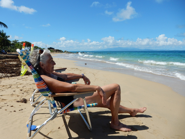
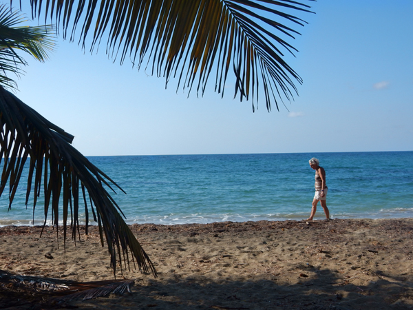
We started driving east and arrived at the Yunque Mar Beach Hotel at about 6:30. Got settled and then did the short drive over to Playa Luquilllo to check out the beach. I can’t recall seeing a sun umbrella in the water before.

The beach is noted for its more than 50 beachfront “friquitines” or food kiosks

It was a tough choice, so we decided to have a Pina Colada (in a whole pineapple) to improve brain function
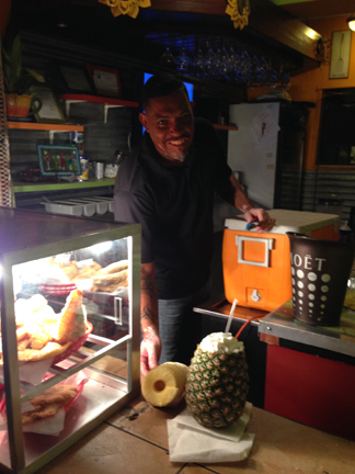
We settled on Chicken Mofongo. Mofongo is a fried plantain-based dish (mashed bananas) that is prepared with a variety of ingredients.

Bacardi rum is made in Puerto Rico, here we have a street vending machine for anybody that has $3, no matter age or condition

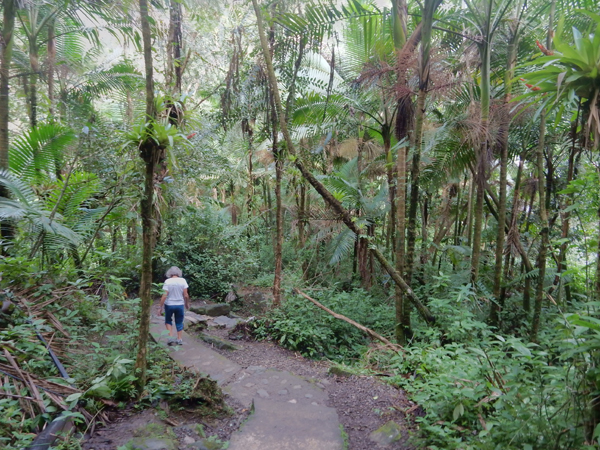
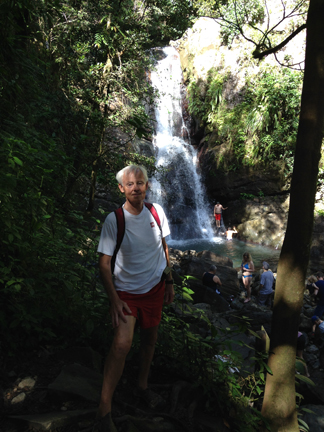
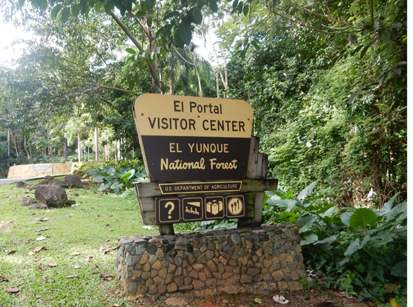
January 31 – Had an early breakfast and headed for El Yunque National Forest. It is the only tropical rain forest in the U.S. Forest Service System

La Coca Falls – 85 ft

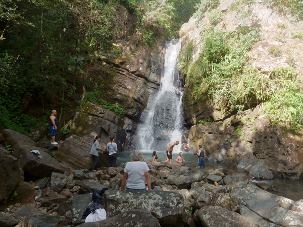
For our morning exercise we hiked the La Mina Trail – 1.5 miles roundtrip. It is the most popular trail in the park.

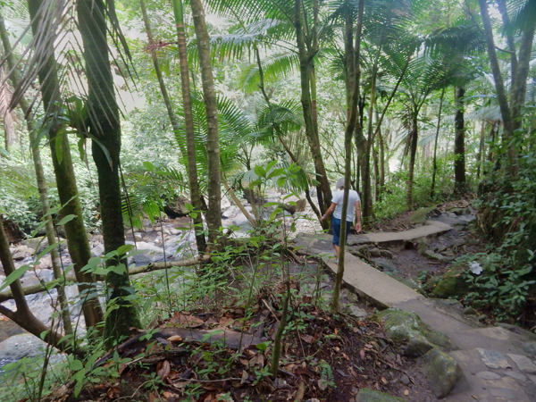
La Mina Falls (35 ft) with its great soaking pool
Yokahu Observation Tower

Los Picachos – 3,175 ft
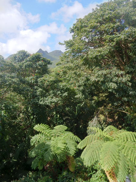
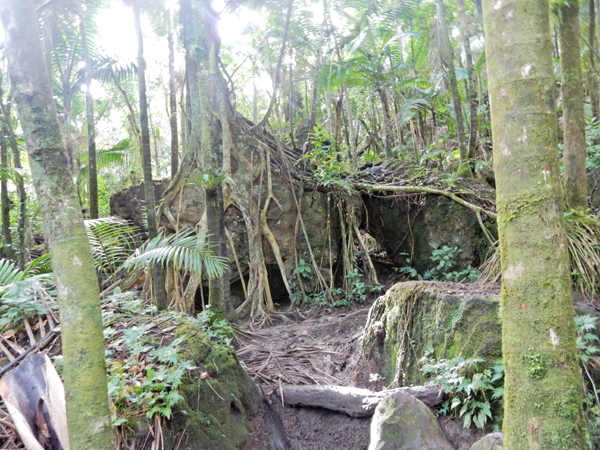
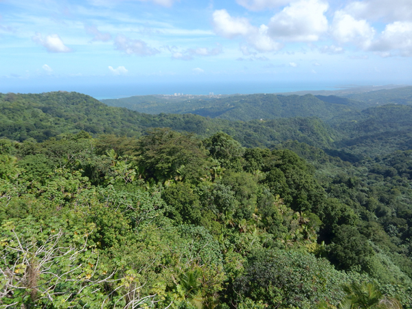
Tropical Rainforest
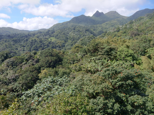
View toward Luquillo and Atlantic Ocean
This was one of the most unique National Forest Service Visitor Centers I’ve visited
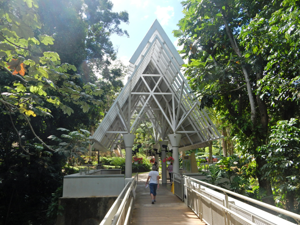
A frame construction was quite beautiful

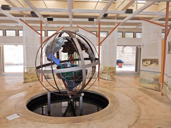
Excellent displays, video, etc.
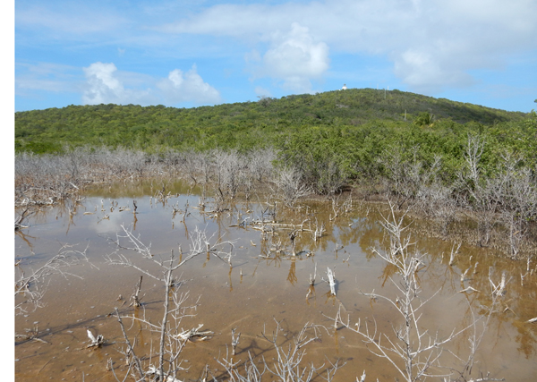
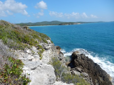
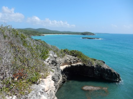
Made it to Reserve Natural de las Cabezas San Juan at 1:30 for our tour in English. It is located on the northeast tip of the island.

Though relatively small (316 acres), it contains seven ecological zones. This is a Ceiba tree at the entrance

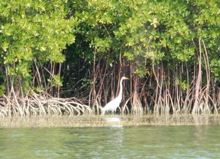
We had three stops as we were taken by tram through the reserve. The first was a wetlands area where we followed a boardwalk. Notice the tip of the lighthouse in the background.
Birds in marsh area

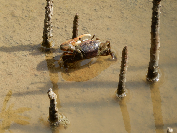
Fiddle crab and vertical growths of the beginning of mangrove trees
Millipede

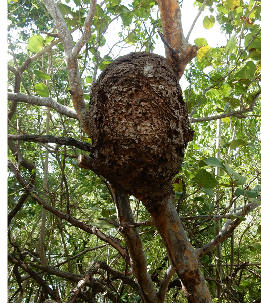
Termite nest
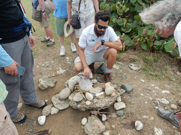
The second stop was a beach area where our guide described corals and shells
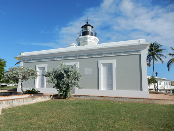
The last stop was El Faro de las Cabezas de San Juan, which is Puerto Rico’s oldest lighthouse (1882)
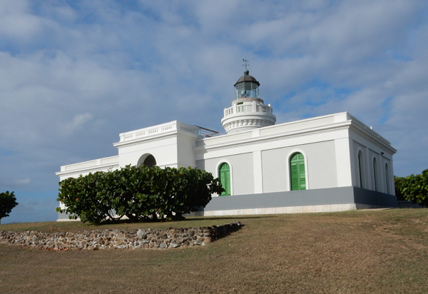
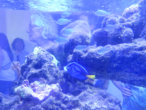
Inside was a small museum and a dark room where the guide demonstrated the glow of bioluminescent algae in water filled plastic bags

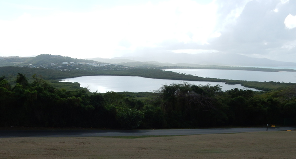
This is the Lagunda Grande or bioluminescent bay. It is one of three in Puerto Rico. We were told that the bioluminescent micro-organisms are at a level of about 20% of what they were five years ago. A hurricane is thought to be at least partially responsible for the decline.
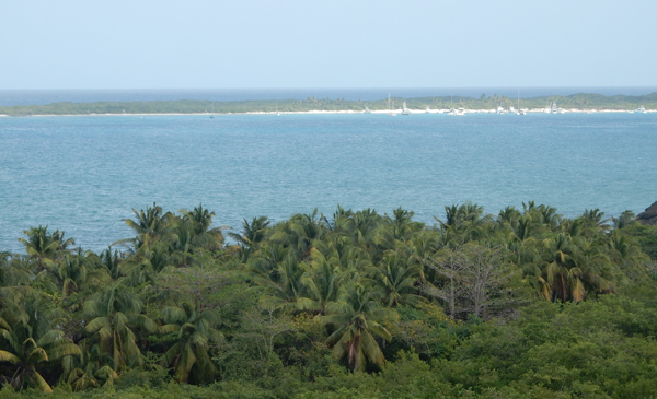
This is a view of the rainforest and the area where the Atlantic Ocean meets Vieques Sound
The tour lasted about two hours. It was Sunday and people had brought at least a hundred horses to this area for a parade and riding through the streets – Spanish Style, that is, rider perfectly straight (vertical, no movement) and horse with a very short and quick gate.

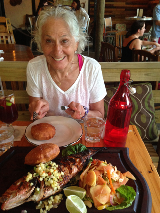
We went to the La Estacion restaurant/bar for dinner. Had a couple glasses of Sangria Red and then shared a Red Snapper

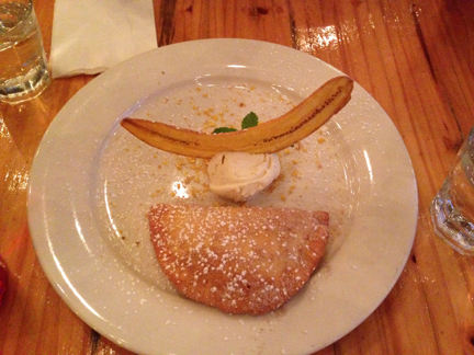
This was our shared desert – ice cream with dried banana and banana turnover – yum!
Unfortunately, I got sick and spent a couple of hours that night on the bathroom floor!
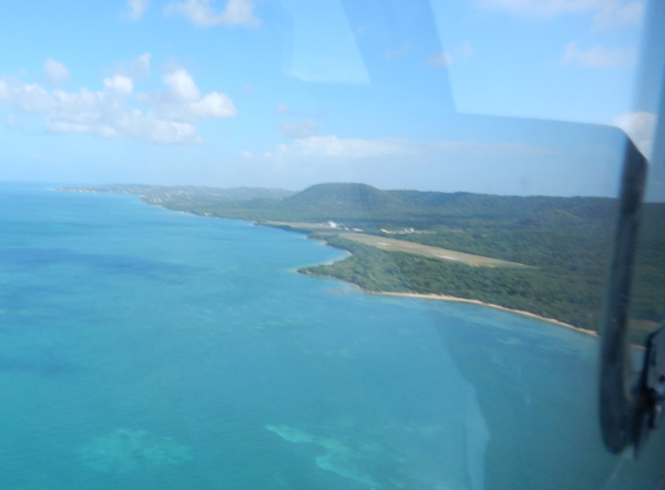
February 1 – dropped off the rental car in Ceiba and took a ten minute Vieques Air Link flight to the island of Vieques for a two week stay.

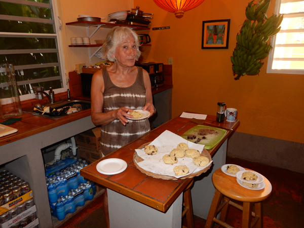
We spent the first four and last three days of our stay at Casa de Amistad in Isabel Segunda (Isabel II), the town where the ferry docks. It is a great guesthouse run by Owen and Dan who are super friendly and helpful. It has nine rooms, comfortable indoor and outdoor gathering places, a small pool and an open kitchen. You can also borrow ice packs, coolers and chairs for the beach.


Helen delighted everyone by making scones, brownies and iced coffees – each twice and all on different days! They even put this picture of her on their web page.
February 2 – we started our island visit by walking to the lighthouse, fort and exploring the town. The lighthouse – “El Faro de Punta Mulas” is located on Mulas Point. It was built in 1896 and restored in 1992.
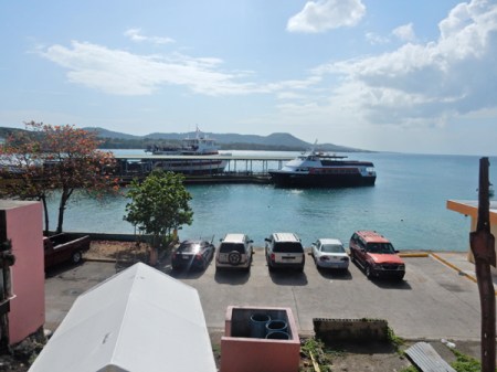
View of town and ferry dock from lighthouse

View of town and lighthouse from fort

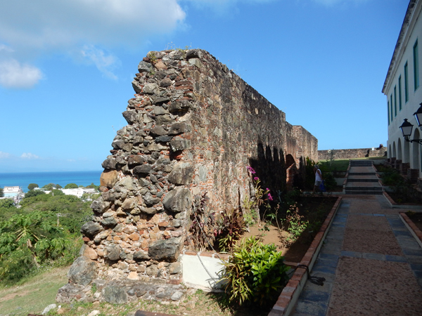
The Fort – “Fortin Conde de Mirasol” is located on a small hill above the town. It was the last fort built by the Spanish in the Americas (1840)

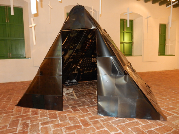
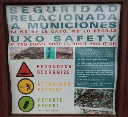
It contains a small museum including some history on the US Navy control of more than two-thirds of the island and its use as a bombardment range. In fact there was a staged amphibious attack by the Army, Navy, Air Force and Marines on La Chiva beach in 1950. In 2003 the Navy land (70% of Vieques) was declared a U.S. Fish and Wildlife Refuge. However a large part of this land is still restricted due to the danger of unexploded ordinance. The Navy is slowly clearing these areas and opening them to the public. This X-Ray tent display is meant to highlight medical problems (e.g. cancer) supposedly incurred by the locals as a result of the Navy’s explosions.

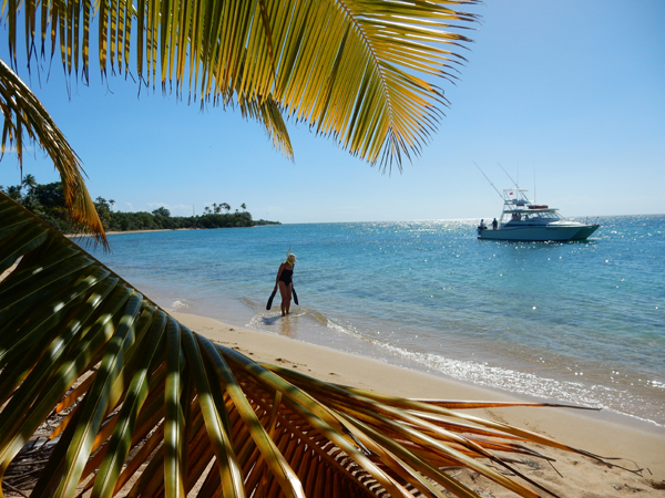
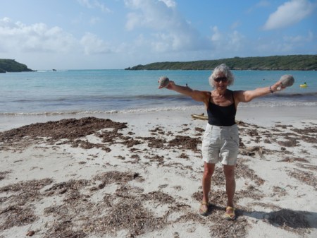
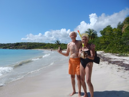
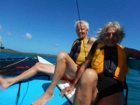
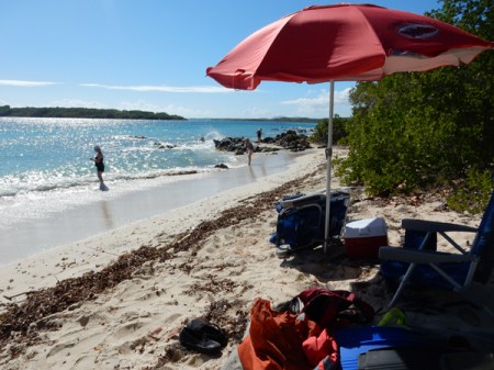
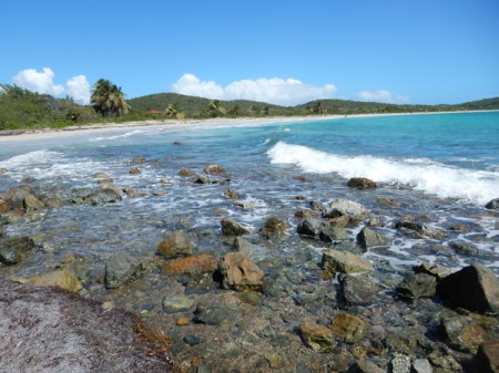
Picked up the rental Jeep from Avis and started our quest of visiting every major beach on Vieques! Our first stop was Playa El Gallito or Gringo Beach. Helen with some fan coral.
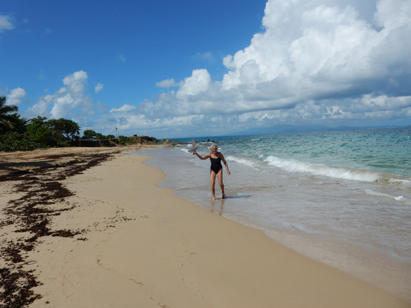
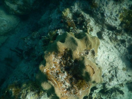
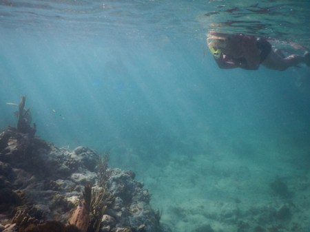
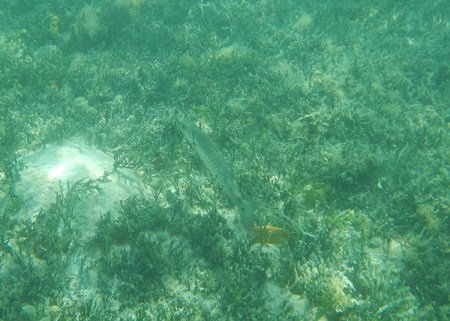
We relaxed, got some sun and then swam out to the point to snorkel. We brought our own snorkel equipment with us and used it many times.

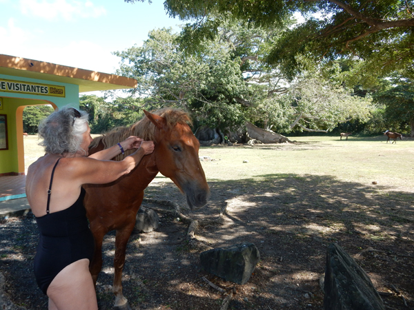
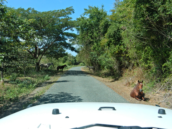
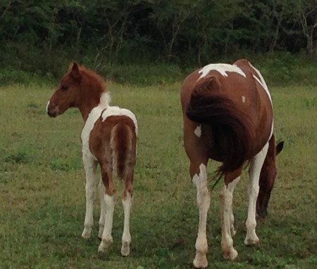
Continuing along the north coast, we stopped to see a Ceiba tree that is estimated to be around 400 years old. We also encountered our first collection of free range horses! We discovered that they are all over the island!

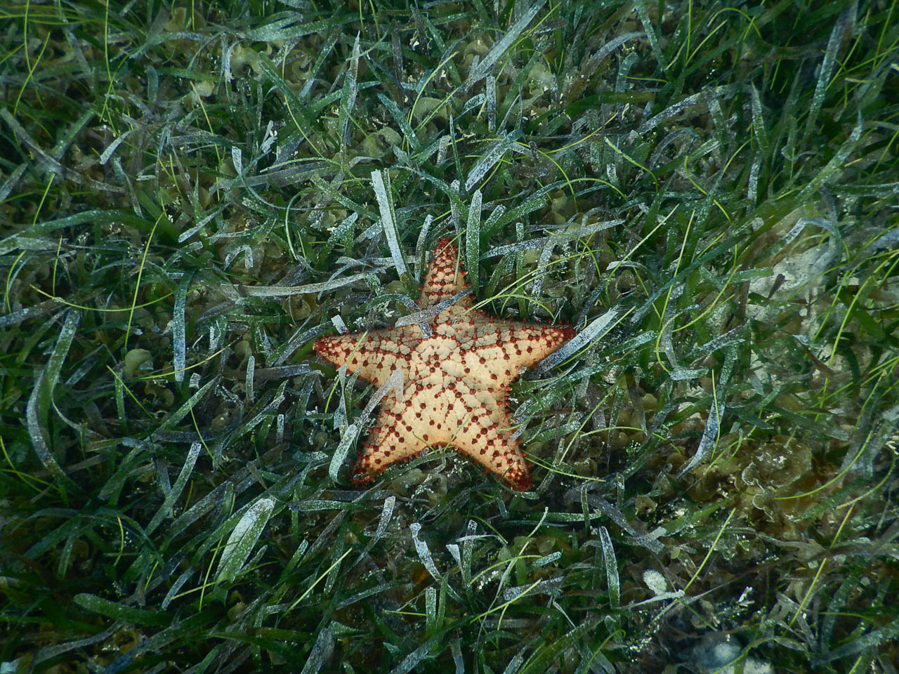
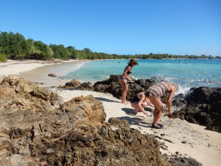
Our next stop was Blaydin or Starfish Beach. Again, walked the beach and snorkeled
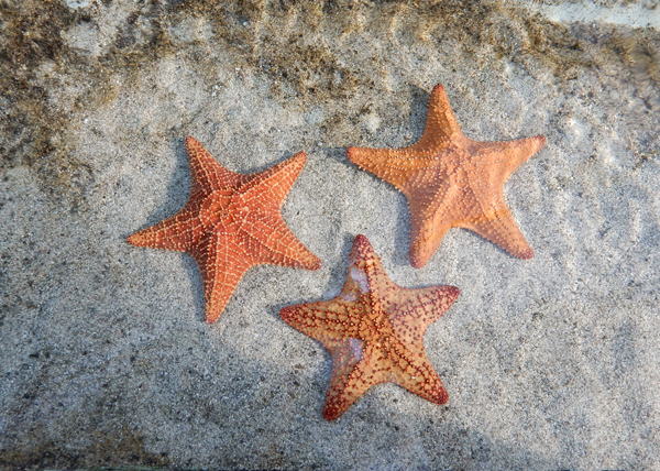
Starfish, sea cucumber and sea anemone
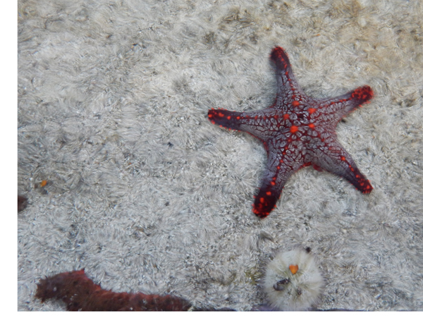
I found this live conch, of course I put him back


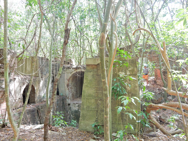
February 3 – Started the day by driving to the west end of the island and hiking through the ruins of the Playa Grande Sugar Plantation
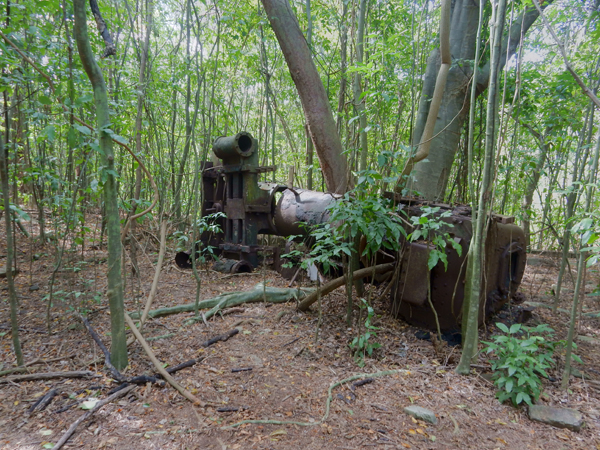


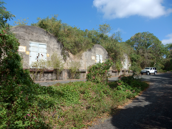
We then drove through the remains of the Navy’s administrative and storage facilities on the west end – now part of the Wildlife Refuge. The area is loaded with bunkers where the Navy stored armaments. Earth covered barrel-arched bunkers were called “igloo magazines.”
More free-range horses
Mangrove swamp


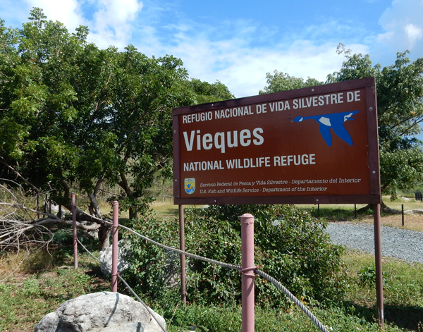
Wildlife Refuge plaque

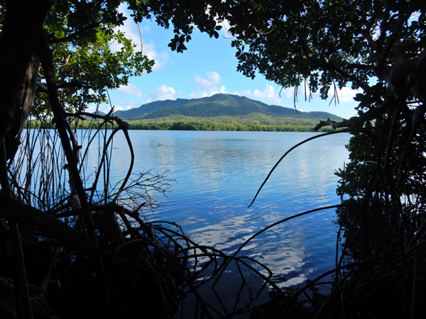
Kiori Lagoon with Mt Pirata (984 ft) in background – it is the highpoint of Vieques. I hope to come back next year and hike to the top
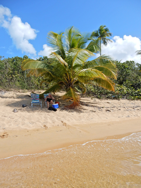
Punta Arenas, also known as Green Beach – we spent the rest of the day here sunbathing, walking and snorkeling
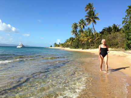

Ready for snorkeling
Good spot –


February 4 – The U.S. Fish & Wildlife Visitor Center provided a good orientation to their sites on the island
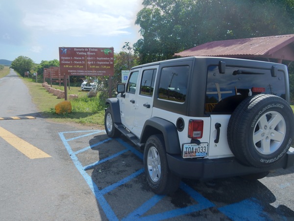


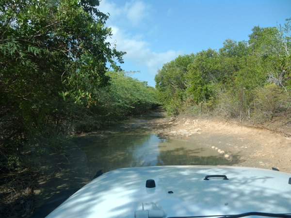
Why we rented a jeep
Playa Grande is located on the southwest corner of the island – walked the beach and collected treasures for about two hours, not another person there!

Swimming is not recommended here because of a quick drop off, surf and dangerous currents
I took a great movie of the pelicans diving for fish

This beach is a turtle nesting site from April to June
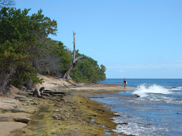
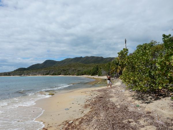
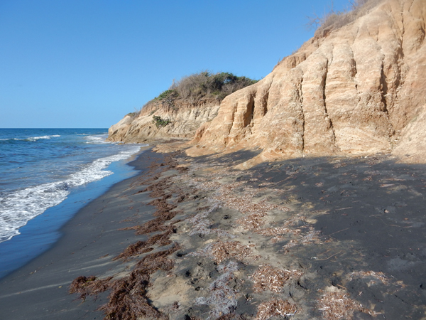
February 5 – Started the day with a short hike through a stream bed (arroyo) to Playa Negra or Black Beach. The black sand, which is magnetic, comes from magma pushed up from the surface around Mt Pirata and is then washed down the arroyo. We were a bit disappointed because there wasn’t much black sand on a large area of the beach, perhaps because of lack of rain?

This end of the beach was what we expected
Picked a nice mango on our hike through the arroyo

It is recommended that you not swim at this beach but we did enjoy walking and collecting more shells
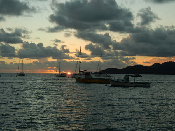
We checked into the Malecon hotel in Esperanza where we had four different rooms over seven days. Even though I booked in November, I wasn’t able to claim the same room for seven nights – a popular place! Esperanza is a “resort like” area with several hotels and restaurants on the south side of the island. It has a nice seaside promenade with a harbor and small dock. Nice sunset –
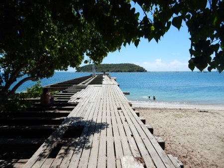
February 6 – started the day by walking the promenade to the Esperanza Sugar Pier and Playa Esperanza. Horses on the beach – you can see the Esperanza Sugar Pier in the background. It was built in 1927 for the export of sugarcane – Puerto Rico’s largest cash crop during the 20th century.

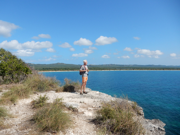
We then hiked across the land bridge to Cayo de Tierra. We did the trail out to the southwest viewpoint.

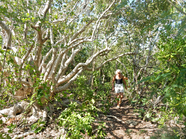
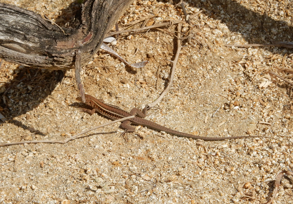
Lots of lizards
Another termite nest

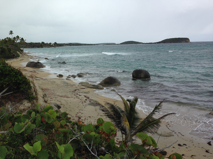
View back toward harbor with Esperanza in the background. Cayo de Afuera (island) is on the left.
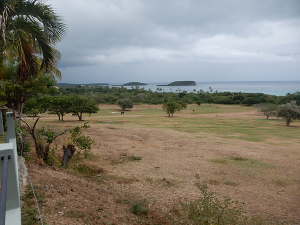
Had our first of four days of Fish Tacos for lunch at Bananas in Esperanza. Lunch special of 2 delicious Fish Tacos for $9 – we each ate one. It was cloudy in the afternoon, so we checked out the hacienda Tamarindo as a possible place to stay in the future. This is the view from their pool, a nice pastoral scene, and beach. Cayo de Tierra can be seen in the middle and Cayo de Afuera on the right.
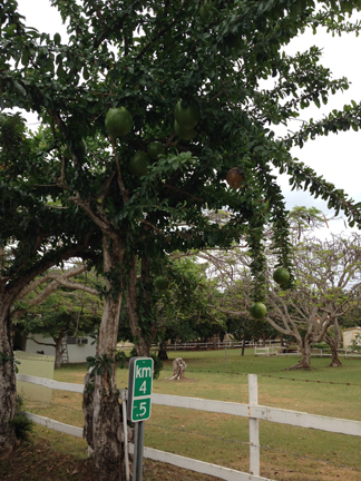
This may be an Annona Glabra Tree (also known as a Pond Apple). Note how large the fruit are; they can be up to 6 inches in diameter. I sent a text to our children stating it was a Watermelon Tree – no one argued?!
Found this iguana outside our room!

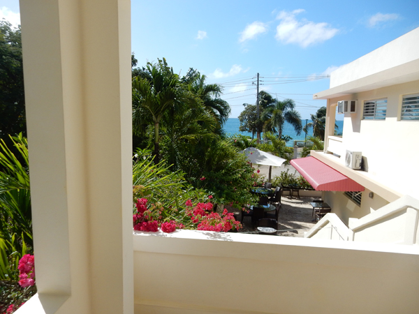
View from our balcony at the Malecon
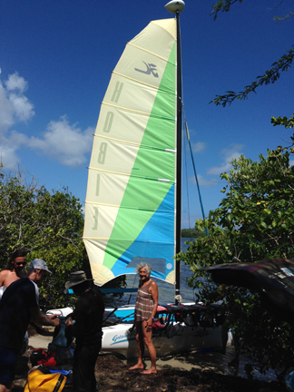
Walked the promenade before dinner. Helen thought we should buy this sailboat and fix it up!

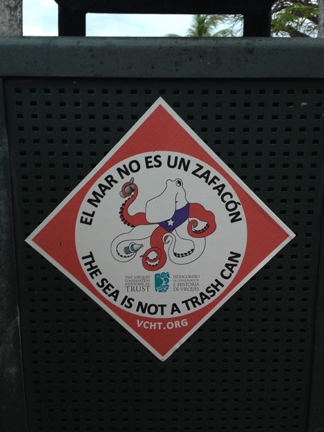
The beaches on Vieques are generally pristine. However, the shore and beach area across the street from the restaurants along the promenade suffer from litter.
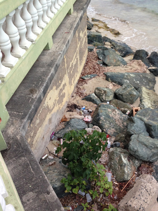
This is Tradewinds Beach, which was directly across the street from our hotel

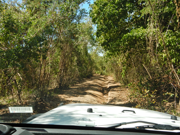
February 7 – This is the road to Navio Beach, the worst one we experienced on our trip – yeh jeep!
Navio is noted for its wind, waves and boogie board/body surfing. Helen enjoying a wind break
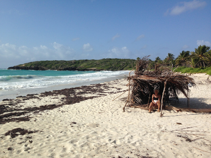
Helen enjoying a real break

Next beach – Media Luna or Half Moon Beach, a good one for kids because it is shallow 50 yards out

Sea Urchin shells
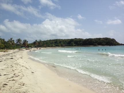
Sunday at Sunbay (mile long) – do you believe we relaxed at this beach?! Did a little swimming, reading, Helen stitched, I walked into town and brought back fish tacos for lunch. The Malecon hotel did not have any TVs, so early evening we drove across the island to watch the Super Bowl at Casa de Amistad. Vieques is 5 miles wide and about 21 miles long.

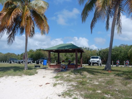
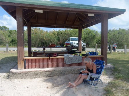
February 8 – arrived at Caracas Beach early enough to claim a gazebo. We discovered you have to watch out for the sand burs here.

Mid-morning Helen drove me to the Vereda Cerro Playuela Trail System where I started at Tres Palmitas, hiked all the trails and met her back at the beach (2.5 miles).
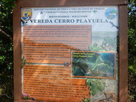
Notice lizard on sign


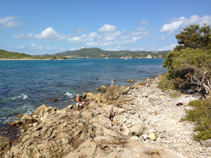
This is Playa Corcho Beach on Puerto Ferro Bay (also known as Barracuda Bay). You can only get here by hiking or kayak and it has some bioluminescence. I hope to come back here to kayak and/or snorkel

Hiking out to the point

Lots of pineapple-like bromeliads and clattering thatch palms

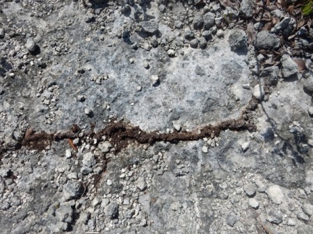
Termite tunnel across path and termite nest

Looking east from point
Caracas Beach in distance
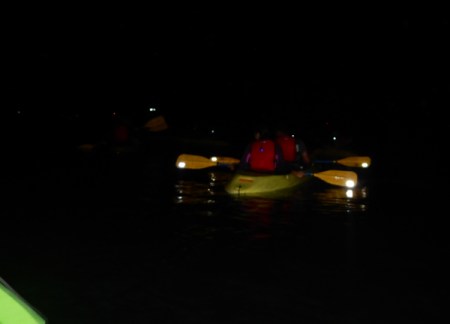
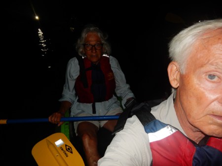
I hiked across Playuela Beach, translation “Little Beach” on my way back to Caracas to meet Helen. I would not recommend this beach as it gets a lot of wind and waves bringing debris and trash up on the beach. Late afternoon we drove back to our hotel to get ready for our tour of Puerto Mosquito Cano Hondo, better known as the Biobay. Guinness Book of World Records states that this is the brightest bioluminescent bay in the world! We choose to do our tour with JAK Water Sports because they have glass bottom kayaks.
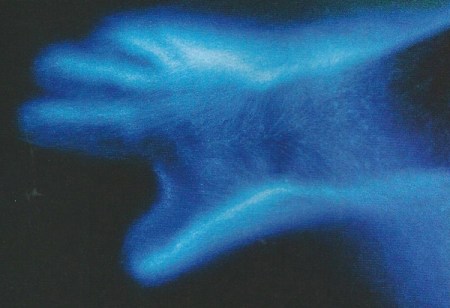
Though I tried with many settings on my camera, I was unable to get a picture of the phosphorescent dinoflagellates activity. The following is the only picture in this blog that I scanned in from a magazine. It is a very good representation of what we experienced when we moved our hands through the water.
It was an amazing experience, I made the reservation for the one day in February when there would be no moon. The stars were brilliant and we could see the Milky Way and beyond. Also, as we paddled we could see what appeared to be a myriad of stars passing under our glass bottom kayak. Fish scurrying here and there were leaving bright sparkling trails in the water and our paddles produced splashes of sparkles that trailed off behind us.
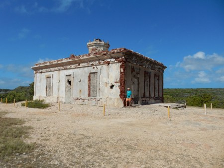
February 9 – started the day by driving out to the Puerto Ferro Lighthouse. Note the restricted areas on the sign.

Begun under Spanish rule in 1896, the lighthouse construction was stopped during the Spanish-American War. When Puerto Rico was taken over by the U.S., the lighthouse was completed and became operational in 1899.
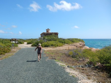
In 1925 and earthquake damaged the building and it was not reopened. Only recently did the lighthouse become accessible by the public
View northeast from the lighthouse

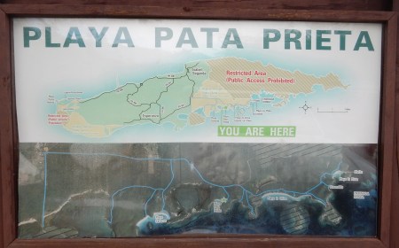
Our next stop was Pata Prieta, translation “black leg or foot”
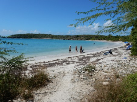
It is a protected U-shaped cove and was our favorite beach on Vieques

There is some decent snorkeling off the point to the east


Watch out for the sea urchins!

We found that locals had found several conchs, cut them out of their shells and then dumped the shells in about eight feet of water off the point. There were about fifteen there and we each dove and brought one up for Helen’s yard collection.
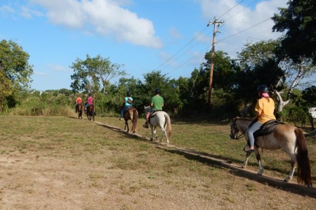
Helen did a trail ride with Esperanza Riding Company in the afternoon

Kim, who was also staying at the Malecon, joined her

Starting on the trail, Helen said it was a great ride and that they even got to ride across Playa Negra (Black Beach)
February 10 – We drove out to the very end of the dirt road going east through the Wildlife Refuge to La Plata or Silver Beach. There we met Jorje (George) of Little Boat Sailing who was taking us and two other couples on a half day sailing/snorkeling tour.

We sailed across Ensenada Hondo bay on the southeast coast of the island
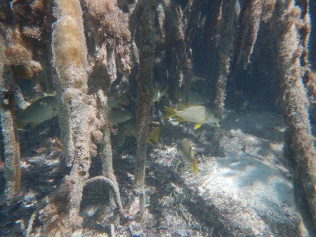
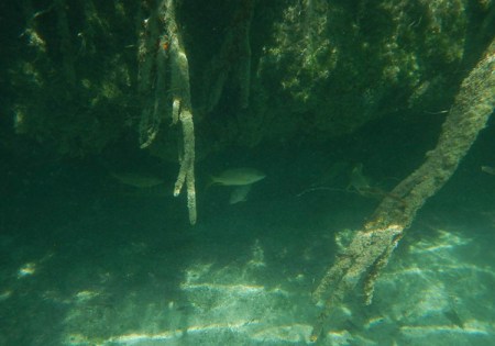
Our fist snorkel was in shallow water around the mangroves at Punta Carenero. Ensenada Honda has the largest mangrove forest on the island and is also the largest protected body of water on Vieques. Only the shoreline is open, the rest of the east side of the island is still restricted by the Navy. This is a sea cucumber –


Sea anemone

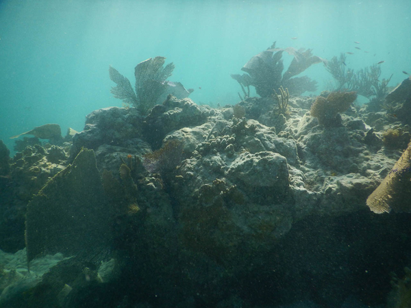
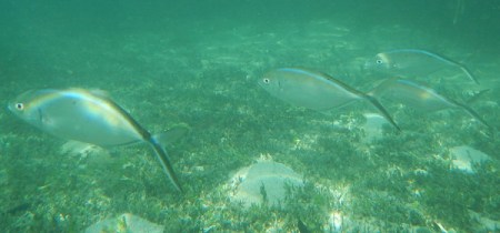
Our second snorkel was over a reef at the entrance to the bay. Jorje emailed us all of these underwater pictures.
Staghorn coral – endangered
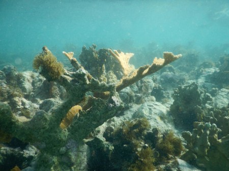
Wonderful snorkeling

It was a fun day and we celebrated with dinner at the Tin Box
February 11 – Started the day by swimming from the Esperanza Sugar Pier through the harbor to Cayo de Afuera
Snorkeled the north and west sides of the island

Barracuda
Again, had fish tacos for lunch and then drove to Bahia de la Chiva, which was called Blue Beach by the Navy. There are 23 different access points to the bay! Today we choose to explore and enjoy the east side. More sea shells anyone?
Our beach spot
Helen on the rocks

Interesting ruins on the east side of Esperanza, probably related to the sugar industry


February 12 – we went back to La Chiva Beach this morning. This time we set up on the west side of the bay.

We swam out to the island you see in the picture, Cayo La Chiva, for some good snorkeling
Some rocks that separate east and west La Chiva beaches – this morning there were only about two dozen people covering 1.5 miles of beautiful beach
Drove back to the north side of the island this afternoon for our final three night stay at Casa de Amistad. I wish I had this stone in my yard!

Good variety of fruits and vegetables

After getting settled in Casa de Amistad, we drove to Rompeolas, also known as Mosquito Pier, for more snorkeling. It is a sea wall that juts out 1.1 miles into the Atlantic Ocean. Pelicans with sea wall in background –

Pier at end of sea wall, easy access stairs on left for snorkeling or SCUBA

Good visibility today

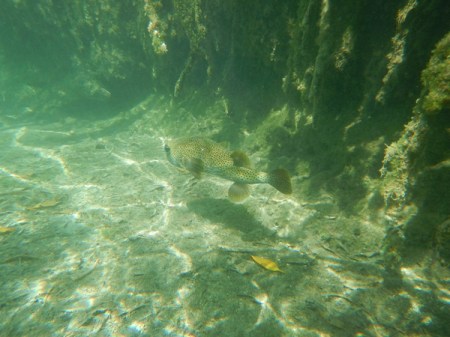
Puffer fish
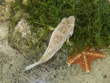
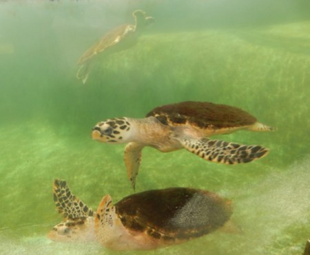
Turtles under pier
February 13 – This was our last day with the jeep; so we drove back to the south side of Vieques and our favorite beach Playa Pata Prieta. Sign shows location of beach.
Another sign warns of unexploded ordinance – don’t touch and report!
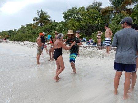
We snorkeled in the morning and then a group of 12 young Puerto Ricans showed up for a beach party. They came over to Vieques for the weekend with their chairs, coolers, grill, electronic speakers, balls, etc. They were having a great time and then one of the group started teaching the salsa and they invited us to join them.
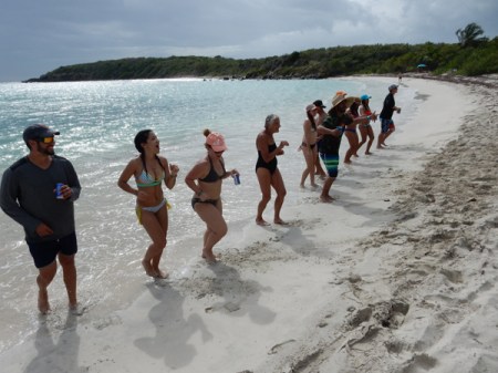
The young man in the stripped swimming suit was acting as the instructor
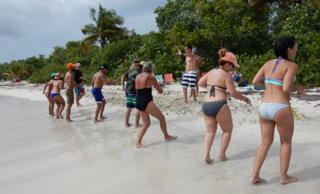
Helen, the dance instructor, had to add her two cents
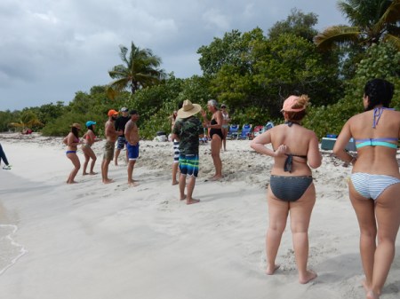
Practicing – check out the video https://youtu.be/gVMu81I3SPg
Video #2 – https://youtu.be/YqFd-TeJX-o
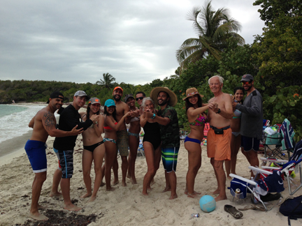
Group photo – how did the white guy get in there? They offered us drinks, which we accepted and hamburgers!
Leaving Wildlife Refuge
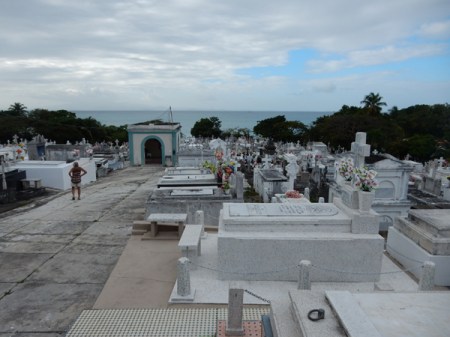
February 14 – Valentine’s Day – our last day on Vieques. This is the Isabel Segunda cemetery, notice how the graves are above ground.
This is Sea Glass Beach – guess what Helen found?


Ferry dock – this is the boat (center left) that we caught the next morning

We continued walking to La Chata Beach in the Santa Marta area. More shells!!!
I just checked – we enjoyed 16 different beaches on Vieques and snorkeled 12 times! It is an amazing place and we will likely return next year.

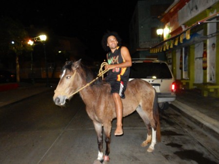
Bareback rider in town, lots of people own the free range horses. We were told they can just grab the closest horse, ride it wherever they like and leave it!
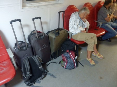
February 15 – We were up at 4:30am to catch the 6am ferry to Fajardo on the main island. Notice the green suitcase that we paid $3 for at a thrift shop. Well, it was packed with 48.6 lbs. of sea shells and sea glass!!! Under 50 lbs., so we could take it as free baggage when we flew home. Of course we had to carry it with us for 4 more days!
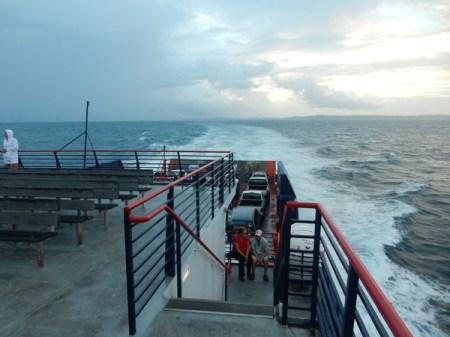
The public ferry is a bargain at $2 each and takes about 1.5 hrs to get to Fajardo. We arrived to a light rain and had Enterprise Car Rental pick us up at the ferry terminal.
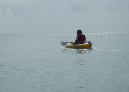
Drove to the Manatee Eco Resort on Salinas Bay. It is located on the south coast of Puerto Rico. We rented kayaks and paddled out through the mangroves into the bay.

We paddled in and out of showers for 2.5 hours looking for manatee

Alas, none were to be found. Actually, we think their presence is a myth and it is just a marketing ploy to try to draw tourists!
Returning to port

February 16 – Drove north through the mountains on very narrow/windy roads to Jayuya, which is located in a beautiful valley in the center of the island

Nearby waterfall

In 1950 a local lawyer and nationalistic hero, Blanca Canales, led a revolt against U.S. occupation known as the “Jayuya Uprising.” Rebels took over a police station and declared a Puerto Rican republic from the town square. Three days later the U.S. bombed the town causing much destruction. How many of you out there knew or remembered that? Canales’s home is now a museum that tells the story of the revolt and preserves the house much like it was in the 1950s.

Blanca Canales

Nearby is the Cemi Museum (1989) that is devoted to the Taino Indian culture. A Cemi is a god, spirit or ancestor and the museum shape is a representation of a god.

A short drive away is a nice boardwalk that leads to river rocks that have Taino petroglyphs.

It was so relaxing sitting by the river in this beautiful valley, breathing the wonderfully clear air and observing both wildlife and the symbols of the indigenous culture
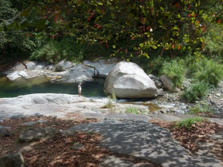

Don’t miss the bird at water level on the right of the rock

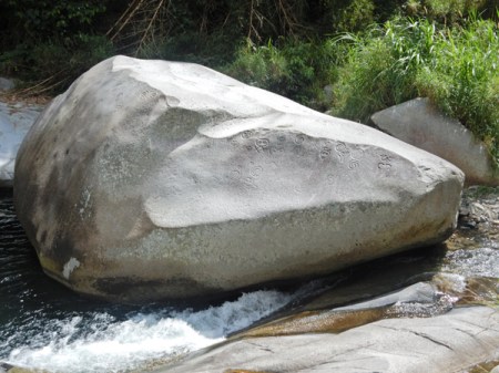
Petroglyphs
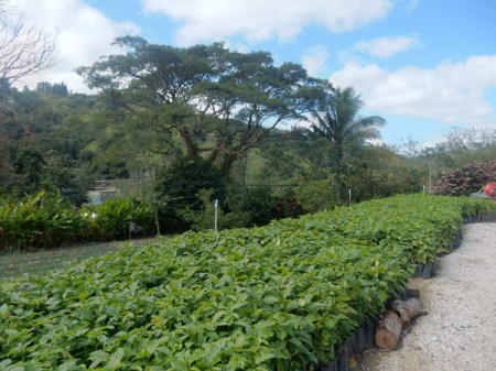
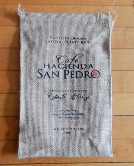
The next stop was the Hacienda San Pedro coffee plantation and plant

The coffee is truly “mountain grown.” Three of Puerto Rico’s highest peaks surround the valley – Cerro de Punta, Cerro los Tres Picachos and Cerro Maravilla. New coffee trees are planted every five years.
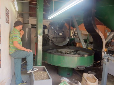
The beans here are picked in the last few months of the year, so they were just finishing up with the mediocre coffee beans that had already been picked. The gourmet beans are the first to be processed. This is one of three employees who volunteered to give us a tour showing Helen a coffee tree.

Grinder processing the last of the mediocre coffee beans
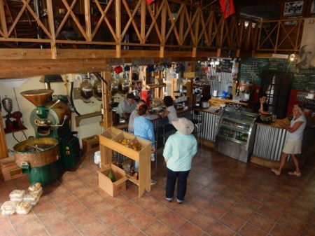
Old grinder on left, coffee bar and restaurant
Roberto (owner in hat), reporter doing a story on the plantation, employee, Helen and another friendly employee/guide
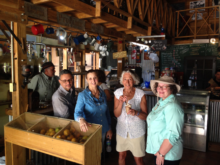
We had delicious iced coffees and bought five bags of their best beans! By law, the beans must be organic and free-trade.
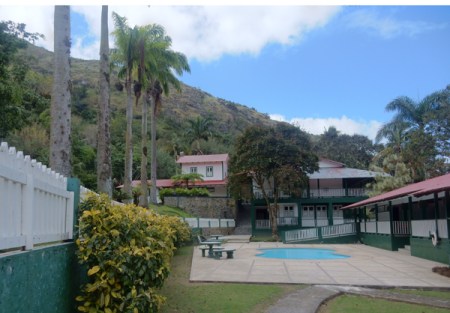
We discovered that Hacienda Gripinas was open and drove there to see if we could get a room. It is a coffee hacienda built in 1858, restored by the government in 1975 and now run as a hotel. The coffee from this plantation won the gold medal at the Louisiana Exposition in St Louis in 1904. It is the best place to stay in the area. I had tried for months to email and call them for a reservation; I also searched the internet for any current contact information – there was nothing. I was surprised to find they were open. It seems they mad a name change that resulted in the communication problems.

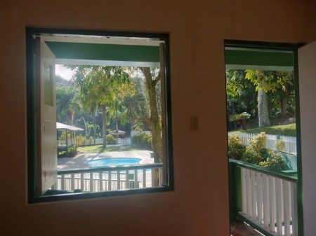
We were able to get a nice first floor room with balcony overlooking the pool, including breakfast, for $65 – local’s cost


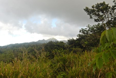
After settling in, Helen choose to stay in the Hacienda and stitch while I went off to do the highpoint of Puerto Rico – Cerro de Punta, highest mountain in this distance shot from the north
As with the hotel, I found very little current/detailed information on getting to and climbing the mountain. I drove a circular route from Jayuya, Rt 144 east, Rt 149 south, and Rt 143 west to highpoint. After completing the hike I continued on Rt 143 west, Rt 140 north and then Rt 143 east back to Jayuya. My phone GPS did not work in the mountains. These picnic facilities are in Toro Negro State Park on Rt 143. Cerro Jayuya (4,265 ft) is in the background.

View south toward Ponce

Picture from top of Cerro Jayuya looking west toward Cerro de Punta and its communication towers. Both peaks are in the Cordillera Central mountain range that runs east-west down the center of the island.
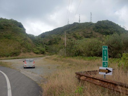
One lane road on north side of Rt 143 leading to the top of Cerro de Punta (4,390 ft), the Highpoint of Puerto Rico. The peak is located in the western part of the Toro Negro Forest Reserve. Note that Rt 143 is well marked and the turn-off is at kilometer marker 17.3
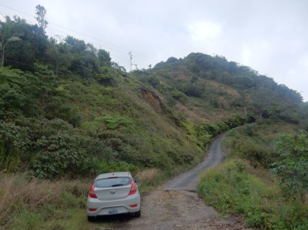
I choose to hike up the road instead of drive. For the exercise but also because I thought it would be difficult to back the car down if I encountered another vehicle coming down the road. It was steep and there were few pull-outs where two cars could pass. As it was, I found no one else on the mountain.
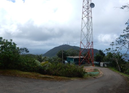
Near the top, the road continues up a bit more from this point, then there are 53 steps up to a concrete viewing platform

Blurry self-photo on top; it was cloudy with on and off drizzle. It took me 20 minutes to hike up.

View looking east toward Cerro Jayuya and its communication towers. Ruta Panoramica (Rt 143), which runs down the middle of the island, can be seen in the picture.

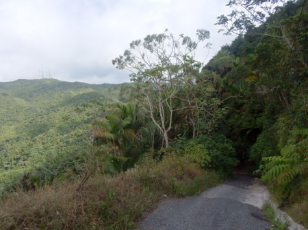
View of summit road while descending, about the first one-third of the road going down is concrete and the last two-thirds asphalt
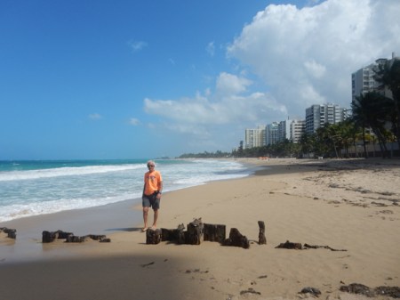
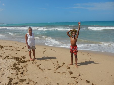
February 17 – last full day in Puerto Rico. Drove down the mountains to the coast and on to San Juan. We arrived at the Andalucia Guest House in Ocean Park (east of San Jose) in the afternoon and went right to the beach. Vieques beaches are so much better!
We drove into Old San Juan for the evening. We were excited to go back to some of the same places we experienced on our honeymoon in 1968! This is Parque de las Palomas or Pigeon Park.

Plaza del Quinto Centenario was built in 1992 for the 500-year anniversary of Columbus’ first voyage. The totem pole “El Totem Telurico” was constructed with clay from across the Americas to signify the origins of the people of the Americas.

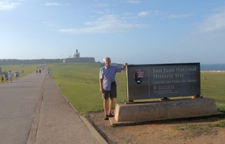
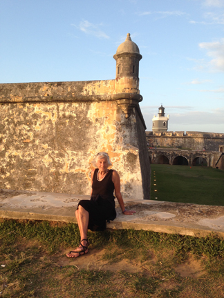
Castillo San Felipe del Morro, San Juan National Historic Site – fortification was started by Spain in 1539. Puerto Rico means “Rich Port” and it was the first major island with water, shelter, supplies and a safe harbor for ships sailing to the Americas from Europe by way of West Africa.
Approaching walkway over dry moat

Entrance – 2016 and 1968


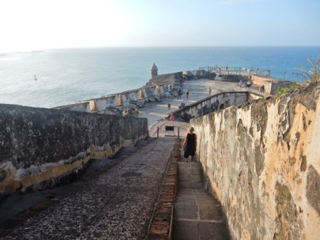
Ramp leading down from the main plaza on level 5
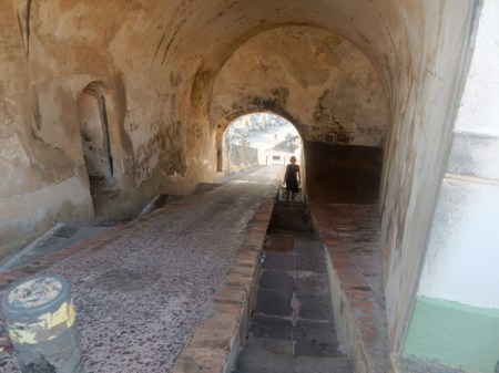
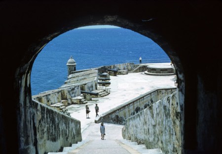
Ramp ends at the main firing battery, level 4 – late afternoon 2016 and morning 1968
“El Morro” was attacked by England three times 1595, 1598 and 1797 and once by the Dutch 1625


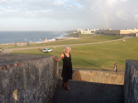
View east toward Castillo San Cristobal and Rainbow! At the end of the Spanish-American War (1898), Puerto Rico became a U.S. Territory; Helen 1968
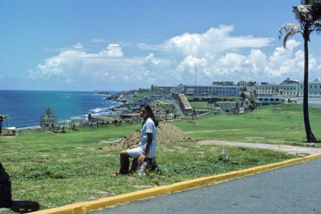
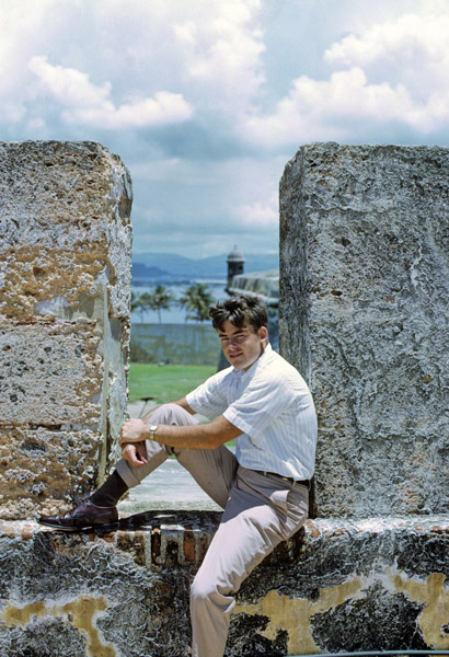
Tom 1968 and 2016 – hardly any change

Some of the walls are 15 feet thick, the lighthouse has been operating since 1846

Dry moat and sentry box, San Juan National Historic Site was established in 1949
1968

El Morro was declared a World Heritage Site in 1983

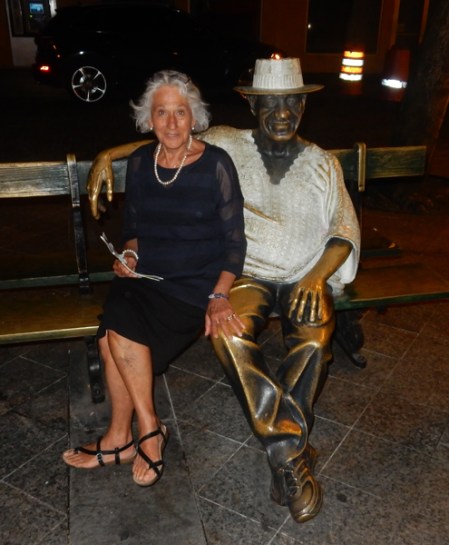
Walked through Old San Juan to El Jibarito, a crowded/fun Puerto Rican restaurant, for dinner. Afterward, walked some more through the Old City and its many plazas.
February 18 – paid the piper (American Airlines $150) to change our reservation so we could get to Dayton late afternoon instead of 11:30 at night!
Helen and I both agree that this was one of our best “vacations.”
