
5/1 Tu – left Dayton 6:20a, left Chicago 8:20a, left San Francisco, 11:40a, and arrived Salt Lake City at 2:41p. That’s what you get for using frequent flyer miles! It took 5.5hrs to drive to Winnemucca NV, a long day.
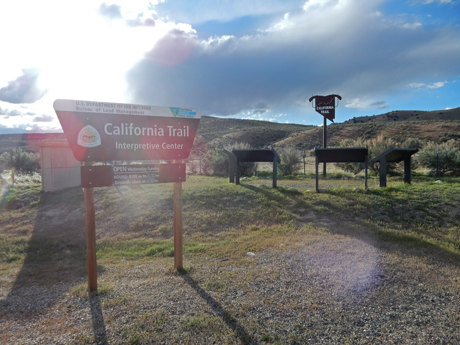
I stopped at the California Trail Interpretive Center (BLM) on I80 outside of Elko NV


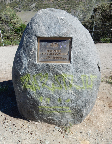
5/2 W – it took 7hrs to drive to Berryessa Snow Mountain National Monument (BLM and USFS), which is in Mendocino National Forest NW of Sacramento CA. I took Hwy 20 W through Grizzly Canyon and into the NM.
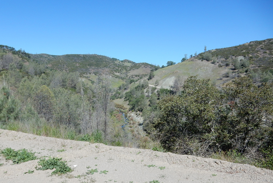
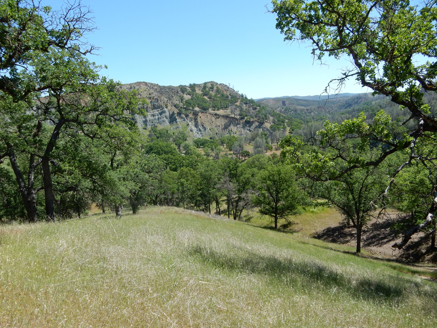
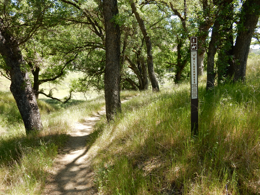
The Cache Creek Wilderness is in the new (2015) National Monument
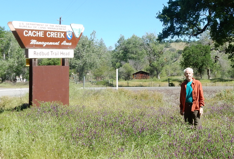
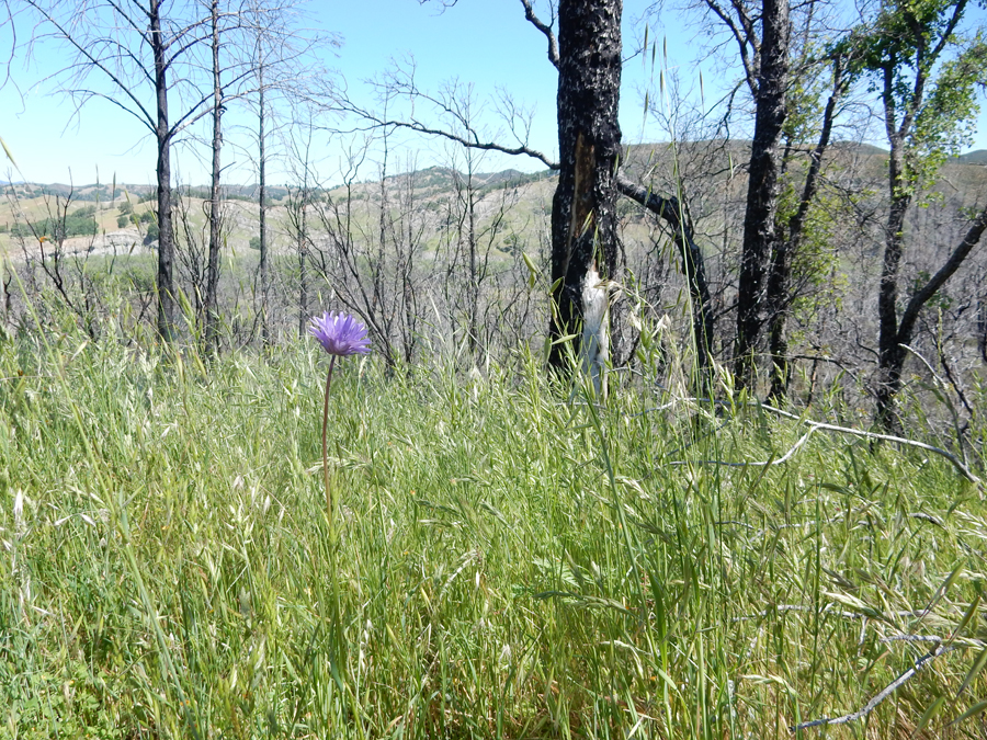
Starting the Red Bud Trail to Baton Flat and Cache Creek, 5 miles round trip, 1000-foot total gain

The spirts were with me –

Hiked through a beautiful meadow before the trail ascended to a ridge

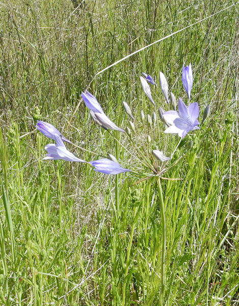
I was surprised by the number and variety of wild flowers at this time of year


Top of ridge, which way?
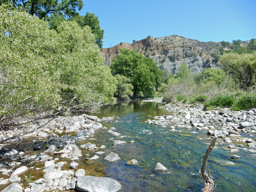
View down to Cache Creek


Hiking down to Cache Creek
Baton Flat on Cache Creek

Cache Creek
It’s OK, the little guy can regrow it –

Stayed in an Airbnb in Redding CA
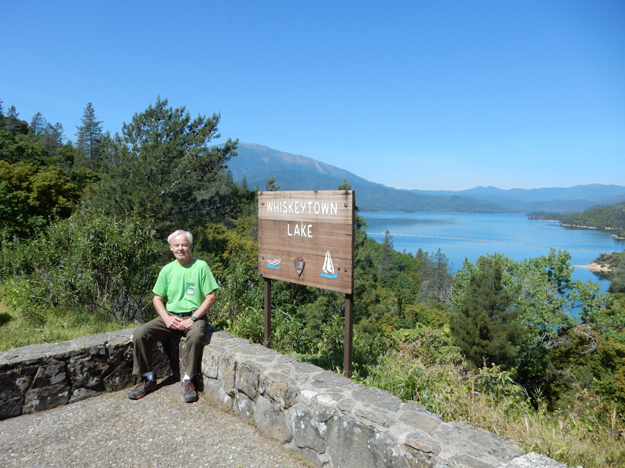
5/3 Th – just W of Redding, I entered the Whiskeytown Unit of the Whiskeytown-Shasta-Trinity National Recreation Area

I started by driving on the east side of the lake to the Camden Water Ditch Trail

I did the 1.1mi loop trail
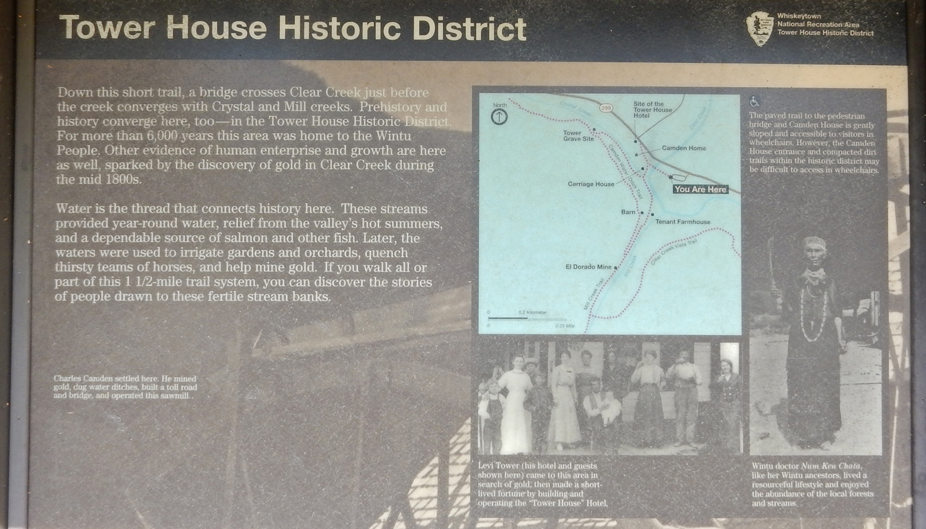
Camden House

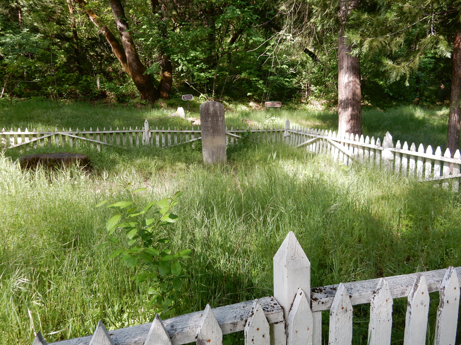
Tower grave site in the Tower House Historic District

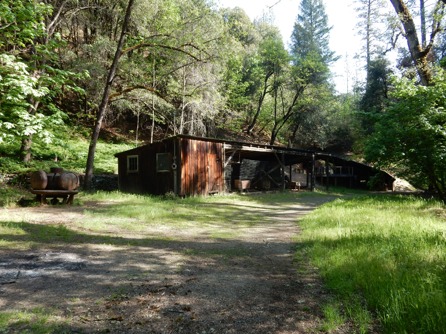
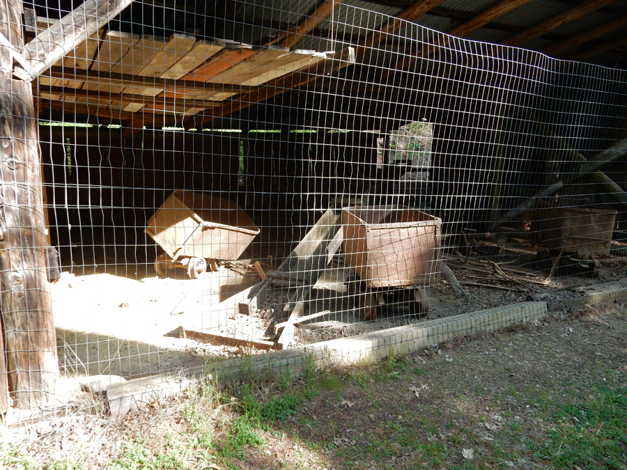
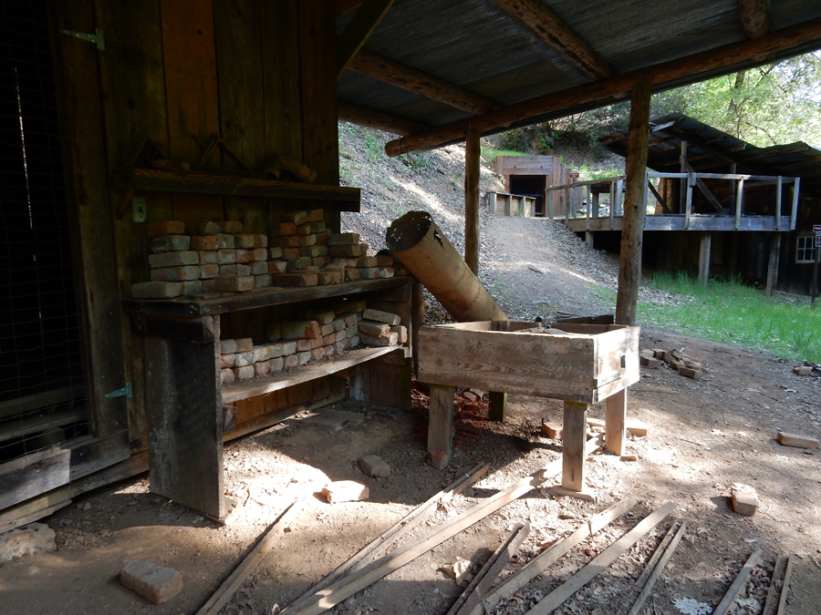
El Dorado Mine

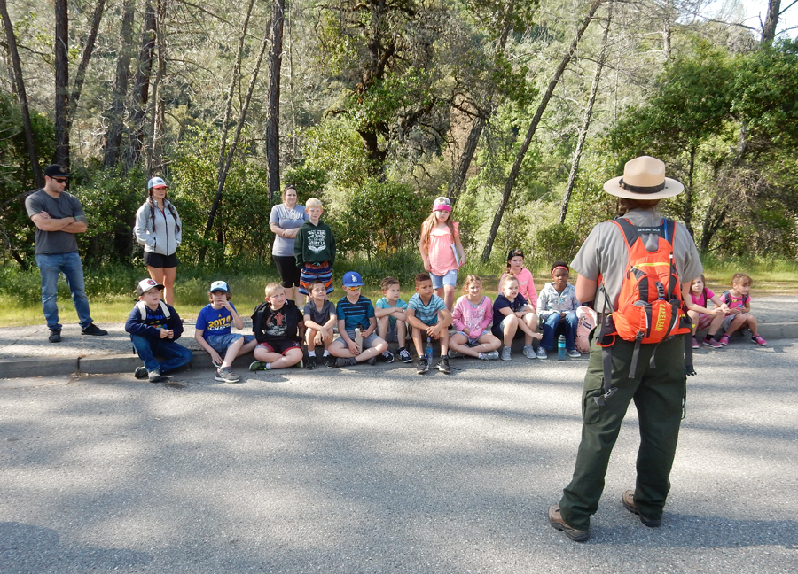
Early national park education, the children were really excited – we need more of this!
I next did the short drive and hike to Crystal Creek Falls, it was worth it

Afterward I drove back to the Visitor Center at the SE corner of Whiskeytown Lake

I hiked the Shasta Divide Nature Trail to the lake, 0.5-mile loop


President John F. Kennedy dedicated the Whiskeytown Dam in 1963
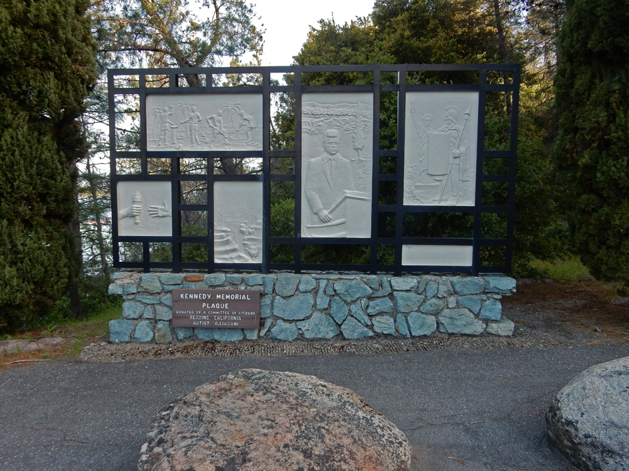
It is one of a series of dams and canals that harness the waters of the Sacramento River and its tributaries
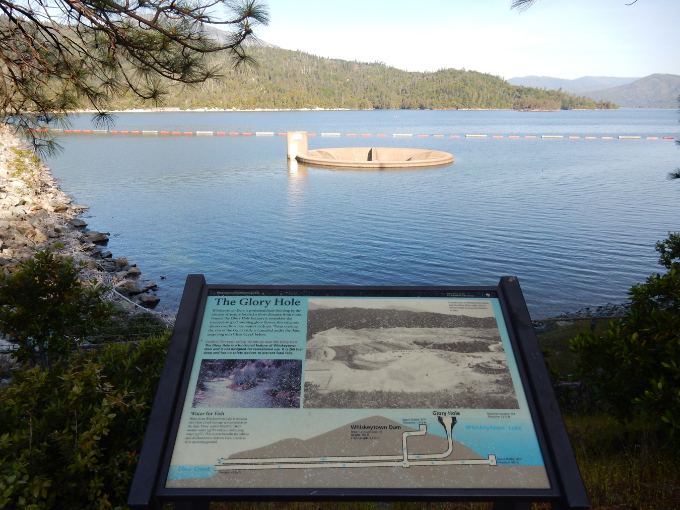

However, this development came at a cost

Mt Shasta from an I5 overlook

At one time, this mountain was on my to do list


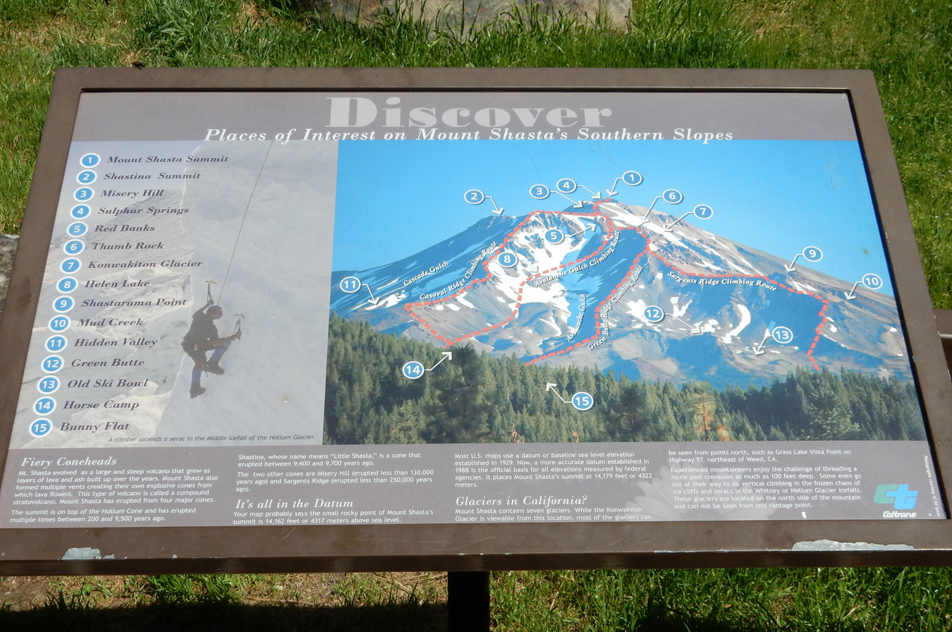
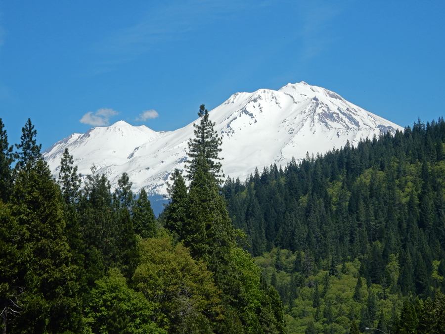
Mt Shasta from the west
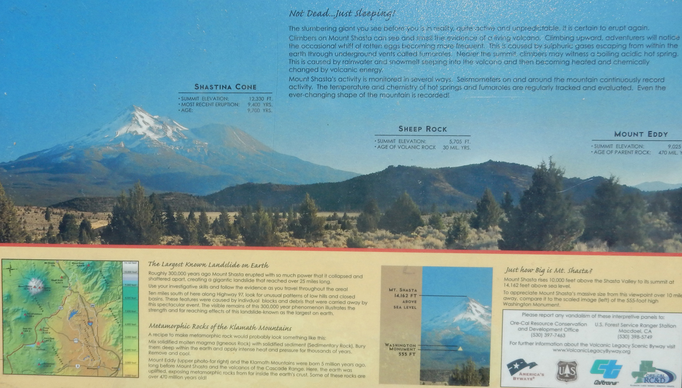
View of Mt Shasta from the North, off US 97, the second pic (sign) shows the location


Read the signs for more information – you can tell I like mountains!


Lower Klamath National Wildlife Refuge, just south of the OR border, lots of birds

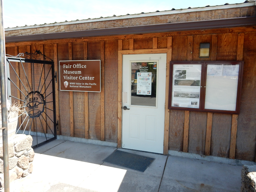
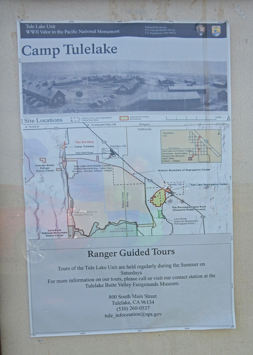
Arrived at the Butte Valley Fairgrounds Visitor Center and Museum in Tulelake CA at 2:30. The NM Visitor Center here is only open from Memorial Day to Labor Day but this museum is open year round.
Some displays in the Museum

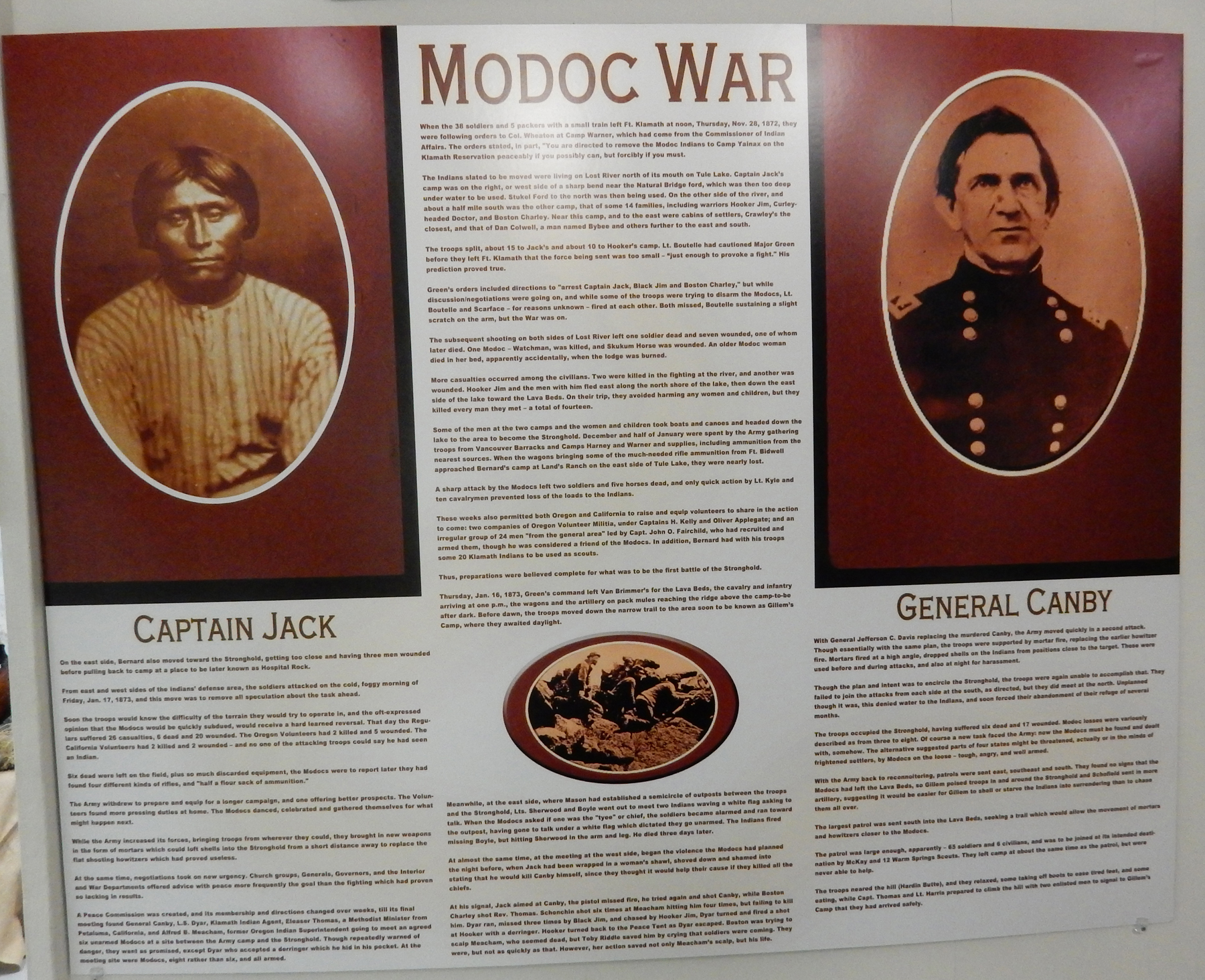
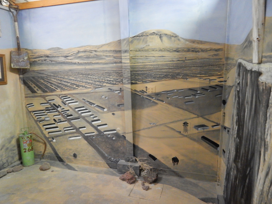
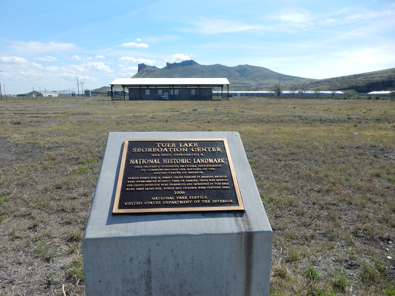
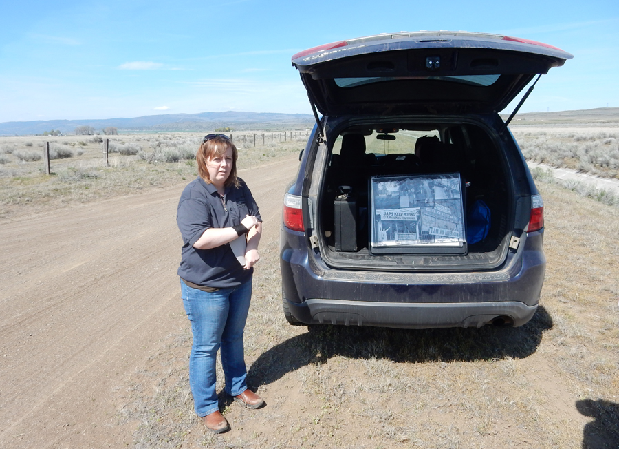
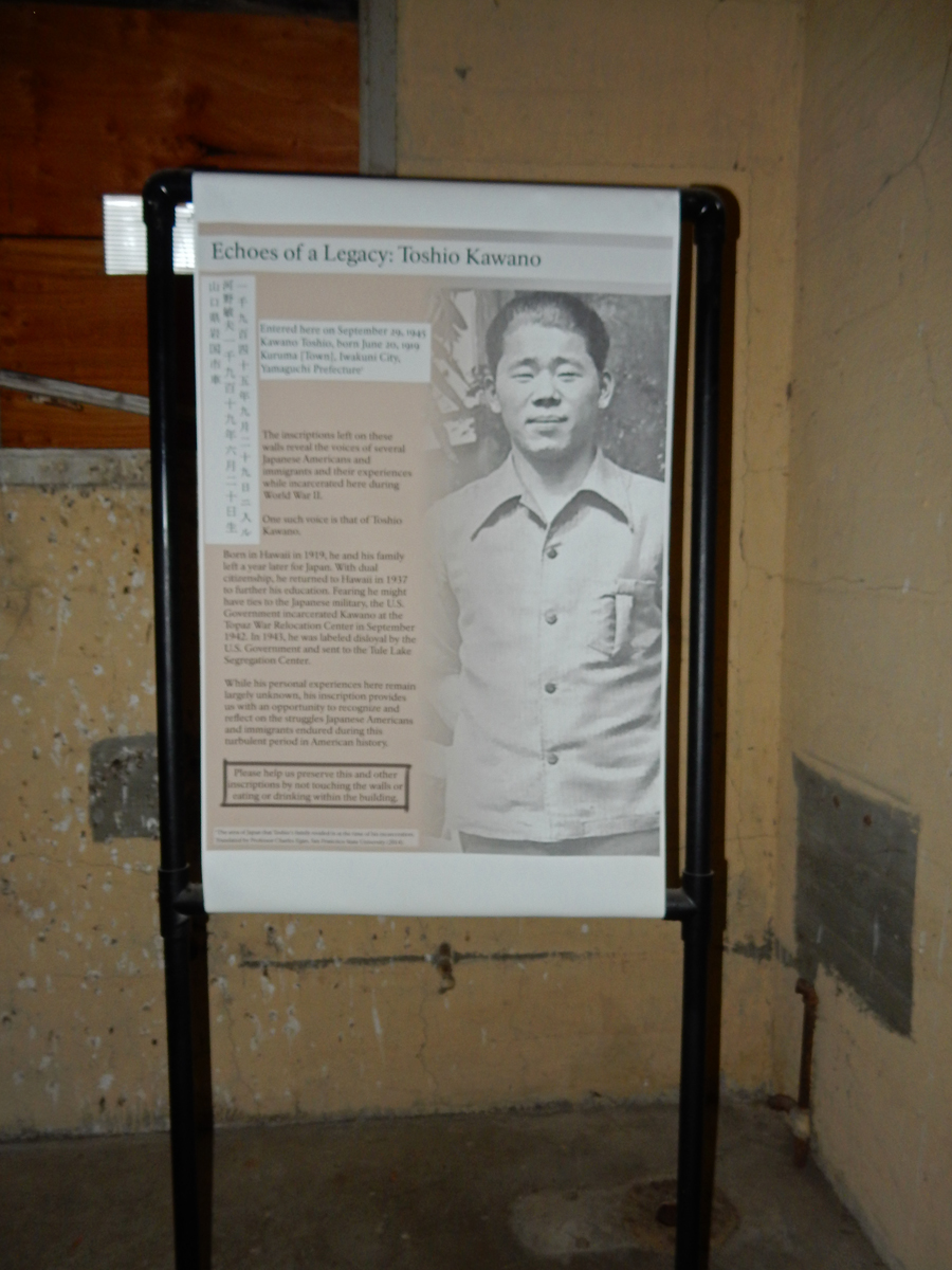
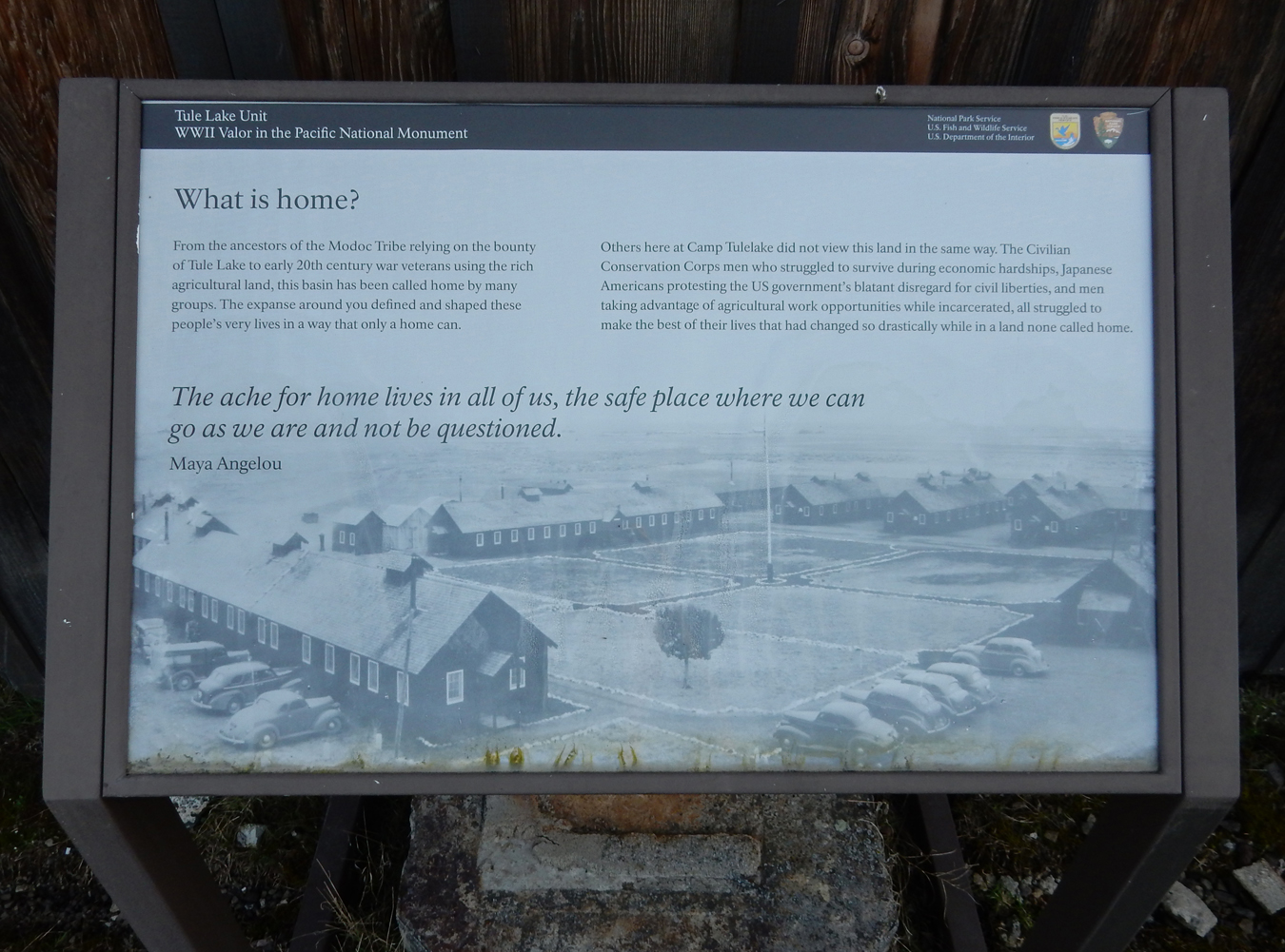
I met National Park Ranger Angela here at the museum. Her normal post at this time of year is at Lava Beds National Monument nearby. I had arranged for her to give me a tour of the Tule Lake Unit of the World War II Valor in the Pacific National Monument. We examined this display of the Tule Lake Japanese Segregation camp at the museum and then drove to the location of the Segregation Center.

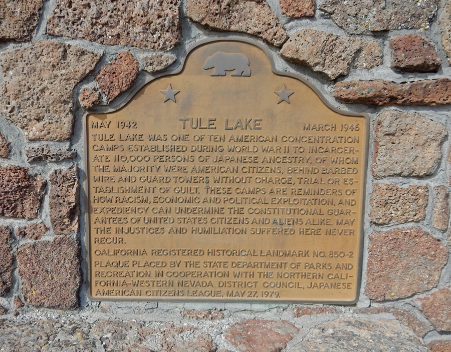
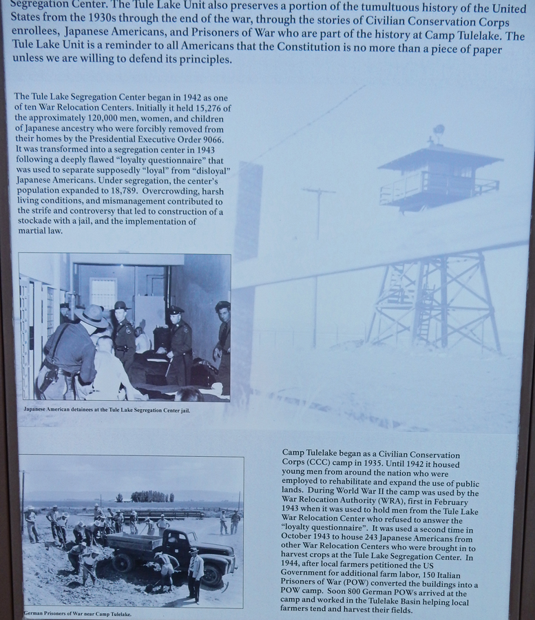
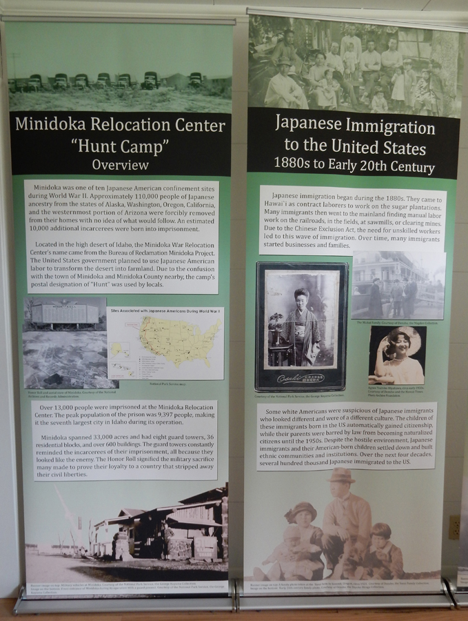
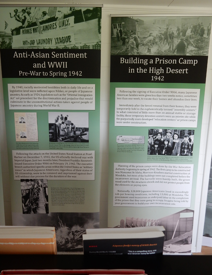
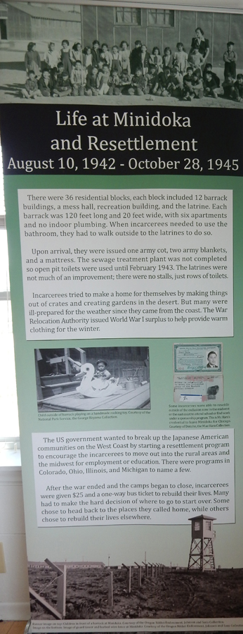
There were 10 Japanese Relocation Centers, “Concentration Camps,” spread mainly across the western U.S. They were in operation during World War II, from 1942 to 1945. I have already visited one of them – Manzanar National Monument, outside of Lone Pine CA (see this blog for May 2016). I will be visiting another on this trip – Minidoka National Monument in ID. There is also a new (not yet open) National Monument in Hawaii – Honouliuli National Monument, that will tell the history of internment, martial law, and the experience of prisoners of war in Hawaii during World War II. These camps were a black mark against the U.S. during this period and it is important that their story be told.
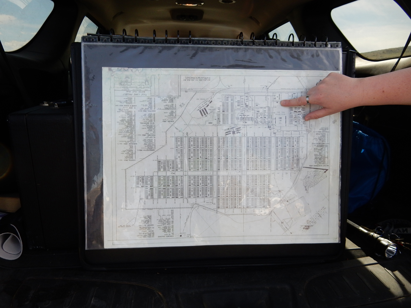
Ranger Angela giving an over view of the Relocation Story from the back of her SUV
The Japanese population at this camp was 18,789 in 1944
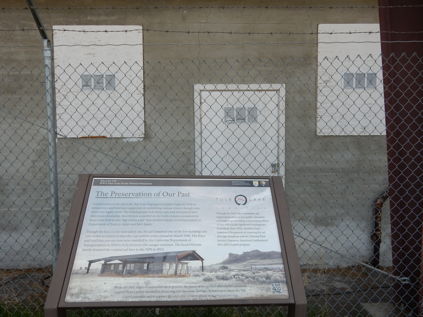
The tour here centered around the jail, which was very well constructed by the inmates. As a result, it is still here to help tell the story of this camp.
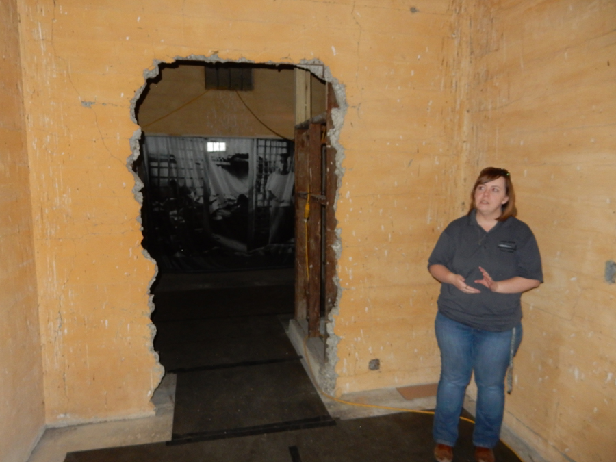

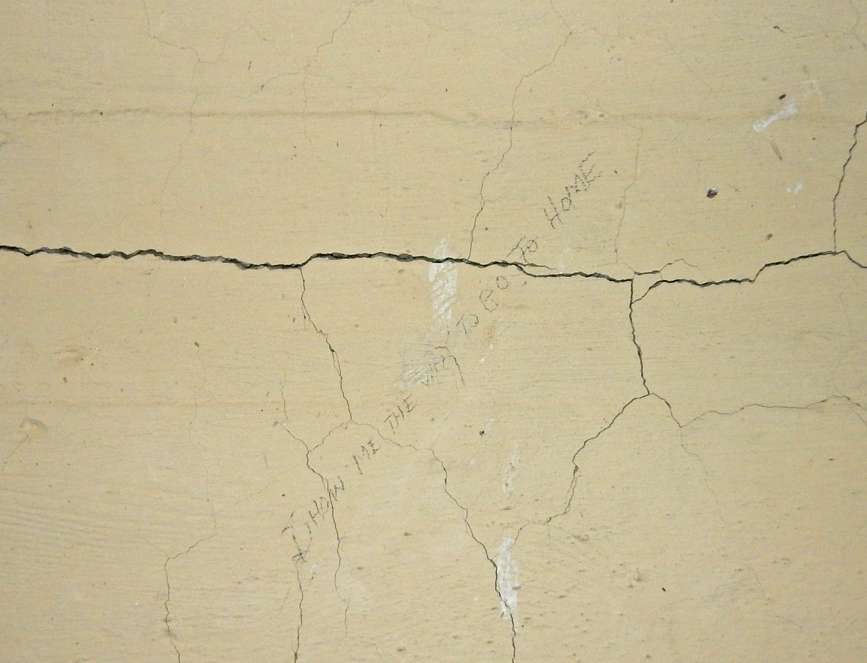
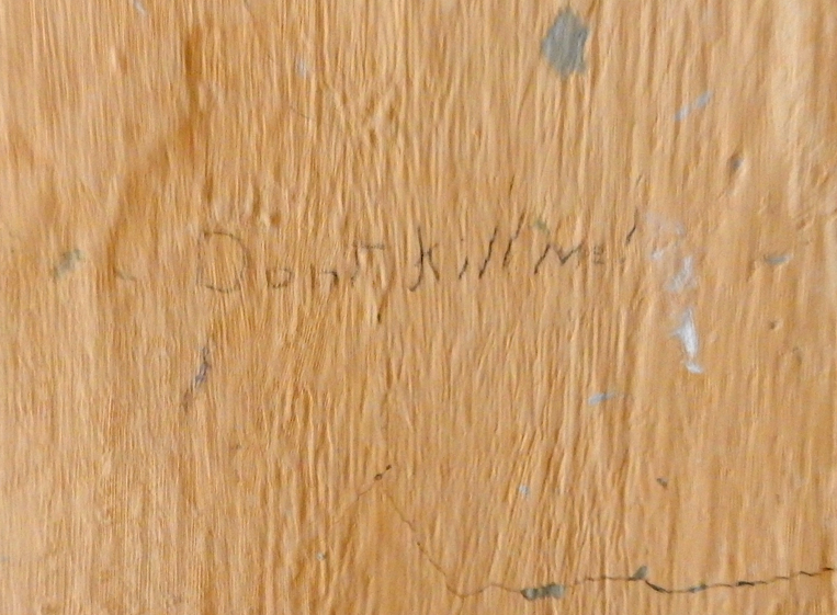
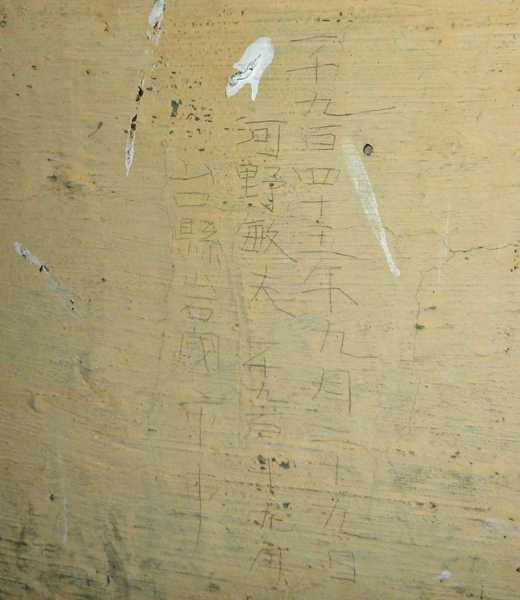
Legacy of Toshio Kawano
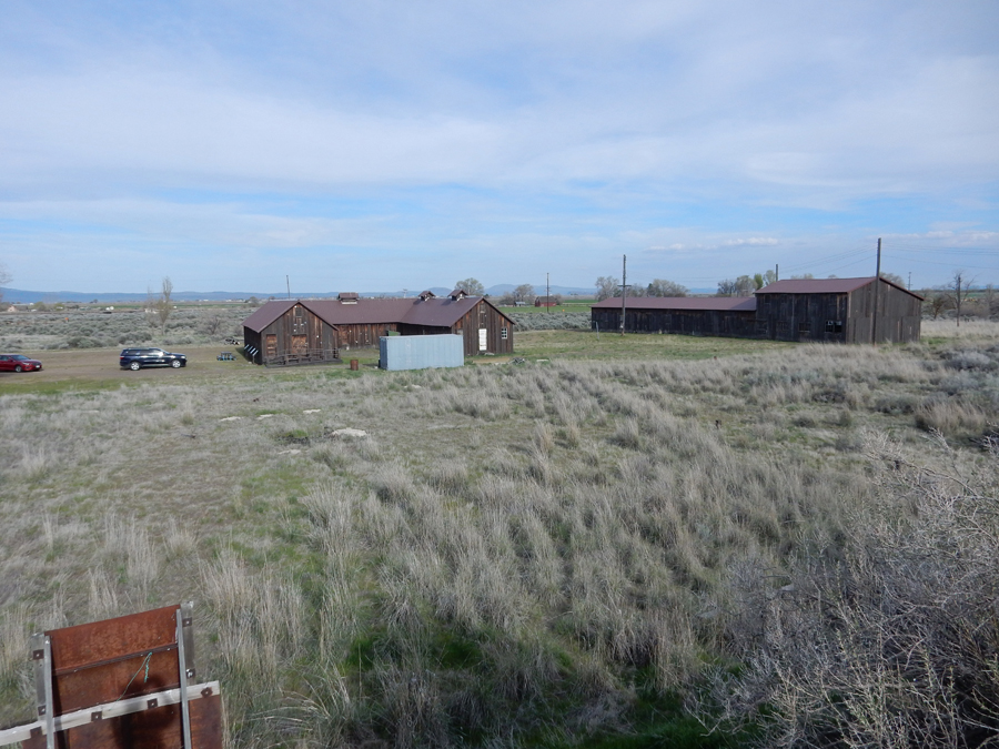
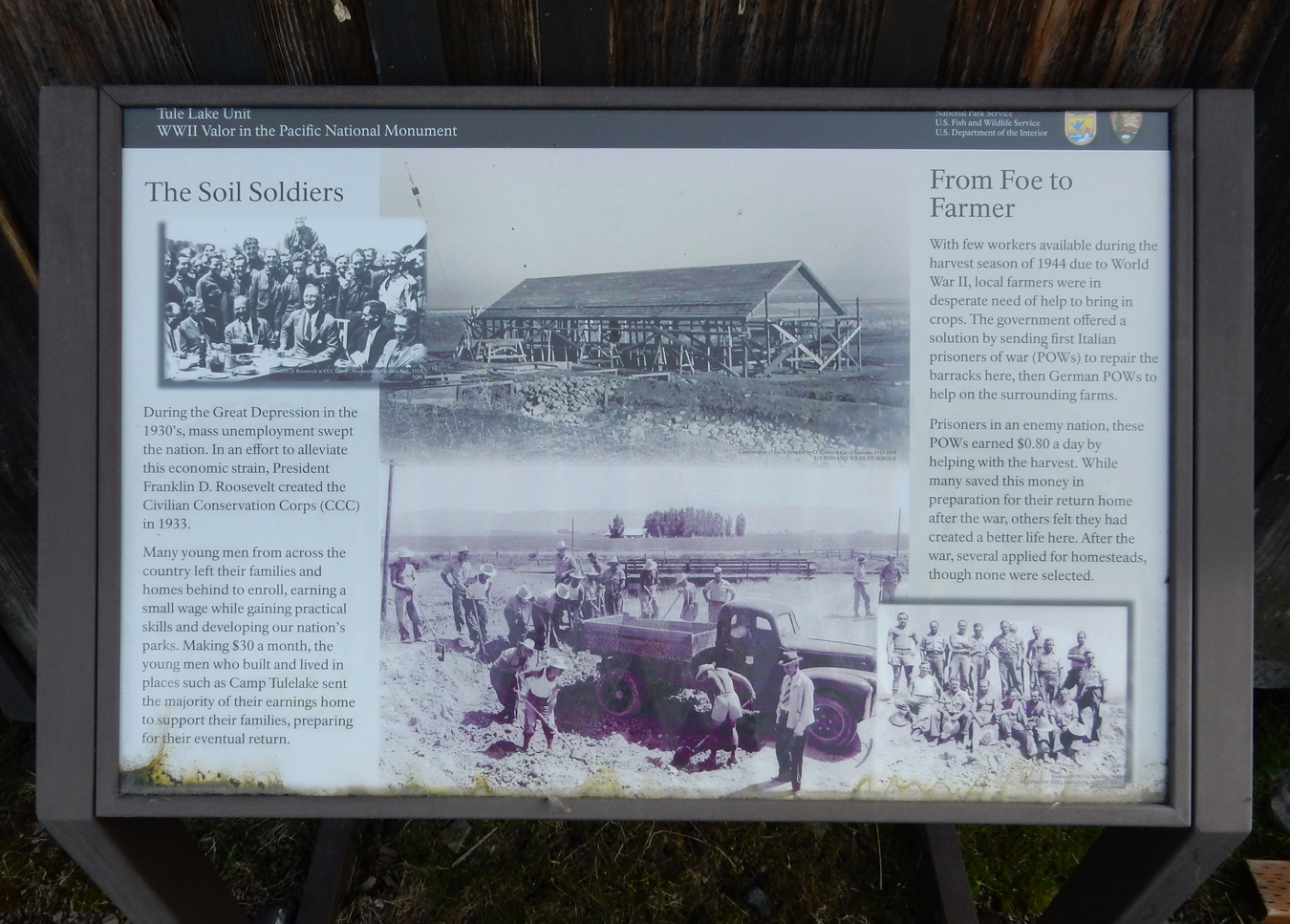
After two hours at the Tule Lake Segregation Center, Ranger Angela agreed to give me an additional tour of Camp Tulelake on the other side of town
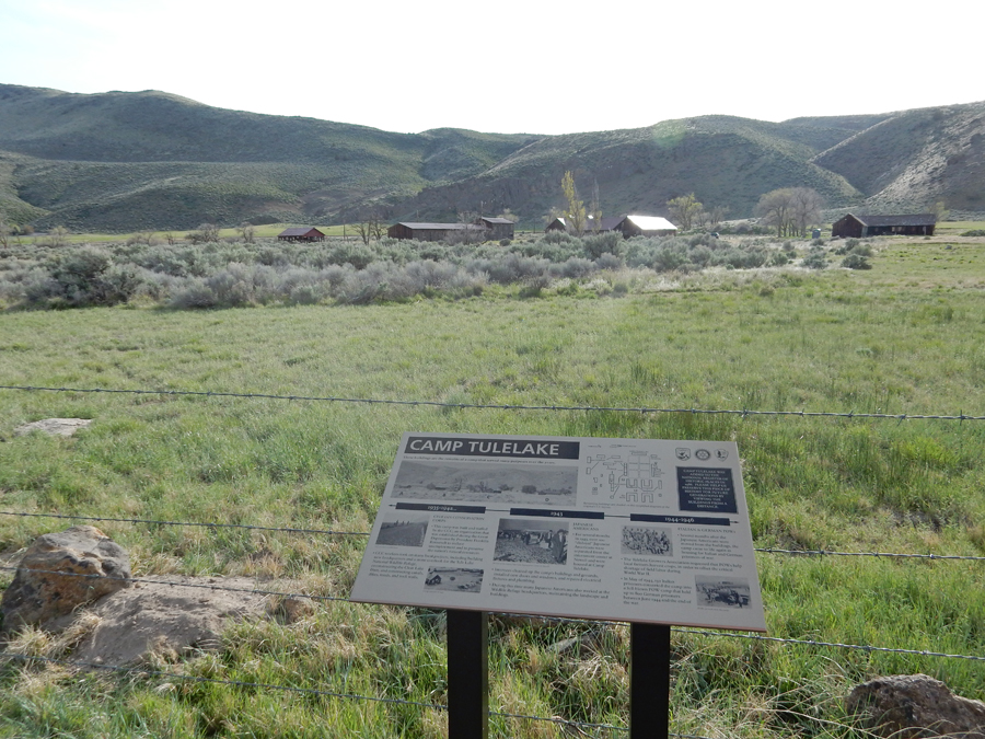
Note – Italian and German Prisoners of War were held here from 1944-46

Some of the buildings that are undergoing restoration


It was a 4.5hr drive up US 395 in southern OR to my Airbnb in Hines OR. After 2hrs it turned dark. There is next to nothing on the section of this road from the tiny town of Valley Falls to Riley, 90 miles. Though traveling at a good clip, I did not pass anyone for an hour and there were fewer than 10 vehicles going the other way.
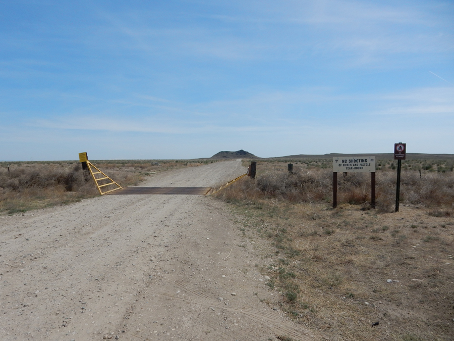
5/4 F – it took 3hrs to drive to Meridian ID, which is on I84 20 miles S of Boise. From there I turned South to some interesting sites. This sign gives a snapshot of some of the sites – however, be careful, South is to the left on the sign.
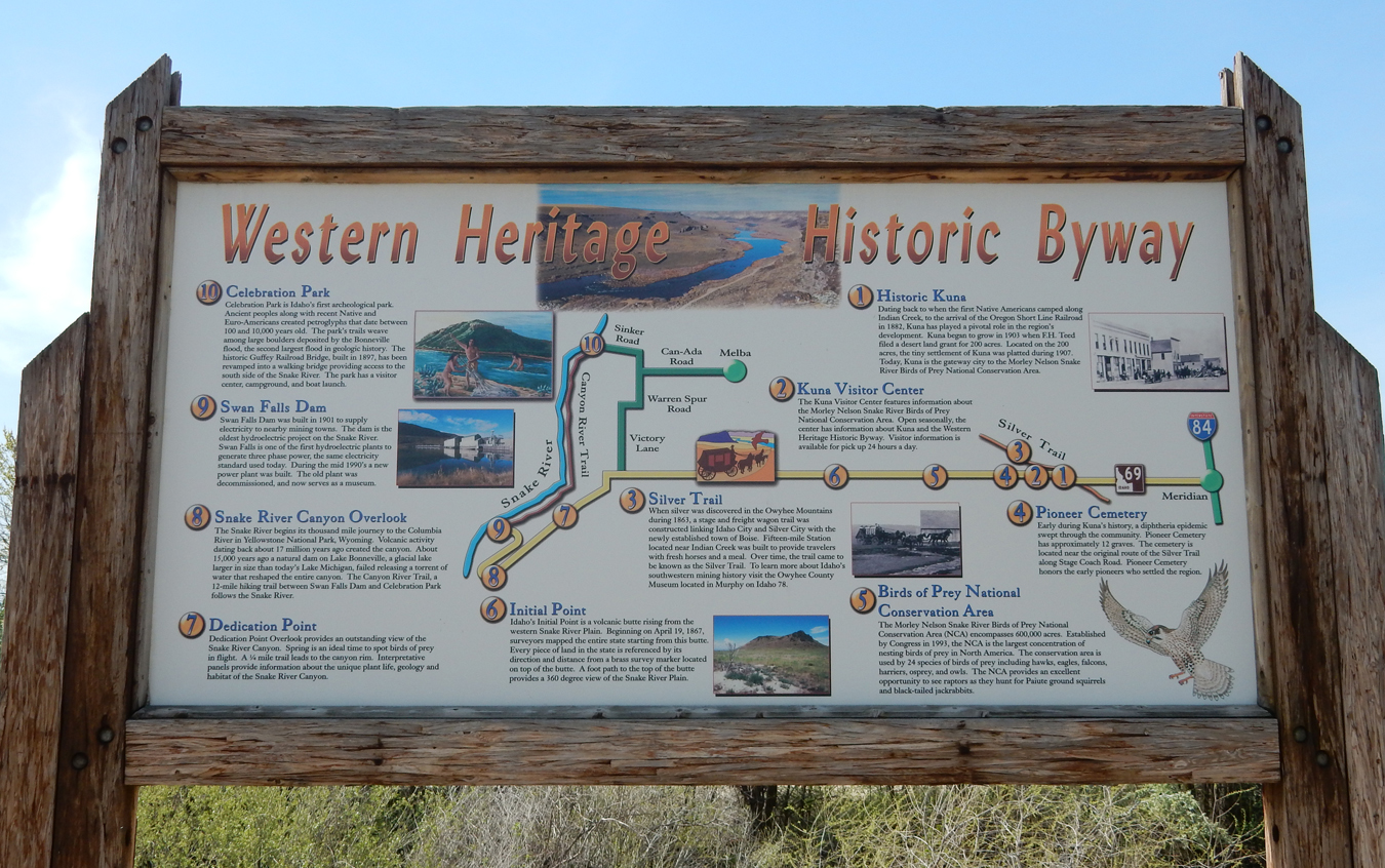
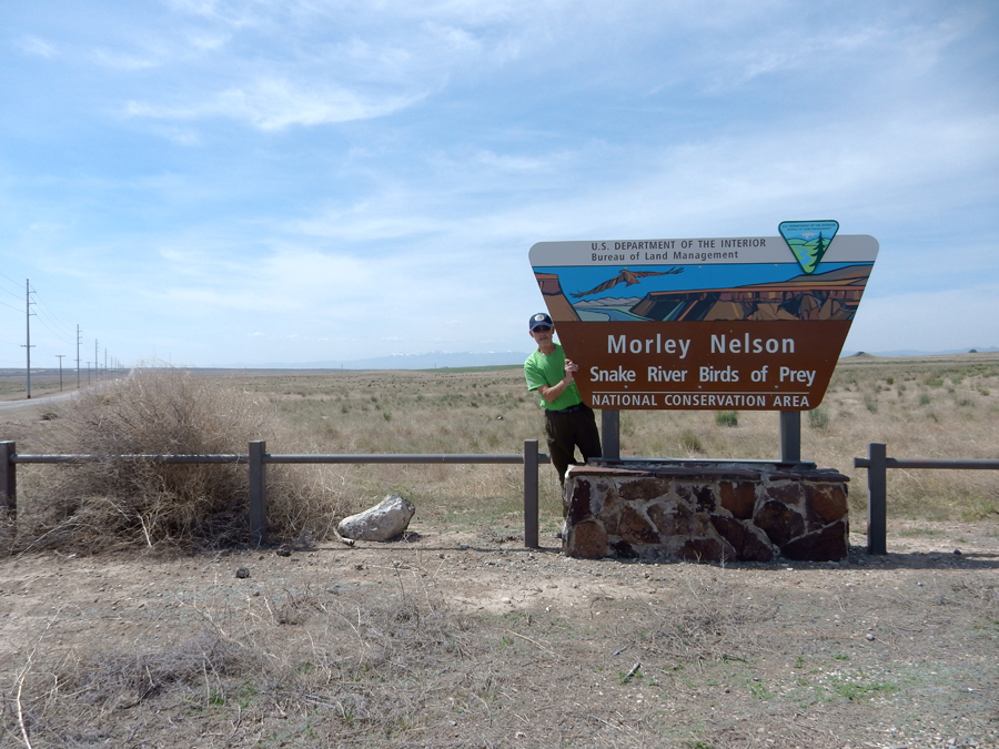
My main objective was the Morley Nelson Snake River Birds of Prey National Conservation Area (NCA), which is managed by the BLM


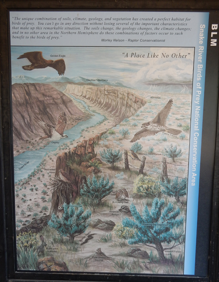
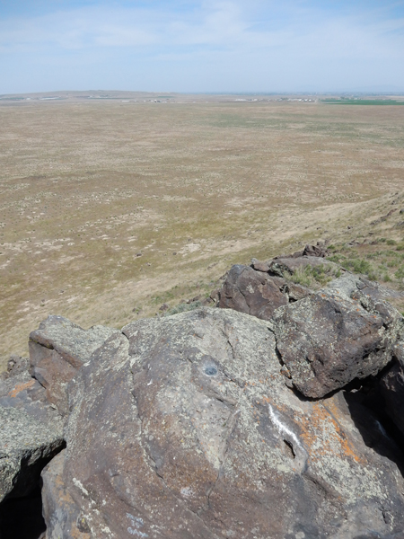
The Kuna Visitor Center was my starting point for a 56-mile drive through the NCA. My first stop is called the Initial Point, because it is the geographic reference point from which the entire state of ID was surveyed (1867). It is a prominent lava butte a mile east of the Swan Falls Road.
It is a short hike up to a small concrete observation platform


New USGS benchmark

Old USGS benchmark on a rock nearby

These guys, prairie dogs, are all over the place

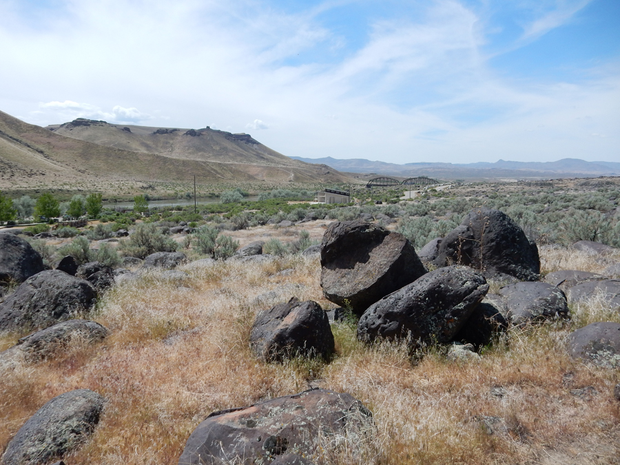
My next stop was Celebration Park on the Snake River, “Idaho’s Only Archaeological Park.” Note the Petroglyphs on the rock on the left –
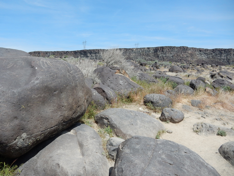
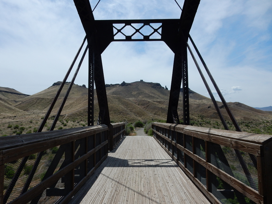
I did a short hike on the Petroglyphs Trail and then headed for the Guffey Railroad Bridge
It was built in 1897 to carry trains loaded with gold and silver ore from Silver City. However, by the time it was completed the mines had played out and the RR ended up carrying sheep and cattle.

My next stop was the Dedication Point (1971) overlook on the Snake River. I only saw a few birds today and was unable to get any good photos.

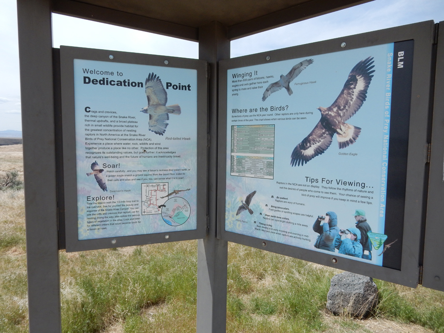
View looking West down the Snake River Canyon

View looking East up the Snake River Canyon

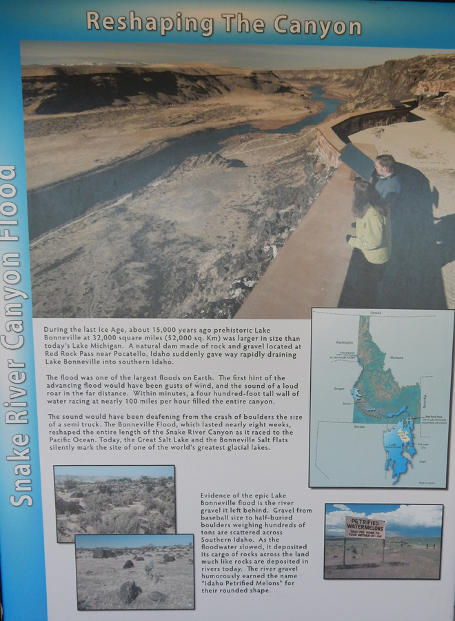
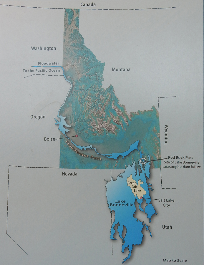
These signs describe the formation of the Snake River Canyon – it was formed by the “Bonneville Flood” some 15,000 year ago. It has been categorized as one of the largest floods on Earth and lasted 8 weeks! It is estimated that the wall of water was up to 300 feet high and traveled at 70-100mph! It deposited large rounded boulders on the rim, now called “melon gravel.” Many of the petroglyphs in this area were made on these boulders.
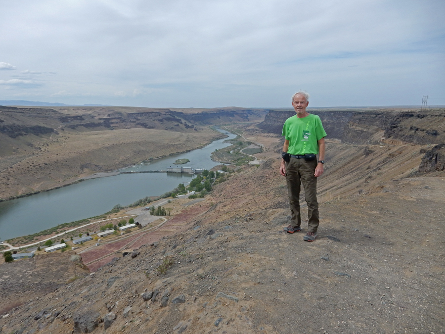
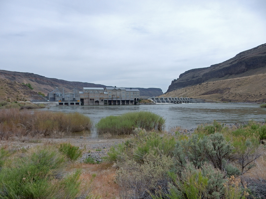
My last stop was at the Swan Falls Dam and Historic District
The dam was completed in 1901 and was the first dam on the Snake River. This sign describes the four phases of construction from 1901 to 1913.

Boarding House and Village, far removed from “civilization”


Dam from downstream
I attempted to drive the 4WD road from the dam South, however, I almost got stuck “in the middle of no-where” with my rental car. So, I turned around, went back to I84 and stayed the night in the Mountain Home Inn.
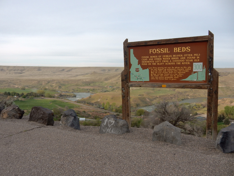
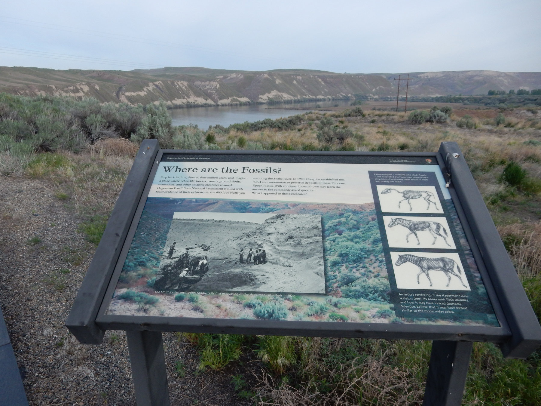
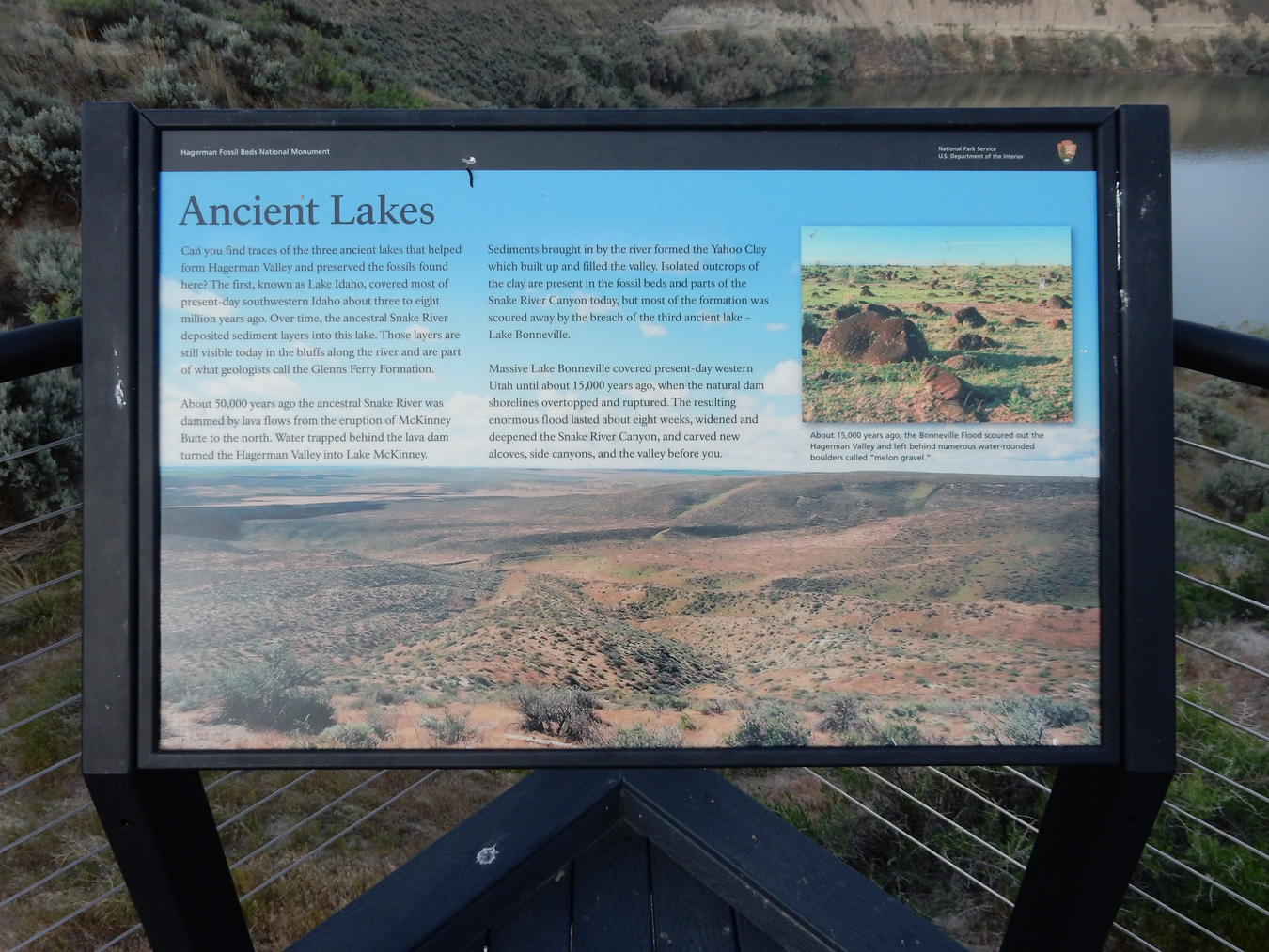
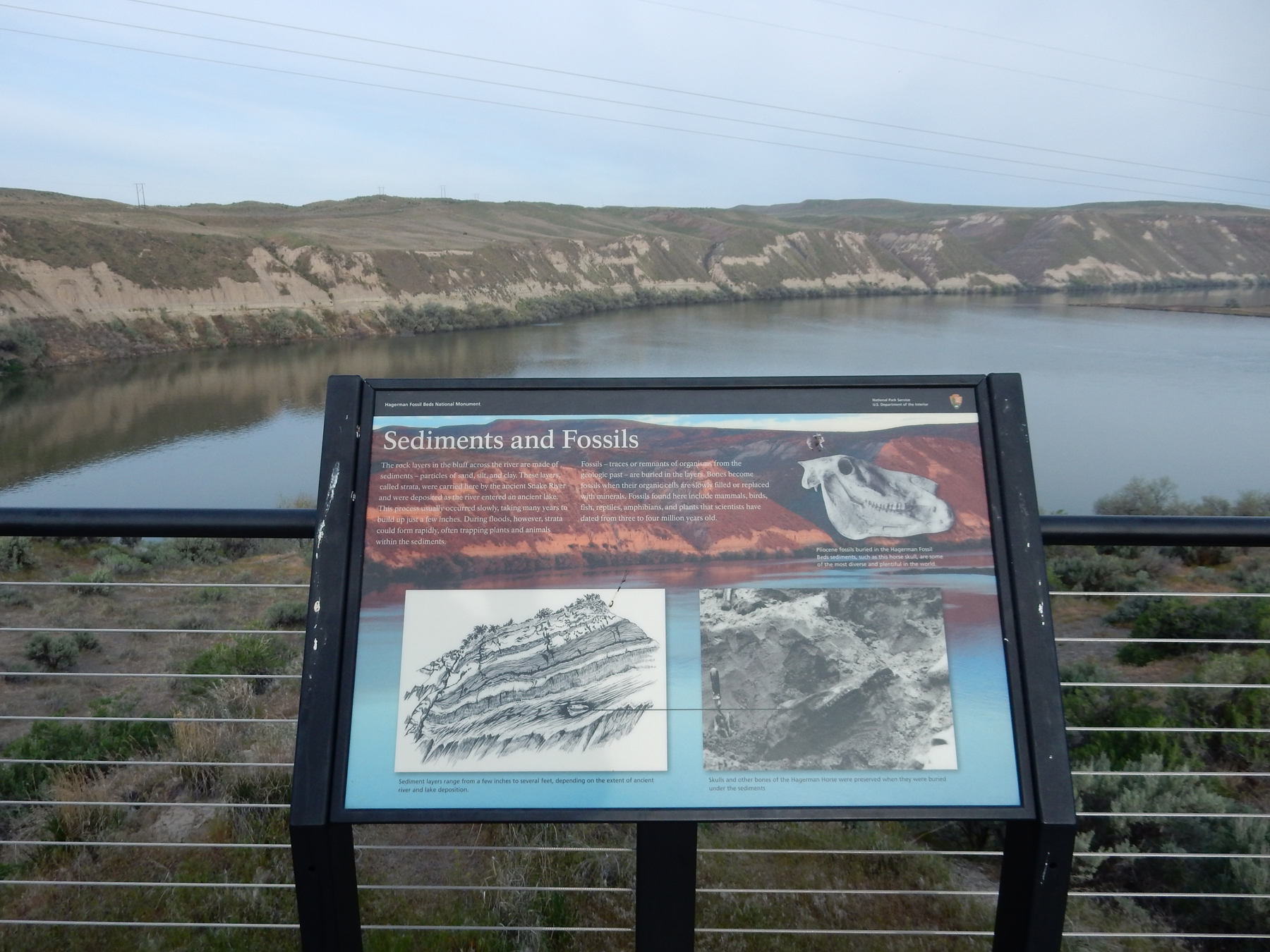
5/5 Sat – 1hr to Hagerman Fossil Beds National Monument
On Bell Rapids Road (Oregon Trail) headed for the Snake River Overlook

Signs at Snake River Overlook
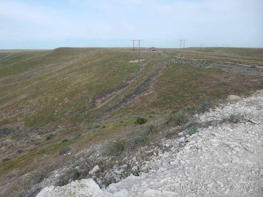
The park road follows the Oregon Trail route from the Snake River Overlook to the Oregon Trail Overlook. The Emigrant Trail was a three-mile parallel trail that permitted more traffic going up (600 feet) the difficult stretch from the Snake River to the Desert Plateau. This was one of the most difficult segments of the Oregon Trail.
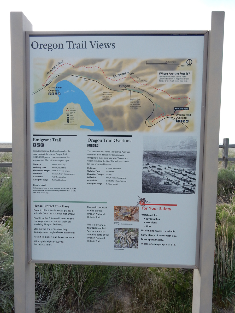
View east down to the Snake River from the Oregon Trail Overlook. The Oregon Trail came up the same way the road does. The Emigrant Trail can be seen on the right.

This photo is looking west to the Oregon Trail Overlook. You can see the final steep stretch of the Oregon Trail in the middle of the picture going up to the Overlook. You can see the wheel ruts.
Magnify to read about The Great Westward Migration

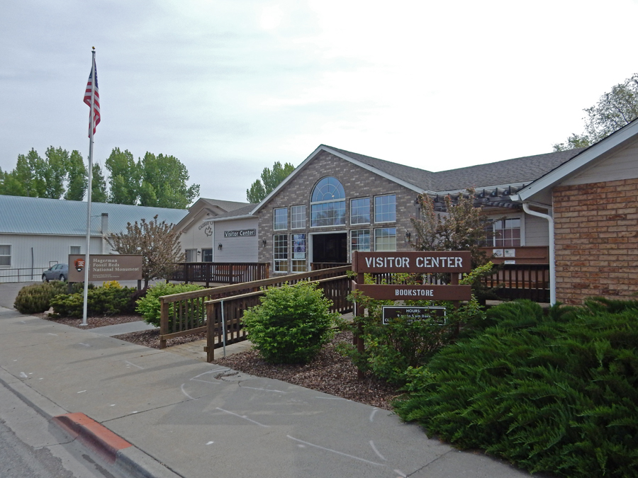
I hiked the 0.5-mile trail to a prominent overlook and then hiked about 1.5 miles on the Emigrant Trail. Afterward, I headed back to the town of Hagerman to see the Hagerman Fossil Beds NM Visitor Center.
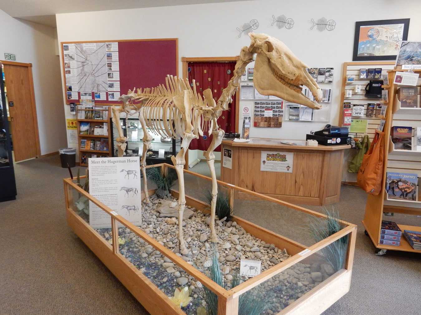
Horses here BEFORE the Spanish
How about Camels –
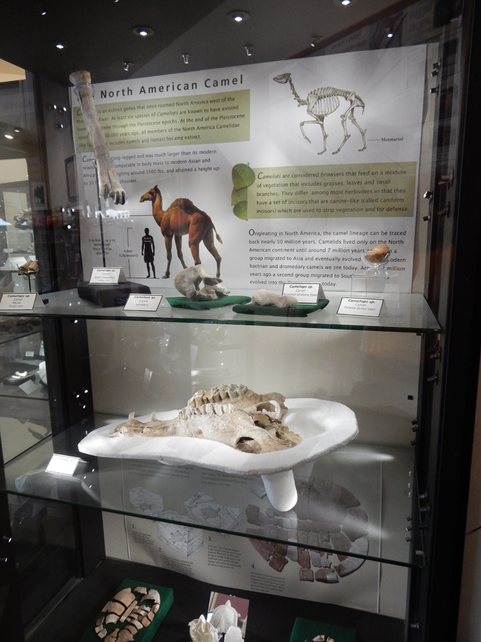
Small but nice Visitor Center, watched an interesting video

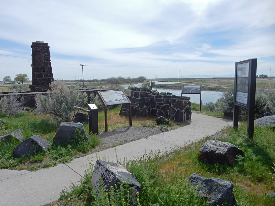
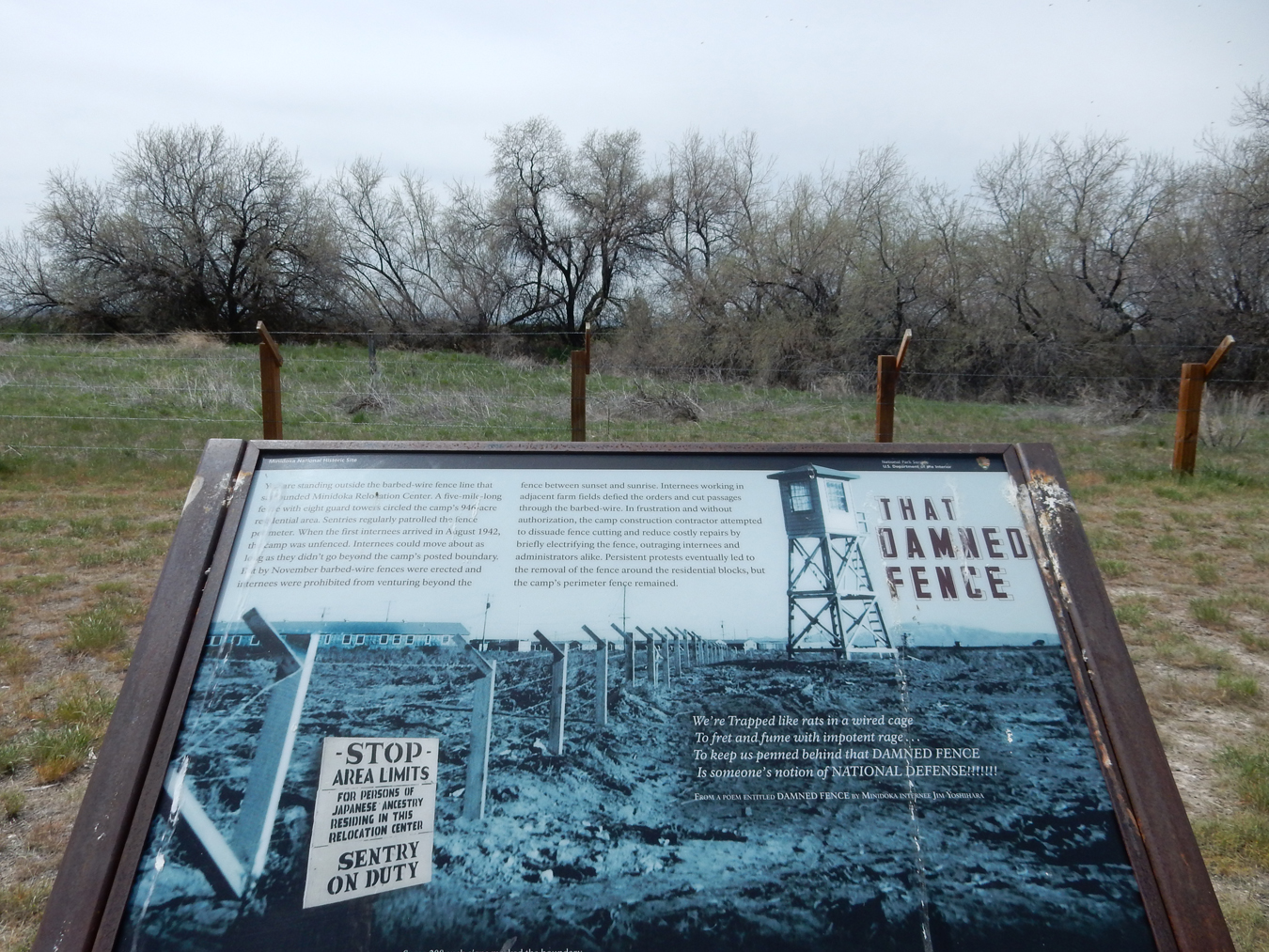
It was only an hour drive to get to Minidoka National Historic Site, it was also known as Hunt Camp ID

Camp Entrance


Remains of Reception Building on the Twin Falls North Side Canal of Clover Creek
I had planned my trip so that I would get there for a two-hour ranger tour at 12:30. I arrived a bit early, so was able to complete my own tour in less time, therefore making it possible for me to visit Craters of the Moon before it got dark. I did this 1.6-mile trail.

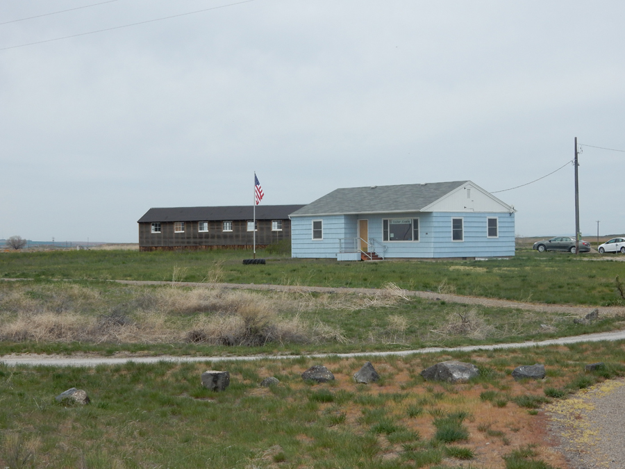
Visitor Center
To understand the story, read the next four displays

Map Describing Camp

Housing


Minidoka NHS became a member of the International Coalition of Sites of Conscience in 2015

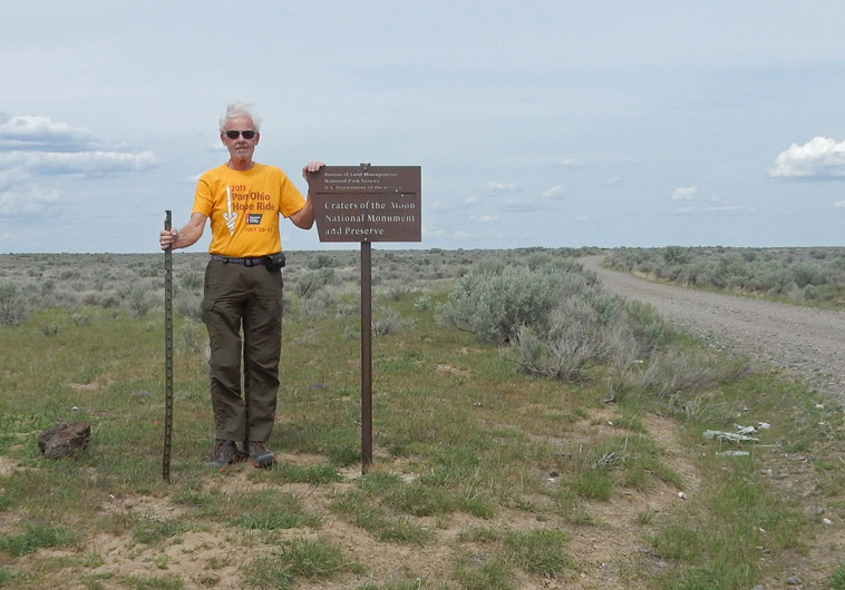
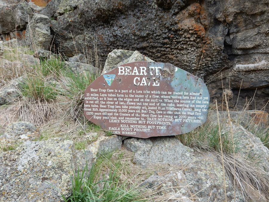
I averaged under 18mph driving the 21-mile gravel road to Bear Trap Cave in Craters of the Moon National Monument. I visited the original NPS monument in 1966 and this time was going into the newer (2000) National Preserve part of the monument that is managed by the BLM. The area is called the Great Rift. With limited information, I didn’t know if I could get to or find Bear Trap Cave, or what I would do when I got there. Whiskey Butte –

Entering the National Preserve, from the map I have, it looks like the NPS manages the lava flows and the BLM manages everything around the lava flows.
I found it – Bear Trap Cave!

It is an opening into a Lave Tube. The ceiling fell in creating this opening. It has been traced for 15 miles.
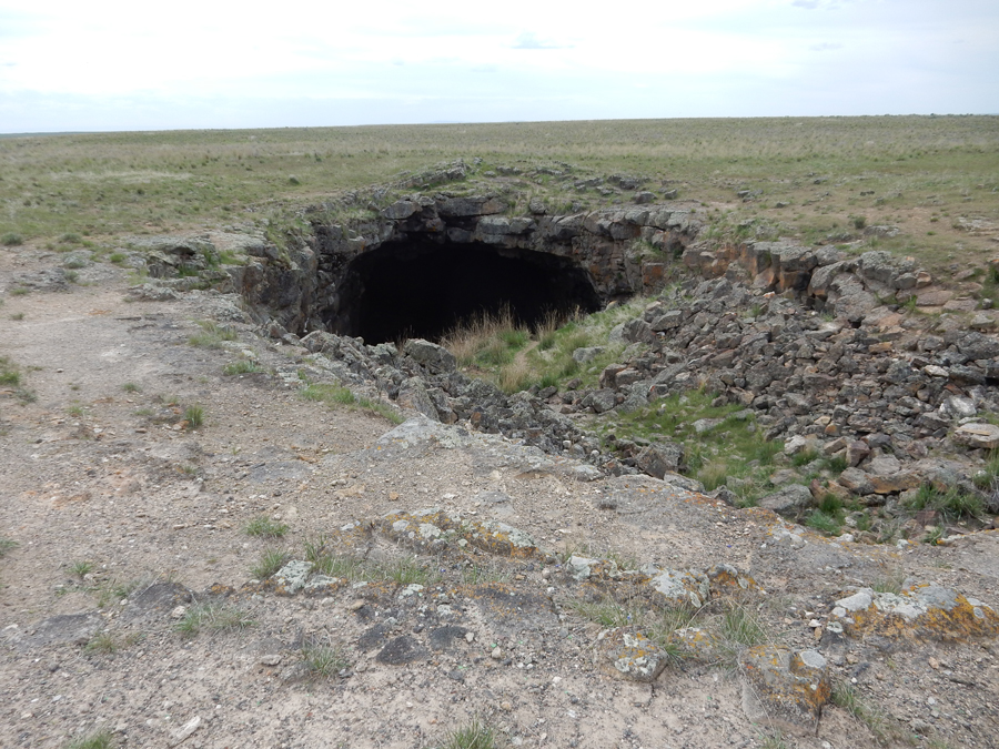
It was a rock scramble getting down to the “cave” entrance – watch out for snakes! The sign was an Eagle Scout project of Sheldon Wright. Being alone, I felt I was on a real adventure. At the same time it impressed on me that I had to be careful

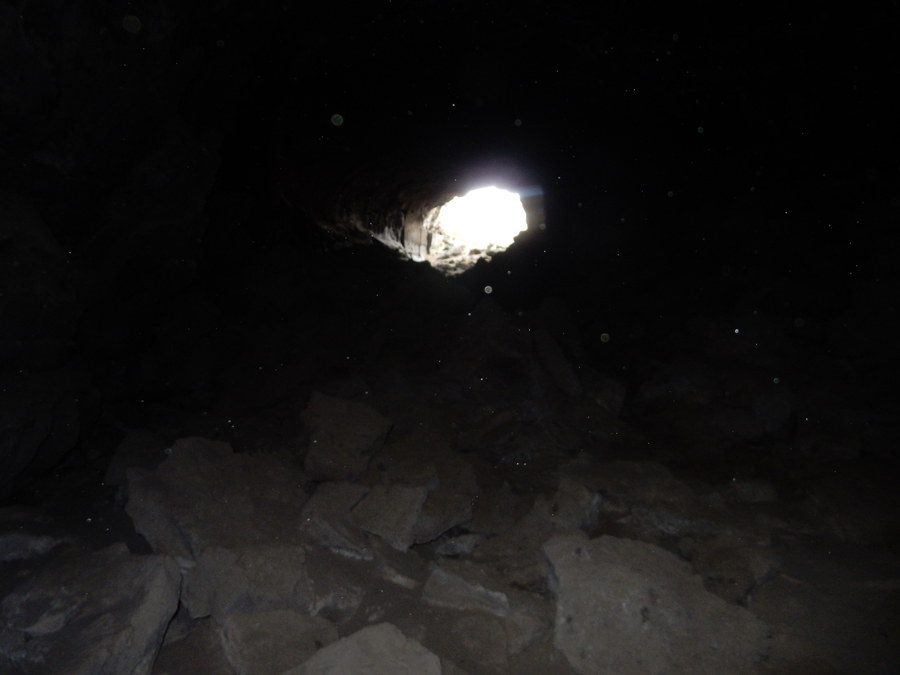
I put on my head lamp and was able to carefully work my way a quarter mile into the tube There was graffiti in there – If I remember right, a boy had spray painted in big letters “Angel, will you go to the prom with me?” A real “downer” when I saw it in the light of my head lamp.

Working my way back out of the cave
Desert marker


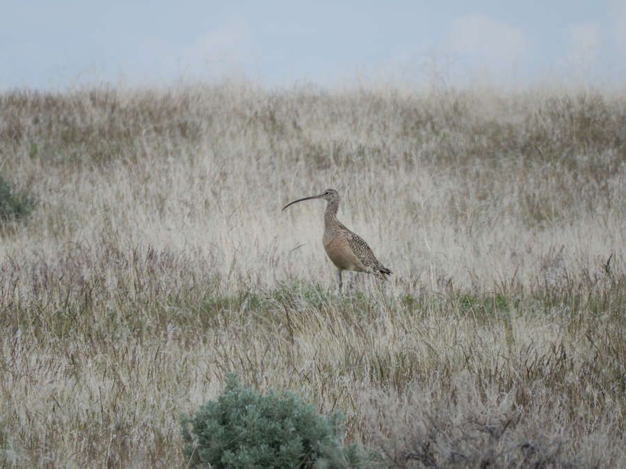
I believe this is a Long-billed Curlew. I also saw a large elk but was unable to get a photo
I stayed off the beaten path in an Airbnb in Burley ID (2 nights)
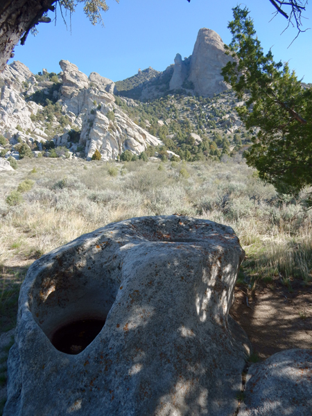
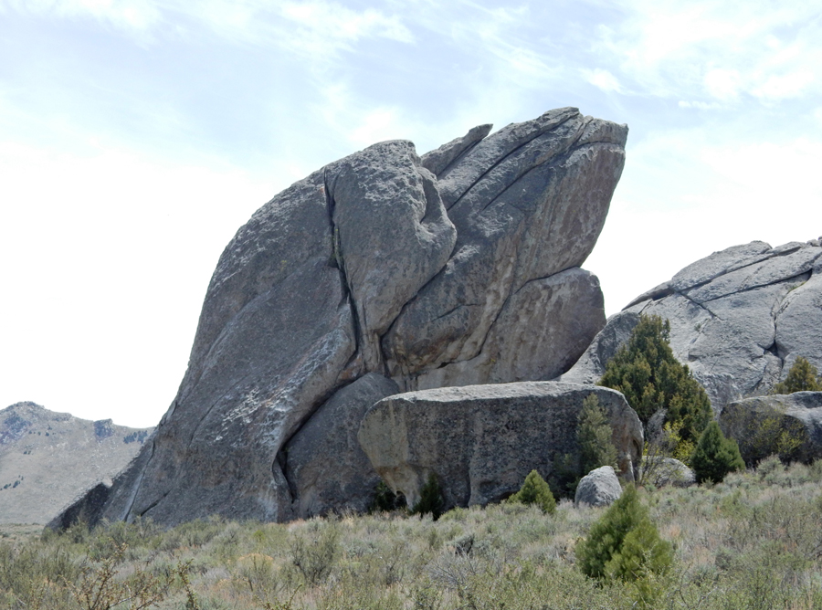
5/6 Sun – I started at the City of Rocks National Reserve Visitor Center in Almo ID at 8am when they opened

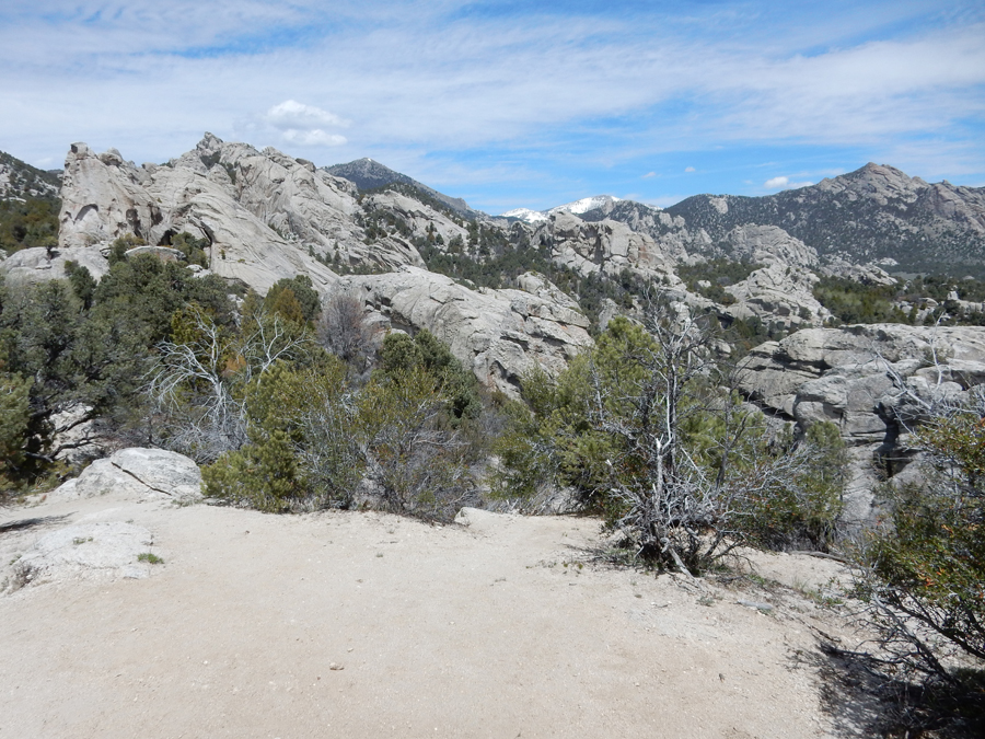
Excellent reference for my day’s activities. This was the most enjoyable day of my trip – this place is amazing! With all my stops and hikes, it took me all day to cover the 25-mile loop road.

My first stop was the Circle Creek Overlook, where I did the 1.2-mile Geological Interpretive Trail


Panholes
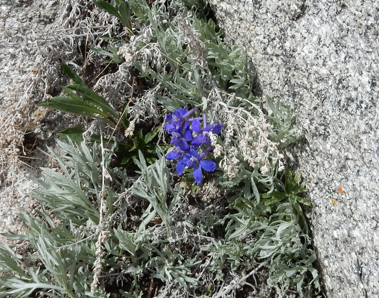
All kinds of interesting geological features and flowers as well!


The near vertical cracks are called “Joints” and are great for climbing

Climbed a rock to get a photo of the Circle Creek Basin


“Veins” – in this case, quartz intrusions into cracks

Yes, it’s called a Window

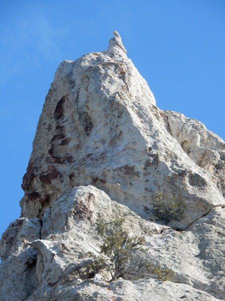
A Pickelhaube
Pinnacles

Circle Creek Ranch

Chicken Rock on the north side of the road
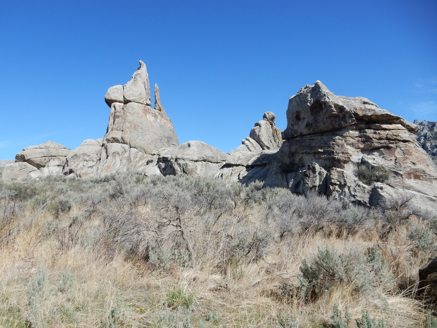
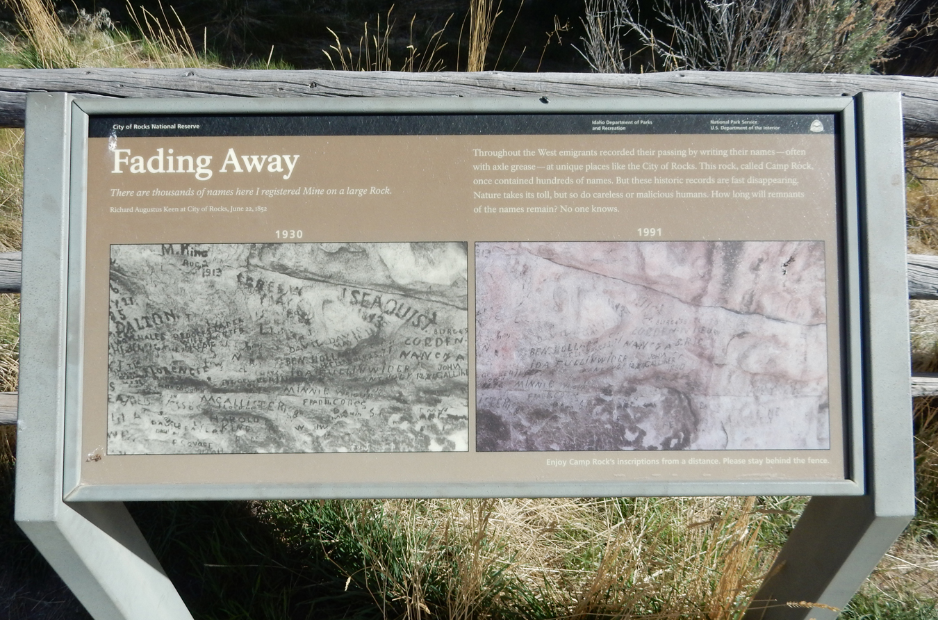
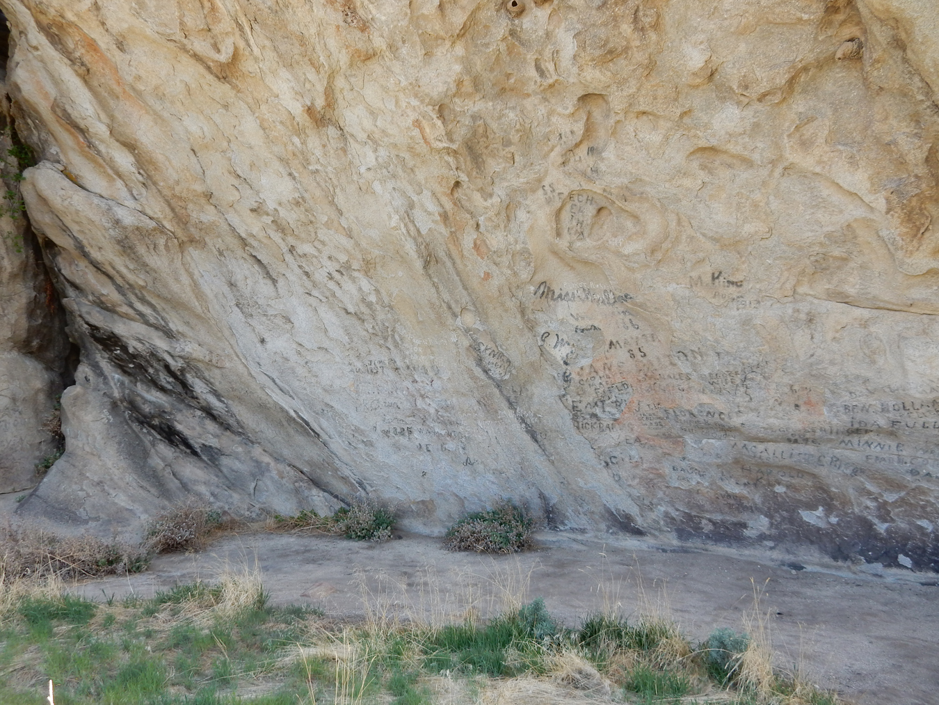
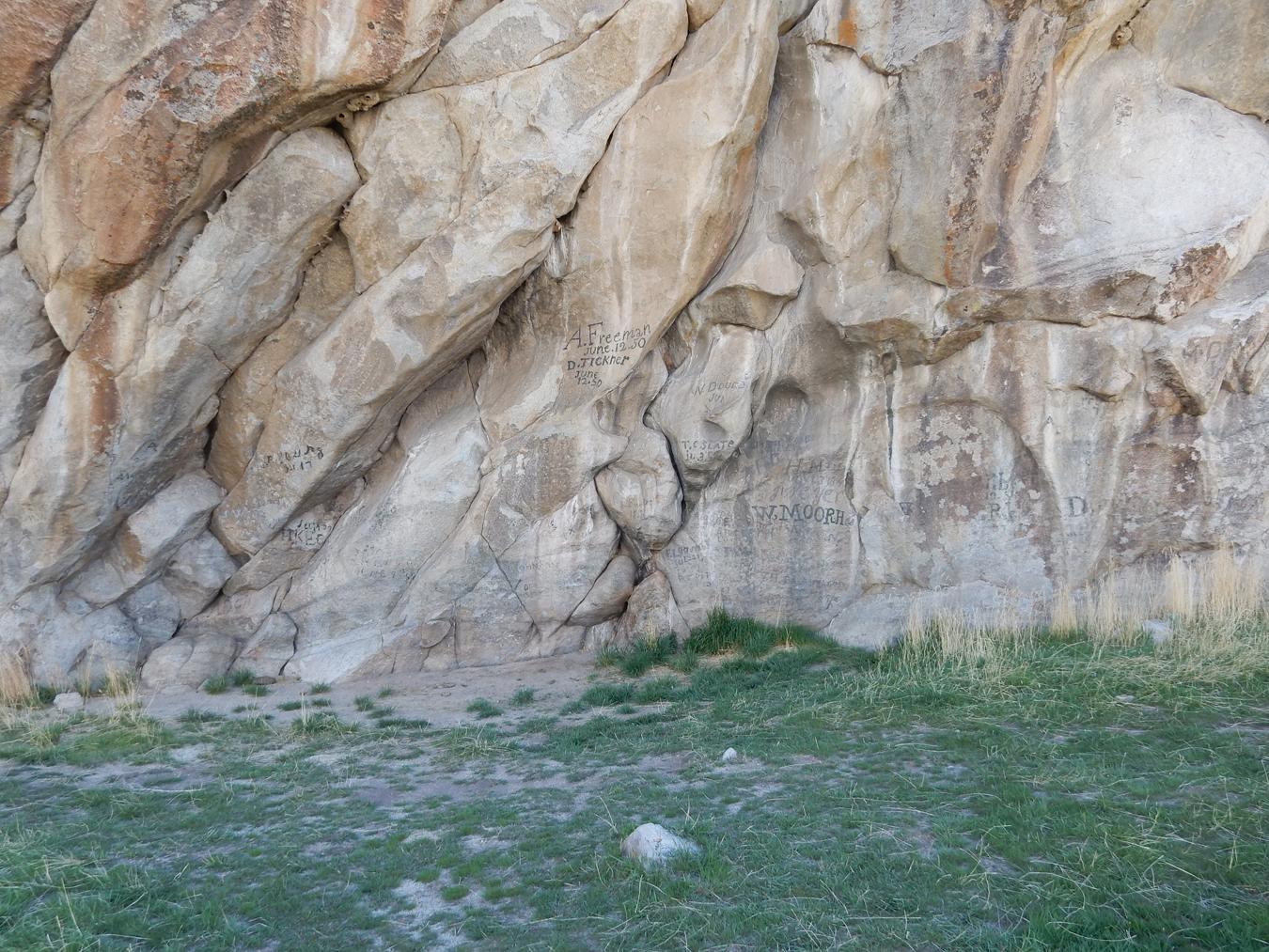
Camp Rock on the south side of the road – emigrants wrote their names and dates using axle grease

Profile of man’s face with the words “wife wanted”
Nests on Camp Rock

View west from Camp Rock on the California Trail, a 2,000-mile trail from Kansas City to Sacramento. “Ho for California” Free Land/Gold – many routes, cut-offs and branches, a major route was through the City of Rocks. It is estimated that 250,000 migrants followed this route. At first, 1843-1882, they were after land. Then, in 1849, the motivation was GOLD. There were few wagon trains on the trail after 1869 (transcontinental railroad).

Kaiser’s Helmet – Picklehaube on top

Treasure Rock – stage coach robbery loot buried here in 1878, I didn’t find any

Looking north into Circle Creek Basin, many emigrants camped here

Devil’s Bedstead

Register Rock, more emigrant signatures

Nice profile

Pinnacle Pass

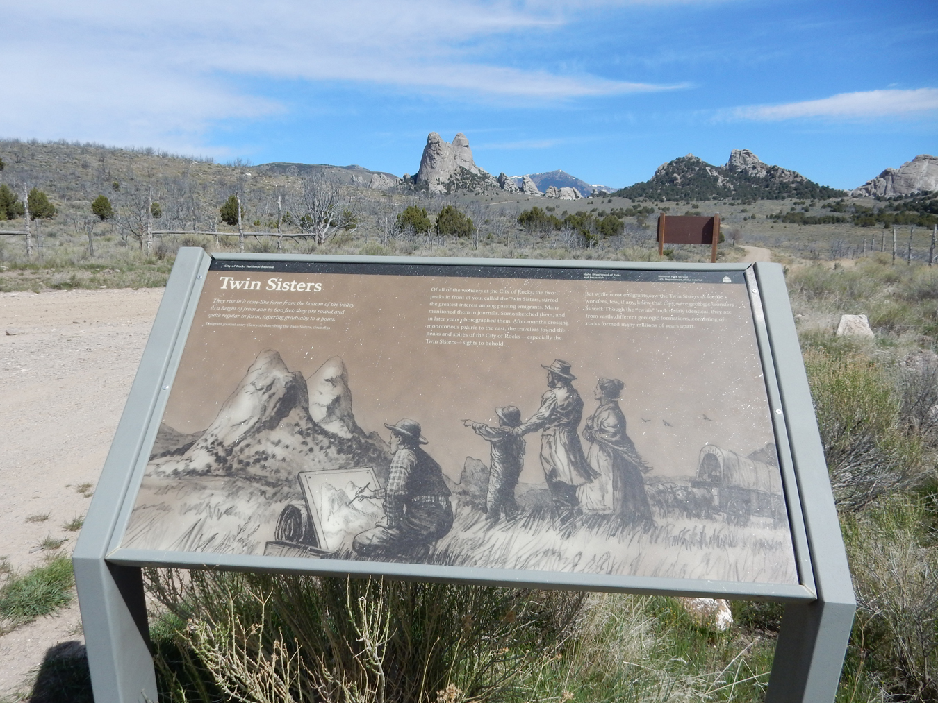
Twin Sisters in center, left sister made up of rock from the Green Creek Complex, right sister made up of Almo Pluton, at 638 feet, they are the most prominent features in the reserve.

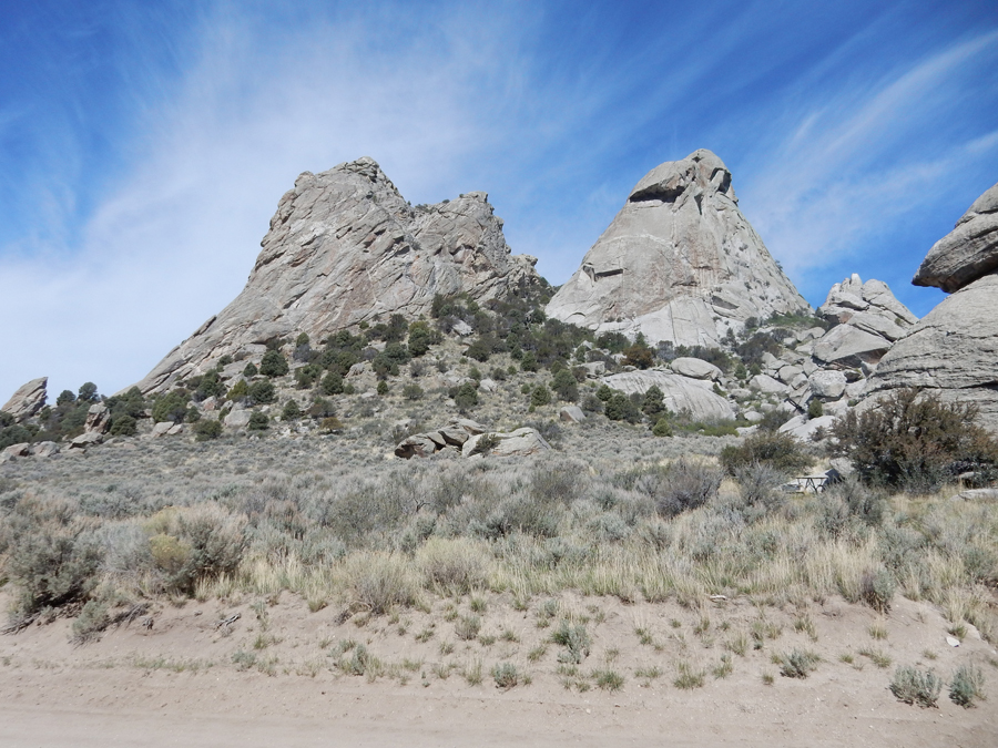
View of Twin Sisters from the south
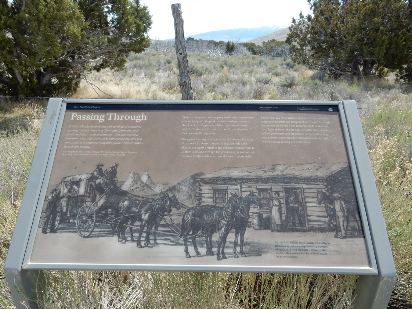
Holladay Overland Mail and Express Company stagecoach line on the Kelton Road, which was on the Salt Lake Alternate Trail to the City of Rocks
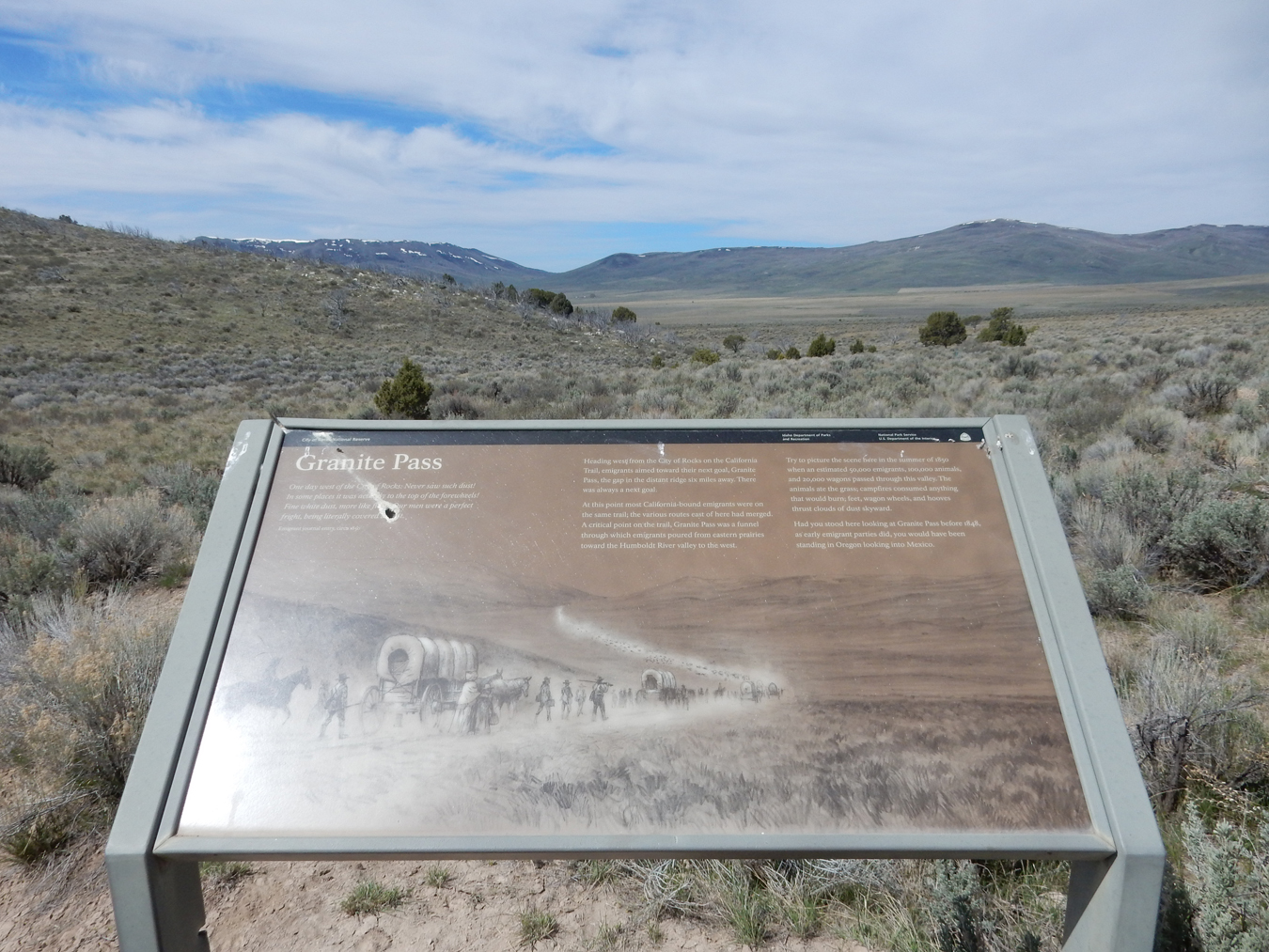
Granite Pass, 6 miles away, was the next obstacle on the California Trail. If you were standing here in 1848, you would be standing in Oregon looking into Mexico!
Breadloaves
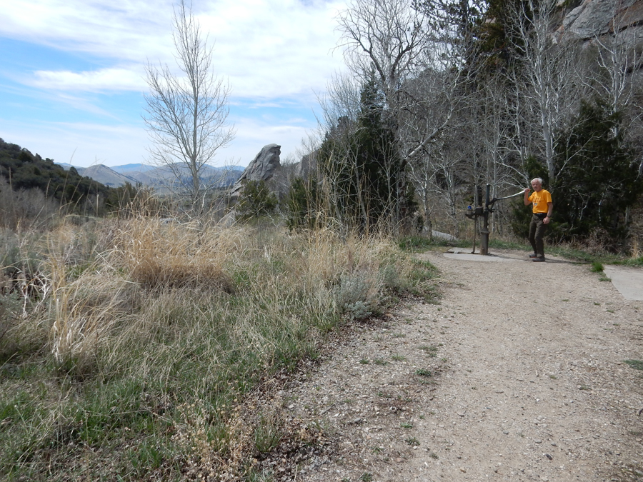
Quenched my thirst at the Emery Pass Picnic Area
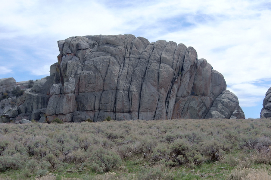
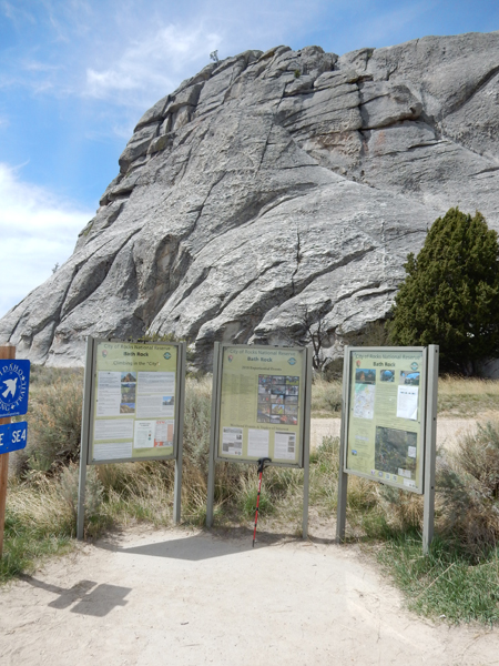
This is an amazing rock-climbing area
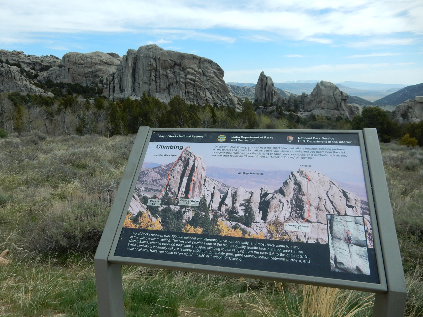
Bath Rock Climbing Area – there are panholes full of water on top
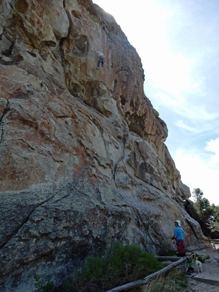
Climbers on the west side of Bath Rock

Climbers on Creekside Towers
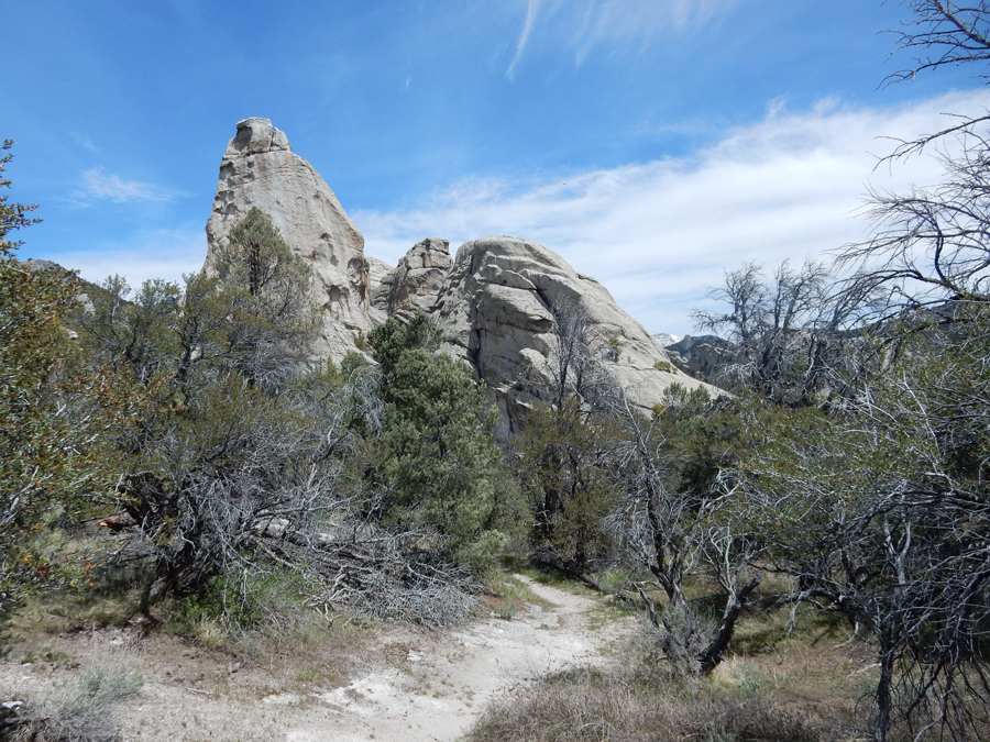
On the extended 1.7-mile Creekside Towers Trail
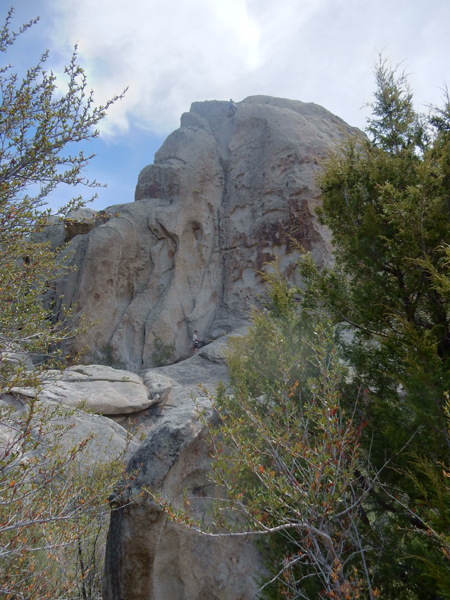
Climber topping out on the Anteater
Everywhere you look, excellent rock climbing


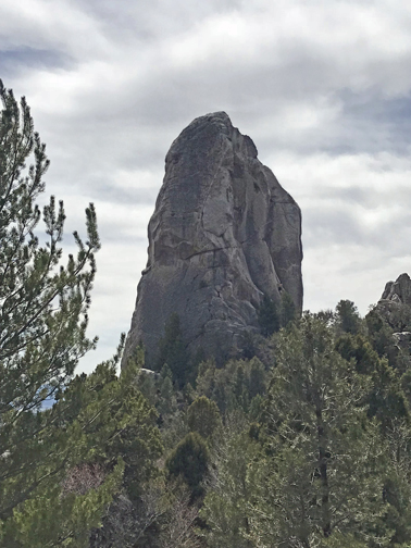
The Incisor, also known as Morning Glory Spire
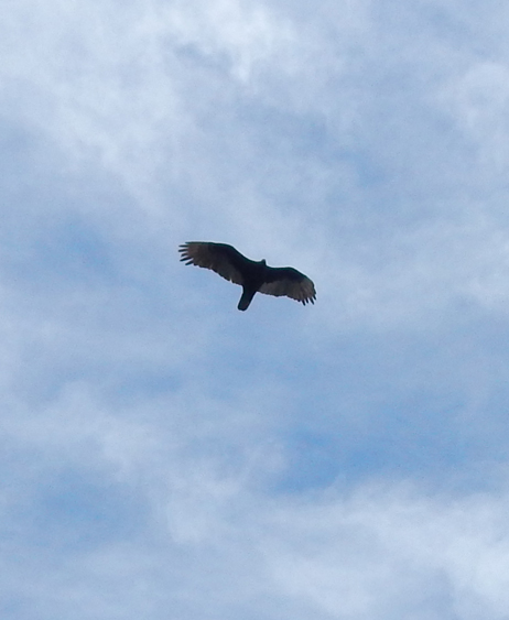
I love ravens, “Once upon a midnight dreary . . . “


Backside (eastside) of Creekside Towers


What a wonderful hike this was –


I would reserve campsite, #37 or #38 near Window Arch
Window Arch is one of the most popular features of the Reserve

Alright, I’m not done yet. I still have to hike around Elephant Rock

Base of Elephant Rock – these are called a Tafoni, weathering creates small hollows on joint surfaces. The hollows gradually enlarge through the creation of a sheltered micro-climate that facilitates the accumulation of salt. Salt is a corrosive agent that expands when dry and breaks apart the granitic minerals. The salt is transported by wind and rain from the Great Salt Lake basin 30 miles away.


I call this Frog (or Toad) Rock
Here are a couple of colorful pictures, before I head back to my Airbnb (but NO breakfast) in Burley ID

5/7 M – 3hrs to Salt Lake City airport, left at 11:58am, left Denver at 5:50pm, arrived home at midnight
