
9/4 Su – late breakfast at the West Bayden IN Resort with Peter and Heather and then a casual 3hr drive to the Cincinnati Airport. My Alaska Air flight to Seattle left at 6pm, the next flight at 9pm. As we approached Anchorage, the “Northern Lights” were visible on the right side of the aircraft. I switched seats and saw a curved white-blue glow above the curve of the earth with lots of stars above. Looking North the glow looked similar, but I did not see any “dancing lights.”
I arrived in Anchorage at midnight. It took a while to get the shuttle to the Baymont Inn. The first room they gave me had no heat. The key for the second room they gave did not work. The second key they gave me did not work. Then I was able to get in but this room did not have any heat either! After that, they told me the entire building had no heat! It was 1:30am (4:30am OH time) and I did not want to search for another hotel, so I negotiated a lower price WITH at space heater for the night.
Helen called at 9:30am OH time and woke me up (5:30am Anchorage time). Now I know how Kate feels when people call her in LA in the early morning forgetting she is 3hrs behind OH time.
9/5 M – Labor Day, slept in late and got ready for my 2pm flight on RAVN (Raven) Air to Dutch Harbor (Unalaska) in the Aleutian Islands, 1200 miles southwest of Anchorage. A woman at check-in let me know that my phone would not work in Unalaska and that I would have to get (pay for) an app for service. Everything was fine until our DASH 8-300 two engine turboprop taxied to the takeoff runway. It was then discovered that a sensor was not working, and we had to return to the terminal. I had to start thinking about alternative plans should I be unable to fly to Dutch Harbor today. Flights are often fully booked as there are only two a day or canceled due to bad weather in the Aleutians. It would require major changes in my itinerary and maybe another return trip to Alaska. Fortunately, the problem was resolved, and we left an hour late.
I spoke with my seat mate and learned he was from Louisiana and was going to Dutch Harbor to work on a boat that would be fishing in the Bering Sea. Further, he had recruited several south sea islanders, mainly “big” Samoans, who were also on the plane. He would receive about 15K for two months, if the fishing was good.
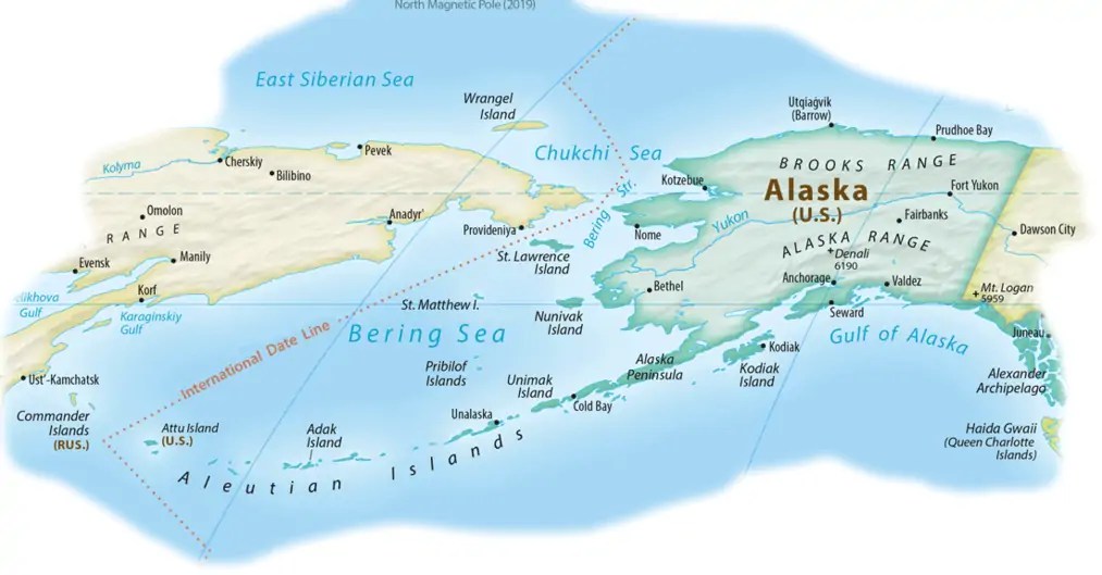
Upon arrival, took the shuttle to the Grand Aleutian Hotel and checked-in at 6pm. Alaska has the entire state on the same time, that is, 1hr behind West Coast Time. If that were not the case, Unalaska would be 2hrs behind West Coast Time. The last Aleutian Island of Attu is only 208 miles from the Commander Islands of Russia. The International Date Line does a jog so that it passes west of the Aleutian Islands, making the west coast of Attu the western most point of the U.S.

Boats from Dutch Harbor catch more metric tons of fish (Bering Sea) than anywhere else in the U.S. Many of the episodes on the TV Show the “Deadliest Catch” are about fishing boats stationed in Dutch Harbor.

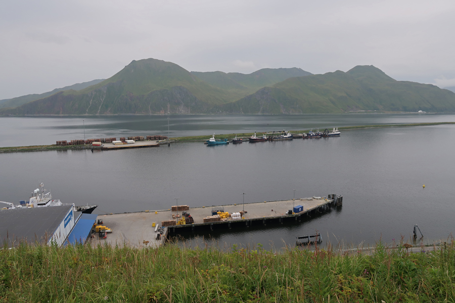
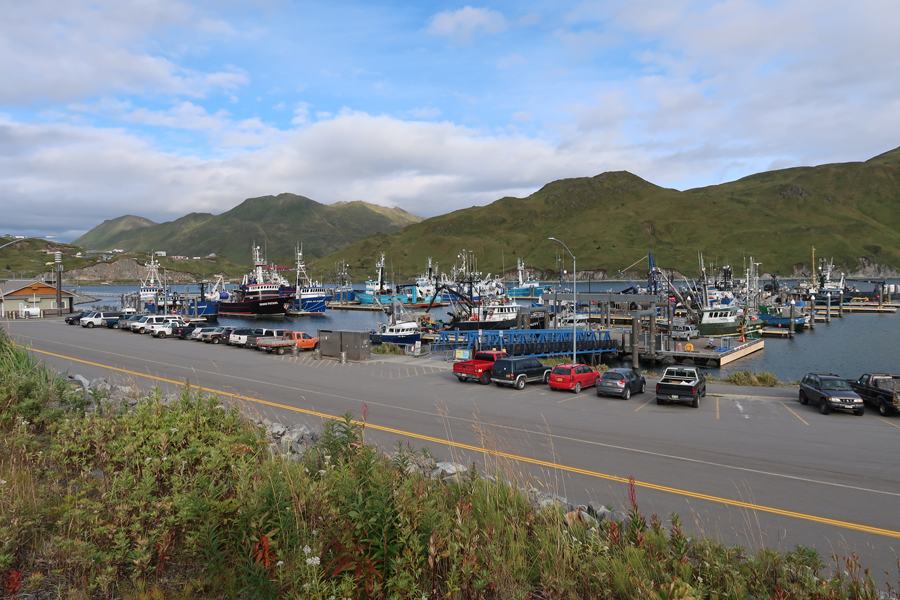
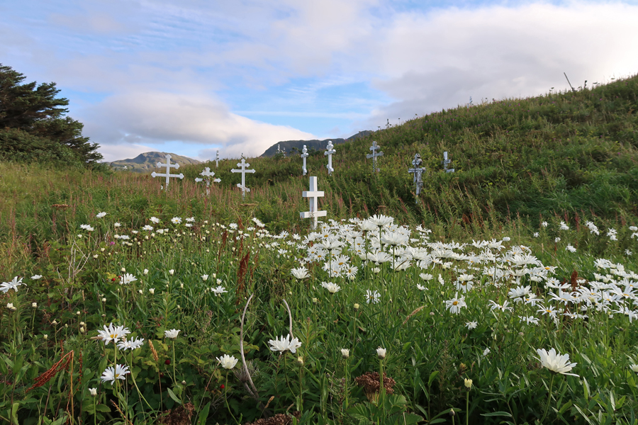
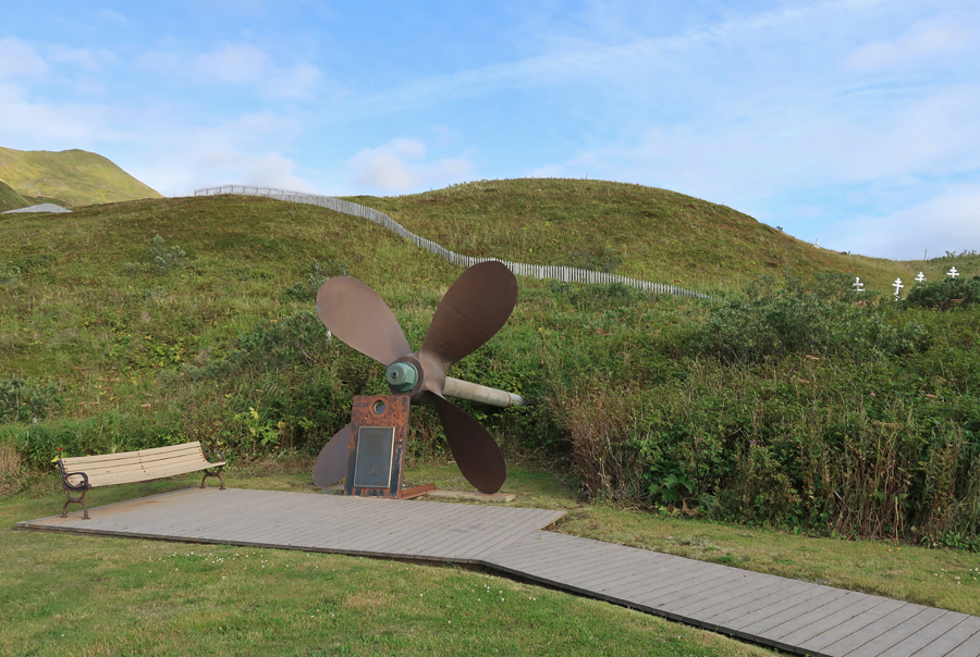
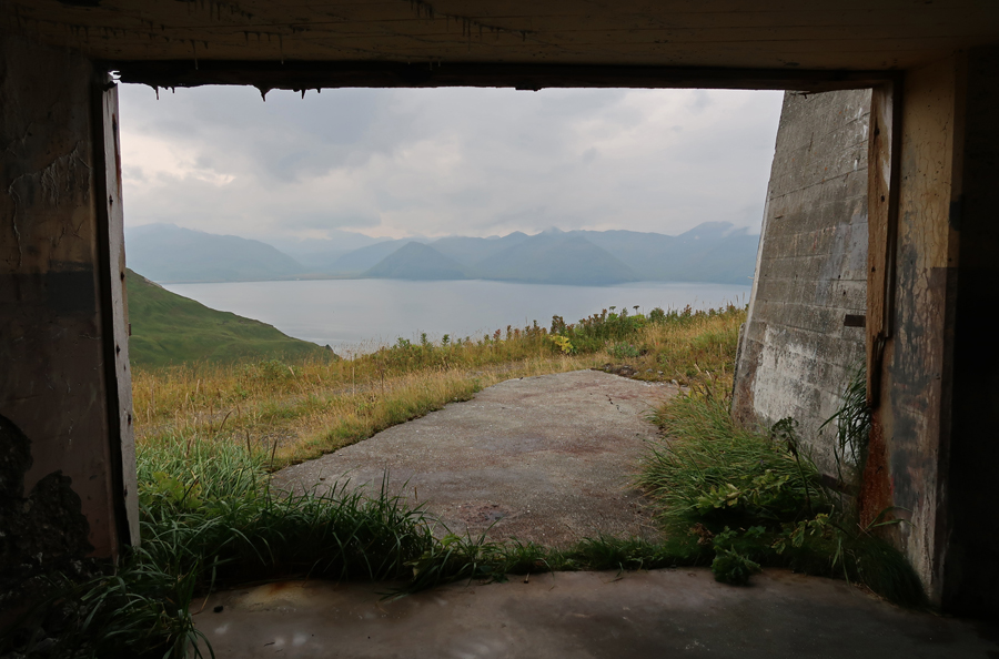
Since it would be light until 10pm, and I was blessed with partial sunshine (unusual here), I hired a Vietnamese taxi driver to give me a two-hour tour of Unalaska. We had to first pick up a local from the grocery store and drive him home and then some men from a fishing trawler and take them to a bar. Then, we were ready for our tour of Unalaska. He was a hoot, telling me in a high squeaky voice his life history. Our first stop was the Unalaska Memorial Park and cemetery.
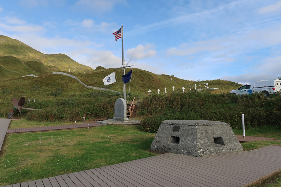
Pillbox lower right, monuments, Iliuliuk Bay, and Mt Ballyhoo (1634ft) in background
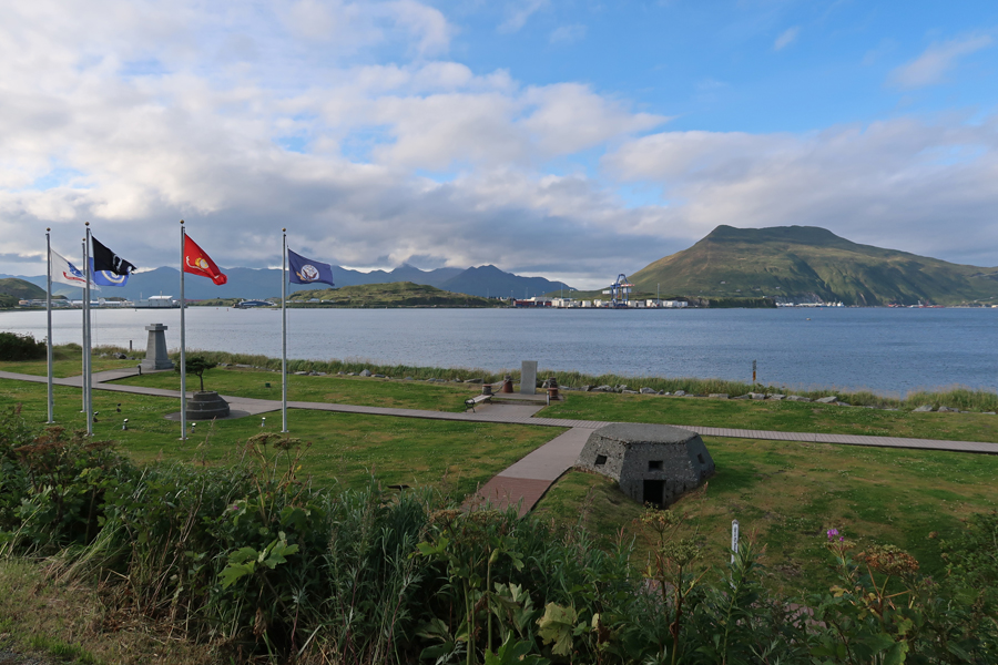
World War II in the Aleutians Monument – to honor Aleut Civilians, U.S., Canadian, and Japanese Military Personnel.
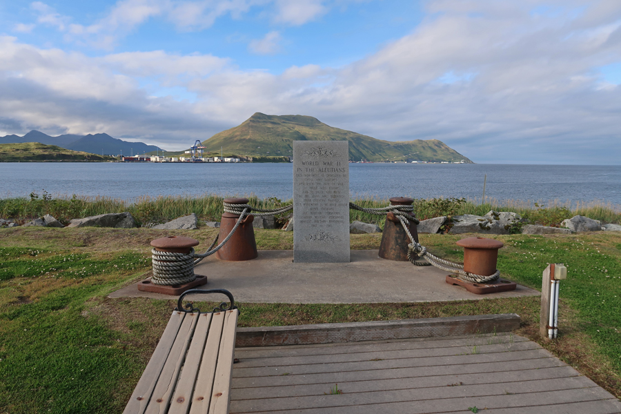
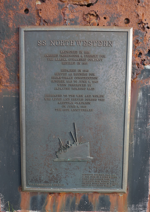
Monument to the men and women who lived and served during the Aleutian Campaign of World War II. The S.S. Northwestern was destroyed during Japanese Air Raids on Unalaska, June 3-4, 1942.
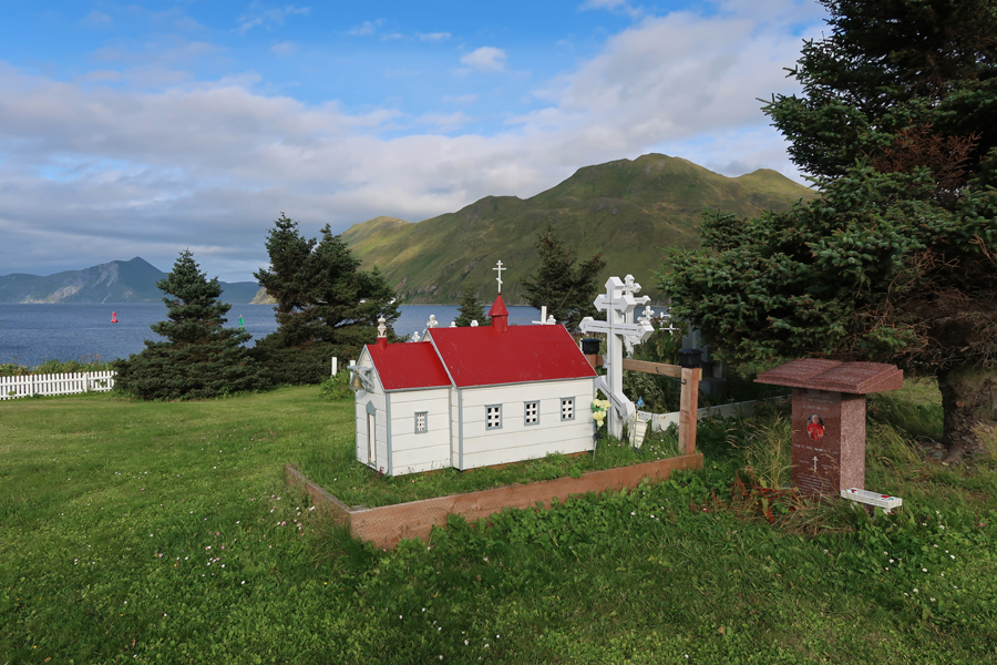
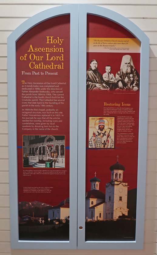
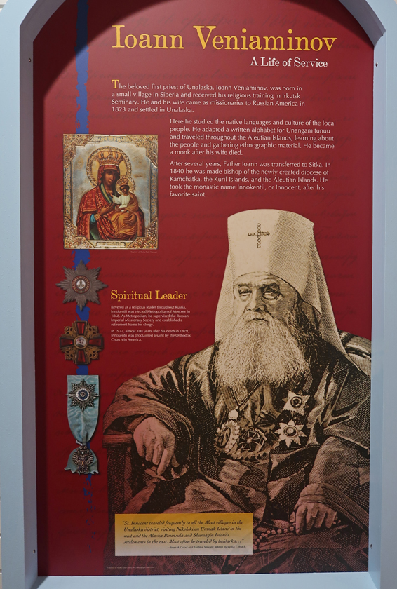
Holy Ascension of Our Lord Russian Orthodox Cathedral – it is the oldest Russian Church (1825 – rebuilt 1894) still standing in the U.S.

YouTube Tour of Unalaska/Dutch Harbor – https://www.youtube.com/watch?v=MraeiImhMH0
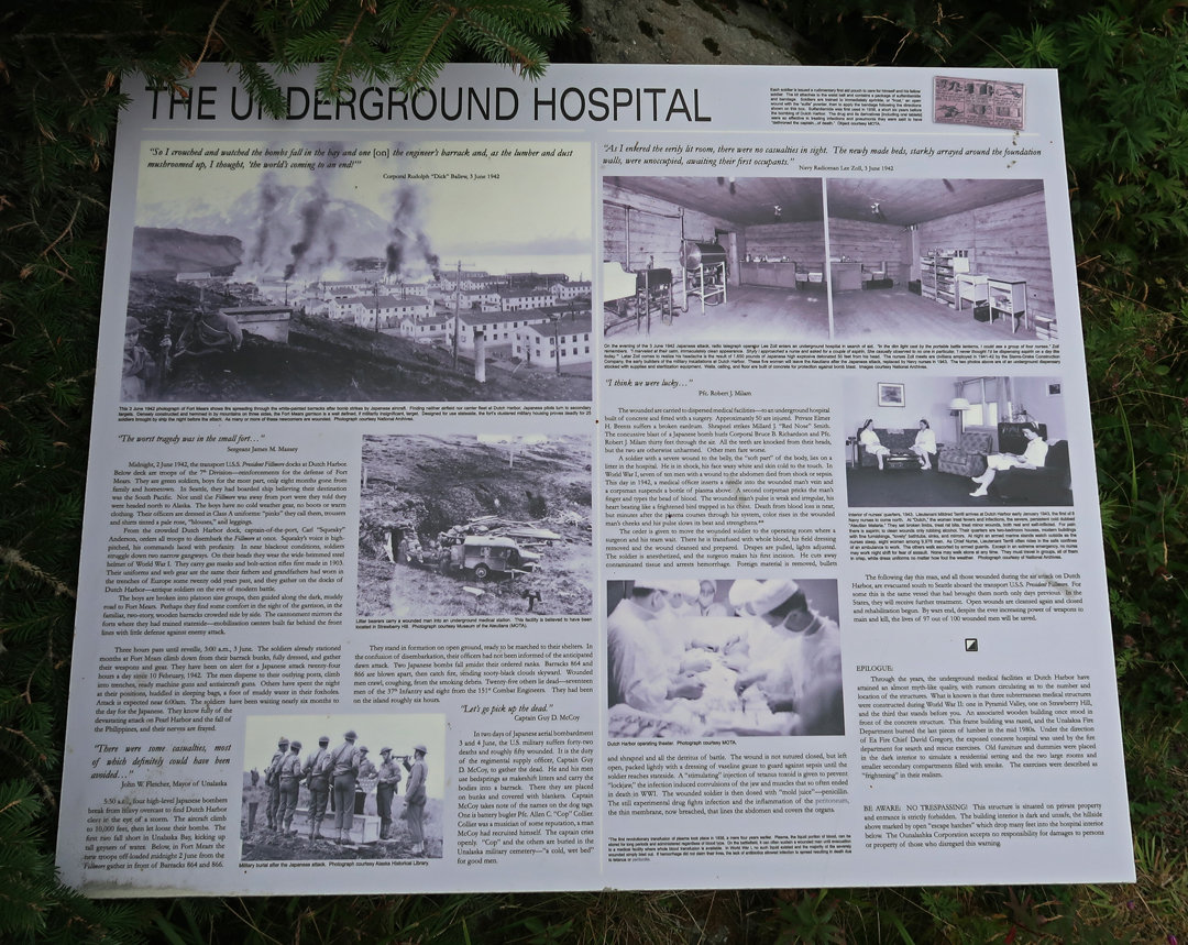
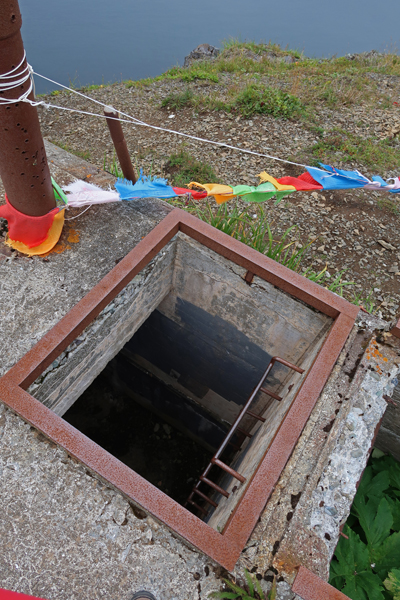
After returning to the hotel, I walked to the U.S. WW II Underground Hospital on Amaknak Island. Back at the hotel, I ordered French Onion Soup, House Salad, Margaretta Quesadillas, and a beer at the bar and ate in my room.

9/6 Tu – The Aleutian World War II National Historic Area, an Affiliated NP Unit, is administered by the Ounalashka Corporation. The administrators and staff went out of their way to accommodate me during my visit. I gave all the ladies T-shirts and John a hooded sweatshirt and mittens for his teenage girls. Laresa, Technical Lands Manager, opened the Aerology Operations Building (1941) Visitor Center at Tom Madsen Dutch Harbor Airport for me at 9am. She helped me plan my day and left me in the care of Sasha (Anastasia) a student assistant, who provided information and served as my photographer.
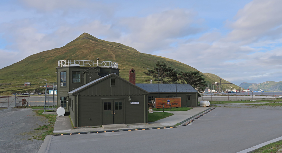
The windows on the octagonal upper floor gave radio operators a 360-degree view.


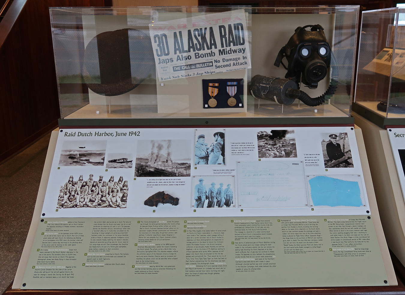
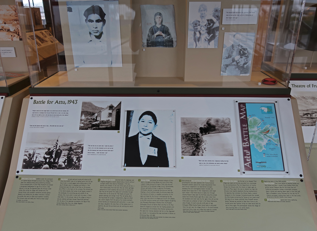
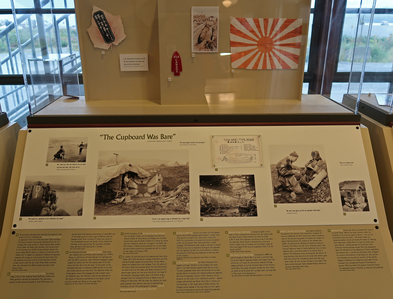
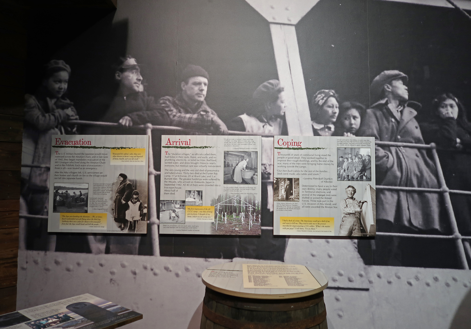
The Visitor Center has excellent displays covering the Japanese attack and occupation of Attu Island and Kiska Island at the end of the Aleutian chain (6-months after Pearl Harbor), the bombing of Unalaska, and the retaking of the islands from the Japanese by U.S. and Canadian forces (1942-43). This was one of the deadliest battles in the Pacific Theater. American casualties were 549 killed, 1148 wounded, 1200 severe cold injuries, 614-disease (including exposure). The Japanese suffered 2351 killed and 28 captured before their withdrawal from the islands. Here are some examples –
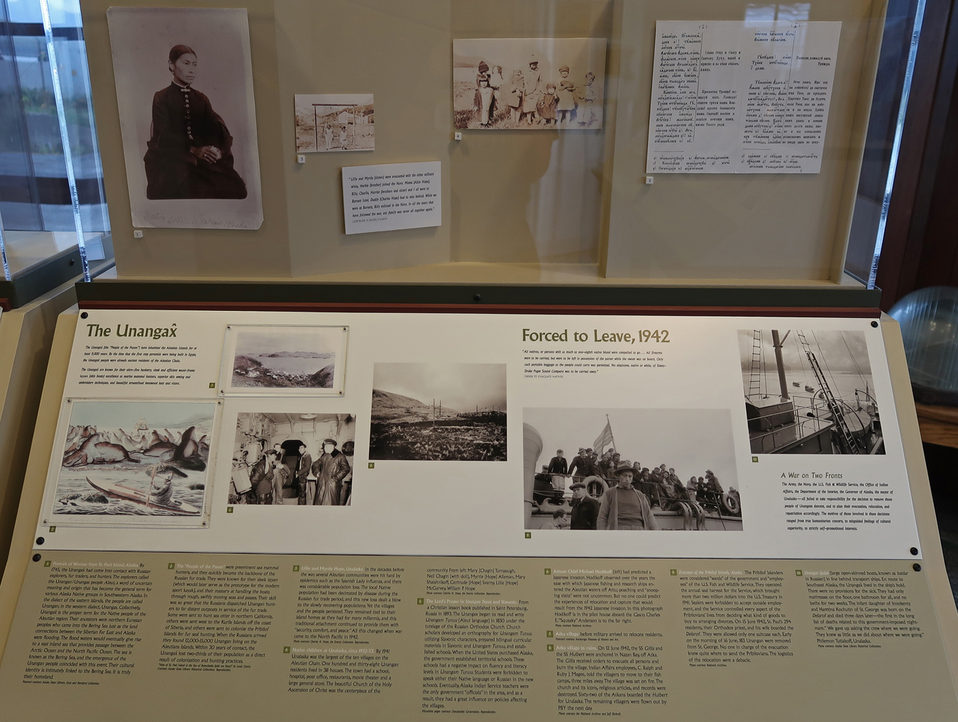
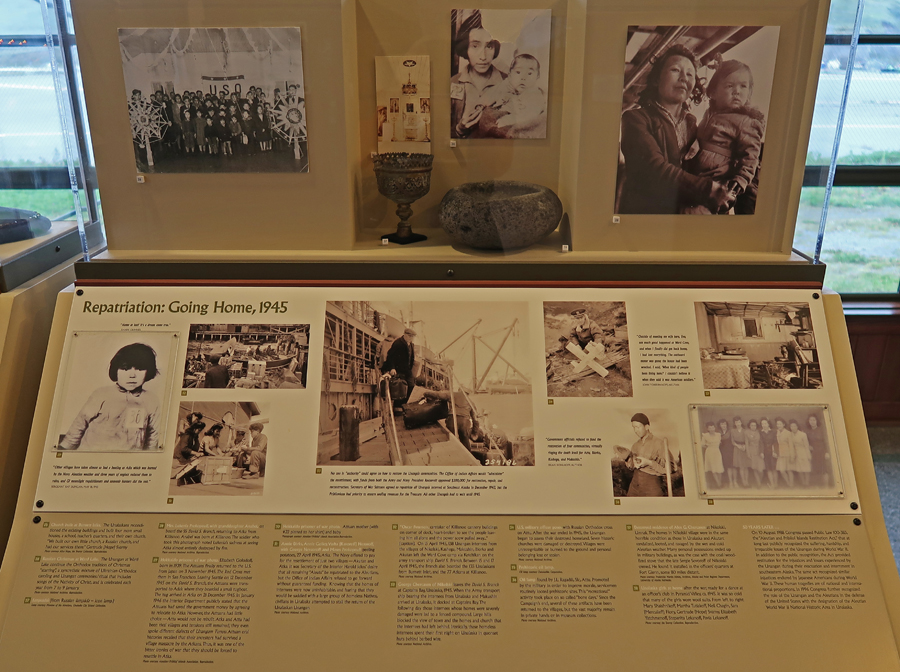
There are also displays describing the forced relocation of the Alaska Native residents from the Aleutian and Pribilof Islands and the hardships they faced during and after the war. Americans have been learning of the forced relocation of U.S. Japanese citizens during World War II for some time. However, few Americans know the story of the forced relocation of Native Alaskans. Here are some examples –
I met Denise, President, as well as Lands, Property & Leasing Manager of the Ounalashka Corporation in her office at 12:30pm. She was the point person for my visit. She explained how the Corporation controlled and administered the land while a native tribal council governed the area. She stated that there was good cooperation but in general the council was against change in the natural environment while the corporation wanted development to increase the standard of living.
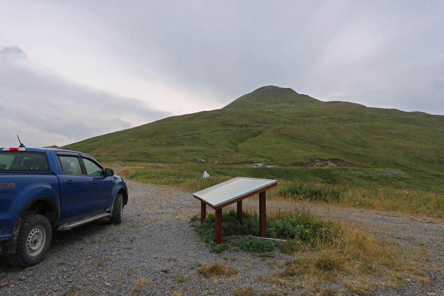
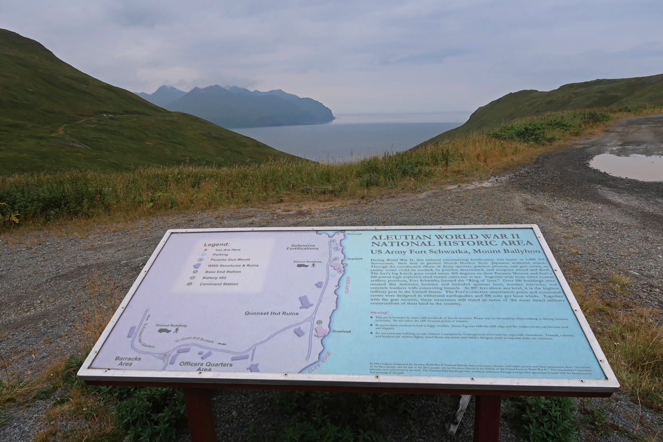
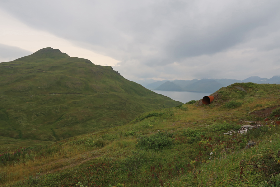
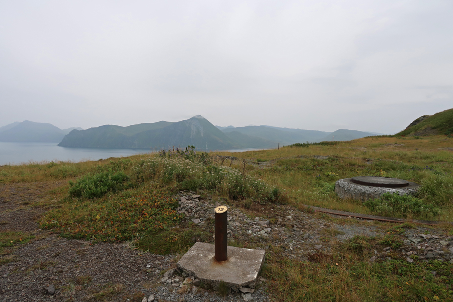
Denise arranged for John, their security guard, a local and former Russian Orthodox Priest (15 years), to drive me up Mt Ballyhoo to Fort Schwatka. The fort and other military installations were built to defend the island during World War II.

Fort Schwatka – cloudy with occasional light rain
Munitions Magazine and Battery Command

Mounts for 155mm Guns
Base End Station for Defense and Observation, the highest defensive battery ever built in the U.S.

Memorials for two teenage girls who died when the car they were in tumbled 900 feet down to the shoreline in 2019. That is why the gravel road to Fort Schwatka now has a locked gate.

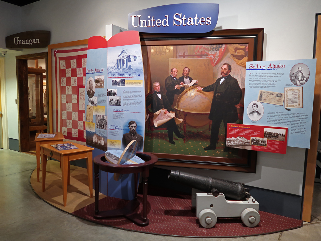
After descending Mt Ballyhoo, John dropped me off at the Museum of the Aleutians in Unalaska.

Excellent displays on Aleutian History

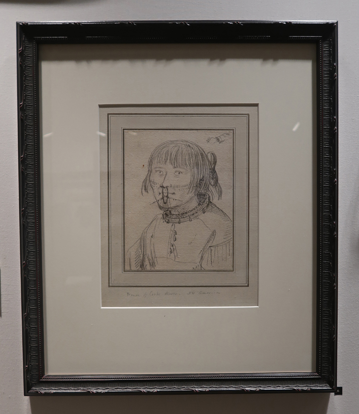
“Woman of Ounalashka” Original pencil sketch by John Weber, artist on Captain James Cook’s 3rd Voyage of Discovery, 1778
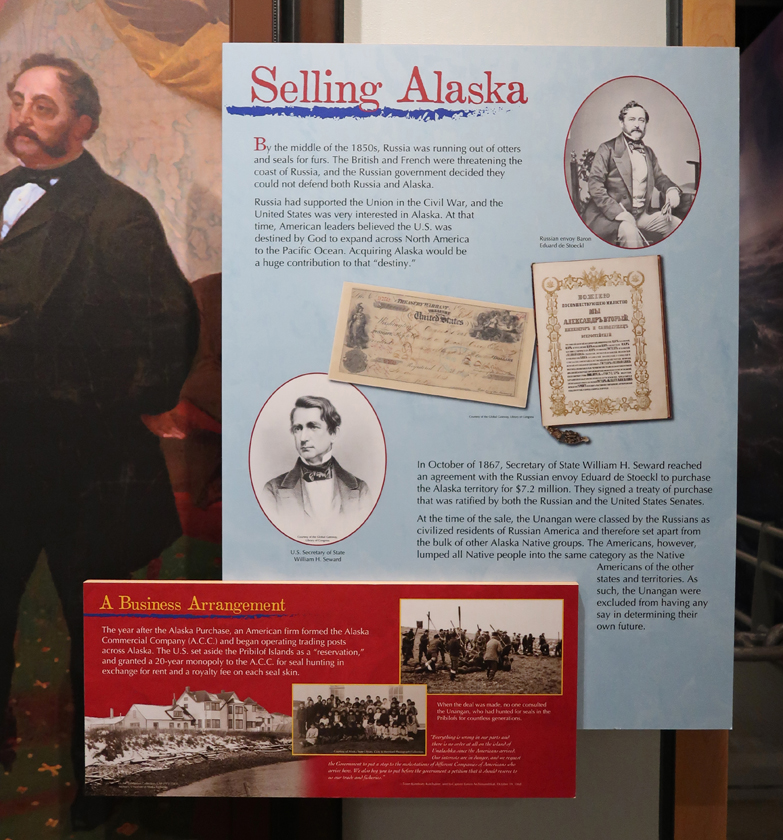
Russia Sold, U.S. Bought Alaska for $7.2 million, 1867 – “Seward’s Ice Box”
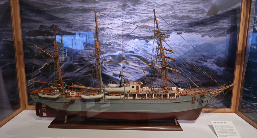
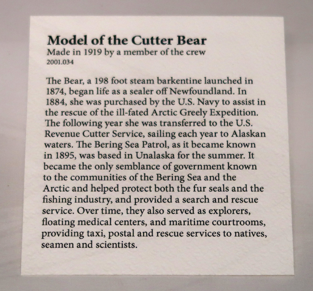
Cutter Bear
YouTube Tour of Unalaska/Dutch Harbor – https://www.youtube.com/watch?v=MraeiImhMH0
Leaving Dutch Harbor on RAVN Air for Anchorage. While waiting, I heard a familiar language. There was a group of about eight Serbian workers who were going home after working for four months in the Uni-Sea fish processing plant. They said the trip would take 1.5 days and, after a break, they would be returning since there was little work available in Serbia.

Returned to the Baymont Inn in Anchorage – this time they had heat!
9/7 W – Took the once daily Alaska Air flight to Utqiagvik (Barrow), arrived at 3:30pm. This was my second visit here – see Blog for September 2020. Upon arrival, I went to the Ukpeagvik Inupiat Corporation (UIC) to check on the cost of a permit to go to Point Barrow, the northern most point in the U.S. I picked up the Land Use Access Permit Application and found that a one-time permit would be $150.

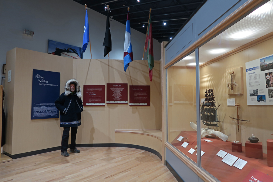
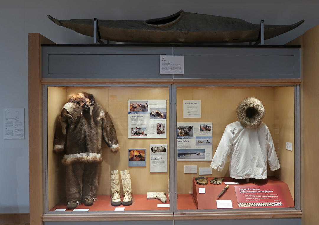
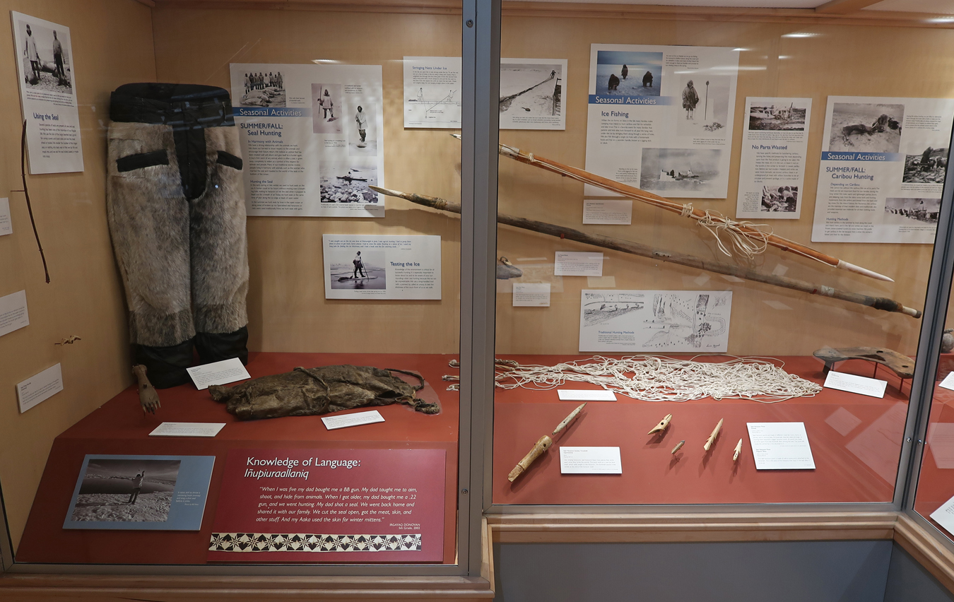
I then took a taxi ($6) to the Inupiat Heritage Center (Affiliated NP Unit) and arrived at 4:30. It is located in the same building as the Tuzzy Consortium Library of Ilisagvik College, the first and only federally recognized tribal college in Alaska. The college web site states that “The basis for all Iḷisaġvik’s educational programs is the rich foundation of a subsistence culture in harmony with the land and seas that give it sustenance.”

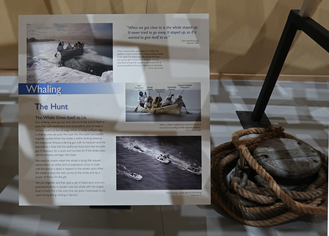
The Center is affiliated with New Bedford Whaling National Historical Park in MA. There were over 2,000 whaling trips from New Bedford to the western Arctic in the 1800s. The whales they were pursuing here were Bowheads. The only baleen whales that spend their entire life near the Arctic Sea ice. Because of their thick bowhead bony structure, Bowheads can break through ice several feet thick to breath. They were prized for their blubber and baleen. The blubber was used to produce whale oil for lamps. New Bedford was known as “The City that Lit the World” – with whale oil. The baleen filter-feeding system inside the mouths of these whales was used for collar stiffeners, buggy whips, parasol ribs, and corset stays because it was both flexible and strong. I only had a half hour to get oriented before they closed but would return each of the next two days to thoroughly view the exhibits and native craft areas.

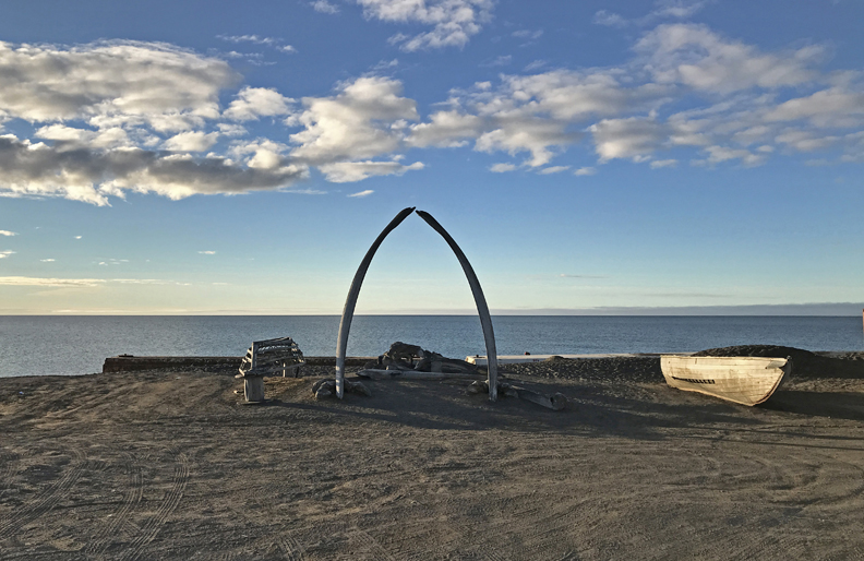
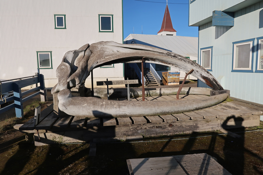
I dropped my bag and backpack off at my room and walked to the Whale Bone Arch near the historic whaling station on the Arctic Ocean (Chukchi Sea).
For dinner I ordered the Reindeer Scrambler at the nearby Niggivikput Restaurant in the Top of the World Hotel. As I sat there, a heavy bank of fog started to roll in off the ocean. By the time I walked back to my room, it had enveloped Utqiagvik.
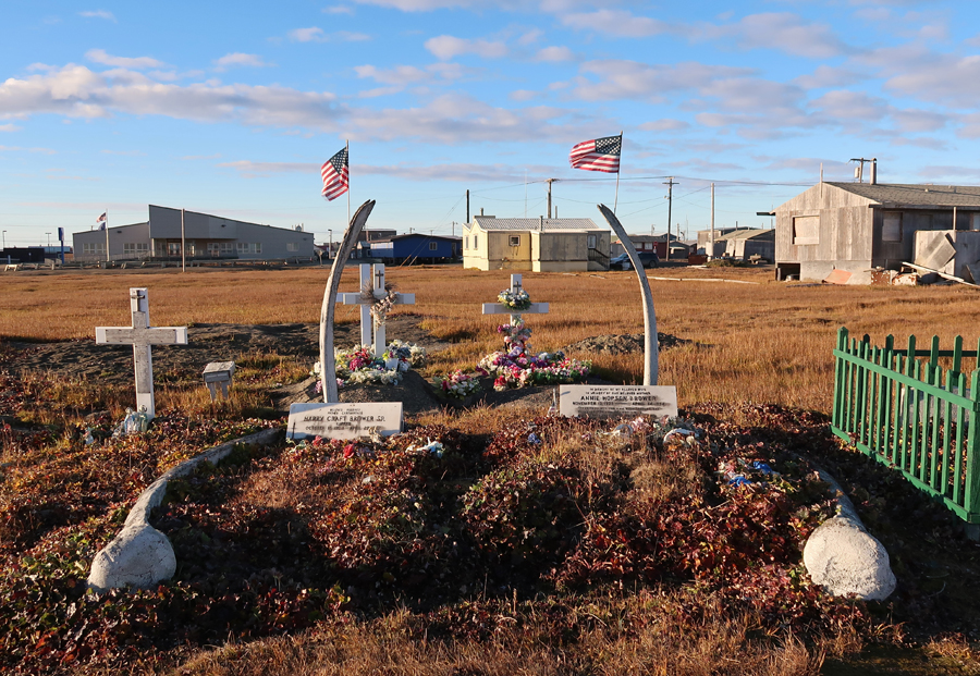
9/8 Th – ate my leftover Reindeer Scrambler for breakfast and then walked to Captain C. Eugene Brower’s home for a 1.5hr conversation. He grew up in a sod house, hunting with his father Harry on the ice. The family later moved into town where he became a leader of the native community. Parents graves in the Browerville Cemetery.
He was a Board Member and President of the native Barrow Whaling Captains Association (BWCA) for over 41 years. According to his 2017 Certificate of Recognition and Honor, “He has had to deal with the toughest, rowdiest and most demanding whaling captains who he has been able to lead . . .” He was Mayor of the North Slope Borough 1981-1984. His grandfather was Charles D. Brower, author of the book Fifty Years Below Zero, and the self-proclaimed “King of the Arctic.”


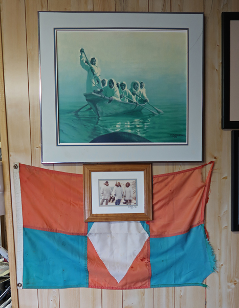
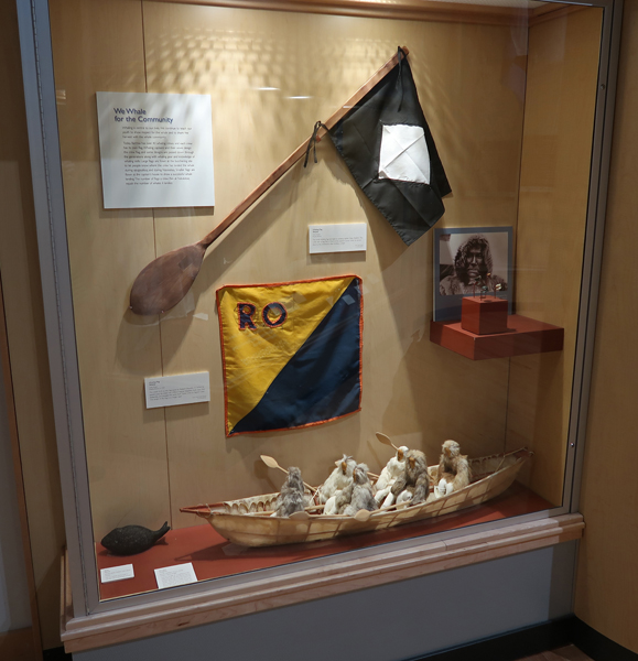
It was an extraordinary experience for me to learn about his life and the native community. Brower Family whaling flag
I stopped at the Stuaqpak (community store) to buy some items for lunch. While eating lunch, I received an email from Alaska Air stating that my 4:40pm flight today was canceled due to fog. Further, they rescheduled me for a flight out in two days with a connection in Anchorage at 3am the following day that would not get me to Seattle until 7:30am on Sunday! What to do? Helen was scheduled to meet me at an airport hotel in Seattle that evening. I was unable to use my phone in Barrow, except for emails and texts, when I had Wi-Fi at my room. I emailed and texted Helen to let her know what had happened but she was already on her way to Seattle.
After lunch, I returned to the Inupiat Heritage Center for more photos and again to inquire about finding a driver to get to Point Barrow. The Center emphasizes the history, culture, and subsistence lifestyle of the Inupiat. “We are Inupiat – We are Whalers.” These are the values of the community:
Love and Respect for Elders and for One Another
Respect for Nature
Knowledge of Family, Kinship, and Roles
Sharing
Knowledge of Language
Cooperation
Having a Sense of Humor
Knowledge of Hunting Traditions
Compassion
Humility
Avoidance of Conflict
Spirituality
The following are examples of some of the displays:


I also went to the Stuaqpak and asked employees there if they knew anyone who could drive me to Point Barrow. I received some phone numbers, but they were dead ends.
At 10pm I received a text from Helen stating she was at the Comfort Inn and was waiting for me. She had not read my email or text! I was able to borrow a phone to call her – she was not happy with the news. We decided that she would ask Vera if it was OK to arrive two days early. If so, she would pick up our rental car the next day and drive to Portland. In the meantime, I would cancel our hotel reservations for the next two days in WA.
I decided to try to get on the Alaska Air flight the next day even if I had to buy another ticket, because the airport could be closed again for one or more days – that happened frequently in Utiqiagvik.
I set my phone alarm for 1am and 3am to look for the Northern Lights – no luck, fogged in.
9/8 Th – Ate the Raisin Bran I had brought with me for breakfast and was back at the Heritage Center at 9:30am, again looking for a driver to take me to Point Barrow. I was given two names and told I could try to contact them on Facebook. As stated, my phone was not working but one of the contacts was Deano, Eugene Brower’s son-in-law. So, I walked to Eugene’s house for the phone number. I caught him getting in his truck. Eugene called Deano and he agreed to meet me at Latitude 71 at 11:30 for the trip to Point Barrow.
I continued walking, again through the Browerville Cemetery and then around the Isatkoak Lagoon. Note the big vinyl bags (filled with gravel) and the berm built to try and stop wave erosion on the coast.
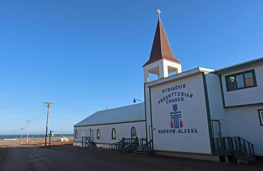
The highpoint of Utqiagvik is 30 feet at Cape Smyth, where the Presbyterian Church and the main parts of town are located.
My next stop was the Administration Building for the North Slope Borough.

I continued to the airport and the Alaska Air building. There was one person there. I asked if I could change my Seattle flight to today. She said I could if I paid extra for preferred seating. She also booked me on a better flight out of Anchorage to Seattle the next day. I now had to reserve a place to stay in Anchorage for this evening as well as in Seattle.
I walked back to put on all my warm clothes for Point Barrow. Deano was there early, cleaning the windows of his four door 4WD Ford pickup. We drove out Stevenson Street along the Chukchi Sea, past llisagvik College. The College is located at the Naval Arctic Research Laboratory (NARL) area, with the Barrow HS Football Field, and the U.S. Air Force Long Range Radar Site nearby.
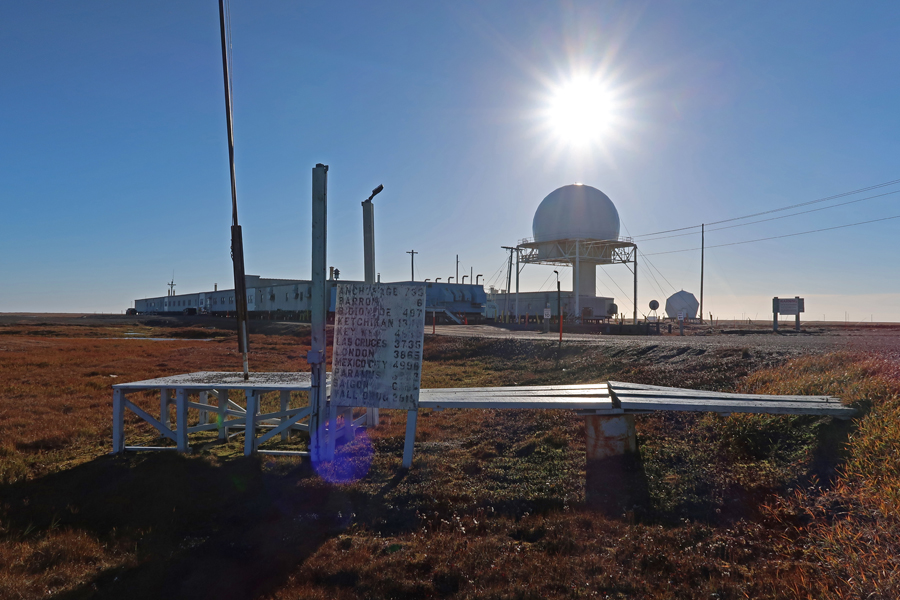
This site was part of the Distant Early Warning (DEW) Line built in the 1950s and active during the “Cold War.” In 1990, the Point Barrow DEW site became part of the North Warning System (NWS), which is administered by NORAD.
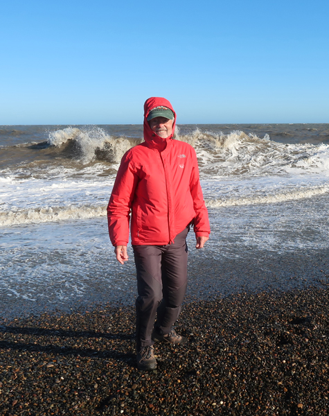
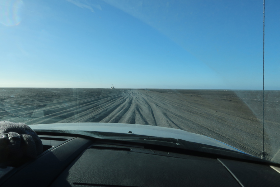
We stopped at the end of the gravel road to deflate the tires to get better traction as we started on the track leading out to Point Barrow. It was below freezing in the morning, but the sun came out taking the temperature up to the mid-40s making it a very good day for this excursion. Still, the wind chill made it feel like the mid-30s.
There is a tall tower (pole) at Point Barrow near the northernmost point of the U.S.

As we walked along the beach, Deano used the GPS on his phone to find the precise location of the northernmost point. Deano said he brings his family out here at least once a year to walk the beach. They have found old boat parts such as copper nails and parts of a brass stove. Deano with whale vertebrae.
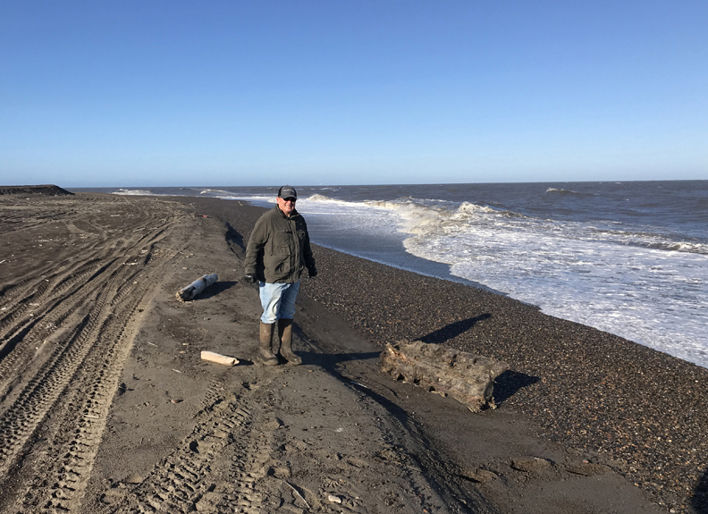
I walked out as far as I could, without getting my shoes submerged, to stand at the northernmost point.
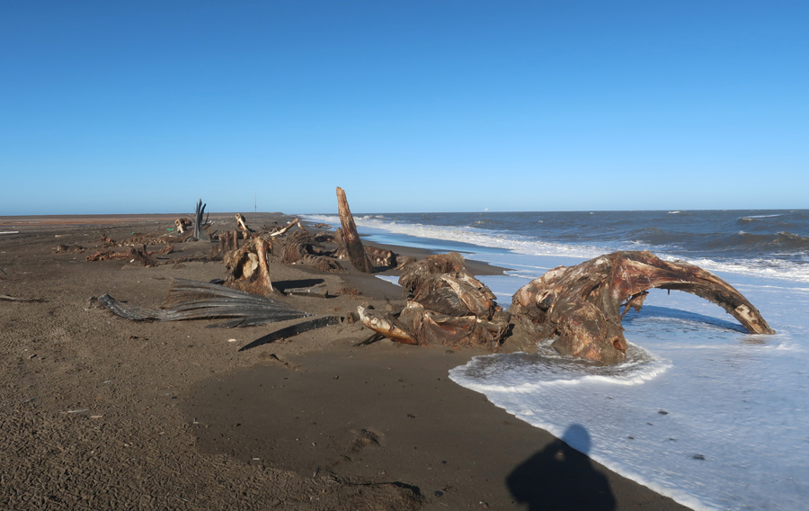
We then drove a bit further to where the whalers leave whale bones to attract polar bears and thereby keep them away from whaling operations.
As we returned, Deano tried to maintain momentum as we slid, swerved, and bounced, sometimes hitting bottom, along the rutted track. We had to stop several times because the truck radiator was boiling over under the stress of pushing through the sand. I was concerned that the truck might break down or get stuck, causing me to miss my flight later in the day.
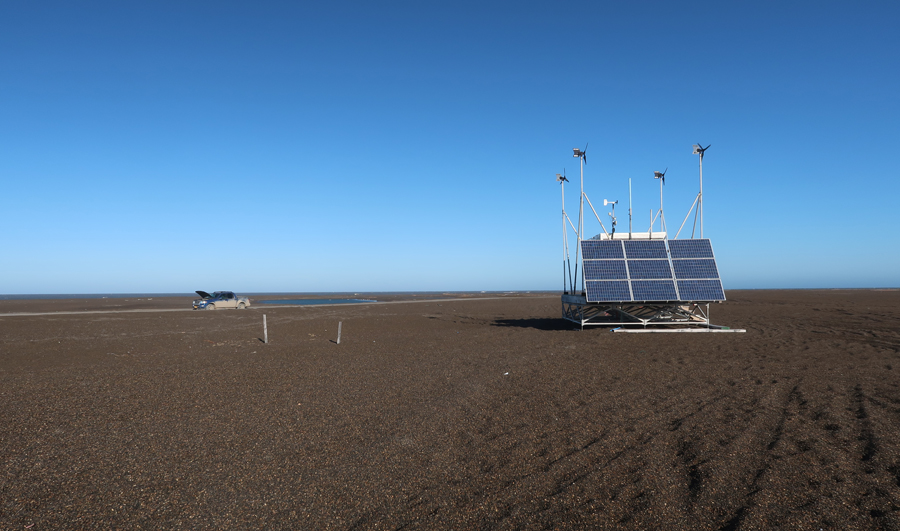
Cooling the engine near a solar powered weather station
Satellite view of the ice breakup along the Chukchi Sea in 2009. Point Barrow is at the upper right of the image. Point Barrow is where the Chukchi Sea meets the Beaufort Sea. Both are seas of the Arctic Ocean.
Deano dropped me off at my room in Browerville. After a mix-up with rides/taxis, I finally got to the airport at 4:20. They pulled me out of line at security because of the hiking stick in my backpack and crampons in my suitcase. It took me awhile to convince them that the items should be permitted on the plane. It was a good thing that the 737 was already at the airport because the fog was again rolling in off the Arctic Ocean. The plane took off in the fog and arrived in Anchorage at 7pm. I got the McDonald’s Special of two quarter pounders for $7 and ate them while I walked to the shuttle area. Took the shuttle to the rundown two-star Ramada Inn downtown – the price was right ($129). But you get what you pay for – the first room they gave me did not have heat. The card key did not work for the second room, but I took it anyway after an employee let me in.
I connected to Wi-Fi, caught up on my emails and text messages, and then spoke to Helen. We agreed she would pick me up Sunday morning at 10am at the Four Points by Sheridan near the Sea-Tac airport.
9/10 Sat – stayed in bed until Helen called at 8am. I then walked to the Salmon Viewing area on Ship Creek where they were having “The Great Alaska Duck Race,” a fund raiser for many Alaskan Non-Profits. Hilton Hotel is right center.

Continued my walk past the Alaskan RR Station and up to the Eisenhauer 50th State Memorial.
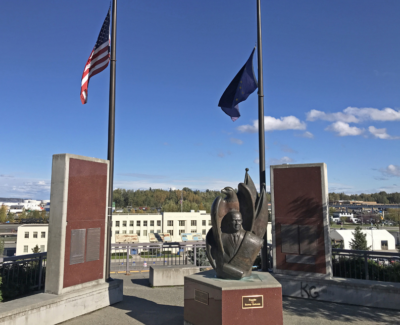
Anchorage history

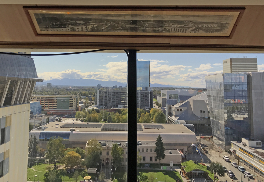
I continued through downtown to the Coastal Trail along the Knik Arm of the Cook Inlet looking for a view of Denali. On the way back, I stopped at the 22-story Hilton Hotel and asked if I could go up to the top floor where there is an event room and an outdoor viewing area. I was told it was closed but they would call security to take me up. I could just barely make out the base of Denali, top covered in clouds but could not get a good photo. Here is a photo of downtown, note the picture above the window of Anchorage before the earthquake.
Took the Ramada shuttle to the airport, had another salmon sandwich and beer as a parting Alaska treat before boarding my flight to Seattle. Alaska State Seal at airport –

Arrived at SEA-TAC Airport at 10pm and took the shuttle to the Four Points Sheraton.
