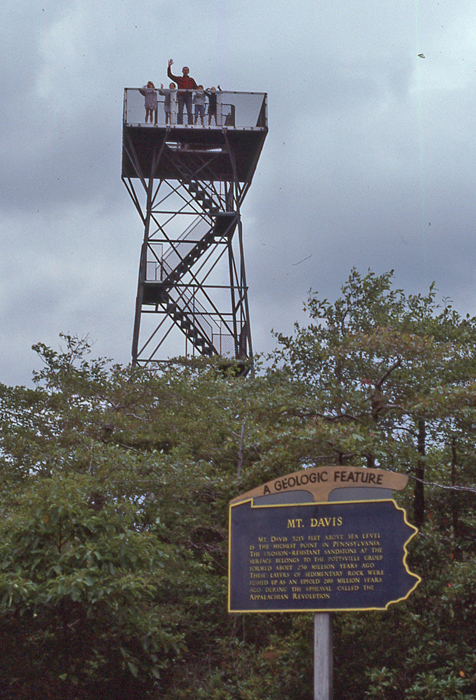
This was our second visit to Mount Davis – Highpoint of PA (3,213ft). Our first visit was in 1989 with Kate and Chad and their friends David and Jessica. Here we are on the tower – Helen took the photo.
1989
This is the marker on top of the tower
1989
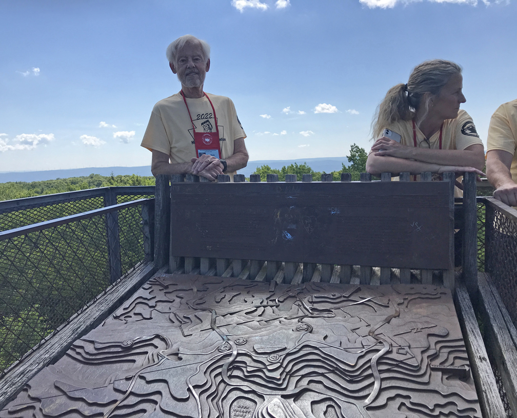
Helen and I visited again on 6/25/2022 when we were attending the Highpointers Konvention at Seven Springs Mountain Resort in PA. We arrived at the highpoint at 11am, took photos, climbed the tower, and spoke to other highpointers who were there for the Konvention Watermelon Feast.
2022
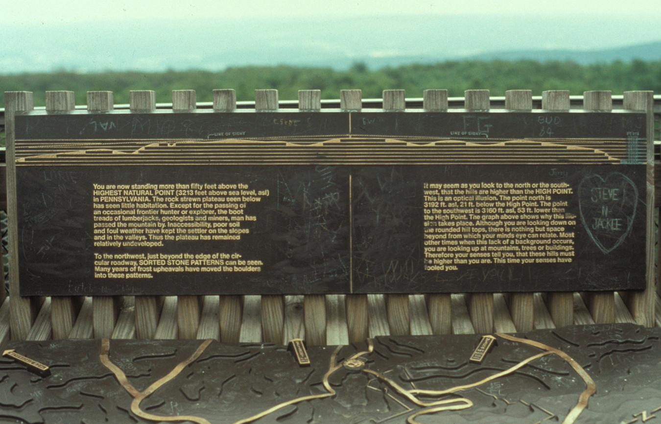
Note the weathered marker on top of the tower. There is a project in process to upgrade the signage at Mt Davis.
4/14 Th – I arrived in LA last night after a 4500-mile road trip from OH – see previous post for May 2022. Today, our friends Ron & Pat from Mercer Island WA visited. They are Kate’s godparents and Ron was my best friend growing up in Chicago.
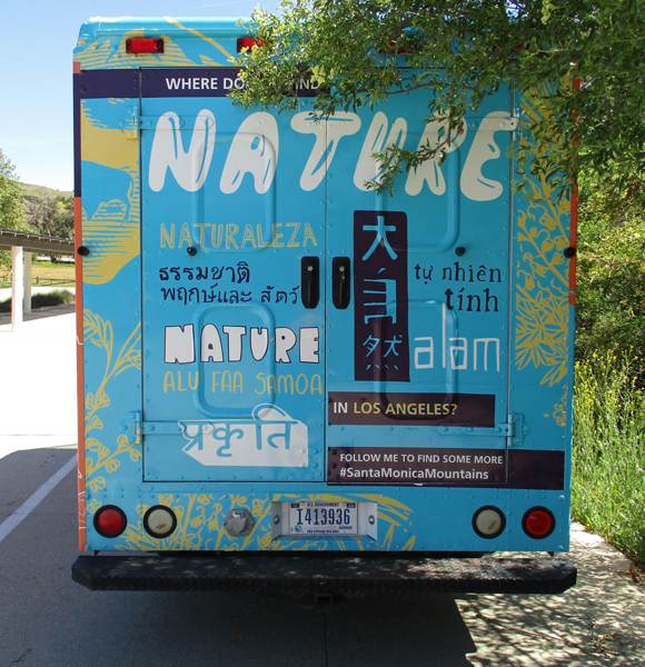
4/15 F – outing to Santa Monica Mountains NRA. Our last visit was October 2015 – see Blog.
“Nature in Los Angeles?”
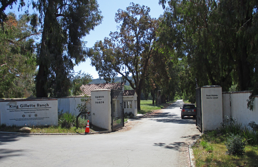
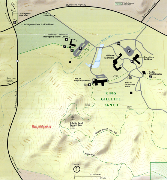
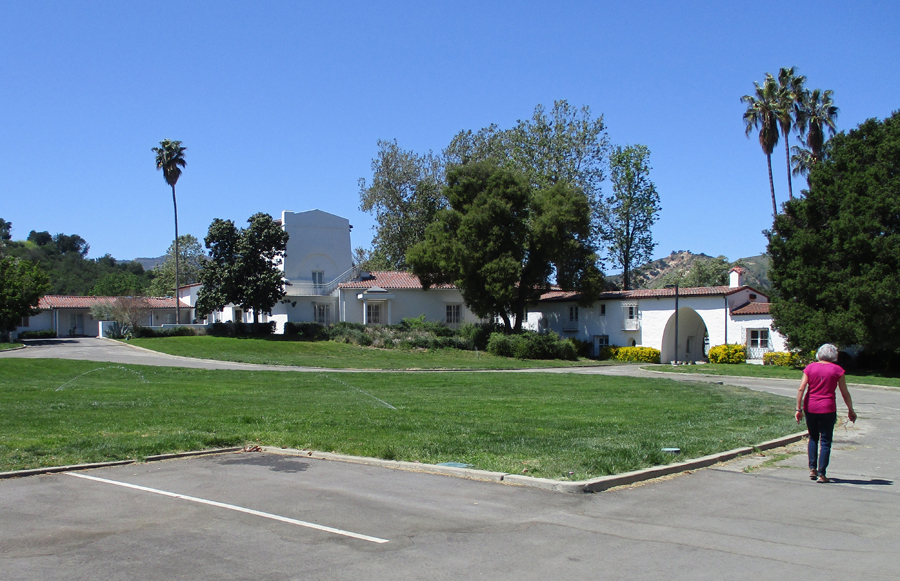
We started at the Visitor Center, which was formerly the horse stable for the King Gillette Ranch.
The Urban Wild
Thriving in the Suburbs
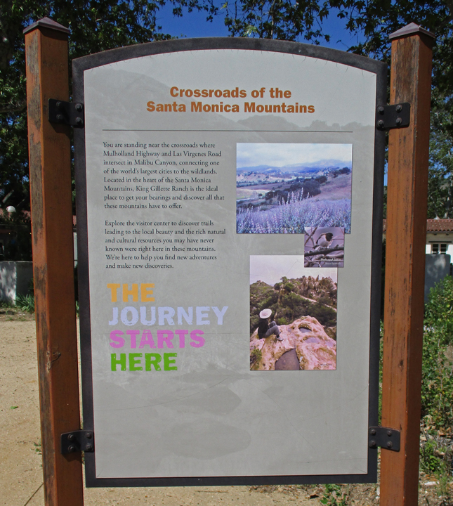
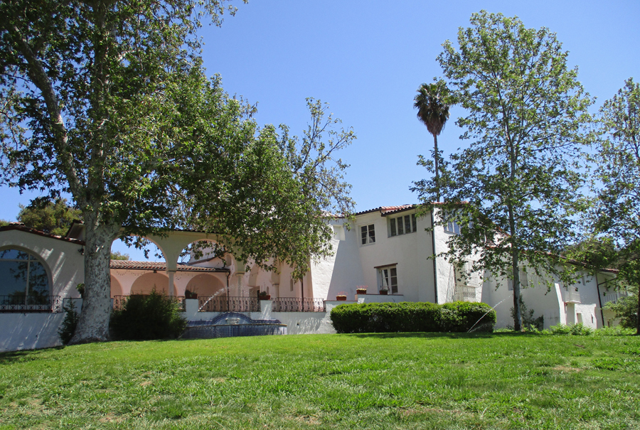
The 588-acre King Gillette Ranch is managed by the Mountains, Recreation, and Conservation Authority (MRCA).
We hiked to Inspiration Point for an overview of the property and Santa Monica Mountains
And then walked around the Gillette Mansion grounds. The Spanish Colonial Revival style mansion and other structures were built in the 1920’s for razor magnate King C. Gillette. They were all part of a landscape plan including tree lined entry, pond, formal courtyard, terraces, bridges, and lawns.
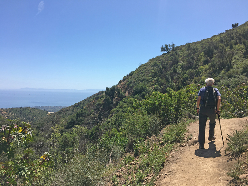
4/15/2022 F – Photo of Channel Islands from Hot Springs Canyon Trail in Los Padres National Forest (north of Santa Barbara)
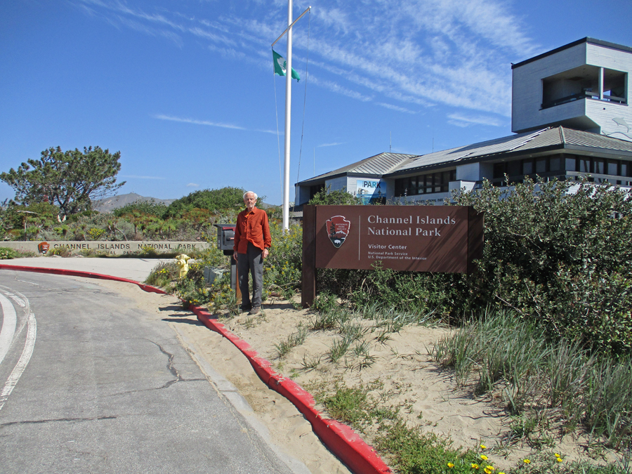
Took us about 1.5 hours to get from Silver Lake to the Robert J. Lagomarsino Channel Islands NationalPark Visitor Center at Ventura Harbor. Helen and I had visited here in August 2008 before we did a three-day kayak trip to four of the eight Channel Islands – see Blog. Note the viewing area on top of the Visitor Center. They have scheduled Ranger Dives from the islands that can be viewed live at the Visitor Center. Like an underwater campfire program!
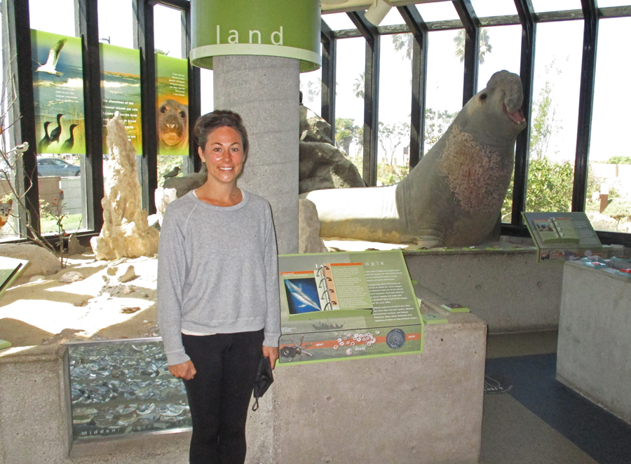
Nice model showing the eight Channel Islands. The islands were never part of the mainland – they are the easternmost islands in the Pacific Island group. “Today, five of the islands (San Miguel, Santa Rosa, Santa Cruz, Anacapa, and Santa Barbara), their submerged lands, and the waters within one nautical mile of each island are protected as Channel Islands National Park.” The Channel Islands National Marine Sanctuary extends six miles from the shore of each island. This land/water area is “. . . home to over 2,000 species of animals and plants – 145 are found nowhere else on Earth.”
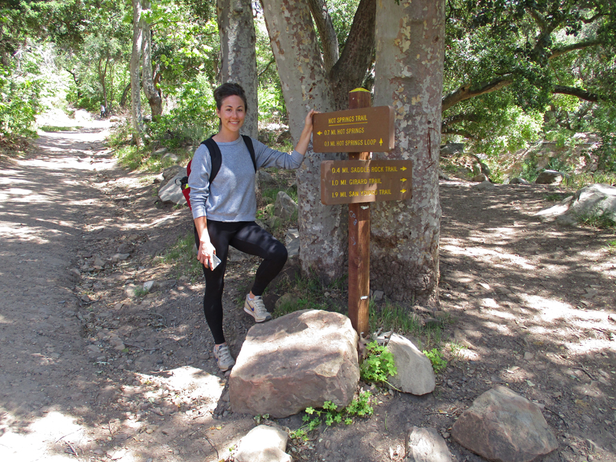
After IN-N-OUT Burgers, Kate directed us to the trailhead for the Hot Springs Canyon Trail in the Ynez Mountains near Montecito CA.
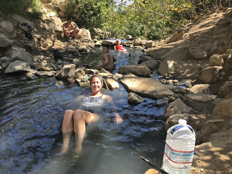
It was a 3.7-mile rt hike (1,177ft gain) to a series of small pools fed by a hot mineral spring
2022
2022
2022
The water temperature went from very hot in the top pools to moderately hot in the lower pools
Dinner at Bacari in Silver Lake
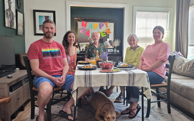
4/16 Sa – shopping, games, preparing for Easter. Also, oil change – discovered I had a leaking axle seal that had damaged the brakes, arranged to have repairs done at garage around the corner from Kate on Monday. Kate now has a second dog – Greta
4/17/ Su Easter – returning from Easter Mass at St Francis of Assisi RCC, note Hollywood sign and Griffith Observatory in background
Heather had treated Peter to a So-Cal Holiday for his birthday and they joined us for a wonderful lamb Easter dinner at Kate’s
Followed by the traditional Cracking of Eggs
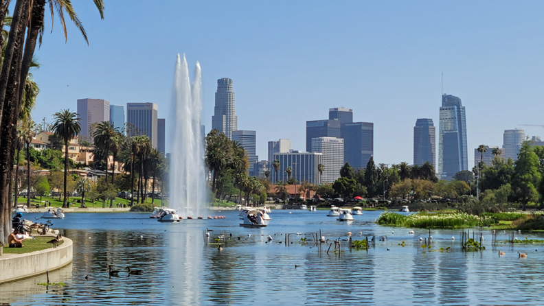
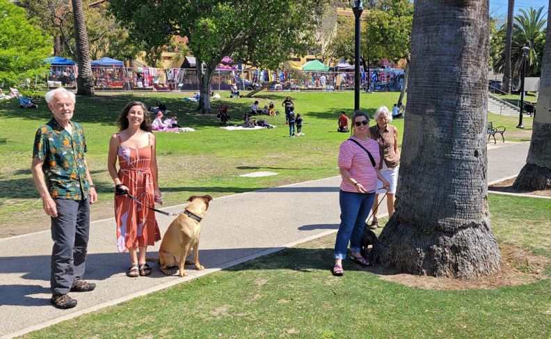
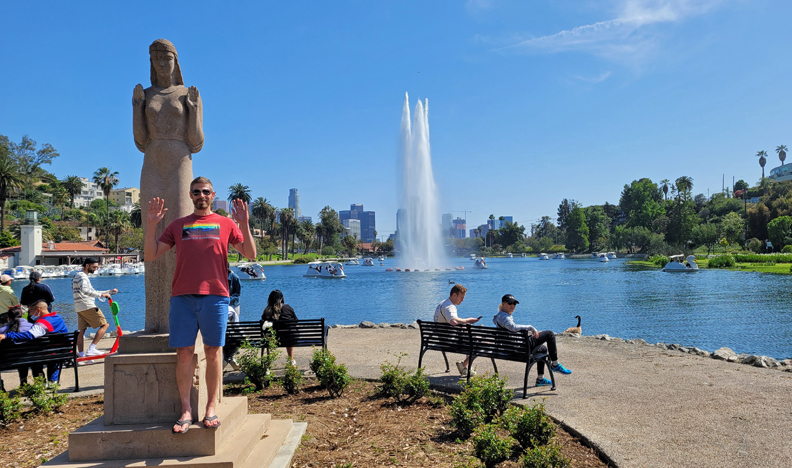
After meal walk in Echo Park
“Lady of the Lake”
Celebrated Peter’s 49th birthday – Kate gave him 49 scratch-off lottery tickets!
4/18/ M – with Kate. $2,300 for brake and axel seal repairs on Sequoia, got it back at sundown. This was great because it allowed me to continue my trip on schedule.
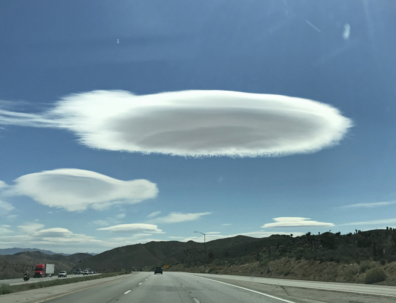
4/19 Tu – Dropped Helen off at the Burbank airport for her flight home and started my drive to UT. Found this flying saucer cloud outside of Las Vegas. Don’t text and drive – note, I am in the middle lane with no one around me!
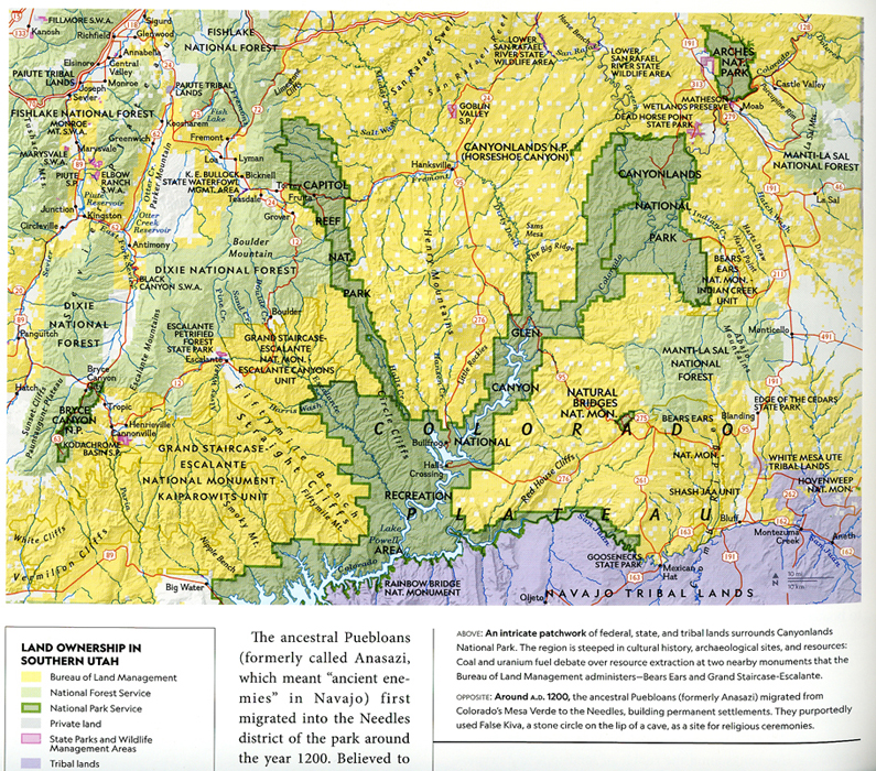
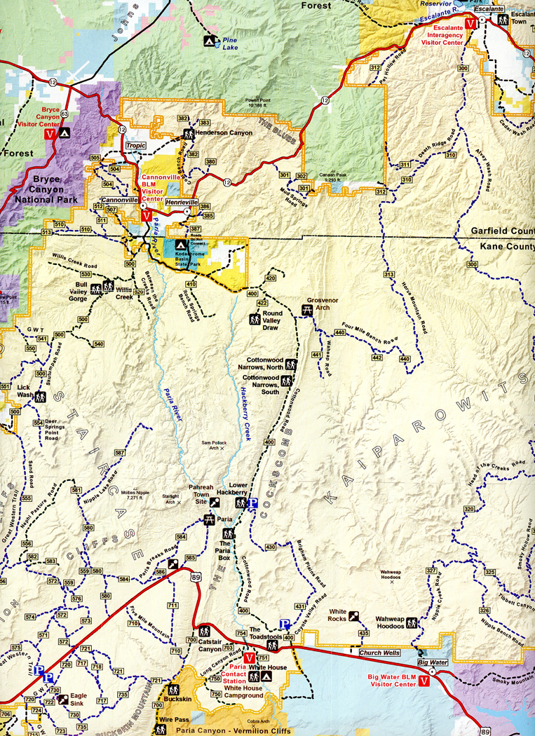
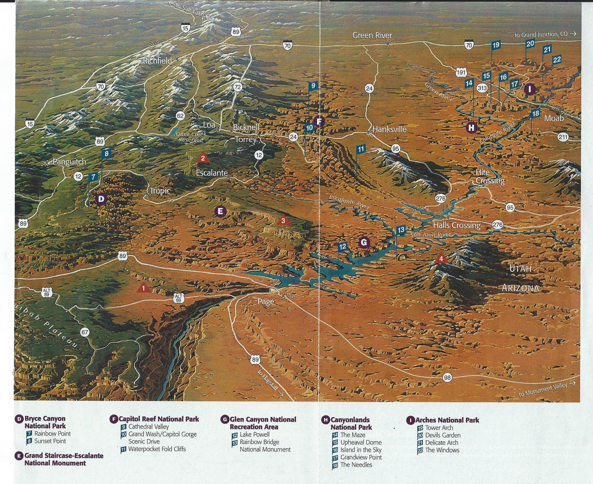
It was a 535-mile drive to Bryce Canyon NP. Note the location of Bryce Canyon on the lower left of this map, and its relation to other protected areas in Southern Utah.
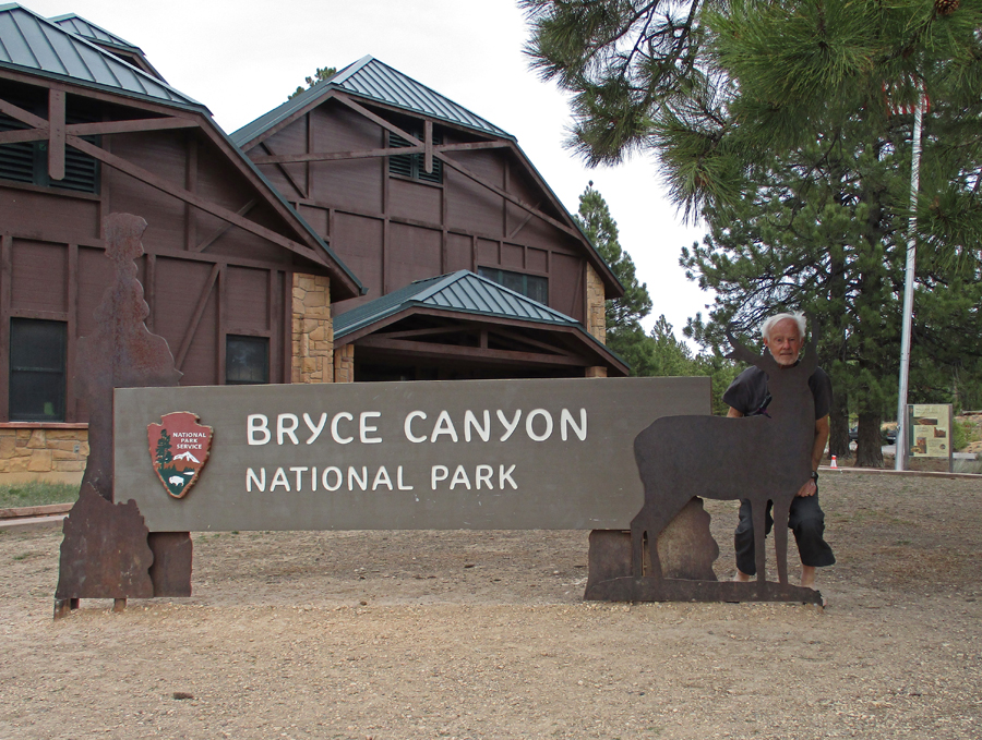
I arrived late afternoon. My first stop was the Visitor Center –
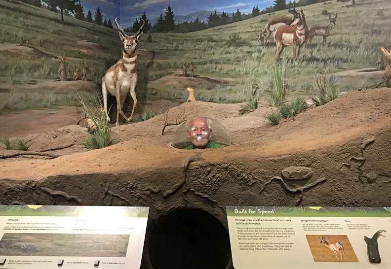
Getting oriented
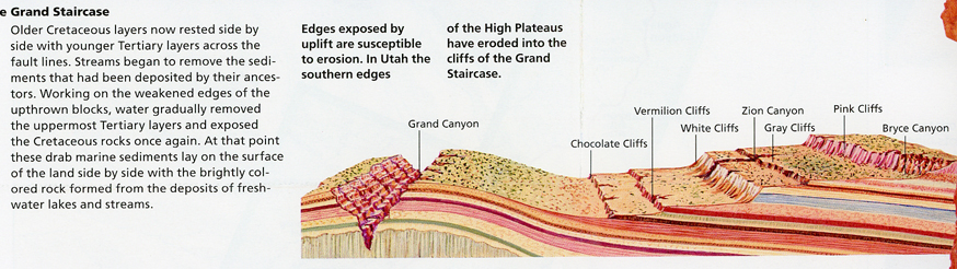
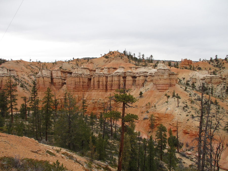
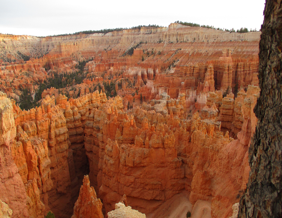
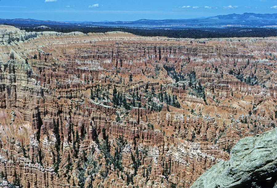
The Grand Canyon is at the bottom and Bryce Canyon is at the top of the “Grand Staircase.” This region is my favorite part of the contiguous 48-states.
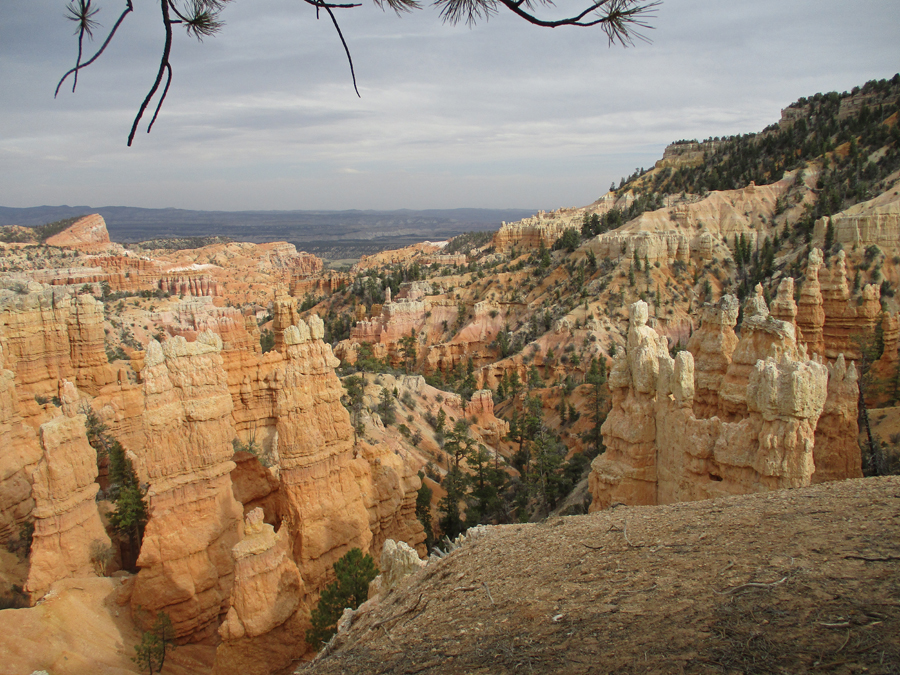
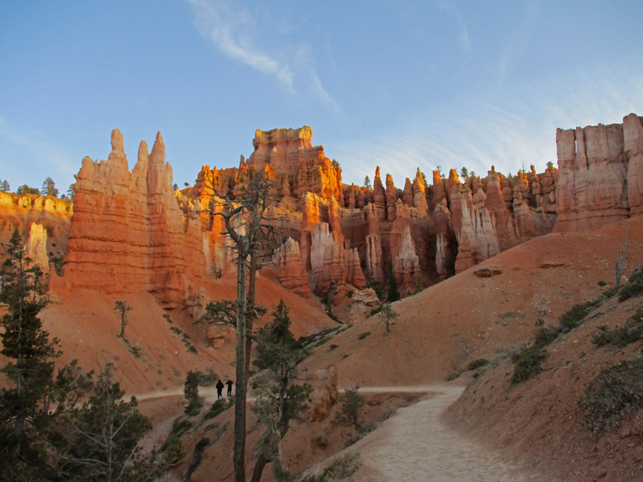
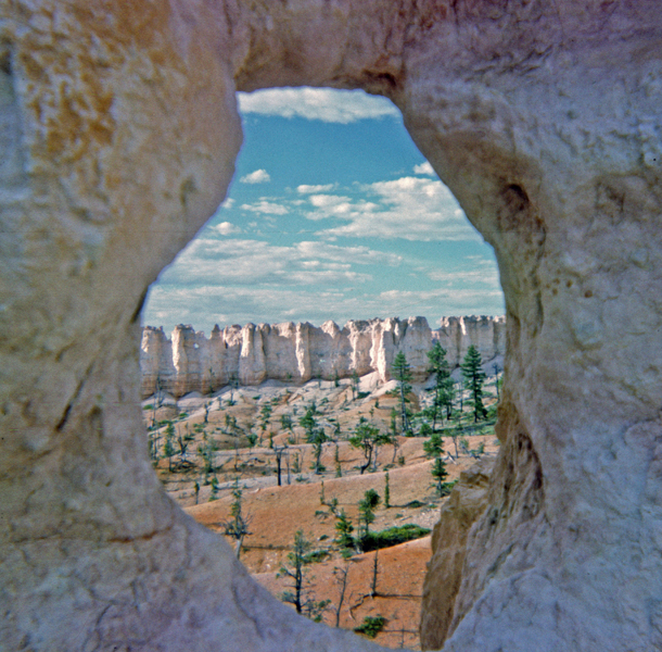
Fairyland Point Overlook
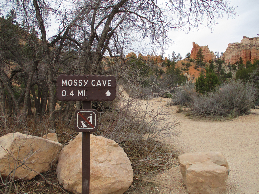
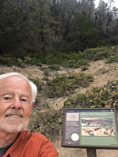
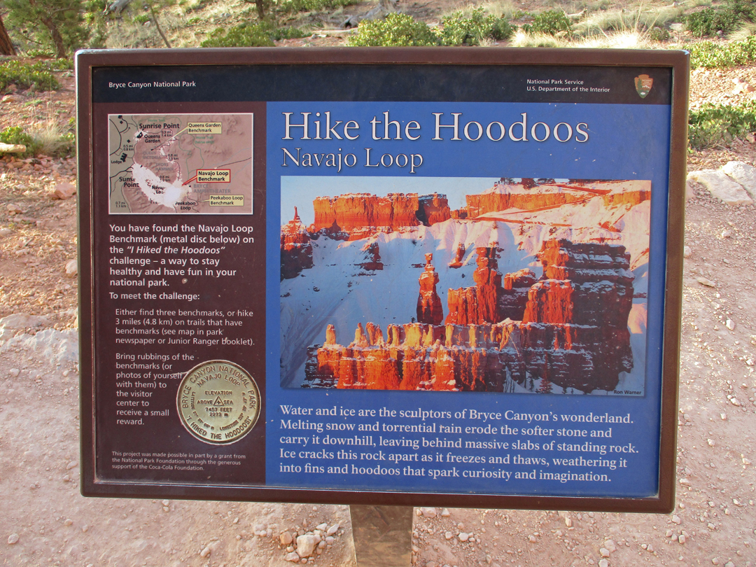
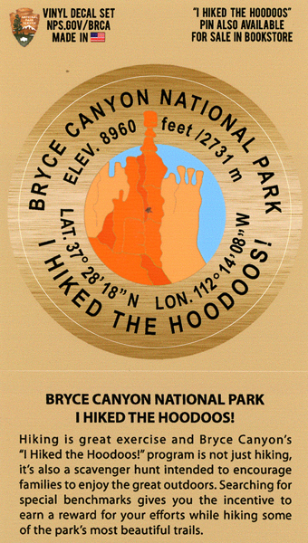
I decided to do the “Hike the Hoodoos” challenge. There are nine benchmarks located along eight different hiking trails in the park. A minimum of three miles of hiking is needed to get an “award.” In order to “prove” you completed this task, you need to take photos or rubbings of three of the nine medallion benchmarks. I started with a hike to Mossy Cave, which is off Rt 12 in the northern part of the park.
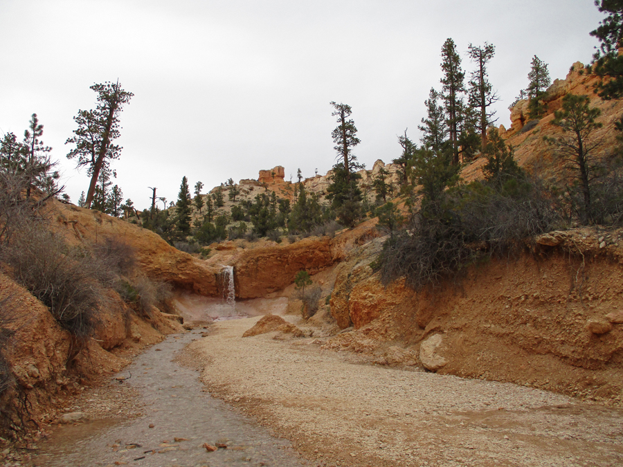
Along the way I took a side trail to a waterfall on the “Tropic Ditch,” a 1892 Mormon irrigation canal that brought water to the town of Tropic
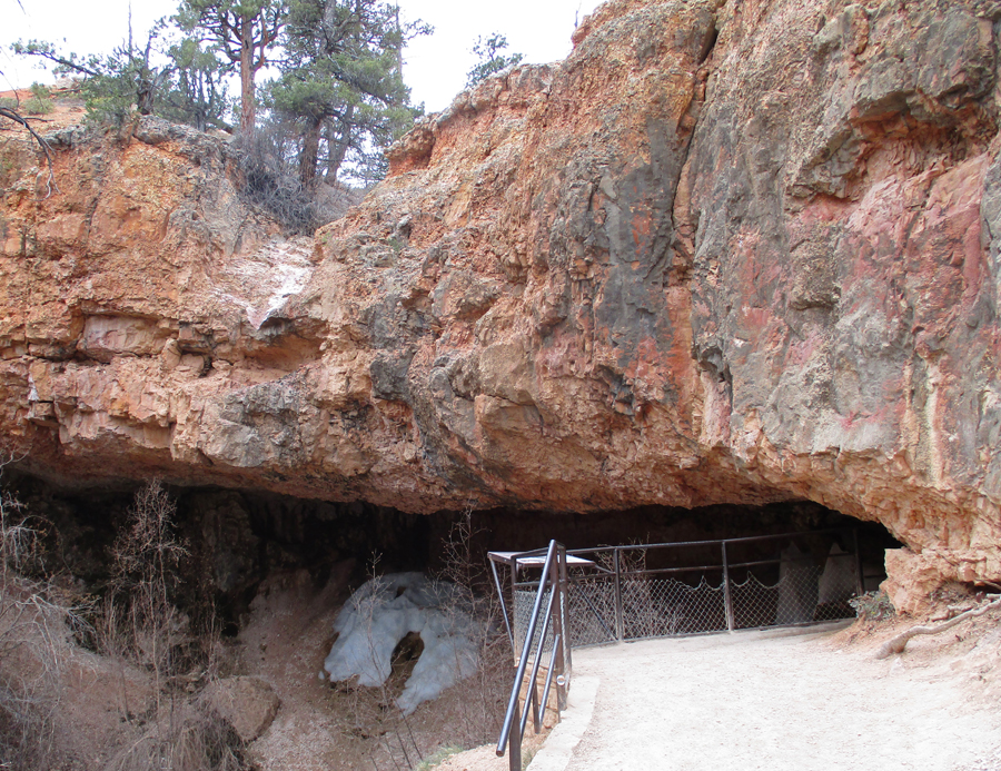
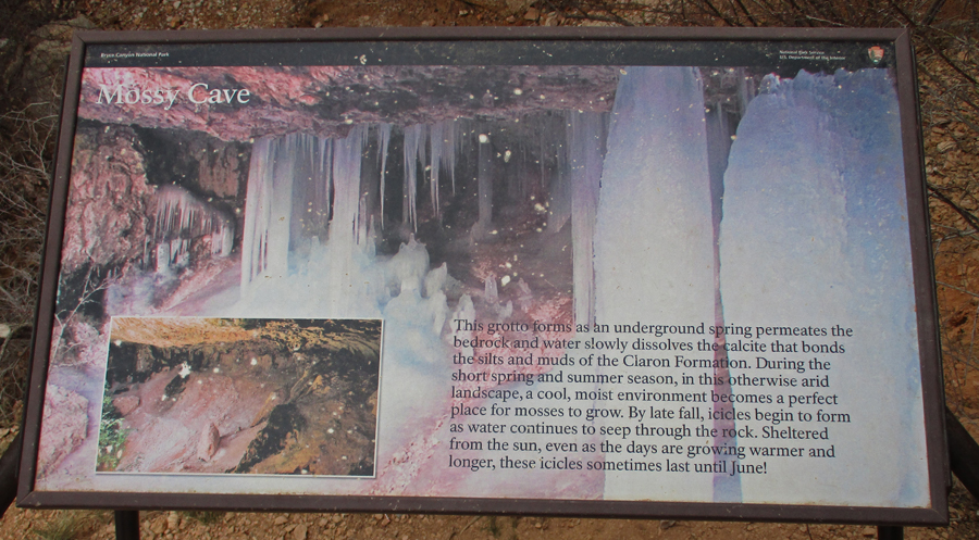
I then backtracked and did the trail to Mossy Cave, where some ice remained in the “cave”
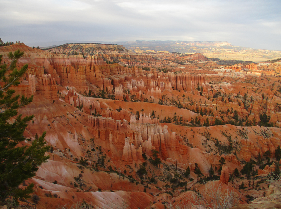
Returned on Rt 12, again entered the park on Rt 63, and drove to Sunset Point – 7:30pm
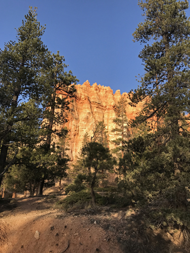
View from the Rim Trail
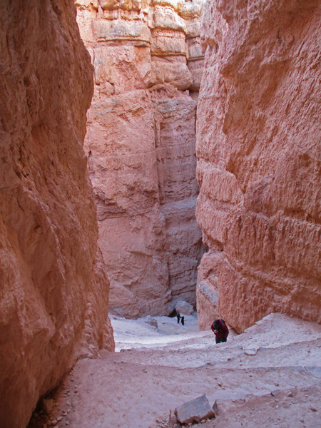
Hikers ascending on the Navajo Loop Trail
Slept in the Bryce Canyon Lodge parking lot
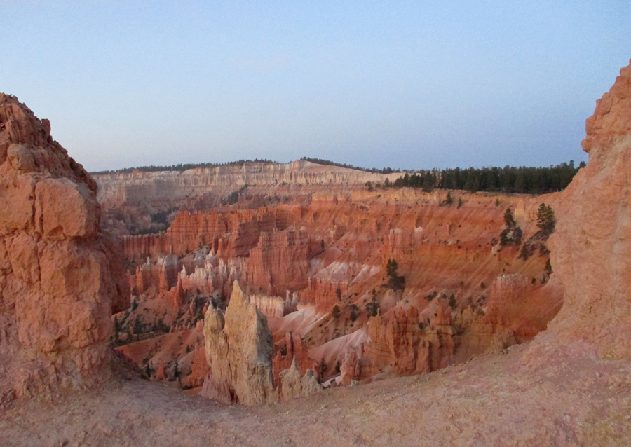
4/20 W – arrived at Sunset Point before sunrise (6am), twenty-nine degrees, – note the moon
View of Bryce Canyon from the Rim Trail before sunrise
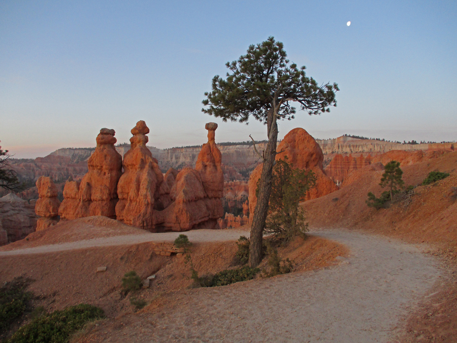
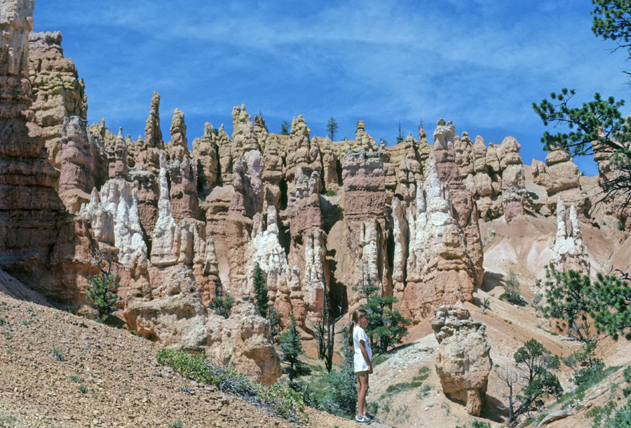
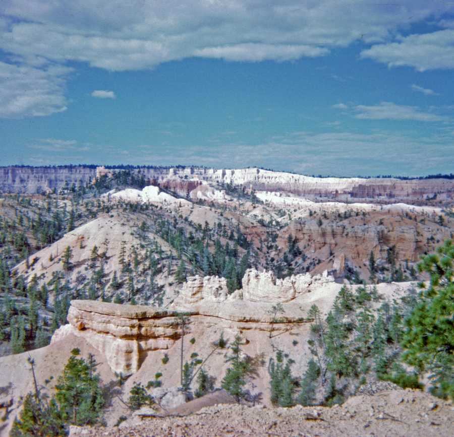
Walked to Sunrise Point and started on the combined Queen’s/Navajo Loop Trails in order to earn my “Hike the Hoodoos” reward. This was my fourth visit to Bryce, and my third time doing this loop. I will be adding photos from previous trips.
Sunrise
1982 hike with Helen, Stacy, Peter, and Kate – photos from the Queen’s Loop
Helen, Kate, and Queen Elizabeth
1967 hike with Jay – PH era (Pre-Helen)
I found the Navajo Loop Medallion Benchmark 2022
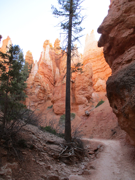
Start of the 600ft climb out of Bryce Canyon on the Wall Street segment of the Navajo Loop Trail
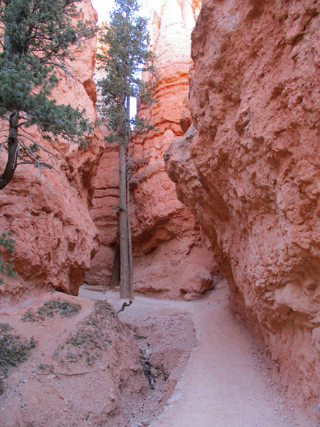
Wall Street section of trail
Almost there
Top – back at Sunset Point
I successfully “Hiked the Hoodoos” covering about five miles over three trails – I took my photos to the ranger at the Visitor Center and received my award – a decal – made in the USA!
Photo from Inspiration Point in 1967
Photo from Bryce Point in 1982
Peter (11) and Stacy (12) – 1982
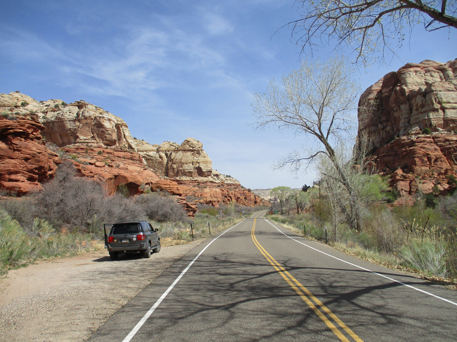
Drove Rt 12 from Bryce Canyon NP to Torrey UT before turning east to Capitol Reef NP. Rt 12 is said to be one of the most scenic roads in the US. A good part of this road passes through Grand Staircase Escalante National Monument, administered by the BLM. The monument was drastically reduced by the Trump administration in 2017 but reinstated by the Biden administration in 2021.
In March 2009, Helen and I hiked the “Toadstools” Trail, in the Paria Rocks area off US 89 in the southeastern or Kaiparowits Plateau Unit of the monument – see Blog.
On February 8, 2018, we stopped briefly at the Grand Staircase Escalante National Monument Visitor Center on US 89 – see Blog.
In April 2006, we did some wonderful hikes in the northern part of the Kaiparowits Plateau Unit. That was before the start of this Blog, so I am including some information and photos here. That year we drove Rt 12 from Torrey to Bryce Canyon NP (opposite of this trip).
When we reached Cannonville, we turned south on the unpaved Cottonwood Canyon Road to a point where we had access to Cottonwood Canyon.
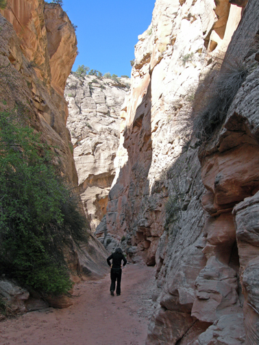
We hiked into, down about a mile, and then back up through this beautiful slot canyon
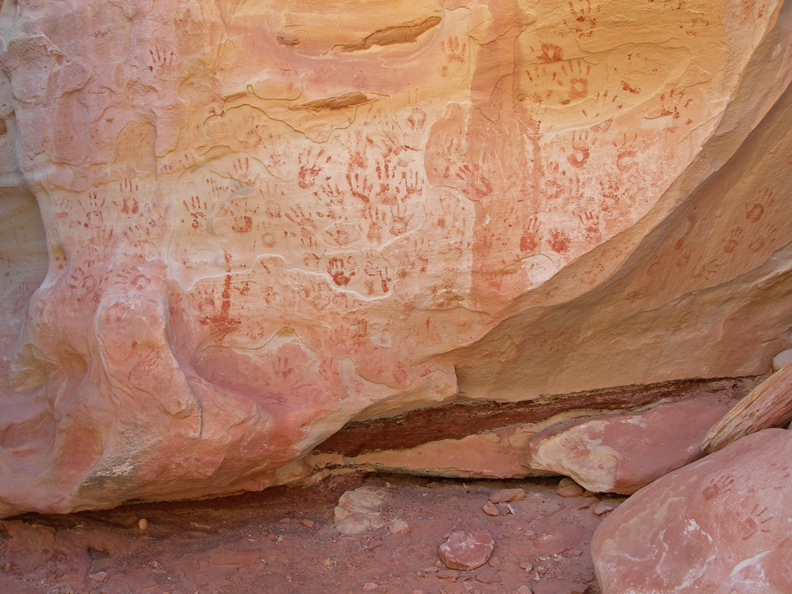
I have no idea who put these handprints here –
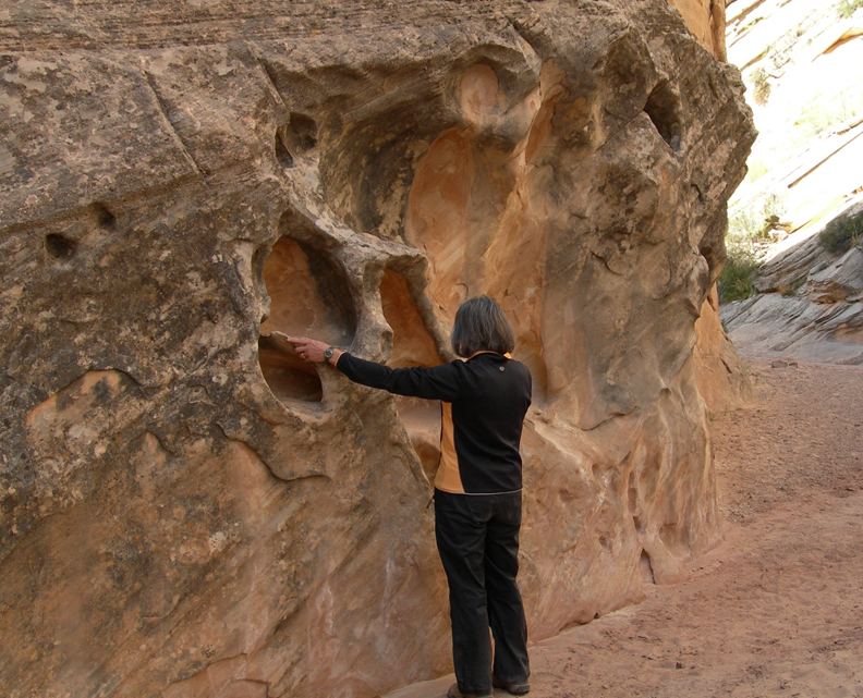
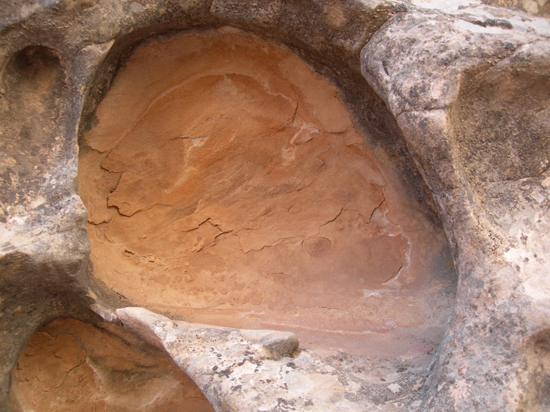
Do not do this hike if there is rain anywhere in the vicinity! Debris in the water is responsible for carving out these alcoves.
Rock – Face
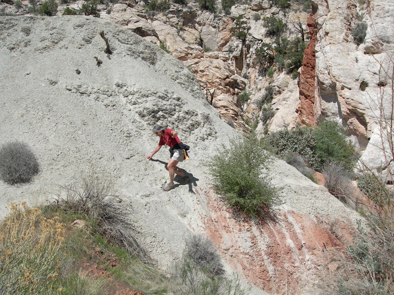
Scree traverse to get into and out of the canyon
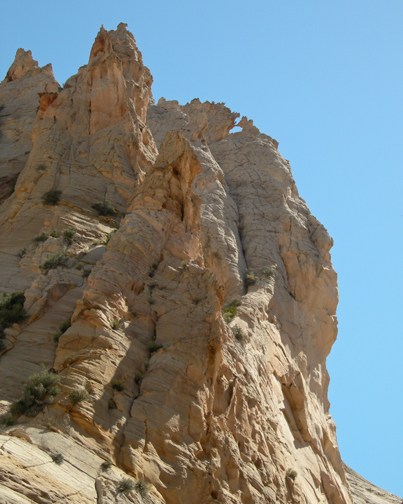
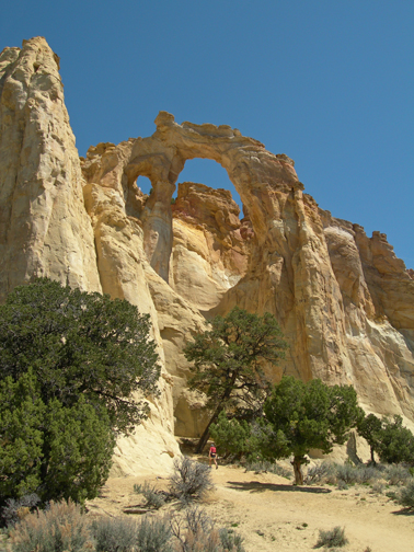
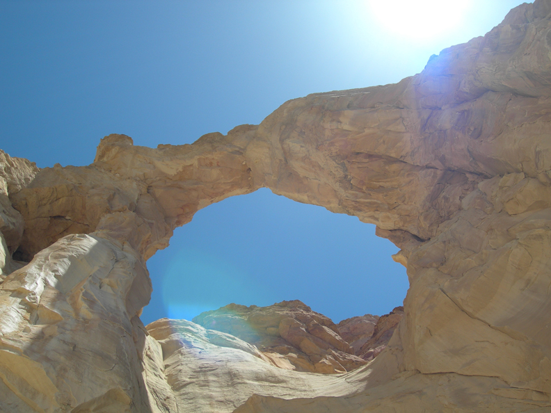
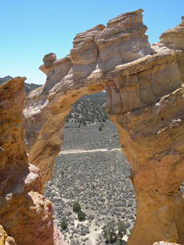
Our next stop was Grosvenor Arch, named for Gilbert H. Grosvenor, who was President of the National Geographic Society.
It is a double sandstone arch
View from the bottom
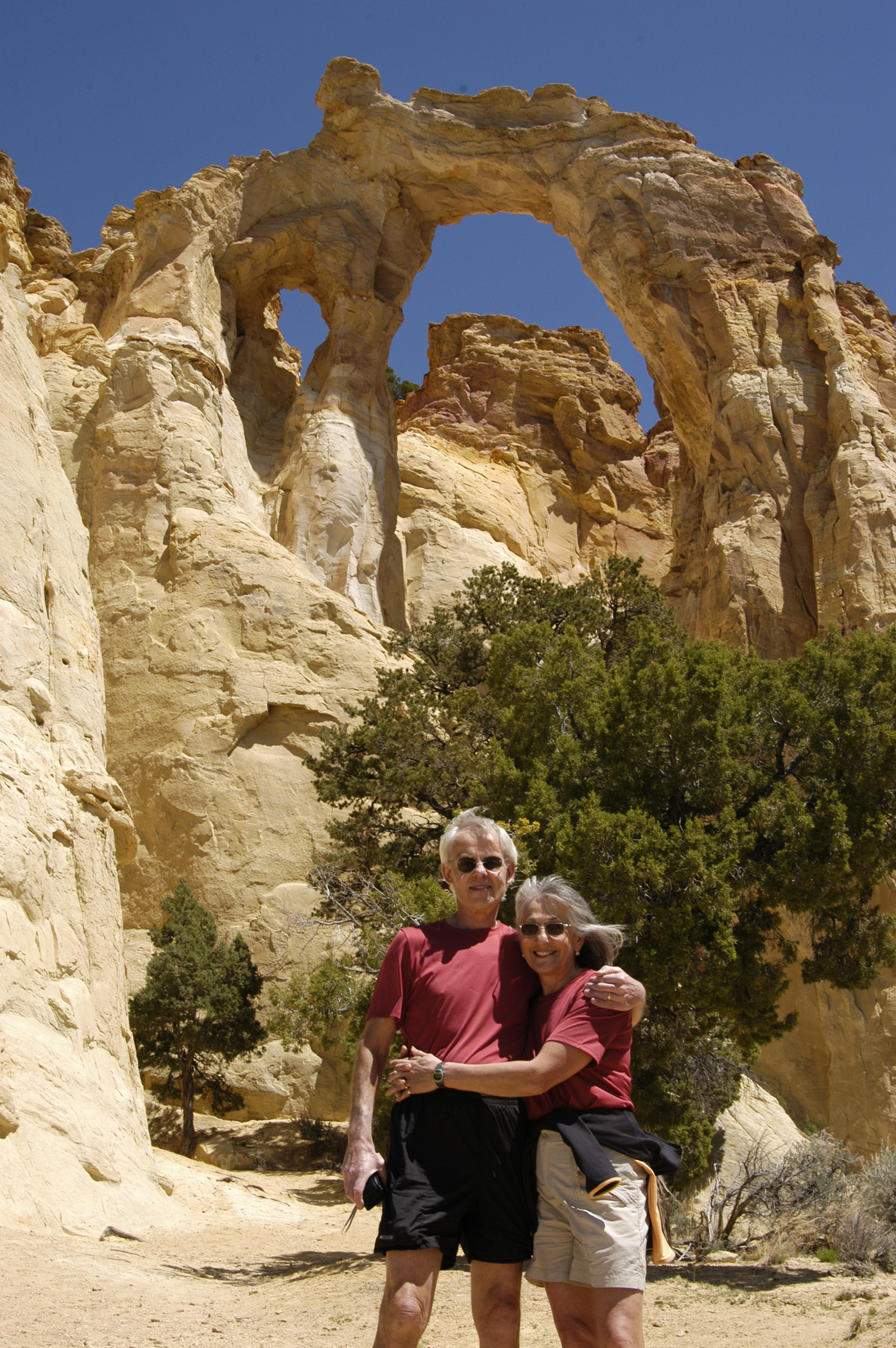
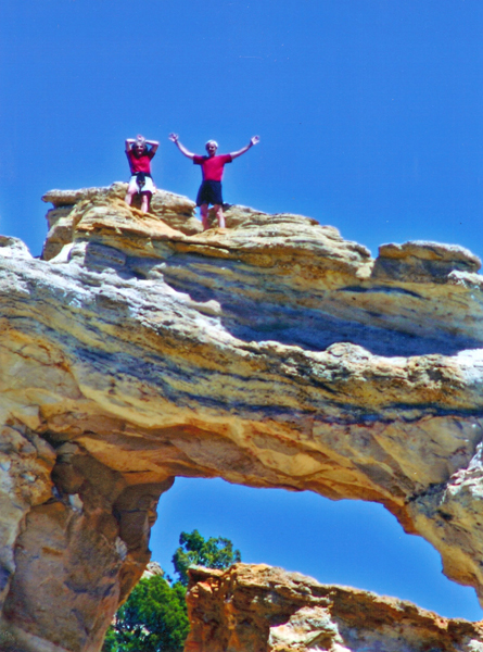
After deliberating for a while, we decided to climb it – back side of arch
View from top
After we descended, we met a couple who had taken photos of us on top. They later mailed them to us.
View north from bottom of arch
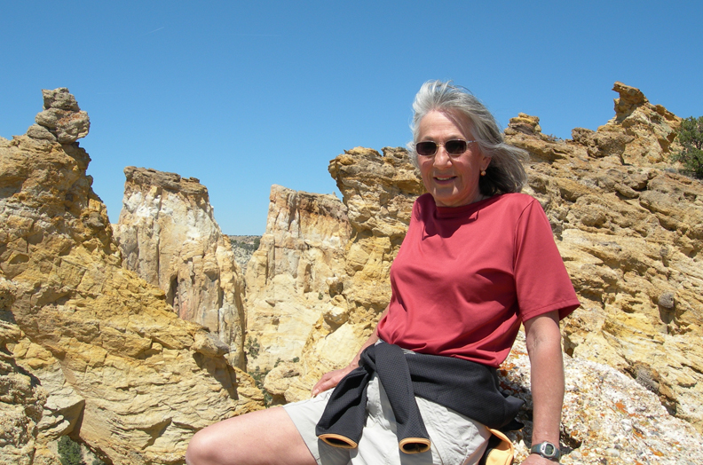
Our next stop was Kodachrome Basin State Park, which is in Grand Staircase Escalante NM. Rock formations on the Nature Trail
We hiked the Angels Palace Trail to a point called the “End of the World”
Photo of park cabins from Angels Palace Trail
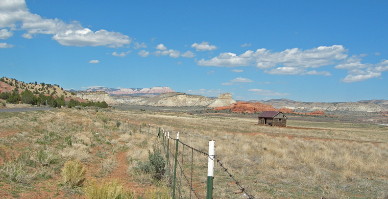
Ranch scene along Rt 12
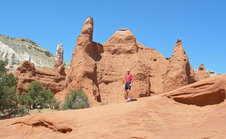
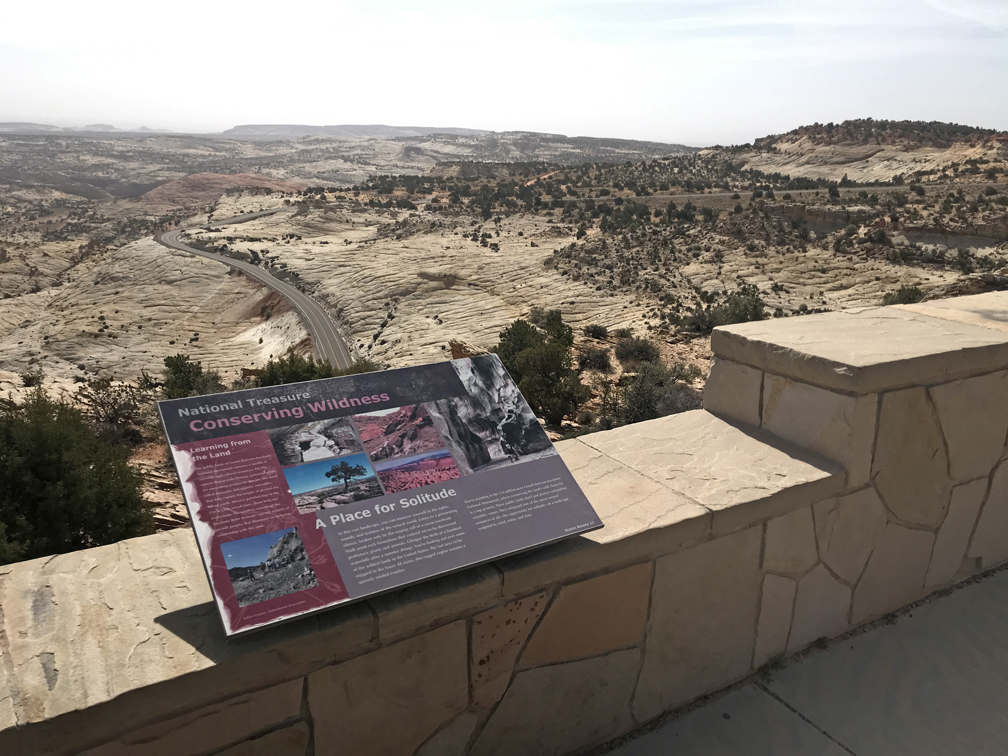
OK, now I am back to 2022, after leaving Bryce NP – entering Grand Staircase Escalante NM on Rt 12
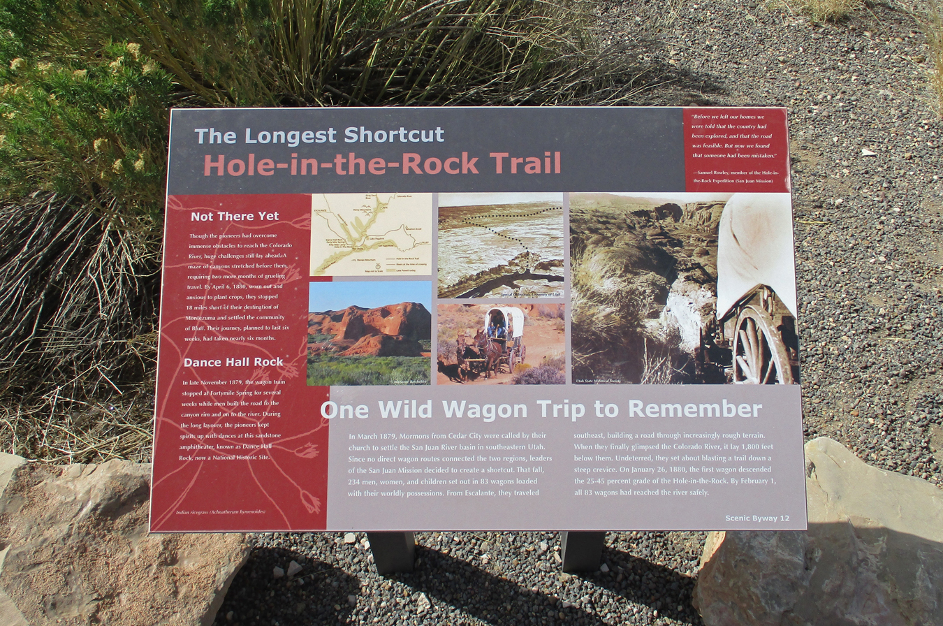
Mormon – Hole in the Rock Trail
Rt 12 Overlook – here is one of three informative markers
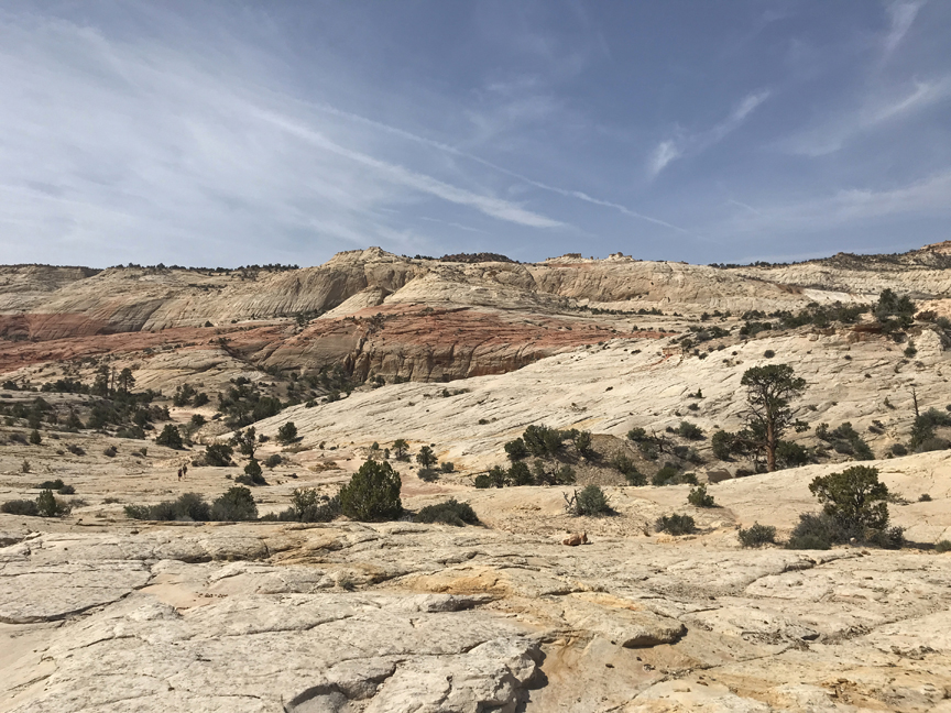
I really enjoy hiking on slickrock
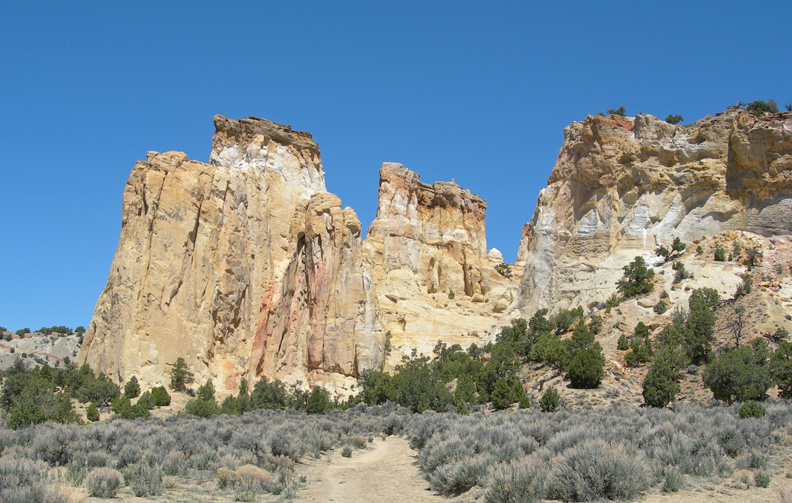
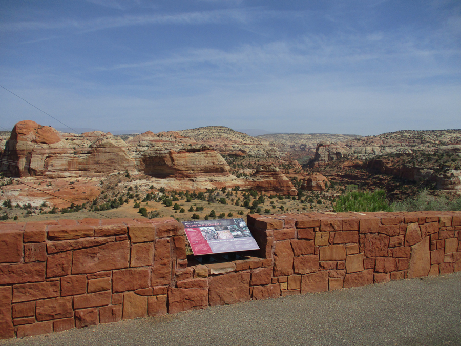
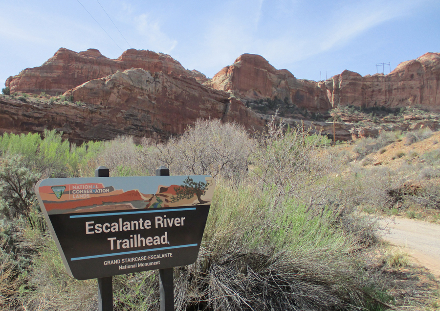
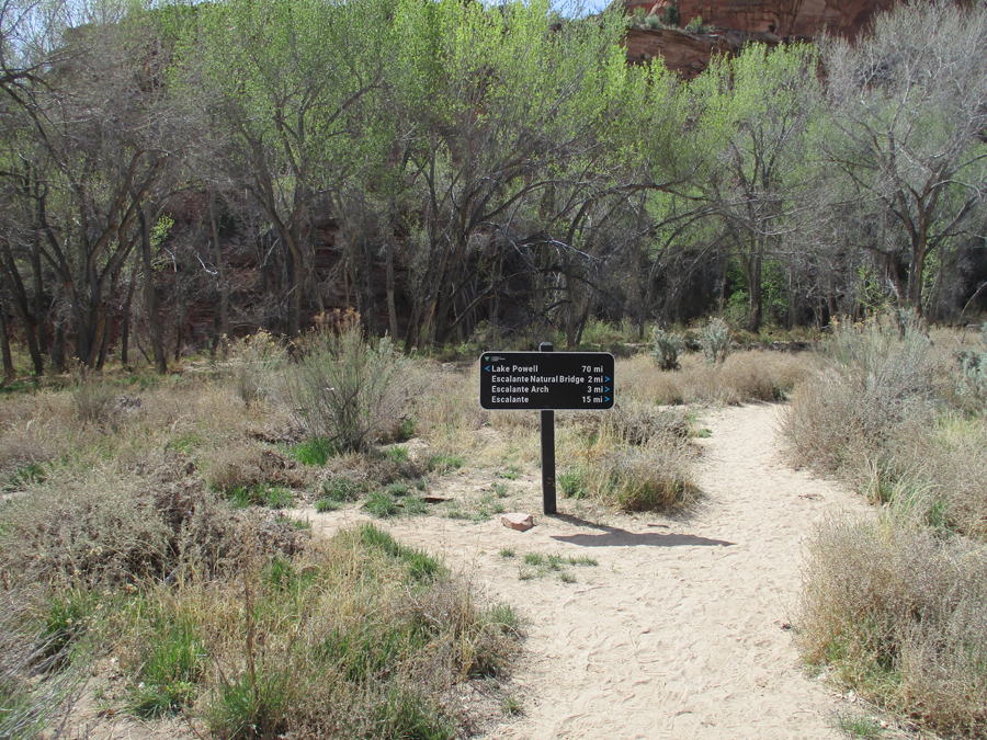
Escalante Canyons Unit of Grand Staircase Escalante NM, these are the canyons related to the Escalante River
Did a hike to the Escalante River
Colorful formations
View of Escalante River Canyon
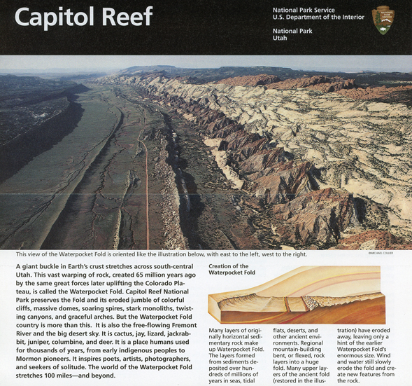
I arrived at Capitol Reef NP today (April 20, 2022) at about 1pm.
On April 27, 2006, our first visit to the park, Helen and I arrived at sunset
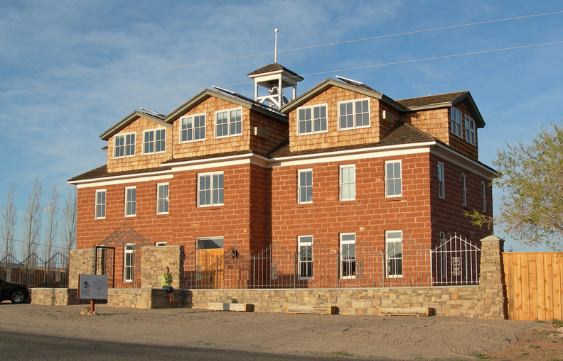
That night we stayed at the Torrey Schoolhouse Bed and Breakfast. It was built in 1914 (same year as our house) and was the center for community activities. The Butch Cassidy gang frequented its weekend dances.
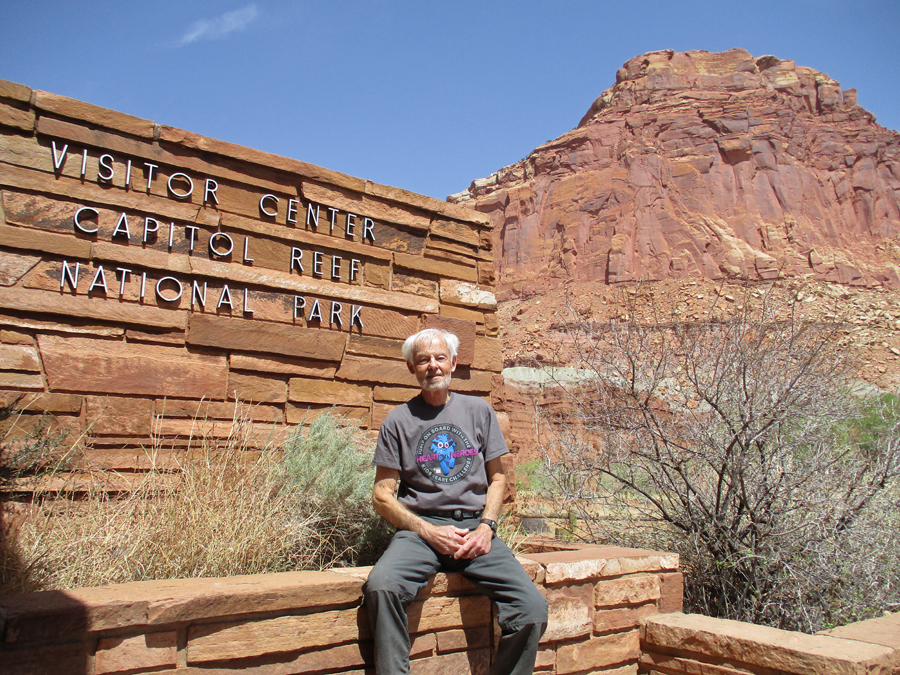
We drove back into the park the next morning – Visitor Center
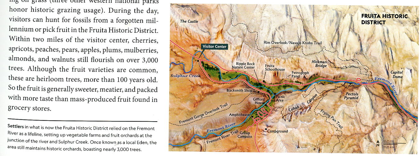
Map showing Fruita locations as well as the Rim Overlook and Hickman Bridge Trails
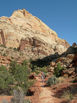
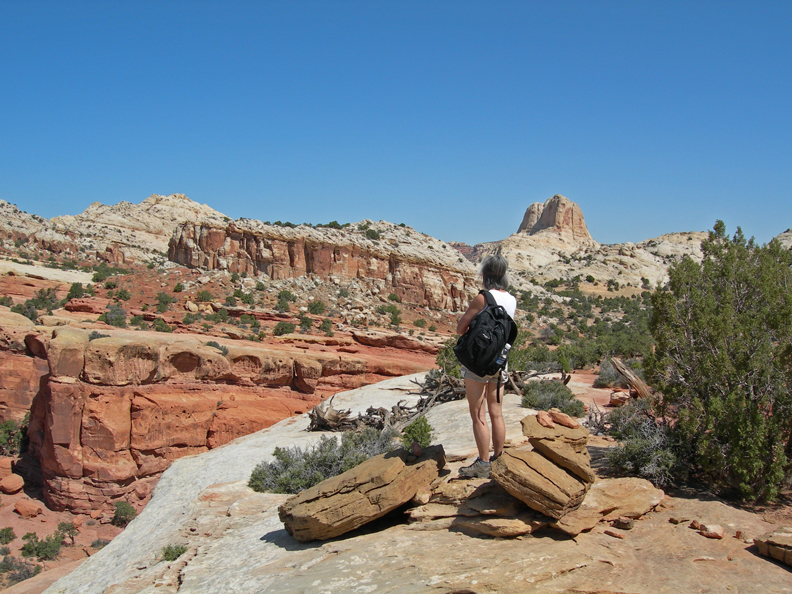
Our first hike that day was the 4-mile Rim Overlook Trail. It was a wonderful hike, gaining about a thousand feet in elevation, through beautiful multicolor rock formations.
Visitor Center from Rim Trail
On the way up we passed an outlook for Hickman Natural Bridge but couldn’t see it. On the way back we met some other hikers who said we had to look harder – it was there. Well, I tried and still couldn’t see it – then Helen said, “There it is.” We were standing on a cliff right across from it but because it had a rock background from our high vantage point, we at first were unable to pick it out! The following photos are from our 2-mile hike to the Hickman Bridge. You can “see” the Bridge in these two photos.
The Hickman Bridge is 133 feet wide and 125 feet high – when you can see it from below, with the sky above, it is obvious! A “Bridge” is formed by water running underneath it. An “Arch” is formed by other erosion forces.
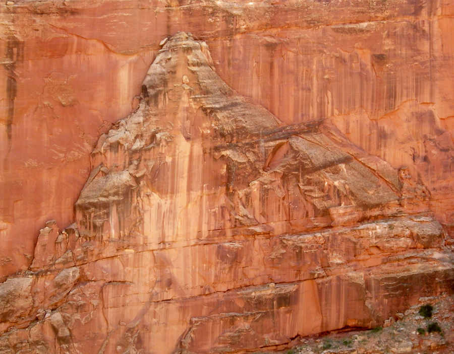
I call this the “Rock Wall Mountain”
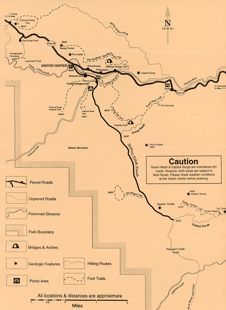
Afterward, we drove the 10-mile scenic drive to Capitol Gorge
We did the 2-mile trail into the gorge walking along a narrow wash bottom with sheer canyon walls.
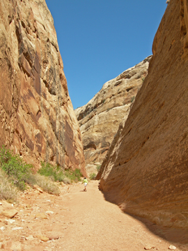
I found it fascinating how rocks and pebbles created coves in the sandstone walls of the gorge
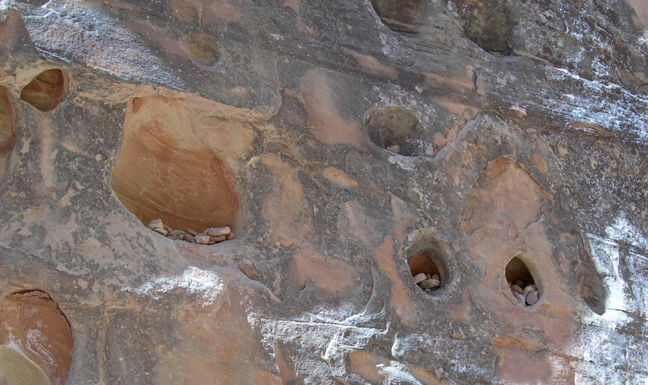
There was a “Pioneer Register” in Capitol Gorge where people signed their names on the rock wall over a hundred years ago and water pockets that are called “tanks.”
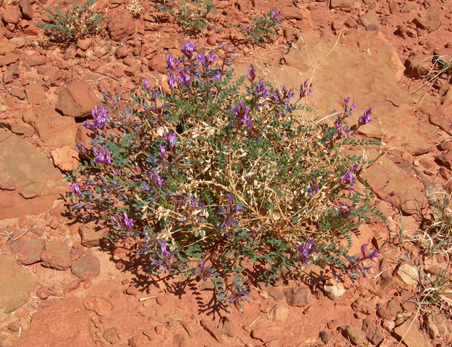
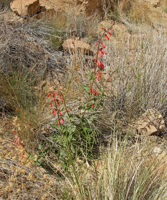
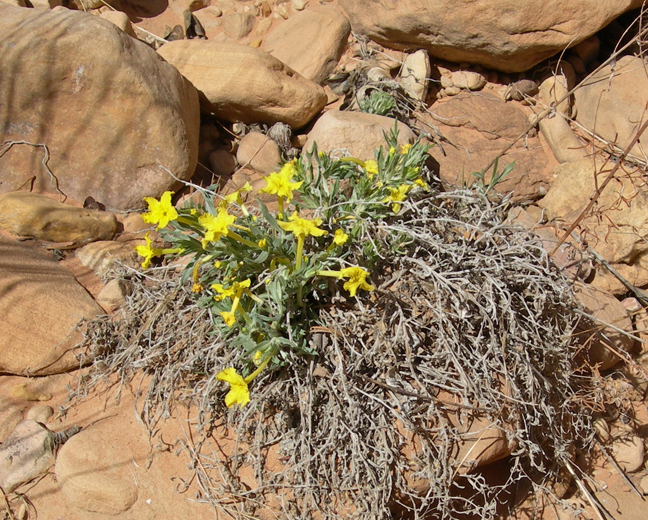
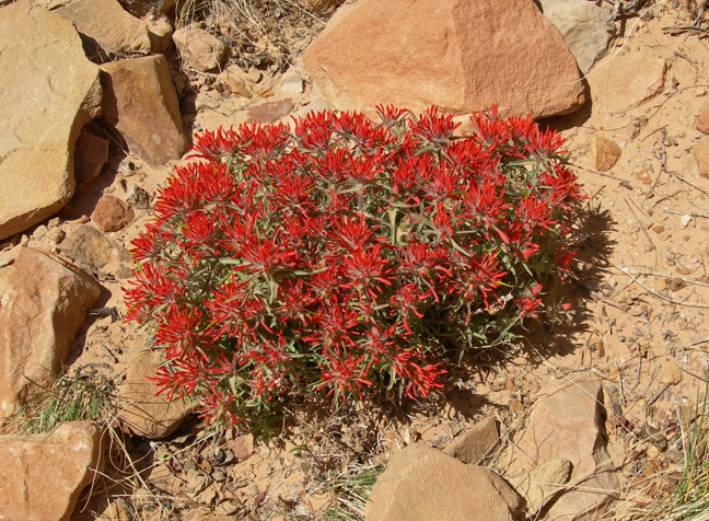
Spring flowers added to the beauty of this April visit to the park. Are you ready? Name these flowers –
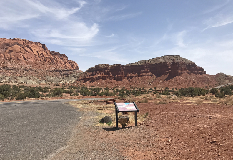
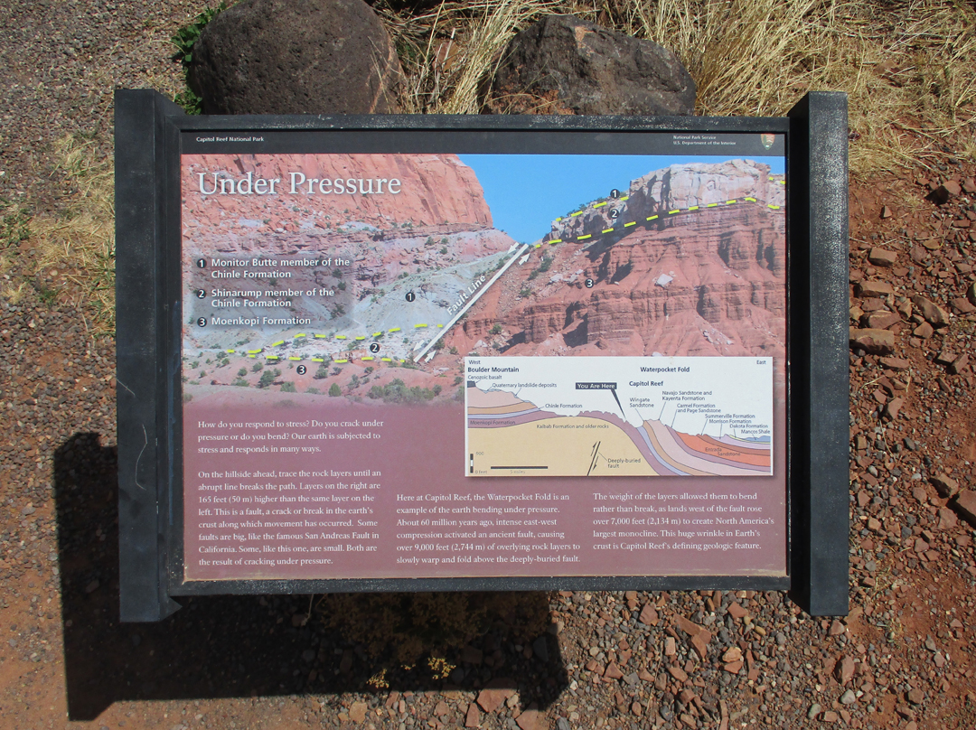
Today, 4/20/2022, I entered Capitol Reef NP from the west. The park protects the Waterpocket Fold (about 90 miles long), which is the longest exposed monocline in North America.
Chimney Rock
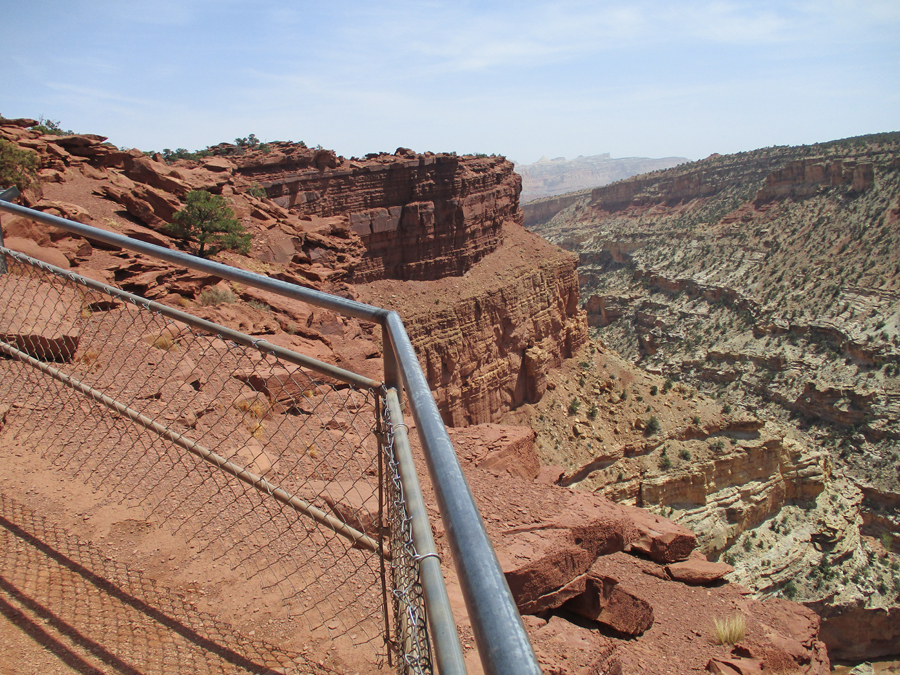
I then did a short hike to the Goosenecks Overlook
Sulfur Creek flows through the Goosenecks – this photo from 2006
Afterward, I did the same 1-mile rt hike from the parking lot to Sunset Point that Helen and I did in 2006
Castle Rock
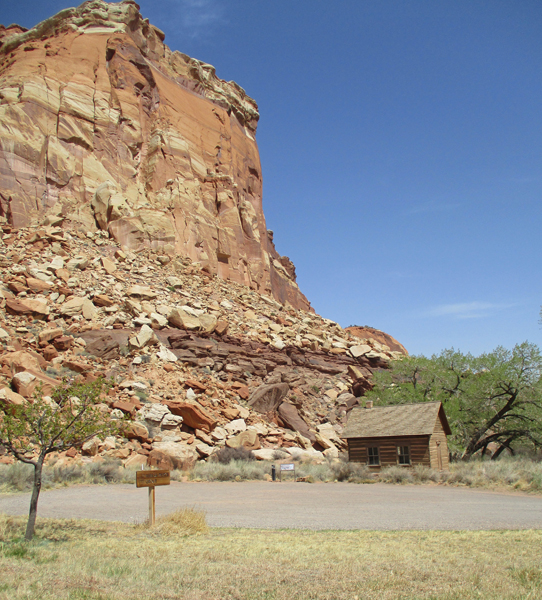
Visitor Center
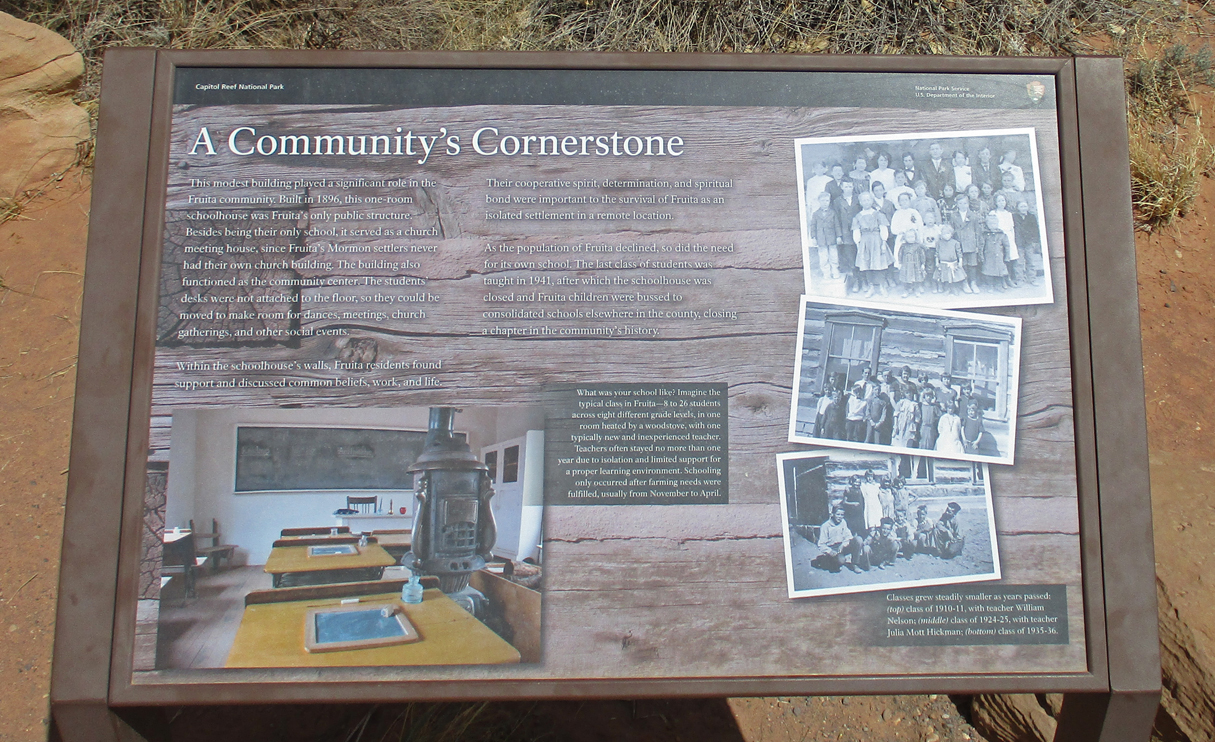
Fruita Schoolhouse
I was hoping that, if I arrived at Arches NP before the close of the Visitor Center at 5pm, a ranger would allow me into the park. This is the first year you must have a timed entry reservation to enter the park. I had a paid ($2) reservation for the following morning for the first entrance time slot of 6-7am. After 2.5-hours, I arrived at 4:30pm – made it! – and convinced the ranger that I would leave the park by sunset if she permitted me to enter.
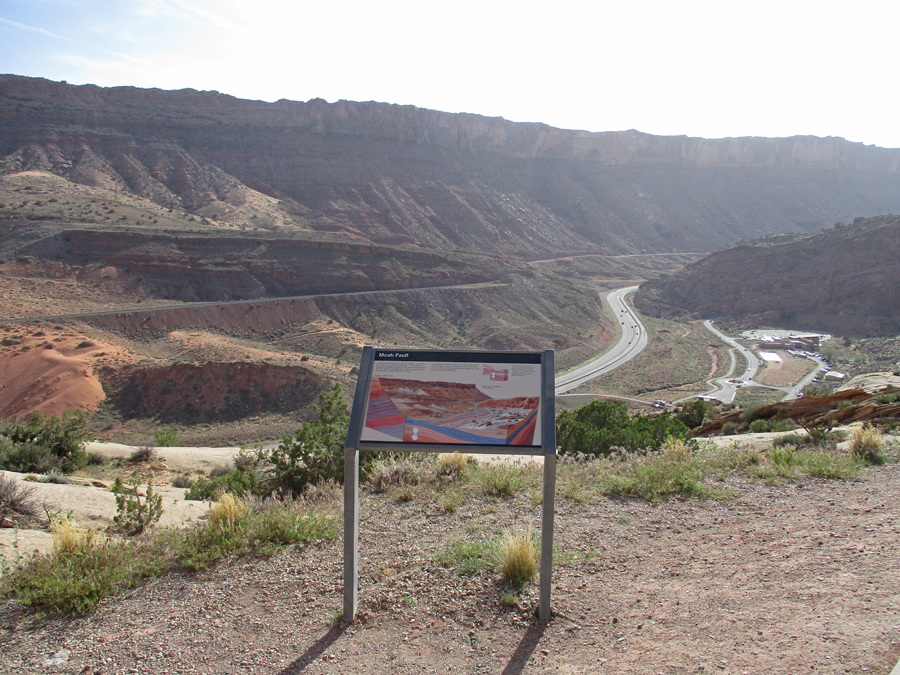
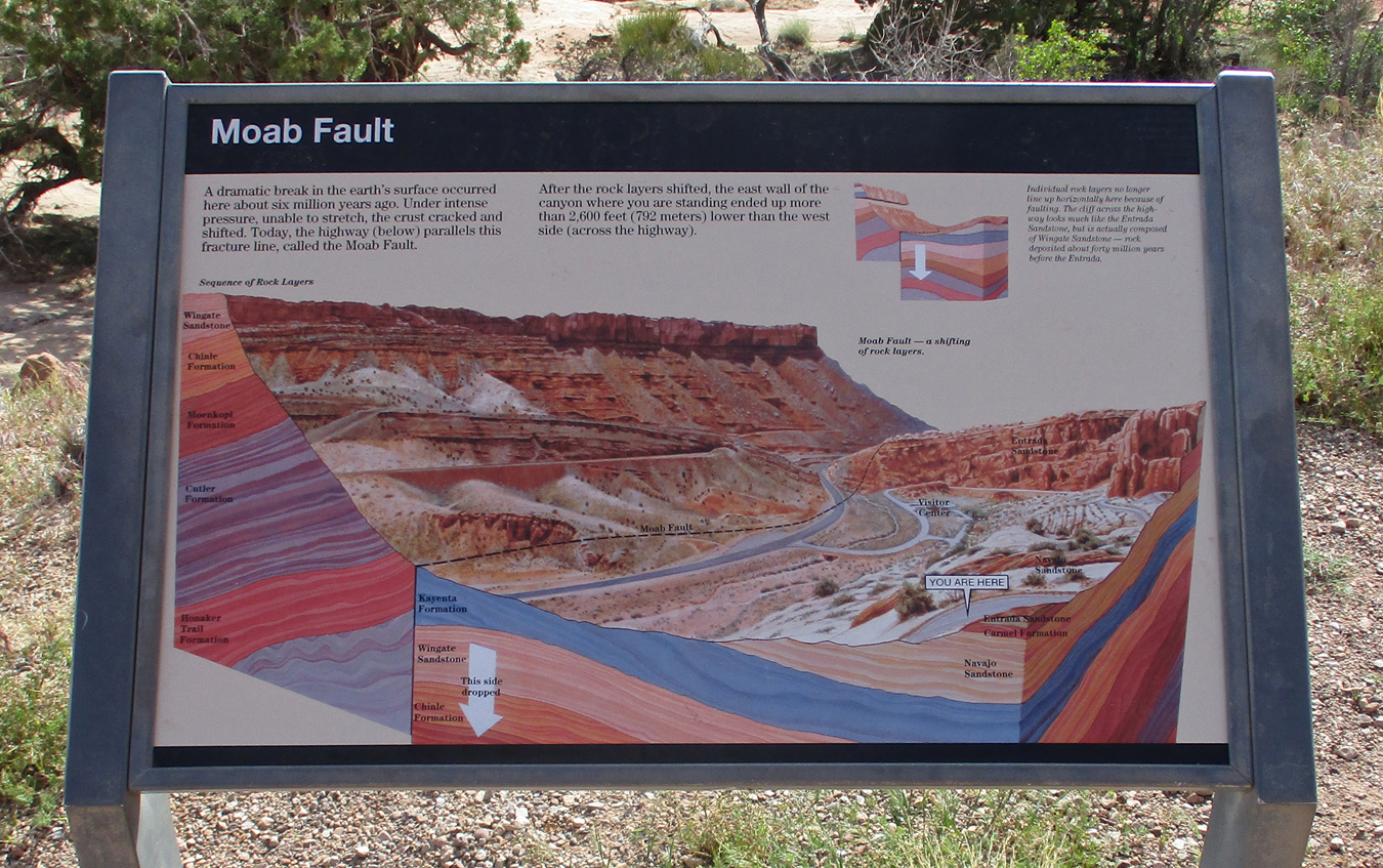
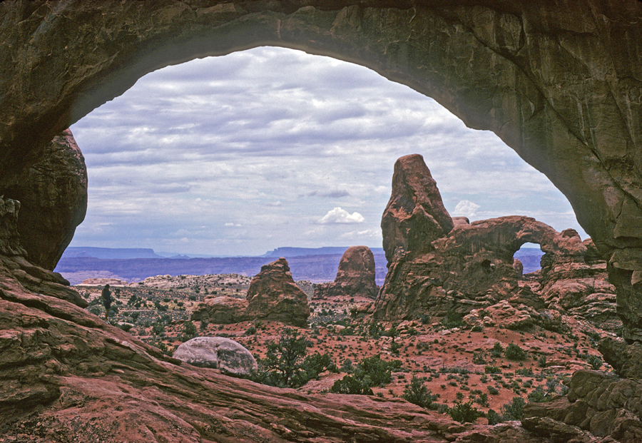
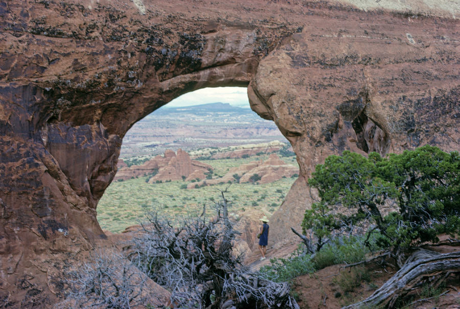
This was my fourth visit to Arches NP and my main objective was to get a photo of Landscape Arch, which has the longest span in the park, 290 feet. It is the fifth longest natural arch in the world. There are four in China that are longer. There are over 2,000 cataloged arches in the park. The minimum opening to be cataloged as an arch is three feet. This is my first Blog entry for Arches NP. So, I will present photos in the order you would see the formations driving the road into the park. I will also state the year each photo was taken – the Moab Fault, Visitor Center in the background 2022.
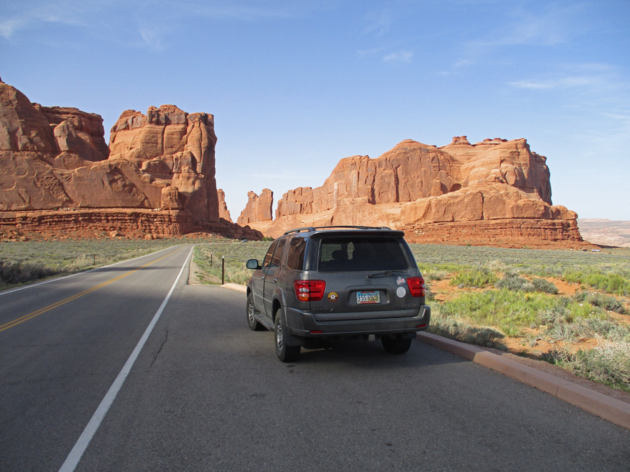
Approaching Courthouse Towers – on left 2022
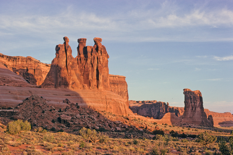
The Three Gossips and Sheep Rock (center) 2022
The Three Gossips and Sheep Rock 1968
One mile trail – Park Ave Balanced Rock 1968
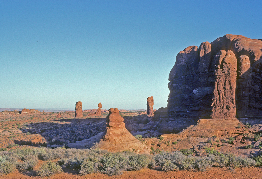
Rock Pinnacles 2022
Pinnacles and Balanced Rock 2022, 1982, 1968
198220221968
Half mile hike to Double Arch 112 feet High 1998
Turret Arch Thru North Window – One mile Loop Trail 1968
Chad and Turret Arch 1998 (15-year-old bonding trip with Dad)
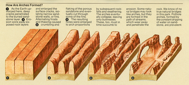
How Arches Form
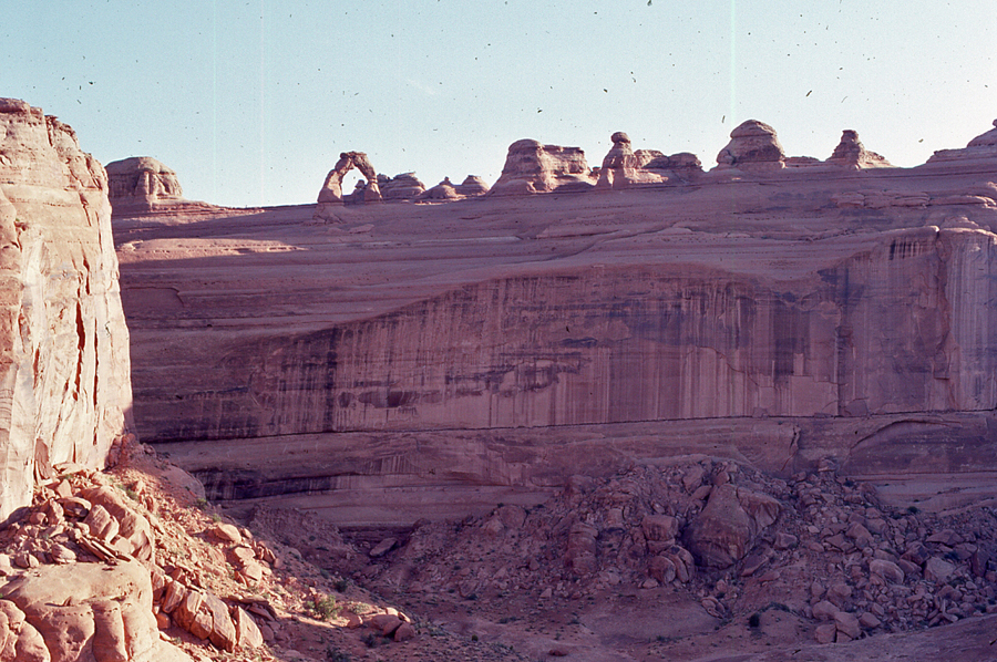
Half mile hike to Upper Viewpoint of Delicate Arch 1982, note VW Camper. We drove to LA and then flew to Hawaii on this family trip.
Stacy at Upper Delicate Arch Viewpoint 1982
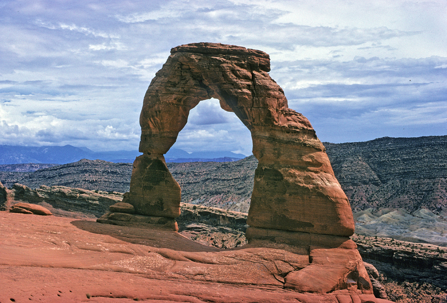
Delicate Arch across Valley Wash
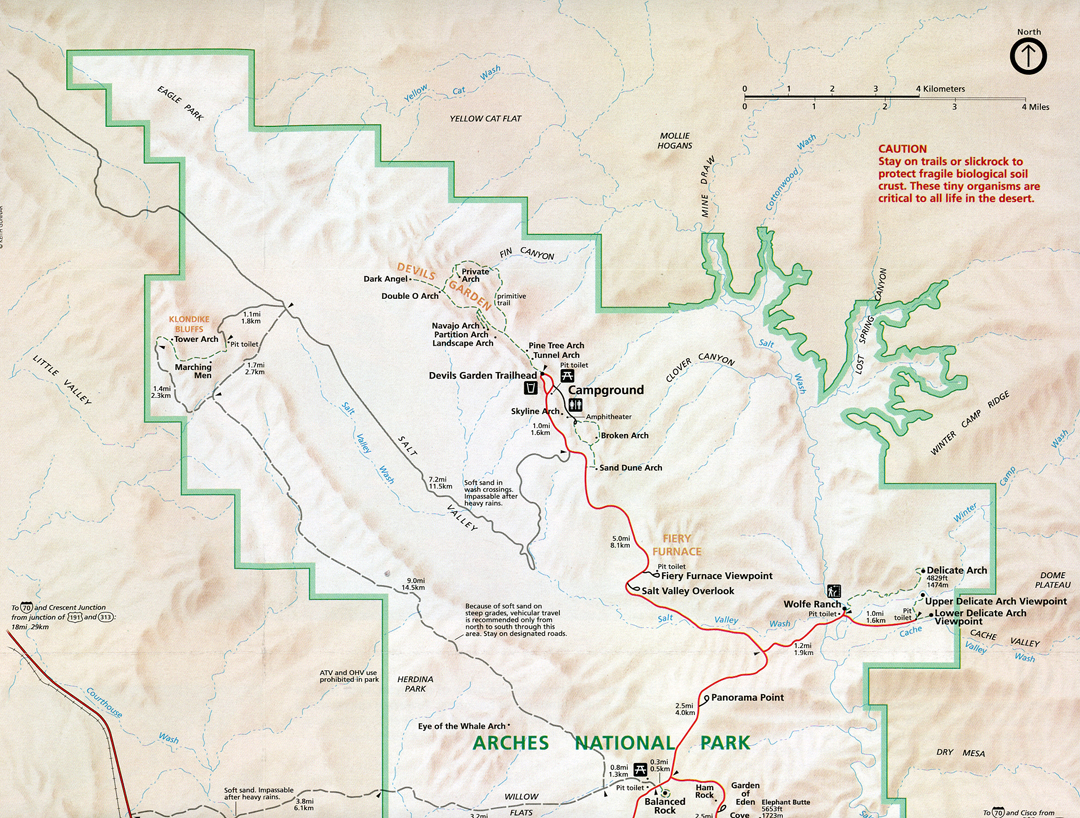
Map of North part of park
Helen at Wolfe Ranch for start of 3-mile rt summer hike to Delicate Arch 1968. We were married in June and were doing a NP road trip on our way to Seattle.
Tom at Delicate Arch 1998
Delicate Arch 1968
2014 Utah National Parks Quarter
2014 America The Beautiful Quarters Coin Arches Utah Uncirculated Reverse
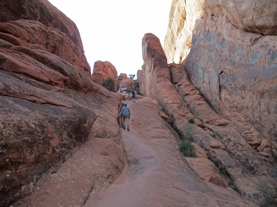
Approaching Devils Garden 2022
Skyline Arch, 71 x 33 feet 2022
Sign describes how Skyline Arch increased in size in 1941
One mile hike to my objective – Landscape Arch 2022
Looking Northwest through Devils Garden 2022
2022, I continued on the Primitive Loop northwest through the fins of Devils Garden in search of two arches Helen and I had climbed to in 1968
Southeast view from top of small fin 2022
Southeast view from top of large fin – note small fin (previous pic) to the left – this photo 1968
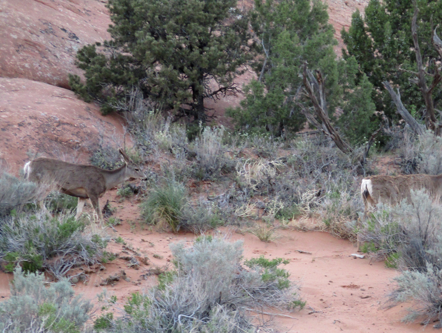
The route through the fins was now in the shade and difficult to follow. These deer advised me to turn around before I injured myself 2022
1968 – Helen at Partition Arch
1968 – Navajo Arch
Sunset from our Devils Garden Campground tent site in 1968. The first time Helen washed her hair and then dried it over a campfire. How could she not like the campfire scent in the car for the next two days? Something a newly wed male was about to learn.
Slept in a hotel parking lot in Moab UT
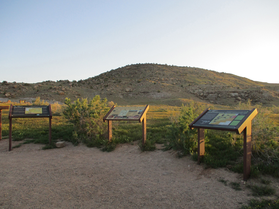
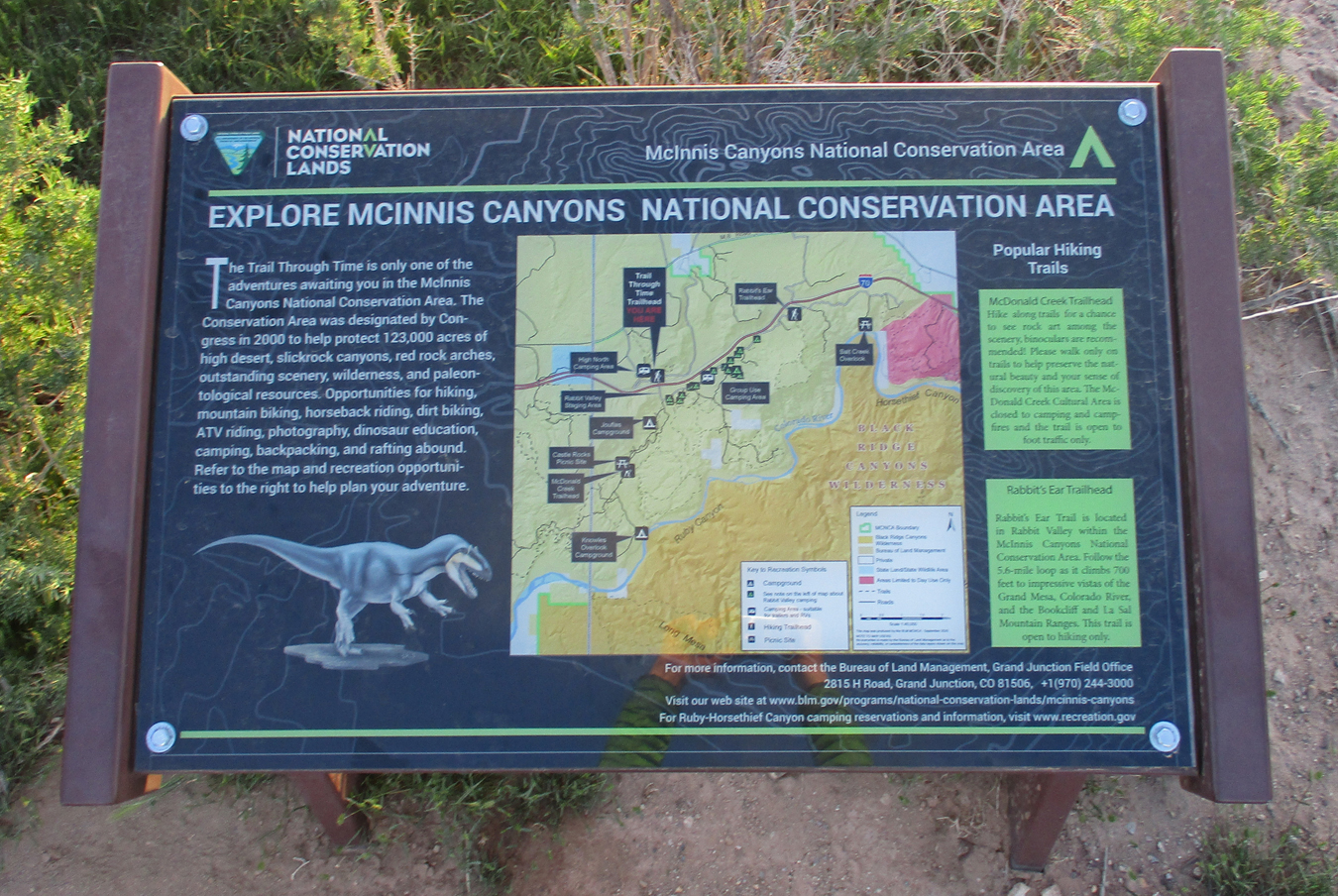
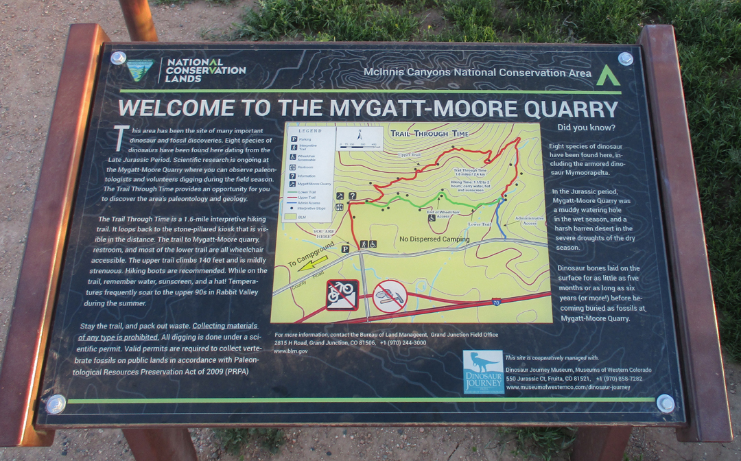
4/21 Th – 1.5hrs to McInnis Canyons National Conservation Area (MCNCA – BLM) in West Central CO on the UT border. It was previously called Colorado Canyons NCA and has the second highest concentration of naturally occurring arches in the world – behind Arches NP. Its 193 square miles includes a 24-mile section of the Colorado River. “View the fossils of 140-million-year-old dinosaurs at a working fossil quarry.” It has been proposed that this NCA become a National Monument.
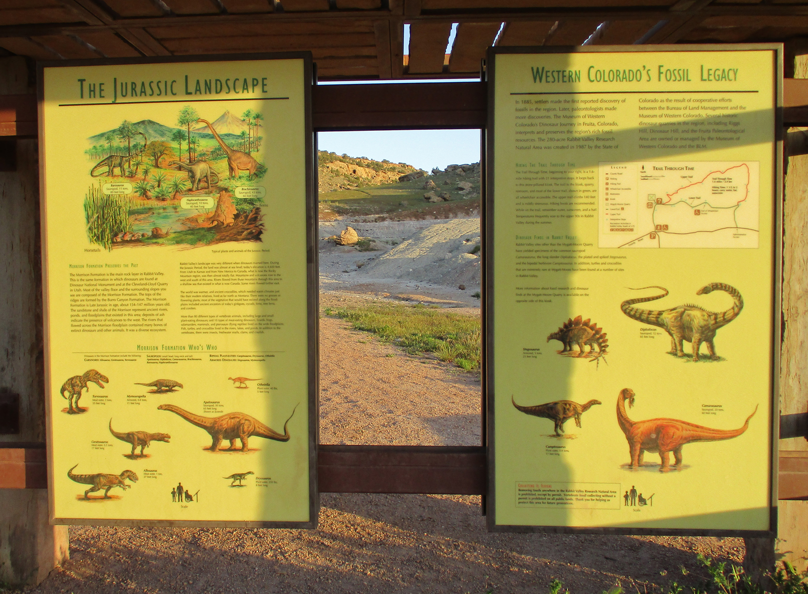
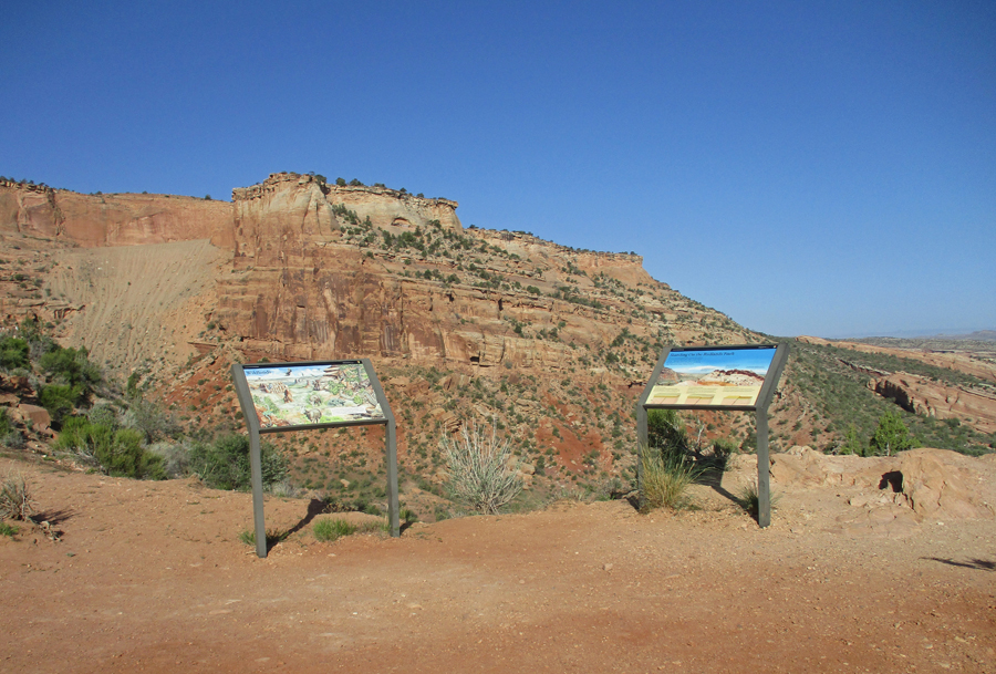
The 1.6-mile Rabbit Valley Trail Through Time is just off Interstate 70
Paleontologists have found eight species of dinosaurs in the Mygatt-Moore Quarry and continue to do field work here.
Kiosk at the start of the trail
Camarasaurus Skeleton – Note disk marker on rock
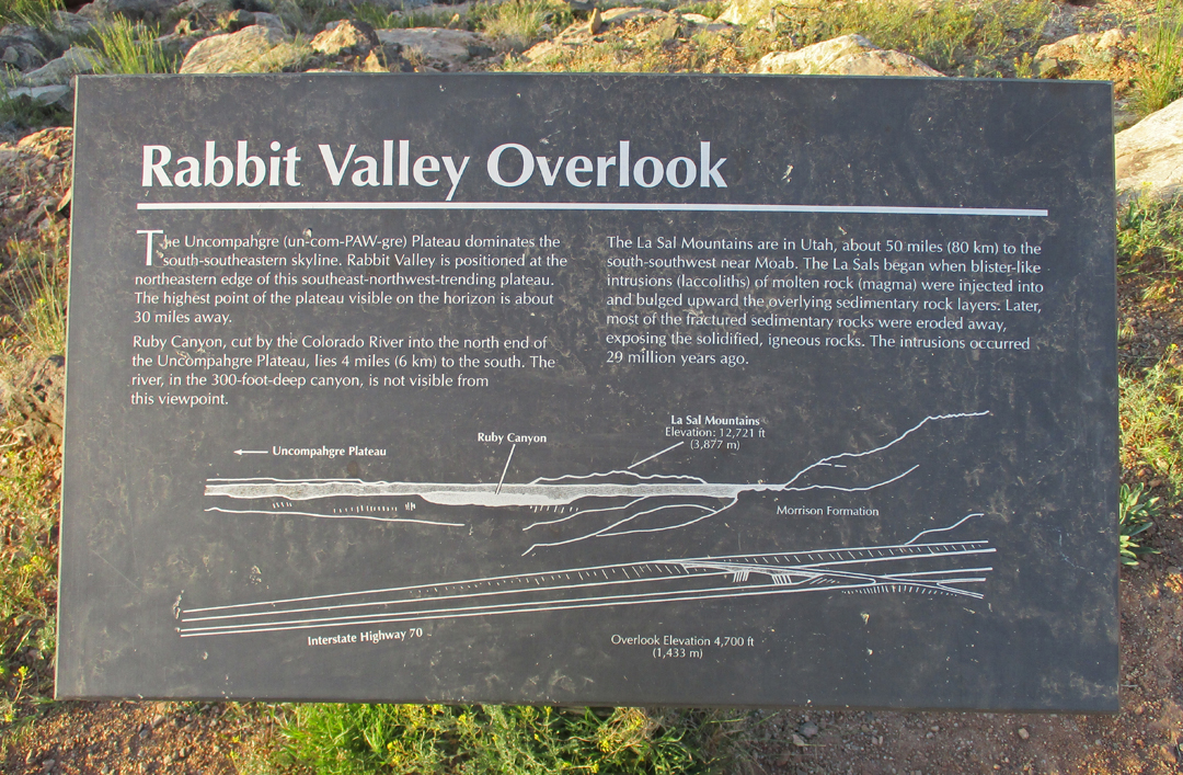
Rabbit Valley Overlook
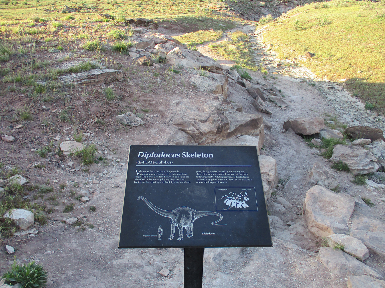
Diplodocus Skeleton
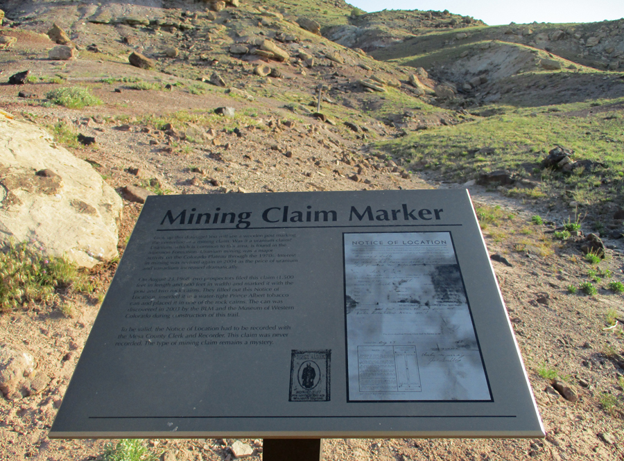
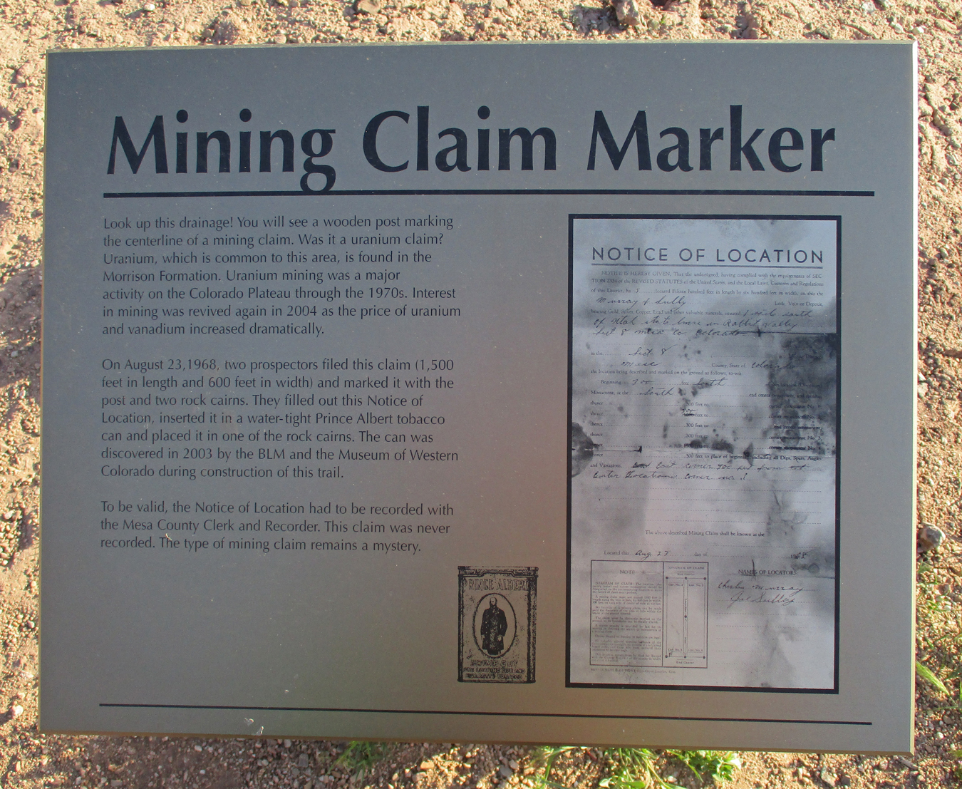
Mining Claim Marker
Balanced Rock
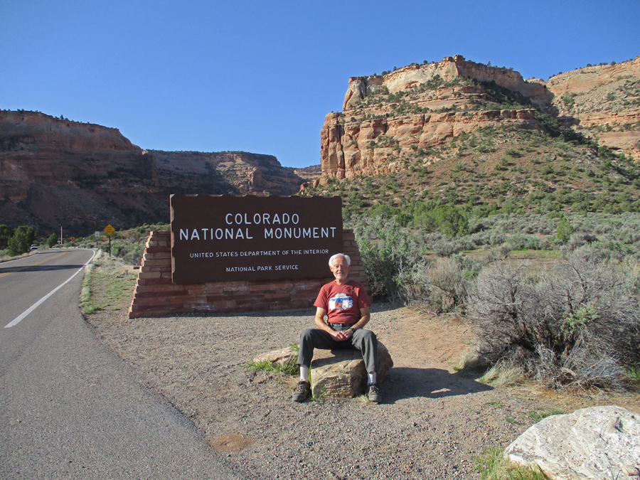
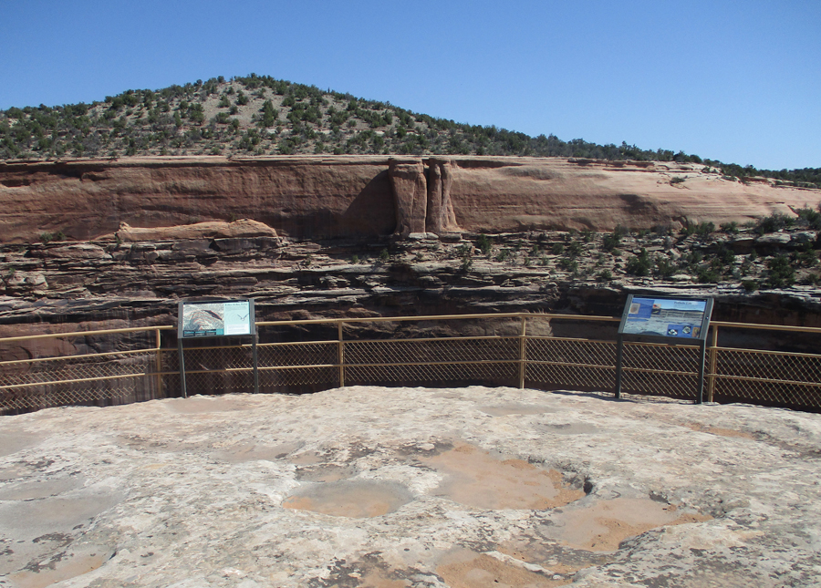
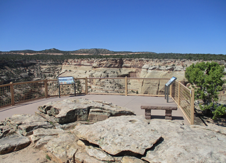
It only took a half hour to get to the west entrance to Colorado National Monument near Fruita CO.
Lots of great views as you drive up switchbacks to the top of the Colorado Plateau, 2,000ft above the Colorado River Valley
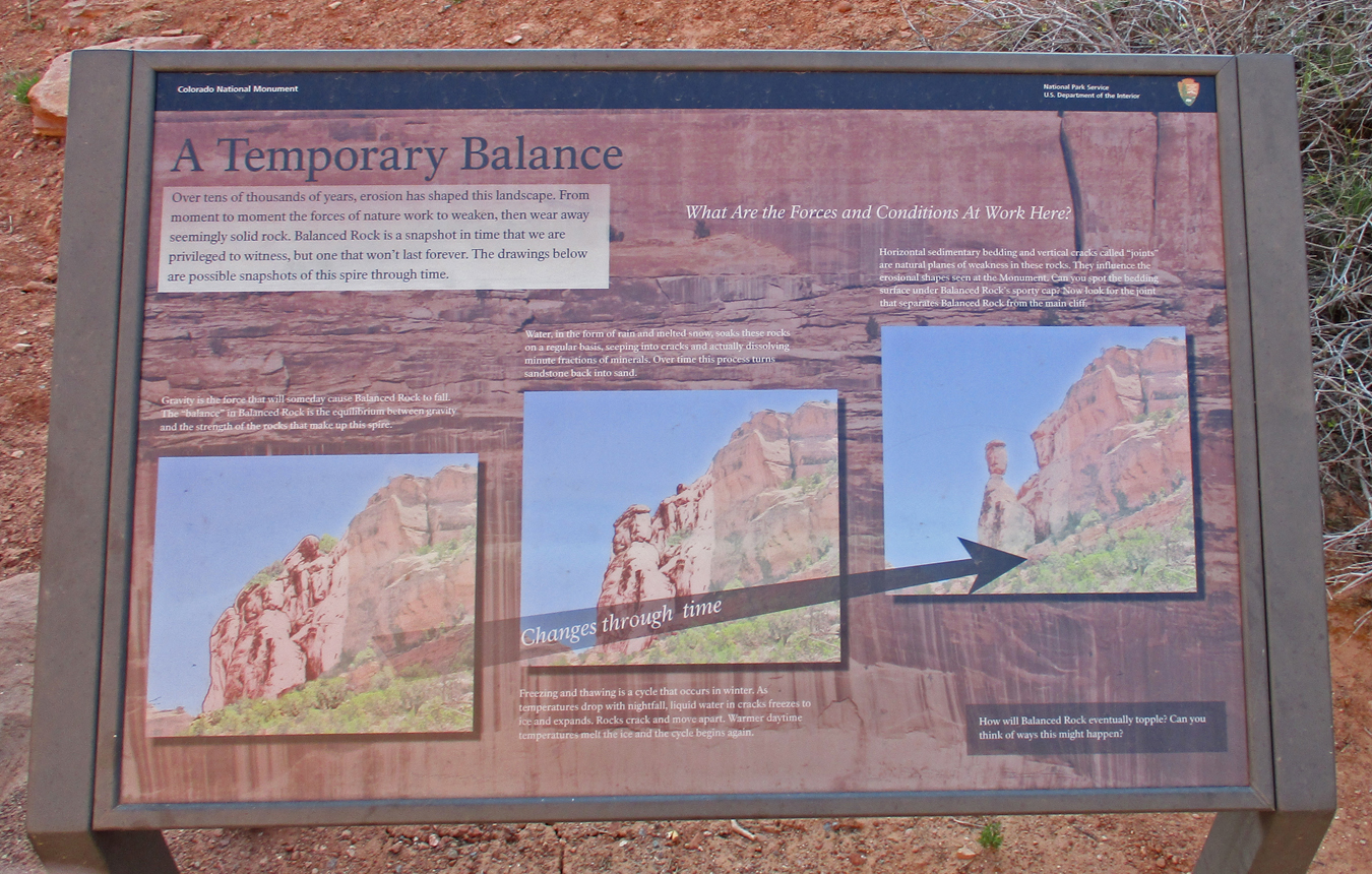
The formation of a Balanced Rock
Sign describing construction of the road by the CCC from 1931 to 1950.
Note Balanced Rock in the upper right part of the photo at the Fruita Canyon View
John Otto arrived in this area in 1906 and worked tirelessly for it to become a national park. When President Taft declared it a National Monument in 1911, Otto became the park caretaker at a salary of $1 a month!
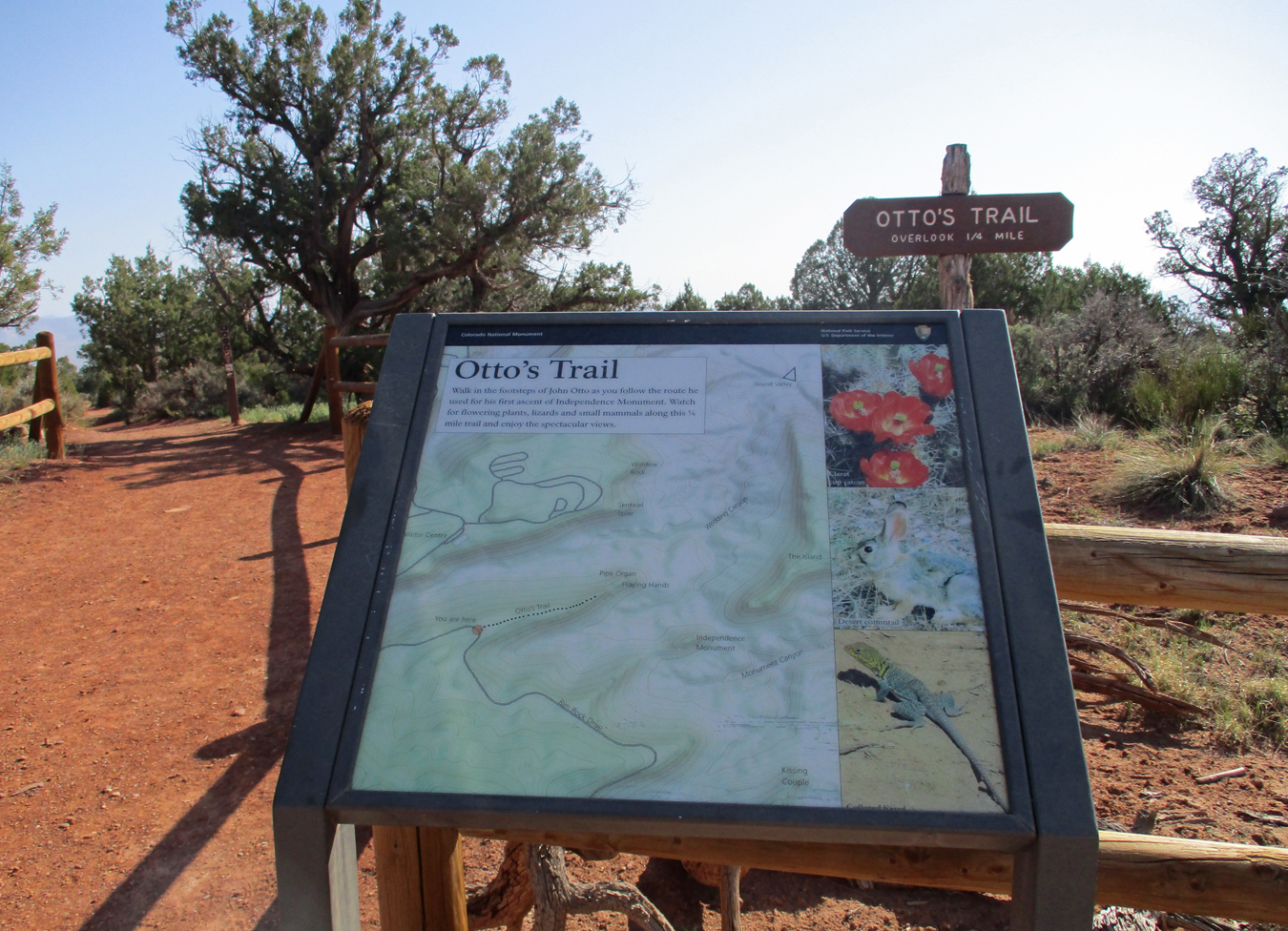
Otto’s Trail, I did lots of short trails to overlooks
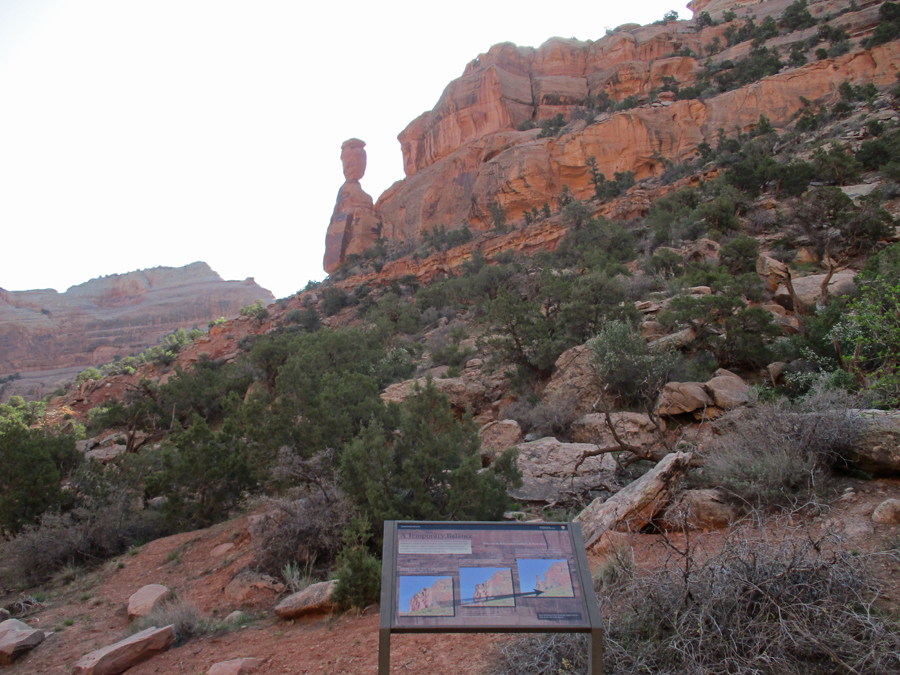
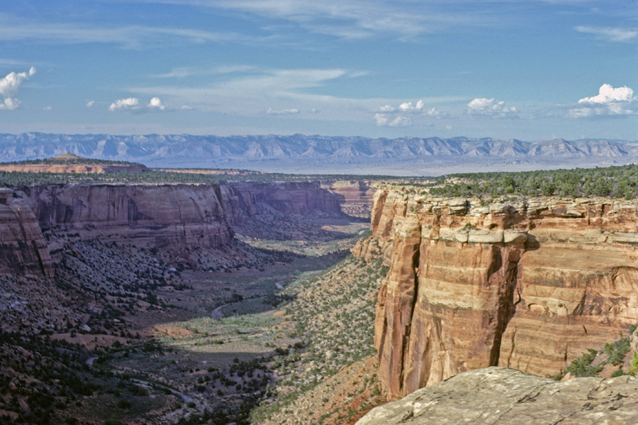
Overlooking Wedding Canyon to Independence Monument
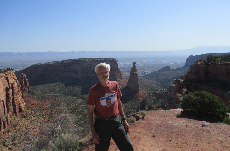
Independence Monument – 450 feet tall 2022
2022
Climbing Independence Monument to Raise Flag on July 4th – the Tradition Continues
2022
This was my third visit to this park – Independence Monument – took this photo in 1968 with Helen
1968
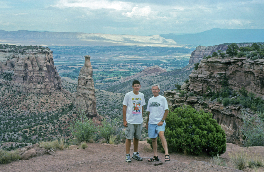
Independence Monument 1998 with Chad
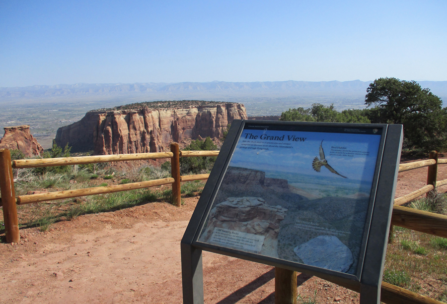
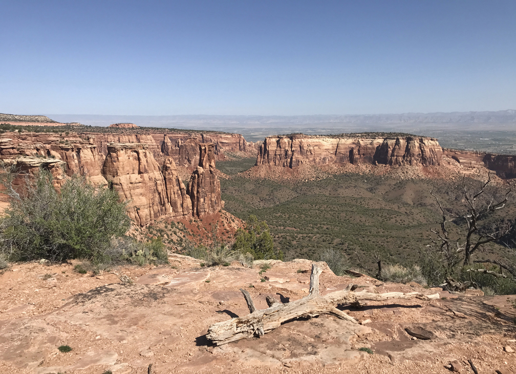
Grand View 2022
Grand View – 1998
1998
Grand View – 1968
1968
Grand View – 2022
2022
Grand View Flowers 2022
Juniper – 1968
1968
Sandstone Detail – 1968
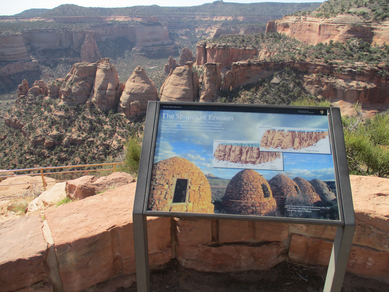
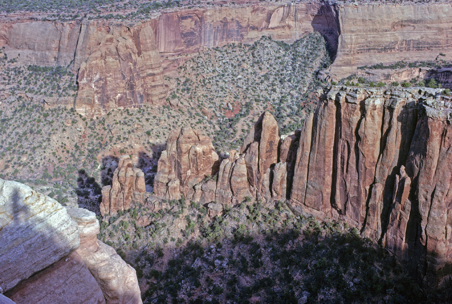
Coke Ovens – 2022
Highland View – 1968
1968
Upper Ute Canyon Overlook – 2022
2022
Bats –
Fallen Rock Overlook – 2022
Ute Canyon View – 1968 with Helen
1968
Red Canyon Overlook – 2022
Cold Shivers Point – 2022
Stayed with cousin Nick and wife Linda in Arvada outside of Denver, dinner at German restaurant with Nick, Linda, cousin Cathy, and Lisa (Nick & Linda’s daughter)
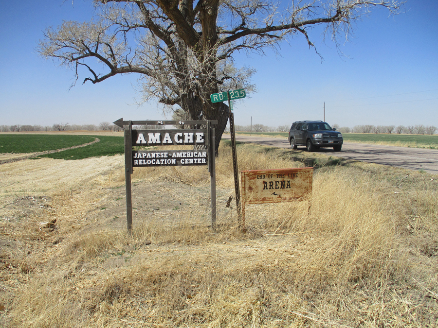
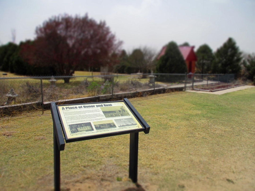
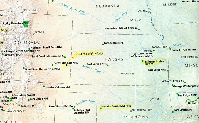
4/22 F – 4hrs to Camp Amache NHS near Granada in southeast CO. This is the newest National Park Unit (#424) – bill signed by President Biden in 2022.
Old Museum in Granada foreground, new Museum and Amache NHS Visitor Center background with green awning
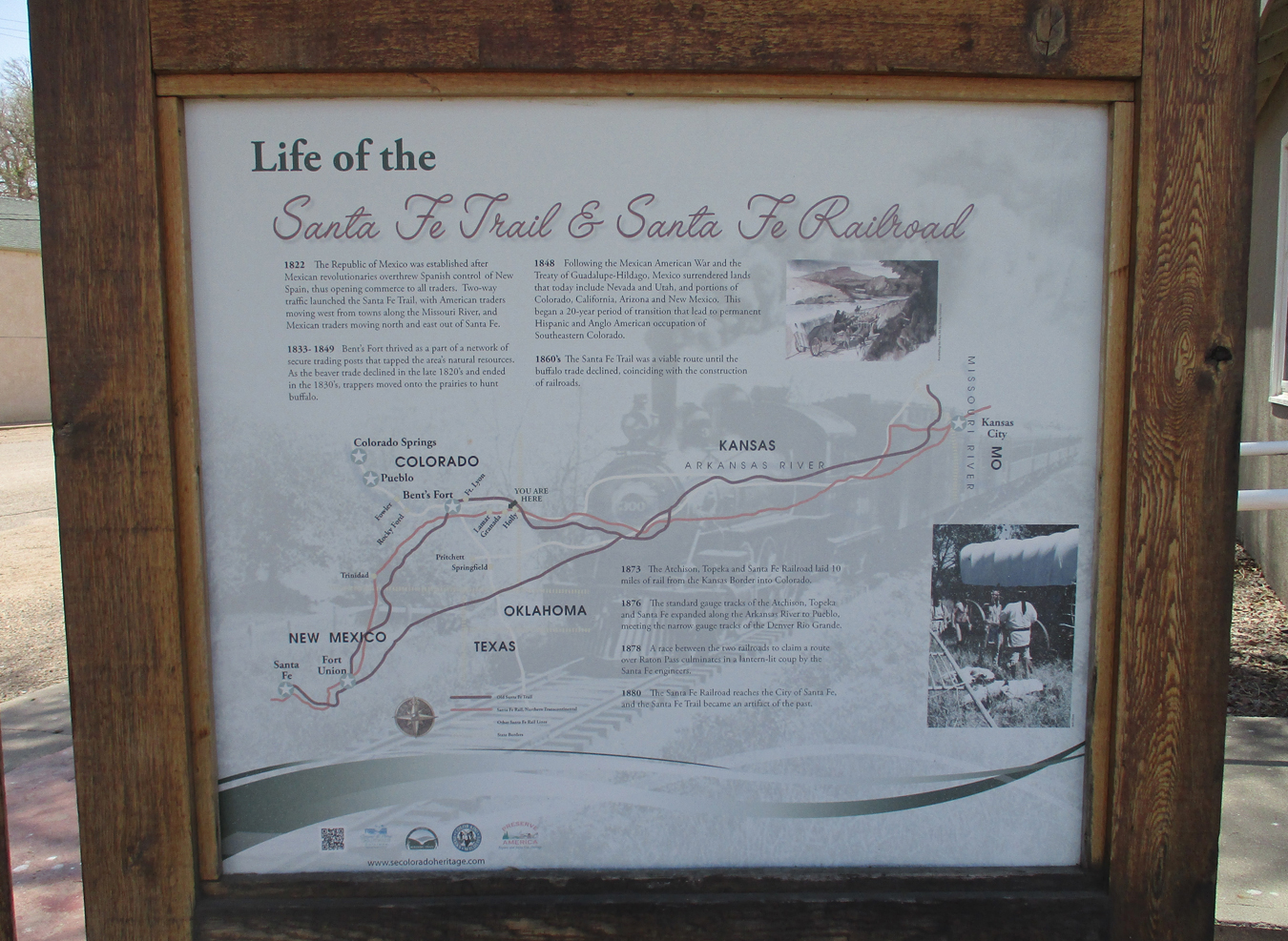
Santa Fe Trail and Santa Fe Railroad
The Visitor Center was to be closed today but John Hopper (APS) had opened it for me for a noon visit. A gentleman from Great Britain happened by as well.
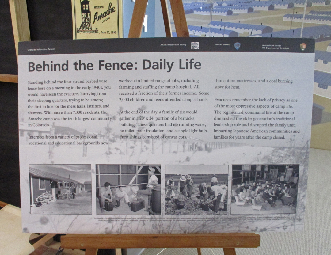
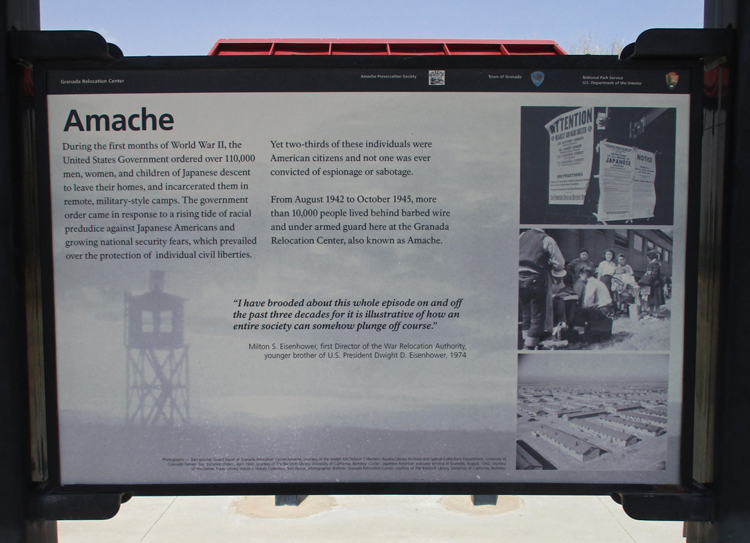
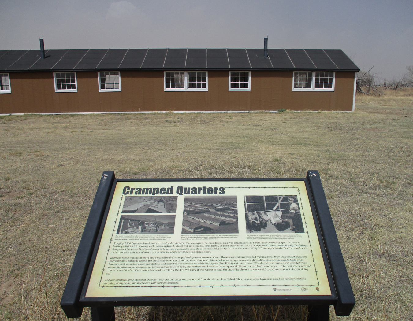
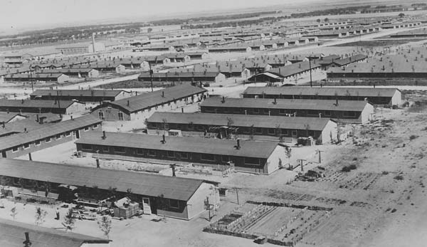
Granada Relocation Center, also known as Amache, was one of ten Japanese internment camps operated by the U.S. government during World War II (1943-1945). At its peak, it housed 7,500 persons of Japanese descent, most American citizens. In retrospect, this was a black mark on the Roosevelt administration. Japanese arriving by rail car – does that remind you of anything?
Relocation Center, Internment Camp, Concentration Camp?
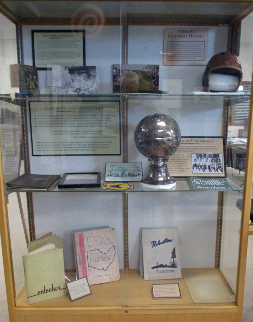
Despite the difficult conditions, the residents worked to maintain their community.
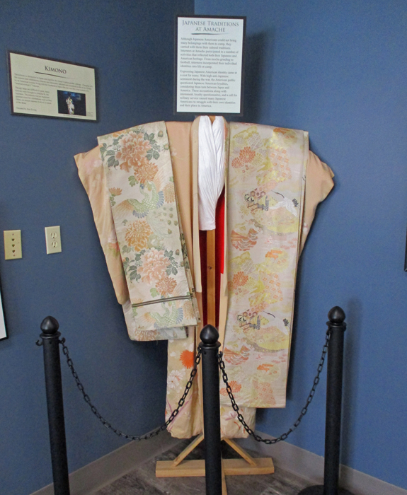
That included Japanese as well as American traditions
Amache was located on the Arkansas River so that residents could produce agricultural products for the war effort.
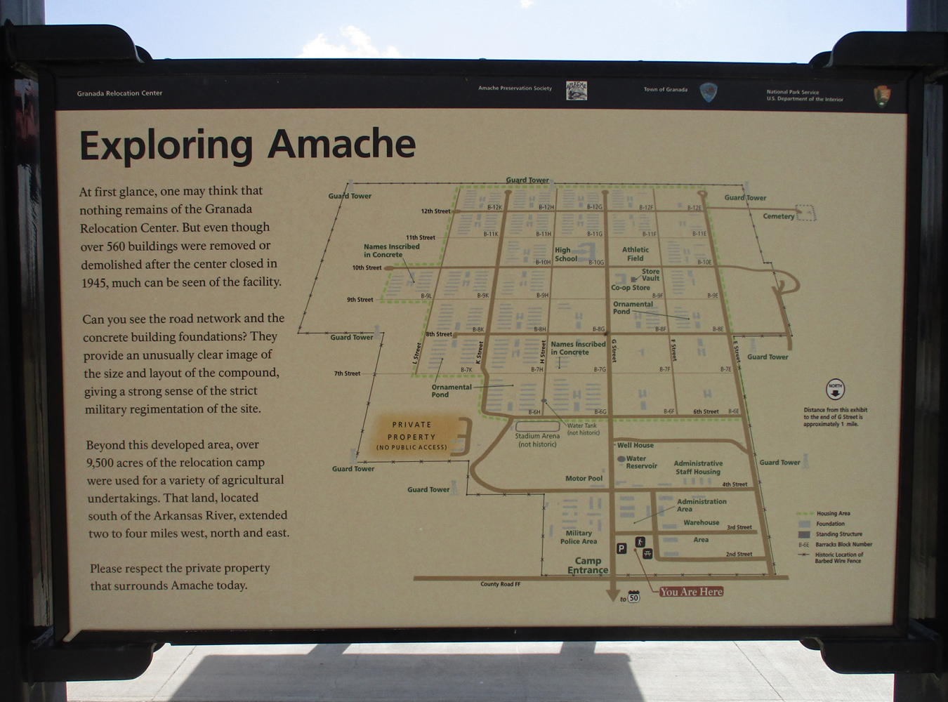
The Relocation Center Central Area is located off U.S. 50 just west of town
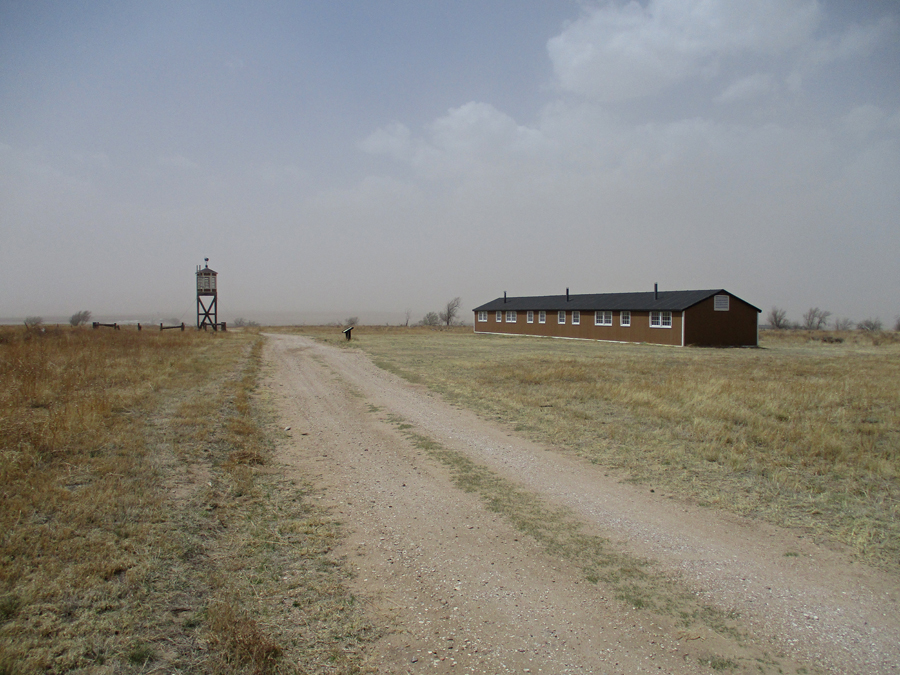
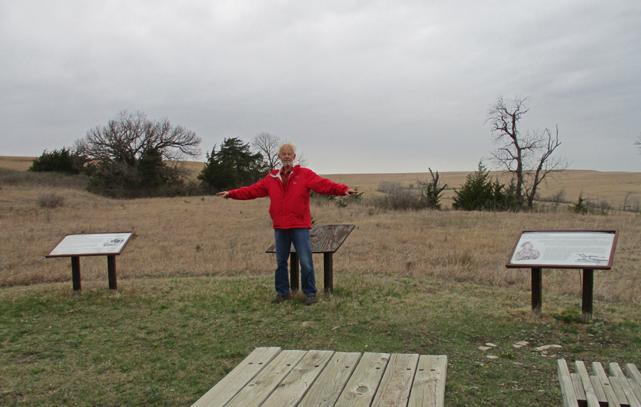
This was another “Red Flag Day.” High winds with blowing sand/dust made it unpleasant to be outside. The following are representative of many informative markers.
Poor visibility due to blowing sand/dust
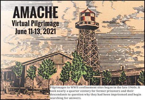
Water Tank and Annual Pilgrimage
Guard Tower and rebuilt barracks
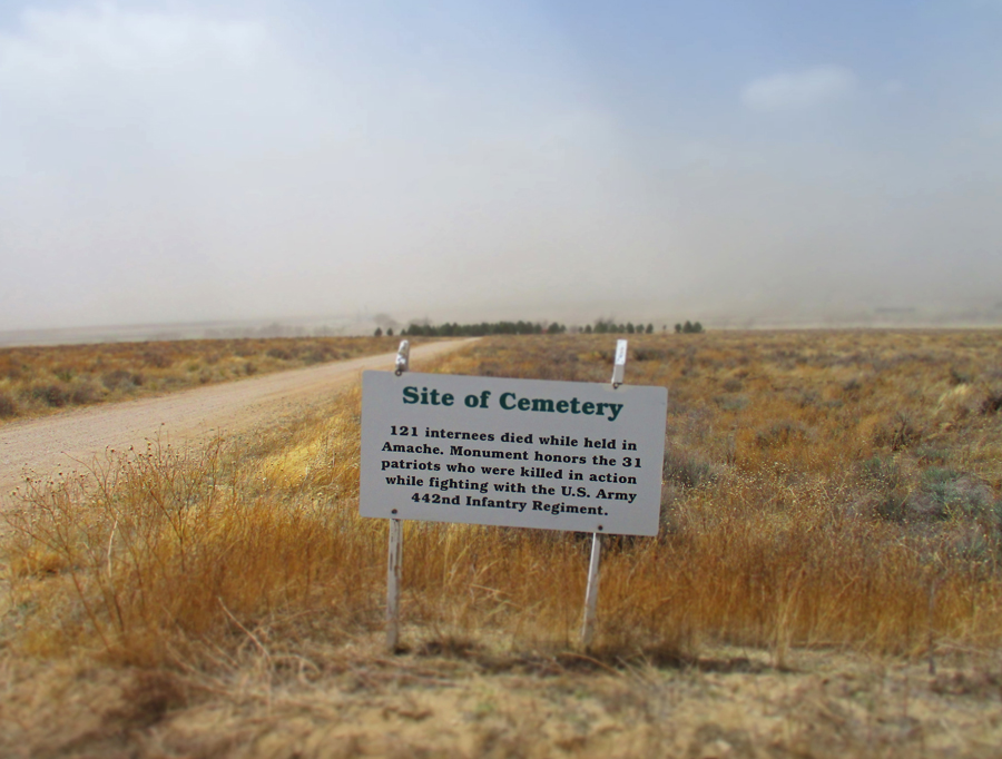
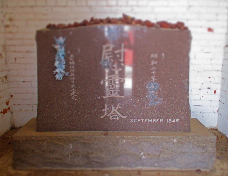
Cemetery
5.5hrs on U.S. 50 to get to Tallgrass Prairie N PRES in KS. Slept in parking lot.
4/23 Sa – Tallgrass Prairie N PRES
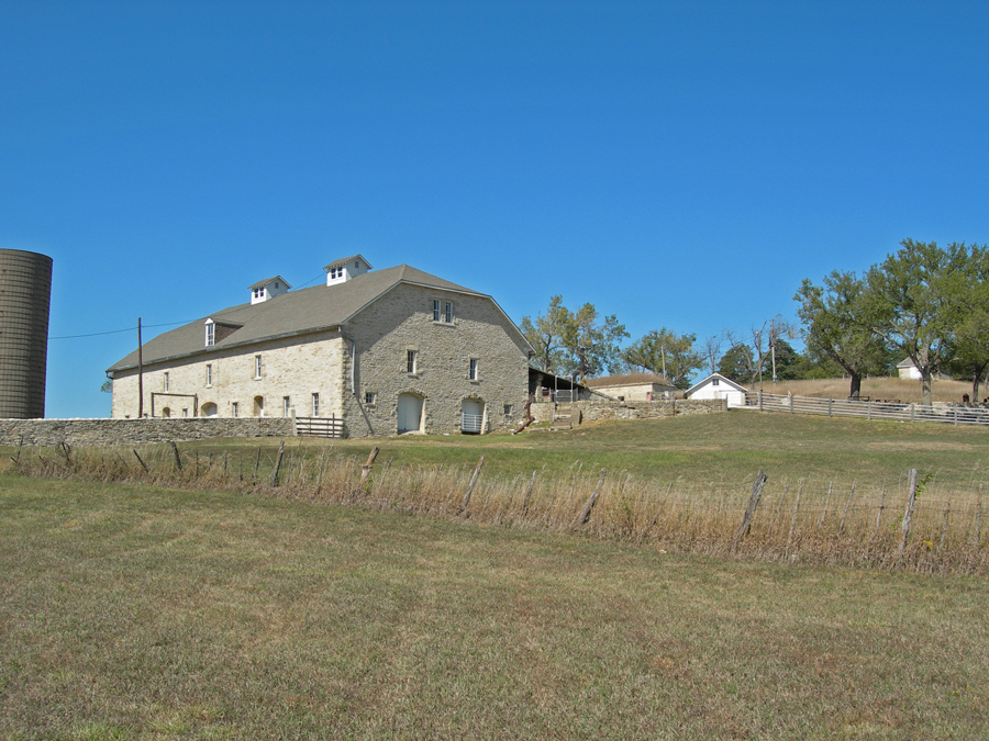
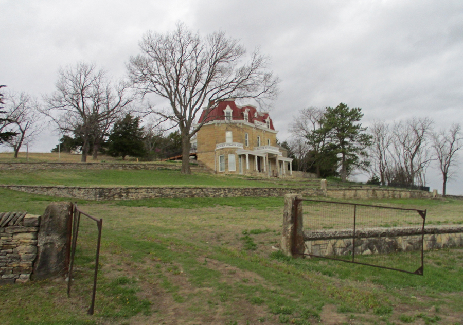
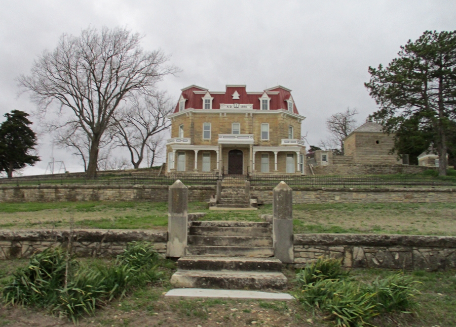
Spring Hill Farm and Z Bar Stock Ranch (11,000 acres) represents a ranching legacy from 1878 to 1986. The Nature Conservancy owns most of the land and manages the Preserve with the NPS.
Entrance
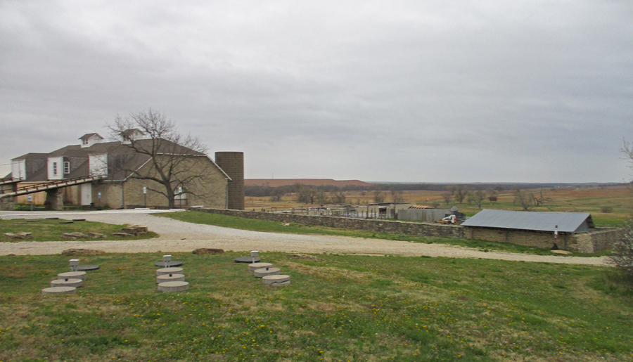
This photo of the 110ft x 60ft Limestone Barn is from my 2007 visit
The Ranch House Mansion was built in 1881
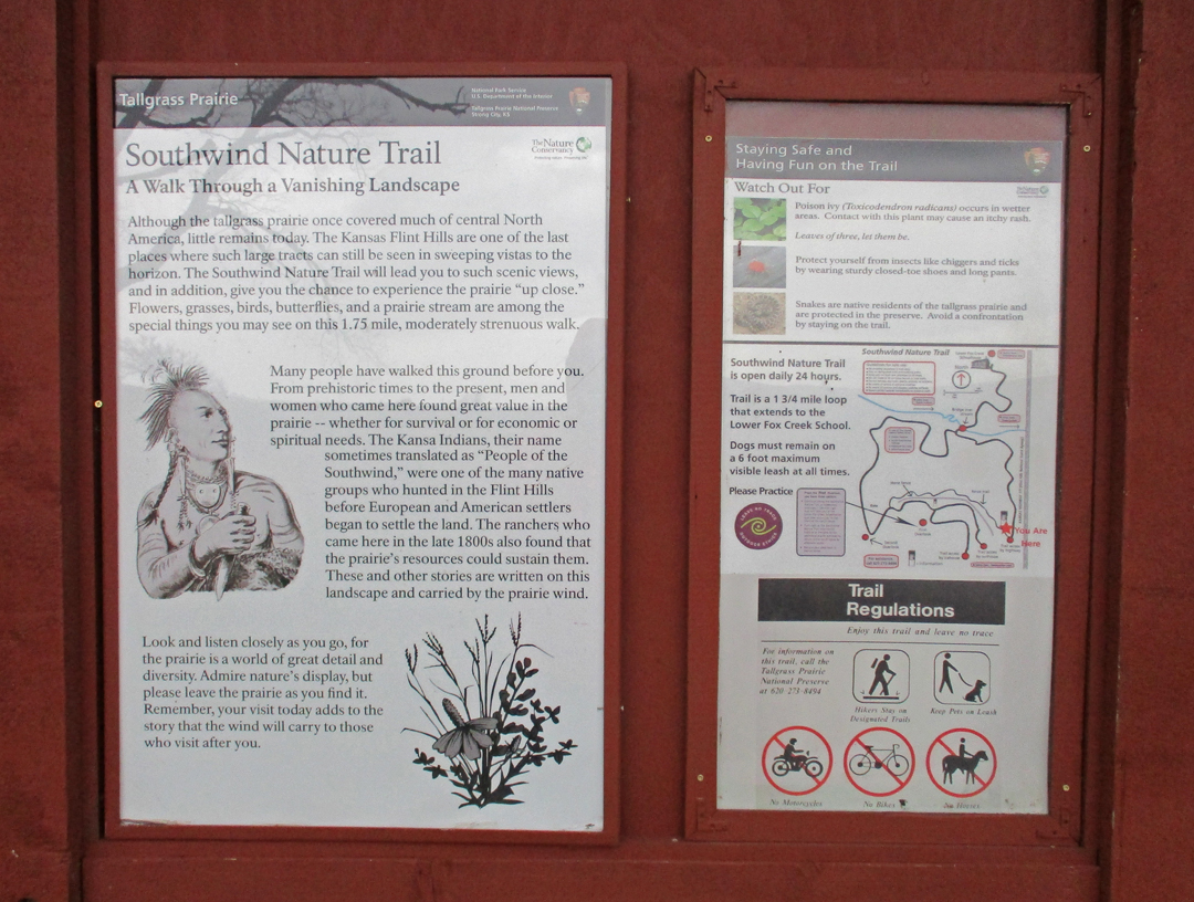
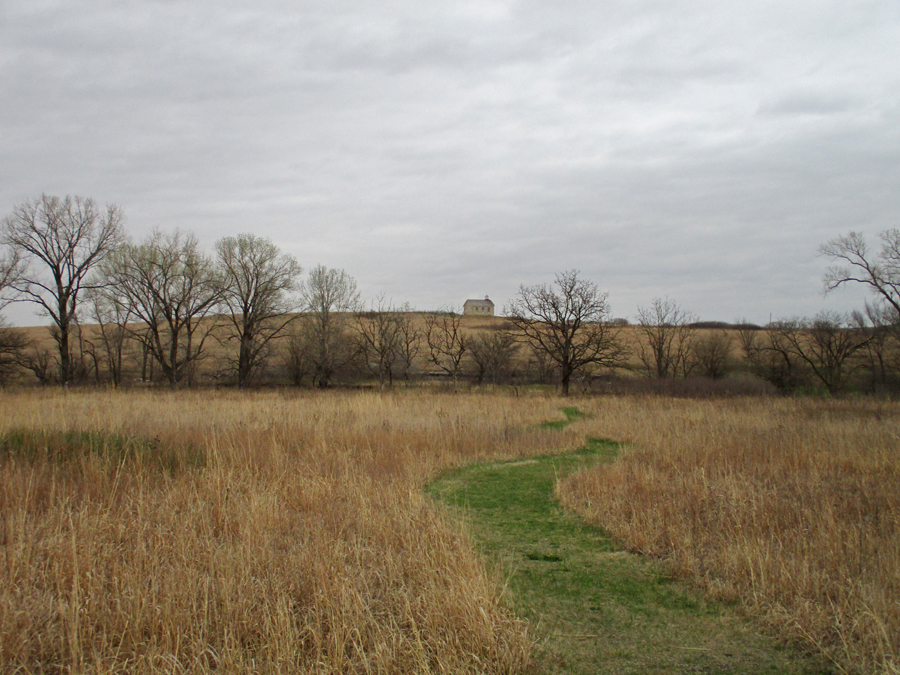
I did the 1.75-mile Southwind Nature Trail
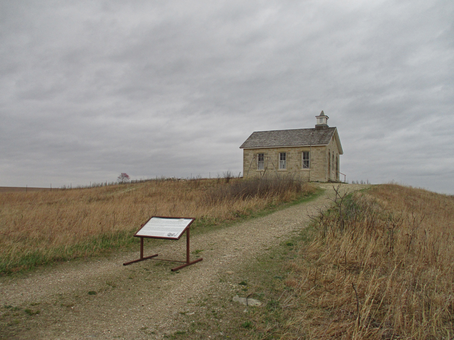
The scenic one-room Lower Fox Creek Schoolhouse was built in 1882 and closed in 1930
Tallgrass Prairie – 2022, Bison herds once roamed this land. Today you can see some bison in the Windmill and/or West Traps Pastures. However, I did not see any today when hiking through the West Traps Pasture.
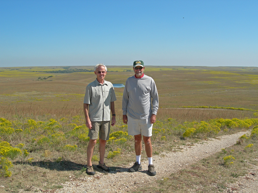
Tallgrass Prairie National Preserve with Larry – 2007
View from Overlook – 2022
Limestone Barn with Flint Hills in background
This old gas pump is by the 1882 limestone Chicken House
The Ranch House Mansion currently serves as the Visitor Center – Ice House on hill to left
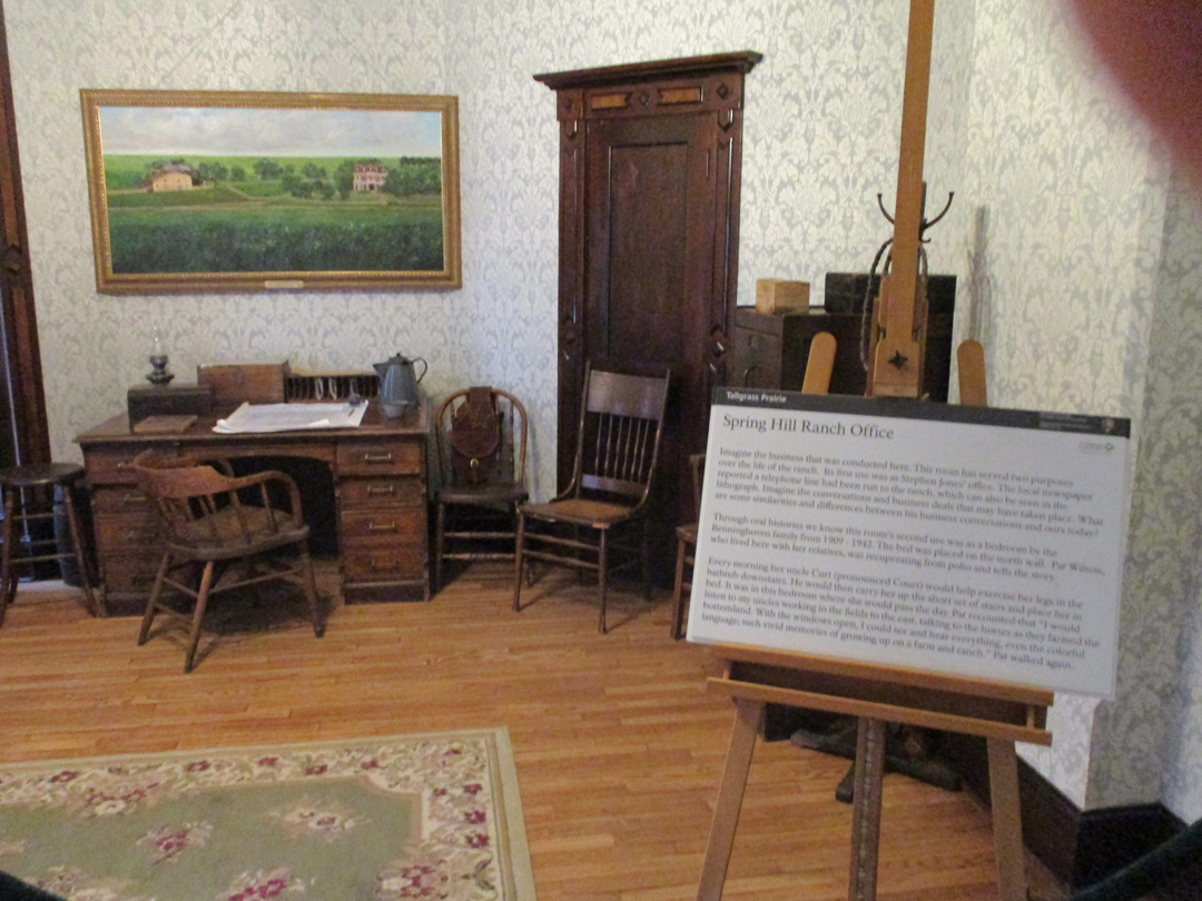
Spring Hill Ranch House Office
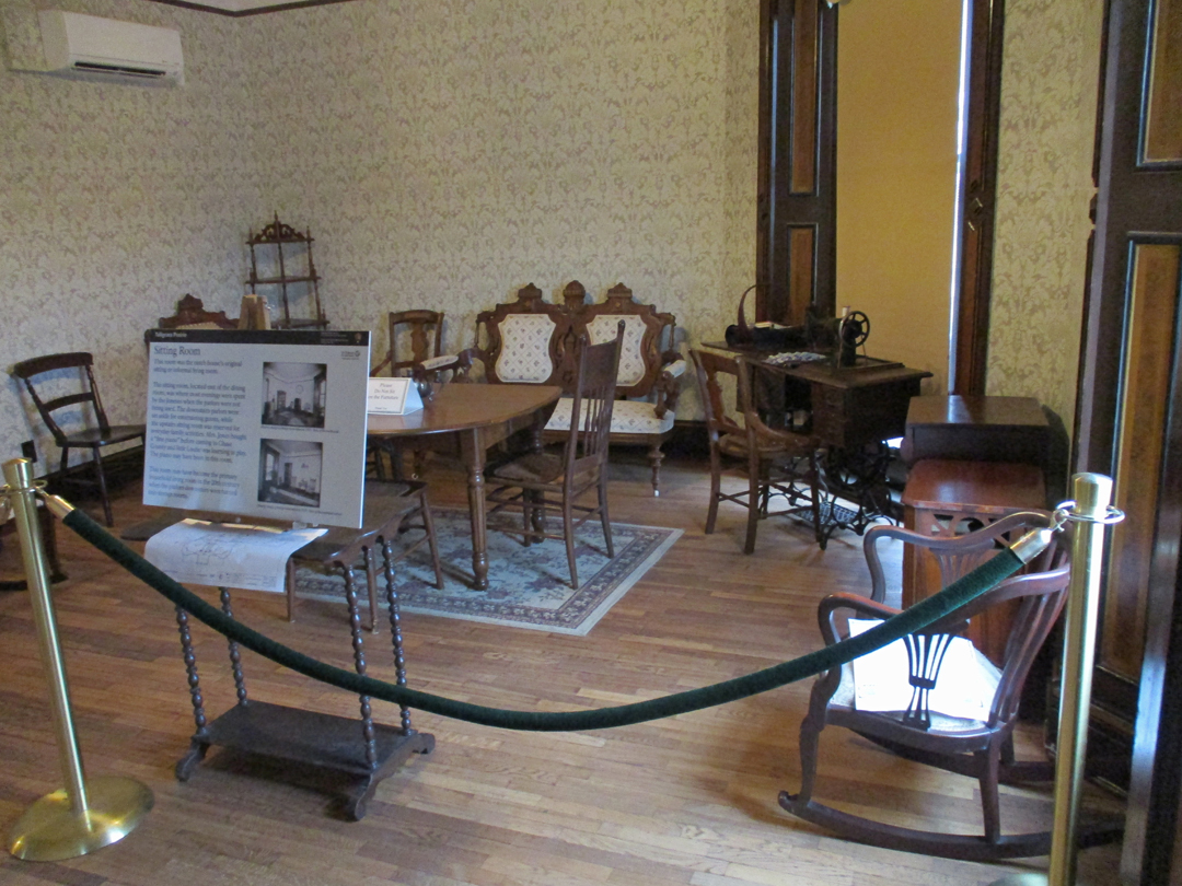
Sitting Room
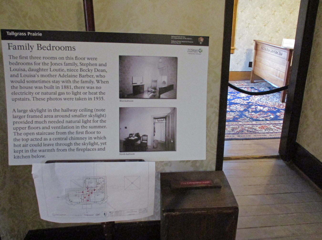
Bedrooms
Ice House from second floor window
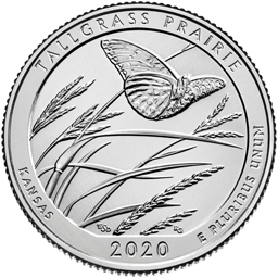
2020 Kansas Quarter – part of National Park series, one NP site from each state – Tallgrass Prairie
11hr (745mi) drive to Springfield – slept in my own bed!