
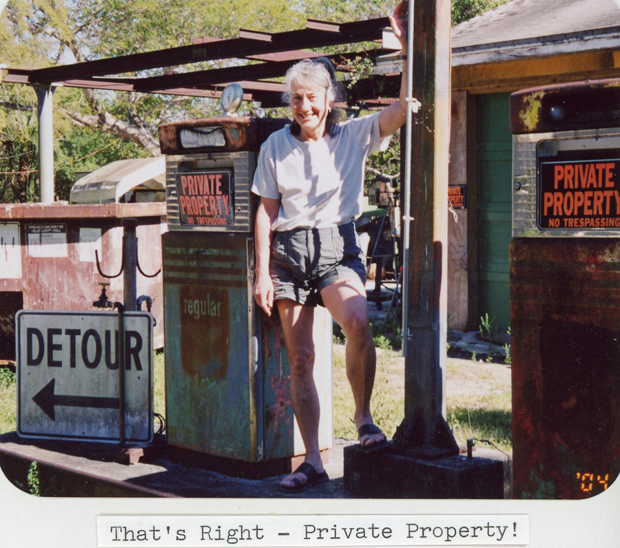
1/13/2020 – Big South Fork National River and Recreation Area KY and TN, visited the park headquarters, also see Blog October 2009
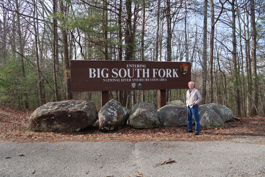
East Rim Overlook of the Big South Fork of the Cumberland River

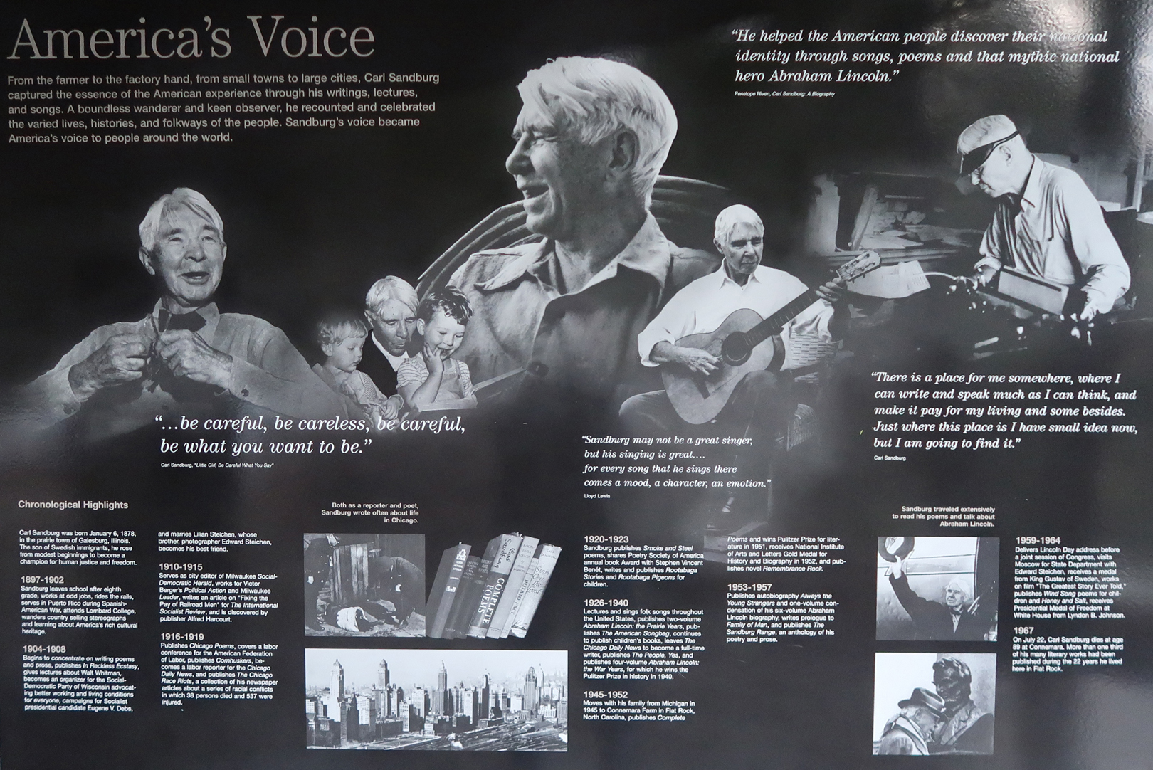
Stopped at Carl Sandburg Home National Historic Site in NC to add to my photo collection from October 2010 (see Blog for that month)
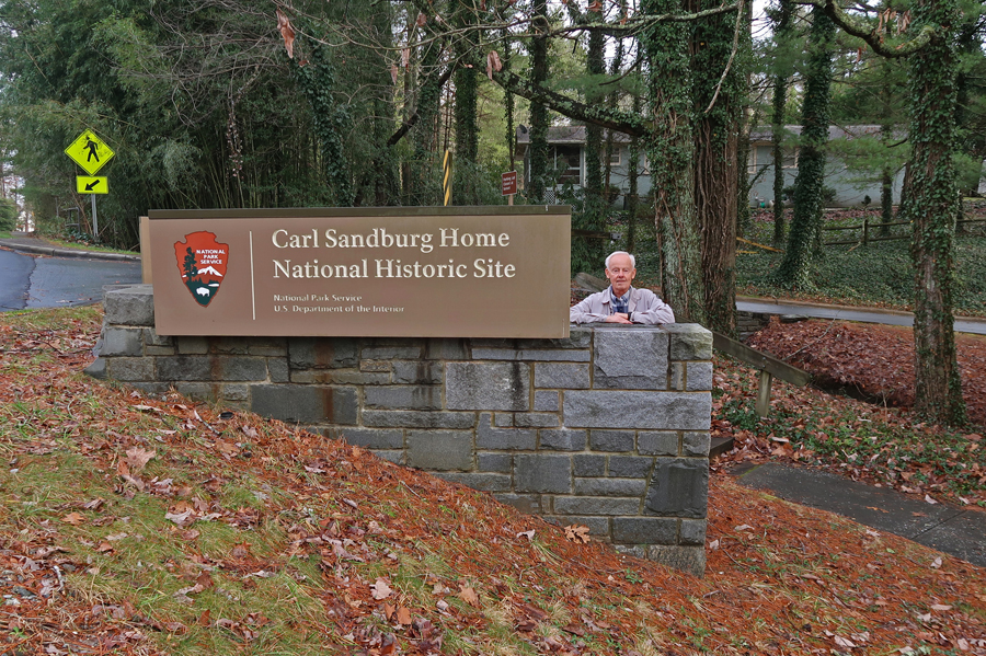
Carl Sandburg (1878-1967)
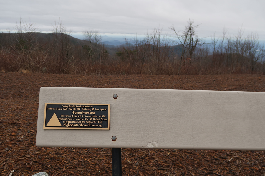
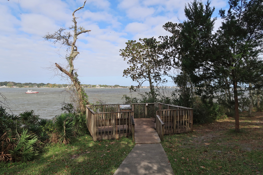
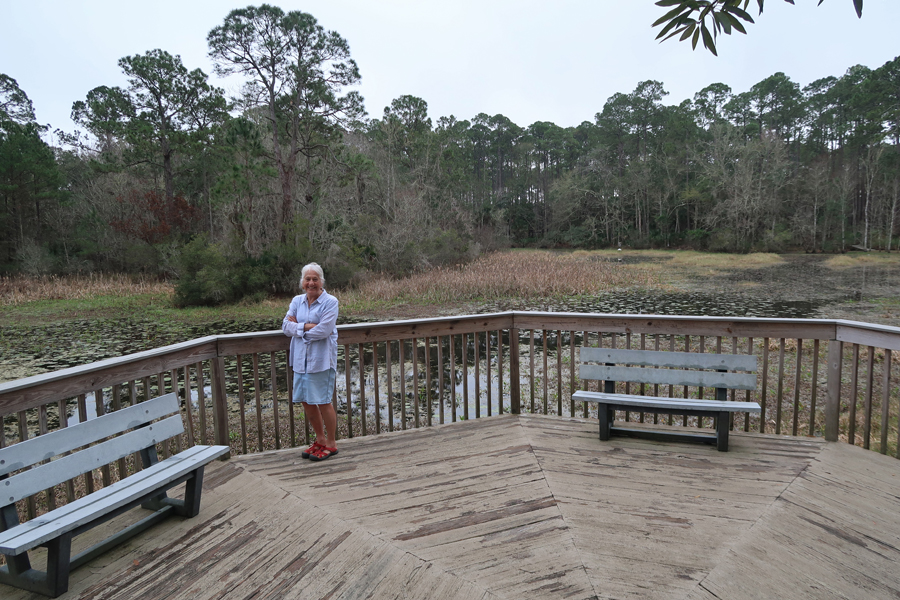
Continued to Sassafras Mountain (3560ft), the highpoint of South Carolina
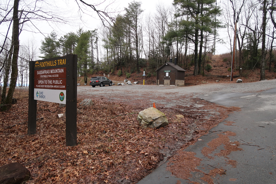
The new viewing platform is on the border between South Carolina (SC) and North Carolina (NC)


There is now a view from the top
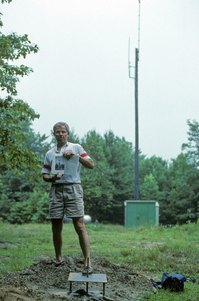
Which did not exist in 1991, there was a fire tower there in 1988 (book pic)
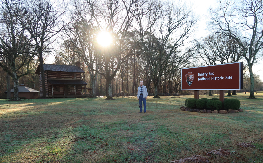
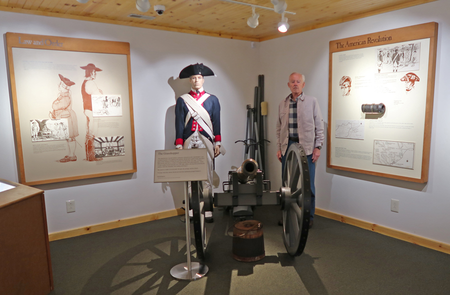
1/15 – NP Unit stops in SC, first Ninety Six National Historic Site, this was one of many Revolutionary War Battleground sites in the Southern Colonies. We also visited in March 2016 (see Blog).
The first Revolutionary War battle in the South took place here on November 19, 1775; 1,900 loyalists attacked 600 patriots. After two days of fighting, they agreed on a truce. However, in June 1781, Nathanael Greene attacked and laid siege to the loyalists/British in the fort. He was not successful. The loyalists left the village in ruins in July and tried to destroy the star fort when they left, ending the existence of the village.

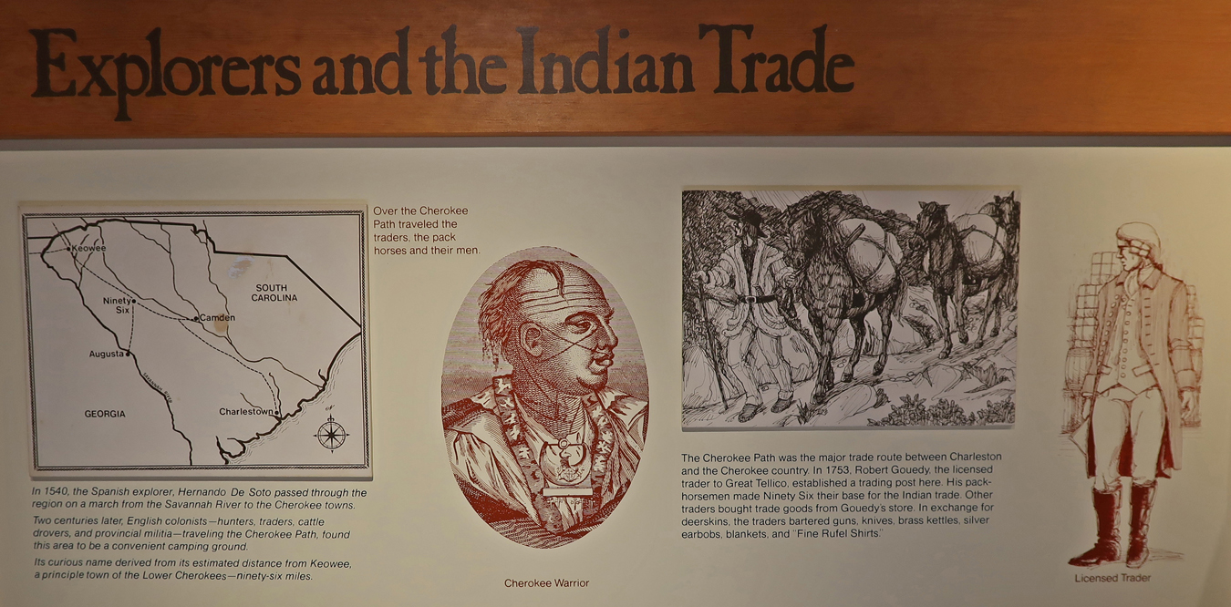
Why is it called Ninety Six? The location was at the intersection of two Indian paths, one from what is now Augusta GA to Camden SC. The other was called the Cherokee Path and it went from Charleston to the Cherokee town of Keowee. Ninety Six was 96 miles southeast of Keowee. After the Revolutionary War battle at Ninety Six,
I was disappointed that the ranger would not allow me to hold an old rifle for this photo.
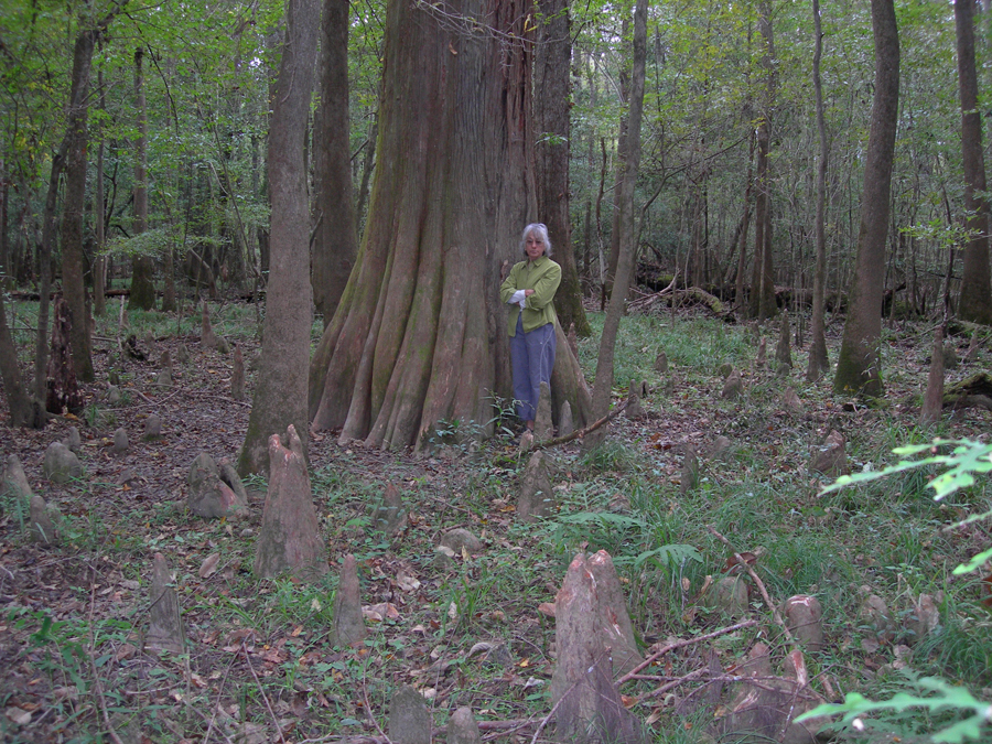
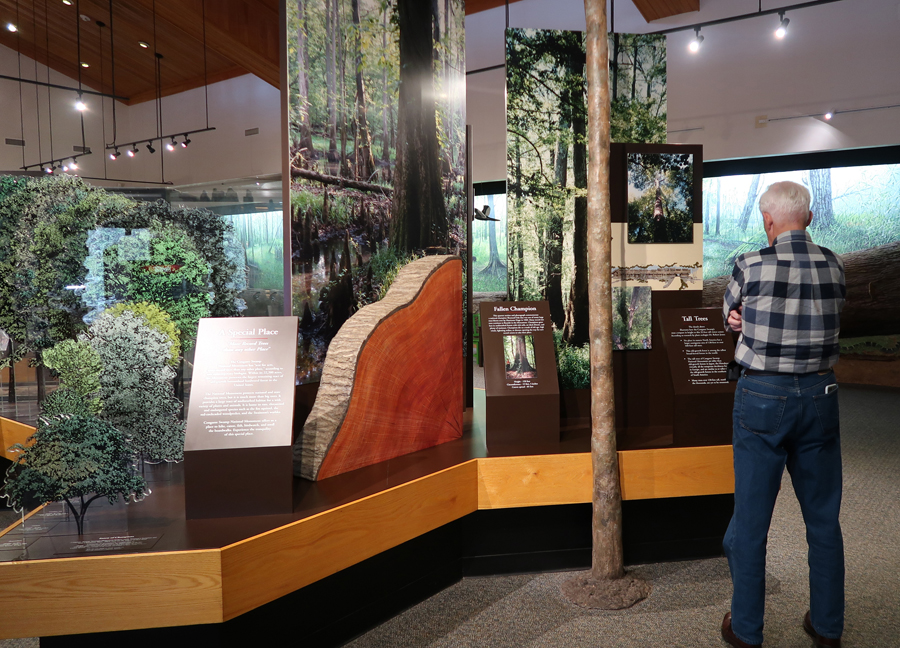
Congaree National Park was our next stop. It is one of the smallest (by area) National Parks. Gateway Arch (St Louis) is ~91 acres – in my opinion it should be a National Monument or National Memorial NOT a National Park! It is a man-made structure with nothing “natural” about it! Hot Springs NP in Arkansas is the next smallest (#2) at ~5,500 acres. Number three is the National Park of American Samoa at 8,257 acres. Then #4 is Virgin Islands NP at 14,940 acres. Congaree NP is #5 at 26,539 acres.

I am going to start with our 2006 visit here – 10/13/2006 – Congaree NP is one of the most biodiverse in North America and protects the largest contiguous area of old-growth bottomland hardwood forest remaining the U.S. We toured the visitor center, watched a video, and then took the 4.4-mile Weston Loop Trail, at first on a boardwalk and then through the swamp. Notable sites included the bald cypress trees, cypress knobs, and moss-covered trees.
AND, we came across a five-foot long black snake that wouldn’t move off the trail. It looked as though he had recently eaten; we counted 19 bumps along his body! I took a video of the interesting water beetles on Cedar Creek. They would move together in a compact circle or long column and then, for no apparent reason, would start a wave action through the water. The rangers said they had never seen that before.

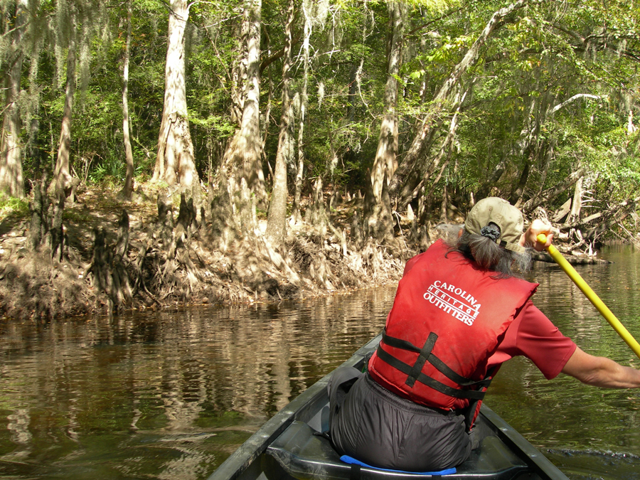
The next day, we stopped at a supermarket to buy food and then drove to Carolina Heritage Outfitters home base in Canadys SC on the Edisto River at 10am to pick up our canoe. We packed our gear and were then driven to our put-in location off US 21. The Edisto is a clear “black water” River that flows through bottomland swamp on its way to the Atlantic. On average, it was about 40 feet wide with a lot of strainers (fallen trees) near the banks. It was fairly shallow in most places and often had a very inviting sand bottom. However, we did not go in due to the unseasonably cold weather. We stopped in the sun on a sandy bank for lunch and enjoyed the tranquility of our environment.
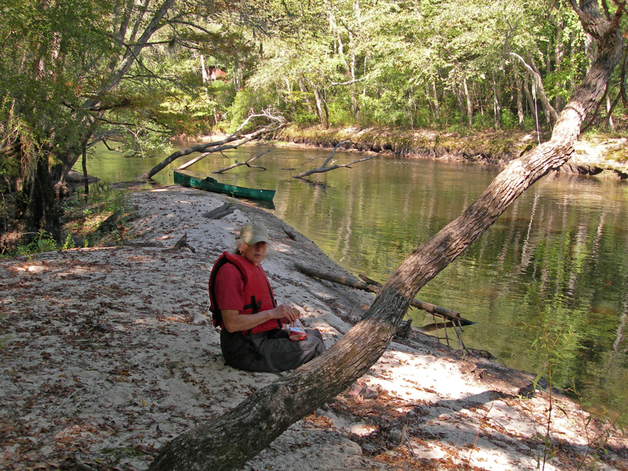
Helen did a good job paddling (I couldn’t slow that woman down!) and we covered 13 miles with a 40-minute lunch stop in 3 hrs. 45 min.

So, we got to our “Tree House” earlier than expected. We were told it would take 5-6 hours.

The “Tree House” was not built in a tree but rather on stilts among the trees. It had stairs to a platform where there was a picnic table and grill and then more stairs to a one room “cabin” in the trees. Inside there was a little table, pull out couch, and gas grill for cooking. I laid out our sleeping bags in the loft overlooking the river and we then walked around the area. There were three “Tree Houses,” (out of sight of one another) on the river. Only two were in use, ours and one occupied by five female middle school teachers. When we returned, we had chips, salsa and beer outside at the picnic table and then Helen grilled a steak for dinner. As it got dark, I lit the Tiki torches around the platform and got out the oil lamps so we could see our dinner and then play Scrabble. It was cold (40s, we had on all our layers) but fun. The only “downer” was Helen’s mood when she lost at Scrabble!
I was up early the next morning to light the lamps, start the little heater, and prepare breakfast. I used the items left for us in a cooler – starting with the sausage in a seasoned iron frying pan followed by eggs over easy in the sausage grease.
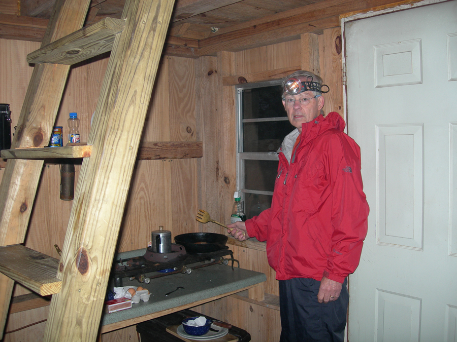
We also had OJ, rolls, jam, plums, and made some hot tea. Helen was invited out of her sleeping bag at the proper time and we enjoyed our breakfast in the trees.

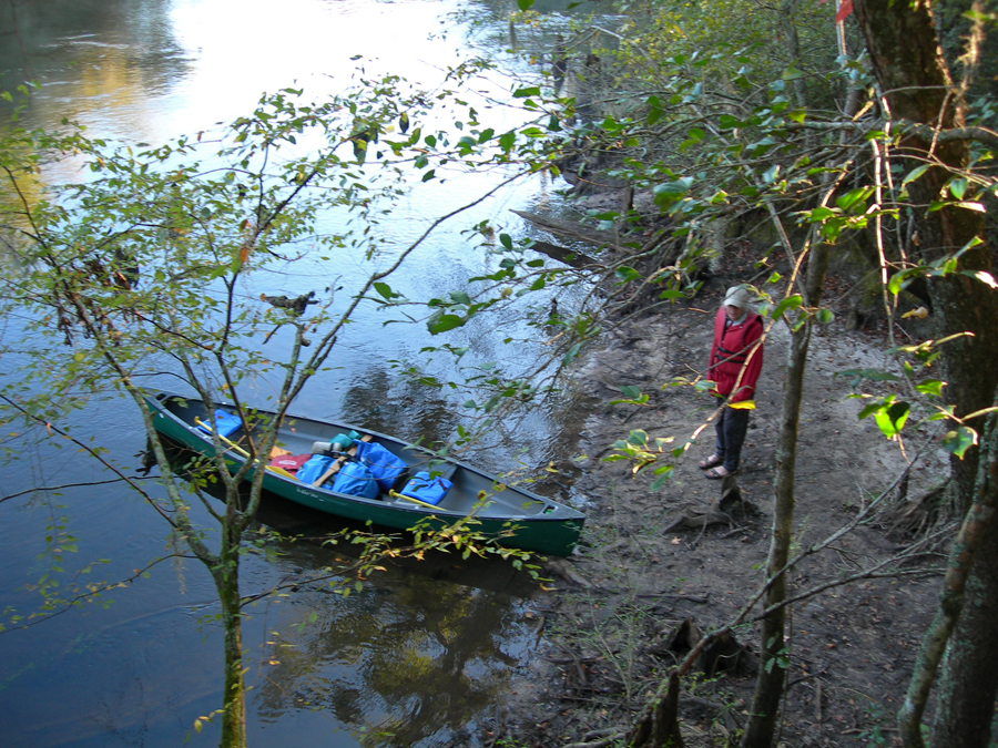
The next morning, we launched the canoe into a river mist among cypress stumps at 8am for the 12-mile paddle to the Carolina Heritage home base. The river became a bit wider, but we still had to be careful as we moved around the many strainers. During our two-day paddle we were treated to the site of wild turkeys, heron, egrets, and many other birds. We were told we missed the alligators because of the cold weather.
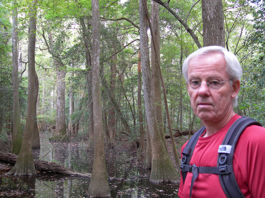
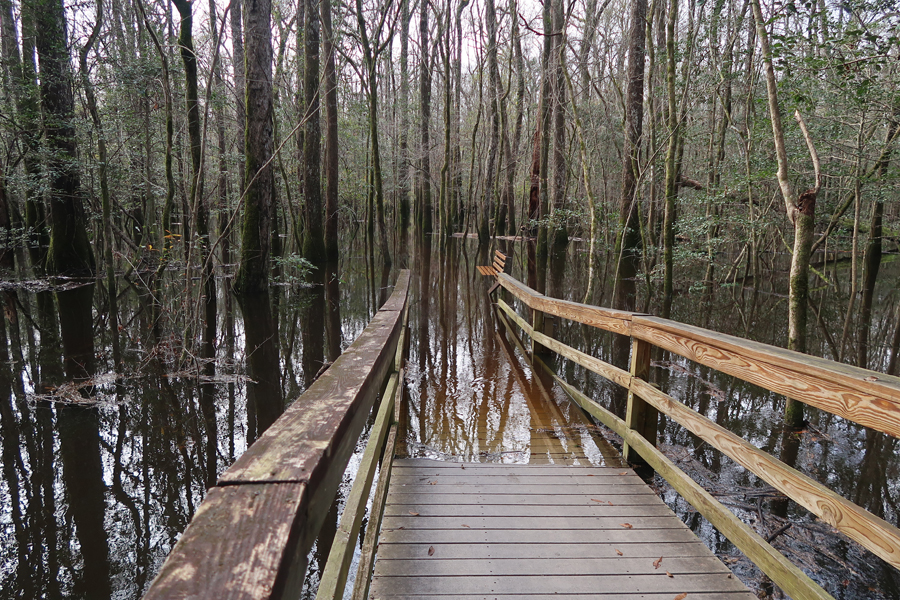
Today, 1/15/20, we started at the Harry Hampton Visitor Center
Harry was instrumental in passing legislation to preserve the largest remnant of old growth floodplain forest in the SE U.S.
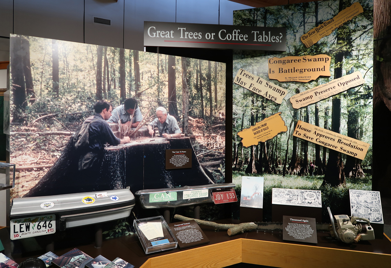
Helen watched the park video as I did as much of the boardwalk self-guided tour as I could.


The Congaree River was in flood stage. So, I was unable to complete the loop or any other trails
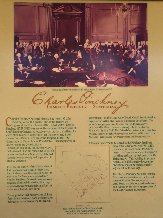
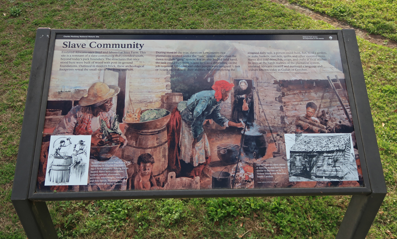
Two more hours took us to Charles Pinckney National Historic Site, it is on the E side of Charleston Harbor not far from Fort Moultrie, which is part of the Fort Sumter NHP. Pinckney is not a recognizable name to most Americans but he was an important figure in his day (1757-1824).
We returned to this site (were here in March 2011 – see Blog) for additional photos, to watch the video, and to walk the Nature Trail.
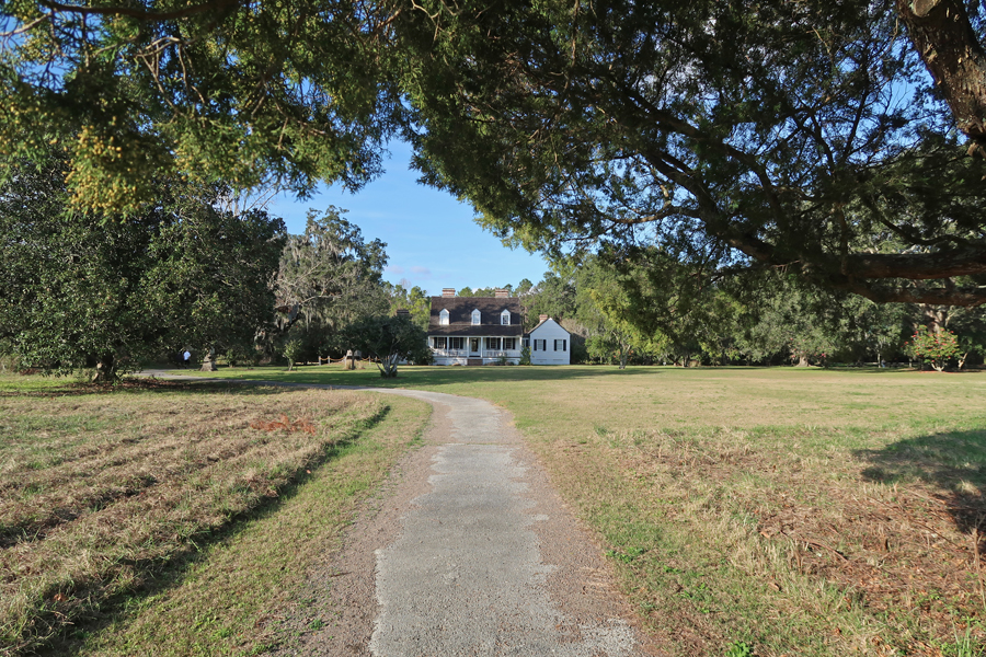

Charles Pinckney – Statesman, he is in the famous “Signing of the Constitution” (1787) painting by Louis S. Glanzman. Pinckney represented South Carolina and was one of the drafters of the document.
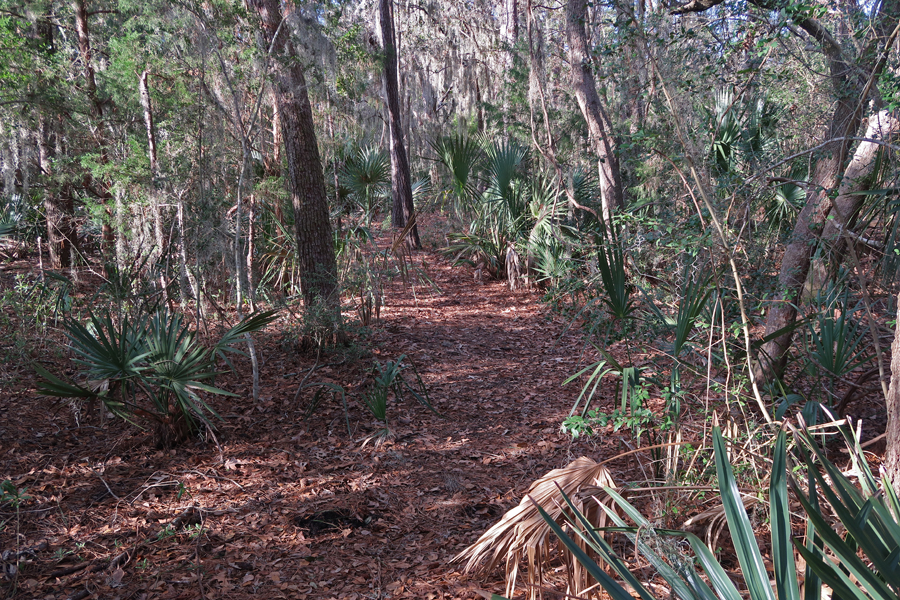
The Nature Trail borders a tidal wetland, mosquitoes in January!
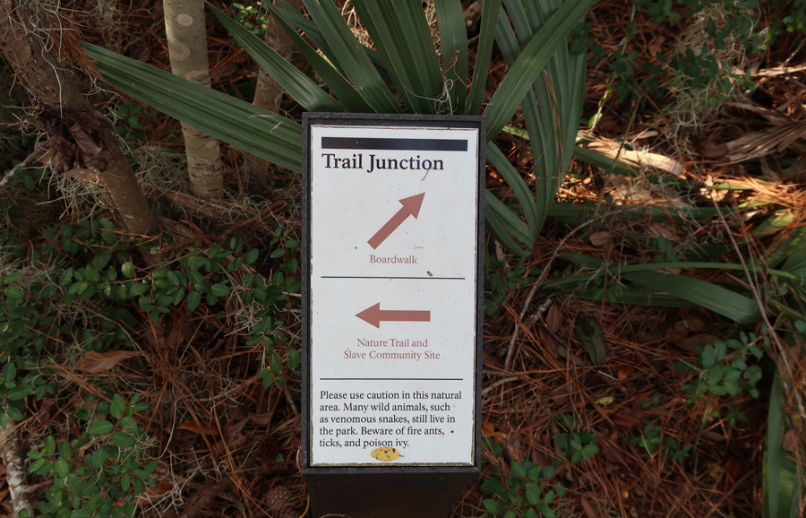
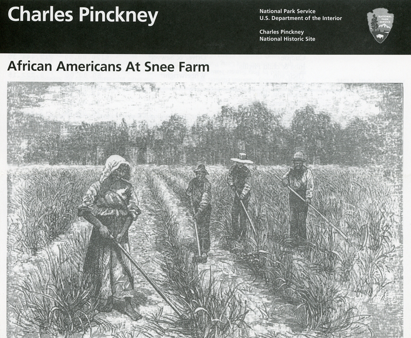
It leads to the location of the slave community
We arrived at our friend Karen’s home in Beaufort SC about 5pm
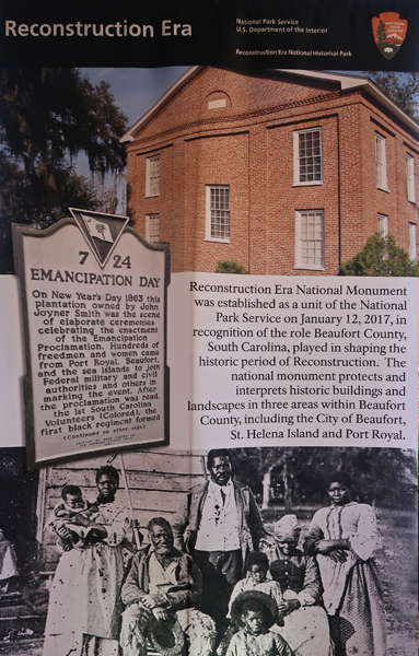
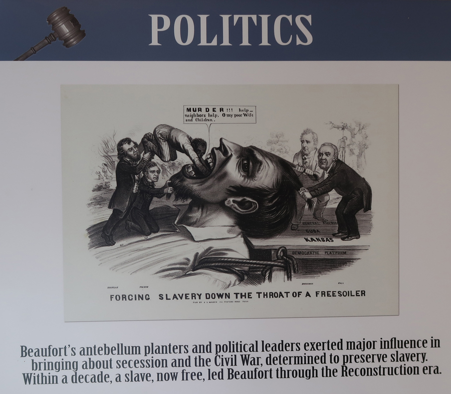
1/16 – Beaufort SC, Reconstruction Era National Monument has now been changed to Reconstruction Era National Historical Park. It has four sites.
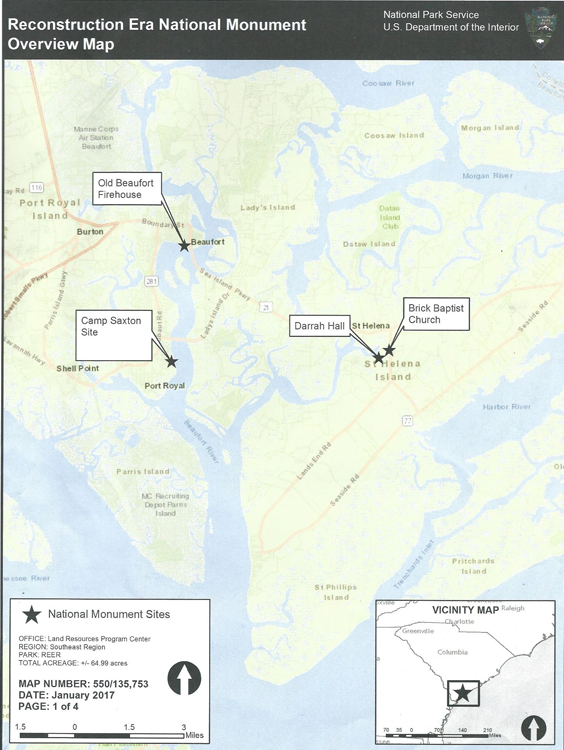
We visited all four sites last year – see Blog for February 2019; however, the Vis Ctr was not yet open.
So, this year, we visited again during our stay with Karen in Beaufort

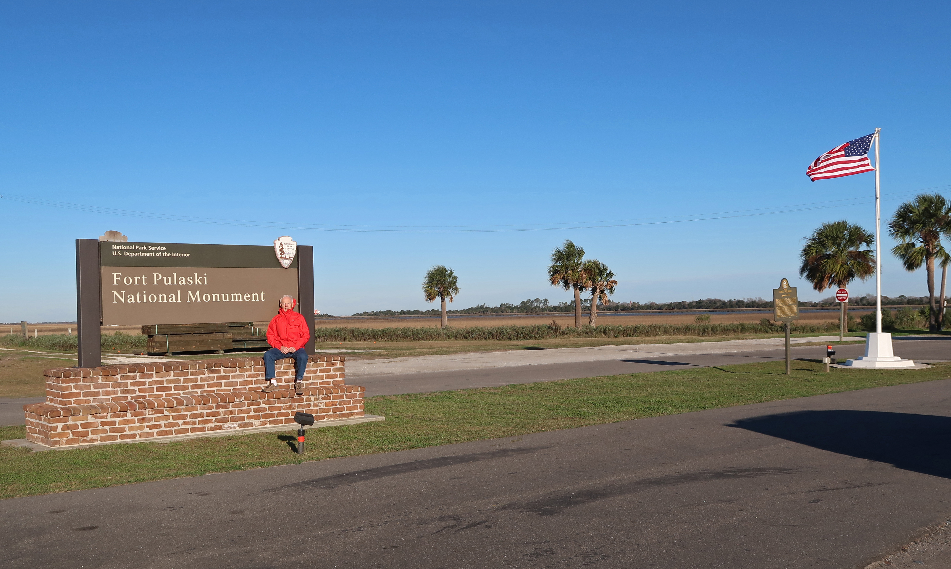
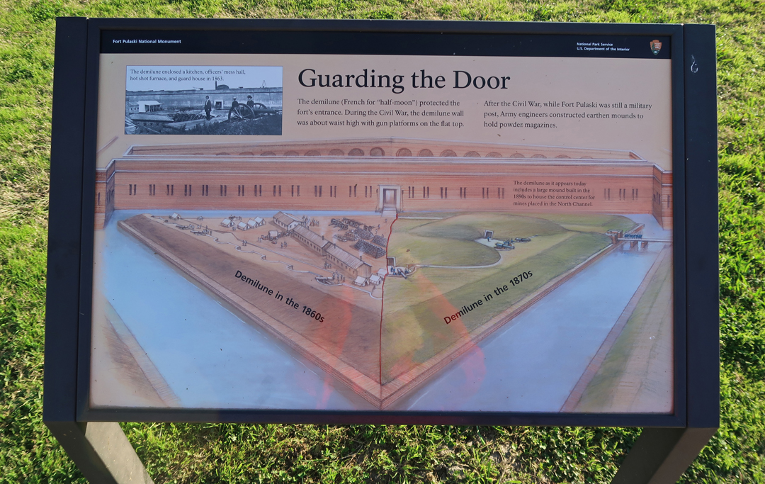
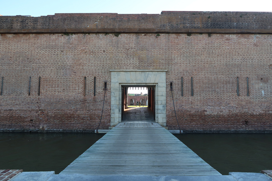
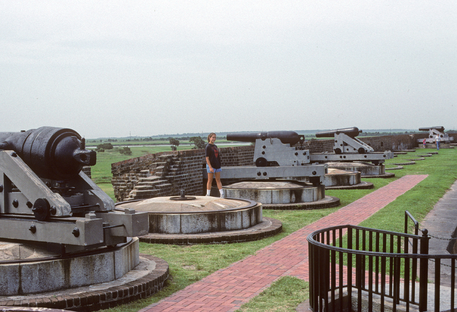
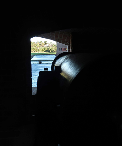
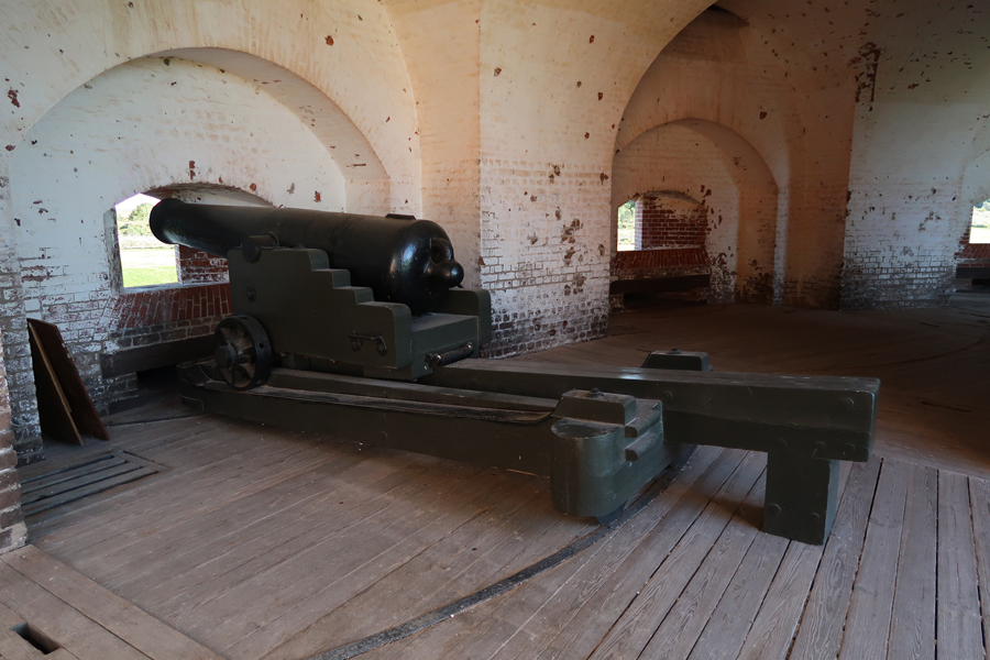
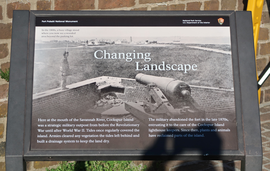
1/17 – Our first stop was Fort Pulaski National Monument outside of Savannah GA

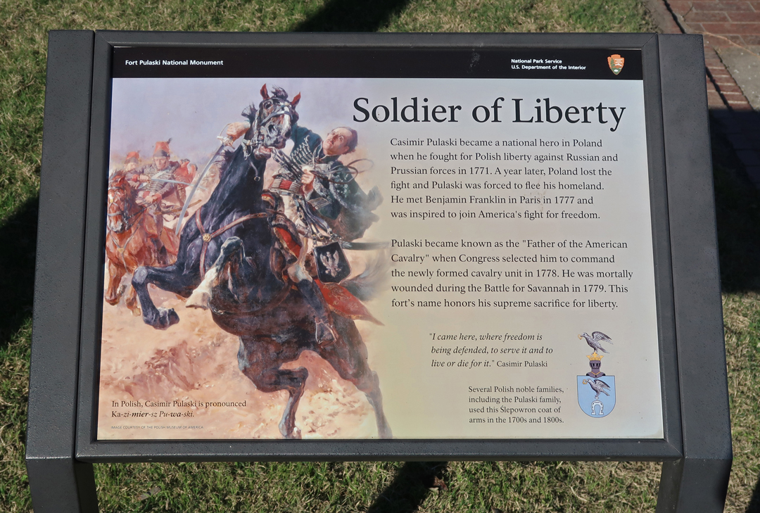
It is named for Polish (Lithuanian) Count Casmir Pulaski who was killed (age 33) during a cavalry charge on the British lines during the Siege of Savannah in 1779. Pulaski was born in 1746 in a Lithuanian Province of Poland. He arrived in America in 1777 and joined the American Revolution fight for the cause of “Liberty and Freedom from British Tyranny.”
Visitor Center

Drawbridge and Entrance

We first visited here with Kate and Chad in 1996 when we did a side-trip during the Atlanta Olympic Games.
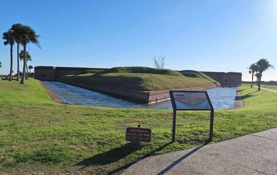
The fort was begun in 1829, after the War of 1812, as part of a systems of forts along the East Coast.

It was completed in 1847 but was not armed or garrisoned in 1861 when the Civil War began.

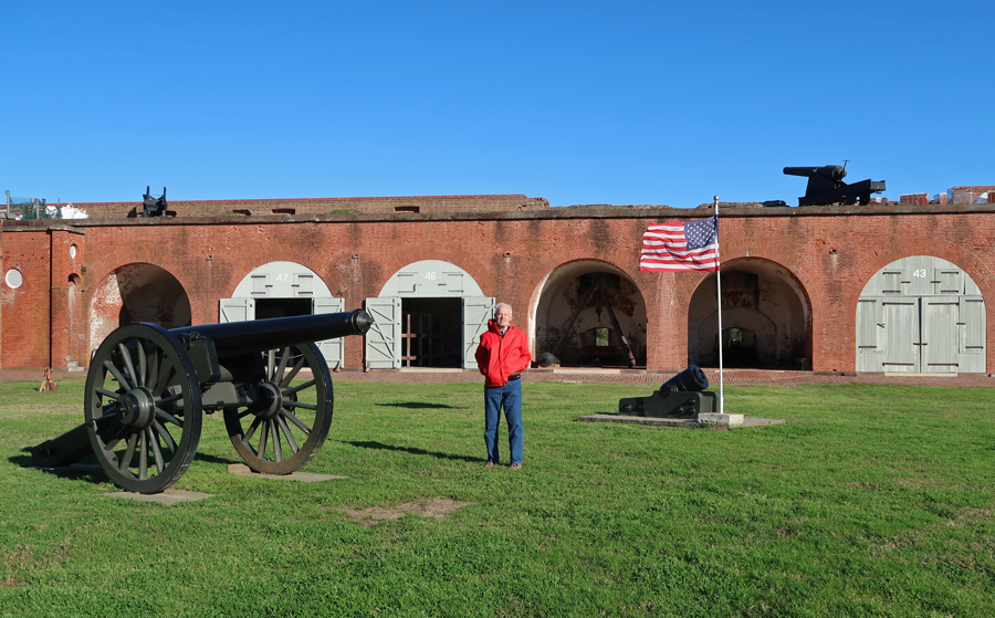
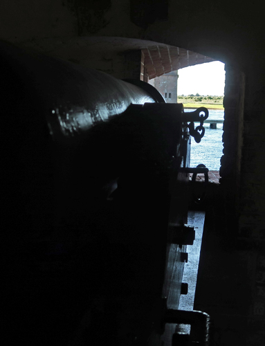
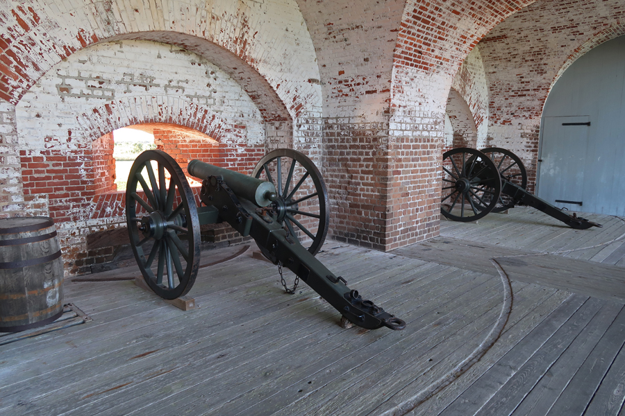
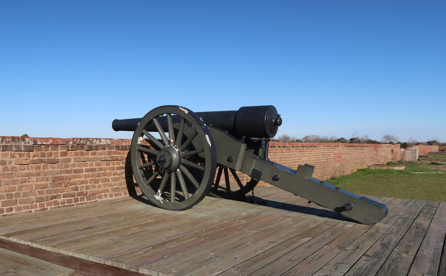
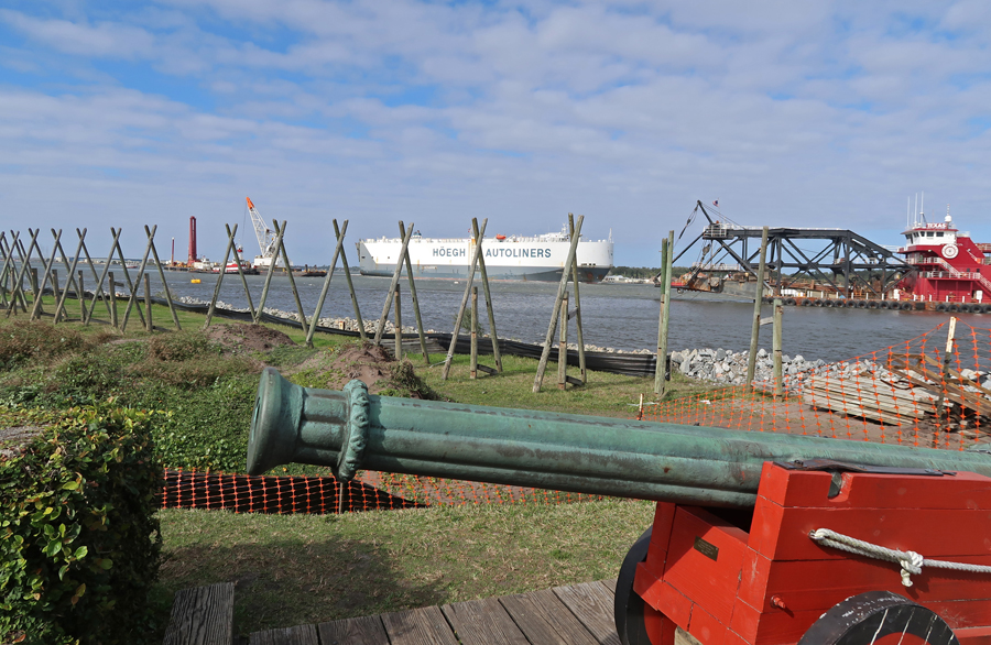
Some armaments – I love cannon pics!

It was immediately occupied by the Confederates (SC Militia)

On April 10, 1862, when the Confederates refused to surrender, the Federals started to bombard the fort with new rifled cannon from Tybee Island.
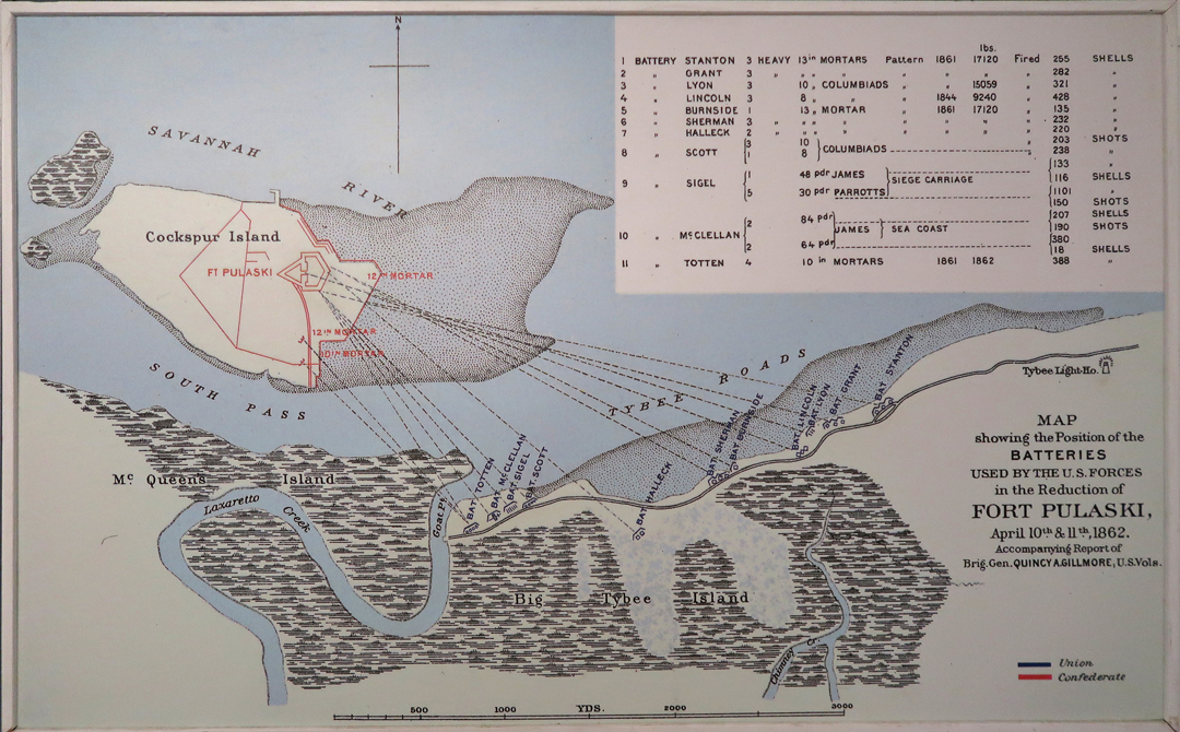
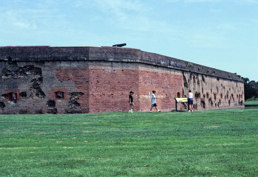
The fort walls, brick masonry, were not built to withstand this weapon, today and 1996

After 30 hours of bombardment, Col. Charles H. Olmstead surrendered.

After Federal control, the fort was a magnate for escaping slaves

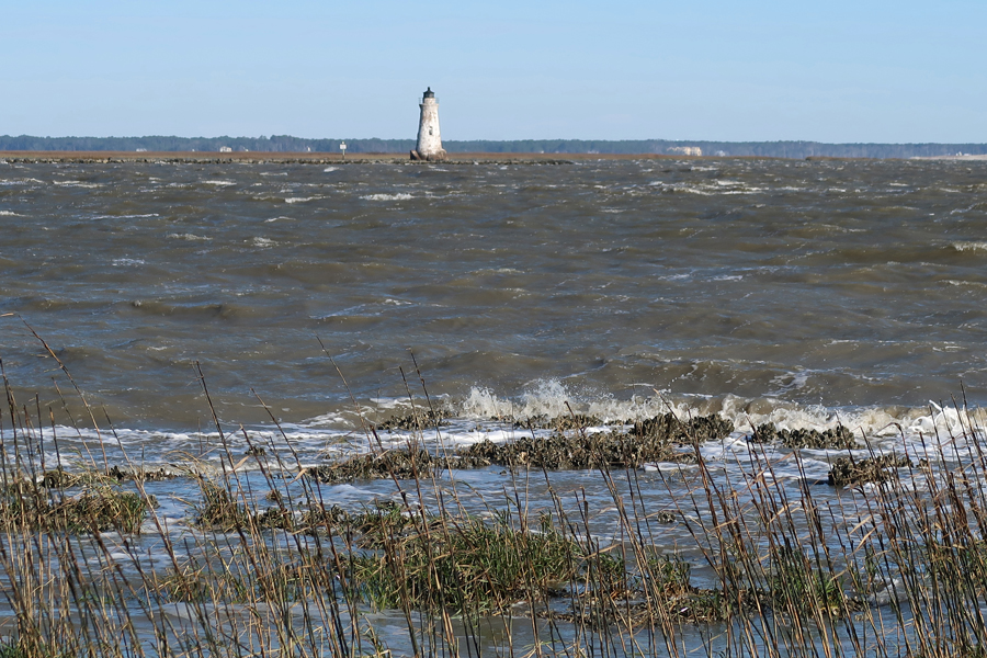
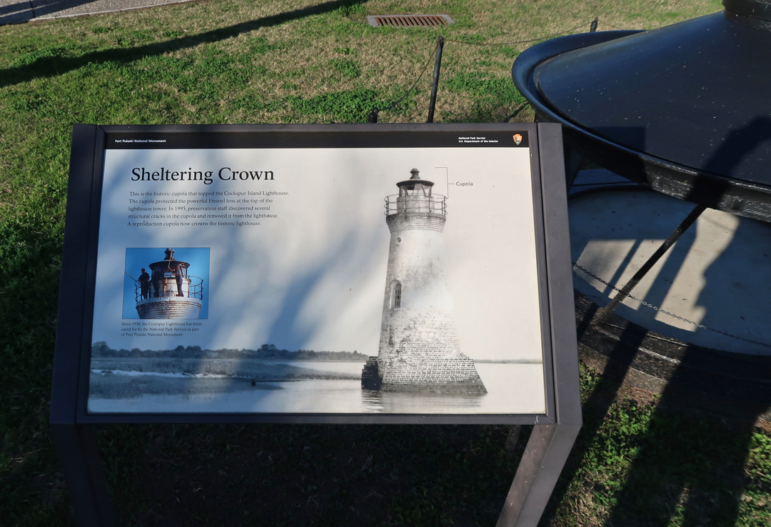
Cockspur Island Lighthouse
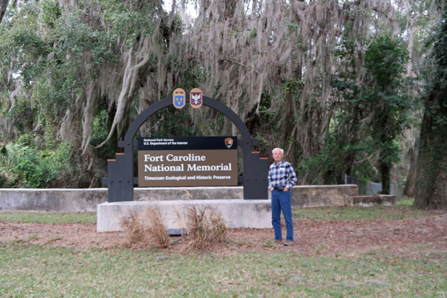
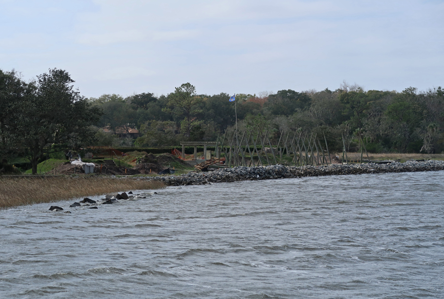
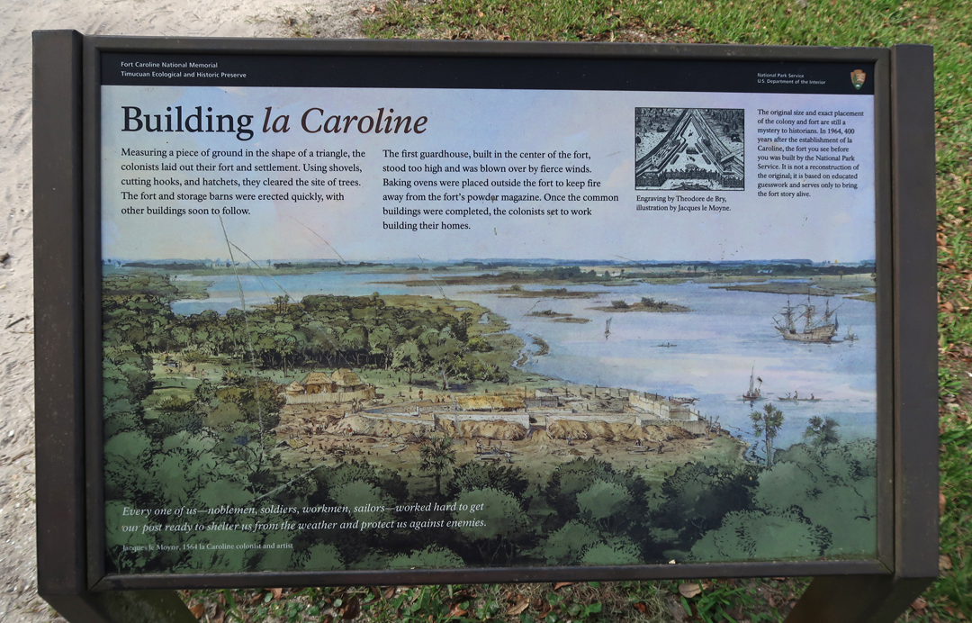
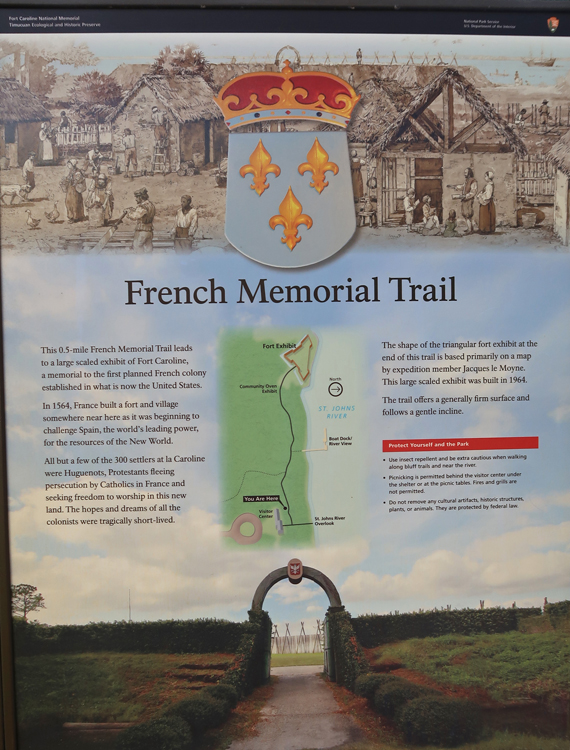
Next, 3hrs to Fort Caroline National Memorial; it is a little east of Jacksonville FL. It shares a Visitor Center with Timucuan Ecological Historic Preserve. We visited here in March 2011 – see Blog.
Map from the late 1400’s – note, NO North America!

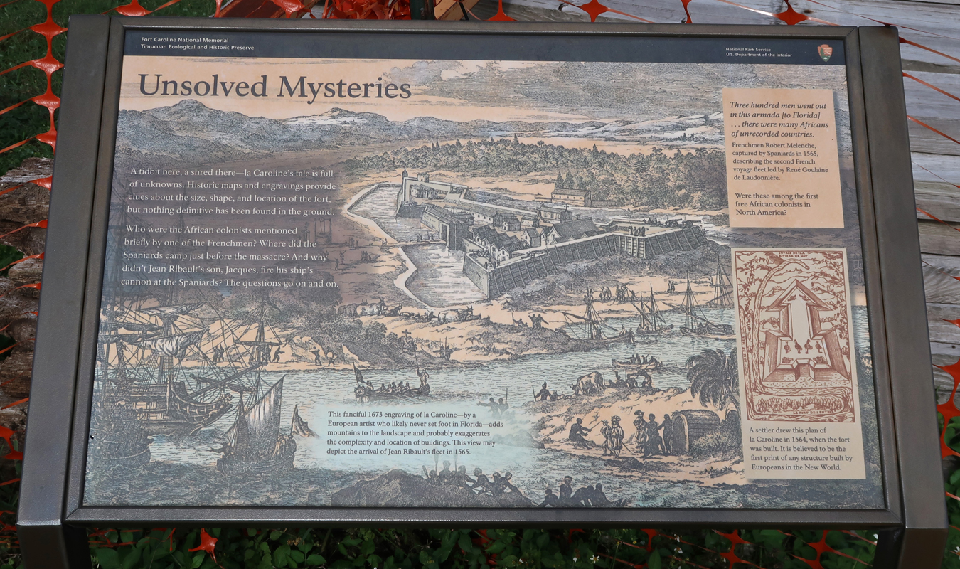
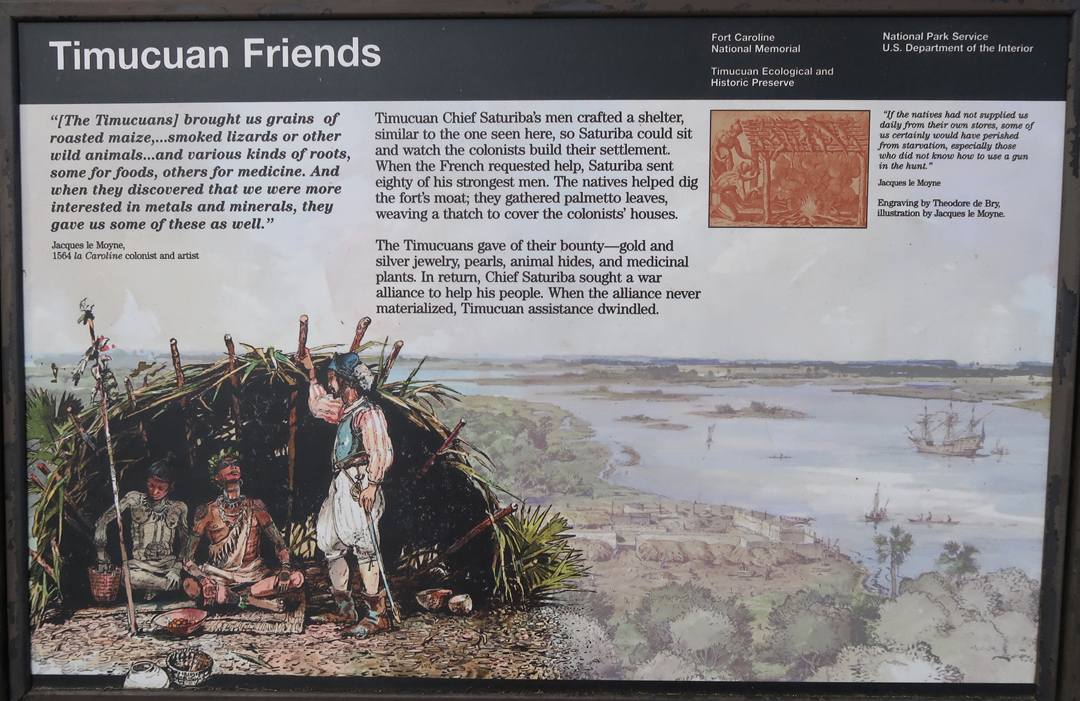
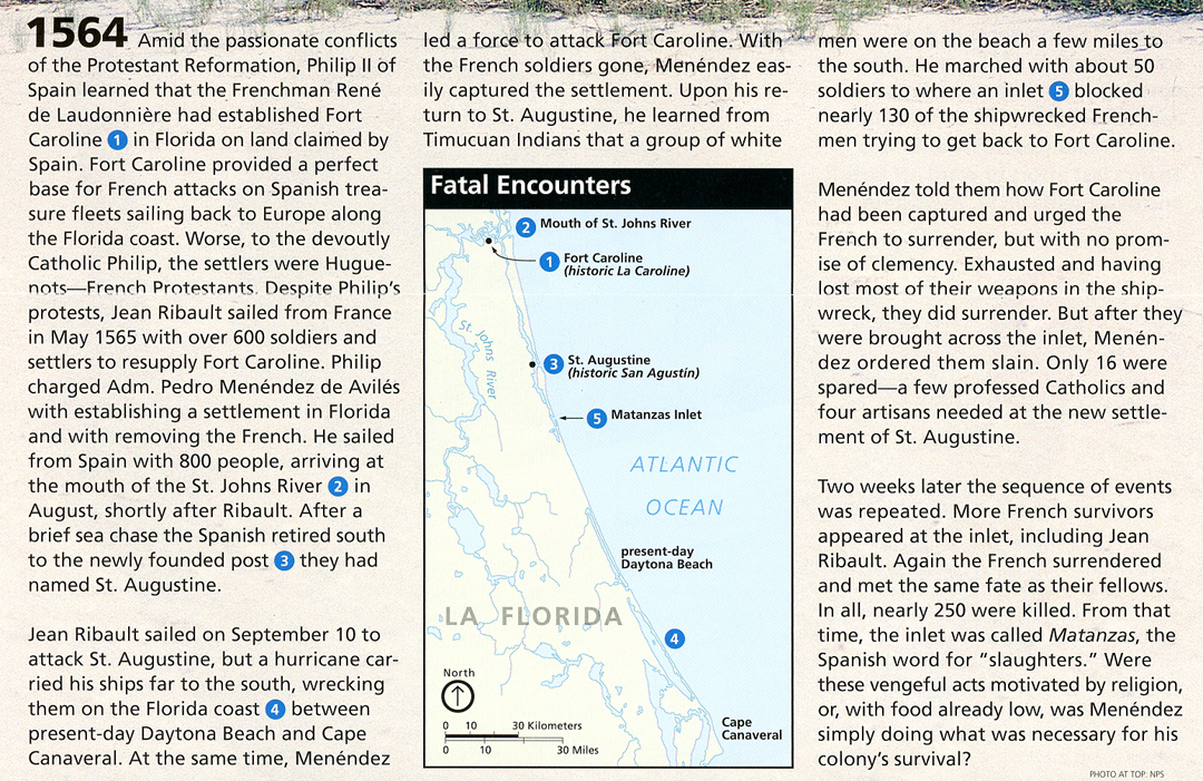
Commander Jean Ribault explored the area in 1562. He returned in 1564 and built a village and fort called La Caroline (land of Charles) to honor King Charles IX of France. Fort Caroline was constructed on the River of May (now St. Johns River).

River of May


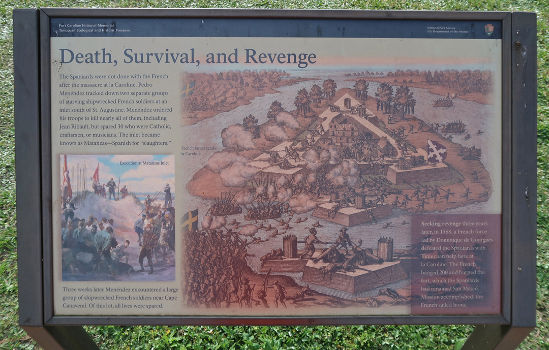
In 1565, Admiral Pedro Menendez attacked Fort Caroline from his base in St Augustine. The Spanish slaughtered the inhabitants only sparing women, children, those that professed to be Catholic, and a few artisans that were needed in St Augustine.
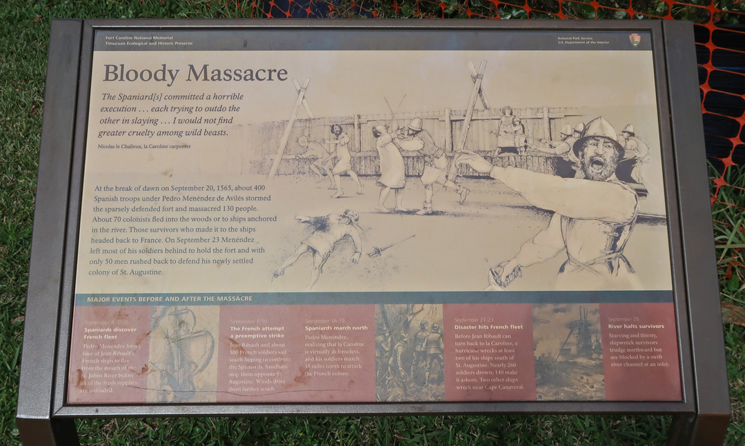
The French exacted their revenge in 1568. They attacked and destroyed the fort, killing all that did not escape, and then sailed back home. However, France would no longer challenge the Spanish in the “New World.”
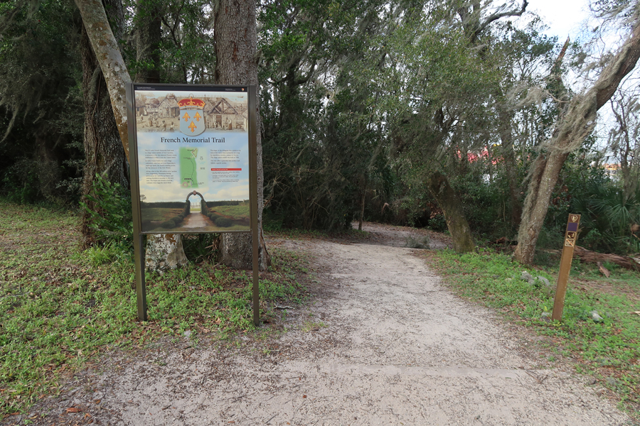
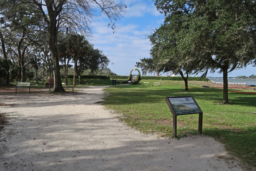
French Memorial Trail
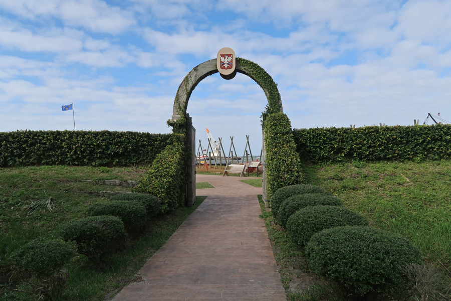
Fort Caroline today


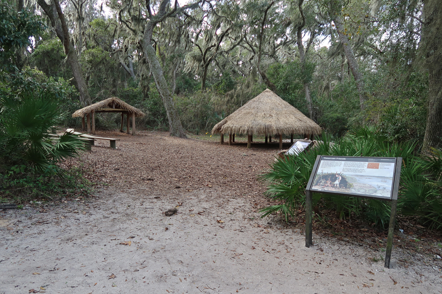
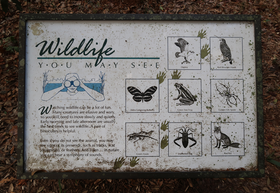
Timucuan “Friends”
Early drawings of Timucuan Indians
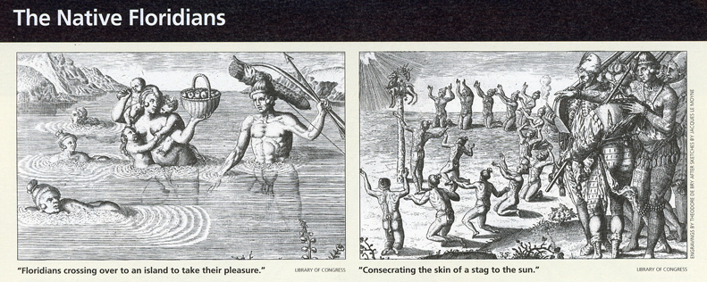
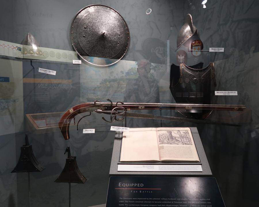
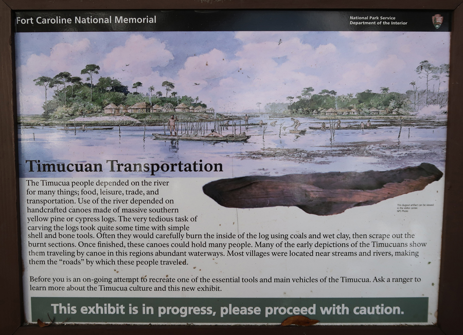
The local Timucuan Indians numbered in the tens of thousands when the Europeans arrived. They were ravaged by disease and by attacks from Spanish and British raids. There were only about 100 left when they emigrated out of the area in 1763.

The Ribault Monument, on the St Johns River, is also within the Timucuan Ecological and Historic Preserve. Photo from 2011.

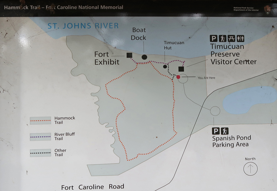
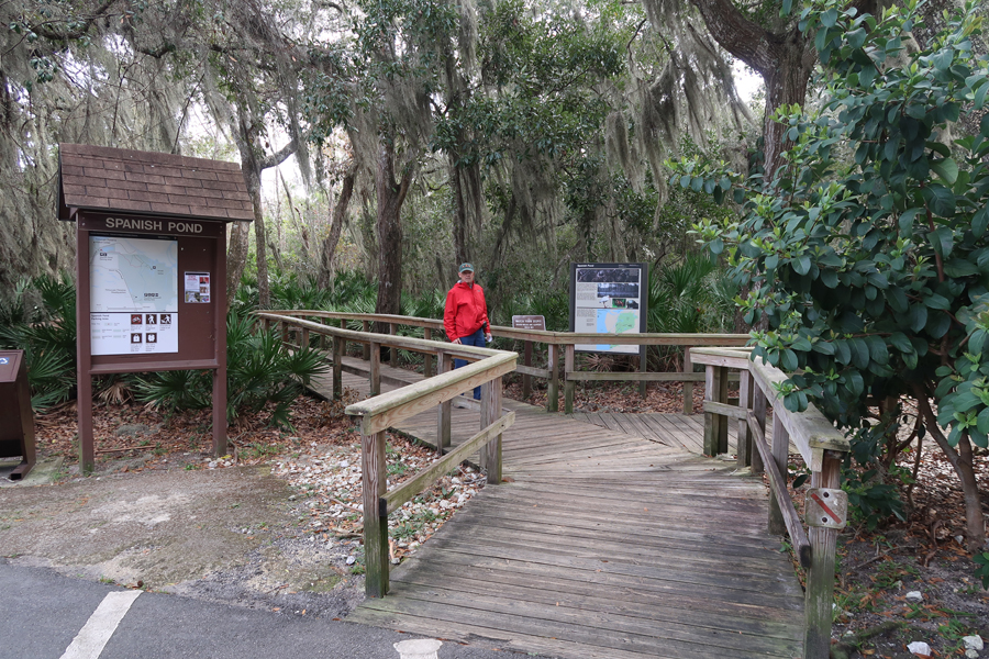
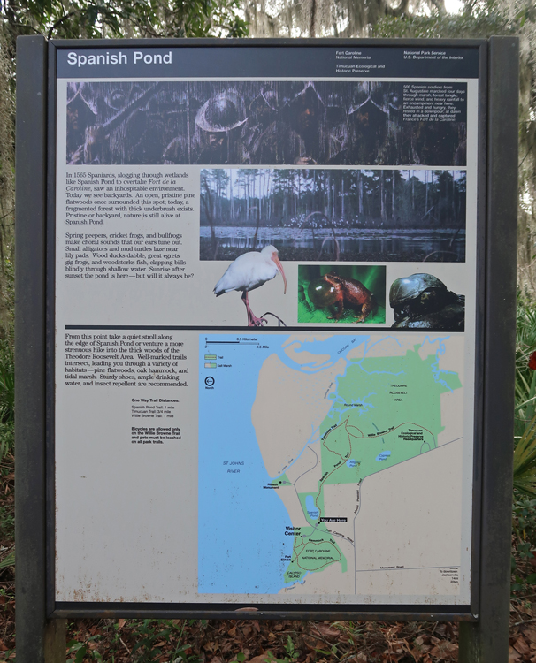
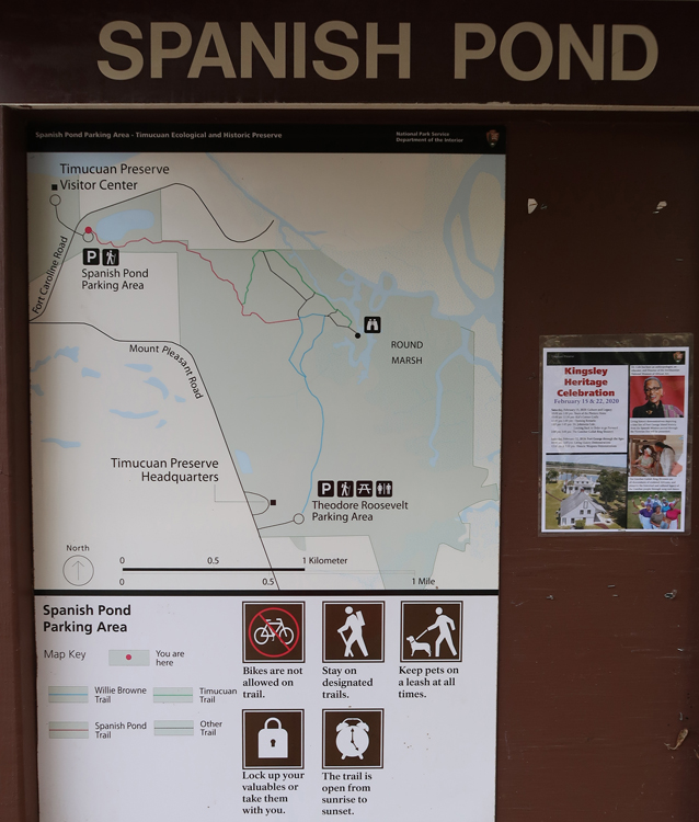
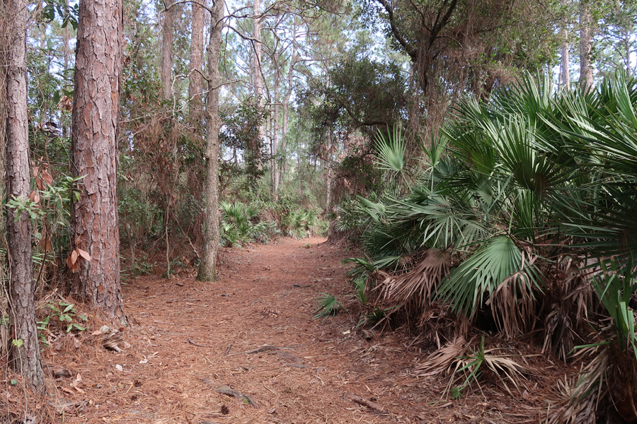
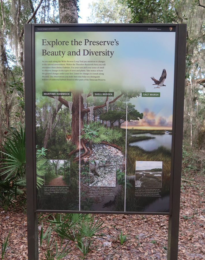
It was now time for a hike. I started at the Spanish Pond and hiked the Spanish Pond Trail, the Timucuan Trail, and the Willie Brown Trail – about 3 miles.
This was a one-way hike. Helen met me at the Theodore Roosevelt Parking Area
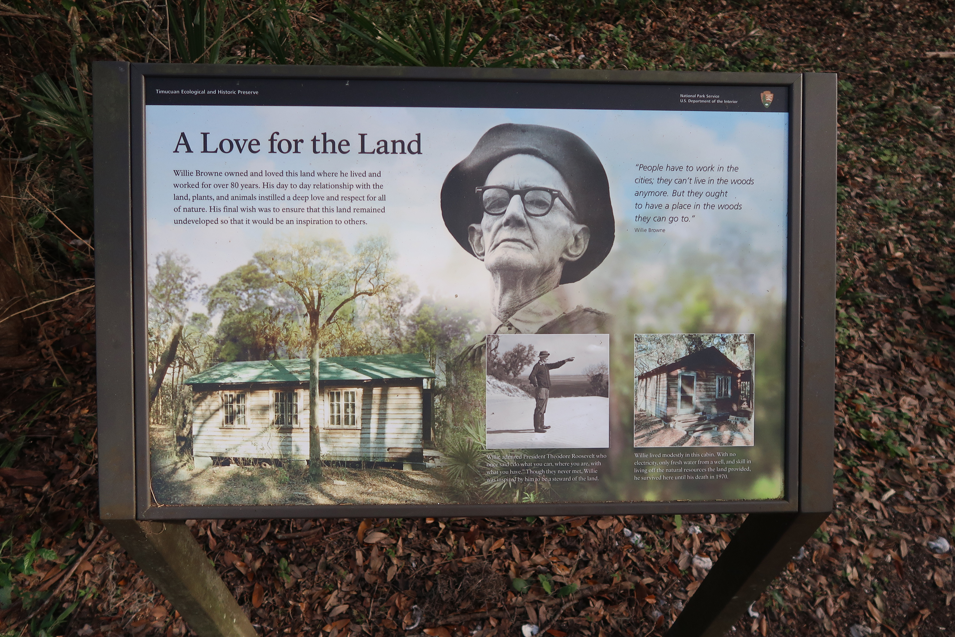
The 600-acre Theodore Roosevelt Area of the Preserve was donated to the Nature Conservancy by Willie Brown who grew up, lived, and died on the property. Willie was offered millions by developers but instead donated the land to protect it for future generations! The NPS acquired the property in 1990.


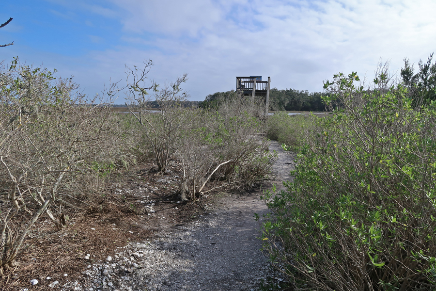
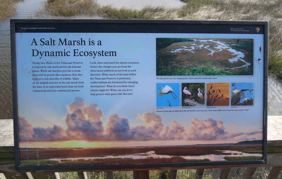
One of my objectives was the Viewing Tower at Round Marsh

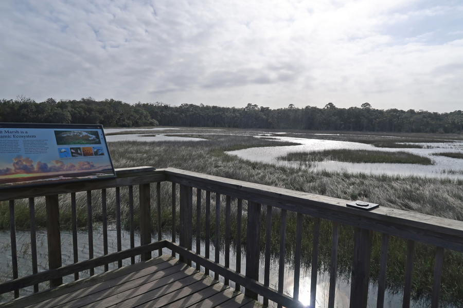
This was the site of Willie Brown’s Cabin

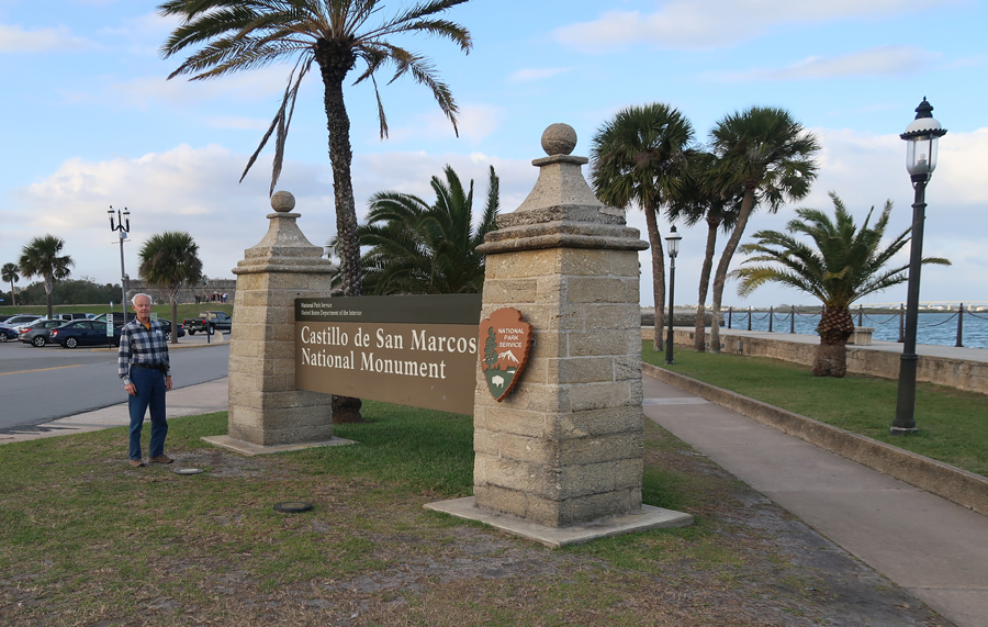
We stopped briefly at Castillo de San Marcos National Monument in St. Augustine for a photo. We have visited here several times in the past, most recently March 2011 (see Blog)
Had fish tacos in St Augustine and then drove an hour south to Fort Matanzas National Monument. We took a boat to the fort in March 2011 – see Blog. The fort was built here in 1740 to protect St Augustine.

This is also the area where in 1564 Adm. Pedro Menendez de Aviles slaughtered about 115 Frenchmen who were trying to get back to Fort Caroline after their fleet was shipwrecked on Cape Canaveral during a hurricane.
We stayed at a Fairfield Inn in Palm Coast FL
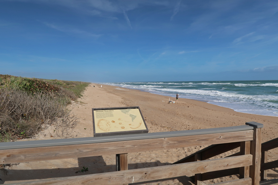
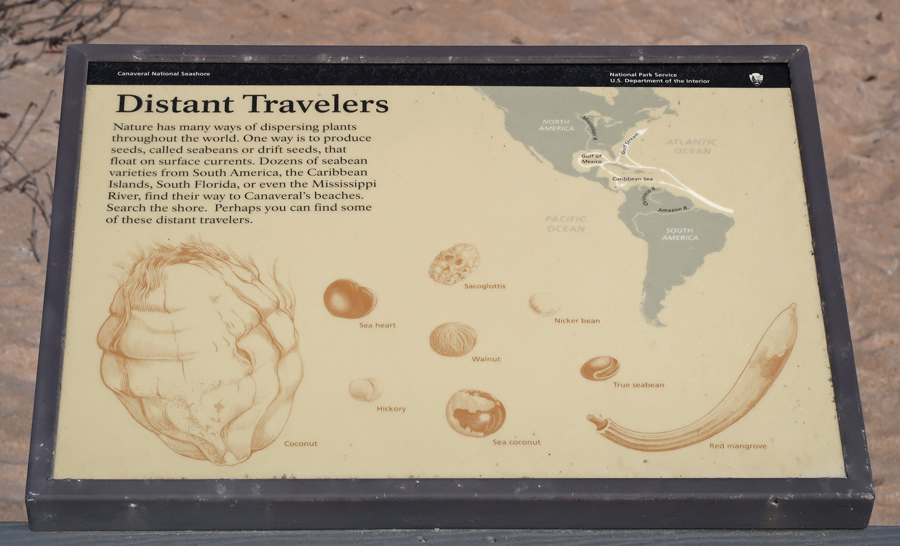
1/18 – “Holed-Up” entering Canaveral/Merritt Island National Seashore

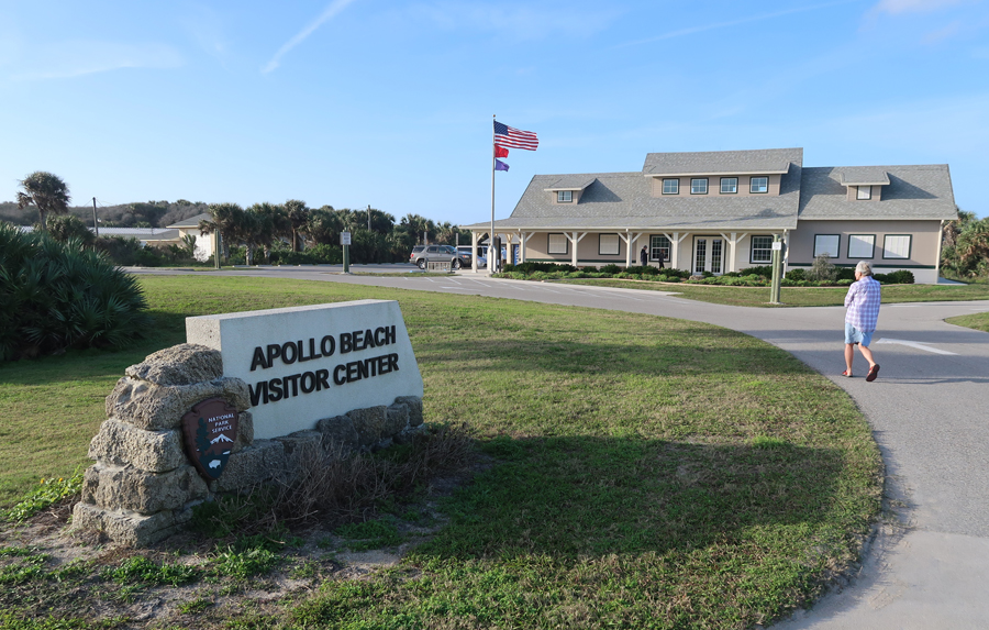
We were at the Apollo Beach Vis Ctr at 9am when it opened. We were disappointed to learn the rocket launch scheduled for today at the Kennedy Space Center (Cape Canaveral) had been canceled. This was the second time this had happened to us – see Blog March 2011, at the National Seashore.

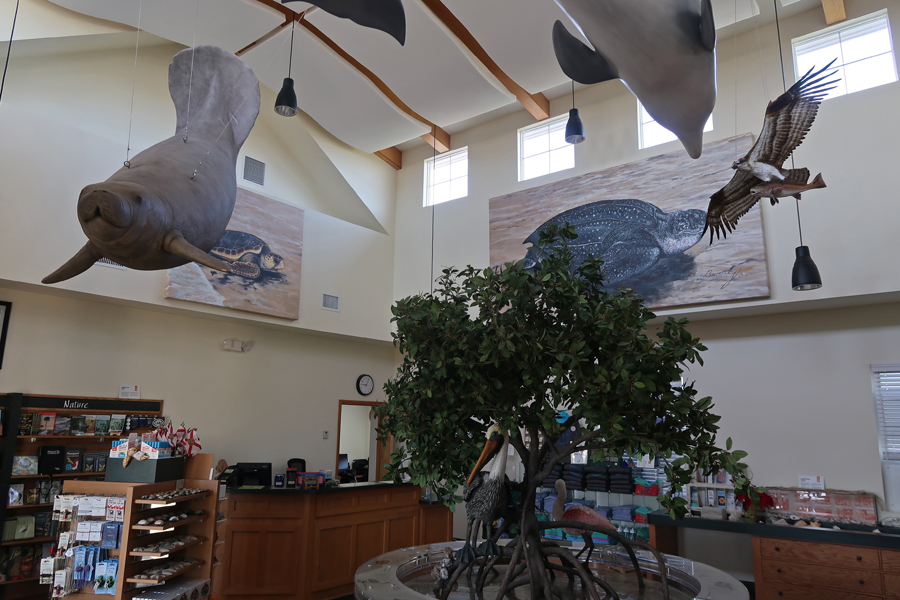
Toured the Vis Ctr and watched the video

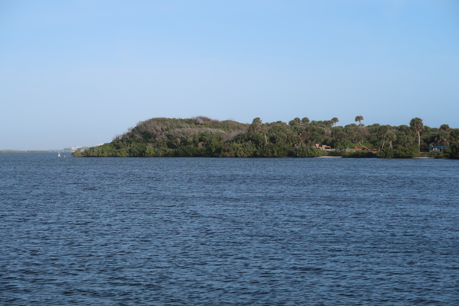
Turtle Mound

Ocean View from top of Turtle Mound 2011
Afterward, dropped Helen off at the parking lot for Beach #3. She walked north along the seashore searching for shells and picking up trash.
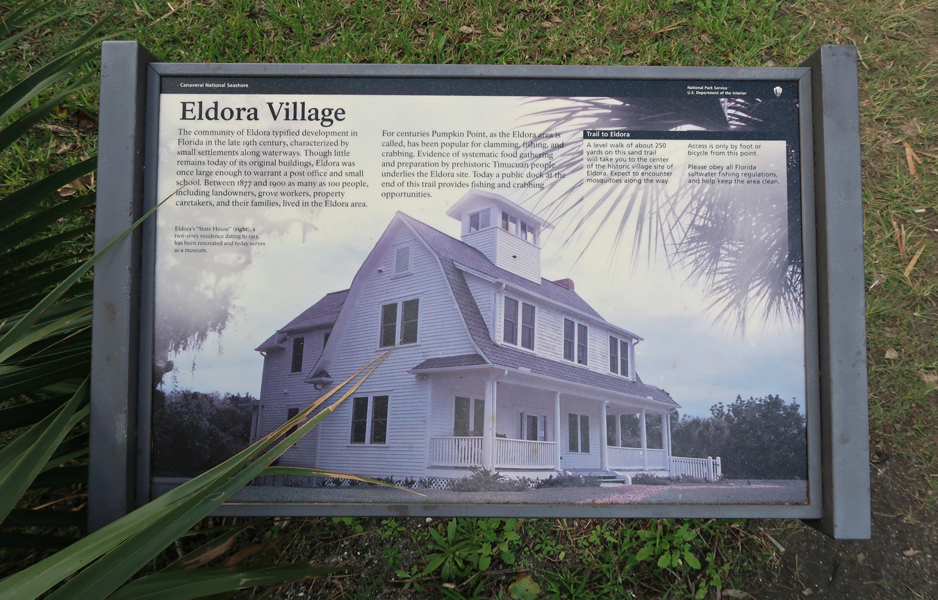
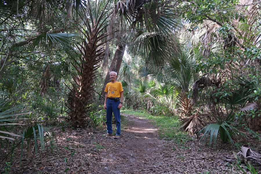
Meanwhile, I did the Eldora Hammock Loop starting with a short walk to the Eldora State House.
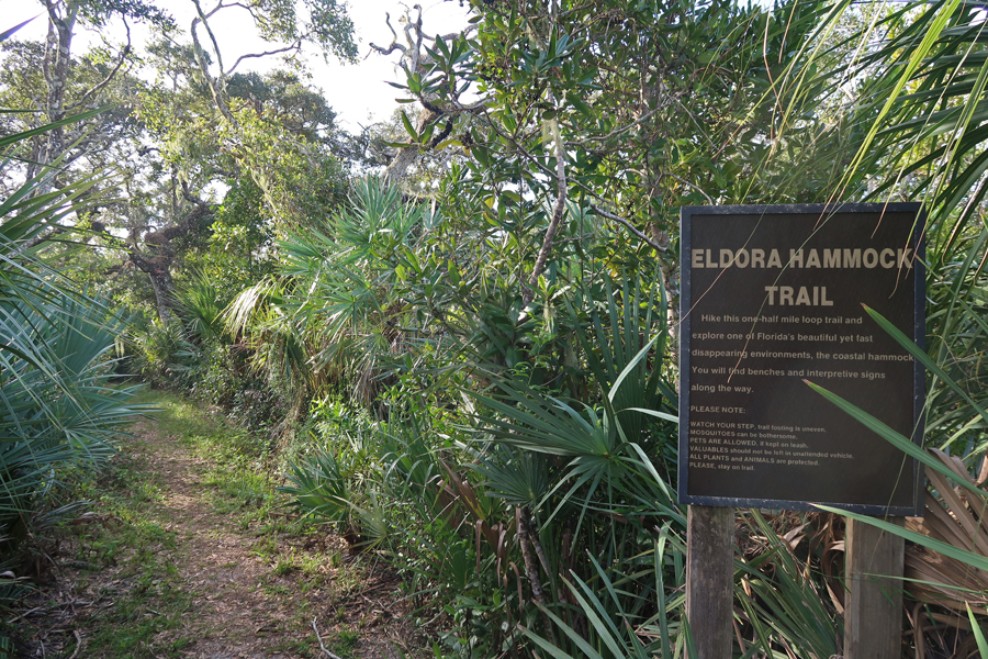
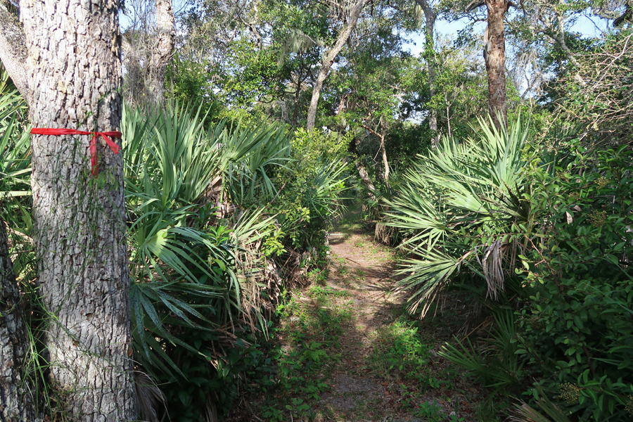
I then did the 0.5-mile Eldora Hammock Nature Trail

I continued to the end of the road and headed to the water

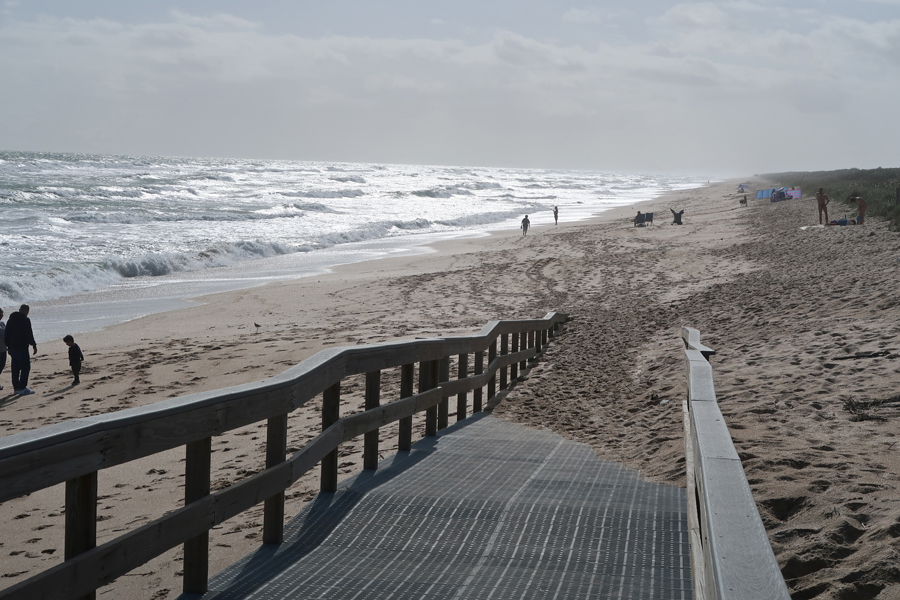
And walked about a half mile through the surf

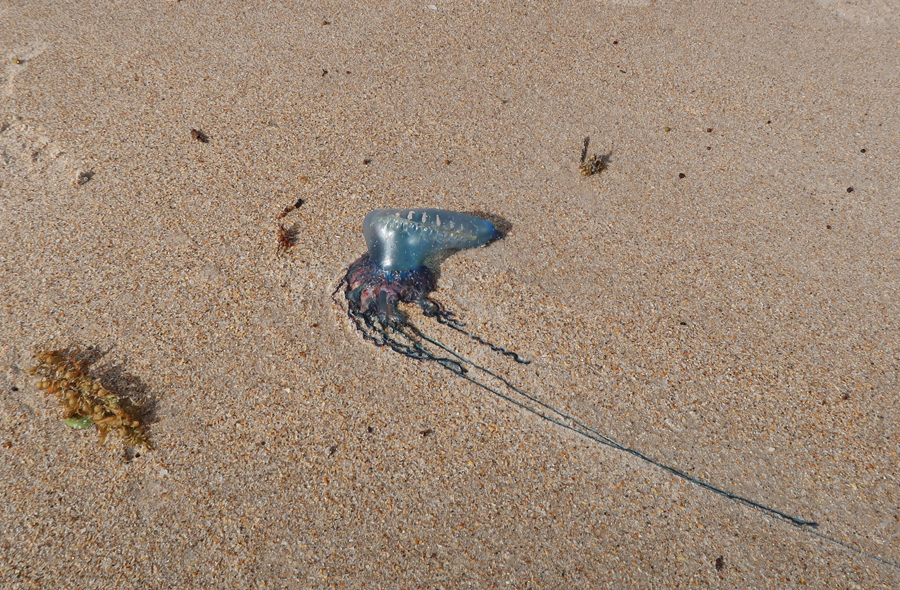
Portuguese Man of War – Jelly Fish
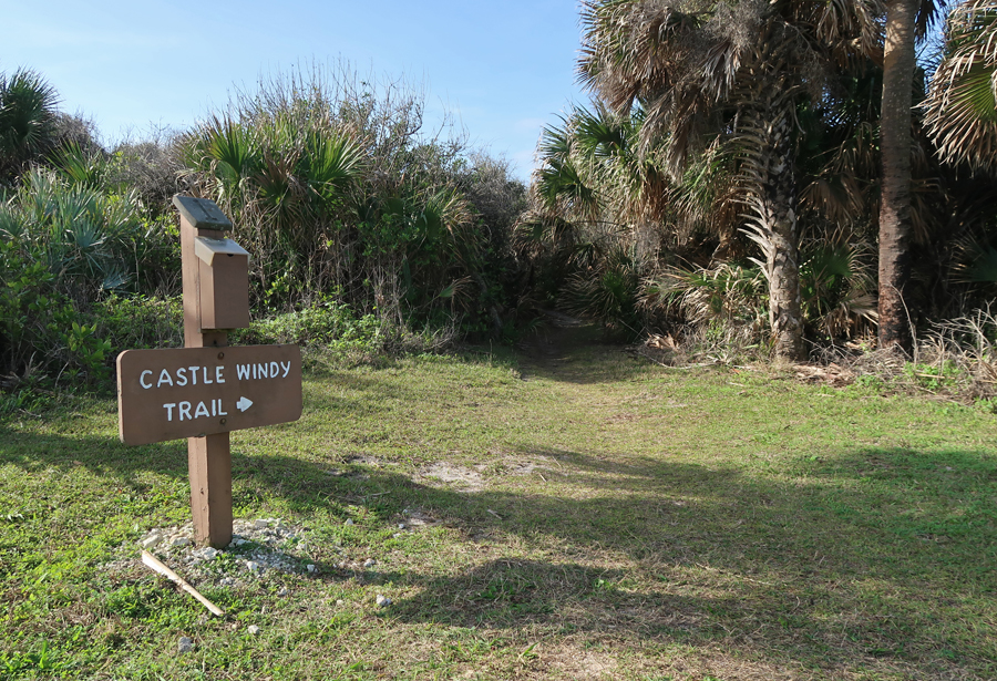
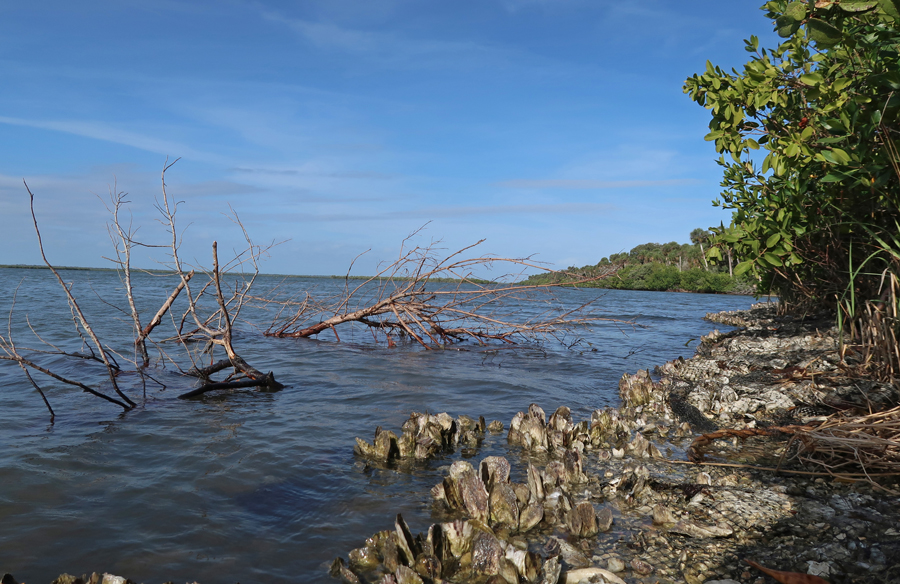
Next, hiked the 0.5-mile Castle Windy Nature Trail to Mosquito Lagoon
Mosquito Lagoon
Picked up a tired Helen at the Parking Lot for Beach #2

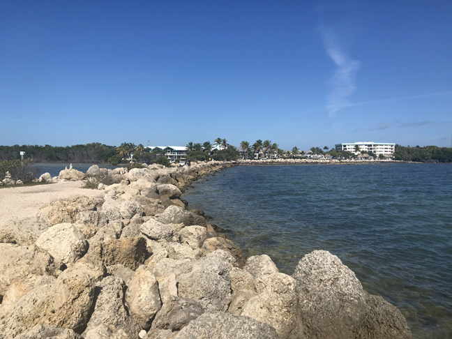
Mistake, I drove through Miami trying to avoid the Florida State Tollway on our way to Key Largo. My bad, that resulted in a seven-hour drive to Key Largo instead of five! We arrived at our Airbnb condo in the Kawama Village HOA at 7pm.
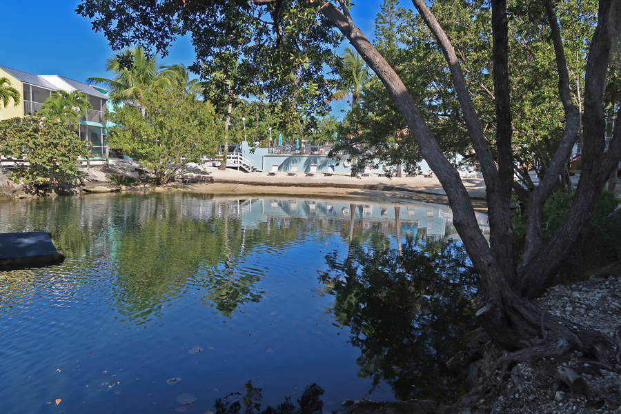
1/19 Sun – settled into the condo and toured the grounds. They are still repairing units damaged by Hurricane Irma last year.
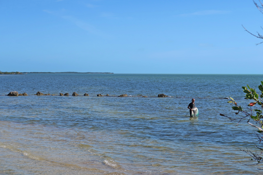
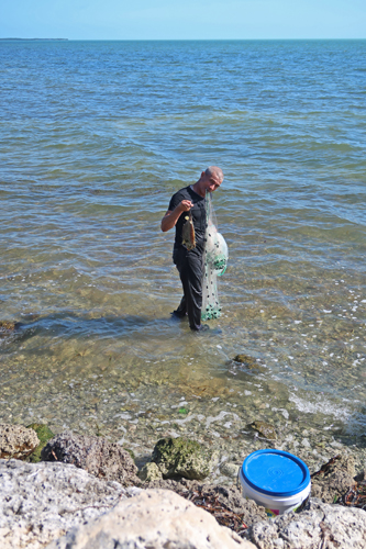
Fisherman
My dream SUV was parked by the wharf. A Ford EarthRoamer XV-LTS F-550 Off-Road RV, carbon fiber, marine grade, solar, with 41” tires, etc. – about 650K. The 2017 HD F-750 Super Duty, 46” tire model I saw online was 1.5 million!

Each afternoon, Helen swam laps in the 90-degree pool. Today, we went to the Crocodile Lake National Wildlife Refuge after her swim.


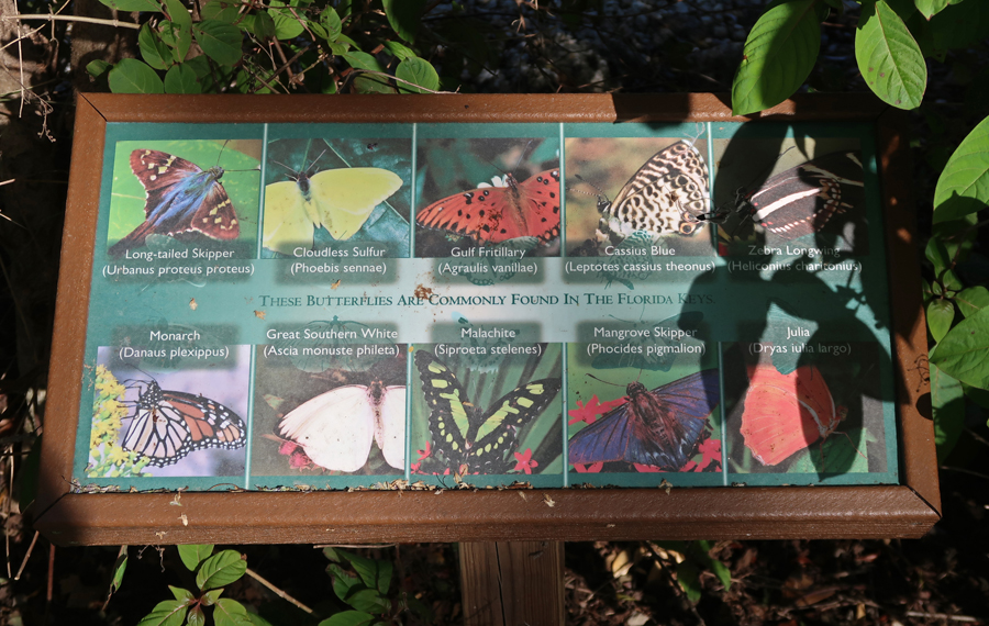
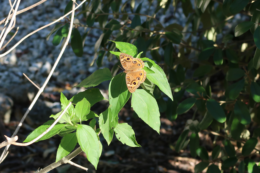
Very much enjoyed the “Butterfly Garden.”

 \
\

We then did a hike in the Dagny Johnson Key Largo Hammock. Ate dinner at “The Catch” restaurant. We chose the “Fish of the Day.” You then select among 20 different ways you would like it prepared. Helen chose blackened and I chose grilled. We played games every evening at the condo – Aces to Kings, Skip-Bo, and/or Farkle.
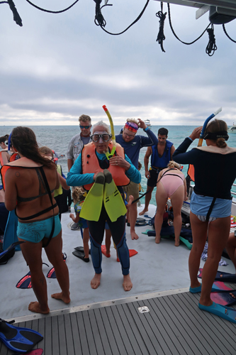
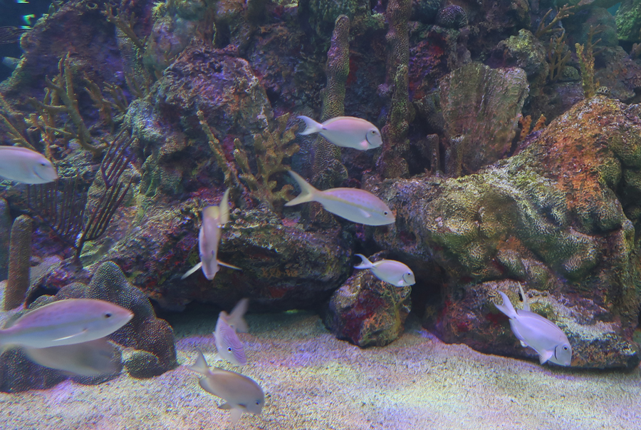
1/20 M – MLK Day, 15min to John Pennekamp Coral Reef SP. We did the 9am 2.5hr Snorkel Trip to Molasses Reef
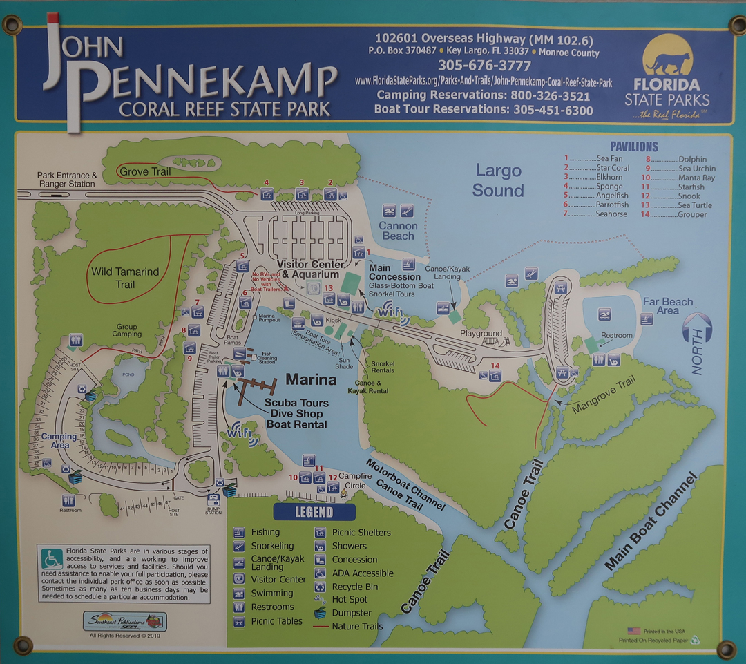
It is part of the NOAA Florida Keys National Marine Sanctuary

Good snorkeling, would have been better if it were sunny

Did some sunbathing on Cannon Beach


Then returned to the condo and rode bikes to Key Largo Fisheries for take-out shrimp and blackened Mahi-Mahi, plus Key Lime Pie!
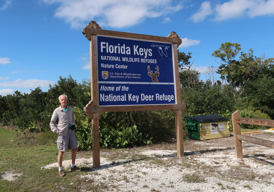
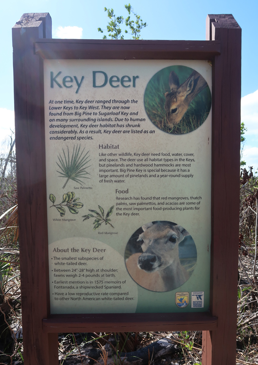
1/21 Tu – very windy today, low 60s in the morning, cold front coming in. Drove south 1.5hrs on FL State Rt A1A, the “Overseas Highway,” to the National Key Deer Wildlife Refuge on Big Pine Key, only a half hour from Key West.
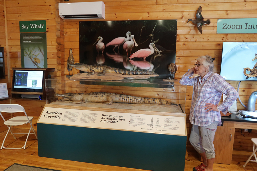
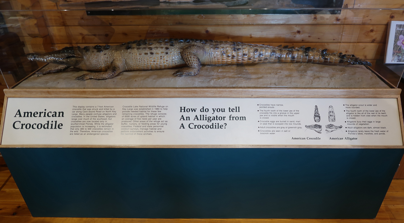
How do you tell an Alligator from a Crocodile?
After a picnic lunch, we did the short Blue Hole Nature Trail

And then the Watson and Manillo Trails

As can be seen, they did a controlled burn here last year

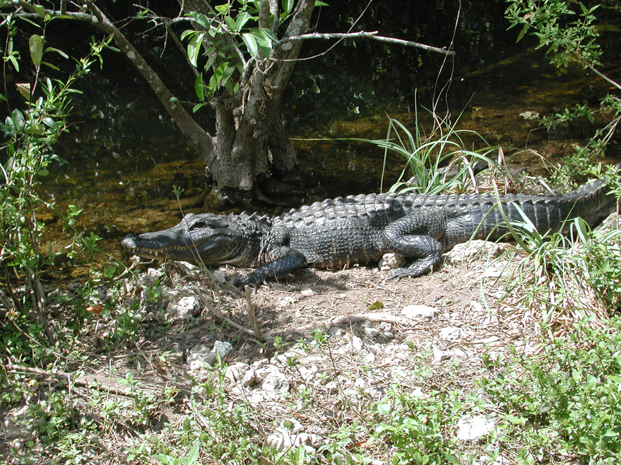
Did not see any miniature Key Deer. However, there is a photo of some later in this post when I describe our stop in Everglades NP. The smallest deer in the U.S. are in FL. The further north you go, the larger they get – e.g. for a very long time the record for largest deer in the U.S. was a deer shot in Ohio.
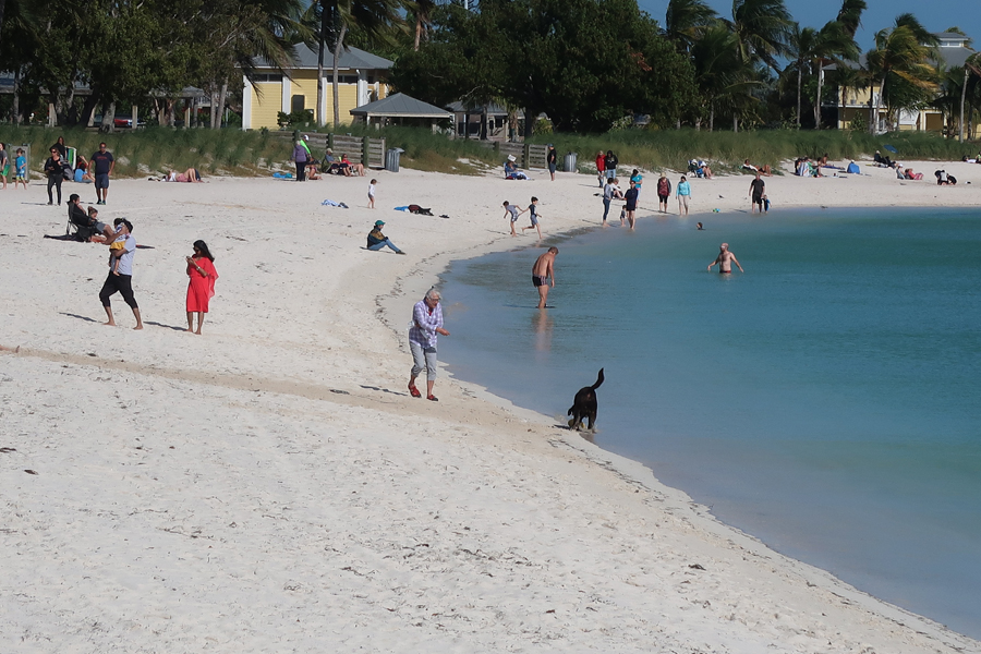
It was too windy to sunbathe in Bahia Honda SP, so we drove to Boot Key for a walk on Sombrero Beach. It was a nice, no fee, substitute.

We stopped briefly at the Dolphin Research Center

And this tourist trap on our way back to the condo
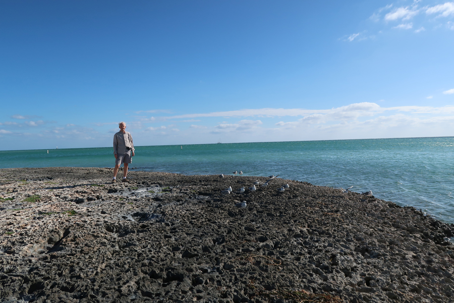
As we drove North, stopped for a short walk at the new, very nice, Anne’s Beach on the south end of Lower Matecumbe Key. It would be fun to spend the day at one of their eight single table picnic pavilions right above the beach.

Had a rotisserie chicken for dinner in the condo and played games
1/22 W – 41 degrees, wind 35mph, Wind Chill 31 degrees. It was raining Iguanas – literally! They fall from the trees and then are comatose until the temperature rises.

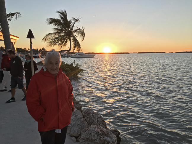
We had planned on using the condo kayaks today – no way. Had a lazy day; Helen did laundry and swam in the heated pool. We visited Captain Slate (SCUBA Adventures) on Islamorada Key. For years the Wittenberg SCUBA class would do its checkout dives with him. Splurged for our last night in the Keys by first enjoying the sunset on the Morada Bay Beach
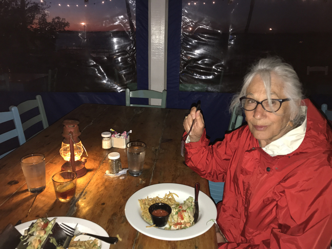
And then having dinner at Morada Bay Beach Café. Calamari and fish tacos.
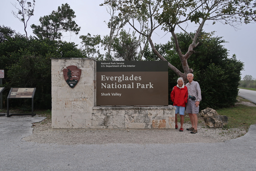
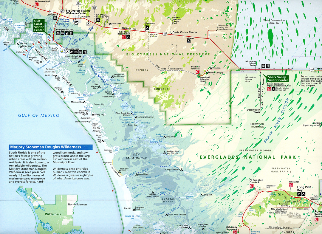
1/23 – 2hrs to the Shark Valley entrance to Everglades National Park

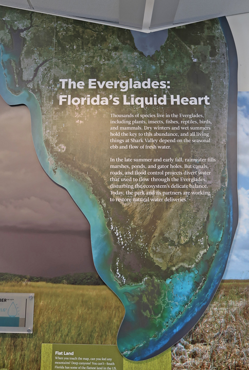
Entrance at Shark Valley, we have visited all major parts in the Everglades. Also, see Blog April 2009


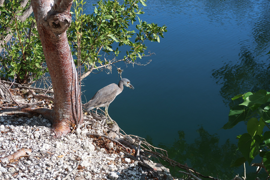
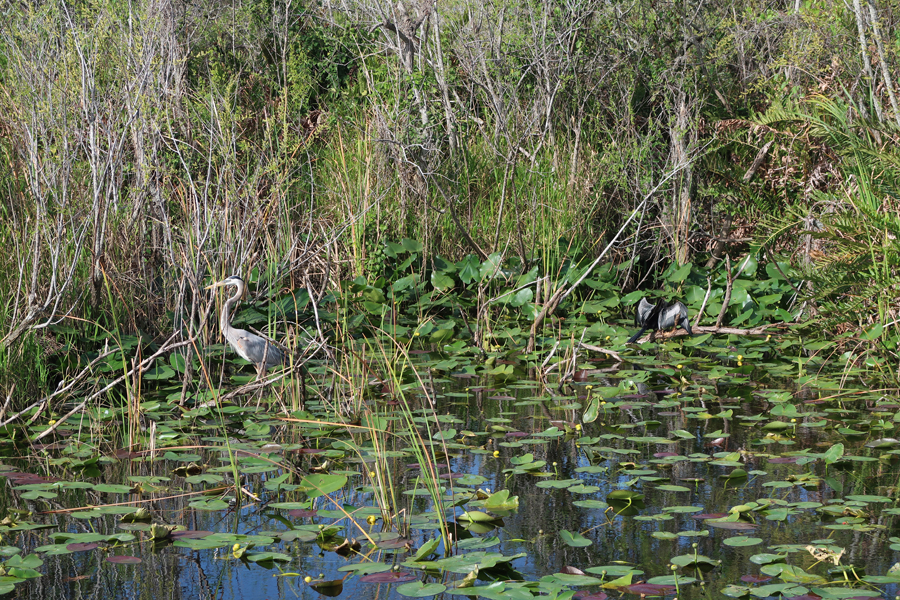
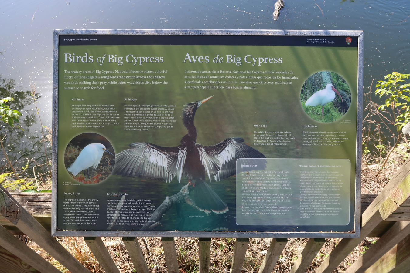
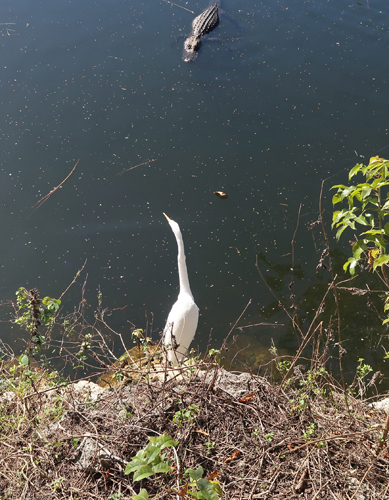
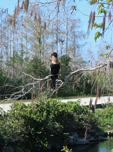
Love those birds –

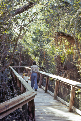
We visited here in 1976 with Stacy and Peter, this pic is on the Boardwalk trail near the Visitor Center
Now you must walk, bike, or take the tram along the route on the right to get to the Observation Tower
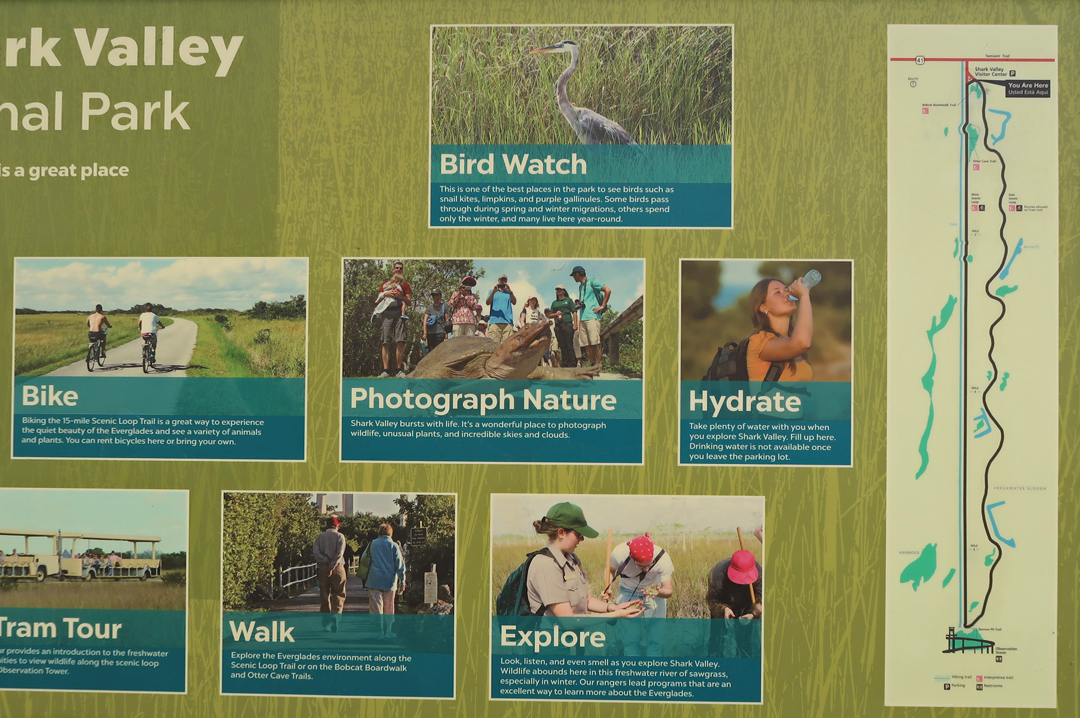
In 1976, you could drive the route. A nice hike is to take the tram to the Observation Tower and walk back along the Shark Valley Trail. That is were I took the pic of the miniature Key Deer

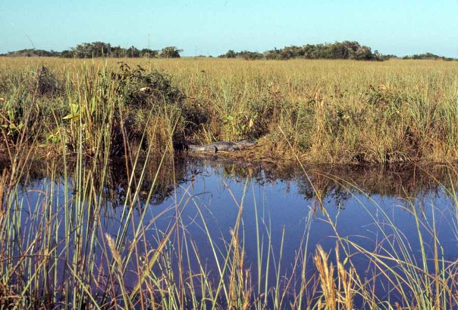
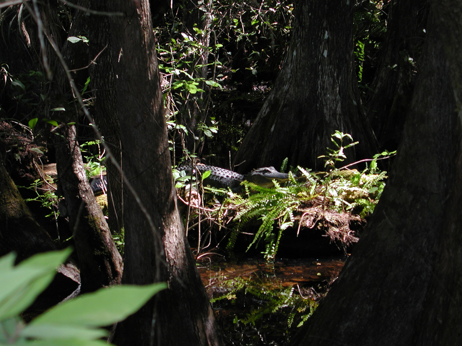
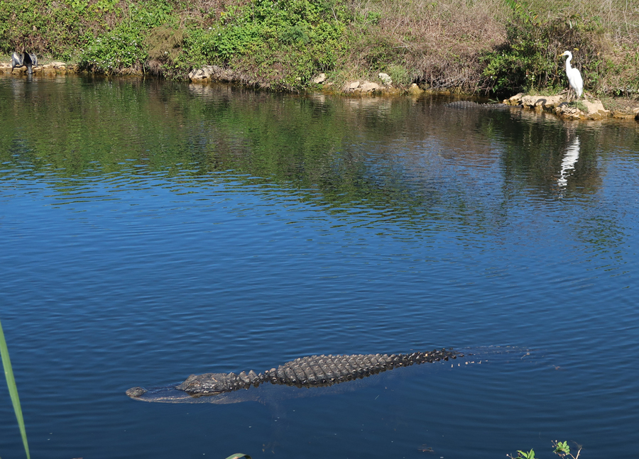
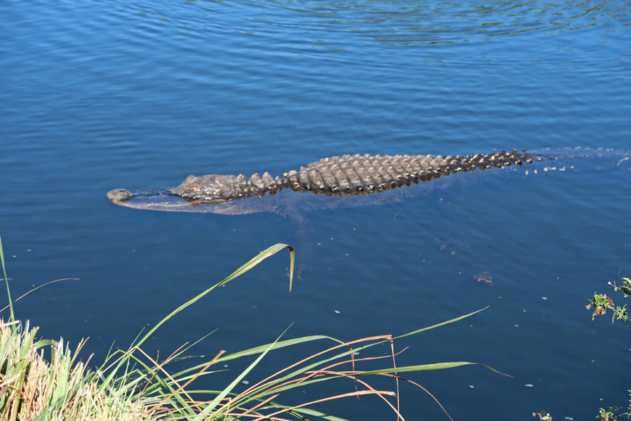
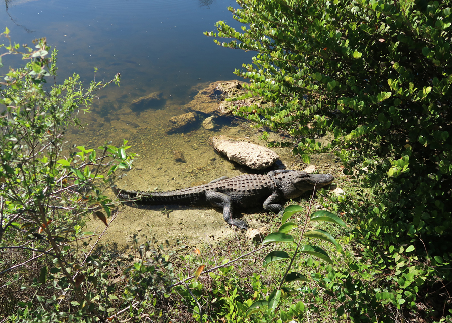
Of course, alligators are all over the place
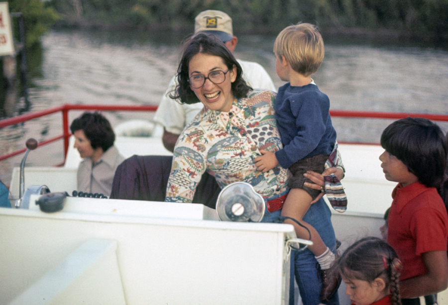
On that same trip, we did a ranger boat tour from the Gulf Coast Visitor Center by Everglades City
And we camped in the Flamingo campground

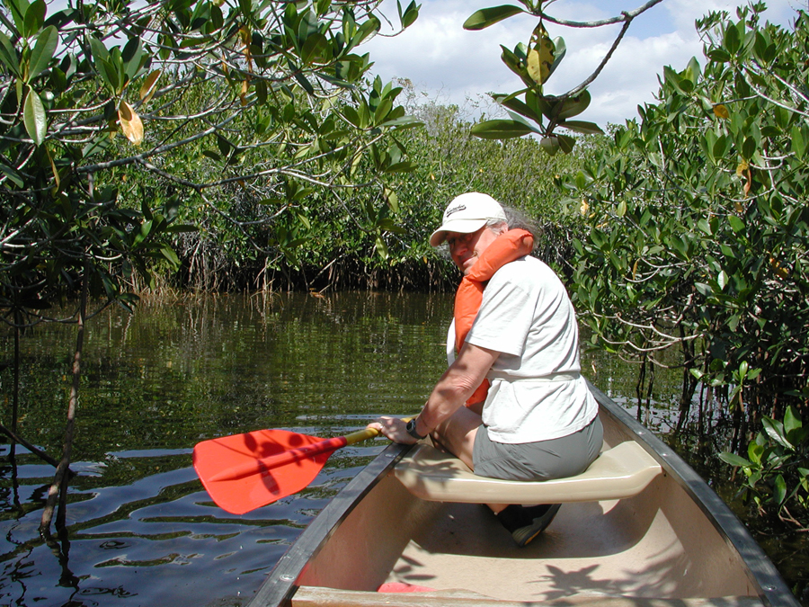
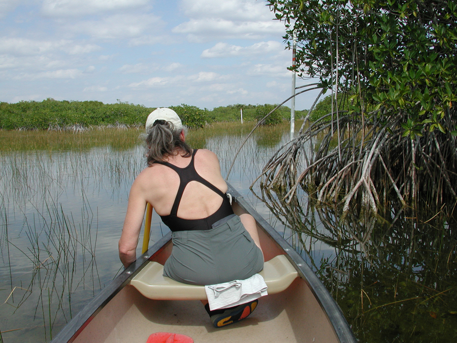
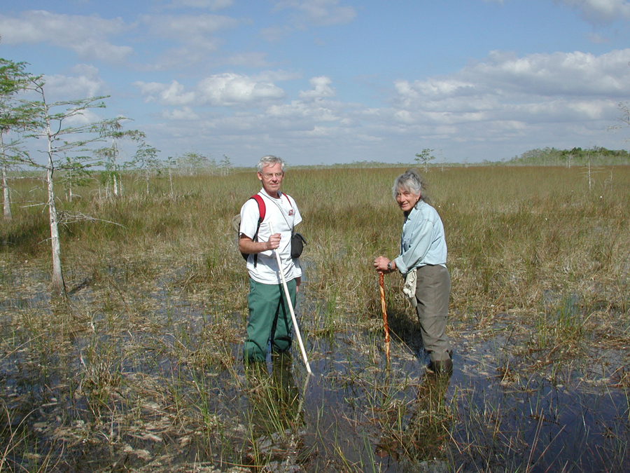
In 2004, we did the Nine Mile Pond Canoe Trail

It was great fun paddling through the mangrove tunnels and marshes
You look for and follow the white poles, so you don’t get lost!
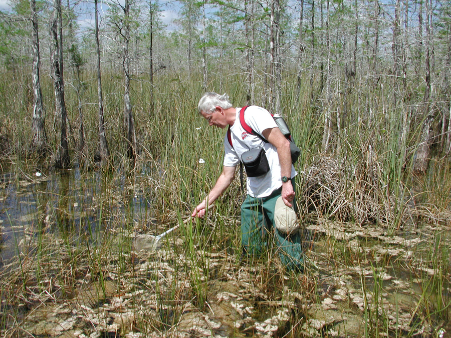
You never know what you may find –
I sunk about 1.5ft into the muck to take this photo

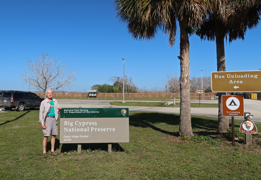
The Big Cypress National Preserve was only about ten minutes west on the Tamiami Trail (Rt 41). We have visited the Preserve many times as the Tamiami Trail, runs right through it. We have done the Loop Road (gravel) through the Preserve twice (2004 and 2009) – see Blog for April 2009, later in this posting for 2004
What is the difference between a National Park and a National Preserve?

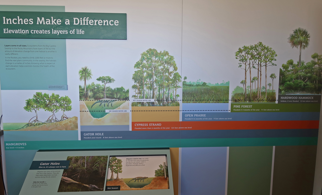
Oasis Visitor Center posting of Birds, Mammals, Snakes/Lizards, Fish, Reptiles/Amphibians, Turtles, Flowers, Butterflies, and Dragon Flies seen here.

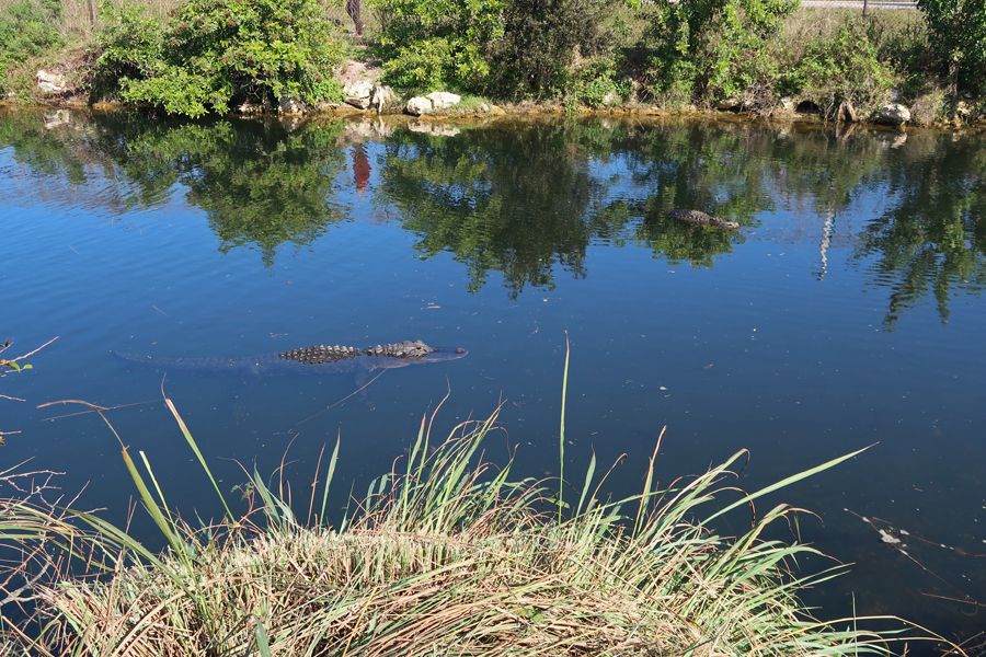
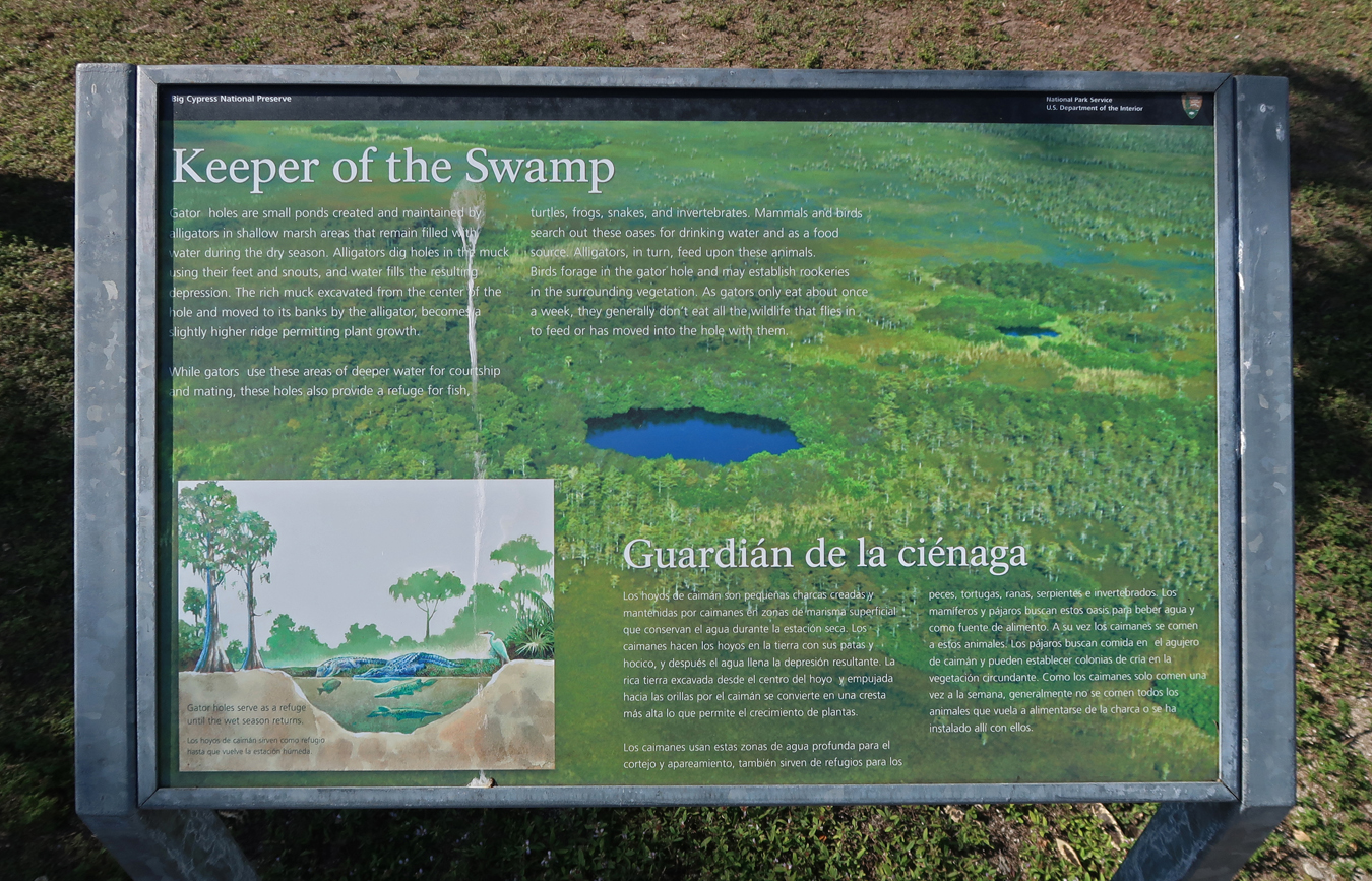
Keepers of the Swamp – Alligators
Be careful, alligators can run up to 15mph – can you?

Fish


Birds

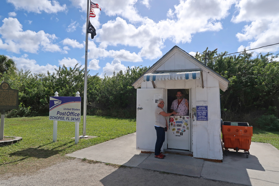
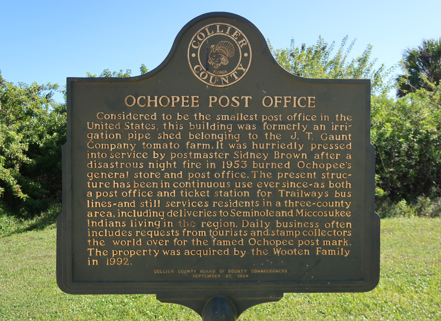
We made a brief stop in Ochopee, which has the smallest Post Office in the U.S. Of course, we had to send the kids (grandkids) postcards from here.
Our next stop was the new Big Cypress Swamp Welcome Center near the west end of the preserve. The Halfway Creek Canoe Trail starts near there. I would like to paddle it to the Gulf Coast Vis Ctr someday.
Welcome Center
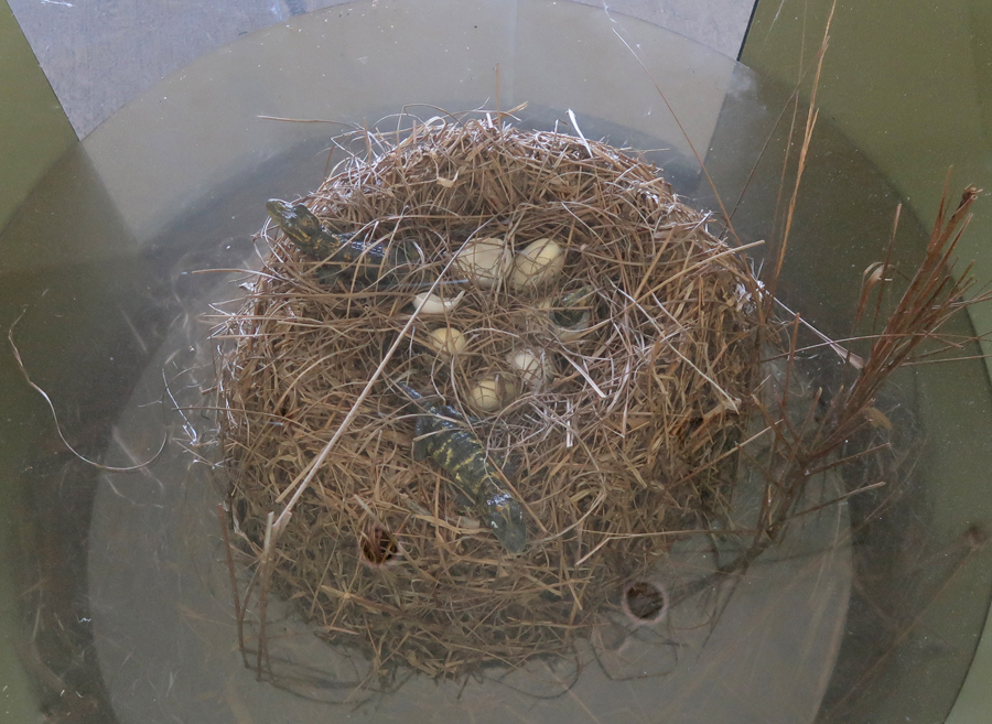
Alligator nest
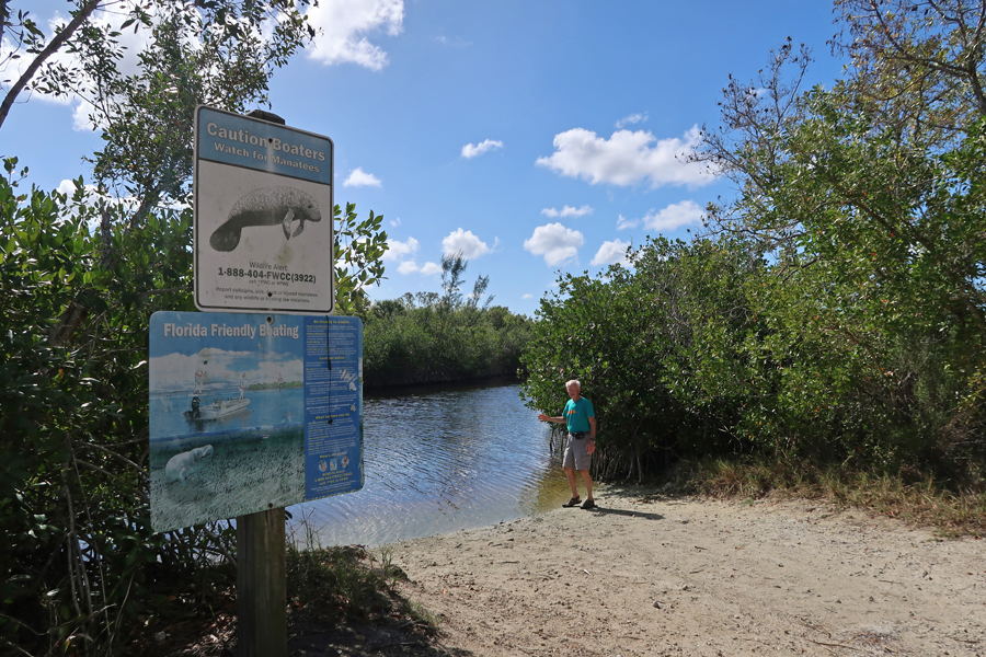
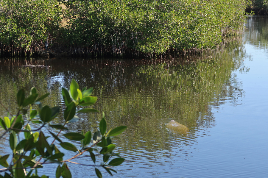
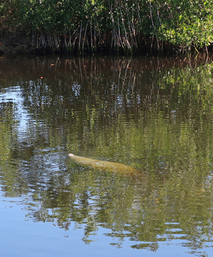
The cold weather in the Gulf drove the manatees inland – lucky for us!
In 2004, we did the 10-mile Loop Road (gravel) through the Preserve and highly recommend that route. We stopped many times to view wildlife.
My favorite part was the Muck Walk over hammocks and through the swamp. Be sure to wear sturdy shoes covering your ankles or higher because the rough limestone underneath is potted and sharp. Also, watch out for snakes and alligators, tremendous biodiversity.

Helen’s favorited parts were the 1950s gas station and dumpster diving

Had dinner with Bev and Mike in Ft Myers and then stayed in a nice Fairfield Inn near the Tampa airport
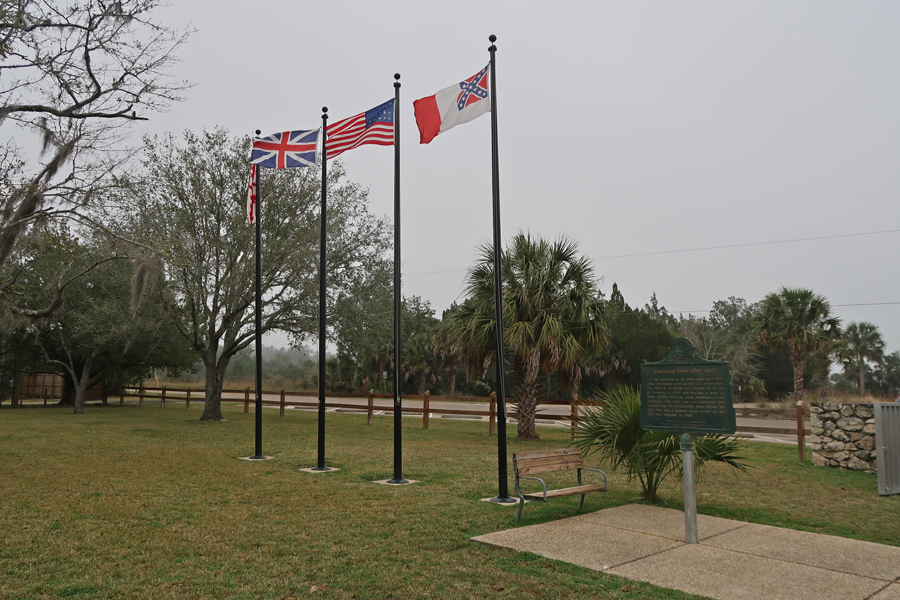
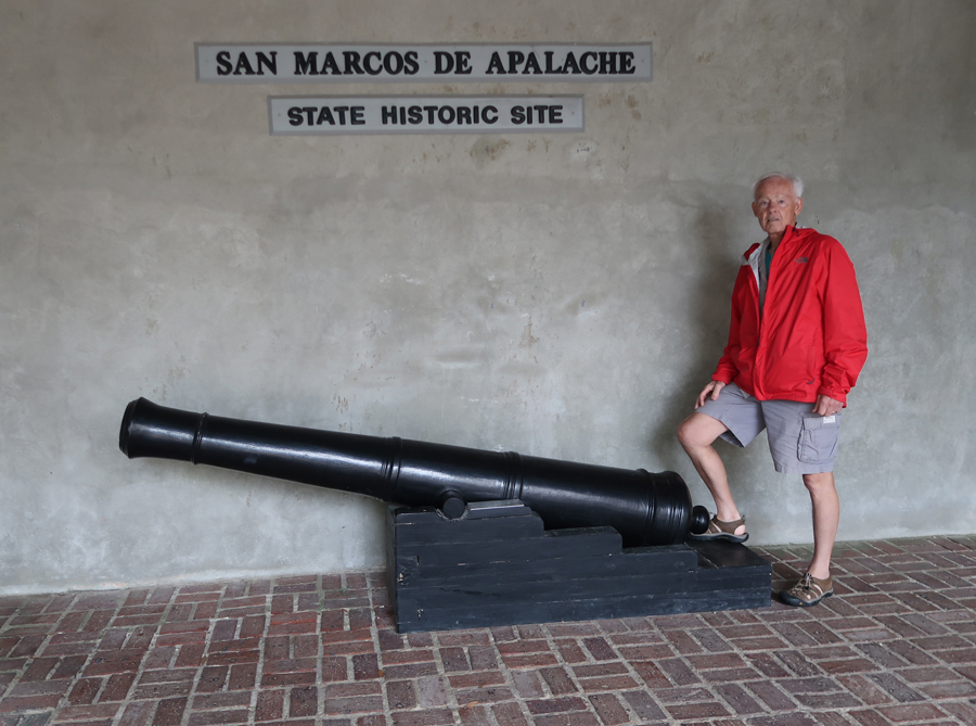
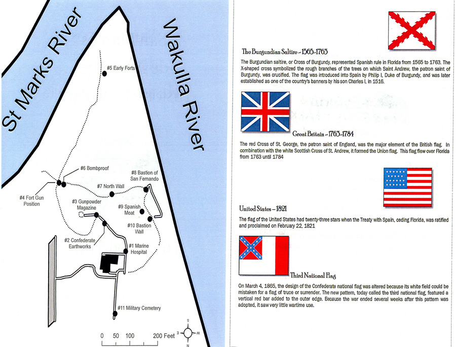
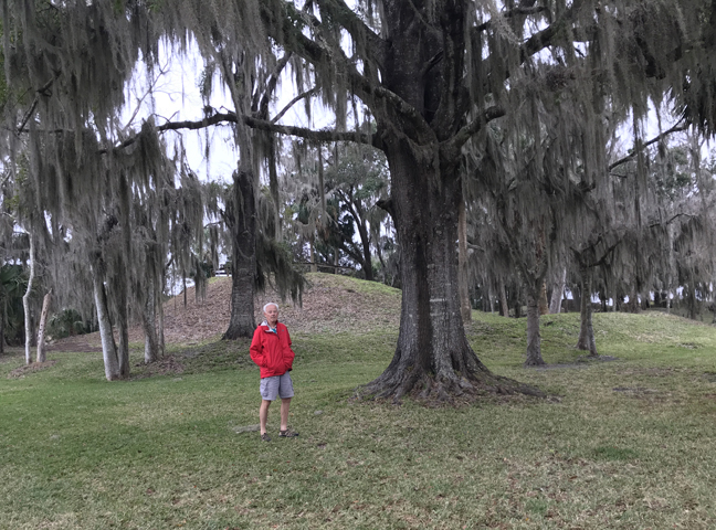
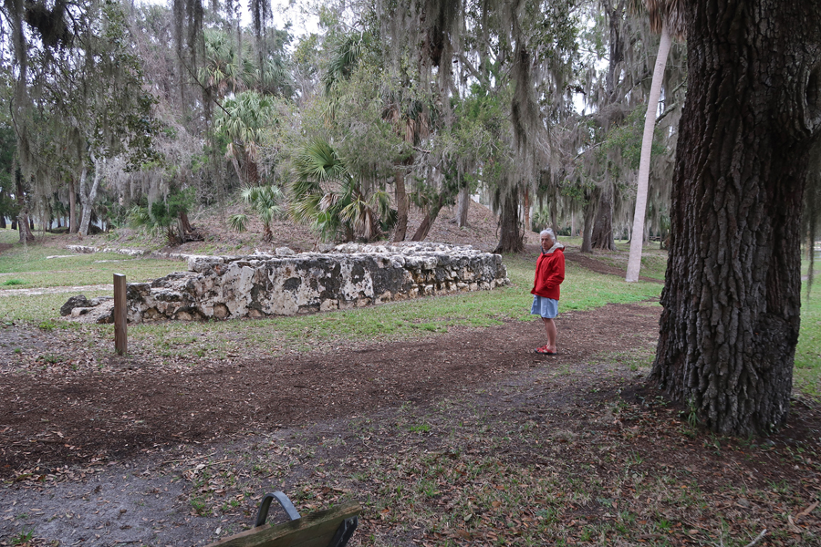
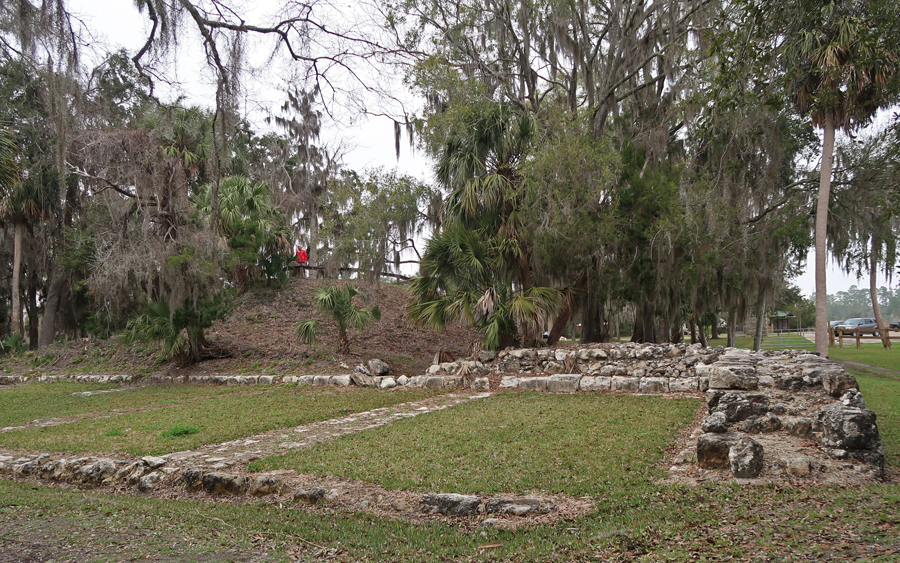
1/24 F – Off at 7am, 4hrs to Fort St Marks National Historic Site, approved by Congress (1952) but FL did not donate the land. Therefore, currently, it is not a National Park Unit. It is now San Marcos de Apalache Historic State Park, however, it was known as Fort St. Marks by the English and Americans. Note the Spanish, English, American and Confederate flags.
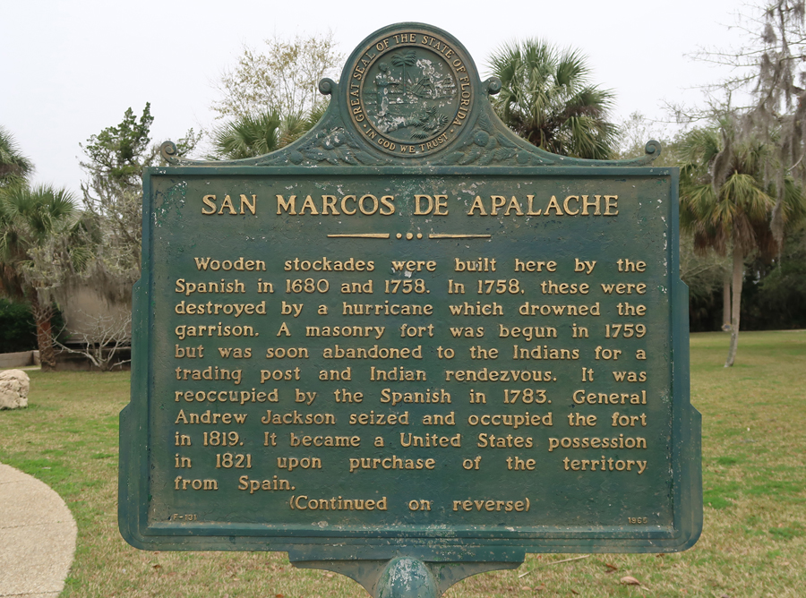
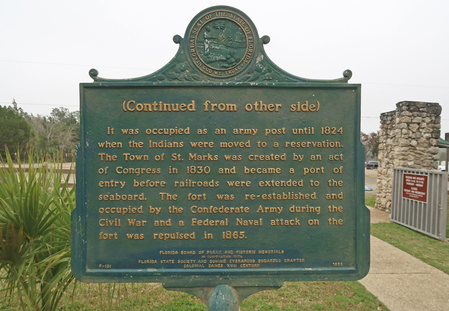
The Spanish first built wooden buildings and a stockade in the late 17th and early 18th centuries here, which were destroyed by a hurricane. The stone fort was built beginning in 1753. It came under successive control by Great Britain, Spain, the United States and, lastly, the Confederacy during the Civil War. The Confederate Army built a Marine hospital from the materials of the fort. The US took control of the site again in 1865, and the fort site was abandoned. There is a $2 Museum admission.

In 1818, after Gen. Andrew Jackson defeated the British (War of 1812) in the Battle of New Orleans (1815), he took Fort San Marcos from the Spanish.

After two Seminole Wars and FL statehood in 1845, a hurricane destroyed the fort in 1851

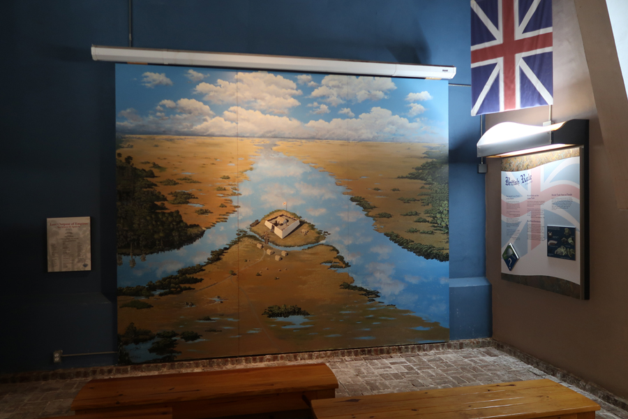
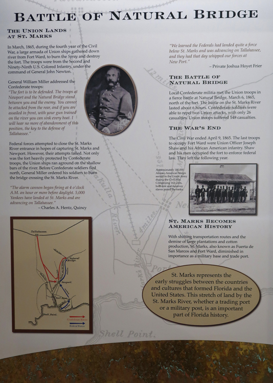
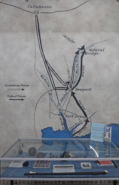
The Union lands at St Marks – The Battle of Natural Bridge, March 6, 1865
We did the Historical Trail
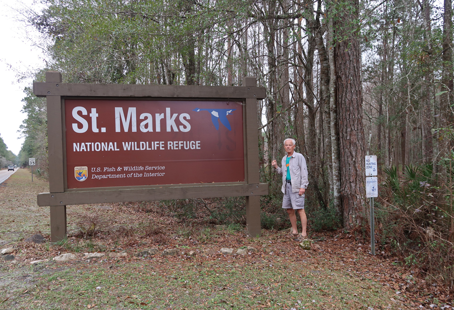
We also visited the nearby St. Marks National Wildlife Refuge on the Gulf coast, south of Tallahassee

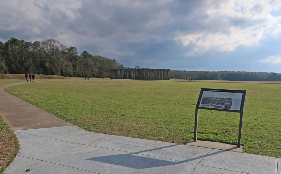
3.5hrs to Andersonville National Historic Site GA, stopped for a few more pics since it was on our way home. We did an extensive tour here in February 2017 – see Blog

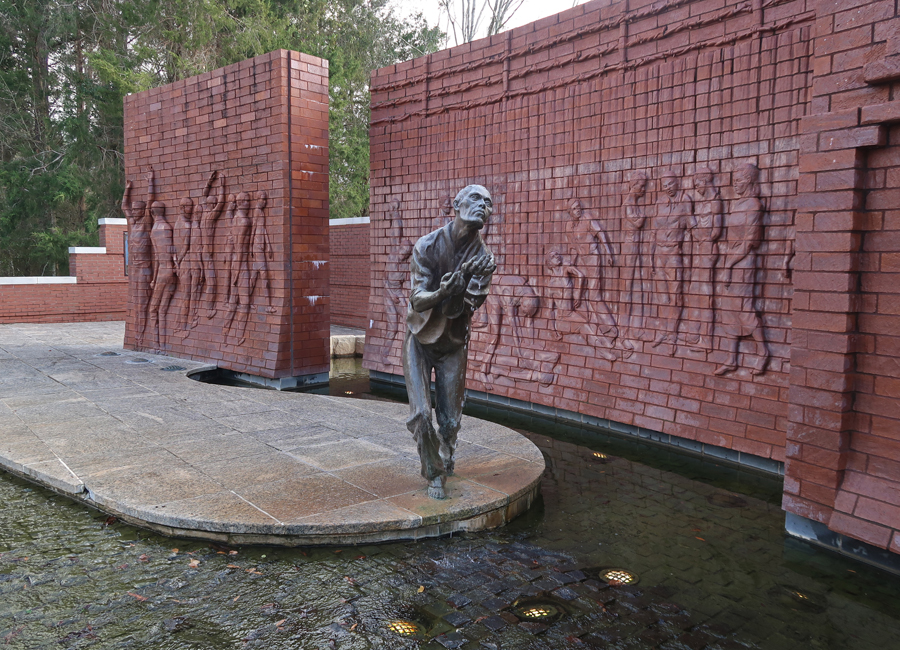
Andersonville was a Confederate Prisoner of War Camp during the Civil War
Atrocious conditions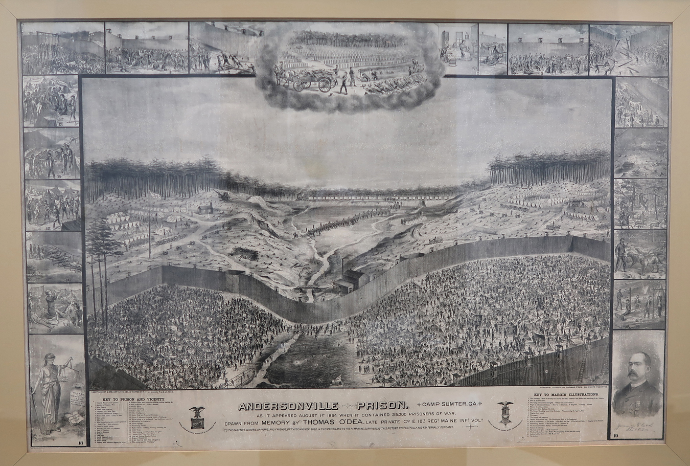
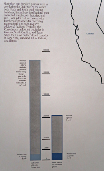
Deaths in Civil War Prisoner of War Camps – Confederate and Union, 58,000 men died in captivity!
This is also the location of the National Prisoner of War Museum.

The museum tells the story of the suffering of American soldiers over the past two centuries
Stayed in a Fairfield Inn in Warner Robins GA
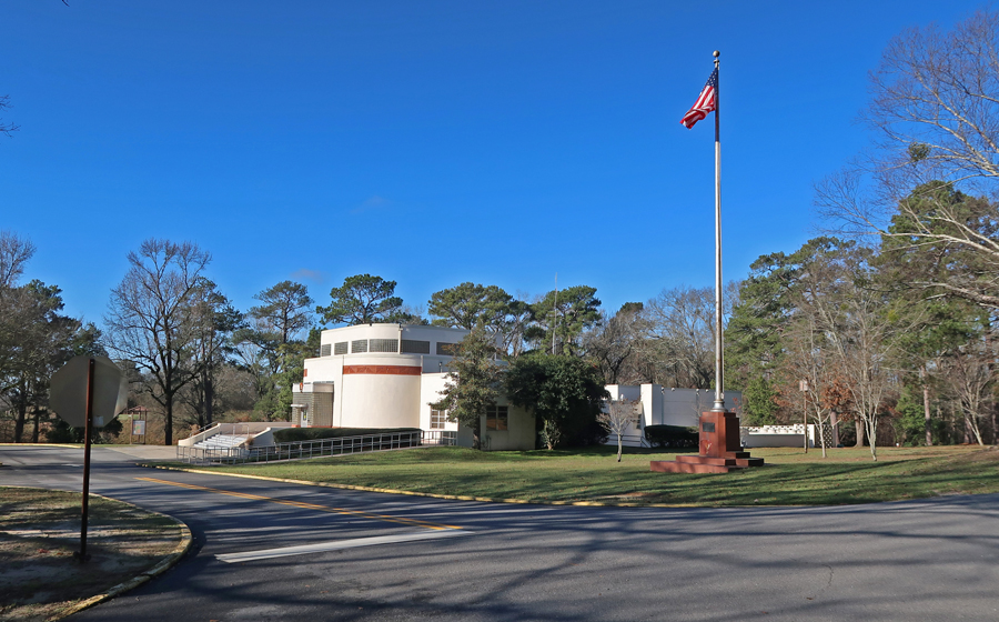
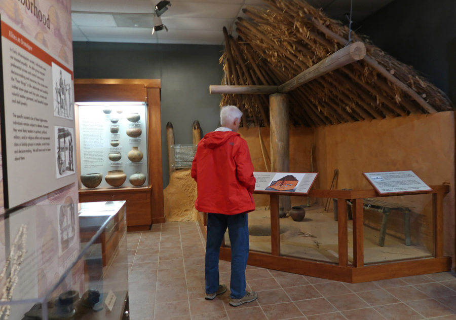
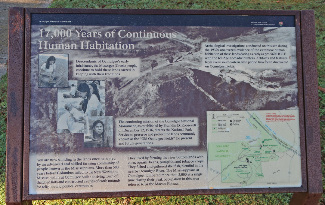
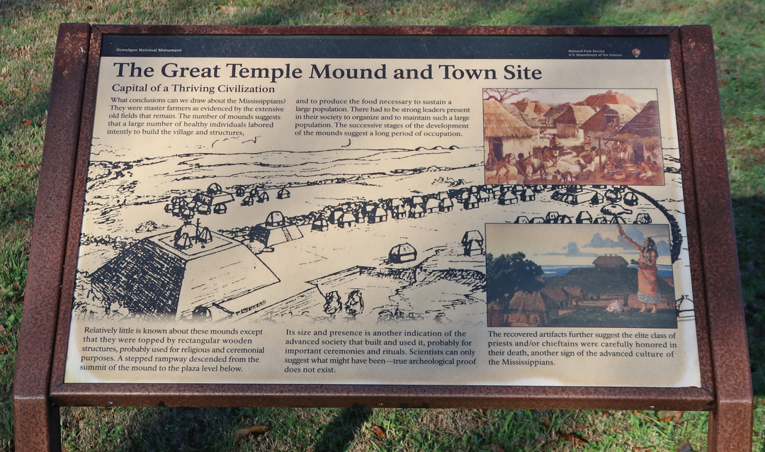
1/25 Sat – Arrived at Ocmulgee National Historical Park 10min east of Macon GA at 8:45, 15min before the Vis Ctr opened
This site is one of many Mound Group sites around the Midwest
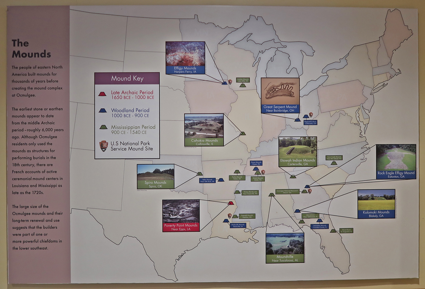
Artifacts found at this site go back over 10,000 years
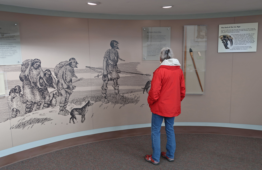

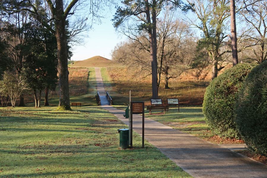
Getting ready for a hike around the site


Start of hike, Great Temple Mound in distance
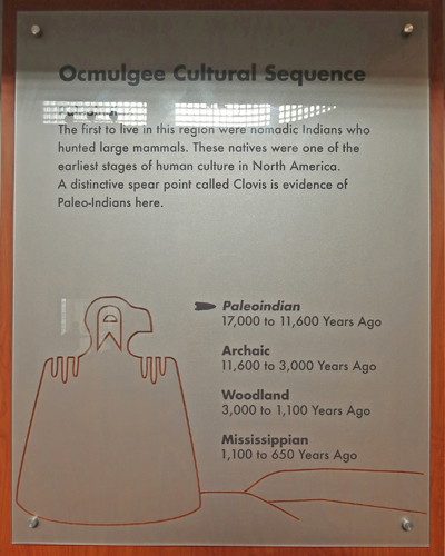
17,000 Years of Continuous Human Habitation!
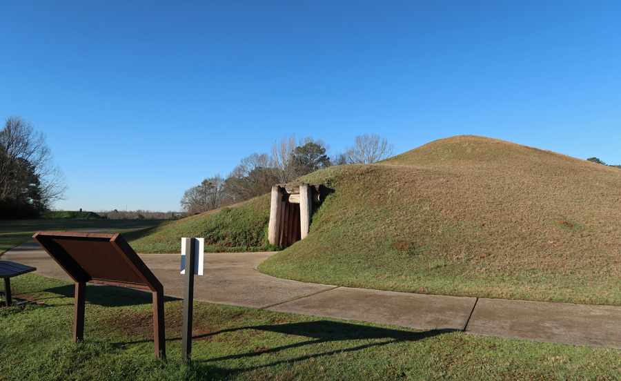
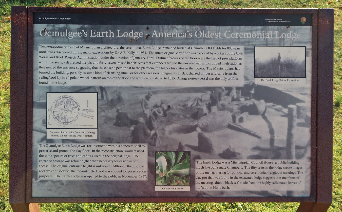
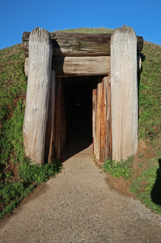
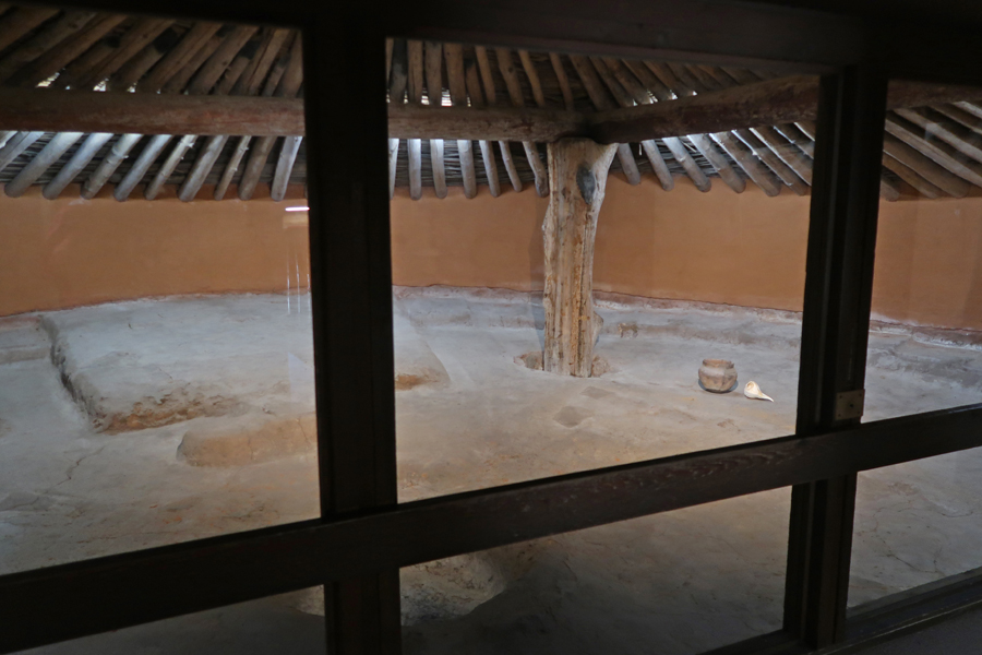
First stop, the Earth Lodge

Iron Horse Desecration of the Mounds (1843 and 1873)

Great Temple Mound


View from top of Great Temple Mound looking NW toward Funeral Mound, Lesser Temple Mound, and the Trading Post Site
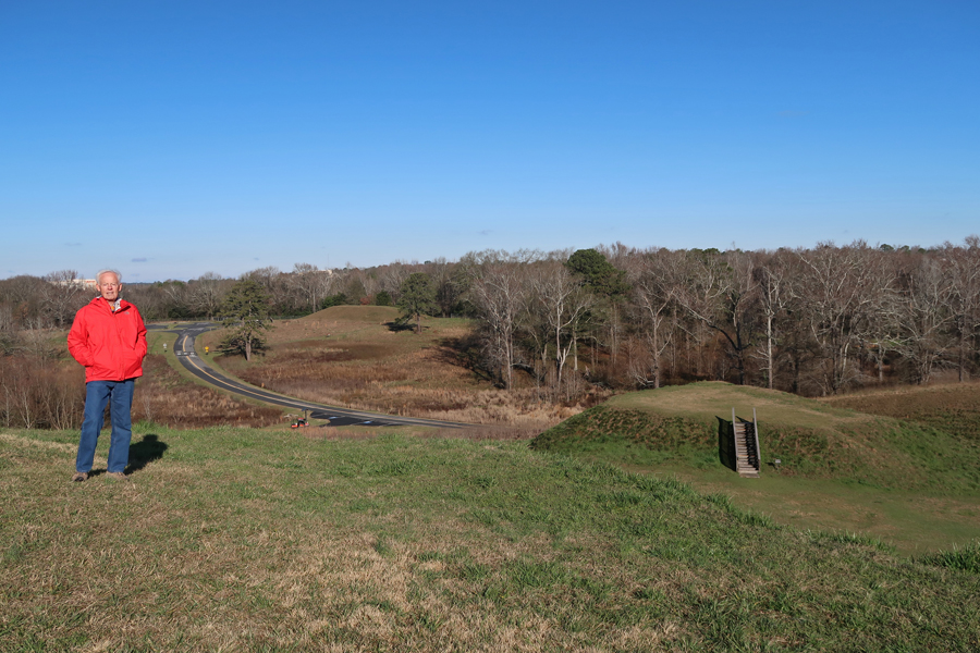
Descending the Great Temple Mound, Ocmulgee River below

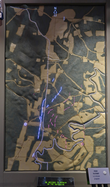
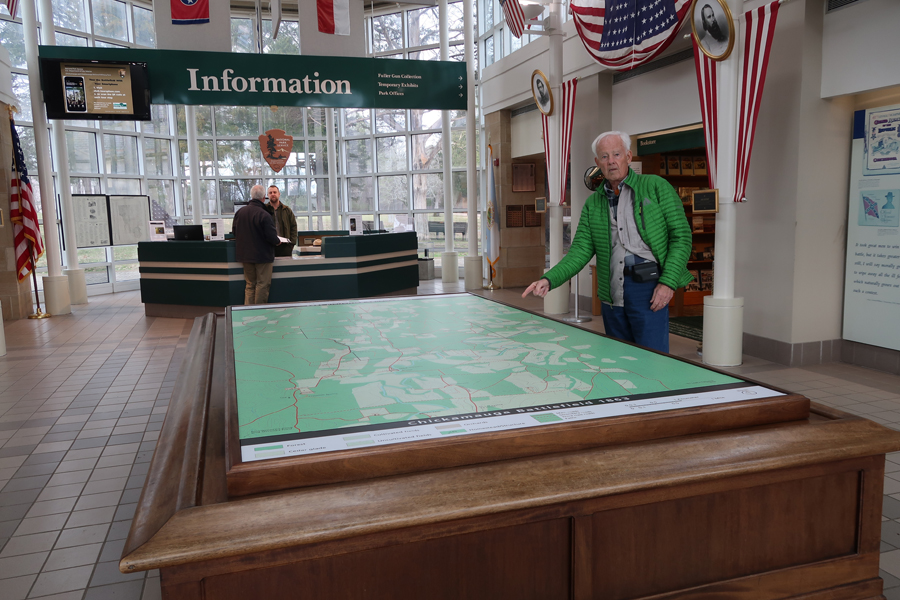
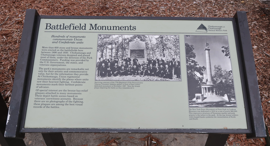
3.5hrs to Chickamauga and Chattanooga National Military Park. Late summer 1863 the Confederates abandoned Chattanooga TN to the advancing Federals, the Confederates withdrew 26 miles to the SE, the Chickamauga battlefield (GA). The Union forces (~70,000), led by Maj. Gen William S. Rosecrans, followed. On September 19, 1863, the Confederates (~66,000), led by Gen. Braxton Bragg, attacked the Federals at Chickamauga and pushed them back into Chattanooga. They then occupied Missionary Ridge and Lookout Mountain, thereby preventing most Federal supplies from entering the city.
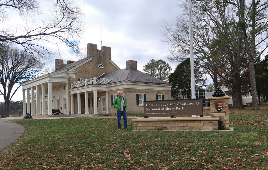
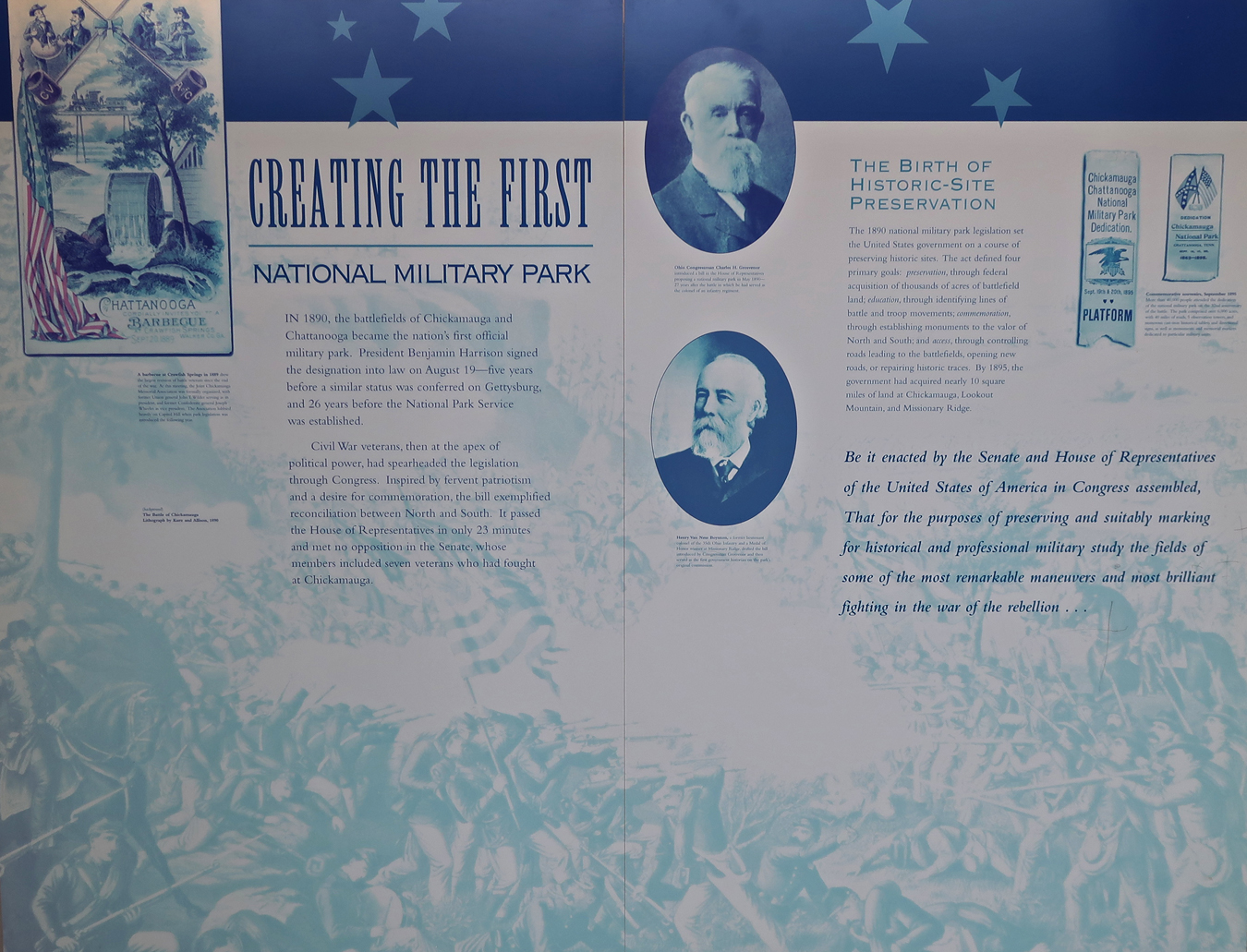
This was the first National Military Park authorized by Congress (1890). It was dedicated in 1895. In 1933, all the National Military Parks, administered by the War Department, were transferred to the National Park Service.
Chickamauga was a Confederate victory (September 1863). Chattanooga, which included the Battle for Lookout Mountain (a diversionary attack) and the attack on Missionary Ridge (November), was a Union victory and opened the Union route into GA.

Electronic depiction of the Battle of Chickamauga
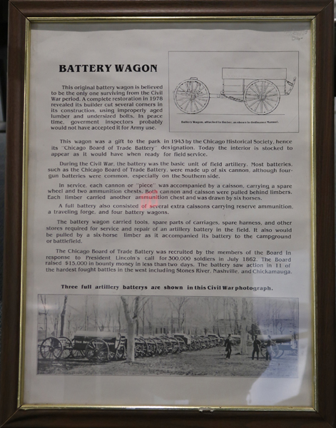
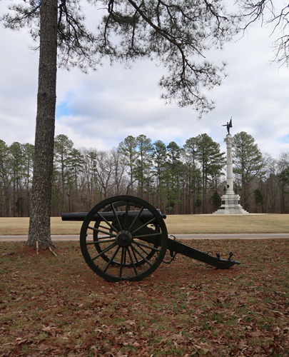
Battery Wagon sponsored by the Chicago Board of Trade

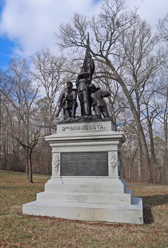
There is an interesting 7-mile driving tour of the Chickamauga battlefield

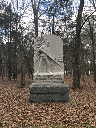
Chickamauga Confederate Monument
Brotherton cabin, where Confederates broke through Union defenses

Wilder Brigade Monument, “Union Col John T. Wilder’s brigade of mounted infantry, armed with Spencer repeating rifles, halted a portion of the attacking Confederates. The “Lightning Brigade had the only Union success on this part of the field.”

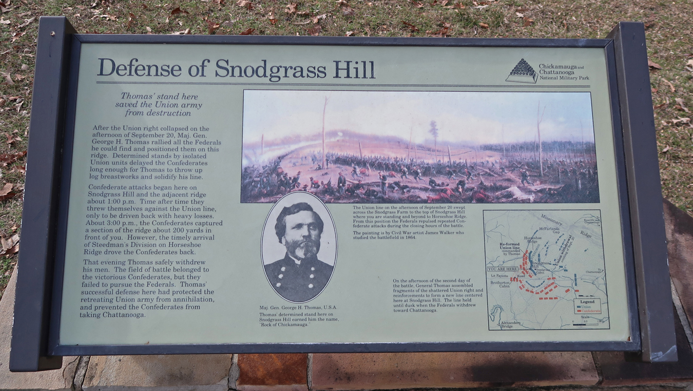
Snodgrass House on Horseshoe Ridge
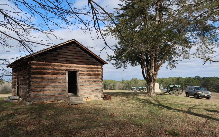
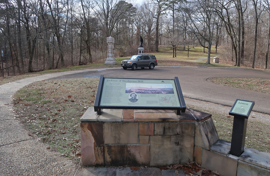
Defense of Snodgrass Hill
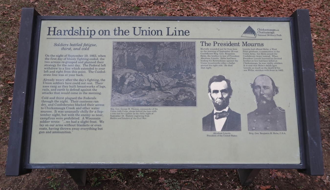
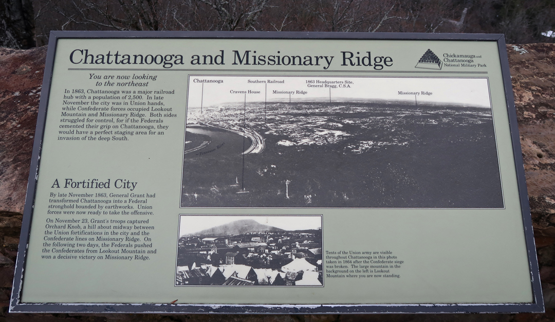
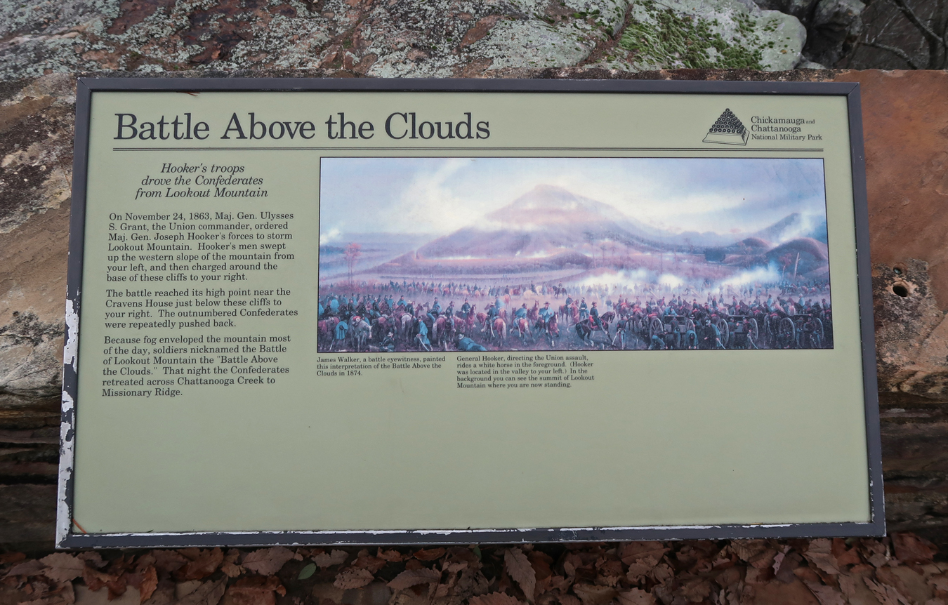
After the Union defeat at Chicamauga, Lincoln sent reinforcements including Maj. Gen Joseph Hooker, Maj. Gen William T. Sherman, and replaced Rosecrans with Maj. Gen. Ulysses S. Grant. The Battle of Lookout Mountain, also called the “Battle Above the Clouds,” took place on November 24, 1863. Maj. Gen Joseph Hooker’s troops, partially protected by heavy fog, took the Confederate fortifications on Lookout Mountain.
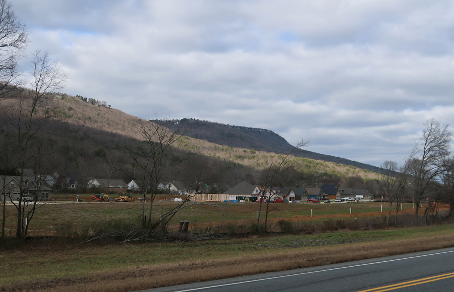
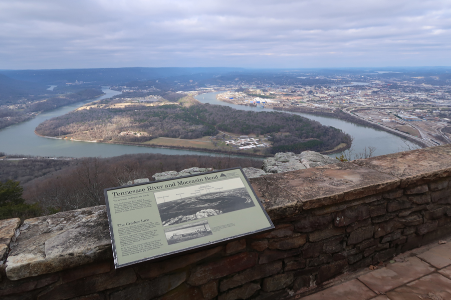
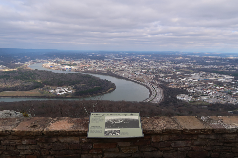
Lookout Mountain (2,389 ft) overlooks the Moccasin Bend (~680 ft) of the Tennessee River. Hooker’s attack was a diversionary tactic and the main Union force attacked Missionary Ridge to the east of Chattanooga.
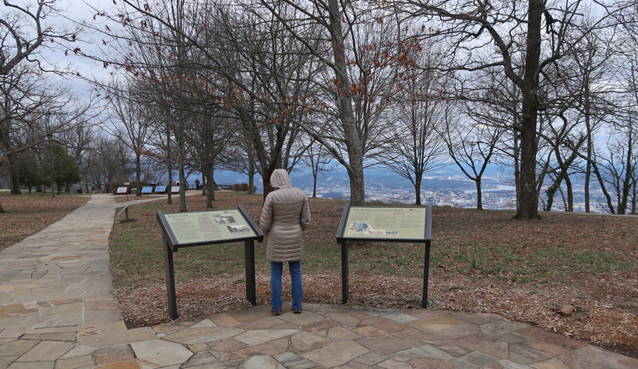
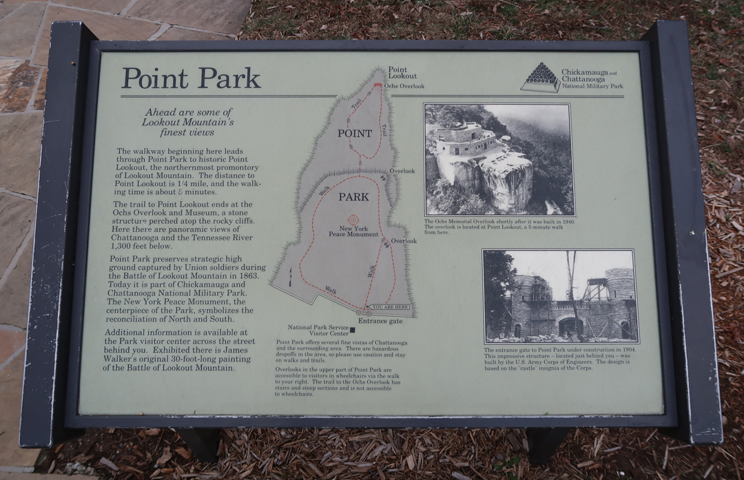
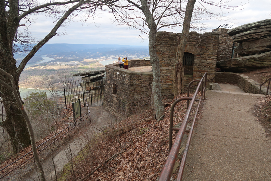
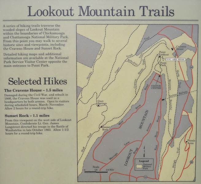
Point Park is located on top of Lookout Mountain.

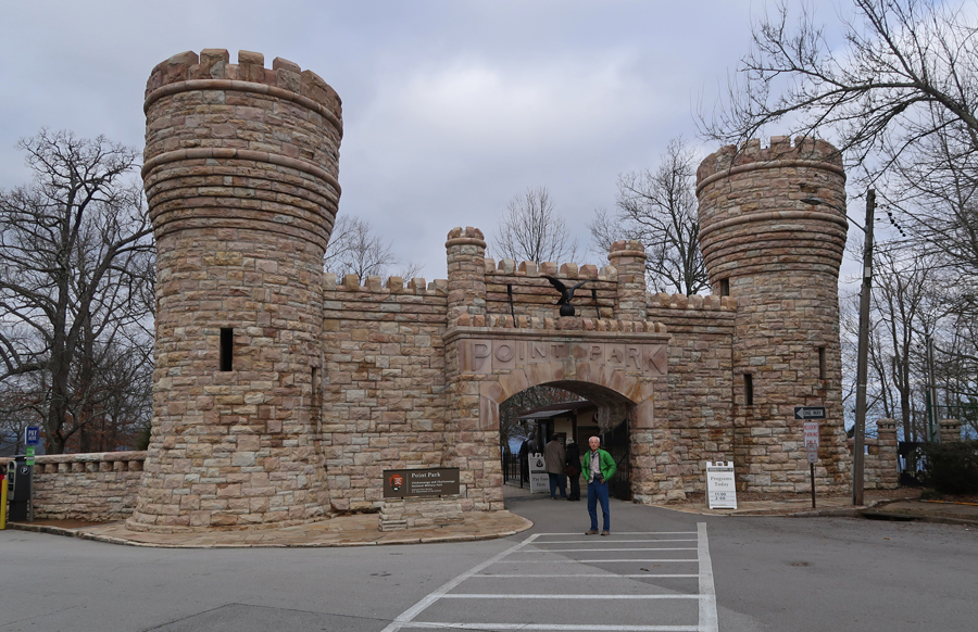
A little cold today but hey, it’s January!
1996 photo

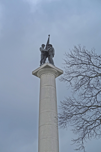
New York Peace Memorial

Great views west, north, and east from Ochs Memorial Observatory
There was an interesting display on Civil War Signaling there

Moccasin Bend National Archeological District is directly across the Tennessee River

View of Missionary Ridge

Lots of good trails
The Craven House was at the epicenter of Hooker’s attack on Lookout Mountain


View east toward Missionary Ridge from Craven House

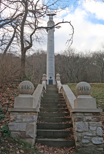
Nearby monuments

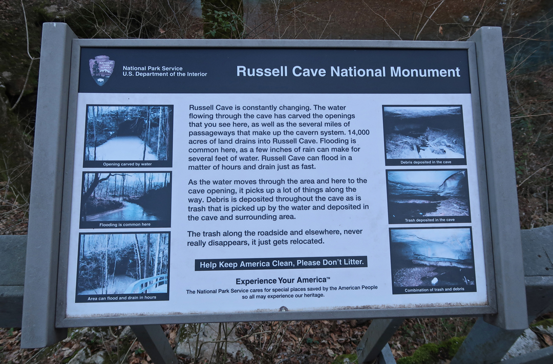
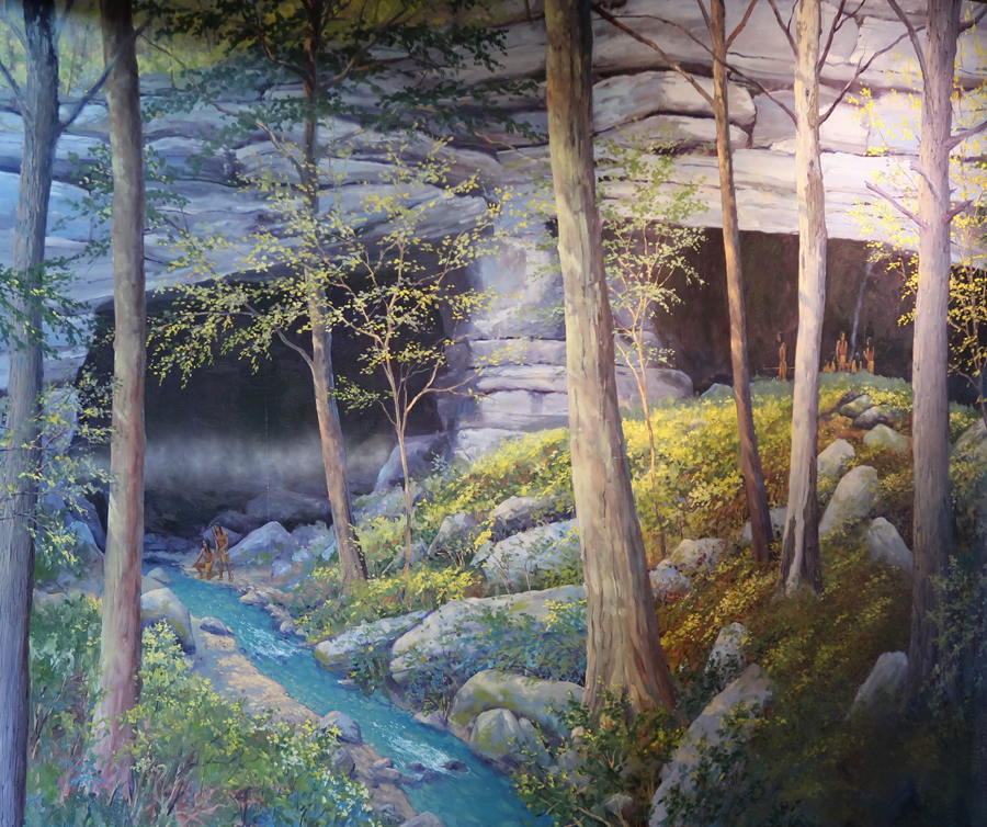
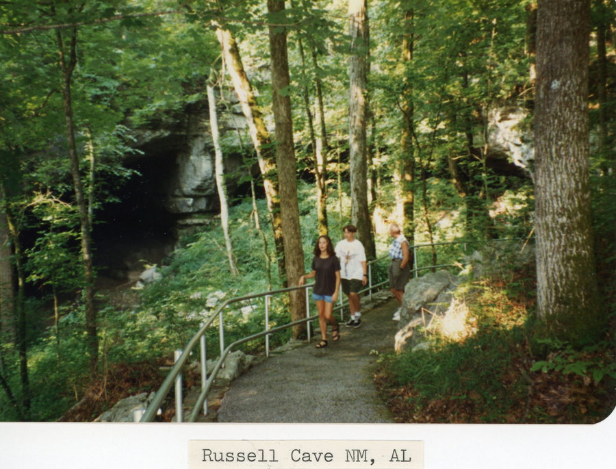
Today’s schedule was highly structured so we could get to and in each of four Visitor Centers. The fourth was at Russell Cave National Monument in NE Alabama. We left the Craven House on Lookout Mountain at 4pm EST for the one-hour drive to the Russell Cave Vis Ctr, which closes at 4:30. We arrived at 4pm CST!
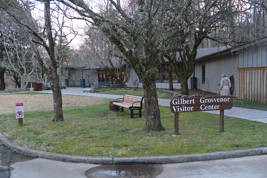
Toured the Visitor Center
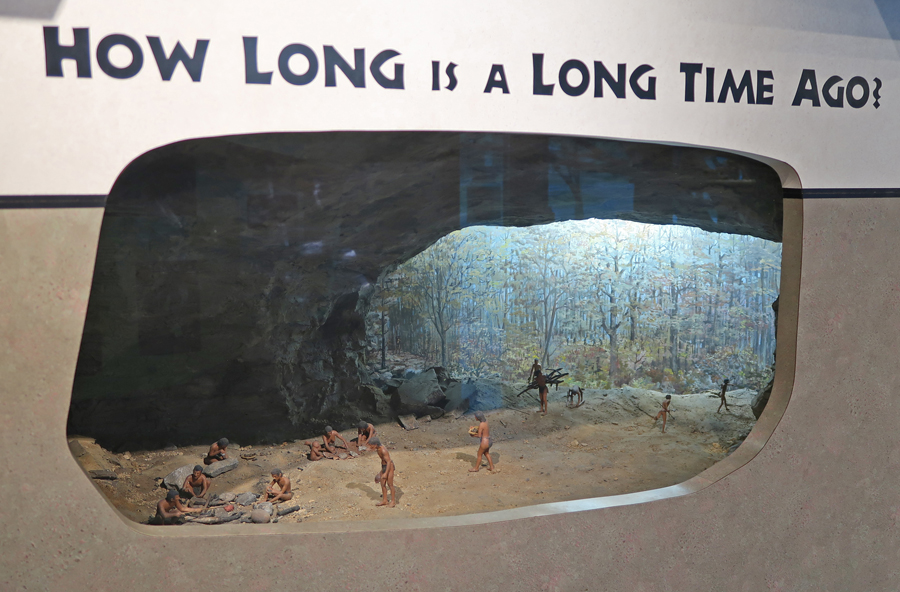
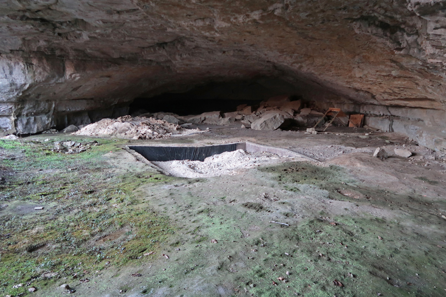
A 0.2-mile boardwalk trail takes you to the cave shelter

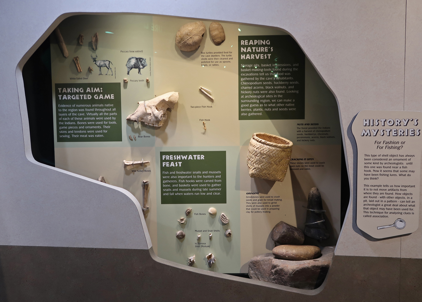
Excavations in Russell Cave trace human history from recent activity (e.g. bottle caps, tent pegs at the surface),

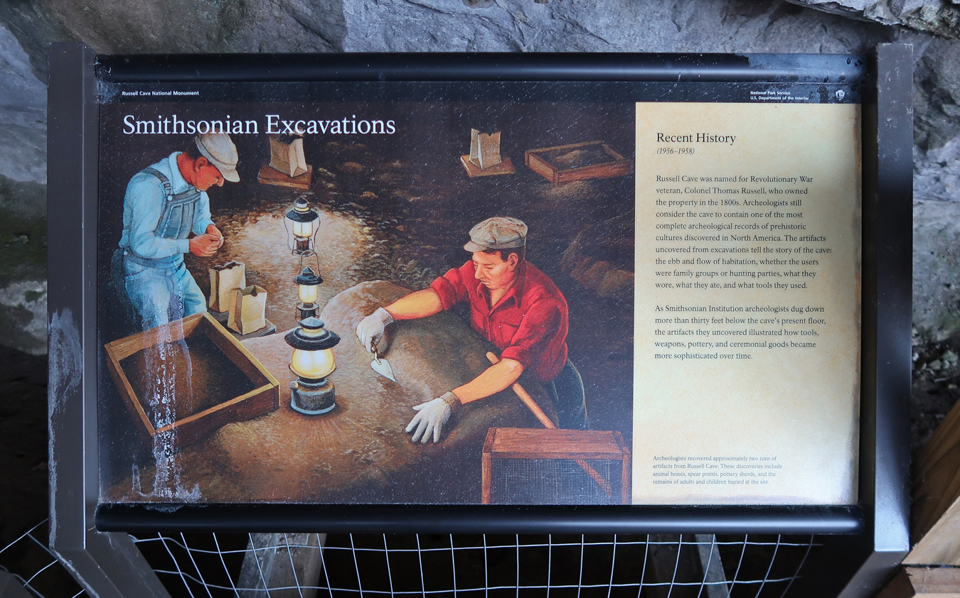
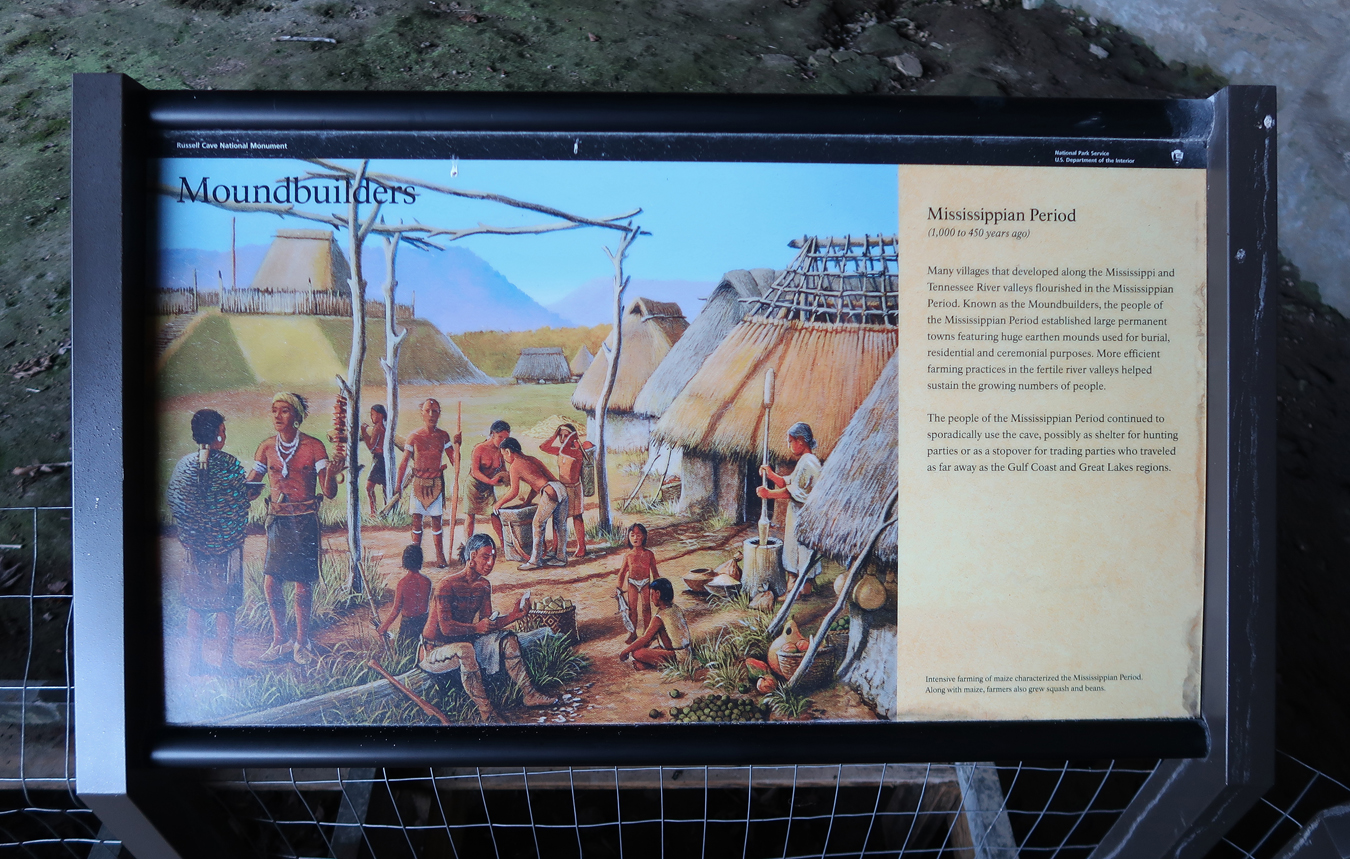
To the Mississippian era 500-1000 years ago (e.g. bone needles, shell ornaments just below surface),
To the Woodland era 1,000-3,200 years ago (e.g. pottery, baskets 6 inches down),

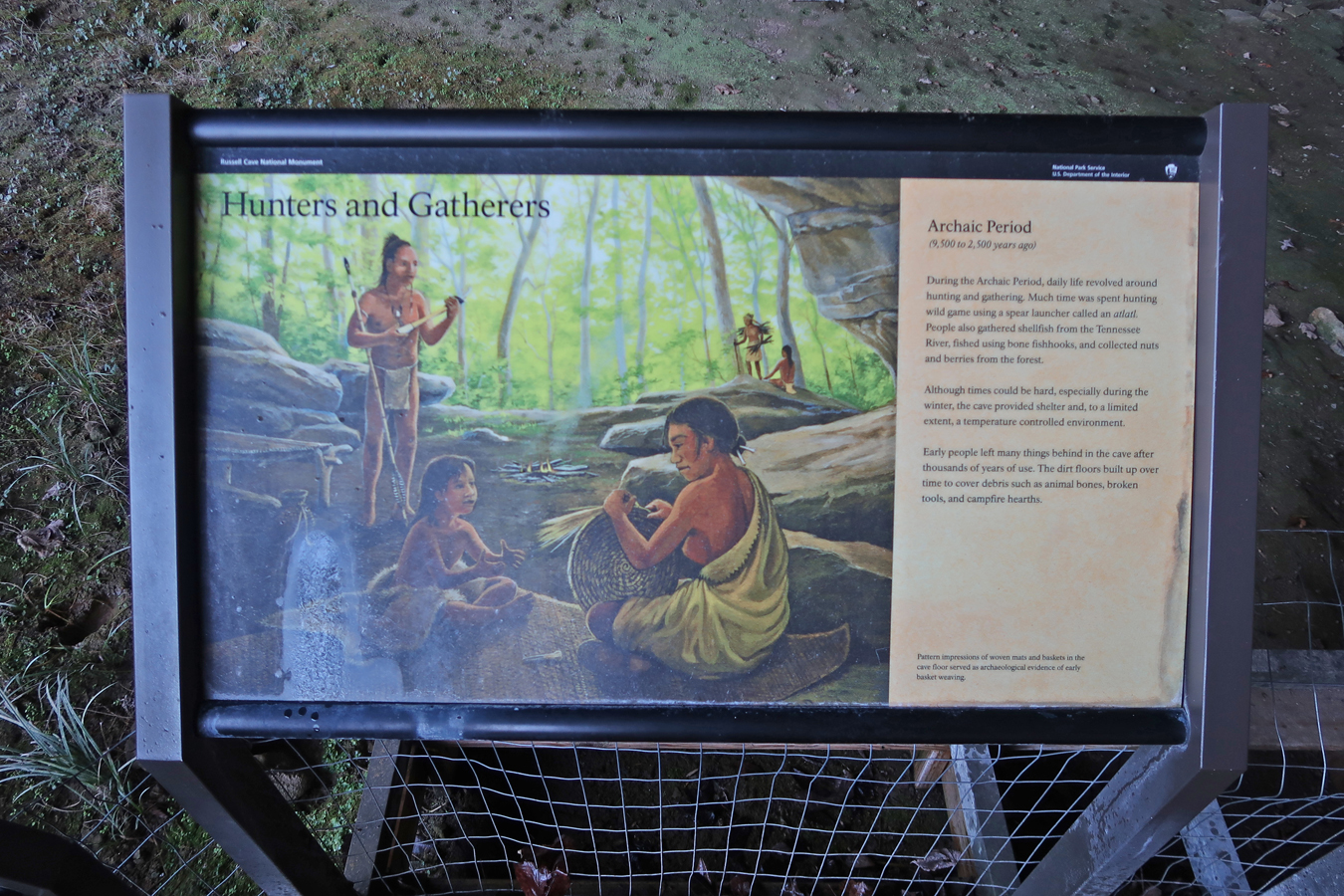
To the Archaic era 3,200-11,450 years ago (e.g. bone hairpins, bone awl 4 feet down). About 7,000 years ago, the roof of the cave collapsed and raised the floor above stream level, thereby permitting habitation. Though the cave could only accommodate 15-30 people, it was used for generations by different bands of people. These people lived relatively comfortable lives in the Tennessee River Valley, harvesting food and hunting by season. According to archeologists, they were able to fully use their environment without destroying what sustained them.
The Paleo era was 10,000-14,500 years ago (e.g. animal scraper, stone points 6 to 43 feet down), which is the level of the water table.

Returning from the cave in 1996, there was a paved trail at that time, no boardwalk
1.5hrs to Fairfield Inn in Chattanooga TN
1/26/20 Sun – Helen’s B-Day – Left Chattanooga at 7:30am, arrived home at 3:15pm to a surprise Birthday Pizza Party organized by Peter, Heather, Stacy, and Brad.
