
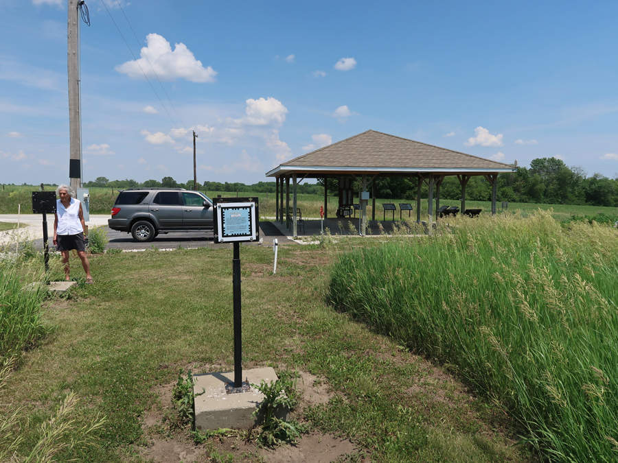
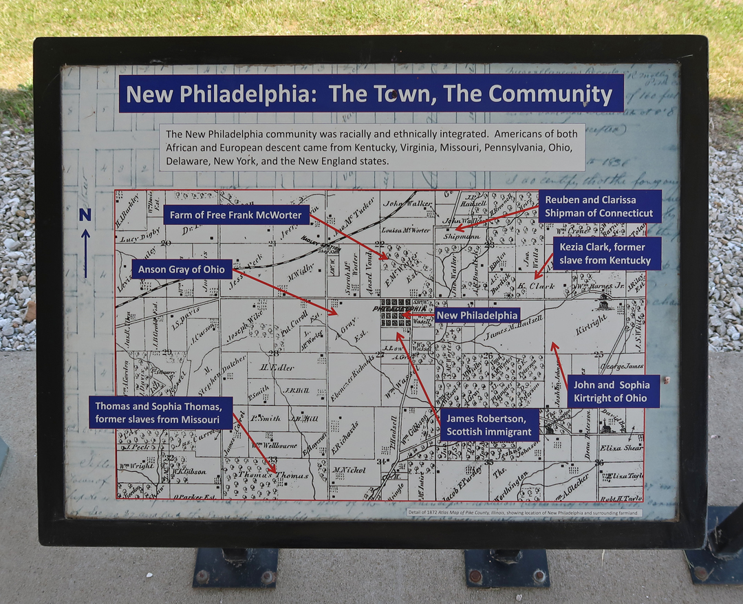
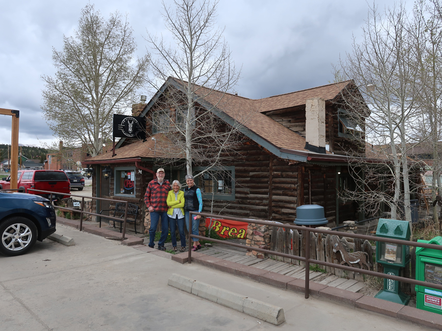
5/31/2023 – It took 7 hours to drive to West-Central IL and the integrated interracial town that “Free Frank” McWorter founded in 1836 – New Philadelphia NHS. “The first known town planned and legally registered by an African American before the Civil War.”
This site is the 424th and newest NPS Unit (12/29/2022). So, my total NP Units count rises to 424!

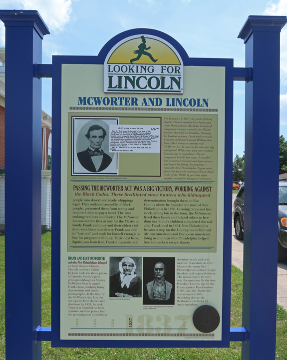
Frank was a slave in KY. He saved money from his work and a small business to first purchase his wife and then himself, then his children and grandchildren. He sold lots in New Philadelphia to get the funds to purchase his family members.

At its peak, New Philadelphia had about 160 residents in 1860.
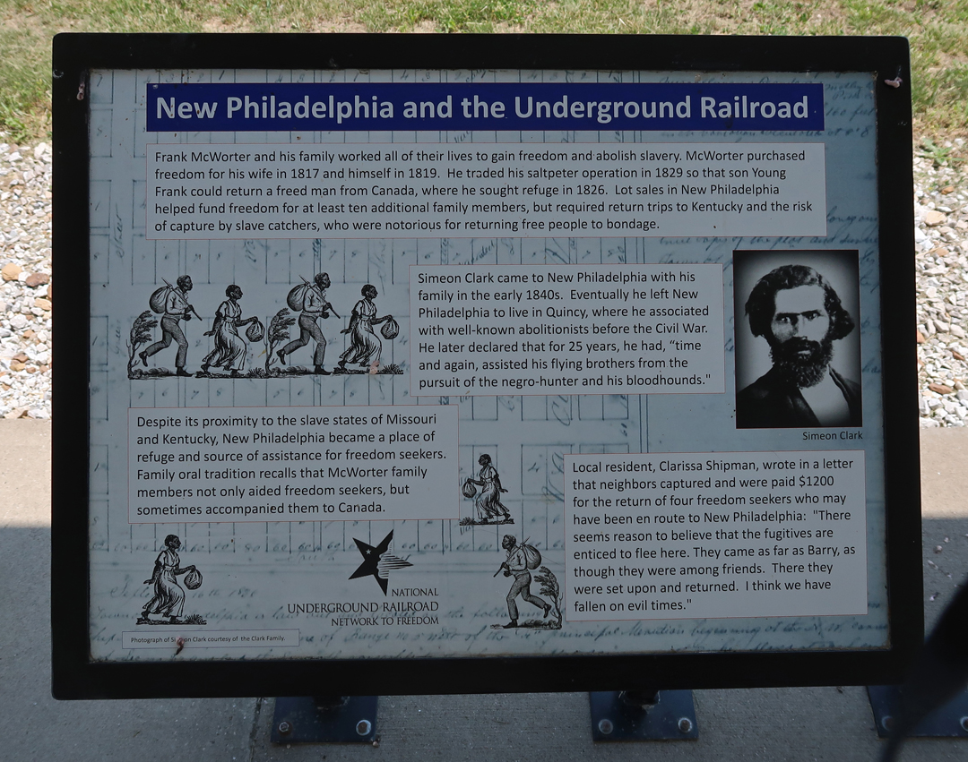
It was a stop on the “Underground Railroad” before and during the Civil War.
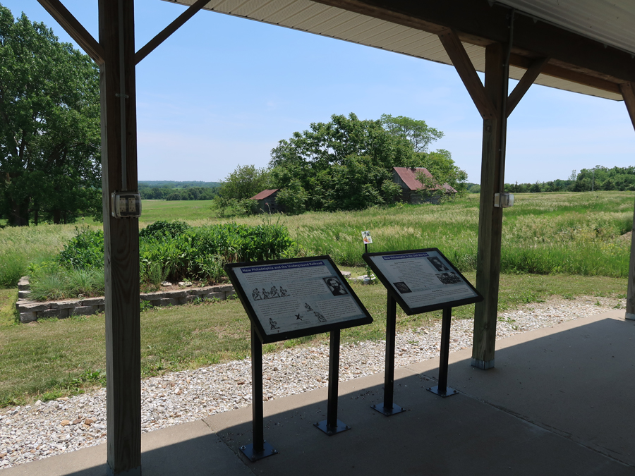
You can listen to an audio tour as you walk the loop trail through the townsite
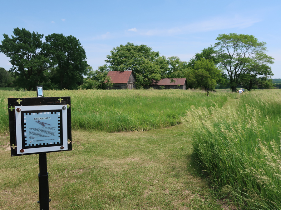

You can get the park stamp at the Public Library in Barry IL – 2 miles west

The McWorters attended the First Baptist Church in Barry

“Free Frank” and Lincoln –
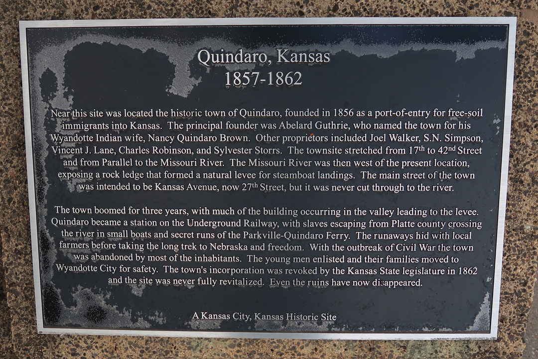
We arrived at the Quindaro Townsite National Commemorative Site (NCS) in Kansas City KS as it was starting to get dark.
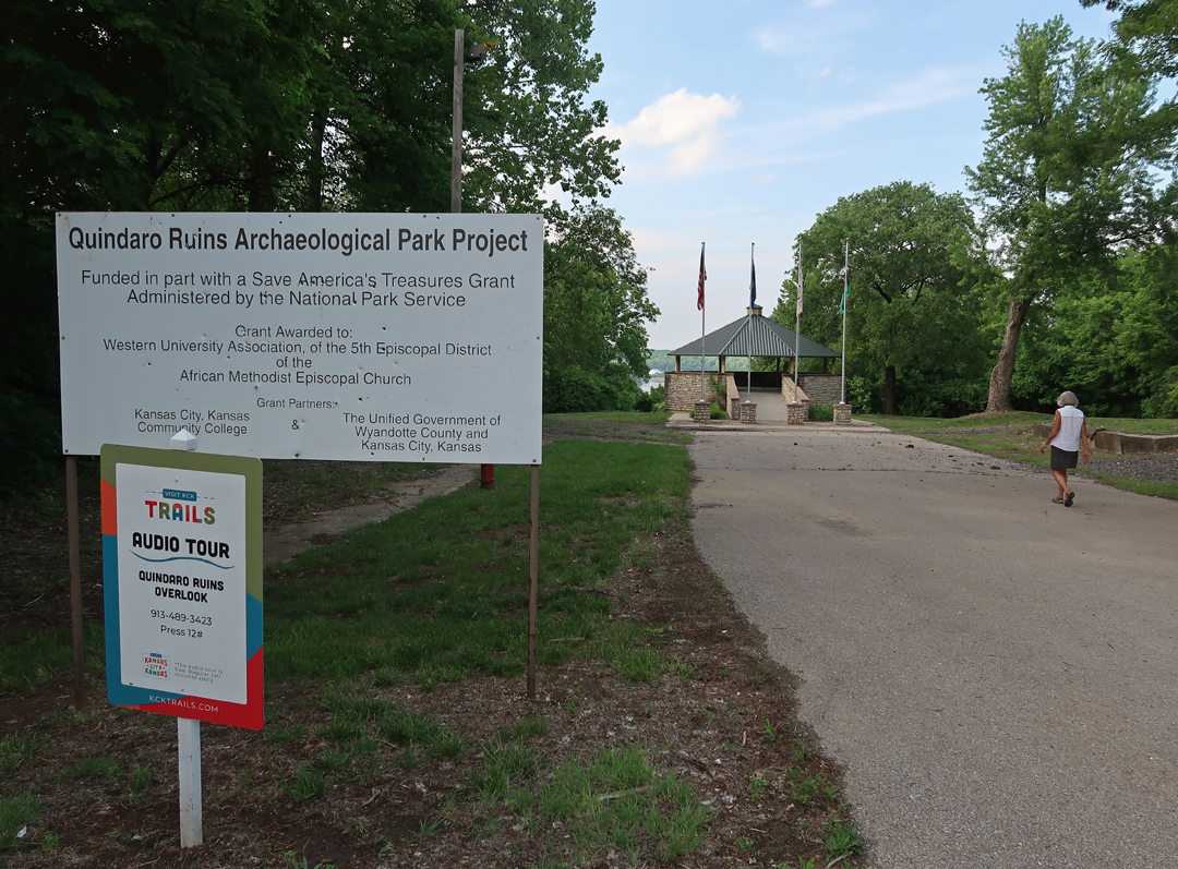
Quindaro was on the banks of the Missouri River below this overlook. The opposite side (east side) of the river was MO, a slave state.

Plaques at Overlook – National Freedom Trail Underground Railroad Network Site
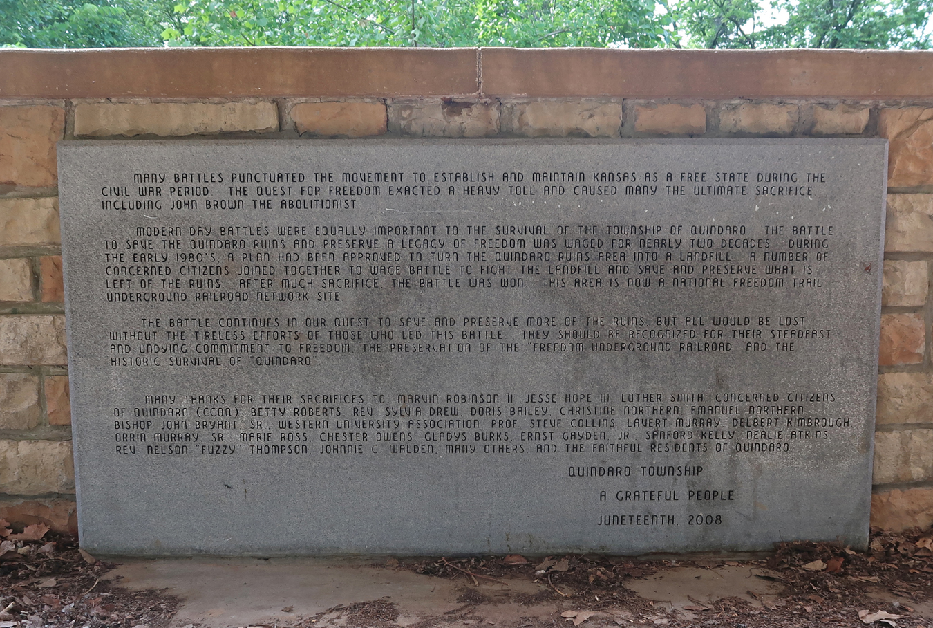
John Brown was a hero to the people of Quindaro. The statue was erected in 1910.

The town “officially” existed from 1857 – 1862
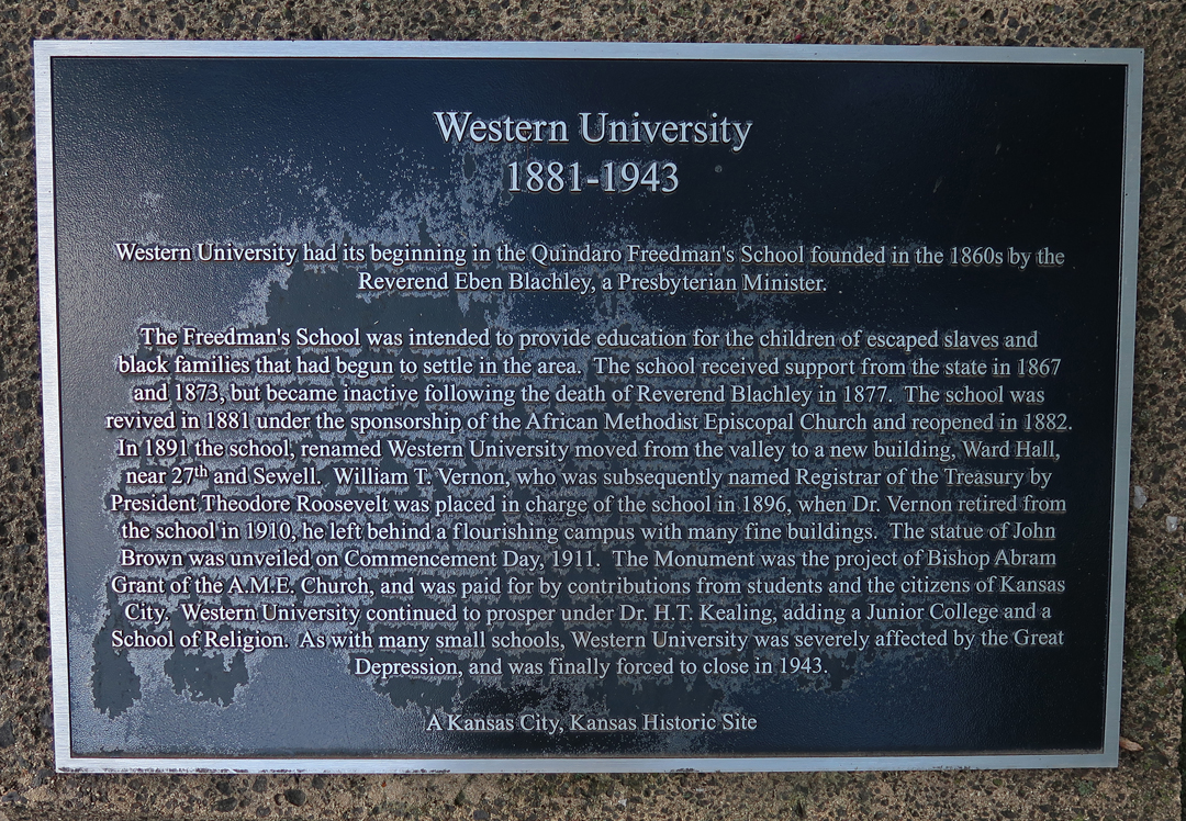
Quindaro Freedman’s School was started here in 1860. The school closed in 1877 but was re-activated by the African Methodist Episcopal Church (AME) in 1882. In 1891 it was renamed Western University and continued to educate primarily blacks until it was forced to close in 1943.
Spent the night in KC
6/1 Th – 8.5hrs and 610mi to Nick & Linda’s home in Arvada outside Denver. We had a family dinner at Jordano’s Italian restaurant that evening.
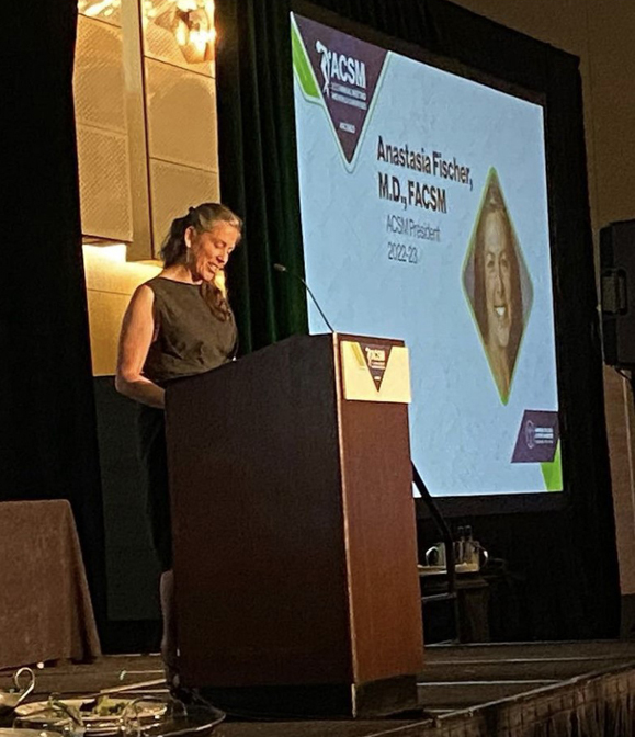
6/2 F – Had the Sequoia serviced in the morning and “hung out” with Nick & Linda until we left for the American College of Sports Medicine (ACSM) convention banquet at the Hyatt Regency.
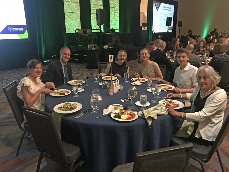
Stacy was passing the gavel after serving a year as President of ACSM
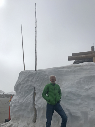
6/3 Sa – up early, met Leaf & Jeff at their home in Loveland at 8am for a Rocky Mountain Excursion.
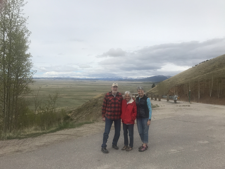
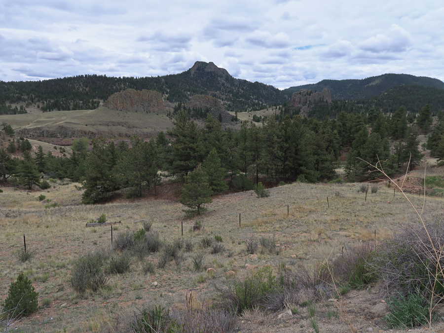
We drove to Kenosha Pass on Rt 285; it is one of the entrances into the South Park National Heritage Area.

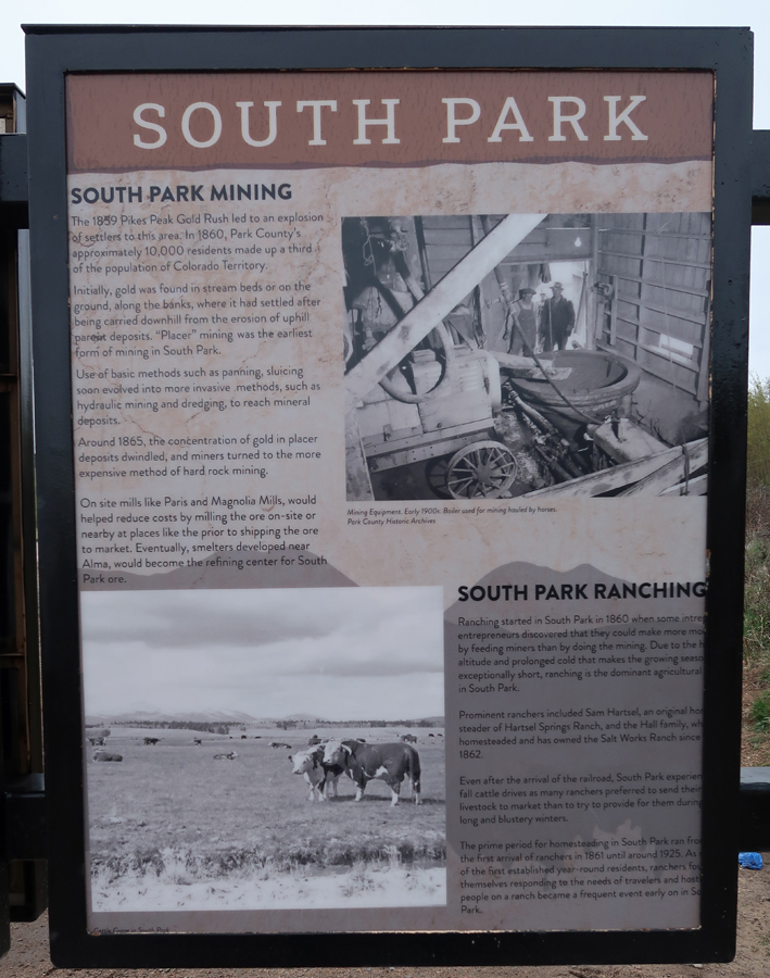
Spaniards called South Park Valle Salado (Salt Valley) for the salt springs used by the Ute and other tribes. The French, who were in the area as early as the 1700s, used the Creole name Bayou Salade (Salt Marshes). American trappers, or mountain men, who began filtering into South Park in the first decade of the nineteenth century, used a mix of the French and Spanish and titled the valley Bayou Salado for the salt springs and the salty, standing water that grew rich, high protein grasses favored by big game. The name South Park was taken from the French parc, meaning game preserve and referring to the area’s vast herds of wildlife. According to historian Virginia McConnell, the name South Park was first used in the 1840s when a chain of mountain valleys—North Park, Middle Park, and South Park—were becoming a popular hunting ground for American hunters.

South Park is a vast grassland basin, 50 miles long and 35 miles wide, situated in the geographic center of Colorado. In the basin, the elevation of the National Heritage Area is about 8,500 feet, while on the surrounding mountain peaks it rises to as high as 14,286 feet. The significance of South Park’s natural resources is directly linked to its high altitude. From canyons to grasslands to mountain summits, this landscape boasts a wealth of natural resources, some of which exist nowhere else in the world. More than 115 rare or imperiled plant and animal species have been documented in South Park, nearly 50 of which are considered globally significant.

At the peak of the fur trapping era between 1820 and 1840, some 3,000 mountain men are thought to have been in the Rocky Mountains. Among those known to have trapped in South Park were Kit Carson, Joseph Meek, John Smith, and Dick Wootton, who is said to have gathered 1,000 pounds of skins during one season. By 1840, with the beaver population decimated and changing tastes in fashion, the fur trade waned.
Our first stop was in the town of Como


Como was a railroad town, 1881-1938
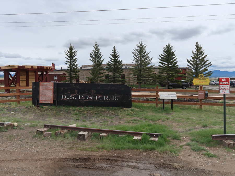

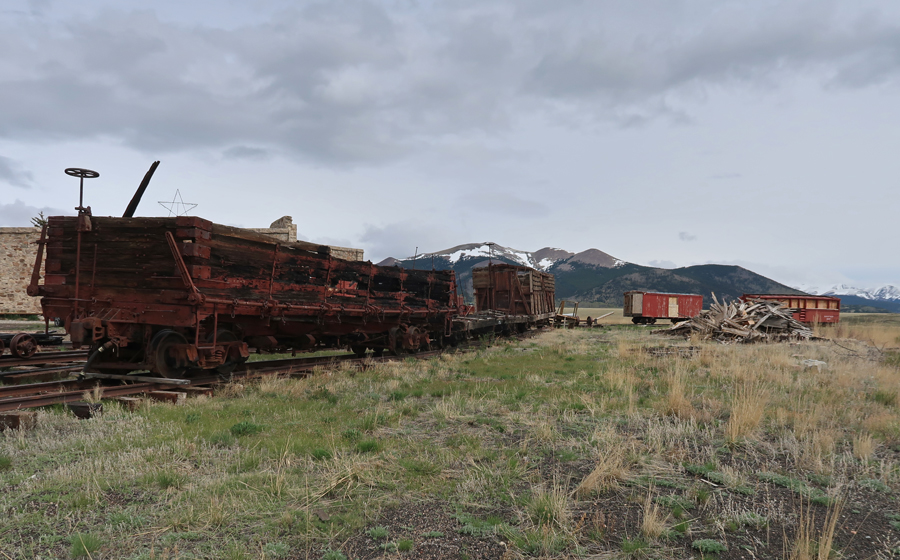
Como Roundhouse


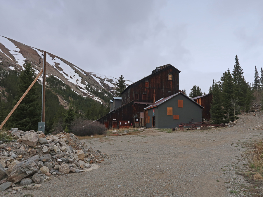
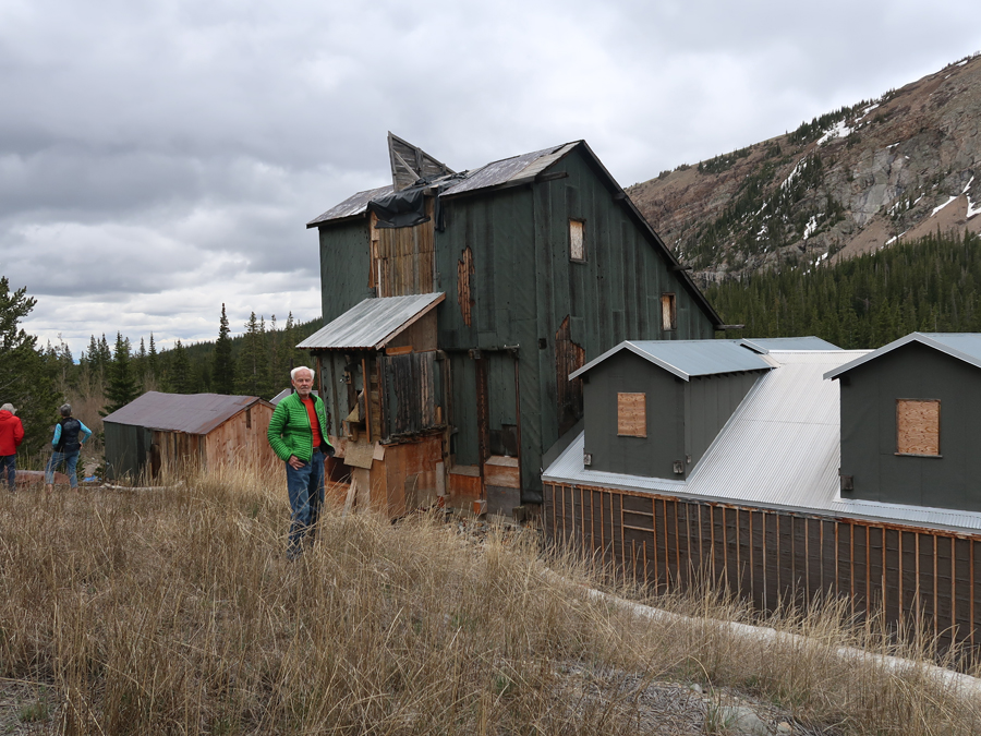
Our second stop was Alma (1873), the highest incorporated town in the U.S. – 10,578ft elevation
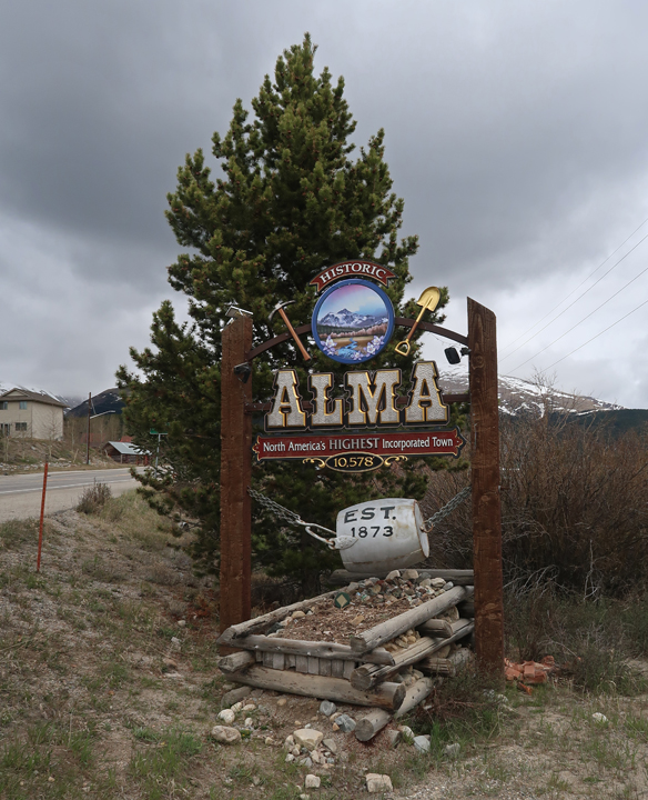
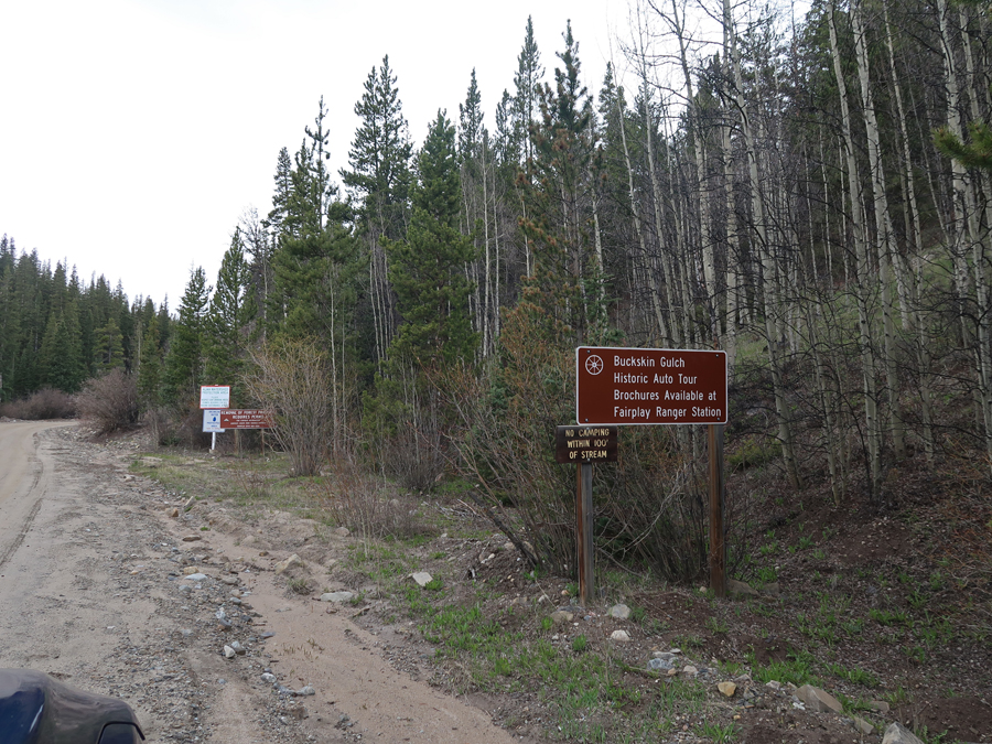
Alma was the supply and service center for Park County mines and the smelting center of South Park. The town was established at the junction of Buckskin Creek and the South Platte River seven miles north of Fairplay as a result of new silver discoveries. The remains of several mines can be found along the Historic Buckskin Gulch Auto Tour Road (gravel).
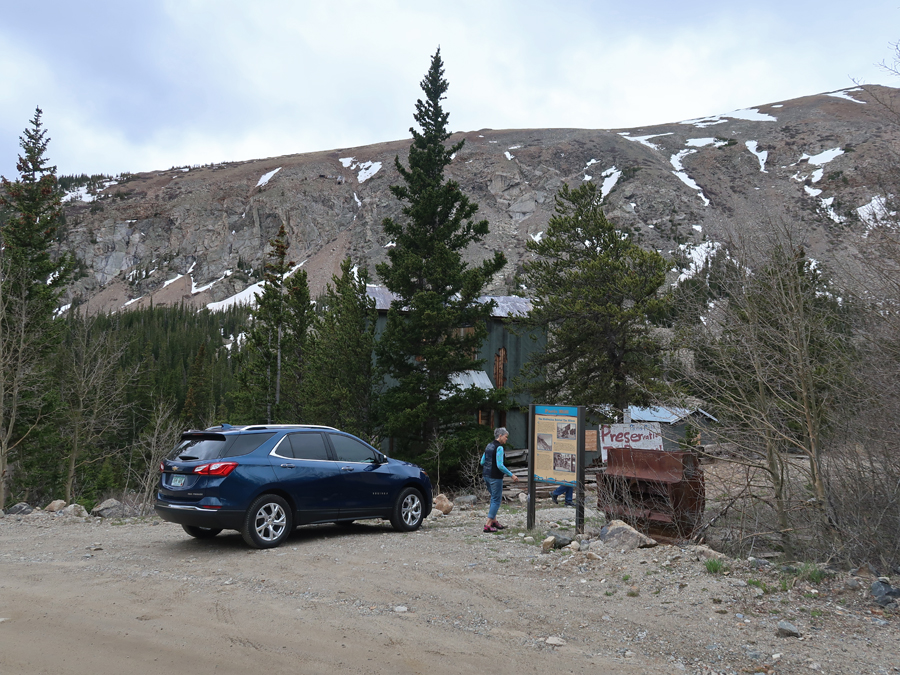
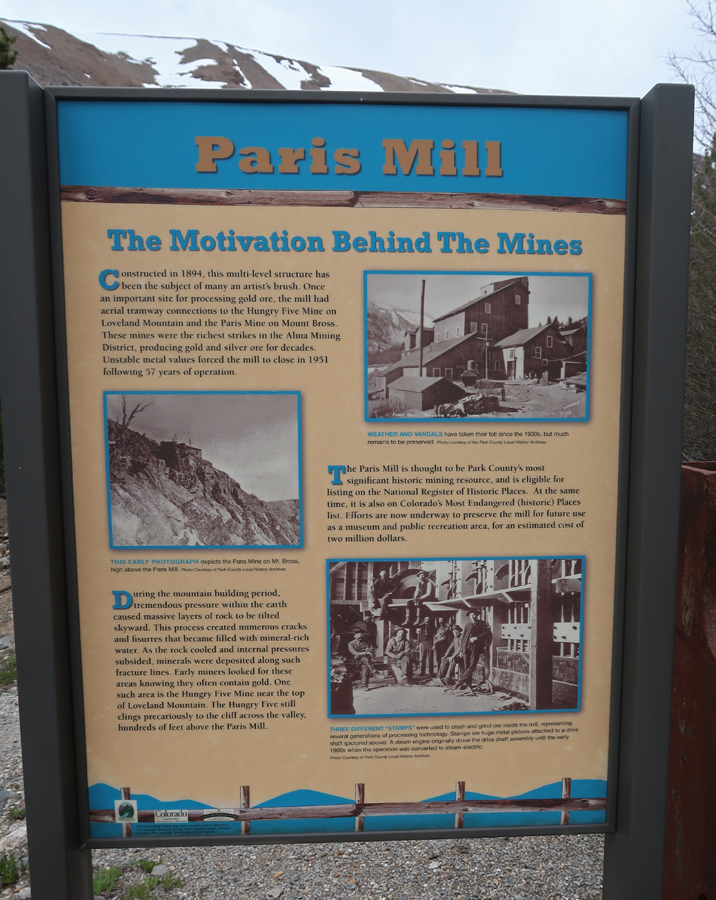
The Paris Mill Mine is in the process of restoration
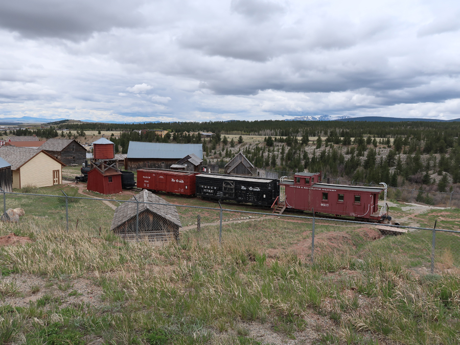
Our next stop was in Fairplay, in the center of the South Park NHA. South Park was one of the richest sections of the Colorado Mineral Belt. Intrusions of gold, silver, lead, and other minerals lead to extensive mining throughout the Mosquito Range.

South Park City Museum – is a historic 1880s Gold Rush town that’s now a museum with more than 40 buildings.

The Old Park County Courthouse (1874) housed county court functions for 132 years and continues to actively serve the public today.


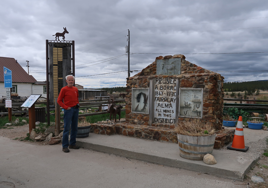
Monument to Prunes A Burro 1867–1930, Fairplay, Alma, All Mines in this District. The monument is adorned with mining tools, ore samples, and a winner’s board for the World Championship Pack-Burro Race that started here in 1949. Burros were used to help miners carry gold ore. They were used to carry anything heavy and could be trusted to navigate narrow trails without dropping valuable loads. Before freight wagons could navigate these trails, burros carried millions of dollars worth of ore out of the Colorado mountains. Many miners bonded with these animals but Prunes in particular became a Park County legend. He worked at almost every local mine during that period. The last mine he was said to work at was the Hocking Mine in Mosquito Gulch.
Had a great lunch at Mr. Burro Café with Jeff and Leaf.
Interesting rock formations and the Mosquito Mountain Range.
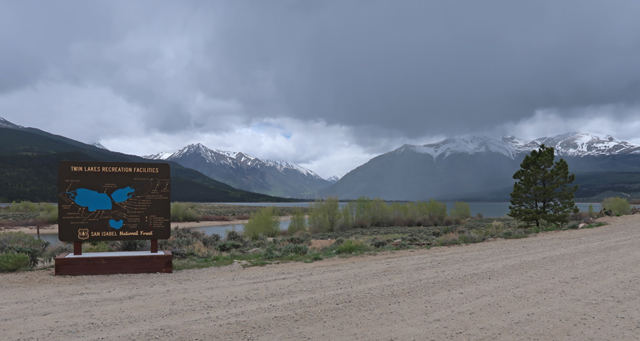
Passed through Twin Lakes near Mt Elbert, the HP of CO at 14,433ft, which I climbed with my brother Pat in 1990
Stopped briefly in Leadville, a famous silver/gold mining town of 30,000 people in the late 19th century. At 10,152ft, it was known as Cloud City, and is a National Historic Landmark.


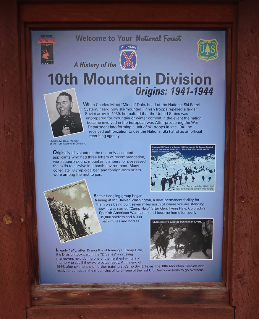
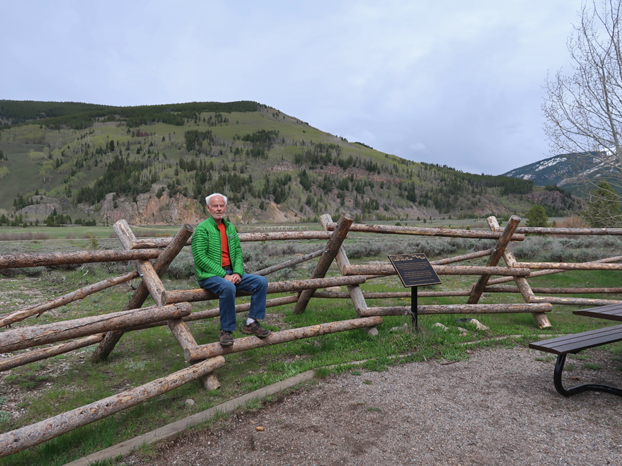
Driving North, Rt-24 climbs to 10,424ft at Tennessee Pass. There is a nice memorial there to the 10th Mountain Division, which trained at Camp Hale a little further North.
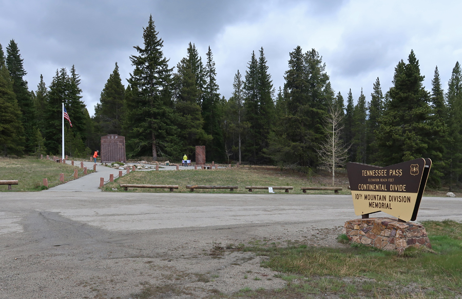
The following markers tell the story of the 10th Mountain Division


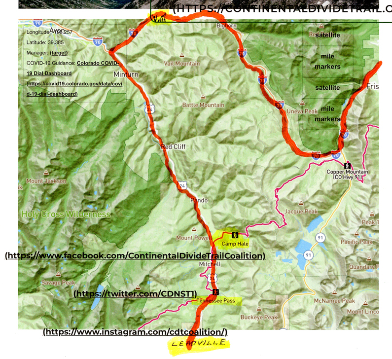
Walked a short distance on the Continental Divide National Scenic Trail (CDT). The CDT extends 3,028-miles from Canada to Mexico and is considered one of the greatest long-distance trails in the world. The CDT is one-third of the “Triple Crown of Hiking.” That is, the CDT, Appalachian Trail (AT) 2,194-miles, and the Pacific Crest Trail (PCT), 2,653-miles. The CDT is in Red on this map [our driving route in orange] –
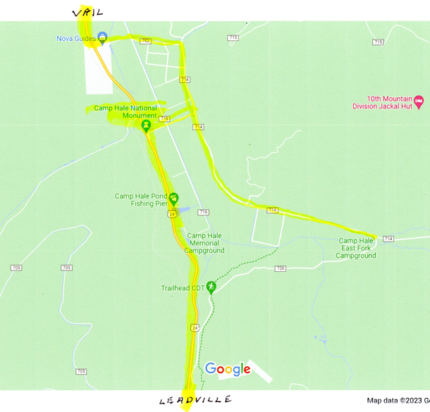
This section of trail at Tennessee Pass is also part of the Colorado Trail and the American Discovery Trail.


Dropped over one thousand feet to the Eagle River Valley (9200ft) that is/was the location of Camp Hale, which was the center of mountain and winter warfare training developed by the US Army during World War II.

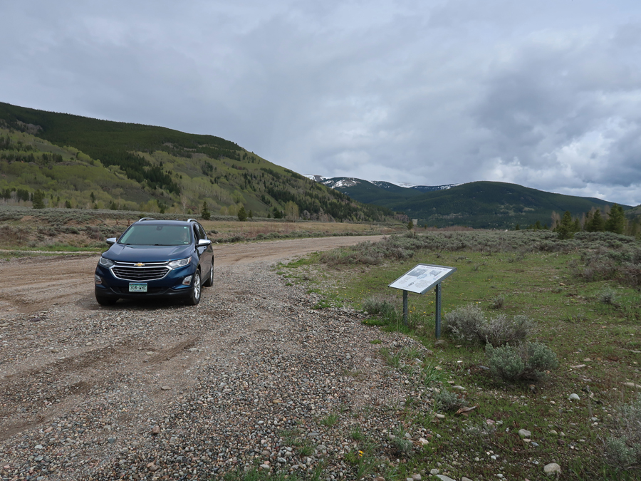
President Biden declared Camp Hale and the Continental Divide Trail a National Monument, administered by the USFS, in 2023. Entrance to the Camp Hale –

The camp included more than 1,000 buildings and structures as well as parade grounds, weapons ranges, and other spaces needed by the Army. There is a self-guided tour with 10 stops that take you in a loop around Camp Hale. Each stop has an interpretive sign describing that area, for example, the Field House.


Rock Climbing Area


The Viking Battalion

Sign describing the history of the Eagle River Valley, note the CIA use 1950s – 1960s.

Tibetan Freedom Fighter Training

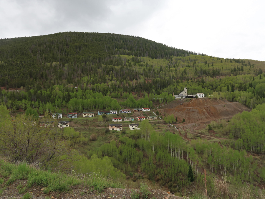
We then continued North on US-24 past scenic old mine town/sites.

And then stopped in Vail – Monument to the “Ski Trooper.”


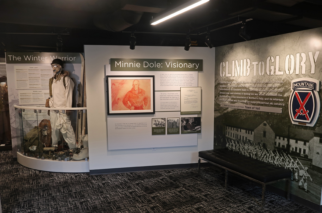
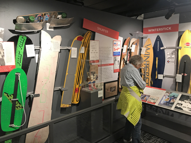
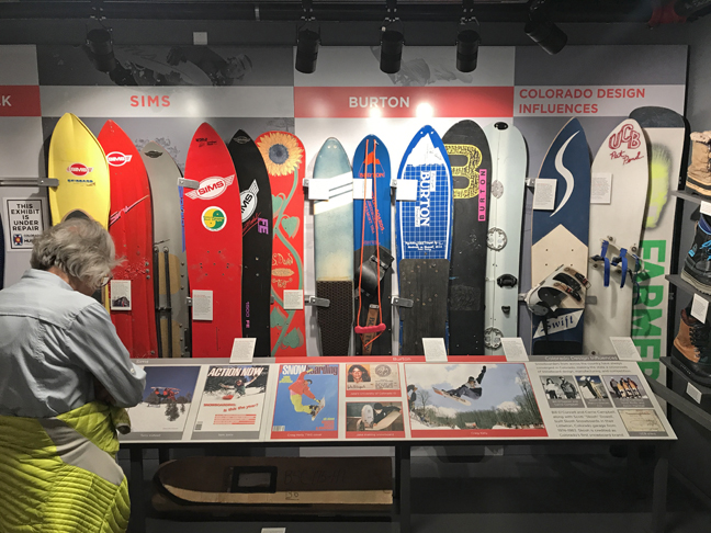
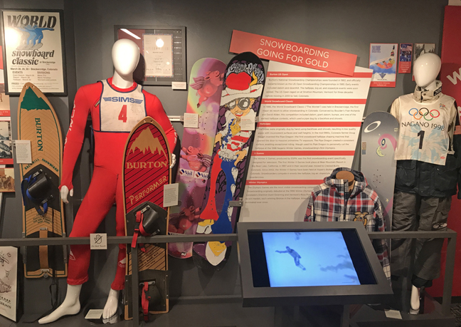
The Colorado Snowsports Museum and Hall of Fame is in Vail. It has a major display on the 10th Mountain Division and Camp Hale.


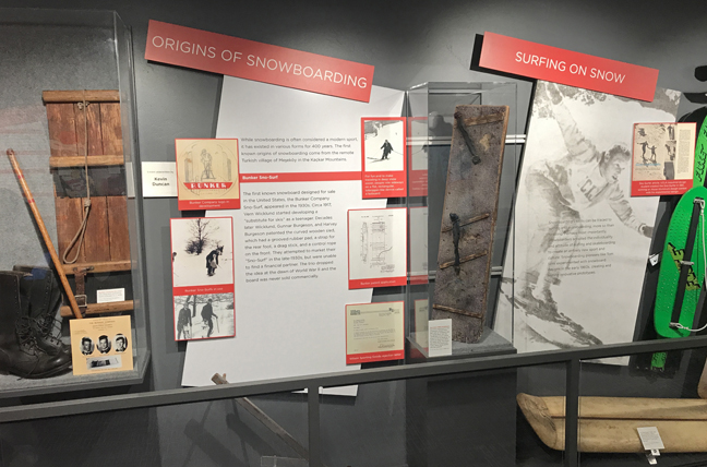
One example from the Snowsports Museum – the history of Snow Boarding


Stopped for dinner in Idaho Springs at Beau Jo’s – the Original Home of Colorado-Style Pizza!
6/4 Su – Relaxing Rainy Day with Jeff and Leaf
6/5 M – Left at 6:30am for the Beaver Meadows Visitor Center of Rocky Mountain NP. We had to get there before 9am, because after that you must have a Timed Entry Reservation for entry! I had one for 11am ($2 online) but that would not have allowed us to get through our agenda for the day.

I had wanted to do a hike in Glacier Basin, however, I discovered that you needed a separate timed entry pass to get on the Bear Lake Road to that area! This photo, taken at the visitor center, shows the topography of the park –

It was supposed to rain all day, but when we entered the park, it started to clear. Overlook for view of Long’s Peak (14,259ft). Unfortunately, clouds obscured the mountain.


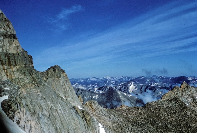
I had not planned to drive the length of Trail Ridge Road to the Alpine Visitor Center, but we could not pass up the beautiful weather! Forest Canyon Overlook – NP is known for its Alpine Scenery.

Lava Cliffs

Black Ice at highest point of Trail Ridge Road – 12,183ft. It is the highest continuous paved road in the U.S.

Alpine Visitor Center parking lot

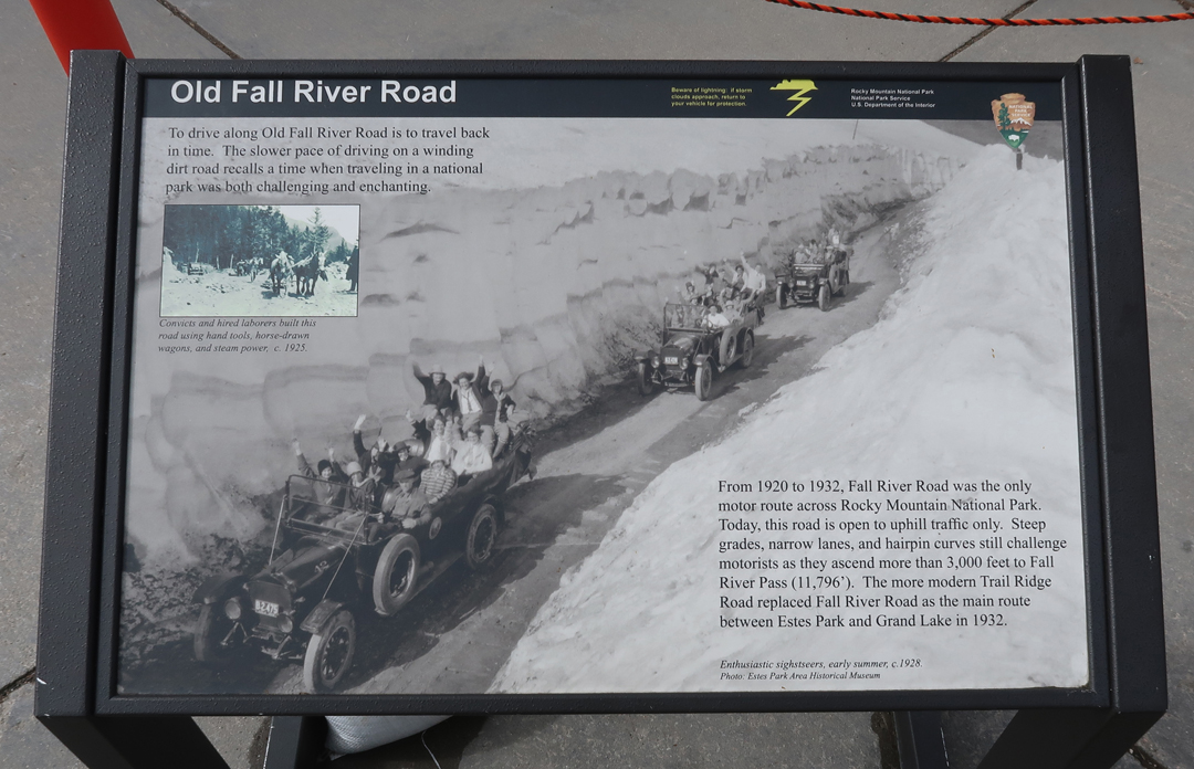
Old Fall River Road, 1920-1932, you can still drive it (one-way) during the Summer.
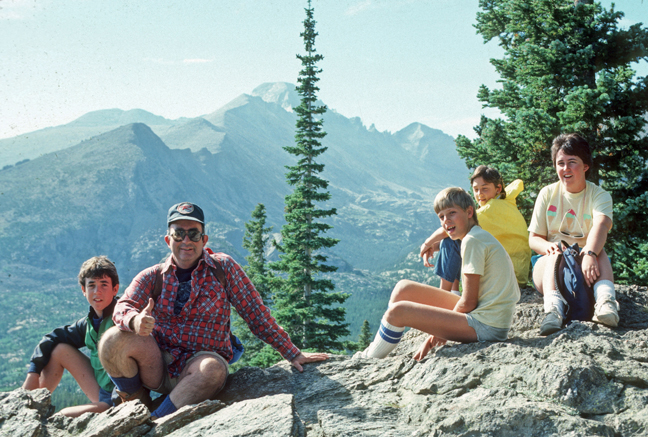
My first visit to Rocky Mountain NP was in 1966 with my mother and three brothers – Mom on Trail Ridge Road

The following year, my friend Jay and I did our first big mountain climb on Long’s Peak (14,259ft), while on our 10,000-mile loop road trip through the western states and Canada. Long’s Peak is the northernmost of the CO fourteeners (58 mountains in CO exceeding 14,000-feet) and the highest peak in Rocky Mountain NP.
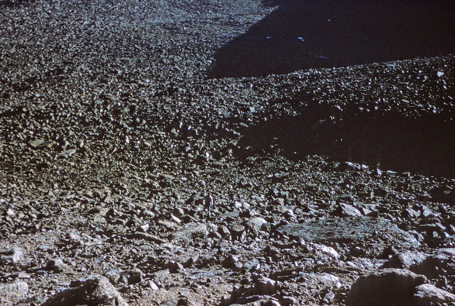
The Boulderfield – I am in center bottom
We started before sunrise on the 15-mile roundtrip hike/climb (5,000 feet of elevation gain).
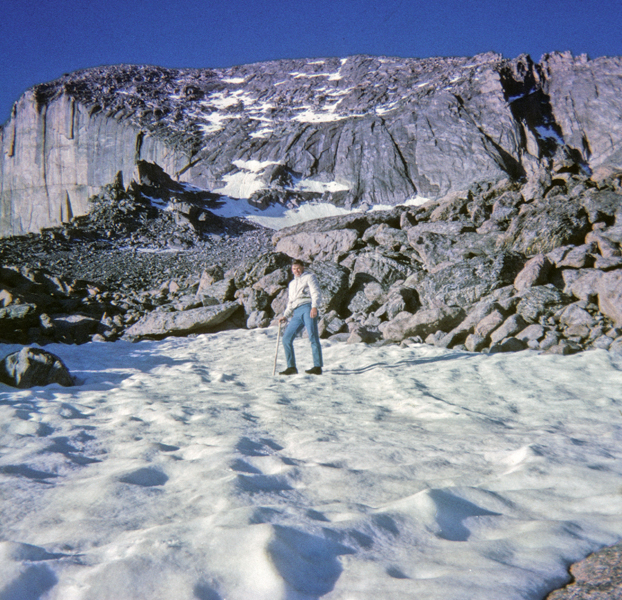
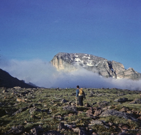
We did the climb up by way of the “Cables Route.” View of Chasm Lake from edge of East Face in 1966 when I climbed to this point by myself. Note the basketball shoes, novice climber! The cables were removed by the NP in 1973.

I became “mountain sick,” due to altitude, and threw up on the summit!

View of the “Home Stretch,” as we started our descent toward the “Keyhole.”
In 1968, I returned with Helen and my three brothers. To make it a little easier, we camped overnight at Jim’s Grove (~11,500ft elevation).
The next day when we got to the Boulderfield (12,660ft), Pat had altitude sickness. So, I stayed with him while Helen, Joe, and Mike did the climb by way of the Keyhole Route. John Wesley Powell was the first to climb this peak in 1868. This climb was 100 years later!

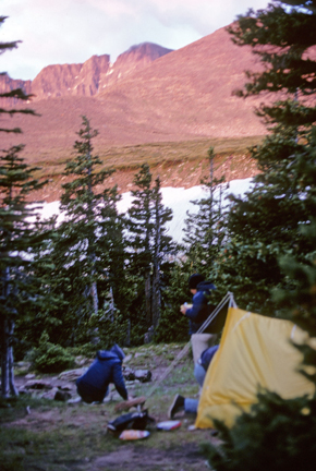
In 1985, my cousin Nick, his daughter Lisa and son Chris, Stacy, Peter, and I camped in Glacier Basin.
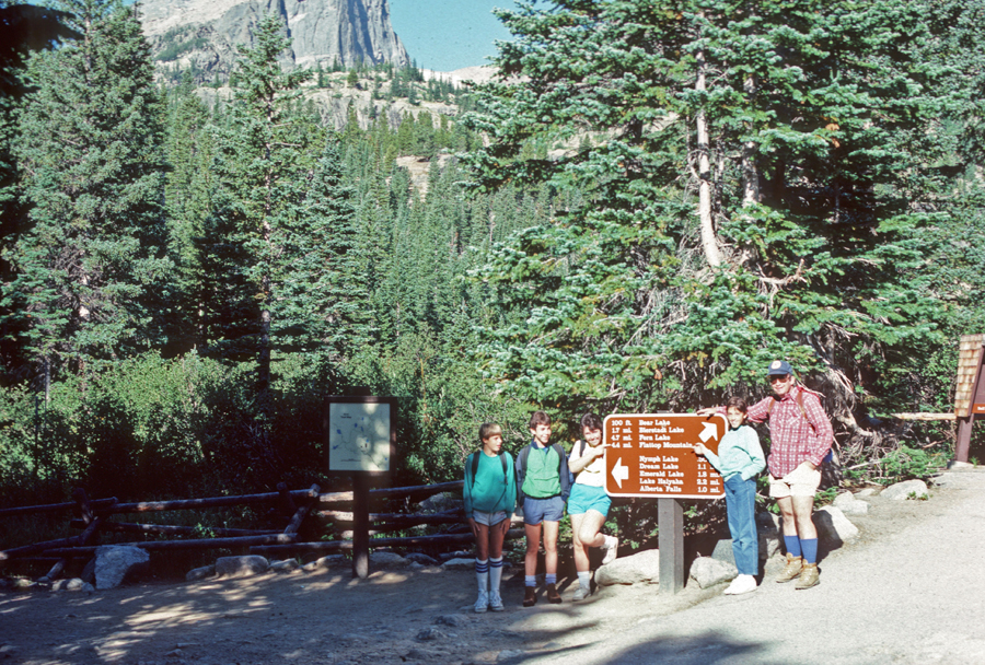

The next day we did the 8.9-mile roundtrip hike to the top of Flattop Mtn (12,324 ft).
Stacy at Panorama of Peaks Overlook on Trail Ridge Road – 1985.

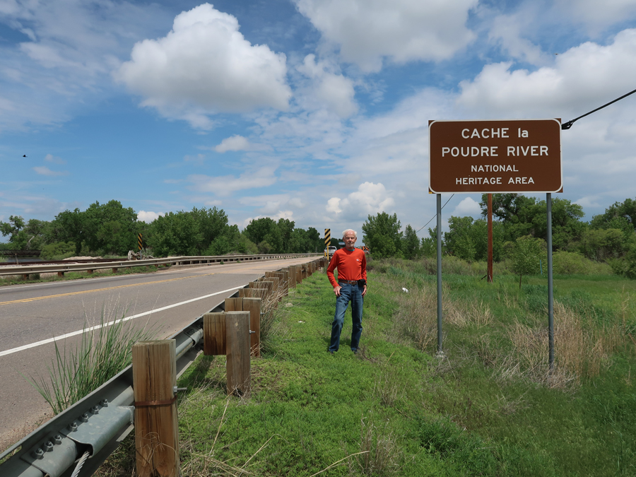
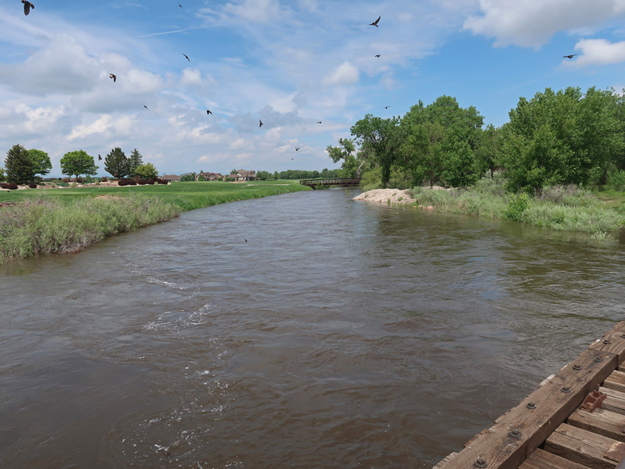
It took about two hours to drive from the Alpine Visitor Center to Cache la Poudre River National Heritage Area (NHA). The NHA follows the river from Roosevelt National Forest to where it empties into the South Platte River. It is Colorado’s only Wild & Scenic River.
Stopped at the Colorado Welcome Center (off I-25) in Fort Collins to pick up literature and get the NHA stamp.

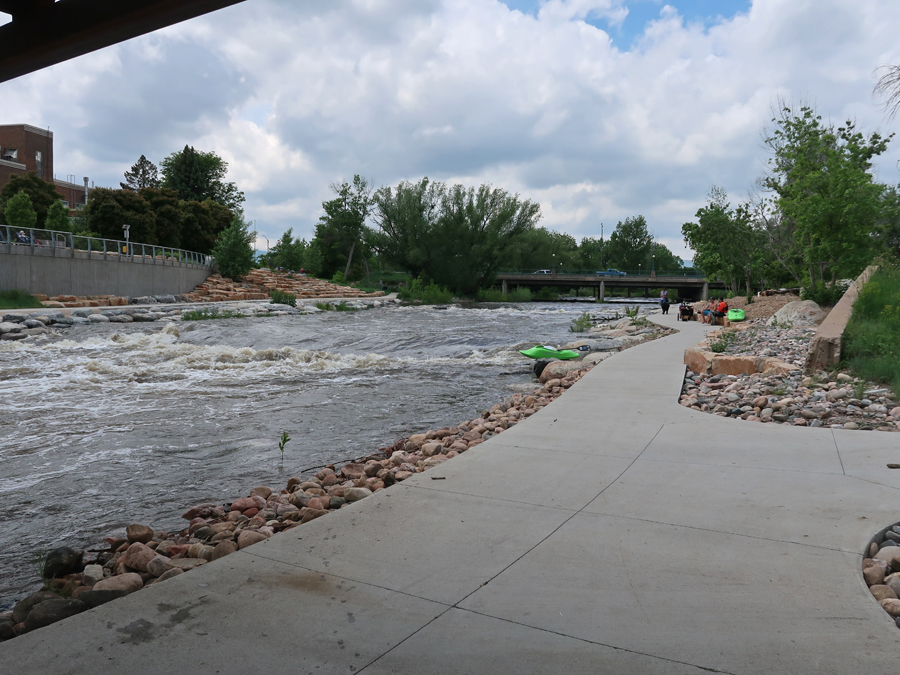
Our next stop was the Fort Collins Paudre River Whitewater Park

Antoine Janis Marker in Laporte – he was the first settler in Larimer County CO

An Overland Trail Stage Stop marker is also in Laporte

Nice map of the Cache la Poudre River NHA

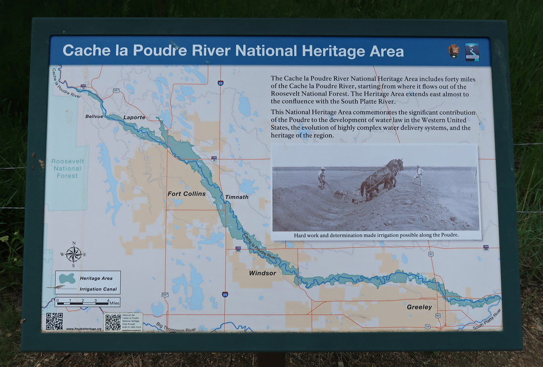
The river was named by trappers who would cache (store) their powder near here (1836).

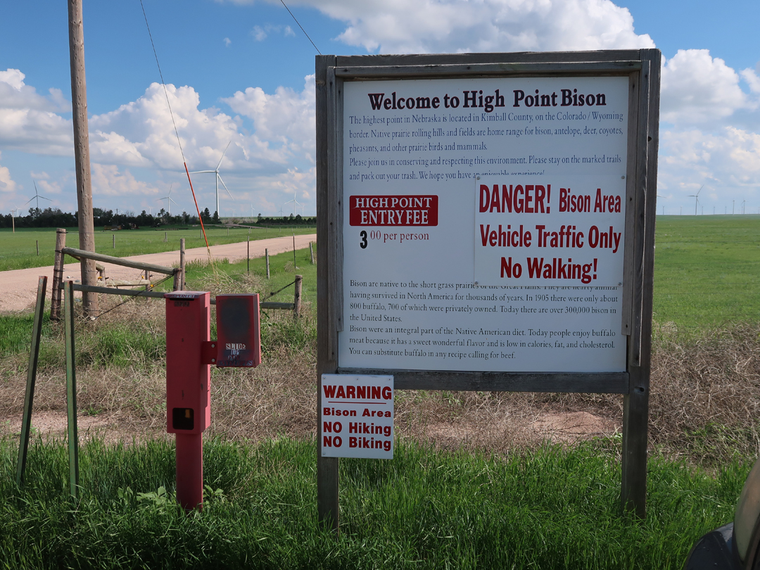
Started the day in Denver, visited Rocky Mountain NP, Cache la Poudre River NHA (Fort Collins CO), and arrived at Panorama Point, the highpoint of NE (5,424ft), at 6:30pm.
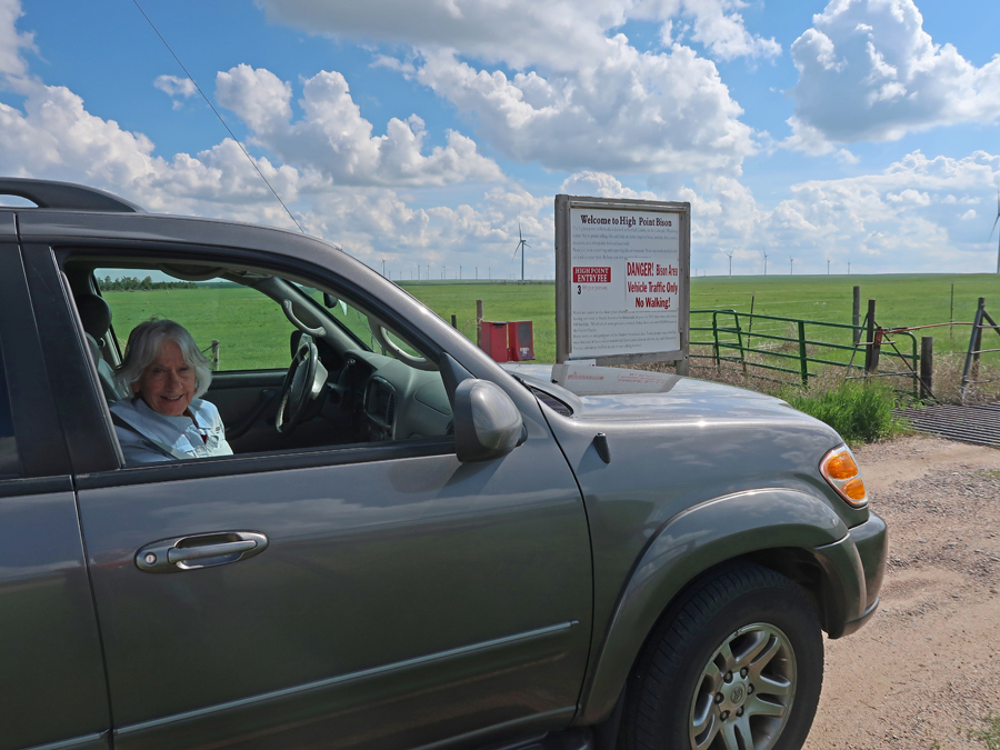
It is on a Bison Ranch and now has a $3 entrance fee. The owners are calling it “High Point Bison.”
This was Helen’s 34th state highpoint.
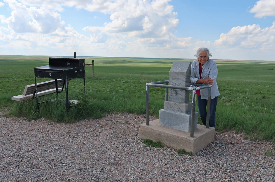
The NE-CO-WY Tri-State Marker is one-mile away.

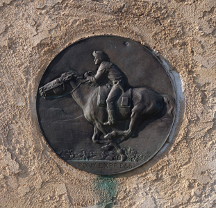
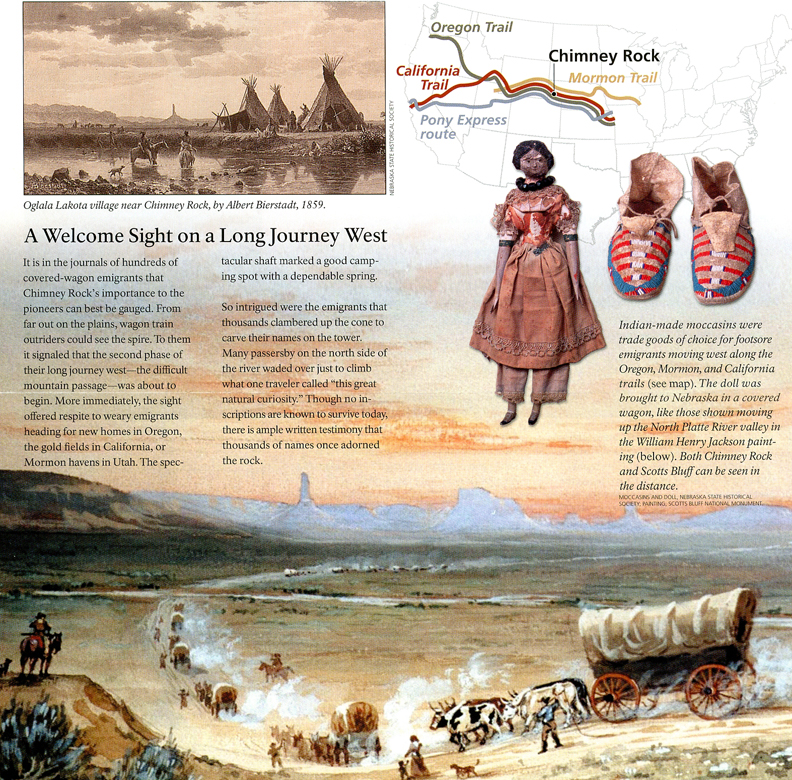
We then drove north to Scott’s Bluff and the Oregon Trail. The Mormon Pioneer NHT, California NHT, Oregon NHT, and Pony Express NHT all followed the same route through NE. The Pony Express Trail only operated for 18 months, from 1860 to 1861. At the time, it was the fastest way to get mail from the east to the west. More specifically, from St Joseph MO to Sacramento CA.
The transcontinental telegraph, which was finished in October 24, 1861, led to the demise of the Pony Express.
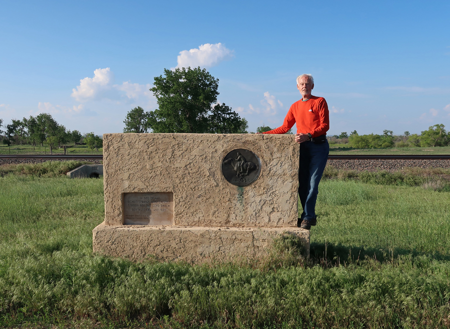
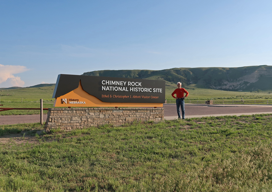
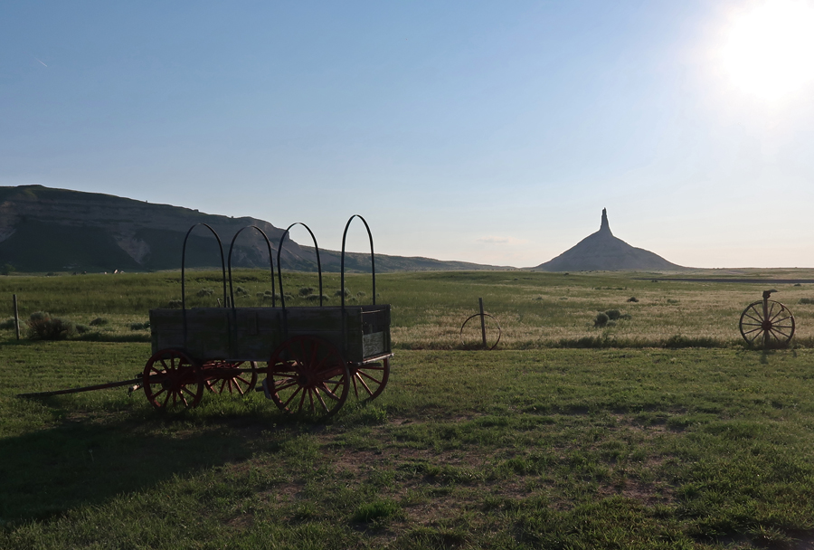
We arrived at Chimney Rock NHS (Affiliated NP Unit) as the sun was setting.
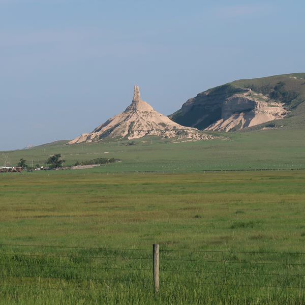
Important Waypoint on the Oregon, California, Mormon, and Pony Express National Historic Trails
The site is administered by the state of NE
When wagon trains reached this landmark, they knew they had reached the Rocky Mountains. So, there was first excitement and then the realization of the difficulties that lie ahead.
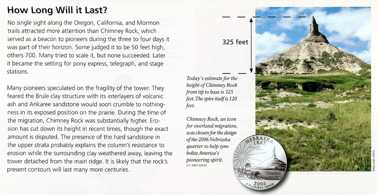
How Long Will it Last?
Prairie Sunset

Stayed the night in the Chadron NE Super 8
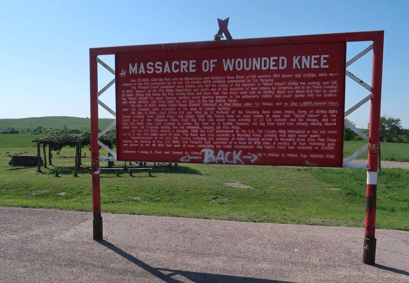
6/6 Tu – Left at 7am and arrived at the Wounded Knee Creek Massacre Site on the Pine Ridge Indian Reservation in SD at 8:30am. These signs tell the story of the massacre –

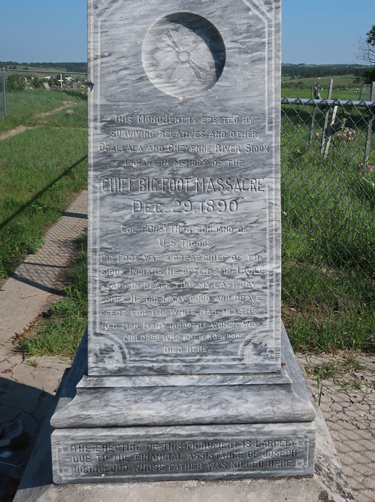
Wounded Knee Cemetery on hill. Helen met an indigenous “healer” here who provided relief for her after the recent death of her nephew – real story. As a remembrance, we got a bundle of sage to pass on to her brother.
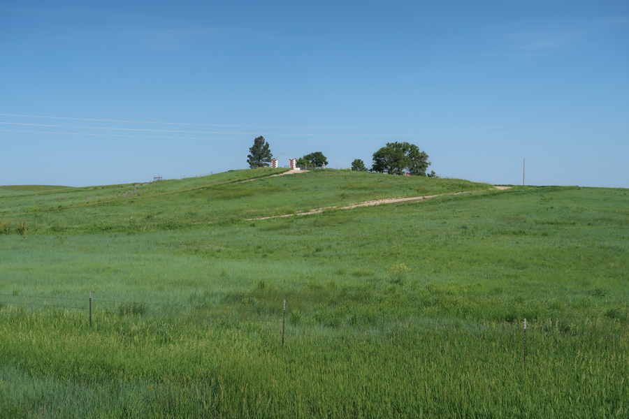

Marker (read) – Chief Big Foot Massacre, Dec.29.1890
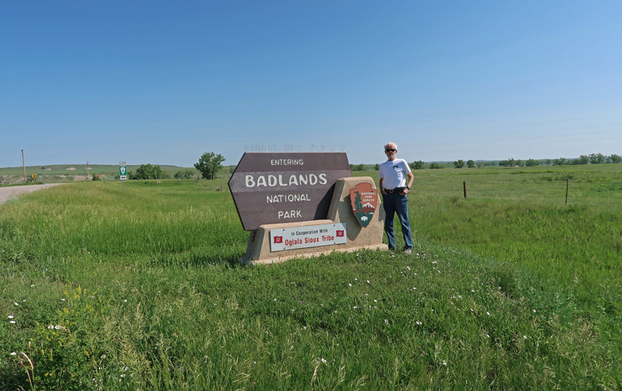
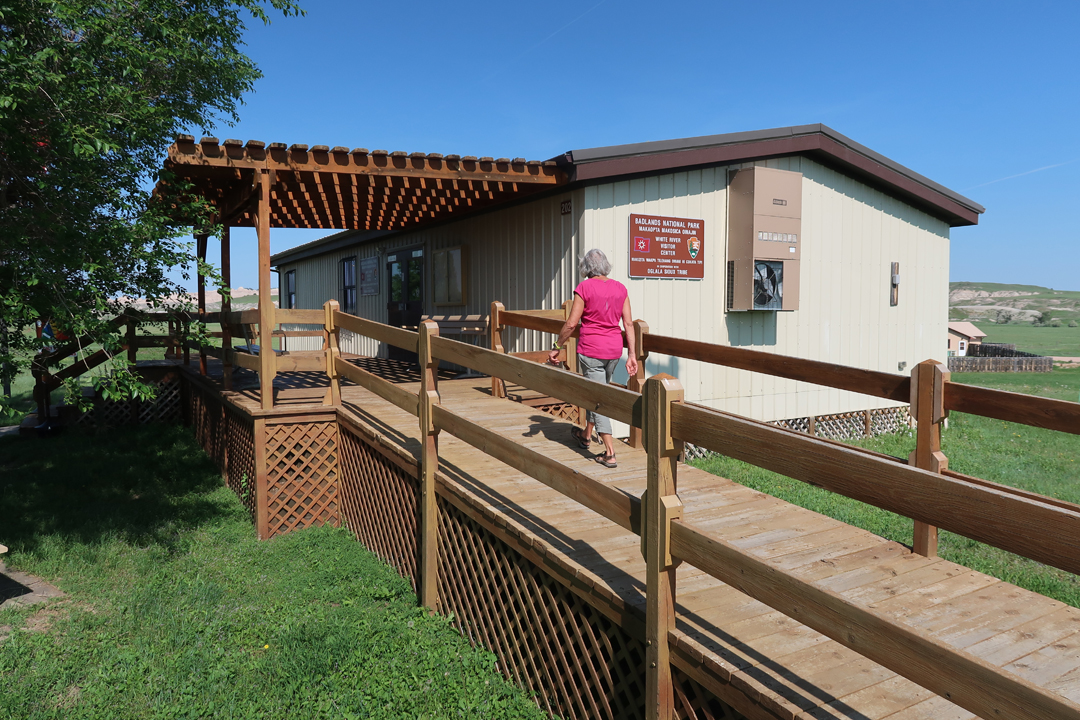
A half hour drive north took us to the White River Visitor Center for Badlands NP, it is staffed in cooperation with the Oglala Sioux Tribe.

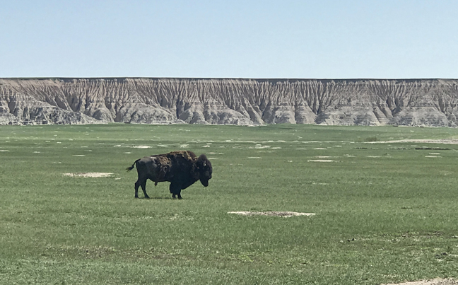
In the 19th century, the buffalo population was reduced to about 800 animals. Today, there are over 300,000 buffalo in the U.S. This photo was taken in the Buffalo Gap National Grassland, which includes Badlands NP.
This photo was taken near the SE entrance to Badlands NP. See this Blog for September 2019 for more photos and information on Badlands NP and the nearby Minuteman Missile NHS.

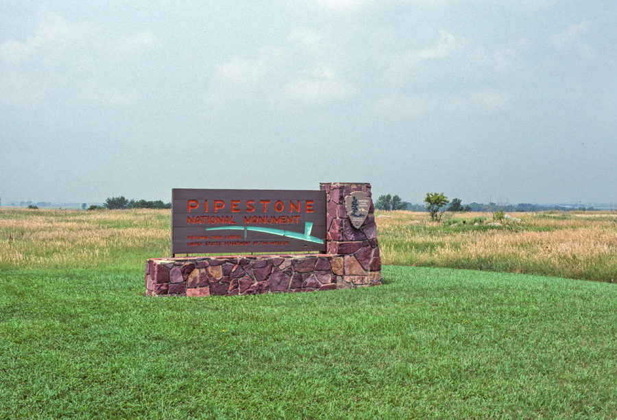
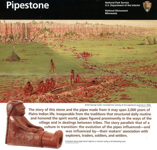
Drove through SD on I-90 for 6-hrs to the SW corner of Minnesota and Pipestone NM. My first visit here was in 1989 with Peter when we were on his 15-year-old “bonding” Road Trip through the upper Midwest.

Helen and I visited every site indicated on this park map –
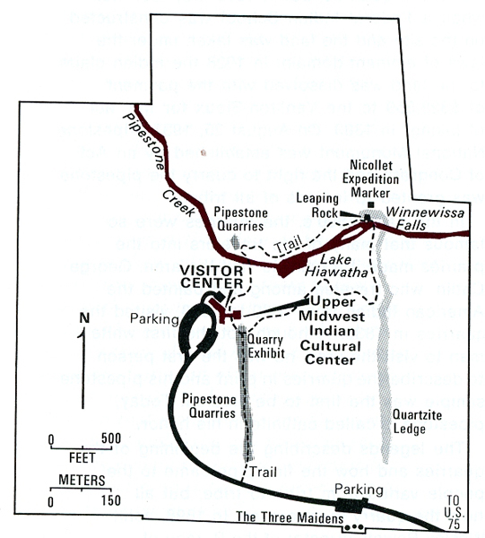
Quarry Exhibit and Pipestone Quarries


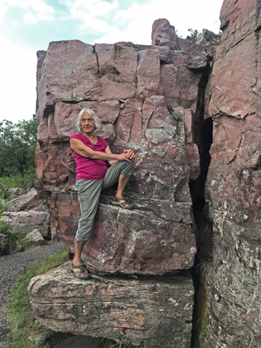
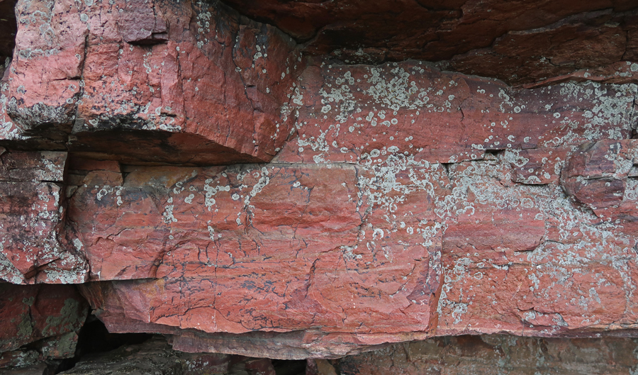
Quartzite Ledge

Winnewissa Falls


The Oracle

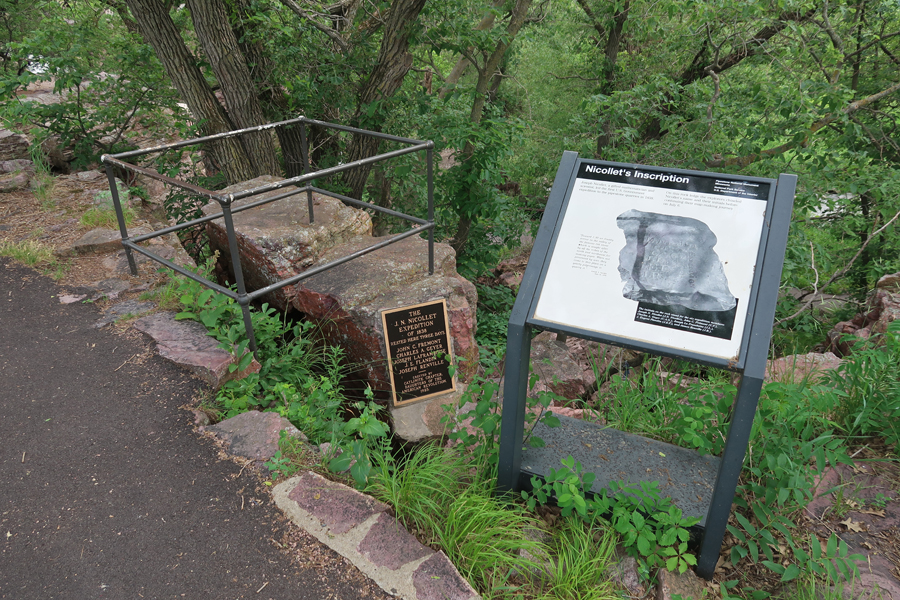
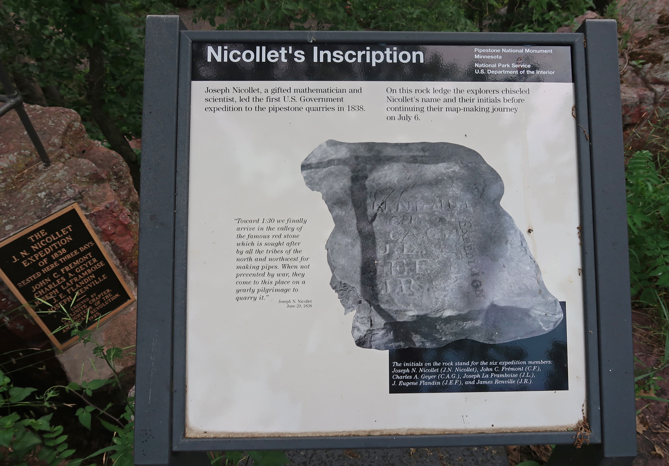
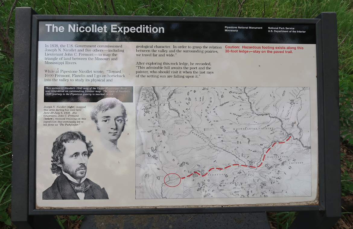
Nicollet Expedition Marker
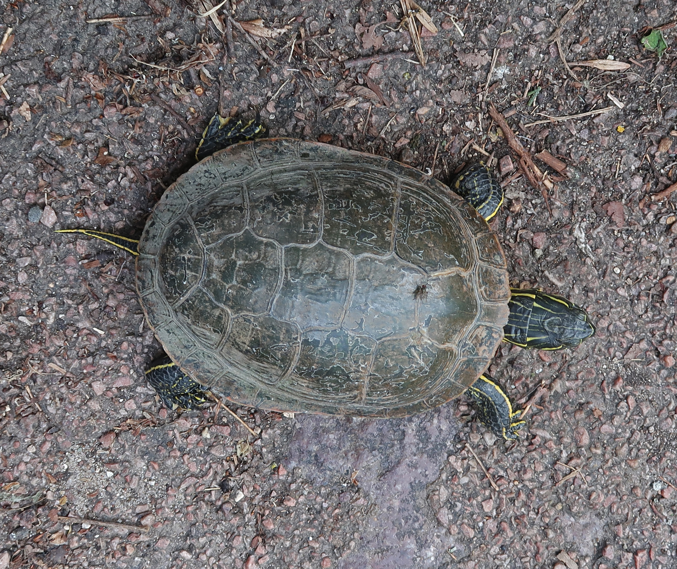
Turtle
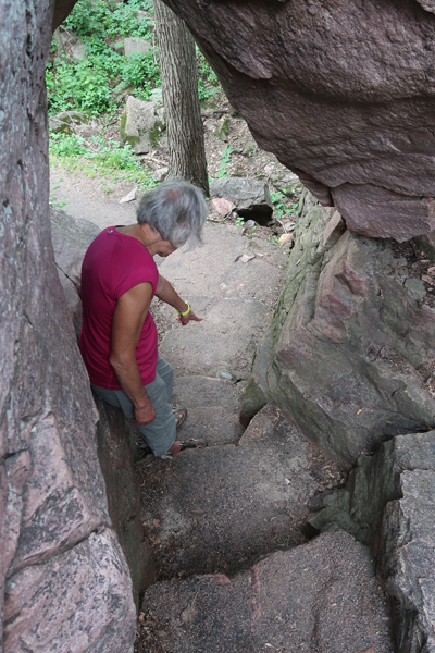
Old Stone Face –

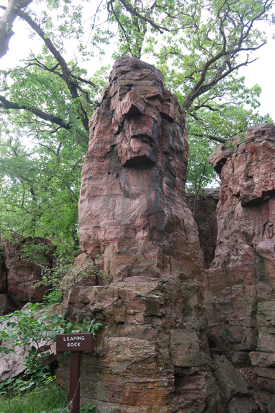
Also known as Leaping Rock
Pipestone Creek


Spotted Pipestone Quarry

Indigenous people are still able to quarry here.

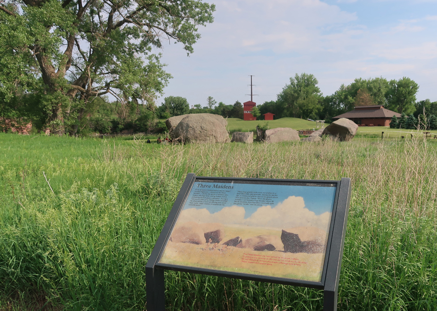
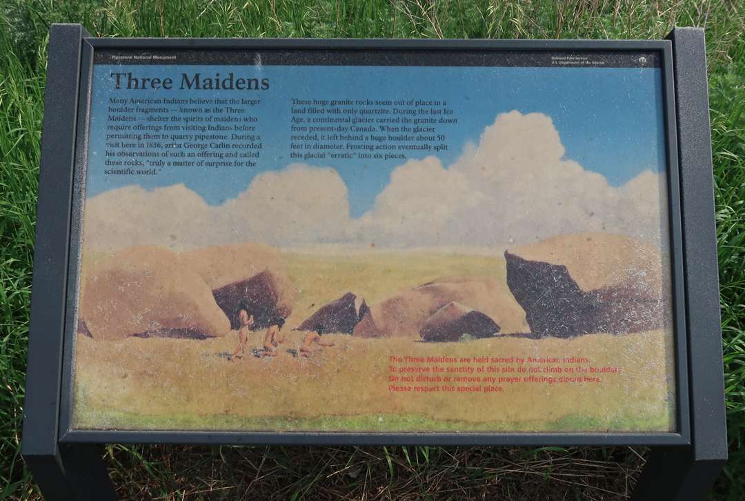
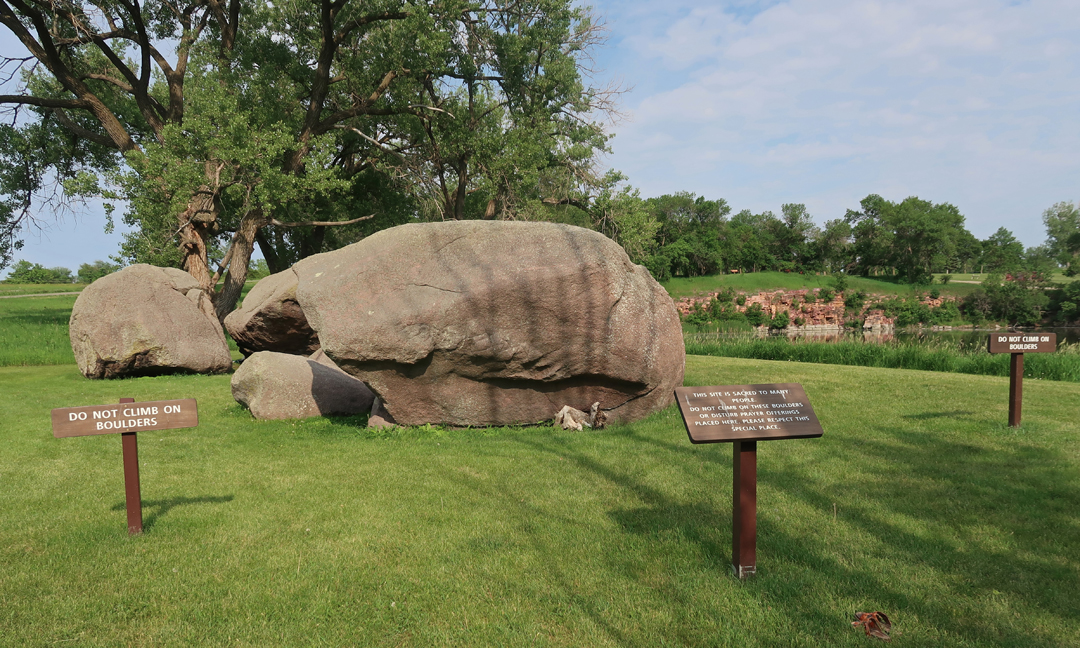
The Three Maidens
4hr drive to Super 8 in Cresco IA
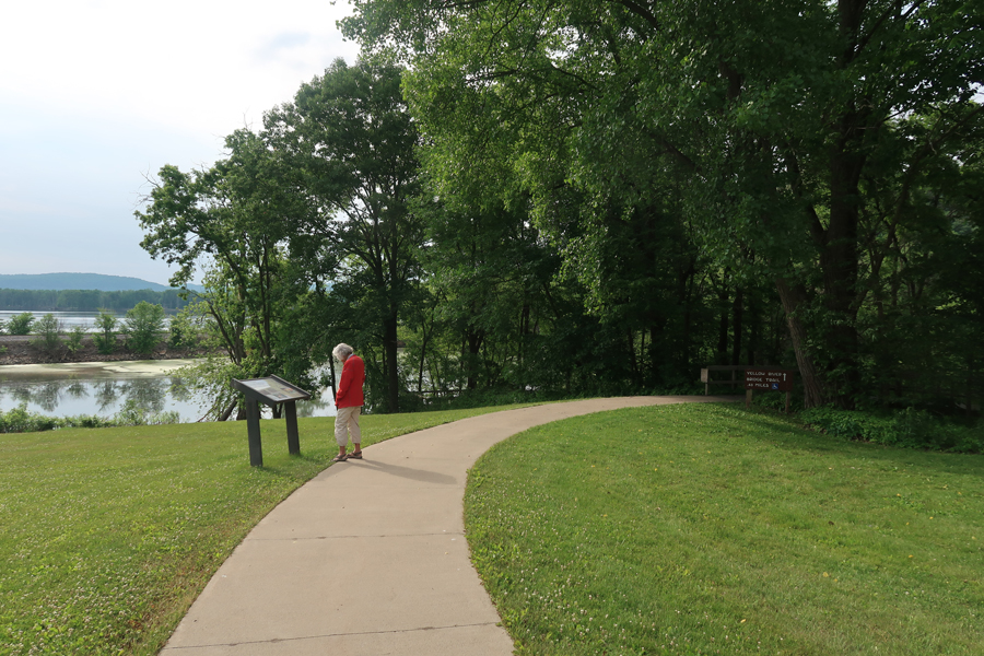
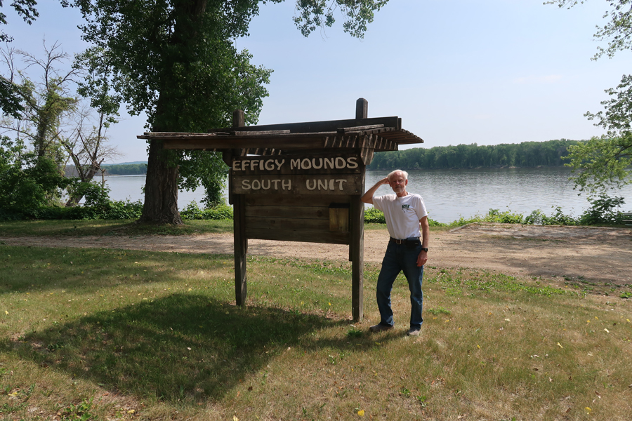
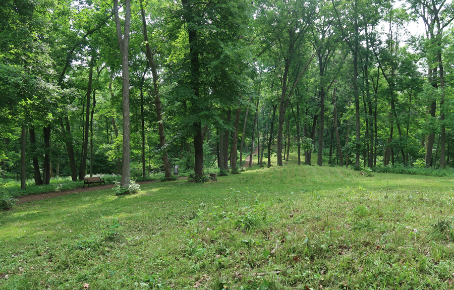
6/7 W – 1.25hrs to Effigy Mounds NM. Helen and I visited in 2007, however, I wanted a few more photos and also to visit the South Unit.
When we arrived, the visitor center was closed. So, we took the Yellow River Bridge Trail into the South Unit, about 1-mile rt.
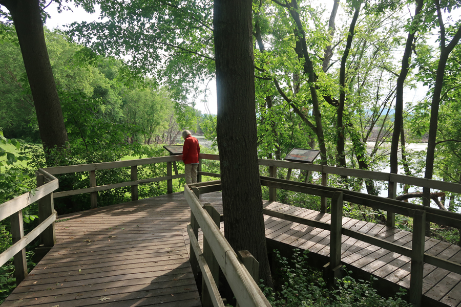
The Yellow River empties into the Mississippi River here
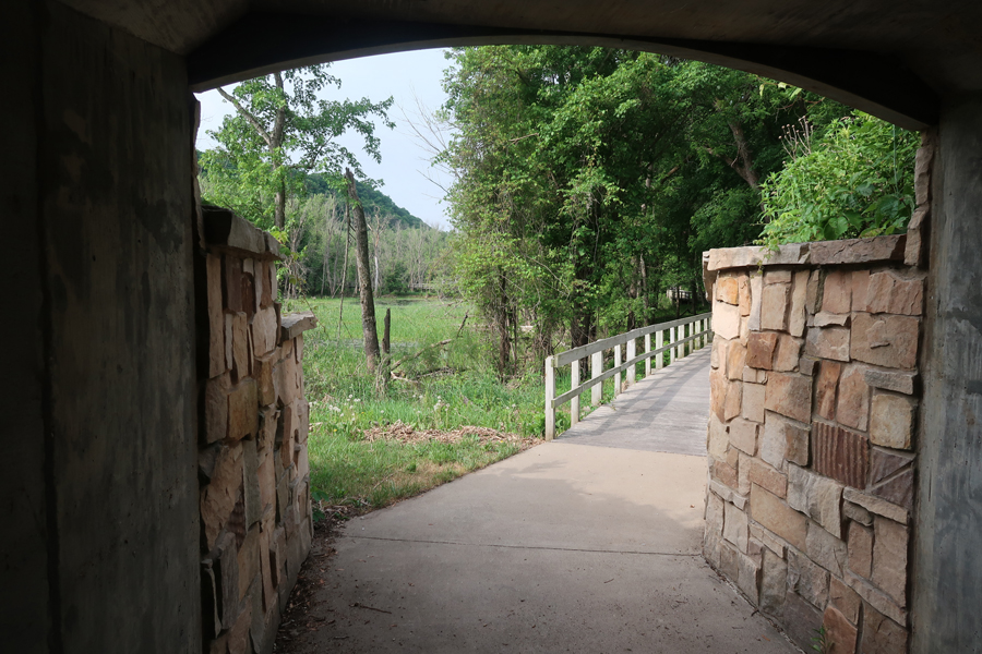
Tunnel under SR-76
Back at the Visitor Center
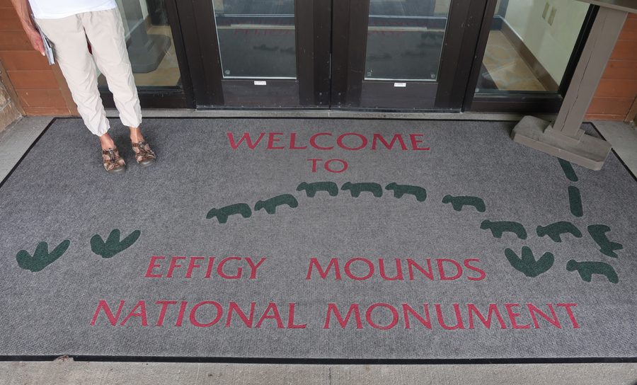
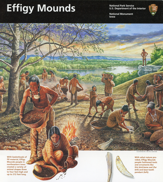
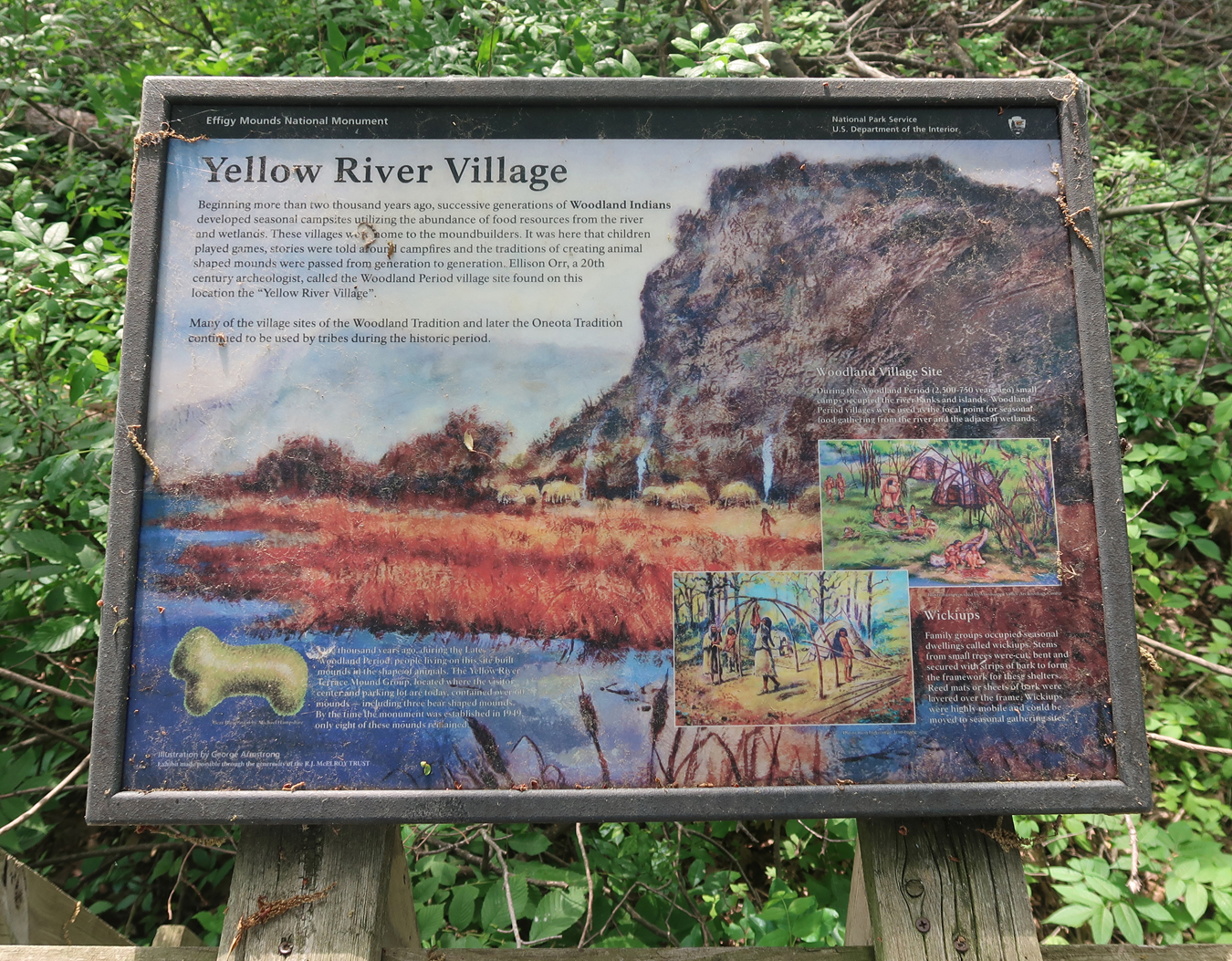
History of Effigy Mounds


We then repeated the 2-mile hike to Fire Point and Eagle Rock that we had done in 2007.

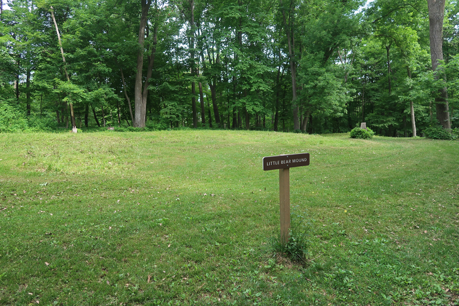
Many of the Effigy Mounds are difficult to make out from ground level, for example, Little Bear Mound
View from Fire Point – 2007

View from Eagle Rock – 2007
Iowa Effigy Mounds Quarter 2017

Our next objective was to visit a couple of sites within the Silos to Smokestacks NHA in Iowa.

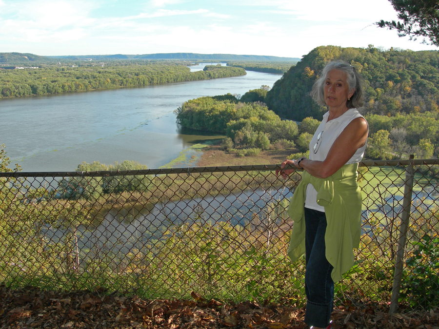
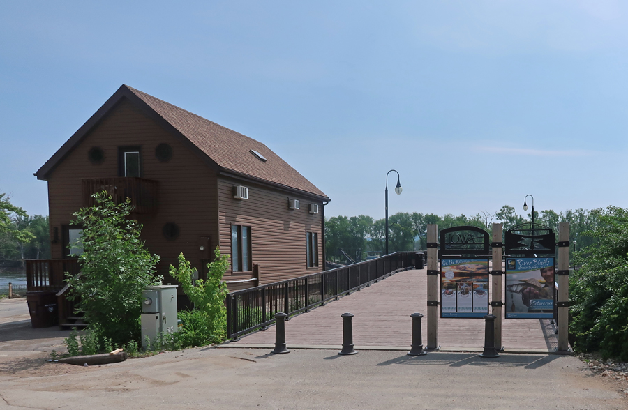
We started in Marquette at the Riverfront Boardwalk on the Great River Road and Mississippi River
River Workboat

There are 29 Locks and Dams on the “Great River”

Marquette-Joliet Bridge and Casino Riverboat river right
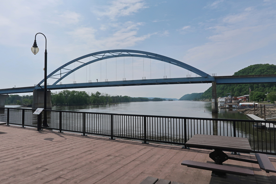
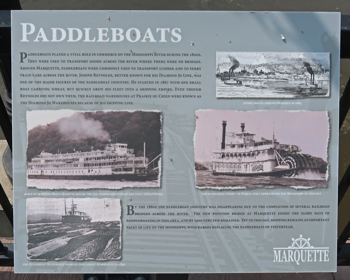
Barges have replaced Paddleboats
Paint Rock Bluff is another site in the NHA

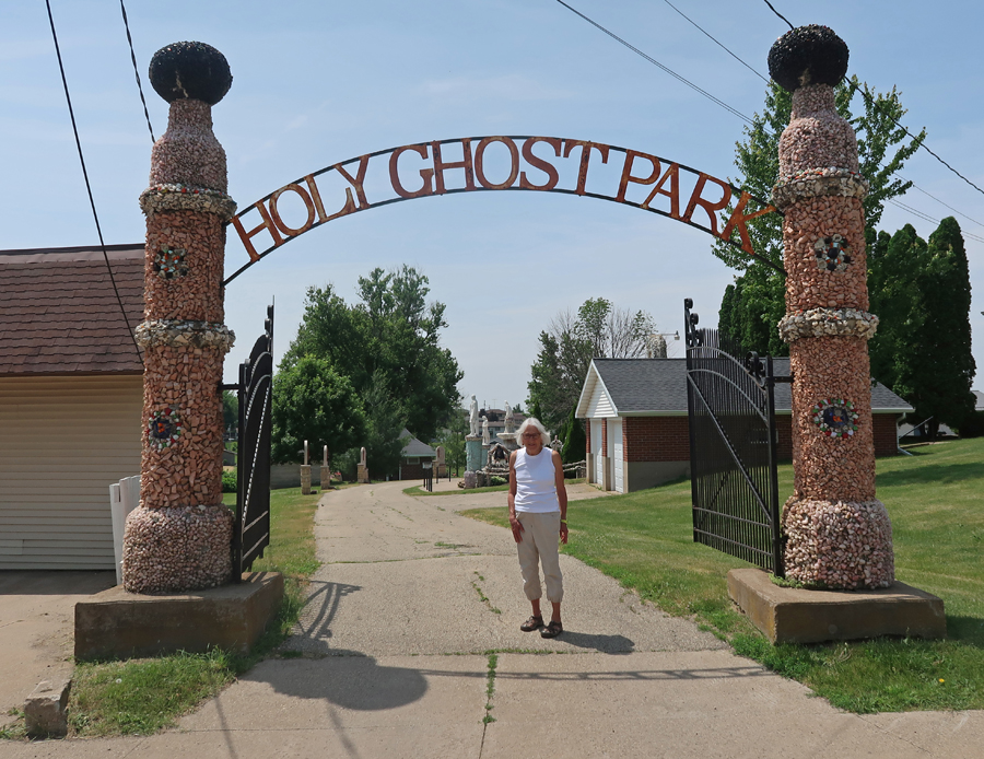
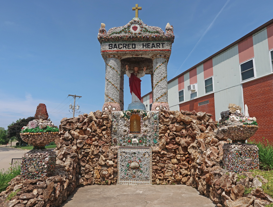
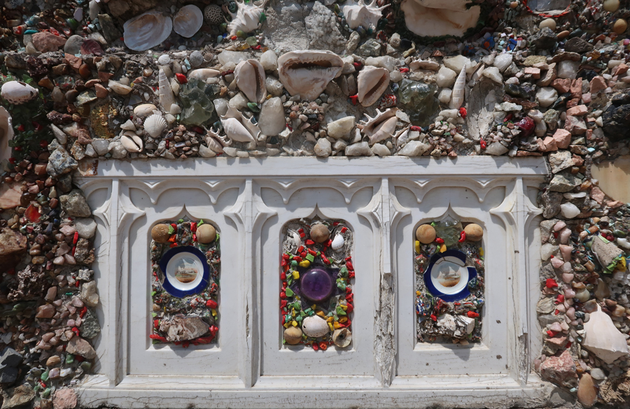
We drove through WI on our way to Dubuque IA and stopped at the Grotto & Shrines on the grounds of the Holy Ghost Parish Church in Dickeyville. It is known for its phenomenal stonework.
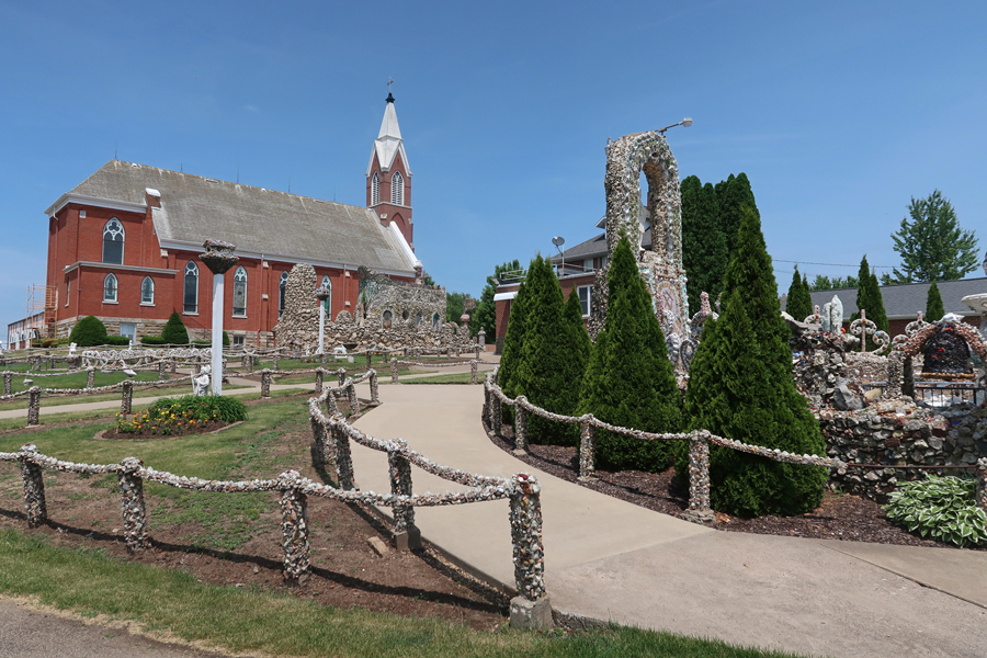
Fr. Matthias Wernerus, a German-American priest, constructed the following shrines during his 1918-1930 service to the parish. They were created out of stone, mortar, shells, glass, brightly colored materials, and objects collected from all over the world – Christ the King Shrine

Sacred Heart Shrine
Patriotic Shrine – Middle Statue is Christopher Columbus


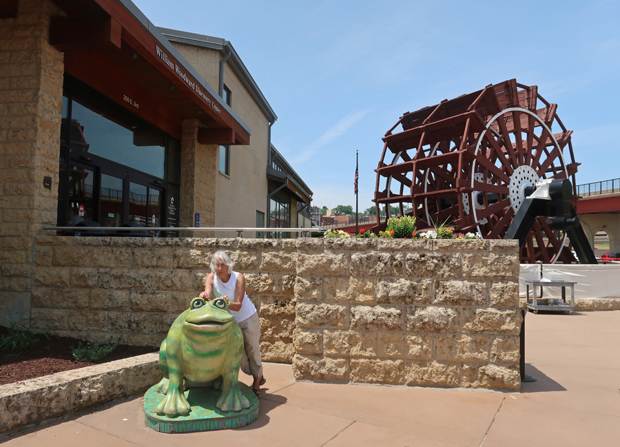
The National Mississippi River Museum & Aquarium in Dubuque Iowa is one of the many sites within the Silos and Smokestacks NHA


We were able to get the National Park Service (NPS) stamp at the museum.
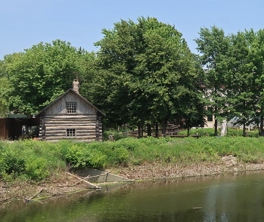
Log Cabin in the Jerry Enzler River Plaza
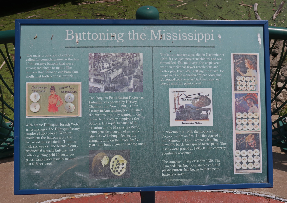
The Iroquois Pearl Button Factory opened here in 1901 and made “Mother of Pearl” buttons from river clam shells. It closed in 1930 when plastic buttons made them obsolete.
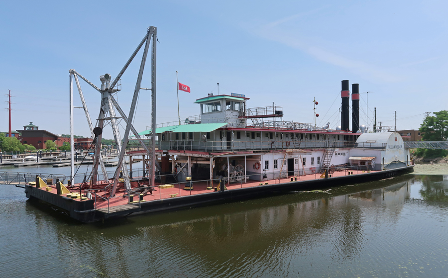
William M. Black Vintage Dredge Boat

8hr drive home to Springfield, lost an additional 1hr to EST – a LONG Day!
6/8 Th – 55th Wedding Anniversary!
