
3/7 Th – Up at 4am to catch our 6:25am flight in Dayton. Arrived at LAX at 1:15, 2.5hrs late because of a mechanical problem in Detroit. As a result, they canceled my rental car and I had to get another, which cost me an additional $165! Anyway, made it to Kate’s, Beef Brisket at We Have Noodles, and then an Uber to the Hotel Café in Hollywood to hear a performance by Griffin House. He is from Springfield and we had heard him many times before, but this was his best performance in memory. By the time we got to bed it was 3am OH time – a 23-hour day!
3/8 F – Recover from previous day! Thrift shops and playing games – Farkle, Aces to Kings, Dominoes, Skip Bo, and Yahtzee. Kate made and excellent Asian Chicken and Rice dinner.
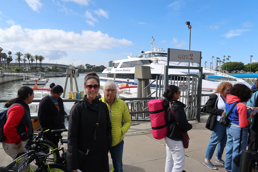
3/9 Sat – It took 1.5hrs to drop off Bennett and get to Long Beach to catch the 9:30am Catalina Express Ferry to Santa Catalina Island. It is one of the eight Channel Islands off the coast of southern CA.
Passing the Queen Mary as we departed the harbor

The ~24mile crossing took an hour and ten minutes and we landed in the resort town of Avalon
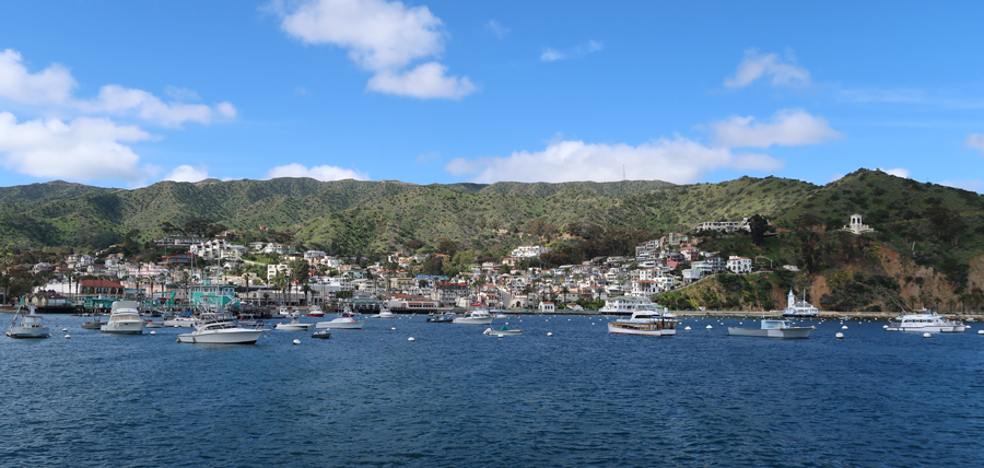
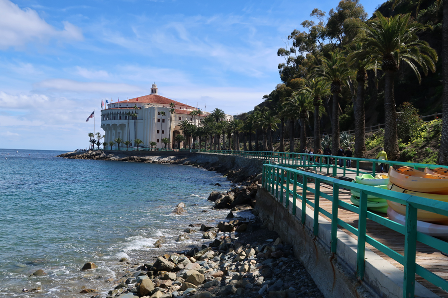
In 1919 the entire island was purchase by William Wrigley Jr (chewing-gum magnate). Wrigley proceeded to develop Avalon into a resort. He also brought his Chicago Cubs baseball team here for Spring training until 1951. Looking across the harbor, the landmark circular building is the Avalon Casino, the Chimes Tower can also be seen center left.
We started by walking through town to the Casino

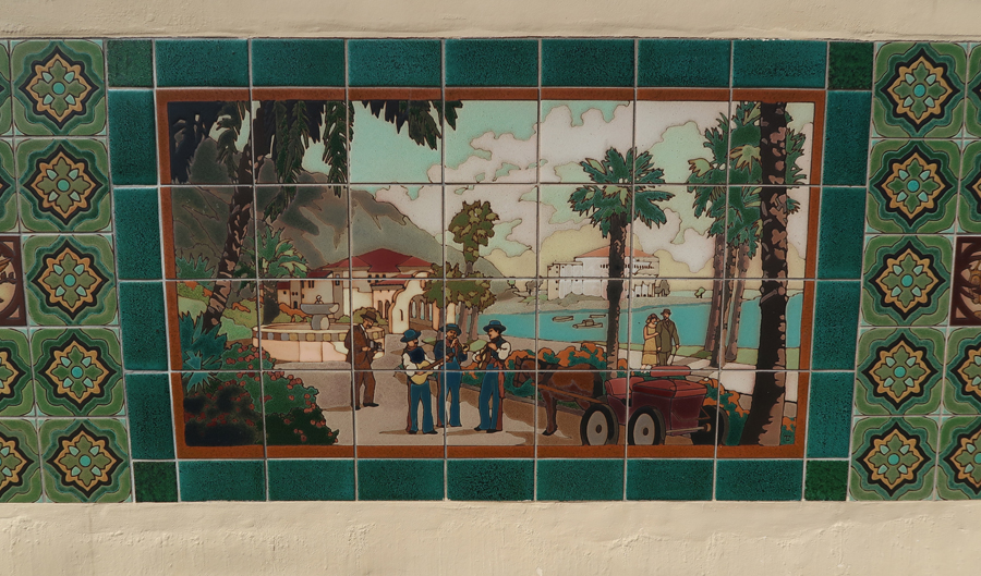
Wrigley started Catalina Pottery and Catalina Tile here in 1927
We decided to take the 1.5hr tour
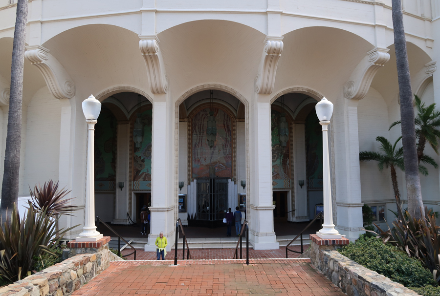
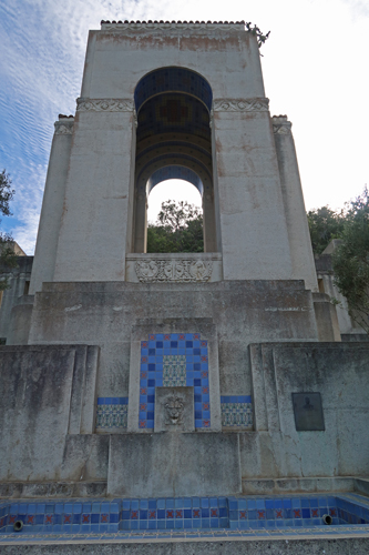
Wrigley built the art deco Avalon Casino 1928-29 for 2 million dollars. Casinos have become known as gambling establishments. However, casino is defined as a building or large room used for meetings, entertainment, dancing, etc. – it is the Italian word for a gathering place. This casino was built with no intention of gambling and that has remained true to this day.
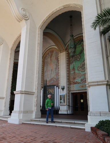
The ground floor theater was designed for excellent acoustics to accommodate the first “talkie” movies. The first shown here was “The Jazz Singer” starring Al Jolson.


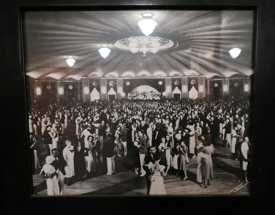
The top floor contains the world’s largest circular ballroom and hosted all the Big Bands of day


Our guide Frankie, self-acclaimed professional dancer, danced with Helen and Kate
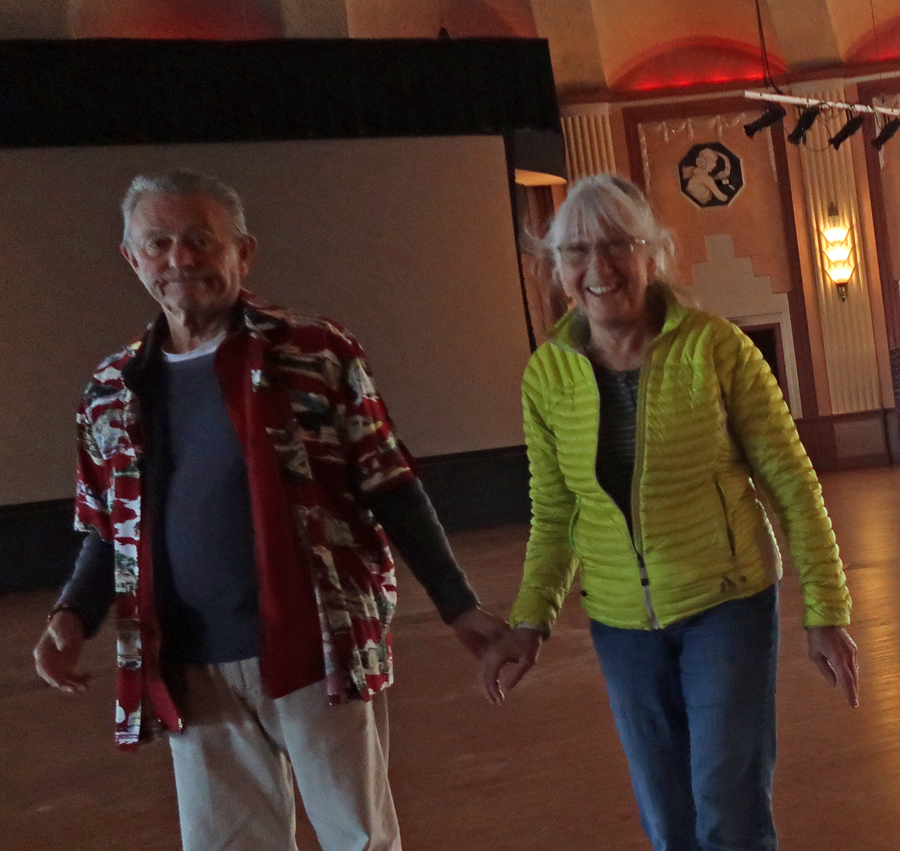
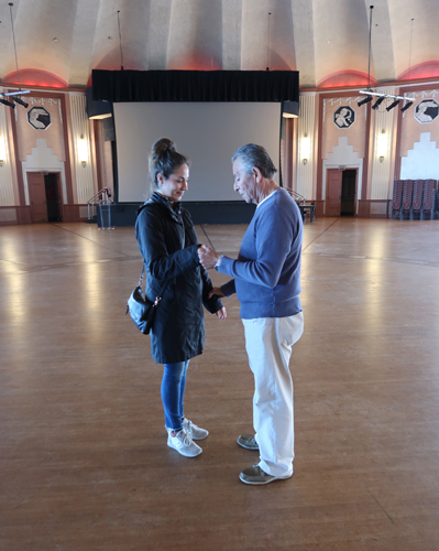
The dance floor was built for 2,000 dancers, though we were told that there were at times 4,000 on the floor
View of Avalon from Casino


View of Casino from Descanso Beach. It was too cold to swim or kayak today.
We had a fish & chips lunch and then rented a golf cart to tour the outskirts of Avalon. This is a nice view from part way up Mt Ada.

The Wrigley home on Mt Ada
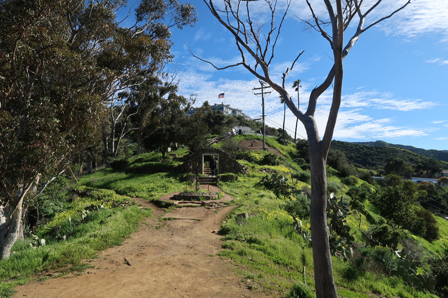
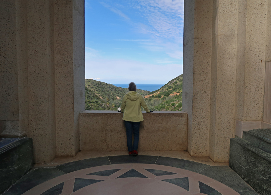
Kate was our driver – they should have issued us helmets! We drove to and toured the Wrigley Memorial and Botanic Garden


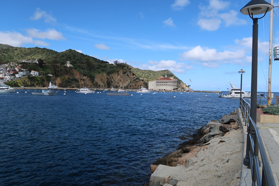
Three-fourths of the island is now run by the Catalina Island Conservancy. Lovers Cove Marine Reserve can be seen on the opposite side of the Ferry Dock.

The Ferry had a mechanical problem on the way back to Long Beach and we did not pick-up Bennett at the sitter until after 9pm.
3/10 Sun – Church, breakfast at Millie’s, walked Bennett in Echo Park, and ate corn, grilled in a shopping cart covered with butter, salt, mayo and sprinkled Mexican cheese. H and K also had some red pepper put on top. Helen prepared pork cutlets for dinner and we then played more games until ready for bed.
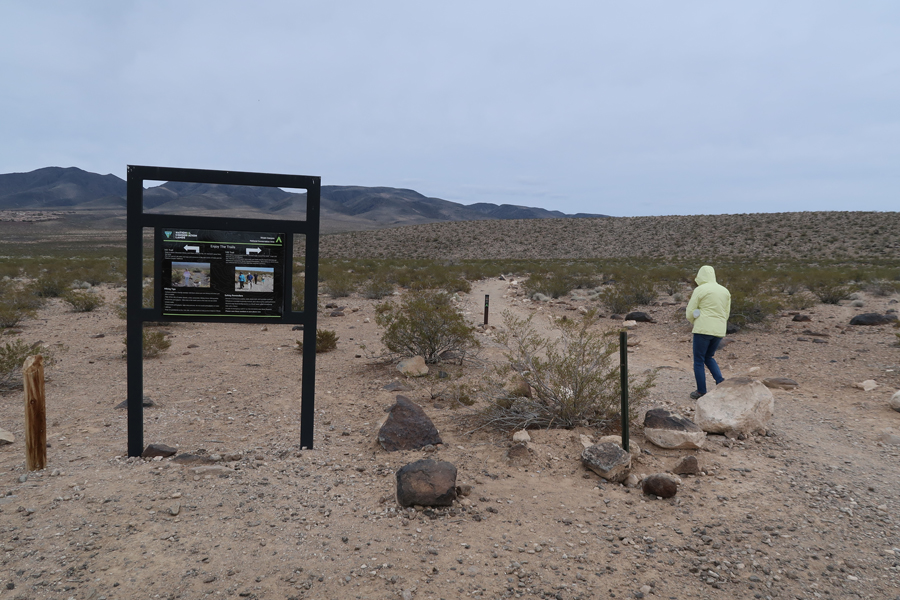
3/11 M – 4.5hrs from Silver Lake to Sloan Canyon National Conservation Area (NV) ~15 miles S of Las Vegas (I15 to Exit 25). It was difficult to find the access road because there was construction taking place for a very large housing development. When we arrived at the trailer Visitor Contact Station, we found it closed, though it was supposed to be open.

We did Option 3, the loop trail combination of the 100 and 200 trails for 4.25 miles and 400 ft elevation gain

Trail register entering the North McCullough Wilderness Area

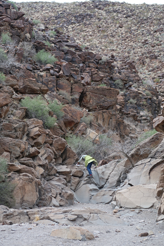
Climbing the first waterfall

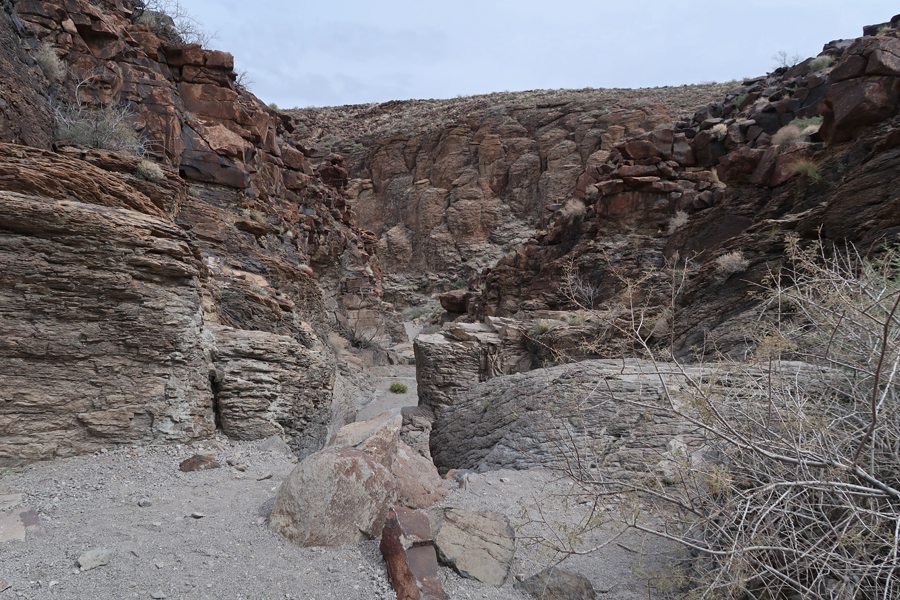
Entering canyon


Start of second waterfall climb

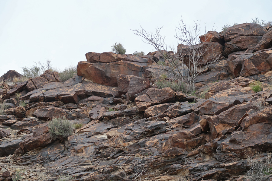
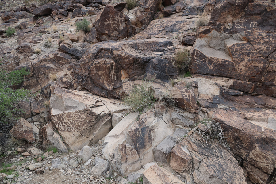
Start of Petroglyphs/Rock Art area
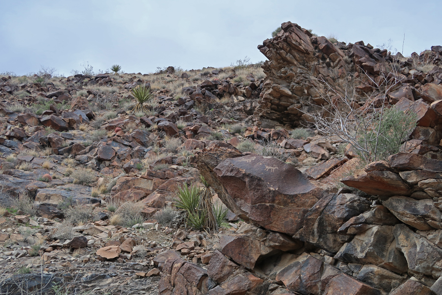


There are over 1,700 Petroglyphs here, created by American Indians from 5000 to 200 years ago
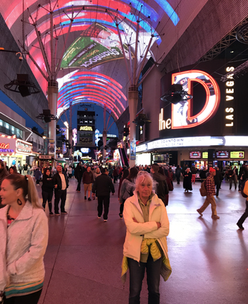
Stayed at the El Cortez Casino Hotel in downtown Las Vegas. Had $9 Prime Rib dinners at Tony Roma’s in the Fremont Casino, and then enjoyed the laser light show in the canopy along Fremont Street. We were going to do the Zip Line under the canopy but thought it was way too expensive.
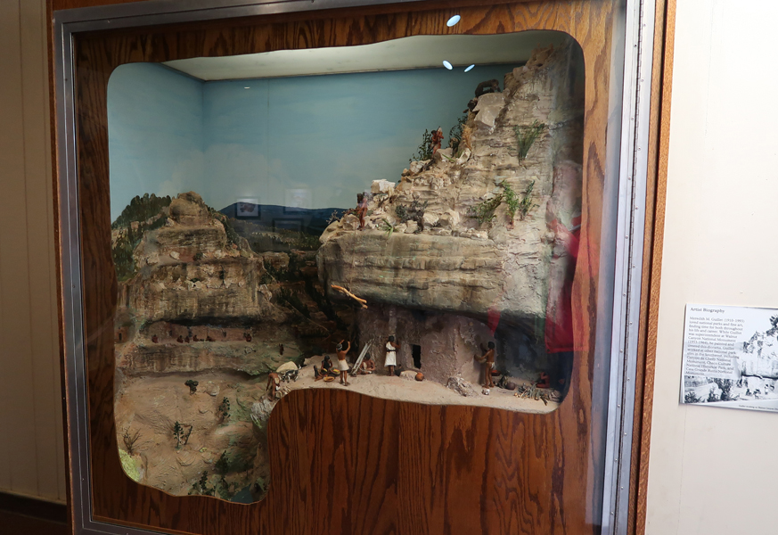
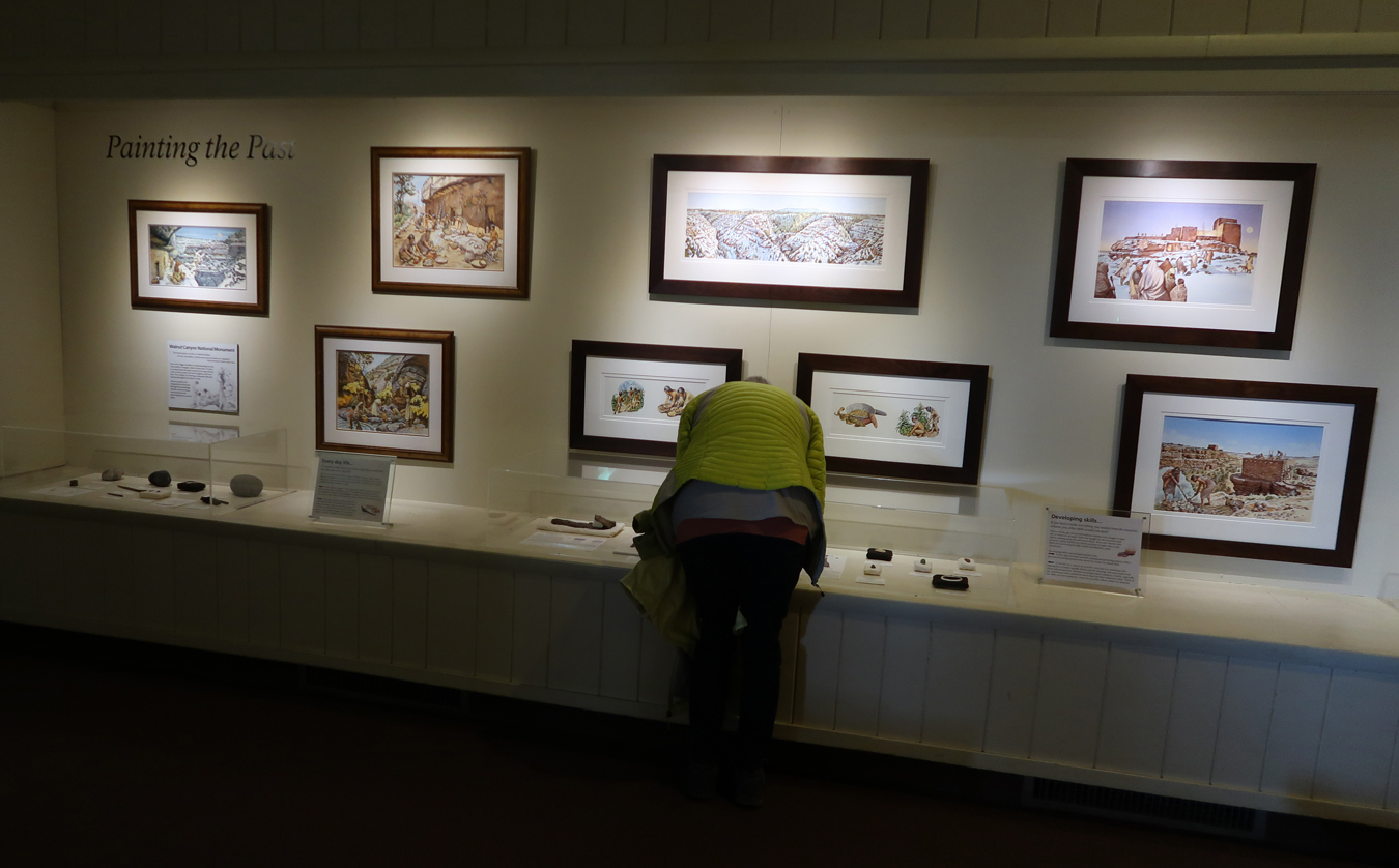
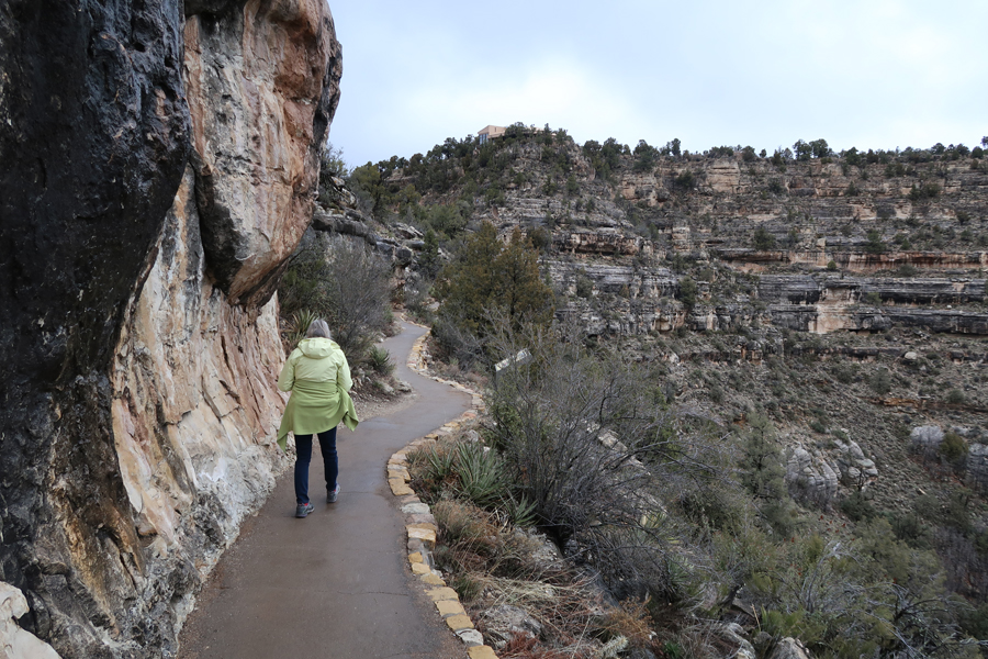
3/12 Tu – Millie made us a wonderful breakfast at her home in Henderson, just S of Vegas. We then drove 5hrs to Walnut Canyon National Monument, 10mi E of Flagstaff AZ. I had been there in the 1960s but could not find any photos. So, I thought it would be fun to return, get some photos, and enjoy the place with Helen.

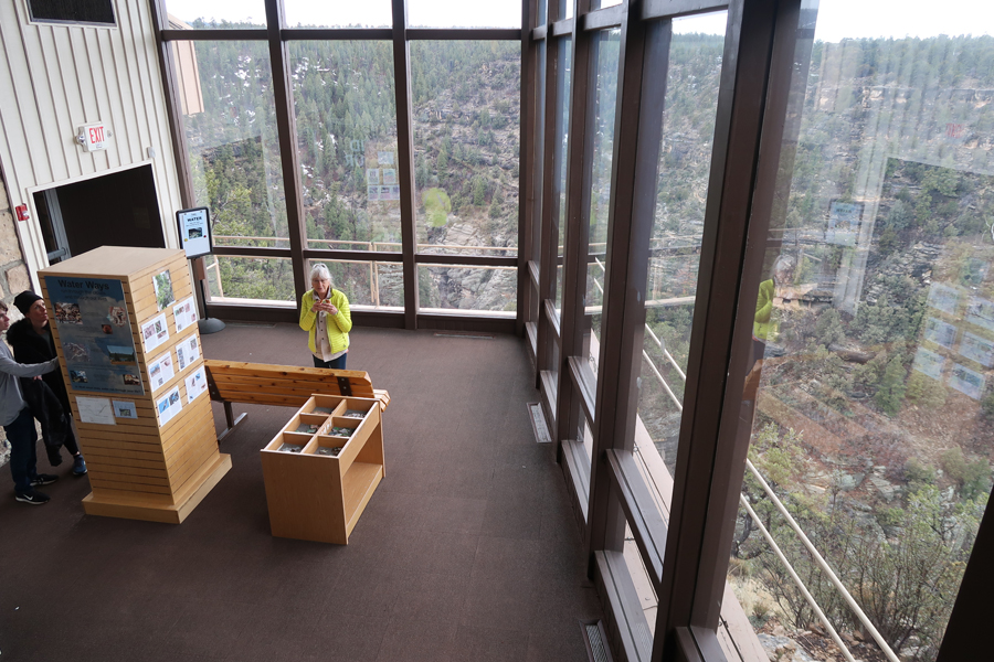
Visitor Center
Nice View from Visitor Center
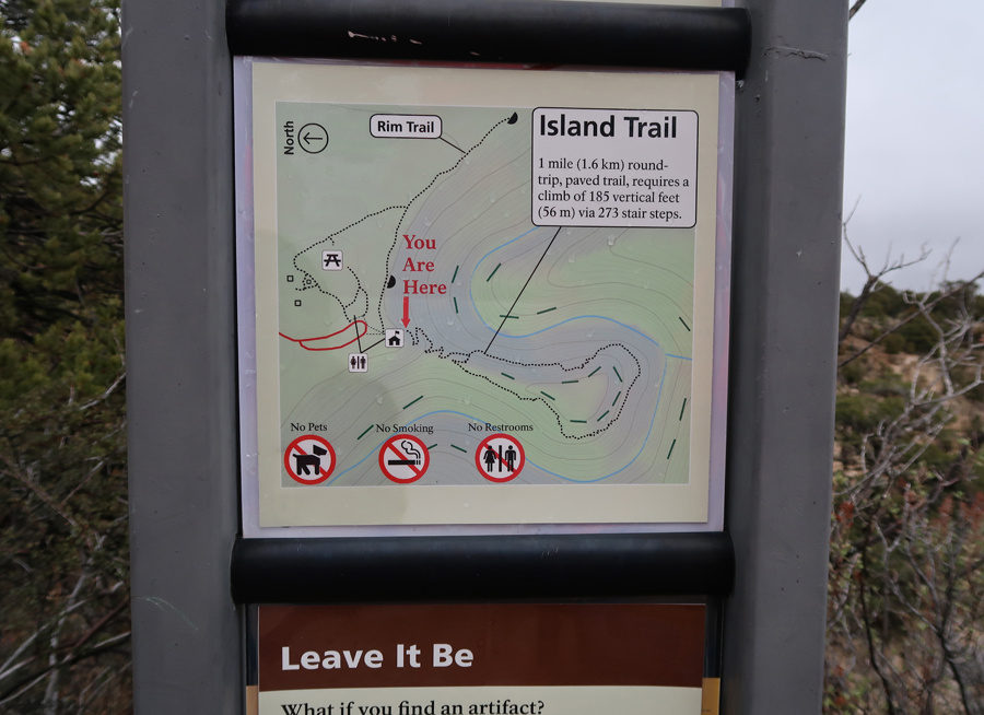
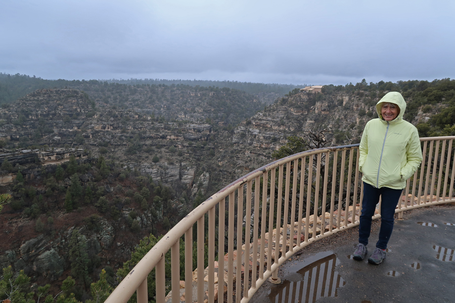
Did the 1-mile Island Loop Trail

Starting down


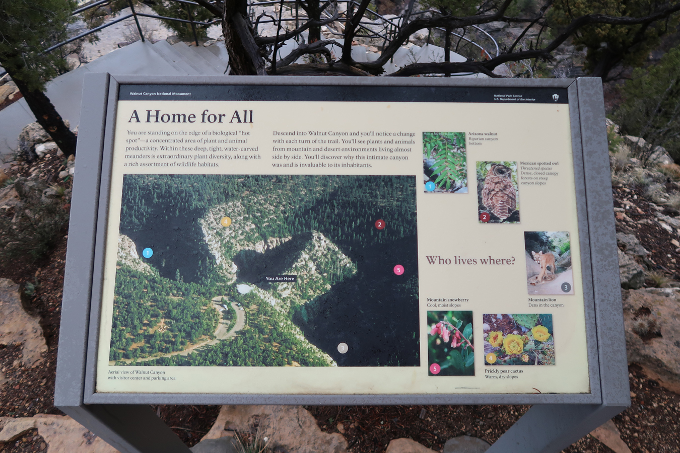
Good view of the “Island,” a kind of peninsula created by a bend in Walnut Creek

Continuing down


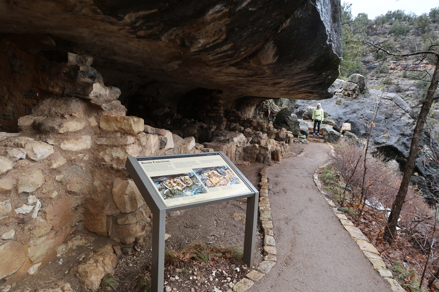
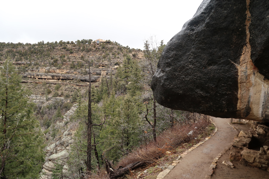
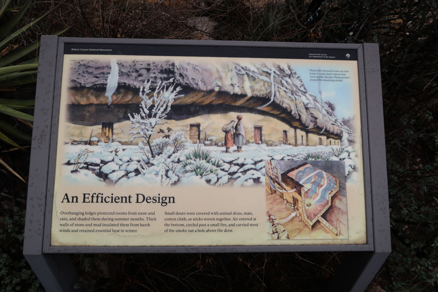
The “Perfect” Shelter
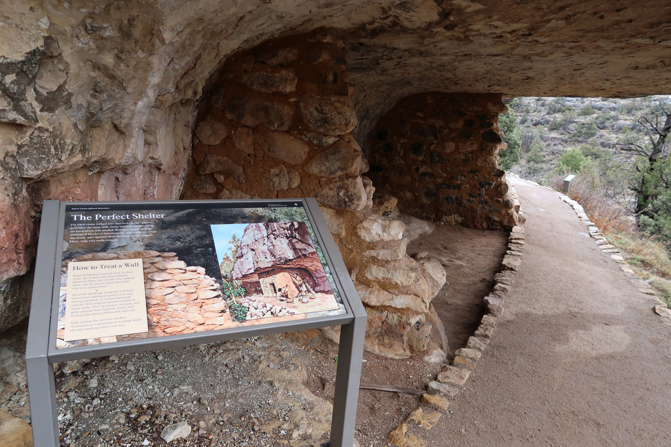

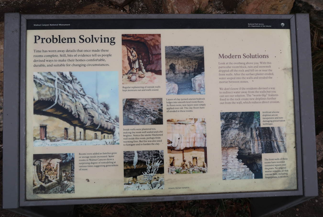
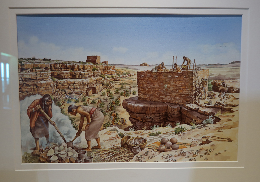
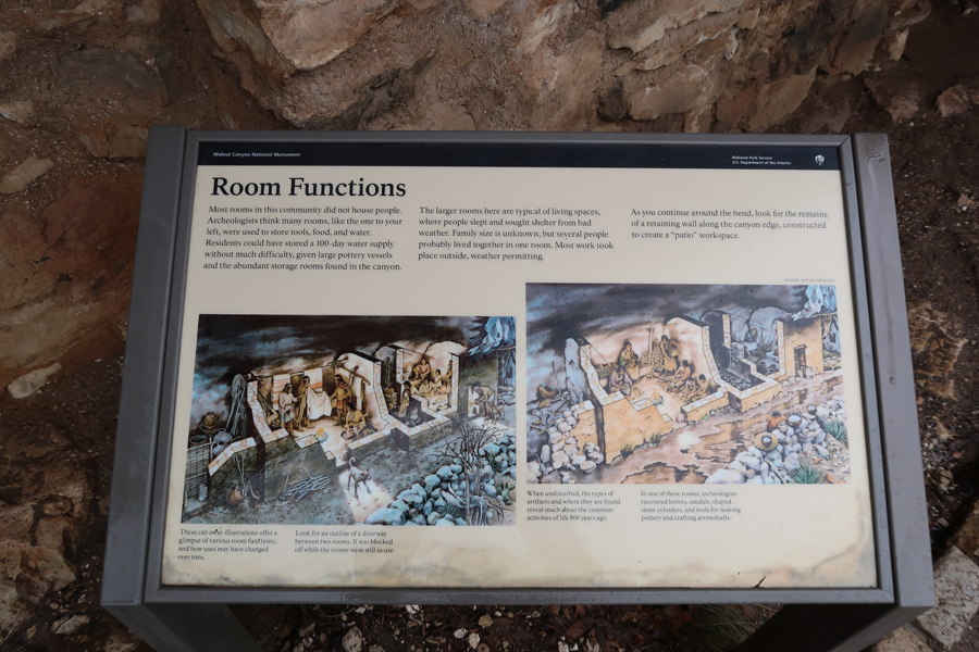
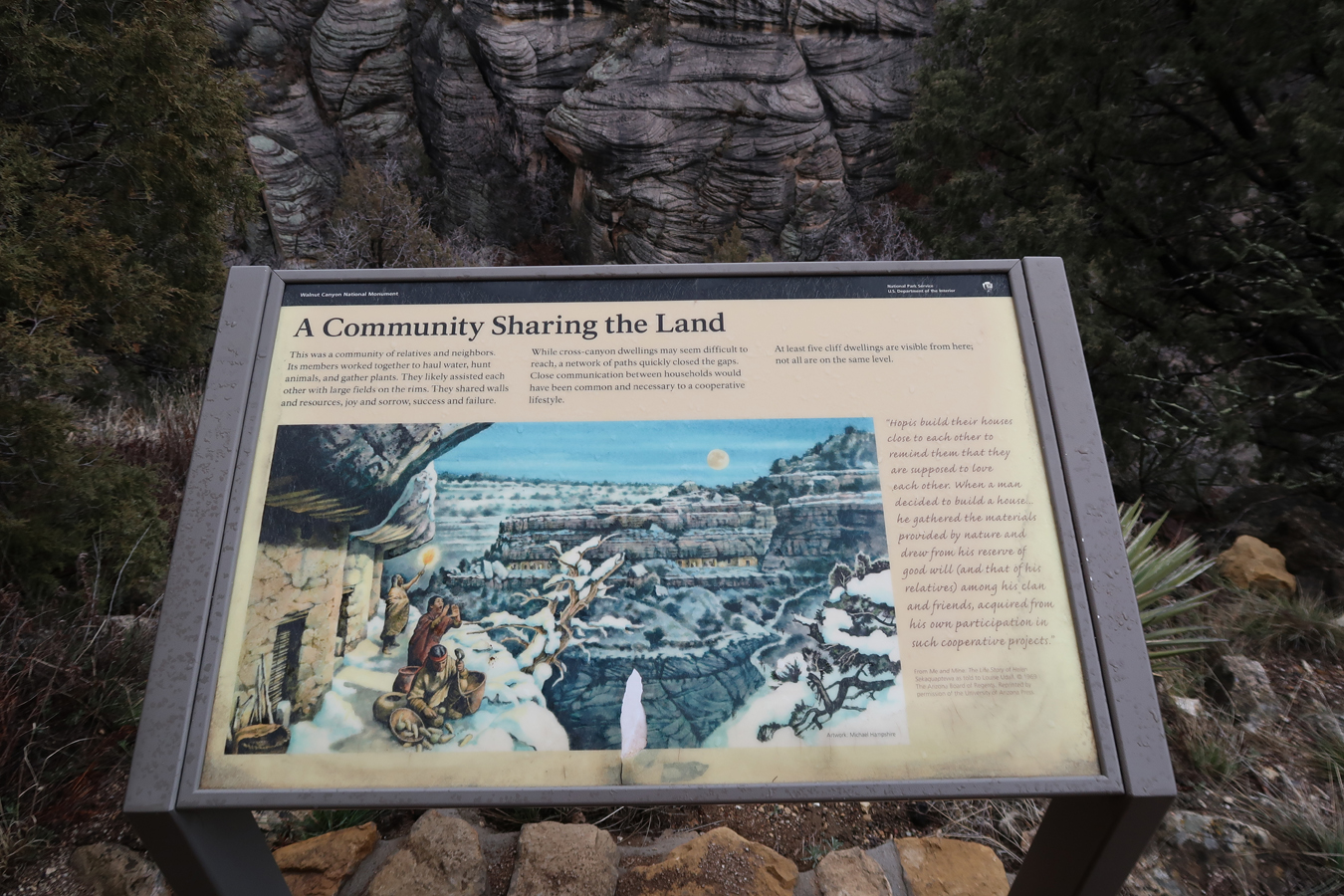
Walnut Canyon’s cliff dwellings were occupied between 1125 and 1250
Looking back toward Visitor Center
Snow from previous night, elevation here is about 7,000 feet

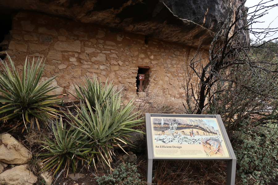

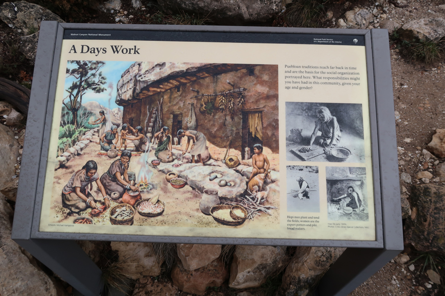
A Community Sharing the Land

Starting back up to the Visitor Center; nice paved trail then steps

Once on top, we did the Rim Trail

End of Rim Trail viewpoint
Did a little loop back to the parking lot passing the Pueblo and Pithouse Ruins


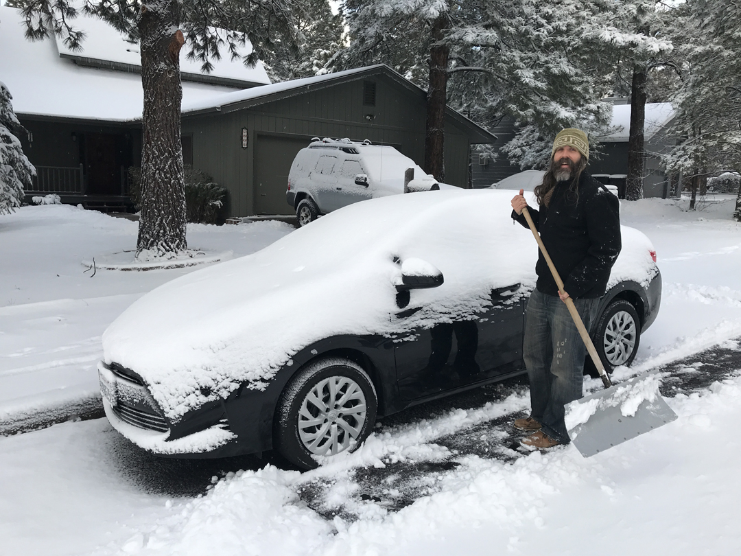
It was raining when we got to Flagstaff, so we played Farkle in the Flagstaff Mall and had Chinese for dinner before arriving at our Airbnb at 6pm. This was the second year in a row that we stayed with Kyrie and Chris. Helen and Kyrie made brownies and Chris had made an iPad spreadsheet for keeping Farkle scores.
3/13 W – woke to 3 inches of snow and more coming down. We had an organic breakfast and then Chris shoveled a path in the snow to our car.
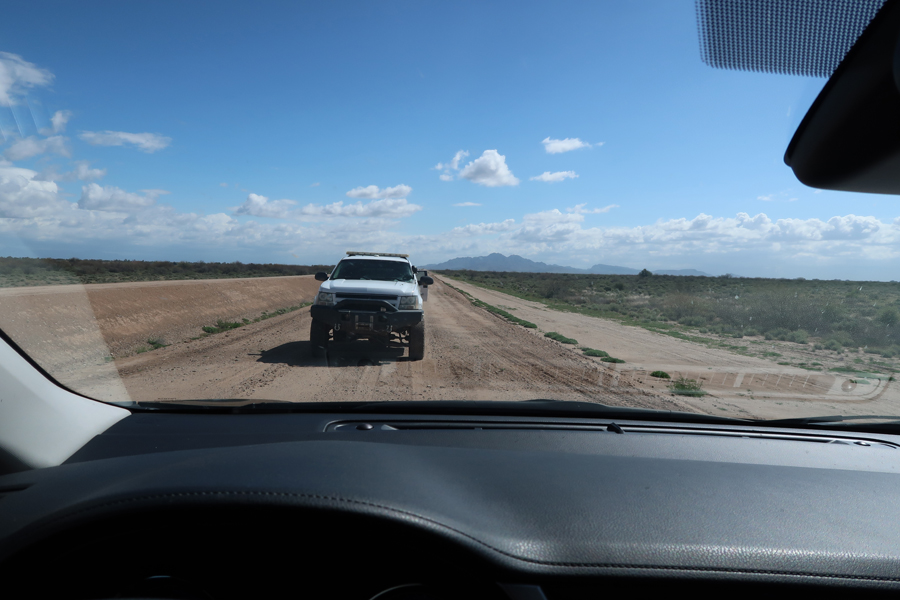
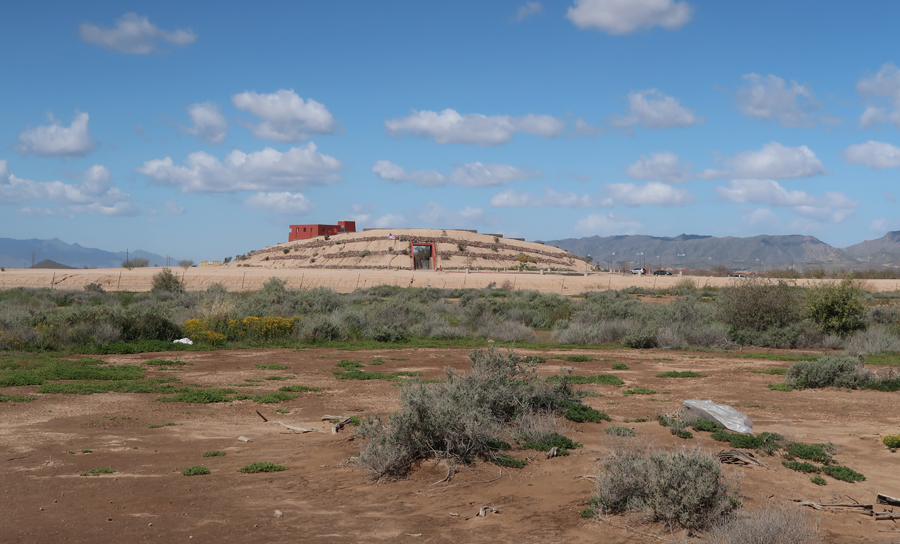
The first half of the drive to Phoenix was slow due to the weather. We passed through Phoenix and then I followed a map I had found to Hohokam Pima National Monument. We exited I17 south of Phoenix. I then followed dirt roads until I was unable to go any further toward the location on the map. I decided to walk to the location. Helen did not want to go, so she stayed in the car and cross-stitched. I found the location a short distance away. The village known as “Snaketown” was excavated in the 1930s and again in the 1960s. After the last excavation it was completely covered. The monument is on the Gila River Indian Reservation. As I walked back to the car, I saw there was a police car next to my rental. As I approached, a second police car arrived.
The officers were upset with me and asked how I got there. I explained that I was doing National Park Units and was following my map. One took my license to his car and the other explained that I was trespassing on the Indian Reservation. I stated that I did not see any No Trespassing signs along my desert route. The second officer explained that the area was sacred ground, that they had a problem with “pot hunters,” and tribal permission was necessary to enter the area. I told him I totally understood and apologized for being there. He went to speak with the other officer. When they returned, I was given a warning ticket for trespassing on the reservation. They suggested I go to the Huhugam Heritage Center for information on the NM site and gave me directions.
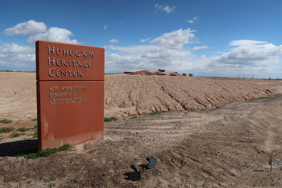

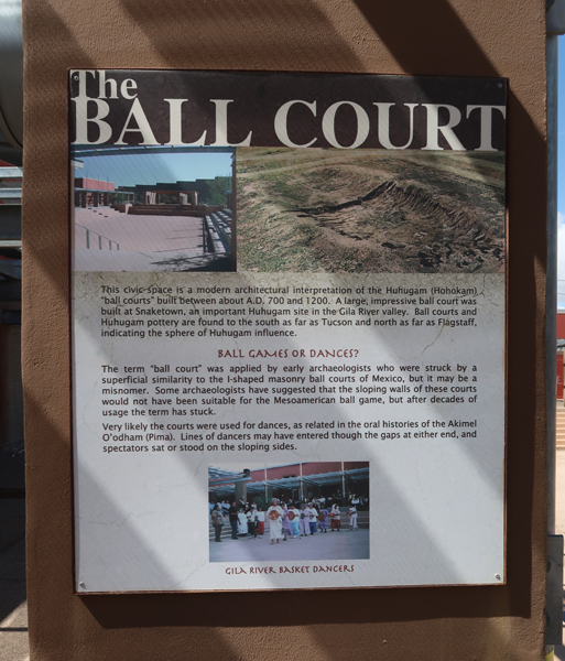
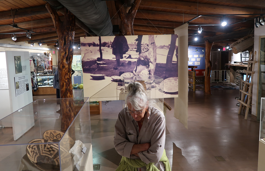
The museum was under renovation; however, we were able to walk the grounds and speak with an administrator. I discovered that, since the National Monument had been closed, going to the Cultural Center was considered as having been at the Hohokam Pima NM site.

The Gila River Indian Community is made up of two tribes – the Akimel O’otham and the Pee Posh. In general, American Indians are very proud of service in the Armed Forces. Perhaps they pride themselves on being warriors.


Since the Heritage Museum was not open, it was recommended we visit the Huhugam Ki Museum of the Salt River Pima-Maricopa Indian Community. They even printed Google Map directions for us.


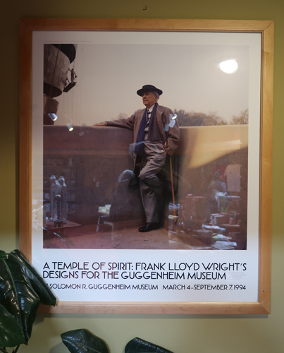
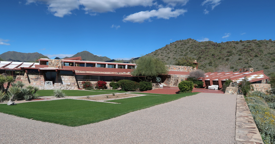
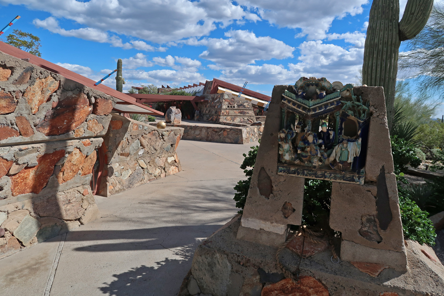
On the way to the Marriott we saw the exit for Taliesin West, Frank Lloyd Wright’s famous winter home and school in the Sonoran Desert from 1937 until his death in 1959 at the age of 91. It is Scottsdale’s only National Historic Landmark.
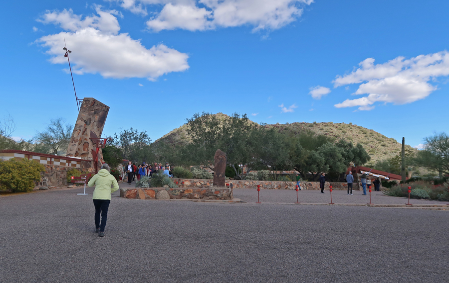
All the tour slots were taken, but we were able to walk the grounds


It took an hour to drive through heavy traffic to our hotel. We checked in and then walked to Caramba’s where we shared a beer and a Fajita dinner
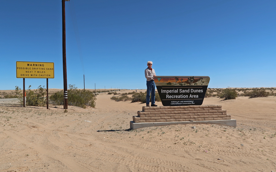
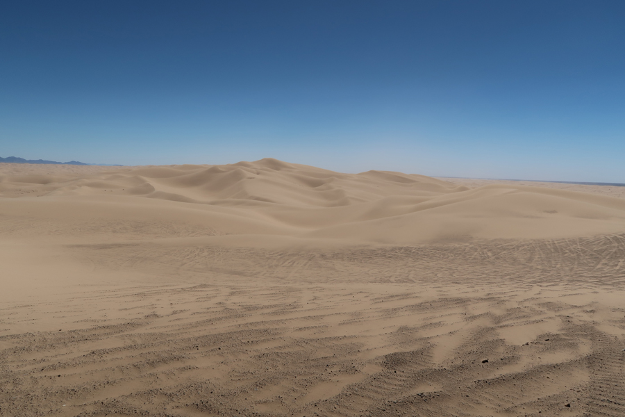
3/14 Th – It was a 4hr drive to get to the Imperial Sand Dunes Recreation Area in CA, just south of the Salton Sea. This is a BLM area
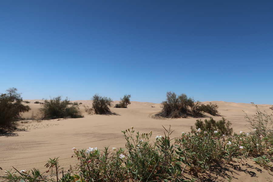
We saw a couple of dune buggies driving across the sand, but most were stopped and waiting because of the high winds


The flag states – “Trump 2016, No More Bullshit.” How ironic, Trump is a habitual liar.

The dunes continue south all the way to the US-Mexico border
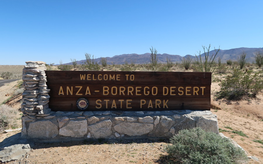
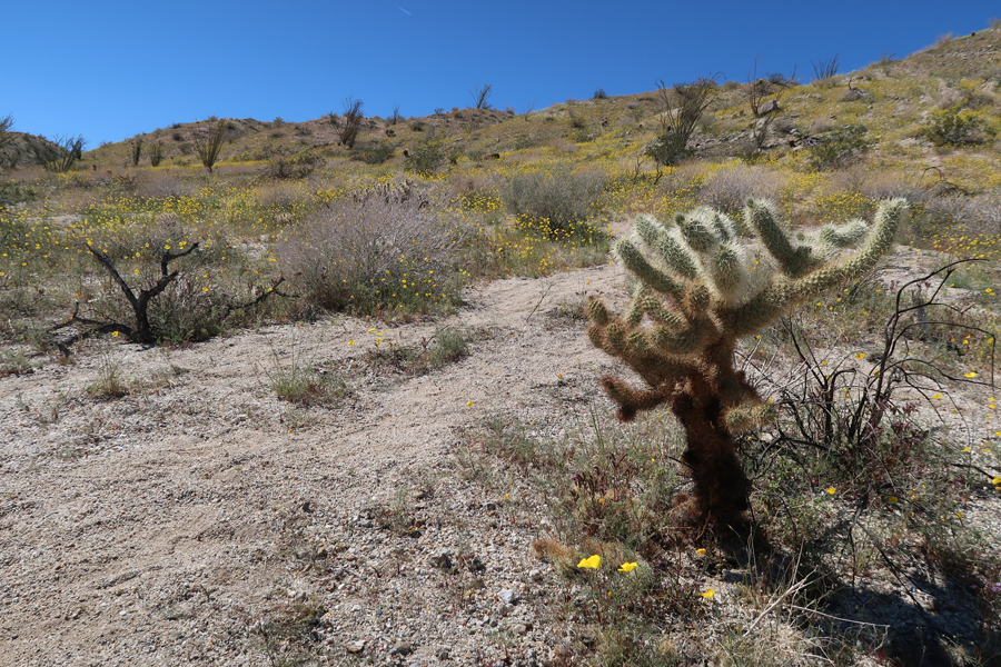
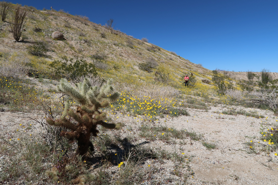
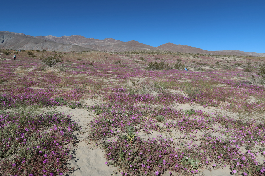
Another hour brought us to Anza-Borrego Desert State Park. We came here for the wildflowers. There was a “super bloom” this year because of all the rain and snow during the winter. The wildflowers themselves have their season as well. So, we saw some we had not seen when we were here in March 2005 and others, we had seen then, were either past bloom or had not yet bloomed.
We began our visit at the Ocotillo Wells Discovery Center on Hwy 78. The volunteers were very helpful giving us a Desert Wildflower Guide and maps that indicated where the wildflowers were blooming. Our first stop was the Ocotillo Forest. Yellow desert dandelions were in bloom as well as some cacti, but the red flaming flowers of the Ocotillo – the tall thin mix between a cactus and a shrub had not yet opened.


There were metal sculptures in the desert all around Borrego Springs – camels, horses, elephants, dragons, etc. The tourists were as interested in these as the wildflowers – lots of folks out taking pictures. Fossils of Columbian Mammoths have been found in here.
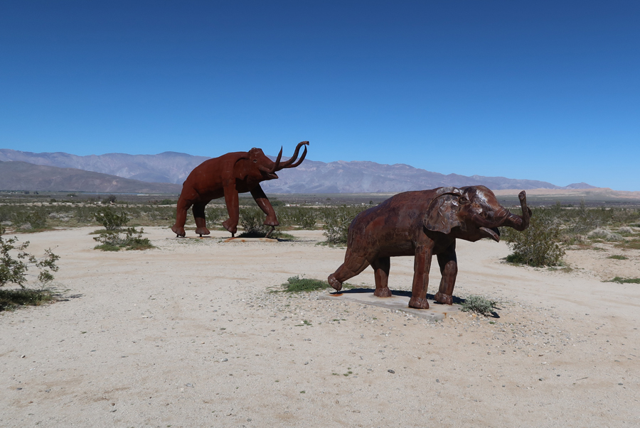
In general, I don’t like these sculptures unless they have some historical context. But I did like the Dragon/Snake. This picture does not do it justice, as two more smaller curves of the tail were on the other side of the road.

Our next stop was north of Borrego Springs on the Coyote Canyon Road where there were fields of yellow dandelions on both sides of the road
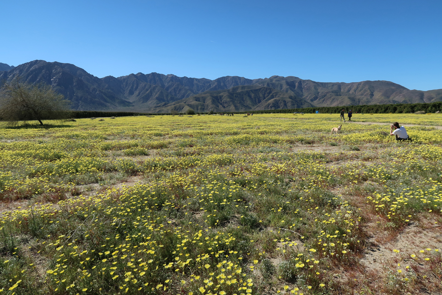
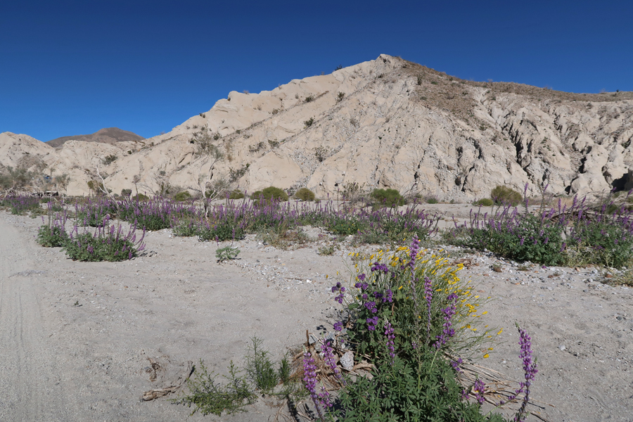
Our next stop was along S22 east of Borrego Springs where there were hillsides covered with wildflowers. The purple sand verbenas were close to full bloom.

I felt it a privilege to walk through this beautiful setting. White Desert Lillys and a close-up of a Sand Verbena


Our last stop was in Coachwhip Canyon. After we had driven as far as we could on the 4WD road, we were rewarded with blooms of Arizona Lupine and yellow Brittlebush

It was a 3hr drive to Silver Lake where Kate had a delicious Asian Chicken dinner waiting for us
3/15 F – Kate and I did the 4mi Hill Walk this morning. The route went over the hill to and around the Silver Lake Reservoir and then back by way of Sunset Blvd. Went to Maria’s for lunch and then the Hollywood Cemetery – interesting People,
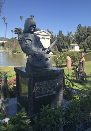
Monuments
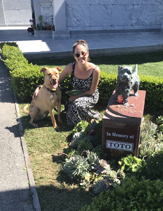

and Stories. For example, I learned that the LA Times Building was bombed in 1910 resulting in the death of 21 newspaper employees! Domestic terrorism is not new –

Helen showed Kate how to make spinach and cherry pita. We played games into the night. Kate, the Yahtzee Queen, had 4 Yahtzee’s in 3 games!
3/16 Sat – Did the Farmers Market at Sunset Triangle Plaza and then the Silverlake Flea Market off Sunset Blvd. Helen repaired and replaced the buttons on her faux leopard coat for Kate.

Had In and Out Burgers (Animal Style!) on our way to Santa Monica. It cost a fortune to park and go to the ArcLight movie Theater there. The National Geographic movie/documentary, “Free Solo,” about the first free climb of El Capitan in Yosemite NP by Alex Honnold, kept us on the edge of our seats. If you like rock climbing, you will love this movie!

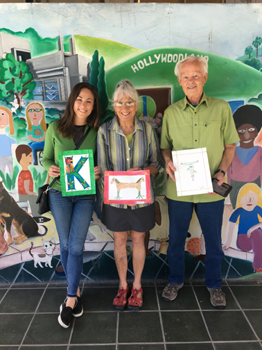
3/17 Sun – St Patty’s Day: Saint Francis of Assisi church for mass, breakfast/flea market in church hall (Tom Hawaiian shirt, Kate mixer), and then a Celtic Art lesson at the Barnsdall Art Park. We were asked to draw/color a picture using the first letter of our first name. We were given some examples of mythical Celtic figures to use in our drawing. Leprechauns, shamrocks, green beer, etc. were not mentioned! You can tell who has the art talent in our family!
We listened to Irish music while playing games. Helen and Kate made, one of my favorites, potato pancakes for dinner.
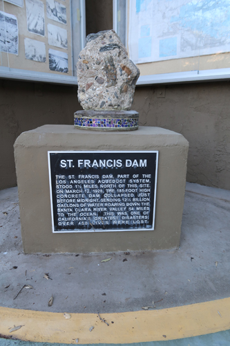
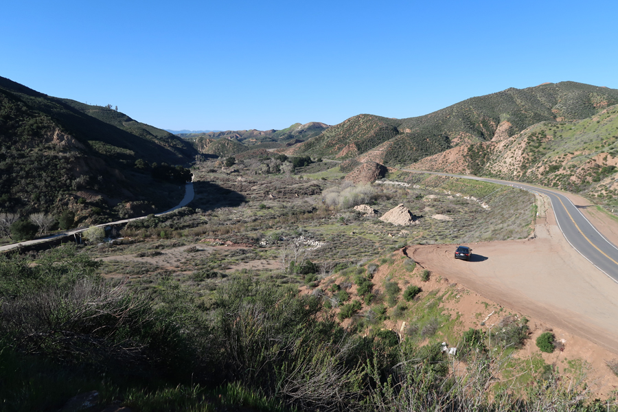
3/18 M – 1hr to Saint Francis Dam Disaster National Monument and National Memorial; it is located in Angeles National Forest NE of Santa Clarita. This is a new (2019) National Memorial and is the only one administered by the USFS. We proceeded up Francisquito Canyon Rd to a Los Angeles Dept of Water and Power site where there is a plaque describing the disaster. When the Visitor Center is built it will tell two stories; (1) the story of the aqueduct system providing LA with water, and (2) the Saint Francis Dam Disaster.


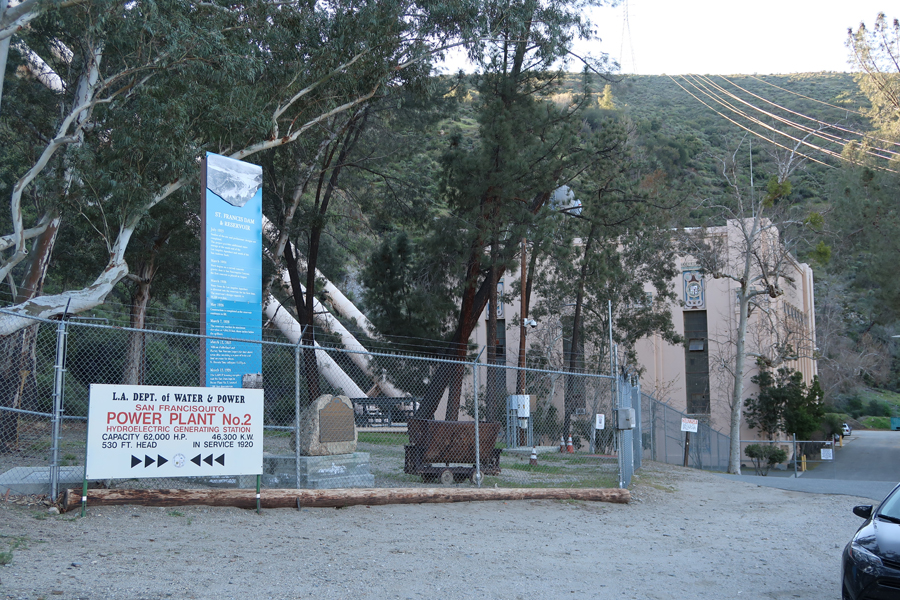
A little further up the road is the site of San Francisquito Power House No. 2 where there is additional information on the disaster. This Power House was 1.4 miles below the dam and was destroyed when the dam burst on March 12, 1928.
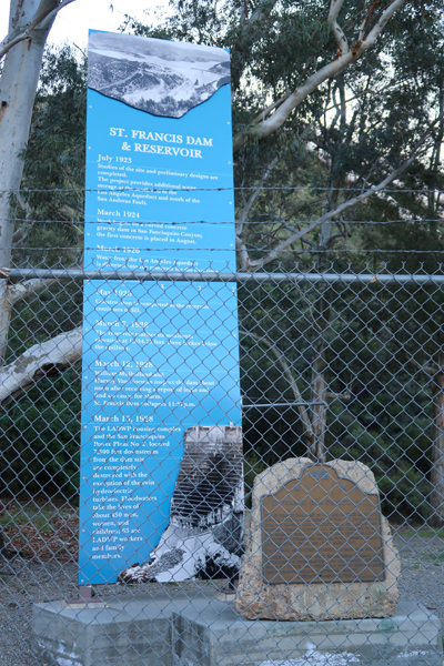

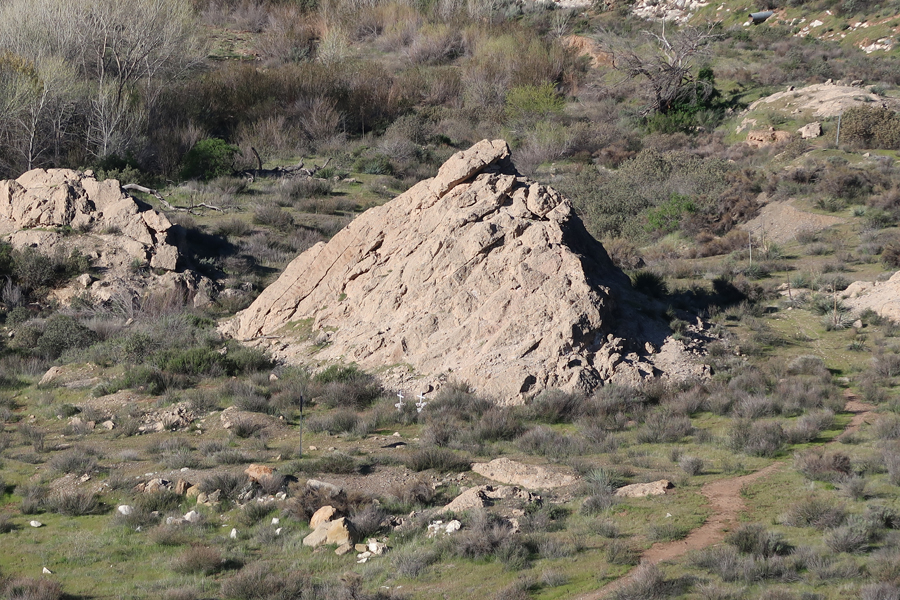
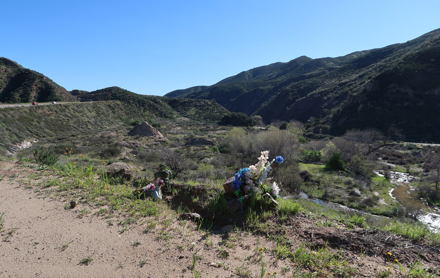
A bit further up the road is the old Francisquito Canyon Rd, which is now blocked off but can be hiked to the dam site. We continued past this point to where the old road re-joins the new road north of the dam site. We parked the car and started to walk down the old road toward the dam site but found it covered with water. I then drove back about a half mile to a point where I could access what remains of the earthen part of the Saint Francis Dam and parked along the road. The reservoir behind the 200-foot high concrete dam was part of the new Los Angeles Aqueduct system built to bring water 233 miles from Owens Valley on the east slope of the Sierra Nevada Mtns near Mono Lake to Los Angles. It had just filled when the dam burst sending a wall of water 54 miles down Francisquito Canyon and then the Santa Clara River to the Pacific Ocean. It is estimated that about 450 men, women, and children died as a result of this disaster. This is a view of the area, including parts of the dam, about a half mile downstream from the dam site – note the white crosses.
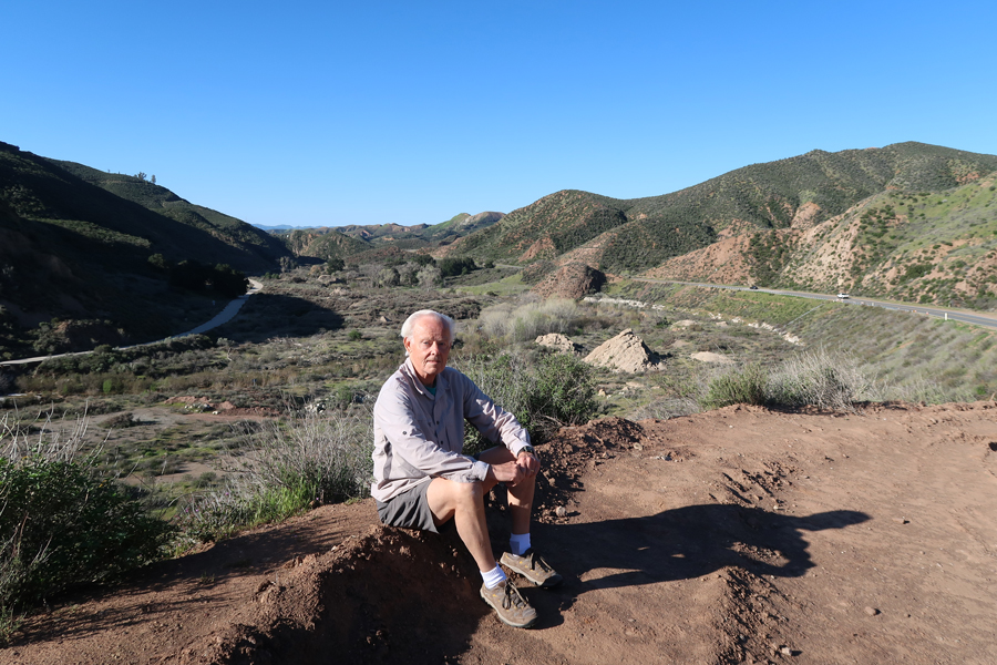
I decided to hike up a steep slope to get access to the top of the Dam; Helen stayed with the car – view looking back toward our car.
Walking toward the canyon and dam site
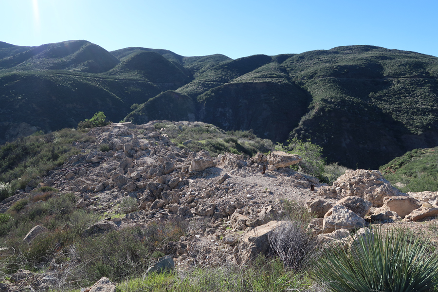
Remains at the top of the concrete and earthen part of dam
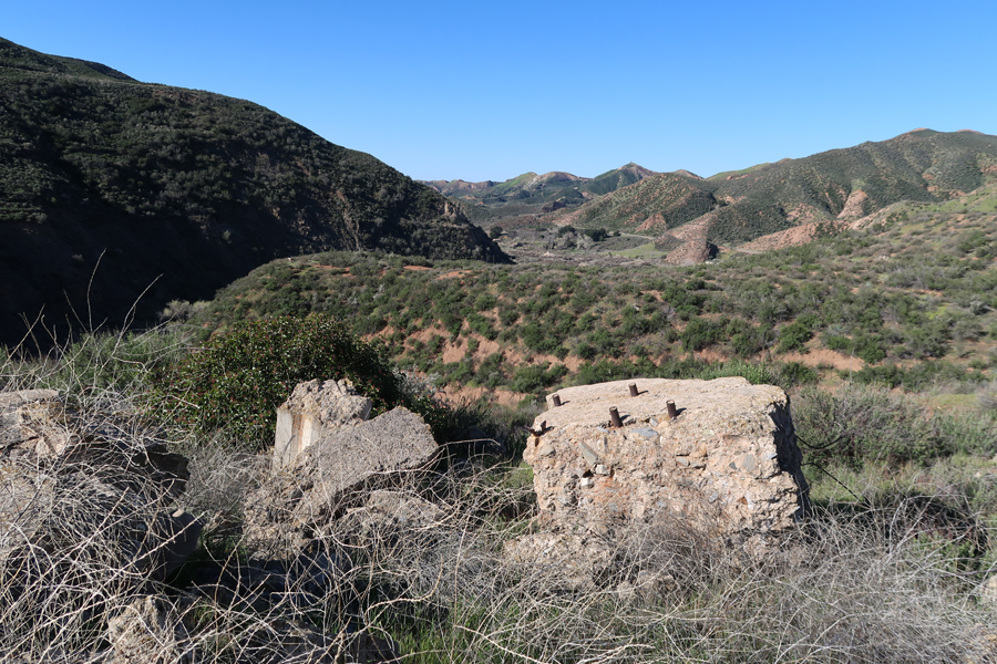

Dam is gone, Francisquito Creek is in the canyon below
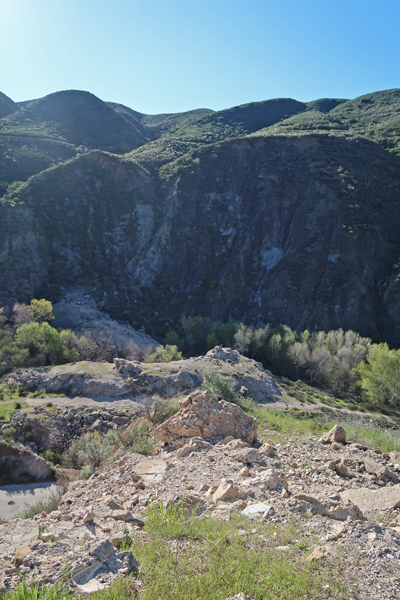
This photo was taken about a mile downstream from the dam site. The dam site can be seen in the center right of the photo with Francisquito Creek in the lower right.

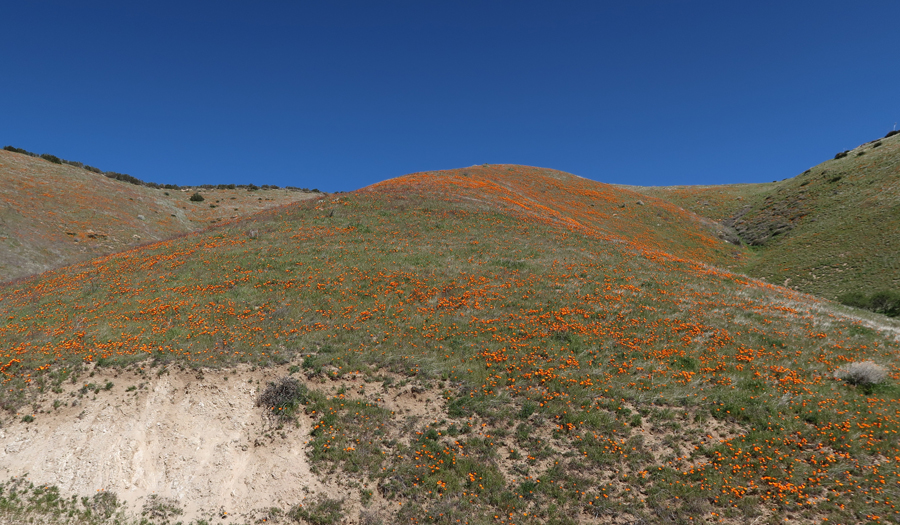
Helen wanted to see the poppy fields Kate had told us about. So, we continued north on San Francisquito Canyon Rd toward Lancaster. After we passed through Green Valley, we found the hills covered with poppies.
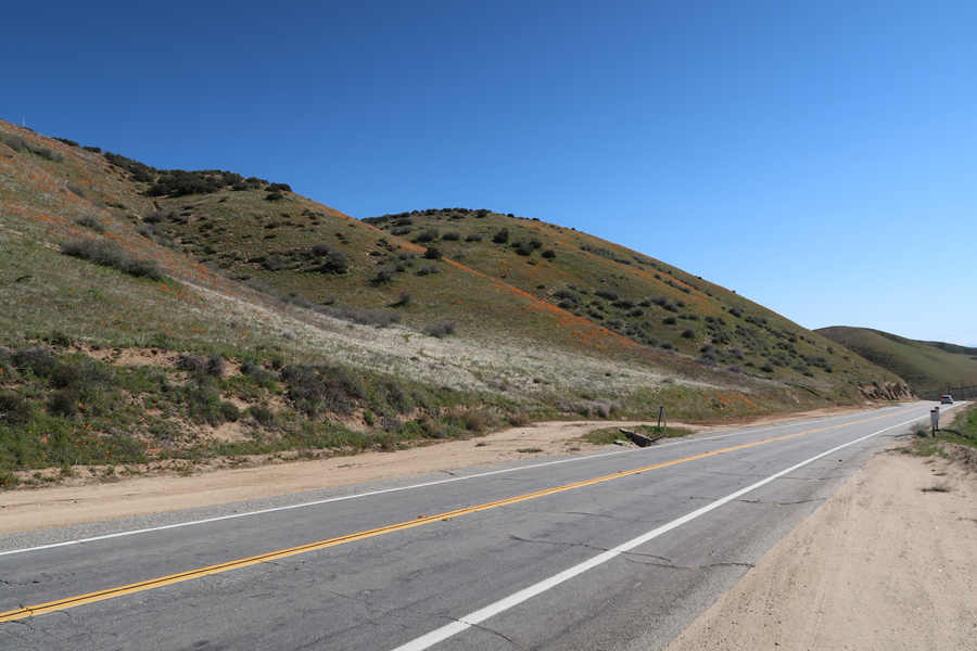
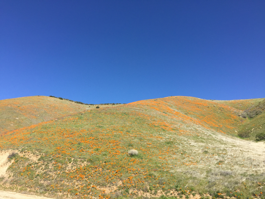

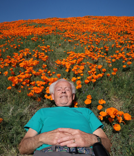
Continuing toward Lancaster we came across a dense field of poppies. We drove a dirt track to get closer and then hiked up into the amazing color. It reminded me of the poppy field in the Wizard of Oz.
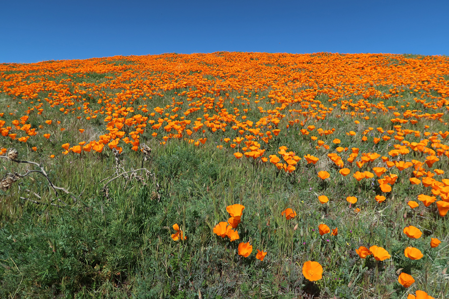

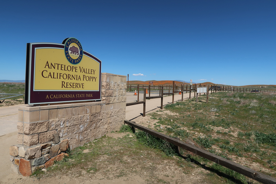
We continued through Lancaster and then discovered Antelope Valley California Poppy Reserve State Park. We started to drive in but found it packed with tourists. We much preferred the “private time” we had already experienced with the poppies, so we continued toward our next destination on Rt 138.
We connected with I5 south and then took Rt 126 west to Santa Paula to see the Saint Francis Dam Disaster Memorial Marker there. The dam burst just before midnight. About 1.5hrs later an urgent message reached the police department here of the imminent disaster. Two officers rode through the night to warn citizens in low lying areas that a torrent of water would soon inundate their homes. Their ride ended at 3:05am when a wall of water swept through Santa Paula.

Persian dinner at Raffi’s Place in Glendale
3/19 Tu – LAX 1:15pm, arrived home at midnight
End of our CA+ Trip. We really enjoyed the time we were able to spend with Kate
