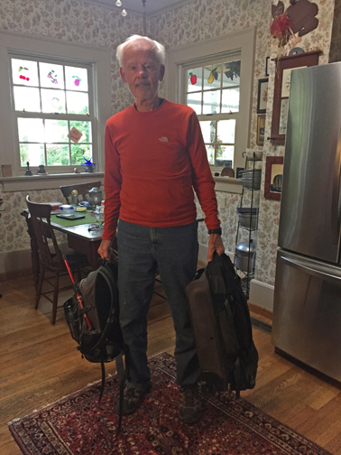
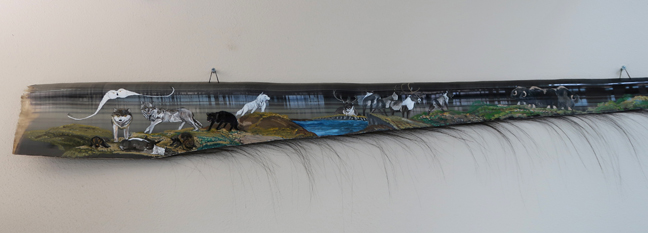
This post includes:
Katmai N PRES, Alagnak Wild River, Aniakchak N PRES, Denali N PRES, Noatak N PRES, Kenai Fjords NP, Inupiat Heritage Center (Affiliated NP Unit), Glacier Bay N PRES, and Gates of the Arctic N PRES
Lake Clark N PRES, and Wrangell-Saint Elias N PRES can be found on this Blog under July 2011
Yukon-Charley Rivers N PRES, and Bering Land Bridge N PRES can be found on this Blog under August 2012
9/1/2020 Tu – I had to complete a COVID Declaration and have proof of a negative test before entering Alaska.
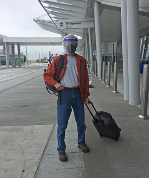
TSA took my peanut butter at the Dayton airport! All flights were about one-third full today with everyone required to wear a face mask, except for eating or drinking. I liked watching my flight information on my personal screen. The screen map showed us flying over Manitoba, Saskatchewan, Alberta, British Columbia, and Yukon Territories of Canada and then into Alaska. After consuming 3 airline zip lock snack bags and two of Helen’s turkey sausage sandwiches, I was full when the plane arrived in Anchorage at 5:40pm (9:40pm OH time). I felt younger, having gone back in time four hours.
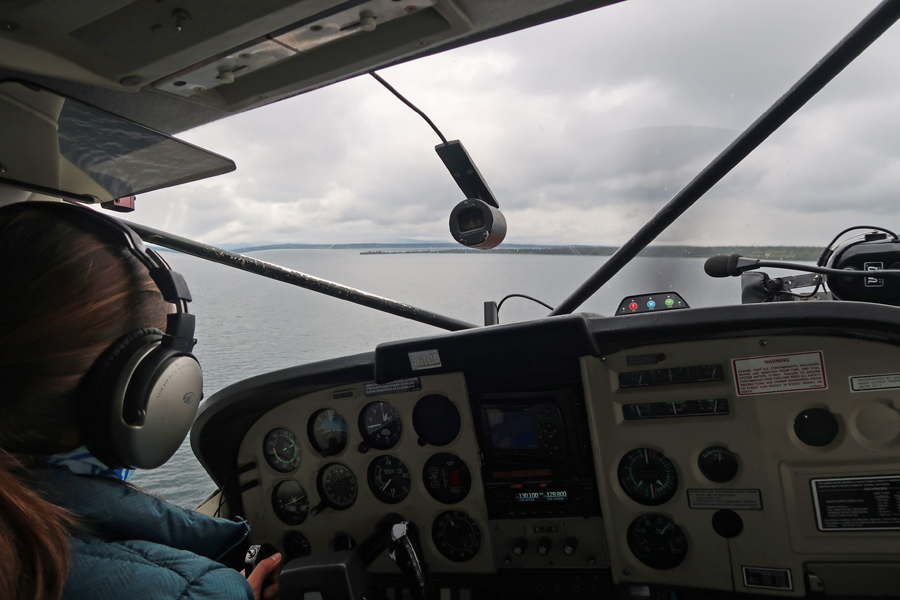
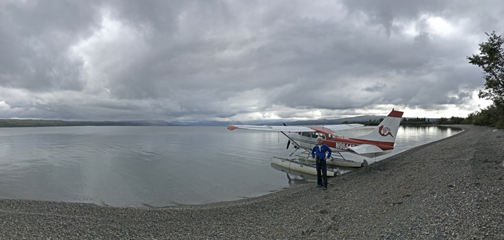
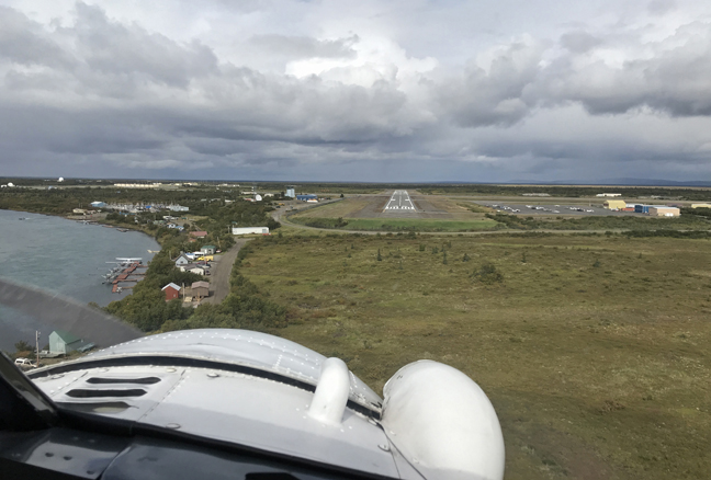
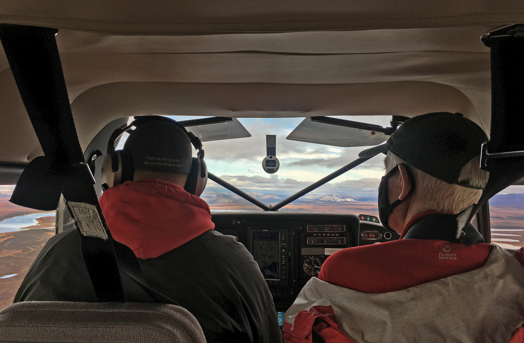
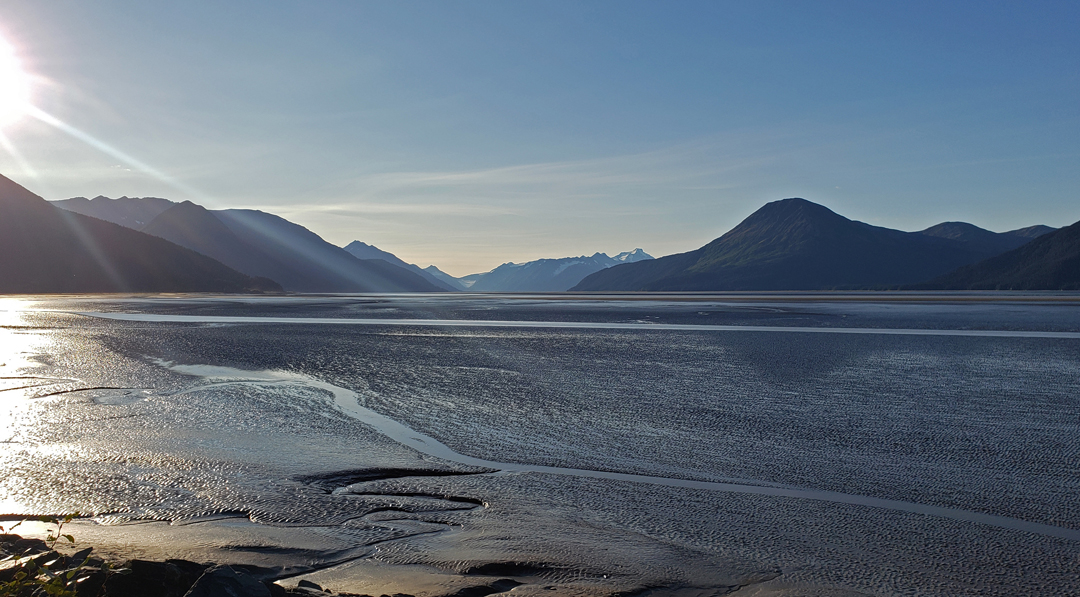
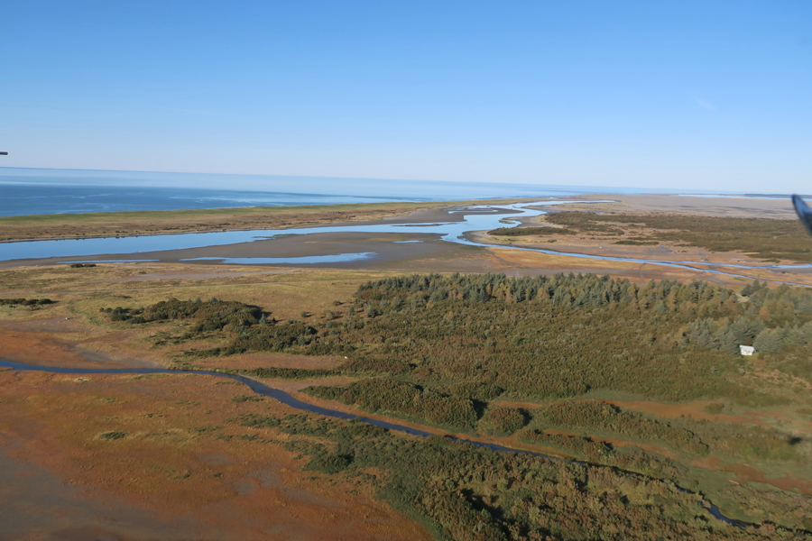
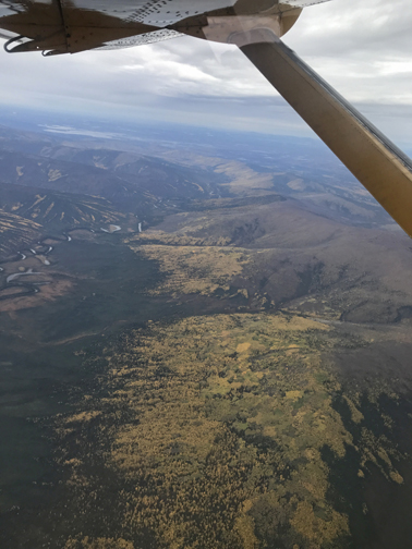
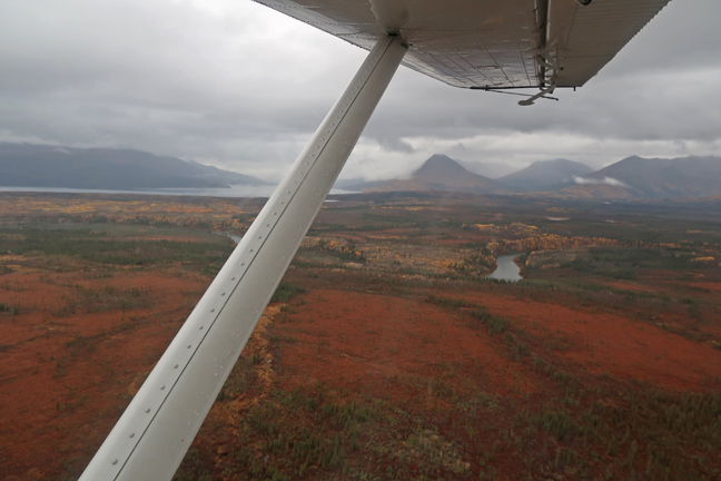
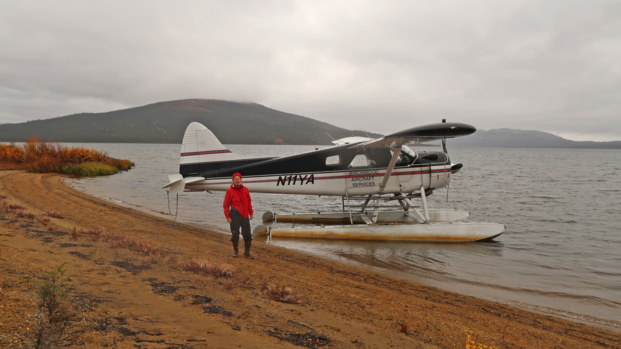
9/2/20 W – My 47-minute Alaska Air flight arrived in King Salmon at noon. It was windy, cold (53 degrees) and raining as Alexi (pilot) and I pushed the float plane away from the Katmai Air dock on the Naknek River. We flew east over Naknek Lake

Then north over Katmai National Park


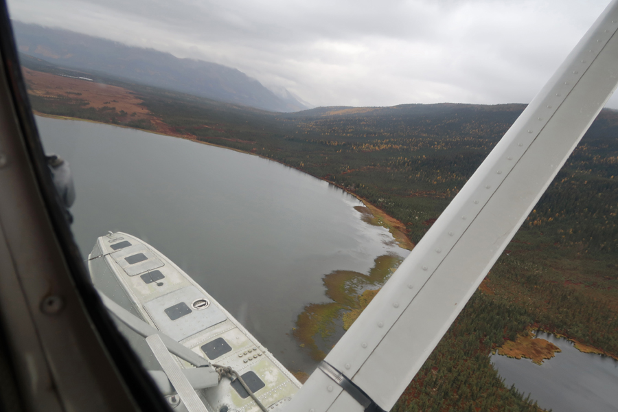
Then to a peninsula on the north shore of Novianuk Lake, which is in Katmai N PRES

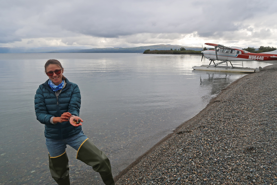
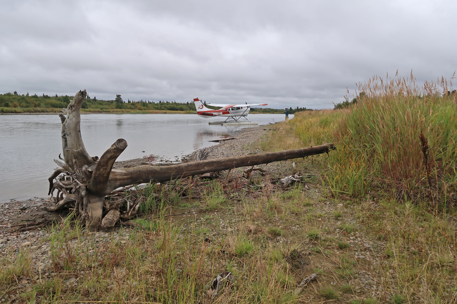
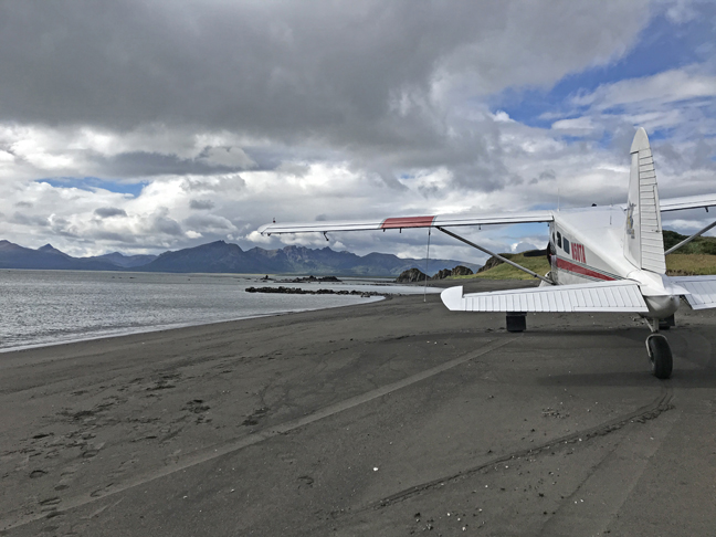
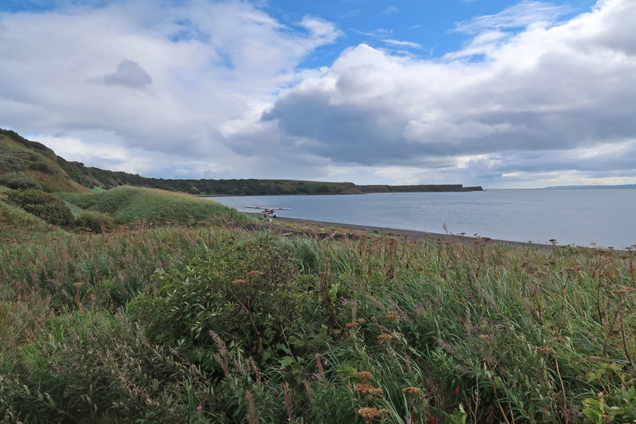
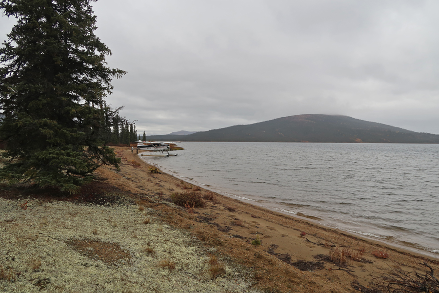
We landed at Agate Beach on the east side of the peninsula


Landing
We were on the leeward side of the peninsula. Without the wind, the conditions were comfortable.

After the plane was anchored to the beach, we started exploring. Agate Beach is named for the abundance of agate rock on the beach.
The moving clouds, rain, and backlight from the beach, made it difficult to take photos, but Alexi did a good job taking this one –
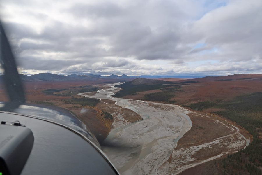
After about 30 minutes, we took-off and flew west over the now closed Royal Wolf Lodge
It was raining as we followed the Alagnak Wild River west under the clouds. The river originates from Kukalek Lake in Katmai N PRES and flows generally west to Bristol Bay. It is a prime salmon fishing river.

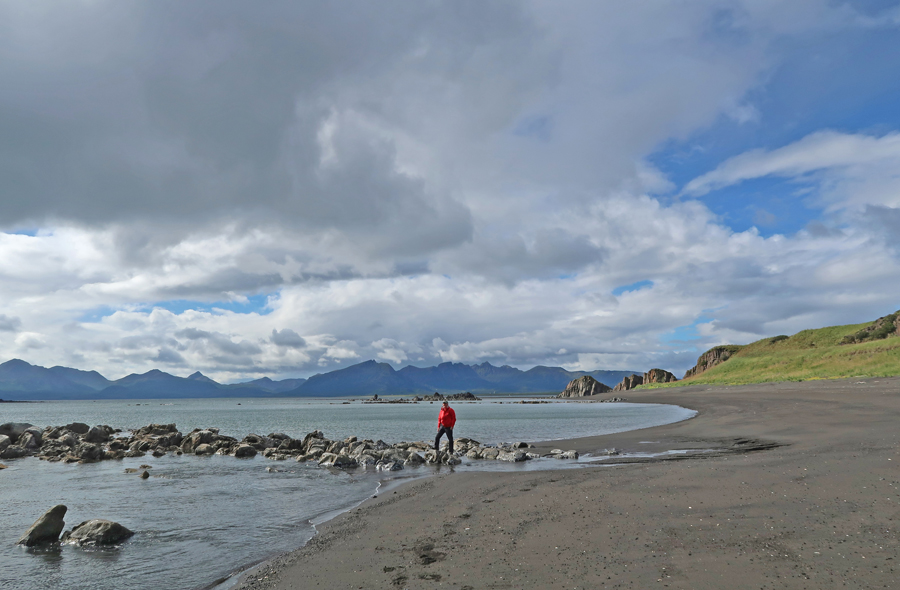
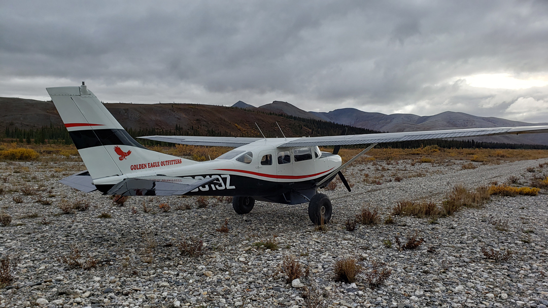
Alexi circled a spot on the river several times making sure she was set up for a tricky river landing. We landed at a place called Cutbank at Estradas, for the now empty cabin that still sits on the north side of the river.
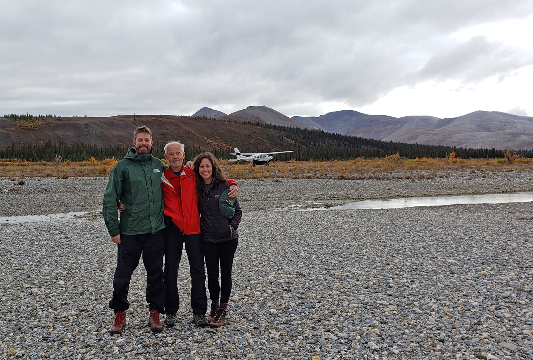
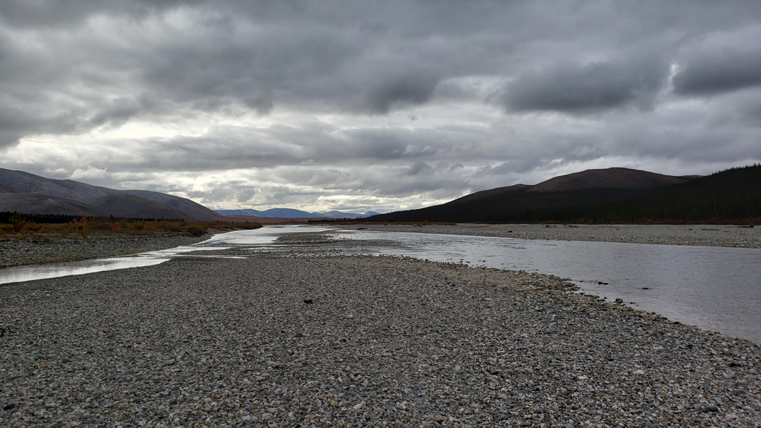
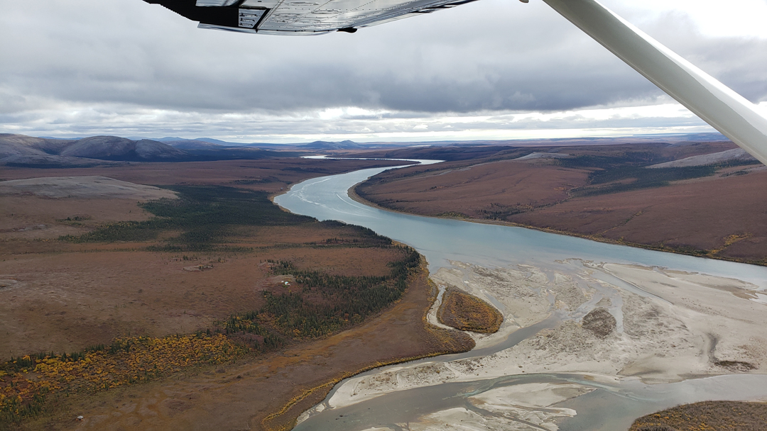
The Alagnak Wild River is somewhat channeled here allowing for a landing. For most of its course to Bristol Bay it is spread out and shallow. Alexi skillfully tied off the plane to a solid tree root ball and we proceeded to explore the area.
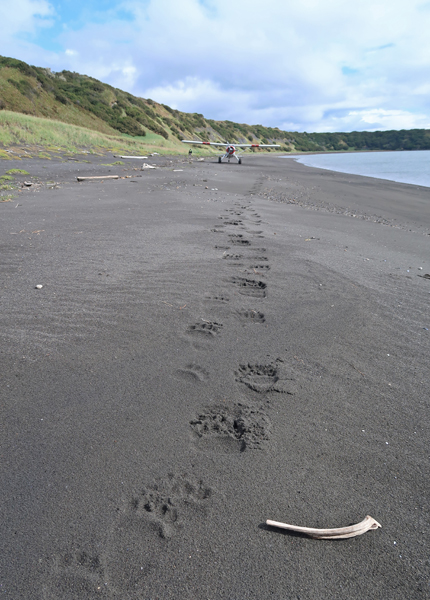
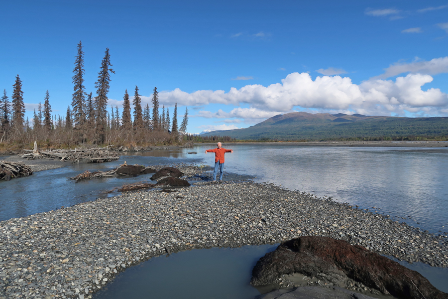
We did not see any animals but did see lots of tracks along the river. I had to have my photo taken in the river so I could prove that I had truly experienced this National Park Unit. The river take-off was a bit “hairy” due to the river current, but we made it fine and were back in King Salmon in about 20 minutes.

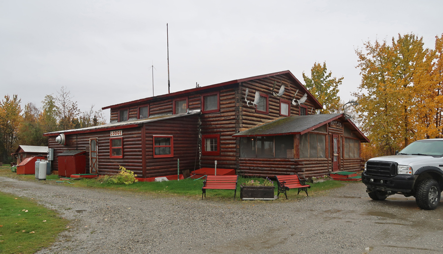
I had rented a primitive cabin from the Antler’s Inn for two nights. I was cold, weary, and hurting because of my wet feet/legs and being bounced about in the small plane. As soon as I got in the cabin, I got out of my wet leggings and water shoes, turned on the heat in the cabin, and got under the covers to get warm.
I had a fit-full night with aches/pains and the 4-hour time change, but plenty of time to get back to physiological and psychological “normal” by morning.
9/3/20 Th – Chris Klosterman, my Trygg Air pilot, picked me up at 10:30. He said Trygg meant safe in “Scandinavian.” He fueled his plane and loaded some supplies including fuel containers for a stop at Pilot Point on the Bering Sea. We took off about 11:15am.
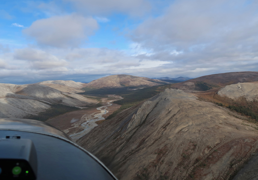
The flight there was over baren but beautiful country. The colors and contrasts were wonderful no matter what light was available. The weather was mixed with clouds, rain, and a bit of sun – Bering Sea in distance

We saw one bear and lots of birds flying south. Chris said some of them were swans. Chris shared one of his mother’s homemade Norwegian cinnamon rolls and I shared my beef jerky.
Landing at Pilot Point, supplies were off-loaded, and the fuel containers we were carrying were filled. A large tent was also loaded for a drop off at a hunting lodge on Cub Creek.

We took off and flew south, bouncing, due to a strong wind, toward the east side of the Aniakchak Caldera – approaching Aniakchak National Monument

The break in the caldera wall releases the water from Surprise Lake in the caldera. This break is called “The Gates.” It marks the start of the Aniakchak River.

Caldera model – The Gates, right center

Pinnacle Mountain

Waterfall at start of Cub Creek on the south flank of Aniakchak Peak (snow in background). We landed at a tiny clearing by the creek in the National Preserve. Fuel containers, tent, and supplies were off-loaded for the lodge. Moose season was starting in four days.

After a quick take-off in the rain, we headed for nearby Meshik Lake in a rain squall

Meshik Lake is at an elevation of about 500 feet. There is a small stream that flows west from the lake to the Bearing Sea, while another small stream flows east from the lake to the Pacific Ocean – a unique geological feature! Some members of the National Park Travelers Club (NPTC) have their float plane pilot “skim off” Meshik Lake and then return to King Salmon. They then say they have been in Aniakchak N PRES – I do not think that is legitimate. I feel you must at least walk in the National Park Unit in order to say you have been there.

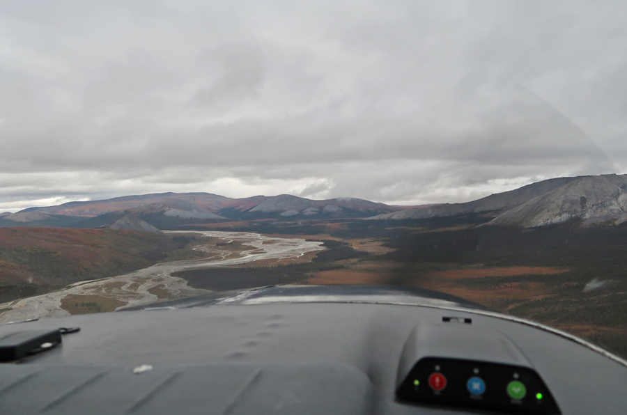
We followed the Aniakchak River east

Approaching Aniakchak Bay.

Chris did an exciting landing on the beach just below the area where the Columbia River Packers Cabin was once located. I did videos to show the incredibly short distance that was needed by the Beaver aircraft to land on and take-off from the beach. There is a building above the beach that serves as a cabin and maintenance location for the National Preserve.

YouTube video
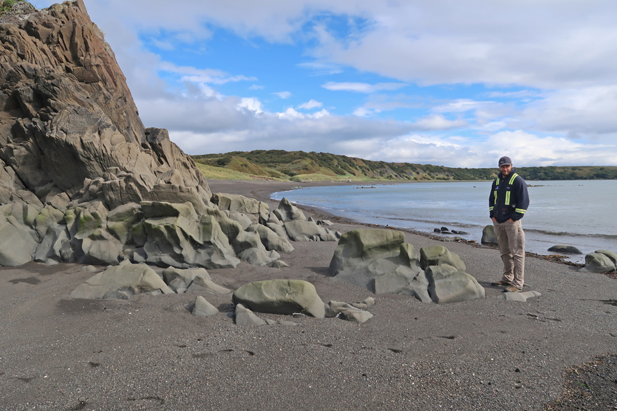
We explored the beach area and checked out the cabin

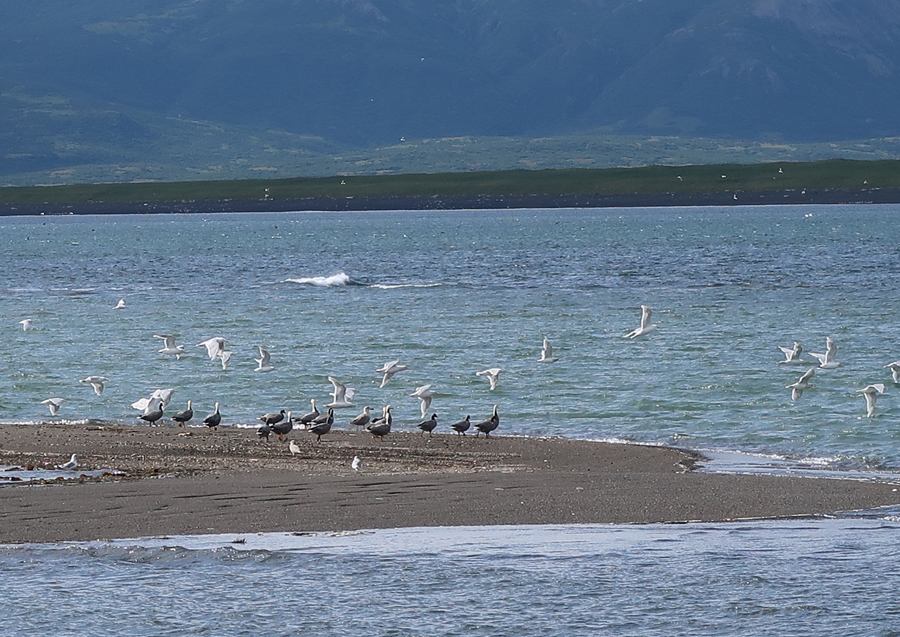
We then hiked to the lagoon that empties into Aniakchak Bay


We saw flocks of birds, seals, and amazing scenery
Heading back to plane (in center)
A bear had gotten there before us
Our time here was way too short. It was pristine, raw, and beautiful. I believe if I were ever forced to choose my favorite National Park Unit, it would be the combined Aniakchak National Monument and Preserve. The time had come to return to civilization. We took-off and flew west.
YouTube video of take-off – look for bear crossing Aniakchak River after take-off

We had to fly through a few rain squalls along the way

There were more bears, but I was too slow with my camera to get any photos. About halfway to the caldera, we turned north and headed back to King Salmon


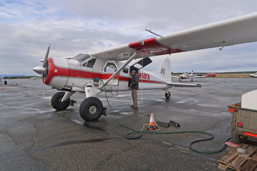
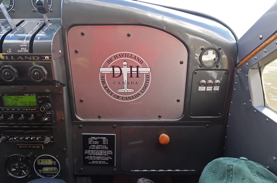
I enjoyed sitting in the co-pilot seat of this sturdy DH Beaver aircraft
We landed about 4pm, making it a 4.75hr excursion.
By landing at Pilot Point, Cub Creek, and Aniakchak Bay on this trip, and also having landed in (on Surprise Lake) and explored the caldera of the volcano in 2012, I feel I have truly experienced Aniakchak National Monument and Preserve.
9/4/20 F – This was my backup day in case weather prevented my flight yesterday. After my granola and tangerine breakfast, I walked across the highway and took a picture of myself sticking my head through a moose billboard that was an advertisement opposing the Peeble Mine. It is a proposed gold mine that would devastate the local environment and pollute Bristol Bay – the largest salmon fishing area in the world.

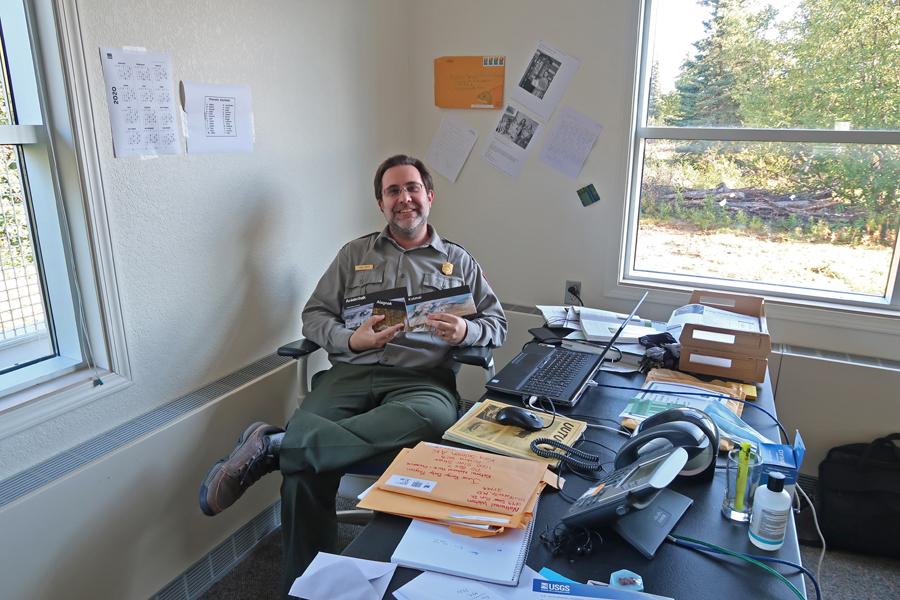
I then went to the Katmai NP office and met with Ranger Burt, who provided me with stamped brochures of the area National Park Units.
Afterward, I had an unpleasant 1.5 mile walk back to my cabin. The gnats were terrible! I had my cap, hood, and facemask on, and used my hands to act like windshield wipers across my face. Despite my efforts, I had several bites on my face, ears, and neck by the time I got back to the cabin. My Katmai Air flight leaving King Salmon was delayed by two hours. I took this photo of Redoubt Volcano on my flight to Anchorage – it last erupted March to July 2009.

I rented a car and met Peter and Kate at our hotel. It was 9pm and they were waiting for pizza they had ordered. We had all tested negative for COVID-19, so were able to hug and enjoy our time together un-masked!
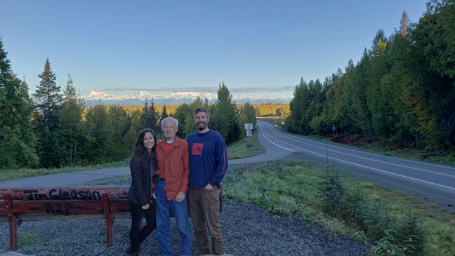
9/5/20 Sat – We awoke (5:45am) to a beautiful day! There were low level clouds and fog as we drove north on A1 and then A3 toward Talkeetna.
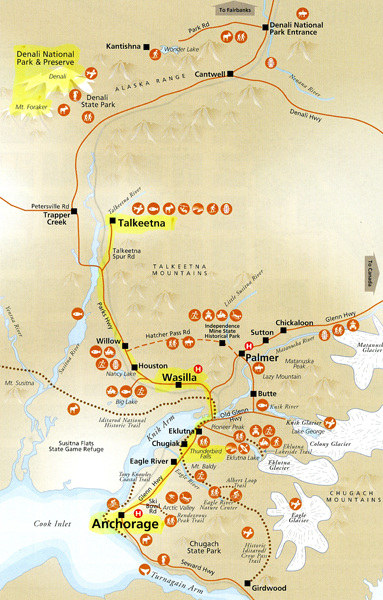
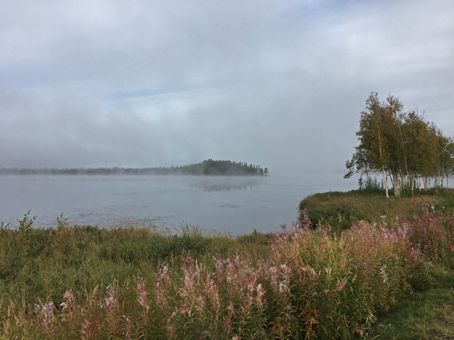
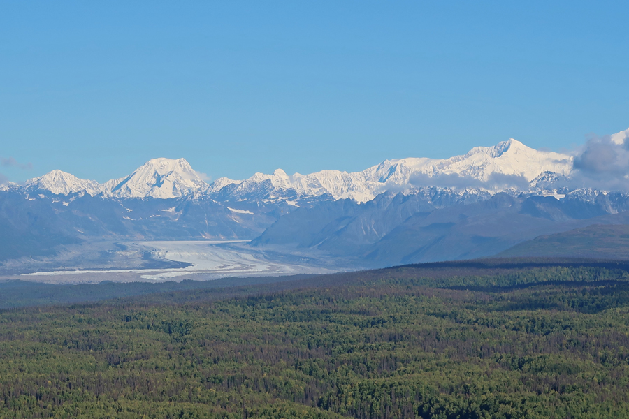
Just before Talkeetna, you come around a curve and get a spectacular view of Denali (formerly Mt. McKinley).
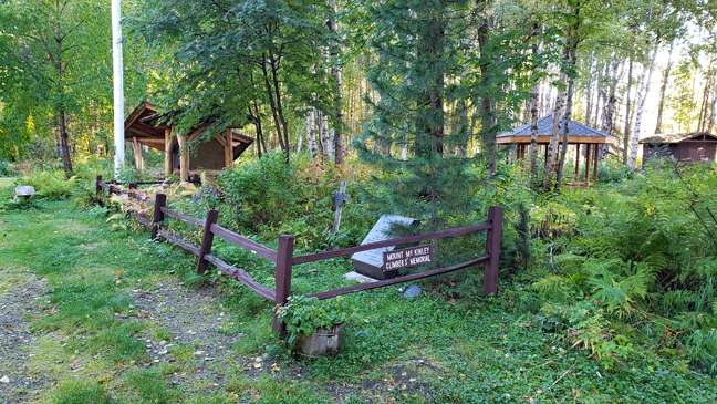
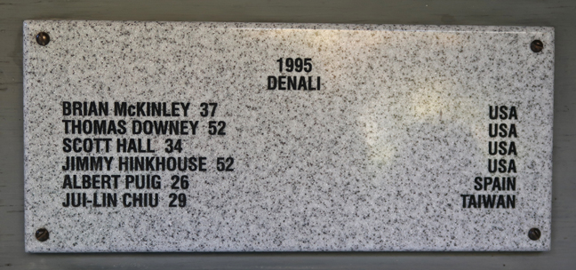
We stopped by the Mount McKinley Cemetery to see the memorials to several climbers who died on the mountain. I took a photo of the names of the six climbers who died in 1995, the year I attempted to climb the mountain.


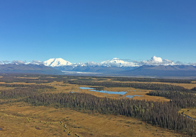
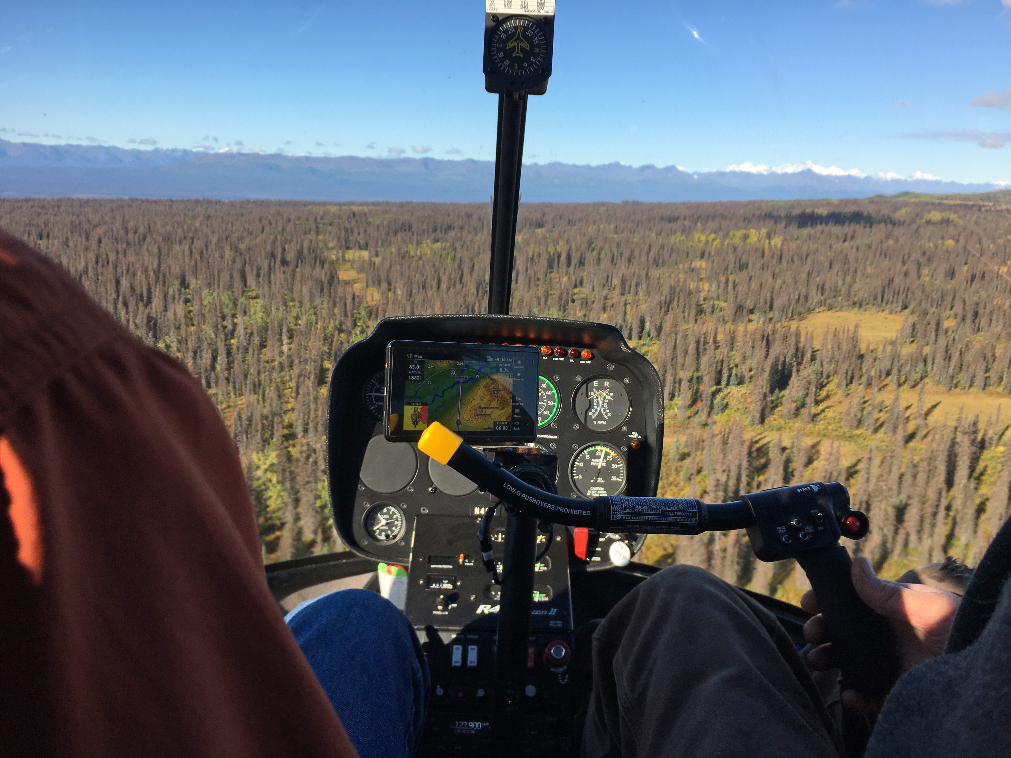
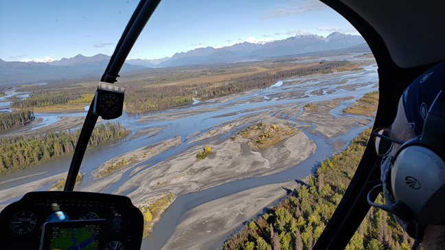
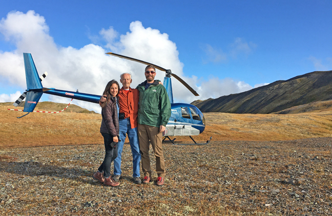
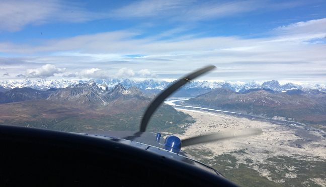
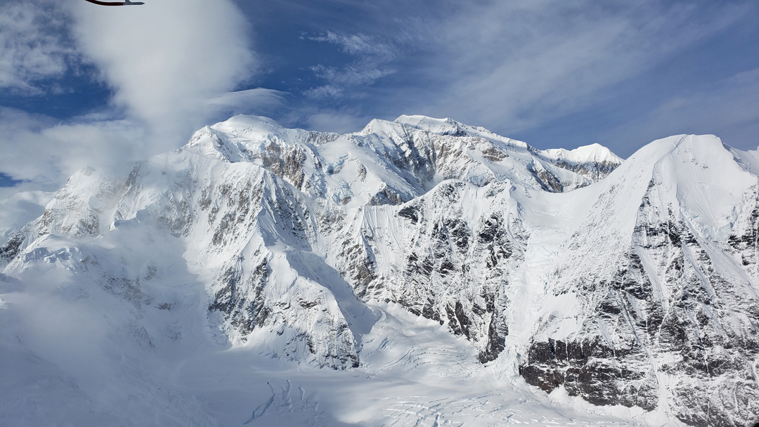
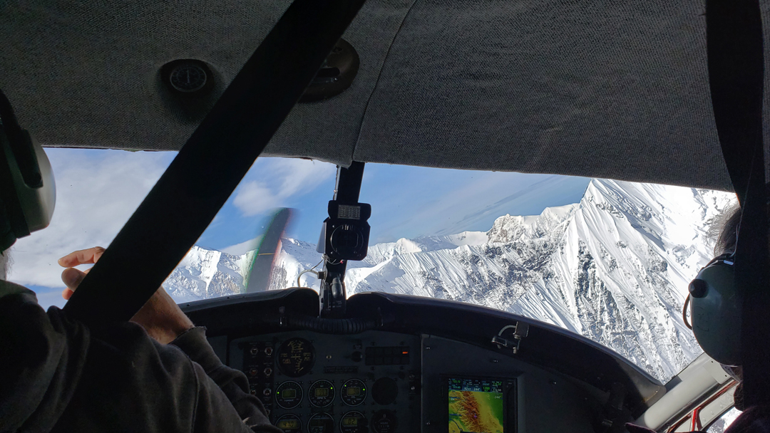
We met our helicopter pilot Danielle at the Talkeetna Air office and received instructions for our flight to Denali N PRES – Take-off view of Mount Foraker and Denali

Kahiltna River

Dutch Hills
The Heli was a spiffy blue color with an outstanding wrap around window for excellent vision.
Kahiltna Glacier
Peter and Kate Selfie

It took about a half hour to fly west to the N PRES
West and East Forks of the Yentna River
Mount Kiskon 3,943ft

We landed on a ridge just below the top of Mt. Kinston at a spot called 3270 for its altitude.

On the way there, we saw swans, eagles, and three bears (Papa, Mama, and Baby – just kidding). Kate took this picture of a black bear.
After an amazingly smooth landing, we moved about the ridge taking photos

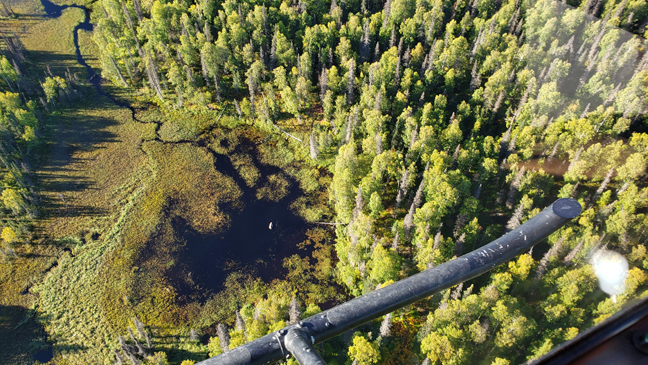
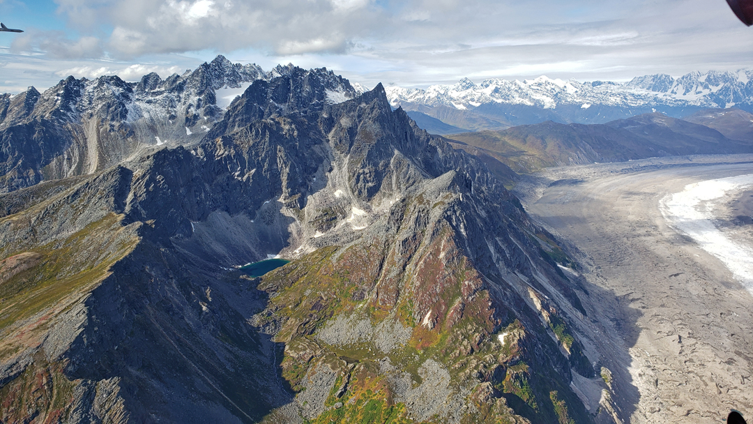
After leaving the ridge, we flew north up the East Fork of the Yentna River. The Yentna Glacier is in the center of this photo –
Glacial moraine and toe of the Dahl Glacier – we have great photos as well as videos of our entire trip


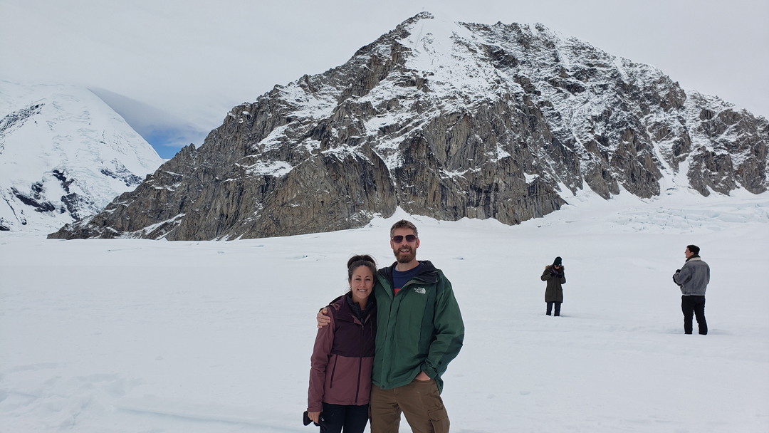
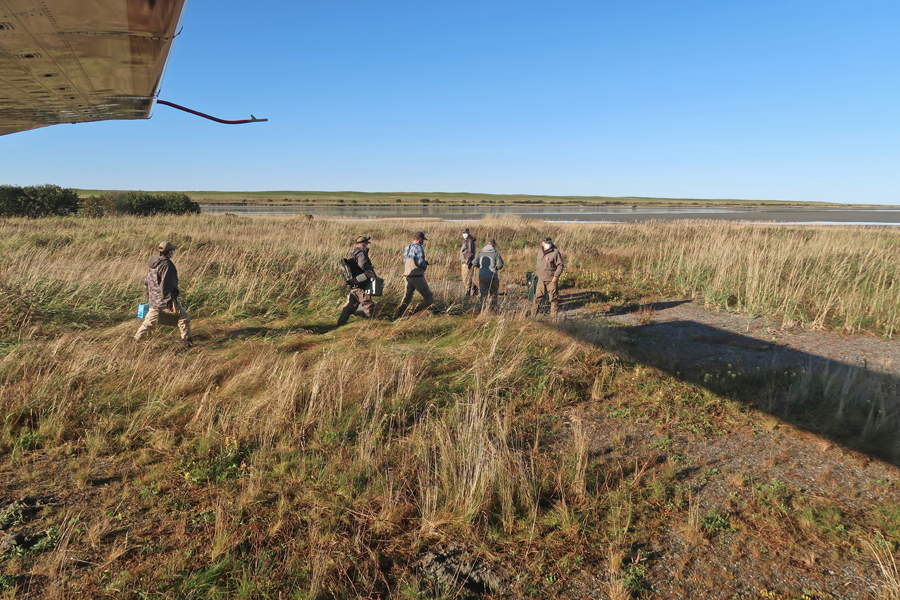
Out next stop was a gravel bar on the East Fork of the Yentna River just north of where it joins the West Fork.
The helicopter was not permitted to land in the N PRES. So, from here we did a short walk into the N PRES for some photos. This was my #413 National Park Unit.
On the way to and on the return from the N PRES, we had great views of Denali, Mt Foraker, and many other peaks in Denali National Park to the north. On the way out of Talkeetna, we stopped at the Denali Brewing Company for a cold one –

An hour down the road, we did a two-mile hike to Thunderbird Falls in Eklutna

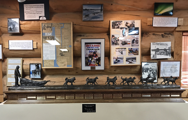
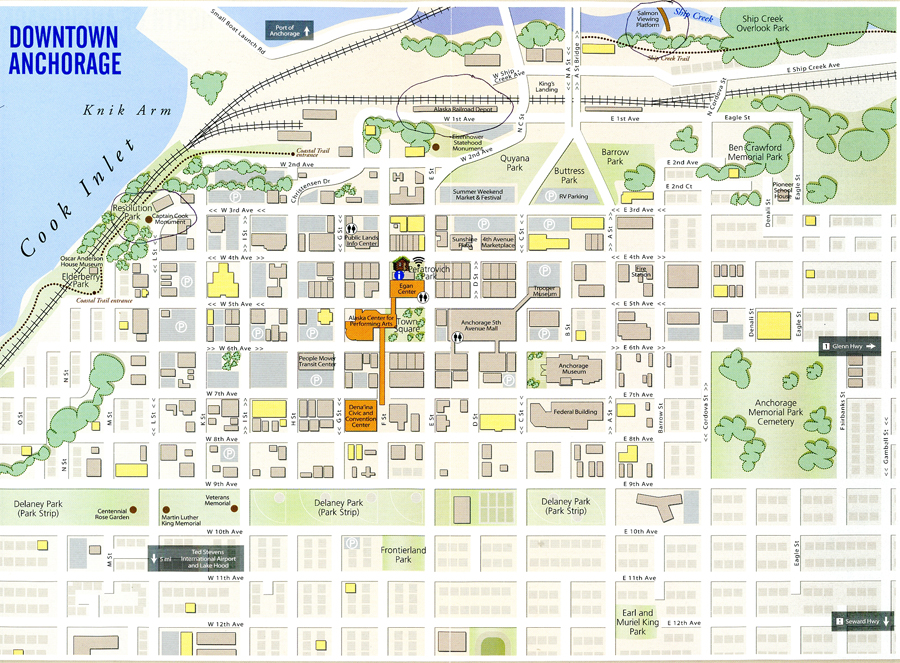
We then drove to Wasilla, Sarah Palin’s hometown. Remember, she said she could see Russia from her back door, check out the map. The Iditarod Trail Museum is located there.


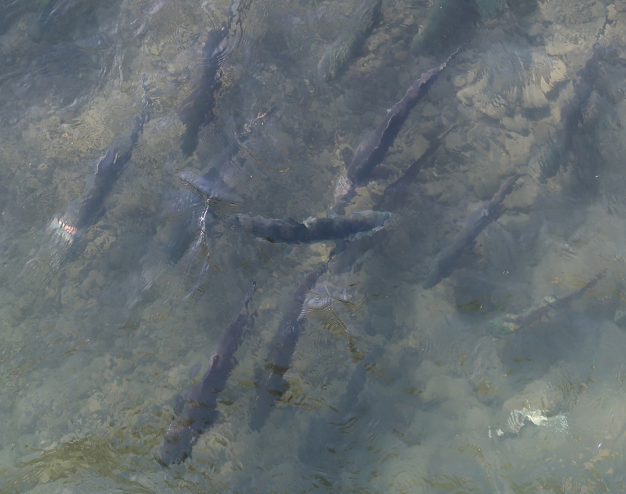
As we approached the Salmon Viewing Platform on Ship Creek in Anchorage, we saw a Mama bear and her three cubs cross the road in front of us.

There were many salmon in the creek preparing to swim up the “fish ladder” to their spawning spots.
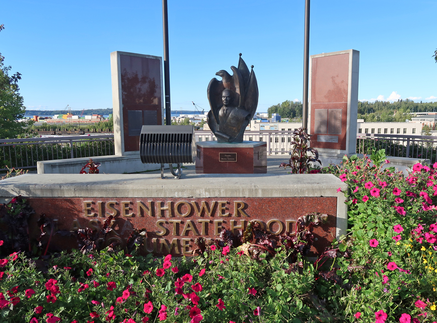
I was driving, so, Peter and Kate had no choice but to go along with me to several Anchorage sites. The first was the Eisenhower Statehood Monument
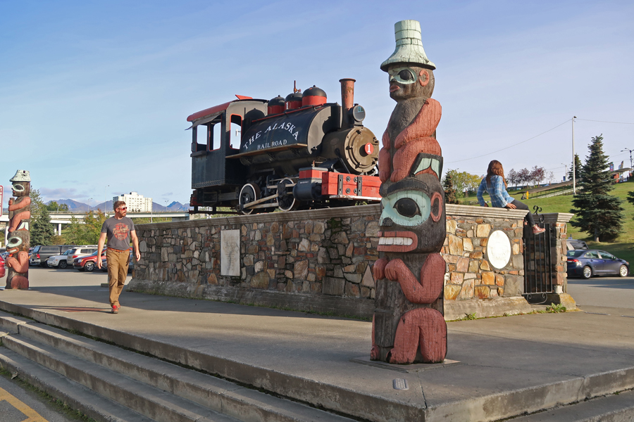
Then the old Alaskan RR Engine at the Railroad Terminal
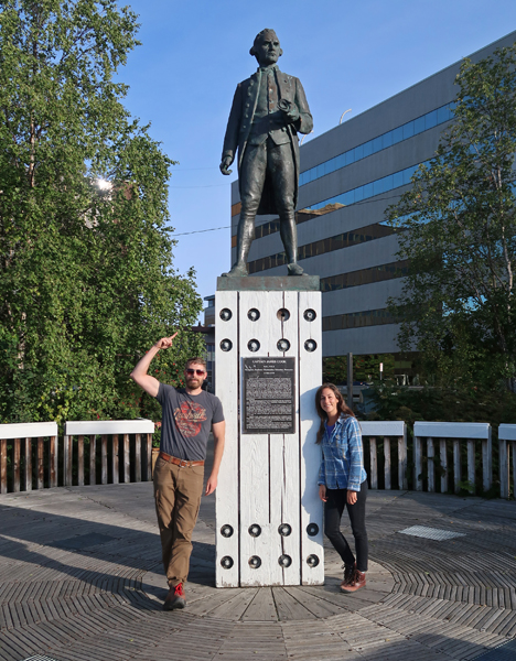
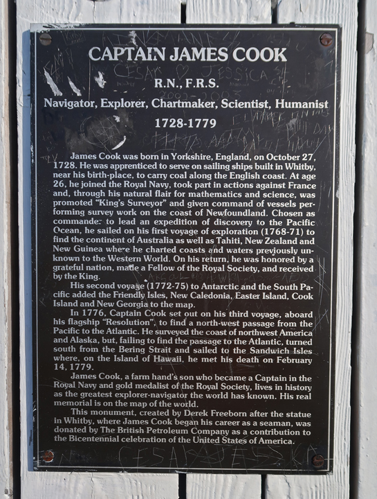
Then the Captain Cook Monument in Resolution Park
Then Earthquake Park on the Kirk Arm of the Cook Inlet. In 1964, the largest earthquake to hit North America this century struck this area. The 9.2 quake produced a 40-foot tidal wave that destroyed Seward, hit CA, and did not stop until it crashed into Antarctica.

9/6 Sun – It took an hour to drive back north to Reflection Lake, but it was not as impressive as it was yesterday in the fog. While there I decided that, instead of a glacier walk on the Manatuska Glacier, Peter and Kate should do the Talkeetna Air flightseeing experience, including landing on the Kahiltna Glacier of Denali. I felt they should not pass up the beautiful day we were having. Most days of the years it is not even possible to see Denali! We made the reservation and then continued driving to Talkeetna.

After checking in for the flight, I called Chris, the Denali NP Ranger I had been communicating with, and he agreed to meet me at the closed Visitor Center to pass on a park brochure.

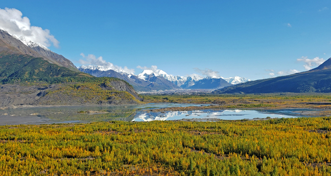
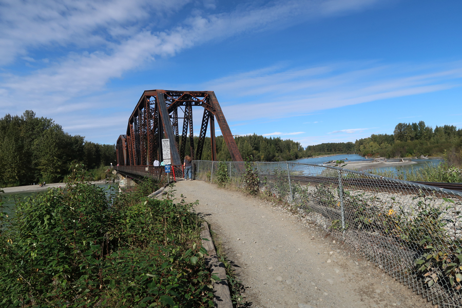
We then did a short walk across the old Alaskan RR bridge and then on a gravel/sand bar to where three rivers come together – the Chulitna, Susitna and Talkeetna Rivers.
A scenic spot where we had a clear view of the rivers, Mount Foraker, and Denali

Kate then treated us to burgers at “Shirley’s World-Famous Burger Barn.”

The next task was for Peter and Kate to weigh in and pick out their boots for the glacier landing.

They did the “Mountain Voyager” tour, with Kate getting to sit in the co-pilot seat.

They had a fantastic flight and took a lot of outstanding photos and videos. The following are just a sample –


By the time they took off from the Kahiltna Glacier, Denali was being covered in clouds


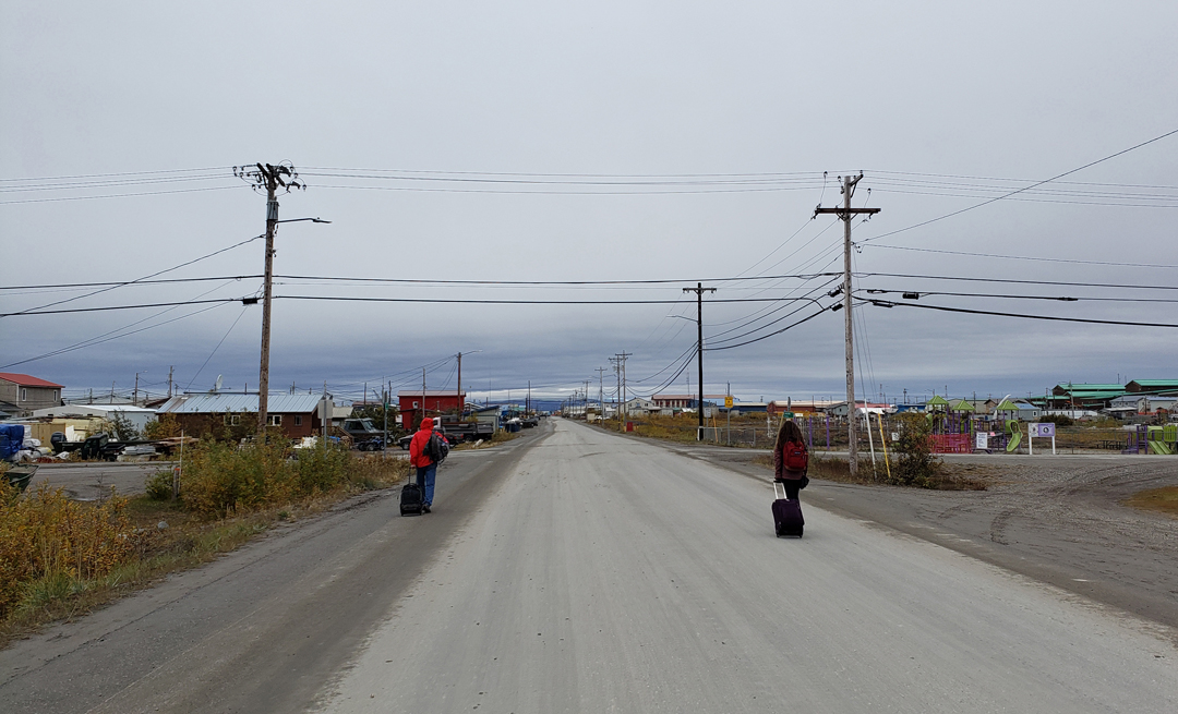
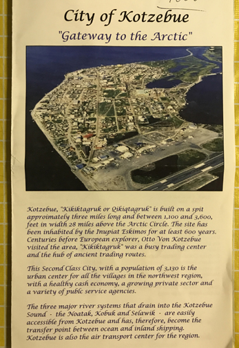
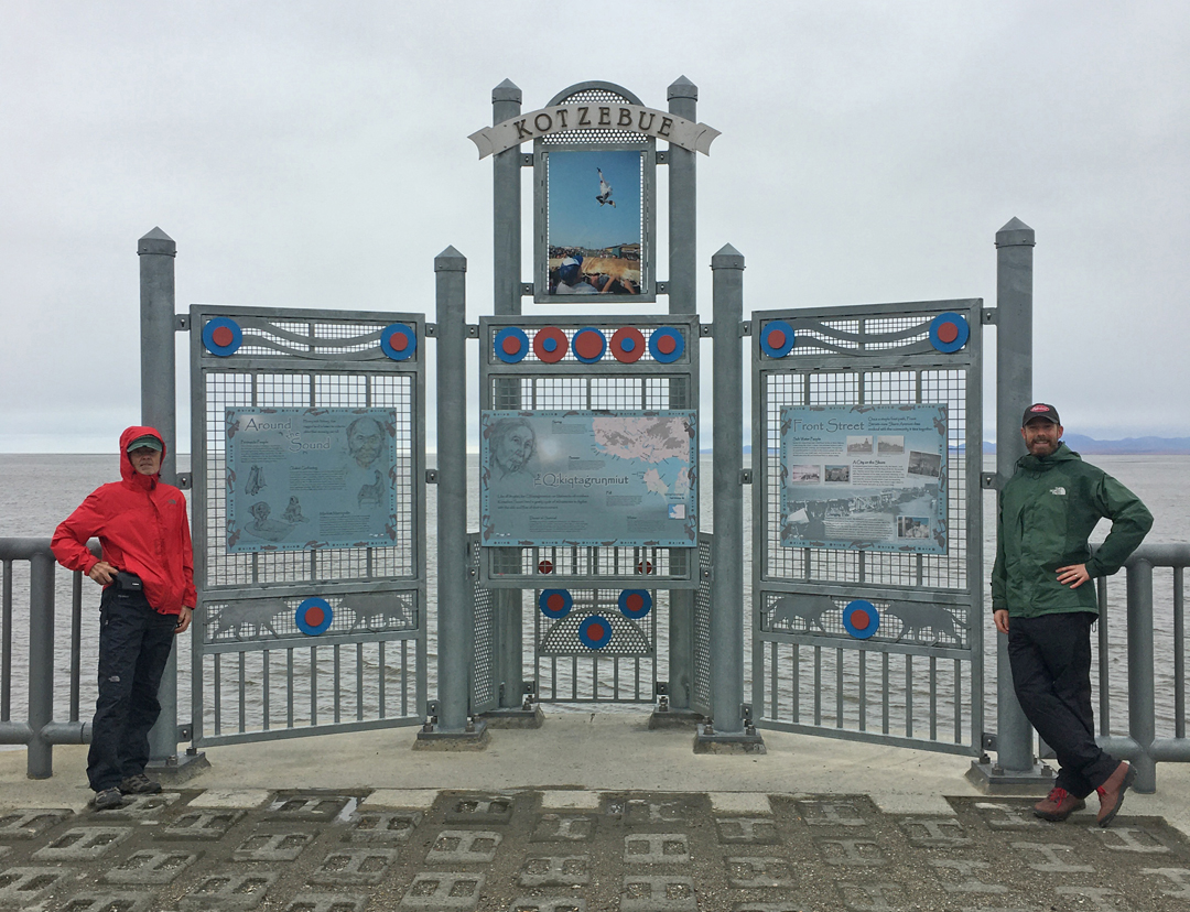
9/7/20 M – Our Alaska Air flight left Anchorage at 10:30am and arrived Kotzebue (above the Arctic circle) at noon. We filled-out our COVID paperwork at the airport and then walked 0.5 mile, pulling our suitcases, to Sue’s B & B, now only a B.

We then walked along Kotzebue Sound – population about 3,200\
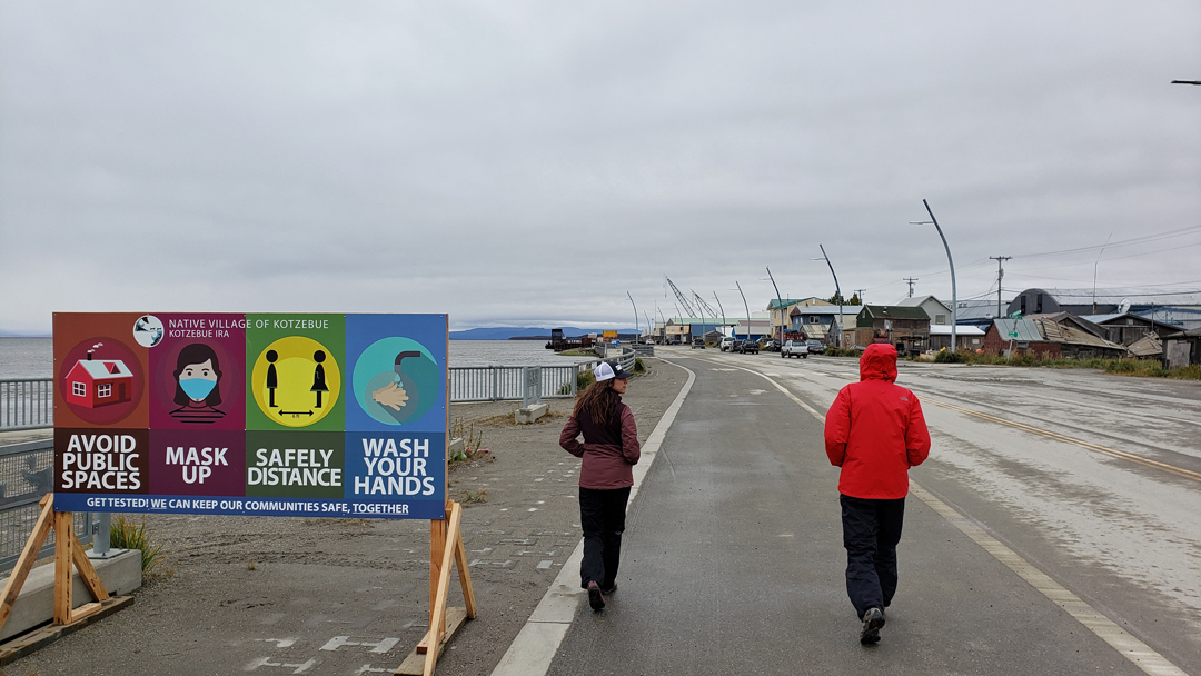
They are taking the pandemic seriously here. Also, no alcohol sold in this native settlement because of the lack of tolerance and abuse by indigenous peoples.
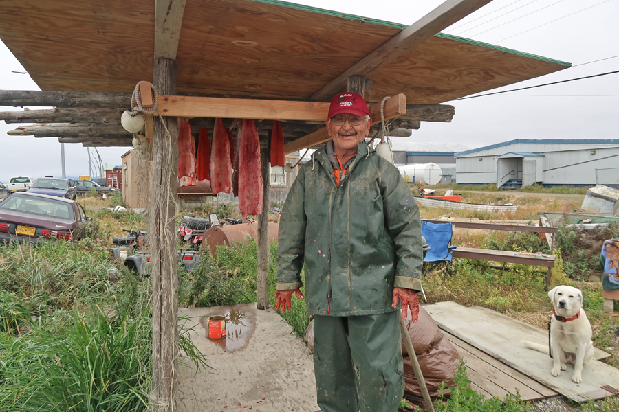
We passed a man who was drying “she fish.” He said that white folks did not like this fish because it had too many bones!
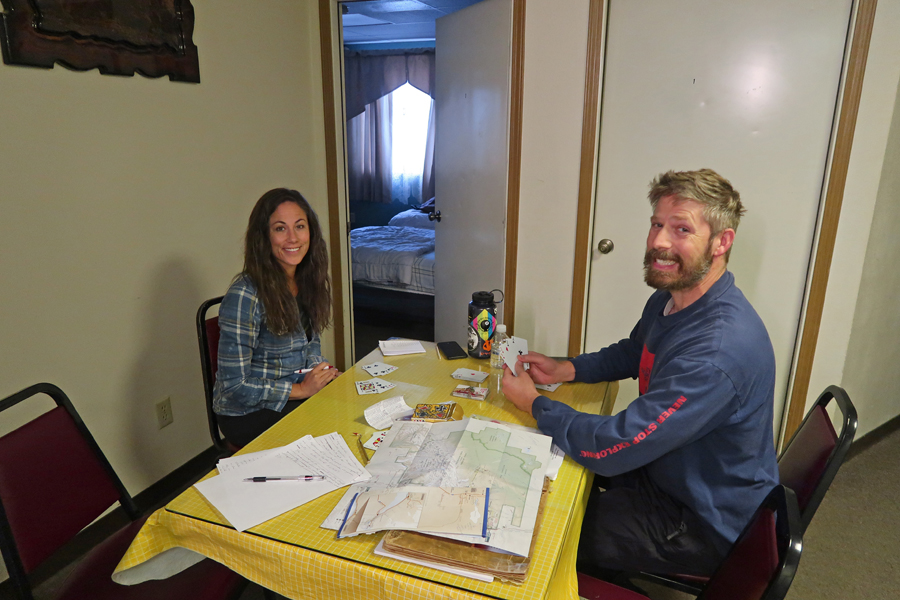
We played a lot of games during our time together, especially at night and when it was raining
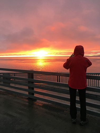
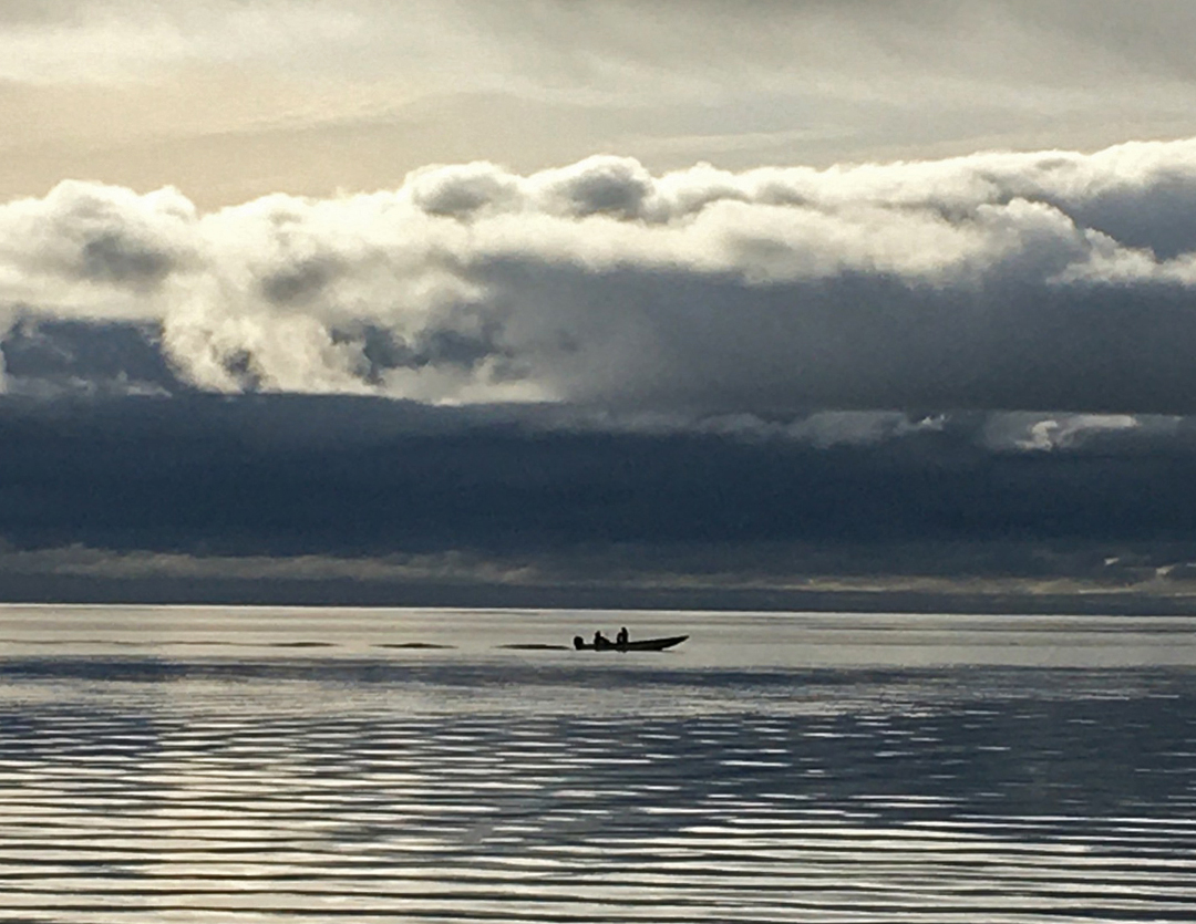
It was raining at 9:30pm when I noticed a glow outside. We rushed to Kotzebue Sound to see a beautiful sunset.
Peter and Kate were excited when seals “popped up” to say Hi. Sue brought us heaters for our rooms, and we settle into bed about 11pm.
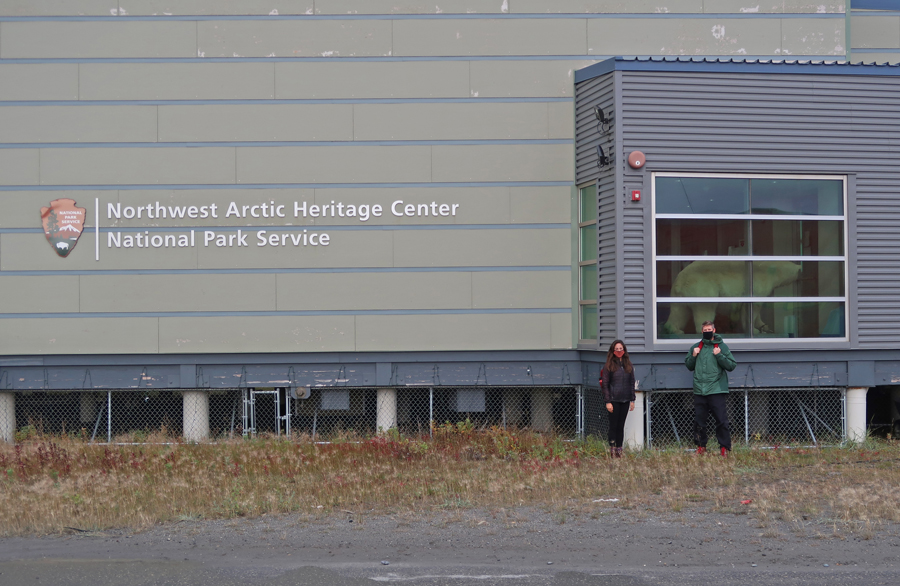
9/8/20 Tu – I was up and out at 5am in hopes of seeing the Aurora Borealis. It was clear and cold with a half moon, but no Northern Lights. Light was coming through clouds to the East as I returned to the room. We waited all morning for a text from Jared of Golden Eagle Outfitters Inc. Air Taxi – “Trust Us with Your Life, Not Your Daughter or Wife.” I had arranged for him to fly us into Gates of the Arctic and Noatak National Preserves. We passed the time by playing Farkle, Aces to Kings, and snacking. I decided to call Deanna, a NP Ranger, and meet her at the Western Arctic Heritage Center. She gave us stamped brochures for the parks but was not allowed to let us in the Visitor Center.
We continued across the street so I could talk to Jared about our scheduled flight into Gates of the Arctic N PRES and the Noatak N PRES. He said the weather was not good for the flight to The Gates, so I suggested we do the short flight to the Noatak N PRES today, and try to do The Gates tomorrow. After all of my communication (e.g. emails, phone calls), I was disappointed in Jared’s seeming lack of concern and communication related to my attempt to get into these two national preserves.

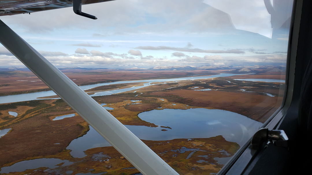
Jason was the pilot of our Cessna for the 25min flight from Kotzebue to a gravel landing strip along the Agashashak River in Noatak N PRES – Leaving Kotzebue

Noatak River emptying into Kotzebue Sound – then Chukchi Sea – then Arctic Ocean
![]()
Following the Noatak River north
Turning east and following the Agashashok River into Noatak N PRES. We saw three muskoxen resting on a ridge.


Landing in preserve, it was overcast with a temperature of 46 degrees


We explored the immediate area, taking photos, and chatting
Ready for take-off on short gravel strip. This was Peter’s and Kate’s first flight in a “Fat Tire Plane” – able to make landings and take-offs in a few hundred feet.
Agashashok River emptying into Noatak River


Looking across Cape Krusenstern National Monument to the Arctic Ocean

Approaching Kotzebue – note its position at the tip of the Baldwin Peninsula

After returning to our room, we played games, and then went back to the Bayside Inn for dinner. We walked by a stand where an EPA observer was stationed to count whales and other animals in the Sound. She said it was in relation to some heavy construction that was being done in the village.
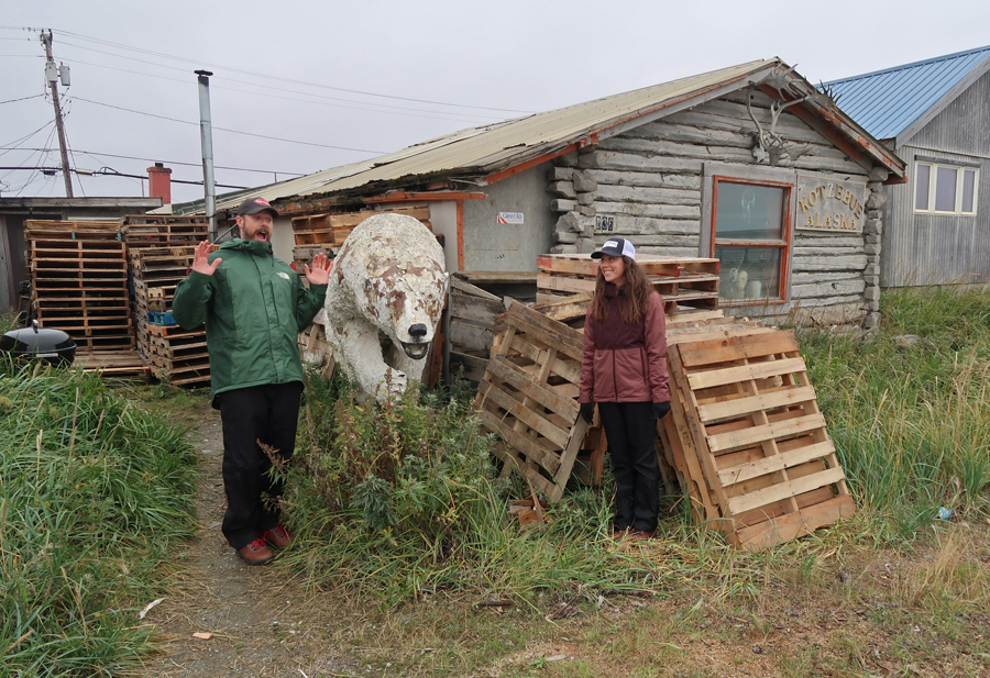
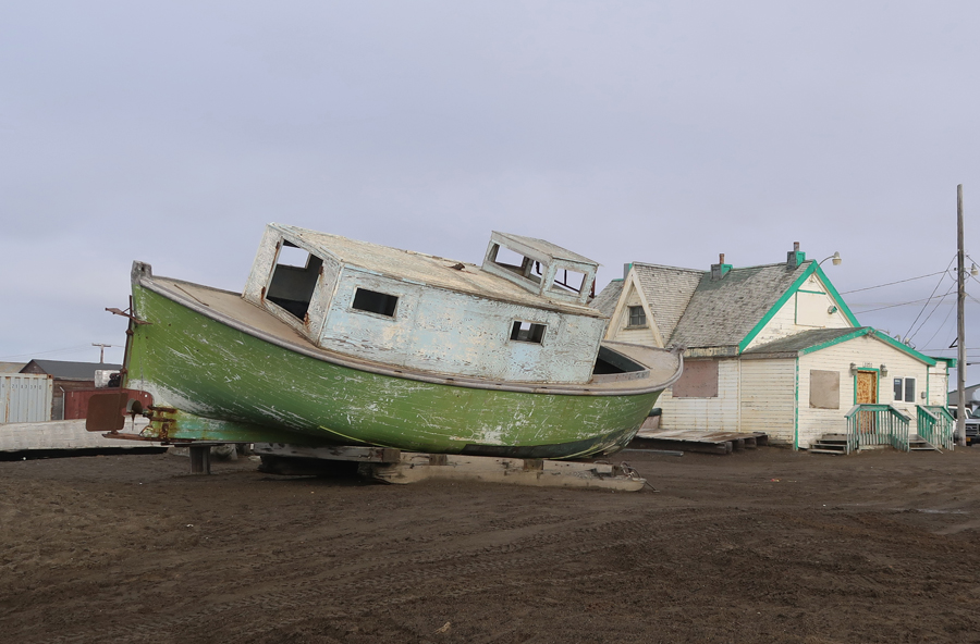
We then explored another part of the village


We packed and “hoped for” a trip to The Gates the next morning.
9/9/20 W – Peter arrived at 7am with coffee. His face was red. He said he could not hear us because the blustery winds had temporarily affected his hearing. He said the north wind was crashing waves over the road at the Sound. Jared texted at 7:45am stating that the weather would not permit a flight to The Gates today. I checked the weather for the next day, which was another backup day, but it looked even worse.
We played games while considering what to do. By mid-morning, it had cleared somewhat, but the wind was still ripping through Kotzebue. We packed and walked the half mile to the airport. Our pant bottoms, boots, and the bottoms of our suitcases were caked in mud by the time we got there. Stopped by this sign for a photo –

I again asked if there was any possibility of flying to The Gates today – no, was the answer. Jared gave me the name and number for the Bettles Lodge on the east side of Gates of the Arctic N PRES and said it would be easier to access the preserve from that location with a float plane. His “fat tire plane” required a low water level in the Kobuk River to land on a gravel bar next to the river in the preserve. I had checked Brooks Aviation, which flies out of Bettles when I was planning my trip, but it was closed because of the pandemic. I did not know that the Bettles Lodge, had a float plane option and was open.
I changed the reservations for Peter and I so we could fly back to Anchorage today with Kate instead of tomorrow. It was a short walk to the Alaska Air terminal, and we were in the air to Anchorage at 1pm. Arrived ANC at 2:15pm. I was in and out of the Anchorage airport five times during this trip!


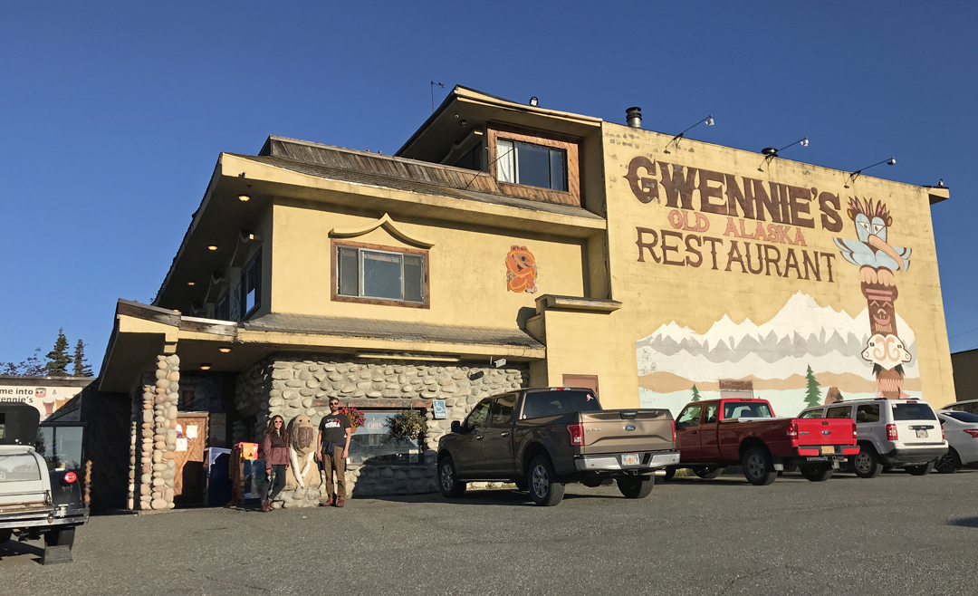
I rented a car and we drove to our hotel. I searched the internet for two hours gathering information on how I might get to Bettles and into the The Gates before I left Alaska. I contacted Bettles Lodge, and the young woman said it was not possible to make arrangements to get to The Gates. I asked her to have the owner contact me the next day.
We walked to Gweenie’s Old Alaska Restaurant for dinner – which way to go?
On the way back, we stopped to watch float planes land on Lake Spenard.

When back at the room, we convinced Kate to stay another day, so she could go to Kenai Fjords NP with us tomorrow.
9/10/20 Th – After a continental breakfast in our room, due to the pandemic, we were off to Kenai Fjords National Park and Seward.

It was another beautiful day reaching the high fifties. Did a few scenery stops on the way down – Bird Point on Turnagain Arm

Tom and Helen
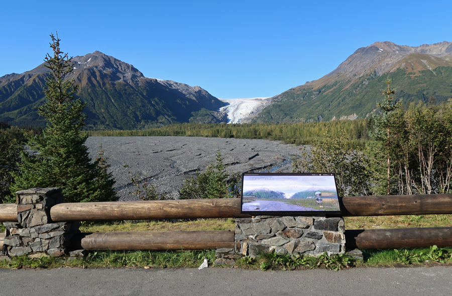
Arrived at the outwash of the Resurrection River at 11am
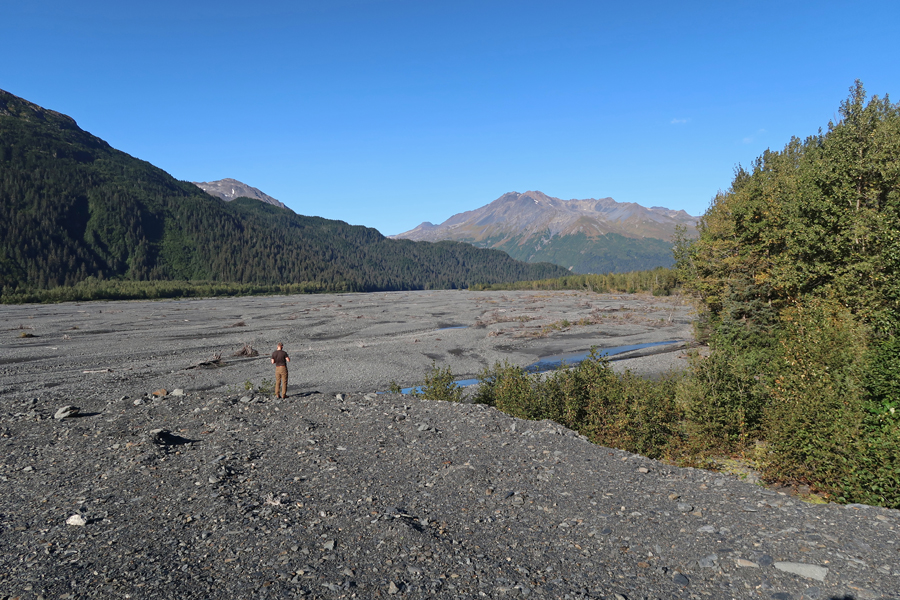
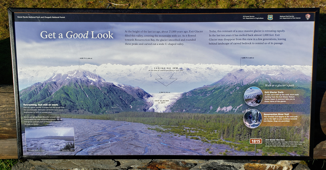
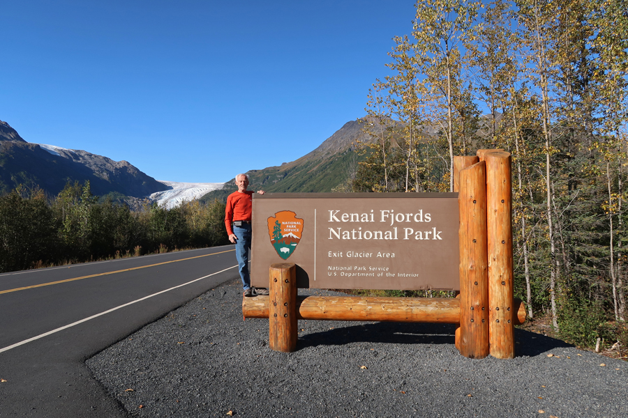
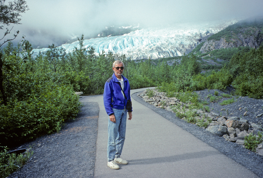
First view of Exit Glacier in Kenai Fjords National Park

Entrance
Start of trail – we did the Nature Trail and the Lower and Upper Exit Glacier Loop Trails

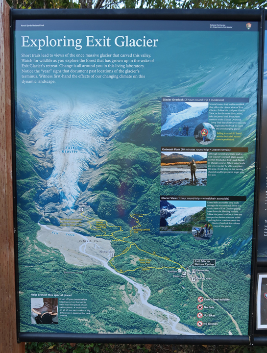
View from Nature Trail
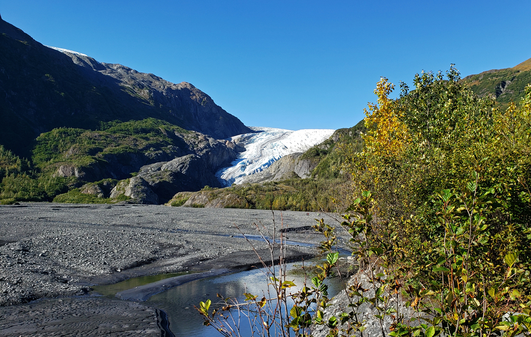
Lower Exit Glacier Overlook

Trail to Upper Glacier Overlook

Upper Exit Glacier Overlook


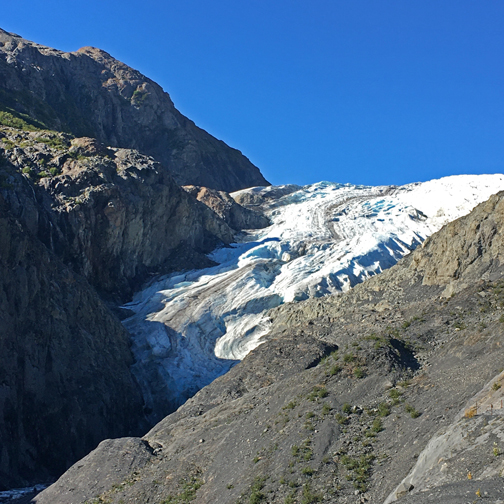
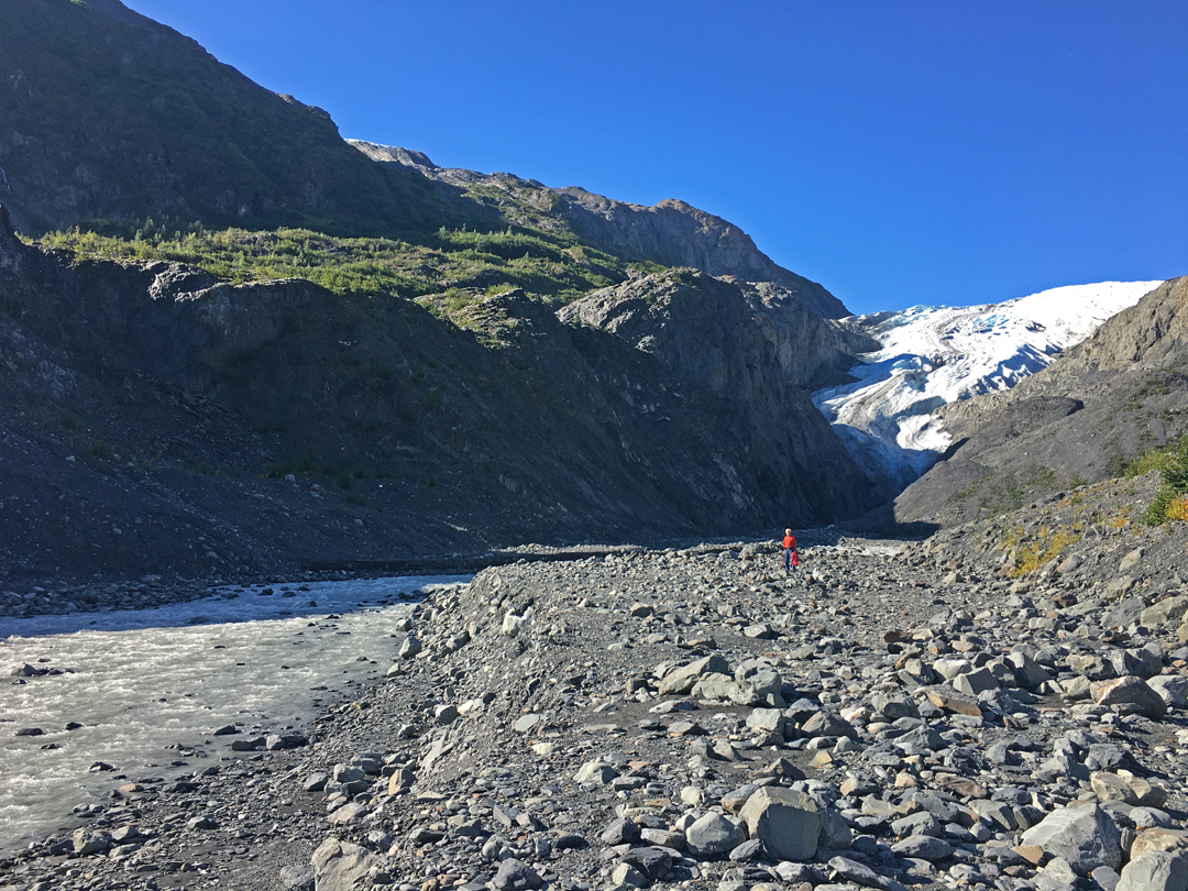
I had originally planned on also hiking the Harding Ice Field Trail but instead decided to hike up the Wash Trail as far as we could go toward the toe of Exit Glacier.
I had done that in 1995 and was able to walk on the glacier!

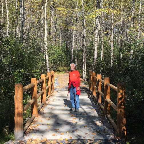
Now, twenty-five years later, the glacier had receded so far up the canyon, that it was too dangerous to approach. I had to use my hiking stick for the first time to help with my balance when walking over the boulders and climbing on the rocks.

Kate and I got as close as we could and I took a great video of her, hair blowing in the wind, with the canyon, glacier, and roaring glacial stream in the background. In total, we hiked about five miles.
You Tube video of Kate – “Beauty at Exit Glacier – Alaska” https://youtu.be/2yD8UMe5ud0

We drove to Seward and took some photos at the Mariners Memorial on Resurrection Bay

The National Park Information Center was closed because of the pandemic

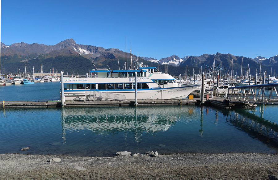
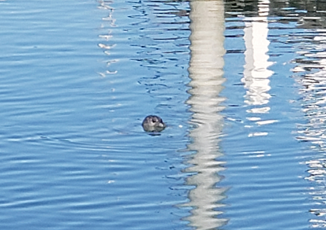
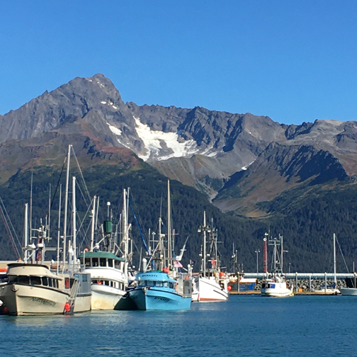
Went to Ray’s Seafood Restaurant for a late lunch/dinner. We had a window table with a great view of Resurrection Bay, the marina, the mountains, and seals popping up in the harbor.

It was a beautiful and laidback drive to Anchorage, everyone was tired. We got in about 6pm, made phone calls, posted photos, and got re-organized. Peter left at 8pm for his red eye flight back to Indy.
9/11/20 F – Kate was up at 3:30am for her flight back to LA. We said goodbye in the lobby, and I went back to bed for a couple of hours and then prepared for my Alaska Air flight to Barrow.
There was clear weather for the first half of the flight. I took a good 5.5min video as we flew over Denali (20,320ft) at an altitude of 40,000 feet. When we landed in Barrow (Utqiagvik), it was 35 degrees, wind 15-20mph, with light snow. This is a view of Point Barrow (northern most point in the U.S.) and the Arctic Ocean.

I was in the U.S. but a LONG way from home –

After COVID screening, my first task was to walk a block to the Wiley Post – Will Rogers Memorial. They died when their experimental seaplane crashed 16 miles short of Barrow. Wiley Post was a well-known early aviation pioneer and Will Rogers, a Cherokee from Oklahoma, was a famous actor, vaudevillian, cowboy, columnist, humorist, and radio personality. As I was setting up my tiny tripod on my suitcase, an Inupiat boy came by with his two friends on bikes and asked if I wanted him to take my picture. I said sure; afterward, I gave him an unexpected tip.


Some friends of his then showed up on an ATV. The female driver asked if I wanted to see a “wheelie.” I again said yes, and she proceeded to do one while laughing and heading down the gravel street.

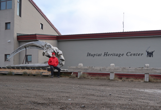
I then walked 1.5 miles carrying my backpack and pulling my suitcase on the wet, gravel and mud roads to Iliasagvik Community College where the Inupiat Heritage Center, an Affiliated National Park Unit, is located. I wore two layers on my legs, three layers on my upper body, my Gore-Tex jacket, a fleece hat under the hood of the jacket – and I was still cold because of the stiff wind coming off the Arctic Ocean. I took some photos of myself and then proceeded another half mile to the Latitude 71 B & B. Nice room but no breakfast, because the owners had left that afternoon on the plane that I arrived on – for a vacation in warmer weather!
I settled in, warmed-up, and then walked to the Arctic Ocean
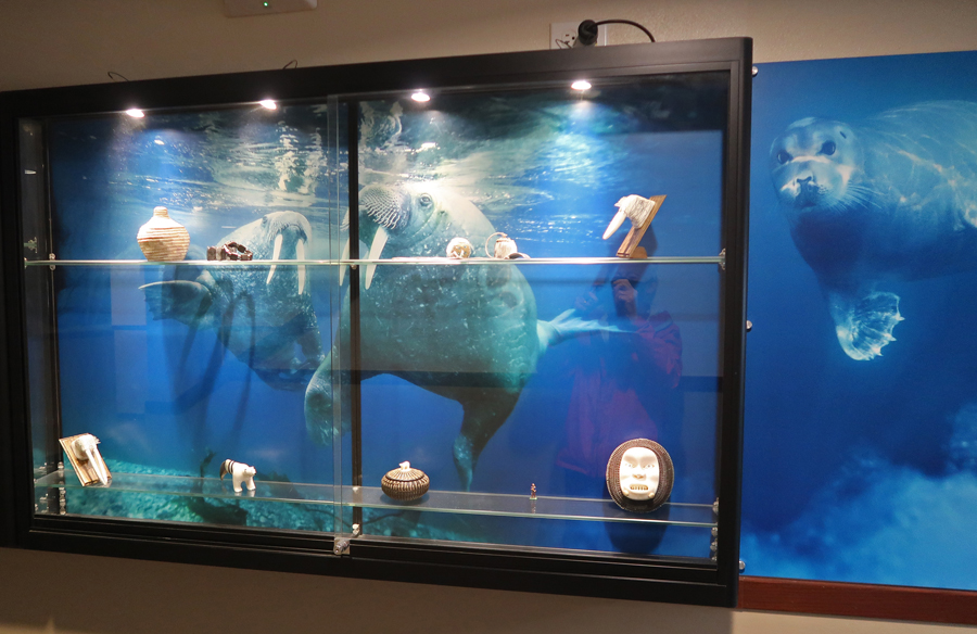
It was a half mile to the Niggivikput Hotel, also known as the “Top of the World Hotel.” They have some nice displays in their lobby.


A popular native craft is painting scenes on the baleen of whales caught off Point Barrow

Behind the hotel, on the Arctic Ocean, are a couple of old boats and whale bones, they made a nice backdrop for some photos.

I ordered the Reindeer Scrambler at their, one customer at a time take-out restaurant (because of the pandemic), and took it back to the Latitude 71 – it was delicious AND I had enough leftovers for breakfast the next morning! That night, I set my phone alarm every two hours and got up to look for the Northern Lights – no luck, just tired in the morning!
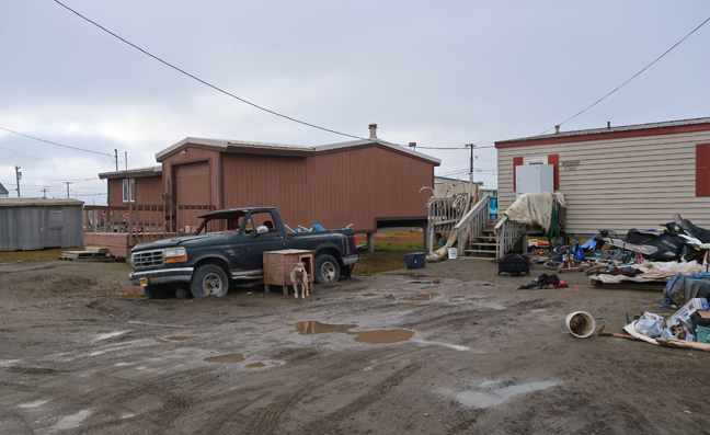
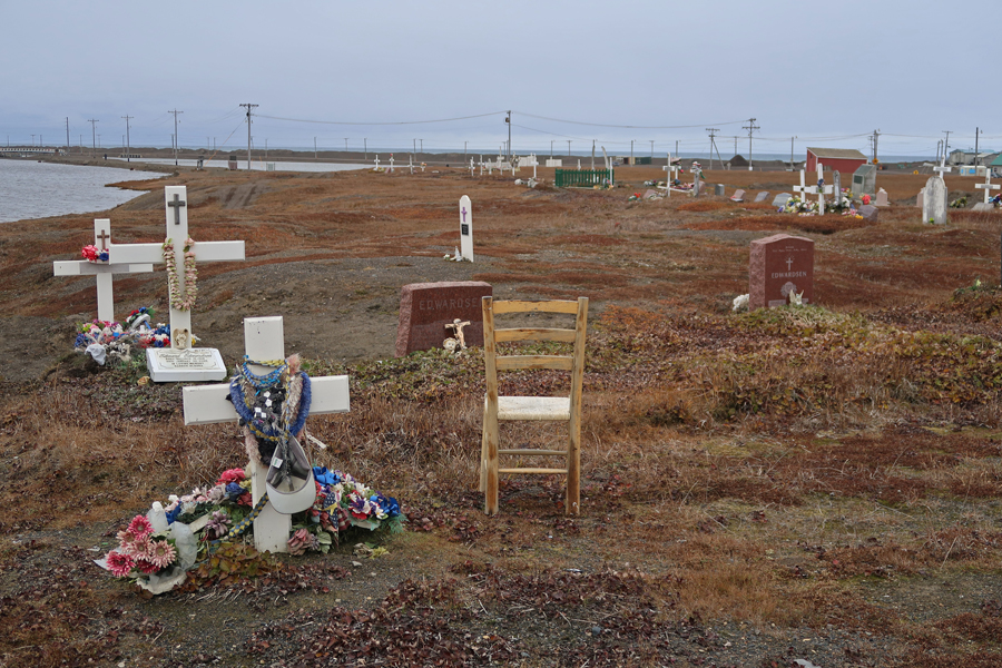
9/12/20 Sat– I got myself organized in the morning and started walking through the village at 11:30am. I stopped at the local cemetery for some photos and then started walking toward the airport.
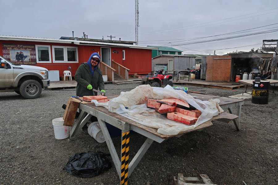
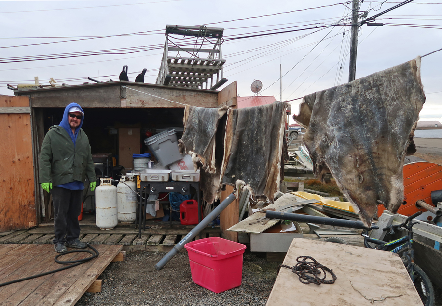
I came across Captain Frederick Brower cutting up his portion of a recently caught whale.
As a result of this encounter, I wrote the following article and submitted it to the Ideas and Voices column of the Springfield News-Sun for Columbus Day, which is now also identified as Indigenous Peoples’ Day.
Global Warming Impact on Indigenous People
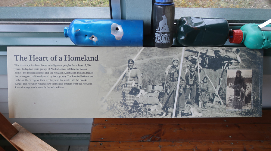
Indigenous Peoples’ Day, October 12, 2020. There are many indigenous people (Native Americans) in the U.S. This article focuses on the Inupiat who live in Utqiagvik (Barrow) Alaska, population ~4,000, on the Arctic Ocean. The Inupiat are part of the Inuit Ethnic Group. In 2016, residents voted to change the name of their village (city) from Barrow back to the Inupiat name Utqiagvik. This was one part of a local effort at “decolonization.” The Inupiat Heritage Center is located here and is an Affiliated National Park Unit.
While walking through the Browerville part of Utqiagvik, I met Frederick Brower, a native whaling captain. His family have been leaders in this community for generations. He was processing his allotted parts of a whale he and his crew had caught a few days earlier off Point Barrow, the northernmost point of the U.S. He was preparing the meat and making oil from the fat. In addition, he had a stack of other whale parts, such as bones and baleen, that he was giving to native artists for their various crafts. He explained that the crew and community also shared in the catch with all receiving portions of the whale. Further, he said he could have pursued another whale but rather it was the custom to help other whalers after an individual catch was made.

Making whale oil, notice the seal skins –
We discussed climate change, the resultant loss of ice in the Arctic Ocean, sea level rise, and the melting of the permafrost causing structures to fail in this area. Global Warming is seriously affecting the wildlife of this area (e.g. caribou, seals, walrus, polar bears, birds, etc.), as well as the Inupiat and their way of life. At the current and projected increasing rate of deterioration, the community may have to relocate by the end of the century. The native community has lived here for thousands of years. They have attempted to slow the erosion by placing large blocks of tundra wrapped in plastic on shore, but waves continuously wash them out to sea.
Global Warming is REAL; it not only affects our indigenous people; it directly or indirectly affects all of us. The big take away is that we need to recognize what is happening. The next step is to work at solutions to the problem. One piece of the solution is to protect what remains of our natural environment, including its indigenous people. In that regard, we must oppose the destructive policies that are championed by the fossil fuel industry, mining companies, and the lumber industry. Through lobbying and political contributions, they have excessive influence on our government laws, rules, and regulations. History has demonstrated that, because of a maximum profit philosophy, these industries have been unable to act in a socially conscious way. Their greed has too often resulted in destruction of the environment. We need to demand that our government representatives support protection and preservation of our incredible natural resources. We also need to play our part in this battle. It is not only necessary for the preservation of the world as we know it but also for our own personal health and that of future generations.
In the end, it is quite simple; do you support greed and destruction of the natural world OR community values and a healthy environment for everyone, like the indigenous Inupiat?
After our conversation, I started walking to the airport. Several locals stopped and asked if I wanted a ride, but I declined, saying that I needed the exercise. At the airport, not only were my backpack and suitcase pulled aside for internal inspection, I was also randomly selected for a “pat-down.” Our 737 had to be de-iced before we were able to leave for Anchorage.
After landing, I got settled in the Comfort Suites for the fourth time and then walked to Wendy’s for a carryout burger meal deal. On the way back, I stopped at Lake Spenard, as the sun was setting in the SW, to watch float planes landing. Lake Hood/Lake Spenard (they are connected) Seaplane Base is the busiest one in the world; it handles over 700 take-offs and landings a day.
I now had computer access and phone service at the hotel. I again contacted the Bettles Lodge and checked weather forecasts for the middle of the week to see if it was possible to get into Gates of the Arctic N PRES before I left Alaska. After determining that the probability was greater than fifty percent, it took me 3hrs to change seven reservations and make three new ones in an attempt to check off my next NP Unit. The airlines were the worst, long phone wait times, and increased fares for all flights!
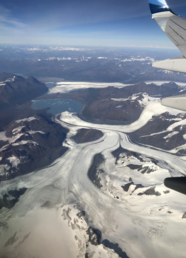
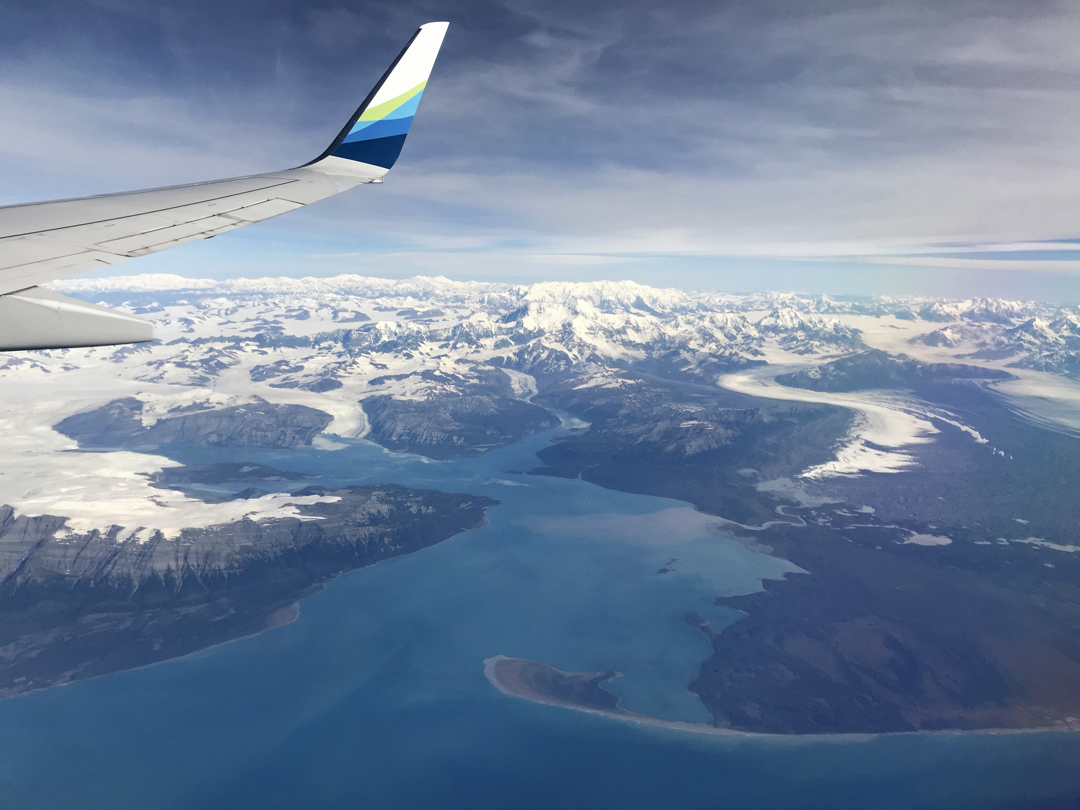
9/13/20 Sun – I was up at 6am to continue my trip planning and diary. I left for the airport at noon and my flight to Yakutat took off at 3:15pm. It was another good weather day and I had terrific views east from the plane as we flew south along the Alaska coastline.
Landing in Cordova

Flight from Cordova to Yakutat – Scott Glacier
Copper River Delta on right –

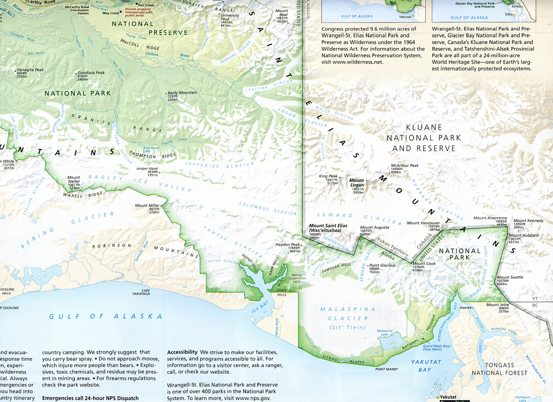
See Yakutat on bottom righthand side of this map –
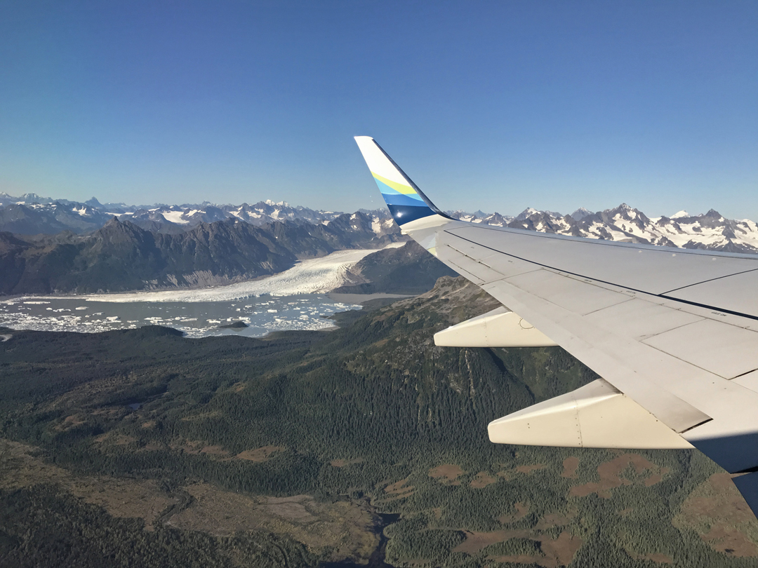
Landing in Yakutat, note airstrip. Mount Saint Elias (18,008ft) and Mount Logan (19,551ft), highpoint of Canada, can be seen in background.

I arrived at 5:43pm, checked into the Yakutat Lodge at the airport, and then went to the Yakutat Coastal Airlines office next door. Tanya, wearing her mask, came out to meet me – no one allowed in the office because of the pandemic. She stated I would have to come back the next morning at 10am and they would fit me in among the flights to take fishermen to area fishing camps. The salmon were running and there were lots of fishermen there.
I then took a short walk to the NPS office. It was closed but I was able to pick up park brochures/information from an outside rack.

Next, a Mongolian Beef and Broccoli over Rice dinner special and an Alaska Brewery White beer at the Yakutat Lodge Restaurant.

While there, Tanya showed up and told me I could go out at 8am the next morning. I said that was great because it would allow me to move-up my reservation back to Anchorage by one day. I spent the next two hours changing all (nine) of my remaining reservations.
I retired to my cabin across the road to find that the heat was off, I could not drink the water, the coffee maker did not work, and the alarm clock was broken. Fortunately, I was able to get them to turn on the heat!
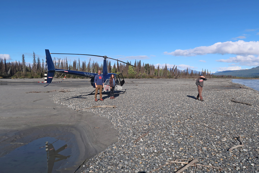
9/14/20 M – I was up early, ate my suitcase food, and was at the Air Taxi across the road, where there were eight fishermen ready to go, at 7:45am. At 8am, Tanya said I would have to wait for the next group at 8:30. At 8:30, she said I would have to wait for the group at 9am. I was now worried I might not be able to make my new reservation – 11:45am flight back to Anchorage. At 9am, she informed me that I would be with the last group at 9:30! I immediately checked in for my ANC flight, to maximize the time I would have after returning from the Glacier Bay National Preserve to catch the Air Alaska plane.

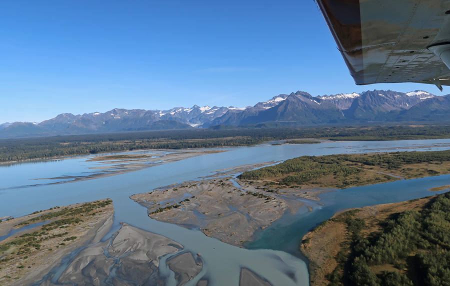
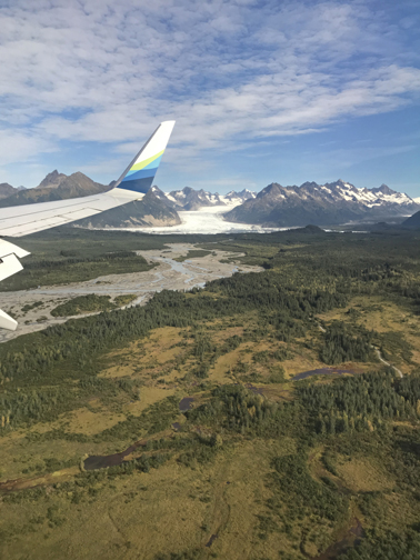
We did leave at 9:30am and flew SE past Yakutat Glacier

Then crossed Dry Bay – the Alsek River flows into Dry Bay and then enters the Gulf of Alaska.

The fishermen were dropped off at the Doame River Lagoon, that is a river/lagoon/ocean location that is within Glacier Bay National Preserve
Hans, pilot of the Otter, then flew me to a tiny airstrip (more like a short gravel road) along the East Alsek River in the preserve

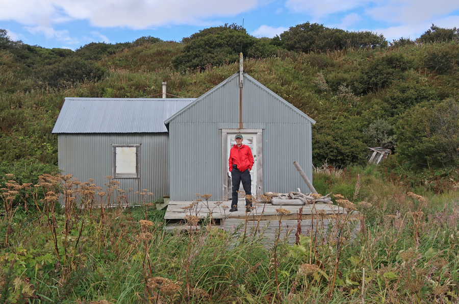
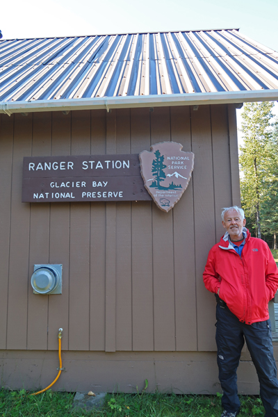
I had previously arranged for Rangers Adam and Mary to meet me there. I learned their cabin was about 0.3 mile away and started walking.

About halfway there, they met me on their ATVs in full gear (guns, etc.).

They said to follow them to the cabin/office area.

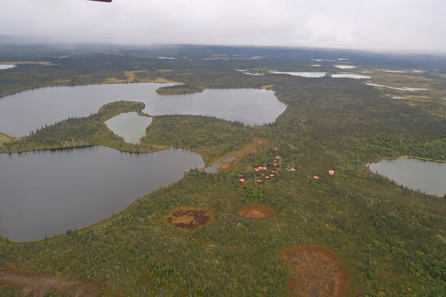
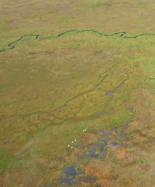
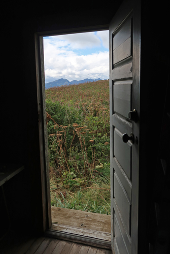
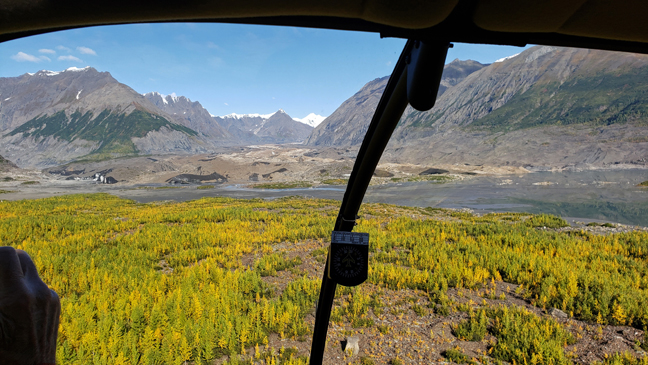
They were very kind, providing me with written and verbal information about the preserve. This is a very nice illustration of the Glacier Bay National Preserve area.
My 415th National Park Unit
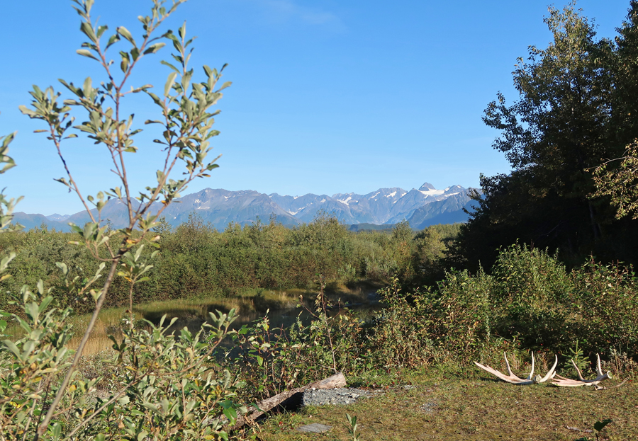
Pictures of the preserve

My time was limited; I had to hustle back to Hans for my flight back to Yakutat

View flying back NW across Dry Bay
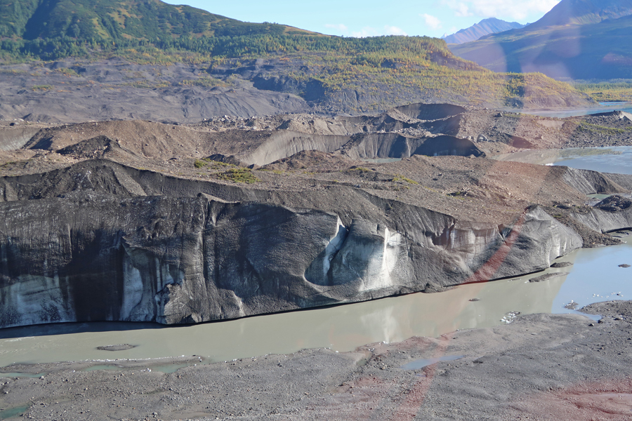
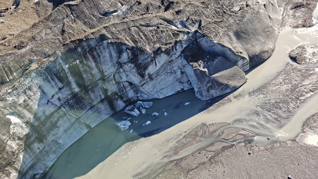
Ustay Lake at the toe of Ustay Glacier

Landing at the Yakutat airfield. I just made my Alaska Air flight and ate my Mongolian Beef leftovers on the way (39min) to Cordova.
Icy Bay and Mount Saint Elias
Bering Glacier
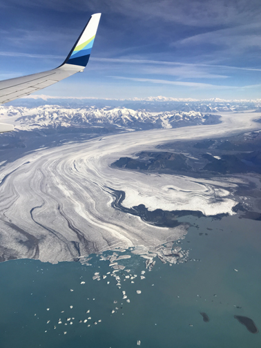
Chugash National Forest

Scott Glacier
It took 45min to load the fishermen and their fish in Cordova for the next leg of the flight to Anchorage.
I had rented a car to drive 7hrs to Fairbanks after I arrived. However, I decided it would be too stressful to accomplish that and still make my flight early the next day to Bettles. So, I canceled the car and booked an Alaskan Air flight (45min) to Fairbanks.
After landing in Fairbanks, I took a taxi to the Clarion, bought a cup of soup to add to my beef jerky and rice crackers for dinner and went to bed.
9/15/20 Tu – At midnight I woke up sweating and discovered that the thermostat (AC) was not working. Then the alarm woke me up at 5:22am – I had not set it! It went off two more times 15min apart, so I unplugged it. I complained at checkout, but the clerk offered no recourse. He did call someone, who told him I should have opened the window!
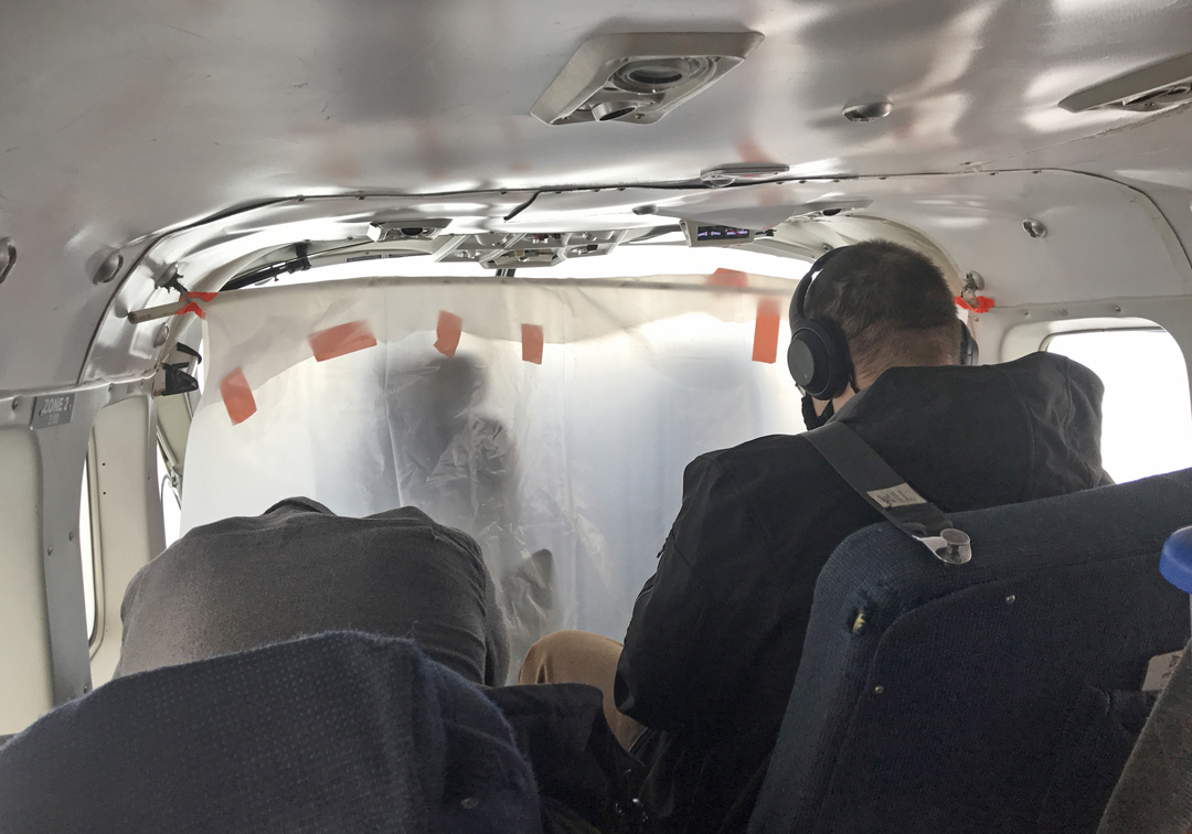
I took a taxi to Wright Air for my 9:15am flight to Bettles. There were two other passengers, and the rest of the single engine Otter was stuffed with cargo. Note the plastic separation from the pilot because of the pandemic.
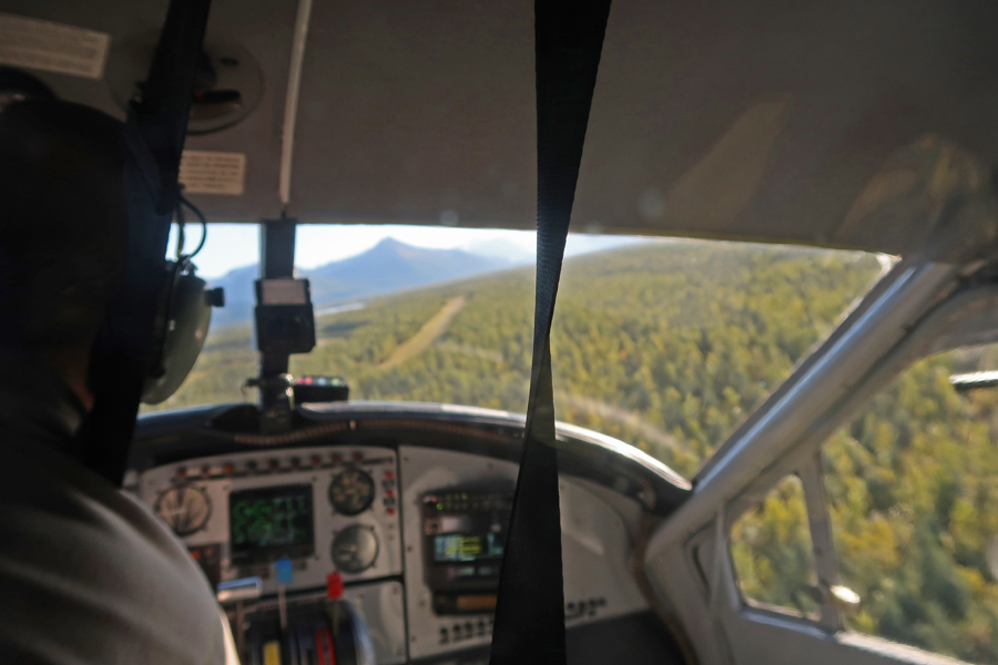
Flying north from Fairbanks to Bettles
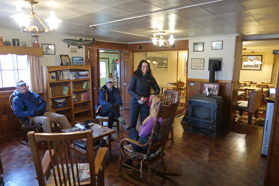
It was drizzling when we arrived at 11am. I met the owner of the Lodge at the airstrip and then took a quick tour of the Lodge, which is on the National Register of Historic Places.

I took full advantage of the National Park Visitor Center near the airfield, visiting it three times during my time in Bettles


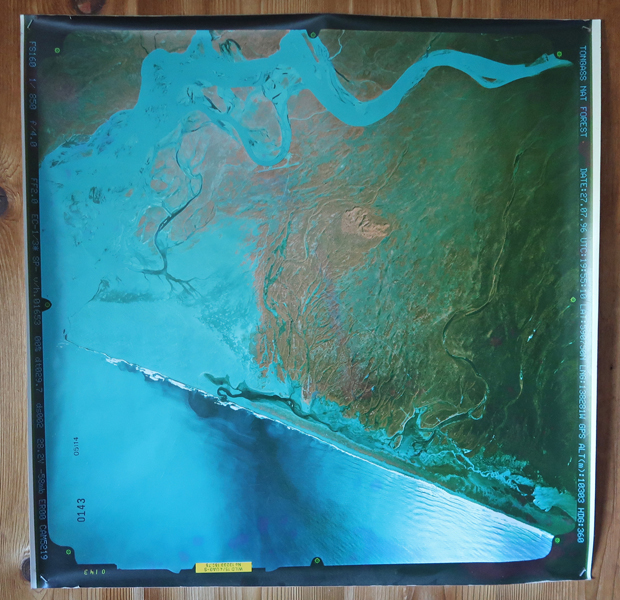
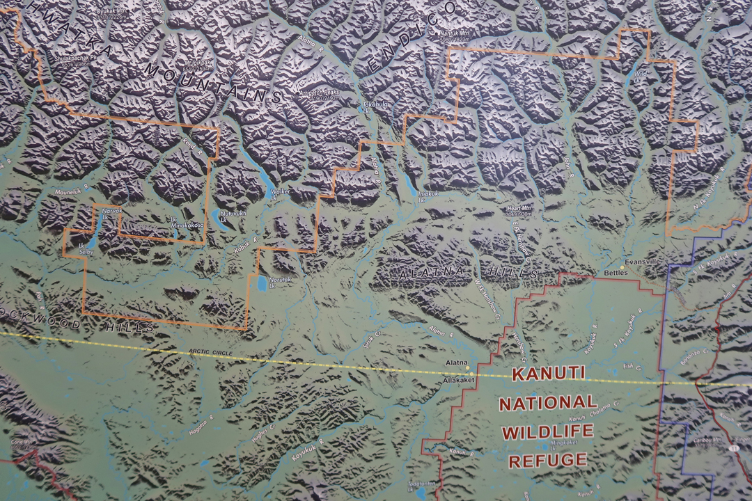
Topographical wall map section showing Nutuvutki Lake – just left of center
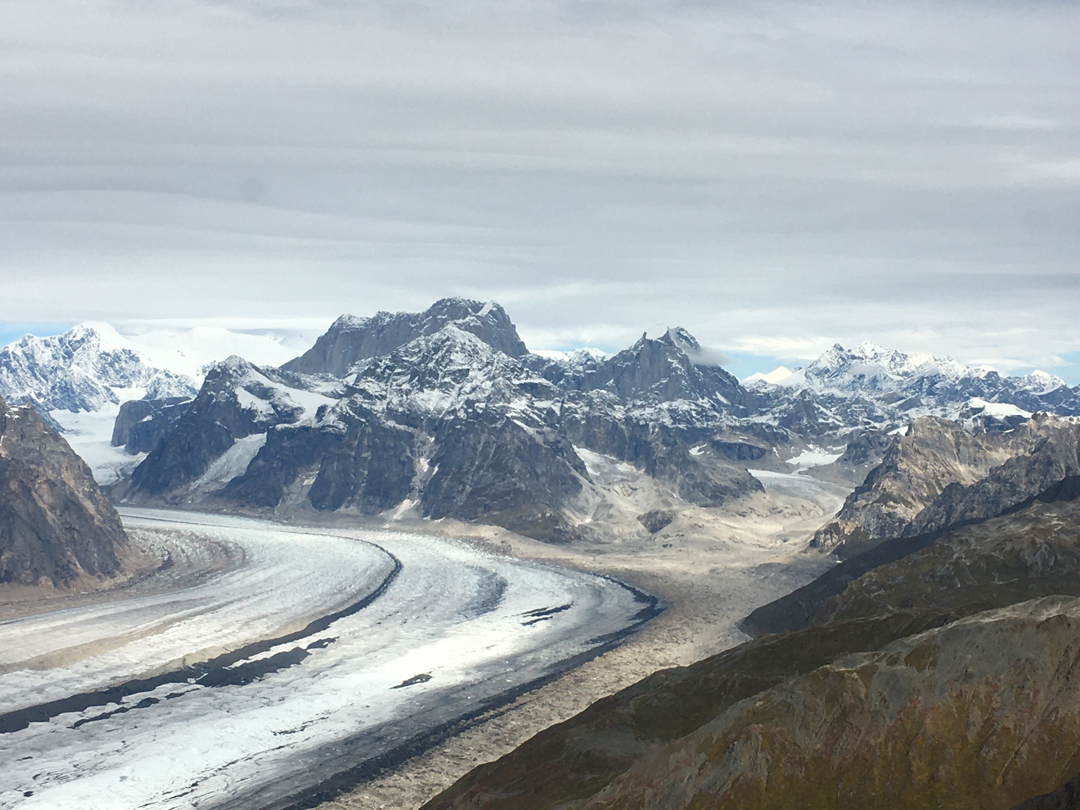
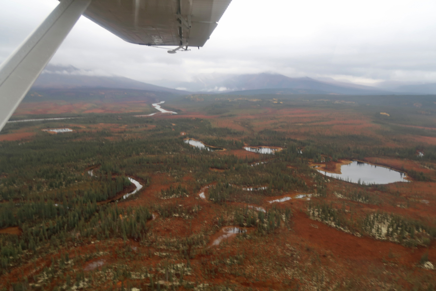
After lunch in the Lodge, I was introduced to my pilot Siegfried for the float plane flight to Nutuvutki Lake, which is located in the SW section of Gates of the Arctic N PRES. We drove a short distance to Bettles Lake, boarded the plane, and were airborne at 1pm. The weather was cold, cloudy, and wet. This photo was taken just after take-off when we were crossing the Koyukuk River.

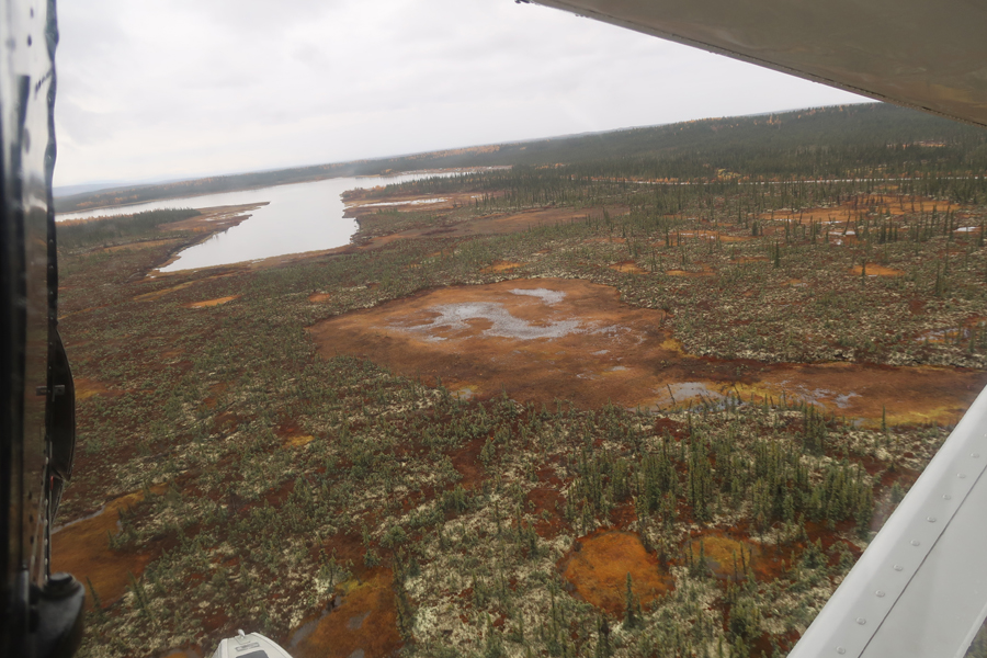
We flew west past the Alatna Hills. The leaves on the deciduous trees were at their peak with bright golds and yellows set against the green conifers at higher elevation and colorful tundra in the wetlands at lower elevation.

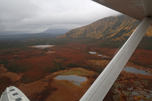
There was water everywhere, ponds, lakes, rivers, and, at times, crashing into the plane.

The Alatna River
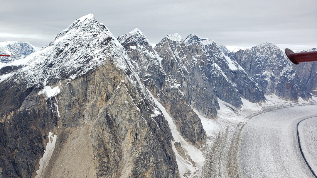
Helpmejack Hills

Walker Lake, which is in Gates of the Arctic National Park and Kobuk River

Approaching Nutuvutki Lake

Seig circled the lake three times before landing and coasting to a small beach area on the SW part of the lake. We were surprised to see a float plane parked next to a cabin on the lake.

As I exited the plane, he said “Watch your valuables, they have guns.” A man and his son, who had walked over from the cabin, met us. I discovered that their family had an “inholding” in the National Preserve. Later, Ranger Bob explained that there were many of these parcels and that most were owned by Native Americans or their descendants.
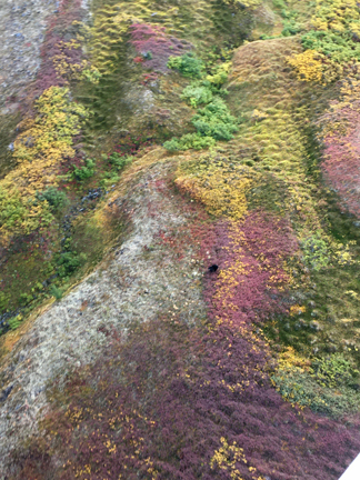
I walked around the area taking pictures. It was pristine, my boots sank into the soft earth and vegetation. Again, the colors were striking, despite the clouds and light rain.


Unfortunately, the weather was deteriorating, and we needed to start back.
Seig chose a more southerly route back to avoid turbulence, first flying over the Kobuk River,

and then southeast along the Alatna River,

before swinging back northeast to land at Bettles Lake
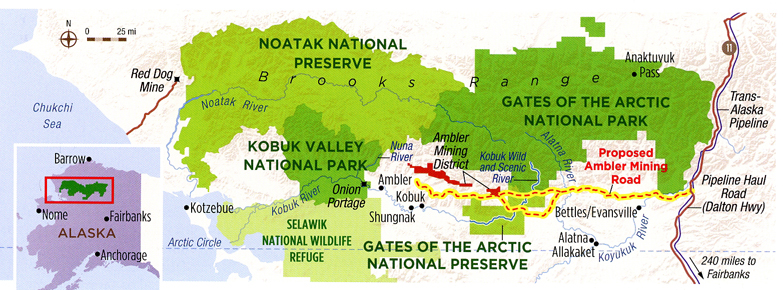
The Trump administration is supporting a road right through the middle of the preserve, so that a foreign mining company can extract copper and zinc! That road would seriously disrupt one of the last mass migrations on earth – the migration, spring and fall, of around 500,000 caribou to and from the North Slope of the Brooks Range – see my Blog entry for Gates of the Arctic National Park, August, 2012.
At dinner, I sat across from a fellow who was a former EPA employee. He was there teaching a small crew how to correctly bury waste in the tundra. Later, I struck up a conversation with John, who was a Snow Safety & Explosive Specialist from Aspen CO. He manufactured cannon that he used for his Avalanche Mitigation Service (AMS). Afterward, I watched two videos in the Aurora Lodge. One was about Bob Marshall and the Eskimo Village of Anatuvuk. It described the changes of the last century. The second video was about Mardy Murie and her husband Olaus. They came to the Gates of the Arctic for their honeymoon and used dog sleds to explore the area. They lived here 15 years and then moved to what would become Grand Teton NP. They were leaders of the Wilderness Society and instrumental in the passage of the Wilderness Act (1964).
I again looked for the Northern Lights, to no avail, but I did come up with a good story for breakfast.
9/16/20 W – Last day in Alaska, there were five guests and two employees in the eating area of the Historic Lodge for breakfast. I startled everyone by telling them I had seen the Aurora Borealis at 3:30am. I described how the light was moving from left to right across the sky. It would get lighter, then darker. It was a rhythmical pulsating light – extraordinaire. I paused, then said “It was the rotating beacon from the airfield” – I got um!
Went back to the NP Vis Ctr for the third time, then packed for the 10:30am Wright Air flight to Fairbanks. This is a picture of the Dalton Highway that goes from Fairbanks to the North Slope and the oil pipeline that returns –

Arrived in Fairbanks at noon and joined three of the other Lodge guests in the shuttle to their hotel – that way I was closer to the airport terminal. I then walked the 1.5mi to the airport – it felt good to be walking!
My flight to Anchorage left at 5:25pm. My flight to Chicago left Anchorage at 10:14pm and arrived in Chicago at 7:21am. It was packed and they did not distribute food or drinks! The same thing happened on my next flight to Dallas/Fort Worth – yes, they sent me the wrong way to go home! My flight to Dayton was the same, full and no services. No more American Airlines for me!
Helen picked me up and we were home at 5pm. It was another excellent Alaska Adventure!