
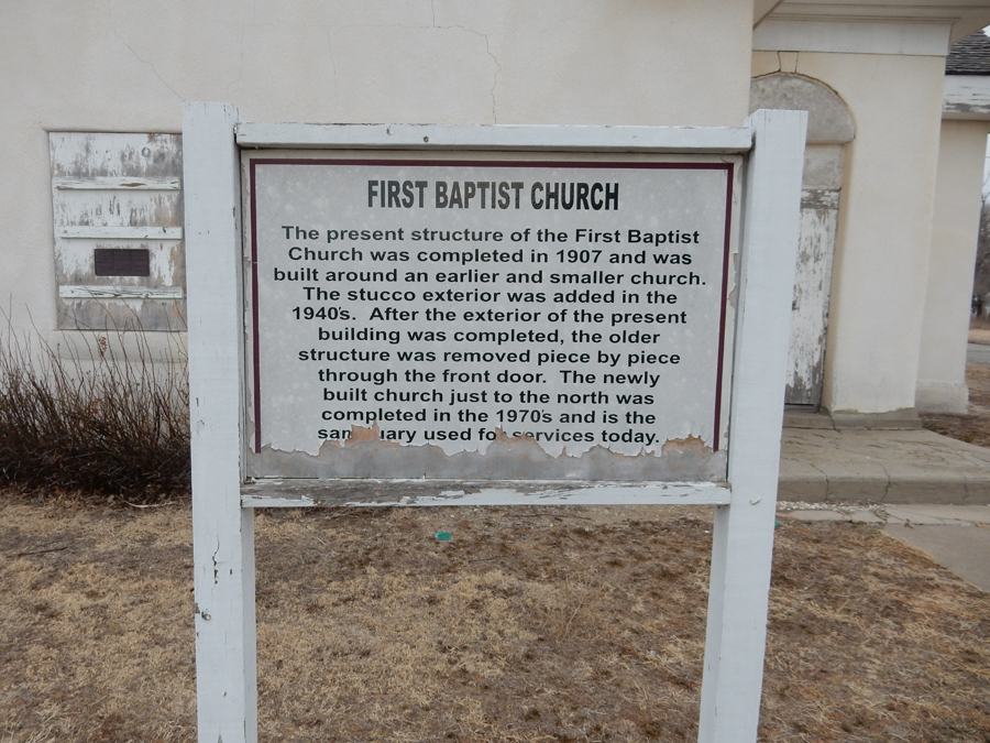
2/1 Th – Breakfast at the Waterfront Restaurant – San Diego’s Oldest Tavern.

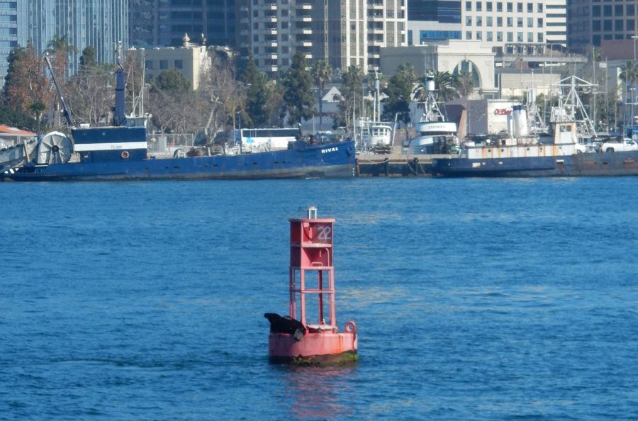
Ferry to Coronado Island, note the seal on the buoy
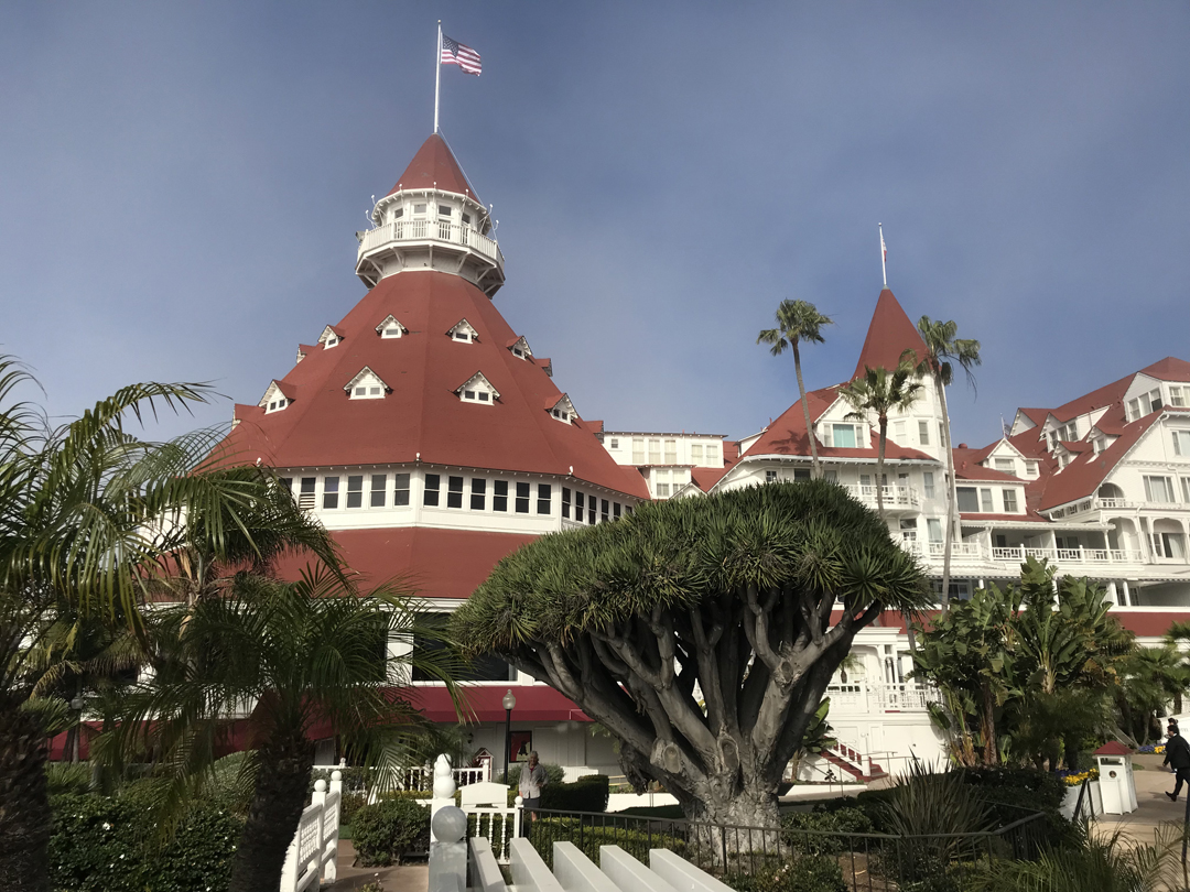
We rented bikes and rode to the Hotel del Coronado


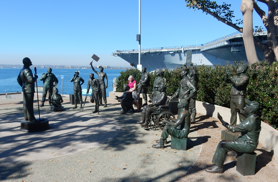
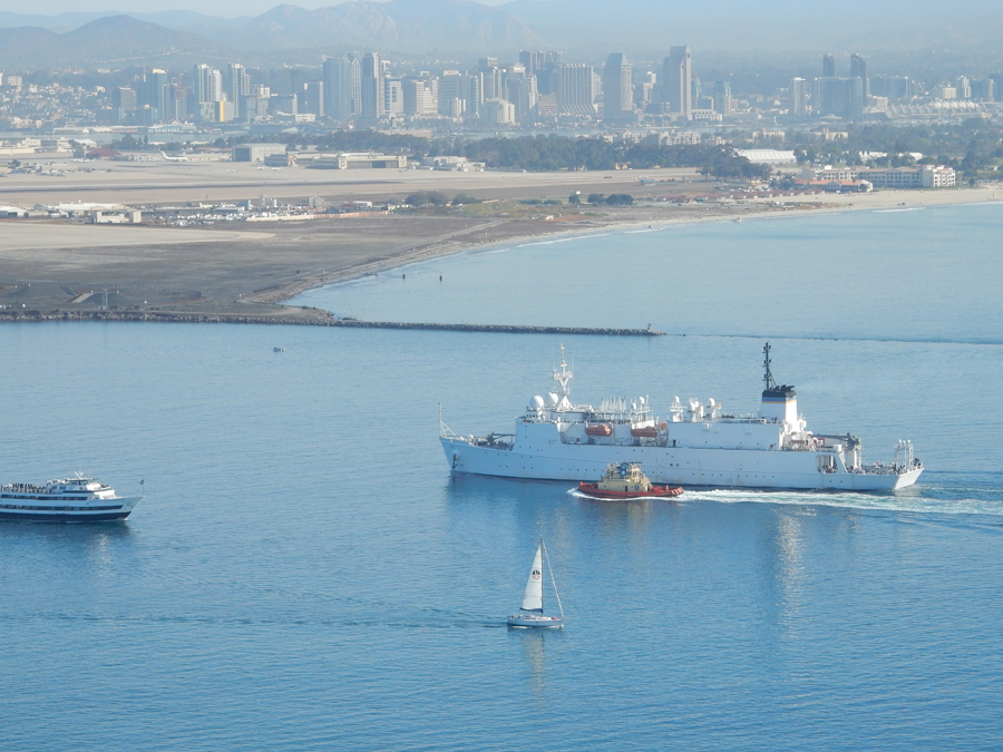
Returning to San Diego, aircraft carrier USS Midway, now a Museum

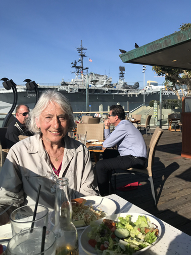
Helen at National Salute to Bob Hope and Military
Lunch at Fish Market Restaurant across from USS Midway
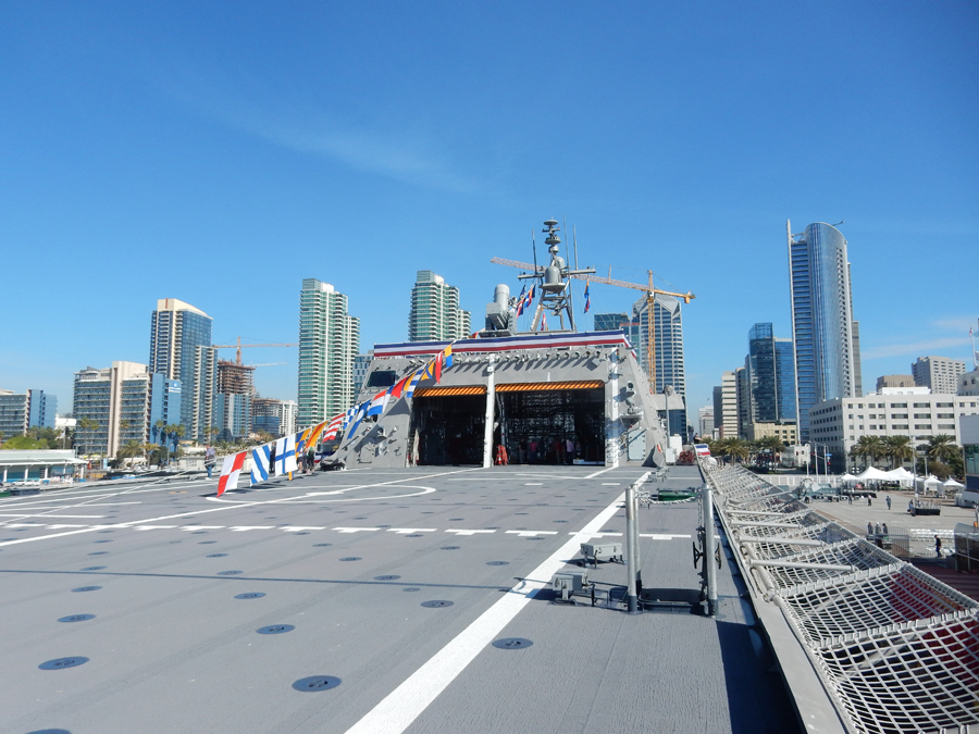
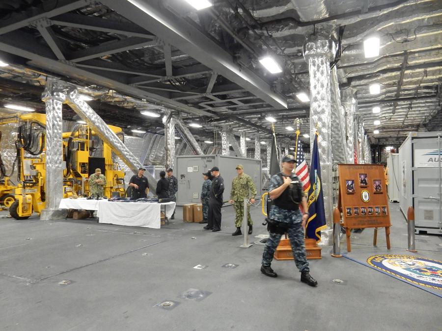
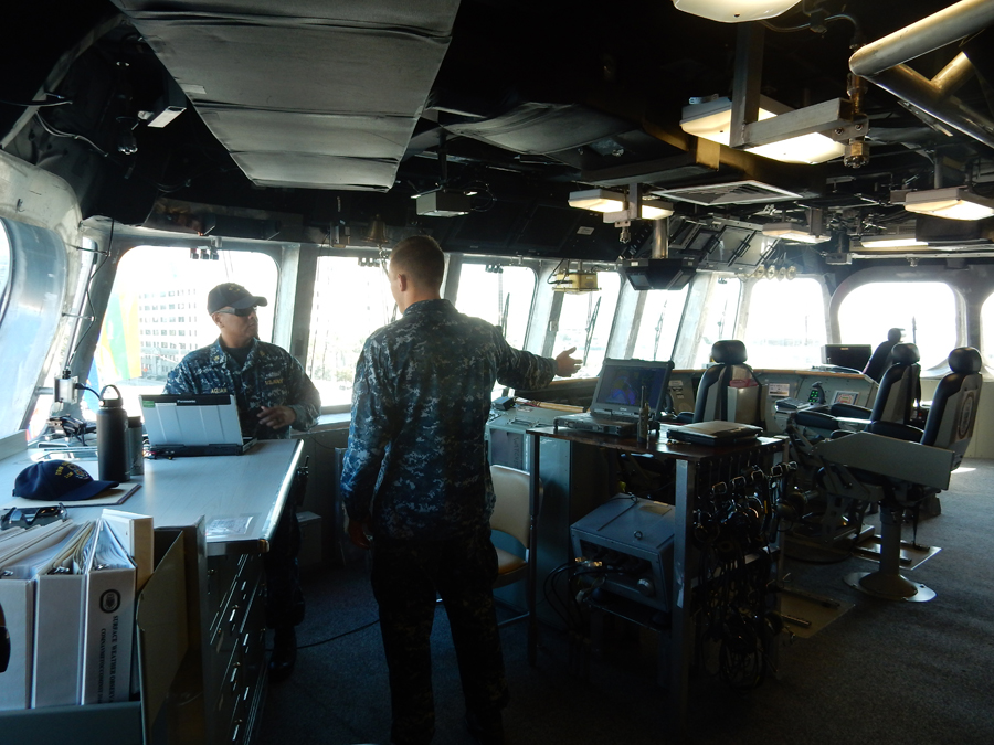
I was able to tour the new USS Omaha, two days before it was officially commissioned
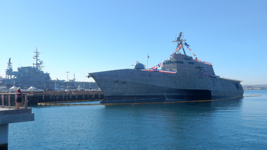
It is a Littoral Combat Ship (LCS), #12
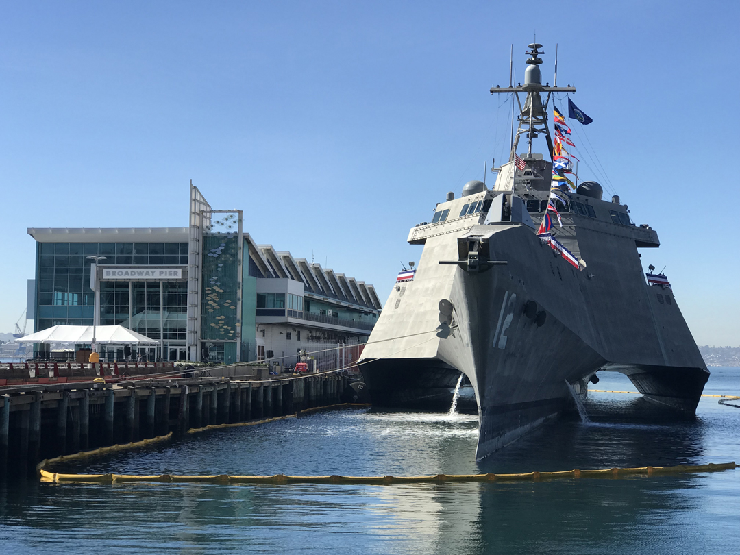
It is a multi-purpose, fast (40 knots), shallow water, trimaran

Possible uses – interdiction of pirates and drug smugglers in addition to transport of special forces

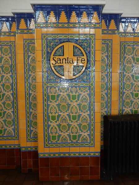
Santa Fe Railroad Station


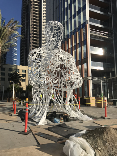
Statue made up of letters/figures from different languages
Went back to Balboa Park for the evening, started with drinks at Panama 66, toured the Sculpture Garden and then walked the El Prado – Plaza de Panama
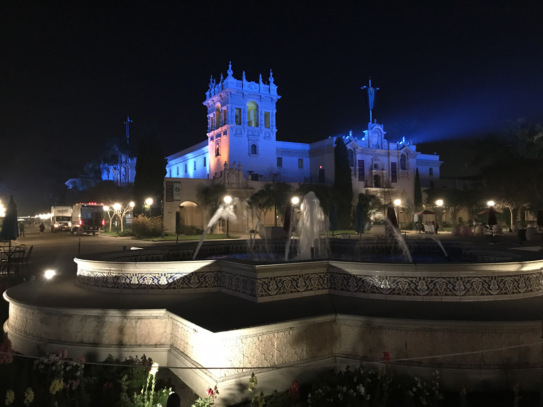
“Supermoon” (also a Blue Moon) above Helen’s head!

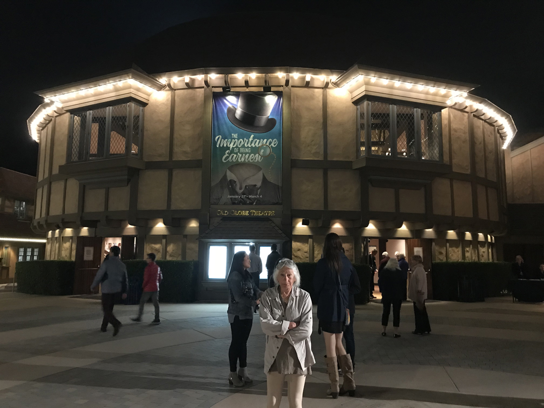
Saw the “Importance of Being Earnest” by Oscar Wilde at the Old Globe Theater
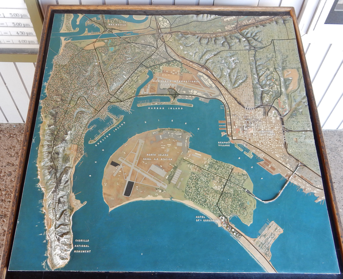
2/2 F – Again, had breakfast at the Waterfront, bought one for a homeless woman as well, and then drove to the Cabrillo National Monument – see other pics from May 2015

Nice model of San Diego area showing location of monument
Monument with Old Point Loma Lighthouse in background

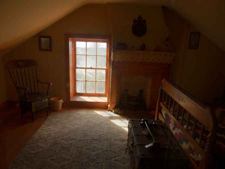
Model of lighthouse and pics from inside


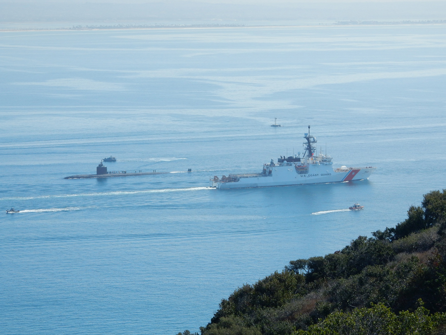
Ships, Boats, Submarine passing Point Loma
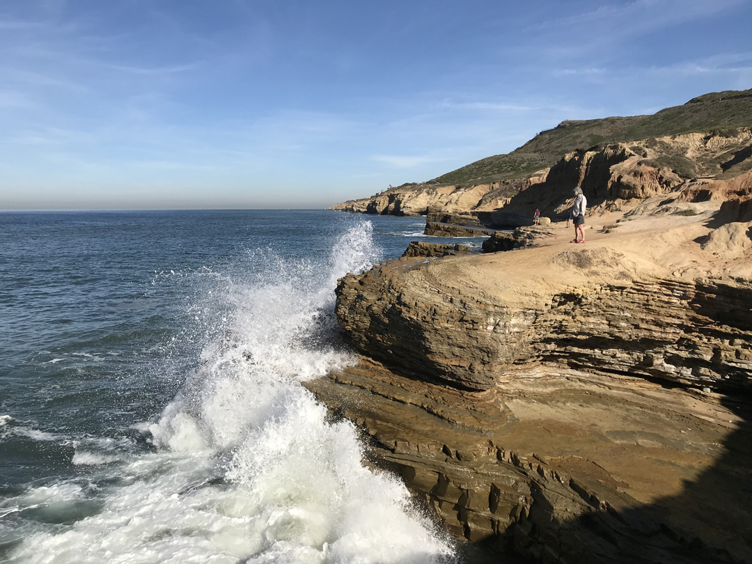
Crashing waves at Tidepool Access area – did enjoyable hike here
After lunch, drove to Kate’s house in LA; walked to Casita del Campo for dinner, then Kate treated us to a performance of the Musical “Aladdin” at the Hollywood Pantages Theatre

2/3 Sa – thrift store shopping, lunch (tacos) on Sunset Blvd, put base on front porch bench, walked Bennett and dinner at home

2/4 Su – church, breakfast at Millie’s, SuperBowl Party at Kate’s friends in Santa Monica
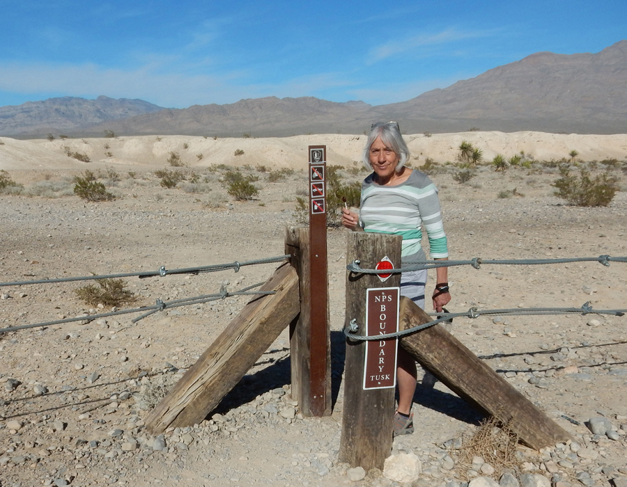
2/5 M – 4hrs to Tule Springs Fossil Beds National Monument 20 miles north of the Las Vegas strip. This is a new (2014) BLM NM.
Archaeologists have removed mammoth, lion and camel fossils from this area.

We like Tootsie Pops – always take water!
To be honest, there is not much there.
I would not recommend going until they have a Visitor Center.

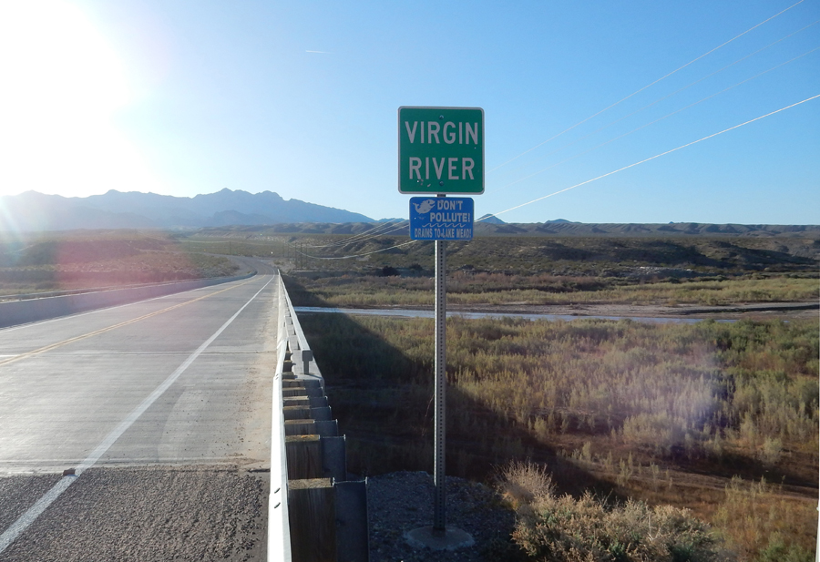
Stayed in a Holiday Inn Express in Mesquite NV, prime rib dinner for two at Virgin River Casino ($18.13)
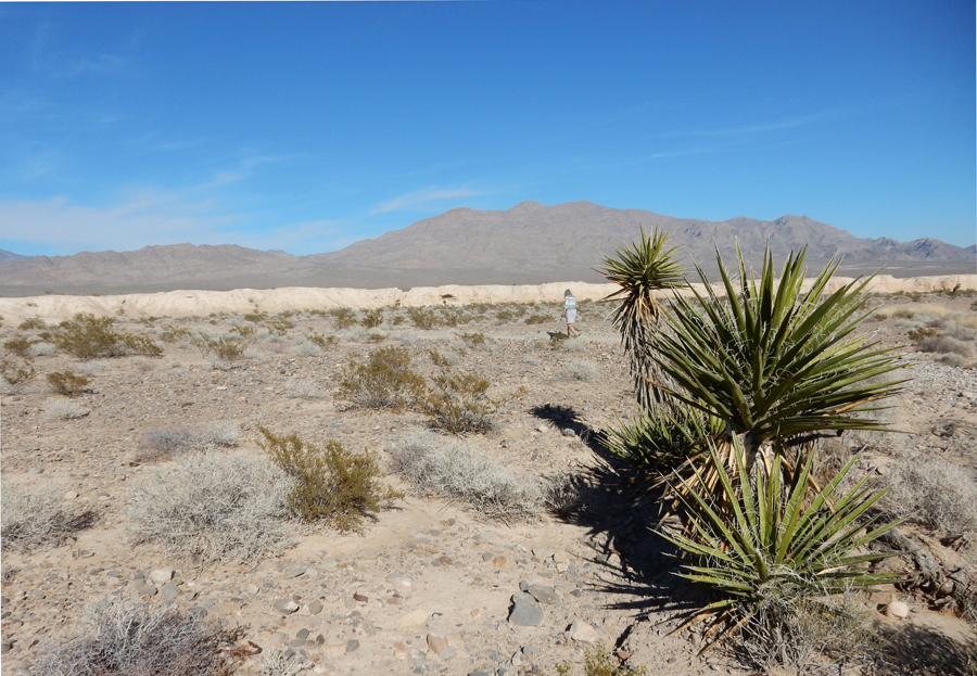
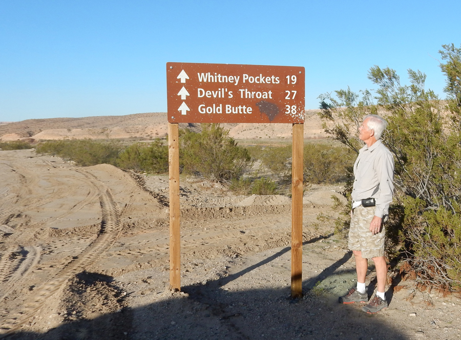
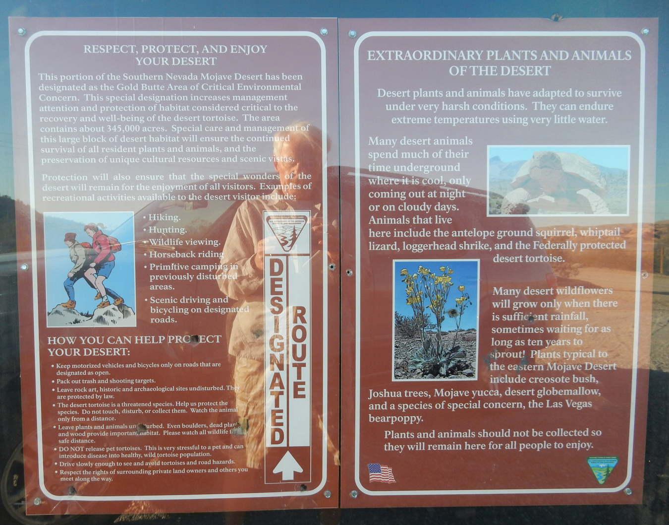
2/6 Tu – Approaching Gold Butte National Monument
4WD needed on all side roads

Gold Butte was designated a BLM National Monument in December 2016 by President Obama. The Trump administration is currently attempting to reduce its size, like it did for Bears Ears and Grand Staircase Escalante NMs in Utah in 2017.
Cliven Bundy has a ranch just north of the NM. He grazed his cattle on the BLM land long before it was a NM without paying grazing fees. This led to the “Bundy Standoff” in 2014. He refused to pay over one million in back fees for grazing on federal land, so the BLM started rounding up his cattle. Protestors, some armed, blocked the removal. The Sheriff and BLM Director agreed to release the cattle to de-escalate the standoff. This issue has still not been resolved. Bundy and his sons were also involved in the Malheur National Wildlife Refuge standoff in OR in 2016, where they were arrested.
According to Wikipedia – “On January 8, 2018, U.S. District Judge Gloria Navarro in Las Vegas dismissed with prejudice the criminal charges against Cliven Bundy, his sons Ammon and Ryan, and co-defendant Ryan Payne regarding the standoff. Cliven and Ammon Bundy, and their supporters, have claimed that the federal government lacks the authority to manage public lands. These arguments have been repeatedly rejected by legal scholars and federal courts, including the U.S. Supreme Court; the property clause of the United States Constitution grants plenary authority to Congress to manage federal property, including land.”
This is the entrance to the Bundy Ranch

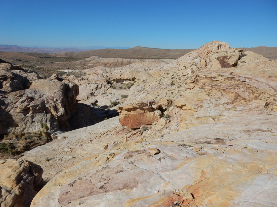
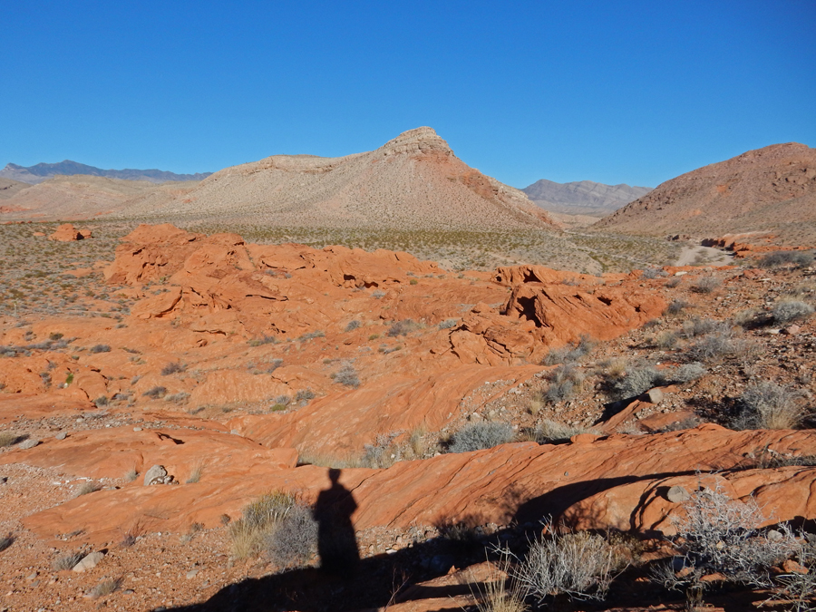
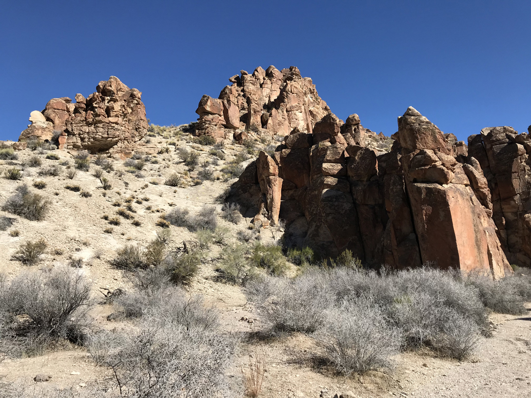
Gold Butte was the highlight of our five-week road trip. The rugged desert landscape, mountains, sandstone formations, historic sites, “rock art” petroglyphs, etc. were wonderful! This area needs to be preserved and protected!

Entering the Monument

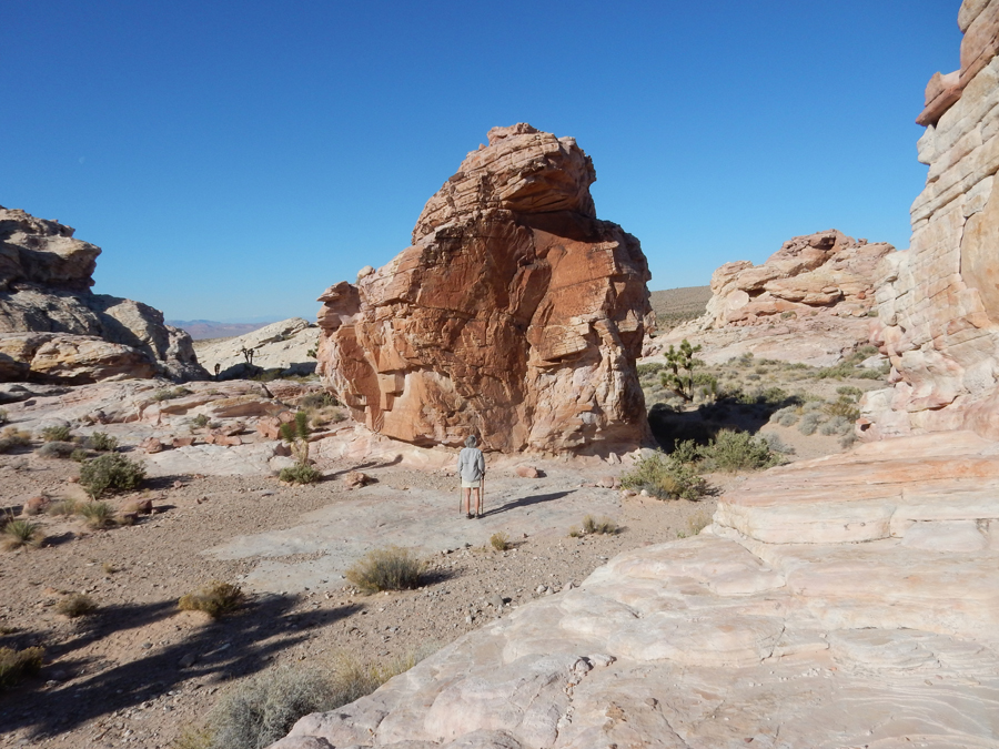
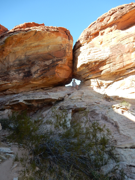
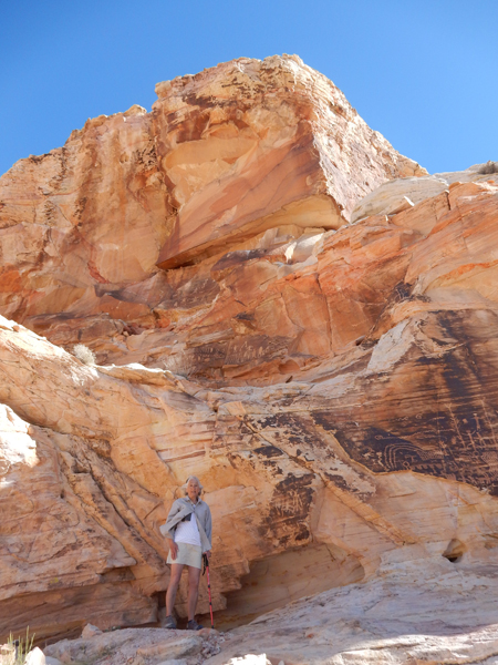
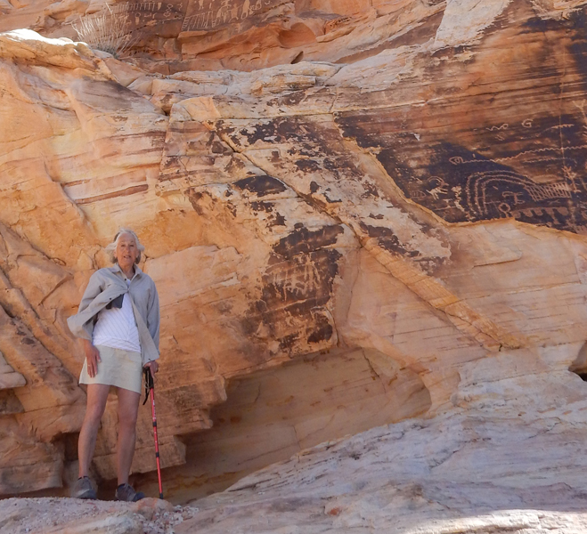
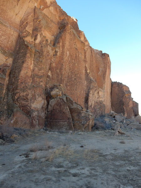
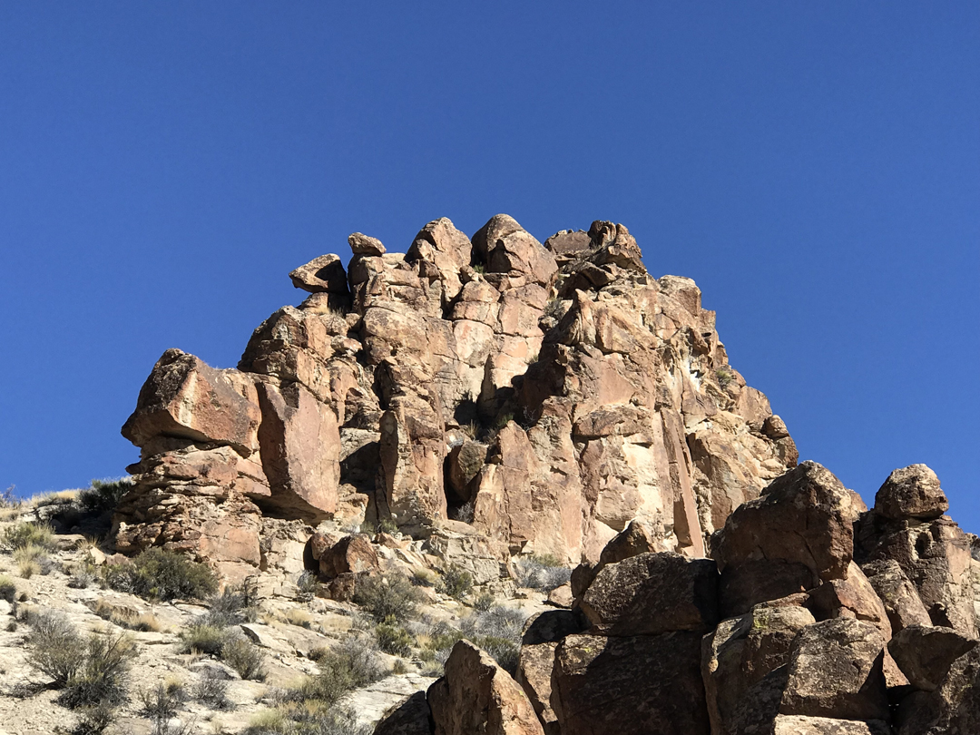
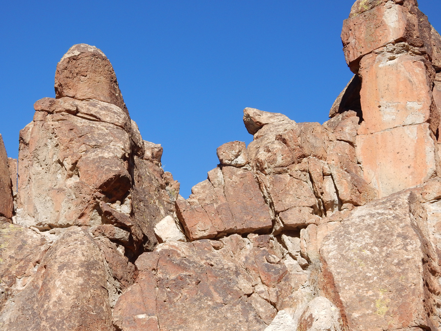
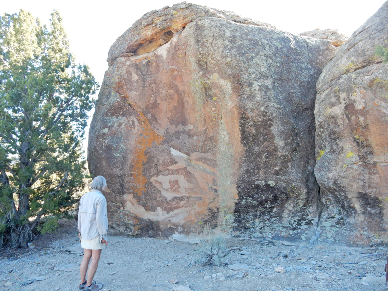
Approaching the “Falling Man Rock Art Site”


We hiked/climbed about 2 miles through and around this site. I wonder why this formation is called “Rabbit Ears?”

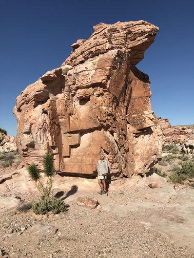
Calvin’s Rock

Arch and Pillar

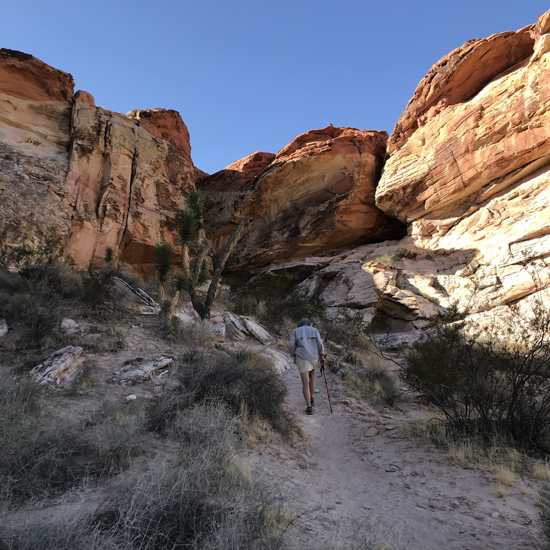
Climbing up to the “Tunnel”

Crawling through
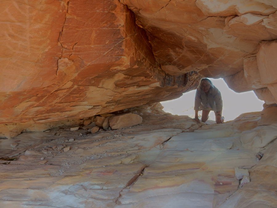
Coming out the other side
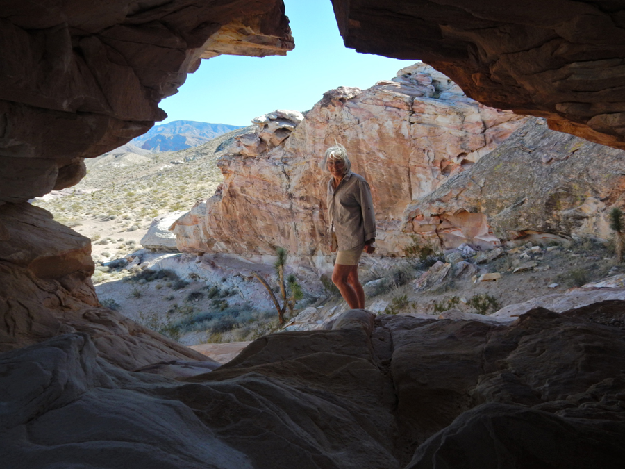
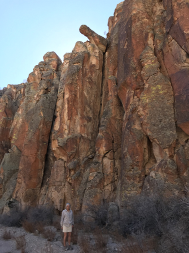
Hiking along cliff
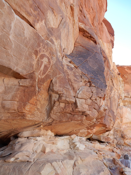
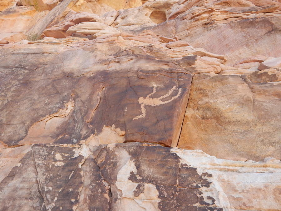
“Falling Man”
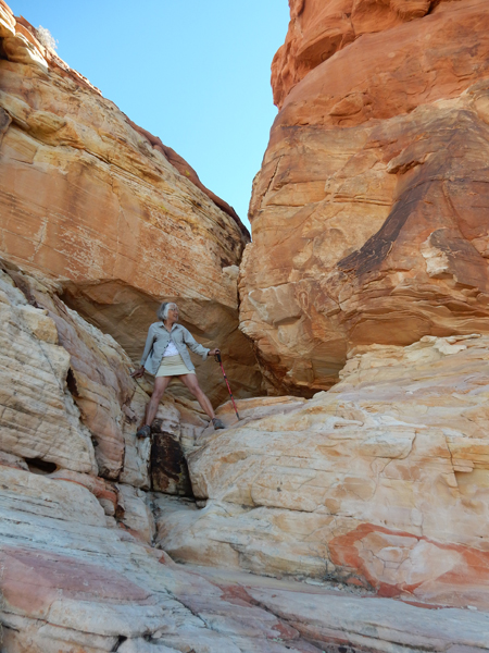
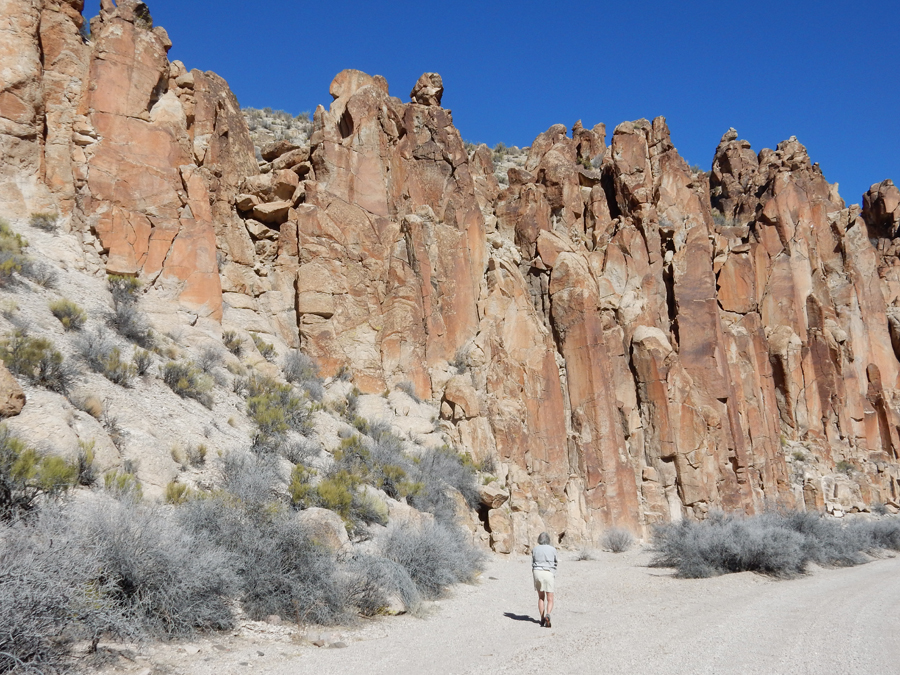
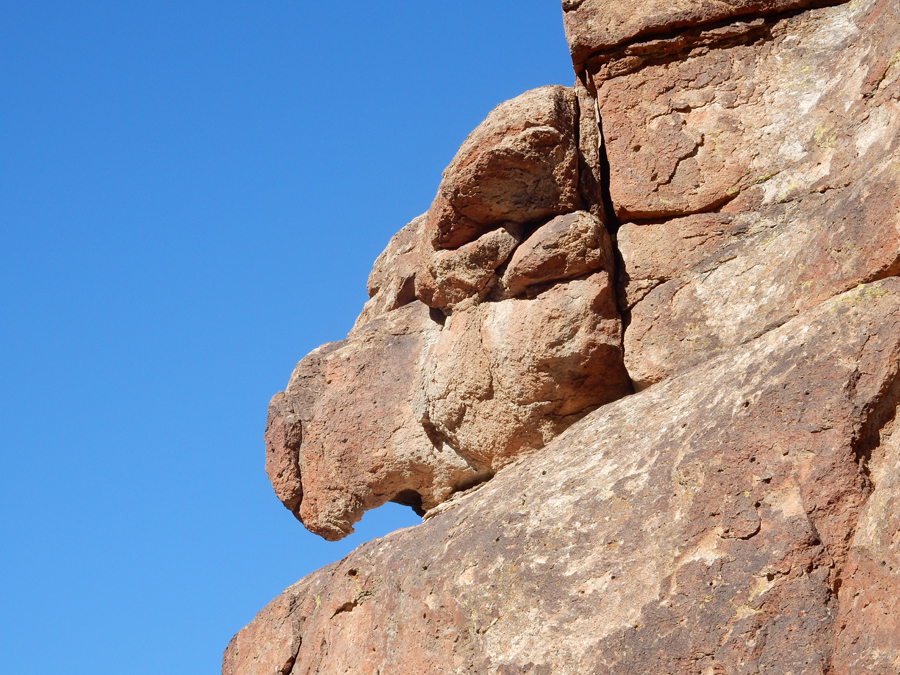
Lots of climbing around

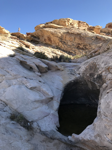
The term “Tank” refers to a depression in the rock that collects water
Interesting striations

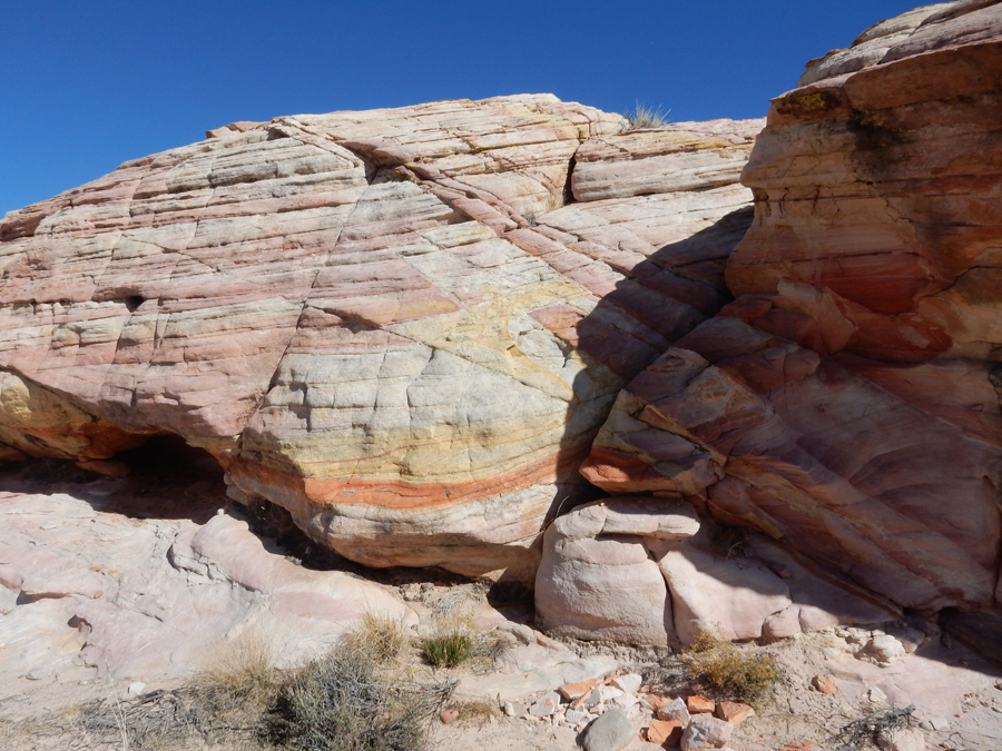
“Flowing Stone”

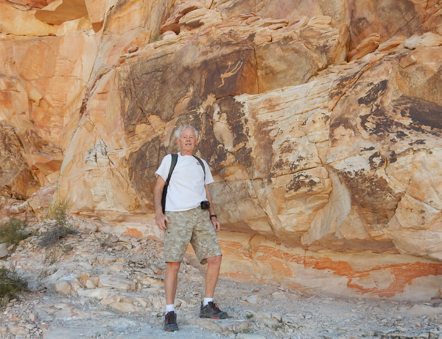
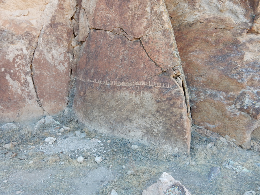
Wall – rock art, petroglyphs


Newspaper Rock from above
Newspaper Rock from below


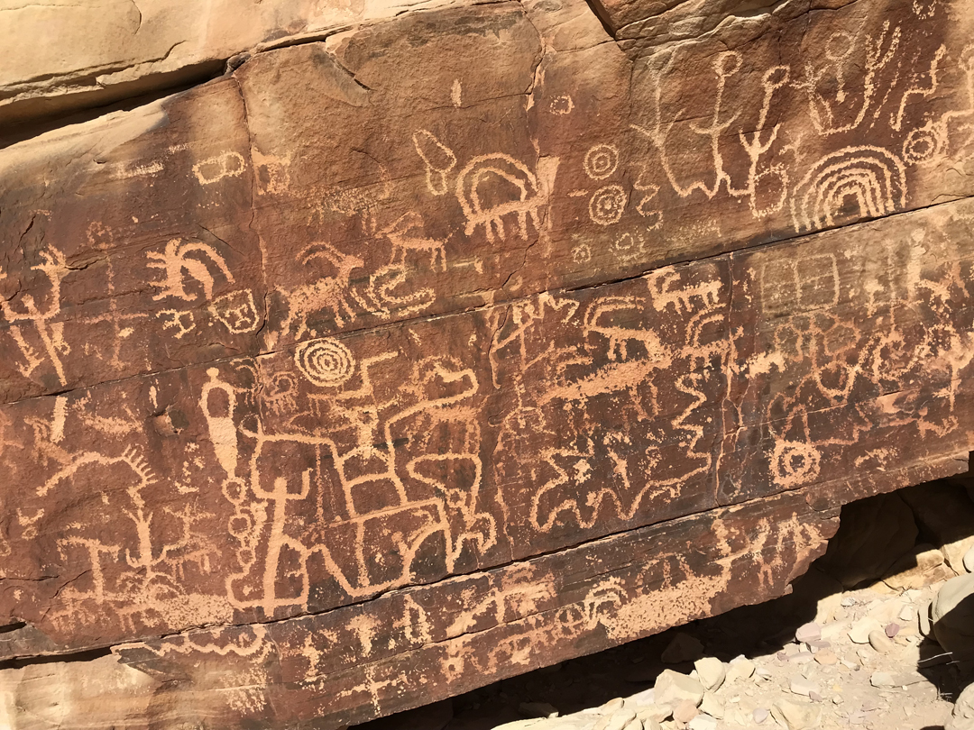
Ancient Sand Painting

Shaded lunch stop

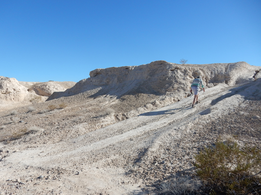
Took a very rough “short-cut” track over to Whitney Pocket
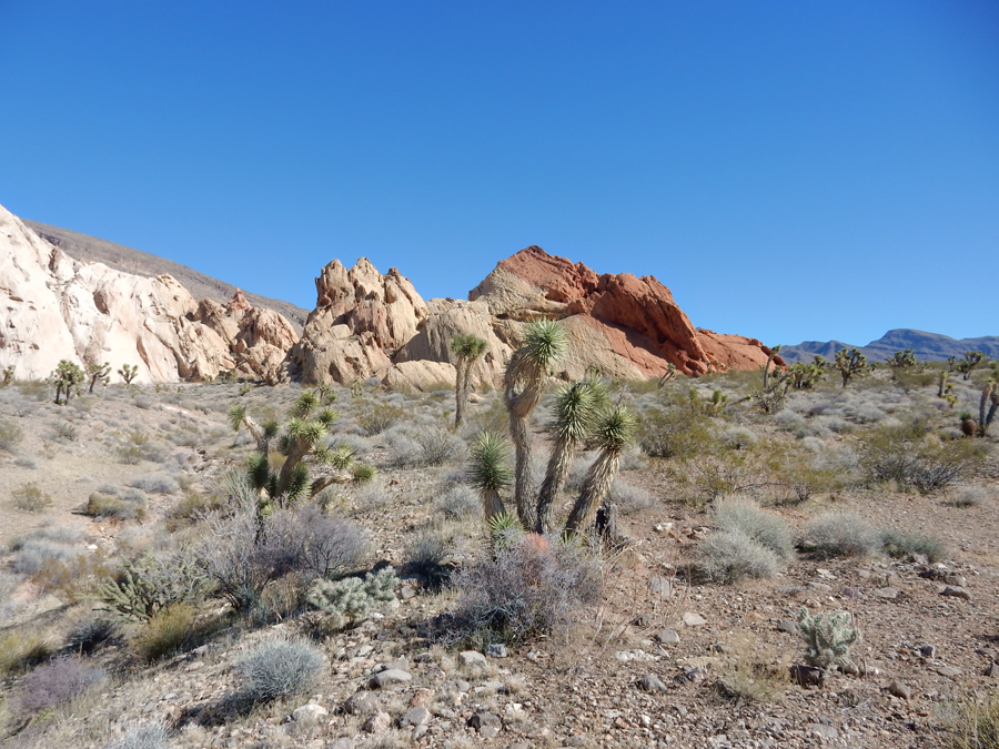
Greyish-Brown sandstone

Original dam was built by Whitney himself

Monkey?

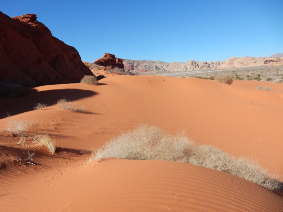
8 more miles of 4WDriving got us to Mud Wash Dunes, Helen cross-stitched in the SUV as I hike out to and through the dunes


I then did a short hike in “Little Finland”

Decided to take the main dirt track another 8 miles round-trip to “Devil’s Throat,” it wasn’t worth it

The roof of a large cave collapsed producing this large hole. It was entirely fenced off for safety because the edge is unstable. Therefore, you could not get close enough to look inside.

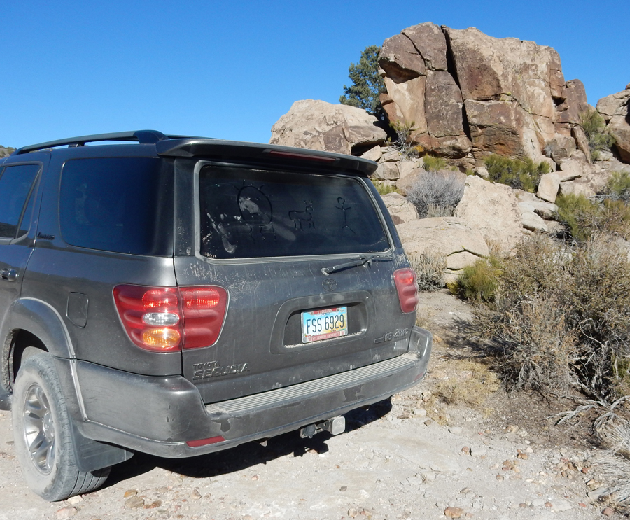
One of Cliven Bundy’s cattle?


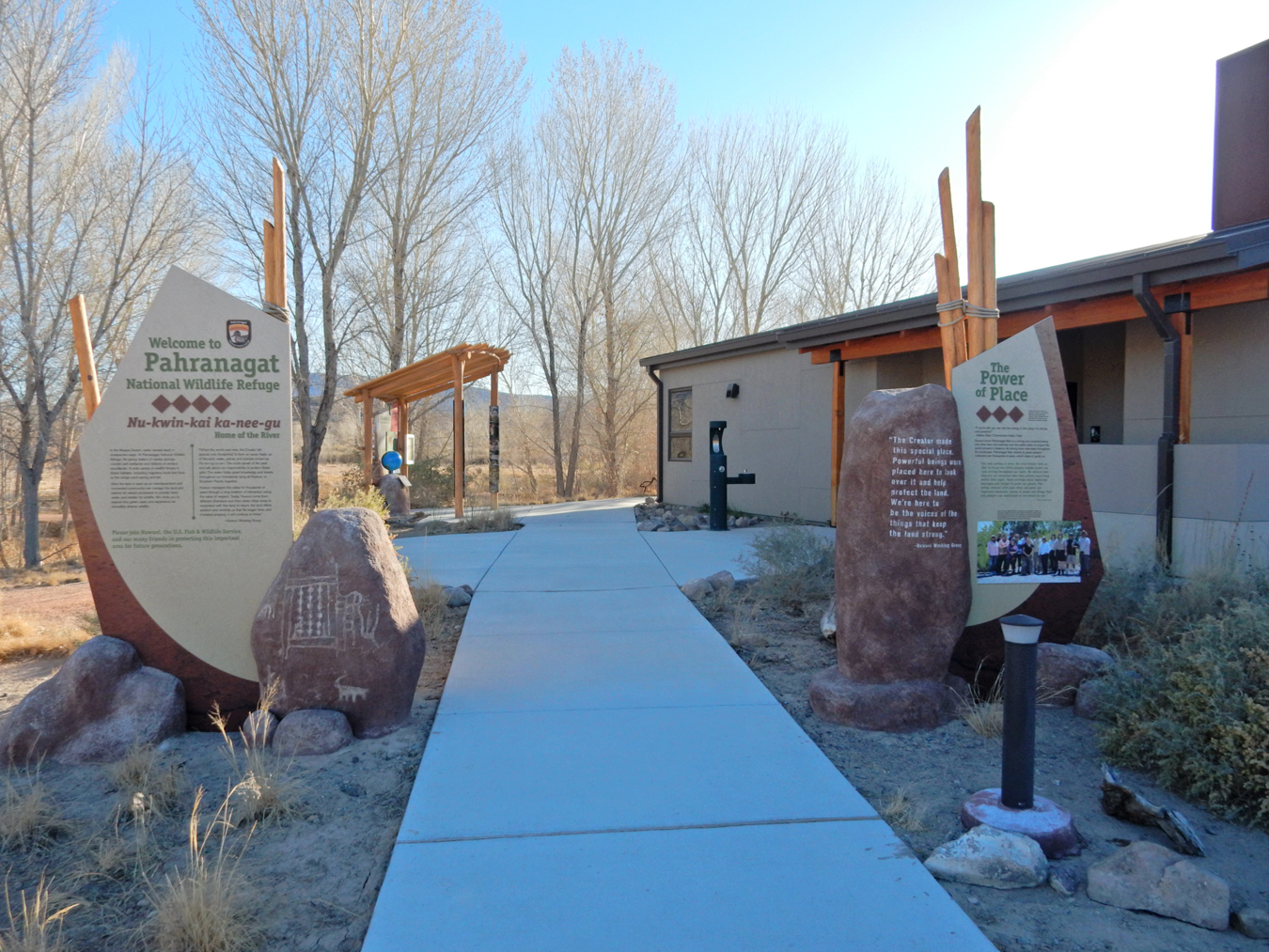
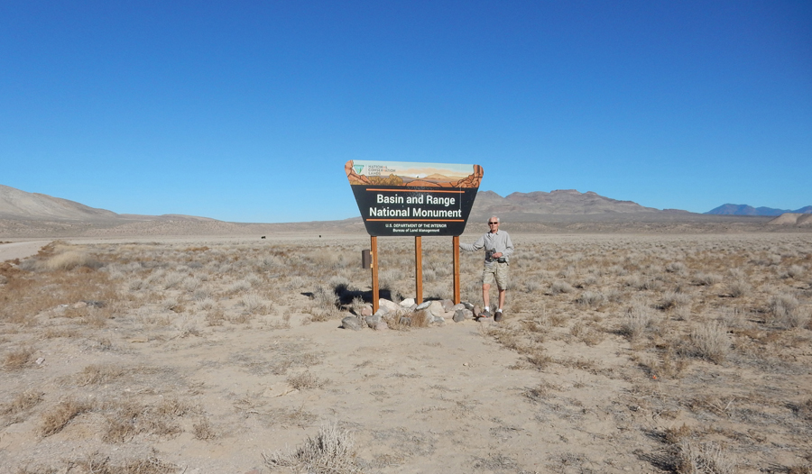
2/7 W – Stopped at the Pahranagat National Wildlife Refuge along US 93 on our way to Basin and Range National Monument (2hrs) north of Vegas. Unfortunately, the Visitor Center was closed.

Most of this new (2015) NM looks like this. However, the monument is huge (708,000 acres) and has many areas that are unique and interesting. This is another NM that the Trump administration is reviewing with the objective of reducing its size.
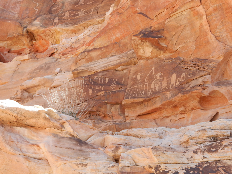
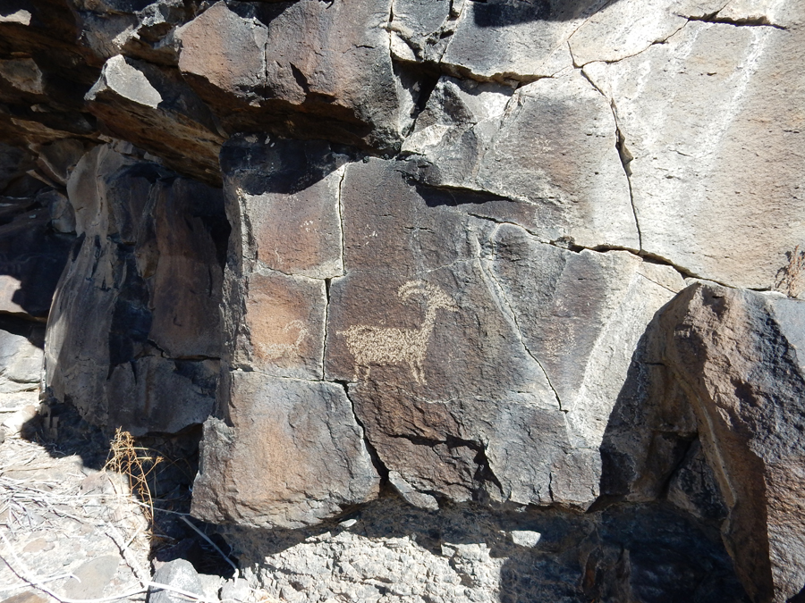
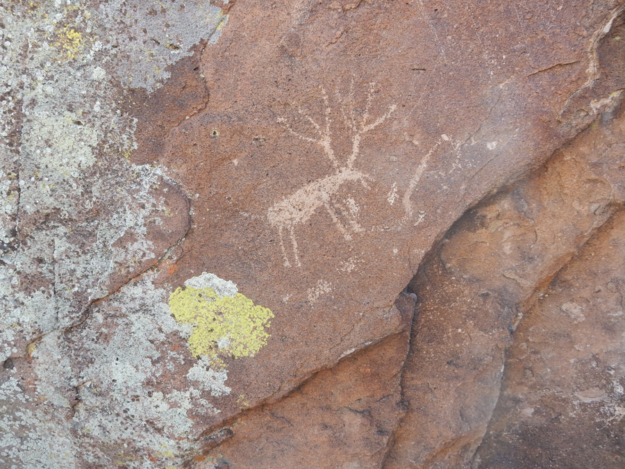
Our first stop was in the White River Narrows Archeological District.
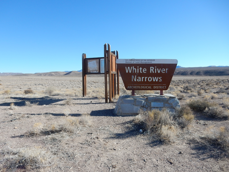
We did several short hikes to rock art locations. The first one was a rake-like design with serpentine and vertical lines below. Archeologists believe this represents a game drive fence used in the canyon narrows.
We followed a very nice BLM pamphlet describing the rock art in this area


Carl Williams, 1926, added his name

Ancient Art of Native Americans going back 4,000 years


Mountains just west of the Narrows in the Weepah Spring Wilderness

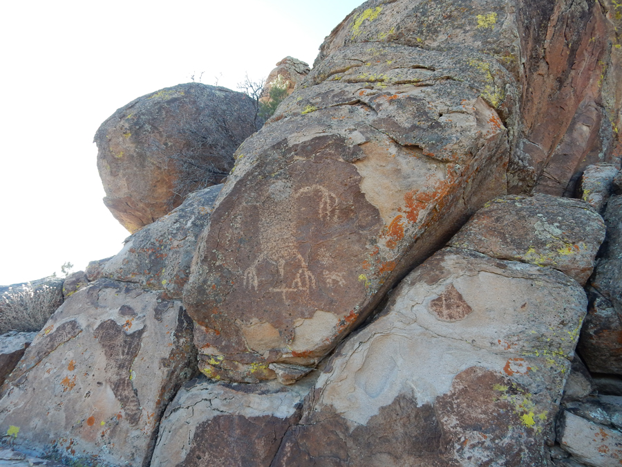
Entering the “Valley of Faces” Canyon, parked the SUV and hiked about 1.5 miles through the canyon on a cool but comfortable morning. This is a two-way track!

Every where you looked you could find fanciful character on or in the rock – Stegosaurus
Stone Finger or ?
Stone Cathedral


Cool rock formation and balanced rocks


Do you see any faces?

Rams Head

Baby on a rock


We then drove to the Mt Irish Archaeological Area in the NM
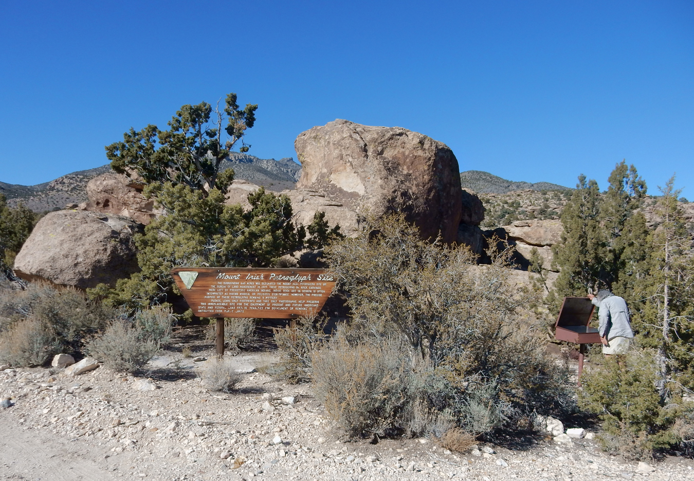
A Mt. Irish BLM Rock Art Guide helped us locate petroglyphs. There were about 80 rock art panels at this site (IV) alone.
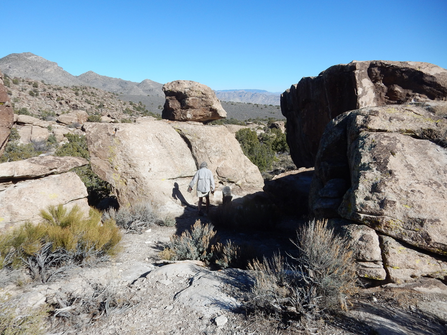


This site (V) had 68 rock panels
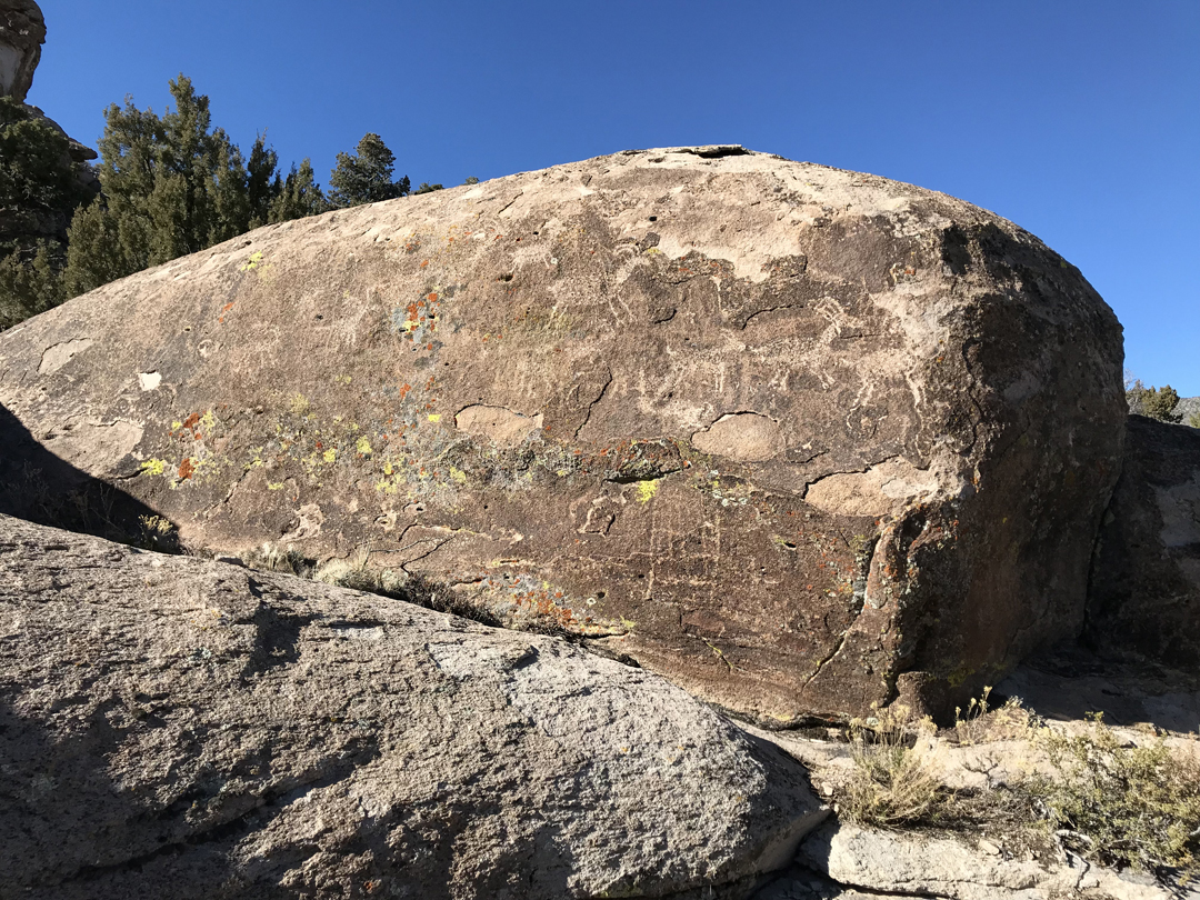


Site VI had 129 panels!


Alien?
“Back Window Art”
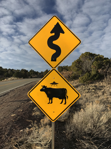
NV SR375 is known as the Extraterrestrial Highway. The top-secret Area 51 base is near the highway. Many travelers have reported UFO observations and other strange alien activity along this road.

Returned to Las Vegas and got half-price tickets for the “Legends in Concert” show at the Flamingo

There were tributes to Michael Jackson, Aretha Franklin, Sting, and Elvis

We learned from Kate that Tami and Bill were in Las Vegas the same evening and were able to meet them in front of the Paris Casino across from the Bellagio


After the concert we rode the world’s largest observation wheel – the “High Roller”

It is 520 feet in diameter and takes one hour for one time around
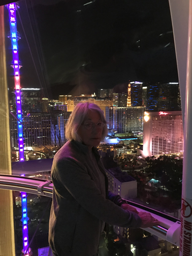
Each of the 28 cars (pods) can carry 40 passengers – we only had four on ours

Great 360-degree views

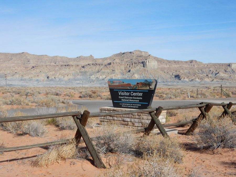
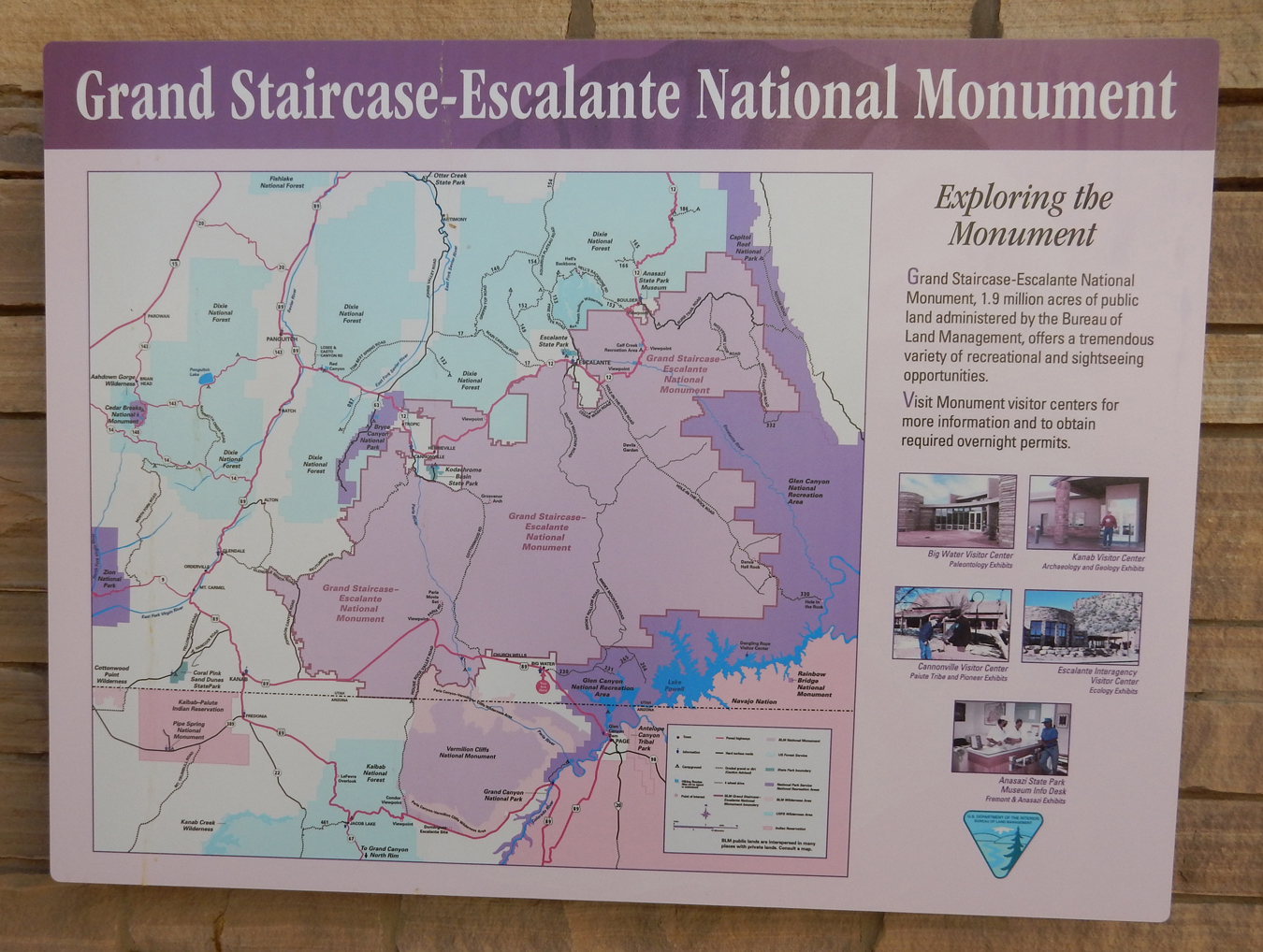
2/8 Th – We had to return to Mesquite NV to retrieve our pillows and Helen’s stitching scissors from the Holiday Inn where we stayed two days earlier. As a result, we drove through southern Utah on our way to Flagstaff AZ. Stopped briefly at the Grand Staircase Escalante National Monument Visitor Center on US 89, it was closed. Trump reduced this NM to about half its original size in February of 2018. I hope our legal system rejects this unprecedented move.
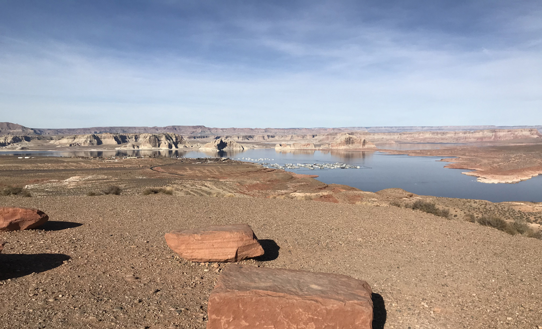
Made a couple of stops in the Glen Canyon National Recreation Area

Glenn Canyon Dam forms Lake Powell

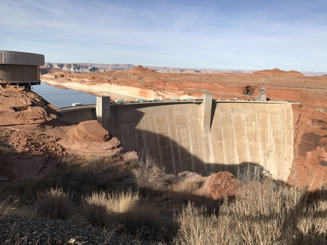
We walked across the dam where I took this picture of the Colorado River proceeding down stream

View of Wahweap Marina where Stacy and I rented a boat for our exploration of Glen Canyon and cruise to Rainbow Bridge NM in 1987
Dinosaur Tracks at the Carl Hayden Visitor Center

Continued South on US 89 toward Flagstaff. Helen bought a nickel silver Navajo bracelet from an old Navajo woman sitting along the road. We arrived at our Airbnb about 6pm.
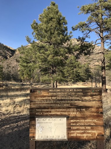
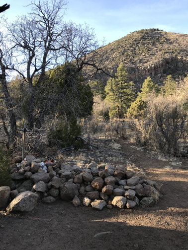
2/9 F – Flagstaff – Met with a realtor and toured 3 houses. Decided that this was not the right place for us, at least right now. I did a nice hike in the foothills just north of the city while Helen was baking scones with Kyrie. We had a fun game of Farkle with our hosts Chris and Kyrie that evening.

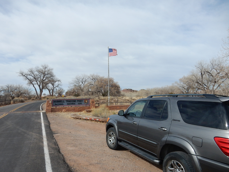
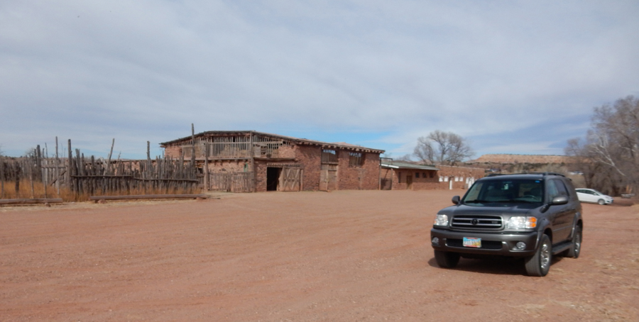
2/10 Sa – 2.5hr to Hubbell Trading Post National Historic Site,

Stacy and I visited here in 1987 on her 15-year-old Road Trip
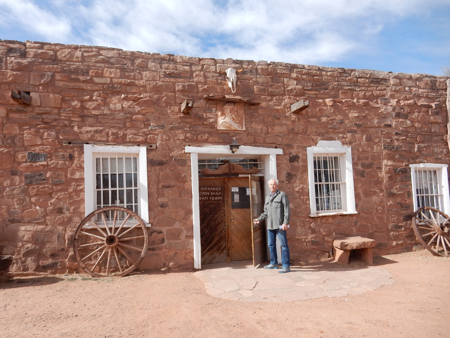
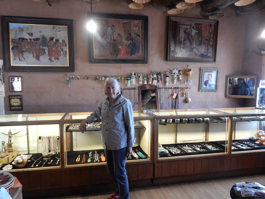
It still serves as a Trading Post in that Navajo sell their crafts here

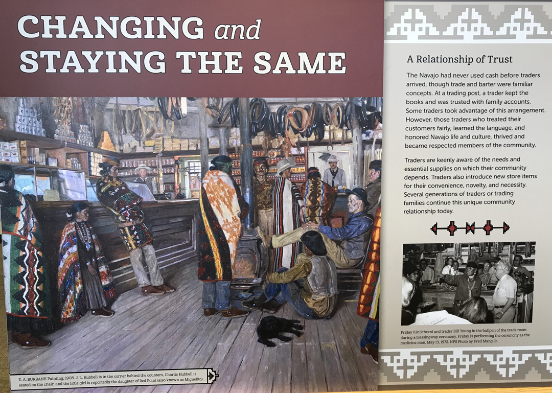
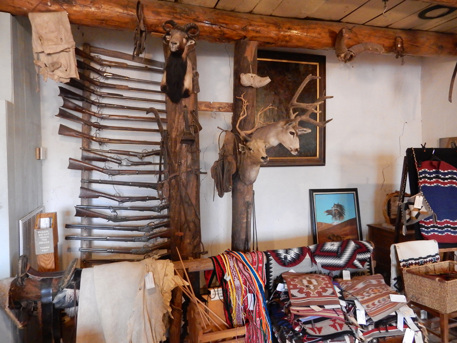
Hubbell – Don Lorenzo to local Hispanics and Naakaii Sani (Old Mexican) or Nak’ee sinili (Eyeglasses) to Navajo started trading here in 1876. He married Lena Rubi three years later and they had four children. In 1967 the wife of their youngest son sold the Trading Post and ranch to the National Park Service.

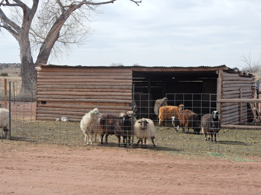
Navajo Churro Sheep
Visitor Center tells the Hubbell story


Guest Hogan, Hubbell Hill (in the background) is on the Navajo reservation. Hubbell, his wife, and his best friend Bi’lii Lani (Chief Many Horses) are buried on top.


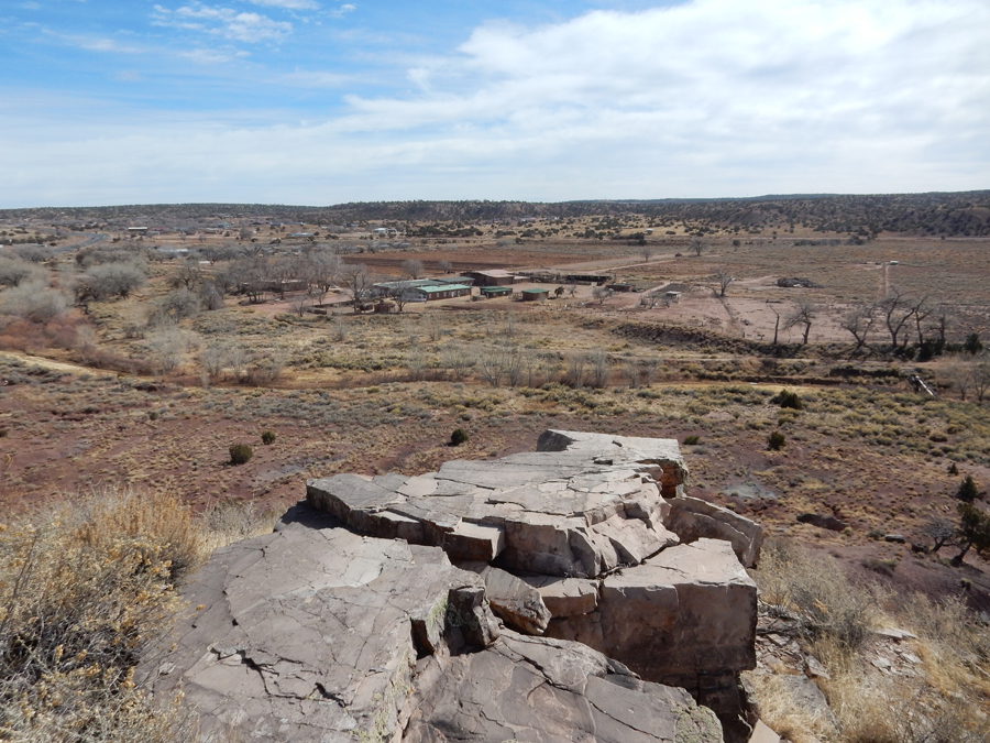
View of the Trading Post and ranch from the top of Hubbell Hill. I am currently exploring the possibility of a coordinated effort between the park and the Navajo Nation to put a trail in from the Visitor Center to the top of the hill. I believe this would be a wonderful addition to the park. It would add a physical activity opportunity for visitors as well as providing a panoramic view of the surrounding landscape.
Fry bread lunch in Ganado, ate in the SUV because of a wind/dust storm

Gave and Indian hitch-hiker a ride on our way to the Fairfield Inn & Suites in Albuquerque NM
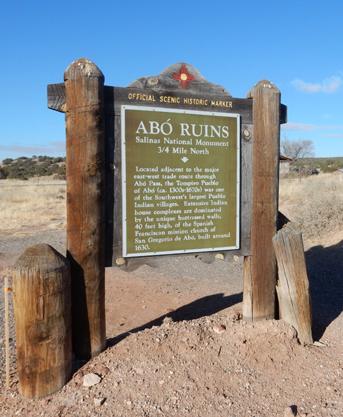
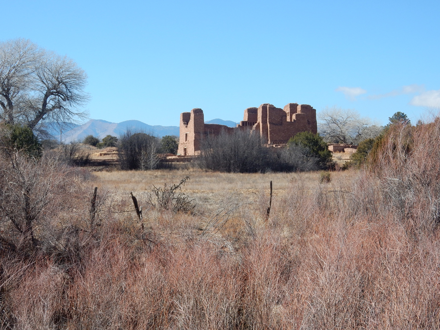
2/11 Su – It took 1.5hrs to get to Abo – the first mission we visited in Salinas Pueblo Missions National Monument
We arrived at 8:30am, so were able to do the 1-mile trail before the Visitor Contact Station opened

This was the coldest morning of our trip since we left MO – 32 degrees
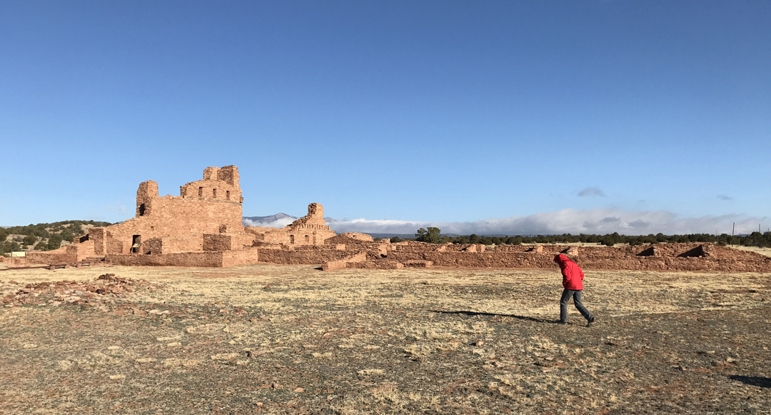
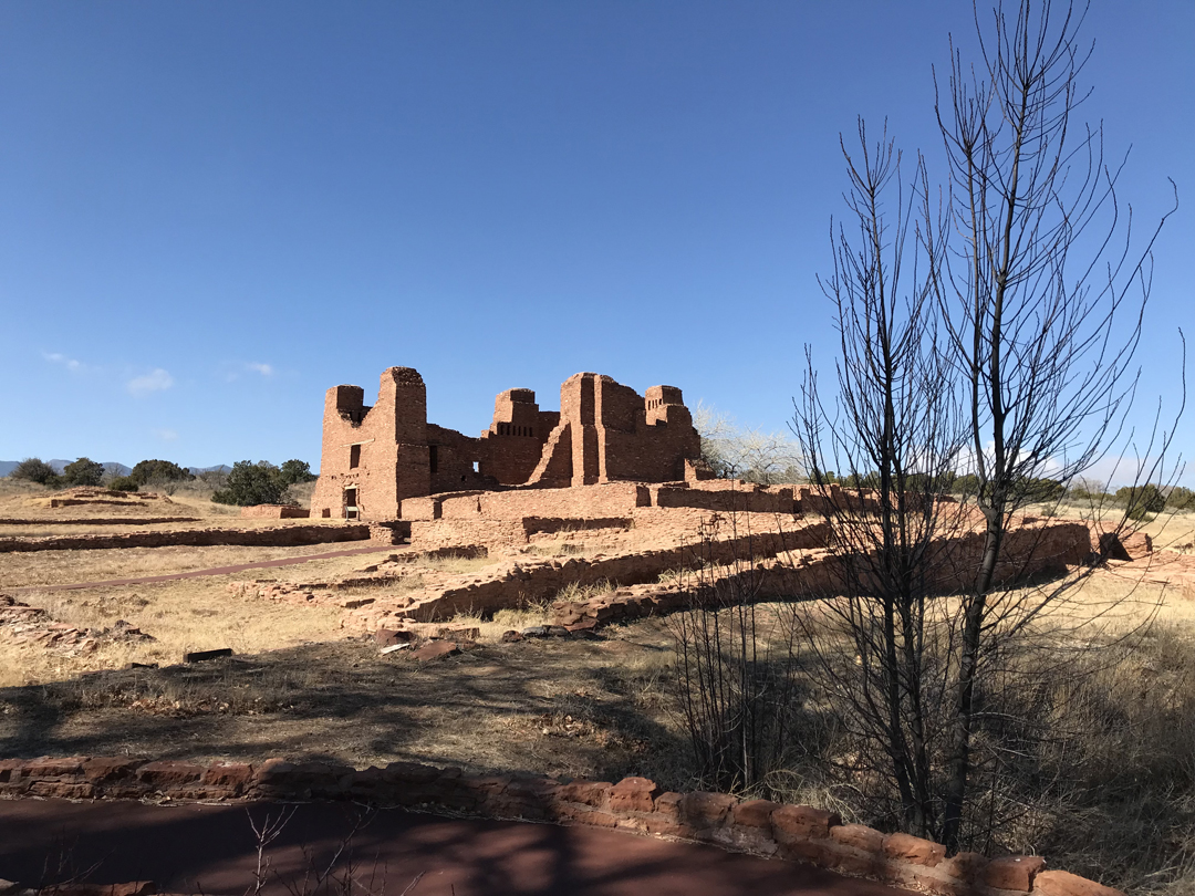
Mission San Gregorio de Abo (1622 – 1628)
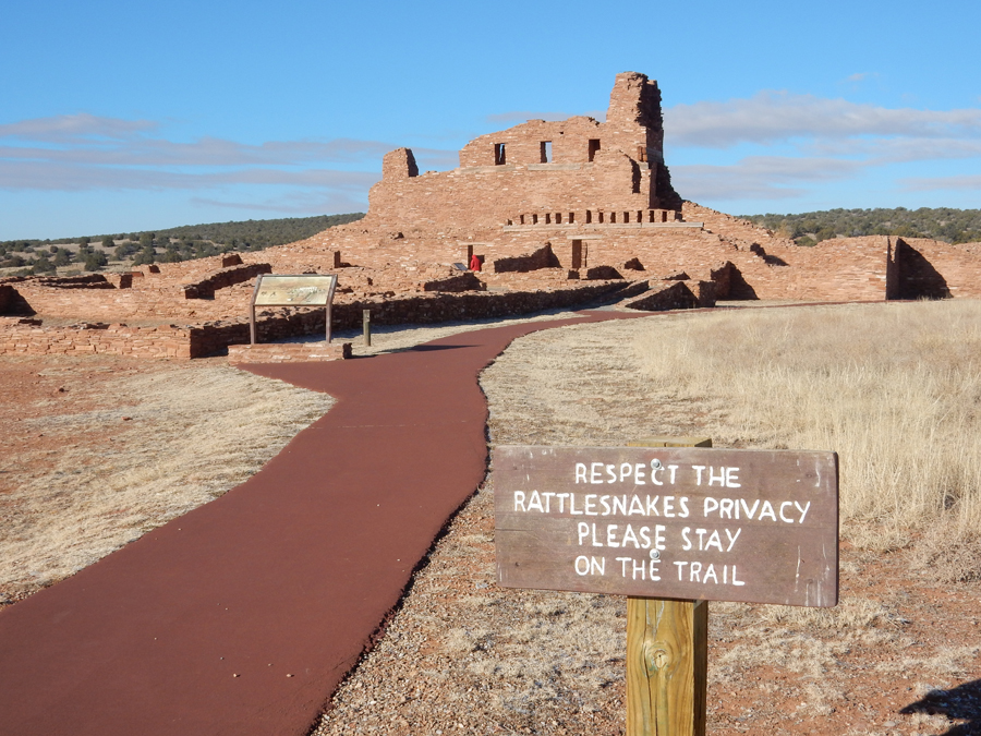

Kiva – note the snow on the sign


Stopped in the monument Visitor Center in Mountainair, where Helen bought some nice earrings
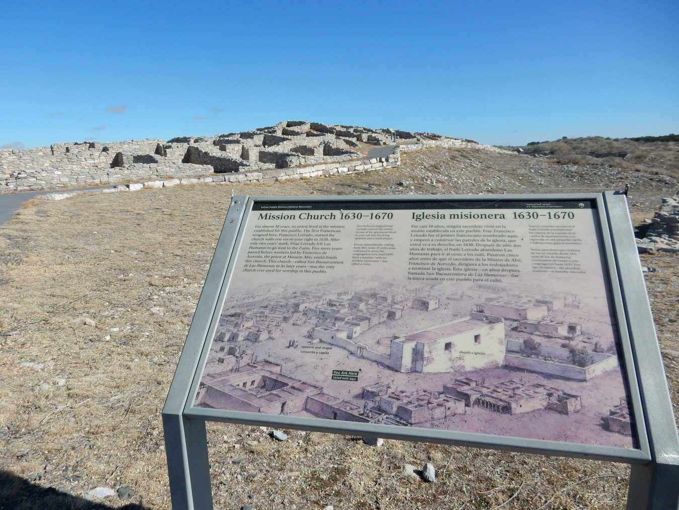
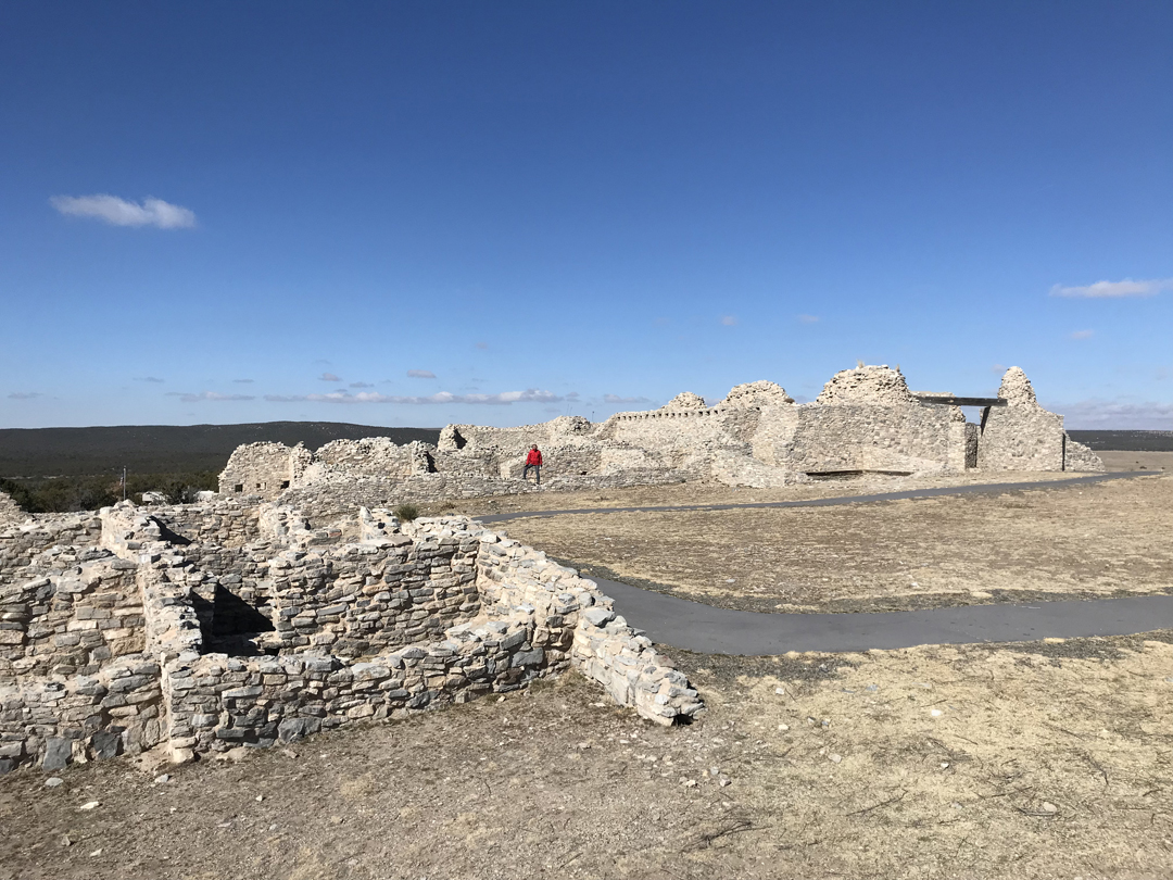
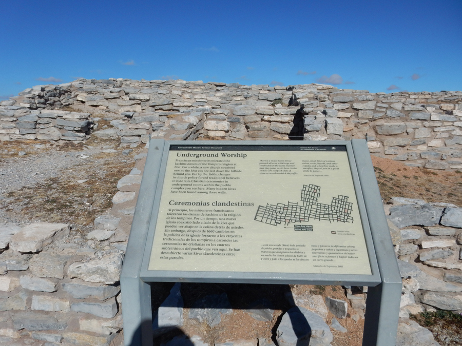
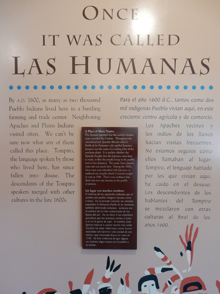
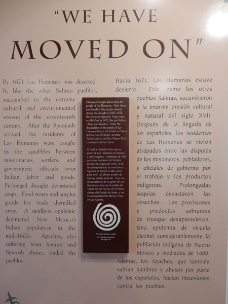
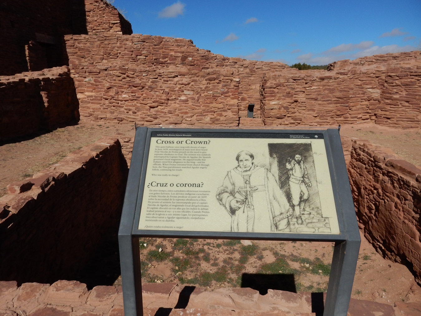
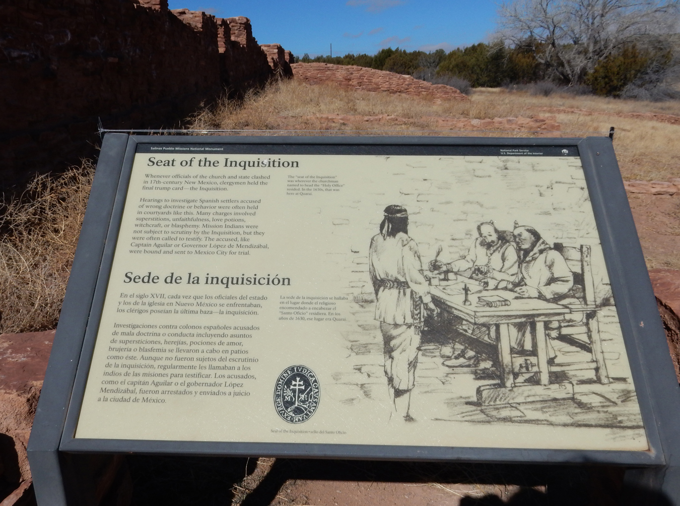
Then turned south for 25 miles to the Gran Quivira Pueblo

Gran Quivira was once called Las Humanas

We walked the 1-mile loop through the ruins
Kiva on left was used for “Underground Worship”

Remnants of Indian Pueblo (1100-1600) in foreground, last church and convent in distance

Info –

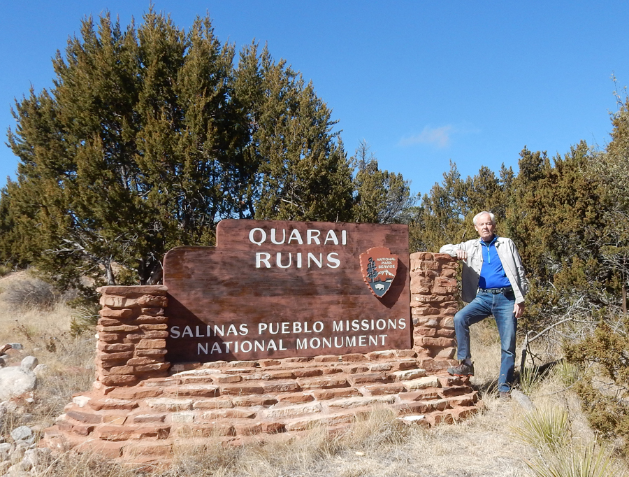
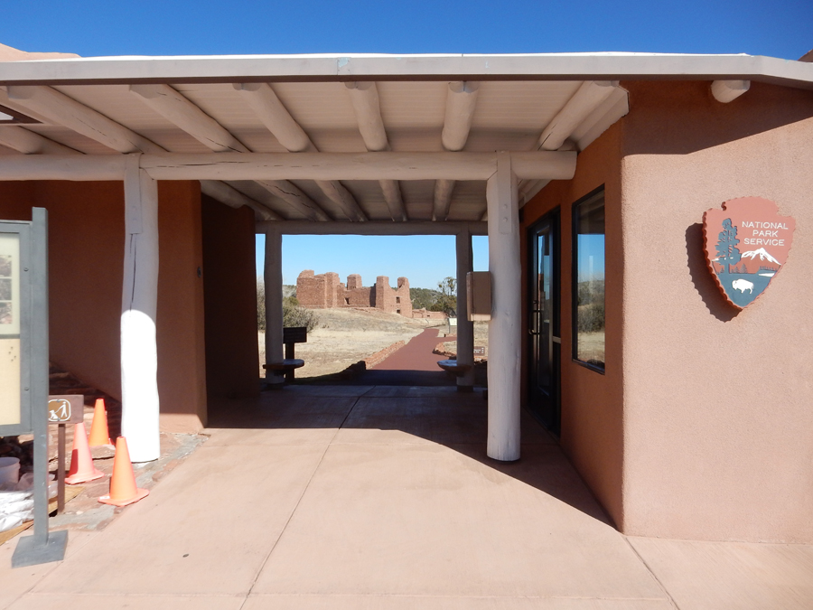
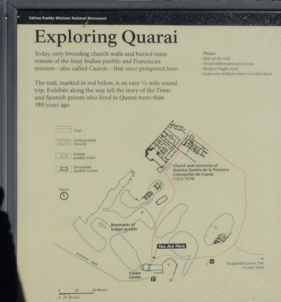
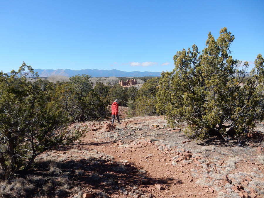
Headed north to the Quarai Pueblo outside of Punta de Agua
Interesting model


We walked the loop trail through the ruins

Nuestra Senora de la Purisima Concepcion de Cuarac church and convent (1622-1678)

9609.1, 9604, 9606, 9608
We also hiked the Spanish Corral 1 mile loop trail

Visitors to the pueblo in 1900

On our way to Santa Fe
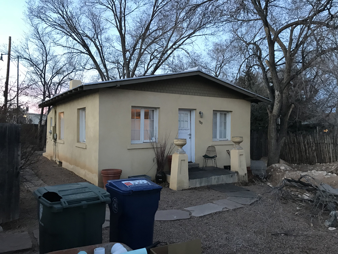
Very nice Airbnb house in downtown Santa Fe
When we can, we have been watching the Winter Olympics from PyeongChang South Korea

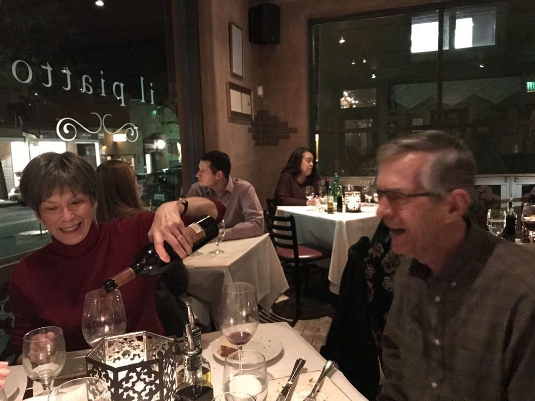
Dinner with Jane and Terry at il Piatto Italian Farmhouse Kitchen restaurant in Santa Fe
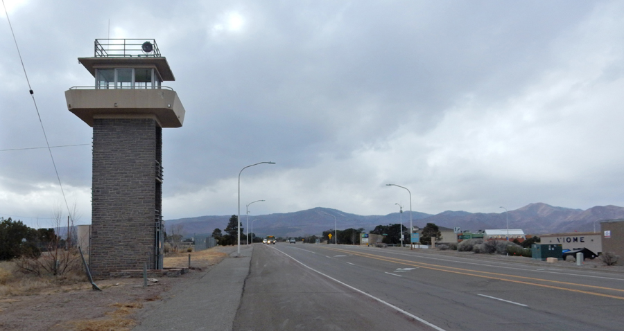
2/12 M – Los Alamos is 1hr NW of Santa Fe – this is the eastern entrance to the city
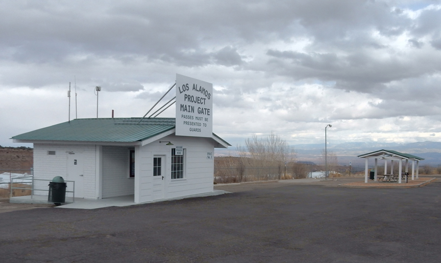
Manhattan National Historical Park Visitor Center

There are three Manhattan NHP sites: 1) Los Alamos NM, 2) Hanford WA, and 3) Oak Ridge TN

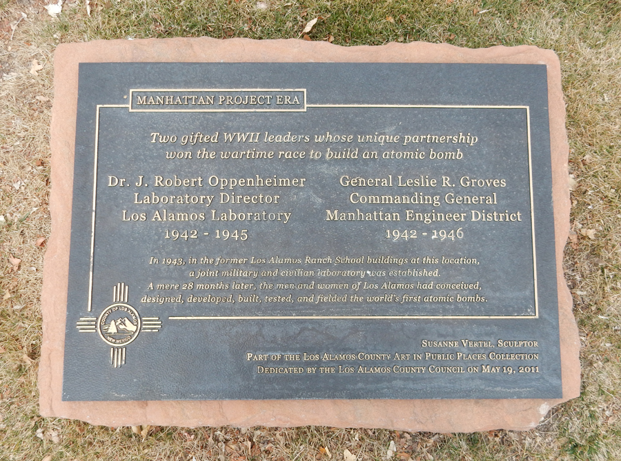
After listening to the ranger talk we explored the city. The Oppenheimer & Groves Sculptures are nearby

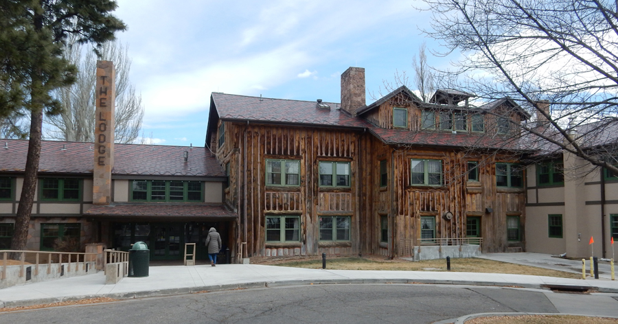
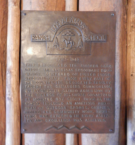
The Fuller Lodge was built in 1928 as the dining hall for the Los Alamos Ranch School

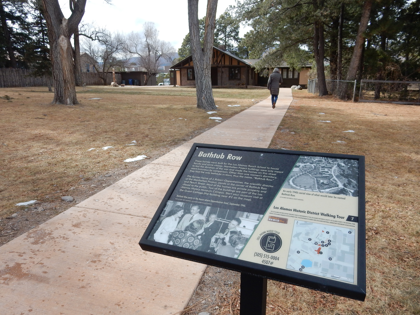
We walked “Bathtub Row” and toured the Hans Bethe House – home to Nobel Prize winners Edwin McMillan (chemist) and Hans Bethe (physicist)
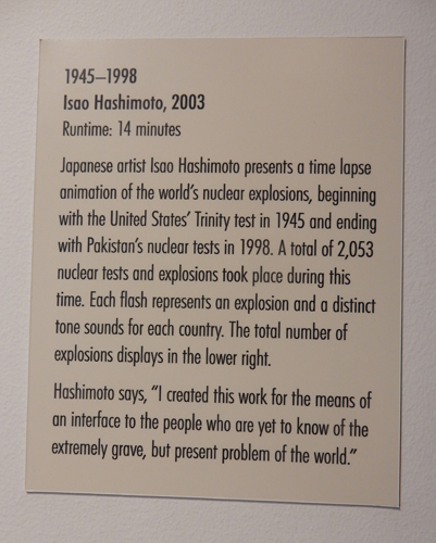
The house contains the Harold Agnew Cold War Gallery

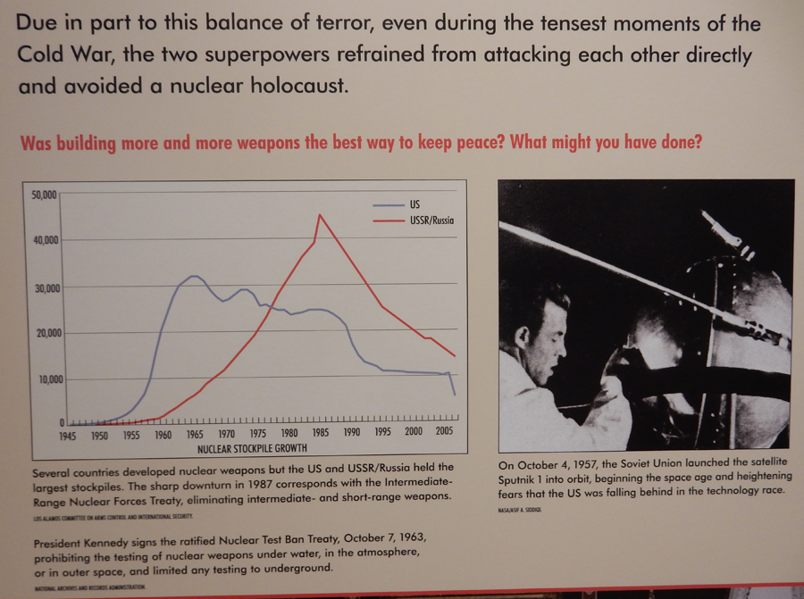

Nuclear tests by country from 1945-1998 – 2,053!!!

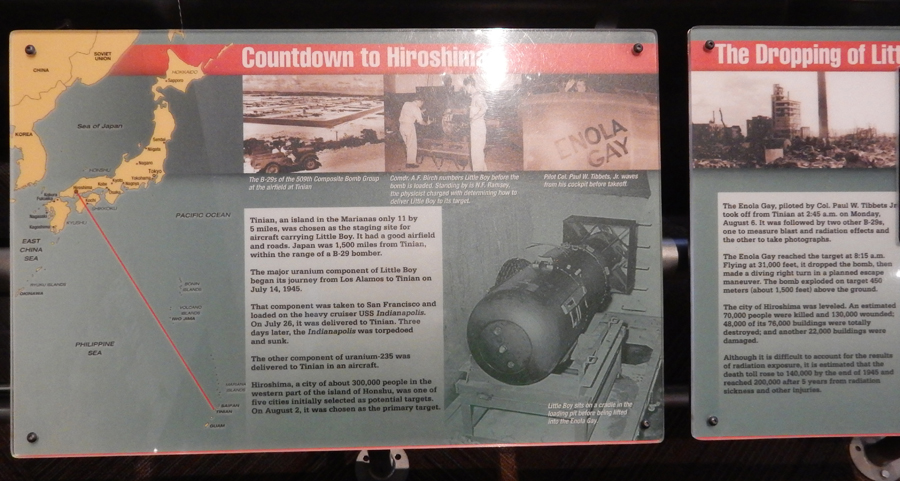
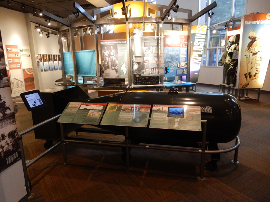
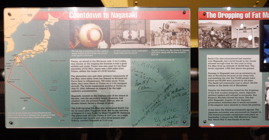
We had lunch with our old friends from the U of Maryland, Morrie and Cheryl, and then toured the Bradbury Science Museum
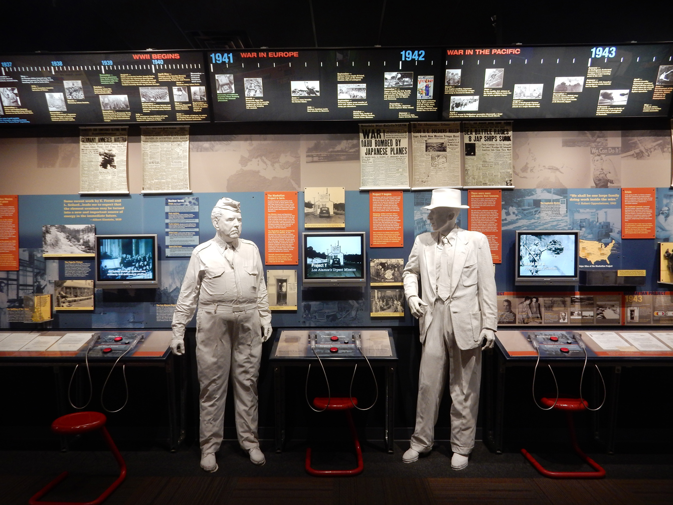
The museum presents the history of Los Alamos National Laboratory including its role in the creation of the nuclear devices exploded over Japan in 1945

Had dinner with Sylvia and Mike at the El Nido restaurant north of Santa Fe

2/13 Tu – it only took 45min to drive to the Glorieta Pass Unit of Pecos National Historical Park

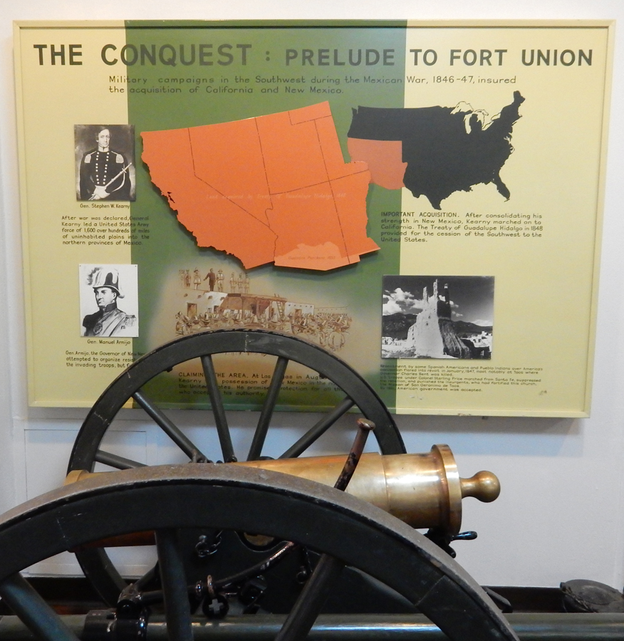
What the sign does not state – is that the Confederates were also trying to take the U.S. Mint in Denver. That would have had a major impact on the Civil War. So, though small, this battle was VERY important. Glorieta Pass is on the Santa Fe Trail; it provides passage through the Sangre de Cristo Mountains.

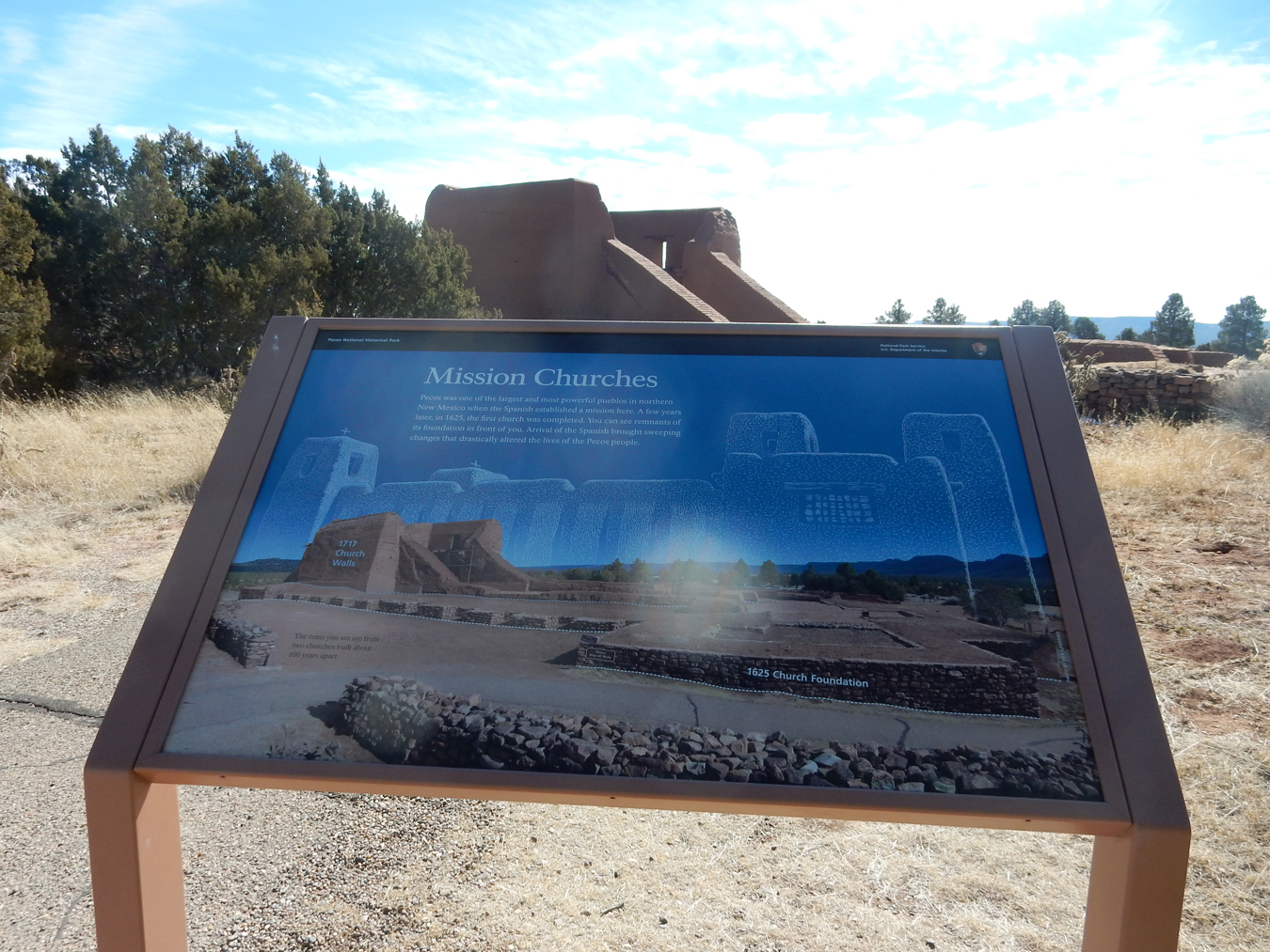
The Pecos NHP Visitor Center is near the Pecos Pueblo

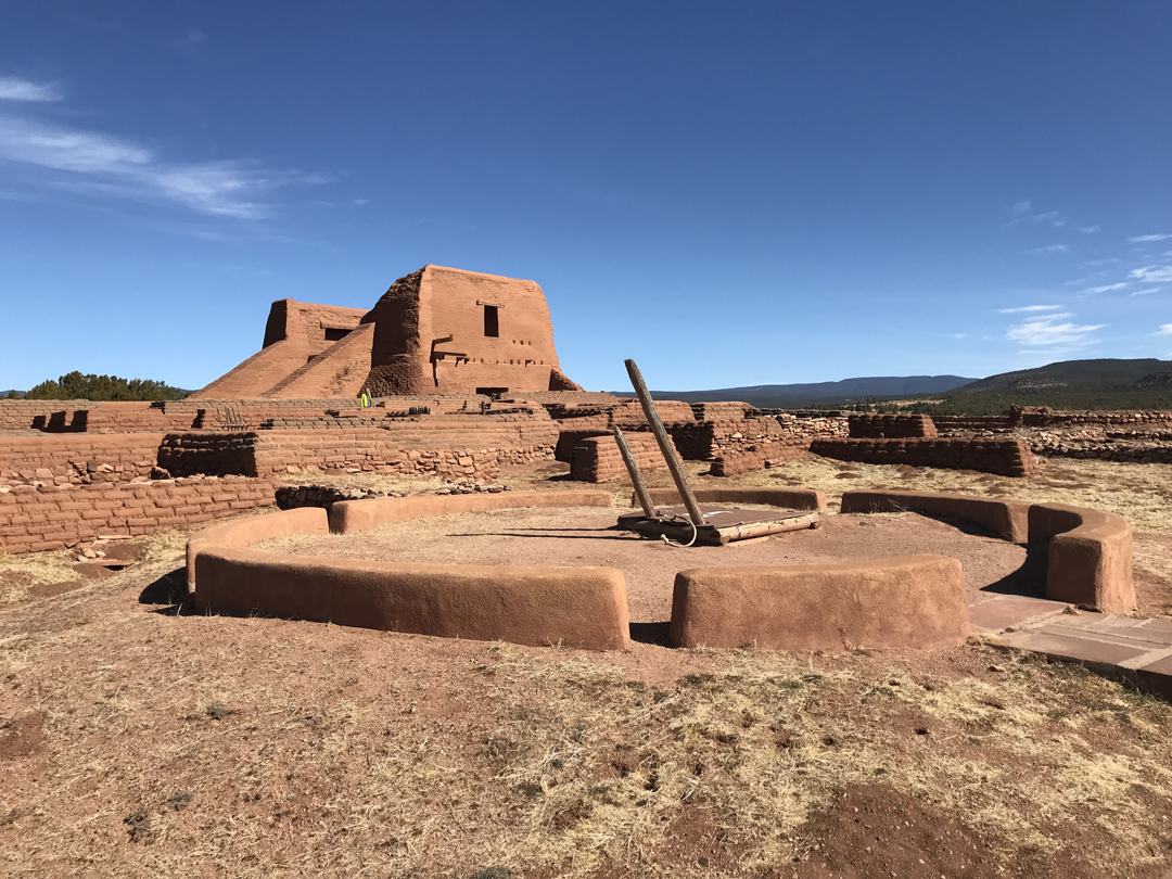
We hiked the 1.25-mile loop trail

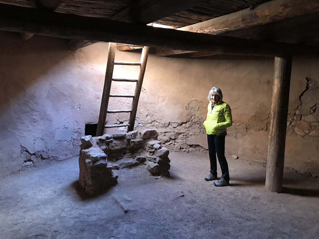
Reconstructed Kiva

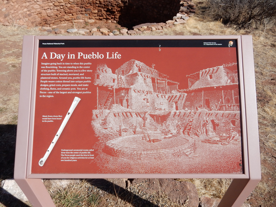
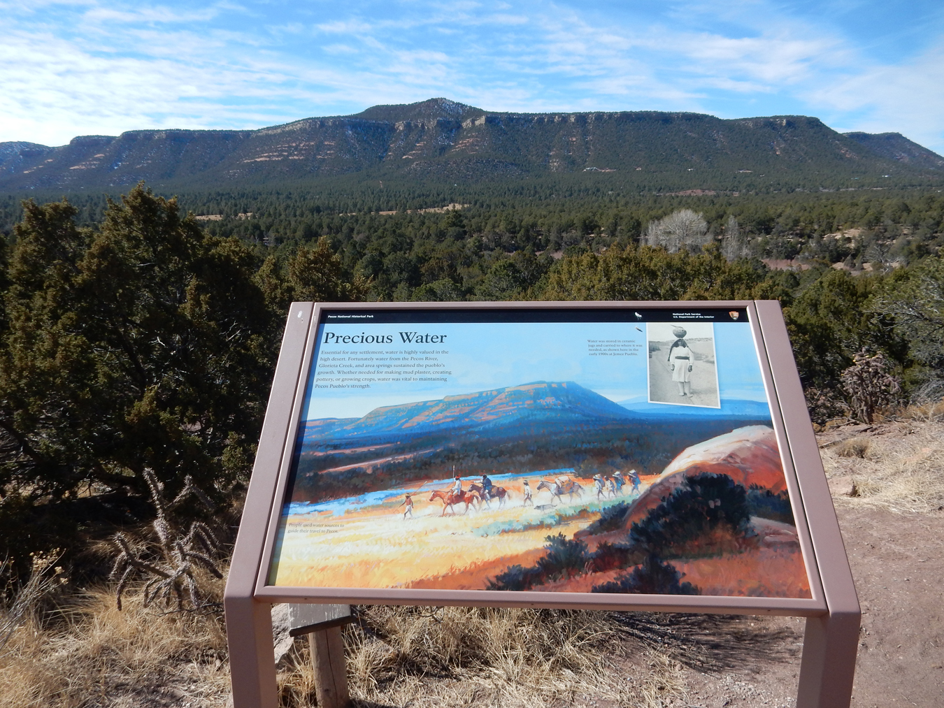
The Pecos Pueblo was strategically located for trade and access to water

In the 1500s, Pecos Pueblo was the richest and most powerful in what is now New Mexico


We stopped at Kozlowski’s/Forked Lightning Ranch and Stage Station and then proceeded to Fort Union National Monument. Can you see Fort Union in the distance? Blow-up Pic

Entrance

Visitor Center – history leading up to the first Fort Union in 1851
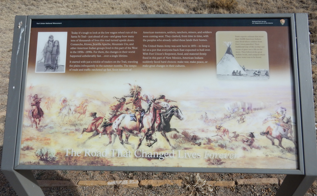
The fort was established to protect the Santa Fe Trail (SFT)
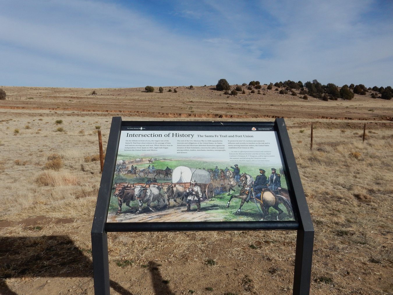
It was located on the Mountain Branch and just off the Cimarron Branch of the SFT

We were given a personal ranger tour of the grounds
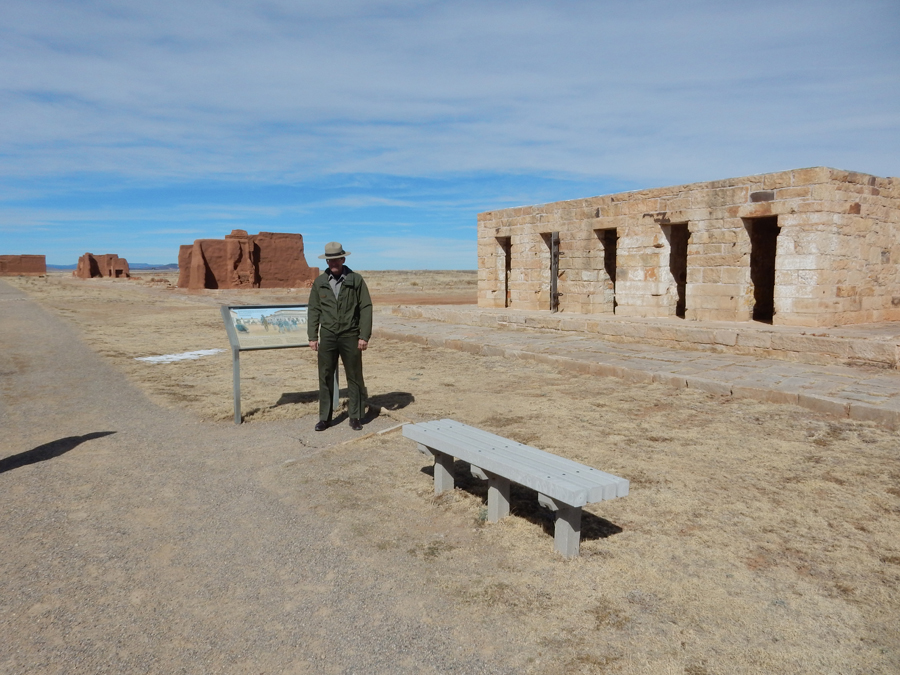


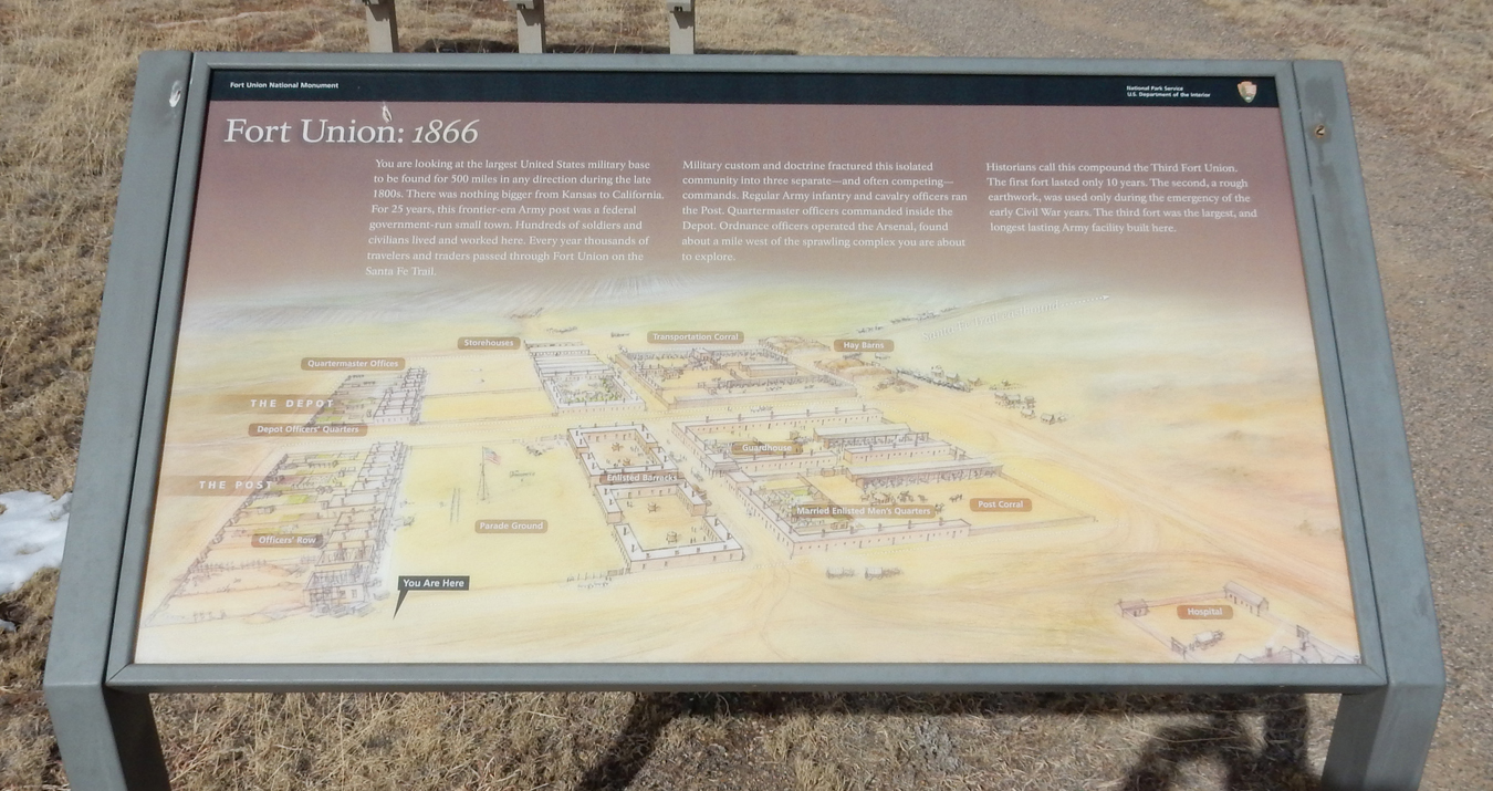
Fort Union was a supply depot for forts in the New Mexico Territory and in its heyday was the largest military base in 500 miles. This is the view from the north – blow it up to see more detail
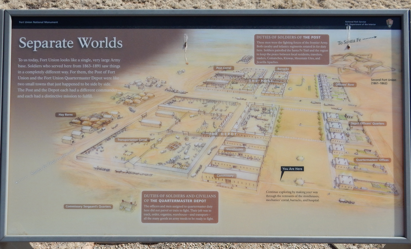
View from the south, represents fort in 1866 immediately following the Civil War
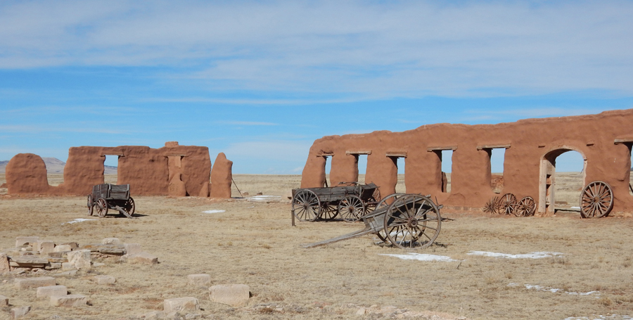
One corner of the reconstructed walls
Elevation marker 1867

War Department Marker 1871

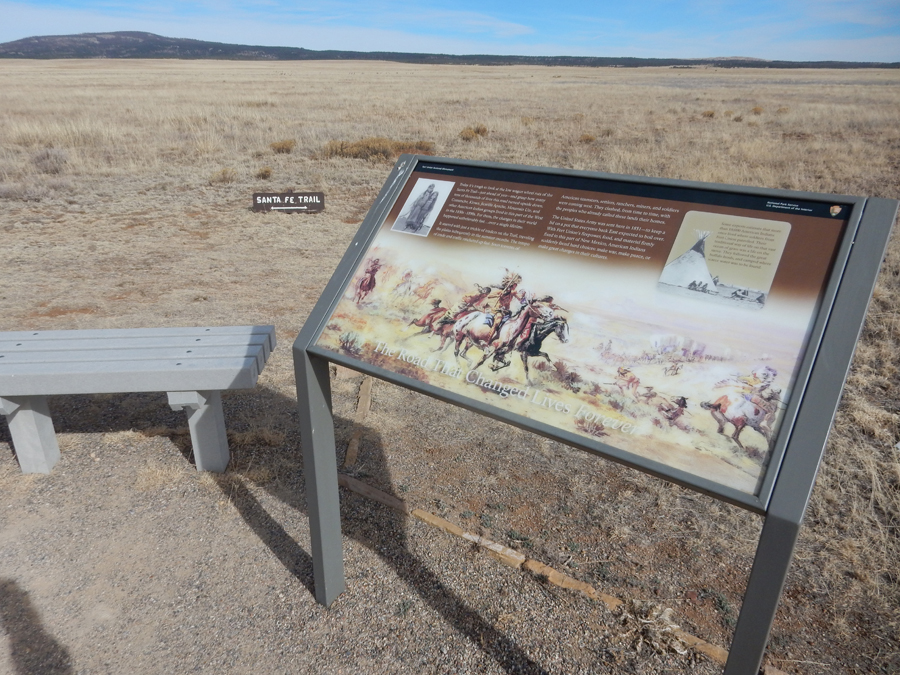
Santa Fe Trail at Fort Union
Trade Site to the North and East of Fort Union – Blow-up for more detail

Trade Sites to the West

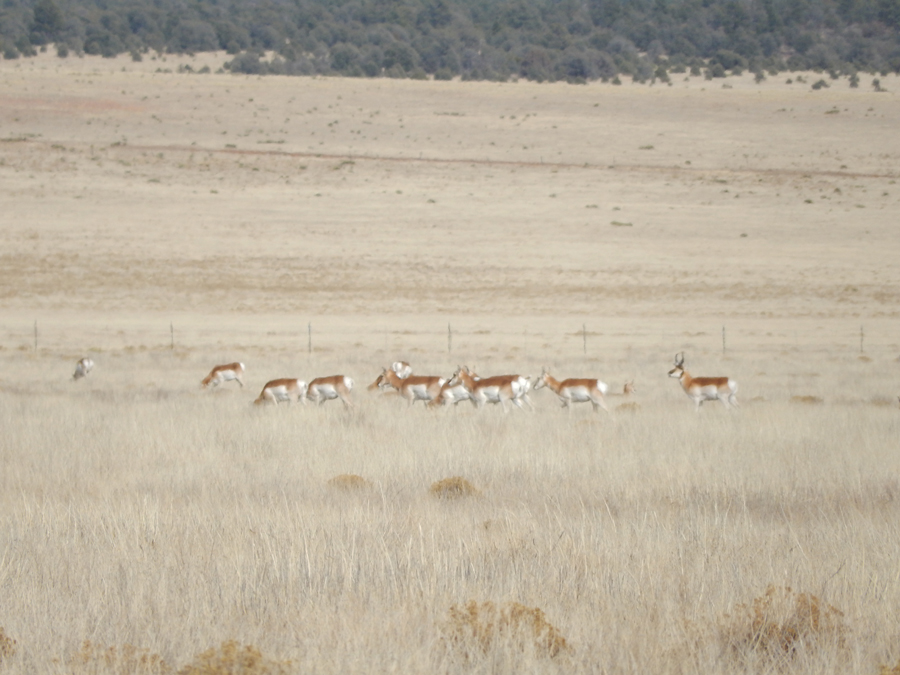
Pronghorn Antelope
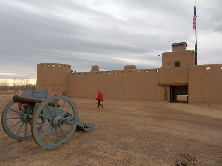
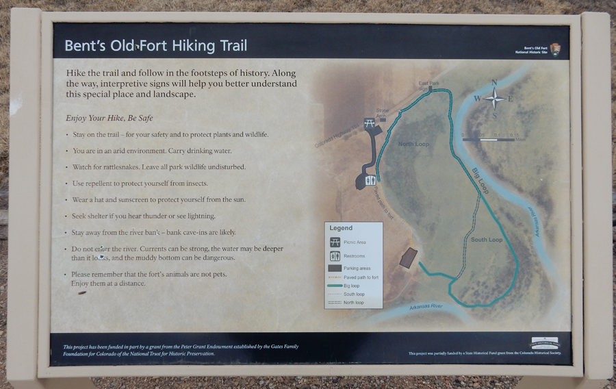
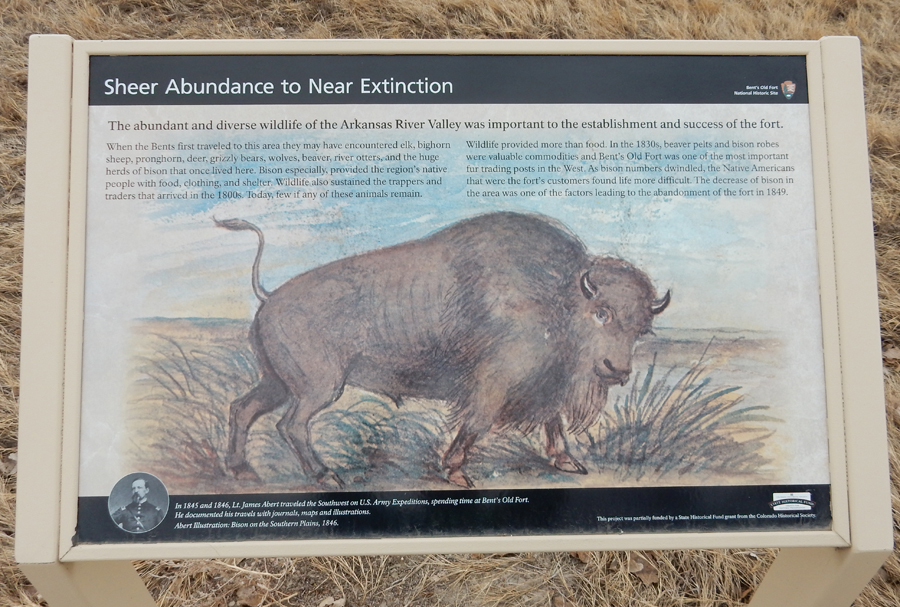
2/14 W – Ash Wednesday, received our ashes at Our Lady of Guadalupe and St Patrick’s Church (what a combination!), breakfast downtown, and then drove 20min to Bent’s Old Fort National Historic Site

Short hike to fort, it was 8am, and it was not open

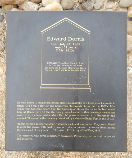
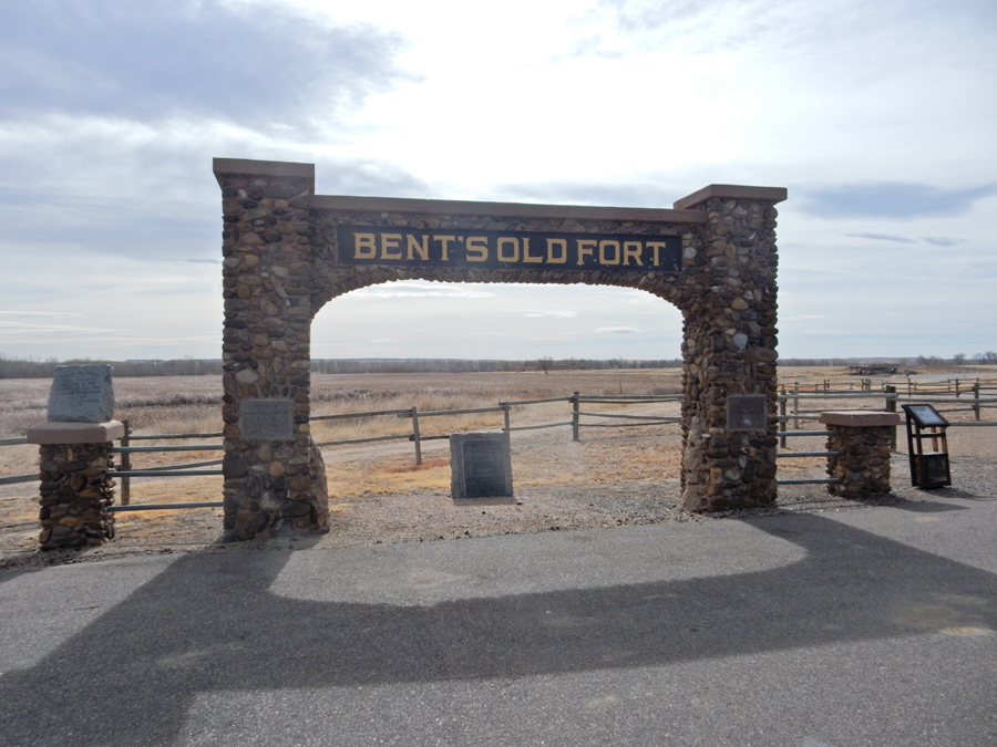
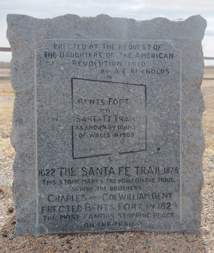
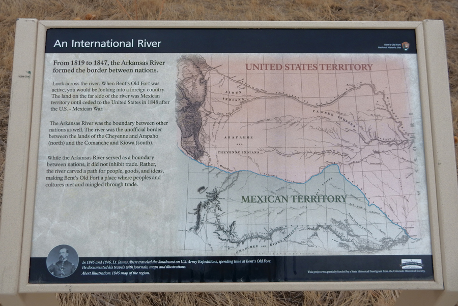
Charles and William Bent, along with Ceran St. Vrain, established their “fort,” first called Fort William, on the north side of the Arkansas River in 1833. Mexico was then on the south side of the river! Open for better view –

Some of the trail was flooded, so we were only able to hike about a mile loop

When we returned to the fort, it was open

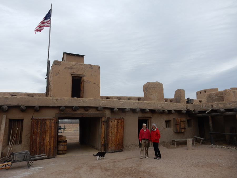
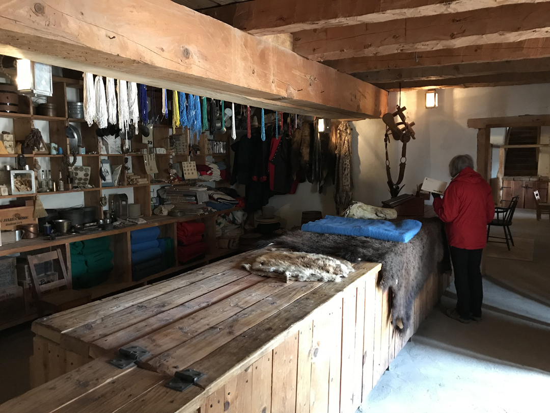
They have done an excellent reproduction of the fort, these were the trade rooms


Kitchen

This was a guest room that is now called the Susan Magoffin’s Quarters. She was the wife of a prosperous trader and one of only a few white women who visited the fort. She suffered a miscarriage and stayed 12 days.

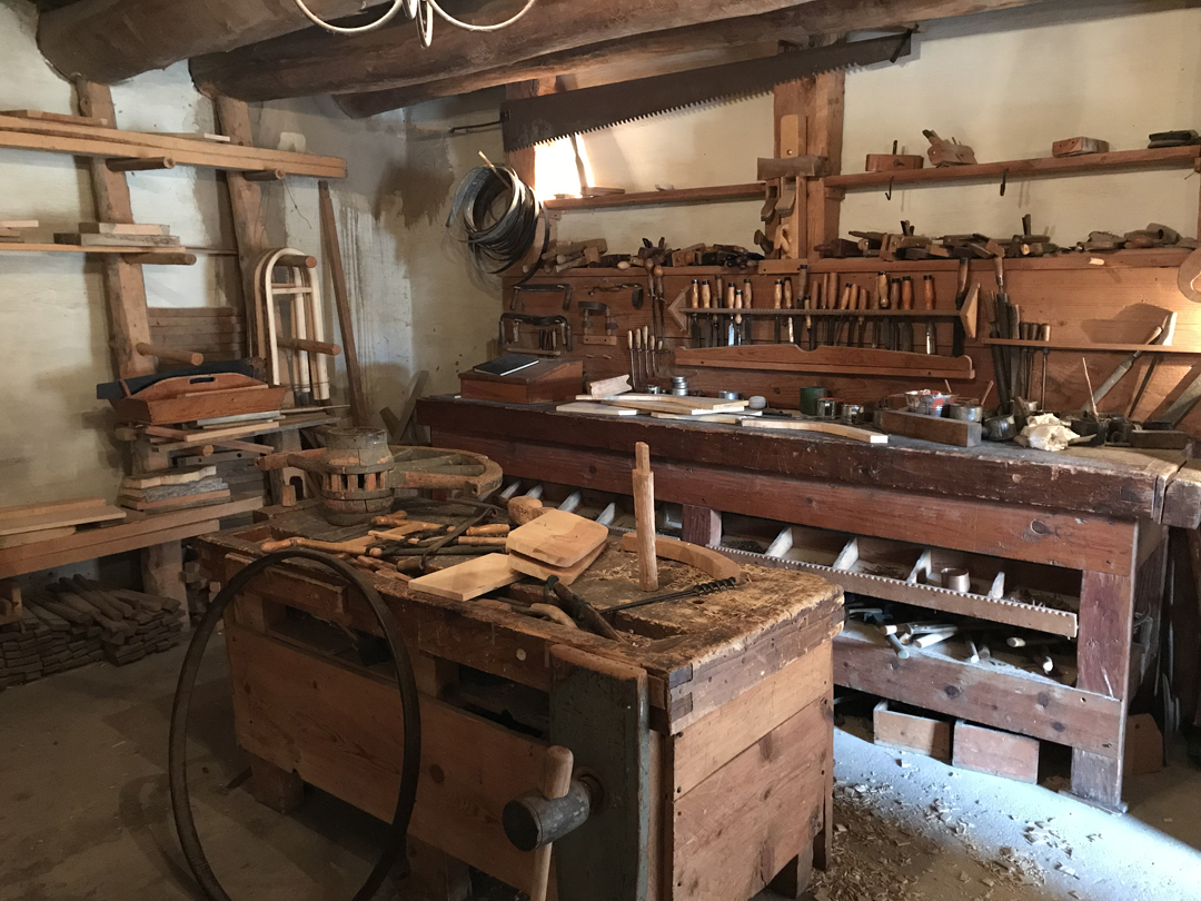
The blacksmith and carpenter shops are still used to create wagons and objects for the fort

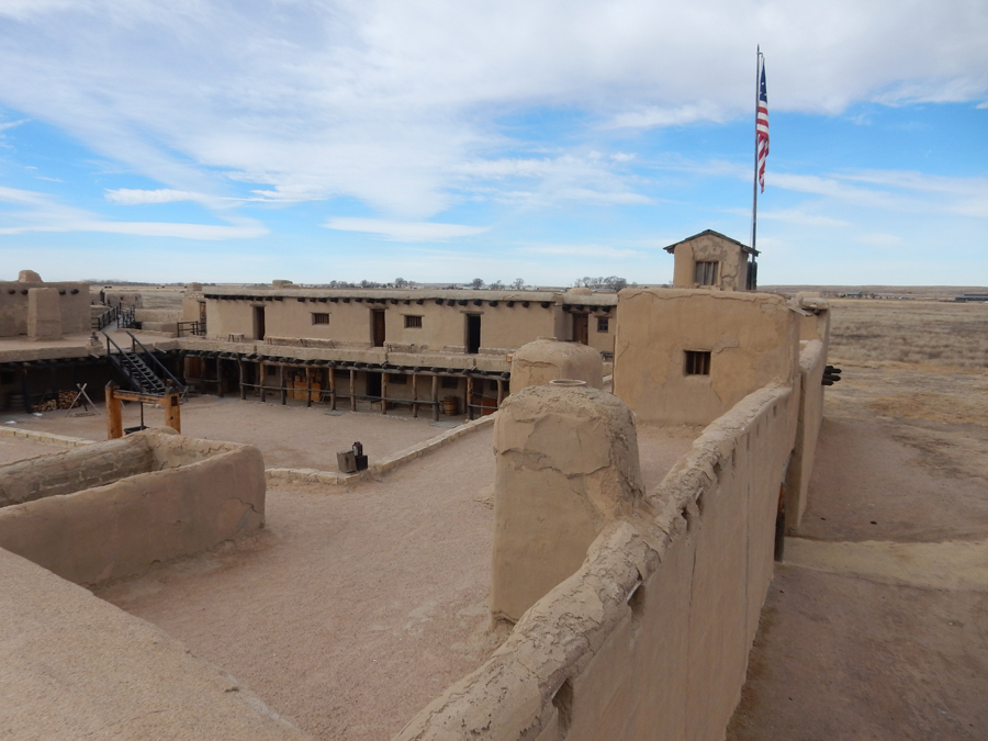
The fort was on the Mountain Branch of the Santa Fe Trail (SFT) and was a cultural crossroads for trappers, hunters, traders, Indians, and Mexicans. The SFT connected with the El Camino Real de Tierra Adentro Trail (Royal Road) at Santa Fe, which extended trade deep into Mexico.


Second level of Bent’s Old Fort, one of the corner gun posts


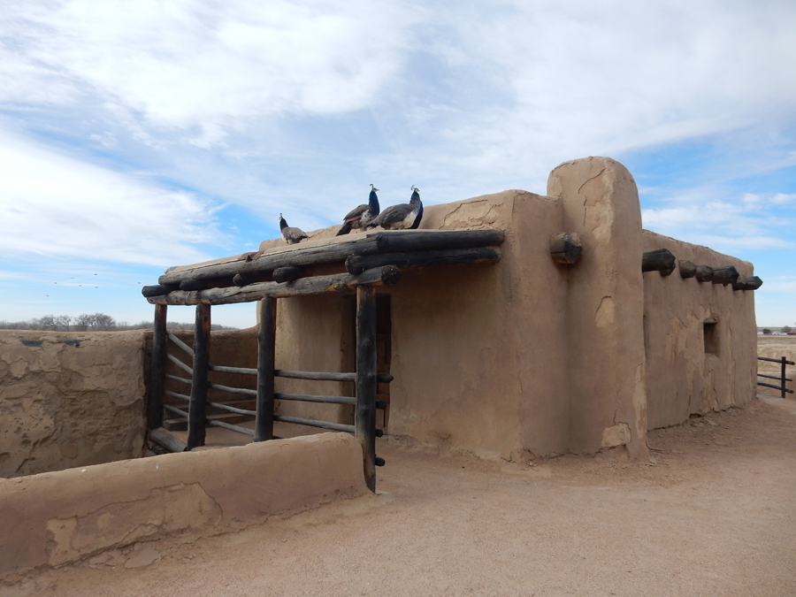
The trading post relied heavily on oxen, mules and horses for transporting furs and trade goods down the 600-mile trail to and from Missouri. Journals mention goats, chickens, pigs, buffalo calves, milk cows, peacocks and sheep. Oxen, Spanish horses and a mule graze in and outside the fort. Peacocks and chickens roam the rear corral, much like in the 1840s.

Charles Bent moved to Taos, married into a prominent family, and directed the SFT trade from there. He was named Provisional Governor of New Mexico in 1846. He was killed in 1847 during a revolt of the Hispanics and Pueblo Indians against the U.S. William Bent married Owl Woman, daughter of Cheyenne Chief White Thunder and sometimes lived in her village. They had four children. Bent also took Owl Woman’s sisters, Yellow Woman and Island, as secondary wives. He had his fifth child with Yellow Woman. After Owl Woman died in 1847, Island cared for her children. Each of the sisters left Bent and, in 1869, he married the young Adaline Harvey, the educated mixed-race daughter of Alexander Harvey, a friend who was a prominent American fur trader. Bent died shortly after their marriage, and Adaline bore their daughter, his sixth child, after his death. I mention the genealogy here because his male children would play a significant role during and after the 1864 Sand Creek Indian Massacre.
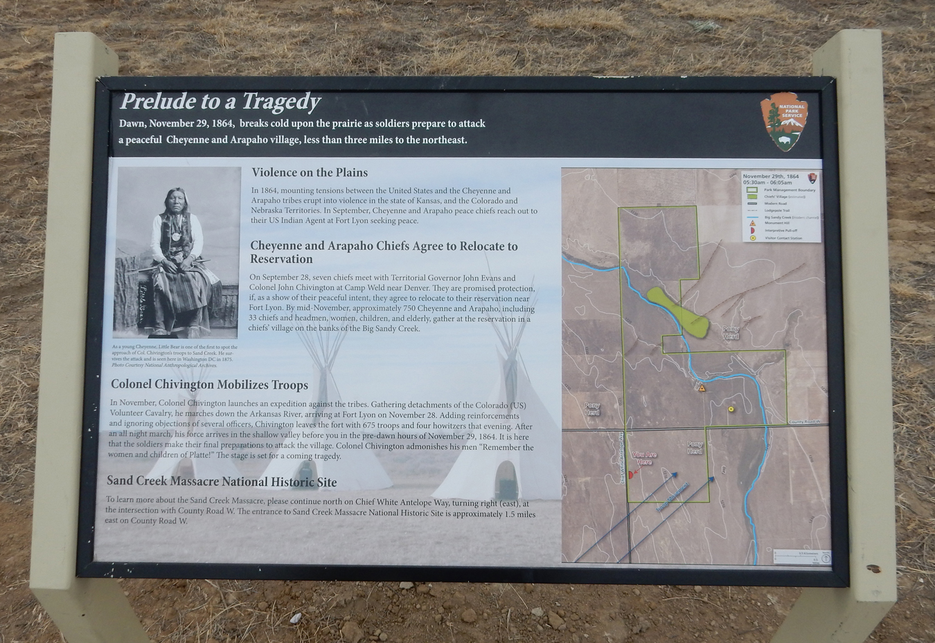
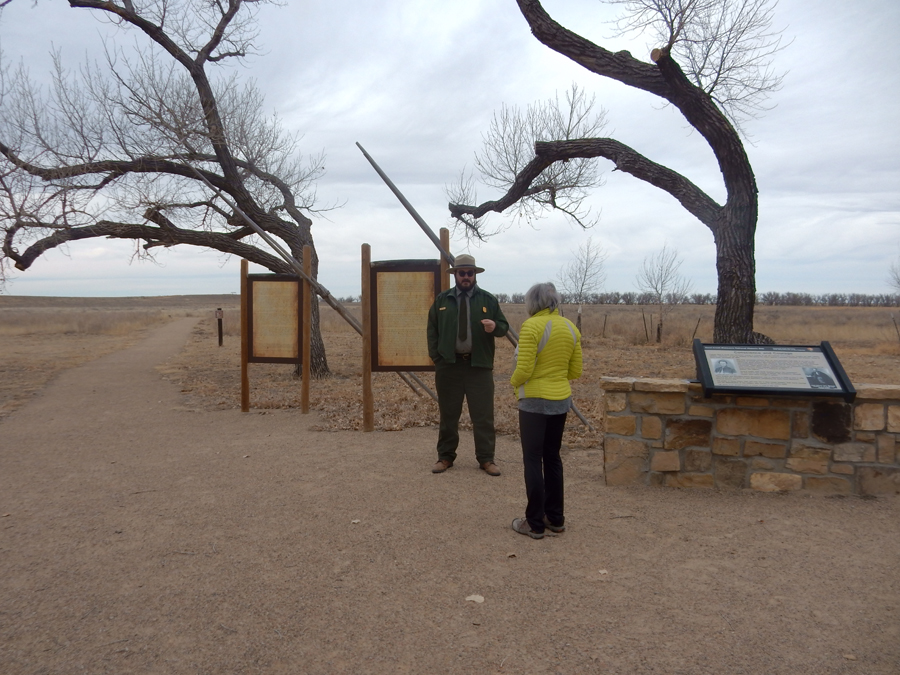
2hrs to Sand Creek Massacre National Historic Site, the last 8 miles were on a dirt road
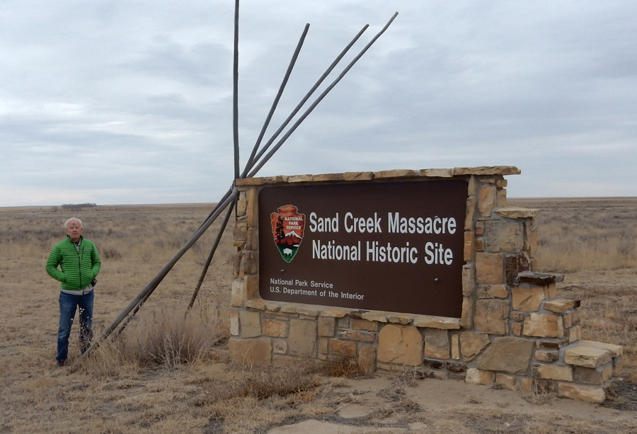
Read the signs to learn the story of this tragedy
Again, a personal ranger tour, I guess February is a good time to visit these sites – provided you check the weather and call ahead to confirm hours and availability of rangers.

Monument and Overlook

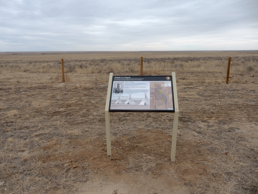
The Story – November 29, 1864

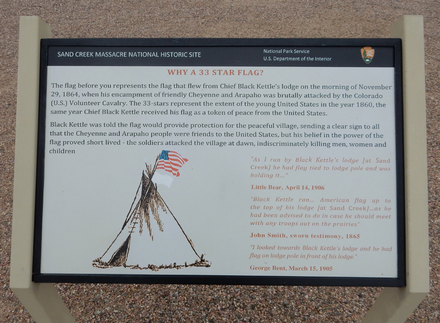
Chief Black Kettle and his wife escaped the massacre only to be killed by Gen George Custer’s troops at Washita Battlefield in OK on November 27, 1868 – see this blog for January 2018 for a description of our visit to that site.
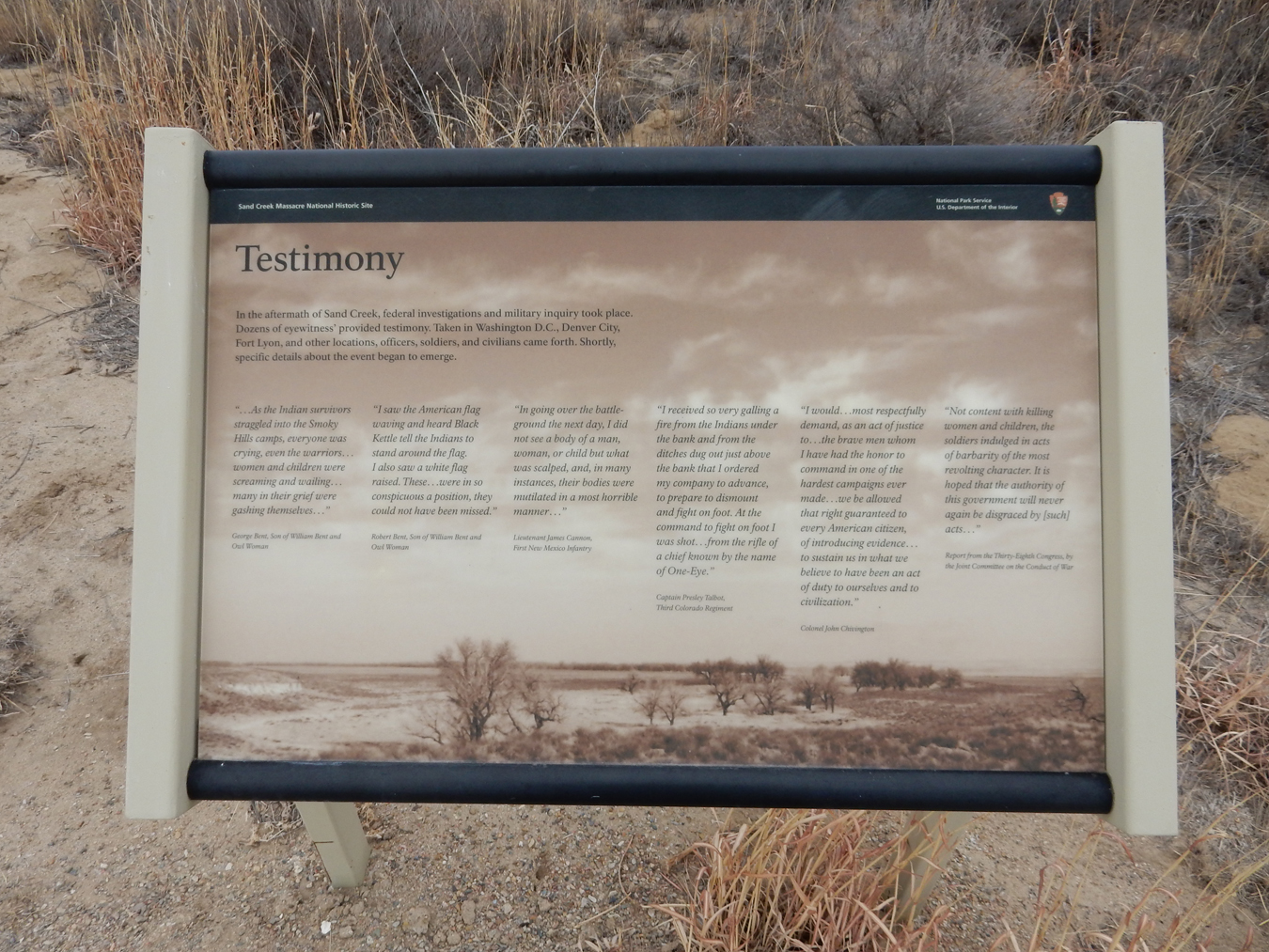
George Bent, William Bent and Owl Woman’s son who was born at Bent’s Old Fort and educated in Kansas City and St Louis, as well as his brother Charles, were with Black Kettle at Sand Creek. Both were wounded but escaped. Afterward, because of the Sand Creek Massacre, they joined War Parties in attacks on towns, farms, and ranches.
Helen was so upset after the ranger’s description of the massacre that she did not want to leave the SUV. I did the 1.5 mile walk along the bluffs overlooking Sand Creek.

Visitors are requested not to descend to Sand Creek because it is considered Sacred Ground.

As I left the site, this peaceful scene was in stark contrast to the events that took place here on November 29, 1864

We spent the night at the Marriott Town Place Suites in Garden KS (Valentine’s Day!)
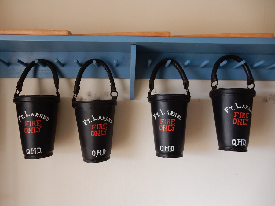
2/15 Th – it took 1.5hrs to get to Fort Larned National Historic Site KS, another fort on the Santa Fe Trail

Guardian of the Santa Fe Trail 1821 – 1880
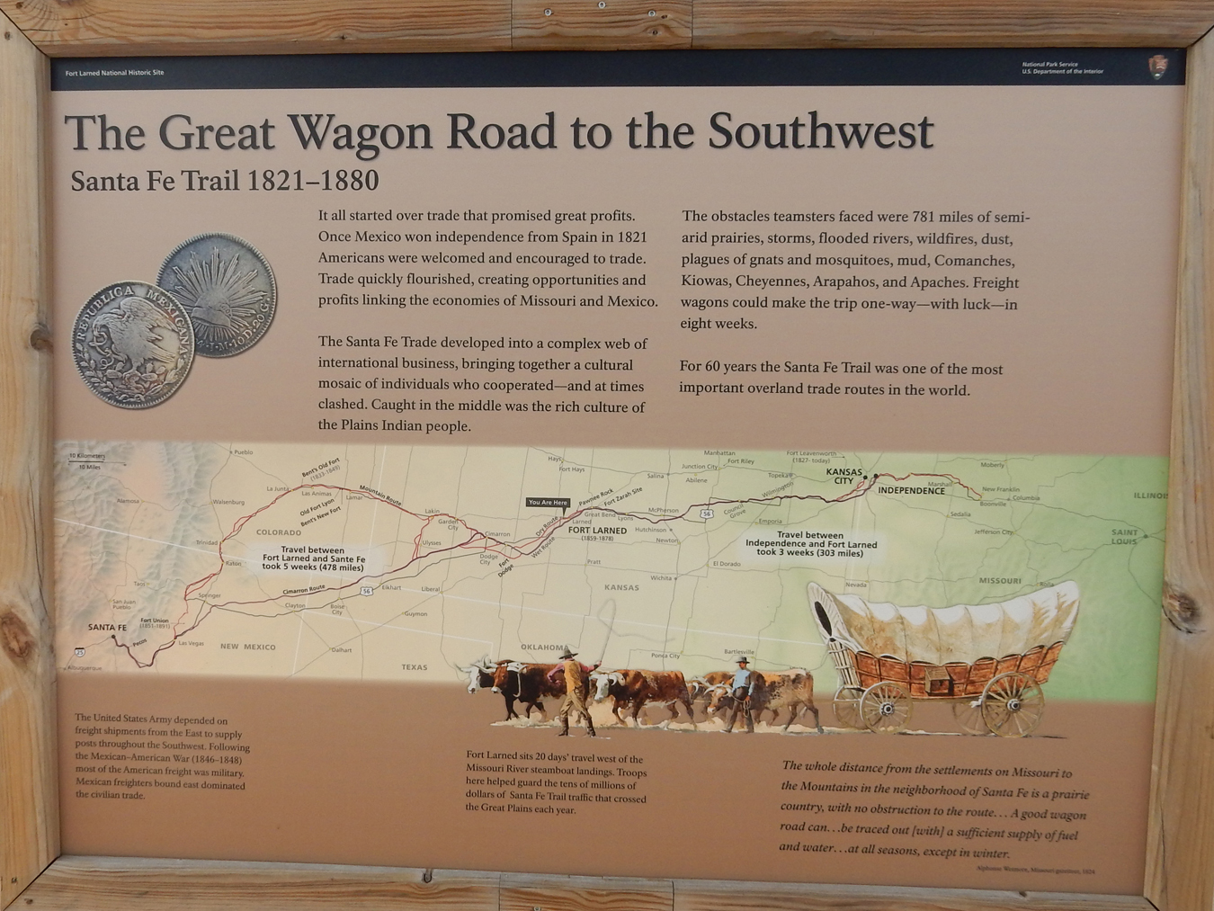
The post was established in 1859 to escort mail coaches and military supply wagons on the trail. The broader mission was attempting to keep peace on the plains during the “Indian Wars.”
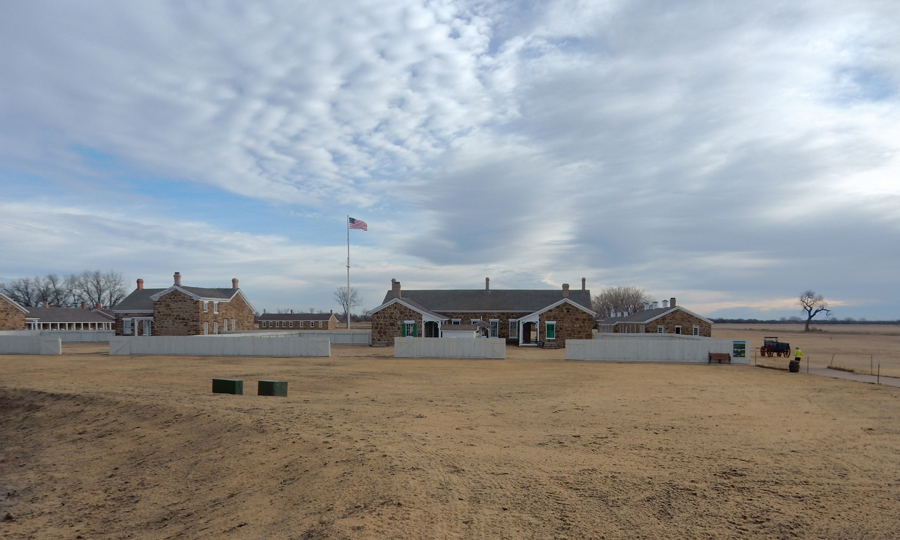
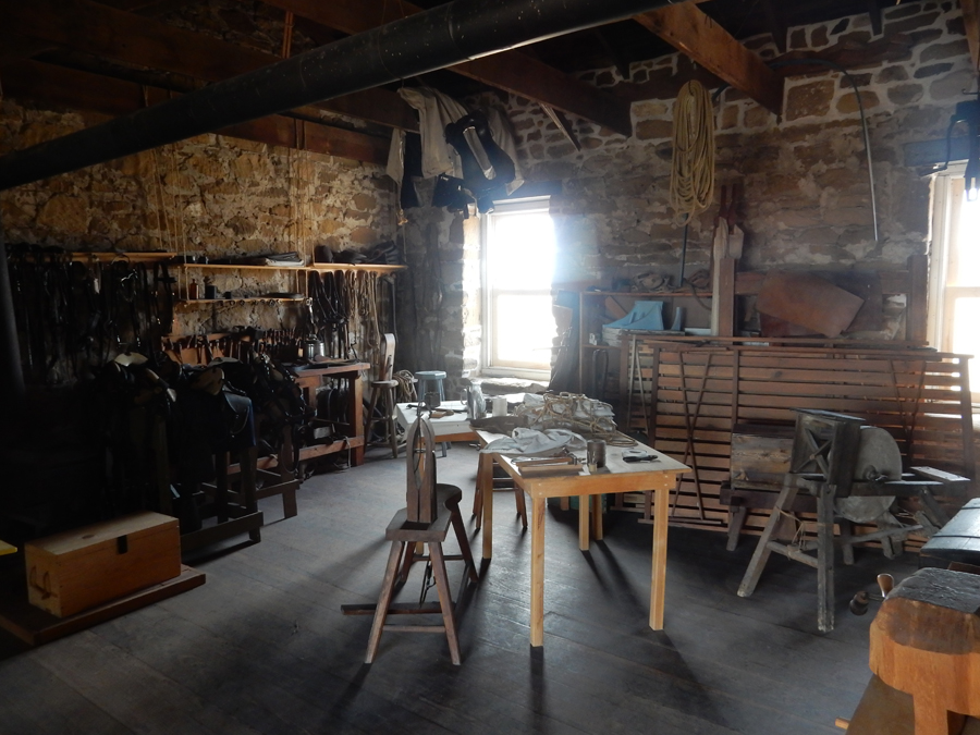
The sandstone buildings were constructed between 1865 and 1868

The sandstone makes for easy etching of names

Buffalo Soldiers display in the Visitor Center/Museum

Fort Larned Model

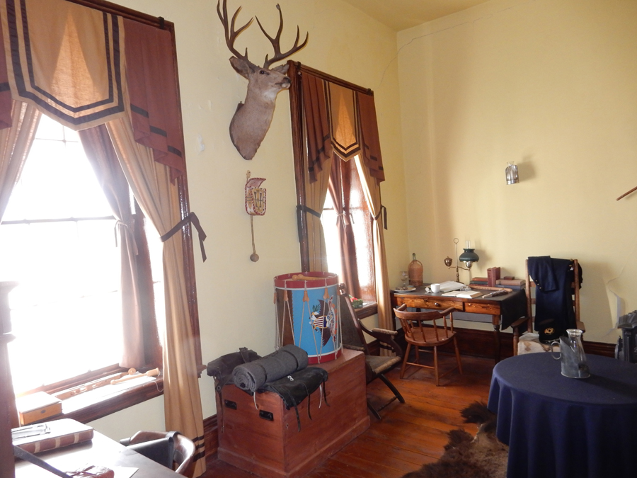
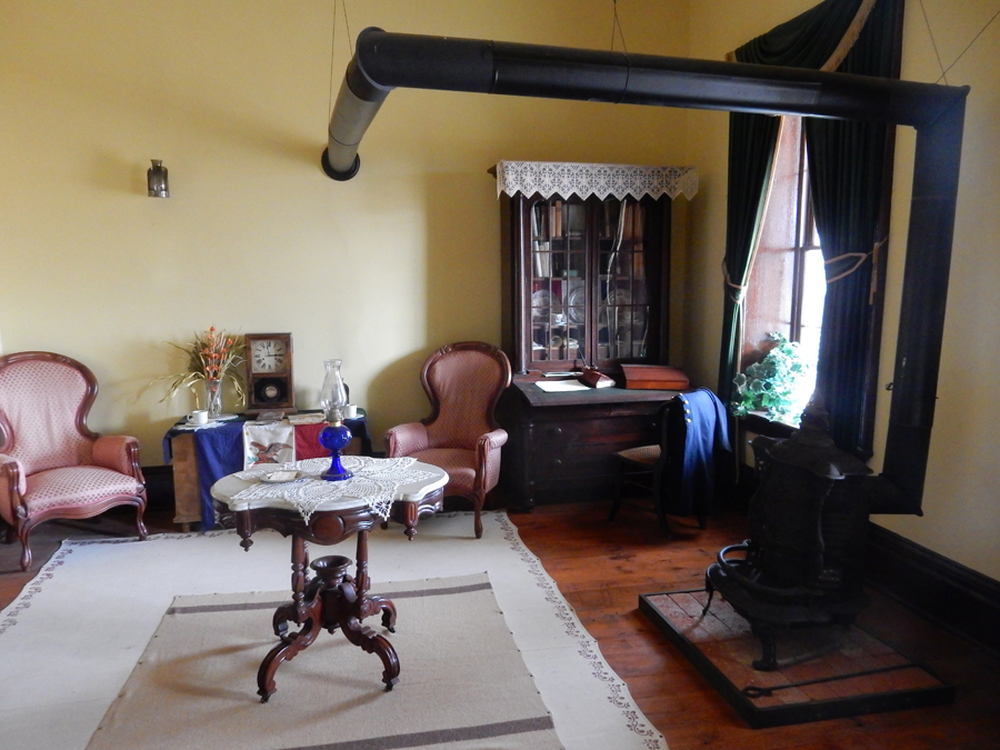
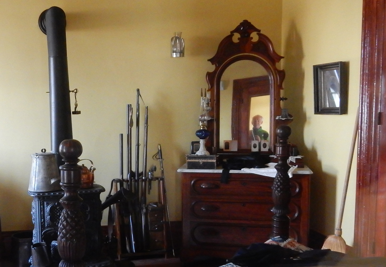
The fort buildings have been nicely restored/conserved to illustrate life here during the 1860s. Here are some rooms from the officer housing:

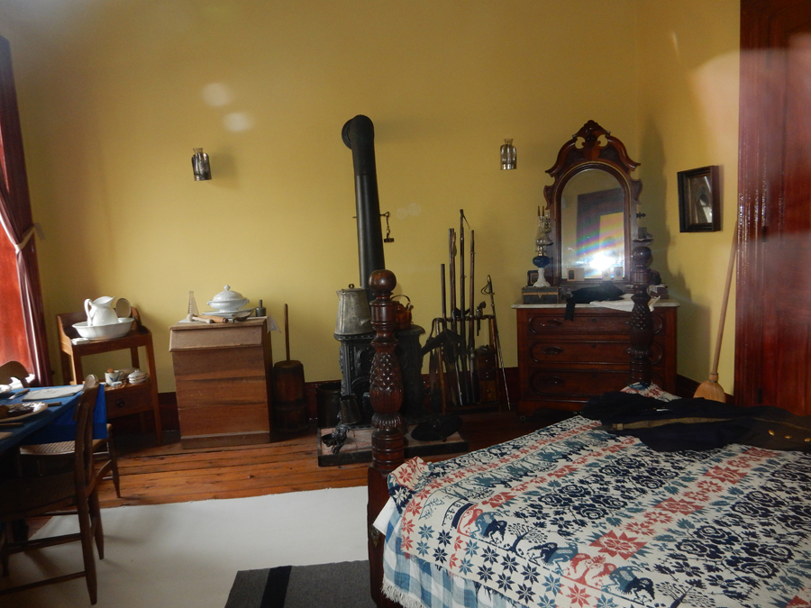
“Ghost” in the mirror
Soldier barracks

Tack Shop
Hospital


Commissary


Quartermaster storehouse

We walked the mile-long loop history and nature trail past the cemetery and around the oxbow

Flag on the parade ground was lowered to half staff during our stay as a result of a student using an AR-15 to kill 17 fellow students at Marjory Stoneman Douglas HS in Parkland FL

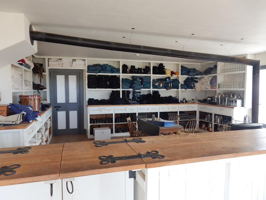
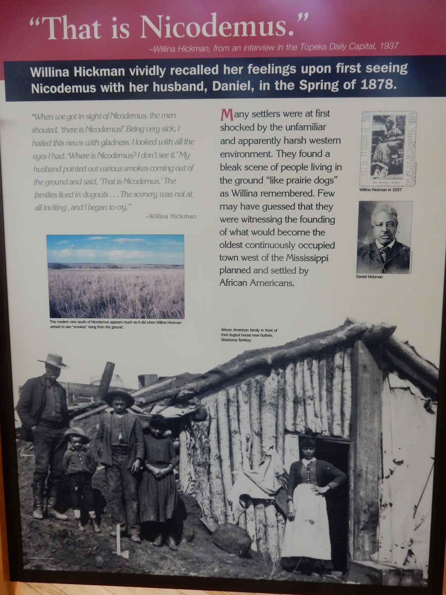
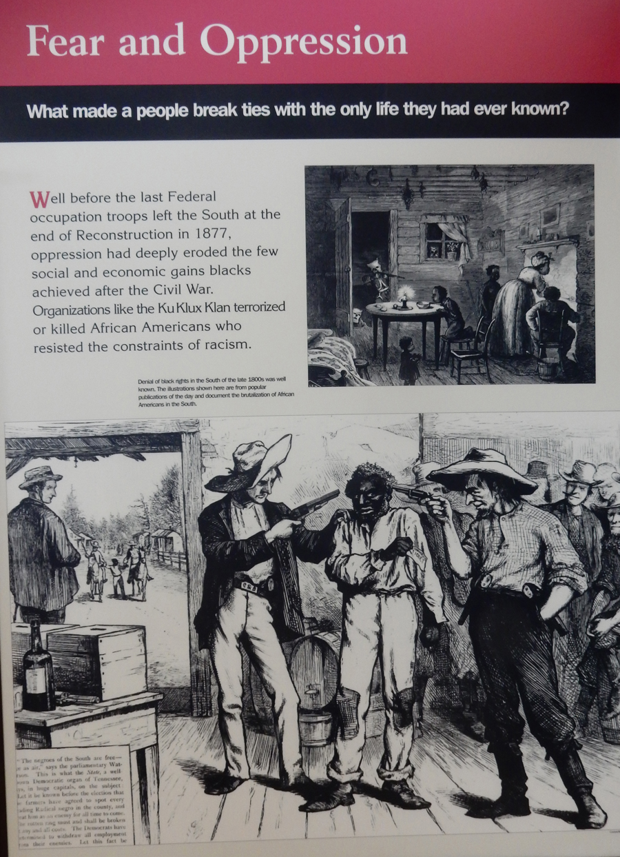
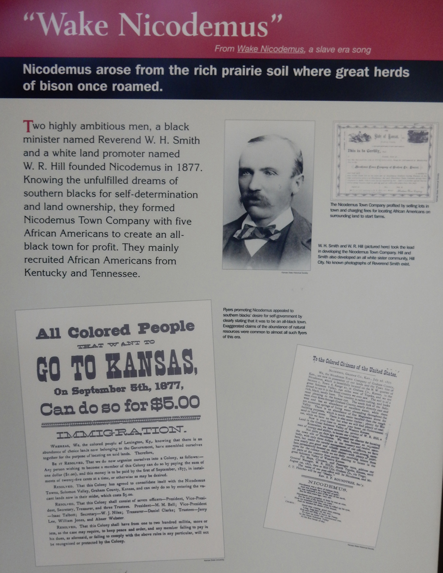
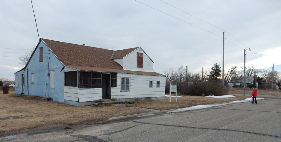
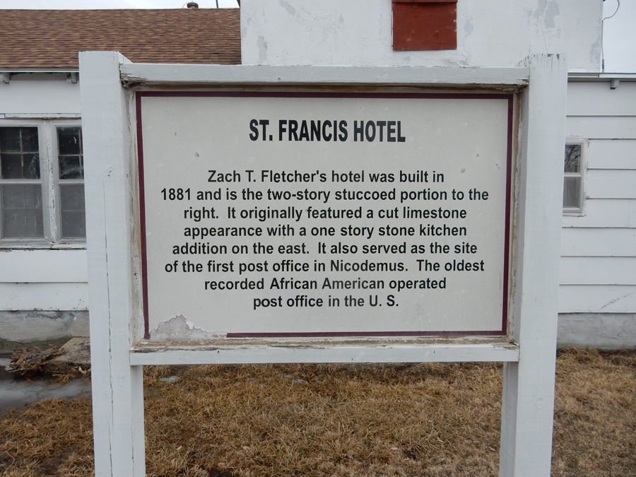
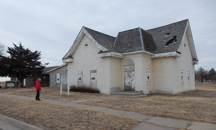
A 2hr drive took us to Nicodemus National Historic Site KS, the only remaining black settlement established after the Civil War

Descriptive posters in the Town Hall/Visitor Center do a nice job of describing the establishment and growth of the town as well as its trials, tribulations, and decline

It also has prominent displays related to professional football players who have a direct family connection to the town – Veryl (Green Bay Packers) and Marvin (Buffalo Bills) Switzer
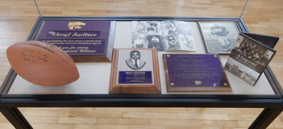
Gale (Chicago Bears) and Ron (San Diego Chargers) Sayers

Kevin (Green Bay Packers) and Gerald (Denver Broncos) Willhite

The buildings illustrated in this poster look pretty good, the current reality is much different

This is Main Street; the population of Nicodemus has been hovering between 50 and 60 for the past 20 years
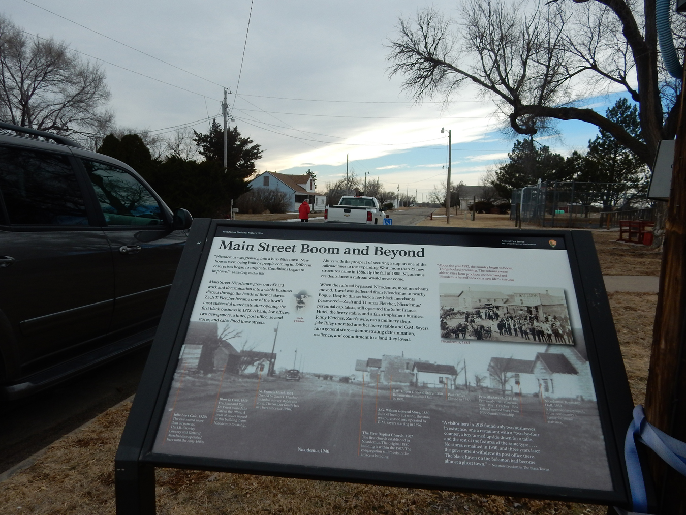
Nicodemus was designated a Historic Site by an Act of Congress in 1996. I have been to most Historic Sites in the National Park System. This is perhaps the least supported one I have visited.

Every summer since 1878 the town has hosted its “Emancipation Celebration,” which is a homecoming for many descendants. Literature states that hundreds attend this event. Why hasn’t the National Park System and prominent descendants done more to support this historic site?
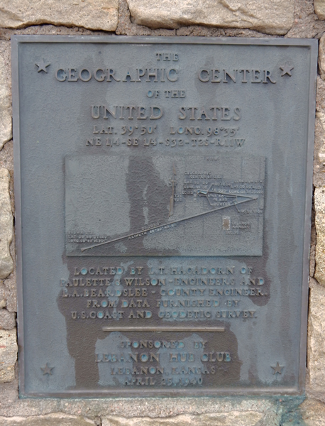
It took 1.5hrs to get to the Geographic Center of the U.S. 9contiguous 48 states) outside of Lebanon in north central Kansas
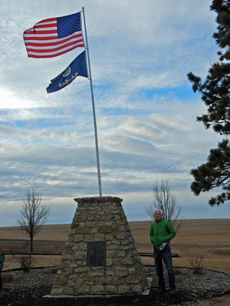
Picnic shelter and small chapel nearby
It took an hour to get to our Airbnb converted storage shed in Belleville KS, it was quite nice – though we had to sleep in the loft (up the pipe rungs)!


2/16 F – “Shed Accomodation” in the morning. We were brought hot biscuits, butter, and jam for breakfast.

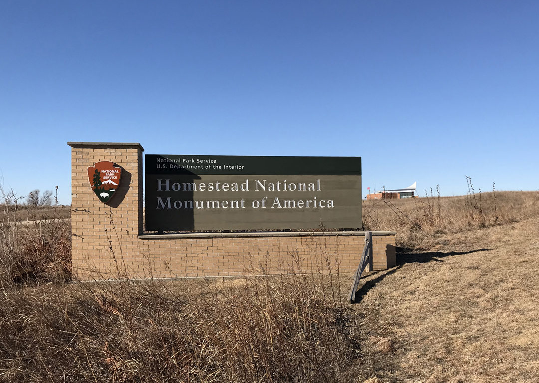
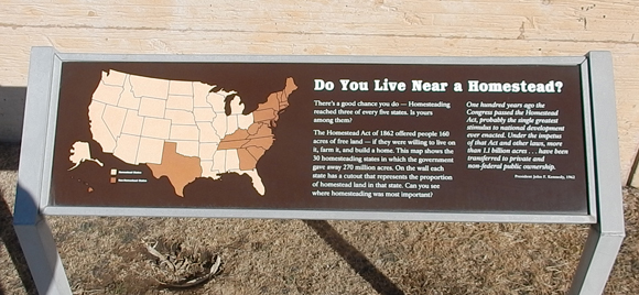
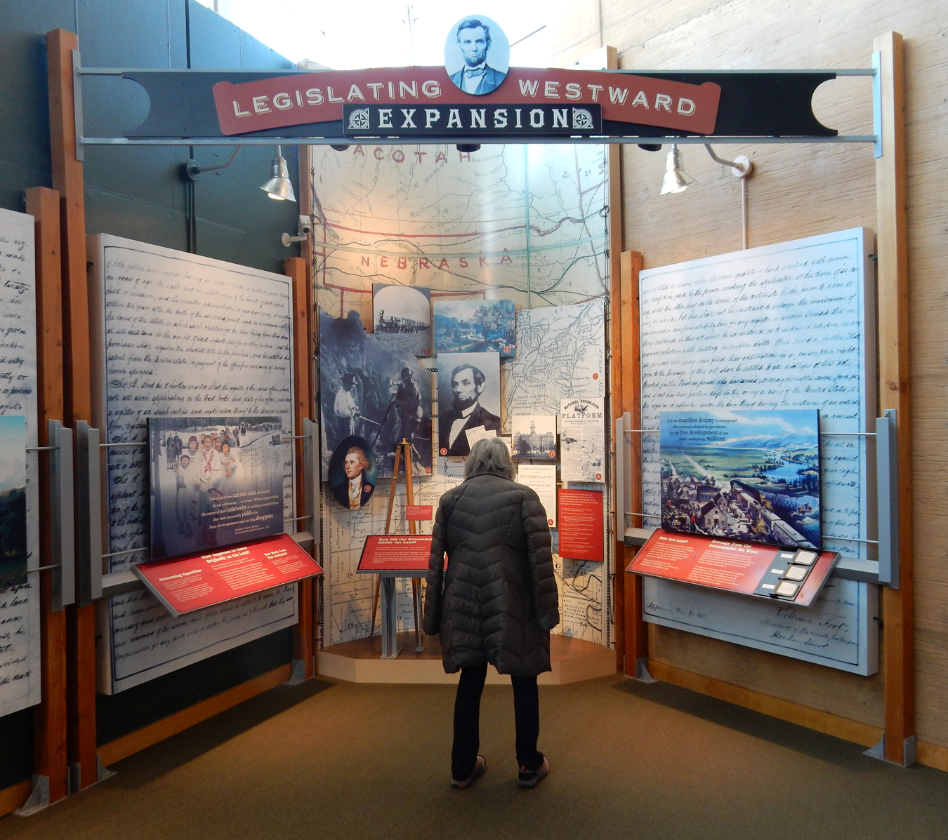
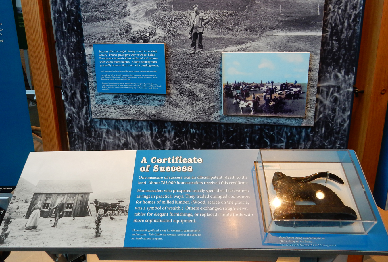
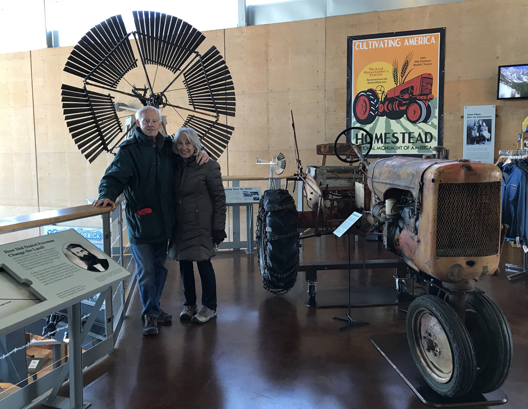
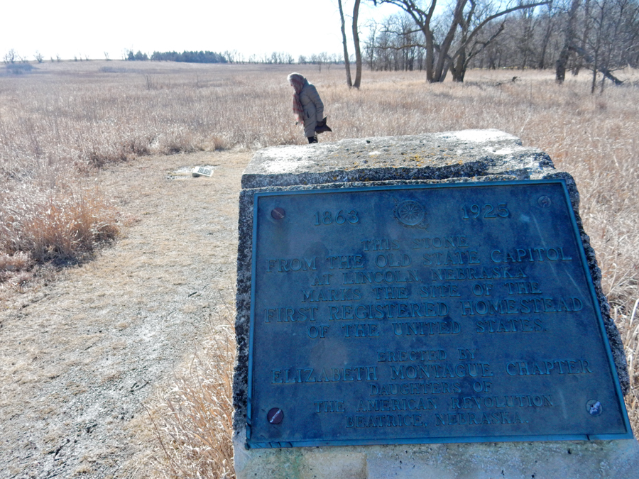
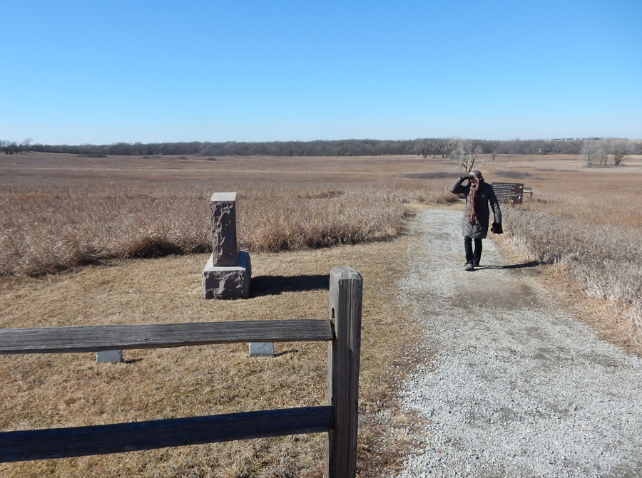
It took 1.5hrs to get to Homestead National Monument of America in southeast Nebraska
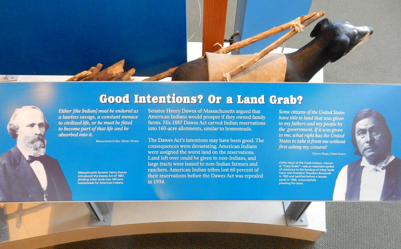
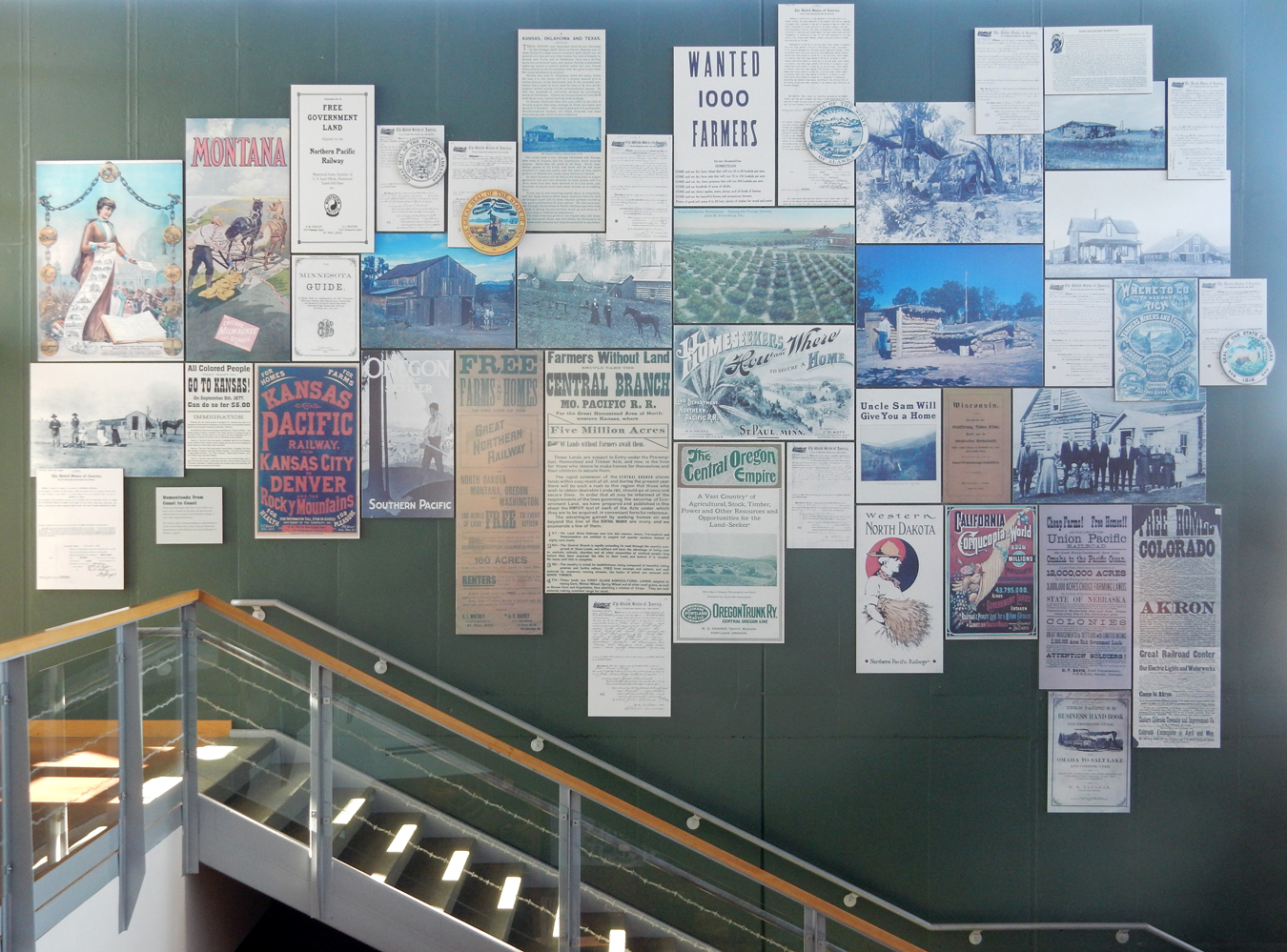
An invitation to the World – “Free Land.” For over a century (1863-1976 lower 48 states, 1960-1986 Alaska) the Homestead Act encouraged Americans and immigrants alike to settle on federal land. Notice the metal outlines of homesteading states on the wall.


Read the story of the Homestead Act

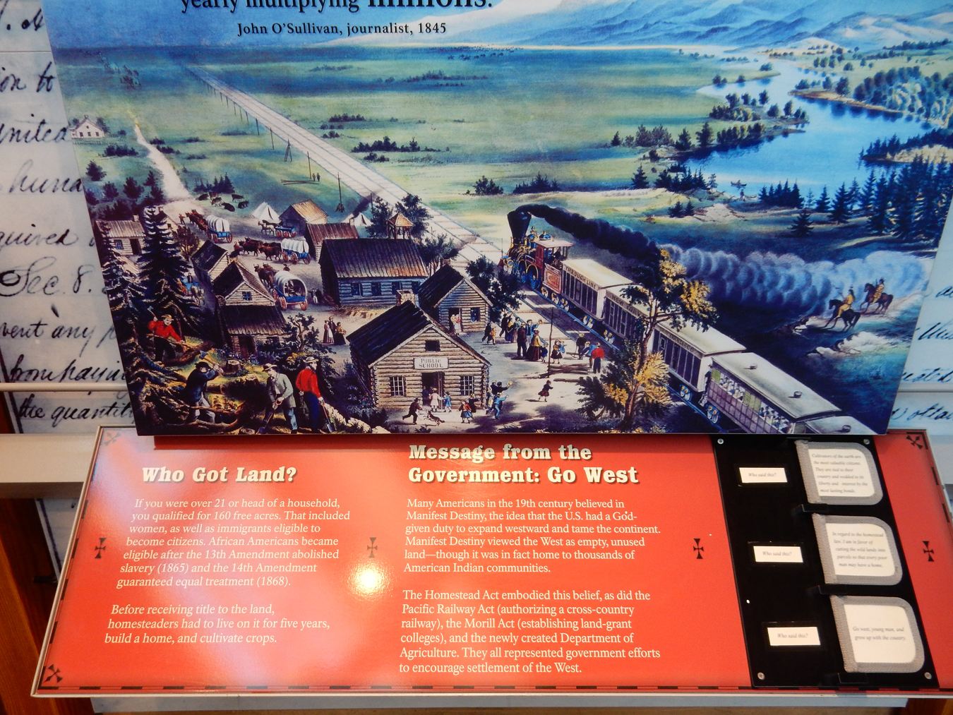

Homestead Advertising

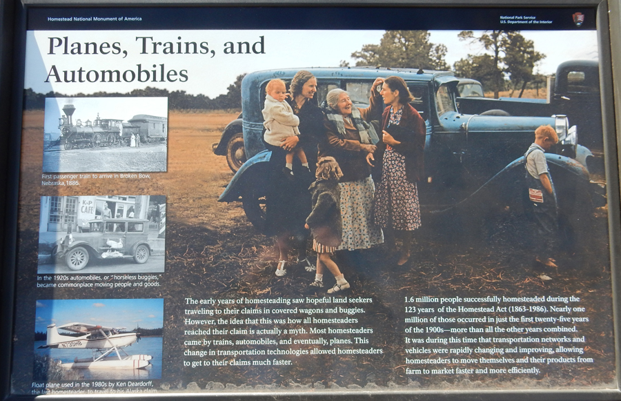
All travel was not by wagon train –
Loss of Indian Land

Springfield Homesteaders, no, our land was not free
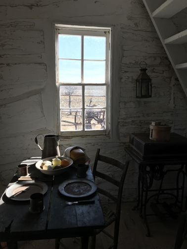
After touring the Heritage Center, we did the short walk to the Palmer-Epard Cabin


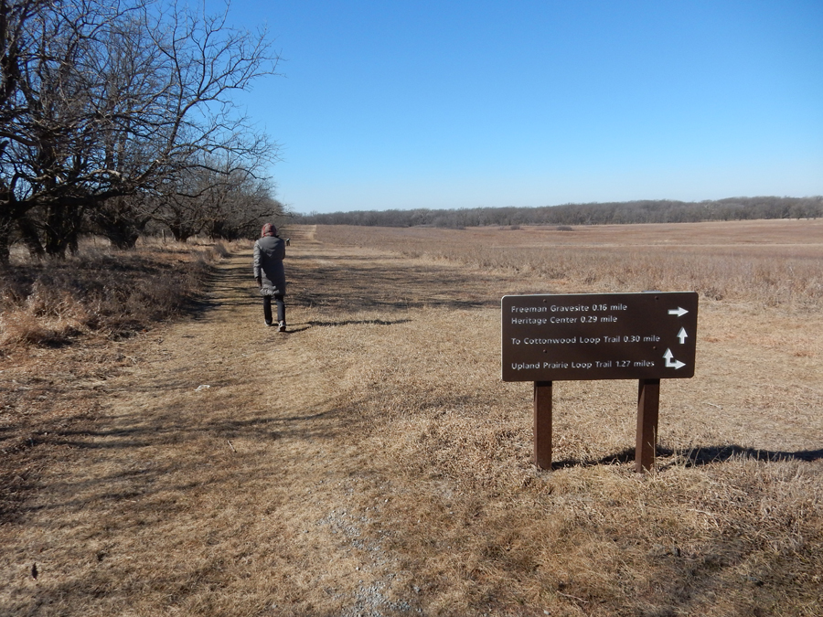
We then did the Upland Prairie Loop Trail, and continued on the Grain Growers Highway Trail for about 1.5 miles
Gorgeous Cottonwood Tree

Site of Freeman house
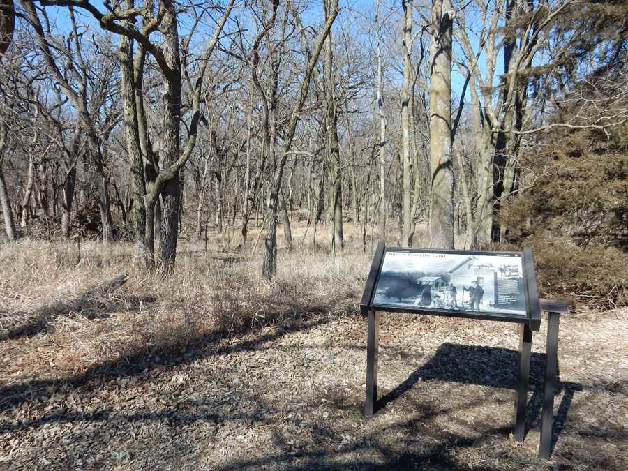

Tallgrass Prairie
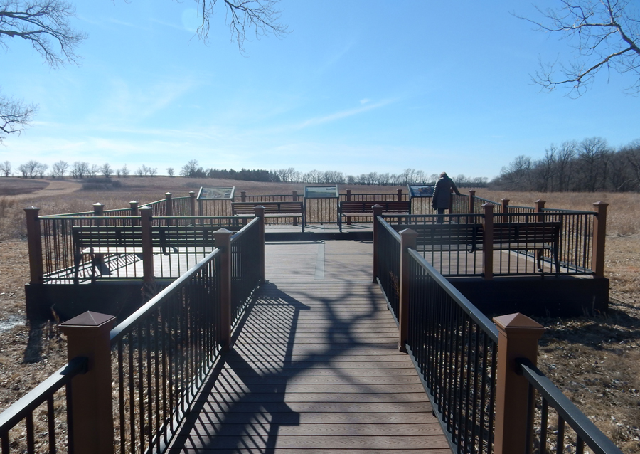
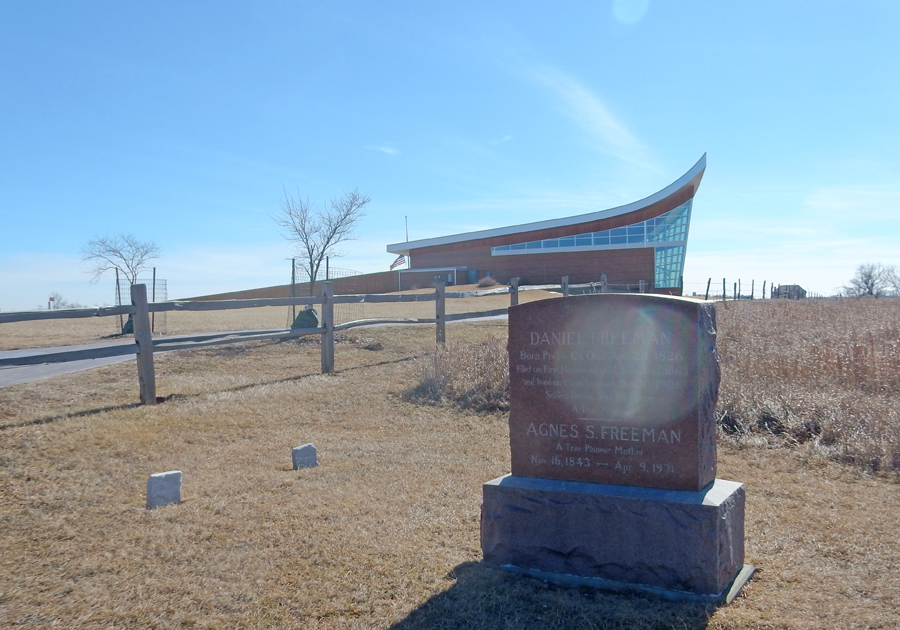
Daniel Freeman filed the first homestead claim for this land on January 1, 1863.
Freeman and his wife Agnes are buried here
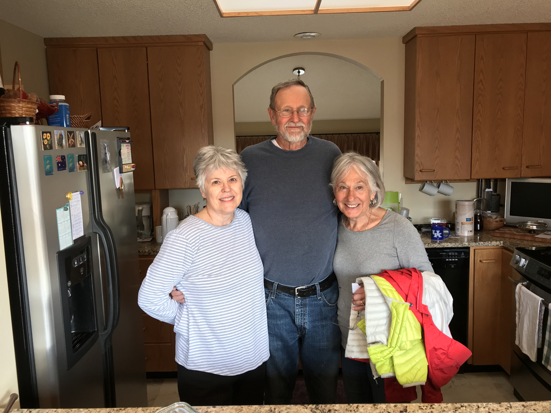
2hrs to Manhattan KS and visit with Connie and Larry
2/17 Sa – Larry and I hiked about 4 miles while Connie and Helen shopped, pizza for dinner
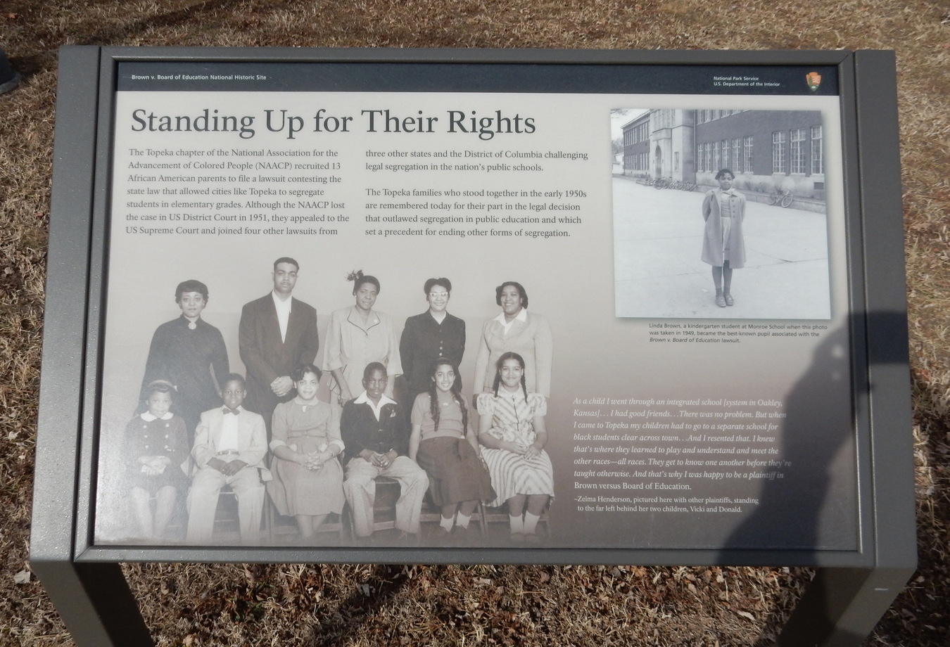
2/18 Su – A 1hr drive got us to the Visitor Center for the Brown V. Board of Education National Historic Site. It is located in the former Monroe Elementary School, which was one of four segregated elementary schools in Topeka KS in 1954.


On May 17, 1954, the U.S. Supreme Court ruled in Brown v. Board of Education that segregation is public education is unconstitutional


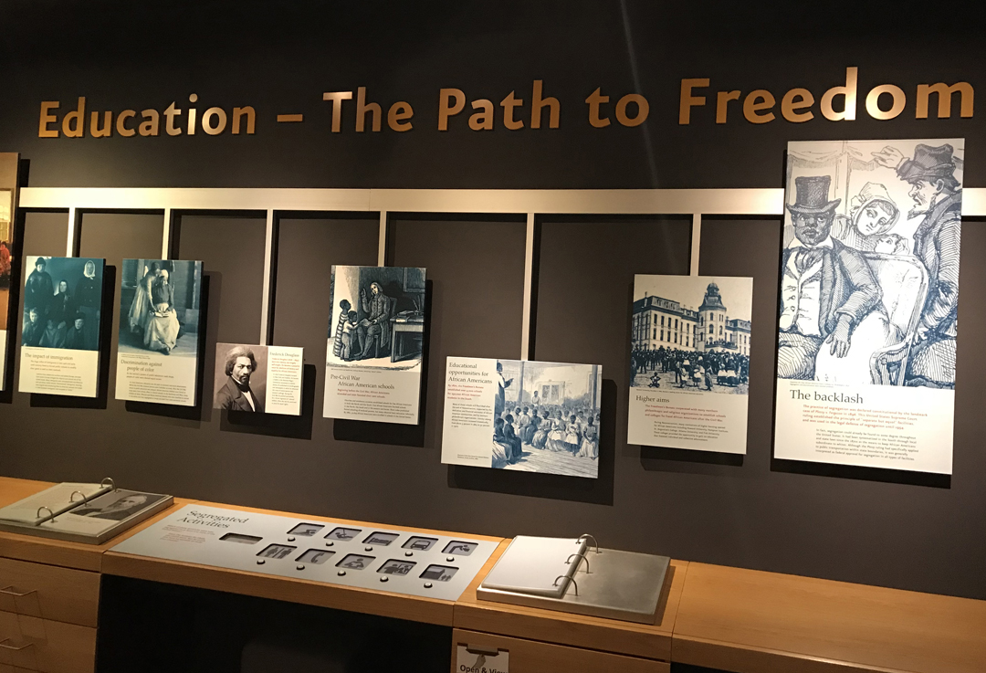
Informative ranger introduction to the historic site

Comparison to two segregated elementary schools in Topeka KS and two in Clarendon County SC in 1948


Watched the half hour movie and then toured the facility; we still have a way to go –


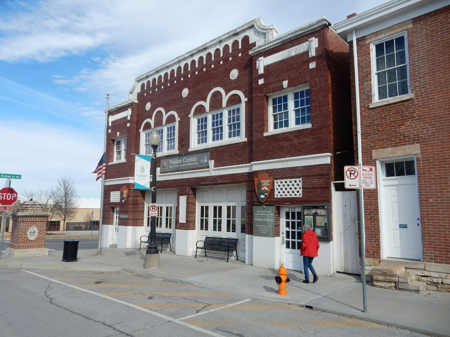
One more National Park Unit before we get home – Harry S. Truman National Historic Site in Independence MO! We first stopped at Truman’s Home and then went to the Visitor Center to purchase tour tickets. Vice-President Truman became President on the death of FDR in 1945. He finished that term and then was elected in his own right leaving office in 1953.


The Visitor Center is in an old fire house
Start of home tour. Bess Truman’s father, David Willock Wallace, committed suicide in 1903, she and her mother and brothers moved into the house with Bess’s grandparents, George and Elizabeth Gates. The home then became the Wallace Home where Bess lived with her mother and three brothers. Harry moved in after he married Bess in 1919. They live here for over 50 years.

Harry often visited his relatives the Nolands who lived across the street from the Wallaces. Harry met Bess when he returned a cake plate to the Wallace home in 1910.

Pictures were not permitted in the Truman Home but they were in the Noland Home


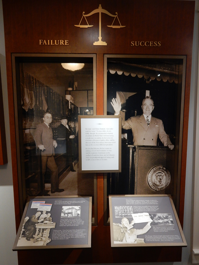
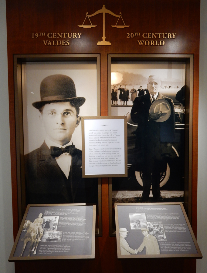
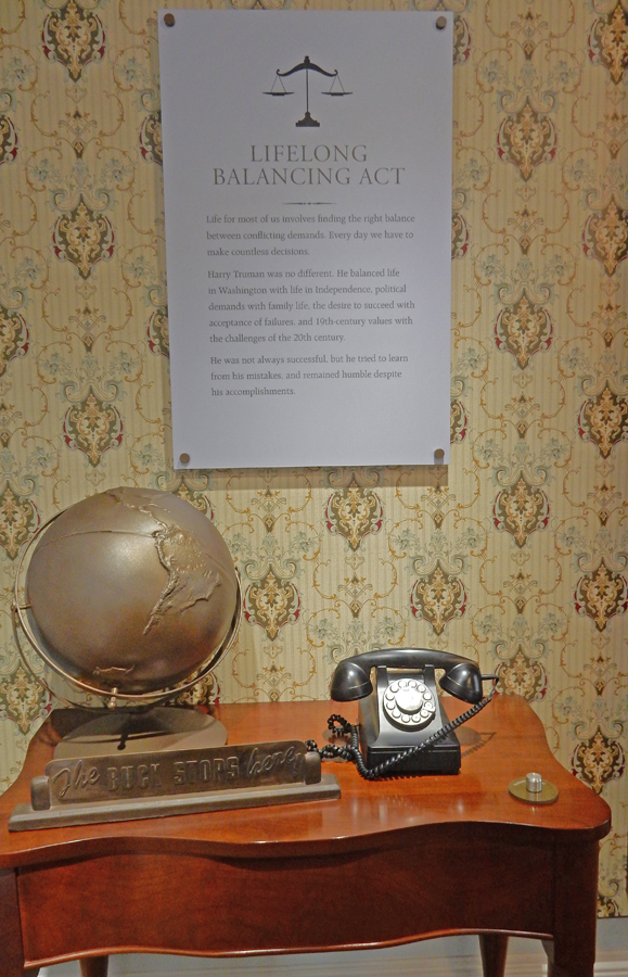
Truman became famous for the phrase “The Buck Stops Here”
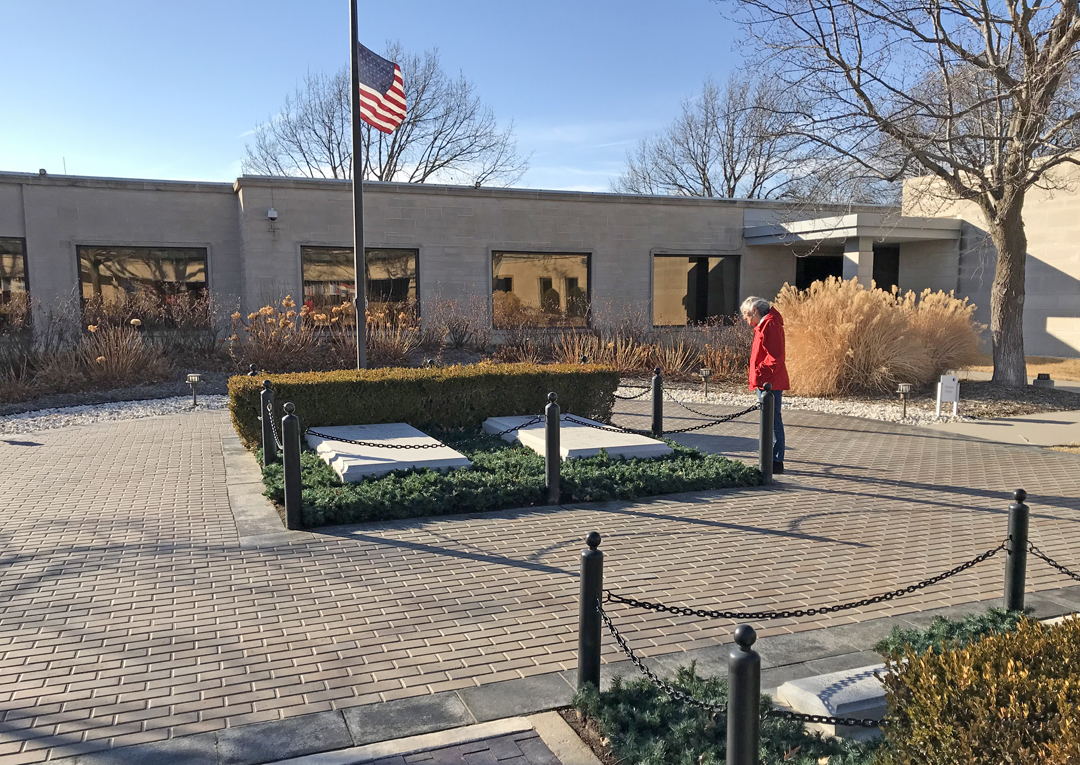
Truman’s Presidential Library and the resting place for Harry and Bess is only a short drive away. It was a bit windy – note flags


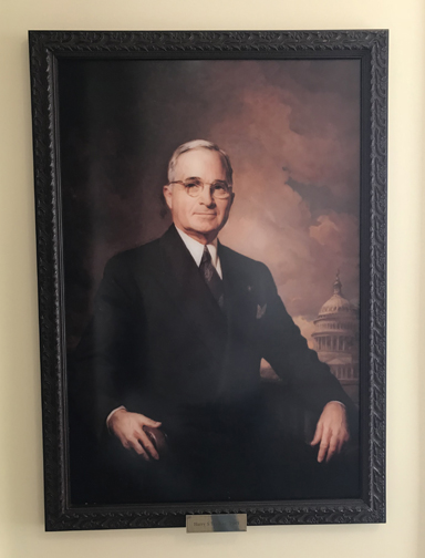
Harry S. Truman – 33rd President of the United States
Stayed in the Fairfield Inn & Suites in Jefferson City MO
2/19 M – “President’s Day,” fitting since we had just visited a President’s Home and Library! It was a 7.5hr drive to get home from Jefferson City but we were able to get there before dark. It was an enjoyable and successful five-week 8,500 mile road trip!
