
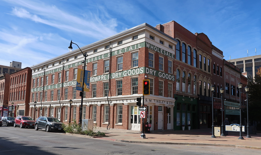
10/14 – Indigenous People Day (Columbus Day) – a cold front was coming in as I drove west to the Springfield IL Visitor Center for the Abraham Lincoln National Heritage Area (NHA). The Lincoln Home NHS is part of the NHA – see Blog for November 2022.
Re-creation of Lincoln-Herndon Law Office 1844-1852

The Old State Capitol is across the street. U.S. IL Senator Barak Obama announced his campaign for President from the south steps in 2007.

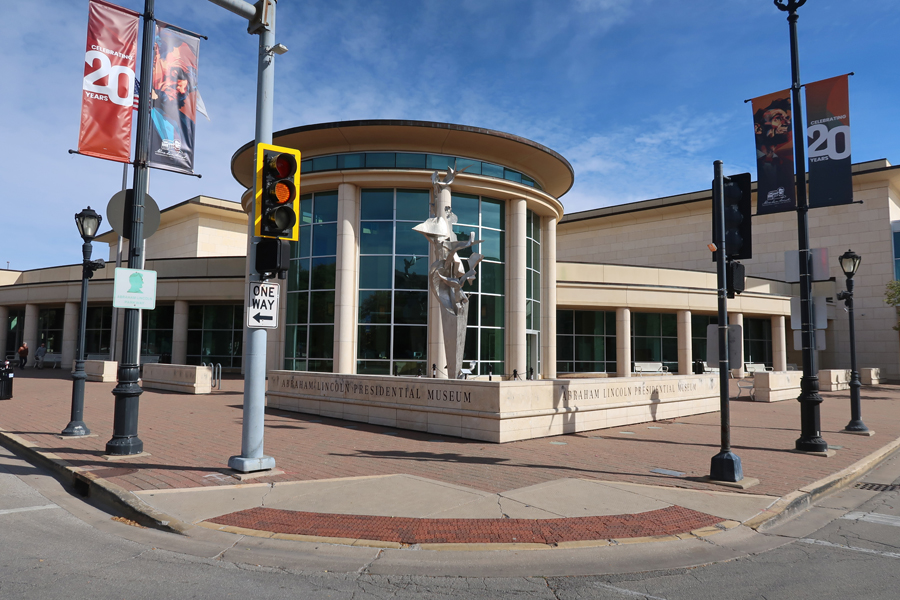
Abraham Lincoln Presidential Library and Museum
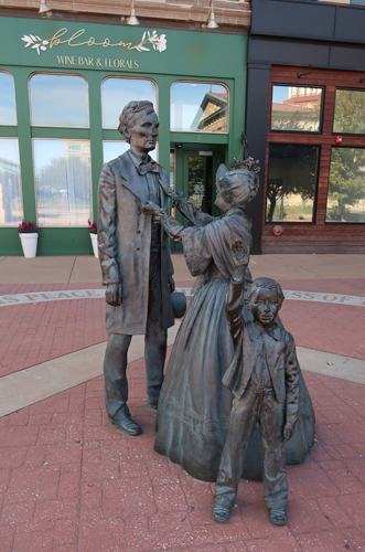
Lincoln Statue in Union Square

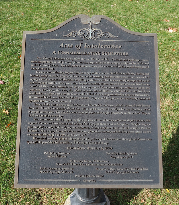
“Acts of Intolerance” sculptures in Union Square, Old Illinois Central Railroad Station in background
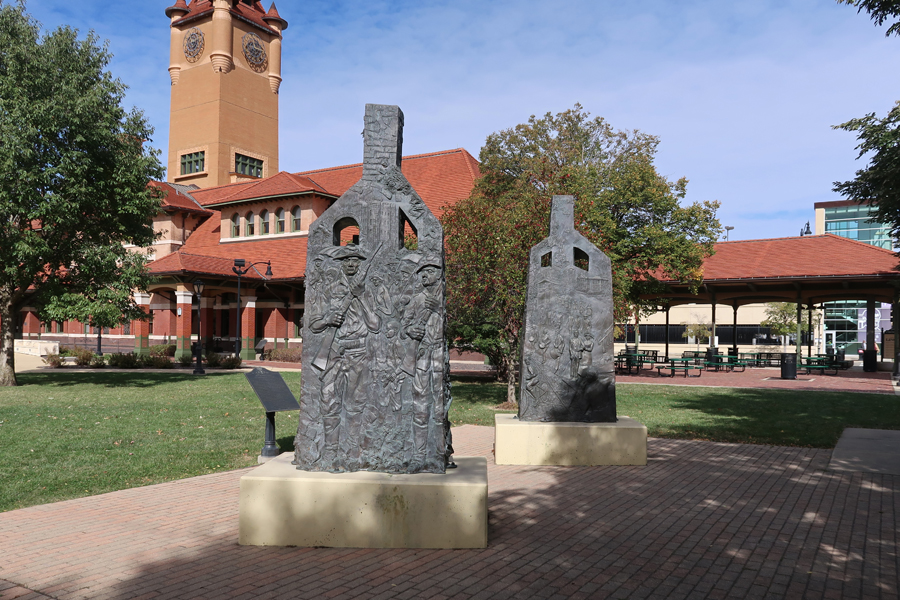
“Two charred chimneys rising from the smoldering rubble of burned-out buildings—these stark images from an old photograph were the inspiration for this unique sculpture by acclaimed artist Preston Jackson. The sculpture commemorates the centennial of the brutal Springfield Race Riot of 1908.” Enlarge sign to read about the Riot.
.

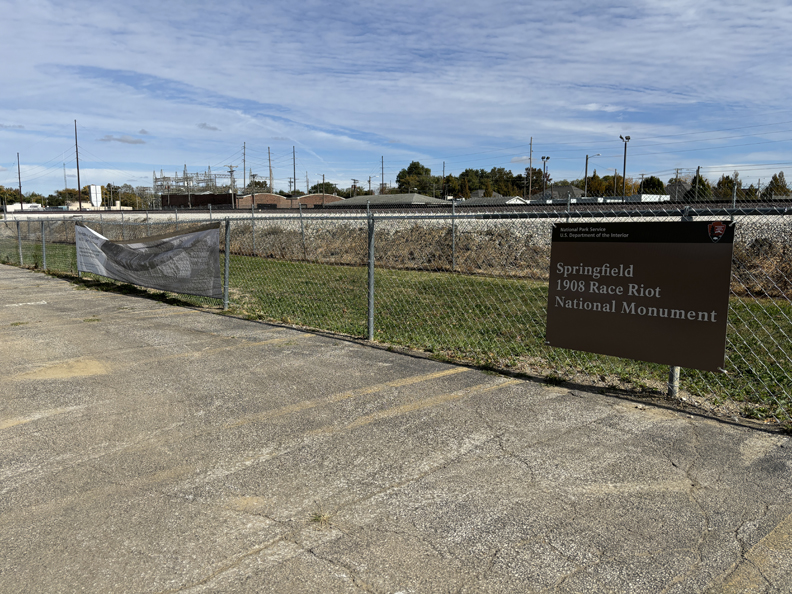
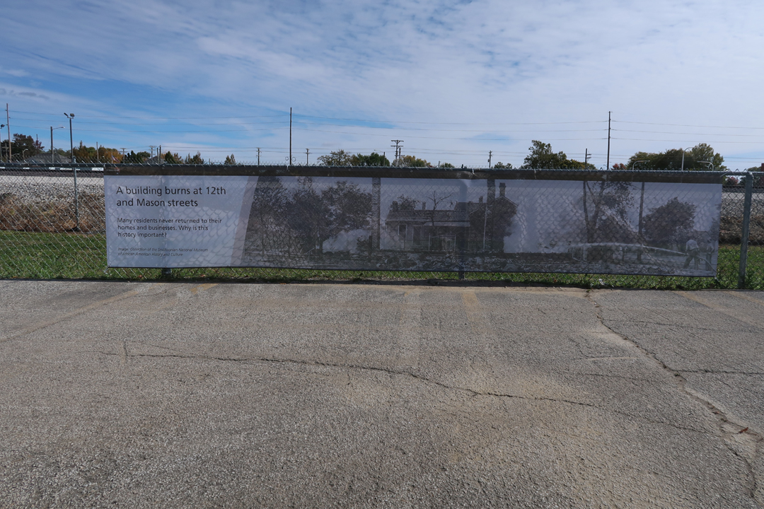
A few blocks away is the location of our newest (August 2024) National Park Unit – Springfield 1908 Race Riot National Monument (NM). “The riot was widely covered by the local and national press. Springfield captured national attention because it took place in Abraham Lincoln’s hometown. It highlighted how little progress had been made in race relations a century after Lincoln’s birth. The riot also caught the attention of prominent civil rights activists like William English Walling, Ida B. Wells-Barnett, W. E. B. Du Bois, and Mary White Ovington. It was a catalyst for the establishment of the National Association for the Advancement of Colored People (NAACP) in 1909.” There is very little there.

There are two banners and a sign on the fence on the east side of the parking lot of HSHS St John’s Hospital Women & Children’s Clinic.

I do not believe this should have become an official NM until the site was at least somewhat developed.
.
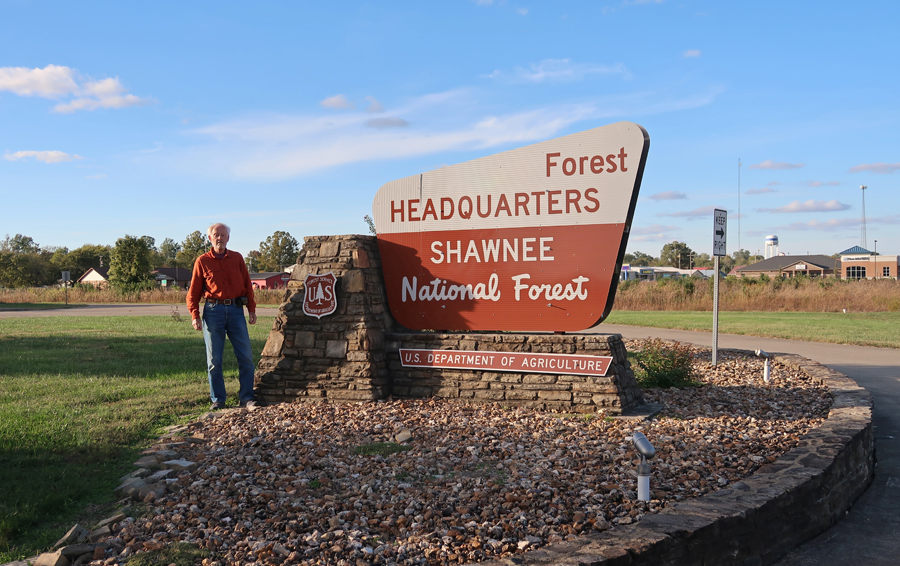
4-hours to Shawnee National Forest (NF) – located in Southern IL between the Ohio and Mississippi Rivers. It has been proposed that parts of this 289,000-acre NF be designated a National Park Unit.
There are a lot of excellent hikes in the NF. I decided to concentrate on the Garden of the Gods Wilderness Area
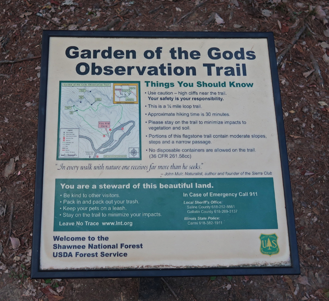
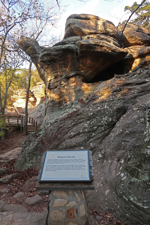
I started with the 0.25-mile Observation Trail, which seems much longer as you wind your way through and around many beautiful sandstone formations.

.
.

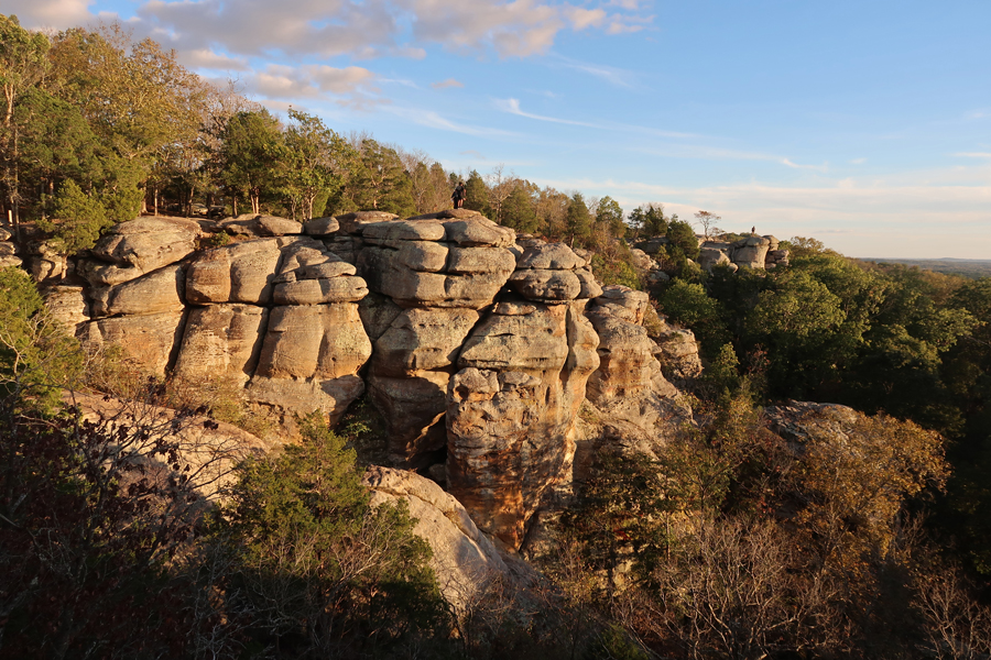
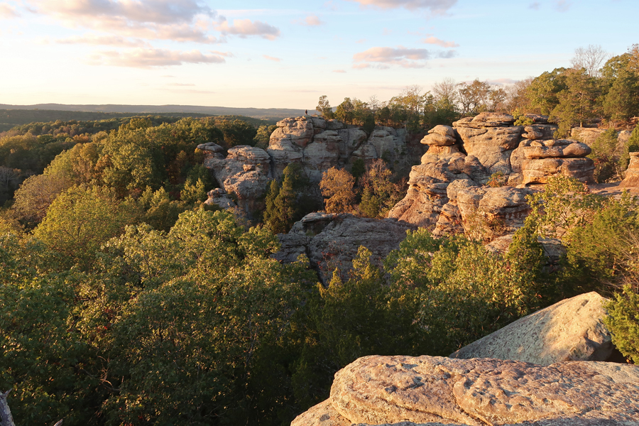
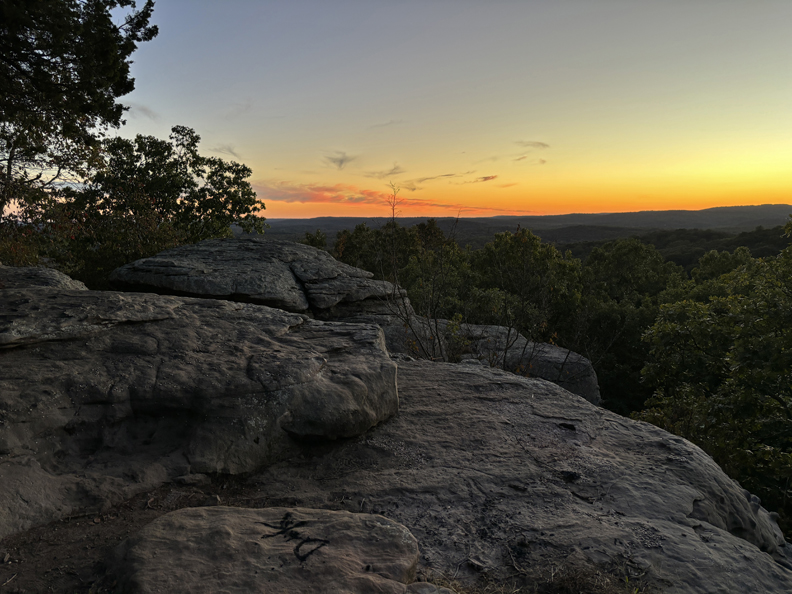
There were great views from the top of the bluffs.
.

.
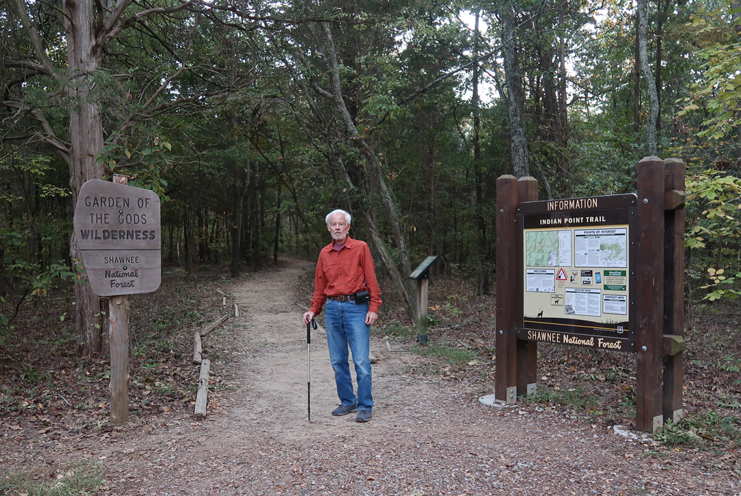
Afterward, I drove a short distance and hiked the 1.6-mile (rt) Indian Point Trail
.

I arrived at Indian Point right after sunset. Fortunately, a near full moon helped me find my way back through the forest.
Slept in the SUV outside of Paducah KY
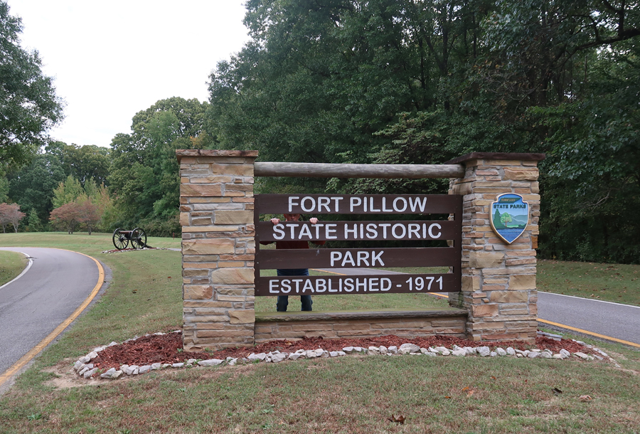
10/15 Tu – 3-hrs to Fort Pillow State Park on the Mississippi River in Western TN. Fort Pillow was built by the Confederates in 1861 at the beginning of the Civil War. It is one of many notable Civil War sites that are not National Park Units.
The Mississippi River has changed course and is now further from this point than it was during the Civil War.

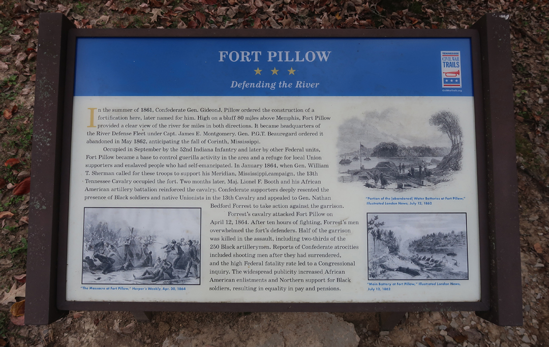
I started at the Visitor Center Museum. Enlarge this sign to read the story of Fort Pillow.
.

.

Was it a “Massacre?”

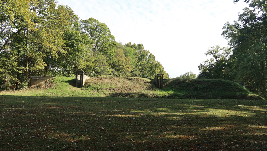
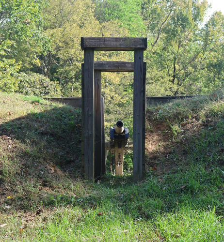
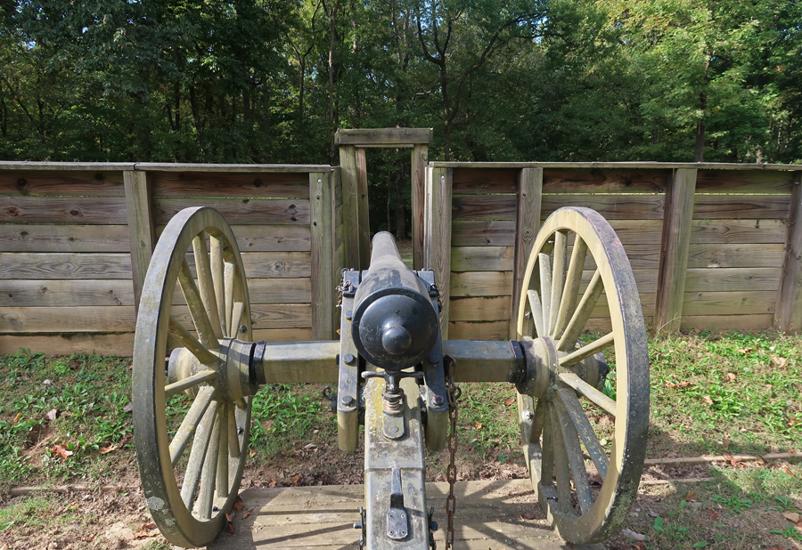
I then hiked the trail to the restored fortification.

.
.
.
.

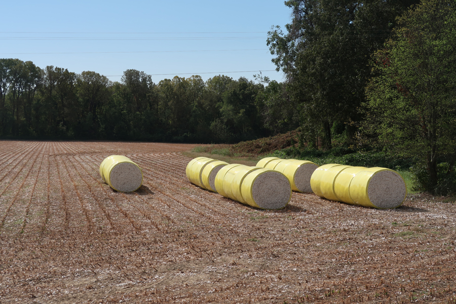
I did not know that West TN was a cotton producing area before this trip.

.
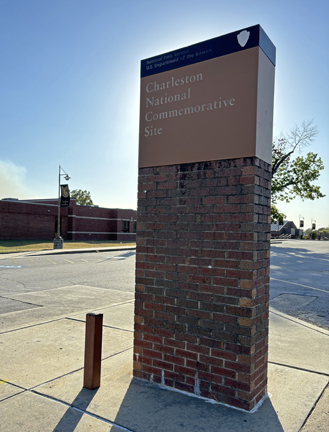
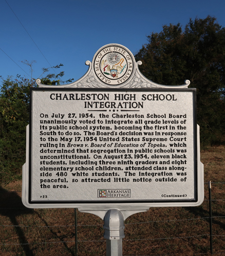
5.5hrs to Charleston National Commemorative Site – Charleston High School in Western Arkansas, just SE of Fort Smith. It is one of three NPS National Commemorative Sites (NCS). The other two are the Kennedy-King NCS in Indianapolis (Blog August 2022) and the Quindaro NHS in Kansas City KS (Blog June 2023). All three are related to African American History.
.
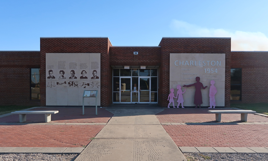
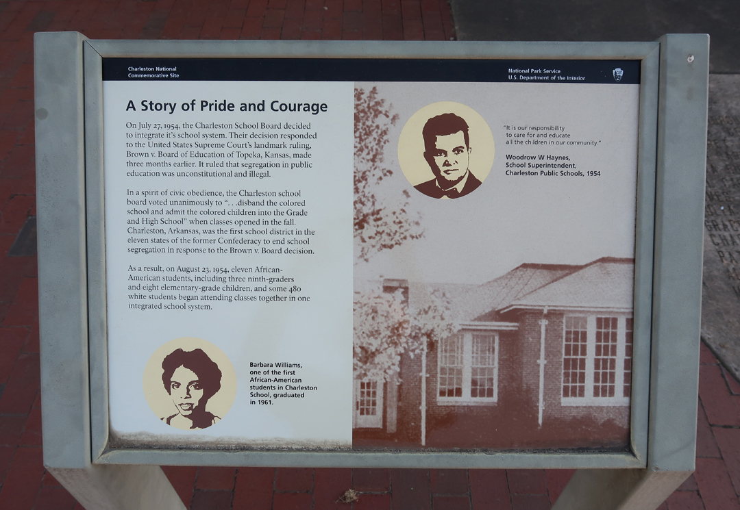
Charleston HS was the first in the 11 Southern states to voluntarily integrate – after the Brown vs Topeka KS Board of Education Supreme Court decision of 1954. That decision determined that school systems based on “Separate but Equal” were in fact not equal.
I knew from online research that there was a Historical Marker related to this site, but I did not know where it was. I showed several people around the school a picture of Barbara Williams, standing in front of the marker, and asked if they knew where it was – no one did.
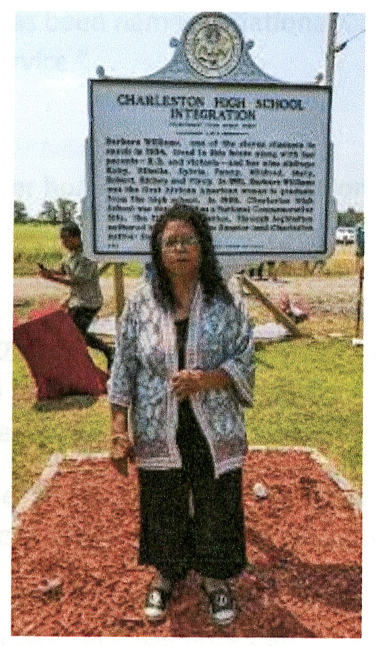
I then showed the photo to a group of Middle School students outside the library and asked. One Black girl said yes, she was related to the woman in the photo and gave me rough direction to the site. Using Google Maps, I found W Eucal Rd about 4-miles east of the library off SR-22. I followed it about a mile to the marker, which is located on the Williams homestead – The Williams house is in the background of the first photo.

.
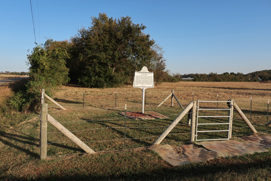
I took my photos and left. A short time later, as I approached SR-22, a car came up behind me and blew the horn. Long story short, it was Mildred Williams Jones, Barbara Williams sister. We returned to the site for a photo and conversation.

.
.

I gave her the materials I had printed out related to the site and then started driving toward the MS Gulf Coast.
Slept in the Sequoia somewhere around Pine Bluff AR.
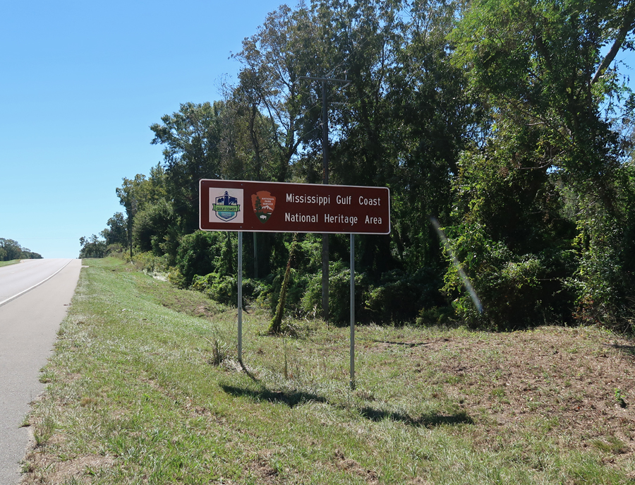
10/16 W – 7-hr drive to Gulfport MS and the Mississippi Gulf Coast NHA. Right after this photo was taken, my tripod blew over and damaged my camera. This was the second time this had happened on one of my trips! I then started using my iPhone for photos. After working on my camera lens, I was able to get it to work by manually moving the protective shutter on the outside of the lens. Over the next two days I took photos with both, to be sure I had something recorded.
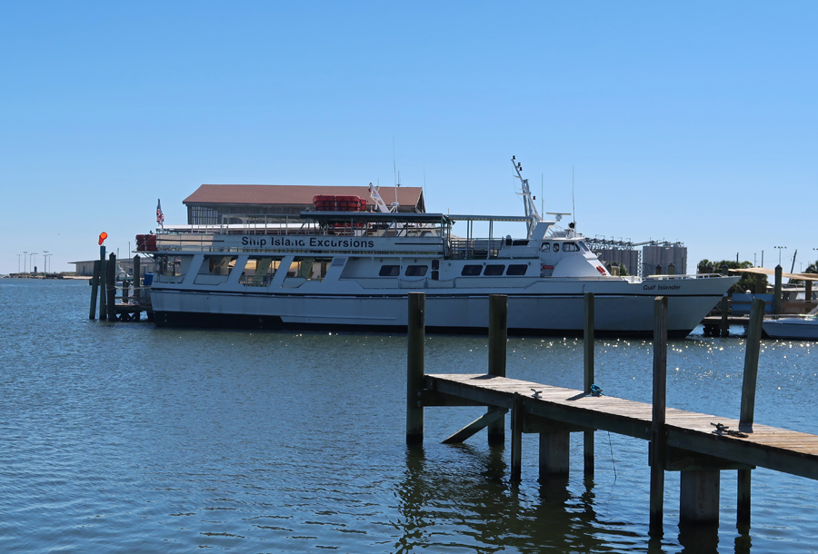
The first thing I did on arrival in Gulfport MS was confirm that the Ship Island Excursions ferry was running the next day. It had not operated for a few days because of wind/waves. Further, Fort Massachusetts (on the island) had not been open, because of flooding, since Hurricane Helene.
Photos at Gulfport Lighthouse

.

Union raid by “Men of Color” on Gulfport during the Civil War (1863).

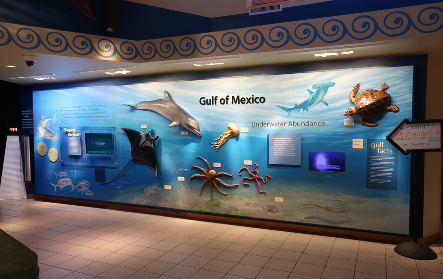
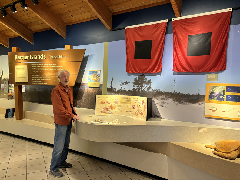
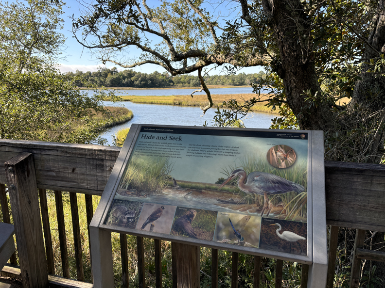
My next stop was the Davis Bayou Area of Gulf Islands National Seashore (NS). The Mississippi NS areas and sites are part of the Mississippi Gulf Coast NHA.
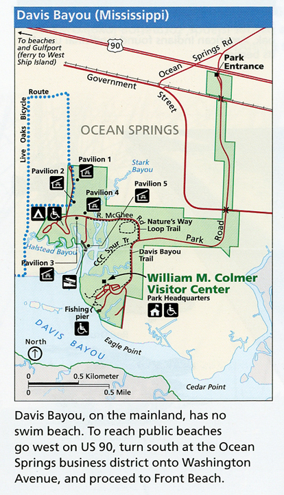
Toured the William M. Comer Visitor Center
.
Bayou Viewing Area

.
Walked to the Fishing Pier and then hiked the Nature’s Way Trail

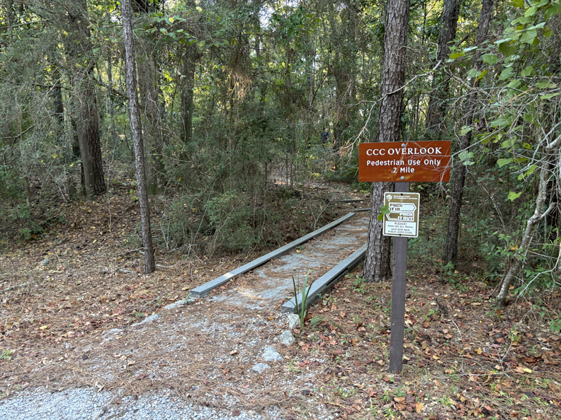
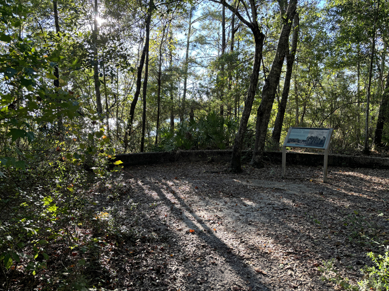
Ended my visit by walking the CCC Spur Trail
.
.

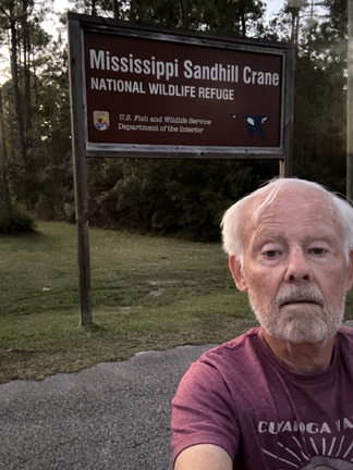
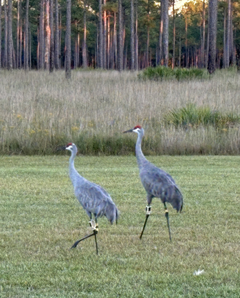
I then drove to the Mississippi Sandhill Crane National Wildlife Refuge.
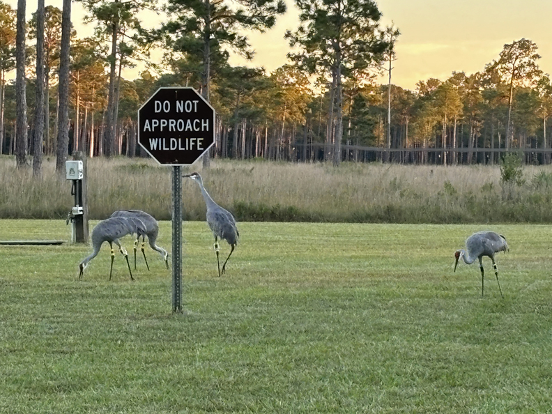
It was late and the Visitor Center had closed. However, I found some Sandhill Cranes foraging in the grass.

.
.
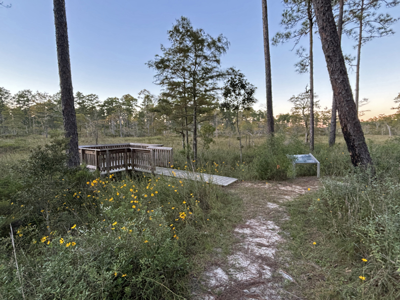
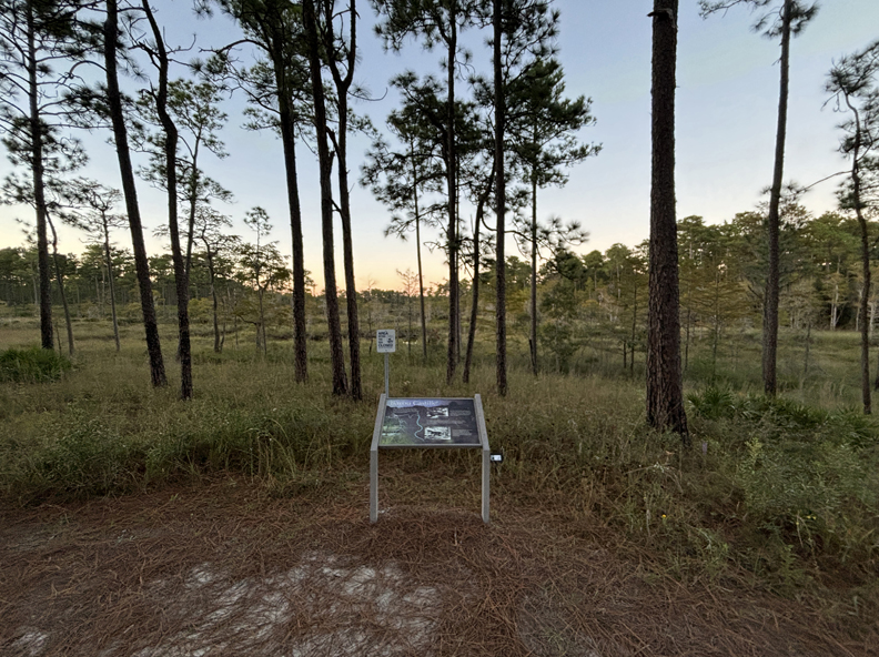
I had just enough daylight left to do the C. L. Dees Wildlife Trail.

No wildlife, other than birds, but lots of nice views
.
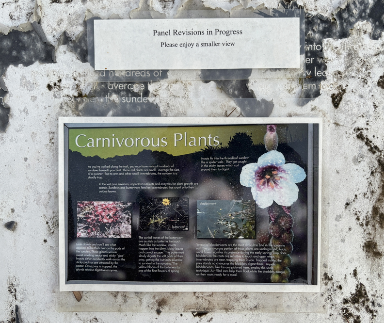
Carnivorous Plants!
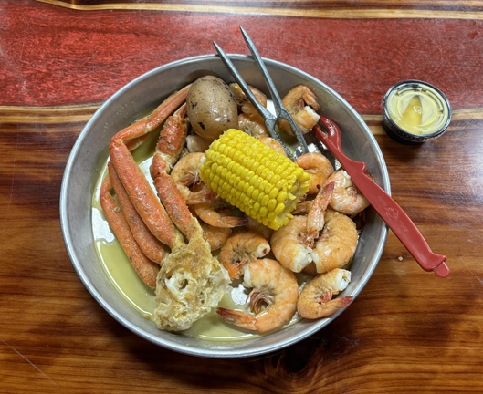
I had spotted the Killer Crab Restaurant when driving here and returned to enjoy the Snow Crab – Shrimp Special, plus beer for $18! There were so many shrimps, I could not finish them all!
I slept the night outside the White House Hotel (built in 1890) in Biloxi MS.
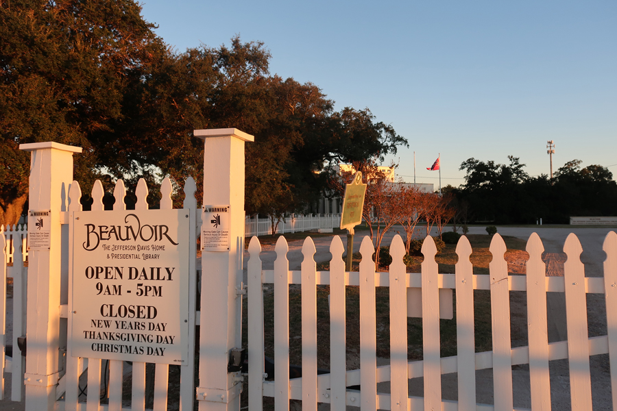
10/17 – I awoke at 6am to the sound of a bugle blowing revelry at the Keesler Navy Base behind the hotel! Got myself together, had breakfast at a surprisingly nice Waffle House, and stopped at Beauvoir, Jefferson Davis’s home (President of the Confederacy) on US-90 overlooking the Gulf of Mexico.
Boarded the ferry ($39 for W-F) and was off to West Ship Island at 9am.
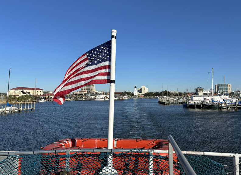
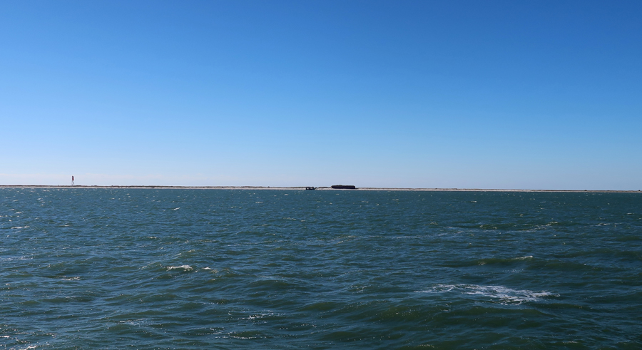
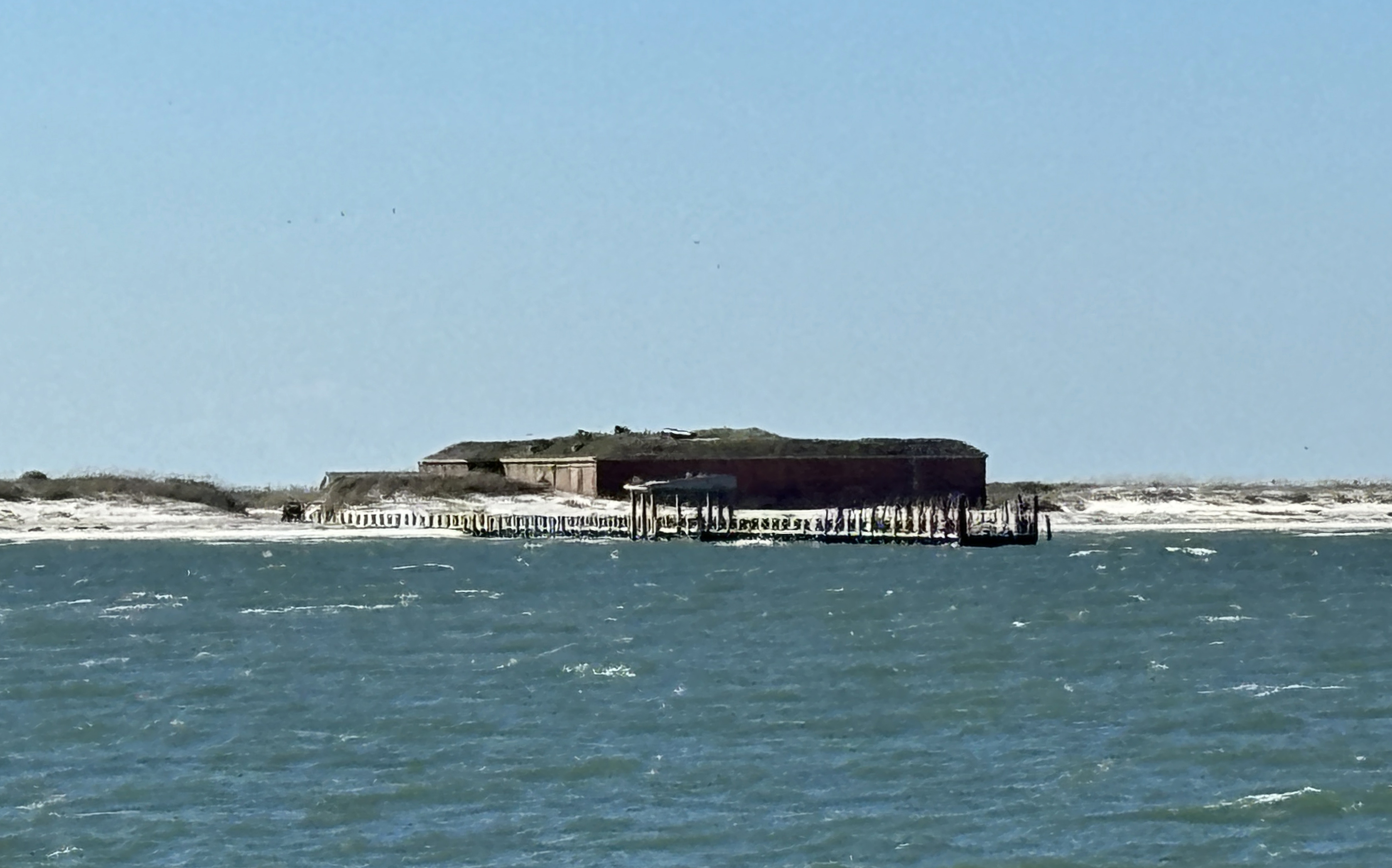
West Ship Island is one of the many islands in the Gulf Islands NS. The NS includes thirteen unique areas from MS through the panhandle of FL. It is 160 miles from east to west – the largest NS in the country. Approaching West Ship Island –
Landing dock, Fort Massachusetts in background.
During the War of 1812, Ship Island was the British staging area for the Battle of New Orleans. They retreated here after their defeat by Andrew Jackson’s forces.

.

Fort Massachusetts was built by the Army between 1857 and 1866. Confederate troops took the island in 1861 but abandoned it nine months later because the men were needed “up north.” Federal forces moved in and used the fort for the remainder of the Civil War. Raids were made from the fort to various locations along the Gulf Coast. The island was also used for Confederate soldier prisoners of war.
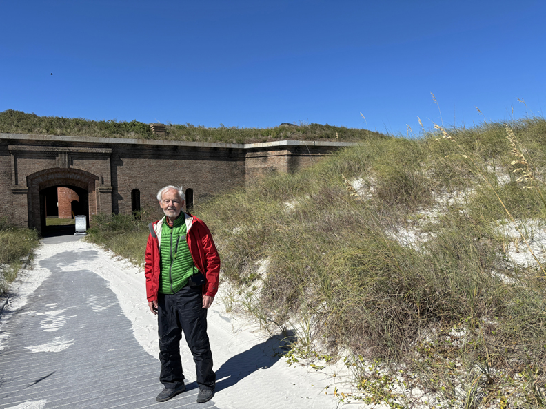
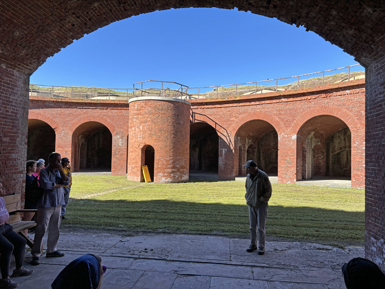
A NP volunteer came out on the ferry with us and did an excellent tour of the fort.
.

.

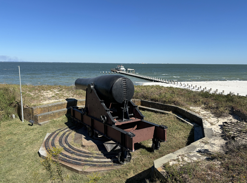
15-inch Rodman Cannon

.
A guardroom by the Sally Port contained a detailed history of the fort.

View from the fort looking east across the island.

Marker describing the changing shape of the island –
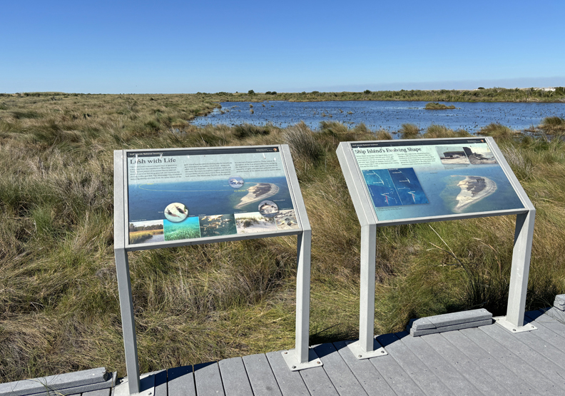
.
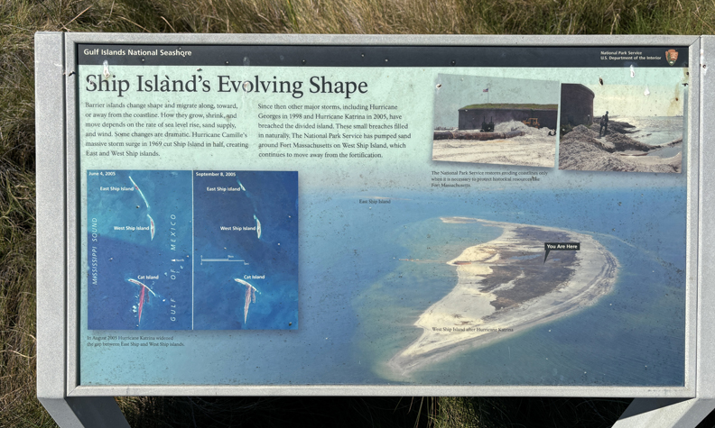
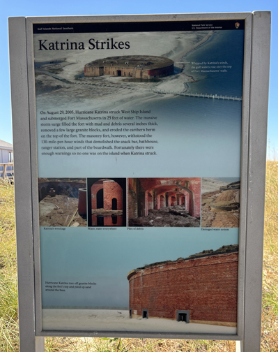
In 2005, Hurricane Katrina devastated the island and submerged Fort Massachusetts with a 25-foot storm surge of water!
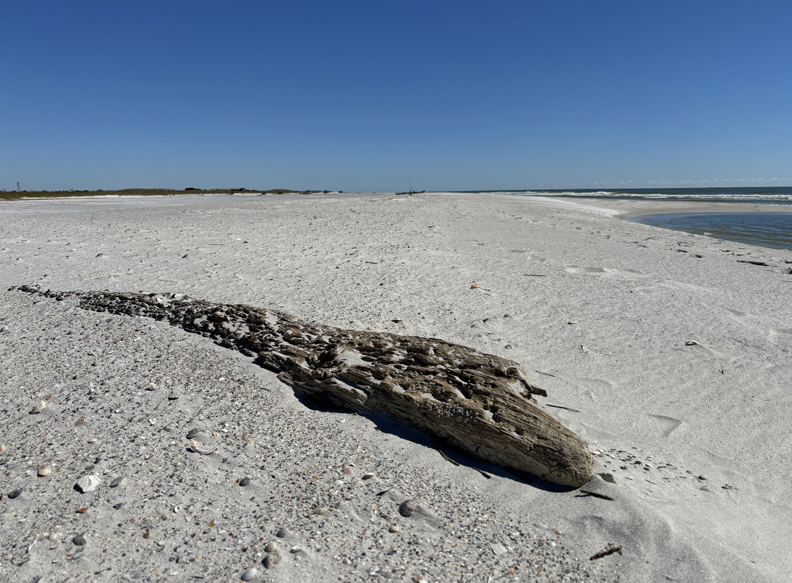
There is a beach area on the south (Gulf) side of the island.
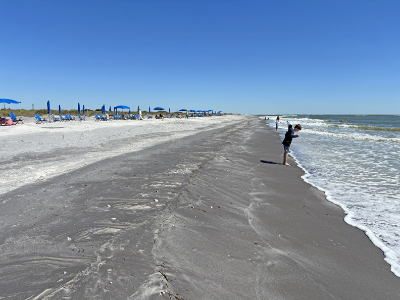
I took a relaxing stroll along the beach looking for shells. Only found a few common ones to add to Helen’s collection.
The ferry departed at 2:30pm, landed in Gulfport at 3:30pm (12-miles), and I started my drive to Muscle Shoals NHA in AL. I stopped for the night in Hamilton MS.
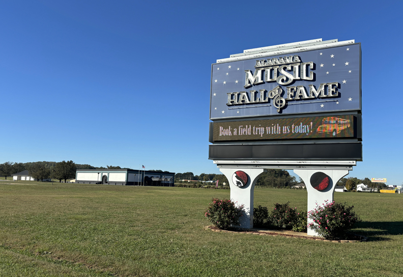
10/18 F – Multigrain Cheerios and an Ensure for breakfast, followed by a 2-hour drive to the Alabama Music Hall of Fame in Tuscumbia AL. My first site in the Muscle Shoals NHA, managed by the University of North Alabama.

.
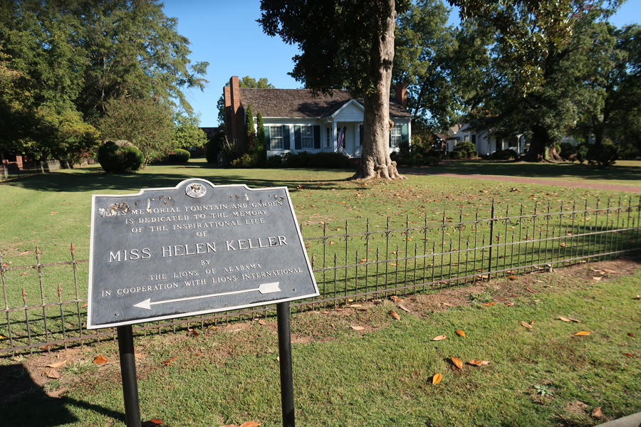
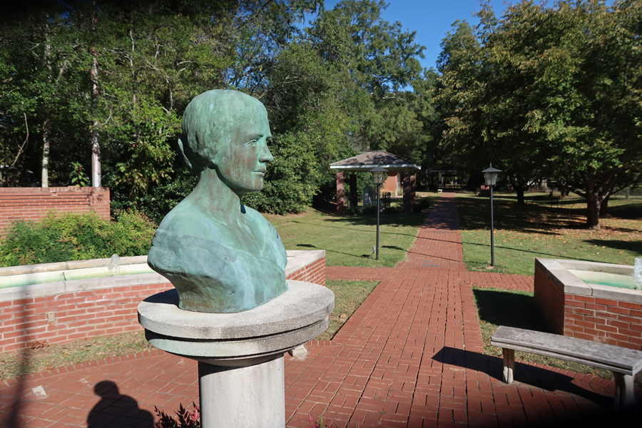
My next stop was Ivy Green, Birthplace and Home of Helen Keller, owned and operated by the Lions of Alabama.
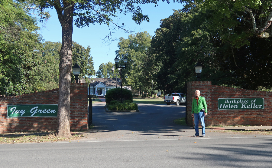
“The homestead was the site of the pivotal experiences which led to Keller’s emergence in the forefront of the effort to provide better methods and facilities to educate people with disabilities.“
Fountain and Bust

.
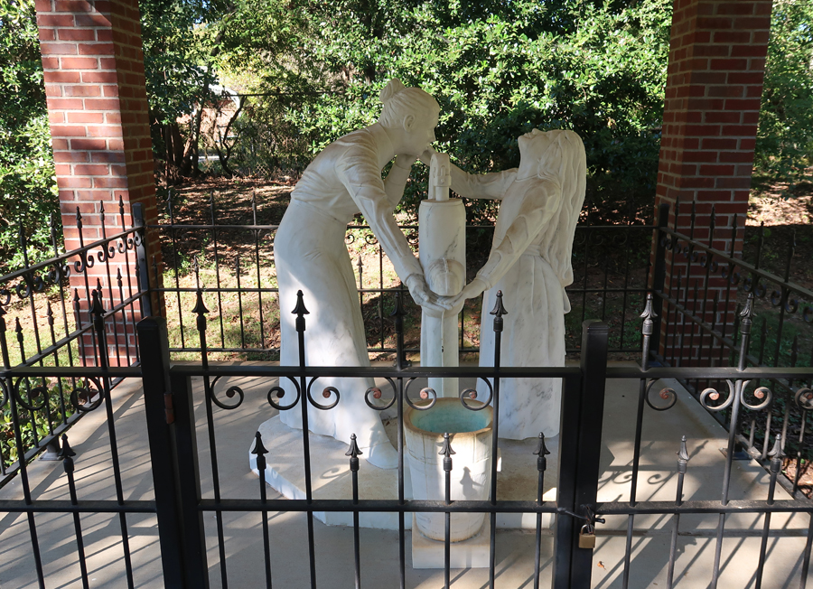
“With the aid of her teacher and constant companion, Anne Sullivan (Macy), the blind and deaf Keller learned to communicate with the world outside of Ivy Green. Through the use of a finger language, created by Samuel Gridley Howe of the Perkins School for the Blind in Boston, various self-developed techniques and much patience and dedication, Sullivan taught Keller to read, write, and speak at Ivy Green.” The water pump was the site of a communication breakthrough for Helen Adams Keller.
My third stop was Tuscumbia Landing on the south side of the Tennessee River.
The Indian Removal Act of 1830 led to the forced relocation of over 100,000 Indians, from their homes in the Eastern U.S. to Indian Territory (now Oklahoma). The Cherokee removal of 1838-39 became known as the Trail of Tears.
Cherokee were brought to this point by railroad. They were then loaded on boats and floated down river to Indian Territory.
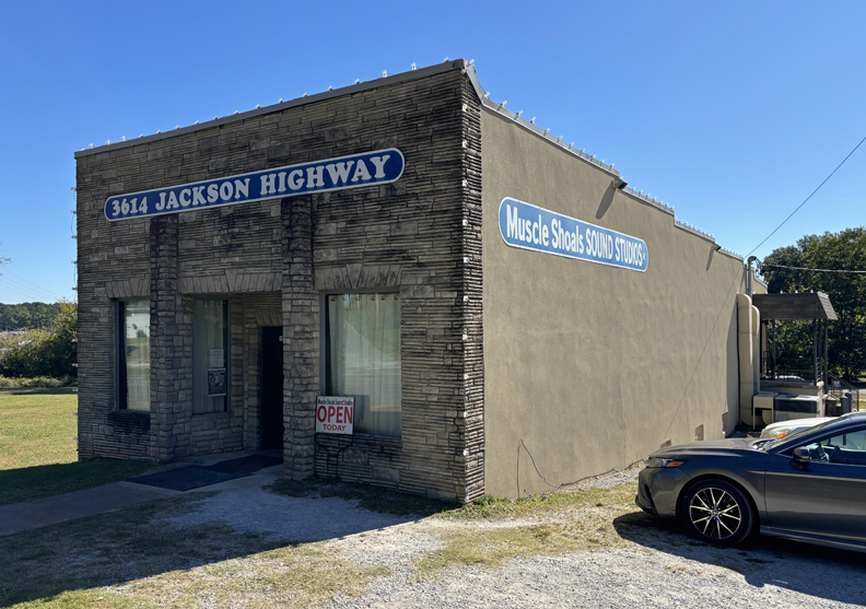
My fourth stop was the Muscle Shoals Sound Studio. It is located in Sheffield AL, which is considered the “Center of the Shoals” because it is centrally located between Florence, Muscle Shoals, and Tuscumbia AL.

The studio recorded many famous artists such as Linda Ronstadt, Mick Jagger, and Cher. The studio was pictured on the cover of Cher’s 3614 Jackson Highway album.
.

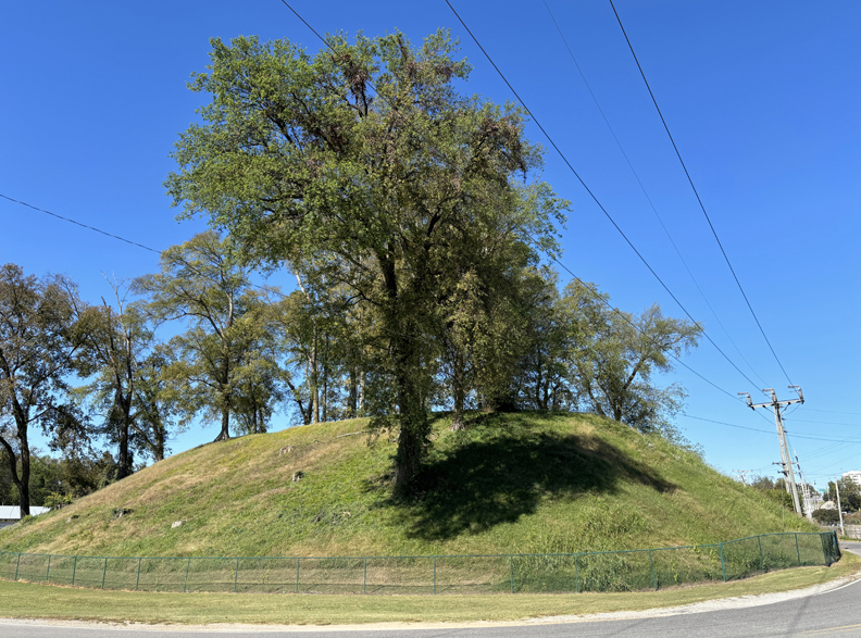
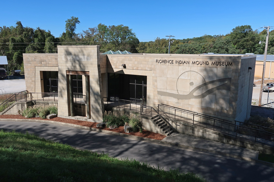
My fifth stop was the Florence Mound built 1700 years ago along the banks of the Tennessee River. “Used as a gathering space for ceremonies, the mound has withstood centuries of floods, storms, and human destruction. It stands today as a testament to the Indigenous people who lived in the Shoals for nearly 10,000 years.
.
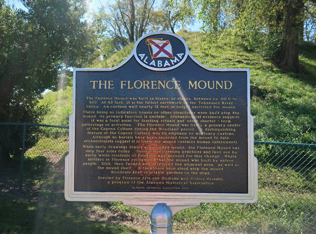
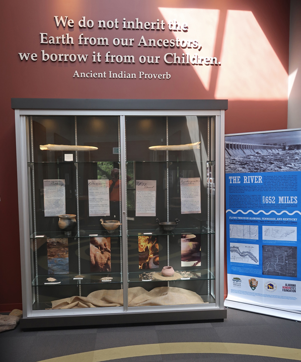
A Museum and Markers at the base of the Florence Indian Mound
.

.
My sixth and final stop in Muscle Shoals NHA was Frank Lloyd Wright’s only AL building – the Rosenbaum House.

The house was finished in 1940 and has been called the purest example of “Wright’s Usonian design.”
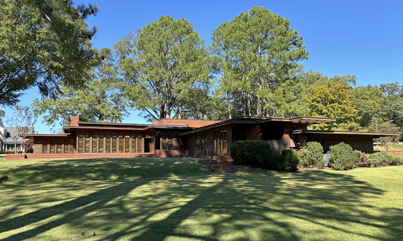
Note the windows and the cantilevered roof extensions that are characteristic of the Usonian design.

Finished the day with an 8-hour, 500-mile, drive to Springfield
