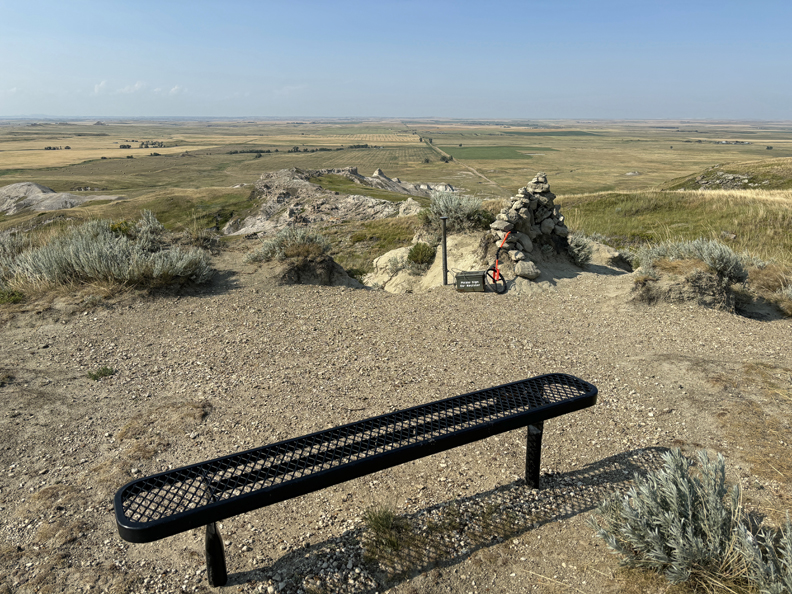
11/12/25 W – 3:30p flight from Dayton to El Paso, rented a GMC Sierra 4WD pickup and stayed in the Sunland Park Inn (Best Western). I bought snacks and drinks to prepare for my three-day trip.
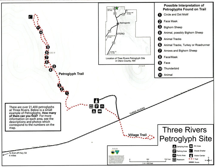
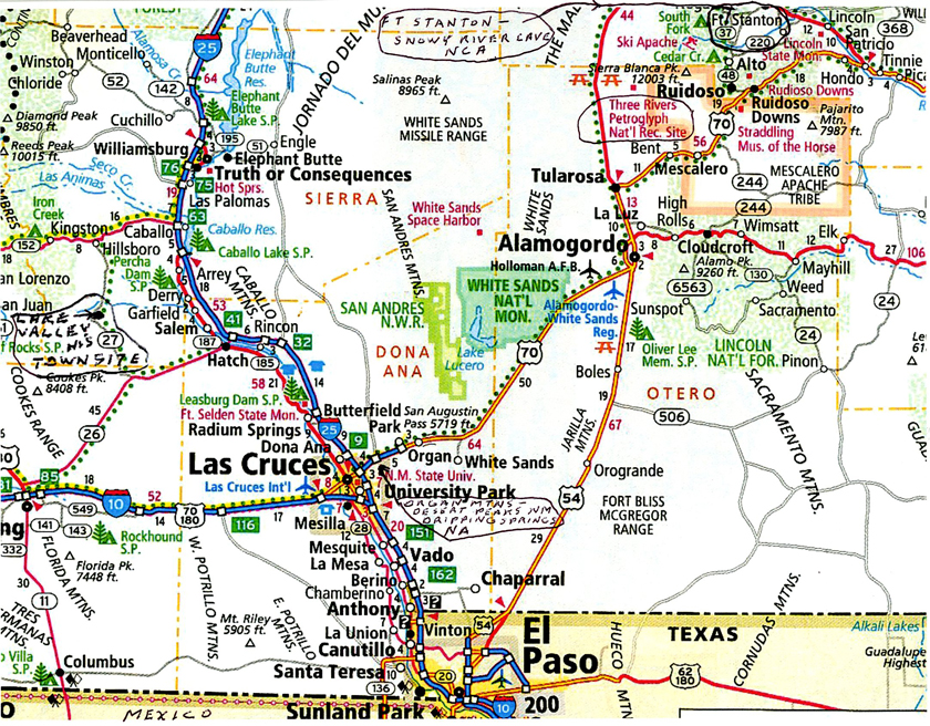
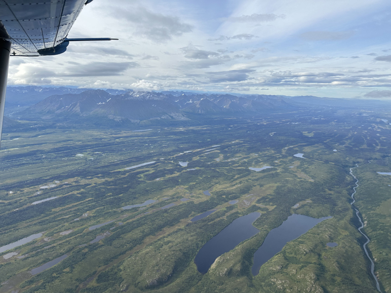
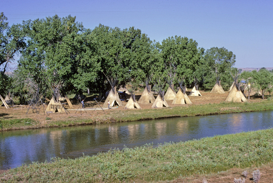
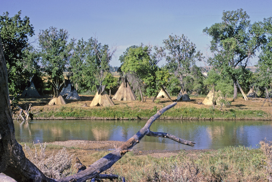
11/13 Th – left at 7am in order to get to a Subway in Alamogordo NM at 8:30a when they opened. I bought a foot long Chicken Teriyaki Sub, so as to have an easy lunch for the next two days. Four of my six destinations are indicated on this map.
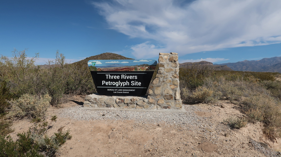
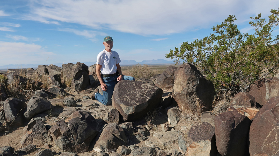
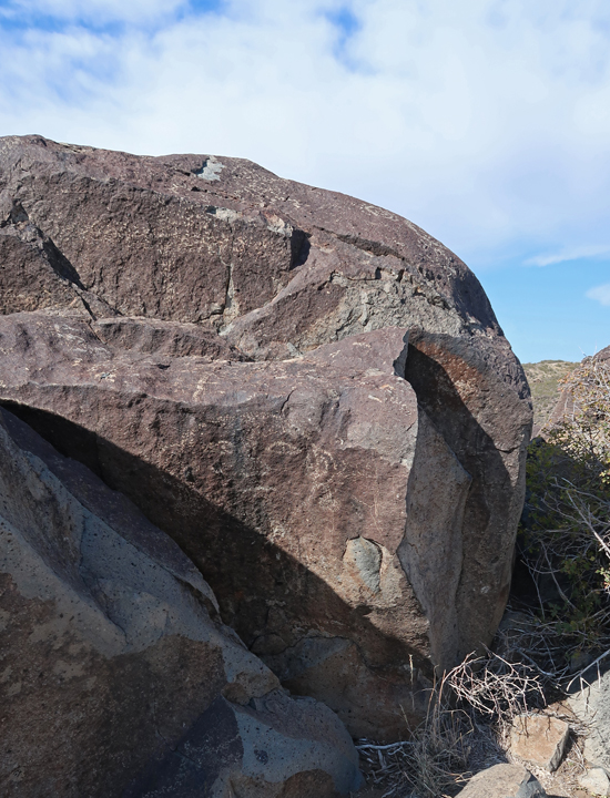
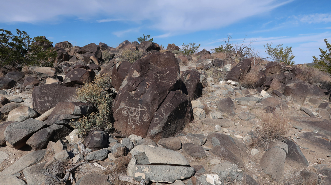
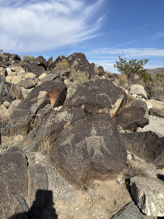
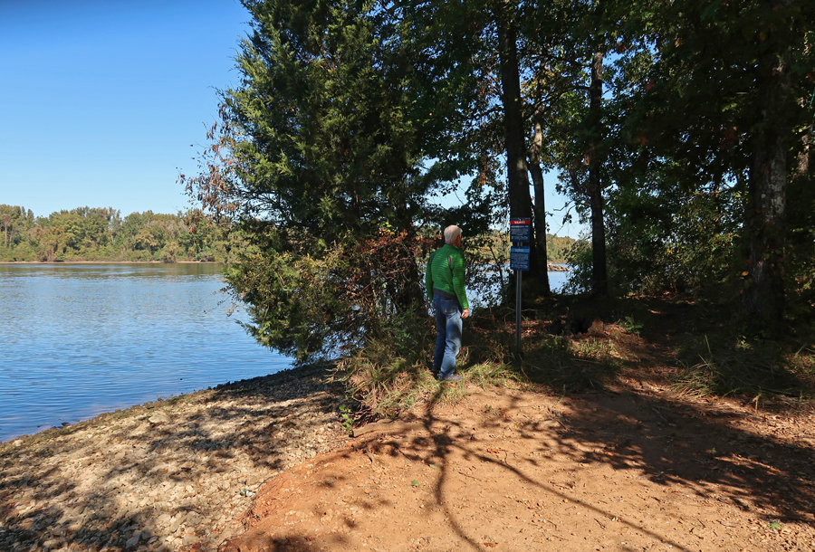
An hour drive north on US-54 got me to the BLM Three Rivers Petroglyph Site.
.
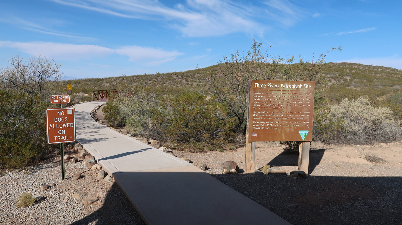
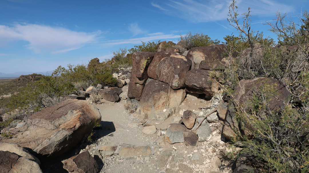
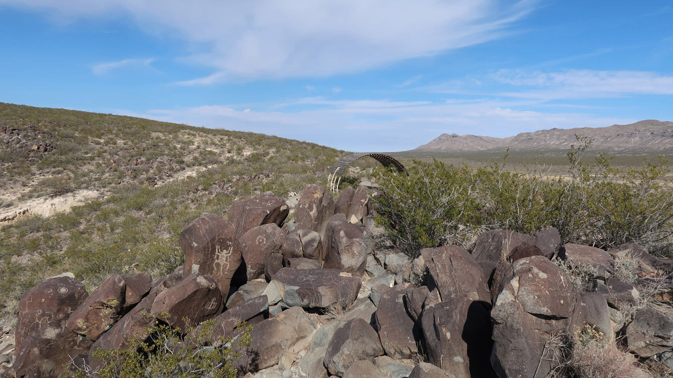
The Petroglyph Trail is a bit rugged and about two miles roundtrip.
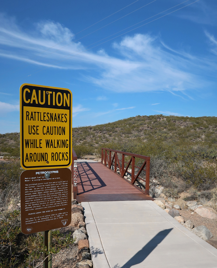
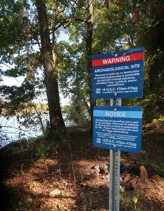
Rattlesnake Caution and the definition of the word Petroglyph –
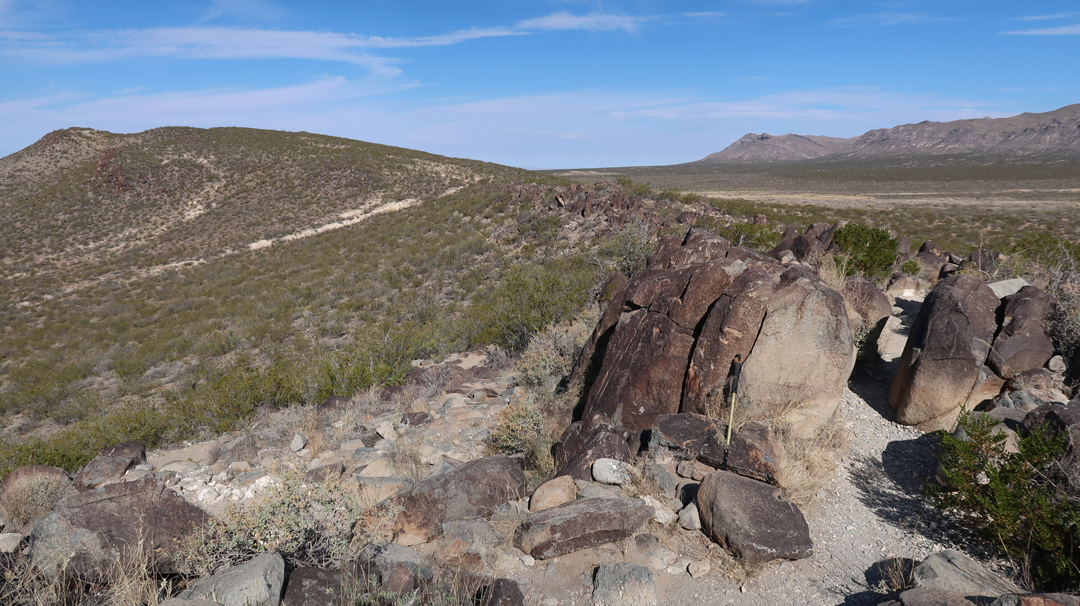
Trail goes up to and follows a ridge meandering through boulders.
.
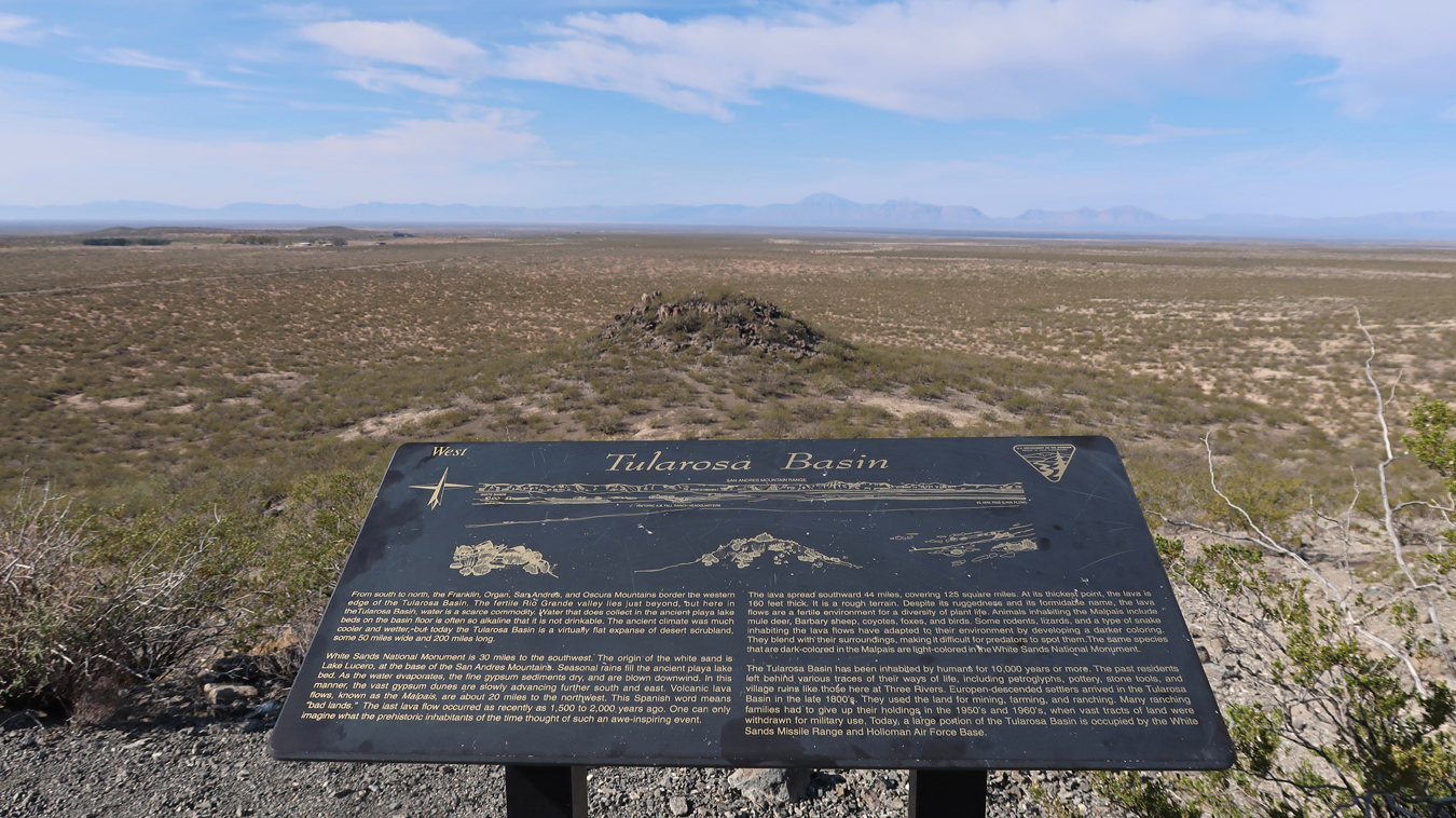
Tularosa Basin – enlarge to read
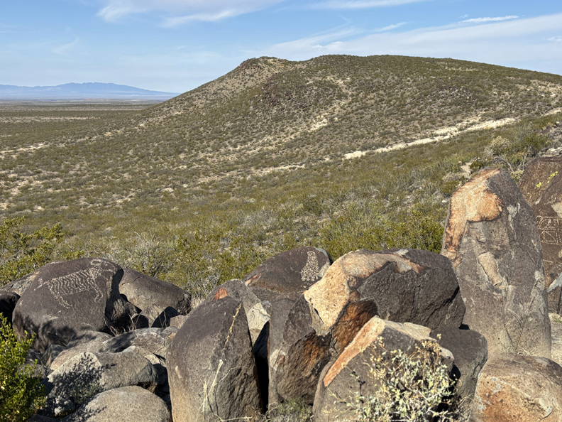
Bighorn Sheep (left), bent knees indicate motion
Body of a Bighorn sheep filled with Mimbres-style geometric designs and pierced by three arrows.
Can you find the round face with almond shaped eyes and earrings?
There are more than 21,000 petroglyphs in this area!
.
The remains of a Mogollon village is near the parking lot. It is thought that the inhabitants of the village created the rock drawings more than six hundred years ago.
The 43-day government shutdown ended today – so, the information center was open!
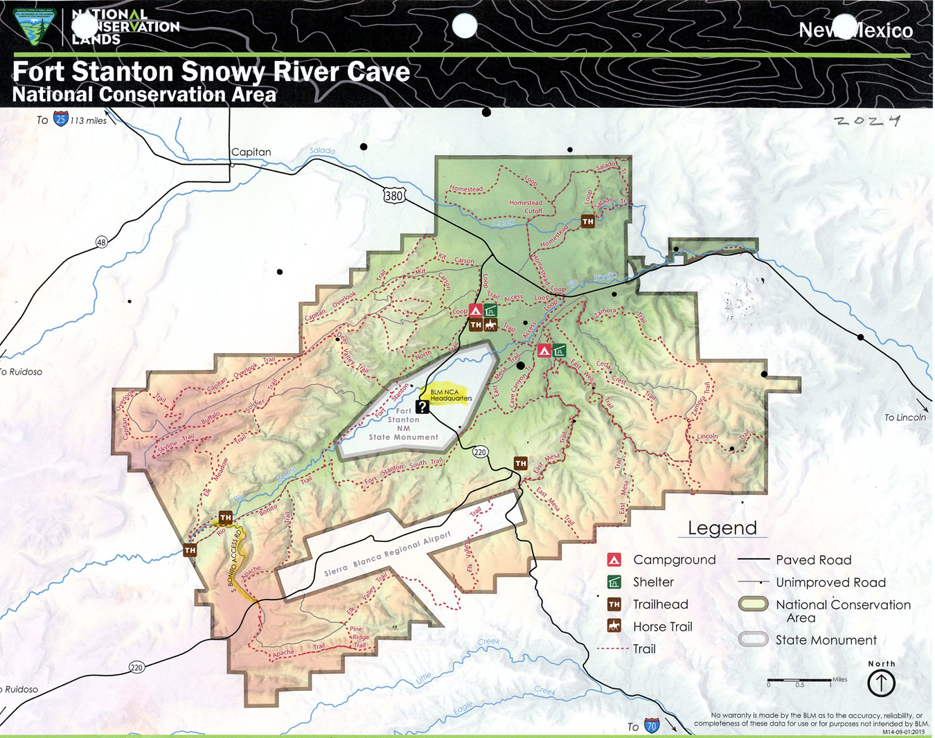
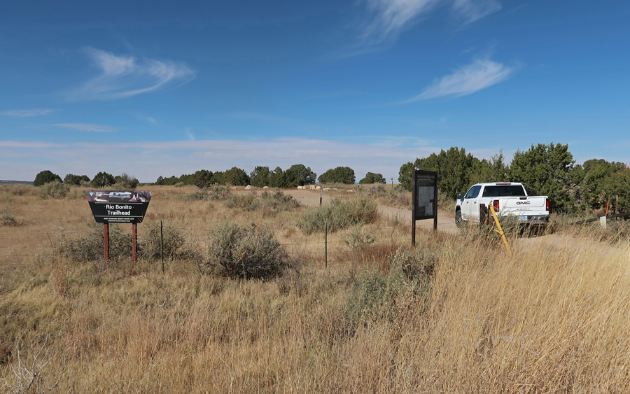
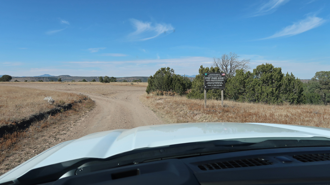
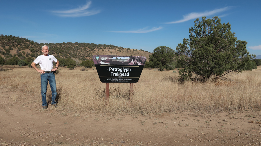
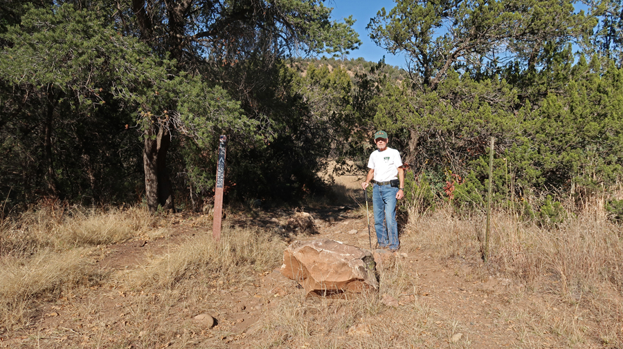
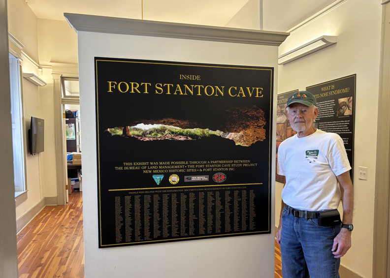
1.25hr (64mi) to Rio Bonito Petroglyph National Recreation Trail in Fort Stanton – Snowy River Cave NCA BLM. Trailhead (TH) is located in the lower left of the map.
Turned N onto the Rio Bonito Access Rd for about a mile until switchbacks dropped you down to the river. You definitely need a high clearance 4WD vehicle on this track.
.
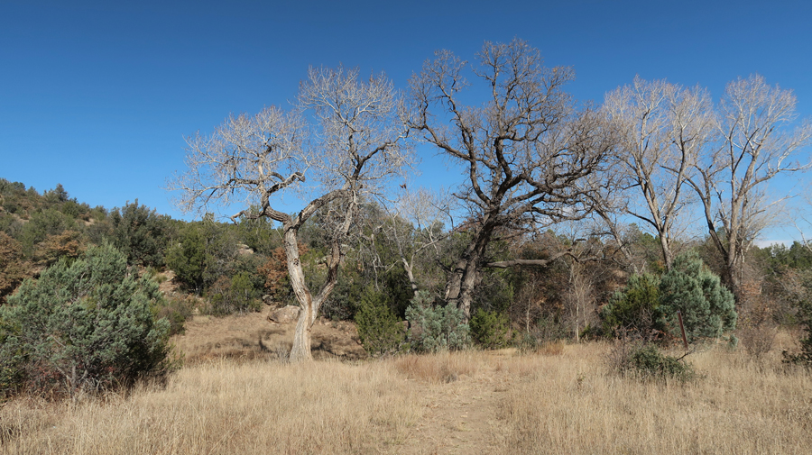
Description – “Trail is 2.5mi loop running up the river from the trailhead. There are cottonwood, walnut, and oak trees. . . The trail passes up and downhill over and along natural contours, including a primitive bridge, loose rocks, and some rocky segments that require rock scrambling.”
.
.
.
.
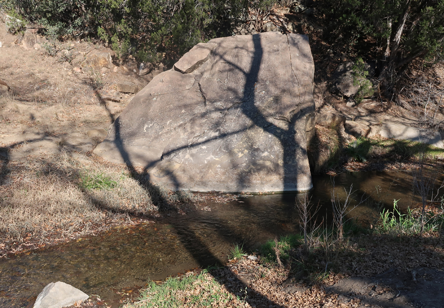
“At the midpoint is Petroglyph Rock in the riverbed (images of native Water God).” Later, a ranger at the fort told me someone had painted graffiti on the rock, and it was cleaned off but it made the “Water God” hard to see.
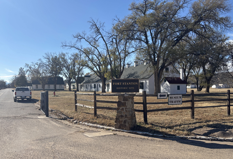
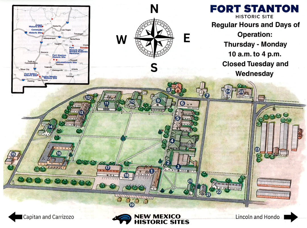
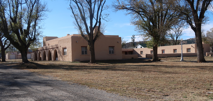
Once back to the road, it only took 15-min to get to Fort Stanton SP (240-acre site with 88 buildings).
.
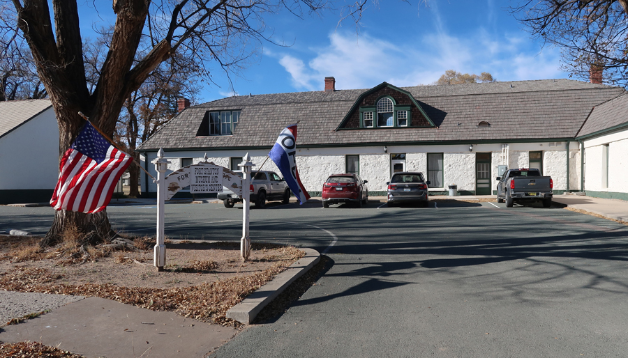
In 1855 Captain Henry Stanton was killed as he led soldiers in pursuit of a band of Mescalero Apache. In response, the Army built a fort, the same year, to protect settlers. They named it Fort Stanton. It is one of very few intact frontier forts in the West. This is the Visitor Center.
.
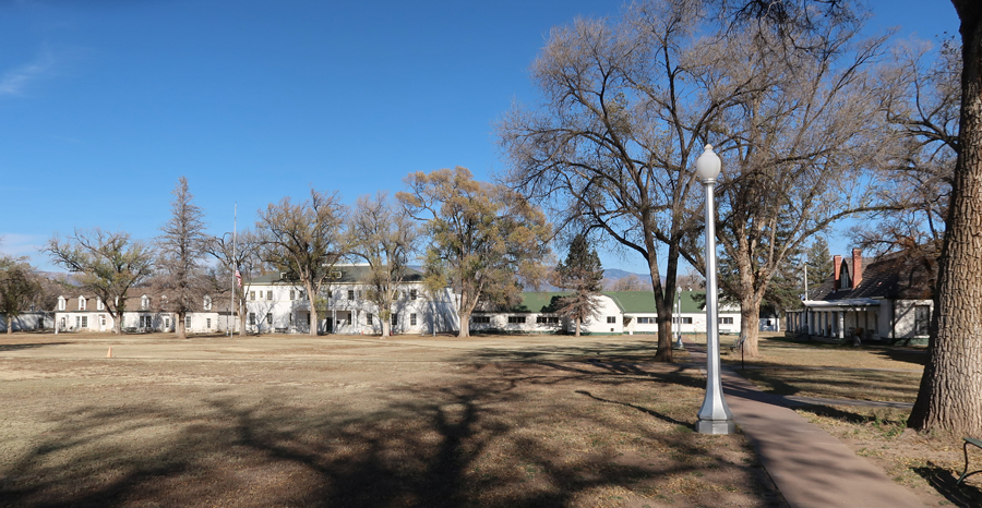
The fort had many missions between 1855 and 1953 when the State of New Mexico took ownership. The flagpole is in front of Barracks/Dining Hall.
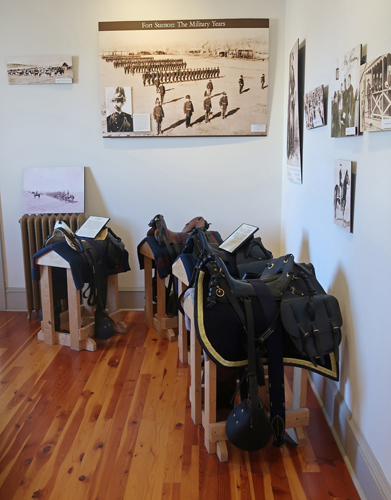
The fort hosted the 9th and 10th cavalry, the 24th and 25th infantry Buffalo Soldiers, Billy the Kid, Colonel Kit Carson, and General “Black Jack” Pershing. It was a prisoner of war camp during World War II.
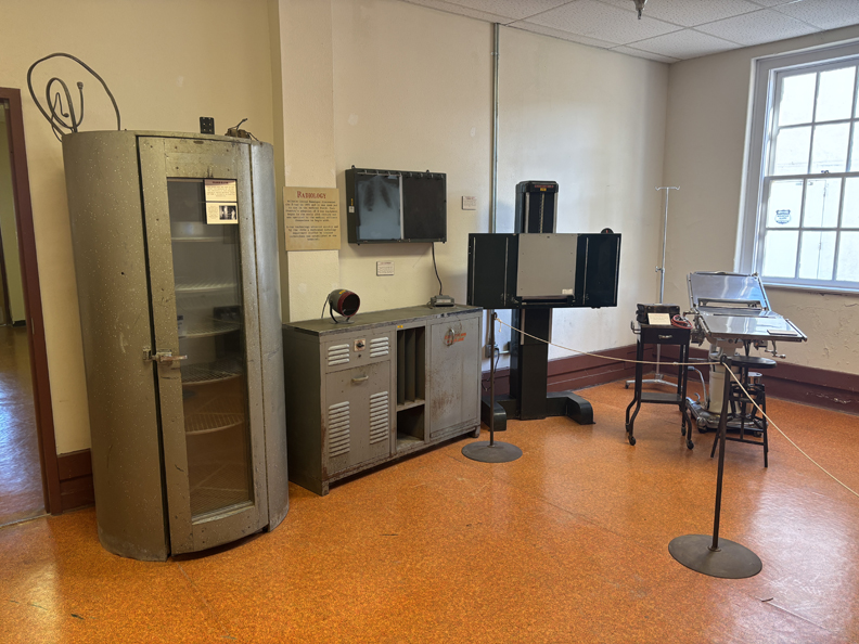
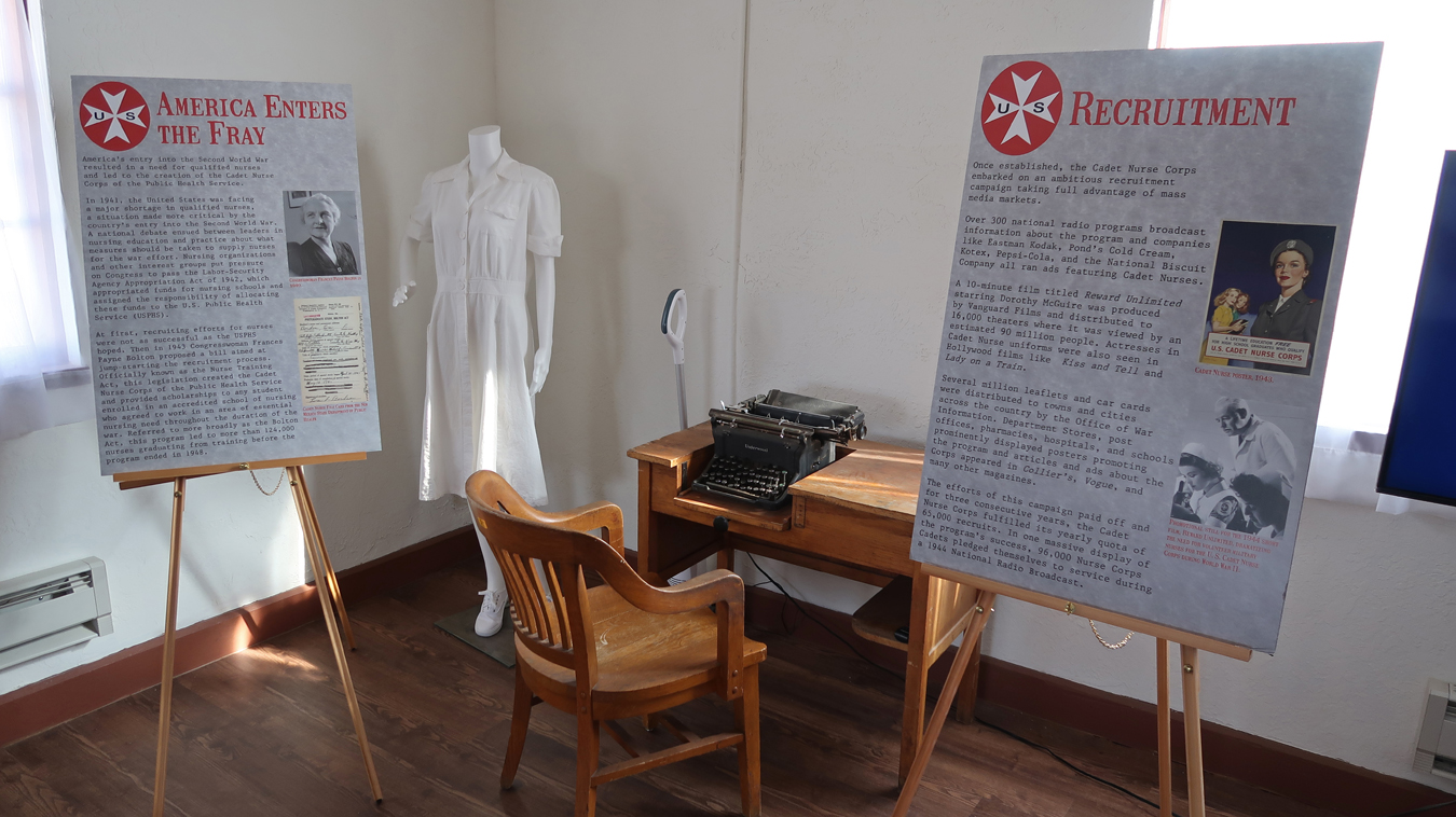
From 1899 to 1953, the fort served as a Tuberculosis Hospital for the U.S. Merchant Marine.
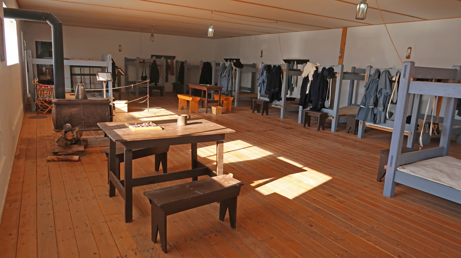
The Nurse Quarters was built in 1940-41
.
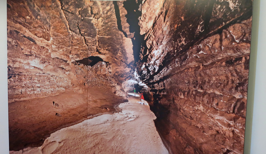
Unfortunately, Snowy River Cave is not open to the public.
In 2001, the 11.7-mile Snowy River Passage was discovered. The floor of the passage is covered with white crystalline deposits of calcite that glisten like snow. It is the longest Calcite formation in North America.
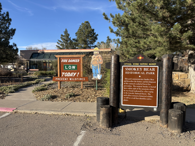
After leaving the NCA, I made a stop at the Smokey Bear Museum in Capitan NM. Read the sign for the story of “Smokey the Bear.”
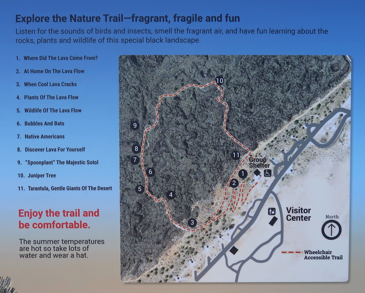
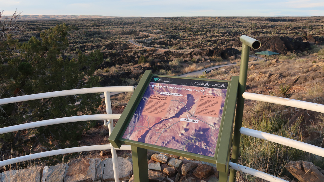
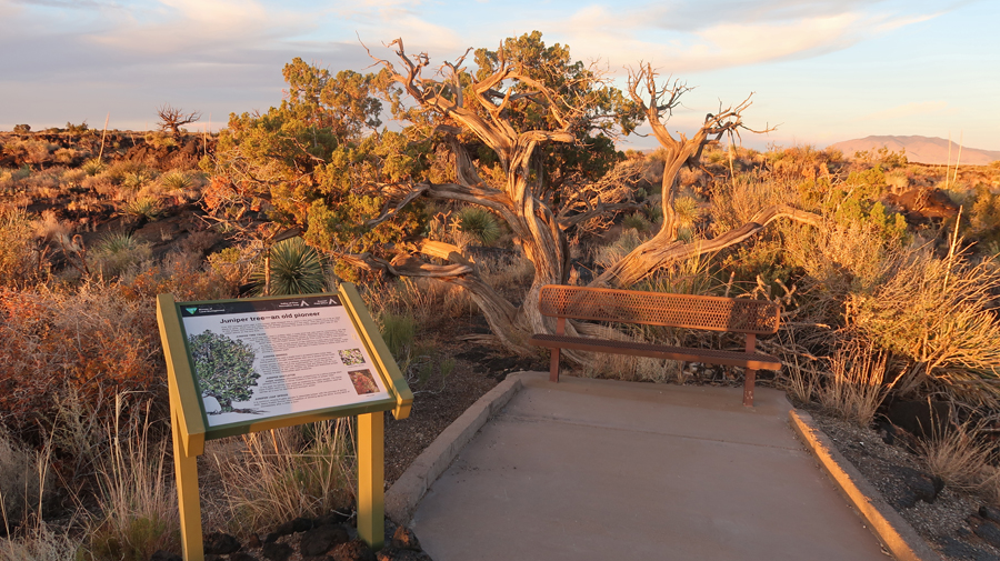
A half hour further west on US-380 is Valley of Fires National Recreation Area (NRA), administered by the BLM. It is just W of Carrizozo NM. See the bottom of this map –
I did the 1-mile, self-guided, paved Malpais Loop Trail –
.
Little Black Peak can be seen through the viewing tube and is probably the last vent that opened adding lava to the lava flow.
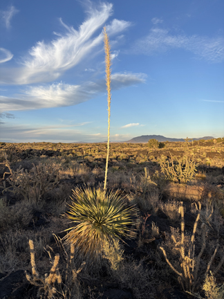
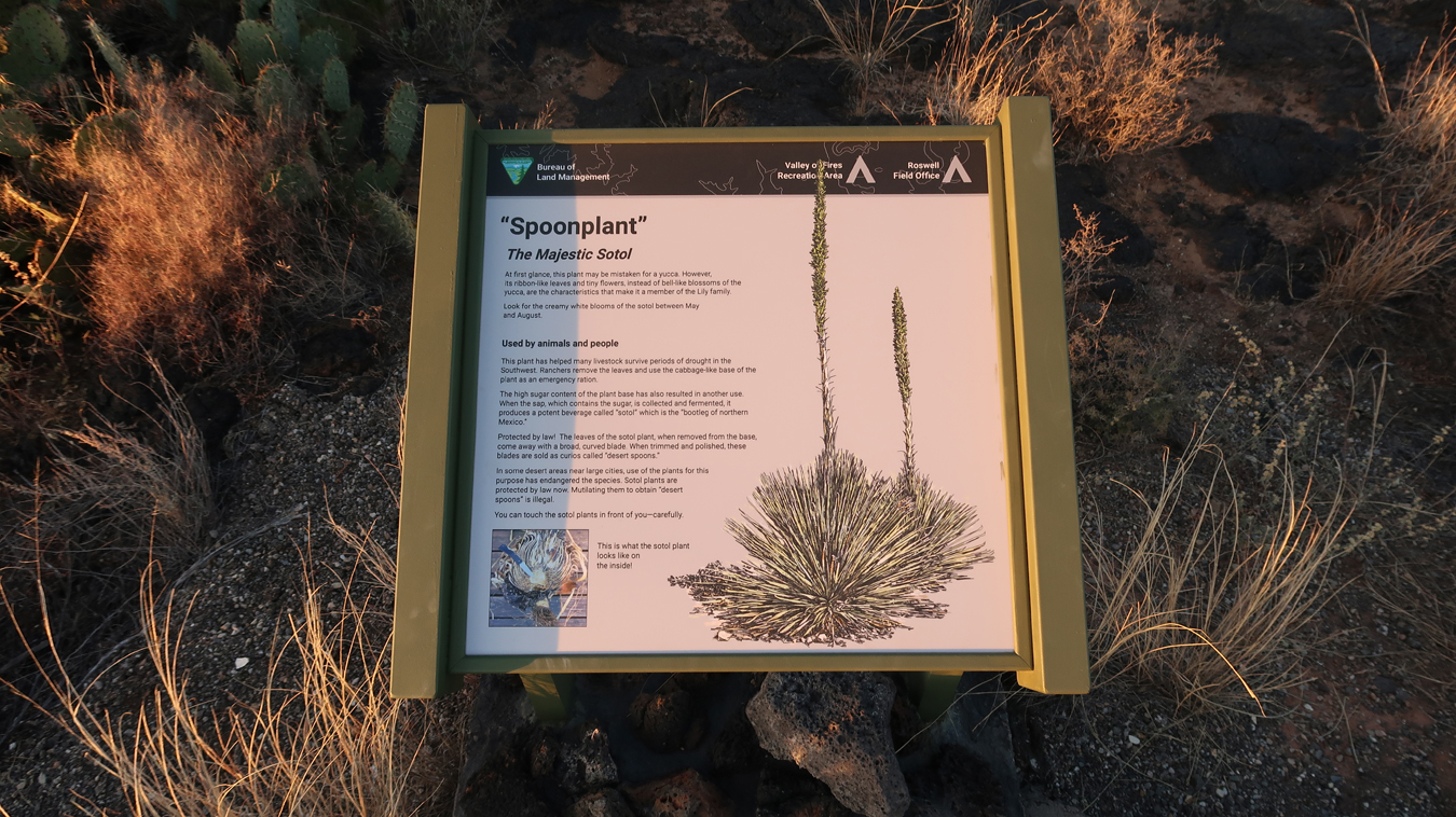
Spoonplant –
.
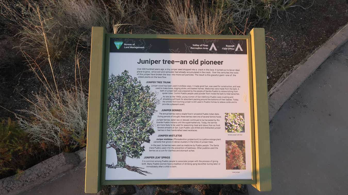
Juniper Tree
.
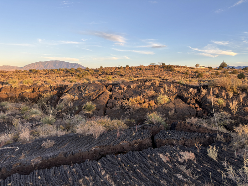
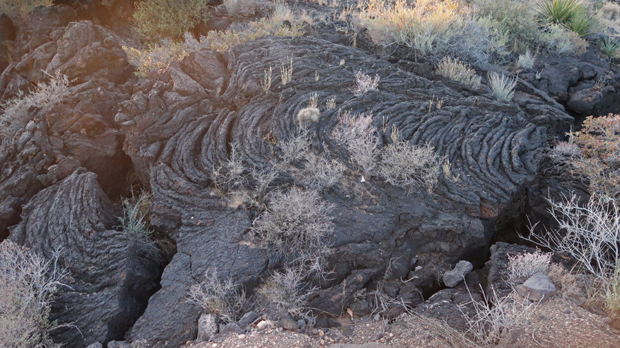
The Carrizozo Lava Flow, over the Tularosa Basin, is 44-miles long, 4 to 6-miles wide, and 160ft thick in the center. Lava folds –
.
Tularosa Valley History –
.
Finishing the trail, as the sun sets –
Sunset across the desert –
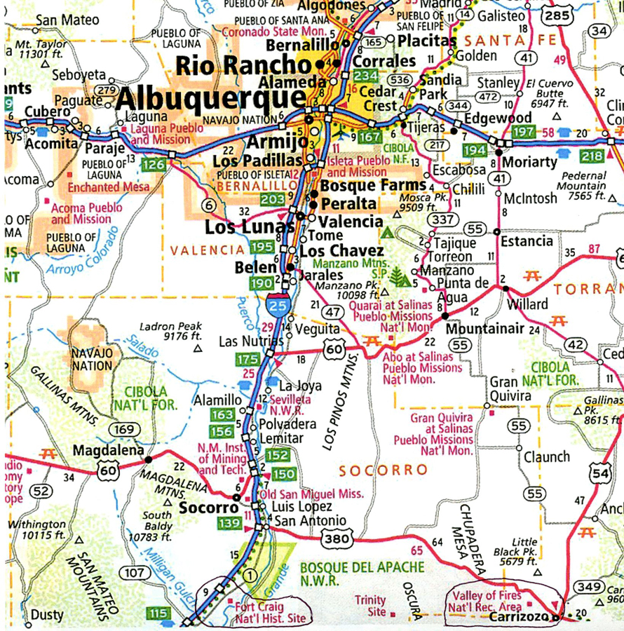
75-miles to the Best Western in Socorro NM
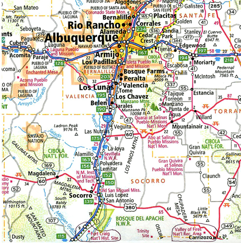
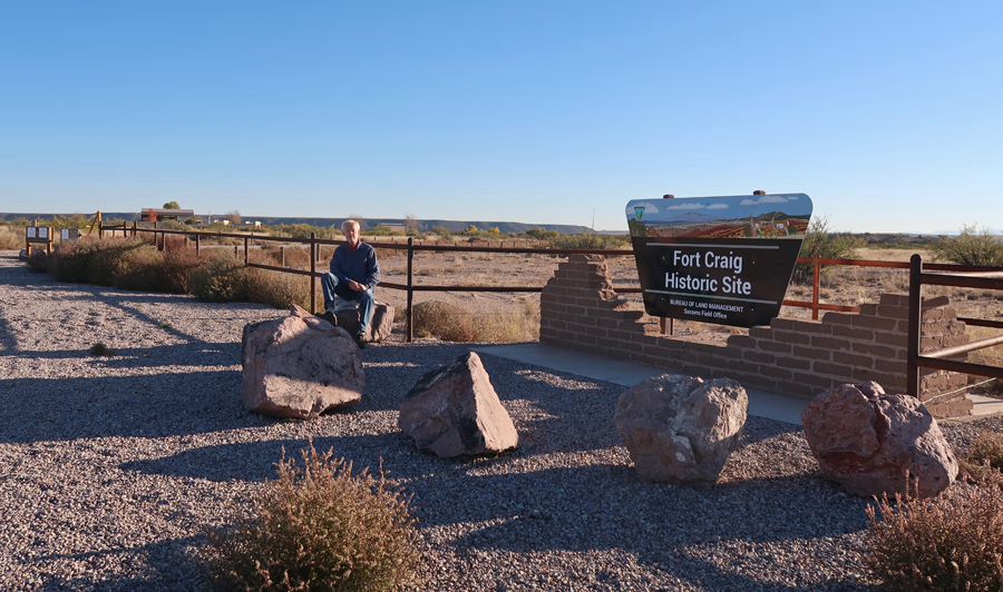
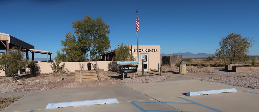
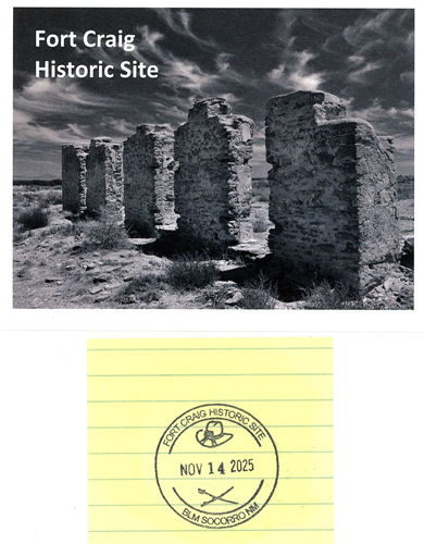
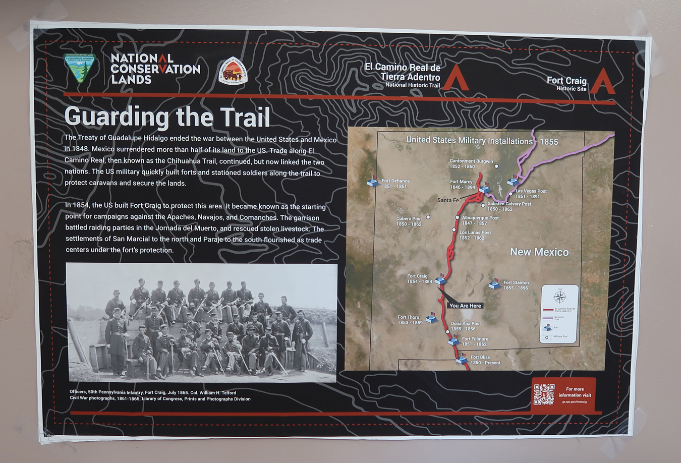
11/14 F – I decided to stop at Fort Craig NHS, which was on the way, but not on my itinerary. I had visited this NHS in April 2022 – see Blog. See bottom map –
.
.
.
This fort was built to protect settlers and guard the El Camino Real de Tierra Adentro Trail between Mexico City and Sante Fe. Note, Fort Stanton is also included on this map.
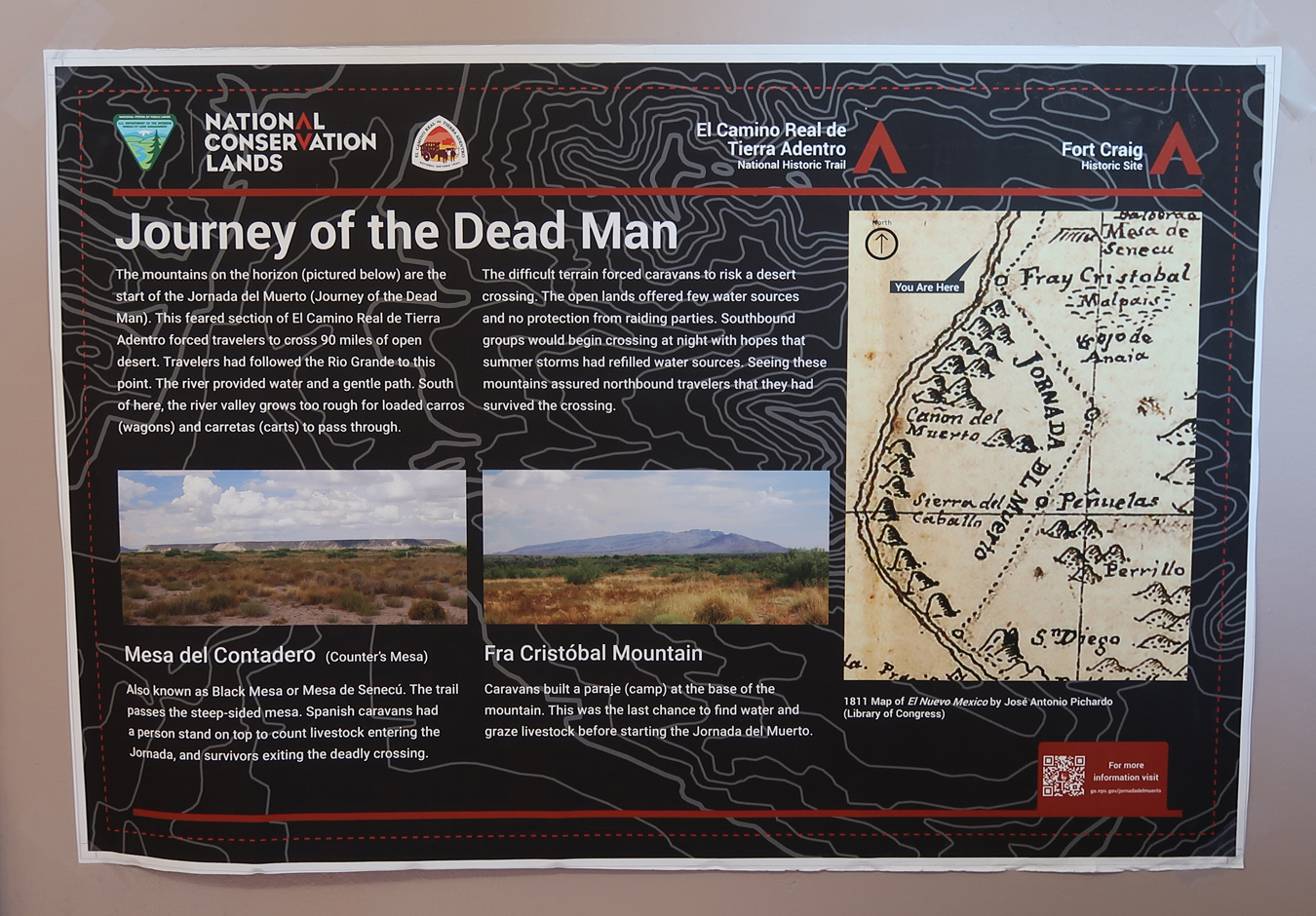
“Journey of the Dead Man” – a 90-mile desert segment of the El Camino Real de Tierra Adentro.
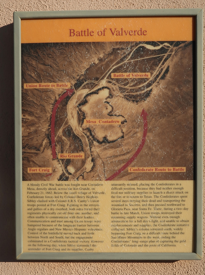
In 1862, a Confederate force won a battle here on their way to Glorieta Pass near Sante Fe where they were defeated and retreated south. The Confederate objective was to take the gold fields in CO and the ports in CA. If they had captured the U.S. mint in Denver, it could have changed the outcome of the Civil War.
.
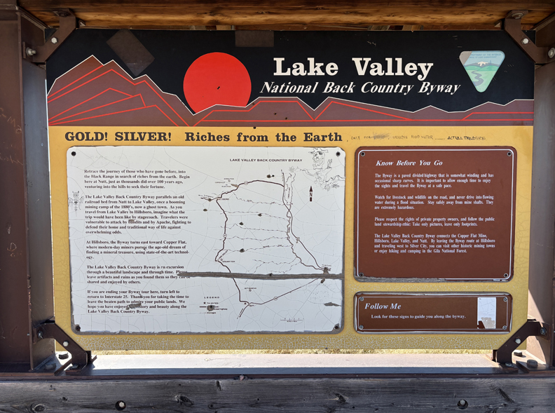
I continued S on I-25 to CR-152 W where I started on the Lake Valley National Back Country Byway to the Lake Valley Historic Townsite. See left middle of map –
.
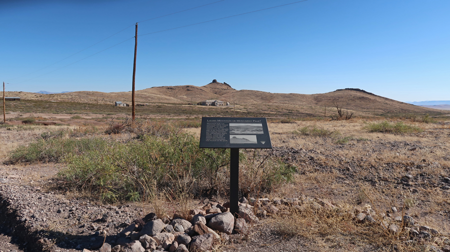
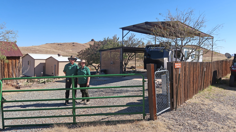
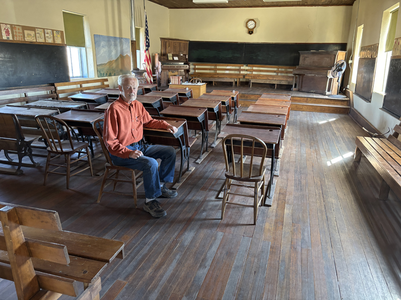
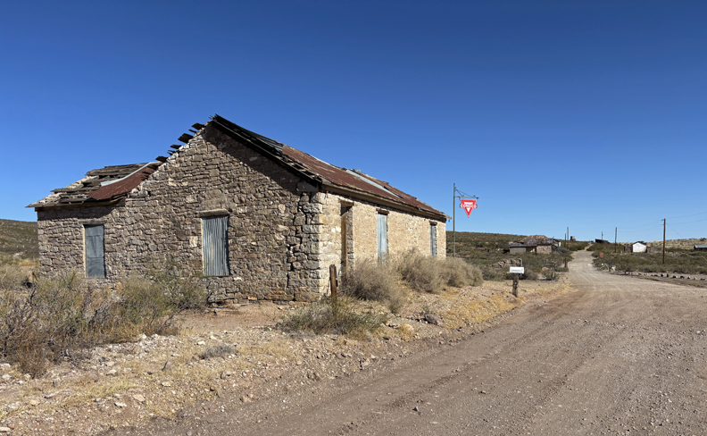
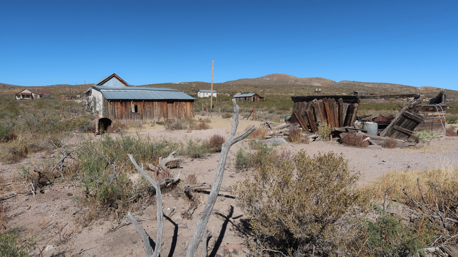
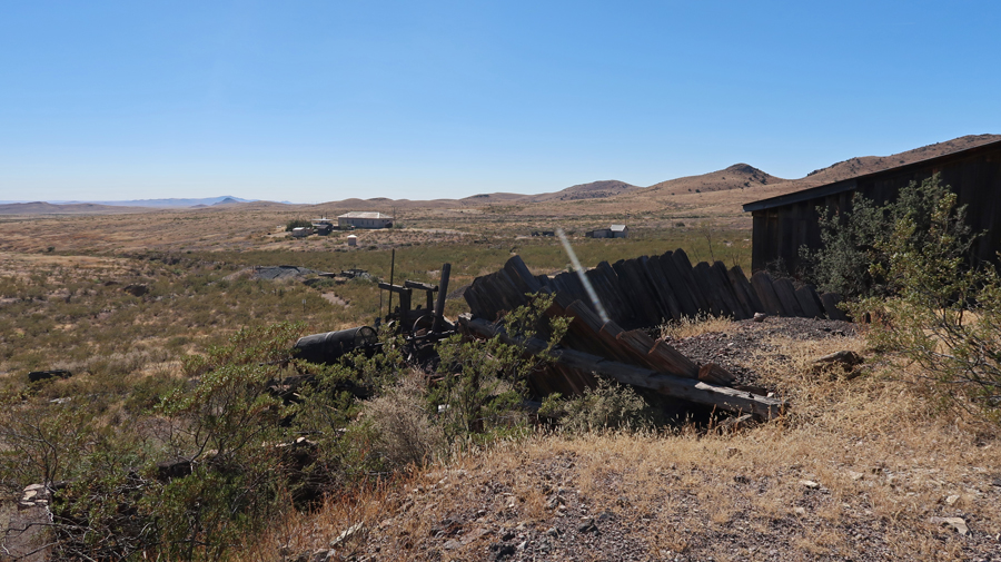
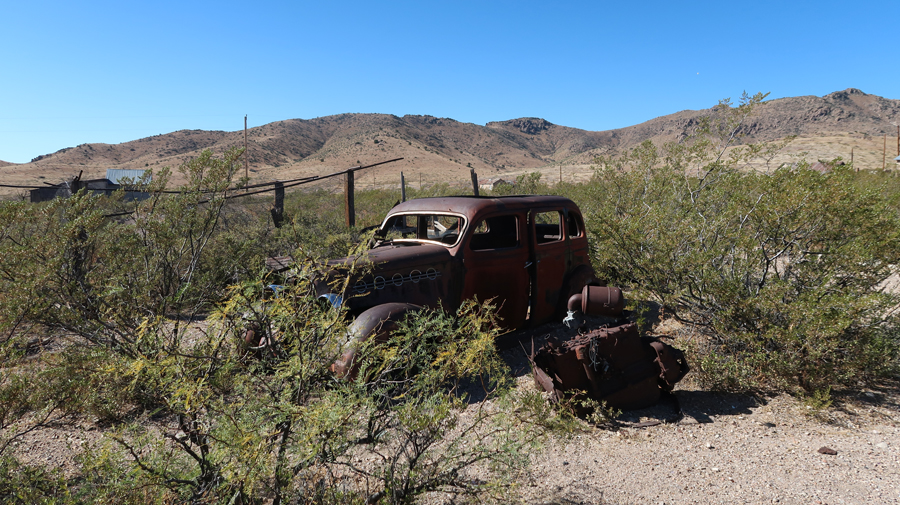
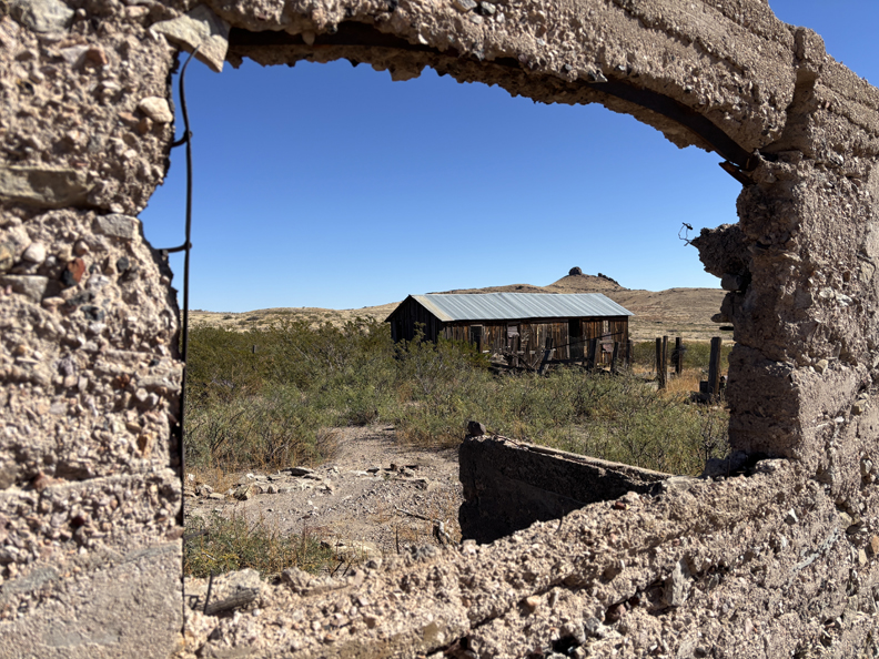
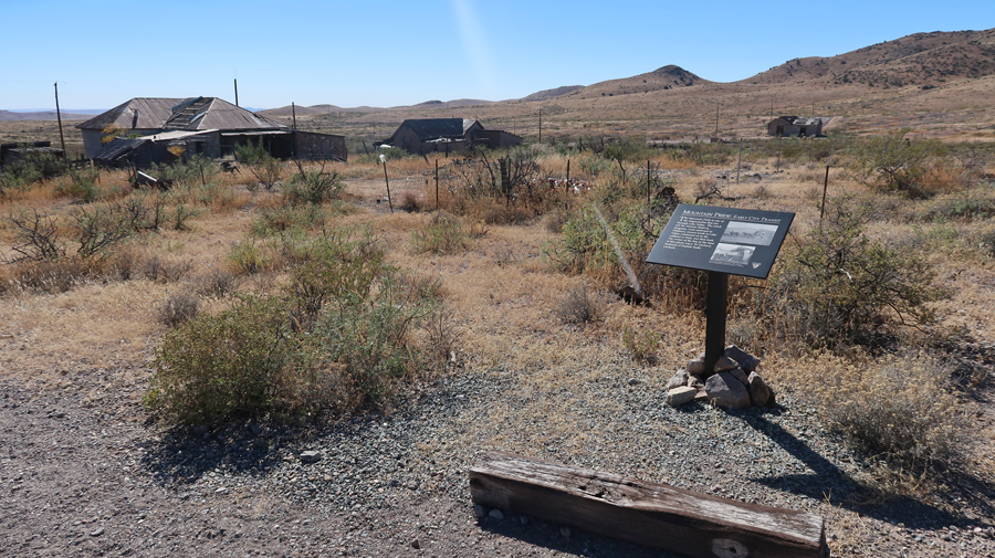
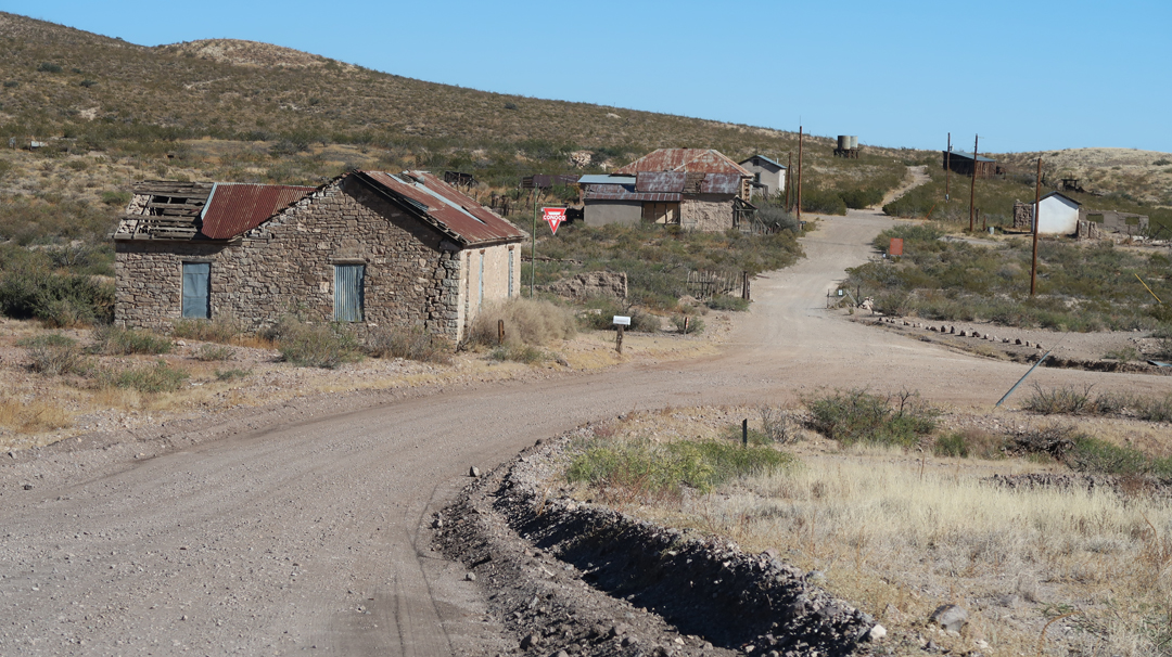
The mining town of Lake Valley was founded in 1878 after silver was discovered. It is now administered by the BLM. The restored schoolhouse provides a glimpse of what schooling in a rural area was like in the early 20th century. The Schoolhouse/Visitor Center is located in the middle of the photo, Lizard Mountain in background.
.
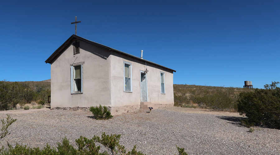
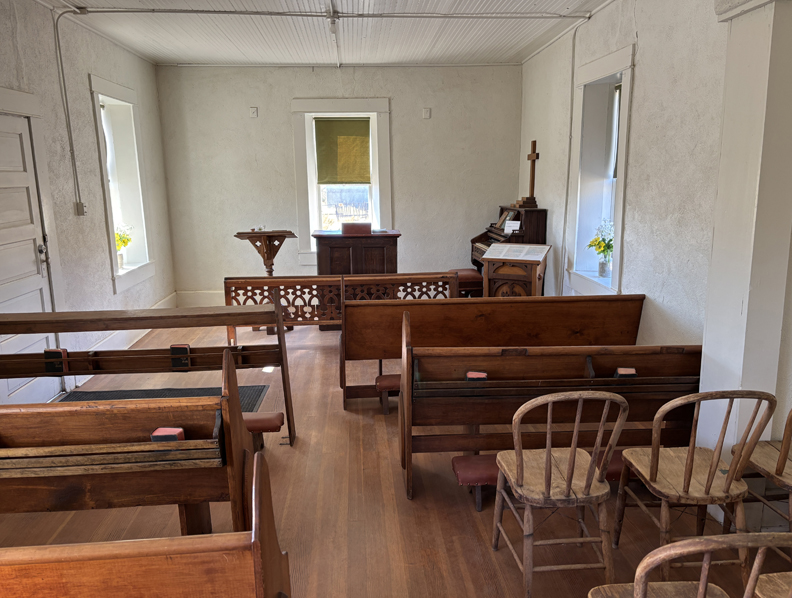
Almost overnight, the small frontier town blossomed into a major settlement with a population of 4,000 people. Today, silver mining has played out and all that remains is a ghost town. The BLM has restored the schoolhouse and chapel. Caretakers and a view inside of the “Schoolhouse” –
.
The Chapel –
.
Other buildings in the townsite have been stabilized to slow further deterioration.
.
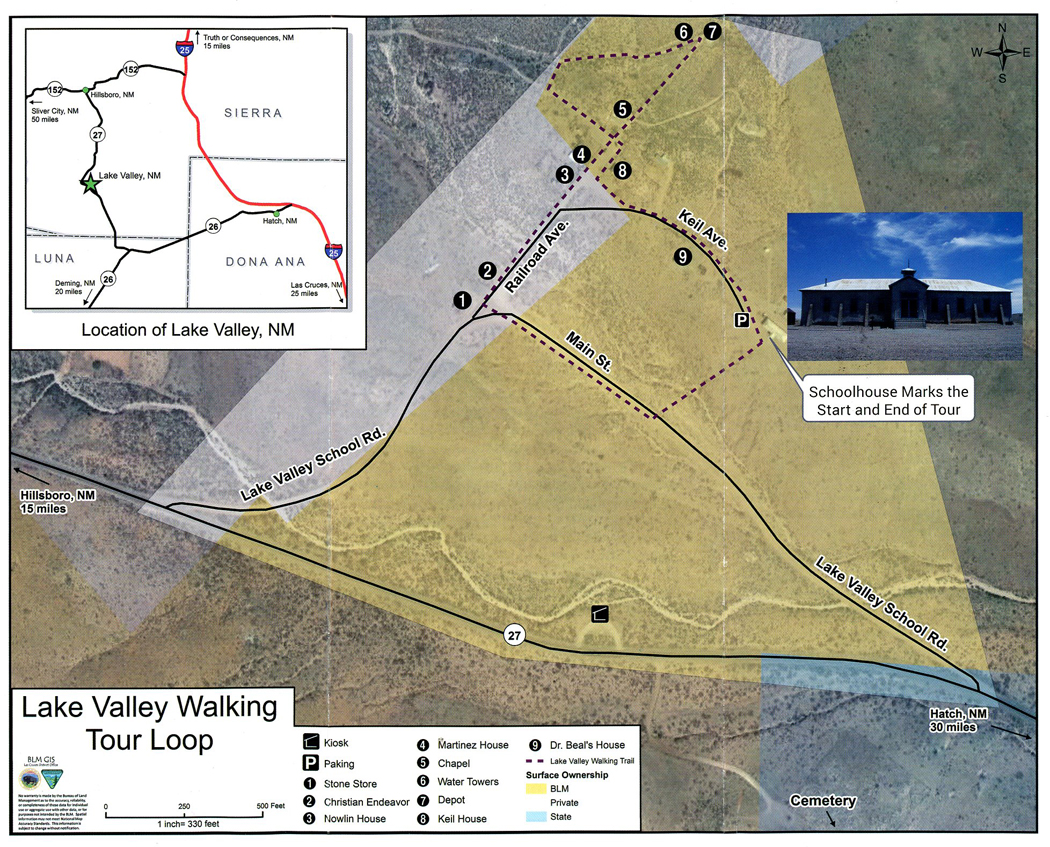
There is a 1-mile self-guided interpretive walking tour.
.
.
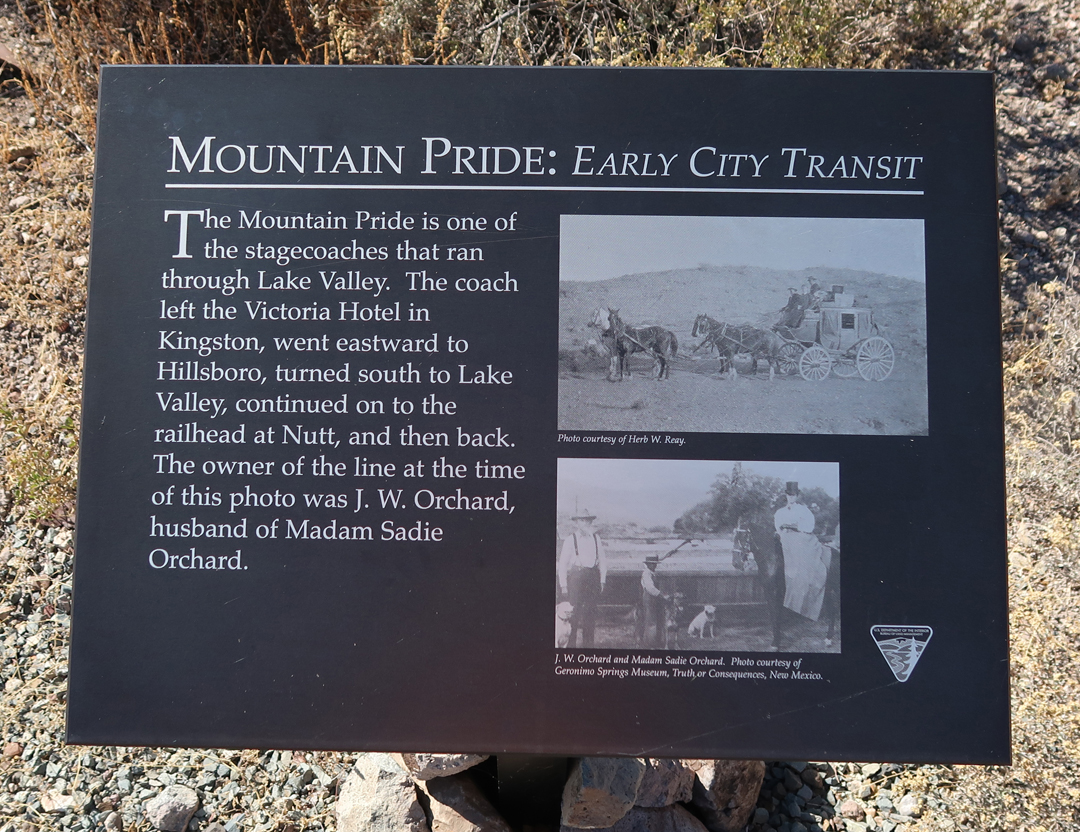
Lake Valley was on the Mountain Pride stagecoach route.
.
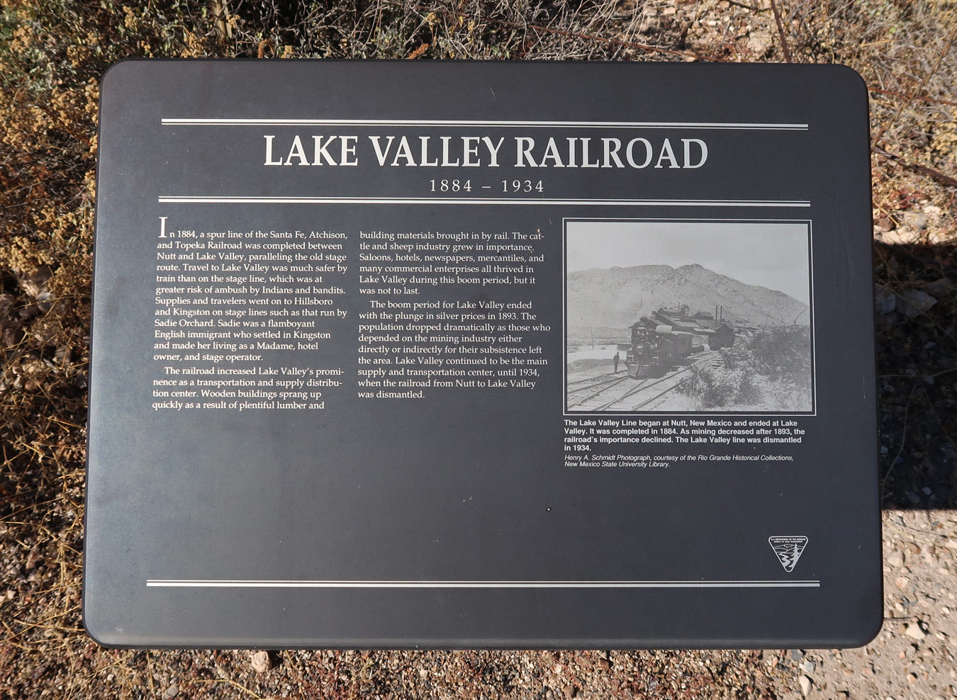
In 1884, a spur branch of the Santa Fe, Atchison, and Topeka RR was built to remove silver ore. See water tower for steam engines on the top of the hill.
.
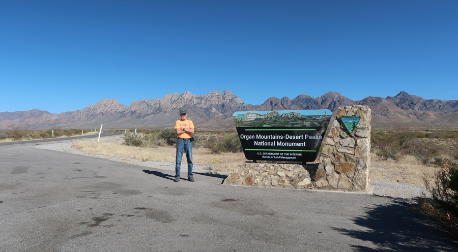
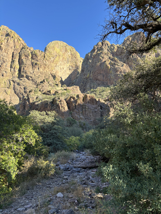
Next stop, Organ Mountains-Dessert Peaks NM (BLM) near Las Cruces NM. In 2018, Helen and I hiked West Trail up to Baylor Pass in the northern part of the NM. I then did the La Cueva Rocks Trail near the Visitor Center – see Blog for January 2018.
.
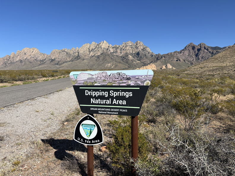
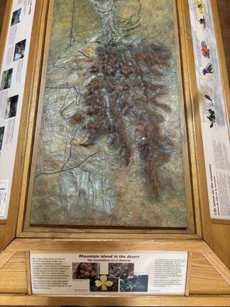
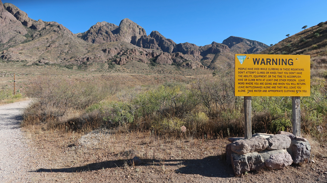
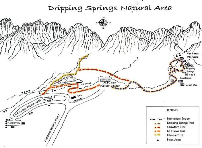
Today, my focus was on the Dripping Springs Natural Area (NA). There was a nice display in the A.B. Cox Visitor Center – “Mountain Island in the Desert”
.
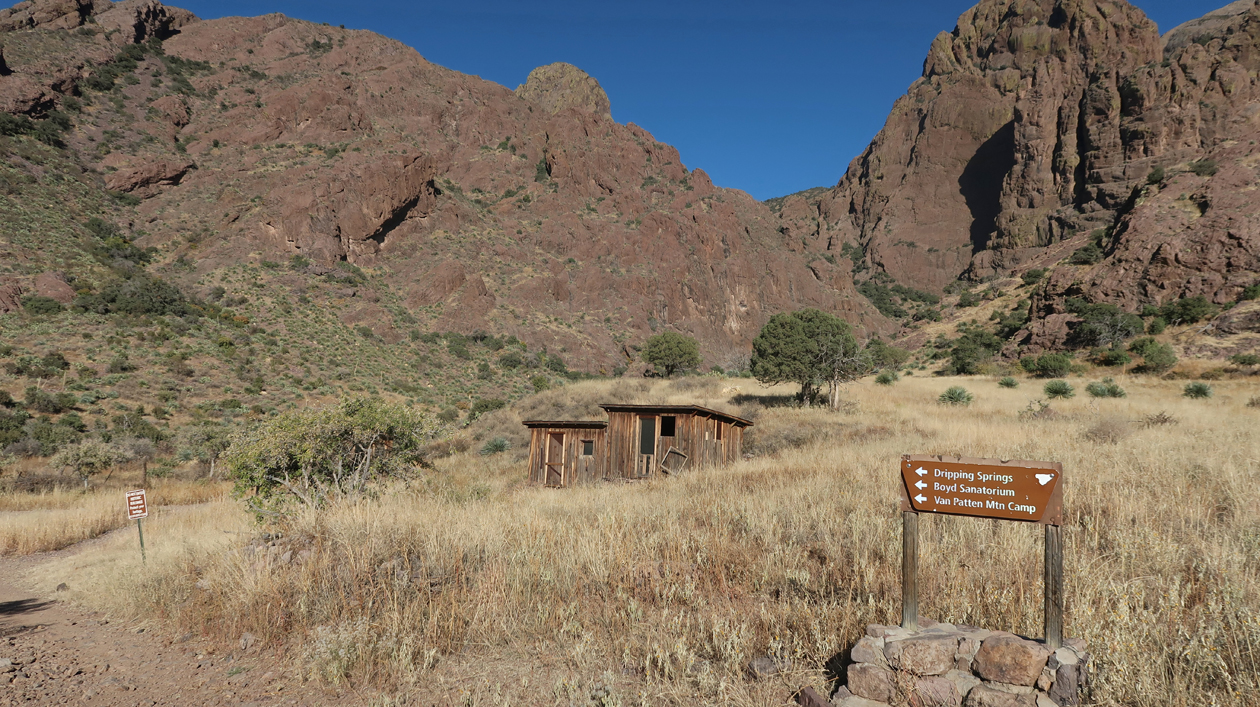
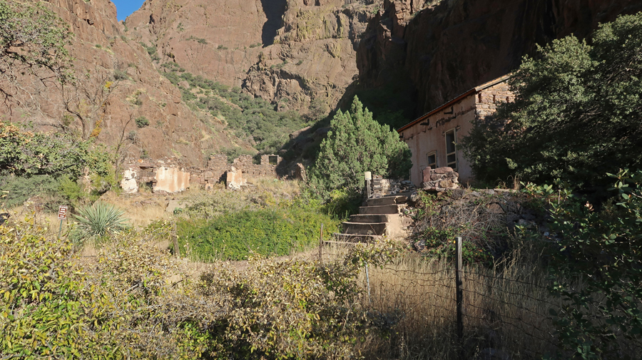
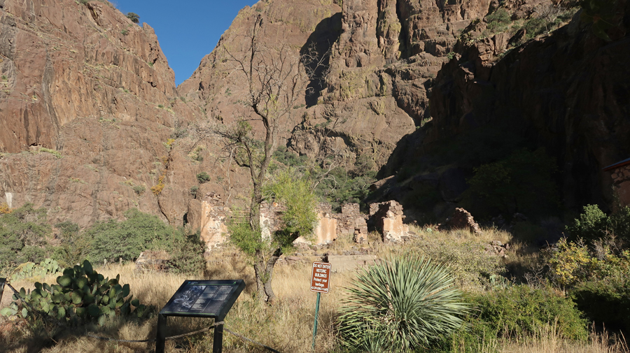
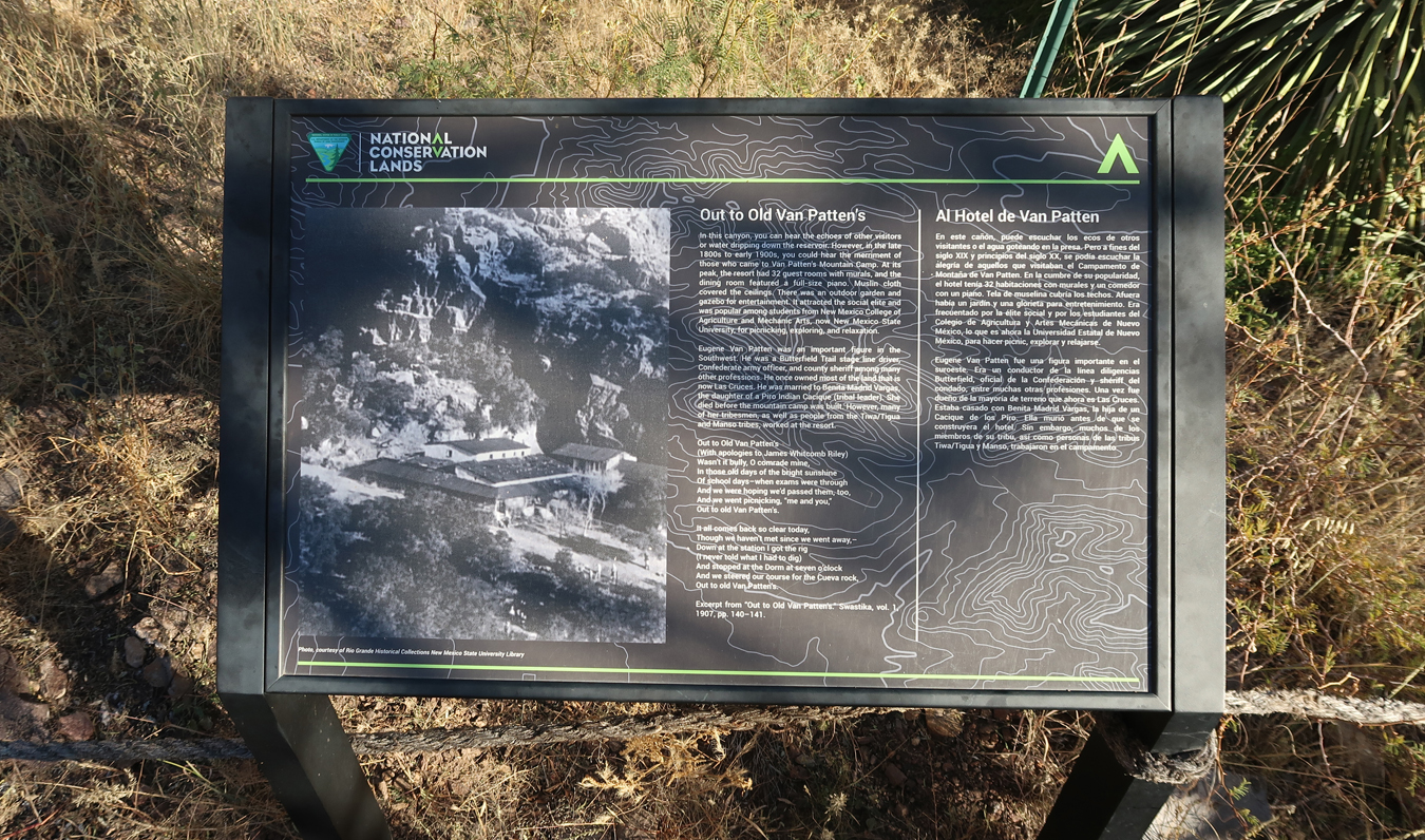
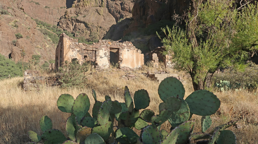
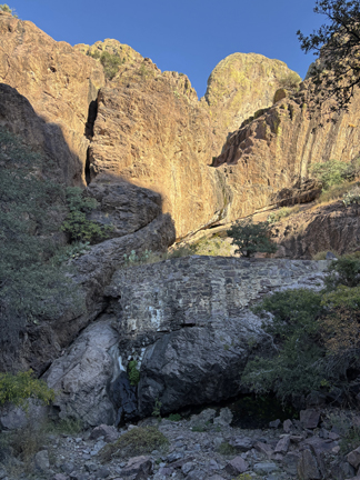
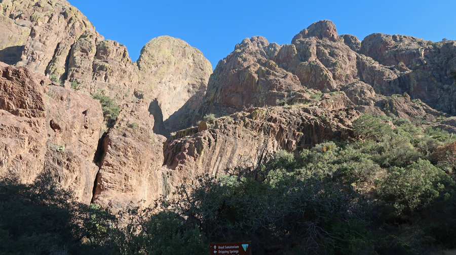
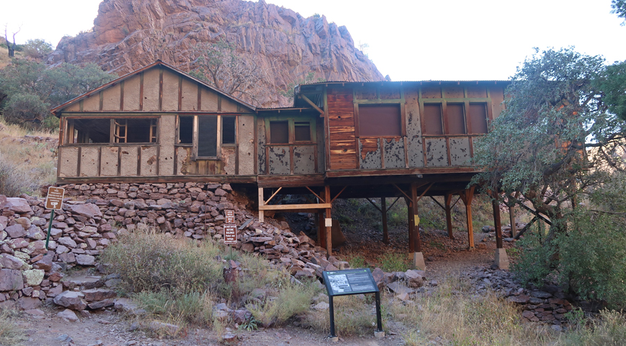
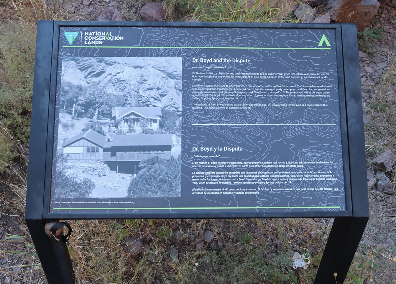
I did the 3-mile rt Dripping Springs Trail that ascends 600ft to the Van Patten Mountain Camp, Dripping Springs, and Boyd’s Sanatorium.
.
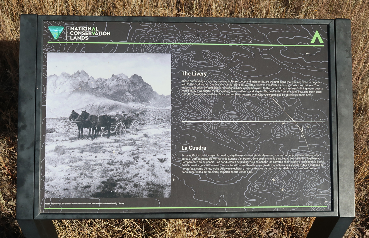
This was the Livery where guests would arrive, first by stagecoach and on horseback, and later in cars.
.
Remains of Van Patten Mountain Camp
.
.
.
Looking up Dripping Springs Creek
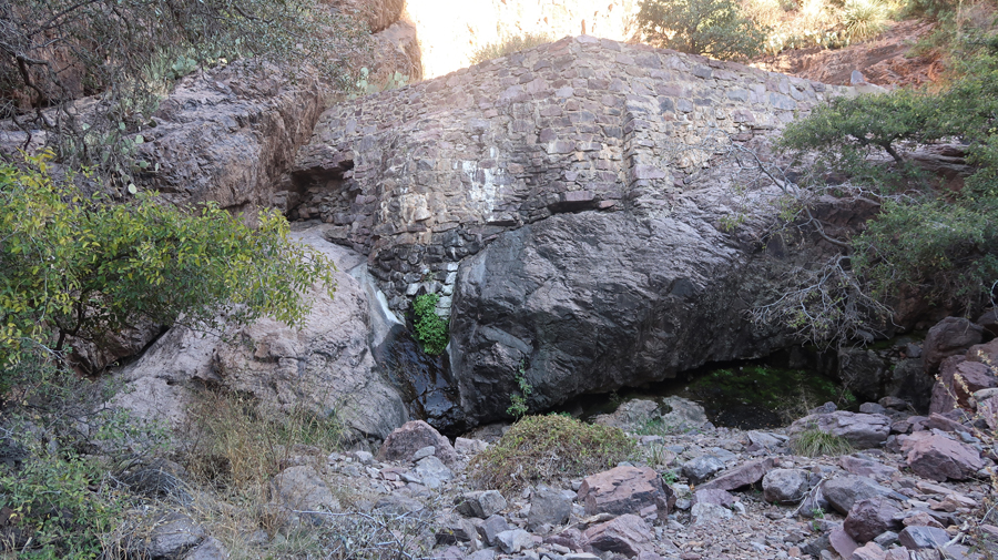
Stone Dam –
A slight trickle of water coming out from below the green vegetation near the center of this photo. It is dripping! I was hoping for a waterfall, which is what they show in the brochure.
Boyd’s Sanatorium – note sign at bottom of photo
.
.
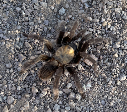
Tarantula on trail –
Descending near the end of the trail –
Back to El Paso for the night and then flight home the next morning.
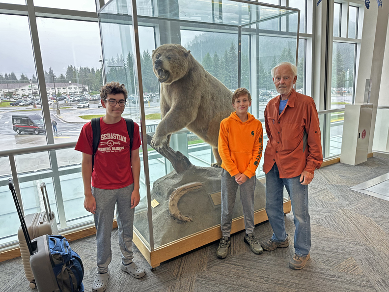
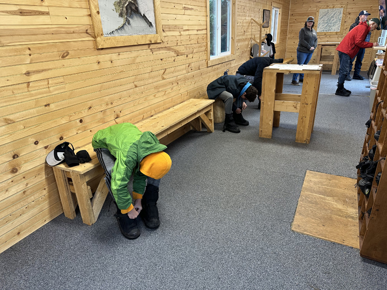
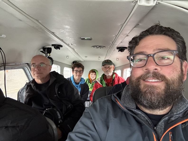
8/8/2025 F – met Chad, Drago, and Seamus at the Crown Plaza O’Hare Chicago. Paid for long-term parking for the days we would be away. Drago selfie, start of trip –
8/9/2025 Sa – up at 4:15am, Uber to airport for 6am Alaska Air flight to Seattle (SEA). I had ordered breakfast on the plane, but they did not have a record of the order, so we had to buy some snacks during our flights. Arrived SEA at 8:37am, left 9:55am for Juneau (JNU) and arrived at 11:26am.
.
.
The Frontier Suites Shuttle picked us up and drove us to the hotel in a light rain. Had lunch at the Valley Restaurant next door. Drago and Seamus ate the first of many burgers during our trip. It is owned and run by a Filipino family – every worker was a member of the family. At 2pm I went back to the airport to pick up a “Mystery Car” from Budget Car Rental – it turned out to be a Subaru Crosstrek Hybrid.
When I got back, we went out for a tour of Juneau. Our first stop was the Alaska State Capital. It is the only U.S. State Capital that is not accessible by road.
In 1867 William Henry Seward negotiated a price of 7.2 million for the purchase of Alaska from Russia.
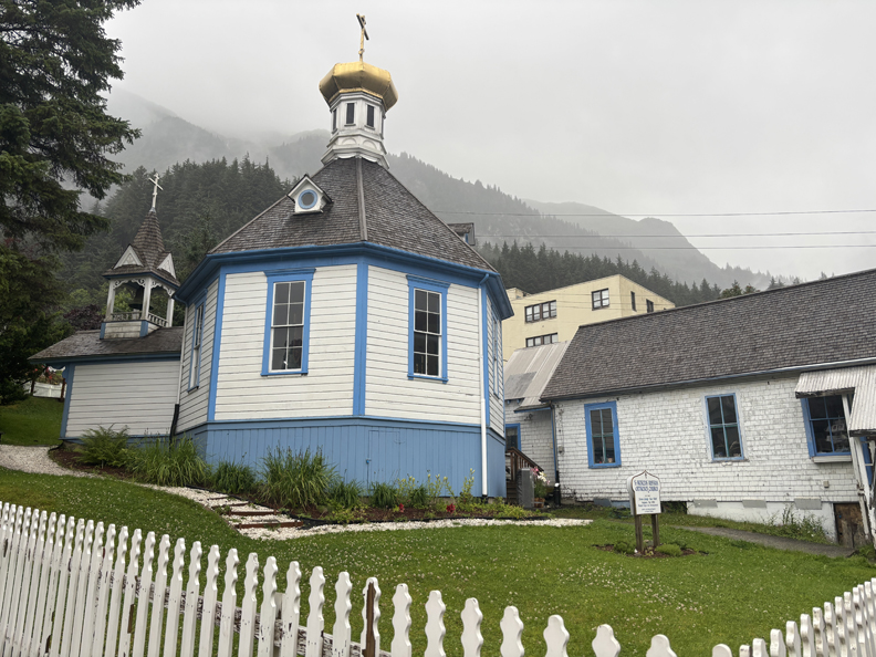
We stopped by St Nicholas Russian Orthodox Church on our way to the waterfront.
We were impressed with the size of the Coral Princess and in fact saw it the next day on Glacier Bay.
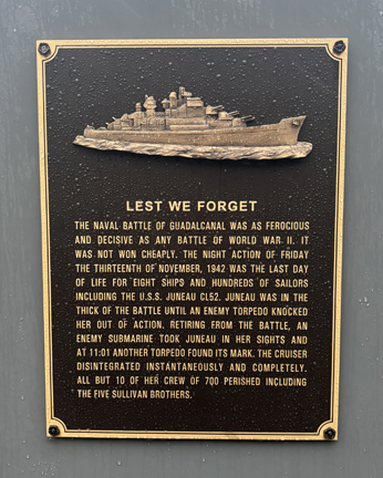
There is a Memorial to the USS Juneau on the waterfront walk. It was a Navy ship that was sunk by the Japanese during the Battle of Guadalcanal on November 13, 1942. All but ten of her crew of 700 perished – including the five Sullivan brothers.
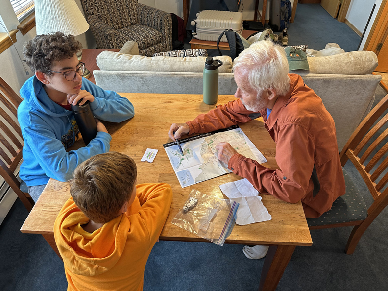
That evening we reviewed our plans.
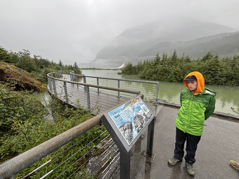
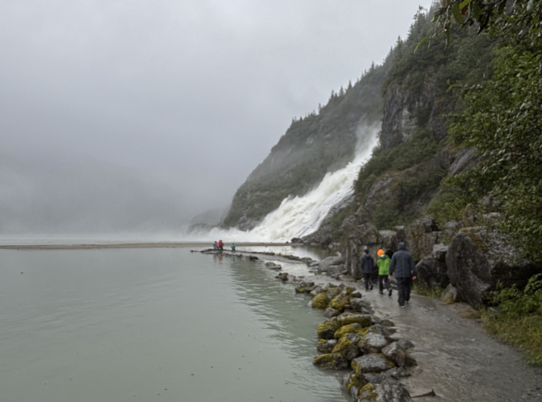
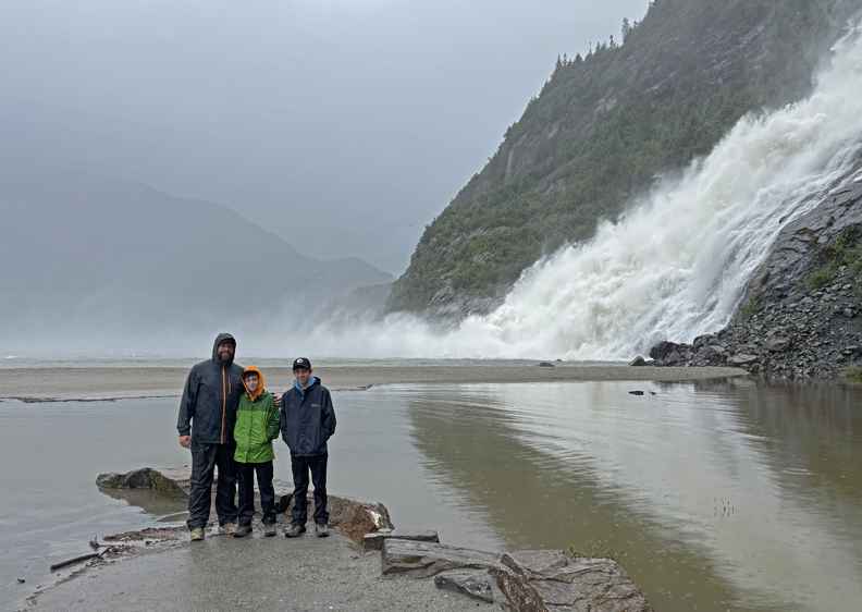
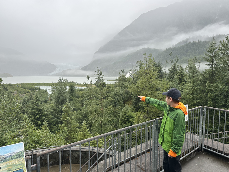
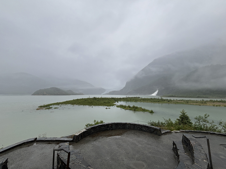
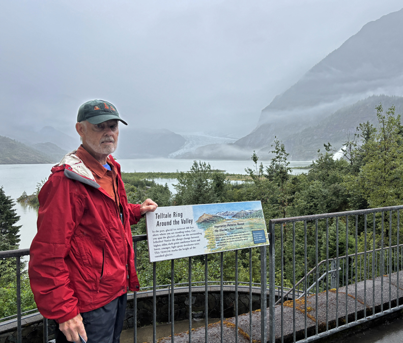
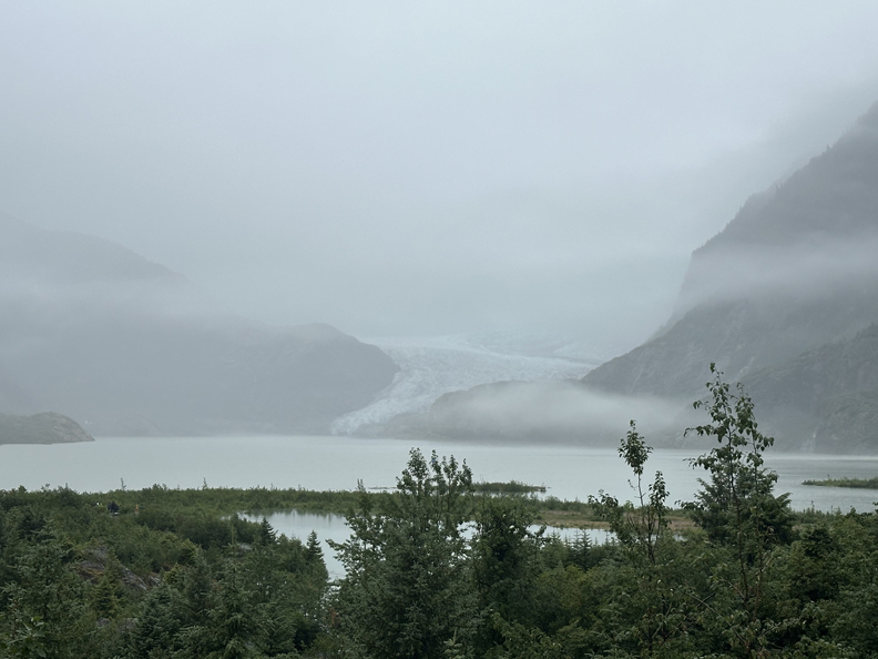
8/10 Su – Had a big breakfast at the Valley Restaurant, then drove 10-min to the Mendenhall Glacier Visitor Center in the Tongass National Forest. It has been proposed that part of this National Forest become a National Park.
.
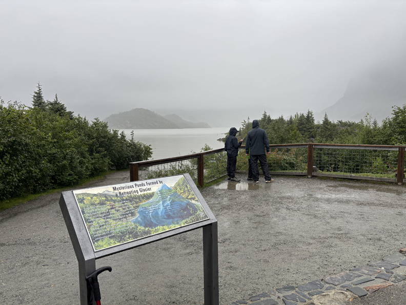
It was not yet open, so we did the Photo Point Trail (0.33mi) in a light rain.
.
.
.
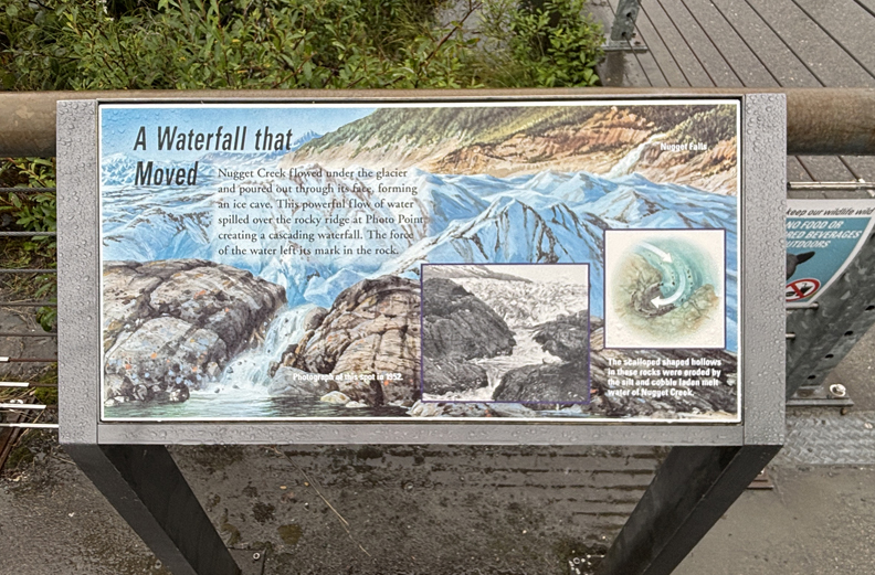
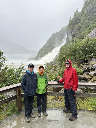
Then continued on the Nugget Falls Trail (2-mi rt).
.
.
.
.
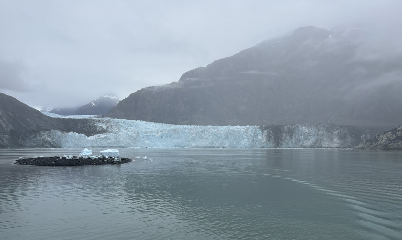
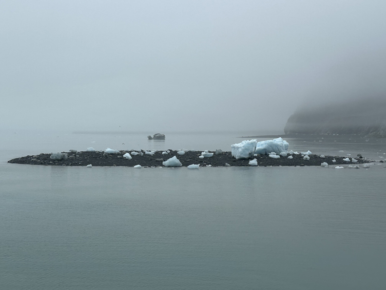
When we returned to the Visitor Center it was open and provided a panoramic view of Mendenhall Lake, Mendenhall Glacier, and Nugget Falls. Note, the fog/rain/clouds obscure the upper glacier and mountains.
.
.
.
.
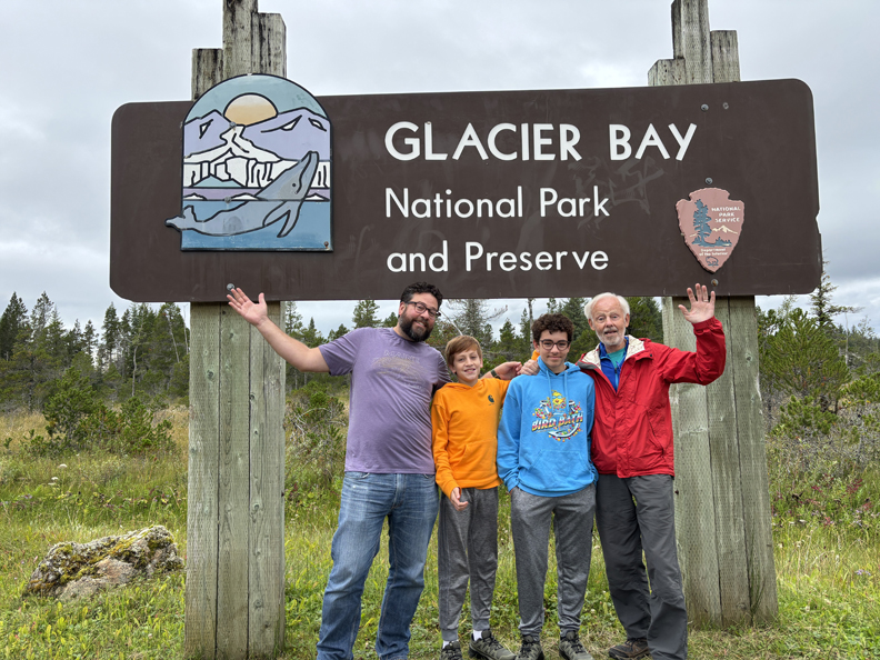
At 4pm we took the half-hour Alaska Air flight from Juneau to Gustavus, followed by a 10-mi shuttle ride to the Glacier Bay NP Lodge/Visitor Center.
Toured the small NP Vis. Ctr. on the second floor of the Lodge
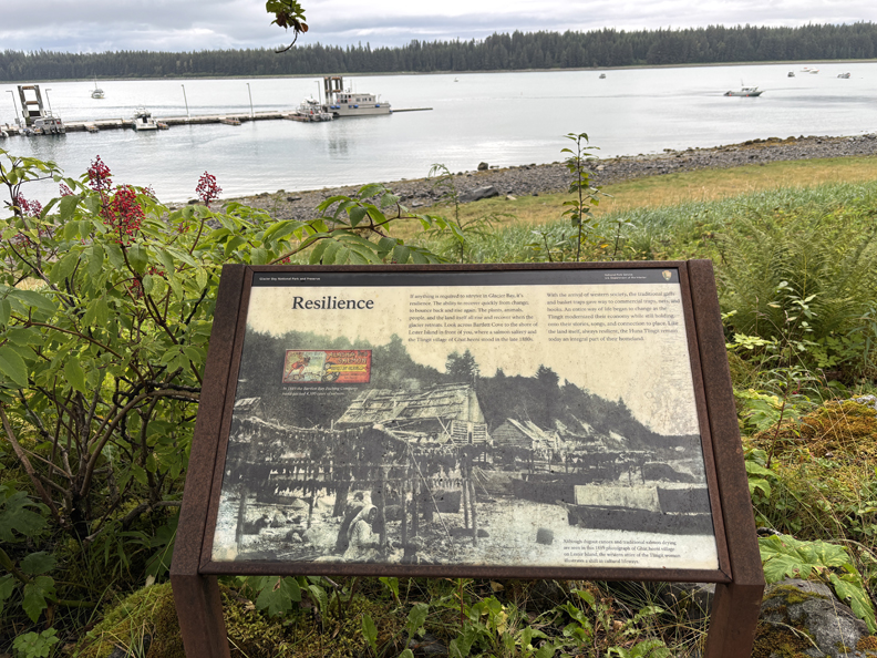
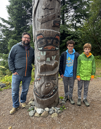
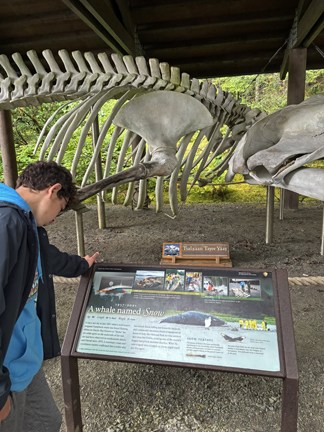
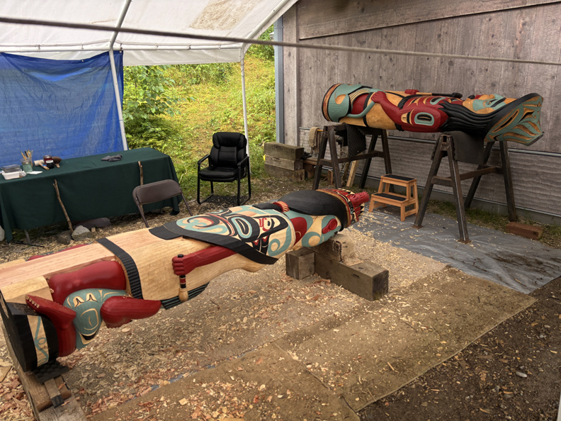
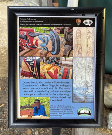
Then did the Tlingit Trail along Bartlett Cove. The Huna Tlingit still inhabit this area.
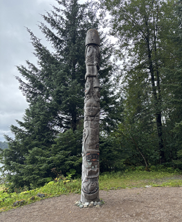
Healing Totem Pole
.
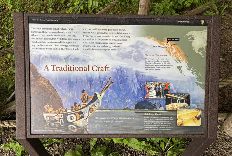
Traditional Dugout Canoe
.
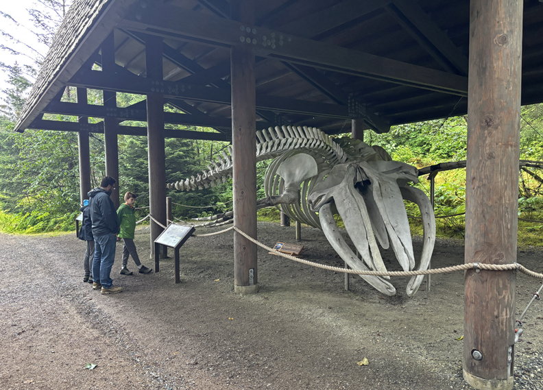
Humpback Whales travel here from Mexico and Hawaii for the summer.
.
Tlingit Tribal House and construction of Totems
.
.
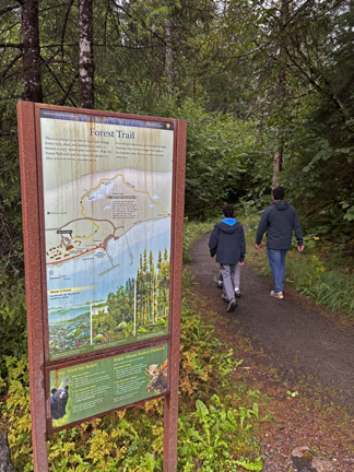
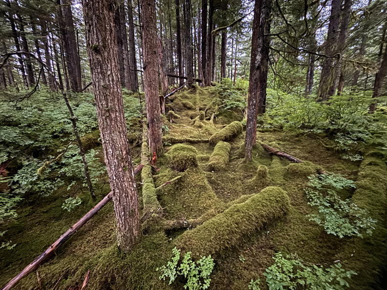
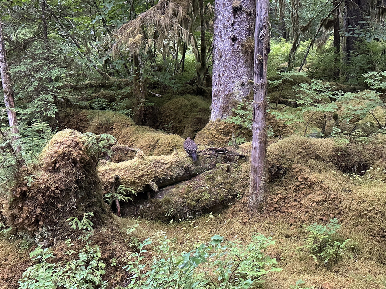
Hiked the Forest Trail outside the Lodge ~1-mi round trip (rt).
.
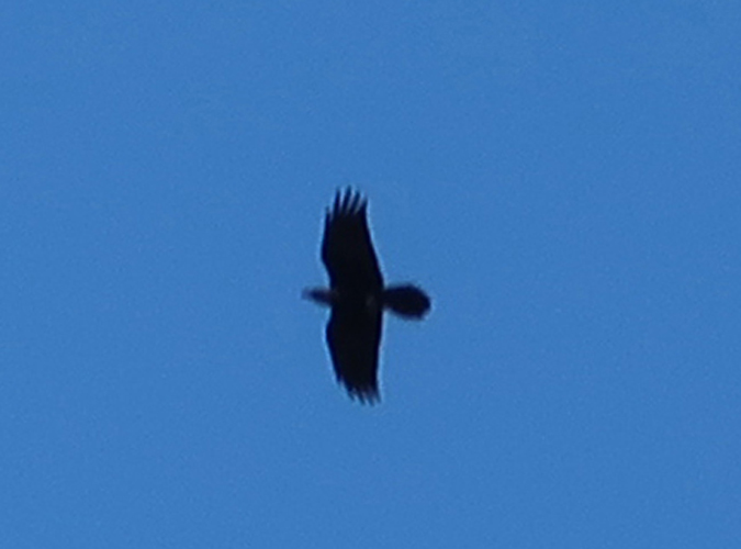
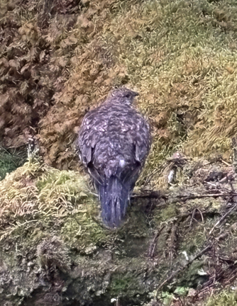
Hawk?
.
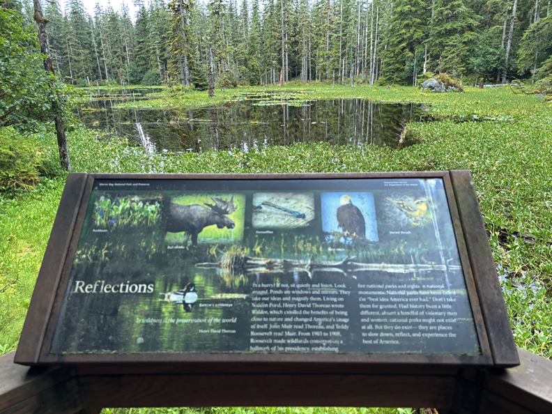
Blackwater Pond Viewing Deck
.
Landscaping with Ice
.
Dinner at the Lodge, the boys shared a bed, and Chad (top) and I (bottom) a bunk bed. We tested the top to be sure it would support his 265 lbs. and I would not be crushed during the night!
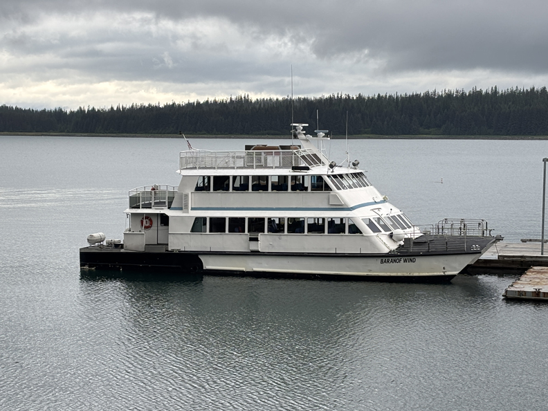
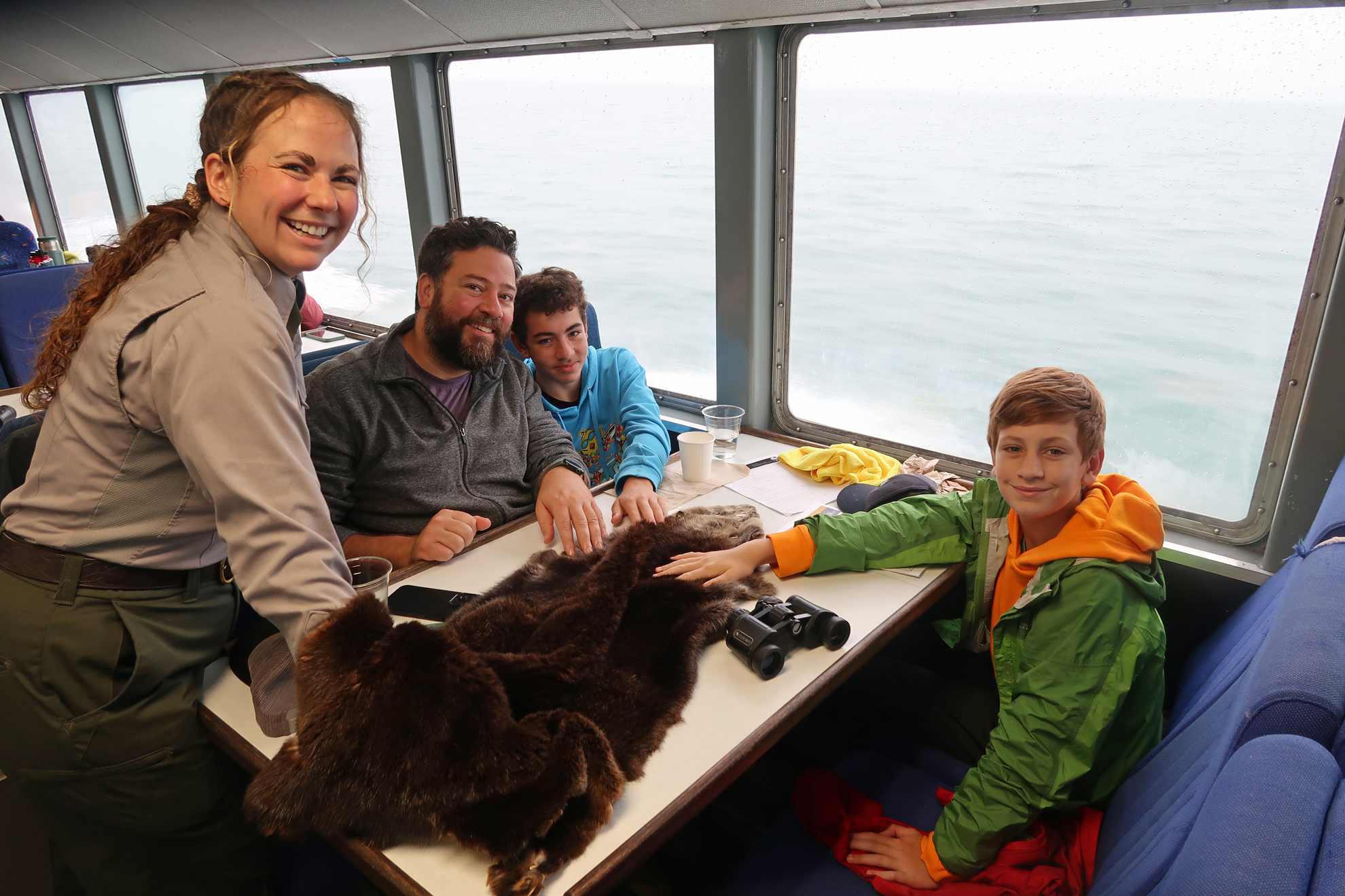
8/11 M – We were up at 5:30am to board the Baranof Wind for our eight-hour tour of Glacier Bay NP.
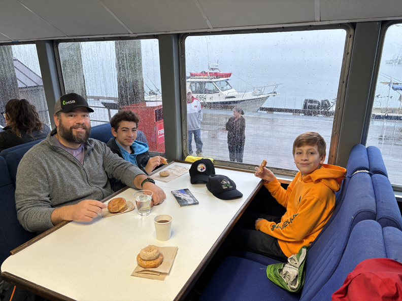
Raining – donuts for breakfast
We very much enjoyed the tour with our park ranger regularly describing the history, sites, and wildlife. However, the weather detracted from the full visual experience we were hoping for.
.
.
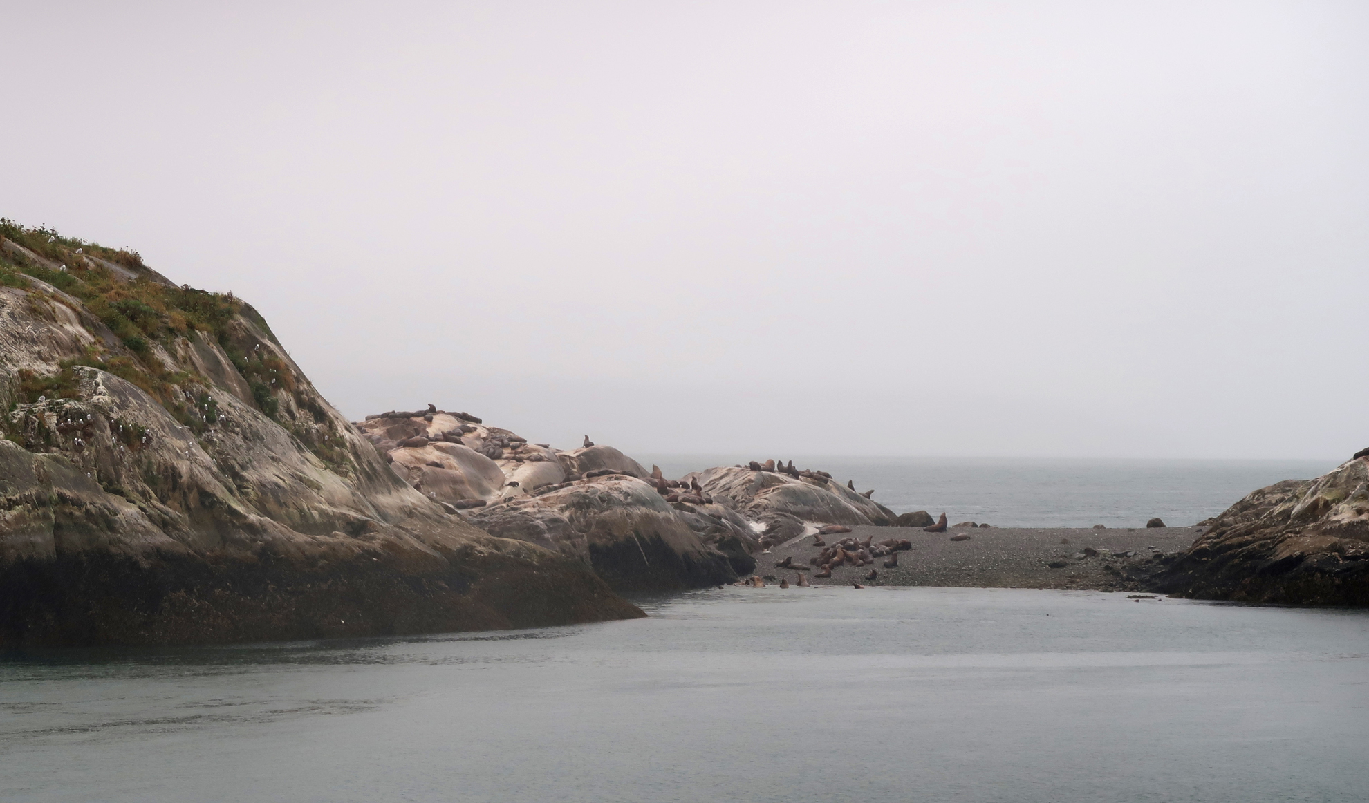
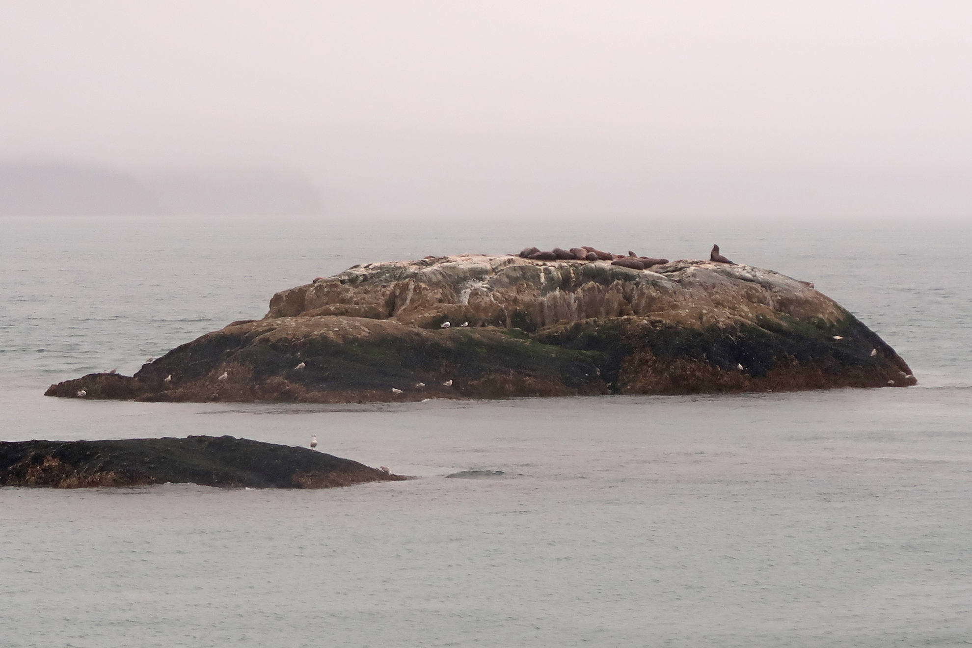
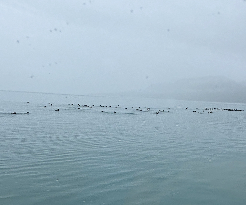
Marble Islands – sea lions, seals, sea otters, birds (e.g., tufted puffin, oyster catchers, marbled murrlets, etc.), and a couple of whales in the distance.
.
.
Sea Otters – this is the largest Sea Otter Colony in the world!
Onboard entertainment – ranger review of the desire for sea otter fur due to its warmth and comfort.
.
.
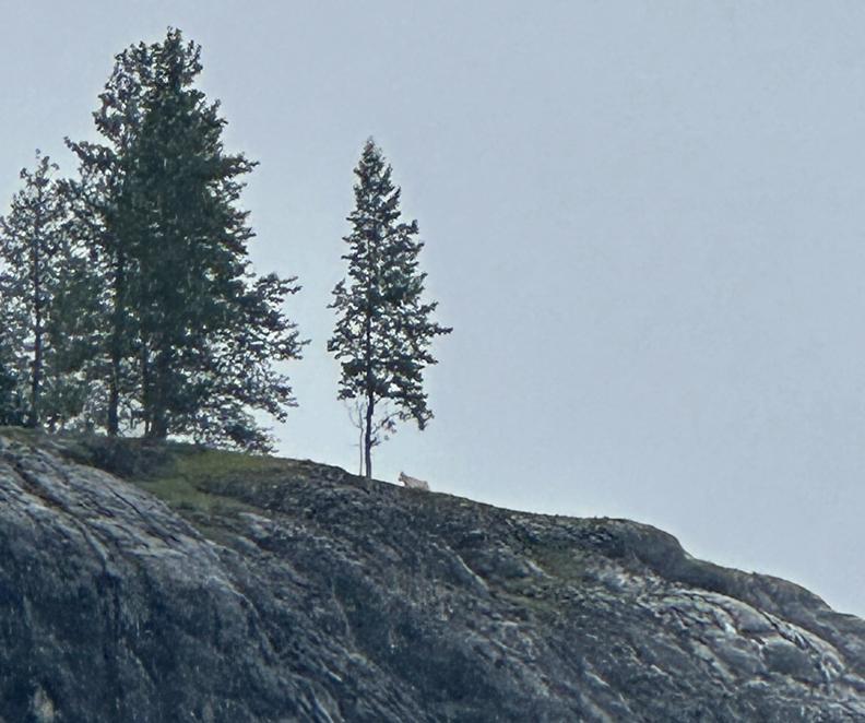
Mountain Sheep
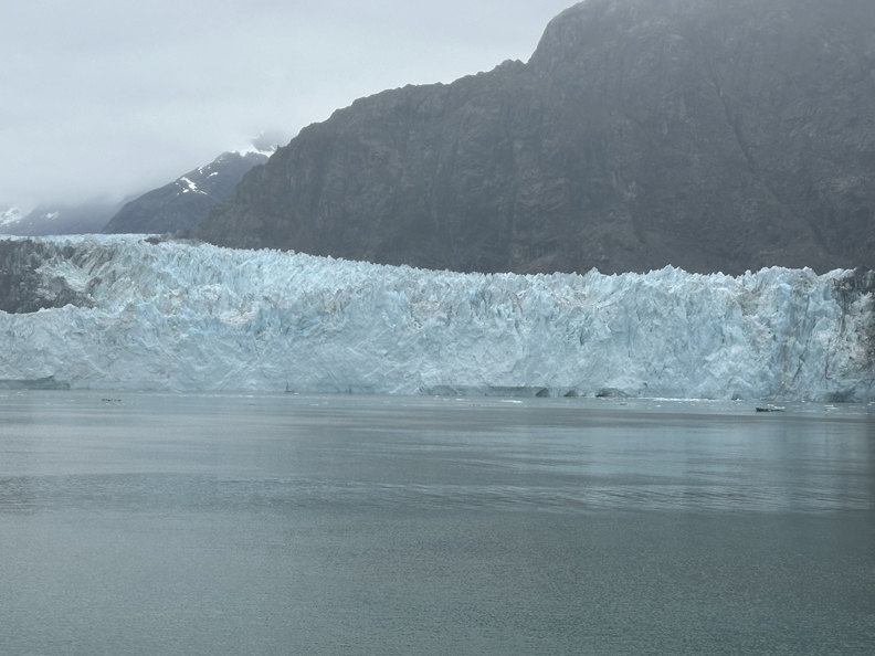
The highlight of the tour was the Margerie Glacier, almost one mile across.
.
.
Seals on ice island in foreground
Everyone cheered when we saw a section of ice crash (calve) into the water. I wondered, should we be cheering for Global Warming!
Leaving the Margerie Glacier
.
The Margerie and most glaciers in the park have retreated significantly since Helen and I were here in July 2011 – see Blog for that month and year.
.
We got back to Bartlet Cove at 3:30pm, the boys skipped stones for 20 minutes, and then we boarded the shuttle for the Gustavus airport. We heard our 5:35pm plane to JNU pass overhead. But, it could not land because of weather conditions. I immediately ran over to the Alaska Seaplane office hoping to catch their 6pm flight to JNU. I was able to get all four of us on that plane. So, I ran back to the Alaska Air office and canceled our re-scheduled flight for 5:35pm the next day.
We carried our luggage to the Alaska Seaplane office to wait for the 6pm flight. It also flew over but could not land. They said another plane was on its way. But that flight was canceled as well. So, I booked us on a 6am flight the next morning to JNU, with a 7:45am connecting flight to Skagway, and we returned to the Glacier Bay Lodge. There was one room left with a single Queen bed. A returning German couple also wanted the room. After a long discussion we were able to get the room and the boys slept on the floor. I now had Wi-Fi, so I could cancel our hotel in Juneau but could not cancel the Ferry we were supposed to take the next day from JNU because the office was only open 7am to 3:30pm M-F!
8/12 Tu – Was a day of Persistence, Flexibility and Patience. – Up at 4:30am to catch the 5am shuttle to the Alaska Seaplane office in Gustavus. That flight was cancelled; so, we booked the 10:25am flight. That flight was also cancelled due to weather conditions.
That meant there was no way we could get to Skagway. My phone did not work in Gustavus, so I had to borrow phones to search for information, cancel, and make new reservations. First, I canceled the Alaska Marine Ferry reservation for a weather-related refund. Next, I was able to convince my car rental in Skagway to change my car reservation to Sunday 8/17, the day we were all supposed to land in Chicago.
We decided that Chad and the boys would return to Chicago as scheduled. I, on the other hand, canceled my Delta reservation and made a new reservation to return to Chicago on 8/17 on Alaska Air from Juneau. That way I could make arrangements to fly to Skagway. I then made a reservation on Alaska Air to fly to Juneau on 8/16. In addition, I made reservations to fly from JNU to Skagway in the morning and return from Skagway to JNU in the late afternoon on 8/17 with Alaska Seaplanes.
So, we had to spend most of the day in the Alaska Seaplanes office in Gustavus. Thankfully, they had snack food and drinks that we could add to the beef jerky, potato chips, and oatmeal/raisin cookies I had brought from OH.
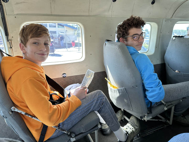
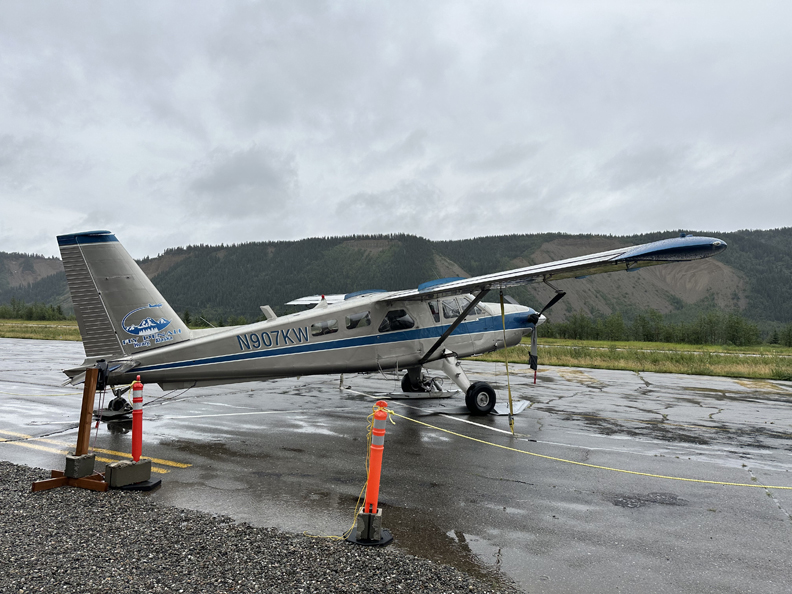
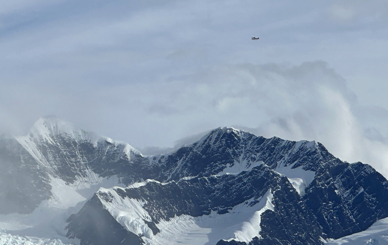
Our 2pm flight was put on hold; then two Alaska Seaplanes arrived at 3pm and we were able to takeoff for Juneau at 4pm. This was the first small plane ride for Drago and Seamus on our first partly sunny afternoon in Alaska!
Gustavus Power Plant
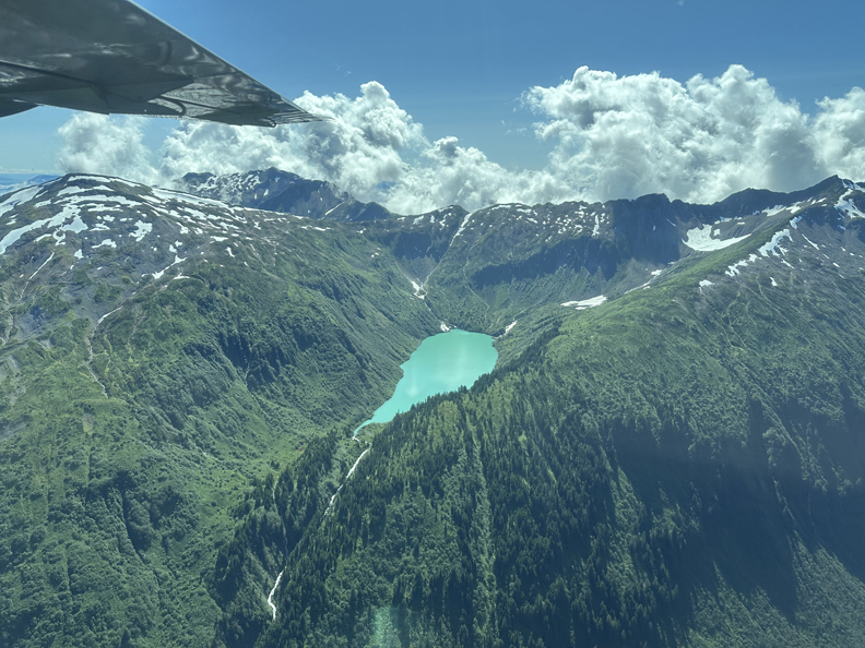
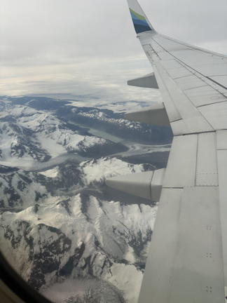
Flight over the Chilkat Mountains
.
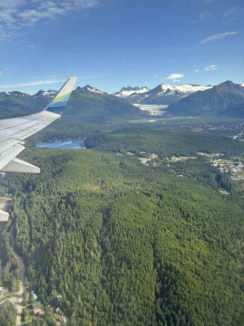
Landing in Juneau – view of Mendenhall Glacier, Mendenhall Lake, and Nugget Falls
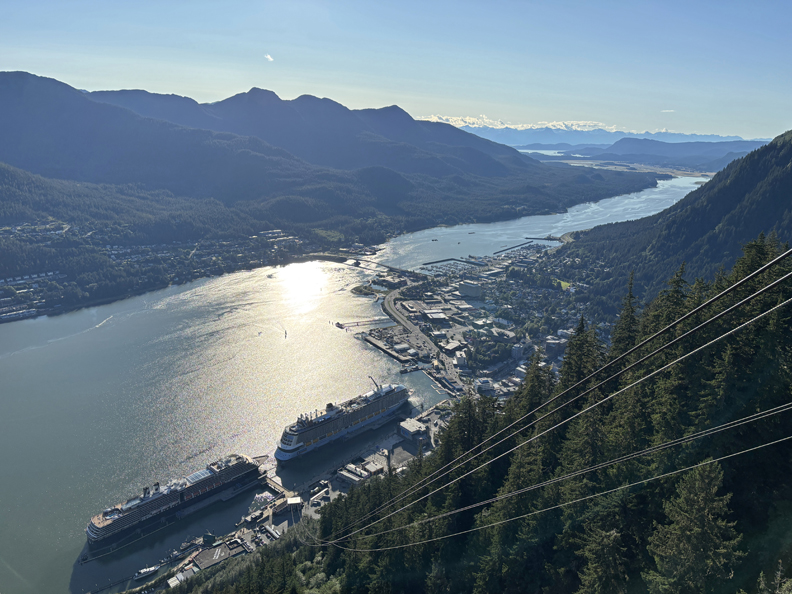
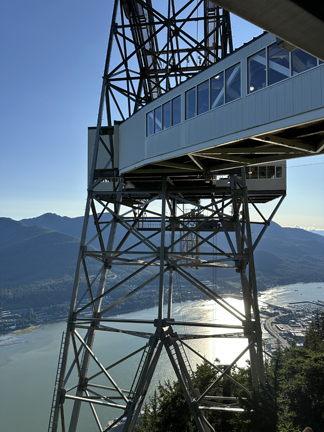
Chad ordered an Uber to return to the Juneau waterfront and take the Goldbelt Tram up Mount Roberts
.
Nice views of the Gastineau Channel, Cruise Ships, and Juneau
.
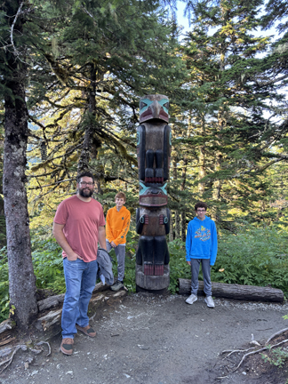
We did the Totem and Alpine Trails on the slopes of Mount Roberts
.
.
.
.
Bald Eagle Wingspan
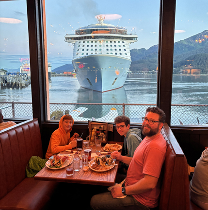
Celebratory dinner at The Hangar on the Wharf Restaurant as the Cruise Ship “Anthem of the Seas” left port
.
8/13 W – Up at 5:15am, 6am Shuttle to airport to catch 7:34am Alaska Air JNU to ANC flight – flight canceled (Fog)! Re-booked for later in the morning – flight canceled (Fog/Rain)! Re-booked for Alaska Air leaving at 2pm, flying to Yakutat, then to Cordova, and then to Anchorage. It was clear on much of the route but was cloudy when we arrived at 5pm.
.
I picked up our Nissan Sentra from Avis, then pulled out of the garage into rain. Our first stop was Earthquake Park; it commemorates the 1964 earthquake that devastated Southcentral Alaska.
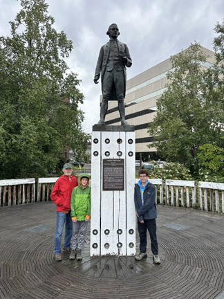
Our next stop was Resolution Point and the Captain Cook monument overlooking the Knik Arm of the Cook Inlet.
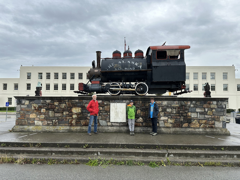
We continued on to the Alaskan RR Depot –
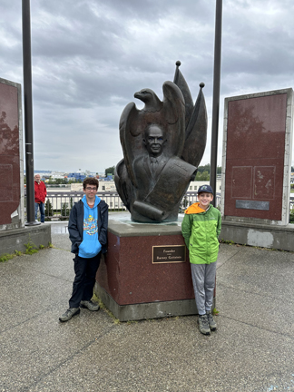
Then walked up to the Alaska 49th State Monument –
It was then a short drive to the Salmon Viewing Area on Ship Creek.
When we arrived at the Fairfield Inn & Suites to check in, they refused to give us the room because the reservation was in Helen’s name using her reward points, and she was not there! I argued that the room was book with her reward points AND my money, which I had paid by credit card. That was still not acceptable. Finally, I produced Helen’s passport for the Manager, and they allowed us to take the room.
Went to the Bear Paw Bar & Grill for Fish & Chips for the Big Boys and Burgers for the Little Boys.
8/14 Th – 6am breakfast at the Fairfield Inn and then started driving in the rain to Talkeetna. We arrived about 10am and were told that our Flightseeing Grand Denali NP Glacier Landing Flight was canceled due to weather. We then stopped by the Denali Climbing Cemetery on our way back to Talkeetna and visited the memorial for those who have died attempting to climb Denali (Mount McKinley).
Six climbers had already died on the mountain when our group started our attempt in 1995.
We then visited the Denali NP Climbing Visitor Center where you register to climb the mountain. The Ranger taught Drago and Seamus how to tie a couple of knots.
On the way back to Rt-3, we stopped for Birch Ice Cream at the Kahiltna Birchworks
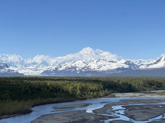
We now implemented Plan B – driving into Denali NP. We first stopped at Denali Viewpoint South on Rt-3.
The first photo is what we saw and the second is the same view on a good day!
.
We also did the short hike to a viewpoint looking across the Chulitna River toward the Ruth Glacier and the “Greatest Gorge.” The gorge is about 9,000ft deep, deeper than the Grand Canyon and perhaps the deepest gorge in the world, but it is at least half full of ice!
Had lunch at the Denali Doghouse in Denali Nation AK, got gas, and then entered Denali NP.
Our first stop was the Visitor Center off Rt-3
.
.
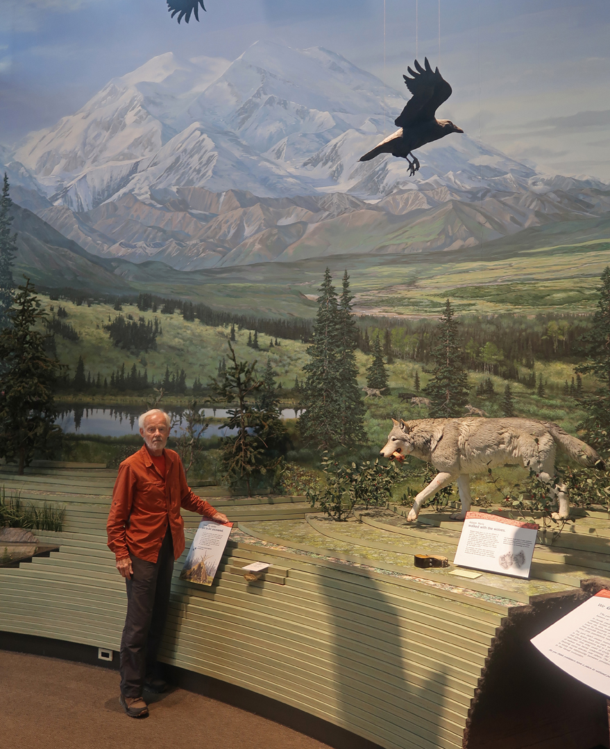
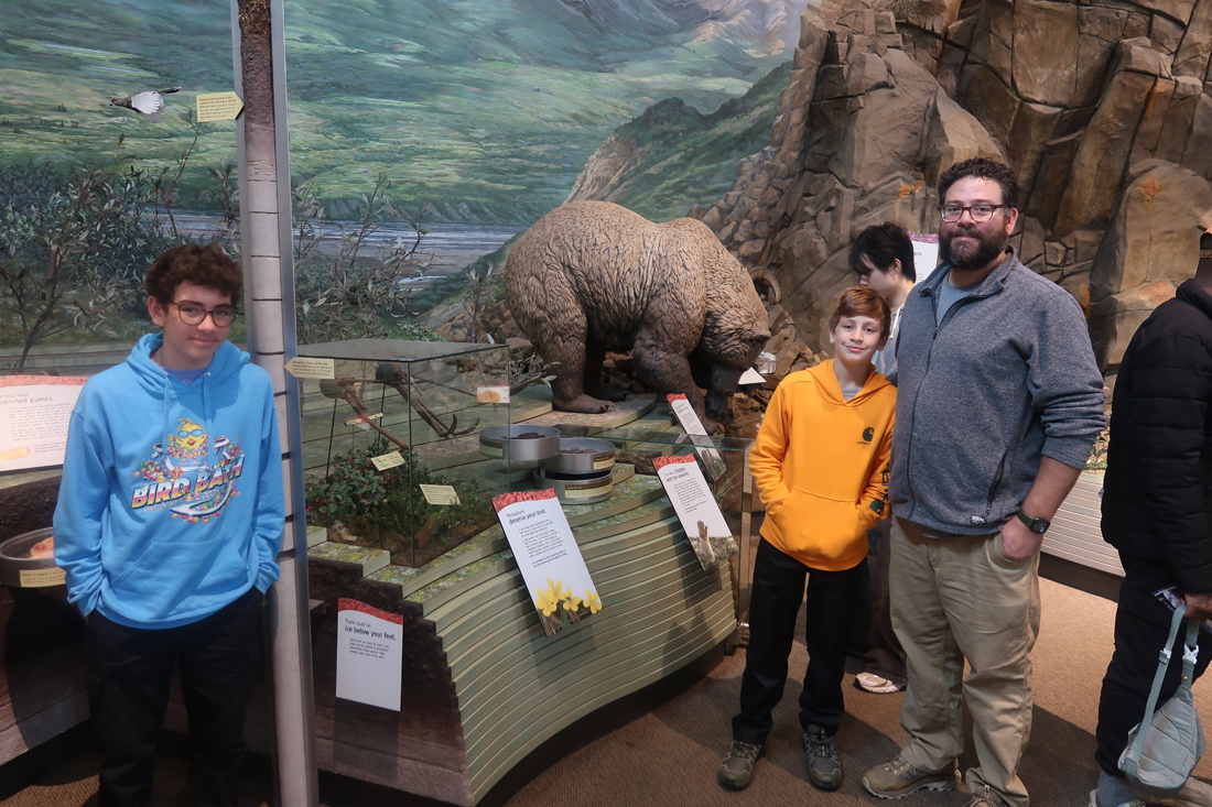
Building a Moose
Our first stop on the Park Road was the Mountain Vista picnic area. This was once a tourist camp for visiting the park.
.
.
.
.
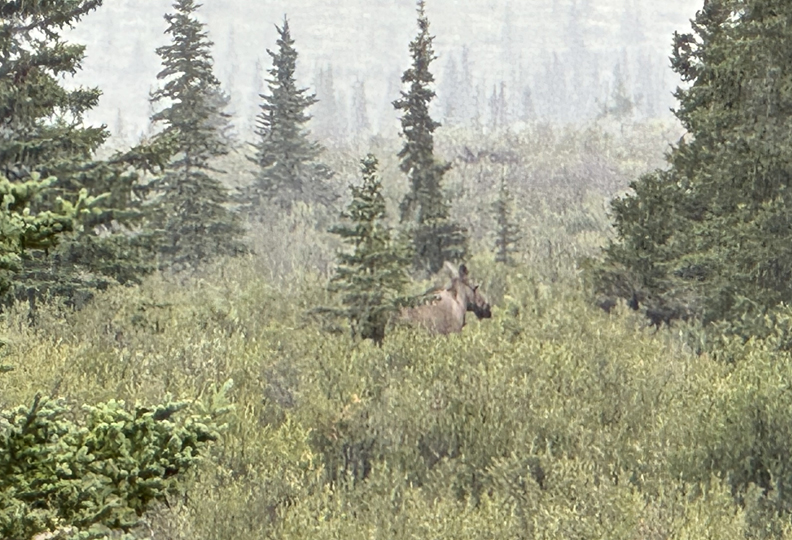
We then continued in the rain, as far as we could by car, to the Savage River (15mi) – saw a Moose along the way
When you reach the Savage River, you must take a bus to proceed further into the park.
.
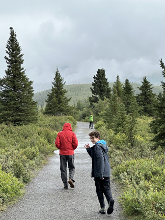
We did the 2-mile Savage River Loop Trail in a light rain.
.
.
Explorer Seamus
Nice hike and interesting rocks along the way –
.
.
.
.
.
Bridge is the half-way point on the Savage River Trail
.
Rain increased on the way back
.
.
.
.
.
On the way to Fairbanks, we stopped at the Fly Denali office in Healy to see if they would have a Denali Glacier Landing flight on the morning of 8/16, the day we were to return to Anchorage for our flights home. The answer was yes, weather permitting (it was raining)! We signed up, thinking the probability was low. The cost was double our previous reservation in Talkeetna, so part of me was hoping we would again be “rained out.”
Ate at a fast-food dinner in Fairbanks, bought lunch items at a Fred Meyer store, then moved into our VRBO duplex, home for the next two nights. I was now sleeping regularly with Drago and Seamus with Chad.
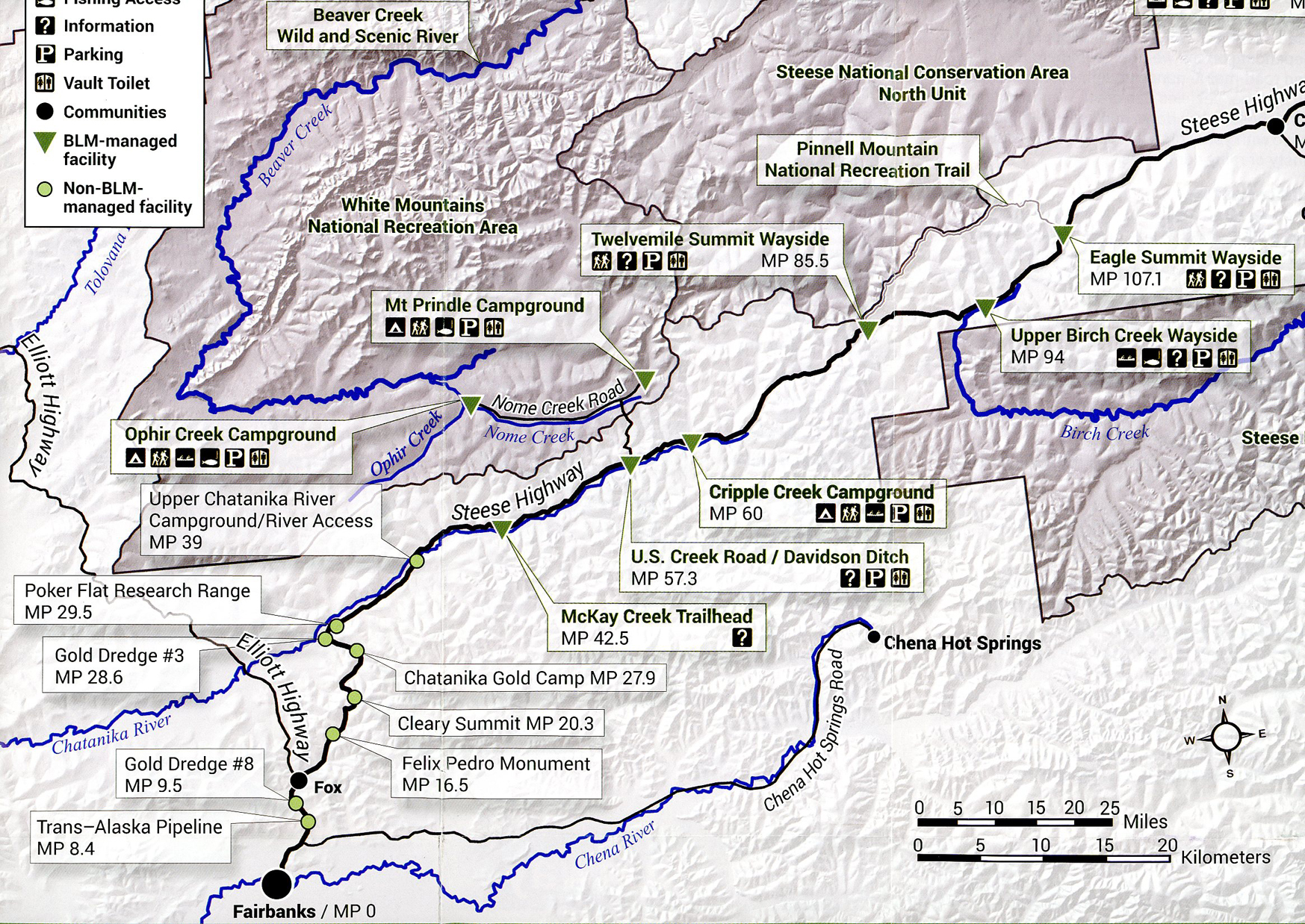
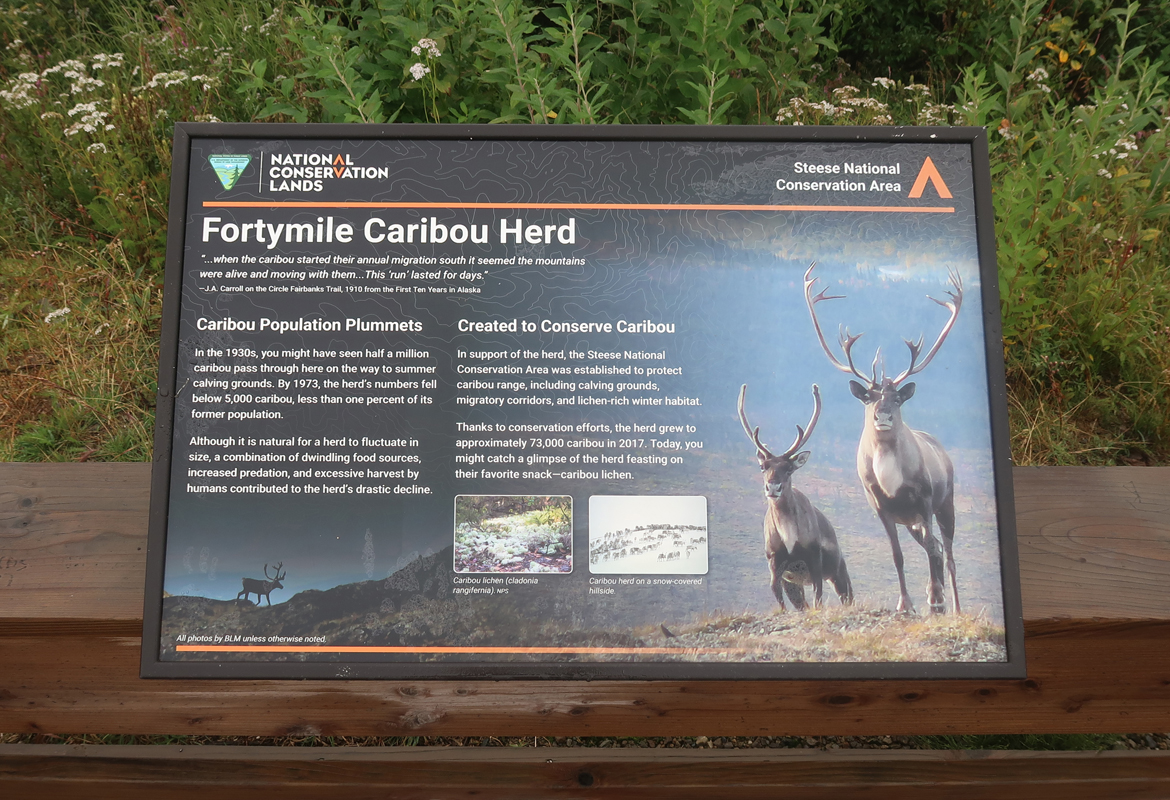
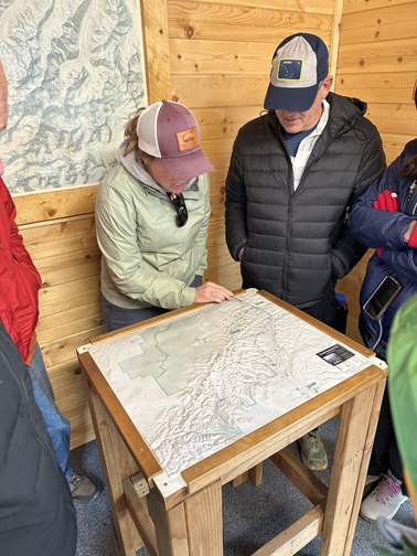
8/15 F – had an early breakfast at the A W Restaurant in Fairbanks, so we could be at the BLM office when it opened at 7:45am. This map shows our seven stops for the day. Our main objective was to see a herd of caribou in the Steese National Conservation Area (NCA).
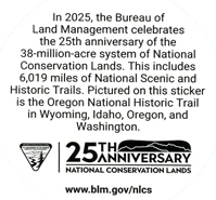
2025 is the 25th year anniversary of the National Conservation Lands Program.
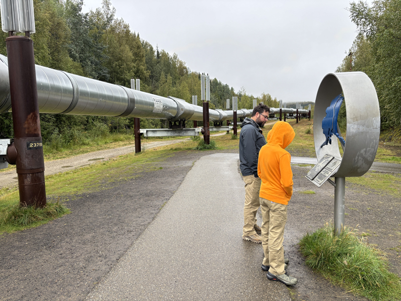
Our first stop was the Trans-Alaska Pipeline System (TAPS).
TAPS spans about 800-miles, from Prudhoe Bay and feeder pipelines on the North Slope to Valdez AK, where it is picked-up and transported by ships.
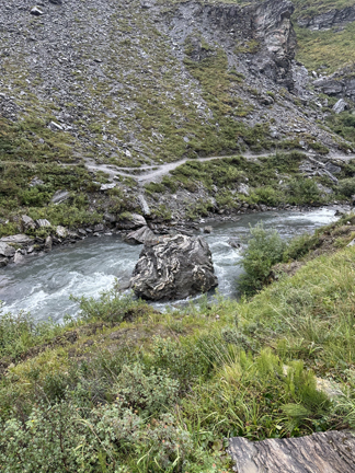
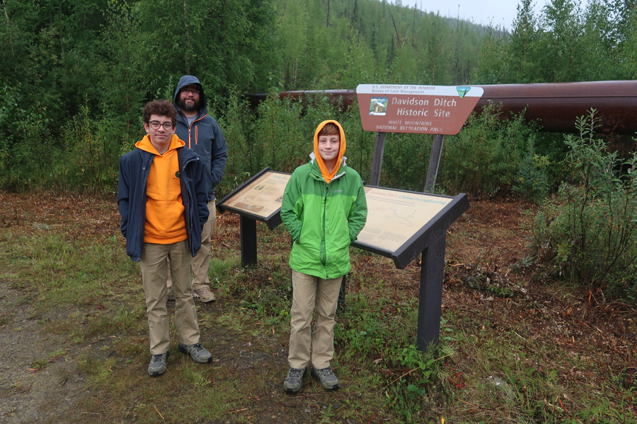
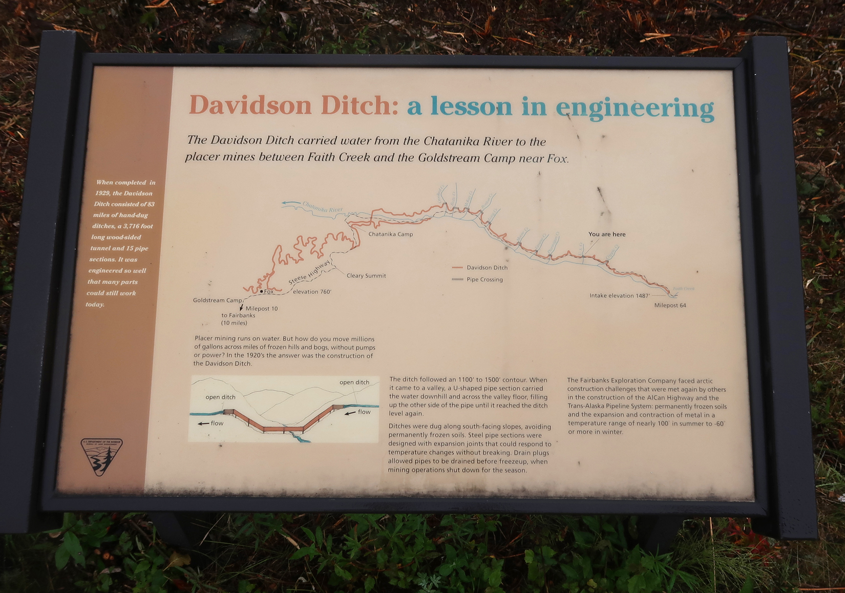
Our next stop was the Davidson Ditch. It is a 90-mile system of inverted siphons and ditches (1929) that carries water from the Chantanika River to Fairbanks to power gold mining operations.
.
.
.
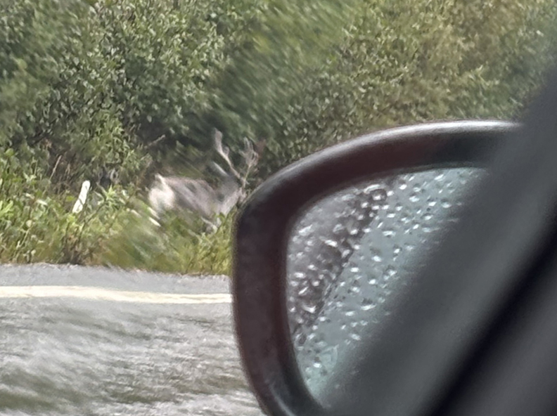
As we gained altitude on the Steese Highway, we came upon a female caribou (they have horns) and calf along the road. Drago took this photo, and Chad did a good video of them moving along the road and up into the forest.
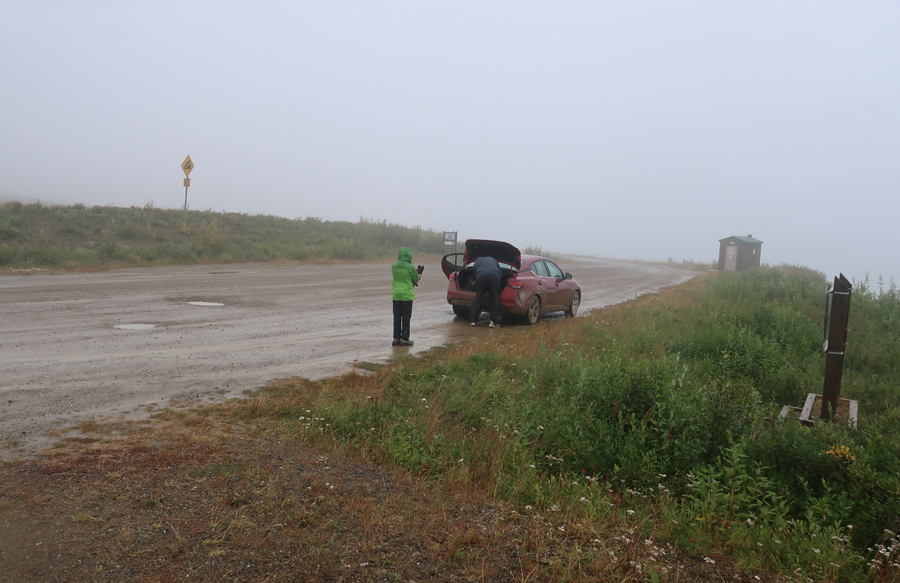
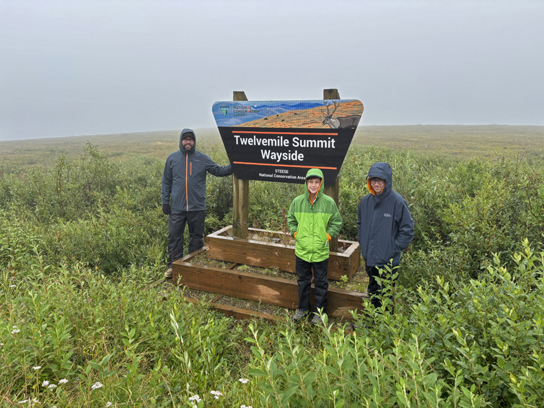
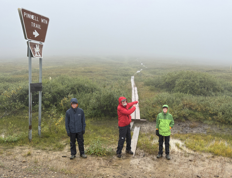
Our third stop was at the Twelvemile Summit Wayside. The first photo indicates the weather conditions – cold (mid 40s), windy, cloudy/foggy, and raining.
.
.
.
‘
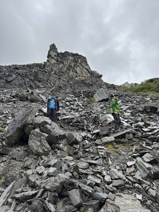
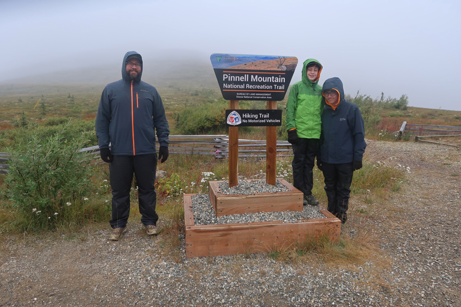
We all “layered up” for our ~1+ mile hike on the Pinnell Mountain National Recreation Trail to the Steese NCA North Unit.
.
.
.
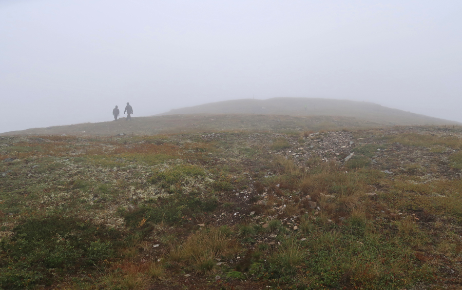
In the Clouds
Caribou Mirage
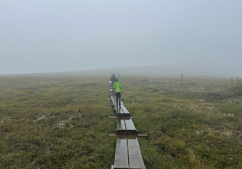
First part of trail – boardwalk
Second part of trail – tundra
Reaching the Steese NCA North Unit
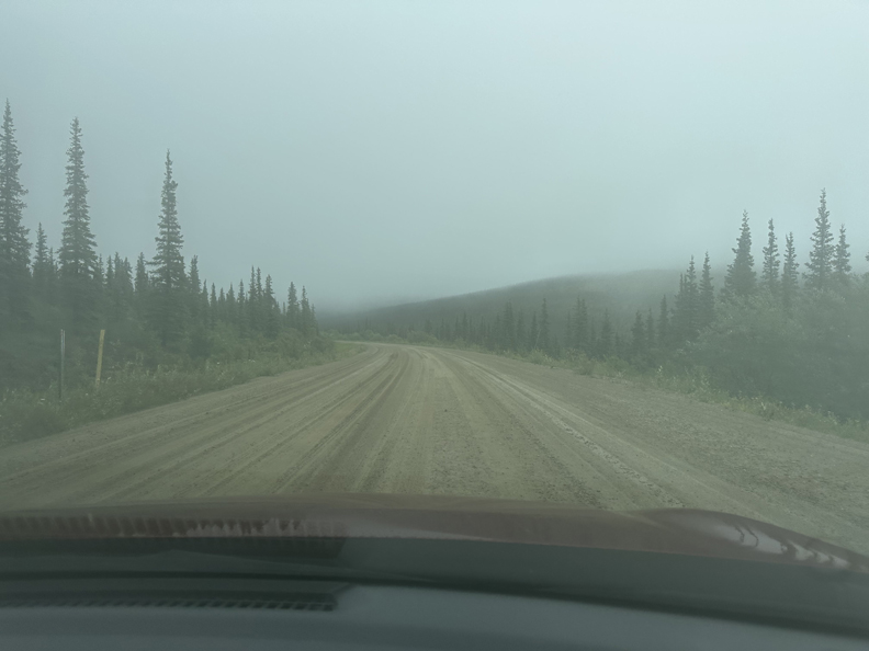
Steese Highway
Upper Birch Creek Wayside in the Steese NCA South Unit.
Birch Creek – National Wild River
.
Fun skipping stones
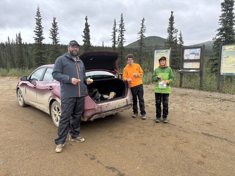
Trunk lunch after Drago drove a car for the first time – across the parking lot!
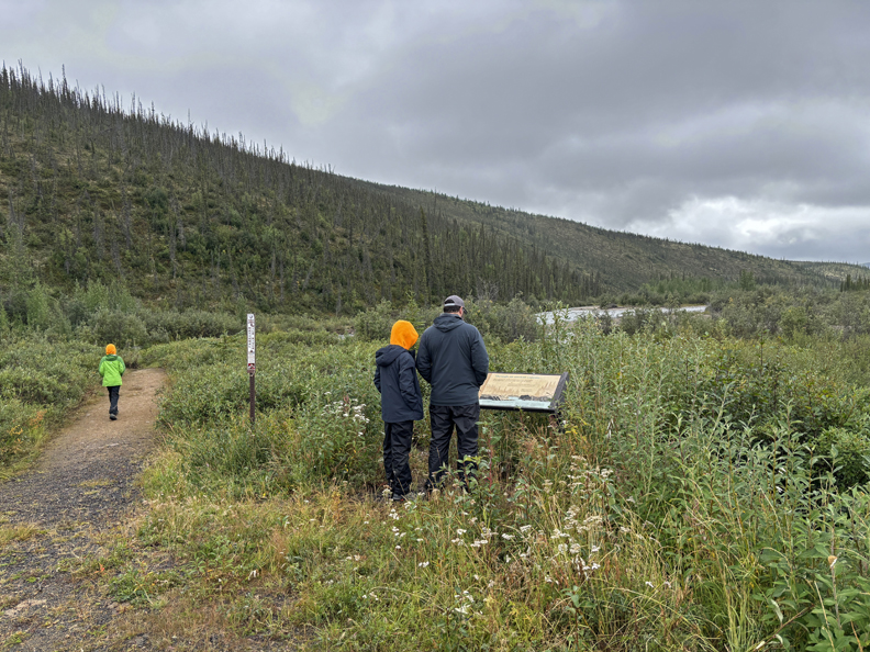
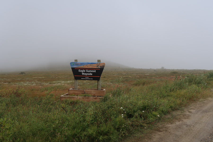
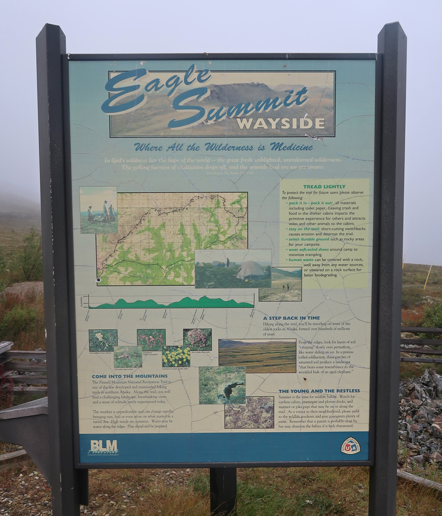
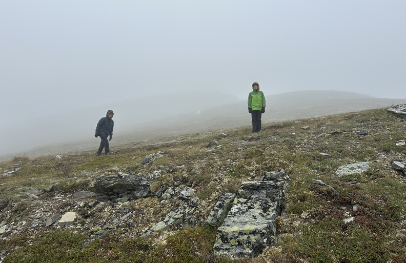
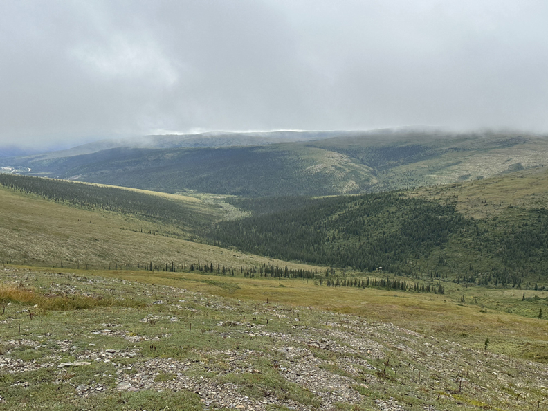
Next stop and furthest point we traveled on the Steese Highway – the tundra of the Eagle Summit Wayside. As you can see, we were now back in the clouds.
.
We did a couple of short hikes into the clouds – including the east end of the Pinnell Mountain NST.
.
.
.
.
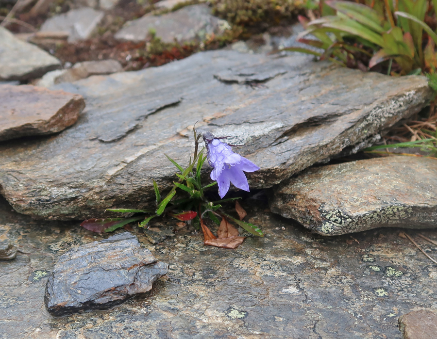
The clouds lifted a bit as we headed down the trail. It was an opportunity to take photos of tundra wildflowers.
.
.
.
.
We were now able to see the road continuing toward its end in Circle AK.
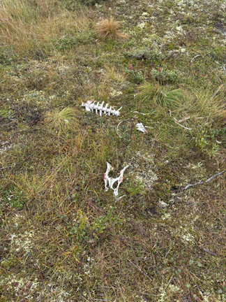
Caribou bones and footprint found nearby –
.
As we drove back toward Fairbanks, we made a stop in the White Mountains National Recreation Area.
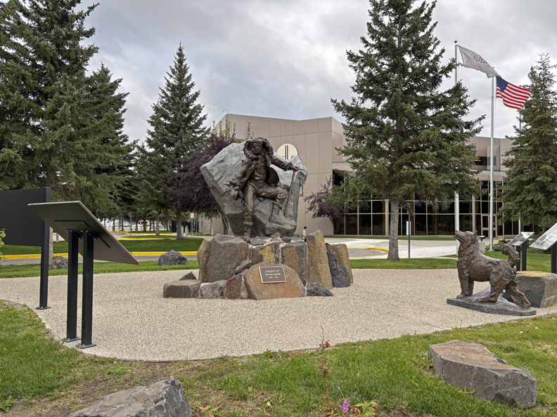
There was some daylight left, so we headed downtown to The Morris Thompson Cultural and Visitors Center and a sculpture titled – “A Hand Up.”
We then walked through the park areas along the Chena River.
Golden Heart Plaza
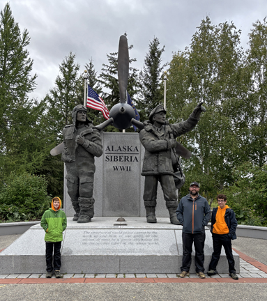
Lend Lease Monument – commemorating our support of Russia during World War II. Our women pilots would fly planes to MT, our men pilots would fly them to Fairbanks where Russian pilots would pick them up, fly across the Bearing Sea, and eventually to the Eastern Front where the Russians were fighting the Germans.
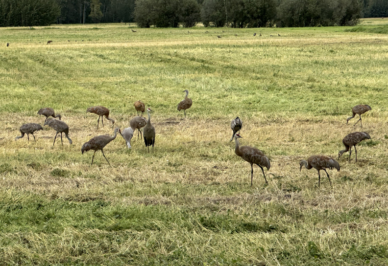
It was a short drive to Creamer’s Field and the Migratory Waterfowl Refuge where we saw Sandhill Cranes and a number of other birds.
Ate dinner back at the A W Restaurant, a local restaurant, not the Root Beer chain. Then we returned to our VRBO duplex and packed for our early morning trip back to Anchorage for our flight home.
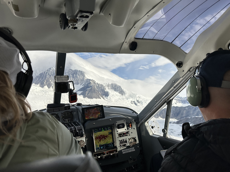
8/16 Sat – up at 4:30am to pack, donuts and juice for breakfast, then drove 2hrs to Healy AK to see if our Denali Glacier Flight was a go. It was raining when we arrived but the weather report from Denali indicated we could do the flight. So, plans were reviewed, we put on our glacier booties and took off in a slight drizzle.
.
.
.
.
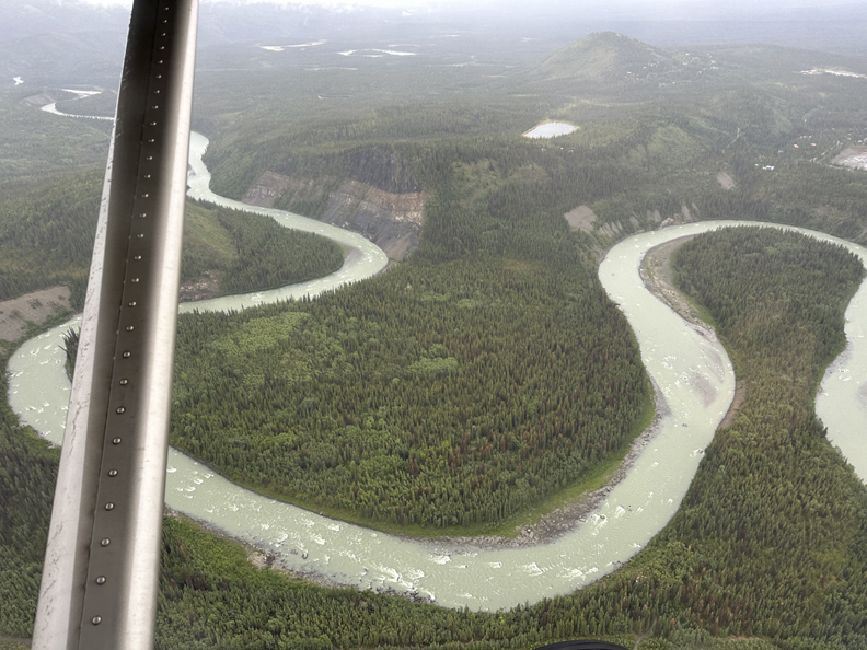
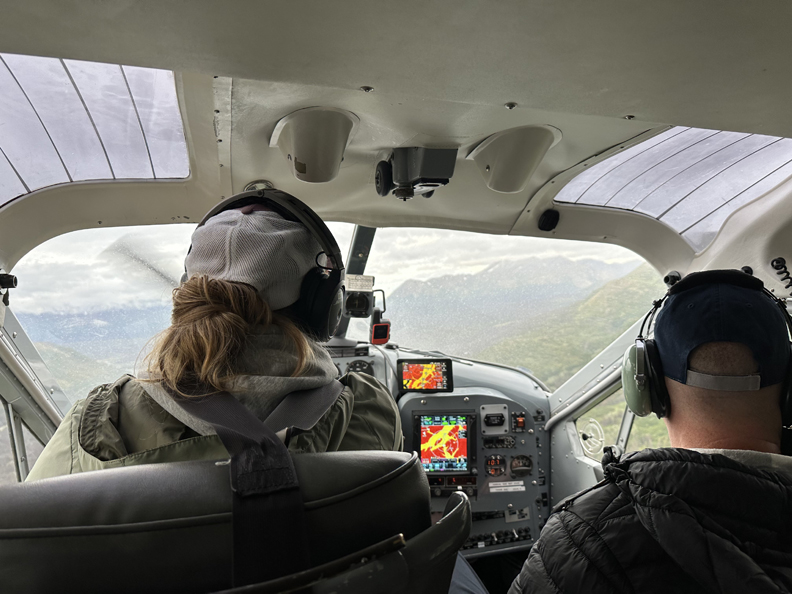
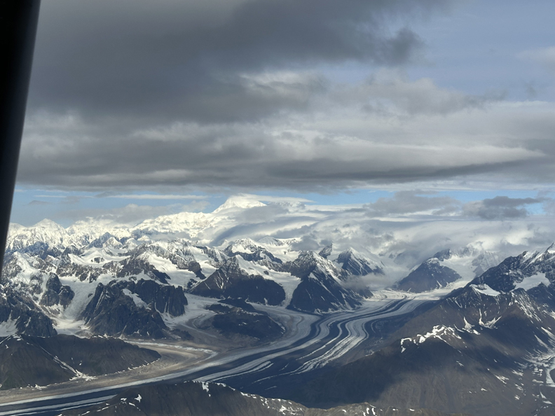
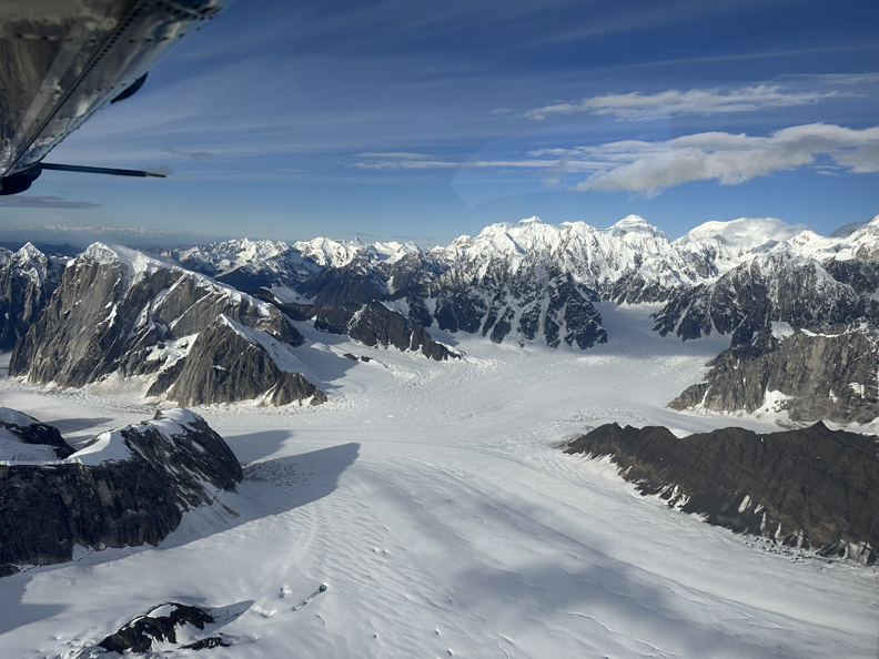
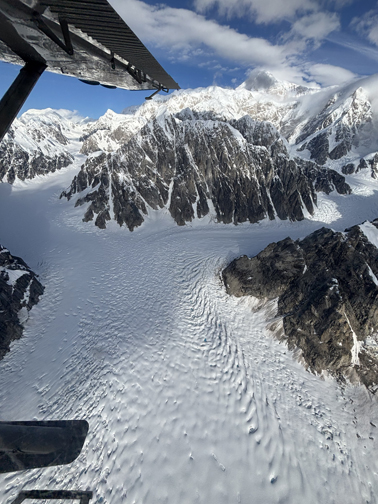
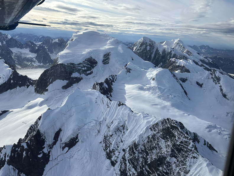
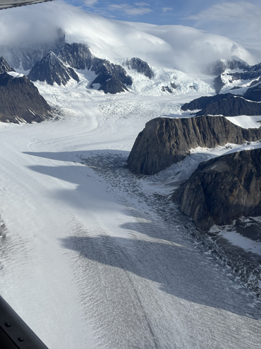
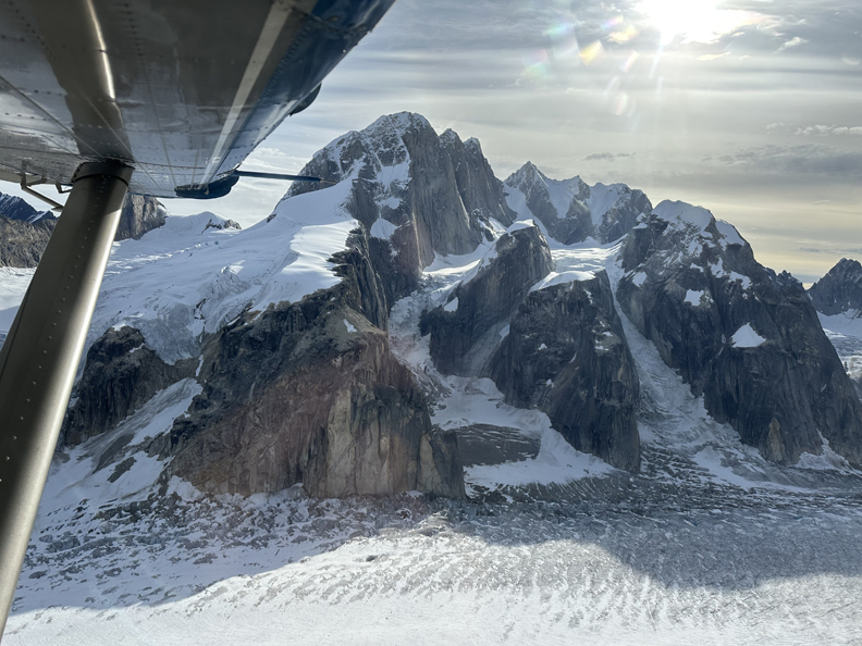
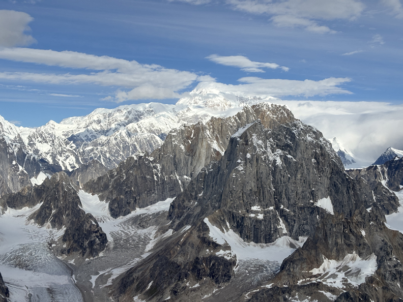
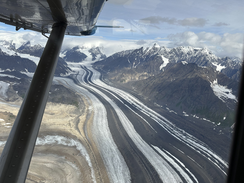
Our plane flew Southwest over the Alaskan Range
.
.
.
Reaching higher elevations
.
.
.
Chad and I were on the left side of the plane and Drago was on the right side, so we were getting different views going to and returning from our glacier landing.
.
.
.
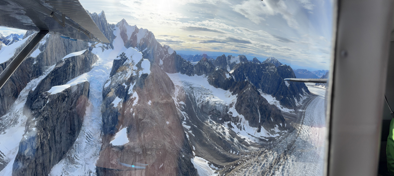
Beautiful alpine scenery
.
.
.
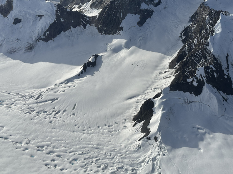
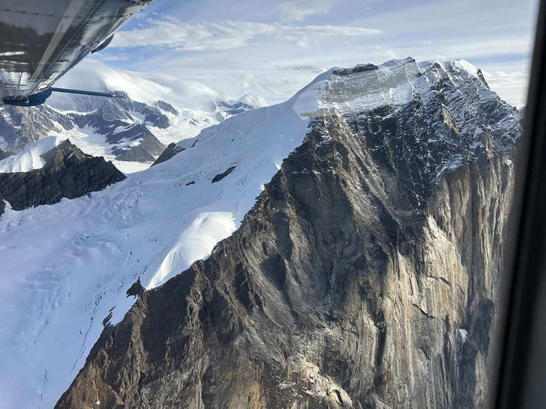
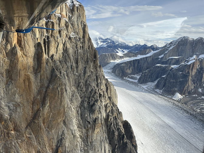
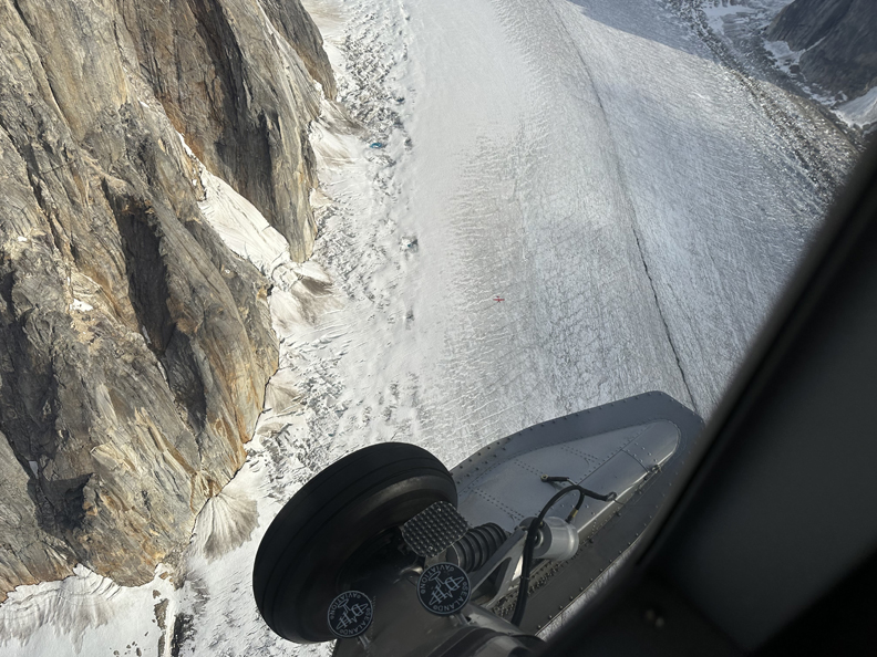
Note landing location
.
View of Denali (Mount McKinley)
.
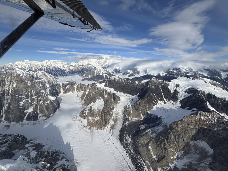
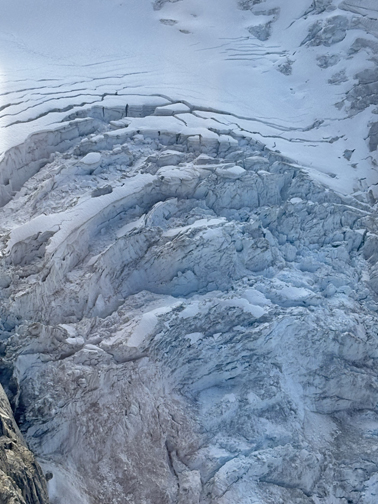
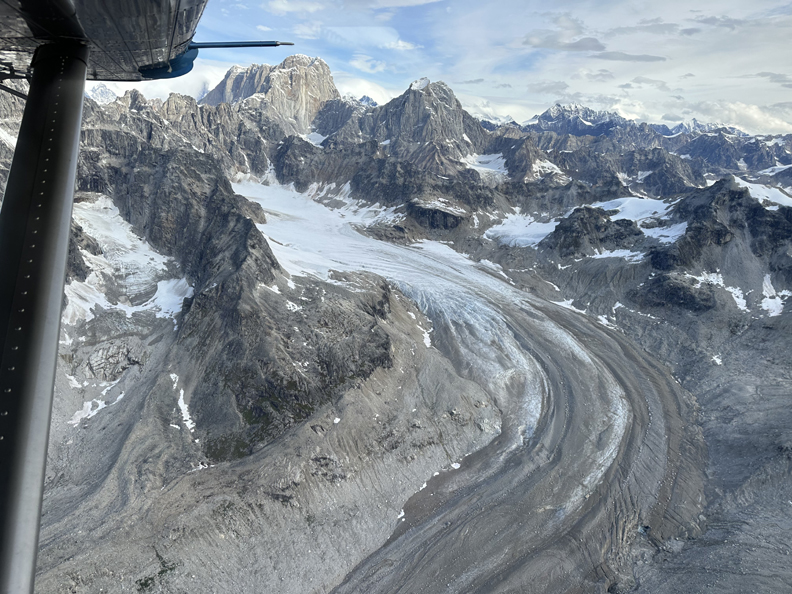
Icefall
Circling for landing
.
.
.
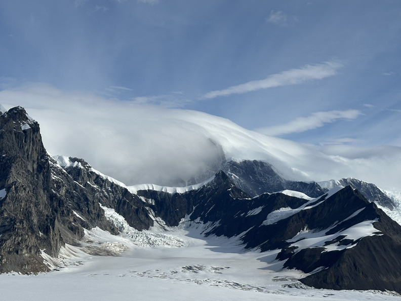
Note the lenticular clouds indicating high winds on the mountain
.
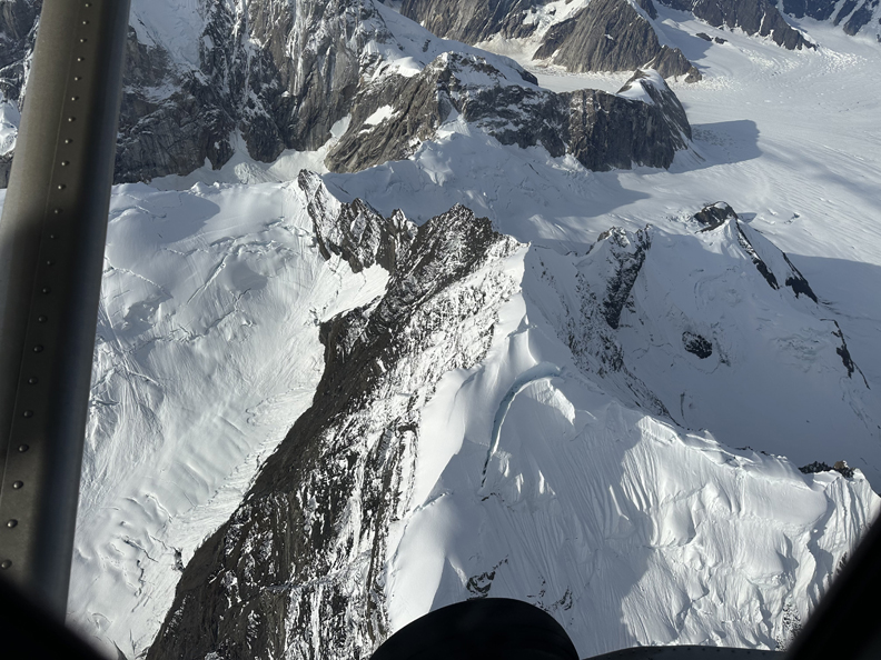
Approaching landing on the Ruth Glacier
.
.
.
Landing
.
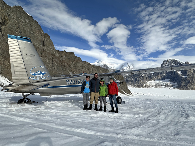
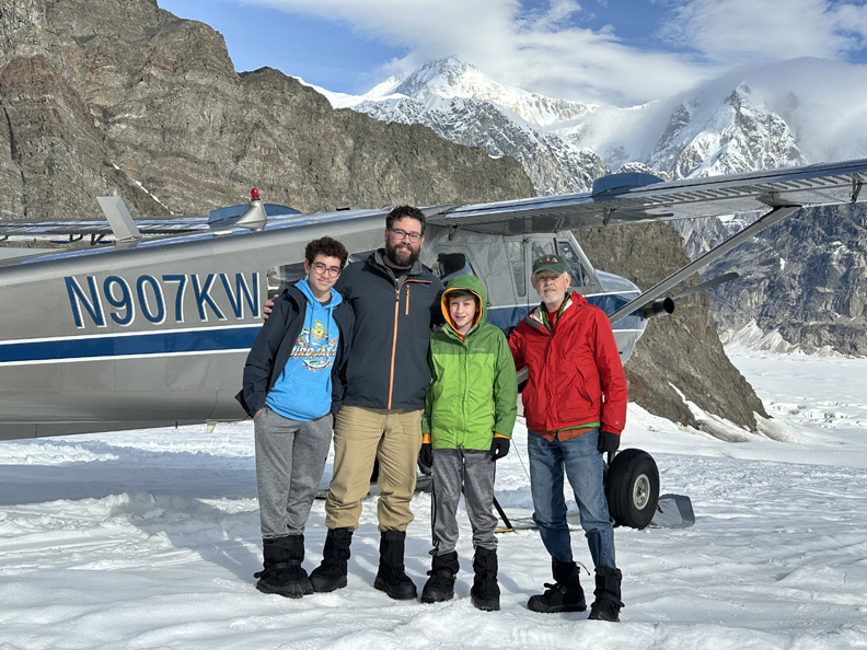
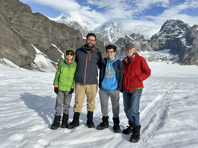
On finger of Ruth Glacier
.
.
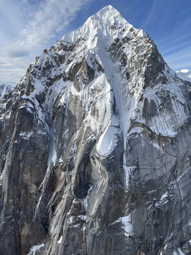
Denali above Chad’s Right Shoulder. It was calm, clear, quiet, comfortable, and Beautiful!
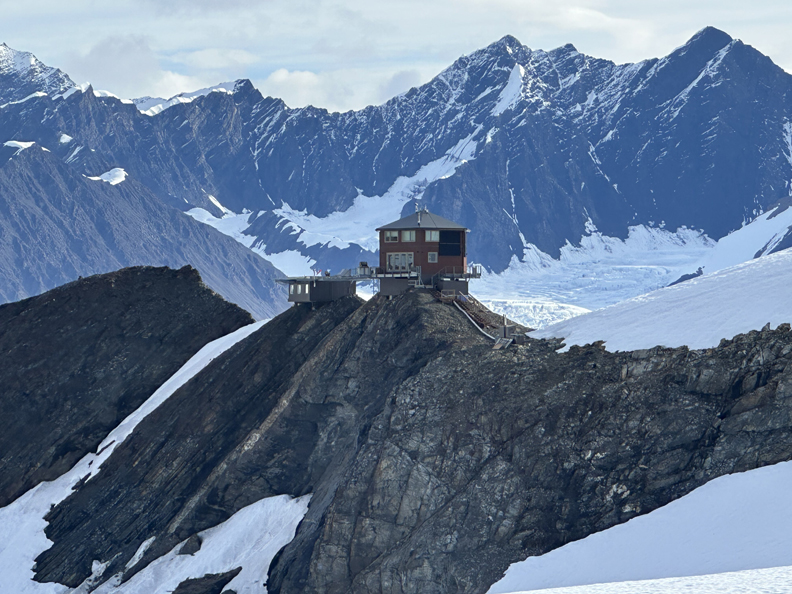
Interesting Story – Don Sheldon was a bush pilot who started the first glacier landings on Denali. He owned and ran the Talkeetna Air Service. In 1953, before Denali NP existed, he used the Homestead Act to acquire 5 acres on the mountain and proceeded to build a “retreat” on rocky terrain just above the Ruth Glacier. He and his family improved the facilities, and it is now known as the Sheldon Chalet. The rental cost starts at $32,000/night, with a three-night minimum stay. A specific package, the Ultimate Mountain Adventure, is priced at $57,000 per person for a 4-day, 3-night stay, which includes transportation to and from Anchorage, and is available for 2026!
.
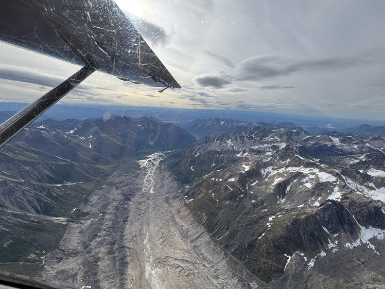
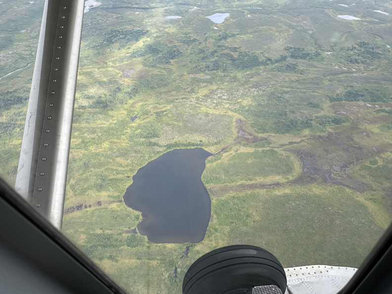
The following photos were taken while returning to the Healy airport –
.
.
.
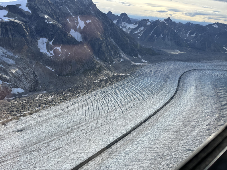
Glacier detail
.
.
Denali
We had some air turbulence on the return flight
.
.
.
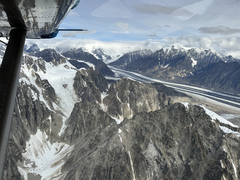
Follow the Glacier
.
.
The Home Stretch
.
.
.
.
This Denali Glacier Landing Flight was the Highpoint of our Alaska Trip!
See Blog for September 2020 to view photos taken by Peter and Kate during their flight from Talkeetna and landing on the Kahiltna Glacier on the south side of Denali.
Filled the gas tank, then Chad drove 5hrs to the Anchorage Airport as we ate snacks in the car. Arrived about 4pm and Chad, Drago, and Seamus checked in for their 5:15pm flight to SEA, followed by an11:55pm flight to MPL, a 7am flight to ORD (Chicago O’Hare), a Crown Plaza hotel shuttle to their car, and a drive home to Milwaukee.
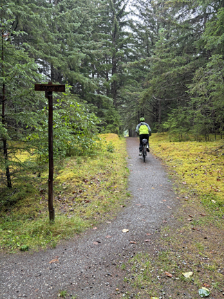
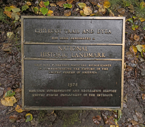
Meanwhile, I gassed-up the rental car, returned it, and checked in for my newly booked 7:48pm Alaska Air flight to Juneau. I was on a mission to do a segment of the Chilkoot National Historic Trail outside of Skagway AK. There are a total of 27 National Scenic and Historic Trails. After doing a hike on the Chilkoot Trail, I would be able to state that I had experienced all of them.
I took the Frontier Suites Shuttle to the hotel and checked in for the night.
8/17 Sun – I was up at 5:30am to catch the 6am shuttle to the airport for my 7:45am flight with Alaska Seaplanes to Skagway. There was a weather cancelation at 8am and I rebooked for an 11am flight. That flight was canceled. So, I tried to book the 3pm flight but it was full. That left me with the last possible flight to Skagway at 6:30pm. Leaving Juneau –
Since I had planned to return to Juneau today at 5pm to catch Alaska Air flights to Chicago, I had to cancel Alaska Seaplanes and Alaska Air reservations. In addition, I had to book an Alaska Seaplanes flight to Juneau the following afternoon, and re-book my flights to Anchorage and Chicago on Alaska Air. Nothing accomplished today, except getting to Skagway!
I arrived in Skagway at 7:30pm and had to find a place to stay. As I started to walk into town, I met John who was trying to get to Canada to meet his hunting guide (Air Canada was on strike). He and his brother own a roofing company in Lubbock TX. He had recently made a reservation at the Skagway Inn and was told there was one room left. He called and confirmed the reservation for me. We then walked about a half mile to the hotel carrying our backpacks and dragging our bags through a light rain.
I was assigned the “Essie Room,” the smallest room in the former brothel. It was clean, comfortable, and decorated with vintage items. The bed just about filled the room with the restroom down the hall. John and I met in the restaurant for dinner right before they closed. My Shrimp Caesar Salad was reasonably priced and excellent.
8/18 Mon – I went for breakfast when it opened at 7am and was surprised to have a served full breakfast as part of the room cost of $139.32; omelet, hashbrowns, fruit, juice, and coffee – I Highly Recommend the Historic Skagway Inn!
.
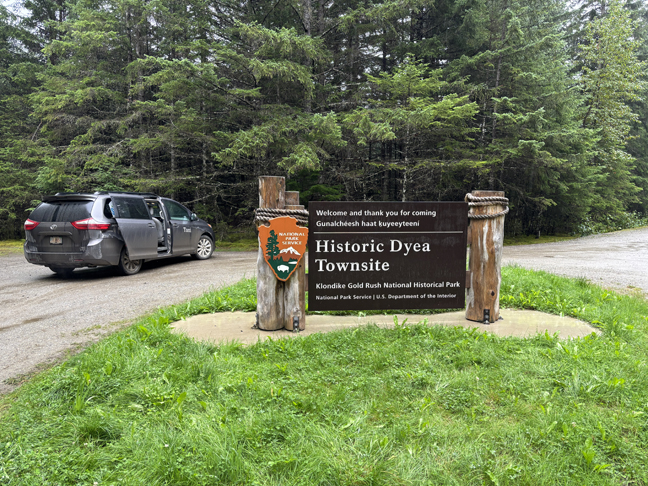
I hired a taxi to drive me to the Historic Dyea Townsite, which was/is the start of the Chilkoot National Historic Trail. He picked me up at 8am for the 10-mile drive, in a light rain, to the townsite.
.
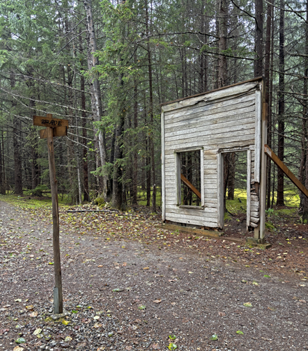
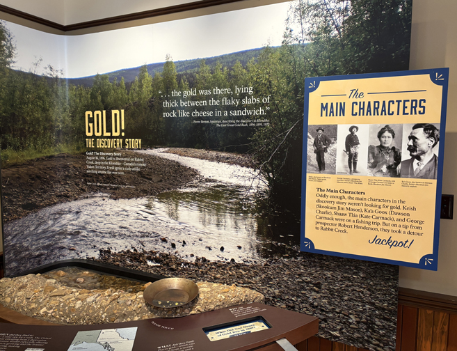
In 1895, Dyea was a small Tlingit village and fishing camp. It was also the staging area for Native trade to and from the interior over the Chilkoot Pass. That all changed in 1896 when gold was discovered in the Klondike area outside of Dawson City, Yukon Territory, Canada. That prompted the 1896-1898 Klondike Gold Rush when Dyea grew to 5,000-8,000 people. Almost as quickly as it rose, the Boomtown fell to 3 inhabitants by 1903 when the railroad was completed from Skagway through the White Pass to Whitehorse Canada.
.
“Glacial Rebound,” the result of “Ground Rebound,” has resulted in the land here rising 7-feet since 1890, affecting access to the Taiya River, Taiya Inlet, and Pacific Ocean.
It is about a 0.5-mile walk to the Dyea Cemetery, which is also called the “Slide Cemetery” because it is the resting place of about seventy “stampeders” who failed to head the warnings and died in a series of snow slides (avalanches) across the Chilkoot Trail on Palm Sunday, April 3, 1898.
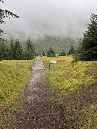
It is another 0.5 mile walk to the start of the Chilkoot National Historic Trail – a 33-mile international trail that starts at Dyea and ends at Bennett, BC, Canada. There are nine campgrounds along the trail, which has an elevation gain of about 3500 feet. The Chilkoot Pass is roughly the halfway point and is the international border between the U.S. and Canada.
The first part of the trail follows the Taiya River.
.
.
A permit is required from the Chilkoot Trail Center (NPS) in Skagway for overnight stays on the trail.
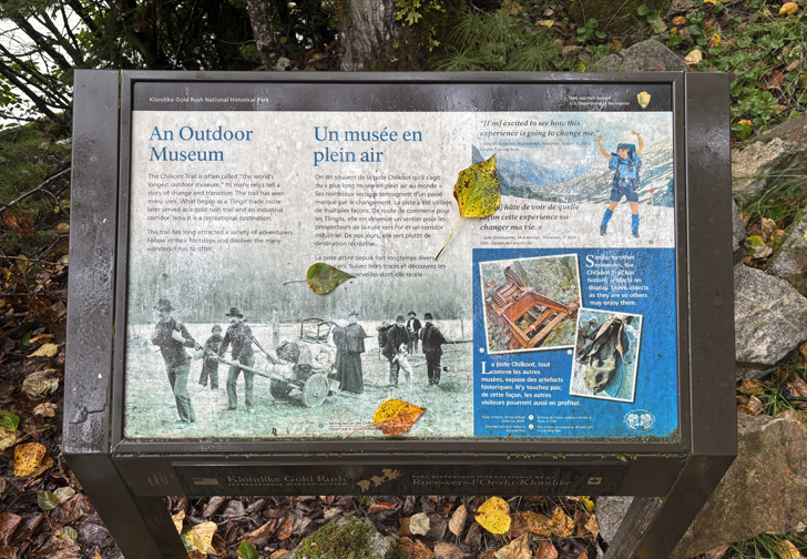
The trail has been called the “World’s Longest Museum” because of artifacts left along the trail. The trail has gone from a Tlingit trade route, to a gold rush highway, to a recreational trail.
I did a mile hike, as I had to get back to catch my plane to Juneau.
.
.
Registration Box –
Returning to trailhead
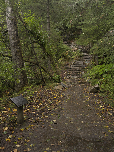
“Golden Stairs” – top part of the Chilkoot Trail to Chilkoot Pass (1898).
I went straight to the airport to check on my noon flight – it was canceled due to weather! I had a choice. I could re-book for 4pm and risk that flight being canceled and having to spend one or more night(s) in Skagway, or I could take the Alaska Marine ferry at 2:15pm, requiring me to cancel my Alaska Air flight home that night and re-booking the flight for the following day. In addition, I would have to get a hotel in Juneau for this evening. I opted for the latter, since there was no guarantee that I could fly to Juneau the next day. So, I canceled my flight to Juneau and flight to Chicago, booked the ferry to Juneau, booked a hotel in Juneau, and booked another flight to Chicago. This has been the story of the entire trip – changes due to Bad Weather!
I now had 1.5-hours before boarding the ferry. I started by going to the Klondike Gold Rush NHP Visitor Center
.
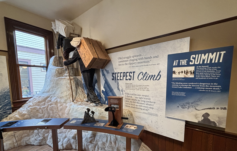
“Steepest Climb”
.
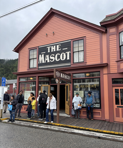
The NHP opened the Mascot Saloon Museum (1898) sometime after my 2011 visit.
.
.
I treated myself to a gourmet lunch of Halibut Puff Pastry, Fish Chowder, Salad, and Beer at Olivia’s Bistro in the Historic Skagway Inn, then headed for the ferry.
Alaska Marine Vehicle (Ferry) “MV Columbia” arriving in Skagway (late)
Sailing the Taiya Inlet and enjoying a salmon dinner. I discovered that state employees working on ferries cannot accept tips.
.
The Ferry left Skagway late, arrived in and left Haines late, and arrived in Juneau at 11:30pm, about two hours late. The hotel shuttle was no longer running. So, I hitched a ride in a van to the airport and then walked a half mile to the Frontier Suites hotel – this was my fourth night in Juneau.
The Aurora Borealis Season is September to April. However, NOAA had reported activity last night and stated that tonight the conditions would be good. So, I went out from 12:30am to 2am looking for the Northern Lights. Alas, I could not find a dark/clear place to look north. I only saw a light glow above the trees. However, I did have some excitement as I returned to the motel. As I arrived, I heard three gunshots close by and thought I may have been the target. I ran into the lobby. The desk clerk had also heard the shots. He locked down the hotel and called the police. In the end, we thought the shots came from a homeless camp across the highway. Goodnight Tom.
8/19 Tu – Day of waiting and best weather day of trip. I had breakfast at the Valley restaurant and lunch at the Juneau airport. Took an Alaska Air flight to Anchorage at 6pm and then a “red-eye” flight to Chicago arriving 8/20 W at 5:40am. Took the Crown Plaza shuttle to the hotel and then drove home arriving at 5pm.
FYI – Helen and I visited Juneau, climbed Mt Roberts, paddled Mendenhall Lake, did the boat tour of Glacier Bay NP, ferried to/from Skagway, and visited the Klondike Goldrush National Historical Park in July 2011 – see Blog for additional photos and commentary.
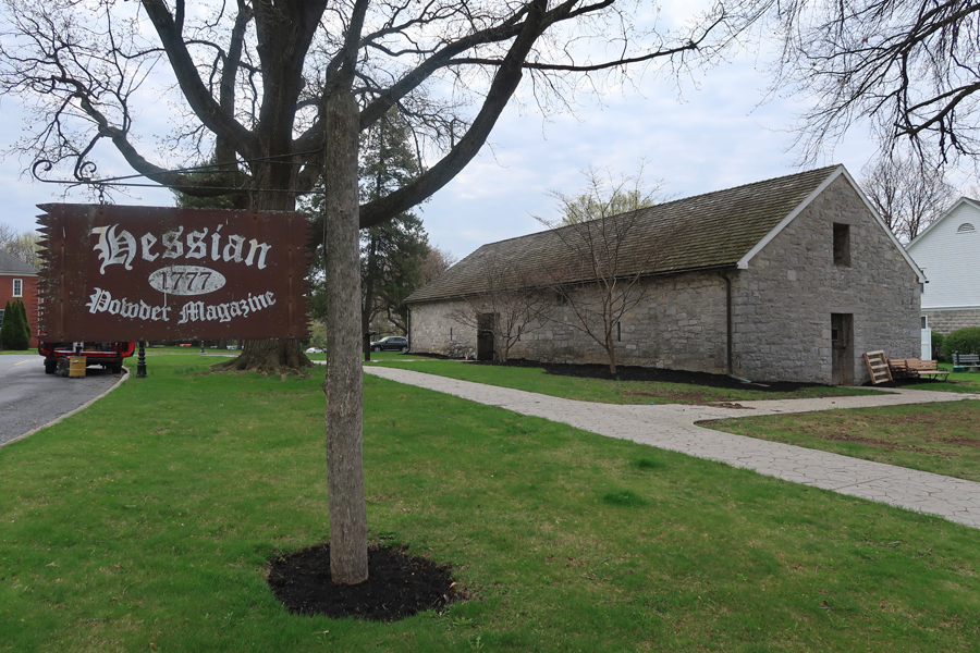
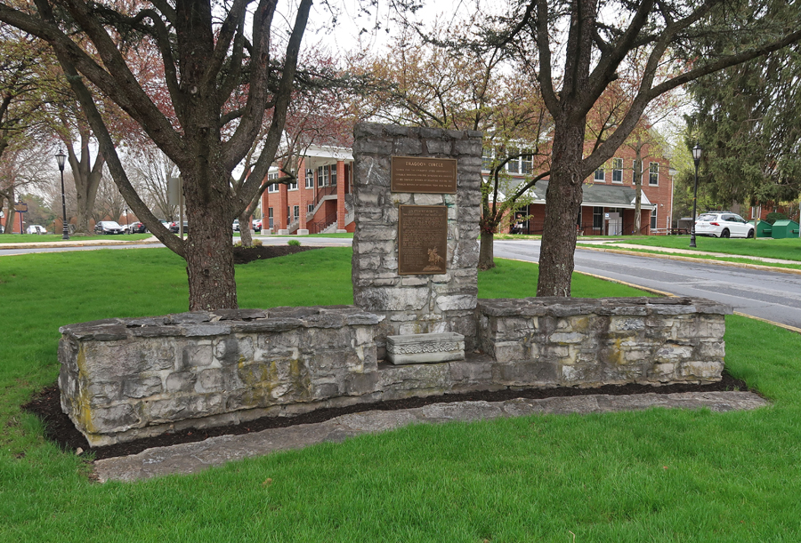
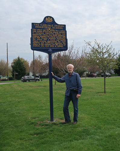
4/14/2025 M – it was a 1.5hr drive from Alex and Brett’s house to the U.S. Army Barracks in Carlisle PA just west of Harrisburg.
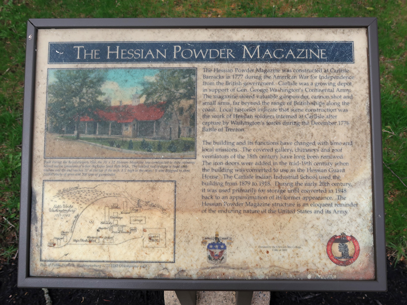
Carlisle was the jumping off place for traders and settlers heading over the Allegheny Mountains in the mid-1700s. In 1757, British Colonel John Stanwix built a fort here that was operational during the French and Indian War. The 1777 Hessian Powder Magazine was used during the Revolutionary War. It now serves as the Hessian Guardhouse Museum.
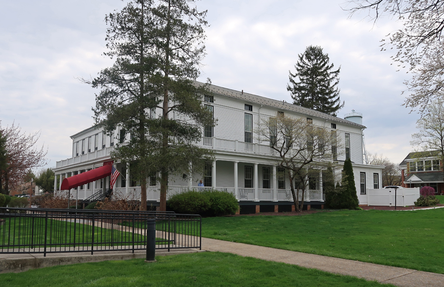
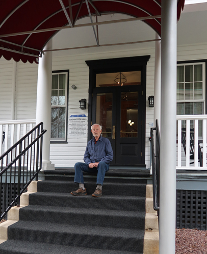
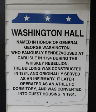
After the Revolutionary War, Carlisle continued as an Army Base and was active during the 1794 Whiskey Rebellion. Washington Hall –
.
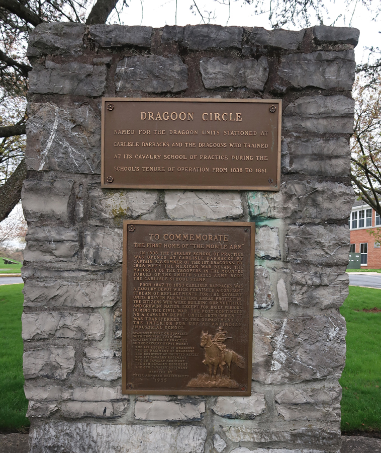
In 1838 the Army established the US School of Cavalry Practice and trained a horse mounted force of U.S. Dragoons. In 1863, Confederate troops took the base and prepared for the Battle of Gettysburg. After the Civil War ended, the barracks returned to its pre-war mission of receiving, training, and forwarding cavalry recruits destined for the Indian wars on the western frontier.
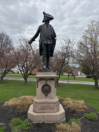
This statue of Frederick II of Prussia was given to the US in 1902. “Frederick the Great,” King of Prussia, is credited with transforming Prussia into an eighteenth-century European power. He was known for his military prowess. The statue was at the U.S. Army War College in Washington DC but was taken down before World War I. After the War College was moved to Carlisle in 1951, it was decided to place “Freddy” “in a position overlooking the Parade Ground.
This is a Monument to graduates of the U.S. Army War College. It is still operational, and trains selected officers for high command positions. Some notable graduates include John J. Pershing (1905), Dwight D. Eisenhower (1927), and Omar N. Bradley (1934).
In 1879, the War Department transferred control of the post to the Department of the Interior to be used for the first off-reservation Indian boarding school for the education of Native American children. The purpose was to assimilate and integrate the children by teaching them English, trades, and Christianity. Also, the children could be used as political hostages to prevent uprisings from the Indian bands from which they were taken. The Carlisle Indian Industrial School operated until 1918. The base was then returned to the U.S. Army.
.
So, there is a long history of various U.S. Army missions at this base. However, my focus for this trip was the Carlisle Federal Indian Boarding School NM established last December by President Biden. Several of the buildings on campus were used and/or built by the 7,800 Indian students, from more than 140 Tribes, that lived here from 1879 to 1918.
Sioux students in uniform at Carlisle Indian Industrial School, circa 1880 –
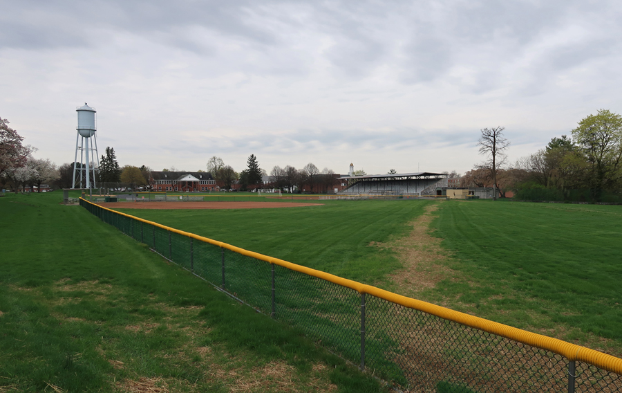
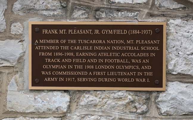
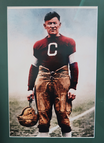
Carlisle is considered the first Federal Indian Boarding School. It was founded by Richard Henry Pratt, a military officer famous for his philosophy of “Kill the Indian, Save the Man.” The school forced Indian children to change their clothing, language, and worked at changing their beliefs. Males had their hair cut and wore uniforms. Females had to wear long confining Victorian dresses. All Indian clothing and possessions were confiscated (e.g., moccasins, medicine bags, jewelry, and ceremonial rattles). Before (Indian dress) and after (Western dress) photos were taken of each child to demonstrate the dramatic change produced by the school. It was an attempt to “civilize” the America Indian. The school promoted athletics and produced several outstanding athletes. For example, the athletic stadium is named for Frank Mt Pleasant, of the Tuscarora Nation, who participated in the 1908 London Olympics.
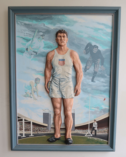
Perhaps the most famous graduate was Wa-Tho-Huk of the Sac and Fox Nation in Oklahoma; he was renamed James “Jim” Thorpe.
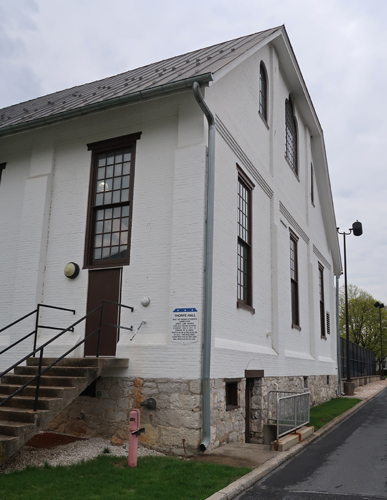
The Thorpe Hall Gym is named for him –
.
There is a small collection of memorabilia in the Gym –
.
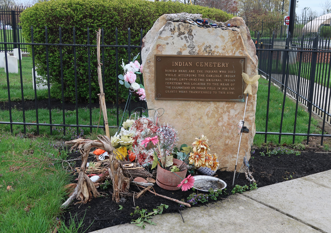
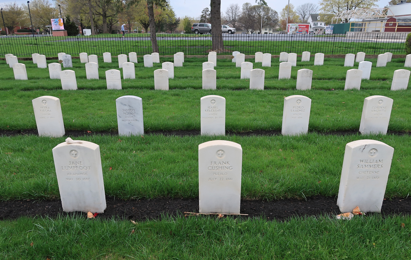
The most poignant reminder of the excesses of the Carlisle Indian School is the Indian Cemetery.
More than 180 Indian children died at Carlisle – note the different tribes represented in the cemetery.
A seven-year U.S. Army disinterment project has been identifying remains and returning them to their tribal descendants. As of the creation of this sign, about forty have been “Respectfully Returned to Their Families.”
Lake Erie Bluffs Hike
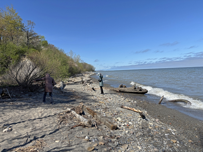
4/30/2025 – We have the East Coast on the Atlantic Ocean, the West Coast on the Pacific Ocean, and the “North Coast” in northern Ohio on Lake Erie! We did a very enjoyable two-mile loop hike along the “North Coast” in Lake Erie Bluffs (Lake Metroparks east of Cleveland) OH. It was a cold, crisp, and clear day.
Started with a view from the Observation Tower – Jan and Helen
.
Lake Erie is the shallowest of the five Great Lakes (210ft at deepest point) but provides more fish for human consumption than the other four lakes put together. It is known as the “Walleye Capital of the World.” It is also the warmest of the Great Lakes with an average August water temperature of 75-degrees. There was lots of interesting driftwood along the beach part of the hike.
10/14 – Indigenous People Day (Columbus Day) – a cold front was coming in as I drove west to the Springfield IL Visitor Center for the Abraham Lincoln National Heritage Area (NHA). The Lincoln Home NHS is part of the NHA – see Blog for November 2022.
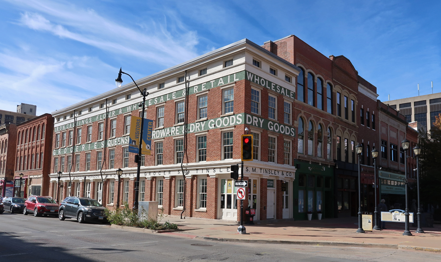
Re-creation of Lincoln-Herndon Law Office 1844-1852
The Old State Capitol is across the street. U.S. IL Senator Barak Obama announced his campaign for President from the south steps in 2007.
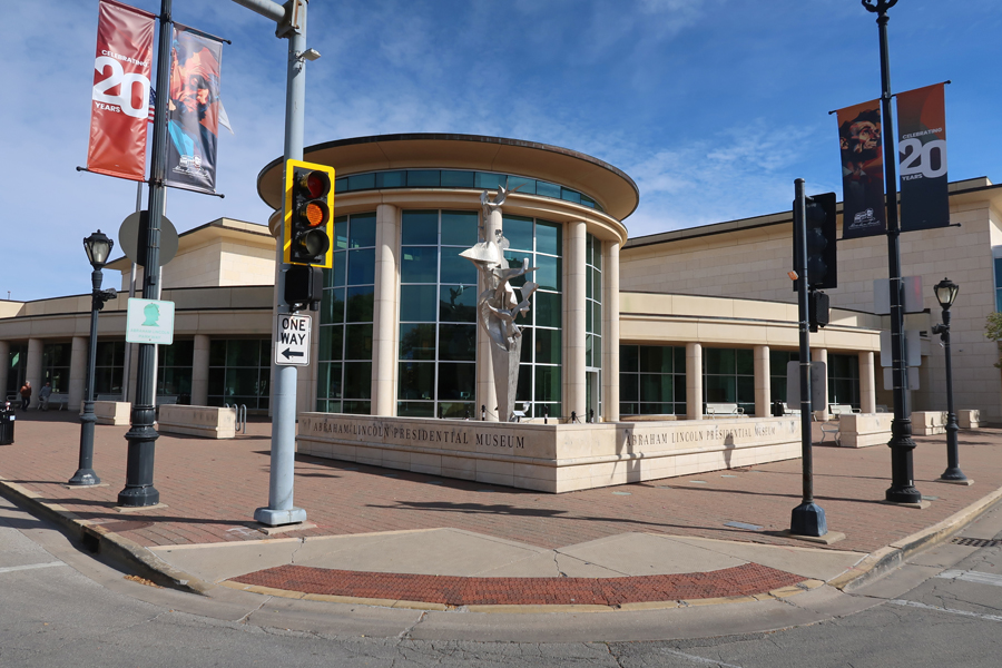
Abraham Lincoln Presidential Library and Museum
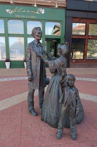
Lincoln Statue in Union Square
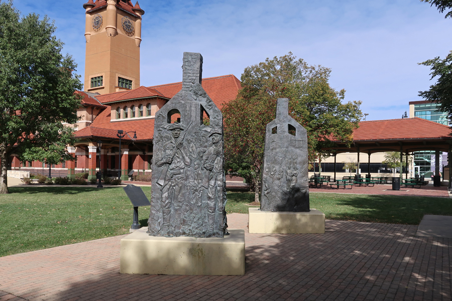
“Acts of Intolerance” sculptures in Union Square, Old Illinois Central Railroad Station in background
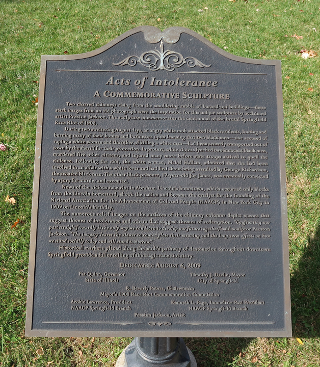
“Two charred chimneys rising from the smoldering rubble of burned-out buildings—these stark images from an old photograph were the inspiration for this unique sculpture by acclaimed artist Preston Jackson. The sculpture commemorates the centennial of the brutal Springfield Race Riot of 1908.” Enlarge sign to read about the Riot.
.
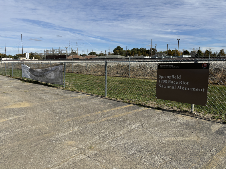
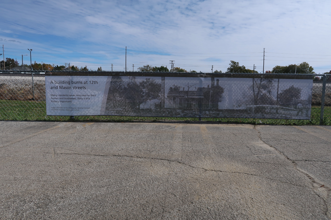
A few blocks away is the location of our newest (August 2024) National Park Unit – Springfield 1908 Race Riot National Monument (NM). “The riot was widely covered by the local and national press. Springfield captured national attention because it took place in Abraham Lincoln’s hometown. It highlighted how little progress had been made in race relations a century after Lincoln’s birth. The riot also caught the attention of prominent civil rights activists like William English Walling, Ida B. Wells-Barnett, W. E. B. Du Bois, and Mary White Ovington. It was a catalyst for the establishment of the National Association for the Advancement of Colored People (NAACP) in 1909.” There is very little there.
There are two banners and a sign on the fence on the east side of the parking lot of HSHS St John’s Hospital Women & Children’s Clinic.
I do not believe this should have become an official NM until the site was at least somewhat developed.
.
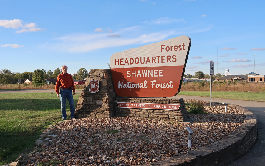
4-hours to Shawnee National Forest(NF) – located in Southern IL between the Ohio and Mississippi Rivers. It has been proposed that parts of this 289,000-acre NF be designated a National Park Unit.
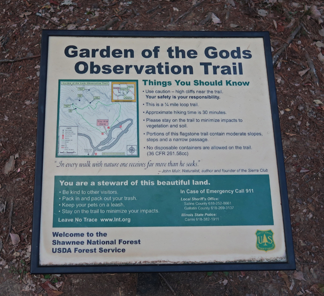
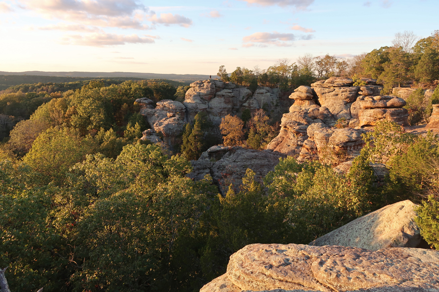
There are a lot of excellent hikes in the NF. I decided to concentrate on the Garden of the GodsWilderness Area
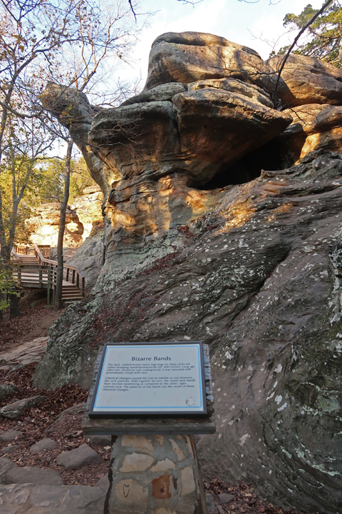
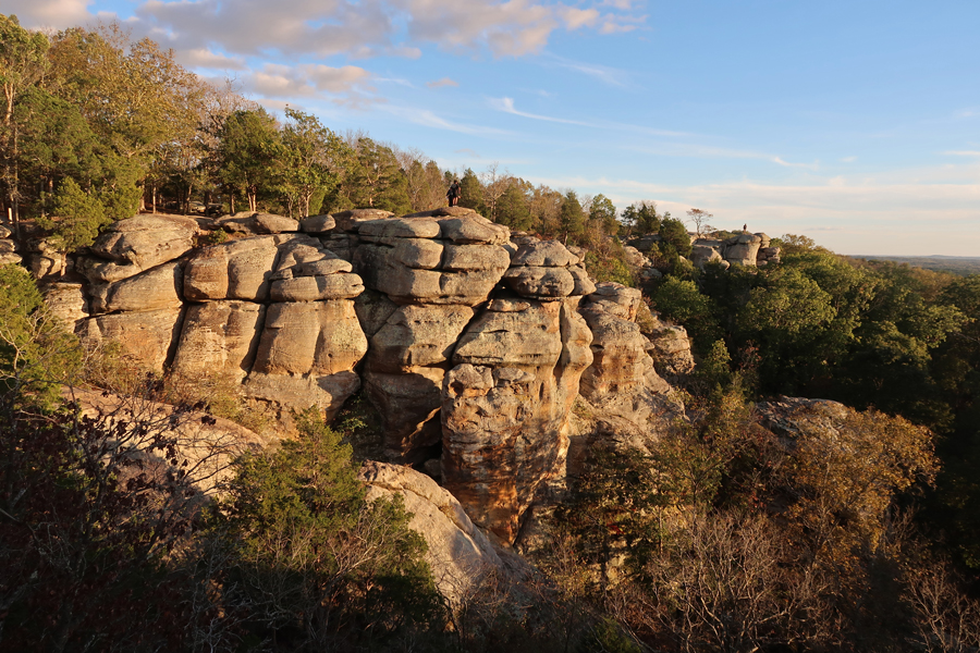
I started with the 0.25-mile Observation Trail, which seems much longer as you wind your way through and around many beautiful sandstone formations.
.
.
There were great views from the top of the bluffs.
.
.
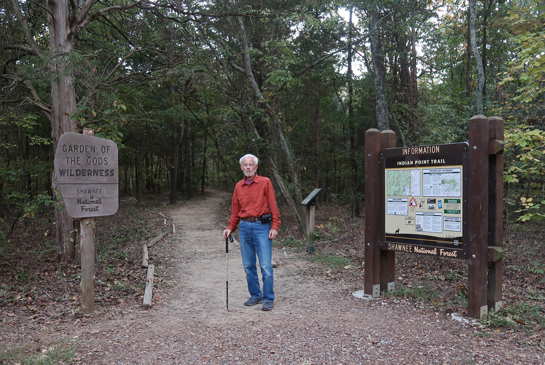
Afterward, I drove a short distance and hiked the 1.6-mile (rt) Indian Point Trail
.
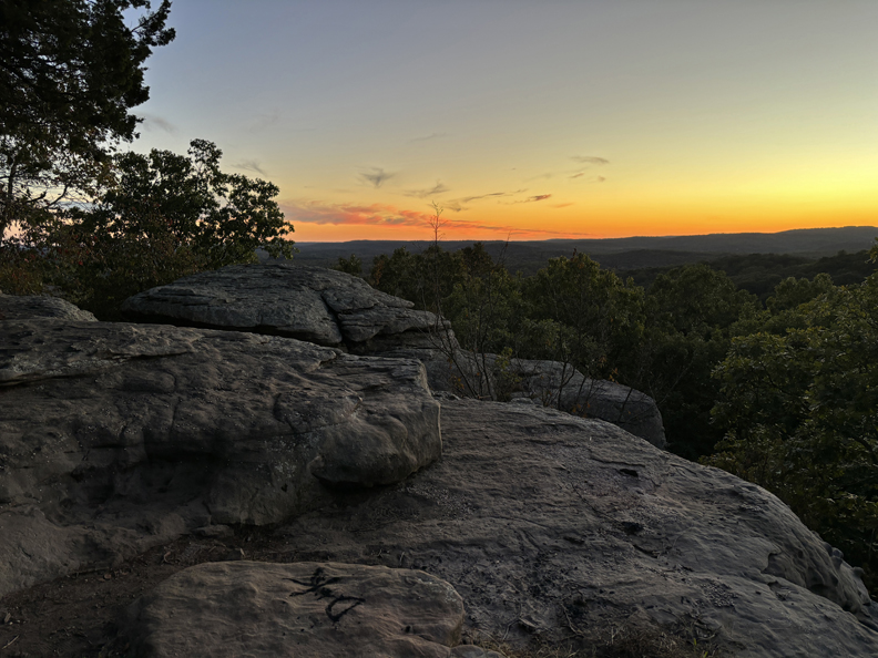
I arrived at Indian Point right after sunset. Fortunately, a near full moon helped me find my way back through the forest.
Slept in the SUV outside of Paducah KY
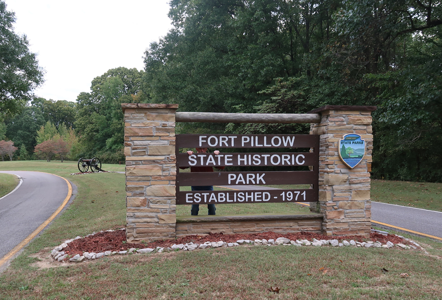
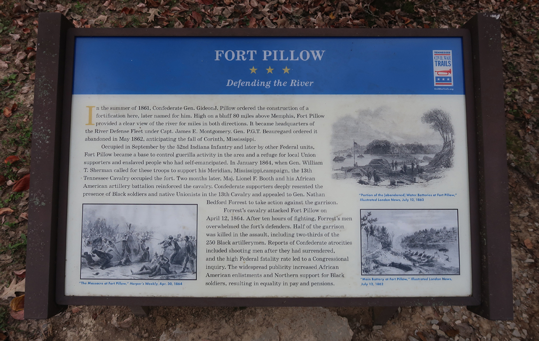
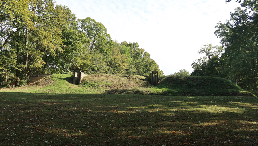
10/15 Tu – 3-hrs to Fort Pillow State Park on the Mississippi River in Western TN. Fort Pillow was built by the Confederates in 1861 at the beginning of the Civil War. It is one of many notable Civil War sites that are not National Park Units.
The Mississippi River has changed course and is now further from this point than it was during the Civil War.
I started at the Visitor Center Museum. Enlarge this sign to read the story of Fort Pillow.
.
.
Was it a “Massacre?”
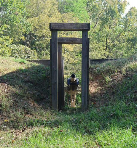
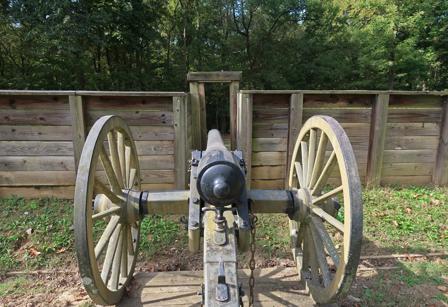
I then hiked the trail to the restored fortification.
.
.
.
.
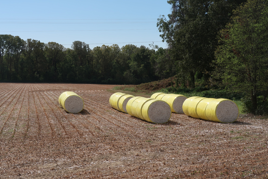
I did not know that West TN was a cotton producing area before this trip.
.
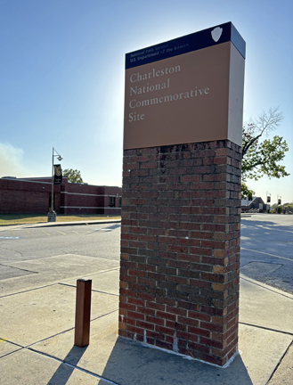
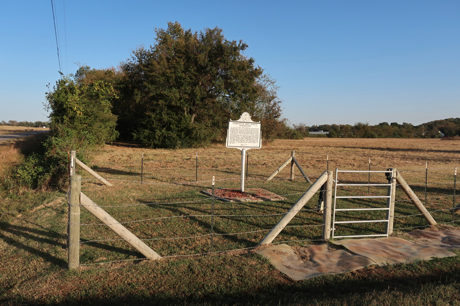
5.5hrs to Charleston National Commemorative Site – Charleston High School in Western Arkansas, just SE of Fort Smith. It is one of three NPS National Commemorative Sites (NCS). The other two are the Kennedy-King NCS in Indianapolis (Blog August 2022) and the Quindaro NHS in Kansas City KS (Blog June 2023). All three are related to African American History.
.
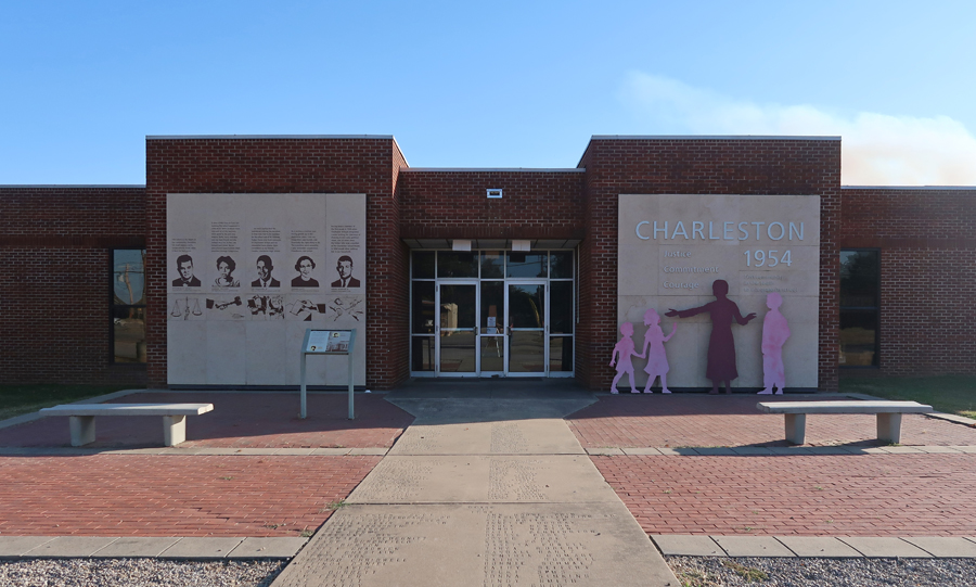
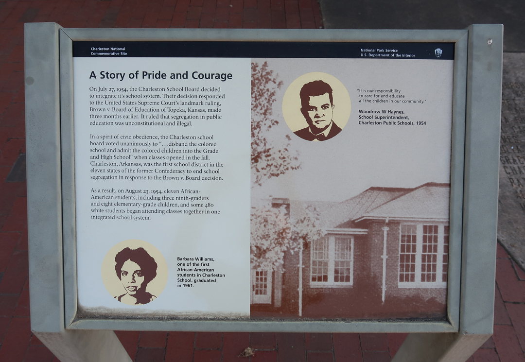
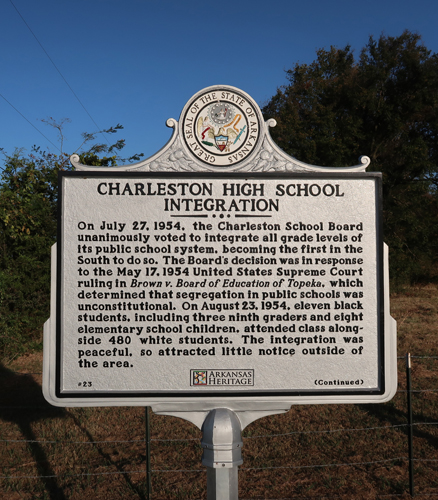
Charleston HS was the first in the 11 Southern states to voluntarily integrate – after the Brown vs Topeka KS Board of Education Supreme Court decision of 1954. That decision determined that school systems based on “Separate but Equal” were in fact not equal.
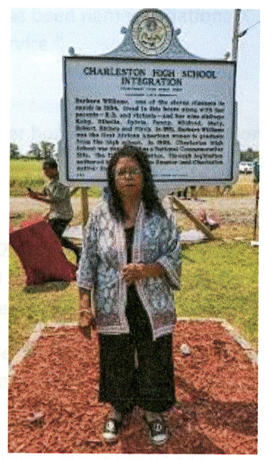
I knew from online research that there was a Historical Marker related to this site, but I did not know where it was. I showed several people around the school a picture of Barbara Williams, standing in front of the marker, and asked if they knew where it was – no one did.
I then showed the photo to a group of Middle School students outside the library and asked. One Black girl said yes, she was related to the woman in the photo and gave me rough direction to the site. Using Google Maps, I found W Eucal Rd about 4-miles east of the library off SR-22. I followed it about a mile to the marker, which is located on the Williams homestead – The Williams house is in the background of the first photo.
.
I took my photos and left. A short time later, as I approached SR-22, a car came up behind me and blew the horn. Long story short, it was Mildred Williams Jones, Barbara Williams sister. We returned to the site for a photo and conversation.
.
.
I gave her the materials I had printed out related to the site and then started driving toward the MS Gulf Coast.
Slept in the Sequoia somewhere around Pine Bluff AR.
10/16 W – 7-hr drive to Gulfport MS and the Mississippi Gulf Coast NHA. Right after this photo was taken, my tripod blew over and damaged my camera. This was the second time this had happened on one of my trips! I then started using my iPhone for photos. After working on my camera lens, I was able to get it to work by manually moving the protective shutter on the outside of the lens. Over the next two days I took photos with both, to be sure I had something recorded.
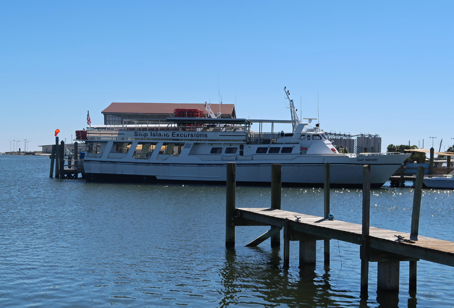
The first thing I did on arrival in Gulfport MS was confirm that the Ship Island Excursions ferry was running the next day. It had not operated for a few days because of wind/waves. Further, Fort Massachusetts (on the island) had not been open, because of flooding, since Hurricane Helene.
Photos at Gulfport Lighthouse
.
Union raid by “Men of Color” on Gulfport during the Civil War (1863).
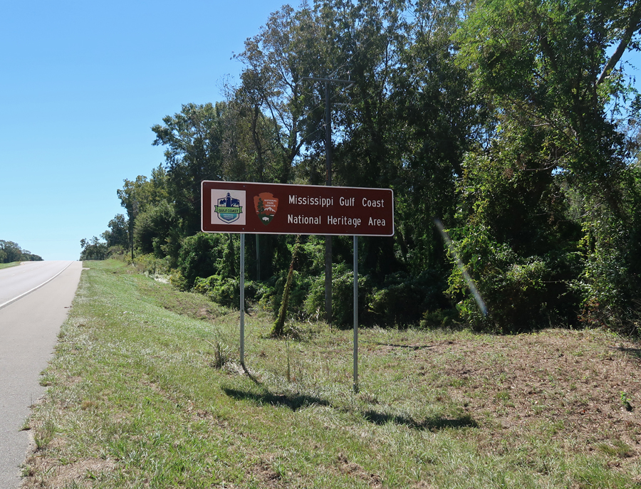
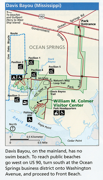
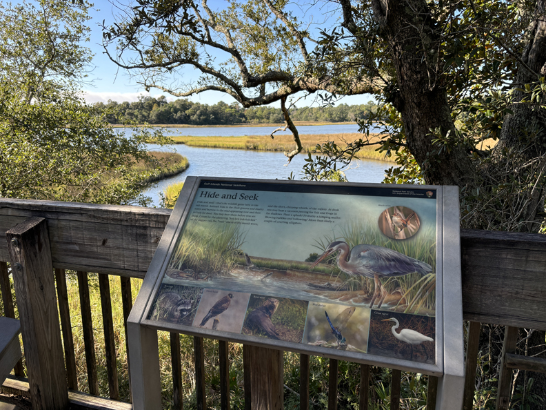
My next stop was the Davis Bayou Area of Gulf Islands National Seashore (NS). The Mississippi NS areas and sites are part of the MississippiGulf Coast NHA.
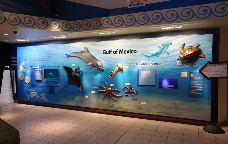
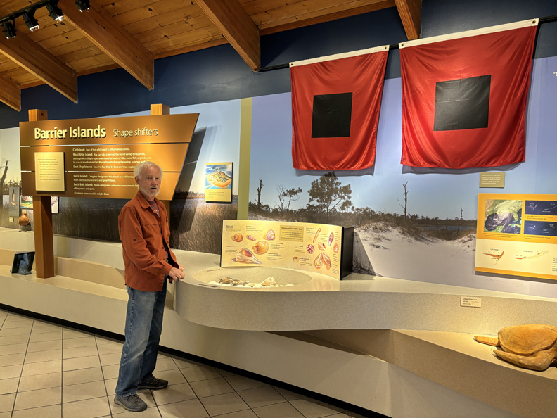
Toured the William M. Comer Visitor Center
.
Bayou Viewing Area
.
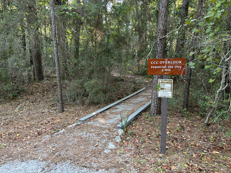
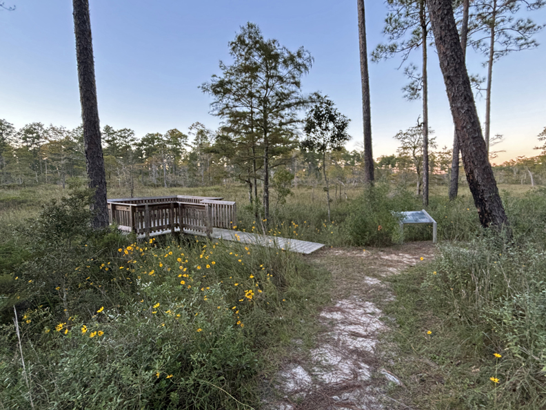
Walked to the Fishing Pier and then hiked the Nature’s Way Trail
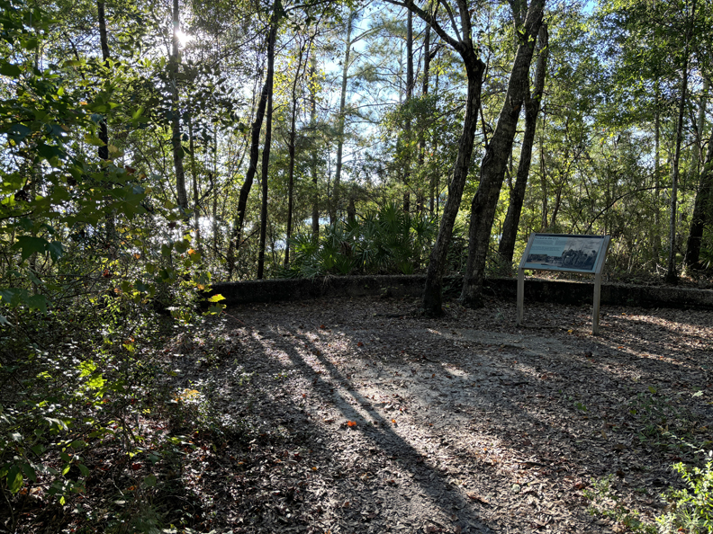
Ended my visit by walking the CCC Spur Trail
.
.
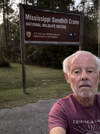
I then drove to the Mississippi Sandhill Crane National Wildlife Refuge.
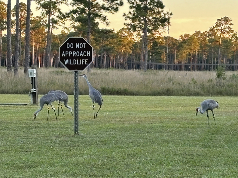
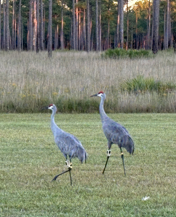
It was late and the Visitor Center had closed. However, I found some Sandhill Cranes foraging in the grass.
.
.
I had just enough daylight left to do the C. L. Dees Wildlife Trail.
No wildlife, other than birds, but lots of nice views
.
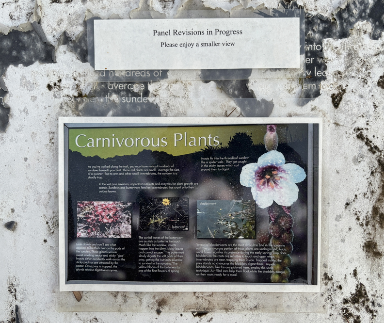
Carnivorous Plants!
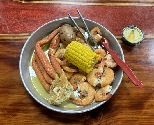
I had spotted the Killer Crab Restaurant when driving here and returned to enjoy the Snow Crab – Shrimp Special, plus beer for $18! There were so many shrimps, I could not finish them all!
I slept the night outside the White House Hotel (built in 1890) in Biloxi MS.
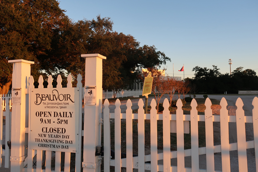
10/17 – I awoke at 6am to the sound of a bugle blowing revelry at the Keesler Navy Base behind the hotel! Got myself together, had breakfast at a surprisingly nice Waffle House, and stopped at Beauvoir, Jefferson Davis’s home (President of the Confederacy) on US-90 overlooking the Gulf of Mexico.
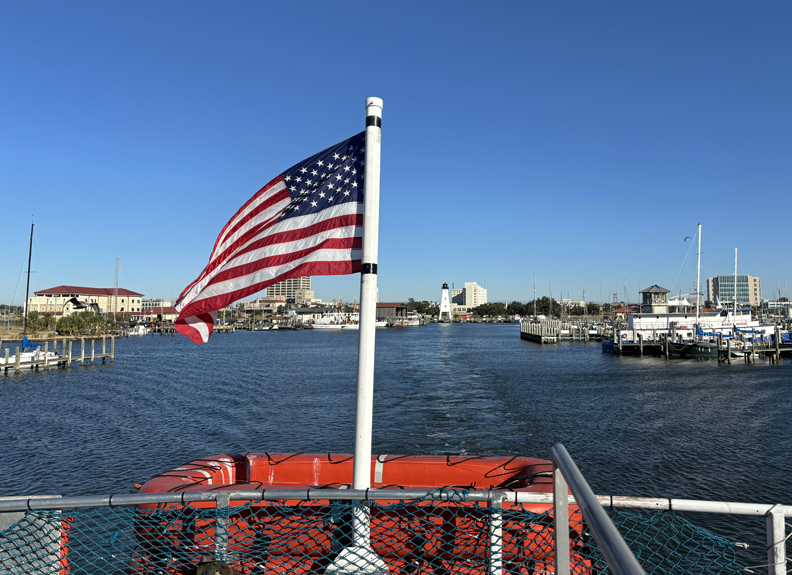
Boarded the ferry ($39 for W-F) and was off to West Ship Island at 9am.
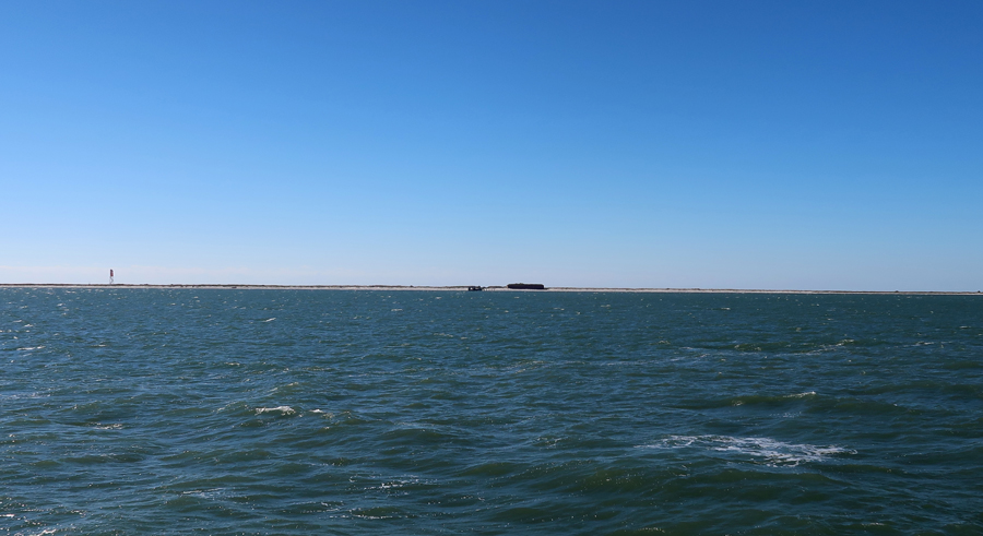
West Ship Island is one of the many islands in the Gulf Islands NS. The NS includes thirteen unique areas from MS through the panhandle of FL. It is 160 miles from east to west – the largest NS in the country. Approaching West Ship Island –
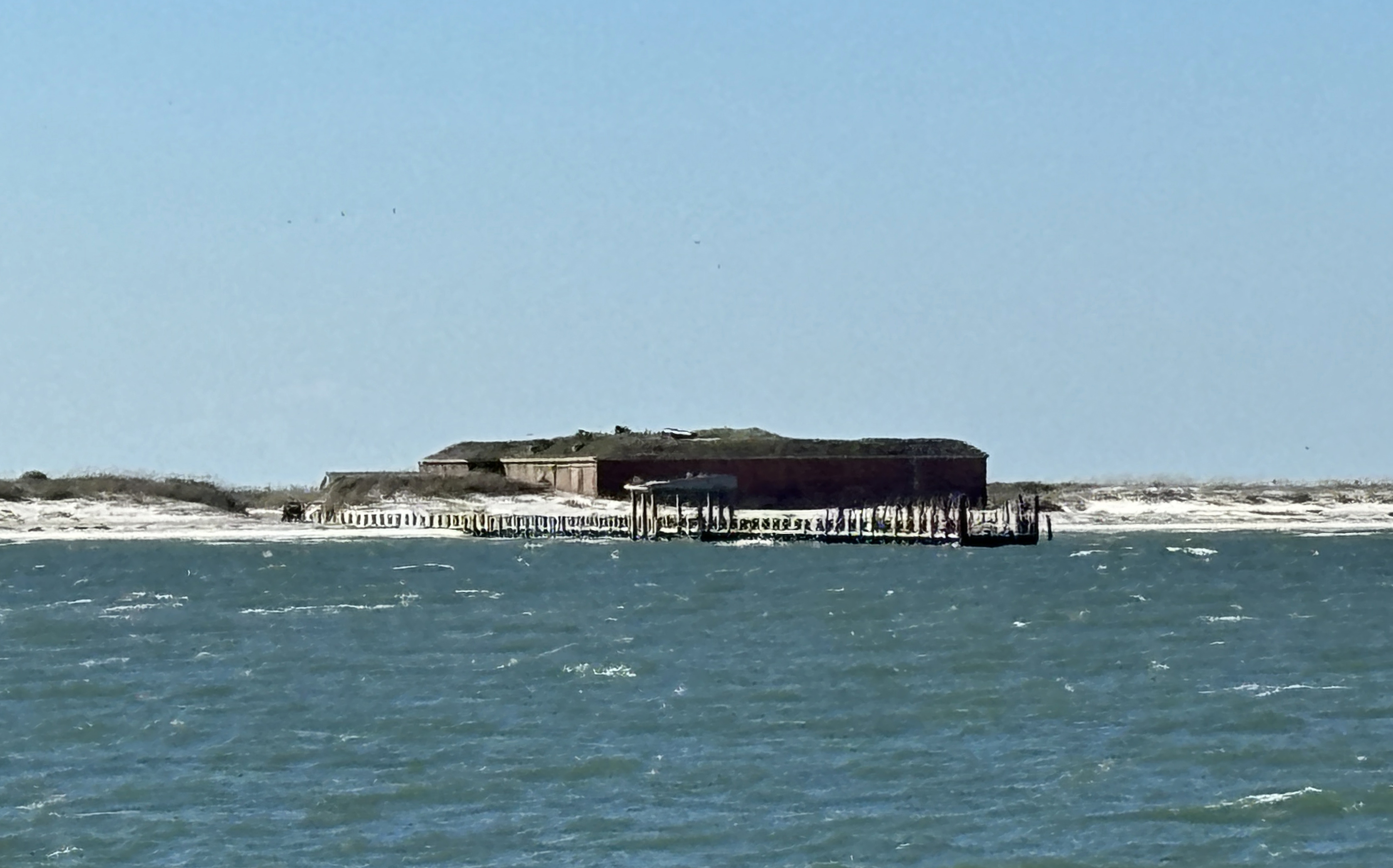
Landing dock, Fort Massachusetts in background.
During the War of 1812, Ship Island was the British staging area for the Battle of New Orleans. They retreated here after their defeat by Andrew Jackson’s forces.
.
Fort Massachusetts was built by the Army between 1857 and 1866. Confederate troops took the island in 1861 but abandoned it nine months later because the men were needed “up north.” Federal forces moved in and used the fort for the remainder of the Civil War. Raids were made from the fort to various locations along the Gulf Coast. The island was also used for Confederate soldier prisoners of war.
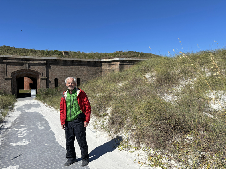
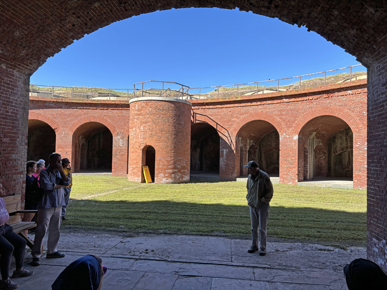
A NP volunteer came out on the ferry with us and did an excellent tour of the fort.
.
.
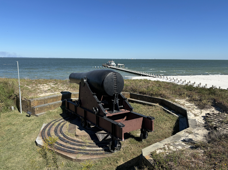
15-inch Rodman Cannon
.
A guardroom by the Sally Port contained a detailed history of the fort.
View from the fort looking east across the island.
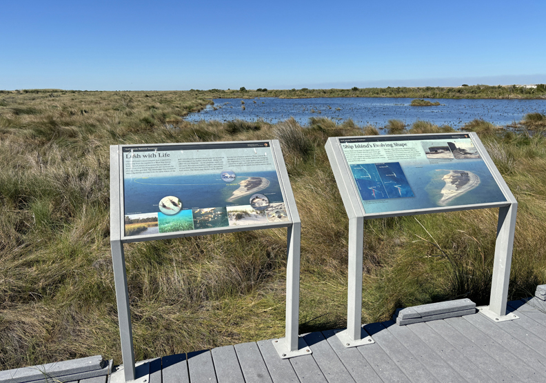
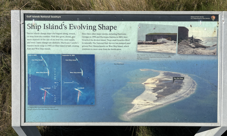
Marker describing the changing shape of the island –
.
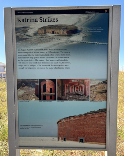
In 2005, Hurricane Katrina devastated the island and submerged Fort Massachusetts with a 25-foot storm surge of water!
There is a beach area on the south (Gulf) side of the island.
I took a relaxing stroll along the beach looking for shells. Only found a few common ones to add to Helen’s collection.
The ferry departed at 2:30pm, landed in Gulfport at 3:30pm (12-miles), and I started my drive to Muscle Shoals NHA in AL. I stopped for the night in Hamilton MS.
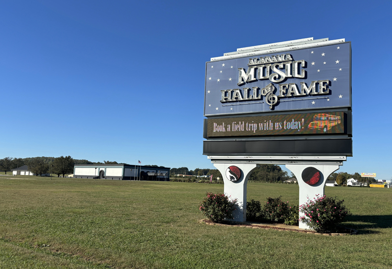
10/18 F – Multigrain Cheerios and an Ensure for breakfast, followed by a 2-hour drive to the Alabama Music Hall of Fame in Tuscumbia AL. My first site in the Muscle Shoals NHA, managed by the University of North Alabama.
.
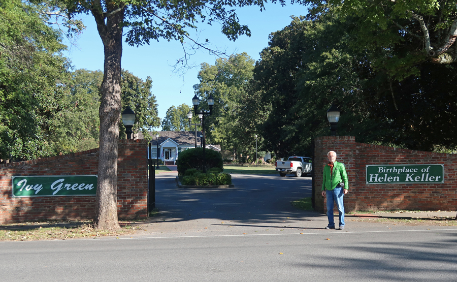
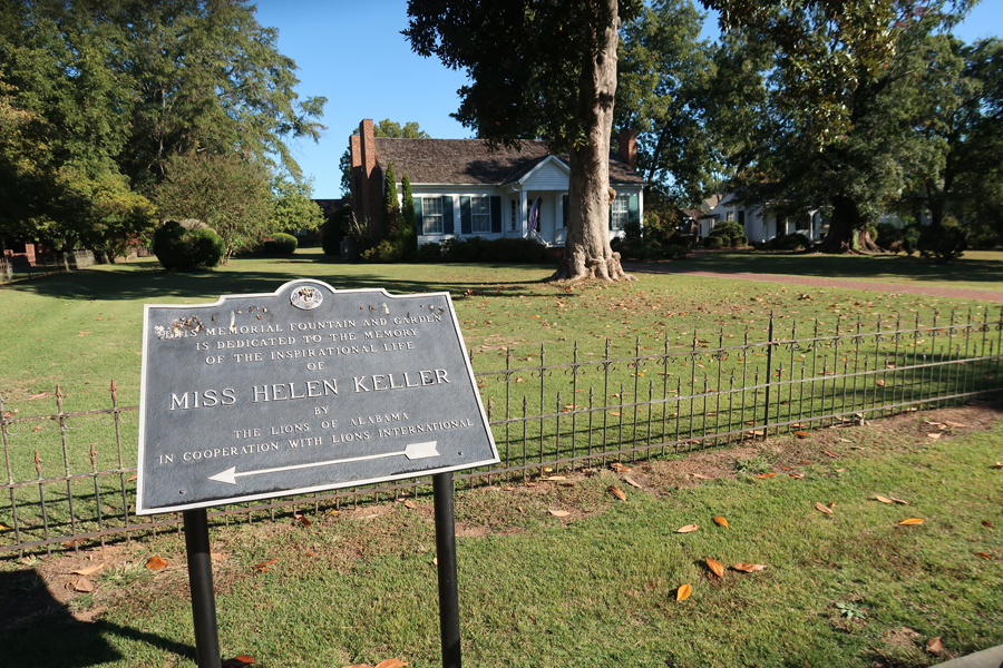
My next stop was Ivy Green, Birthplace and Home of Helen Keller, owned and operated by the Lions of Alabama.
“The homestead was the site of the pivotal experiences which led to Keller’s emergence in the forefront of the effort to provide better methods and facilities to educate people with disabilities.“
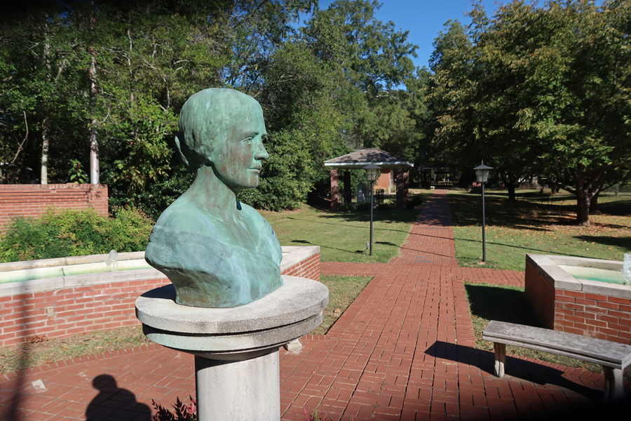
Fountain and Bust
.
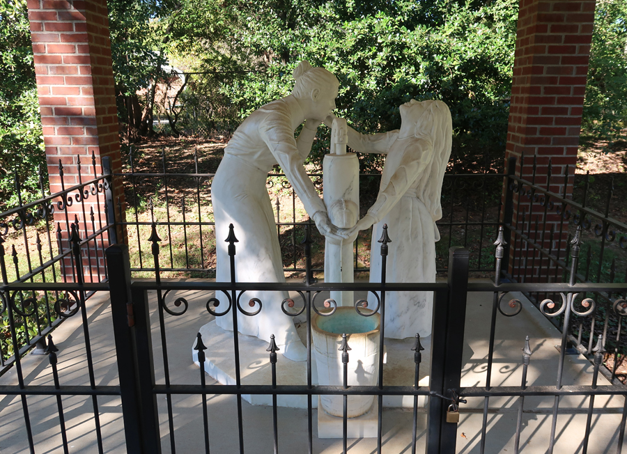
“With the aid of her teacher and constant companion, Anne Sullivan (Macy), the blind and deaf Keller learned to communicate with the world outside of Ivy Green. Through the use of a finger language, created by Samuel Gridley Howe of the Perkins School for the Blind in Boston, various self-developed techniques and much patience and dedication, Sullivan taught Keller to read, write, and speak at Ivy Green.” The water pump was the site of a communication breakthrough for Helen Adams Keller.
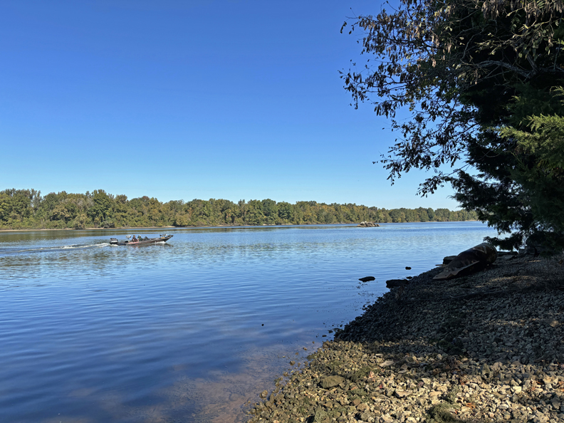
My third stop was Tuscumbia Landing on the south side of the Tennessee River.
The Indian Removal Act of 1830 led to the forced relocation of over 100,000 Indians, from their homes in the Eastern U.S. to Indian Territory (now Oklahoma). The Cherokee removal of 1838-39 became known as the Trail of Tears.
Cherokee were brought to this point by railroad. They were then loaded on boats and floated down river to Indian Territory.
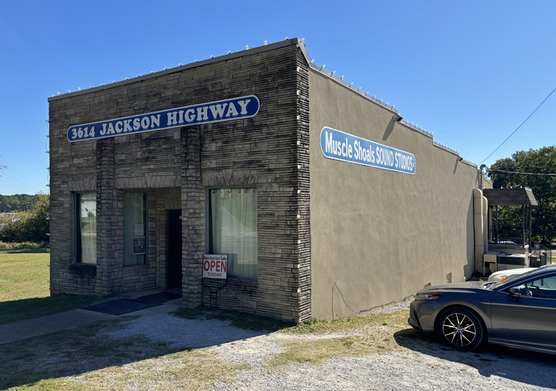
My fourth stop was the Muscle Shoals Sound Studio. It is located in Sheffield AL, which is considered the “Center of the Shoals” because it is centrally located between Florence, Muscle Shoals, and Tuscumbia AL.
The studio recorded many famous artists such as Linda Ronstadt, Mick Jagger, and Cher. The studio was pictured on the cover of Cher’s 3614 Jackson Highway album.
.
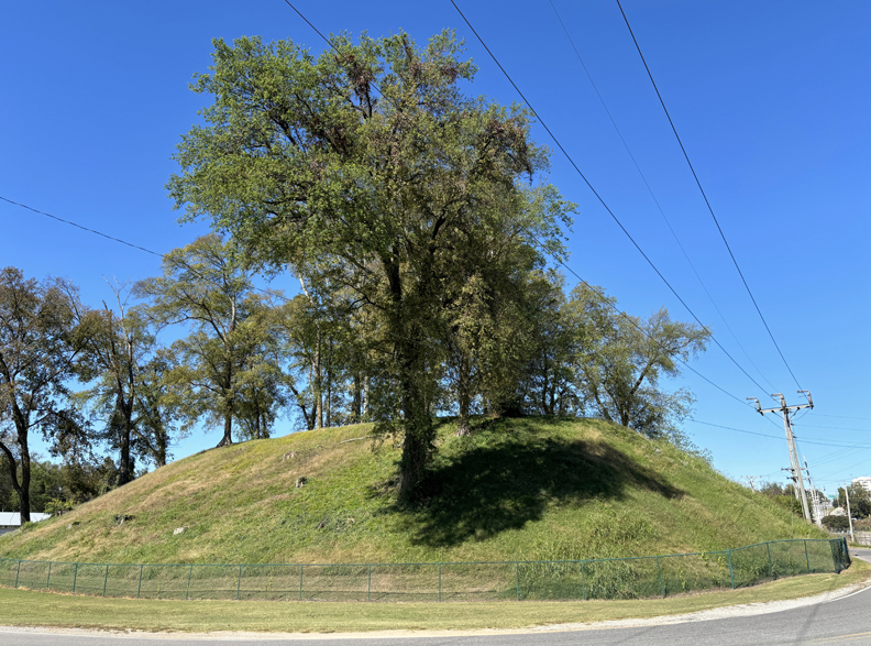
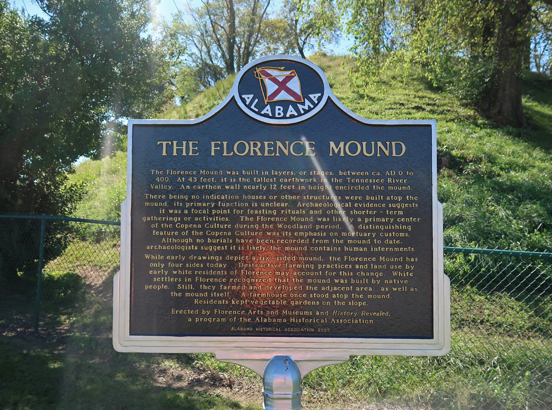
My fifth stop was the Florence Mound built 1700 years ago along the banks of the Tennessee River. “Used as a gathering space for ceremonies, the mound has withstood centuries of floods, storms, and human destruction. It stands today as a testament to the Indigenous people who lived in the Shoals for nearly 10,000 years.
.
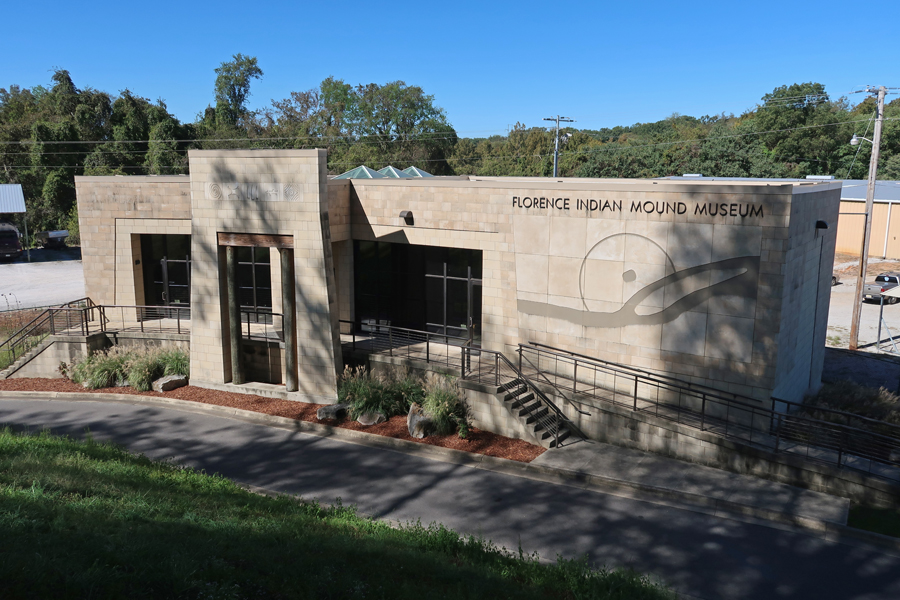
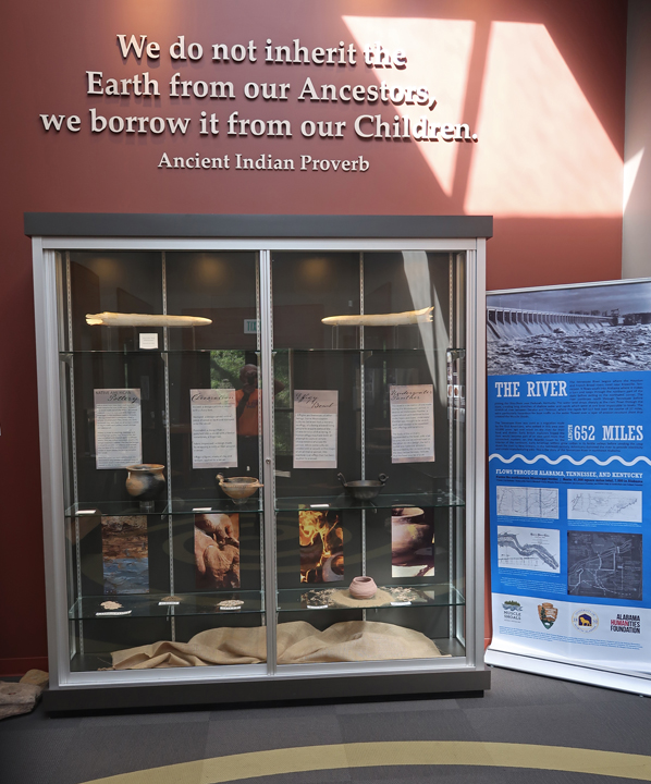
A Museum and Markers at the base of the Florence Indian Mound
.
.
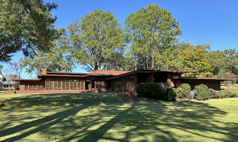
My sixth and final stop in Muscle Shoals NHA was Frank Lloyd Wright’s only AL building – the Rosenbaum House.
The house was finished in 1940 and has been called the purest example of “Wright’s Usonian design.”
Note the windows and the cantilevered roof extensions that are characteristic of the Usonian design.
Finished the day with an 8-hour, 500-mile, drive to Springfield
8/5/2024 – dropped Helen off at the Portland Airport at 5:45am. Her flight flew east over Ohio to Washington DC’s Dulles Airport (in Virginia). After a three-hour layover, she flew back west to Dayton OH – that’s what happens when you use Reward Pts!
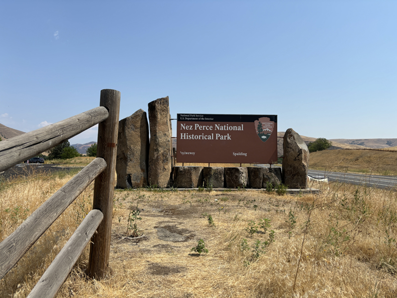
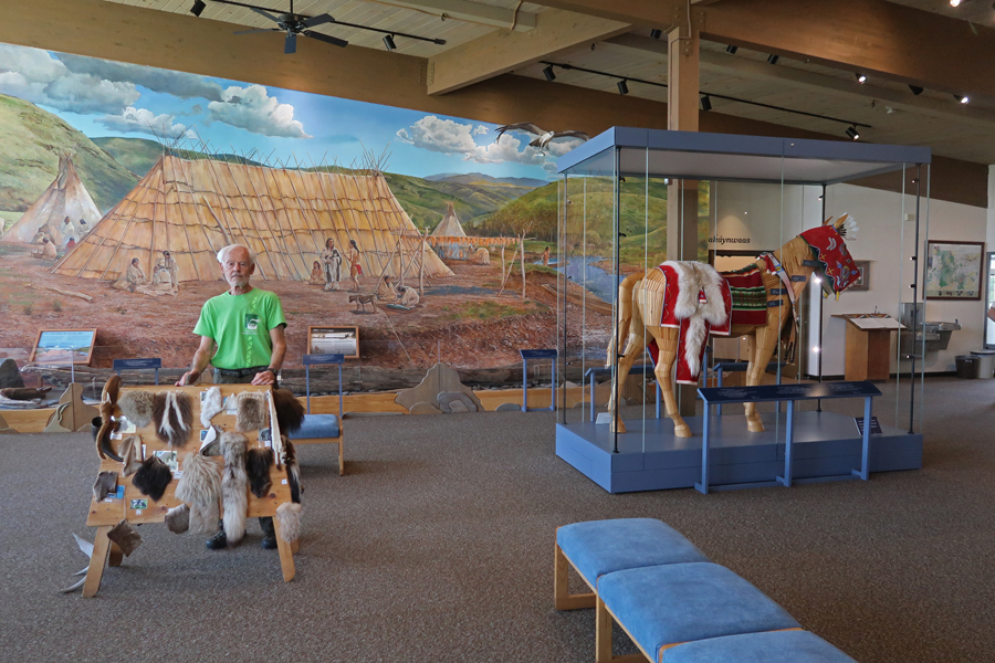
Meanwhile, I drove to Spalding ID and the Nez Perce National Historical Park. – see Blog entry for September 2016 for first visit.
.
Slept in the Sequoia in the parking lot of a Courtyard Marriott in Bozeman MT
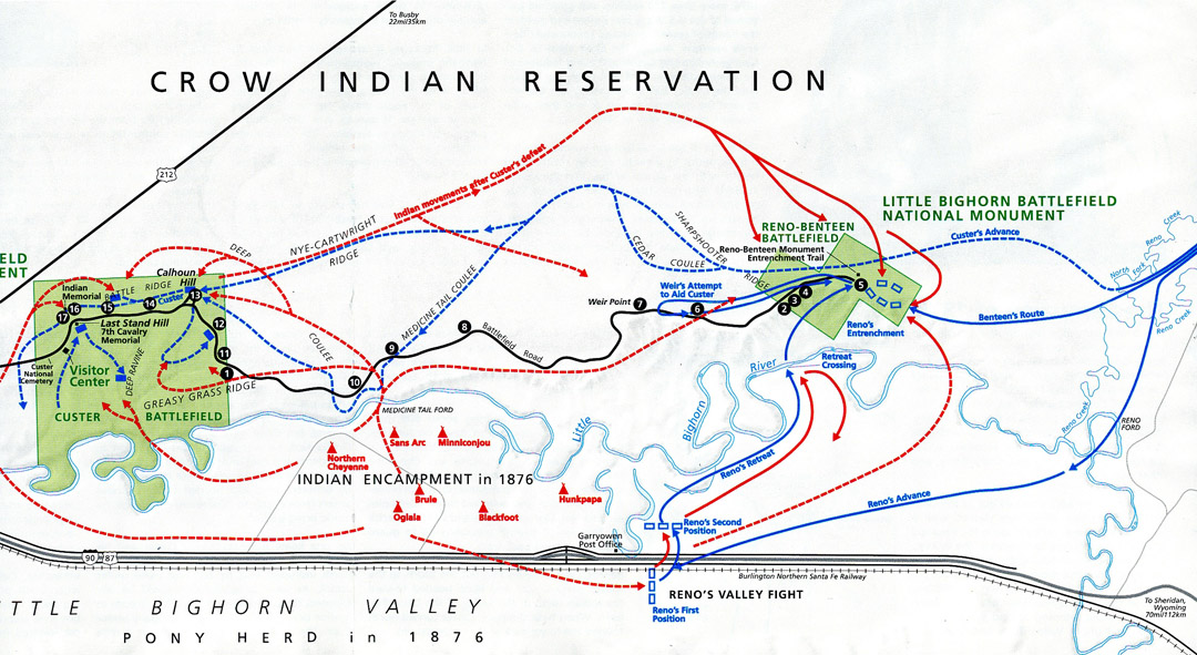
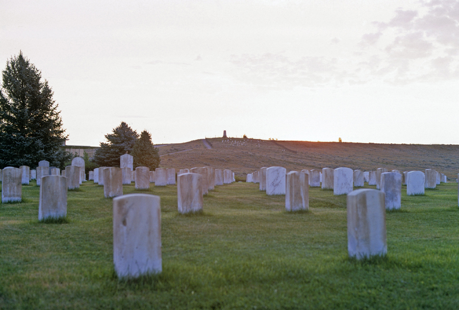
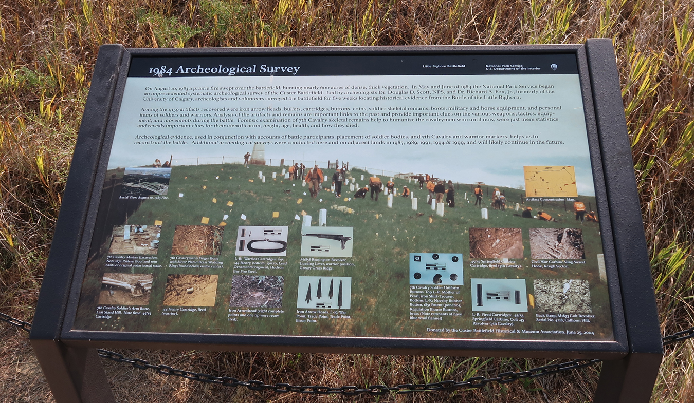
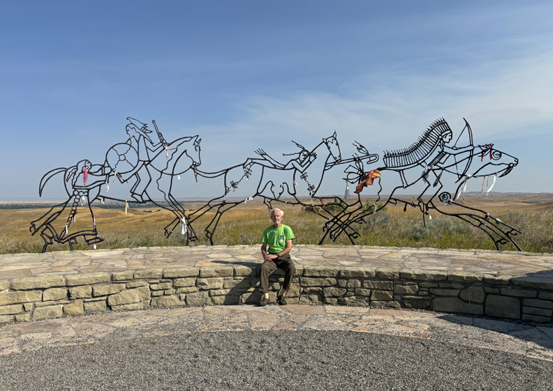
8/6 Tu – 3hr drive to Little Bighorn Battlefield NM and “Custer’s Last Stand.” Our first visit here was in 1969; I have included some of those photos below. The rangers let us camp on the grass outside the visitor center overnight (not possible today!) – 2024
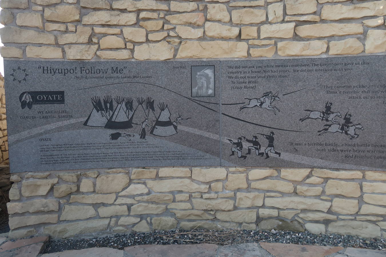
The Army was there to force the Indians back on their reservation. On June 25, 1876, there were about 7,000 Indians camped along the Little Bighorn River including 1500-2000 braves. Led by Sitting Bull. Blue represents movements of the Army and red Indian movements.
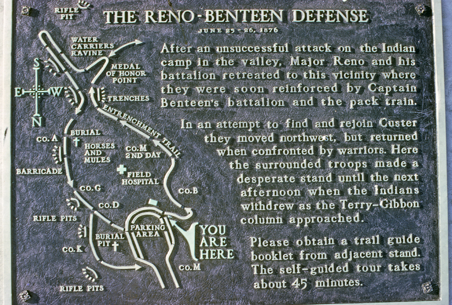
The battle began when Custer ordered Reno’s battalion to attack the encampment. They were routed and retreated to these bluffs. Reno was joined by Benteen’s battalion, and they were able to make a determined stand until the next afternoon, when the Indians withdrew. We walked the Entrenchment Trail in 1969.
.
When we were there in 1969, a filming crew had recreated the Indian encampment and were filming the movie “Little Big Man” with Dustin Hoffman.
.
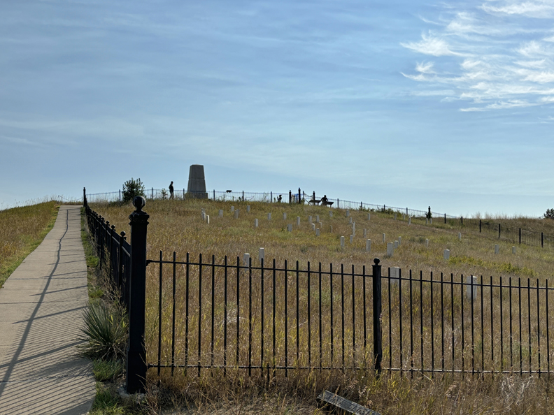
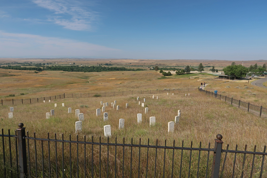
Custer continued north trying to locate the lower end of the encampment. There were skirmishes with Indians all the way to Last Stand Hill. National Cemetery with the 7th Cavalry Memorial (1881) on the hill in the middle of the photo.
Red granite markers were placed on the battlefield in 1999 to indicate where Indians fell. This marker is for “White Black Man” a Lakota warrior.
.
.
Last Stand Hill
Looking downhill toward the Little Bighorn River. It is estimated that about 210 of Custer’s men were killed. An additional 53 of Reno-Benteen’s men were killed on the hilltop one mile south.
.
.
Lt. Col George A. Custer died and was buried here but in 1877 Custer’s remains were reinterred at the U.S. Military Academy at West Point NY.
7th Cavalry Memorial 2024
Horse Cemetery – many horses were also killed during the battle. Custer’s last horses were purposely killed and used for a breastwork against the attacking Indians.
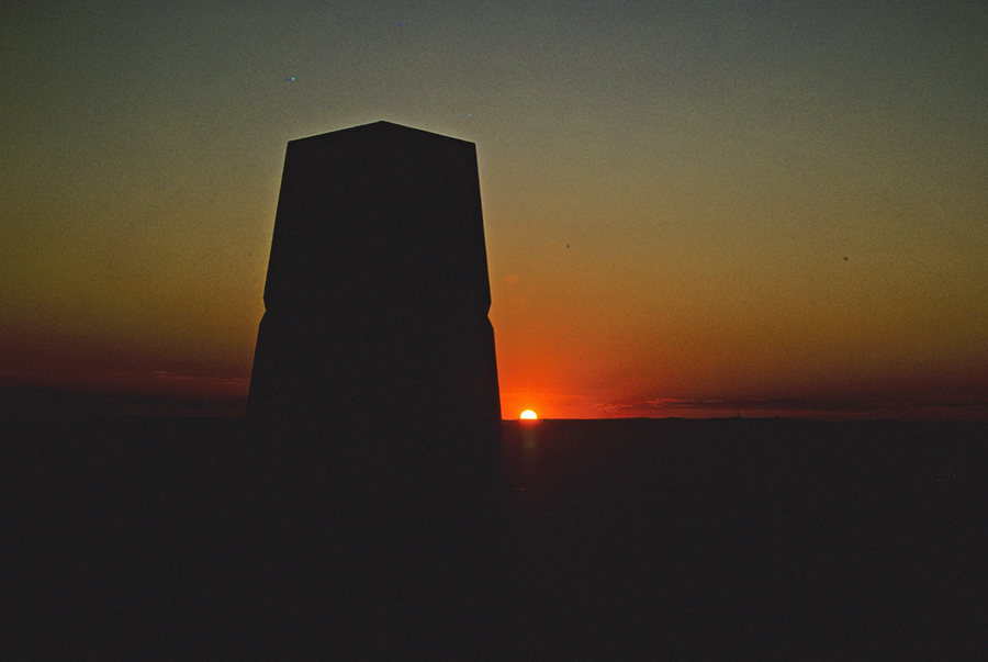
Sunset 1969
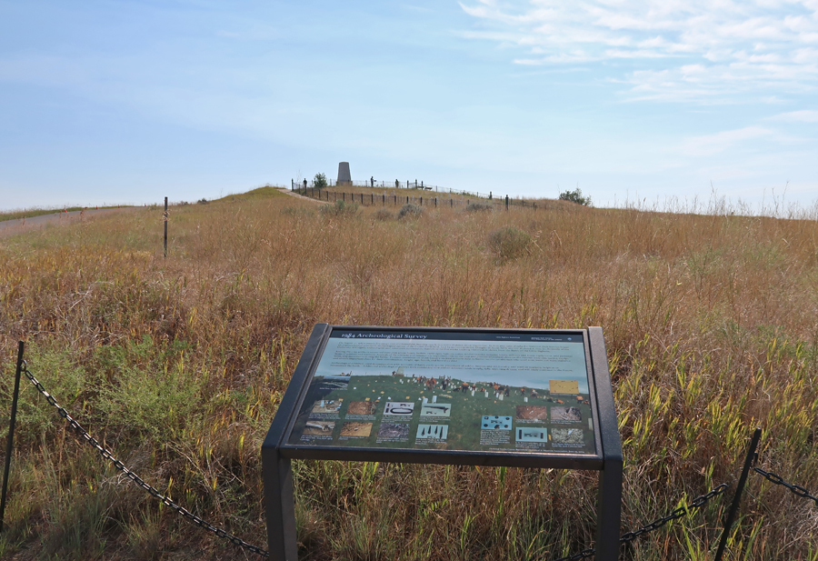
A large memorial to the Indians killed (60-100) in the battle was completed in 1999.
.
One of several monuments to the Indian tribes who were involved in the Little Bighorn Battle.
Peace Through Unity
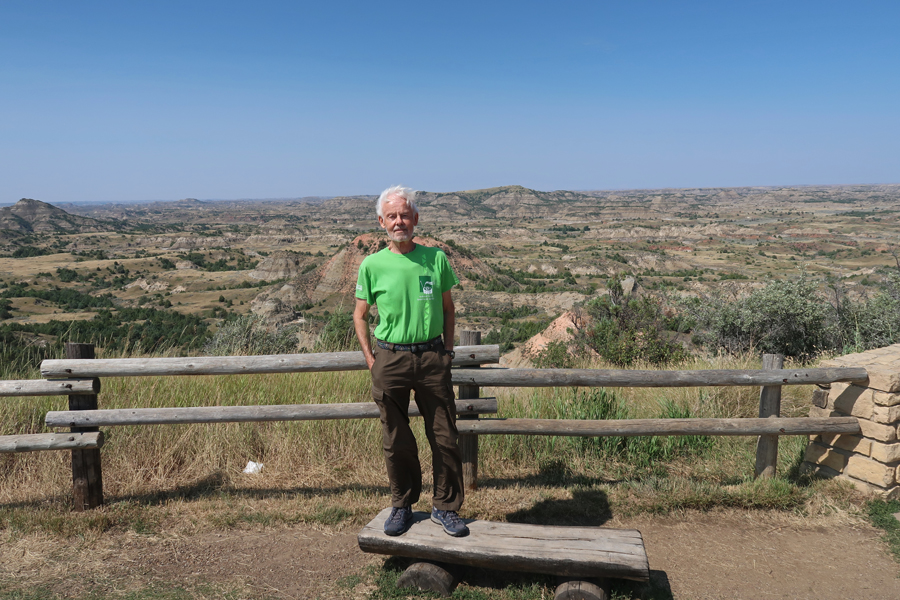
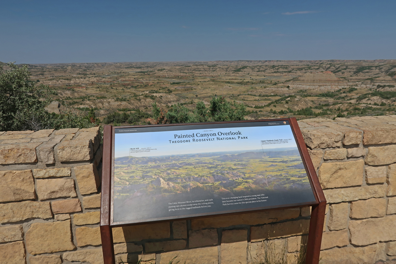
My next stop was the Painted Canyon Visitor Center in the South Unit of Theodore Roosevelt NP. See Blog dated September 2019 for my visit to the North Unit.
.
.
My main objective this afternoon was to measure the trail distance from the parking lot to the top of White Butte (3,506ft), North Dakota’s highest point.
.
The trail has been significantly improved since my last visit. It starts at this gate. Note the measuring wheel to determine how far it is from there to the top.
The top, with cairn, USGS marker, and registration box. One-way distance – 4,591ft. Gain in elevation – about 400ft.
.
LONG – 400mi drive to Detroit Lakes MN –
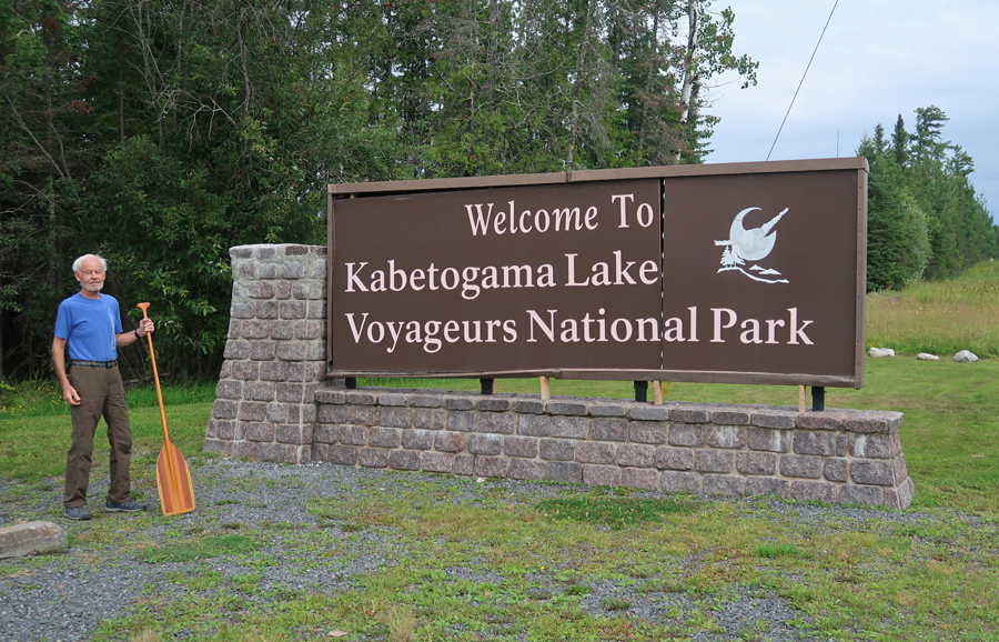
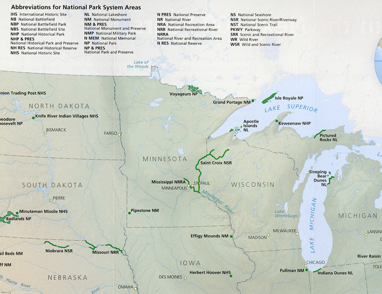
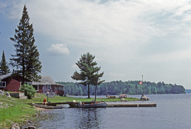
8/7 W – 3.5hrs to Kabetogama Visitor Center in Voyageurs NP
.
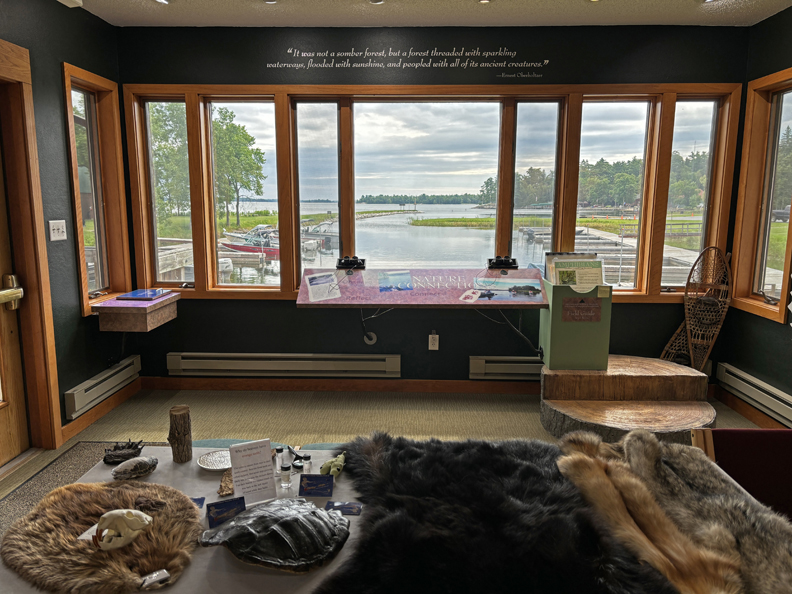
The Visitor Center overlooked Lake Kabetogama
.
History
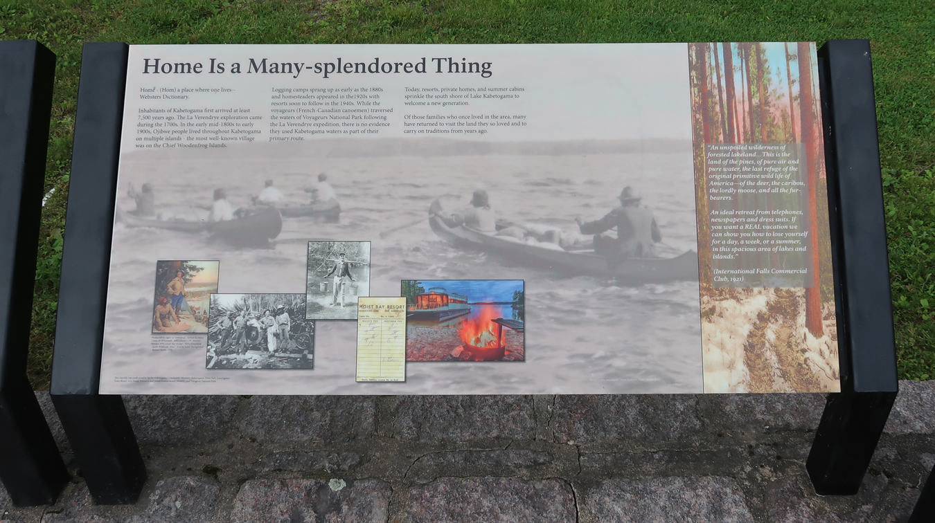
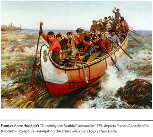
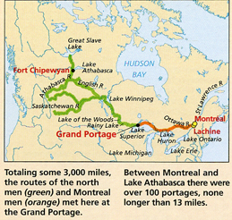
The park is noted for its river and lakes system that provided passage for “Voyageurs” – French-Canadian canoe men, who moved beaver and other pelts from the Canadian Northwest to Montreal and trade goods in the opposite direction. The fur trade peaked during the late 1700s and early 1800s. Note the categories of NP Units that are on the top of this photo.
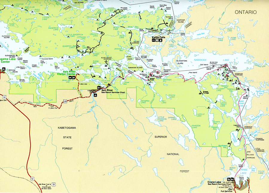
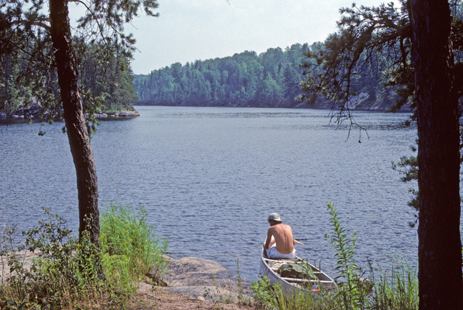
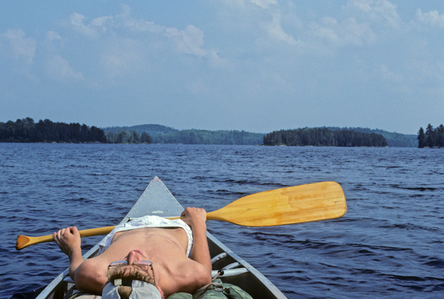
Peter and I plied some of these same waters in 1989 on a three-day canoe adventure. This was one activity on Peter’s 15-yr-old bonding road trip with Dad. We paddled from Ash River to Crane Lake camping on islands between the U.S. (Minnesota) and Canada. Our stops (short red lines) and campsites (circled) are marked on this map.
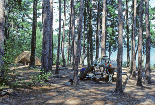
Ash River – start. Owner of Corcoran’s Pine Point Lodge on Crane Lake drove us and our rental canoe 65-miles to get to this put-in. Charged us $15 for three-day canoe rental, $30 for 3hrs of travel time, $13.09 for 11 gallons of gas, and $6.70 for a pizza and 2 drinks!
Stop on McManus Island
Island Campers
Wolf Pack Island Camp – Day 1
.
.
Morning Haze
Break Time
Rest Stop – Pike Bay
My Island Camp – Day 2. A bear destroyed a campsite here the night before. All food, toiletries, etc. were supposed to be placed in metal lockers. The campers neglected to do that!
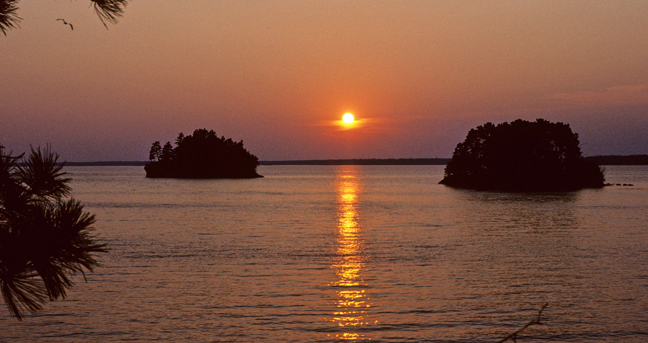
These islands are in Canada – one of them is called “Your Island.”
Sunrise
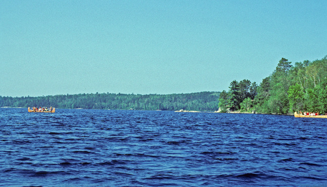
Large Voyageur Canoes
.
.
.
14-mile paddle to Crane Lake on Day 3 – returned canoe here
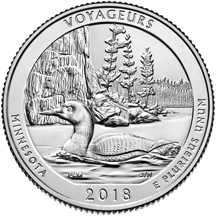
2018 MN National Park quarter
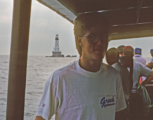
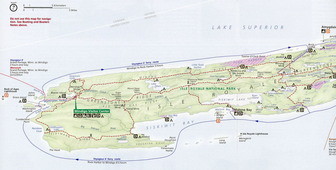
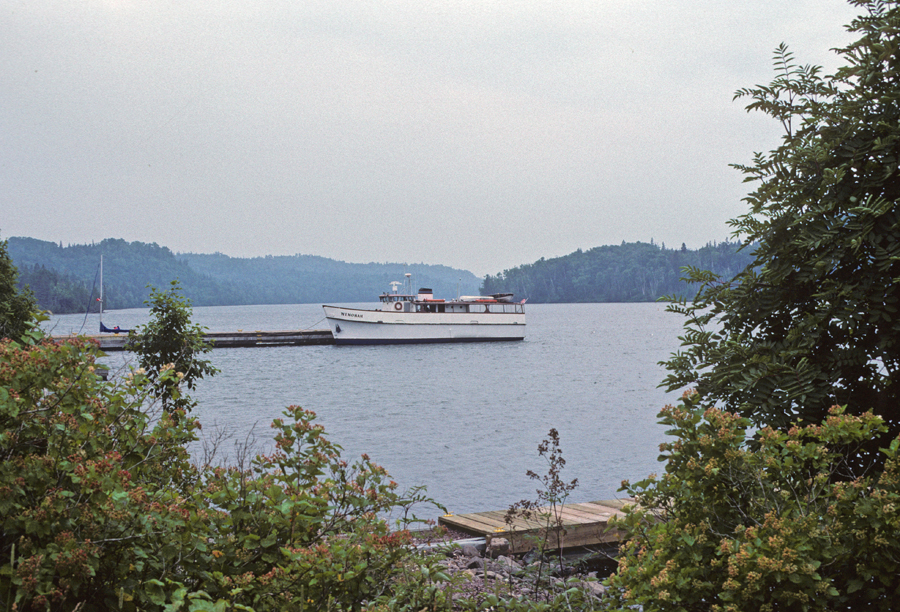
It took 4.5hrs to drive to Grand Portage MN on the western shore of Lake Superior. In 1989, Peter and I took the ferry Wenonah (3hrs) to Isle Royale NP.
We passed the Rock of Ages Lighthouse as we approached the island.
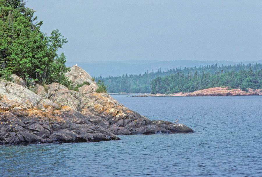
Sailing through the North Gap
Entering Washington Harbor
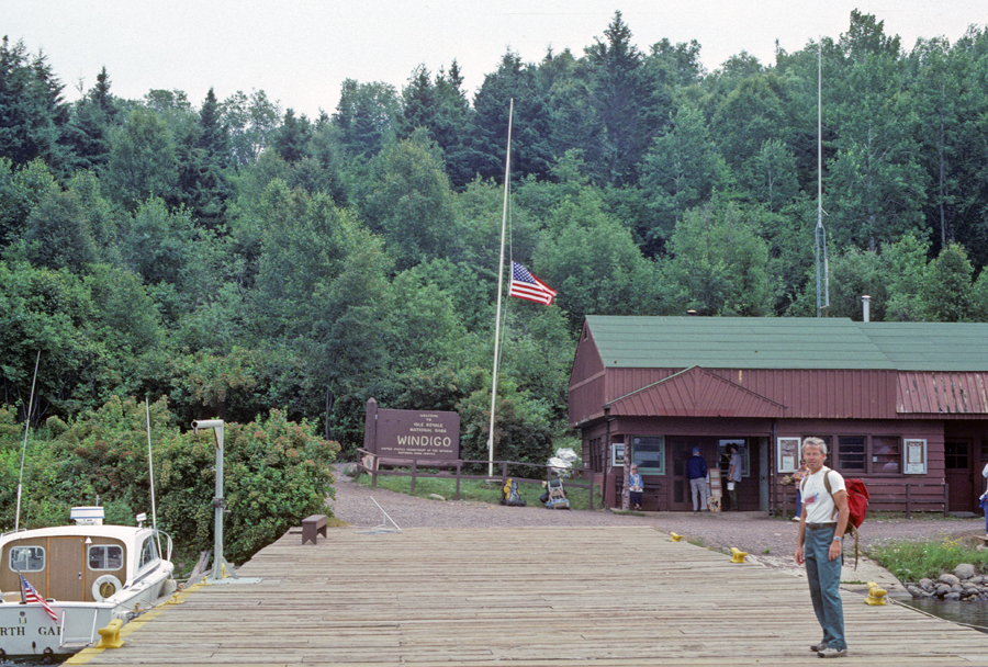
Landing at Windigo
Shipwrecks around Isle Royale
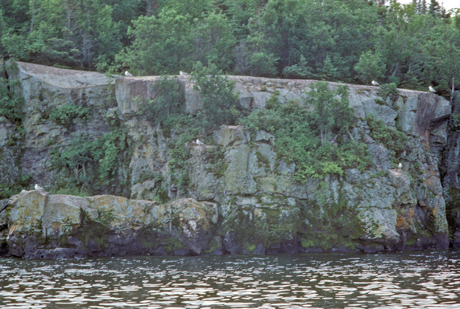
We hiked the loop trail to Huginnin Cove in a light drizzle. On the way back to the Visitor Center, we passed the Wendigo Mines. The trail presented us with the greatest array of green colors that I have experienced in my life.
Wenonah waiting for departure –
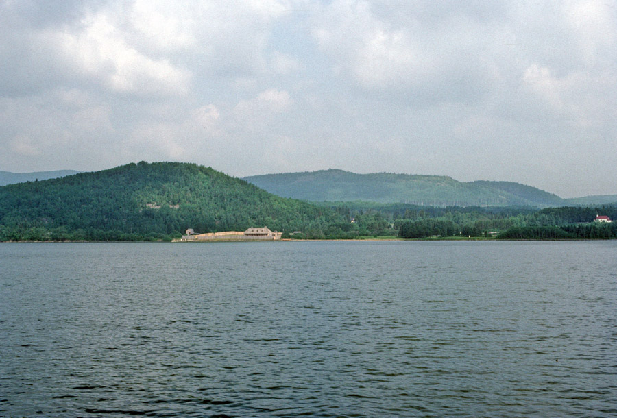
This is a photo of the North West Company’s Headquarters, in Grand Portage Bay, taken from the ferry as we returned.
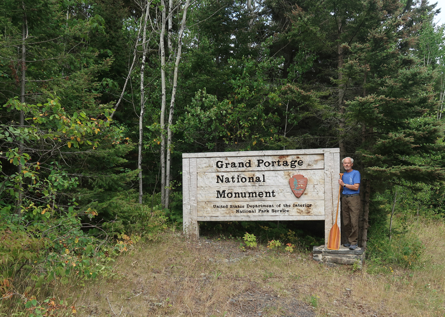
We arrived back in time for a visit to Grand Portage NM. It was the first NP Unit to be co-managed with a Tribal Nation – the Lake Superior and Minnesota bands of the Chippewa Tribe.
The North Men (Winterers) and Montreal Men (Pork Eaters) met at the Grand Portage for trading. The North West Company ran the largest fur trading depot in the heart of the continent.
Fur trading took place here in the early 1700s. In 1722, the Grand Portage became the standard route to bypass rapids on the lower Pigeon River. The North West Company built its headquarters here in 1784. In 1803, they relocated north to Fort William (now Canada) to avoid complications of citizenship, licensing, and import duties. To avoid paying taxes!
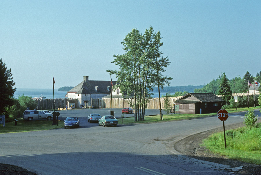
In 1989, the Visitor Center was in the Stockade.
Inside the Great Hall 1989
2024 – 35 years later
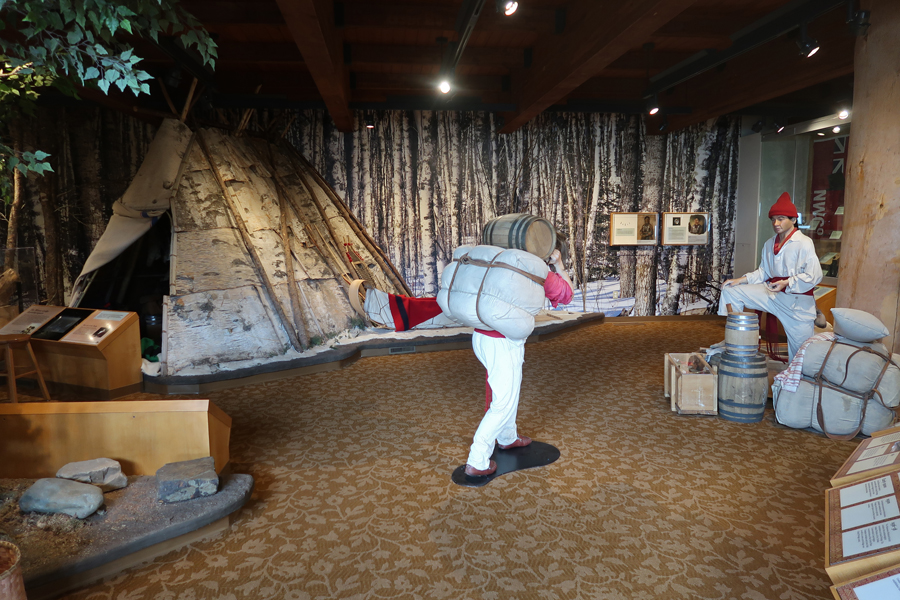
This was my first visit to the “new” Heritage Center.
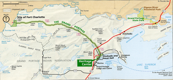
The voyageurs had to carry all their trade goods, about 90lb packs, over an 8.5-mile portage between Fort Charlotte and the Stockade on Lake Superior. That way they were able to avoid the waterfalls and rapids on the last 20-miles of the Pigeon River. Voyageurs is a French word meaning “travelers.”
.
.
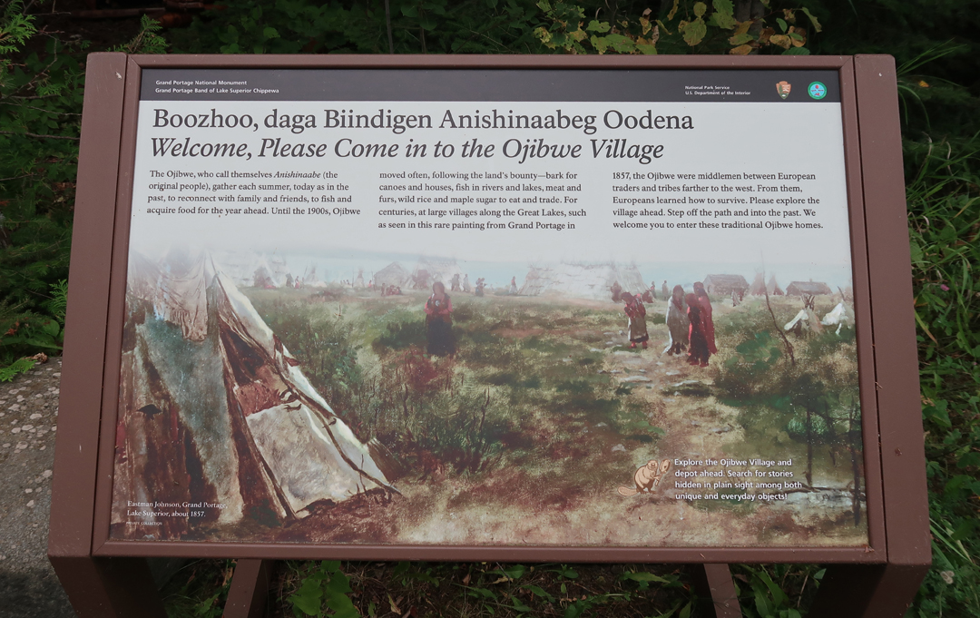
Ojibwe Village – Gichi Onigamiing – The Great Carrying Place
.
Canoe Warehouse
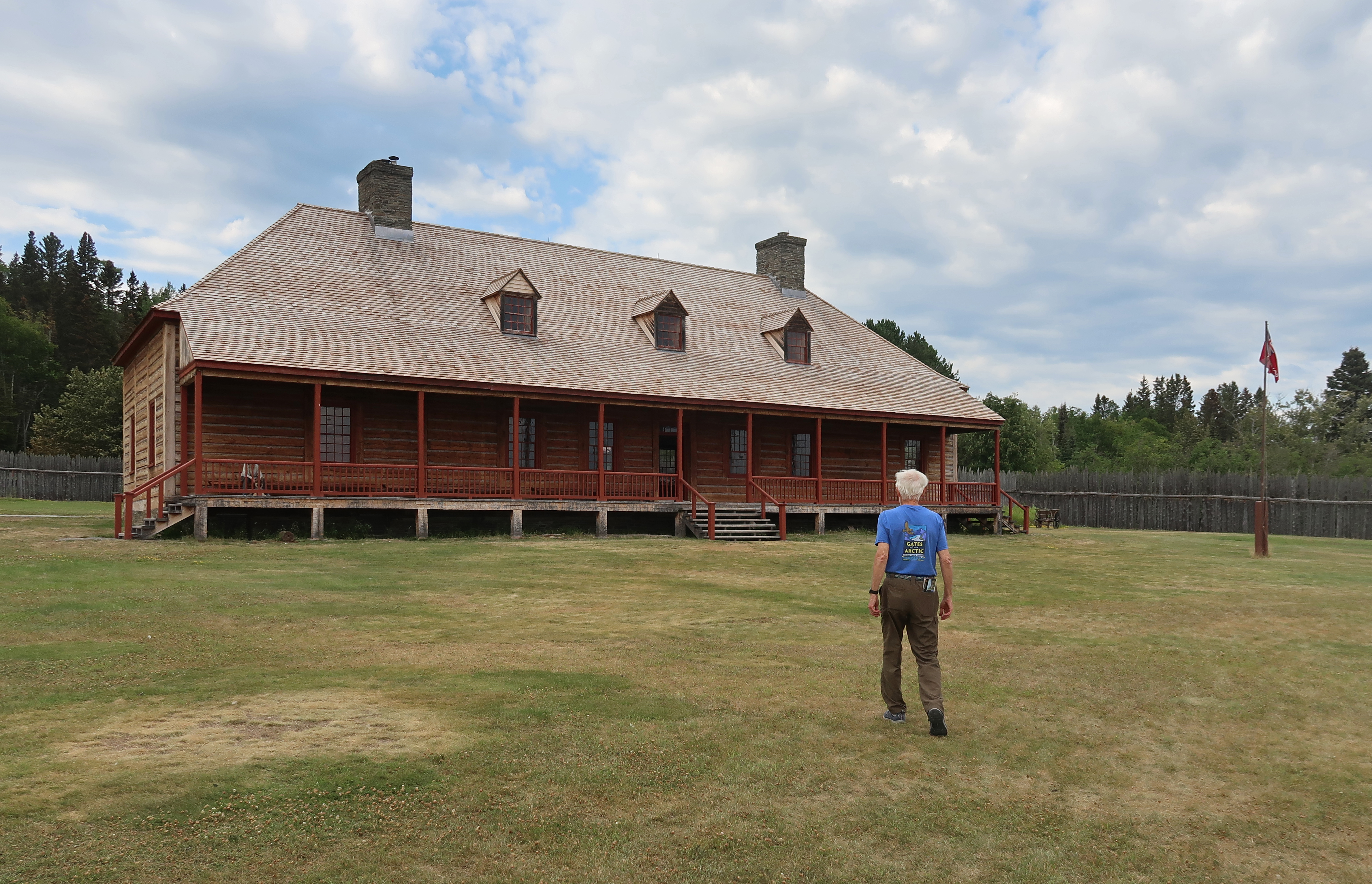
Kitchen left and Great Hall right
Reenactors in Kitchen
.
Approaching Canoe Brigades
Ready to tour the Great Hall – interior circa 1797.
Most trading took place during the Rendezvous in July of each year.
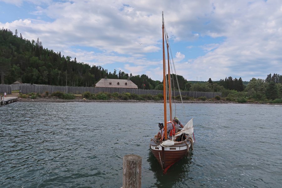
Dock, stockade, and sailboat Paul LaPlante. Boats like this Mackinaw boat were the “pickup trucks” of the Lakes and also served the fishing industry in the mid-1800s.
Boat named for Paul LaPlante; a local French-Canadian/Ojibwe who lived in Grand Portage. He was a well- known skilled boat builder. Numerous descendants of his still live on the Reservation here.
Lake Superior Maritime Highway
Start of Grand Portage Trail (17- miles round trip). I did a short walk!
Drove through Deluth MN in a pouring rain, then onto US-53, and then I-94 stopping outside of Eau Claire WI.
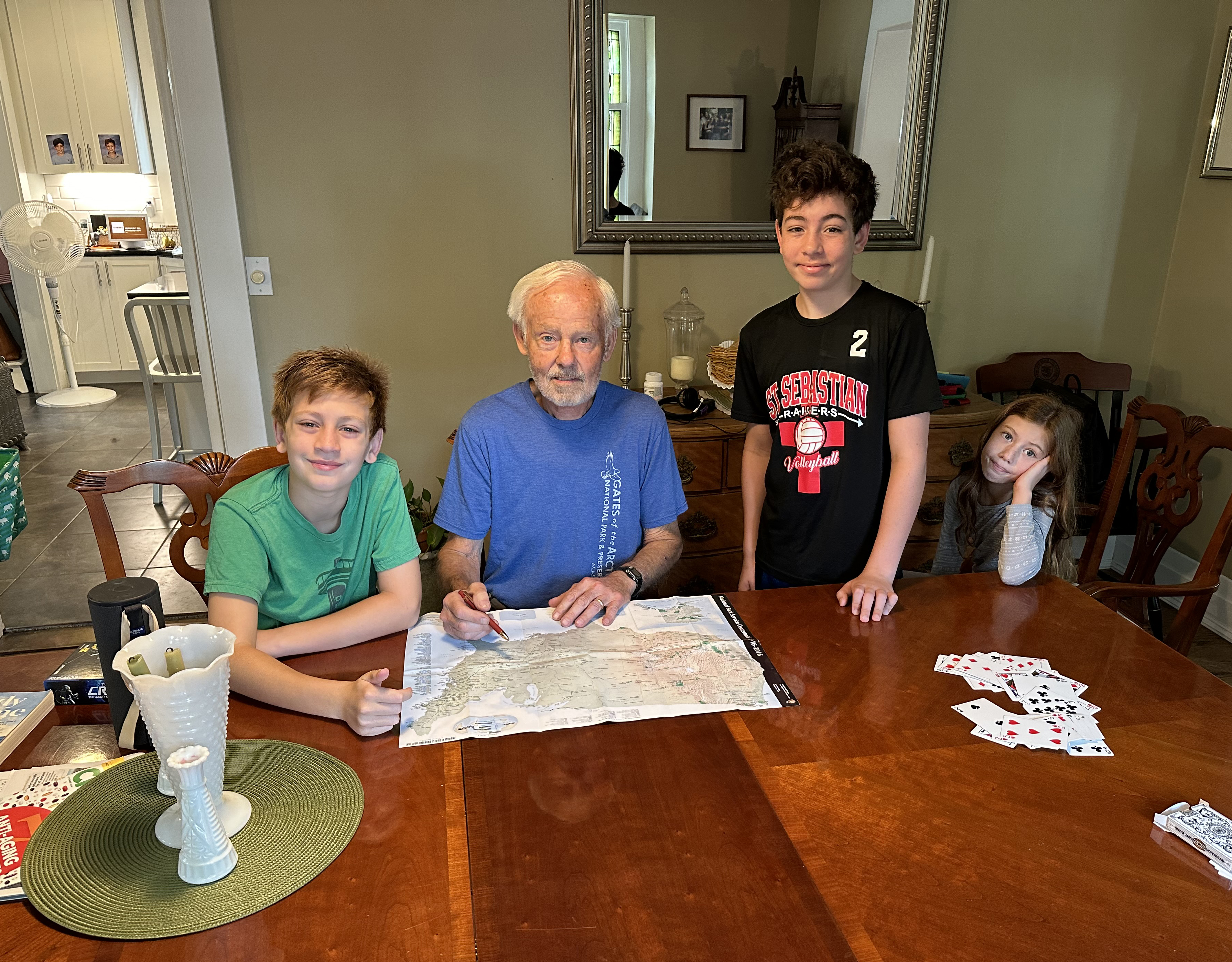
8/8 – 4hrs to Chad, Liz, Drago, Seamus, and Lena in Milwaukee. I enjoyed telling/showing the grandkids the route of my travel and the NP Units I visited.
Drove through Chicago so I could take my brother Mike to lunch and then continued to Springfield arriving about 8pm. Trip mileage was 6,246-miles.