Spring Break – SE Arizona
March 14, 2010Saturday March 6th – Arrived in Phoenix last night but Helen’s bag did not – long story. We visited Casa Grande Ruins NM in the morning. It is the first cultural and prehistoric site to be protected by the US government. It was set aside in 1892 by President Benjamin Harrison. The “Great House” is four stories high and was built in 1350 as an astrological center for the Hohokam Indians farming community. The protective roof was built in 1932.
After driving back to Phoenix to pick up Helen’s bag, which arrived from Detroit at 12:30, we drove to Sonora Desert NM and took a 15.3 mile dirt track to the start of the trail leading to the summit of Table Top Mountain in the like named Wilderness area. Because of our late start, we had to hustle to complete the 7 mile round trip (ascending over 2000 ft) to the top. A cacti jumped up and bit the back of my hand on the way up (see pic). We had a dramatic panorama of rugged mountain ranges and desert plains from the top. It was dark by the time we got back to I8 and proceeded to the Guest House Inn B & B in Ajo, AZ.
Sunday March 7th – We woke up to cold and rain but by the time we drove to and went through the Visitors Center of Organ Pipe Cactus NM most of the rain had stopped. We hooked up with a couple who had stayed at the same B & B (He is the state Grizzly Bear specialist for the state of Montana) and completed the Desert View Nature Trail (1.2 miles), shared a picnic lunch, and drove the Ajo Mountain Drive (21 miles) completing the Arch Canyon trail (2 miles) and the Bull Pasture trail (3 miles). We had a reservation for an observation program at the Kitt Peak National Observatory (world’s largest collection of optical telescopes) but it was canceled due to the weather so we continued to our Days Inn north of Tucson for the night.
Monday March 8th – After a 6am continental breakfast, we drove to and through Ironwood Forest NM in cold and rain. In fact we literally “slid down” one hill on the dirt track, first bouncing off one beveled shoulder and then the other, in our rented Ford Escape SUV. The Ironwood tree is one of the longest living trees in the Sonora desert. Ragged Top Mountain is a monument landmark as well as the Silver Bell Mountains for which the still active Silver Bell Copper Mine is named.
We continued to the west segment of Saguaro NP, toured the Visitors Center and then drove the Hohokam Road completing the Valley View Overlook trail and the Signal Hill Petroglyphs trail. Too cold for rattlesnakes, check out the Saguaro cactus skeleton.
Just south of Tucson we stopped at the San Xavier del Bac mission. We had hot beans and cheese on the frybread for lunch (see pic). Father Kino first visited the O’odham Indian community here in 1692. The current church dates to the 1820s. Note the squaw statue in the church.
A little further south, we toured the last remaining Titan Missile silo that was part of our nuclear missile deterrent in the 1960s. It was an impressive tour. The command center was used for the first Star Trek movie. Captain Helen at the controls – don’t push that button!
Continuing south, we stopped for a tour of the Tumacacori National Historical Park. Like San Xavier del Bac, Father Kino, a Jesuit, was responsible for the start of the mission here in 1691. In 1767 Franciscans took over mission operations. During a period of exploitation, the Jesuits and Franciscans were often the only ones to have the Indians’ interests at heart.
After stopping in a Pawn Shop in the border city of Nogales (can you believe Helen didn’t buy anything!), we drove to and through (dirt track) the Las Cienegas National Conservation Area (NCA). “Cienegas” means marshlands in Spanish and I had to be careful not to get stuck in the mud. This NCA consists of rolling grasslands and oak-studded hills that connect “sky island mountain ranges.” Cienega Creek supports a lush riparian corridor. Many early western movies (e.g. Red River, The Big Country) were filmed in this area. After having a humongous Porterhouse Steak we stayed the night in the Sonoita Inn, which had originally been built as a barn to house Secretariat, the famous racehorse, after he was retired.
Tuesday March 9th – Drove south from Sonoita to Parker Canyon Lake and then took a dirt track called Montezuma Canyon Rd to Coronado National Memorial on the Mexican border. It was an adventurous trip negotiating the mud, fording the streams and then getting caught in the middle of a Border Patrol search for “illegals” (emigrants or drug dealers). We were the only ones in the area beside about 20 border control vehicles (some armored) and a helicopter! After reaching the Memorial (this “Memorial” has the requisites to be a national park), we took a short hike (about 1 mile roundtrip) to the top of Coronado Peak (6,575 ft). We were surprised to be in snow this far south, when it was in the 60’s back in Ohio! From the top we could see the new and old sections of the fence built along the U.S. – Mexican border. There was also Border Control radar set-up in the trail head parking lot.
Illegal immigrant (no birth certificate)
After going through the Visitor’s Center in Coronado, we visited the BLM district office in Sierra Vista and then went to the Fairbank Historic Townsite in San Pedro Riparian NCA. Fairbank is a “ghost town” that began in 1881 when it was the closest railroad stop to Tombstone, then one of the largest western cities (15,000 in 1882).
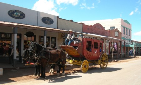
Our visit to Tombstone (“The Town Too Tough to Die” and the site of the OK Coral) – the second largest tourist attraction in AZ – behind the Grand Canyon, was less than memorable. We spent an excessively long half hour paying to see a “re-creation” of Boot Hill and walking downtown among the glitzy tourist traps. Our recommendation – don’t go there!
Our next stop was Chiricahua NM. I visited this NM with my family in 1966 and was again impressed by the spectacular beauty of the place. Our time was limited, so we did a loop hike, taking the Echo Canyon trail, then the Hailstone trail and then the Ed Riggs trail (3.1 miles) followed by the Massai Point nature trail. Again, it was colder than expected (snow on the trail) but we thoroughly enjoyed our hike through the canyon and the balanced rock formations. This is an “undiscovered jewel” of the national park system and I hope to return again!
We came to AZ to get a break from Winter – it was in the 60’s in OH!!!
Wednesday March 10th – after spending the night at a Holiday Inn Express in Wilcox, we drove to Fort Bowie National Historic Site. As we turned on to the dirt road to reach the trail head (40 miles from Wilcox), Helen informs me that her glasses are missing; no where to be found, perhaps she left them by the computer at the Holiday Inn. OK, let’s think about this. We drive through Apache Pass (site of wagon train massacre) and then do the 1.5 mile hike past the Butterfield Overland Stage coach station, the fort cemetery (Little Robe, Geronimo’s 2 yr old son, is buried here – Helen’s rock can be seen in the background), the site of the battle of Apache Pass, and the First Fort Bowie ruins to the Visitor Center. It was a cool crisp morning and the hike with reflection on the historic events that occurred here was invigorating. We hiked back to the SUV by way of the Overlook Ridge trail (1.5 miles).
Helen searches the SUV and then calls the Holiday Inn. At first, she can’t get through, so we start driving to New Mexico. As we approach I10, Helen contacts the hotel and they say they will search for the glasses and call us back. Long story short, they could not find them. So, I decide to drive an hour back to Wilcox on the interstate to find the glasses. We pull into the parking lot and I get out of the SUV to start the search. As I approach the Holiday Inn door, Helen calls to me that her glasses were under her seat in the SUV! We silently drove to Silver City, NM.
After passing through Silver City, we took State Highway 15 north through the mountains. It was a windy, at times one lane road, through snowy passes to Gila Cliffs NM. We watched the video at the Visitor’s Center and then headed for the trail to the Cliff Dwellings. We were told that we could not do the loop trail through the canyon and then past the ruins because of trail construction. However, we reversed the loop and did the trail to (and through) the Cliff Dwellings and then down the canyon, bush whacking around the trail bridges that were being reconstructed.

We took a different route back to Silver City (longer but safer) and stayed at the Palace Hotel in the heart of the downtown historic district. We ate at a great Mexican restaurant called the Jalisco Café (hot stuff!) and then “hit the hay.”
Thursday March 11th – I had to scrape snow and ice off the Ford Escape before we headed for the Catwalk National Recreation Trail in Gila National Forest near Glenwood NM and the AZ border.
Along Rt 180 we stopped at a monument to Aldo Leopold. Aldo was a Forest Ranger in Gila National Forest and in 1924 he persuaded the Forest Service to set aside 755,000 acres as the U.S. and World’s first designated and protected Wilderness!
Continuing, we drove to Glenwood and the Catwalk National Recreation Trail. It is a 2.2 mile (roundtrip) trail that provides a glimpse of historical and culture events that occurred a century ago. It started when gold and silver were discovered in the area and a mill was built to crush the ore at the bottom of Whitewater canyon. A pipeline was built, starting 3 miles upstream, to carry water to the mill. Workmen used to walk up the canyon on the pipe to maintain it – thus the name catwalk. The mill is gone; remnants of the pipeline remain as well as a beautiful riparian area along Whitewater Creek.
Glenwood New Mexico – how about a 25 cent coffee!
We had lunch in Clifton AZ in what appeared to be a dying mining town and then passed through a small part of the Gila Box (River) NCA as we drove the Black Hills Back Country Byway, a 21 mile unpaved road “accessible to high clearance vehicles during dry weather.” Even though Coronado passed this way in 1540, we would not recommend this road, as the desert scenery is rather boring. Though I must admit that my impression of the road and area was tempered by being stuck behind a road grader for a half hour despite the fact that there was not another vehicle on the road! I even got out and ran up to the driver and asked him to move over so I could get by on the one lane road – he refused! We continued on to Globe AZ where we stayed in a nice B & B called the Dream Manor Inn.
Friday March 12th – we left Globe at 7:30am to be sure we were on time (had reservations) for our ranger led hike and tour of the Upper Cliff Dwellings at Tonto National Monument. Access to this site is only offered a few times each week. The ranger did an outstanding job explaining the flora, fauna and history as our small group climbed the 600 ft (3 miles round trip) to the ruins. When finished, Helen and I did an additional mile on a paved trail to the Lower Cliff Dwellings.
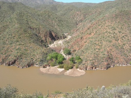
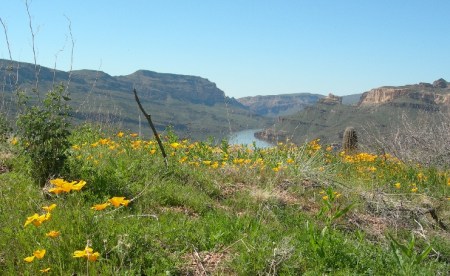
Afterwards, we drove the Apache Trail Historic Road (Rt 88) down from Roosevelt Lake and dam toward Phoenix. This Scenic Byway along the Salt River, which was used by the Apaches as they migrated between their winter homes in the high country and their summer homes in the basin, is definitely worth the time and effort. It is a heavily traveled dirt road (slow) but has spectacular scenery along the river and then through the Superstition Mountains.
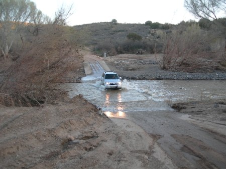
We next drove through Phoenix and then north to Agua Fria NM. We had little information about this Bureau of Land Management (BLM) National Monument. According to the internet description – “it is an expansive mosaic of semi-desert, cut by ribbons of valuable riparian forest and offers one of the most significant systems of prehistoric sites in the American Southwest.” Our objective was to get to the Pueblo la Plata archeological site and back before dark. The first part of the Bloody Basin dirt road was rough but then we forded the Agua Fria River on to an unmaintained road. Even though we had a small SUV, it was only two wheel drive and this road was a real challenge.
Long story short, we got stuck about a mile from the pueblo at 5pm. I stepped out in mud up to my ankles and proceeded to place rocks around all tires. There was NO ONE around in this wilderness area and I was afraid we would have to spend the night in the vehicle, hike out to get a tow truck the next day and miss our flight home. I was really upset when the first pavement of rocks didn’t work and we sank deeper in the mud! At that point I saw a Suburban about a quarter mile away and was able to flag him over to us. The driver was heavily bearded, packing guns, dressed in camouflage and looked like he would either eat us or be able to help us! Well, he had a towing strap. So I crawled in the mud under the car and attached it to my rear axle and then that old beat-up truck (4-wheel drive) was able to pull us out. As it turned out, the man was hunting coyotes and we were just lucky he was in the area.
Natural car wash – crossing the Agua Fria River
We got to the Cordes Junction Motel & RV Park after dark. Though a one star facility, it was an “oasis in the desert” and a place to clean-up!
Saturday March 13th – We had a couple of extra hours, so I took scenic route 260 and then 87 through Payson to the airport in Phoenix. As we approached Phoenix I decided to stop at the Fort McDowell Indian Reservation to see if they were selling any Indian crafts. Low and behold, they were having a flea market! Though we had only an hour, Helen was in her glory buying a moose pitcher, two pairs of old turquoise earrings, 3 silver pins and a silver button – all for $40! We were back in Springfield at 10pm – having completed another great Spring Break trip!


I am amazed at how much you did in such a short time. It was good to see you both after all these years.
Natalie
Draga Misho – tvoj muzh je malo lud!!! 😉
love,
Nela