
Pacific NW National Park Units
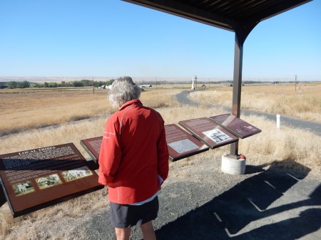
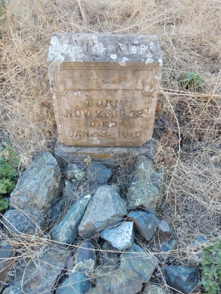
September 19, 20169/10/2016 – Ebey’s Landing on Whidbey Island WA became our nation’s first National Historical Reserve in 1978. After ten years of contentious battles, the community elected to preserve itself. The local population and government partnered to preserve this rural farming community. Our friends Pat and Ron looking over some of the heritage farmland.
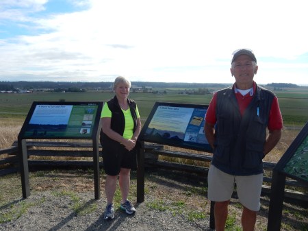
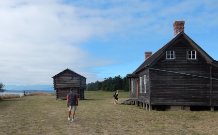
Jacob Ebey was one of the first white settlers in the 1850s. His house is now the Visitor Center for the Reserve. Note the blockhouse that was used for defense. In fact, Jacob’s son Isaac was killed by the Skagit Indians in retaliation for killing one of the tribal members.

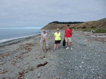
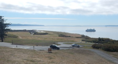
The Reserve grew out of a community effort to oppose a development that would have prevented access to a popular beach. This is the beach; we hiked the Prairie Ridge Trail and part of the Bluff Trail.

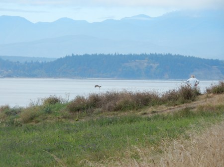
Seagull and Helen overlooking Admiralty Inlet and the Olympic Peninsula
Beach in Ebey’s Landing State Park, which is part of the Reserve.
Ferry approaching Admiralty Head and Fort Casey State Park
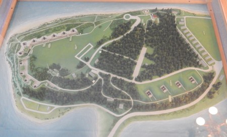
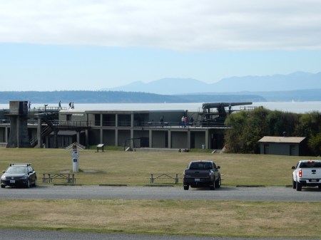
Fort Casey State Park is also part of the Reserve. The fort was built in the late 1890s to protect the entrance to Puget Sound.
This is the second Admiralty Head Lighthouse. It was in operation from 1903 to 1927.

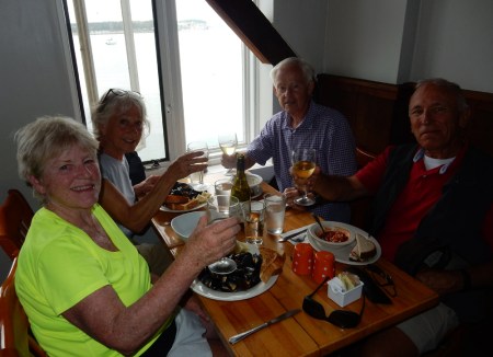
Penn Cove mussels for lunch in historic Coupeville!
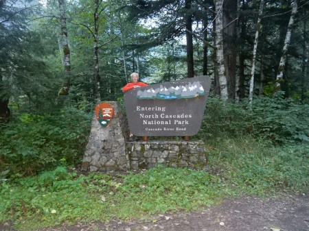
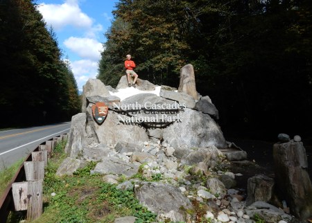
9/11 – Drove the Cascade River Road into North Cascades NP
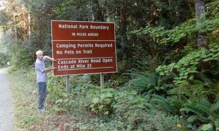
The road continued into the park for about 5 more miles
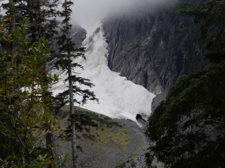
Glacier coming off Glacier Peak near trailhead
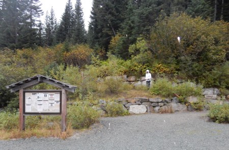
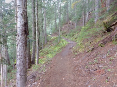
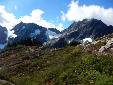
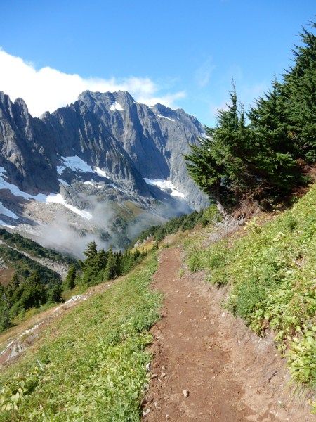
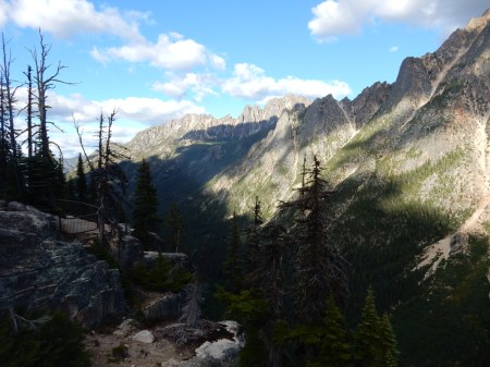
Starting on the Cascade Pass trail in a light rain

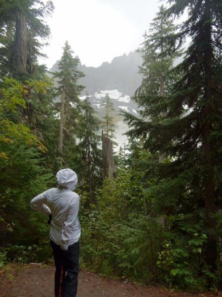
The rain and rising mist made for interesting scenery while at the same time teasing us and increasing our excitement for a full view of the mountains

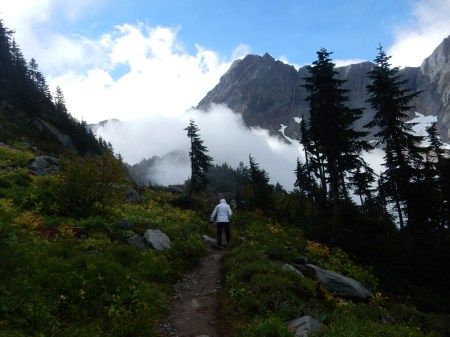
Approaching Cascade Pass
See YouTube Video at – https://youtu.be/d95ZRAxsPlw
and YouTube Video at – https://youtu.be/pDOxD80MugE
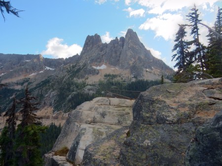
Cascade Pass 5392 ft

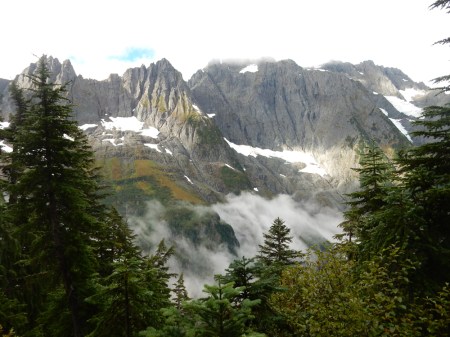
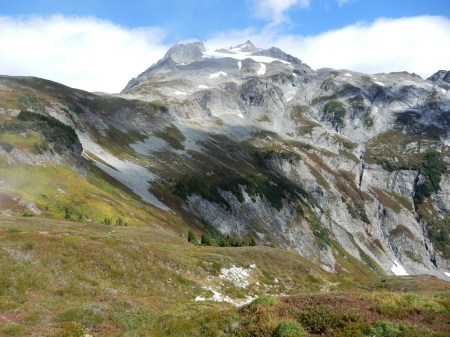
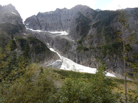
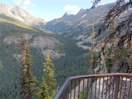
Helen decided to return the 3.7 miles to the car while I continued up a steep trail, about a mile with a 1,000 ft elevation gain, to reach the ridge north of Cascade Pass. The weather cleared and I was treated to spectacular views of the mountains, glaciers, lakes and valleys.
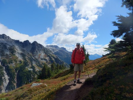
Met some backpackers coming back from the Sahale Glacier camp, asked one to take my picture
Doubtful Lake

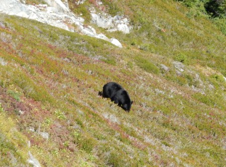
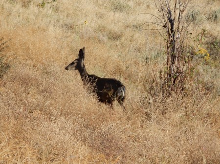
Black bear
Videos, first looking south and then looking north
See looking South You Tube Video at https://youtu.be/2xkAv5Ww04c
See looking North You Tube Video (including black bear) at https://youtu.be/pqlYGO6anW8
Descending trail
Johannesburg Mtn (8,200 ft)
Heading for the Newhalem North Cascades National Park Visitor Center on Rt 20
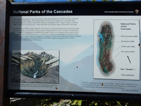
Interesting sign depicting the North Cascade Mountains
Views from the Washington Pass Overlook on the North Cascades Highway, east of the park; first Kangaroo Ridge (8,182 ft)
Valley view and road looking SE
Early Winter Spires (7,807 ft)
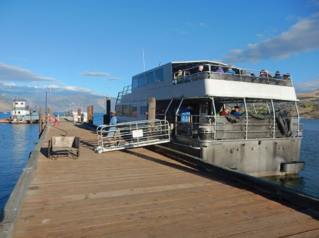
9/12 – Stayed in Lake Pateros WA last night and will be there again tonight. It was a half-hour drive from there to Chelan WA where we boarded the The Lady Express for a 2.5 hour boat ride to Stehekin in Lake Chelan National Recreation Area.
The only way to reach Stehekin is by boat or float plane

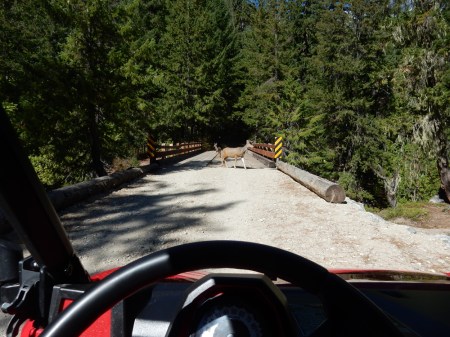
We only had a three-hour window to fit in all of our activities, so we decided to rent an ATV

Our first stop, about 10 miles away, was High Bridge where the Pacific Coast Trail crosses from North Cascades National Park to Lake Chelan National Recreation area or vice versa.


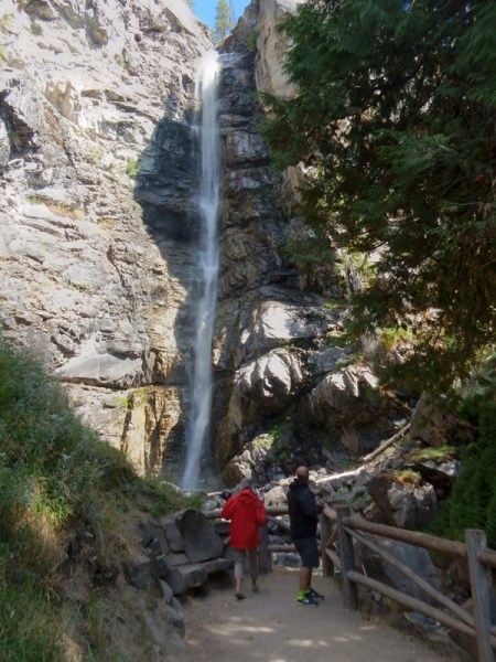
We drove to the end of the gravel road at the Stehekin River and then returned picking up some back packers and stopping at Rainbow Falls

We also stopped at the Stehekin Pastry Company for a quick take-out lunch and then the Golden West Visitor Center before boarding the Lady of the Lake II for a 4 hour boat ride back to Chelan (the SLOW boat!).

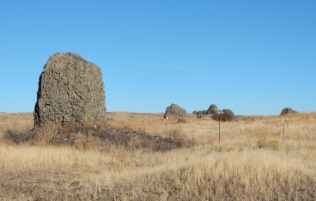
9/13 – Rocks deposited by massive prehistoric floods through the Columbia River Basin
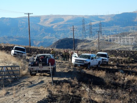
As we approached the Grand Coulee Dam, we found firefighters wrapping up their work putting out grass fires on the west side of the Dam. The fire had “jumped” the Colombia River and was now burning on Indian lands on the east side of the Dam.
Save that deer!
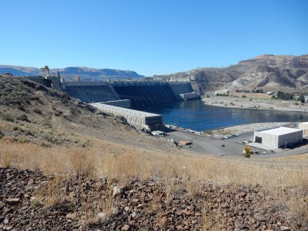
Grand Coulee Dam, which is now the second largest concrete structure in the world. The Three Rivers Dam in China has ten-times more concrete!

“B” Street – greatest Boom Town street ever

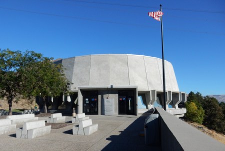
Stopped at the Grand Coulee Dam Visitor Center to view exhibits and make arrangements for the 10am tour
The Pacific Northwest power grid system is the only one in the U.S. that is not in distress at this time. That is the result of the Federal Colombia River Power System.

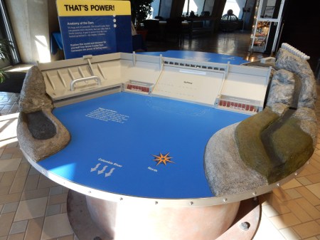
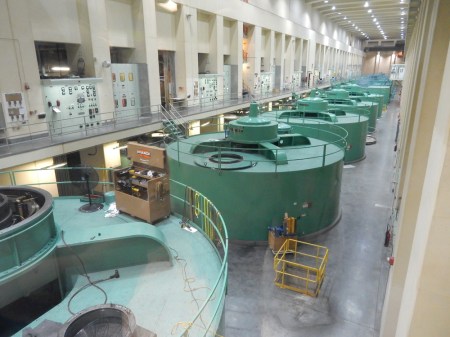
On our tour, we were able to see a set of the older turbines and drive across the dam with a guide. Interestingly, the first priority of the dam is irrigation and second production of electricity.
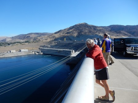

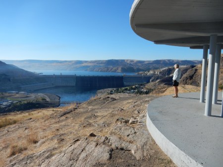
You will see some red and blue lights in the center of this photo, which are used for the 10pm Laser Show. Unfortunately, I did not know about the show and had not worked it into our travel schedule. Also, in the top center of the photo is the overlook where I took a picture of Helen and the dam at about 8am.
View of the Dam from the east
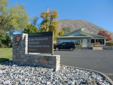
We stopped at the Visitor Center for the Lake Roosevelt National Recreation Area in the town of Coulee Dam but it was closed. I’m not sure why, because it should have been open.
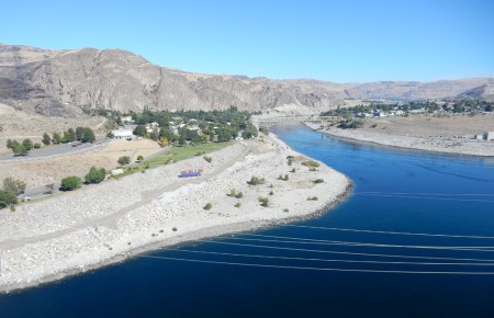
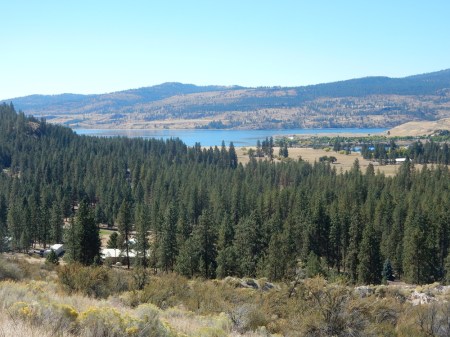
The NRA extends 129 miles behind the dam to a point 13 miles from the U.S.-Canadian border. This is a view from about the 40-mile mark.

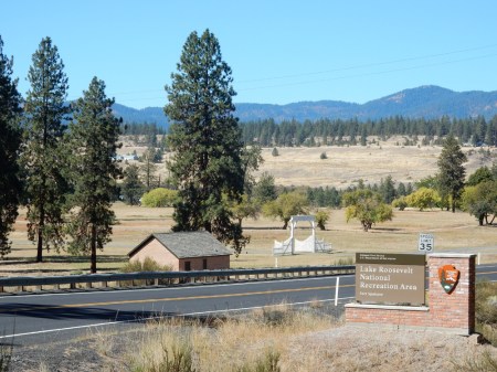
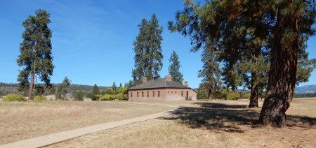
Fort Spokane, which is part of the Lake Roosevelt NRA, was established in 1880 at the confluence of the Colombia and Spokane Rivers.
It was meant to not only protect the settlers on the south side of the river from the Indians but also to protect the Indians (several tribes) who were re-settled north of the river, from the settlers. It later became an Indian boarding school and then an Indian hospital before it was closed in 1929. There are only a couple of buildings there and we were disappointed the Visitor Center was closed for the season.

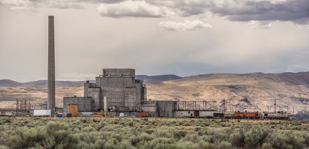
We next drove, Helen states “like a bat out of hell,” to the Hanford Reach area just north of the Tri-Cities of Richland, Pasco and Kennewick WA. This is where the Yakima River flows into the Colombia River. It was difficult finding information about “The Reach” online, though there is a Visitor Center in Richland. I discovered that there is one National Park unit there – the Manhattan Project National Historical Park (2015) and also – the Hanford Reach National Monument administered by the U.S. Fish & Wildlife Service (FWS).
The Manhattan Project NHP has three units – Hanford Reach WA, Los Alamos NM and Oak Ridge TN. The NHP has tours (4 hours with advanced reservation) it does of the Reactor B complex April through September using transportation provided by the Department of Energy (DOE), which administers the site. The DOA also has its own tours. The B Reactor is where the plutonium was produced for the “Fat Man” atomic bomb that was dropped on Nagasaki Japan in August 1945.
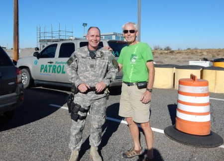
We attempted to enter the DOA site but were nicely told we could only do so on an official tour. Doesn’t the guard look like a nice guy!
The Hanford Reach National Monument has several units, some restricted and some not. We drove through the Wahluke, Saddle Mountain and McGee Ranch-Riverlands Units. I also followed the No Trespassing arrow (below) to find out where I was not supposed to go and to set foot in the NM . That’s our black Jeep Compass rental. I generally do not like Jeep products but it performed well on our trip. This area is the Fitzner/Eberhardt Arid Lands Ecology Reserve Unit.

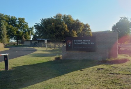
9/14 – it took an hour to drive from Richland to the Whitman Mission National Historic Site. We arrived at 8am and the Visitor Center opened at 9am, so we had an hour to take the trails in the park.
Whitman Memorial overlooking the Mission Site

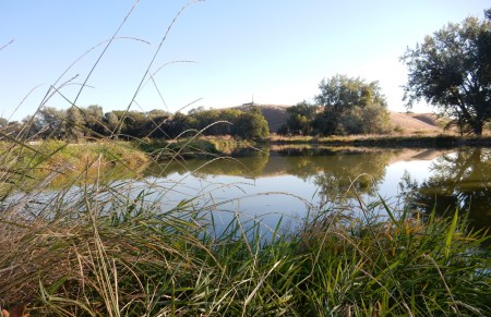
Millpond and Mission House site from the Memorial
Memorial on hill taken from the Millpond
Put your back into it Bro!
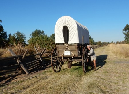
Covered wagon is on the historic route of the Oregon Trail

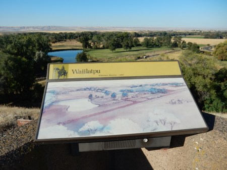
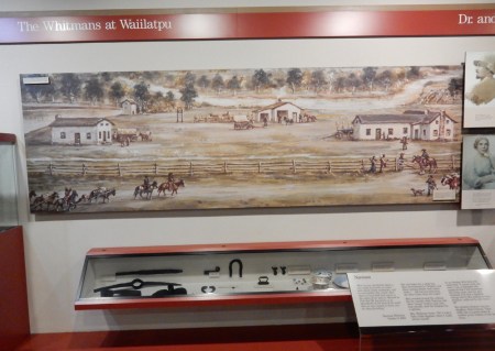
Mission House Site, mission was founded in 1836 by Marcus and Narcissa Whitman

Watched the video and toured the Visitor Center, Waiilatpu means “place of the people of the rye grass”
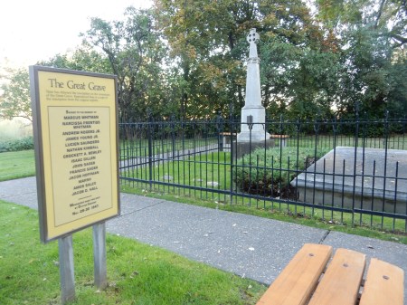
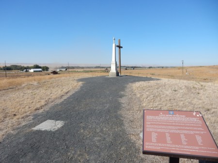
This Mission and station on the Oregon Trail is memorialized by the massacre that took place here. A group of Cayuse Indians killed the Whitmans and twelve others on November 29, 1847.

The rest of the story – a measles outbreak had killed half the Cayuse tribe. Marcus Whitman, who was a Methodist minister and doctor, administered to the white settlers and Cayuse Indians. Whitman’s medicine helped white children but did not help the Cayuse who had no resistance to the disease. A group of Cayuse believed they were being poisoned to make room for emigrants. The mass grave is for the 14 that were killed. Another 50 were taken captive but then protected by friendly Nez Perce. They were later ransomed by Peter Skene Ogden of the Hudson’s Bay Company.
A short drive took us to Frenchtown Historic Site, located 12 miles west of Walla Walla on Old Highway 12
Frenchtown –


The log cabin just to the left of the monument is thought to be the oldest cabin in WA. Built in 1837 by employees of the Hudson’s Bay Company for a Cayuse Indian man called “The Prince.”
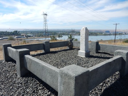
Jane Silcott (1842-1895) grave above Confluence of Snake and Clearwater Rivers – Lewiston ID
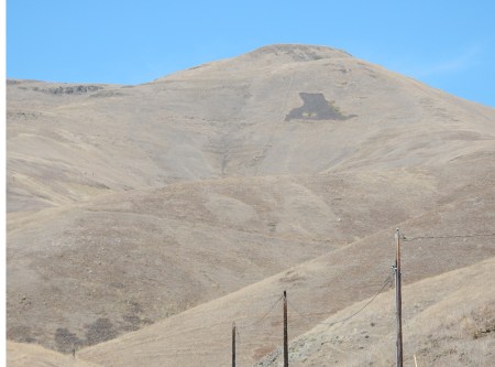
A Nez Perce Indian tale tells how Coyote was fishing in the Clearwater River and Black Bear happened to come by and angered him. So, he took his fishnet up on the hill on the south side of the river and flung Black Bear up on the north side and turned him into stone –
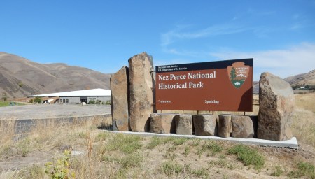
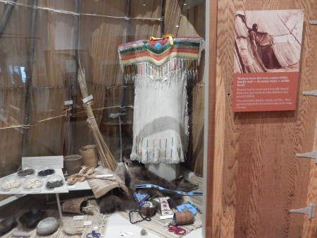
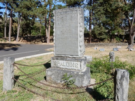
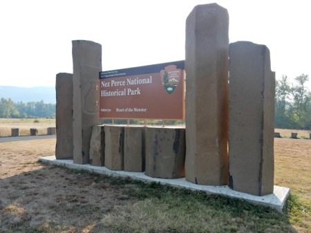
We arrived at the Nez Perce National Historical Park Visitor Center in Spalding ID near Lapwai on the Nez Perce Indian Reservation at about 1pm.
Roll of men and women

The sign states that “The Land Defines the Nez Perce Way”

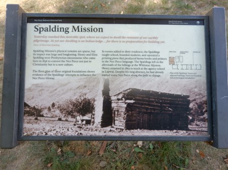
We then walked the roads and trails on the Spalding site, which is located on the Clearwater River. Lewis and Clark traveled through here in 1805. Fur trappers followed and then missionaries. Reverend Henry Spalding and his wife Eliza built the first Nez Perce mission here in 1838.
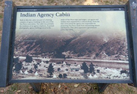
It was the site of the old Nez Perce Indian Agency from 1855 until 1884 – note the Indian teepees.
After the Whitman massacre in 1847 the Spaldings left Lapwai. Spalding returned in 1862 and again in 1871 to start efforts to build a Presbyterian Church; he died in 1874. Sue and Kate McBeth continued his work and the first services were held in the church in 1876. The church was faced with brick in 1905 and that is what we see today. It is still and active church.


Spalding died in 1874 at the age of 69
We visited several of the sites related to the Nez Perce NHS. The next one was Canoe Camp on the Clearwater River. It was the site of the Nez Perce Village of Ahsakha.

This is where Lewis and Clark learned to make canoes for their journey to the Pacific Ocean.

It is the place where the North Fork of the Clearwater River meets the Clearwater River. Note the dam on the North Fork – in the middle of the picture.

Our next stop was the “Heart of the Monster” just north of Kooskia ID
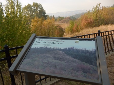
A Nez Perce tale tells how Coyote killed the Monster and his heart fell in this place and turned to stone

Helen is listening to an audio of the tale

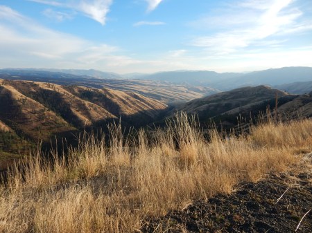
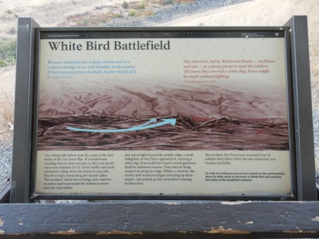
This is the valley where the White Bird Battlefield is located
This sign describes the battle. It was a Nez Perce victory but triggered a War against the tribe.

We also drove to the Battlefield site on Old Highway 95
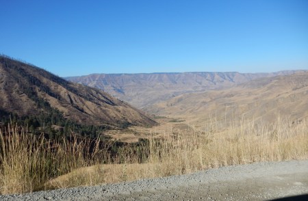
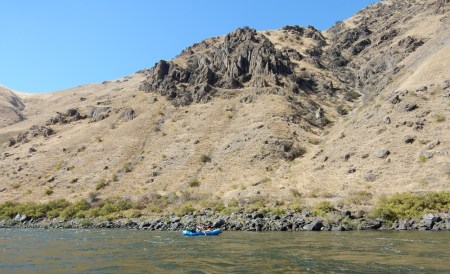
9/15 – Stayed the night at the Killgore Motel outside of White Bird ID. We were up at 7am to do the one-hour scenic drive (17-miles on a windy gravel road between the Salmon and Snake Rivers) to Pittsburg Landing on the Snake River in Hells Canyon National Recreation Area, which is administered by the Wallowa-Whitman National Forest.

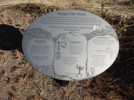
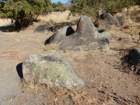
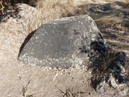
We did a short side trip about a half mile away to see some Indian Petroglyphs
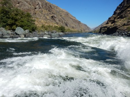
Our Killgore Adventures Jet Boat 65-mile Wild River Hells Canyon Tour started upriver at 9am


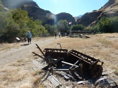
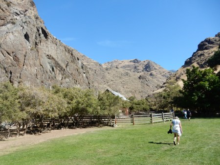
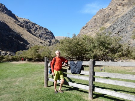
Our first stop was the Kirkwood Historic Ranch
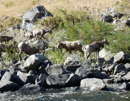
Long Horn Sheep spotted along the river, notice that he is tagged

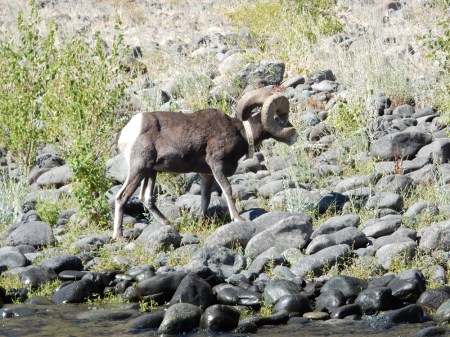
He must have been looking for – Females have horns as well
Calm before the rapids

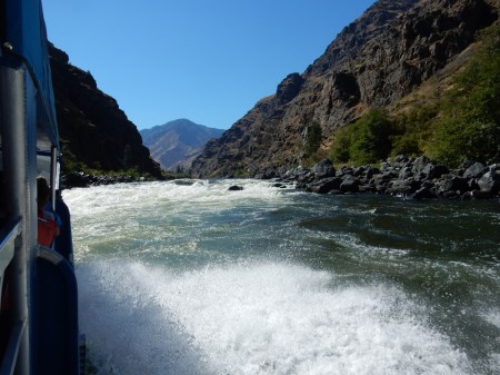
Starting through a Class II rapid and next pic looking back at the rapid


Video of Jet boat going through a Class II-III rapid. We sat in the open area at the back of the boat so I could take unobstructed pictures. It resulted in a few drenchings!
Jet boating sequence going through a Class III-IV rapid

Hells Canyon Creek (Dam) Visitor Center

View downriver from Visitor Center

Another jet boat coming through the Class II rapid below the Visitor Center
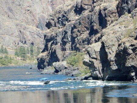
The same boat heading toward the dam
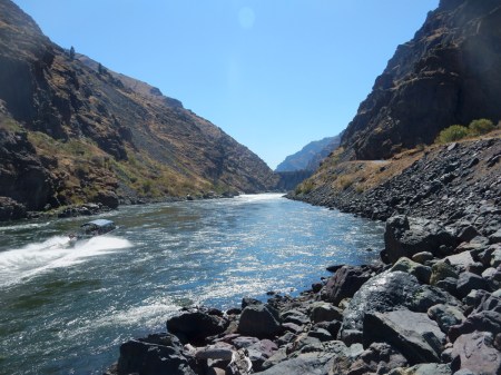
Hells Canyon is considered the deepest Gorge in the U.S. It is just under 8,000 ft deep
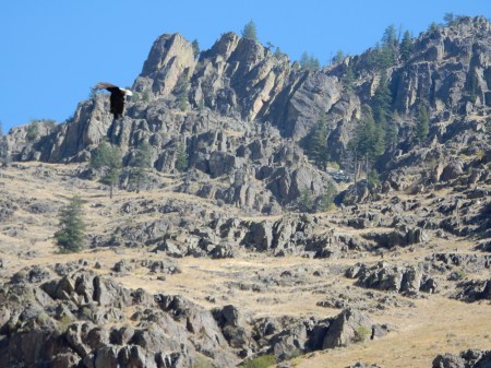
Eagle – left side of picture
On the return trip downriver, the captain purposely went into a hole and I got drenched. My favorite cap was blow off and lost in the river! Drying out at Sheep Creek Cabin.
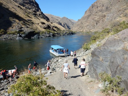
Returning to boat
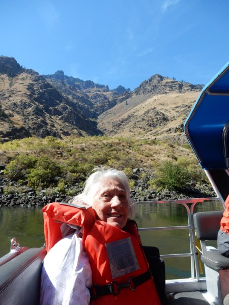
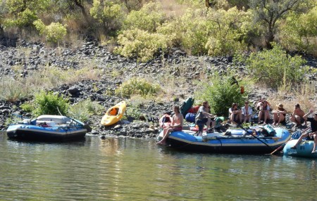
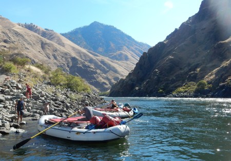
Some pictures of rafters enjoying the river –

We returned at about 3:30 and then did a 4-hour drive to Nampa (outside Boise)
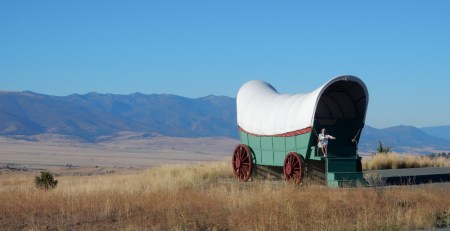
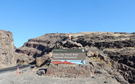
9/16 – Left Nampa and about a half-hour later crossed the Snake River into OR on US 26. Giant covered wagon – travelers first saw the Blue Mountains from here indicating that their trip was nearing its end. Approximately 450 miles to go!
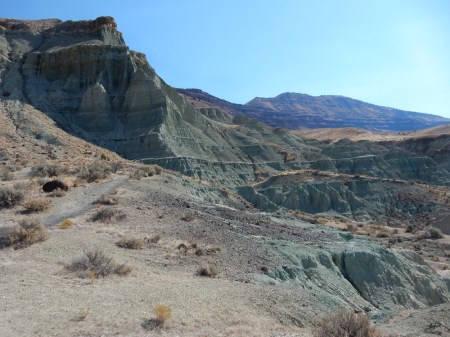
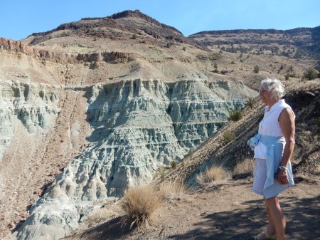
Mescall Overlook in the Sheep Rock Unit of John Day Fossil Beds National Monument OR. This is a view of the Mascall and Rattlesnake formations.
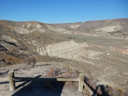
Also from the Overlook, this is the view looking North toward Picture Gorge – Tootsie Pop snack!
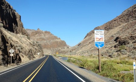
Picture Gorge is noted for Indian pictographs painted on the steep basalt walls

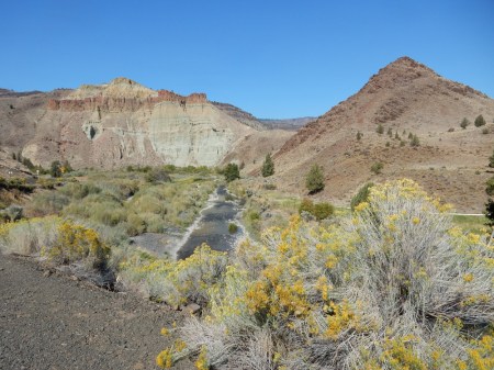
Sheep Rock (3360 ft), named for the sheep that were raised below its summit

Map of Sheep Rock Unit
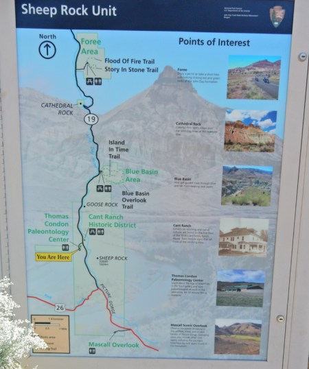
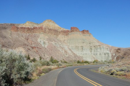
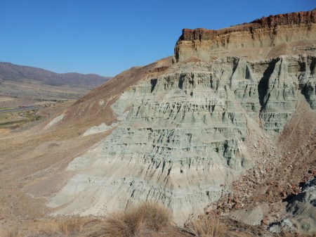
Two views of Cathedral Rock – a colorful greenish outcrop of the John Day Formation, capped with reddish ignimbrite. The John Day River can be seen in the second pic.
We took two short trails in the Foree Area of the park. The first was called the Story of Stone Trail where erosion has exposed several colorful badland outcrops.
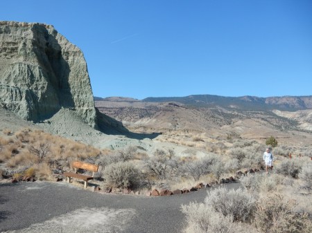
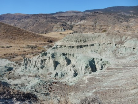

The second was the Flood of Fire Trail. It gave us several colorful views of cliffs and the John Day River valley.
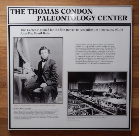
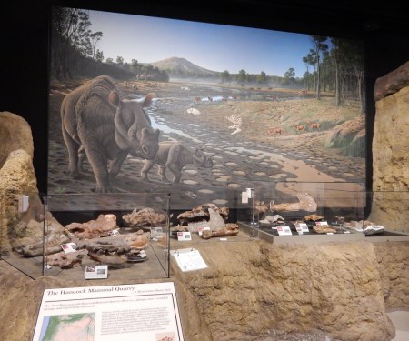
John Day has a town, river, valley, fossils, etc. and this national monument named after him. So who was he? You would think he was a prominent person – explorer, scientist, politician, etc. Well, he was a member of an 1812 overland expedition to the new Pacific Fur Company Post in Astoria OR. An average guy who was camping with his friend Ramsay Cooks at the point where the Mah-hah River meets the Colombia River. They were robbed of ALL their belongings, including their clothes! Fortunately, a group of trappers going to Astoria rescued them. John Day worked at the post in Astoria for many years. So, when travelers passed the spot where Day was robbed, they would tell Day’s story. The Mah-hah River became known as the John Day River and many locations in eastern OR would subsequently be named after him. John Day never came to this location. Thomas Condon, a prominent self-trained scientist and minister, who was stationed in The Dalles, explored this area. He named it the John Day Fossil Beds after the river that passes through here. Condon became a professor at the U of Oregon and was also named Oregon’s first state geologist. The National Monument Visitor Center is named the Thomas Condon Paleontology Center. This is a North American rhino skull at the entrance.

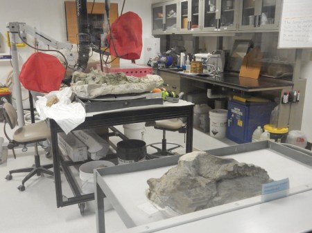
Research continues today adding hundreds of fossil specimens each year to the collection. Some pictures from the center follow –

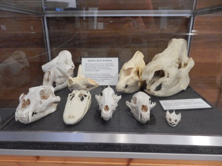
The Paleontology Center has eight “assemblages” of ecosystems from different geological layers on display. Here are three examples – First, the Hancock Mammal Quarry recreates a warm, humid forest. A mudflow (lahar) covered this region. There were huge rhino like animals, tapirs and small four-toes horses.
Second, the Turtle Cove Assemblage recreates a cool and dry climate with hardwood forests that were inundated with ash and pumice from volcanic eruptions. There were three-toed horses, saber toothed cat like animals and giant pigs as tall as bison.
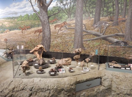
Third, the Rattlesnake Assemblage recreates a relatively cool, semi-arid climate dominated by grasslands. There were one-toed horses, elephants, camels and ground sloths.

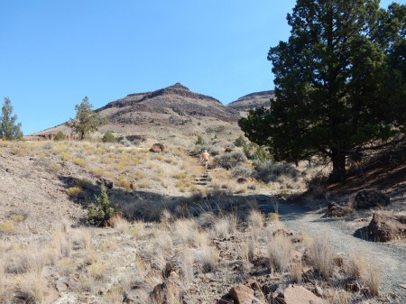
After touring the Visitor Center, we drove to the tiny town of Mitchell OR for a soup lunch

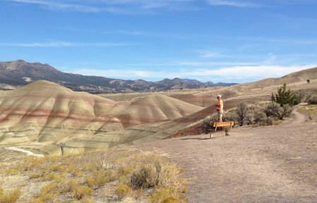
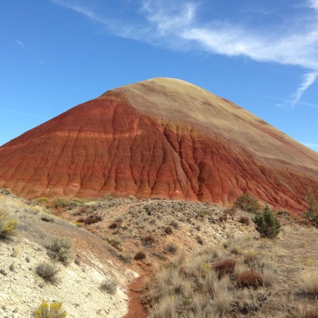
The Painted Hills Unit of John Day Fossil Beds NM is a short drive west of Mitchell. We started by doing the Painted Hills Overlook Trail, which provided some great views.

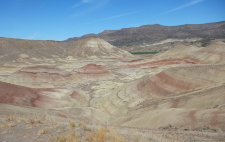
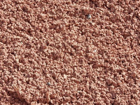
We then did the Painted Cove Trail. I took some close-ups to show the interesting textures as well as colors.
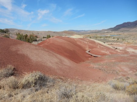

The Red Scar Knoll/Red Hill Trail was next on our agenda; it is the newest trail in the Painted Hills. The Red Scar Knoll is a strikingly bisected hill of tan and red claystone.

“End of Trail”

Not really, we drove another two-hours to the Clarno Palisades Unit of John Day Fossil Beds NM. Here are a couple of pics taken along the way –

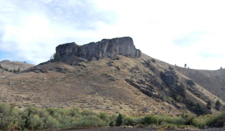
Clarno Palisades from the east
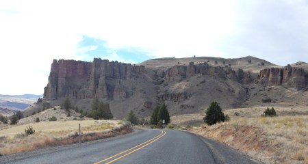
Clarno Palisades from the south
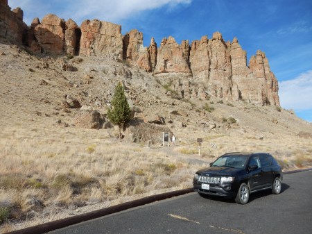
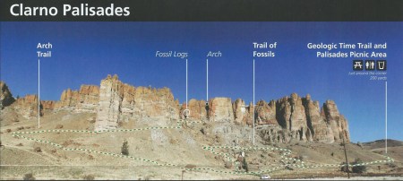
We first did the Trail of Fossils loop trail. Picture is from park pamphlet
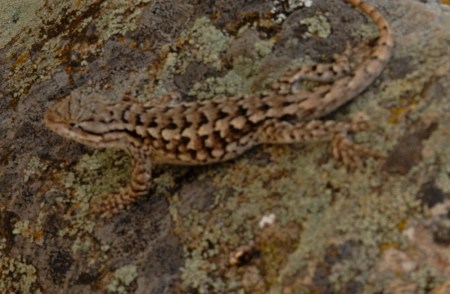
Friendly little lizard
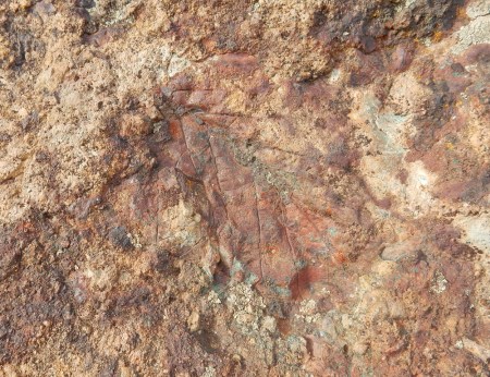
Leaf fossil in center of pic
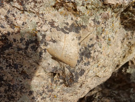
Another leaf fossil in center of pic
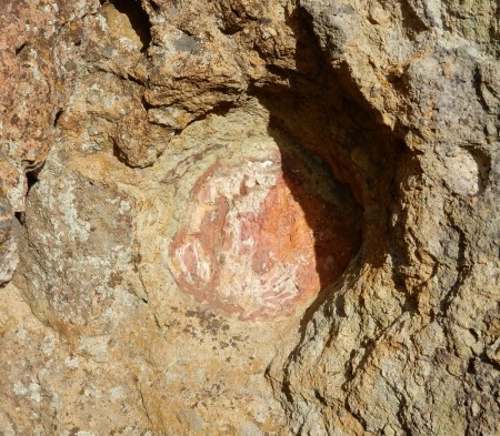
This is the fossilized end of a large tree limb
Tree root fossil
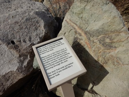
I then did the Arch Trail; perhaps you can see my orange shirt just below the cliffs
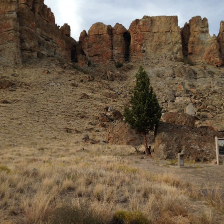
Fossilized logs (T) near the end of the trail
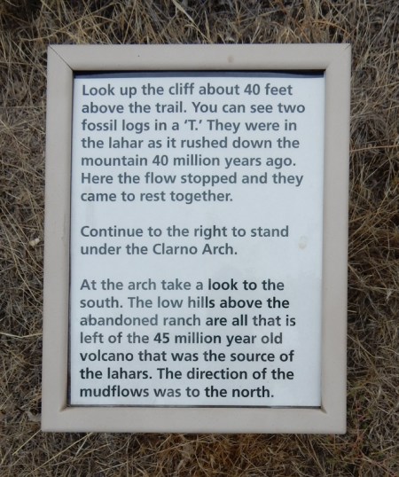

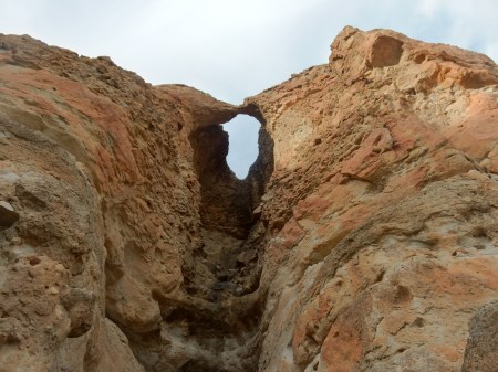
Looking up at the Arch
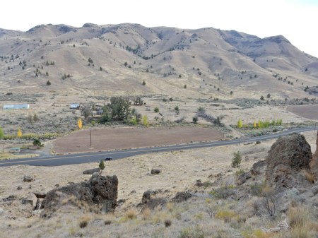
View south from the cliffs in the direction of the volcano that produced this landscape. The ranch has been abandoned and is now part of the park.
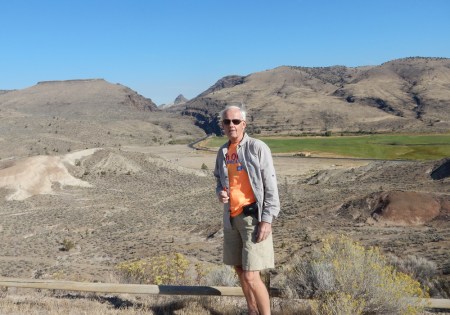
Telephoto shot – Can you hear me now? I think we both need hearing aids!

Drove from here to The Dalles on the Colombia River and then on to Portland the next day for our flight back to Dayton. This time, we actually flew together (on frequent flyer miles)!

Leave a comment