
NP Unit Road Trip – SD, WY, MT, and ND
September 27, 20198-10 Sat – Smoky Bear’s Birthday! (75) – I’m older than the bear –
8-11 Sun – drove to Chicago, visited Mike, Cathie and Jim and then continued to Madison WI (500mi). I slept in the Sequoia (SUV) in the parking lot of a Holiday Inn Express
8-12 M – 725mi to Minuteman Missile National Historic Site SD, arrived at 3:30 Mountain Time
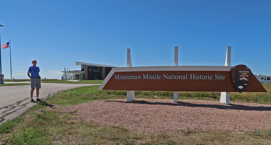

There were 3 Missile Squadrons located around Ellsworth Air Force Base in South Dakota

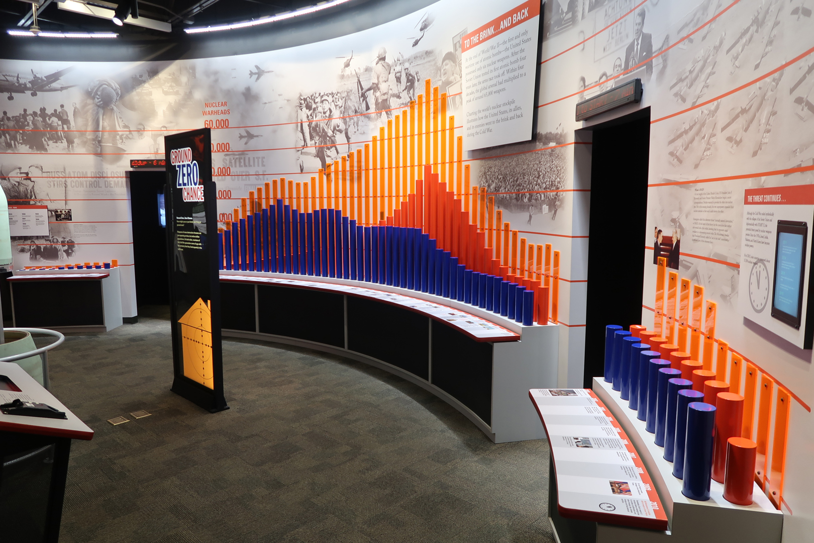
Number of Nuclear Warheads represented by cylinders. Blue U.S., Orange Soviet Union; from after World War II on left to 2010 on the right. Height of orange plastic on wall represents total.
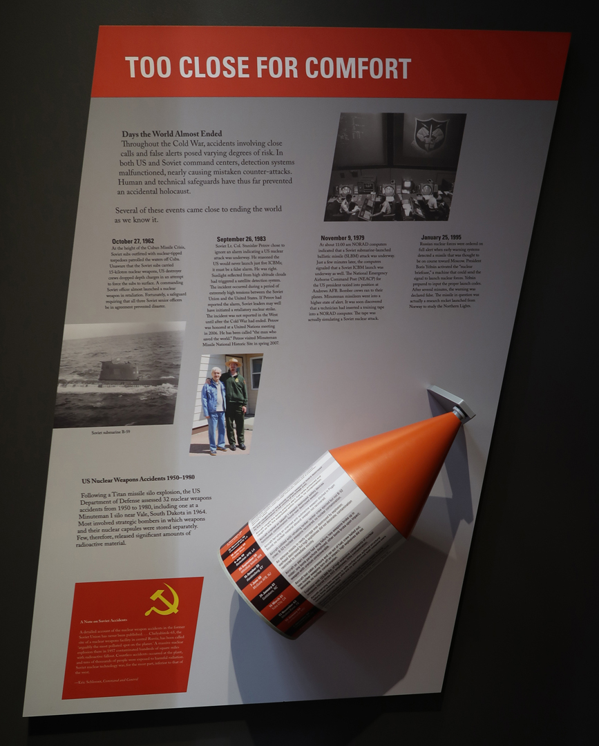
Specific dates on which the world could have ended!!!
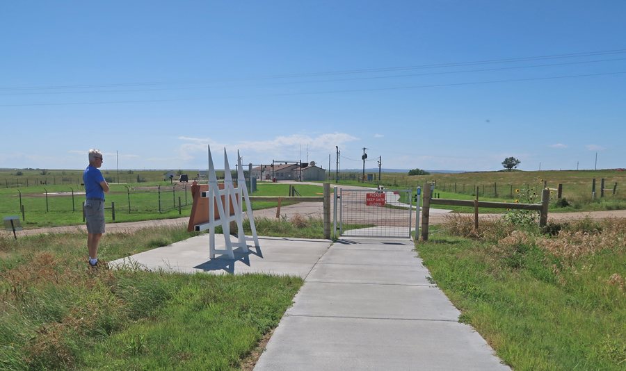
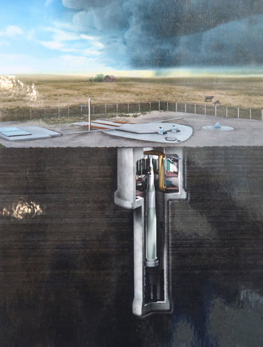
After the Visitor Center, I drove 5mi west on I90 to the Delta-01 control and launch site. I had hoped to take a tour, but they were booked two-months in advance. They only allow 6 people per group (2 ladders to negotiate), as a result tickets are very much in demand.

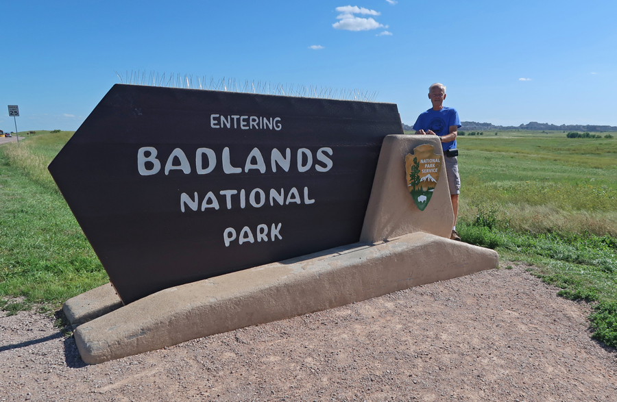
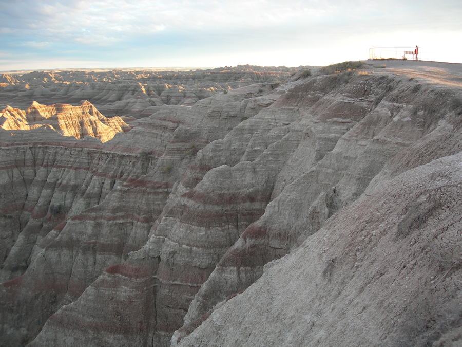
I was ahead of schedule, so I decided to re-visit two NP Units. The first was Badlands National Park, which was only a half-hour away.
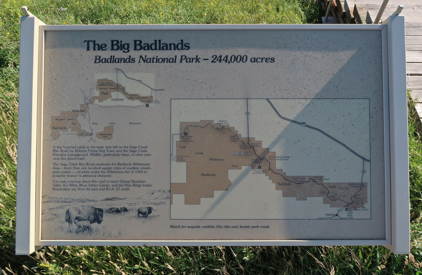
My first stop was the Ben Reifel Visitor Center

Some formations look like sandcastles

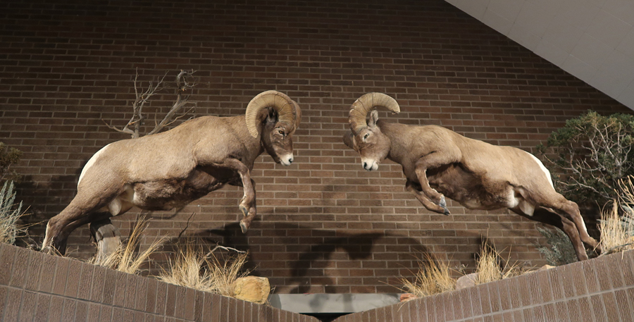
Models for Dodge pickup truck hood ornaments, male Bighorn Sheep – Rams. Rams are about the same size as football players. Seems a good name for the LA football team; they even crash their heads together!

Mrs. Bighorn Sheep (Ewe)
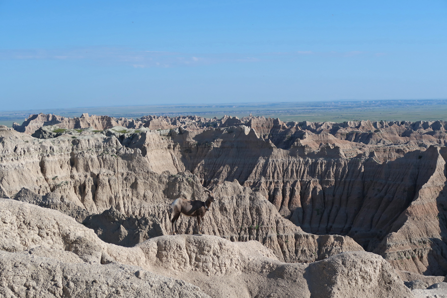
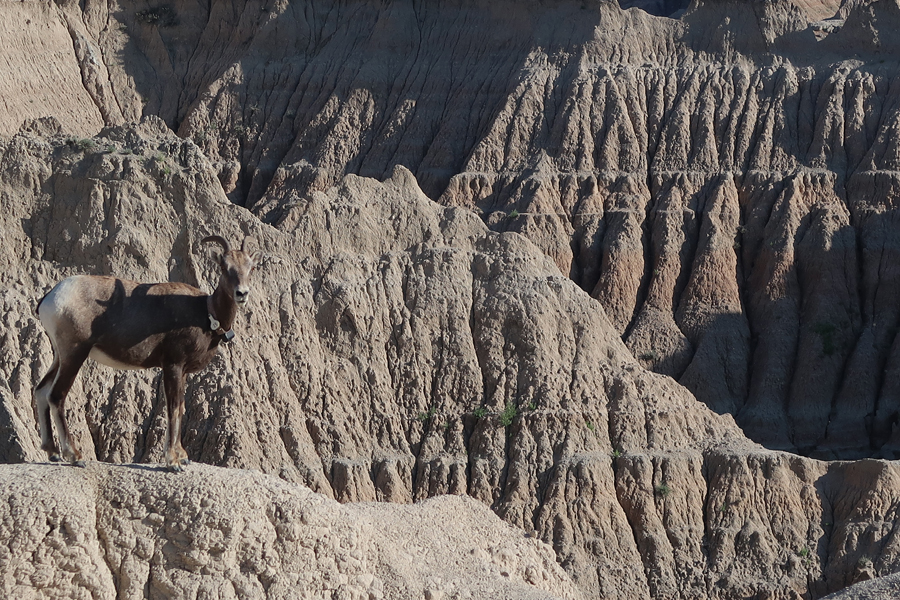
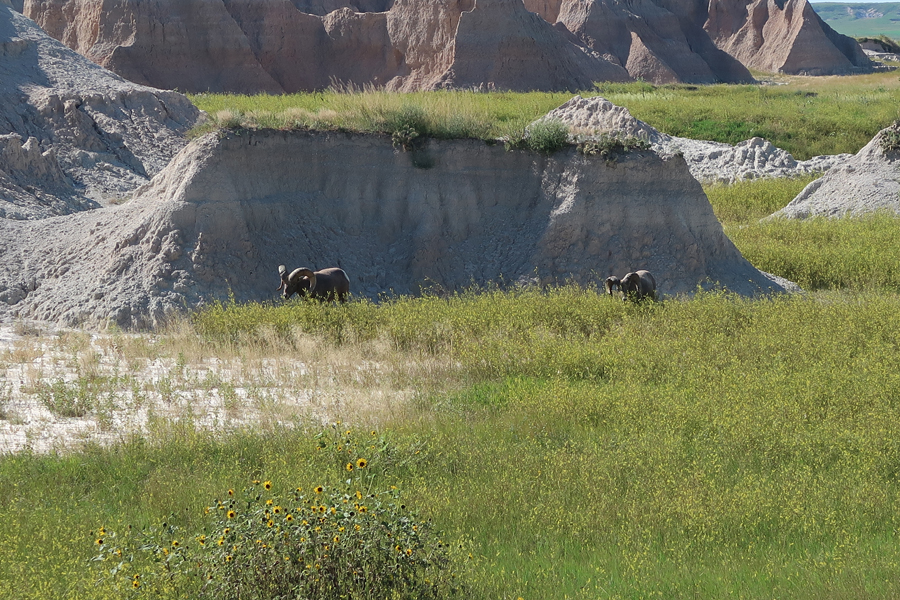
There is nothing like seeing animals in their natural habitat

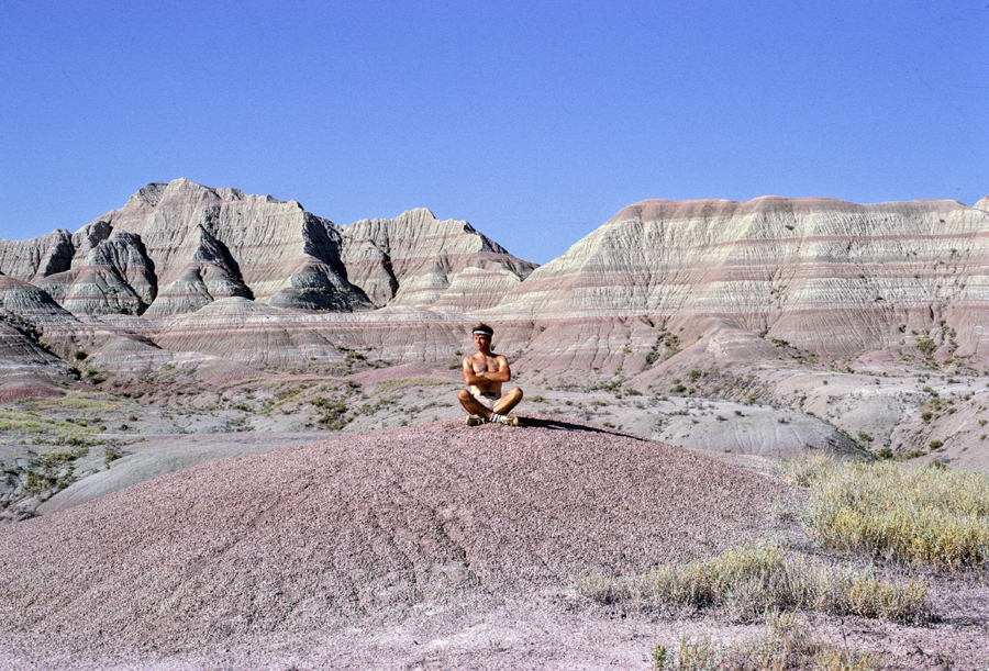
Colorful formations

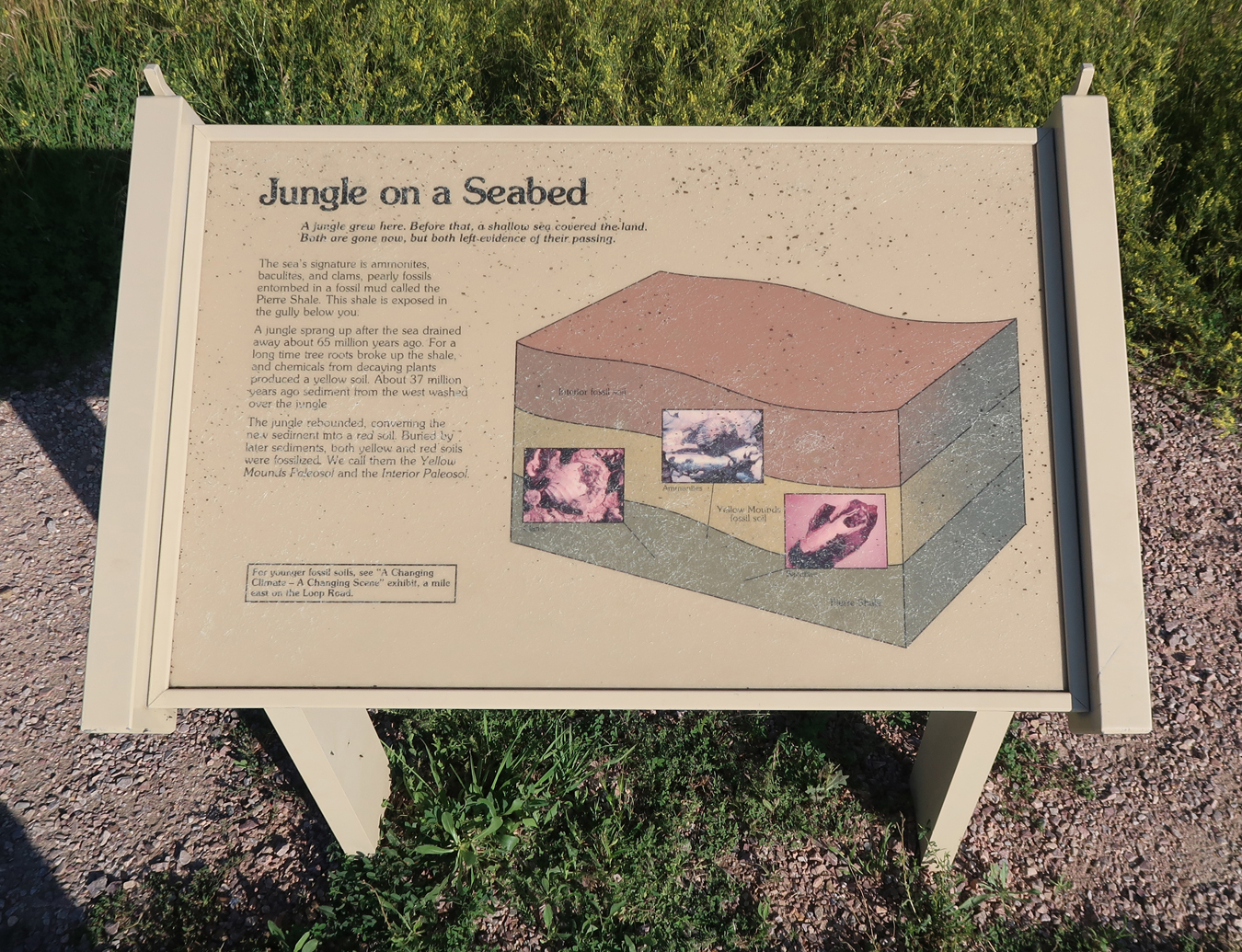
Formed by Volcanoes


1969 visit

2007 visit

My second NP Unit re-visit was that evening to Mount Rushmore National Memorial in the Black Hills. After paying for parking ($5 Sr), I walked past the Avenue of Flags to the Grand View Terrace
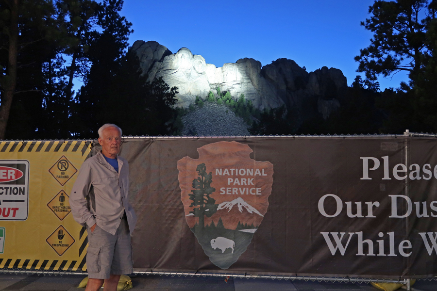
It was now dark, so I returned to the car to get my headlamp in order to hike the Presidential Trail
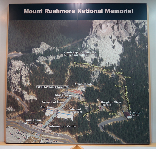
I began by taking the Nature Trail to the Borglum View Terrace

Gutzon Borglum was commissioned to carve the memorial in 1925. He died in March 1941. His son Lincoln oversaw carving until it was finished at the end of October that same year.


The Sculptor’s Studio is right below the terrace

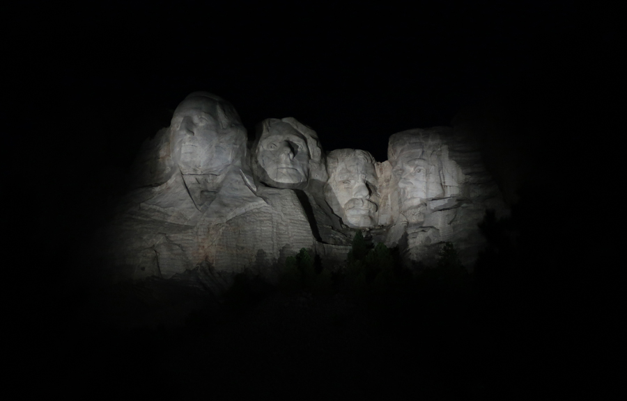
Carving the faces

The Presidential Trail (0.6mi) starts at the Sculptor’s Studio
It includes 422 stairs as it ascends to viewpoints right below the faces

It was a clear night, I laid on my back and viewed the night sky. It was the peak night of the Perseids meteor shower. The Perseids are produced by the comet Swift-Tuttle and radiate from the constellation Perseus. I reveled at the sight of numerous “shooting stars.” But what really amazed me where what appeared to be little red round balls that moved very fast with many quick changes of direction across the sky. I had never seen these irregular patterns before and was awestruck by the display. But, were they meteors or UFOs?
1969 visit – Helen


Chief Liz Guz and his flower children

I slept at the Wrinkled Rock Climbing Area in the Black Elk Wilderness of Black Hills National Forest
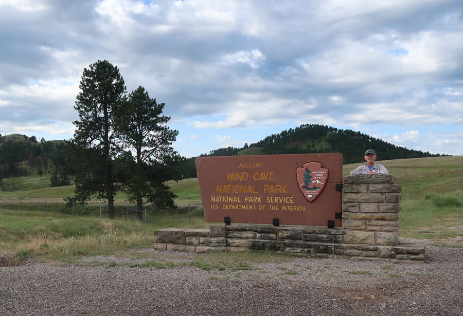
8-13 Tu – Drove through the Black Hills National Forest and Custer State Park to Wind Cave National Park


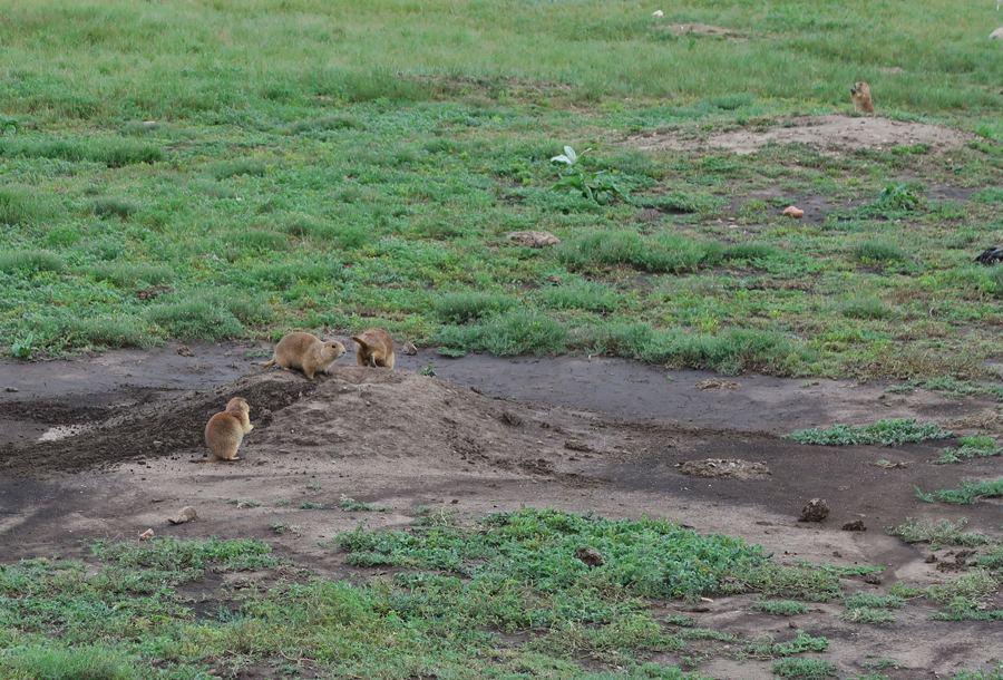
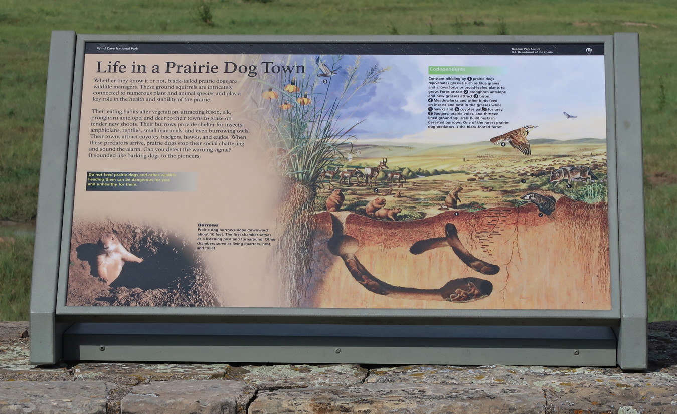
Prairie Dog Town
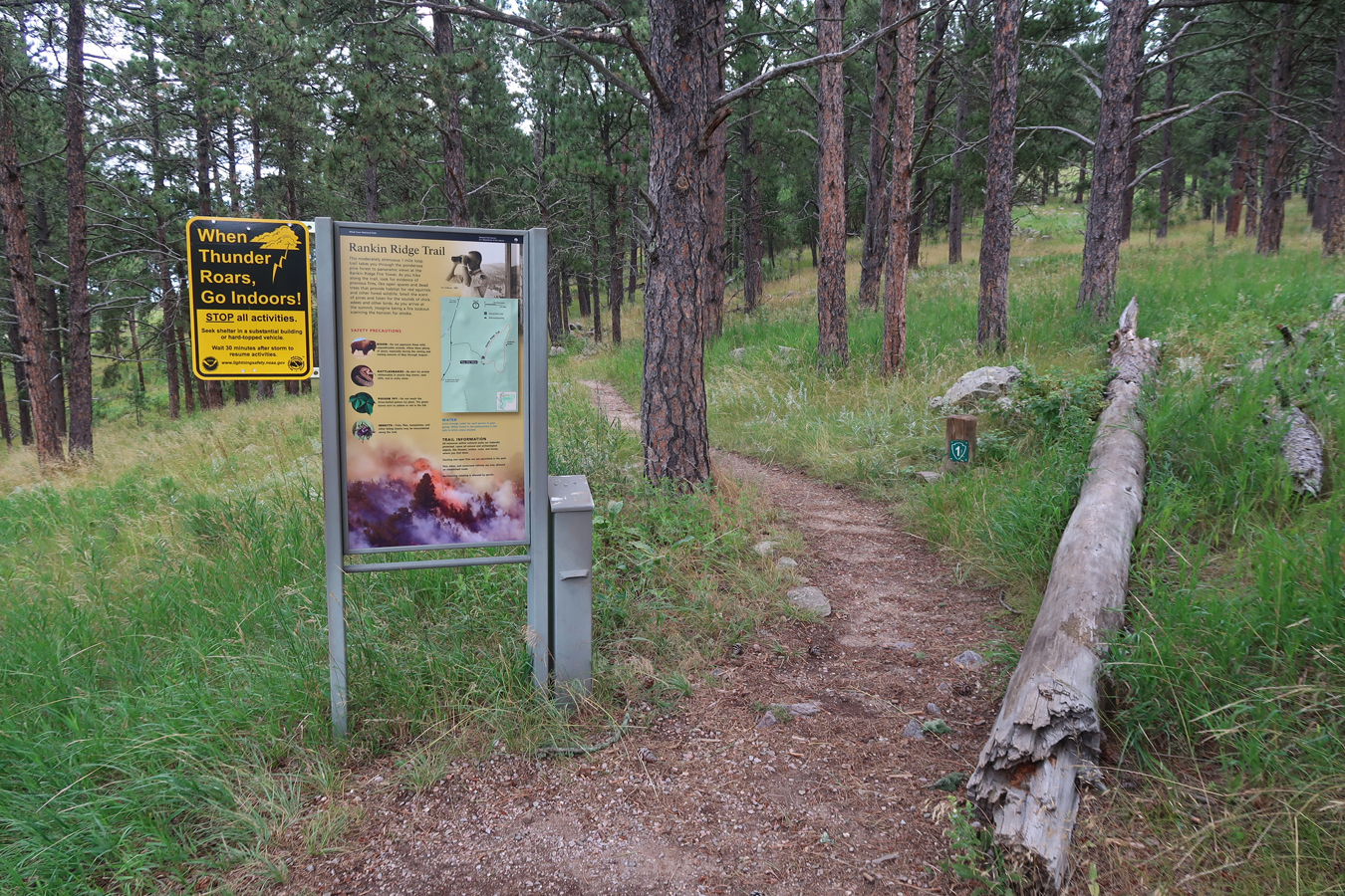
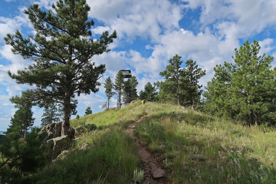
Hiked the 1mi Rankin Ridge Loop Trail to the Lookout Tower at 5,013ft


This is an active Lookout Tower
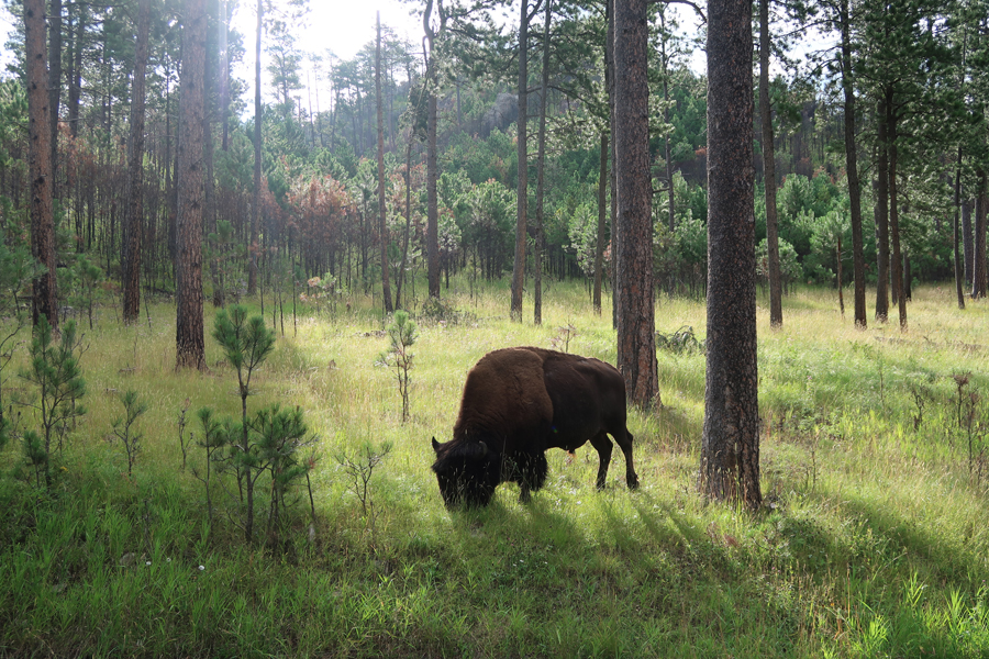
I like this back lit photo of a lone buffalo in the forest
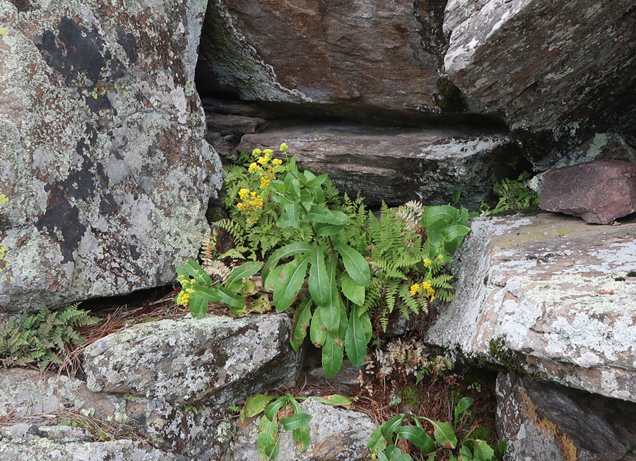
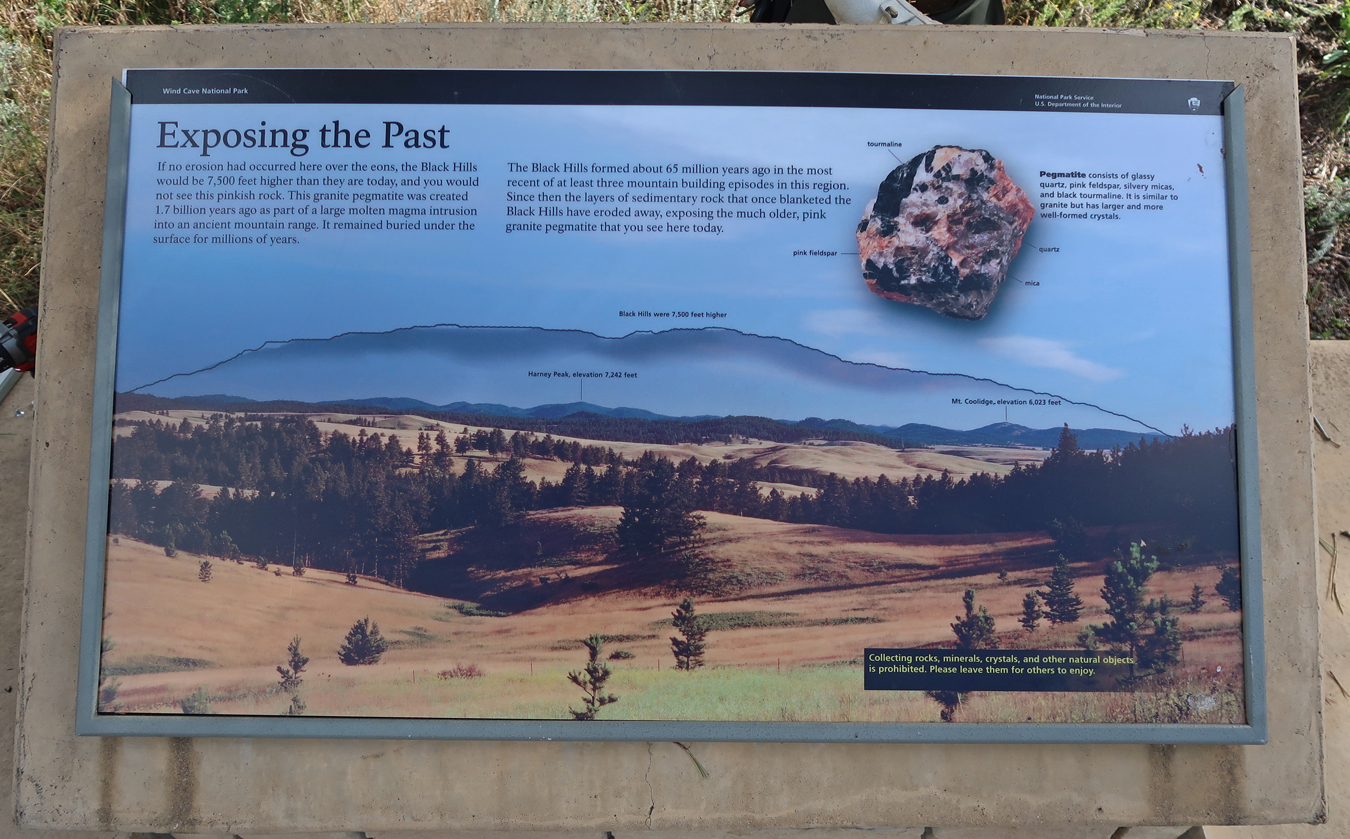
Ranger Nick replacing a worn sign at a turnout. It describes the formation of the Black Hills

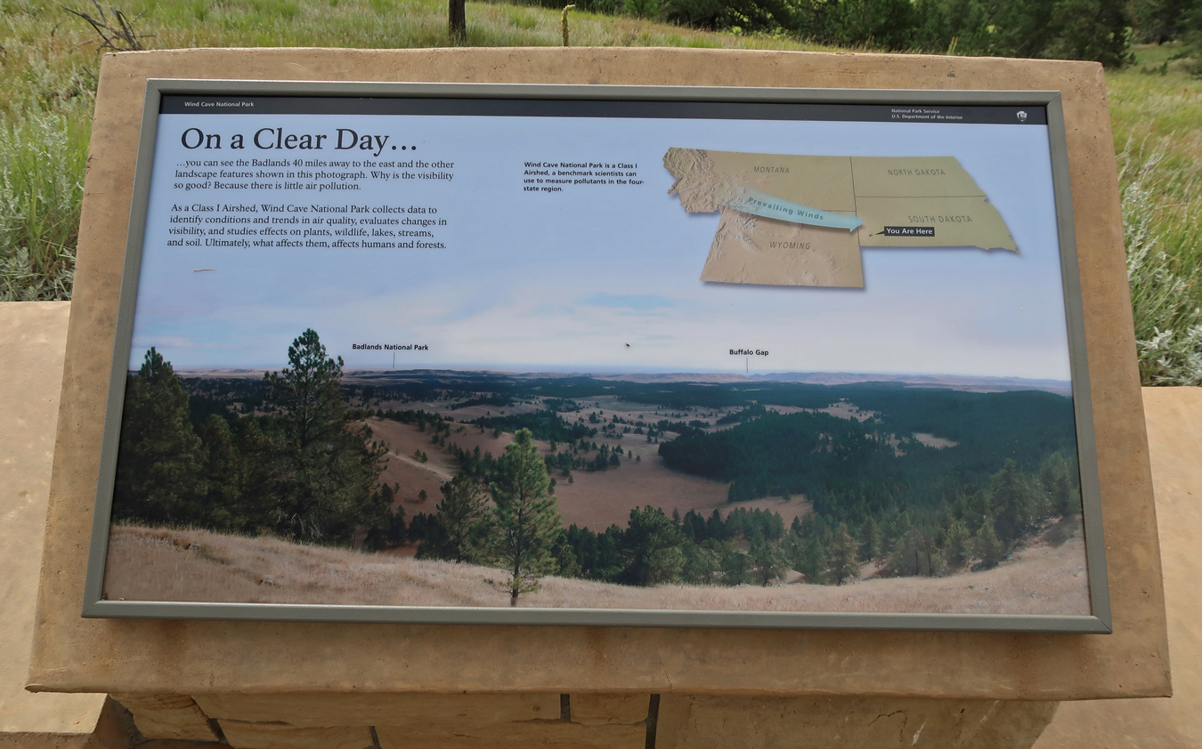
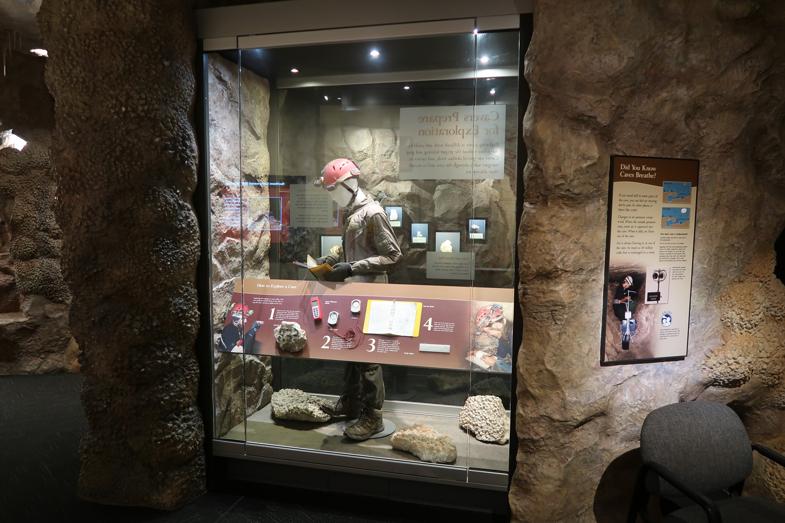
The Visitor Center had the expected displays on Wind Cave, caving, bats, native Indians and animals


Caving – There were no tours because the elevator was out of service. Fortunately, I had done the tour in 1969

Wind Cave ceiling boxwork, one of the highlighted cave formations

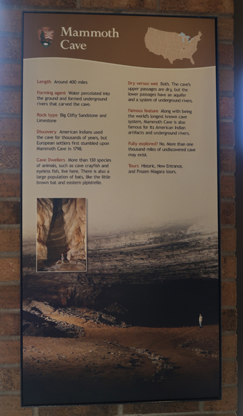
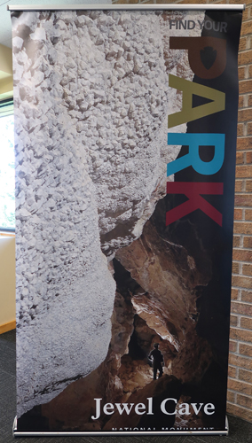
Posters describing caves that are Units within the National Park System


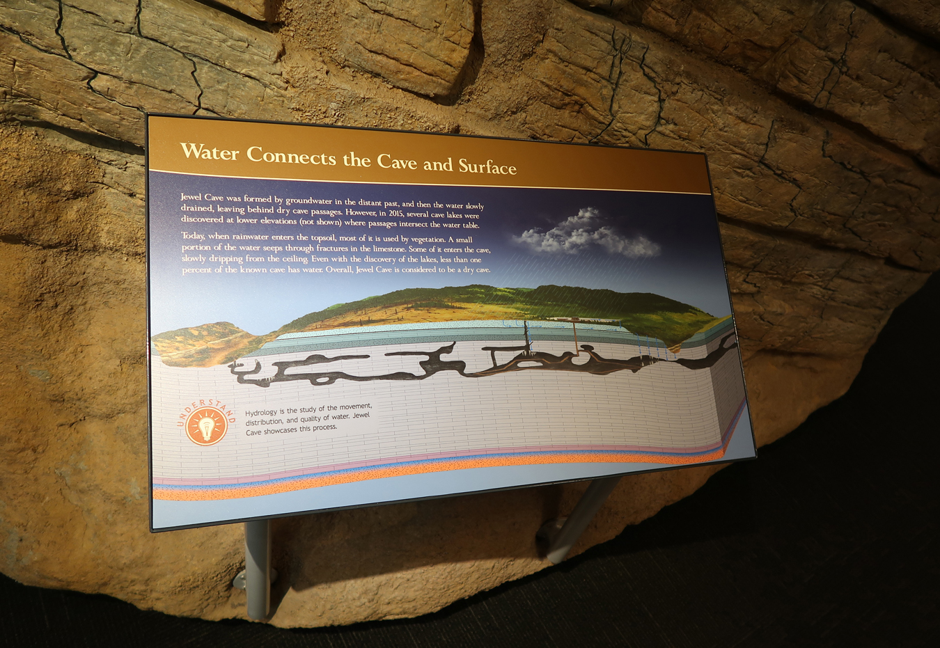
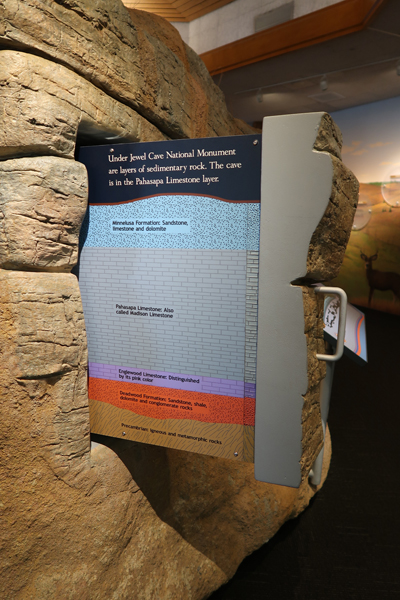
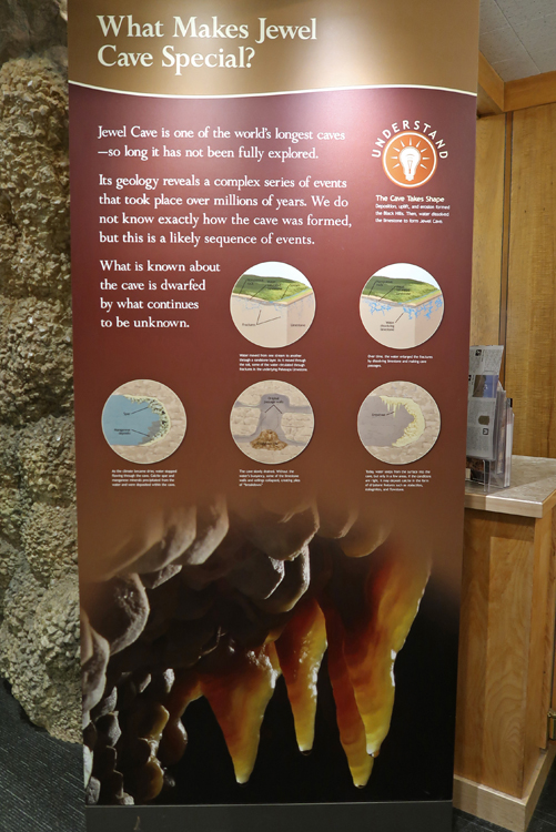
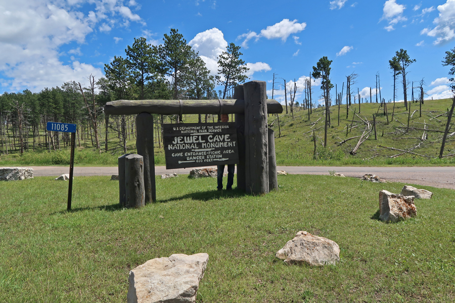
It was only 0.75hr (32mi) to Jewel Cave National Monument, some think that Wind Cave and Jewel Cave systems may be connected
The elevator here was out-of-order as well. I was told a week earlier that it would be operational by the time I got here. Nope, fake-news, it would be “a few more days.” Like Wind Cave, I had already done the standard Scenic Cave tour in 1969. I was here this time to get some usable pictures, which did not happen back then. The good news was that I was there just in time to get the last ticket for the Historic Lantern Tour, which uses the historic entrance to the cave. I had just enough time to do a quick tour of the Visitor Center.

The tour starts 1mi west at the historic cabin built by the CCC in the 1930s


Only lantern light is permitted – no headlamps or cell phones! Also, you had to choose between carrying a lantern OR a camera – I chose my camera. So, I had to walk between two people who had lanterns.

“The Historic Lantern Tour takes place through low, narrow passages by lantern light. You will stoop, duck walk, and navigate narrow wooden stairs (~600 steps) to view the cave from an unpaved, rocky trail. This strenuous ½-mile route lasts about 1 ¾ hours.”


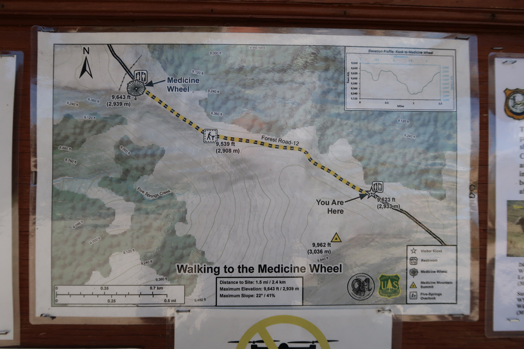
A 4.5hr drive took me to north central WY and the Medicine Wheel National Historic Landmark (USFS). The drive west through the mountains on 14A was scenic but had lots of curves. Checkout the descent going toward Lovell. Why such a nice roadside map? Answer, no cell phone service!

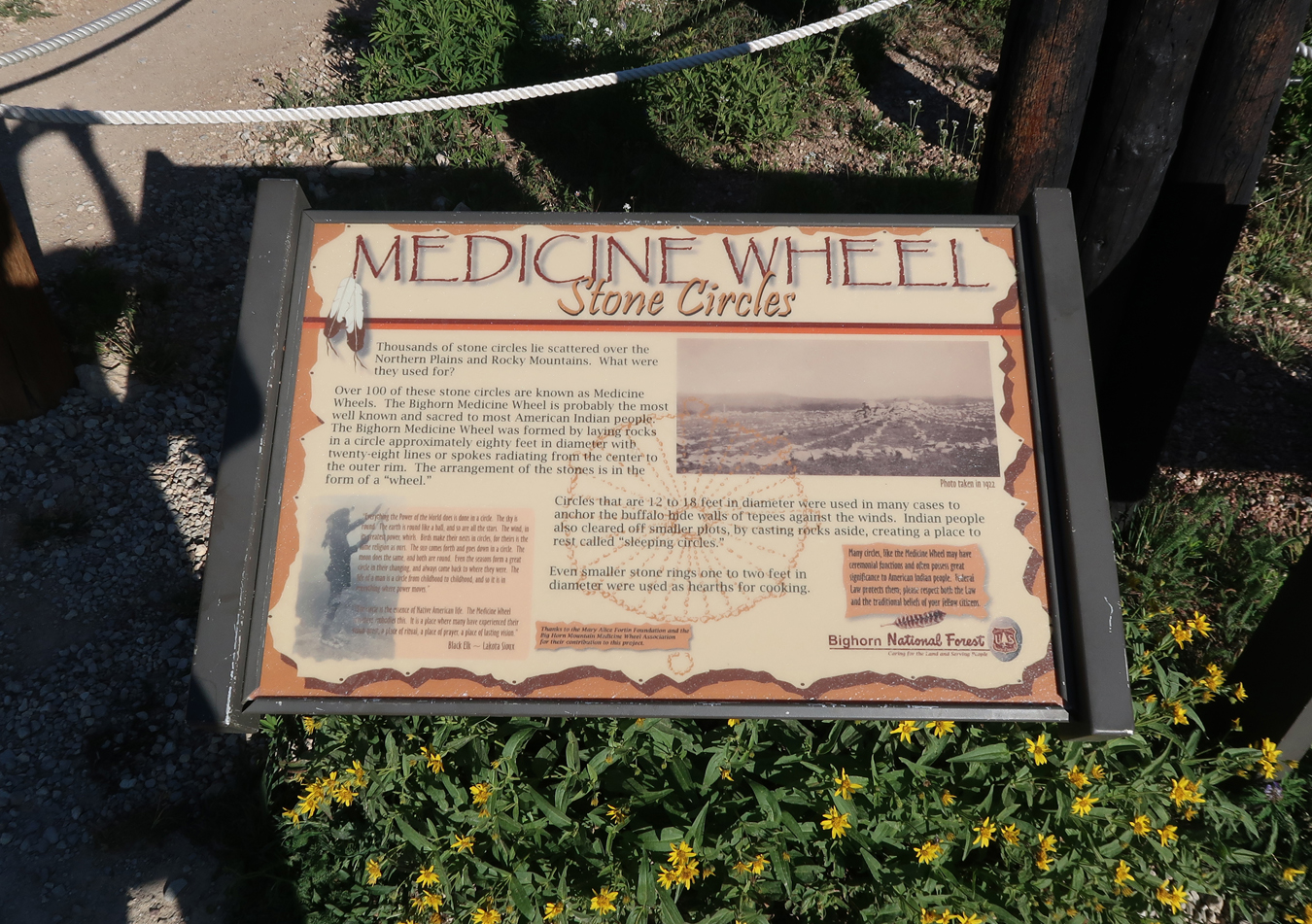
I had seen Medicine Wheel NHS in my Rand McNally book of state maps (WY) when I was planning my trip and decided to check it out if I had the time. Oral histories provided by Native Americans indicate that the Medicine Wheel extends back in time through many generations. Artifacts and other archaeological evidence indicate that the Medicine Wheel/Medicine Mountain NHL has been visited by Native Americans for nearly 7,000 years. There was helpful information posted at the kiosk by the trail head.


As indicated on this map, the trail to the Medicine Wheel (9,643ft) is 3mi round-trip
On my spirit quest, I passed two pairs of Native Americans
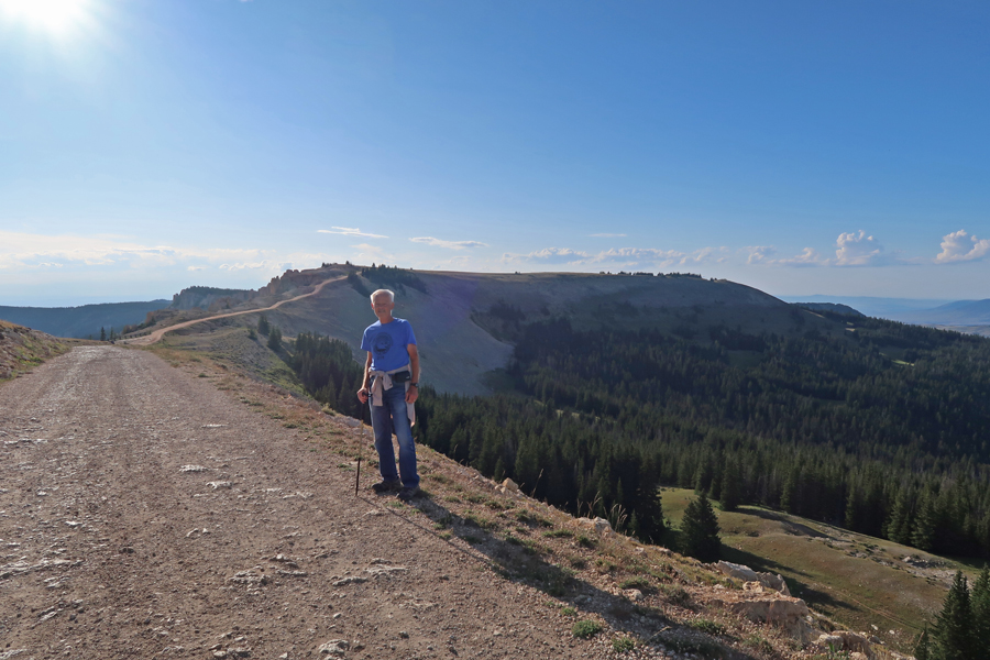
This photo was taken just below and SW of the Medicine Wheel looking back SE toward the top of Medicine Mountain. As seen near the center of the photo, there is an FAA Radar Dome on top of Medicine Mountain (9,962ft) that monitors air traffic over WY and MT.

Five Springs Basin is on the right

Research suggests that the Medicine Wheel is a composite structure with the central cairn and some outer cairns constructed earlier than the rim and spokes. Native American spiritual practices prescribe traditional uses in distinct portions of the landscape, including areas for staging, approach, ceremonies, prayer and vision questing, camping, and medicinal plant gathering. Native American ethnographic accounts refer to the Medicine Wheel as the “altar” for the Medicine Mountain complex, illustrating the important central role the Wheel plays in ceremonial and spiritual functions.


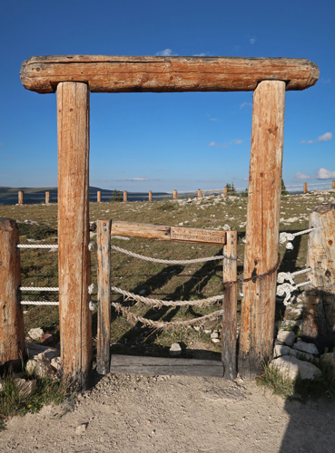
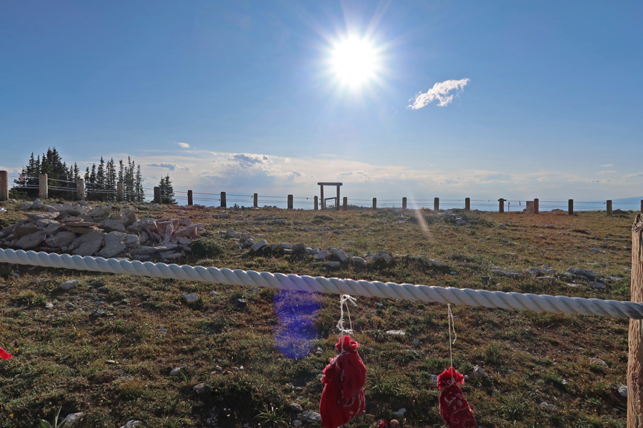
According to Wikipedia, “The Medicine Wheel, sometimes known as the Sacred Hoop, has been used by generations of various Native American tribes for health and healing. It embodies the Four Directions, as well as Father Sky, Mother Earth, and Spirit Tree—all of which symbolize dimensions of health and the cycles of life.” The Medicine Wheel is about 80ft in diameter and has 28 spokes. The longest spoke extends beyond the circle and aligns with the direction of sunrise at the start of the summer solstice.
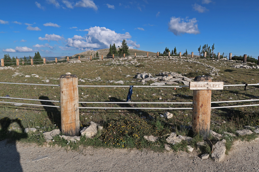
No entrance without permit
Prayer offerings hanging from rope
I arrived at the southern end (WY) of Bighorn Canyon National Recreation Area at dusk

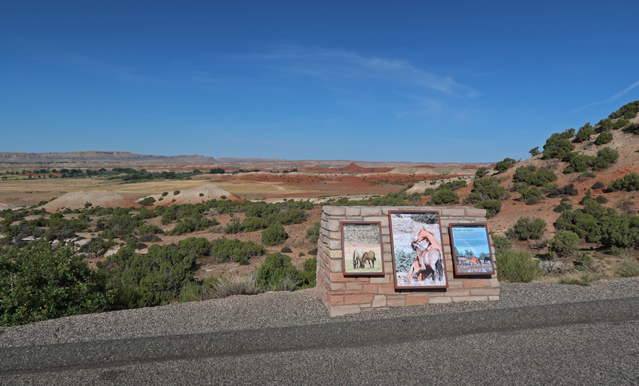
As I was driving N through the Recreation Area (RA), I happened upon some wild horses as the moon was rising in the east

This part of the RA is within the Pryor Mountain Wild Horse Range. I took these pictures the next day –

I continued N into MT and stopped at the Devil Canyon Overlook. I took a video there right after sunset. I slept in the SUV at Barry’s Landing, a boat access to Bighorn Canyon, which is at the end of Rt 37. Laid down on my Thermo-Rest in the SUV at 10pm with just a sheet covering me (68 degrees), got in a fleece bag at 1am (55 degrees), got in my down sleeping bag at 4am (43 degrees).
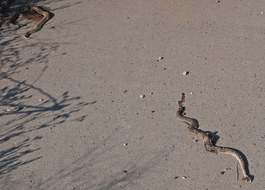
8-14 W – Good Morning!
Off with their heads!
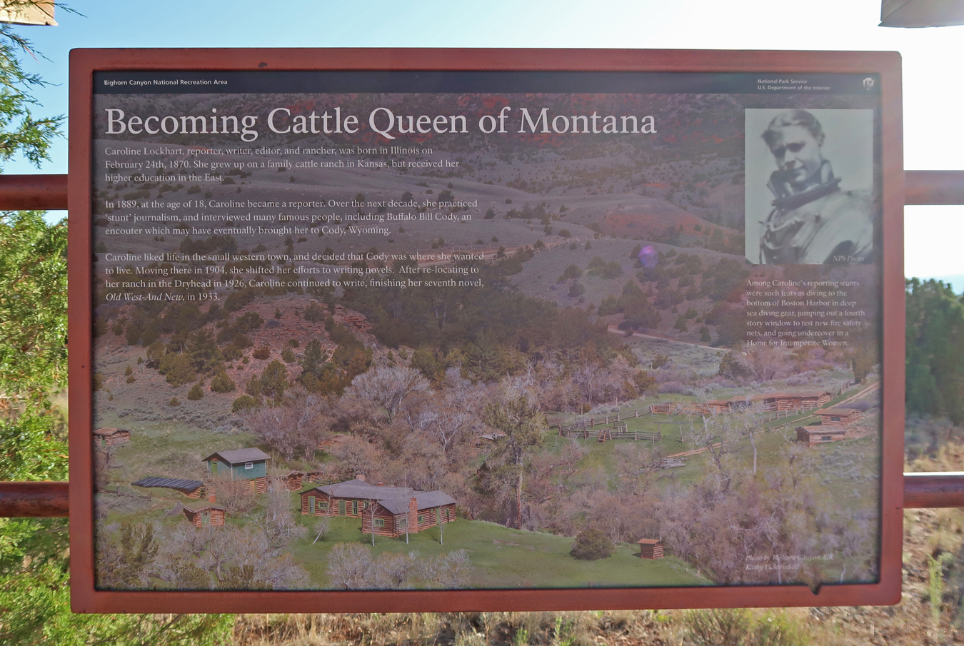
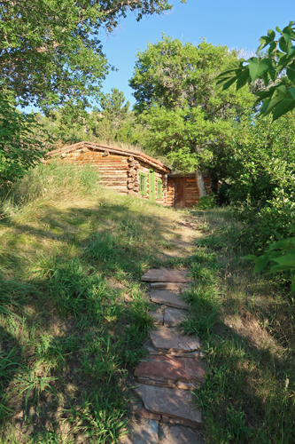
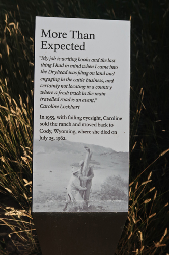
My first stop was the Caroline Lockhart Ranch
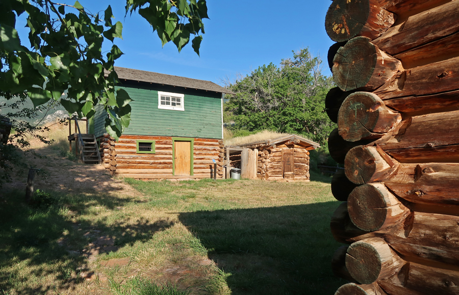
A 0.5mi trail leads to the well-preserved ranch buildings

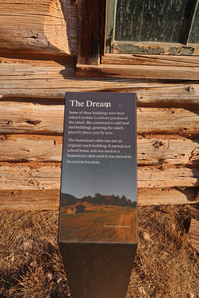
Note the log construction and the sod roofs

The Davis and Cottonwood Creeks provided the life force for the ranch

Lockhart began ranching at 56 years of age
On my way back south into WY, I again stopped at Devil Canyon Overlook for more videos and still shots

View North


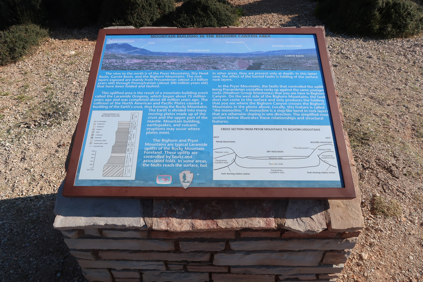
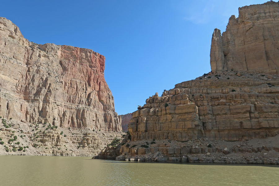
View South – reminds me of the Grand Canyon

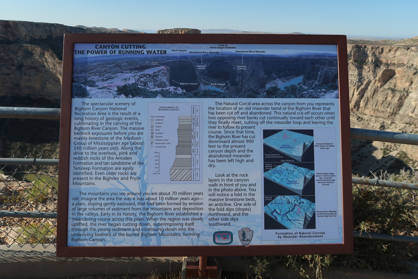

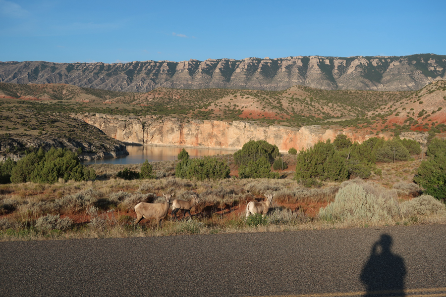
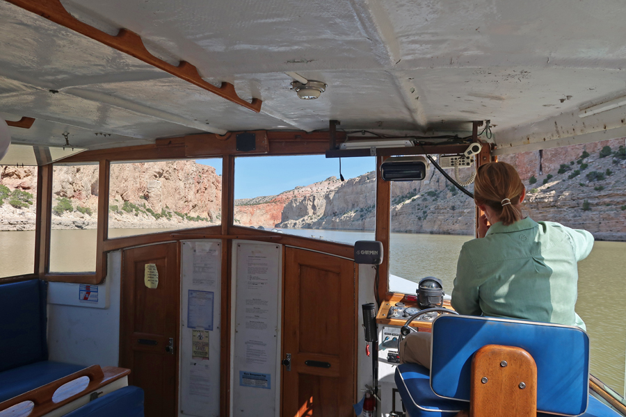
The Yellowtail Dam in MT creates the Bighorn Lake, which extends 70mi south through Bighorn Canyon into northern WY. The Shoshone River empties into the lower end of the lake. I did the 10am 2.5hr boat tour from Horseshoe Bend Marina in WY north to just past Devil Canyon Overlook in MT. It was worth the $45 cost. Heading into Bighorn Canyon

Female Mountain Sheep


Devil Canyon Overlook (left center) from the Lake
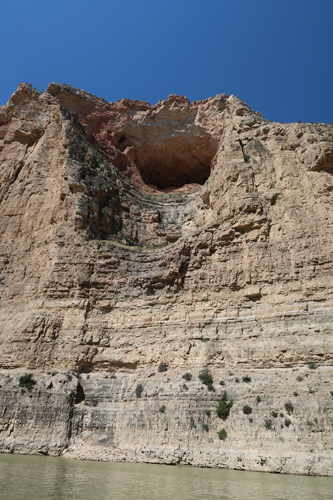
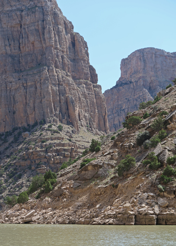
1,000ft straight up

Smooth ride on the “Lake” through the canyon, no longer the rapids of the Bighorn River

The Amphitheater
The Keyhole, just left of the upper center of photo
Leaving the Bighorn Canyon NRA, OK, those are little horns, NOT bighorns

The Bighorn Canyon NRA Visitor Center is in Lovell

6.5hrs to Butte MT, an SUV cleaning, a Tom clean-up, and a sleep in a Quality Inn
8-15 Th – 6:15am start, followed by 2hrs of scenic travel along the Big Hole River, winding through mountains, over hills, and grasslands. This is cattle country, few people other than sporadic trout fisherman trying their luck. Passed through the hamlets of Divide, Wisdom and Wise to Big Hole National Battlefield.
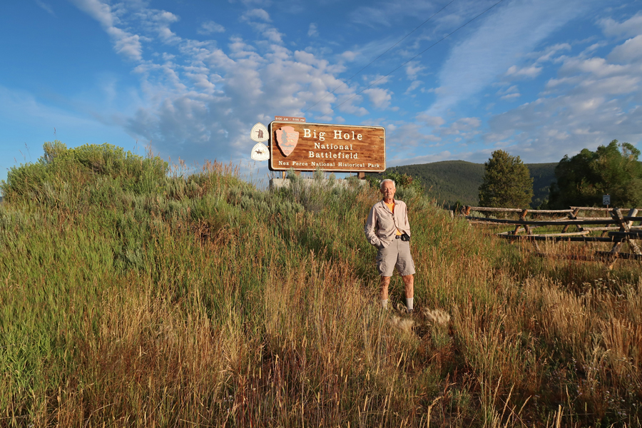
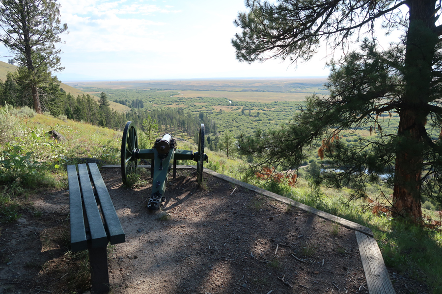
View from the Visitor Center

I hiked all the trails indicated on this map

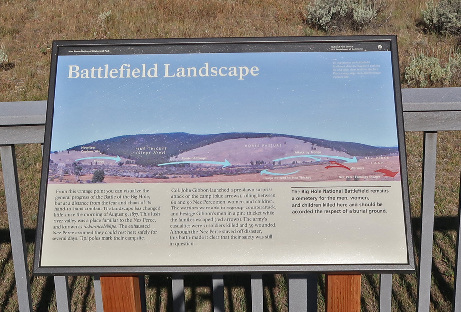
This is the site of the largest battle fought in the five-month conflict known as the Nez Perce War. I started by doing the 1.6mi (roundtrip) trail to the Indian encampment.

About 750 non-treaty Nez Perce camped here thinking the US Army, which was chasing them, was far behind

They were wrong, troops attacked their encampment at daybreak on August 10, 1877

My pre-visit reading had stated “Hikers should keep an eye out for ground squirrel dens/holes, which can easily be stepped into.” They were right, I was concentrating on taking a photo, stepped back, and down I went! This was the location of Chief Joseph’s Tipi.
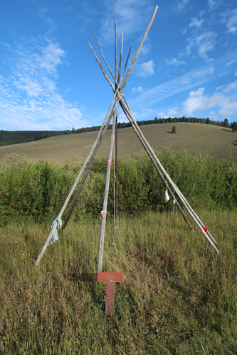
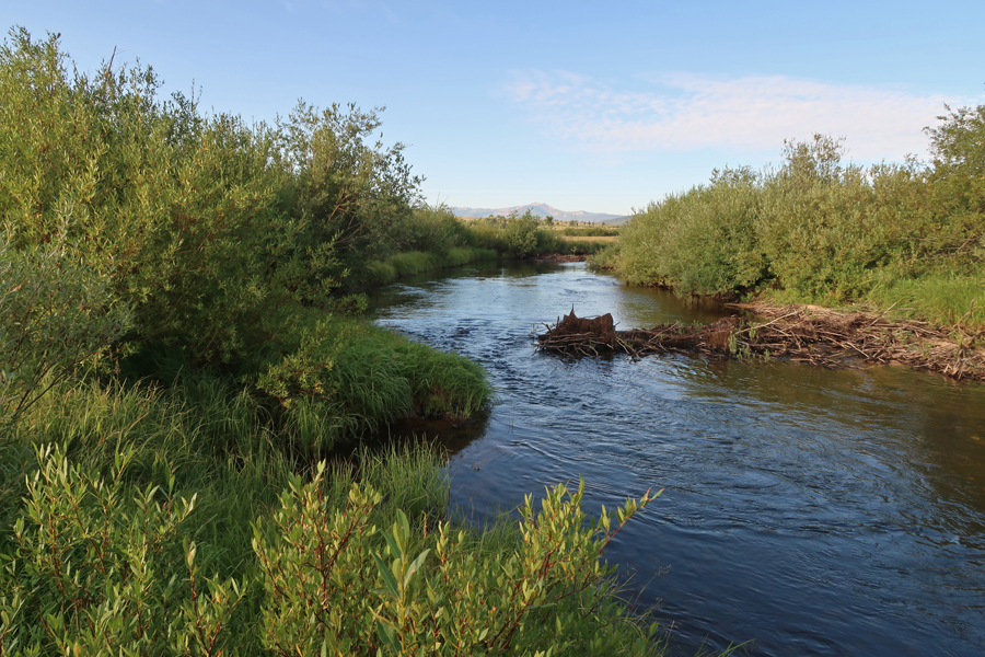
There were 89 tipis set up along the North Fork of the Big Hole River

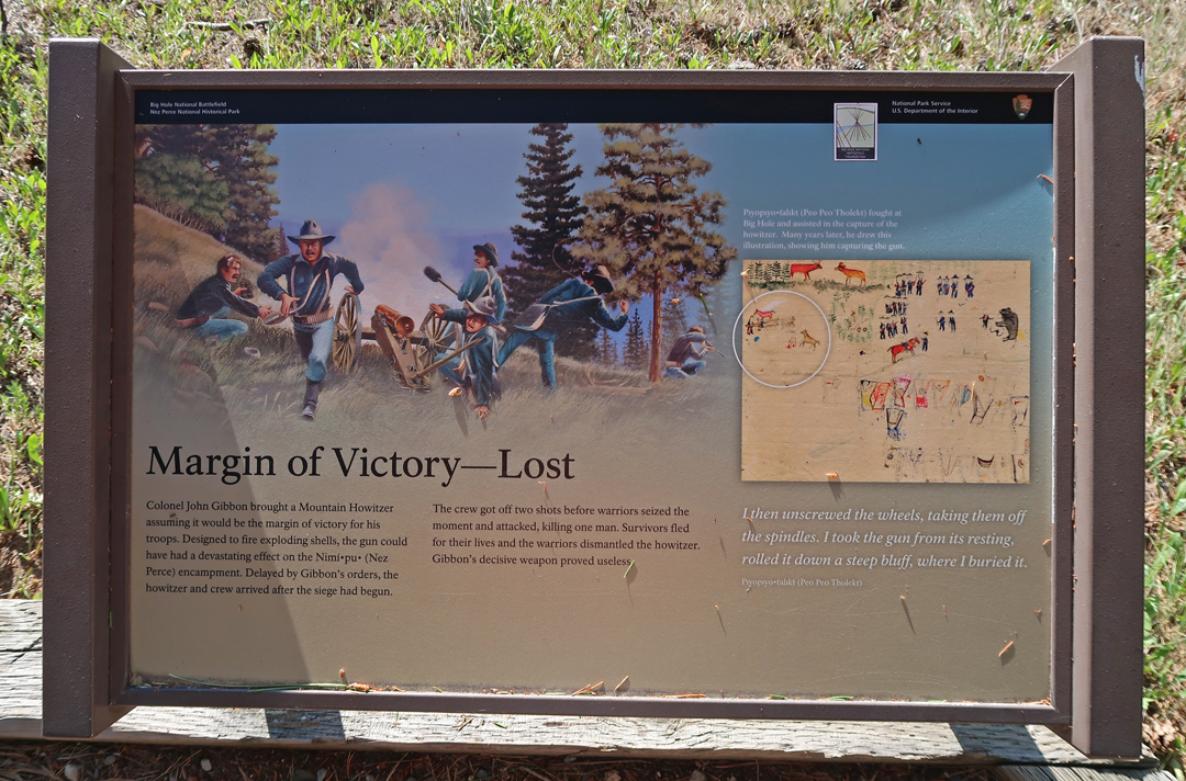
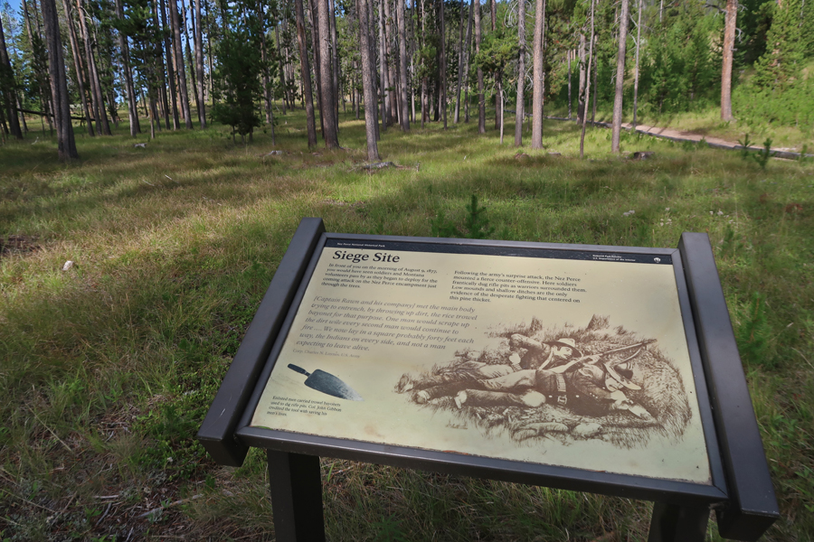
After the initial attack, the Nez Perce counter-attacked and drove the soldiers back across the river. They dug trenches on the bluff as they were surrounded by the Indians. Meanwhile, three Nez Perce captured the Howitzer canon that was being brought up to support the troops and disabled it.
Siege Site and monument to the Americans killed. Of the 162 military and 34 volunteers, 31 were killed and 38 wounded.
View looking back across the Big Hole River toward the encampment. It is estimated that 60 to 90 men, women, and children were killed in the attack. During the night, the Nez Perce withdrew before Army reinforcements arrived.


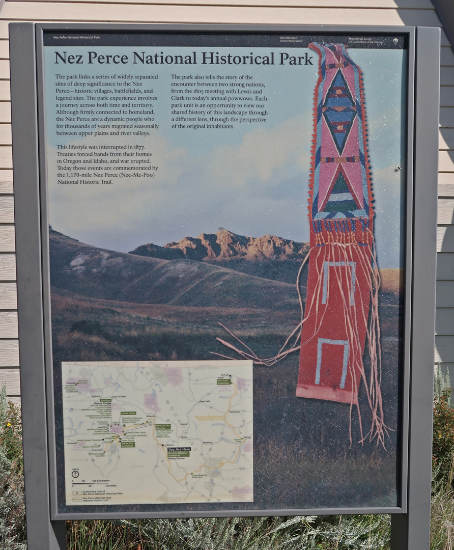
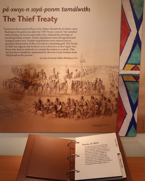
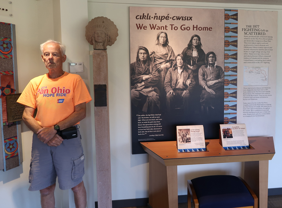
The Nez Perce National Historic Trail – there are 38 separate locations in five different states, following the flight of the Nez Perce tribe from the U.S. Cavalry. After the battle at Bear Paw in northern MT, September 30 to October 5, 1877, Chief Joseph surrendered and stated, “From where the sun now stands, I will fight no more forever.” However, Chief White Bird escaped with about 300 Nez Perce into Canada (~40mi).
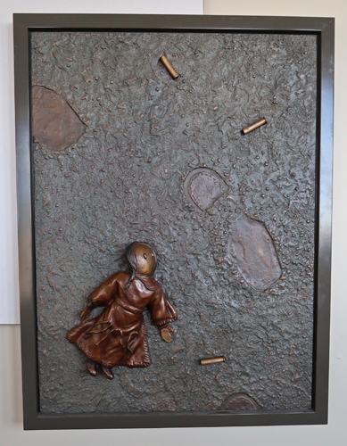
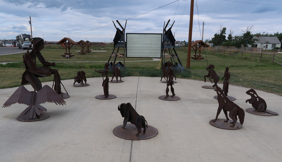
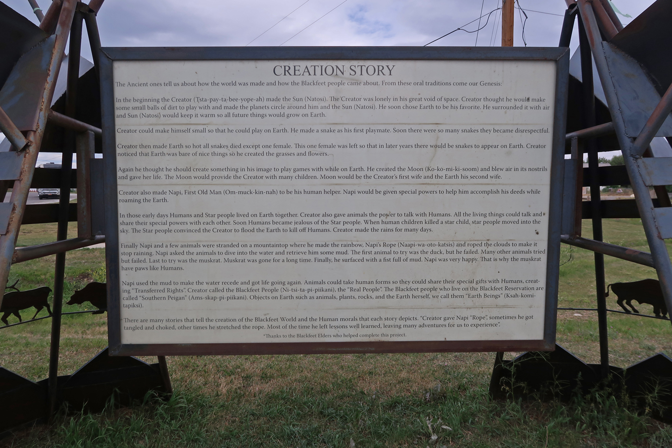
The following display is in the Upper Missouri River Breaks NM Interpretive Center (BLM) in Fort Benton MT


Visitor Center – The Thief Treaty
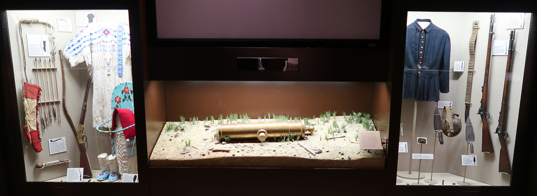

This small monument to the Nez Perce killed in the Big Hole battle was originally located on the battlefield. It was regularly vandalized. So, it is now in the Visitor Center.

2hrs (85mi) NE to Grant-Kohrs Ranch National Historic Site, working ranch run by the NPS

First stop, the Visitor Center

Johnny Grant and Conrad Kohrs

Old Photos

Howdy Partner!

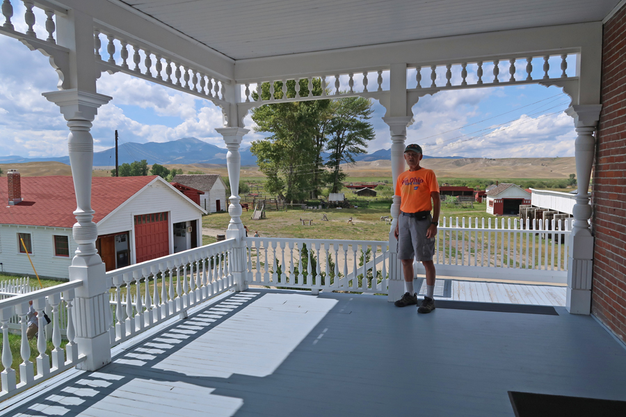
Brick extension (1890), original white frame ranch house (1862) on right

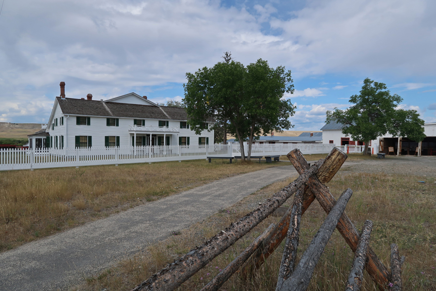
Did the house tour, unfortunately, no photos allowed. It had an eclectic combination of period ranch items and quality furnishings from around the globe. Both Grant and Kohrs were international travelers. View from back porch –
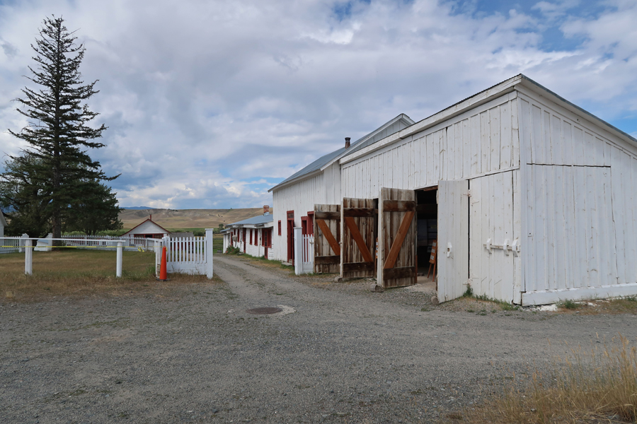
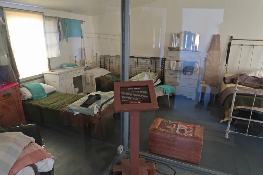
Bunkhouse Row

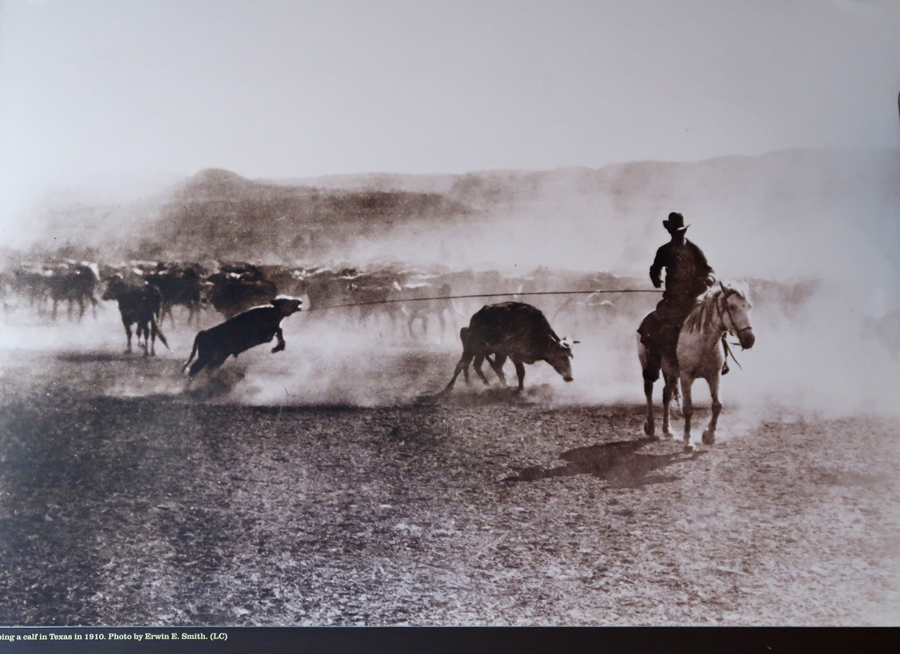
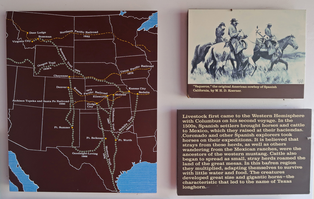
Western Trails – this ranch is in Deer Lodge MT
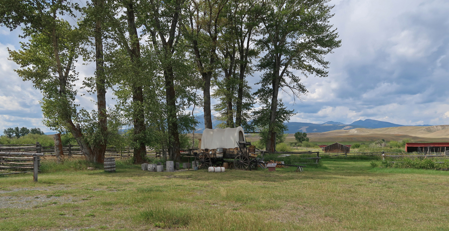
Garden, back of house, and chuck wagon on right
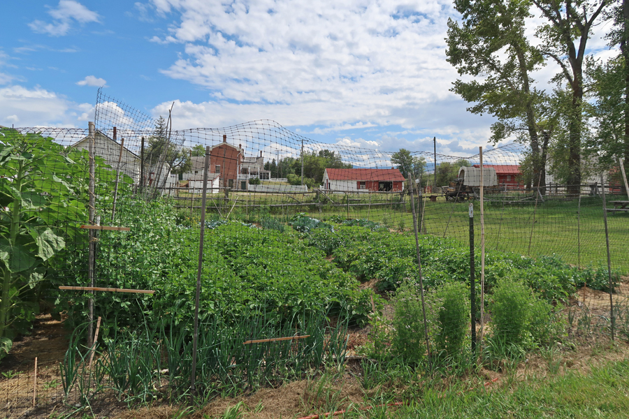
I “loved” the Chuck Wagon, even had a personal talk and cup of Cowboy Coffee with Cookie. Water boiled in a coffee pot over a fire, coffee thrown in, settled to bottom, and then poured. I had a caffeine high for the next three hours!

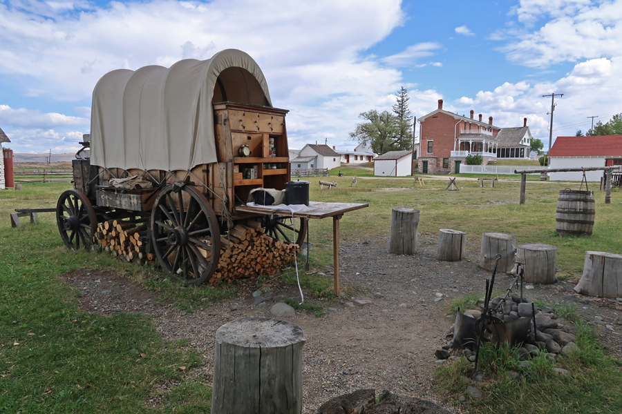
“Cookie” – the most important member of the cattle drive

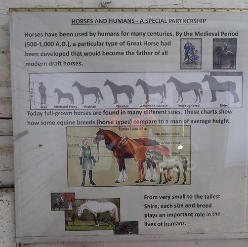
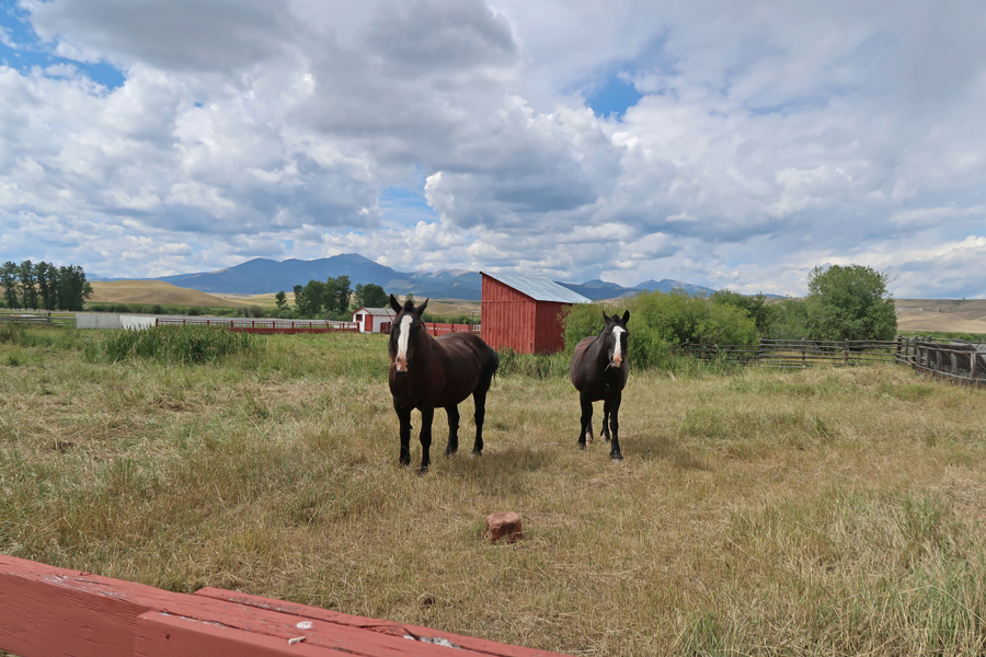
Horses
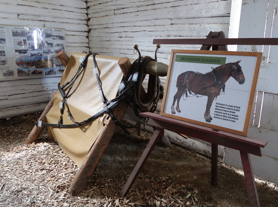
Blacksmith Shop

Variety of Horse Shoes


Variety of Cattle Brands

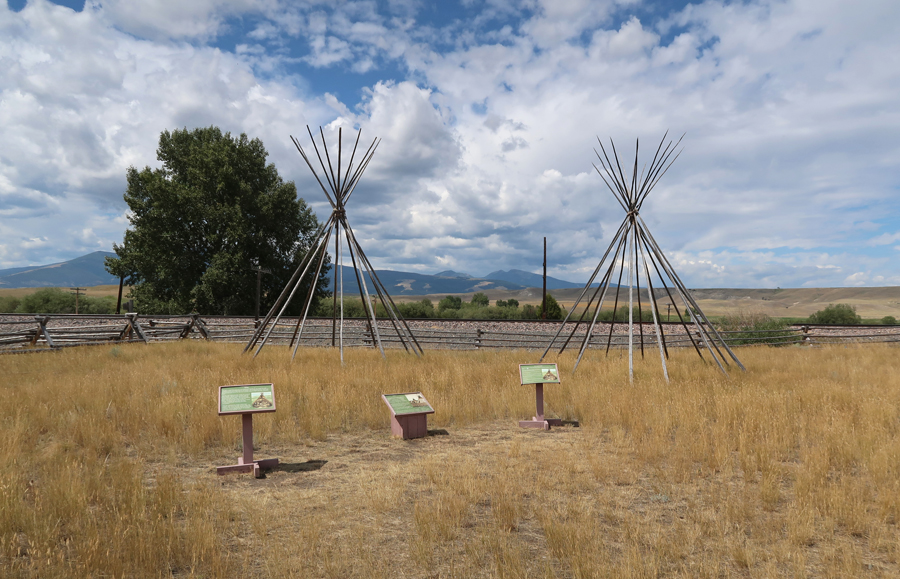
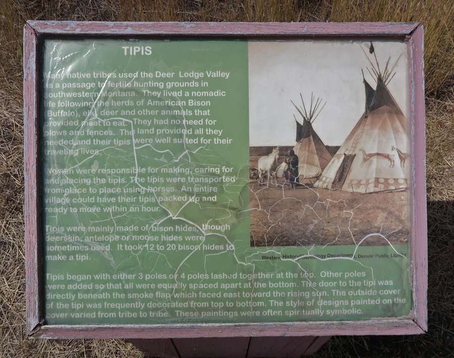
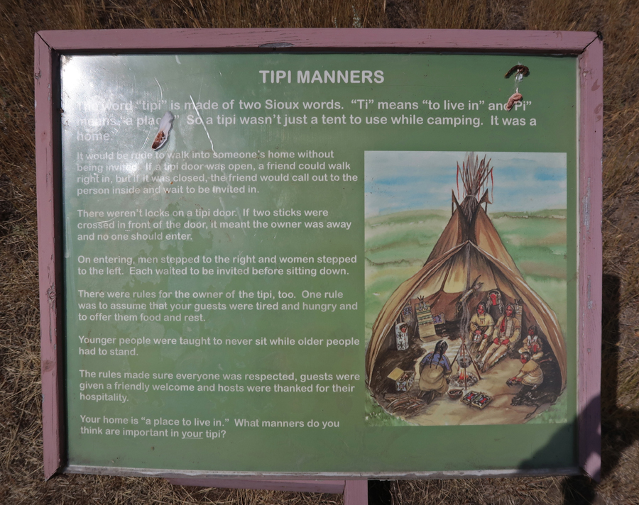
Tipis would be set up outside of the Trading Post. The first floor of the 1862 house was the Trading Post, the second floor was the residence.

4hrs to the West entrance of Glacier National Park. I had not planned on going into the park but having arrived 5min before the Apgar Visitor Center closed, I couldn’t resist!
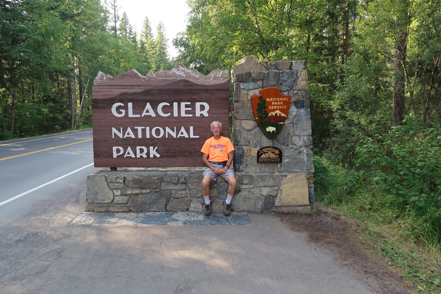
Glacier National Park is part of the Waterton – Glacier International Peace Park World Heritage Site.

On both of my previous visits here, I started in Waterton Lakes National Park in Canada. Climbing Mt Crandell (7,802ft) in 1967. Prince of Wales National Historic Hotel (1927) and Middle Waterton Lake can be seen in the background. We also did the boat tour on Upper Waterton Lake into the U.S. and back.

Helen climbing Mt Crandell in 1969, Upper Waterton Lake in background
 Tom on the Rocks
 Pat, Helen, Tom, Cecile, Mike 1969

Two Babies

Bison Paddock in Waterton Lakes NP
In 1967, after Jay and I crossed the border into the U.S., we hiked into Glacier NP along the Belly River Trail. We laid out our sleeping bags and slept in the woods. The next day we discovered that two young women had been killed in the park the previous night by grizzly bears!
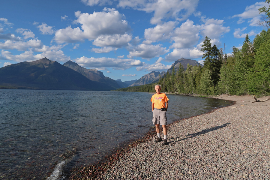
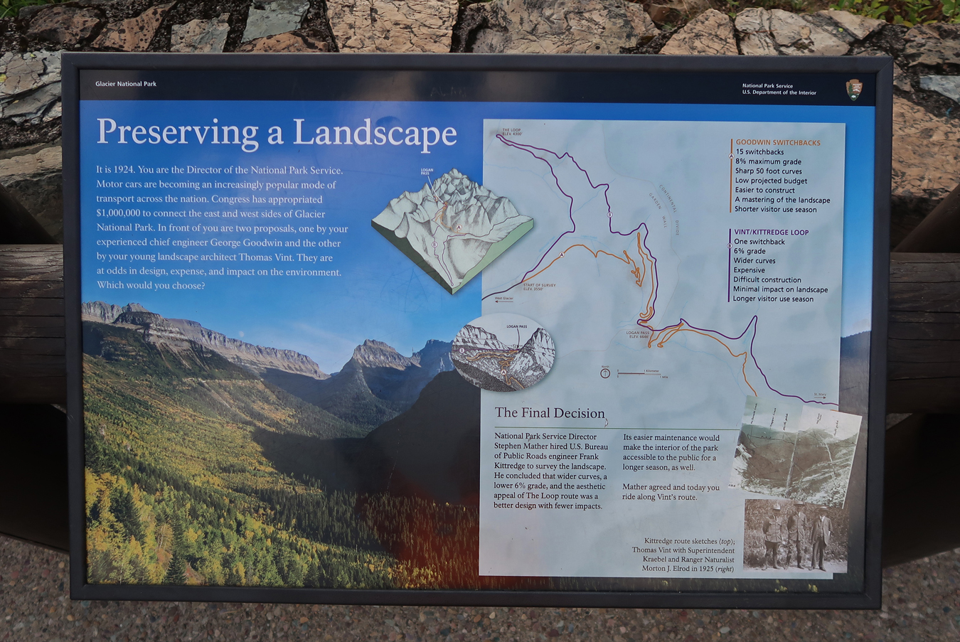
On the previous trips I drove from East to West and hiked several trails. This time, I drove West to East on the Going-to-the Sun-Road. I opened the sunroof and all the windows on the SUV and breathed in the mountain air! This sign was at the SW end of Lake McDonald (3,200ft), 3.4 miles from West Glacier, 28.6mi to Logan Pass (6,646ft) – see bottom of sign.
 Lake McDonald (3,153ft)
 McDonald Falls
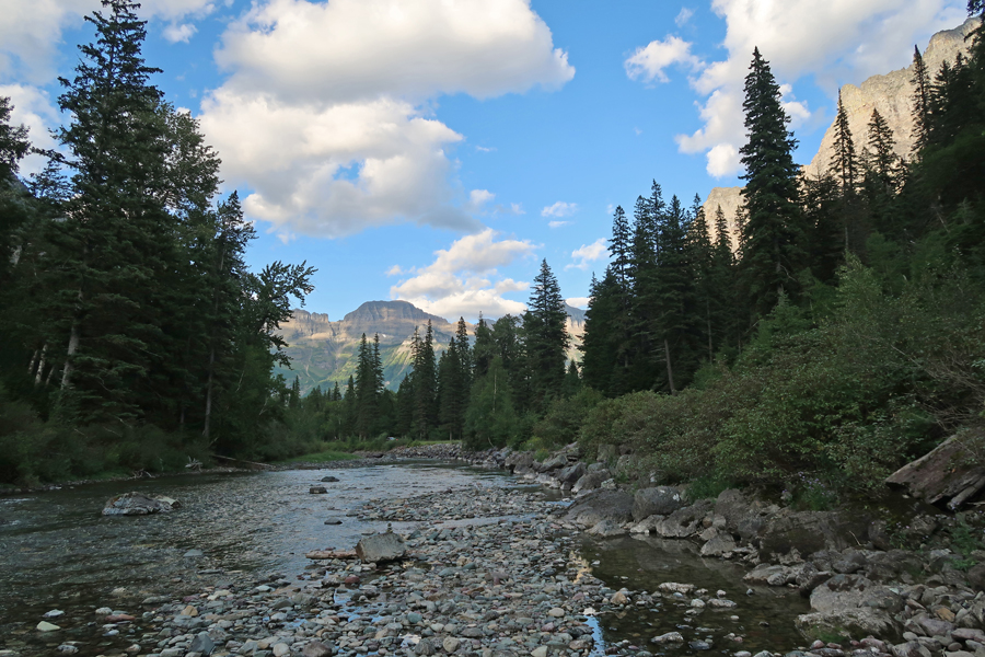
 McDonald Creek
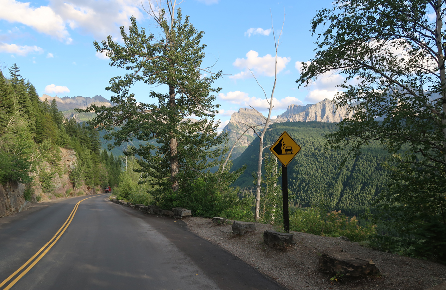
 Going – Up

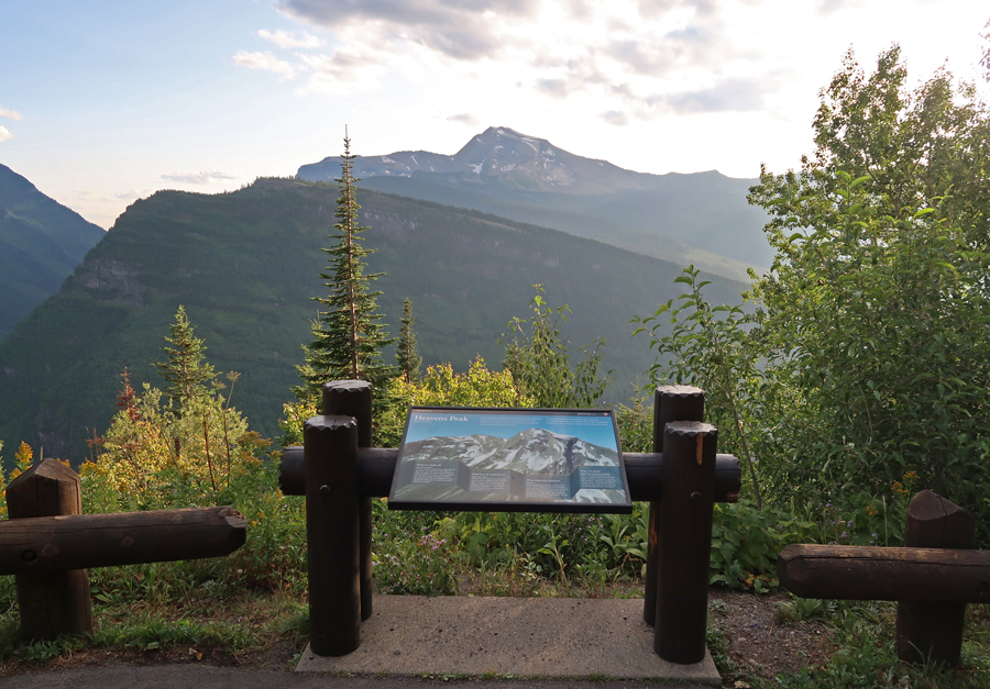
 Heavens Peak

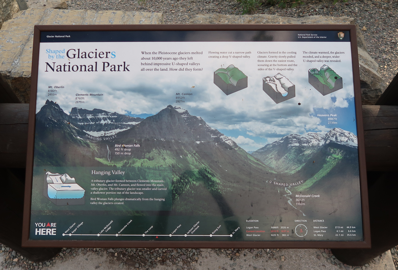
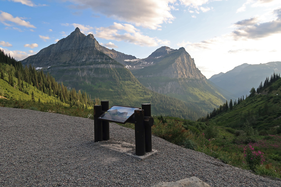
Looking back at the U-shape of a glacier carved valley

 Wilderness?
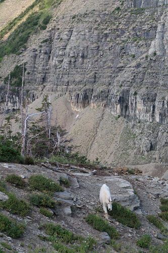
 Mountain Goat
Cecile Martin at Logan Pass 1969
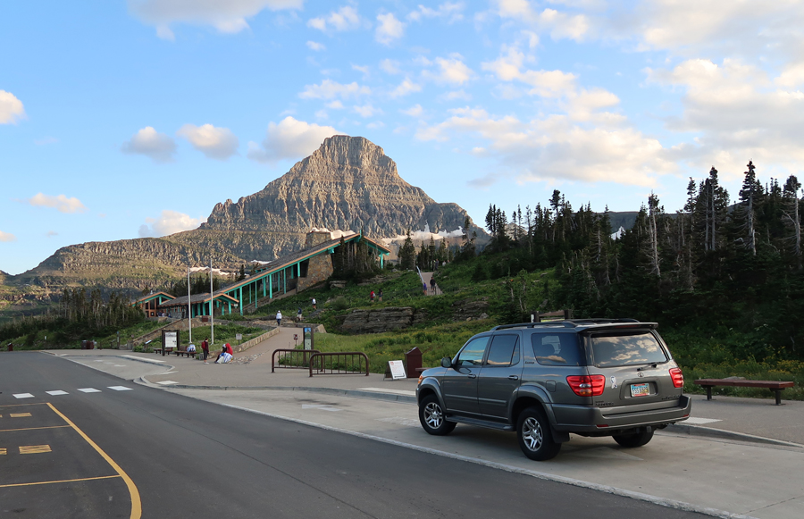
 Logan Pass 2019

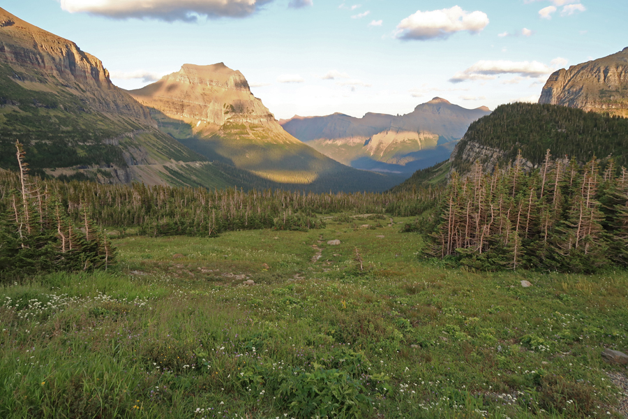
 Eastward descent from Logan Pass
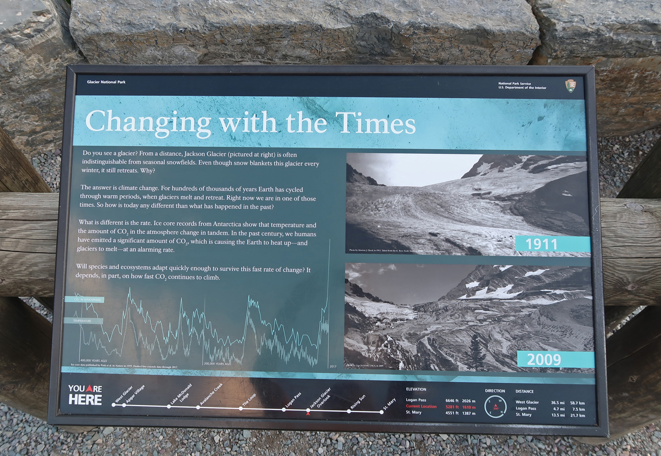
Global Warming – Jackson Glacier
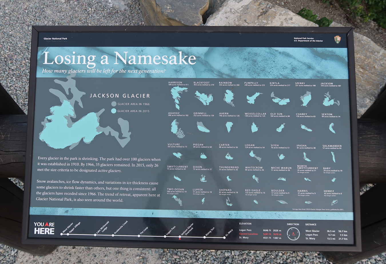
There may be NO glaciers in Glacier NP for our great-great grandchildren
Hiked the Sun Point Nature Trail to Saint Mary Lake

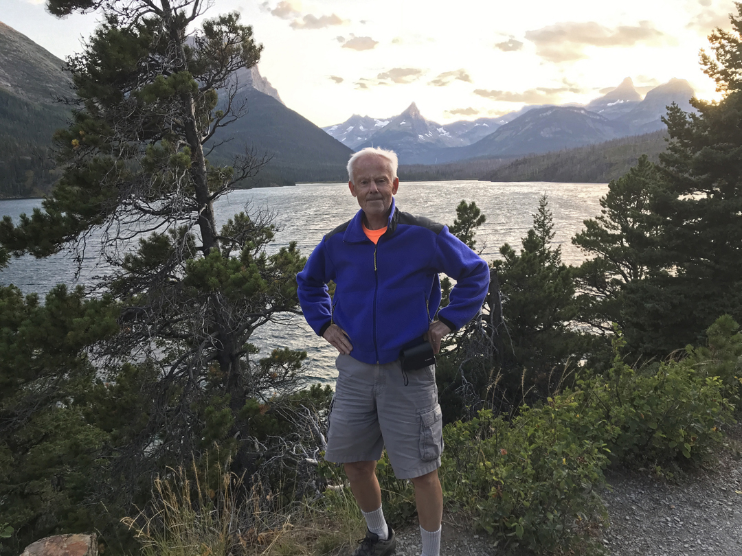
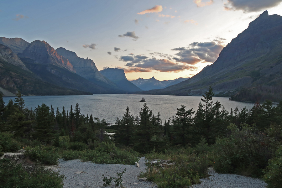
Famous view of Goose Island in Saint Mary Lake from Rising Sun – looking West


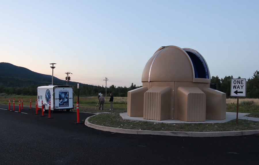
Attended a Dark Sky program at the Saint Mary Visitor Center


Slept in the parking lot of the Snowgoose Grille in Saint Mary
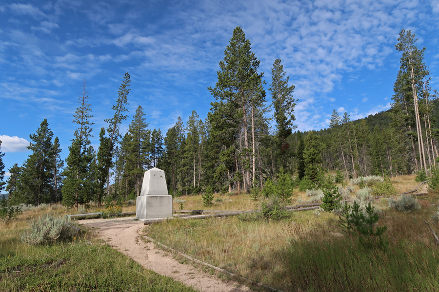
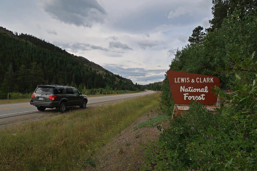
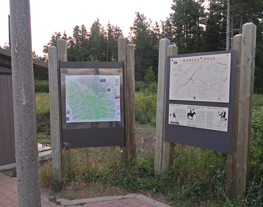
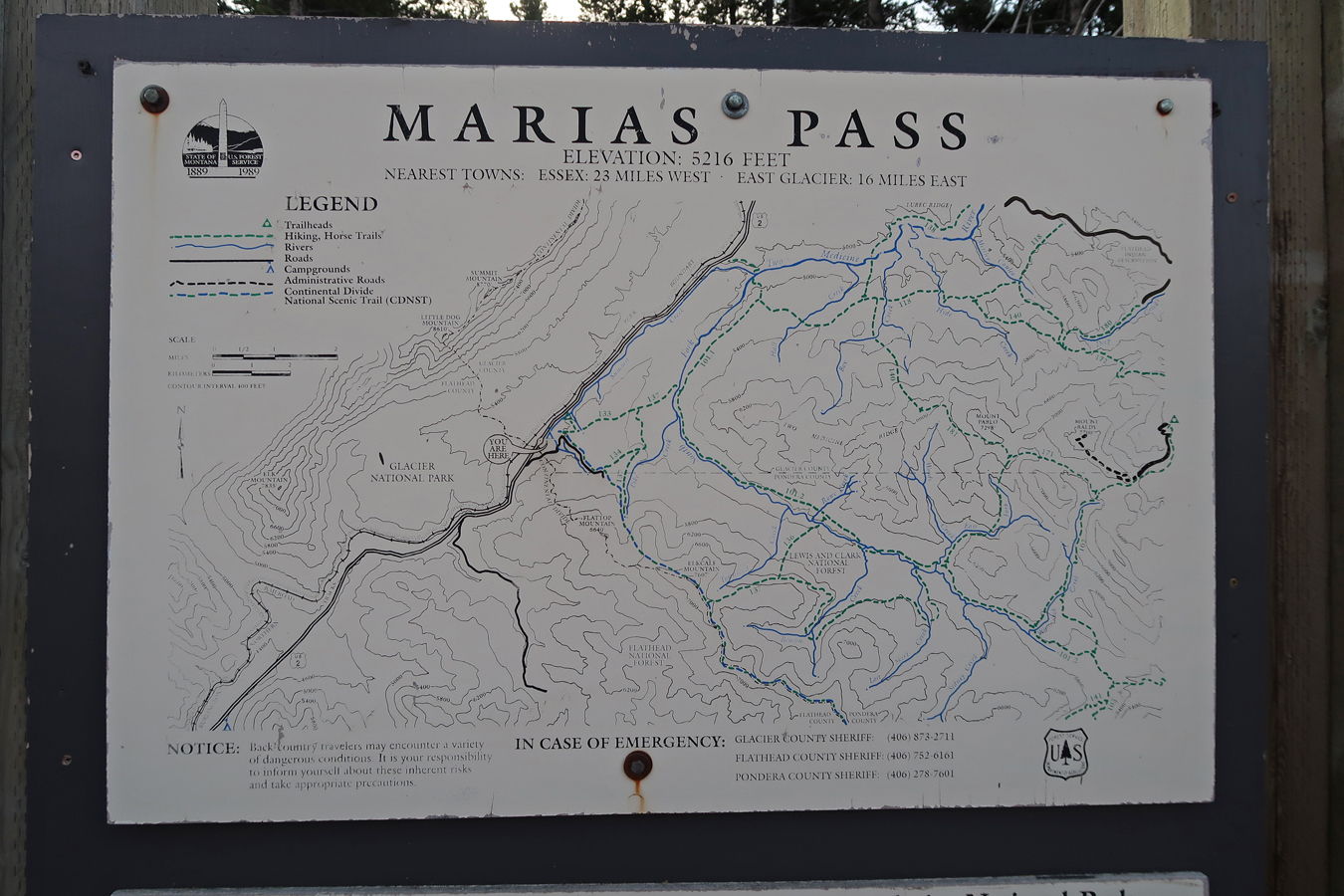
8-16 F – Took Rt 89 and then Rt 49 south to East Glacier Park Village, and from there, Rt 2 east to Marias Pass (5,216ft). A new National Monument titled Badger-Two Medicine (B2M) has been proposed on Lewis and Clark National Forest land west of the Blackfeet Indian Reservation and SE (across Rt 2) from Glacier NP. This 200 square mile area is called B2M for the two rivers, the Badger River and the Two Medicine River, that begin in snowfields and rivulets along 30mi of the Continental Divide and then flow east through this area. The area is referred to as the Rocky Mountain Front, where the mountains meet the prairies. The B2M area is an important spiritual retreat and sacred to the Blackfeet people.

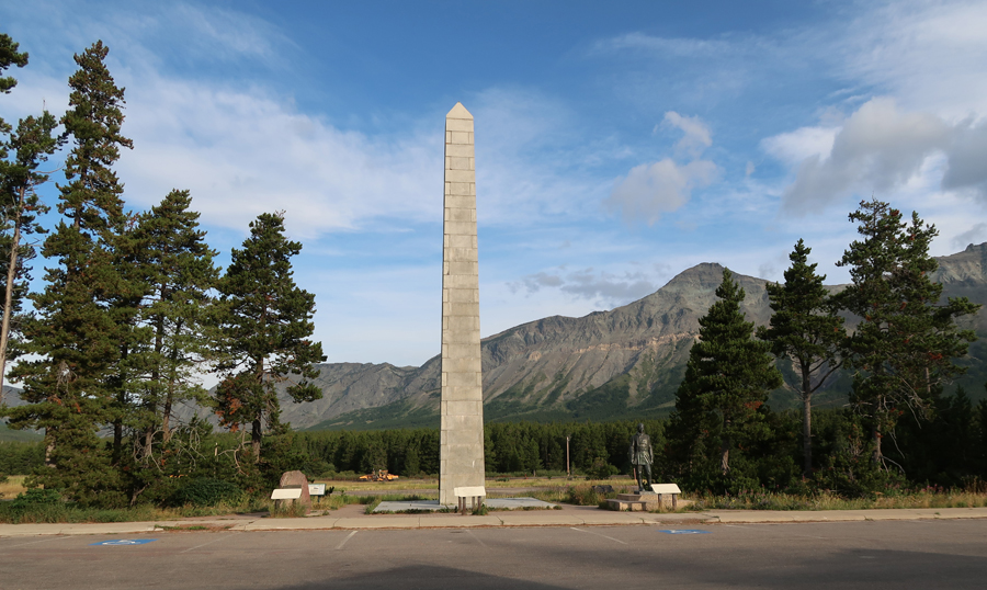
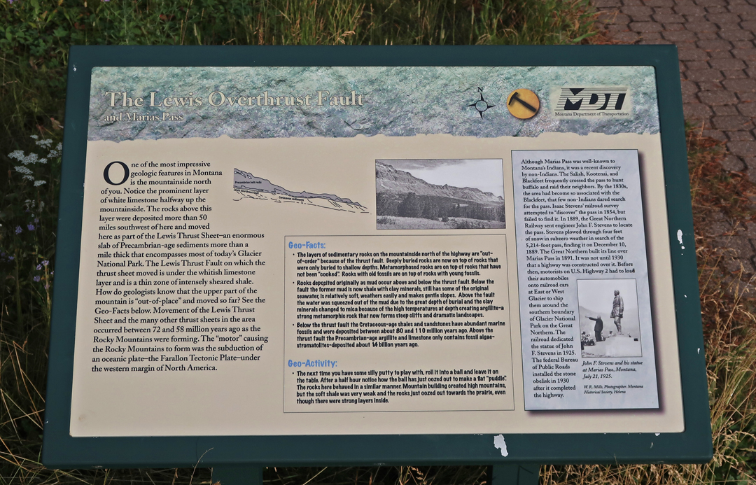
Montana’s Indians, the Salish, Kootenai, and Blackfeet, frequently crossed the pass to hunt buffalo and raid their neighbors. The pass was “discovered” in 1889 by John F. Stevens an engineer for the Great Northern Railroad. The RR would finish their line over the pass in 1891. The statue of Stevens was dedicated in 1925.

The obelisk is a memorial to Theodore Roosevelt and was dedicated in 1930 after the highway was completed over Marias Pass.

The Lewis Overthrust Fault is in Glacier NP

The Continental Divide Trail crosses Rt 2 at the Marias Pass Historic Interpretive Site

I had difficulty getting information on how I could access the B2M area. My first attempt was a 4WD road extension of the Pike Creek Road Forest Service Access. I had to back up for about 100 yards and turn around when I got to this point.
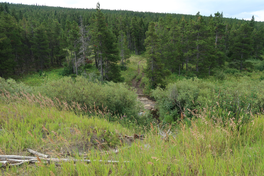
To be sure I had hiked in the B2M area, I did parts of three different trails. The first was a 1mi out (south) and back on the Continental Divide Trail. I made sure I had my water, snacks, hiking stick, and was wearing my “bear bell.”

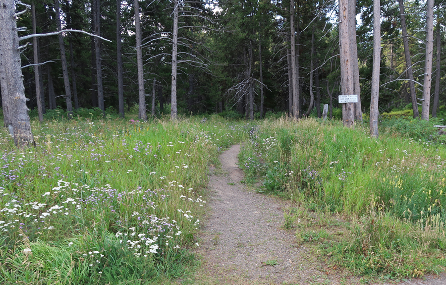

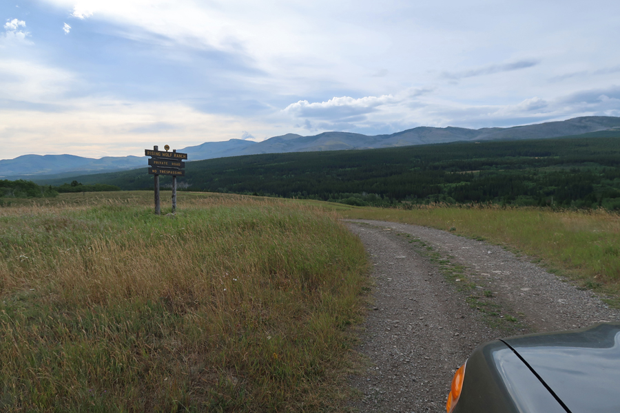
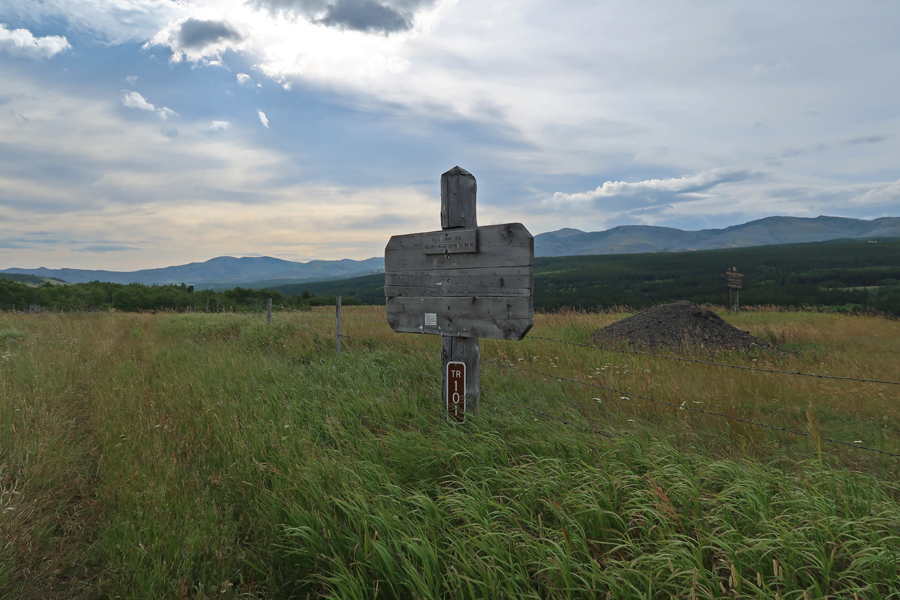
The second hike was on USFS Trail 101, which is off of a road that leads to Rising Wolf Ranch
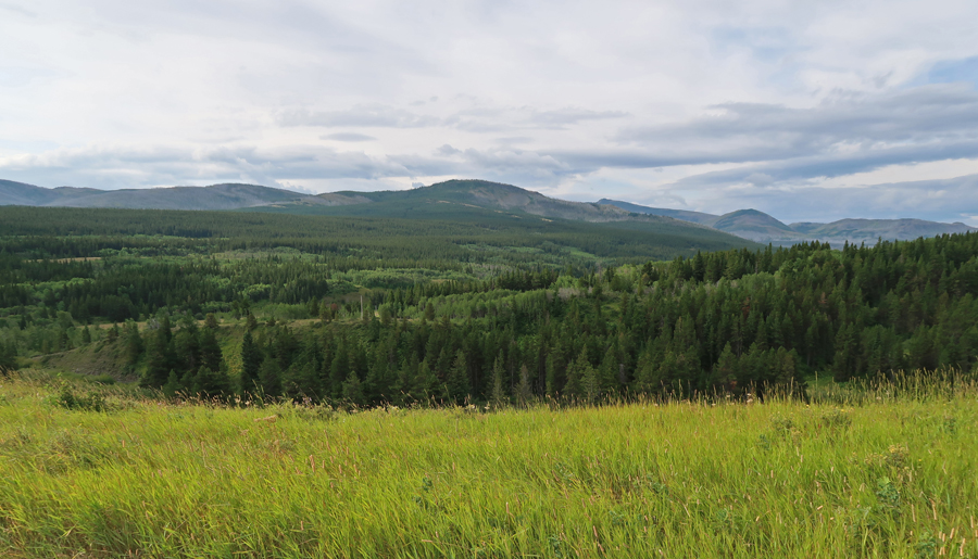
The third hike was on the Lubec/Buffalo Lakes Trail (USFS #100) off of Rt 2
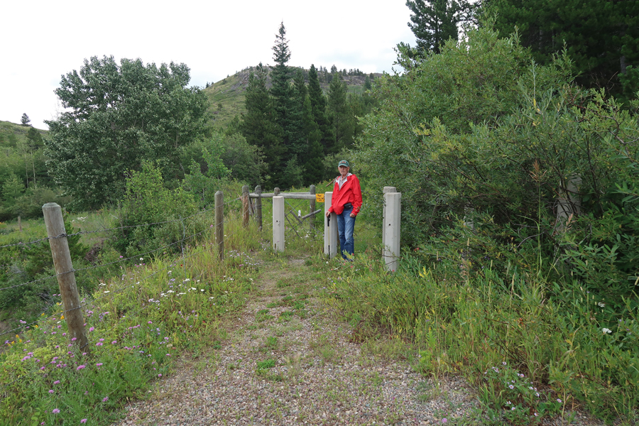
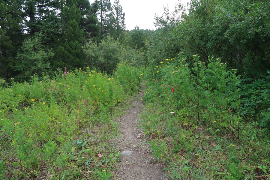
I hiked for about an hour, until I was above Lubec Ridge and Buffalo Lakes. I took a nice video from that point.
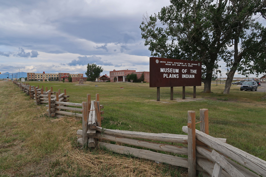
A 20min drive from the trailhead took me to Browning MT, which is on the Blackfeet Indian Reservation. It is the location of the Museum of the Plains Indians.
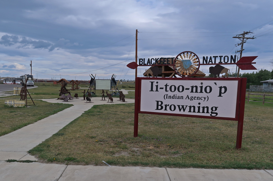
 Blackfeet Nation Agency
East of Browning, off Rt2, is a monument to commemorate the northernmost campsite of the Lewis and Clark expedition – Camp Disappointment. Read the sign to discover why it was a disappointment. The obelisk monument is on the ridge just to the left of the sign.

The site is on private land within the Blackfeet Indian Reservation. That might have something to do with the graffiti.

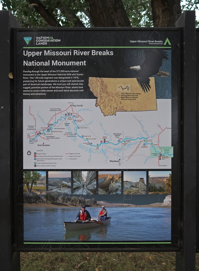
3.5hrs (200mi) to Fort Benton MT and the Upper Missouri River Breaks National Monument Interpretive Ctr (BLM)
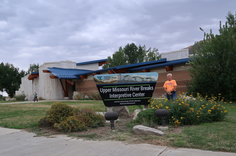
The monument spans 149 miles of the Upper Missouri River from Fort Benton to the Charles M. Russell National Wildlife Refuge
Flags of Indian Nations

Displays on history
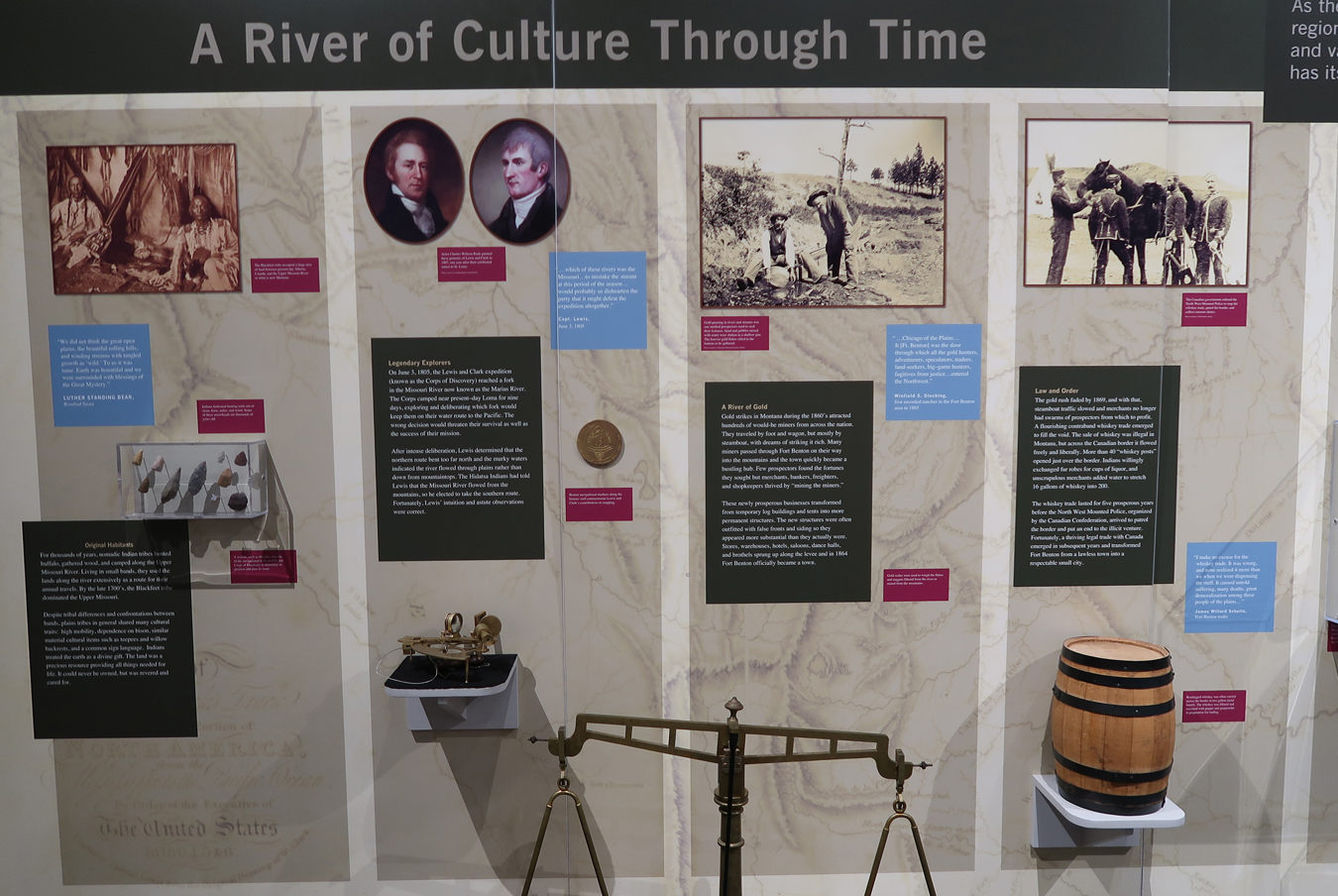

Geology and Paleontology

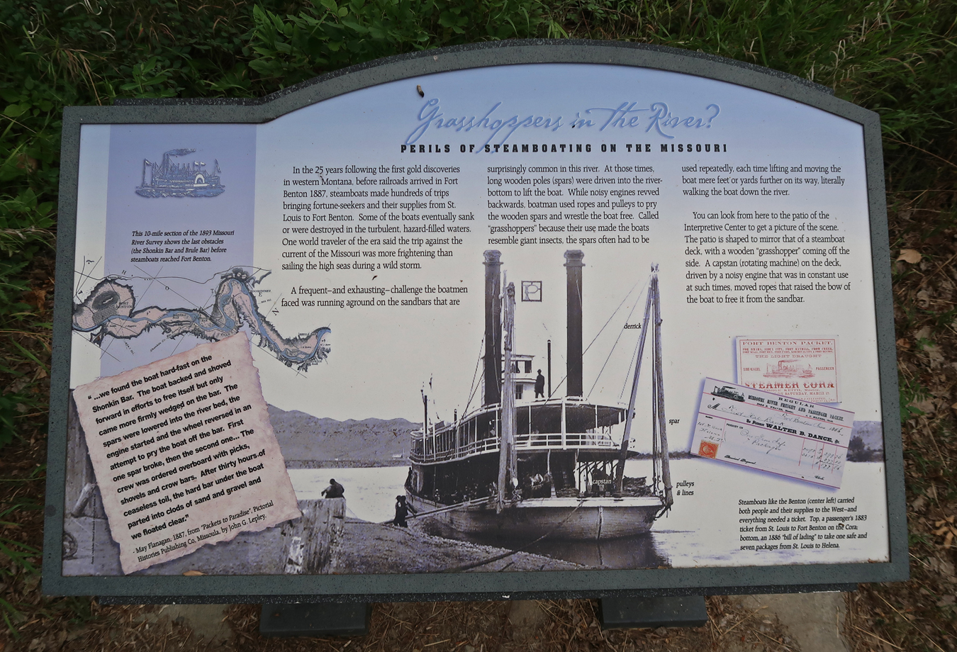
Steamboat Era

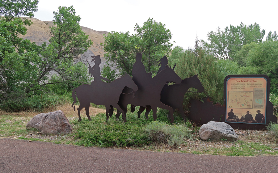
The Cow Island Incident


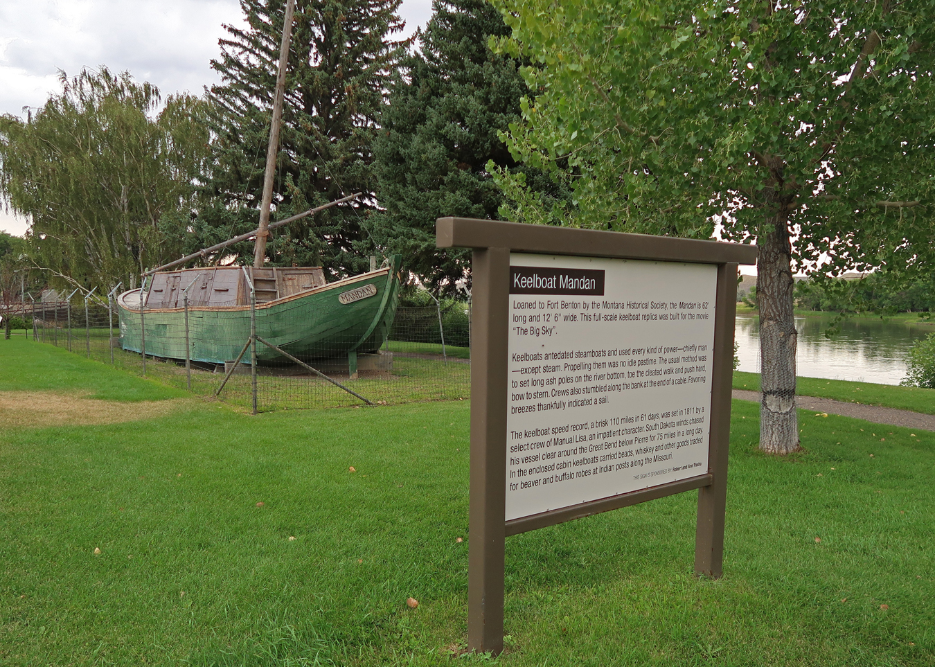
Fort Benton has done a great job of developing its riverfront into an attractive, informative, and welcoming area for locals and visitors. Keelboats preceded steamboats for transport up the Missouri.
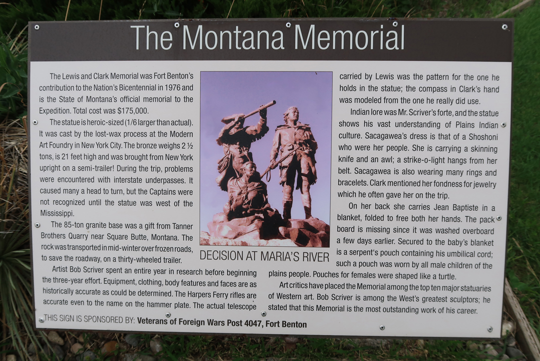
The Montana Memorial
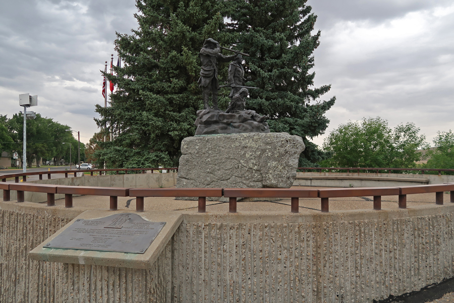

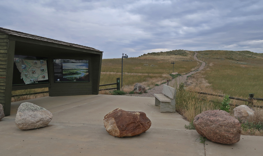
I drove a lengthy but interesting route through the National Monument. I covered about 180 miles, with over 100 miles on gravel roads where I did not encounter another car. . My first stop of note was Decision Point.
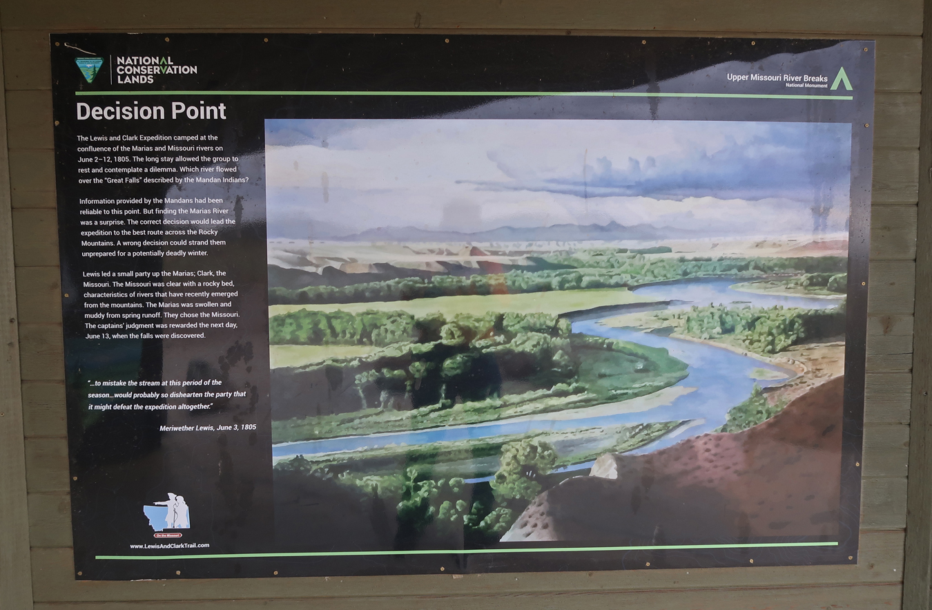

This reminded me of Helen telling me which way to go –

Nice view of the confluence of the Missouri and Marias Rivers

I then drove a circular route, first Rt87 N and then Coal Banks Landing Road south to Virgelle Ferry. I crossed the Missouri River on the quaint state ferry.


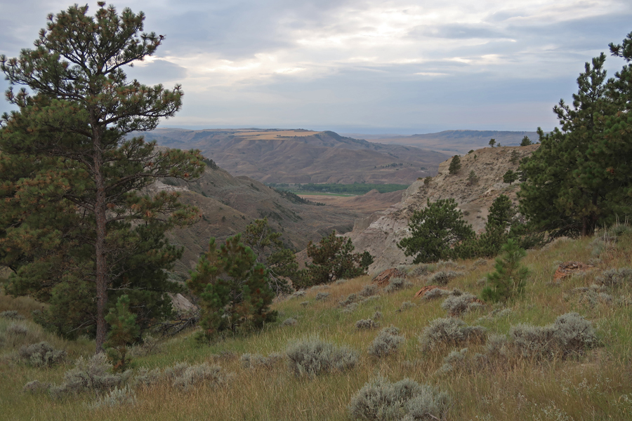
I then drove back to Decision Point on the south side of the river. That gave me a good feel for this part of the monument. The land surrounding the river is rugged “uplands,’ commonly referred to as the Missouri Breaks. In 1976, Congress designated the 149-mile segment of the Missouri River that runs through the monument as a National Wild and Scenic River.


I then drove Rt87 N again, this time to Big Sandy and then took Rt236 S to Judith Landing

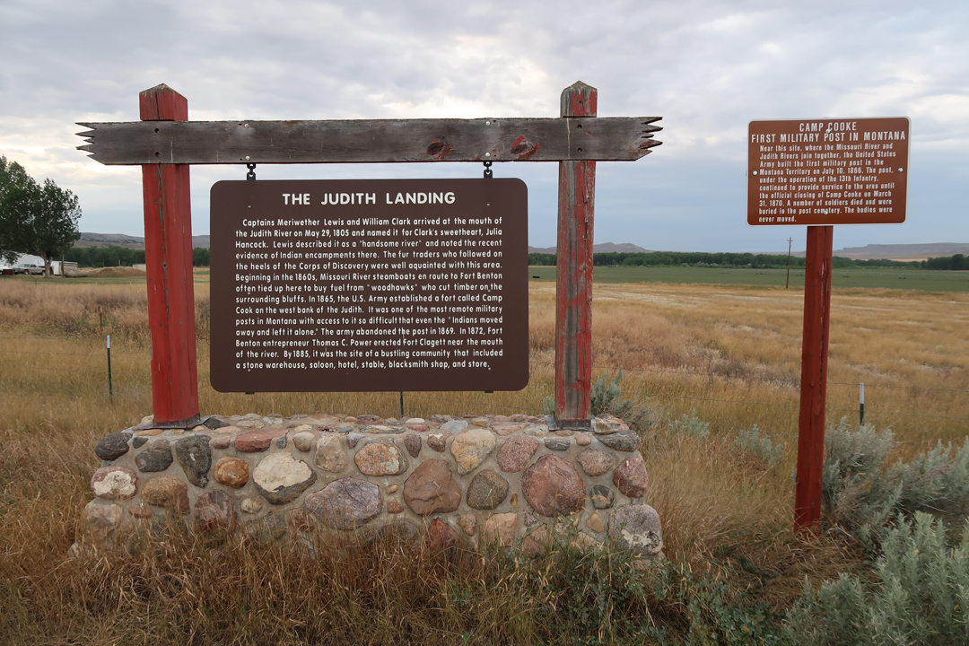
Camp Cooke and Claggett Hill Trail

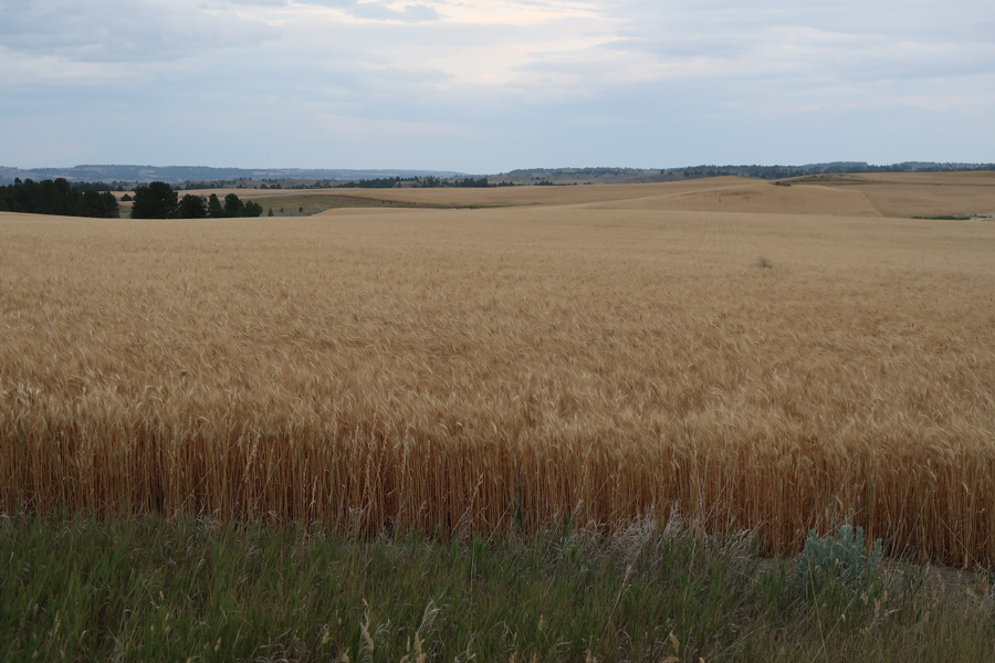
The “Staff of Life,” a strong wind blowing the wheat made it look like waves on the ocean


I arrived at the James Kipp Recreation Area campsite in the Charles M. Rusell National Wildlife Refuge at 10pm. Thus, I joined the Nez Perce, Lewis & Clark, and other sojourners who have passed through this wild and scenic area.
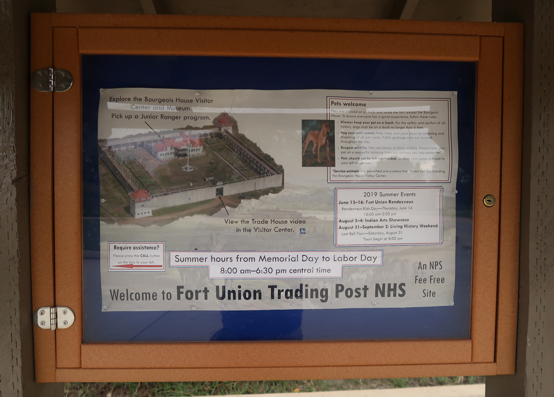
8-17 Sat – 5hrs (280mi) to Fort Union Trading Post National Historic Site ND
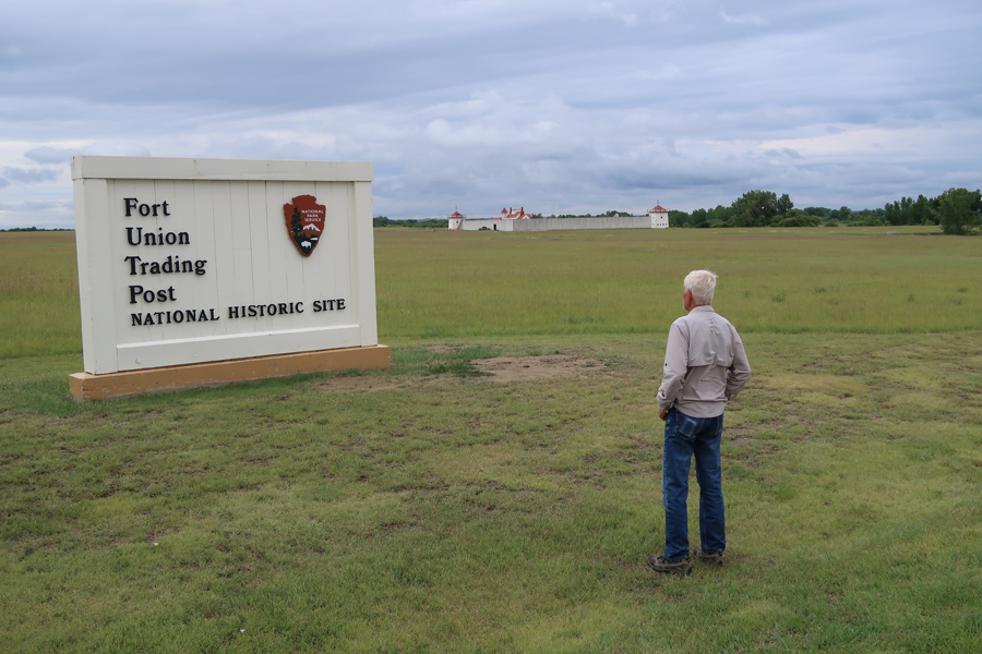
It is in ND just across the MT border
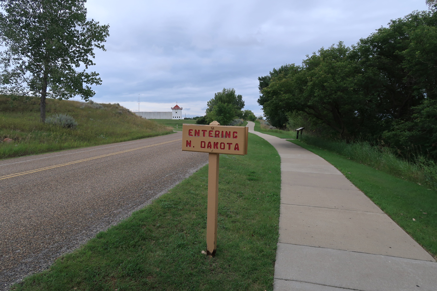
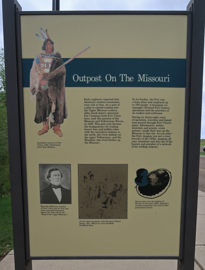
Fort Union was an American Fur Trading Outpost located on the Missouri River just west of its confluence with the Yellowstone River
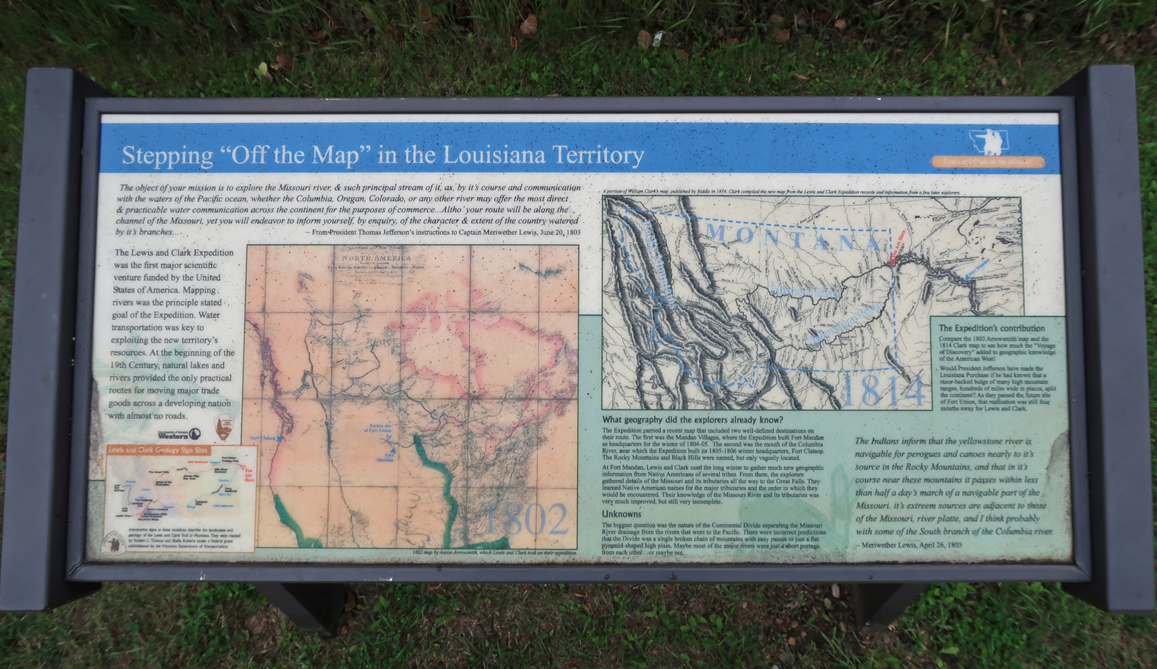
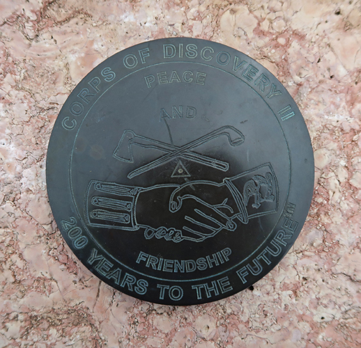
Description of Lewis & Clark “Stepping Off the Map” at Fort Union
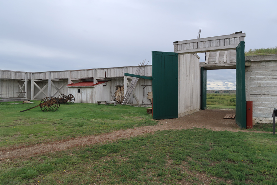
Bastion, front gate, and giant fur press on right
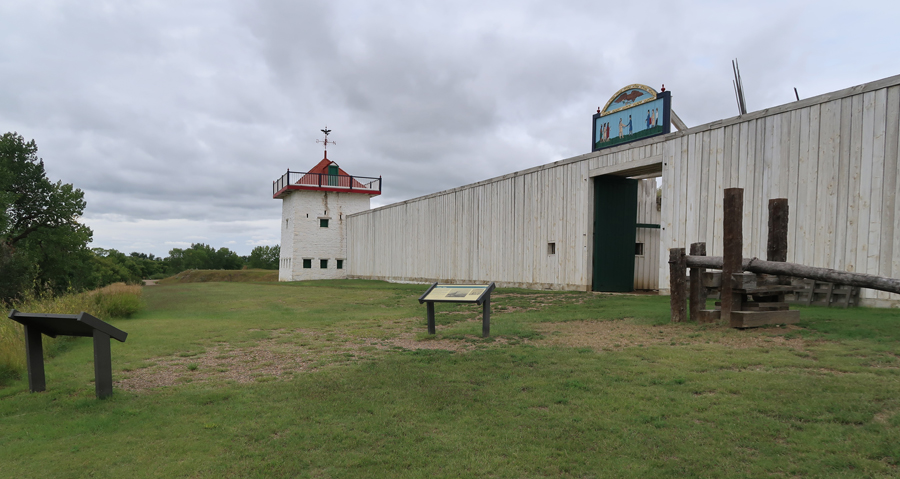
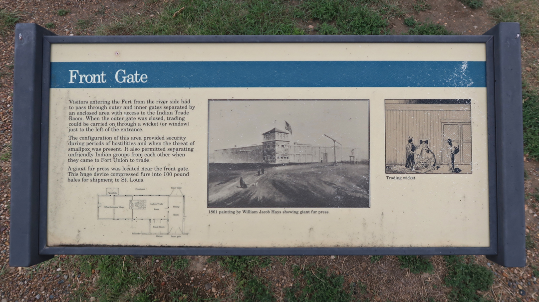
The window to the left of the front gate was a trading wicket
Missouri Breaks can be seen looking west through the front gate
Trade rooms adjacent to front gate

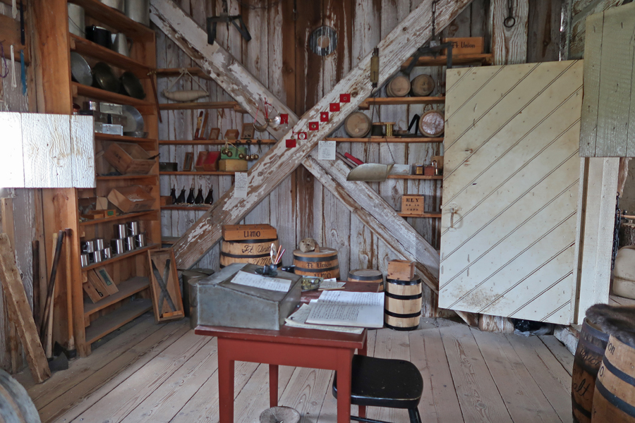
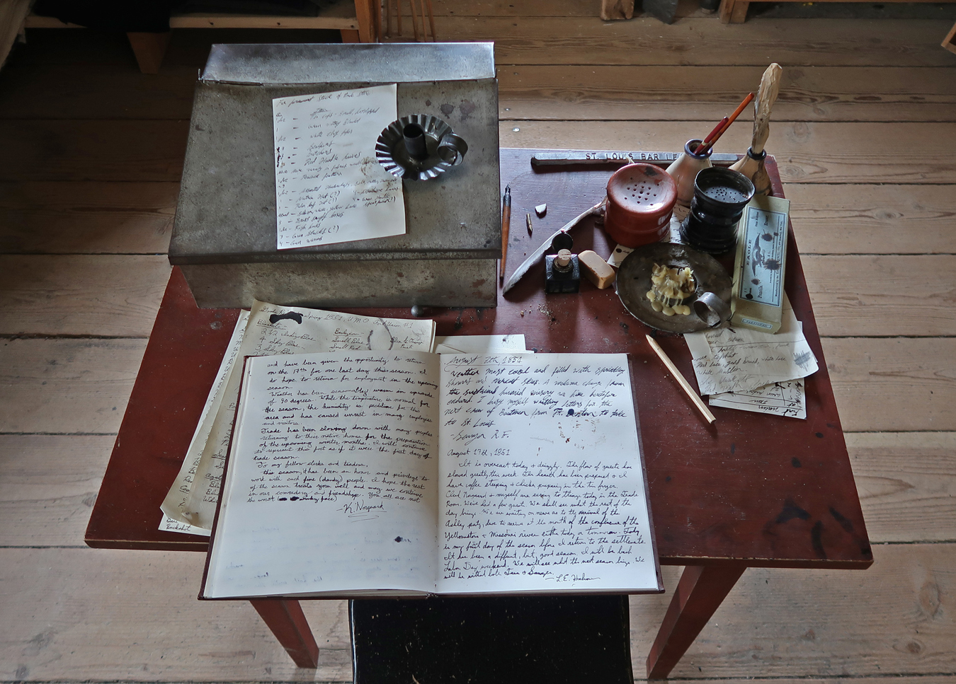
Trading wicket (window) in middle of photo

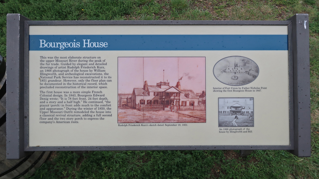
Bourgeois House (Visitor Center) from one of two stone Bastions. Golf cart was not there in 1833!

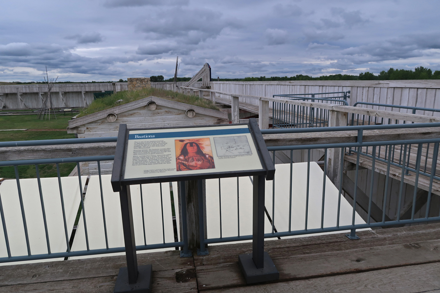
 Bastions
 Trade Goods
 Trade Furs

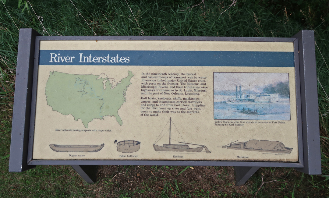
The Missouri River was a 1,800-mile water highway between Fort Union and St Louis

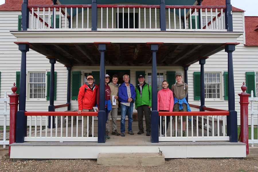
I had the pleasure of meeting the Maitlands here. They stated they were the first family to have completed all National Park Units! They were here with exchange students from Denmark and Germany.
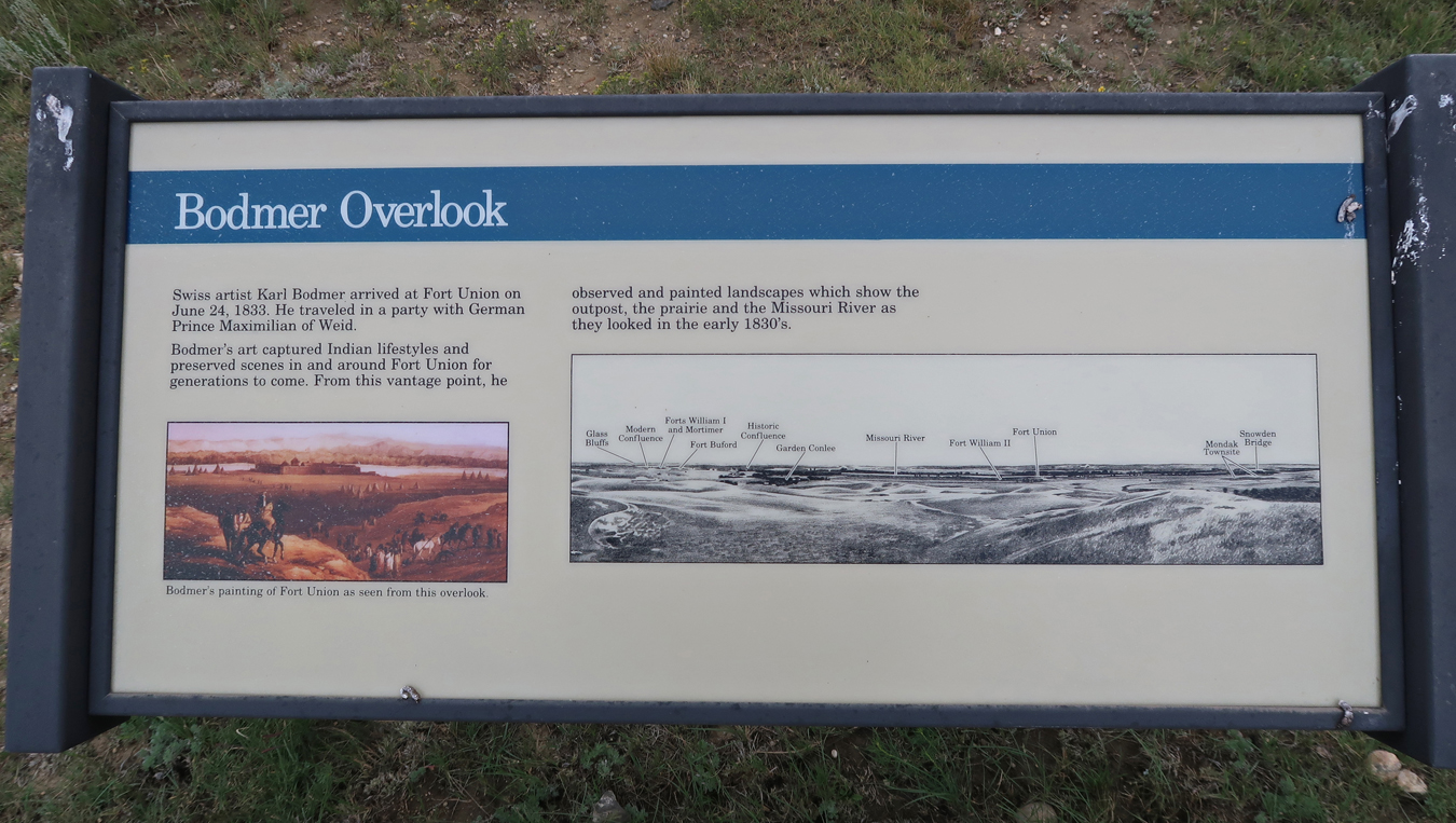
After touring the fort, I hiked to the Bodmer Overlook. The sign states that it is 1-mile roundtrip and takes about one hour. I agree with the one hour, however, I think it is closer to 2-miles roundtrip. Afterwards, I returned to the fort and suggested that the ranger re-examine the length of the trail.

View from the overlook

 1833 painting of the fort
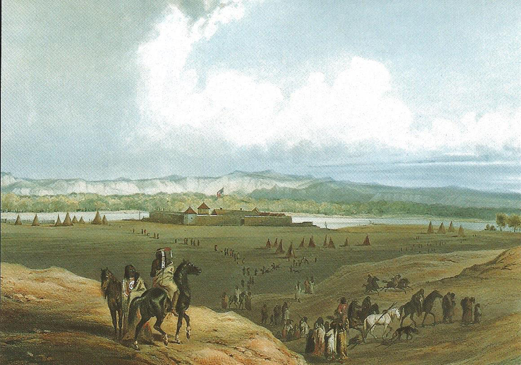
The Missouri River can be seen behind Fort Union

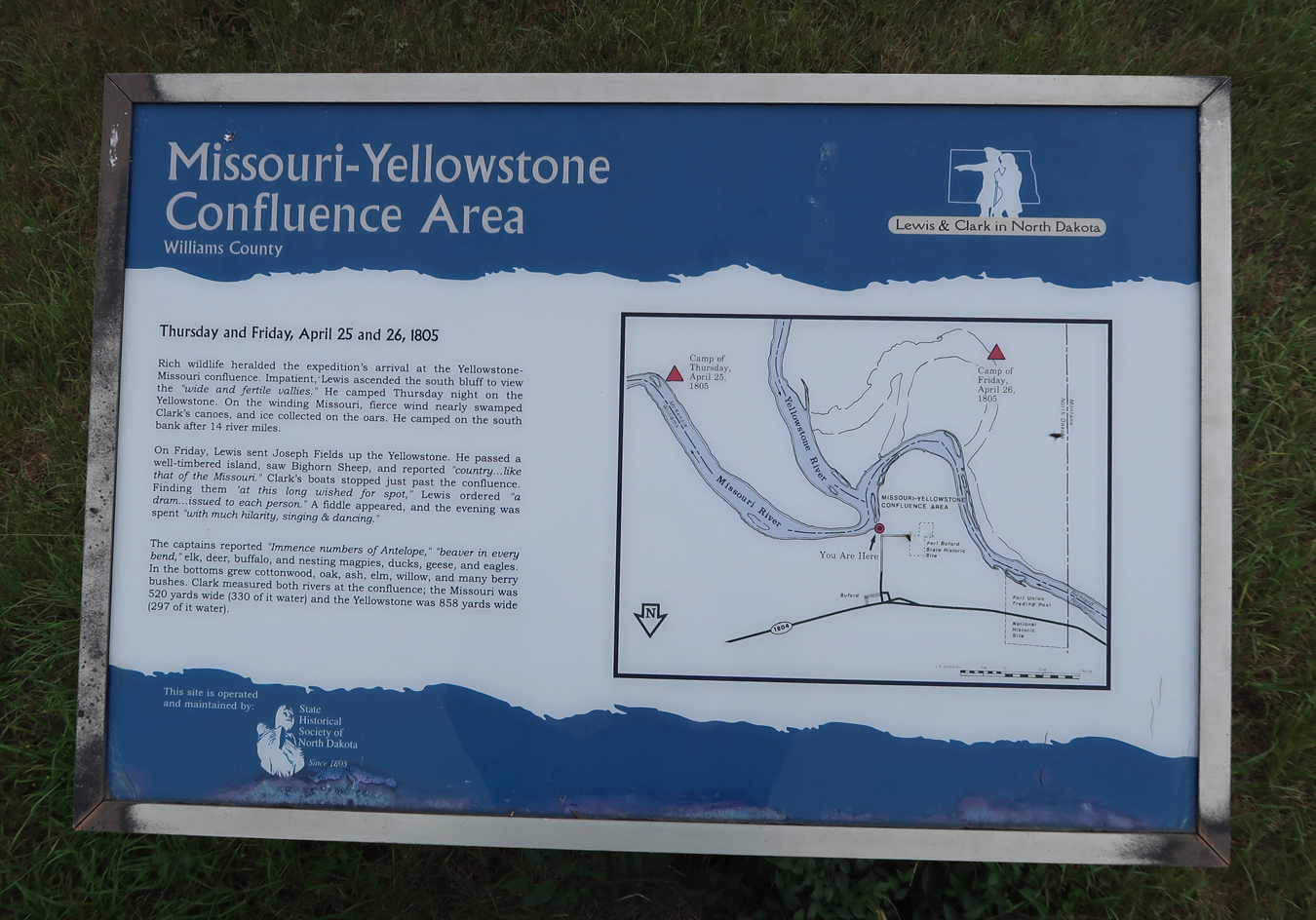
A 5min drive took me to Fort Burton State Historic Park. It is located right at the confluence of the Missouri and Yellowstone Rivers. Lewis & Clark camped near here in 1805.

It was the site of Fort Burton, which was a U.S. military post from 1866 to 1895. This was the site of Lakota Chief Sitting Bull’s surrender in 1881.
It was time for another oil change, so I headed to a new Jiffy Lube in Williston ND. Afterwards, I asked for the best place in town for a steak. I was directed to the Williston Brewing Company. I had a 12oz prime rib dinner and an Oil Bust beer to wash it down! This was one of two big dinner “splurges” I had on this trip.

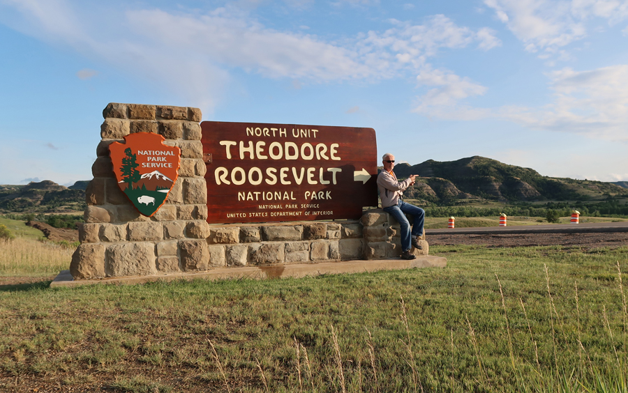
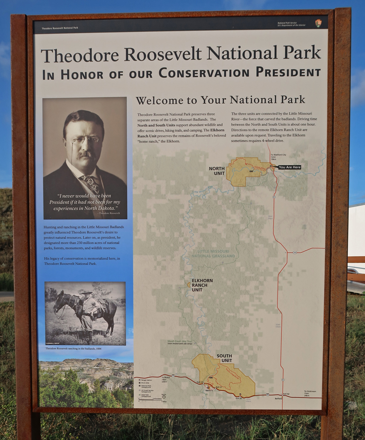
1.25hrs (70mi) to Theodore Roosevelt National Park ND, I had visited the South Unit in 1991

On this trip, I explored the North Unit
There are more National Park Units associated with Theodore Roosevelt than any other person

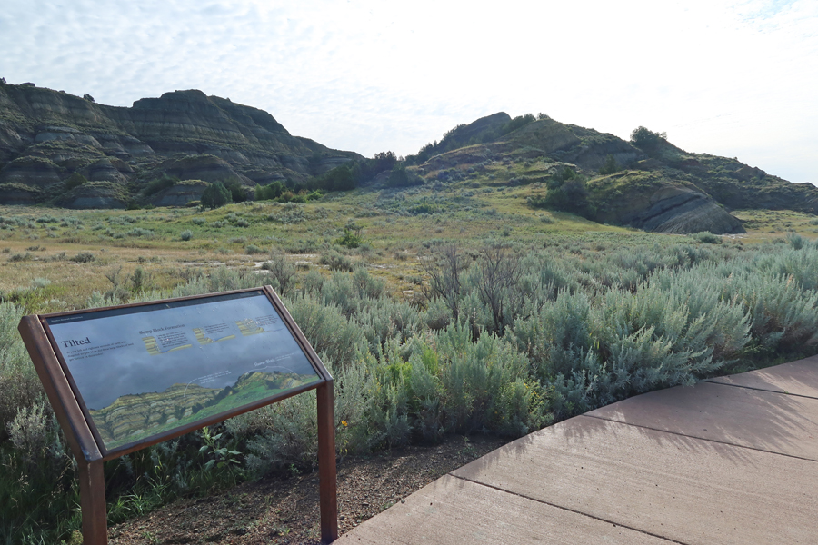
Bentonite, a fine-grained blue-gray clay, defines the badlands’ landscape

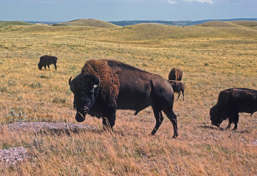
Resident Buffalo Herd
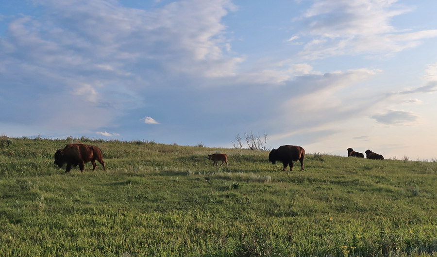

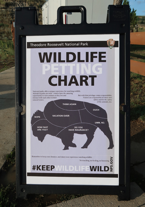
Don’t Mess with the Buffalo!
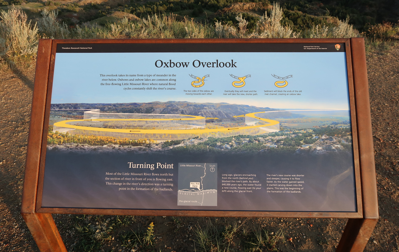
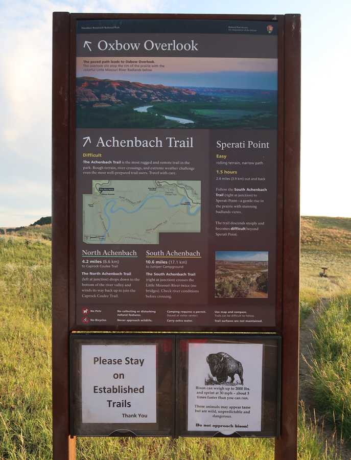
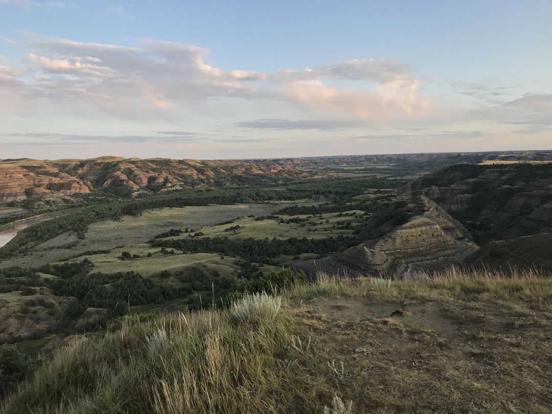
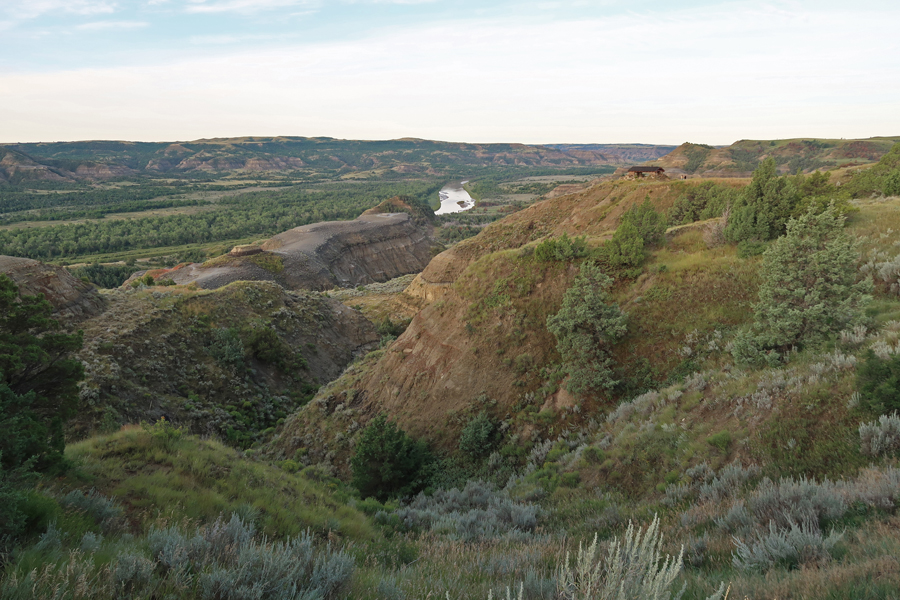
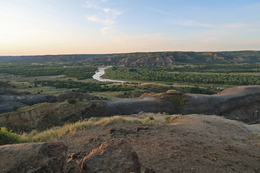
I did the 28-mile Scenic Drive to the end of the road at the Oxbow Overlook of the Little Missouri River

From there, as the sun was setting, I did the 1.2mi trail to Sperati Point
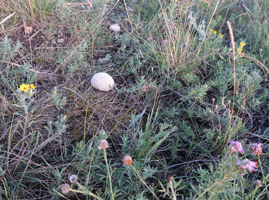
Interesting “brain” stones
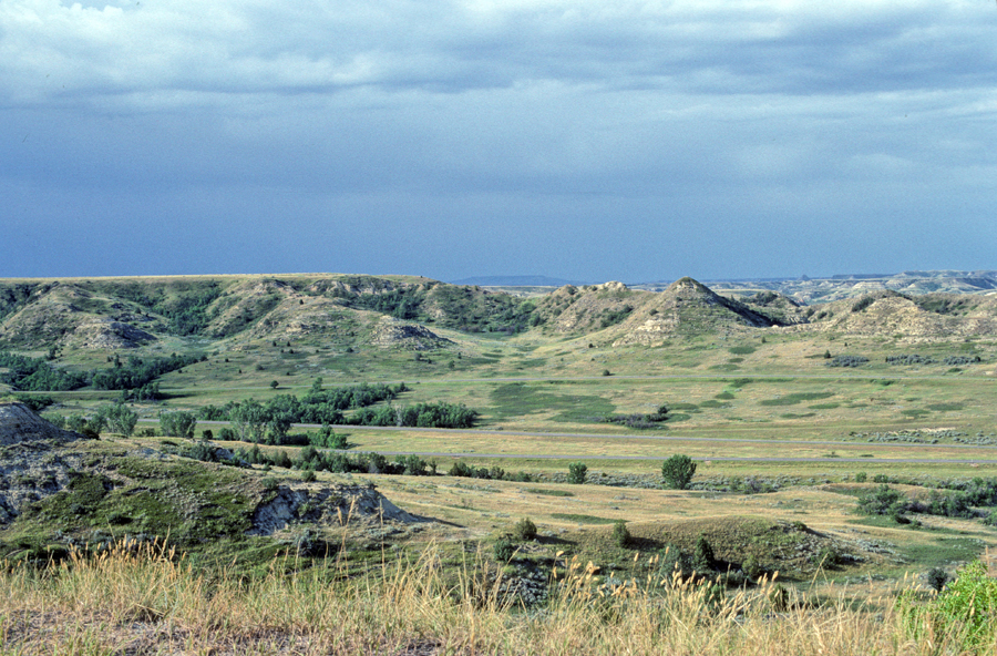
View south from Sperati Point
I slept in the Juniper campground
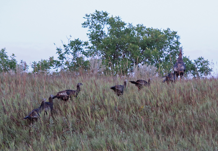
8-18 Sun – I was up early, which is a good time to view wildlife


River Bend Overlook – “The View that Launched a Park.” Note the 1937 CCC shelter on the right


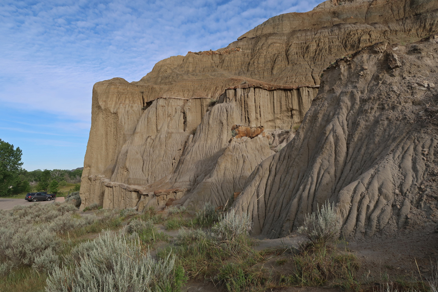
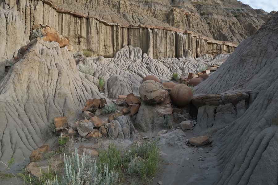
I started on the Caprock Coulee Trail; however, it was way too muddy. I was carrying an extra three pounds of mud on each shoe! So, I moved on to the Cannonball Concretions area.

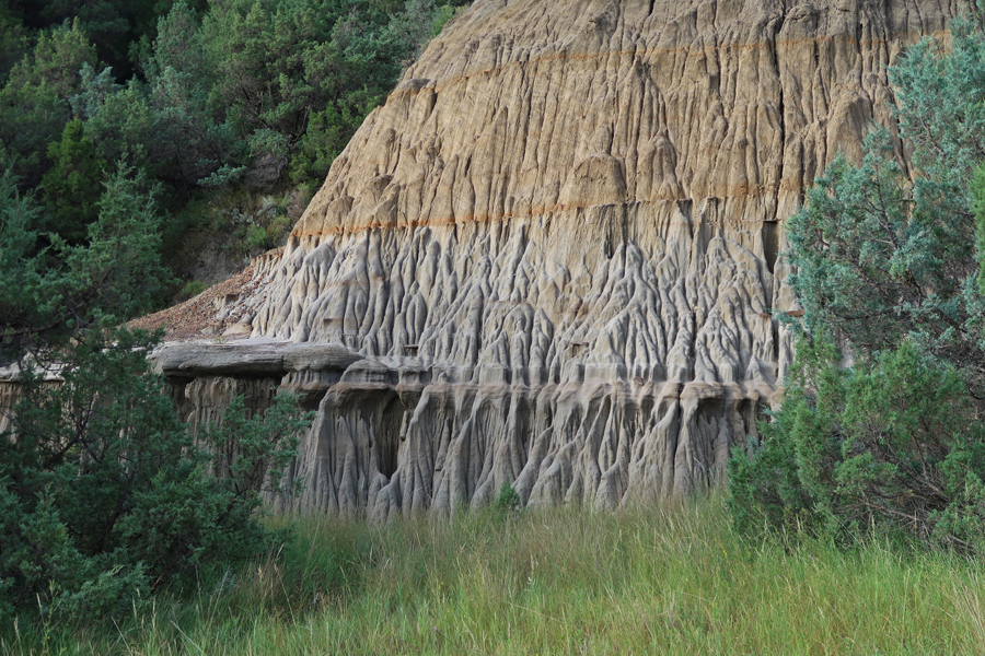
West side of butte
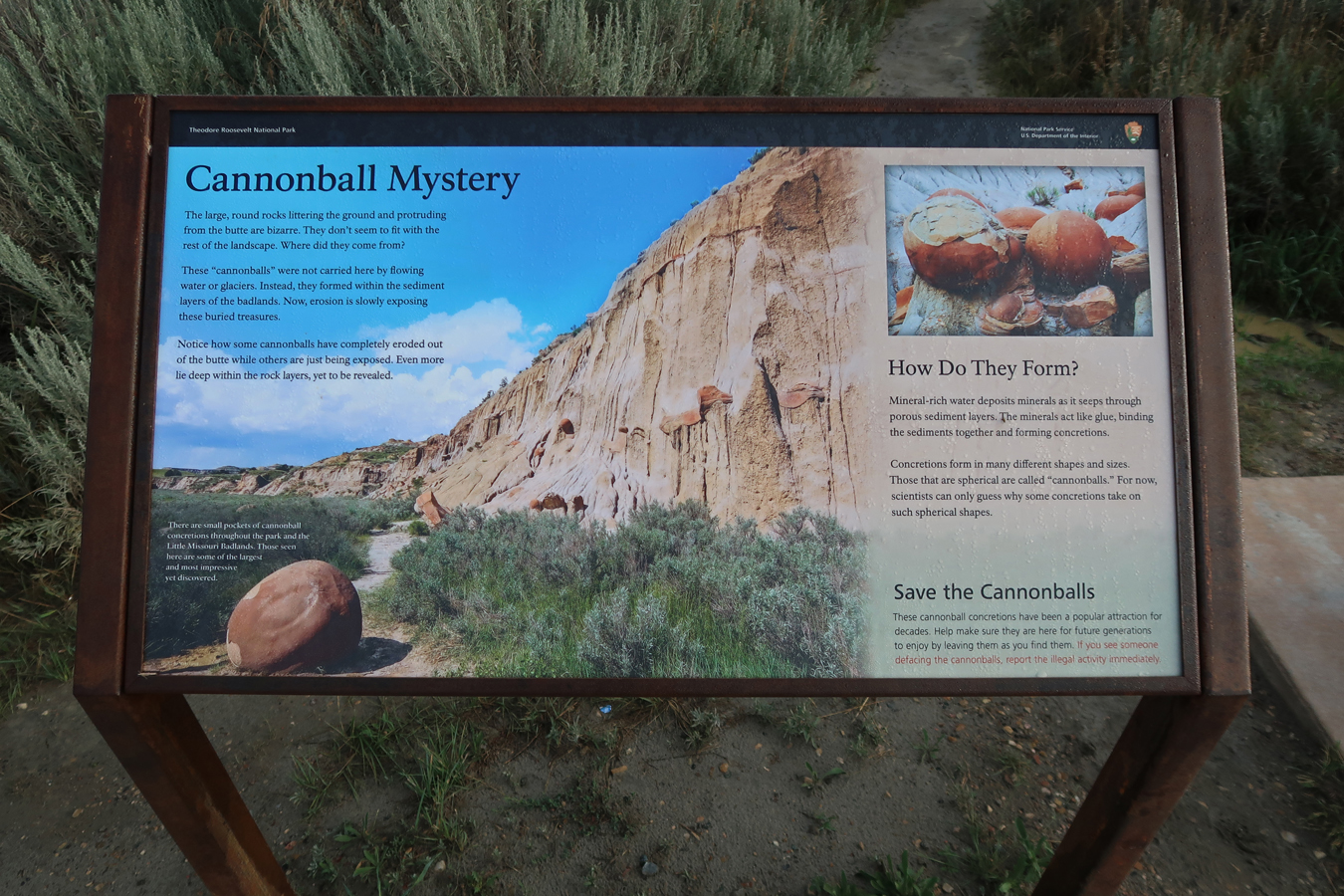

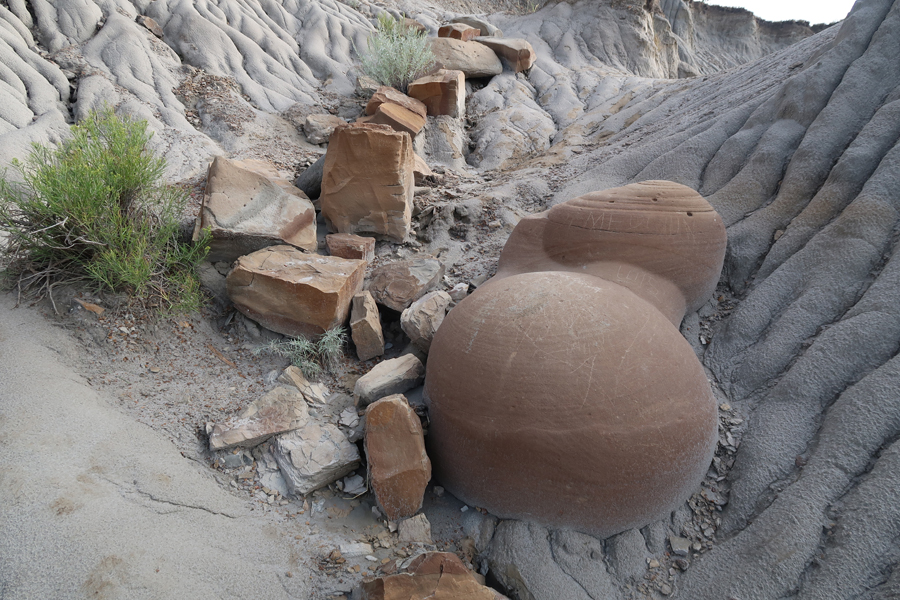
Fascinating formations – called concretions. NOT carried here, but formed within the sediment layers of the badlands
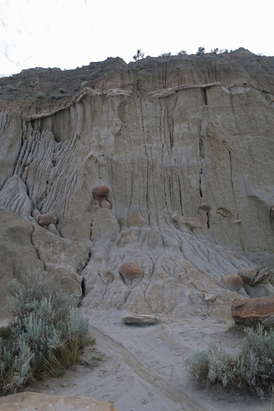


East side of butte
Did the Little Mo Trail, 1.1mi rt, to get a close-up view of the Little Missouri River


Formation of a “Slump Block”

I drove east on Rt200 through new “fracking fields.” This previously sparsely inhabited area is now booming with construction. I was surprised to find new “roundabouts” out in the middle of nowhere! On the other hand, ND has done little to improve their road signs – they are terrible!
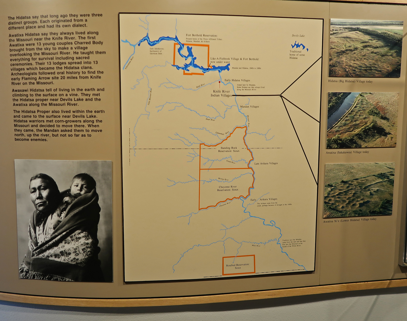
The 110-mile trip to Knife River Indian Villages National Historic Site on the Knife and Missouri Rivers took 2hrs.

The park encompasses the sites of three Indian Villages

There were many Indian Villages along the Missouri River
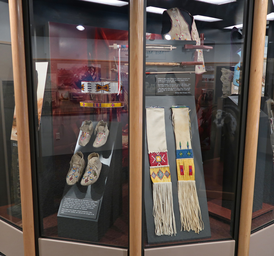
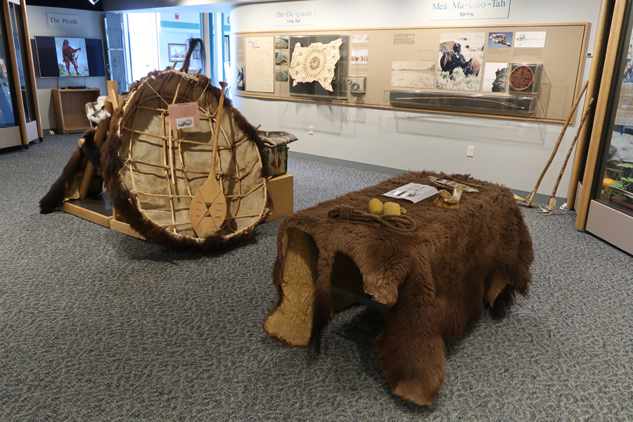
Many informative displays in the Visitor Center
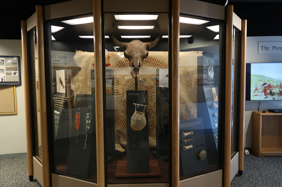
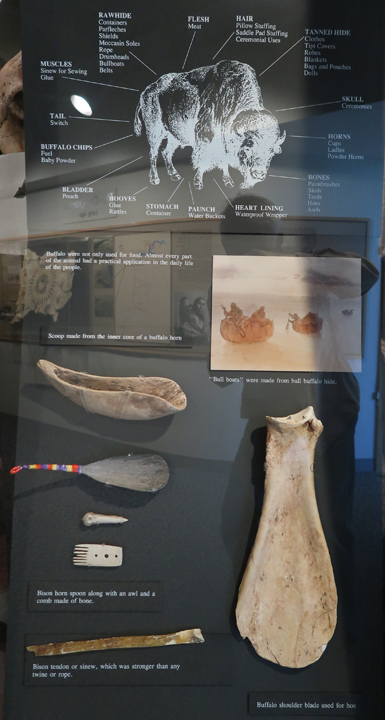
How the Indians used all parts of the buffalo
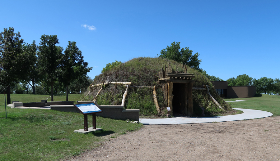
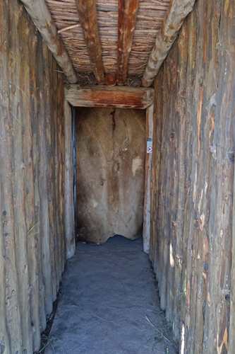
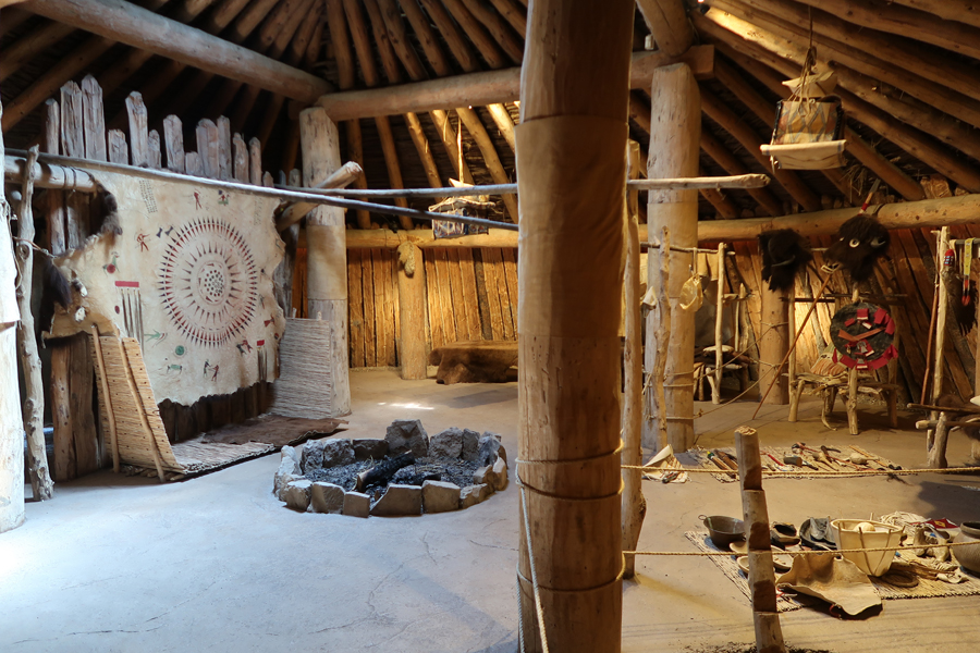
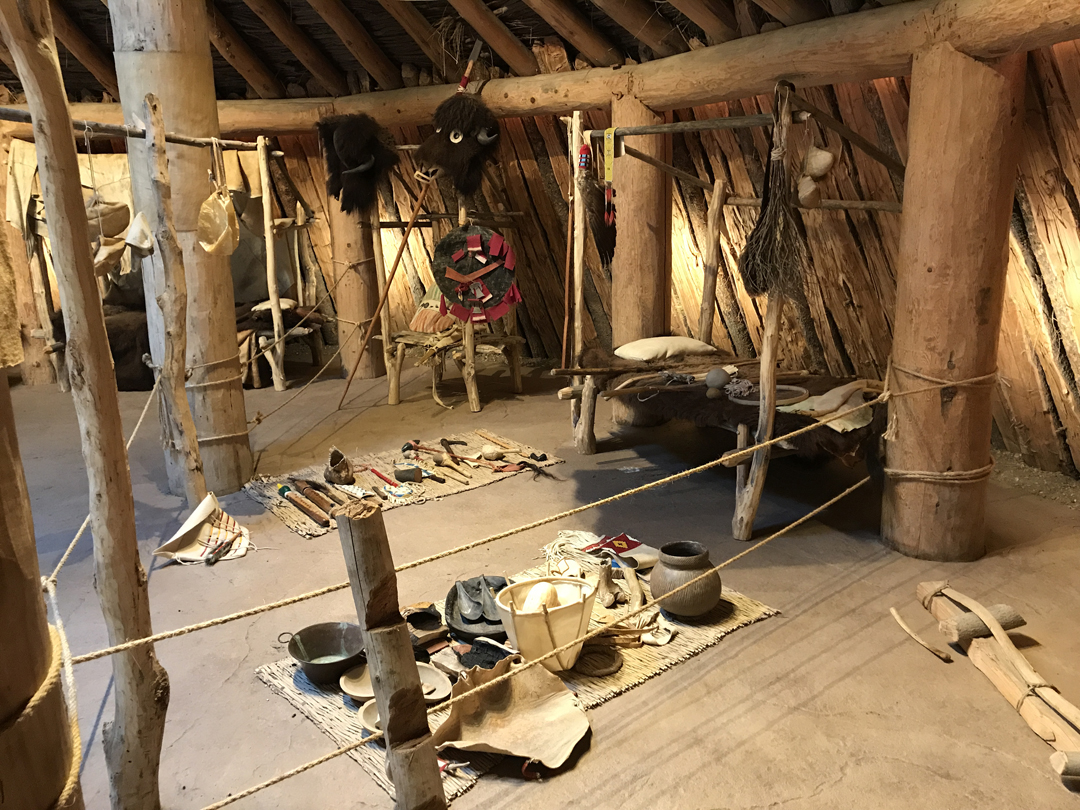
Re-creation of an earth-lodge at the Awatixa Xi’e Village (lower Hidatsa Site) near the Visitor Center

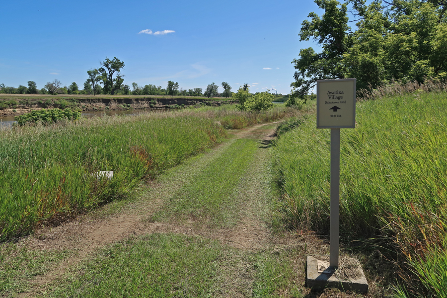
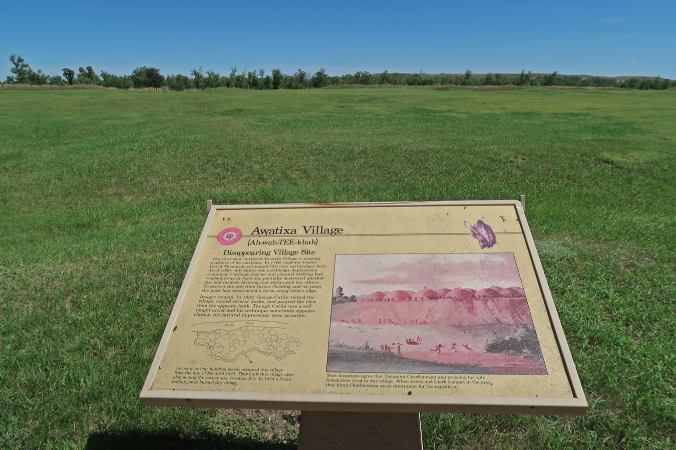
I then walked to the Awatixa Village (Sakakawea Site) on the Knife River

Lewis & Clark arrived here (confluence of Knife and Missouri Rivers) in October 1804 after a 1,600-mile trip up-river from St Louis. They built Fort Mandan where they spent the winter of 1805. They hired Toussaint Charbonneau and his wife Sakakawea (Sacagewea) to serve as their interpreters for their western exploration. Sakakawea gave birth to her first child, Jean Baptiste at the fort. Clark nicknamed him “Pomp.” Pompeys Pillar National Monument in MT (BLM) is named after him. Lewis & Clark stopped here on there return trip in August 1806. Charbonneau, Sakakawea, and Pomp resumed their lives in the village.

I then drove a short distance north to do the trail to the Big Hidatsa Village Site, the third village site in the park


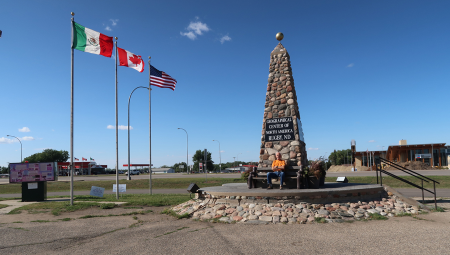
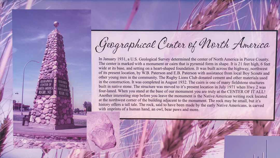
2.5hr drive to Rugby ND and the Geographical Center of North America
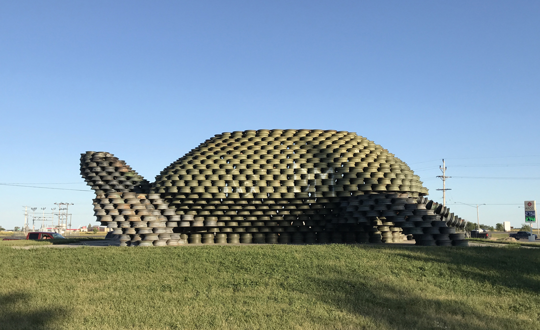
A half-hour north is Dunseith ND, where they have this large turtle – made from wheel rims
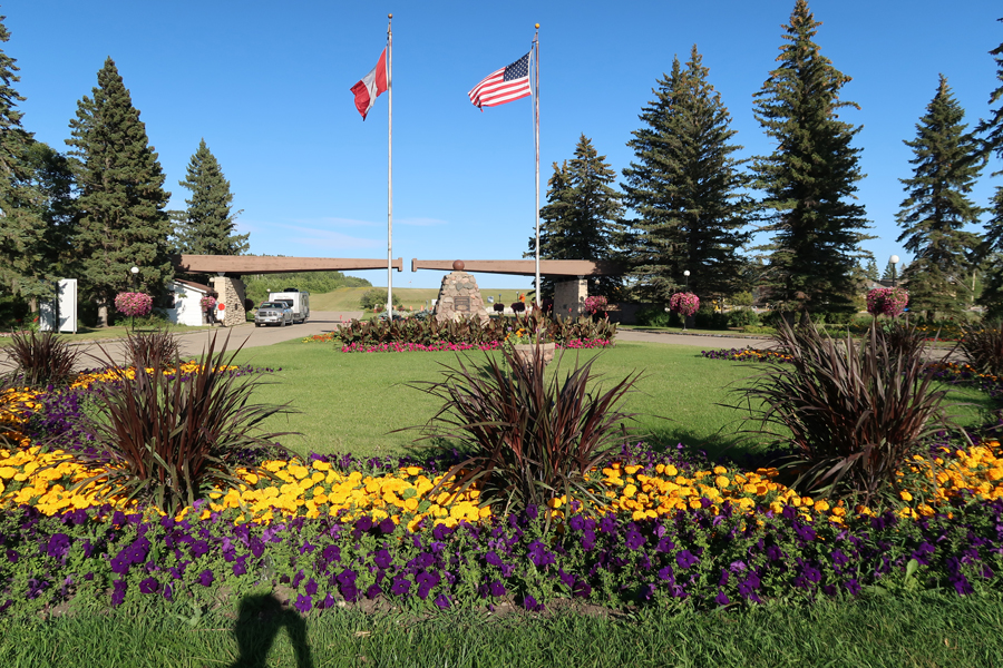
Fifteen minutes further north is the U.S.-Canadian border and the International Peace Garden, which is an Affiliated National Park Unit. Half of it is in the U.S. and half in Canada. CAUTION, if you plan to visit, be sure you take your passport or your driver’s license and birth certificate to get back in the U.S.! Standing in Manitoba Canada, looking back into the U.S. and the Duty-Free shop where I bought a liter of Jameson Irish Whiskey for Chad.

U.S.-Candian Border

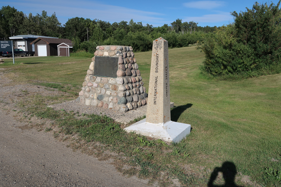
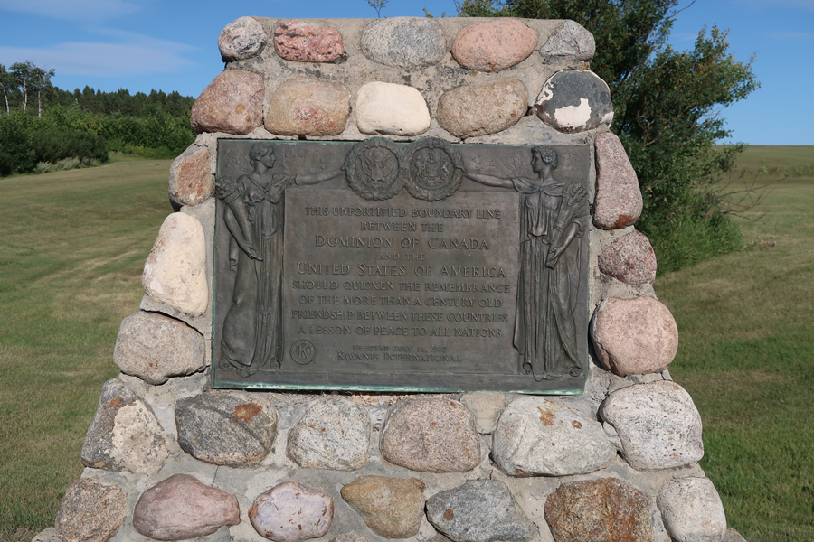
Looking east, back at the entrance ($20 per vehicle). The grand opening marker cairn (July 14, 1932) can be seen in center of photo.
I drove all the roads, making several stops. There is a 3.1-mile loop in the U.S. (left). There is a 1.5-mile loop in the center, the Formal Garden (green) – The U.S.-Canadian border goes right down the center. There is a 3.5-mile loop in Canada (right).

Promise of Peace Sculpture dedicated 2016

A waterway runs from the Peace Chapel on the west end to the entrance on the east end

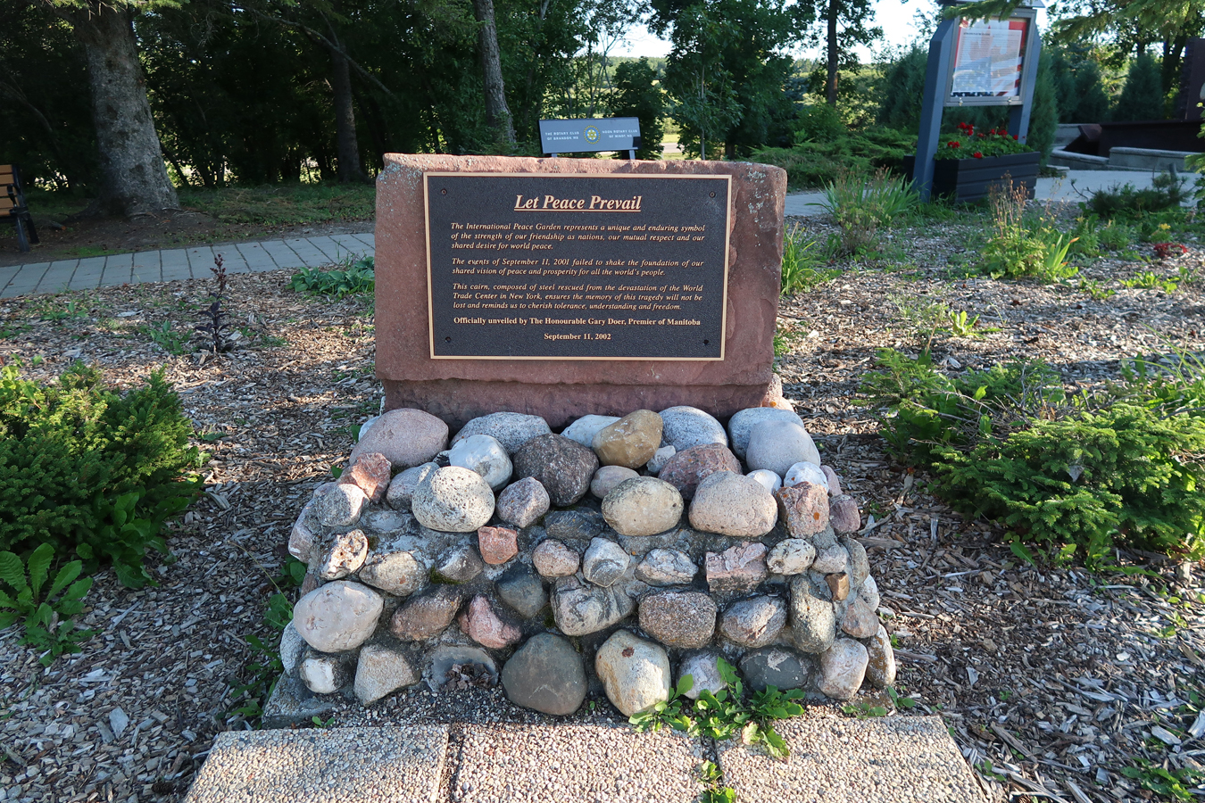
9/11 Memorial Site containing steel girders from the Twin Towers in NYC, Carillion Bell Tower in background
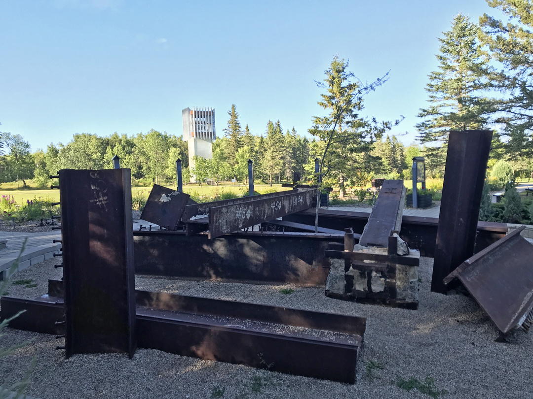
The 9/11 Memorial was constructed by the government of Manitoba
Floral Clock, 18ft high

9.5hrs to Hixton WI, where I slept in the Sequoia at a gas station on I94
8-19 M – 3hrs to the Martins in Milwaukee
8-20 Tu – 2hrs to Chicago, spent the day with my brother Mike
5.5hrs to Springfield, drove 5,400 miles. Arrived home 3:30am 8/21 W – much to Helen’s surprise!

Leave a comment