
National Park Road Trip to the Atlantic Ocean
June 22, 20216/12 Sat – Left home at 6am for a 2,000-mile road trip to the Atlantic Ocean. Arrived at Friendship Hill NHS in SW Pennsylvania at 10am. I had visited here in 2011 when I was on my way to Pittsburgh for Drago’s birth. See Blog for October 2011.
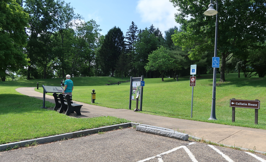

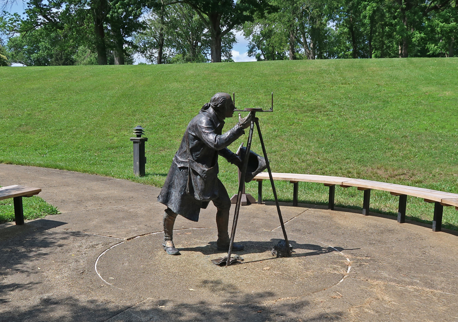
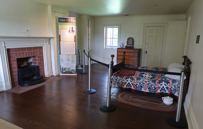
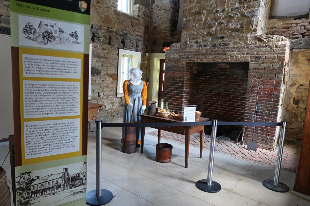
This time, the house/visitor center was open for self-tours. This was the “Wilderness Home” of Albert Gallatin (1761-1849). He was an entrepreneur, politician, diplomat, financier, and scholar. He was the Secretary of the Treasury for Presidents Jefferson and Madison. He arranged financing for the Louisiana Purchase and the Lewis and Clark Expedition. He also worked to end the War of 1812 with Great Britain.

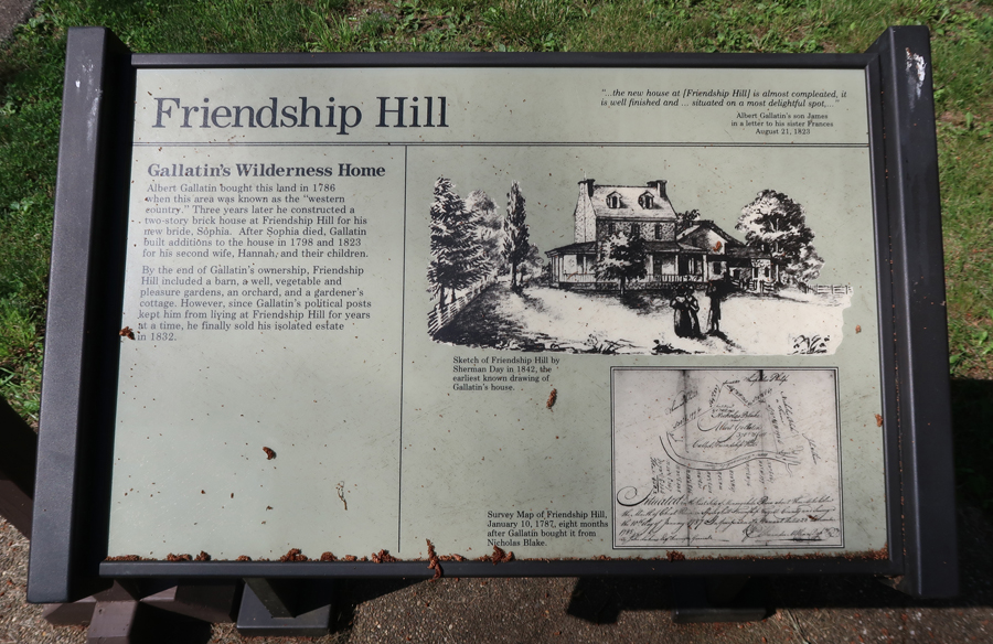

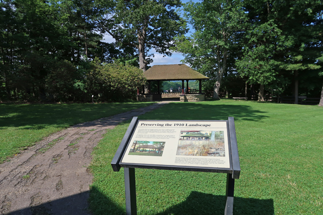
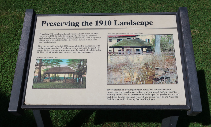
Friendship Hill is on the Monongahela River.

Though it was not on my agenda, my next stop was the terminus of the C & O Canal in Cumberland MD, which is part of the Chesapeake & Ohio Canal NHP. In my post of April 2017 on this Blog, I described stops at Spring Gap, Oldtown, Paw Paw Tunnel, Williamsport Visitor Center, and Lock 44.
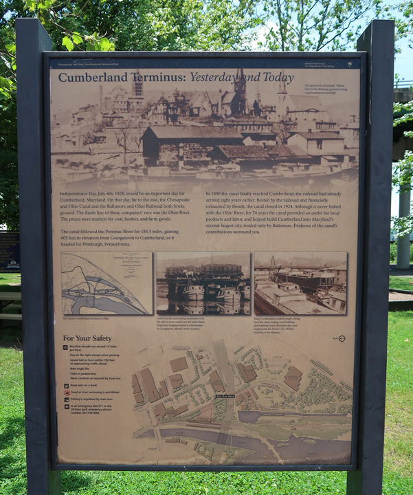
The Chesapeake (Bay) and OHIO Canal never made it to the Ohio River. Construction stopped here in Cumberland MD in 1850 when railroads made the continuing digging of the canal a financially losing proposition. 184.5 miles of the C & O Canal were completed from Georgetown (Washington DC) to Cumberland MD. The canal remained open until 1924.

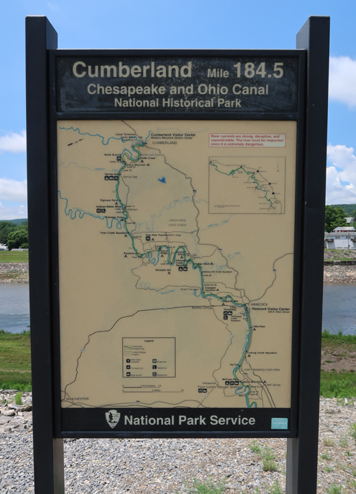
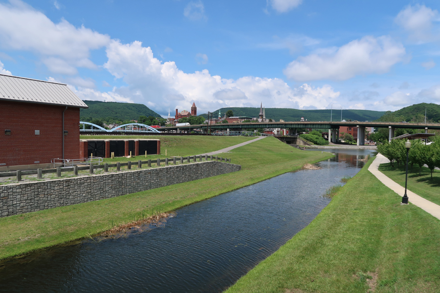
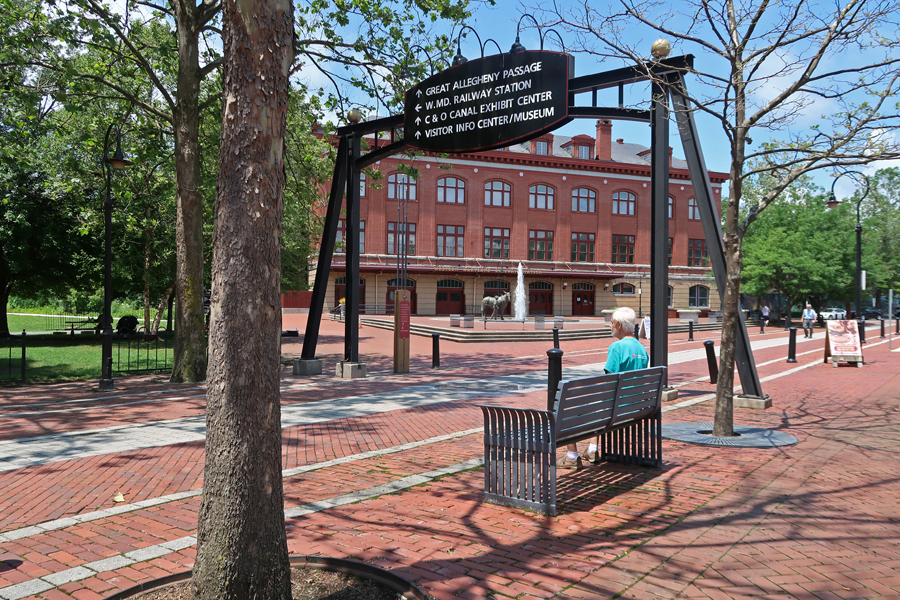
The Cumberland C & O NHP Visitor Center is located in the Western Maryland Railway Station. Goods were transferred from canal boats to wagons for travel on The National Road and on to railroad cars for points west and north. Likewise, goods, especially agricultural, were shipped back east.


Fort Cumberland (built 1754) was an 18th-century frontier fort that was an important military and economic center during the French and Indian War (1754-63). It was constructed at the confluence of Wills Creek and the Potomac River.
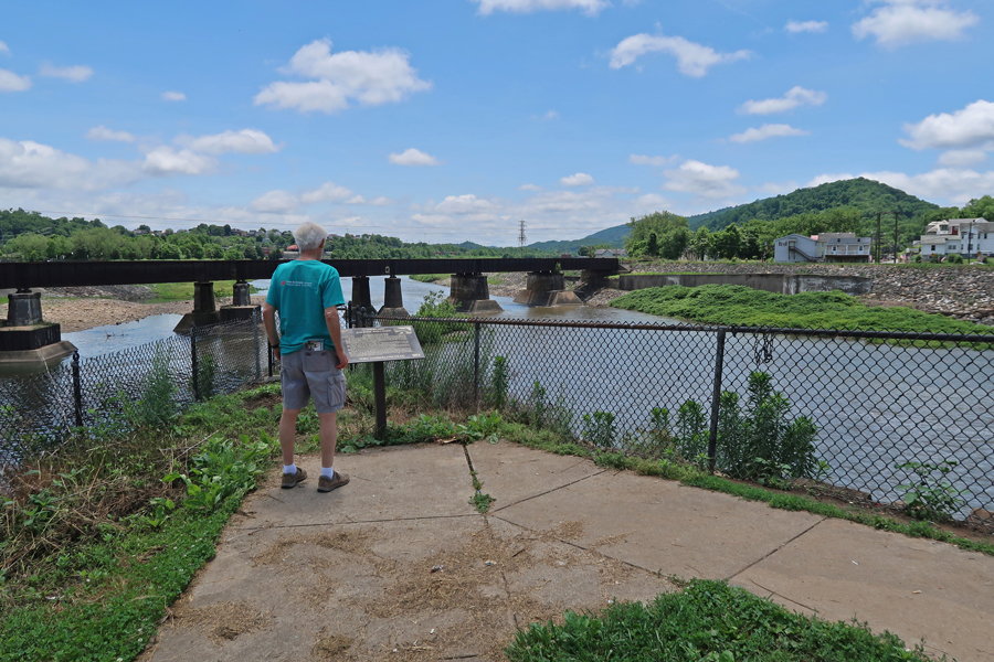
This fort once marked the westernmost outpost of the British Empire in America and was the jumping-off point for General Braddock’s disastrous expedition against the French at Fort Duquesne in present day Pittsburgh. When Braddock was killed, a young officer of the Virginia militia, George Washington, led the troops back to Fort Cumberland.


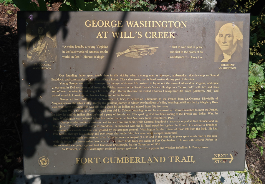
As mentioned, The National Road started here and linked the east to the western part of America at the time.


I then had a 3.5hrs drive to the Dickey Ridge Visitor Center in Shenandoah NP. Skyline Drive, the parks scenic roadway, follows the crest of the Blue Ridge Mountains for 105 miles. At its southern end, it joins the Blue Ridge Parkway, which continues 469 more mile to Great Smoky Mountains NP.


My first visit here was in the Fall of 1966 when I went with a group of graduate students from the U of MD. We drove part of Skyline Drive stopping at overlooks and doing short hikes.


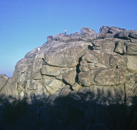
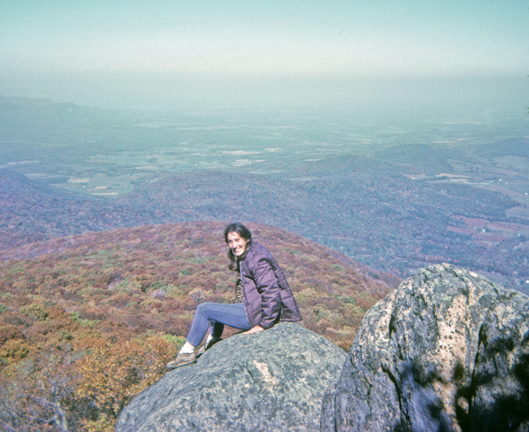
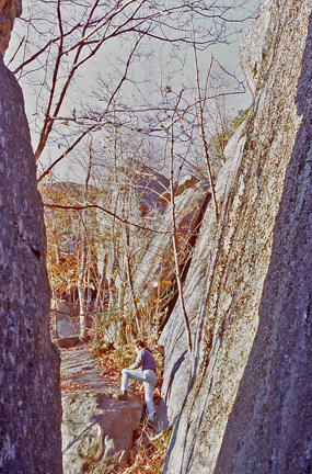
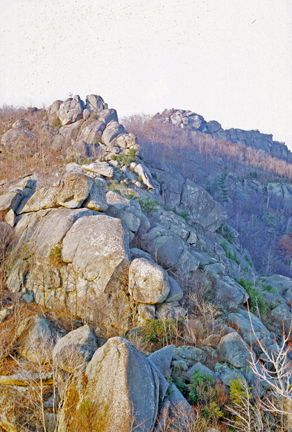
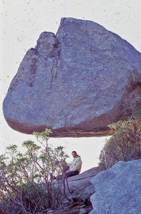
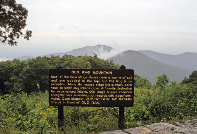
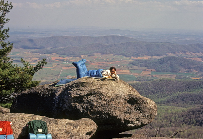
The next year, I was invited to go along with my friend Jay and his date to climb Old Rag Mtn. Jay and I had just completed a 10,000-mile road trip out west that summer. This hike/climb is classified as the toughest but most rewarding hike in the NP – some say in the entire Middle Atlantic Region. We chose a route starting from Skyline Drive at an elevation of about 3,500 feet (Limberlost Parking Area) and then dropping about 1500 feet into Weakley Hollow via the Old Rag Fire Road and on to the Old Rag Shelter. From there, the route went up the Saddle Trail to the Byrds Nest 1 Shelter, and then on to the summit at 3,291ft. It was about 10 miles roundtrip with a total gain of about 2800 feet.
Jay and I carried small packs. Jay’s date, Helen Alexis, was given the task of carrying a bottle of wine for our summit celebration. To make it easy for her, he cut off one of his pant legs and made a sling she could put around her neck to protect the bottle and keep her arms free. Well, when we reached the top of the mountain, she was wearing the sling BUT the wine was gone! The bottle was lost somewhere on the trail. How could she not know that she dropped a full bottle of wine that was hanging around her neck? Did she drink it and discard the bottle?

We scrambled around the summit rocks and ate most or our snacks before heading back to Skyline Drive. It was a long day. I was impressed with the stamina and good spirit of this Serbian beauty during our challenging outing.
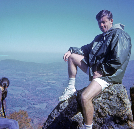
It was dark when we arrived back at Jay’s little red convertible, a TR3 sports car. We were hungry, all that remained was a can or sardines and crackers that Jay had brought to impress his date. Against my better judgement, I helped finish the remains and we started descending the narrow windy road dropping down from Skyline Drive. I was sitting sideways on the tiny bench seat behind Jay and Helen. I swayed to-and-fro, and lurched forward and back, as Jay tried to go as fast as he could down the steep mountain road (VA Rt 211). By the time we got to the bottom, I was sick. I jumped out of the car and ridded myself of those sardines and crackers. I was not going to go back to that bench seat. Helen, being a good sport, said she would sit in my lap on the passenger side. I found this arrangement very agreeable for the remainder of our ride back to the U of MD.
That was the beginning – in less than a year Helen (Baba) would be my wife!
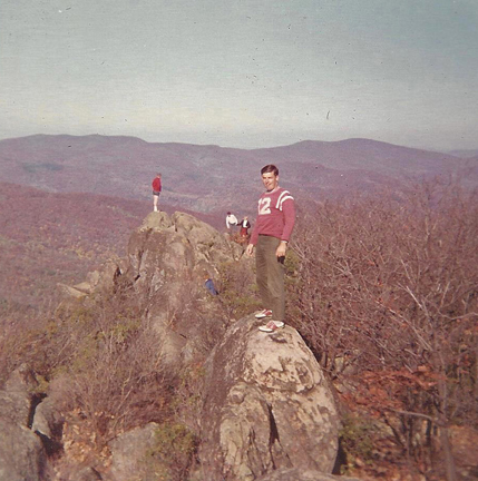
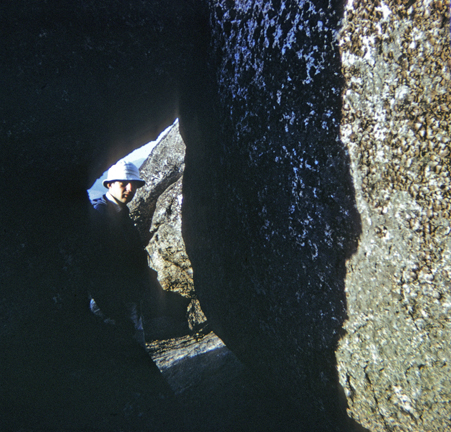
We climbed Old Rag with Jay and other graduate assistants from the east side of the mountain in the Spring of 1968. We took the Ridge Trail for about 1.5 miles and then set up camp along the trail. The next morning, we summited and then returned to U of MD. This hike/climb is about 5 miles roundtrip with a gain of 2400 feet and involves a lot of fun rock scrambling on the top third of the route.

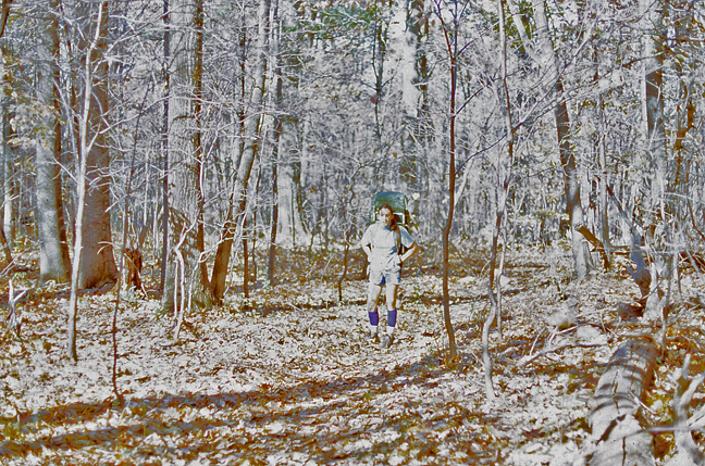
Baba and I returned in 1970 and did the same route again. It snowed on our campsite that evening.


Christmas break 1969-70, we drove the entire length of Skyline Drive and the Blue Ridge Parkway on our way to Mexico City in our new (used) VW camper.

In the Fall of 1970, Baba was coaching the U of MD women’s swim team. Most of the team joined us for another trek up the mountain by way of the Ridge Trail route.
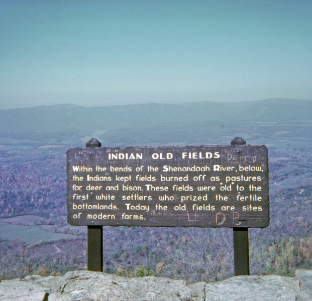
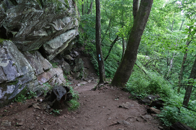
After 50 years, I returned to Shenandoah NP ten day ago. I wanted to do a couple of new trails in the park. My first stop was the Dickey Hill Visitor Center with good views of the Shenandoah Valley and Shenandoah River.

The Many Moods of an Overlook

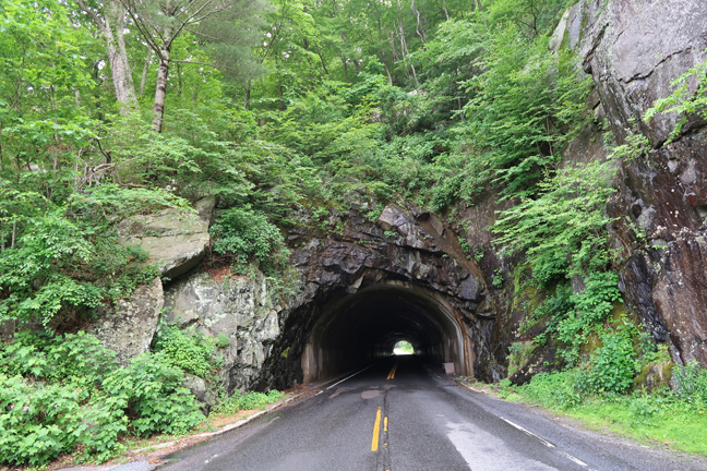
Marys Rock Tunnel (1932) at Mile Marker 32.4 of Skyline Drive, 700ft long, 12’ 8” clearance
Skyline Drive reaches its highest point (3,680ft) at Skyland. The Historic Massanutten Lodge (1911) is located here.
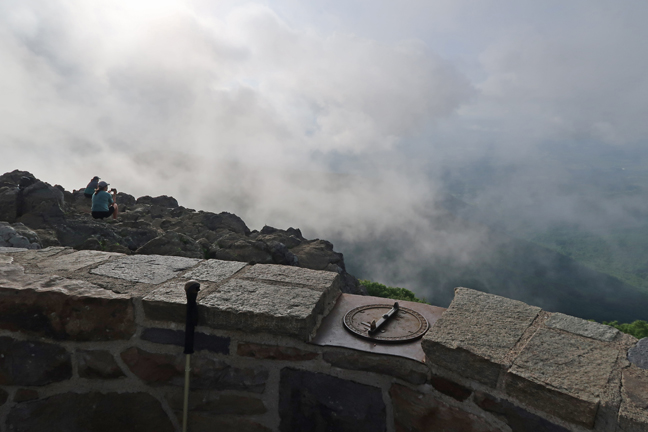
Mile Marker 45.5 – did the Lower Hawksbill Trail, 1.7 miles roundtrip, gain of 690ft, to the summit viewing platform (4,051ft). Hawksbill Mtn is the highest peak in the park. Park literature states that “The viewing platform on top of Hawksbill offers a magnificent 360-degree panoramic view of the Shenandoah Valley, the Blue Ridge Mountains, and the Virginia Piedmont.” Not so, when you are in the clouds!
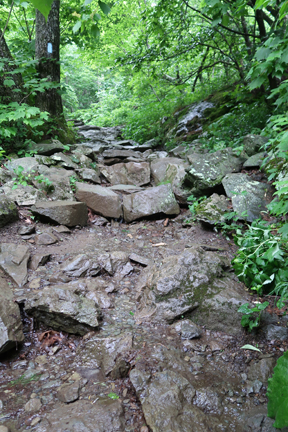
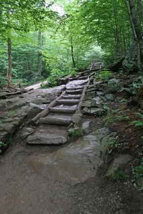
It was getting dark as I did the 1.4-mile roundtrip Dark Hollow Falls Trail. It has a 440ft gain on the return.

Deer at Sunset

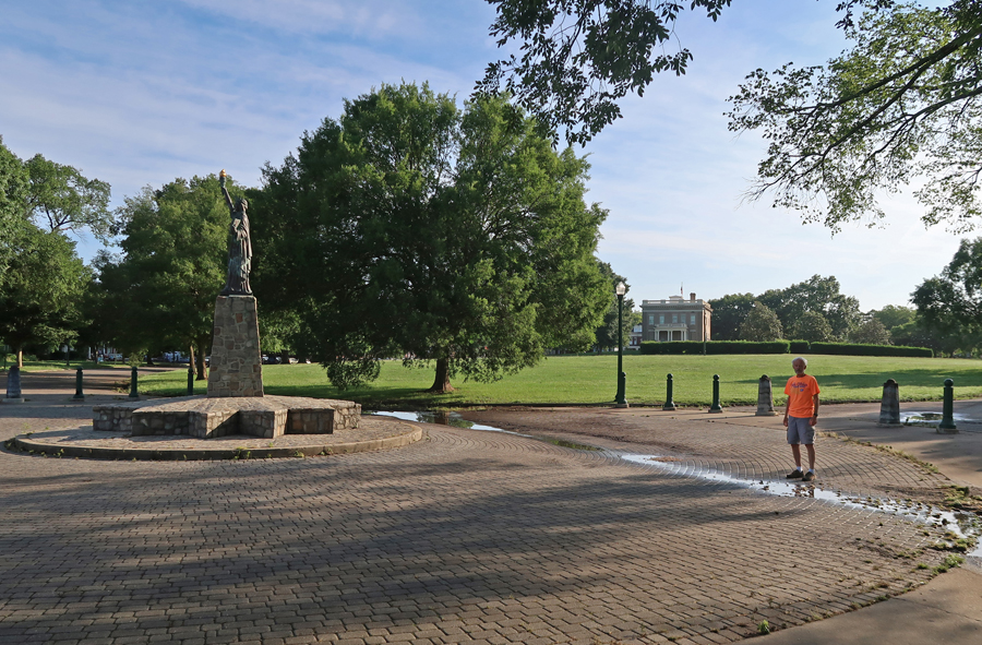
6/13 Sun – arrived at the Richmond NBP Cold Harbor Unit at about 6am. I visited the Richmond Unit at the Tredegar Iron Works in April 2017 (see Blog). On this trip I wanted to see the other four Units. All of these Units are related to the Battle for Richmond during the Civil War. However, I am starting this description of my visit with the Glendale Malvern Hill Unit in order to present the information chronologically.
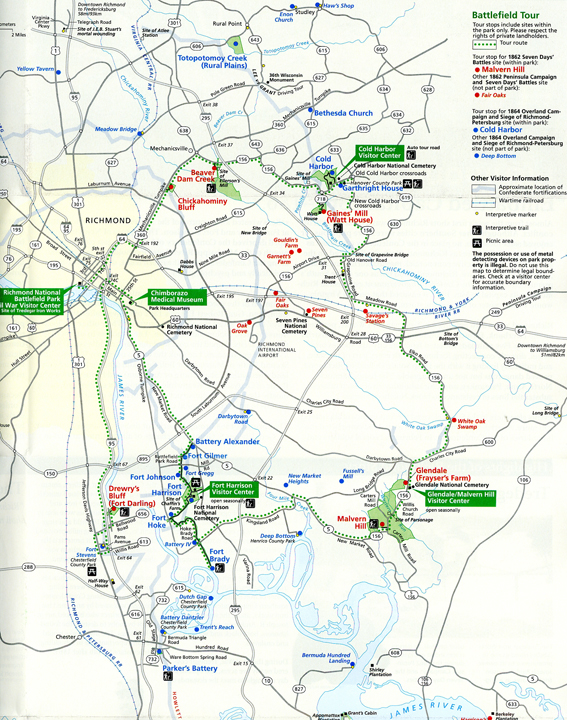
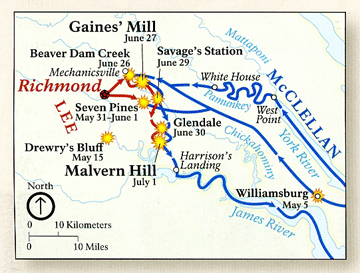
The first Union attempt to take Richmond (Confederate Capital) and defeat the Southern rebellion took place at Bull Run in VA at the First Battle of Manassas in July 1861 (see Blog for June 2019). The Federal forces were defeated. The second attempt to take Richmond started in March 1862 under General George McClellan and was referred to as the Peninsula Campaign. His forces reached the east side of Richmond, but they were beaten back by General Robert E. Lee in the Seven Days Battles.
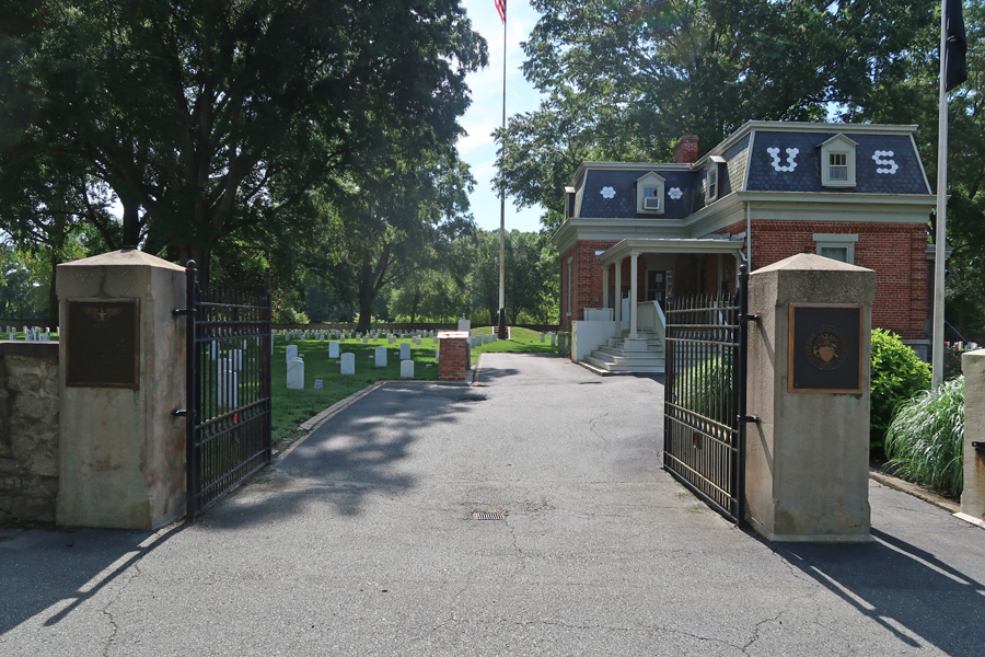
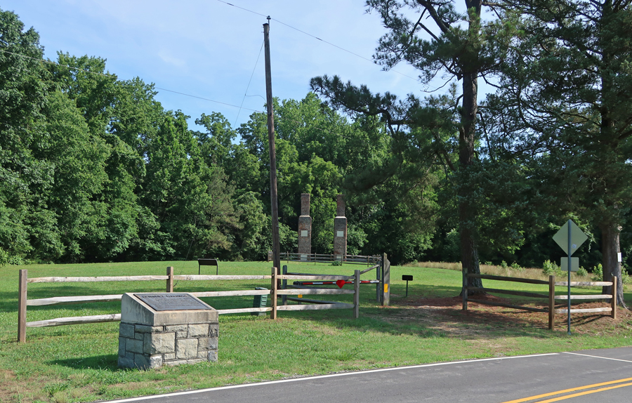
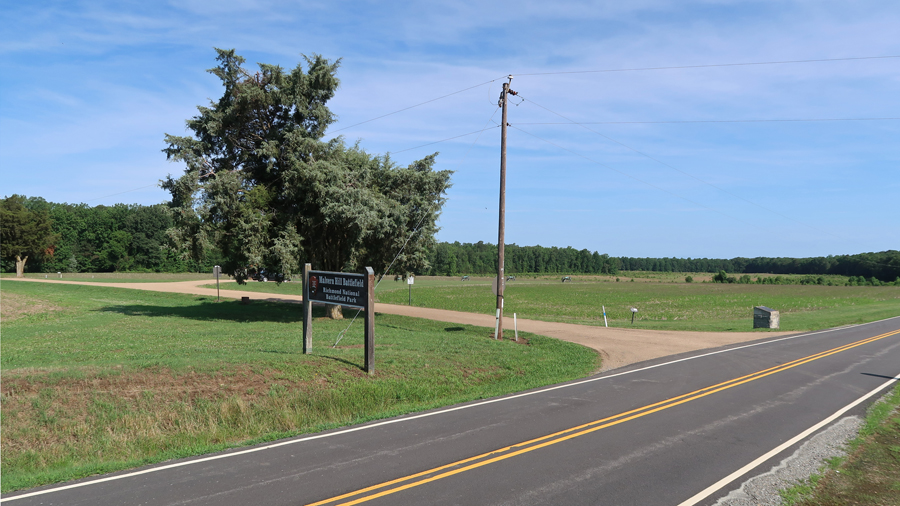
Glendale/Malvern Hill Unit – represents one battle during the 1862 Confederate defense of Richmond. Glendale National Cemetery
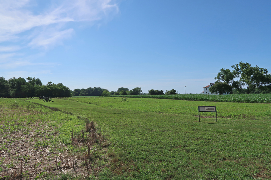
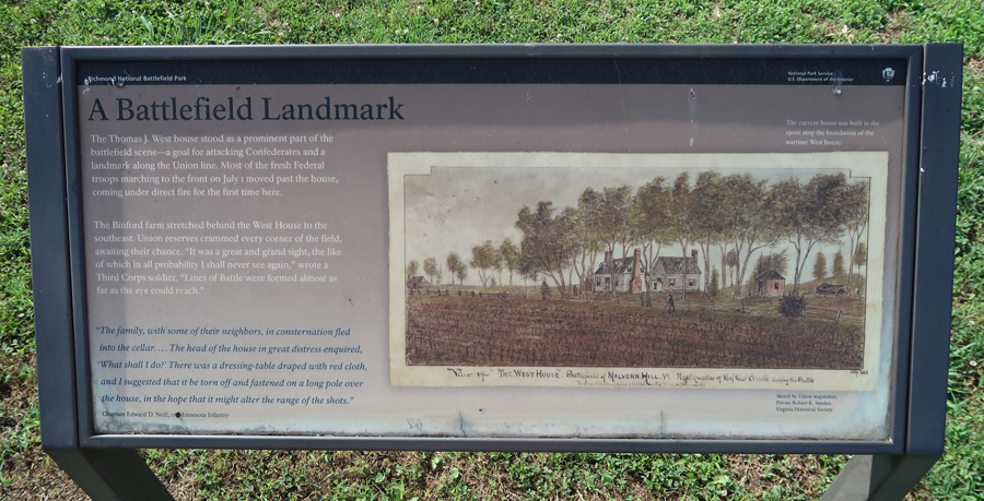
The Methodist Parsonage overlooked Malvern Hill.


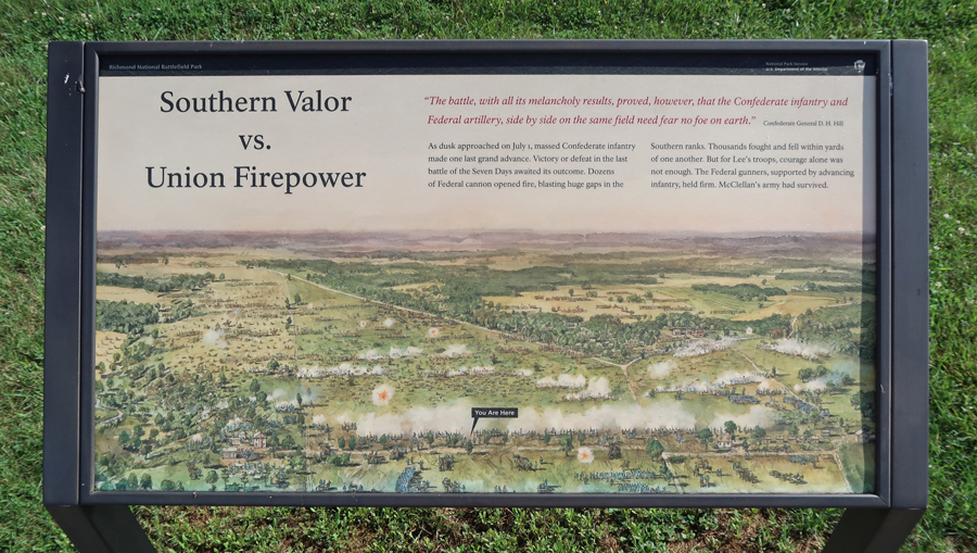
Malvern Hill – Union successful defense of their position against General Lee’s attacks. General McClellan decided to withdraw after this battle and lost his advantage related to the goal of taking Richmond. Historians believe that this encouraged the Confederates and greatly extended the Civil War.


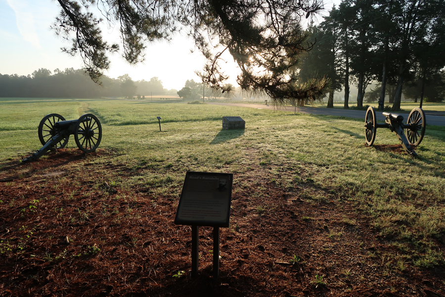
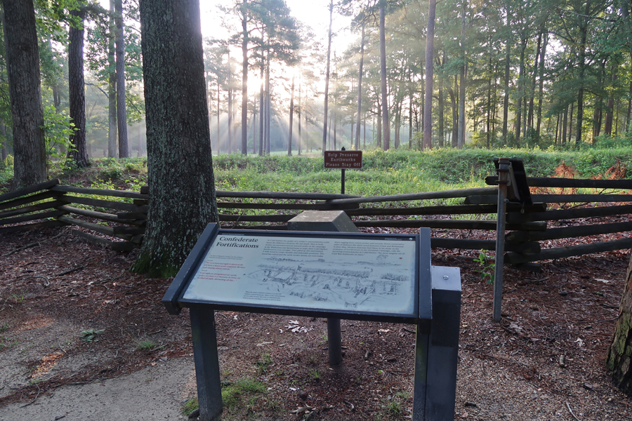
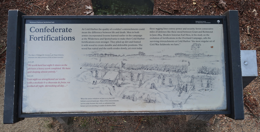
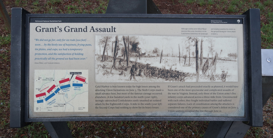
General Ulysses S. Grant’s 1864 Overland Campaign (see Blog for April 2017) began with the Battle of the Wilderness May 5-6, followed by the Battle of Spotsylvania May 8-21, and reached the outskirts of Richmond at the end of May. At Cold Harbor, 6,000 Federals were killed or wounded during massive, ill-conceived, assaults on Confederate entrenchments. Most of the casualties took place in one hour! The Civil War in the East was changed from a war of maneuver to one of siege.
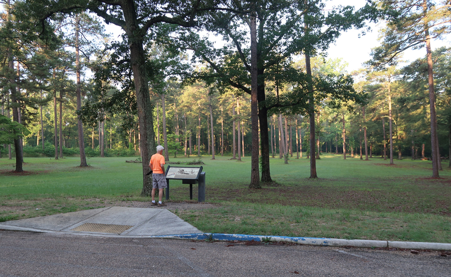
Battle of Cold Harbor Unit


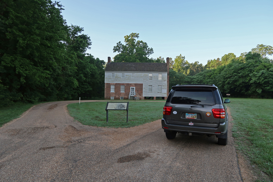
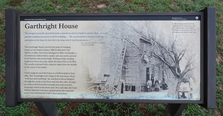
Garthright House – Union Field Hospital
Chimborazo Unit Medical Museum – Confederate Hospital, now Park Headquarters.

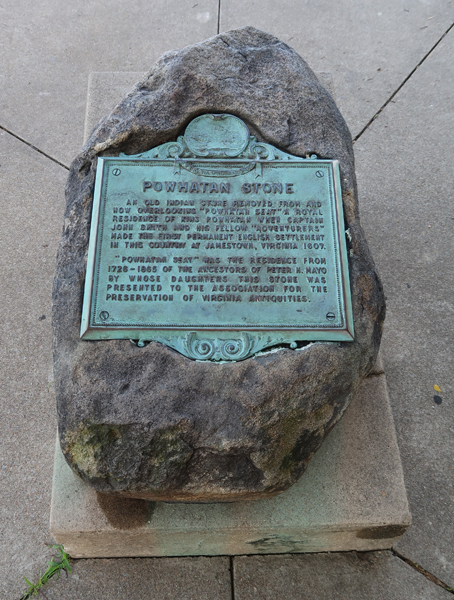
Powhatan Stone in Chimborazo Park, which overlooks the James River and Richmond

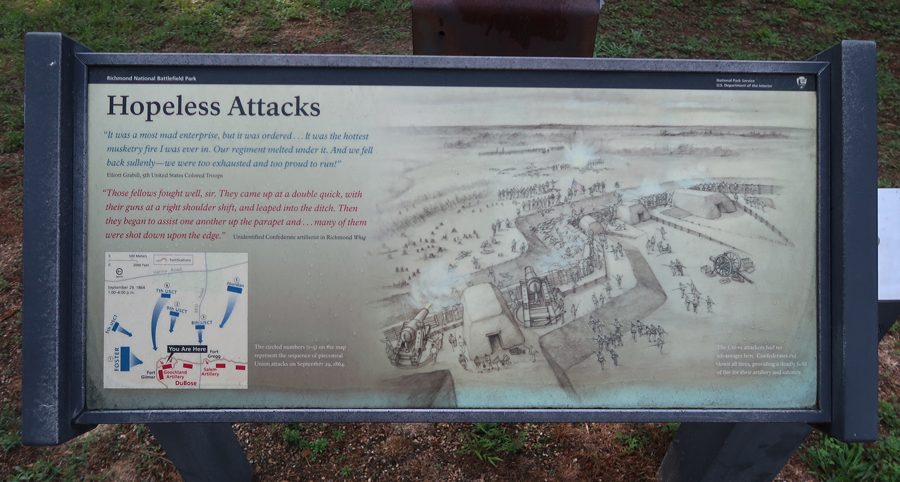
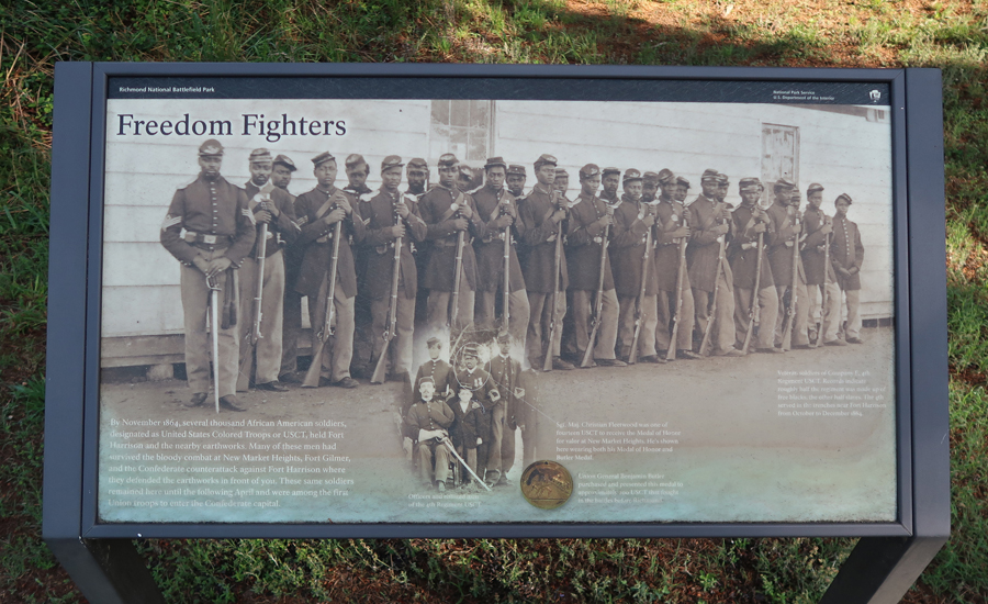
Fort Harrison Unit – including Fort Gilmore, Fort Johnson, and Fort Hoke were part of Confederate Defenses on the East side of the James River protecting Richmond. First Fort Gilmore

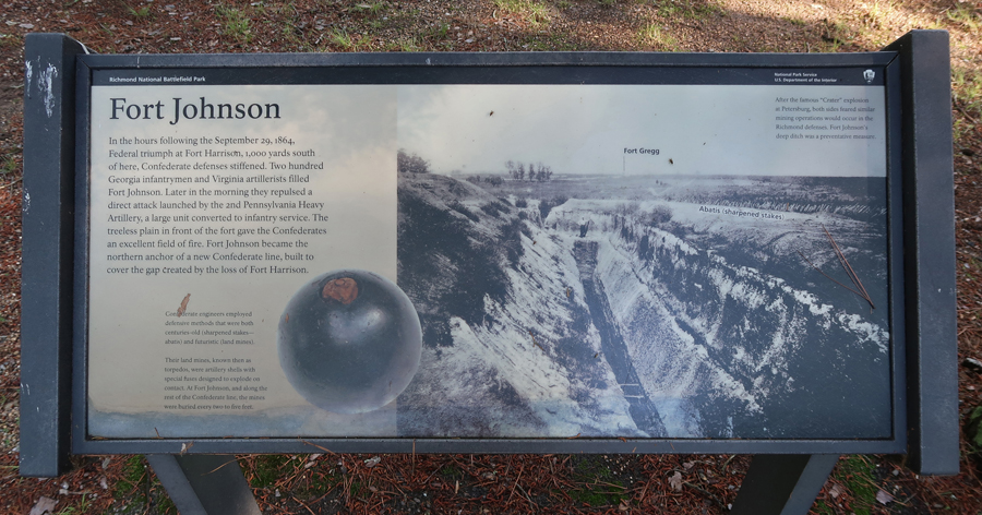
Fort Johnson
Fort Harrison

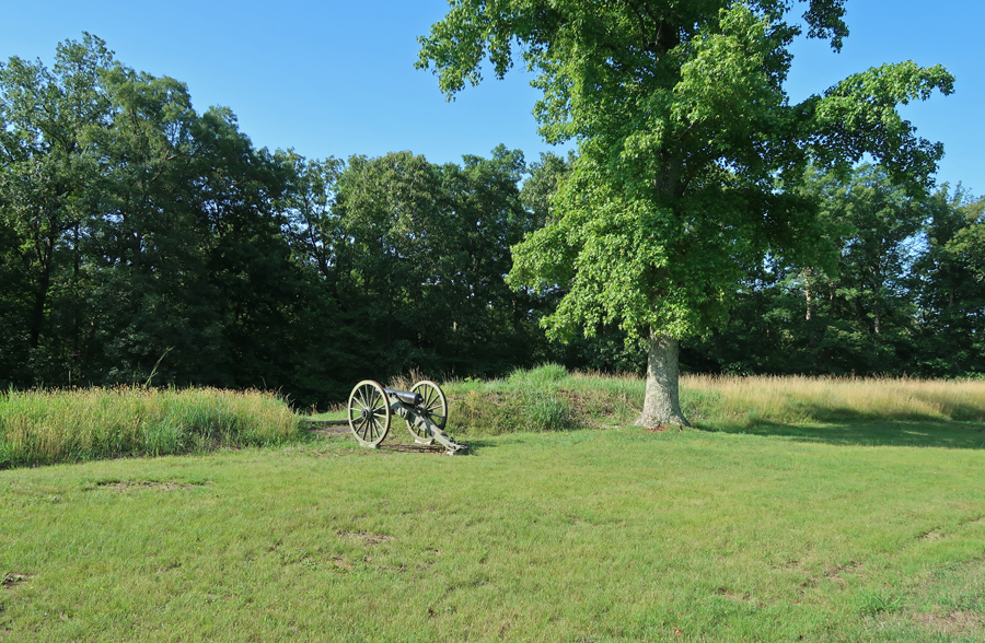
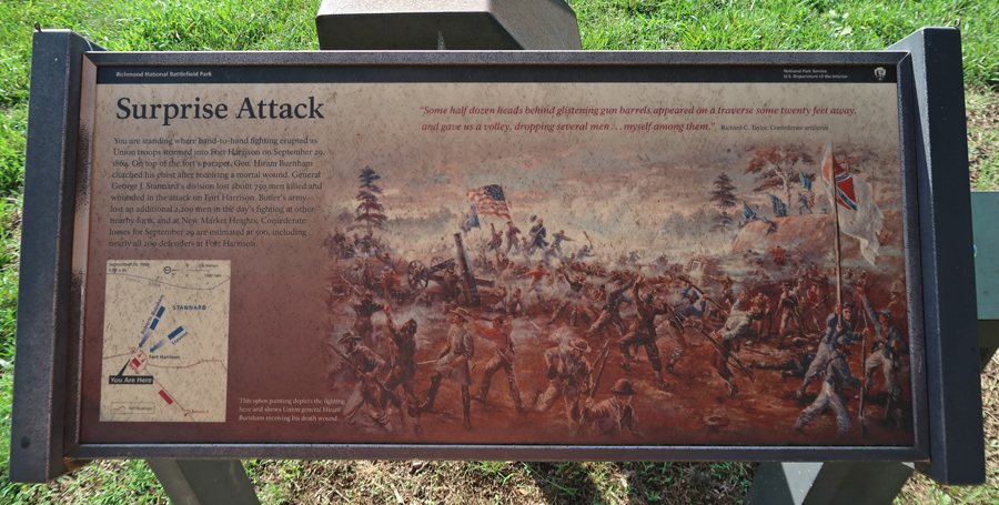

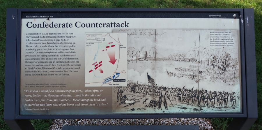

Fort Hoke


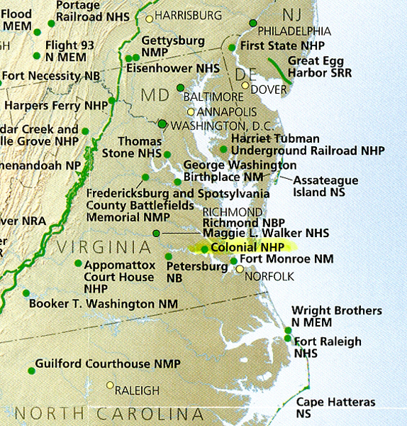
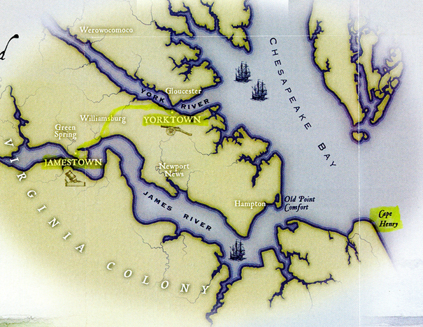
My next three stops were part of Colonial National Historical Park in southeast VA. I will start with the Cape Henry Memorial, which is located on the Fort Story Military Base, where the Chesapeake Bay opens to the Atlantic Ocean. You must provide photo ID and go through security in order board a shuttle that takes you to the memorial area and lighthouses. You are restricted to this area.
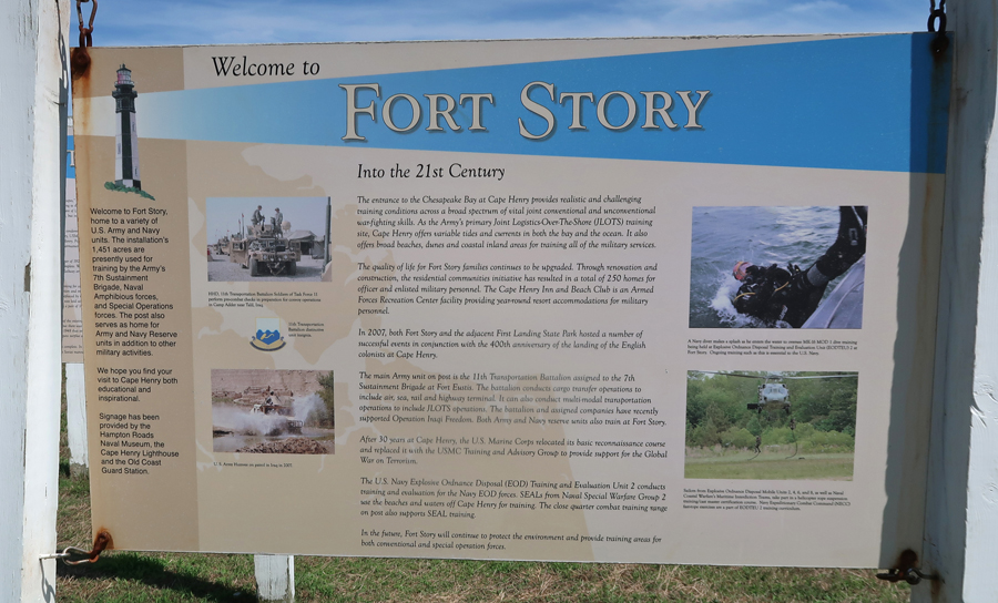
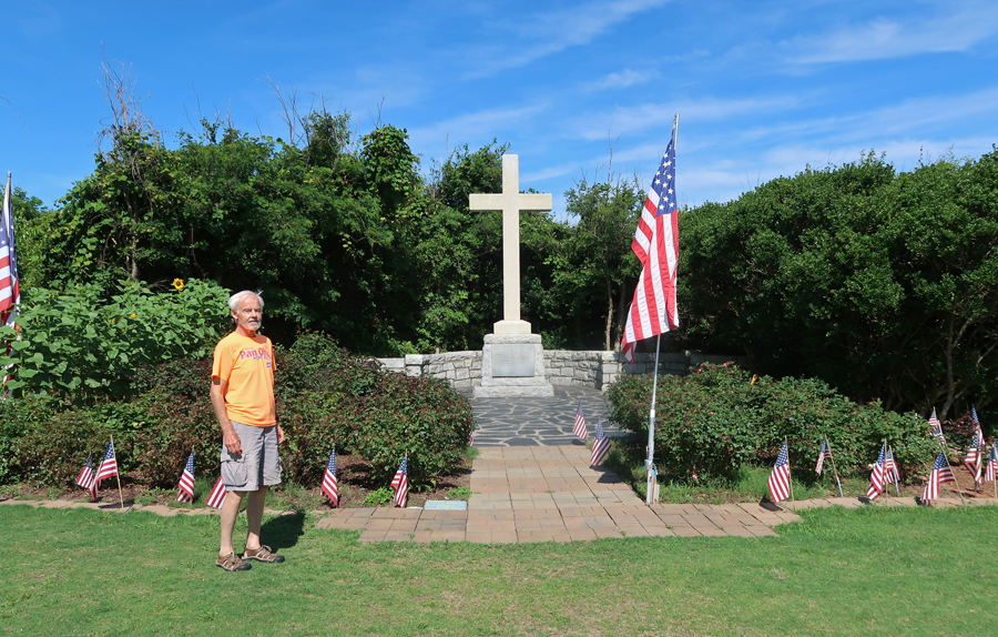
The first permanent English settlers landed here on April 26, 1607. A memorial cross has been placed here by the National Society Daughters of the American Colonists.


After taking measure of the Cape, they established the first permanent English settlement in North America on May 13, 1607, on an island in the James River. They called the settlement Jamestown, in honor of the then king of England, King James I of England and Ireland. Cape Henry and Cape Charles were named after his sons.

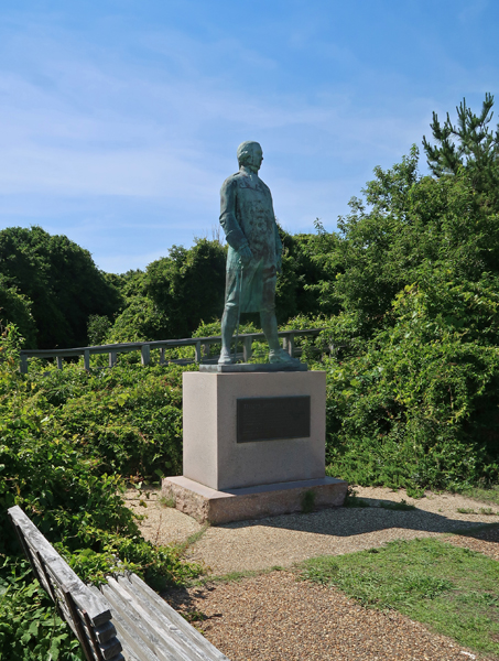
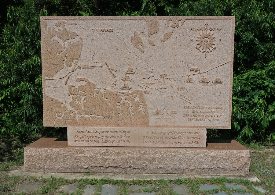
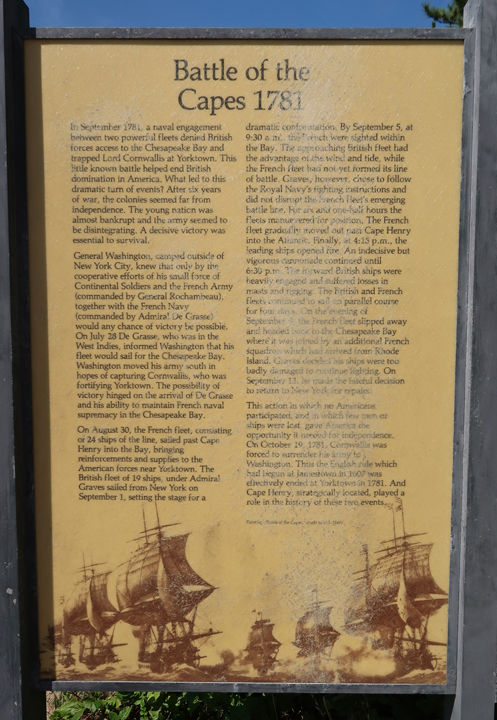
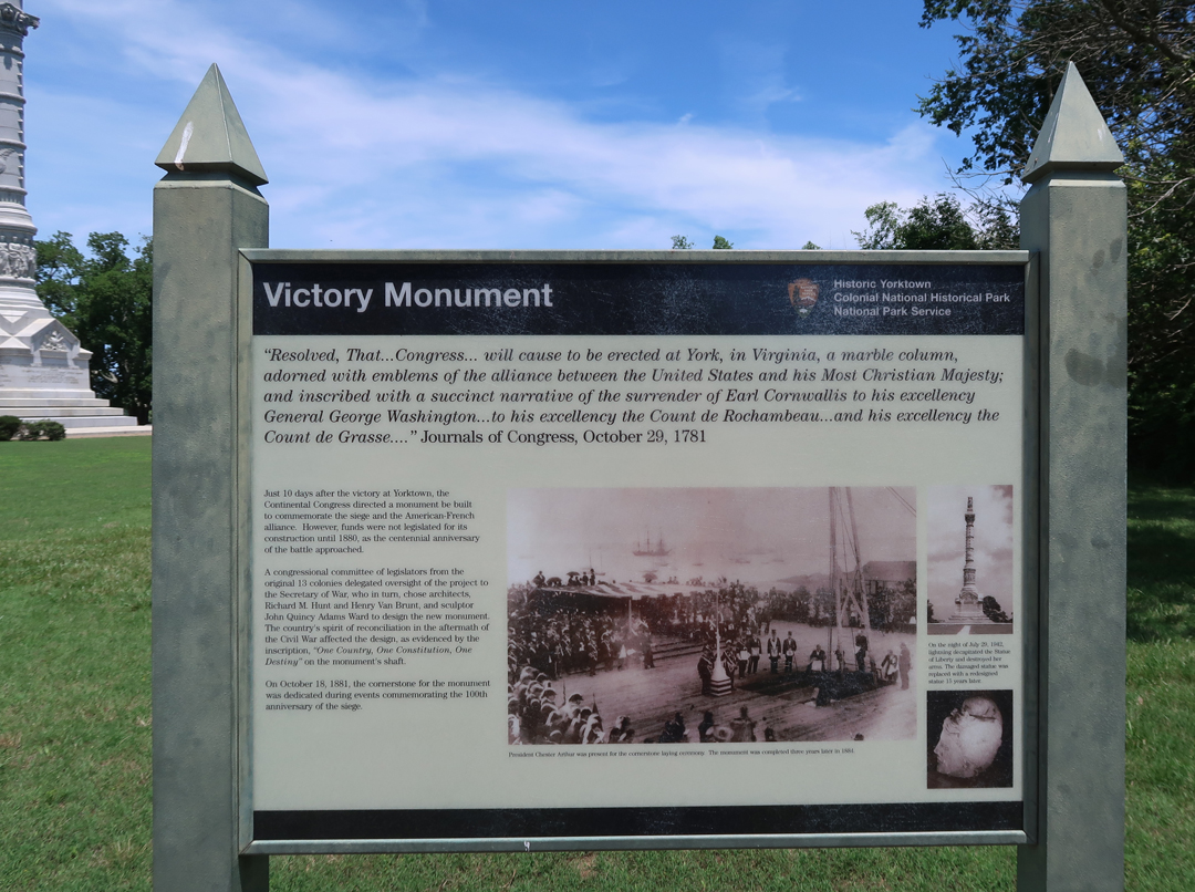
There is also a monument here to French Admiral Comte de Grasse, who defeated the English fleet on September 5, 1781, in the “Battle of the Capes.” This prevented reinforcements from reaching Lord Cornwallis in Yorktown, leading to his surrender on October 19th. Britain recognized American Independence in January 1783.
In 1791, President George Washington reviewed, and Alexander Hamilton signed the contract for the first public works project of the U.S. Government – the construction of the Cape Henry Lighthouse (107ft). I paid $9 for a senior ticket to climb to the top.


The “New” (current) Lighthouse was lit in 1883.
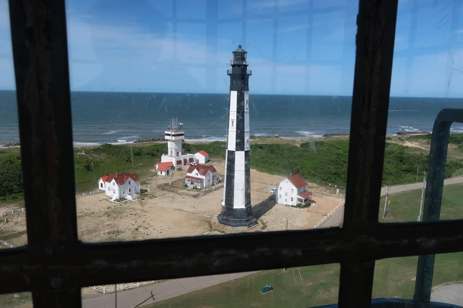
View of the Cape Henry Memorial Area from the Old Lighthouse (middle of photo)

1883 and 1792 Lighthouses

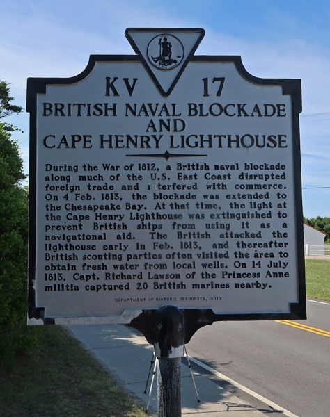
But wait – we were not through with the British yet! During the War of 1812 they blockaded the Chesapeake Bay and attacked Washington DC, burning the White House.
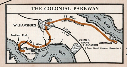
Historic Jamestown is one hour by car from Cape Henry. The site is administered by Preservation Virginia in conjunction with the NPS and a fee is charged for entrance. My reduced rate was $10 because I have a NP lifetime Senior Pass.


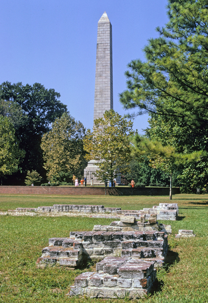
Helen and I visited in the Fall of 1969; some photos are from that trip. All tours start at the Tercentennial Monument, which was built in 1907 to mark the 300th anniversary of the founding of Jamestown.
63, 65, 68, 71
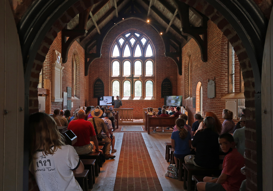
The Memorial Church was built in 1907 as well.

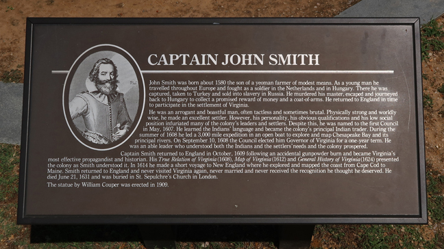
This sign gives and introduction to the “Old Towne.” Note the statue in the bottom center – John Smith.


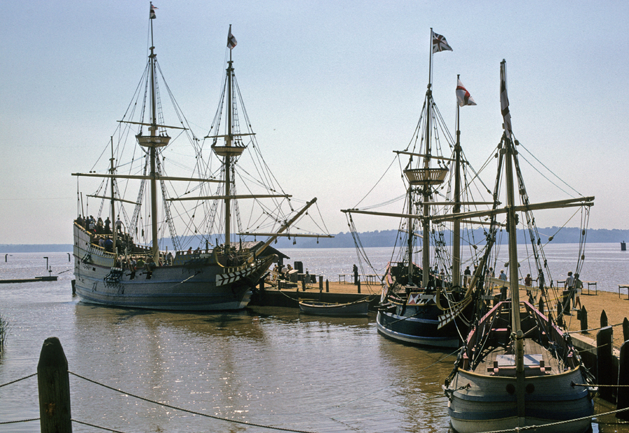
Replicas of the three wooden ships that carried the 104 Englishmen were floating at the dock in 1969, the Susan Constant, Godspeed, and Discovery. They were not there in 2021.
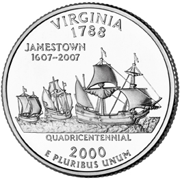
2000 50 State Quarters Coin Virginia Uncirculated Reverse

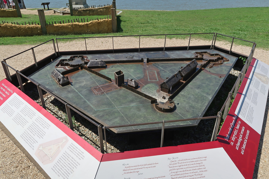
The James River has eroded some of the bank where the fort was located –

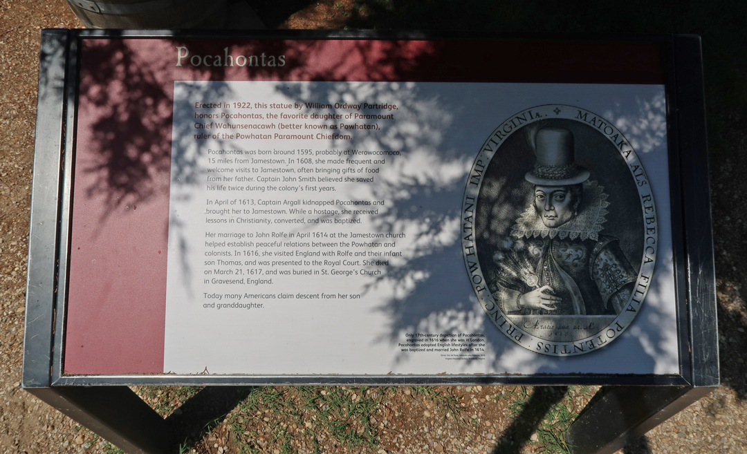
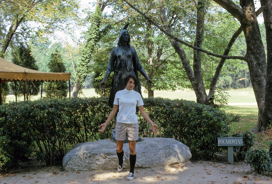
The real story of Pocahontas, plus two interesting characters – Me 2021 and Helen 1969. She has said that I like Pocahontas better, because she did not talk balk!

Remembering Our Slave Heritage


Re-creation of the Virginia Company Military Outpost, 1610-14 – when Helen and I visited in 1969.


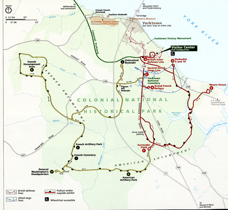
The Colonial Parkway is a leisurely (40min) and scenic way of traveling between the Jamestown Settlement and the Yorktown Battlefield of the Revolutionary War.

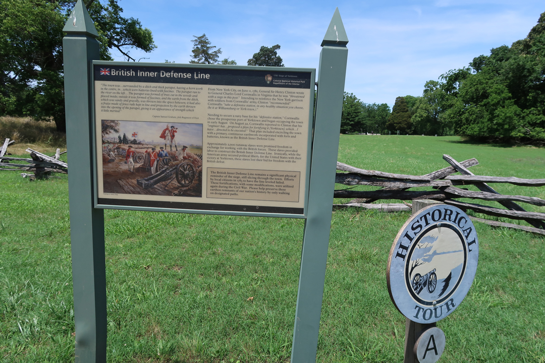
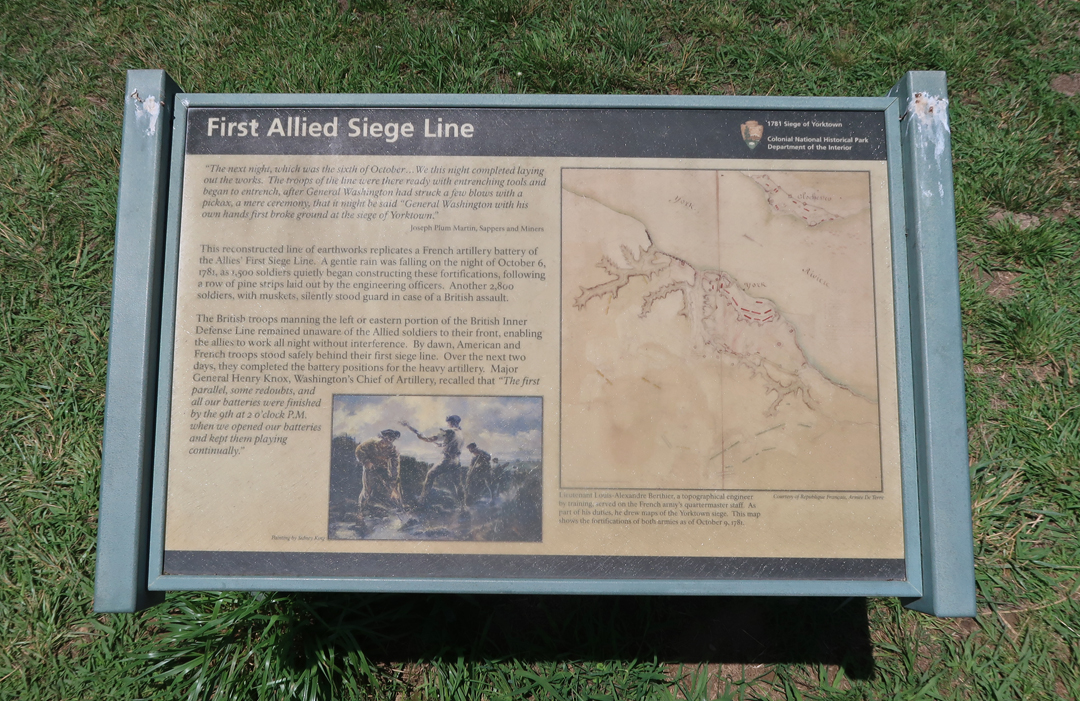
This sign, a short distance from the NP Visitor Center is close to Yorktown and is the first stop on a 7-mile loop road that takes you through the British inner Defense Line and the Allied (American and French) siege lines.
Photos from 1969, the first photo shows the van I bought for us to move from Seattle back to the U of MD.
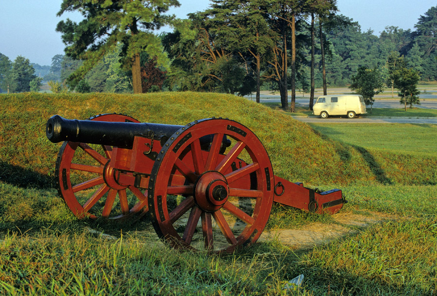

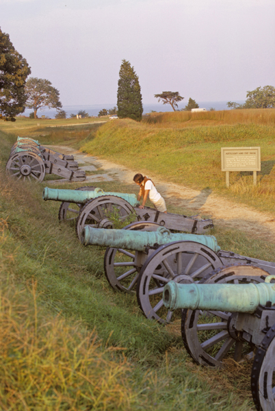
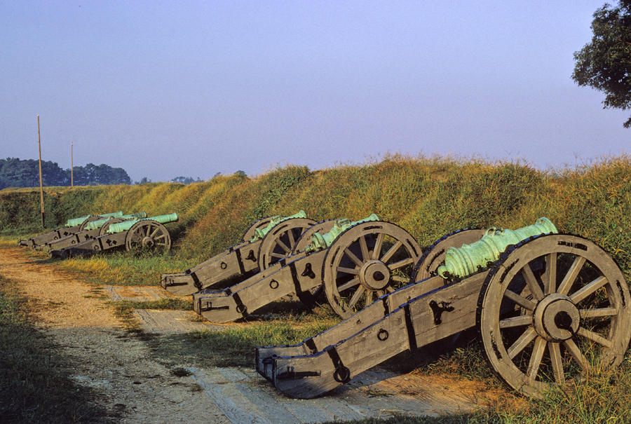
Grand French Battery on the first siege line – 2021

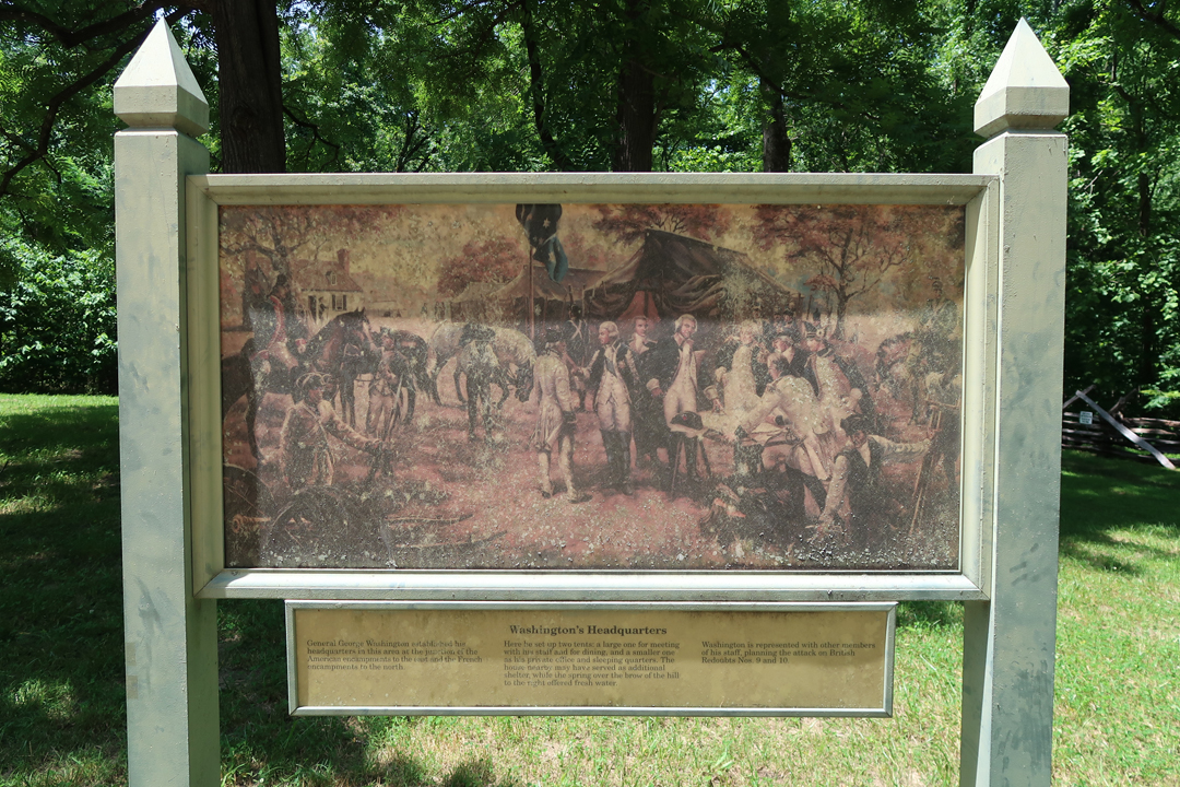
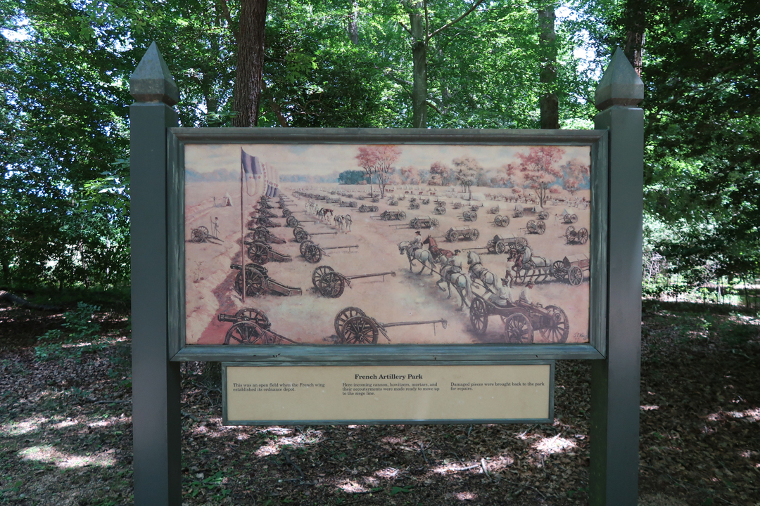
A second 9-mile loop road takes you through the American and French Encampment areas. First the American Artillery Park and Washington’s Headquarters.
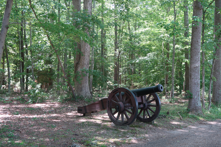
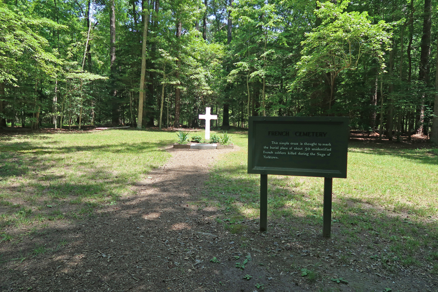
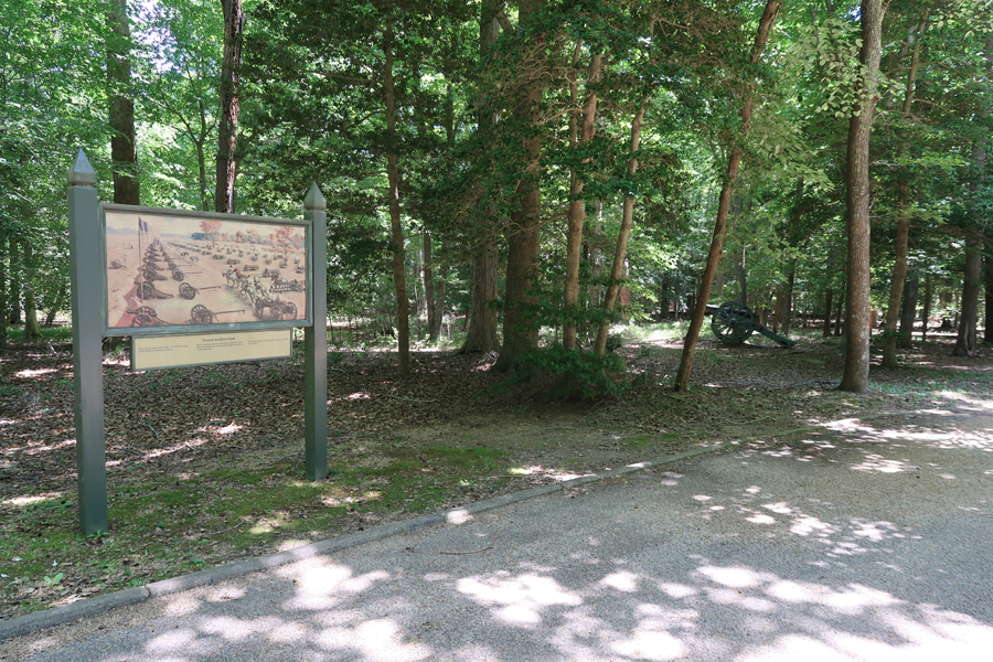
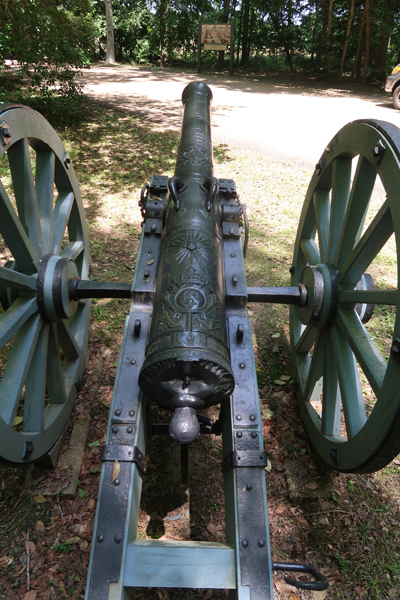
Then the French Cemetery and Artillery Park

On October 19, 1781, Cornwallis’s army surrendered. In this John Trumbull painting, Maj. Gen Benjamin Lincoln accepts the surrender of the British arm from Brig. Gen Charles O’Hara, Cornwallis’s second in command.

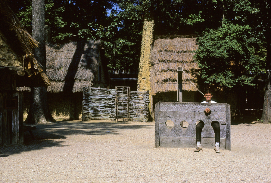
Following my Battlefield tour, I toured Yorktown.

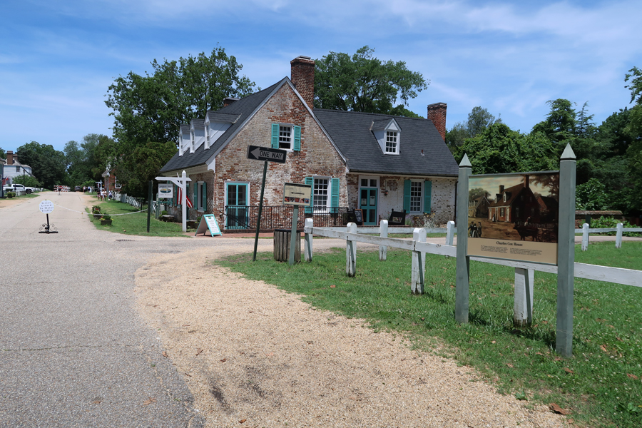
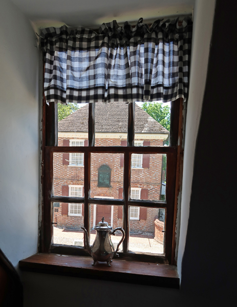
It was fun walking through and visiting the period buildings. This is the Dudley Diggs House (1760), now the Mobjack Petite Café, where I had a great turkey sandwich. The Customhouse (1721) is located across the Main Street.


General Thomas Nelson Jr house


Grace Episcopal Church (1697) is still in service.


General Thomas Nelson, commander of the Virginia militia, governor of Virginia, and signer of the Declaration of Independence is buried in the church graveyard.

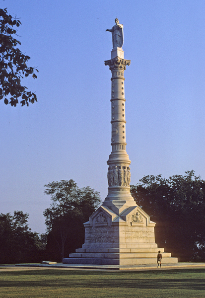
Helen at the Yorktown Victory Monument in 1969
Yorktown was under siege again during the Civil War

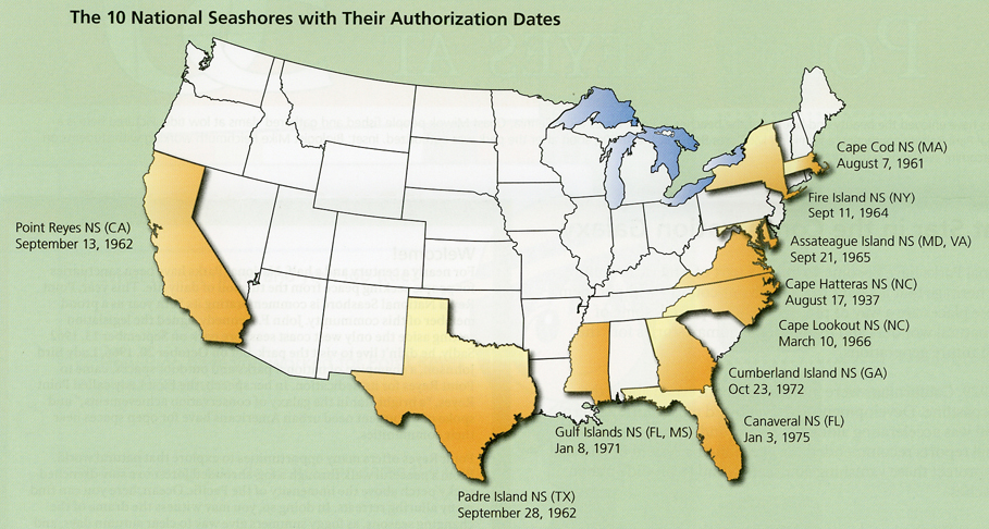
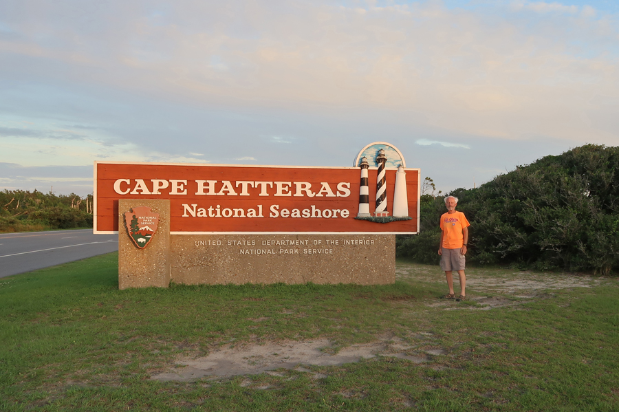
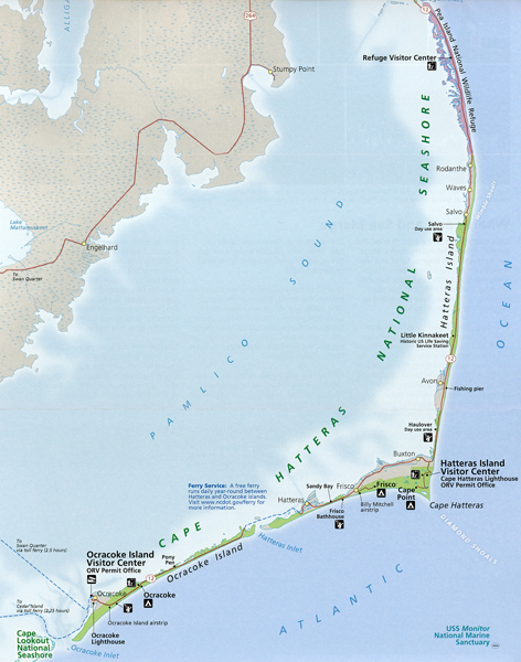
After a 3.5hr drive, I arrived at Cape Hatteras National Seashore at dusk. This NP Unit is one of ten NPS National Seashores.


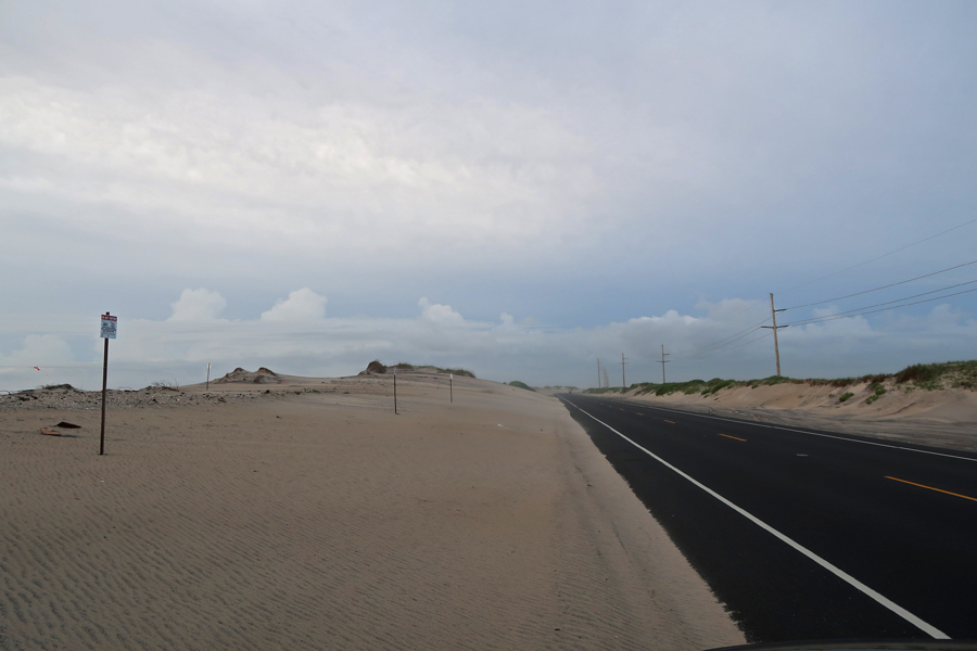
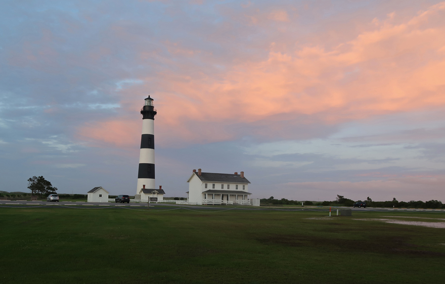
It was almost dark as I took a video of the rotating beacon of the Bodie Island Lighthouse
Atlantic Ocean, next stop Europe? Slept in the Oregon Inlet campground.
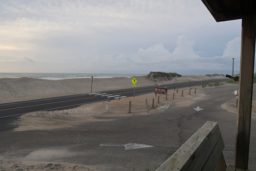
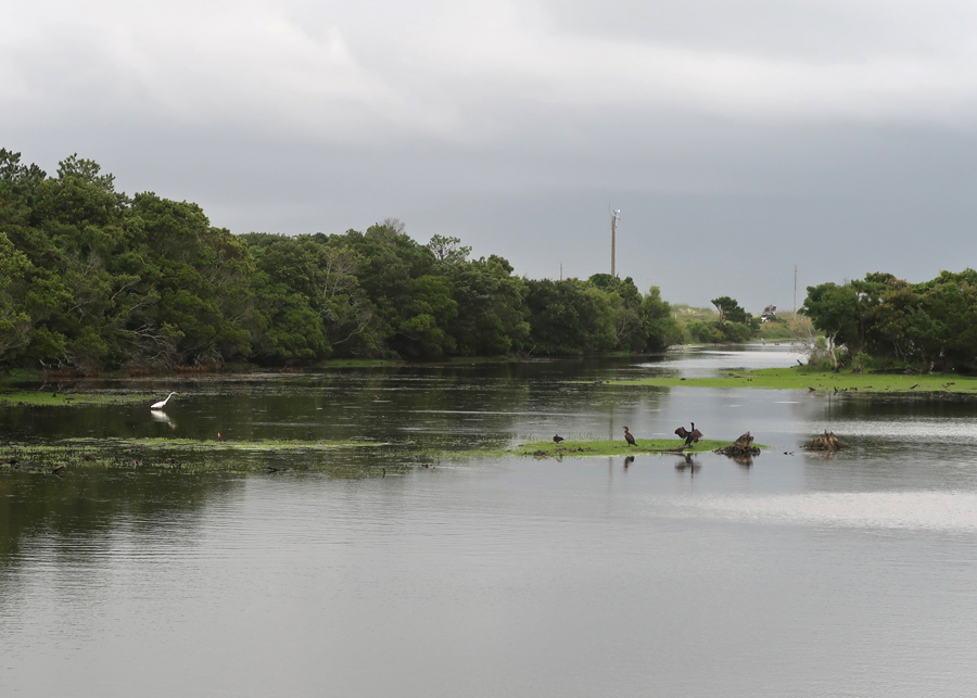
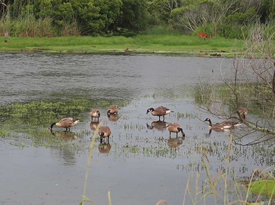
6/14 M – I was up early and drove on to Pea Island as it became light.

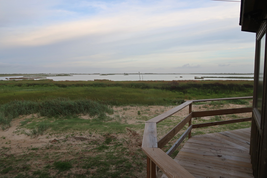
My first stop, and walk, was at the Pea Island National Wildlife Refuge Visitor Center.


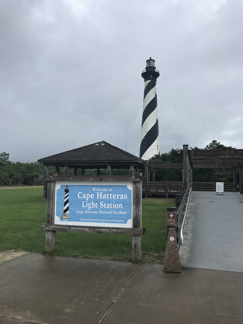
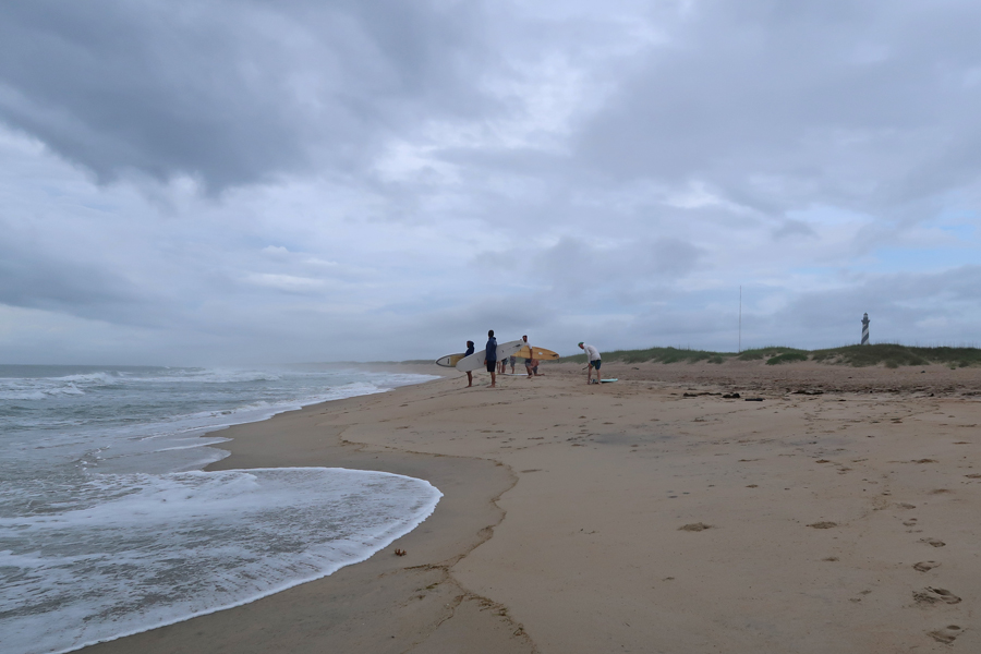
It was about 7am as I drove onto Hatteras Island.
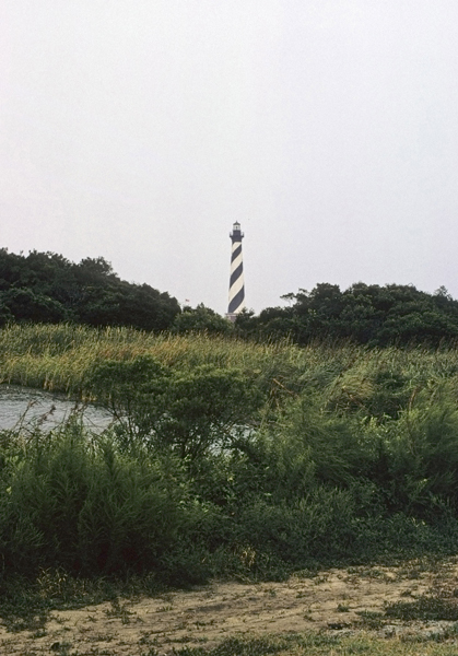
The first photo of the Cape Hatteras Lighthouse was taken from the beach in 1969 when Helen and I visited the Seashore. The second was taken today (6/14/2021).

It was not open, so I was unable to climb to the top.
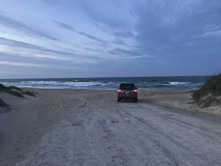
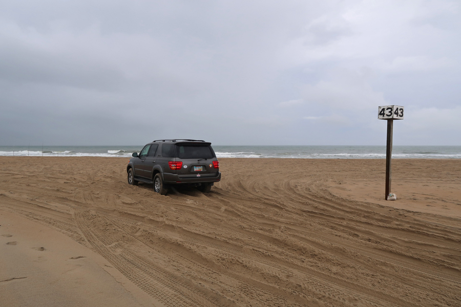
You need a permit for your vehicle (only 4WDs) to drive on the beach.
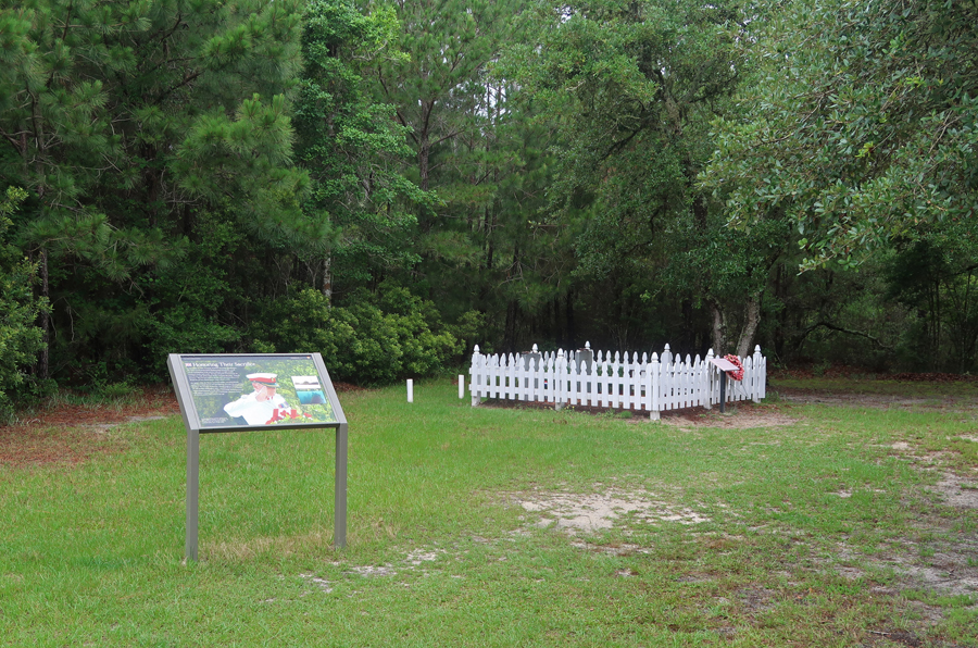
There is a tiny cemetery on the island honoring British seaman lost off this cost during WW II when their ship was sunk by a Nazi U-boat (submarine).

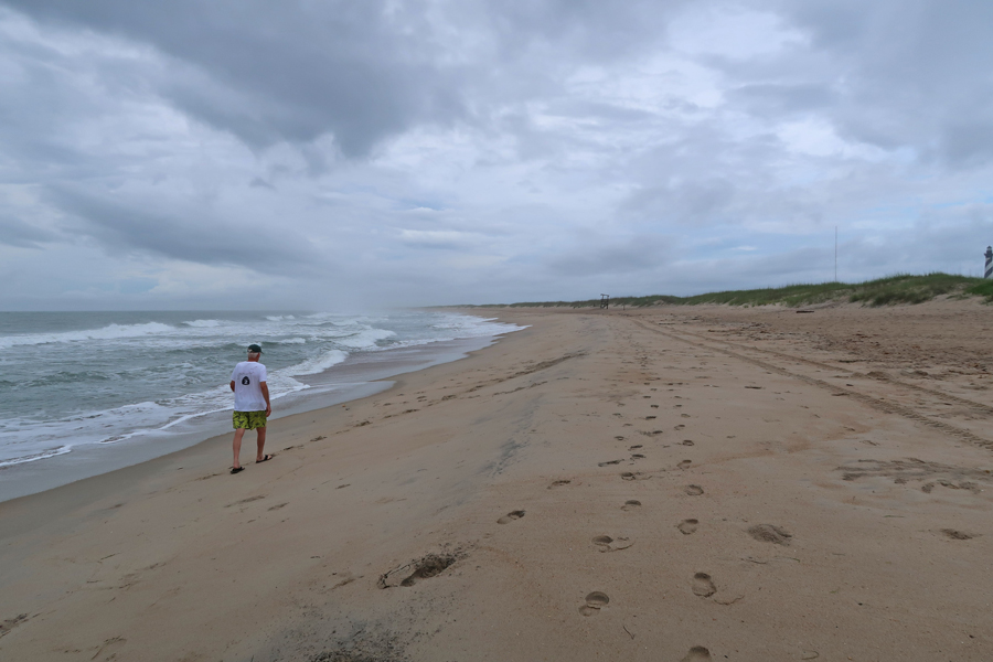
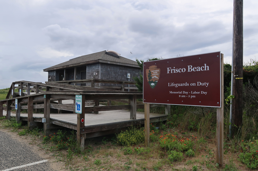
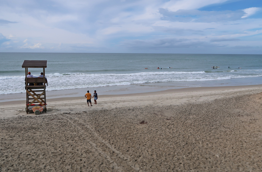
I then stopped at Frisco Beach, which is one of the few that have lifeguards.
6hr drive to Guilford Courthouse National Military Park in NC – during my school history lessons, I learned a good deal about the northern battles of the Revolutionary War but relatively little about the southern battles. For example, there are three National Park Units in South Carolina devoted to the Revolutionary War – Ninety Six NHS, Cowpens NB, and Kings Mountain NMP. There are two in North Caroling – Moores Creek NB and Guilford Courthouse NMP.
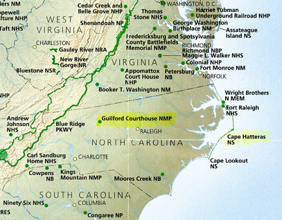

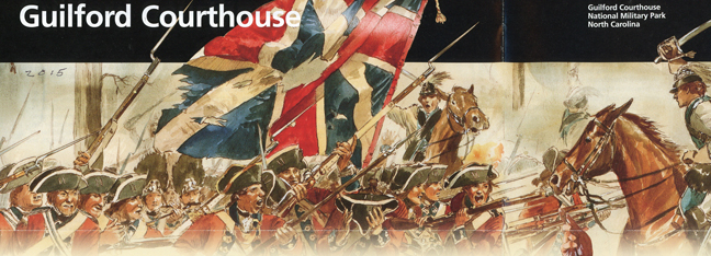
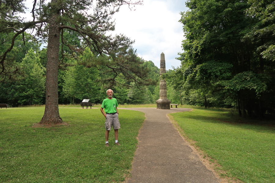
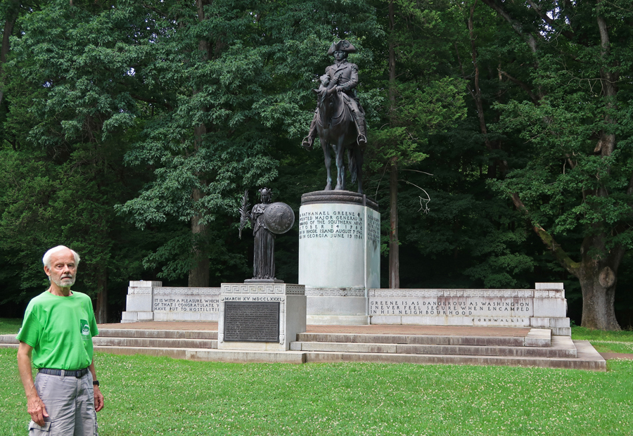
Our first visit to this Unit was in 2011, (Blog March 2011). As stated in that blog post – Guilford Courthouse National Military Park is located just north of Greensboro NC. On March 15, 1781, Maj. Gen. Nathanael Greene and about 4,400 men contested the invasion of NC by 1,900 redcoats commanded by Cornwallis. Fierce fighting resulted in about 250 rebels and 500 redcoats dying before Greene withdrew resulting in a British victory. However, the battle left Cornwallis’s troops weak and unable to fulfill their role as an occupying force. Seven months later he would surrender at Yorktown. Guilford Courthouse –
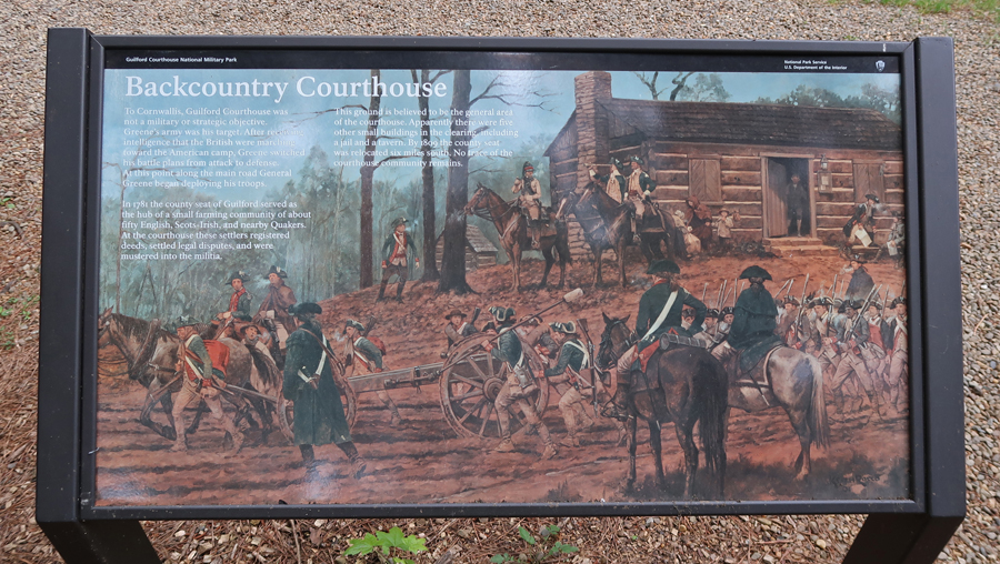
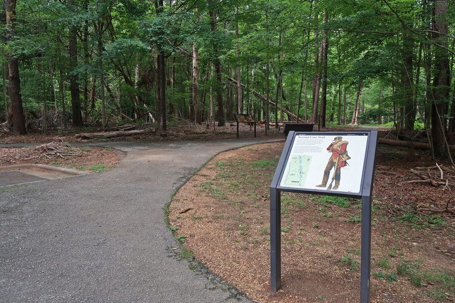
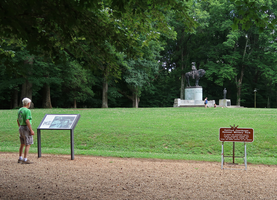
The Continentals, under General Nathaniel Greene, set up three defensive lines in this area (see map). The British, under General Charles Cornwallis, progressively attacked all three. The First Line Defense –


Second Line Defense

Cavalry Monument
Third Line Defense


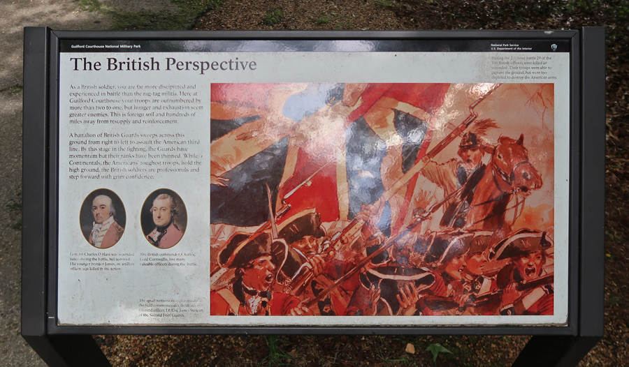
British Perspective
General Nathaniel Greene Monument – largest in the park
Helen 2011


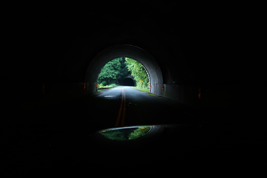
It took about 2hrs to get to Rt 80, a VERY windy/steep road up to Buck Creek Gap of the Blue Ridge Mountains. From there, I turned south on the Blue Ridge Parkway. After a few miles, I passed through Twin Tunnels at Marker 344.5 of the Parkway.

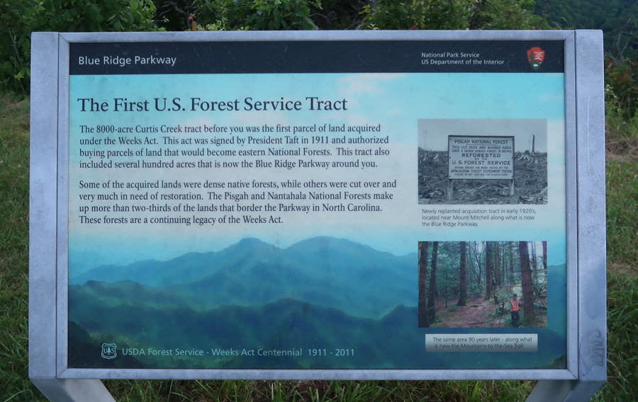
The very first United States Forest Service (USFS) tract of land established in 1911 by President Taft is to the east.

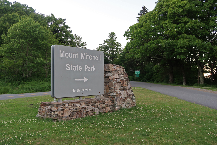
At 8pm, I arrived at Mount Mitchell State Park and the 5-mile road that takes you to a parking lot near the top.

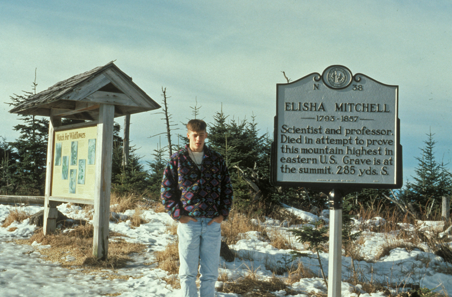
Helen and I had been to the top in 1969 on our trip to Mexico from MD. I again took the short trail to the top in 1988, and this is a photo of Peter ready for the 285yd trek to the summit in 1992.
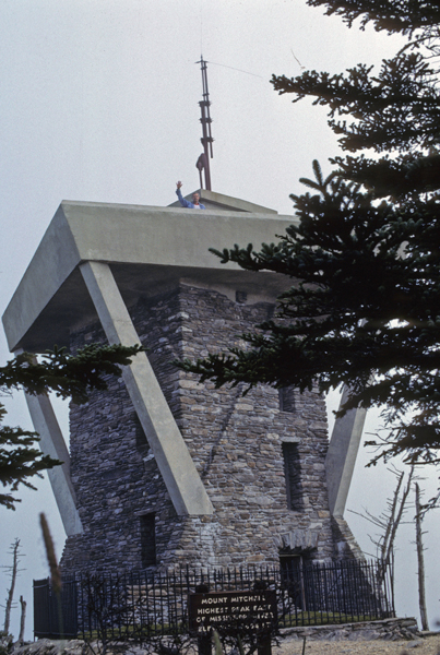
In this 1988 photo, I am standing on the observation platform surrounding the old 25-foot stone tower that was built on the summit in 1959.
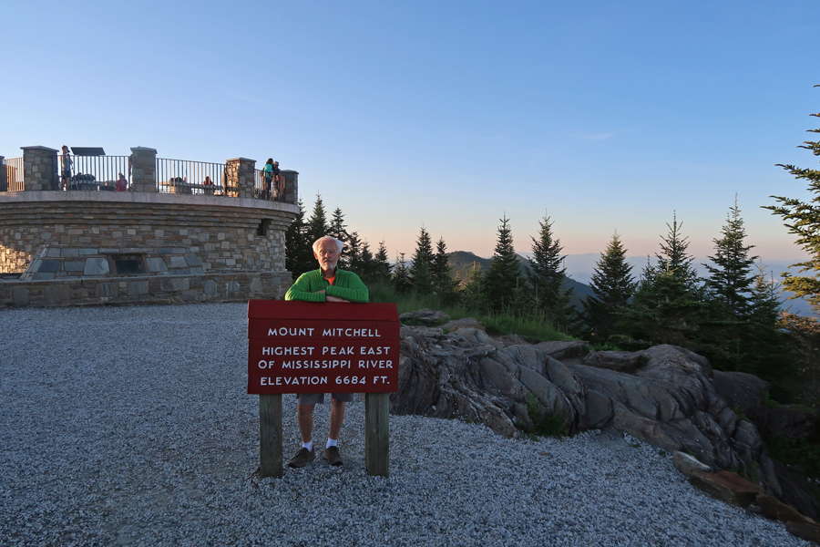
Here I am again in 2021 at the new 10-foot-high viewing platform that was erected on the summit in 2009.
The current circular observation platform is the fifth structure to crown the summit of Mount Mitchell. The first was an obelisk erected next to the grave of geographer Professor Elisha Mitchell (1793-1857) in 1888. He died in a fall on the mountain while attempting to prove that the Black Mountains were the highest peaks in the region and the eastern U.S. He proved, with measurement taken in 1838 and 1844, that Black Dome, the highest peak in the Black Mountains, was higher than Mount Washington (6,288ft) in NH. Black Dome was re-named Mount Mitchell (6,684ft), by the U.S. Geological Survey, in his honor in 1881-82.
In 1915, high winds destroyed the obelisk and a 15-foot ladder, supported by three poles was placed on the summit. When Mount Mitchell State Park was created in 1916, a 15-foot covered wooden platform was constructed. In 1926, NC replaced the platform with a medieval looking stone tower. In 1928, a funeral cairn and plaque was placed on Mitchell’s grave. The word “University” is misspelled on the plaque! In 1959, a viewing platform was constructed on the 25-foot stone tower.
In 2009, a 10-foot-high, 36.5-foot diameter circular viewing platform replaced the stone tower. It provides a 360- degree view of the Black Mountains. Mount Mitchell is sometimes referred to as “The Island in the Sky” because it acts like an island above a sea of warmer land. Most plants and animals on top of Mount Mitchell cannot live farther down the mountain.


Glassmine Falls – center of photo

Craggy Gardens

Looking East from around Mile Marker 370 on the Blue Ridge Parkway.
Sunset

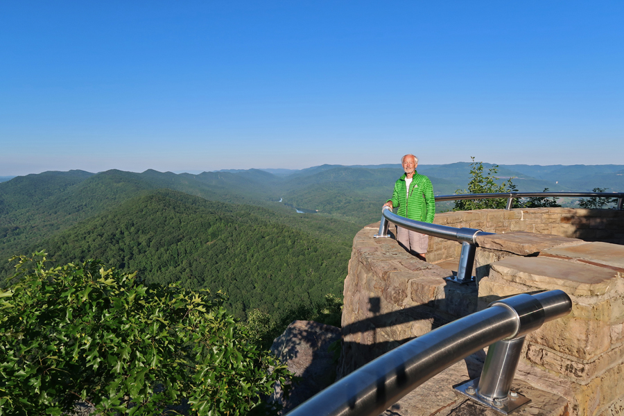
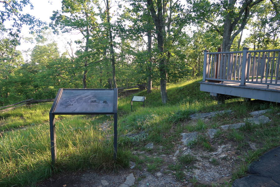
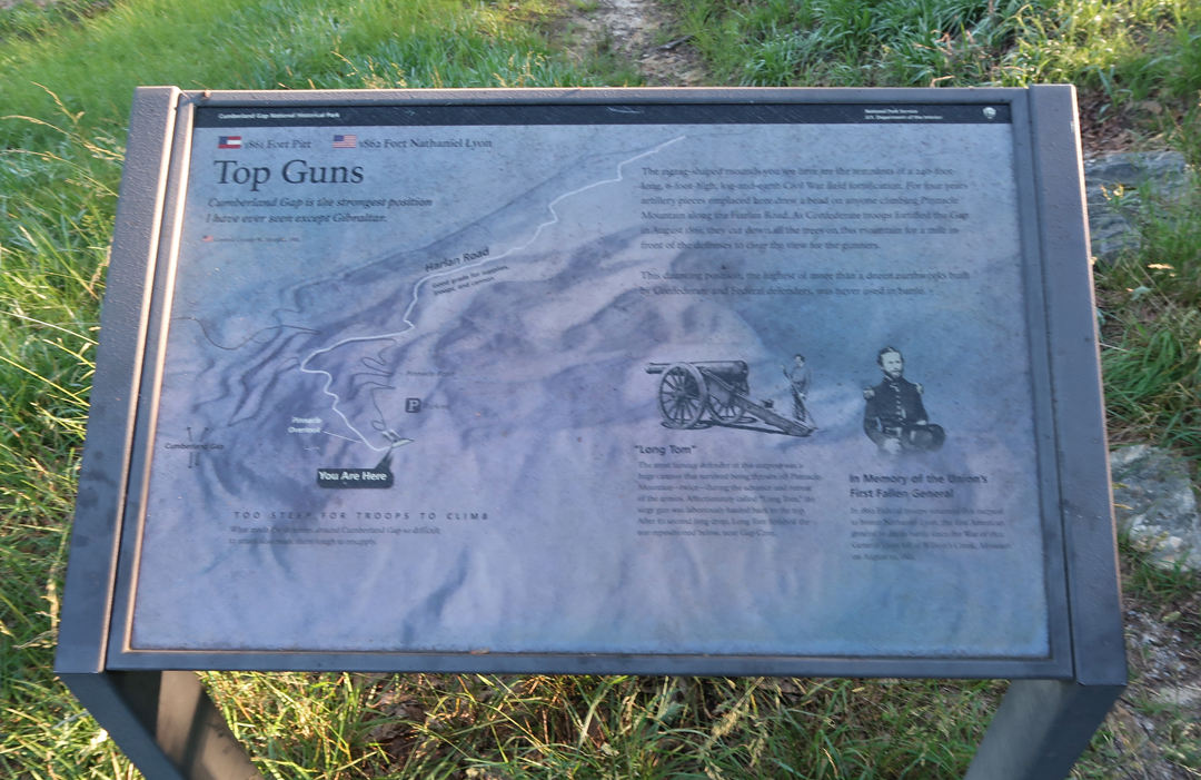
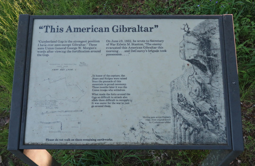
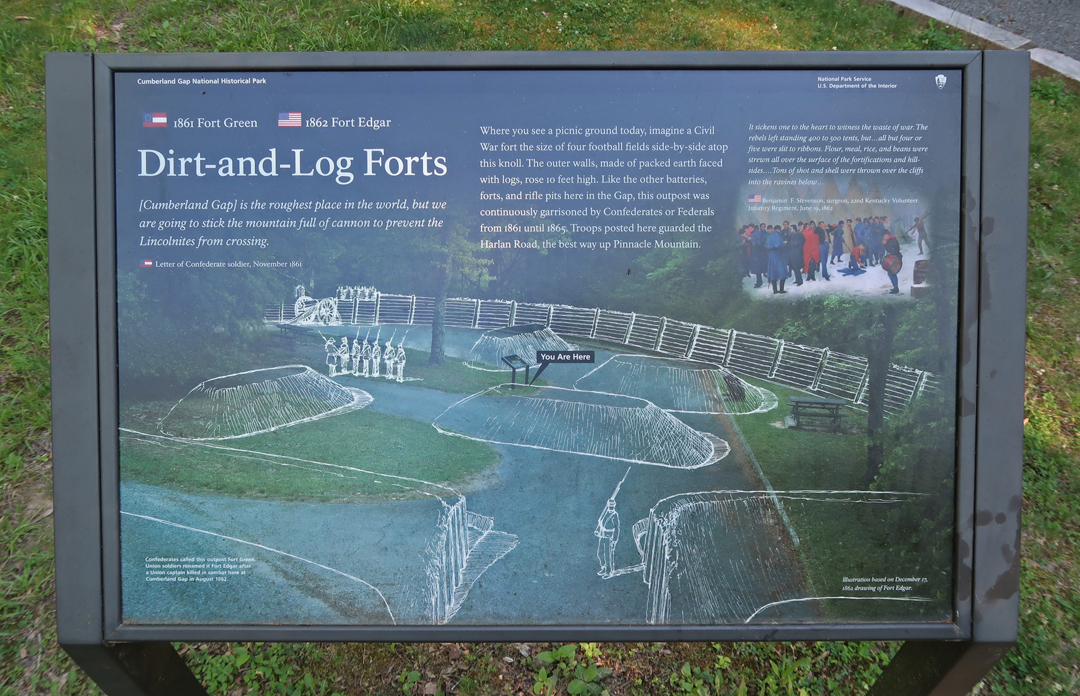
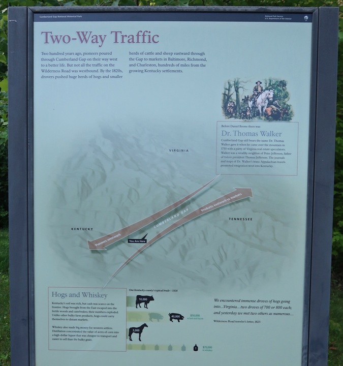
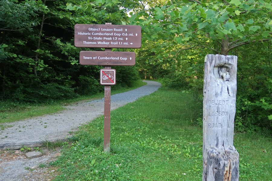
6/15 Tu – arrived at the Cumberland Gap National Historical Park Visitor Center about 6:30am and immediately took the road to the Pinnacle Overlook. This was my fourth visit to the park. On this trip, my objective was the Pinnacle Overlook, where there is a great view of the Gap and information related to the strategic importance of this location during the Civil War.

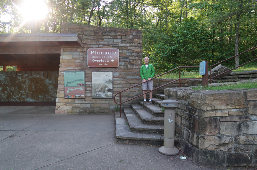
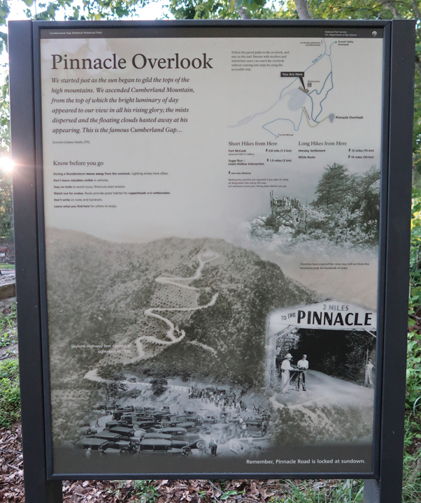
This was a popular tourist spot long before the establishment of the NHP in 1955.


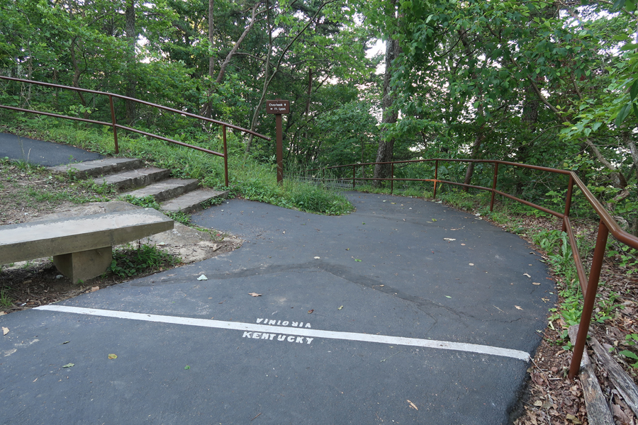
This is the 2016 KY state quarter – three states come together in the Gap – KY, TN, and VA. It was not until 1803 that the tri-state point was made official.
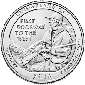
2016 America The Beautiful Quarters Coin Cumberland Gap Kentucky Uncirculated Reverse
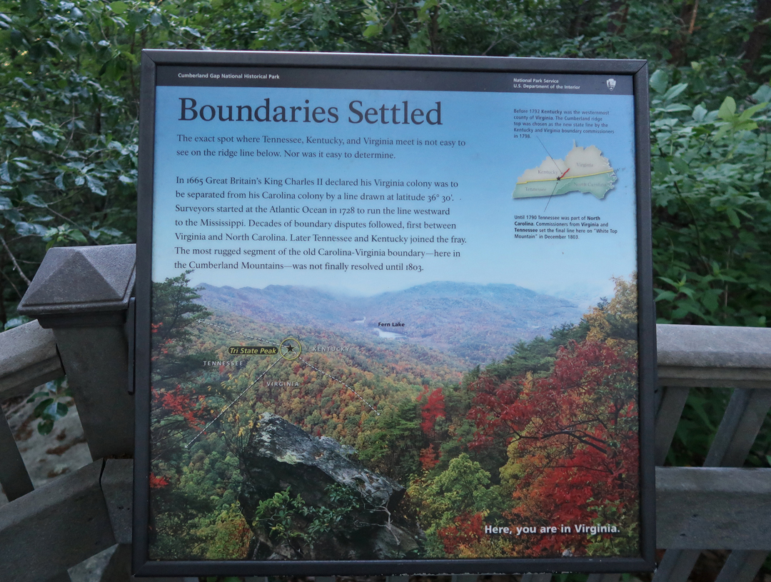
Kate is standing on the tri-state point in this photo from 1984, which was a short hike from Rt 25E when it ran directly through the Gap. In 1996 a tunnel was completed to bypass the Gap and the Gap was returned to a walking path – the original Wilderness Road.
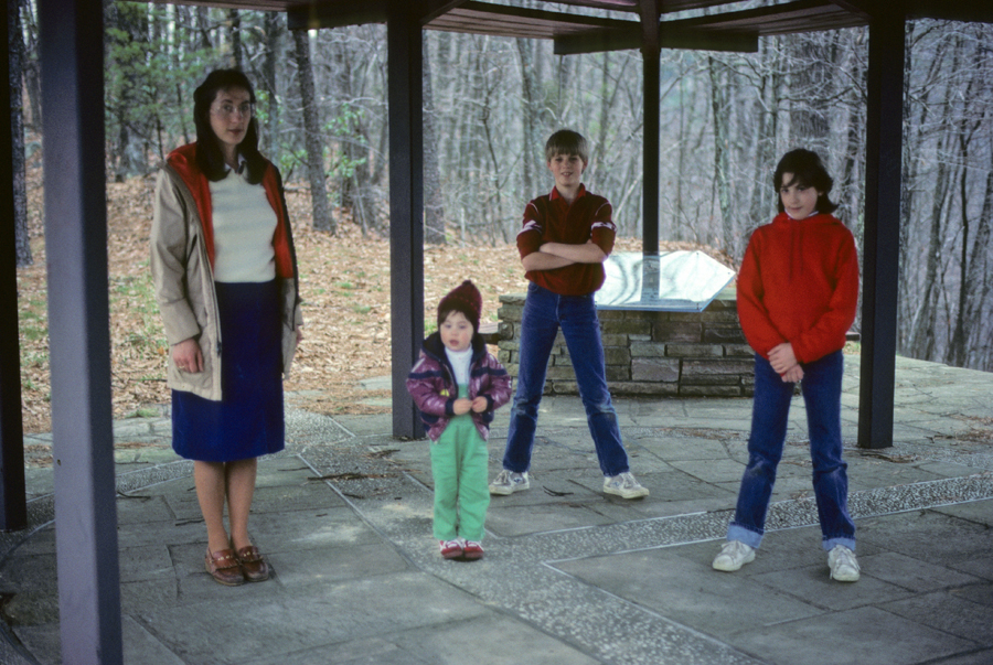

As you can imagine, the Gap was a very strategic location during the Civil War. The first photo is from 1984.
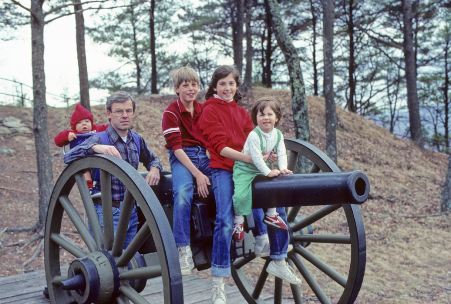
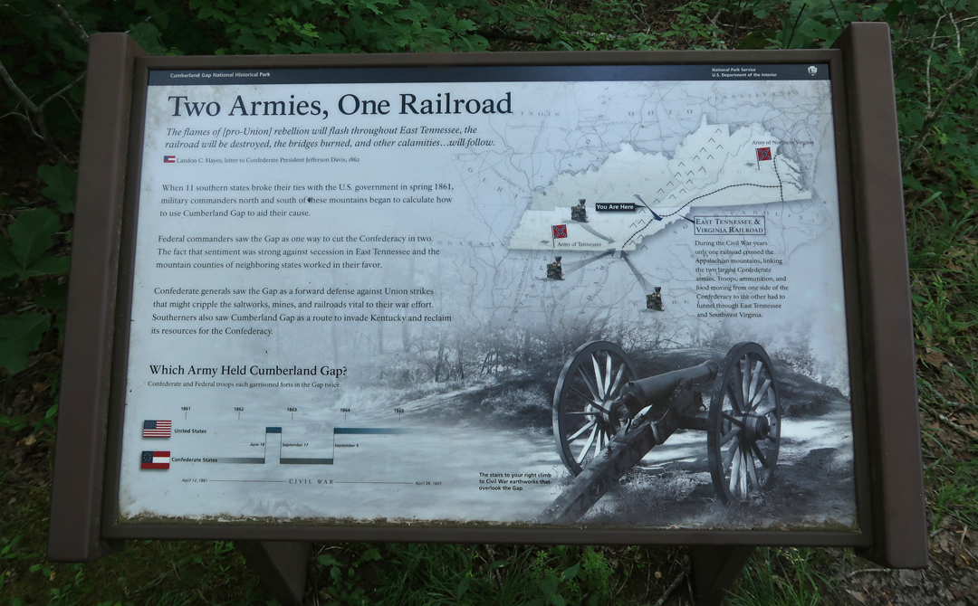
The site of Fort Lyon is on the loop trail near the Pinnacle Overlook.
On my last visit, I hiked through the Gap on a rainy day in April 2016 – see Blog. This is where I finished my hike that day.

A 6hr drive brought me back to Springfield.

Leave a comment