
Hawaii, Saipan, Guam, and Los Angeles
January 30, 20231/12/2022 Th – after having our flight from Dayton to Maui canceled at 10pm yesterday, I arranged for a flight from Columbus leaving at 5am. So, we were up at 2am to get to the airport. Five minutes from home I hit a deer. Fortunately, I was still able to drive the car to Columbus, only to find that our flight was canceled! After much ado, American Airlines got us a flight on United that left at 7am. When we got to United, that flight was canceled. We had to rebook two more times to finally get a flight to Maui. Also, we had to change our return flights because now our car was in Columbus and not in Dayton as originally planned! We arrived in Maui at 10:30pm, 8 hours later than planned. I rented our car from SIXT and got to our VRBO Kihei Bay Surf Condo at 11:30pm, where Kate was waiting. She had landed nine hours earlier.
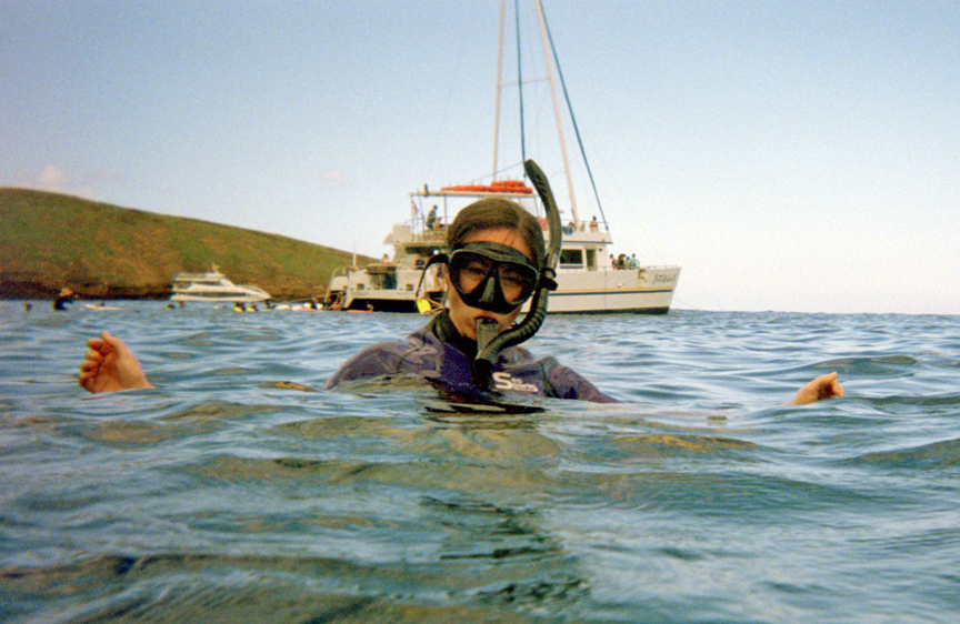
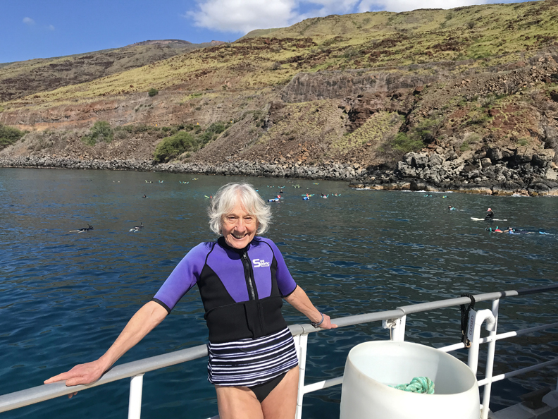
1/13 Friday the 13th – up early to get to the “Pride of Maui” leaving out of Wailuku for our snorkeling adventure at 8am. We took towels, reef approved sunscreen, caps, warm clothes, etc. A light breakfast was waiting for us when we boarded at 7:30am. The water temperature was about 75 degrees, air temperature was in the low 60s, with winds about 13mph. That prompted us to rent wet suits.

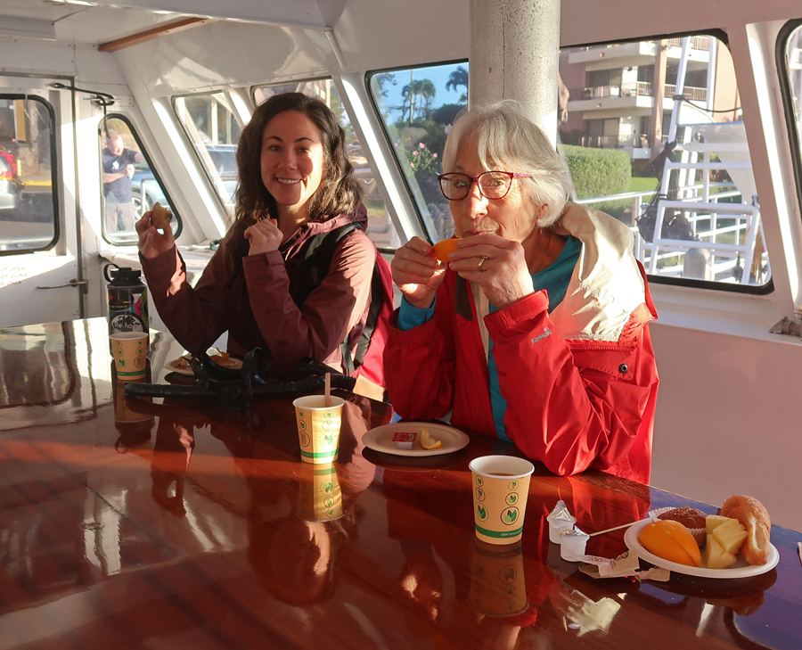
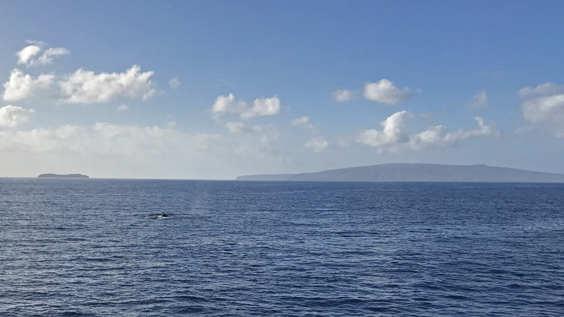
We were treated to numerous humpback whale sightings and breaches on our 45min cruise to the Molokini Crater snorkeling site.

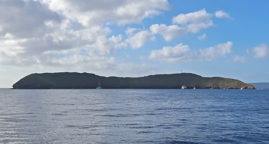
Though cold, it was a good site and we snorkeled for about 45 minutes.

Water Camera Photos –
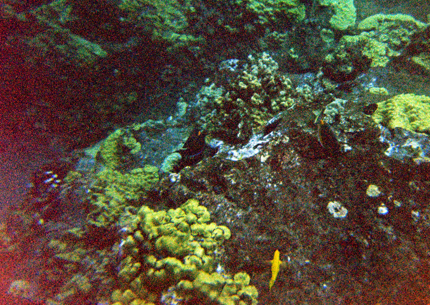
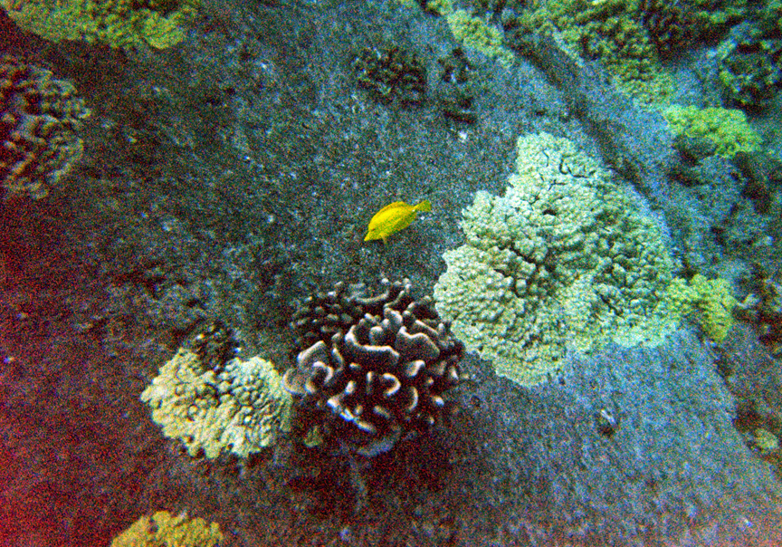
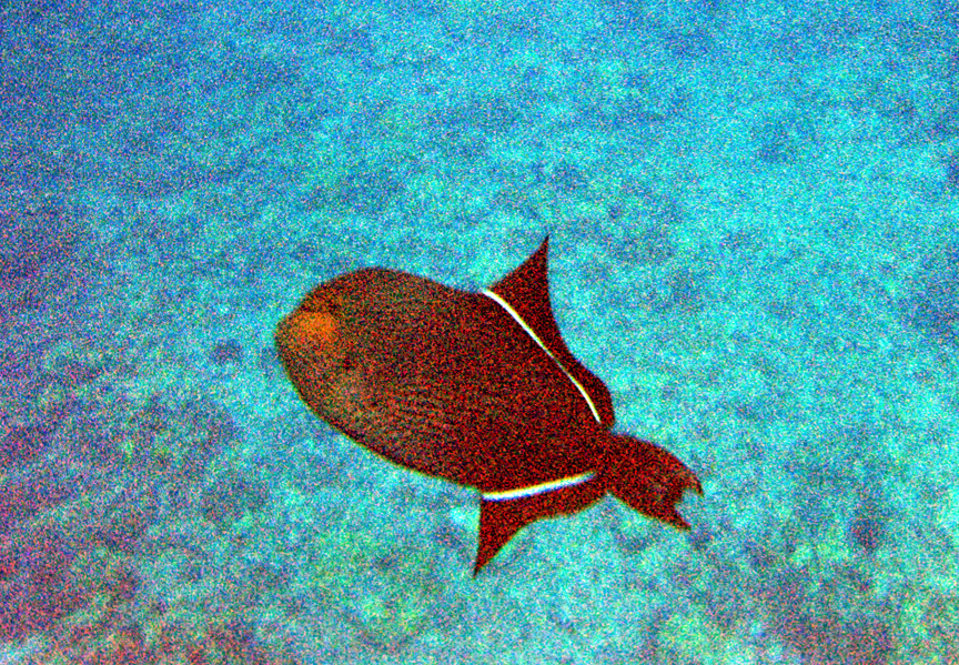
We had a BBQ lunch and saw more whales as we then cruised to our “Turtle Town Snorkeling” destination.
Good snorkeling but no turtles today –

Drove to Lahaina, saw the Jodo Buddhist Mission, and walked the beach.

–

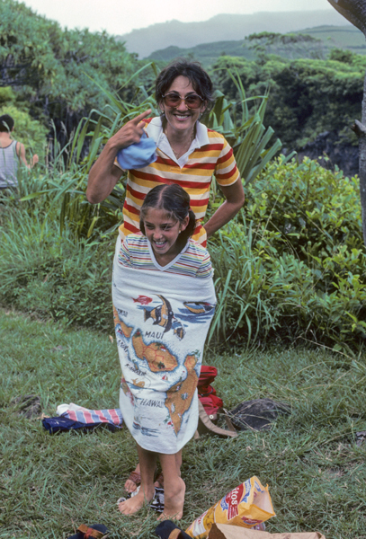
In 1982, Helen, Stacy, Peter, Kate, and I visited four of the Hawaiian Islands. This is a photo of Stacy near Lahaina.

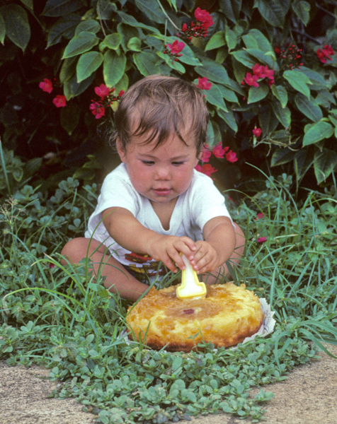
Kate had her first birthday on Maui, with a Pineapple Upside Down Cake! – July 20, 1982.
–
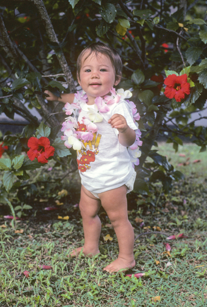
Kate – 2023

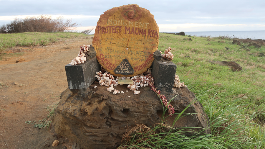
We had VOG today – that is, Volcano Smog from the eruption of Mauna Loa on the island of Hawaii. I was not feeling well after our beach walk, so we returned to the condo. I rested and hydrated while Helen and Kate went out to Kihei Sushi Ko for dinner.
1/14 Sa – started the day at the Kahului Swap Meet. It focused on local handicrafts, so was not of great interest, but the small bananas were excellent!
In 1982, we drove the notorious Road to Hana, windy, gravel, and often one-lane. I don’t know why these people were so happy!

The waterfalls at the end were worth it – Cliff jumping at Makahiku Falls

Peter and Stacy enjoyed sliding down into some of the Pools of ‘Ohe’o near Kuloa Point. These pools are also known as the “Seven Sacred Pools.”

–

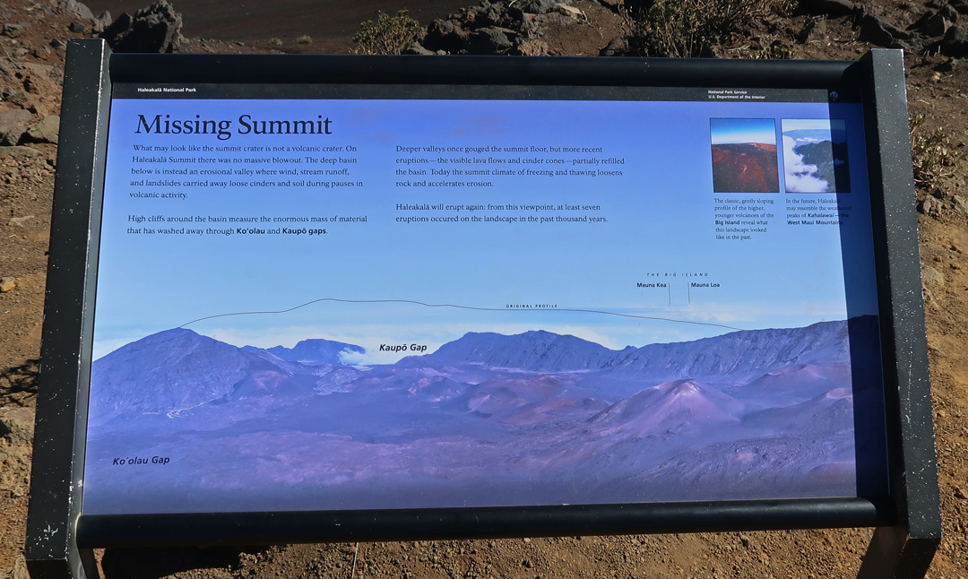
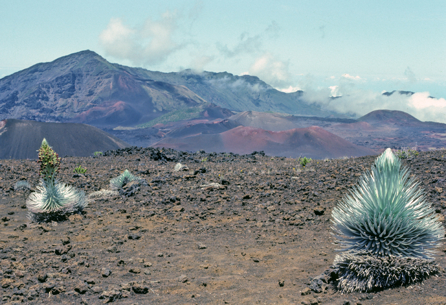
Today we entered Haleakala NP about 11am and stopped at the 7,000ft Visitor Center

Haleakala means – “House of the Sun.”

Here is a 1982 photo of Stacy at the Leleiwi Overlook 8,840ft.
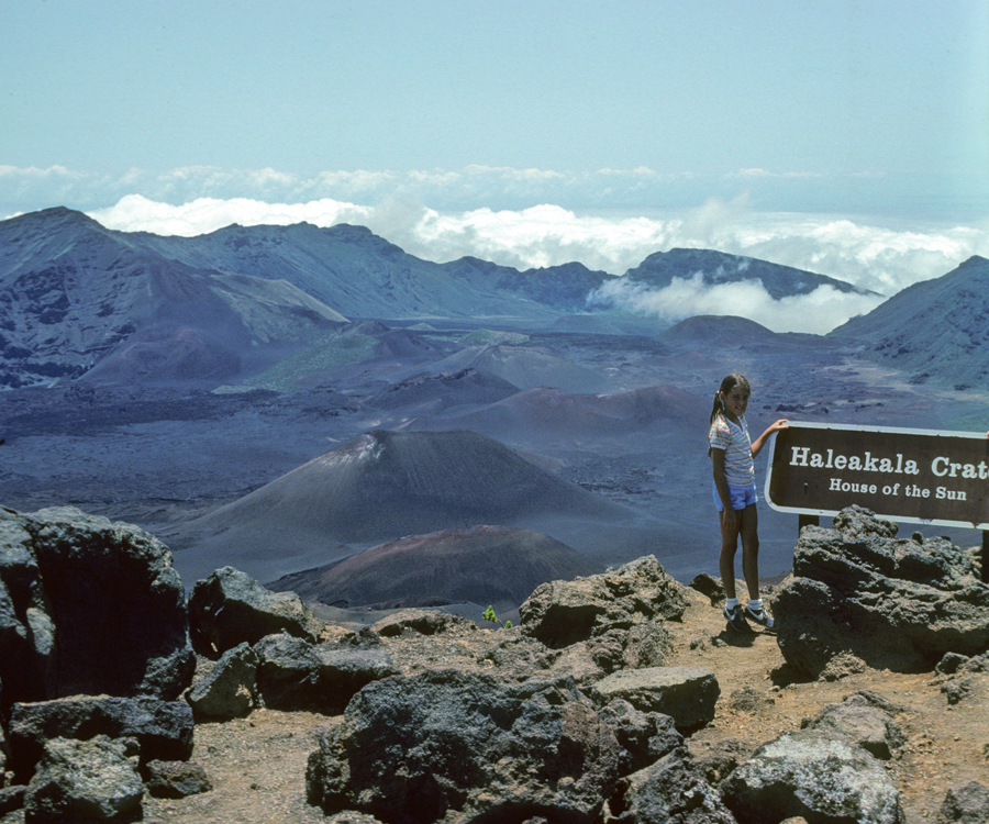
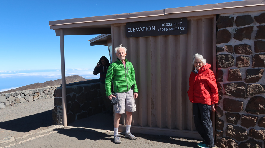
It is a 37-mile drive to the highest point on the crater rim (10,023ft) called the Pu’u’ula’ula Summit, about 30-degrees colder than at the beach!

–

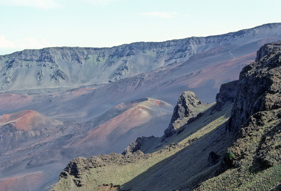
The Haleakala Visitor Center at the 9,740ft level was not open today.

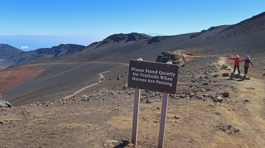
We did the short hike to the overlook on the Keonehe’ehe’e or Sliding Sands Trail

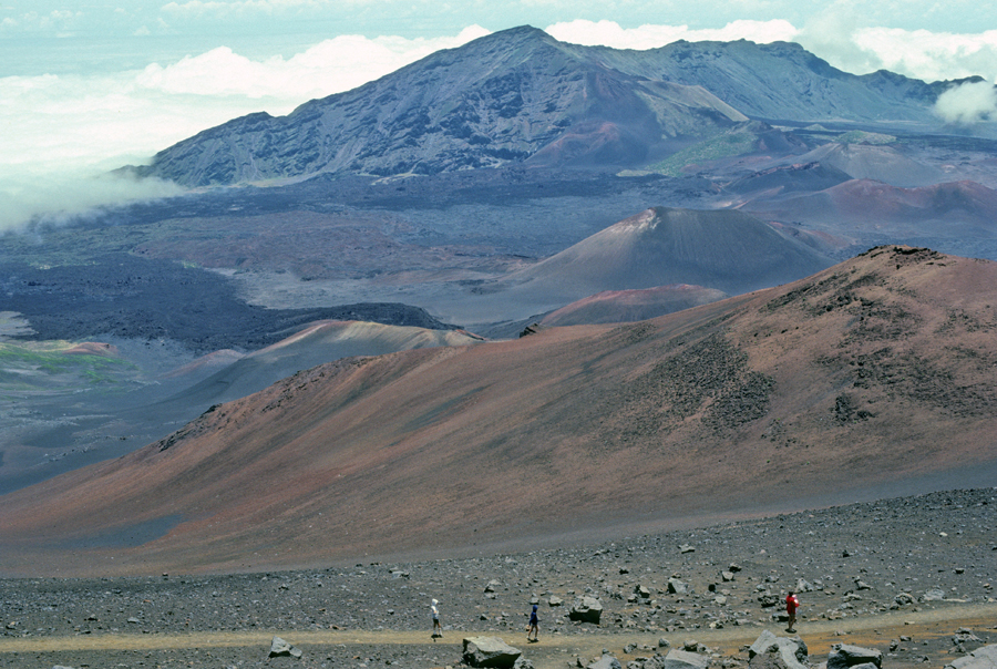
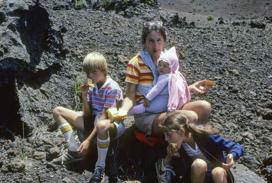
In 1982, we hiked about 2,500 ft down this trail to the Pu’u o Pele Cone in the Wilderness Area on the crater floor. Note Helen carrying Kate. We took turns carrying her on the 7-mile round trip hike.
Of course, we also carried food and water for lunch. One of our funny stories is how we also carried a whole pineapple for dessert. After cutting and eating it, we all ended up with very sticky mouths and hands. Helen said, “No problem, just rub your hands in the black pumice and the sugar will just fall off leaving your hands clean – just like using sand on the Jersey shore.” Well, it did not brush off and we all looked like hobos until we got back to our motel.
The Ahinahina or Silversword grows on the slopes of Haleakala and nowhere else in the world. We were able to see some on our 1982 hike.

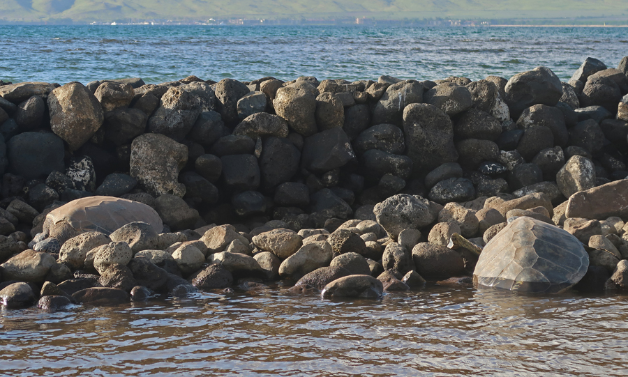
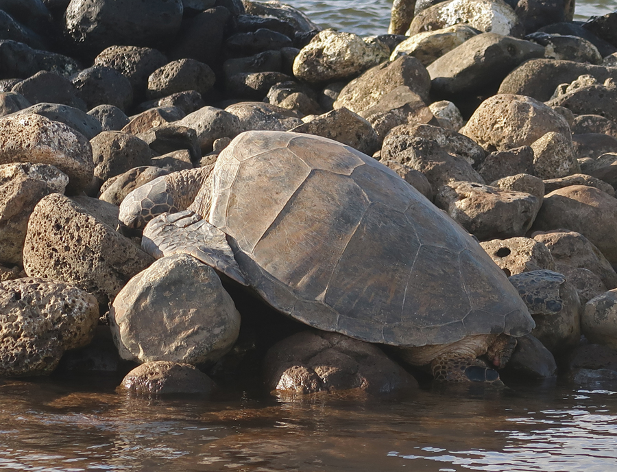
On our return, Kate searched Google for a place to eat and found a nice Food Truck Park with local selections near Kahului. We returned to the condo and walked across the street to the 500-year-old Ko’ie’ie Fishpond.
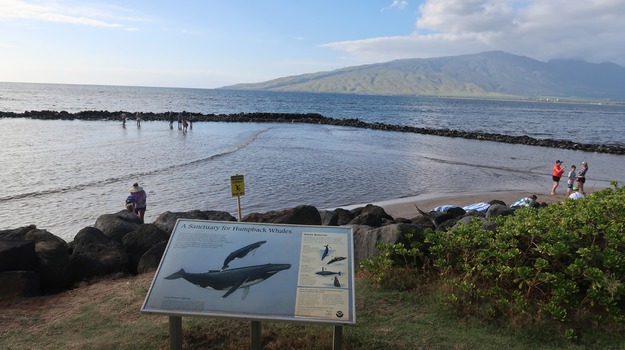
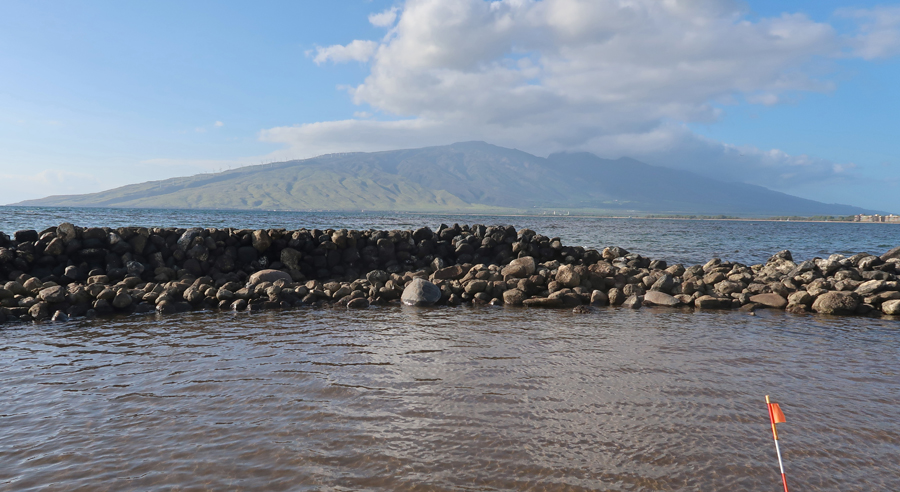
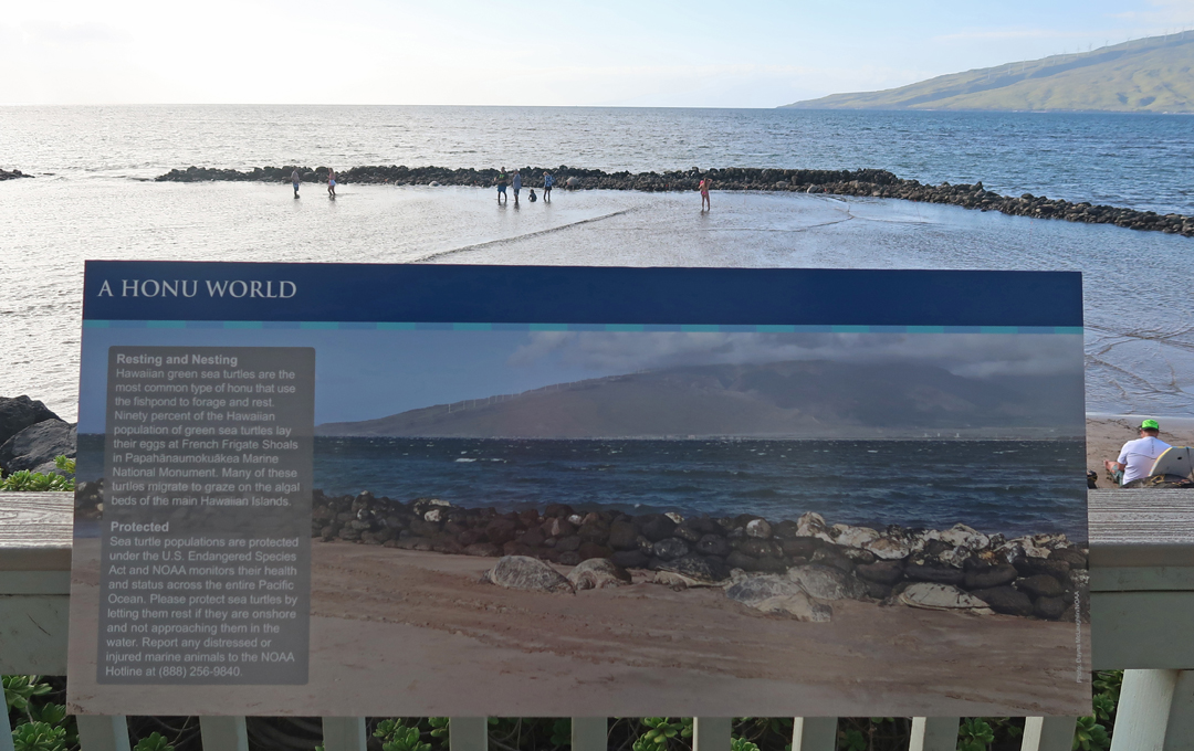
We waded in to get a better look at the seven large Green Turtles that were resting on the rocks.

–
The Visitor Center for the Hawaiian Islands National Marine Sanctuary is nearby.


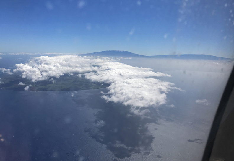
1/15 Su – Had a great breakfast at a local place called the Tasty Crust in Kahului and then headed to the airport. Kate’s flight to LAX was canceled and she was rescheduled, getting into LA later in the evening. We departed at 11:20am and arrived at the Kailua-Kona airport on the Big Island of Hawaii at 11:56am. Airplane view of Mauna Kea (left) and Mauna Loa (right). Mauna Loa had stopped erupting.
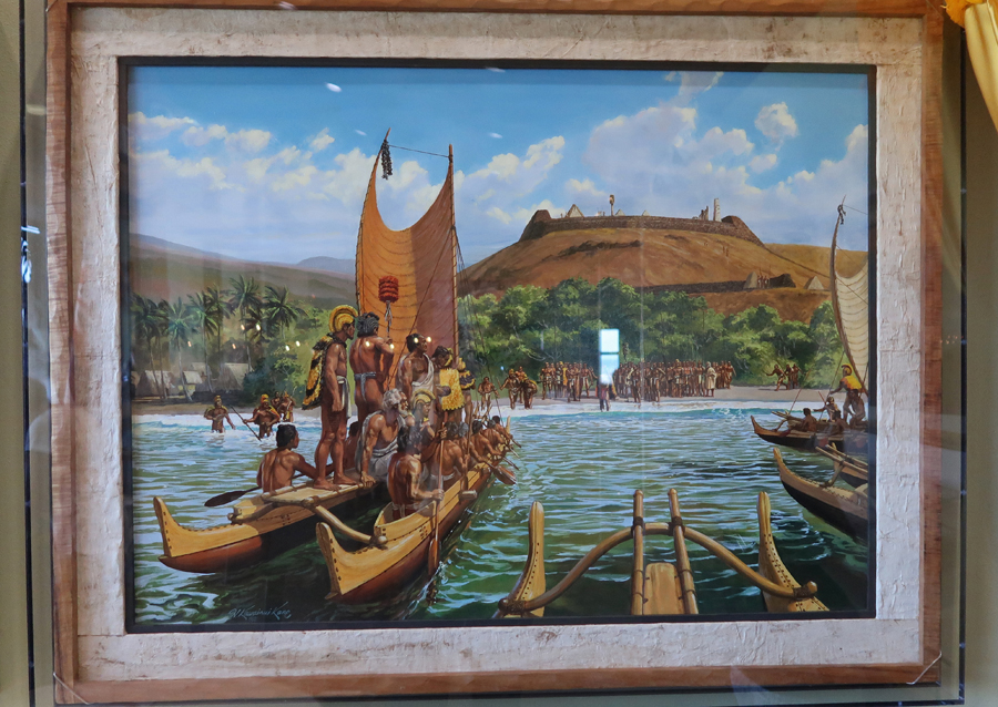
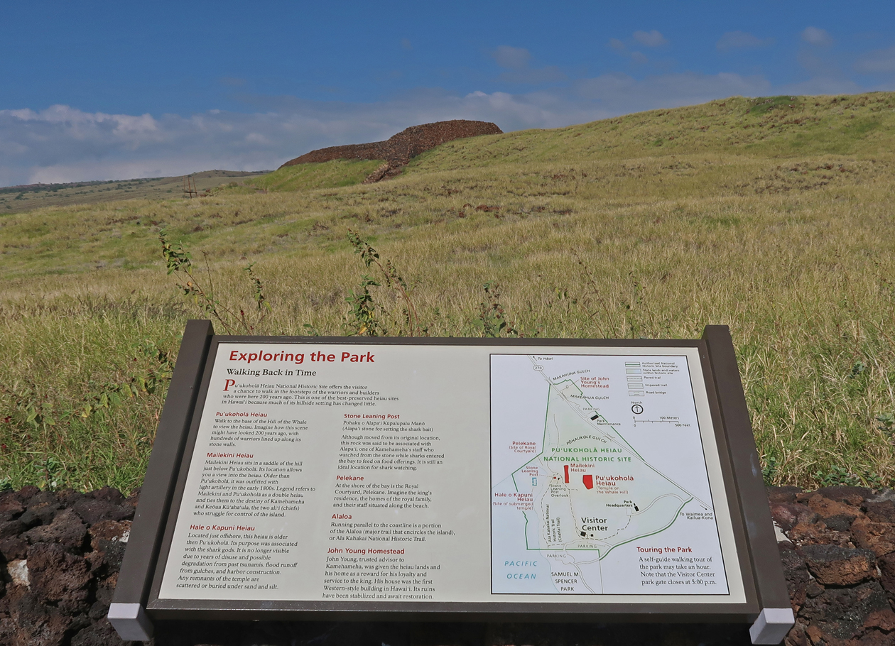
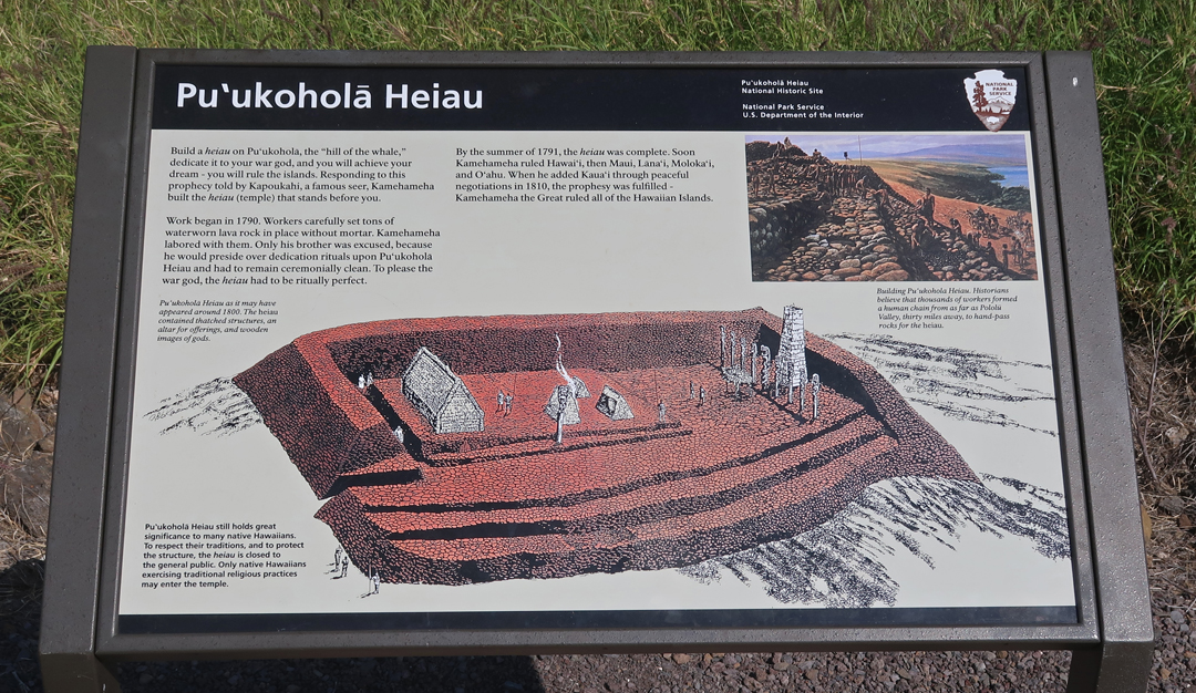
Thrifty upgraded us to a new 4WD Jeep “Road Hawk,” which would allow us to drive to the observatories on top of Mauna Kea (13,803ft). Our first stop today was the Pu’ukohola Heiau NHS. This was our second visit to this site – we had previously visited all the NP Units on the island on previous trips.
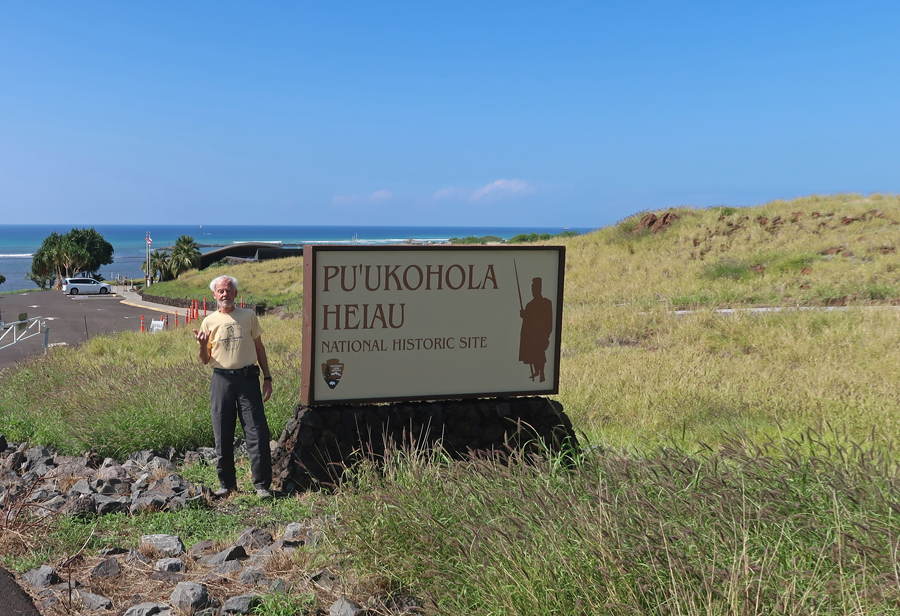
We watched the video “Foundation of a Nation” that describes how Kamehameha I was destined to unite all the Hawaiian Islands. A prophet had told Kamehameha that he would be successful if he built a Heiau or Temple to the War God Kuka’ilimaku or Ku atop Pu’ukohoa or “Whale Hill.”
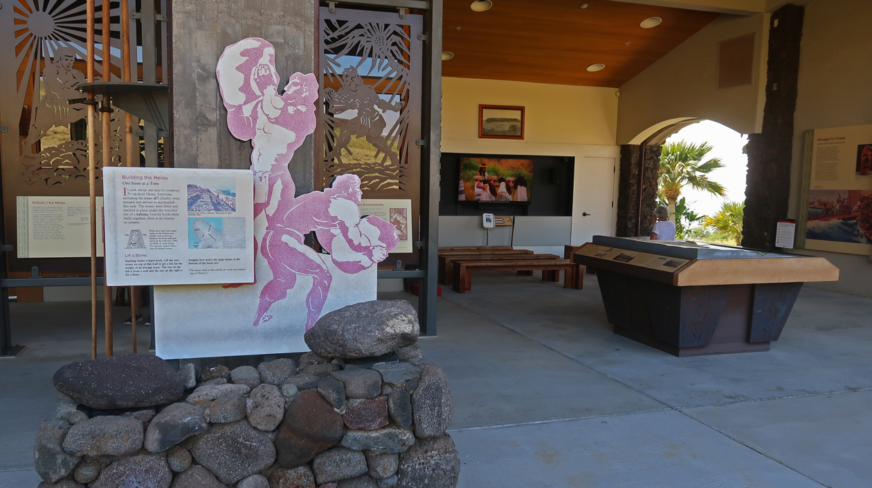
It was built 1790-91 by moving stone hand over hand from the Pololu Valley over twenty miles away. No mortar was used in the construction.

–
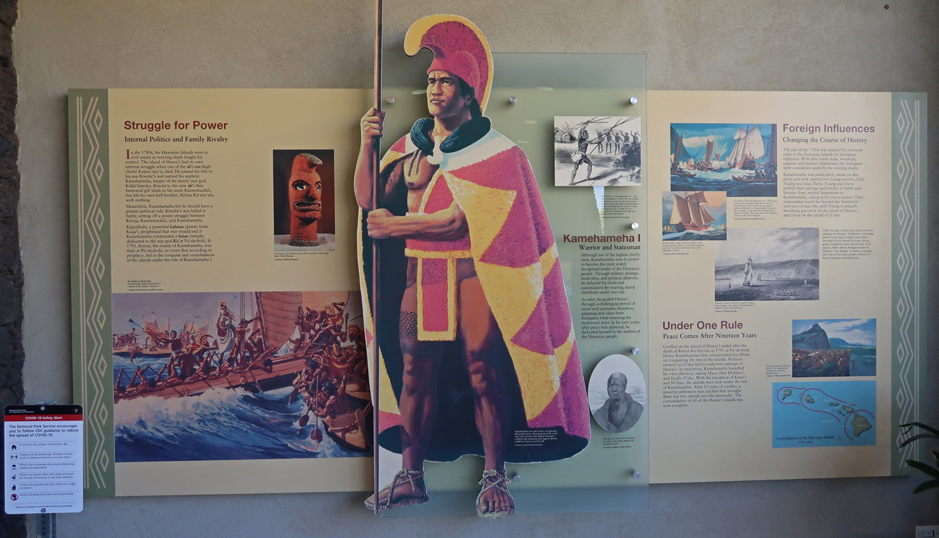

Kamehameha defeated his first cousin Chief Keoua, who controlled the south end of the island. He then invited him to the dedication of the new temple and killed him and most of his party. Keoua’s body was then carried to the Heiau and offered as the principal sacrifice to the War God Ku. Kamehameha I would go on to conquer the other islands, then known to Europeans as the Sandwich Islands, to become the first King of the Hawaiian Islands.
One reason for Kamehameha’s success was his use of “modern weapons (e.g., a canon)” and techniques learned from John Young a British sailor stranded on the island in 1790.

We hiked the one-mile trail to the Heiau on the Hill of the Whale and then returned on a segment of the 175-mile Ala Kahakai National Historic Trail, which runs along the west coast of the island.


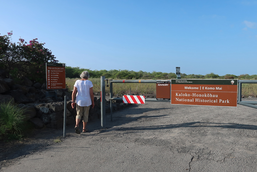
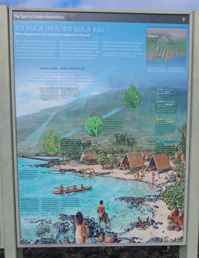
It was an hour drive south to Kaloko-Honokohau NHP. We arrived at the Hale Ho’okipa Visitor Contact Station at 3:30 and had a half hour there before they closed. We looked around the small contact station and then did the nature walk.


–
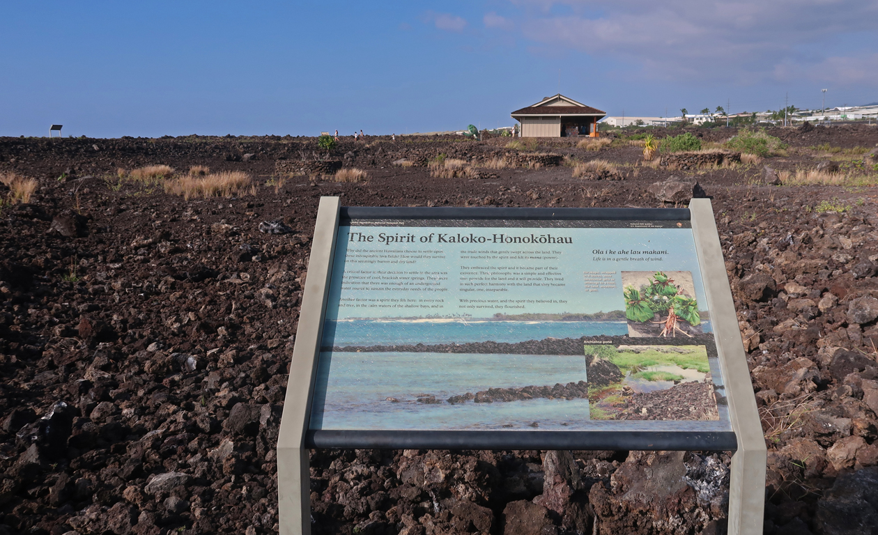
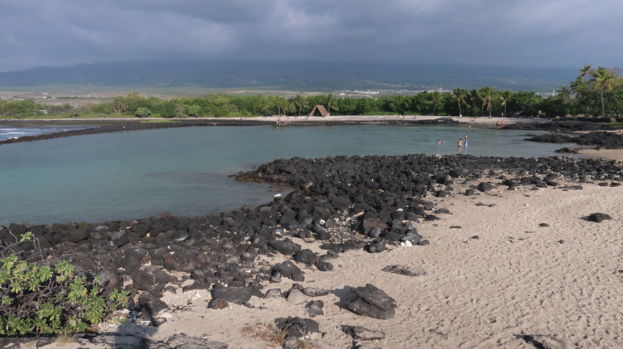
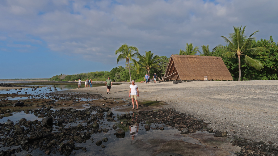
The grounds remained open, so we drove to a parking area near the ocean and entered the park near the Pu’uoina Heiau and the Ai’opio Fishtrap. It was an enjoyable walk to the ocean, past the fishtrap, and along Honokohau Beach. High tide would bring fish into the pond for sustainable “farming.”

–
Had dinner at Keoni’s Point of View, a salty bar/grill in Kailua-Kona where we watched the Cincinnati Bengals defeat the Baltimore Ravens in an NFL Playoff game. We then bought breakfast items at Target and drove to our Airbnb at an elevation of about 1,000ft up the mountain from the airport. It was big and clean, but no AC.
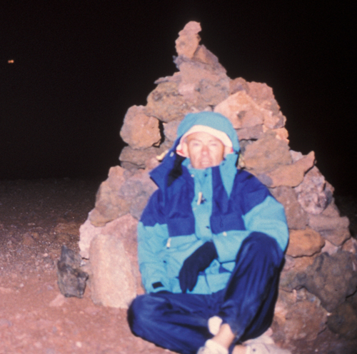
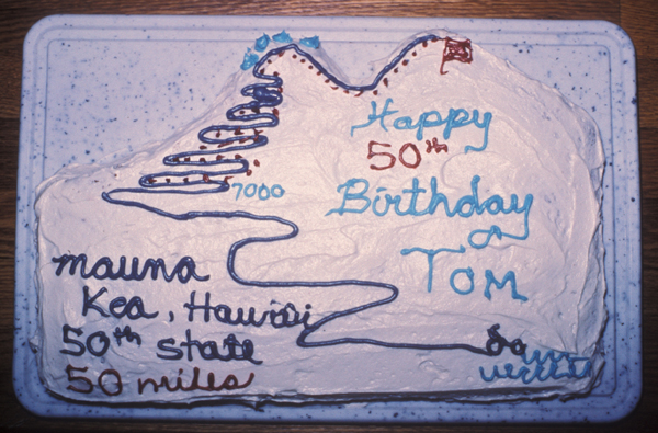
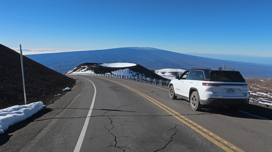
1/16 M – Martin Luther King Day – we were up at 6am for what would be the busiest day of our trip. It took a bit over an hour to drive up Saddle Road (Rt 200) to the 6,632ft saddle between Mauna Kea (13,796ft) and Mauna Loa (13,677ft). This road is now known as the Daniel K. Inouye Highway and is a huge improvement over the dilapidated two-lane road we drove in 1993 when I climbed Mauna Kea. See my article at https://www.summitpost.org/mauna-kea-50-miles-to-the-hp-of-the-50th-state-hawaii/969138 describing my 50+-mile sea to summit climb on my 50th birthday. It was the most difficult physical effort of my life! Mauna Kea is the highpoint of Hawaii and the tallest mountain on earth when measured from the sea floor. However, Mauna Loa is the most massive mountain on earth by volume.

We drove up through the Mauna Kea Ice Age Natural Area to the Onizuka Science Center at the 9,200ft level on the mountain. Ellison Onizuka was a Hawaiian astronaut killed in the Space Shuttle Challenger explosion in 1986.
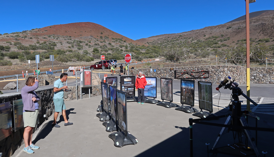
This is the point at which State Rangers control further travel on the 4WD road. First, we had to stay there for a half hour to see how our bodies reacted to the altitude. They warned us of the effects of high altitude on the heart and lungs. They then checked our 4WD vehicle and made sure we knew how to use it before allowing us on the windy gravel road to the observatories near the summit.

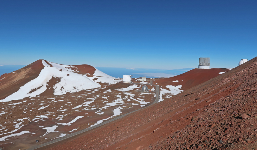
It was 8-miles and an additional 4,000ft up to the observatories. And as you can see – a bit windy! The road from here to the top is paved.

–
There is now a sign discouraging people from continuing to the true summit of the mountain.

It is about a quarter-mile down from the United Kingdom Infrared Telescope and up a cinder cone to the true summit at 13,804ft. The elevation was 13,796ft back in 1993 when I climbed it, so I guess the mountain is “growing.”

–
–
Helen convinced me that I should not do the hike to the summit marker. Besides, I had already been there twice.

Downshift and use low gear on your descent.
Mauna Loa in background

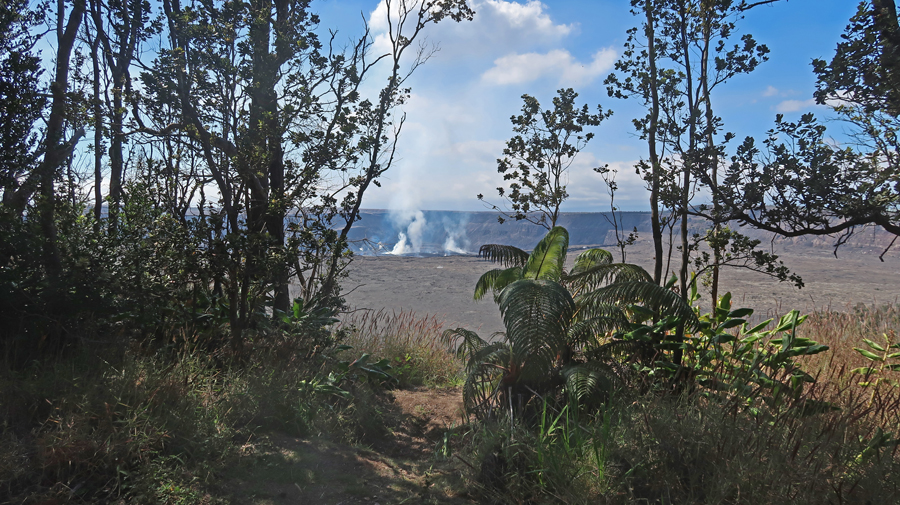
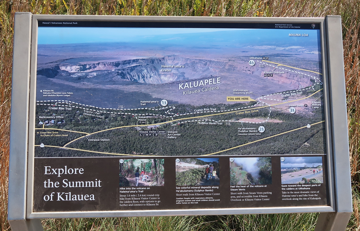
It took about an hour to get to Hilo and a Subway where we bought foot long subs – half for lunch with the other half saved for dinner. Another half hour took us to the Hawaii Volcanoes NP Visitor Center at 4,000ft on the rim of the Kilauea Caldera.


As mentioned, our first visit to the Big Island was in 1982 and today we repeated some of the same hikes we did back then. To start we took a half mile hike to the Waldron Ledge where we had a view of an ongoing Kilauea eruption. We could see a dot of red magma and fire in the crater.

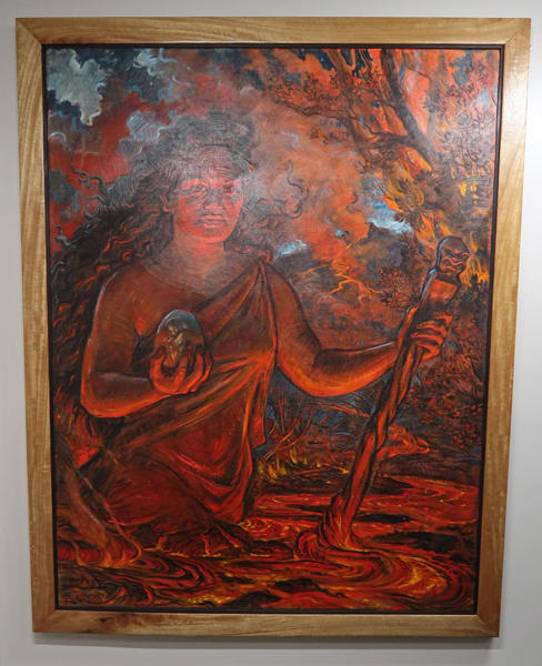
The Goddess Pele

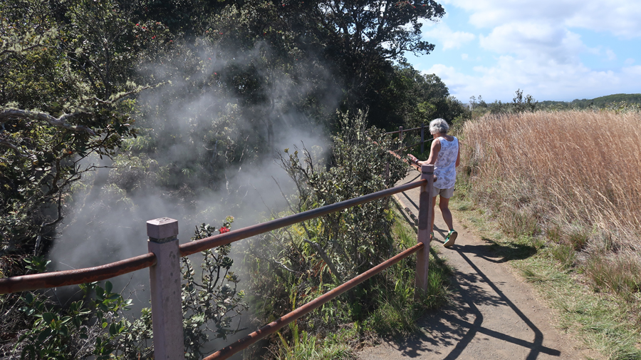
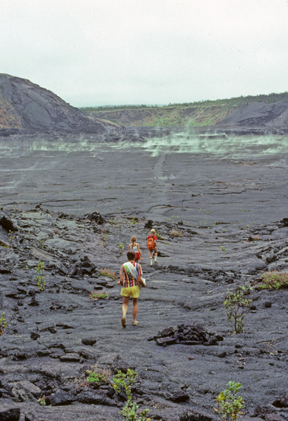
We then did a two-mile hike along the crater rim, past the steam vents, and through the sulfur banks area.


It was then on to the Kilauea Iki Crater

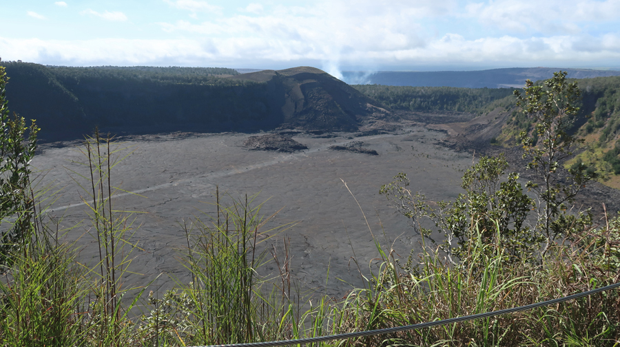
It was steaming and quite hot when we hiked across it in 1982.

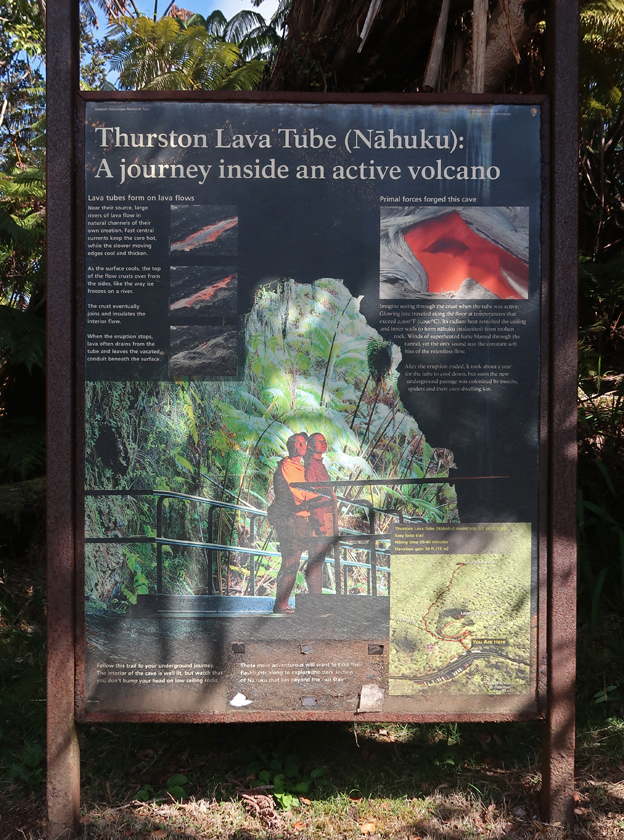
A short hike through the Thurston Lava Tube (Nahuku 0.3mi loop trail) was next.
–

–

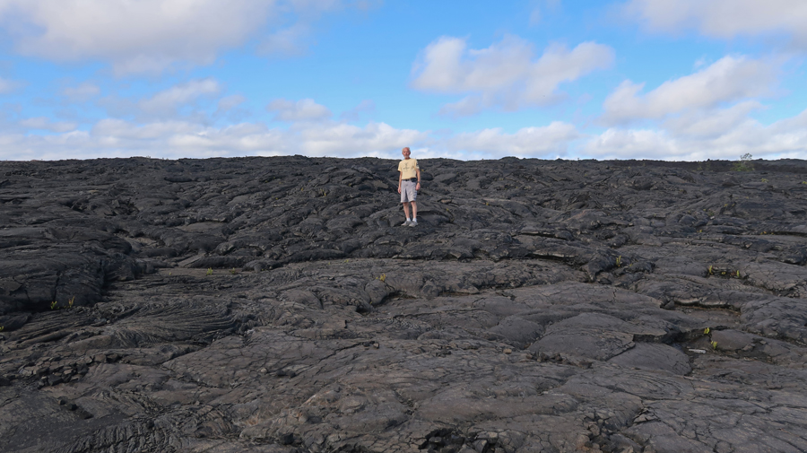
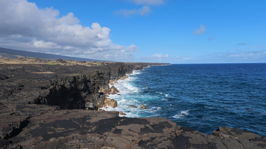
That was followed by many stops along the 19-mile Chain of Craters Road down to the Pacific Ocean. We had walked over magma flowing under our feet here in 1993.
Today the lava was cooled into intricate formations.

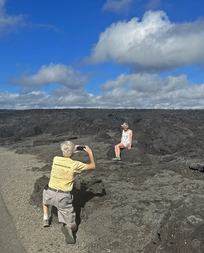
We met a couple from Singapore at the Kealakomo Overlook. She took a photo of me taking a picture of Helen and then transferred it to my iPhone.
–

We met them again at the Holei Sea Arch

Some splendid views here as the waves crashed against the black lava.
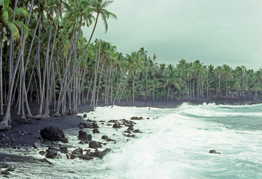
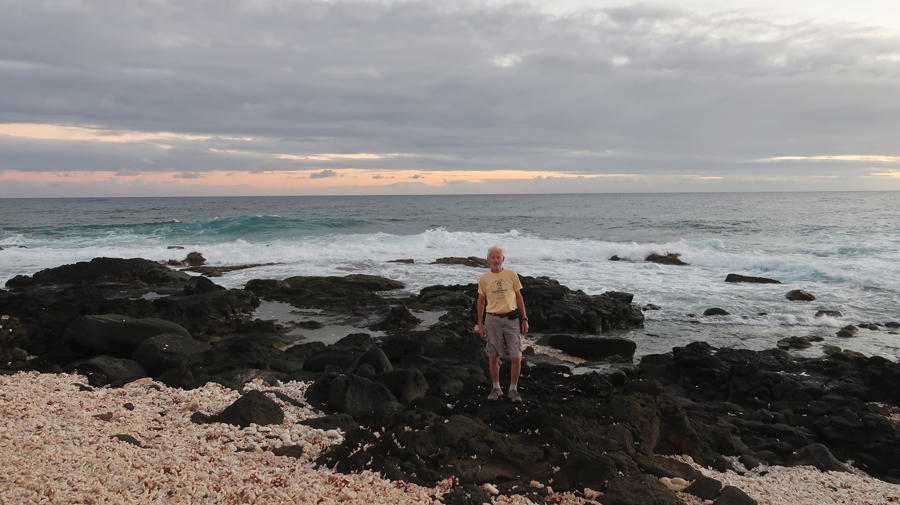
It took 1.5hrs to drive back to the Visitor Center and then continue on to the “potential” South Kona National Heritage Area (NHA). Our first stop was Punalu’u Black Sand Beach Park near the south end of the island.
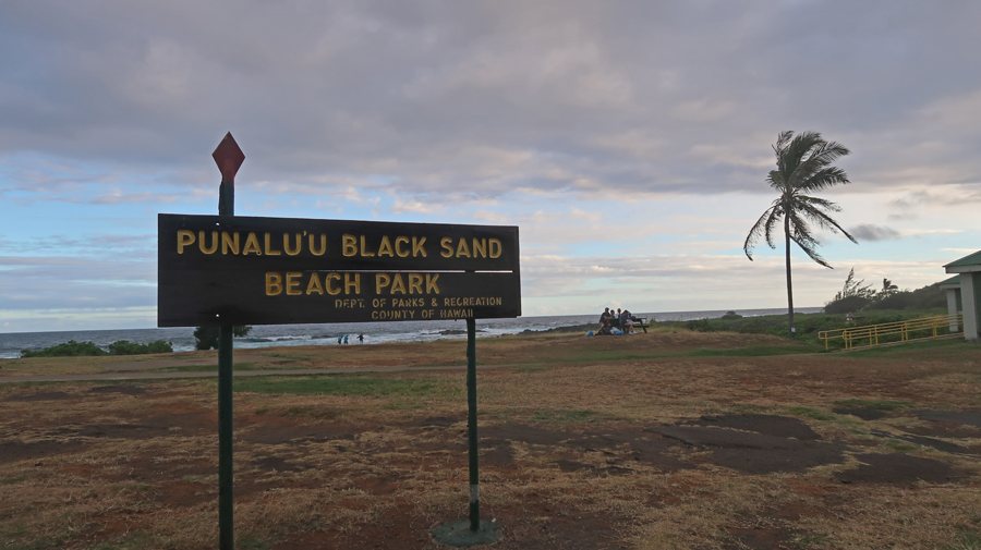

In 1982, we visited a black sand beach with Peter and Stacy

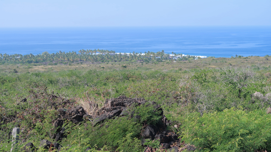
We ate the second half of our Subway sandwiches as we drove to Ka Lae “The Point.” Along the coastline of the “potential” South Kona National Heritage Area – there is Honomalino Bay, Kapua Bay, Pōhue Bay and Ka Lae, otherwise known as South Point. Pōhue Bay is one of the few untouched places in Hawaiʻi. This area is home to a number of historic trails, heiau – or sacred sites and temples, petroglyphs and other cultural features, and Pōhue Bay is also a prime nesting point, an area for the endangered hawksbill sea turtle. In the north, Honomalino, is a black sand beach and is one of the most picturesque sites on the island of Hawaiʻi.


–

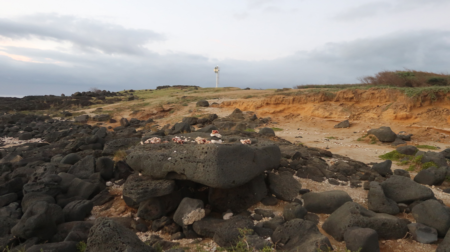
The sun was setting in a cloudy sky as I got to the Light Station at South Point – it is the Southernmost Point of the U.S., January 16, 2023.

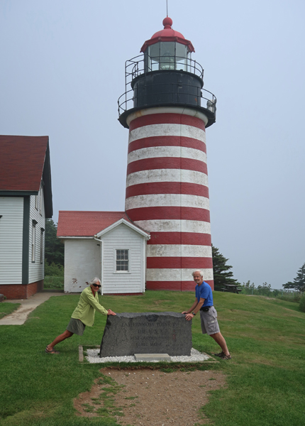
I was at the Easternmost Point of the U.S. – West Quoddy Head Lighthouse in ME on July 21, 2022.
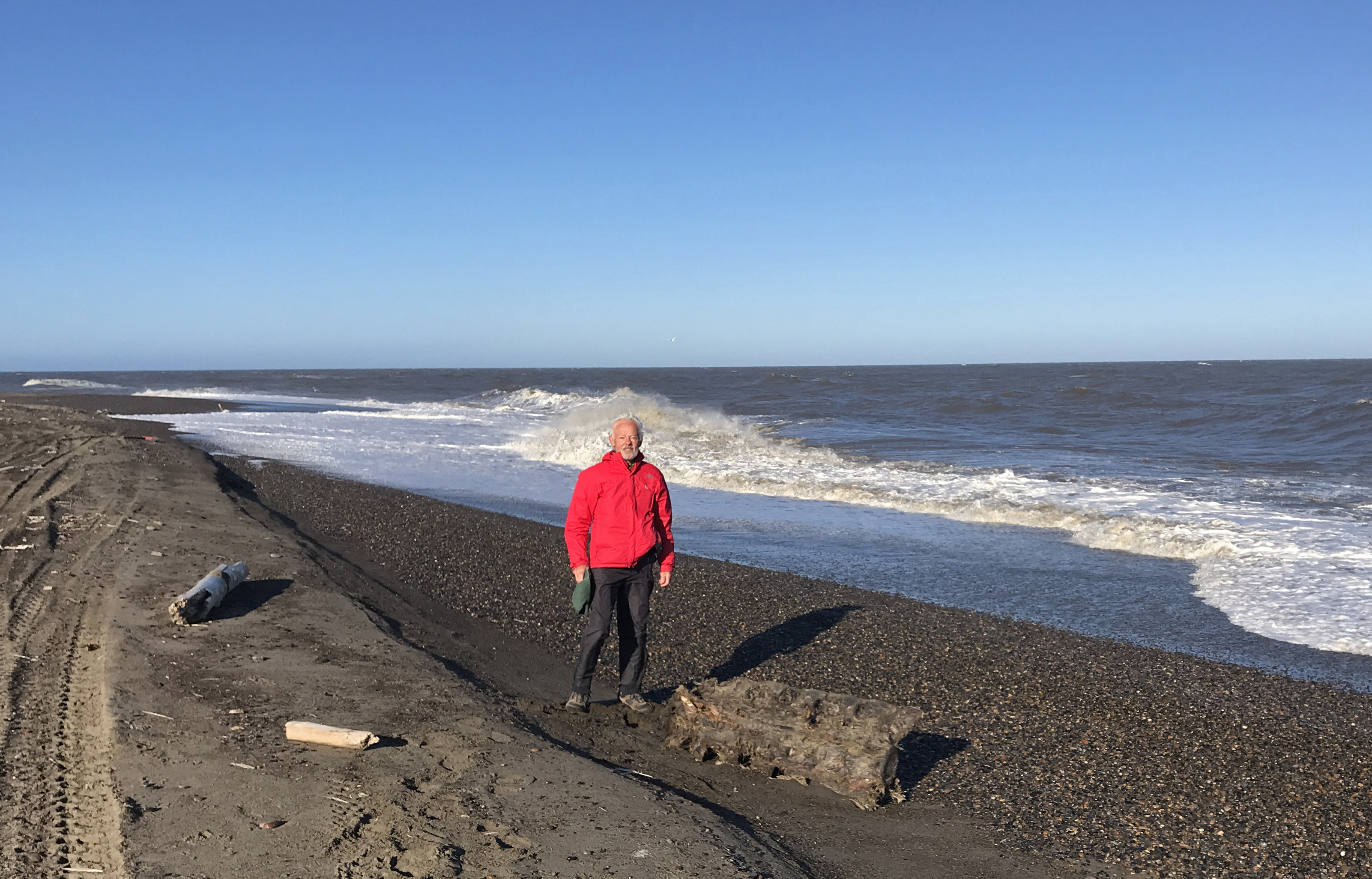
And I was at the Northernmost Point of the U.S. on the Arctic Ocean – Point Barrow AK (note whale vertebrae) on September 8, 2022.
The Westernmost Point of the U.S. is on the west shore of Attu Island, which is the last island in the Aleutian Chain of islands stretching from Alaska into the north Pacific Ocean. The Japanese invaded Attu and Kiska islands in 1942, six months after Pearl Harbor. In a major offensive, the U.S. and Canada retook the islands in 1943. Attu is only 208 miles from the Commander Islands of Russia. Attu is the largest uninhabited island in the U.S. In fact, the International Date Line does a jog so that it passes west of Attu so that all of Alaska can be on the same day. It is now next to impossible to get to the Westernmost Point of the U.S.
The closest I got was on September 5-6, 2022, when I was in Unalaska (Dutch Harbor) AK visiting the Aleutian World War II National Historic Area – See Blog for September 2022.

Peter and Stacy at the Southernmost Point of the U.S. in 1982

Looking back at the Light Station from “The Point,” 2023
The drive back to our Airbnb in the dark and rain seemed longer than the two hours that it took. We arrived at 9pm, it was a 15-hour day.
1/17 Tu – we had an easy morning driving south down the west coast of the island. This was Helen’s morning, so I followed her directions to five Thrift Stores – nothing purchased, can you believe it!? We did buy some oranges along the way.

We arrived at Pu’uhonua o Honaunau NHP at about 11am. This is another Hawaiian Historical Park that explains the societal structure, culture, and everyday life of early Hawaiians. You can see the Royal village nestled on the coast in the following photo.

Good photo of Konane -a Hawaiian strategy game played with black and white pebbles; Keone’ele Cove where only ali’i (royals) could land their canoes; and the Hale o Keawe or royal mausoleum housing bones of at least 26 ali’I, including Kamehameha’s great-grandfather. Note the Great Wall extending to the left of the Keawe. The ocean side of the 12 foot tall, 18 foot wide, and 950 foot long wall was the Pu’uhonua or “Place of Refuge.” If a person was guilty of breaking rules or perhaps an enemy, he/she could try to get to the Place of Refuge for safety. They would have to swim in from the ocean side over the jagged lava rocks. If they succeeded, after a few days, priests could absolve them of their “sins” and then they were free to go.

2023 photo of me with the Hale o Keawe in background.

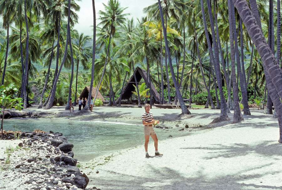
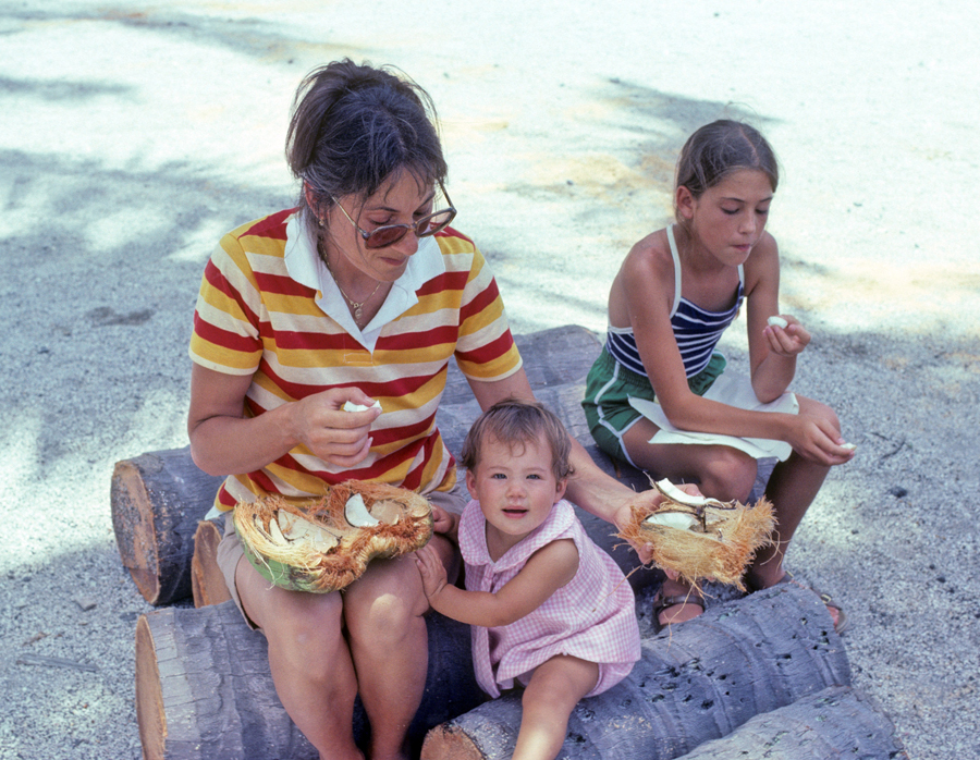
1982 Photo looking back at the Royal Grounds with me holding a coconut. Peter and I worked for over a half hour to break it open so we could drink the juice and snack on the meat.
–
Two Ki’i – wooden images of Hawaiian gods
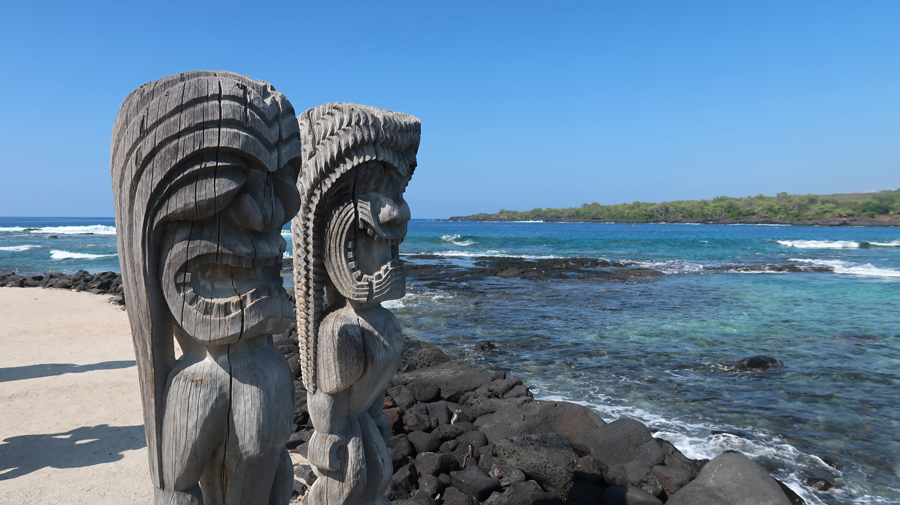
Photo from the Pu’uhonua side of the Heiau

Note gold colored fish –


This Halau or house now serves to protect canoes and other artifacts.

Stacy built this model on the beach at this site in 1982.

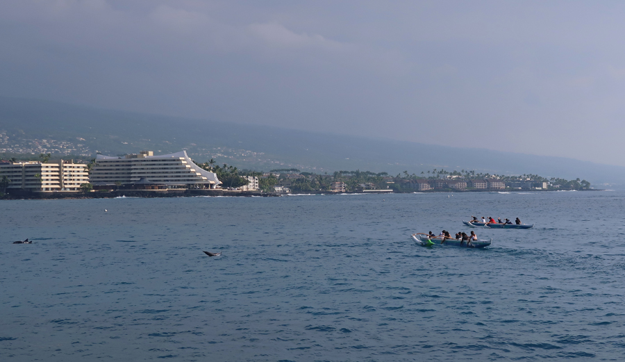
After Hawaiian BBQ Bowels for lunch, we drove to Kamakahonu National Historic Landmark (Kamehameha’s home) and the related beach that is next to the Kailua Pier.

–


Helen snorkeling in the Bay
In 1993 we used Jack’s Diving Locker, which is located at the Pier, for both SCUBA and Snorkeling – Helen sitting.

We watched young male and female paddlers leave the harbor for evening practice.
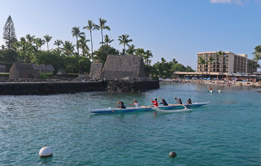
They cheered as numerous dolphins displayed their jumping skills.
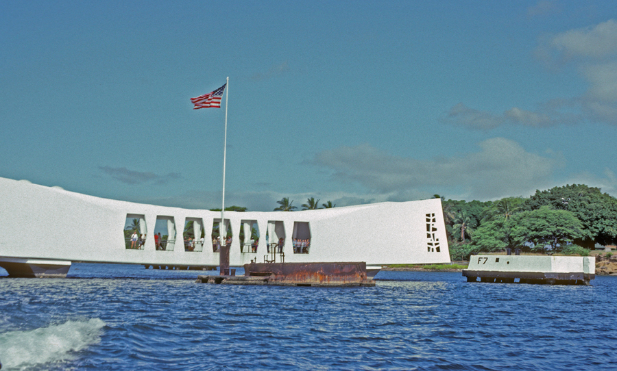
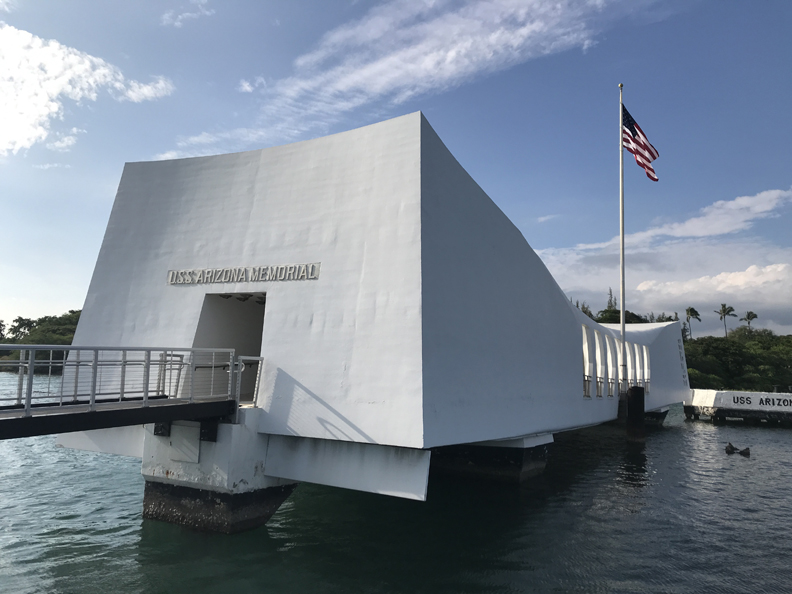
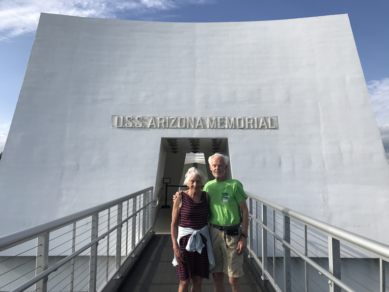
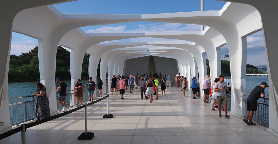
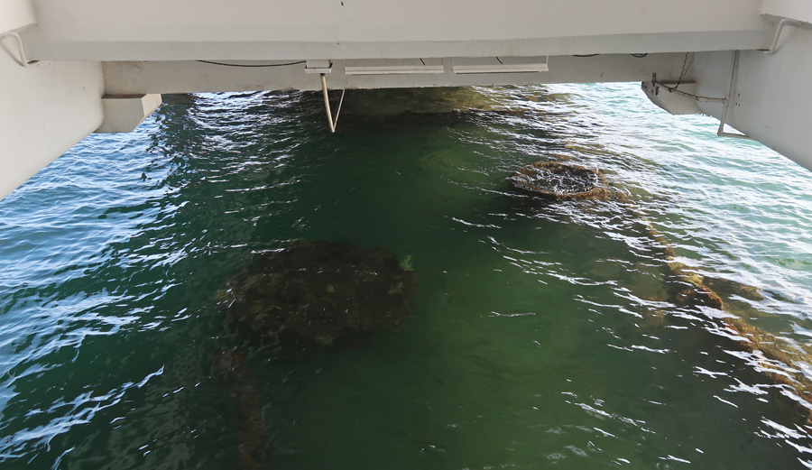
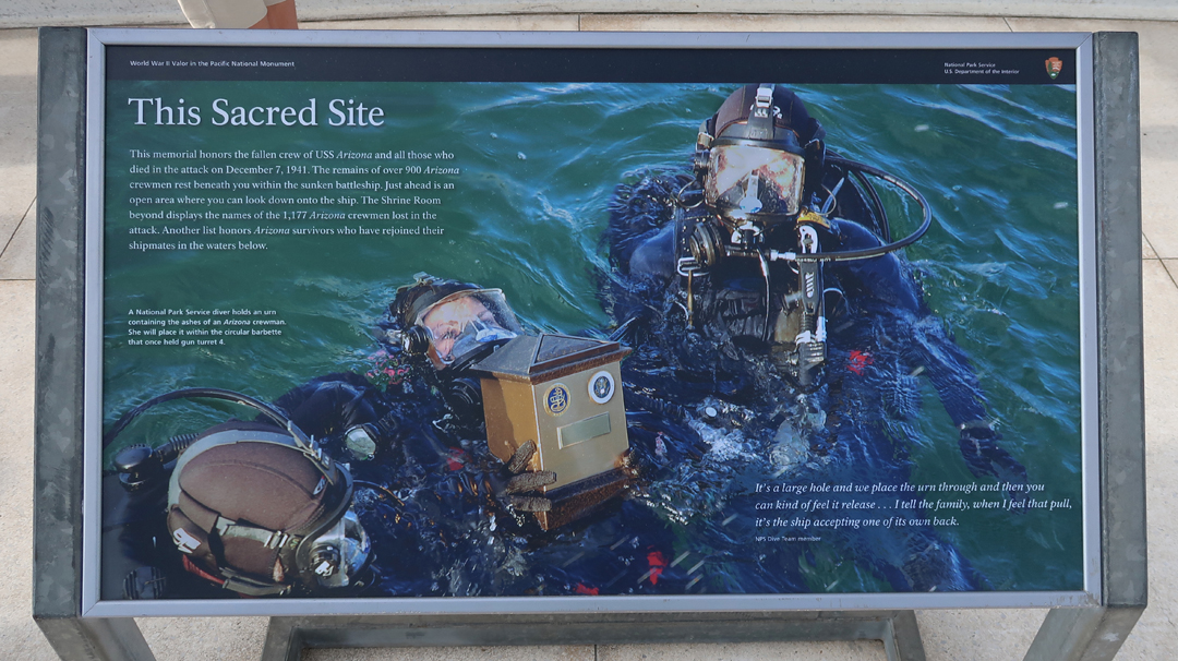
1/18 W – lazy morning, caught 12:40pm flight to Oahu. There was at least a one hour wait at Thrifty rent a car. So, I confirmed a Mustang convertible rental at Budget and then canceled the Thrifty rental. Had to do that to make our 3:30pm reservation ($1 each for reservation fee at recreation.gov) for our Navy boat tour to the USS Arizona Memorial at Pearl Harbor N MEM. Stacy, Peter and I were able to visit the memorial in 1982 but Kate was one-year-old and was not allowed on the boat. Helen stayed with her at the Visitor Center; so, this was her first visit to the remains of the battleship. This photo shows the memorial on the left and the USS Worden guided missile cruiser in 1982. The Worden was launched in 1962 and then scuttled in 2000 off Hawaii during Navy target practice.

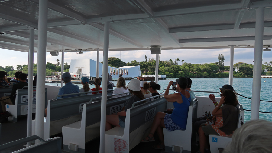
It was the last 45-min tour of the day. Arizona Memorial in 1982 and 2023 –
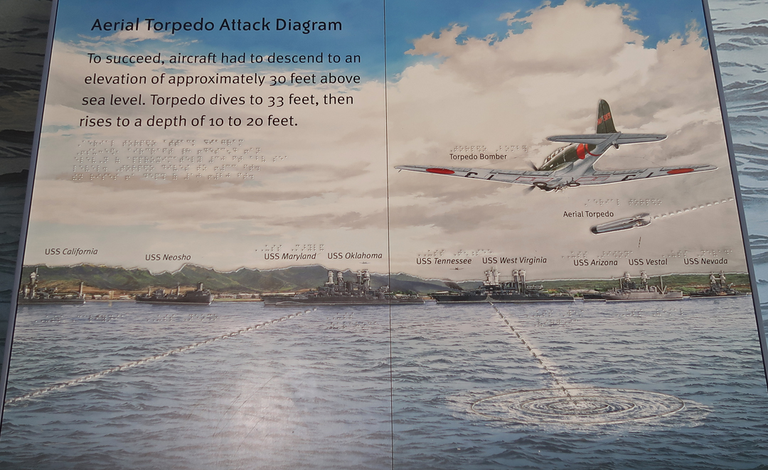
After World War I, the Japanese expanded its territory (by force) to provide for its growing population. It saw the U.S. as a threat to that expansion. So, on December 7, 1941, it launched the infamous surprise attack on our western fleet at anchor in Pearl Harbor.

The greatest loss of life occurred on the USS Arizona when a 1,760-pound armor-piercing bomb slammed through its deck and ignited its forward ammunition magazine, 1,177 of its crew perished in less than 9 minutes.

–
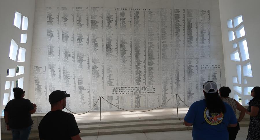

A total of twelve ships were sunk and nine others were damaged. U.S. losses were ~2,400 killed, ~1,200 injured, 164 aircraft destroyed and an additional 159 damaged. All ships, with the exception of the Arizona and Oklahoma were salvaged and later saw action in the War. The museum and outdoor signage describe the prelude, attack, and aftermath. Age of the Battleship –


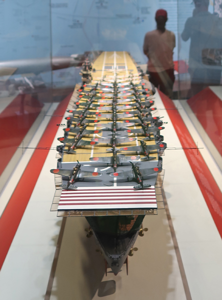
Six Japanese aircraft carriers took part in the operation.

–
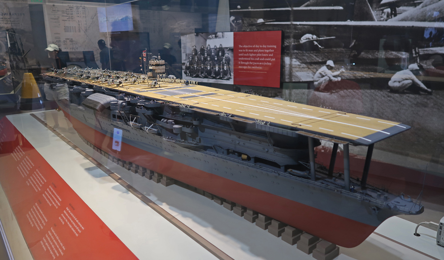
How the Nakajima “Kate” carrier torpedo bombers attacked the ships at Pearl Harbor. The Japanese attack code was “Tora, Tora, Tora.”

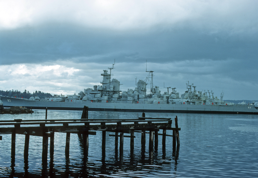
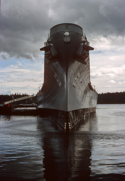
The USS Missouri, on which the Japanese surrendered in Tokyo Bay on September 2, 1945, can now be toured at Ford Island (Battleship Row) near the Arizona Memorial. We toured the ship in 1969 when it was part of the “Mothball Fleet” at the Bremerton Naval Shipyard on the Olympic Peninsula, across Puget Sound from Seattle. Photos from 1969 –
–
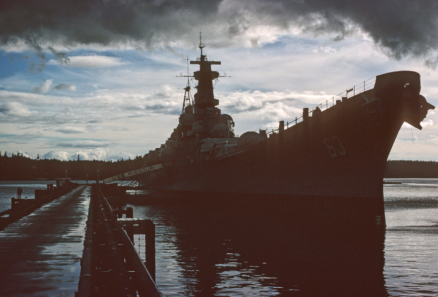
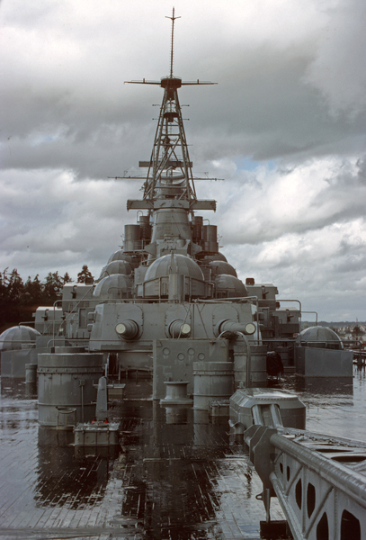
The USS Missouri was re-activated in 1984 and recommissioned in San Francisco in 1986. She served in the Gulf War (1991), was decommissioned in 1992, and eventually returned to Bremerton WA. In 1998 she was towed to Pearl Harbor to be docked within 500 yards of the USS Arizona. Here she is in 2023 –


We had a four-night stay at the Ramada Plaza by Wyndham a couple of blocks from Waikiki Beach. It was reasonable and proved to be a good location for our visit to Honolulu and the island of Oahu. Dinner was from a Mexican food truck about a half mile from the hotel.
1/19 Th – splurged and shared the Sirloin Tips breakfast at IHOP around the corner. However, we never returned as it took 1.5hrs to get out of there because of a lack of cooks. Still, it was not a problem because the Japanese Cultural Center of Hawai‘i ($10 adult) did not open until 9am.
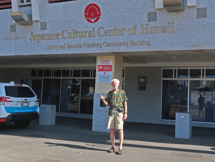

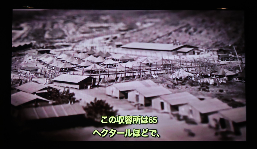
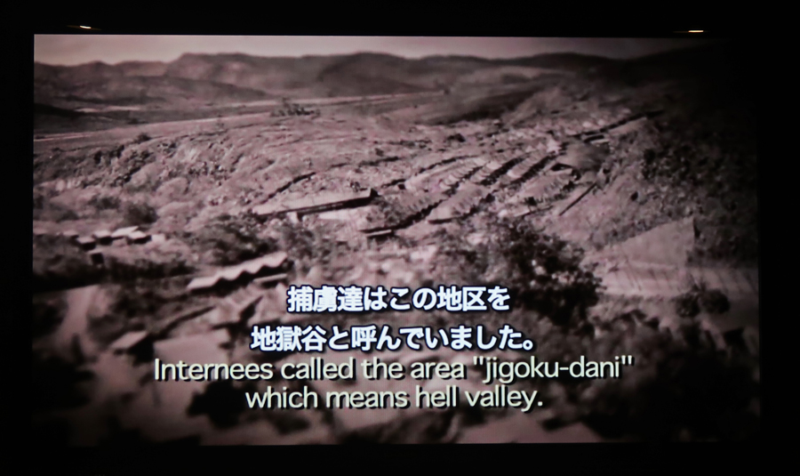
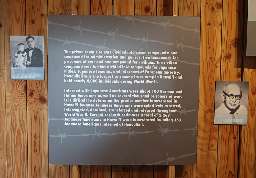
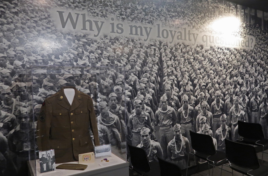
They are the temporary Visitor Center for Hono’uli’uli National Historic Site a new (2015) NP unit that has yet to be developed. The foyer of the museum has a large display devoted to this Japanese Internment Camp, which also housed German and Italian Internees as well as Japanese Prisoners of War.
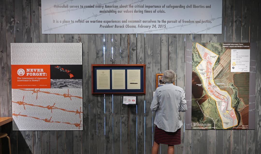
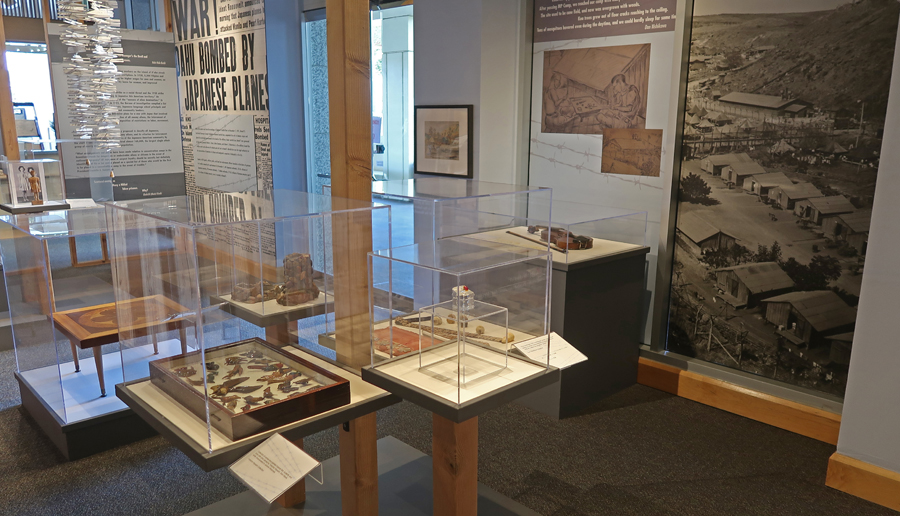
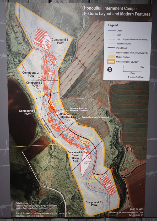
Hono’uli’uli opened in 1943, covered 160 acres, and became the largest and longest-used confinement site in the Hawaiian Islands for US citizens and residents of Japanese and European ancestry arbitrarily suspected of disloyalty following the attacks on Pearl Harbor.
A total of about 400 civilians were incarcerated in Hono‘uli‘uli throughout the course of the war.
Approximately 4,000 prisoners of war were confined at Hono‘uli‘uli in five compounds, and were divided into separate quarters by military rank (officer vs enlisted men), function (combat troops vs labor conscripts), and in some cases, country of origin.

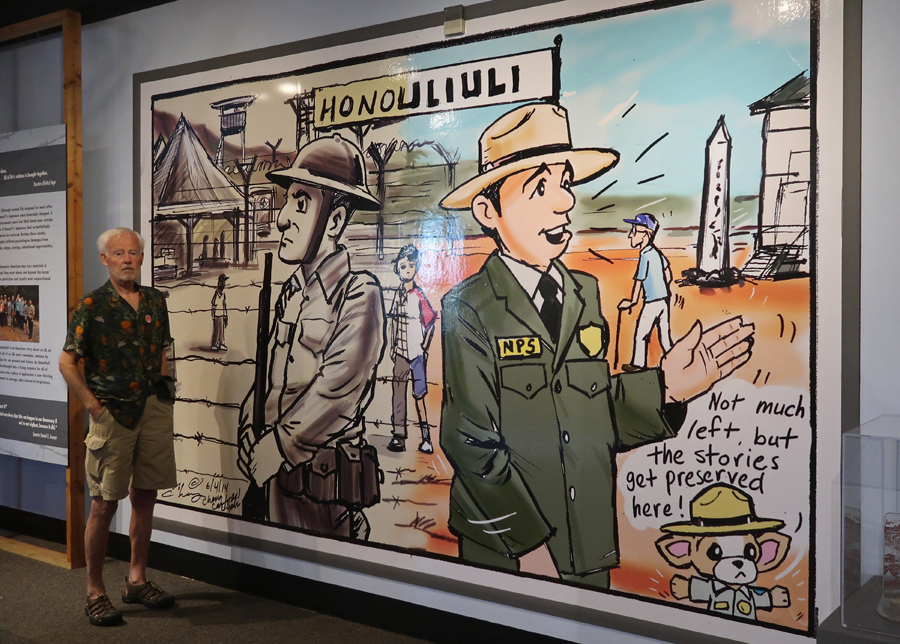
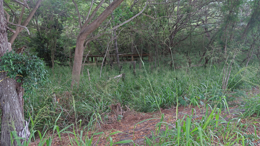
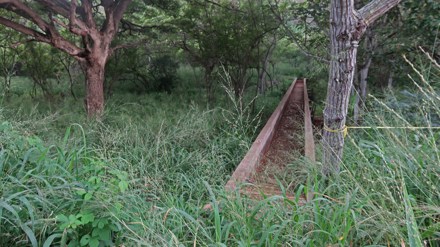
We visited the actual Hono’uli’uli site in a ravine about a half hour from Honolulu. An aqueduct separated prisoners of war from incarcerates. The aqueduct provided water for both internment and prisoners of war camps. The camp closed in 1946.

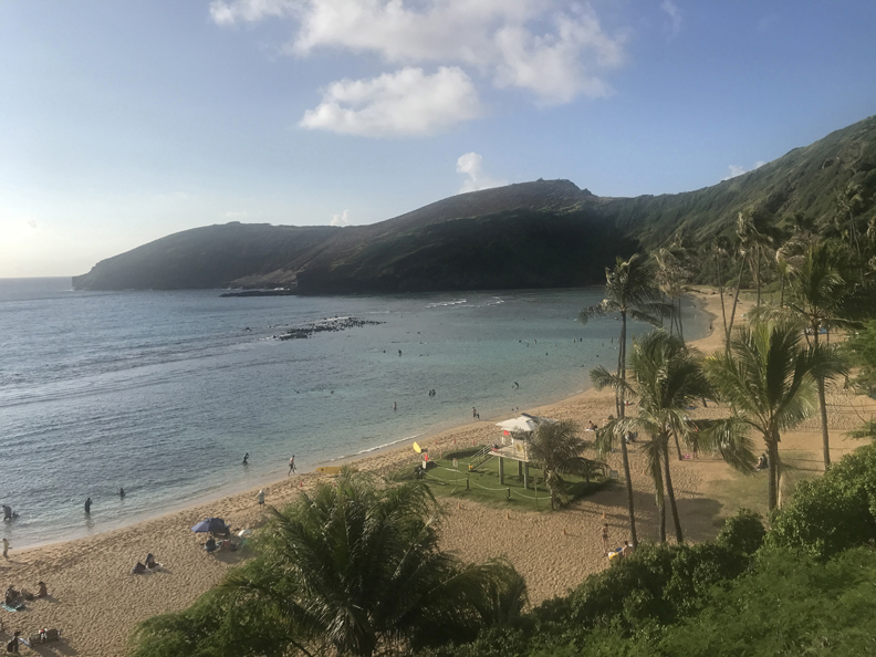
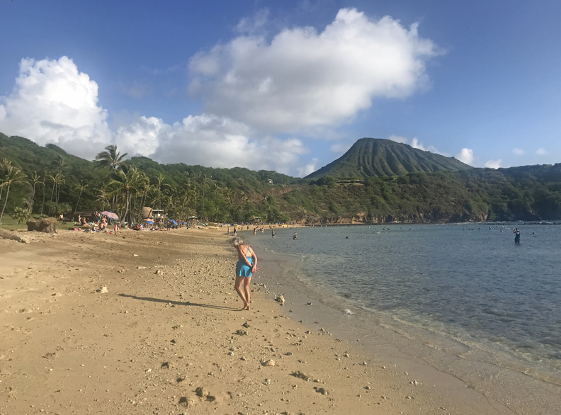
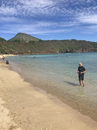
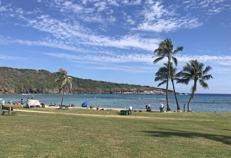
1/20 F – Snorkeling Day – When planning this trip I spent hours trying to get entrance tickets for Hanauma Bay Nature Preserve, State Park. I continued trying to use their web site while in Hawaii but to no avail. So, this morning I was up at 6am to drive a half hour to the park to get two of the limited “walk-in reservations” when they opened at 6:45am. I then drove back to Honolulu to pick up Helen and our McD’s breakfast and headed back to the park. We arrived just before our scheduled 9:30 entrance time. Parking is only $3 but space is limited. They permit thirty walk-ins every 15 minutes until 1:15pm. If you are not there on time, you lose your tickets! The beach is open 6:45am-3:15pm W-Sun. It is a marine life conservation area and underwater park. There are many employees, and they work hard to protect and preserve the reef.
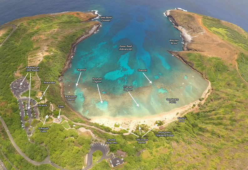
We paid the entrance fee ($25 each), watched their 9min video, listened to their safety and rules lecture, and then walked down to the Bay
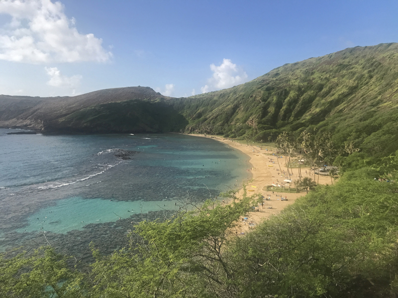
We picked up our snorkel equipment ($30 each) and opted for the wet suit top instead of the PFD. Morning view of the Bay and Koko Head.
When we arrived it was close to Low Tide, so there were only a couple of feet between you and the reef all the way out to the break water. Helen followed an octopus for about 20min until it went in a hole to get away from an eel.
In the afternoon, she followed a multi-brown colored “Flying Gurnard” bottom feeder. It had a large rectangular head, little fins to stir up sand for feeding, and large well-developed wings to maneuver. At one point it lifted an antenna from its head. The rangers said that no one had seen that fish here before.

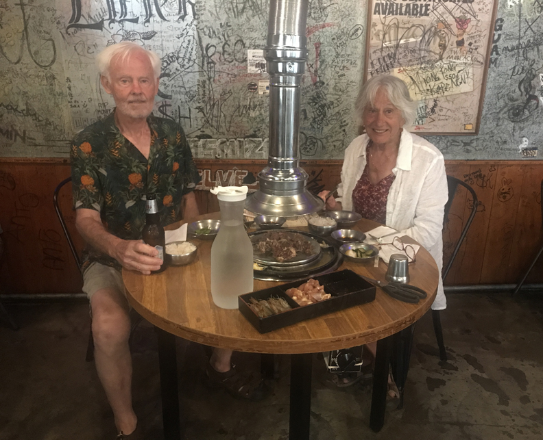
Took another evening walk and ate at the Sura Hawaii Korean BBQ. We found it interesting that we were not permitted to take leftovers with us. It might be a food safety thing.
1/21 Sa – The National Heritage Area Act (12/22/2022) – established the National Heritage Area System (Community-Led Conservation and Development) in the Department of Interior. As of 2023, 62 National Heritage Areas (NHAs) have been designated. A new goal for me is to visit all these areas. Fortunately, I have already visited most of them. I try to stay “ahead of the game” by visiting areas that have been proposed for inclusion in the system. Such was the case here in Hawaii for Ka’ena Point, the western most point on the island of Oahu. So, today I traded our Mustang convertible for a 4WD Jeep to access this area.

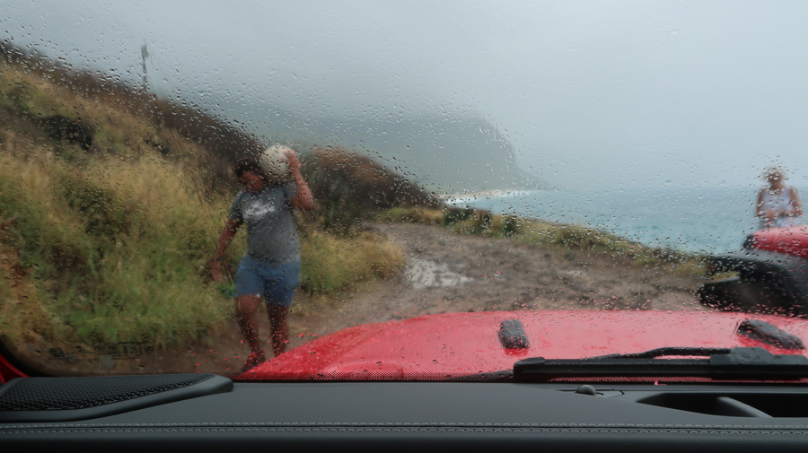
Kaʻena Point, from Makua to Waialua, is the site of the last intact sand dune ecosystem in Hawaiʻi and is said to be named after a sibling of the Hawaiian goddess Pele. Kaʻena Point also includes a leina ka ‘uhane, an important cultural site that, according to some Hawaiian traditions, is where the souls of the deceased leap into the next plane of existence and are reunited with their ancestors. Ka‘ena is also home to various protected species including laysan albatrosses, wedge-tailed shearwaters, monk seals and fragile native plants. Today was the first cloudy day of our trip and it started to rain as we entered the park.


At the end of the paved road, I put the Jeep into 4WD and we bounced and splashed over a rough one lane track for about a half mile until we reached a closed gate.

We sat there for half an hour deciding whether or not to hike further along the coast toward the point. While waiting, a Hawaiian carrying a heavy ball on his shoulder passed by our Jeep.
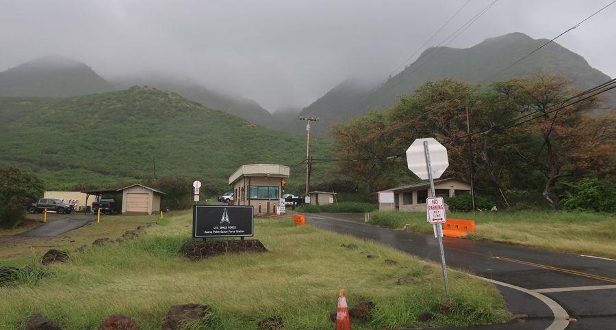
The weather forecast was rain for the next two hours. So, we decided to head back toward Honolulu. When we got to the paved road, we were stopped by police who said they were looking for the man that passed by our vehicle. Continuing, we drove by a Space Force Station
And then stopped at Kaneana Cave (Makua Cave). It is named for the Hawaiian god Kane, who represents the god of creation. For Hawaiians, this cave is believed to be the beginning of human creation.

–
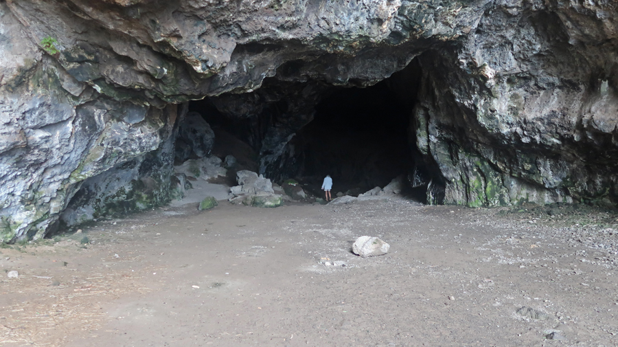
We had to be careful because Nanaue – Shark Man lives in the cave and is known to eat humans. Our headlamps illuminated floral offerings left for Nanaue.

After returning to Honolulu, we walked Waikiki Beach and then had pizza while watching the Cincinnati Bengals defeat the Buffalo Bills in another NFL playoff game.
2023

Photos from 1982 – >40 years ago!


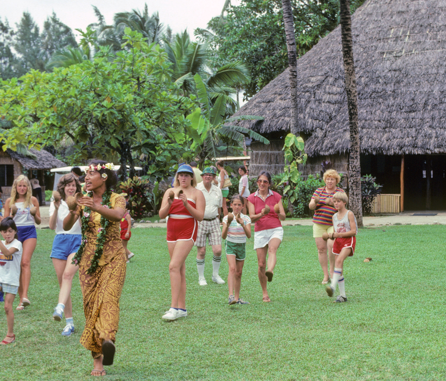
Polynesian Cultural Center 1982
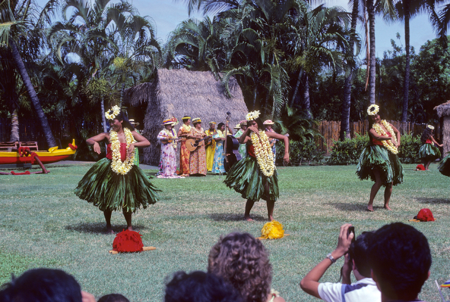
Coconut Dance
Dole Pineapple Factory

1/22 Su – Travel Day, dropped Helen off for her 8am flight to LA, returned to the hotel and prepared for my 3:15pm flight to Guam. Arrived in Guam (8 hour flight) at 7:15pm local time 1/23/23 – I had crossed the International Date Line. Took a taxi to the Guam Airport Hotel and crashed.
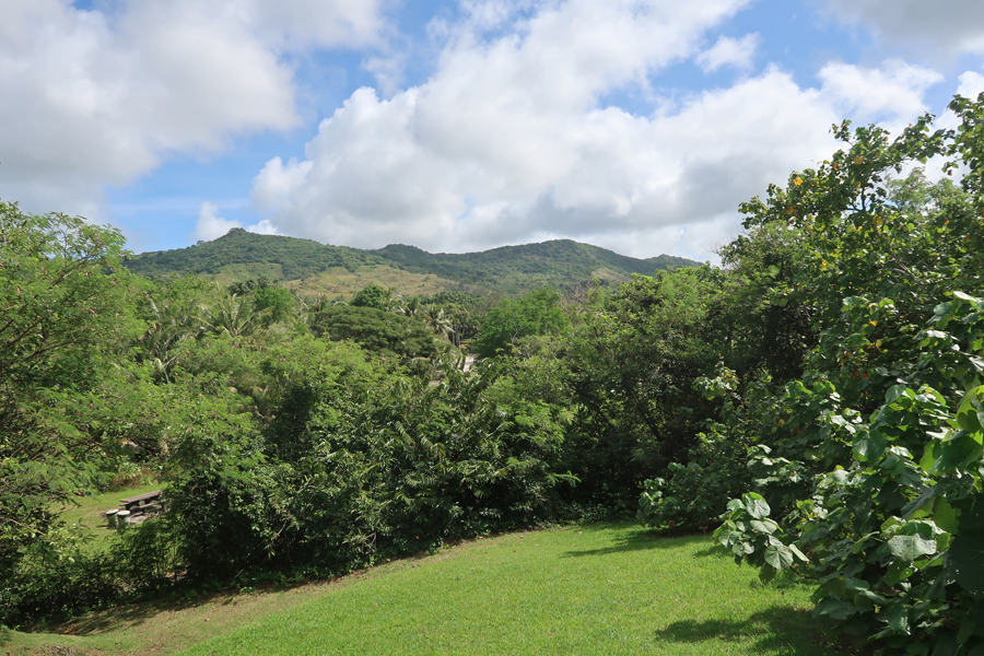
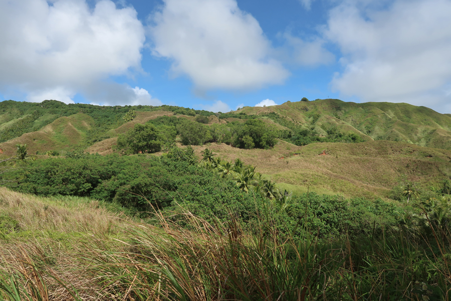
1/24 Tu – I was up early to catch my 8am (45min) flight to Saipan. It is the main island of the Commonwealth of the Northern Mariana Islands (CNMI). Landing on Saipan – Mt Tapotchao (1,545ft) in background.

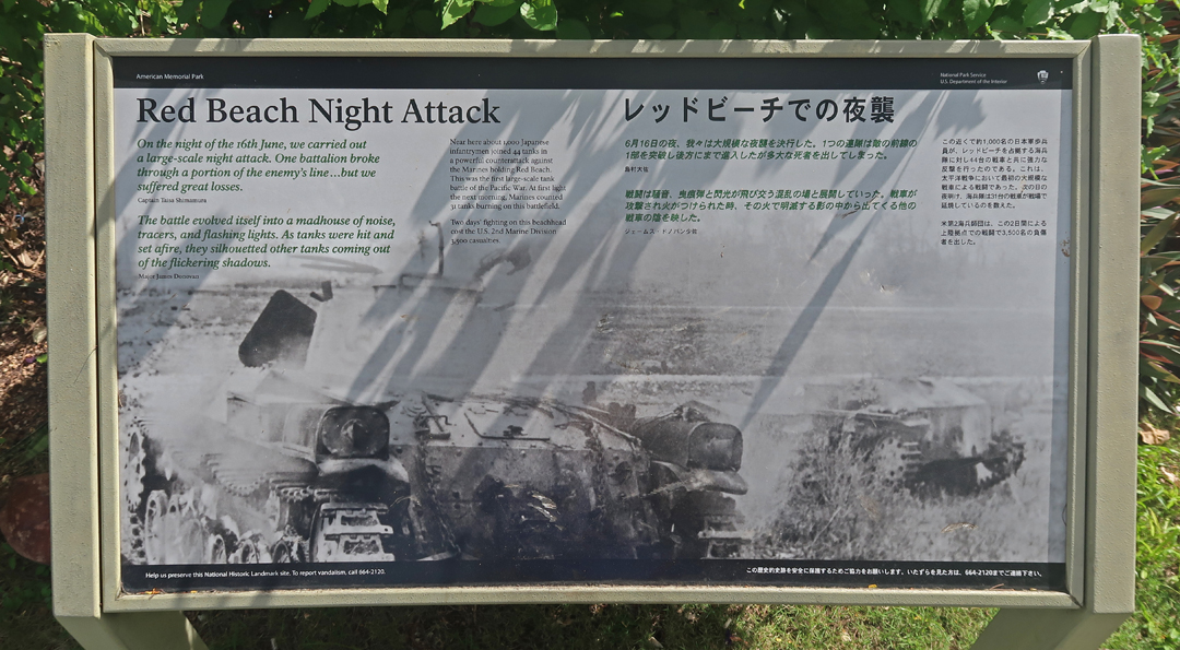
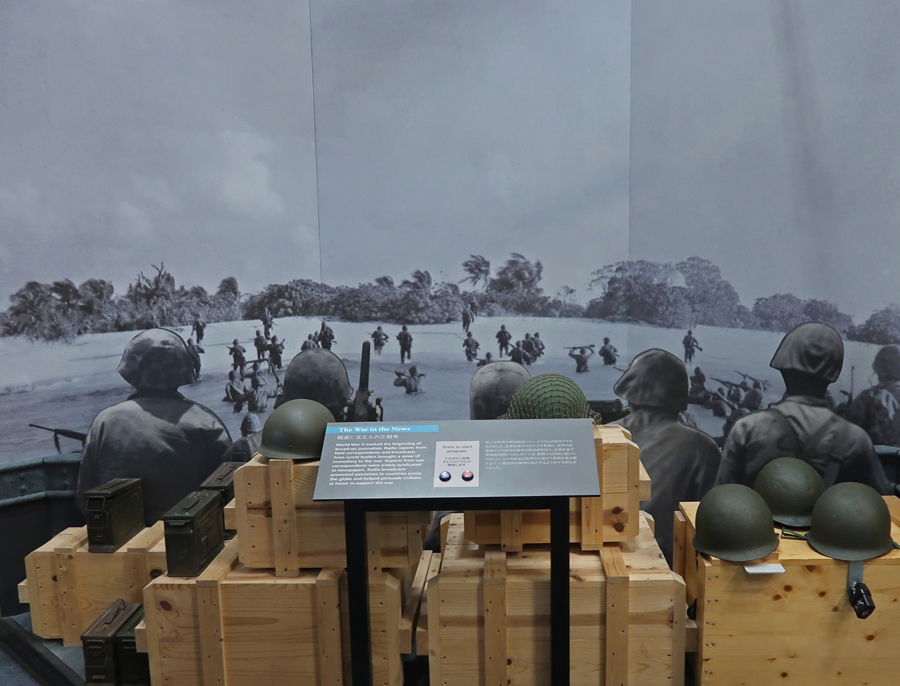
My objective was to visit the American Memorial Park, which is an Affiliated NP Unit, as well as other sites on the island related to the Battle for Saipan during World War II. It took place June 15-July 9, 1944, to unseat the Japanese occupiers.

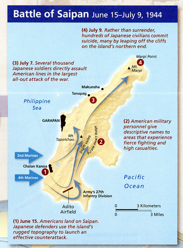
After the attack on Pearl Harbor, the U.S. mobilized and started planning its strategy for the invasion of Japan. In order to do that, it needed “stepping stones” (islands) to move its forces and supplies closer to the objective. The Mariana Island campaign was part of that strategy. Our forces started with Saipan, then took Tinian followed by Guam. My first stop was at the Japanese air raid shelters near the airport.

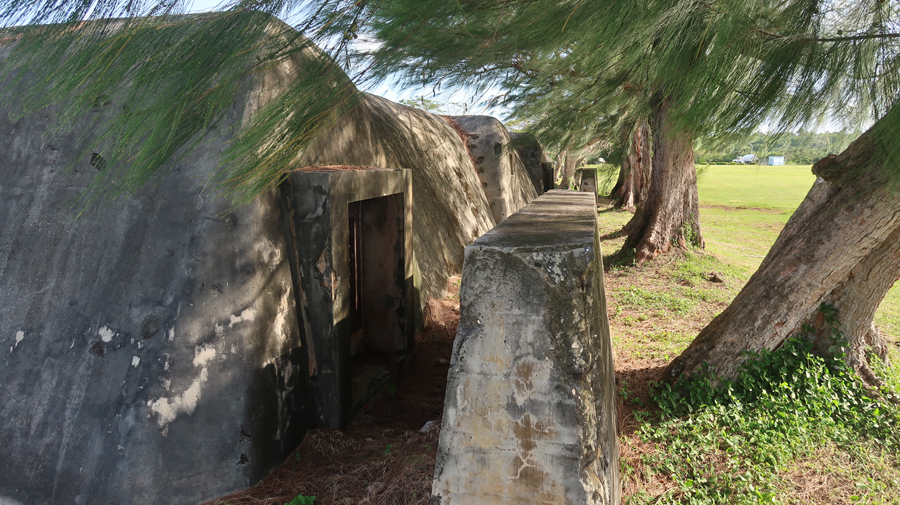
Some of the Japanese structures have been re-purposed.
Nearby is the Japanese Memorial of the Dead

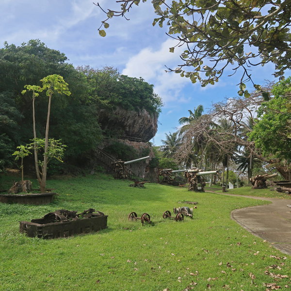
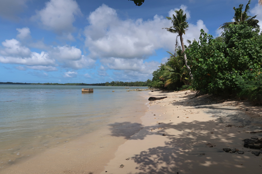
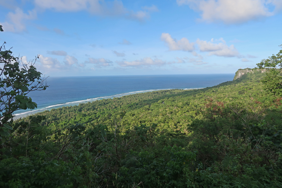
Our forces attacked along the southwest coast of the island. This is a coral reef area with beautiful sandy beaches.
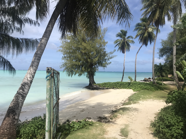
–

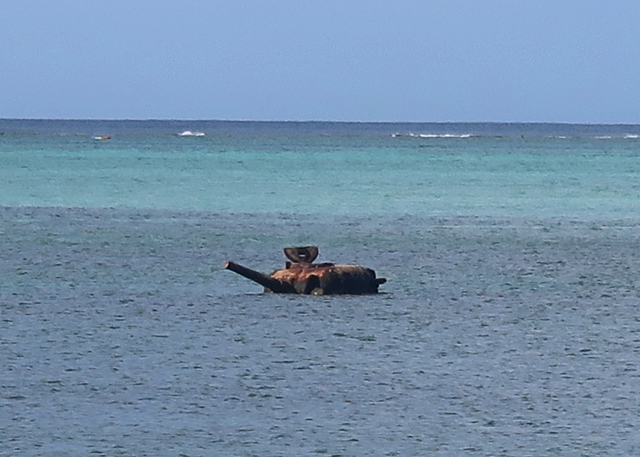
Some armaments remain – an American tank that did not make it.

Japanese tank

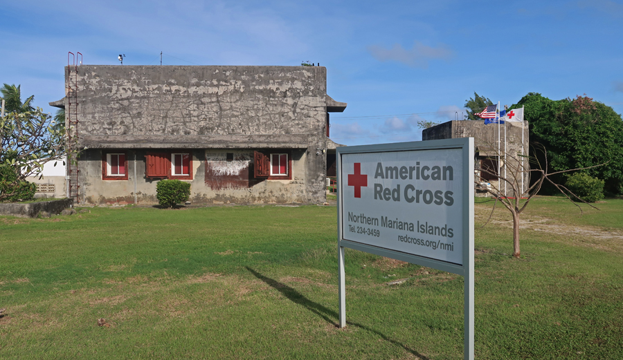
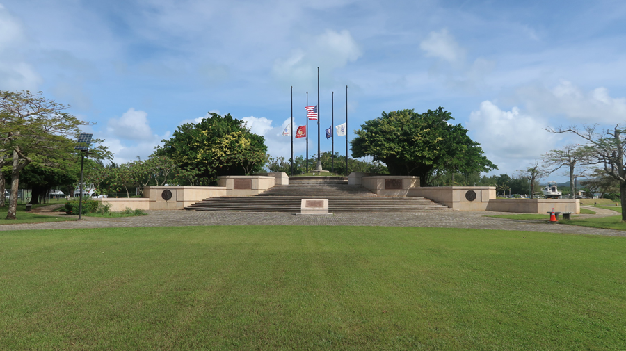
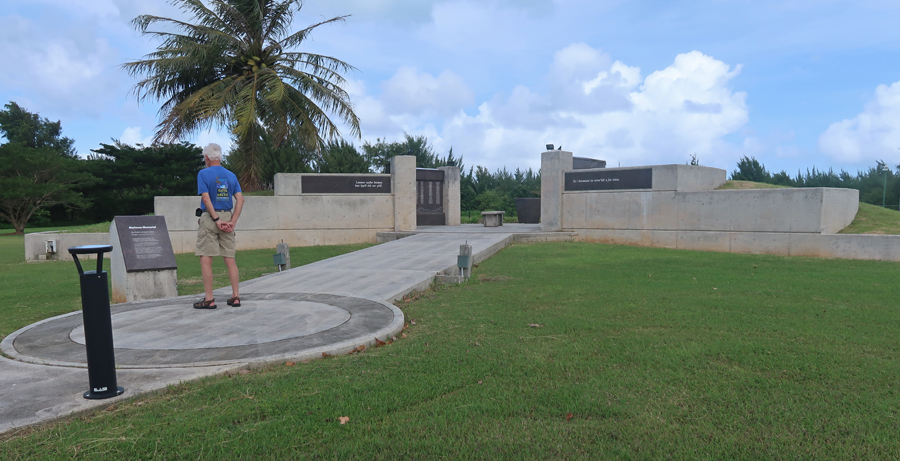
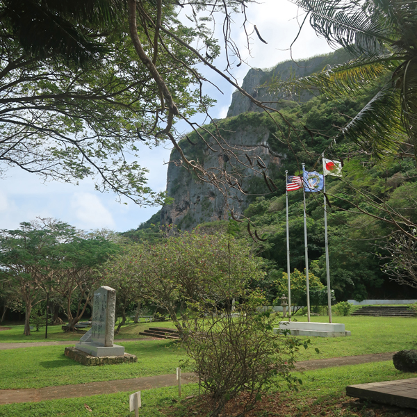
The American Memorial Park is in Garapan, the capital of the CNMI.

The Court of Honor and Flag Circle – The American Flag is displayed at the center of the Flag Circle and is surrounded by the flags of the U.S. Navy, U.S. Marine Corps, U.S. Army and U.S. Coast Guard, the armed services divisions that participated in the campaign.
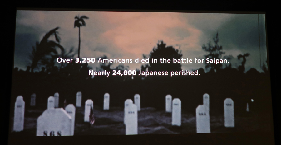
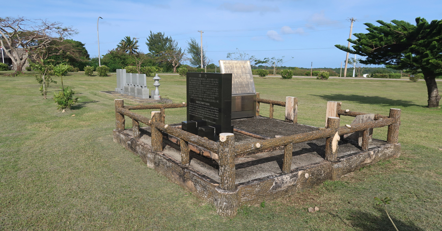
The Marianas Memorial is nearby – it is dedicated to Indigenous Chamorros and Carolinians of the Northern Mariana Islands who died during World War II. Caught in a war not of their making, the people of the Northern Marianas, like many civilians throughout the Pacific, became victims of war. The Marianas Memorial honors Chamorros and Carolinians who lost their lives as a result of war-related causes from the beginning of American aerial bombardment in Saipan on June 11, 1944, to the closure of civilian camps on July 4, 1946.

Ranger Kaneshi mailed me helpful information before my visit.
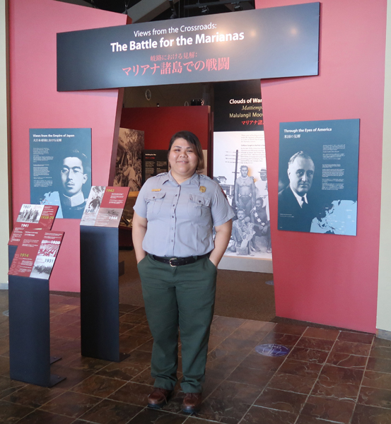
Watched the video, toured the museum, bought postcards and a park T-shirt

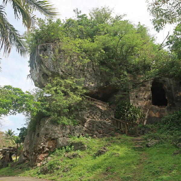
Drove to the North of the island, which was the last to fall to American forces. Last Japanese Command Post
–


Korean Memorial


Okinawa Memorial

Japanese Peace Memorial
As American forces progressed across the island, Japanese propaganda leaflets were distributed that stated the soldiers would kill all males and take the women and children away in their boats. As a result, many individuals and families committed suicide. This is Banzai Cliff, one of the places families came to die. They would line up by age with the second youngest pushing the youngest over the cliff. This would continue until the eldest jumped to his/her death.
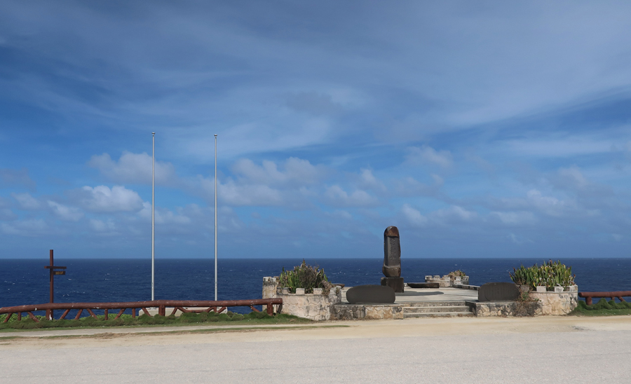

Additional Memorials across the street

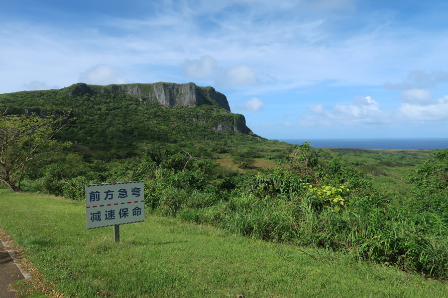
Another suicide location was “Suicide Cliff” in background.

–

The taking of the Japanese airstrip, which was renamed Isley Field, allowed our CBs to expand the runways to accommodate our long-range B-29 bombers.
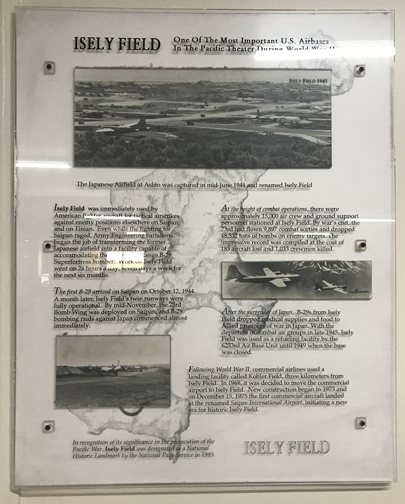
The subsequent taking of Tinian and Guam resulted in additional runways, which then permitted the U.S. to use its long-range bombers to bomb Japan. August 5, 1945, the B-29 Superfortress “Enola Gay” took off from Tinian carrying the atomic bomb nicknamed “Little Boy,” which was dropped over Hiroshima. Three days later, the B-29 “Bockscar” (on display at the U.S. Air Force Museum near Dayton OH) left Tinian and dropped a second atomic bomb, “Fat Man,” on Nagasaki, Japan. The devastating results of these bombs led to the surrender of Japan, September 2, 1945, on the USS Missouri anchored in Tokyo Bay.
I got settled in the Saipan Beach Hotel, and then went to the Naked Fish Restaurant across from the American Memorial Park for some delicious Fish Tacos. I brought a roll of CNMI Quarters with the American Memorial Park on them for distribution while on the island. These locals, building a traditional canoe at the beach, were happy to receive them.

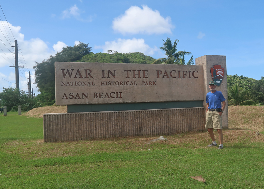
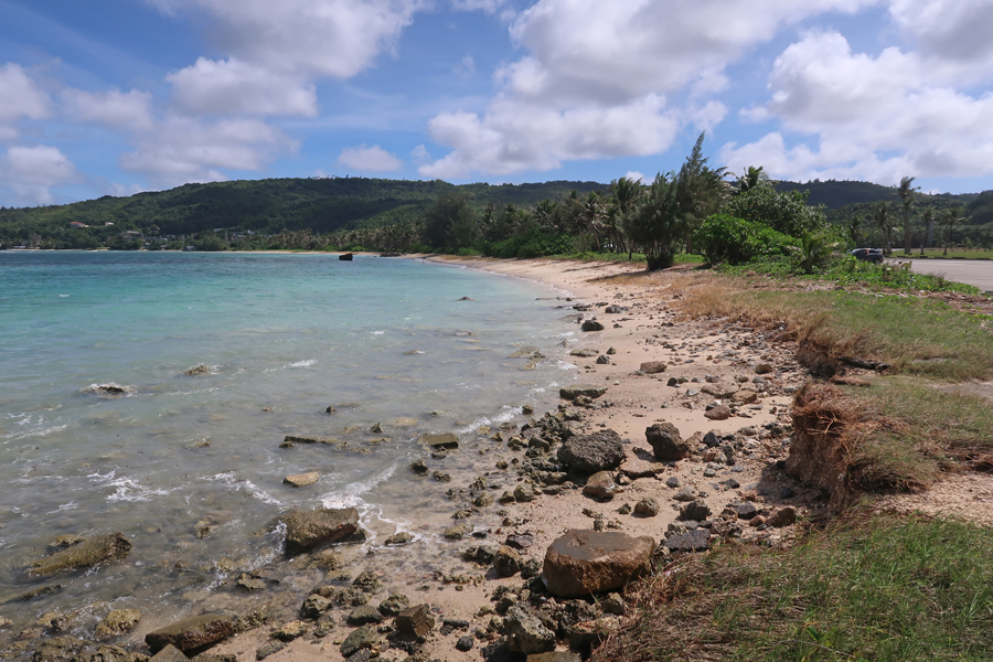
1/25 W – Left Saipan at 9:50am and arrived in Guam at 10:35am. Payless car rental upgraded me to a new BMW SUV, and I started driving south on Rt 1 along the west coast of the island. This was my second visit here – see Blog for April 2015. I passed through Hagatna (capital) and stopped at the Asan Beach Unit of the War in the Pacific National Historical Park. This was one of two locations where U.S. forces came ashore on July 21,1944.
My next stop was the T. Stell Newman Visitor Center. It was closed today but an employee kindly let me in.

Agat Bay was the second location where US Marines and Army troops stormed the beach.


I had two objectives for this visit to Guam. The first was an attempt to climb Mt LamLam (1,332ft) the highpoint of the island.
I found the trailhead across from the Cetti Bay Vista Point.
I brought water and snacks and was ready to go at 2pm. I carried my camera on a tripod in one hand and had my hiking stick in the other. Mt LamLam on the left, Mt Jumullong Manglo (1,263ft), with a cross on top, is on the right.
The path (unkept trail) is steep and slippery in spots and passes religious altars and crosses along the ridgeline. Locals carry big wooden crosses on their backs to the summit of Mt Jumullong Manglo early on the morning of Good Friday.


Umatac Bay from trail

Long story short, it was 90 degrees with high humidity and insects on a steep, rough, slippery trail through razor grass and thick vegetation growing over lava rock. I made it about two-thirds up the mountain and decided that, for safety, I needed to turn around. In fact, near the bottom, I slipped on some loose dirt and ended up with a few bruises on my left side and a swollen hand. Thankfully, I protected my camera. Here is a photo of the Cetti Bay Overlook taken from a point close to the bottom of the trail.

You will recall that I stated that Mauna Kea, the highpoint of HI, was the tallest mountain on earth, when measured from the sea floor – 33,000 feet. Well, the greatest vertical distance between two adjacent points on earth is between the bottom of the Mariana Trench and the top of Mt LamLam – 37,533 feet. Mount Everest is 29,032 feet.
An Oreo McFlurry seemed like a good option for a snack on this hot day. I dropped my bags off at the Harmon Loop Hotel and proceeded to my second Guam objective – the Ritidian Unit of the Guam National Wildlife Refuge. It was one of the highlights of our Guam trip when Helen and I visited in 2015. I arrived at 5pm – check the hours on the sign.

Overlook
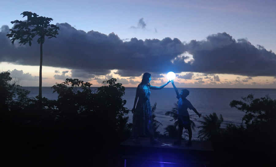
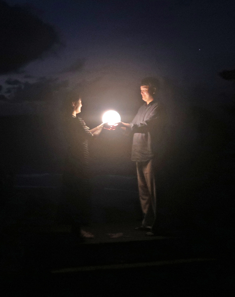
Since I could not enter, I started searching a primitive back road for some other access to the beach. After about a half hour I found the Ritidian Beach Eco Camp. I took the steep descent to a structure just above the beach. There was a small group there enjoying the beach and drinks in a pavilion. I spoke with a photographer who was setting up his camera. He stated that he photographed tourists as they did two ATV tours of the area. The “Jungle Tour” was in the morning and the “Beach and Star” tour was in the afternoon and evening. He was preparing for the latter.

I noticed that my car was the only one down there, all the people had come in large ATVs. I looked back at my descent route and saw why – a steep decline with a couple of sharp turns. I carefully backed up and tried to go up – no luck, wheels spinning. Fortunately, my BMW had 4WD. After I locked into low, I was able to slowly make it out of there. The photographer had suggested that I stay around until dusk to see him photograph the Korean tourists against a starry sky with the reflection of the moon over the ocean. So, I parked at a spot I could exit from and walked back to the beach for a stroll. The day tourists had left, and those that remained for star gazing and photos were off eating a prepared dinner. So, I had the beach, all the way to the cliffs where the Wildlife Refuge was located, to myself.

–
It was one of those special times you have during your life – walking through small waves along a pristine beach while the sun set, and the moon and stars rose in the darkening sky.
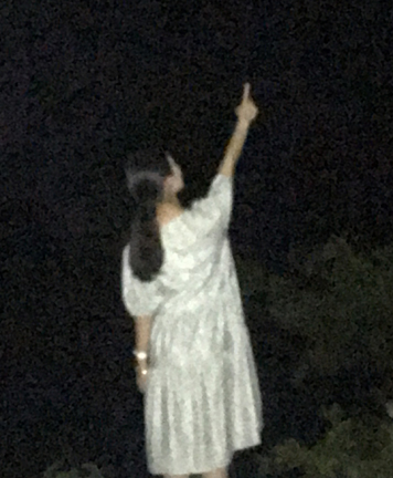
I listened to the astrological lecture from the Korean tour guide (in Korean!) and then watched with interest as some of the clients posed for and paid for their photos. You can get some idea of the kinds of photos taken from the pics that follow, but they cannot compare to the classy professional ones taken by the photographer.
–

–
As I was leaving, I had to be careful not to hit feral pigs crossing the road.

Got back to the hotel late, had a beer and snacks while I wrote my diary.
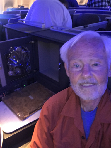
1/26 Th – Helen’s Birthday! 1pm 4-hour flight to Tokyo, 2-hour layover in the United Lounge, and then a 10-hour flight to LAX. The plane left Japan at 6pm and landed in LA at 11am on the same day I left (again crossed the International Date Line). The long flights on this trip had irritated my back, so I splurged and at the last minute bought a Business Class upgrade for $999 – very unlike me, I got my flight on rewards points. BUT I was able to write in my diary, read, AND stretch out in a horizontal position and sleep!
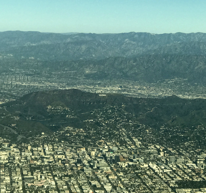
Landing in LA – can you see the Hollywood sign?
Kate picked me up; we stopped at the bank to buy quarters – limit of $100 each. I was searching for D mint marks on select National Park quarters to complete sets for our grandchildren. That was followed by a stop at Vons grocery store. Not surprisingly, we found Helen working with plants on Kate’s patio. Kate prepared dinner and an apricot tort for Helen’s 78th birthday.

1/27 F – Goodwill shopping, exchanged quarters at the bank, and then foot peddled a Swan boat at Echo Lake.


We had a very enjoyable and delicious dinner at the Perch Rooftop restaurant overlooking LA. This was a Christmas present (2022) from Kate. She reserved the best (corner) table on the rooftop. Not only that, the bartender knew how to make an excellent Manhattan!

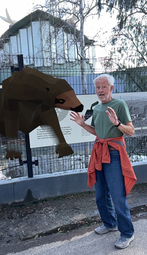
1/28 Sa – Had our traditional large Mexican breakfast (brunch) at Millie’s and then drove downtown to the La Brea Tar Pits.
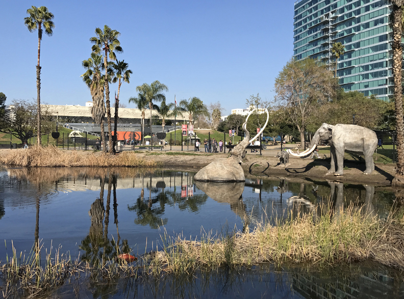

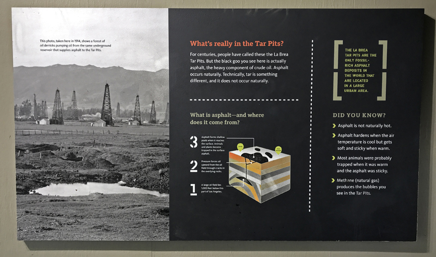
The tar, really asphalt, has been trapping animals for thousands of years, and is continuing to do so.

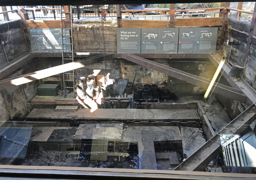
On-going excavations –
You can bring up holograms on your phone of some of the animals discovered here – great fun for kids like me.
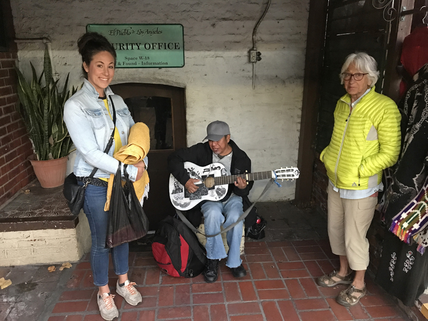
We then drove to the Olvera Historical District and Mexican Market in central LA by Union Station. The Avila Adobe, part of El Pueblo de Los Angeles Historical Monument, is the oldest building in LA (1818). Had dinner at the El Paseo Inn; waitress made delicious fresh Guacamole at our table. Kate bought new sandals and a yellow woven blanket. I thought they both deserved a serenade before we departed.
1/29 Su –Our flight departed LAX at 11am, we had a 3-hour layover in the United Lounge in Denver, arrived in Columbus at 10:30pm, and were home about midnight.
It was an enjoyable trip with many concomitant learning experiences.

Loved all the great pictures and great commentary! Brought back memories of my trip thru Micronesia in1972 on Air Micronesia…thanks !