
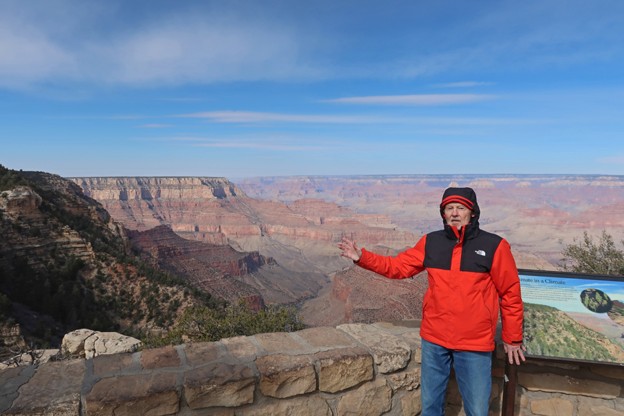
2/11/25 Tu – Drove north 4hrs from Scottsdale AZ to the Tusayan Ranger Station for Kaibab National Forest where I picked up information and a vey helpful map of the USFS Tusayan Ranger District. I then proceeded 6 miles to the South Rim of Grand Canyon NP. Despite some sun, the temperature in the low 40s with a strong wind, made for a cold day. Photos are from Mather Point.

Drove east about six miles to Grandview Point on the South Rim and then, after about two miles, turned south into Kaibab National Forest.


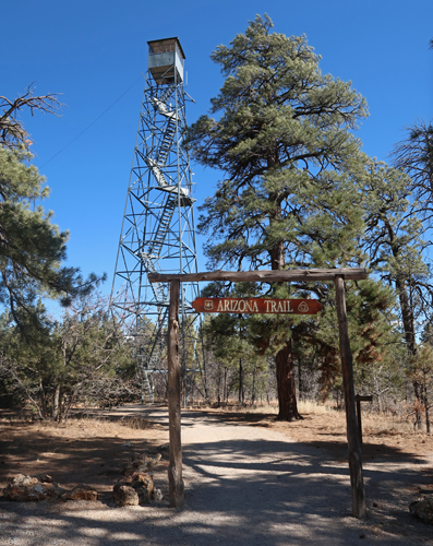
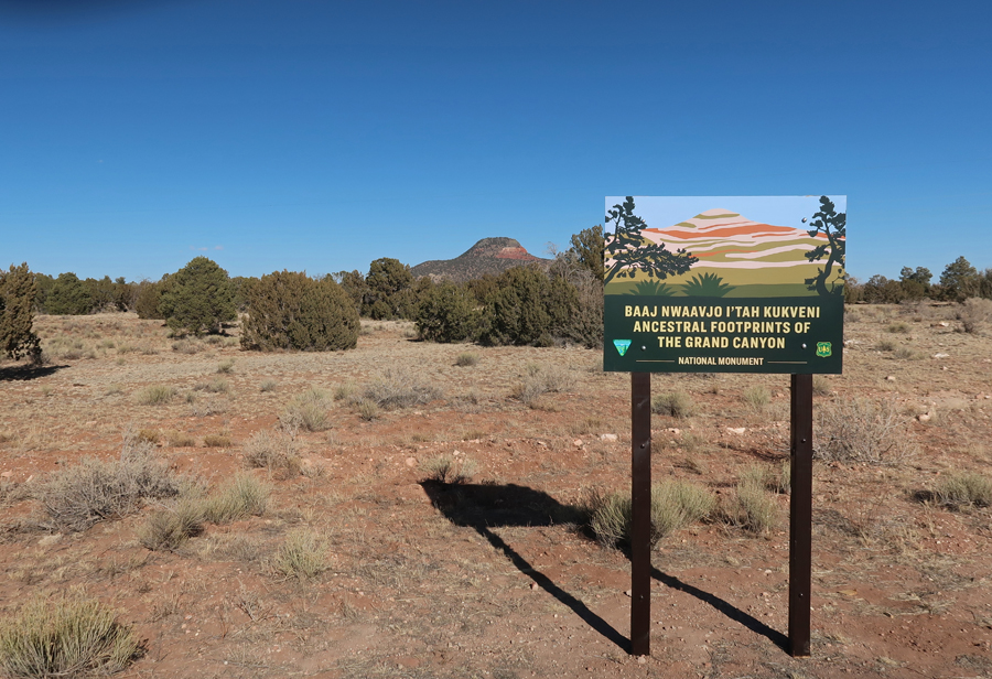
My first stop was the USFS Grandview Tower in Baaj Nwaavjo I’tah Kukveni – Ancestral Footprints of the Grand Canyon NM.

I held on tight as I climbed the 80-foot 1930s steel tower in high winds. This photo was taken looking north toward the South Rim of the Grand Canyon.
President Biden designated this National Monument in 2023 after a request from the 13 tribes of the Grand Canyon Tribal Coalition. There are large sections of the NM both south and north of Grand Canyon NP.
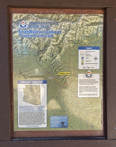
I then did a short hike on the Arizona National Scenic Trail, which starts on the AZ-UT border, passes through the Grand Canyon, and continues south for over 800 miles to the Mexican border.

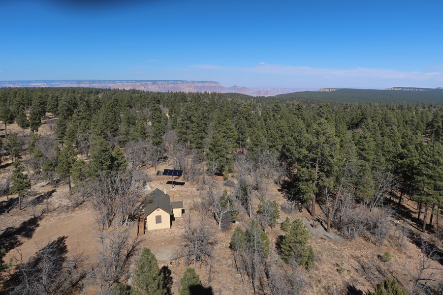
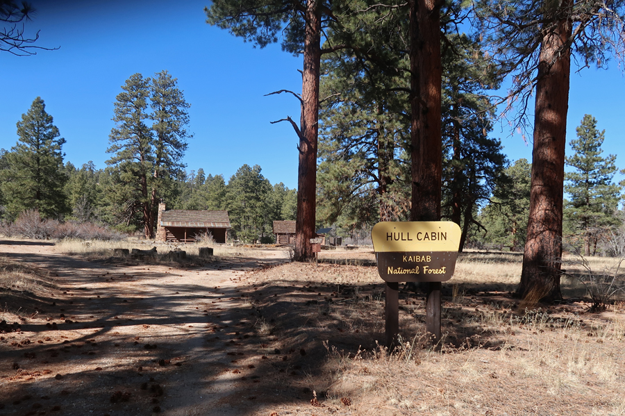
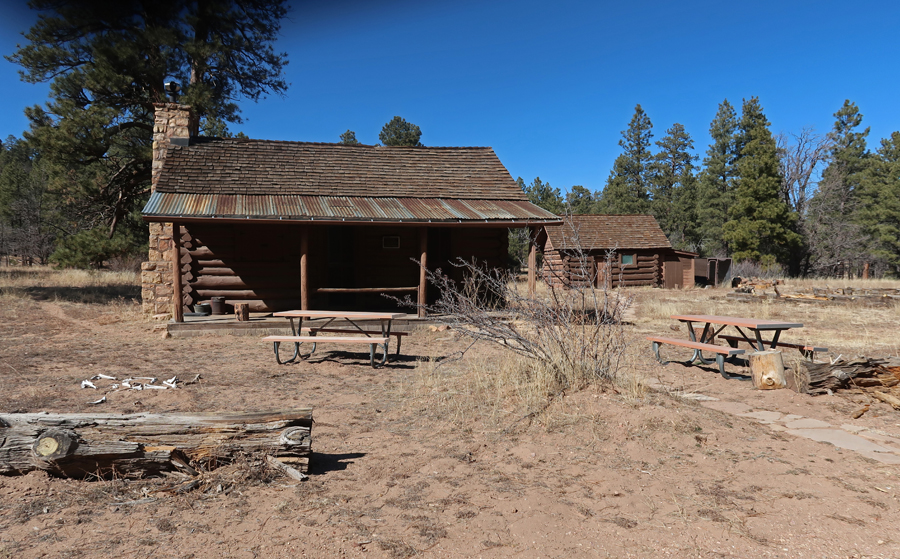
The 1880s Hull cabin, which is on the National Register of Historic Places, is 2-miles from the tower and can be rented from the USFS. William Hull raised sheep and was one of the first to take tourists to the Grand Canyon.
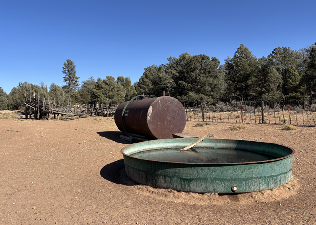
I then drove Forest Service roads to a gate and water tank about a half mile from the Old Grand Canyon Airport.


My last stop was the start of the Red Butte Trail.
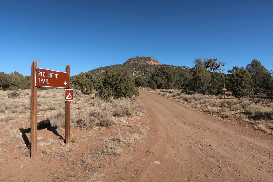
The 2.4-mile rt trail leads to the Red Butte USFS Fire Tower and the top of Red Butte (7,326ft). The trail gains about 1,000ft in elevation.


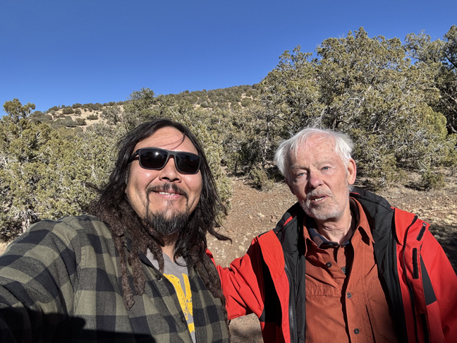
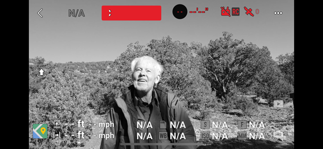
Red Butte is sacred to the Havasupai Indian Tribe that live in the Grand Canyon. I met Bobby, an Indian from the Four-Corners area at the trailhead. Among other things, he is a photographer and had just finished flying his drone around the top of Red Butte.
One frame of his drone footage of me –
Departing the NM –
Returned to the Holiday Inn Express in Scottsdale AZ
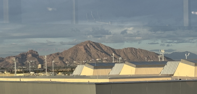
2/12 W – Spent the day in the Phoenix area. Drove around Camelback Mountain looking for the location from which George Bickerstaff may have painted the landscape oil that we have in our living room. Bickerstaff was an early nineteenth-century American Expressionist painter.

This is the view from the porch of the JW Marriott Scottsdale Camelback Inn on Lincoln Dr. This photo was taken looking South. The real location may be NW from here in the Paradise Area, OR, it is not a painting of Camelback Mountain!

Camelback Mountain from the airport train when I arrived (view looking North) –
Another view looking North, from the South side of Camelback Mountain – this looks more like the painting.

View from Arizona Falls, which are man-made, on the Arizona Canal that runs through Phoenix. There is a small hydroelectric plant there.


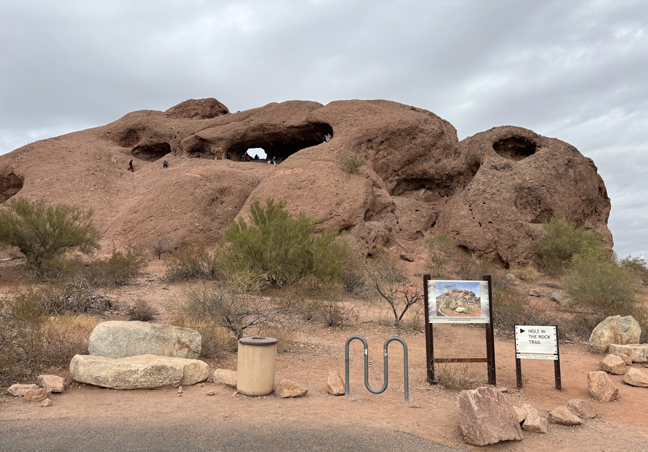
I then visited Papago Park next to the Phoenix Zoo.
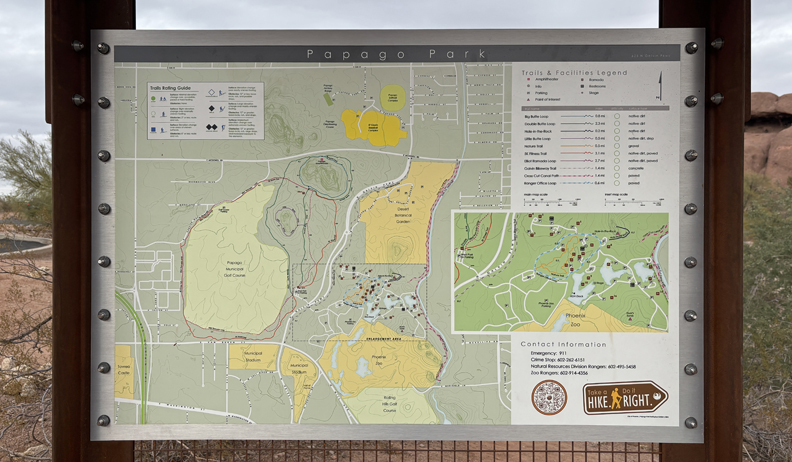
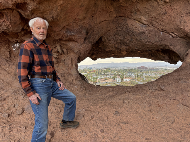
Did the short hike to “Hole in the Rock,” a red rock butte.

Only a half mile round trip.
Looking East toward Zoo through “Hole in the Rock”
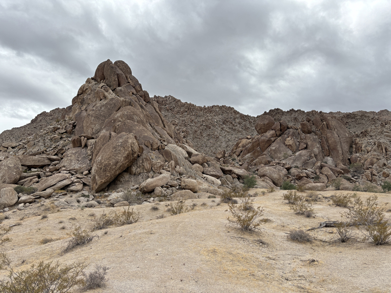
2/13 Th – 4hrs (212mi) from Scottsdale AZ to Corn Springs CA in Chuckwalla National Monument (BLM). See Chuckwalla MTNS Area south of I-10. Gravel Road to Corn Springs Campground and Corn Springs Mining Area.
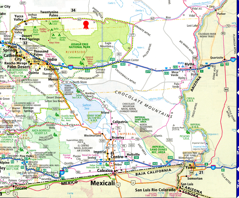
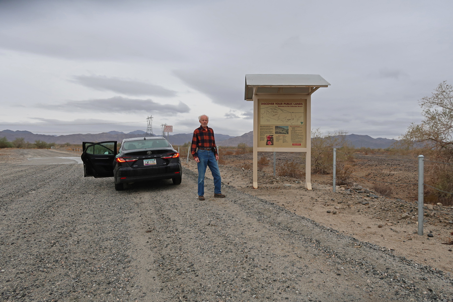
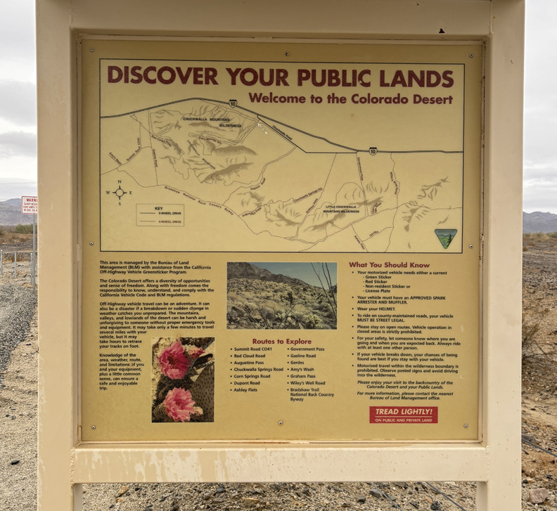
The new NM is in the Colorado Desert of Southern CA that protects 624,270 acres of desert habitat in Riverside and Imperial counties from development. The monument spans several mountain ranges between Joshua Tree National Park and the Chocolate Mountain Aerial Gunnery Range, designated a NM on 1/14/2025, shortly before President Biden left office. Corn Springs Palm Oasis and Campground.
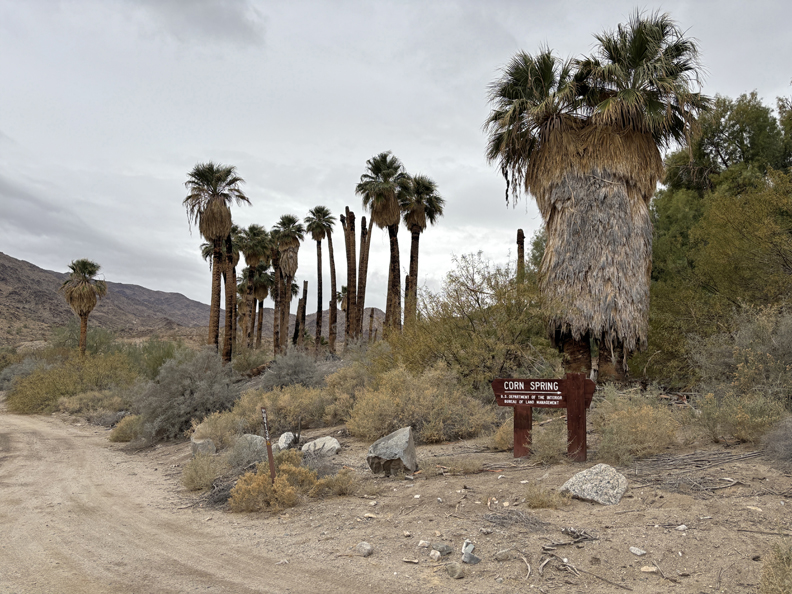
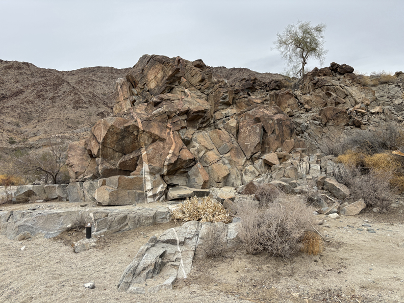
0.5 Mile Interpretive Trail – it was a cloudy day with the temperature getting up to about 55 degrees. Also, there was scattered rain, which is very unusual in this desert location.

Petroglyphs – some said to be over 10,000 years old, others grafitti.

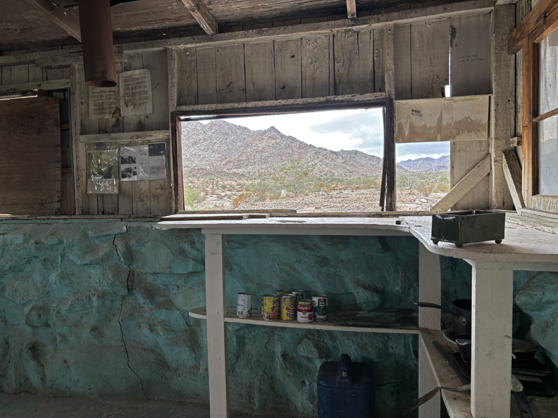
Edward Wodetzki’s Miner’s Cabin and remains of a mill.

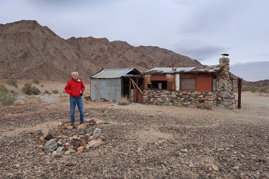
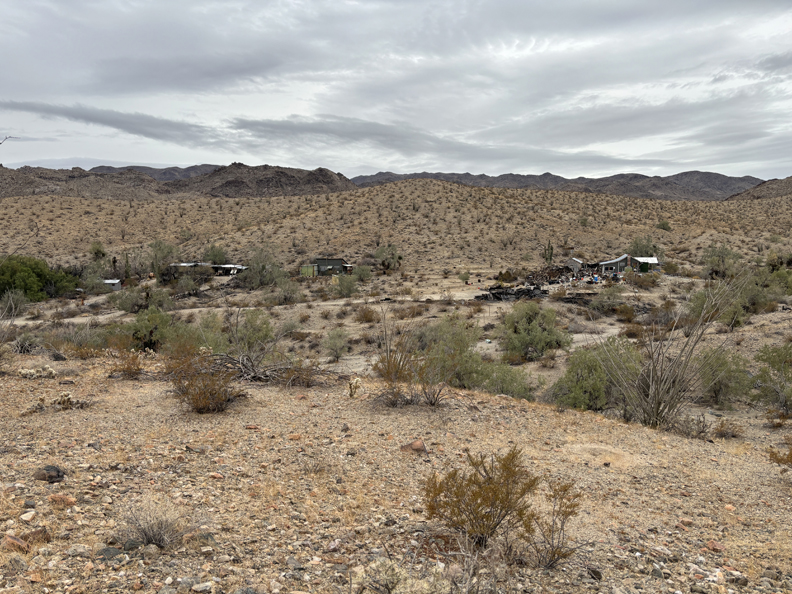
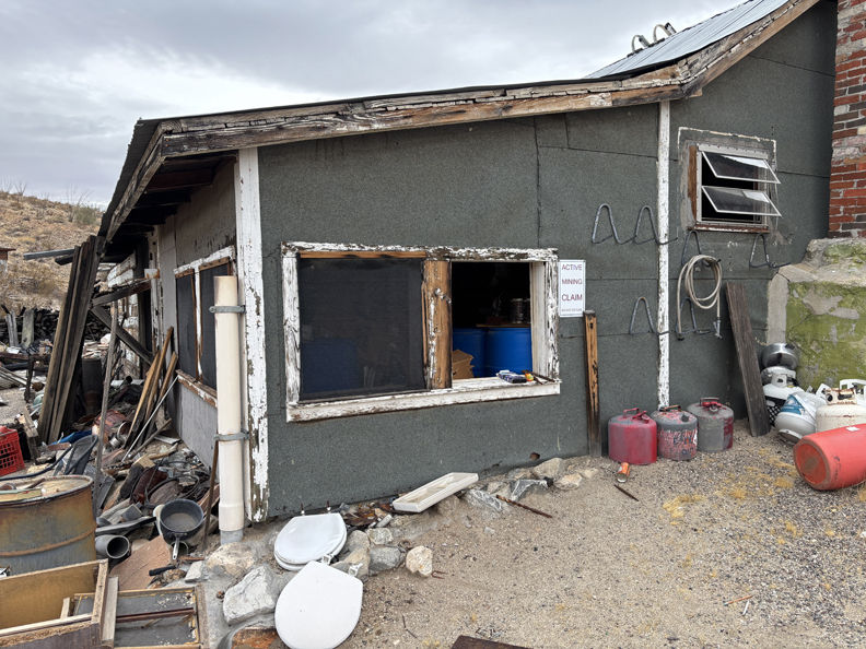
Corn Springs Mining Area – sign on building states “Active Mining Claim.”

It took about an hour to return to I-10, drive to the Desert Center Exit, and then drive a short distance to the location of Desert Steve’s Cabin and his plaque at the base of Alligator Rock, which is within the new Chuckwalla NM.

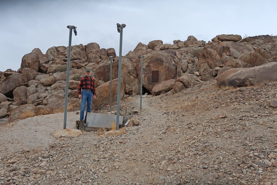

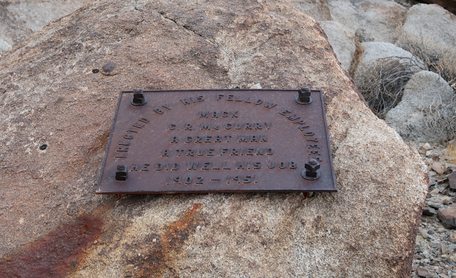
There is another plaque there as well – Mack, “He Did Well His Job.”

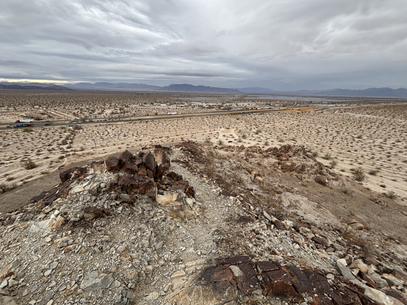
I hiked to the top of the alligator’s head and looked down his spine. Alligator Rock has spiritual and cultural significance for local tribes.
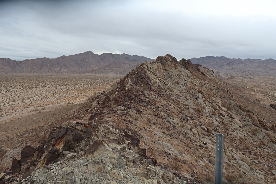
I-10 from the top of the alligator’s head –
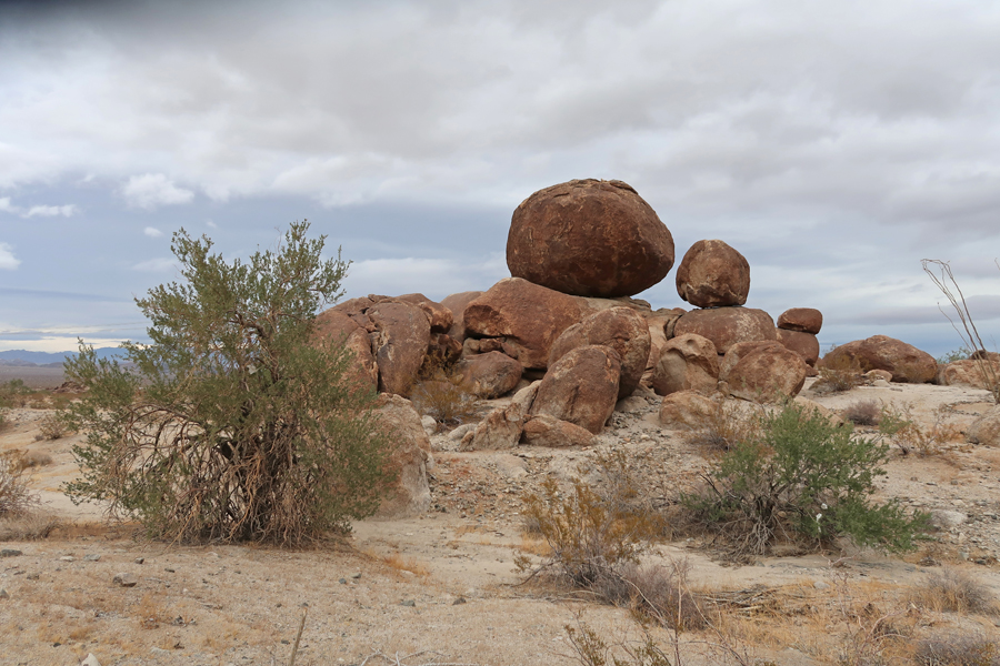
It took about 15-minutes to drive to the Edmund C Jaeger Nature Sanctuary, which is also within the new NM.

Some nice balanced rocks there –
2.5hrs (135mi) from Edmund C. Jaeger Nature Sanctuary to Yuma AZ.
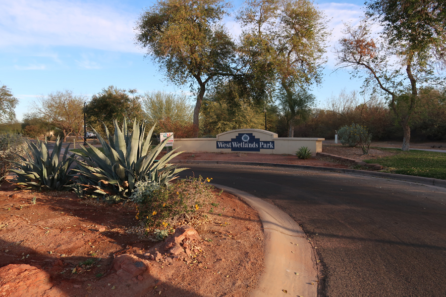
2/14 F – Valentines Day – I arrived at West Wetlands Park, which is on the Colorado River in Yuma AZ, at about 8am. It was my first stop in Yuma Crossing National Heritage Area (NHA). Yuma is close to both the CA and Mexican borders.
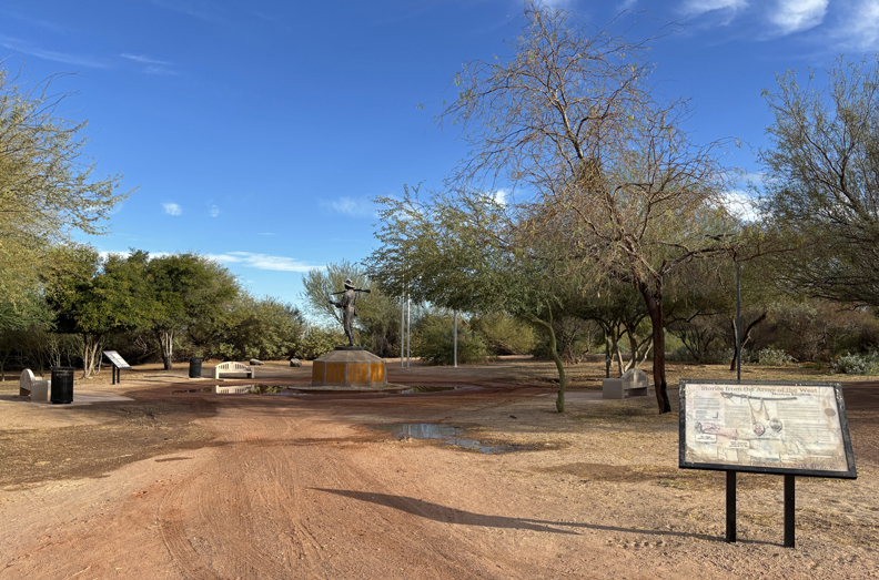
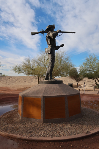
There was an interesting Mormon Battalion Monument – “Army of the West” in the park just past this trail bridge. The battalion marched 2,100 miles from Iowa to Southern California establishing the first wagon route to the Pacific Coast – watch out for Rattlesnakes!

The statue is of Philemon Merrill who led the battalion (~500 enlisted and volunteer men). The Battalion was operational from 1846-1847 during the Mexican American War.

This map shows some of the major sites in the Yuma Crossing NHA that are east of West Wetlands Park.

In 1775-76, Spain sent the Juan Bautista de Anza expedition 1,000 miles from Sonora Mexico to Alta CA to establish a route to settle the port of San Francisco. The local Quechan tribe assisted the expedition in crossing the Colorado River at present-day Yuma. Yuma is one of the sites along the NPS Juan Bautista de Anza National Historic Trail.
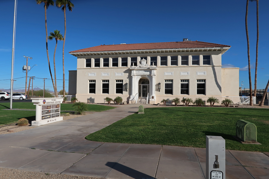
I stopped by the Old Yuma City Hall to pick up some literature from the office of Yuma Crossing NHA. According to the Guinness Book of Records, Yuma AZ is the “Sunniest City on Earth!”
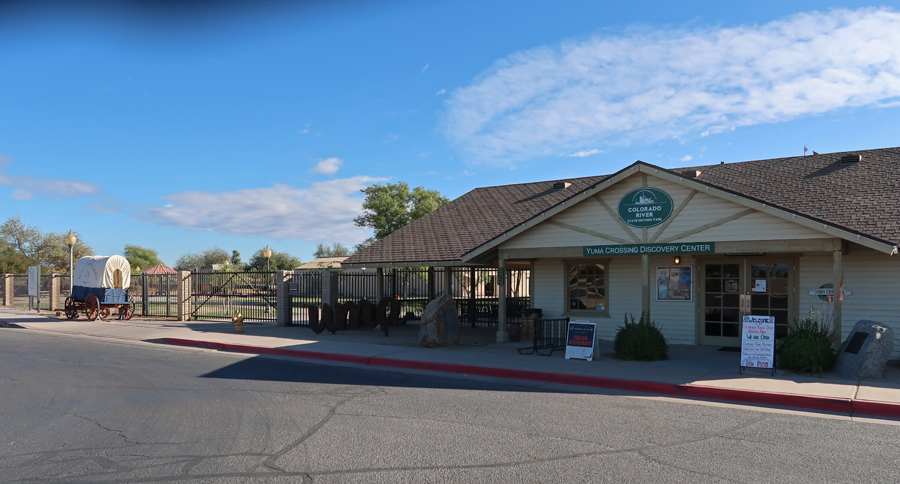
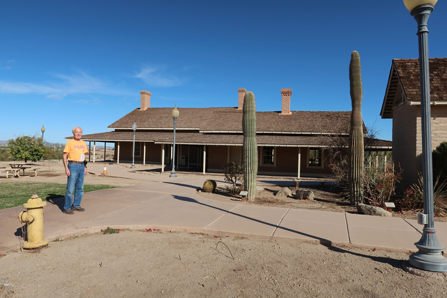
My next stop was the Colorado River State Historic Park.

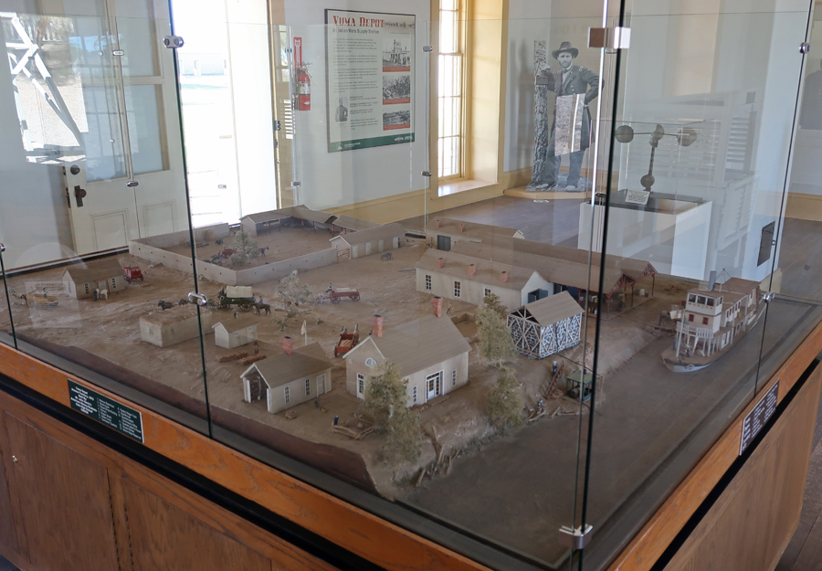
This was the location of the Southwest Army Quartermaster Depot 1865-1883.

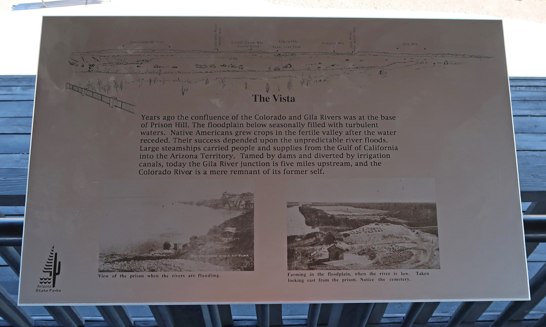
In the late 1800s, steamboats delivered Army supplies up the Colorado River to Yuma for storage and disbursement to Indian War forts. Note the steamboat on the Colorado River.
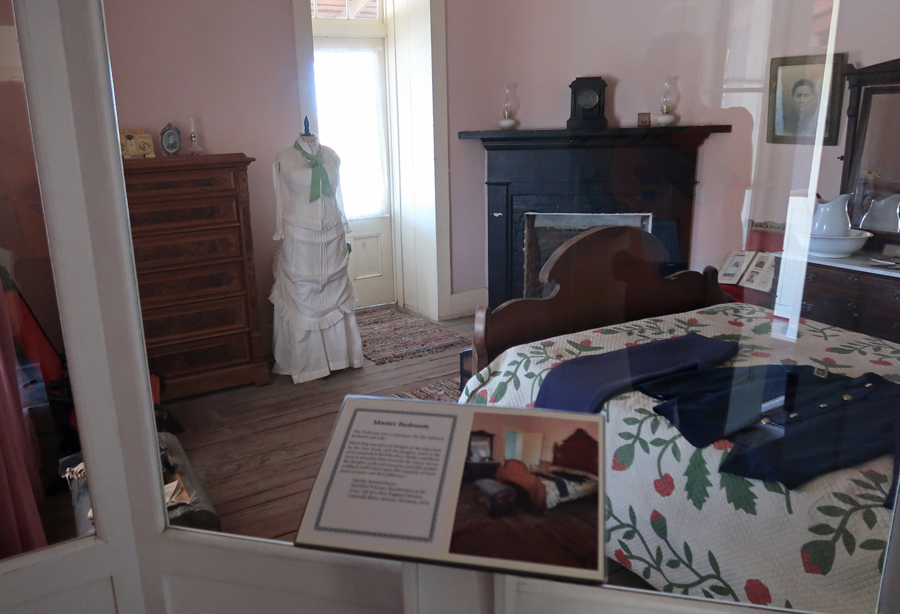
There are period displays in the former Officer Quarters –

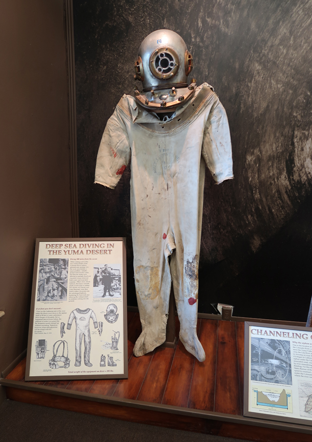
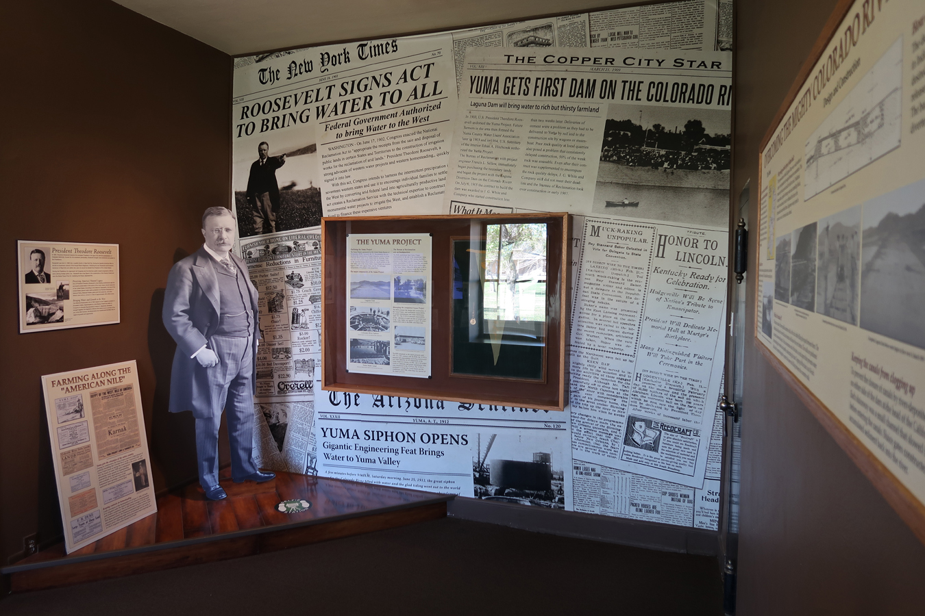
The Bureau of Reclamation Building presents the history of Colorado River development in Yuma.

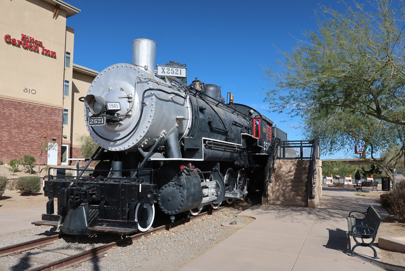
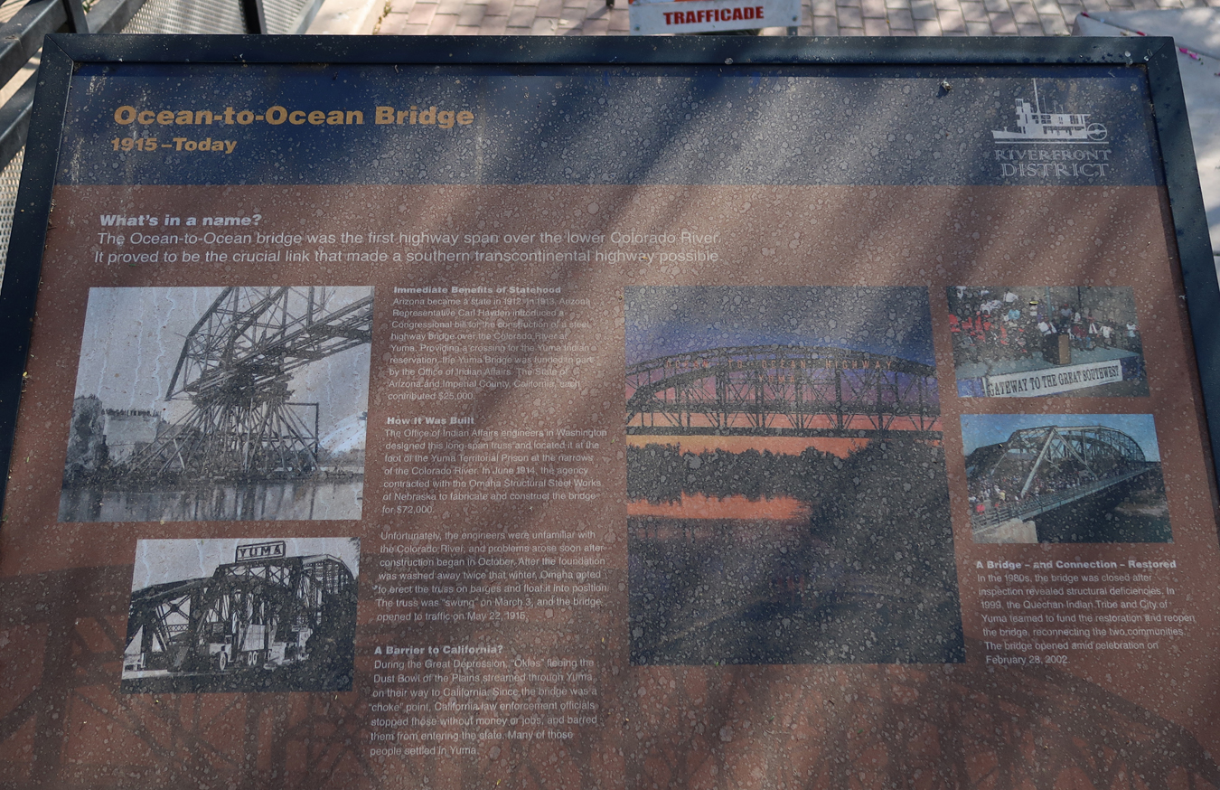
A short distance away is the Pivot Point Bridge, “Ocean to Ocean Bridge,” crossing the Colorado River – location where the first train entered the Arizona Territory in 1877. This is a 1907 Southern Pacific Baldwin steam locomotive. A Southern Pacific Hotel was located here from 1881 to 1926.
The Historic Sanguinetti House Museum & Gardens is nearby. E. F. Sanguinetti (1867-1945) built the house, which is considered a “Jewel of Historic Yuma.” E. F. Sanguinetti (1867-1945), an Italian Immigrant, built the adobe house in 1882. As a result of his many businesses, he became known as the “Merchant Prince of Yuma.”

The Yuma Territorial Prison overlooks the Colorado River.
A reconstructed Guard Tower for the Prison is located here.


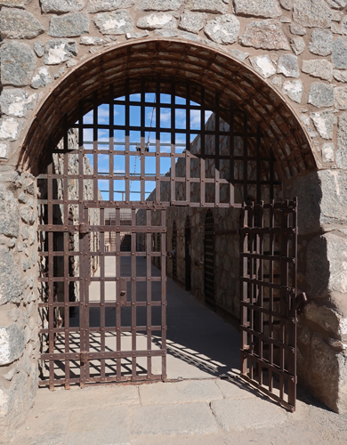
Sally Port into Prison –

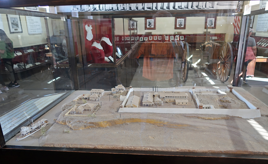
The Prison Museum was very interesting presenting the history of the location as well as the male and female inmates. Model of the Yuma Territorial Prison (1876-1909).
Gatling rapid fire gun –

One example of a woman prisoner –

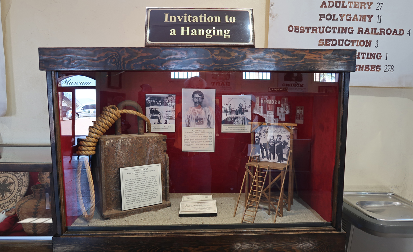
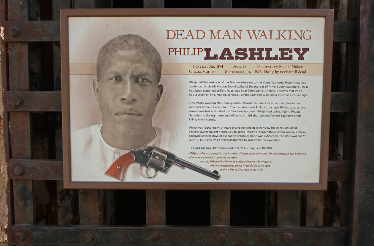
Hanging display –
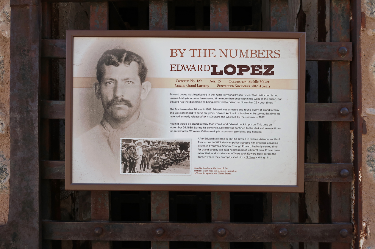
Crimes –

Cell Block –

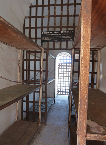
Iron Bunkbeds –
Examples of prisoner crimes –

As of my visit to Yuma Crossing NHA, I have now visited all 62 National Heritage Areas.
3.5hrs (230mi) to Tucson (I-8 runs along Juan Bautista de Anza NHT), and the west unit of Saguaro NP. Quick stop to pickup a new NP brochure and do a short walk in the Saguaro cactus forest.

Saguaro cactus forest –

Overnight at a Holiday Inn Express.
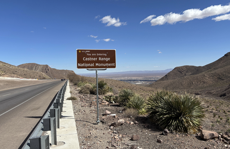
2/15/25 Sa – 5hrs from Tucson to Castner Range NM (2023), just North of El Paso TX.
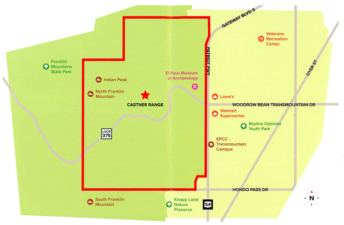
First stop was Smugglers pass on Woodrow Bean Trans Mountain Road in Franklin Mountains SP.

Castner Range NM is located just east of the pass. It is a part of Fort Bliss and is administered by the U.S. Army.
Cattle/Horse Thieves (Wrestlers) and Fusselman Canyon –


The El Paso Museum of Archaeology is located at Wilderness Park.

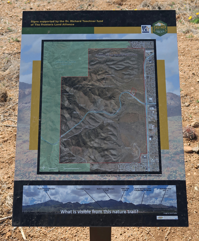
It has a Nature Trail that is within Castner Range National Monument and is the only part of the NM that is currently open to the public. Again, be alert for snakes.

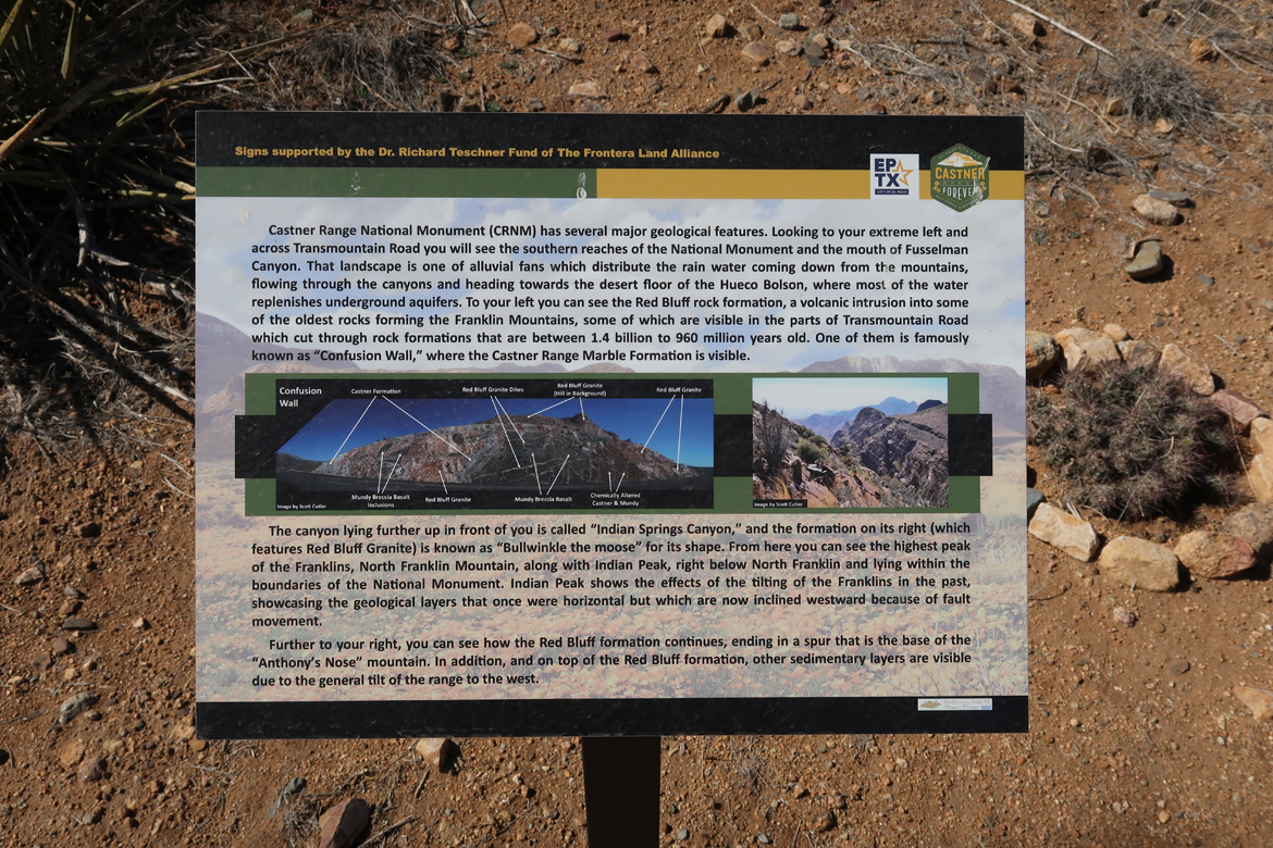
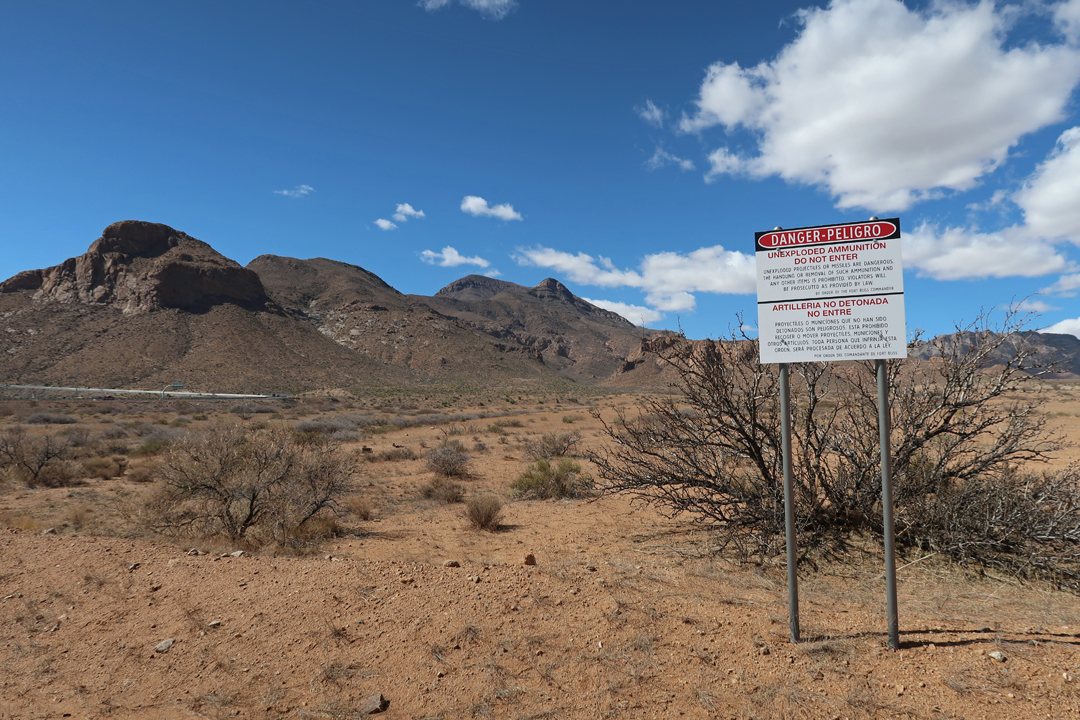
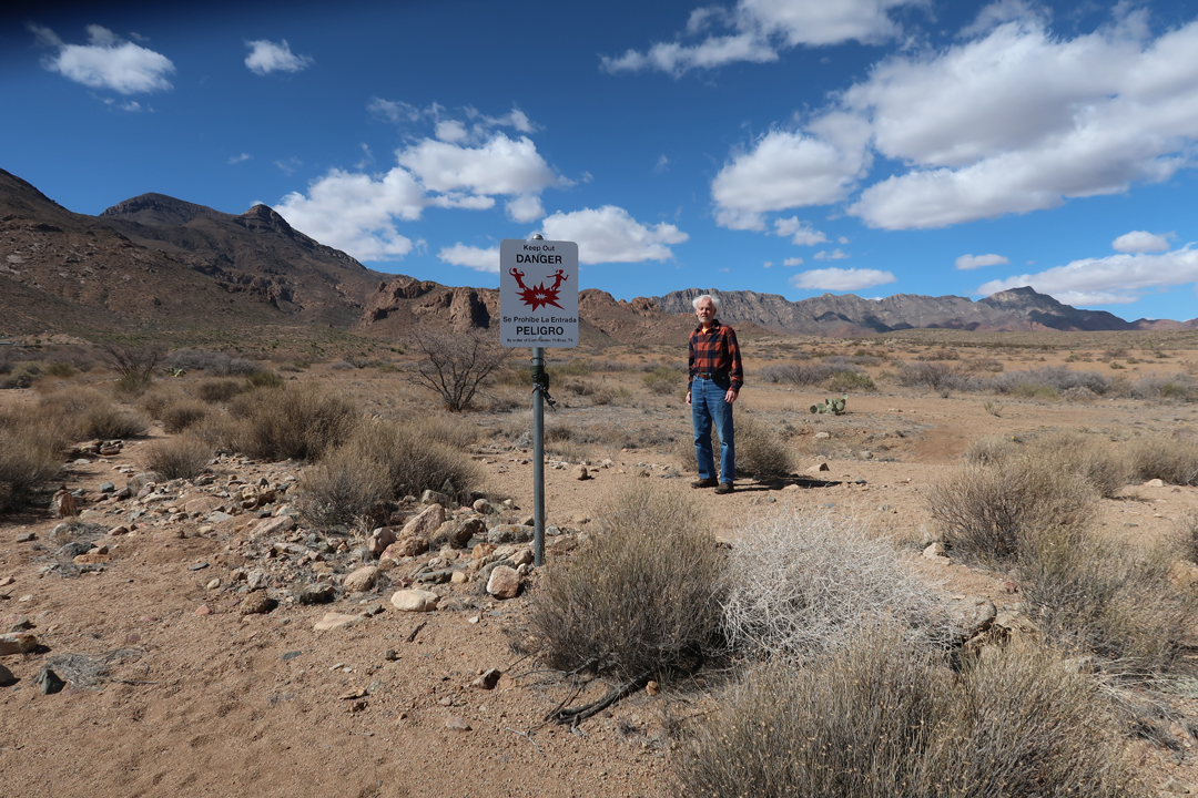
Fort Bliss was a weapons test site 1926-1966 and the remainder of the NM is closed as the Army acts to remove unexploded ordinance. Peligro – Danger
The El Paso Museum of Archaeology presents the human history of the area.


The Museum placed this photo on their Facebook page.

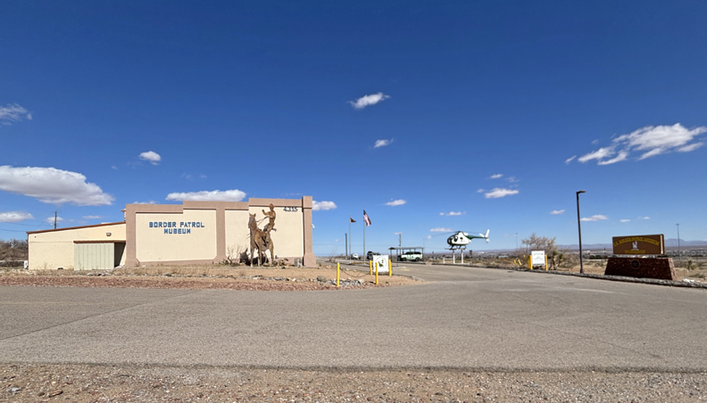
I then stopped by the National Border Patrol Museum, which is next door. My brother Joe worked as a Border Patrol agent in El Paso early in his career.

Celebrated the end of my trip with a Vietnamese dinner and continued reading of “Winter of the World” by Ken Follett. It is book two of the Century Trilogy. Use reward points for my stay at Towne Place Suites El Paso North.
2/16/25 Su – Up at 4:30am for my 6:30am flight from El Paso to Denver, then flight to Columbus OH where I had to clear snow and ice off our car before driving home. Helen had a nice hot meal ready for me at 5pm. It was a 14-hour travel day.
