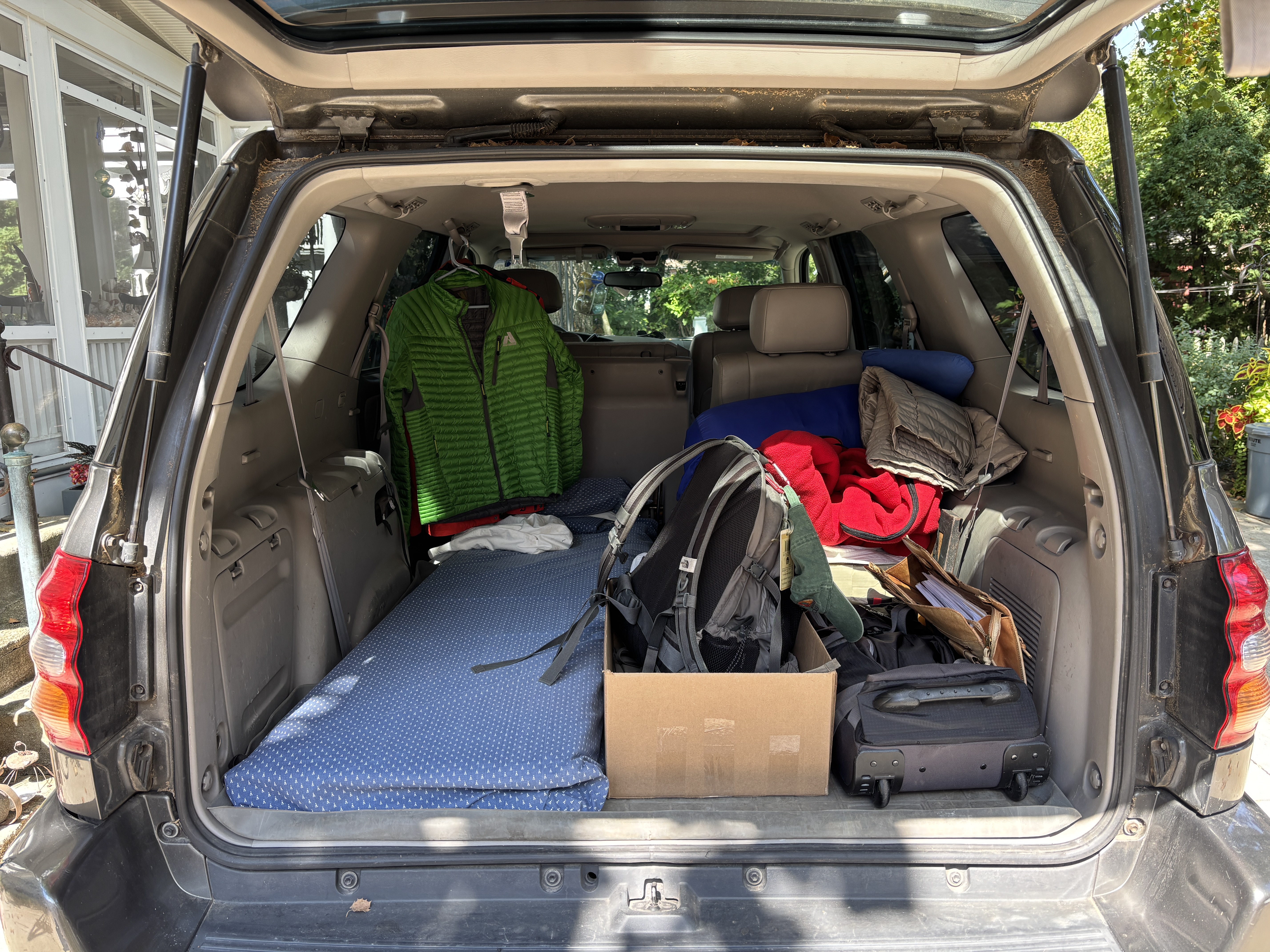
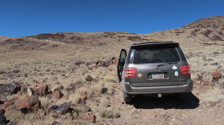
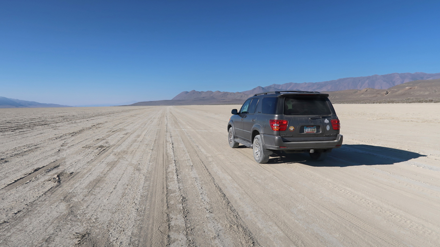
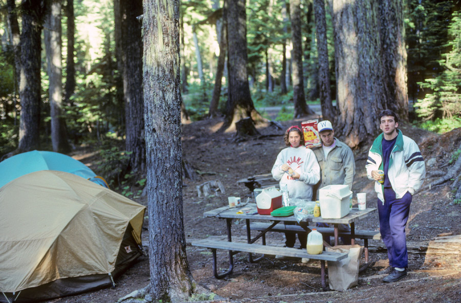
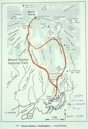
11/12/25 W – 3:30p flight from Dayton to El Paso, rented a GMC Sierra 4WD pickup and stayed in the Sunland Park Inn (Best Western). I bought snacks and drinks to prepare for my three-day trip.
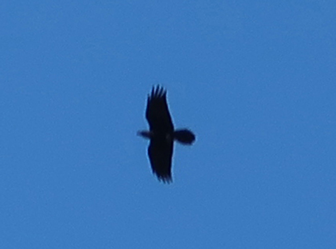
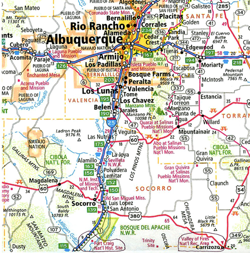
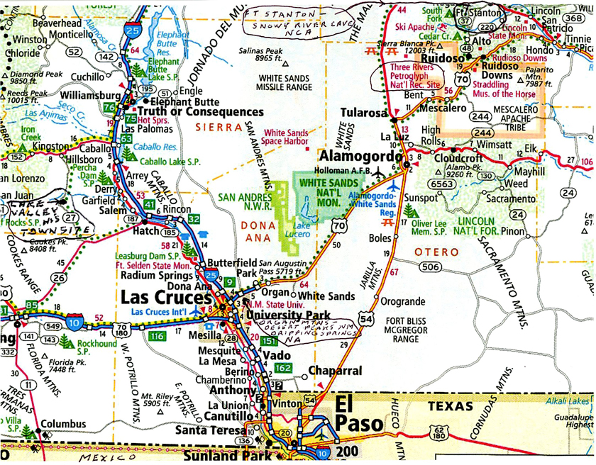
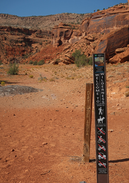
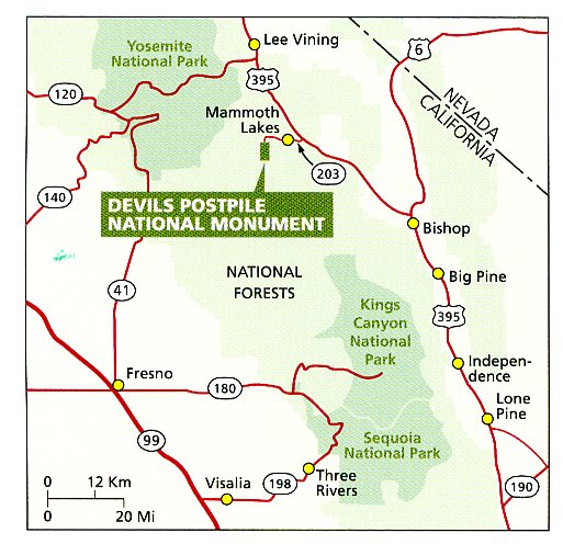
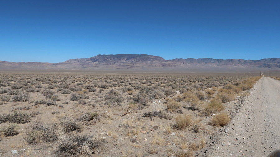
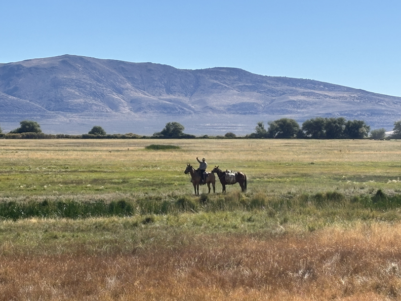
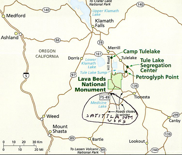
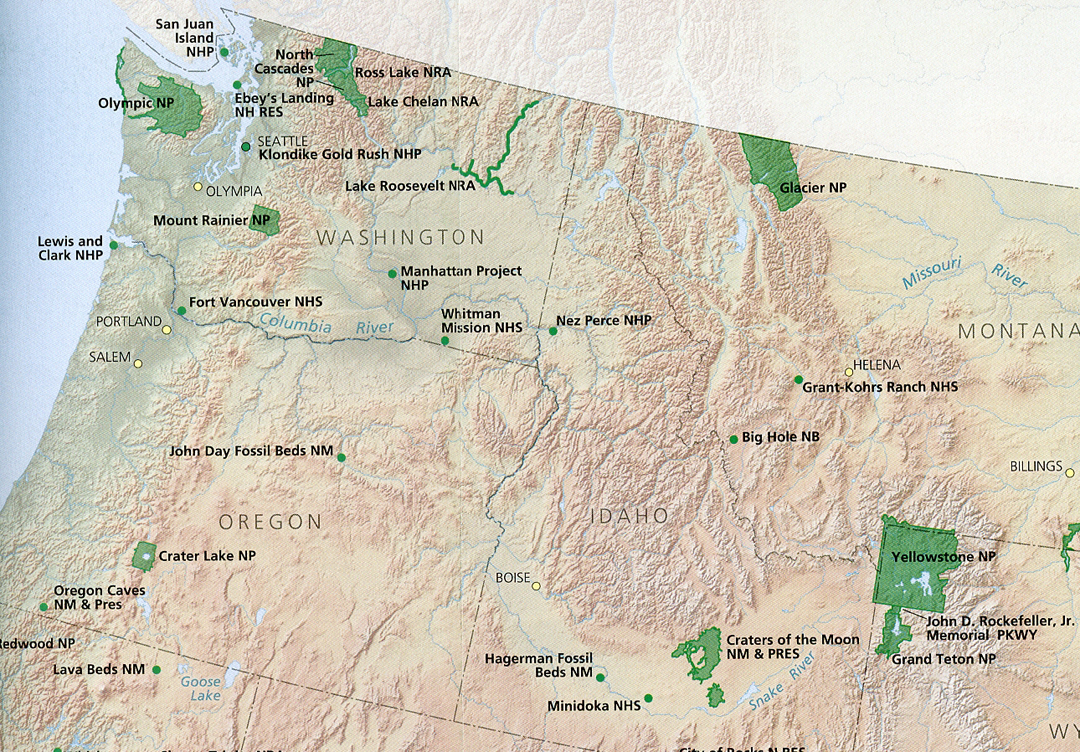
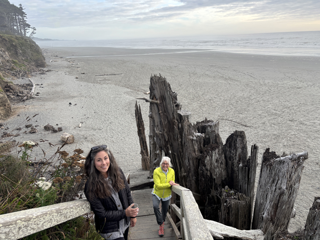
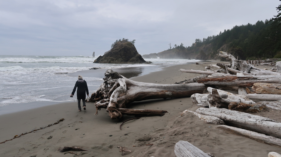
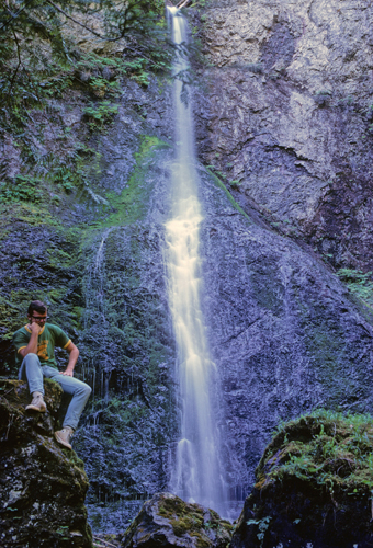
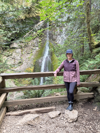
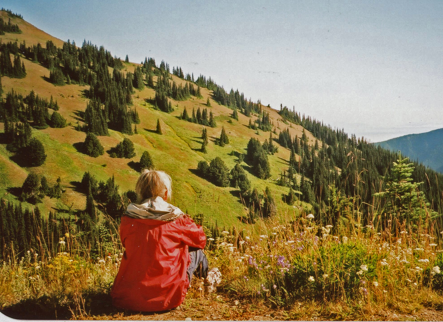
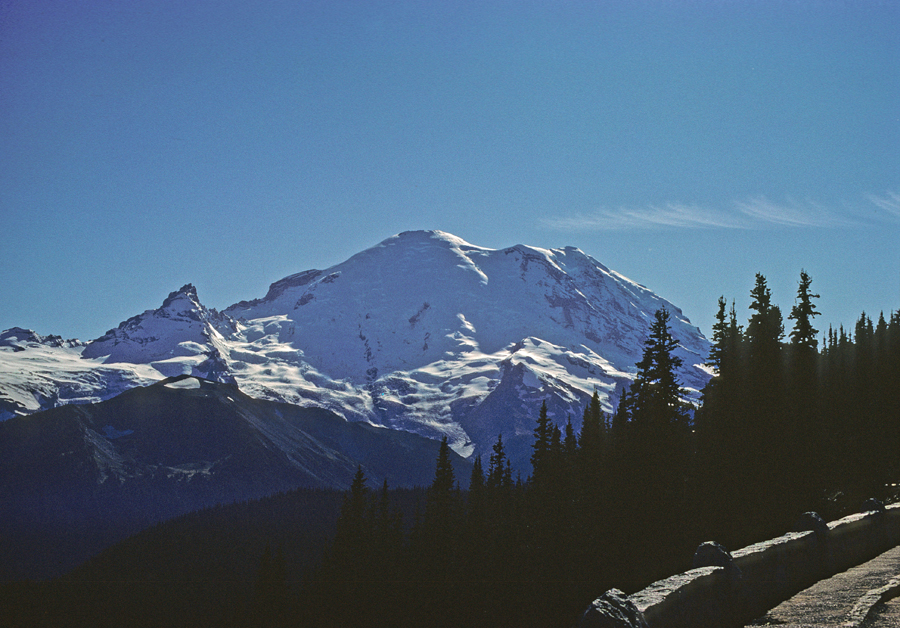
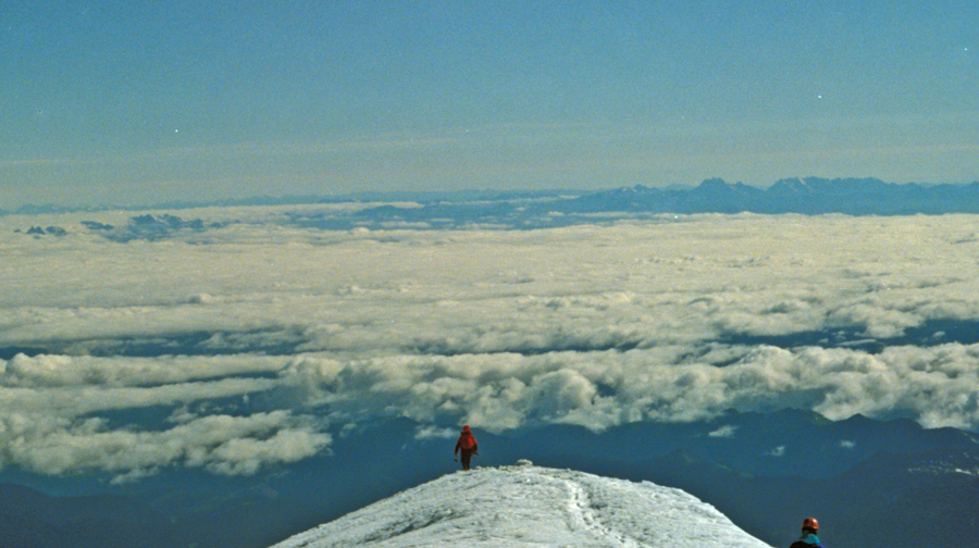
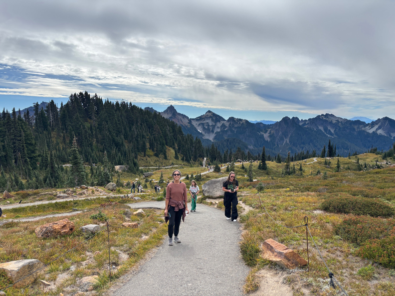
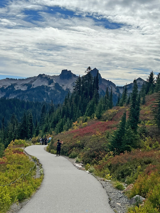
11/13 Th – left at 7am in order to get to a Subway in Alamogordo NM at 8:30a when they opened. I bought a foot long Chicken Teriyaki Sub, so as to have an easy lunch for the next two days. Four of my six destinations are indicated on this map.
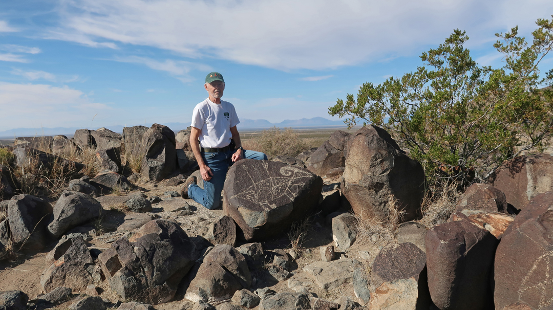
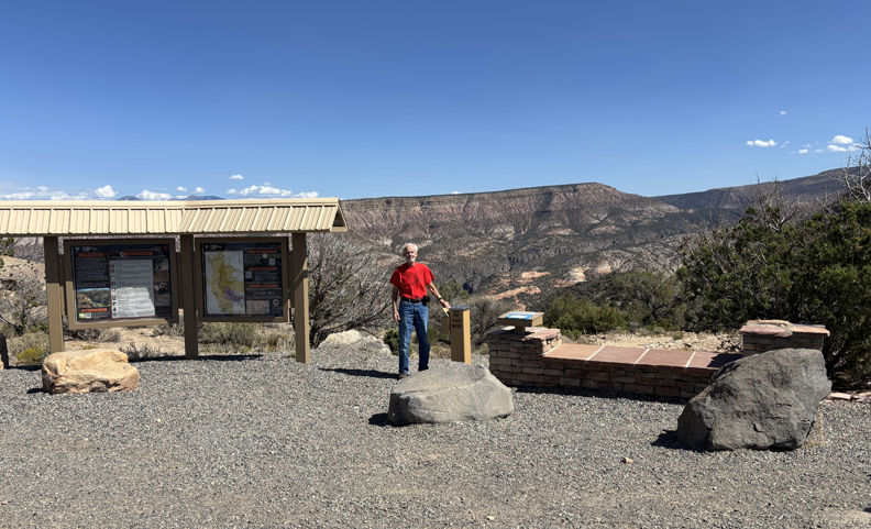
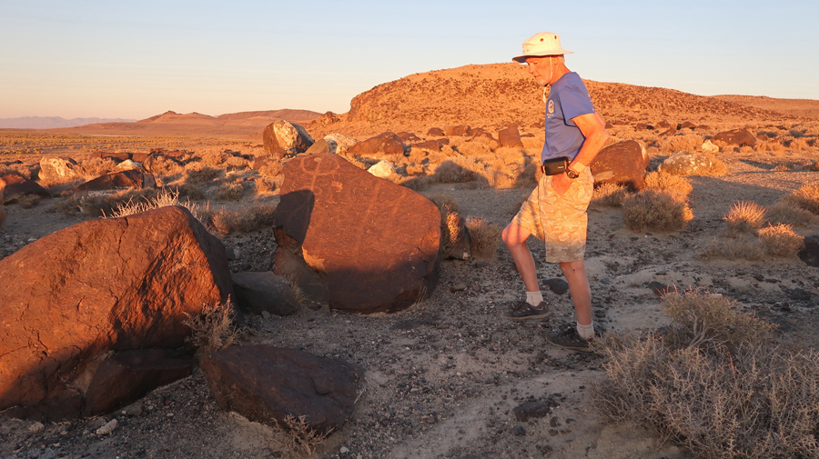
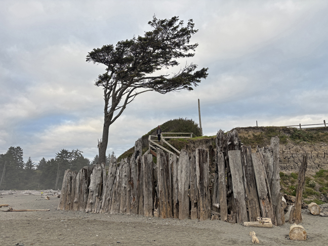
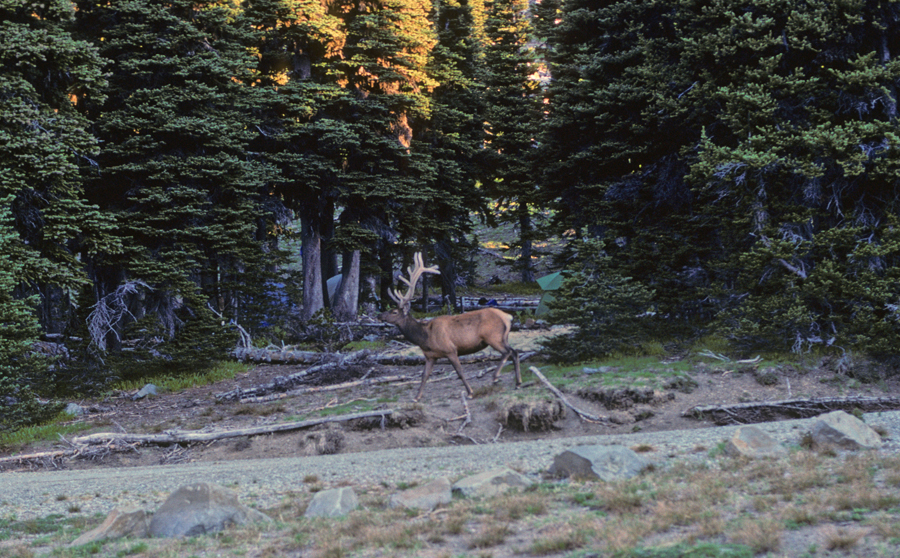
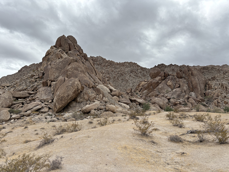
An hour drive north on US-54 got me to the BLM Three Rivers Petroglyph Site.
.
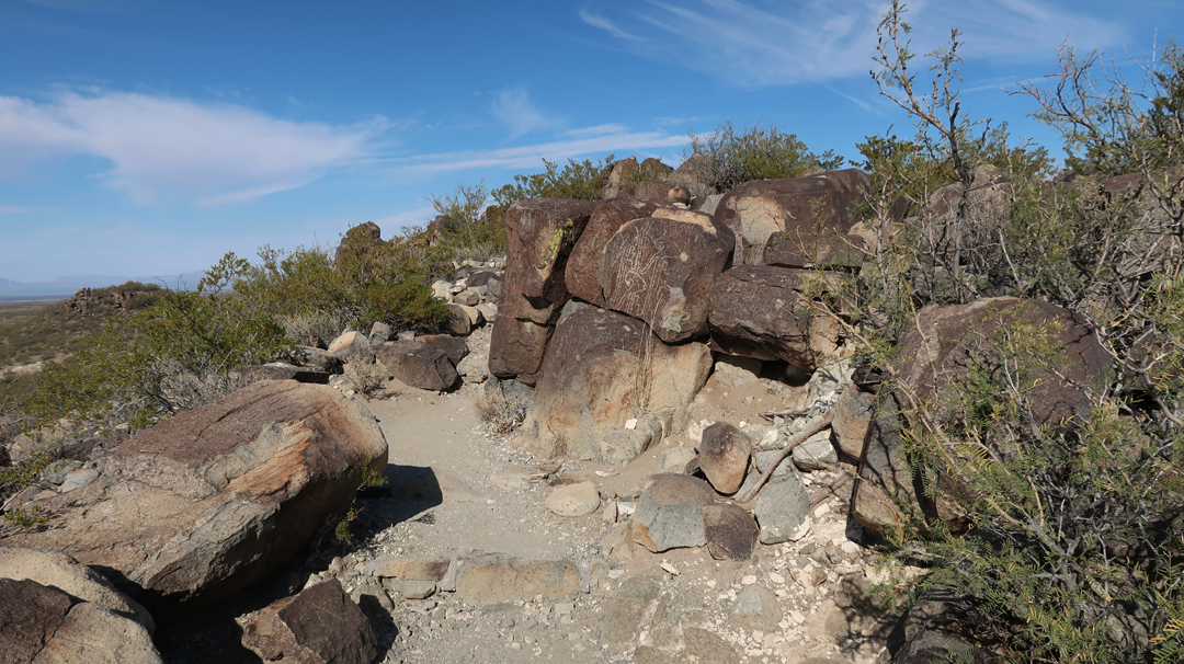
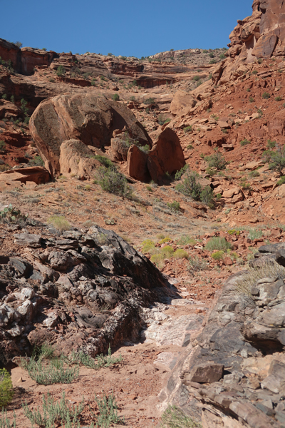
The Petroglyph Trail is a bit rugged and about two miles roundtrip.
Rattlesnake Caution and the definition of the word Petroglyph –
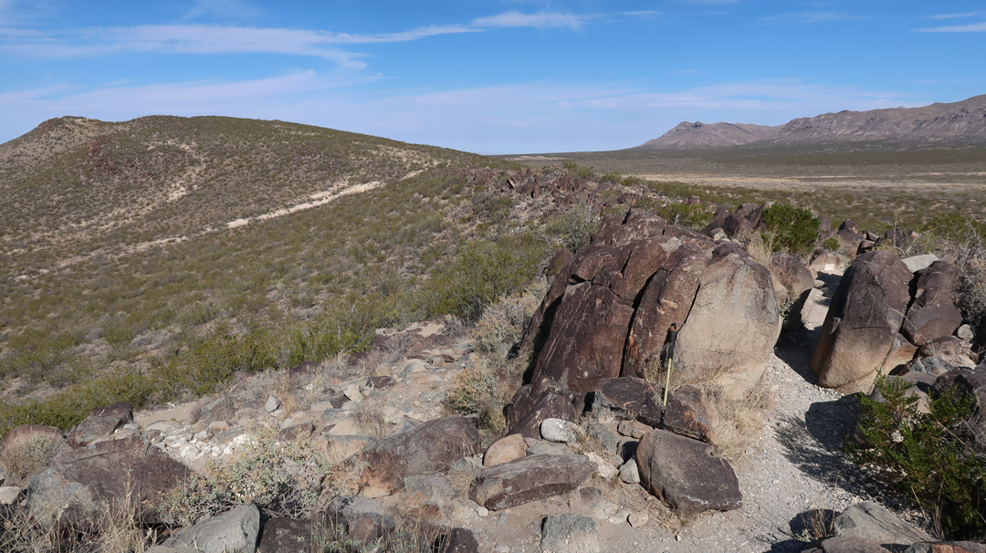
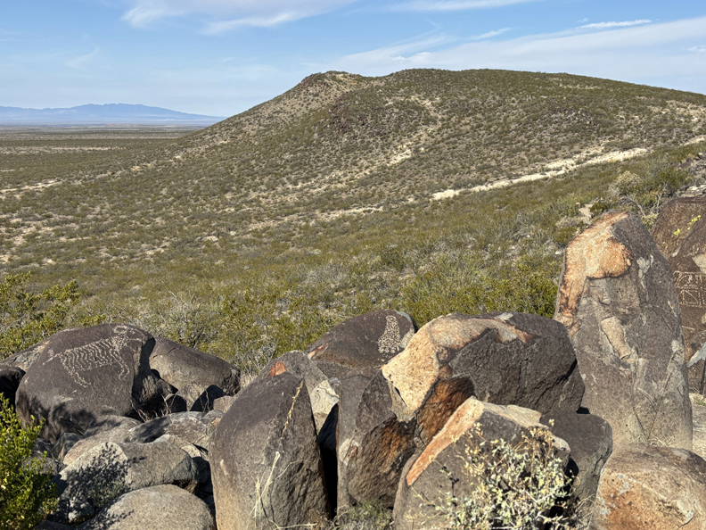
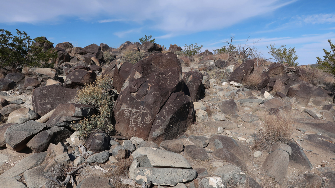
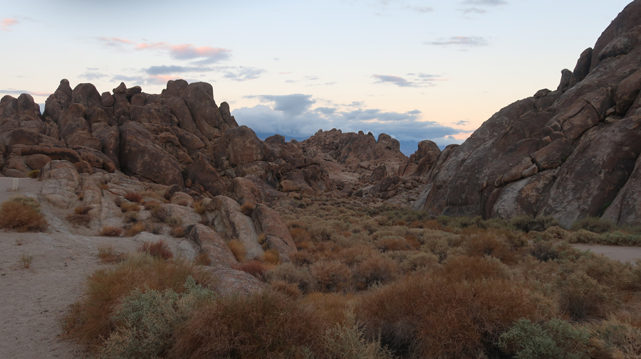
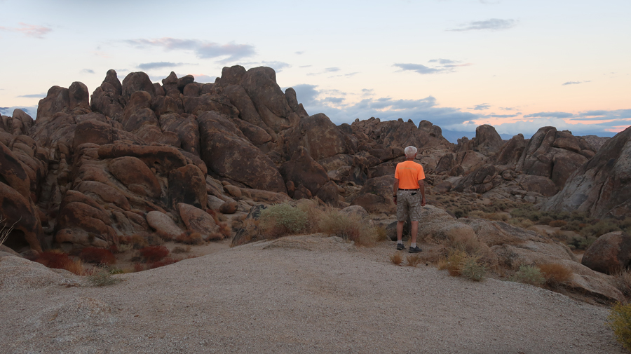
Trail goes up to and follows a ridge meandering through boulders.
.
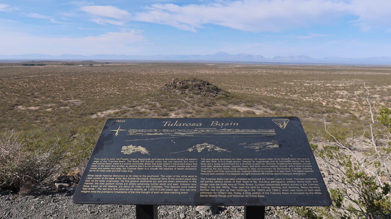
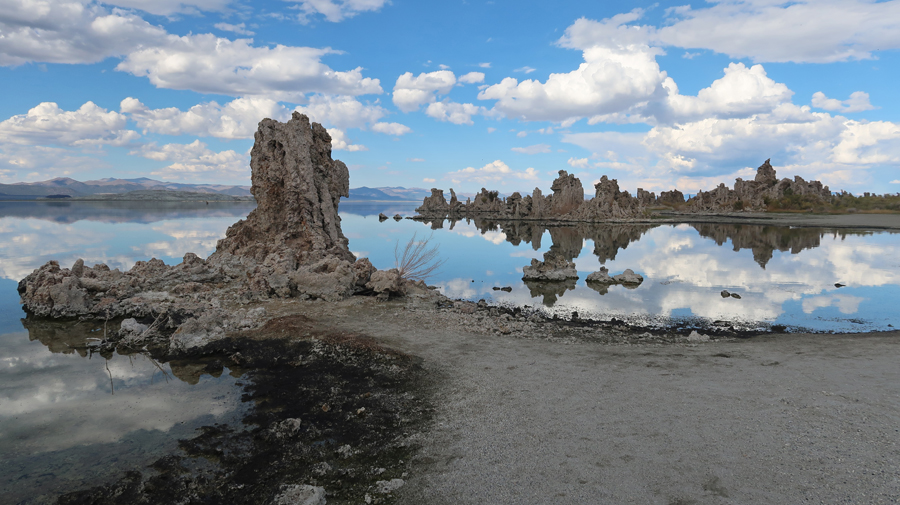
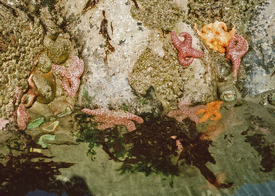
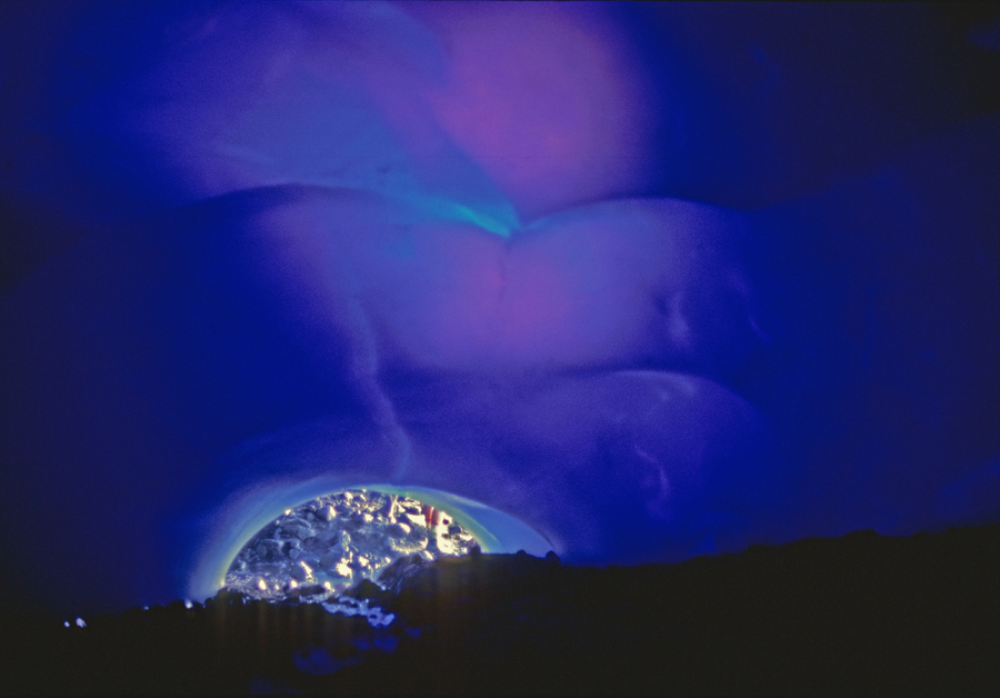
Tularosa Basin – enlarge to read
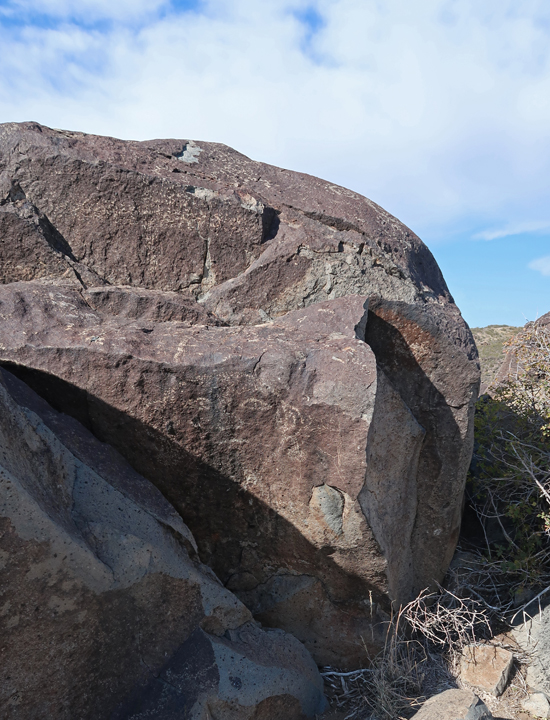
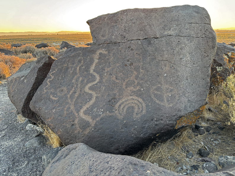
Bighorn Sheep (left), bent knees indicate motion
Body of a Bighorn sheep filled with Mimbres-style geometric designs and pierced by three arrows.
Can you find the round face with almond shaped eyes and earrings?
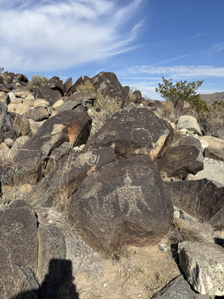
There are more than 21,000 petroglyphs in this area!
.
The remains of a Mogollon village is near the parking lot. It is thought that the inhabitants of the village created the rock drawings more than six hundred years ago.
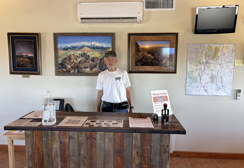
The 43-day government shutdown ended today – so, the information center was open!
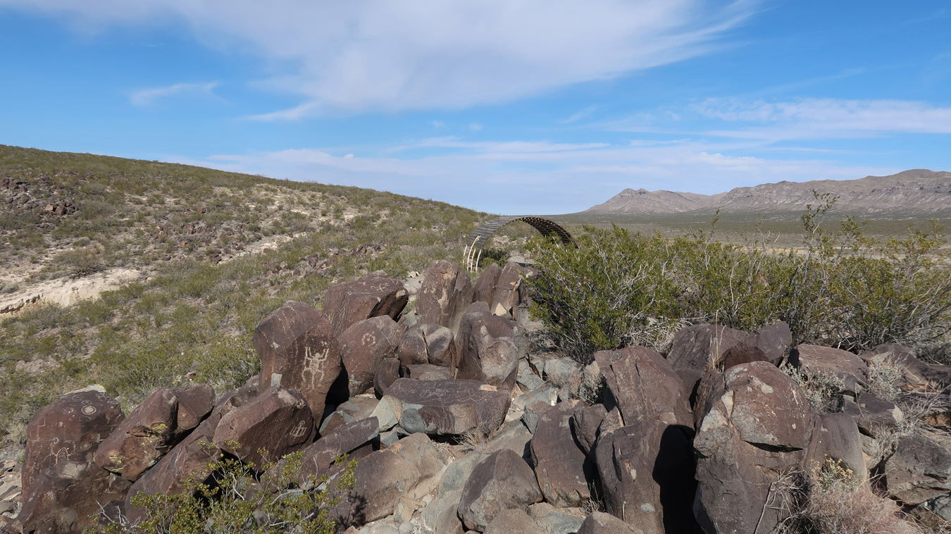
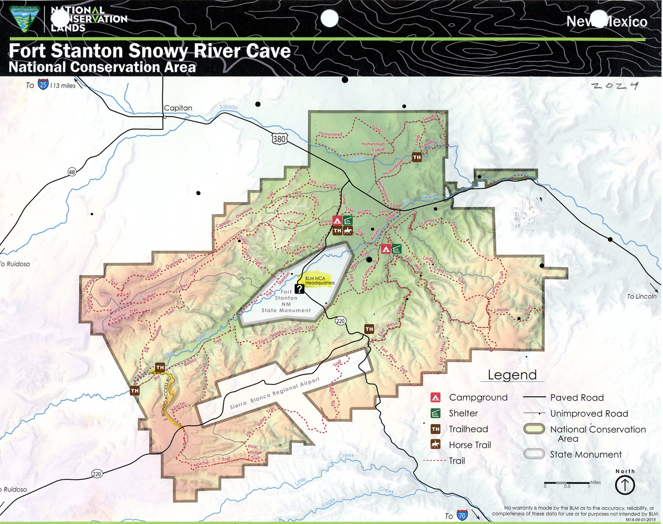
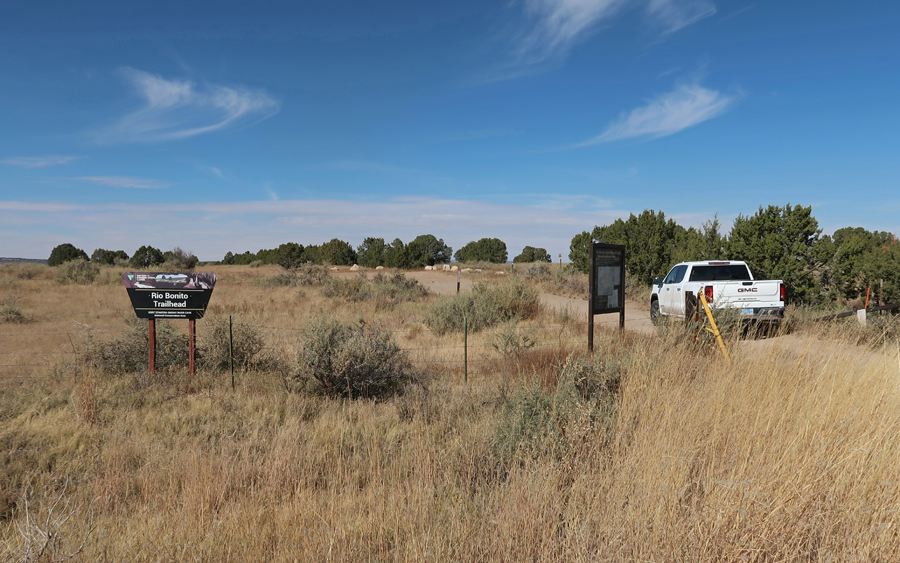
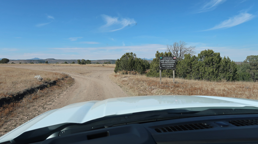
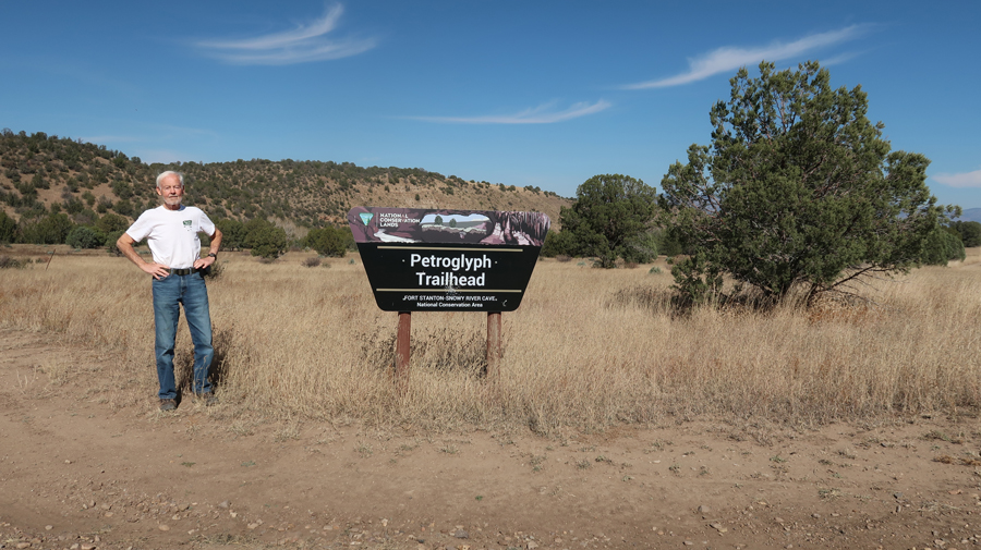
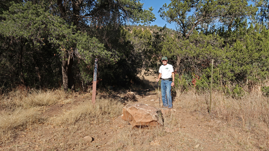
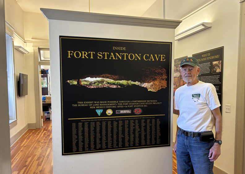
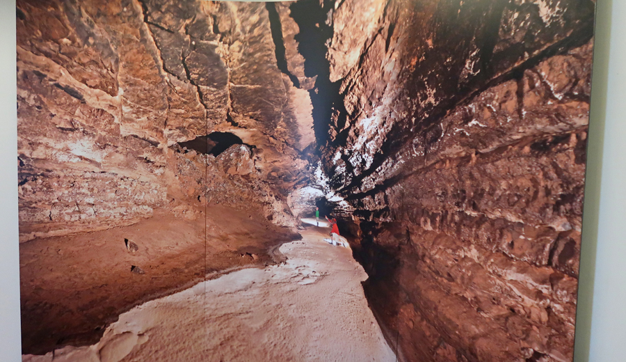
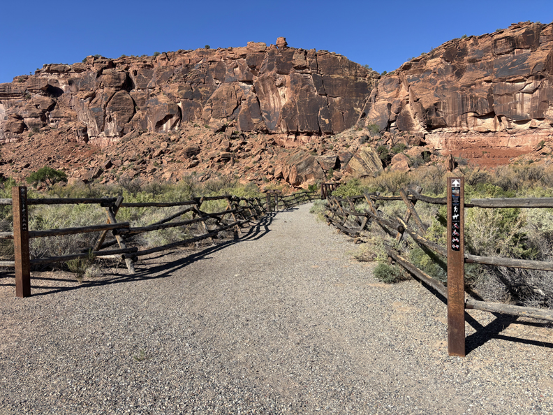
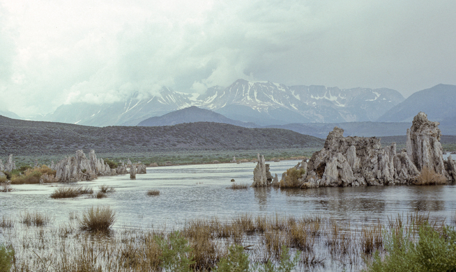
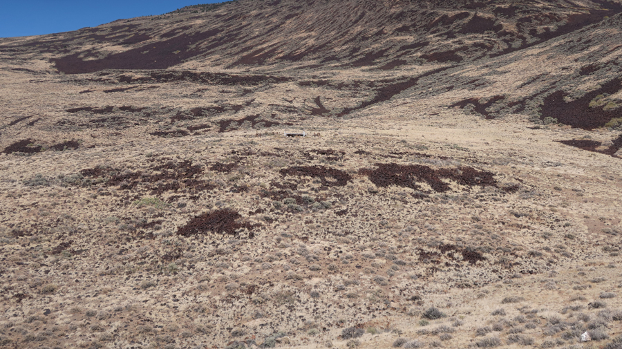
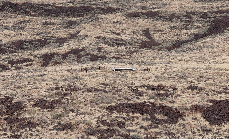
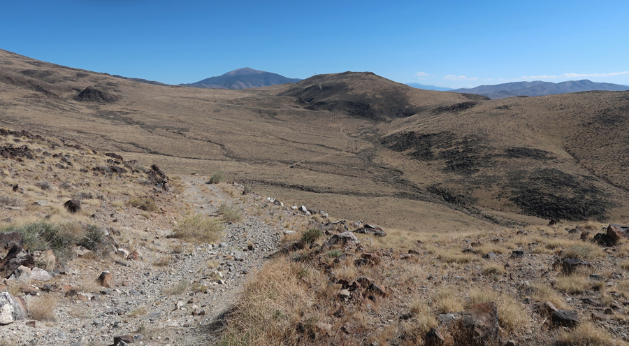
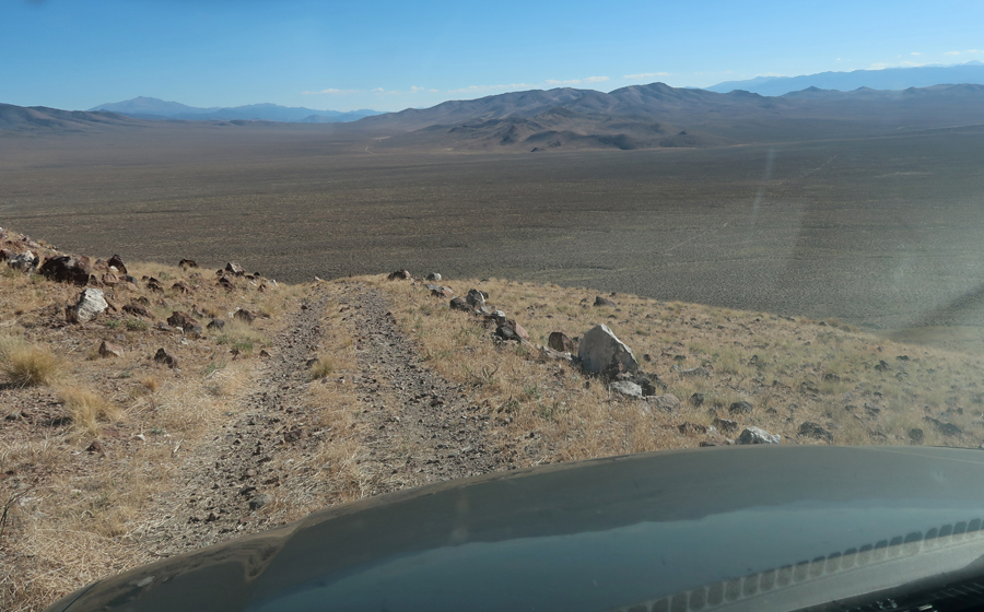
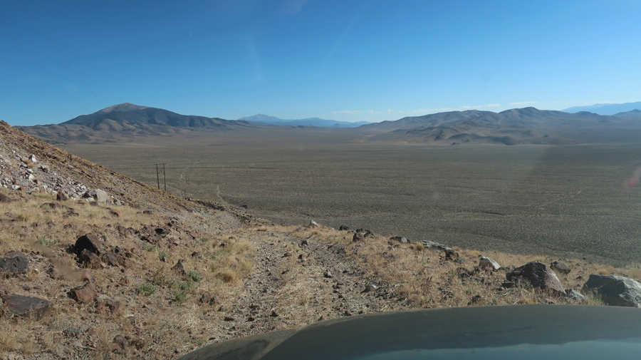
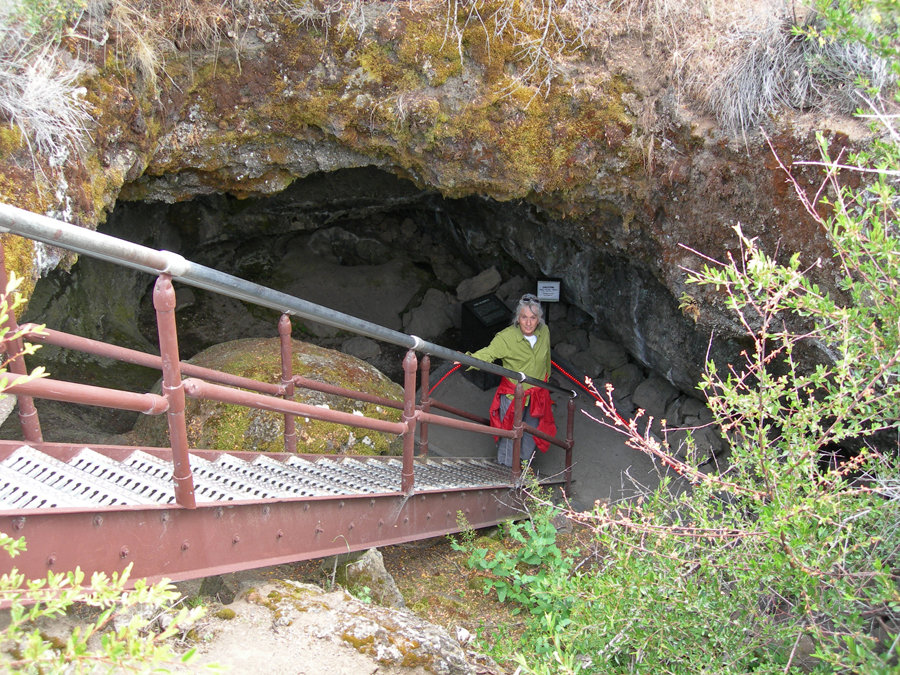
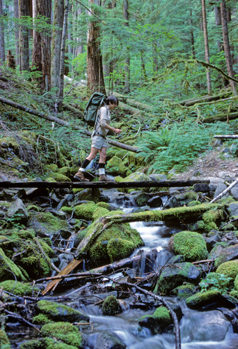
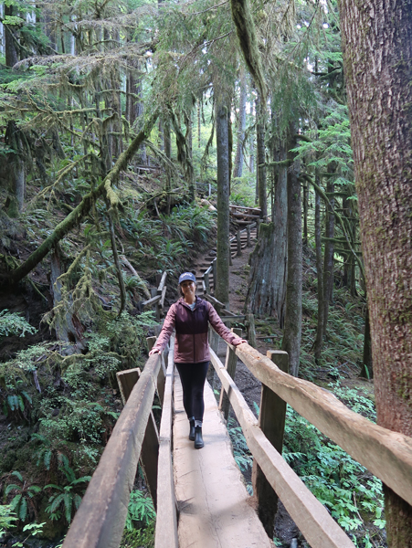
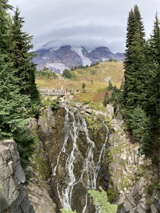
1.25hr (64mi) to Rio Bonito Petroglyph National Recreation Trail in Fort Stanton – Snowy River Cave NCA BLM. Trailhead (TH) is located in the lower left of the map.
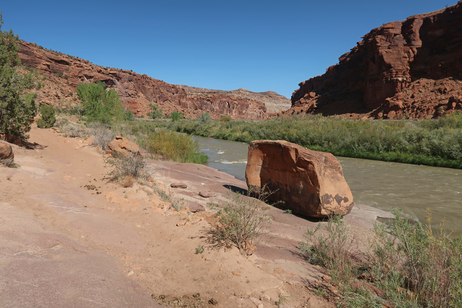
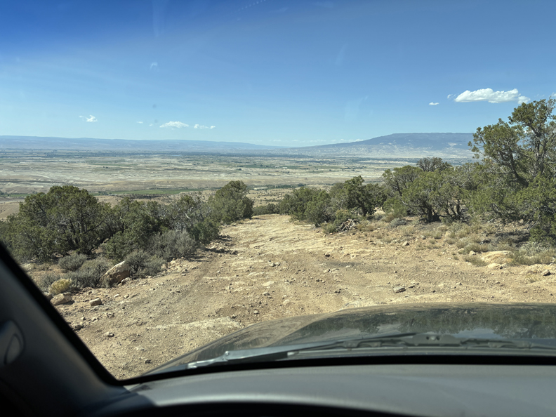
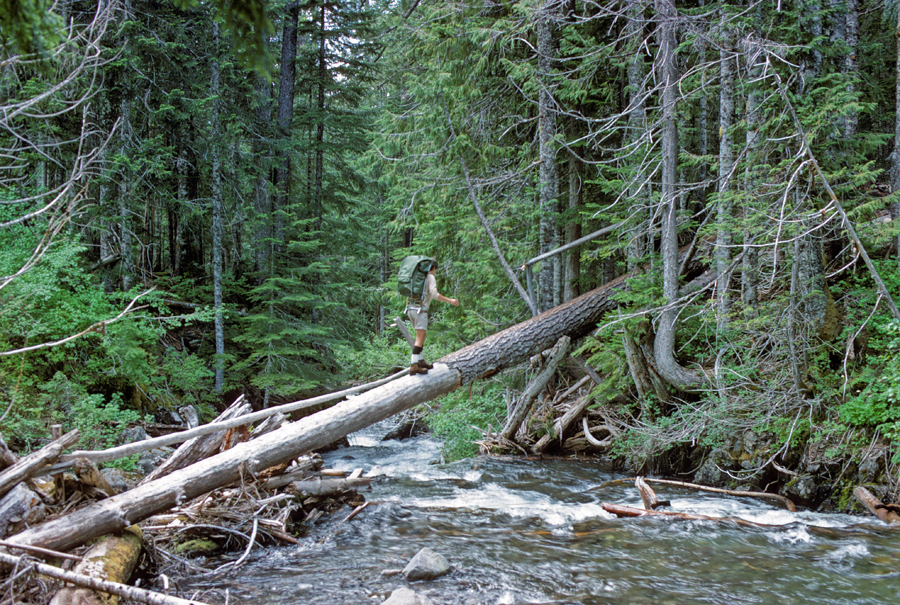
Turned N onto the Rio Bonito Access Rd for about a mile until switchbacks dropped you down to the river. You definitely need a high clearance 4WD vehicle on this track.
.
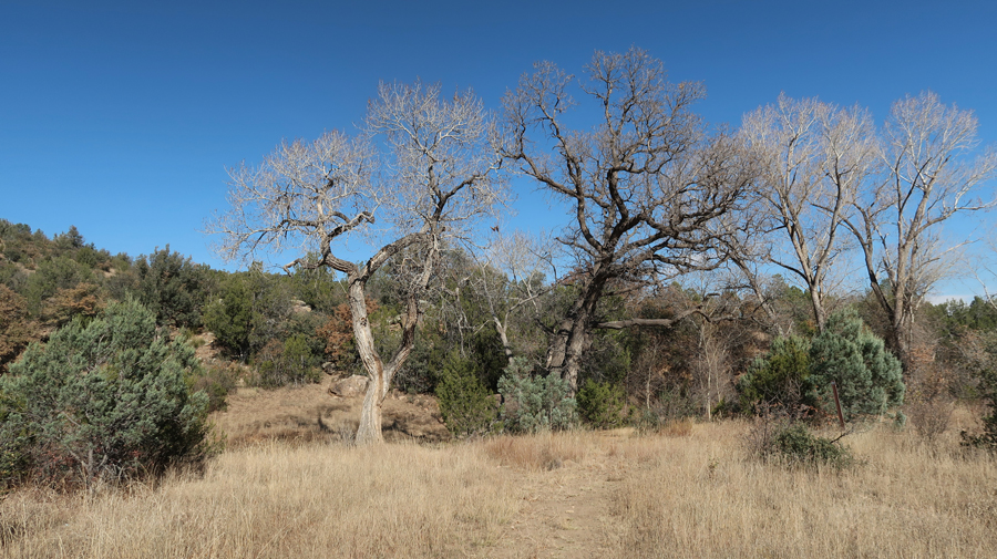
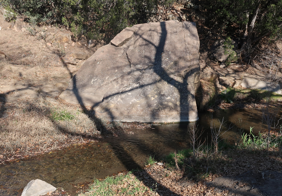
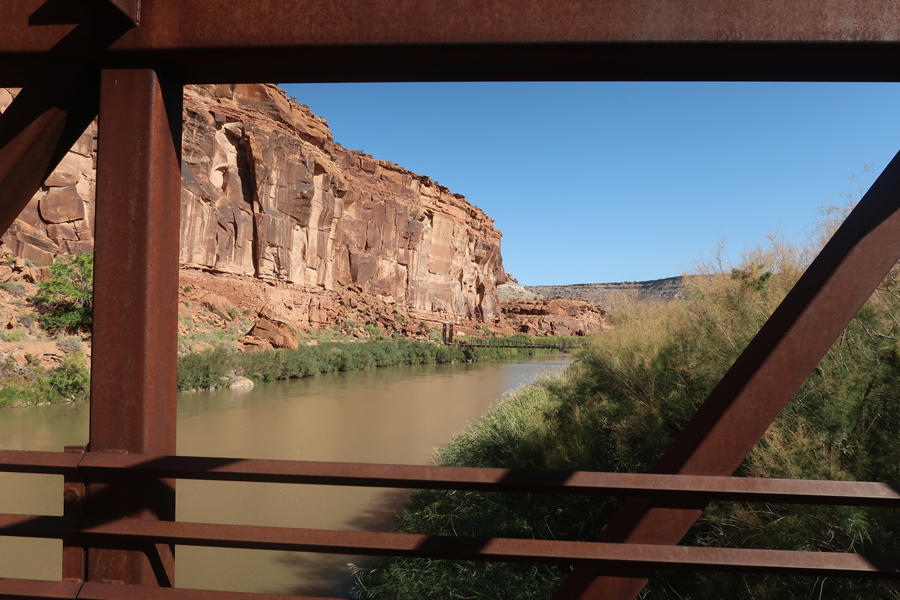
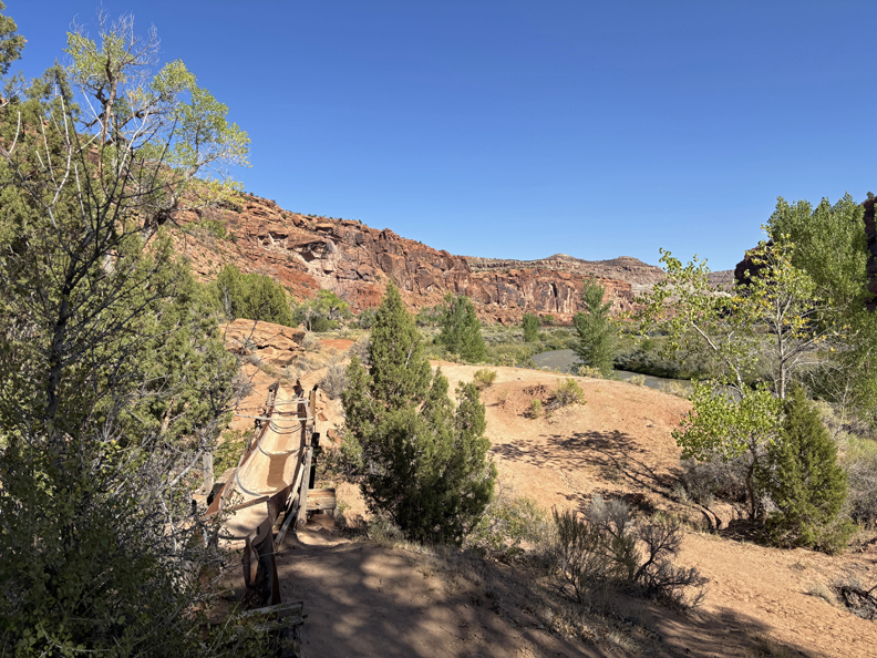
Description – “Trail is 2.5mi loop running up the river from the trailhead. There are cottonwood, walnut, and oak trees. . . The trail passes up and downhill over and along natural contours, including a primitive bridge, loose rocks, and some rocky segments that require rock scrambling.”
.
.
.
.
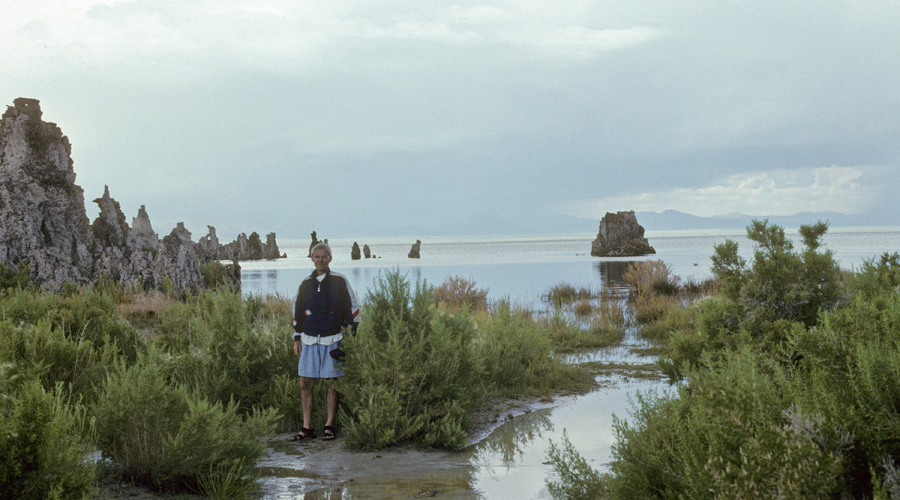
“At the midpoint is Petroglyph Rock in the riverbed (images of native Water God).” Later, a ranger at the fort told me someone had painted graffiti on the rock, and it was cleaned off but it made the “Water God” hard to see.
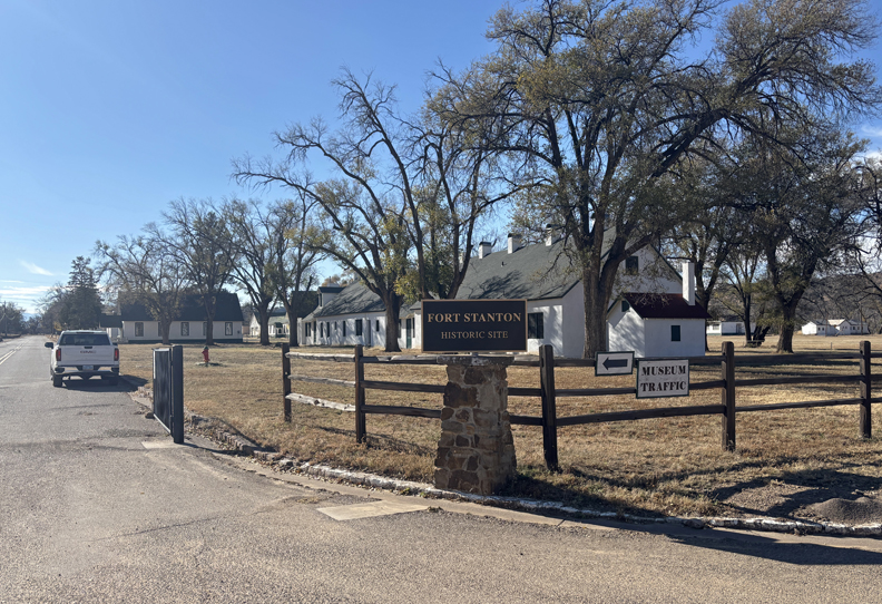
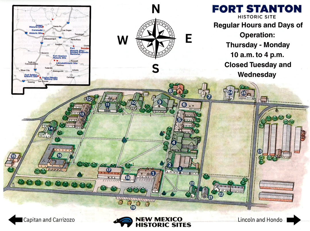
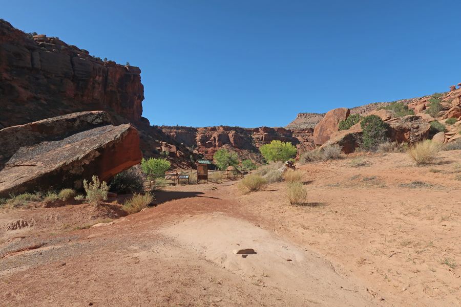
Once back to the road, it only took 15-min to get to Fort Stanton SP (240-acre site with 88 buildings).
.
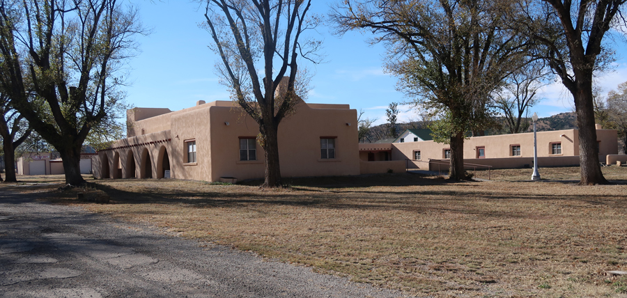
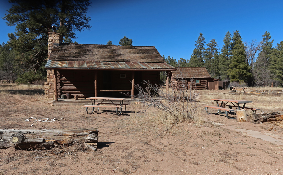
In 1855 Captain Henry Stanton was killed as he led soldiers in pursuit of a band of Mescalero Apache. In response, the Army built a fort, the same year, to protect settlers. They named it Fort Stanton. It is one of very few intact frontier forts in the West. This is the Visitor Center.
.
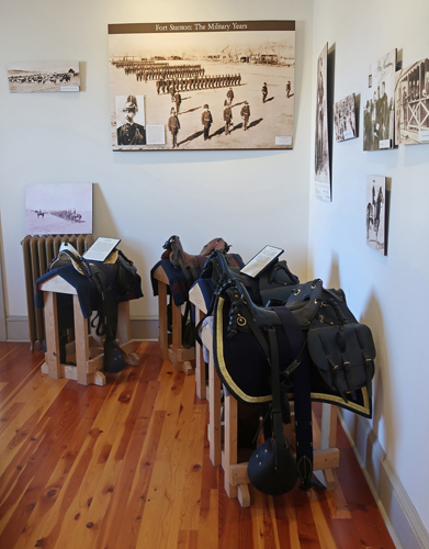
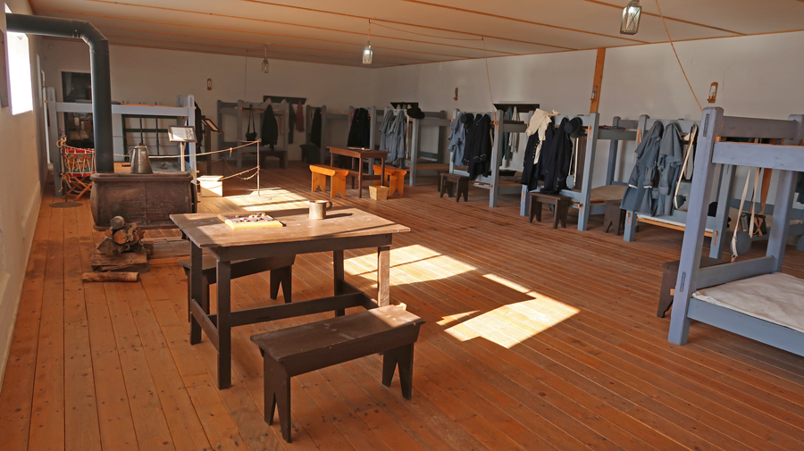
The fort had many missions between 1855 and 1953 when the State of New Mexico took ownership. The flagpole is in front of Barracks/Dining Hall.
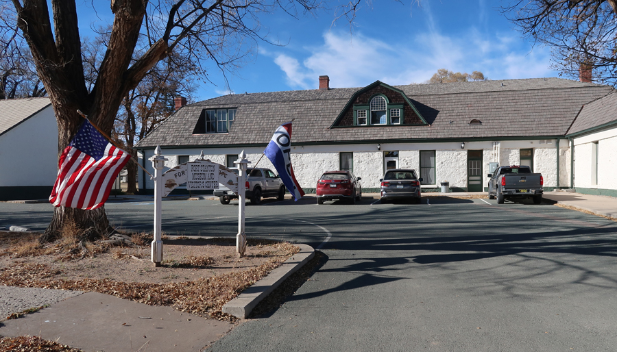
The fort hosted the 9th and 10th cavalry, the 24th and 25th infantry Buffalo Soldiers, Billy the Kid, Colonel Kit Carson, and General “Black Jack” Pershing. It was a prisoner of war camp during World War II.
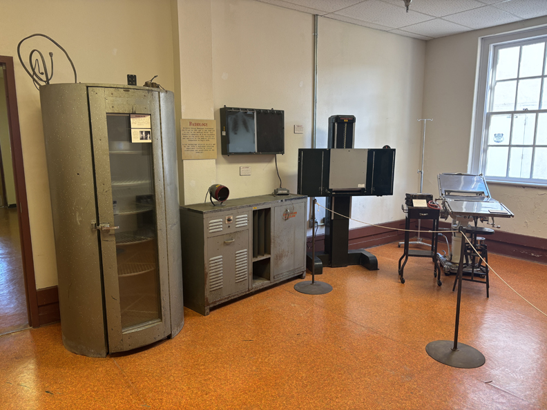
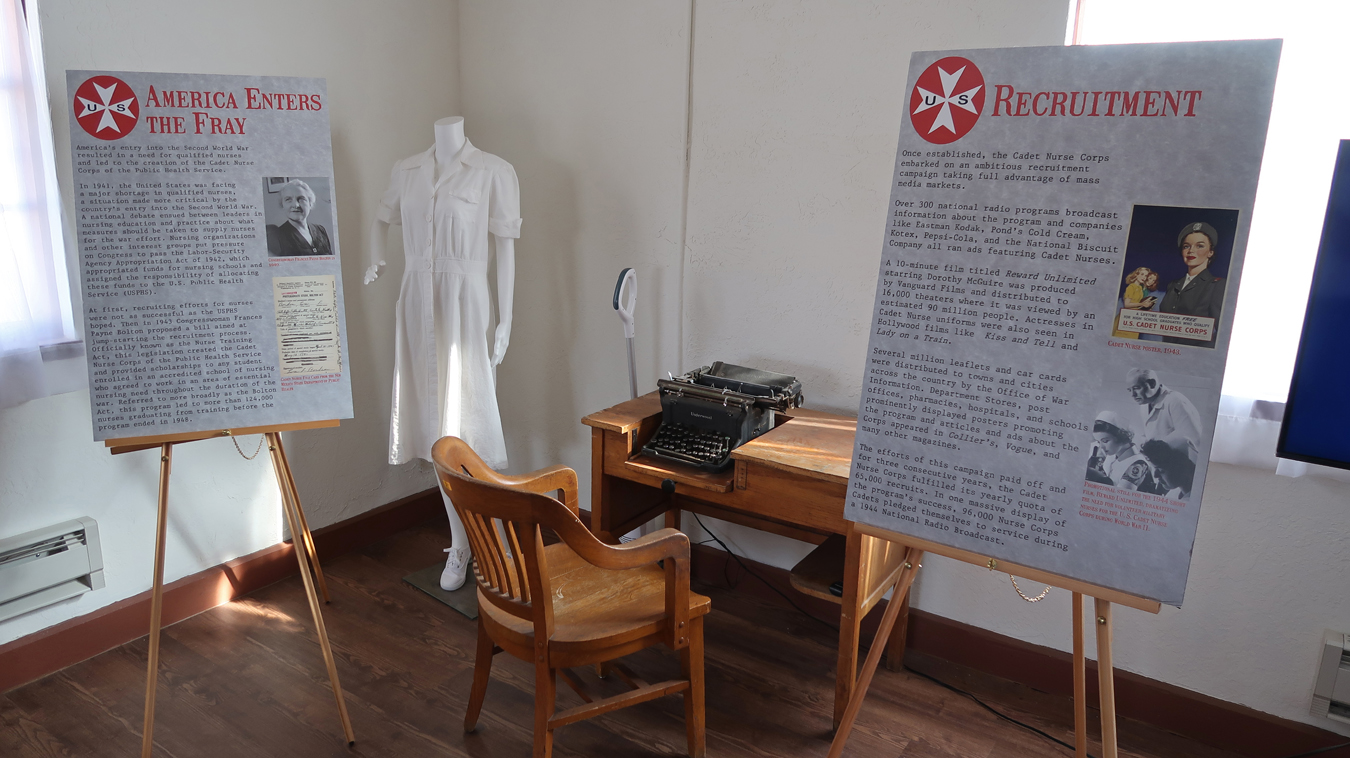
From 1899 to 1953, the fort served as a Tuberculosis Hospital for the U.S. Merchant Marine.
The Nurse Quarters was built in 1940-41
.
Unfortunately, Snowy River Cave is not open to the public.
In 2001, the 11.7-mile Snowy River Passage was discovered. The floor of the passage is covered with white crystalline deposits of calcite that glisten like snow. It is the longest Calcite formation in North America.
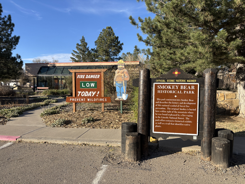
After leaving the NCA, I made a stop at the Smokey Bear Museum in Capitan NM. Read the sign for the story of “Smokey the Bear.”
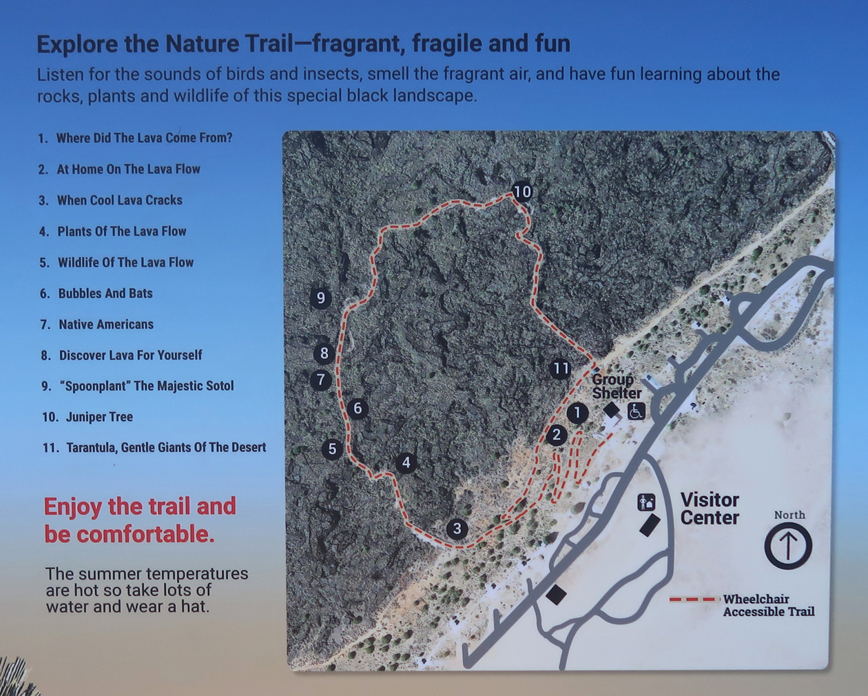
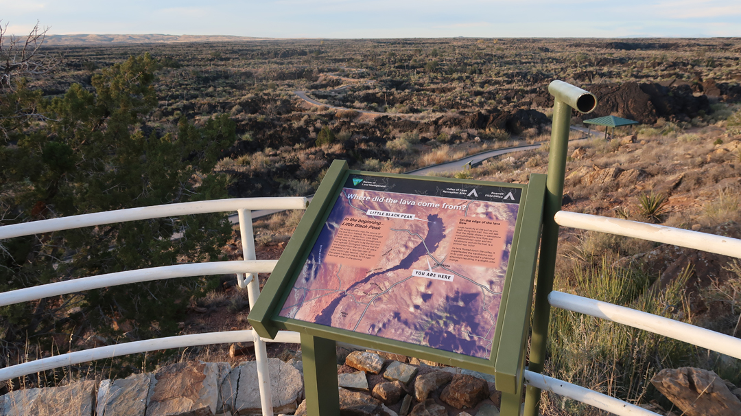
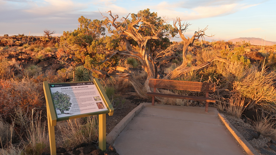
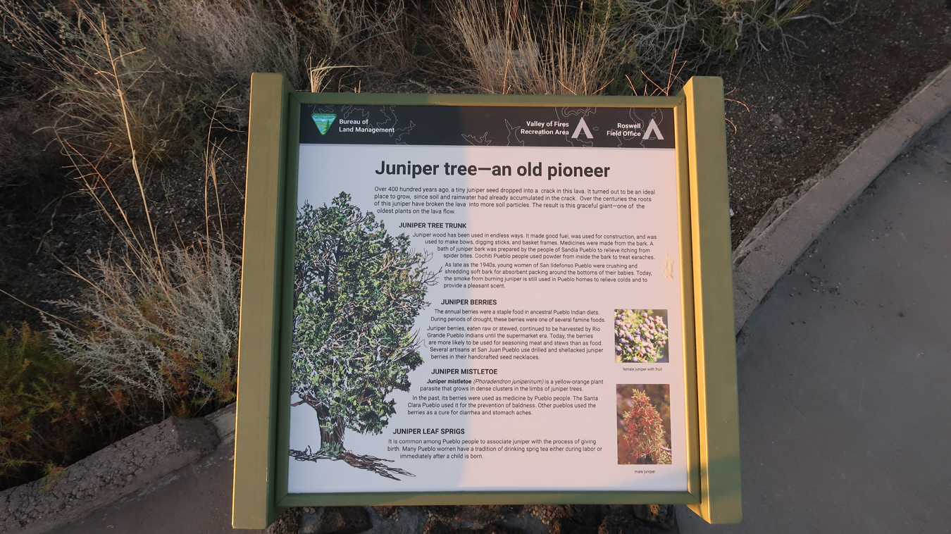
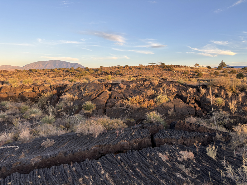
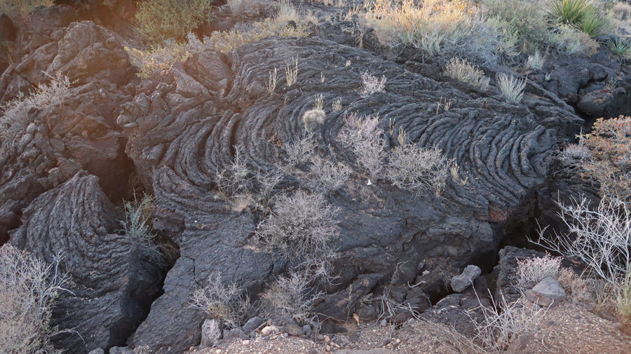
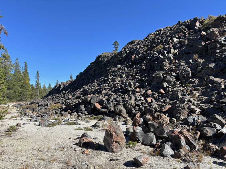
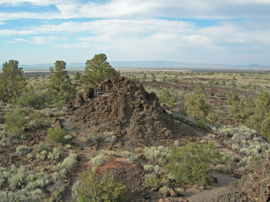
A half hour further west on US-380 is Valley of Fires National Recreation Area (NRA), administered by the BLM. It is just W of Carrizozo NM. See the bottom of this map –
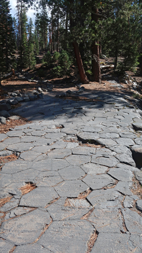
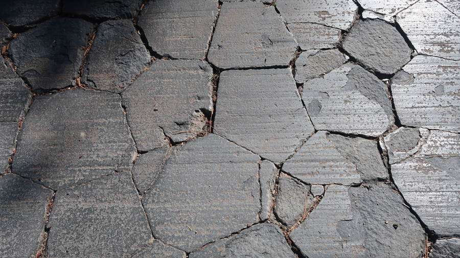
I did the 1-mile, self-guided, paved Malpais Loop Trail –
.
Little Black Peak can be seen through the viewing tube and is probably the last vent that opened adding lava to the lava flow.
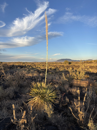
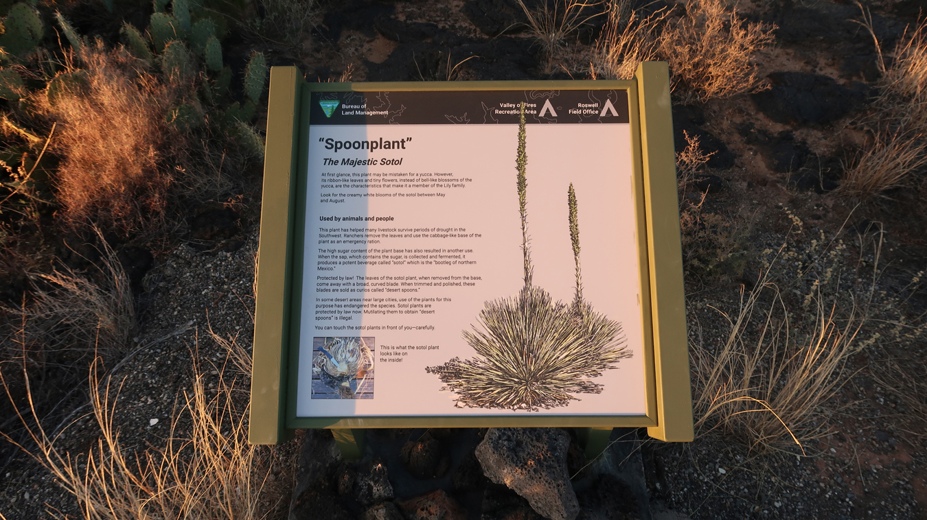
Spoonplant –
.
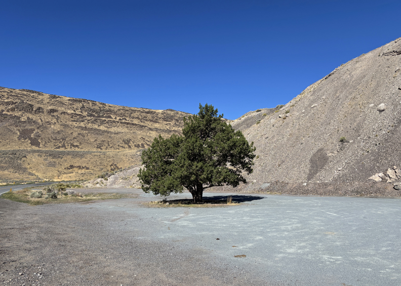
Juniper Tree
.
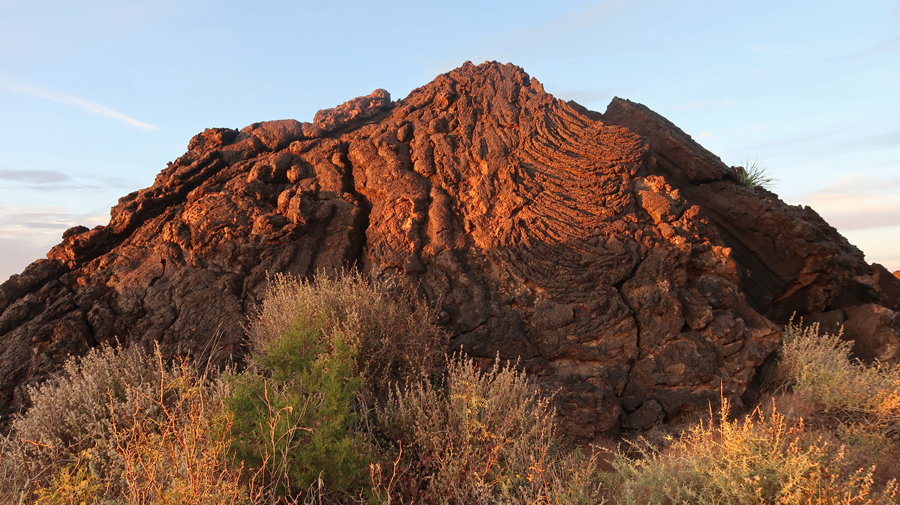
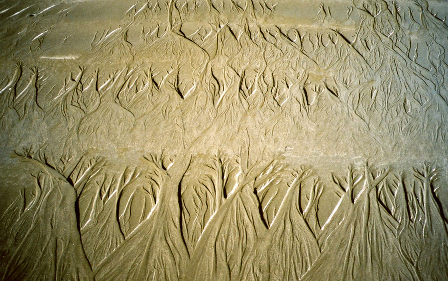
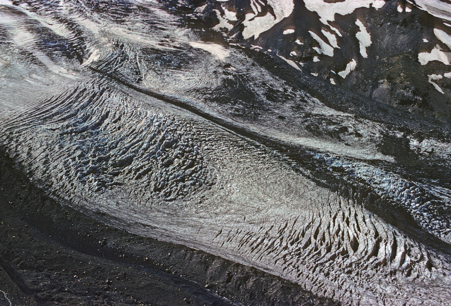
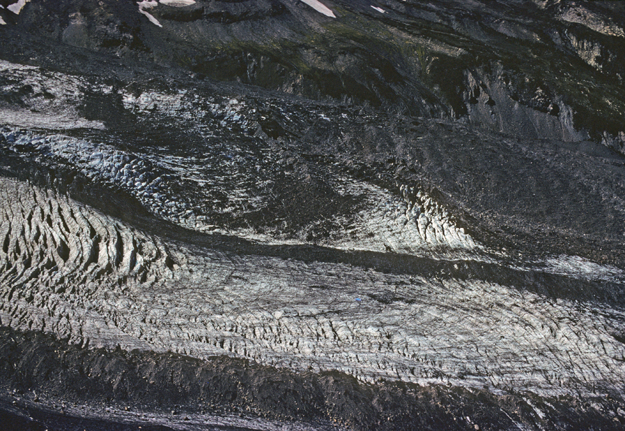
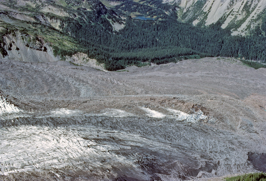
The Carrizozo Lava Flow, over the Tularosa Basin, is 44-miles long, 4 to 6-miles wide, and 160ft thick in the center. Lava folds –
.
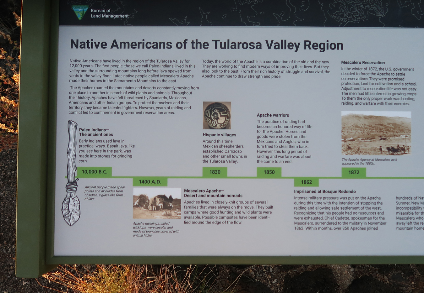
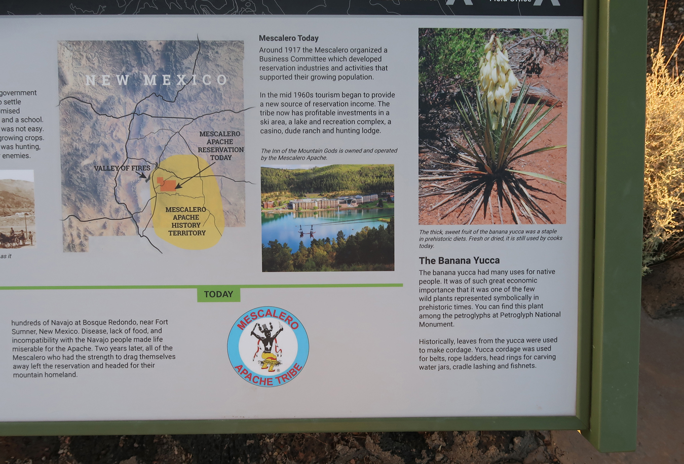
Tularosa Valley History –
.
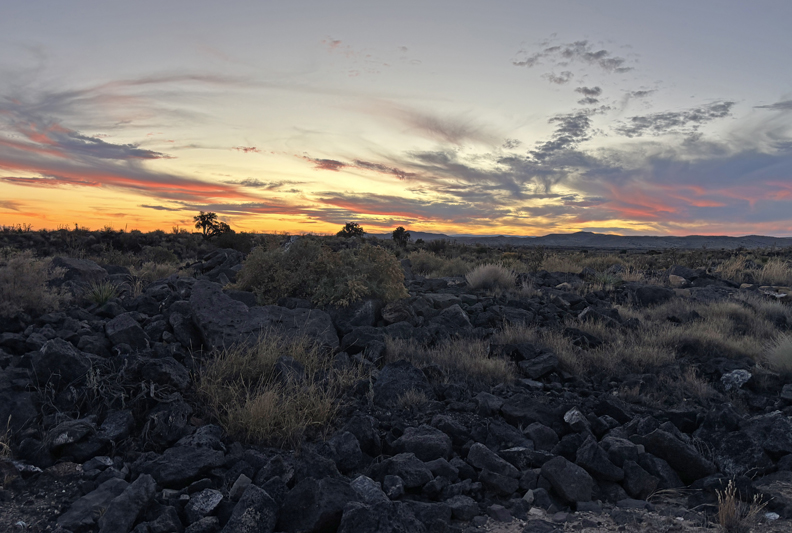
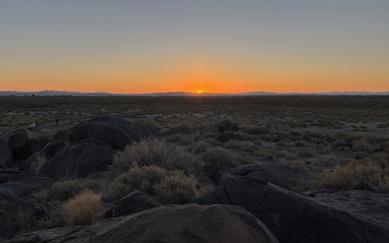
Finishing the trail, as the sun sets –
Sunset across the desert –
75-miles to the Best Western in Socorro NM
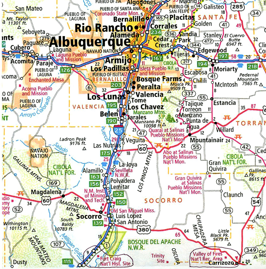
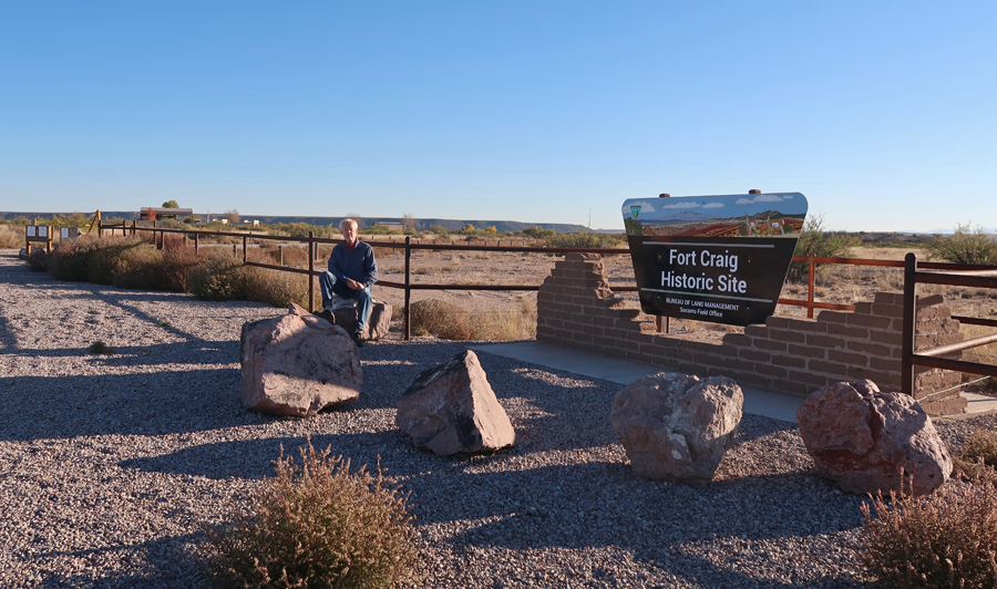
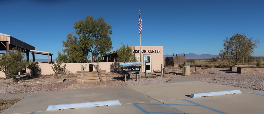
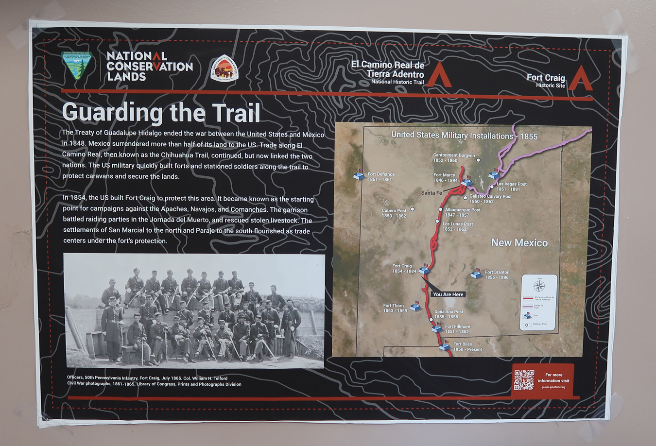
11/14 F – I decided to stop at Fort Craig NHS, which was on the way, but not on my itinerary. I had visited this NHS in April 2022 – see Blog. See bottom map –
.
.
.
This fort was built to protect settlers and guard the El Camino Real de Tierra Adentro Trail between Mexico City and Sante Fe. Note, Fort Stanton is also included on this map.
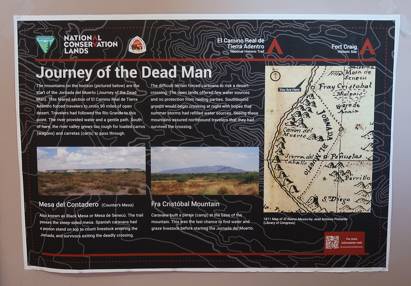
“Journey of the Dead Man” – a 90-mile desert segment of the El Camino Real de Tierra Adentro.
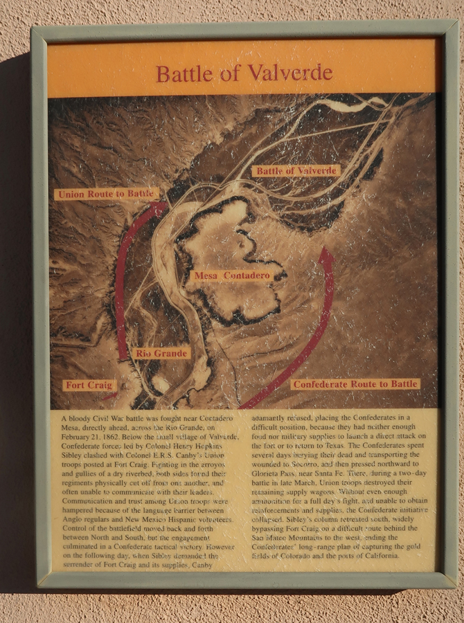
In 1862, a Confederate force won a battle here on their way to Glorieta Pass near Sante Fe where they were defeated and retreated south. The Confederate objective was to take the gold fields in CO and the ports in CA. If they had captured the U.S. mint in Denver, it could have changed the outcome of the Civil War.
.
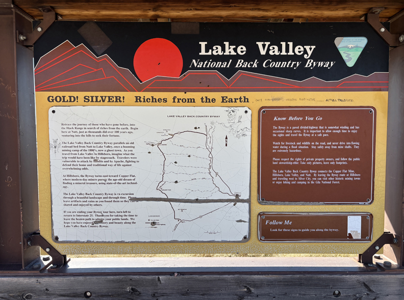
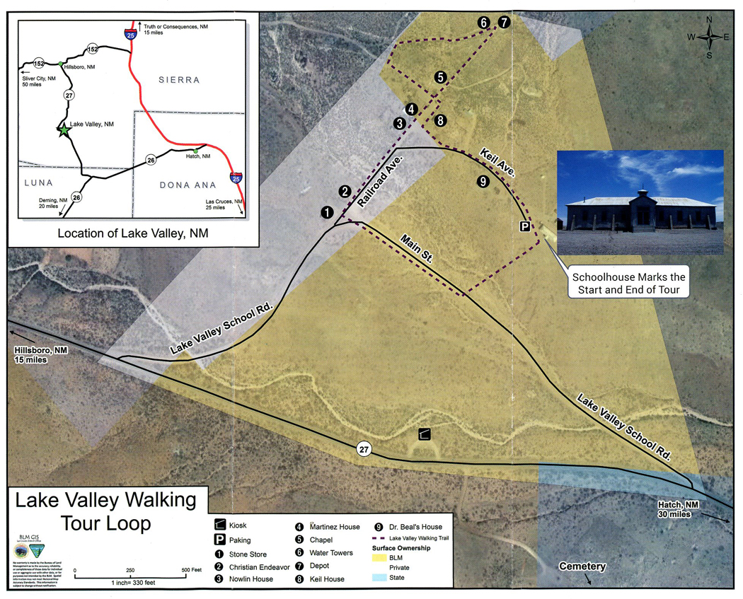
I continued S on I-25 to CR-152 W where I started on the Lake Valley National Back Country Byway to the Lake Valley Historic Townsite. See left middle of map –
.
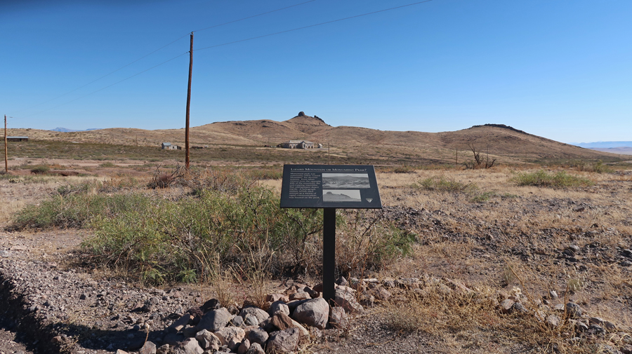
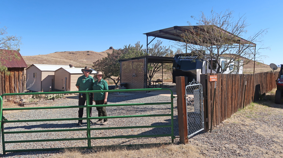
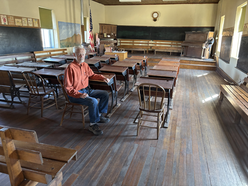
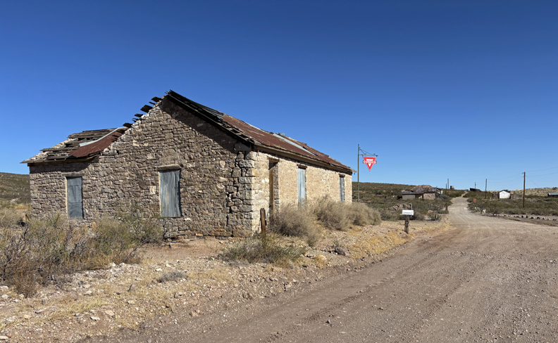
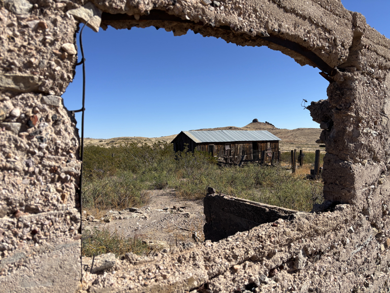
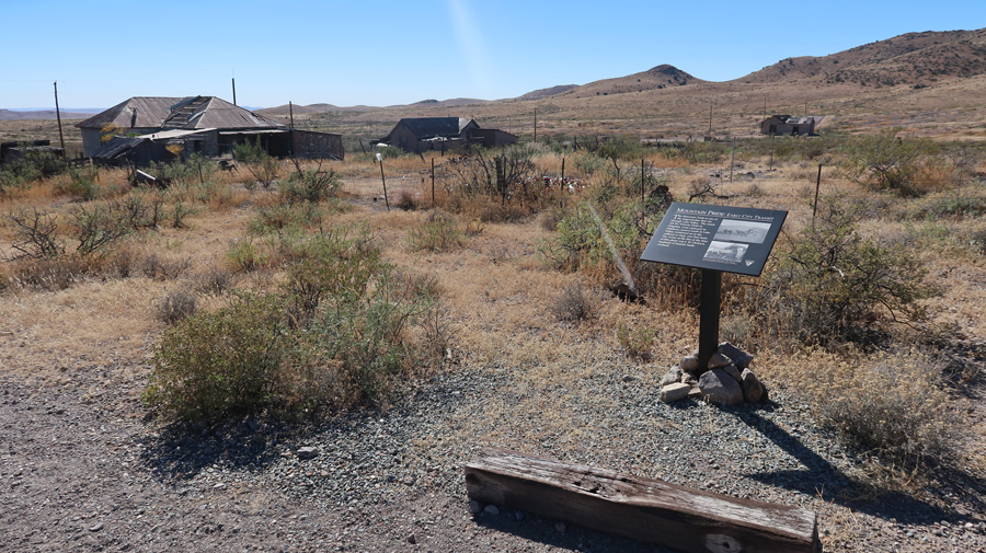
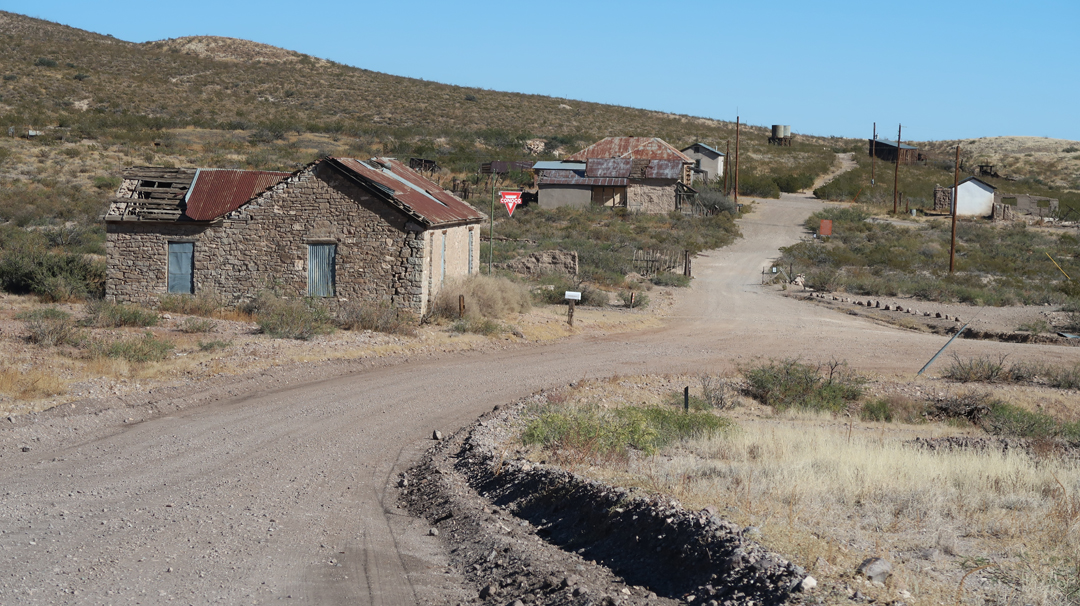
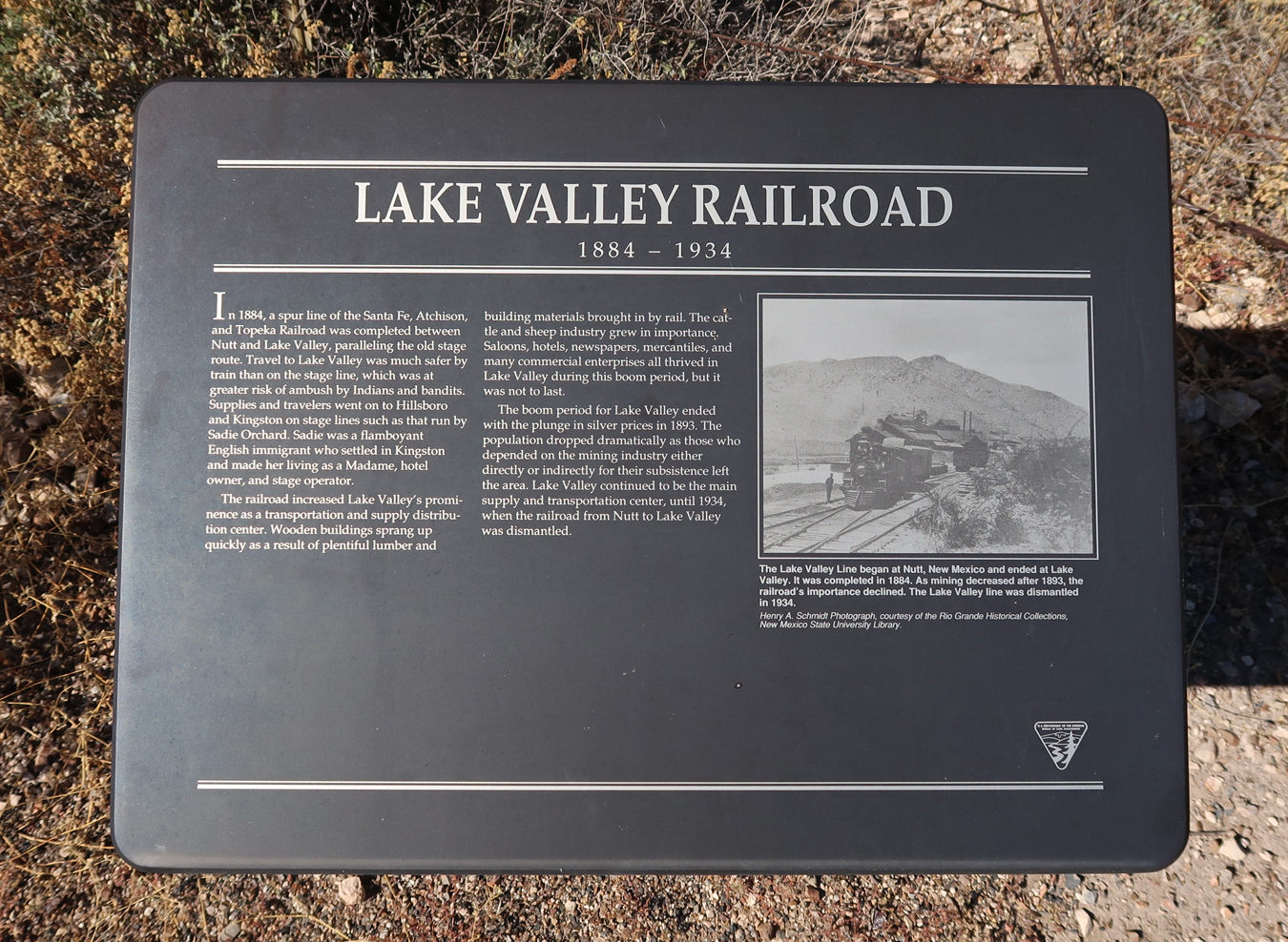
The mining town of Lake Valley was founded in 1878 after silver was discovered. It is now administered by the BLM. The restored schoolhouse provides a glimpse of what schooling in a rural area was like in the early 20th century. The Schoolhouse/Visitor Center is located in the middle of the photo, Lizard Mountain in background.
.
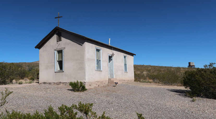
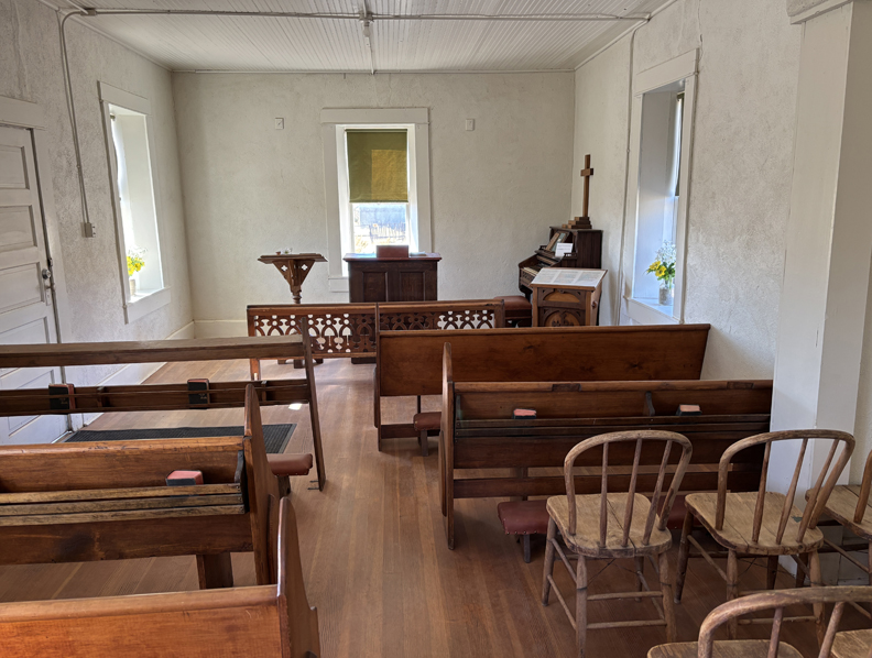
Almost overnight, the small frontier town blossomed into a major settlement with a population of 4,000 people. Today, silver mining has played out and all that remains is a ghost town. The BLM has restored the schoolhouse and chapel. Caretakers and a view inside of the “Schoolhouse” –
.
The Chapel –
.
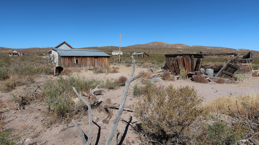
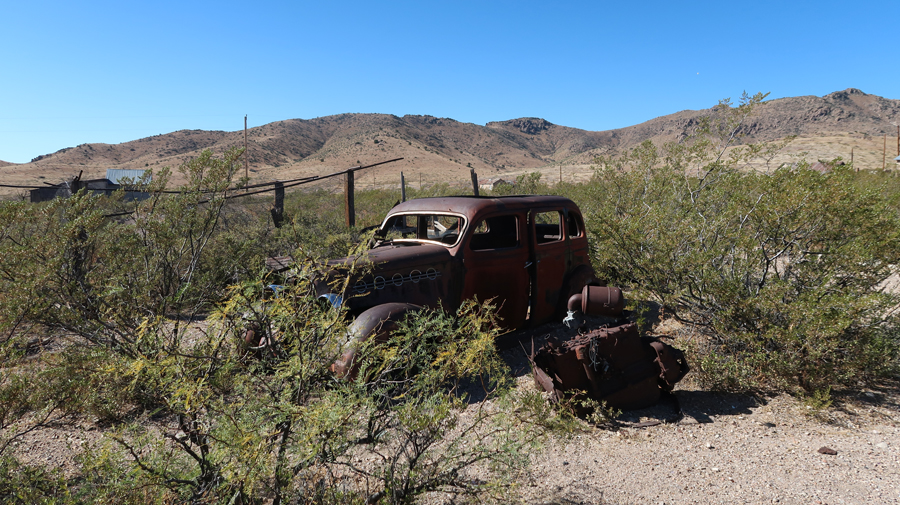
Other buildings in the townsite have been stabilized to slow further deterioration.
.
There is a 1-mile self-guided interpretive walking tour.
.
.
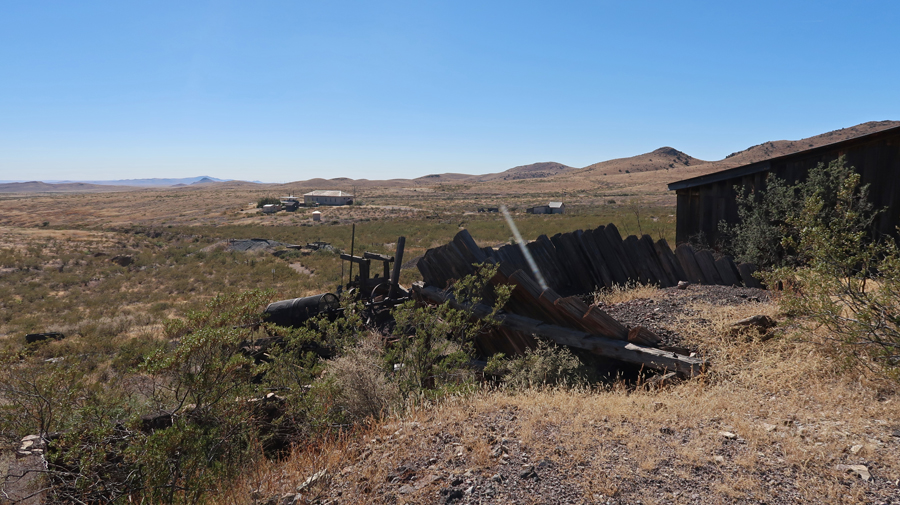
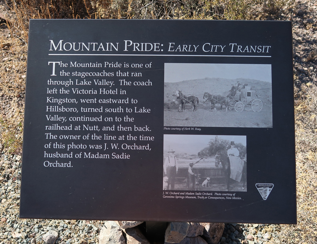
Lake Valley was on the Mountain Pride stagecoach route.
.
In 1884, a spur branch of the Santa Fe, Atchison, and Topeka RR was built to remove silver ore. See water tower for steam engines on the top of the hill.
.
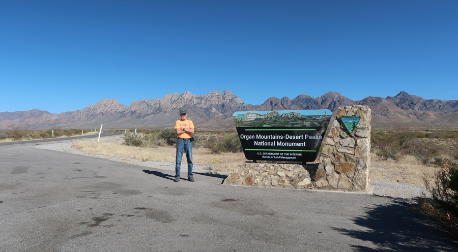
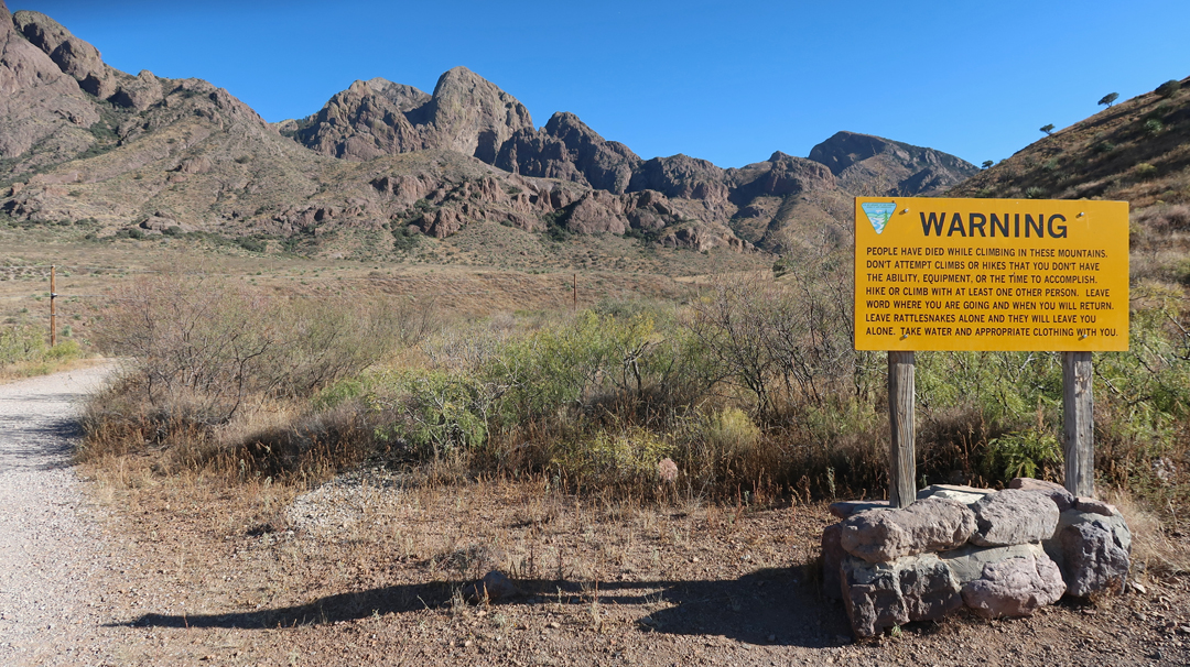
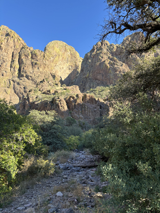
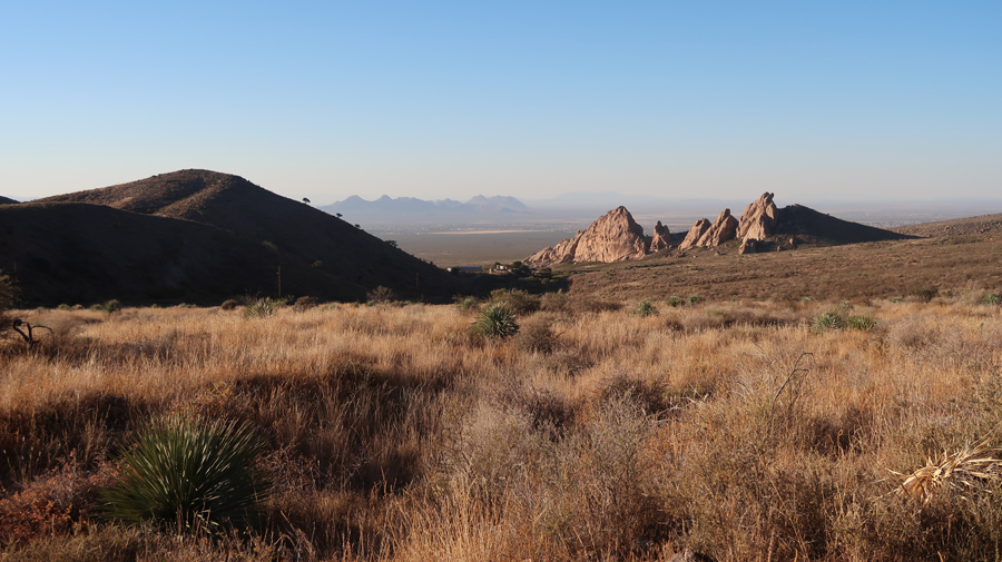
Next stop, Organ Mountains-Dessert Peaks NM (BLM) near Las Cruces NM. In 2018, Helen and I hiked West Trail up to Baylor Pass in the northern part of the NM. I then did the La Cueva Rocks Trail near the Visitor Center – see Blog for January 2018.
.
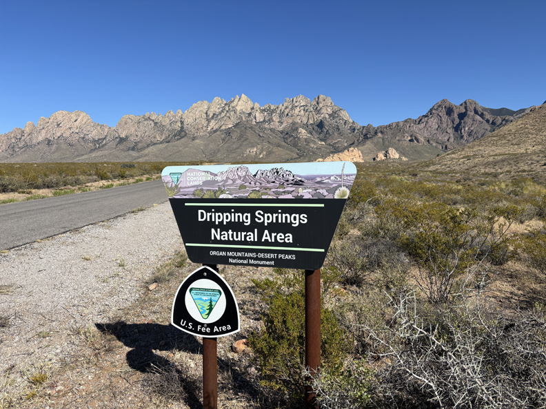
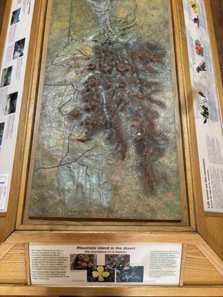
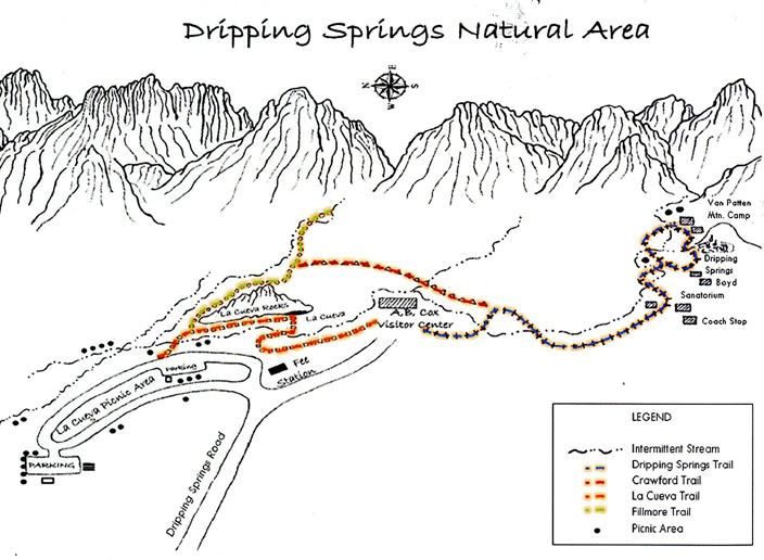
Today, my focus was on the Dripping Springs Natural Area (NA). There was a nice display in the A.B. Cox Visitor Center – “Mountain Island in the Desert”
.
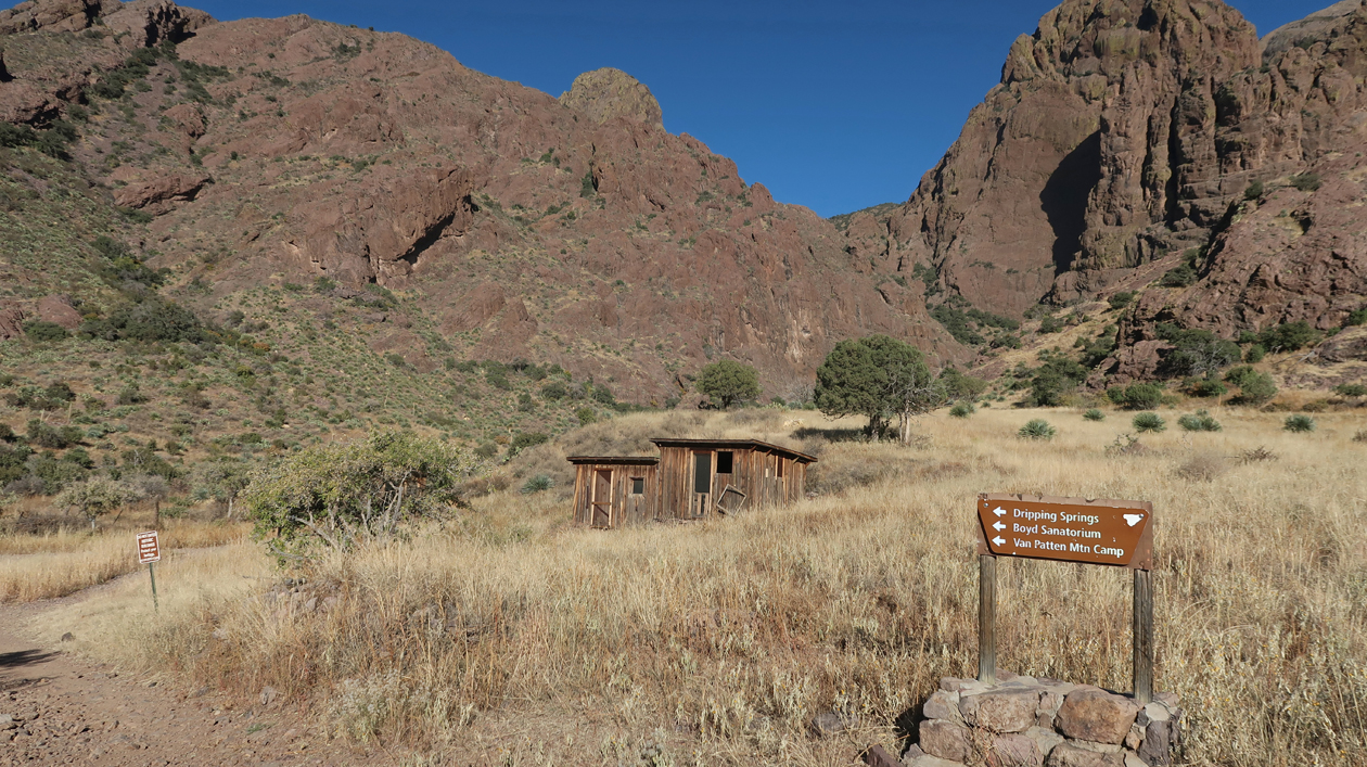
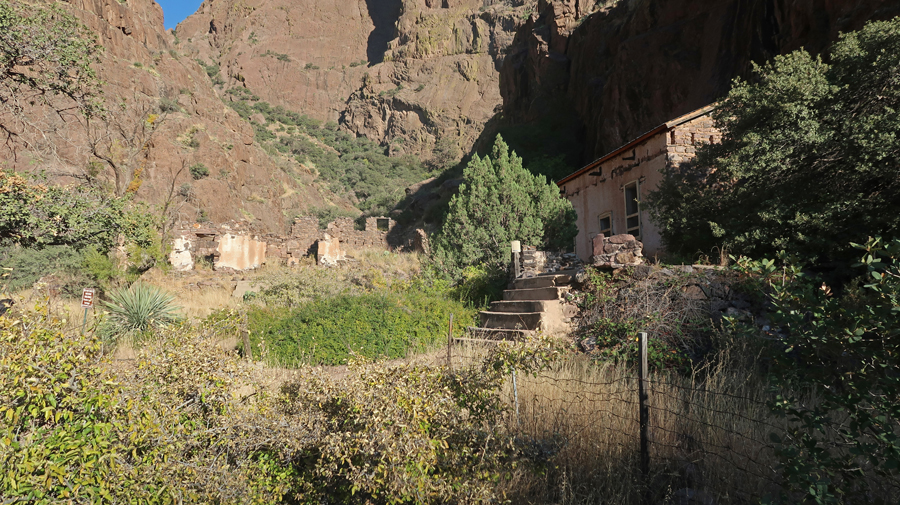
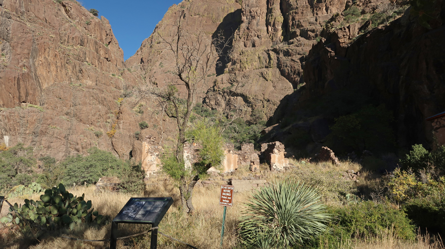
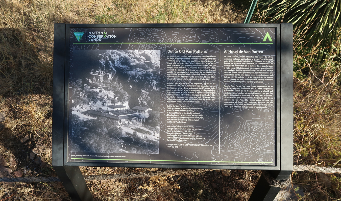
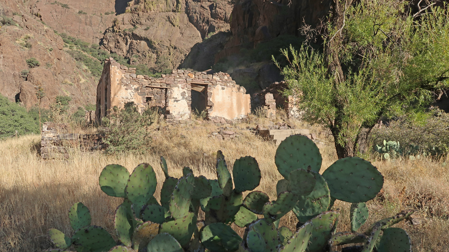
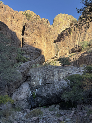
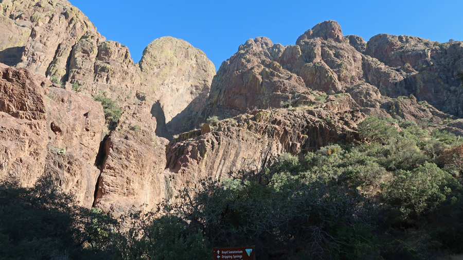
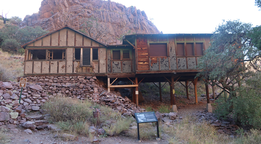
I did the 3-mile rt Dripping Springs Trail that ascends 600ft to the Van Patten Mountain Camp, Dripping Springs, and Boyd’s Sanatorium.
.
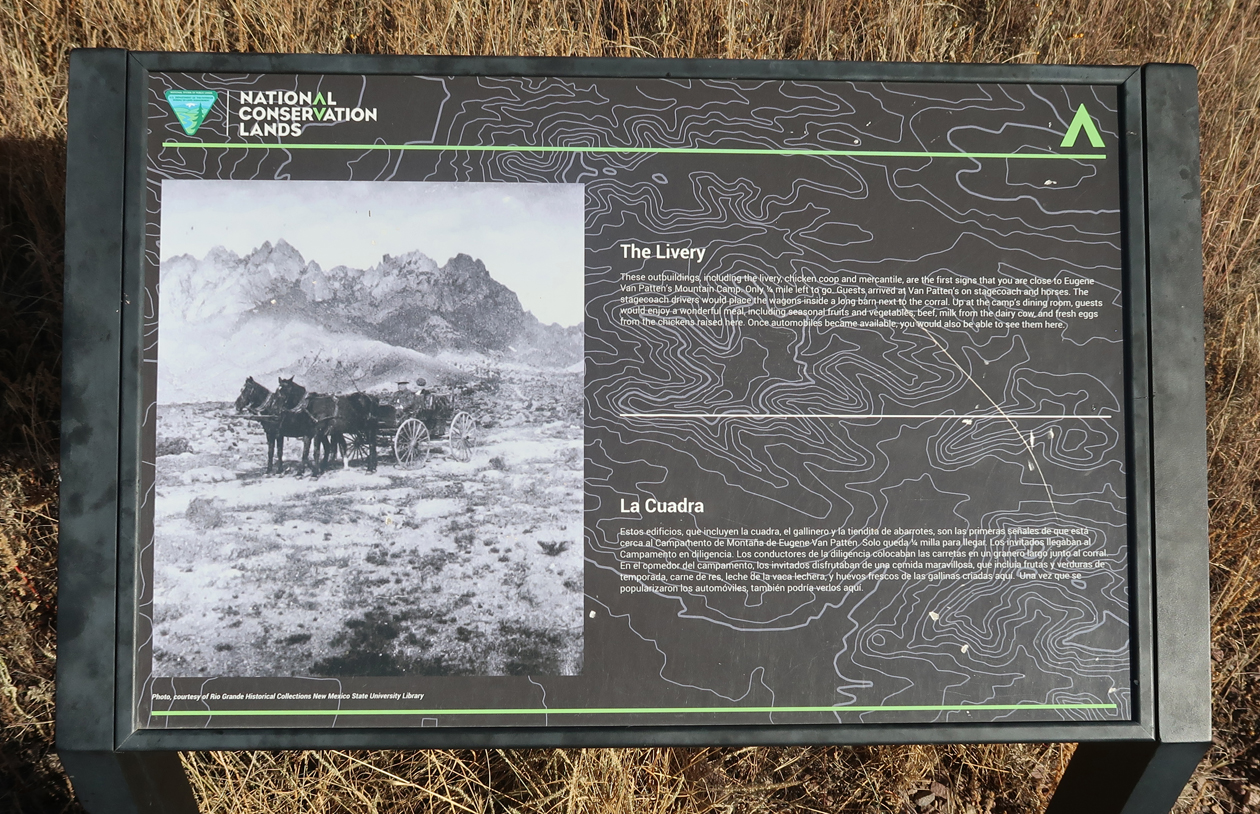
This was the Livery where guests would arrive, first by stagecoach and on horseback, and later in cars.
.
Remains of Van Patten Mountain Camp
.
.
.
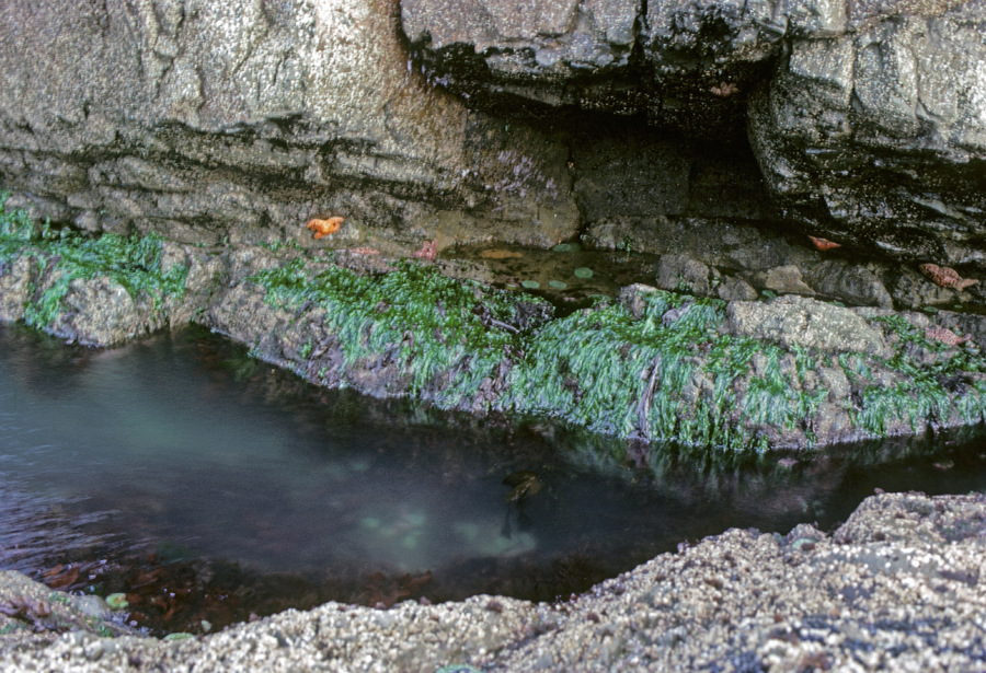
Looking up Dripping Springs Creek
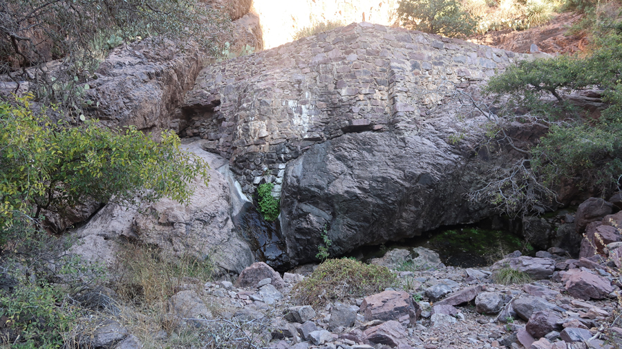
Stone Dam –
A slight trickle of water coming out from below the green vegetation near the center of this photo. It is dripping! I was hoping for a waterfall, which is what they show in the brochure.
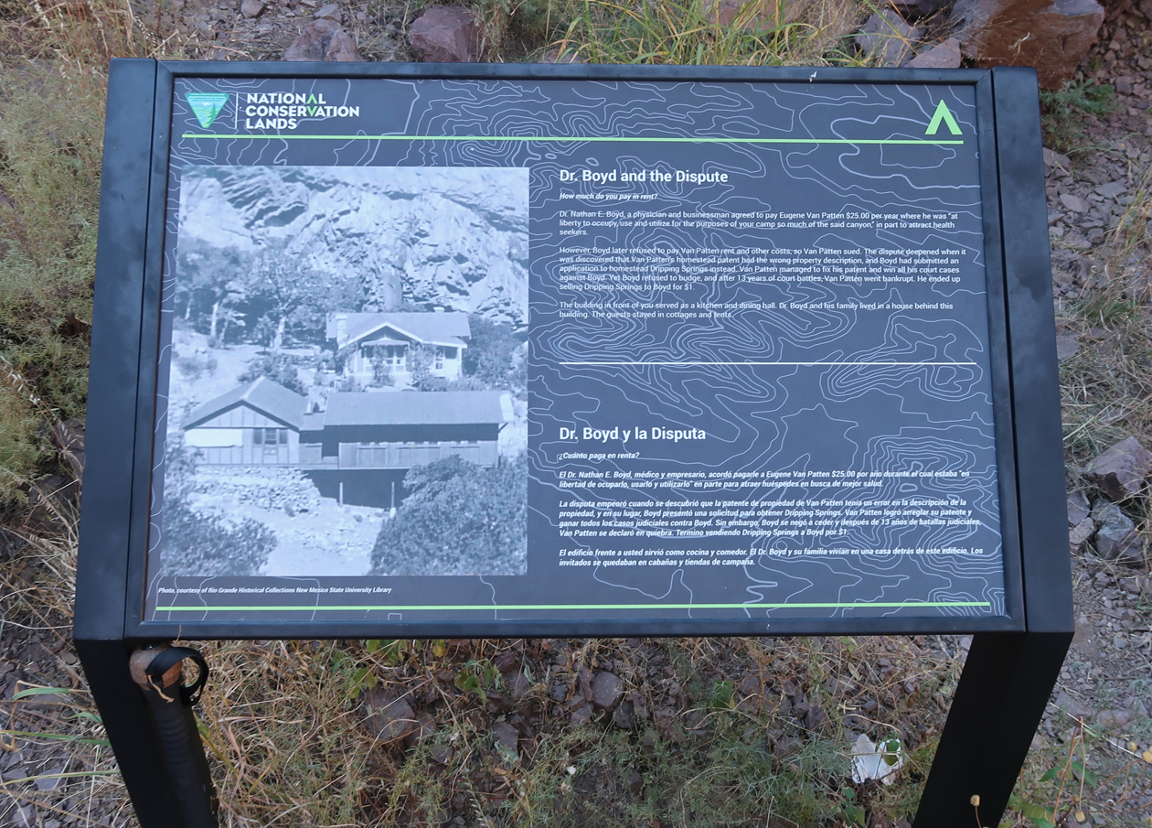
Boyd’s Sanatorium – note sign at bottom of photo
.
.
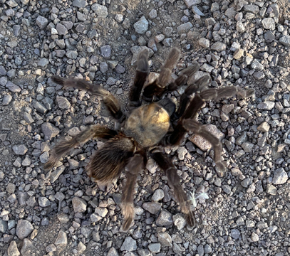
Tarantula on trail –
Descending near the end of the trail –
Back to El Paso for the night and then flight home the next morning.
9/15/2025 M – Start of 7,388-mile trip to Portland OR and West Coast. Drove 500 miles to Kingdom City MO, parked behind a motel to sleep.
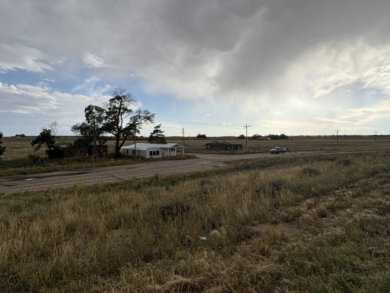
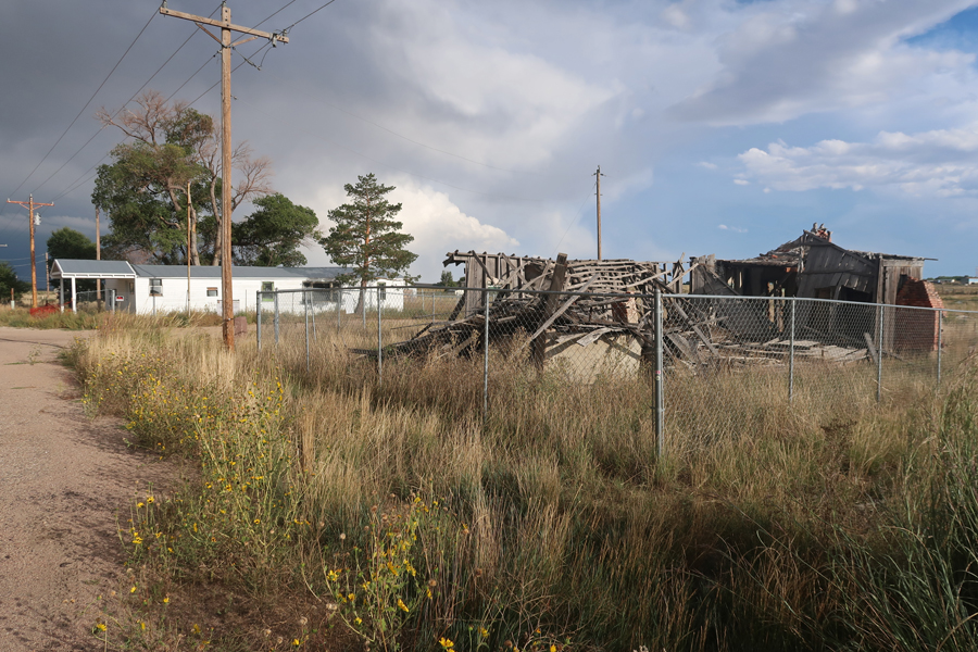
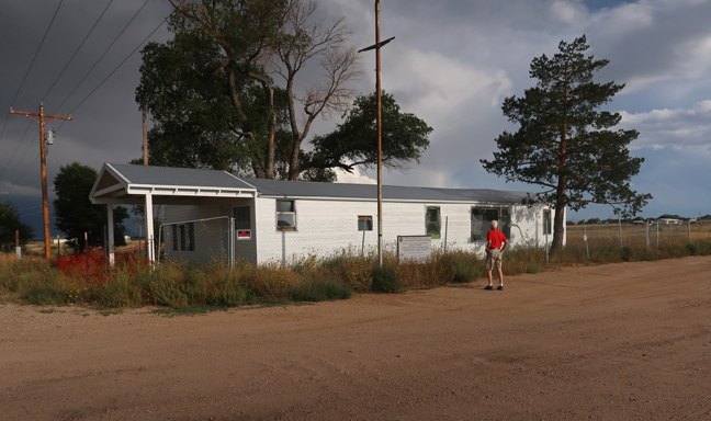
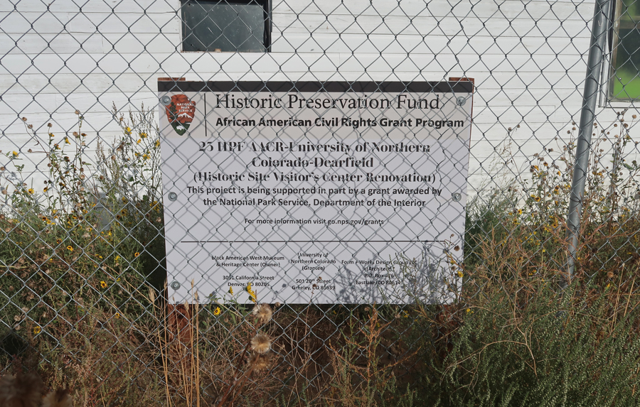
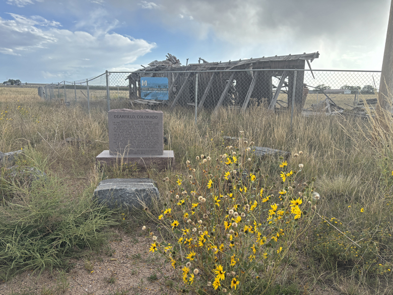
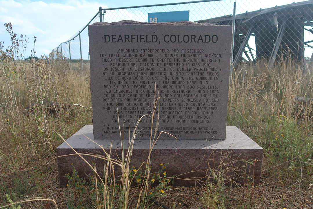
9/16 Tu – Drove 12 hours (750mi) to Dearfield Black Community, a proposed NHS, east of Greely CO. Photos around 7pm, with a storm on the way.
Dearfield was an African-American Agricultural Colony started by Oliver Toussaint Jackson in 1909. By 1920, Dearfield had over 200 residents. There are three remaining buildings: a gas station diner and what is left of Jackson’s home. After the “Dust Bowl” (1940), only 12 people remained.
NPS and CO state grants are being used to stabilize the site.
.
Monument was donated by the Anadarko Petroleum Corp and the Greely Monument Works in 2010.
.
The storm hit around 9pm, just as I was starting my drive into the Rocky Mountains on I-70. It was now dark. The rain and wind became more intense; then it started to sleet and then snow as the temperature dropped to 34 degrees. The road was under major construction with many barrels and changes of lanes. Some semitrailer trucks were moving slowly up the mountain essentially blocking the right lane, while others were going the speed limit and throwing up spray that I could not see through. The conditions were horrible, totally unsafe, when I pulled off into the Grizzly Creek Rest Area for the night. This drive ranks in the top ten of the most difficult/dangerous drives I have done!
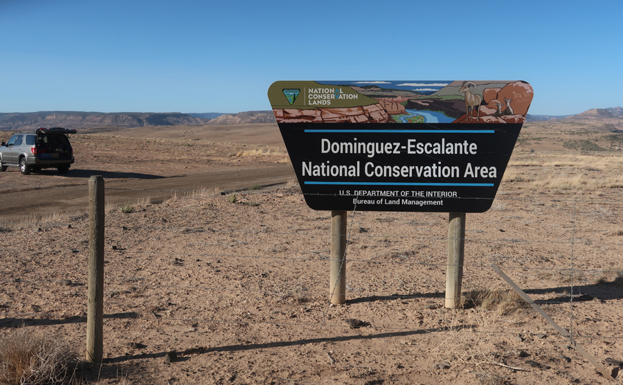
9/17 W – started driving early and was at the BLM Grand Junction Field Office at 8am when it opened. I was able to get better maps and travel guides for the two National Conservation Areas (NCAs) I visited on this day. The first was the Dominguez-Escalante NCA only 25 miles south of Grand Junction CO.
.
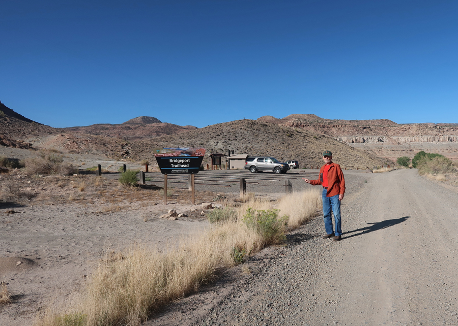
I started my hike into the Dominguez Canyon Wilderness (and NCA) at Bridgeport on the Gunnison River.
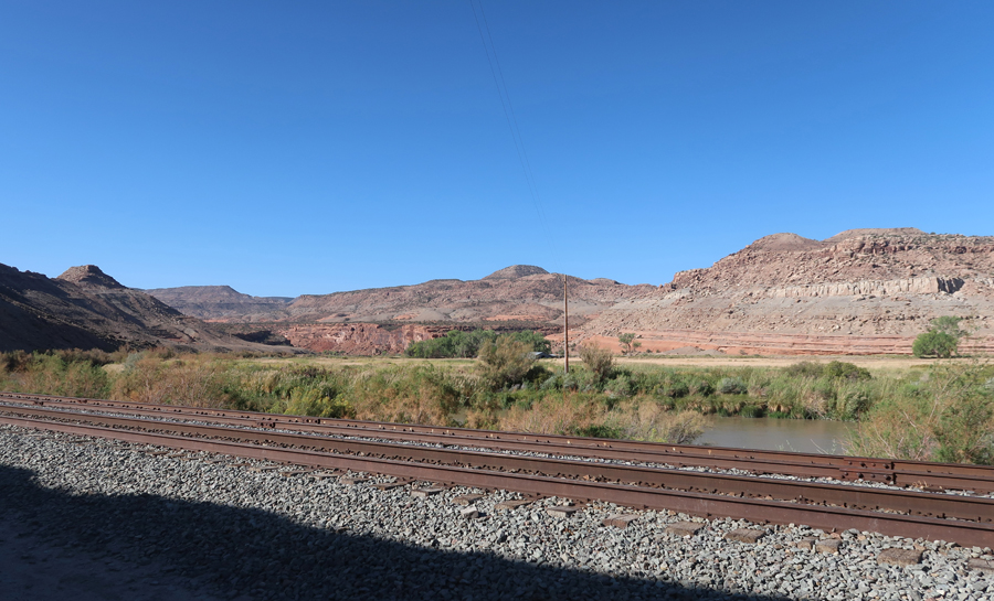
The first part of the trail followed the east side of railroad tracks to two bridges crossing the river.
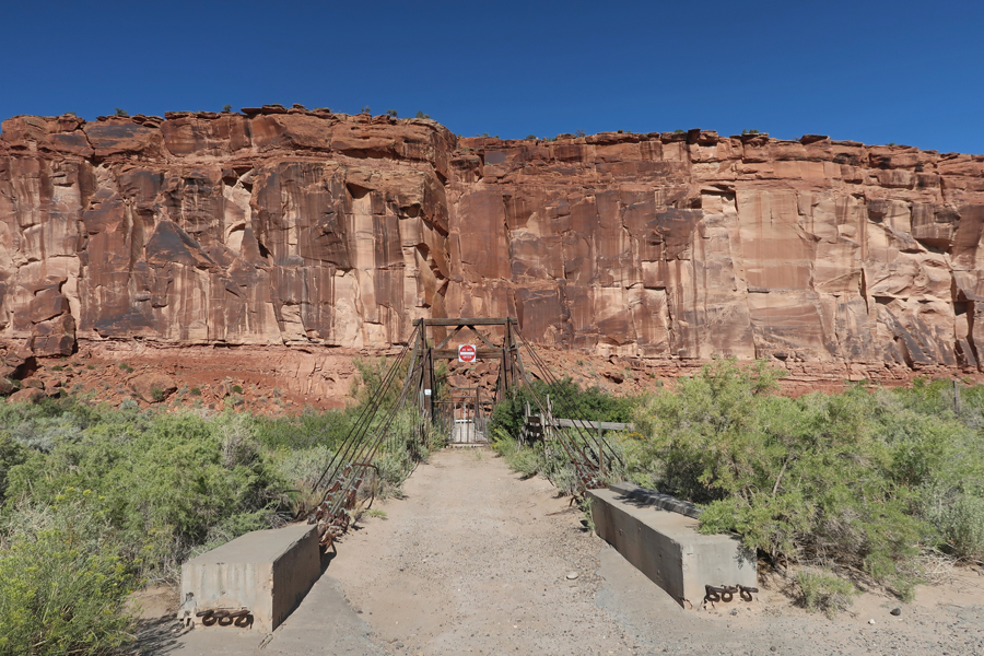
The first (old) bridge was closed. So, I crossed the Gunnison River on the second (new) one.
.
Looking back at the old bridge –
I passed an old mine – note the sluice trough.
And then came to the gate into the Dominguez Canyon Wilderness.
I hiked around Triangle Mesa toward Big Dominguez Creek.
.
However, after hiking about 3-miles, I had not got to the creek. So, I decided to return to Bridgeport.
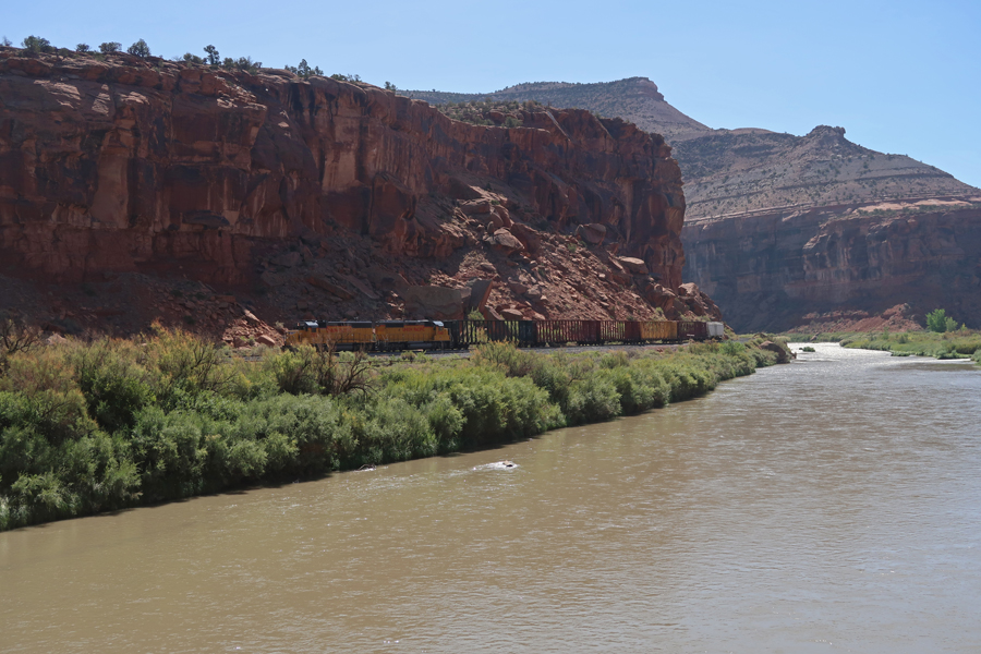
Union Pacific railroad train moving through canyon; the North Branch of the Old Spanish Trail passes through the eastern part of the NCA.
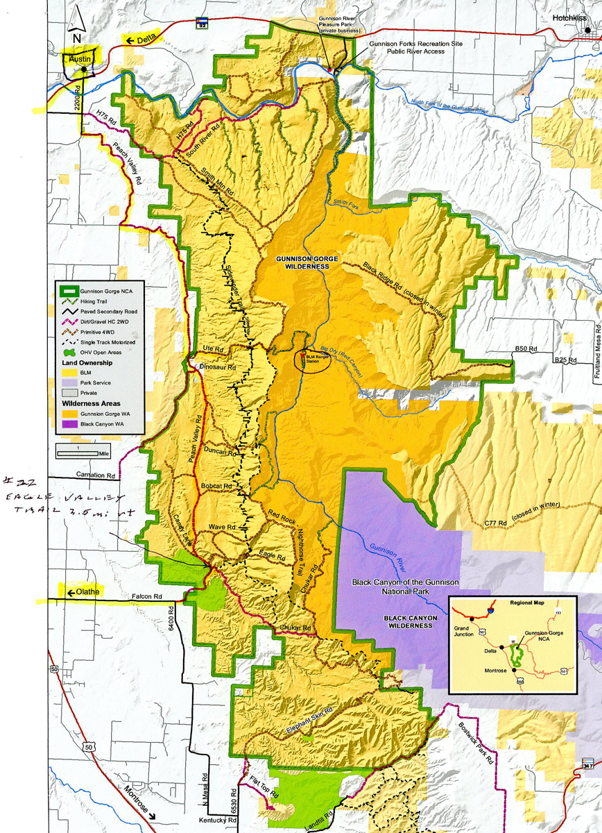
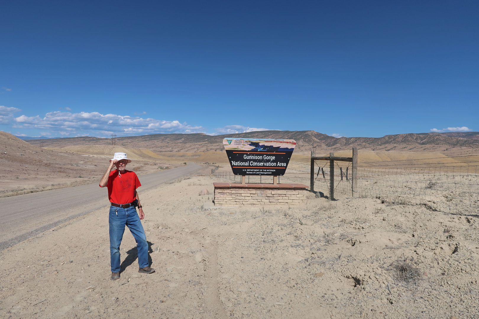
It took about an hour to drive SE to Delta CO and then on to Austin where I then drove S on Peach Valley Rd into Gunnison Gorge NCA and Wilderness.
.
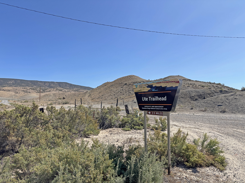
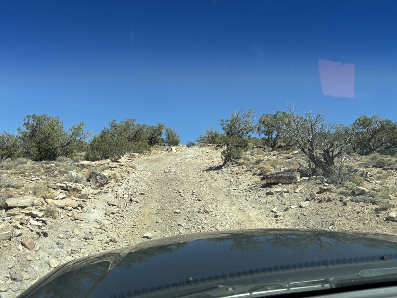
Ute Rd is a 4WD Track that ends at a lookout in the Gunnison Gorge Wilderness
.
.
Descending back into the Gunnison Gorge NCA
Sidewinder Trail through the NCA
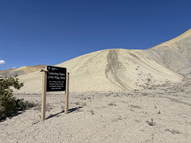
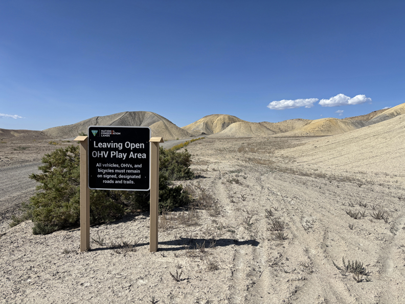
Back at Peach Valley Rd
OHV Play Area
.
.
I stopped at a Toyota dealer in Delta CO because the Sequoia had an unusual sound that had been increasing since I left OH. Manager test drove it and said I probably needed one or two new front wheel bearings, but he was booked for a week. He gave me the names of three repair shops in Grand Junction where I was staying that night. I immediately called the first on the list and was told to bring my SUV in at 8am the next morning. I stayed the night in a Super 8 motel.
9/18 Th – I had the Sequoia at Shrums Auto Repair at 8am. The head mechanic and manager both test drove the SUV and stated that the sound was likely one or both front wheel bearings. I said to go ahead with the repair and walked downtown to tour and have lunch. I really liked Grand Junction and thought that I might like living there.
When I returned to the repair shop, the front wheel bearings had been replaced, but the mechanic and manager said the noise was still there! They proceeded to look at other possibilities and even put a sound system under the vehicle at each wheel to record sounds while driving to try to find the problem – no luck! They were dumbfounded and said that the only thing they could come up with was a gear box problem, which they could not look into for two days! We agreed that I should take the vehicle and drive it until the sound was worse and then have it evaluated again. That put me at risk for getting stuck somewhere, perhaps with no cell phone service, but I felt I had to do it to maintain my schedule.
So, I got on I70 at 4pm and started driving West. It took me 5.5 hours to get to Leeds UT, where I slept in the SUV.
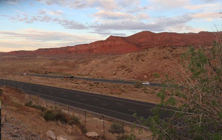
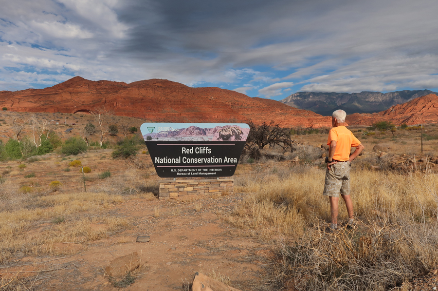
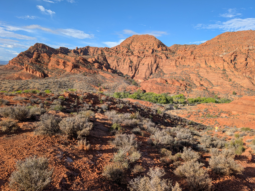
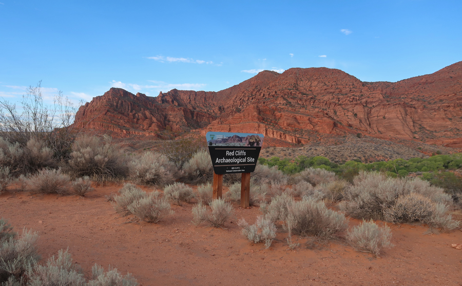
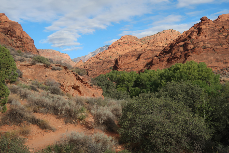
9/19 F – Up early and drove into the Red Cliffs NCA at daybreak. It is a large area (45,000 acres) in SW Utah, just N of St George.
I-15 and the Red Cliffs
.
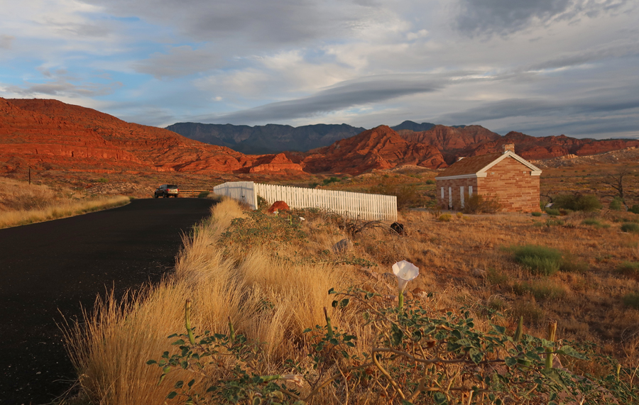
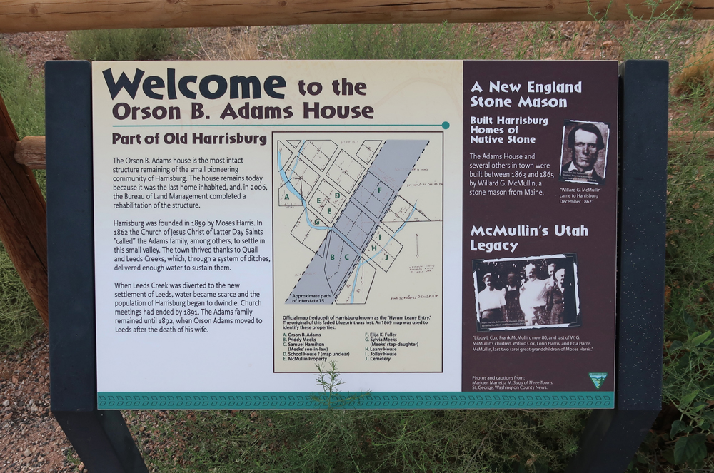
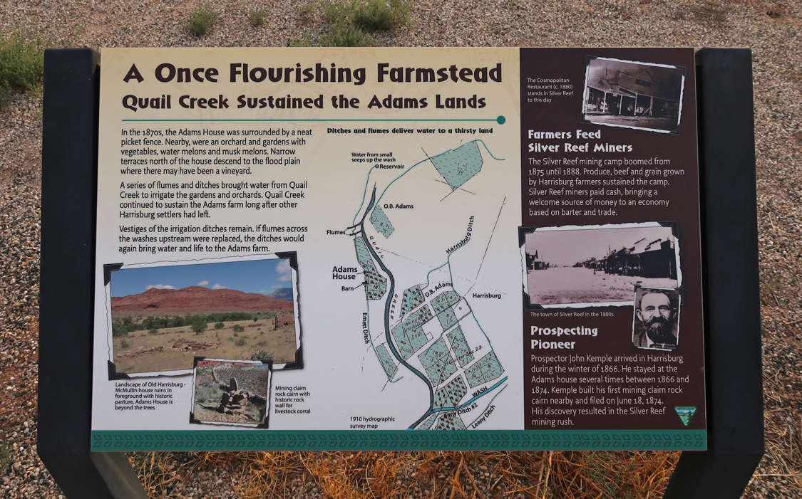
The Church of Jesus Christ of Latter Day Saints “called” Orson and Susann Adams and 41 others to move to this area in 1862. There family lived in this house from 1864 to 1892.
.
.
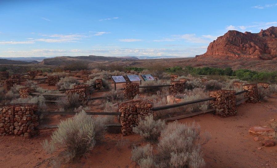
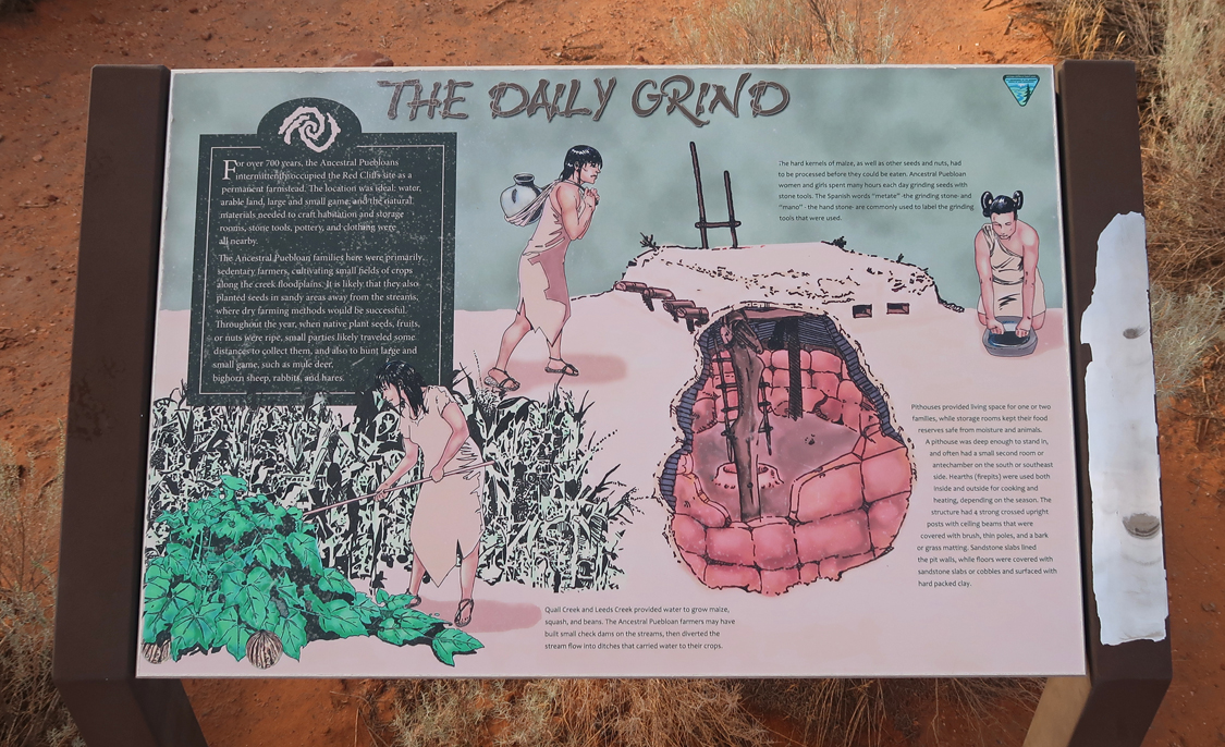
My first hike was 0.5 miles on the Anasazi Trail to an Archeological Site that was the home to Puebloan farmers. I am lower right in photo.
.
.
.
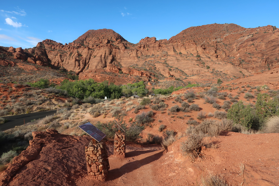
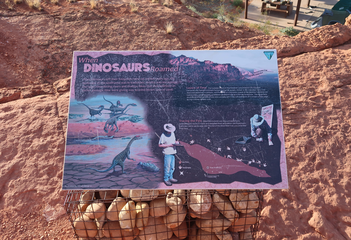
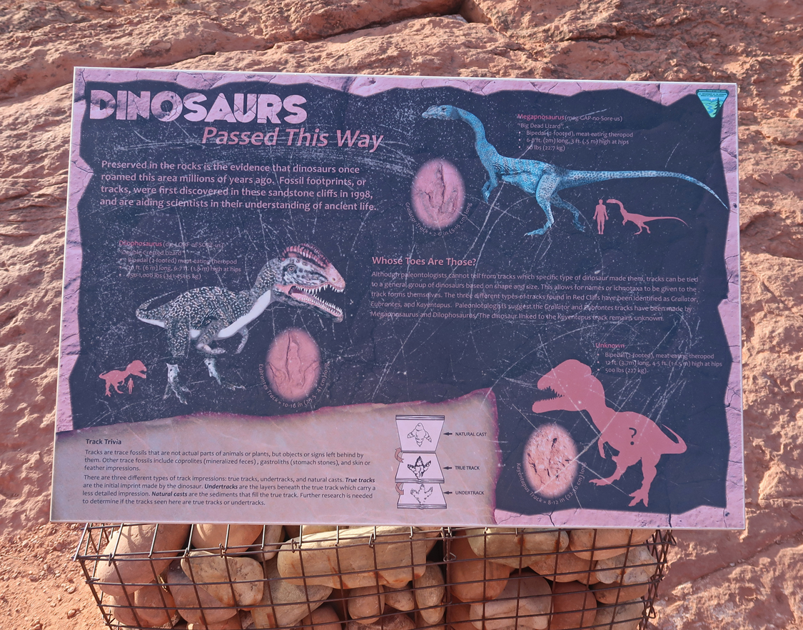
I then took the Mano and Red Reef East Trails about a half mile to a Dinosaur Track Area
.
.
That was followed by a short hike on the Red Reef Trail that follows Quail Creek.
McMullin House in Red Cliffs Recreation Area – Williard C. McMullin, a stone mason from Maine, built several stone houses in the area, including the Adams House.
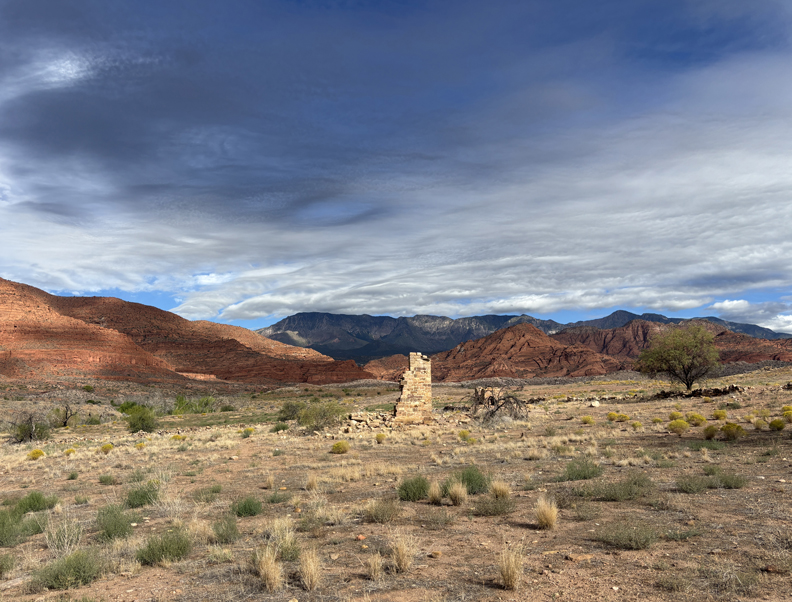
After leaving the NCA, I drove to the Bureau of Land Management (including BLM) adjacent to the St George airport to collect information on both the Red Cliffs and the Beaver Dam Wash NCAs. I needed the latter to decide on my route to and through Beaver Dam Wash NCA, which is located about 12 miles west of St George.
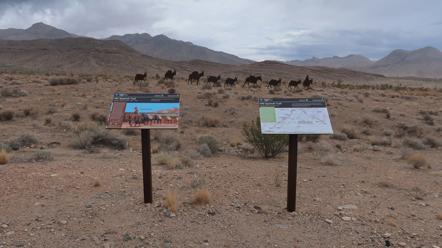
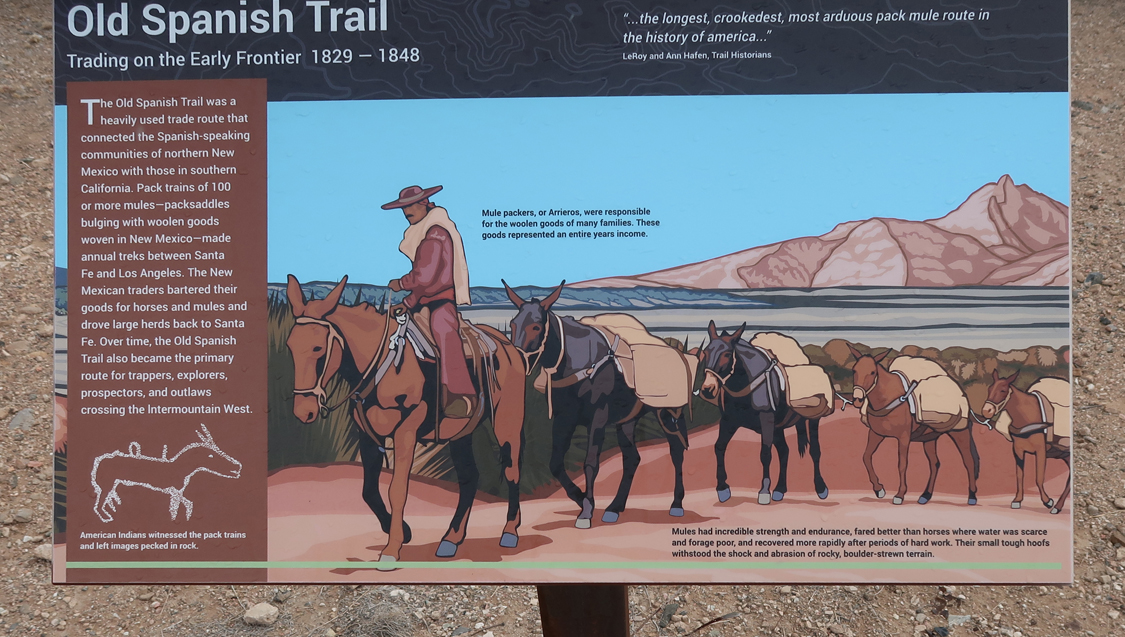
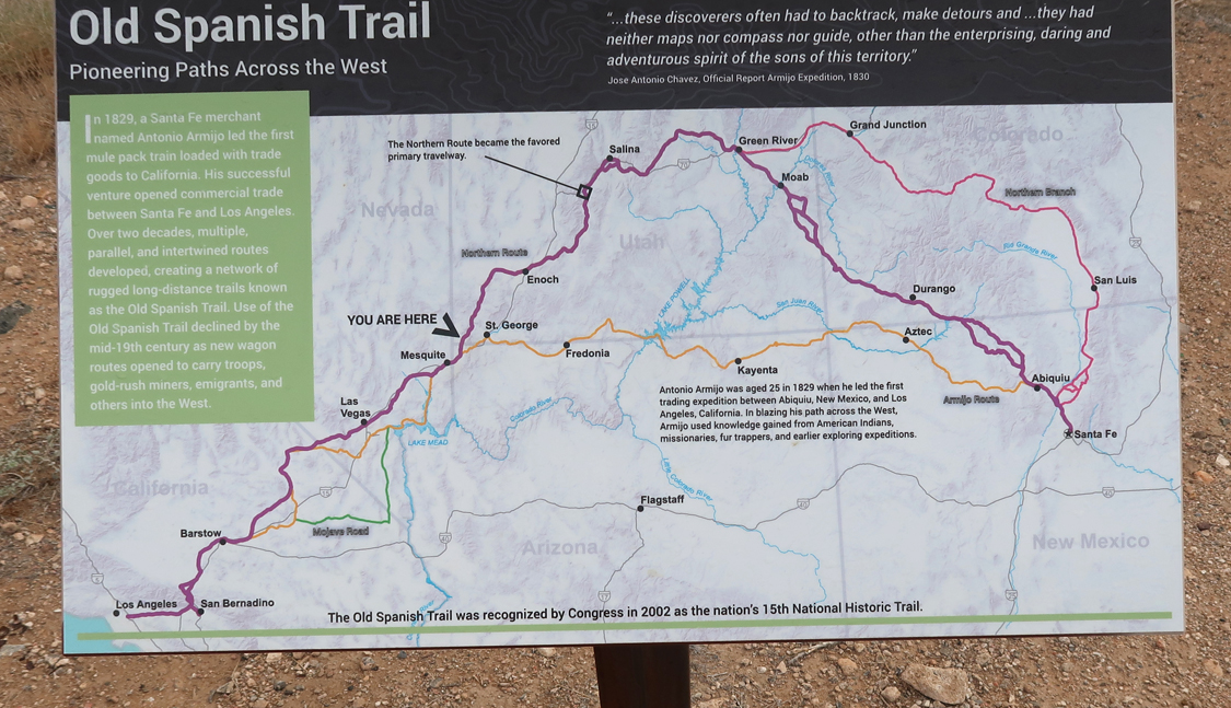
Old Highway 91, which passes through Beaver Dam Wash NCA, was the route of the Old Spanish Trail, a National Historic Trail (NHT).
.
.
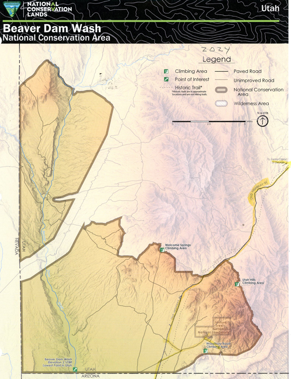
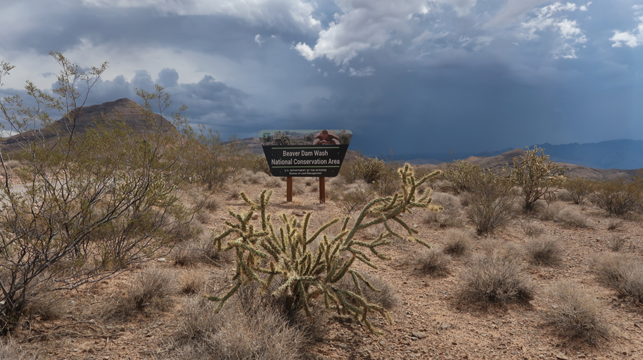
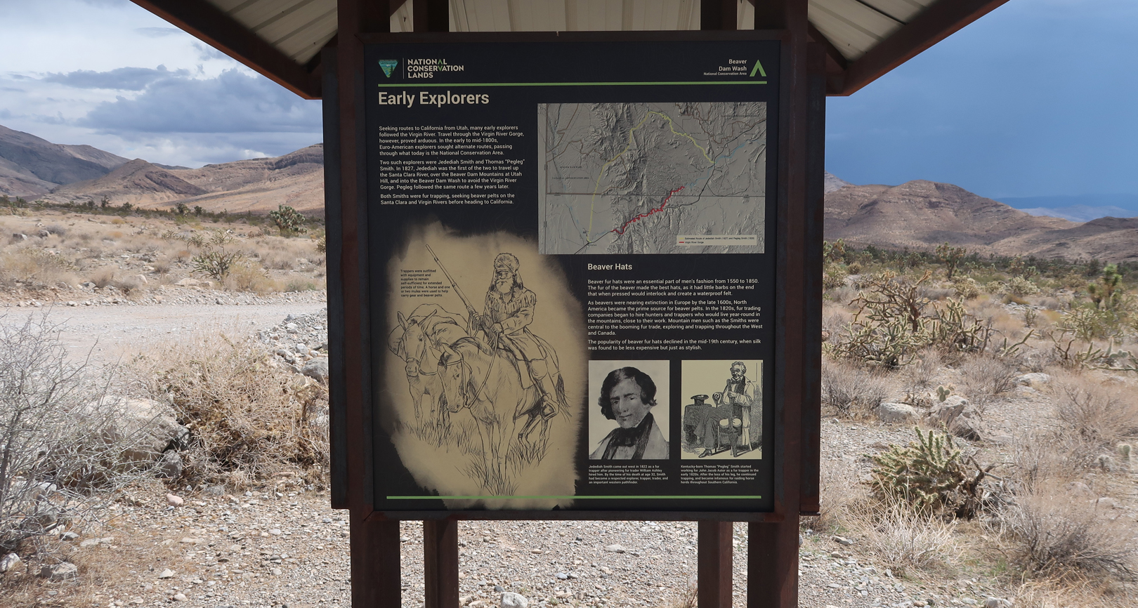
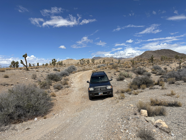
Entering Beaver Dam Wash NCA. Congress designated these 63,645 acres in the SW corner of UT a NCA in 2009 – storm ahead
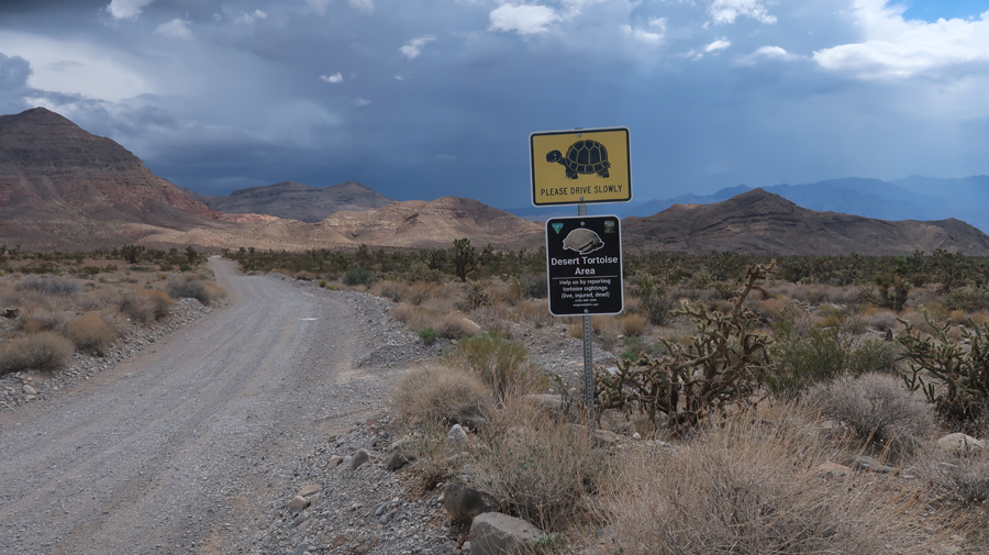
Watch out for Desert Tortoises
Early Explorers
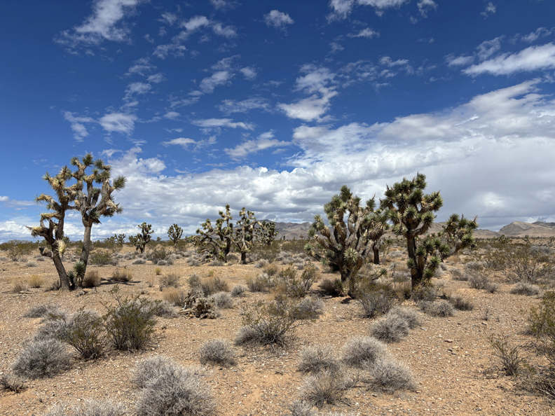
Joshua Tree National Natural Landmark is within the NCA
.
I drove toward the Woodbury Road Climbing Area
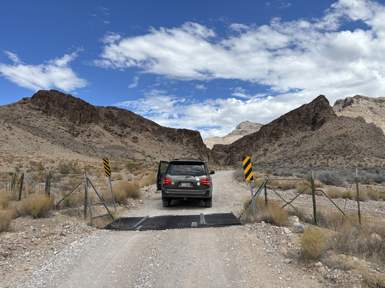
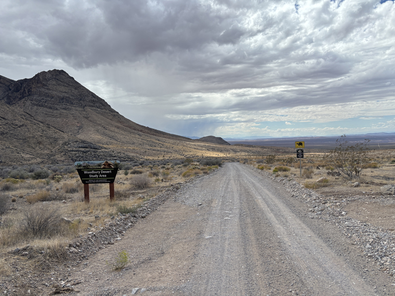
And then exited the NCA through the Woodbury Study Area into AZ
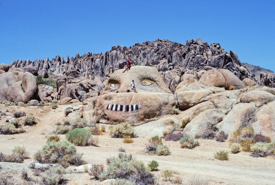
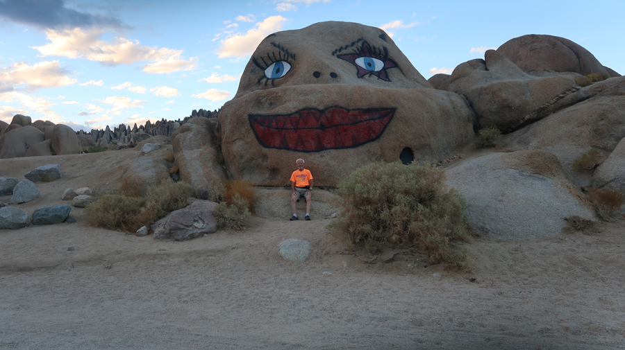
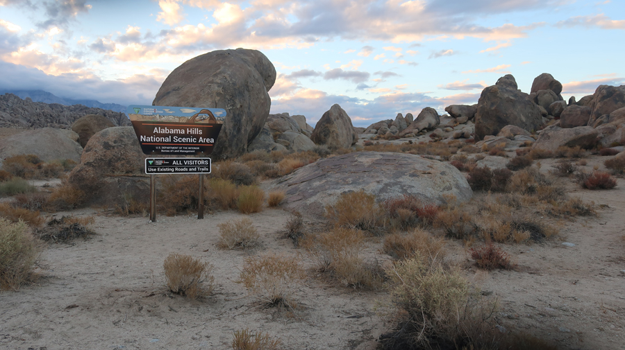
Drove 325-miles through Las Vegas and Death Valley NP to Lone Pine CA and the Alabama Hills National Scenic Area (BLM). I stopped at the painted “Monkey Head” on Whitney Portal Road just west of Lone Pine. The first pic is from 1992 with Manuel, our exchange student from the Canary Islands (Spain), on the monkey’s head and Chad leaning on his nose. The second photo is what it looks like today.
.
This was my fifth time in this area. The first four were related to climbing Mt Whitney (14,505ft), the highpoint of CA and the highpoint of the 48 contiguous states.
The sun had just set over the Sierra Nevada Mountains, but I was still able to drive Movie Road and had enough light to briefly explore Lone Ranger Canyon. There have been over 400 movies filmed here, primarily “Cowboy Flics.”
.
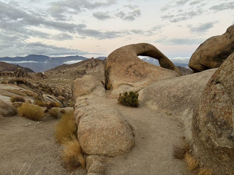
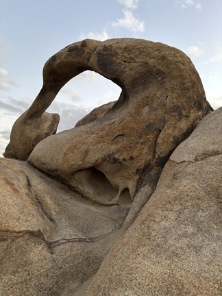
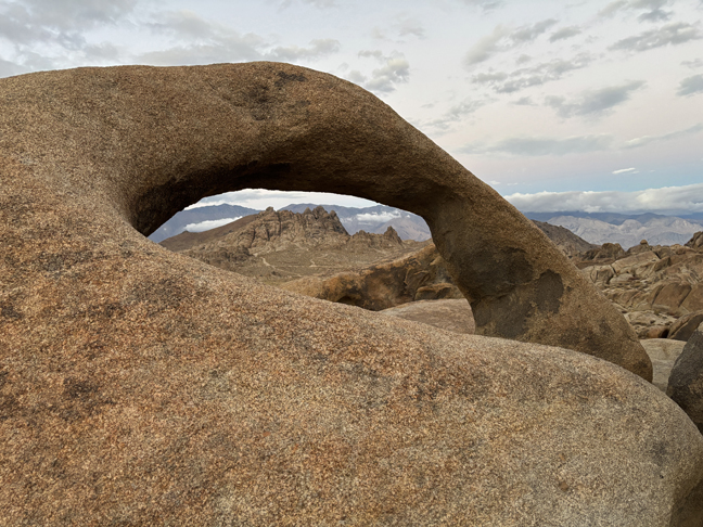
I had to be careful not to trip on the 0.6-mile Arch Loop Trail to Mobius Arch – it was dark by the time I got back to the SUV. I used the light on my cell phone to finish the trail. The photos are deceptive because the camera adjusted for the lack of light.
.
.
.
It was then a one-hour drive to Bishop CA and the Liars Club Social at the Whiskey Creek Restaurant. Afterward, I signed into the Best Western Lodge for the Highpointers Club Konvention.
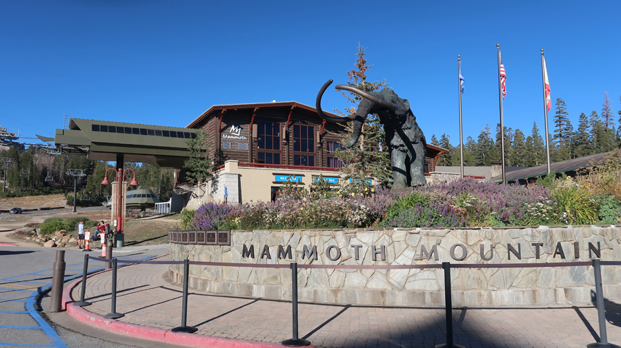
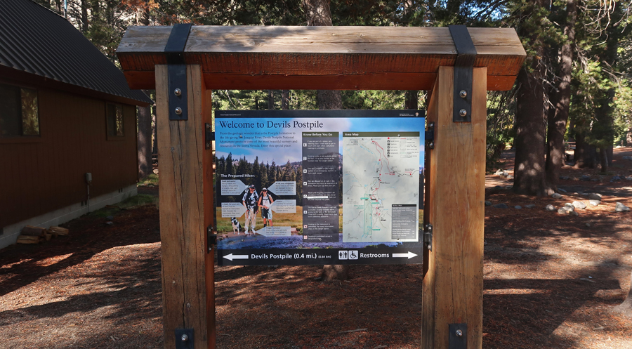
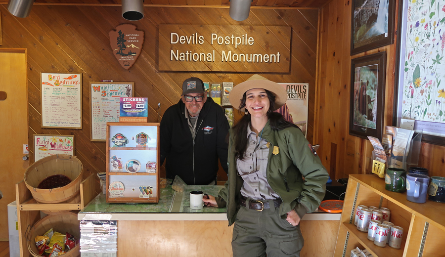
9/21 Sun – I was up early to drive to the Mammoth Mountain Ski Lodge to catch the 9am Shuttle Bus into Devils Postpile NM. The road into the monument was closed due to construction but buses were running on the weekends.
.
I was here in 1967 with my friend Jay, but I did not have any written or photo evidence that I had been here – hence the reason for my visit today.
.
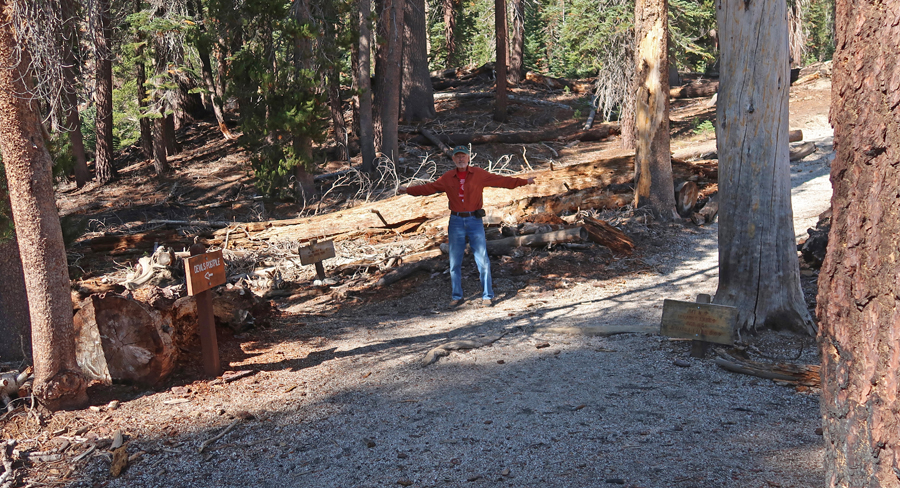
My first hike was about 1.5-miles from the Ranger Station to the intersection of the John Muir and Pacific Crest Trails and back – a Two for One!
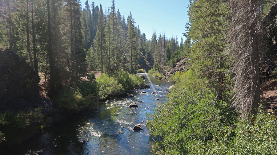
Middle Fork of the San Joaquin River
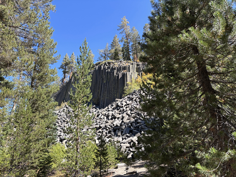
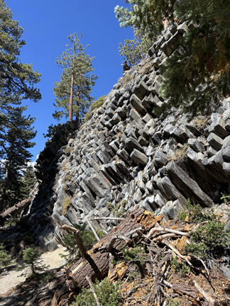
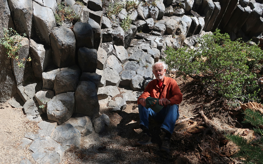
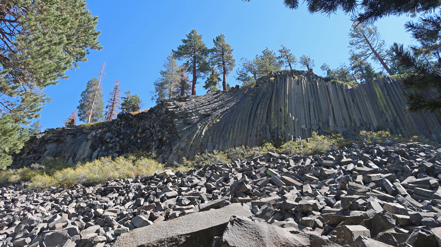
I then hiked the Devils Postpile loop Trail, about one mile. It goes up over the top and then back to the Ranger Station. As basalt lava erupts and cools, it shrinks and then cracks. Sometimes it will form vertical columns with three to seven sides.
.
.
The 60-foot wall was exposed during the last glaciation.
.
.
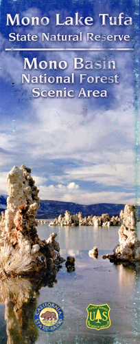
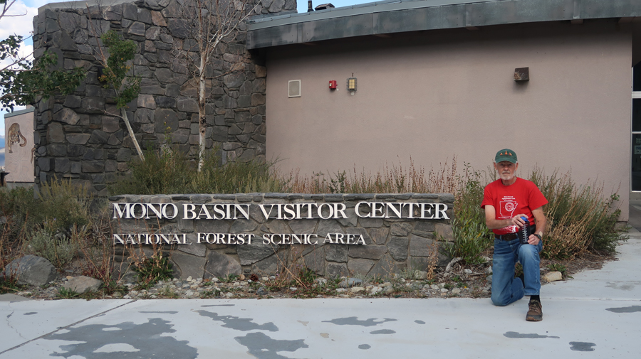
After exiting the bus at the Lodge, it took me 45 minutes, with a descent of 2,600ft, to get to the Mono Basin National Forest Scenic Area Visitor Center (USFS), just east of Yosemite NP.
.
Toured the Visitor Center and had a nice conversation with the ranger. He said that he normally worked as one of the Climbing Rangers in Yosemite NP.
.
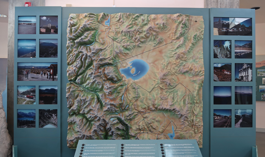
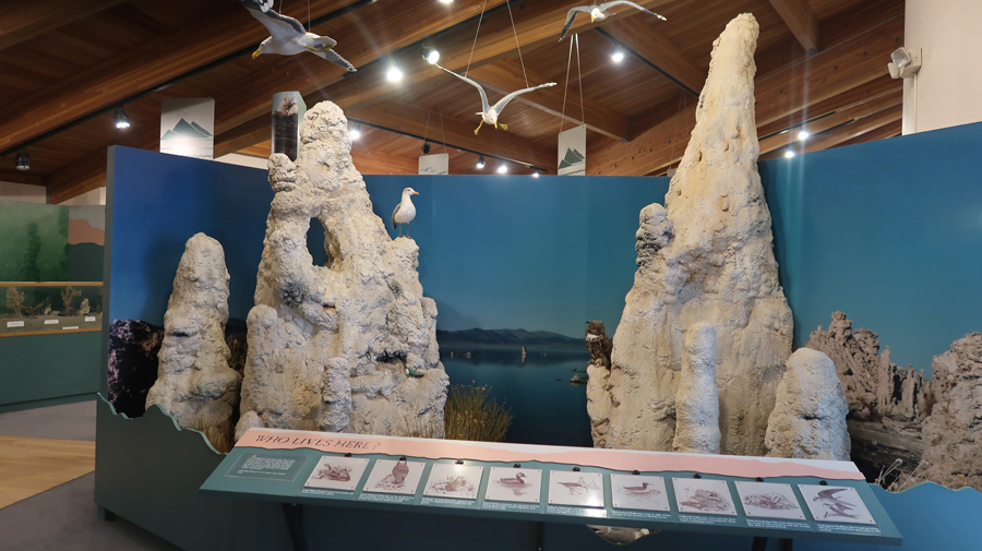
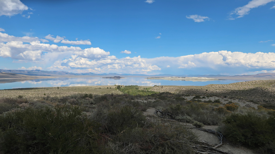
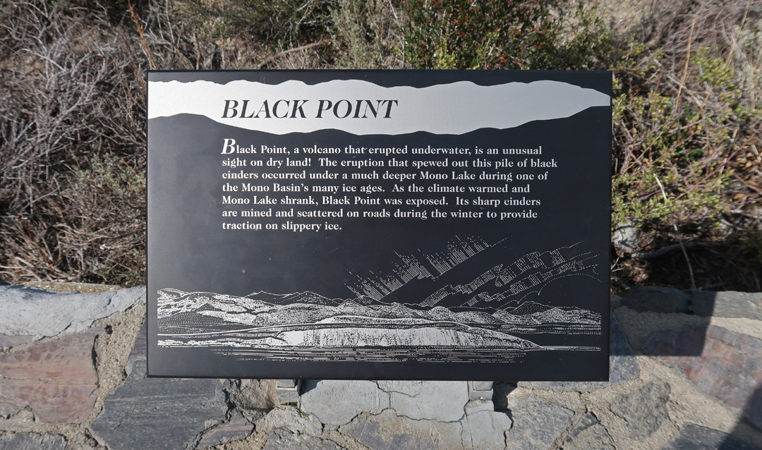
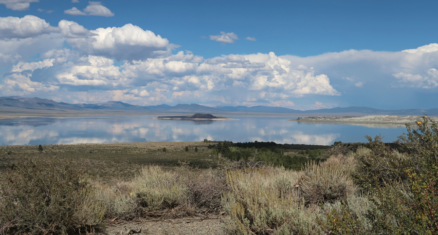
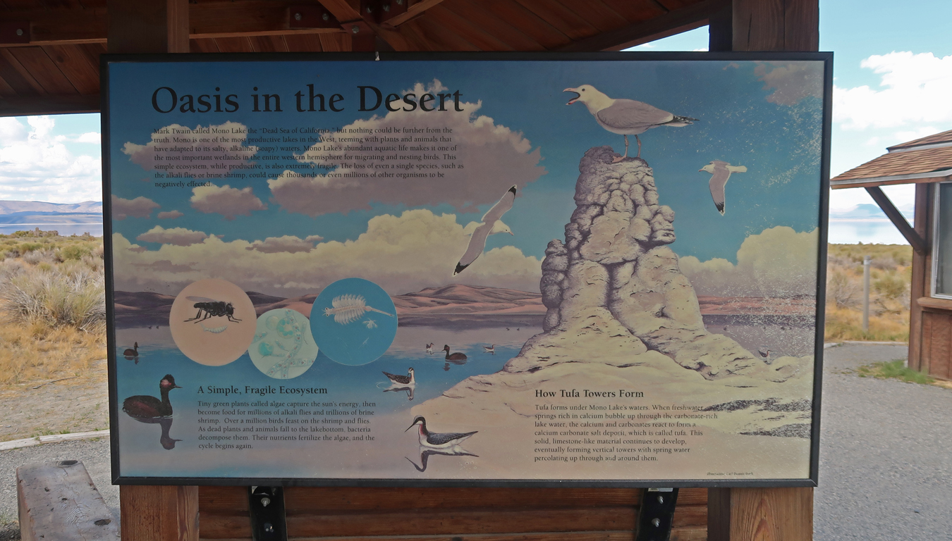
There is a good view of Mono Lake and Black Point from the Visitor Center.
.
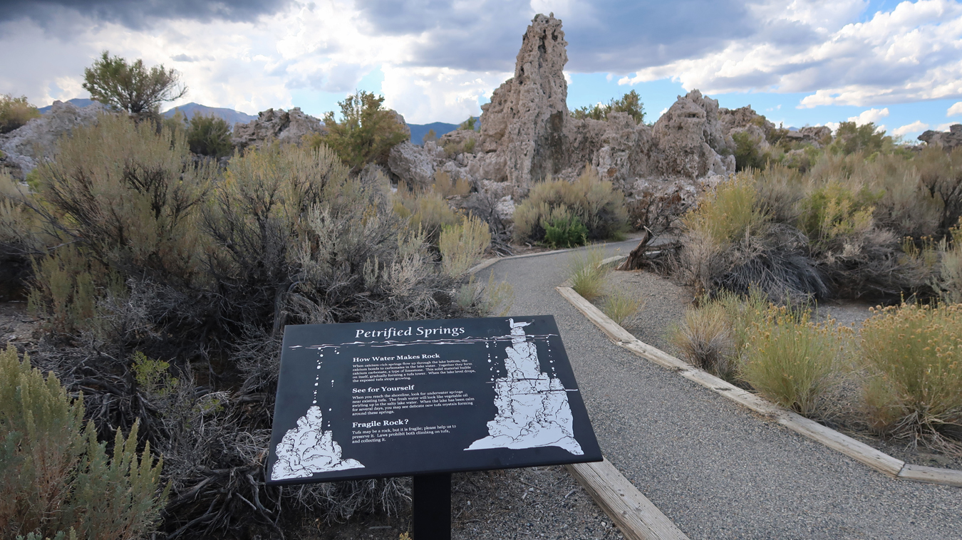
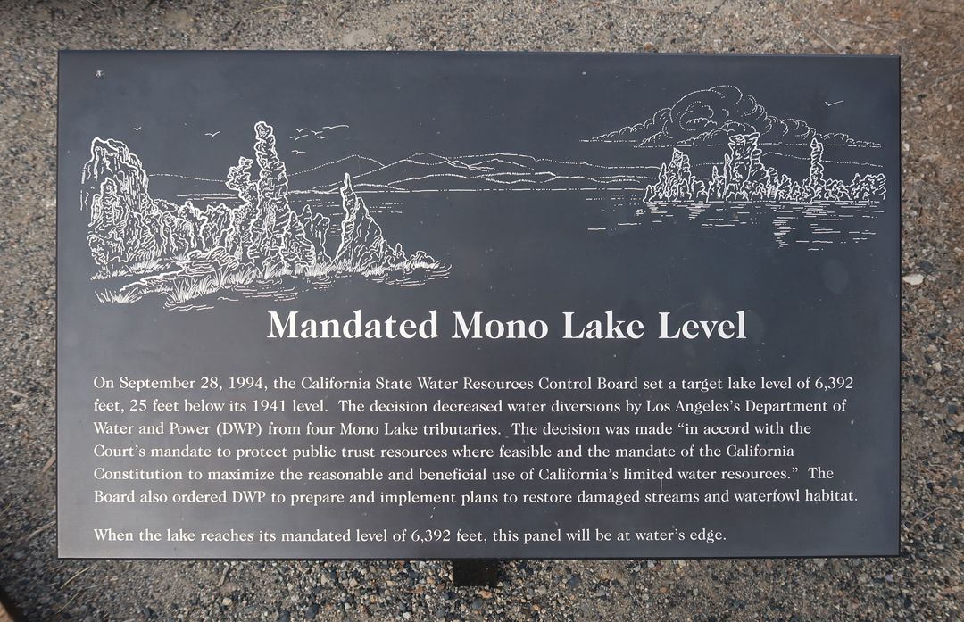
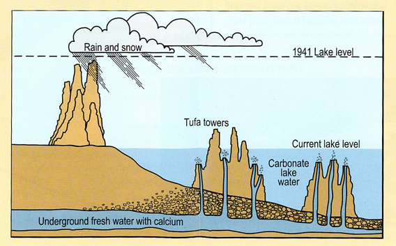
I then drove a short distance to Navy Beach and the South Tufa Area.
.
Tufas are produced as underground springs mix with the carbonate in the lake water to produce calcium carbonate.
.
.
.
Chad (15) and I visited here during our 1998 “bonding” trip. Mono Lake has receded significantly in the last 27 years!
.
I next drove two hours north to Carson City NV and had dinner in a small strip mall at the Hot Potato Pie fast food restaurant. I was told that this was the first in the country and they were about to open a second in Carson City. You order a giant potato and can choose from a multitude of toppings. Like ordering a pizza but with a much greater variety of toppings. I predict this is going to become a national chain!
.
I slept in the Sequoia behind a motel.
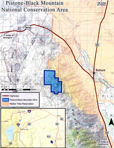
9/22 M – My first stop was the Carson City District Office of the BLM. I spoke with at least three employees asking about two new BLM National Conservation Areas (NCAs) outside of Carson City. I collected information and purchased a BLM map for Walker Lake (2006), which shows the location of Black Mountain. A BLM employee drew the location of the Pistone-Black Mountain NCA on this map. I was also given written directions to find the 4WD route to Black Mountain (3,941ft).
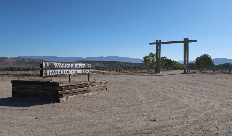
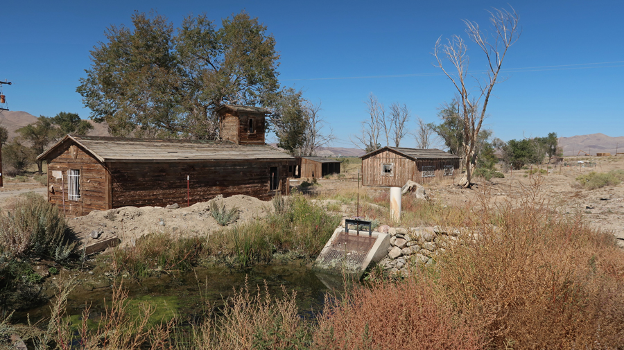
I drove past the Walker Lake Recreation Area and an old homestead along the East Walker River.
.
I continued for another half hour until I realized I was going south – the wrong direction! I turned around and headed back. When I got back to the Recreation Area, I stopped a state pickup truck going the other way to ask directions. That is how I met Ryan, the only person I saw for the four hours it took me to get to Black Mountain and then back to a NV state highway. He put an app on my phone that allowed me to track my location. I was now on my way to Black Mountain.
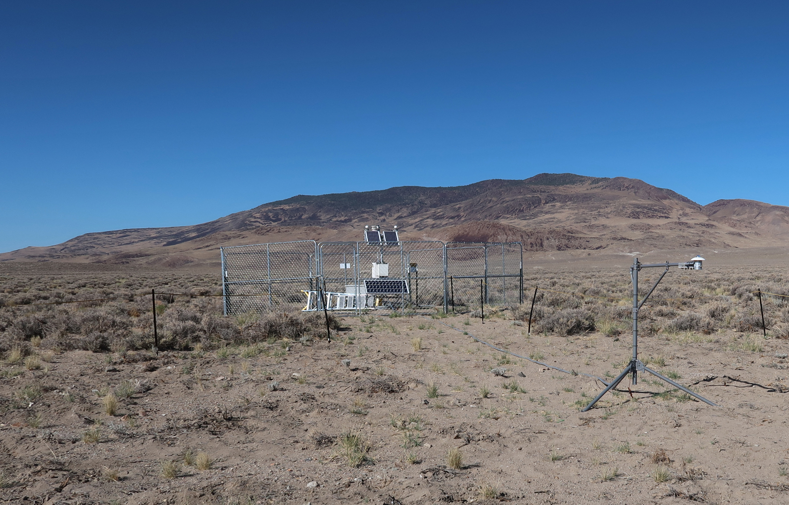
I passed a fenced area that looked like it contained a solar powered weather station.
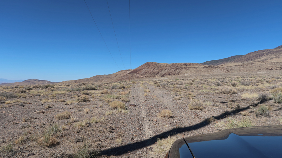
The track started to gain elevation along a power/telephone? line.
.
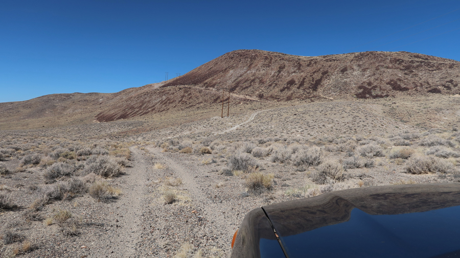
I got to a point where the Sequoia 4WD would not take me further up the mountain. So, I hiked over the hump you see in this photo.
On the other side I found a fenced structure that looked like it may have been a covering for a mine entrance, in middle of first photo.
This is a magnification of the above photo –
Looking at my phone, it appeared I was in the Pistone-Black Mountain NCA. So, I slowly backed down the track until I found a spot to turn around. I then proceeded down the steepest sections in my lowest gear.
.
Heading back to civilization –
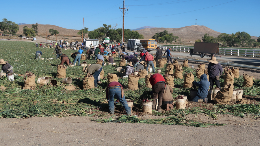
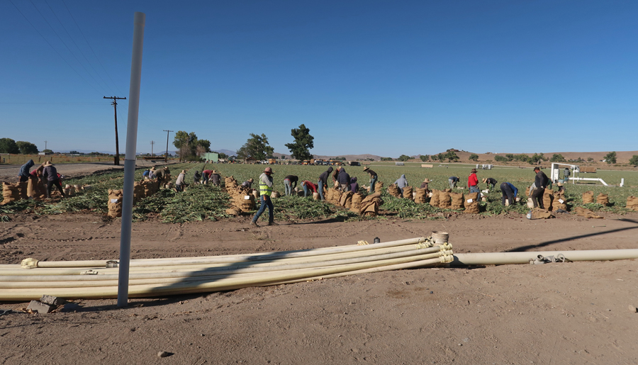
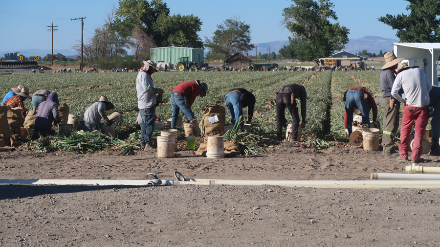
I took these photos of migrant workers outside of Yearington NV. They were starting to harvest a field of red onions. Another group was working back toward them from the opposite side of the field.
.
.
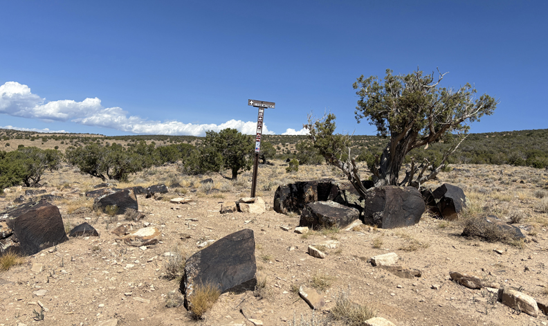
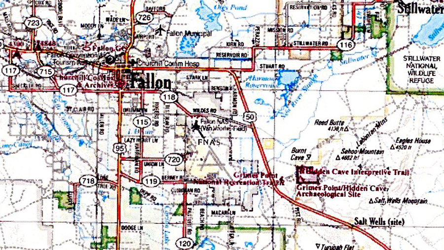
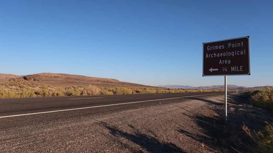
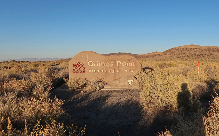
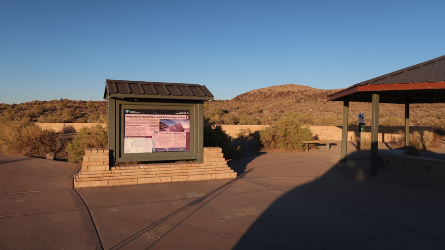
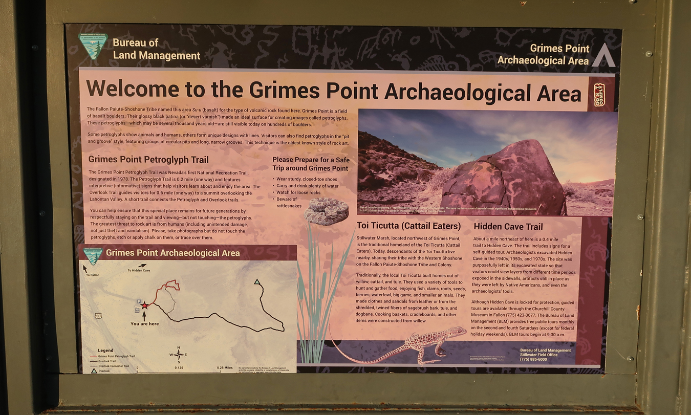
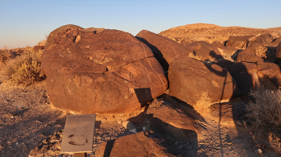
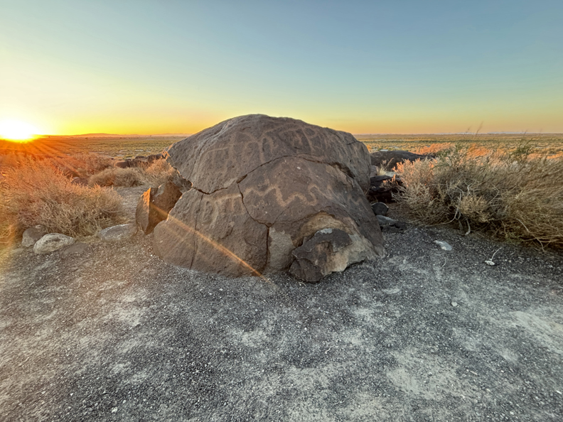
My next task was to get to the Numanaa Nobe NCA before dark. There is one part of the NCA that has easy access off of Rt-50 east of Fallon NV – the Grimes Point Archeological Area. The majority acreage of the NCA is NE of this location.
.
.
There are about 150 Basalt boulders with more than 1,000 petroglyphs in the area.
.
“Some petroglyphs show animals and humans, others form unique designs with lines. Visitors can also find petroglyphs in the “pit and grove” style, featuring groups of circular pits and long, narrow grooves. This technique is the oldest known style of rock art.”
.
I did the 0.5-mile Petroglyph Trail.
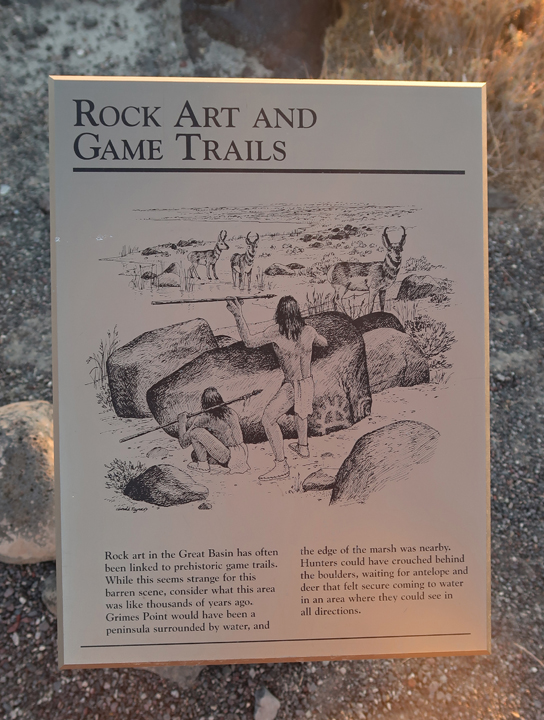
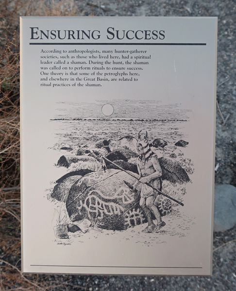
Some of the petroglyphs here may be related to the ritual practices of the tribe’s shaman.
.
It was dark by the time I made it back to the SUV.
.
I drove to Fallon and checked into a Motel 6 and then went out to fill the gas tank and get dinner. I got out my phone and put the location of a Maverick gas station on Google Maps and pulled out onto Rt-95 headed north. I looked at my phone, and it had gone dark. I did not want to adjust it while driving and there was no road shoulder. So, I pulled off onto a dark side street to get it working. Within one minute there was a police car with flashing lights behind me and a voice yelling at me to pull ahead. Had I done that, I would have had an accident with another car that was going by. The loud voice yelled at me again to pull ahead. I did so and got to a small parking lot in front of a business. The policeman pulled directly behind me so I could not move. He asked for my license and registration. I asked why he had stopped me. He stated I was blocking a crosswalk. I said there was no one there and explained that I was in a safe position to adjust my phone. He was young, overweight, obnoxious, and rude. It was clear I was going to get a citation, no matter what! He wrote me a $90 ticket, and stated I could come back from OH and argue my case to the magistrate! This was not a good way to end a long day.
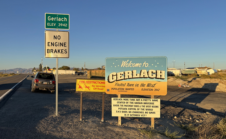
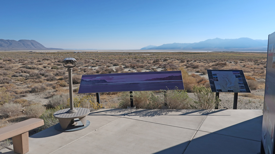
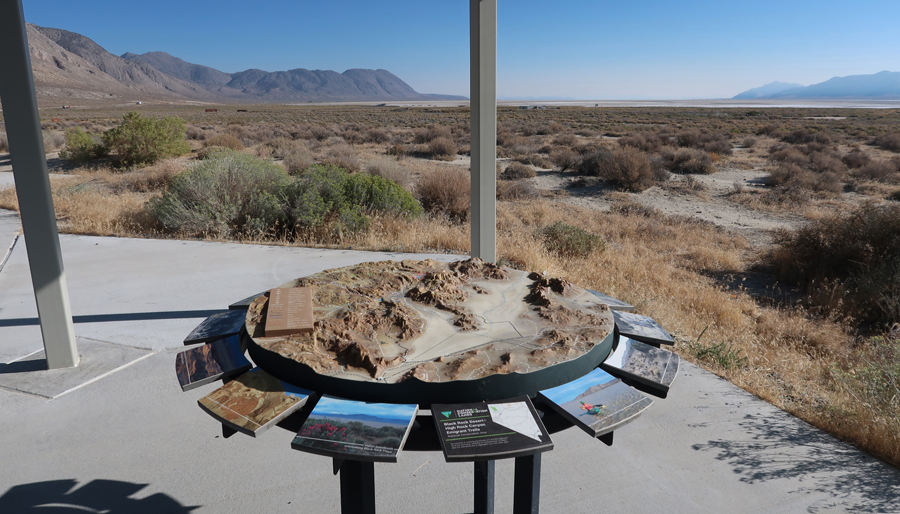
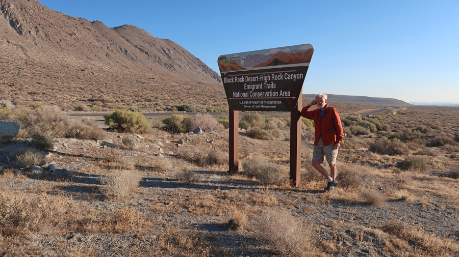
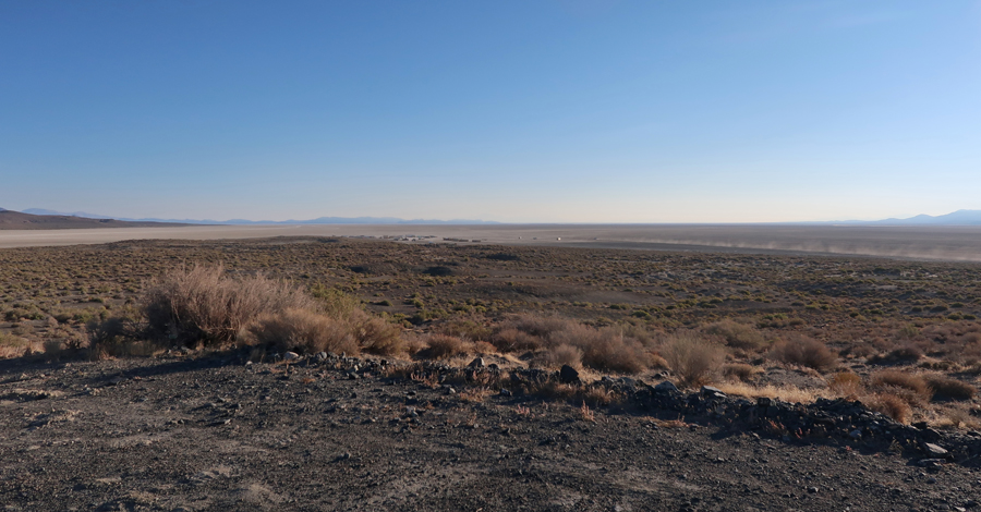
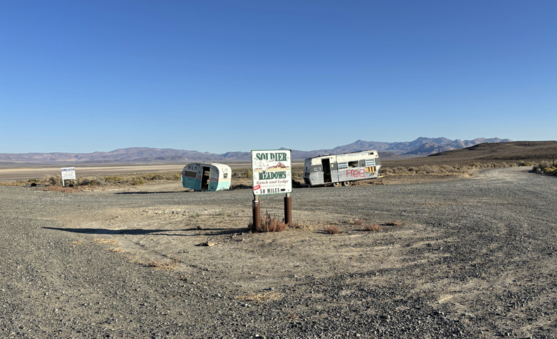
9/23 Tu – coffee and donuts from a gas station, then a four-hour drive to Gerlach in the NW corner of NV.
Read the Gerlach sign –
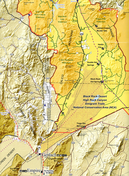
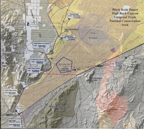
Map showing a small southern part of the Black Rock Desert – High Rok Canyon Emigrant Trails NCA
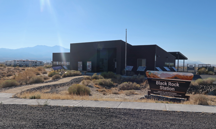
The Black Rock Station, BLM Visitor Center, was not open due to the government shutdown. However the signage and information were good.
.
.
Rt-34, starting into the NCA.
Map showing the route I took, first on Rt-34, then Rt-200, then onto the Playa at the Cassily Mine Campground, and finally my exit at the 12 Mile Playa Access.
Truck driving on Playa, notice the dust trail –
Right turn onto Rt-200
According to Wikipedia: “Burning Man is a week-long large-scale desert event focused on “community, art, self-expression, and self-reliance” held annually in the Western United States.” It started in 1986 at Baker Beach in San Francisco and moved to the Black Rock Desert in 1990. It has a tumultuous history. A symbolic man is created and burned symbolically at the end of the event. The event usually occurs around Labor Day. I met the fellow in the next photo who explained how he had worked at the event but quit because of a conflict with his boss. He cautioned me not to drive into the designated Burning Man “Black Rock City.” He said the workers, who live there year-round, do not like others entering the area. The event had a crowd of 74,126 in 2023. Several people have died in relation to this event.
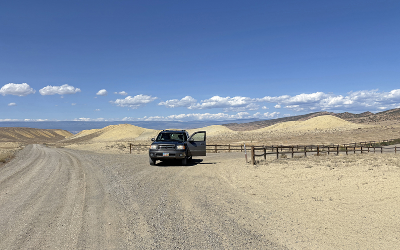
Getting ready to drive onto the Playa –
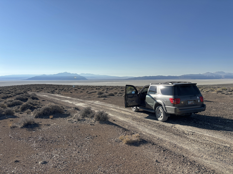
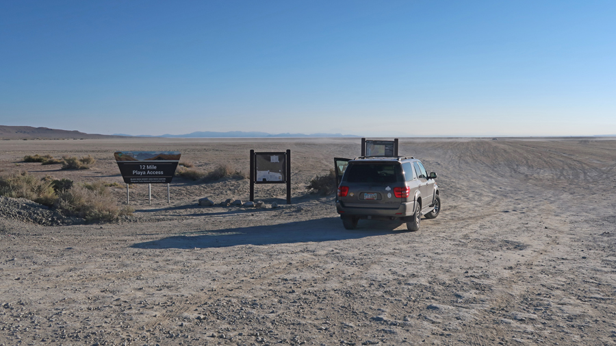
I drove 7-8 miles on the Playa and exited at the 12-Mile Playa Access. I only saw a fraction of this NCA and would like to spend more time here.
.
I returned to Gerlach and drove Rt-34 NW to Vya and then took CA 8-A into the “Surprise Valley” of NE CA on the Barrel Springs Back Country Byway.
.
This “cowboy” invited me to go for a ride with him in Surprise Valley. However, I was trying to get to Portland OR before midnight. As it turned out, I should have taken advantage of this opportunity.
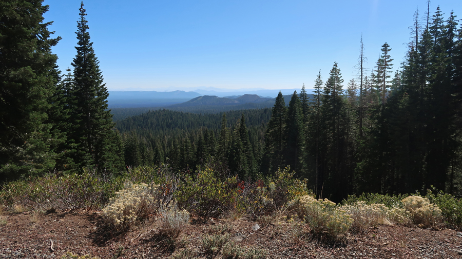
I stopped at the BLM office in Cedarville CA but it was closed. I saw a sign for the USDA Modoc National Forest Warner Mountain Ranger District and followed the arrow to the office. The people there were very helpful and gave me a Modoc Country Map that was useful in following backcountry roads to Medicine Lake, which is in the new Sattitla Highlands National Monument (USFS). Sattitla means “obsidian place” in the Achomawi language. President Joe Biden established the monument by proclamation under the Antiquities Act on January 14, 2025. President Trump was sworn into office on January 20, 2025. I took Rt-299 W through Alturas to Canby CA, then Rt-139 N to Tionesta, then Forest Service road FS-97 to the Volcanic Legacy Scenic Byway, then 2.6mi N on the Byway to Medicine Lake. It took a good deal of time to figure this out using at least three maps with varying route numbers.
.
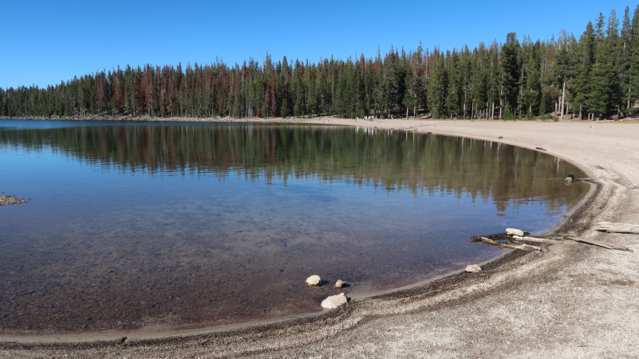
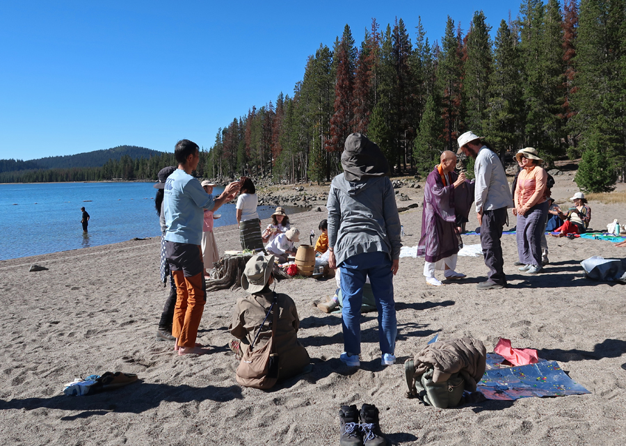
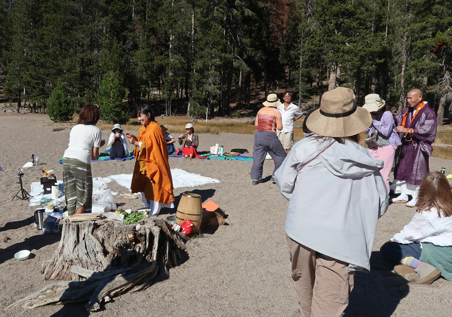
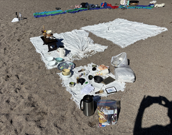
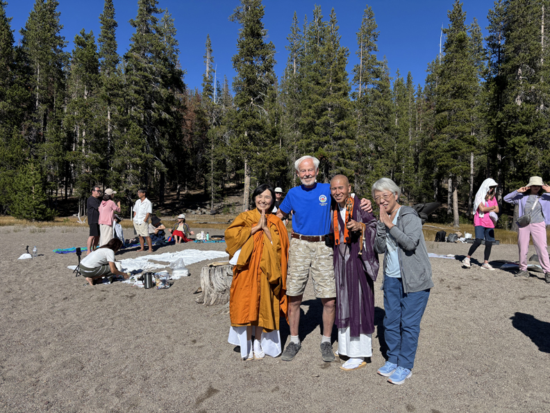
It is a beautiful lake with a number of camping areas. I happened upon a Buddhist group that was praying for World Peace.
.
The Monk was giving individual blessings, and they were enjoying tea and symbolic snacks.
.
After receiving my blessing, they welcomed me and asked me to stay and become a part of their community. So, I texted Helen and told her I had joined the group and would not be going home.
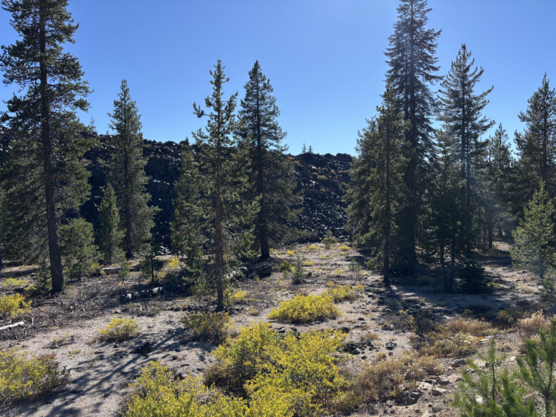
But alas, I was overcome by remorse and continued my route through the NM stopping in the Glass Flow Geological Area. It is difficult to take good pictures into the sun.
.
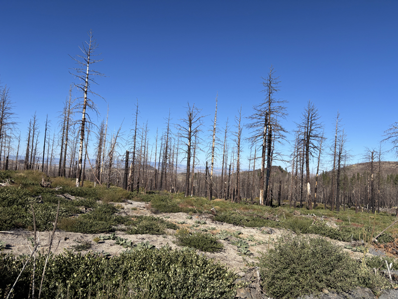
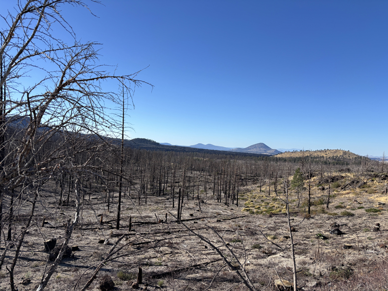
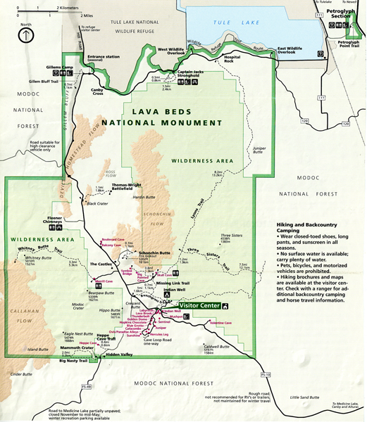
I continued on the Byway (Rt-47) through the north part of the Sattitla NM to and into Lava Beds NM. Note the damage from a Forst Fire earlier in the year.
.
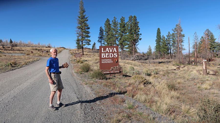
To the south entrance of Lava Beds NM.
.
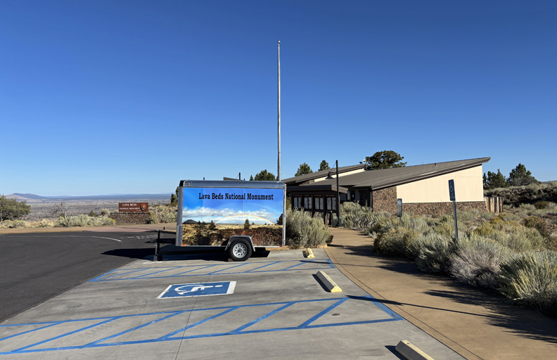
The road surface improved and I stopped at the Visitor Center, which was not open.
.
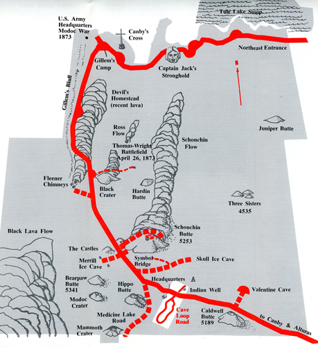
Helen and I explored this NM in 2007 and did hikes into five Lava Caves along the Cave Loop Road.
The Mushpot Cave was the only one with lights.
.
In the others, we used lanterns. Note the lantern in Helen’s left hand.
Photo of the Fleener Chimneys 2007
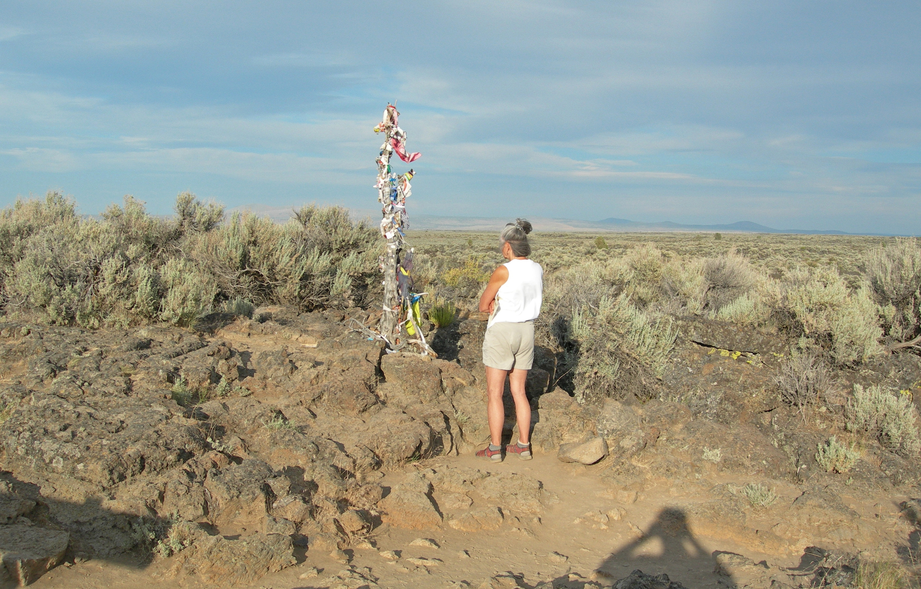
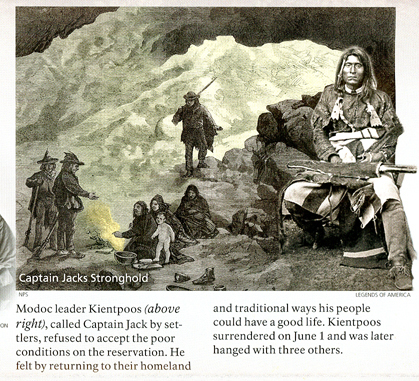
We also hiked the 1.5-mile Captain Jack Stronghold Trail. Photo of the Medicine Pole.
.
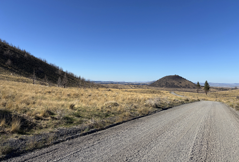
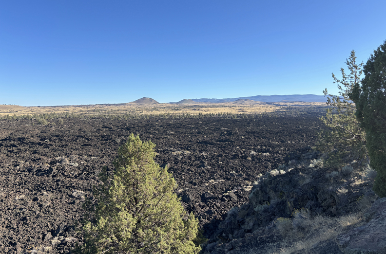
On this trip, I stopped at the Devils Homestead Lava Flow
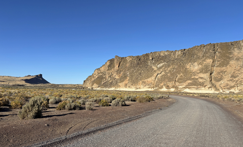
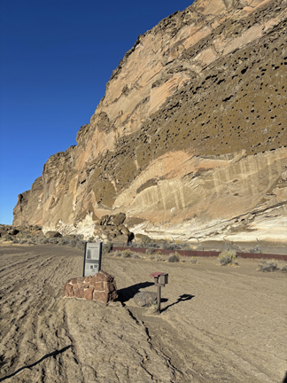
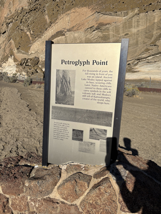
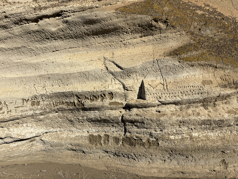
And then drove to the Petroglyph Point Trail Section
.
.
.
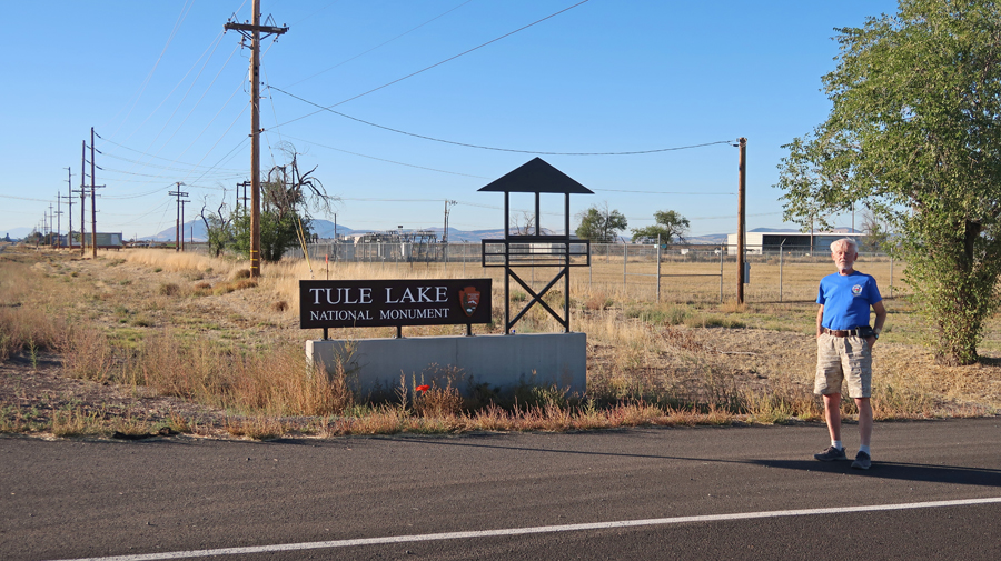
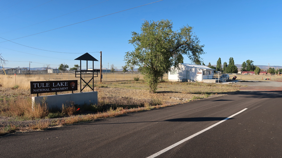
Tule Lake NM, which was a Japanese internment camp during WW II, was only three miles away. I visited here in May 2018 and posted several photos on our Blog. However, there are no photos of me. Hence, this photo to document that I DID visit this NM Unit!
There was no Visitor Center here in 2018. You can now see one in this photo.
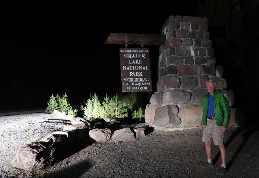
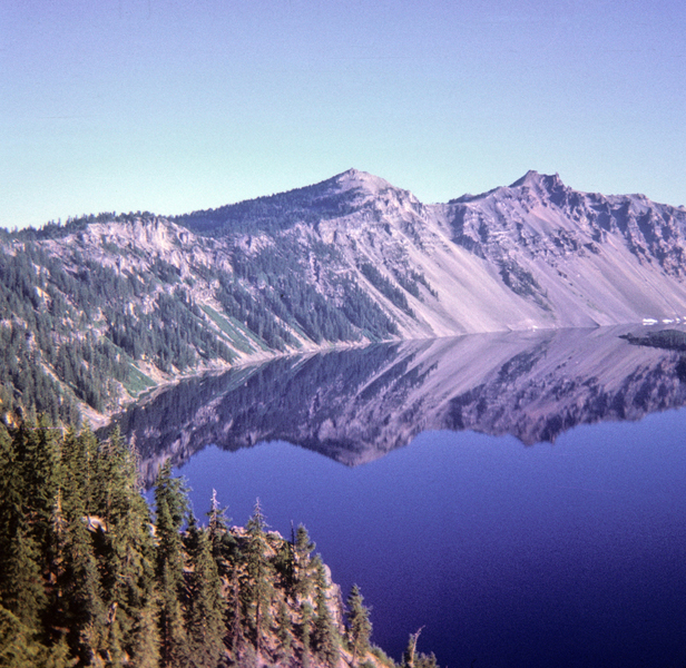
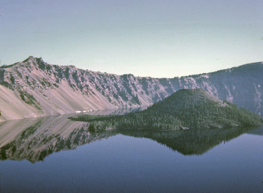
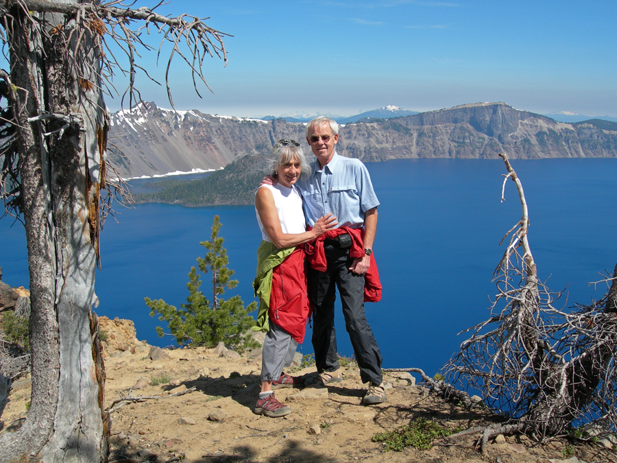
I called Helen in Portland and said I could make it there about 12:30am. She said, go somewhere else, because we do not want you to wake us up or upset the dogs? I said, does that mean you want me to sleep in the SUV again with my pee bottle? She said, yes – what the heck! So, I drove to Crater Lake NP (took about 2-hours) to sleep in the Sequoia with my pee bottle.
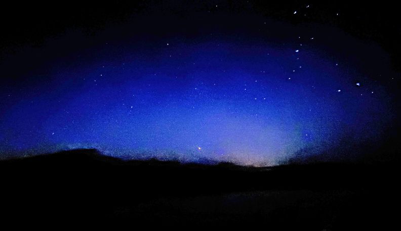
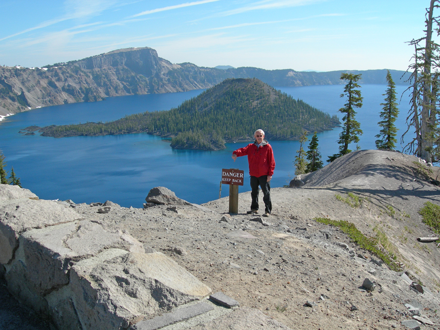
Crater Lake NP is a great place for Sky Gazing, and it was a crisp cold night.
.
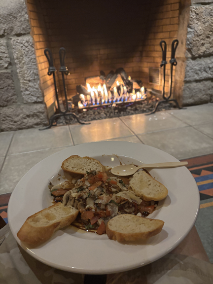
I also treated myself to Mushrooms Bruschetta plus a Manhattan and relaxed in front of the fireplace in the Crater Lake Lodge!
My first visit to this NP was in 1967 with my friend Jay. We were on a 10K mile trip through the U.S. and Canada.
.
.
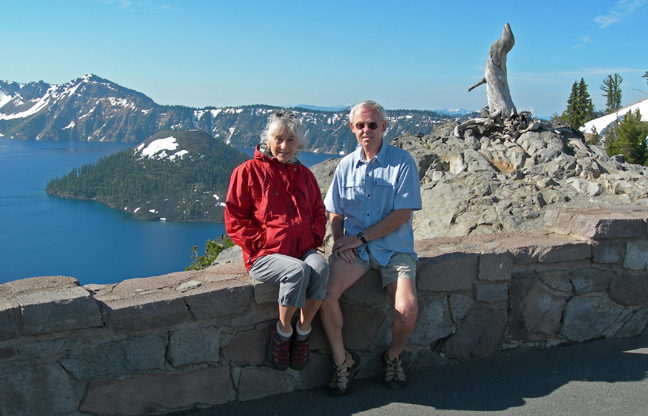
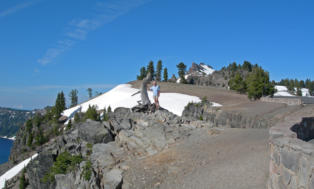
Helen and I visited in 2007 – photo from the Watchman Overlook
The Garfield Peak Trail is 1.8-miles one-way with a 1,000ft gain.
.
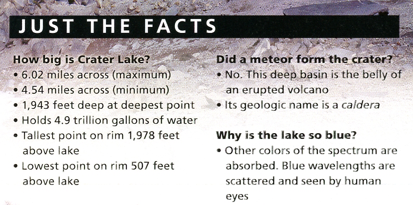
Just the Facts:
.
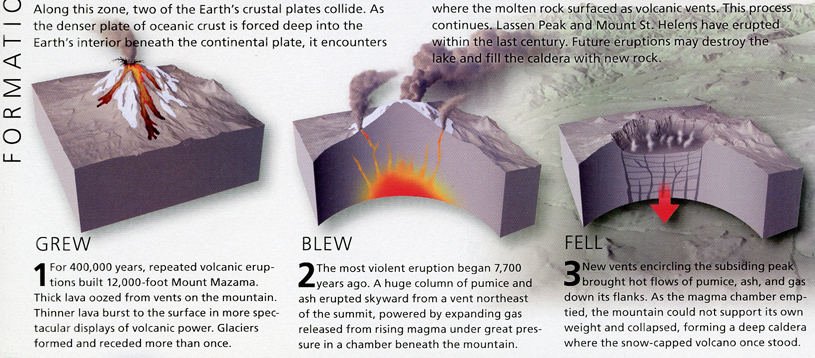
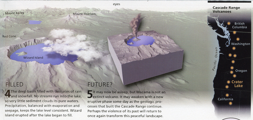
Mount Mazama
.
.
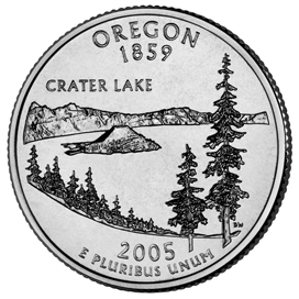
2005 OR State Quarter
2005 50 State Quarters Coin Oregon Uncirculated Reverse
9/24 W – Arrived in Portland for lunch and a five-day visit with Kate.
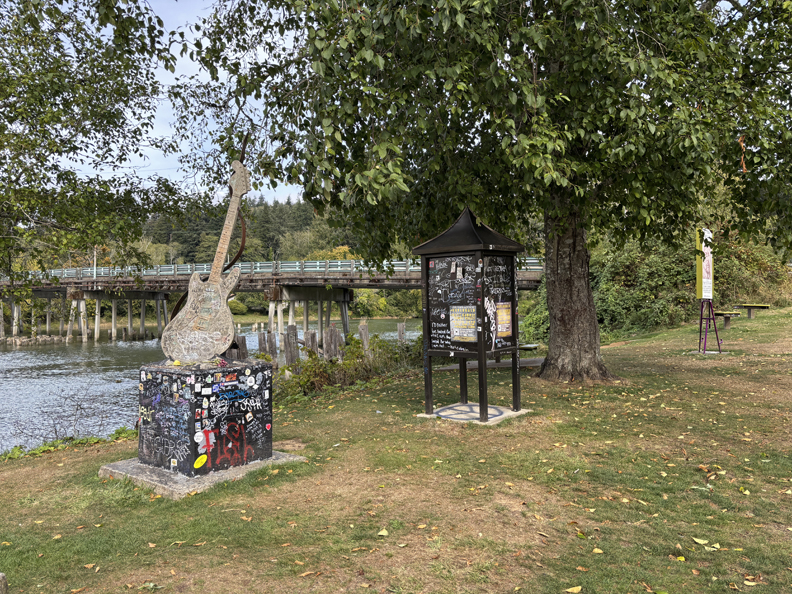
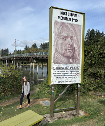
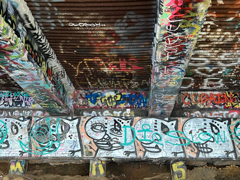
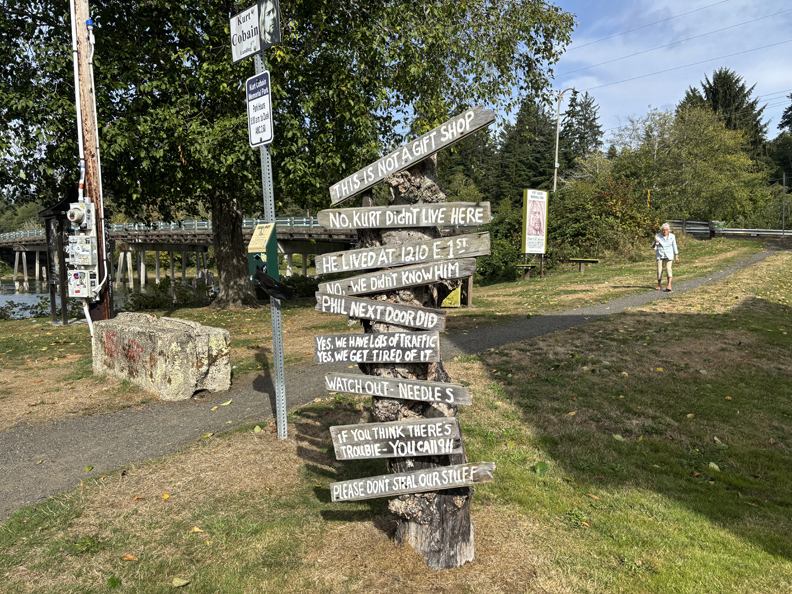
9/25 Th – Left after lunch for a 2.5-day excursion. Our first stop was the Kurt Cobain “under the bridge” memorial in Aberdeen WA.
Kurt grew up here and spent some time under this bridge. His song “Something in the Way” recalls his experience under his bridge.
.
He shot himself in 1994 (27-years-old) after struggling with addiction. Signs in front of the house next to the memorial.
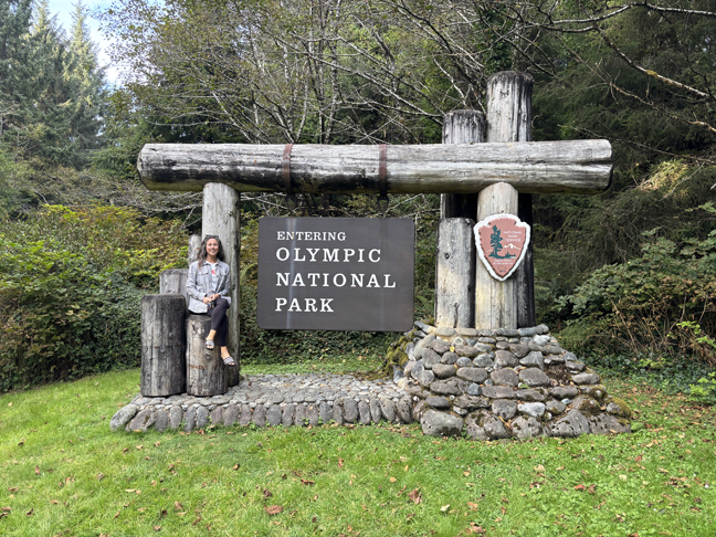
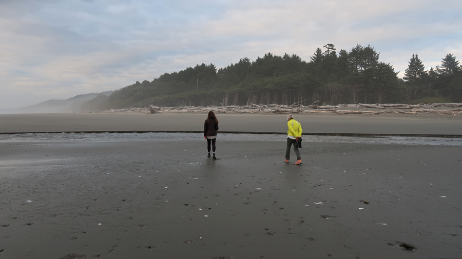
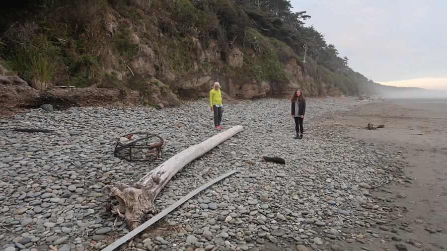
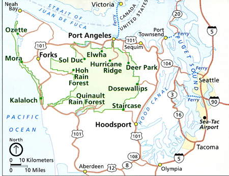
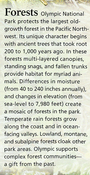
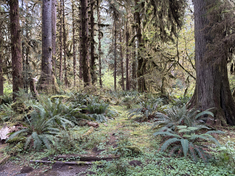
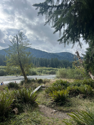
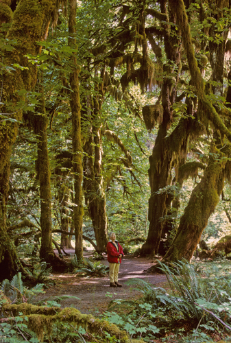
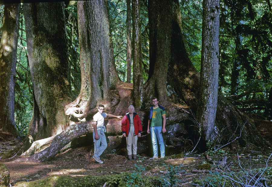
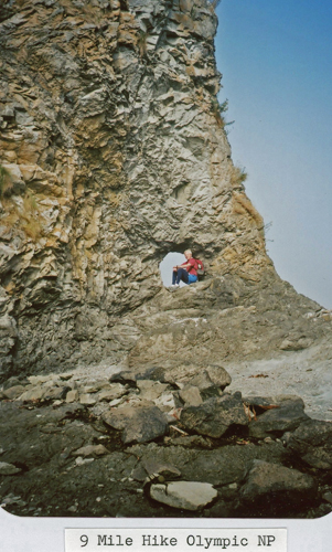
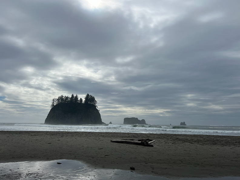
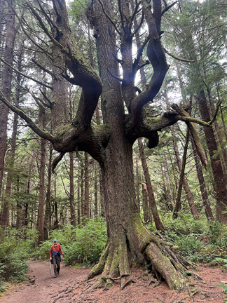
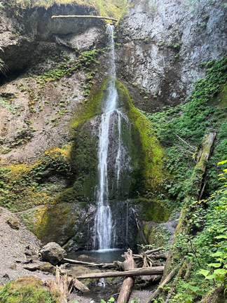
We made a quick stop in the Quinault Rain Forest of Olympic NP. The following descriptions and photos follow a counterclockwise drive in and around the park starting within the Quinault Rain Forest (S) and progressing to Hurricane Ridge (N).
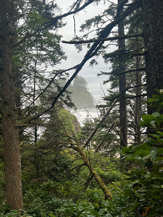
Then proceeded to this sign near South Beach
.
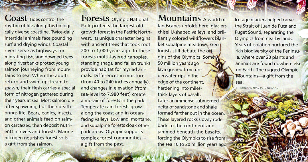
Olympic NP has three major Ecological Regions. I will have photos related to each one.
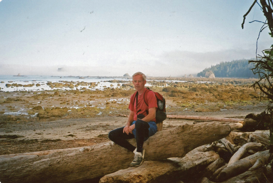
Our next stop was the Kalaloch Lodge, which is in the park and on the Pacific Ocean. Our cabin overlooked the beach (#23). We decided to take a sunset stroll before dinner at the Lodge.
.
.
.
.
.
.
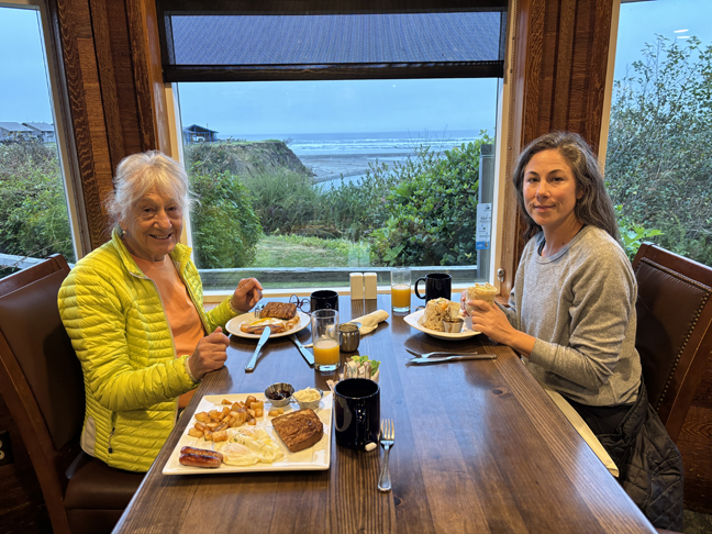
9/26 F – 7am breakfast at the Creekside Restaurant in the Kalaloch Lodge
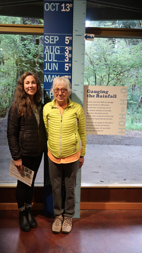
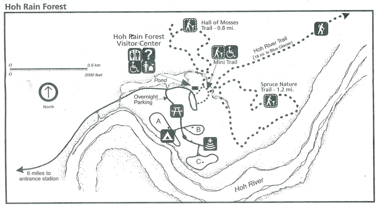
We were at the Hoh Rain Forest Visitor Center at 9am when it opened.
.
Gauging rain by month in the Hoh Rain Forest. Rain totals 140-167 inches per year!
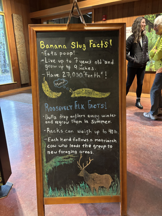
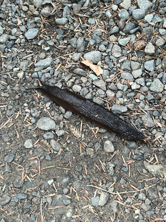
Slugs
.
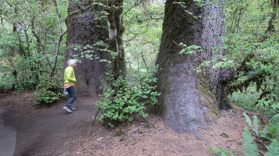
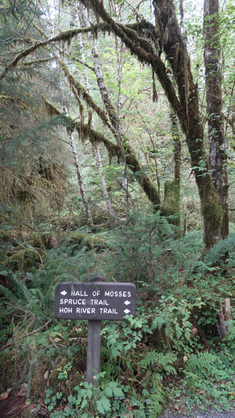
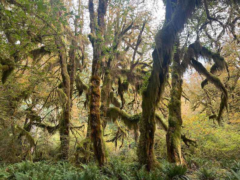
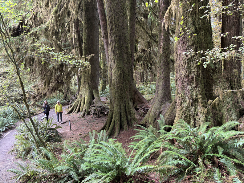
Our first hike was the Hall of Mosses Trail, 0.8-mile.
.
.
.
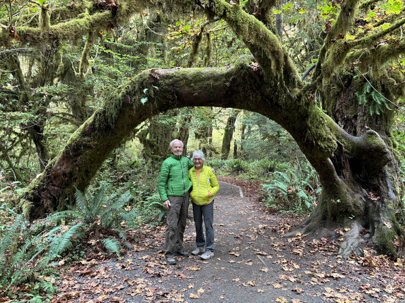
Then the 1.2-mile Spruce Trail
.
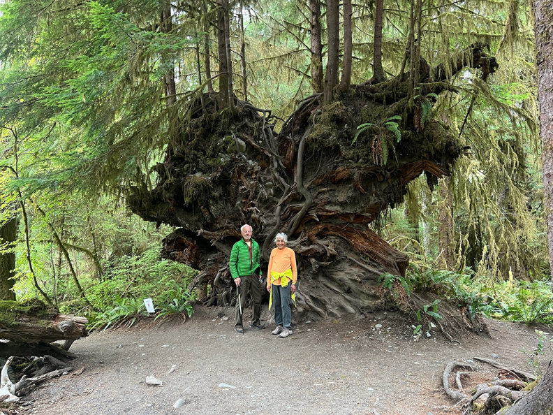
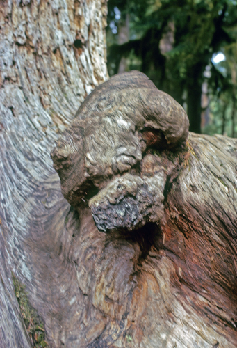
“Nurse Log”
.
Followed by 0.5-mile walk on the Hoh River Trail
We have visited Olympic NP at least seven times. I will be adding photos to this Blog post from previous visits. I will include the year of the photo(s). These were taken in 1969 – my mother Cecile on the Hall of Mosses Trail.
Me
My Mom and brothers Pat and Mike on the Spruce Trail
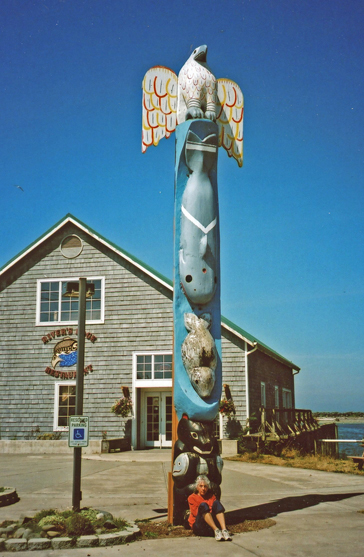
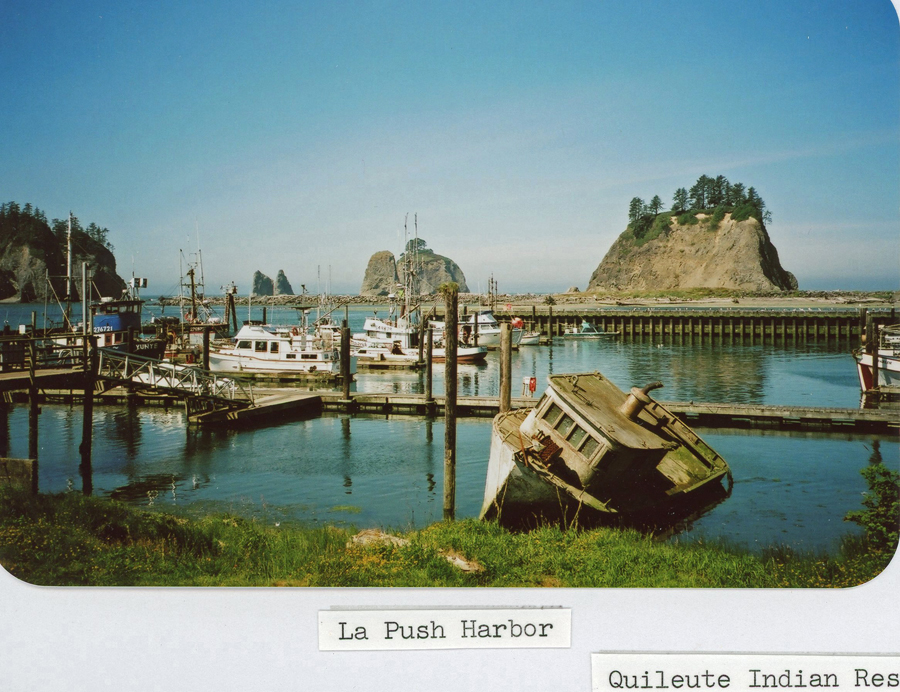
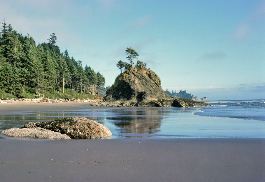
1.5hrs (47mi) from the Hoh Rain Forest to the Quileute Indian Reservation in La Push. The two photos are from 2005. Note Helen at bottom of totem pole.
.
.
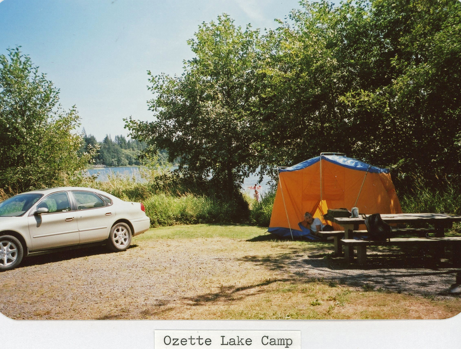
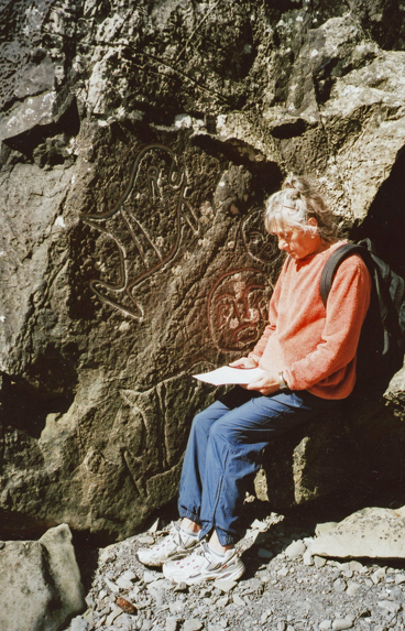
I have photos from three hikes along the coast in 1969. The first hike was a three-leg 9-mile hike that started from the Ozette Lake campground and went 3-miles to the ocean at Cape Alva. The second leg was a three-mile hike on the beach and over rocks to Sand Point, and the third was a 3-mile hike back to our campsite.
.
.
Petroglyphs
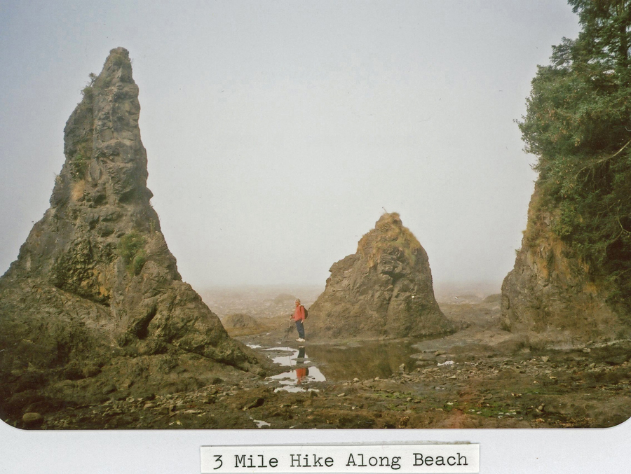
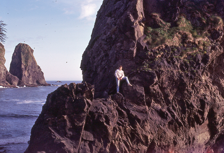
The second hike was three miles round trip (rt) to 3rd Beach south of La Push
.
.
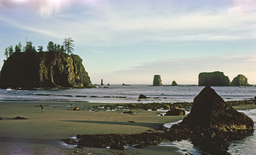
The third hike was to 2nd Beach (2-miles rt) with my mother, brothers Mike and Pat, and Helen
Mike and Pat holding piece of kelp
2nd Beach
.
.
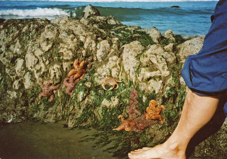
Tidal Zone – Helen’s foot
.
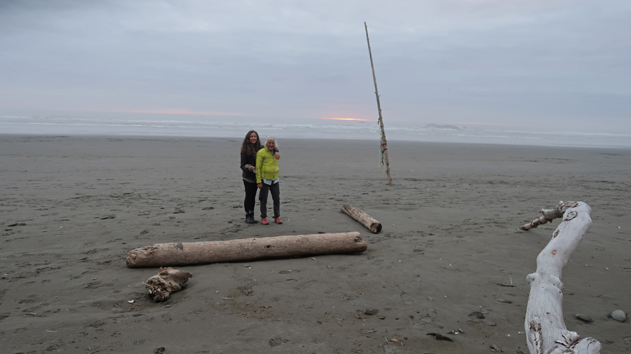
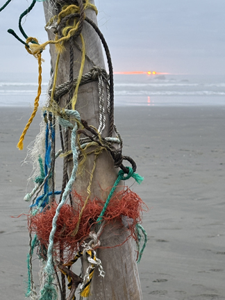
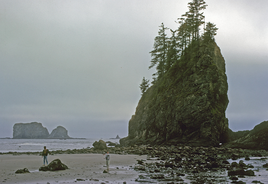
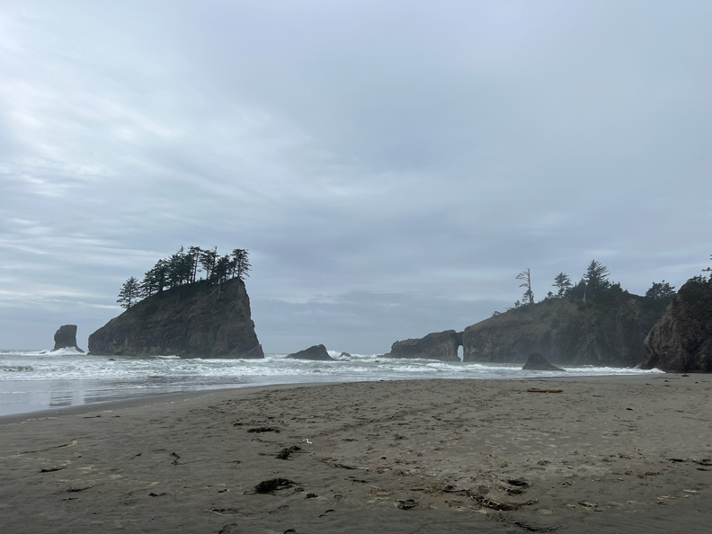
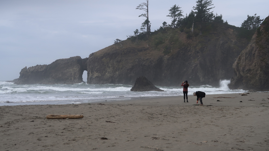
We returned to 2nd Beach on this trip (2025) with Kate, because it was our favorite.
.
Arch close-up
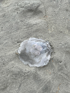
Jellyfish
.
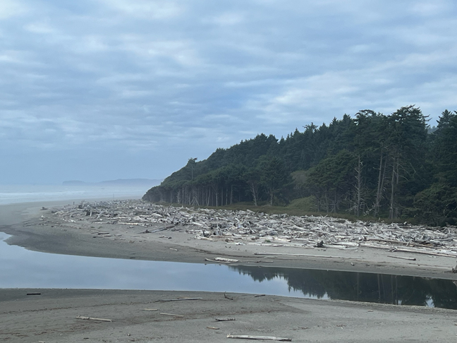
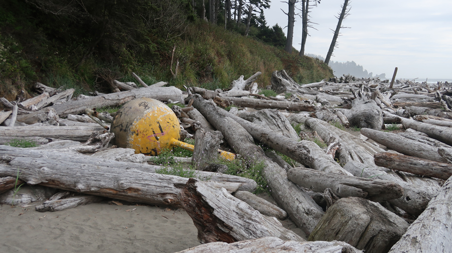
Storm debris
.
Return to Kate’s car. Sequoia was in the shop in Portland for a left rear seal leak, which required new axle shaft, seal, and complete wheel brake system. The same repair was done in LA two years previously, but it failed due to poor workmanship.
.
.
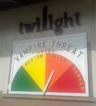
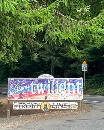
Stopped in Forks for an ice cream. It is the setting for the popular vampire series “Twilight.”
.
In 1969, Helen and I drove to Sol Duc for a backpacking trip with the hope of climbing Mt Olympus (7,980ft), the highpoint of Olympic NP. The Sol Duc Hot Springs Resort was not open that year, but it is open now. We started our backpack toward the mountain not knowing what to expect.
I asked Helen to stop for a photo – she was not too excited about that!
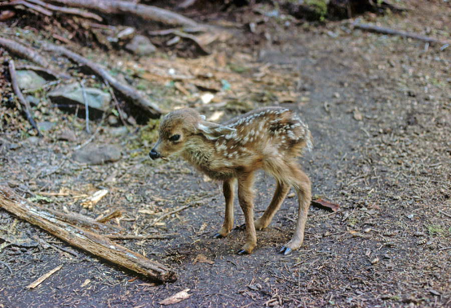
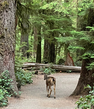
In the end, the snow was too deep and we aborted our mission. On the way back we came across a newly born fawn. We DID NOT touch it because then the mother would abandon the child.
Grown deer –
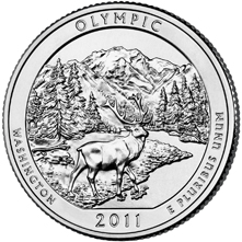
2011 America The Beautiful Quarters Coin Olympic Washington Uncirculated Reverse
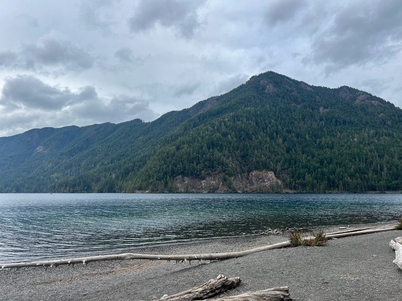
Lake Crescent is located in the N of the park. H & T had a beautiful tent campsite there in 1969. Storm King Mountain (4,534ft) is located just east of the lake, this photo is from 2025.
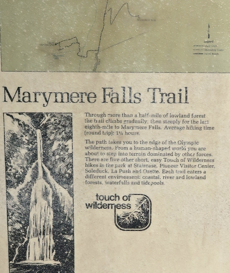
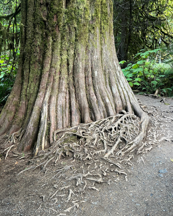
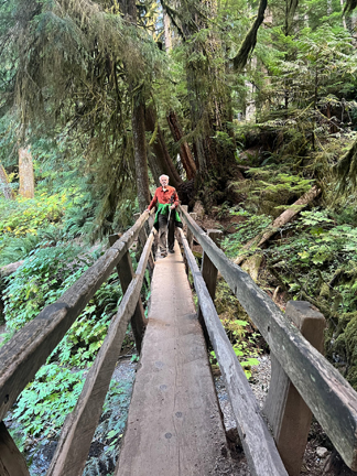
The Trail to Storm King Mountain and Marymere Falls begin near the Lake Crescent Lodge. This is another “Forest” area in the park.
.
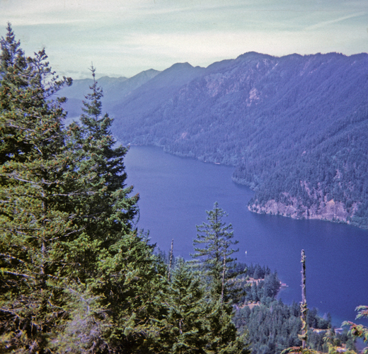
In 1967, Jay and I climbed Storm King Mountain. I took this photo on the way down. Sailboat on Lake Crescent.
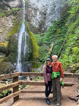
I have hiked the 1-mile rt trail to Marymere Falls three times. The first was with Jay in 1967. The second was with my brothers Mike and Pat in 1969. This is a photo of Mike – “The Thinker.”
The third was this year (2025) with Kate.
Crossing Barnes Creek –
Lower view of Marymere Falls –
Upper view of Marymere Falls –
Returning to car –
.
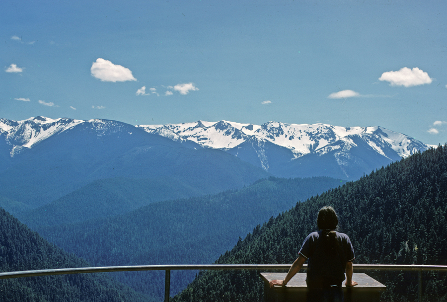
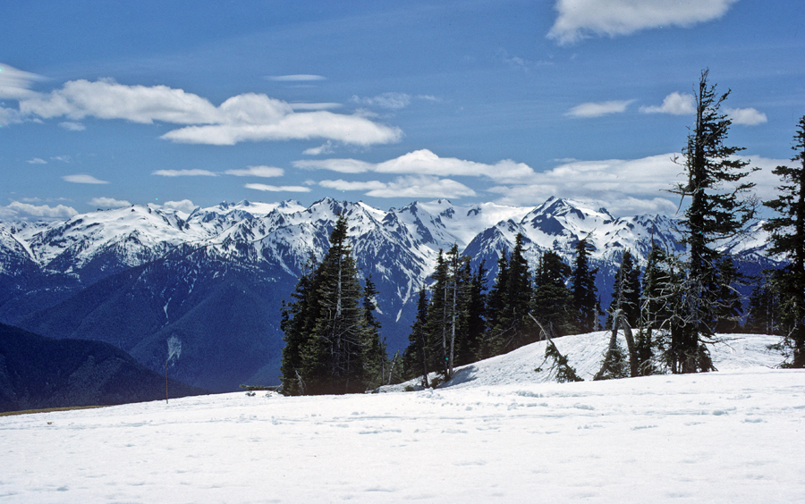
Hurricane Ridge was clouded in on this trip. However, Helen and I had a good day when we traveled there from Seatle on 6/1/1969.
.
.
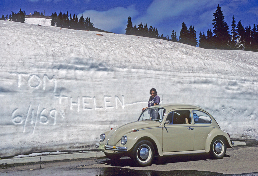
We loved our VW “Beatle.”
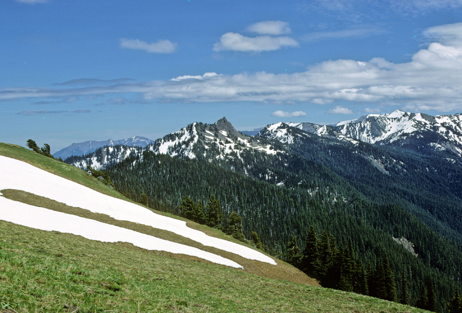
We took a couple of hikes along the ridge. Mt Olympus is to the right in this photo.
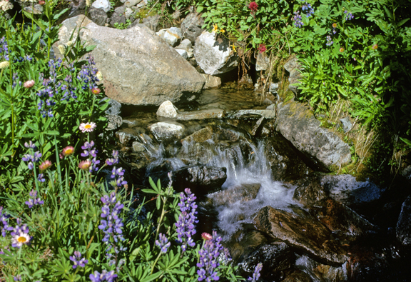
Wildflowers had just started blooming –
.
Olympic NP mountains were usually visible from Seatle – they beckon you to visit! We took advantage of this beautiful day to do exactly that! Checking trails –
.
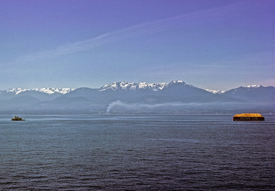
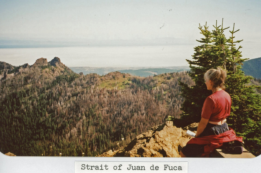
Vancouver Island Canada is on the other side of the Strait of Juan de Fuca.
By the time we got to Port Angeles it was dark. We continued driving around Puget Sound to Kent WA where we stayed in a Best Western motel.
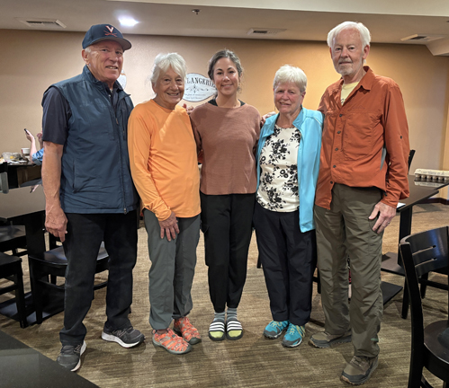
9/27 Sat – Ron and Pat met us at the motel for breakfast.
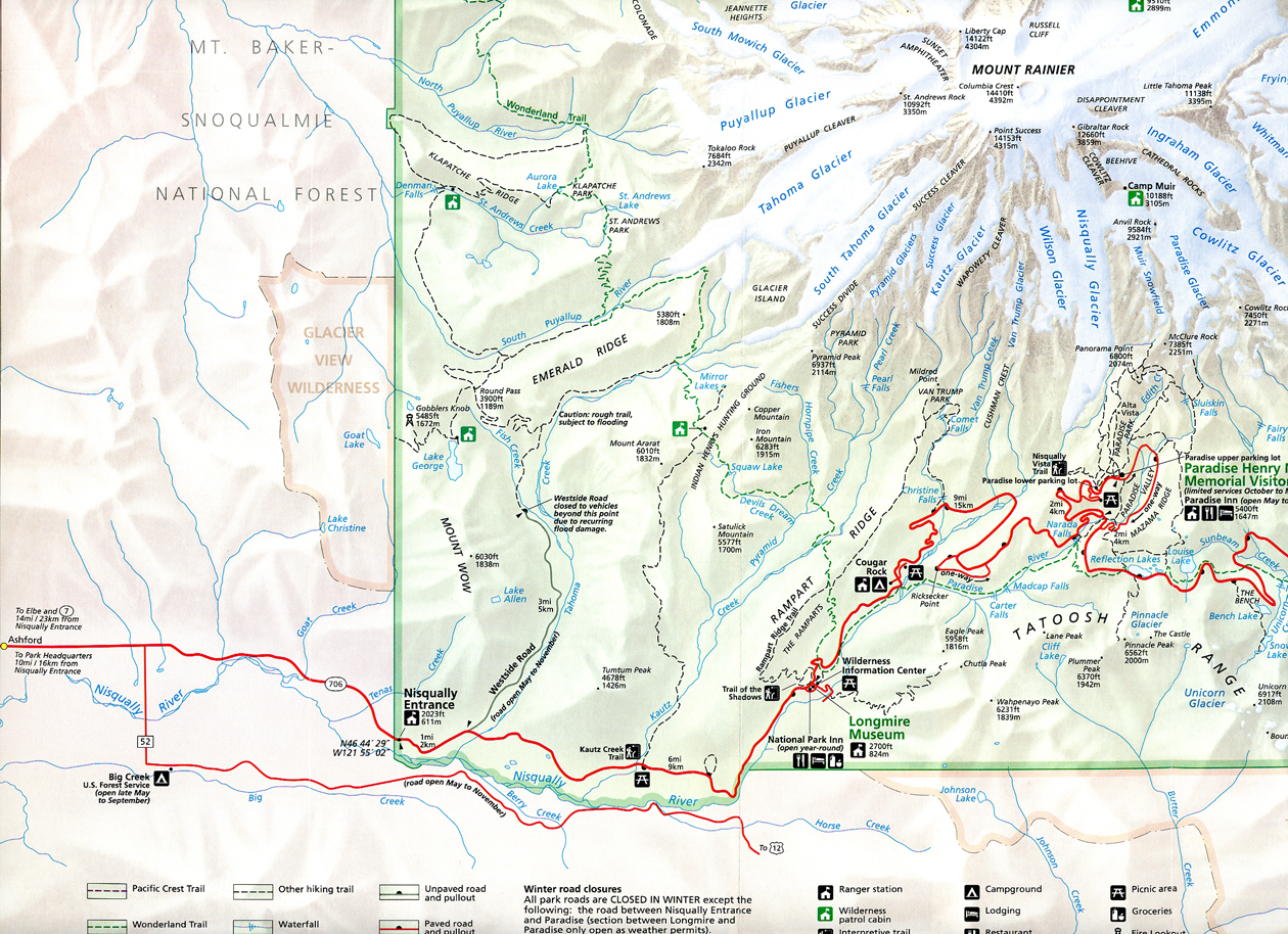
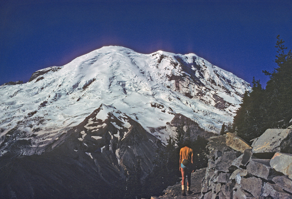
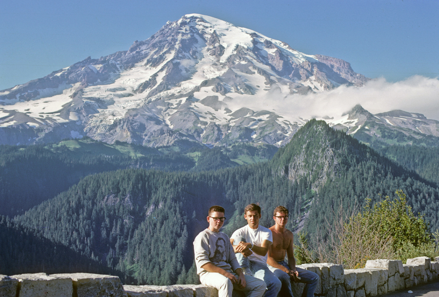
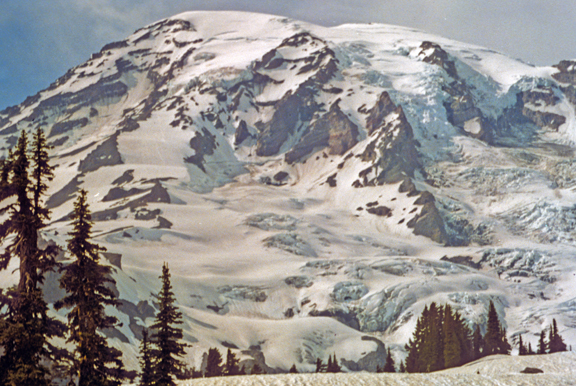
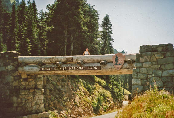
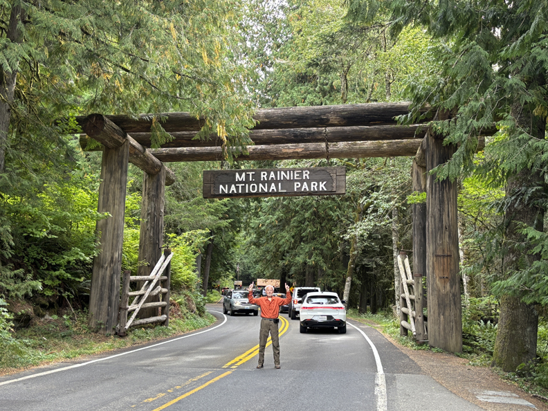
Afterward, we drove 3hrs to the Paradise Henry M. Jackson Memorial Vis Ctr in Mount Rainier NP.
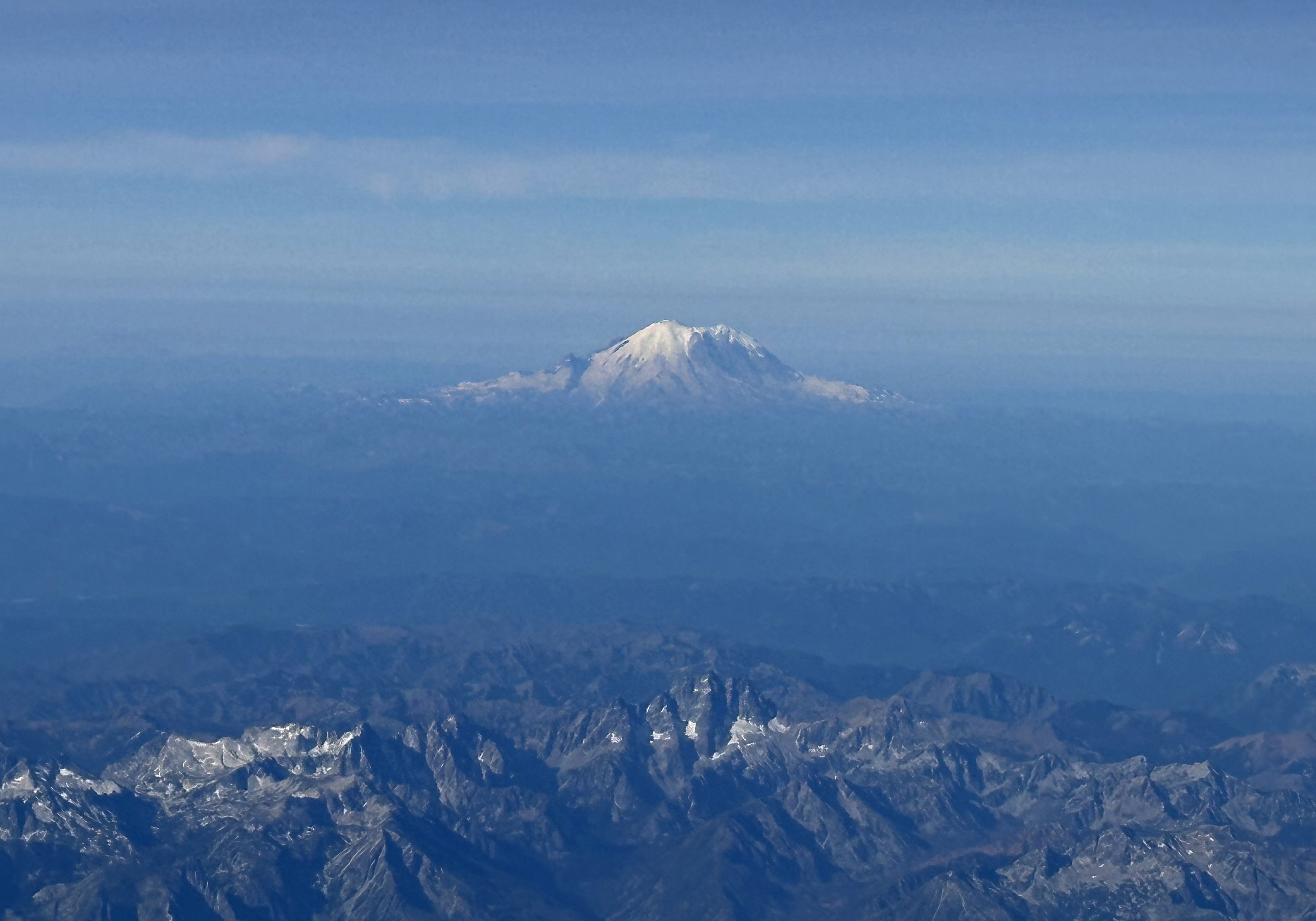
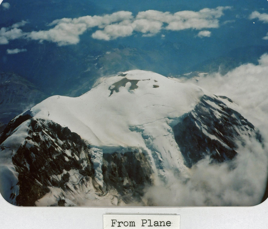
Mount Rainier from airplane August 2025 –
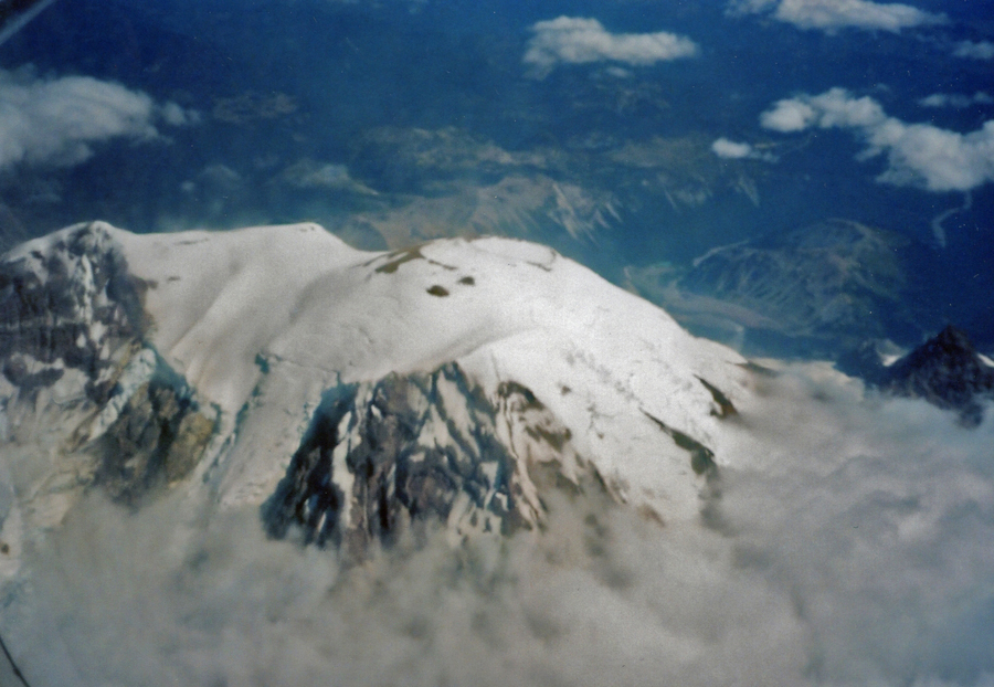
Top of the mountain from plane in 2005 –
.
I saw Mount Rainier (Mt Tahoma) for the first time in 1967 when Jay and I tried to climb it. We needed a permit and met with the climbing rangers to get one. However, they would not give us one because we did not have climbing experience on glaciers.
Marmot
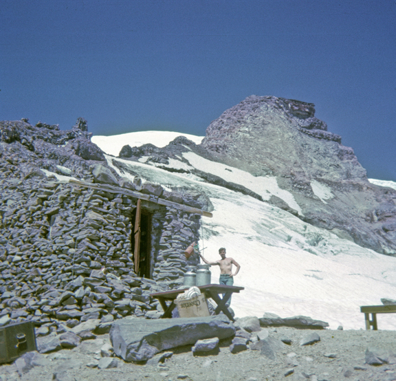
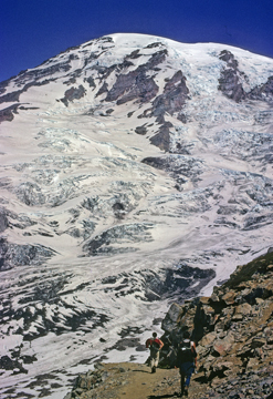
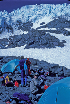
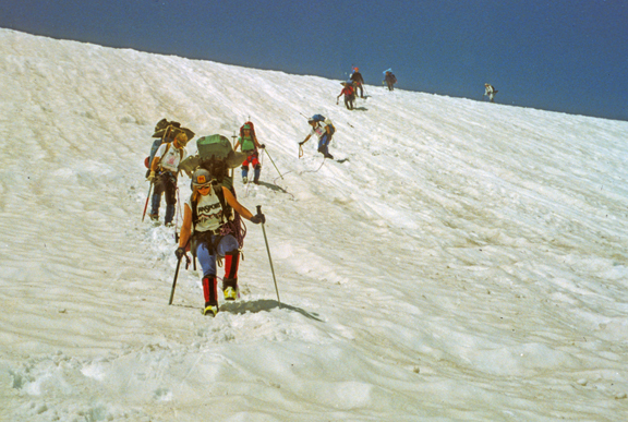
We did climb 4,639ft and more than 9-miles to Camp Muir, which is located at 10,000ft
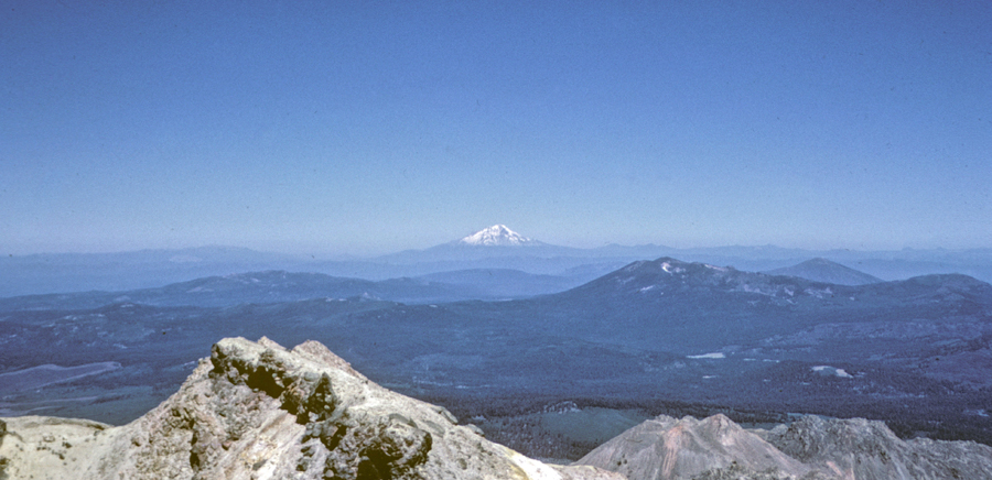
Mount St Helens from Camp Muir – before it erupted!
In 1969, Helen and I invited our Canadian friends George and Linda to climb Mount Rainier with us.
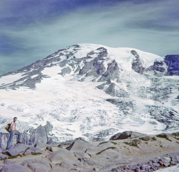
Mt Rainier from the West –
We would all climb to Camp Muir and then George and I would summit early the next morning, while the ice was still stable.
The Skyline Trail –
Backpacking up the Muir Snowfield –
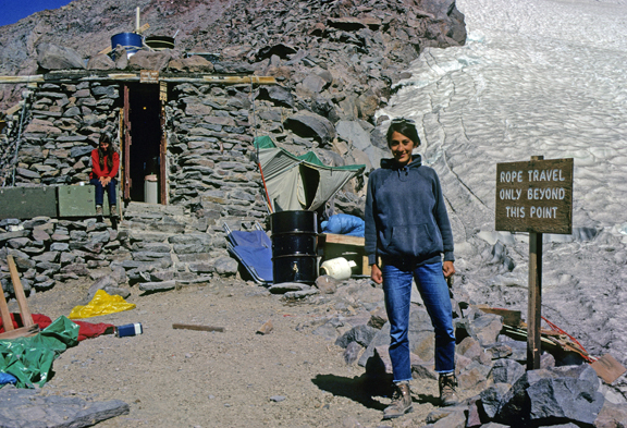
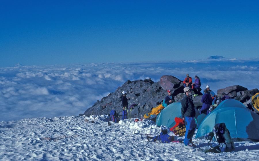
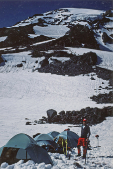
Camp Muir
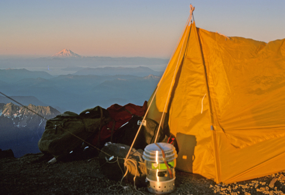
Our tent, note the stove and cook pots –
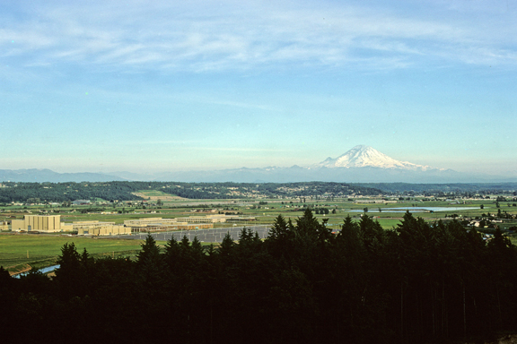
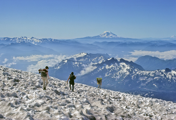
Mt Adams left, Mt Hood center, Mt St Helens right
After having a problem with altitude sickness, George and I decided not to attempt the summit. We packed up after a light breakfast and headed down the mountain. This photo shows us descending through “sun cups” with Mt Adams in the background.
Back on the Skyline Trail with Mt St Helens in the background –
Helen and I visited the NP several times 1968-69. In the Fall of 1968, we drove to the Sunrise Visitor Center on the East side of the mountain.
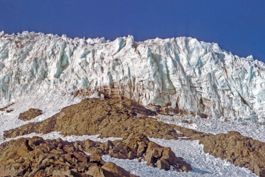
Note the Emmons Glacier on the left of Steamboat Prow. It is the largest glacier in the lower 48 states and provides another route for climbing the mountain.
Starting our 7-mile rt hike.
.
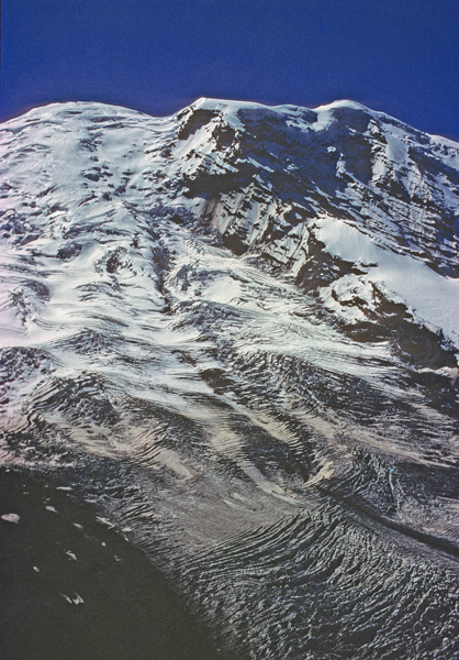
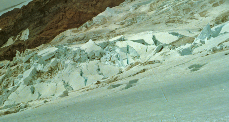
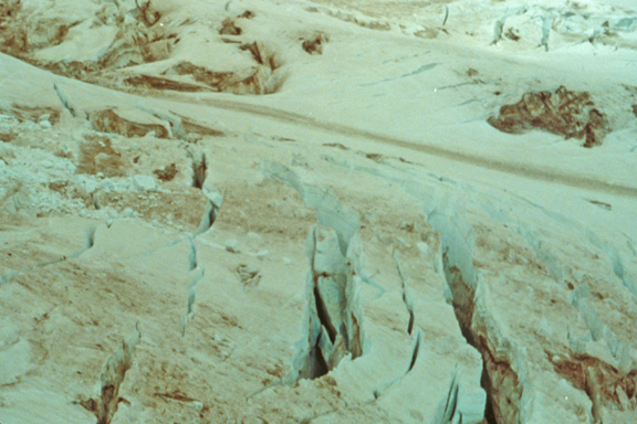
We hiked the Wonderland Trail to a point overlooking the Winthrop Glacier. The photos follow the glacier from its origin to its terminal moraine.
Note Crevasses
.
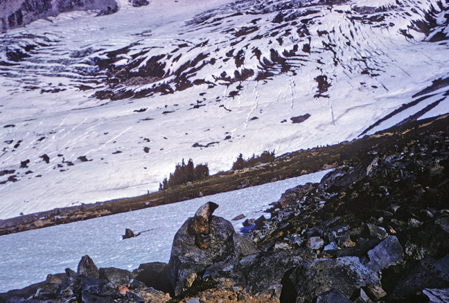
Toe of the Winthrop Glacier, moraine, and Mystic Lake
We met Bob and Sue from New Zealand on this hike; they became our lifelong friends. They were living in Tacoma at that time but then moved to an apartment complex on Mercer Island, right next to ours! Bob was a doctor on a grant at the U of W. He specialized in the cause and treatment of pain and was also a spelunker (explores caves). Here is a photo of my favorite mountain from the U of Washington.
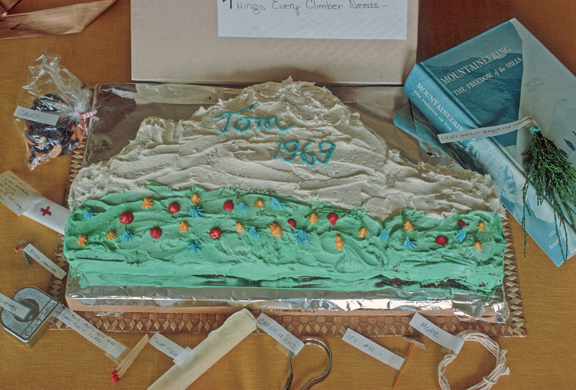
My birthday cake – June 1969
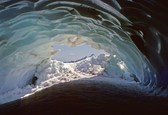
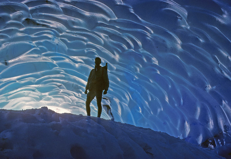
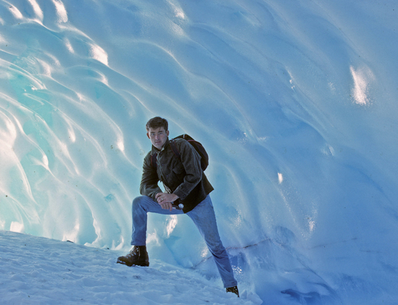
In July 1969, Bob and I went on an adventure to explore the ice caves in the Paradise Glacier on Mount Rainier.
Bob
These caves have collapsed because of global warming.
The color of ice – with light filtering through
In August 1969, I took my mother and brothers Pat and Mike to the Visitor Center and Paradise Inn.
.
.
On July 12, 1991, I arrived in Kennewick WA to visit Stacy. She had a Paper Science and Engineering Internship at a Boise Cascade White Paper Division Plant. The next day she picked up Ken and James, and they followed me to the White River Campground on the east side of Mount Rainer.
.
Early the next morning, we drove to Sunrise for the sunrise. It was beautiful!
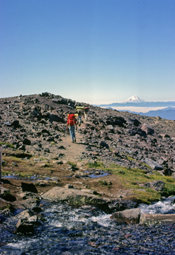
We then went back to the campsite and hiked to the Glacier Basin Overlook.
.
.
Afterward, we drove around the SE corner of the NP –
to the Paradise Visitor Center, where we took a walk on a snowfield.
Stacy, Ken, and James returned to Kennewick WA, and I slept in the van.
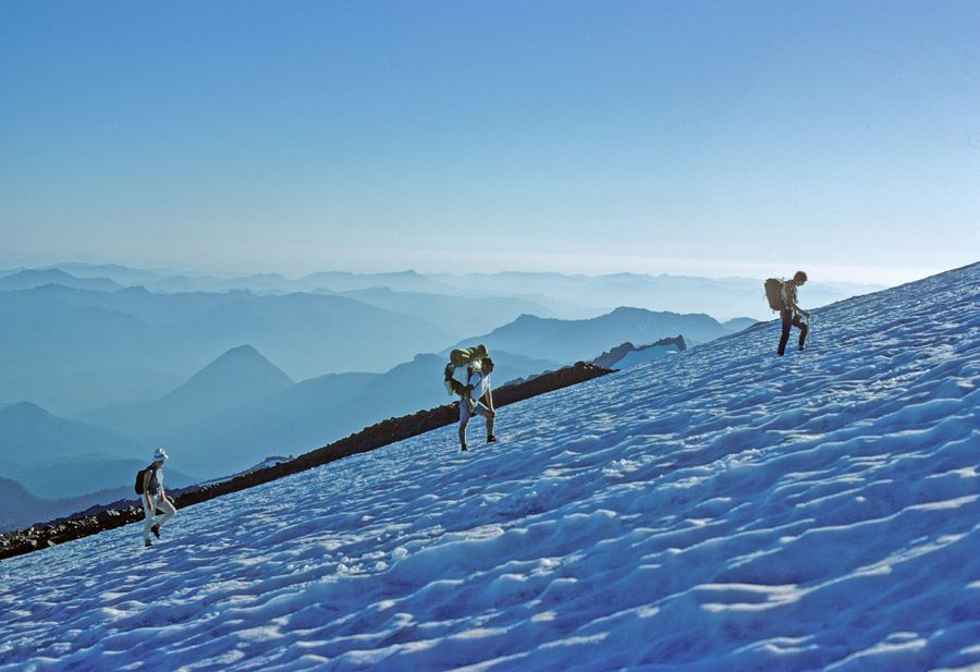
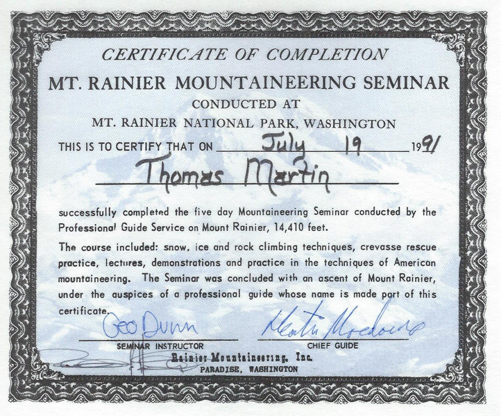
The next morning, I signed in with Rainier Mountain Guides, met my tent mates Steve and Peter, and started up the Muir Snowfield in a heavy mist and rain carrying a 50-pound backpack. I was on a five-day glacier climbing seminar.
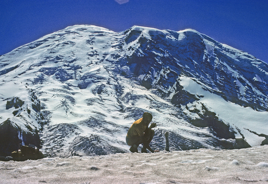
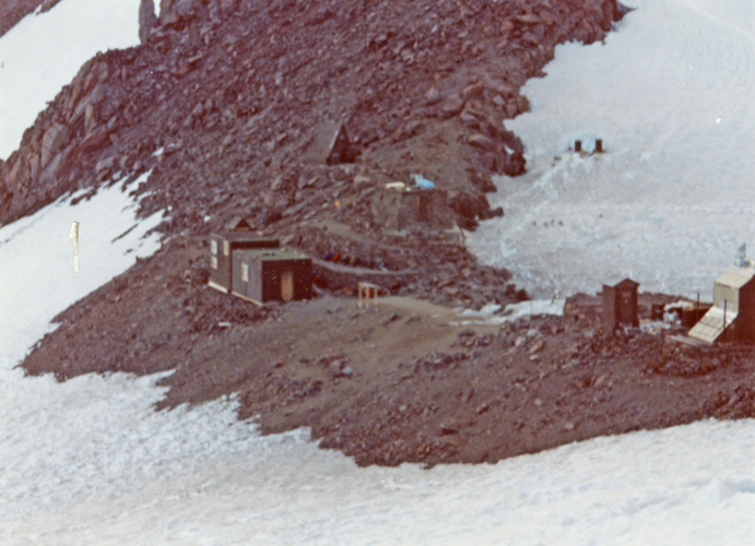
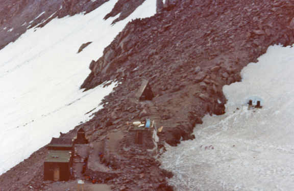
We set up camp at 9,700ft, just below Camp Muir. I hiked up to take these photos.
.
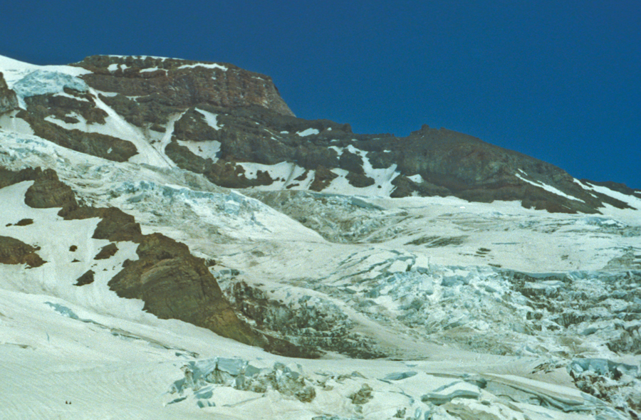
Nisqually Glacier
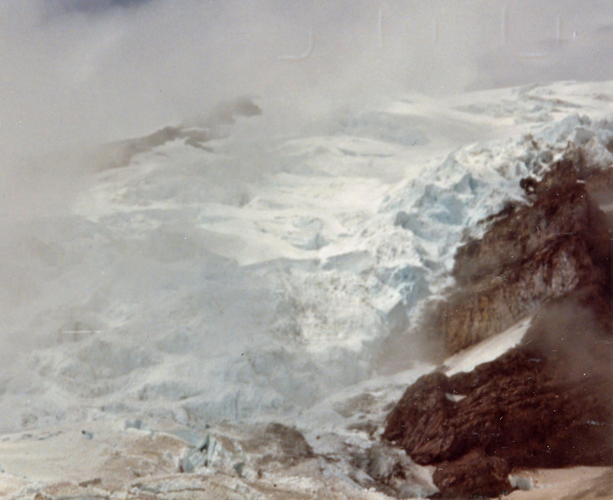
The next morning, we had ice axe, crampon, and basic rope practice and then trekked across the Nisqually and Wilson Glaciers to our next camp.
We had to find a way through the crevase fields.
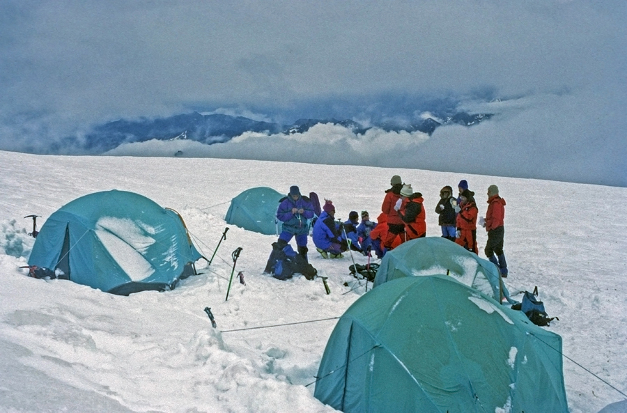
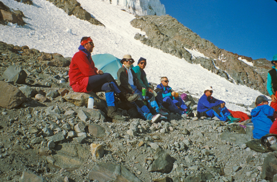
Camp 2, 9,000ft – Peter, Steve, Tom and gear had to fit into one of these VE25 North Face tents.
About an inch of snow fell overnight. In the morning, we had more crampon, rope, and crevasse rescue practice. At 11am, we started a strenuous climb up the Kautz Glacier. Camp 3 was on a rocky outcrop at 11,200ft.
We were up at 2am to prepare for the push to the summit. We left camp at 4:15am with headlamps to light the way. The guides placed fixed ropes on a steep slope next to the icefall, and that is where the steepest climb began. Photo taken day before.
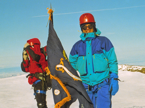
Reached the summit, Columbia Crest 14,410ft, of Mount Rainier at 9am on July 18, 1991. I had a teammate take the obligatory summit photo.
We then found and signed the summit register; tentmates Peter and Steve.
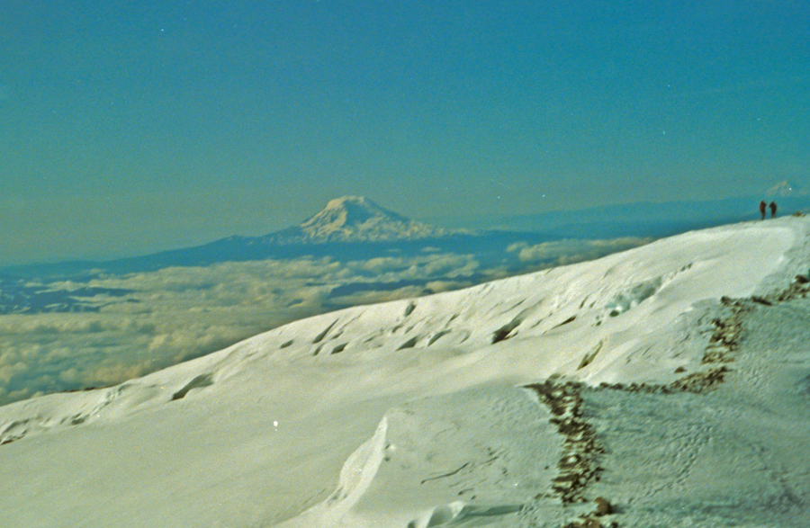
Descending from the summit crest – Mt Adams in background
.
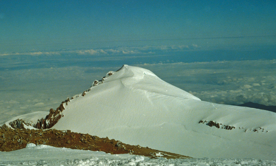
Dropping down onto the Kautz Glacier
Passing icefall on the way down to Camp 3
We had a rest stop and packed up our gear at Camp 3.
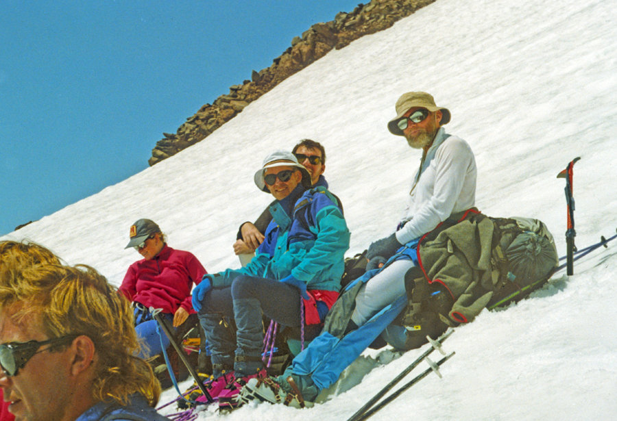
We then descended 3,000ft down the steep slope of the Kautz Glacier. The top was slushy because of the sun with ice underneath. Everyone fell at least once and used the ice axe self-arrest to stop. Photo of rest stop; notice, we are all tied into the rope for safety.
I was able to get this photo lower on the glacier.
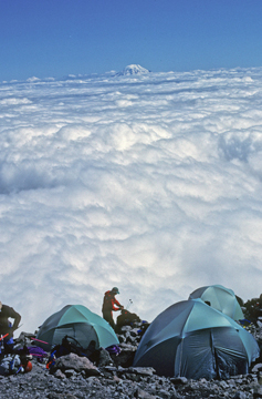
Camp 4 –
.
Photos taken on the descent to Paradise
.
.
.
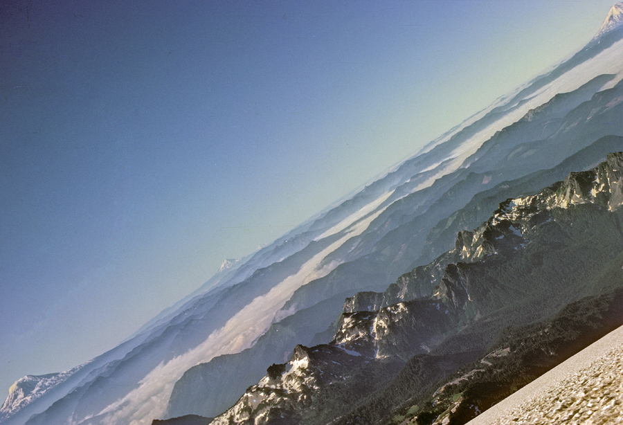
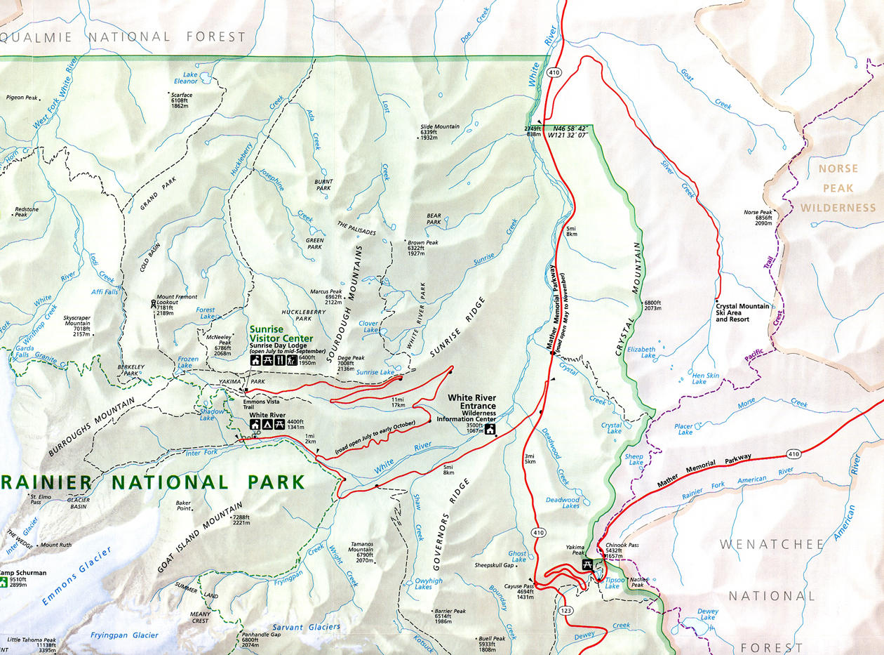
In 2005, Helen and I made a visit to the east side of Mt Rainier. These photos were taken near Chinook Pass, when we did the 3.5-mile Naches Peak Loop Trail. The first is a popular view of Mount Rainier from Tipsoo Lake. I have seen it on several Calendars.
The Pacific Crest Trail crosses this bridge over Rt-410, the Mather Memorial Parkway.
.
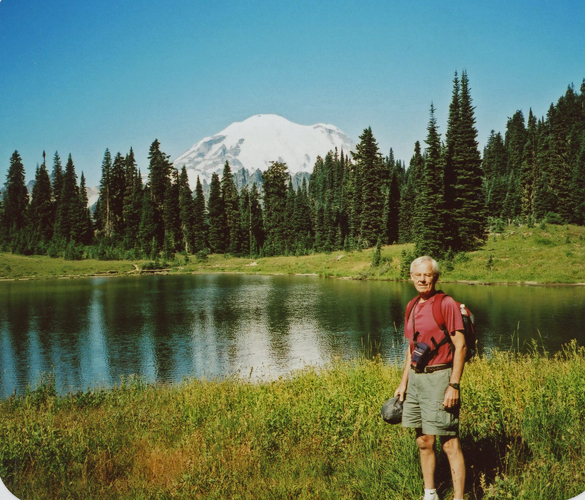
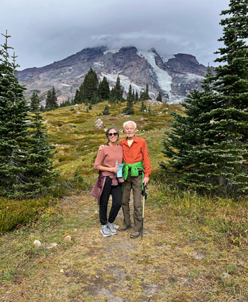
In 2025, we visited the south end of the park with Kate.
Leaving from the Visitor Center, we hiked the Skyline Trail to the Glacier Vista at 6,336ft, a gain in elevation of almost one thousand feet.
The Tatoosh Range to the South
.
Mount Rainier covered with a lenticular cloud, indicating high winds at the top of the mountain. It is recommended that you not climb into such a cloud.
These photos were taken on the way down
.
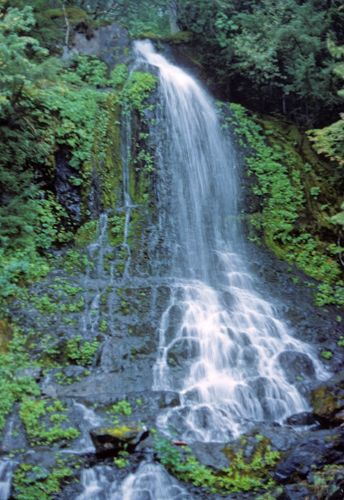
We then did the 1-mile rt Myrtle Falls Trail.
.
After stopping at the Henry M. Jackson Memorial Visitor Center for an ice cream, we had a 3-hour ride back to Portland where I picked up our Sequoia – with the left rear axle, seal, and brake repaired. I was fortunate to get it fixed without having to change our itinerary. Kate went to pick up Benne and Greta and we met at her home for dinner.
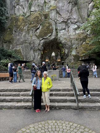
9/28 Su – after mass at the Chapel of Mary at the Grotto, we went to the Javi restaurant for breakfast.
We spent the rest of the day relaxing and packing for our circuitous trip back to OH.
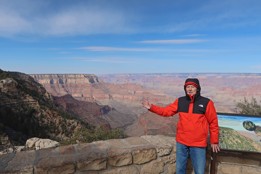
2/11/25 Tu – Drove north 4hrs from Scottsdale AZ to the Tusayan Ranger Station for Kaibab National Forest where I picked up information and a vey helpful map of the USFS Tusayan Ranger District. I then proceeded 6 miles to the South Rim of Grand Canyon NP. Despite some sun, the temperature in the low 40s with a strong wind, made for a cold day. Photos are from Mather Point.
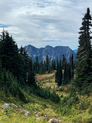
Drove east about six miles to Grandview Point on the South Rim and then, after about two miles, turned south into Kaibab National Forest.
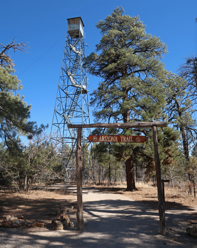
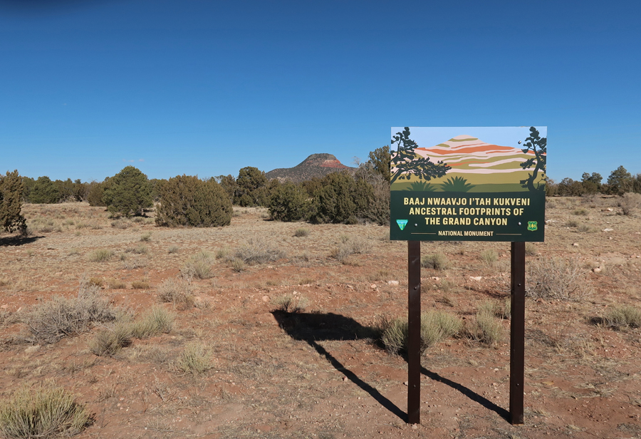
My first stop was the USFS Grandview Tower in Baaj Nwaavjo I’tah Kukveni –Ancestral Footprints of the Grand Canyon NM.
I held on tight as I climbed the 80-foot 1930s steel tower in high winds. This photo was taken looking north toward the South Rim of the Grand Canyon.
President Biden designated this National Monument in 2023 after a request from the 13 tribes of the Grand Canyon Tribal Coalition. There are large sections of the NM both south and north of Grand Canyon NP.
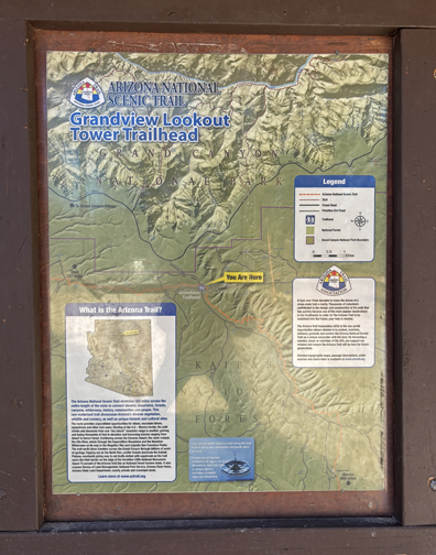
I then did a short hike on the Arizona National Scenic Trail, which starts on the AZ-UT border, passes through the Grand Canyon, and continues south for over 800 miles to the Mexican border.
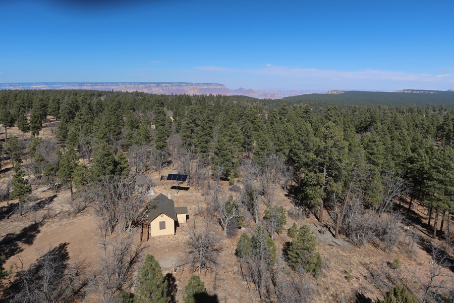
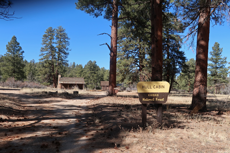
The 1880s Hull cabin, which is on the National Register of Historic Places, is 2-miles from the tower and can be rented from the USFS. William Hull raised sheep and was one of the first to take tourists to the Grand Canyon.
I then drove Forest Service roads to a gate and water tank about a half mile from the Old Grand Canyon Airport.
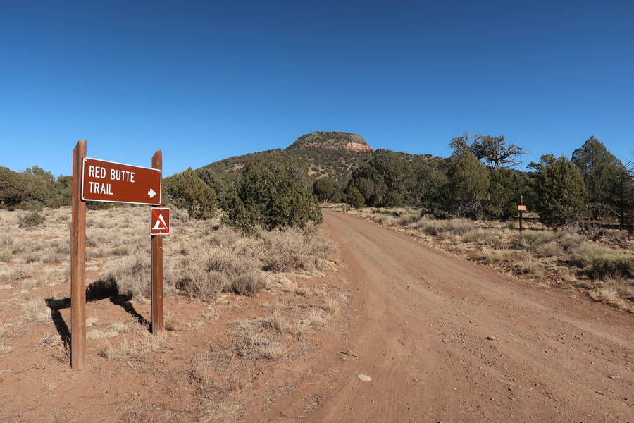
My last stop was the start of the Red Butte Trail.
The 2.4-mile rt trail leads to the Red Butte USFS Fire Tower and the top of Red Butte (7,326ft). The trail gains about 1,000ft in elevation.
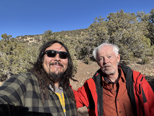
Red Butte is sacred to the Havasupai Indian Tribe that live in the Grand Canyon. I met Bobby, an Indian from the Four-Corners area at the trailhead. Among other things, he is a photographer and had just finished flying his drone around the top of Red Butte.
One frame of his drone footage of me –
Departing the NM –
Returned to the Holiday Inn Express in Scottsdale AZ
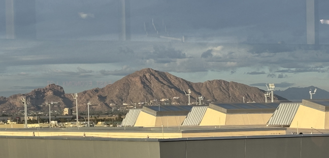
2/12 W – Spent the day in the Phoenix area. Drove around Camelback Mountain looking for the location from which George Bickerstaff may have painted the landscape oil that we have in our living room. Bickerstaff was an early nineteenth-century American Expressionist painter.
This is the view from the porch of the JW Marriott Scottsdale Camelback Inn on Lincoln Dr. This photo was taken looking South. The real location may be NW from here in the Paradise Area, OR, it is not a painting of Camelback Mountain!
Camelback Mountain from the airport train when I arrived (view looking North) –
Another view looking North, from the South side of Camelback Mountain – this looks more like the painting.
View from Arizona Falls, which are man-made, on the Arizona Canal that runs through Phoenix. There is a small hydroelectric plant there.
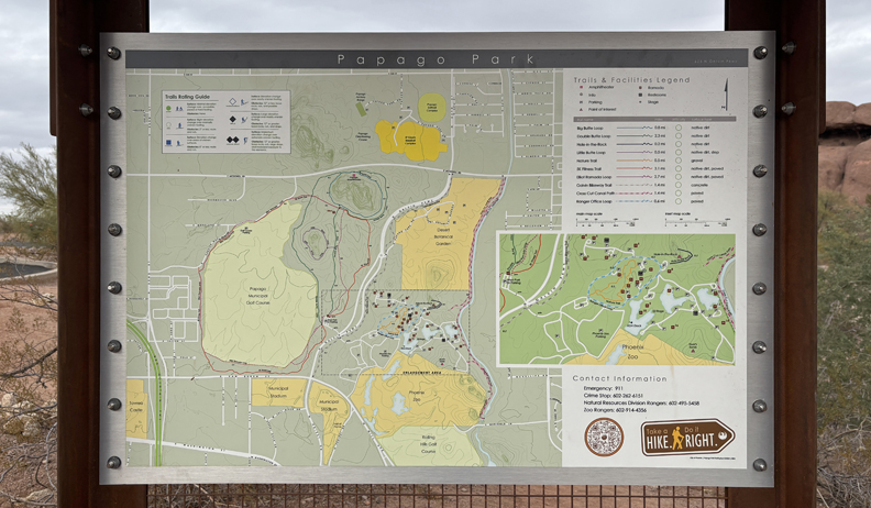
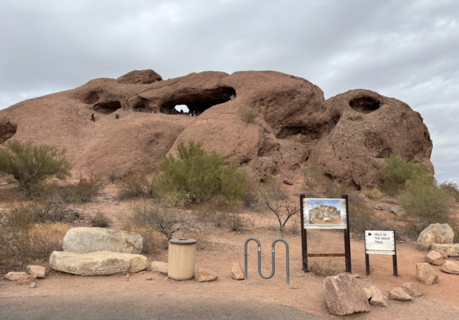
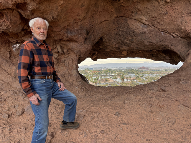
I then visited Papago Park next to the Phoenix Zoo.
Did the short hike to “Hole in the Rock,” a red rock butte.
Only a half mile round trip.
Looking East toward Zoo through “Hole in the Rock”
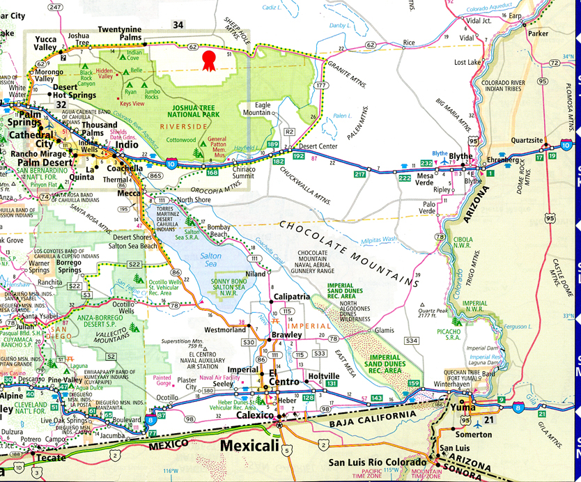
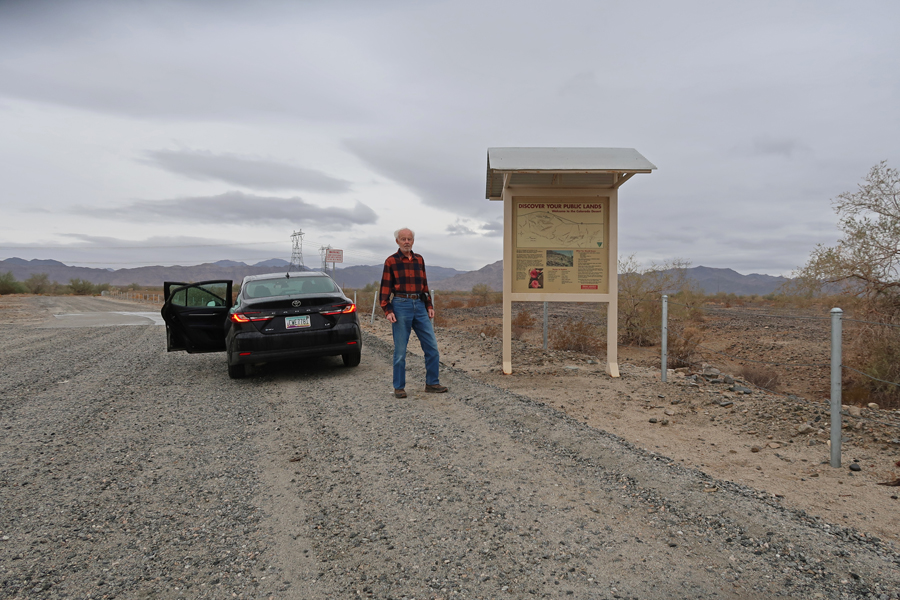
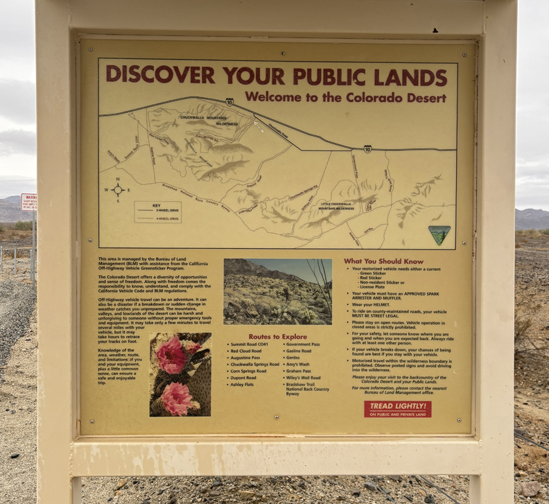
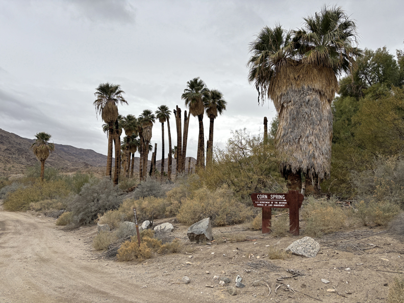
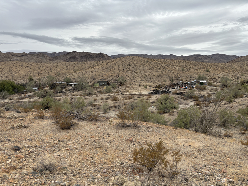
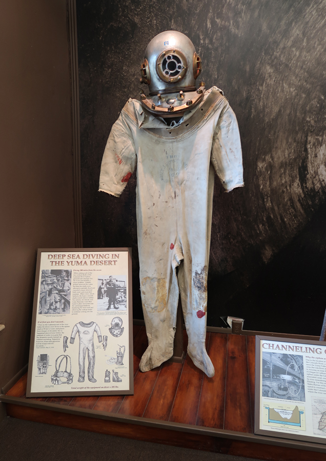
2/13 Th – 4hrs (212mi) from Scottsdale AZ to Corn Springs CA in Chuckwalla National Monument (BLM). See Chuckwalla MTNS Area south of I-10. Gravel Road to Corn Springs Campground and Corn Springs Mining Area.
The new NM is in the Colorado Desert of Southern CA that protects 624,270 acres of desert habitat in Riverside and Imperial counties from development. The monument spans several mountain ranges between Joshua Tree National Park and the Chocolate Mountain Aerial Gunnery Range, designated a NM on 1/14/2025, shortly before President Biden left office. Corn Springs Palm Oasis and Campground.
0.5 Mile Interpretive Trail – it was a cloudy day with the temperature getting up to about 55 degrees. Also, there was scattered rain, which is very unusual in this desert location.
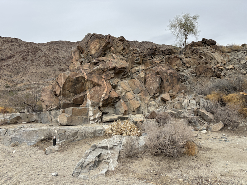
Petroglyphs – some said to be over 10,000 years old, others grafitti.
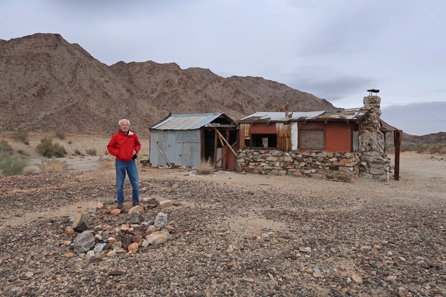
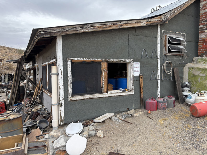
Edward Wodetzki’s Miner’s Cabin and remains of a mill.
Corn Springs Mining Area – sign on building states “Active Mining Claim.”
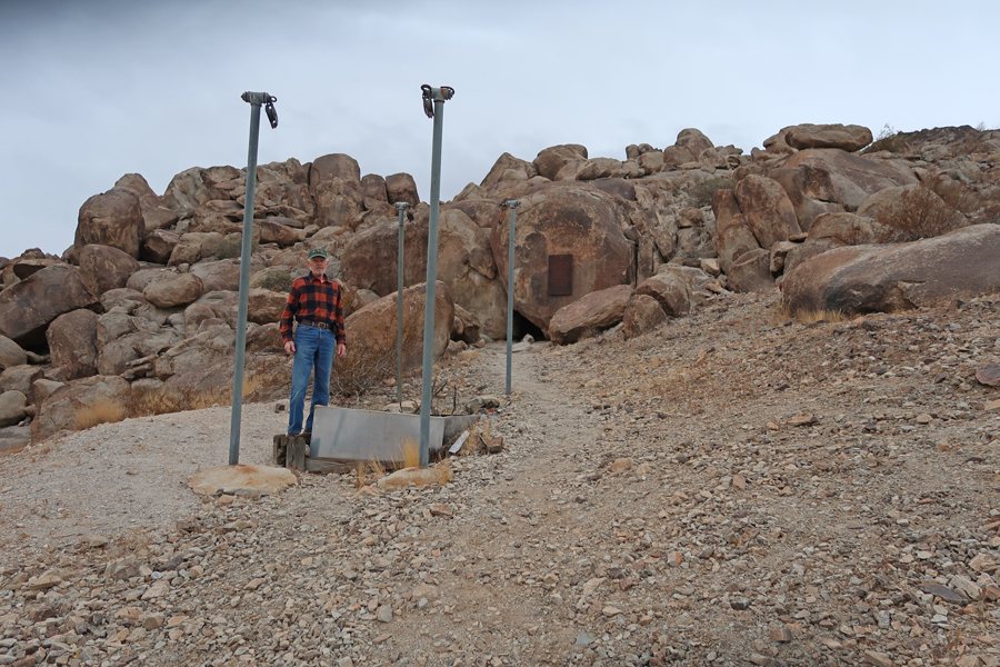
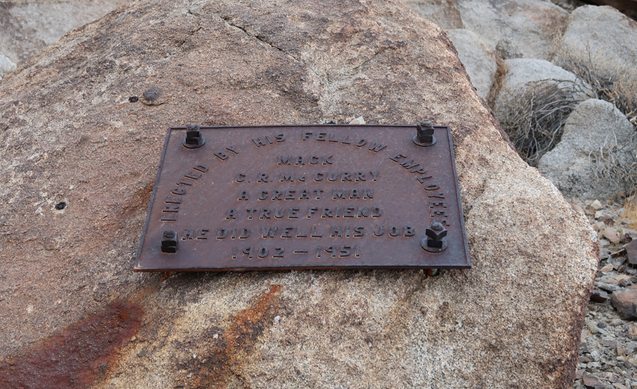
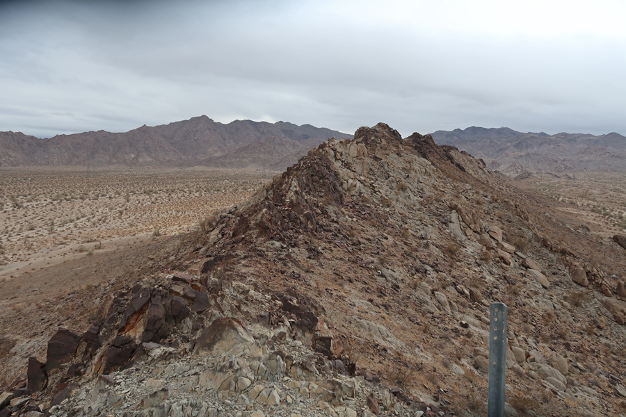
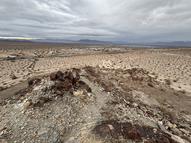
It took about an hour to return to I-10, drive to the Desert Center Exit, and then drive a short distance to the location of Desert Steve’s Cabin and his plaque at the base of Alligator Rock, which is within the new Chuckwalla NM.
There is another plaque there as well – Mack, “He Did Well His Job.”
I hiked to the top of the alligator’s head and looked down his spine. Alligator Rock has spiritual and cultural significance for local tribes.
I-10 from the top of the alligator’s head –
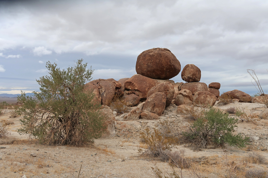
It took about 15-minutes to drive to the Edmund C Jaeger Nature Sanctuary, which is also within the new NM.
Some nice balanced rocks there –
2.5hrs (135mi) from Edmund C. Jaeger Nature Sanctuary to Yuma AZ.
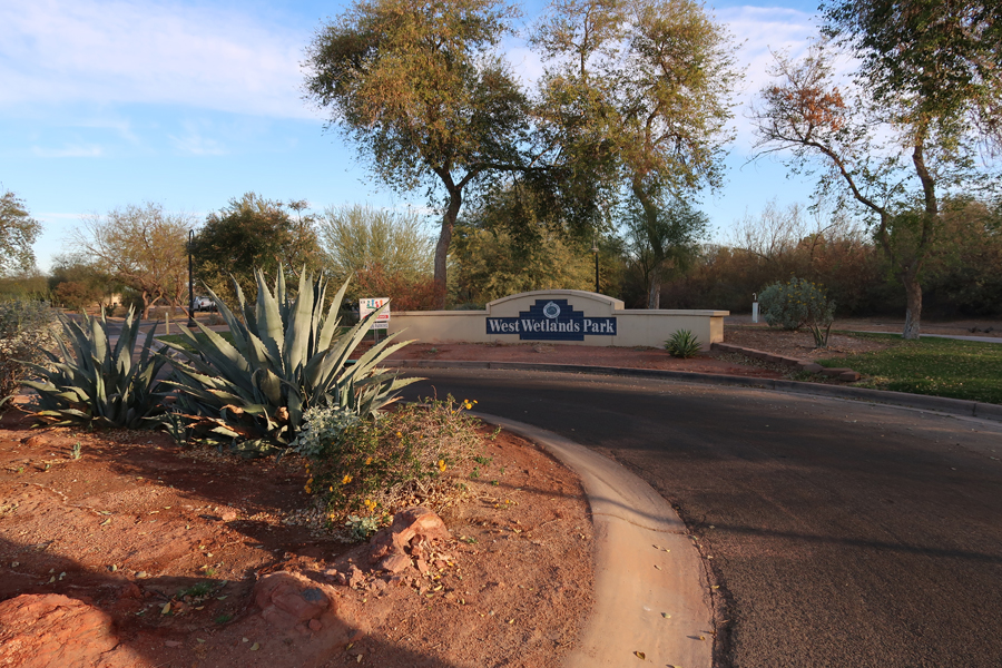
2/14 F – Valentines Day – I arrived at West Wetlands Park, which is on the Colorado River in Yuma AZ, at about 8am. It was my first stop in Yuma Crossing National Heritage Area (NHA). Yuma is close to both the CA and Mexican borders.
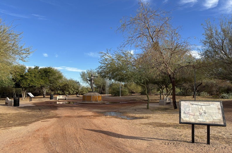
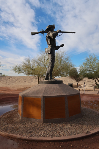
There was an interesting Mormon Battalion Monument – “Army of the West” in the park just past this trail bridge. The battalion marched 2,100 miles from Iowa to Southern California establishing the first wagon route to the Pacific Coast – watch out for Rattlesnakes!
The statue is of Philemon Merrill who led the battalion (~500 enlisted and volunteer men). The Battalion was operational from 1846-1847 during the Mexican American War.
This map shows some of the major sites in the Yuma Crossing NHA that are east of West Wetlands Park.
In 1775-76, Spain sent the Juan Bautista de Anza expedition 1,000 miles from Sonora Mexico to Alta CA to establish a route to settle the port of San Francisco. The local Quechan tribe assisted the expedition in crossing the Colorado River at present-day Yuma. Yuma is one of the sites along the NPS Juan Bautista de Anza National Historic Trail.
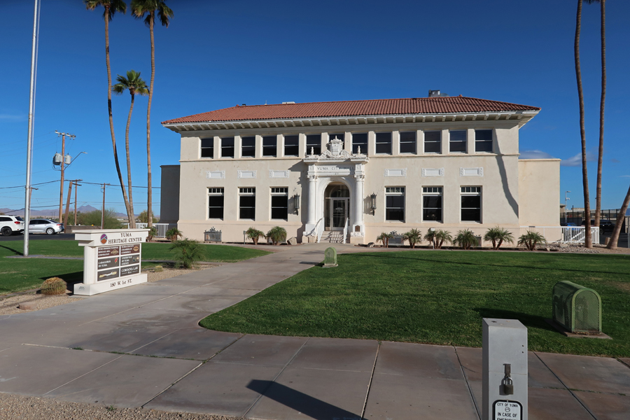
I stopped by the Old Yuma City Hall to pick up some literature from the office of Yuma Crossing NHA. According to the Guinness Book of Records, Yuma AZ is the “Sunniest City on Earth!”
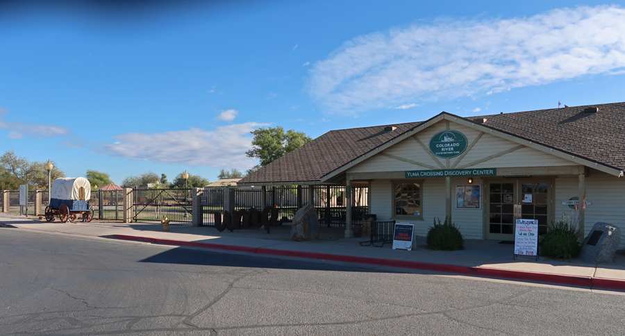
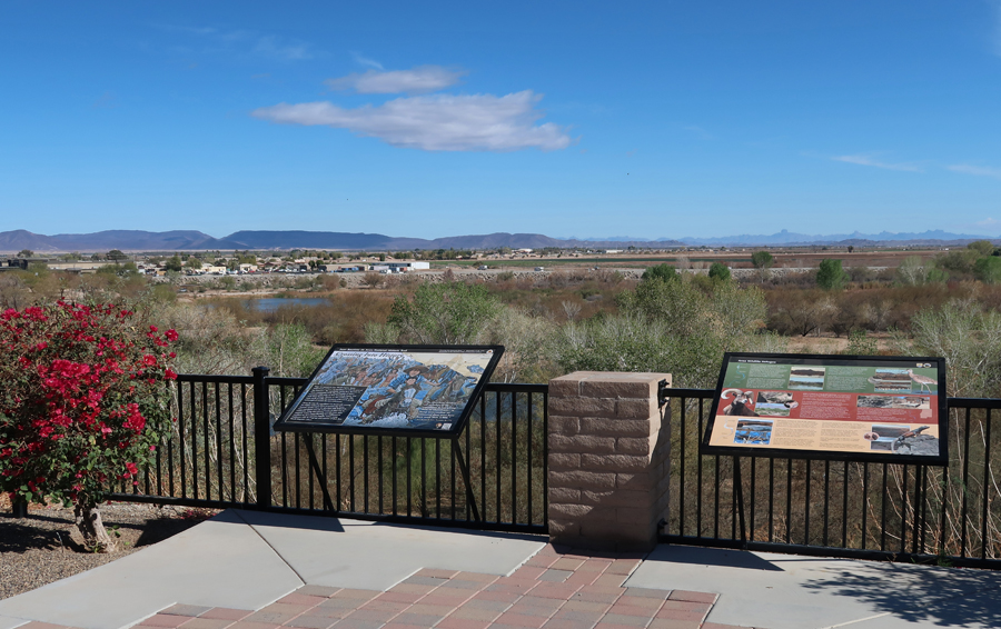
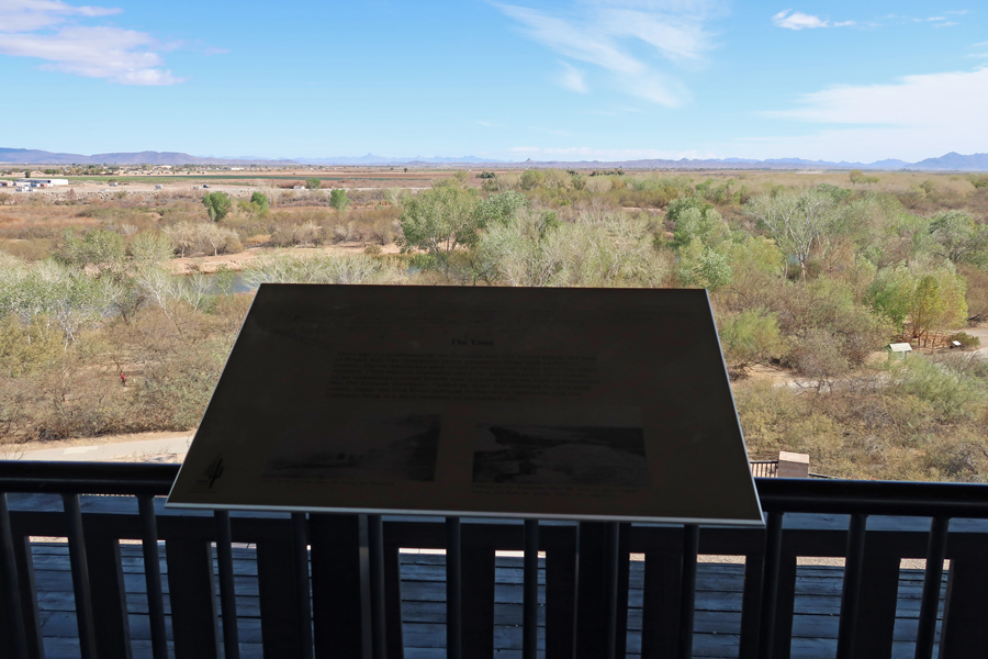
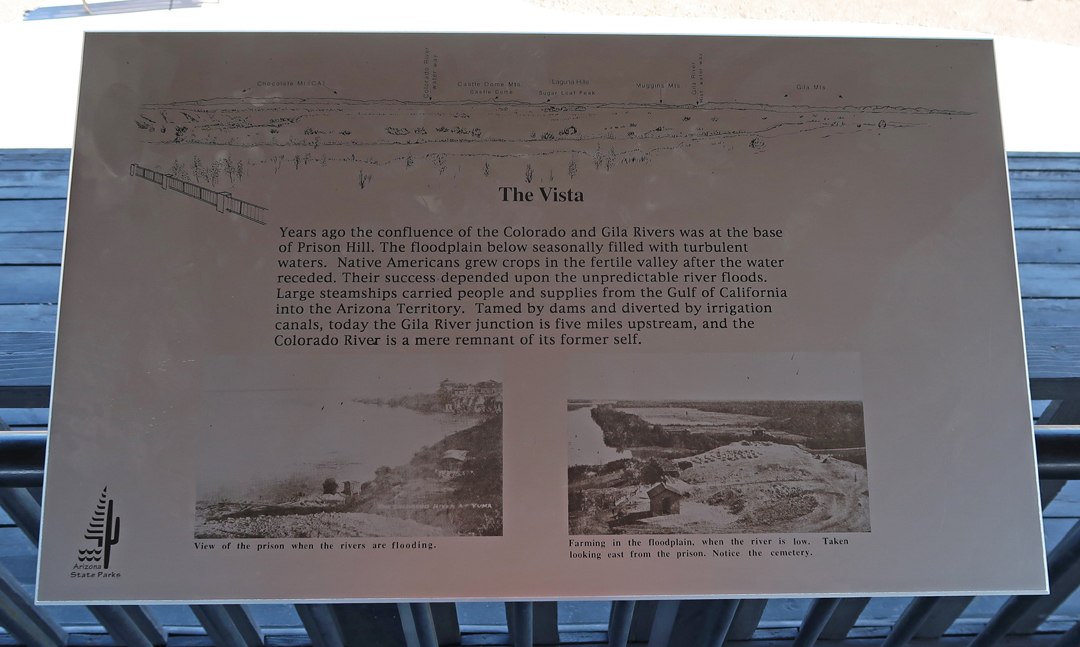
My next stop was the Colorado River State Historic Park.
This was the location of the Southwest Army Quartermaster Depot 1865-1883.
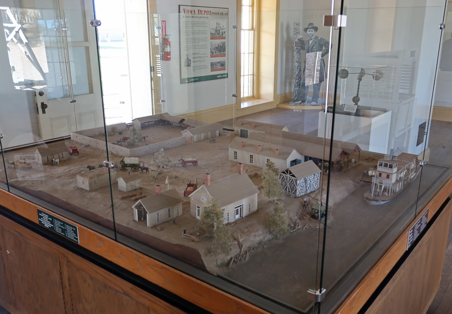
In the late 1800s, steamboats delivered Army supplies up the Colorado River to Yuma for storage and disbursement to Indian War forts. Note the steamboat on the Colorado River.
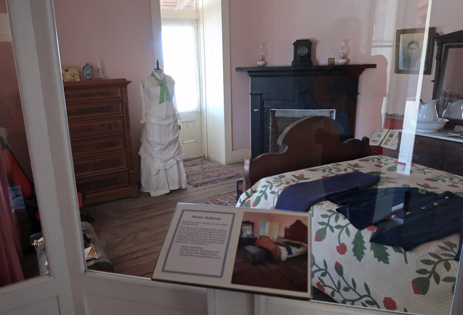
There are period displays in the former Officer Quarters –
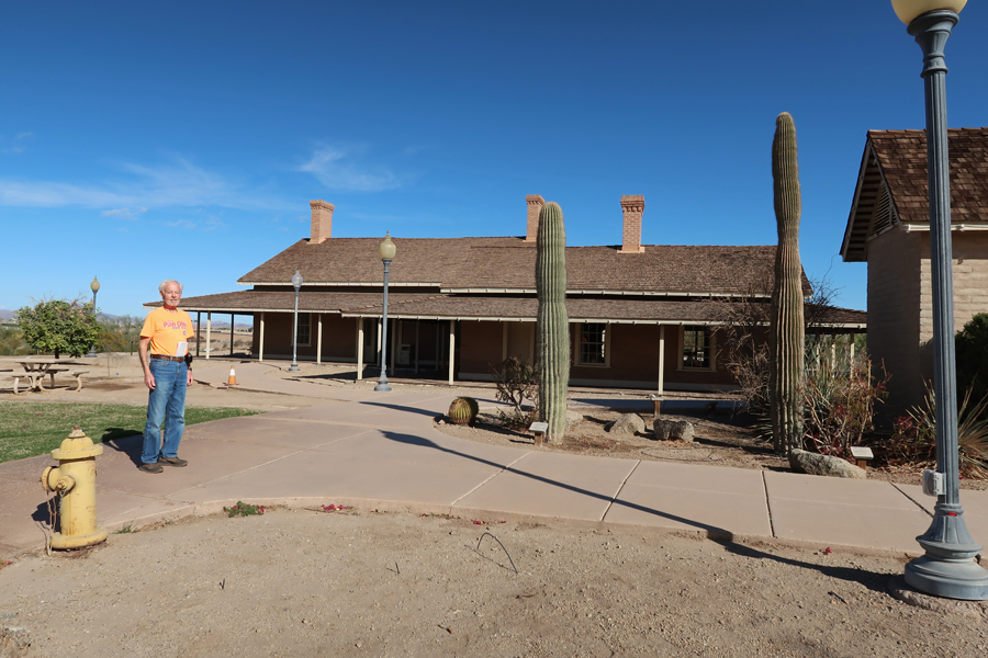
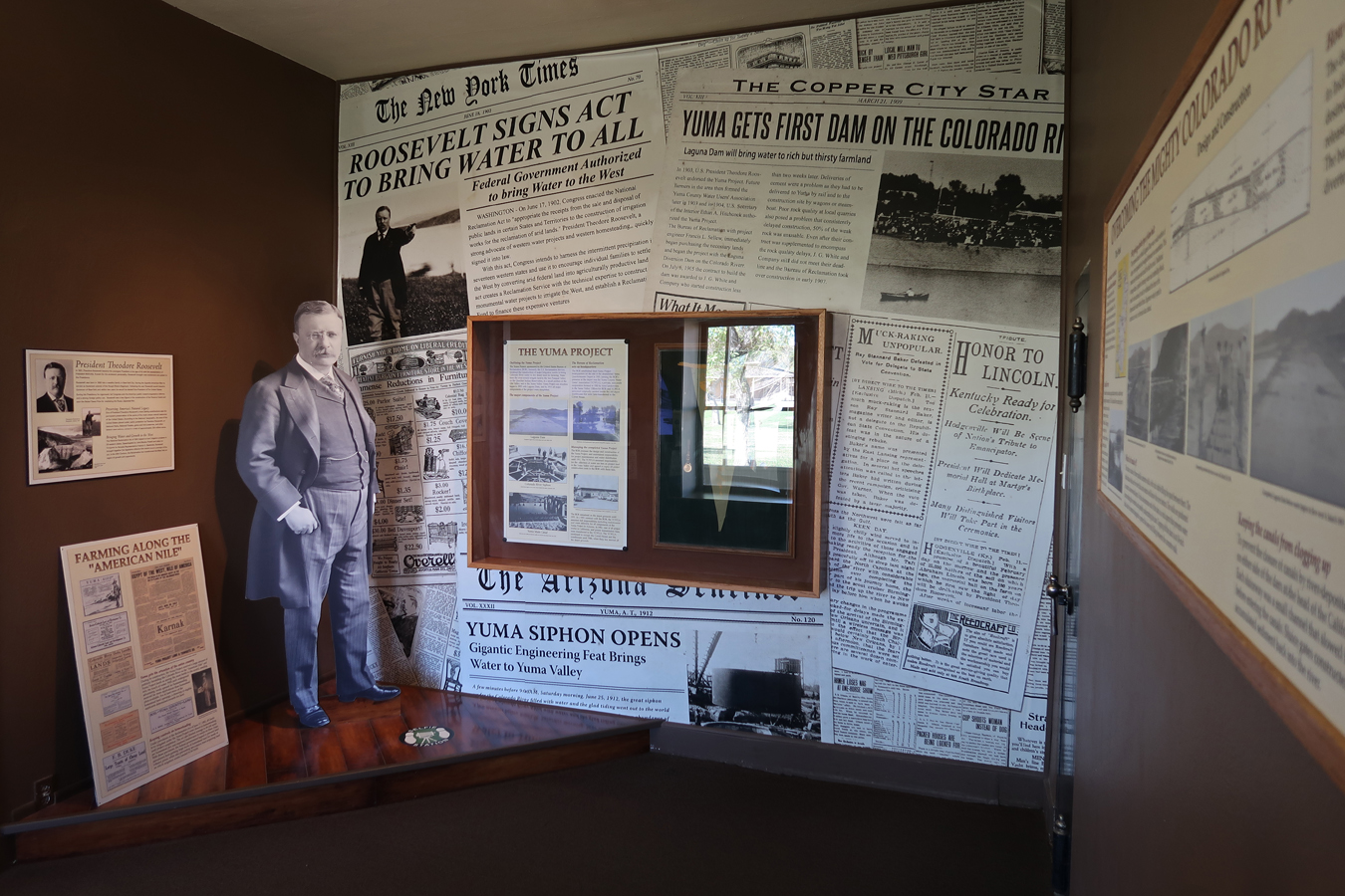
The Bureau of Reclamation Building presents the history of Colorado River development in Yuma.
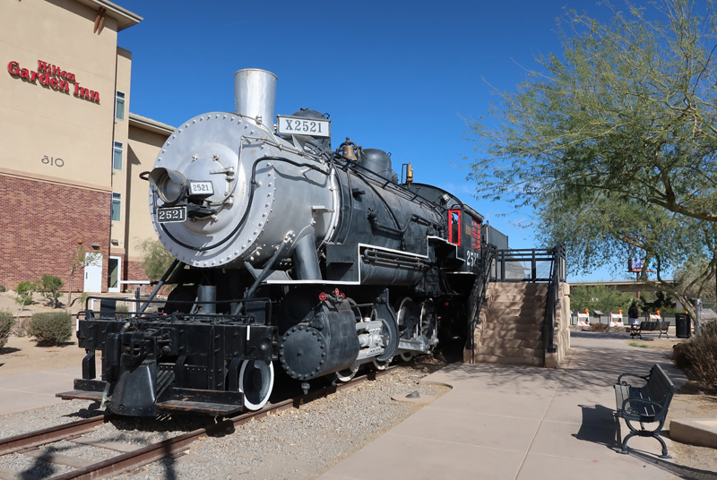
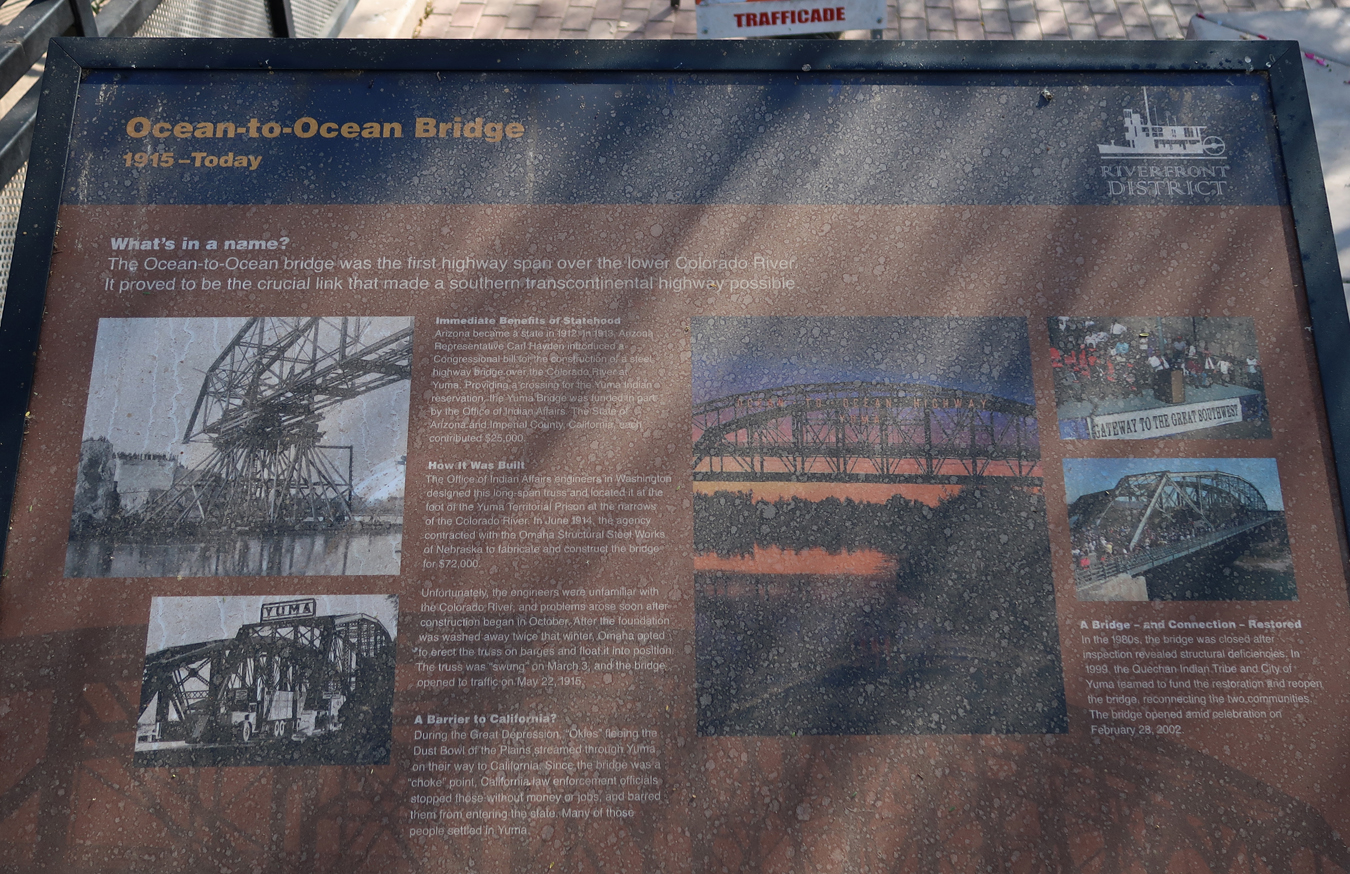
A short distance away is the Pivot Point Bridge, “Ocean to Ocean Bridge,” crossing the Colorado River – location where the first train entered the Arizona Territory in 1877. This is a 1907 Southern Pacific Baldwin steam locomotive. A Southern Pacific Hotel was located here from 1881 to 1926.
The Historic Sanguinetti House Museum & Gardens is nearby. E. F. Sanguinetti (1867-1945) built the house, which is considered a “Jewel of Historic Yuma.” E. F. Sanguinetti (1867-1945), an Italian Immigrant, built the adobe house in 1882. As a result of his many businesses, he became known as the “Merchant Prince of Yuma.”
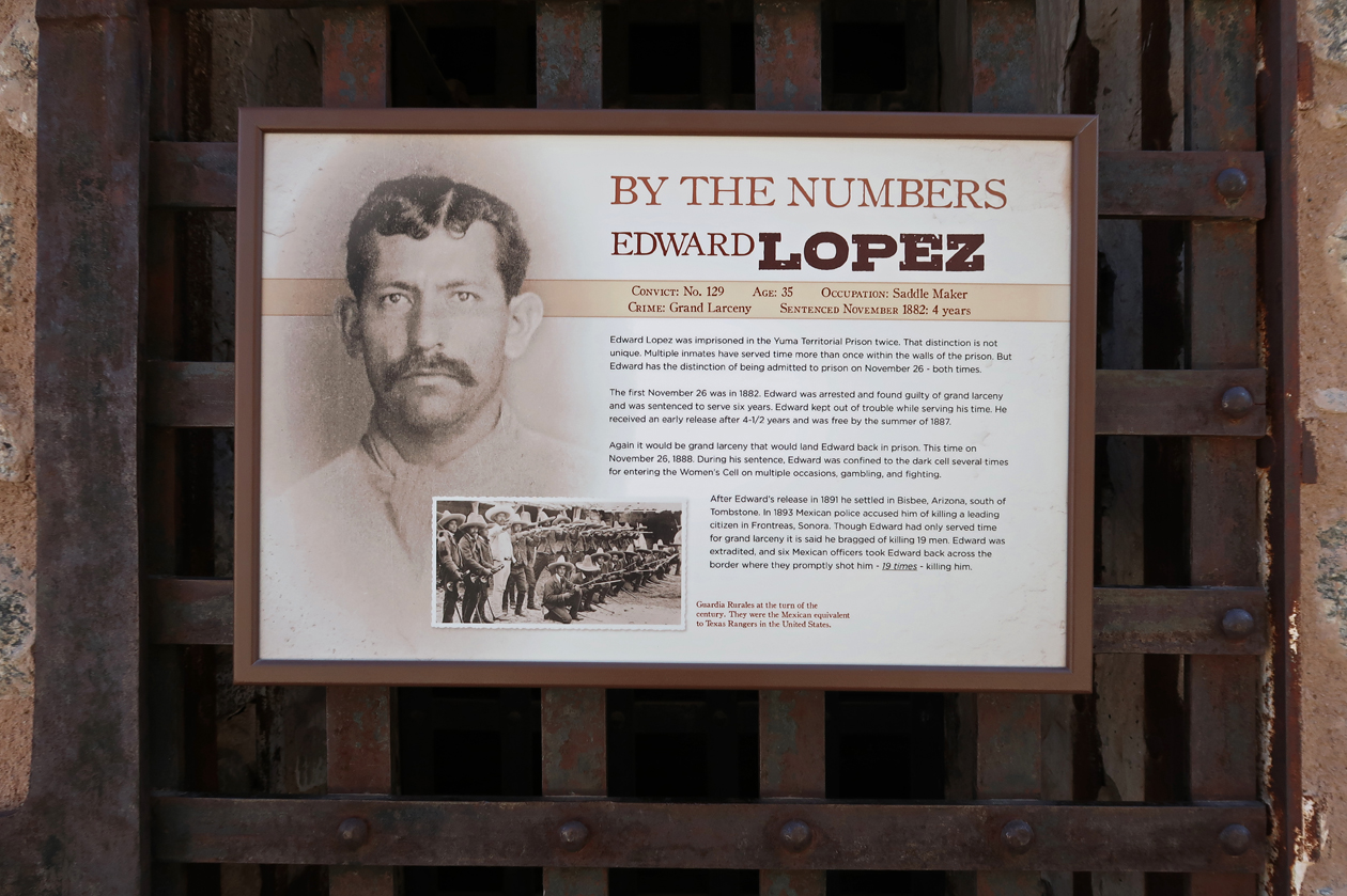
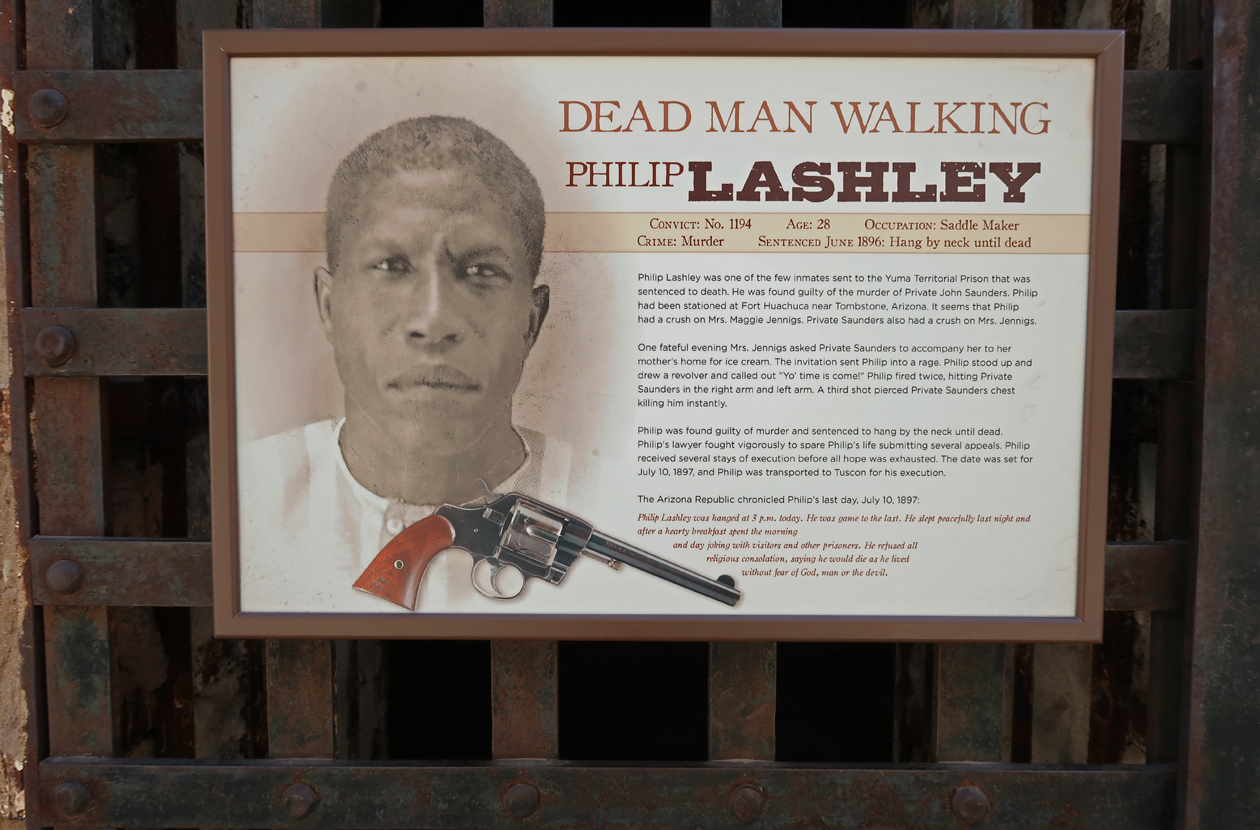
The Yuma Territorial Prison overlooks the Colorado River.
A reconstructed Guard Tower for the Prison is located here.
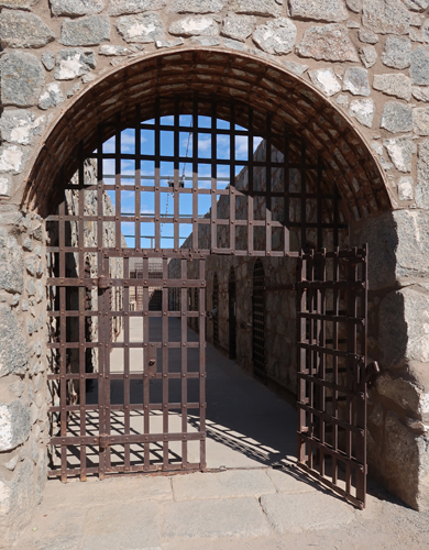
Sally Port into Prison –
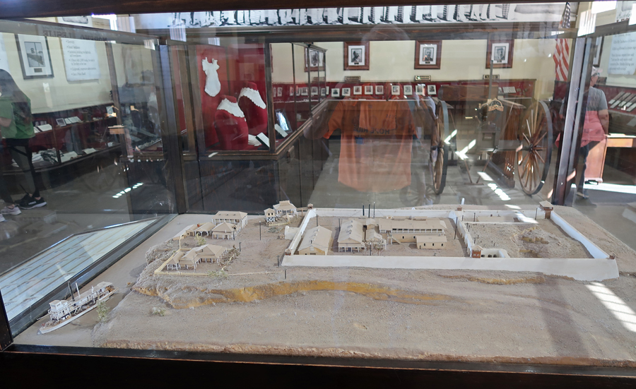
The Prison Museum was very interesting presenting the history of the location as well as the male and female inmates. Model of the Yuma Territorial Prison (1876-1909).
Gatling rapid fire gun –
One example of a woman prisoner –
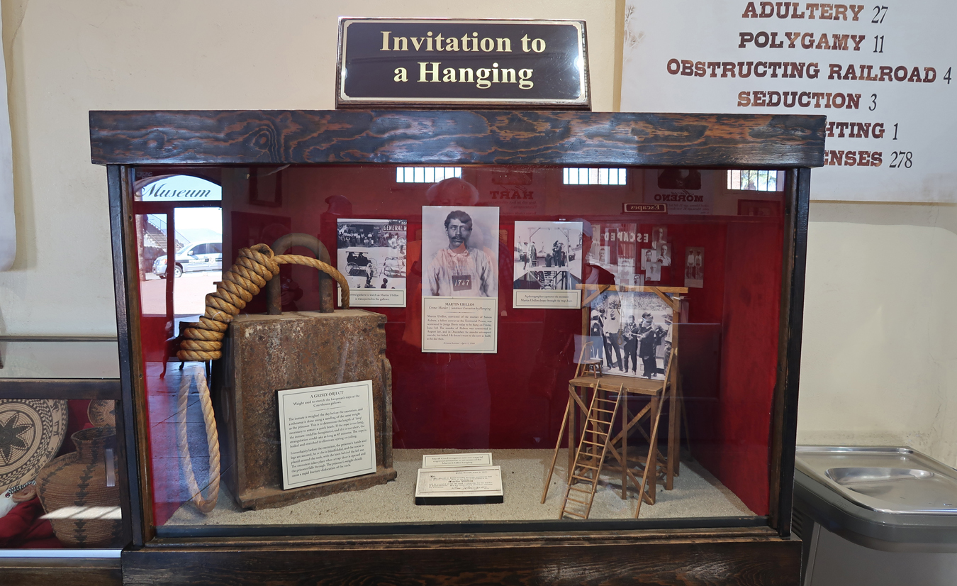
Hanging display –
Crimes –
Cell Block –
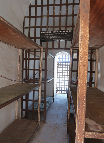
Iron Bunkbeds –
Examples of prisoner crimes –
As of my visit to Yuma Crossing NHA, I have now visited all 62 National Heritage Areas.
3.5hrs (230mi) to Tucson (I-8 runs along Juan Bautista de Anza NHT), and the west unit of Saguaro NP. Quick stop to pickup a new NP brochure and do a short walk in the Saguaro cactus forest.
Saguaro cactus forest –
Overnight at a Holiday Inn Express.
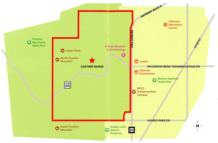
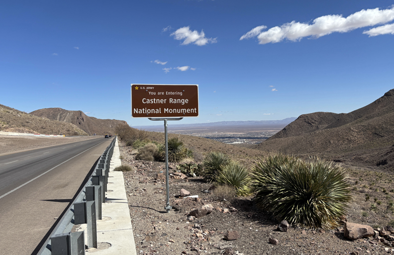
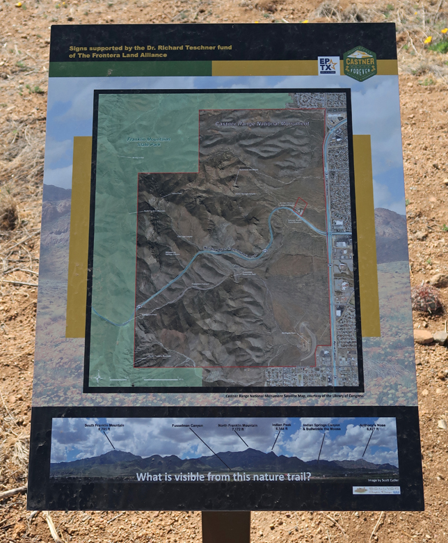
2/15/25 Sa – 5hrs from Tucson to Castner Range NM (2023), just North of El Paso TX.
First stop was Smugglers pass on Woodrow Bean Trans Mountain Road in Franklin Mountains SP.
Castner Range NM is located just east of the pass. It is a part of Fort Bliss and is administered by the U.S. Army.
Cattle/Horse Thieves (Wrestlers) and Fusselman Canyon –
The El Paso Museum of Archaeology is located at Wilderness Park.
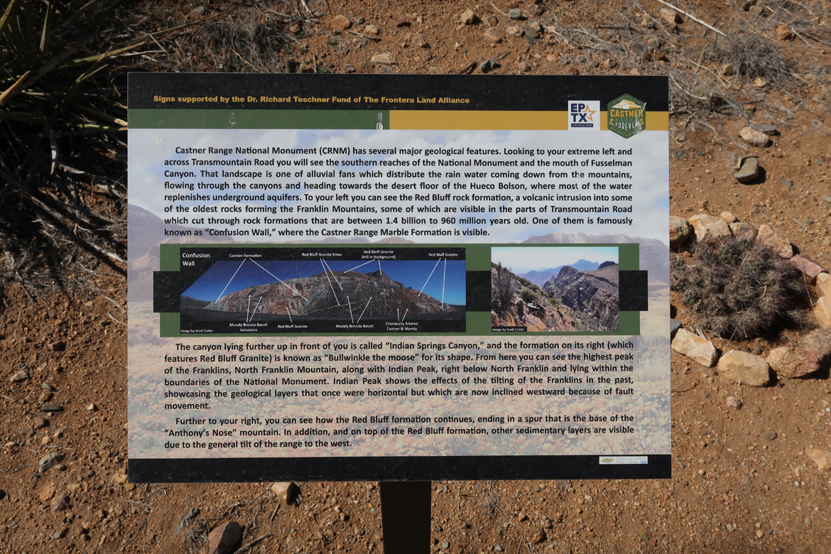
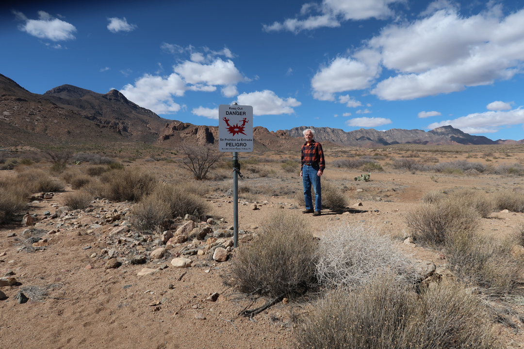
It has a Nature Trail that is within Castner Range National Monument and is the only part of the NM that is currently open to the public. Again, be alert for snakes.
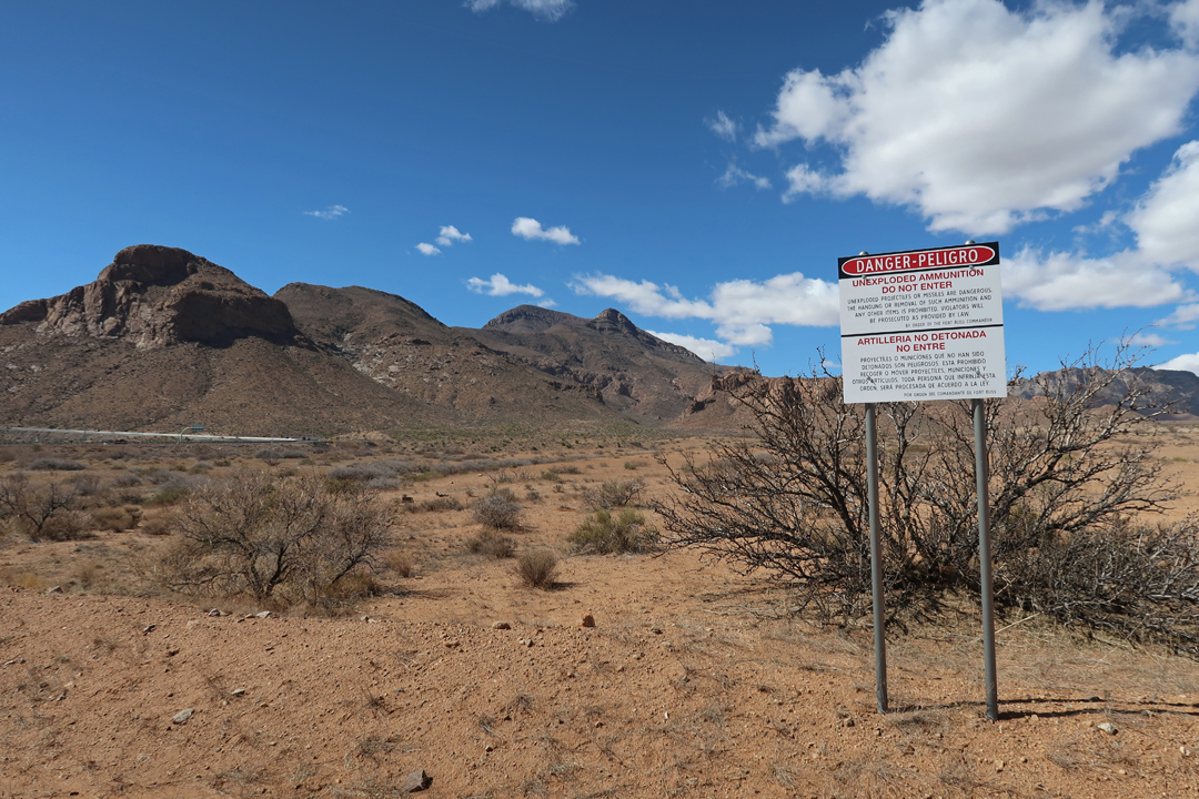
Fort Bliss was a weapons test site 1926-1966 and the remainder of the NM is closed as the Army acts to remove unexploded ordinance. Peligro – Danger
The El Paso Museum of Archaeology presents the human history of the area.
The Museum placed this photo on their Facebook page.
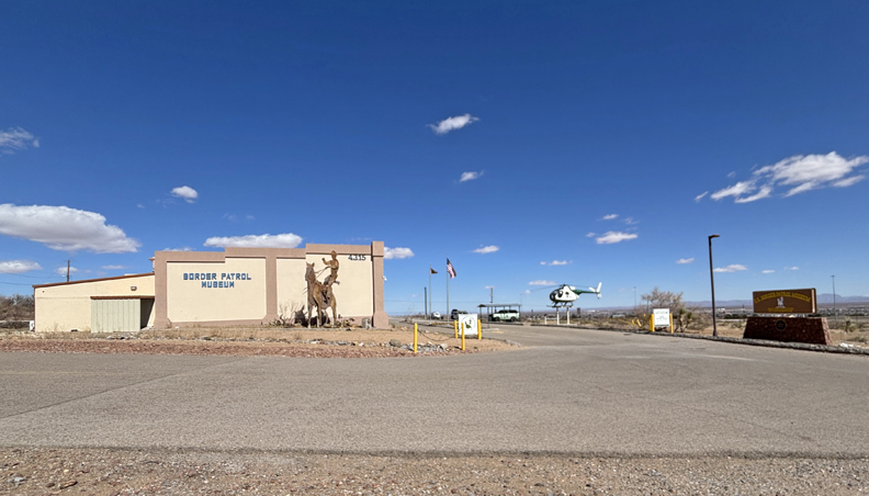
I then stopped by the National Border Patrol Museum, which is next door. My brother Joe worked as a Border Patrol agent in El Paso early in his career.
Celebrated the end of my trip with a Vietnamese dinner and continued reading of “Winter of the World” by Ken Follett. It is book two of the Century Trilogy. Use reward points for my stay at Towne Place Suites El Paso North.
2/16/25 Su – Up at 4:30am for my 6:30am flight from El Paso to Denver, then flight to Columbus OH where I had to clear snow and ice off our car before driving home. Helen had a nice hot meal ready for me at 5pm. It was a 14-hour travel day.