
Kalaupapa NHP Hawaii and the National Park of American Samoa
January 31, 20151/21/2015 – Karlene picked us up at 11am to drive to the airport. Our first flight was to MSP, then to SEA, then to HNL arriving at midnight and getting to the Equus Hotel at 1:30am. With a five hour time difference, that’s 19.5 hours traveling! That’s what you get for using frequent flyer miles!
1/22 – We were up at 4;30am (3hrs sleep) and were picked up by the Makani Air van at 5:50. Our single engine plane took about a half hour to fly from HNL to “topside” Molokai.
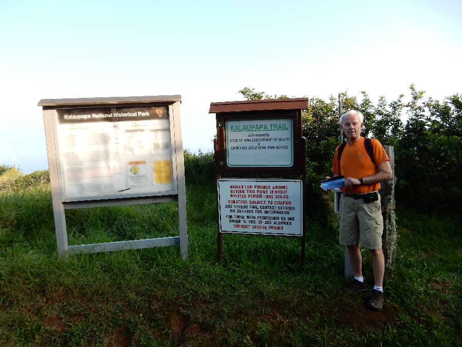
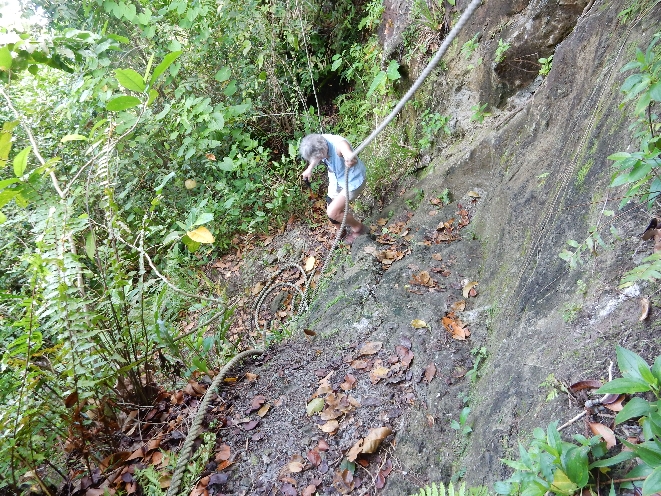
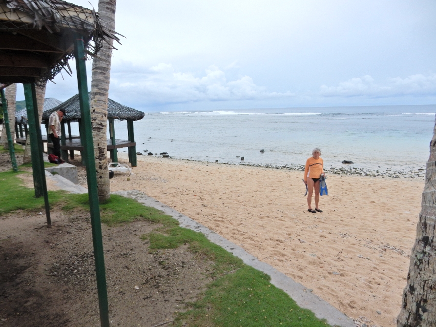
We then took a taxi to the trail head and checked in for our hike down the 3.2 mile trail to Kalaupapa NHP. I picked up a park pamphlet at the trail head.
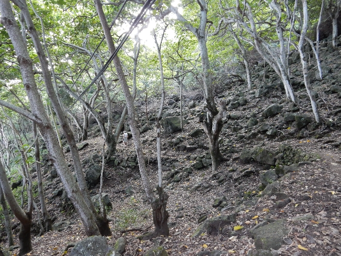
Kalaupapa – left center
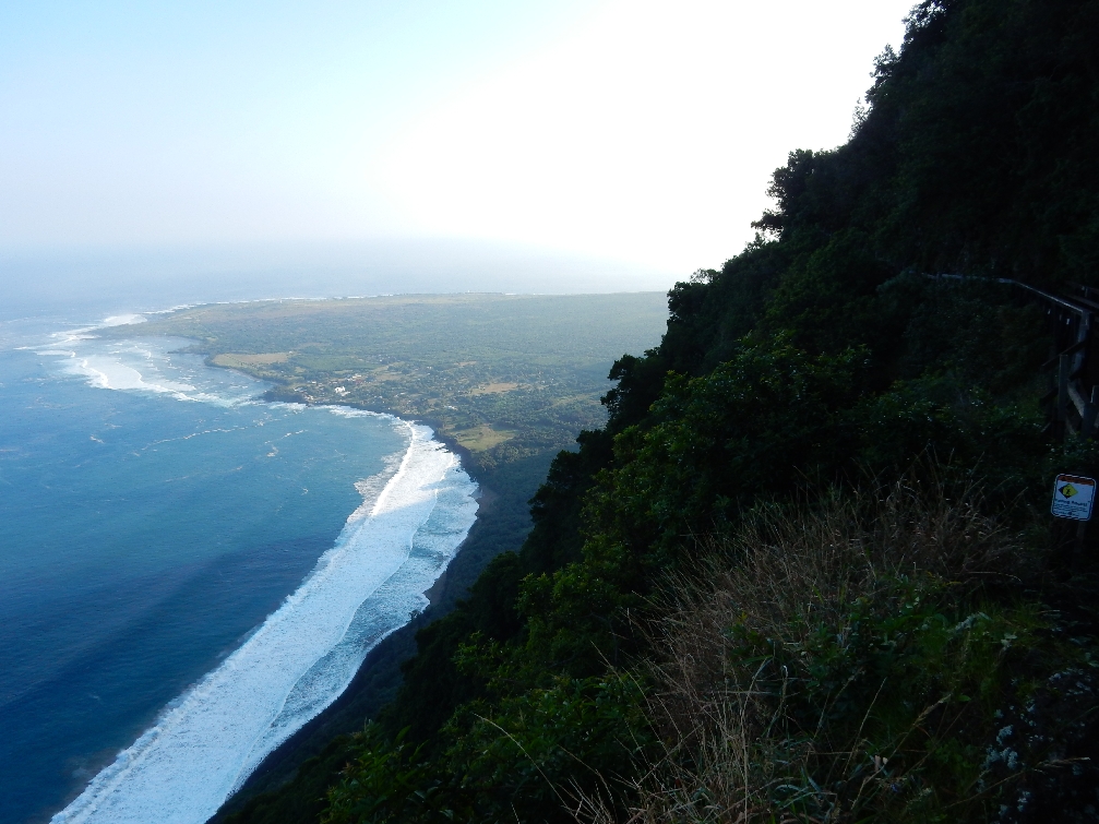
The trail dropped 1664 feet and had 26 switchbacks

Helen, left of center, near end of trail
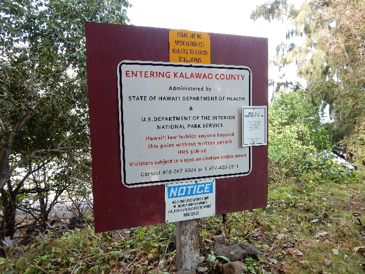
A permit was necessary to hike to the former leper colony

Trail started at top of cliff

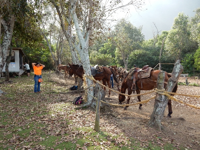
We reached the bottom about 10am. A “donkey train” (like the Grand Canyon) arrived with about 10 clients at 10:30 and then our tour bus showed up shortly after.
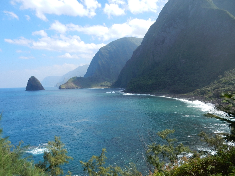
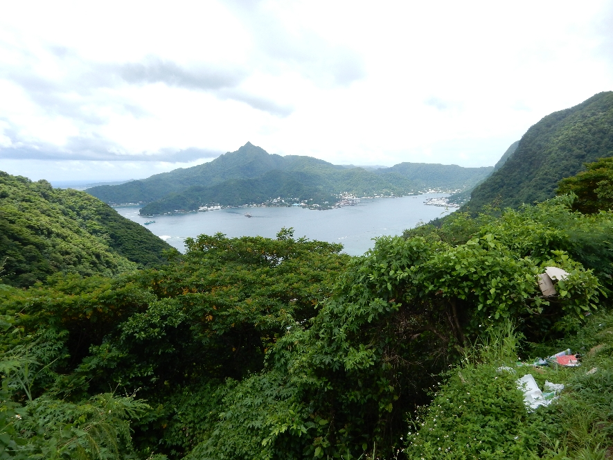
In 1865 Hawaiian communities were moved off the leaf-like peninsula that is cut off from the rest of Molokai by the 1600 foot cliffs, for the formation of a leper colony. King Kamehameha V established the community in an attempt to control the spread of leprosy. Thousands were forced into settlements on this isolated peninsula. Leprosy, also called Hansen’s disease, was poorly understood then. Today, leprosy is easily cured with proper diagnosis and treatment. It is interesting that fifteen leper patients still live in Kalaupapa.
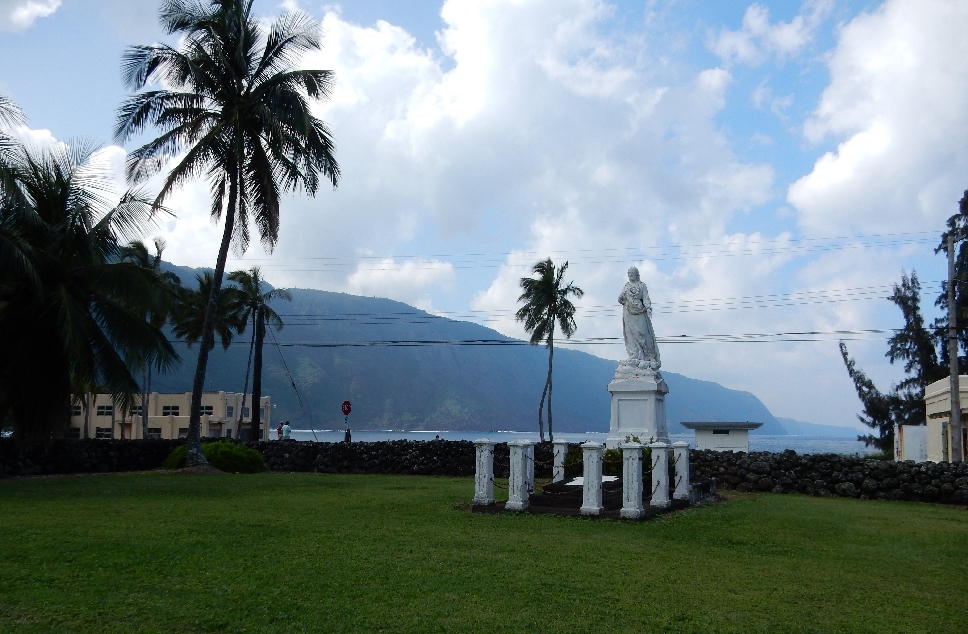
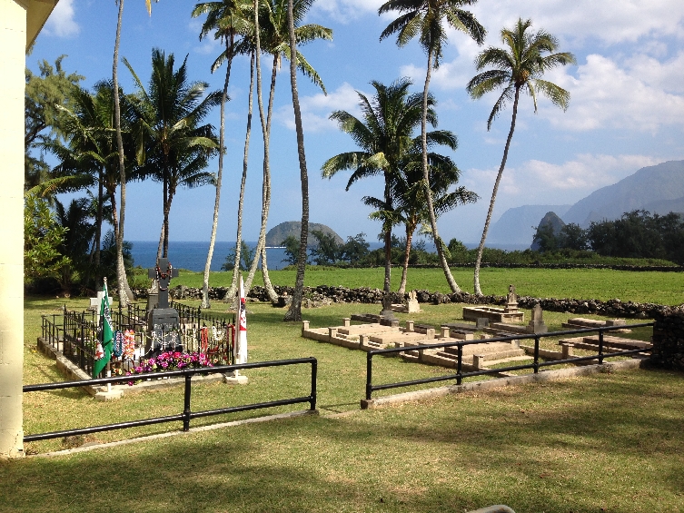
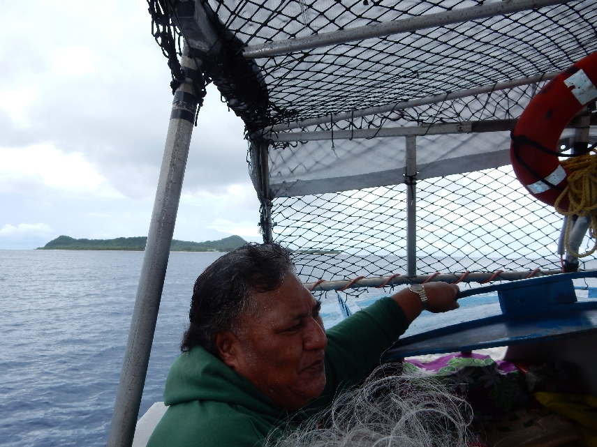
Norm, our driver/guide, took us on a tour of the former leper colony. Stops included Mother Marianne Cope’s grave and monument (she is now designated a Saint by the Catholic Church),
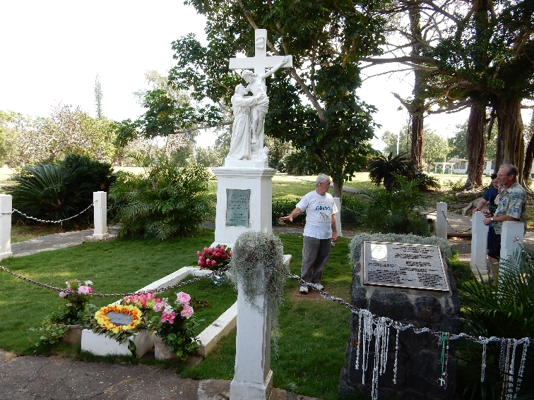
National Historic Park Visitor Center

St Francis church

and the ocean landing.
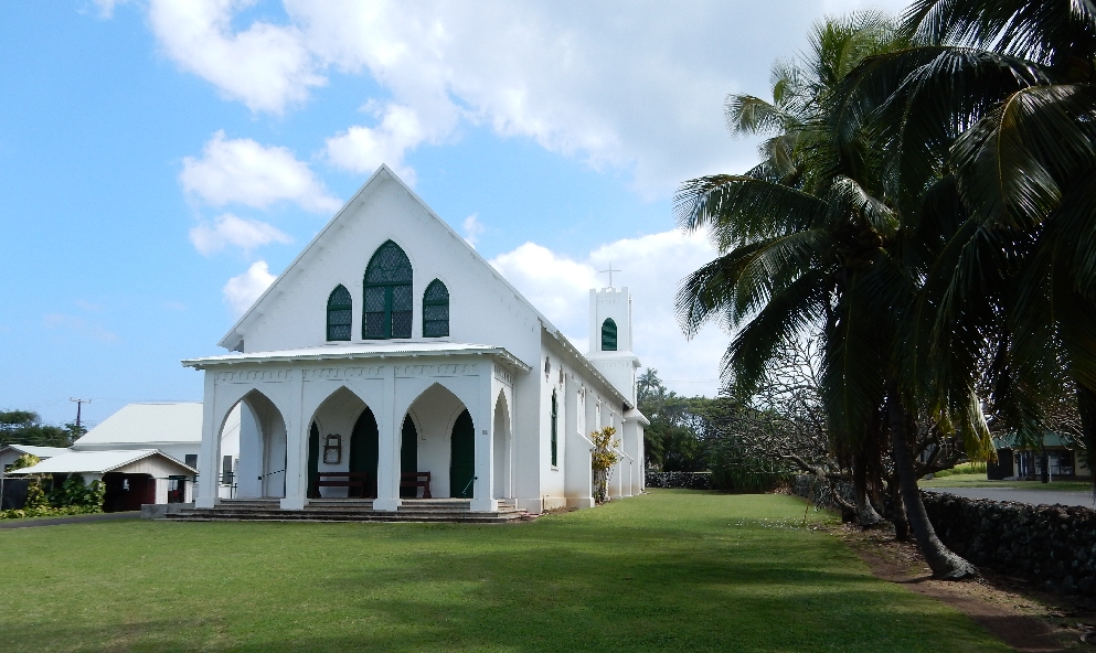
We were then driven to the Kalawao Settlement for a bag lunch and a visit to St Philomena Church
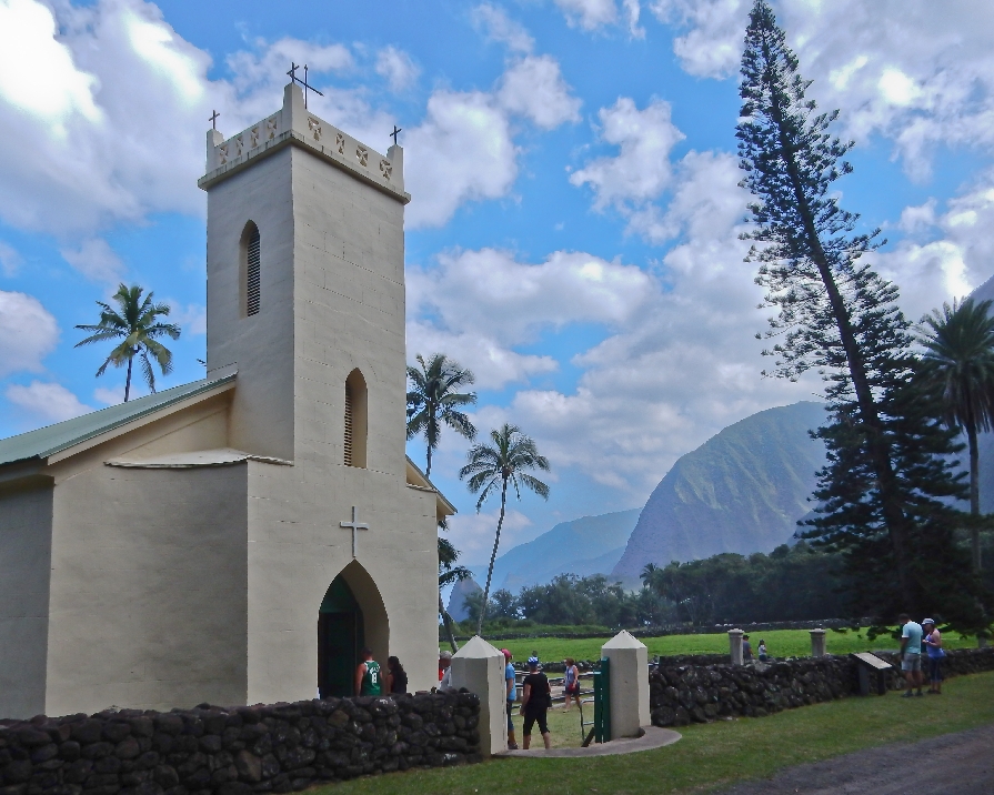

There are several graves there and a monument for Father Damien. He was a Belgian priest who came to care for the residents and also succumbed to the disease. He was designated a Saint in 2009.

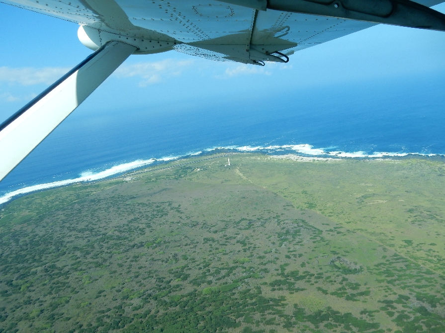
We flew out of Kalaupapa (instead of going back up the trail) about 3pm. This is the lighthouse near the small air strip

Taking off – rugged coast

Lighthouse from air
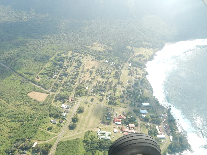
Kalaupapa Settlement from air
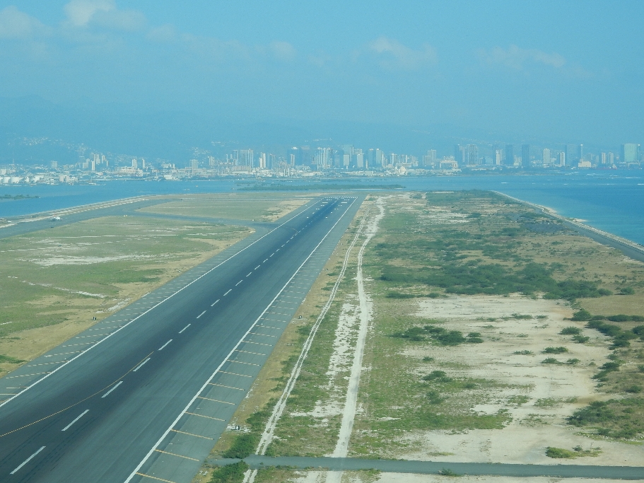
“Topside” Molokai above cliffs – Kalaupapa peninsula on left

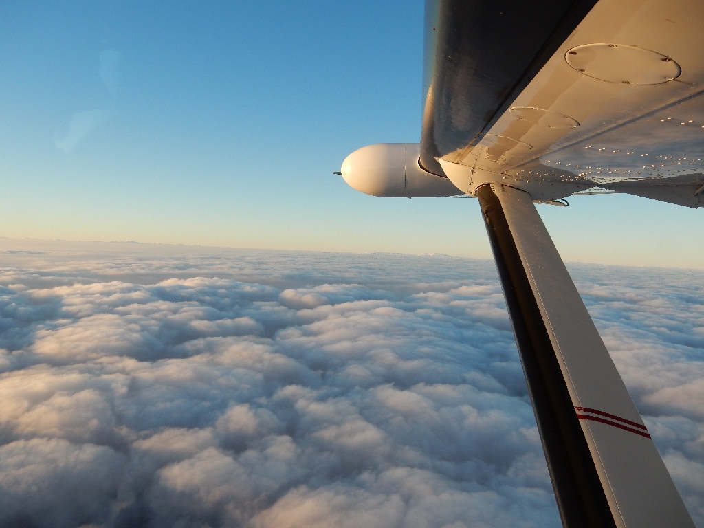
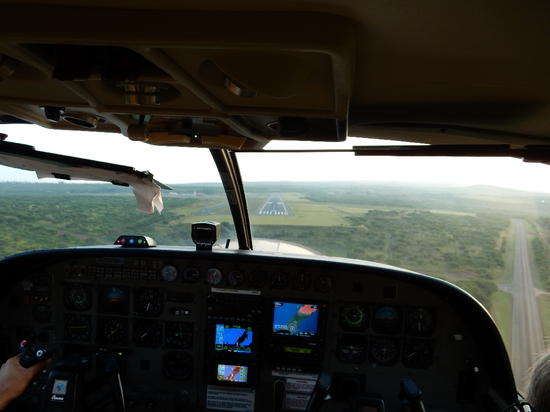
We changed planes “topside” for our trip back to Oahu and I was able to sit in the copilot’s seat. We saw a Navy destroyer leaving Pearl Harbor, landed in HNL and were back at our hotel at 5pm.

After dinner we strolled through the high price hotel district window shopping and listening to music and then walked along the beach, It was a beautiful evening.
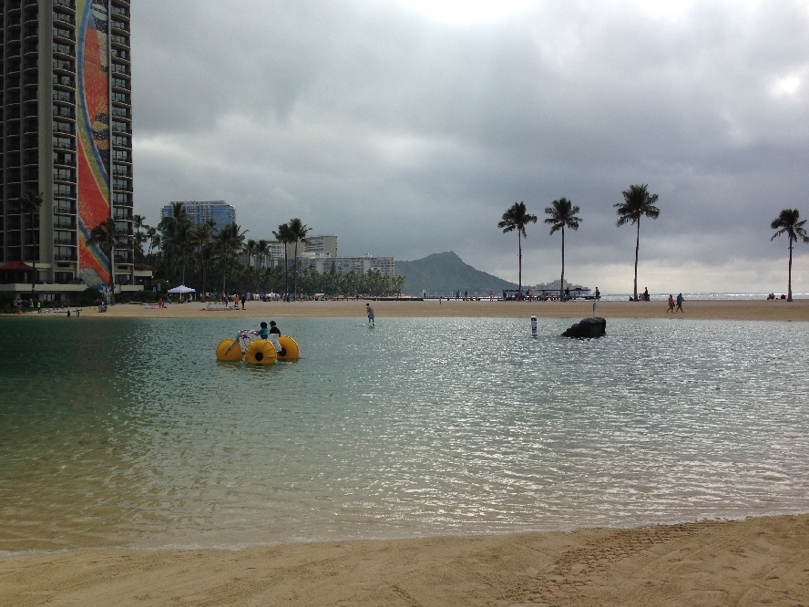
1/23 – Slept twelve hours and then spent the morning walking along the Waikiki beach. This is the Hilton Lagoon
Silver Head on left, Diamond Head on right
Barefoot Babe
Cleaning those bare feet – same spot we used in 1982

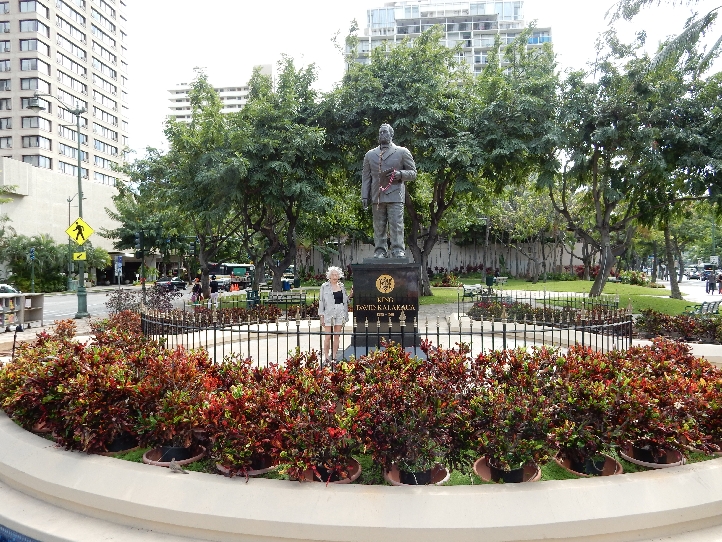
King Kalakaua 1836 – 1891
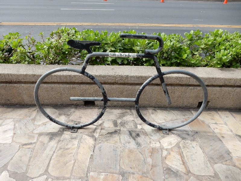
Creative bike rack
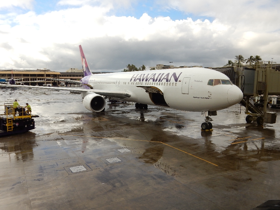
Took a taxi to the airport and boarded an Hawaiian Airlines jet for a six hour flight to American Samoa. It is located 2,600 miles SW of Hawaii. The word Samoa means “sacred earth.”
We arrived about 10pm at the Tafuna International Airport on the island of Tutuila and then took a taxi to Moana O Sina, our bungalow accommodations for the next five days. Despite all of our international travel, this was our first time in the Southern Hemisphere.
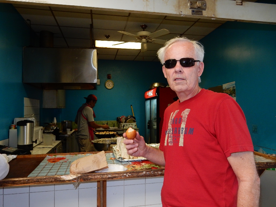
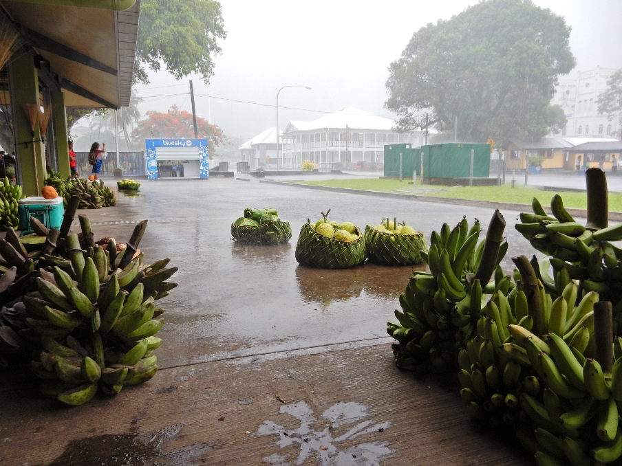
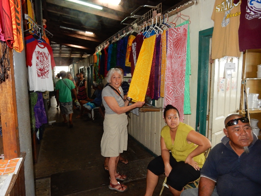
1/24 – Had a tropical breakfast, picked up a rental car and drove to Pago Pago. First stop was the Fagatogo Square Market – bought some bananas,

a huge avocado and two cute little girl Chinese tops for our granddaughters Leva and Hattie

also bought eight “donut balls” for $1. They were so heavy and greasy; I could only eat 3 of my 4!
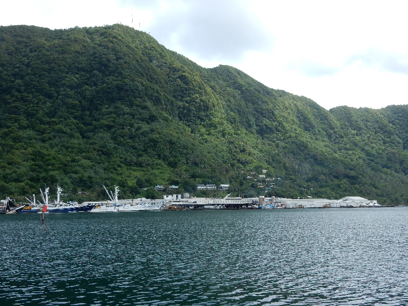
View of Pago Pago Harbor from behind market

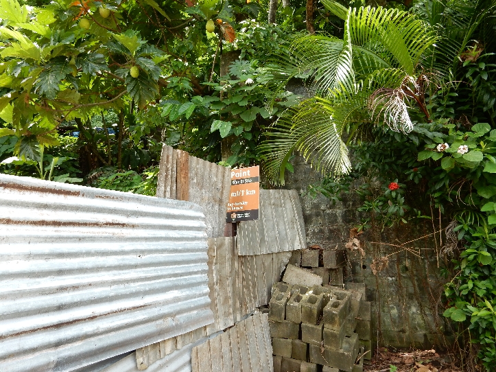
We then did the 0.6 mile Blunts Point trail to a World War II Cannon that guarded the harbor. The trailhead sign was somewhat obscured by a local’s chicken enclosure. First picture is left hand side of sign
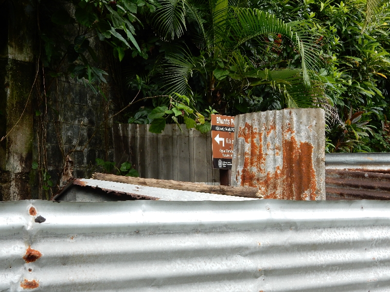
This next picture is the right hand side of sign
Start of trail – hot and humid

By the time we reached the gun, we were soaked in sweat
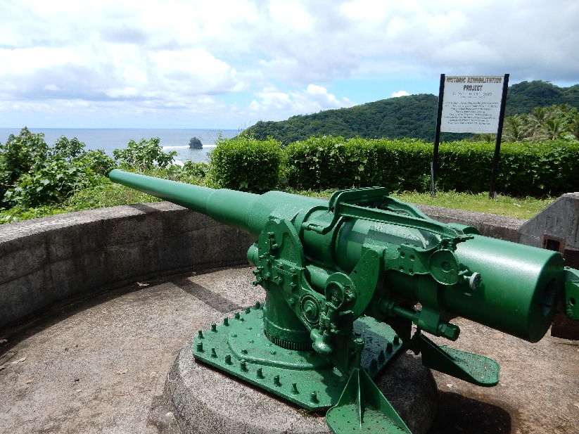
It is a National Historic Landmark

We then took our time driving to the west end of the island. Our first stop was the armed forces monument near the airport. Matafao Peak (2142 ft) is in background.

World War II era fortifications at memorial

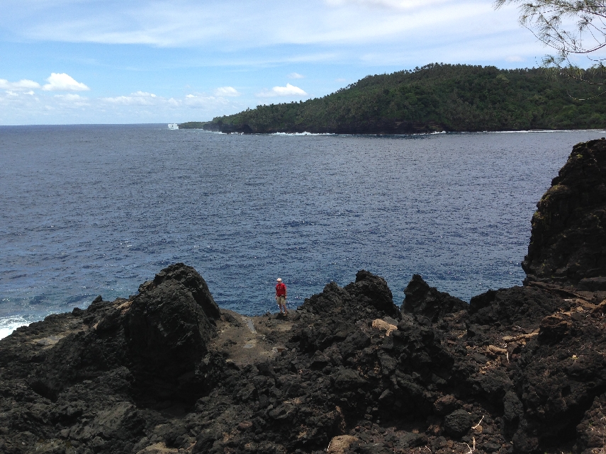
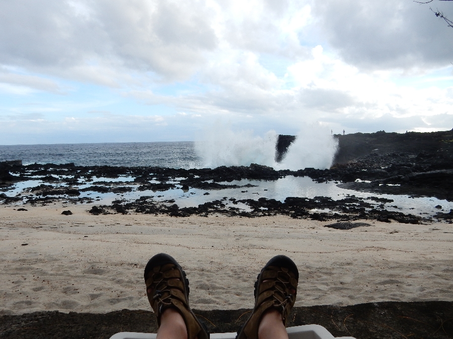
We then followed a rough gravel road to The Turtle and Shark Legend site by Larsen Bay. As the myth goes, a blind women and her granddaughter were turned out by their village during a time of famine. They went to this point and jumped off the cliff. Feeling guilty, their family went to find them and called out their names. A turtle and shark appeared and the family knew they were miraculously transformed in the water.
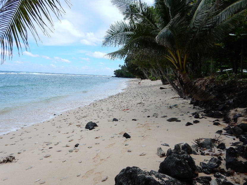
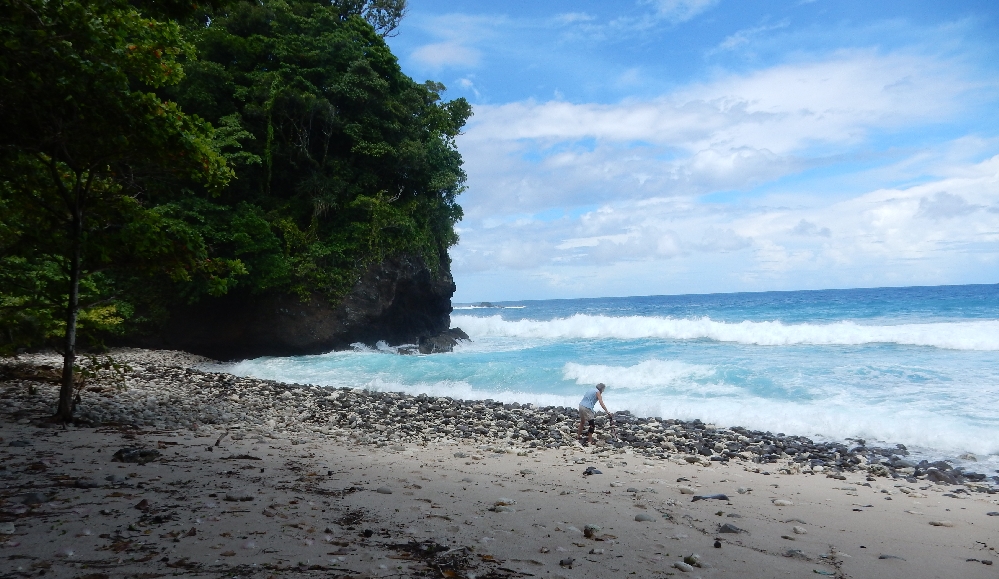
Stopped at several beaches on our way out to Fagamalo (end of the road) and back
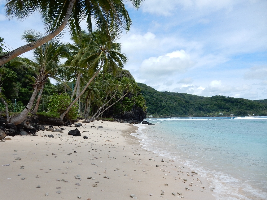
Helen searching for shells, didn’t see another tourist all afternoon. In fact, only saw a handful during our six days on the island
Fagamalo Marine Protected Area

Fagamalo beach
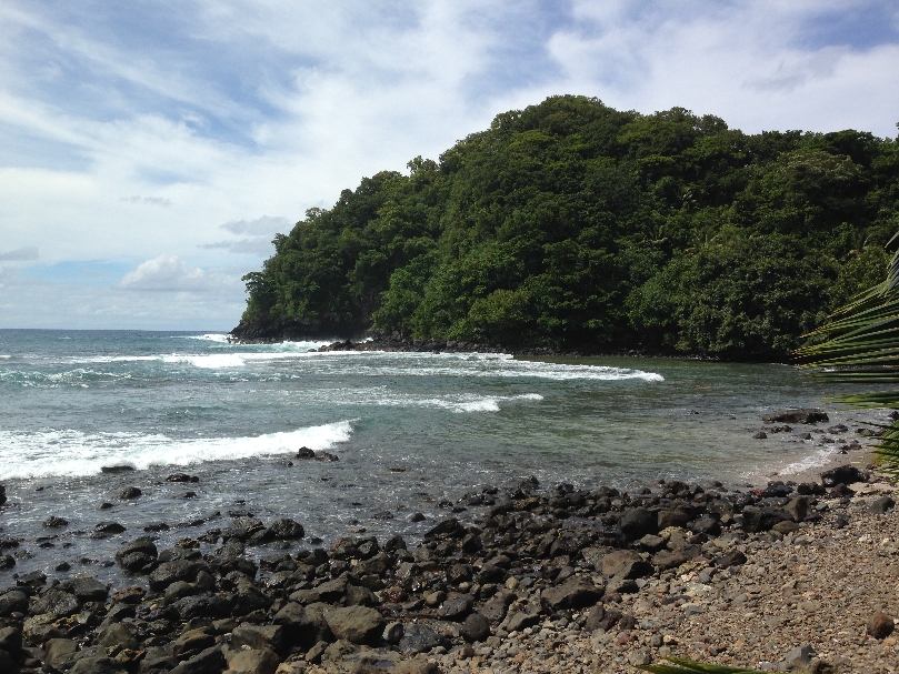
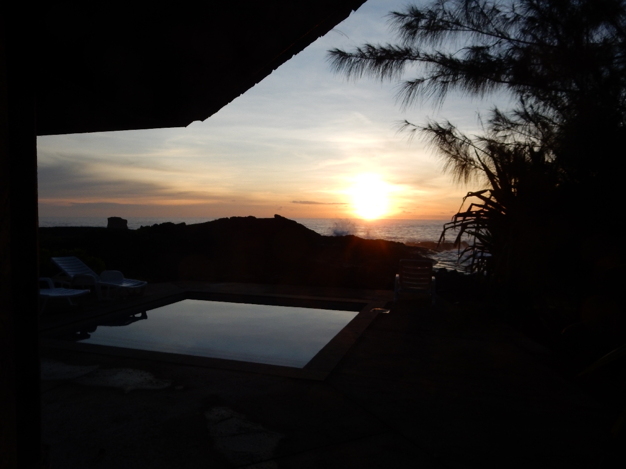
After a Chinese dinner we returned to Moana O Sina for a dip in the big pool
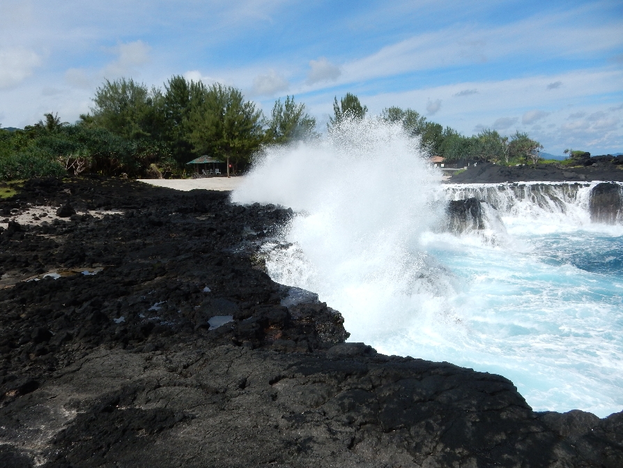
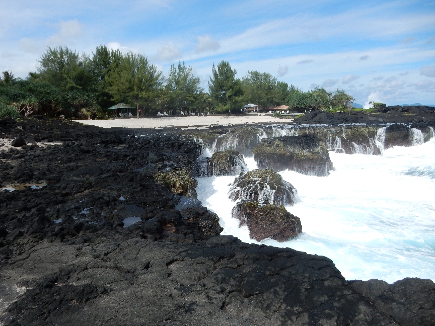
and to sit and watch the waves crash over the volcanic shoreline.
1/25 – Sunrise over the small soaking pool outside our bungalow
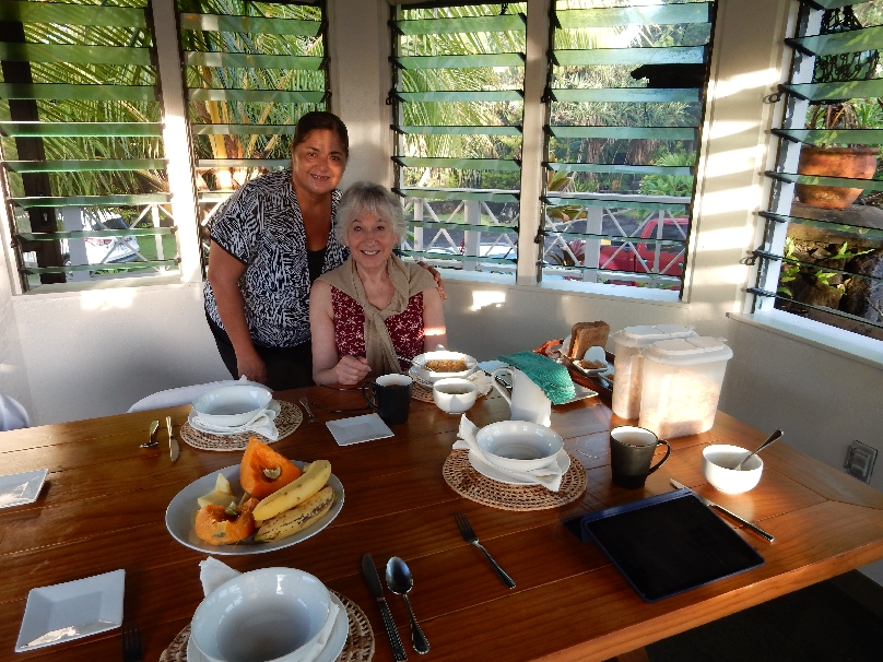
Becka serving our tropical breakfast of fresh fruit (most from the grounds), cereal and excellent coffee.
Went to church at Holy Family Cathedral in Tafuna this Sunday morning – it was wonderful! It was worth the half-hour it took to find it (no street signs).
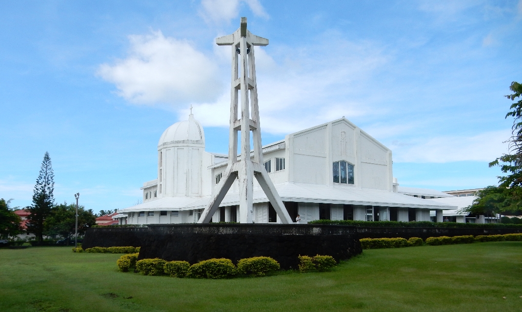
It was the children’s mass and there was such peace and joy in the congregation. A procession of young people brought the gifts (hosts, wine, colorful leis for the two priests and a white one for the bishop, as well as flowers) to the altar. The singing was loud and clear and joyous. At the end, all the children performed a native dance and sang.
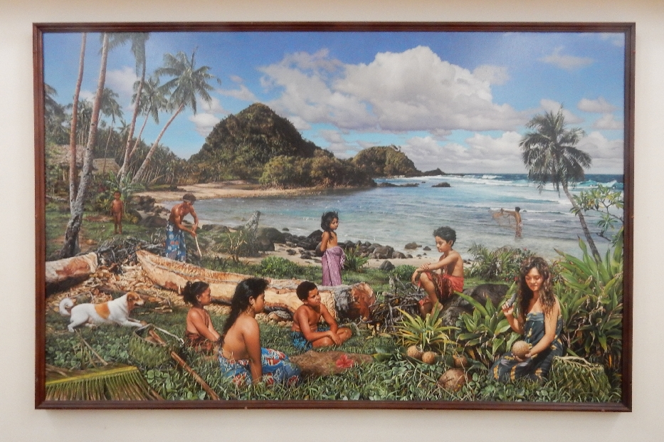
Large Mural depicting the Samoan family
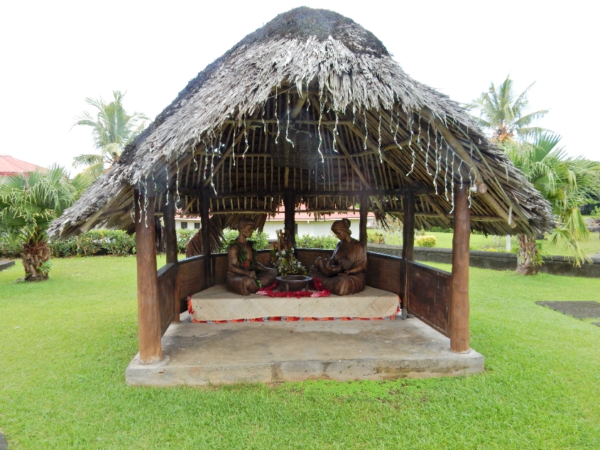
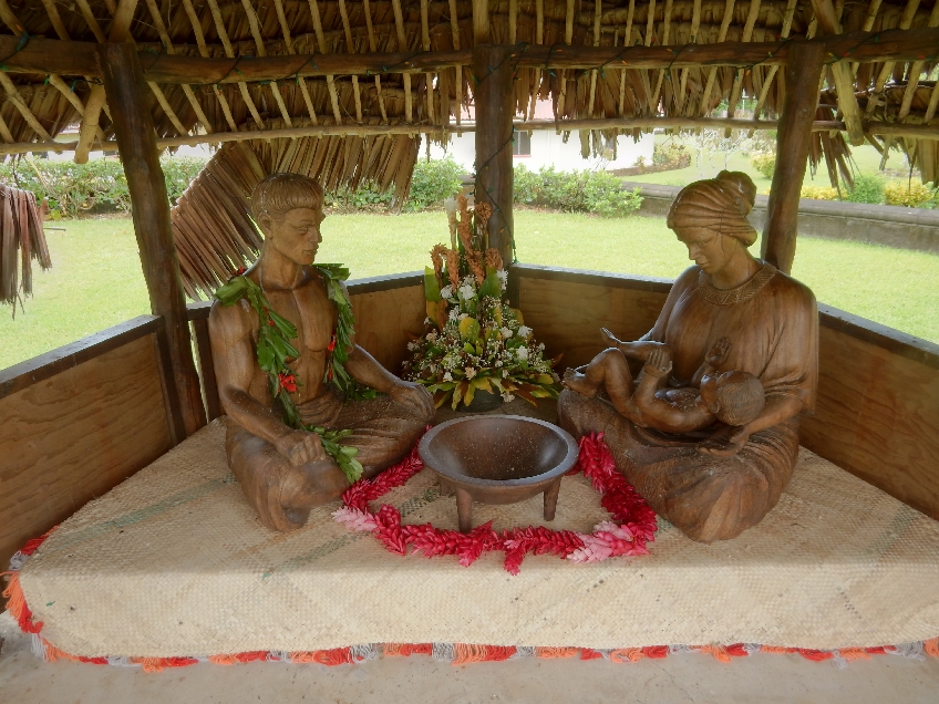
Wonderfully carved Samoan Nativity
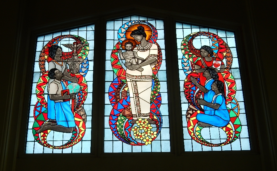
Cathedral panel – men

Cathedral panel – women
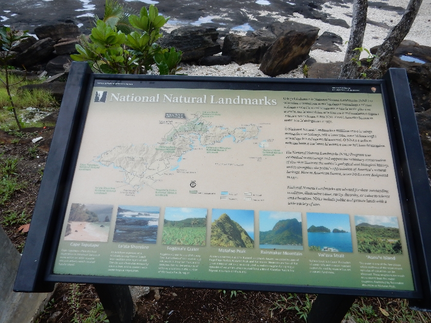
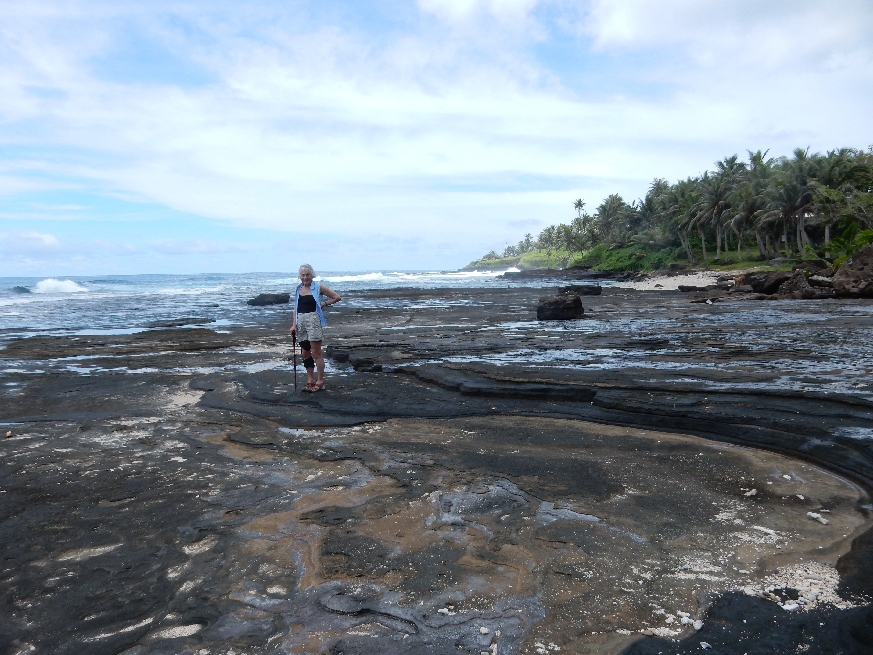
We changed clothes and headed to the western entrance to the Le’ala Shoreline Trail – it is a National Natural Landmark. Sign depicts locations of seven National Natural Landmarks on island.
Boys playing in surf

We didn’t get far as it was high tide and the volcanic rocks were extremely slippery

and dangerous!
So, we drove back to Moana O Sina. Here are some sights along the way – example of a traditional “Fale” or family gathering place, every family (extended) has one.
We were advised to follow the Samoan Way “Fa’asamoa” while on the island:
- Always ask permission before taking pictures, using the beach or for any other activities
- Sundays are a day for church, rest and quiet
- Dress conservatively, no bikinis or speedos – wear shorts and T-shirt
- Do not eat or drink while walking through a village
- Other specific guidelines if asked into a fale
Interesting Samoan decoration

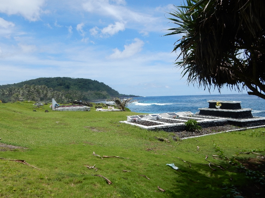
Vailoa Korean Fisherman’s Cemetery

Family cemetery plots are in front of homes and often close to the ocean
Banyan tree

First order of business, lunch – fresh avocado sandwiches. We spent the rest of the afternoon lounging at the ocean and taking dips in the pool. Note owner’s dogs – lower right

Check out the color

My favorite spot
Every wave different
Beautiful sunset!

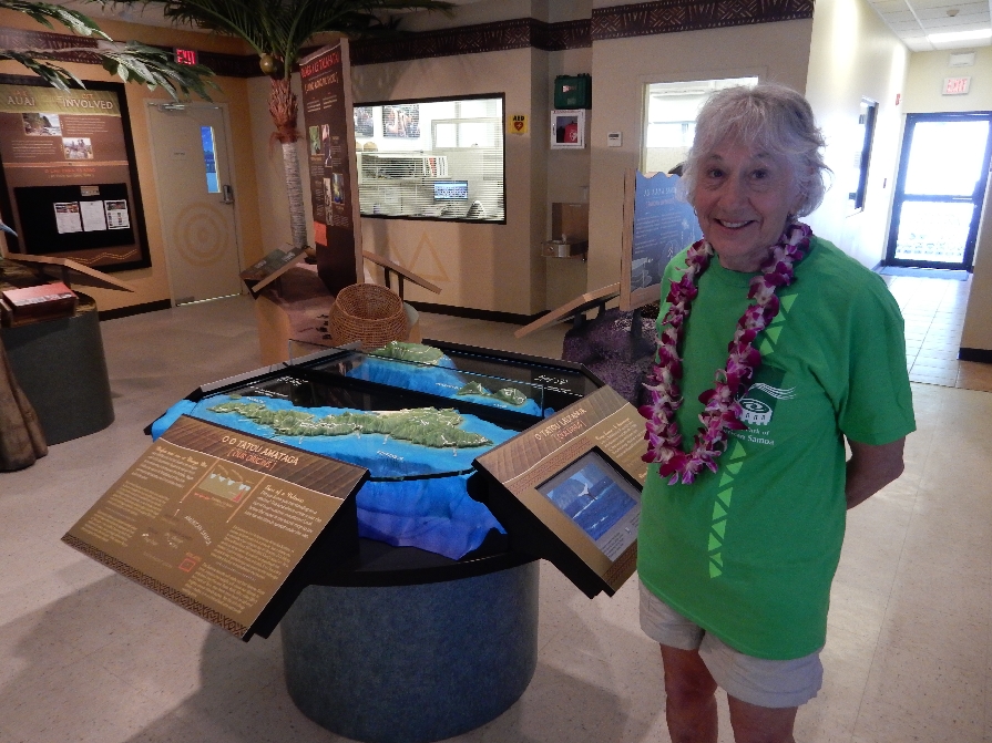
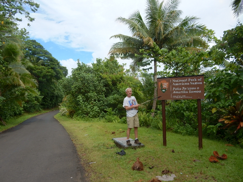
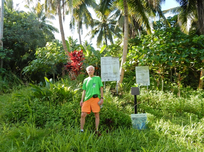
1/26 – Helen’s Birthday! It took us an hour to drive to The National Park of American Samoa Visitor Center in Pago Pago – only one road and rush hour traffic! When we signed in they discovered it was Helen’s birthday and four rangers sang her happy birthday, first in English and then Samoan. They informed us that the trails we intended taking were in reasonable condition.

New National Park of American Samoa T-shirt
The main American Samoan island is Tutuila
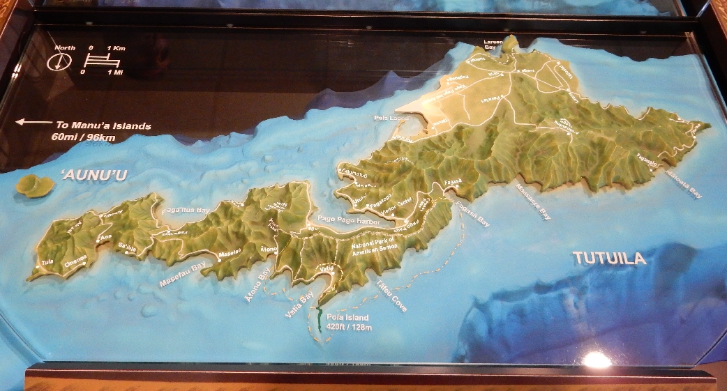
About 60 miles east are the American Samoa islands of Ofu, Olosega and Tau. Together are are called the Manu’a Islands. I tried very hard to get to Ofu, it is supposed to have the best snorkeling of all the islands. However, the only way to get there at this time is on the mail boat and we did not have enough time for that.

This picture is to be included in park newsletter, mentioning Helen’s birthday and my completion of ALL National Parks

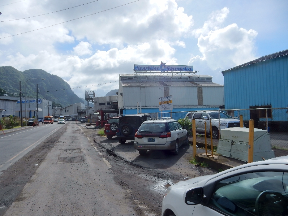
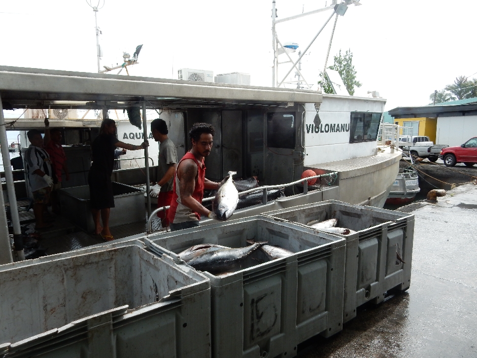
StarKist Tuna plant from Pago Pago
American Samoa’s largest employer – locals are upset because they import a lot of foreigners who will work for lower wages. Chicken of the Sea closed it’s plant a number of years ago. We learned a new company is in the process of re-opening that plant. That should help the economy.
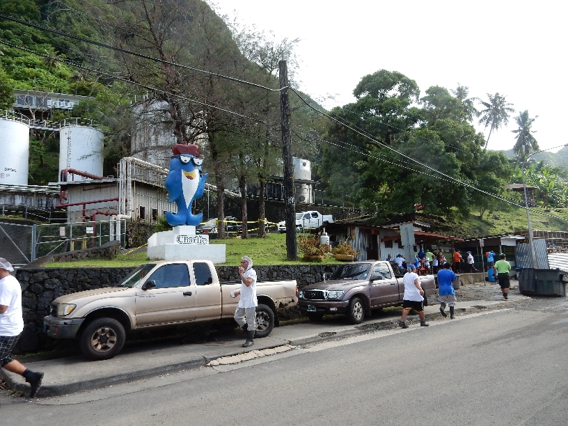
Charlie the Tuna
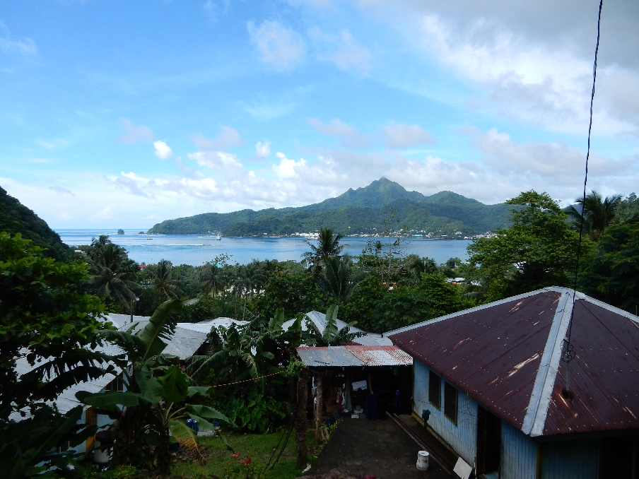
Pago Pago Harbor and Matafao Peak
Entering the National Park
Signs describing the Vai’ava Strait National Natural Landmark and Pola Island
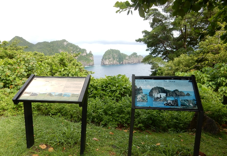
Rainforest information

Hiking the Lower Sauma Ridge Trail through the rainforest – 0.4 mi roundtrip
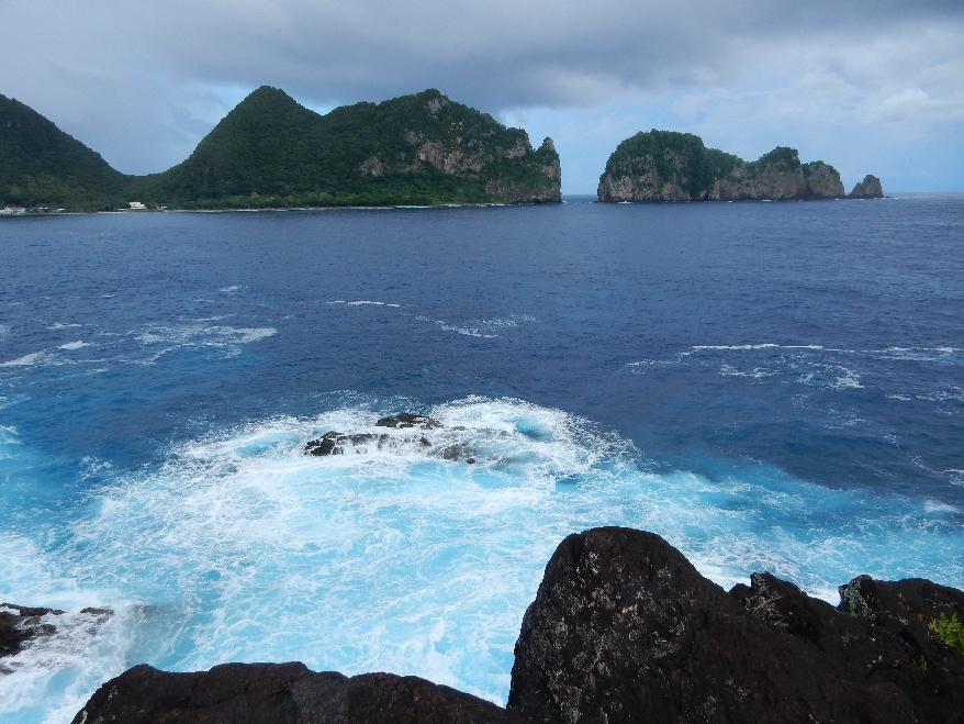
Vatia Village on left, Vai’ava Strait and Pola Island from the east
Vatia Bay and Village, note bird above surf

After driving around the Bay and through the Village, we did the short Pola Island Trail. Guide stated, “Due to unfriendly dogs, please drive past the last house at the end of the paved road in Vatia Village.”
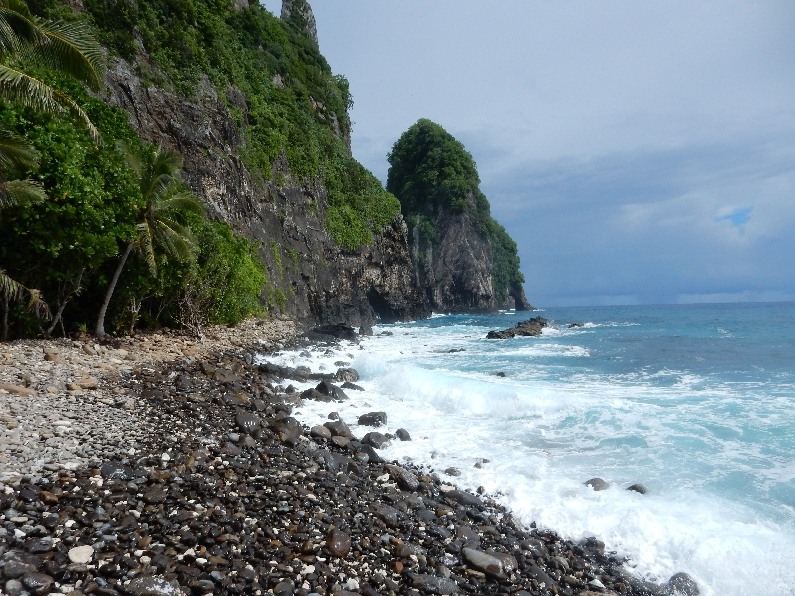
Looking back along rocky beach toward Bay and Village

Sign in Vatia Village – weaving remains an important traditional skill and activity
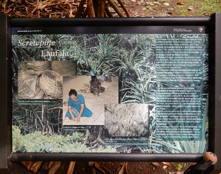
Women weaving mats in the community Fale, each village has unique designs. They are used for sitting, sleeping and for gifts.

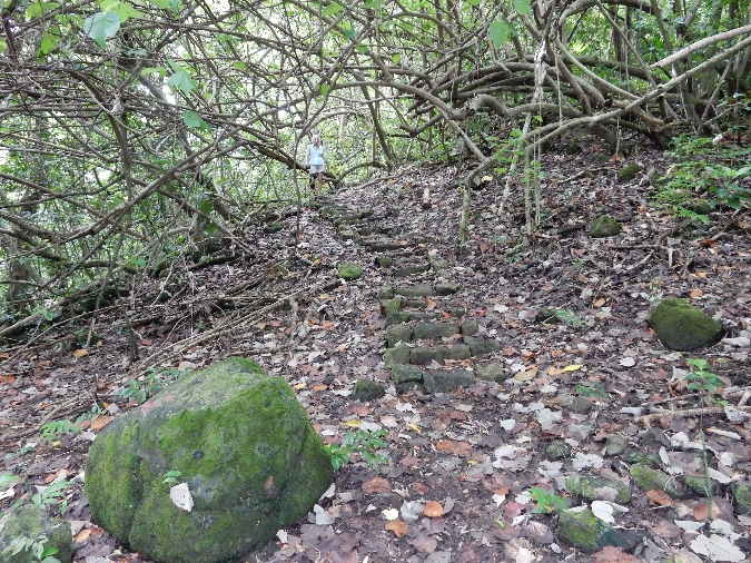
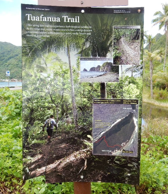
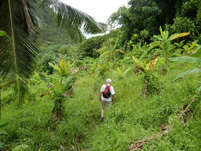
Tuafanua Trail 1.1 miles through tropical rainforest over pass and then down a steep descent on several ladders and ropes to a rocky beach.
Starting through the rainforest, there were then switchbacks up to the pass over the peninsula
Large snail, each species has a unique shell design

Descending with aid of rope

Very slippery
Approaching beach

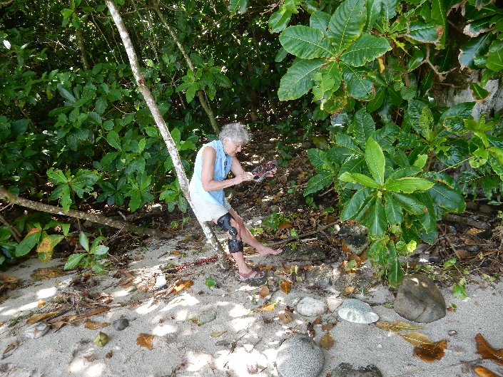
They were right – a rocky beach. It was hot and humid, Helen collected some more shells and we snacked and drank water to stay hydrated.
Pola Island (in background) from the west side
Preparing for hike back
One of the ladders

Another ladder

Pago Pago Harbor from NE
Back at the market, another rain storm
Coconuts, bread fruit, local transport and a wet dog

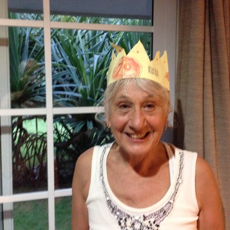
We then celebrated Helen’s birthday with blackened tuna salads at the Sadie by the Sea restaurant on Goat Island. Still looking for that fishing basket we stopped at the JlenT store in Nu’uuli where somehow Helen substituted a pearl necklace for that basket! Cell phone photo with Helen wearing “70 Rocks” crown made for her by Leva – she brought it on our trip!
1/27 – Rory West, our adventure guide, met us at 7:30am. He had an old pickup, which would not fit the three of us, so we decided to take our rental car. He was supposed to take us to two good snorkeling locations, based on tide and weather. He brought two sets of old snorkeling equipment but none for himself. I said we expected him to be snorkeling with us. So, we stopped at a store so he could buy a third set and then we started our drive toward the east side of the island.

When we stopped at the first beach, Helen and I put on our snorkeling gear but Rory stated he wasn’t going in and would watch our things.
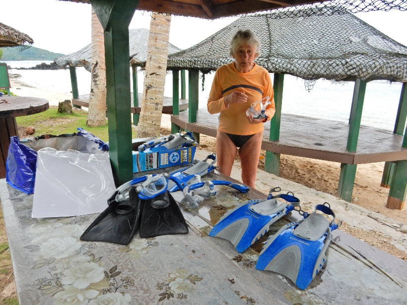
In the end, it was not a good place to snorkel and we left after half an hour
Rory had no other suggestions for snorkeling so I said we would continue east to the village of Au’asi and take a native shuttle boat to the island of Aunu’u. It was something Helen and I were going to do ourselves anyway. It cost $1 per person each way to take the 15 minute ride across the straight to the island.

This man was going to a funeral on the island. You can see that the island is a caldera. It is a National Natural Landmark.
Rory was not familiar with the island and did not know how to find the trail to the rim of the caldera. Helen decided to stay at the beach to collect shells. View back toward Tutuila

while Rory and I passed through the village asking for directions.
We followed those directions but could not find the trail

After about half an hour, we returned through the village passing the funeral service taking place in the community Fale. Found Helen at the beach and caught the next boat shuttle back to Tutuila.

Rory continued to give us information on the history of American Samoa as well as local customs as we drove back to Moana O Sina. We agreed that I would pay him only half his stated fee. I can’t believe Outside Magazine recommended this guy. No boat, no snorkeling, no adventure! I knew of potential snorkeling sites but did not know tides, conditions, etc. We hired him for safety.
We did Chinese take-out of steamed dumplings with sweat and sour pork for dinner and then enjoyed the pools and sunset.
1/28 – leaving our bungalow

We started the morning by doing the 2 mile hike to Fogatelle Bay National Marine Sanctuary, had to pay the family at the head of the trail (where it states Gate on the map) $5 each for access.

Hiking the ridge section, where the sign states 4 WD Road
Overlook of Fogatelle Bay

This is the point where it states Chain and then the trail drops down to a small beach
There were a wide variety of birds in the rainforest

Last steps down to the beach, notice the small waterfalls
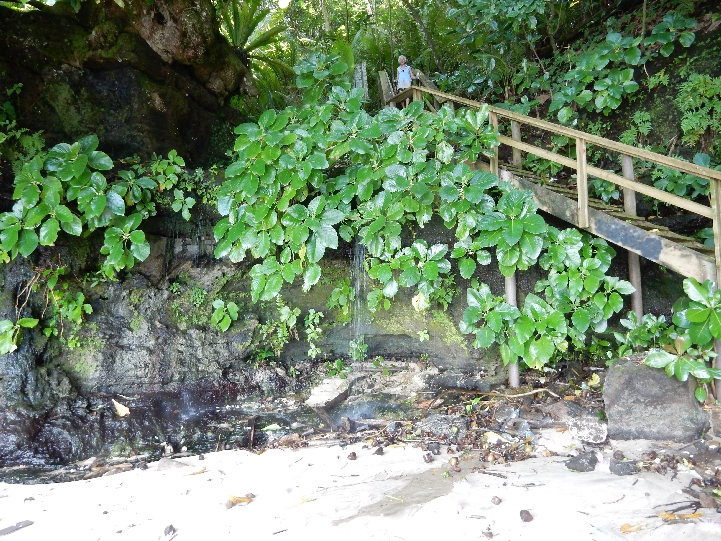
Another small waterfall entering the Bay – this would have been an outstanding spot for snorkeling had we brought equipment.

Close-up

See the lizard?

By the time we got back to the car we were both soaked with sweat from the temperature and high humidity.
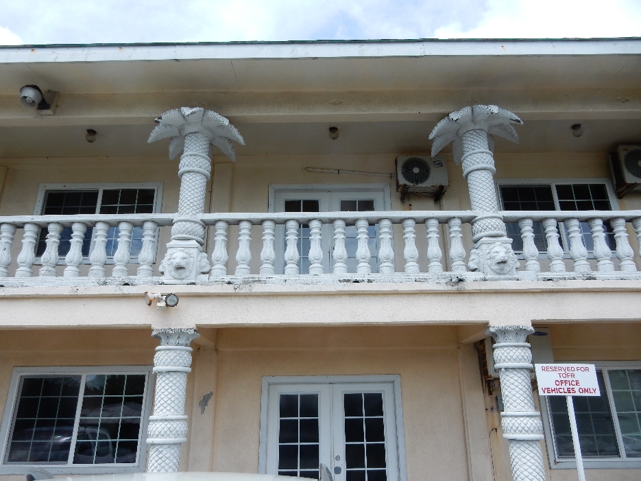
Helen wanted a picture of this building

and columns
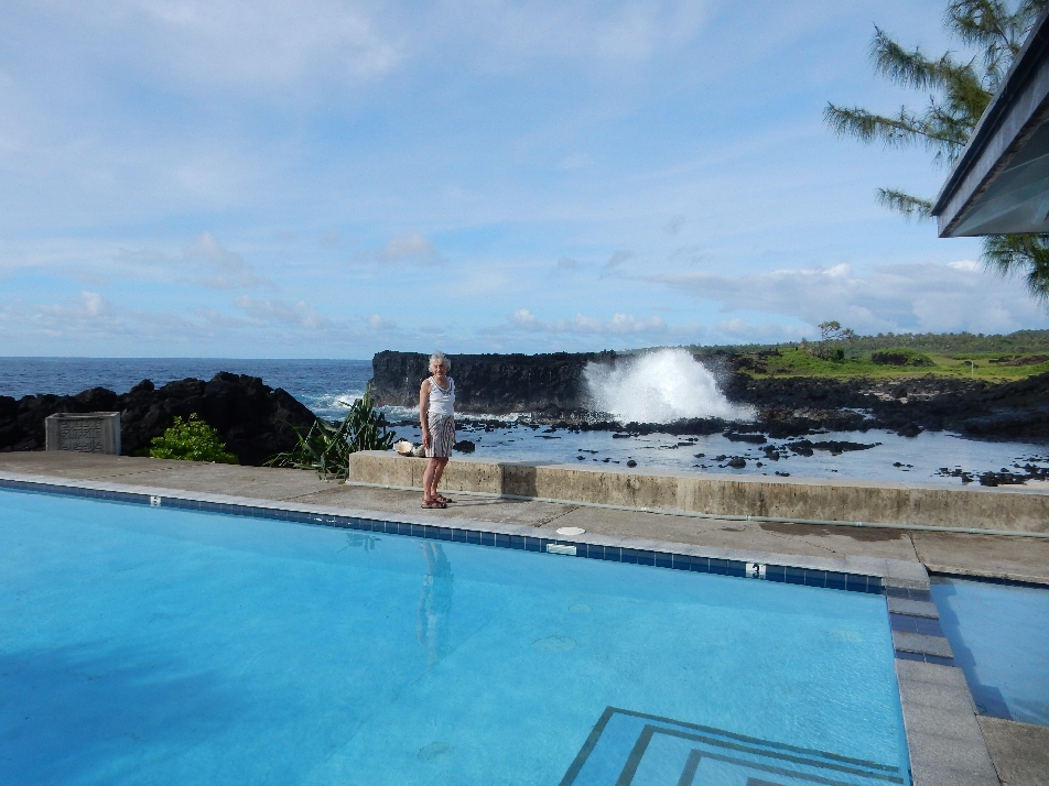
Celebrating a successful hike at Moana O Sina – we packed our things (after our 5 night stay) and then had to sit on the volcanic rocks and let the ocean spray cover us one last time.

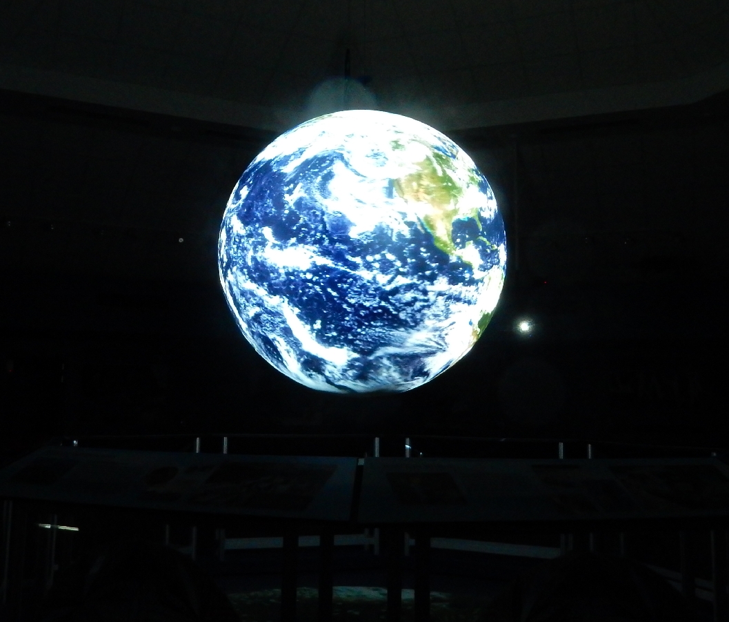
Drove into Pago Pago for the 1pm show in the Tausse JP Sina Ocean Center.
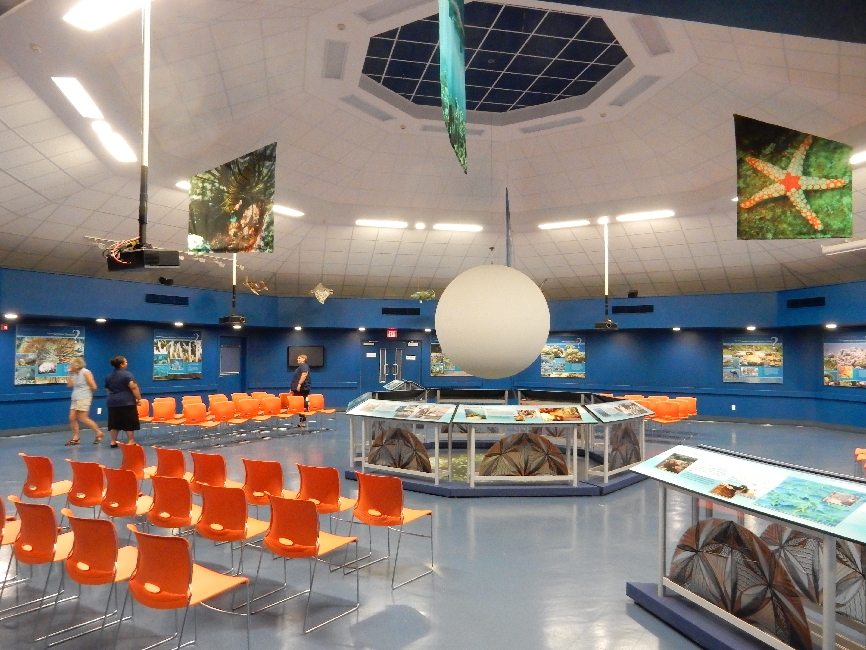
The facility was finished in 2012 and is the administrative and educational center for the new and expanded National Marine Sanctuary of American Samoa.
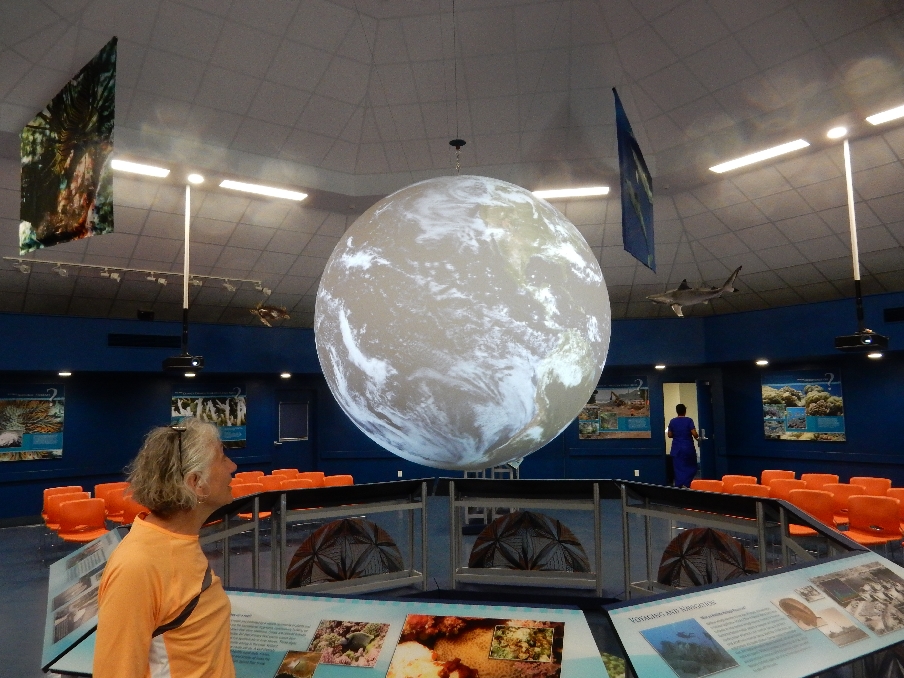
One of the features is a large sphere on which can be projected various views of the world as well as video programs.
Map showing the extent of the Marine Sanctuary

Went back to the town market so Helen could buy a wrap (cloth) to use as packing for a USPS Priority box sent to ourselves containing literature, clothes, sea glass, shells and rocks, $9 no weight limit. The next stop was the post office to mail the box and some postcards. This was our last opportunity to use the US mail until we returned to Hawaii in four weeks.
National Park boat, Rainmaker Mt (1718 ft) in background

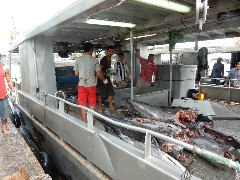
Tuna boats

Local racing canoe
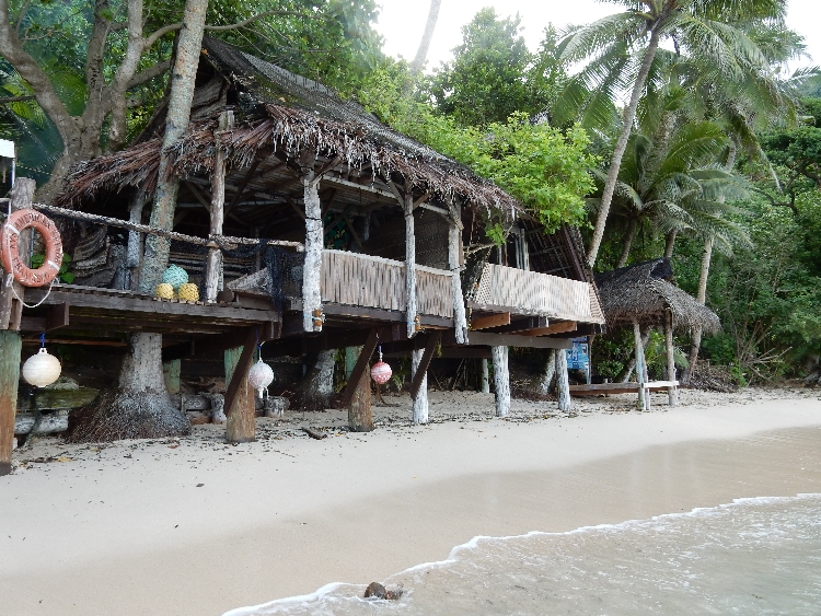
It took about a half hour to drive to Tisa’s Barefoot Bar at Alega Beach – located just left of center in photo
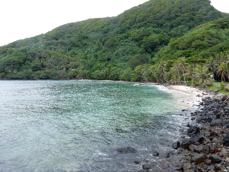
We were the only customers all afternoon. Note the glow of the fire left of center
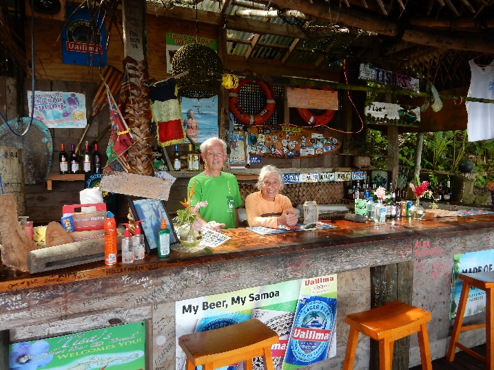
“Candyman,” Tisa’s significant other, had started the fire on the sand floor at 2pm to heat the stones for the “Umu” or Samoan Feast that evening. He continuously fed the fire until 5pm.

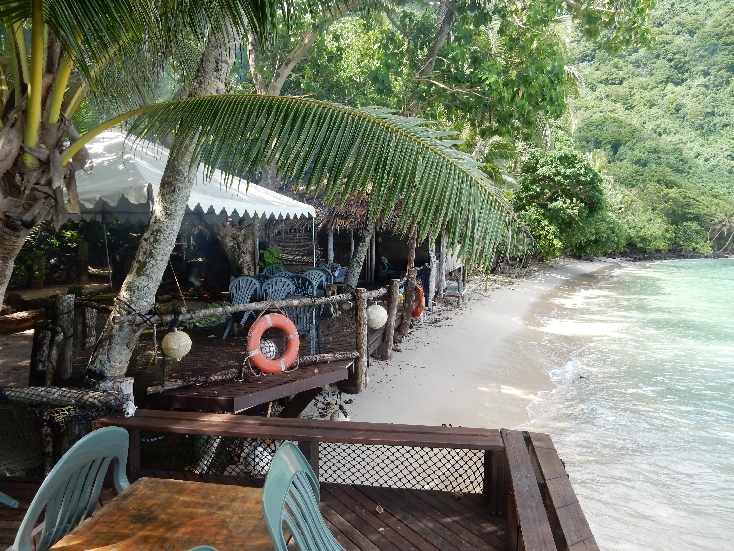
This was a laid back fun place; Tisa even let me put my store bought beer in their ice chest!
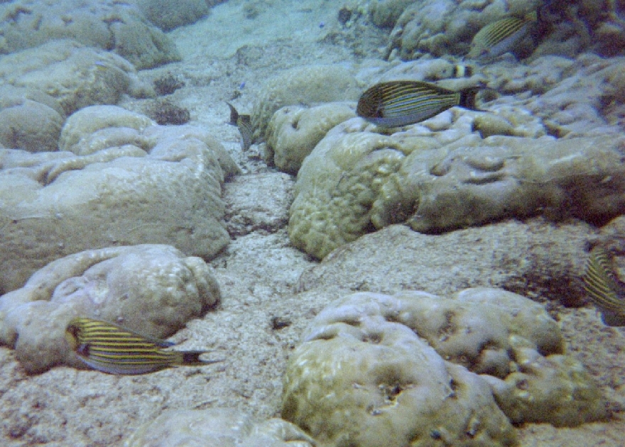
We checked in and borrowed snorkel equipment to swim out to the reef.
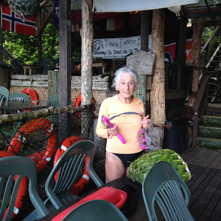
Off to snorkel – Our Fale (room) was the open A frame right of center
We didn’t see any turtles

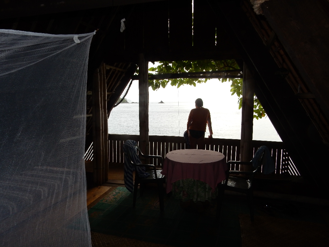
Tisa on the balcony of our Fale

The reef itself was not great but there was a nice variety of fish. Underwater camera did not do it justice

At 5pm, half coconut bowls with meat, seafood and vegetables were placed on the hot stones and coals and then covered with banana leaves. Our Fale was at the top of the three stairs

Candyman placing banana leaves. Our toilet and small sink were, right of center, behind bar

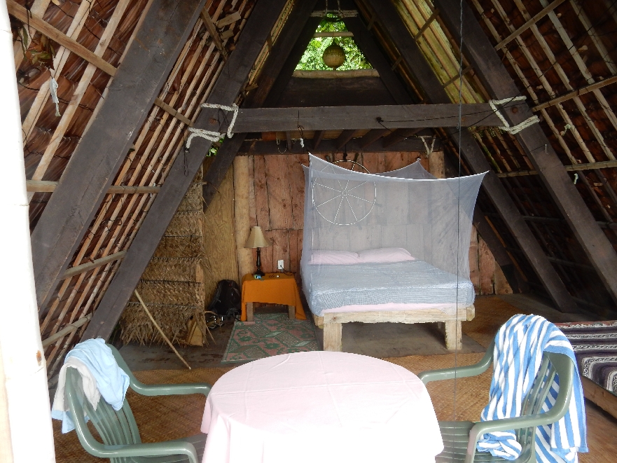
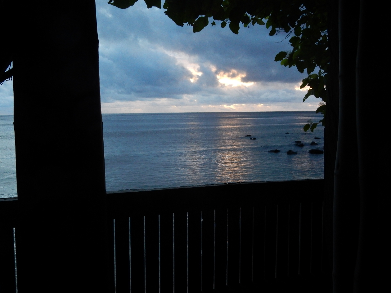
Our Fale – a thatched roof A frame completely open to the beach and ocean, was outfitted with a double bed, night stand, a single bed and a small table with two chairs. The ocean view from the balcony was stunning.
Mosquito netting over bed
We shared the Umu with a group of trial lawyers that were putting on a workshop in Pago Pago. Ready to do the peel (7:30pm) and get to that food

The “Feast” included bread fruit, octopus, shrimp, papaya, coconut, mango, sweet potato, fish, turkey, pork, etc.

Starting to serve

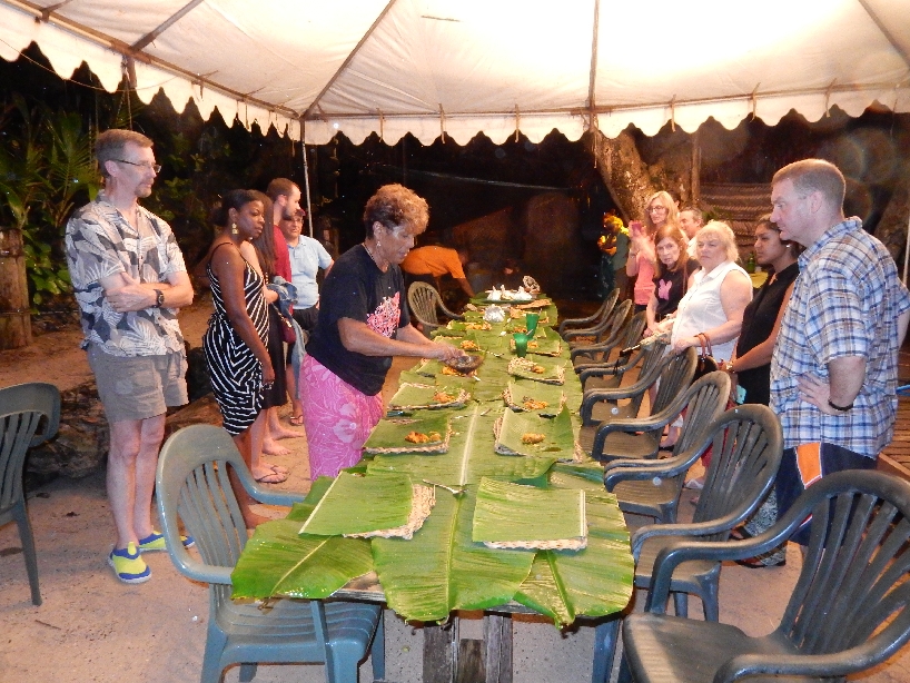
Some of the choices
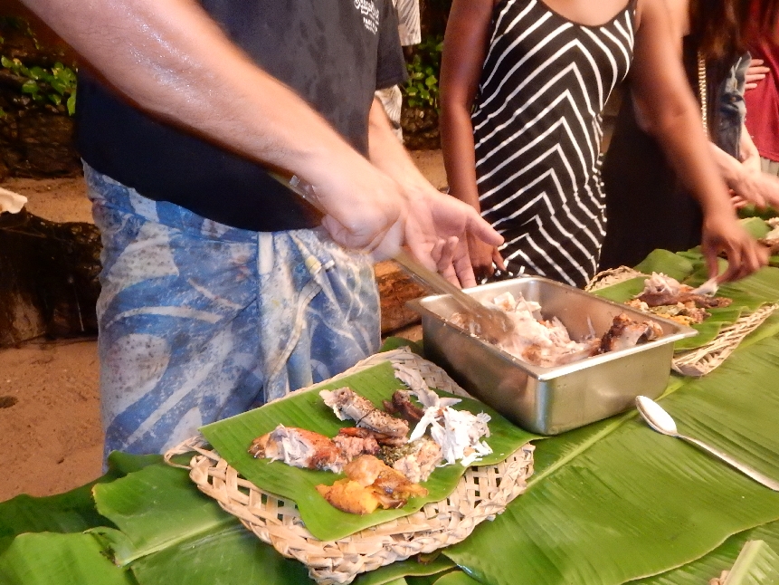
Choices were placed on a large banana leaf (plate substitute). Beer and hand sanitizer at top – you ate with your fingers Samoan style!

That evening we were the only people remaining after the owner Tisa and her companion Candyman left to sleep at their home because it was going to rain all night. It rained most of the night, the only inconvenience was Helen going to the restroom, about 15 yards away, in the rain. This is the route as seen in the morning. I didn’t have that problem given the open balcony.

1/29 – Morning has broken –

Candyman arrived and had our breakfast prepared for us at 8am.
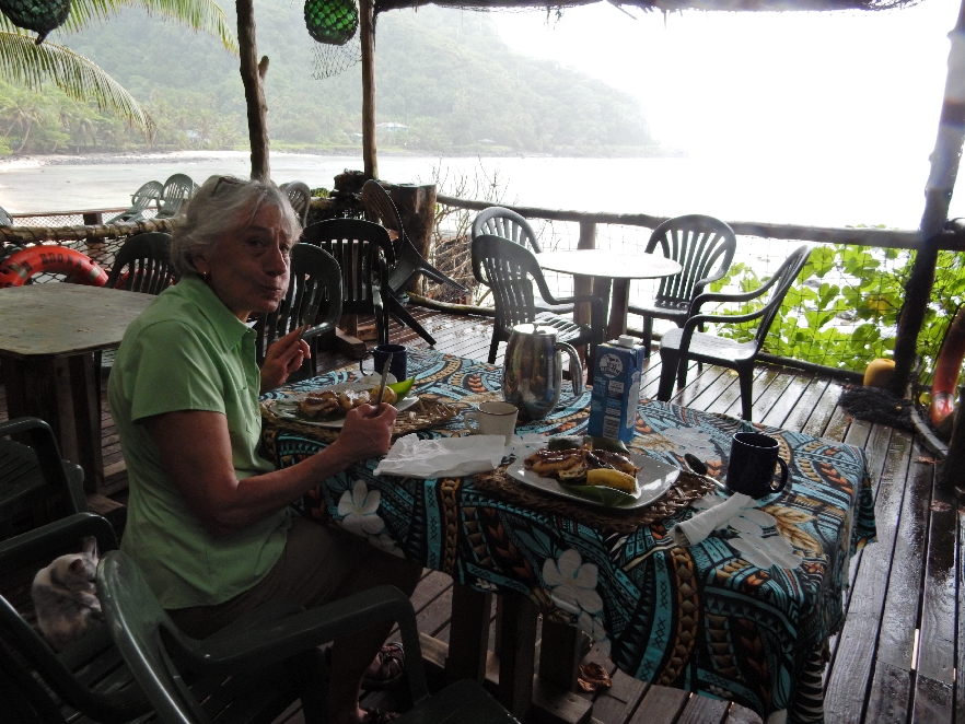
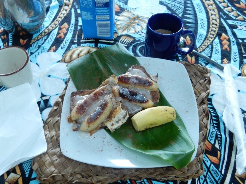
Whole grain organic bread with bananas and a special banana sauce on top served on a banana leaf and excellent local coffee
We drove to the airport, returned the rental car and eventually boarded the small Polynesian Air plane for our 35min flight to Samoa, also referred to as Western Samoa, an independent country.

Fagatele Bay National Marine Sanctuary – Bye-Bye American Samoa, we would like to return some day –

This flight reservation (and hotel reservations) took careful planning because when we left it was January 29th at 12:45pm. When we landed 35 minutes later it was 2:20pm on January 30th – we crossed a time zone and the international dateline.
Landed at Fagali’ airport, took a taxi to the Outrigger Hotel, sounds much better than it actually was, and then grabbed umbrellas to walk into Apia. Ten minutes later the skies opened with torrential rain. Umbrellas did no good and we had to call a taxi to take us to a nice Italian restaurant, Scalini’s, near our hotel. The umbrellas worked for the top half of our body as we walked back to the hotel but our legs and shoes got soaked as we walked through the water overflowing the culverts and flowing down the road.
1/31 – [Samoa date] Had a “tropical” breakfast at the hotel

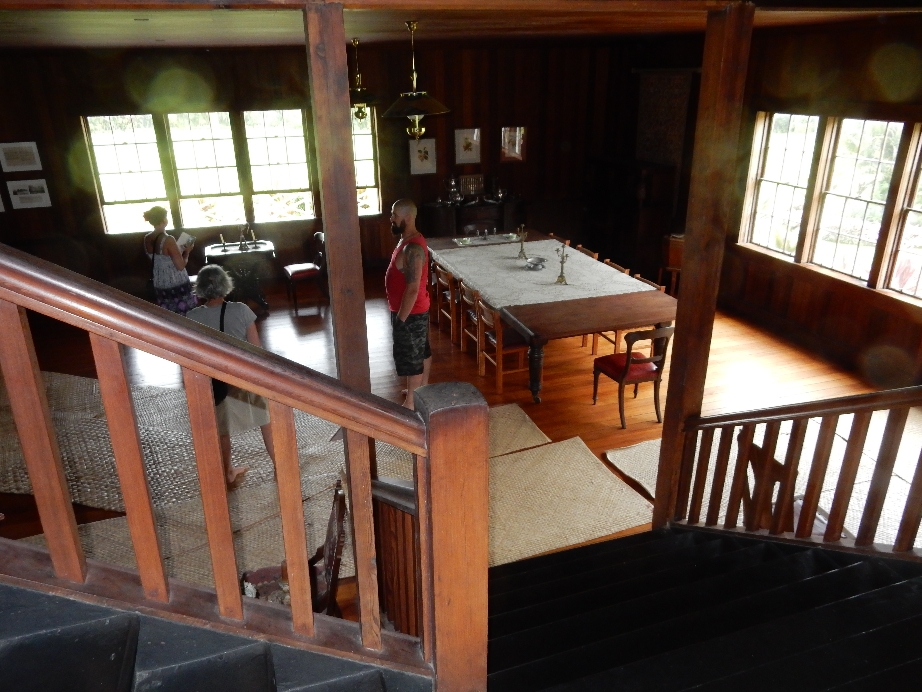
Then took a taxi to the Robert Louis Stevenson home/museum on top of a hill overlooking the island and ocean. Two of his most famous works are Treasure Island and Dr. Jekyll and Mr. Hide.

Fireplace was just for decoration, guide did a nice job for us and one other couple – no shoes allowed

Mats on floor and interesting Samoan mat wall covering

He only lived here 4 years. He died at 44 and was buried on top of Mt Vaea, now a Scenic Reserve adjacent to the estate.
Attractive gardens surrounding house

Portrait of Stevenson, safe and bear rug
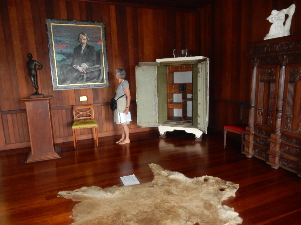
Samoan sculpture on veranda

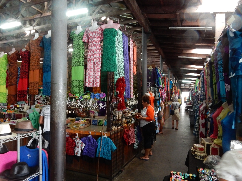
Taxied to the Flea Market in Apia where we purchased some gifts for family and friends

Walked past the Fish Market and harbor where some fishing boats were off-loading their catch
Notice their taped hands
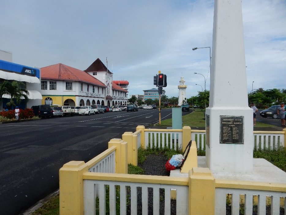
Clock Tower, just right of stoplight, was built in memory of those that died in World War I
Samoan Tourist Authority built in the shape of a Fale. The statue is across the street from the cathedral

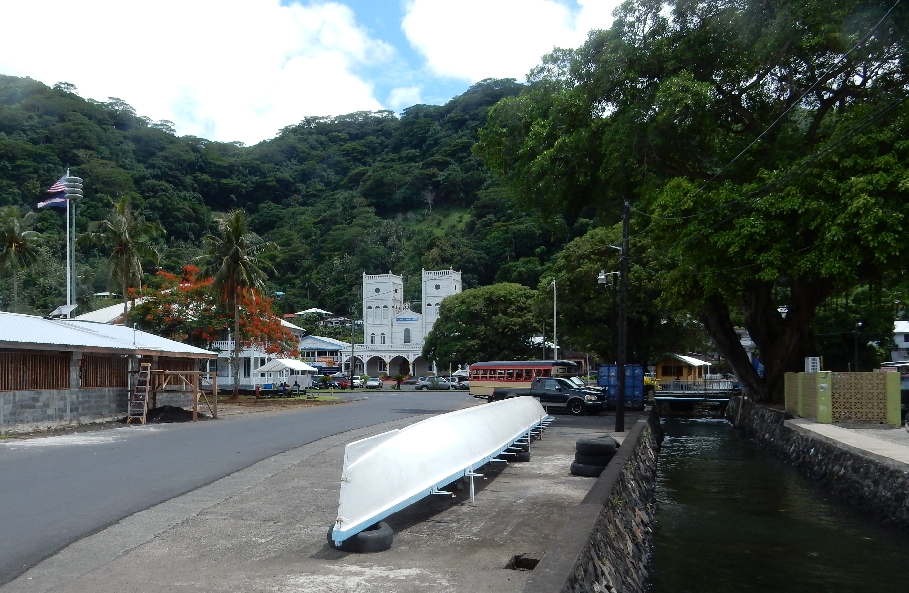
Muliva Catholic Cathedral

Beautiful woodworked ceiling with traditional designs. We observed a funeral service for about 20min and then picked up our bags and headed for the Faleolo Airport about 22 miles west of Apia.

Our Air New Zealand flight took 4 hours and we landed about 7pm. Bob & Sue picked us up at the airport and drove us through Auckland to their large/modern apartment. We immediately fell into friendly conversation as if we had seen each other just yesterday – though it had been 25 years ago!

Leave a comment