
GA NP Units, Belize and Tikal Guatemala
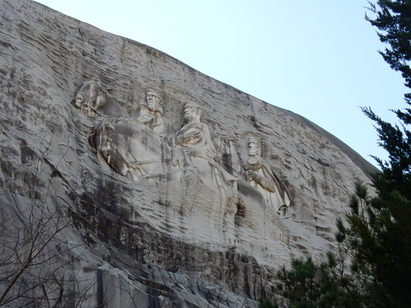
February 28, 2017February 15 – Our first stop, after visiting Irmi and Harold in SC, was Stone Mountain GA just east of Atlanta. I have wanted to see the mountain side sculpture for a long time. Now I can say that I have done that and there is no need to return. It is not a national park unit. I believe it is privately owned and there is a fee to enter the area. I was very disappointed with the commercial approach to this site. There are amusements and they have a laser light and sound show during the season.
Gutzon Borglum started working in 1923 and the plan was to sculpt seven figures and an army of thousands. He completed Lee’s head on the general’s birthday in 1924. There were then funding disputes and Borglum abandoned the project. Borglum is best known for his later work at Mount Rushmore in SD. Another sculptor was hired (1925) and produced a new design. The design required that Lee’s head be blasted from the mountain. In 1928, the land owner refused to renew the lease and the project stagnated until 1958 when the state of GA purchased the site. Walter Hancock was hired as the new sculptor in 1963 and he continued working with some modifications of the previous design. Vice President Spiro Agnew dedicated the sculpture of Confederate President Jefferson Davis, General Robert E. Lee and General Thomas J. “Stonewall” Jackson in 1970.

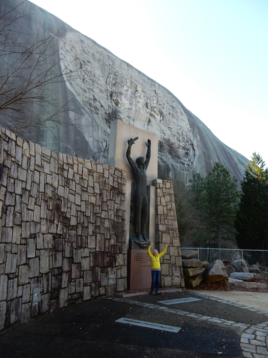
The sculpture measures 90 x 190 feet, surrounded by a carved surface that is over 300 feet wide making it the largest bas-relief sculpture in the world. It is about 400 feet up the rock face.
Hancock also did two bronze statues named Sacrifice & Valor which were installed by the reflection pool
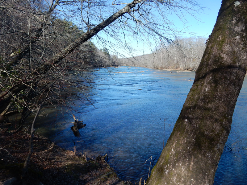
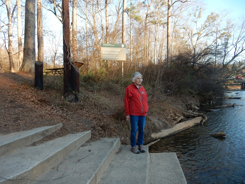
We then drove to the Hewlett Lodge Visitor Center in the Island Ford Unit of Chattahoochee River National Recreation Area (NRA) north of Atlanta

Did a nice 2-mile hike along the Chattahoochee River


Then drove to the East Palisades Unit where we did a mile loop hike to an overlook of the Devils Race Course Shoals of the river

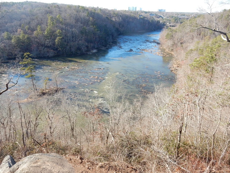
The NRA is a series of parklands along a 48-mile stretch of the Chattahoochee River. The river was the site for the paddling events for the 1996 Atlanta Olympics. I did another mile hike in this area off Powers Ferry Road
February 16 – we stayed in Marietta GA last night and this morning were in Kennesaw Mountain National Battlefield Park at 8:30am when the Mountain Road opened. Marietta is at the foot of Kennesaw Mountain.

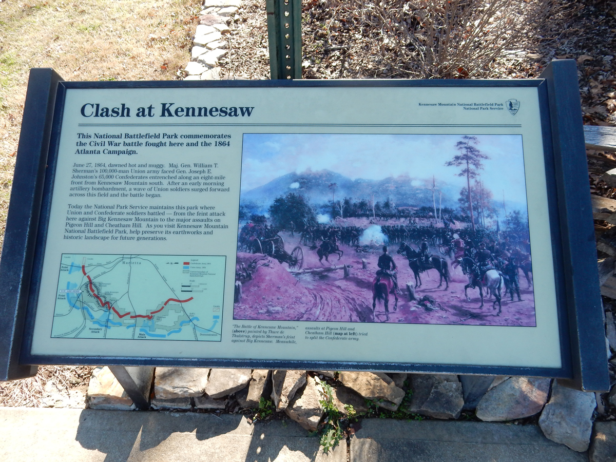

The fighting in this area took place Spring/Summer of 1864 as part of the Western campaign. Both sides were, for the most part, still fighting with Linear Tactics.

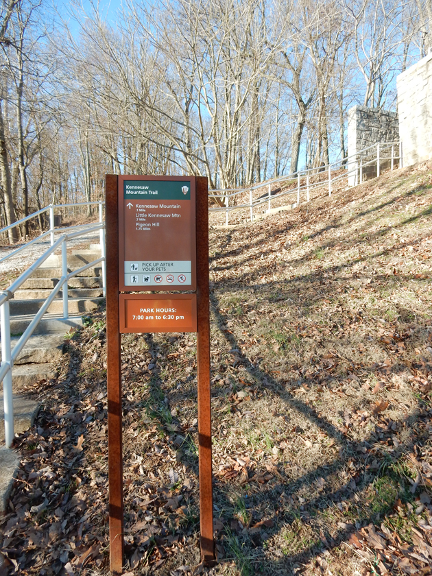
It was a brisk morning, we drove to the top of Big Kennesaw Mountain and then did the trail over the top toward Little Kennesaw and back.
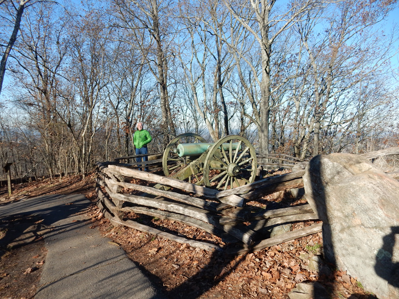
Gen. William Tecumseh Sherman had started his march to the sea. Gen. Joseph Johnston’s Confederates entrenched themselves along the ridgetops of Big and Little Kennesaw Mountain to block the Union’s advance on Atlanta.


As can be seen from the photos, the Confederates and their artillery had an excellent defensive position

Atlanta is in the center of this photo from Big Kennesaw Mountain

On June 27, 1864, Sherman feinted a direct attack on Kennesaw Mountain but sent most of his force against the Confederate flank at Pigeon Hill and Cheatham Hill. The unsuccessful attacks resulted in 800 Confederate and 1,800 Union casualties.

This is the Cheatham Hill salient (protruding angle in line) where most casualties occurred. It came to be known as the “Dead Angle.”

We did a loop trail here passing the Illinois monument


And the grave of an Unknown US Soldier

Johnson again retreated south to protect Atlanta.
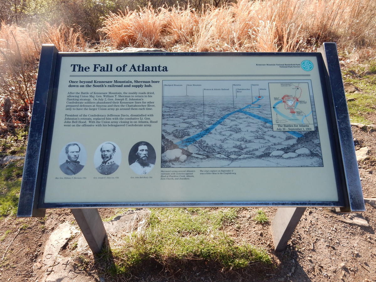
Sherman advanced and laid siege to Atlanta cutting its rail links. The city fell on September 2, 1864.
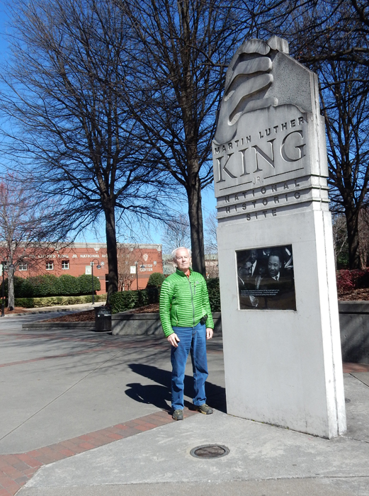
After a short 30-min ride we were at Martin Luther King, Jr. National Historic Site near downtown Atlanta. We started at the Visitor Center.
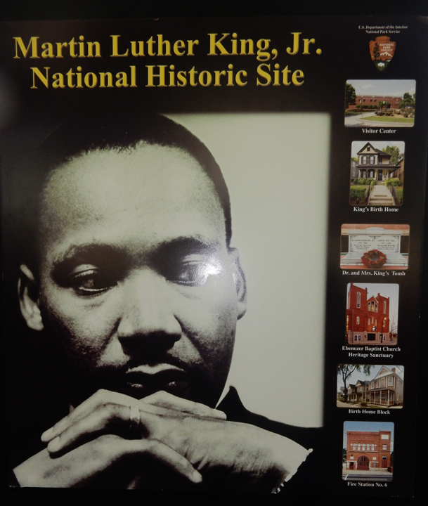

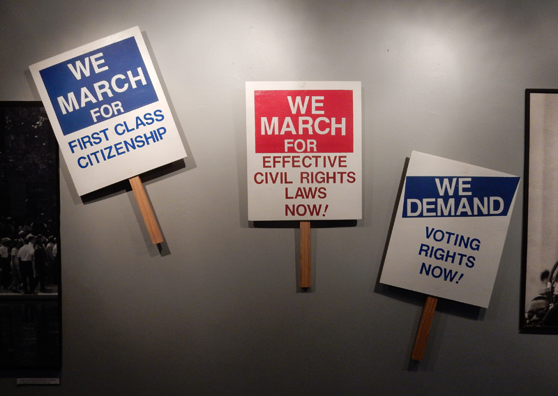
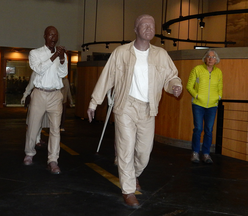
As usual, we watched the video and toured the Visitor Center

Wagon that was used for MLK funeral

Last year, 2016, was the 100th anniversary of the formation of the National Park Service. This is a list of the National Park Units added by President Carter including many large national parks in Alaska.

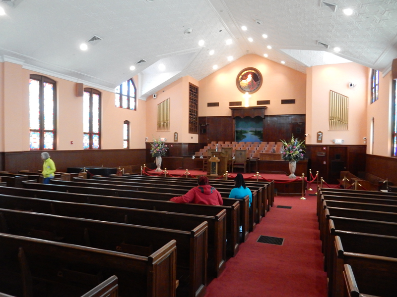
Historic Ebenezer Baptist Church
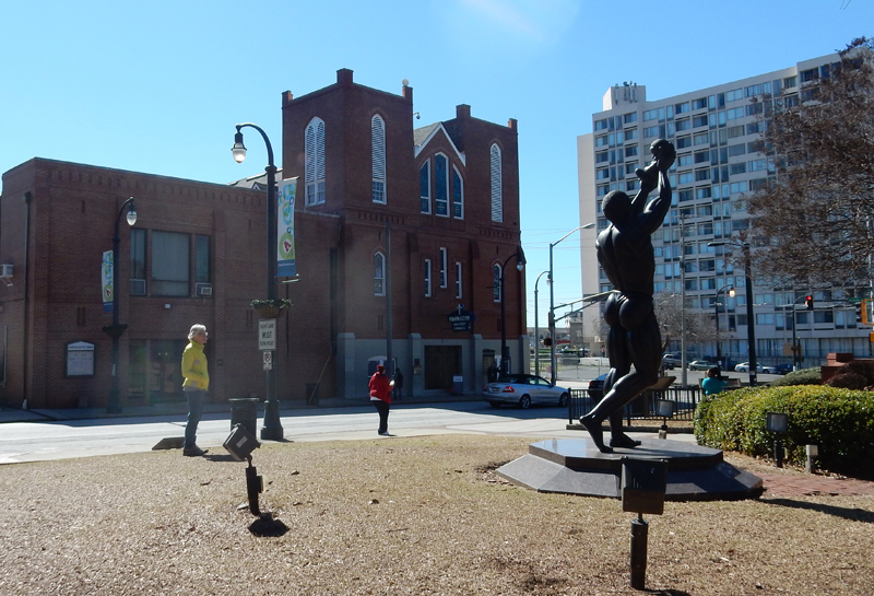
Current Ebenezer Baptist Church across the street

Visitor Center in background
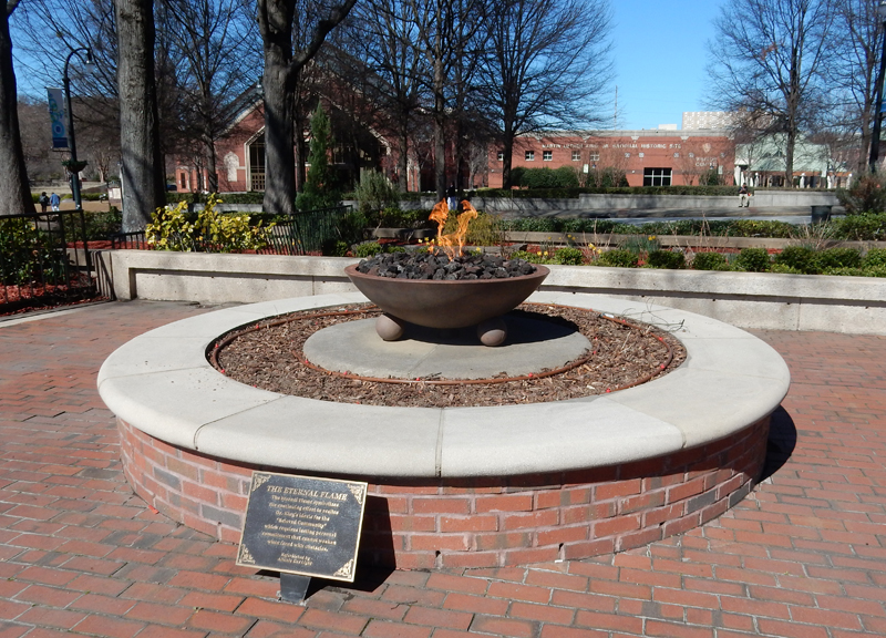
The King Center, eternal flame and tombs

Reflecting pool surrounding the tombs of Dr. and Mrs. MLK


Close-up eternal flame, Ebenezer Baptist Church and Park Visitor Center in background
MLK was born here on January 15, 1929


February 17 – First stop Andersonville National Historic Site. There are three parts. First, the Andersonville Prison site, which was a Confederate Civil War prison. It was originally called Camp Sumter Military Prison and opened in February 1864. It was intended to hold 10,000. By August, the number exceeded 32,000 Union prisoners.

In the 14 months the prison existed, 45,000 soldiers were confined here – over 13,000 died from disease, poor sanitation, malnutrition and/or exposure.


The prison pen covered 26.5 acres. A steam through the center provided most of the water and served as a sewer.

The stockade was 1,620 feet long and 779 feet wide. There were sentry boxes every 90 feet along the top.

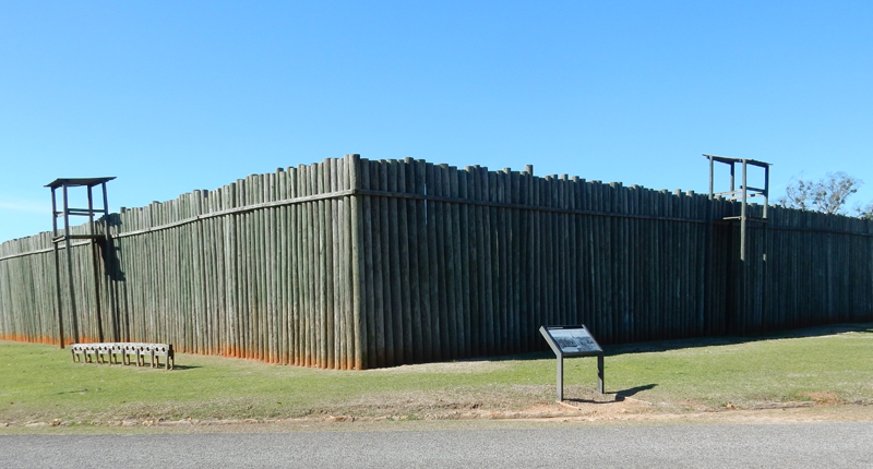

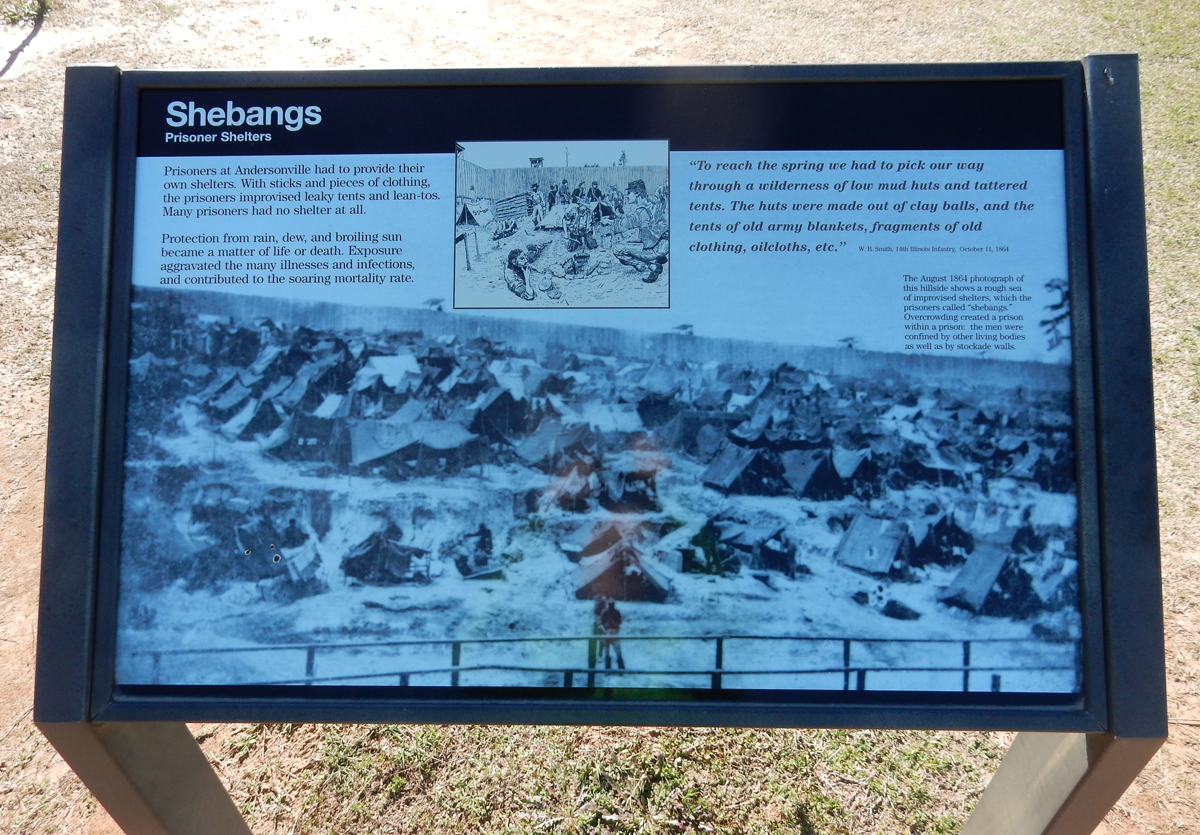
There was a “deadline” inside the stockade wall that was 19 feet wide. Anyone entering this area could be shot. “Shebangs” – prisoners had to provide their own shelter!

Helen walking among the prison camp monuments
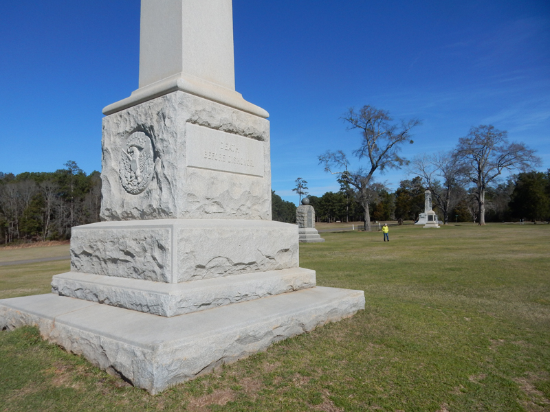

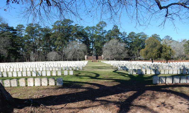
The second part of the site is the Andersonville National Cemetery. It was established in July 1865 as a resting place for deceased veterans. The first to be buried here were prisoners who died at the camp in February 1864. In August 1865, Clara Barton, the “Angel of the Battlefield” came here and took on the task of marking grave and notifying families of the death of their loved ones.


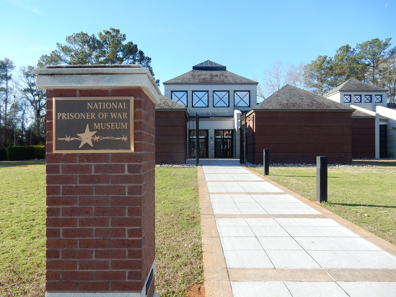
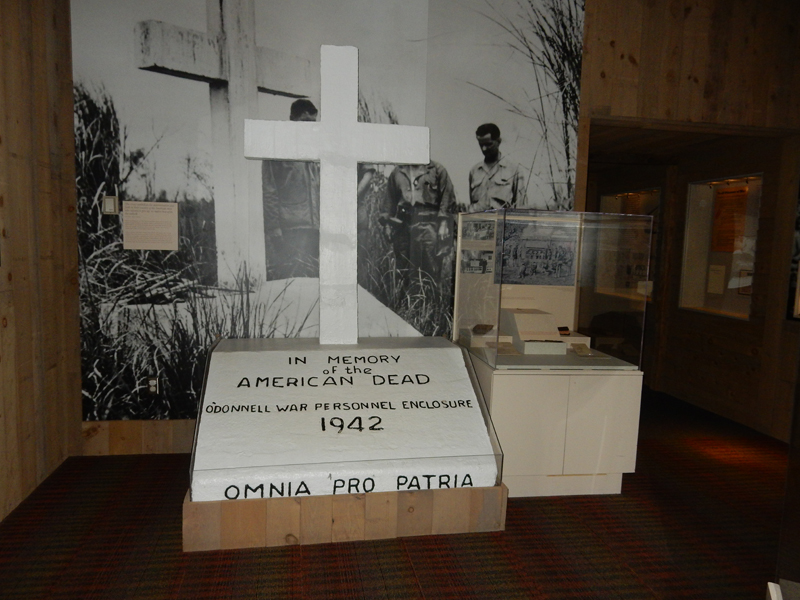
The third part of the site is the National Prisoner of War Museum

What is a POW? The answer is not simple.

POWs by other names

About how many US POWs have there been? > 500,000
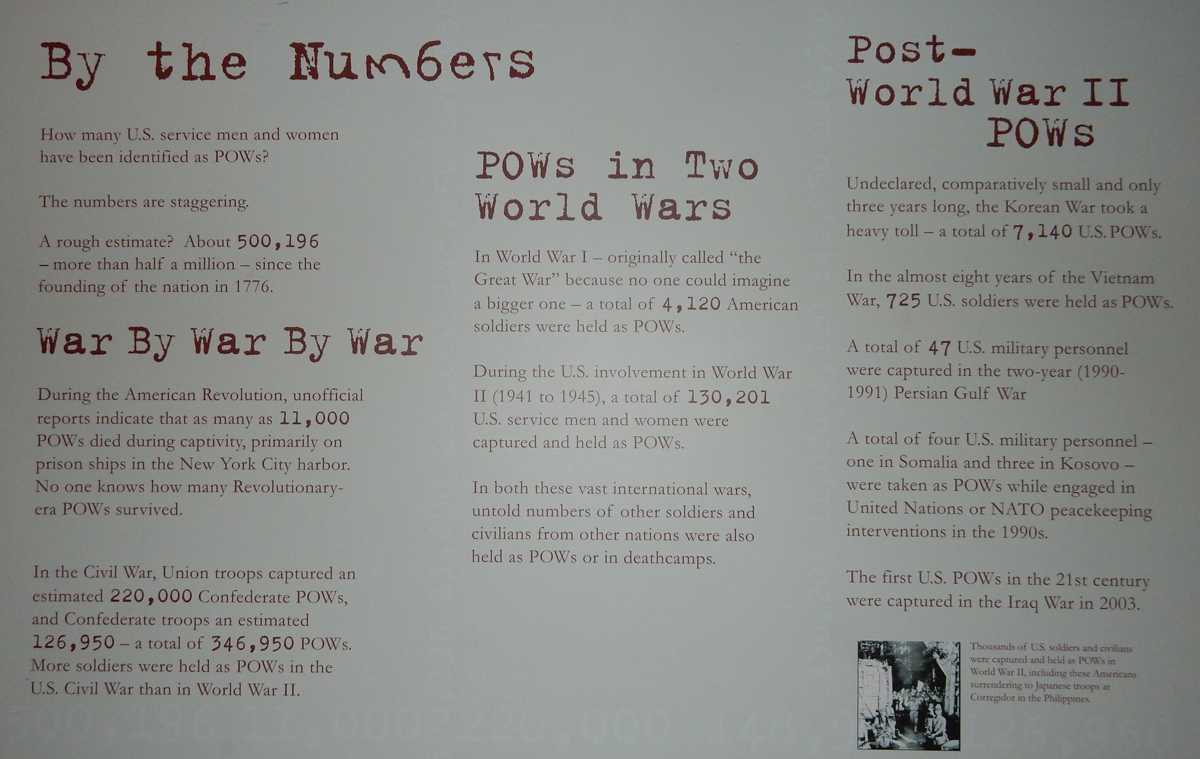
World War II
Vietnam

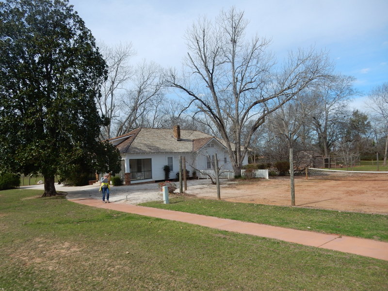
Jimmy Carter National Historic Site (NHS) Plains GA – The NHS has four parts, 1) Plains HS, 2) Carter Boyhood Farm and Home, 3) Plains Depot and 4) Current Carter Home, not open to public. We started at the Visitor Center in the old Plains HS that Jimmy and his wife Rosalynn attended.

James Earl “Jimmy” Carter Jr. was born October 1, 1924 in Plains GA. In 1928, his family moved to a 360-acre farm outside of town. At that time, the house did not have electricity or plumbing. His father Earl liked tennis and built a clay court next to the house. Jimmy lived here for 14 years and was responsible for regular farm chores.
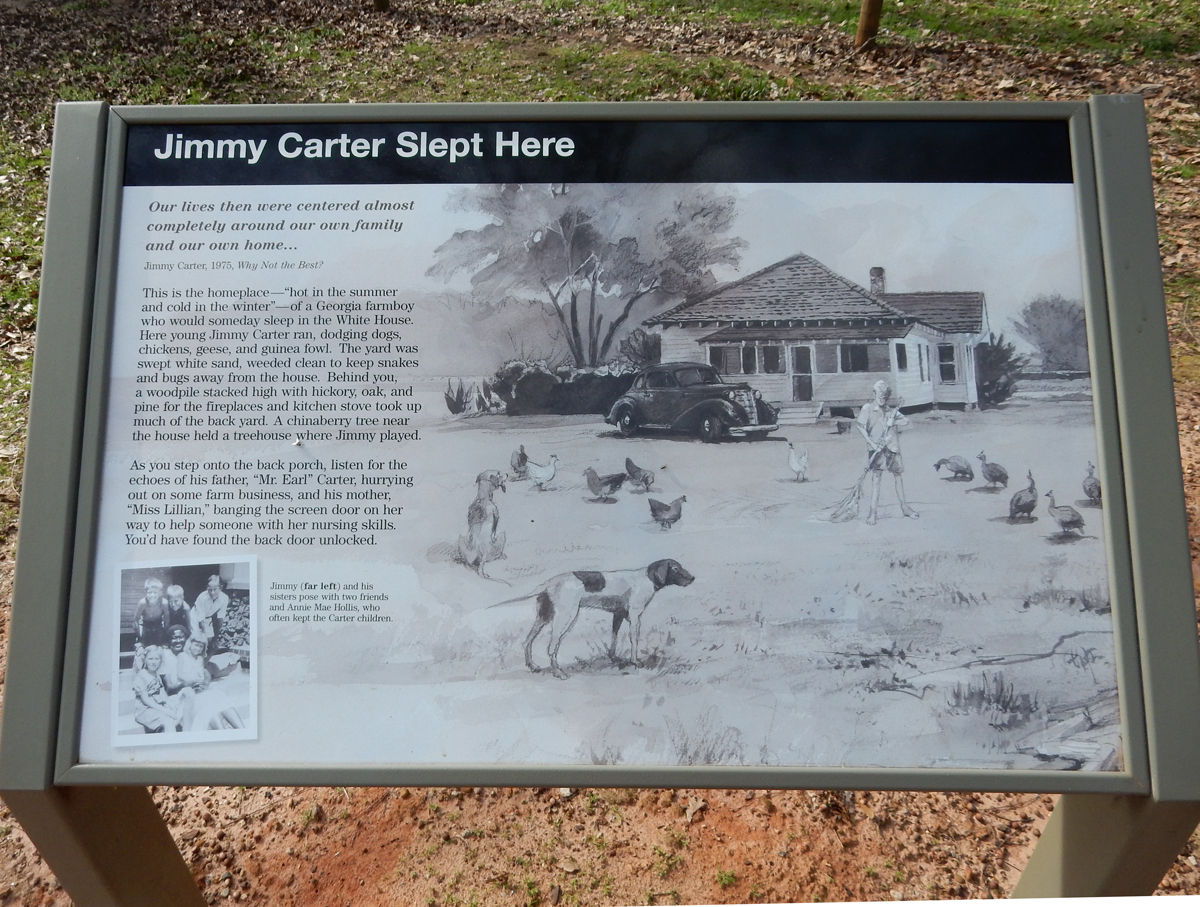
The family also had a Commissary near their home where they sold seeds and supplies to farmworkers and neighbors.

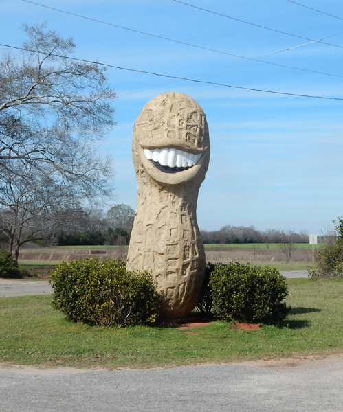
One of the Carter family crops was peanuts – this one is located a little north of Plains
Jimmy graduated from the Naval Academy in 1946 and married Rosalynn that same year

He was a state senator 1963-1966, GA Governor 1971-75, and elected the 39th President of the U.S. in 1977. The local Plains Depot (railroad station) was his campaign headquarters.


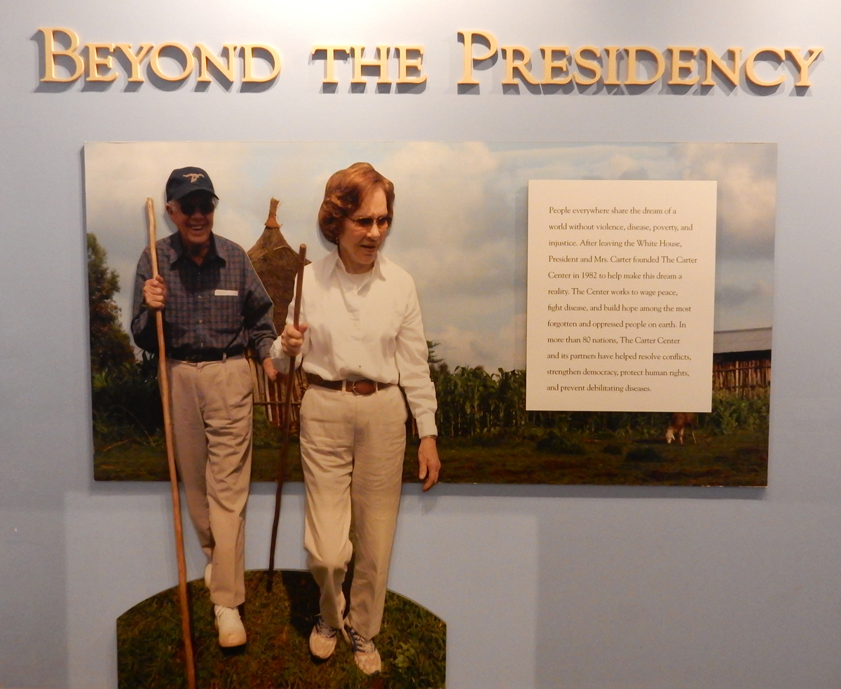
President Carter is now 92 and lives in the Carter Home on the edge of town. He was born and will die in the same place, unusual for a U.S. President. He has been very active during retirement. He is known for his work with Habitat for Humanity and in 2002 was awarded the Nobel Peace Prize “for his decades of untiring effort to find peaceful solutions to international conflicts, to advance democracy and human rights, and to promote economic and social development.” In 1980, he signed the Alaska Lands National Interest Conservation Act, protecting over 100 million acres of federal land.
Overall I believe that Carter was one of our better Presidents. However, I must state that the U.S. foreign policy in relation to Iran at that time was misguided. My view is based on my experiences in Iran as a Fulbright Scholar at the University of Teheran before and during the Iranian Revolution. For example, on December 31, 1977, at a New Year’s Eve celebration in Teheran, President Carter stated that “Iran, because of the great leadership of the Shah, is an island of stability in one of the more troubled areas of the world.”
We stayed the night outside of Jacksonville FL
February 18 – had a leisurely drive to Miami Lakes FL where we stayed in a Marriott and had dinner at a Puerto Rican restaurant
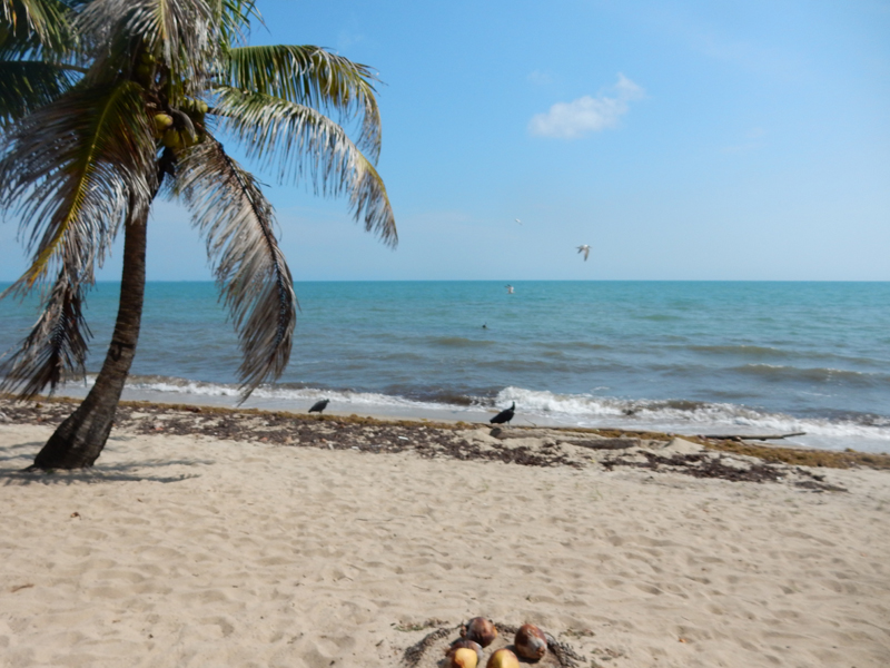
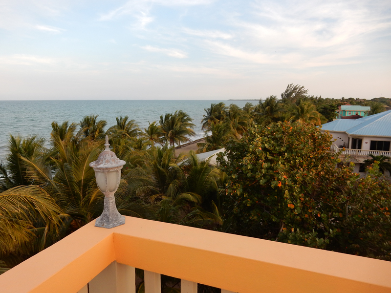
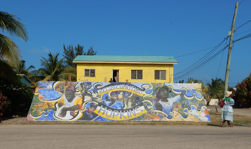
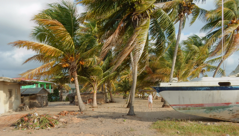
February 19 – flew AA from Miami to Belize and arrived at 11am. Rented a Jeep Patriot (with certification to drive to Guatemala) and then drove from Belize City to Hopkins in the southern part of the country, population 1,800. I chose Hopkins because it was small, on the Caribbean, close to Salt Water Caye Marine Reserve, and still had a Garifuna vibe – that is, relatively untouched by large commercial enterprises. We stayed at the Buttonwood Guesthouse, which is owned by the Coconut Row Guesthouse. Shortly after checking in, we received our fresh coconut with straw and rum added! Our room was on the third floor, highest room in Hopkins! It can be seen in the background of this pic.

Views from roof


February 20 – this was our first full day in Hopkins. We started by walking the beach in the morning. Helen thought this would be a good “fixer upper” – hurricane remnant
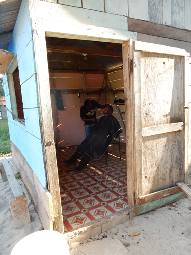
In the afternoon, we explored the village on bikes, houses across our dirt street

Police Station

Church of God of the Prophecy

OK, I underestimated the length of the ride, thought it would be 4 to 5 miles. It turned out to be 12 – because we had to ride to the end of the road!

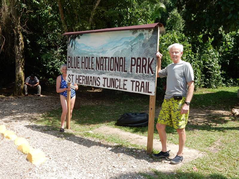
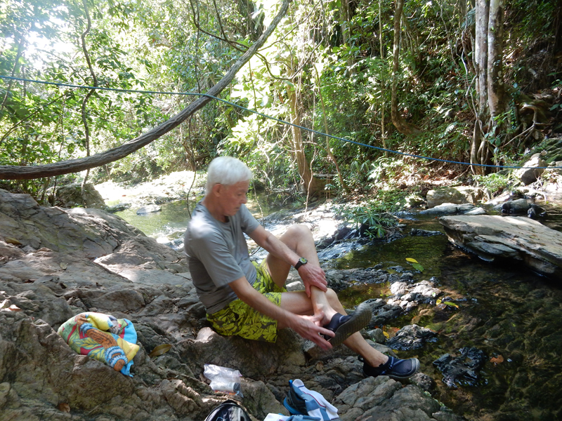
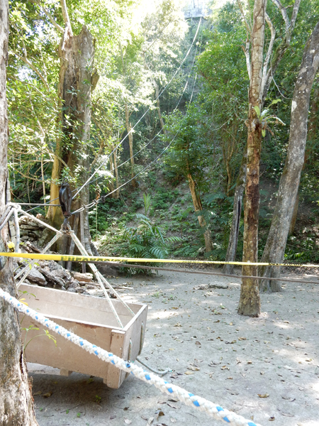
February 21 – This turned out to be a big day for us. Our first stop was St Herman’s Blue Hole National Park. I had planned to just hike to the cave and then take a dip in the Blue Hole. However, after speaking with the ranger, we decided to also do the Cave Tubing. A guide is required ($50 each) for this 2-hr underground adventure. We donned our helmets, head lamps and PFDs and hiked to the cave entrance.


It was a real adventure for us “old folks” as it was slippery and many of the cave passages small.

Descending to the underground river
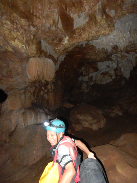
I was unable to open the Zip Lock bag that contained my camera due to the tight, moving and ever changing conditions. So, I don’t have any photos of us tubing. It was a bumpy and exciting ride! Here we are finishing and climbing out of the cave.

Park sign
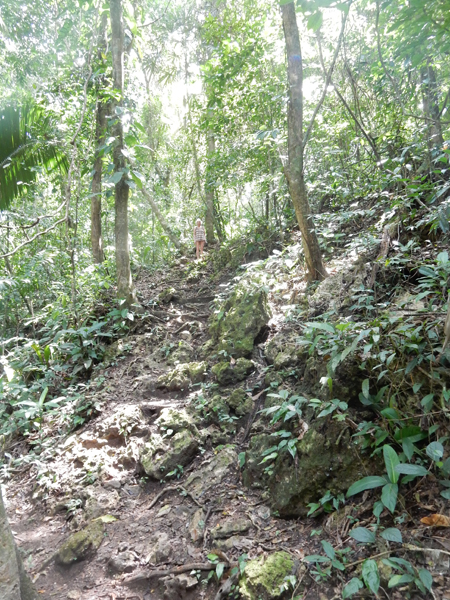
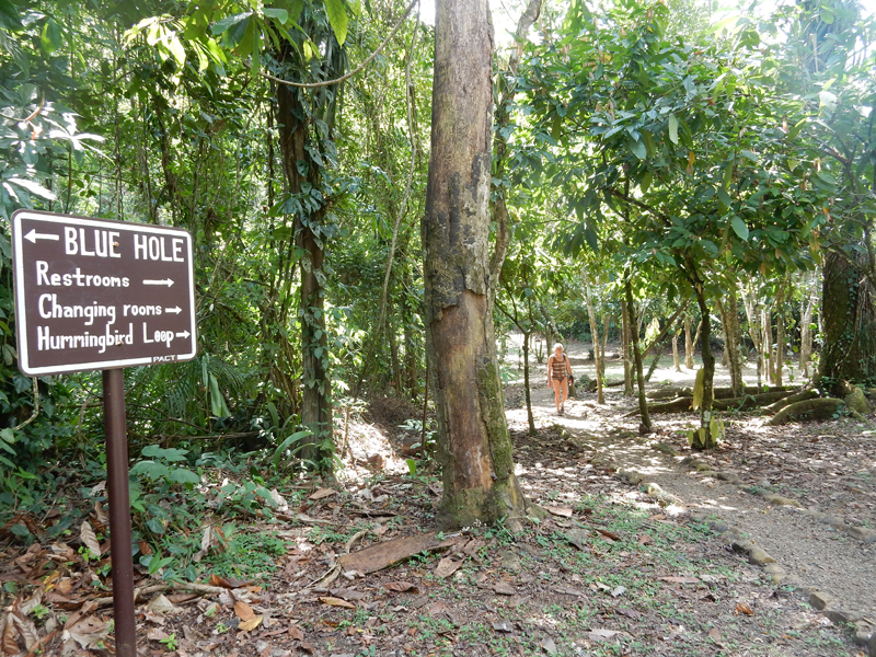
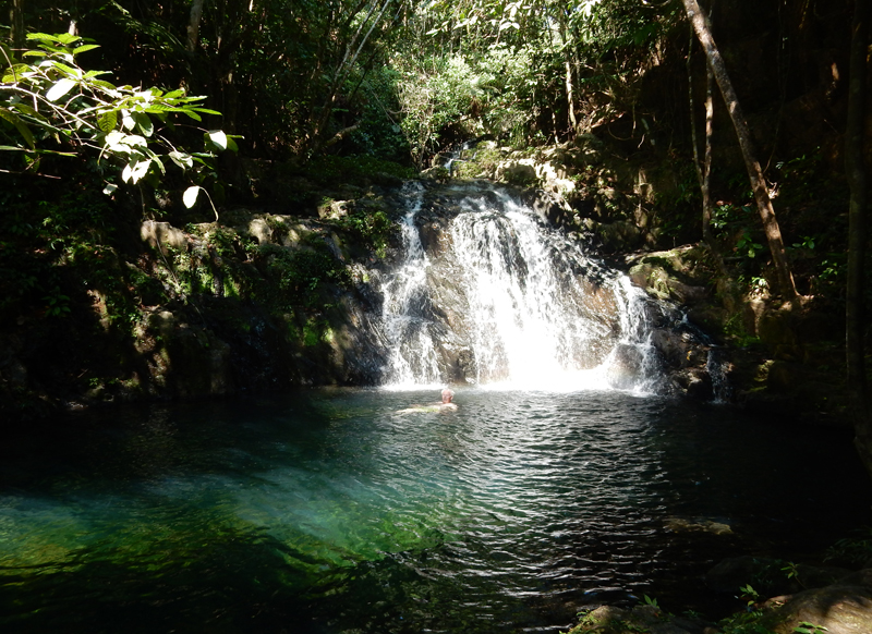
We next hiked the Hummingbird Loop trail through the jungle near the Blue Hole


We then headed for a dip with the fishes in the Blue Hole

As mentioned, I hadn’t planned to do cave tubing in the morning. However, I had planned and made an internet reservation to do the Cave Tubing at the Nohoch Che’en Caves in the Cave Branch Archaeological Reserve another one hour drive toward Belize City. We arrived at 3pm and were delighted to be the only people on the river. This is a tour spot for Cruise Ships, so I had planned to be on the last possible tour of the day after the “tourists” left. Again, guide required, another $100 (cash).
Ready to go – this was a “cake float” compared to the morning ride. The Cave Branch River was wide with plenty of head clearance.

Also, the tubes were first class with supportive backs and handles. There is an opening with small waterfall about mid-way along on the float. The 2-hr hike and float was well done and relaxing but no match for the morning excitement.


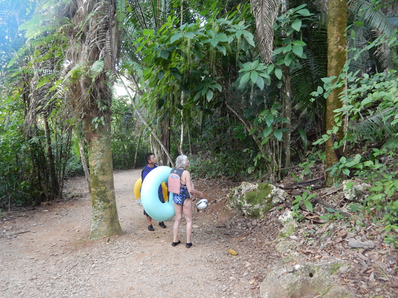
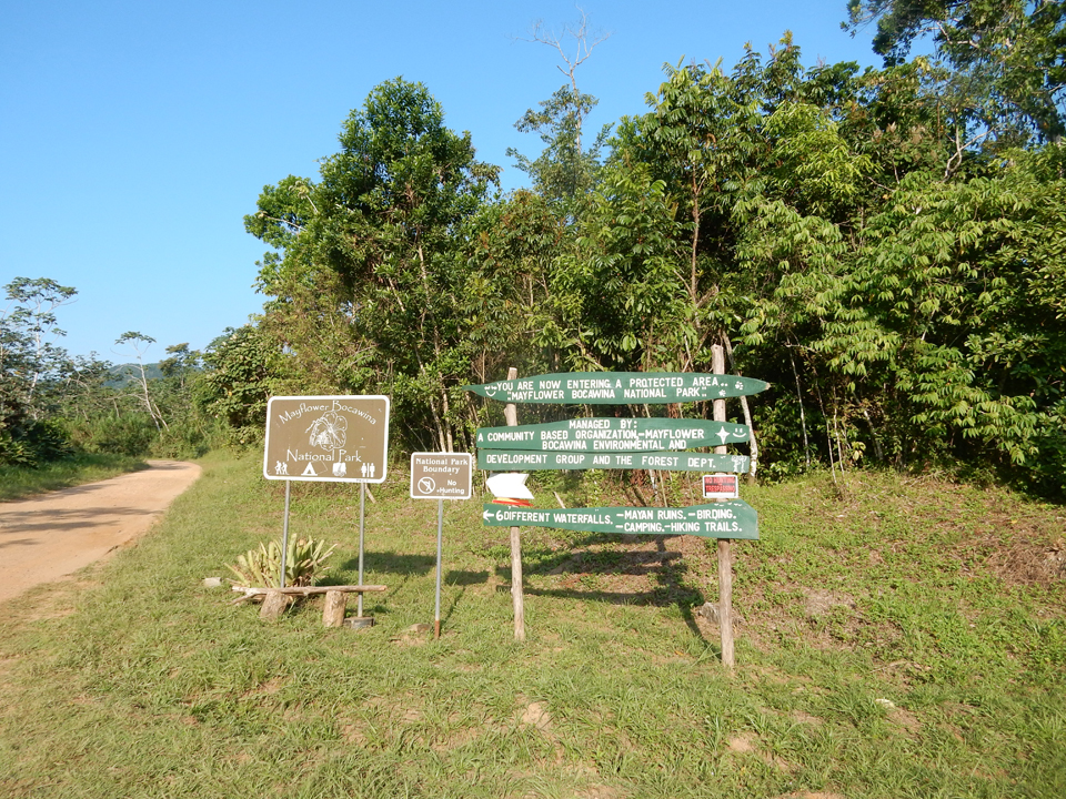
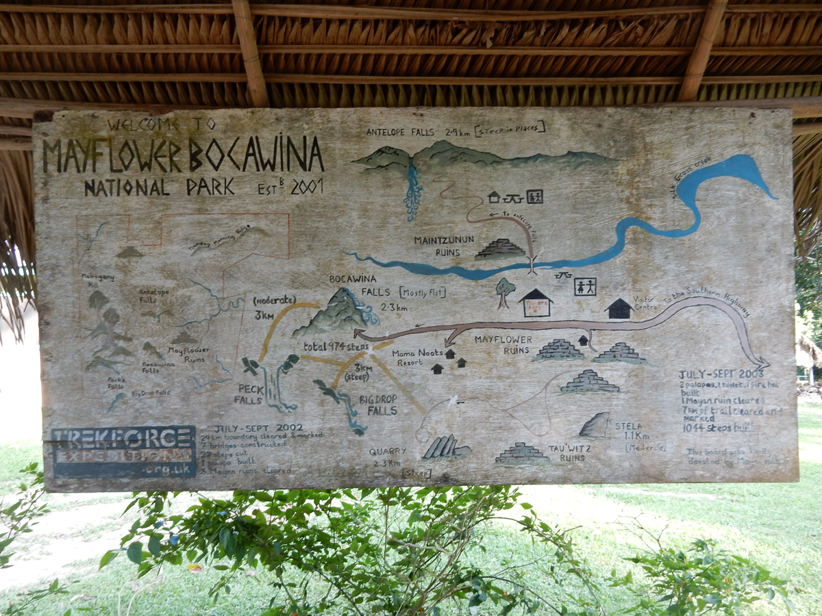
February 22 – again, started our day with a delicious Mexican breakfast at Thong’s street side restaurant. It was then a short drive to Mayflower Bocawina National Park.
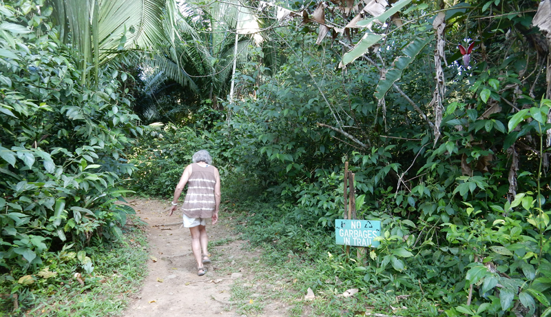
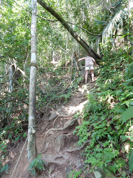
We decided to do the strenuous Antelope Falls Trail (center top of map)
Start of trail
Many sections required rope assists

According to our Lonely Planet book, the trail/climb is 3.5-miles round trip

More ropes
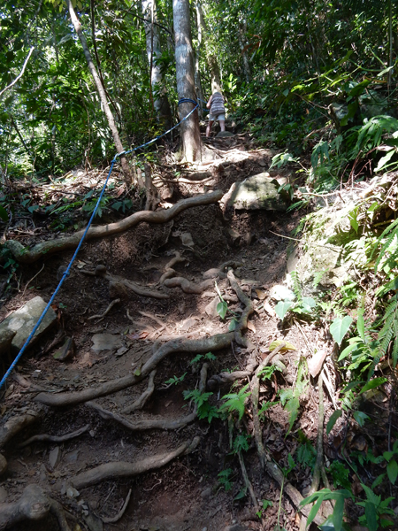
Cascade along trail
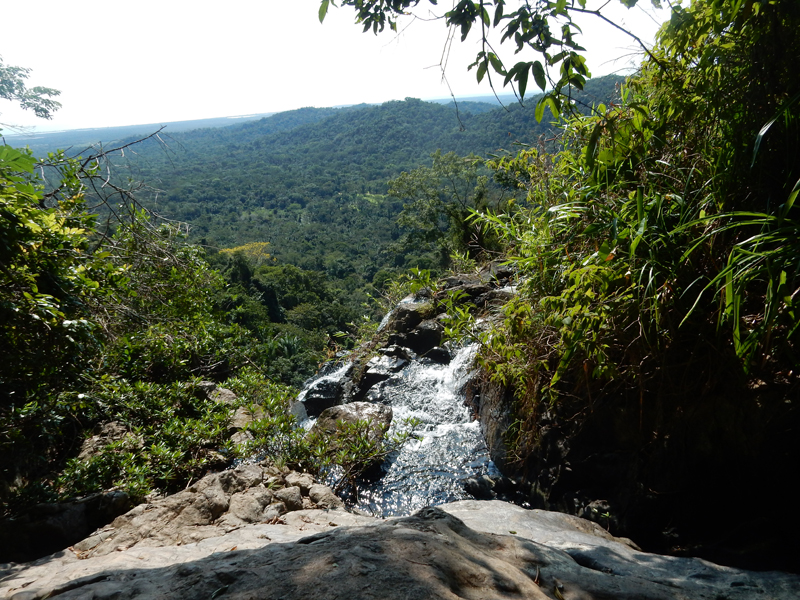
Jungle panorama from top of falls
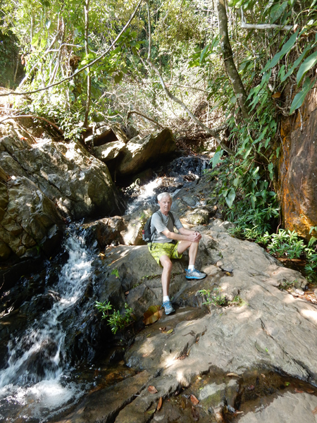
Wow, beautiful pool at base of Antelope Falls. Sweaty from climb, perfect for a nice cool dip! Took off backpack, put on water shoes, emptied right pocket, emptied left pocket, took off shirt – forgot phone in back pocket!!! All phone photos lost –
Met a small group with climbing guides as we started our descent, they were surprised to see us up here


We also did another mile hike to Lower Bocawina Falls

Helen returning from base of falls, another rope ascent

Trail returning to Jeep

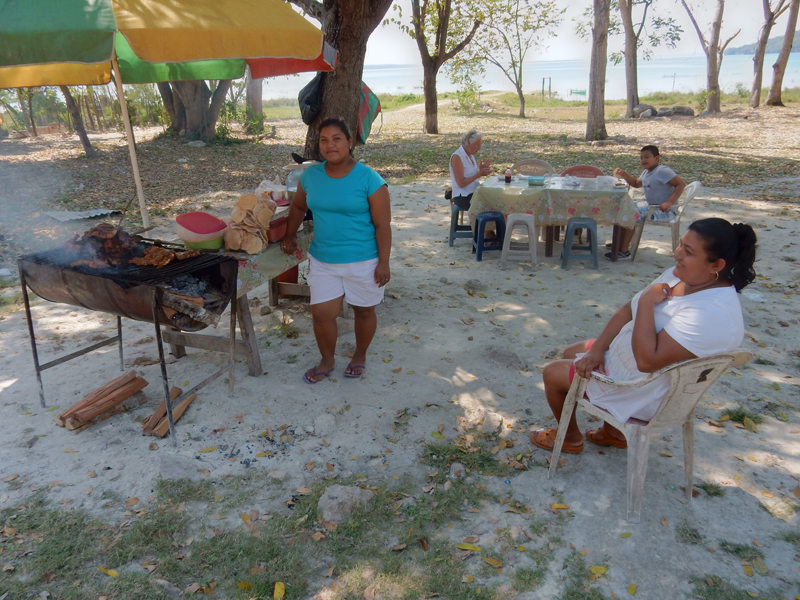
Celebrated our “big day” with a barracuda dinner over the water – delicious! This shack is only open when the locals catch fish.

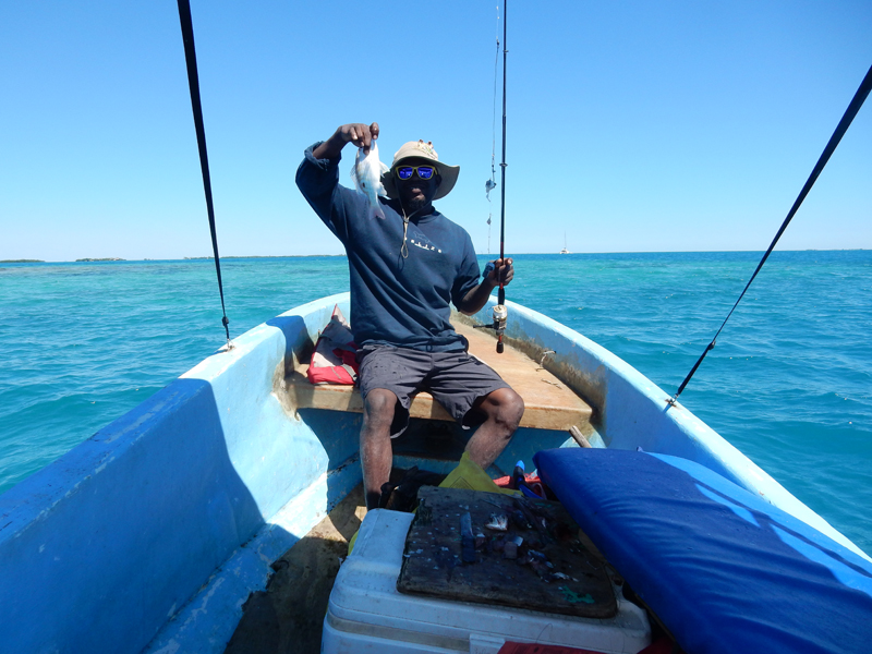
February 23 – hired Ash, a local guide, to take us out for some fishing at the reef. We also snorkeled at Salt Water Caye Marine Reserve but there are no pictures because I left my camera in the boat.

Helen’s first fish – yellow snapper
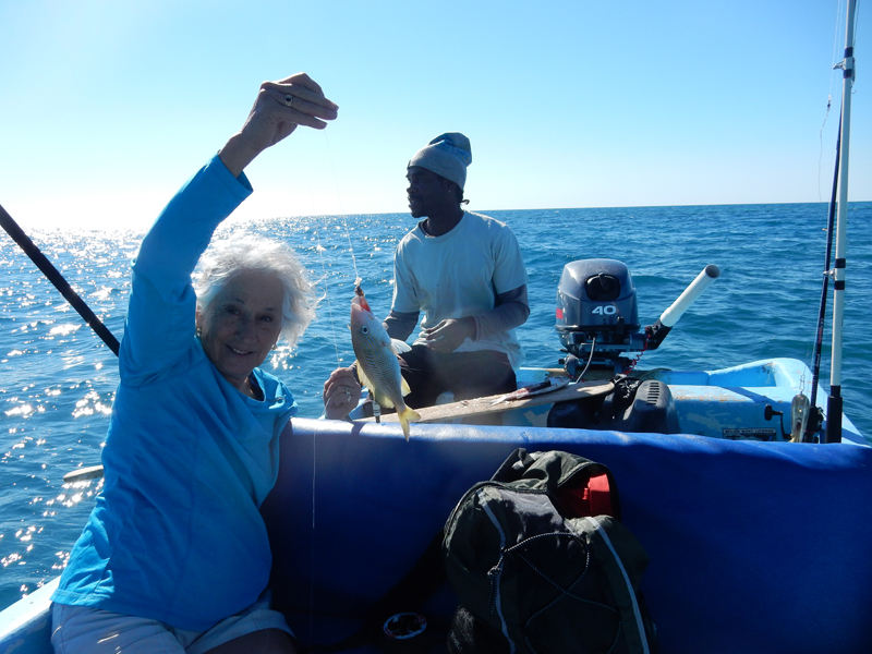
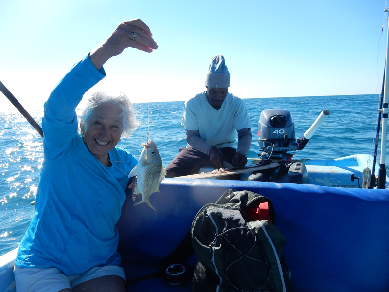
Helen’s second fish, fishing technique – line with a spark plug on the end for weight and a single hook about 6 inches up from the bottom with bait on it. Get weight on bottom, feel for pull and jerk up. It worked! Helen caught eight fish and I caught five
Ash’s assistant Mathew on his day off. He worked for the Coconut Row Guesthouse
I think this is a maceral
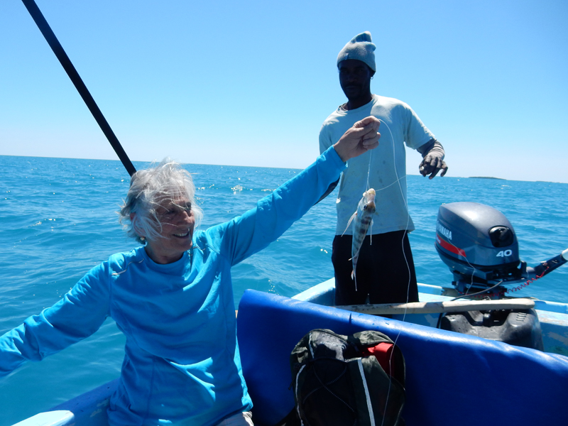
Going home

We asked Mathew to grill two of the fish for us. He started by borrowing the grill and then we bought the coals and other ingredients at a local store. Almost every little food store we saw in this area was run by Chinese.
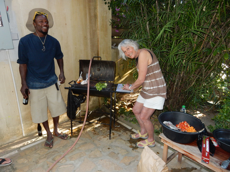
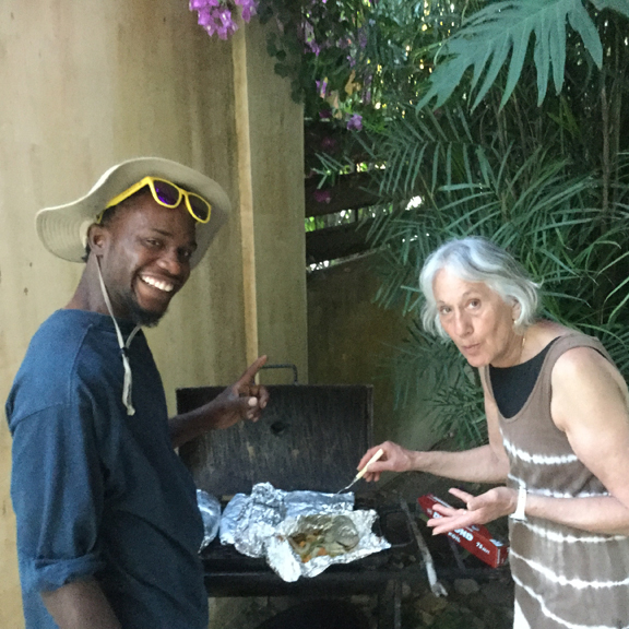
He also grilled two more for himself and his cousin. The rest of the fish were donated to his extended family.

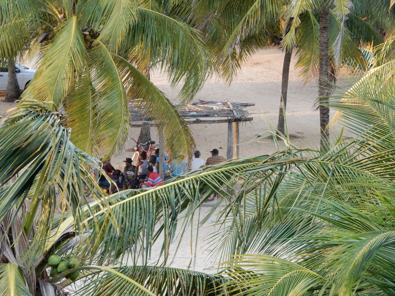
In the evening, we walked down the beach to experience some of the local drumming

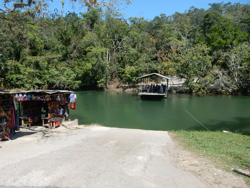
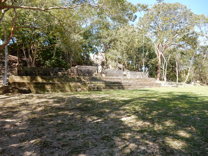
February 24 – Drive to Guatemala, our first Mayan Ruins stop was in Belize close to the Guatemala border. To get to the Xunantunich archaeological site we had to take a hand cranked ferry across the Mopan River.

Visitor Center

Stela 8


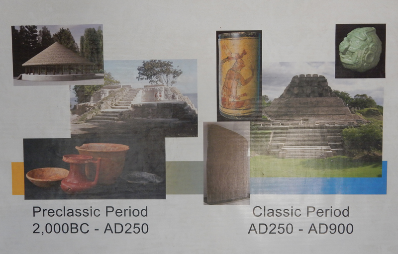
Though probably inhabited as early as 2000 BC, the current complex of ruins dates back to the 7th century
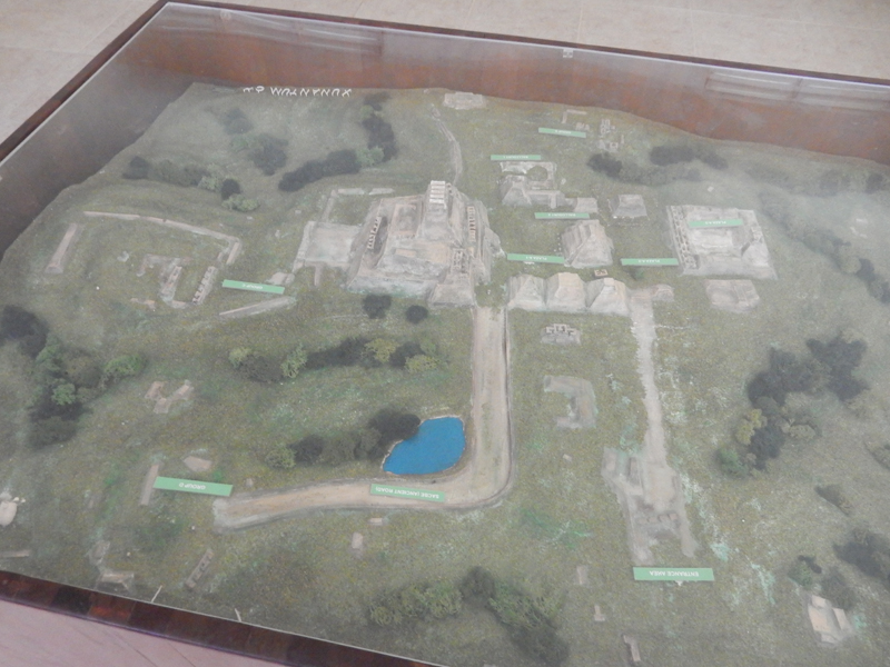
The Museum describes two major periods
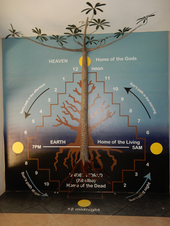
Interesting display
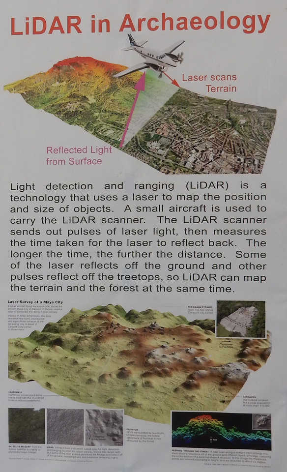
Archaeologists have used light detection and ranging (LiDAR) laser scans to map the area
This is believed to have been a structure for an important family unit
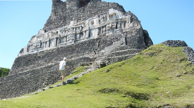
The dominant structure is El Castillo, thought to be the ruling family’s ancestral shrine and burial location


The original structure would have been built with an elaborate plaster frieze. What we see now are some replicas built over the originals.
Chac, the rain god, is the central figure on this side (east)

Climbing to the top
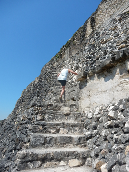
The structure is 130 feet tall with a pretty 360o view from the top

Praying to the Sun God
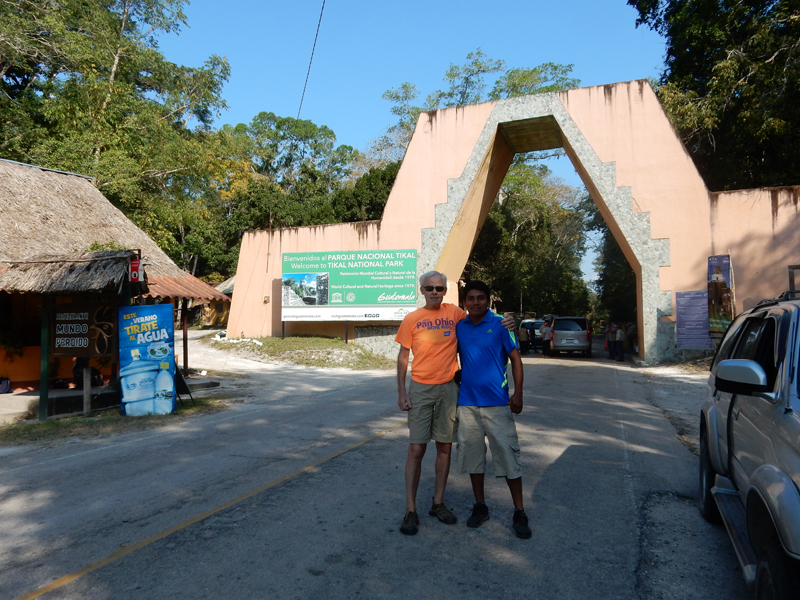
Crossing the border into Guatemala was a nightmare. First, a hefty exit fee to leave Belize. Then the car fumigation. Then the car entrance fee into Guatemala. Then the lengthy line to get passports checked and pay visa fee. Then the actual border crossing. All with essentially no Spanish language skills and numerous people wanting to “help” for a fee. After about an hour drive, we arrived at the Park entrance and had to exchange dollars to Quetzals (1$ = 7.5 GTQ) to pay the entrance fee.

It was then an additional 20 mins to reach the ruins and the Tikal Inn. Arrived in the early evening and settled into our Ranchon ($97.60 for 2 nights) – a thatched roof cabin in the forest.
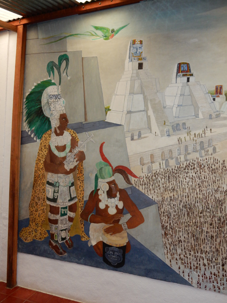
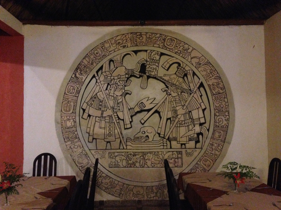
We decided to pay a per deum for breakfast and dinner in the dining room. It was a good decision, reasonably priced and good local food. This is a mural near the dining room.

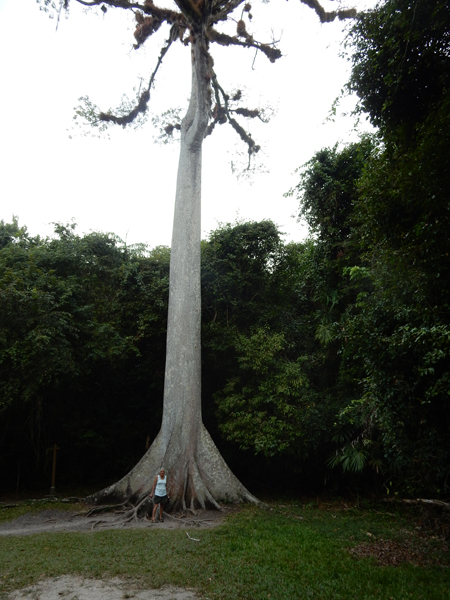
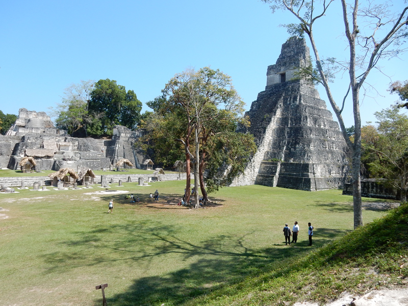
February 25 – We were at the dining room when it opened at 7am and started our self-tour of this large UNESCO World Heritage site at eight. The site is 222 square miles and it is estimated that only 7% of the original buildings have been excavated. Archeologists have estimated Tikal to be about the same size and population of Rome at that time. I believe this to be a Ceiba tree.
We started by walking about half a mile to Templo VI SE if the Gran Plaza. It is called the Templo de las Inscripciones.

There is a long inscription on the 12m-high roofcomb – hence the name. The Stele and Altar date from 736.


We walked for six hours around most of the perimeter of the site. Here are some of the more notable sites along the way. Palacio de las Acanaladuras – a complex of residential buildings.


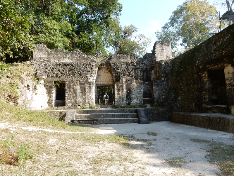
Excavation is ongoing at Acropolis del Sur (South Acropolis), note Temple in background


This complex includes Templo V
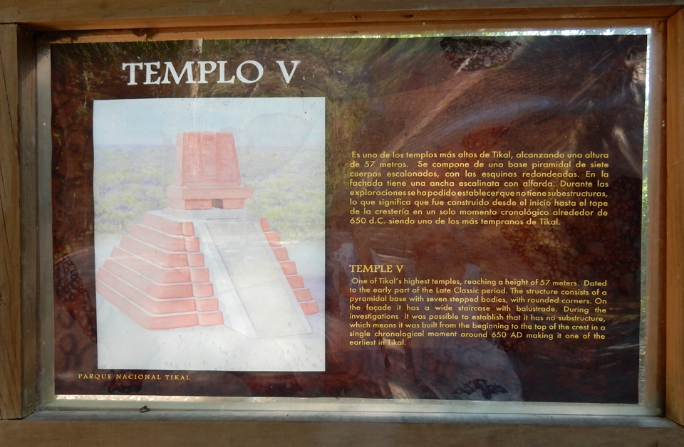
It is 190 feet high
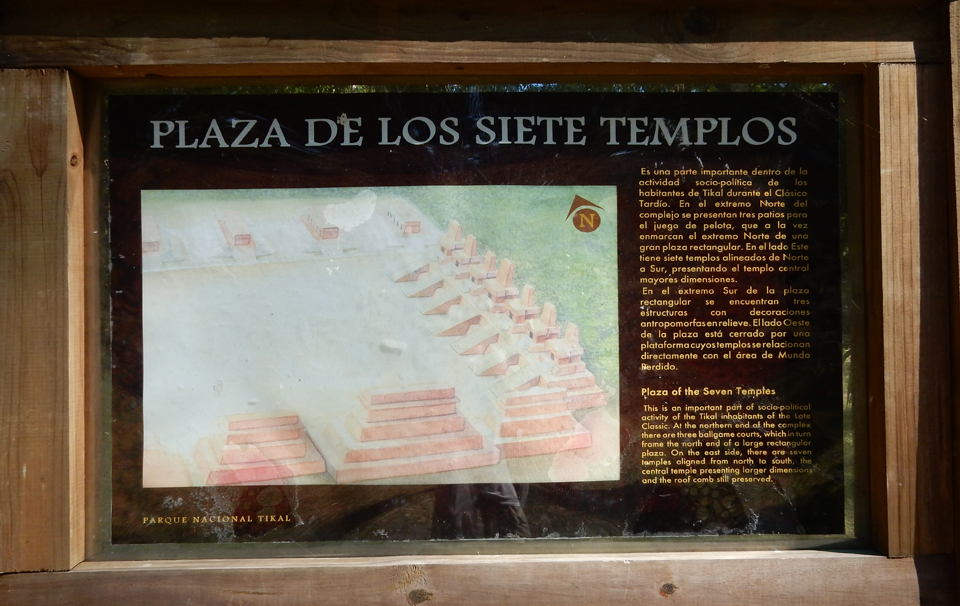
Plaza de los Siete Templos – Plaza of the Seven Temples

I believe this is the Templo de las Calaveras – Temple of the Skulls
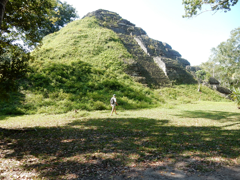
Gran Piramide – the main structure of what is called the “Lost World.” Its square top was an astronomical platform during the Preclassic Period (300 BC)

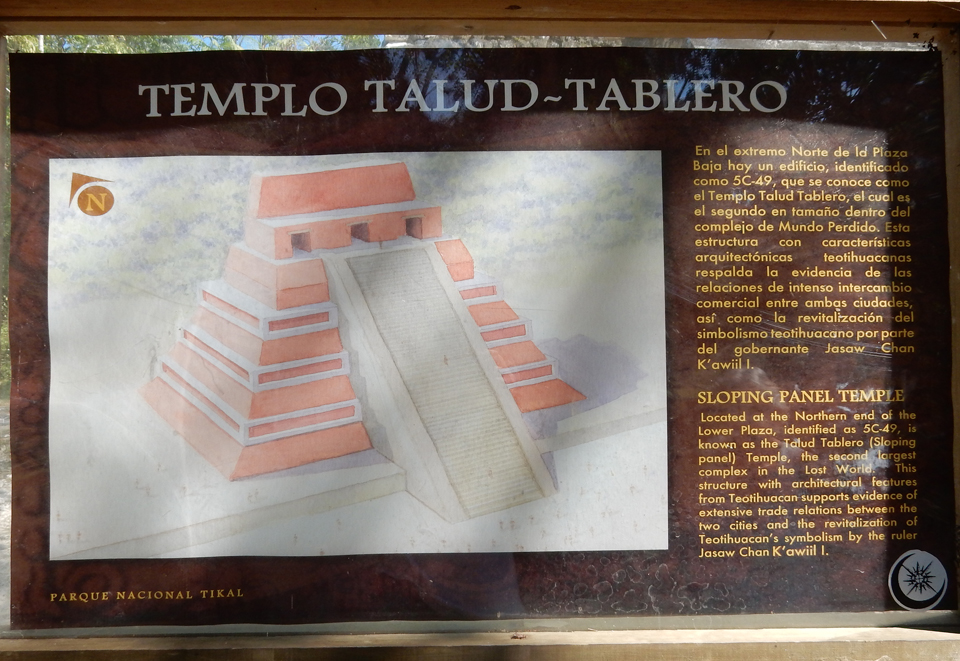
Templo del Talud-Tablero – Temple of the Three Rooms

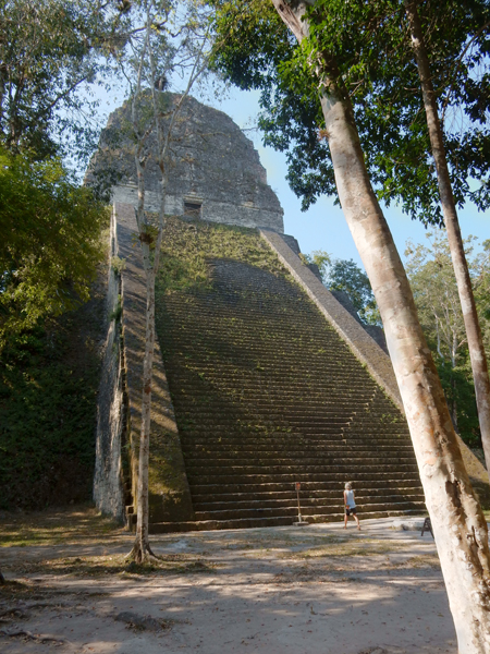
Templo IV – at 210 feet, it is the highest building at Tikal

Wooden steps and ladders take you to the top for a panoramic view of the jungle. The tops of the Temples that are seen in this photo are around the Gran Plaza

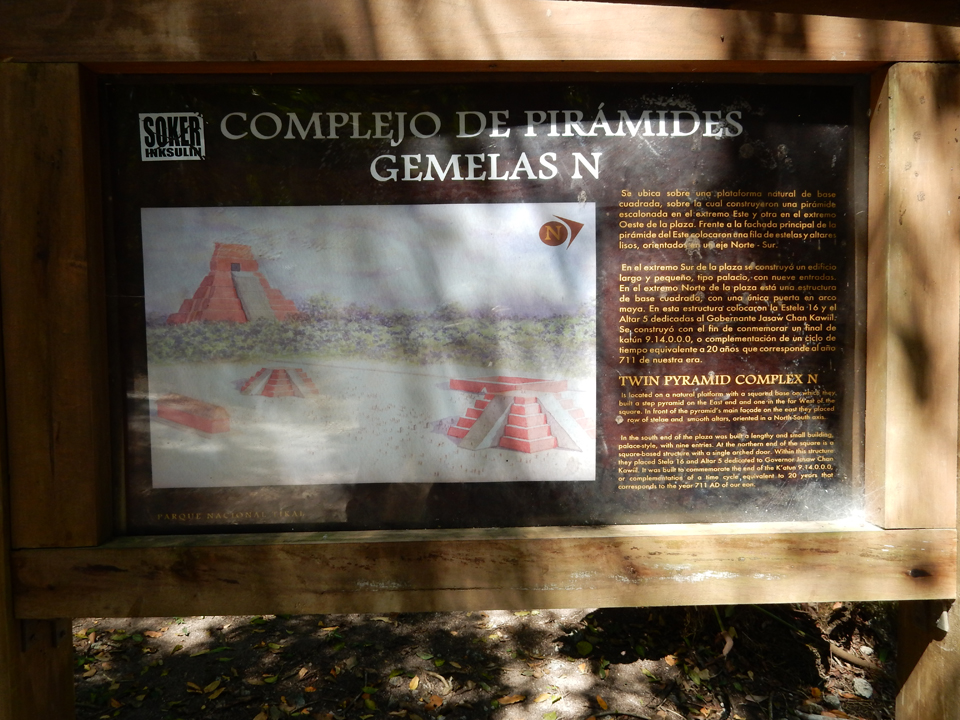
Complejo de Piramides Gemelas N – this complex is thought to have been constructed by King Moon Double Comb to mark the end of the 14th katun of Baktun 9. That is, 144,000 days or about 394 years. You may recall that some were predicting the end of the world on 12/21/2012, the end of the last katun. The king is portrayed on this stelae (stone shaft).

I believe this is Temple III (181 feet high) that is currently being excavated – Temple of the Jaguar Priest
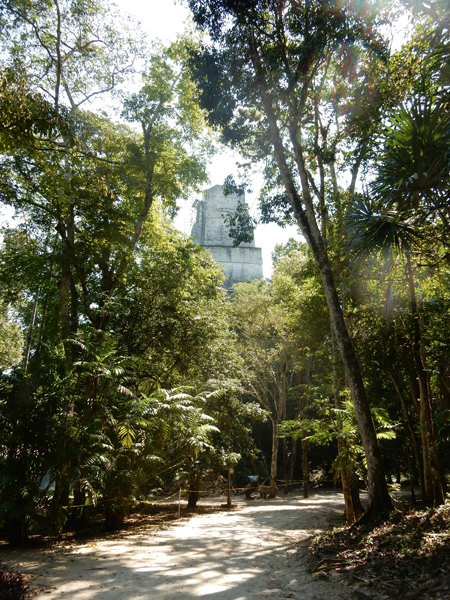
Approaching the Gran Plaza

Gran Plaza, Temple II – Temple of Masks on right

View from Acropolis del Norte toward north side of Temple II

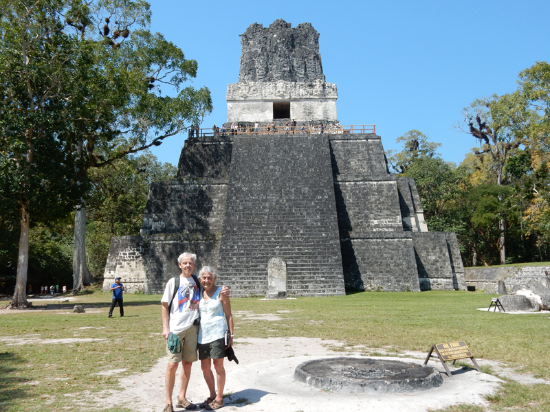
Temple I – Temple of the Great Jaguar on the left

View of Temple I from south side of Gran Plaza. Lord Chocolate (King Moon Double Comb) was buried here along with 16-lbs of jewelry, 180 jade objects and 90 bits of bone carved with hieroglyphs.

Note the wooden viewing platform on Temple I

View of frieze on top of Temple I from viewing platform

Carvings at platform level

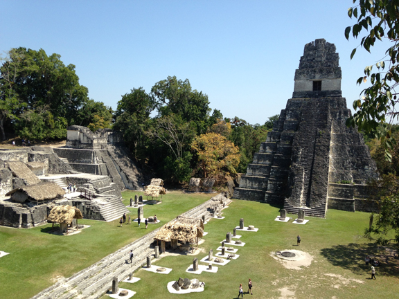
View of Gran Plaza and Temple II from viewing platform
Looking west, tops of Temple III (left) and Temple IV (right) – you can get some sense of the distance we walked

Walking to Complex R


Complex R


View back toward Temple III from top of a pyramid in Complex R

In realty, how the Pyramids were really made
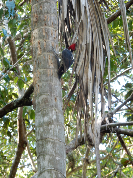
Some wildlife as we hiked back to the Inn – a red headed woodpecker
I have a nice video/audio of the Howler Monkeys who were in this area

Turkey

In trouble, again! I don’t know why she looks so happy?

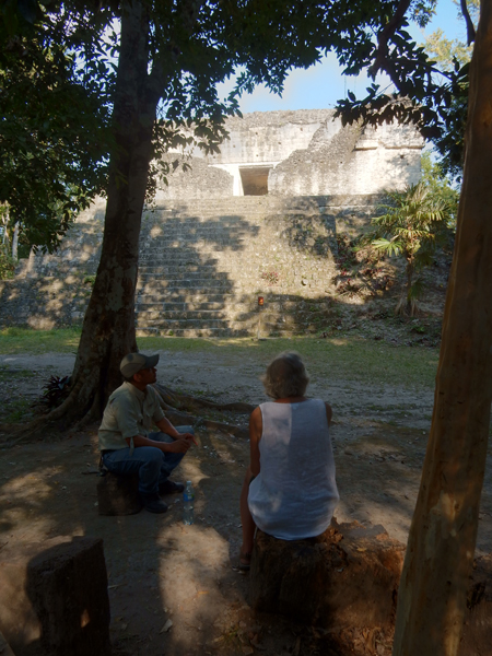
We got back to the Inn at 2pm, after waling six hours. Rehydrated and took an hour rest before going back at 3pm, this time with a guide, for a three hour “sunset” tour.

We asked that he take us to Group H and Complexes M and P because those were ones that we had not yet seen.

It was a good way to end the day because the guide slowed us down. Or, did we slow him down?

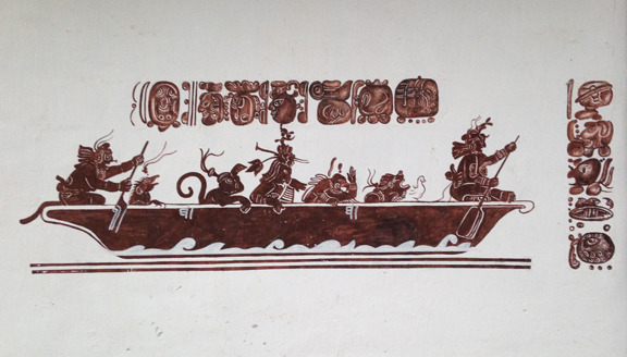
Anyway, we ended at the Gran Plaza and climbed back up to the viewing platform on Temple I for the sunset. Unfortunately, it was a cloudy evening. To be honest, this guide was not very good. Eighty-five percent of what he covered, I already knew from my readings and guidebook. I’m sure others are better but if I were to do it again I would not hire a guide. We were “pooped” by the time we got back at 6:30 for dinner. We walked and climbed pyramids for 9.5 hours today. Here is some Mayan art from the Tikal Inn.

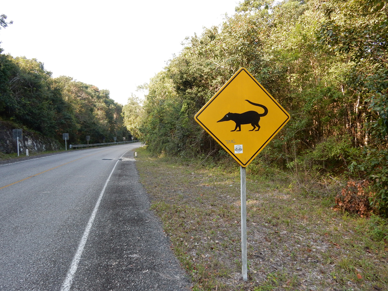
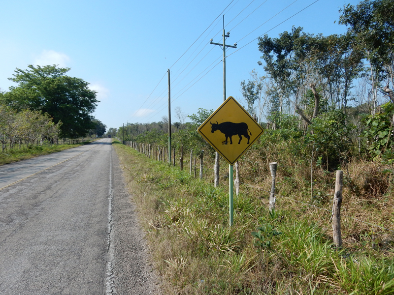
February 26 – here are some Guatemala road signs returning to Belize. I decided too late to start this project because I didn’t stop for the snake, jaguar, monkey, etc. signs driving to Tikal.


When leaving Tikal, I couldn’t find my sunglasses, we searched everywhere. As we approached the entrance I thought I would check the last possible place I might have left them – at the ticket booth. I stopped and asked and sure enough a worker had found them. Here is the honest fellow – a reward was in order.
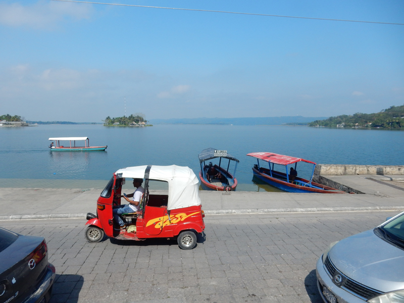
It took about an hour to drive to Flores Guatemala, a small (3,000) island in Lago de Peten Itza. Here is a picture of a taxi (Tuk Tuk) and boats you can hire to tour the lake.
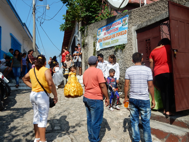
As we parked we heard a band playing and followed the sound – it was a children’s parade that they do on the Sunday before Lent. For us it seemed like a Halloween parade. The all-male adult horn/drum band was in the back.

Some very good costumes


The children cueing up and then entering the school gate

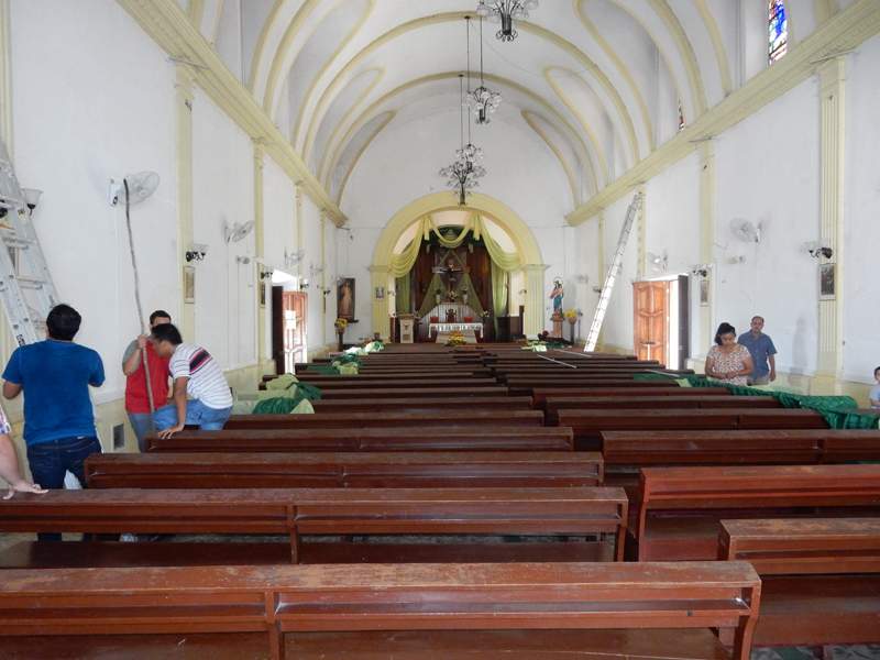
We visited the cathedral, which is located across from Parque Central.

They were preparing the church for Ash Wednesday
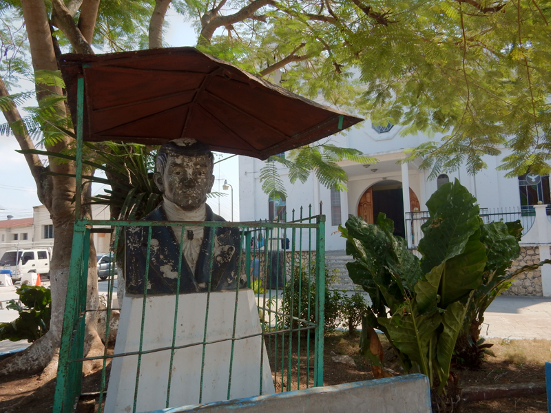
A local hero in need of restoration
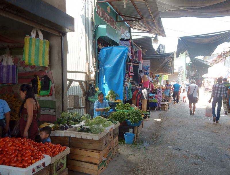
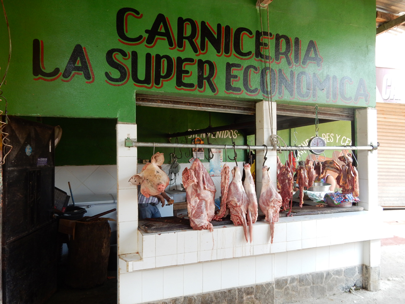
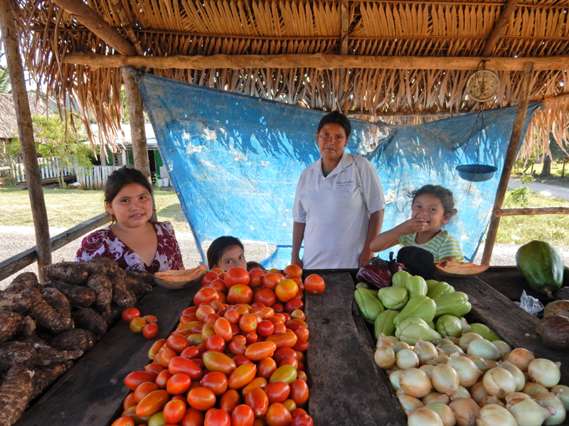
Our real objective was the market in Santa Elena (25,000), Flores sister city, which is just across the causeway.
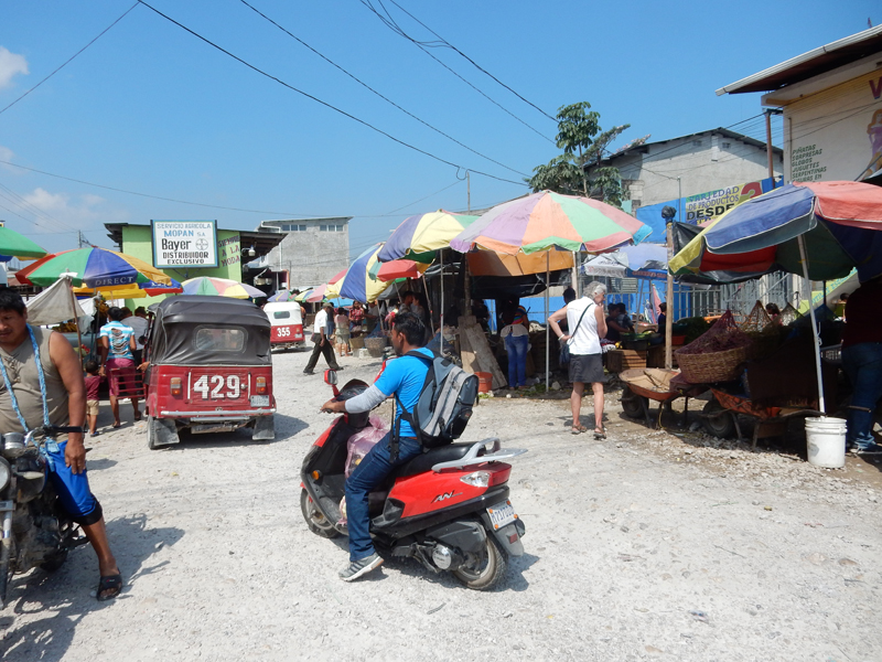
Some typical market views


Helen bought some table linens

My sandals didn’t need to be polished

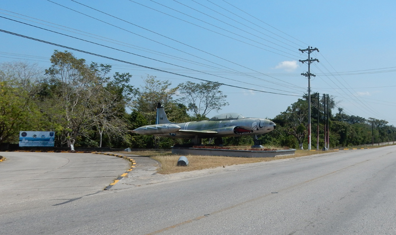
Guatemala Air Force
We couldn’t find the kind of local crafts we were looking for in the market, so we stopped in El Remate which is near the junction of the road to Tikal. Bought a couple of small wood carvings from a special needs man near the lake and then presents for family from the Cahui restaurant/gift shop. It was lunch time, so we thought we would try some local flavor with grilled ribs from two women set up near the lake. Yummy, two big lunches and drinks for $4!

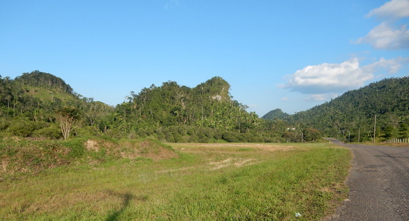
Roadside scene

Rio Mopan near Guatemala-Belize border

Our border crossing basically involved the same procedure as before, however, it being Sunday there was not as much traffic and it took under half an hour. We returned the same route passing through Belmopan (capital of Belize) and then took the Hummingbird Highway toward Hopkins. We traveled this road six times and I did not mind at all given the natural beauty in this part of the country. When I left Springfield, I brought with me 6 T-shirts, 2 polo shirts, 2 long sleeve shirts and a pair of swimming trunks to give away. I looked for individuals who looked like they could use a donation. The woman in this picture at a roadside fruit/vegetable stand was the mother of an El Salvador refuge family. If you look close, she is wearing a Springfield News-Sun Perfect Service shirt. This was our regular banana stop and we would also give the kids Double-Bubble Gum!
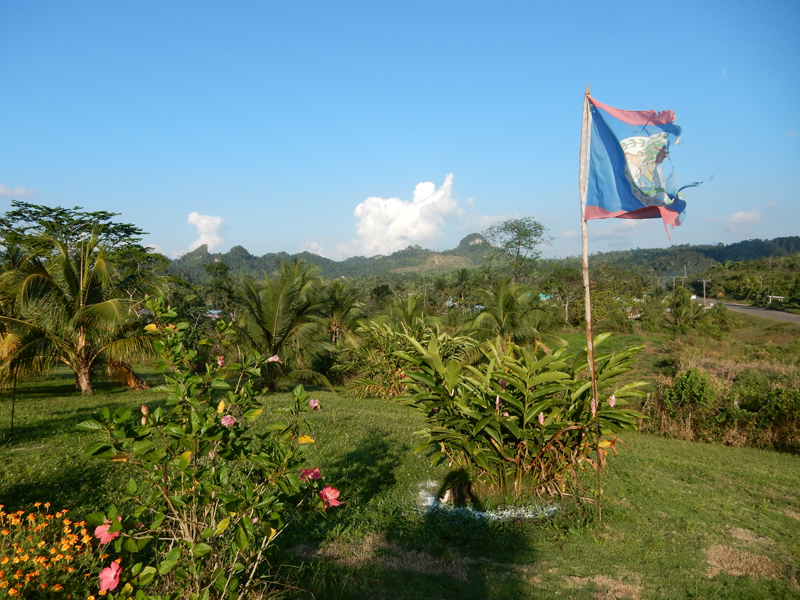
We stopped in this area simply because it was scenic and I wanted to take a couple of pictures. On the top of a hill I met an expat from MN and his wife who had lived in the area for about 30 years. They purchased this property about 5 years ago. They were doing subsistence farming and basically living off the land. They were very friendly but did not want their picture taken. We had earlier purchased a papaya that was not yet ripe; they traded us for one that was perfect. We added it to our pineapple, mango and bananas for our fruit salad that evening.

Note their Belize flag
I believe this is another Ceiba tree

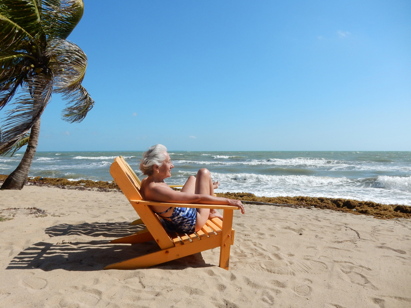
February 27 – After 8 busy days, we decided to “chill-out” and spend two days relaxing in Hopkins. Helen did consider SCUBA diving at the reef but it was too windy. Here are a few more pictures from town.


We had three delicious seafood meals at this little place (Luba La Ruga) on the beach next to the little pier

However, you need patience. He started from scratch, did one order at a time and was the bartender – have another beer!

You are looking at the restroom (outhouse)

“Don’t Worry – Be Happy!”

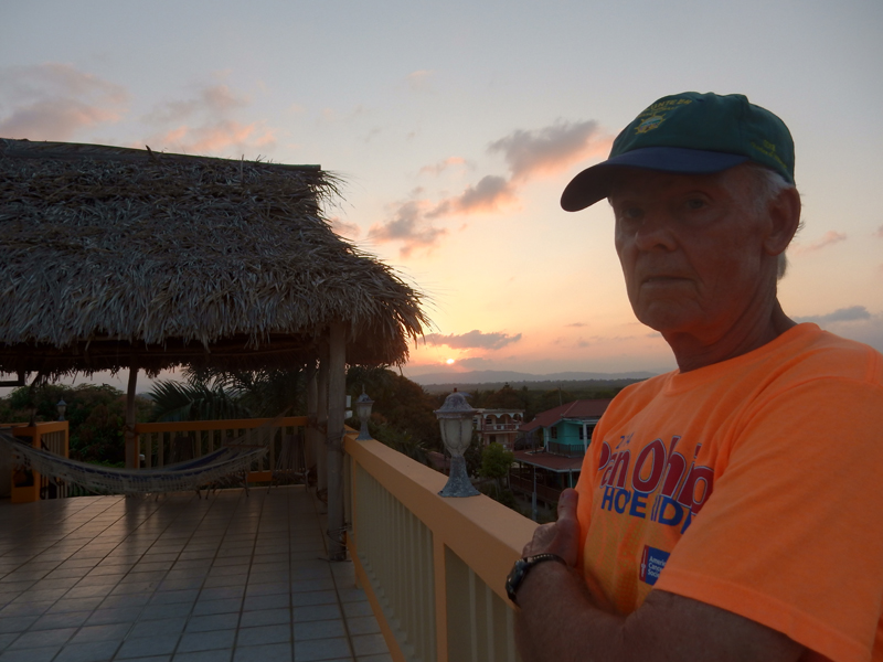
Sunset on the roof

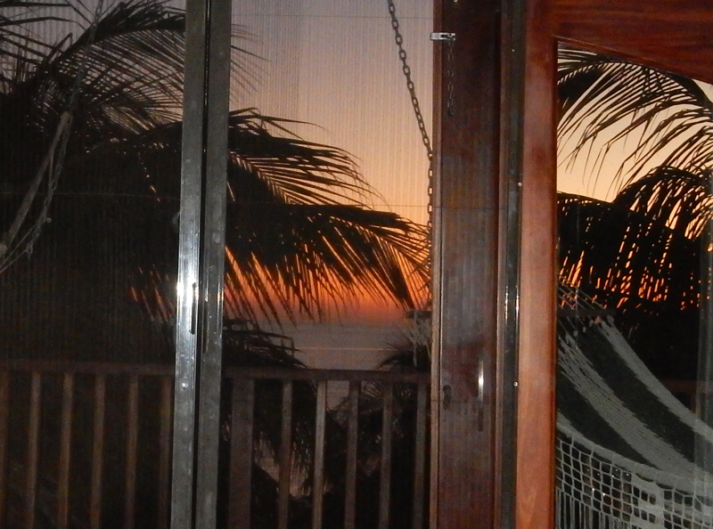
February 28 – Sunrise, last day of February
We walked the beach on another windy day
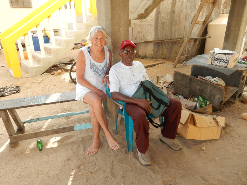
We met James early in our stay in Hopkins. We would see him all over town. Always outgoing, friendly, talkative and positive about Hopkins – it was the greatest place in the world! Well, this morning he admired the T-shirt I had on. So, I took it off and gave it to him. It was the Pan Ohio T-shirt I had on last night at sunset (see pic). So, he invited us for coffee in a house nearby where some of his relatives lived. Everybody here is related! I don’t have a picture of James but here are two of his relatives.
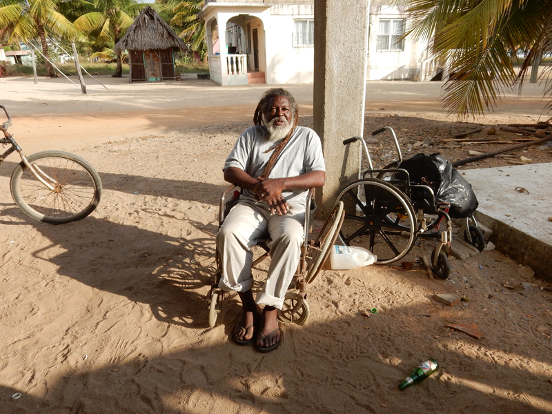
No, he is not disabled, he just finds the seat comfortable.
As I stated, a windy day
Monuments in the center of town – both to women


Baba’s Lane – how we walked to our room, almost all dirt roads

Local urchins

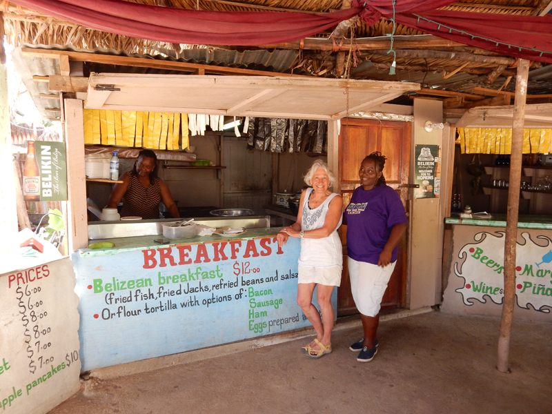
Tina’s (she is behind counter), another favorite eatery
March 1 – AA from Belize City to Miami, arrived 5:30pm

you are truly a good webmaster. The site loading pace is amazing. It seems that you are doing any distinctive trick. In addition, The contents are masterpiece. you have performed a magnificent process on this subject!