
Bahamas, AL NP Units, Nashville and Mammoth Cave KY
March 20, 2017March 1 – AA from Belize City to Miami, arrived at 5:30pm, again stayed at the Marriott in Miami Lakes
March 2 – Drove to Orlando to start an 8-night package I had purchased, that included a 3-hr condo sales pitch. I thought it was a reasonable deal just to keep us “South” for the first part of March before slowly working our way back home. But, it wasn’t. We arrived too late to do anything in the area today.
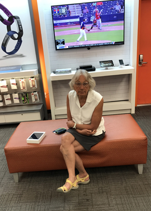
March 3 – Orlando sales pitch all morning. That left the afternoon and evening. However, the cost for a half day ticket to Disneyworld, Epcot, or Universal Studios was over $100 . . . just wasn’t worth it. The good news was that we could go to an AT&T store. I had to replace my phone that went swimming in Belize and Helen got an iPad Mini that was on sale.
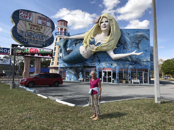
March 4 – Drove to Palm Beach (No, we did not see Trump) to take a Blue Star Cruise to Grand Bahama Island. Boarded at noon, relaxed and enjoyed the served dinner despite the rough seas – the show was canceled. We were one of the few couples who tried dancing. We were rocking and rolling without even trying!

March 5 – dawn arrival in Freeport

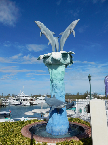
After breakfast, we disembarked and were transported by van to the Pelican Bay Resort in Lucaya. Both our days here were moderate but windy, therefore, SCUBA and snorkeling were not possible. Food was not covered for our two days here, whereas it was for the other 7-days of our package. The good part was that it gave us the opportunity to choose our own restaurants – more seafood! I believe we ate more seafood on this trip than any other we have ever taken. We had Conch fritters for lunch today – purchased from a local who had a kiosk at the marina.
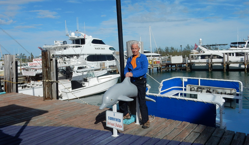
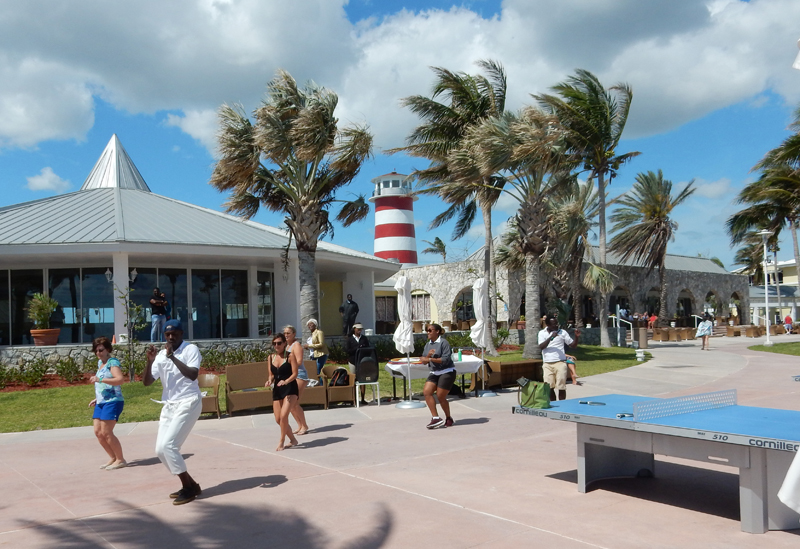
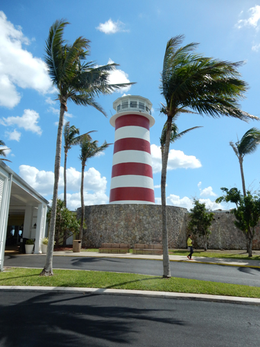
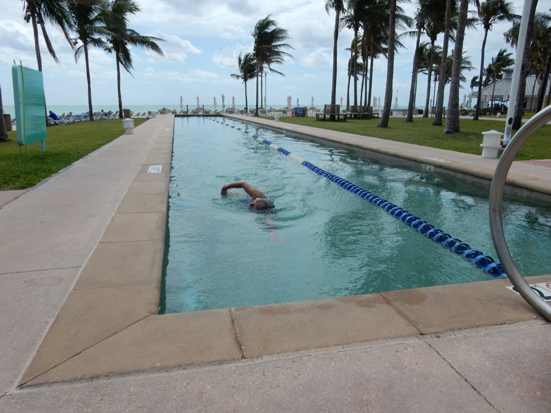
March 6 – We spent much of the day at the Grand Lucayan Resort across the road. Technically, we were not supposed to be able to use the grounds because we were not staying there. However, Helen met two women on the boat who were staying there and she hung out with them while I walked the beach. Dance class and lighthouse tower.
Helen was also able to get in a swim at the lap pool
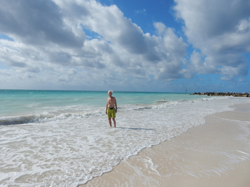
I had to be satisfied with the sights on the beach

However, I did do a manly thing by wading out in the heavy surf to retrieve some balloons. I presented them to Helen for coming in first at the pool.

March 7 – Took the free ferry to Taino Beach this morning.

Again, it was too windy to swim but we did enjoy our walk and sun bathing on the beach

We were on board the Grand Celebration by mid-afternoon. I knocked myself out of the Corn Hole tournament by continuing to pitch my bean bags in the hole (3 pts) causing me to go over 11 and having to start again from 0. Played Farkle with a competitive Canadian couple we had met – they did not like losing. We chose the served dinner again this evening; the meals were good. We saw the comedian and show this evening, both were entertaining. After purchasing our allotment of duty free liquor, we ended the evening with the performance of a Tina Turner impersonator.

March 8 – docked in Palm Beach in the morning and then drove to the Hilton Double Tree in Deerfield FL for the last two nights of our package. This was the best accommodation we had as part of our package. Relaxed by the pool and had a tasty dinner in the restaurant.
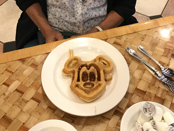
March 9 – that’s what you call a good breakfast. Pretend you don’t notice the pills.
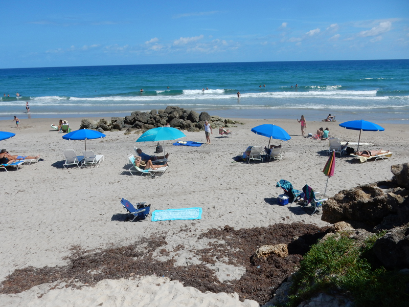
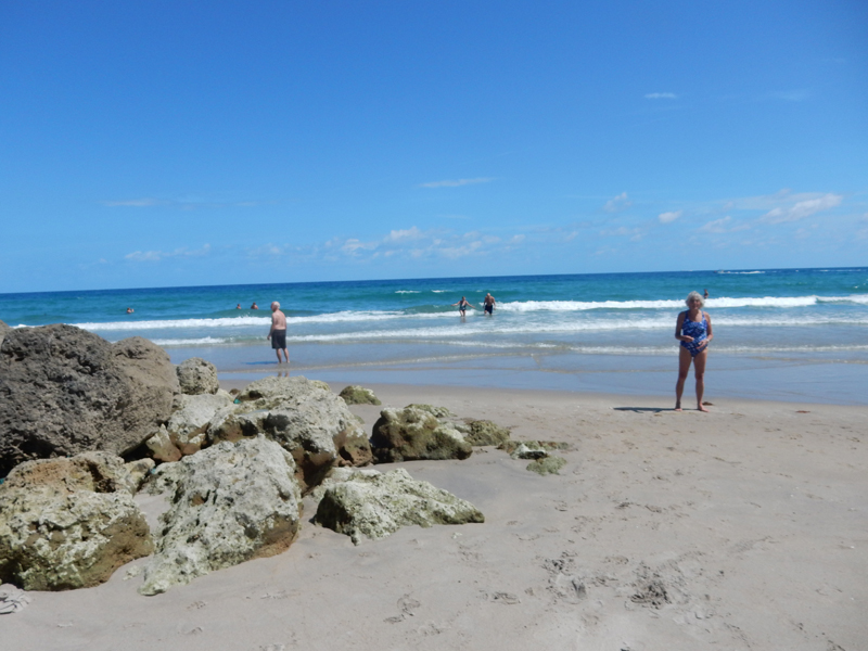
Had a very nice day at the Deerfield Beach
Hillsboro Inlet Light Station (1906) – 147 feet high

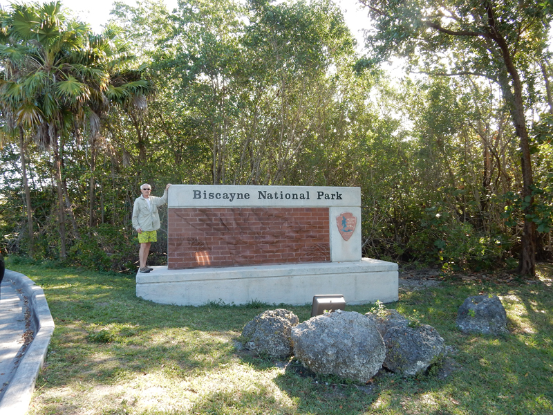
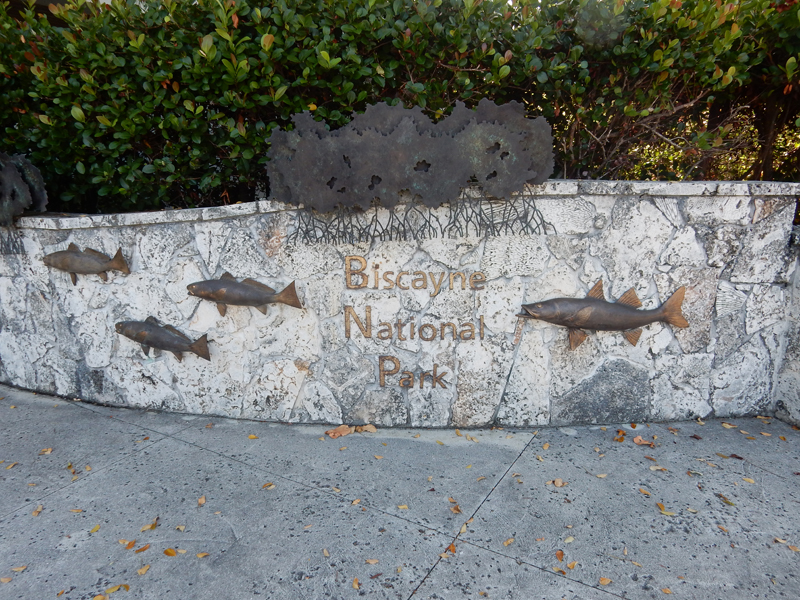
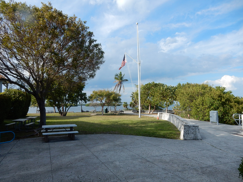
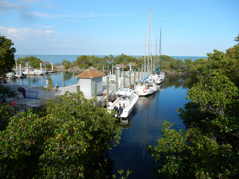
March 10 – a 1.5-hour drive brought us to the Dante Fascell Visitor Center for Biscayne Bay National Park. We toured the grounds and then entered the Visitor Center when it opened at 9am.

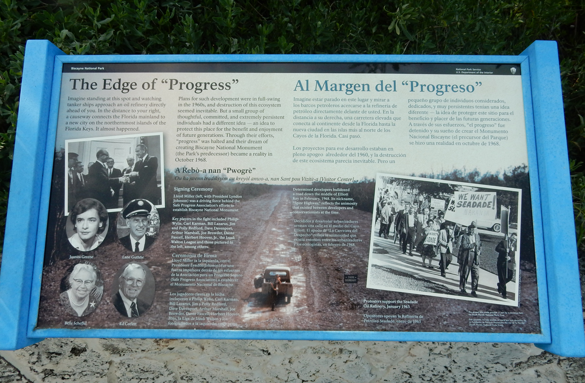
Establishment of National Park
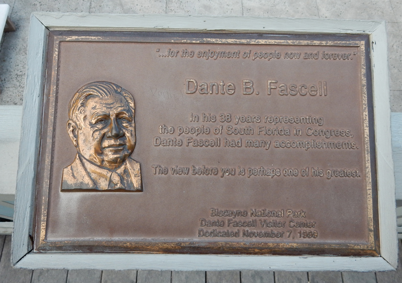
The Visitor Center is named for Dante Fascell

Lion Fish have been introduced into the Bay (probably from SE Asia) and there is now a bounty on them because they are damaging the ecosystem.
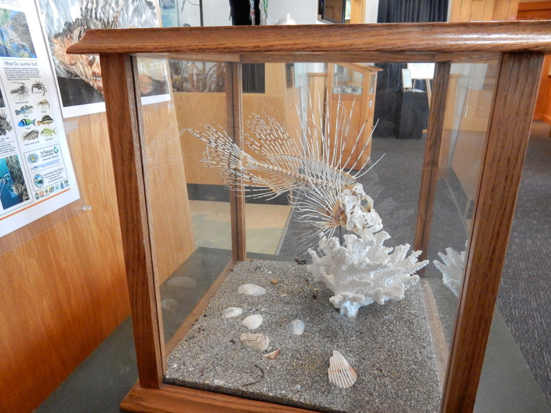
Other displays in the Visitor Center


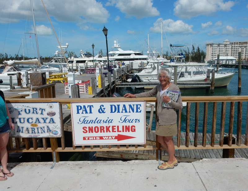
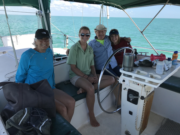
Mike and Bev arrived about 9:15 and we prepared for our days outing. We had four of six slots on an Island Dreamer sailing excursion. This is the only sailing concession in the park. Our boat is the one at the end of the dock – the Adventure.
Motoring out into the bay

Maggie, the captain (she sailed the boat all by herself!) and our friends Mike and Bev
We were supposed to go to Boca Chita Key but Maggie said the wind was not strong enough and it would take too long. So, we docked at Adams Key.

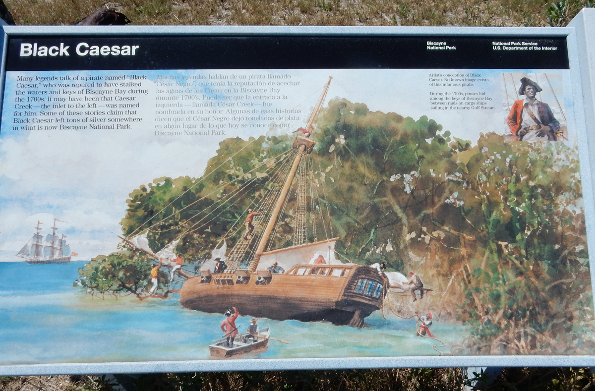
Lunch time – we had to bring our own snacks, drinks and lunch. Check-out the sign, precursors of our current day Somali pirates
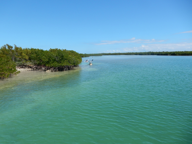
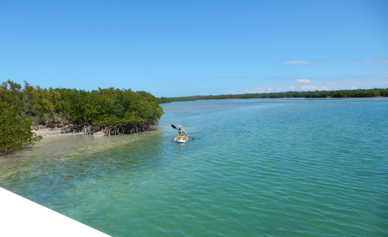
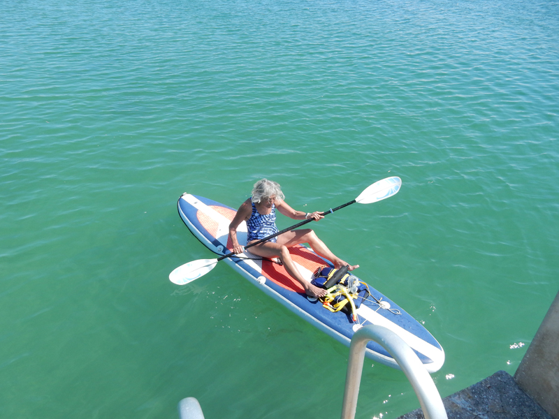
We brought our snorkel gear and were instructed where we might find some good snorkeling along the inlet. Our vehicle to get there was a paddle board. This is the first time I had tried one and found it more difficult than I thought it would be. If I were younger it would have been fine but I have lost a good deal of my balance skills. I got up a couple of times but decided to paddle the board like a kayak.

Leaving the dock

The best part of the paddle was when we passed through a shallow area among the mangroves and saw some small sting rays. There were some small fish on route and one sea turtle but the snorkeling was not good.
Picture taken at Visitor Center

Return to dock

Return across Biscayne Bay in a slight wind – note jib sail

We then followed Mike and Bev to their home in Ft Myers
March 11 and 12 – relaxing, shopping (second hand stores) and playing games with Mike and Bev
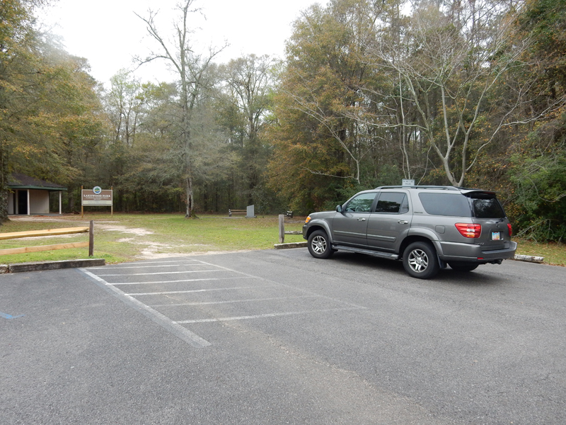
March 13 – It was a long day driving today – 10 hrs. Our first stop was Tallahassee, to take a look at the FL state capital. Our next stop was Britton Hill the Highpoint of Florida. At 345 feet, it is the lowest highpoint of the 50 states. There are buildings in Miami that are taller!
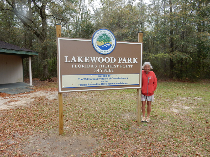
This was Helen’s 30th state highpoint – as you can see, she was ecstatic!

We arrived in Fort Walton Beach just east of Pensacola FL at 7:30pm; it was cold and rainy
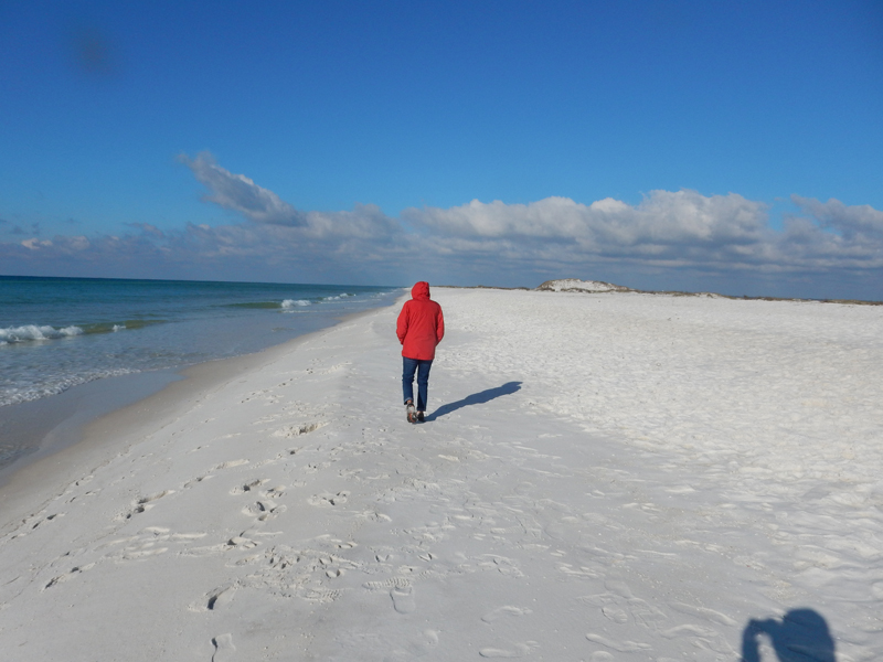
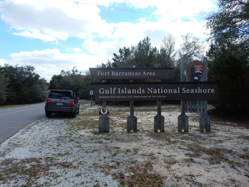
March 14 – when we left this morning, we drove over the bridge to Destin. Peter and Heather have recommended Destin for its beach, sun and fun. I like the fact that it is right next to the FL part of Gulf Islands National Seashore. I hope to get to the MS part on another trip.

Cold and windy, not what we wanted for our “Winter Escape”
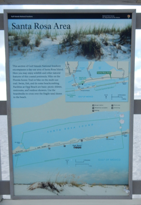
Sign with map of the Santa Rosa Beach area
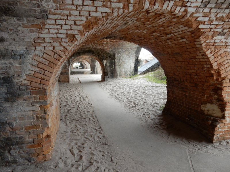
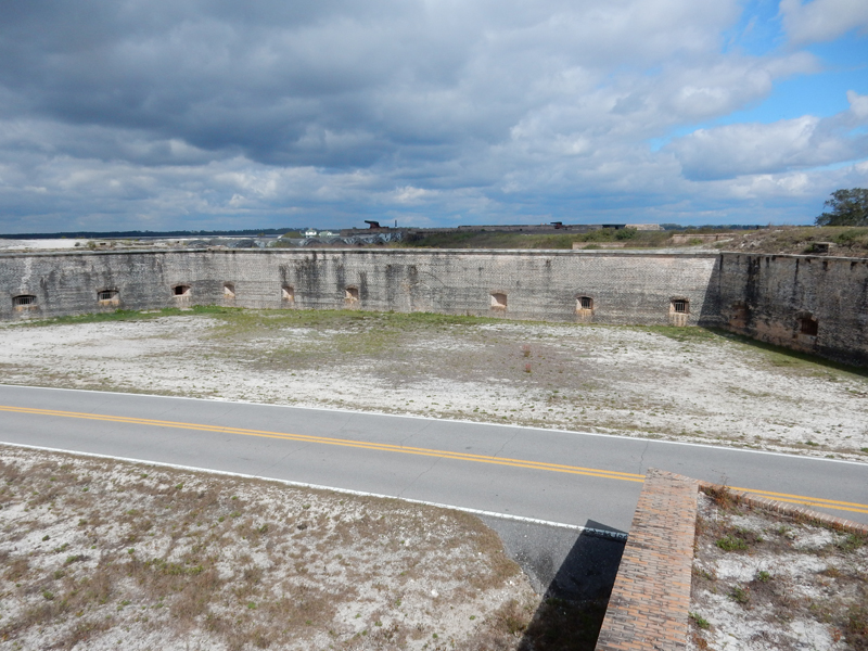
Drove west past Pensacola Beach to Fort Pickens on the western tip of Santa Rosa Island

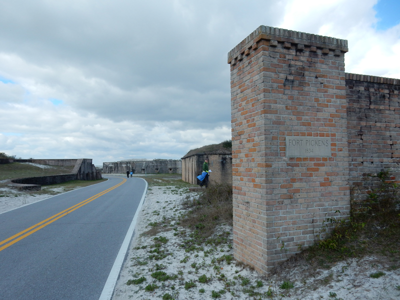
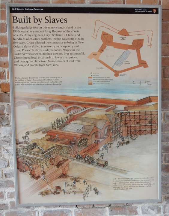
Before the age of nuclear weapons, Homeland Security meant “harbor security.” During the War of 1812, the British took Point Comfort (current location of Fort Monroe National Monument) at the entrance to Chesapeake Bay and then moved up the Potomac River to sack Washington DC and burn the White house. After the war, the U.S. built over 40 coastal forts to protect its harbors. Fort Pickens, a state of the art brick and masonry fort, was completed in 1834.

Built by slaves
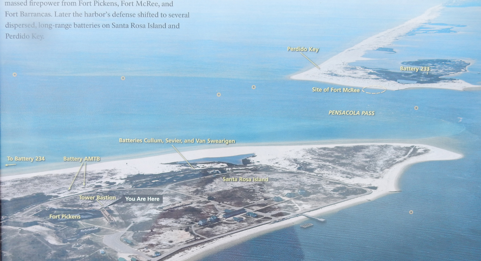
On November 22-23, 1861 the Confederates, who occupied Fort McRee and Fort Barrancas on the opposite side of the Pensacola Inlet, had a massive artillery duel with the Union force at Fort Pickens. The Confederates abandoned their forts in May 1862 to use their troops elsewhere.

The fate of the Apache Indians is directly tied to Fort Pickens. In 1886, 16 Apache men including Geronimo and Naiche, the youngest son of Cochise and hereditary chief of the Chiricahua Indians, were taken off a train in Pensacola and taken here by boat. Their families continued to Fort Marion in St. Augustine FL where they were imprisoned. Leaders in Pensacola had petitioned the government to bring the Apaches to Fort Pickens as tourist attractions. President Cleveland only approved the petition for these 16 men, thus separating them from their families. After Apache petitions, their families joined them in 1887. In 1888, they were all moved to Mount Vernon Barracks north of Mobile AL and in 1894 they were moved a final time to a reservation at Fort Sill OK. At that time, Naiche chose to move to the Mescalero Reservation in NM.
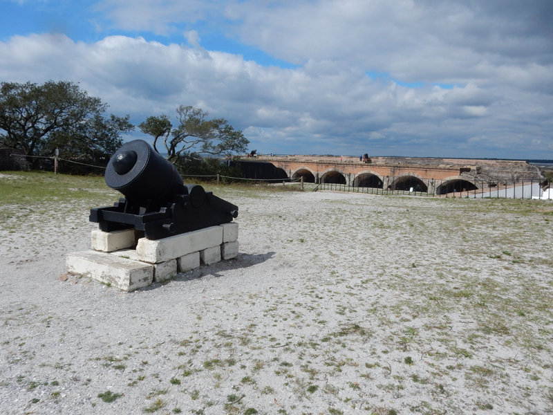
After the Civil War, Fort Pickens was regularly upgraded with the latest defensive armaments – rifled cannon, underwater mines, searchlights, huge guns in concrete, rapid-firing artillery (for fast motor boats), anti-aircraft batteries, etc. As you can see in the photos, this Rodman Gun (circa 1868) holds a prominent position in the fort.


The fort today

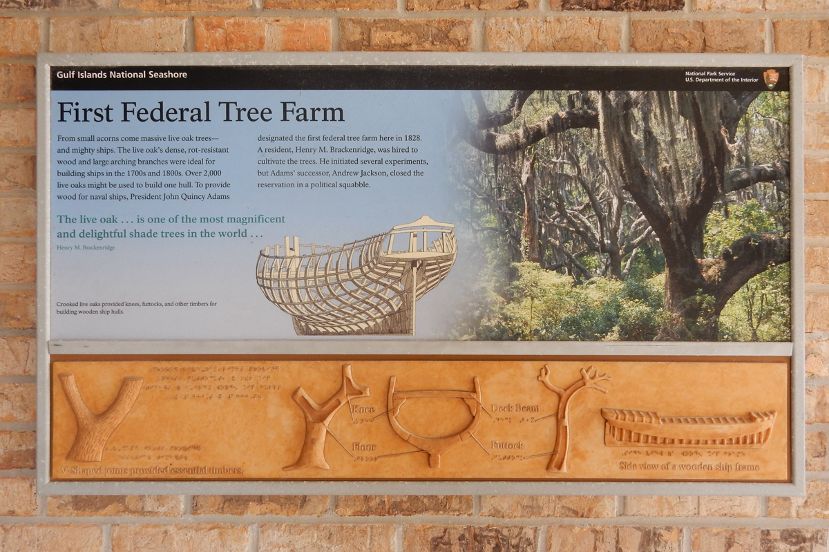
Our next stop was the Naval Live Oaks area visitor center on the other side of Santa Rosa Sound.
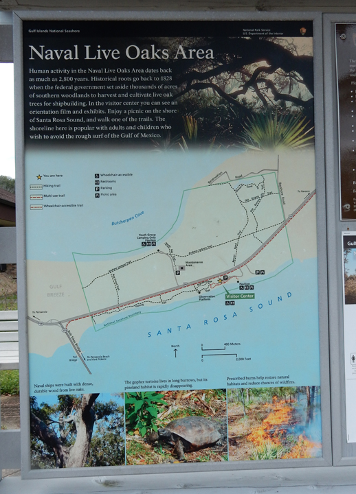
This area was the first tree farm in the U.S. (1828). About 1000 live oaks were used to build one wooden vessel. It is called a “live oak” because it both drops and keeps leaves year-round. The limbs and trunks were used to provide specific shapes for various parts of the boat. President John Adams considered the Navy the first line of defense from foreign invasion. The U.S.S. Constitution (Old Ironsides) gained fame when cannon balls bounced off its live oak walls. It is still a Navy ship. When it is in port in Boston, it is part of the Boston Freedom Trail and can be toured free of charge.
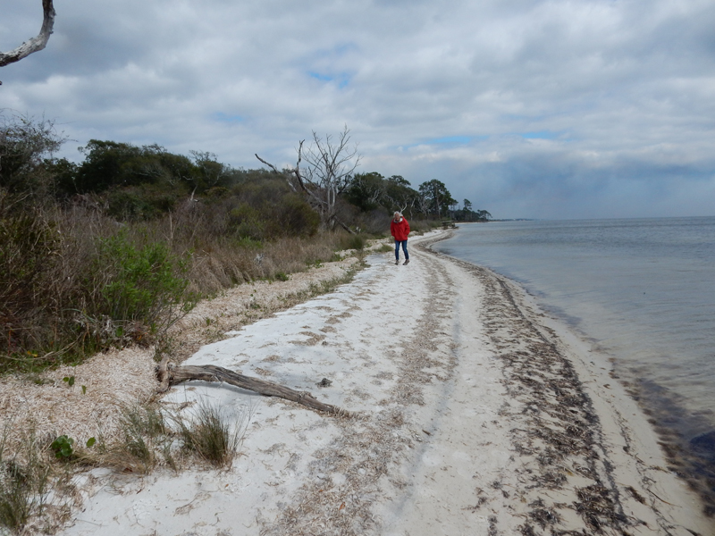
We hiked the Nature Trail along the Sound
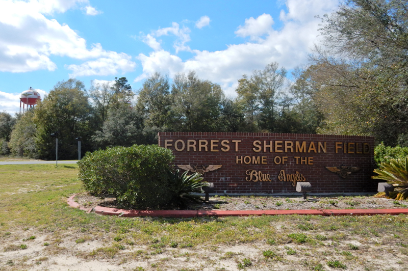
It took almost an hour to drive through Pensacola to the back entrance of Naval Air Station Pensacola. The Pensacola Navy Yard was built here in 1826 and in 1914 it became Naval Air Station Pensacola.

Navy, Marine and Coast Guard aviators are trained here and it is the home of the Blue Angels
The 2nd German Air Force Training Squadron is also located here

Some parts of the base are open to the public including the National Naval Aviation Museum, Fort Barrancas (administered by NPS), Barrancas National Cemetery and the Pensacola Lighthouse. The current lighthouse was built in 1858 and is 150 feet tall.

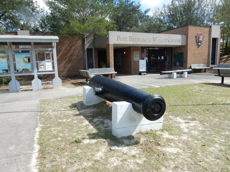
Fort Barrancas, on the west side of the Pensacola Inlet, was completed in 1844. As stated, it took about an hour to get here by car but Fort Barrancas is less than two miles across the inlet from Fort Pickens.

Fort Barrancas is considered an area of Gulf Islands National Seashore
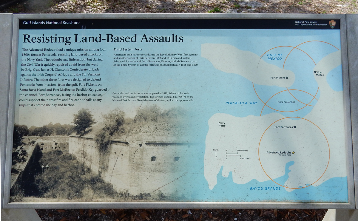
The Advanced Redoubt of Fort Barrancas is interesting because it protected both the fort and the Navy Yard from a land attack

It took about 3hrs to get to Montgomery AL where we spent the night
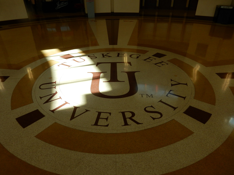
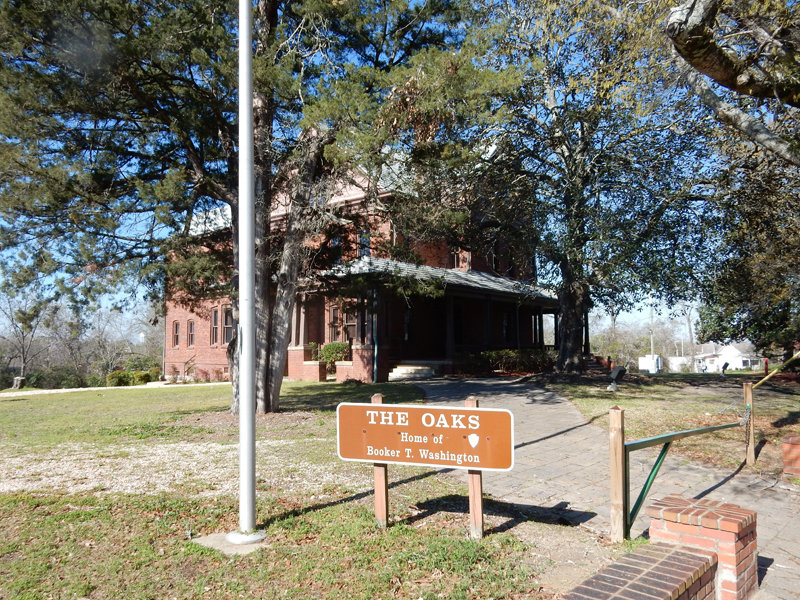
March 15 – we arrived at Tuskegee Institute National Historic Site AL at 8am and walked the campus until someone was available at the Visitor Center. Lewis Adams, a former slave, organized black support for a white politician who in turn pushed through legislation establishing a “Normal School for Colored Teachers at Tuskegee” in 1881.

Booker T. Washington was born a biracial slave in 1856 in Virginia. His mother moved to West Virginia after the Civil War and married a freedman named Washington Ferguson. Booker took the first name of his step father as his last name. He learned to read and write with the support of his mother and the mistress of a home where he worked as a houseboy. In 1872, he walked 500 miles to Hampton Normal Agricultural Institute. He convinced administrators to allow him to attend and worked as a janitor to help pay his tuition. He graduated in 1875 and started teaching at the school. In 1881, he was recruited to start the School in Tuskegee Alabama.

Washington expanded the original mandate to train teachers with his belief that the lives of African Americans could be improved by emphasizing practical job skills. He hired instructors who could teach bricklaying, carpentry, printing and other trades. Washington emphasized challenging work and self-discipline. He wanted Tuskegee graduates “. . . to return to plantation districts and show the people there how to put new energy and innovative ideas into farming as well as into the intellectual and moral and religious life of the people.” In 1896, he hired George Washington Carver to head the newly created Agriculture Department.
Students wore uniforms, attended church daily and learned social graces. The school emphasized self-sufficiency with students and faculty growing their own food, making bricks, furniture and constructing buildings designed by faculty architects. The school slogan is “Do Common Things Uncommonly Well . . .”

In 1882, he married his first wife Fannie and they had a daughter. Fannie passed away shortly after in 1884. He married Olivia in 1886 and they had two sons but she died in 1889. In 1893, he married his third and last wife Margaret. They continued to raise the first three children but had none of their own. In 1899 the faculty and students of Tuskegee built “The Oaks” as a residence for the family.
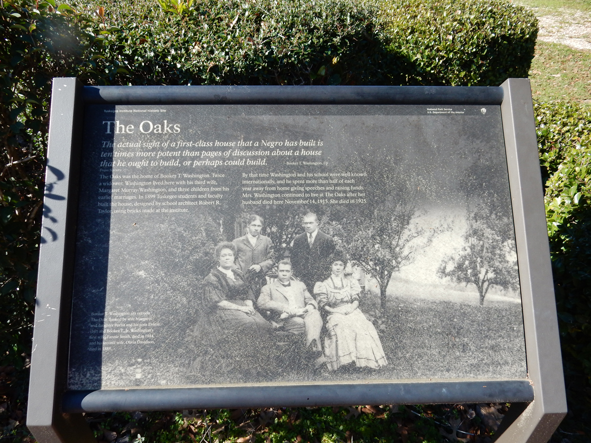
Washington taught that economic success for African Americans would take time, and that subordination to whites was a necessary evil until African Americans could prove they were worthy of full economic and political rights. He believed that if African Americans worked hard and obtained financial independence and cultural advancement, they would eventually win acceptance and respect from the white community. In 1895, he stated in a speech that African Americans should accept disenfranchisement and social segregation as long as whites allow them economic progress, educational opportunity and justice in the courts. W.E.B. Du Bois deplored Washington’s philosophy and criticized him for not demanding equality. The Oaks library –

Washington was an adviser to Presidents and perhaps the best known “black” man in the world at that time. He died in 1915. As word spread of the school’s success, it received support from benefactors like Andrew Carnegie and John D. Rockefeller. The statue “Lifting the Veil of Ignorance” was unveiled in 1922.


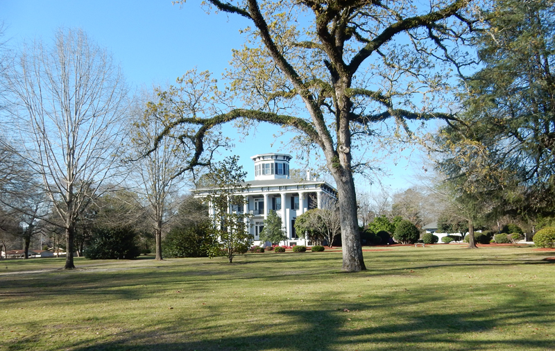
Grey Columns, just east of campus, was built in the 1850’s as the center piece of a plantation. It now serves as the Presidents home.
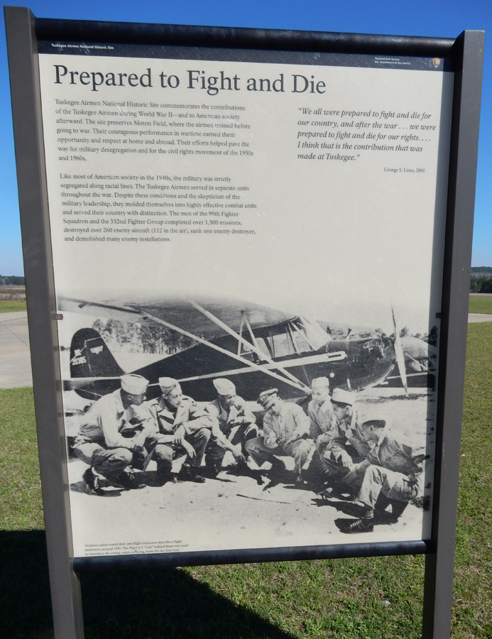
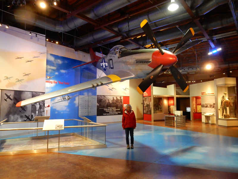
President FDR visited in 1939 resulting in the location of a Civilian Pilot Training Program at the Institute. In 1941, Tuskegee became the training base for the all African American 99th Pursuit Squadron. Primary flight training took place at the Institute with flight training at nearby Tuskegee Army Airfield. Tuskegee Airmen National Historic Site was established in 1998 and is a mere 15 min drive from Tuskegee Institute.
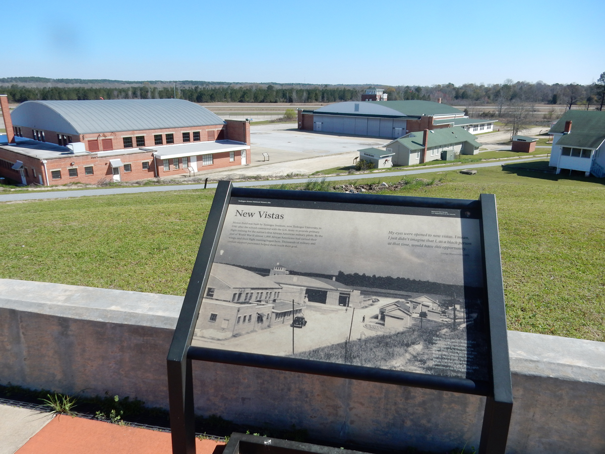
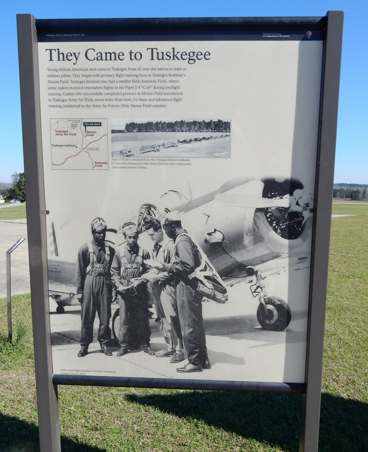
World War II Segregation
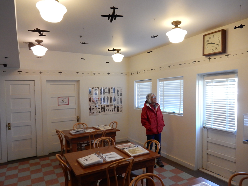
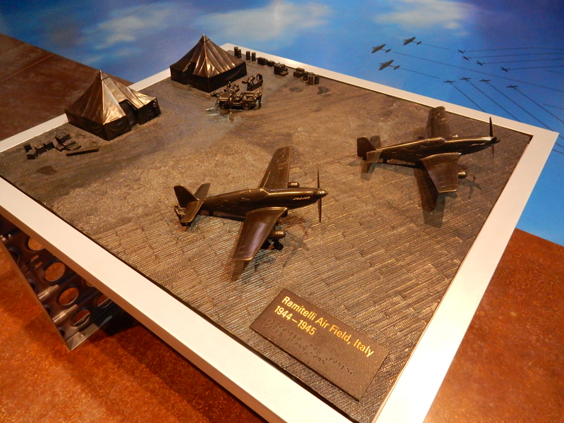
Hangar 1 – Life and Training of Tuskegee Airmen

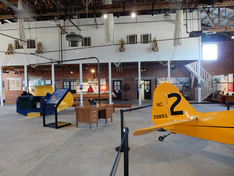
Hangar 2 – Museum and Contributions of Tuskegee Airmen


P-51 Red Tail Mustang
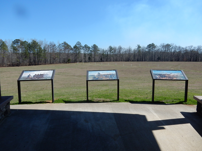
One hour north, also in AL, is Horseshoe Bend National Military Park
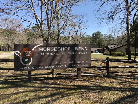
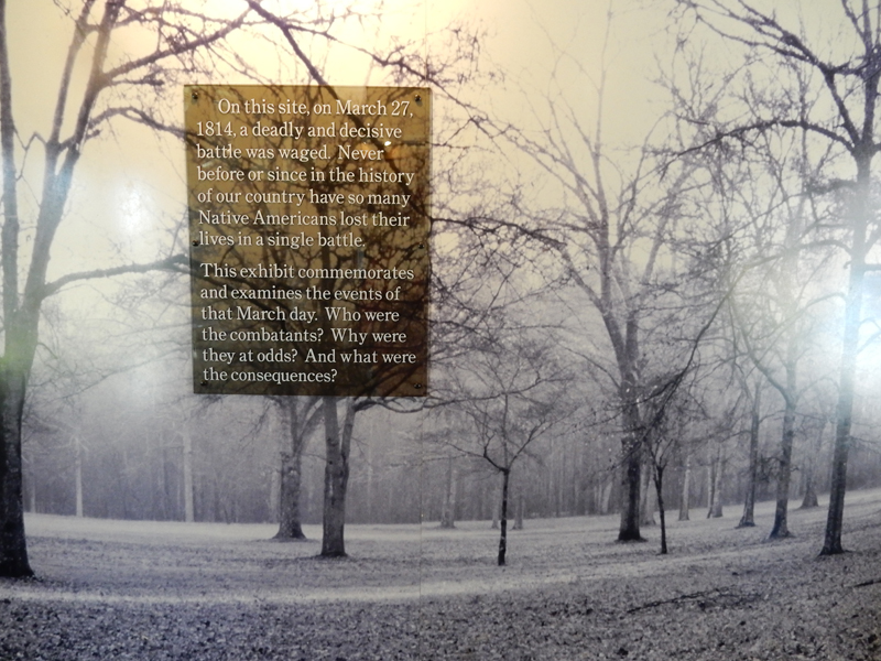
The Battle of Horseshoe Bend was the last battle of the Creek Indian War 1813-14. On March 27, 1814, more Native Americans were killed in this battle than any other in the history of our country
In the late 1700’s the Creek Nation had a loose confederacy with those living NW of the Chattahoochee River considered the Upper Creeks and those SE of the river the Lower Creeks. The confederacy signed a treaty with the U.S. in 1790 defining land boundaries. As more white settlers moved into the area the Lower Creeks were said to become “more civilized” as they had closer contact with their GA neighbors. However, the Upper Creeks in AL had regular conflicts with white squatters and became “nationalistic.” At the same time, the Shawnee Chief Tecumseh was trying to unite Indian nations to drive the “white man” from Indian lands. Many of the Upper Creeks agreed with this approach and became known as “Red Sticks,” because they painted their war clubs red. After a series of battles the Red Sticks set up a fortified defensive position on a 180-degree bend in the Tallapoosa River.

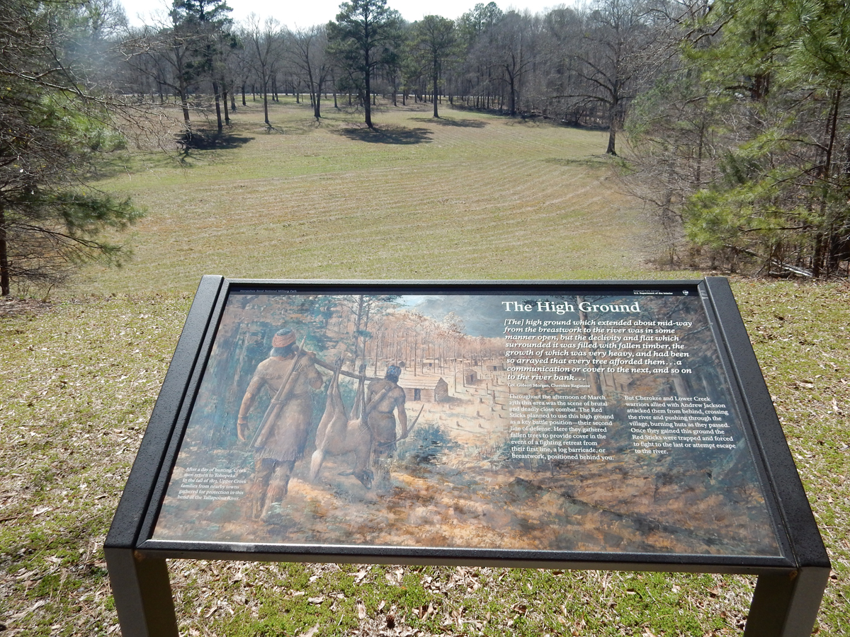
There was a temporary Indian village on the bend of the river that was called Tohopeka and Chief Menawa directed the fortification of the peninsula with a 5 to 8-foot-high log breastwork.
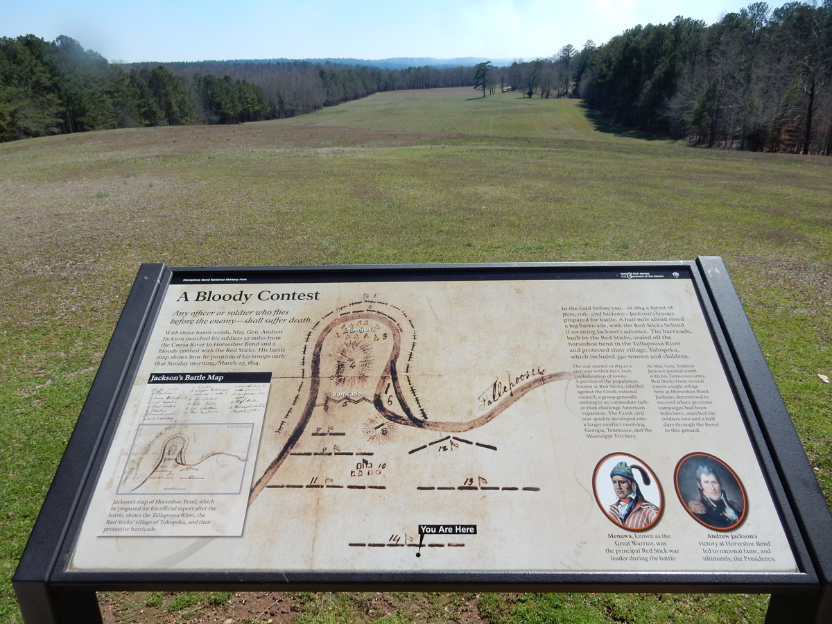
The white poles mark the location of the 400-yard breastwork
General Andrew Jackson had a force of 2,000 infantry, 700 mounted infantry and 600 Cherokee and Lower Creek allies. The Red Sticks numbered about 1,000 men with about 400 women and children in the village. At 6:30am, Jackson sent 1300 of his force, including his Cherokee allies, across the river to surround the peninsula and prevent escape. At 10:30am he opened a two-cannon artillery barrage that had negligible effect on the breastwork. At 12:30pm he received word that the Cherokee Indians had unexpectedly crossed the river and attacked the village. He then ordered a frontal attack. Lt. Sam Houston was one of the first over the barricade.


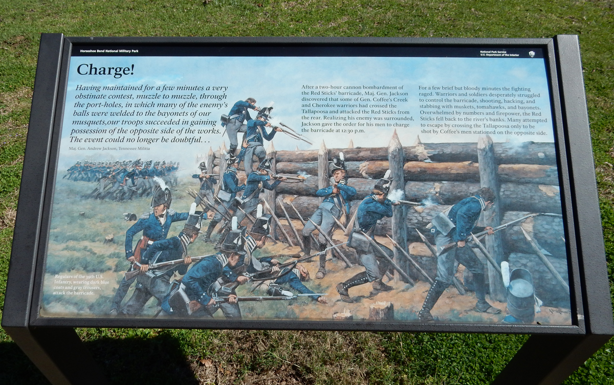
Futile escape
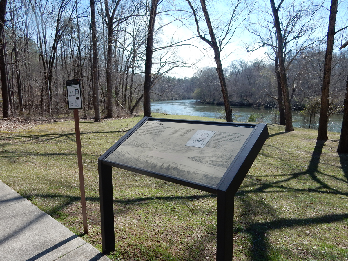
Over 800 of Chief Menawa’s 1,000 Red Sticks were killed. The women and children were taken prisoner by the Cherokee. Jackson suffered about 200 casualties, 50 killed and 150 wounded. The Treaty of Fort Jackson followed, 23 million acres of Creek land were added to the southeastern U.S. – three-fifths of AL and one-fifth of GA.
Nine months later, Jackson defeated the British in the “Battle of New Orleans,” the last major battle in the War of 1812. In 1828, he was elected President and signed the Indian Removal Bill requiring southeastern tribes, including his Cherokee allies at the Battle of Horseshoe Bend, to move to Oklahoma – “The Trail of Tears.”
Andrew Jackson was a slaveholder, a populist and has been described as an emotionally volatile man; he fought in about 100 duels. President Trump, 5/1/17, described Jackson as “an amazing figure in American history—very unique [in] so many ways.” He hung a portrait of Jackson in the Oval Office.
It took about 1.5-hrs to get to Cheaha State Park. Cheaha Mountain, at 2,405 feet, is the highpoint of AL. It was Helen’s 31st state highpoint.
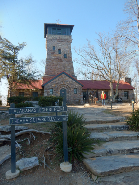
Lookout Tower
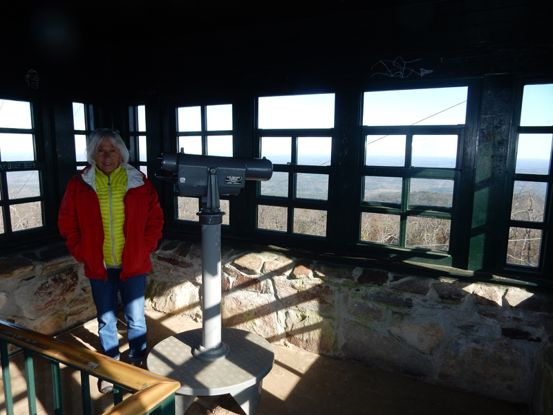
View of top of stone tower and communications tower from the west

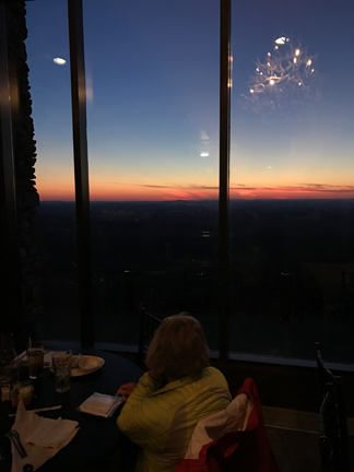
We stayed in the SP Lodge atop the mountain. We order an unhealthy Nacho and Cheese appetizer. It was SO BIG that we did not order dinner!
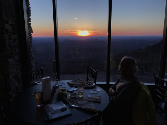
Enjoyed a beautiful sunset, note the antler chandelier reflection in the window
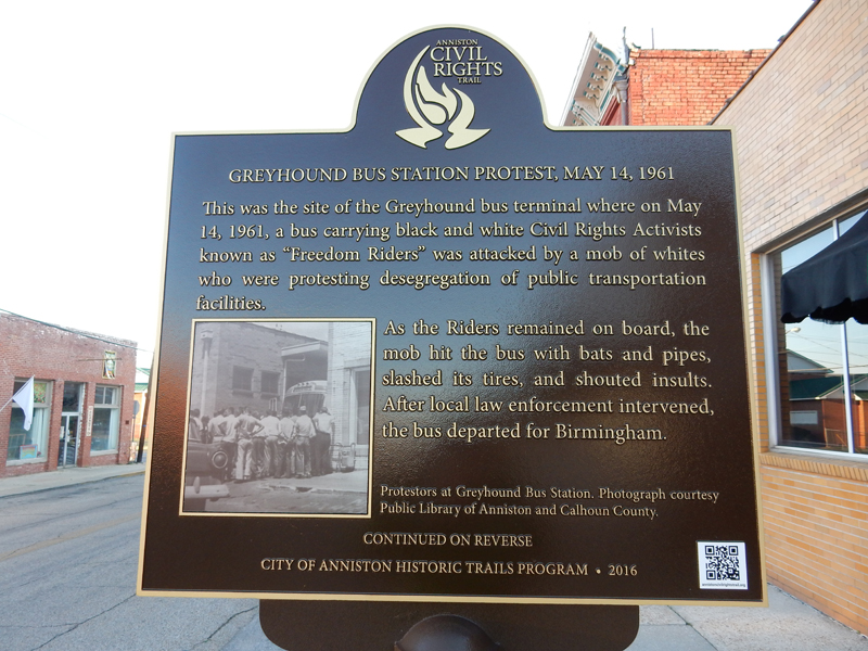
March 16 – the electricity was out at the Lodge when we exited at 7am. We packed up, brushed teeth, etc. with our head lamps and then drove down Cheaha Mountain. Got gas and a carry out breakfast and arrived at the new Freedom Riders National Monument site in Anniston AL at eight. President Obama declared it a National Monument on January 12, 2017 along with Birmingham Civil Rights NM and Reconstruction Era NM in Beaufort SC – all honoring the American Civil Rights Movement.
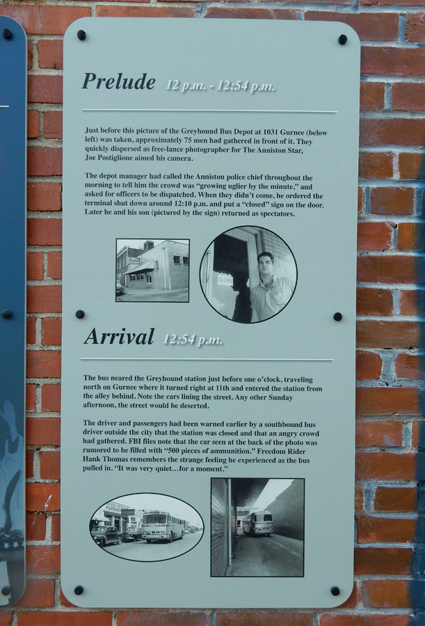
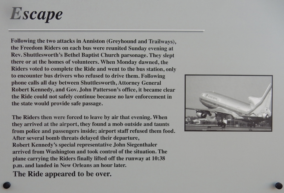
The monument tells the tale of black and white (integrated) civil rights advocates who, on May 4, 1961, boarded a Greyhound bus in Washington D.C. with the objective of riding it through states that had segregation laws to New Orleans. They were called the “Freedom Riders.” They were testing the 1960 Supreme Court ruling that prohibited segregation in depot restaurants and restrooms serving the interstate system. Read On – to learn more about what happened when the bus reached Anniston AL on May 14th.
There are two parts to the monument. The first is the former Greyhound Bus Station in Anniston
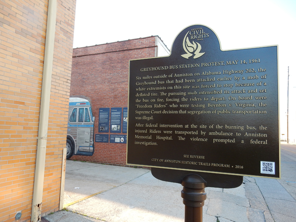


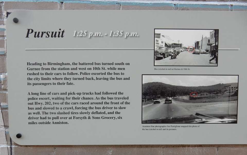


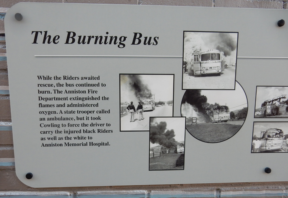


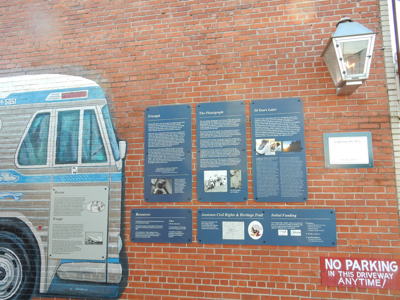

The second part of the monument is the Bus Burning Site on State Route 202 (Old Birmingham Highway) six miles west of Anniston. It was a little hard to find and not much there at this time.


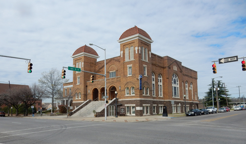
We continued west on SR 202 to Birmingham AL and the Birmingham Civil Rights National Monument. As stated, this is another new NM; it covers approximately 4 square blocks in downtown Birmingham. Our first stop was the 16th Street Baptist Church.

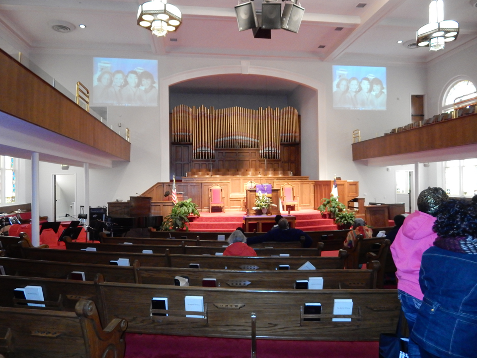
We were fortunate to be able to take a church tour that was starting at that time. We were told the story of four young black girls who were killed and 22 others injured by a bomb placed at the church on Sunday September 15, 1963. MLK stated that it was “. . . “one of the most vicious and tragic crimes ever perpetrated against humanity.” Note the girls picture projected on the wall.
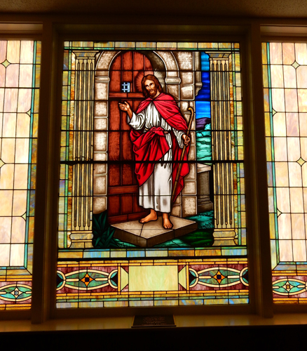
Some think it a miracle that only the face of Christ was blown out of this stained-glass window
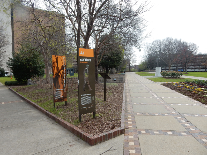
Caty corner from the church is Kelly Ingram Park. Peaceful protesters were brutally attacked here by police with their batons, dogs and water cannon.
Even black children’s marches were violently disrupted. This act of domestic violence became a galvanizing force for the passage of the 1964 Civil Rights Act.

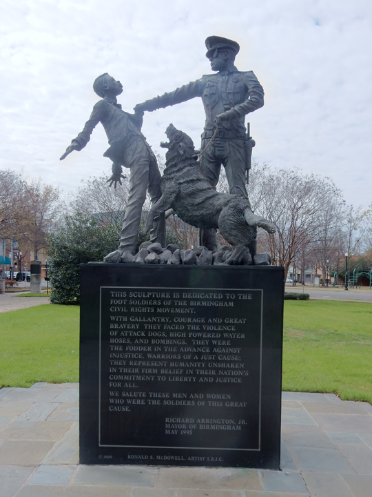


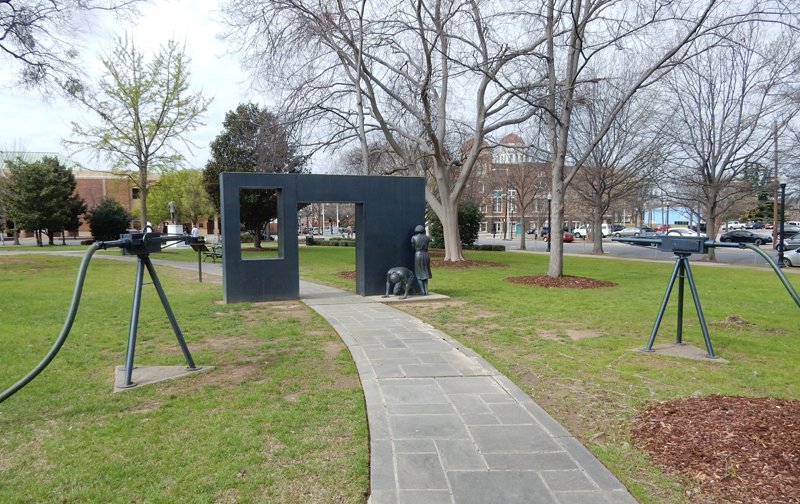
This statue depicts three ministers kneeling in prayer during a non-violent demonstration – John Thomas Porter, Nelson H. Smith and A. D. King.

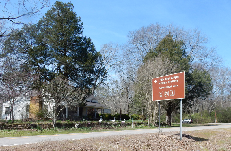
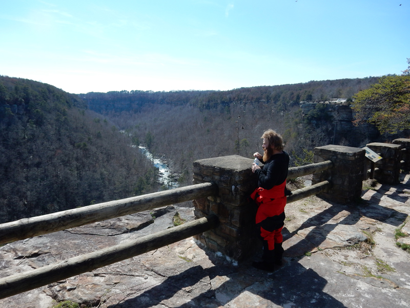
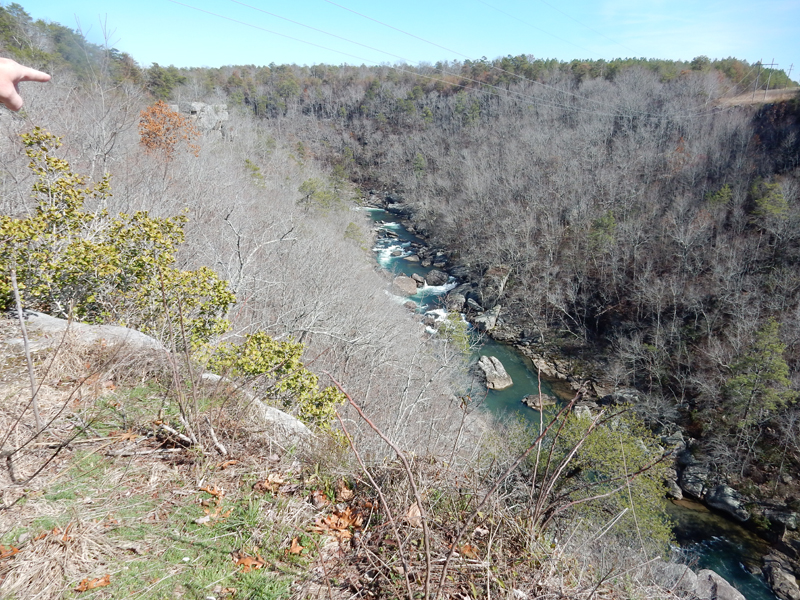
Who would have guessed that there is a white-water canyon with serious kayaking and rock climbing in Alabama? Well, there is. It is Little River Canyon National Preserve in NE Alabama.
Confederate Gen. John B. Hood Headquarters on Oct 19, 1864 on his retreat with 40,000 troops from Atlanta

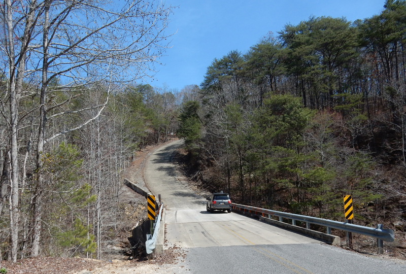
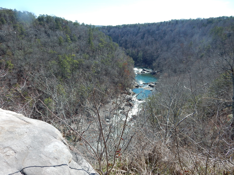
We drove the entire Canyon Rim Drive from south to north stopping at various sites along the way

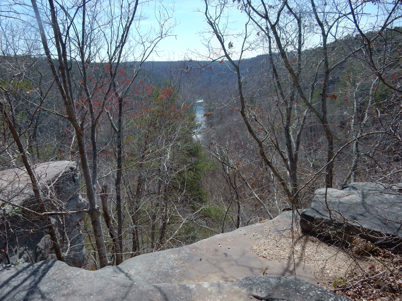
The southern part of the road is gravel and very windy
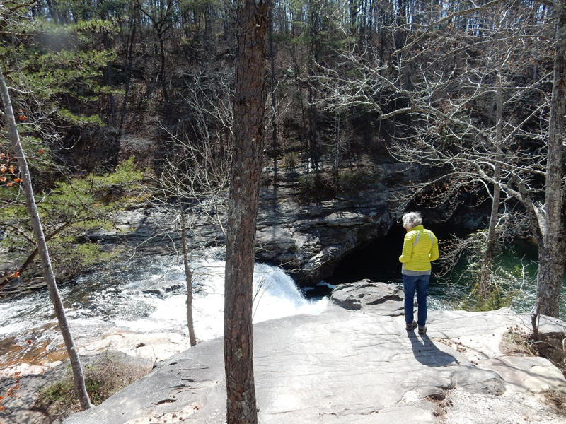
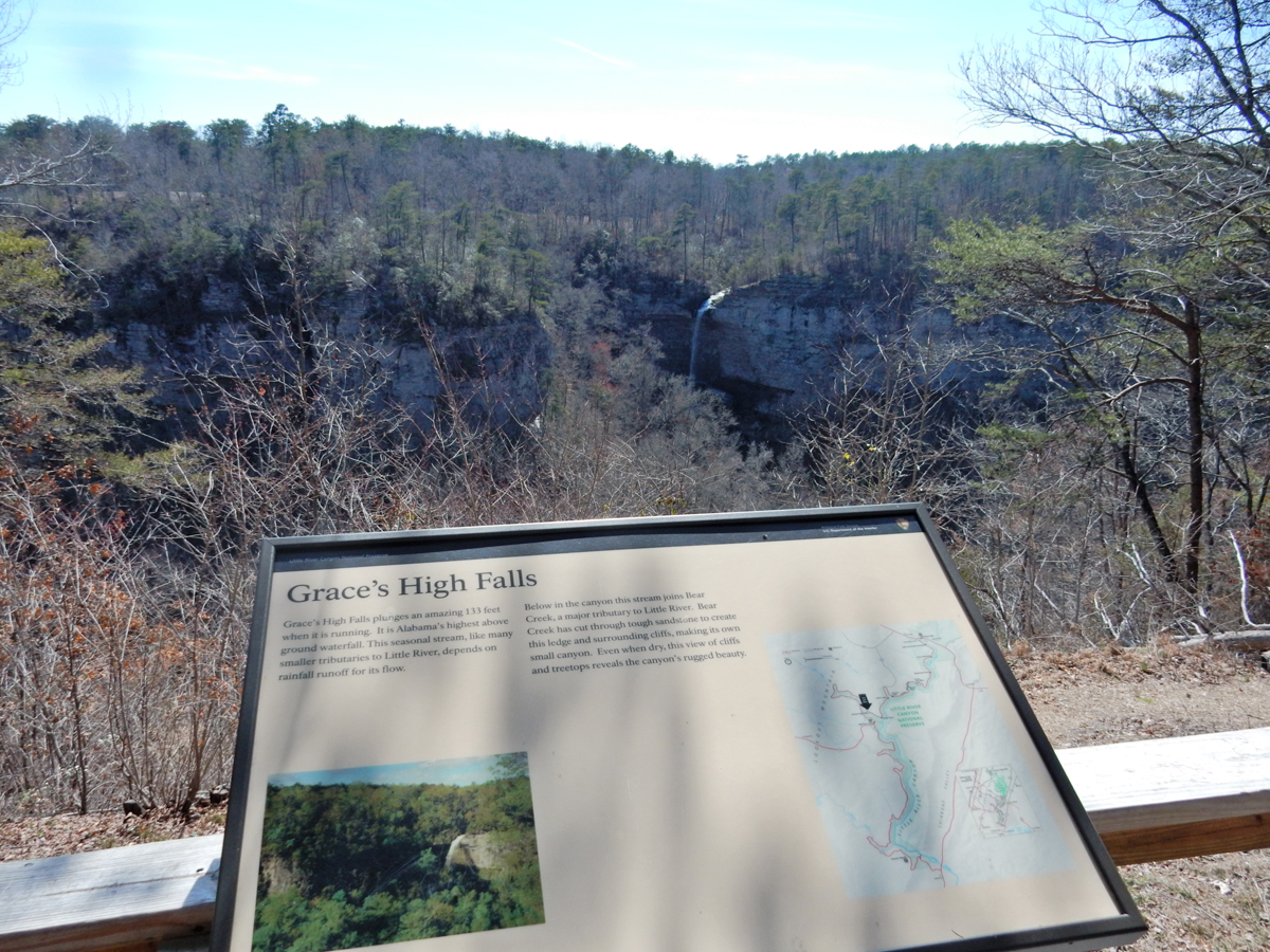
Grace High Falls Overlook

This is a kayaker who had dragged his kayak up from the canyon after about a six-mile paddle. We agreed to drive him back to his truck. He then had to drive back to get his kayak which he stashed at the side of the road.
He was obviously an expert paddler and was an excellent guide as we continued to stop at overlooks. Here he points out some Class IV rapids
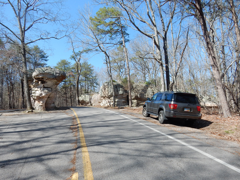
 Mushroom Rock
Little River Falls
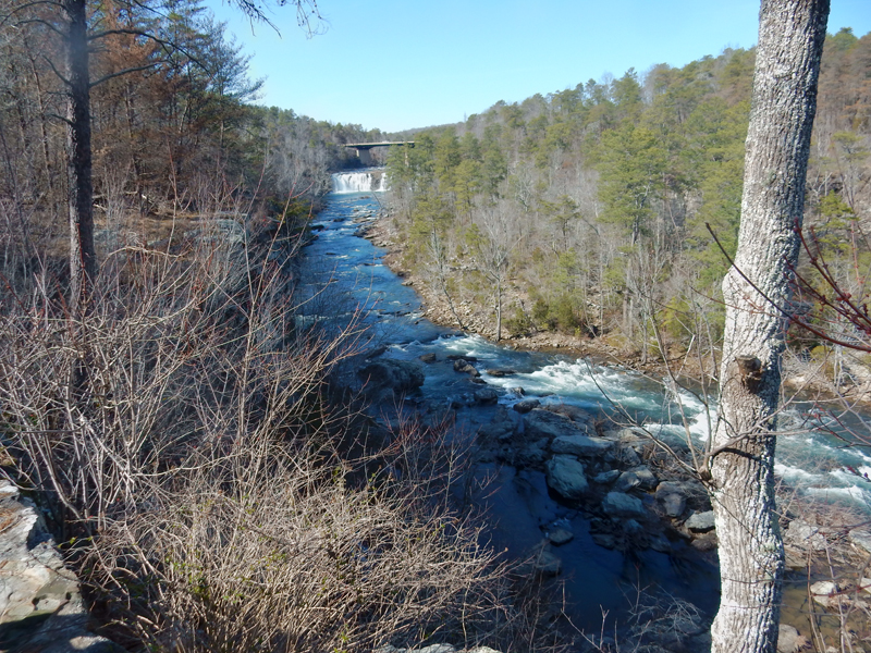
Little River Falls up close
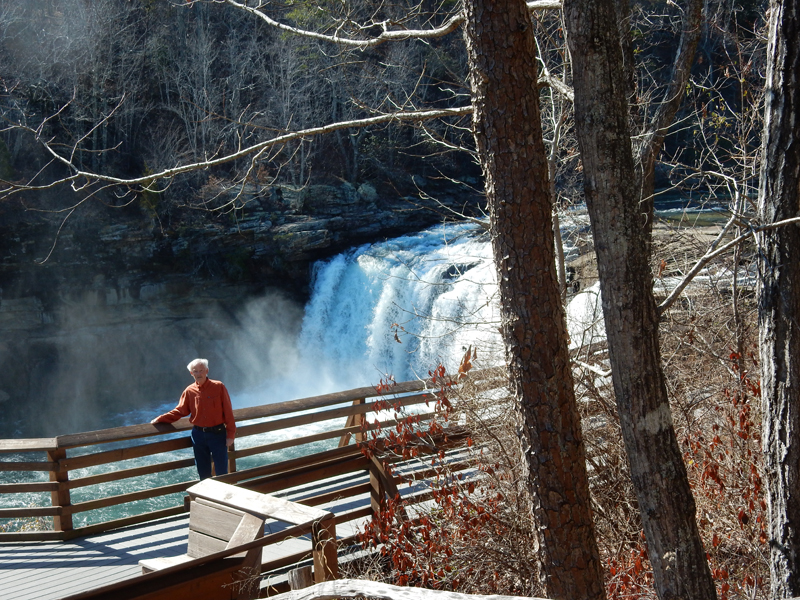

We hiked the loop, first the Little River Falls Trail, then the Martha’s Falls Trail and then returned along the road (Hwy 35)
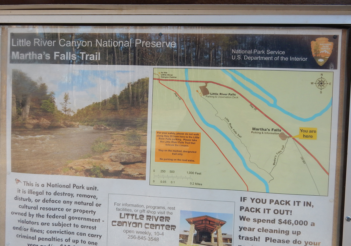
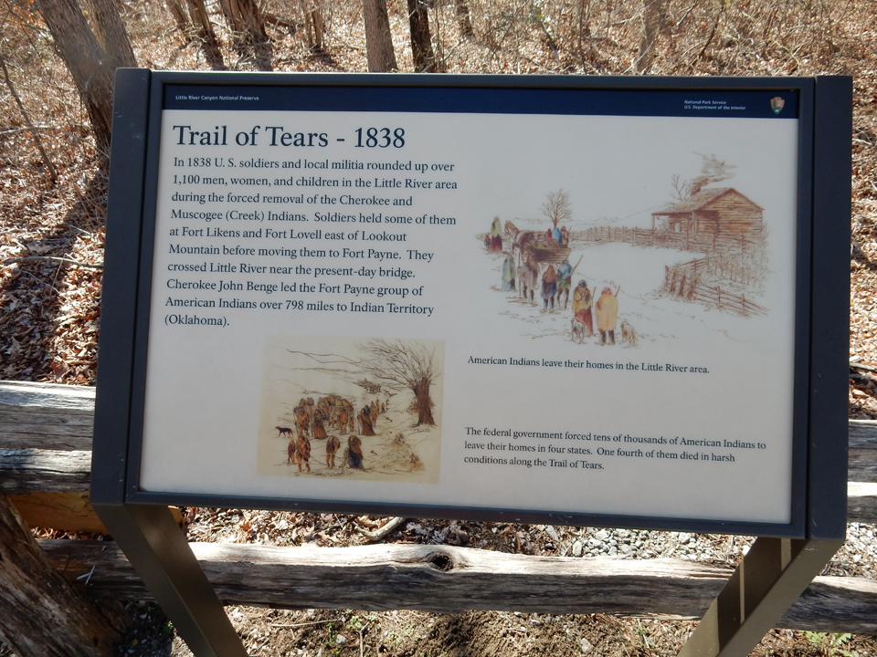
Some signs along the way


After some fast food in Fort Payne AL, we drove to Peter and Heather’s house in Franklin TN
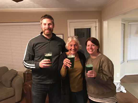
March 17 – St Patty’s Day! Lunch and cards with JoAnn and Larry; green beer with Peter and Heather
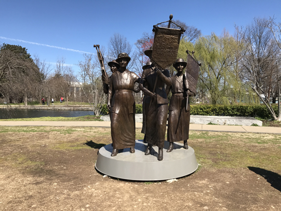
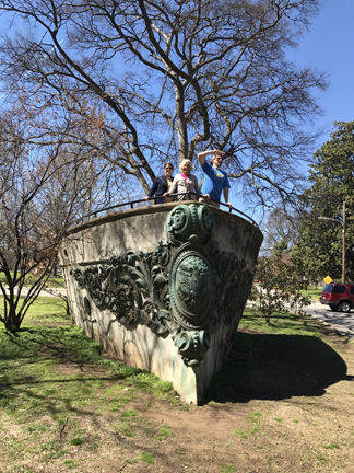
March 18 – Peter and Heather took us to Nashville for the day. We started with a walk in Centennial Park. Votes for Women –
Peter looking for the Parthenon.
We found it!

Peter and Heather

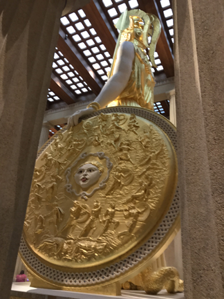
The Parthenon was built with temporary materials for the 1897 Tennessee Centennial Exposition. It housed the art exhibit. Because of both of its crumbling structure and popularity, it was rebuilt in 1920 with more permanent materials. It continues to have an art collection and visiting art shows.

The 42 foot Athena, Goddess of Wisdom, statue was unveiled in 1990 and is gilded with 8 pounds of 23.75 carat gold. She holds a 6’ 4” Nike (Victory) in her right hand. That’s how tall Peter is –

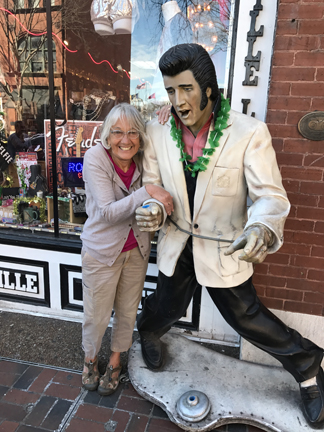
Went downtown to see the Music Row area
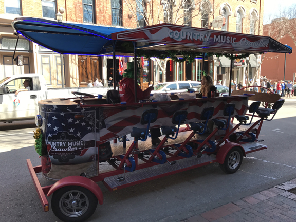
Look close – it’s a mini-bar you pedal
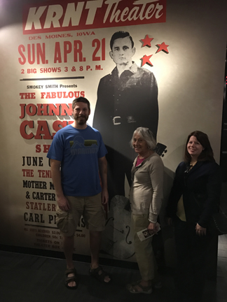
Peter and Heather surprised us with tickets to the Johnny Cash Museum


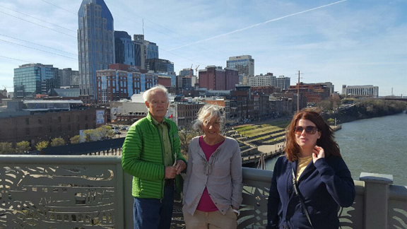
Bridge over the Cumberland River
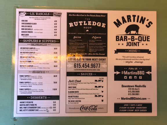
It was a good thing we did a lot of walking because they then treated us to a rib dinner at Martin’s BBQ Joint.
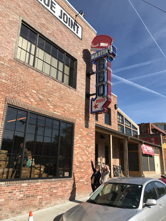
It is supposed to be one of the best in town.
Had to have a Goo Goo Bar for desert!
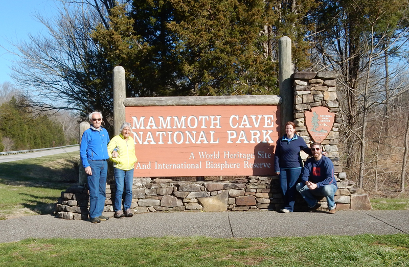
March 19 – it was a 3-hr drive to Mammoth Cave National Park (KY) from Franklin
It is billed as the longest cave system in the world with over 400 miles of passages

Check-out the yellow lines, representing, caves on the map

Cave exploration and measurement with lasers

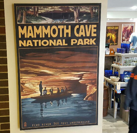
When I was here the first time in 1966 they offered the Echo River Tour, partially with boat – see poster. Unfortunately, they no long offer that tour. They do offer the River Styx Cave Tour, as a specialty tour.
I had gotten tickets two months earlier for the first Domes and Dripstones tour at 10am. You start by being bused 10 min to what is called the new cave entrance.

Entering Cave
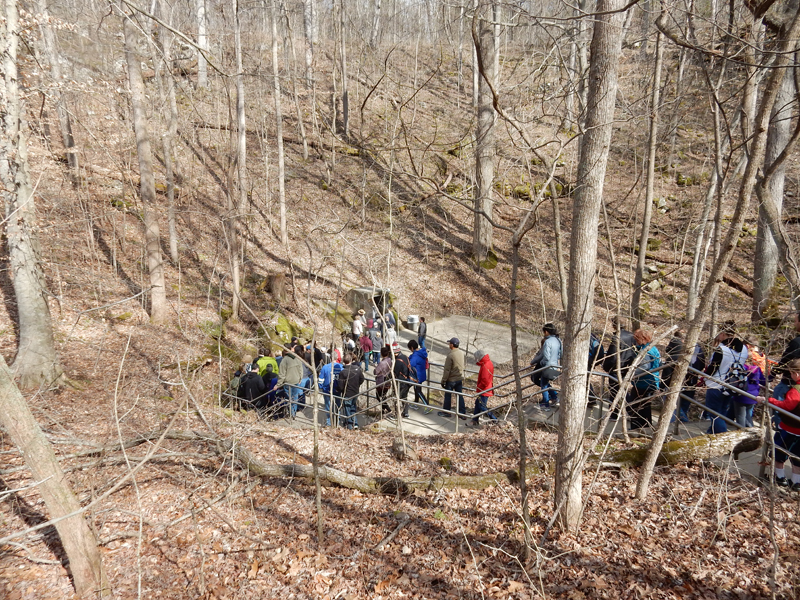
Starting a 280 stair descent


I believe this is called Grand Avenue, too many people
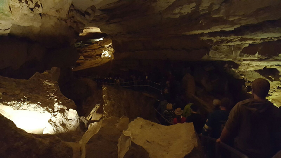
I tried to stay at the end so I could get some pics

A little lecture and “lights out”


It was a 2-hr tour over a 0.75-mile route, with 500 total stairs and had a Moderate Difficulty rating

Stalactites coming down stalagmites growing up, when they meet, it is a column
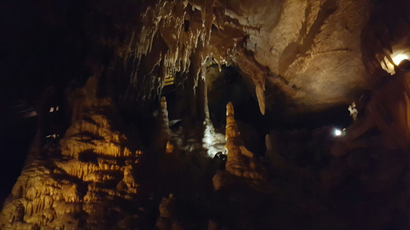
Frozen Niagara

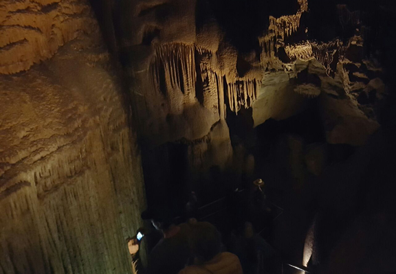
Near end of tour

We had lunch in the restaurant next to the Visitor Center and then parted ways. We were back home in Springfield at 6pm.

Leave a comment