
Maine and New England National Park Units
July 30, 2022I had already planned a trip through ME for August. However, in early July, Stacy invited us to join her family in a vacation house at Higgins Beach ME for a few days. This was an opportunity to spend some relaxing time with Stacy, Brad, Leva, Geert and Hattie, so we jumped at the chance and changed our reservations, schedule, etc. We were told to take Queen sheets, blankets, pillows, towels/wash cloth, beach towels, beach toys, etc. for our accommodation in a small house attached to the house Stacy’s family was in. We also took our passports, vaccination cards, and Covid Tests because we would be crossing the border into Canada three times after our visit. We had to complete the ArriveCan App and enter our passports and Covid vaccination records. In addition, for each crossing, I had to enter the information on our port of entry and time of entry within 72hrs of crossing the border. $1 US = $1.30 Canadian
7/15 F – 7hrs to Kate’s (Nancy’s daughter) home in Victor NY where we spent the night
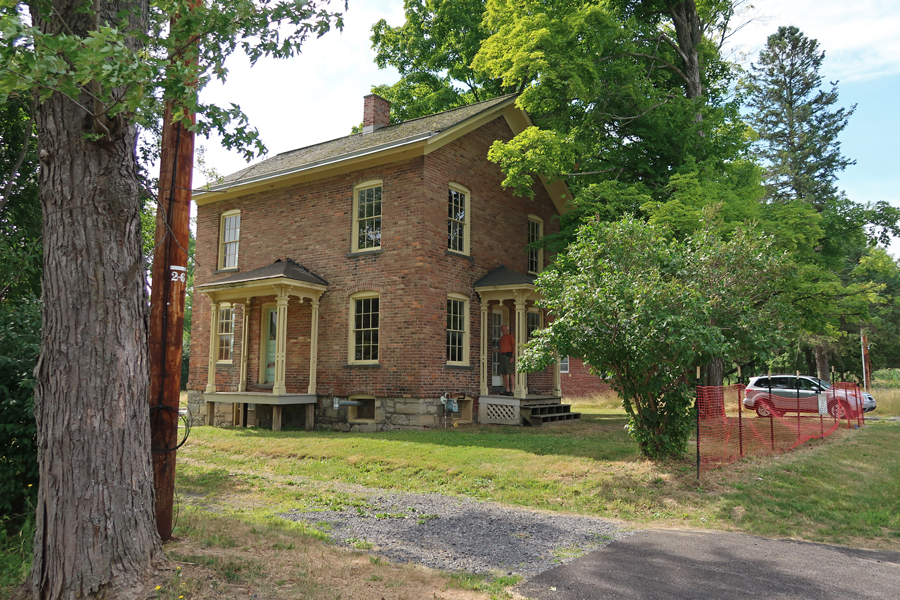
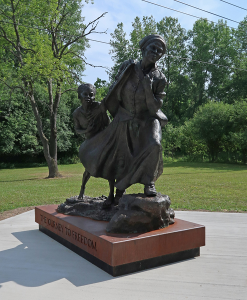
7/16 Sa – made a stop at Harriet Tubman NHP in Auburn NY (see Blog for October 2017) to get photos of her home, which I missed on our last visit.
There was also a “traveling statue” there titled The Journey to Freedom – Harriet was a “Conductor” on the Underground Railroad
Met Stacy and family at their rental house in Higgins Beach ME at 6pm

7/17 Su – we were up for sunrise at 5:15am!

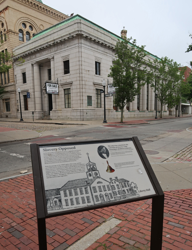
7/18 M – Hattie took me for a walk to the river to see the “quicksand.” The beach is a half mile long spit bound by bed rock on the southwestern end and the Spurwink River on the northeastern end. On the way we passed the remains of the three masted schooner “Middleton,” which ran aground on a fog filled night in 1897. It was loaded with coal. Much of the coal was recovered, but many locals found enough afterwards to heat their homes for a couple of years.

For lunch we did the annual pilgrimage to the Lobster Shack near Twin Lights SP for lobster rolls


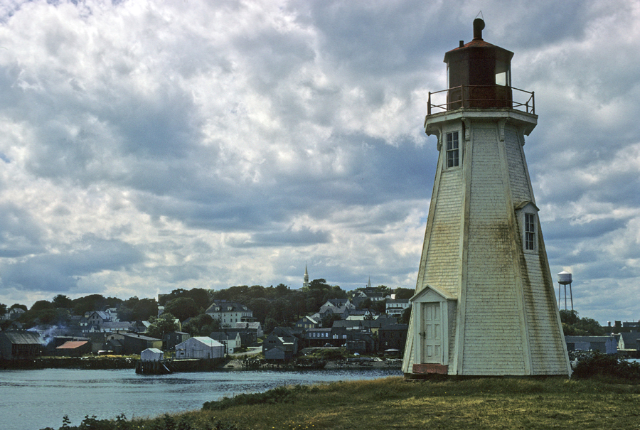
That was followed by a walk to the scenic South Portland Head Lighthouse in Fort Williams Park on Cape Elizabeth. The Portland Head Light was first lit in 1791.


7/19 Tu – spent the day playing and relaxing at the beach

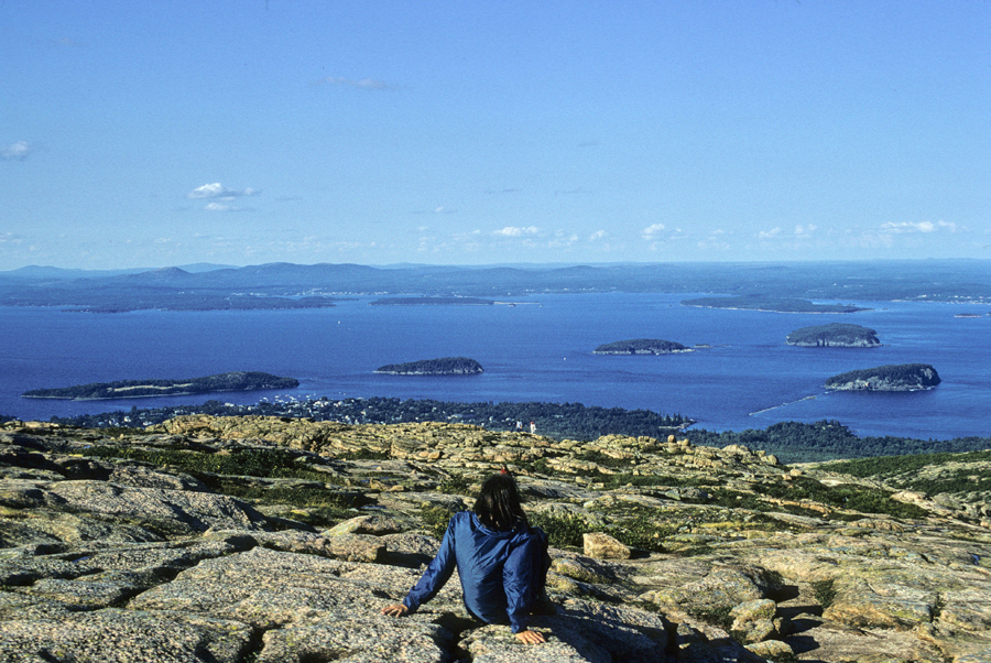
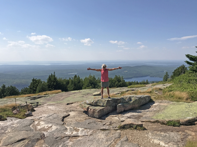
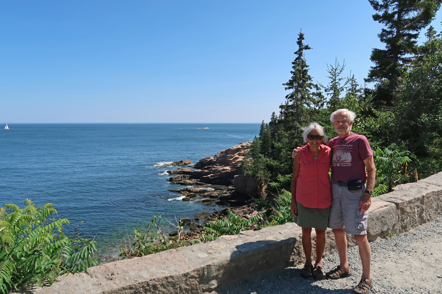
7/20 W – Kate’s Birthday! – said goodbye and did the 3-hour drive to Acadia NP. Helen and I were here in 1970 when we were on a road trip to the Eastern Canadian Provinces with our mothers in our VW camper. Helen taking in the view from atop Cadillac Mountain (1530ft) on Mount Desert Island, where the first rays of sunshine strike the continental USA. You can see Bar Harbor below, as well as islands in Frenchman Bay.
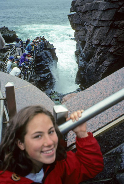
Kate and I visited in 1996 after we climbed Mount Katahdin by way of the Knife’s Edge. Here she is at Thunder Hole.
Kate and I had a cloudy/rainy day and could not see a thing from the top of Cadillac Mountain

Some of Acadia NP land –
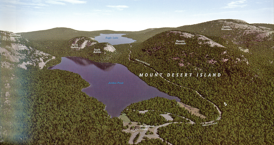
However, she was able to experience a form of high tea at the Jordan Pond House.

We did a long drive around Mount Desert Island, picture at low tide –

We camped at the Seawall Campground in our 1983 GMC van. Here I am making a healthy Lipton dinner at the beach.

It was clear the next morning when I took this photo of the Bass Harbor Head Lighthouse


HAD TO bring back some lobster trap buoys for Helen!

This year we had to have an advanced reservation to drive the auto road to the top of Cadillac Mountain. It cost $6 online and I had a 3:30 to 4pm window to check in at the entrance gate. The reservations are in demand, especially for the earliest times, so as to catch sunrise on the top of the mountain (sold out months in advance). View from the West Parking Lot
View from the East Parking Lot

Same spot as the first photo of Helen above – top of Cadillac Mtn with Bar Harbor in center 2022

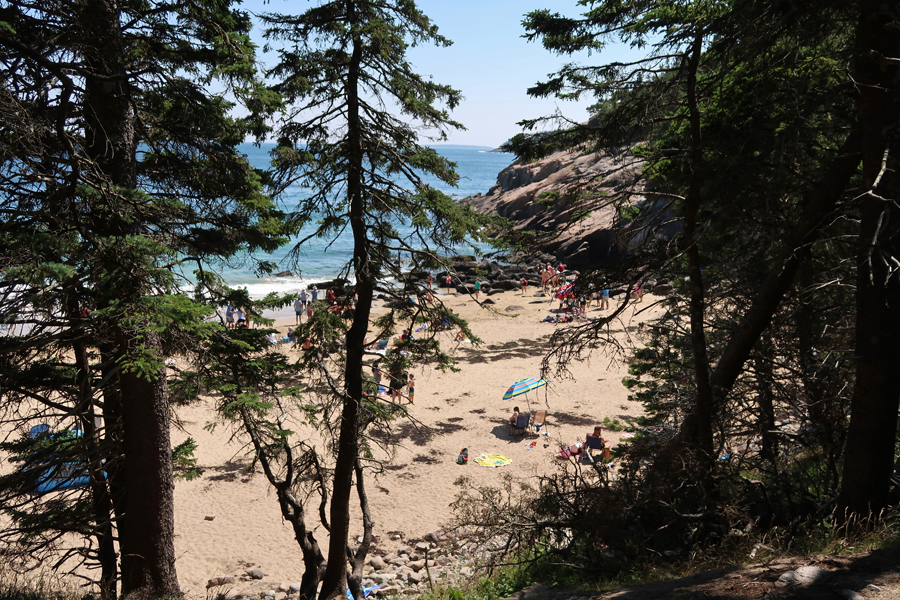
Sand Beach – A “Pocket Beach”

Beautiful day for a walk along the coast
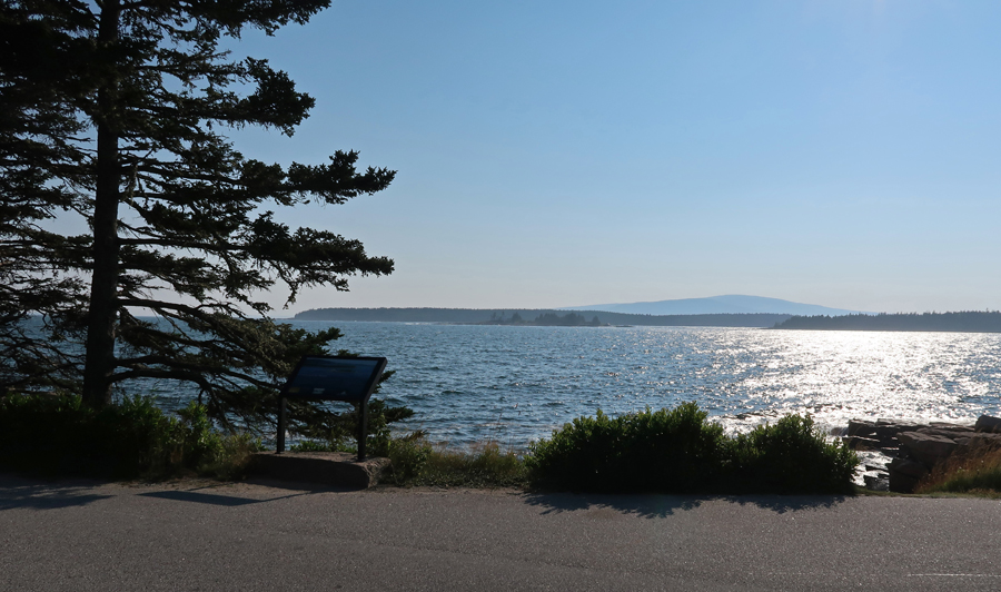
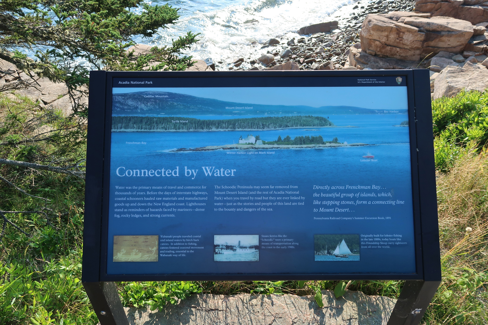
We next drove around Frenchman Bay to the Schoodic Penninsula, which is a unit of Acadia NP

Schoodic Point provides a wonderful view across the Bay back toward Cadillac Mountain
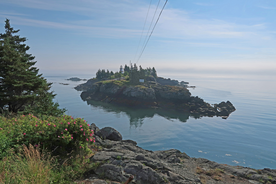
This granite point provides excellent ocean views –

Lobsterman and son, checking the traps

Stayed the night in Lubec ME
7/21 Th – crossed the border into Canada on the FDR International Bridge completed in 1962. Before that, island access was by boat from Eastport ME. We drove to the northeastern tip of Campobello Island to see the Head Harbour Lightstation (also known as the East Quoddy Light). The island is in New Brunswick and the wooden lighthouse (1829) has a distinctive St. George red cross daymark. Unfortunately, it was hightide and we were unable to hike to the lightstation.
Campobello Island is on Atlantic Daylight Time (ADT), one hour ahead of EDT. So, I planned our arrival at the Roosevelt Campobello International Park Visitor Center (an Affiliated NP Unit) for 10am (9am EDT) when it opened. This was our brochure in 1970 when we visited with our mothers and then me in 2022.

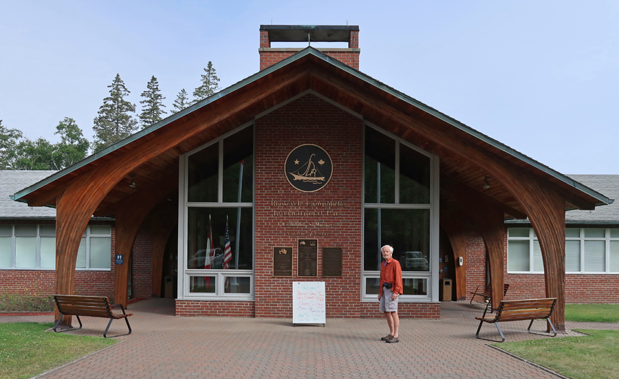
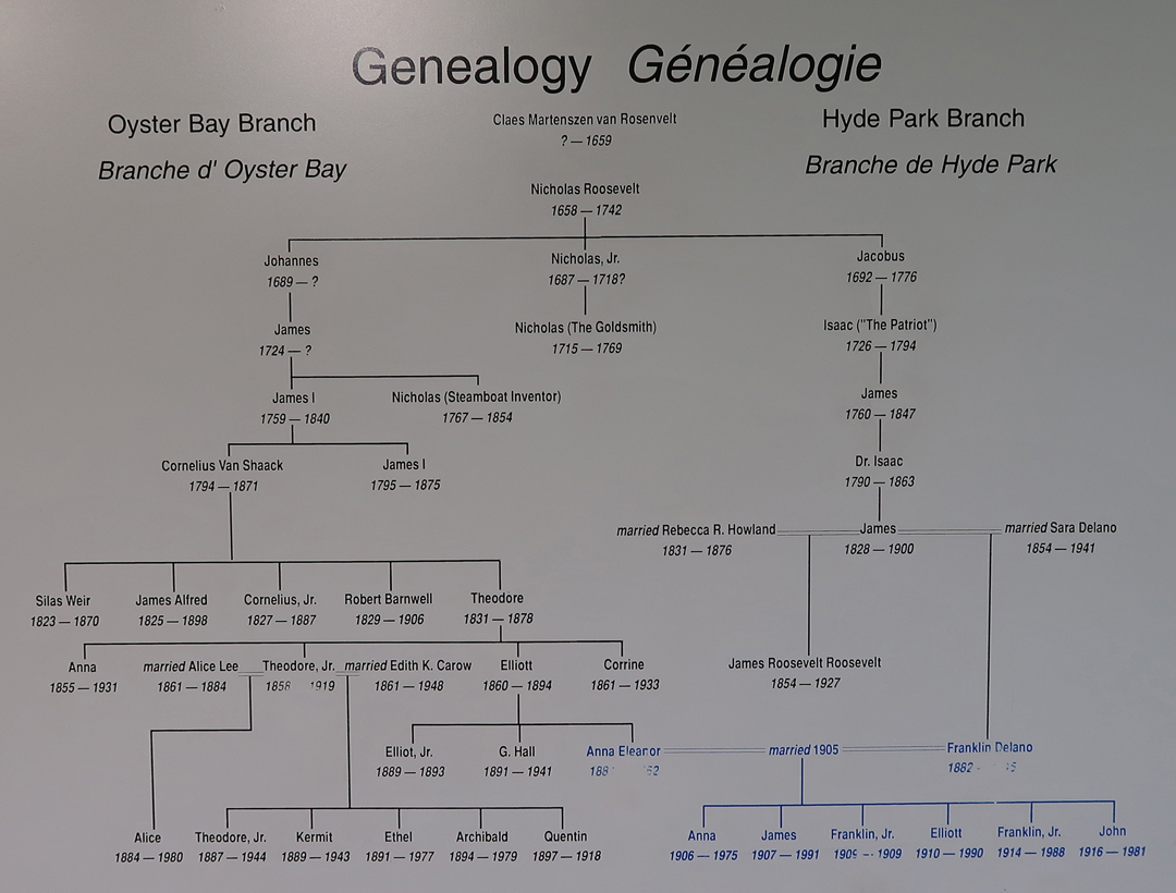
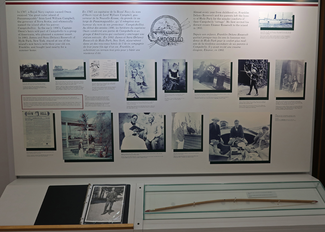
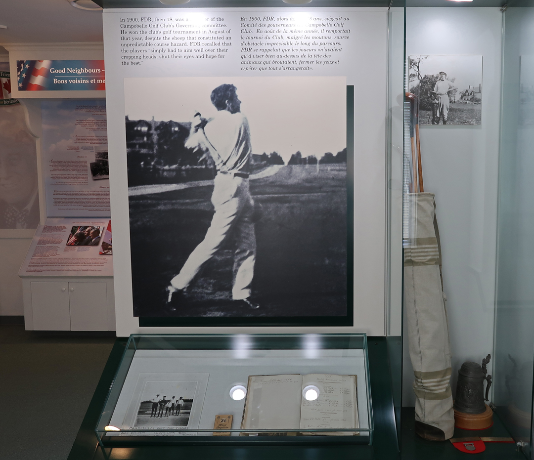
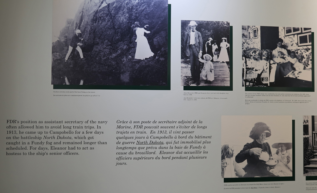
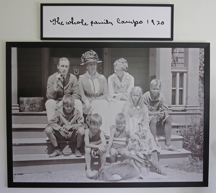
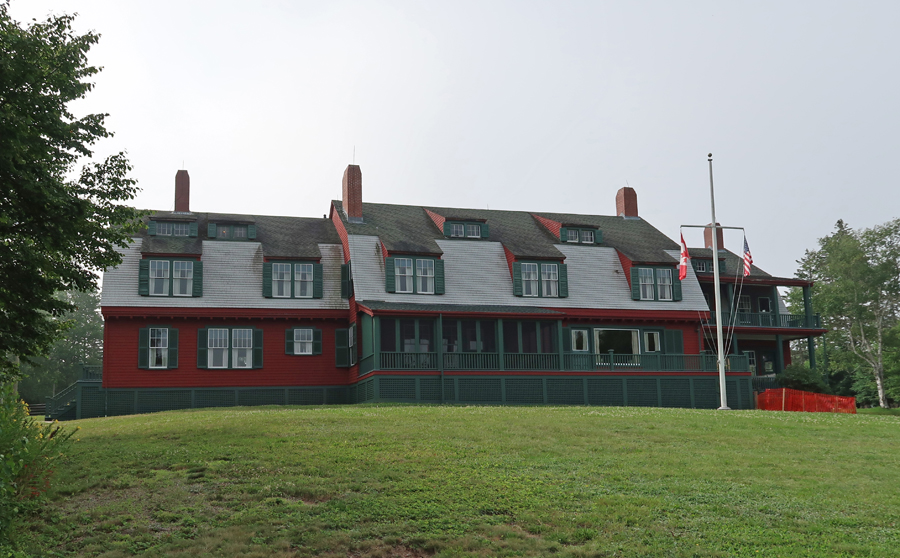
The Visitor Center (VC) tells the Franklin Delano Roosevelt’s family story. His father James bought the island with other investors and built a “cottage” here in 1883. FDR (1882-1945) spent his summers at that cottage until 1908. In 1909, their next-door neighbor Mrs. Hartman Kuhn died. In her will she offered her 34-room cottage to FDR’s mother Sara for the bargain price of $5,000 including all furnishings. Sara presented the cottage to her son Franklin as a belated wedding gift in 1909. FDR had married his fifth-cousin Eleanor Roosevelt in 1905. Her father had passed, so her uncle President Theodore Roosevelt gave the bride away. They enjoyed the first cottage and then the second each summer. All five of their healthy children experienced life at Campobello. A sixth child, the first Franklin Jr, died in infancy. Franklin contracted polio in 1921 (at age 39) and fell ill at the cottage. He was elected President four times starting in 1932. He died in 1945 shortly after starting his fourth term.
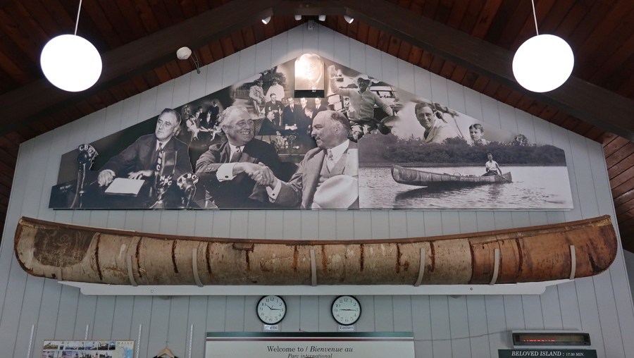
There is a birch bark canoe above the counter of the VC which was made for FDR by Tomah Joseph a Passamaquoddy elder and life-long friend of the President. Franklin had good relationships with the local Native Americans.
The museum had many interesting photos –


My Campobello cottage photo from 1970
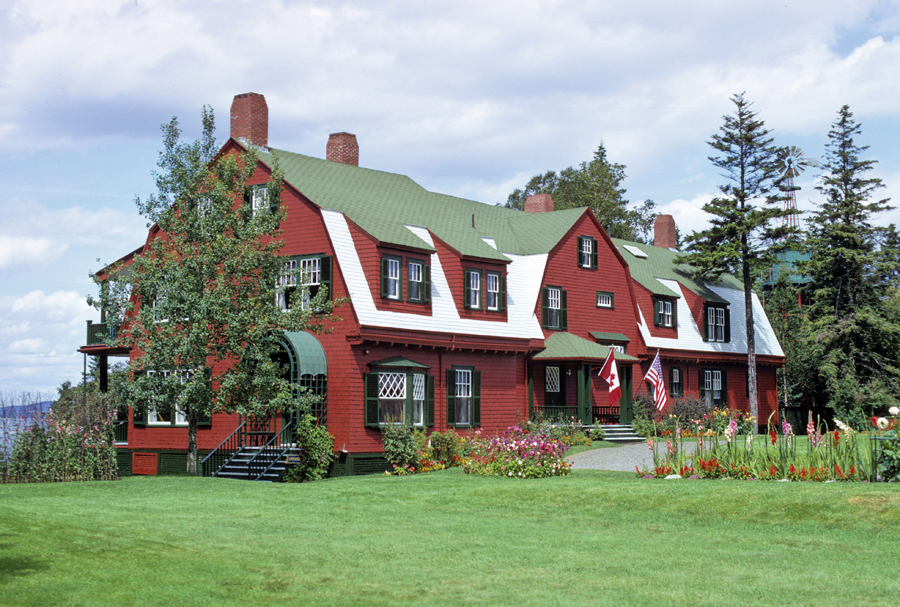
Photo in entrance room of cottage
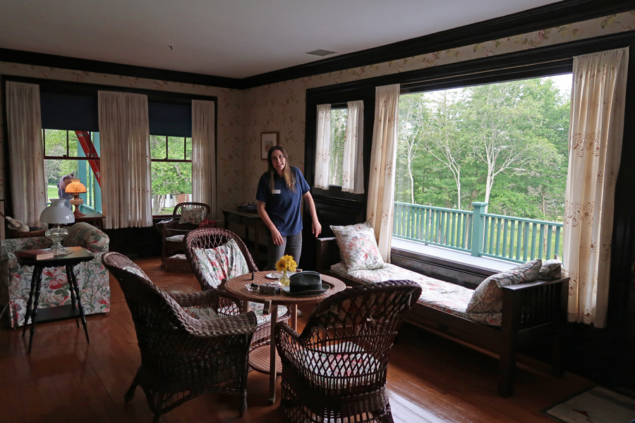
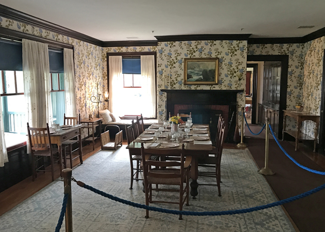
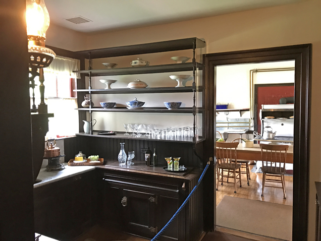
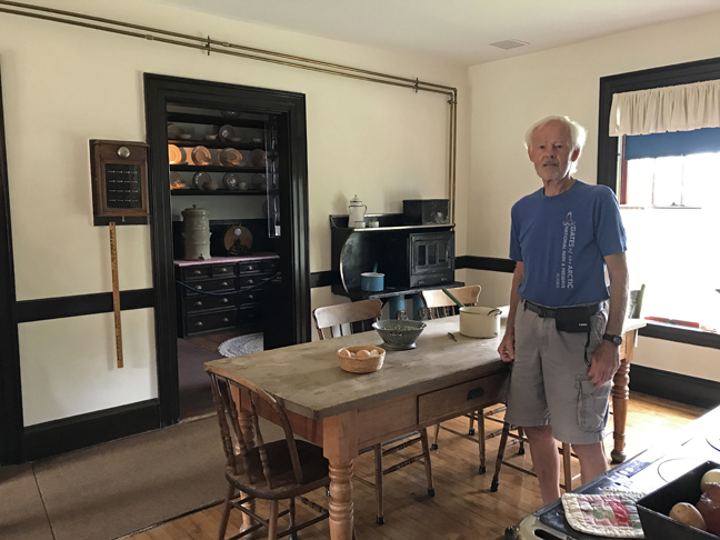
Cottage tours are free and take about a half hour. Select room photos follow – Playroom

Tour Guide in Study

Living Room
Dining Room
Butlers Pantry
Kitchen
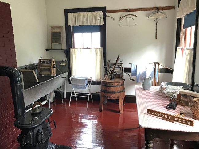
Laundry
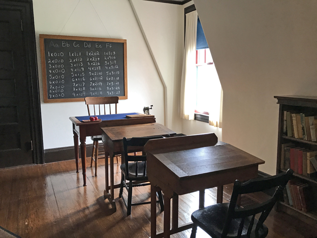
Schoolroom – children were home schooled in Hyde Park and here at their summer home as well
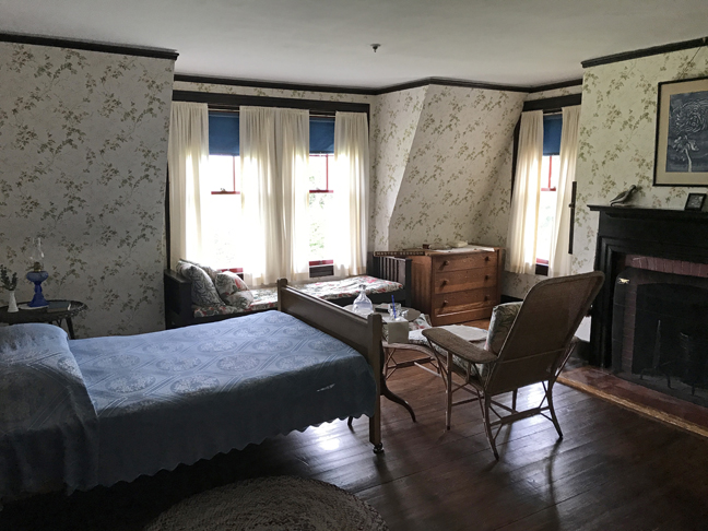
Master Bedroom
Bath

Boys Room

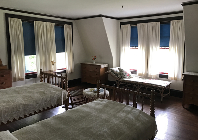
Guest Room
View from Covered Porch – Eastport ME in distance
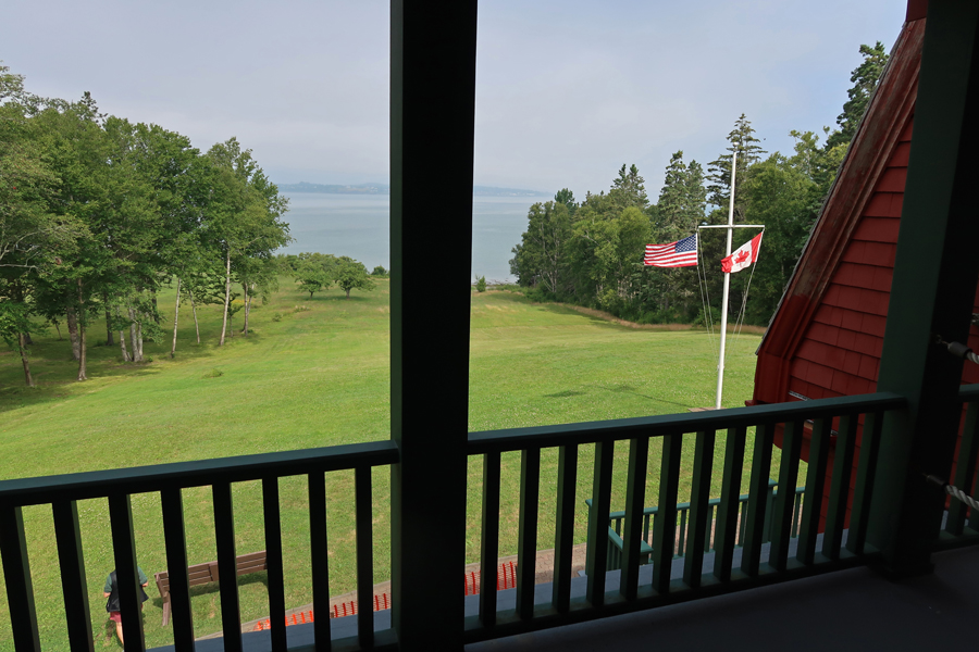
Bay side of Cottage
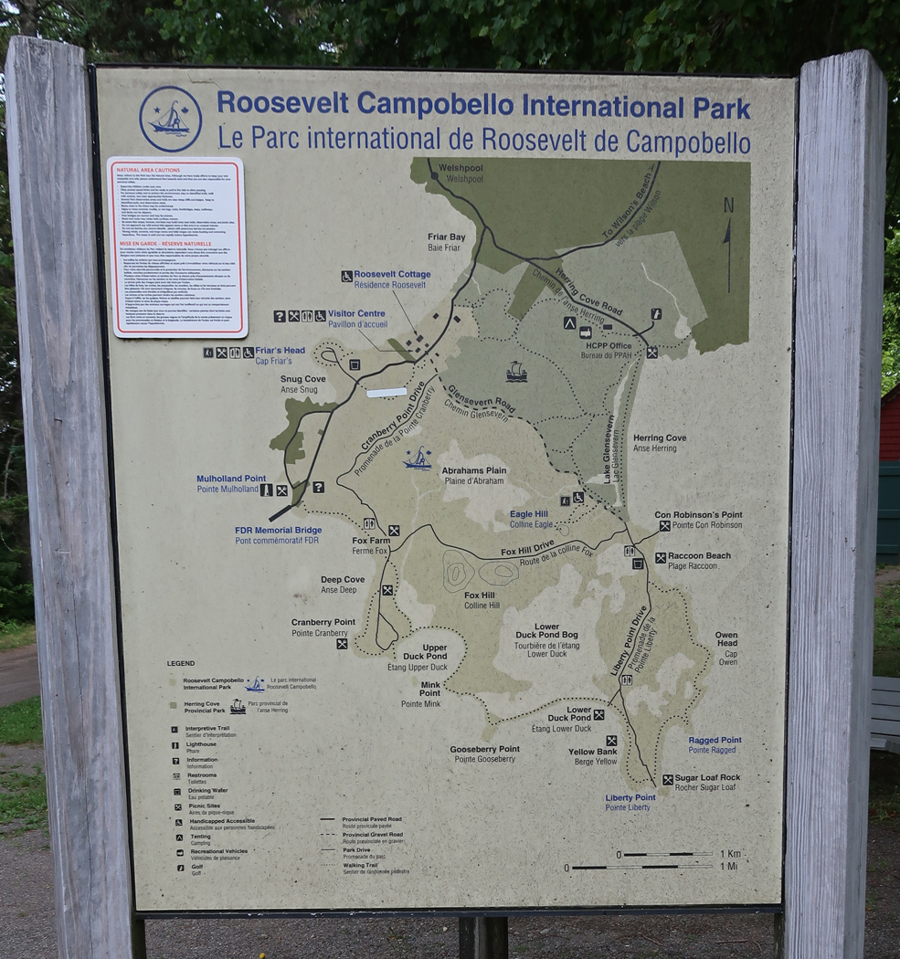
Map – we toured the grounds and then drove to the Mulholland Point Light
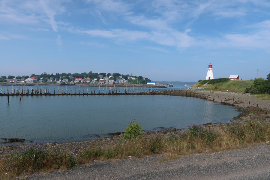
Lubec ME from Campobello Island New Brunswick Canada 2022
Mulholland Point Light – 1970
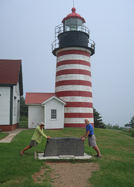
We re-entered the USA and in 10 minutes were at the West Quoddy Head Light, which is the eastern most point of the 50 states

This is a photo of the West Quoddy Head Light that I took in 1970 with Campobello Island in the background

1.5hrs to Rt 1 N and Saint Croix Island International Historic Site. See Blog to read about our first visit to this IHS – October 2017. This time it was low tide, and we could walk down to the shore of the St. Croix River to view the island, which is in the middle of the river with New Brunswick Canada on the opposite side.


The island was the beginning of a permanent European presence in Northern North America. The winter of 1604-1605 on Saint Croix Island was a cruel one for Pierre Dugua’s French expedition. Iced in by freezing temperatures and cut off from fresh water and game, 35 of 79 men died. As spring arrived and native people traded game for bread, the health of those remaining improved. Although the expedition moved on by summer, the beginning of a French presence in North America had begun.
Helen with one of the locals

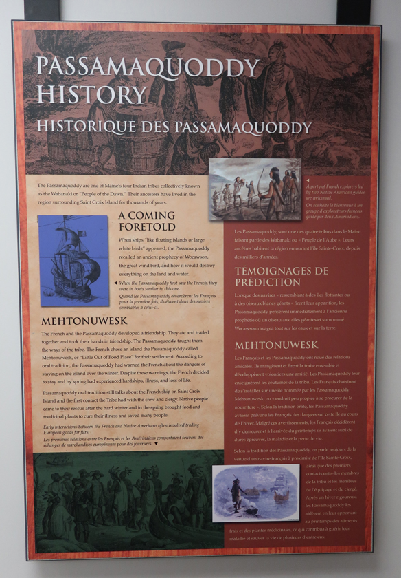
On this visit, we were able to enter the visitor center and learn more about the site and history. The Passamaquoddy Native Americans, who lived here, had a prophesy of how a great white bird (sailing ship?) would destroy everything on land and water. However, the historical information here states that the French and Passamaquoddy had a friendly and supportive relationship.
We then drove north on US Rt 1 stopping at a house sale in Calais ME (Helen bought an anchor plus misc. items) and then a sale along the road somewhere north of Presque Isle ME. She is still talking about the old handmade potato basket she should have bought there. In the 17th and 18th centuries Irish and Scotch-Irish immigrated into the area and introduced potato farming.
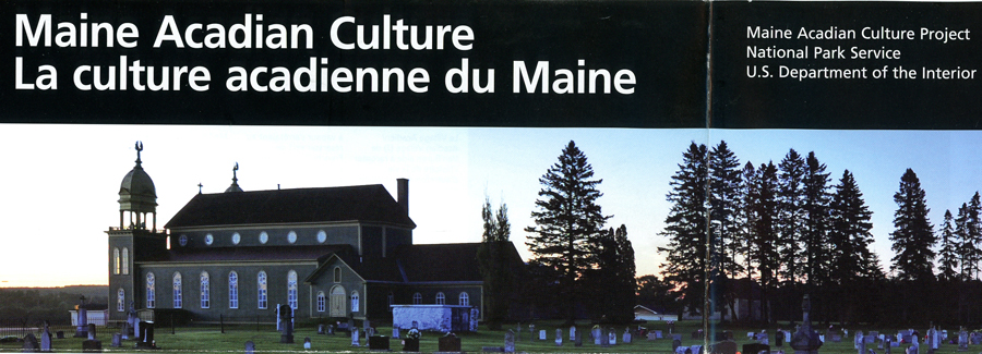
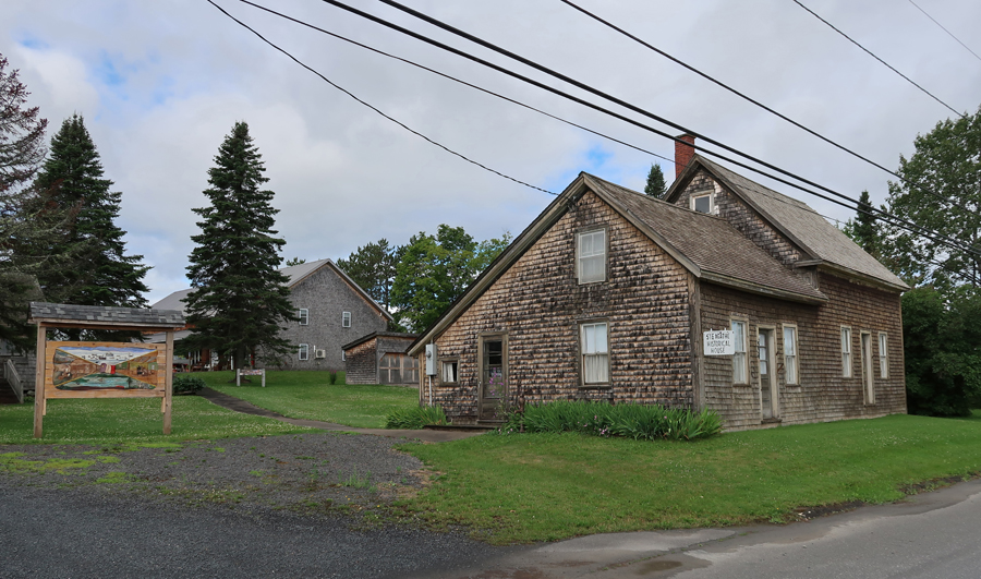
On the way to Van Buren ME, we made a quick stop in Cyr Plantation ME to see the Governor Brann School. It is one of twelve locations that are part of the Maine Acadian Culture Project, an Affiliated National Park Unit. The Project ties together a collection of twelve sites on the U.S. side of the Saint John River Valley border with Canada. The focus is on the unique ethnicity and culture of the region. In the 1600s French Acadians settled Nova Scotia. British took over in 1755 and proceeded with a forced relocation of the French. Some of these Acadians were relocated to New Orleans (“Cajuns”) and some to Fredericton New Brunswick.
The Governor Brann School tells the story of how a Maine 1919 law required the language of instruction in public and private schools to be English. The school was named for Louis Brann, who was Governor of ME at the time of its construction in 1934. It is the best-preserved of the community’s former district school buildings; it was listed on the National Register of Historic Places in 1993. The 1959’s Handbook for Teachers, stated that “Any teacher violates (our) trust, both legally and morally, who allows herself or any pupil to revert to French in the classroom . . . at recess, around the playground . . . or even away from school.” It is now used by the plantation as a polling station and meeting place.


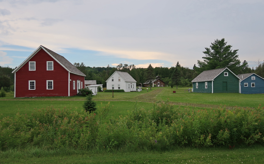
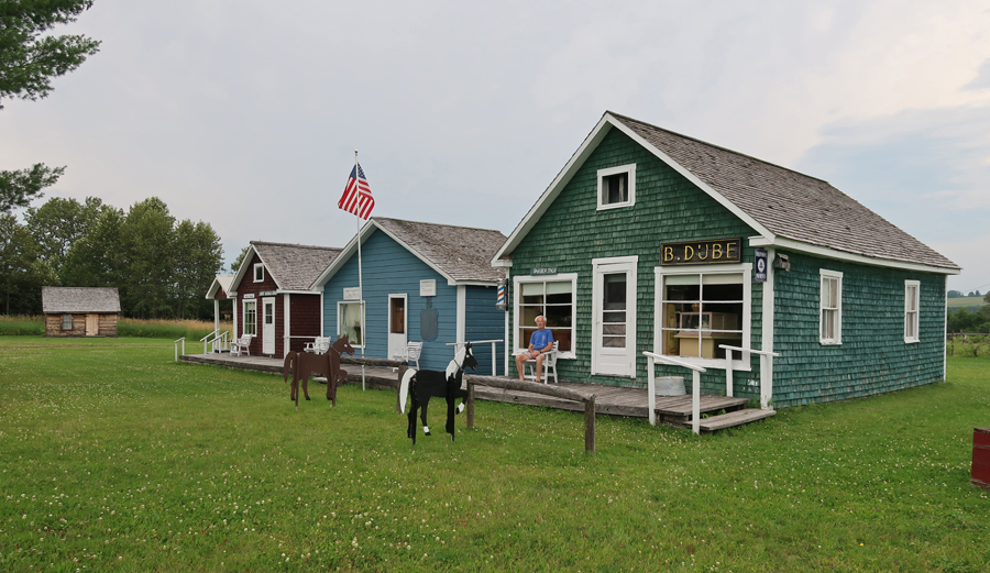
We were able to get to our next site, the Acadian Village ($7 open noon to 5) east of Van Buren ME before dark but after they closed. There are seventeen “Acadian” structures that have been reconstructed or brought here from around the St John River Valley. In 1785, Acadians who had settled in St. Anne Des Pays Bas, Fredericton (New Brunswick), after the English forced them out of Nova Scotia ~1755, were again forced to move by English Loyalists. Twelve thousand British Loyalists immigrated north to the Fredericton area after the American Revolutionary War. The Acadians, displaced again, made their way up the St. John River to what is now the northern border of Maine.
The settlement reflects and incorporates those traits inherent to the Acadians. These skills include fishing, lumbering, and ship building. A number of these dwellings are significant in terms of their distinct Maine Acadian construction such as nautical features of “ship knees,” used for supports in construction, which can be seen in the Morneault house and the Acadian barn.
These “Acadians” still speak French and comprise the largest French-speaking population in North America, except for the Canadian Province of Quebec. The site is owned and operated by Notre Héritage Vivant/Our Living Heritage. It was listed on the National Register of Historic Places in 1977.


Roy House

Center of Acadian Village
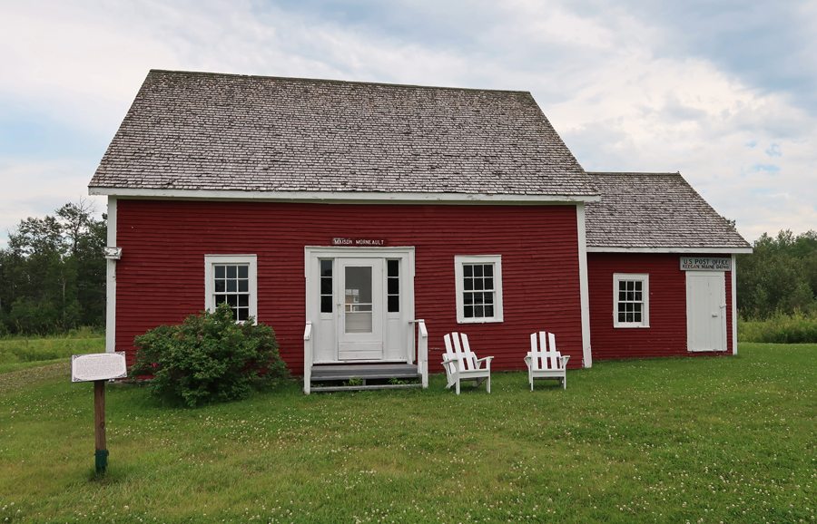
Morneault House – The settlement reflects and incorporates those traits inherent to the Acadians. These skills include fishing, lumbering, and ship building. A number of these dwellings are significant in terms of their distinct Maine Acadian construction such as nautical features of “ship knees,” used for supports in construction, which can be seen in the Morneault house and the Acadian barn.
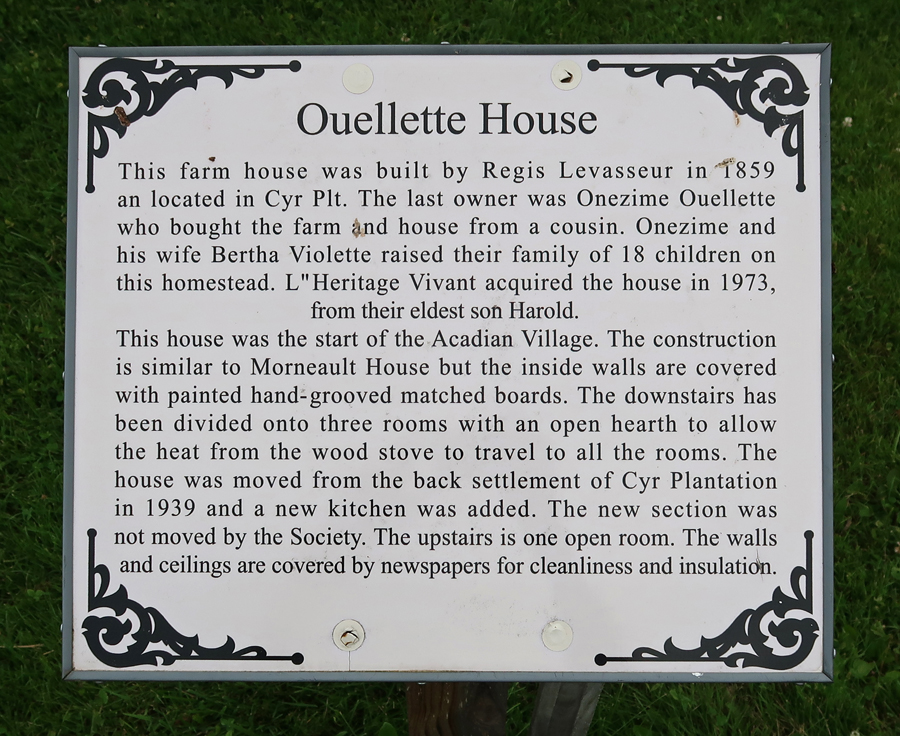
Ouellette House

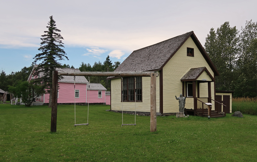
Notre Dame De L’ Assumption Catholic Church

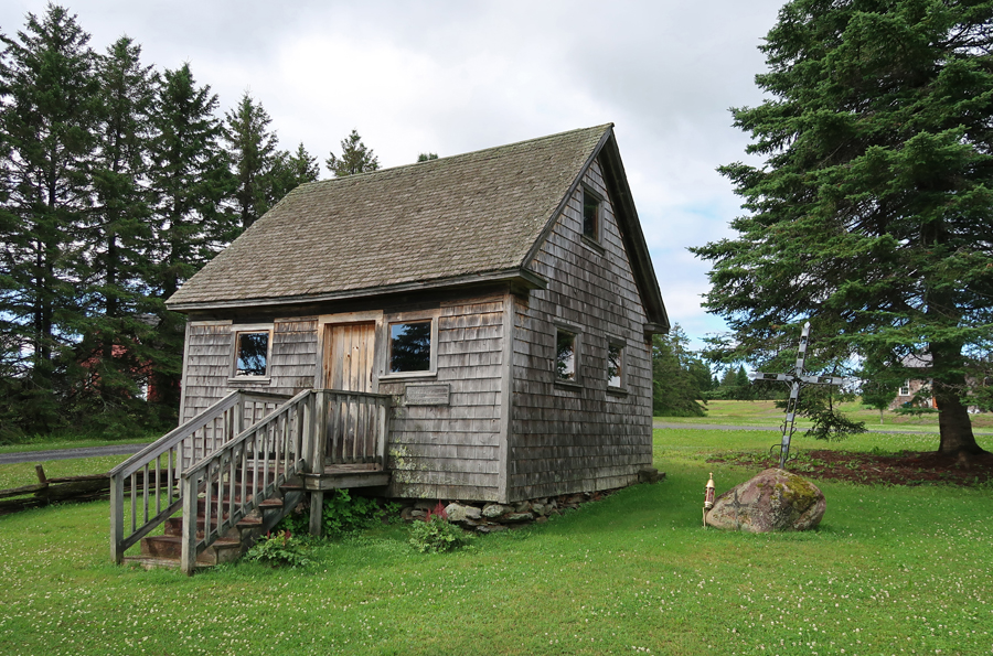
St. Amand-Ayote School House (1900)
Doctor-Optician House


Boardwalk and Businesses
Bangor & Aroostock RR Station

Ate in Van Buren and then crossed the St John River into Canada and stayed at the Daigle’s Motel in Saint Leonard.
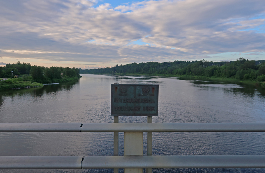
7/22 F – crossed back into the US of A – St John River boundary looking East. Canada on left US on right
Acadian Flag, which you will see many times in today’s photos – the French Flag with a gold star in the upper left corner.

Starting in Van Buren ME, this map shows our morning stops on US Rt 1 through Grand Isle ME

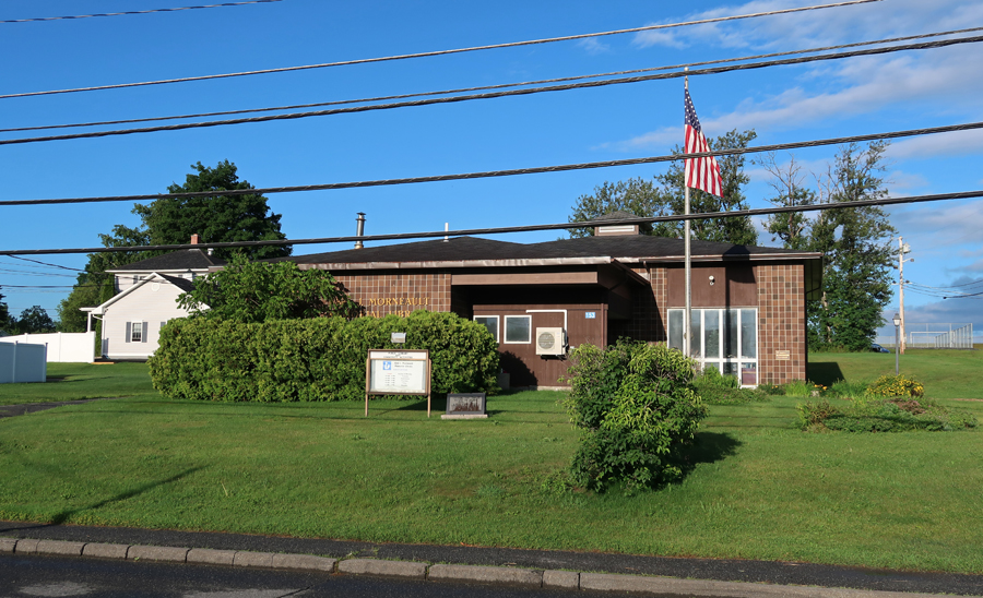
Our first stop was the Abel J. Morneault Public Library in Van Buren, which is a unit in the Maine Acadian Culture Project. Local libraries are important because they hold records related to the Acadian experience. Yesterday, we saw the Morneault House and barn at the Acadian Village outside of town.
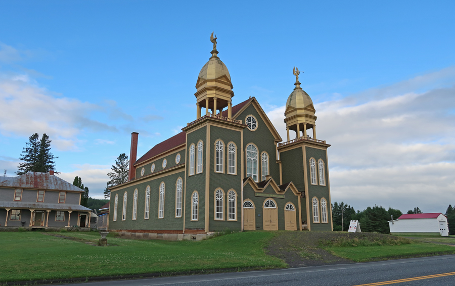
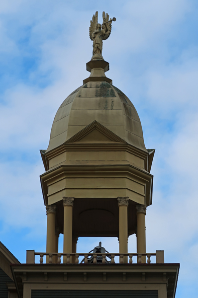
A half-hour ride took us to Lille ME and the Musée Culturel du Mont-Carmel. It is located in the former Our Lady of Mount Carmel Catholic Church and tells the story of the importance of religion in the Valley. It is one of the only surviving 19th-century Acadian churches in northern Maine. This architecturally distinctive building was placed on the National Register of Historic Places in 1973. As you can see, it is highlighted on this NPS brochure.
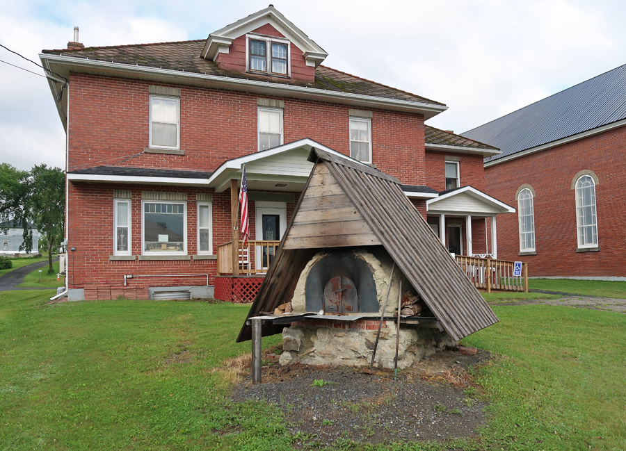
Greater Grand Isle Historical Museum with bread oven out front

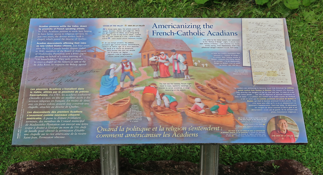
Roadside Shrine with marker explaining the Americanizing of French-Catholic Acadians


This map shows the location of each of our remaining stops through the Saint John River Valley

Acadian Landing Site –the Acadians landed at this site on the St John River in 1785. It is marked by a large marble cross. It is also known as the Acadian Cross Historic Shrine. It was listed in the National Register of Historic Places in 1973.
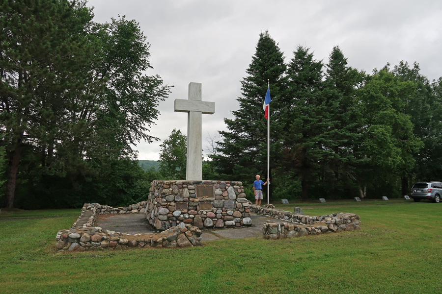
As mentioned, Acadians were living around Fredericton New Brunswick in 1784 at the end of the American Revolution. At that time, the British encouraged their Loyalists in the U.S. to move to that area, and 12,000 arrived interfering with the Acadian way of life. That was the main motivation for the Acadians to move up the St John River to this location. The land here was good for farming and they were a lot closer to the Catholic center in Quebec.

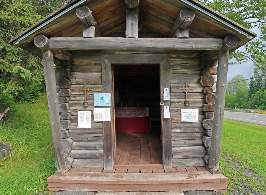
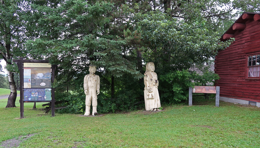
The Tante Blanche Museum is nearby, note St. David Catholic Church in background. Some masses are still held in French. This museum tells the story of Tante Blanche, a heroine during the Colonists black famine.

In 1797, after two years of flooding, an eight-day winter storm descended on the area. Tante Blanch gathered food and clothes from her relatives and friends and then snow-shoed to assist her sick, hungry, and cold neighbors.
We continued west along the St. John River for ten minutes to Madawaska, which was a French Acadian center. The Madawaska Library

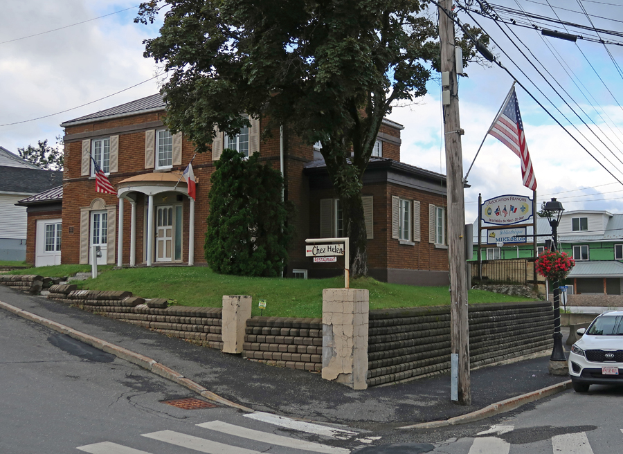
Le Club Francais in Madawaska
From Madawaska, it was a 20 min drive south to the Pelletier-Marquis House. It is now the St. Agatha Historical Society Museum. It represents an older working-class home and is thought of as “everyman’s home.” Humble in appearance, its original site, rock foundation, low ceilings, buckwheat hull insulation, wide floorboards, and square-headed nails make this a unique historical structure. It dates from 1853 and has two surnames because at one time two families lived there.
A donated Acadian Cabin was relocated here from Staratha ME
There are Colored Wood Carvings at several of the Acadian sites

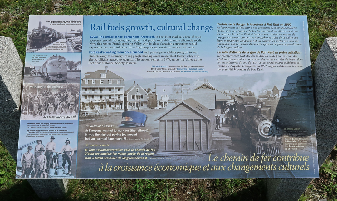
Our next stop was the Frenchville Railroad Station and Water Tank, built in 1910 by the Bangor & Aroostook Railroad (B&A). This site was added to the National Register of Historic Places in 1995. The station was retired in 1971. Tracks here ran along the St John River.
The Town of Frenchville purchased the water tank from Bangor & Aroostook Railroad and used it as a water reservoir for the fire department until 1981. The Frenchville Historical Society took over maintenance of the site in 1985. There is a long caboose that was built by the Pullman Co. as a troop transport car in 1943. It was acquired by the B&A in 1949 and refitted as a caboose. It remained in service until 1981 and was donated to the Frenchville Historical Society in 1988.

The water tower became obsolete in 1958 when the diesel locomotive replaced the steam locomotive. Almost every telephone/electric pole had an American Flag. Local communities, along US Rt 1 and ME Rt 161, put them up at the beginning of summer and take them down in the fall.

This building across US Rt 1 was owned by Hector Martin!

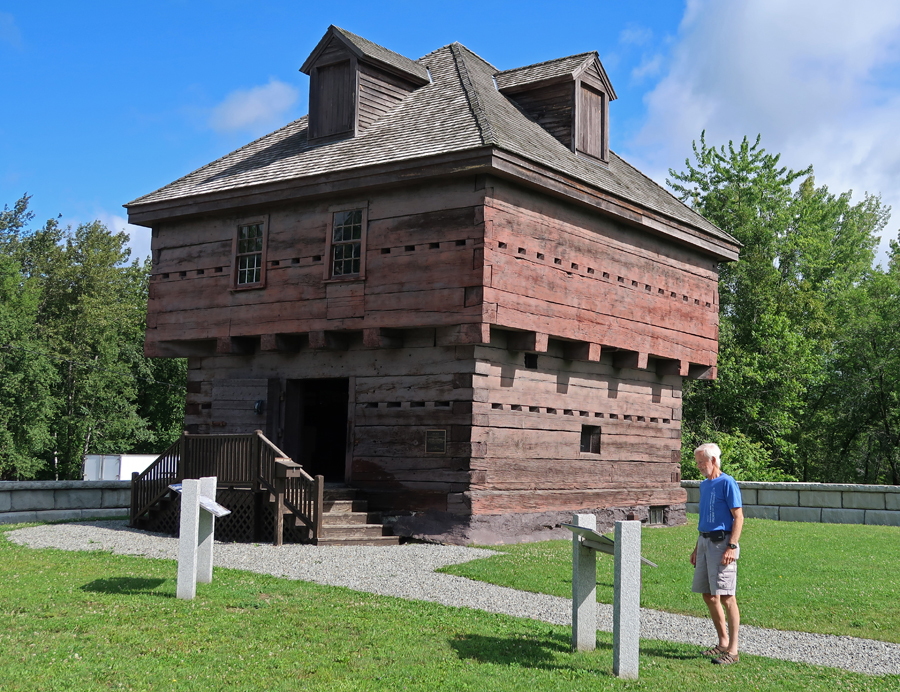
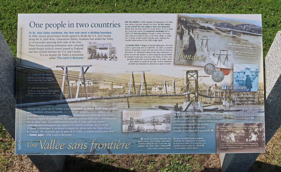
It took 30 min to get to the Fort Kent Blockhouse (1839), located in Fort Kent State Park. It is the only surviving fortification built during border tensions with neighboring New Brunswick, known as the “Aroostook War.” The fort was added to the National Register of Historic Places in 1969 and declared a National Historic Landmark in 1973.
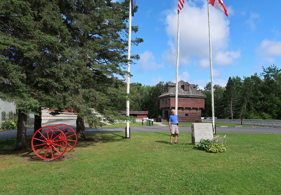
The “Aroostock War” of 1839 was an undeclared and bloodless War with Great Britain over the boundary between New Brunswick (British) and Maine (USA). In 1842 a treaty was reached which distributed land to both sides.

Second floor of Block House
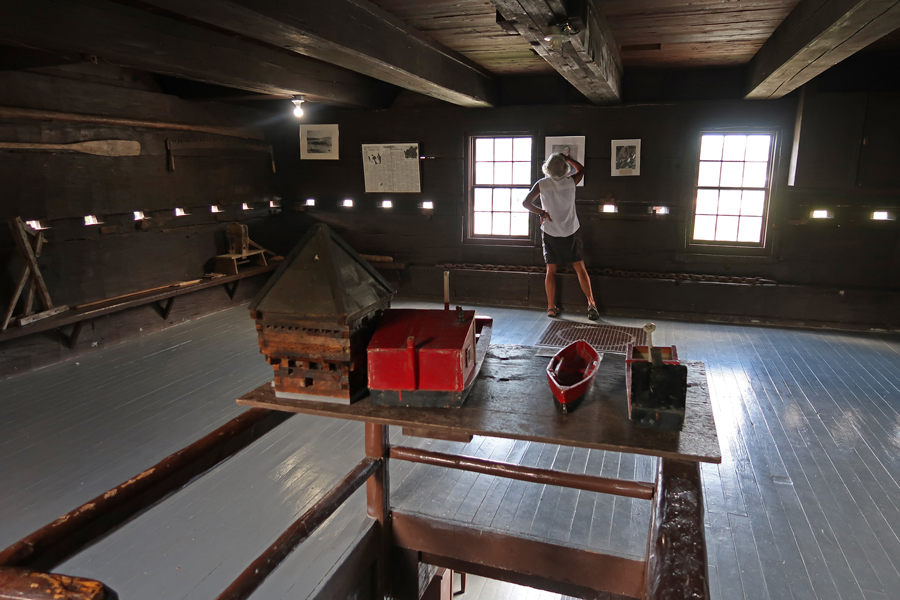
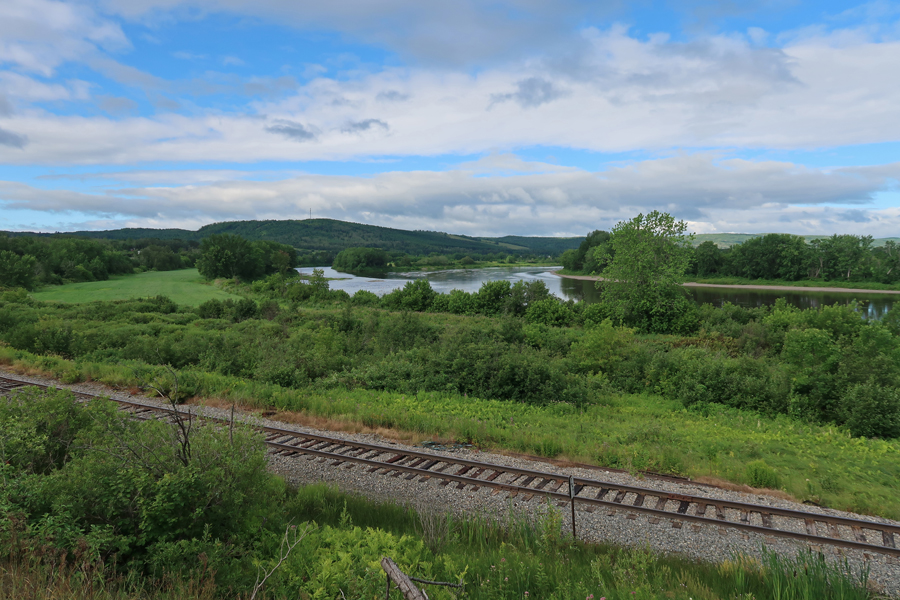
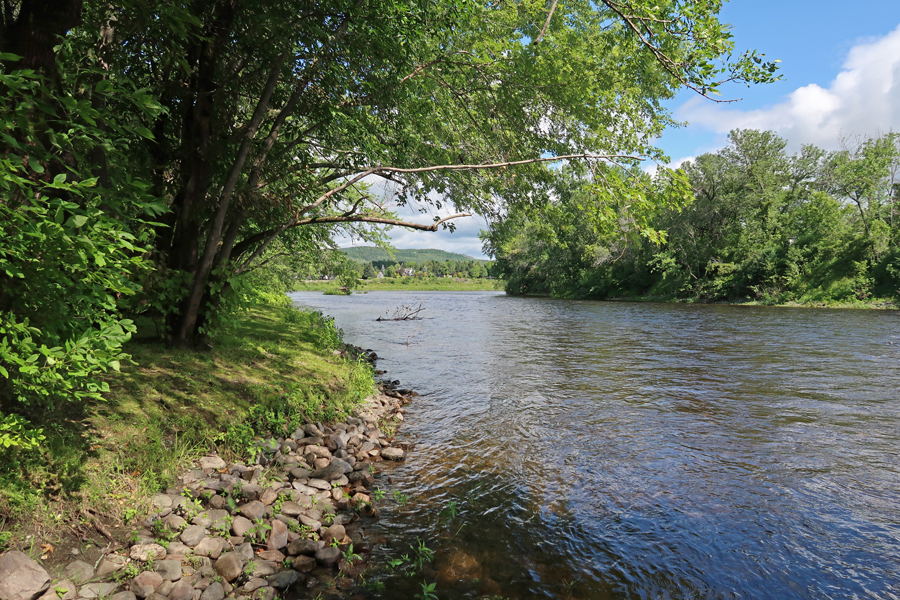
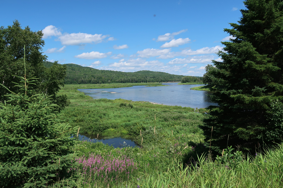
Fish River as seen through a rifle port.

After a short distance it empties into the St John River.
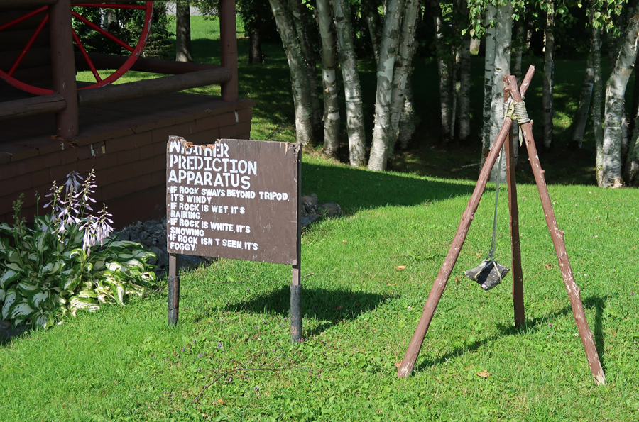
Famous Weather Prediction Apparatus, with one caveat; If the rock is damaged, the bears are hungry
We then went downtown to the Fort Kent RR Station.


The buildings were not open, but I met Ron, a staff member, who gave us a personalized tour.


Telegraph and old phones
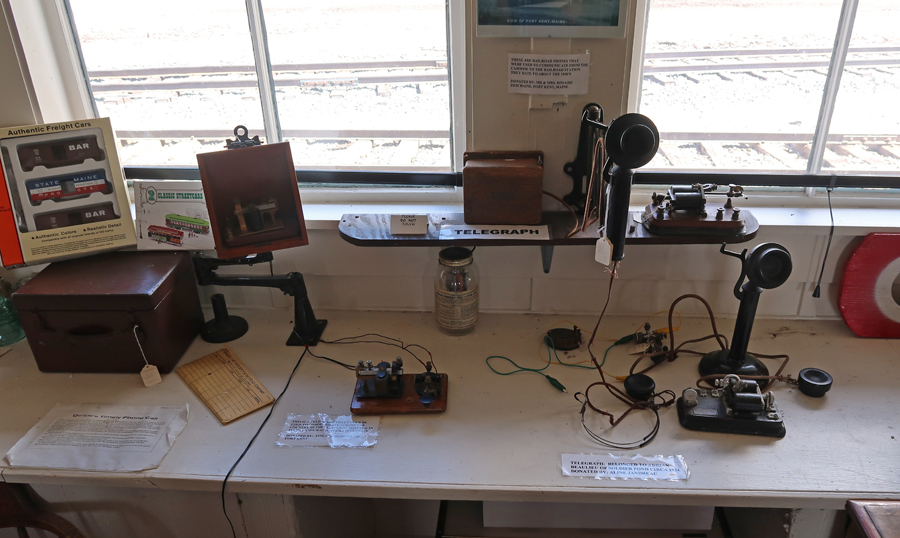
Ron, pointed to his father and uncle

The Paul D. Thibodeau Visitors’ Center of the Fort Kent Historical Society is next door.

The terminus of US Rt 1 is at the border crossing at the St John River in Fort Kent – 2,209 miles from Key West FL to Fort Kent

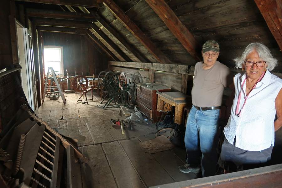
Ron then took us across the tracks to the Daigle-Dube House, so named because both families lived here.
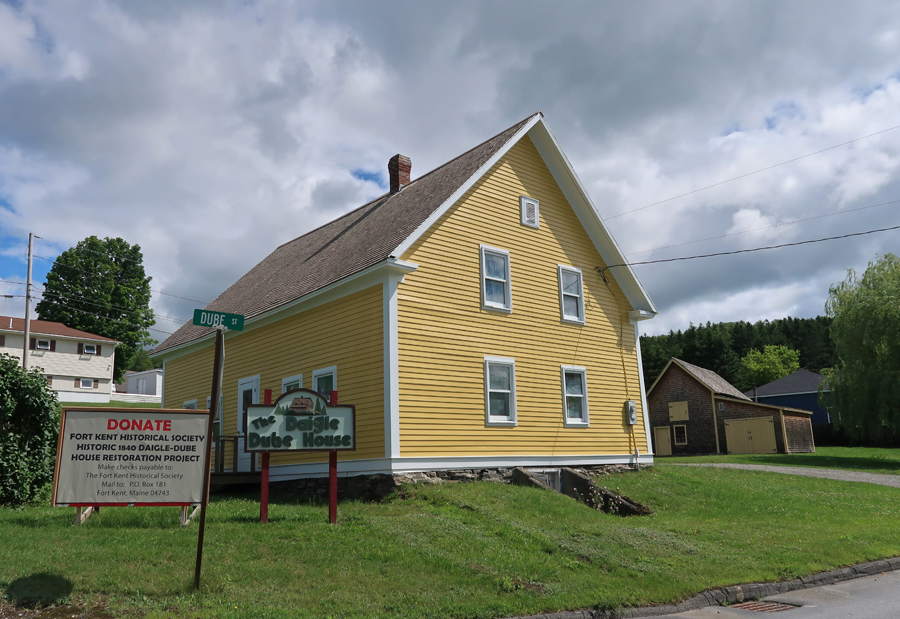
The house was being restored, but Ron opened it to give us a brief tour.

You can see the RR Station from an upstairs window.
There is a barn behind the building as well as a small schoolhouse that is being restored by two former teachers.

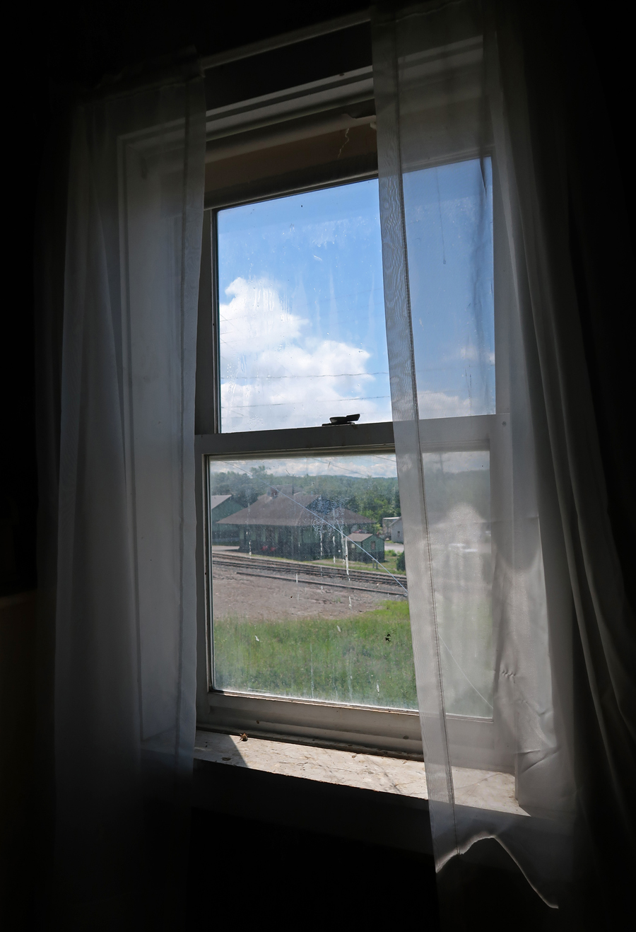
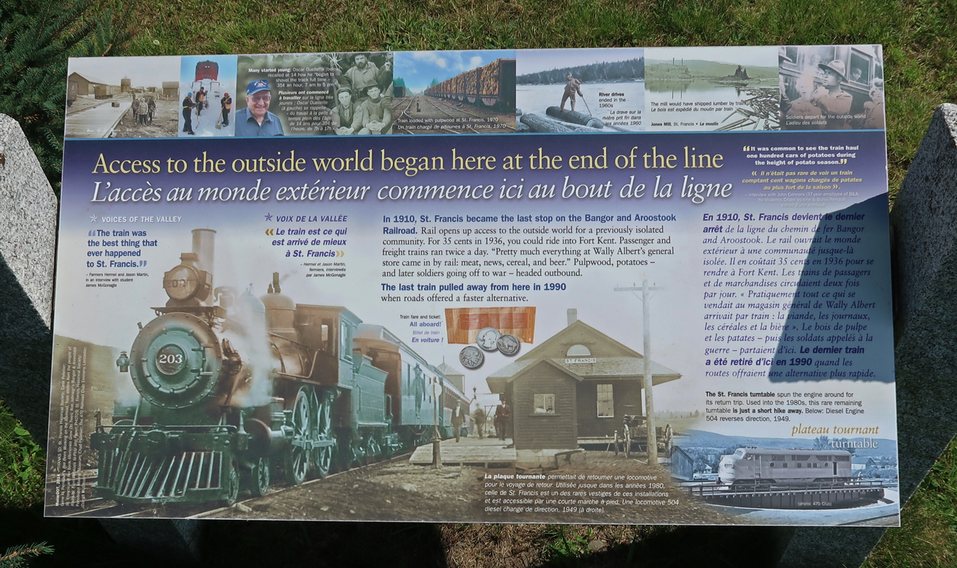
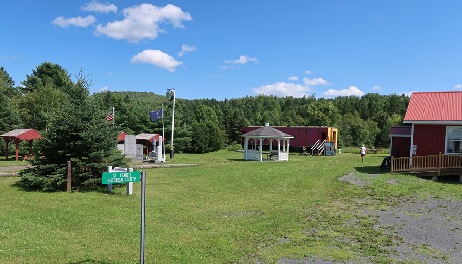
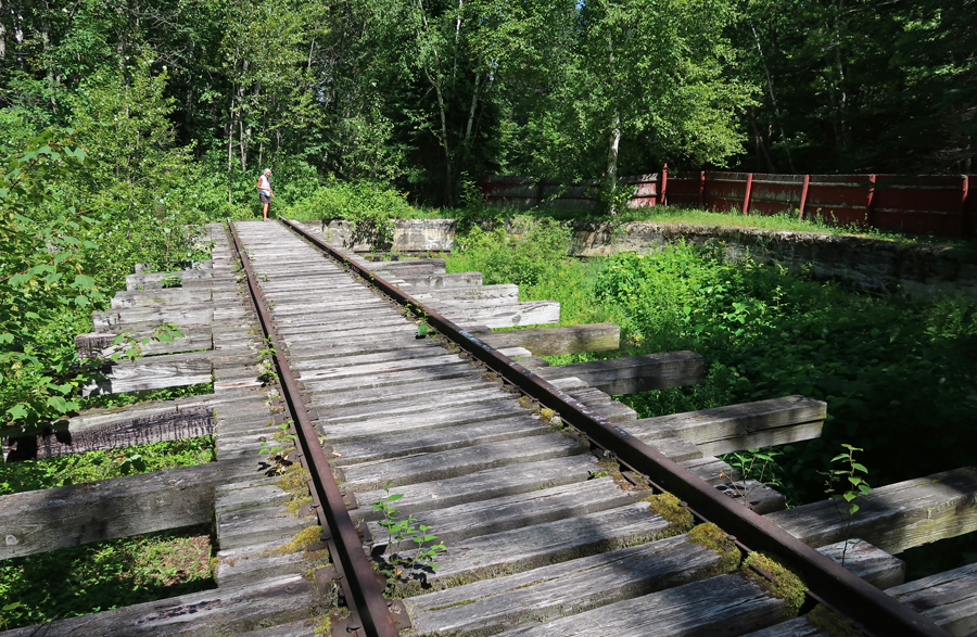
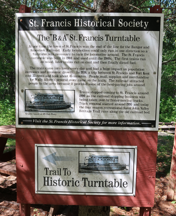
Turned onto Rt 161 West and drove about 25 min to the St. Francis Historical Society Museum

This was the end of the line for the Bangor – Aroostock RR
Wish that was my gas price for this trip!

Hiking to the Turntable – as a young boy I would walk to the turntable near 50th and Kedzie in Chicago to watch them move Engines inside for servicing, repair, and just to turn them around, because early locomotives could only run in one direction! The Saint John Valley Heritage Trail runs along the old railroad bed of the Bangor – Aroostock RR.
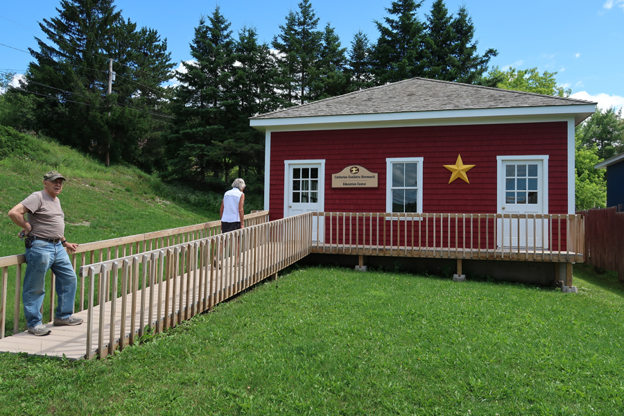
The Allagash Historical Museum was another 15 minutes west of St. Francis. This was our final Acadian Culture destination for the day.

This is where the Allagash River empties into the St John River. In August 1975, three friends and I canoed the Allagash Wilderness Waterway – from Telos Lake to the Saint John River, 95 miles.
“40 minutes back to Fort Kent on ME Rt 161; turn left on US Rt 1 (still Rt 161) and take photo of America’s First Mile on US 1 before crossing Canadian border.”

“Continue on Rt 161 in Canada to Caron Brook and then turn left (N) onto New Brunswick Rt 120, which becomes Rt 289 when you cross into Quebec. Continue to end of Rt 289 and take ramp onto A20, Trans Canada Hwy, to Quebec. Continue on Trans Canadian Hwy to Drummondville and then turn left on I55 to Sherbrooke.”
Estimated 6hrs to Comfort Inn in Sherbrooke, Quebec, turned into 7hrs when I discovered I did not have cell phone service in Canada and therefore did not have access to Google Maps! I did well with the above directions to Sherbrooke but then had to stop twice to ask directions. I took photos of my French “helper’s” phone each time and used those to navigate to our destination.

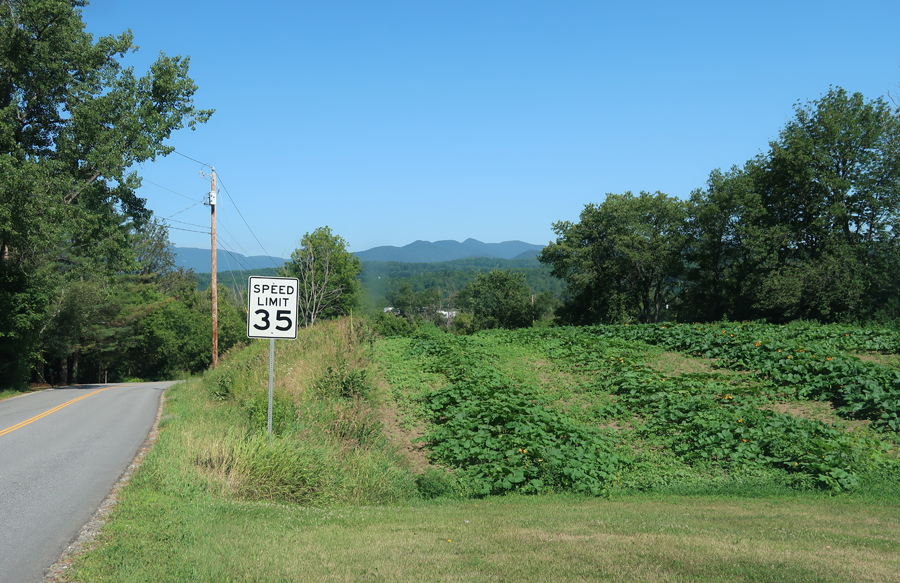
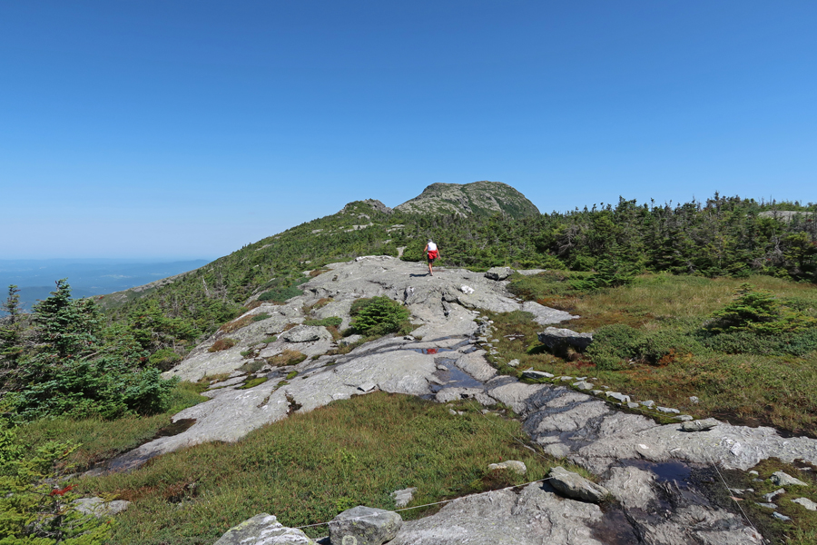
7/23 Sa – It took 3hrs to get to Stowe VT because of a half-hour hold up crossing the border. Also, stopped to buy a half gallon of “real” VT Maple Syrup along the way! View of Mt Mansfield as we approached from the east. The ridge of the mountain looks like a face, facing the sky, with the chin being the highest point.
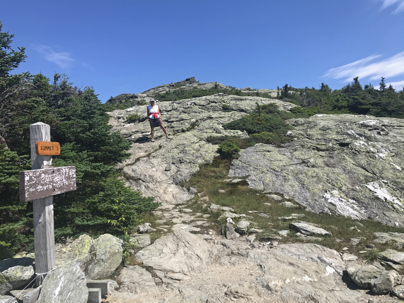
We arrived at the Stowe Mountain Resort at about 10:30am. I had anticipated doing the Gondola ride and then the Cliff Trail-Long Trail combination to get to the summit, because when I checked the Resort information online two weeks earlier, it stated the Stowe Auto Road (toll) was closed due to winter damage.
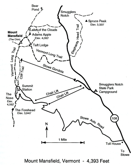
However, when we arrived, we discovered they had opened the toll road. So, I paid $29 for car/driver, plus $11 for one passenger, plus tax $2.40 – adding to a total of $42.40 to drive 4.5 miles to a parking lot and Visitor Station at an elevation of 3,843 feet. That is where we accessed the Vermont Long Trail and started our 1.4-mile trek to the summit.

The trail was fairly level as we started hiking through pine trees. I found myself, what I thought was, a sturdy hiking stick and started using it to help with balance (I had forgotten to pack my hiking pole!).

We followed the ridge, slowly gaining elevation, until the final push to the top
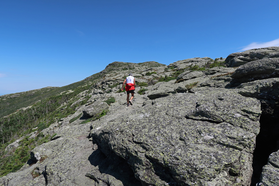
The total gain in elevation from parking lot to top is 550 feet.
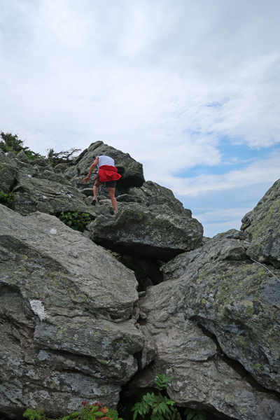
Though hot for VT, it was a beautiful day. We arrived at the summit (4,393ft) at 12:15pm. Photos were taken around the USGS marker, emphasizing that this was Helen’s 33rd state highpoint!

We then started down the trail. On one of the bigger step-downs my walking stick broke causing me to fall and partially roll on the rocks. I was lucky to avoid major injury ending with scratches/abrasions on both knees, arms, and back. A reminder – not to forget my hiking pole!
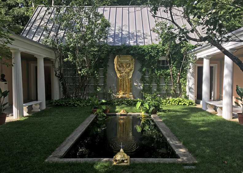
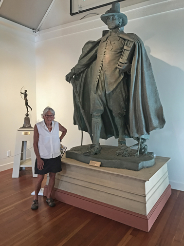
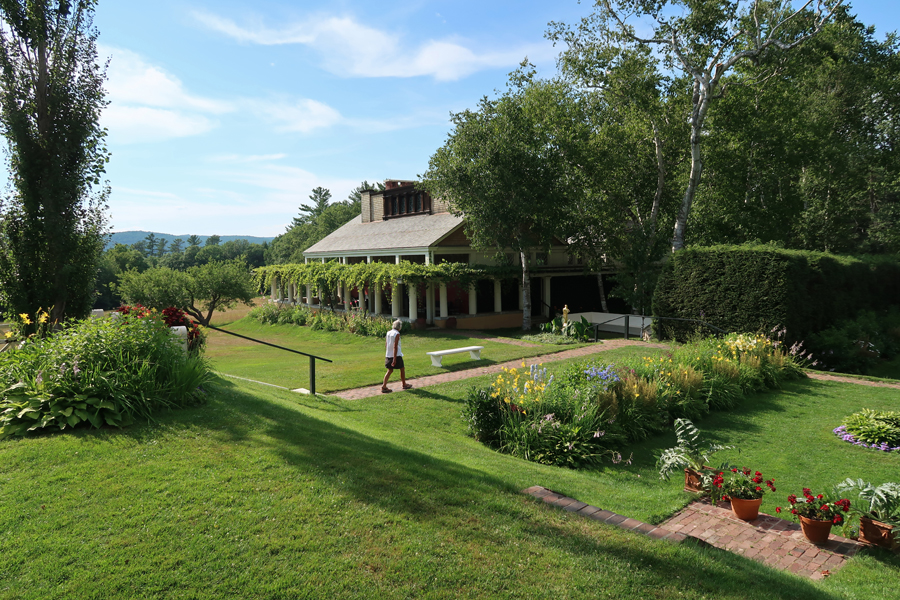
Had lunch is Stowe and called Seamus to sing him his Happy Birthday Song while we were driving to Saint-Gaudens NHS in Cornish NH. Saint-Gaudens was one of America’s greatest sculptors. This was my second visit (see August 2014 for first visit) and Helen’s first to this NHS. Following are some additional photos, starting with Aspet, Saint-Gaudens home that he named for his father’s birthplace in France. It was built in 1817 as an inn; Saint-Gaudens added dormers, the west porch, and columns. The tree is a thornless honey locust, planted in 1886.

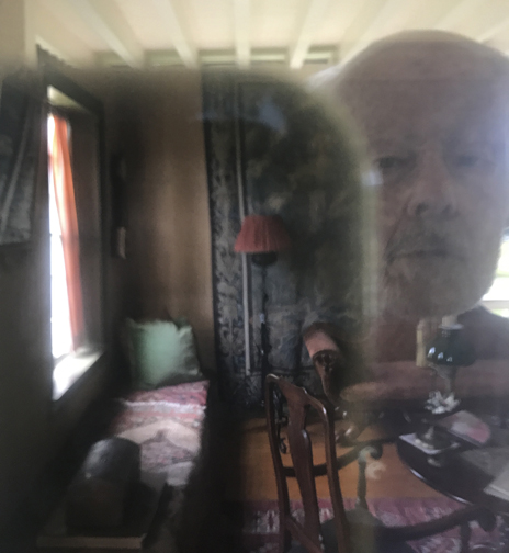
“Artistic” photo of me looking in the window. The house is only open as staffing permits.
Flower Garden

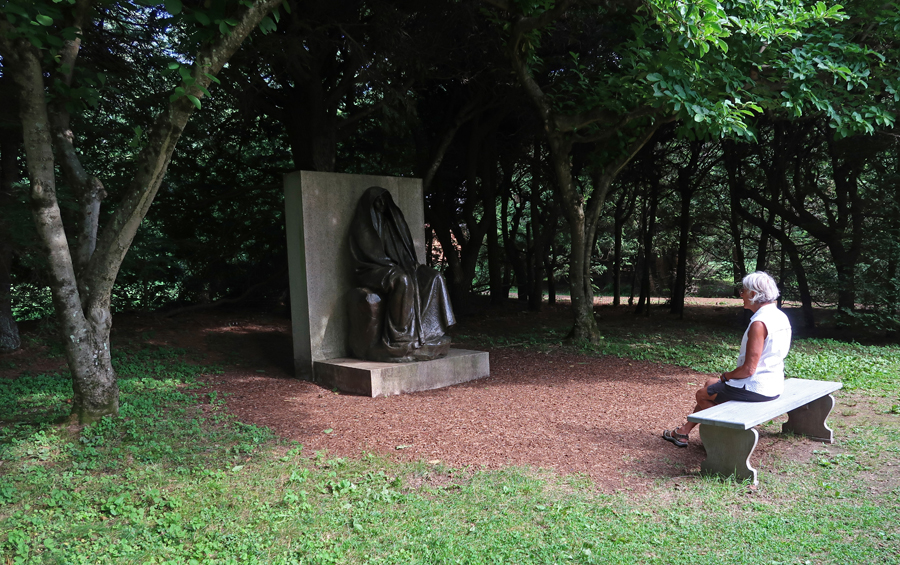
Adams Memorial, the original is in Rock Creek Cemetery in Washington D.C.
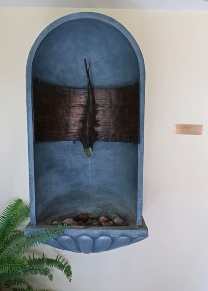
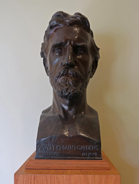
Villard Fish Font and Saint-Gaudens bust in Visitor Center
Atrium and pool with Amor Caritas and entrance to New Gallery
The Puritan
The Little Studio
Blow-Me-Down Mill (1891)

We stopped at Saugus Iron Works NHS on our way into Boston for a couple more photos. See October 2017 Blog for our first visit

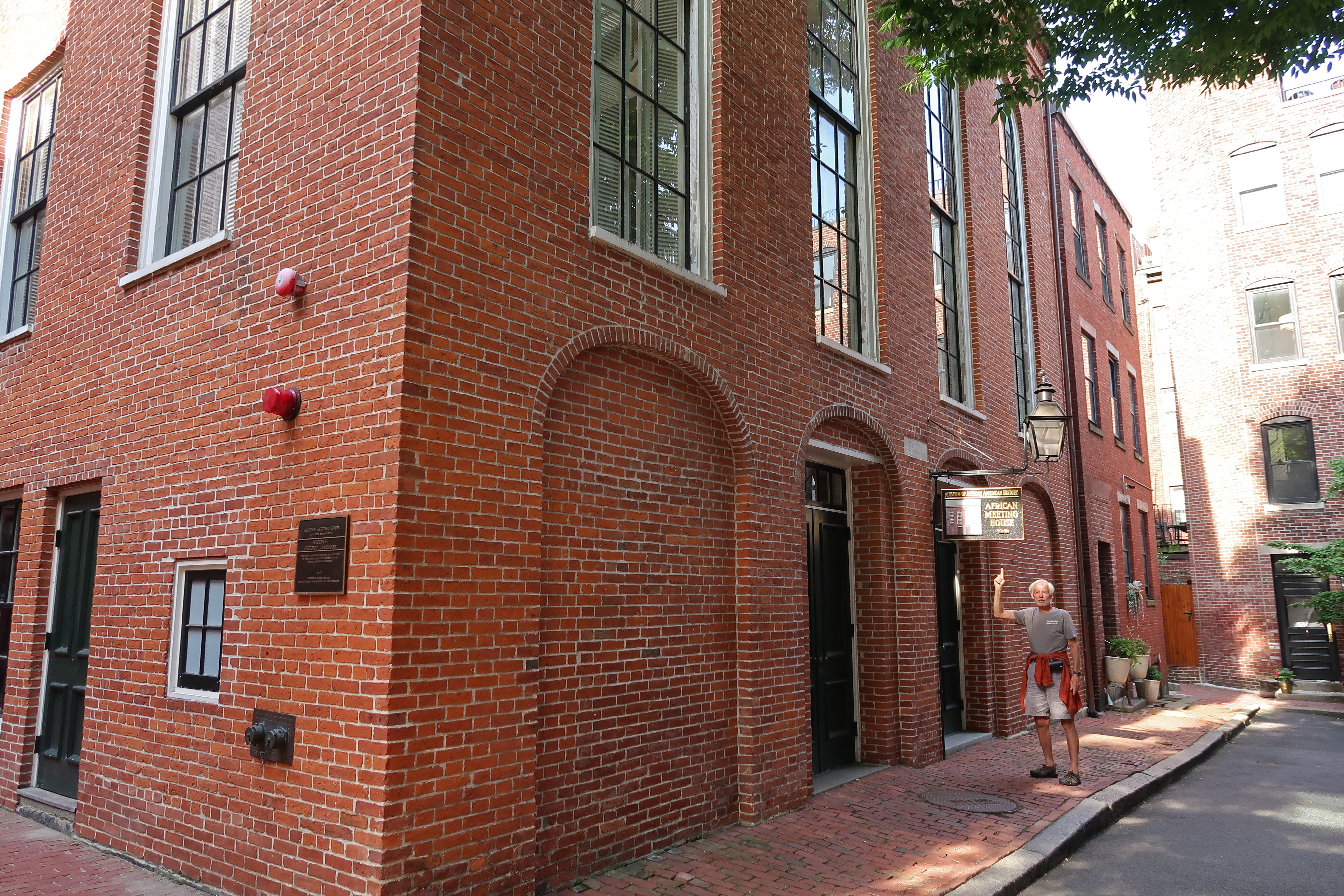
7/24 Su – After breakfast at the hotel, we drove to Beacon Hill and the Boston African American NHS for some additional photos to add to that folder (see Blog for October 2017).
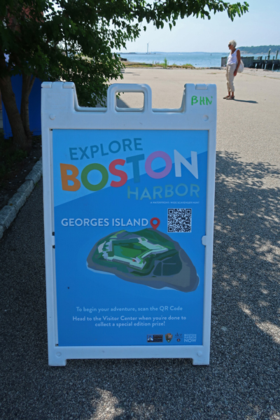
We then proceeded to the Long Wharf North to catch our ferry to Georges Island, which is one of 34 islands and peninsulas that comprise Boston Harbor Islands National Recreation Area. We did the Worlds End Peninsula in October 2017 (see Blog) but thought we should experience one of the Harbor Islands as well.

When we got to the wharf, I checked at the ferry ticket booth to determine the departure dock for our ferry scheduled to leave at 10am to Georges Island. I was told Long Wharf North #2A. So, we walked there, got in line, had our QR code scanned at the gate and boarded the ferry. At 9:30am the ferry started to move out into the harbor and the captain announced we were on our way to Salem MA! I jumped up and told the staff person on that deck that we were on the wrong ferry, and it should stop and let us off! He stated the ferry was moving and they could not do that. So, I ran (that’s relative) to the tower and opened the door to explain the situation to the captain. They threw me out (security breach), but I kept the door open enough to explain what had happened and that they never should have checked us on to the boat! Well, I was able to convince the captain to turn the boat around and re-dock. Here is Captain John’s photo with Helen –

As I stated, our ferry was to leave from dock 2A. After we were dropped off and that Salem ferry left for the second time, our ferry arrived. Here is a photo of two young park rangers who rode the ferry with us to Georges Island
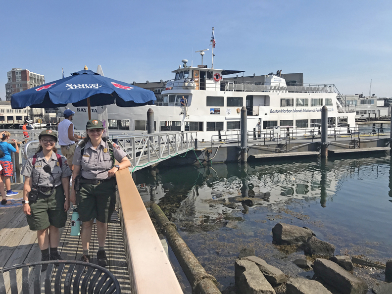
Leaving Boston –

Passing Fort Independence. The English built a fort there in 1634 and that fort evolved through many changes into Fort Independence, which was built between 1833-1851.

Arriving Georges Island, brick building is Visitor Center –
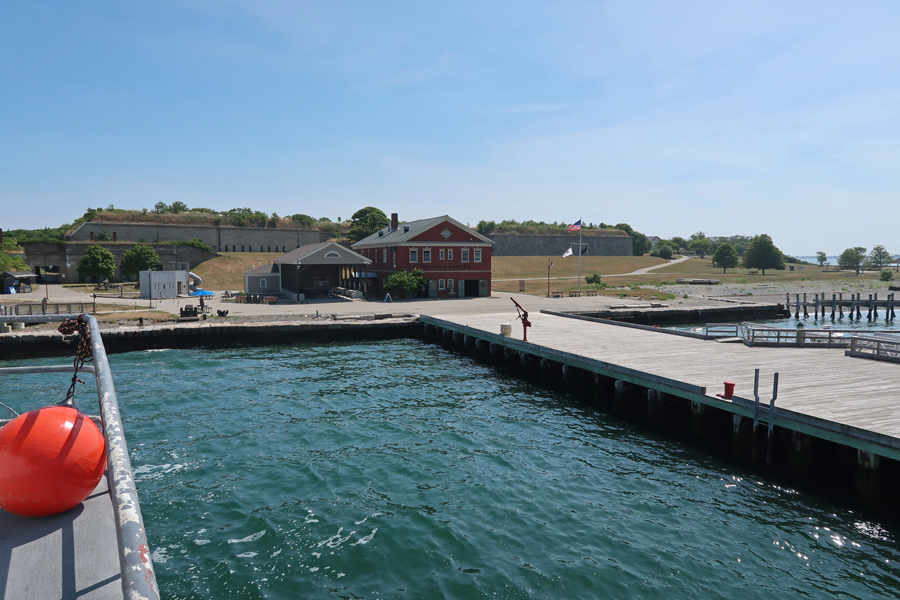
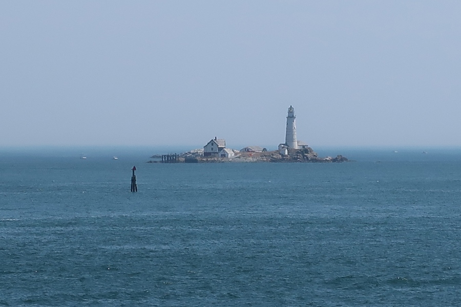
There is only one channel that is deep enough for ocean going vessels to get into Boston Harbor and it passes through the narrow channel between Georges Island and Lovells Island to the north. That is why Fort Warren was built here in 1850.

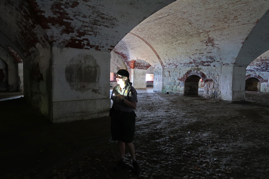
Sallyport, or entrance into fort

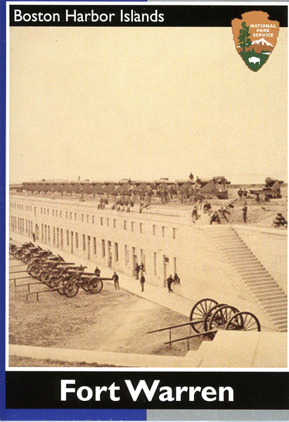
Fort Warren, named for Dr. Joseph Warren, who was killed during the Battle of Bunker Hill (1775). It served as a prison for 2,300 Confederate officers and government officials during the Civil War. Ranger tells the Ghost Story of “The Lady in Black.”
View east

Little Brewster Island and Light to the east
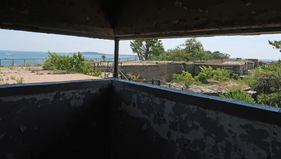
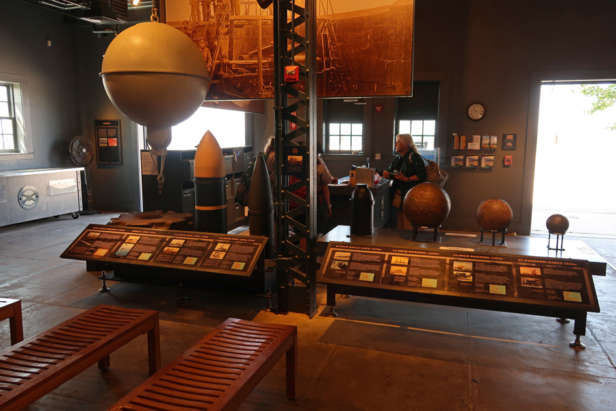
Tower used to oversee the Narrows’ mine field that was set to protect the passage
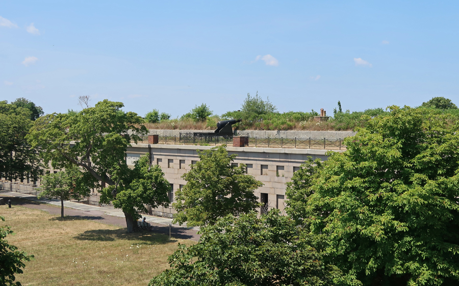
Inner fort with one Endicott Gun seen on the wall
What is left of the Bakery ovens

The Trent Affair – “In the fall of 1861, Confederate President Jefferson Davis dispatched diplomats James Mason and John Slidell to secure European recognition of the Confederacy. Captured by the Union Navy aboard the English ship Trent en route to England, they were imprisoned at Fort Warren. As war with England loomed over their imprisonment, President Lincoln release Mason and Slidell on January 1, 1862.”

Visitor Center model of Endicott Gun and other displays
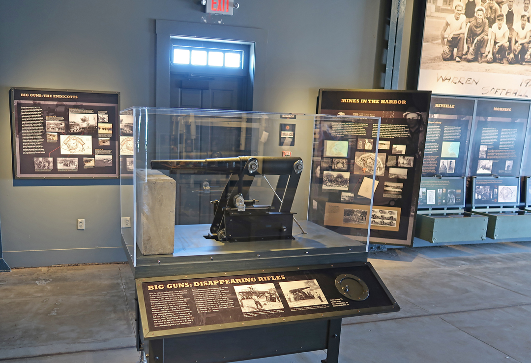
Progression of ordinance used at Fort Warren
“Where have all the flowers gone?”
45min ride back to Boston

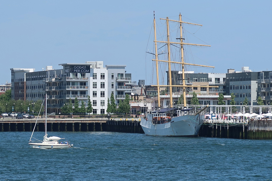
Three masted 245’ Tall Ship Caledonia made into a floating oyster bar at Pier One in trendy East Boston
Stopped by the John Fitzgerald Kennedy NHS in Brookline, a south Boston suburb. We toured the house in October 2017 – see Blog. The house was closed for renovation and is due to re-open in 2023. Today, I wanted to get a photo of St Aidan’s Catholic Church (#3 on the map). JFK was baptized At St Adian’s, he, his brother and sisters (1914-1927) would walk to church and school. It is now community housing.


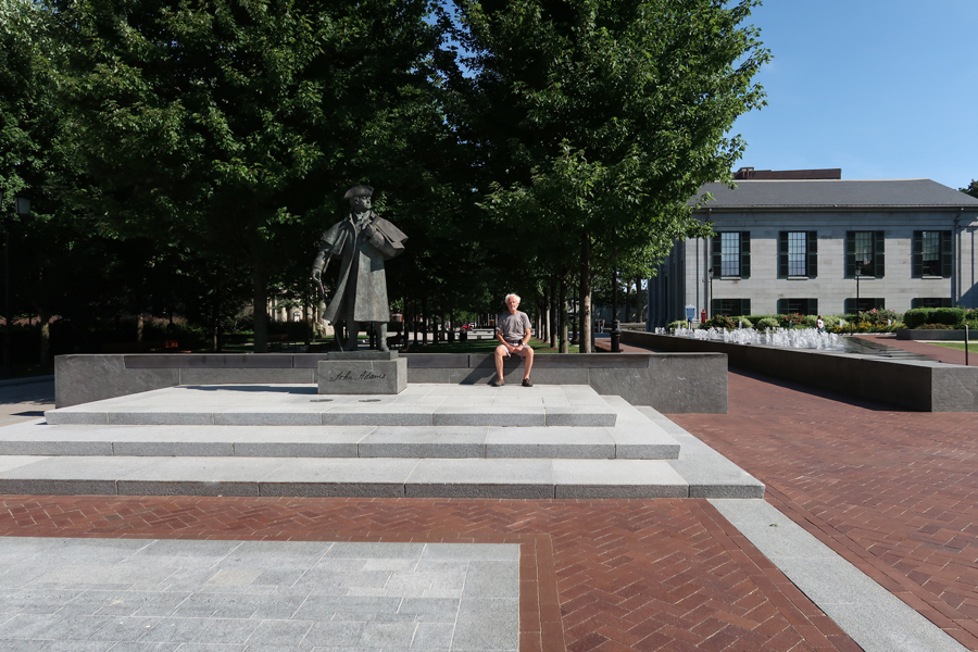
Less than an hour south brought us to Adams National Historical Park in Quincy MA. See Blog for October 2017 for our first visit. The Hancock Adams Common, which connects the Old City Hall (1844) and the United First Parish Church (1828) was completed in 2018. It honors two of the City’s most famous inhabitants, John Adams and John Hancock. Bronze statues are located at each end of the pedestrian mall.

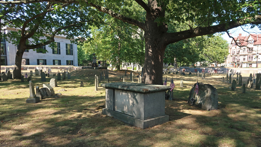
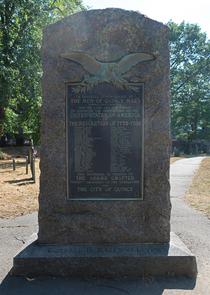
The Hancock Cemetery (1640) is on the west side of the Common and contains many historical markers and graves.
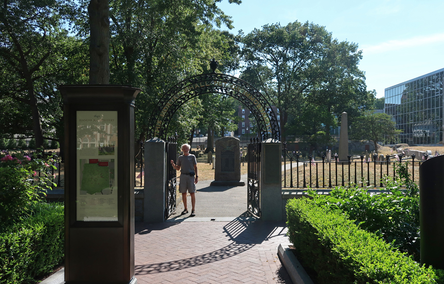
The first monument upon entrance is to “The Men of Quincy, Mass. Who on Land and Sea Fought to Establish the United States of America 1775-1783.”
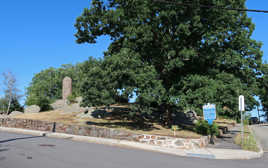
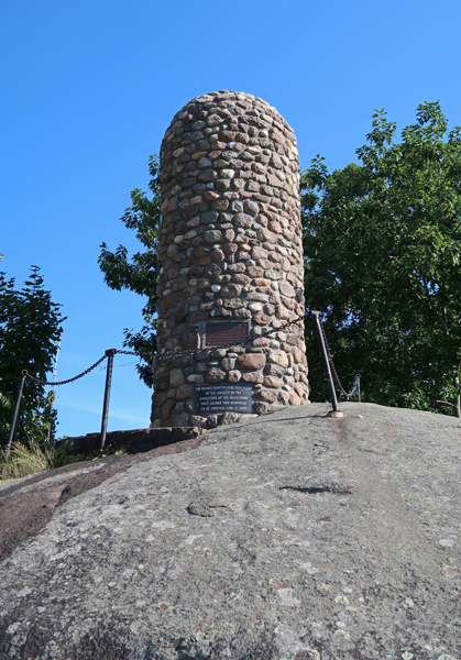
Our last historical stop for the day was the Abigail Adams Cairn

Stayed the night in Middeborough MA
7/25 M – It was a half hour to “The City That Lit the World” (whale oil), New Bedford MA for breakfast.
Also, took a few photos related to New Bedford Whaling NHP. See Blog for October 2017 for a description of our first visit. The sign describes New Bedford actions of abolitionists before the Civil War. Frederick Douglas lived here in 1839 after escaping slavery.
The 54th Massachusetts Volunteer Memorial Plaza.

After the Emancipation Proclamation (1/1/1863), Governor Andrew of MA recruited blacks to form the 54th Regiment. It is memorialized in the sculpture by Saint-Gaudens that is located across the street from the MA Statehouse in Boston. It depicts the regiment, led by Colonel Robert Gould Shaw, marching off to war.

The courage of that black regiment leading the failed Union assault on Battery Wagner, located on Morris Island SC on July 18, 1863, encouraged politicians and Army officers to further enlist black soldiers. The 1989 movie “Glory,” tells their story. This mural is on a building in New Bedford.

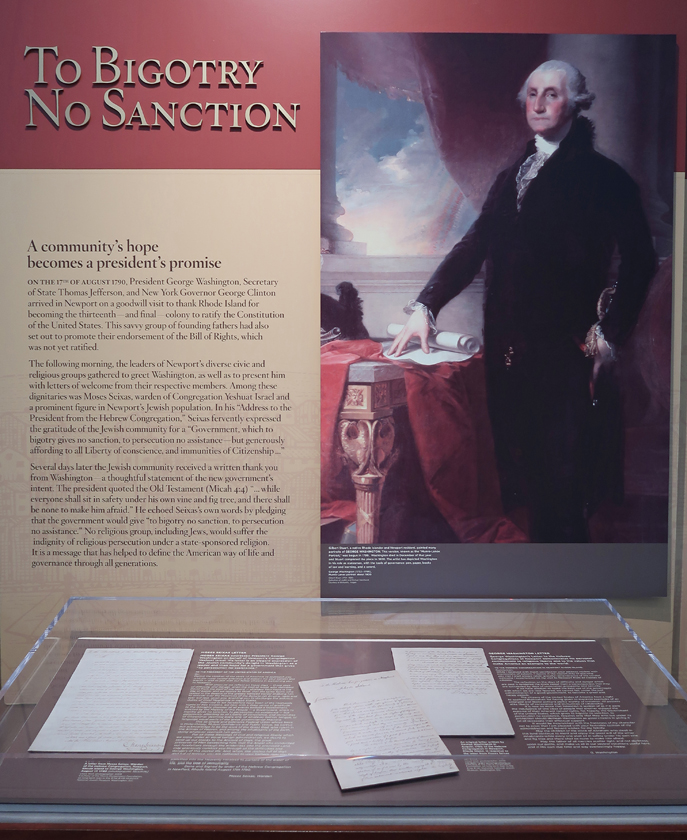
We arrived at the Touro Synagogue National Historic Site in Newport RI in time to take the 10am tour (seniors $14). We had visited in October 2017 but missed the tour – see Blog. This is the oldest (1759) surviving synagogue in the United States. Rhode Island (1663) was the first political entity in world history to declare officially, as a founding principle, the separation of church and state. See Roger Williams National Memorial on Blog October 2017. Touro Synagogue on left –

After a meeting with Newport leaders in 1790, President George Washington sent a written thank you to the Jewish community. He stated that the government would give “to bigotry no sanction, to persecution no assistance.”
The docent gave us an excellent tour of the synagogue.


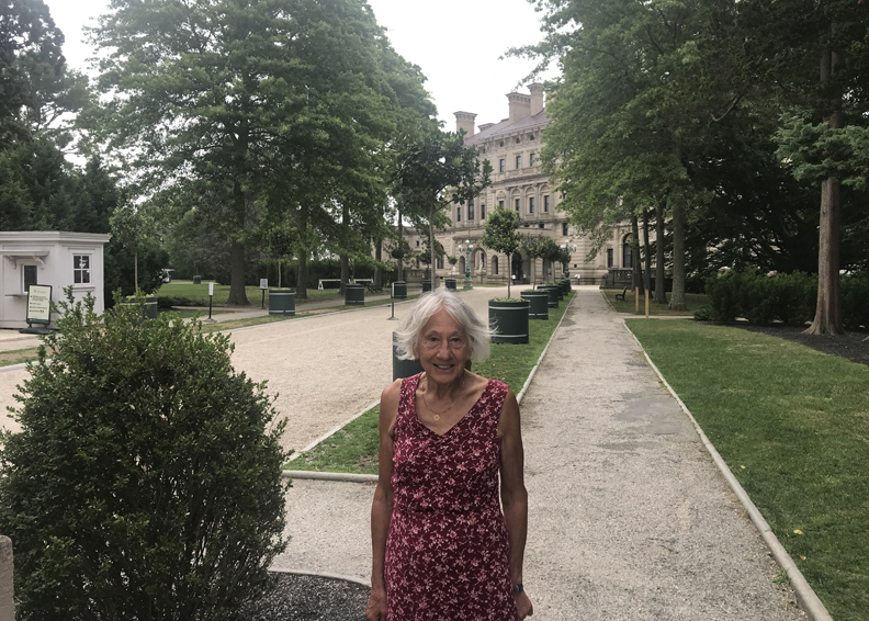
Afterward, we drove past the Newport mansions and stopped briefly at “The Breakers” built by Cornelius Vanderbilt II between 1893 and 1895 as his summer residence.
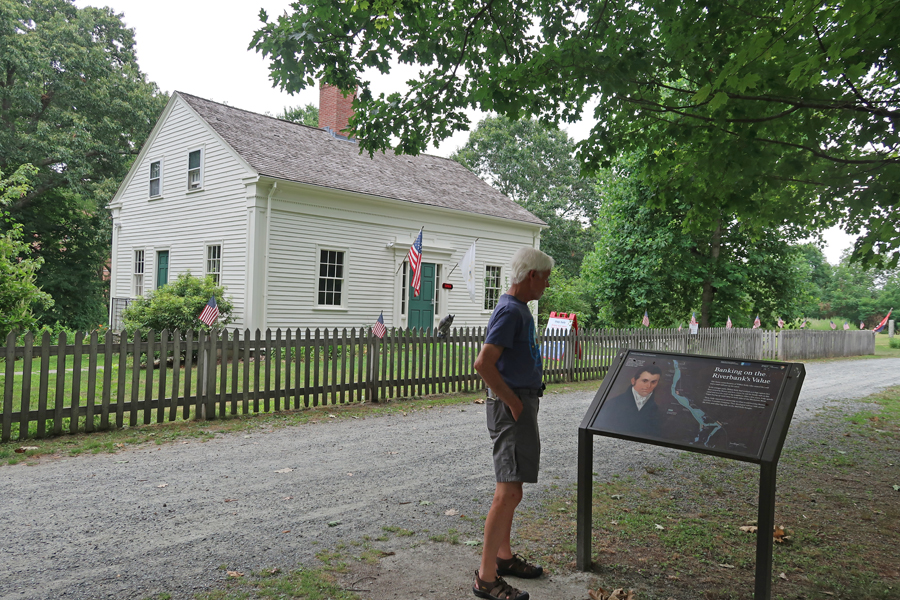
Our last National Park Unit of this trip was Blackstone River State Park, which is a unit of Blackstone River Valley National Historical Park. In October 2017 we visited the other four units of this NHP – see Blog. There are two major sites here, first the Kelly House Museum. Helen walking on the Blackstone River Canal Towpath – which is now the Blackstone River Bikeway.

Blackstone Canal on left, Canal Towpath, and Wilbur Kelly House in distance

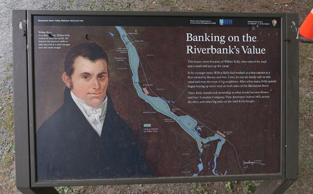
Kelly built a small mill then purchased a larger mill in 1825.

At the same time, he continued buying up land along the river and canal. He then sold to a major company that built several large mills along the river. One of which was the Ashton Mill, which is across the river and was our second site for this unit of the NHP. It started producing cotton cloth in 1867 and later made fiberglass from the 1940s through the 1980s.

The mills supported communities all along the Blackstone River

Two hours to Jean and Jerry’s in Northfield MA, where we had a fun visit with old friends.

7/26 Tu – 12-hour drive to Springfield

Leave a comment