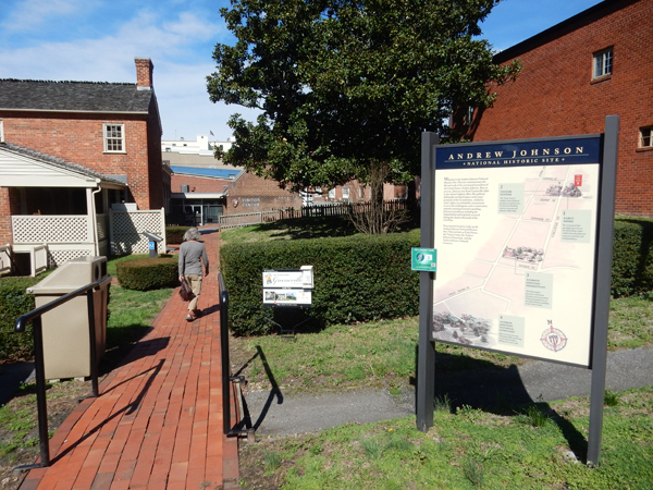
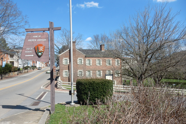
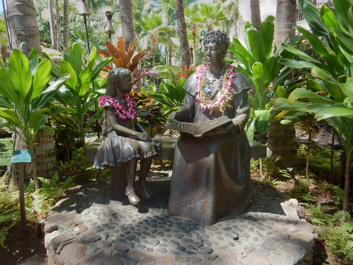
March 14, 2016 – Andrew Johnson National Historic Site is in Greeneville TN. Johnson became the 17th President of the United States when President Abraham Lincoln was assassinated on April 15, 1865.
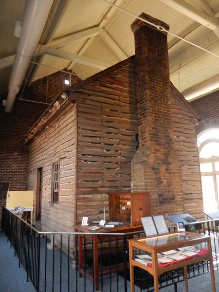
He was born in Raleigh NC but settled in Greeneville TN where he established a tailor shop. The shop is now preserved in the Visitor Center. He was a self-made man with no formal schooling.
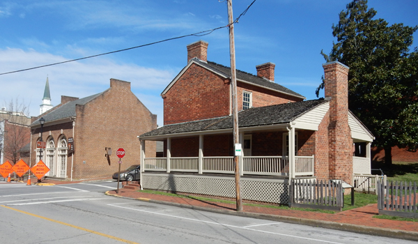
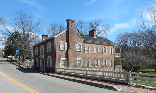
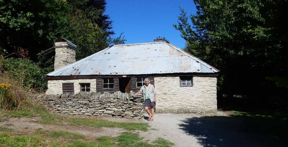
He was an Alderman, Mayor, TN State Legislature, TN Senator, U.S. Representative, TN Governor, U.S. Senator, Military Governor of TN, Vice President and then President of the U.S. A man of political experience! This was his house during the 1830s and 40s. It is across the street from the Visitors Center
In 1851 his family moved to a larger house – The Homestead
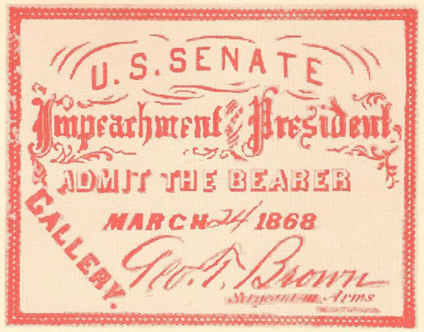
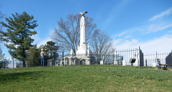
Johnson was pro-Union and had to move to Nashville when Confederates controlled East Tennessee and confiscated his house. He did not return until after his Presidential term in 1869. While President, he sought to restore the Union, opposed radical Reconstruction, signed the purchase of Alaska and in 1867 was impeached. Impeachment failed by one vote in the Senate! In 1868 he proclaimed general amnesty for secessionists. By request he was buried on a prominent hill on his property. A very beautiful and scenic location.
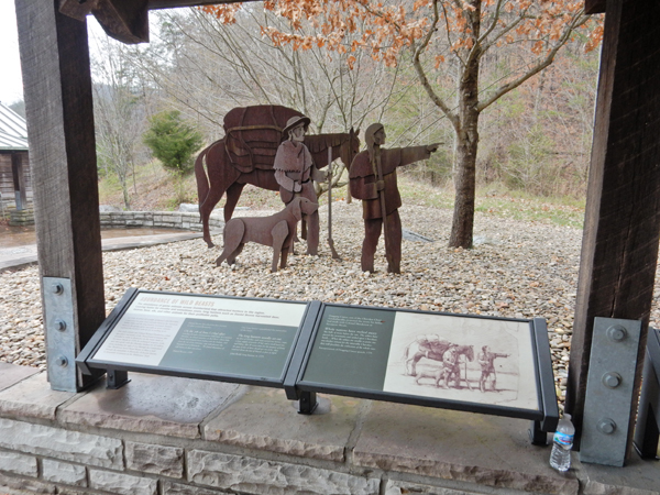
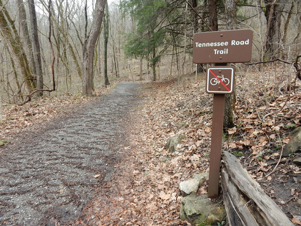
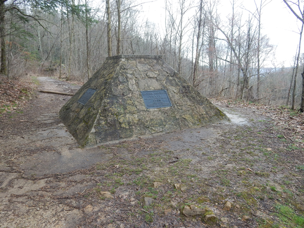
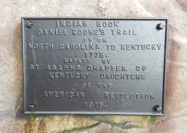
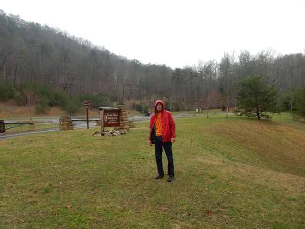
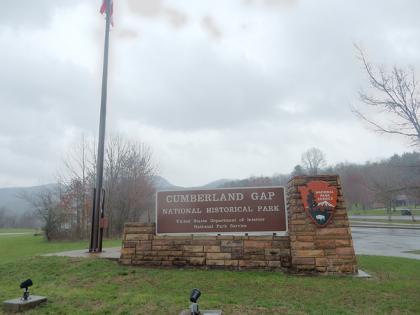
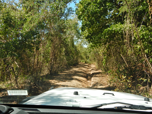
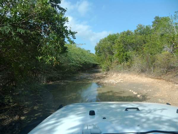
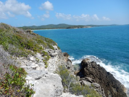
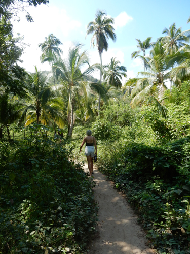
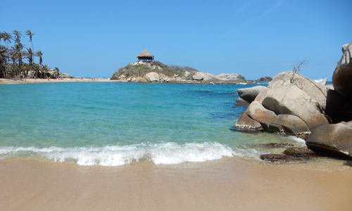
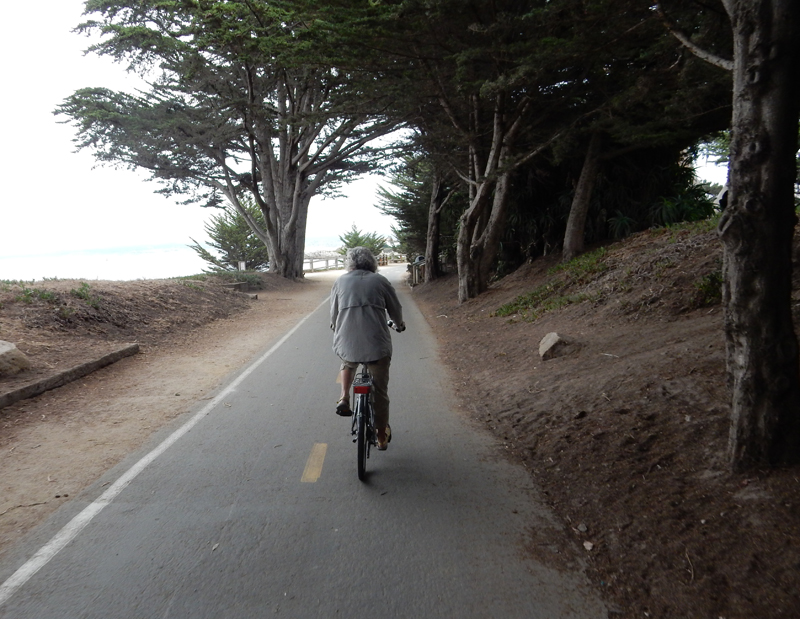
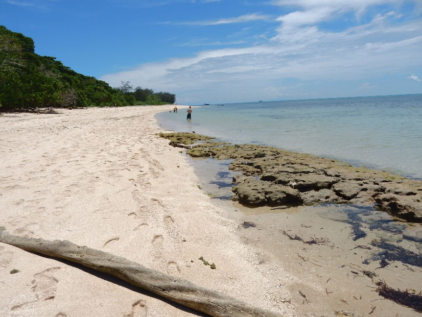
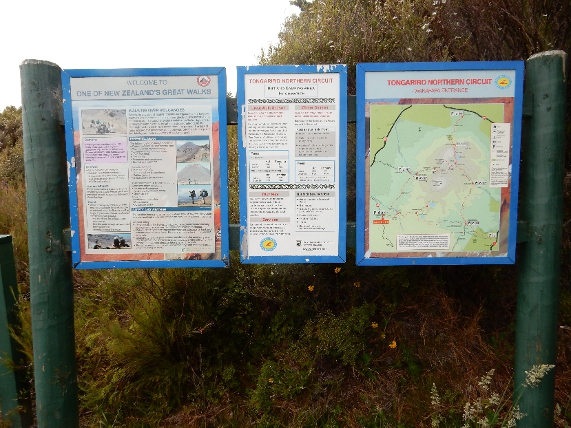
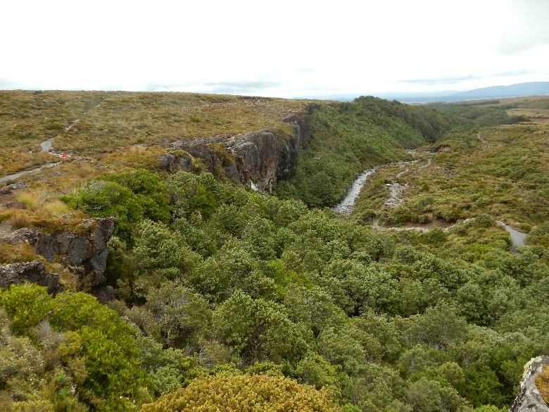
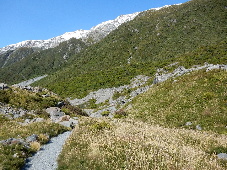
Cumberland Gap National Historical Park – is actually in three states, Virginia, Kentucky and Tennessee. During the mid-18th century the route through the “Gap” provided a path through the Appalachian Mountains for the first great wave of migration from the eastern seaboard to the Ohio Valley. It followed well-worn bison and Indian trails. In 1775, Daniel Boone was commissioned to blaze a road through the gap. Boone’s Trace eventually became known as the Wilderness Road. There are many trails in the park; because of time and weather, I choose to hike the Wilderness Road from the Iron Furnace in the town of Cumberland Gap on the east side to the Thomas Walker parking area on the west side – about 1.3 miles.
I started on the Tennessee Road Trail, which leads up to the Wilderness Road Trail
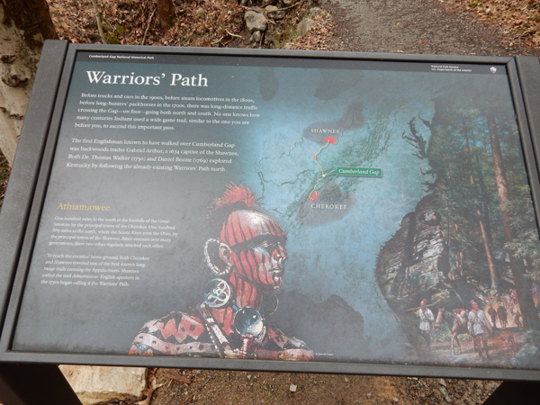
Before European settlement of America, the “Warriors’ Path” passed through the Gap. It connected Cherokee country in the south to Shawnee country in the north.
It was an arduous trip for the 200,000 to 300,000 settlers who crossed Cumberland Gap between 1776 and 1810
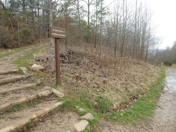
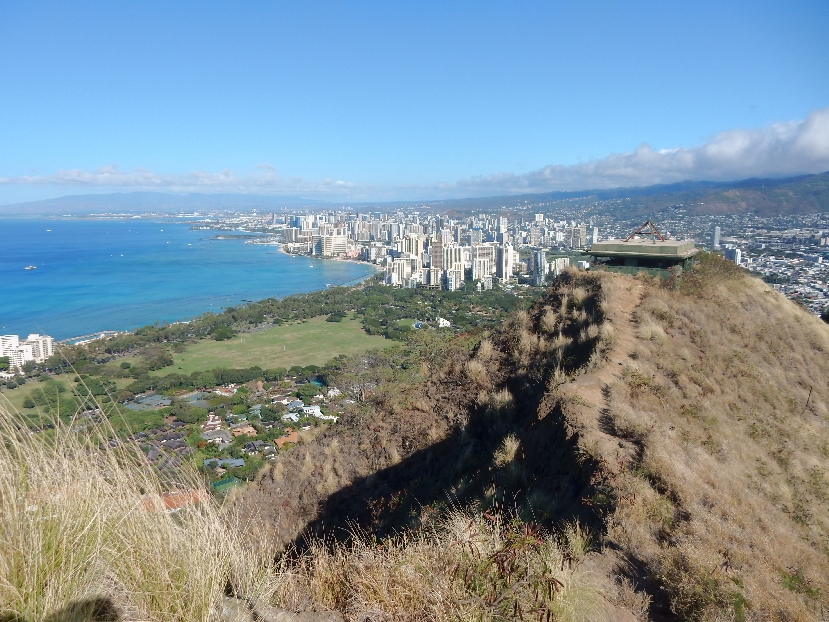
This was at least the third time I had passed through the Gap. The first two times were by road. In 1996 a tunnel for US 25E was completed bypassing the Gap. The road was eliminated allowing for the current trail system. Helen and I had hiked to Tri-State Peak (1990 ft) and the Tri-State monument before we had children. This point on the trail is at the highpoint of the Cumberland Gap.
Indian Rock – it had started to rain at this point
End of the Trail!
Helen picked me up and we went to the Visitor Center where I could change clothes and dry off before driving to Springfield – 5 hours
March 10 – It was about a 7.5 hour drive from Springfield to Gastonia NC, which is just west of Charlotte. We stopped in Gallipolis OH on the Ohio River to eat our pre-made lunch and check out a pawn shop and their Goodwill. We learned that Gallipolis, “Galli for Gaul or France and the Greek ‘polis’ for city,” was settled by the French in 1790 – after the Revolutionary War.
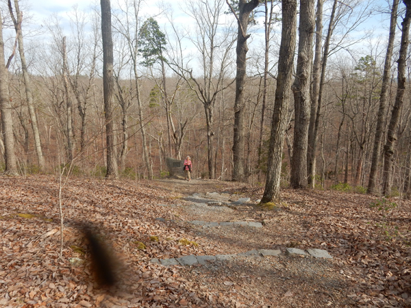
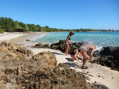
March 11 – Started our day at the Waffle House in Gastonia and then had a short drive to Kings Mountain National Military Park, SC. We arrived at 8am an hour before the Visitor Center opened and were able to hike the 1.5 mile self-guiding Battlefield Trail by ourselves on a beautiful SC morning.
Background – Not many Americans realize the importance of the Revolutionary War battles fought in the South. The Revolutionary War, begun in 1775, had been fought to a stalemate in the North and England turned its strategy to the South. They took Charleston (America’s fourth largest city) in 1780 – it was the worst patriot defeat of the war! General Lord Cornwallis was then put in charge and directed to re-establish English control of the South. He was to move north and join loyalist troops at the Chesapeake Bay thereby closing the eastern seaboard.
There were many loyalists who joined the British forces and together they had early successes in the campaign. As Cornwallis moved further inland, he put Maj. Patrick Ferguson, reputed to be the best marksman in the British Army, in charge of his left flank and Col. Banastre Tarleton in charge of his right flank. Tarleton attacked a column of about 400 Virginia patriots on May 29 near Waxhaws SC. Overpowered, they surrendered, however the loyalists continued the attack and slaughtered over 200 and captured 53. This enraged the patriots and the call went out over the mountains in the summer to gather at Sycamore Shoals TN. On September 26th patriots from TN, KY and VA started their march over the mountains (330 miles) and on route were joined by local militias. The path they took is now designated as the Overmountain Victory National Historic Trail.
As Ferguson moved west, he sent out a message to the “backwater men” that if they did not desist from their opposition, “he would march his army over the mountains, hang their leaders and lay waste with fire and sword.” This proved to be a strategic blunder as it forced these independent “over-mountain men” to surrender to British rule or fight. By October a group of about 2,000 mostly mounted patriots were pursuing Ferguson. He knew they were coming and was confident that the high ground on Kings Mountain would allow him to defeat the rebels.
The patriots (Tories) picked 900 of their best riflemen and surrounded the ridge. About 1,100 loyalists (Twigs) rained down musket fire. There were few uniforms of any sort so the patriots wore white paper in their hats while the loyalists wore twigs so each could determine the enemy. The guerrilla tactics of the frontiersmen allowed them to move up the mountain despite two bayonet charges by the loyalists.
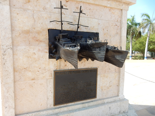
Markers related to the Chronicle regiment’s attack from the Northeast
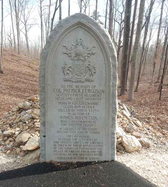
Ferguson had two horses shot out from under him and was on a third when he was hit by musket fire at this spot
He fell and his men dragged him to this point and propped him against a tree where he died
Ferguson’s grave
The rest of the story – Recall that Ferguson was reputed to be the best marksman in the British Army. Ferguson had fought at Brandywine PA in 1777, and as the story goes, he was a scout and had George Washington in his sites. He did not know who the officer on the horse was, but choose not to fire because his back was to him. Would Washington’s death have changed the outcome of the war?
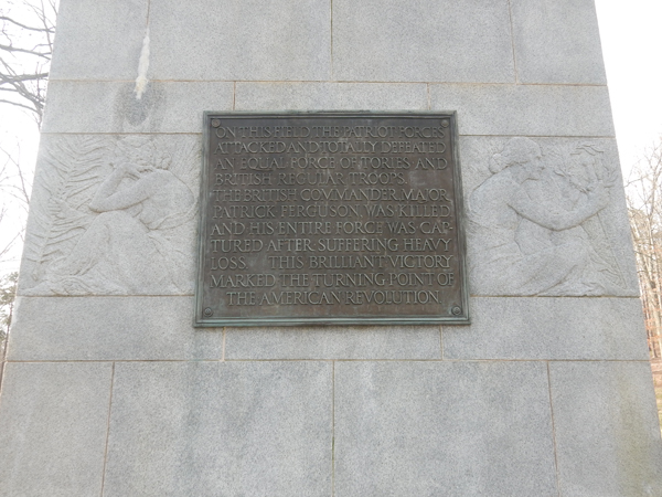
As the patriots took the mountain the remaining loyalists attempted to surrender but the enraged frontiersmen continued their revenge killing for several minutes until their commander’s regained control. In about an hour Cornwallis’s left flank was entirely eliminated and the patriots took control of cannon, arms and supplies. Many historians mark this battle as “The Turning Point of the American Revolutionary War.”
The 83 ft U.S. Monument was dedicated in 1909
The Centennial Monument was dedicated on October 7, 1930 by President Hoover – the 150th year anniversary of the Battle of Kings Mountain
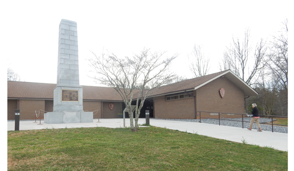
Cowpens National Battlefield – it took less than an hour to drive here from Kings Mountain NMP. “Cow Pens” was a place where farmers brought their cows to fatten them up before driving them to Charleston.
This map shows British (Cornwallis – red) and American line (blue) marches and battles from the May 12, 1980 taking of Charleston to the British surrender at Yorktown on October 19, 1781
Recall that Cornwallis had split his forces and put Col. Banastre Tarleton in charge of his right flank. Also, Tarleton was in command at the slaughter of over 200 continentals at Waxhaws SC. After that battle he was nicknamed “Bloody Ban.”
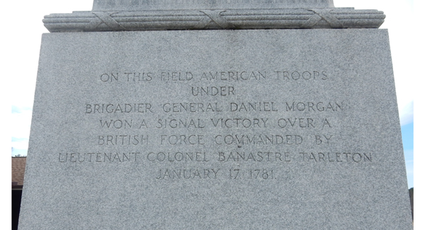
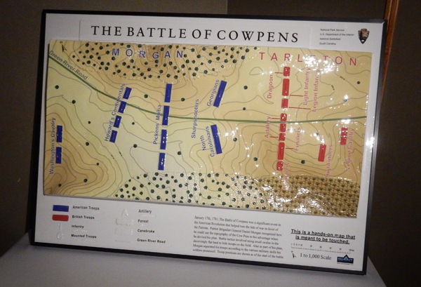
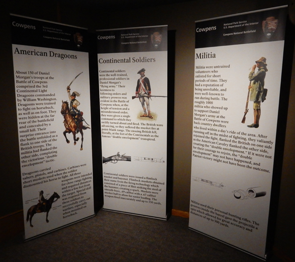
General Nathanael Greene was placed in charge of the Southern Campaign in 1780 by George Washington. He in turn put General Daniel Morgan in charge of his light troops. On January 17, 1781, Morgan led his army (970) of Continentals and backwoods militia to a decisive victory over Tarleton’s force of regulars (1050). About ninety percent of Tarleton’s force was destroyed. The Martin Militia –
U.S. Memorial Monument was erected in 1932
As usual, nice displays and good video in the Visitors Center
Washington Light Infantry Monument erected in 1856
Robert Scruggs House – was built on the eastern end of the battlefield around 1828 and is now a historic component of Cowpens National Battlefield
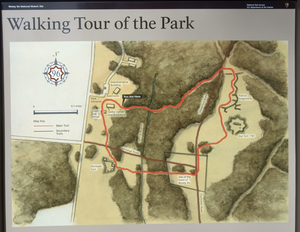
Ninety Six National Historic Site – Our third Revolutionary battle site of the day! Historians believe that this crossroads got its name because it was on the Cherokee Path from Charleston to the Cherokee Town of Keowee near present day Clemson SC – a distance of about 96 miles.
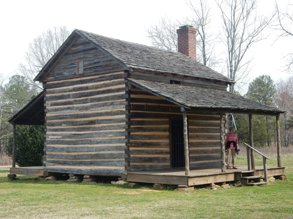
The Logan House
One Mile Walking Tour
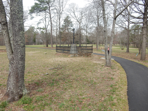
Ninety Six was a critical crossroads in the SC backcountry. In 1780 Lt. Col. John Cruger was put in command of 550 American loyalists. He proceeded to reinforce the walls of the town’s stockade and build a Star Fort.
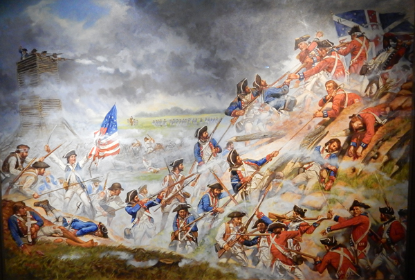
The Star Fort was a formidable defense when Gen. Nathanael Greene laid siege with about 1000 men on May 22, 1781
The Continentals proceeded to dig trenches and a rifle tower in preparation for an attack
However, before preparations were complete, Greene received word that a relief column of 2,000 British regulars were on their way. As a result, he ordered Col. “Light-horse Harry” Lee (father of the Civil War’s General Robert E. Lee) to attack the Stockade Fort and 50 volunteers to move out of the trenches and cut through the sharpened stakes of the Star Fort to prepare for an assault by the main army.
Lee captured the Stockade Fort west of the Star Fort but when Cruger ordered his troops into the ditch surrounding the Star Fort, fierce hand-to-hand fighting resulted in a stalemate with heavy losses on both sides.
Greene did not have enough time to organize another assault and slipped away the morning of June 20th before the relief column arrived. Though Greene did not win the siege, the British decided to retreat nearer the coast and leave the backcountry to the patriots.
January 30 – Left Panama City at 7am, had a layover in Miami and arrived in San Juan Puerto Rico at 4pm. Rented a car from AVIS and learned that we were required to pay a $3.95/day fee for a car EZPass and would be charged for whatever tolls we incurred. I must admit it was convenient, however I did not like being told I did not have an option.
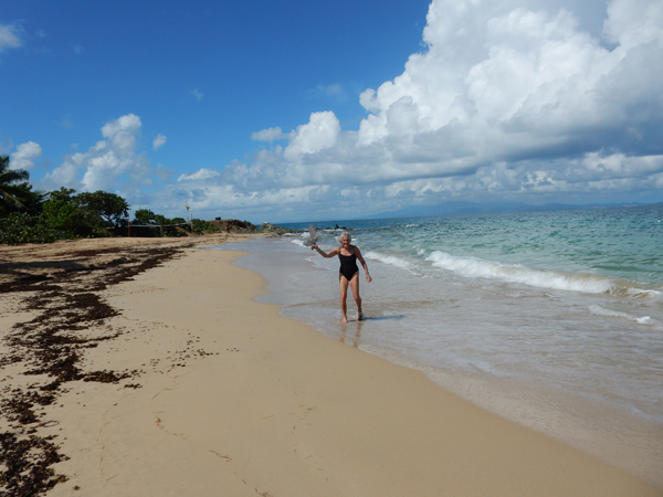
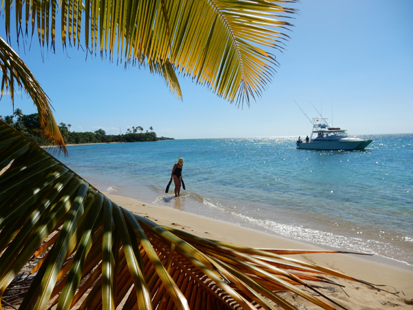
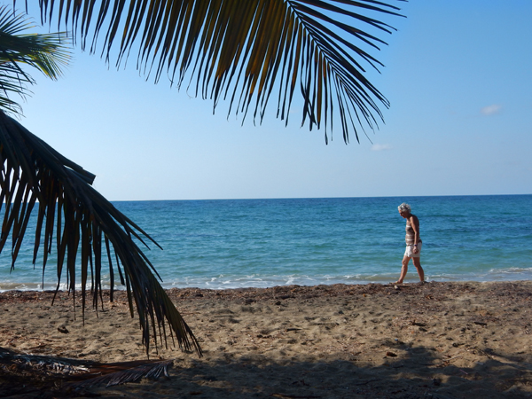
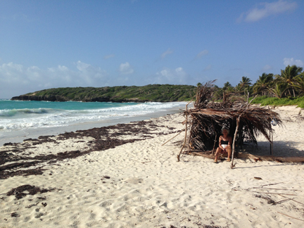
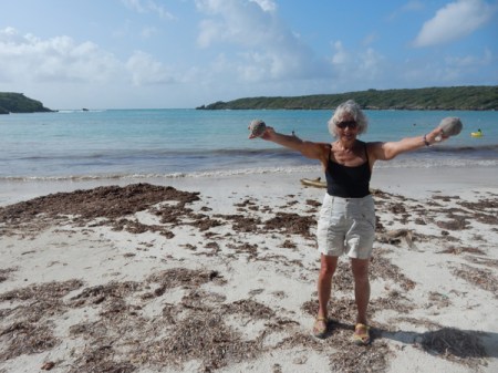
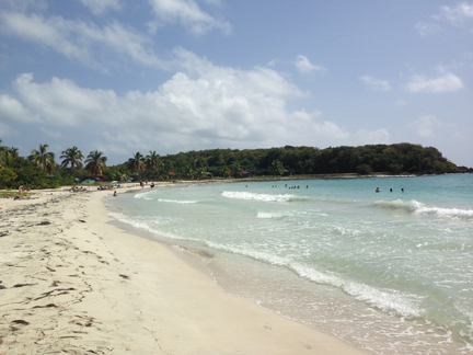
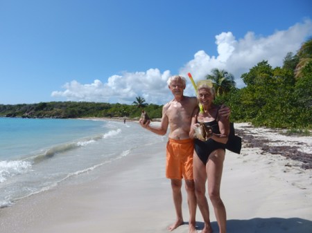
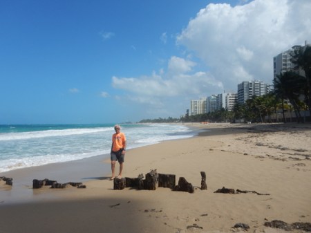
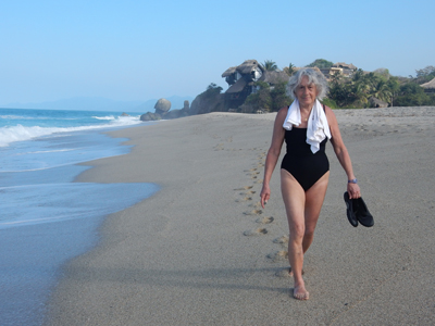
We started driving east and arrived at the Yunque Mar Beach Hotel at about 6:30. Got settled and then did the short drive over to Playa Luquilllo to check out the beach. I can’t recall seeing a sun umbrella in the water before.
The beach is noted for its more than 50 beachfront “friquitines” or food kiosks
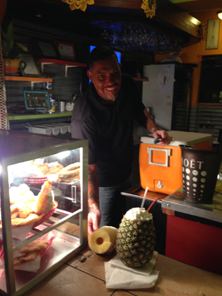
It was a tough choice, so we decided to have a Pina Colada (in a whole pineapple) to improve brain function
We settled on Chicken Mofongo. Mofongo is a fried plantain-based dish (mashed bananas) that is prepared with a variety of ingredients.
Bacardi rum is made in Puerto Rico, here we have a street vending machine for anybody that has $3, no matter age or condition
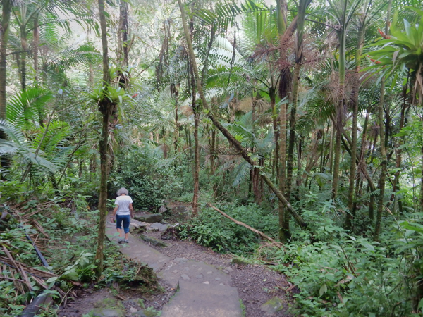
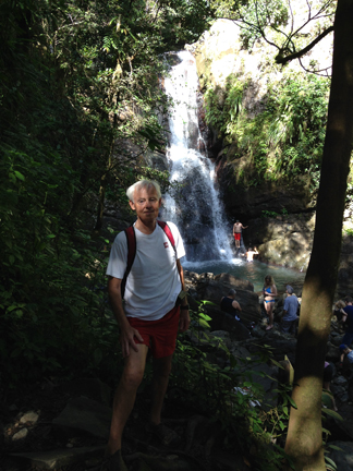
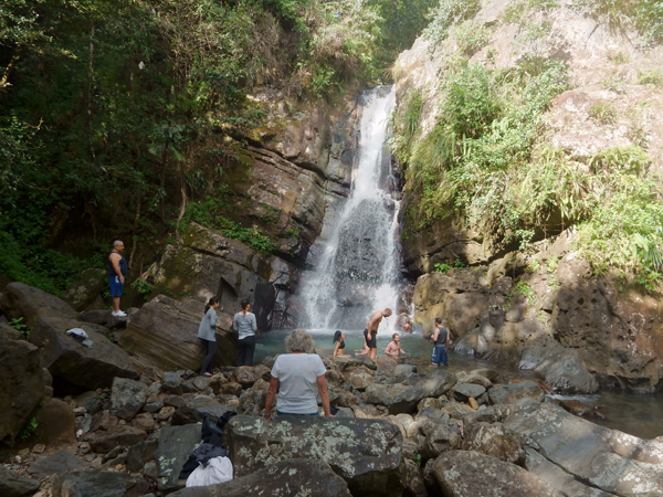
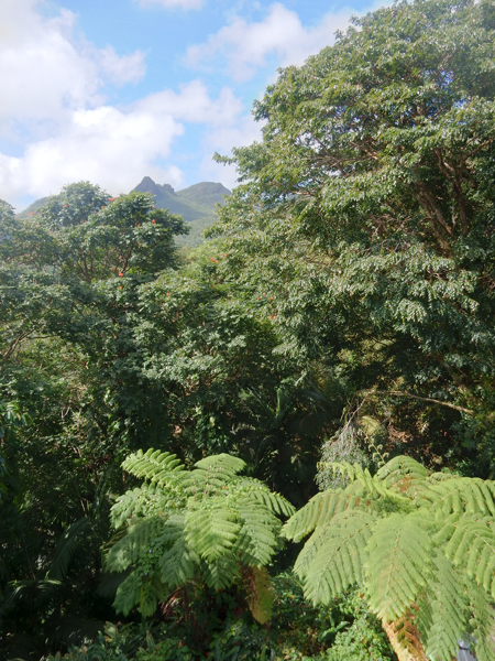
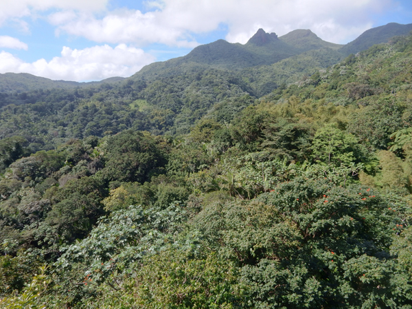
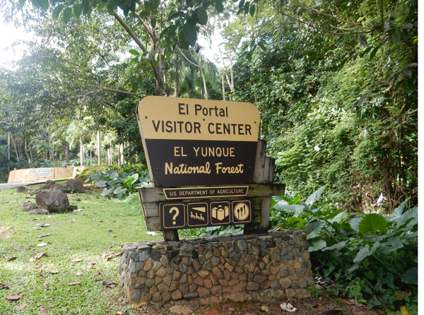
January 31 – Had an early breakfast and headed for El Yunque National Forest. It is the only tropical rain forest in the U.S. Forest Service System
La Coca Falls – 85 ft
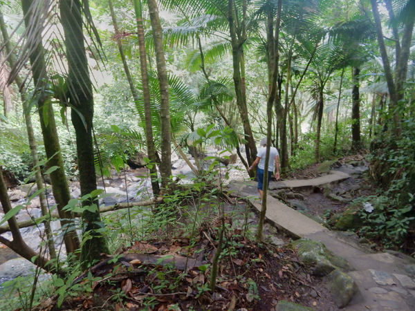
For our morning exercise we hiked the La Mina Trail – 1.5 miles roundtrip. It is the most popular trail in the park.
La Mina Falls (35 ft) with its great soaking pool
Yokahu Observation Tower
Los Picachos – 3,175 ft
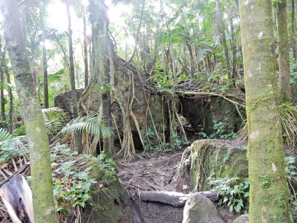
Tropical Rainforest
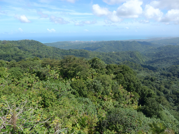
View toward Luquillo and Atlantic Ocean
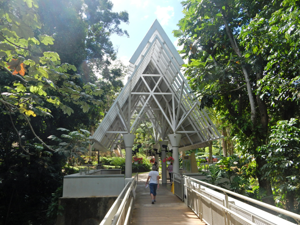
This was one of the most unique National Forest Service Visitor Centers I’ve visited
A frame construction was quite beautiful
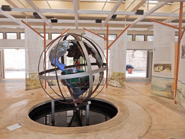
Excellent displays, video, etc.
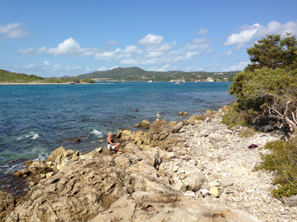
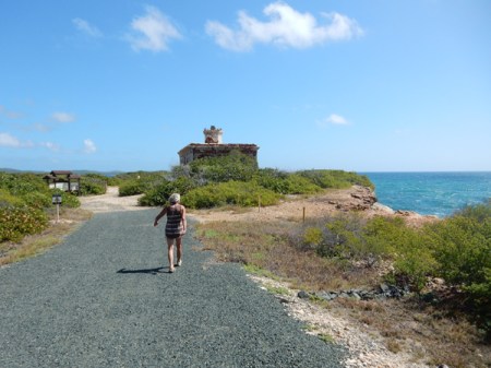
Made it to Reserve Natural de las Cabezas San Juan at 1:30 for our tour in English. It is located on the northeast tip of the island.
Though relatively small (316 acres), it contains seven ecological zones. This is a Ceiba tree at the entrance
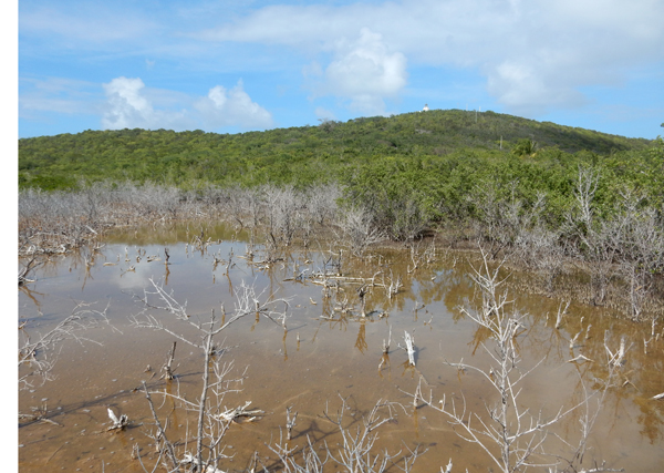
We had three stops as we were taken by tram through the reserve. The first was a wetlands area where we followed a boardwalk. Notice the tip of the lighthouse in the background.
Birds in marsh area
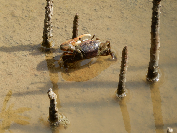
Fiddle crab and vertical growths of the beginning of mangrove trees
Millipede
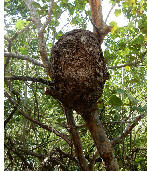
Termite nest
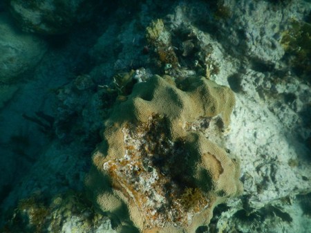
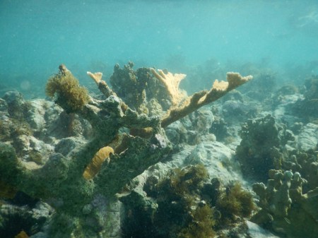
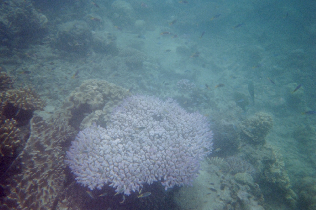
The second stop was a beach area where our guide described corals and shells
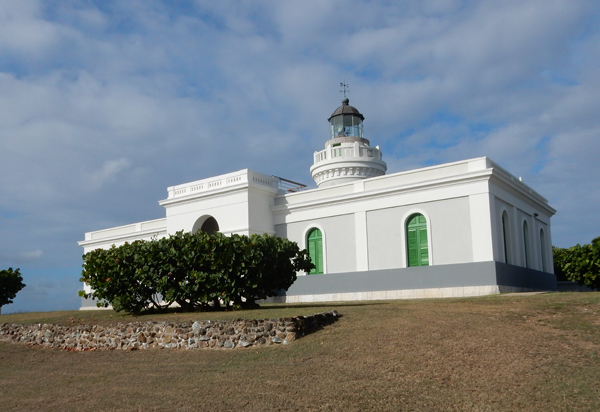
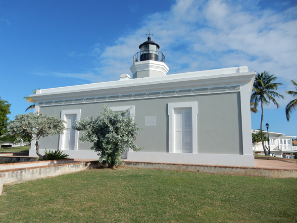
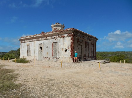
The last stop was El Faro de las Cabezas de San Juan, which is Puerto Rico’s oldest lighthouse (1882)
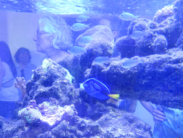
Inside was a small museum and a dark room where the guide demonstrated the glow of bioluminescent algae in water filled plastic bags
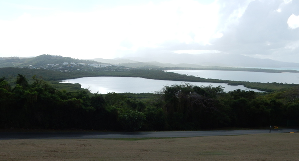
This is the Lagunda Grande or bioluminescent bay. It is one of three in Puerto Rico. We were told that the bioluminescent micro-organisms are at a level of about 20% of what they were five years ago. A hurricane is thought to be at least partially responsible for the decline.
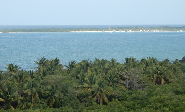
This is a view of the rainforest and the area where the Atlantic Ocean meets Vieques Sound
The tour lasted about two hours. It was Sunday and people had brought at least a hundred horses to this area for a parade and riding through the streets – Spanish Style, that is, rider perfectly straight (vertical, no movement) and horse with a very short and quick gate.
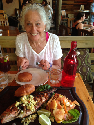
We went to the La Estacion restaurant/bar for dinner. Had a couple glasses of Sangria Red and then shared a Red Snapper
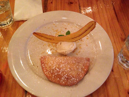
This was our shared desert – ice cream with dried banana and banana turnover – yum!
Unfortunately, I got sick and spent a couple of hours that night on the bathroom floor!
February 1 – dropped off the rental car in Ceiba and took a ten minute Vieques Air Link flight to the island of Vieques for a two week stay.
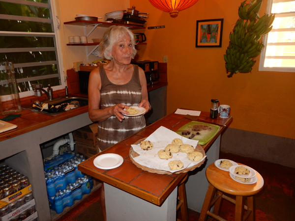
We spent the first four and last three days of our stay at Casa de Amistad in Isabel Segunda (Isabel II), the town where the ferry docks. It is a great guesthouse run by Owen and Dan who are super friendly and helpful. It has nine rooms, comfortable indoor and outdoor gathering places, a small pool and an open kitchen. You can also borrow ice packs, coolers and chairs for the beach.
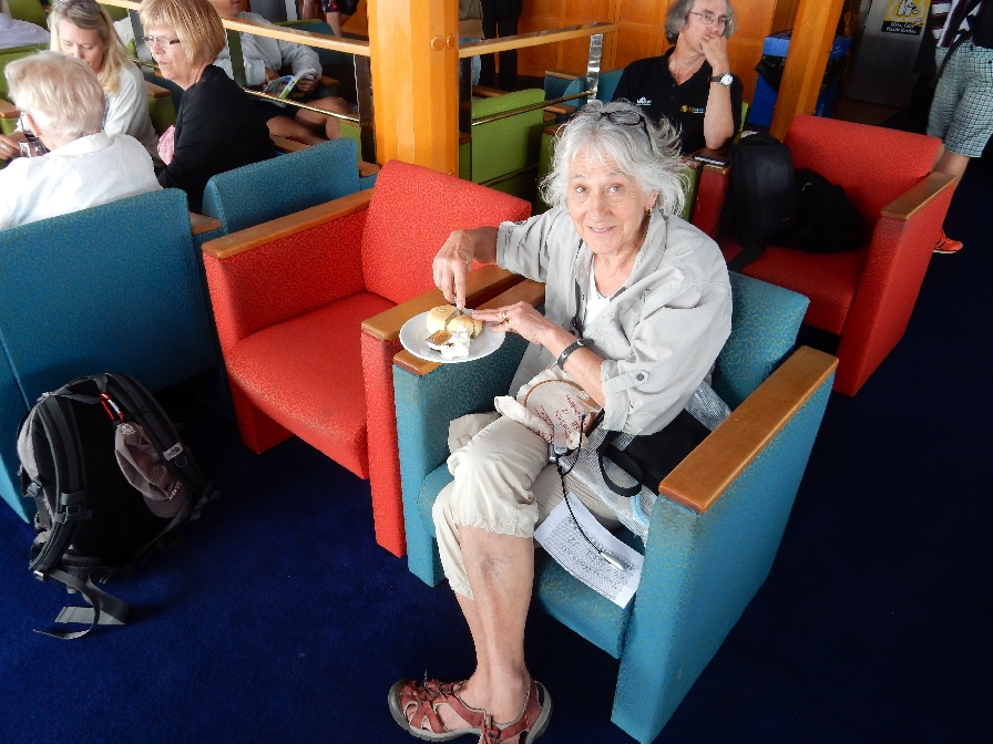
Helen delighted everyone by making scones, brownies and iced coffees – each twice and all on different days! They even put this picture of her on their web page.
February 2 – we started our island visit by walking to the lighthouse, fort and exploring the town. The lighthouse – “El Faro de Punta Mulas” is located on Mulas Point. It was built in 1896 and restored in 1992.
View of town and ferry dock from lighthouse
View of town and lighthouse from fort
The Fort – “Fortin Conde de Mirasol” is located on a small hill above the town. It was the last fort built by the Spanish in the Americas (1840)
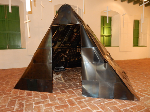
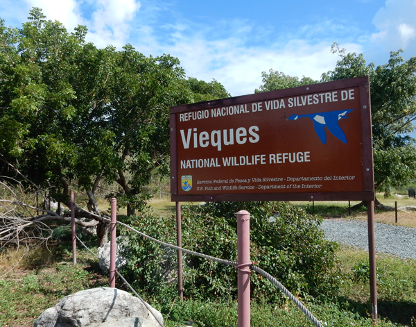
It contains a small museum including some history on the US Navy control of more than two-thirds of the island and its use as a bombardment range. In fact there was a staged amphibious attack by the Army, Navy, Air Force and Marines on La Chiva beach in 1950. In 2003 the Navy land (70% of Vieques) was declared a U.S. Fish and Wildlife Refuge. However a large part of this land is still restricted due to the danger of unexploded ordinance. The Navy is slowly clearing these areas and opening them to the public. This X-Ray tent display is meant to highlight medical problems (e.g. cancer) supposedly incurred by the locals as a result of the Navy’s explosions.
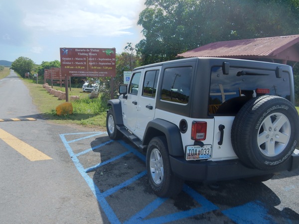
Picked up the rental Jeep from Avis and started our quest of visiting every major beach on Vieques! Our first stop was Playa El Gallito or Gringo Beach. Helen with some fan coral.
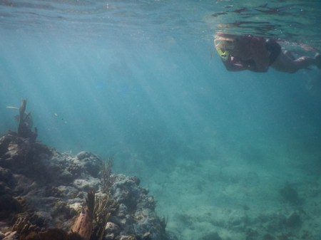
We relaxed, got some sun and then swam out to the point to snorkel. We brought our own snorkel equipment with us and used it many times.
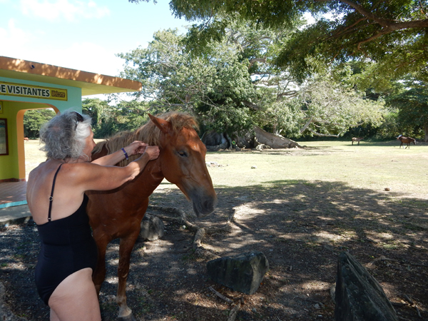
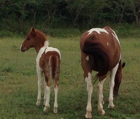
Continuing along the north coast, we stopped to see a Ceiba tree that is estimated to be around 400 years old. We also encountered our first collection of free range horses! We discovered that they are all over the island!
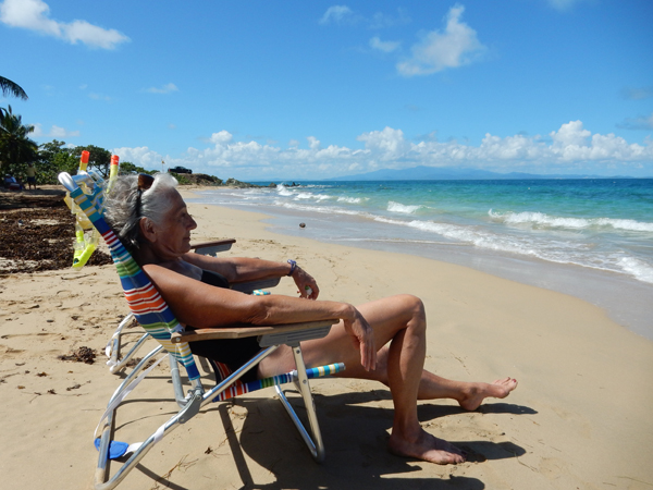
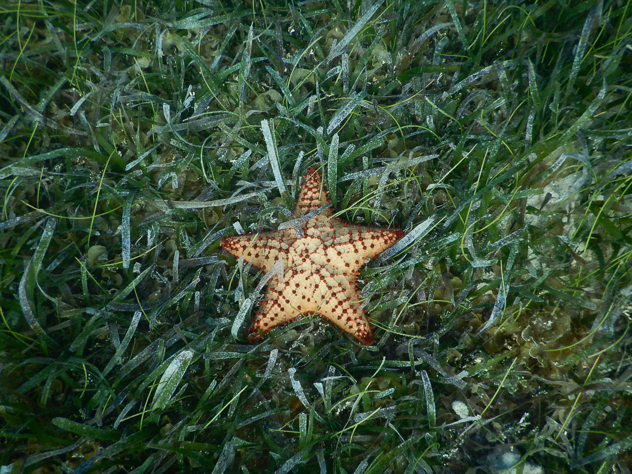
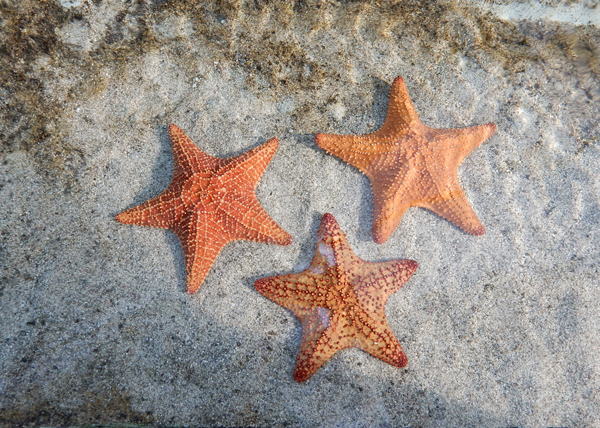
Our next stop was Blaydin or Starfish Beach. Again, walked the beach and snorkeled
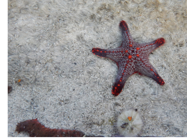
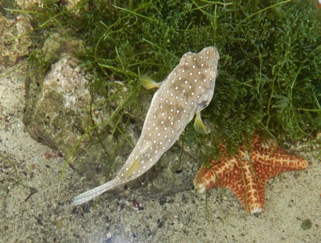
Starfish, sea cucumber and sea anemone
I found this live conch, of course I put him back
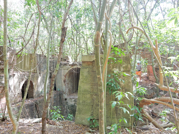
February 3 – Started the day by driving to the west end of the island and hiking through the ruins of the Playa Grande Sugar Plantation
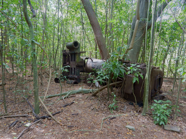
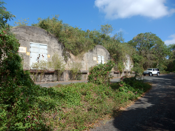
We then drove through the remains of the Navy’s administrative and storage facilities on the west end – now part of the Wildlife Refuge. The area is loaded with bunkers where the Navy stored armaments. Earth covered barrel-arched bunkers were called “igloo magazines.”
More free-range horses
Mangrove swamp
Wildlife Refuge plaque
Kiori Lagoon with Mt Pirata (984 ft) in background – it is the highpoint of Vieques. I hope to come back next year and hike to the top
Punta Arenas, also known as Green Beach – we spent the rest of the day here sunbathing, walking and snorkeling
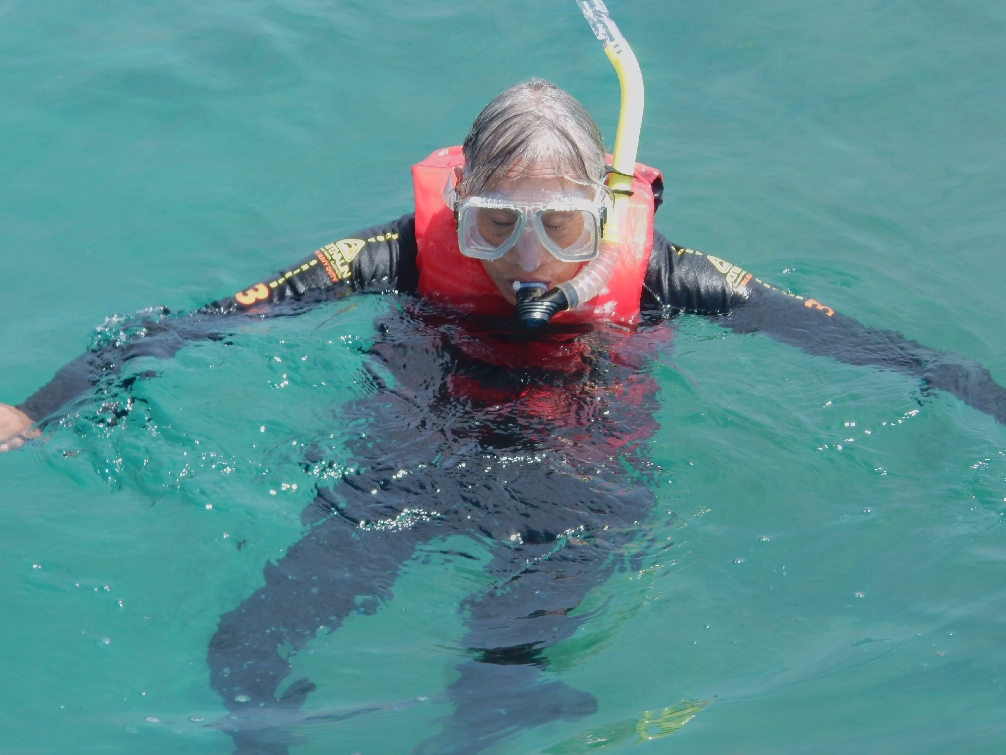
Ready for snorkeling
Good spot –
February 4 – The U.S. Fish & Wildlife Visitor Center provided a good orientation to their sites on the island
Why we rented a jeep
Playa Grande is located on the southwest corner of the island – walked the beach and collected treasures for about two hours, not another person there!
Swimming is not recommended here because of a quick drop off, surf and dangerous currents
I took a great movie of the pelicans diving for fish
This beach is a turtle nesting site from April to June
February 5 – Started the day with a short hike through a stream bed (arroyo) to Playa Negra or Black Beach. The black sand, which is magnetic, comes from magma pushed up from the surface around Mt Pirata and is then washed down the arroyo. We were a bit disappointed because there wasn’t much black sand on a large area of the beach, perhaps because of lack of rain?
This end of the beach was what we expected
Picked a nice mango on our hike through the arroyo
It is recommended that you not swim at this beach but we did enjoy walking and collecting more shells
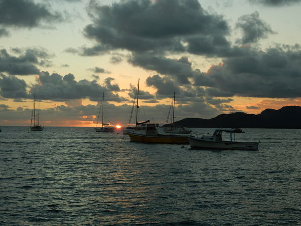
We checked into the Malecon hotel in Esperanza where we had four different rooms over seven days. Even though I booked in November, I wasn’t able to claim the same room for seven nights – a popular place! Esperanza is a “resort like” area with several hotels and restaurants on the south side of the island. It has a nice seaside promenade with a harbor and small dock. Nice sunset –
February 6 – started the day by walking the promenade to the Esperanza Sugar Pier and Playa Esperanza. Horses on the beach – you can see the Esperanza Sugar Pier in the background. It was built in 1927 for the export of sugarcane – Puerto Rico’s largest cash crop during the 20th century.
We then hiked across the land bridge to Cayo de Tierra. We did the trail out to the southwest viewpoint.
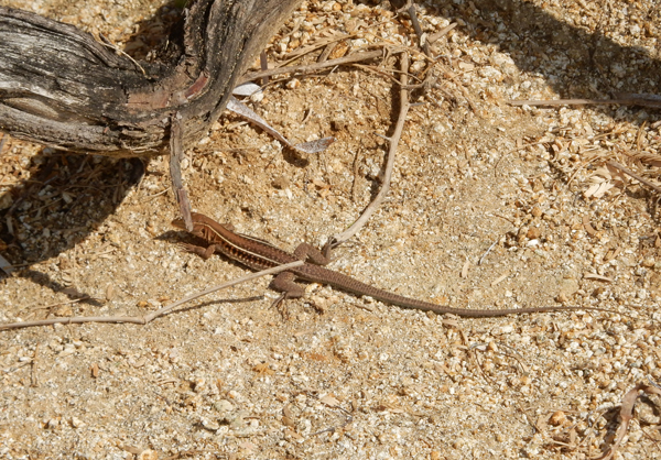
Lots of lizards
Another termite nest
View back toward harbor with Esperanza in the background. Cayo de Afuera (island) is on the left.
Had our first of four days of Fish Tacos for lunch at Bananas in Esperanza. Lunch special of 2 delicious Fish Tacos for $9 – we each ate one. It was cloudy in the afternoon, so we checked out the hacienda Tamarindo as a possible place to stay in the future. This is the view from their pool, a nice pastoral scene, and beach. Cayo de Tierra can be seen in the middle and Cayo de Afuera on the right.
This may be an Annona Glabra Tree (also known as a Pond Apple). Note how large the fruit are; they can be up to 6 inches in diameter. I sent a text to our children stating it was a Watermelon Tree – no one argued?!
Found this iguana outside our room!
View from our balcony at the Malecon
Walked the promenade before dinner. Helen thought we should buy this sailboat and fix it up!
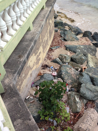
The beaches on Vieques are generally pristine. However, the shore and beach area across the street from the restaurants along the promenade suffer from litter.
This is Tradewinds Beach, which was directly across the street from our hotel
February 7 – This is the road to Navio Beach, the worst one we experienced on our trip – yeh jeep!
Navio is noted for its wind, waves and boogie board/body surfing. Helen enjoying a wind break
Helen enjoying a real break
Next beach – Media Luna or Half Moon Beach, a good one for kids because it is shallow 50 yards out
Sea Urchin shells
Sunday at Sunbay (mile long) – do you believe we relaxed at this beach?! Did a little swimming, reading, Helen stitched, I walked into town and brought back fish tacos for lunch. The Malecon hotel did not have any TVs, so early evening we drove across the island to watch the Super Bowl at Casa de Amistad. Vieques is 5 miles wide and about 21 miles long.
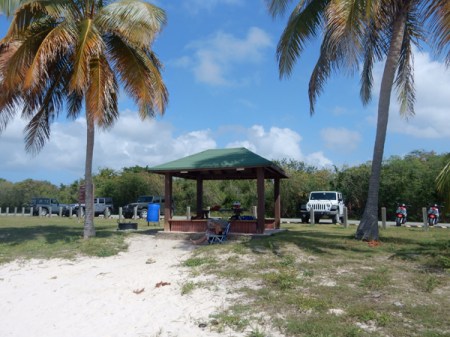
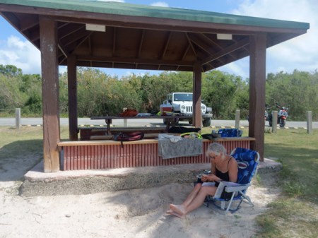
February 8 – arrived at Caracas Beach early enough to claim a gazebo. We discovered you have to watch out for the sand burs here.
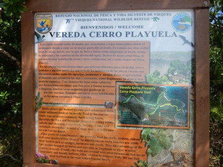
Mid-morning Helen drove me to the Vereda Cerro Playuela Trail System where I started at Tres Palmitas, hiked all the trails and met her back at the beach (2.5 miles).
Notice lizard on sign
This is Playa Corcho Beach on Puerto Ferro Bay (also known as Barracuda Bay). You can only get here by hiking or kayak and it has some bioluminescence. I hope to come back here to kayak and/or snorkel
Hiking out to the point
Lots of pineapple-like bromeliads and clattering thatch palms
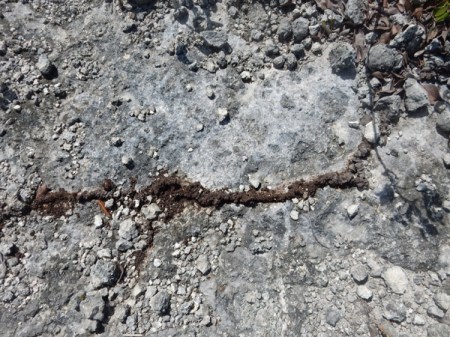
Termite tunnel across path and termite nest
Looking east from point
Caracas Beach in distance
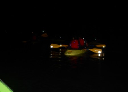
I hiked across Playuela Beach, translation “Little Beach” on my way back to Caracas to meet Helen. I would not recommend this beach as it gets a lot of wind and waves bringing debris and trash up on the beach. Late afternoon we drove back to our hotel to get ready for our tour of Puerto Mosquito Cano Hondo, better known as the Biobay. Guinness Book of World Records states that this is the brightest bioluminescent bay in the world! We choose to do our tour with JAK Water Sports because they have glass bottom kayaks.
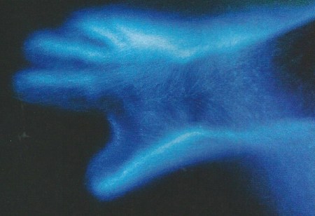
Though I tried with many settings on my camera, I was unable to get a picture of the phosphorescent dinoflagellates activity. The following is the only picture in this blog that I scanned in from a magazine. It is a very good representation of what we experienced when we moved our hands through the water.
It was an amazing experience, I made the reservation for the one day in February when there would be no moon. The stars were brilliant and we could see the Milky Way and beyond. Also, as we paddled we could see what appeared to be a myriad of stars passing under our glass bottom kayak. Fish scurrying here and there were leaving bright sparkling trails in the water and our paddles produced splashes of sparkles that trailed off behind us.
February 9 – started the day by driving out to the Puerto Ferro Lighthouse. Note the restricted areas on the sign.
Begun under Spanish rule in 1896, the lighthouse construction was stopped during the Spanish-American War. When Puerto Rico was taken over by the U.S., the lighthouse was completed and became operational in 1899.
In 1925 and earthquake damaged the building and it was not reopened. Only recently did the lighthouse become accessible by the public
View northeast from the lighthouse
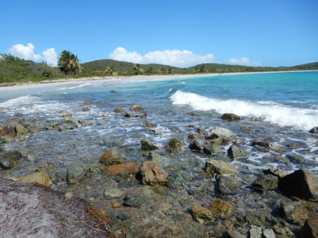
Our next stop was Pata Prieta, translation “black leg or foot”
It is a protected U-shaped cove and was our favorite beach on Vieques
There is some decent snorkeling off the point to the east
Watch out for the sea urchins!
We found that locals had found several conchs, cut them out of their shells and then dumped the shells in about eight feet of water off the point. There were about fifteen there and we each dove and brought one up for Helen’s yard collection.
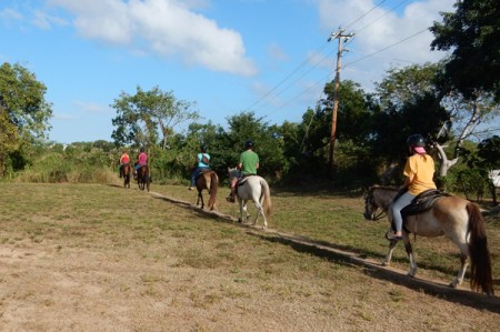
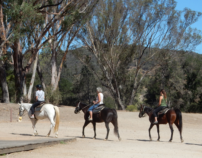
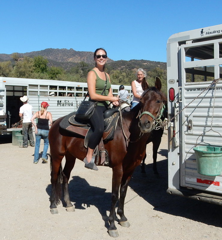
Helen did a trail ride with Esperanza Riding Company in the afternoon
Kim, who was also staying at the Malecon, joined her
Starting on the trail, Helen said it was a great ride and that they even got to ride across Playa Negra (Black Beach)
February 10 – We drove out to the very end of the dirt road going east through the Wildlife Refuge to La Plata or Silver Beach. There we met Jorje (George) of Little Boat Sailing who was taking us and two other couples on a half day sailing/snorkeling tour.
We sailed across Ensenada Hondo bay on the southeast coast of the island
Our fist snorkel was in shallow water around the mangroves at Punta Carenero. Ensenada Honda has the largest mangrove forest on the island and is also the largest protected body of water on Vieques. Only the shoreline is open, the rest of the east side of the island is still restricted by the Navy. This is a sea cucumber –
Sea anemone
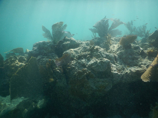
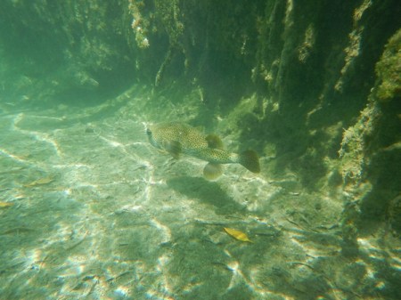
Our second snorkel was over a reef at the entrance to the bay. Jorje emailed us all of these underwater pictures.
Staghorn coral – endangered
Wonderful snorkeling
It was a fun day and we celebrated with dinner at the Tin Box
February 11 – Started the day by swimming from the Esperanza Sugar Pier through the harbor to Cayo de Afuera
Snorkeled the north and west sides of the island
Barracuda
Again, had fish tacos for lunch and then drove to Bahia de la Chiva, which was called Blue Beach by the Navy. There are 23 different access points to the bay! Today we choose to explore and enjoy the east side. More sea shells anyone?
Our beach spot
Helen on the rocks
Interesting ruins on the east side of Esperanza, probably related to the sugar industry
February 12 – we went back to La Chiva Beach this morning. This time we set up on the west side of the bay.
We swam out to the island you see in the picture, Cayo La Chiva, for some good snorkeling
Some rocks that separate east and west La Chiva beaches – this morning there were only about two dozen people covering 1.5 miles of beautiful beach
Drove back to the north side of the island this afternoon for our final three night stay at Casa de Amistad. I wish I had this stone in my yard!
Good variety of fruits and vegetables
After getting settled in Casa de Amistad, we drove to Rompeolas, also known as Mosquito Pier, for more snorkeling. It is a sea wall that juts out 1.1 miles into the Atlantic Ocean. Pelicans with sea wall in background –
Pier at end of sea wall, easy access stairs on left for snorkeling or SCUBA
Good visibility today
Puffer fish
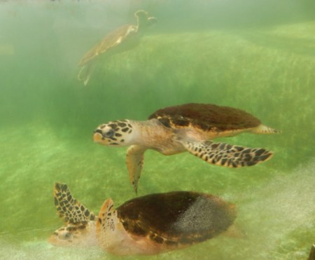
Turtles under pier
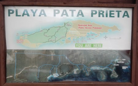
February 13 – This was our last day with the jeep; so we drove back to the south side of Vieques and our favorite beach Playa Pata Prieta. Sign shows location of beach.
Another sign warns of unexploded ordinance – don’t touch and report!
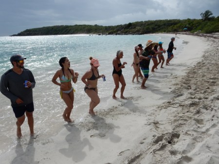
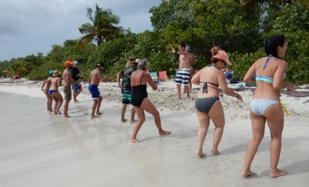
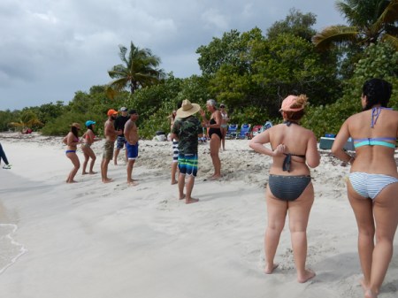
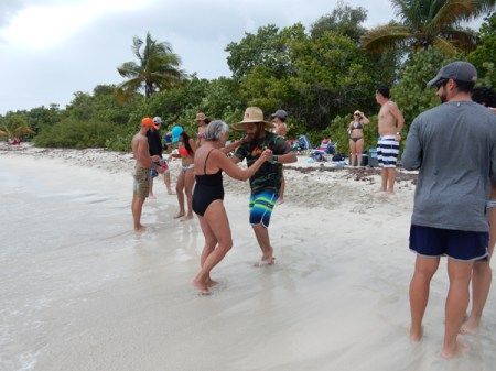
We snorkeled in the morning and then a group of 12 young Puerto Ricans showed up for a beach party. They came over to Vieques for the weekend with their chairs, coolers, grill, electronic speakers, balls, etc. They were having a great time and then one of the group started teaching the salsa and they invited us to join them.
The young man in the stripped swimming suit was acting as the instructor
Helen, the dance instructor, had to add her two cents
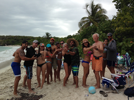
Group photo – how did the white guy get in there? They offered us drinks, which we accepted and hamburgers!
Leaving Wildlife Refuge
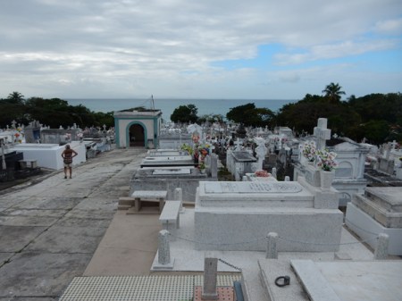
February 14 – Valentine’s Day – our last day on Vieques. This is the Isabel Segunda cemetery, notice how the graves are above ground.
This is Sea Glass Beach – guess what Helen found?
Ferry dock – this is the boat (center left) that we caught the next morning
We continued walking to La Chata Beach in the Santa Marta area. More shells!!!
I just checked – we enjoyed 16 different beaches on Vieques and snorkeled 12 times! It is an amazing place and we will likely return next year.
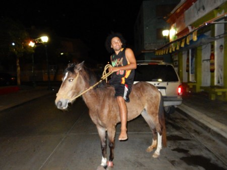
Bareback rider in town, lots of people own the free range horses. We were told they can just grab the closest horse, ride it wherever they like and leave it!
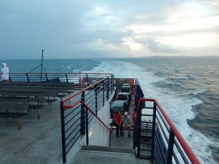
February 15 – We were up at 4:30am to catch the 6am ferry to Fajardo on the main island. Notice the green suitcase that we paid $3 for at a thrift shop. Well, it was packed with 48.6 lbs. of sea shells and sea glass!!! Under 50 lbs., so we could take it as free baggage when we flew home. Of course we had to carry it with us for 4 more days!
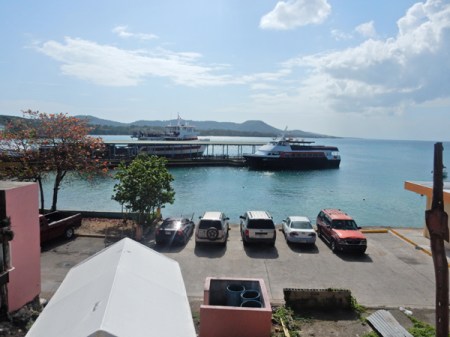
The public ferry is a bargain at $2 each and takes about 1.5 hrs to get to Fajardo. We arrived to a light rain and had Enterprise Car Rental pick us up at the ferry terminal.
Drove to the Manatee Eco Resort on Salinas Bay. It is located on the south coast of Puerto Rico. We rented kayaks and paddled out through the mangroves into the bay.
We paddled in and out of showers for 2.5 hours looking for manatee
Alas, none were to be found. Actually, we think their presence is a myth and it is just a marketing ploy to try to draw tourists!
Returning to port
February 16 – Drove north through the mountains on very narrow/windy roads to Jayuya, which is located in a beautiful valley in the center of the island
Nearby waterfall
In 1950 a local lawyer and nationalistic hero, Blanca Canales, led a revolt against U.S. occupation known as the “Jayuya Uprising.” Rebels took over a police station and declared a Puerto Rican republic from the town square. Three days later the U.S. bombed the town causing much destruction. How many of you out there knew or remembered that? Canales’s home is now a museum that tells the story of the revolt and preserves the house much like it was in the 1950s.
Blanca Canales
Nearby is the Cemi Museum (1989) that is devoted to the Taino Indian culture. A Cemi is a god, spirit or ancestor and the museum shape is a representation of a god.
A short drive away is a nice boardwalk that leads to river rocks that have Taino petroglyphs.
It was so relaxing sitting by the river in this beautiful valley, breathing the wonderfully clear air and observing both wildlife and the symbols of the indigenous culture
Don’t miss the bird at water level on the right of the rock
Petroglyphs
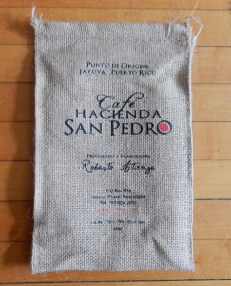
The next stop was the Hacienda San Pedro coffee plantation and plant
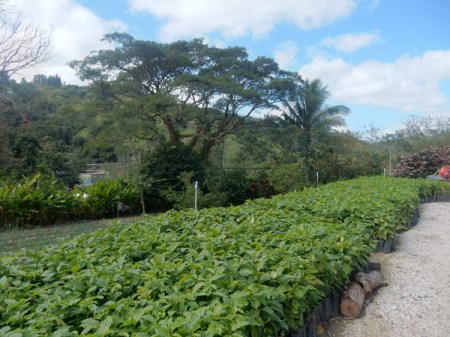
The coffee is truly “mountain grown.” Three of Puerto Rico’s highest peaks surround the valley – Cerro de Punta, Cerro los Tres Picachos and Cerro Maravilla. New coffee trees are planted every five years.
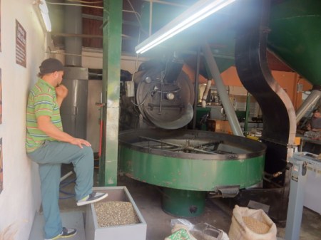
The beans here are picked in the last few months of the year, so they were just finishing up with the mediocre coffee beans that had already been picked. The gourmet beans are the first to be processed. This is one of three employees who volunteered to give us a tour showing Helen a coffee tree.
Grinder processing the last of the mediocre coffee beans
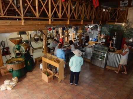
Old grinder on left, coffee bar and restaurant
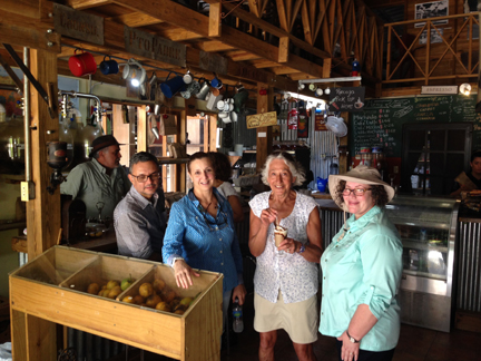
Roberto (owner in hat), reporter doing a story on the plantation, employee, Helen and another friendly employee/guide
We had delicious iced coffees and bought five bags of their best beans! By law, the beans must be organic and free-trade.
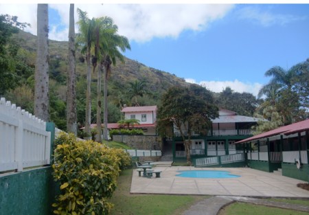
We discovered that Hacienda Gripinas was open and drove there to see if we could get a room. It is a coffee hacienda built in 1858, restored by the government in 1975 and now run as a hotel. The coffee from this plantation won the gold medal at the Louisiana Exposition in St Louis in 1904. It is the best place to stay in the area. I had tried for months to email and call them for a reservation; I also searched the internet for any current contact information – there was nothing. I was surprised to find they were open. It seems they mad a name change that resulted in the communication problems.
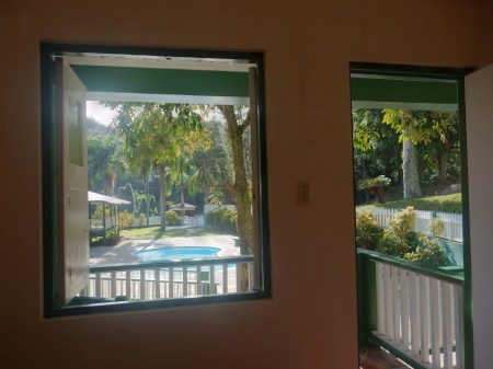
We were able to get a nice first floor room with balcony overlooking the pool, including breakfast, for $65 – local’s cost
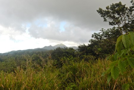
After settling in, Helen choose to stay in the Hacienda and stitch while I went off to do the highpoint of Puerto Rico – Cerro de Punta, highest mountain in this distance shot from the north
As with the hotel, I found very little current/detailed information on getting to and climbing the mountain. I drove a circular route from Jayuya, Rt 144 east, Rt 149 south, and Rt 143 west to highpoint. After completing the hike I continued on Rt 143 west, Rt 140 north and then Rt 143 east back to Jayuya. My phone GPS did not work in the mountains. These picnic facilities are in Toro Negro State Park on Rt 143. Cerro Jayuya (4,265 ft) is in the background.
View south toward Ponce
Picture from top of Cerro Jayuya looking west toward Cerro de Punta and its communication towers. Both peaks are in the Cordillera Central mountain range that runs east-west down the center of the island.
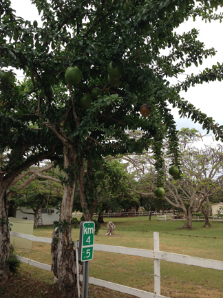
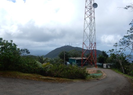
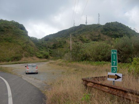
One lane road on north side of Rt 143 leading to the top of Cerro de Punta (4,390 ft), the Highpoint of Puerto Rico. The peak is located in the western part of the Toro Negro Forest Reserve. Note that Rt 143 is well marked and the turn-off is at kilometer marker 17.3
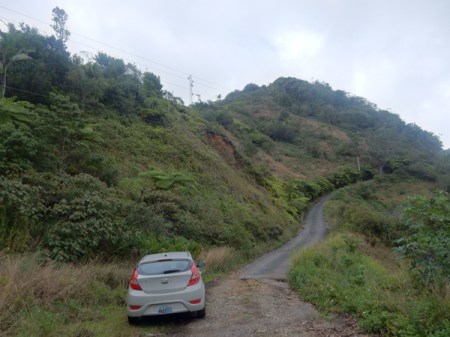
I choose to hike up the road instead of drive. For the exercise but also because I thought it would be difficult to back the car down if I encountered another vehicle coming down the road. It was steep and there were few pull-outs where two cars could pass. As it was, I found no one else on the mountain.
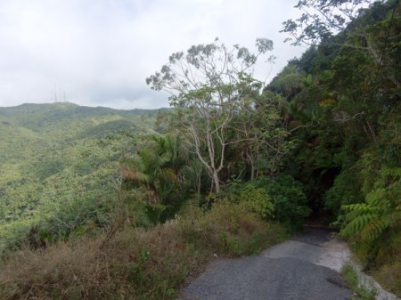
Near the top, the road continues up a bit more from this point, then there are 53 steps up to a concrete viewing platform
Blurry self-photo on top; it was cloudy with on and off drizzle. It took me 20 minutes to hike up.
View looking east toward Cerro Jayuya and its communication towers. Ruta Panoramica (Rt 143), which runs down the middle of the island, can be seen in the picture.
View of summit road while descending, about the first one-third of the road going down is concrete and the last two-thirds asphalt
February 17 – last full day in Puerto Rico. Drove down the mountains to the coast and on to San Juan. We arrived at the Andalucia Guest House in Ocean Park (east of San Jose) in the afternoon and went right to the beach. Vieques beaches are so much better!
We drove into Old San Juan for the evening. We were excited to go back to some of the same places we experienced on our honeymoon in 1968! This is Parque de las Palomas or Pigeon Park.
Plaza del Quinto Centenario was built in 1992 for the 500-year anniversary of Columbus’ first voyage. The totem pole “El Totem Telurico” was constructed with clay from across the Americas to signify the origins of the people of the Americas.
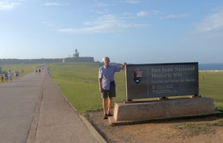
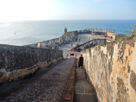
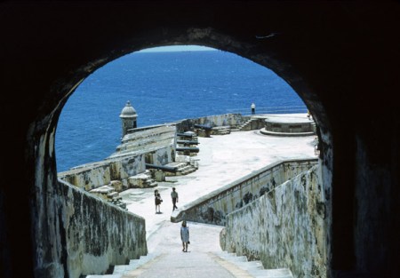
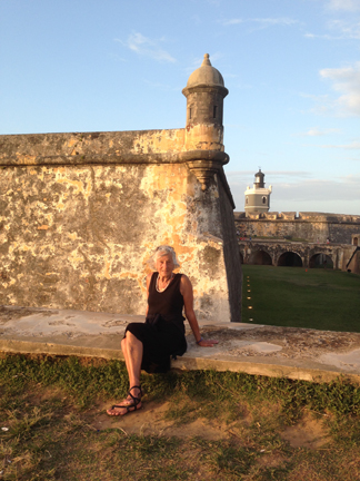
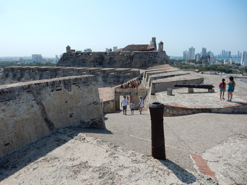
Castillo San Felipe del Morro, San Juan National Historic Site – fortification was started by Spain in 1539. Puerto Rico means “Rich Port” and it was the first major island with water, shelter, supplies and a safe harbor for ships sailing to the Americas from Europe by way of West Africa.
Approaching walkway over dry moat
Entrance – 2016 and 1968
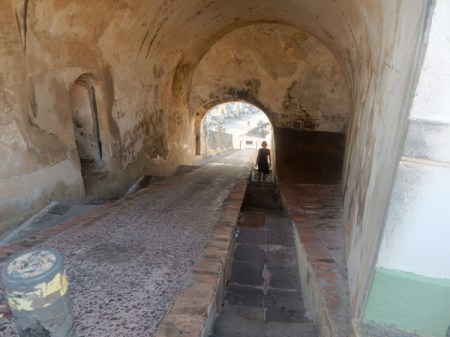
Ramp leading down from the main plaza on level 5
Ramp ends at the main firing battery, level 4 – late afternoon 2016 and morning 1968
“El Morro” was attacked by England three times 1595, 1598 and 1797 and once by the Dutch 1625
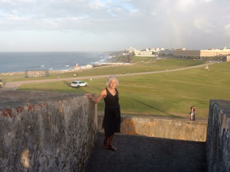
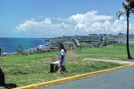
View east toward Castillo San Cristobal and Rainbow! At the end of the Spanish-American War (1898), Puerto Rico became a U.S. Territory; Helen 1968
Tom 1968 and 2016 – hardly any change
Some of the walls are 15 feet thick, the lighthouse has been operating since 1846
Dry moat and sentry box, San Juan National Historic Site was established in 1949
1968
El Morro was declared a World Heritage Site in 1983
Walked through Old San Juan to El Jibarito, a crowded/fun Puerto Rican restaurant, for dinner. Afterward, walked some more through the Old City and its many plazas.
February 18 – paid the piper (American Airlines $150) to change our reservation so we could get to Dayton late afternoon instead of 11:30 at night!
Helen and I both agree that this was one of our best “vacations.”
January 17 – Chad dropped us off at the Dayton airport at 4:45am and we landed in Cartagena Colombia at 2pm (no change in time zone).
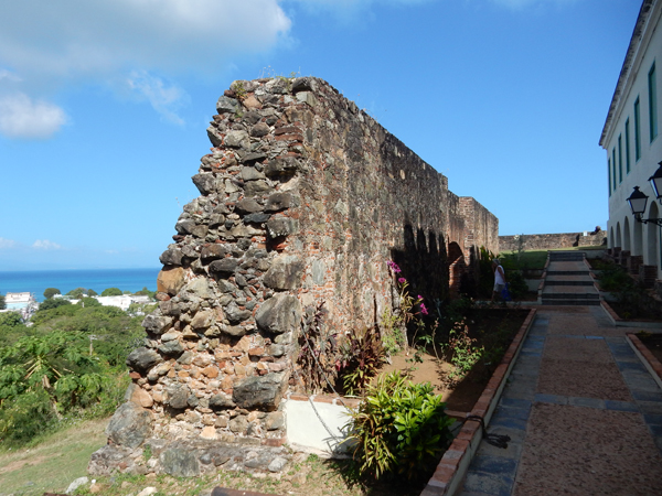
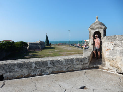
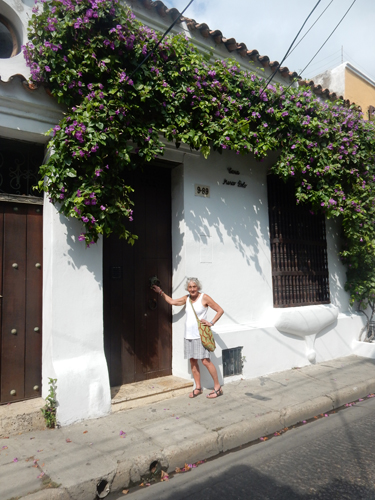
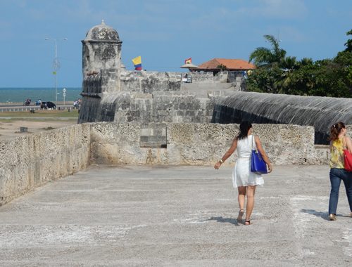
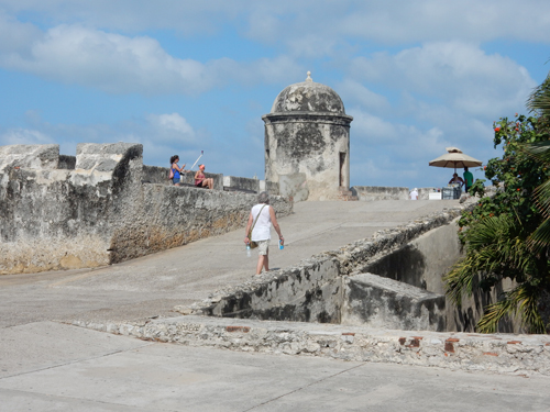
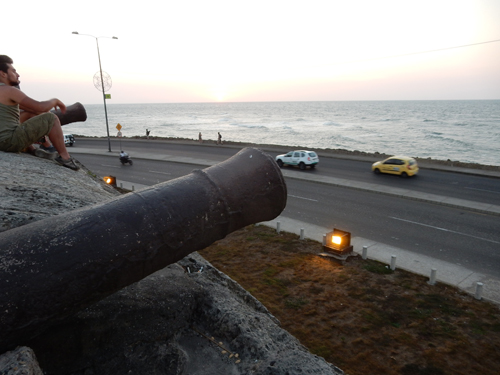
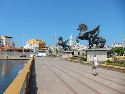
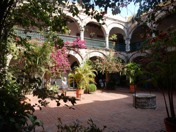
After checking into our guesthouse, we began to explore the old city by walking the northeast sections of the city wall. There are over 8 miles of city walls (Las Murallas) and we walked every inch during our stay! The construction of the city wall began during the 16th century, after a pirate attack by Sir Francis Drake, and was completed in 1796.
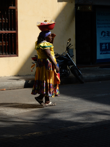
After walking our first section of wall, we started working our way through the maze of the old town. Cartagena was the main Spanish port on the Caribbean and the major northern gateway into South America. It is a UNESCO World Heritage Site with cobbled alleys, churches, plazas and balconies covered in flowers.
Cathedral of Cartagena was begun in 1575 and completed in 1612. It is officially called the Metropolitan Cathedral Basilica of Saint Catherine of Alexandria and is one of the oldest episcopal sees in the Americas.
Street art across from cathedral
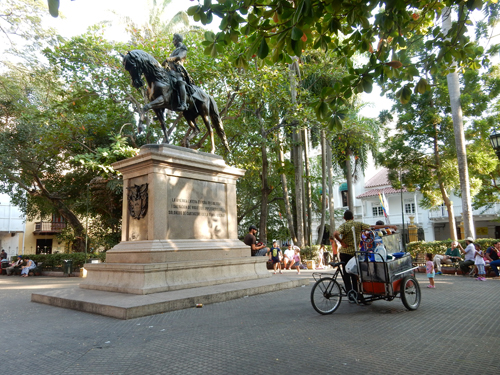
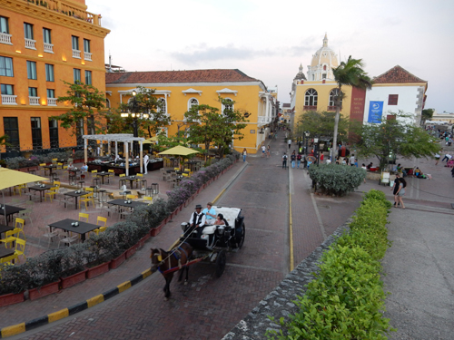
Plaza de Bolivar – Simon Bolivar’s troops took the city from the Spaniards in 1821
Statue of Pedro de Heredia who founded the city in 1533
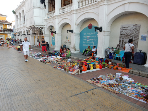
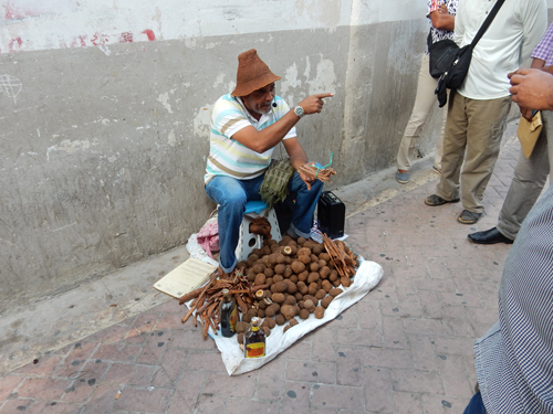
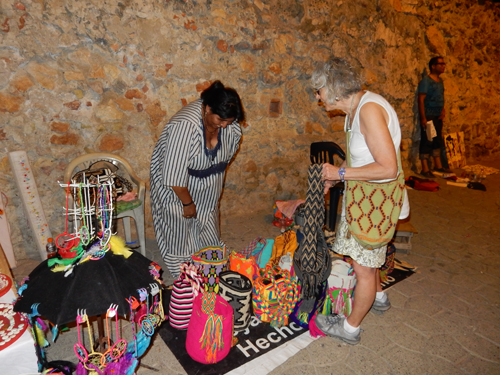
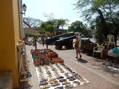
After a little bargaining, local crafts were relatively inexpensive
Helen’s first jewelry purchase of the trip – pearls
Cheese snack
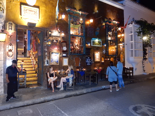
Interesting restaurant, we actually ate outside at another across the street – La Cevicheria. We knew it was a seafood restaurant and ordered Ceviche Douglas thinking it was a kind of seafood platter. Well, it turns out Ceviche is raw seafood and what we each ordered was a VERY large bowl of raw (seasoned) shrimp!
January 18 – Our first three and last three nights in Colombia were spent at Casa Marco Polo in the San Diego district of the old city of Cartagena – a privately owned and remodeled Colonial house
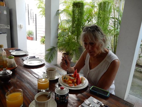
Terrific breakfast included – first great coffee, the fruit plate (some we had never had before) and juice, followed by eggs anyway you would like them (we usually had “everything” omelets) and bread/jam
Stairs up to our room (one of only three)
Our room was the one on top, above it was a roof lookout
We started the morning by walking to Plaza de la Aduana and then up onto the west city wall
We then went outside the city wall to the Parque de la Marina where there are monuments to the Colombian Navy
Two of the monuments were particularly interesting to me, the first was one to Colombian Naval heroes
And the second was a 16th? Century Japanese battleship
We then continued our walk on the west wall
Plaza Santa Teresa from wall
Uh-Oh!!! This resulted in a 50 kt emerald pendant
Nice shoes but couldn’t get the right fit
Fried cheese sticks from Jose became our “go to” snack or small lunch
Balcony flowers everywhere
Statue of Fat Woman Reclining in the Plaza de Santo Domingo
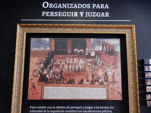
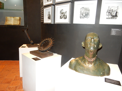
The Palacio de la Inquisicion preserves some of the gruesome details of the Inquisition in Colombia, which started here in 1610. The crimes were magic, witchcraft and blasphemy and resulted in public executions. About 800 met with horrific deaths before the trials were ended in 1821 with Colombian Independence. This is Juan, our English guide.
One of the outside displays – the gallows!
A portrait showing an “autos-da-fe” or Inquisition trial with relatives looking on
“Tools” of the trade – to force confessions!
Yesterday we got disoriented several times as we walked through the maze of the old town. Today, we were like old pros!
We ate chocolate crepes while watching the sunset at Café del Mar on the northwest corner of the city wall
Should have bought one or more bags – I can’t believe I just wrote that; no wonder Helen enjoyed this trip so much!
Hot days (90s) and comfortable evenings
Evening snack
Puerta del Reloj – city gate
January 19 – Monumento a la India Catalina; statue of Catalina, a Carib woman who served as interpreter to Pedro de Heredia when the Spaniards first arrived. It is located outside the main entrance to the old city. I meant to take a front view picture in early evening but never got around to it.
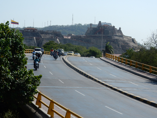
It was a big day for walking and we started by following the east city wall to Castillo de San Felipe de Barajas – The Fort
When I first saw this picture, I wasn’t sure who this was!
Approaching the fort
Some sticky nourishment on a hot morning
The fort was begun in 1657 and by 1762 it covered the entire San Lazaro hill. It was Spain’s greatest fortress and was never taken despite numerous attempts.
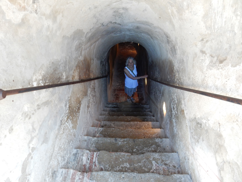
One of a complex system of tunnels
Approaching the top
The fort dominates the cityscape and gives great views of the old town
And new city
After the fort, we continued our walk on the east and then south old city walls around the Getsemani District
A “have” house next to a “have little” house
Walking to the city gate along the Muelle Turistico de los Pagasos
Male on the left and female on the right
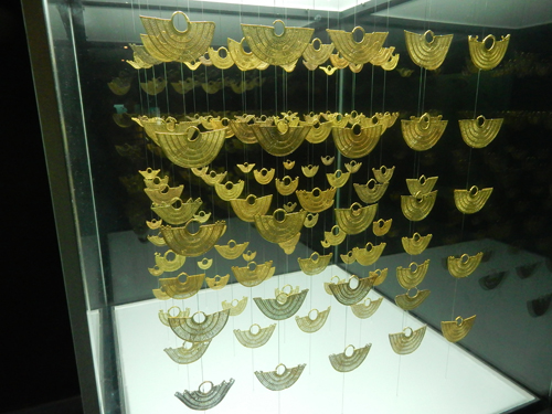
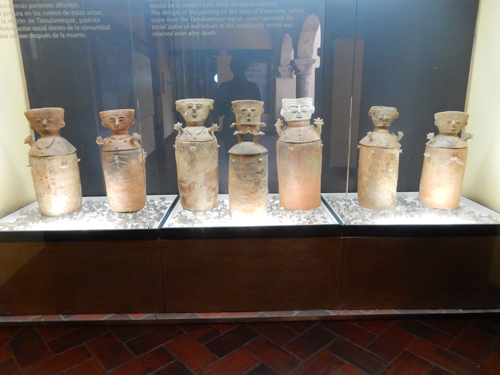
We continued to the Plaza de Bolivar and toured the Museo del Oro Zenu or Gold Museum
Small but very interesting collections of gold and pottery of the Zenu people who inhabited the region before the Spaniards – and it was air conditioned!
Burial urns
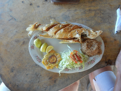
Shared a grilled fish dinner at the Majagua restaurant located on Plaza Fernandez de Madrid and then returned to our room to pack for our trip the next day
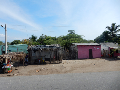
January 20 – Took a taxi to the airport to pick up our rental car and drove to our accommodations just east of Parque National Natural Tayrona on Colombia’s Caribbean north coast. It took us 7 hrs (2.5 extra hours) due to car rental delays, construction and Google Maps problems getting through Barranquilla. The route we traveled is one of the few in Colombia that the US State Department states is relatively safe to travel during the day. Here are a few roadside sites that we experienced along the way.
Entering Finca Barlovento property, which is located at Playa (beach) Los Naranjos where the Rio (river) Piedras enters the Caribbean. Caiman are crocodiles that inhabit the river here.
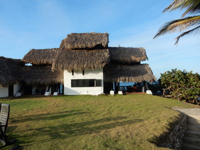
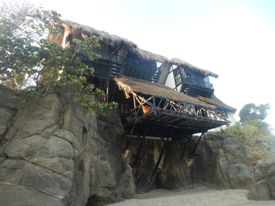
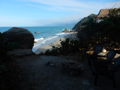
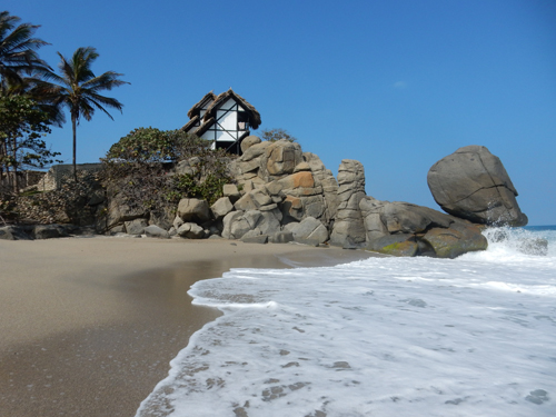
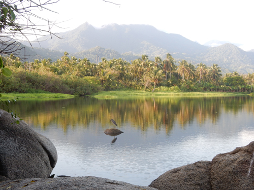
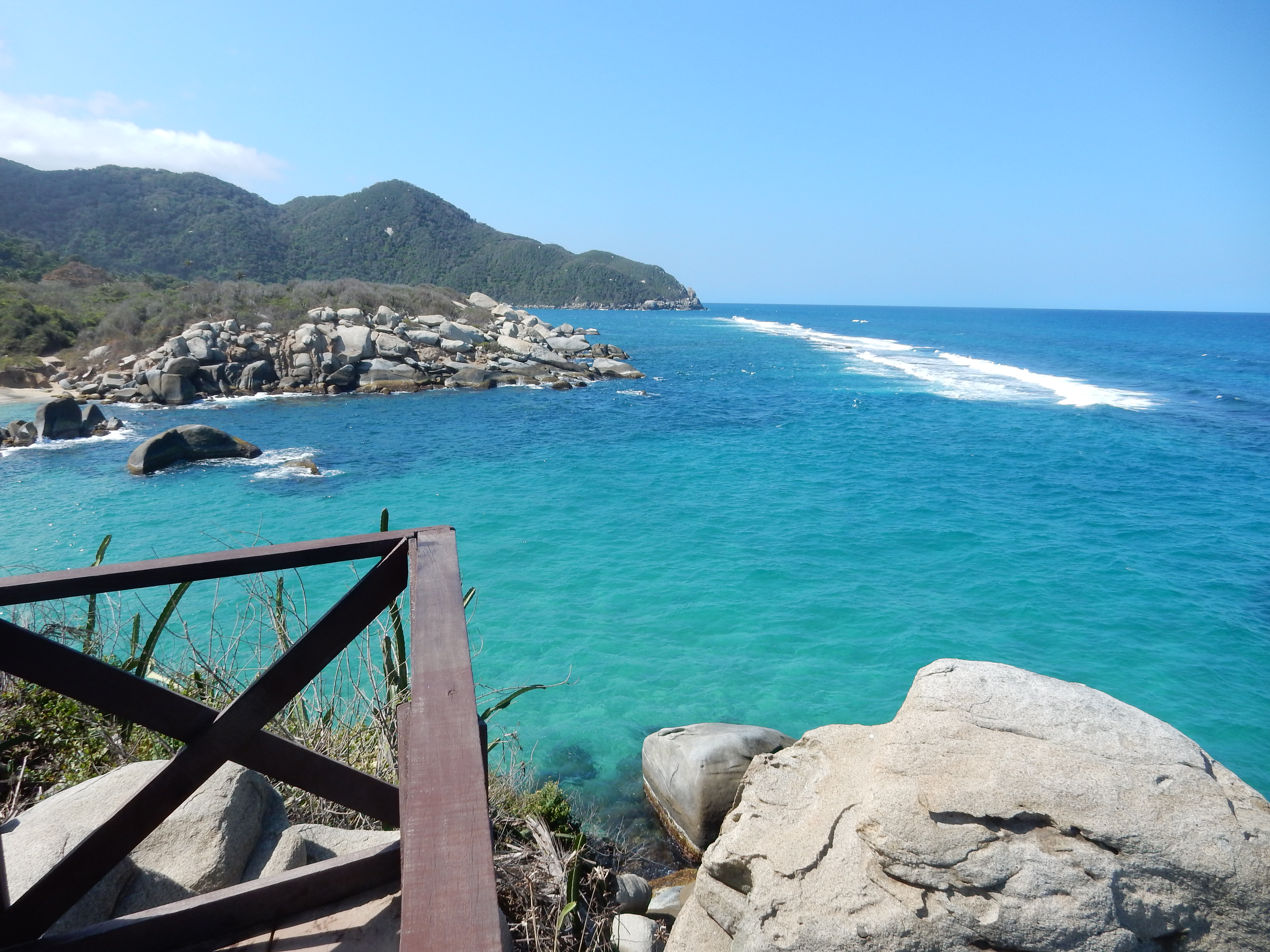
The following pictures of our amazing guesthouse, Finca Barlovento, were taken over a 3 day period. View of Finca Barlovento from the west – our accommodations for three nights. This may be the most scenic location we have ever experienced in that there was natural beauty in EVERY direction!
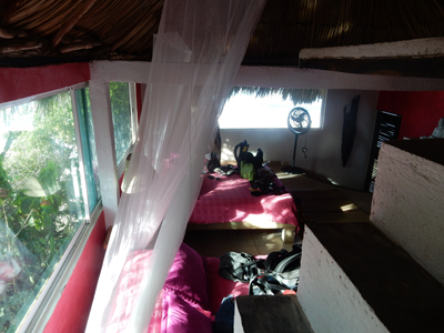
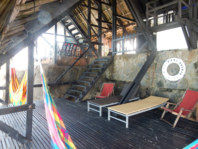
Our room was the one on the corner directly behind Helen; the only one ensuite
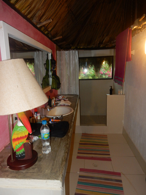
The center bottom is the kitchen and the dining area is on the right
Windows on left looked out on the beach to the north
Window in center looked east and was right above the point where the Rio Piedras enters the Caribbean
Note the thatched roof
Shower view!
Our balcony
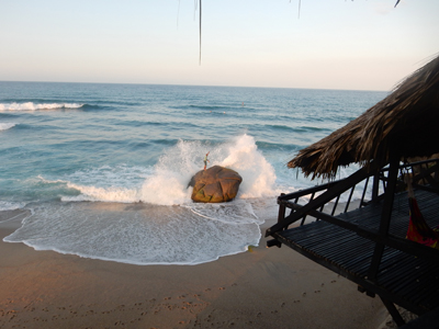
Lace (wave) on beach and local fisherman (on rock)
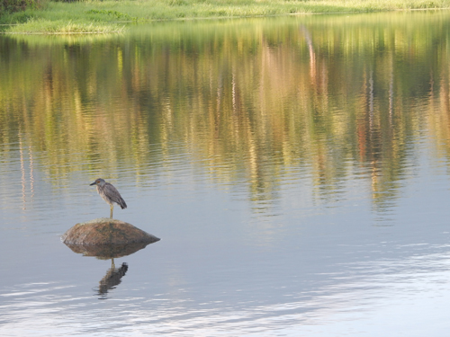
Feathered friend below balcony
View looking north
View from water at low tide
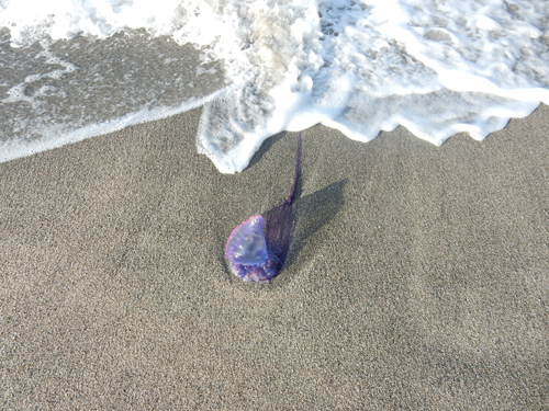
Portuguese Man-of-War (jellyfish)
Deck
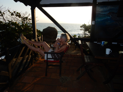
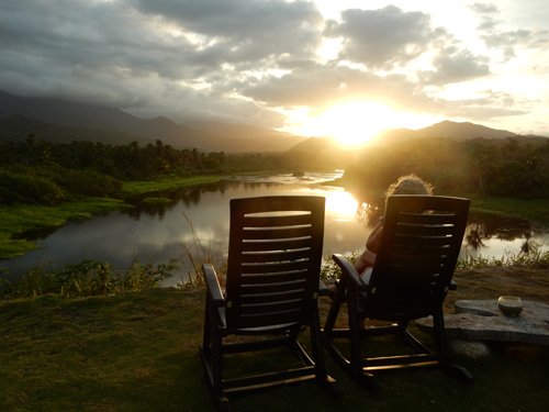
Breakfast coffee and view to the south
Breakfast and dinner included
View of beach and Finca Barlovento (center left) from the south (Tom on rock)
View from the north
View west up river – jungle and Sierra Nevada mountains
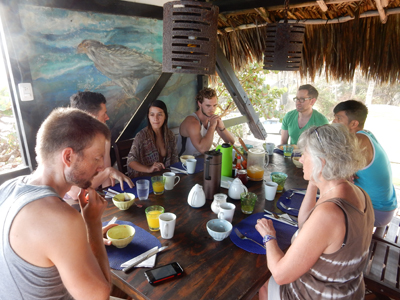
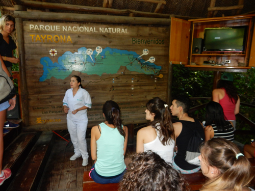
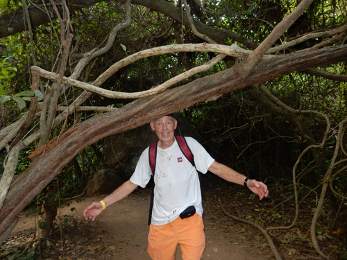
January 21 – Karla and Will from our guesthouse joined us for a full day in Tayrona NP. It was a short drive to the only road entrance to the park at El Zaino. The park entrance fees are relatively expensive.
Required park orientation
You may be checked for alcohol or glass bottles – don’t risk getting shot!
Will is Australian and Karla is Colombian. Karla was a great help (Spanish) making our entrance relatively smooth
Our parking area near Canaveral – these pics were Helen’s idea
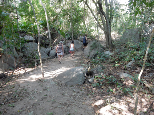
On the trail to Arrecifes, took about 45 minutes
Arrecifes has nice beaches but you need to be careful of dangerous currents
Trail mishap – I had my ball cap on and was running to catch up after taking some pictures
Re-creation of trail mishap – didn’t see the low tree!!!
Hiked for about ten more minutes to La Aranilla where there was a pretty cove for swimming
After a short dip, we hiked another 20 minutes to La Piscina
We decided to by-pass the beaches here and hike another 20 minutes to get to our final destination – Cabo San Juan del Guia
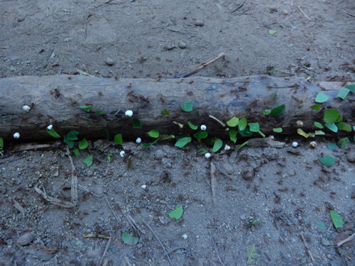
Leaf cutter ants – after all, this is the jungle!
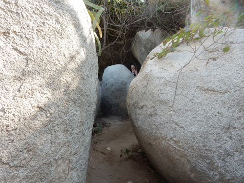
Nice boulders
There is camping, an outside restaurant (ate lunch there) and hammocks for rent
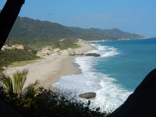
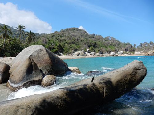
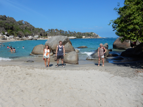
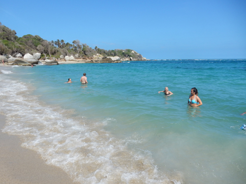
Here we found the best and therefore most popular beaches in the park
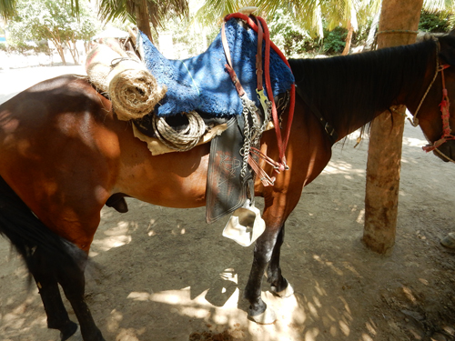
We could have hired a horse to bring us here – about $10 one-way. Helen wanted a picture of his stirrups
The east cove. The hut in between the coves has two small “rooms” as well as six hammocks that can be rented
The west cove. Even though there were more people here than anywhere else in the park, it did not feel crowded
Here are progressive views from the hut toward the west cove – beautiful!
It took us about 1.5 hrs to hike straight back to the car – it was a super day in Tayrona National Park
January 22 – Spent the entire day enjoying the beaches and environs of Finca Barlovento
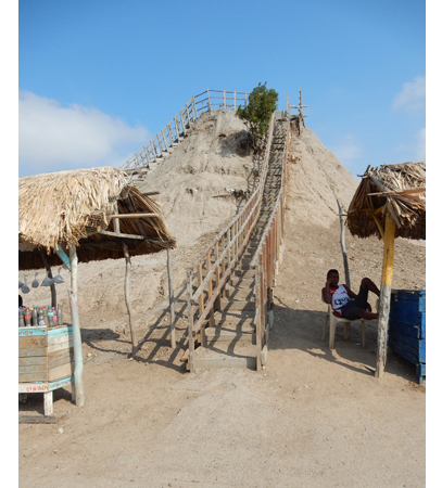
January 23 – Started driving after breakfast, stopped at Tayrona NP to buy a park T-shirt and then headed toward Cartagena. About an hour northeast of the city we stopped to experience the mud bath at Volcan de Lodo El Totumo. The “volcano” is a conical mud formation about 35 ft high.
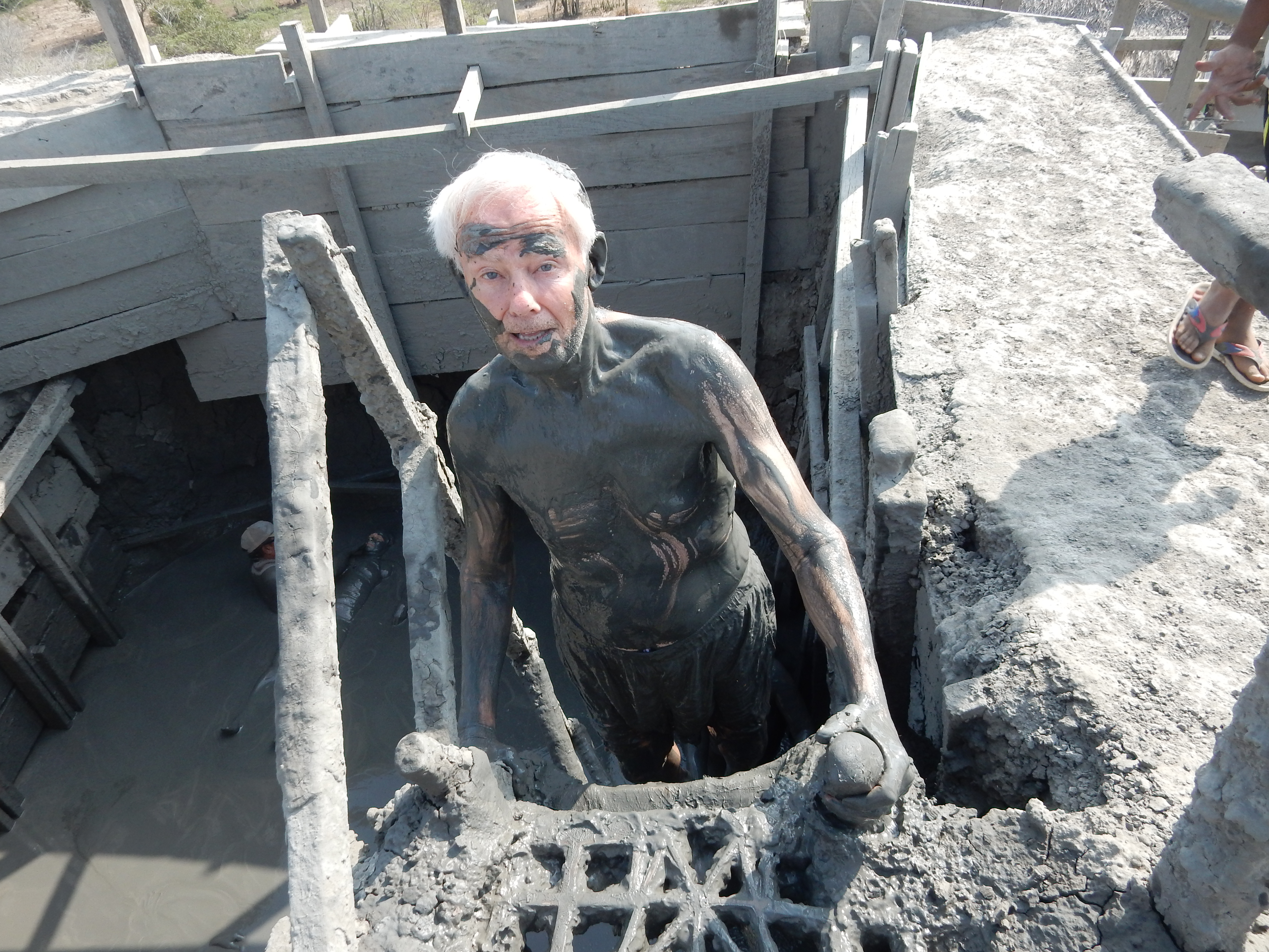
Climbed about 10 ft down a ladder into the center of the “volcano.” I have seen pictures where the mud is near the top – not sure why we were 10 ft down
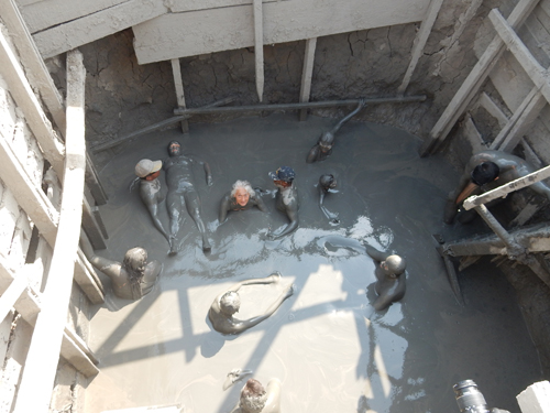
The mud is geothermally warmed and is a comfortable temperature. I didn’t submerge my head due to the cut I had incurred two days earlier.
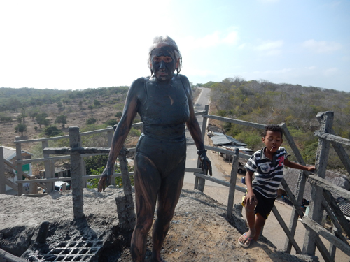
You to pay to go into the volcano, then you were expected to tip the official who took you to the top and did photographs with your camera, the massagers, the fellow who held your clothes, the woman who rinsed you off and then had to pay for the shower you needed to really get the rest (almost) of the mud off. In total about $24 for both of us.
Escaping from the volcano
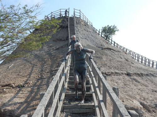
Helen – a little stinky and view of the road coming toward the volcano and lake
It was clearly a bonding experience
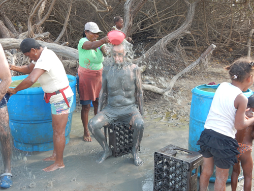
Hard on my tender feet
Heading for a rinse – ouch, ouch, ouch
Warm water from river
Shared a fish lunch to celebrate our “born again” dousing
Dropped the car off at the airport, took a taxi into Cartagena, showered again, and walked to the Plaza de San Pedro Claver for iced coffees. Beautiful evening, watched a wedding party exit the church with music and dancing.
It was Saturday and our one-night out in Cartagena. We went to the Café Havana for snacks, strong rum drinks and a loud live Cuban band – the place was packed! This is a picture of our new Brazilian friends
Notice the sharp looking woman with the emerald pendant!
January 24 – walked to Iglesia de Santo Toribio de Mangrovejo (completed in 1732) for mass but discovered we would have to wait over an hour.
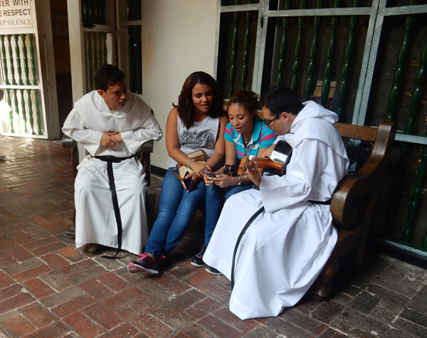
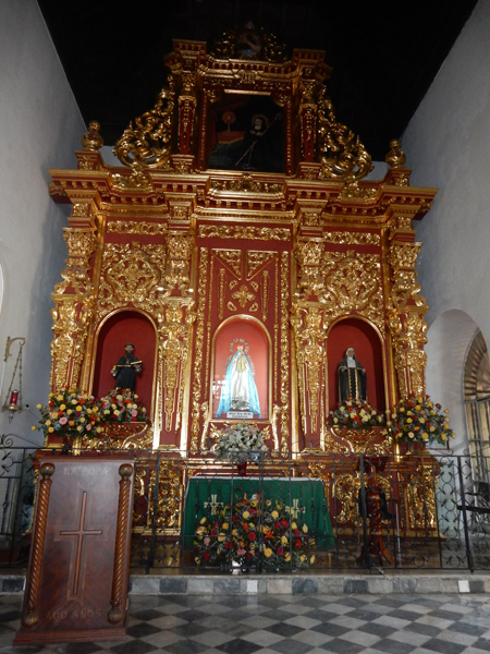
So we continued to Iglesia de San Pedro Claver. it is named for the Spanish monk Pedro Claver (1580-1654) who lived and died in the adjacent convent. He is called the “Apostle of the Blacks” or the “Slave of the Slaves” for spending his life ministering to enslaved people brought from Africa. He was the first person in the New World to be canonized a saint (1888). He is buried in a glass coffin (can see his skull) in the Italian marble altar.
Side altar to the Black Virgin
Walked the west wall of the city again, more iced coffee and shopping
Texted this picture to the grandkids –
Helen wasn’t feeling well, so we went back to the room for the rest of the day. I went out for some OTC meds and then walked a section of city wall around sunset
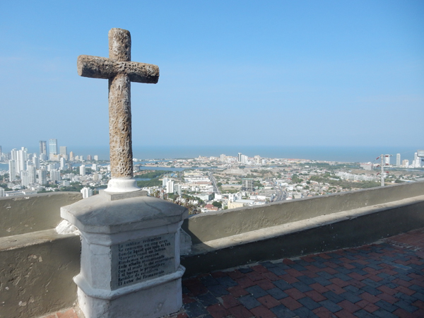
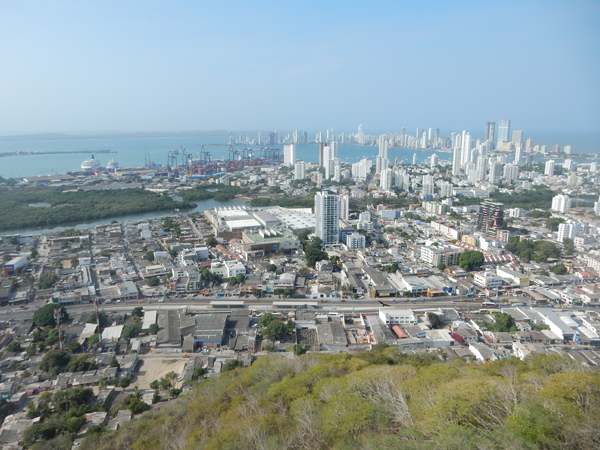
January 25 – took a taxi to the Convento de la Popa – Castillo de San Felipe de Barajas (Fort) is left-center, the Convent is upper right at the top of the hill (about 500 ft elevation)
Entrance to Convent and Chapel, which was founded in 1607. On February 2, the Fiesta de Nuestra Senora de la Candelaria, thousands of pilgrims process up the hill to honor Cartagena’s patron saint – La Virgen de la Candelaria. We missed it by a week.
Great city views from the top
Fort is right-center, Old Town is in distance
Harbor and modern city of Cartagena
Charming flower-filled patio of Convent
Practicing hymns
Representation of pre-Spanish pagans
Chapel of La Virgen de la Candelaria
Padre Alonso Garcia de Paredes – murdered along with five soldiers for trying to spread the good word
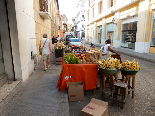
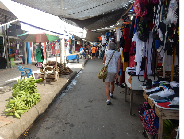
Next stop was Mercado Bazurto – Cartegena’s 24 hr central market. It is a labyrinth of alleyways offering about anything you might desire.
Did a last visit to the central Old Town in the early afternoon. I commissioned a silver pinky ring for Helen from Silver Smith Jose Baza (Fabricacion y Reparacion de Joyas). His little shop is across the street from this statue of Pope John Paul II who visited Cartagena in 1986. Helen specified style and size and Jose took the measurements. We picked it up one hour later.
Returned to our room, rested, packed and then headed outside the north wall for our final sunset in Cartagena
Celebrating our Colombian adventures with the Ultimate Paella Seafood Platter!!!
January 26 – Helen’s Birthday! Unfortunately, our morning Avianca flight to Bogota was a couple of hours late, which meant we had to reschedule the flight from Bogota to Panama City. Long story short, we arrived at our hotel in Panama City at 1am. You can fly from Cartagena directly to Panama City in less than an hour but the only airline to fly that route, the Colombian airline COPA, charges almost twice the Cartagena to Bogota to Panama City fare – they know they gotcha!
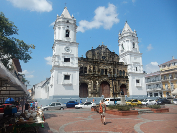
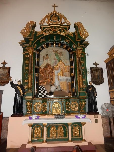
January 27 – decided to tour Casco Viejo (Old City) on our first day in Panama. The weather was the same as in Colombia – hot. We’re not complaining, that’s what we wanted on this trip. We started by visiting the Panama Canal Museum (Museo del Canal Interoceanico) and then the Catedral Metropolitana (begun 1688, completed 1796). The bell towers are inlaid with mother-of-pearl. It was host to the signing of the declaration of independence of Panama from Colombia in 1903.
Both are located on Plaza de la Independencia
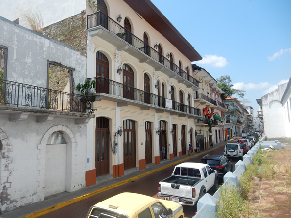
Ongoing preservation and restoration efforts
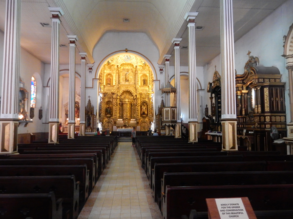
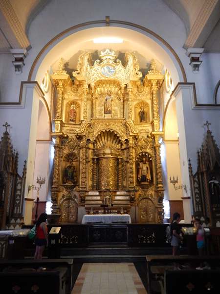
Beautiful baroque altar of Iglesia de San Jose. According to legend, it was painted black the night before Pirate Henry Morgan’s sack of the city and afterward moved to its current location.
One of several attractive side altars
Nuestra Senora del Carmen
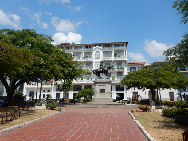
Parque Herrera – General Tomas Herrera on horseback
Plaza Bolivar with Iglesia de San Francisco in background; we had a nice outdoor lunch, from Restaurante Casablanca, while sitting at the plaza
Palacio Bolivar, a former convent where a congress of Latin American union was held in 1826. It is now the Foreign Ministry.
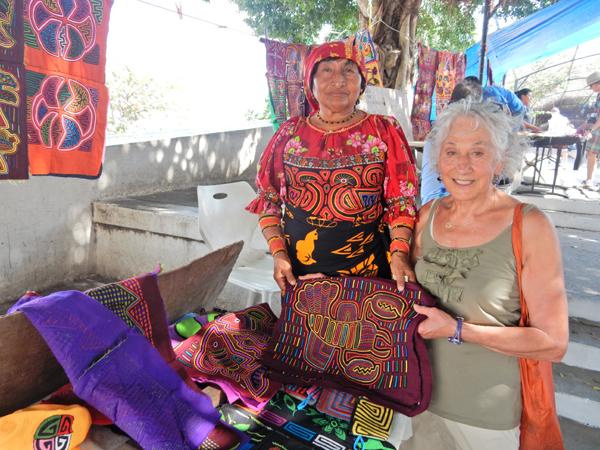
Craft stalls along the Paseo General Esteban Huertas
Helen purchased two of her molas
Helen wanted a picture of the native leg sleeves
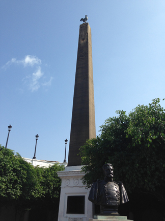
The Plaza de Francia is located on a prominent point right below the French Embassy. The obelisk topped with a Gallic cockerel is to honor the French for their pioneering attempt to build the Panama Canal.
Ferdinand de Lesseps – 22,000 workers lost their lives in building the canal!
Low tide view of Casco Antiguo area of Casco Viejo from Calle 2 Oeste
Relaxed at the pool of the Country Inn & Suites by Bradford on the Canal in the afternoon and then had dinner at the Bucanero’s Restaurant at the end of the Amador Causeway
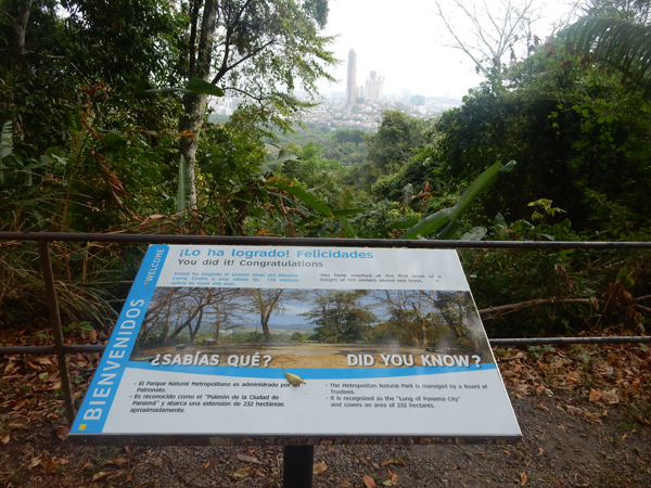
January 28 – Visited Parque Natural Metropolitana in the morning – tropical America’s only wildlife refuge and forest within city limits (573 acres). Enjoyed walking the trails but the pollution of the city is having its effects on this national park.
We walked the Sendero El Roble, Sendero La Cienaguita and Camino del Mono Titi trails – a total of about 2 miles
The park is noted for its dry forest – during the dry season, the trees drop their leaves
Can you see the spider?
Lots of interesting trees
This is a grape palm
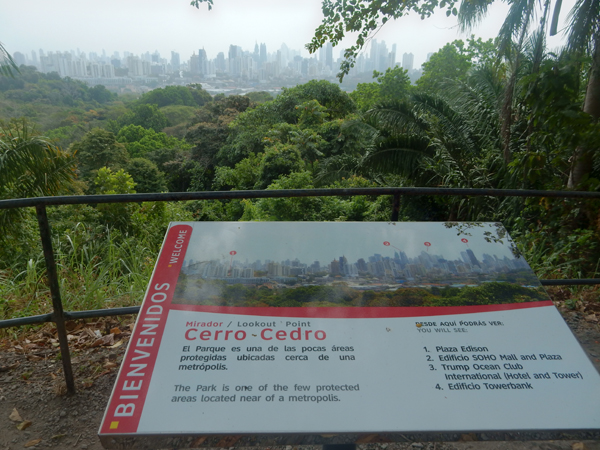
Sign for Mirador or “Lookout point” – highpoint of park, about 500 ft elevation
Also known as Cedar Hill
The park is known as the “Lung of Panama City’
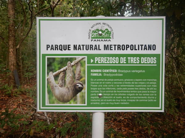
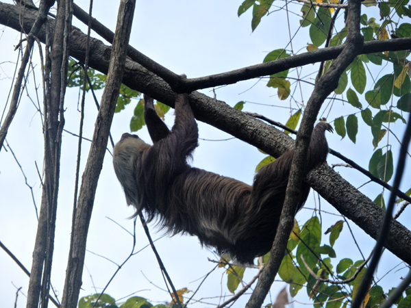
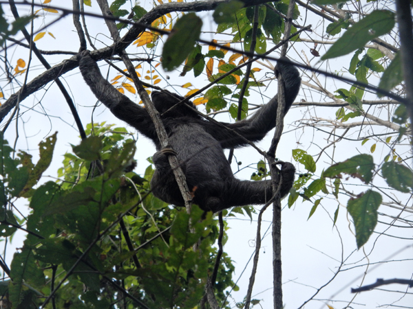
Looking for sloths
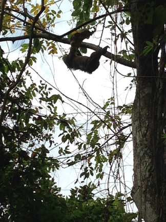
We saw two three toed sloths
Pond/wet area
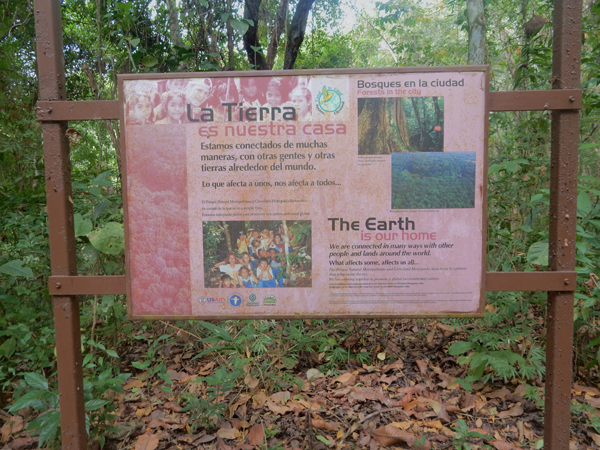
A good parting thought – “The Earth is Our Home”
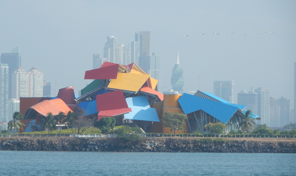
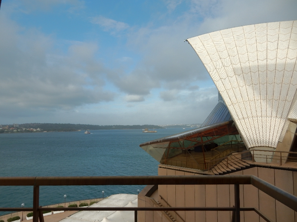
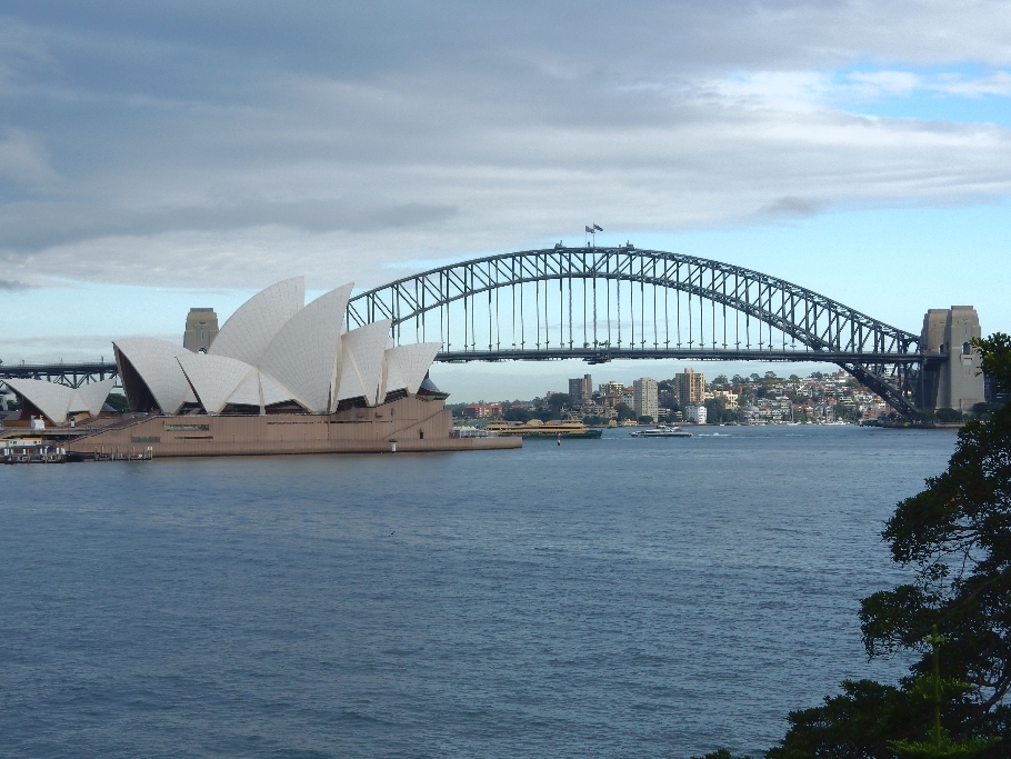
We started our afternoon by walking to the impressive Biomuseo, which opened in 2014. It is multicolored-shaped and meant to represent the branches and leaves of a tree and the forces of nature. Panama hopes it will become a symbol of the city, much like the Opera House in Sydney.
The museum has eight multimedia exhibition halls showcasing Panama’s tremendous biodiversity. It also does an excellent job of covering Panama’s history in Spanish and English. It is surrounded by a “biopark” showcasing Panama’s flora. We highly recommend a visit!
Our Country’s Pillars – monument “Pilares de la Patria” was erected by Bladex Bank
We rented bikes nearby and cycled across the Amador Causeway to the Punta Culebra Nature Center. The Causeway extends three miles to the islands of Naos, Culebra, Perico and Flamenco. It was built with rock from digging the Panama Canal and protects its Pacific entrance. The Nature Center has indoor and outdoor exhibits featuring some of the tropical biodiversity of Panama. It is run by the Smithsonian Institute.
Downtown Panama City from end of Amador Causeway
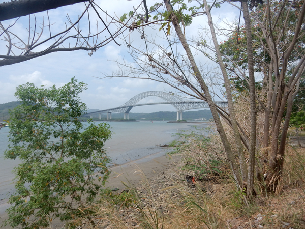
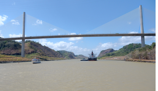
Bridge of the Americas – entrance to Panama Canal from Pacific Ocean
Freighter exiting the Panama Canal – taken near our hotel
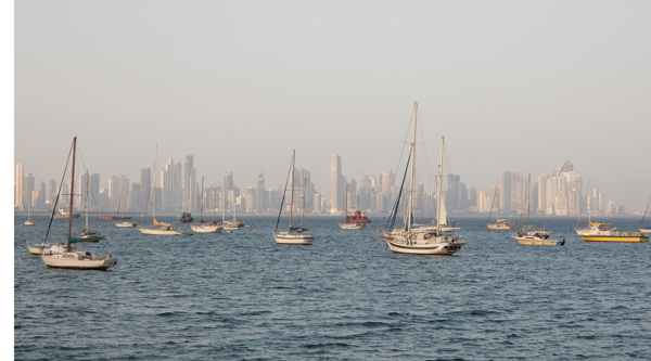
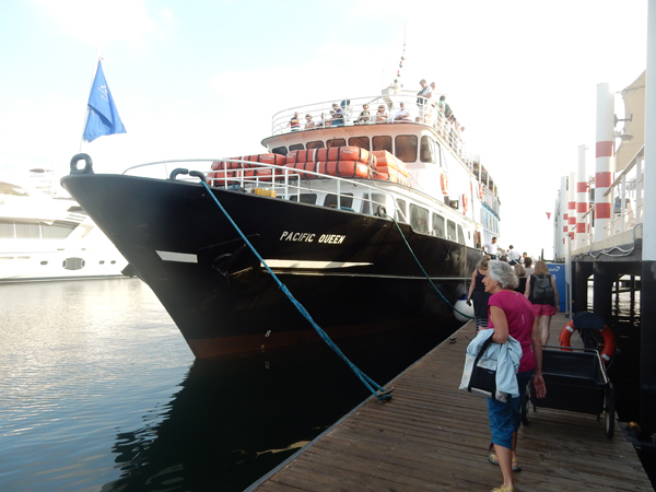
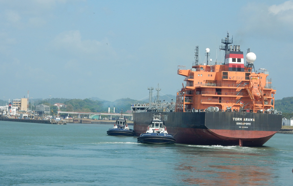
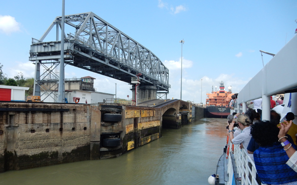
January 29 – I have always had a fascination with ships/boats and have wanted to experience the Panama Canal since I was a young boy. Today was the day – we did a “partial transit” with Panama Marine Adventures on the Pacific Queen.
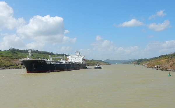
We entered the canal from the Pacific end. Our boat was paired with this one, the TORM ARAWA as we proceeded through the locks
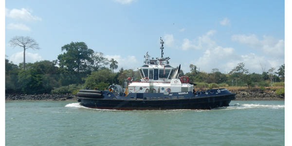
Ocean Tug boat
Biomuseo from the canal
Country Inn & Suites – our hotel on the canal
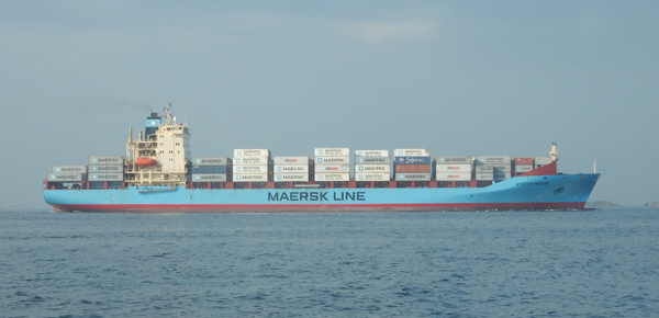
This is a MAERSK line container ship that was actually too large to go through the canal. The containers were off-loaded onto a train and taken by rail to the Atlantic side of the canal and re-loaded onto another ship. They are building another parallel canal that will accommodate larger ships.
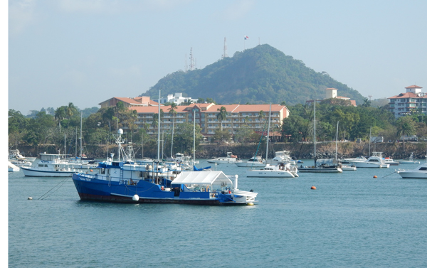
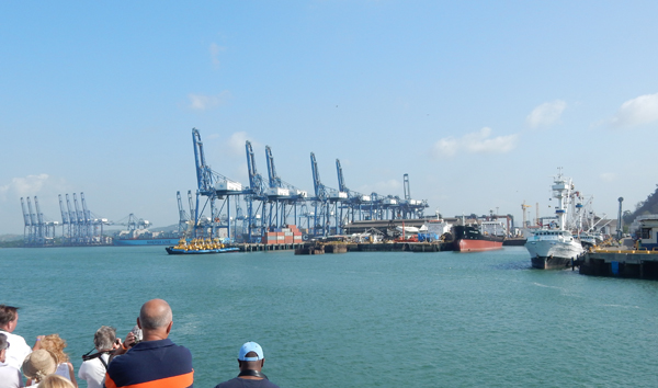
This is the Port of Balboa where the MAERSK and other ships were docked
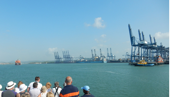
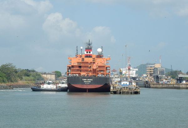
Following the TORM toward the first lock – MAERSK is docked in center of pic
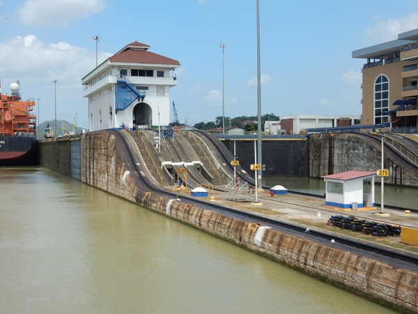
Approaching the Miraflores Locks
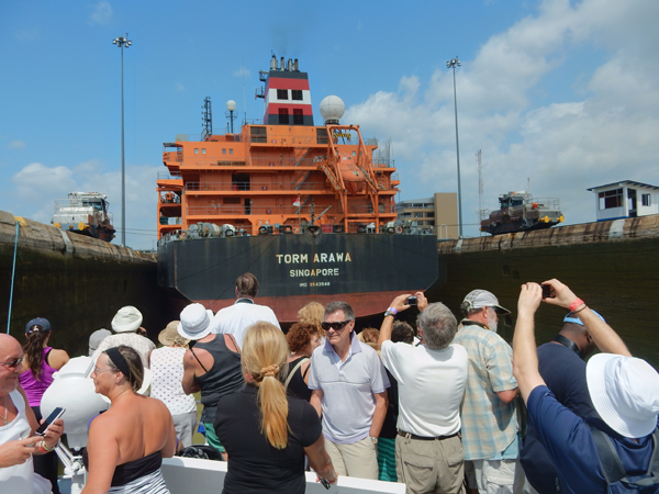
The TORM is going into the left lock, another ship is already up in the right lock
The White side of lighthouse is visible to ships entering the Miraflores Locks from the Pacific but the black side is not visible to ships exiting the locks toward the Pacific
Canal Tug
There are three sets of locks on the canal. Locks are 110 feet wide and 1,000 feet long. Some ships have been built to fit exactly into the locks. They are called PanaMax and are 106 at the beam and 950 feet long.
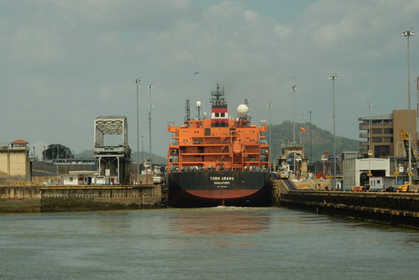
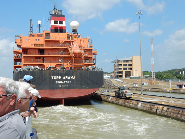
The TORM appeared to be the maximum width but not length, so our boat could fit behind it
Lock gates closing
Going Up! Mules attached by cables left and right keep boat in center of lock
Looking back, lock full
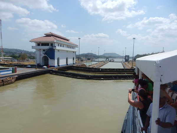
The boat moves forward under its own power. Miraflores Locks Visitor Center is center right
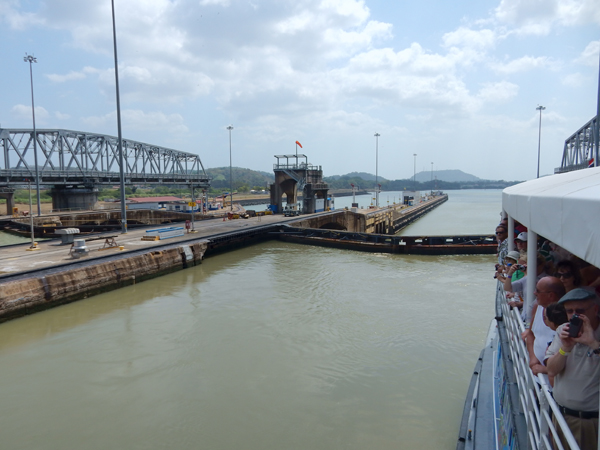
Entering the second lock. The two locks raise a boat from 43 to 65 feet (average 54 feet) depending on the tides of the Pacific Ocean
Double gates here for safety
In case boat in first lock hits first gate
Two spectators
After exiting the second lock we sailed about a mile on Miraflores Lake to the Pedro Miguel Lock
The Pedro Miguel Lock lifts boats an additional 31 feet to the level of Lake Gatun
Mule on the left – ships proceeding toward the Atlantic next pass under the Centennial Bridge. The Canal runs Northwesterly to Southeasterly. The Atlantic entrance is about 27 miles further west than the Pacific entrance – a good trivia question!
Beyond the bridge is the Culebra or Galliard Cut – through the Continental Divide. The French spent 20 years trying to build the Panama Canal (1879-1899). A 1903 treaty allowed the US to purchase rights and properties from the French. The US also purchased properties from private landholders. Construction started in 1904 and was completed in 1914 at a total US cost of about 387 million dollars. The 1977 Torrijos-Carter Treaties turned the canal over to Panama.
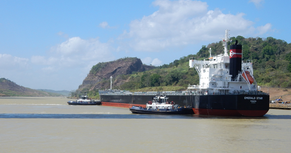
Passing the Emerald Star
Looking back at the Centennial Bridge, ships moving toward the Pacific Ocean. Note the channel markers
The Panama Canal is only about 51 miles long – I thought it was longer. It takes 6 to 8 hours for a ship to pass through
Cost of passage depends on vessel type, size and cargo. In 2010 a cruise ship paid $375,600. The average toll is $54,000. The lowest toll paid was 36 cents by an American who swam the canal in 1928.
The Mermaid Ace is a Panamanian vehicle carrier. It is 107 feet wide and 656 feet long
Panamanian prison that houses Manuel Noriega, former military dictator of Panama
Entering Port of Gamboa
Our cruise ended here and we were taken by bus back to our hotel. Had we continued through the canal, we would have sailed onto Lake Gatun and then passed through the Gatun locks, which would have dropped us 85 feet to the level of the Atlantic Ocean.
Had dinner at the Balboa Yacht Club on the canal.
We left the hotel at 5am the next day, flew to Miami and on to San Juan Puerto Rico.
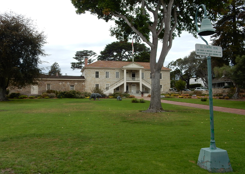
9/29/2015 – Visited our friends Amir and Afsaneh in Campbell CA, had a wonderful Persian meal and reminisced about our time in Iran. 9/30/2015 – it was about an hour drive to Monterey, where we began our day by visiting Colton Hall.
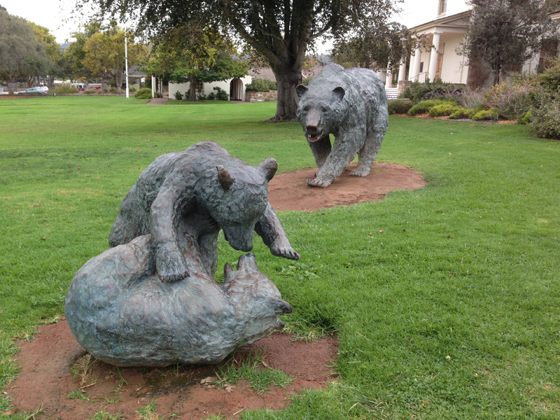
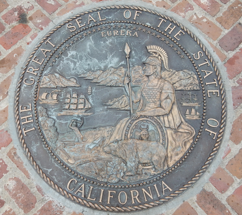
The Bear is the state mascot
CA became the thirty-first state in 1850 and Monterey was its first capital
State Seal
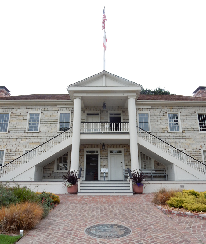
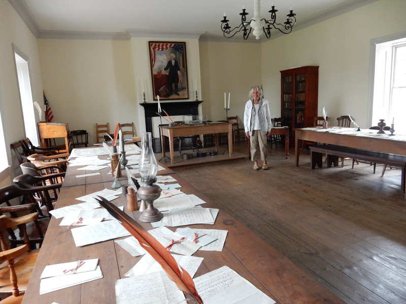
A remote Spanish outpost became an agrarian Mexican province (Alta California) and then a U.S. state. Colton Hall was the site of the state’s first constitutional convention in 1849.
Result of Helen buying an 8’ x 11’ – 70 lb Persian carpet! How are we going to get it home?!!!
We did the historic town walk – this is the Royal Presidio Chapel, now known as the San Carlos Cathedral. It was the church of all Spanish and Mexican governors and is the oldest building (1794) in Monterey.
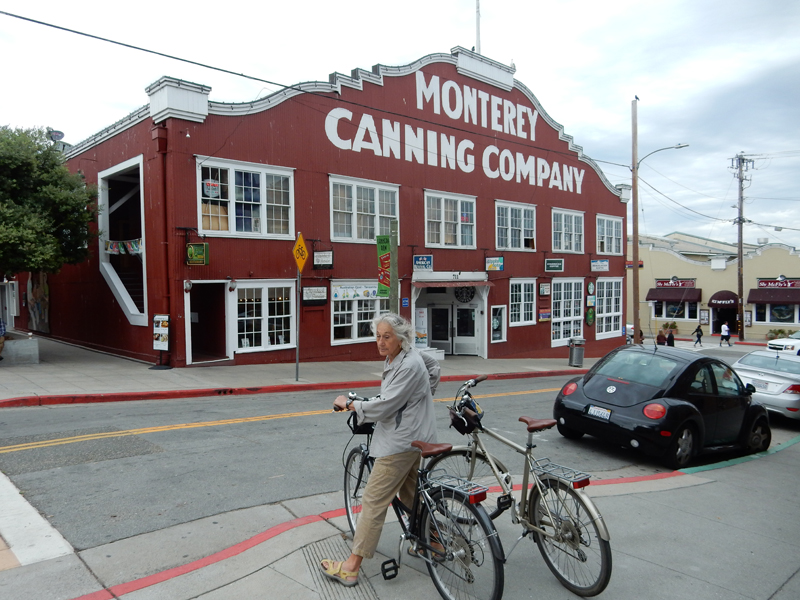
We then walked to the waterfront, rented bikes and pedaled the coastal trail through Monterey
The trail runs over the old Southern Pacific railroad lines that serviced Cannery Row and the sardine canneries. The Monterey Peninsula has a year-round average temperature of 57 degrees.
We pedaled past the Monterey Aquarium and along the coast with great views of the Monterey Bay National Marine Sanctuary including dolphins, seals and birds. We then continued along much of the famous 17-Mile Drive – Lighthouse Golf Course
This guy is for the birds!
I liked this statue
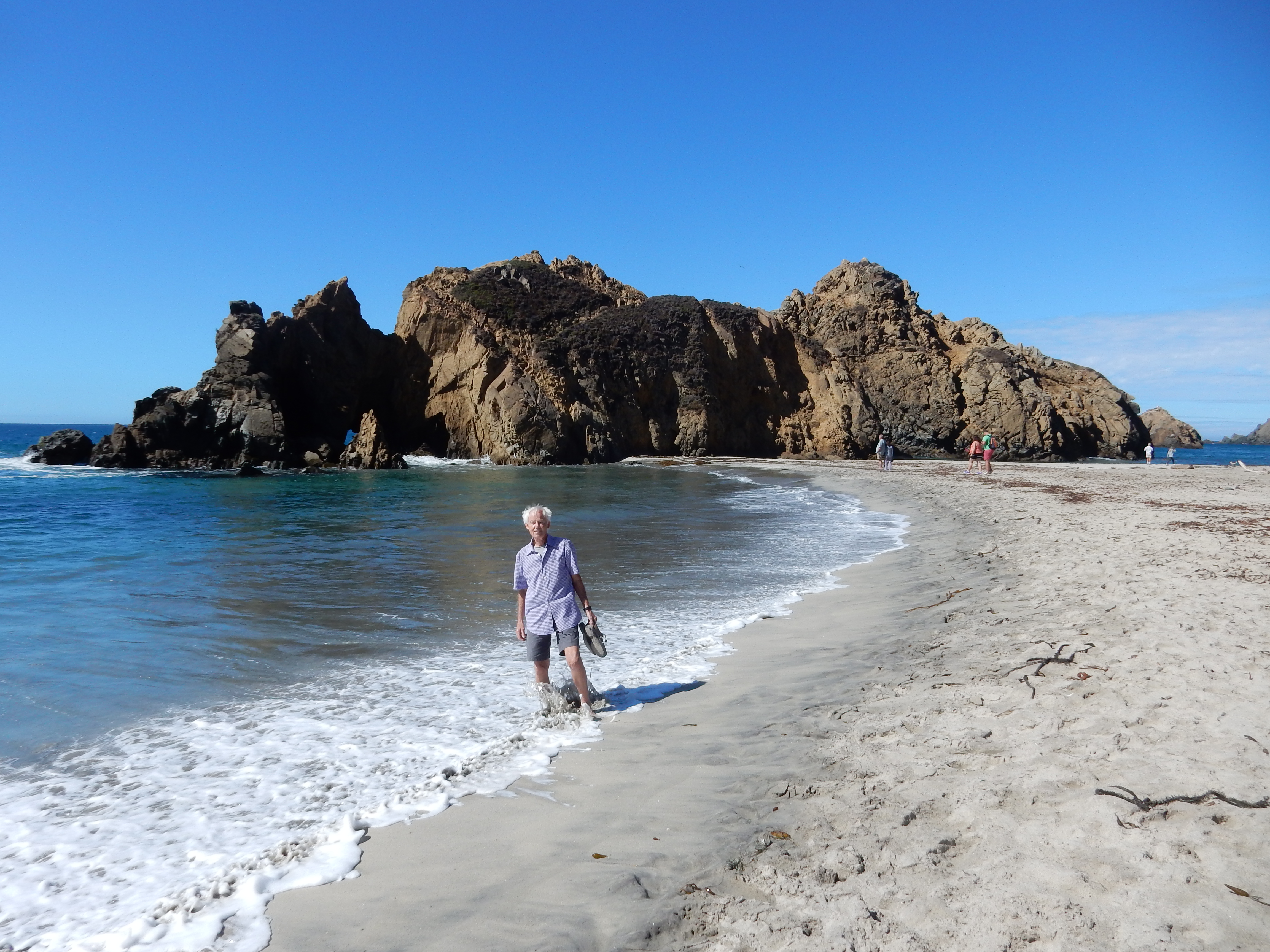
10/1/2015 – Took the famous coastal Rt 1 south toward LA, first driving through Carmel and then stopping at one of our favorite places – Pfeiffer Beach
Rock balancing is something we have seen many places in the world
Helen on the Rocks
Oooo – that felt Good!
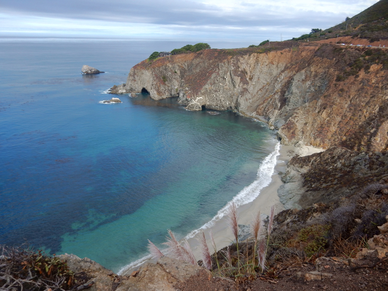
Big Sur Coast
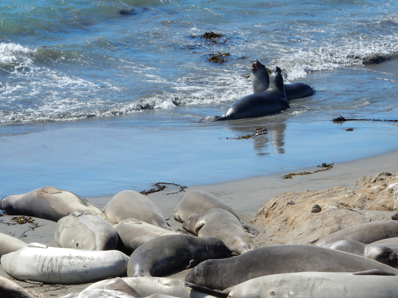
Our next stop was the Elephant Seal beach four miles north of the Hearst Castle. October is when the juveniles and yearlings are primarily on the beach
Two sub-adult males engaging in jousting behavior
10/2/2015 – Dinner and car show at Bob’s Big Boy in Burbank (BBBB) – say that out loud three times! Jay Leno is known to frequent this place with one of his many cars.
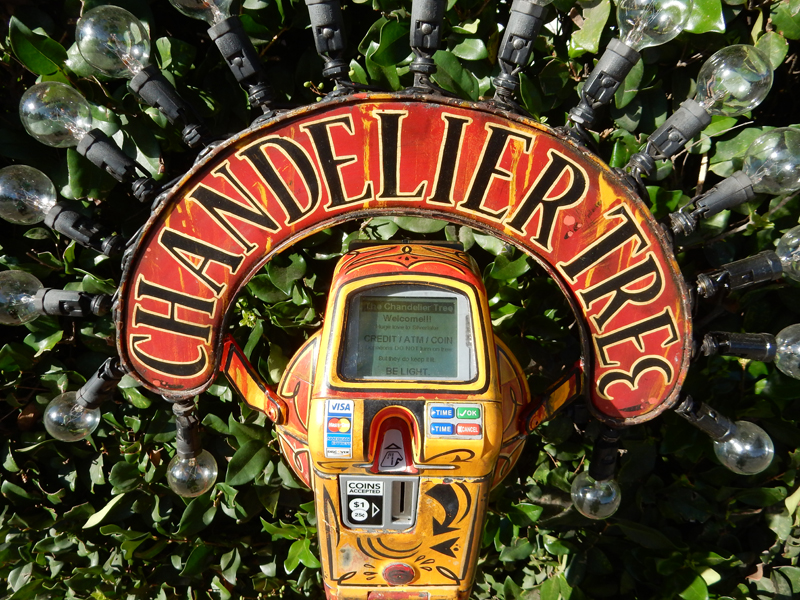
Chandelier Tree – private home about a mile from Kate’s
Cash, Credit or Debit Card donation meter – to keep the lights on!
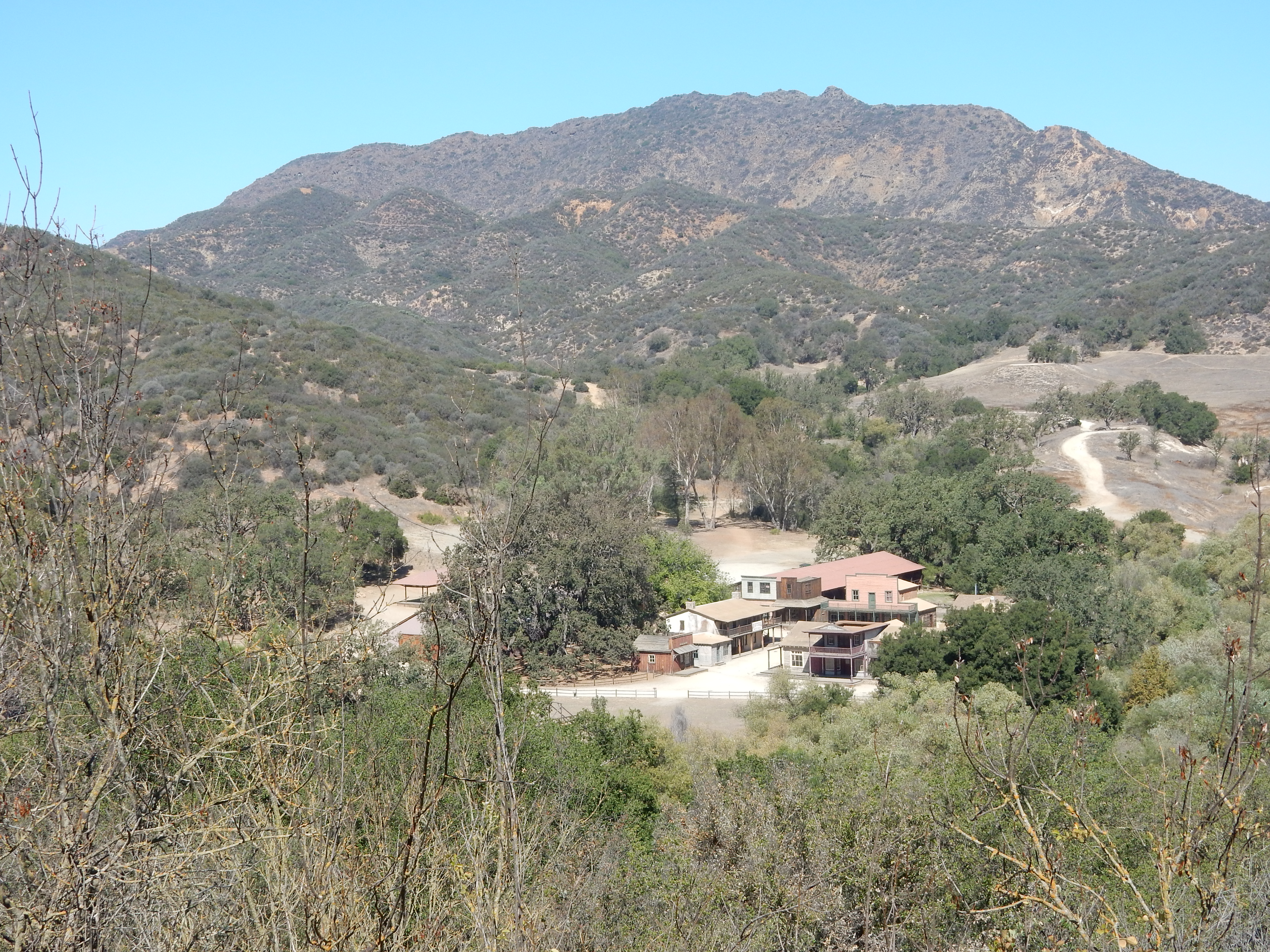
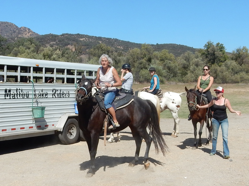
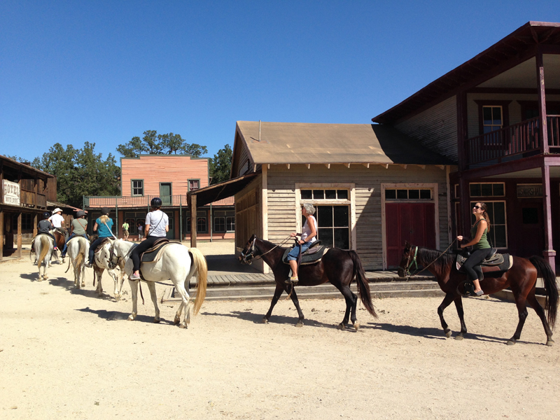
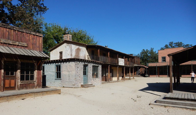
10/3/2015 – Horseback riding at Paramount Ranch in Santa Monica Mountains National Recreation Area. The ranch was a filming site for Paramount Pictures.
Wooo – “Rarin to Go”
Not so Wild West
Movie Set
“Headin Out of Town”
Nice Ride Cowgirl (with purse and sunglasses?) –
Quick change – then lunch at Geoffrey’s on the coast in Malibu – $9 bottle of tap water!
Getty Villa – J. Paul Getty was an oil tycoon who reveled in Greek, Etruscan and Roman antiquities. He first opened the J. Paul Getty Museum in his home. In 1968 he decided to build the Getty Villa on 54 acres he had purchased in Malibu in 1945. The Villa is modeled after the Villa Dei Papiri, a Roman country house in Herculaneum buried by an eruption of Mount Vesuvius in A.D.79. The Getty Villa opened in 1974.
Inner Peristyle –
Outer Peristyle –
East Garden –
Good Audio Tour
Men in Antiquity
Vessels and Jewelry from a Burial
Boxers Mosaic in the Athletes in Competition Room
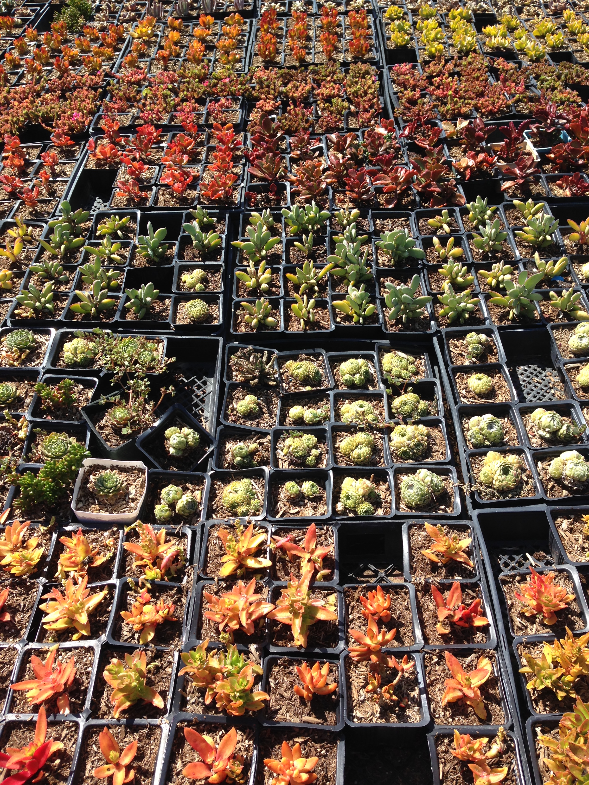
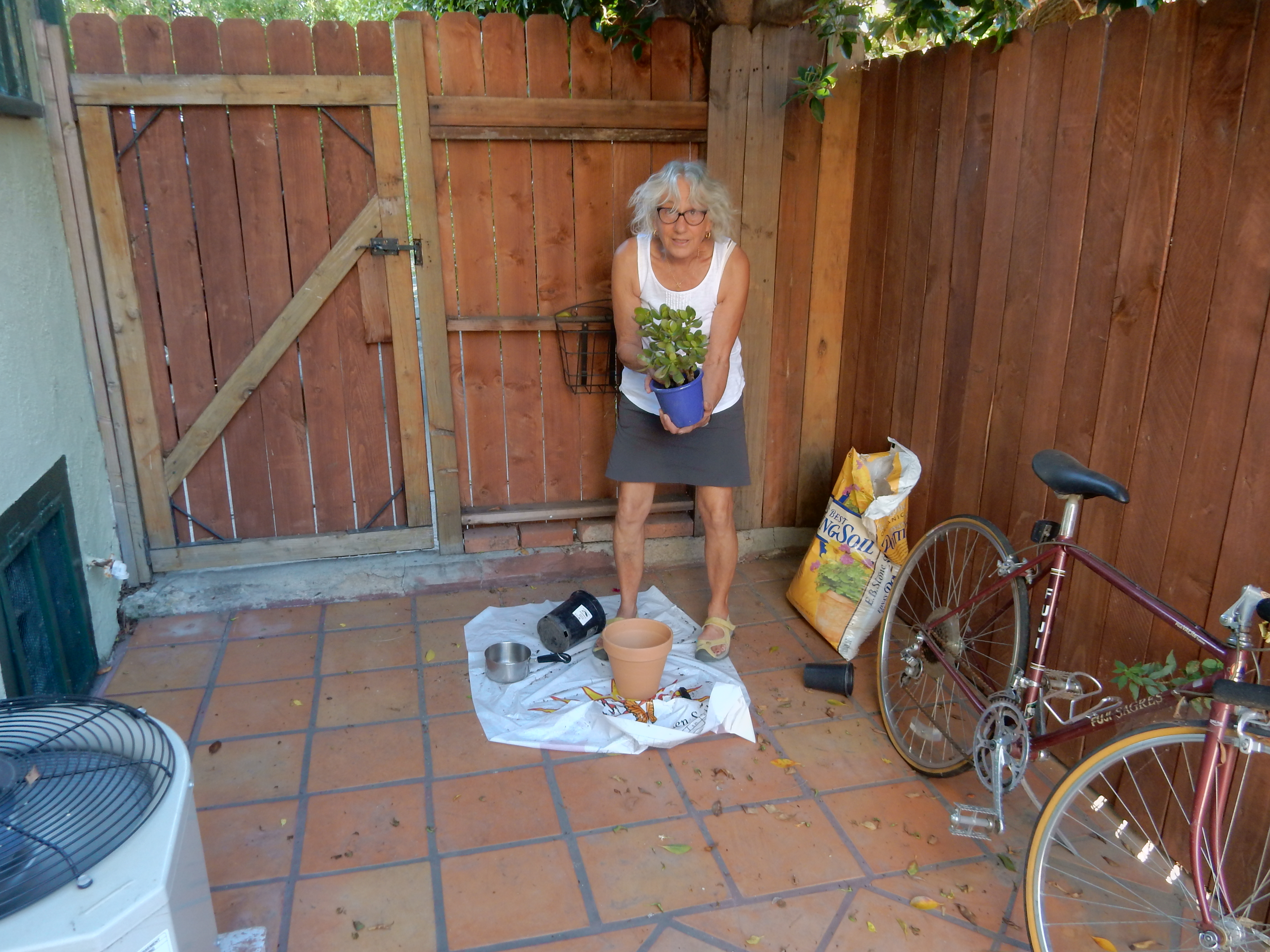
10/4/2015 – attended mass at St Francis of Assisi, breakfast at Millie’s and then spent the rest of our Sunday buying and potting plants for Kate’s patio
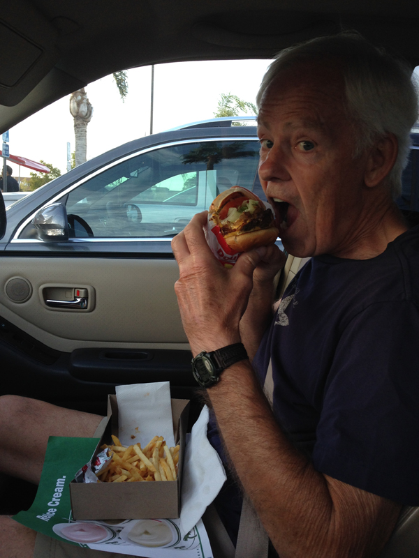
9/25/15 – Dinner – my first In-N-Out Burger – a very healthy Double-Double with a side of vegetables!
Arrived at our rental cabin in Three Rivers CA at 8pm after a four hour drive from LA
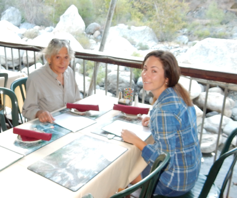
9/26/15 – We were up and packed by 7:30 but had to wait until 8am for the Gateway Restaurant to open for breakfast.
We opted to look at, rather than eat at, the table on the rock!
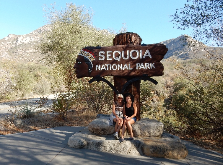
It was a short drive to the south entrance of Sequoia National Park
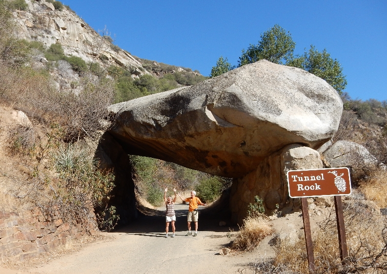
Our first stop was Tunnel Rock – couldn’t quite hold it up!
The Four Guardsman mark the entrance into the Sequoia groves
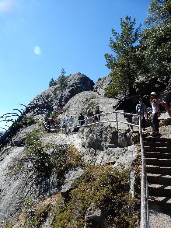
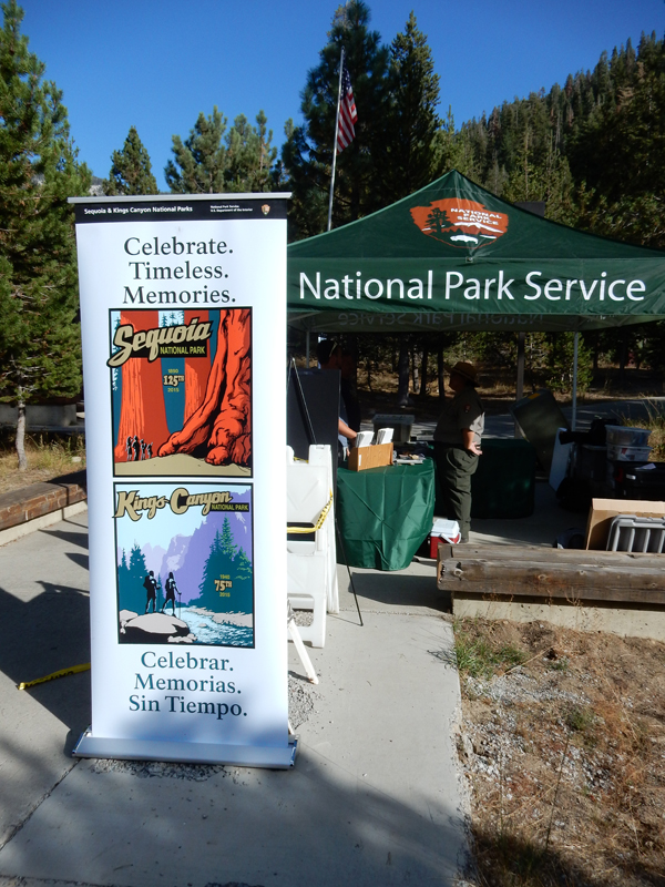
September 26, 2015 was the celebration for the 125th anniversary of Sequoia NP and the 75th anniversary of Kings Canyon NP. The celebration, the unseasonably warm weather and the fact that today was a “Fee-Free” day because of National Public Lands Day, resulted in a large number of people in the park. As a result we could not drive on the Crescent Meadow Road and had to take a shuttle to Moro Rock.
It was a quarter mile hike to the top of Moro Rock
About 350 stairs
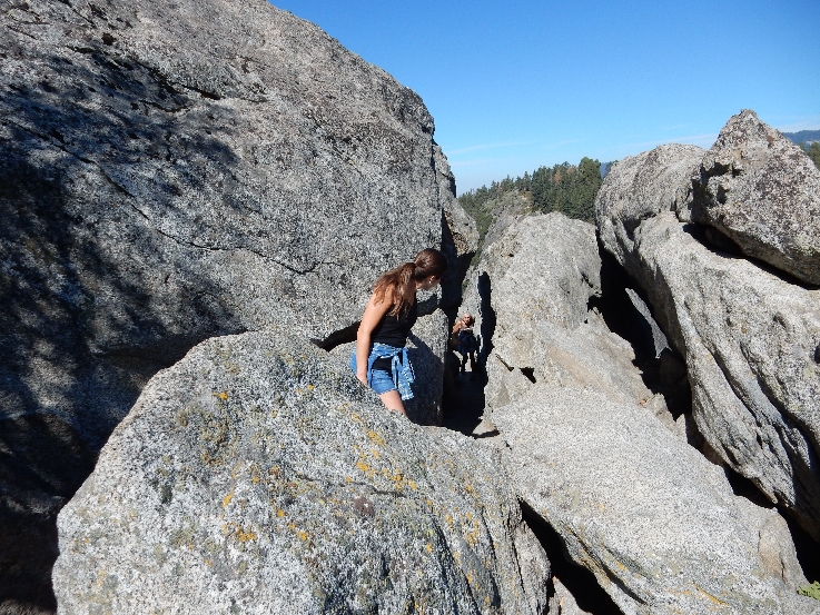
Through the rocks
Almost there
300 foot elevation gain to top at 6,725 ft
Sierra Nevada Mountains
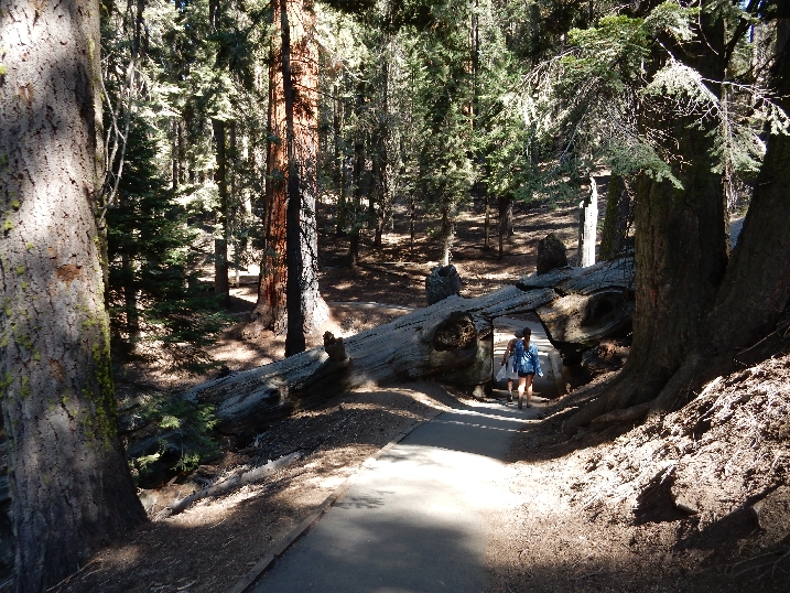
We then hiked about a mile on the Soldiers Trail from Moro Rock to Tunnel Log
Roosevelt Tree hugger –
Kate was disappointed she was not able to drive her car through the Tunnel Log
Replenished our energy with the 125th anniversary celebration BBQ lunch at the Wolverton Picnic Area and then hiked a half mile to the General Sherman Tree
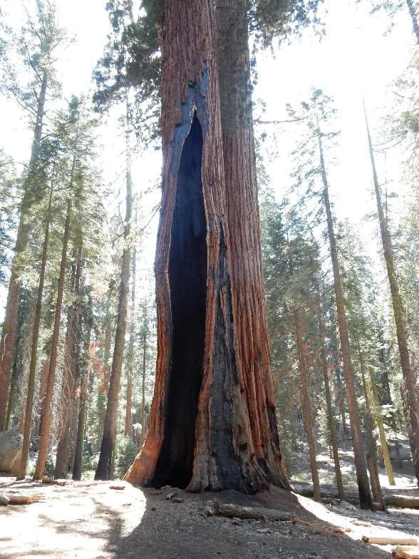
General Sherman Tree – “World’s Largest Living Tree” – based on volume of total wood. It is estimated to be 2,200 years old and each year it grows enough new wood to produce a 60-foot-tall tree of usual size! It is 275-foot-tall and has a circumference of 103 feet at ground level.
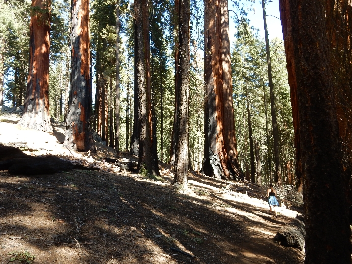
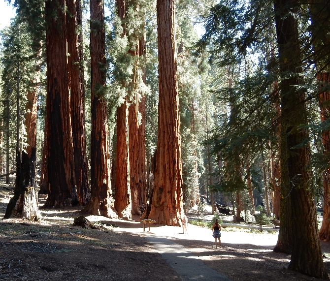
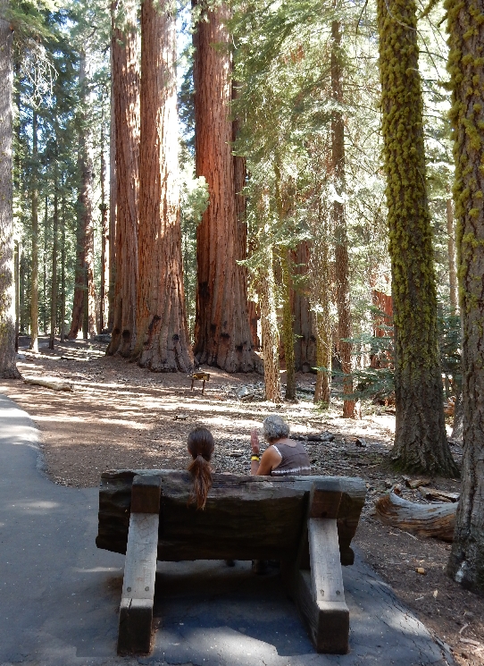
We then did the 2.5 mile Congress Loop through the Giant Forest
Sequoias are fire resistant with 31 inch bark
Senate Group
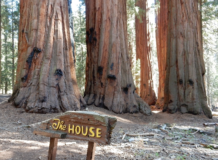
House Group
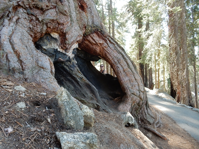
Fallen Giant
Marmot
Lodgepole Visitor Center
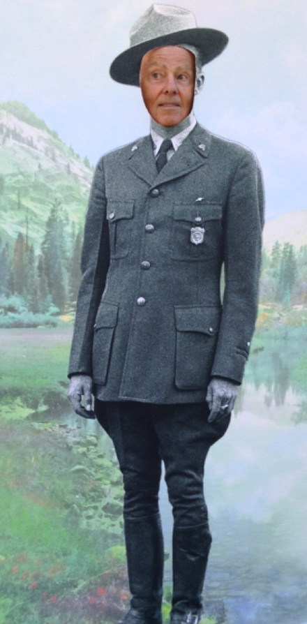
Ranger Tom
Grant Grove Duplex Cabin
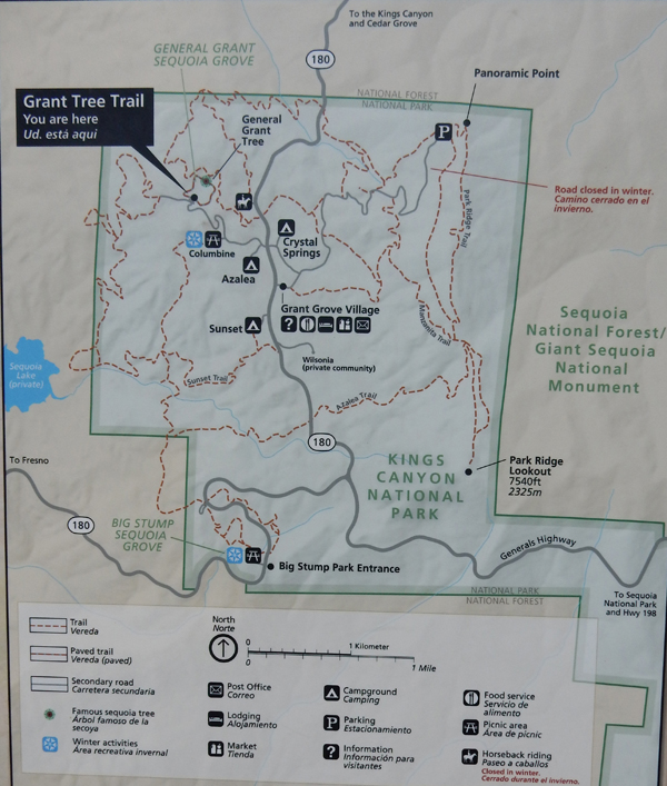
9/27/15 – Started with a morning hike around General Grant Grove
Tunnel Log Coffee Break
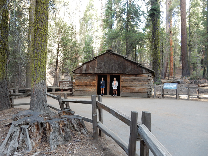
Gamlin Cabin
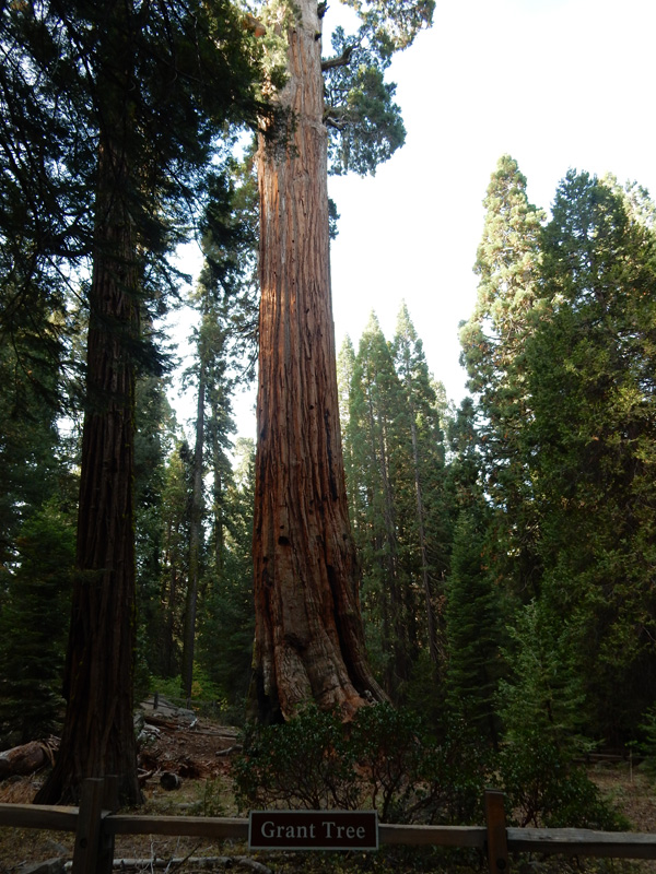
Sunny side of General Grant Tree- the “Nation’s Christmas Tree.” It is the second-largest sequoia in the world. It is 270 foot-tall and has a circumference of 107 feet at its base.
Forest Friend
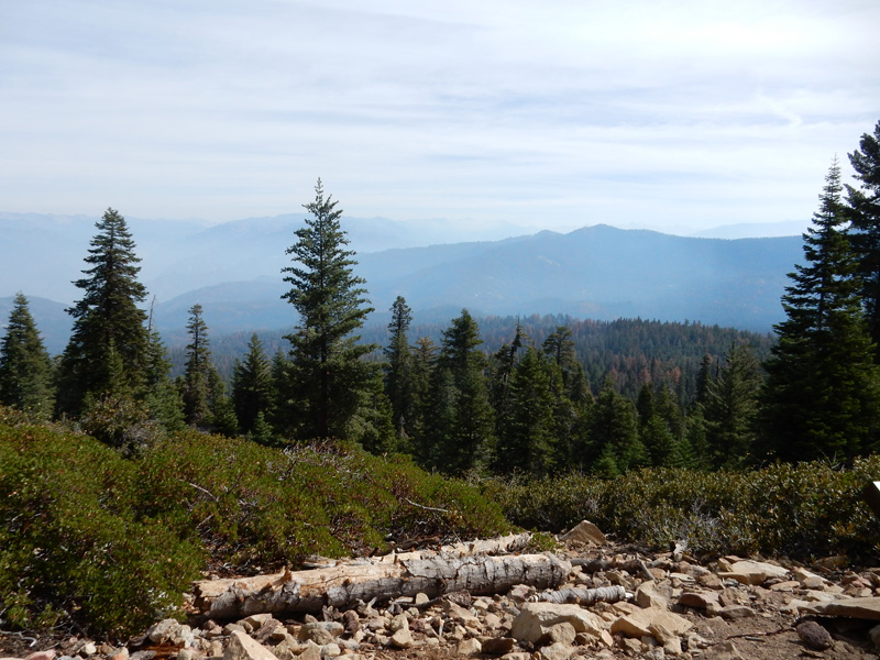
Had breakfast in Grant Grove Village and then did the short hike to Panoramic Point for a view of the Sierra Nevada.
Drove to the Redwood Mountain Grove, where Chad and I had hiked in 1998, and then had an adventure following Google Maps (gravel Forest Road not on maps) to Eshom and onward to LA.
9/28/15 – picked up our rental car at 8am one block from Kate’s house and drove to CA Rt 2 (Angeles Crest Highway), which passes through the new (2014) San Gabriel Mountains National Monument administered by the USFS. Stopped at the Switzer Picnic area.
To do a hike down Bear Canyon
About 3 miles roundtrip – trail follows Seco Creek
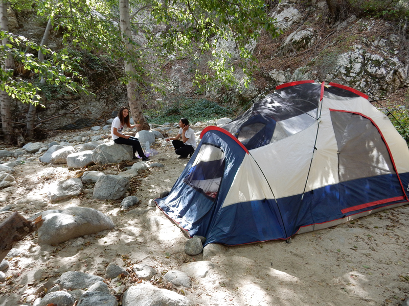
Canyon Campers
What makes the caged bird sing?
Junction with the Gabrielino Trail, which was closed
View from Trail Junction
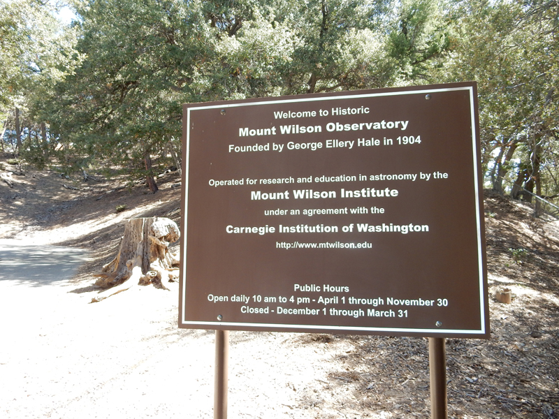
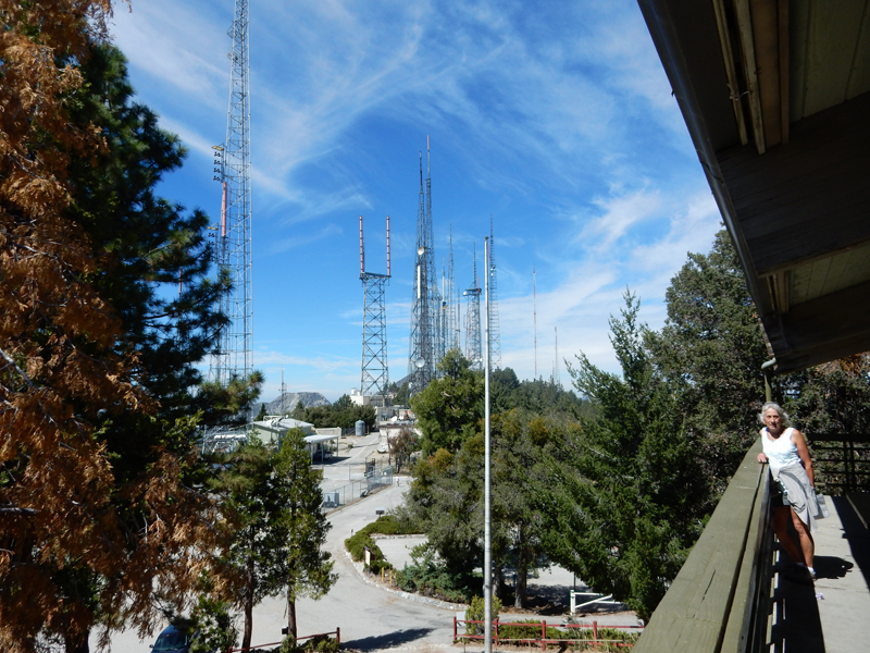
Mount Wilson Observatory was reached by a 4.5 mile spur road off of Rt 2
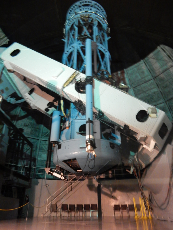
Edwin Hubble used the 100-inch Hooker Telescope to show that our galaxy is one among countless galaxies in an expanding Universe
The peak is also covered with telecommunication towers
And a 150-foot Solar Telescope
You also get good views of the northern LA suburbs 5,000 feet below and the San Gabriel Mountains
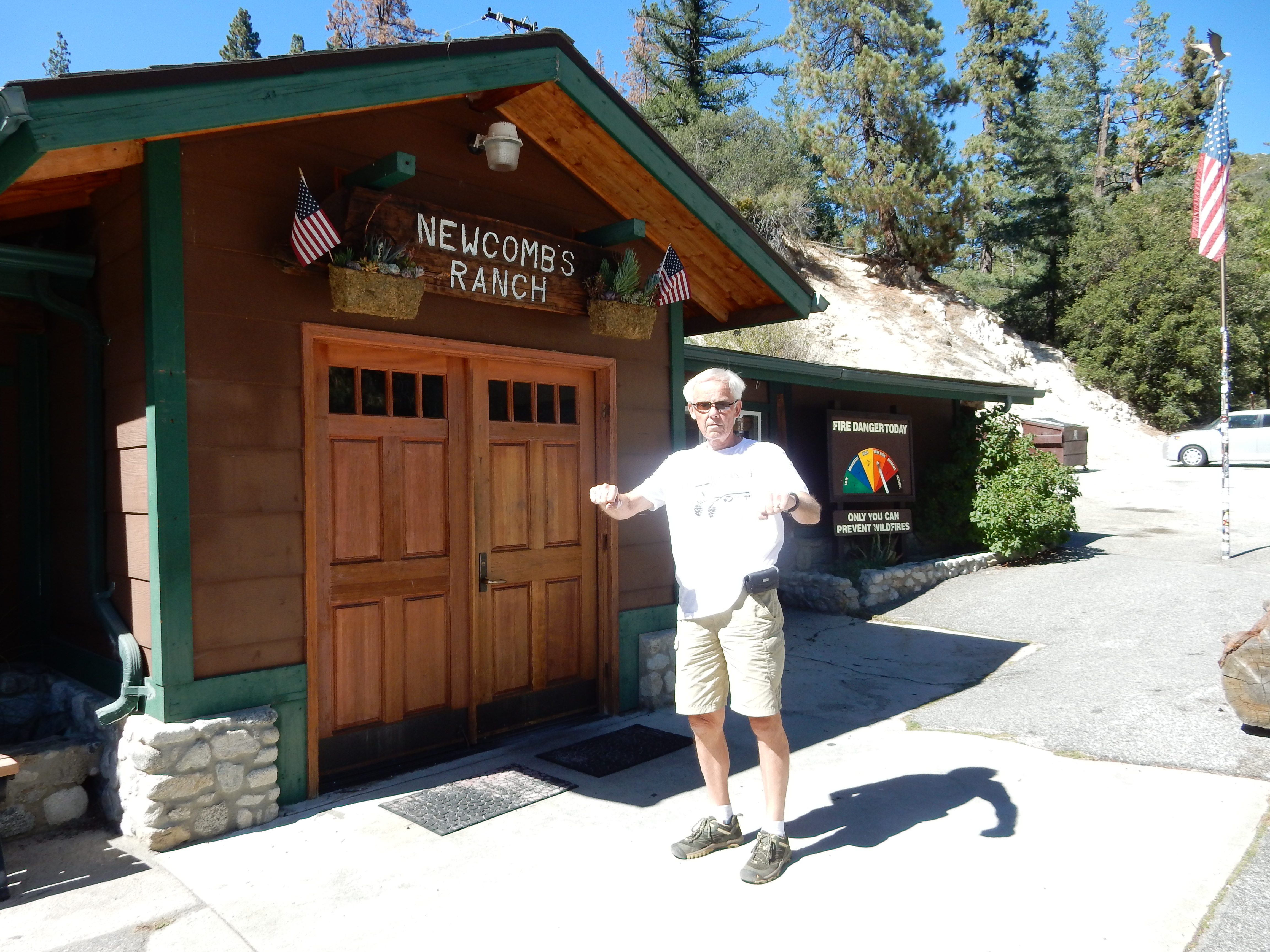
Had lunch at Newcomb’s Ranch, a motorcycle destination on Rt 2, now in the National Monument
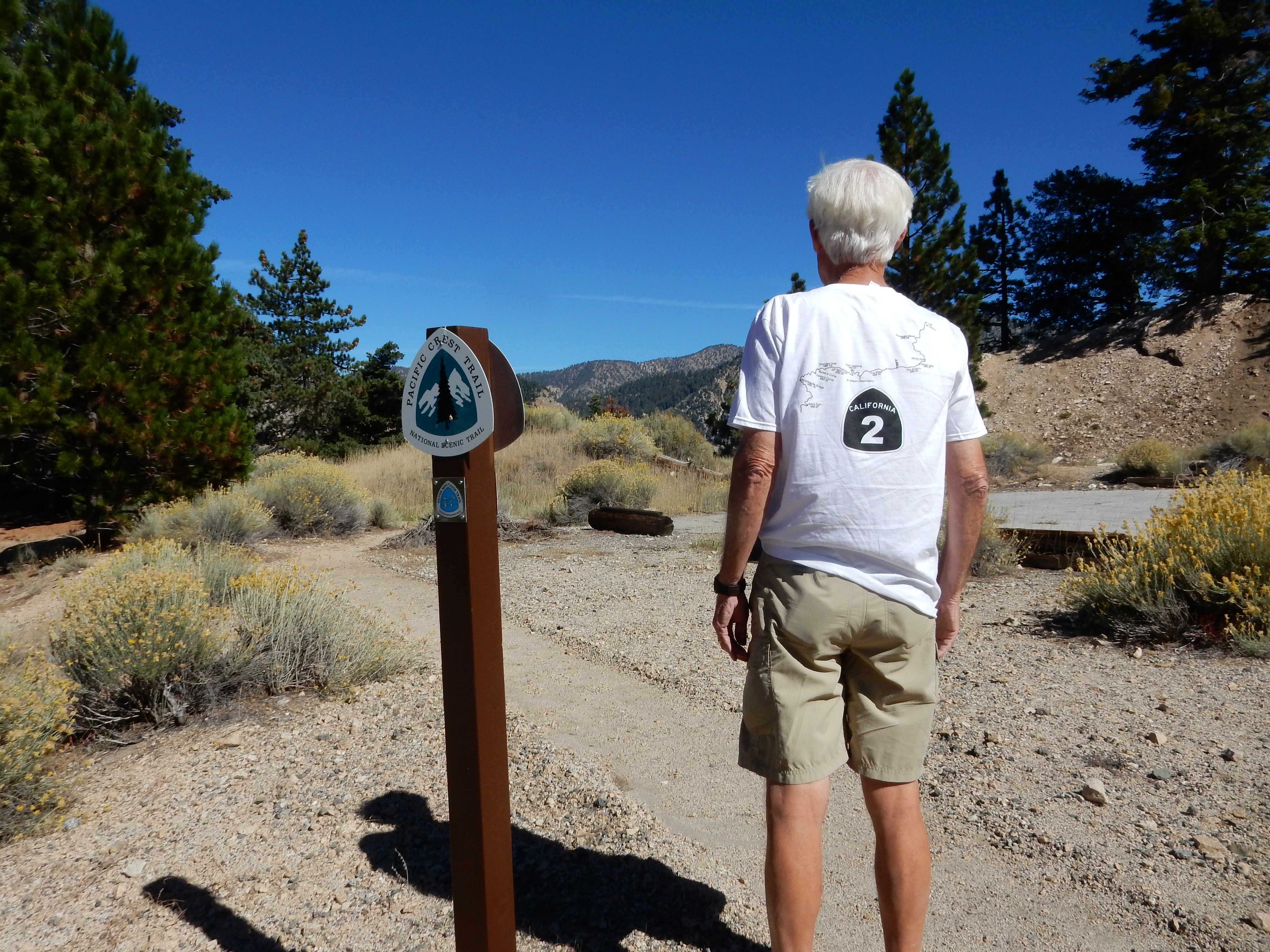
We then drove east on Rt 2 until we were stopped by a police barricade because a film crew was working down the road. It happened to be at a point where the Pacific Crest Trail crosses the road.
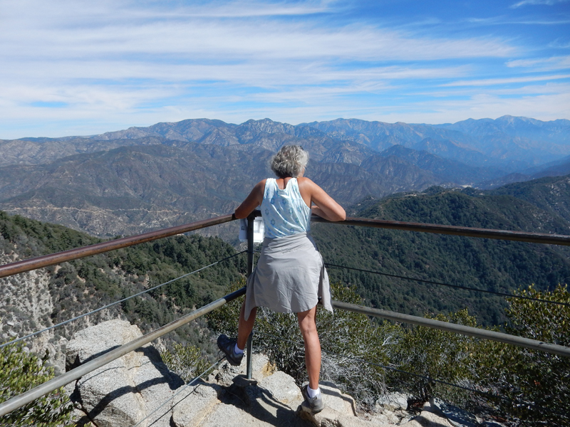
There was a good view of the distant Devil’s Punchbowl north of the road. We had hoped to hike there but will have to save that for another day.
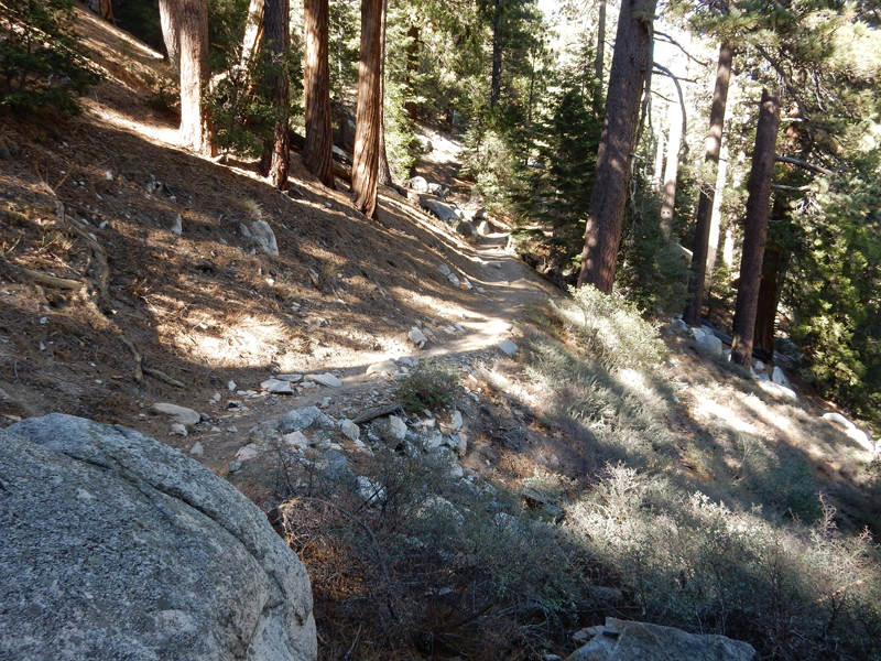
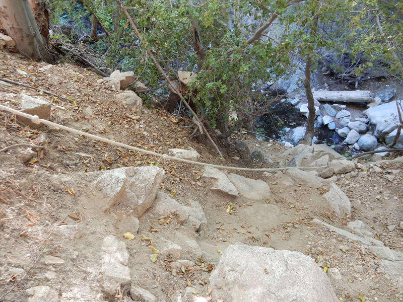
I decided to do another hike off Rt 2 on the way back – to Cooper Canyon Falls. I started on the Burkhart Trail at the Buckhorn campground. It is also part of the High Desert National Recreation Trail (NRT) – 10W02
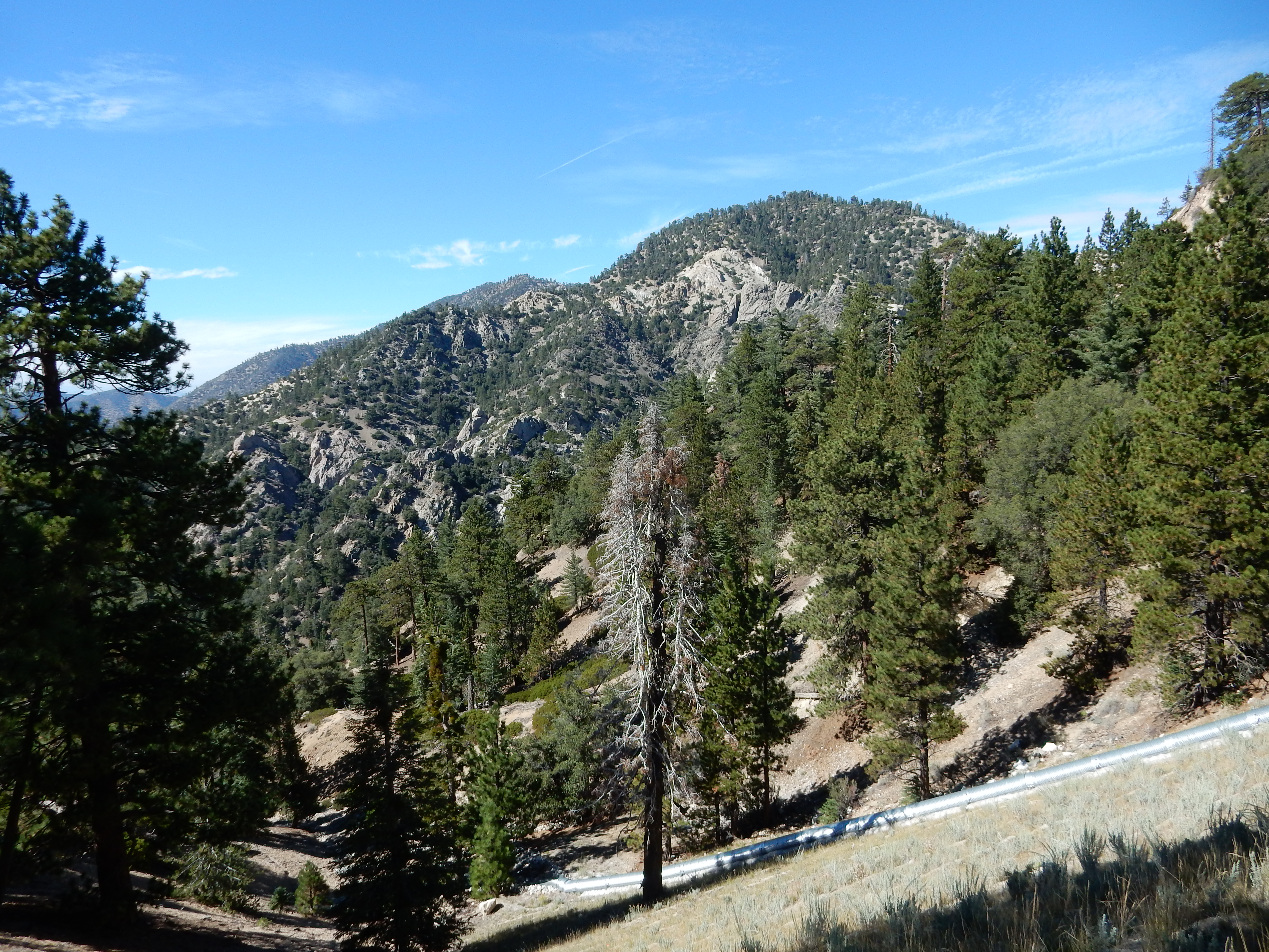
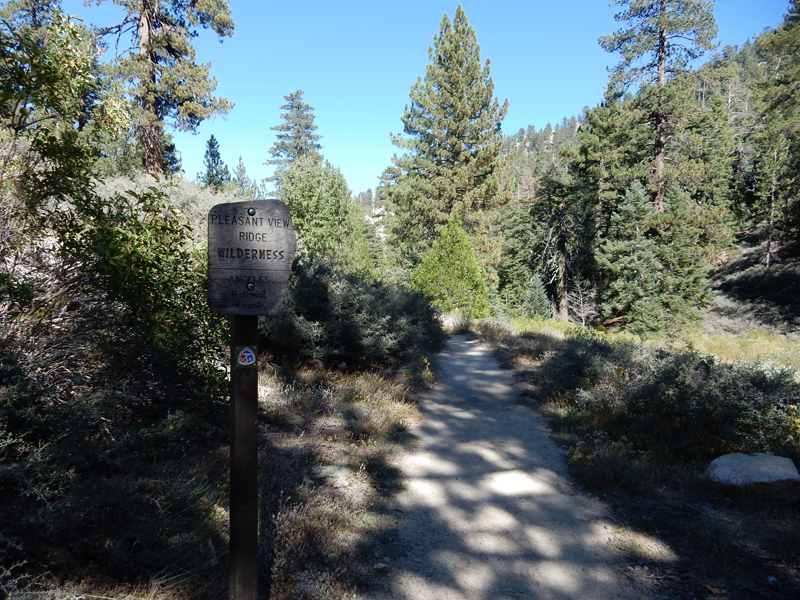
Pleasant View Ridge Wilderness – Los Angeles National Forest
It was an enjoyable hike dropping about 800 feet over 1.6 miles to the Cooper Canyon Trail
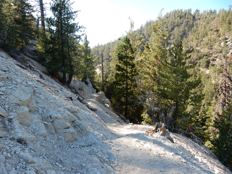
I did not see the drop into the canyon for the falls and hiked about a half mile until I realized that I must have missed it. I headed back and discovered a rope to aid the climb down into the canyon.
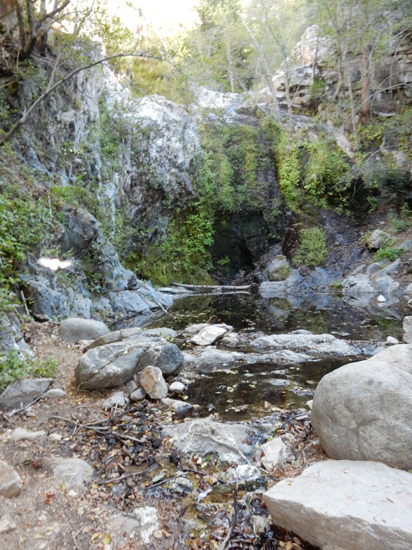
Because of drought conditions, Cooper Canyon Falls looked more like a weeping wall
We were back at Kate’s home at 6pm. In the evening we walked to Barnsdall Art Park to see the eclipse of the moon
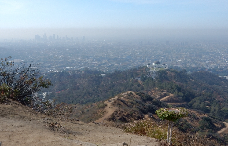
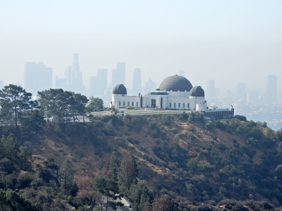
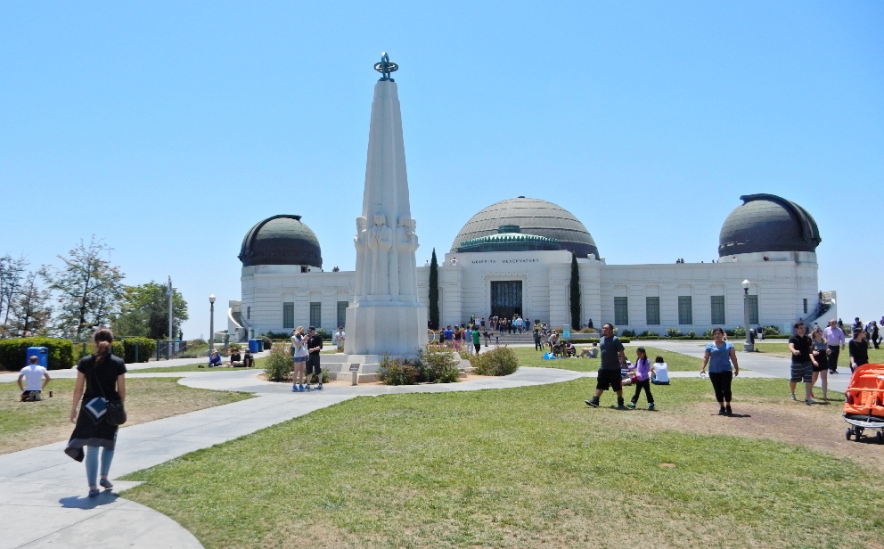
May 9, 2015 – Flew to LA to help Kate with her dog Casey who was having neurological problems. Kate had meetings in Las Vegas from 5/11 – 5/15 and I dog sat for her that week. On Sunday 5/10 Kate and I drove to Griffith Park Observatory for a little walking and views from the LA hills.
LA Motel “Art”
I passed on a personal administrator/chair tool I have used – there are two so you can cover both ears!
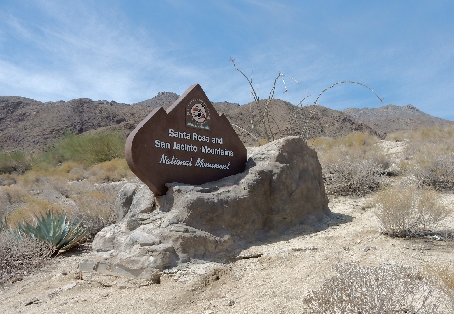
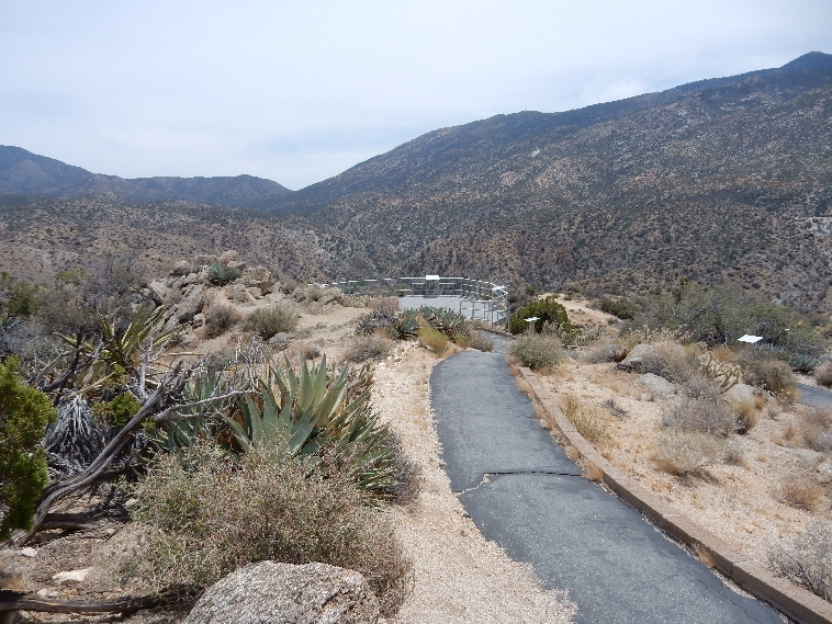
On 5/13 I did a day trip to Palm Desert and the BLM Santa Rosa and San Jacinto Mountains National Monument
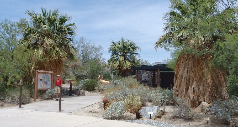
Unfortunately, I discovered that the Visitor Center was closed on Wednesdays as well as Tuesdays because they had just started summer hours
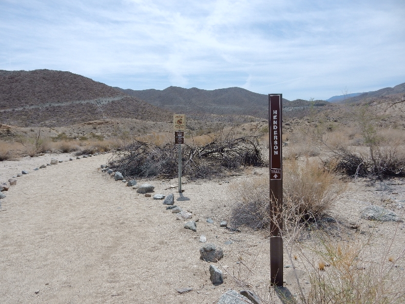
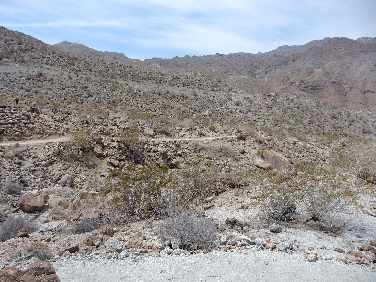
I did all three loops of the Randall Henderson Trail, covering about three miles and gaining about 425 feet in elevation
The Wash Loop
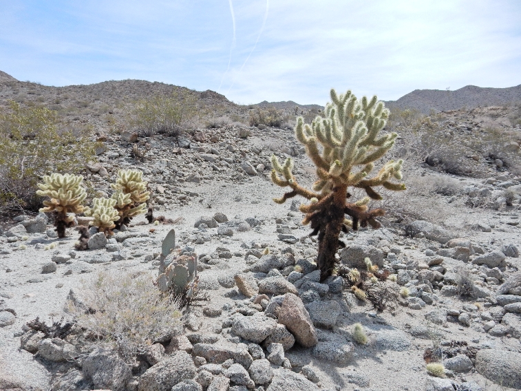
The Cholla Loop – these are called “Teddy Bear Cholla”
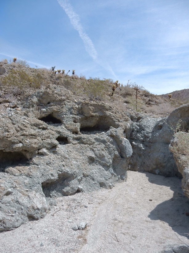
The Canyon Loop
This is a Bighorn Sheep area
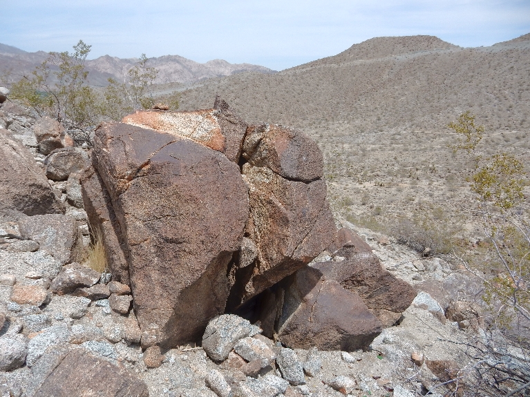
“Rusty Rocks” – dark brown patina caused by oxidation
Barrel Cactus
Ocotillo – spindly pole-like plant
I drove back to LA first on Rt 74 the “Palms Highway” and then Rt 243 through Idyllwild and then I10 – this is a lookout along Rt 74
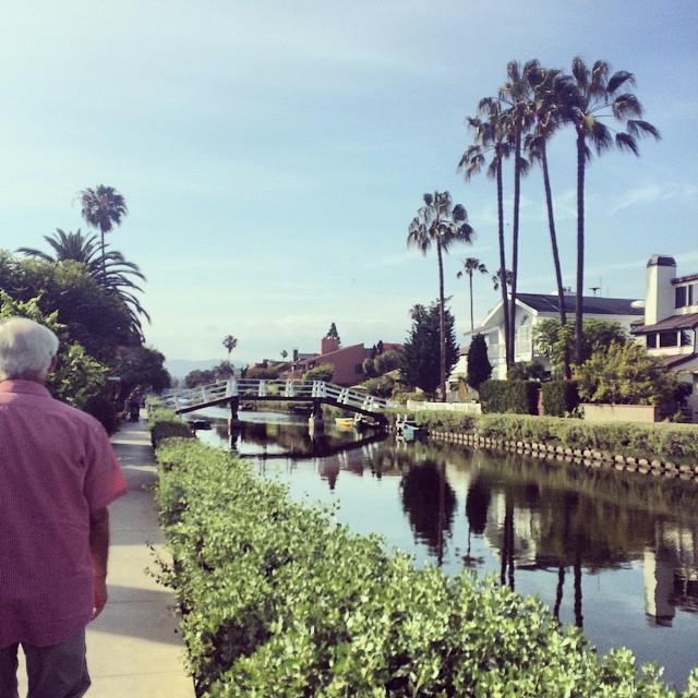
5/16 – Picked Kate up at LAX and then walked the Venice canals, beach front and had great sandwiches at Bay Cities Italian Deli and Bakery in Santa Monica.
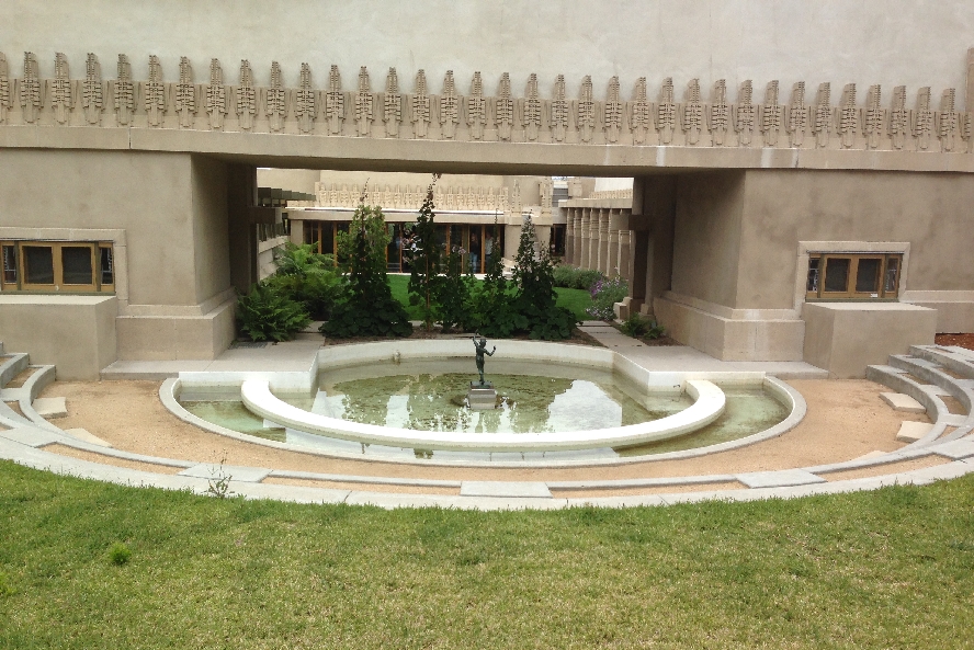
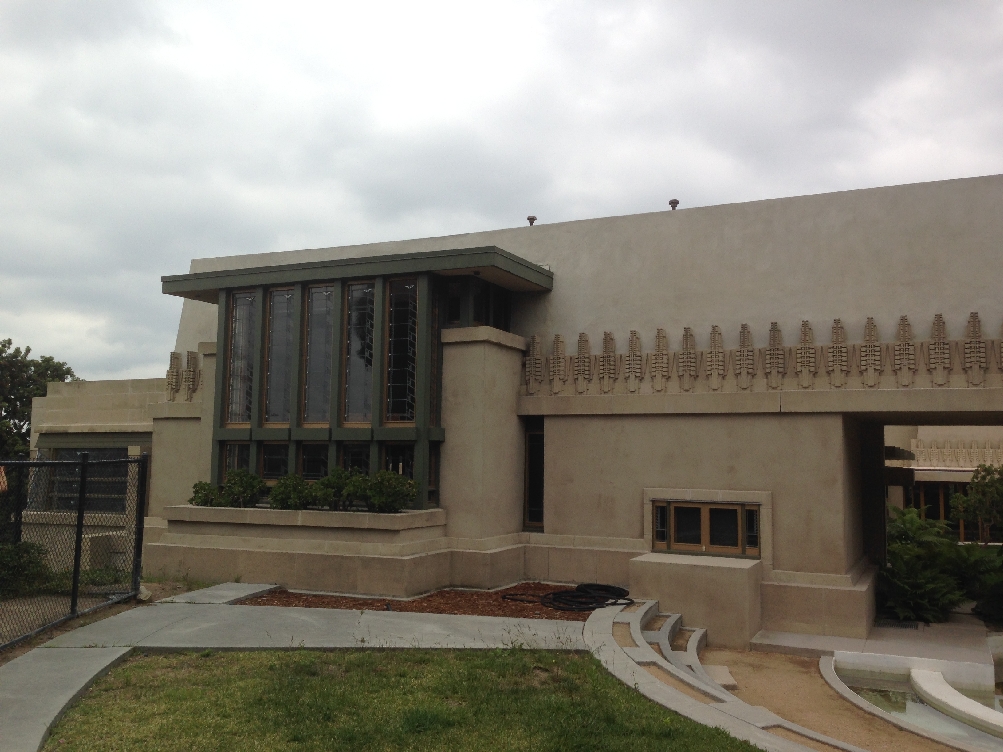
5/17 – Went to St Francis of Assisi church for mass and then ate a big breakfast at Millies’s Café on Sunset Blvd just like last Sunday. We then took Casey for a walk to Barnsdall Art Park where there is a nice view of the LA Hills, art museums and the Hollyhock House designed by Frank Lloyd Wright and built in the 1920’s.
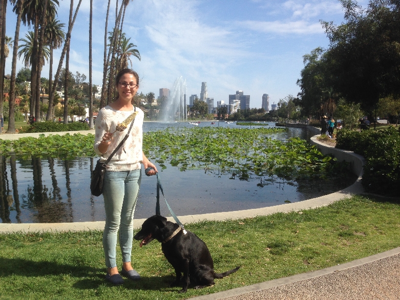
In the afternoon we took another walk with Casey this time around the Lake in Echo Park
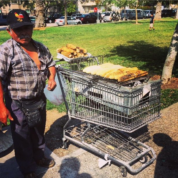
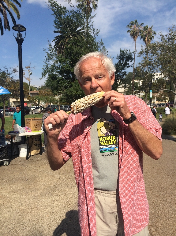
Shared a corn “special” grilled on a grocery cart!
Smothered in butter, mayo, salt, paprika and then rolled in Mexican cheese!
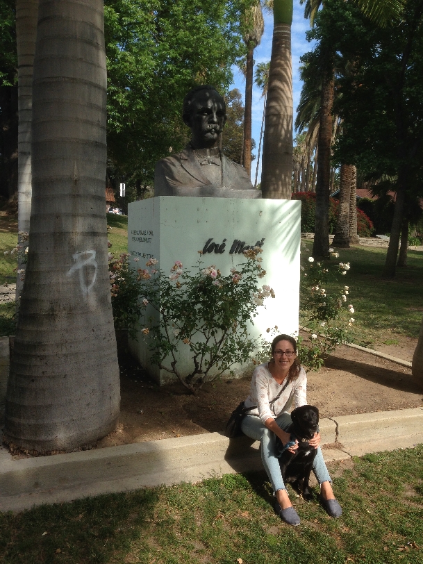
Jose Marti bust
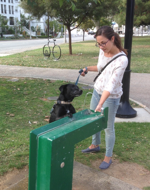
How about a little drink?
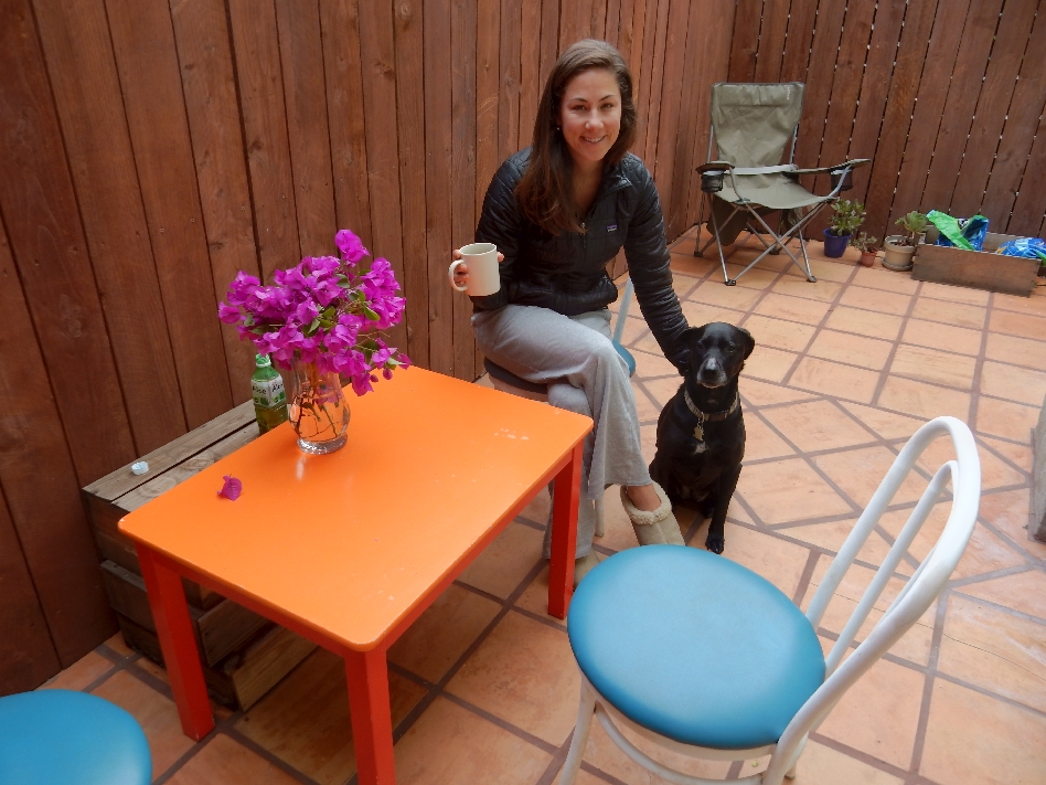
Patio table and chairs acquired from two different Goodwill stores
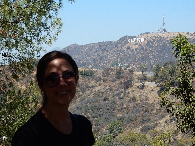
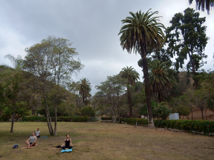
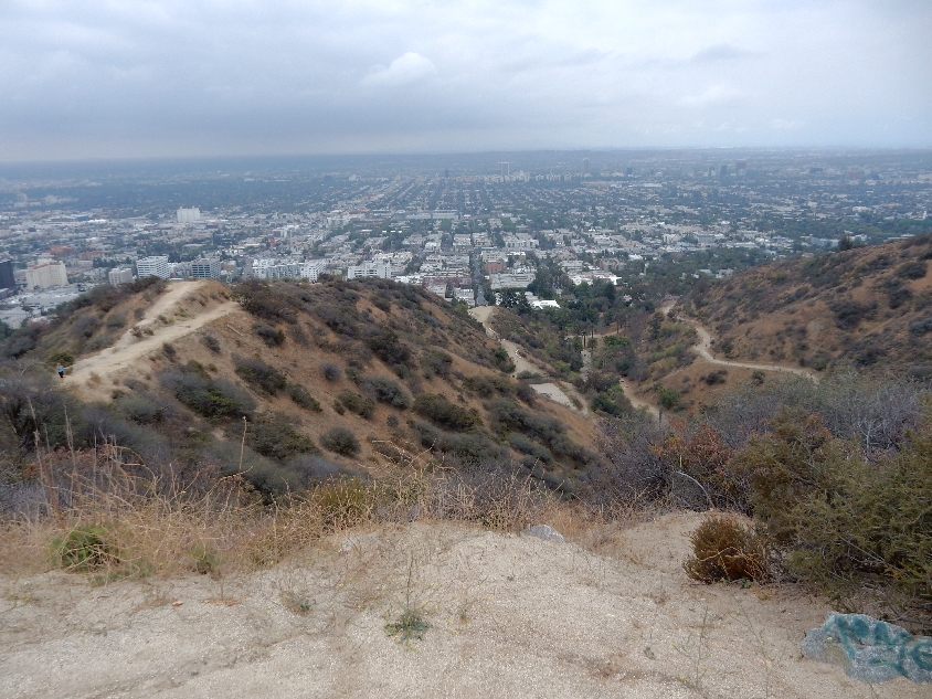
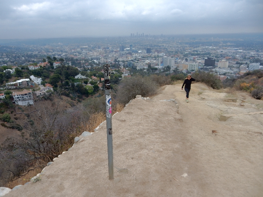
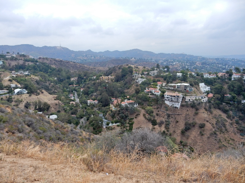
5/18 – I went to Runyon Canyon Park in the Hollywood Hills to hike while Kate worked at home. This Yoga/Meditation group was just past the Fuller Ave entrance, which is located two blocks north of Hollywood Blvd. I was told a lot of “Pretty People” hike here and I found that to be the case.
Top of one of the Hollywood Hills
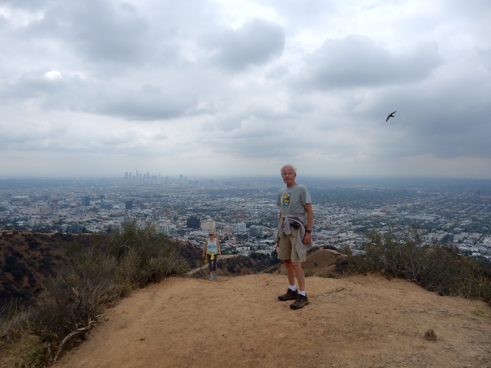
Highpoint of the Hollywood Hills showing the house (on the left) where I met a woman who I thought looked like Demi Moore. It had views east to the mountains, west to the ocean and south to Hollywood and LA. It was just put up for sale for 10.5 million!
Descending
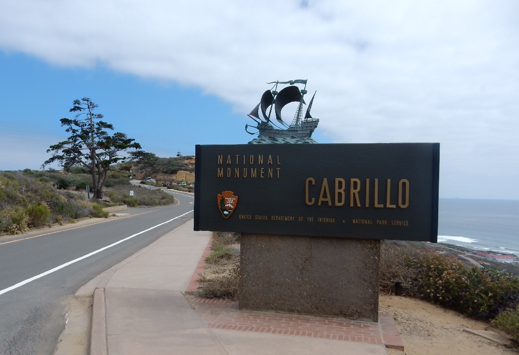
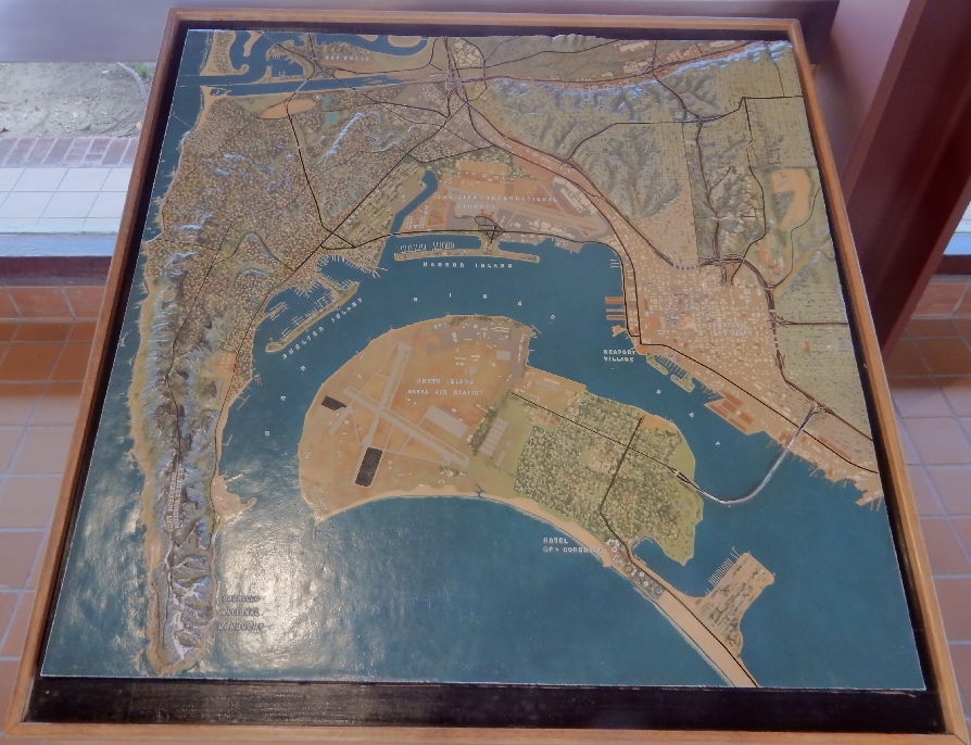
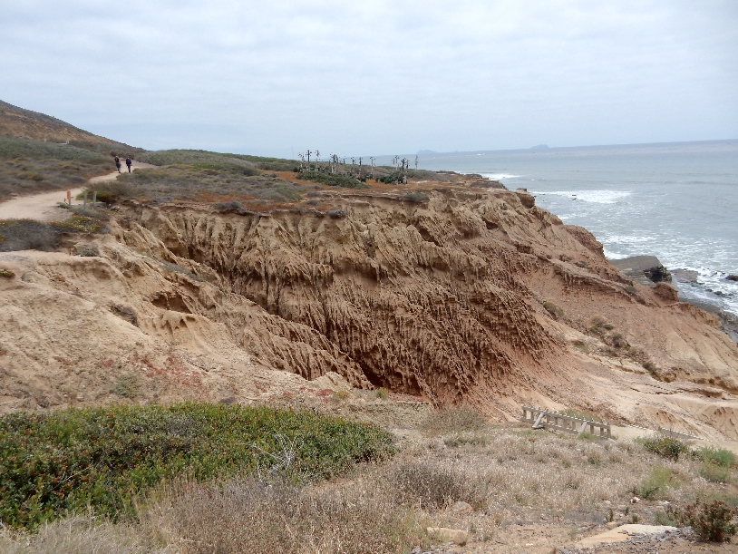
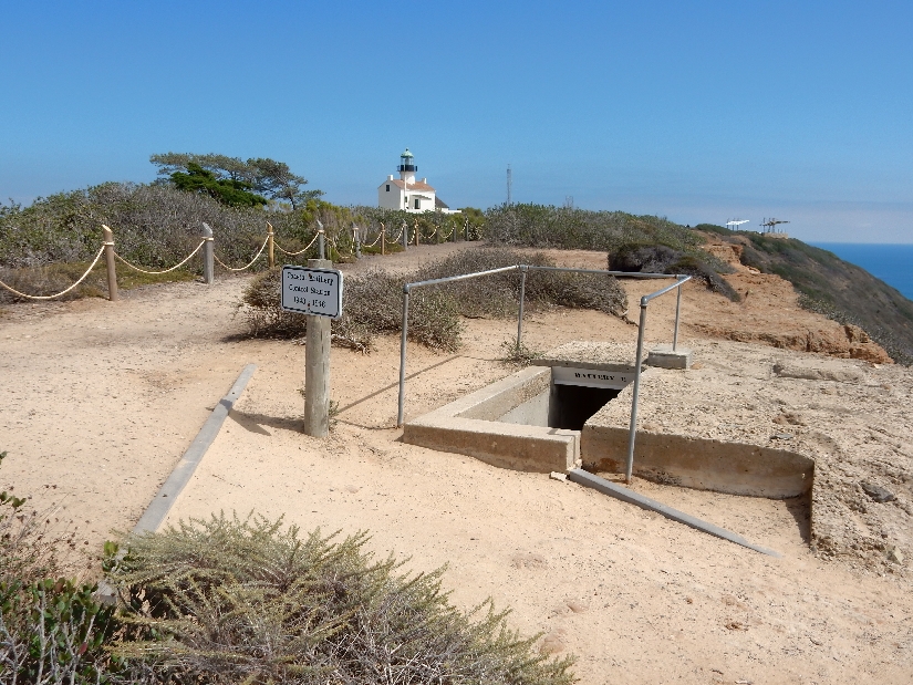
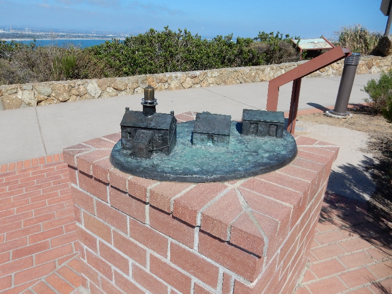
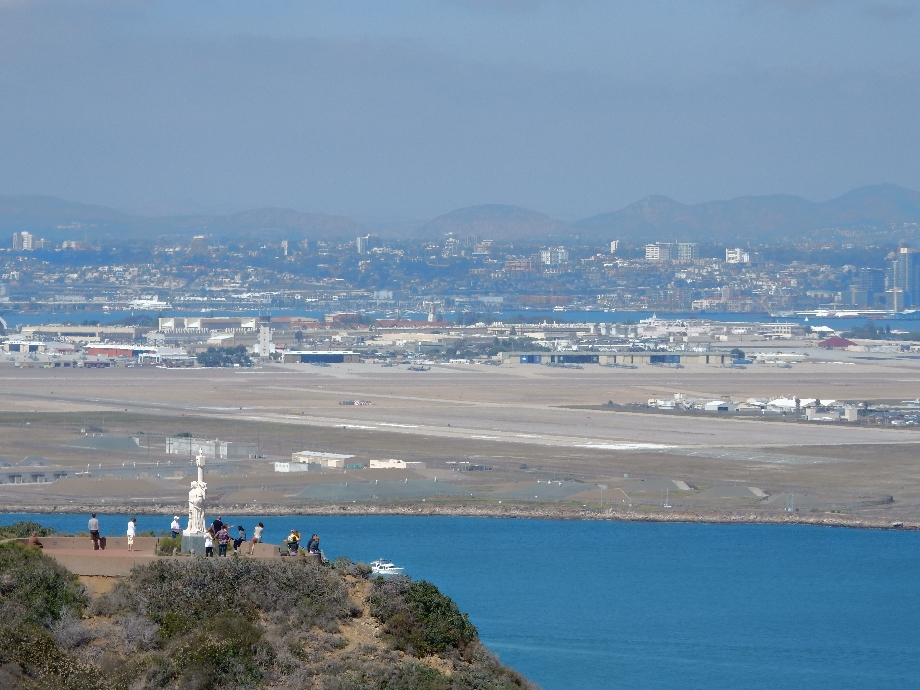
May 27, 2015 – I flew to San Diego for the national convention of the American College of Sports Medicine (ACSM) and also spent some time touring the city. I picked up my rental car about noon and drove to Cabrillo National Monument on Point Loma.
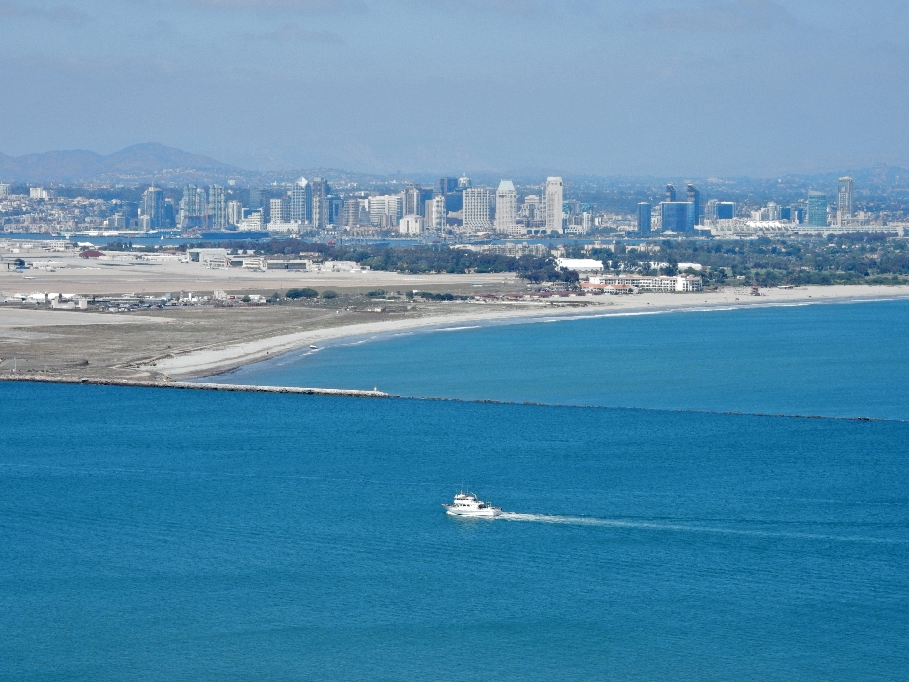
Point Loma and Cabrillo NM lower left
North Island Naval Air Station lower center
San Diego International Airport upper center
Downtown San Diego to right of Seaport Village
Coronado is across (below) Downtown on North Island
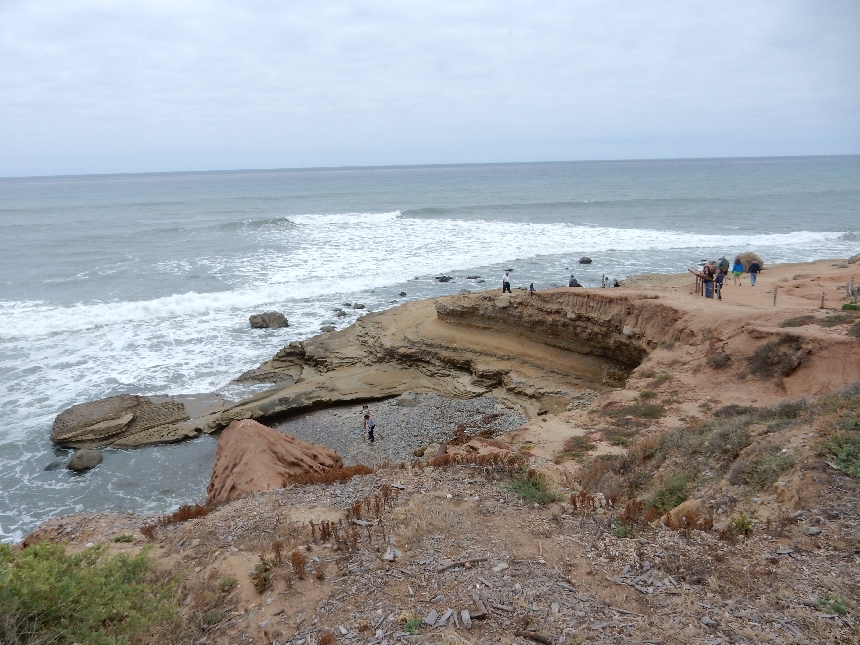
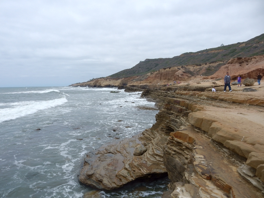
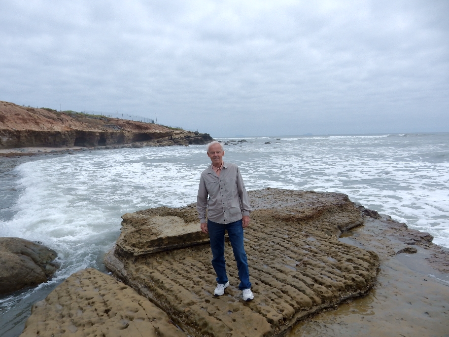
I toured the Visitors Center, watched a video on the Intertidal Zone and then drove to the Tidepool Access to hike the Tidepool Trail – left or Pacific side of Point Loma
The trail along the west side cliffs of Point Loma was about two miles round-trip
The tide had already been coming in for four hours, so I didn’t get to see much tidal zone life
Interesting erosion pattern along cliffs
The haze/fog was just burning off
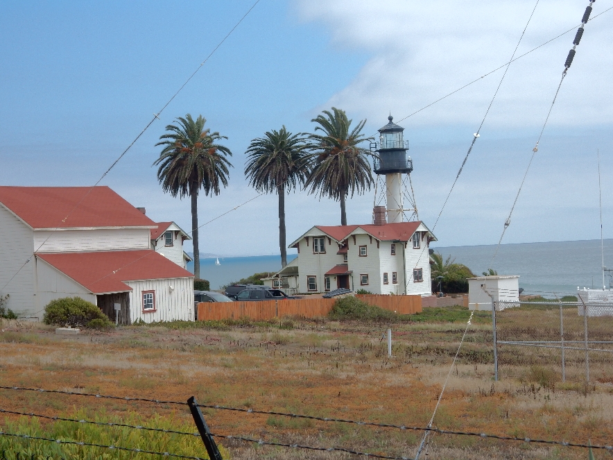
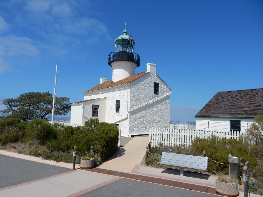
The new Point Loma Light Station on the U.S. Coast Guard Reservation
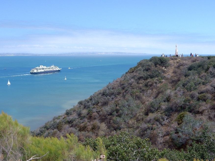
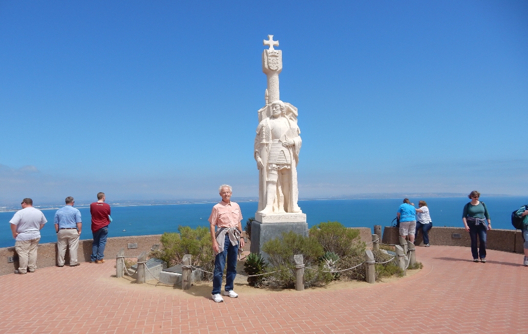
I then drove back to the Visitors Center and did the short hike to the Cabrillo statue
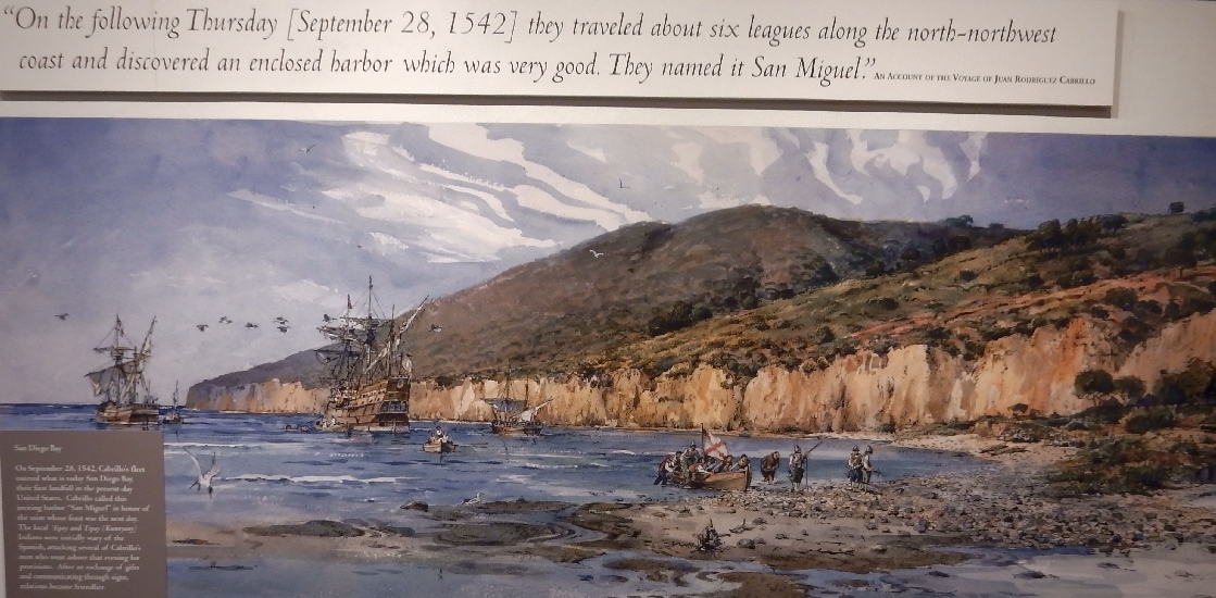
Juan Rodriguez Cabrillo landed on this point on September 28,1542 ,making him the first European to set foot on what was to become the western U.S.
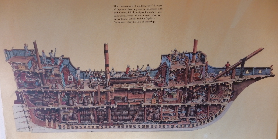
Cross section of Spanish Galleon
Representation of landing, Cabrillo left from Mexico and explored the western coast of what is now CA. There is a bit of a mystery in relation to how he died (January 3, 1543) but it is thought that he was buried on the island of San Miguel in the Channel Islands. Helen and I visited that site during a kayak trip in 2008.
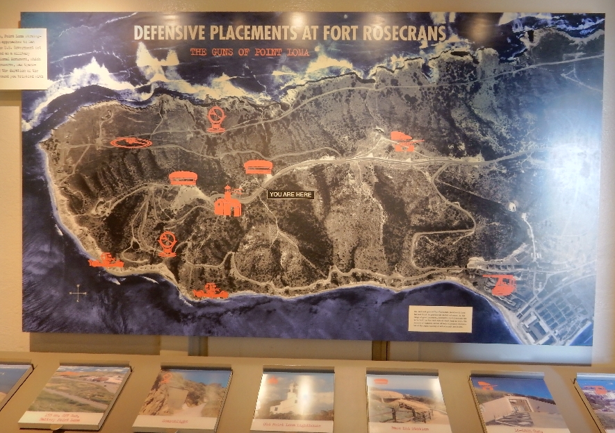
World Wat II defenses on Point Loma – Fort Rosecrans
Battery E Coastal Artillery Control Station 1943-46 and Old Light Station, Whale Overlook upper right
Old Light Station 1854 – 1891
Downtown San Diego
Cabrillo statue and Naval Air Station on North Island
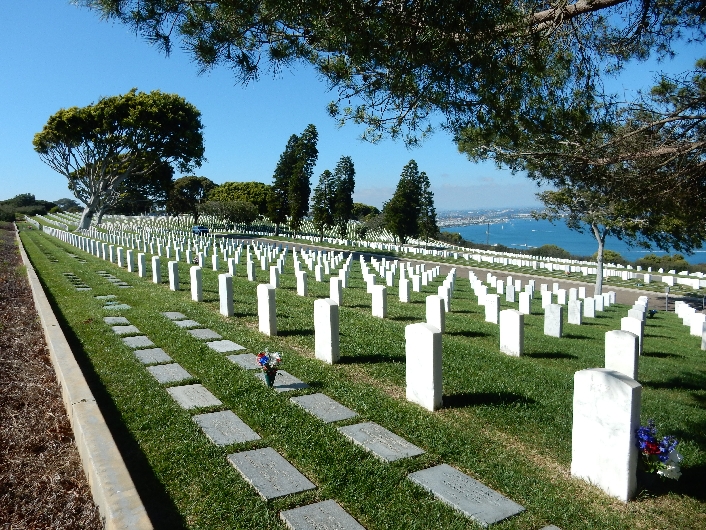
I hiked only about half of the Bayside Trail because the park was closing at 5pm and then visited Rosecrans National Cemetery on my drive back to San Diego
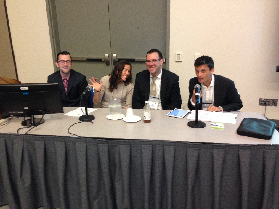
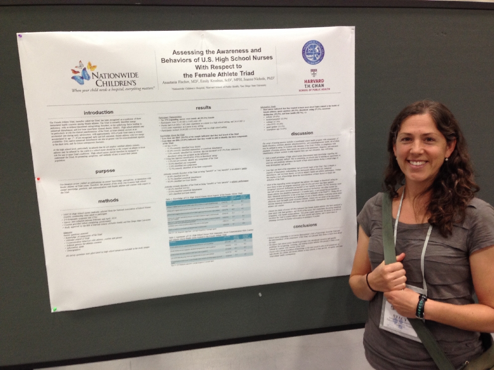
May 28, 2015 – I started the day by attending an 8am to 10 session that Stacy was chairing titled “Medical Mysteries.” It was quite interesting and Stacy did a great job running the meeting. I think that she was both excited and a little embarrassed that her Daddy attended her session.
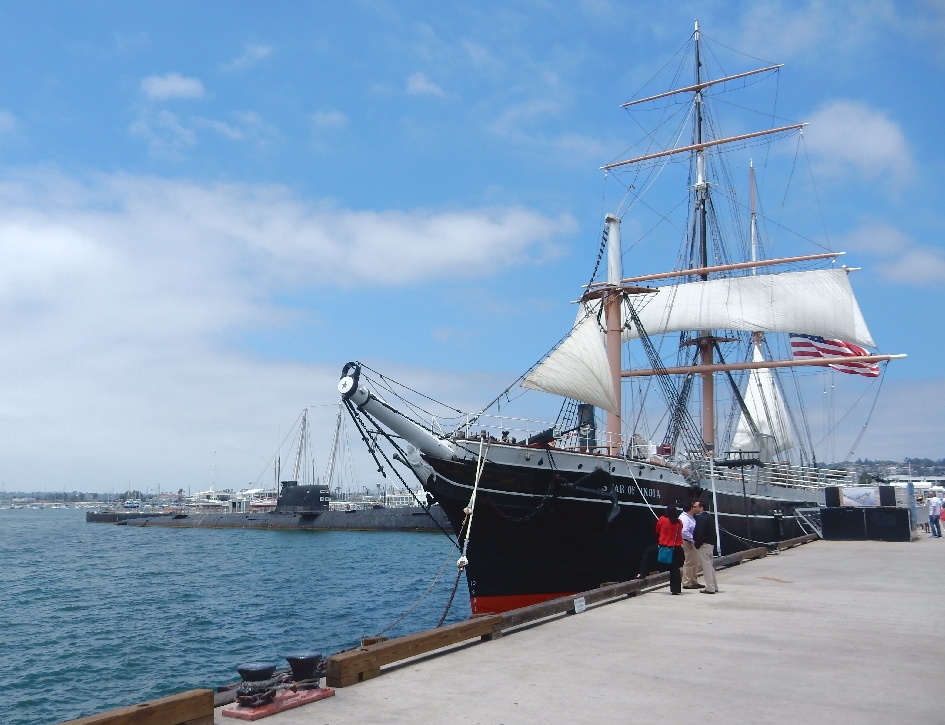
Afterward, I attended another session and toured the Exhibit Hall. In the afternoon I walked to the Maritime Museum on Harbor Dr
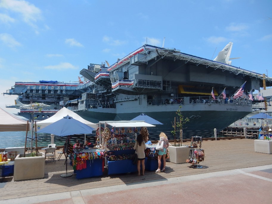
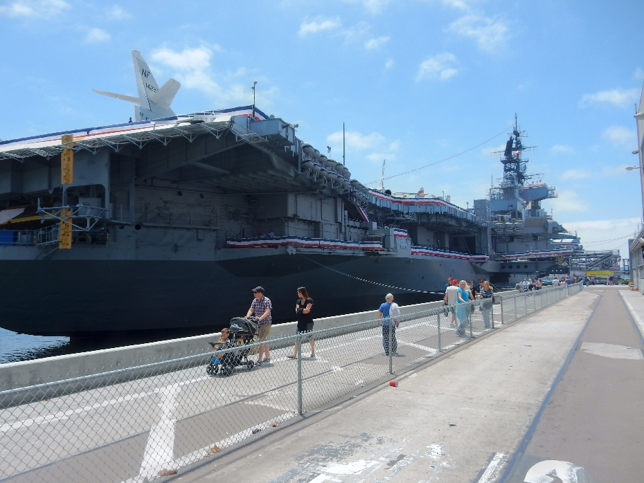
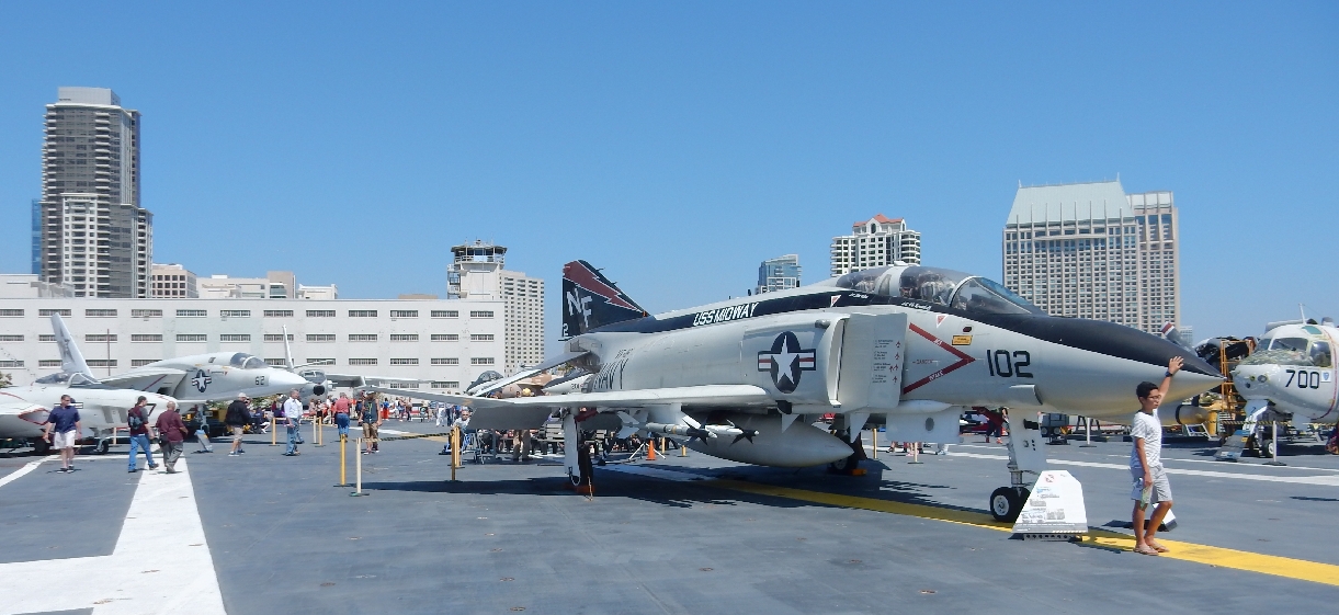
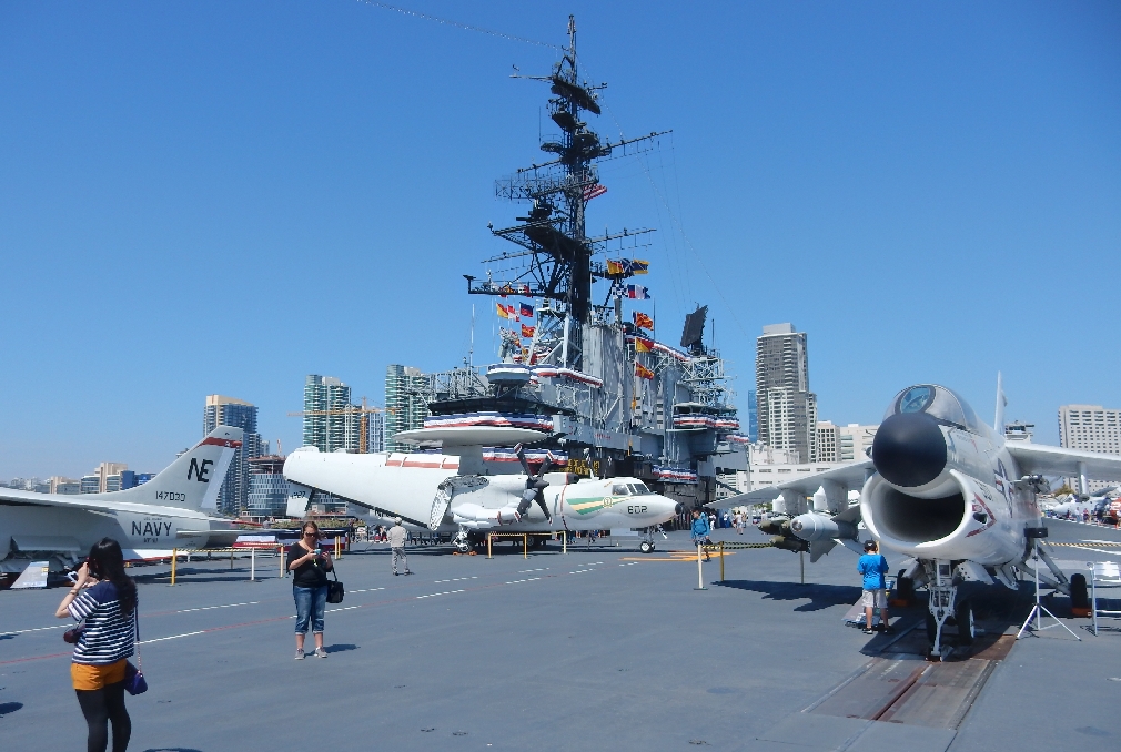
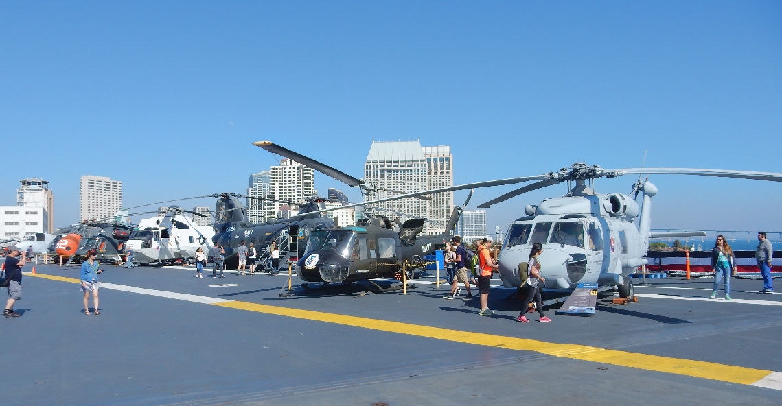
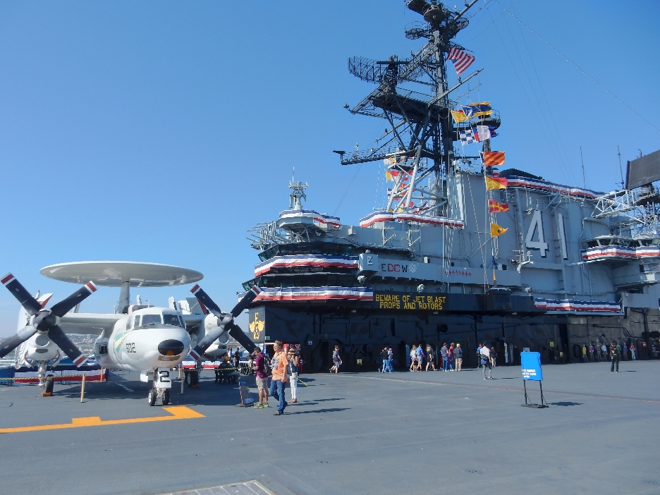
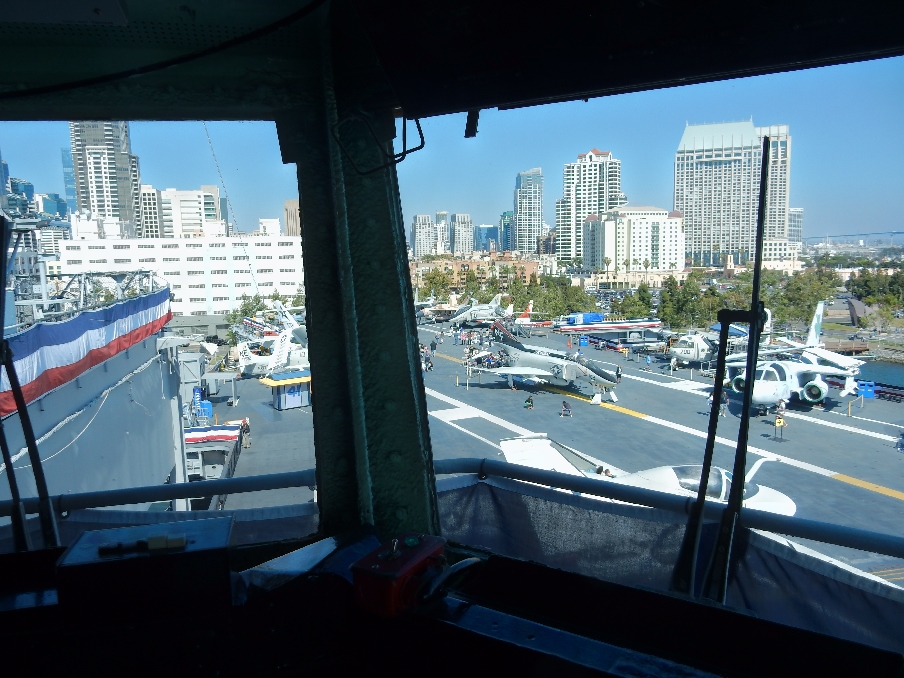
and then to the USS Midway Aircraft Carrier, which is now a museum
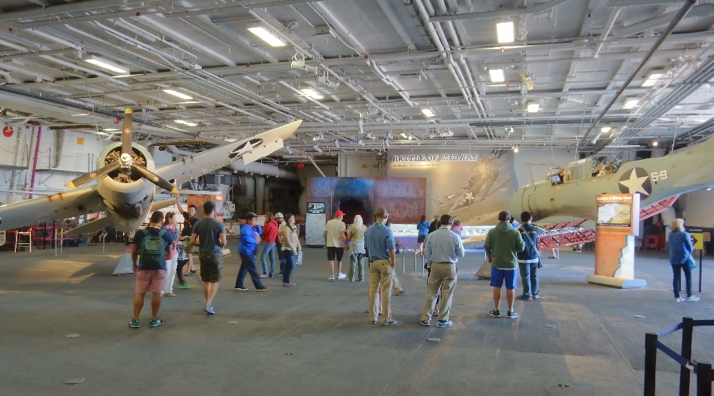
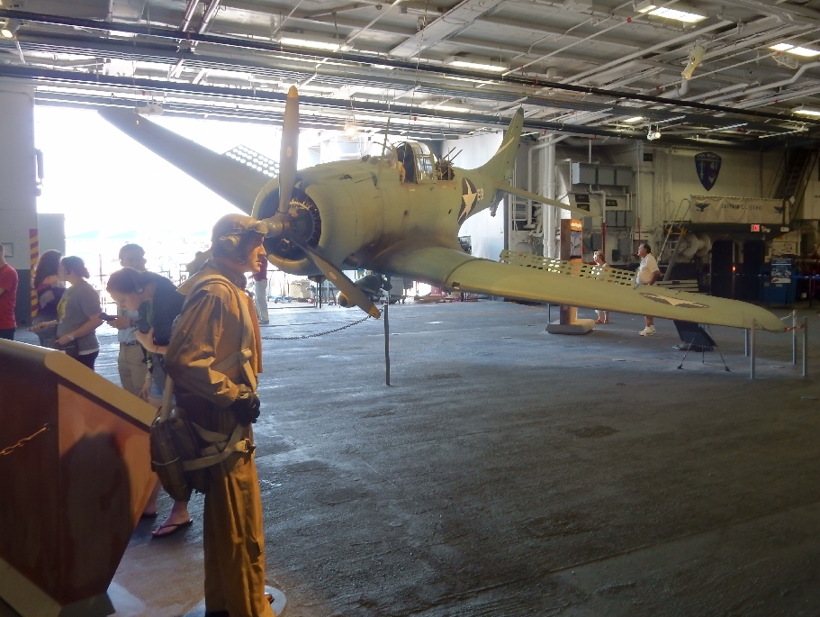
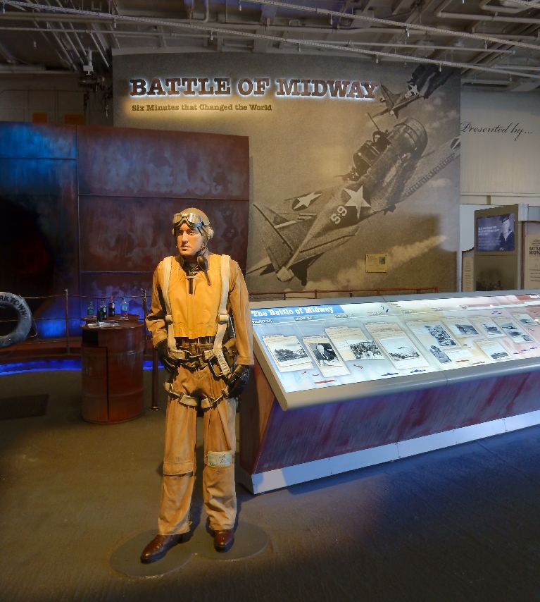
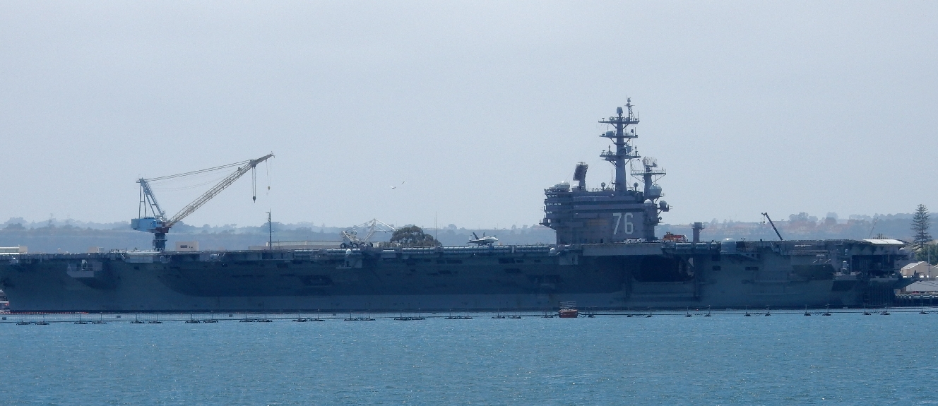
The $17 senior admission was well worth it as a spent 2.5 hours touring the ship. When the Midway was commissioned in 1945 it was the largest ship in the world. It was on active duty through Operation Desert Storm in 1991 and was decommissioned in 1992. There are representative aircraft from all operations it participated in on board as well as aircraft that participated in the Battle of Midway for which it was named. The Battle of Midway was the turning point for the war in the Pacific and they have an excellent movie depicting/explaining the battle on board.
The audio tour describing the planes and ship areas was very well done
SNJ Trainer
Preparation Room
Baghdad Day One Targets
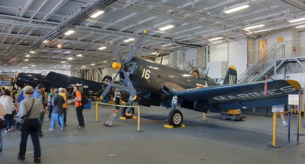
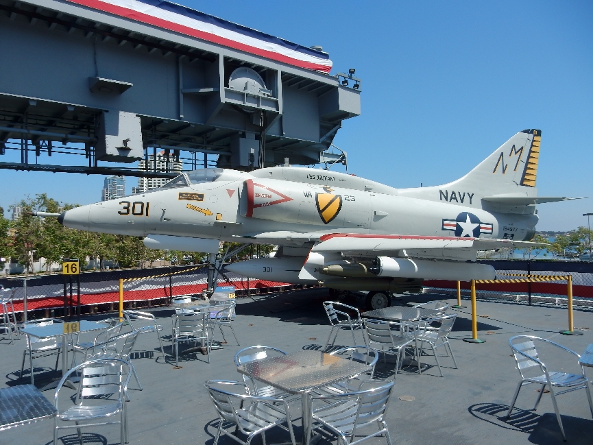
A-4 Skyhawk
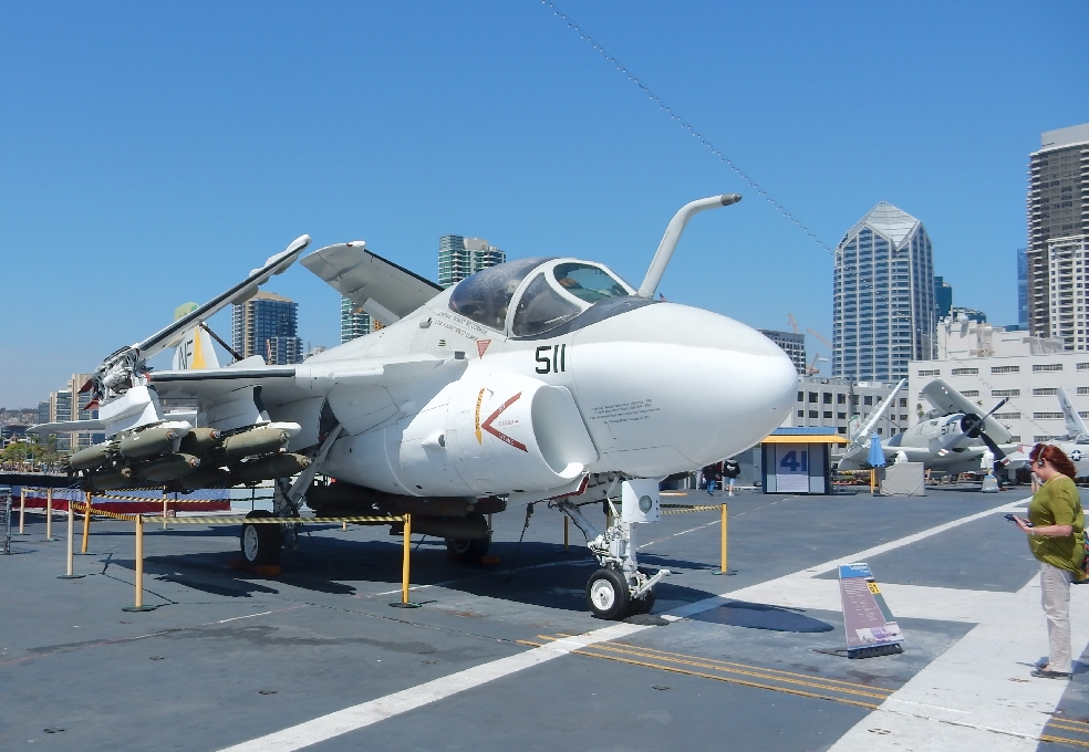
A-6 Intruder
F9F Panther
E-2 Hawkeye center and F-8 Corsair right
A-7 Corsair on catapult
Helicopter Row
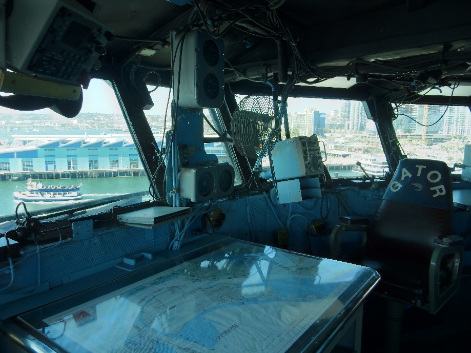
Tower/Bridge
Views from Tower
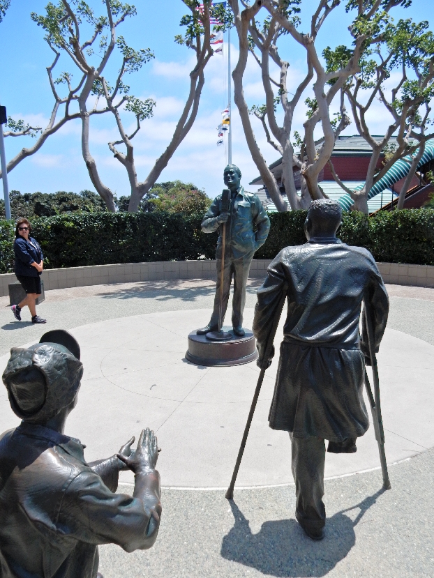
Memorial to Bob Hope
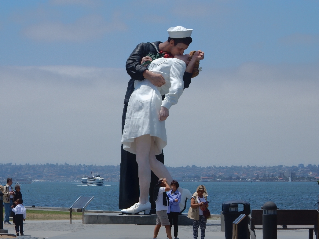
“The Kiss”
Nuclear powered Aircraft Carrier USS Reagan in port for refitting. The U.S. will soon have eleven nuclear carriers when the Gerald R. Ford (CVN) is launched in 2016.
In the evening I took the ferry across San Diego Bay to Coronado where I did a nice bike ride along the Bay to the National Wildlife Refuge. This is a picture of the Artemis Leader going under the San Diego-Coronado Bay Bridge. It is a vehicles carrier registered in Panama.
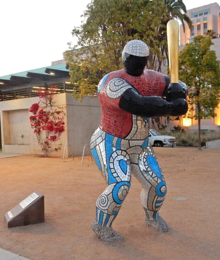
Walking back to the hotel, I passed this cool mosaic batter
May 29, 2015 – Attended a convention session and then met Stacy at her poster presentation. Afterwards we had a quick lunch and she had to attend another meeting related to her new position as an elected Trustee of the American College of Sports Medicine (ACSM).
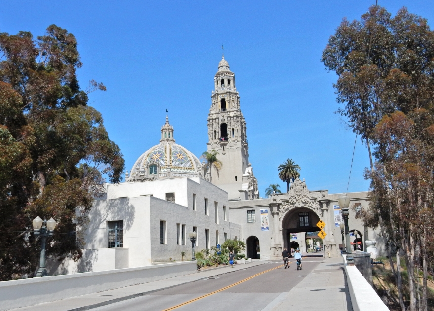
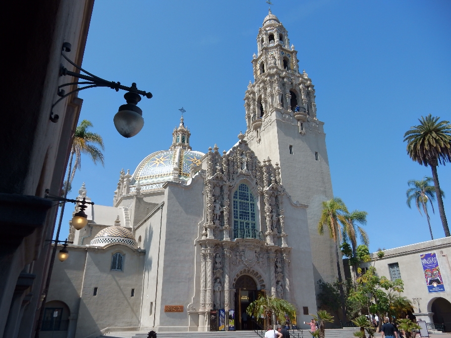
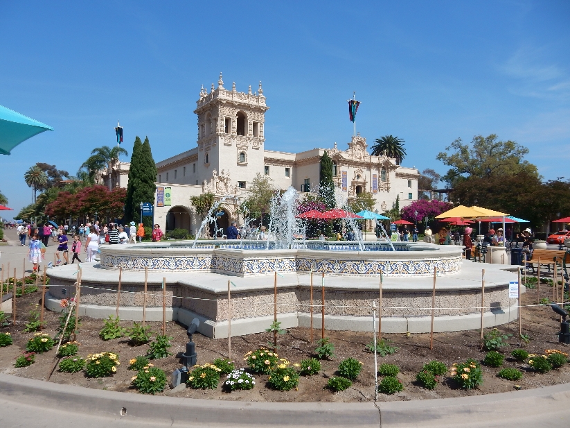
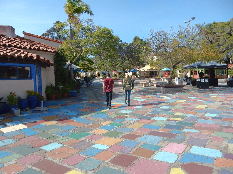
In the late afternoon I walked to and through Balboa Park. It is the nation’s largest urban cultural park. Balboa Park is the legacy of two Expositions, the first was the 1915-16 Panama-California Exposition to commemorate the opening of the Panama Canal (2015 now celebrating 100 years!, the second was the 1935-36 California Pacific International Exposition. Most of the Spanish-Renaissance style buildings were constructed in 1915. Cabrillo Bridge, gate and San Diego Museum of Man.
Plaza de Panama and statue of El Cid
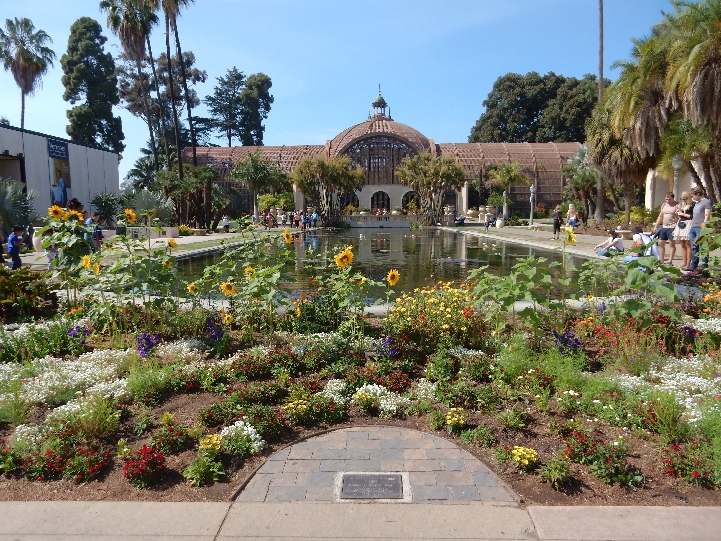
Botanical Building and Lily Pond as seen from the El Prado pedestrian walkway
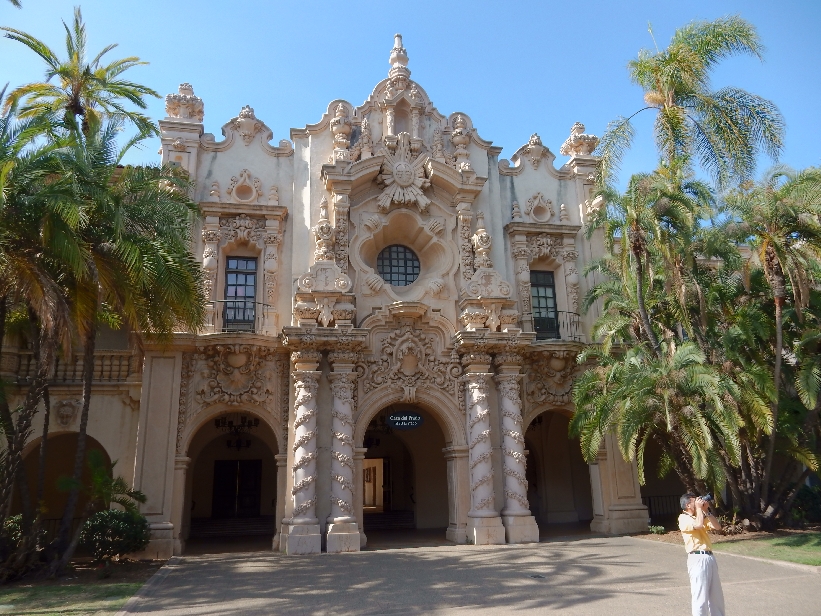
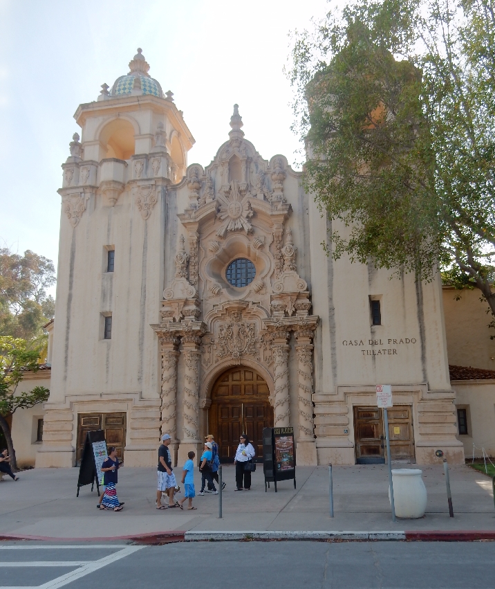
Casa del Prado
Rose Garden
I especially liked the Desert Garden
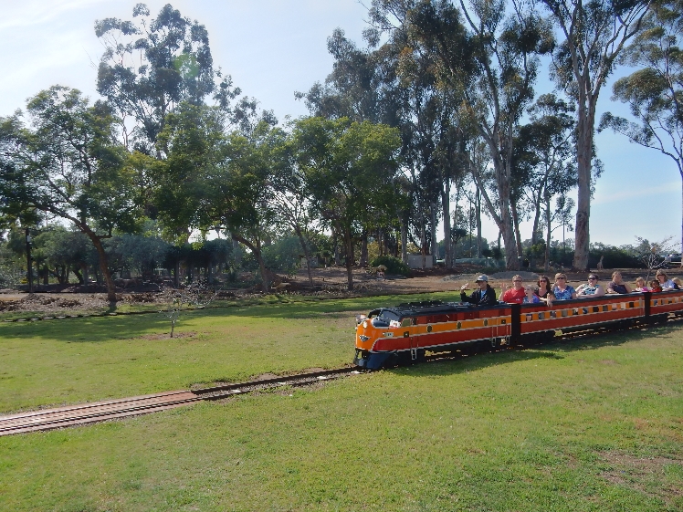
Always fun to take a train ride
Spanish Village Arts Center
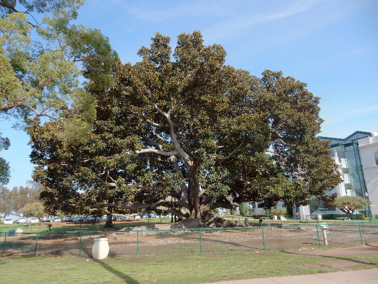
Moreton Bay Fig Tree
Casa del Prado Theatre
Lily Pond and arches between Museum of Photographic Arts and Visitor Center
Spreckles Organ Pavilion where they were holding a high school graduation. FedEx plane landing at San Diego airport and El Cid statue
Alcazar Garden – there are many more sites in Balboa Park, also I did not go to the famous Zoo on this trip
Walking back to the hotel – View from Cabrillo Bridge looking south over I5 toward downtown San Diego
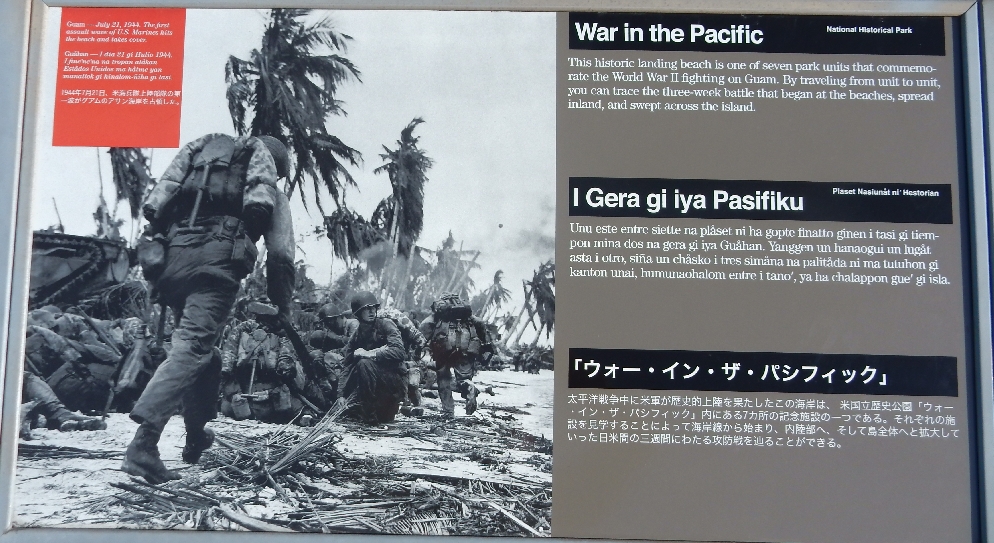
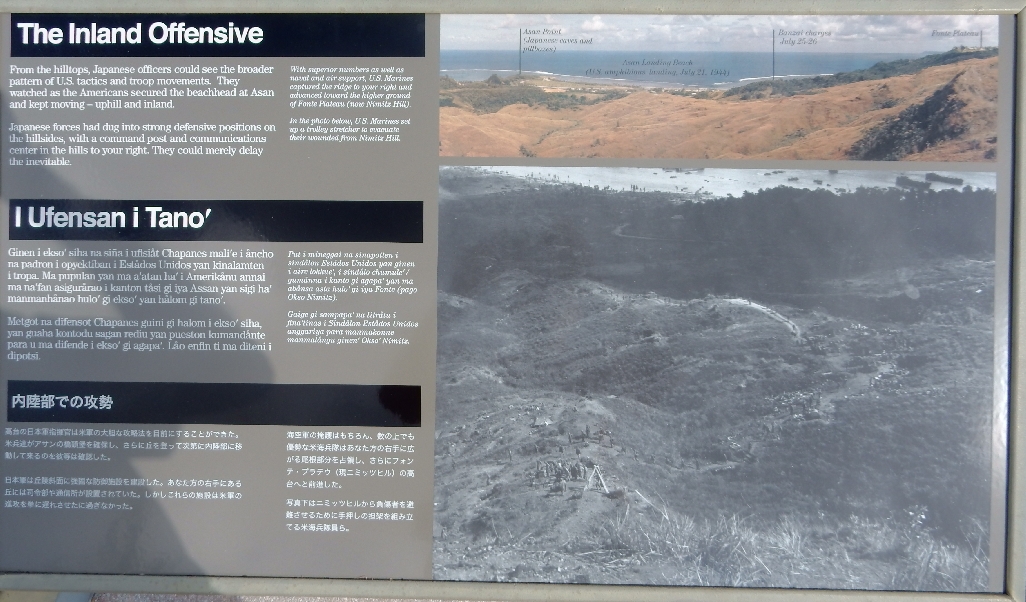
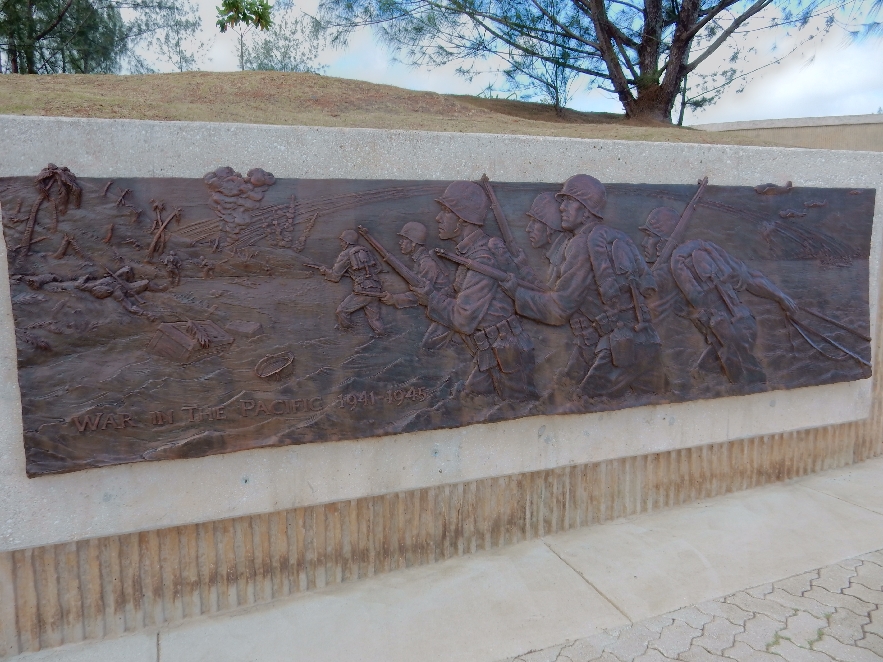
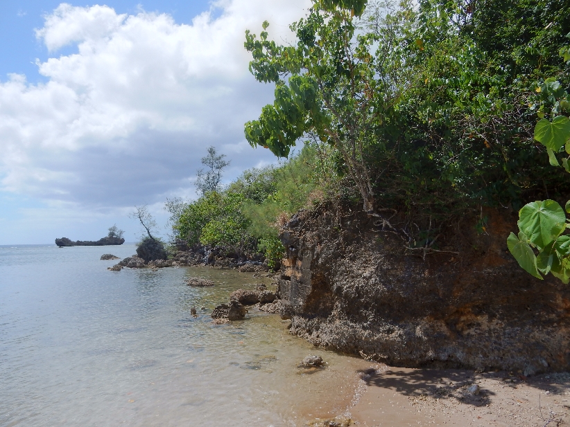
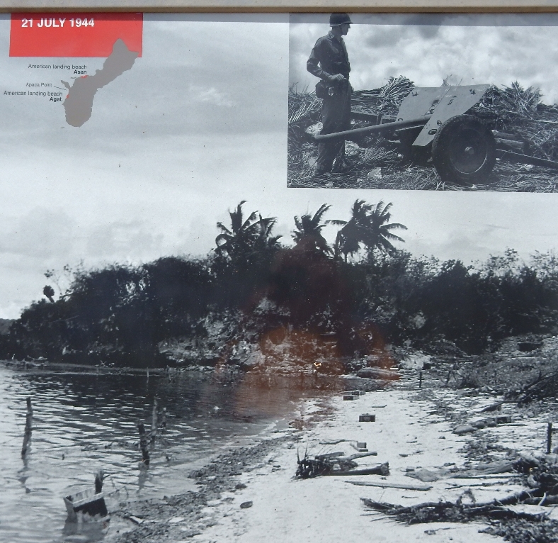
2/27 – We were very fortunate that the plane was only about half full and both Helen and I could stretch out across three seats in an attempt to sleep. Landed early in Guam at 5:30am and picked up our rental car from Thrifty. Our first stop was at Denny’s for a big breakfast. We then tried to check-in early at our Day’s Inn but were told we had to come back between two and three that afternoon. The entire morning was spent touring various locations that are part of War in the Pacific National Historical Park. Started with Asan Beach, which was one of two beaches that were used by the U.S. on July 21, 1944 to invade Guam and take it back from the Japanese.
Observation tower at Adelup Point,
Asan Beach is in the distance
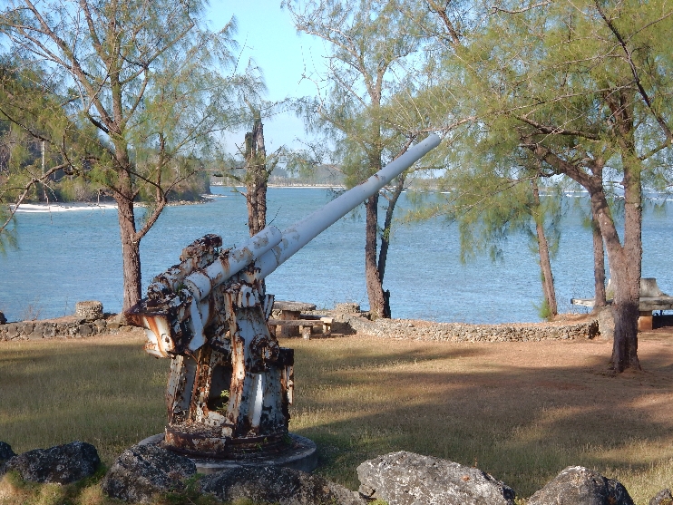
Japanese Gun
We then drove into the hills to the Asan Beach Overlook
Memorial Wall honoring American servicemen who died liberating the island
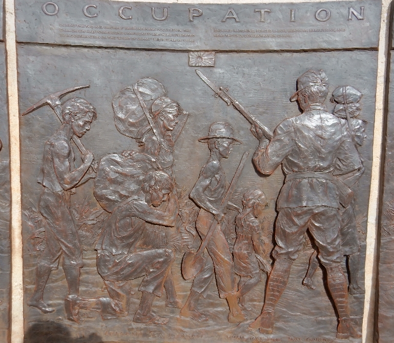
Memorial Wall honoring the Chamoros. The Japanese occupied the island for two and a half years
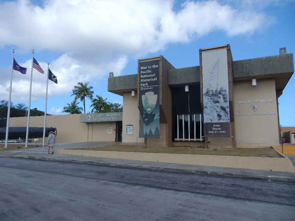
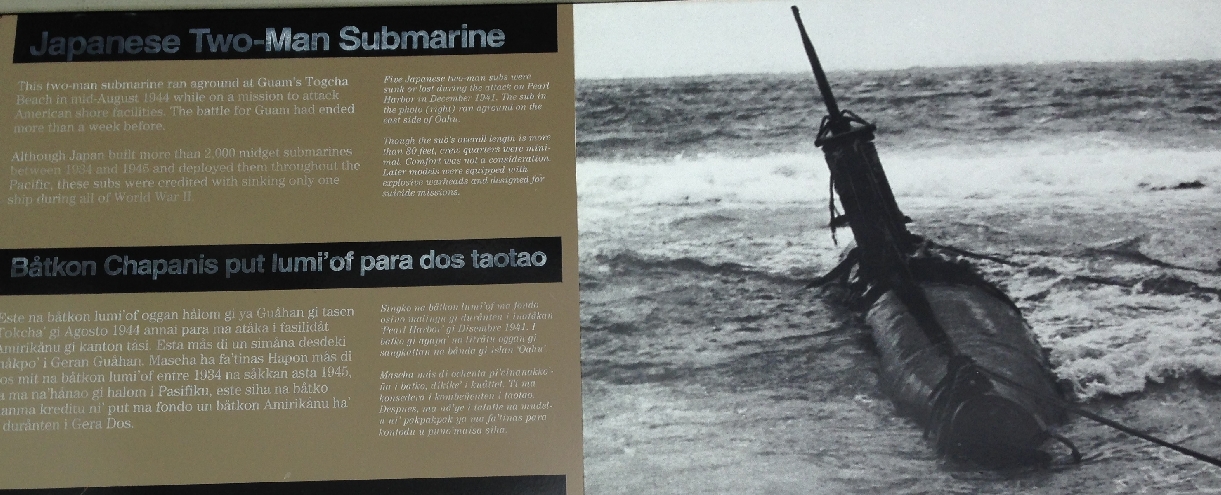
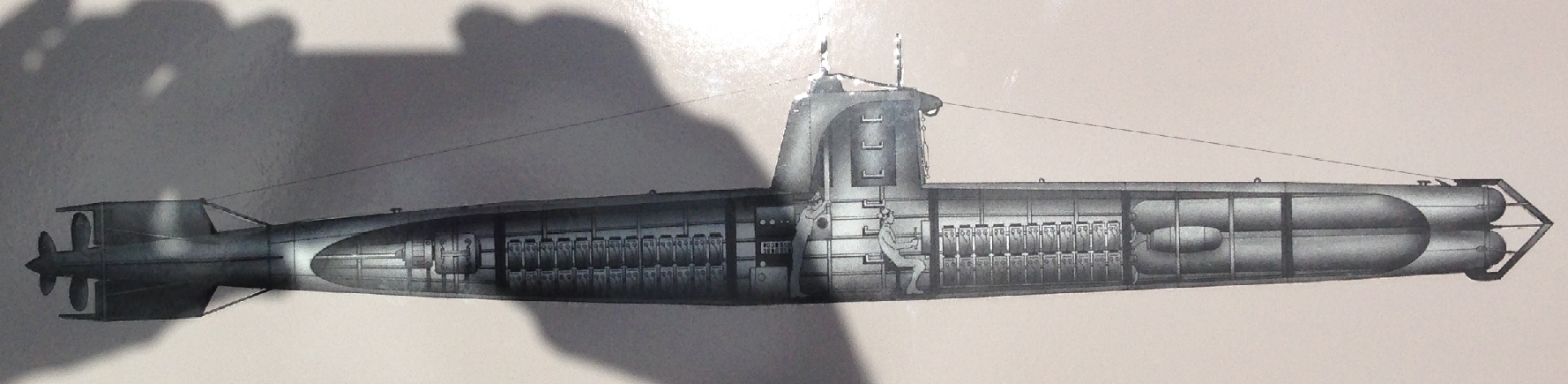
Next stop was the T. Stell Newman National Historic Park Visitor Center
Two-man Japanese submarine
Did a short hike behind the town of Piti to the three Japanese “Piti Guns”
Fortunately they were not yet functional when the marines landed – Gun 1
Gun 2
Gun 3
Parked our car at the Chamorro Village in Hagatna and walked to see some of the local sites. Plaza de Espana was the center for Spanish administration of Guam from 1669 until the U.S. took over in 1898. Of course the Japanese ruled from 1941-1944. Visited Dulce Nombre de Maria Cathedral-Basilica – Pope John Paul II held mass here in 1981. We then walked across the street to Latte Park (also called Triangle Park). These are called Latte Stones –
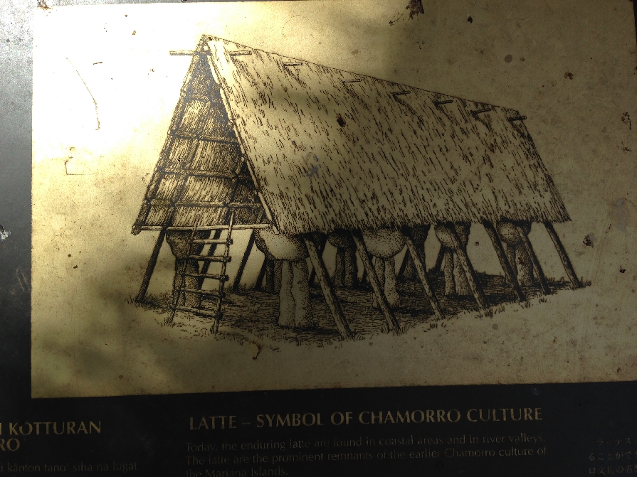
Historians believe they were foundation pillars for men’s houses or homes of nobility
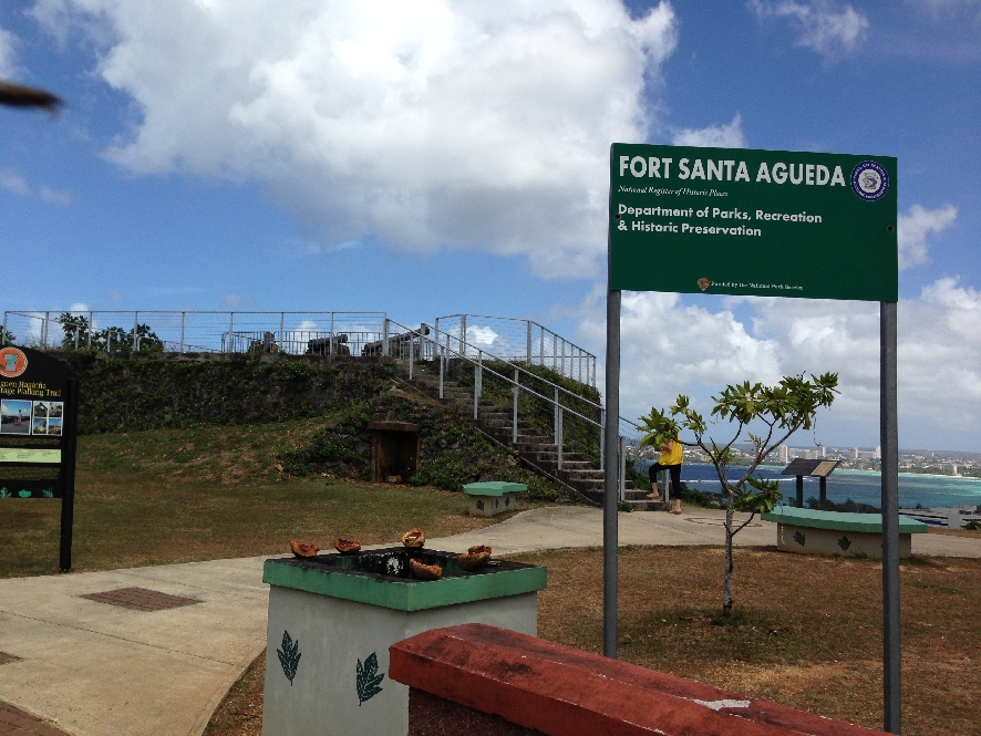
We hiked up to the Fort Santa Agueda (built in 1800) Lookout
View of Hagatna (capital), Agana Bay on left, Tumon Bay (one of Guam’s Marine Preserves) on right with Tamuning (tourist hotels) on opposite side
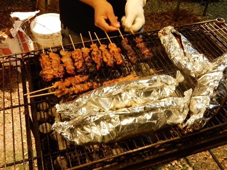
Hagatna is the Capital of Guam – Guam is an unincorporated U.S. territory. Guam has about 200,000 people, is the southernmost island of the Mariana Islands and also part of Micronesia. We ate dinner at Triangle Park (Latte Park) where every Friday locals offer food and crafts for sale – an outside mini-market.
We tried the squid (in foil), ate pork and chicken kebabs,
crab cakes, shrimp sticks
and a kind of donut for dessert
2/28 – Had breakfast at a local Flea Market and then drove to the northern tip of the island and the Guam Wildlife Refuge.
View of Ritidian Beach
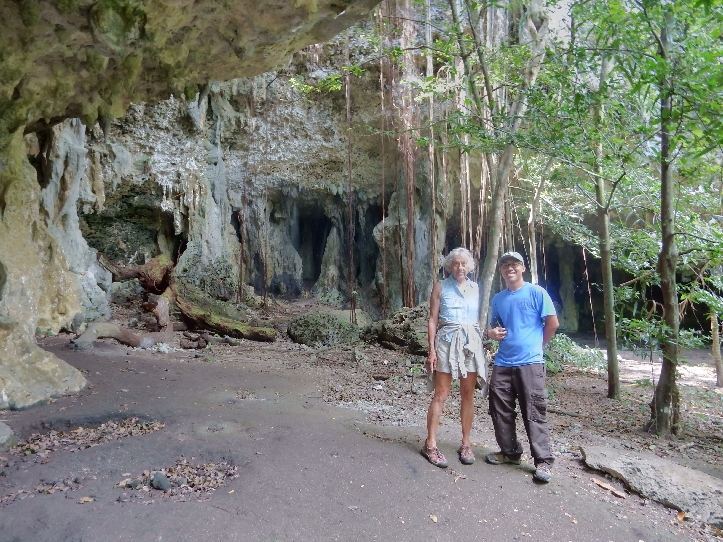
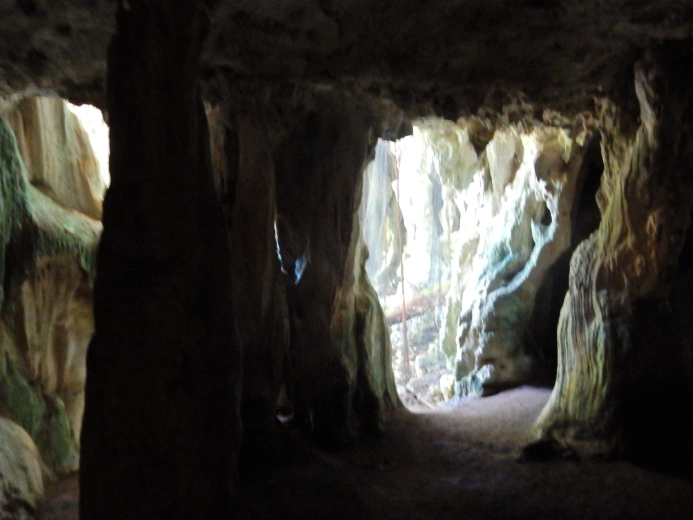
The Visitors Center was closed but I was able to find a door open at the administrative building and found Shawn in one of the back offices. He is doing a post-doc here related to the invasive brown snake population. I called Joe who runs the center because he had confirmed a cave tour for us by email. He said he was off for the weekend but would arrange for Jarod, an intern from the University of Guam to give us a cave tour. Jarod showed up within ten minutes. He was at the beach looking for turtles. We started with a short tour of the Visitor Center and he then took us on a 1.5 hour cave tour.
Limestone formation caves
Cave paintings
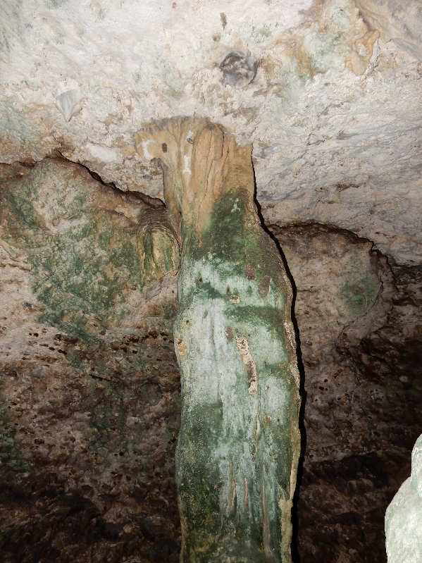
Large stalactite – notice top
Bird painting center of picture, at top of stalactite
Cave spider
Net covers entrance to this cave
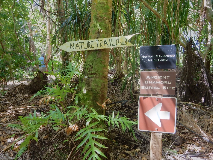
Did a mile nature walk in what was formerly a coconut plantation. Guam National Wildlife Center land was acquired by the U.S. Navy in the 1950s and turned over to the Fish and Wildlife Service (FWS) in the early 1990s. It is adjacent to Andersen Air Force Base.
Butterfly
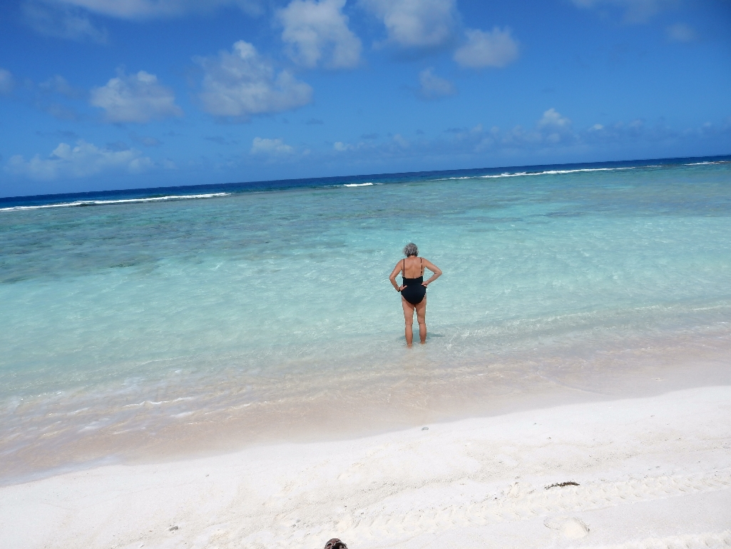
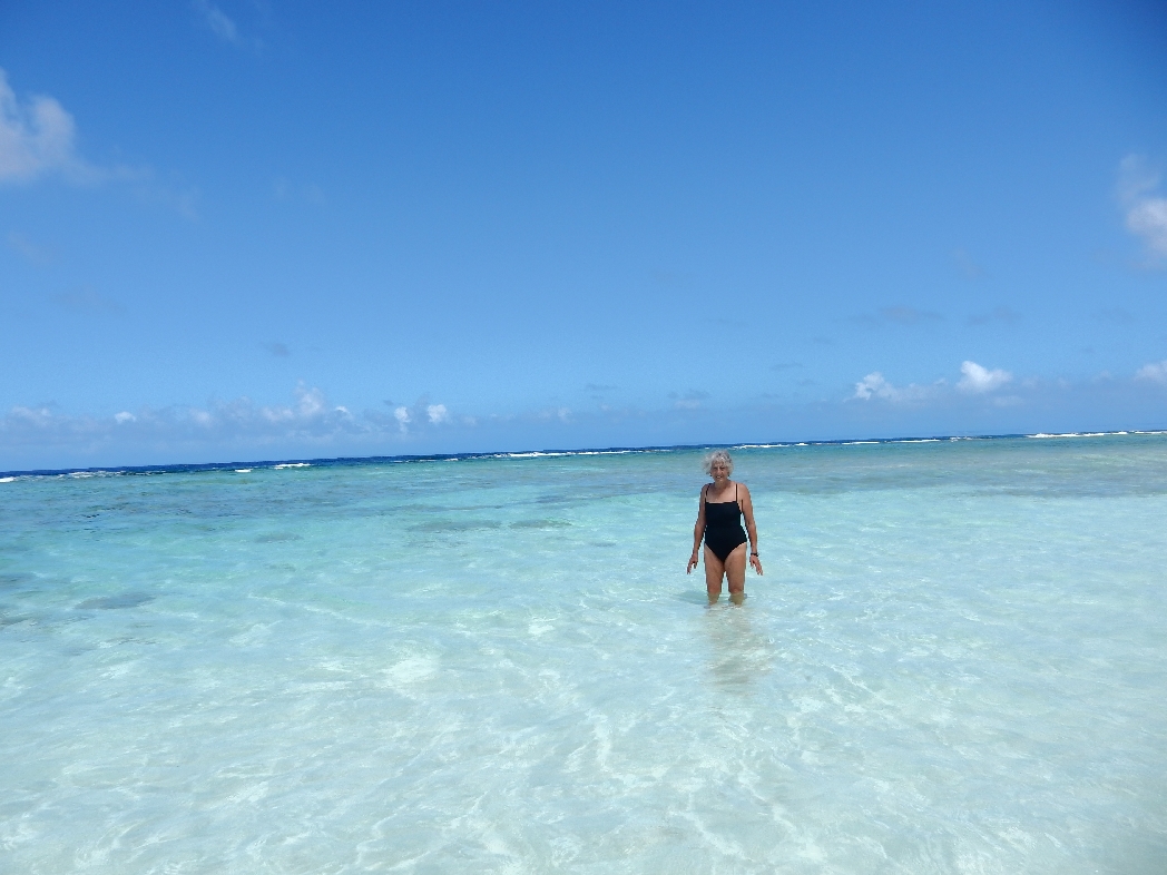
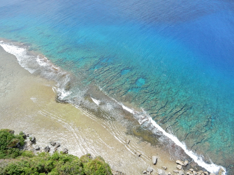
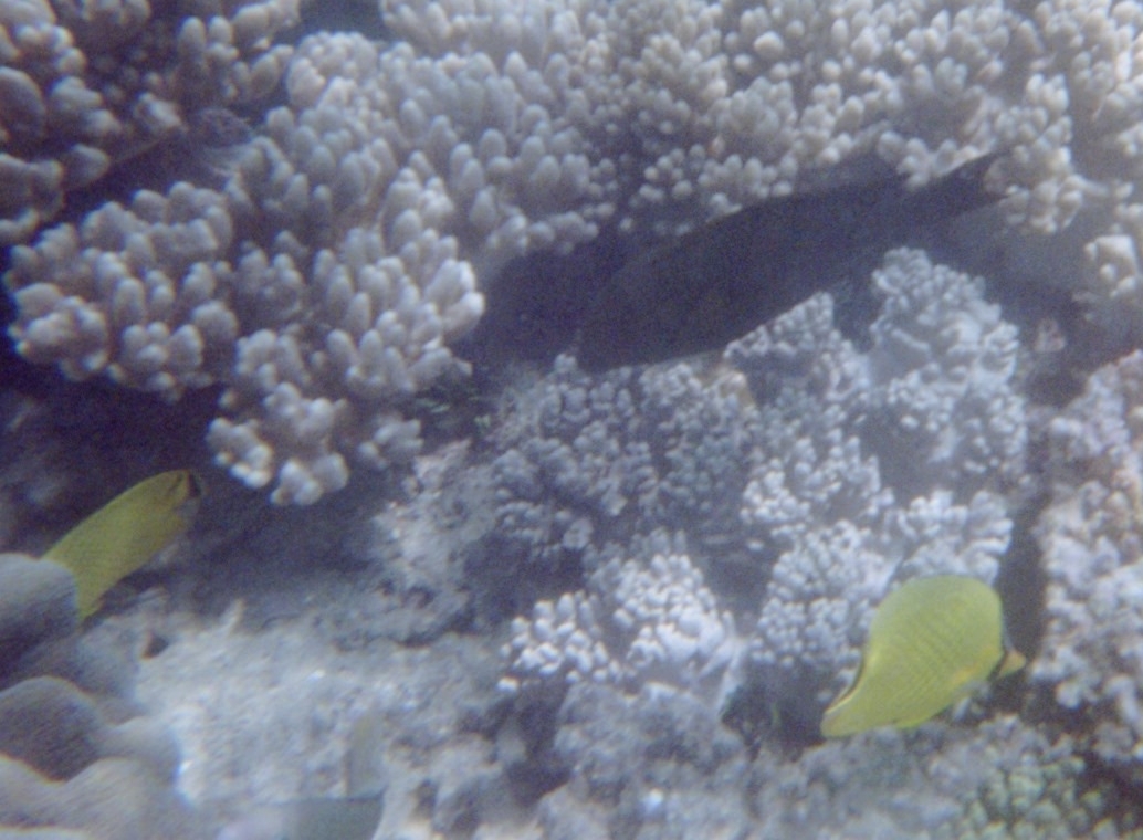
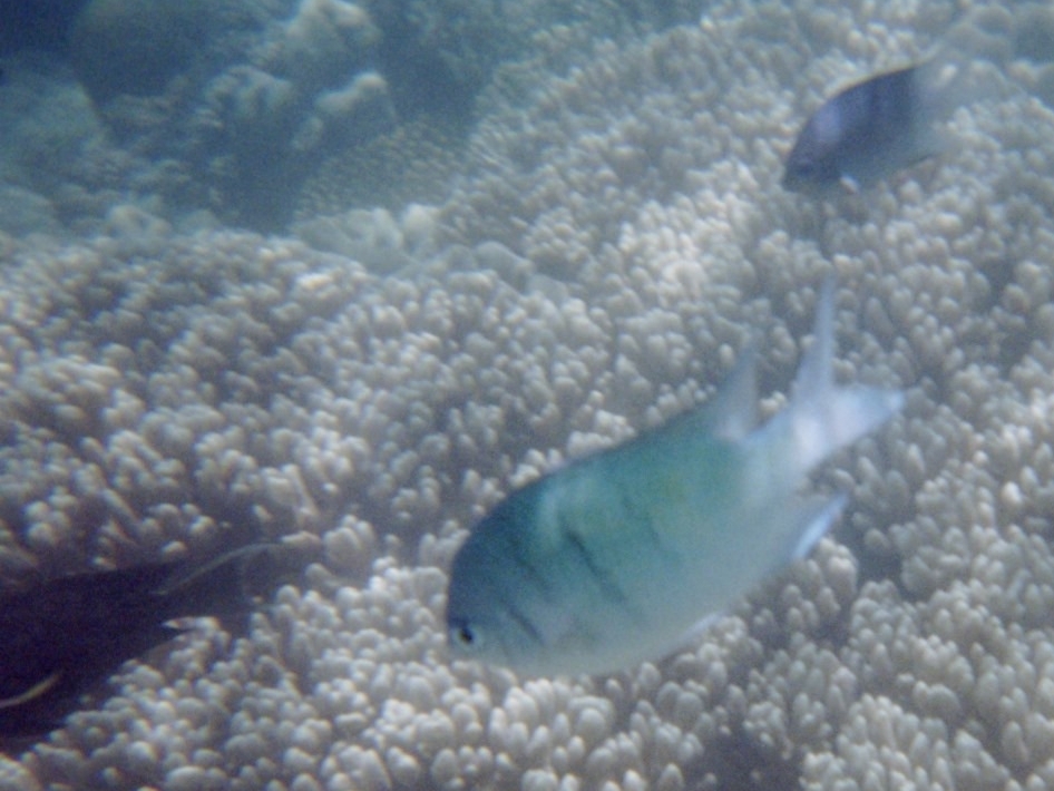
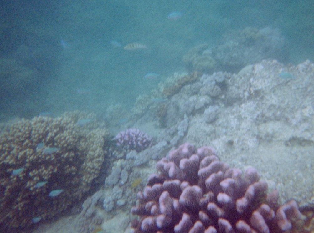
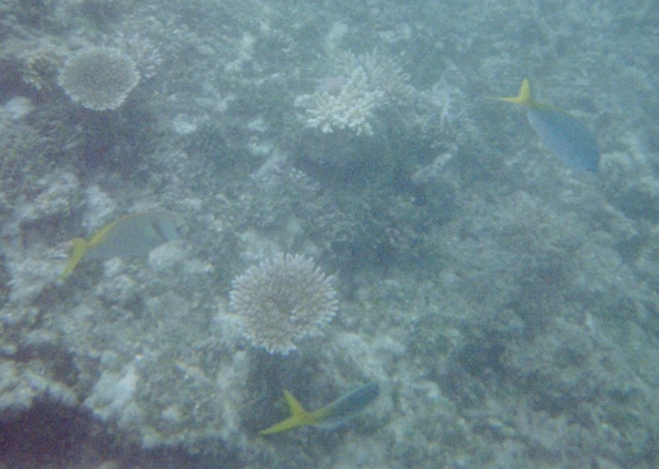
Beautiful pristine white sandy beach – looks like it would be great for snorkeling. We both went in the water so that we could say we were in the Marianas Trench Marine National Monument (FWS). That is, the oceanic zone between Guam and the Northern Mariana Islands.
One of the best beaches on our trip – crystal clear water, reef ready for exploring
Broke down and paid to go to Two Lovers Point. Bus after bus of Asian tourists but it was still a nice view and we got a tasty smoothie!
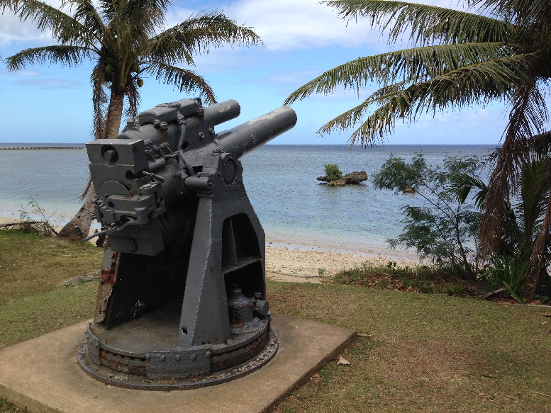
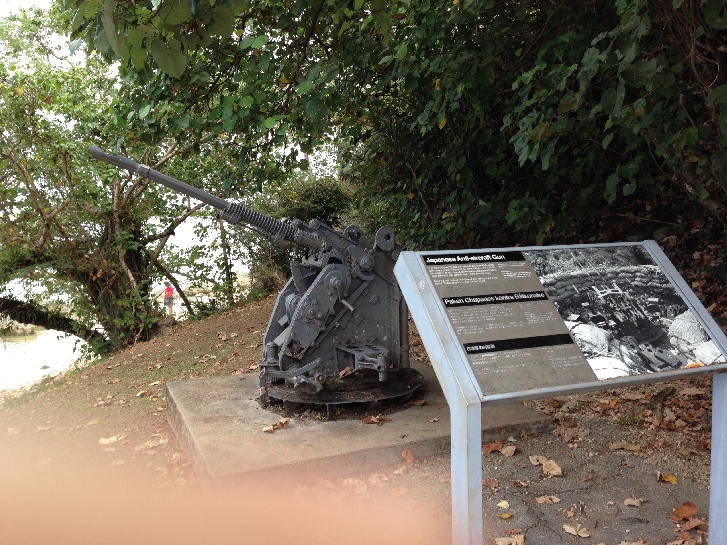
This is Ga’an Point about the middle of the Agat beach landing area for U.S. forces on July 21, 1944
Japanese Gun
Japanese Antiaircraft Gun
Can you see the Japanese pillbox (machine gun nest) built into the rock?
We then headed all the way to the south end of the island and Umatac
Every year during the first weekend in March they celebrate Guam Heritage Day. It commemorates March 6, 1521 when Magellan landed here on his first round-the-world voyage.
Magellan monument and plaque
Helen Dancing with the local Chamorros
Portable ATM!
Some of the villagers took items from Magellan’s ship; he retaliated by burning the village. Soooo, each evening of the festival the A frames built on the beach are set ablaze!
The point at the upper middle of the above photo is the site of Fort Nuestra de la Soledad built to protect the Spanish galleons sailing between Acapulco and Manila in the Philippines. It was the only stop to replenish their supplies.
The current structure represents the last of four forts built at Umatac Bay; it had seven guns
View looking back toward Umatac
Continuing our drive around the south end of the island, we stopped at the Merizo Bell Tower (1910) in Guam’s southernmost village
Statue at Santa Marian in Kamalen Park
Also, took a picture of Bear Rock outside of Inarajan for Peter – he wanted to be a bear when he was growing up
We then stopped at the Inarajan Pools – a pretty area that is, unfortunately, in disrepair
On the way back to our room, we bought Subway subs for our 7 hour flight to Hawaii the next day 3/1 – Left Guam at 7:15am and landed in Honolulu at 6:15pm the previous day, that is 2/28 – we again crossed the international date line. That’s a 20 hour time difference!
2/28 – After the long 7 hour flight, we took a taxi to our hotel and then walked to the ocean and lagoon by the Hilton complex – had expensive ice cream cones on the way back.
3/1 – We restarted 3/1 again – just like Ground Hog Day! Took the bus to Diamond Head State Monument (Park) for $1 each and paid that same amount for entrance.
We walked about a half mile from the bus stop up and through the car tunnel that gives access to the caldera
Descriptive sign showing trail to the top
The crater floor is at about 200 ft elevation – the next series of photos shows Helen on the trail
The trail to the summit is 0.8 mile
The trail switchbacks were put in in 1908
Steep stairway of 74 steps leads to the first narrow tunnel, that is 225 ft long
The second stairway consisted of 99 steps with overhead beams to place camouflaging
There were 52 stairs on the spiral staircase that led up to the four levels of the Fire Control Station
Additional metal stairs lead to the fourth level of the Fire Control Tower, which is the Observation Station. It provides an excellent view of Honolulu and Waikiki. The elevation of the crater summit is 761ft. The next picture shows one of the bunkers that was built along the crater rim – despite the attack on Pearl Harbor, the artillery was never fired during a war!
To do a loop back to the tunnel, you walk the summit rim to a Concrete Landing/Lookout where a winch and cable were used to lift supplies from the crater floor. The Diamond Head Light can be seen in lower center of photo. It was built in 1917.
Starting the descent, view back toward caldera
When we were descending the switchbacks, I heard someone call out a very loud “Aloha” on the trail above. I was startled and ducked. I immediately heard a loud thud behind me. I thought someone had fallen from above. But alas, poor Helen was spread out on the trail behind me. She had looked up when hearing the “Aloha” and had then tripped doing a spread eagle on the rock trail. She was startled and had landed on two knees, an elbow and her right hand. She may also have broken one of her toes. The State Park did not have a first aid kit! Some passerbys but especially the man who ran the refreshment truck at the entrance provided us with cleansing strips, aloe, bandages and ice for her injuries. The abrasion on her right hand was especially bad. A Mango Smoothie was helpful in soothing her bruised ego.
Took the bus back into Waikiki and walked around many of the hotels window shopping, and admiring statues and flowers.
Ate lunch on the beach at The Hilton Hawaiian Village complex
Rested in the afternoon and then went to Snappers for their all you can eat BBQ Ribs.
3/2 – Took our last walk on the beach – Bye Bye Hawaii
Packed and took a taxi to the airport at 1pm, flew to LA (7 hrs) and caught the red eye to MSP. Our flight to Dayton was delayed because of snow and we arrived there at noon on 3/3. Karlene picked us up and drove us home to an inhospitable home coming – see picture
2/23 – Bob got us to the Auckland Airport about 6:15am for our 8am flight to Sydney on Virgin Australia Airlines. It was terrible, they had only two agents and by the time we got to the counter we had only 30 minutes to get on the plan. But, they had finished accepting luggage and we had to take ours to a different location. The first location they told us to go to was incorrect. By the time we got to the right one and then went through security, we had five minutes to run to the gate. You can picture Helen with her knee brace, backpack and picture (about 18″ x 24″) and me with my backpack, boarding papers and hiking stick running for the plane! We were the last ones on before they closed the gate!
Our problems persisted when we landed. Had difficulty finding the location of our pre-paid Airport Shuttle and when we did we had to wait an hour! Long story short, it took us two hours to get to our hotel.
We stayed at the Sydney Harbor YHA. It’s a “youth” hostel in a super location called “The Rocks.” We had a basic but nice room ensuite (meaning with toilet/sink/shower). It was built on steel pylons to preserve excavation sites underneath – it is called the “Big Dig.”
View down from 3rd floor
Artifacts
Dropped off our bags and headed for Circular Quay to catch our Captain Cook Ferry to Fort Denison. We had to hustle to catch the 2:15 boat. City views from the ferry –
Fort Denison is a small island in Sydney Harbor that has an interesting history. It was formerly called Pinch Island and was used to house convicts. The Martello Tower was completed in 1857.
The island is part of the Sydney Harbor National Park
Tour boat passing Fort Denison
Had a fast-food fish dinner at the Quay and then took a lovely walk through the large and well maintained Royal Botanical Gardens.
Some of the park birds
Continued our walk south through the Domain Precinct to Saint Mary’s Cathedral
Archibald Fountain in Hyde Park
We were impressed to see dozens of running groups of all ages and fitness levels running through the streets and parks.
2/24 – Youth Hostel is orange – had breakfast at the gym across the street
I had considered doing the Bridge Climb of the Harbor Bridge – see photos
But it cost about $260 per person, I’d rather climb a mountain – and it’s free!
We chose to walk across the bridge
It was the world’s widest long-span bridge when it was finished in 1932 and is still one of the longest in the world
Though it was cloudy, there were many good views going and returning
This is the sailing ship we saw yesterday from Denison Island. It may be the “James Craig” that does a 6 hr Harbor tour twice a month
After walking the bridge, we went through the Argyle Cut (cut through the rock by convicts 1830-1850) to tour the Sydney Observatory.
It was built in the 1850’s and overlooks Miller Point. It has an interesting collection of old star gazing and time determination apparatus. It also includes Aboriginal sky story videos. This is a model of the HMS Endeavor that was the Royal Navy research vessel captained by James Cook on his first voyage of discovery to Australia and New Zealand, 1769-1771.
The Garrison Church (Anglican 1848), Sydney’s oldest, is lower right
Bird of Paradise flowers
Walked through The Rocks District including The Rocks Discovery Museum – which has four chronological rooms: Warrane (pre-1788 with native Gadigal people), Colony (1788-1820), Port (1820-1900) and Transformation (1900 to present). Picture of “The Rocks” from Campbells Cove –
Yes it does!
Dawes Point Park under the south end of the Harbor Bridge.
Had a salad and Kaibab lunch, took a rest and headed over to the Opera House at 4pm. This was our only “dress-up” day during our six week trip.
Toured the Opera House from 5 to 6. There are five auditoriums where dance, concerts, opera and theatre are staged.
This is the largest auditorium – the Concert Hall
The Opera House is on Bennelong Point
View of Circular Quay and Ferry Terminal from Opera House
Had pre-ordered a Tasting Table at the Opera Kitchen and ate that overlooking the Harbor from 6 to 6:45. Two of everything – small hamburger and chicken sandwich, French fries and potato chips, oysters, salmon, shrimp, three dumplings, sushi, pickles, – had to constantly shoo the sea gulls away!
Attended the opera Faust from 7 to 10:30 in the Joan Sutherland Theatre – it was excellent. This picture of the Harbor Bridge was taken during intermission.
Had a big cappuccino ice cream cone walking the mile back around the Quay to our room – our second ice cream of the evening!
2/25 – Same breakfast as yesterday, then Helen packed, did cross-stitch, sent messages and worked on re-packing the “Ship” painting that she bought in New Zealand. She is taking it as a carry-on, in addition to her suitcase, backpack and stitching bag – all the way back to the U.S. – 7 more flights!
Meanwhile, I did a fast walk through the city and the Royal Botanical Gardens to Mrs. Macquarie’s Point where I took this picture. The Danish architect modeled the Opera House on the “billowing white sails of a sea going yacht.” The locals think it looks more like the mating of two turtles.
Mrs. Macquaries Chair
Nothing like having a little help with your stretching
Nice map of the area
Australian Navy troop transport (largest in the world) in Wooloomooloo Bay
Navy yard
Additional pictures from Royal Botanical Gardens
Sydney’s Finest –
We were picked up by Air Bus Shuttle at 11:30, flew on Virgin Australia, landed in Cairns at 4:15pm and checked into the Bay Village Tropical Retreat
Then walked the Esplanade along the ocean into downtown – watch out for crocodiles!
Pelicans
Our only kangaroo sighting
We ate at the Splash Restaurant, then shared an ice cream and checked-out the sailboat we would be taking the next day in the Harbor.
2/26 – Shuttle picked us up at 7:20am and we boarded the “Ocean Free” (our sailboat) for our day cruise to The Great Barrier Reef
Had pastries and coffee as the crew prepared the boat
They were sold-out, meaning they had their maximum of 25 clients on board Leaving Cairns Harbor – the crew of four young men were very friendly and professional
Helen was supposed to do two SCUBA dives but that was quickly reduced to one because we were taking a red eye to Guam that evening and you need at least twelve hours after a dive before you can safely fly. She then filled out her pre-dive form, listing among other things her meds. They were not familiar with her cancer drug, so they called their standing physician to make sure there would be no dangerous interaction between her med and the compression of diving. It took 4 hours before there was a response and unfortunately the decision was negative. No one there was familiar with her cancer drug. So, they said safety first, sorry no dive.
It took 2 hours to motor out to the Great Barrier Reef off Green Island. The Ocean Free was a sailboat, however, due to time constraints and wind conditions, we did not sail – I was disappointed.
After mooring at their company buoy, we were given snorkeling instruction and then set out for our first snorkeling adventure. OK, Wake-Up and Breath!
There were a number of big fish that just swam around our boat looking for any scraps that would be thrown overboard.
Big fish – up close (in water)!
It was a good spot for fish and coral; however the morning was cloudy so we did not have good light for our underwater observations. Returning to boat –
Had a nice lunch on board about noon
Then took the pontoon boat to the beach on Green Island. Saw some turtles on the way there and back but I was not fast enough to get a picture
Green Island is about one-third National Park and two-thirds resort
I took a nature trail while Helen stayed at the beach
Bathing Beauties –
Hot/Humid – Perfect Day! – Hey, it’s February 26th!
Returning to anchored Ocean Free
After returning to the boat, we again snorkeled for about an hour. This time the sun was out and we had great conditions for swimming over the reef and spotting aquatic life.
Clean-Up time
They opened the jib sail on the way back to Cairns but it was not really sailing
Disembarked about 4:30, freshened-up in our room and again walked into town for dinner. Lots to see along the walk, skate parks, childrens parks and wading pools, exercise courts, monuments, picnic areas, etc. All were being used as well as many walkers/joggers/runners on the boardwalk.
This time we both selected the Sesame Crusted Tuna from the Splash restaurant luncheon menu. You were able to order from that menu any time before 6:30pm and the price was half that of the same meal for dinner. Again walked the almost two mile boardwalk back to our room – it was dark when we got there.
We packed, were picked up by the airport shuttle at 10:45pm and took off at 1am for Guam
1/31 –Auckland, New Zealand – Helen & Sue started the day with a walk along the beach and then met friends for coffee at Kahve, which they did every morning we were in Auckland. Helen selfie with Linzi and Sue.
Sudar, Kahve’s owner
When they returned we had a healthy fruit and cereal breakfast along with freshly ground and prepared coffee – Bob has become a barista extraordinaire. We then drove a short distance to a beach where kids were setting up for an Optimist sailing regatta.
They then took us to see the totems and lookout at Achilles Point
I had been getting chilled all morning, so we drove downtown for a cup of tea. By the time we parked and walked to a waterfront restaurant I was shivering severally with painful stomach cramps, so we returned to the apartment. I spent the rest of the day in bed except for frequent trips to the toilet, only able to take a little fluid.
2/1 – Super Bowl Sunday – I was in bed most of the day with abdominal pain, fever and low blood pressure. I was only able to get up for parts of the game but was able to see the exciting/unbelievable finish – the Boston Patriot’s interception on the one yard line with only 18 seconds to go to beat the Seattle Seahawks!
2/2 – Same as yesterday, diagnosis – some tropical virus.
2/3 – Made some progress today and was able to take a short walk with Bob and pick up the rental car. However, the severe stomach cramps with frequent toilet stops continued. The car was the smallest one I could rent; a sub-compact Japanese Daihatsu Sirion 1.3L. It was a 2006, making it 9 years old. When I went to start it – it wouldn’t. They put in a new battery and I was off.
2/4 – Left for Tongariro NP about 7:30am with Bob leading us in his car through Auckland until we were able to get on Rt 1 south. Adjusting to driving a small car on the left side of the road. Manual transmission on the left, steering wheel on the right, with mirrors and controls reversed! We had a little trouble with poorly marked roads that was complicated by a Garmin GPS unit giving us incorrect information in New Zealand speak!
Example of countryside south of Auckland. It was an overcast and rainy day. As a result, the camera adjusted by increasing the exposure for the countryside but as a result the sky was over-exposed.
Arriving at Tongariro National Park – New Zealand’s oldest national park and a World Heritage area
We did the Mounds and Tawhai Falls Walks as we drove into the park
Can’t see the volcanoes – just clouds
Got to Whakapapa Village mid-afternoon, checked into our cabin and then went to the Visitor Center – it is located in the village. The village is left center in the photo; this is a big park.
My original plan was to do the Tongariro Alpine Crossing – one of New Zealand’s Great Walks. It is 13 miles one-way up over and through the volcanic landscape. Unfortunately Helen’s knee surgery did not permit this trek.
Instead, we did the Taranaki Falls Loop.
Notice that the map states 2 hours for the loop. In the U.S., trails are stated in miles. In New Zealand they are stated in minutes and hours. This estimate is based on the average adult hiker moving at a moderate pace. The advantage of the New Zealand system is that it considers terrain, e.g. difficulty of route. However, I am still preferential to our system, probably because I am used to it and like to determine my own level of difficulty. At the same time, I think the loop was about 4 miles and we did do it in two hours stopping only for pictures.
Starting on the trail
Dropping down to Wairere (Mangatepopo) Stream canyon, we had some rain and lots of wind.
The next series of pictures show us approaching and then leaving Taranaki Falls behind
Too cold for a dip
Falls just left of center and Helen (red jacket) on left in picture
Different kind of forest, it was a good hike
Before going out for dinner, we drove up to the Mt Ruapehu Ski area. There is a formation there that is called Meads Wall – it was used in the Hobbit trilogy. However, the area was socked-in and it was hard to see through the clouds.
2/5 – Woke up to rain, packed and were out of our cabin at 6:30am. We were never able to see the tops of the volcanoes. Perhaps we’ll get a view on the way back to Auckland. We drove south on a very curvy, up-down, Rt 4 to Whanganui. It was slow going but the scenery was great.
I have to look up these numbers – but I seem to recall that 75-80 percent of the vegetation and 60 percent of the animals in NZ are not found anywhere else in the world.
Not many people around, only 4 million in the entire country. There were at least 100 pair of shoes hanging on this fence.
It took us a good 25 minutes to get past this herd of sheep,
herding dogs and shepherds on their ATVs
There was a wonderful kids park in Whanganui, so we had to stop for pictures
We arrived in Wellington at 12:30 and waited for our ferry to take us to the South Island. It was an hour late coming in so we ended up leaving at 3:45 instead of 2:45. Here is our Ferry arriving late; notice the snorkeler in the foreground diving for shellfish. Wellington is in the background.
A hungry crocodile
The trip across Cook Straight takes 3.5 hours. Our Interislander Ferry was the Aratere, which can carry 670 passengers, 28 railroad cars or 30 trucks or 230 cars and it was full. As we left Wellington another Interislander Ferry was coming in.
It was a relaxing ride. We even did “tea time” with biscuit, butter, jam and coddled cream.
Approaching Picton on the South Island
We landed in Picton at 7:15, an hour late.
Much of the ride to Kaikoura was along the ocean
Selfie
The ride was tense as we rushed to get to Kaikoura before dark. We arrived at 9:15, checked into the Alpine Pacific Holiday Park and then went into town for pizza.
2/6 – It rained (snowed in the mountains) overnight and the morning was cold and clear. This is a good picture of our tiny Daihatsu Sirion. Helen is on the passenger side.
Started the day by doing the Kaikoura Peninsula Walkway
At the end of the peninsula is the Point Kean Seal Colony, which is a national Wildlife Reserve
We hiked out to South Bay and back taking pics of the rugged coastline 530 and 532
Returning to the car
Went to the Craypot Cafe in town for breakfast because they had free Wi-Fi and we needed to get caught up on our messages. Alas, they cut us off after a half-hour. The drive toward Christchurch was very tense because I was running out of gas and there were no gas stations. I will let Helen describe that ordeal. In a nutshell, we were almost out of gas and I stopped at a self-serve station – no people, you can only use your credit card with pin number. Well, I never use a pin number with my credit card and didn’t know it. In the end, I showed a Chinese couple who pulled in how to use the pump and they let me piggy back on their fill-up. So, I paid them cash and we were all on our way!
We took the Rt 72 bypass around Christchurch. Here are some pictures along Rt 8 as we drove to Lake Tekapo.
Beautiful aquamarine color of Lake Tekapo
Drove to the top of Mt John, which is on the southern end of the lake
There are three observatories run by the University of Canterbury and a small restaurant on top
In 2012 this area was declared an International Dark Sky Reserve, one of only five in the world
Entering Aoraki/Mt Cook National Park, Aoraki is the Maori name for Mt Cook
Approaching Mt Cook
Mt Cook is the highpoint of New Zealand – 3724m or 12,215 ft
Checked into the Aoraki Court Motel at 7:30pm. We had a large modern/comfortable room with a fantastic view of the mountains
Didn’t want to spend $60 each for dinner at the Hermitage Hotel. So, we bought soup and crackers to prepare in our room for dinner, Special K for our morning meal and Chicken Pot Pies for lunch the next day.
2/7 – We awoke to a beautiful mountain view outside our window. This was, by far, our best weather day thus far on our trip.
We had an in-room breakfast and then did the Glencoe Walk behind the Hermitage Hotel. Flowers along trail
It took a half-hour and gave us a good view up the Hooker Valley – Mt Cook right center
Did a walk through the Hermitage – cool fish on “weeping wall”
Maori eve decoration
Stopped by the attached Sir Edmund Hillary [first man to summit Everest, died in 2008] Alpine Center for a few pics
View inside the museum
It had snowed the night before we arrived so the peaks were covered in a brilliant white as we started our trek to Kea Point. The scenery was amazing.
Flowers along trail
The trail description stated 2 hours return and that is exactly how long it took us, i.e. 2 hours round-trip
Platform at end of trail, Mt Sefton on left 3151m or 10,335 ft, Mueller Glacier left of center
Found some delicious wild raspberry bushes on our way back down the trail
After returning to the village, we toured the Aoraki/Mt Cook NP Visitors Center
Ate microwave Chicken Pot Pies for lunch in our room and then drove up the Tasman Valley to do the Blue Lakes Walk. The lakes are now green with algae, because they are now filled with rain water instead of glacial melt.
We then did the Tasman Glacier View Walk, which gave us a view further up the valley to the mountains. This is Tasman Lake with the Tasman Glacier at the far end.
Returned to our room, cleaned-up and went to the Chaomis Bar & Grill for dinner. New Zealand’s main exports are dairy products and lamb. Our dinner selection – Southern Lamb, it was delicious.
We ended the day pleasantly tired and full!
2/8 – Started at 6:30am with the moon bright above the mountains. Photo taken from our patio.
Drove to Omarama for a big breakfast and gas.
Then continued on through Cromwell, which is a fruit growing area.
They had a lot of bugs as well
Then on to Arrowtown where we toured the historic Chinese Settlement. The Chinese came from the Canton region of China to work the gold fields and were treated as poorly as they were in the U.S.
Village store – now Visitors Center
The next series of pictures shows other “houses” in the village
One of the Village desendents showed Helen how to shake a tree to get the ripe fruit. She has a handful of little plums
Telephone booth in Arrowtown; I bought a $9 milkshake – ummm!
Along Rt 94 – Sheep, sheep everywhere
Took a short hike through the Wilderness Scientific Reserve outside of Manapouri
A unique shrubland environment of bog pine
and racomitrium moss – it looks like dirt in photo but is very fragile
A bit down the road we entered Fiordland, a very large World Heritage Area
Made it to Te Anau in time to visit the Fiordland National Park Visitor Center
Early inhabitant display
Model of Captain James Cook’s boat the H.M.S. Resolution when he visited southwest NZ in 1774
We then did the Lakeshore Walk to the Gates (small dam hydroelectric plant)
Colorful, poisonous, mushrooms
Trail passed through the Te Anau Wildlife Center, this is a Takahe, one of NZ’s flightless birds
We hiked across the dam to the start of the Kepler Track 669
Returning to Visitor Center – Again, in the U.S., trails are stated in miles. In New Zealand they are stated in minutes. Our Lakeshore Walk was listed as 60 minutes to the Gates and the same to return. What that means is that you would get to the Gates in 60 minutes if you continued non-stop at a moderate pace. That is exactly how long it took us even though we did stop for pictures. Round-trip we covered about 5 miles.
Drove to Manapouri to check into our room and discovered it was taken! The good news is that they gave us an entire vacation house for the night instead. Great views over the mountains and river.