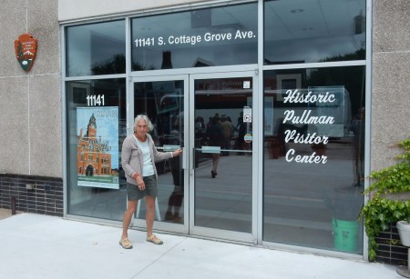
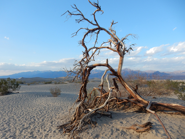
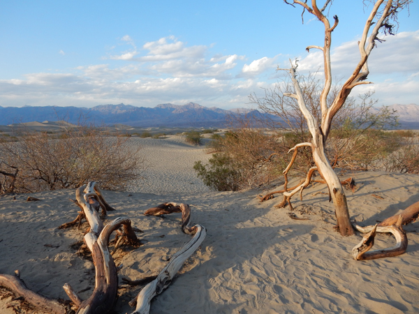
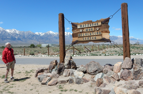
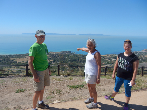
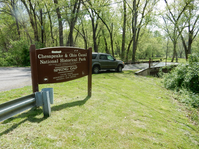
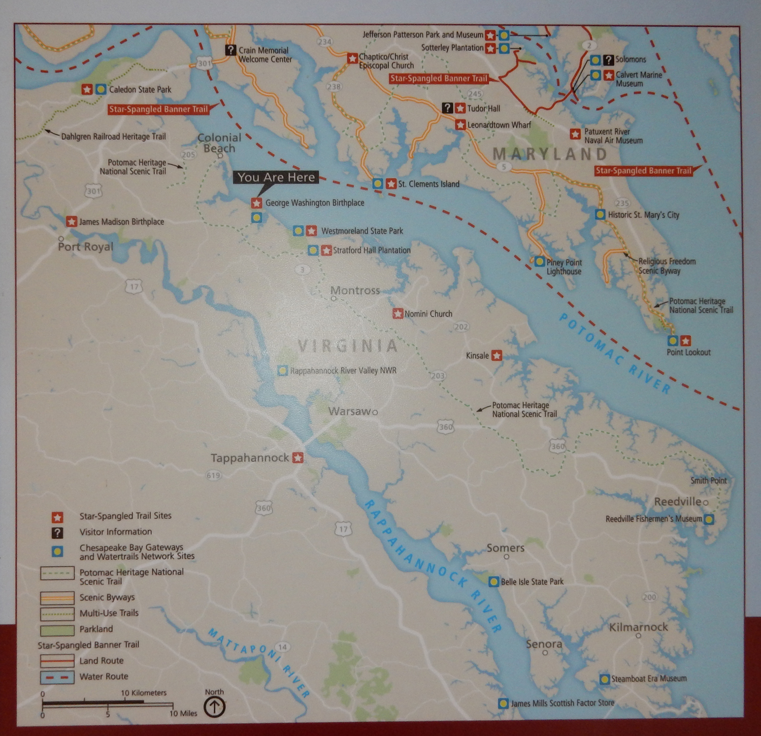
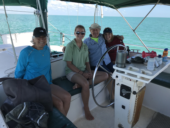
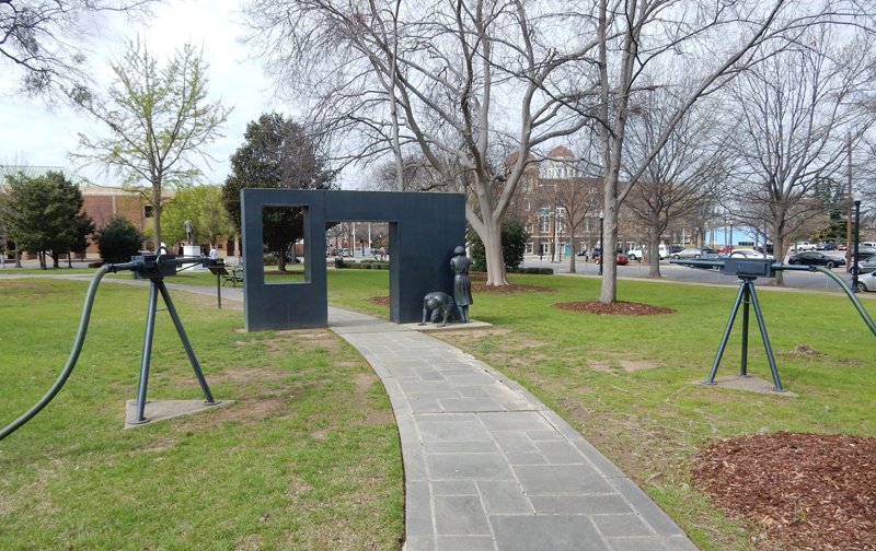
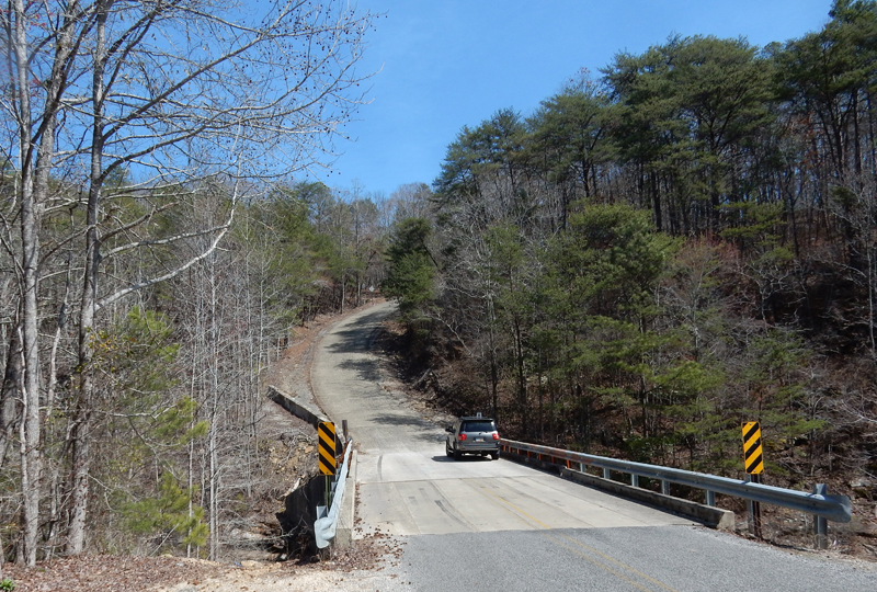
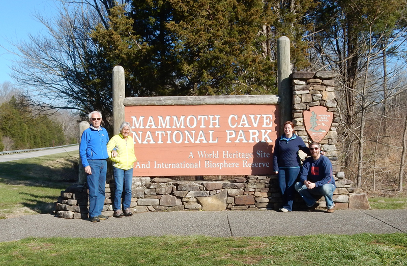
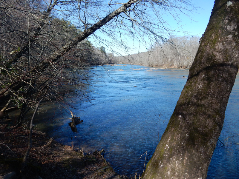
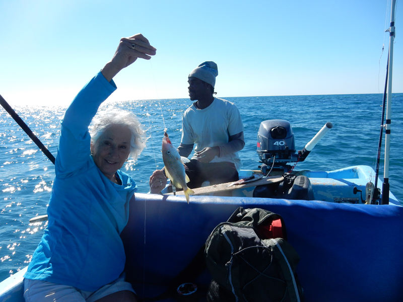
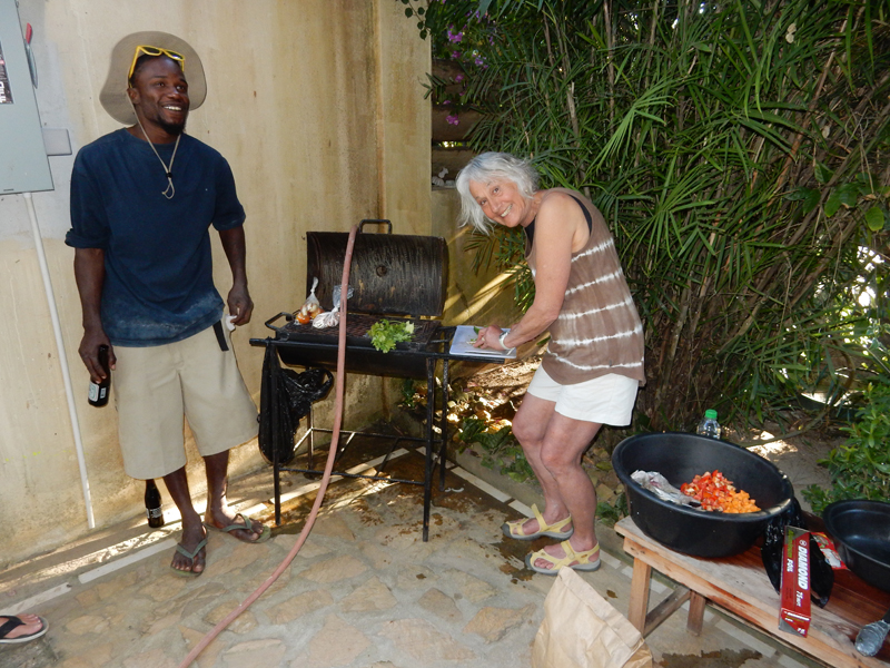
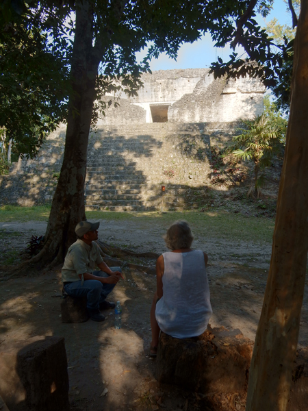
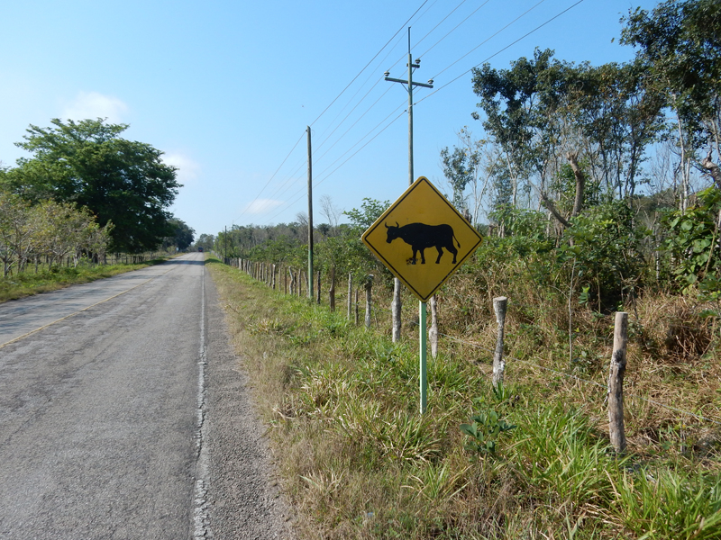
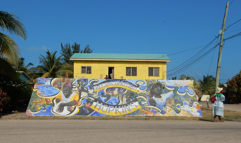
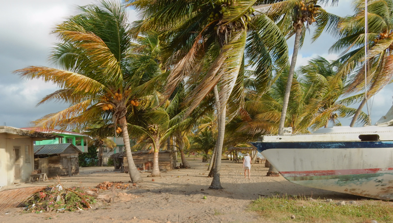
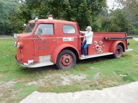
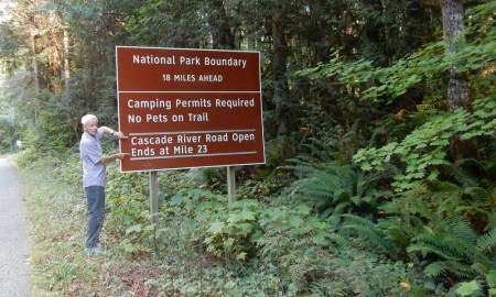
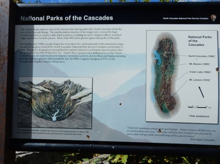
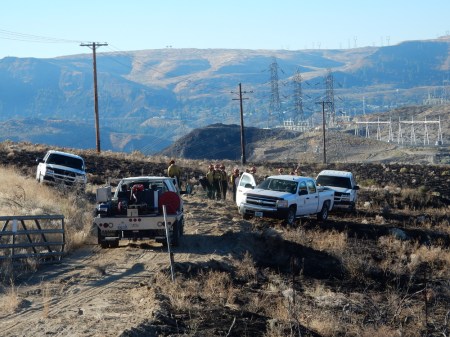
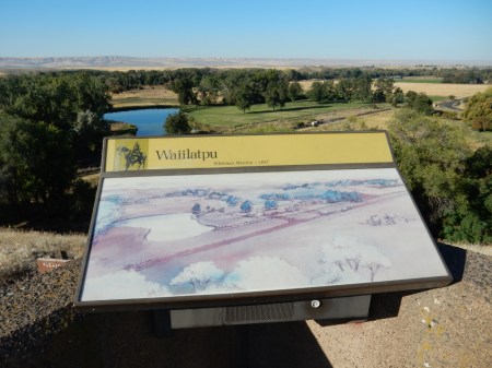
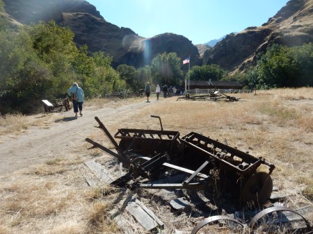
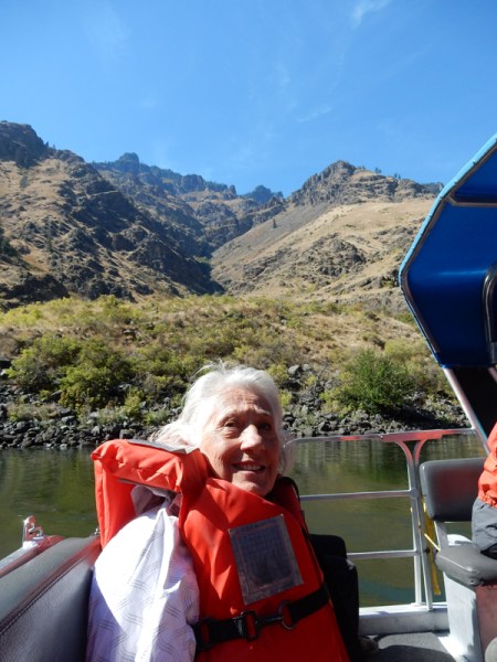
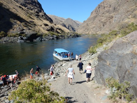
I drove Helen to the airport April 18th to start her Spain-Portugal trip with Nancy. On April 20th I started my NP Unit trip to the East Coast. I started and ended my trip with stops along the Chesapeake and Ohio (C & O) Canal, which is now a 184.5-mile National Historical Park (NHP).
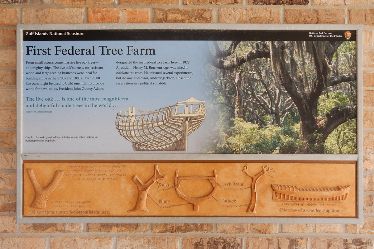
George Washington had envisioned a canal from tidewater (Georgetown in Washington DC) to the Ohio River at Pittsburgh to “Open the West” to commerce. John Quincy Adams broke ground for construction on July 4, 1828.
Construction ended in 1850 at Cumberland MD when it became clear that the Railroad was the future in relation to commerce. With time, the Baltimore & Ohio (B & O) Railroad made shipping faster and less expensive. The canal continued to be used until 1924 when it closed and was abandoned. It became a National Historic Park in 1971.
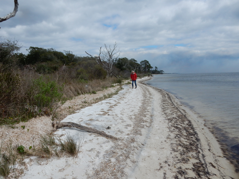
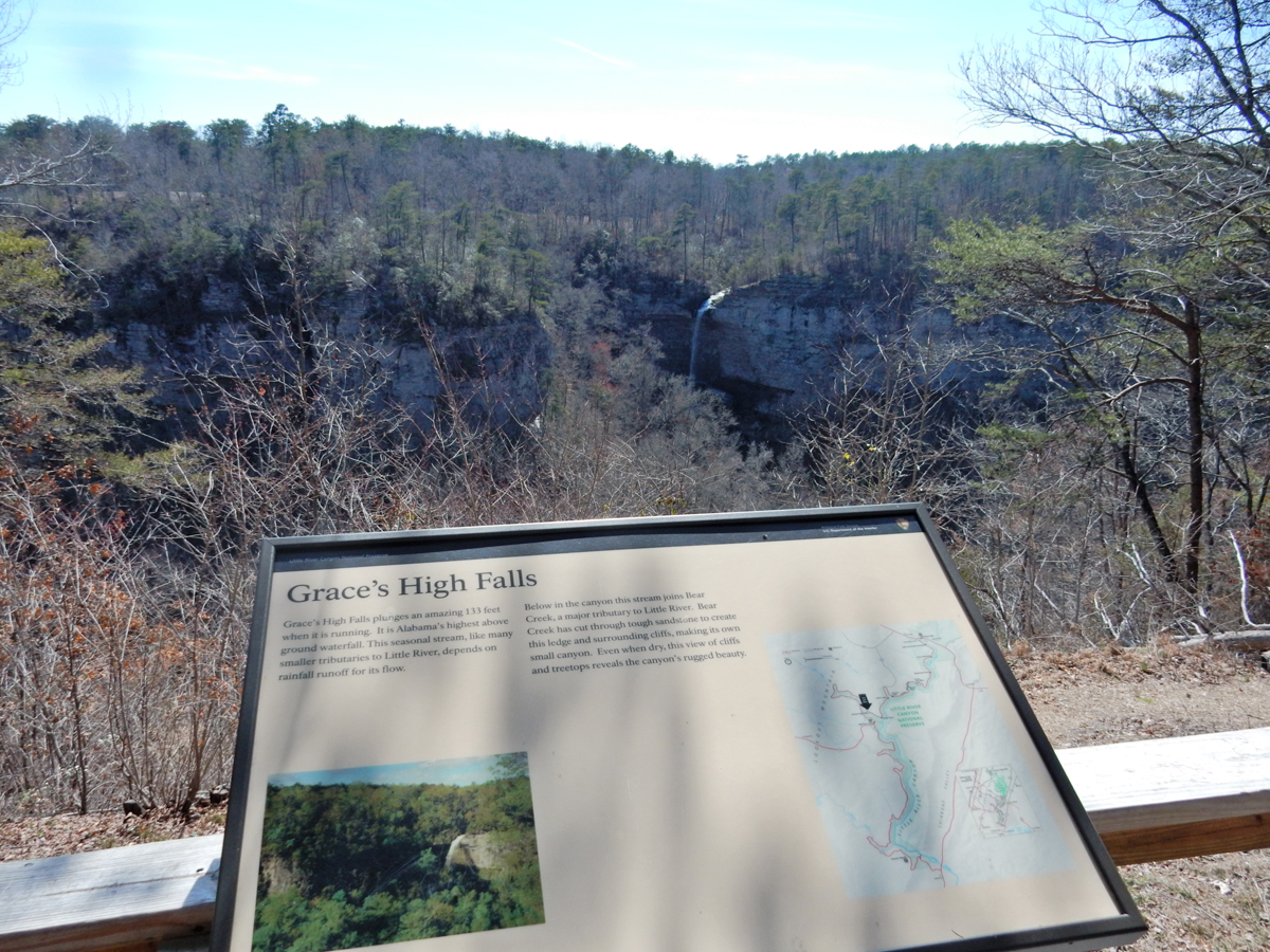
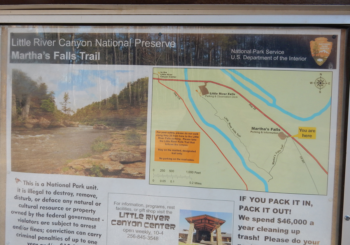
The Canal parallels the Potomac River from Georgetown in Washington DC to Cumberland MD
74 locks and 11 aqueducts over streams were built to raise canal boats 605 feet on their way to Cumberland
Canal boats were a maximum of 12 feet wide to fit through the locks
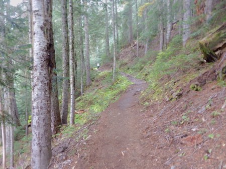
The mule path for pulling the boats was also 12 feet wide and today makes a great walking/hiking/cycling trail
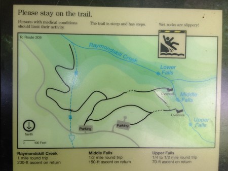
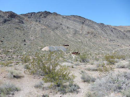
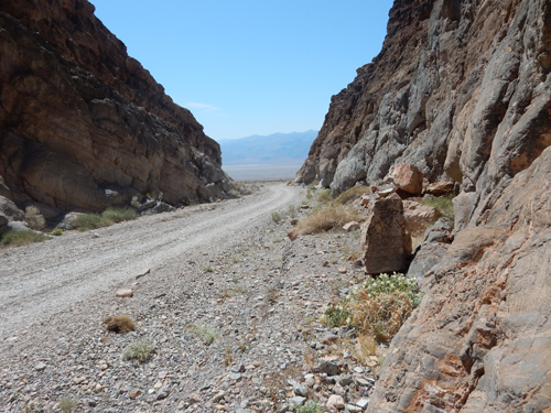
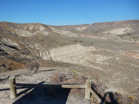
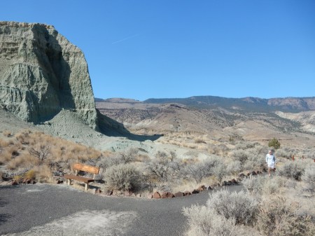
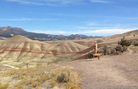
First stop Spring Gap – Mile 174

Second stop Oldtown – Mile 166.7


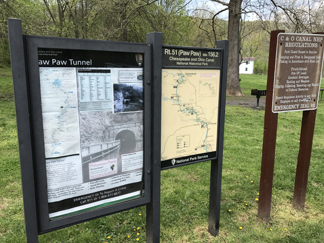
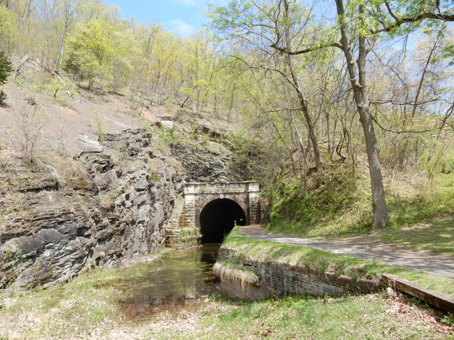
Third stop Rt 51 – Mile 156.2

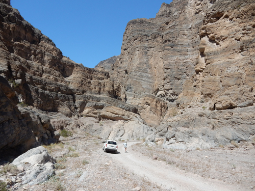
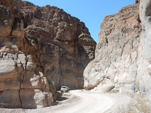
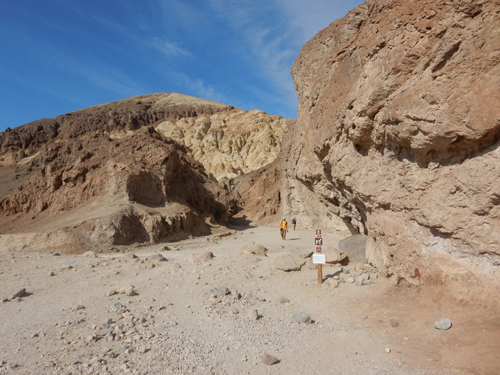
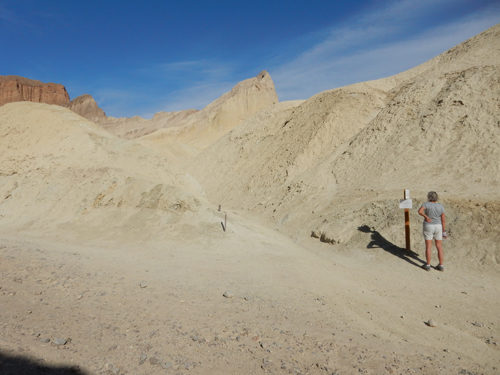
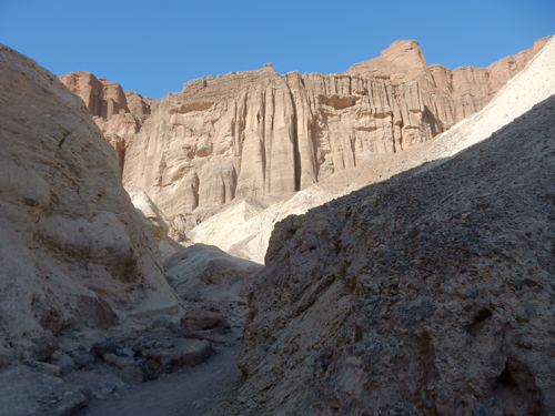
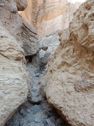
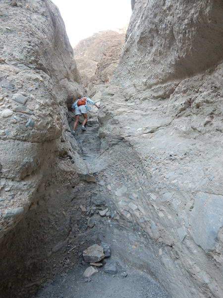
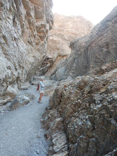
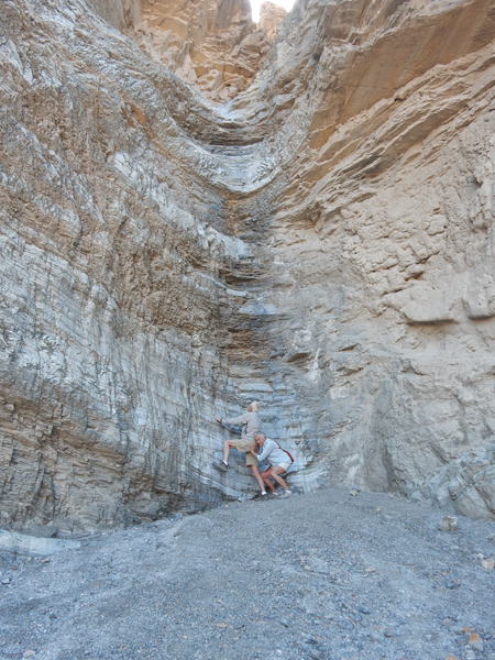
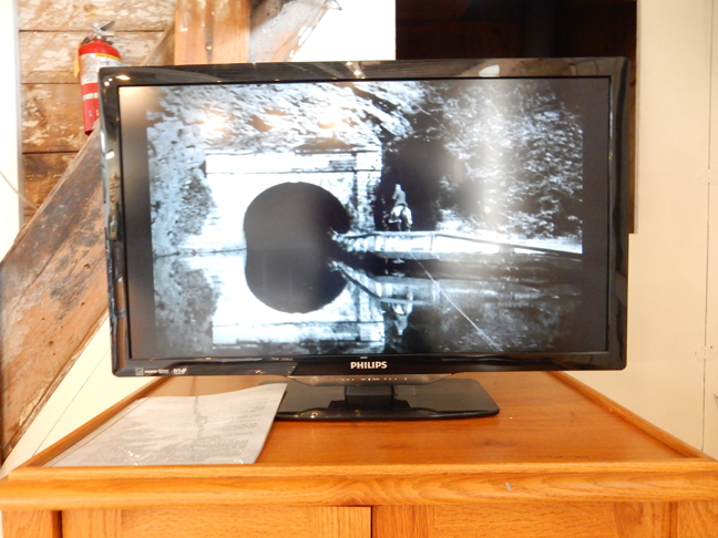
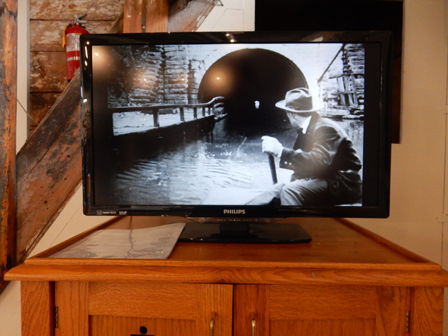
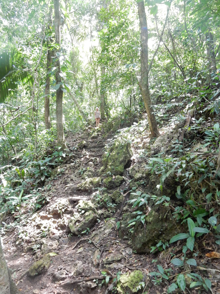
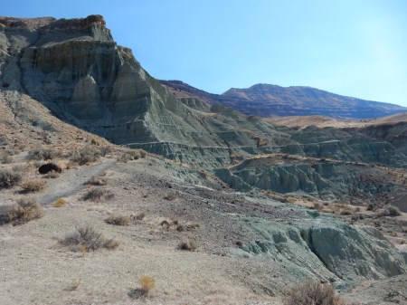
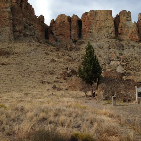
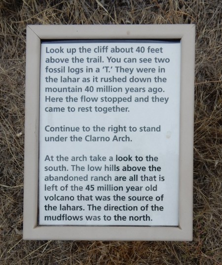
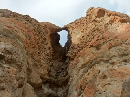
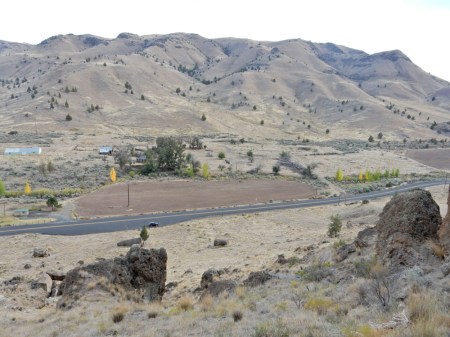
Hiked to the Paw Paw Tunnel

It was built to save the Canal going 6 miles around the mountain – Mile 155.2

Took almost 12 years to build – 3,118 feet long


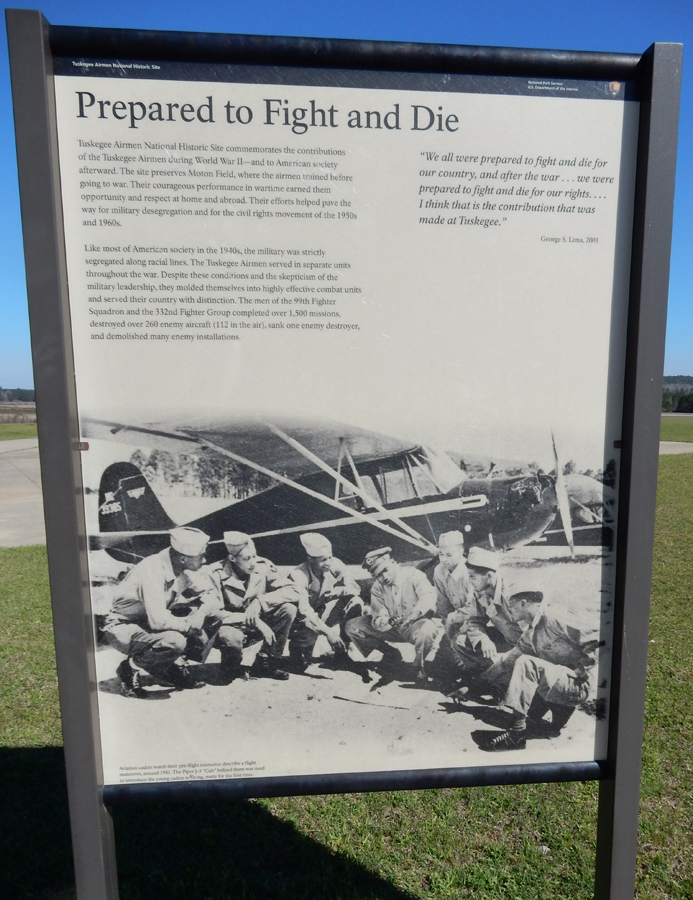
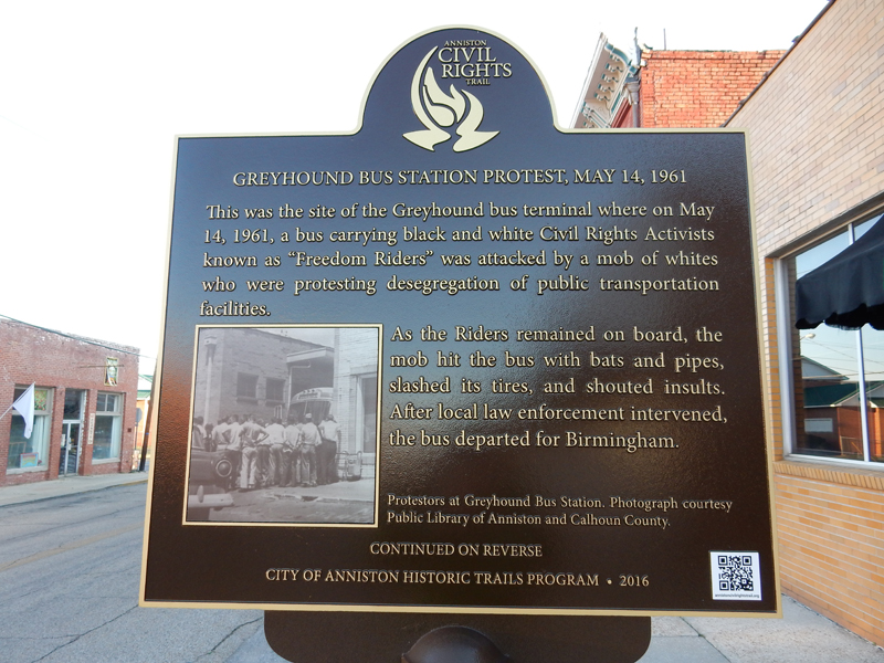
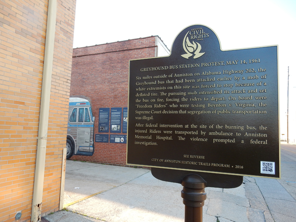
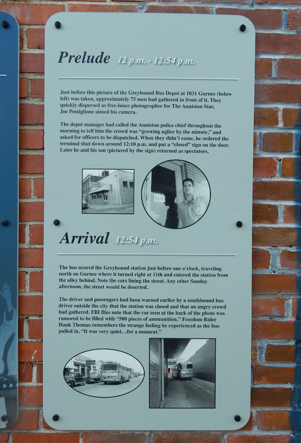
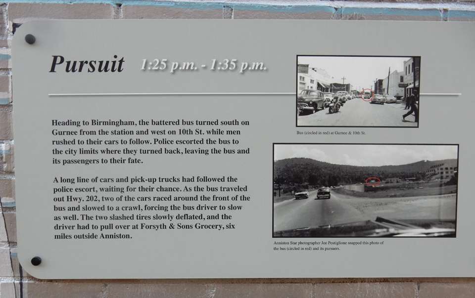
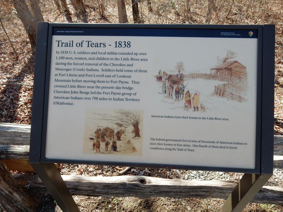
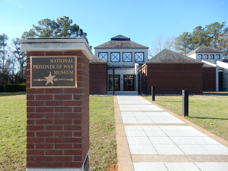
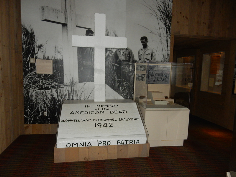
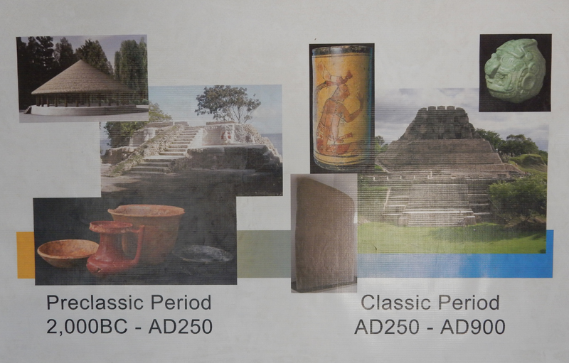
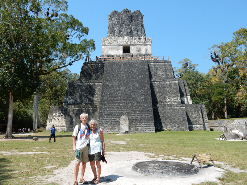
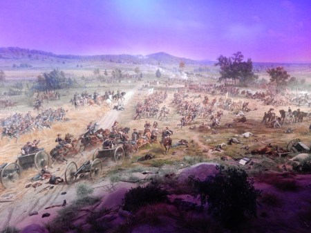
I visited 8 Civil War Battle Sites on this trip. I will present them in the order I visited them; therefore, they are not chronological. All were part of the Eastern Theater during the war.
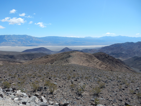
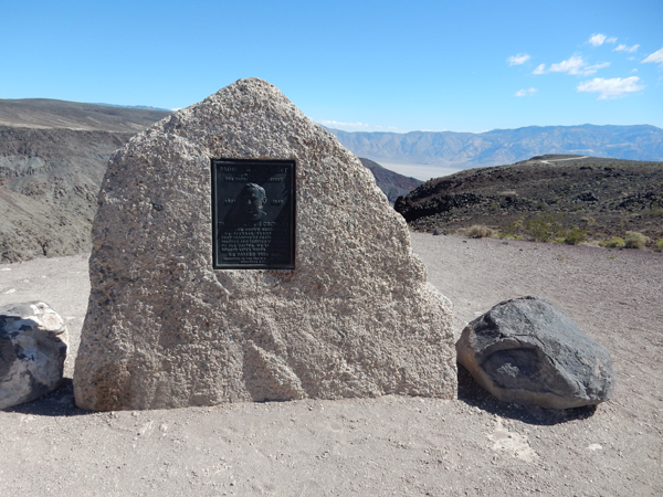
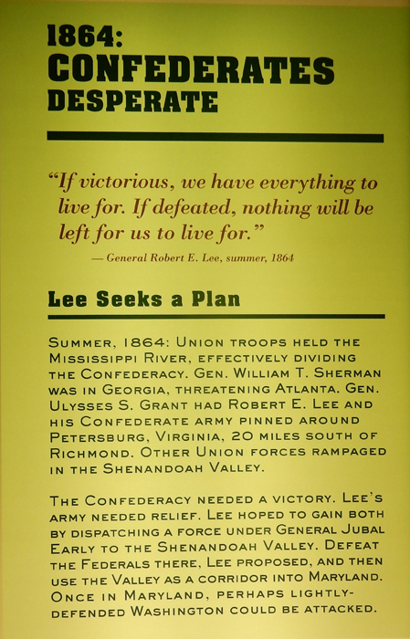
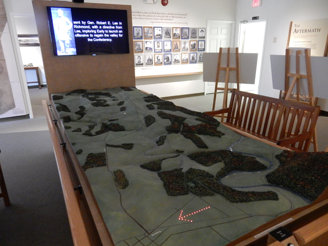
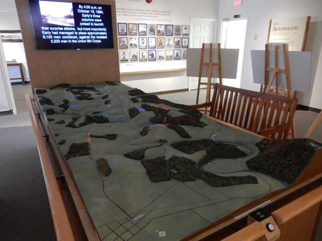
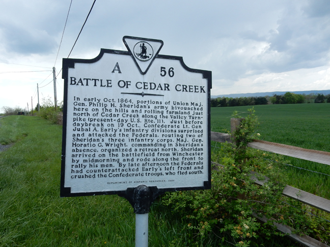
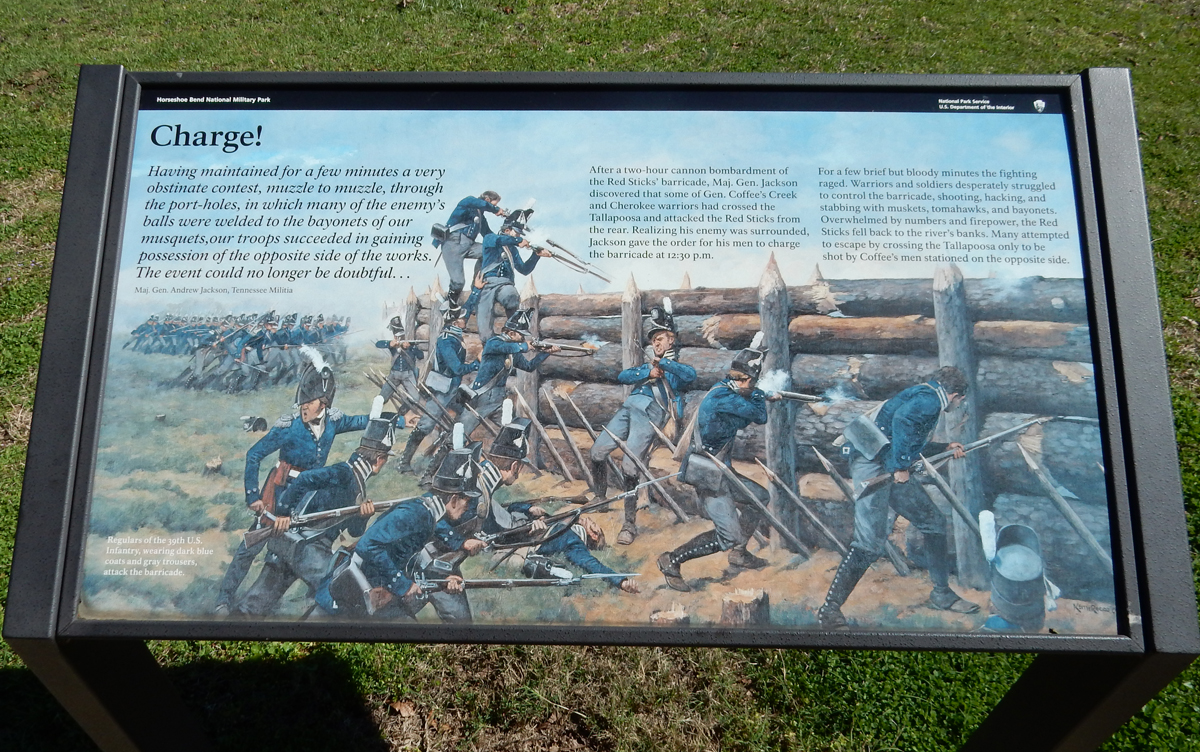
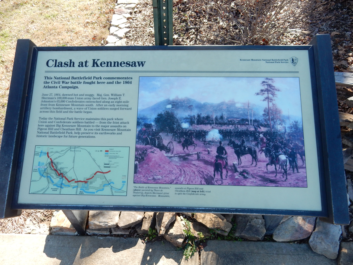
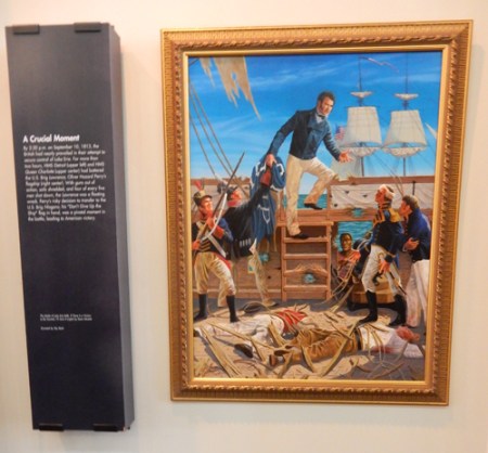
Cedar Creek and Belle Grove National Historical Park – first, the Cedar Creek Civil War Battlefield. In September and October 1864 Gen. Philip Sheridan’s Union Army (32,000) had laid waste to a 75-mile swath of the Shenandoah Valley – the “Breadbasket of the Confederacy.” Lt. Gen Jubal Early was directed by Gen. Robert E. Lee to regain the Shenandoah Valley for the Confederacy. On October 19th Early, who had about 15,000 soldiers, directed a pre-dawn (in dense fog) surprise attack. By about 10am Early had routed the Federals and his soldiers were pillaging their camps – a Southern Victory?


Midmorning, Gen. Philip Sheridan, who was returning from a conference in Washington DC, arrived on the scene. He was able to rally the Union troops into a counterattack. This, in turn, was a surprise to the Confederates who slowly began to retreat. The battle became a rout when Brig. Gen. George Custer lead an un-ordered cavalry attack on the Confederates flank. The Union victory took place three weeks before the presidential election and helped Lincoln to win a second term in office. Six months later the Confederates surrendered at Appomattox Court House.

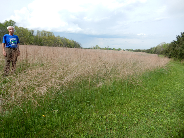
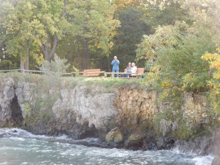
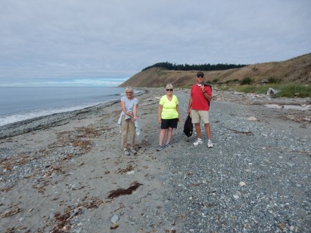
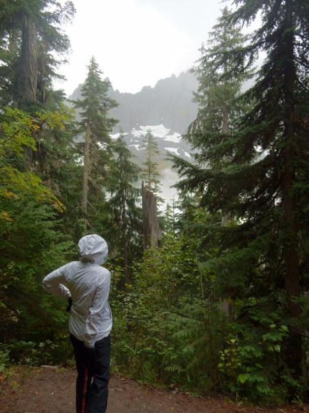
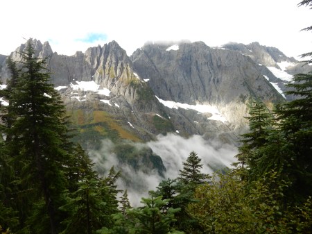
After visiting the store front Visitor Contact Station in a small shopping plaza in Middletown VA, I did a 1.7 mile hike, in a light rain, around one of the positions that was overrun in the Confederates early onslaught.

This is a monument to the 8th Vermont who lost 110 (killed or wounded) of 165 men on this hill. Total casualties (killed, wounded and captured) were Union – 5,700, Confederates 2,900.

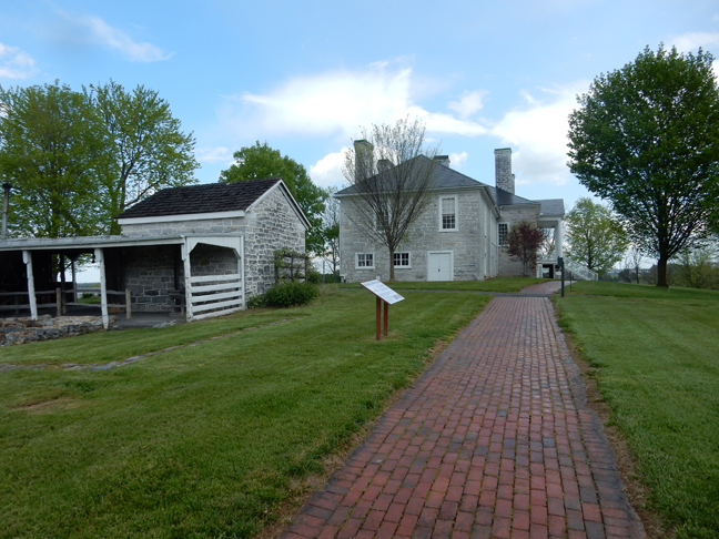
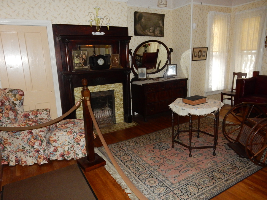
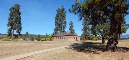
Belle Grove Plantation – had its beginnings with Jost Hite, a German immigrant from PA, who claimed a land grant there in 1731. Major Issac Hite Jr. and his wife Nelly, sister of President James Madison, built their elegant manor house from limestone quarried on the property in 1797. At its peak, the plantation included 7,500 acres.
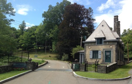
Approaching entrance

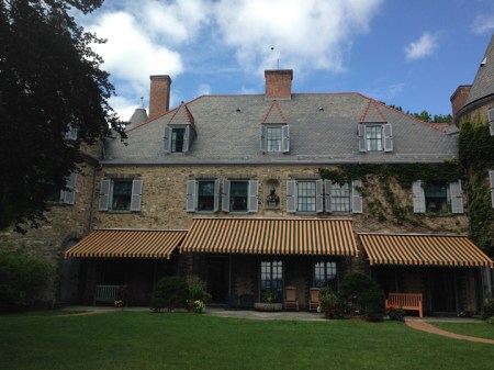
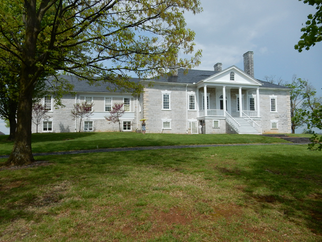
Front and view from front porch – In 1820, the founding editor of the American Farmer stated that “The fine lime stone valley of Shenandoah…the most beautiful portion of our country.”

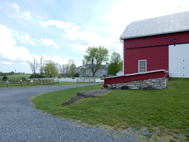
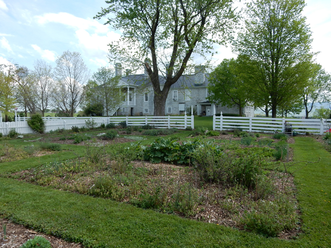
Barn, garden and back of house


Slaves at Belle Grove Plantation


Though the Battle of Cedar Creek raged around the house, which was Gen. Sheridan’s headquarters, it escaped relatively unscathed from the battle. The National Trust for Historic Preservation runs the plantation in cooperation with the National Park Service. The grounds are free (fields, orchards, barn, dairy, icehouse, smokehouse, slave cemetery, etc.) but there is a fee to tour the house – well worth the price.

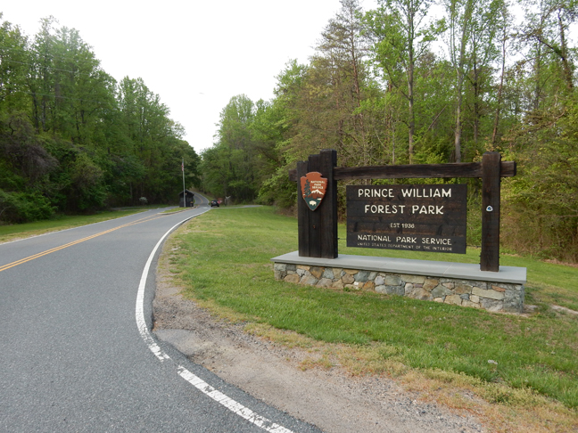
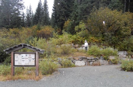
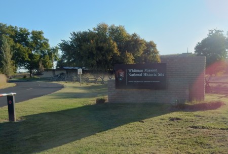
Prince William Forest Park – is located in northern VA about 35 miles south of Washington DC. In 1933 FDR created a “new kind of park” – the Recreational Demonstration Area to reuse marginal overworked land. Camps where low-income, inner-city children and families could get away and experience the great outdoors. The camps were built by the Civilian Conservation Corps (CCC) during the 1930s. Prince William Forest Park became a model for 46 of these land-use projects.

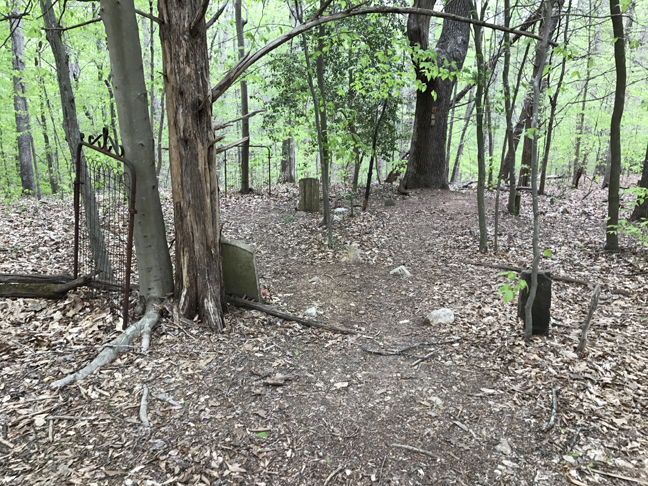
I arrived in the early evening and started with a mile hike to the old cemetery on the North Orenda Road


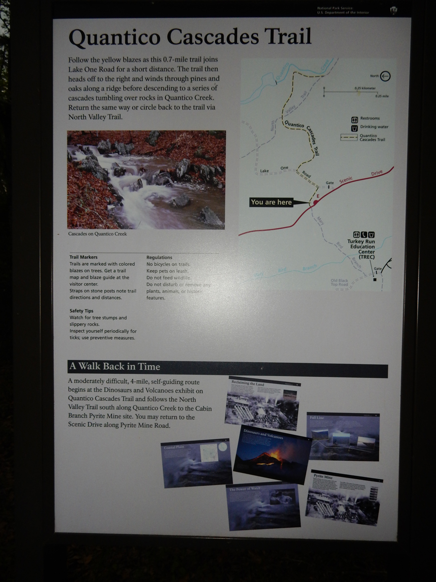
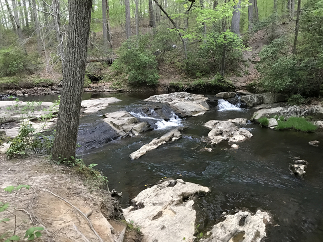
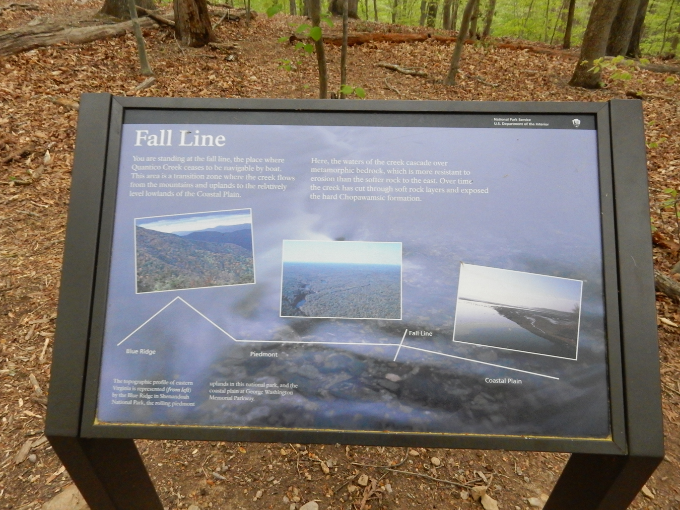
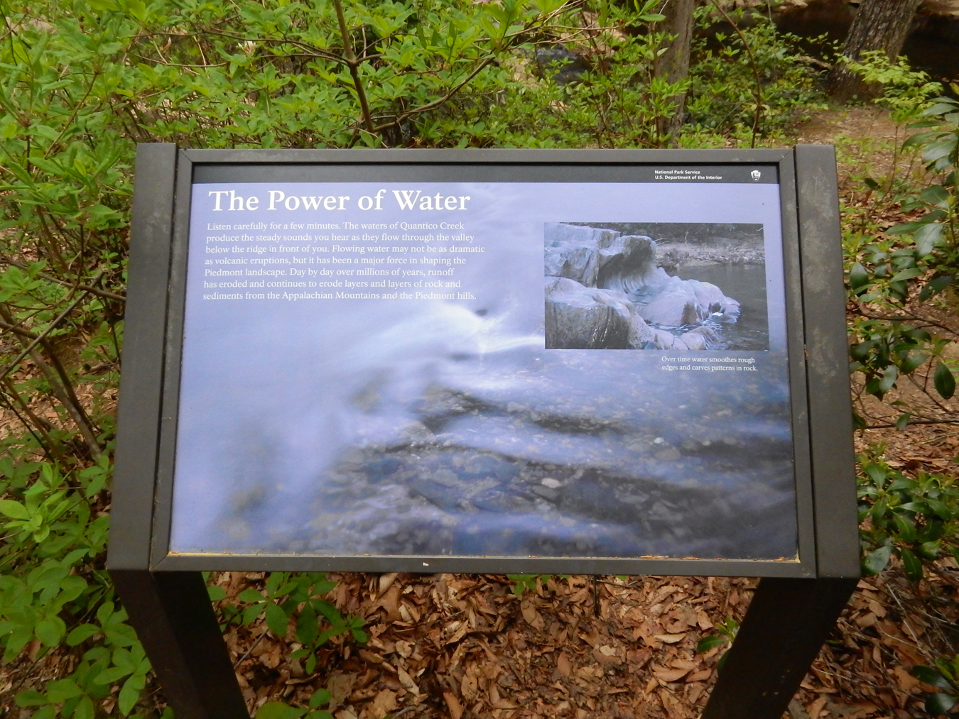
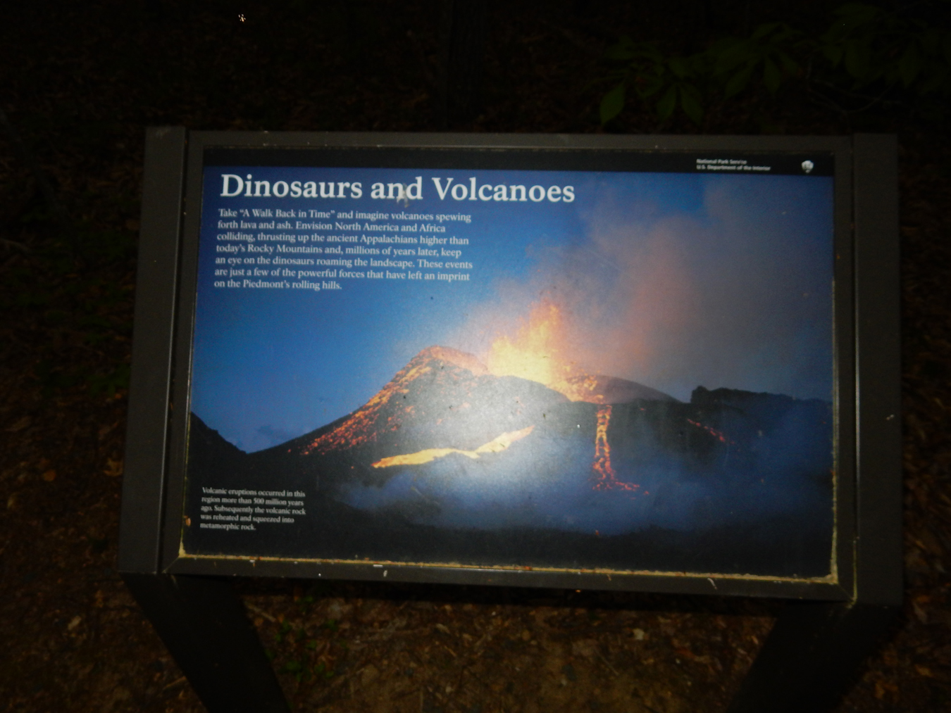
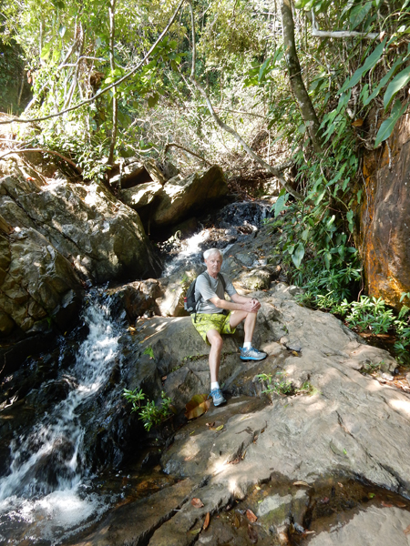
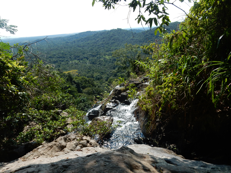
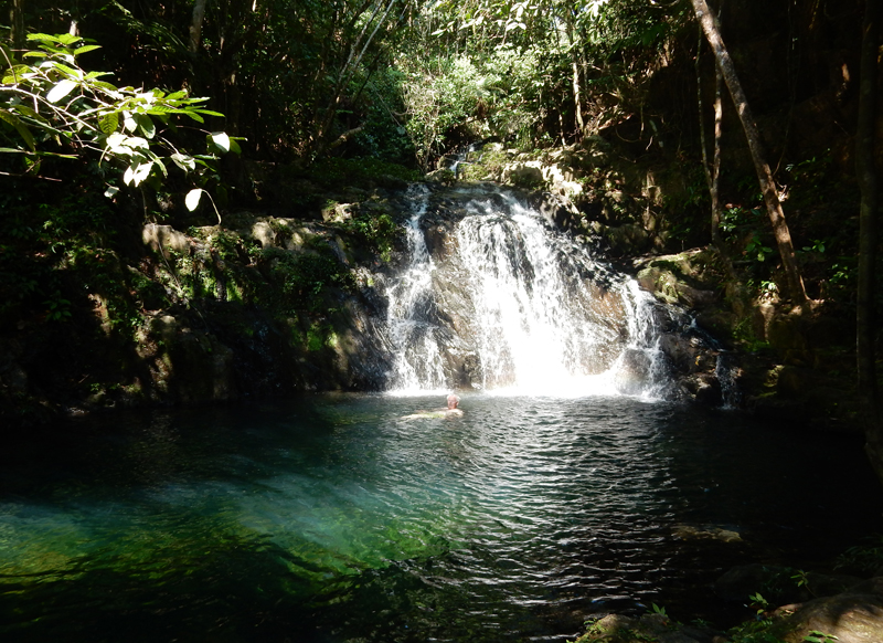
I then did a 1.5-mile loop to the small waterfalls on Quantico Creek. There were a number of military types working-out throughout the park as it is adjacent to the U.S. Marine Corp Reservation.


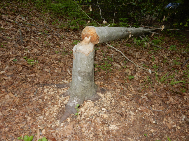
Work of Beavers

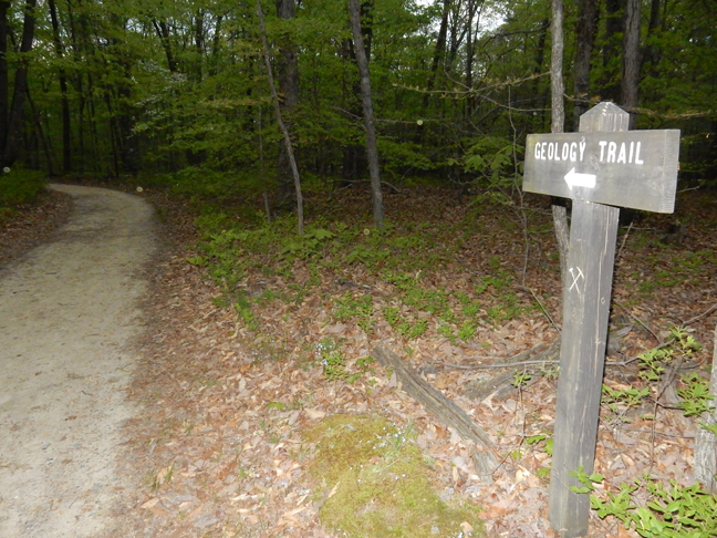
It is also called the “Geology Trail” – I was able to complete it with my headlamp in a slight rain before it became totally dark and began to pour.


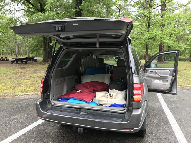
I slept in our Toyota Sequoia SUV at the Oak Ridge Campground
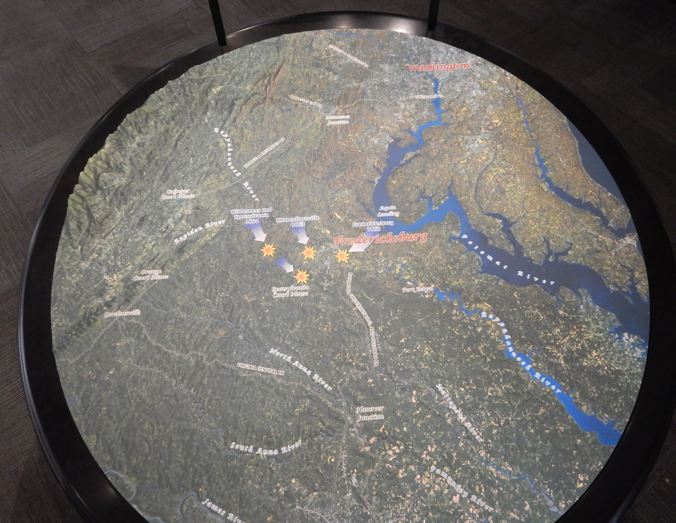
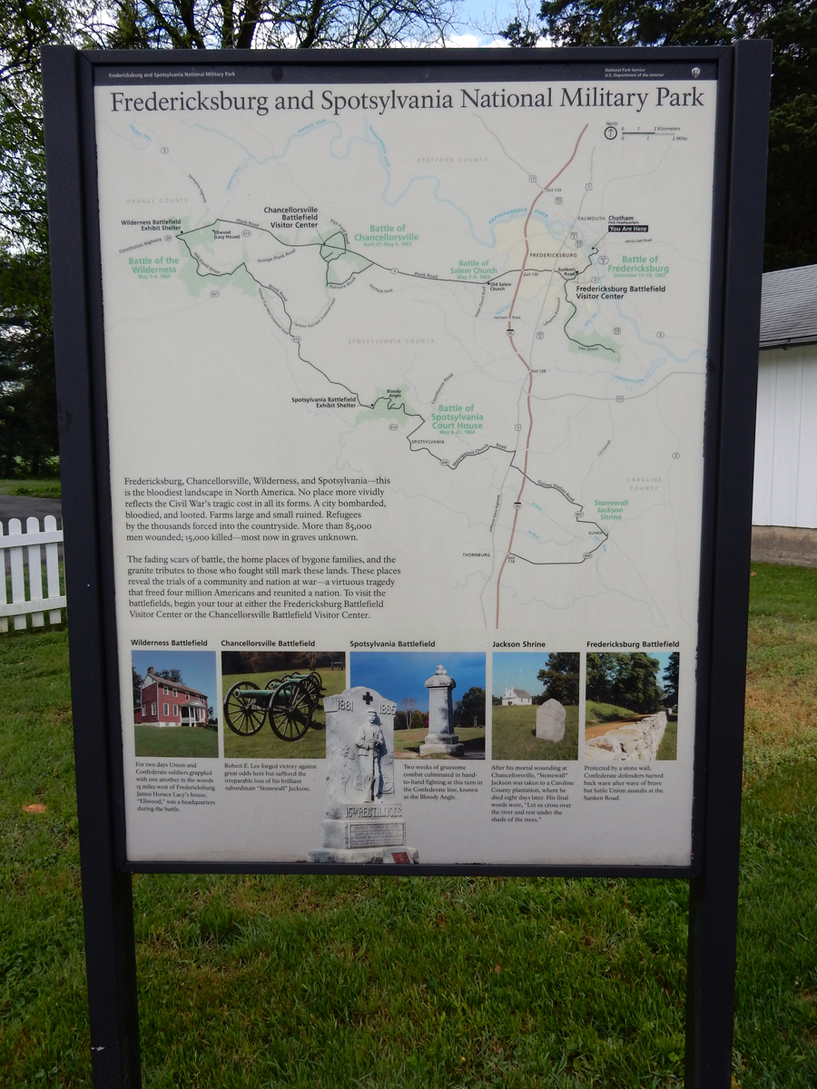
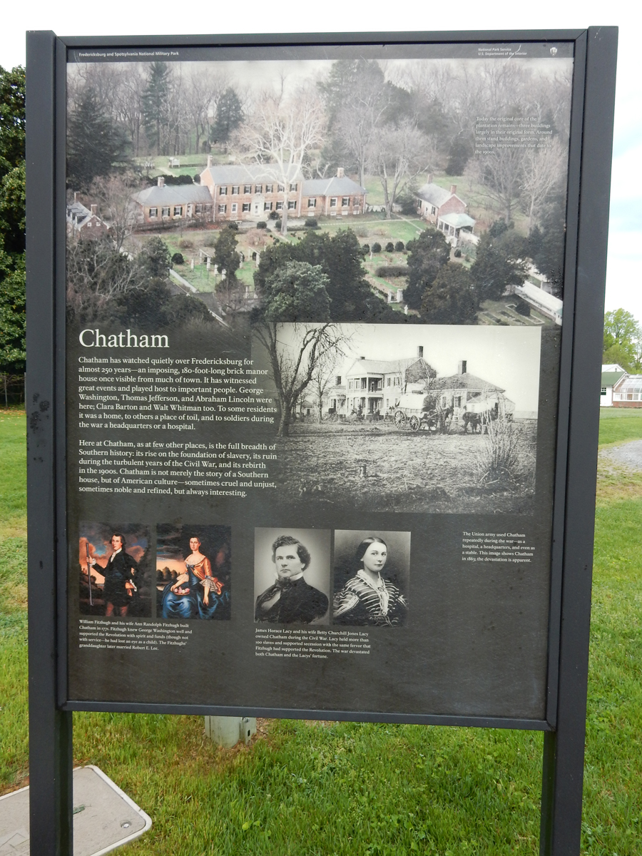
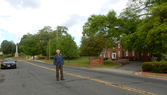
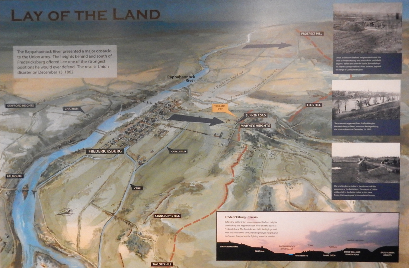
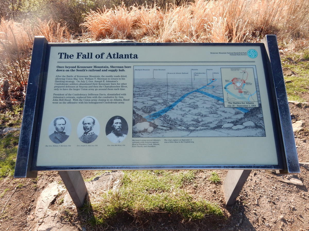
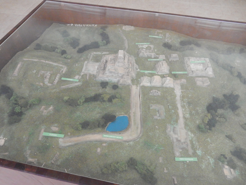
April 21st – I started driving at 4am and stopped for gas and personal hygiene before going to a 24hr McD’s, found enough money on the ground by the take-out window to pay for my senior coffee! I spent 2.5 hrs there writing my notes and eating the Graham Crackers and an orange I had brought with me. It was a short drive to the Chatham House that was finished in 1771 and was the center of a plantation that included 1,228 acres. It is now part of the Fredericksburg and Spotsylvania County Battlefields Memorial National Military Park VA. Phew, that’s some name for this National Park Unit and still it doesn’t indicate the extent of the, primarily, Civil War history that it encompasses. I covered 70 miles today; 32 stops including two Visitor Centers, 2 Battlefield Exhibit Stations and 4 historic buildings. I did the tour, as recommended (chronologically), from the Battle of Fredericksburg December 11-13, 1862, to the Battle of Chancellorsville April 27 to May 6, 1863, to the Battle of the Wilderness May 5-6, 1864, to the Battle of Spotsylvania Court House May 8-21, 1864. Keep in mind that there were many “lesser” battles in this same region during this 1.5-year period. In addition, there were many other battles, big and small, in other regions during this same time-period.
Fredericksburg in relation to Washington DC.

Extent of Military Park – if interested, I suggest you Zoom In to read signs on the blog

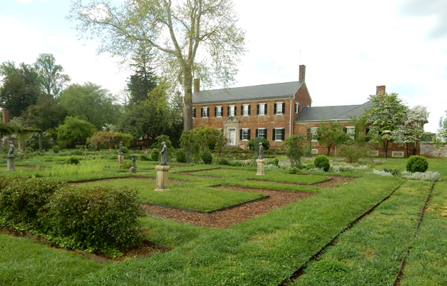
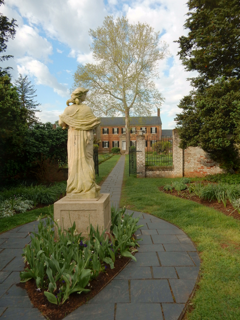
I arrived at Chatham at 8am and toured the grounds before the mansion opened. This was the first stop on my Battle of Fredericksburg tour.


It sits atop a bluff overlooking the Rappahannock River and Fredericksburg.

I crossed the river and arrived at the Visitor Center at 9am as it was opening


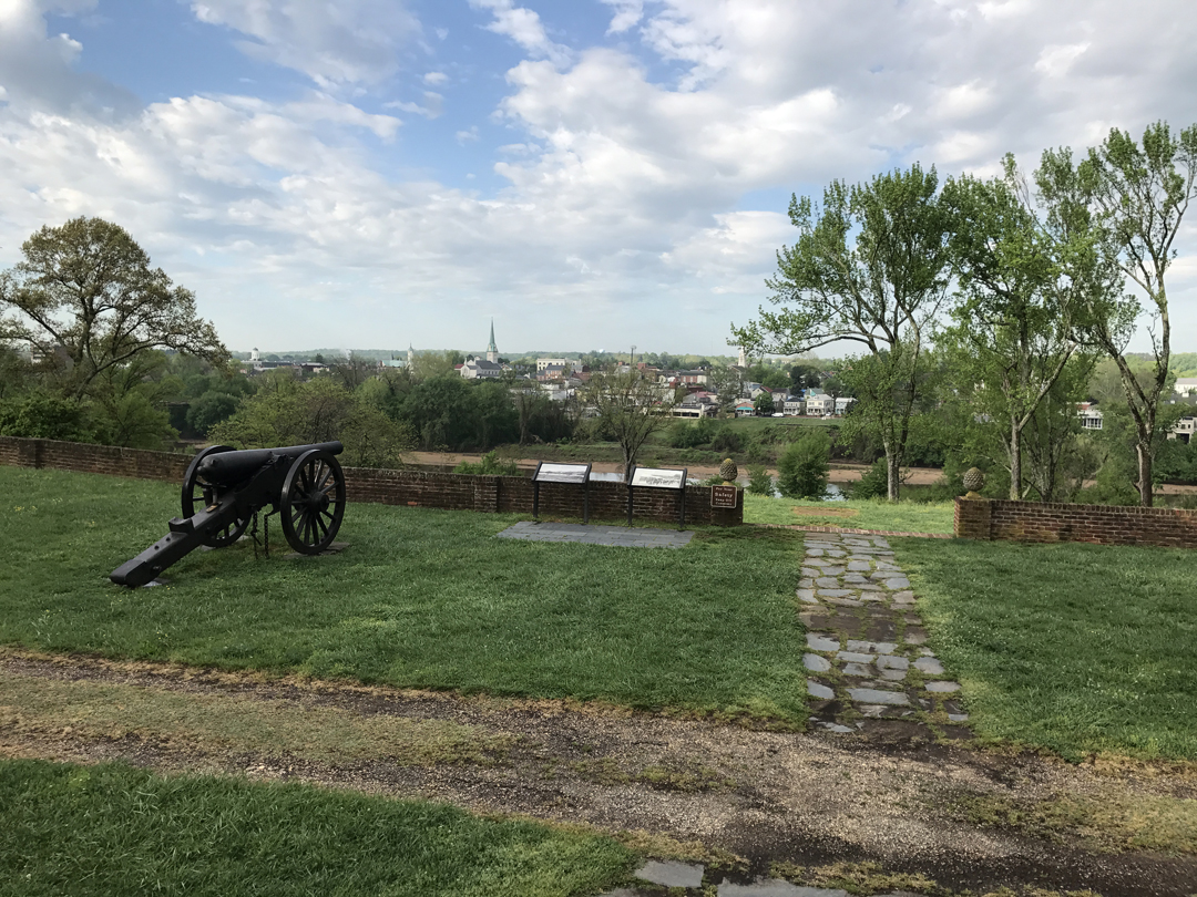
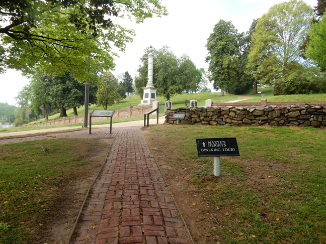
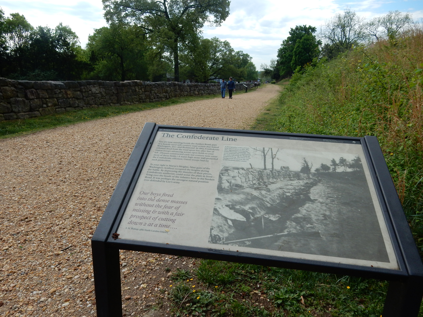
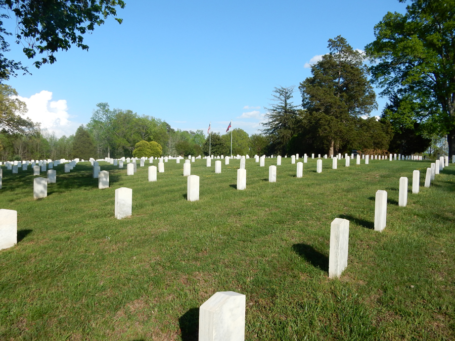
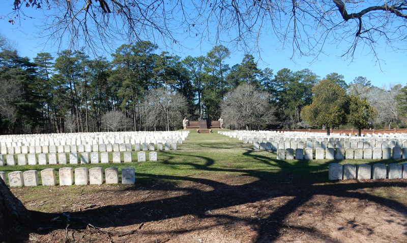
Walked through the National Cemetery on Marye’s Heights


And walked the Sunken Road

The battle was a disastrous defeat for the Union. Line after line of soldiers were sent at the stone wall on the Sunken Road and Marye’s Heights by Union Commanders. Casualties: Union 12,653, Confederates 5,377

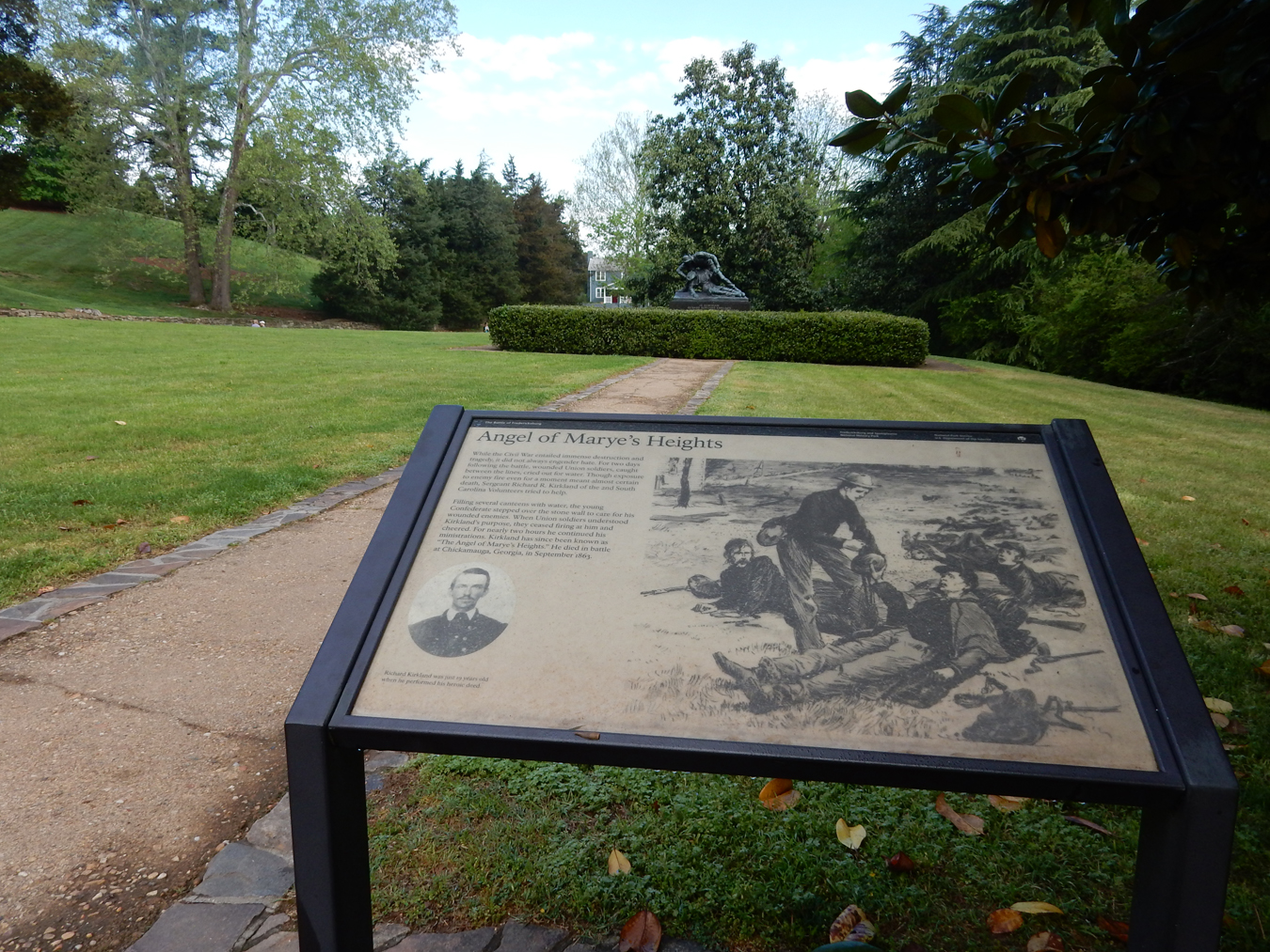
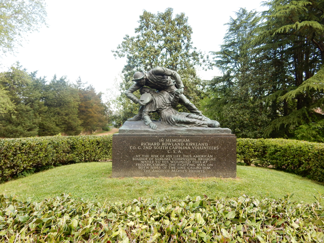
Angel of Marye’s Heights


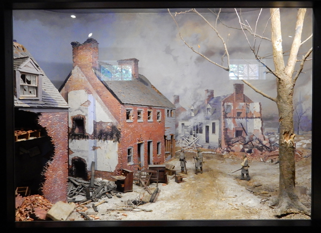
Union soldiers torched Fredericksburg before retreating across the Rappahannock River

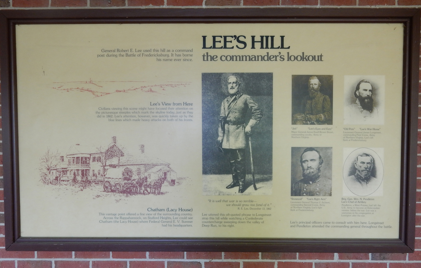
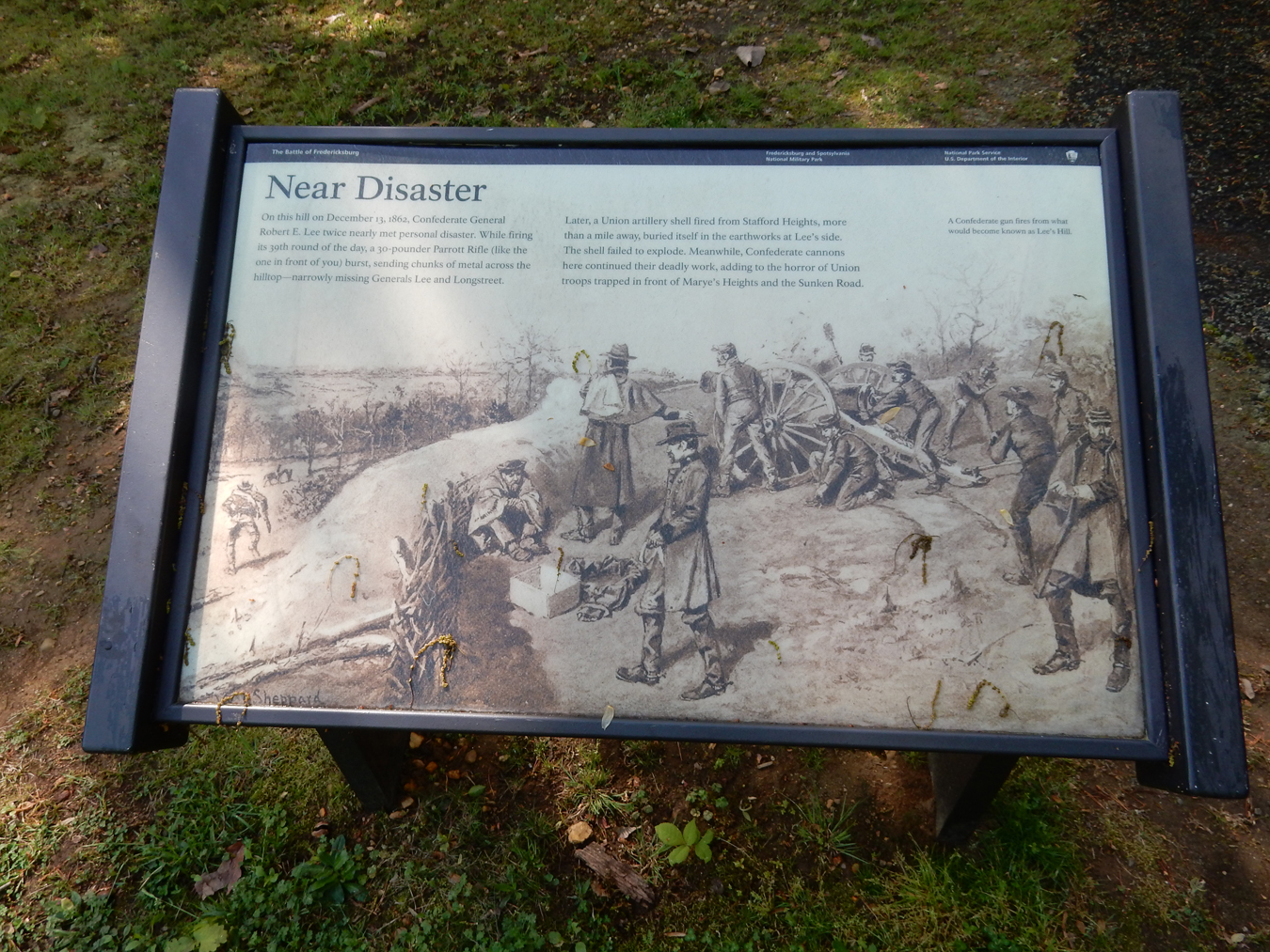
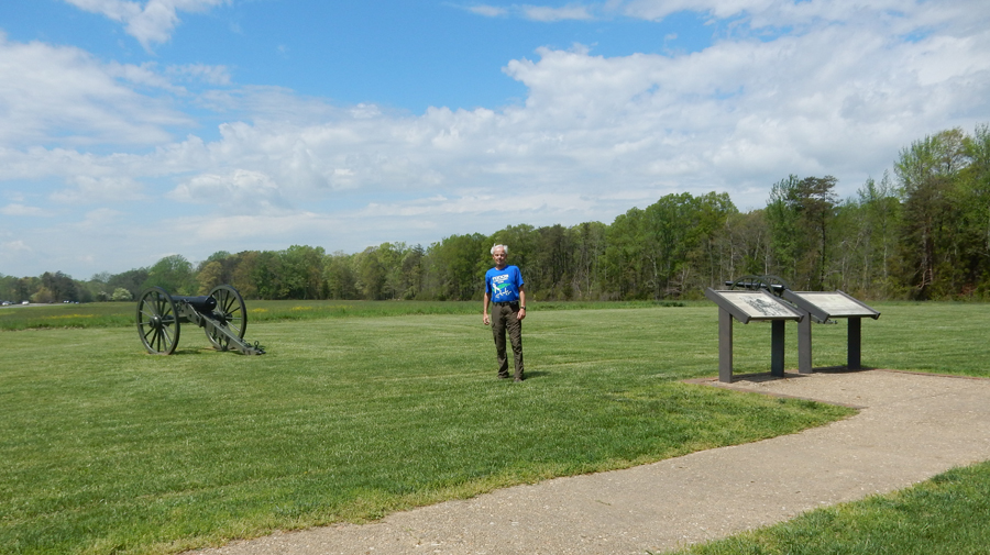
I also did the drive and stops out to Prospect Hill, including Lee’s Hill (another part of the battle)


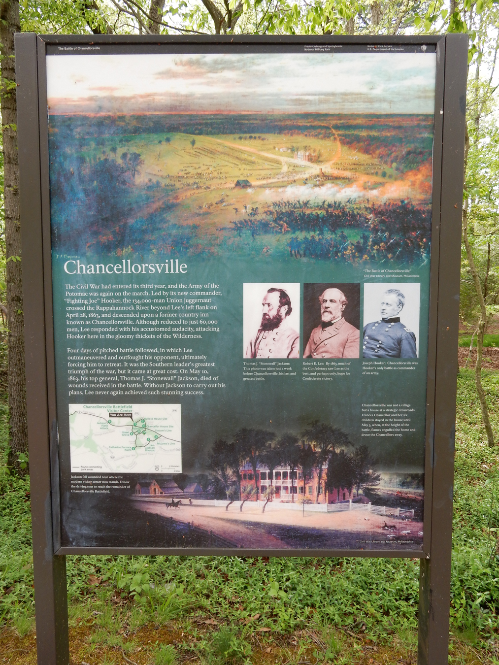
The Battle of Chancellorsville took place four months later. At that time there was no village here, just the Chancellor family home about 10 miles West of Fredericksburg – which was destroyed during the battle. House Site –
 Setting the stage – Union 134,000 under Maj. Gen. Joseph Hooker, Confederates 60,000 under Gen. Robert E. Lee
 Chancellorsville is known as Lee’s “perfect battle” because his risky decision to divide his army in the presence of a much larger enemy force resulted in a significant Confederate victory.
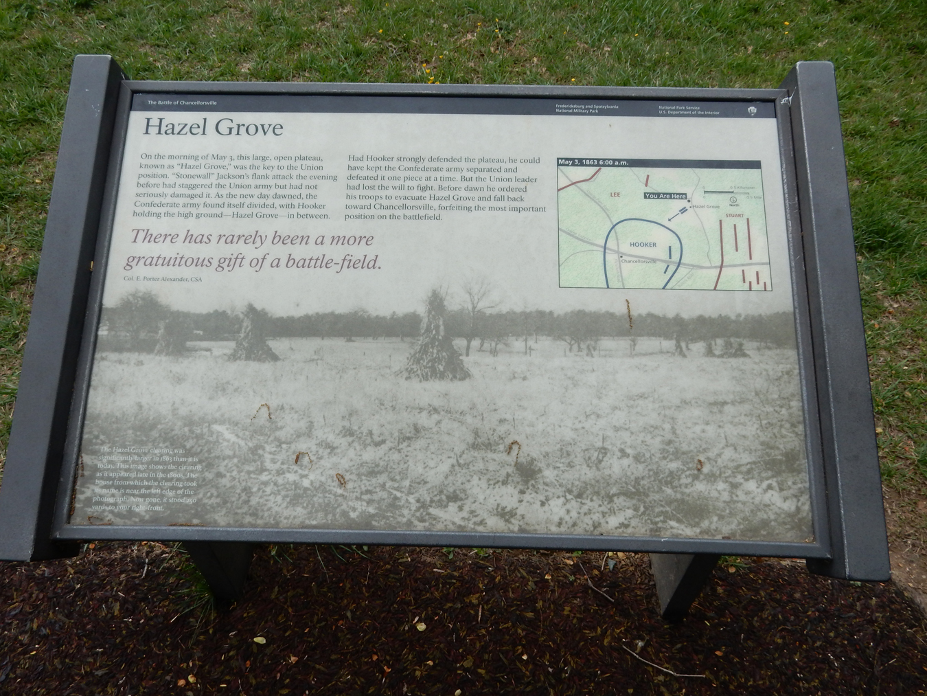
 Maneuver was a flank attack by Lt. Gen. Stonewall Jackson, who was seriously wounded by friendly fire when he returned to camp that evening. The Confederate flank attack, now under Maj. Gen. J.E.B. Stuart, continued the next day and took Hazel Grove.


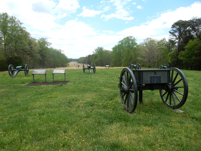
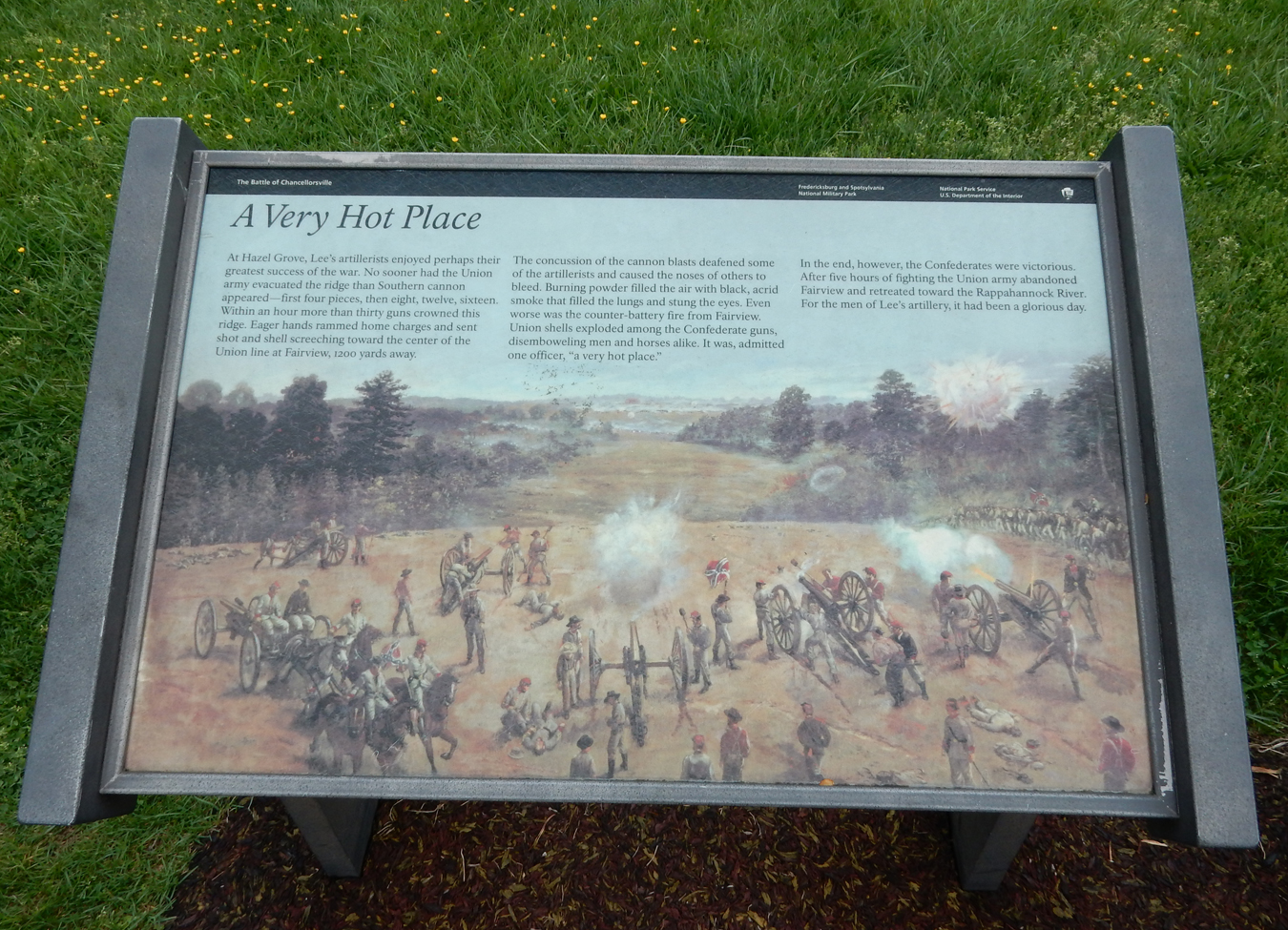
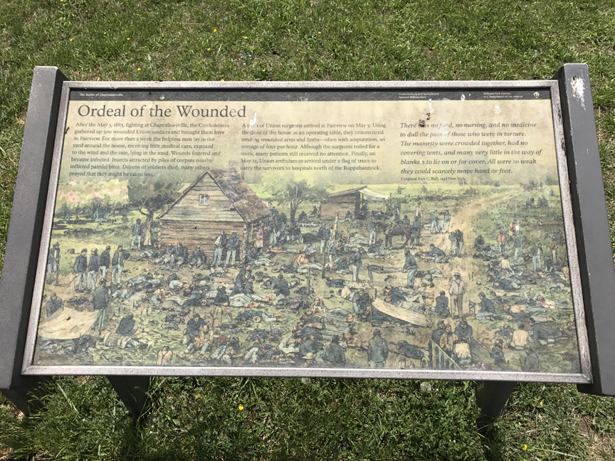
From Hazel Grove, the Confederate artillery was able to pummel the Union forces at Fairview

 Union Center
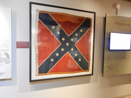
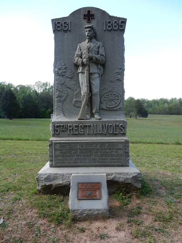
 This was another resounding defeat for the Federals and motivated Robert E. Lee to move into the North – Gettysburg. Within the battle was a small victory by the NJ Volunteers when they were able to capture this Confederate flag.

Overall Battle Casualties at Chancellorsville: Union – 17,287, Confederates – 13,303
May 3rd was the second bloodiest day of the Civil War!
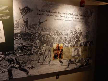

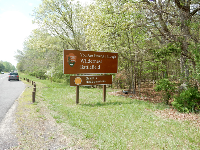
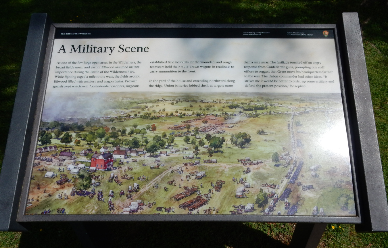
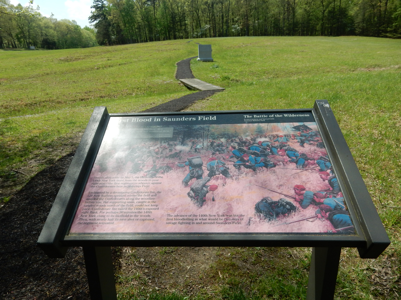
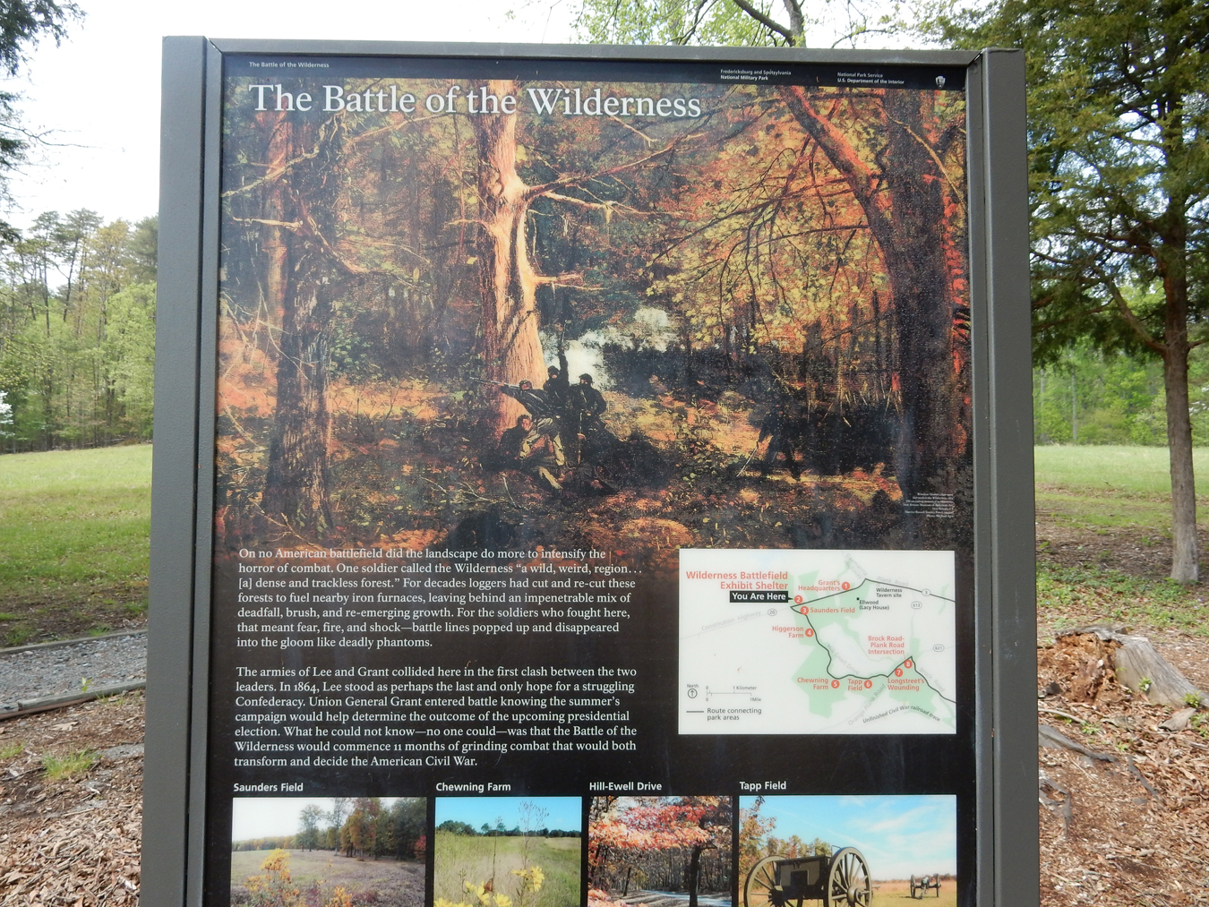
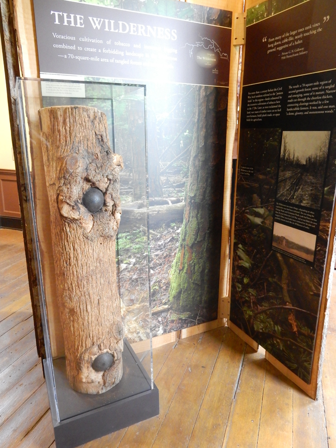
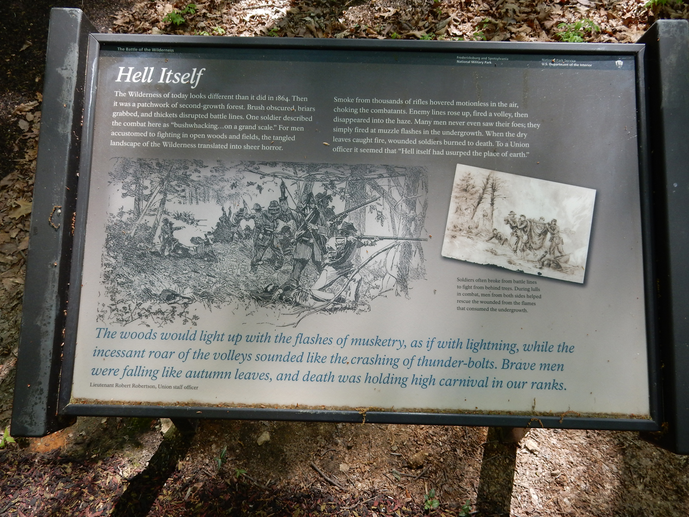
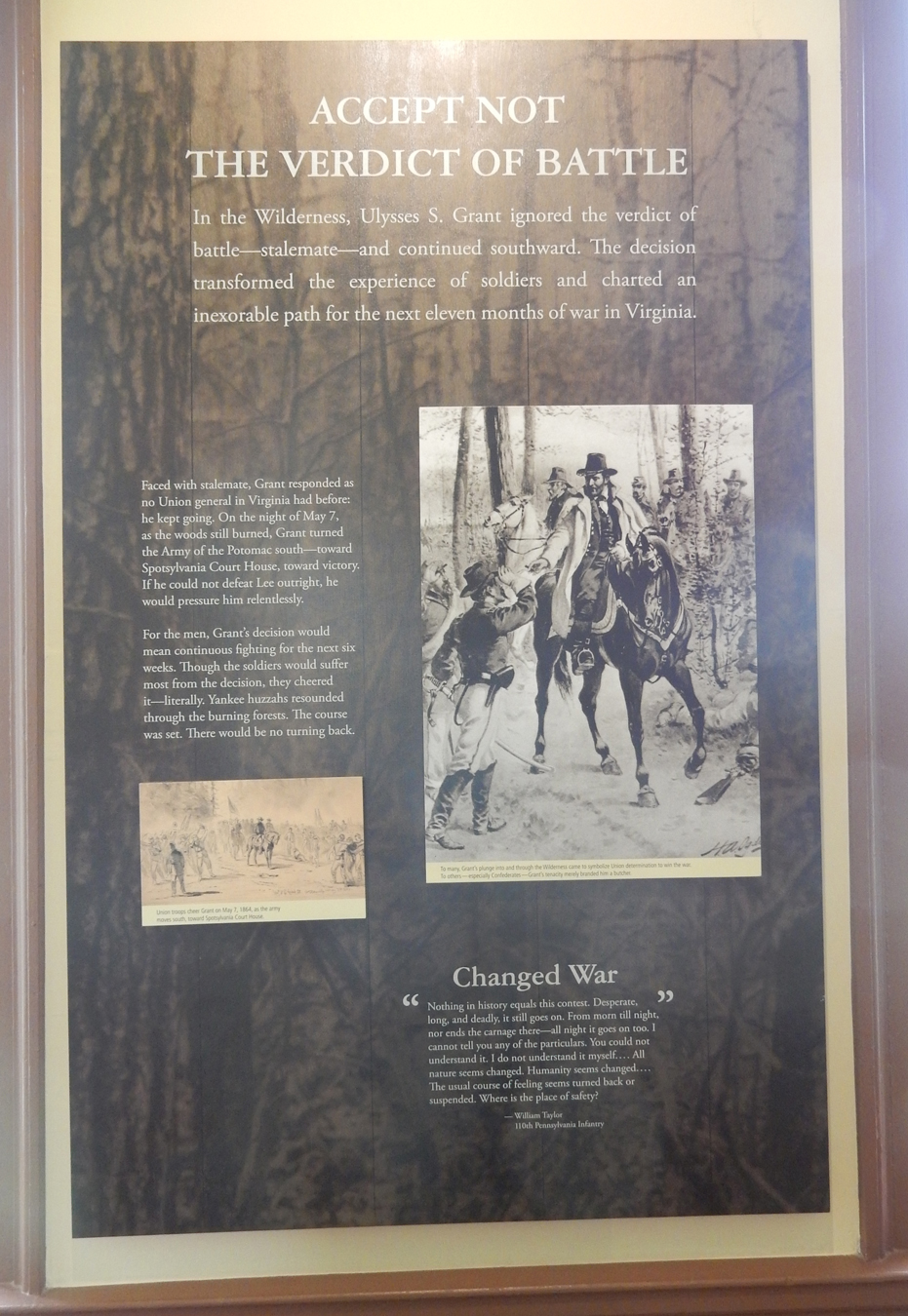
Battle of the Wilderness (May 5-6, 1864) – this was the first clash between Grant and Lee, also the first major battle after Gettysburg. Grant’s objective was to crush the Confederate Army – no matter the cost. The battle took place one year after the Battle of Chancellorsville and only 5 miles further West but in very different terrain – forest of dense thickets and tangled undergrowth.
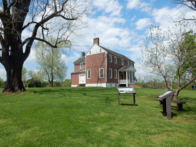
My first stop was the location of Grant’s headquarters

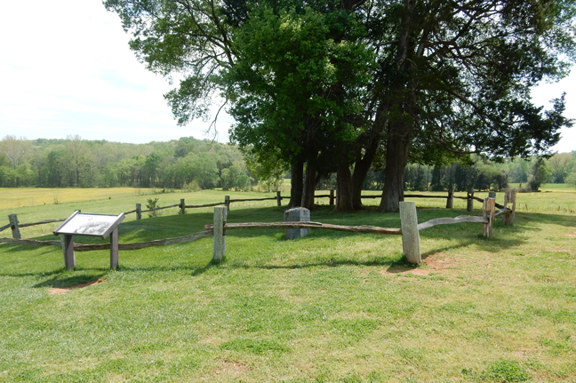
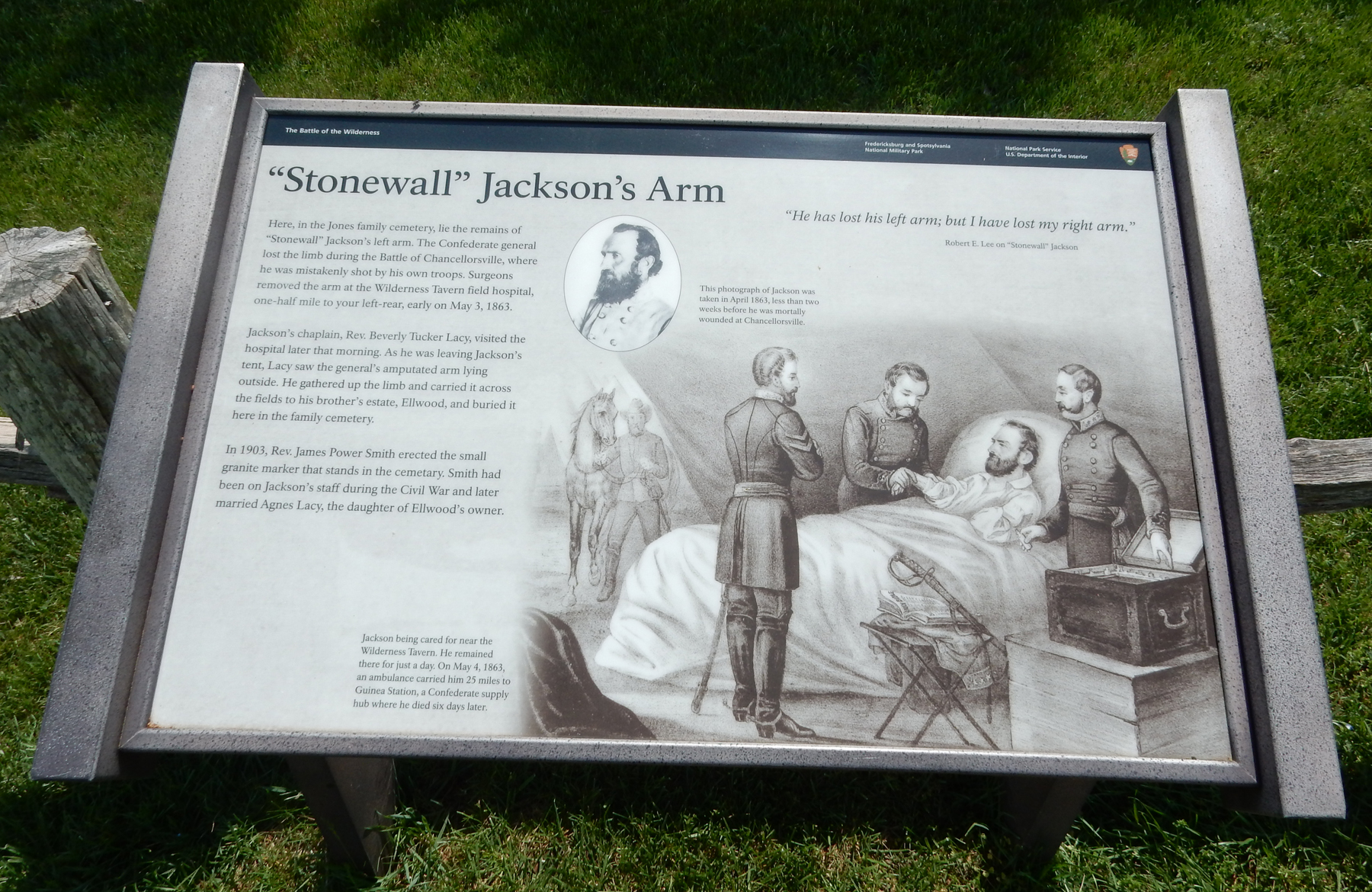
The house on the Ellwood estate (formerly 5,000 acres) was built in 1790


It was used as a headquarters and field hospital by both sides. During the Battle of Chancellorsville, Stonewall Jackson was brought here and his arm amputated.


He was then moved 25 miles to Guinea Station, a Confederate supply station, where he died six day later

Wilderness Battlefield Exhibit Shelter

Saunders Field – start of the two day battle

The battle then progressed and moved into the woods surrounding the field


Cost of battle – Union 17,500, Confederate 11,000


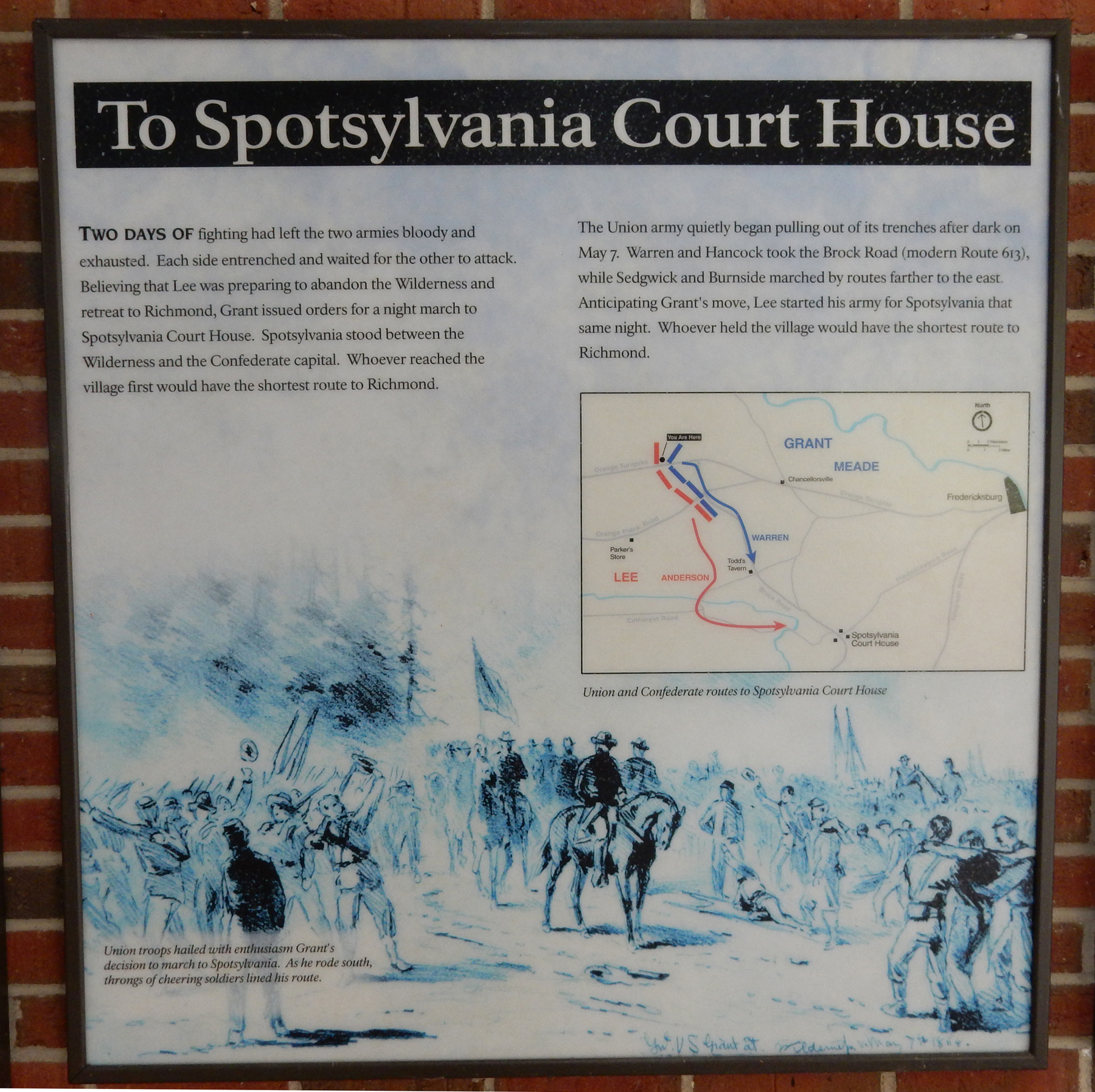
The battle resulted in a stalemate. After major battles, each side would usually re-group and re-supply. However, Grant pursued Lee.

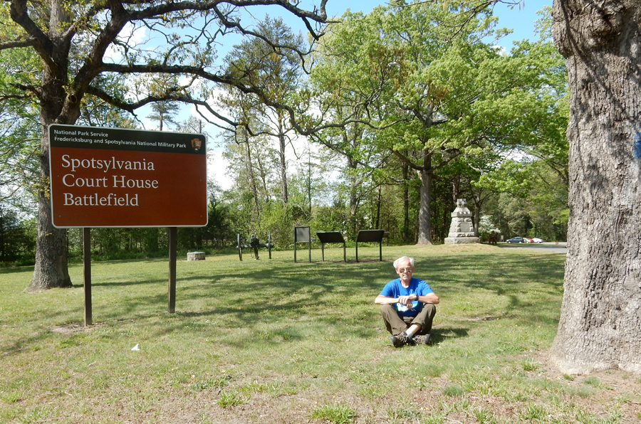
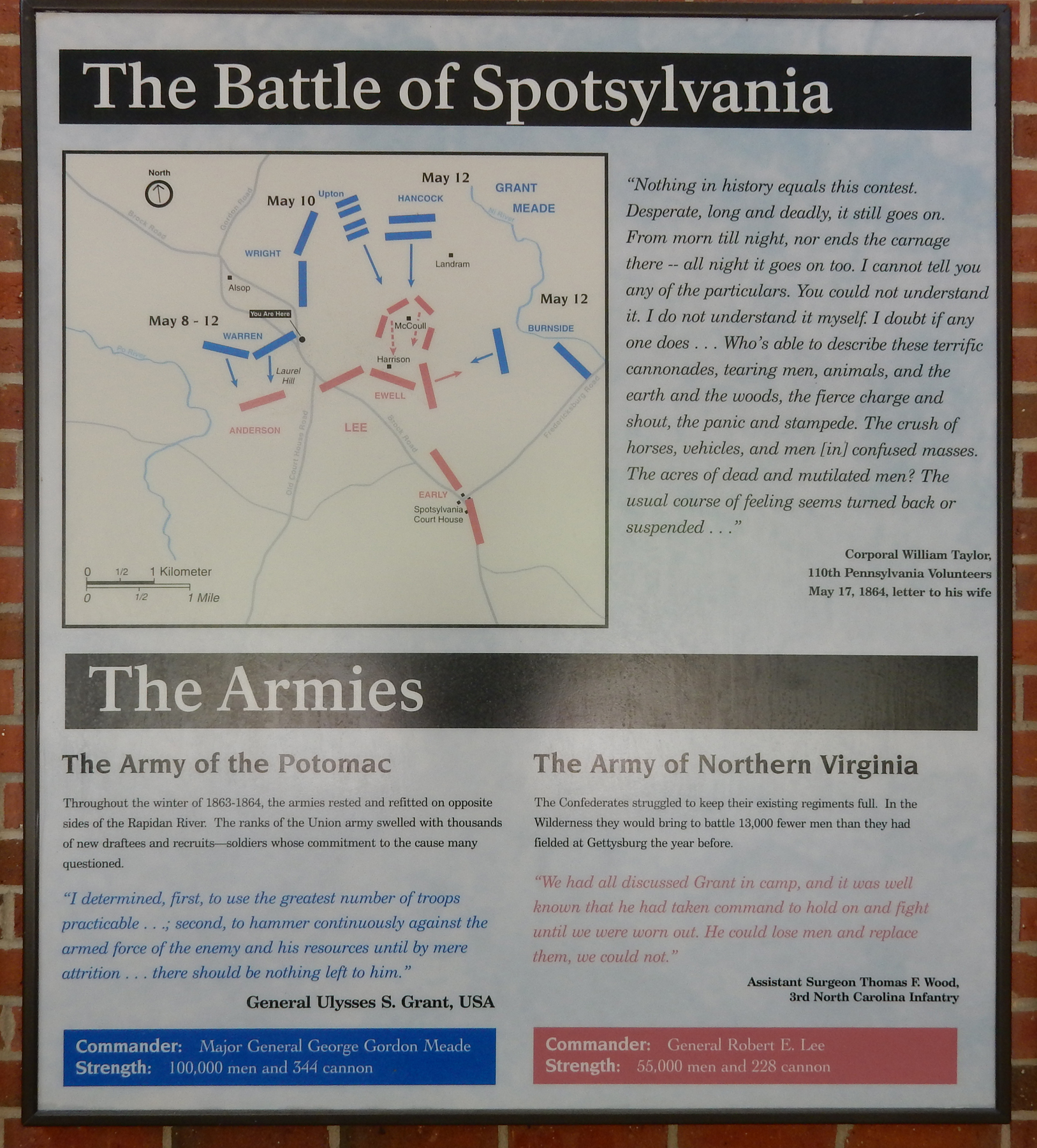
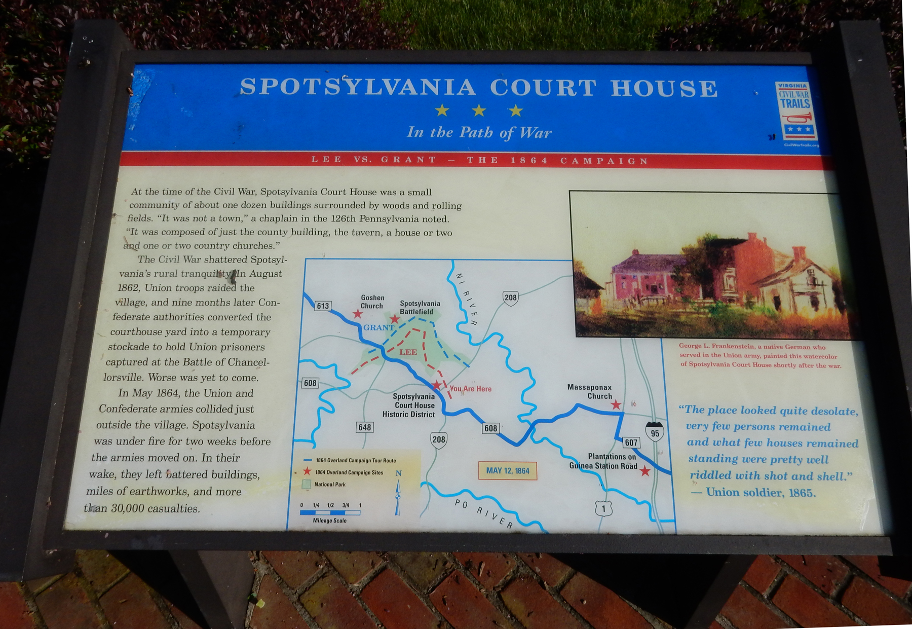
Battle of Spotsylvania Court House – May, 8th to 21st


The Armies

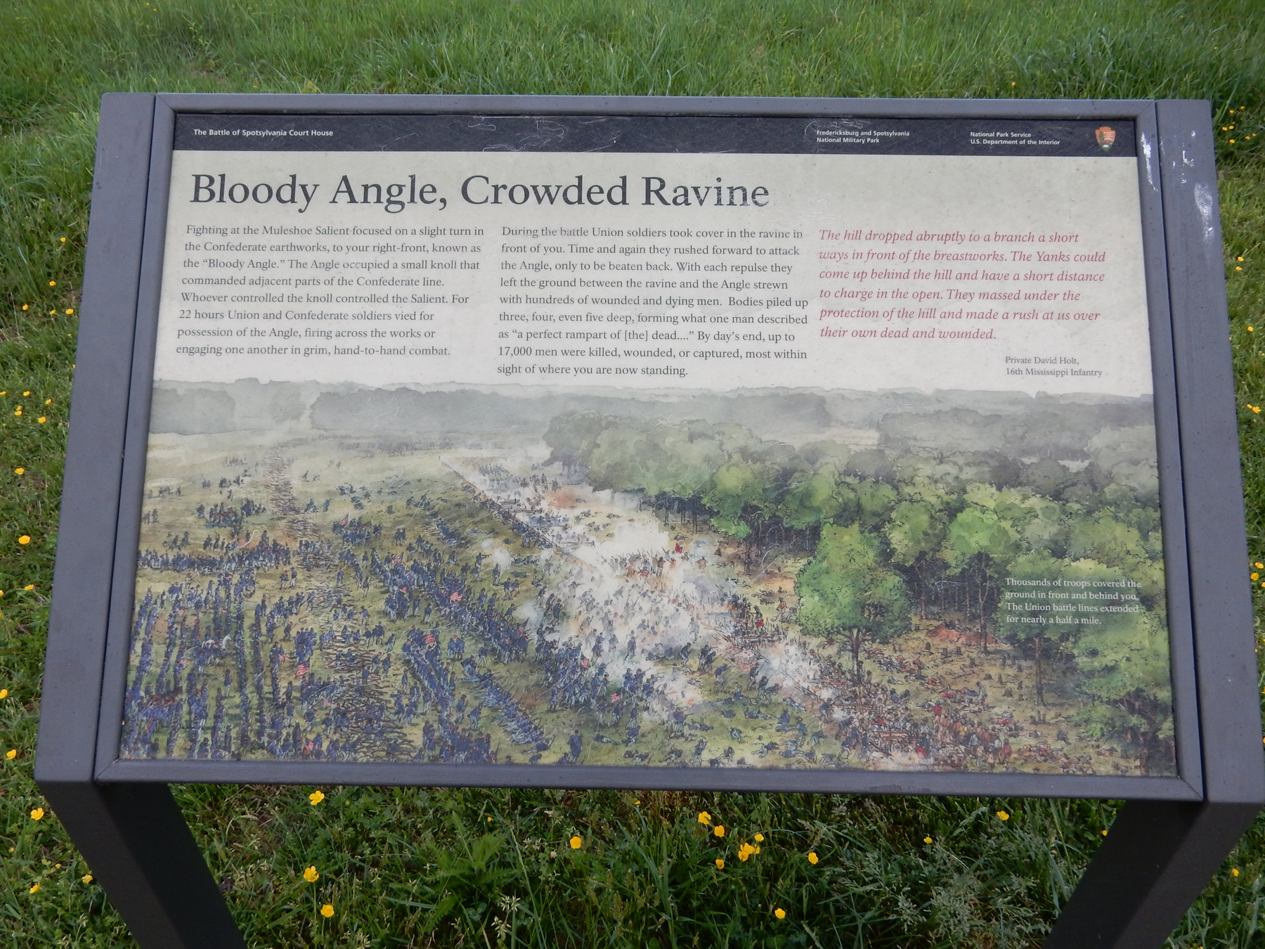
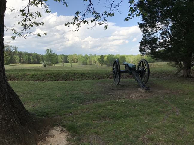
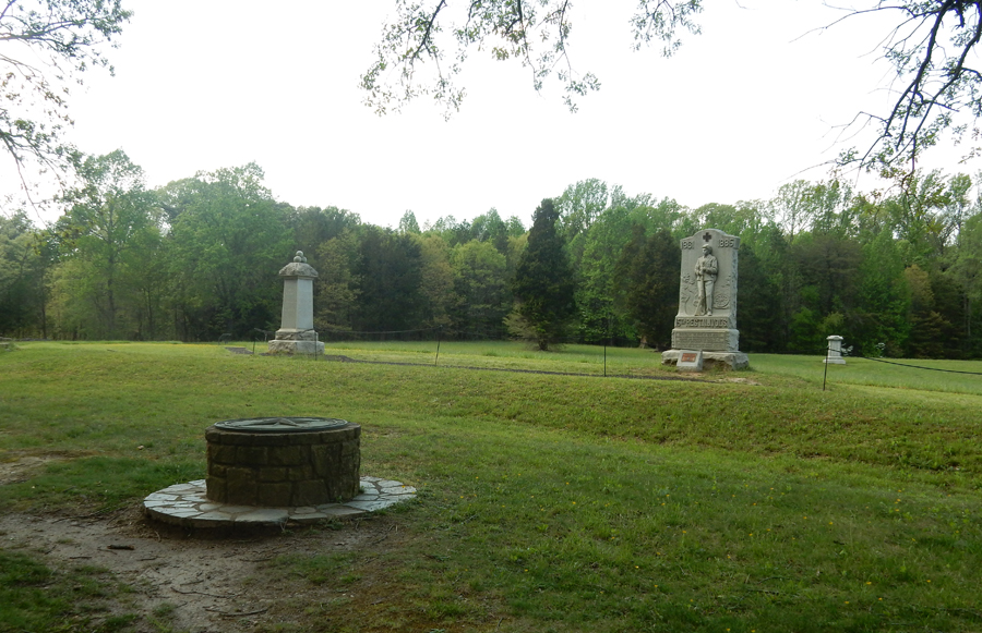
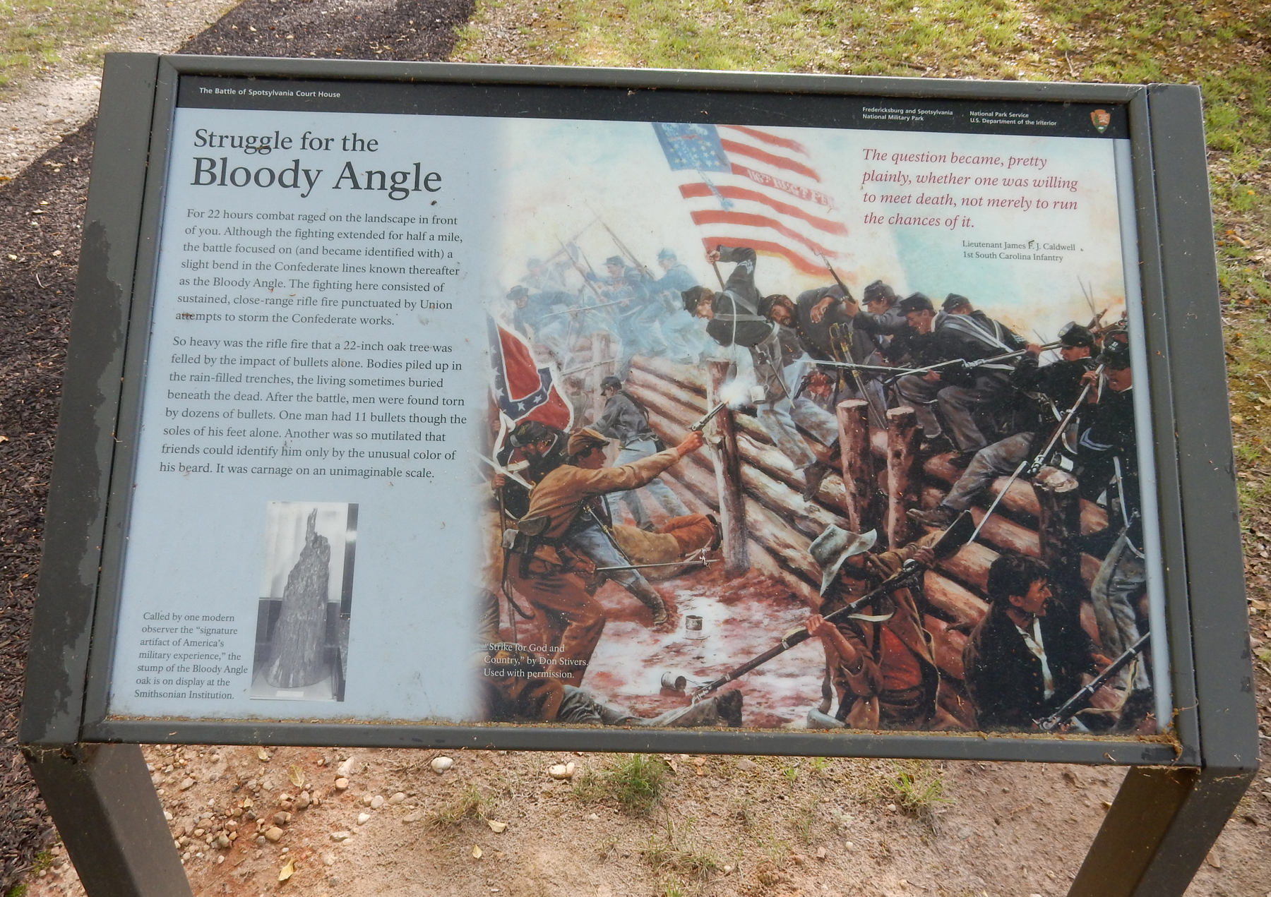
Muleshoe Salient and Bloody Angle – a bulge in Lee’s 6-mile long defensive line, 150 yards ahead


Bloody Angle


Casualties (reminder, that means killed, wounded and captured), Union – 36,000, Confederates 24,000
Arithmetic

Not Over

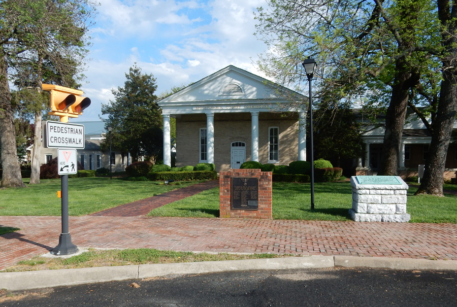
Spotsylvania Court House

Today

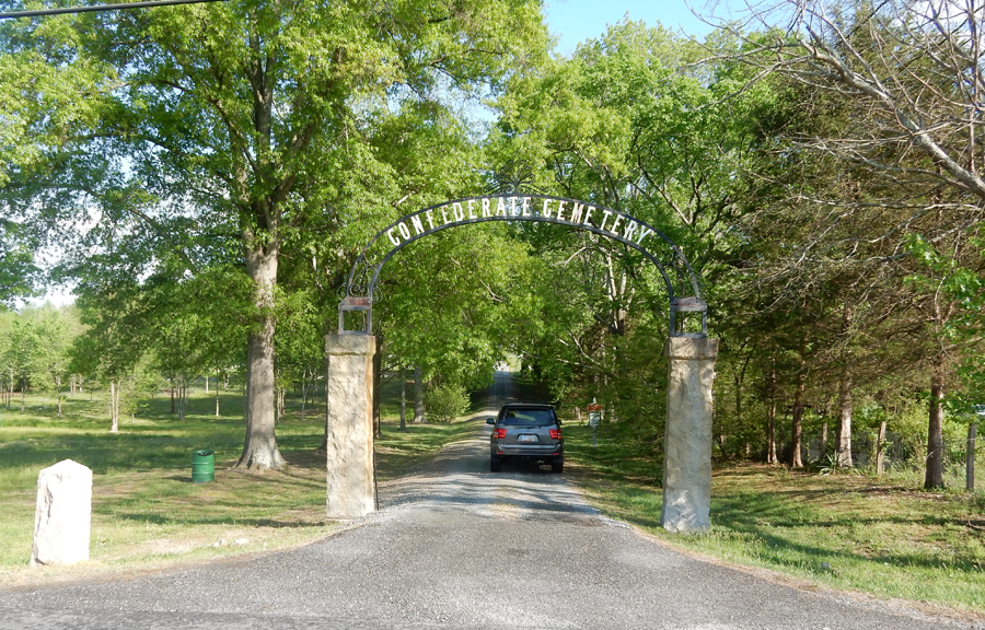
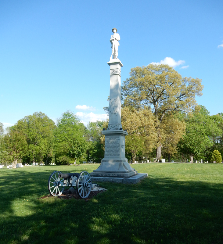
Confederate Cemetery


It’s 11pm (I started at 4am) and I am in a Motel 6 – ugh! It doesn’t matter. How can I complain of a little dirt and danger (3 locks on the door) after what I experienced today? I have been to almost all NPS Civil War Sites and each time I come away depressed. However, today was overwhelming. A simple statement is that the North was fighting for unity, national commerce and many for emancipation. The South was fighting for an aristocratic order and freedom as they saw it. “Those who do not under history are destined to repeat it.”
Let us be a model of democracy, freedom and high moral values. We do have interests abroad and need to support our allies and a global order. However, we should be leading primarily by moral example at home and abroad. Our global efforts should support human values and peace. It is true that, to lead, we must be strong economically and militarily as well as morally – frankly, that is because there is negativity and potential evil in all humans and we need to protect ourselves and others. It is our responsibility to continue to work at improving our evolving democracy. It is the right and responsibility of other nations and peoples to improve their condition, culture and lives. We need not, should not, attempt to impose democracy on others.
Should we withdraw from Iraq – Yes. Should we withdraw from Afghanistan – Yes. Should we withdraw from Syria – Yes. These are tribal, territorial and religious (e.g. sunni vs shia) conflicts. Muslims should be dealing with extreme Islam, Christians should be dealing with extreme Christianity, Hindus, Buddhists, Jews, etc. the same. Let it be clear, by extreme, I mean violent, orthodox, unbending, unthinking, inflexible, and single minded views of life, culture and how ALL people should lead their lives. No religion, culture or country has all the answers.
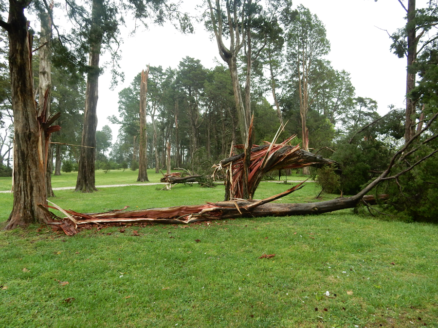
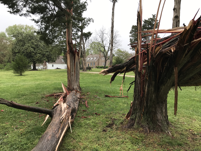
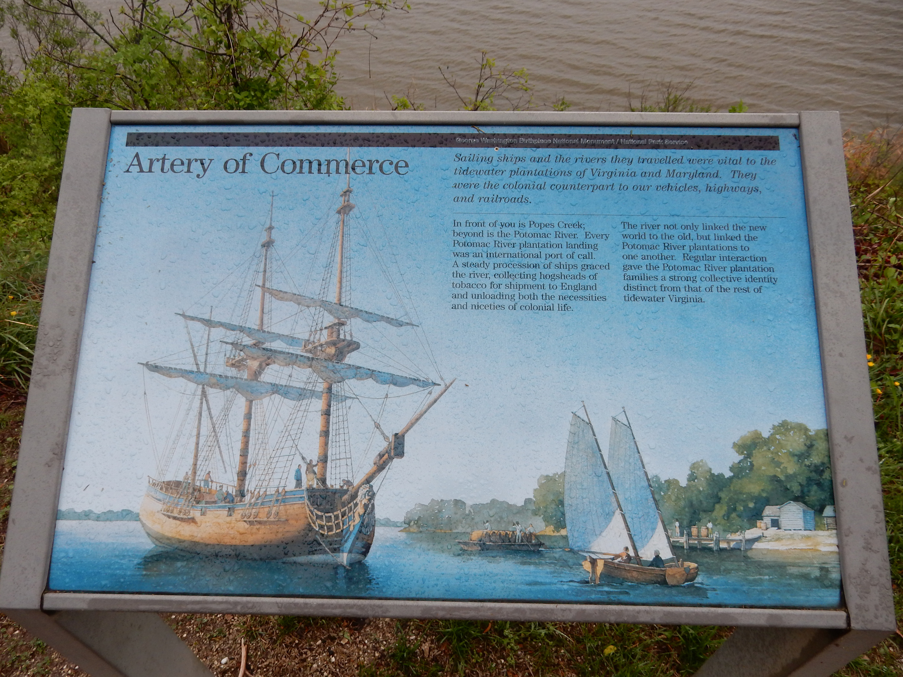
April 22, Earth Day! – Arrived at George Washington Birthplace National Monument at 9am and found it closed. A tornado had hit the previous evening, trees were down, splintered and leaning on each other. Debris covered the ground. Though I was not able to get in the Visitor Center or the re-created house, I was able to walk the grounds along the Potomac River as well as the farm area before Tim, a security ranger, arrived and asked me nicely to leave (liability reasons – limbs still hanging in trees, etc.). Mother Nature demonstrated that she is still in charge!


Entrance

Some of the downed trees


Walk along Popes Creek, view of Potomac River


House and kitchen house

Leaving

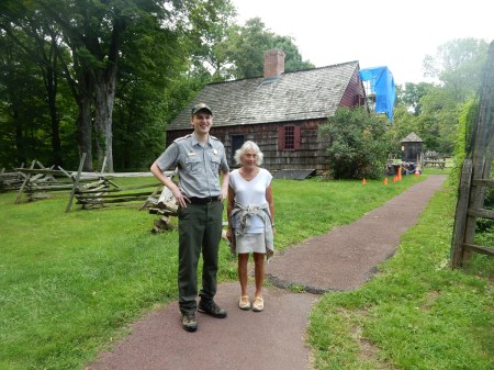
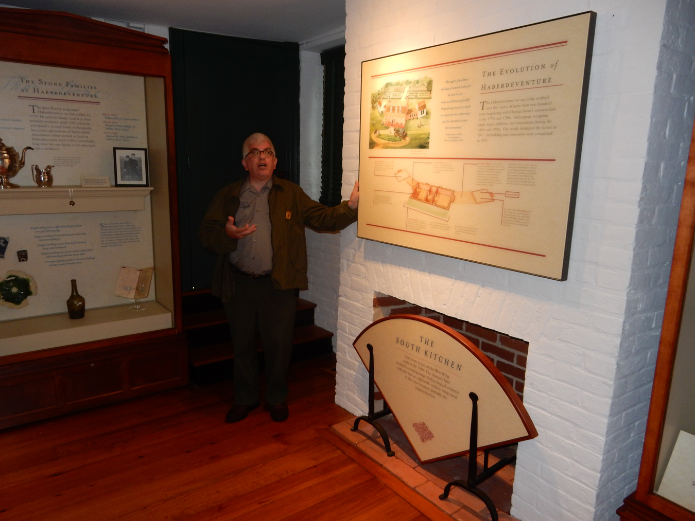
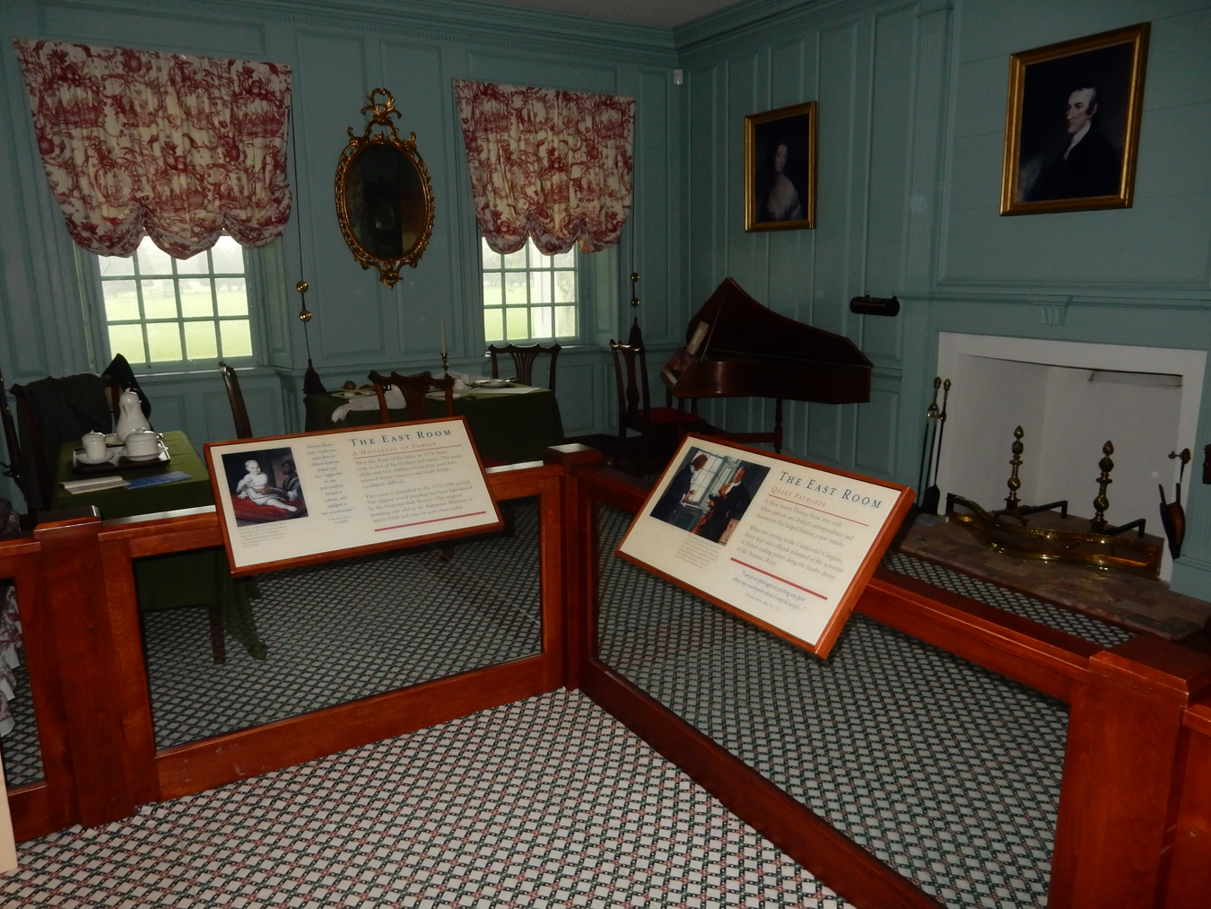
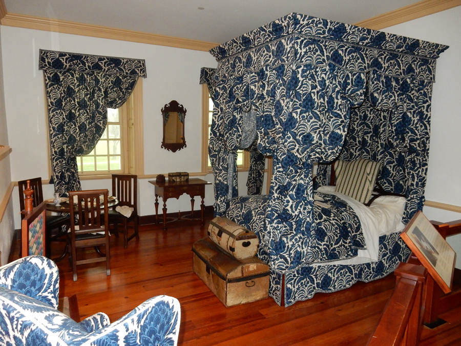
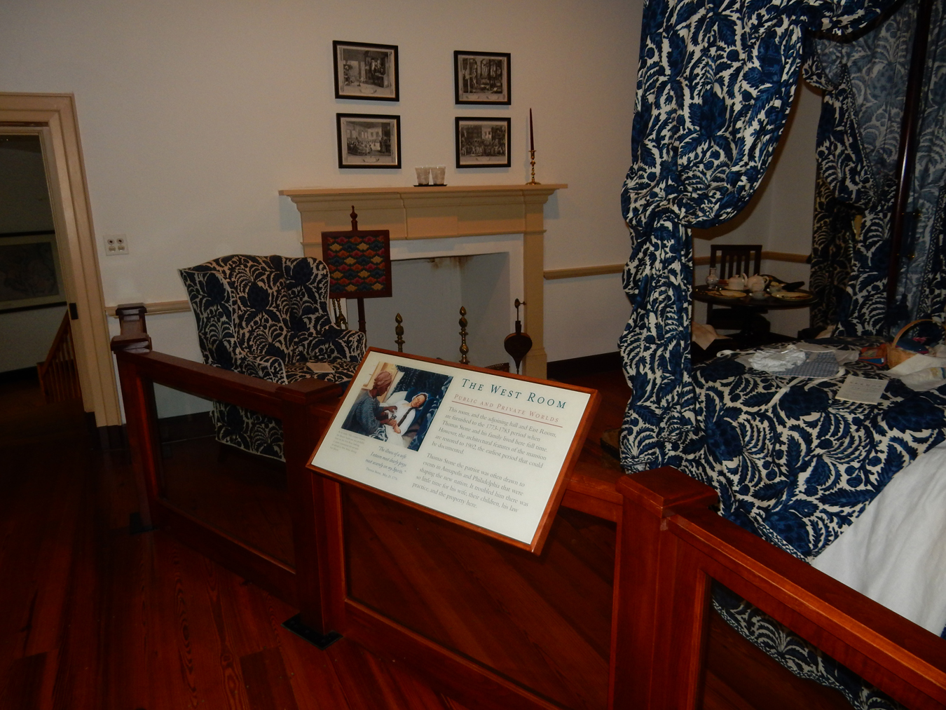
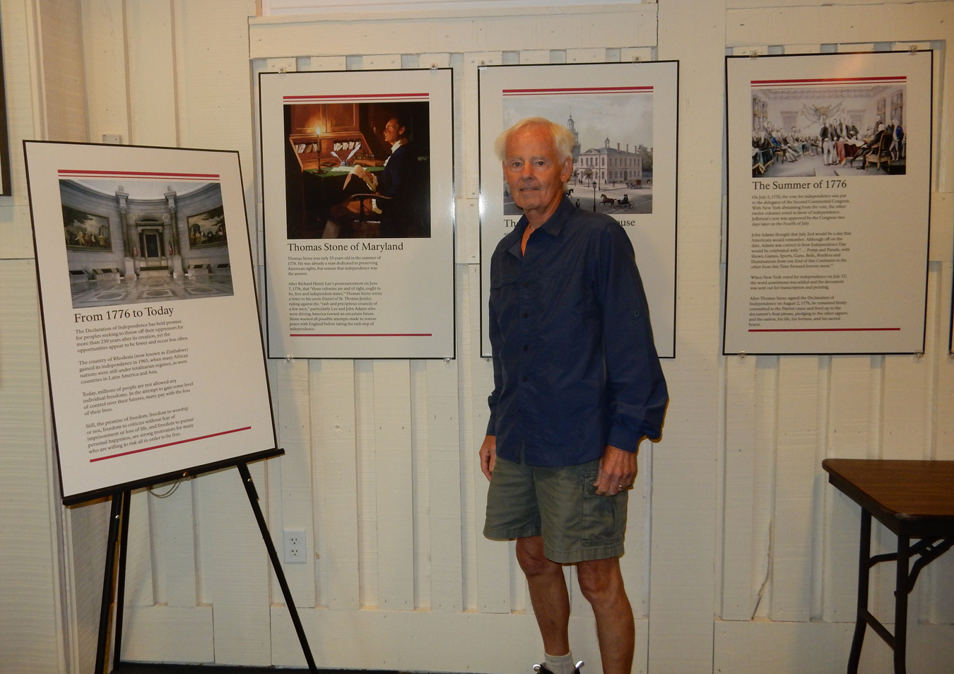
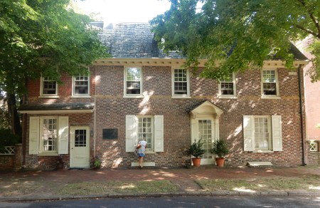
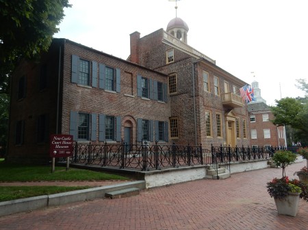
After crossing the 301 Bridge over the Potomac River from VA to MD, it was a short drive the Thomas Stone National Historic Site. Stone was born in 1743 to an affluent family near Port Tobacco MD. It was the second largest town in MD at the time and, as the name implies, was located on the Potomac River. Stone became a noted lawyer, purchased a 442-acre plantation (called Haberdeventure – “dwelling place of the winds”) in the 1770s. He became a “quiet” leader in MD politics serving in Charles County and at the second Constitutional Convention in 1775. He was a British loyalist who came to believe that independence was best for the country. Though risking his wealth and life, he chose to sign the Declaration of Independence on July 3, 1776 as a MD representative. Back (porch) side of house

Front of house

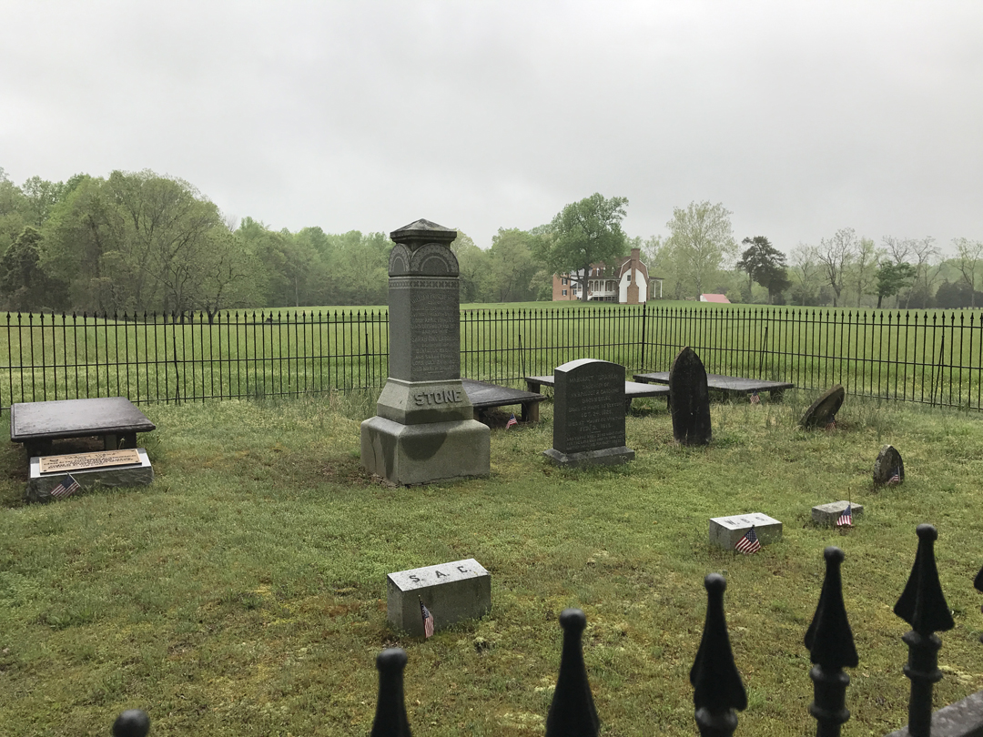
Several generations of Stones can be found in the Haberdeventure cemetery. Outside the fence is an area to mark the resting place of Stone family slaves.

I walked to the Stone house in a light rain and had an excellent/informative ranger tour

Many Stones still live in Charles County and have been instrumental in furnishing the house with many original pieces


Visitor Center

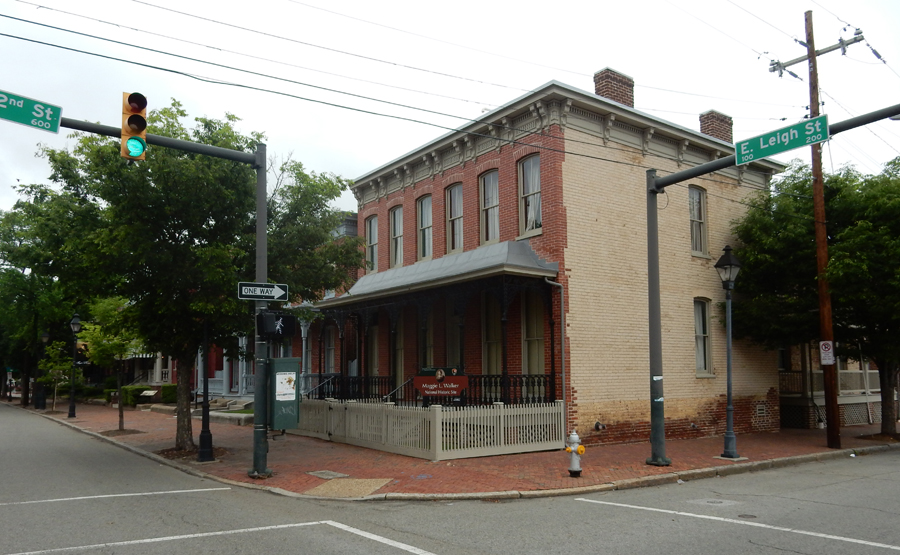
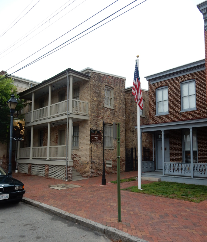
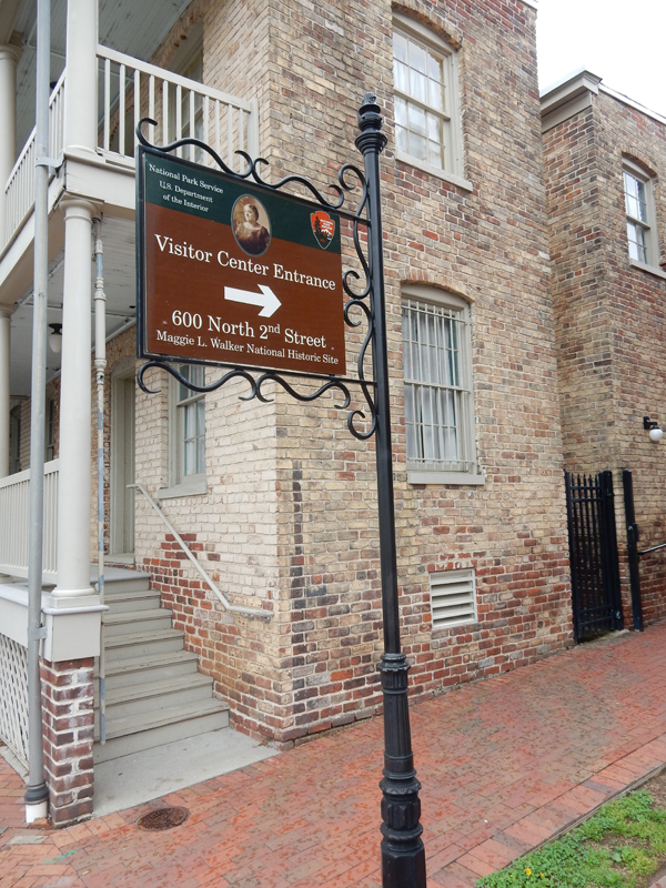
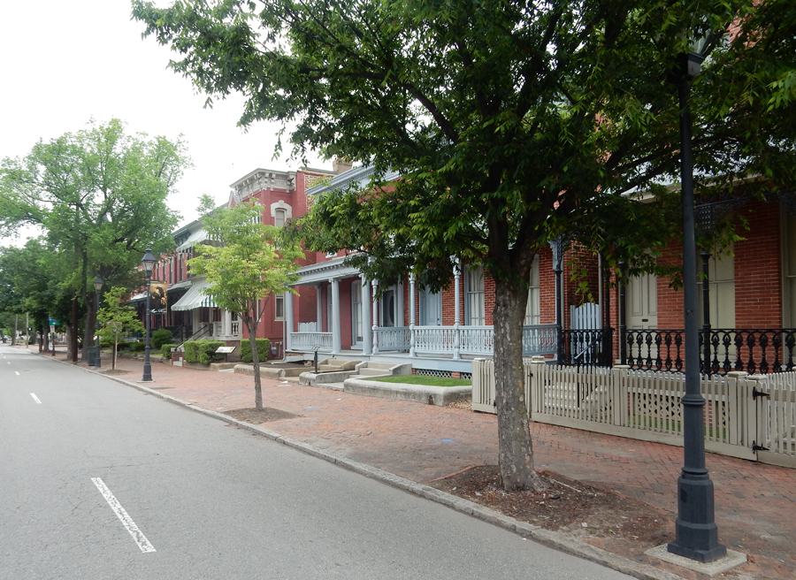
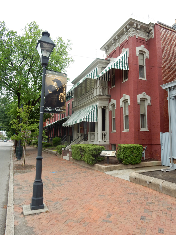
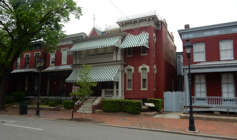
It took 1.5 hrs to drive to the historically black Jackson Ward district of Richmond VA and the Maggie L. Walker National Historic Site. The Visitor Center is located on 2nd Street around the corner from the Walker house.


Maggie was born in 1864 during the Civil War to Elizabeth Draper a slave/servant and a white journalist/Confederate soldier Eccles Cuthbert. In 1869 Elizabeth marries William Mitchell – the butler where she was employed but he died in 1876. This thrust the family further into poverty. That same year, when Maggie was 12, she was baptized in the First African Baptist church. Two years later, she joined the Independent Order of St. Luke, a benevolent society for African Americans in times of illness, old age and death. Thus began a life-long commitment to this organization and her community. In 1886, she married Armstead Walker, a brick contractor. She established the St. Luke Herald newspaper in 1901 and two years later founded the St. Luke Penny Savings Bank (“Turning nickels into dollars”). She served as the banks first President. She also started a retail store for black citizens who were not permitted to enter white establishments. The Walker house was purchased in 1904 and soon became the center of Richmond’s black business and social life.


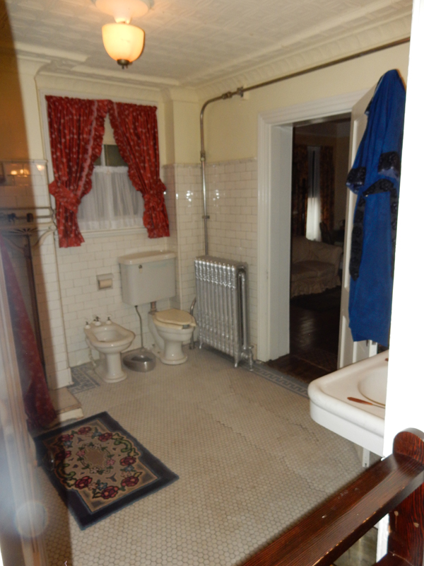
The Walkers expanded the house to 22 rooms as they added electricity, radiators and enclosed porches. The current furnishings are primarily from family and represent the 1904-1934 years of occupancy.


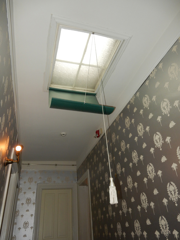
The NPS purchased the house from the Walker family in 1979. Skylight shade – Good Idea!

I was very fortunate to receive a personalized ranger tour

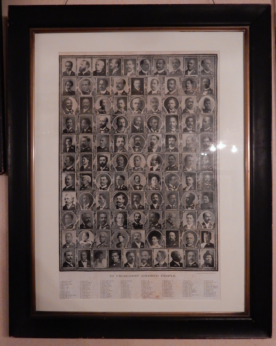
Maggie L. Walker spent her life working for social equality, social justice, women’s rights and economic empowerment – she is one of 101 Prominent Colored People included in this poster.

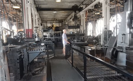
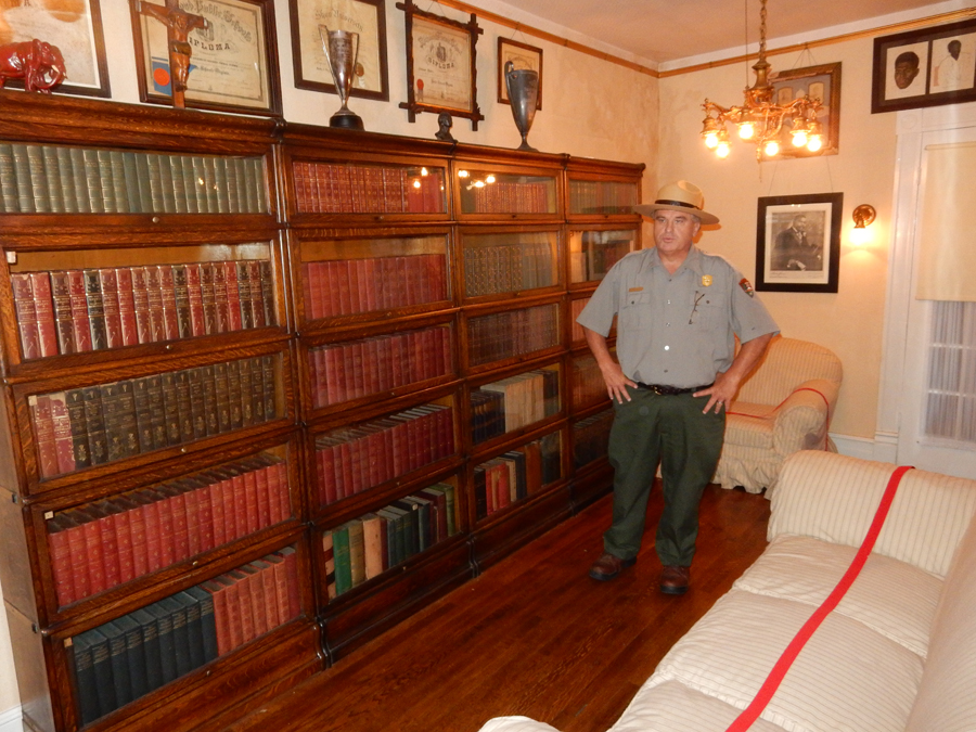
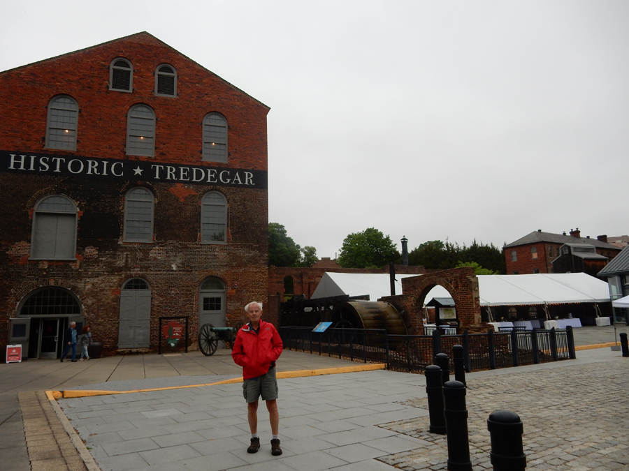
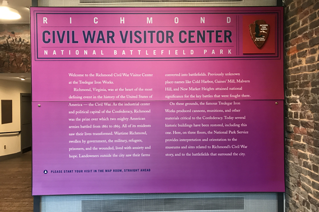
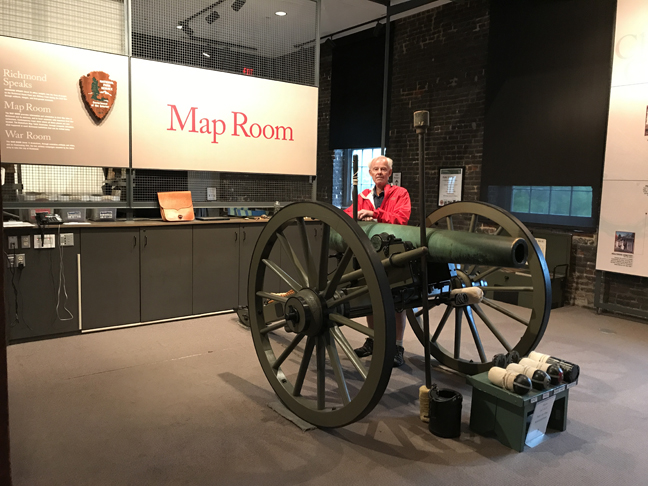
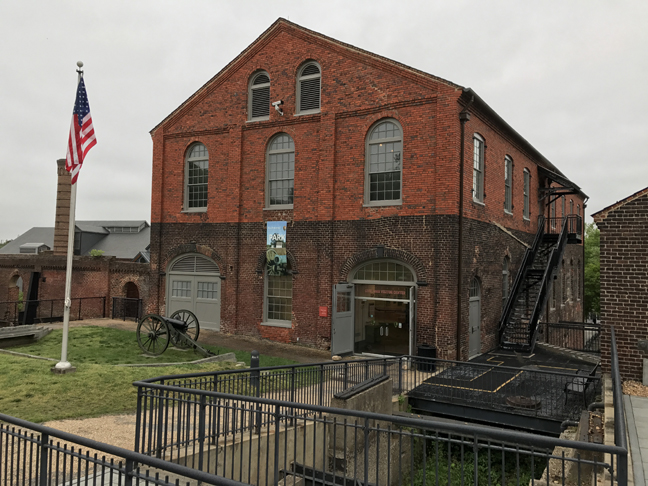
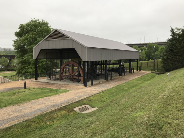
It was but a 10-min drive to the Richmond National Battlefield Park Civil War Visitor Center; it is located in the Pattern Building of the Tredegar Iron Works.


Tredegar was instrumental in making cannon, firearms, munitions and gear for the Confederate Army


It also made plates for ironclad ships including the CSS Virginia (captured USS Merrimack) that confronted the USS Monitor at the Battle of Hampton Roads.

“On April 2, 1865, when warehouses along the James River were being burned by evacuating Confederates, Tredegar was saved by an armed battalion of workers who blocked any attempt to destroy the foundry building. The iron works would play an important role in rebuilding the devastated South after 1865.” Back of Tredegar Building and Rolling Mills.


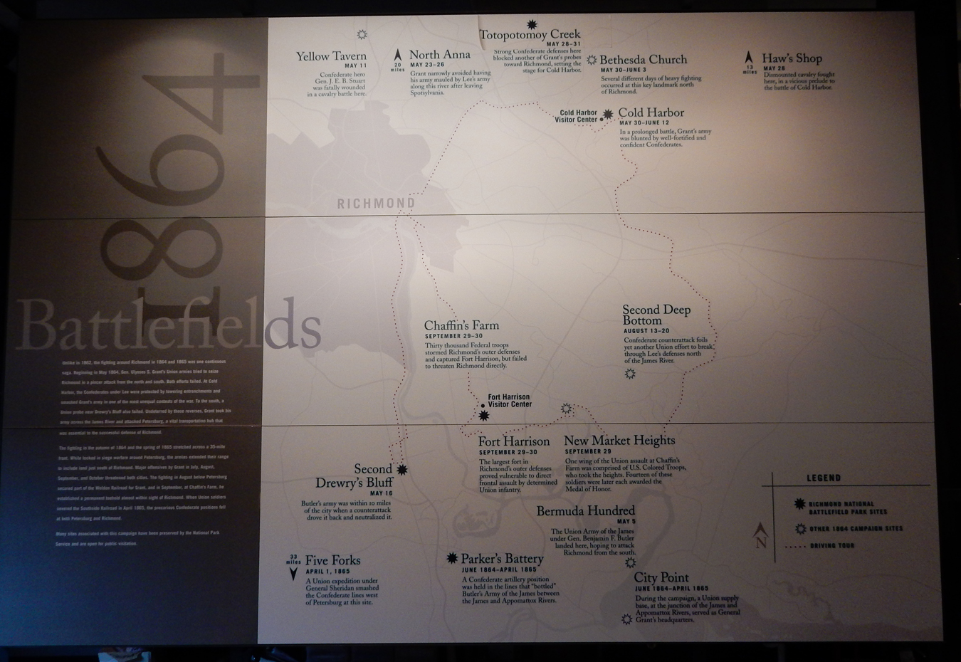
There are many Civil War battle sites around Richmond. It is only 110-miles south of Washington DC. The North tried for four years to take the city. 1862 Battles –

1864 Battles –

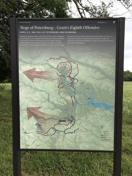
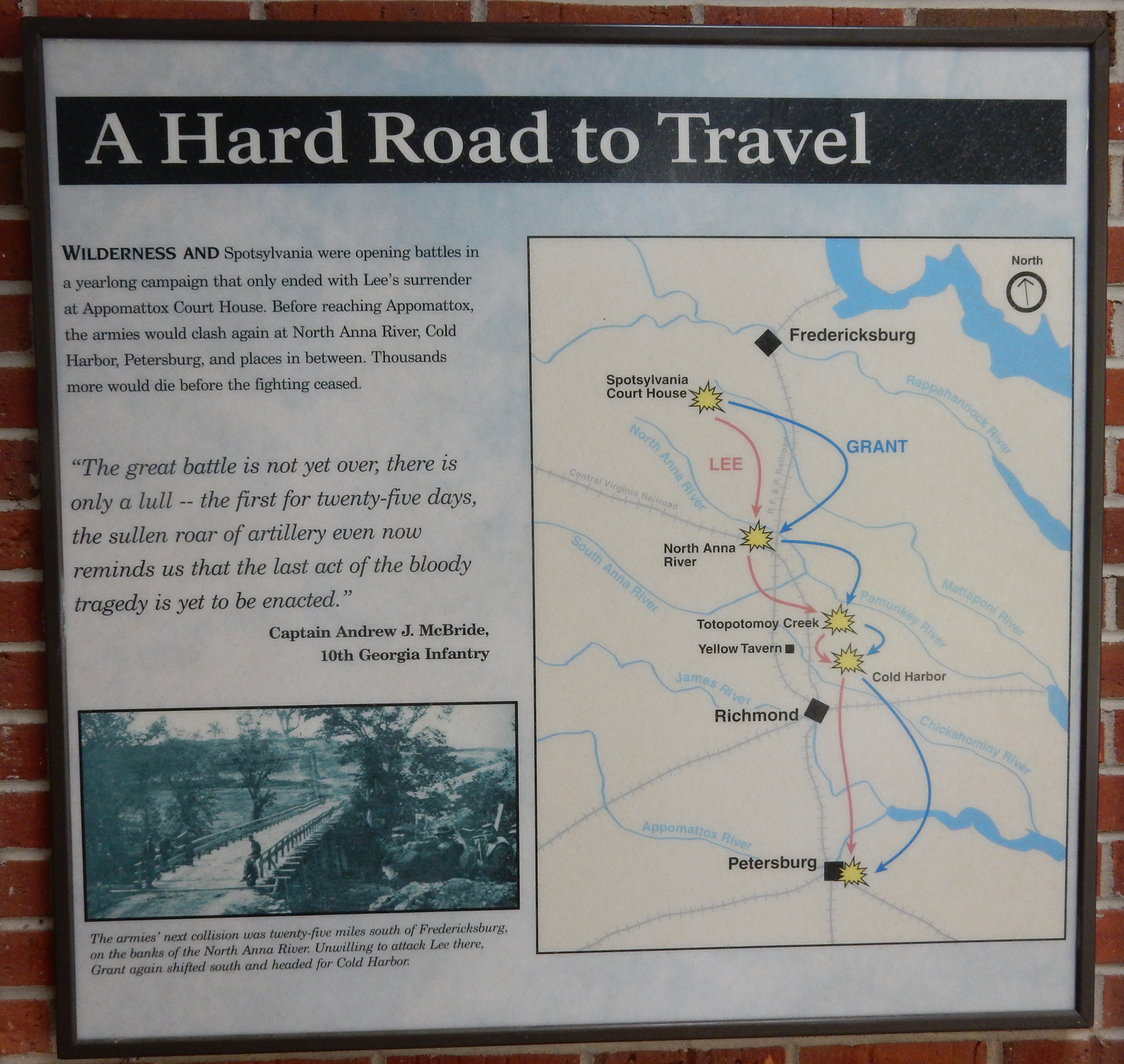
In the end, Grant set up positions north and east of the city (1864) and then moved south (about 25-miles) to place a siege on Petersburg, an important rail and supply center for Richmond, for 9.5 months.
Petersburg fell on April 2, 1865; Richmond fell on April 3rd and President Lincoln entered Richmond on April 4th!


A long day, I slept in the SUV behind a Marriott in Hopewell VA
April 23 Petersburg National Battlefield – Prelude to Petersburg
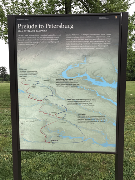
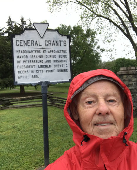
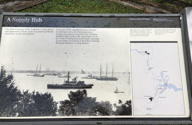
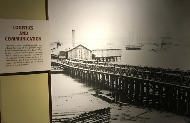
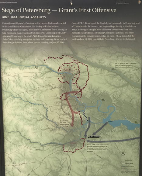
Grant had attacked Richmond May 31 – June 12, 1864. On June 3, he attempted a major direct assault on the city at Cold Harbor. It was a costly defeat with total casualties of 12,738 Union and 5,287 Confederate. In his memoirs, Grant stated “I have always regretted that the last assault at Cold Harbor was ever made. … No advantage whatever was gained to compensate for the heavy loss we sustained.” His attention then turned to Petersburg 25-miles to the south. He first attempted a surprise attack on June 15 with some success, however, his commanders did not follow-up on their advantage and Lee was able to bring in troops from Cold Harbor to support his southern line. As a result, the siege of Petersburg began June 18, 1864. There were several attacks by both sides along the line during the following 9.5-month siege. I arrived at Grant’s supply depot at City Point on the James River in Hopewell VA (about 8-miles NE of Petersburg) at about 7:30 am. It was a dreary morning as I toured the site in a light rain.

The Union Supply Hub


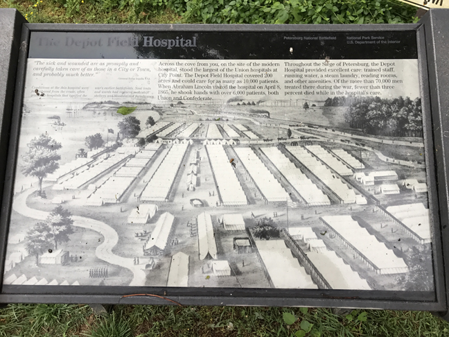
Location of Field Hospital

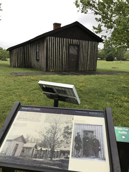
Grant was initially in a tent but then cabins were built as the siege progressed. Grant’s wife and son joined him here during the last three months of the siege.

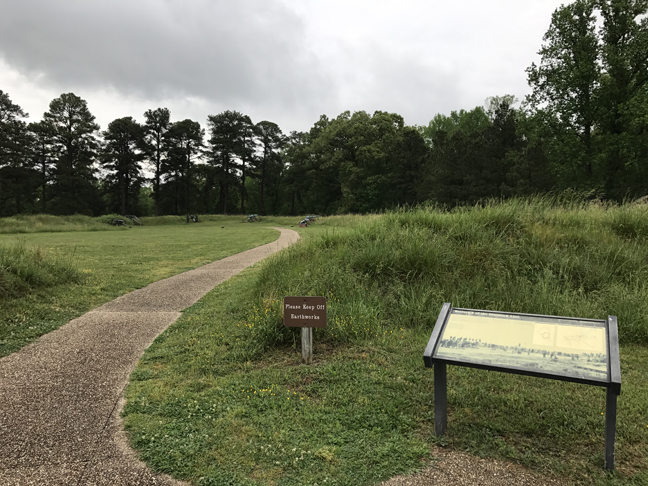
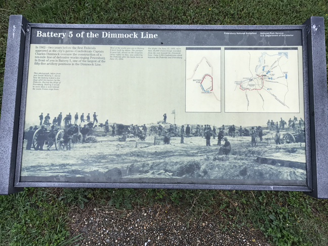
I was at the Eastern Front Visitor Center at 9am when it opened. This is the location of Grant’s first attacks on the Confederates.


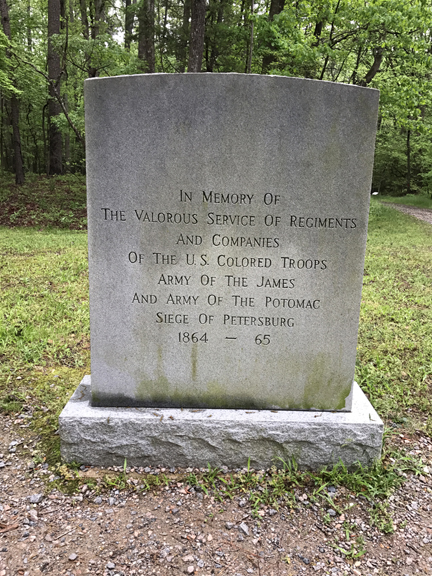
Behind the Visitor Center is a trail that leads to Confederate Battery 5. Nearby are Confederate Batteries 8 and 9 (taken by black troops) – all three were taken during the Union’s first successful attack.


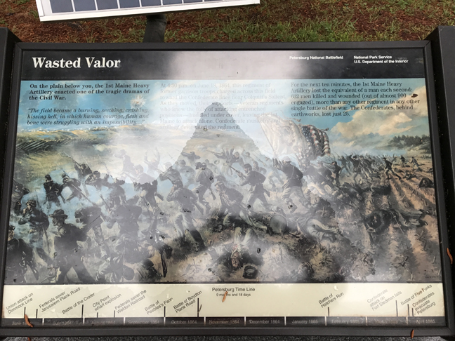
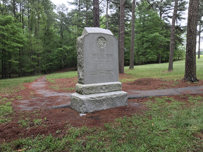
The Confederates dropped back to the west side of Harrison Creek but still held Colquitt’s Salient. The Union attack on the Salient was led by the 1st Maine Heavy Artillery, which suffered the greatest regimental loss in a single action of the Civil War.

The Maine regiment was comprised of “fresh” garrison troops and not aware of the formidable Confederate defense. The other veteran troops knew the folly of such an attack and held back their support, according to the sign – 632 men, of about 900, were killed or wounded. The attack took about 10 min. That means one man per second fell during the charge. I cannot explain the 604-number engraved on the monument stone. The Confederates lost 25 men.


As stated earlier, the Union commanders did not follow-up on their first successful attack. Perhaps they were influenced by the losses of the Maine regiment. This inaction resulted in a 9.5-month siege.

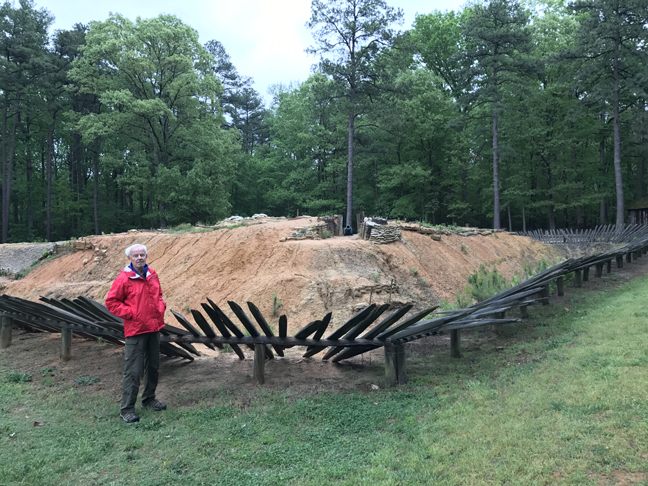
The following siege of Petersburg, with interspersed battles, revolved around trench warfare


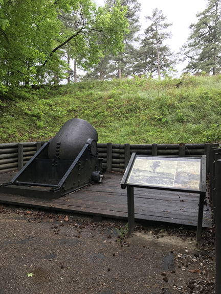
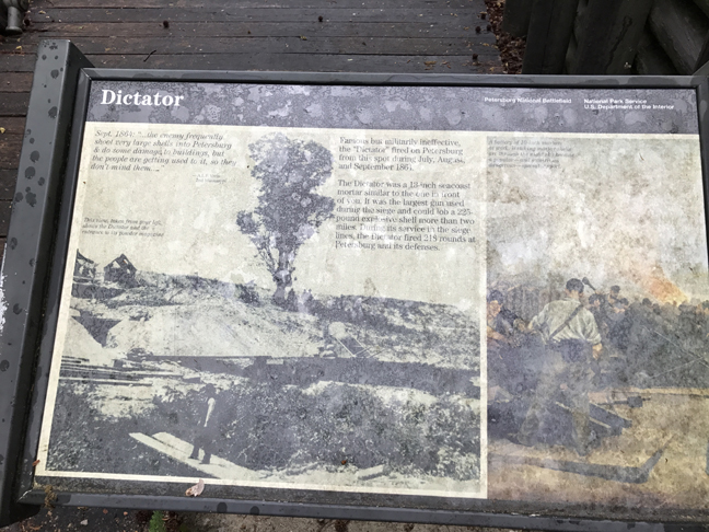
This is a mortar nicknamed the “Dictator,” the largest used by the Federals during the siege


Another ugly episode occurred on July 30, 1864. That is when a huge charge of powder went off under a part of Lee’s defensive line known as the Elliott Salient. Miners from PA suggested tunneling under the Confederate position, blowing it up, and taking Petersburg.


A division of African-American troops with white commanders were selected to spearhead the attack that would occur after the explosion and spent weeks rehearsing the assault. At the last minute, Maj. Gen. George Meade concerned about negative publicity, changed the plan and told Maj. Gen. Ambrose Burnside to choose an all-white division to lead the assault. As a result, confusion reigned.

At 4:40am the explosion produced a crater 170 feet long, 80 feet wide and 30 feet deep. SC troops manned the Salient and suffered the results of the explosion – 270 killed.

Union forces charged directly into the crater and, as a result, were sitting ducks for the Confederates who remained on the rim. The black division followed in support. The remaining SC soldiers were joined by VA troops in a counterattack. According to Wikipedia, “In later stages of the battle, many Union casualties were black soldiers killed by Confederate bayonets and musket fire even after surrendering. Confederates captured earlier in the battle had received similar treatment from Union troops. All of this was a violation of the rules of war prevalent at the time. Black soldiers were also bayoneted by white Union soldiers who feared reprisal from victorious CSA troops . . . Despite the battle being a tactical Confederate victory, the strategic situation in the Eastern Theater remained unchanged. Both sides remained in their trenches and the siege continued. ”

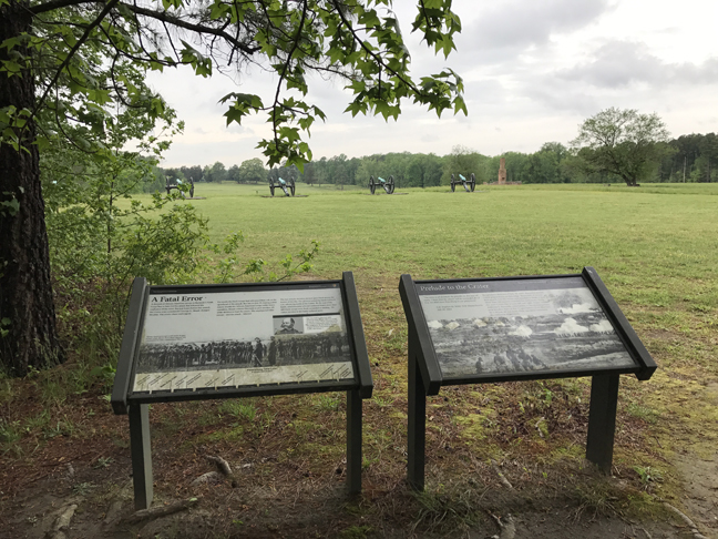
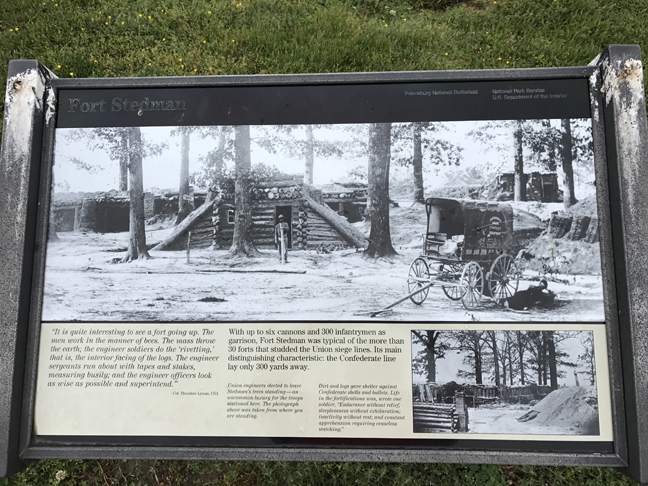
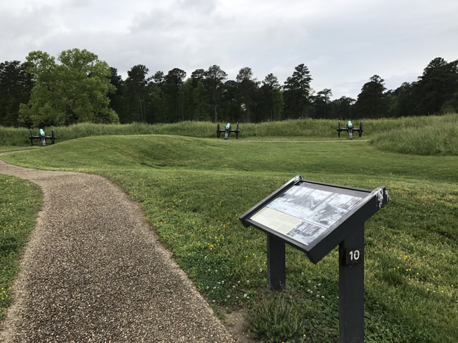
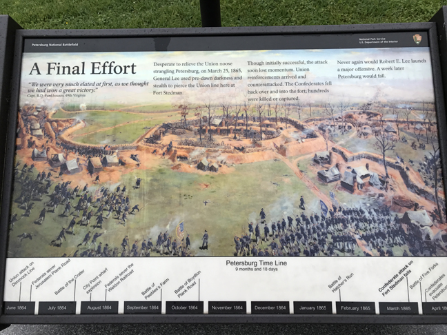
Now, fast forward to March 25, 1865. That was the date of Lee’s last attack trying to break the siege. It took place at Fort Stedman.


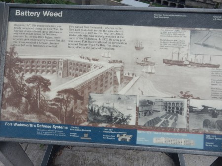
Leaving the Eastern Front area, I drove about five miles SW along the siege line to Fort Wadsworth and the start of the Western Front driving tour. There are four stops on this tour covering about 12-miles. The Western Front Contact Station is located at the Poplar Grove National Cemetery, established in 1866 for Union soldiers. Fort Fisher was the next stop – this was the largest Union earthen fortification on front.

The fourth stop was Confederate Fort Gregg. Here on April 2, 1865, during the final assault on the Federal lines, 600 soldiers held off almost 5,000 Union soldiers allowing Lee’s army to safely withdraw from Petersburg that night.

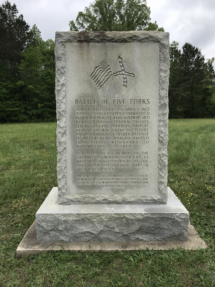
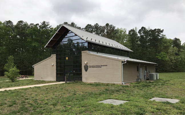
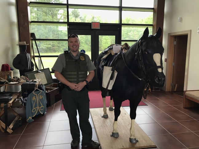
I continued West on country roads for about 8-miles to the Five Forks Battlefield Visitor Contact Station.

I met Ranger Chaffee there. He attended Wittenberg University for two years and I believe was in Helen’s SCUBA class – it’s a small world!

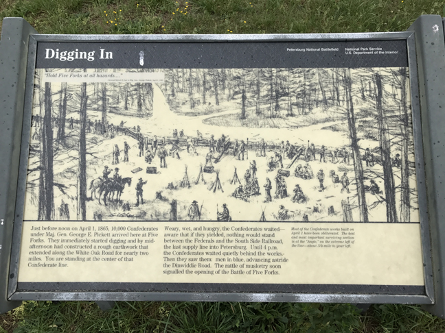
The Federals attacked the Confederates, who were dug in here for about a mile on each side of the Five Road Intersection on April 1. This was part of the final battle to take Petersburg.


The Five Forks Intersection was important because it was the closest route to the South Side Railroad, Petersburg’s last supply line. According to the monument inscription, 10,000 Confederates under Gen. Pickett were overwhelmed by 50,000 Federals under Gen. Sheridan resulting in the evacuation of Petersburg and Richmond and the withdrawal of Lee’s army to Appomattox.
Another full day, Petersburg National Battlefield, a 33-mile driving tour with 17 stops followed by a 5 hr drive to Goldsboro NC
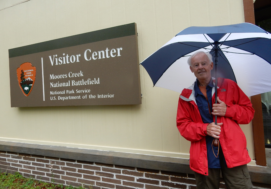
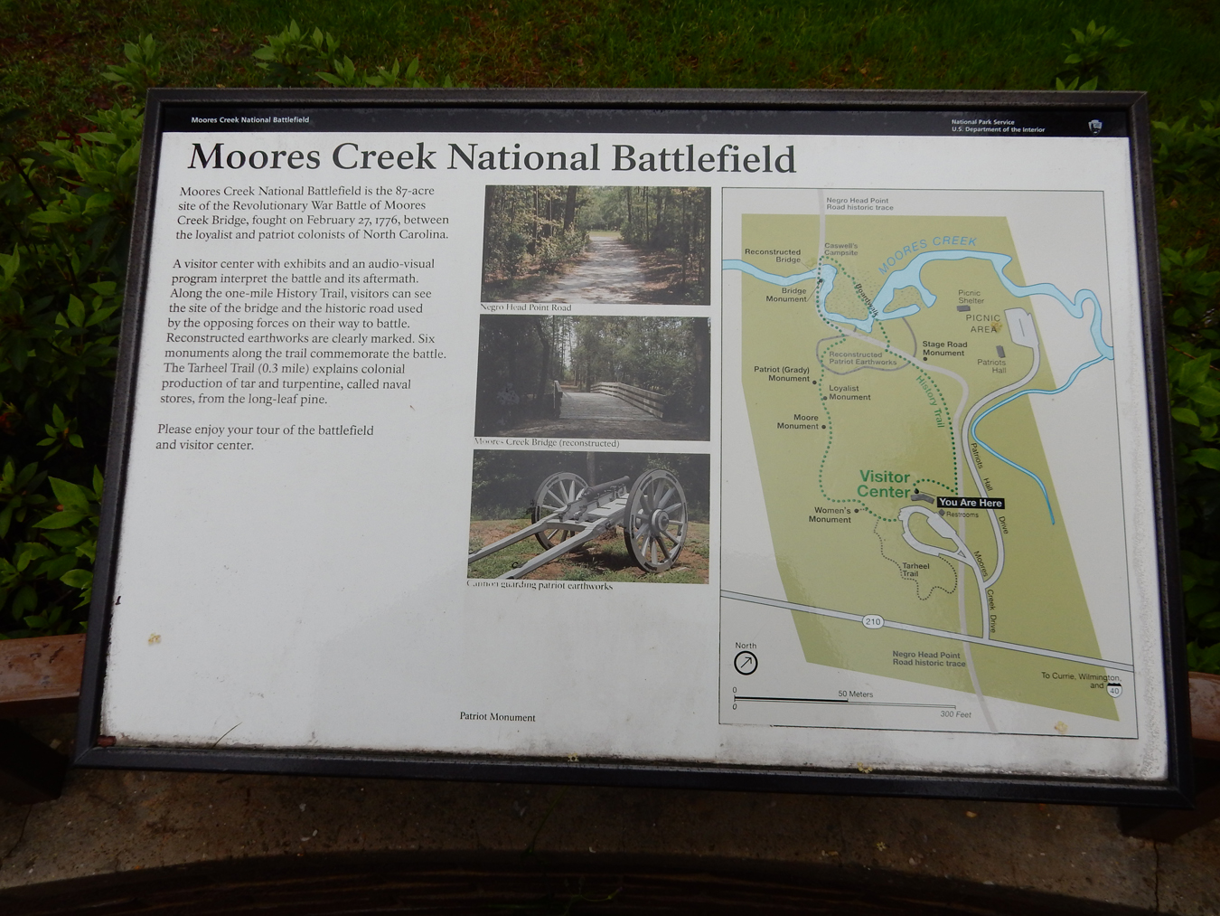
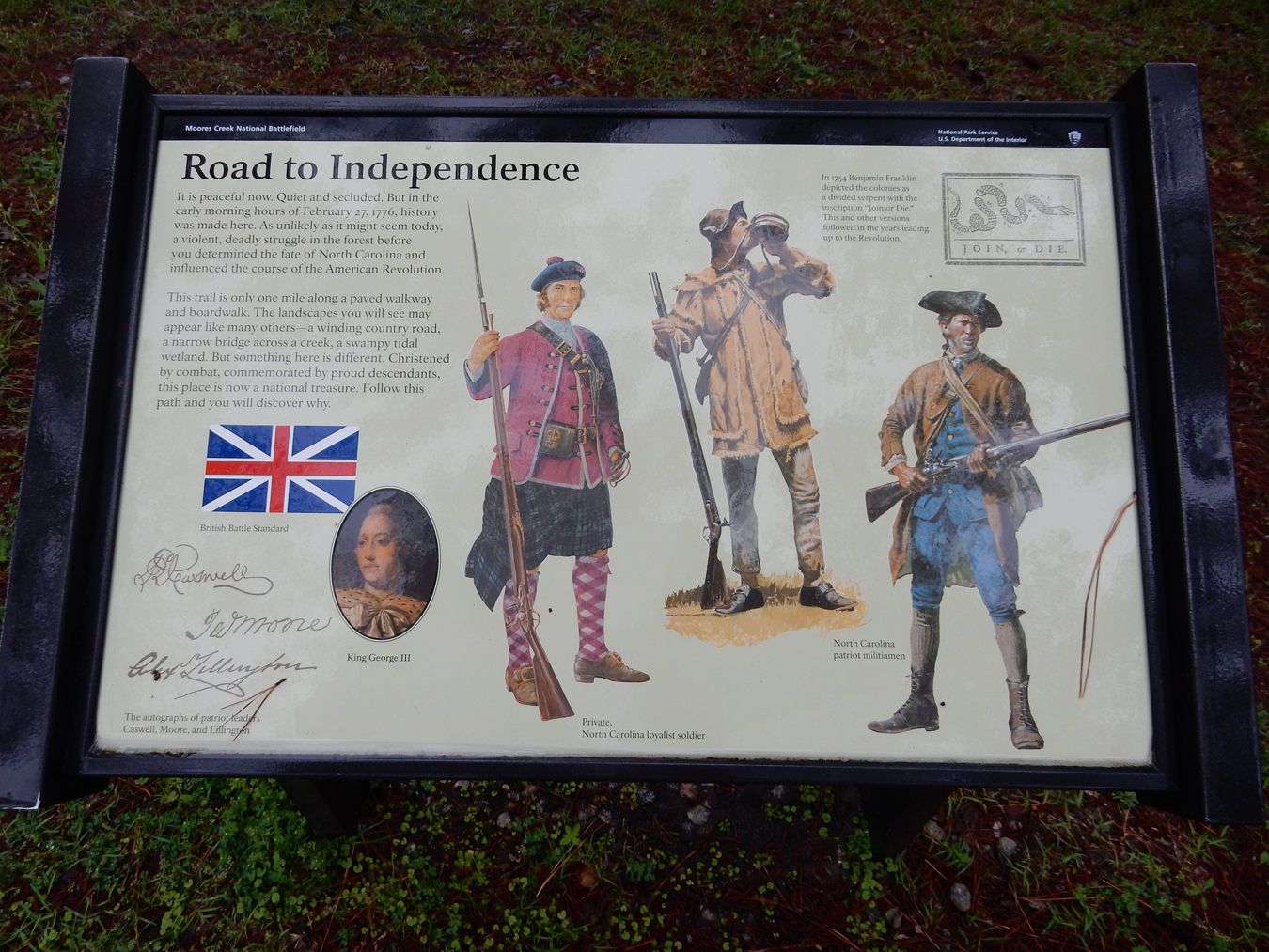
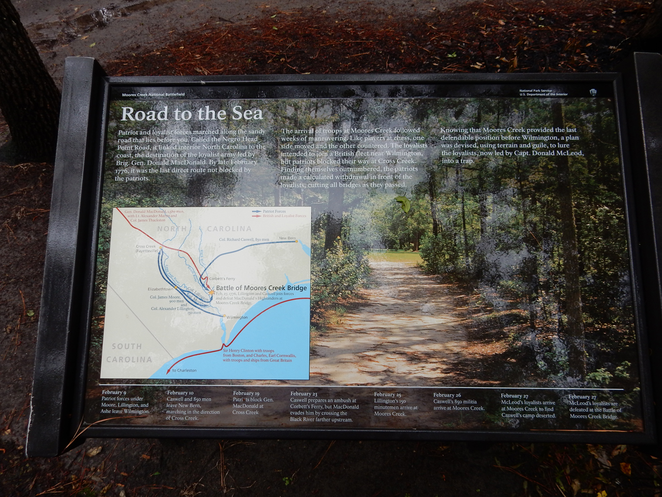
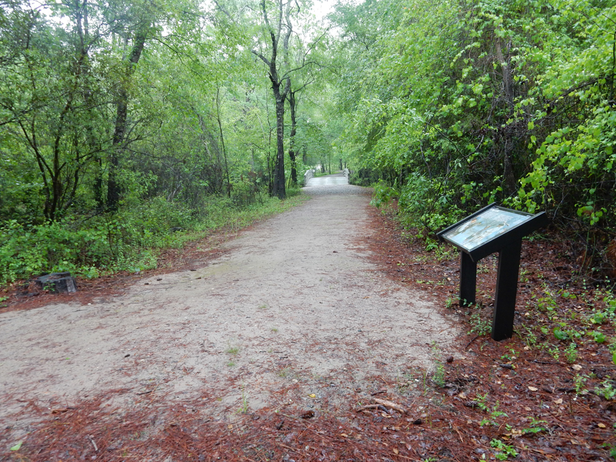
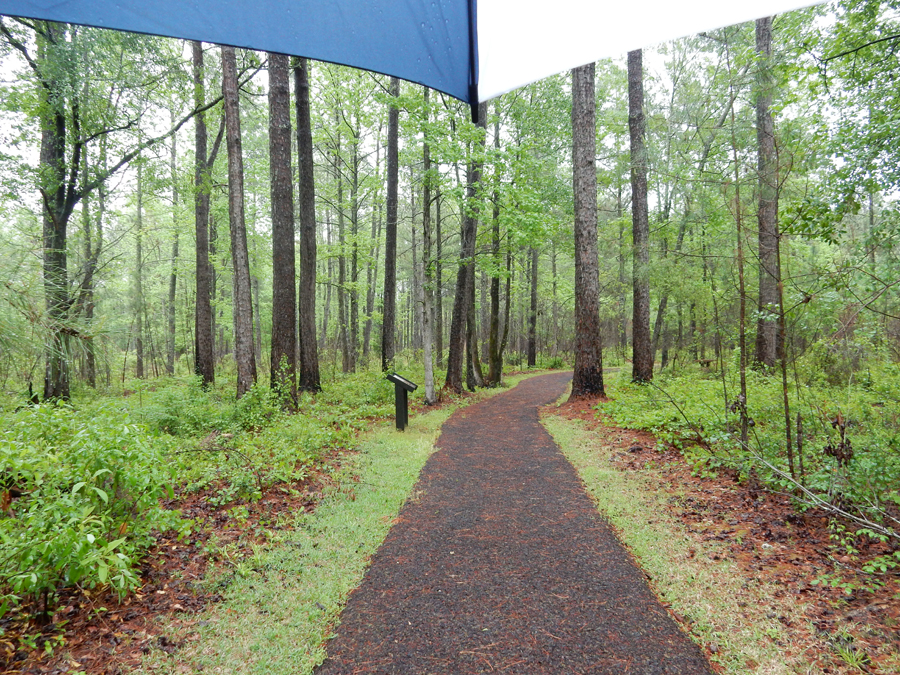
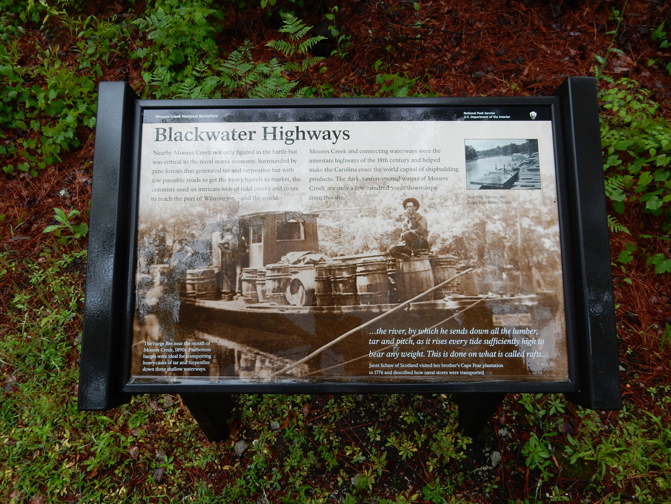
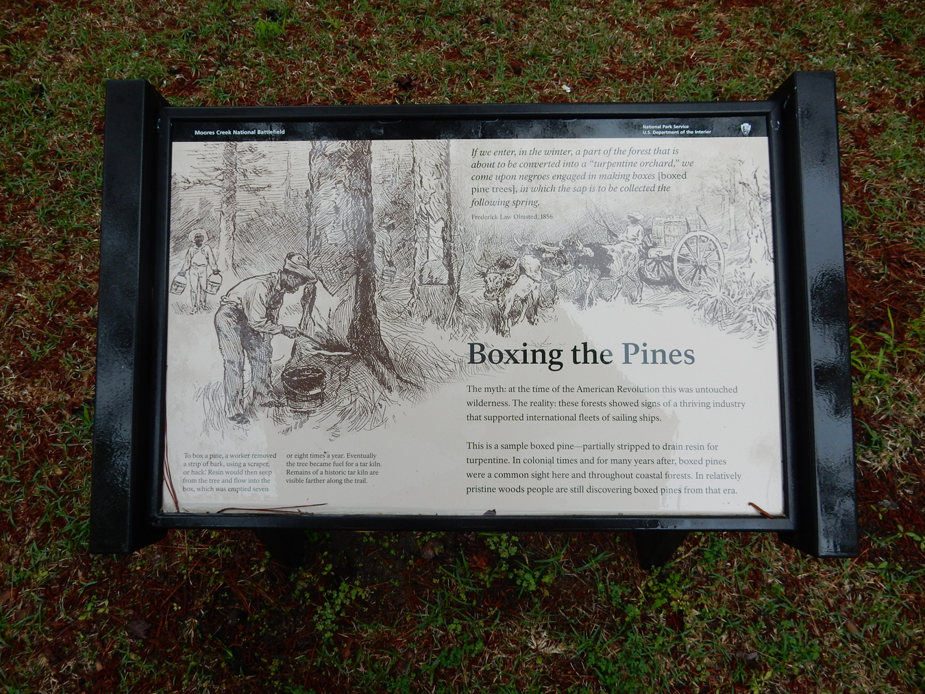
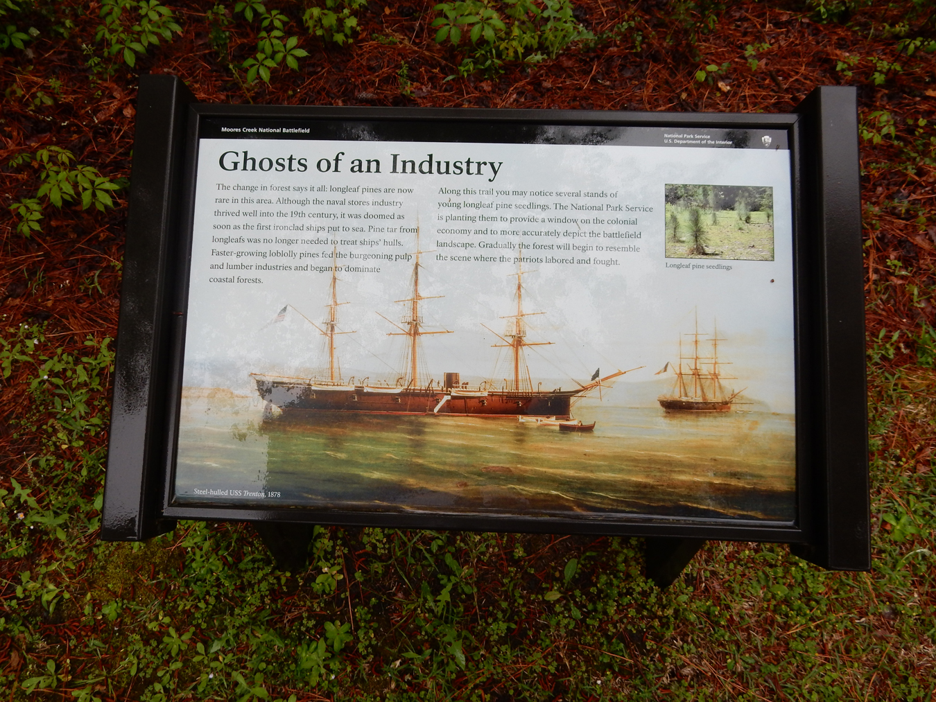
April 24 – Moores Creek National Battlefield is located 20 miles NW of Wilmington NC. It is a Revolutionary War battlefield. The Visitor Center was closed today (Monday) but there were umbrellas in the foyer for public use, very nice!


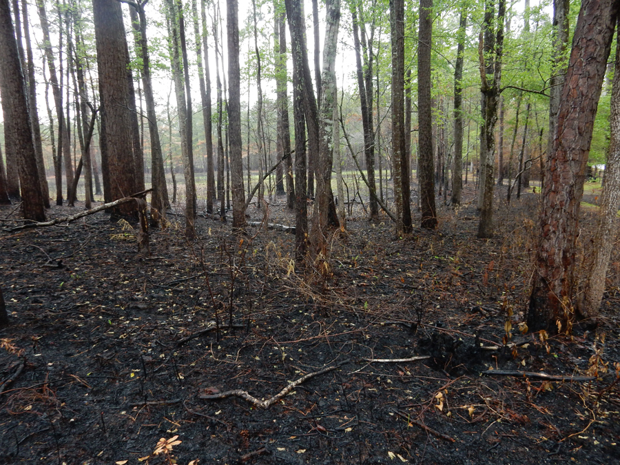
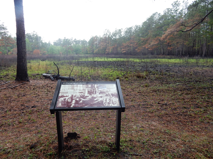
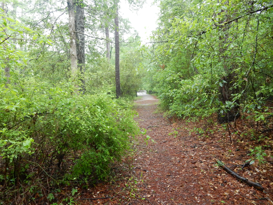
I followed the History Trail – enlarge pics to read signs

Controlled burn


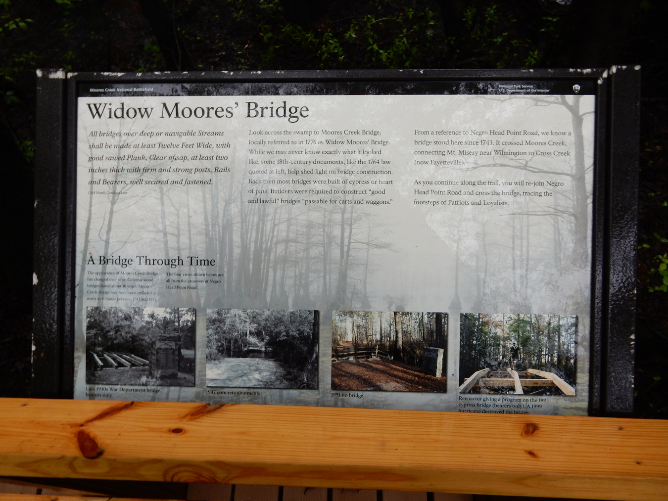
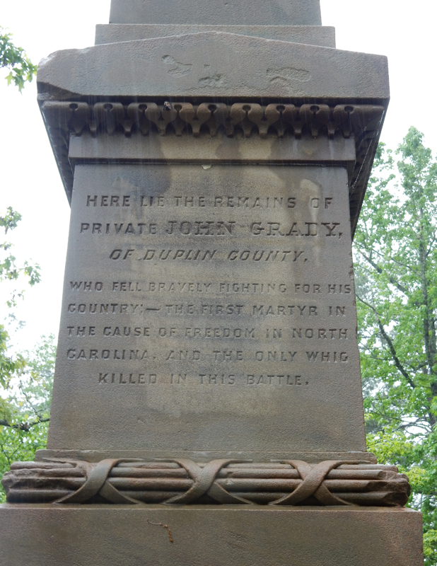
On February 27, 1776, a group of Patriots defeated a larger force of Loyalists at a bridge crossing Moores Creek. It was a “small” scale battle but nevertheless is referred to as the Lexington and Concord of the South. The British plan was to raise a group of Loyalists to march to Wilmington to join British naval troops and conquer the Carolinas. That accomplished, they would then march up the coast to join Lord Cornwallis and restore royal rule.


Stage Monument on Negro Head Point Road

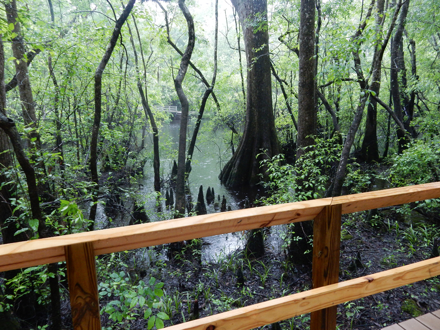
The Patriots became aware of the plan and moved to stop the Loyalists at Moores Creek Bridge before they could join the British troops. It was swampy terrain and the bridge was the only way to cross. The Patriots arrived at the site first and built earthworks overlooking the bridge.


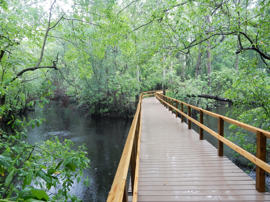
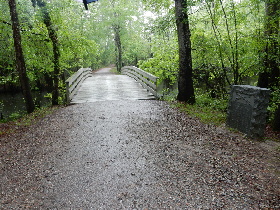
Boardwalk for trail, a bridge did not exist here in 1776

Note the reproduction of the Moores Creek Bridge in the background


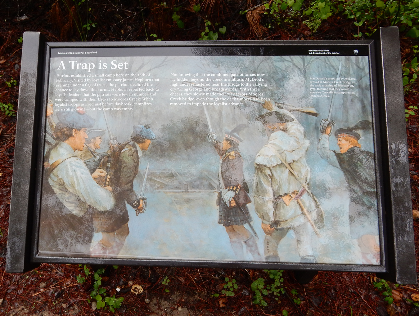
There were about 1600 Loyalists on the march and about 1000 Patriots at the bridge. MacDonald, the Loyalist leader, sent a message to the Patriots giving them a last chance to lay down their arms and swear allegiance to the Crown. They declined. The Patriots removed planks from the bridge and greased the girders before consolidating their men on the east side.

This is the view the Loyalists had as they approached the bridge


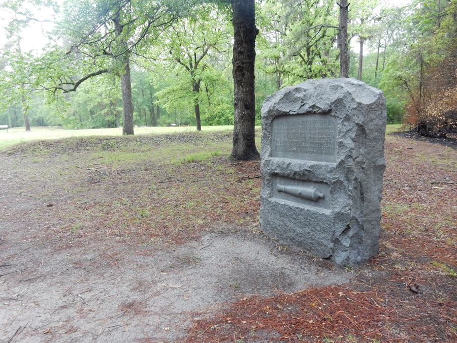
Except for the Bridge Monument!

The Loyalists attacked just before dawn. The Loyalist encountered these earthworks and canon after they crossed the bridge. The advance party was cut down in minutes by musket and artillery fire.


Thirty Loyalists were killed and 40 wounded

Only one Patriot died

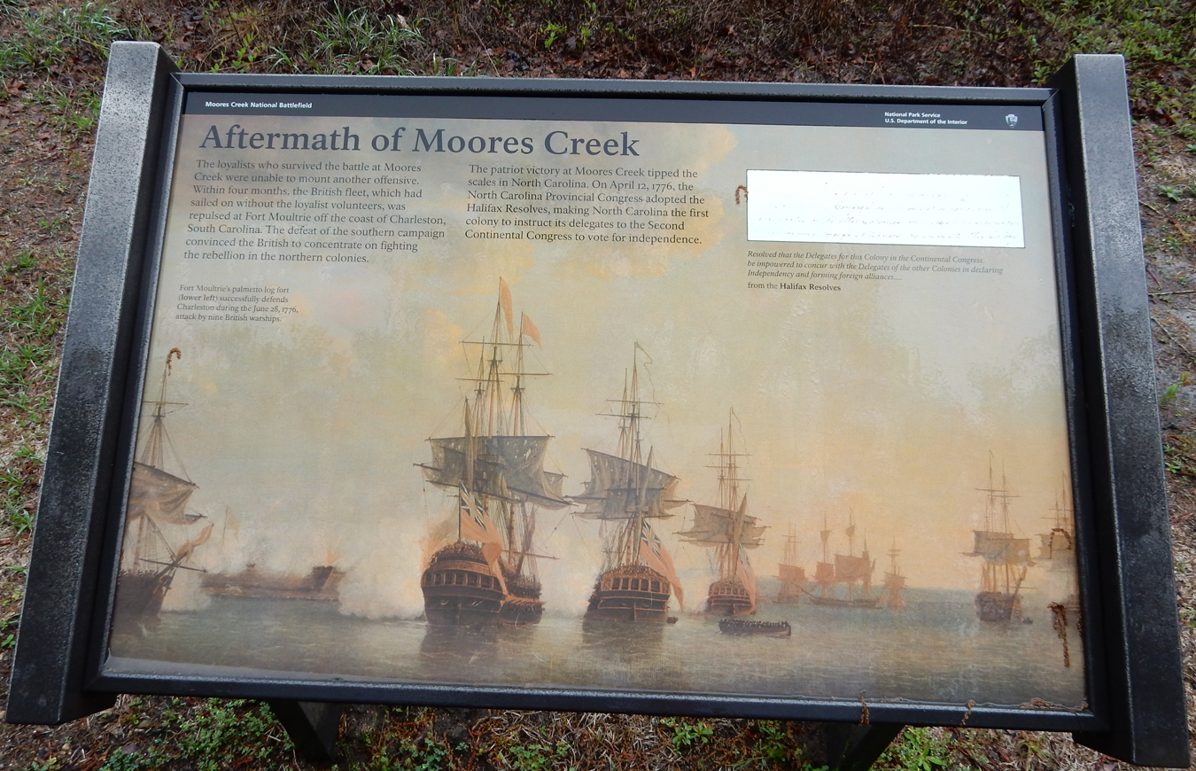
The victory encouraged Patriots in the Carolinas and discouraged loyalist sentiment. Importantly, it emboldened NC to instruct its delegation at the Continental Congress in Philadelphia to vote for independence. It was the first American Colony to do so.

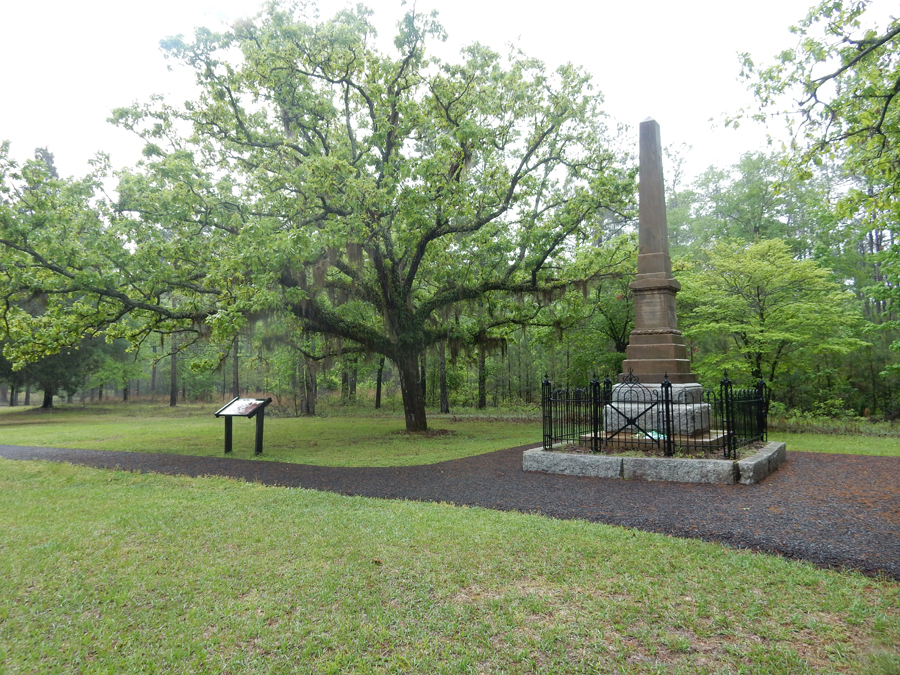
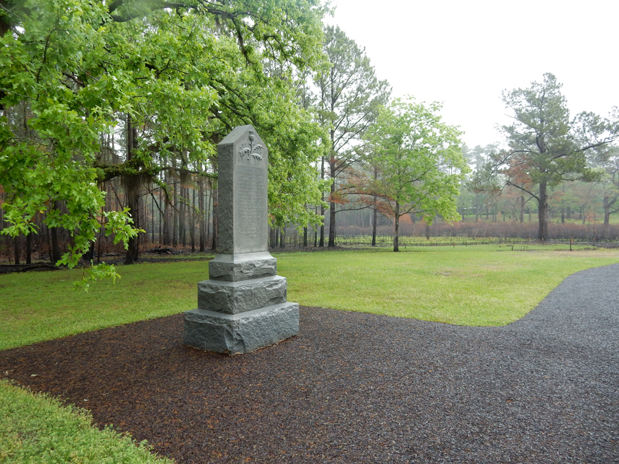
John Grady (Patriot) Monument


Loyalist (Whig) Monument

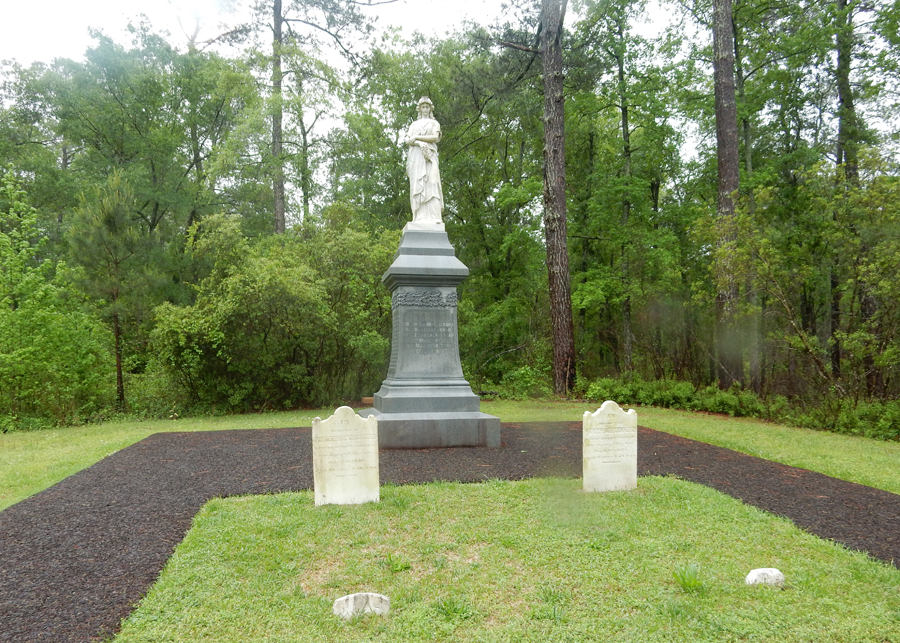
Women’s Monument


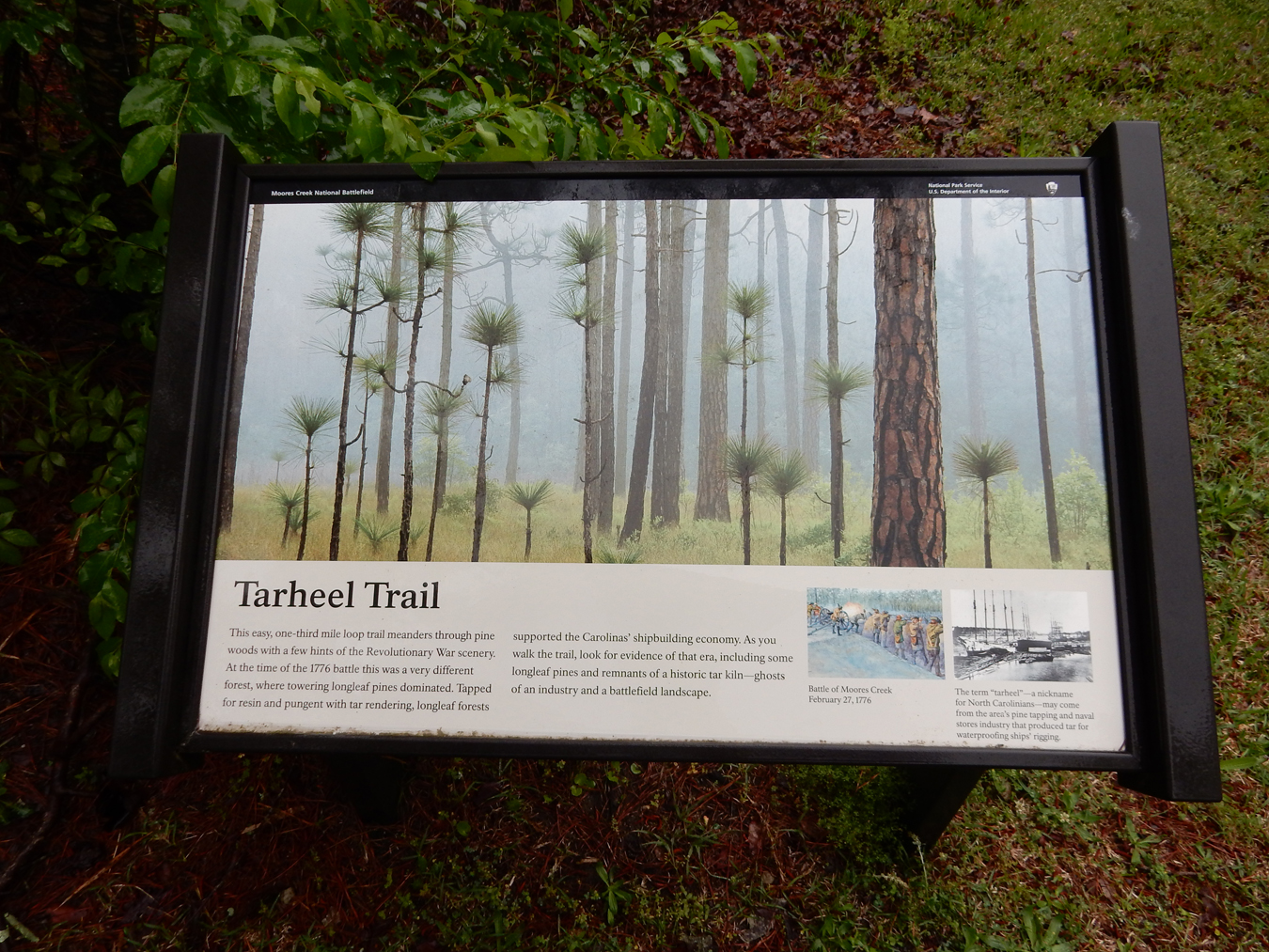
Did you ever wonder why the University of North Carolina are called the Tarheels? I found the answer on the 0.3 mile Tarheel Trail.


As I was leaving, Ranger Ricardo Perez arrived. He was acting in a security roll, however, when I asked to enter the Visitor Center to take a few pictures and get a park brochure he obliged. We had an informative and enjoyable conversation. He is the one who took my photo at the entrance.
“Travelin Man” – back in the Sequoia and headed for Wilmington NC


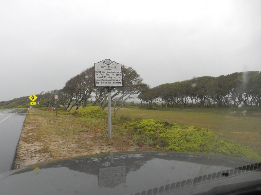
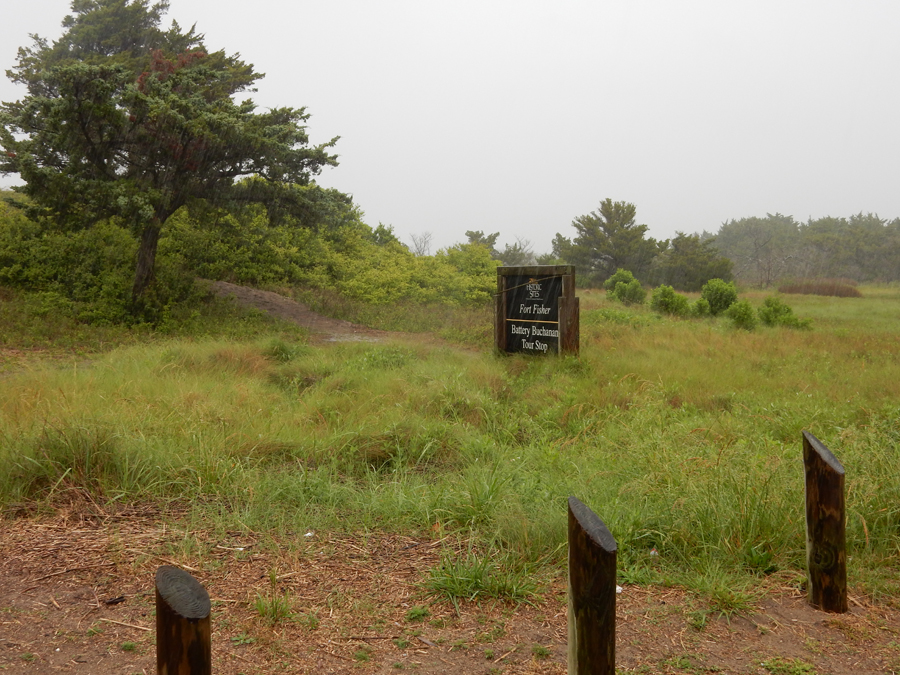
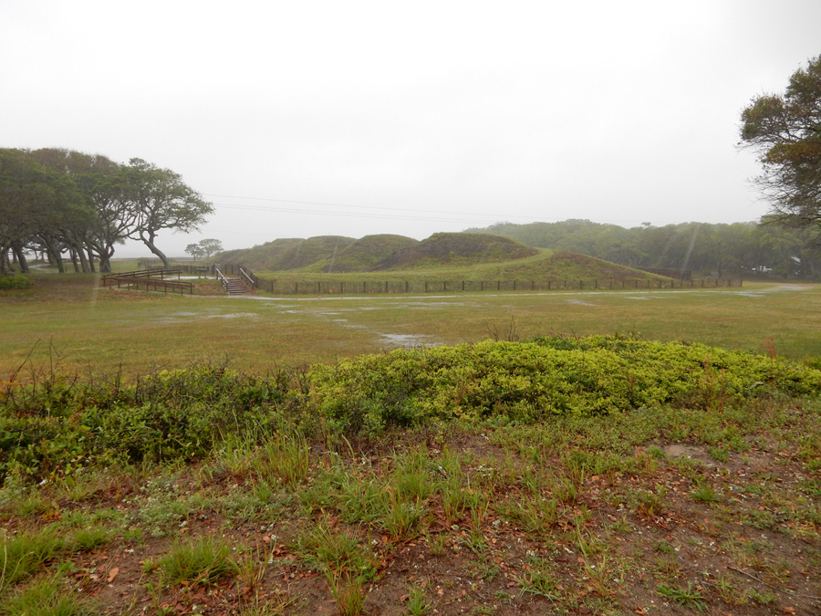
It was raining heavily as I passed through Wilmington and headed for Fort Fisher, which is a NC Historic Site and a National Historic Landmark. This Confederate Civil War Fort kept Wilmington harbor open to blockade runners until a January 15, 1865 Union amphibious assault took this strategic position. As a result, the Federals controlled Cape Fear, one of Lee’s last supply routes.


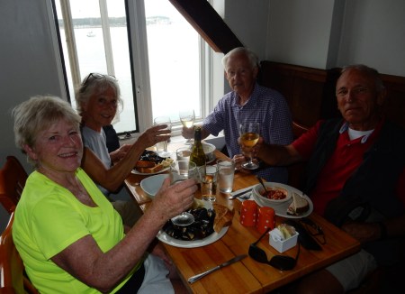
Arrived in Morehead City NC in time to take Linda to dinner. We then attended the fourth and final night of the Morehead City Citizens Police Academy. I even received an award!

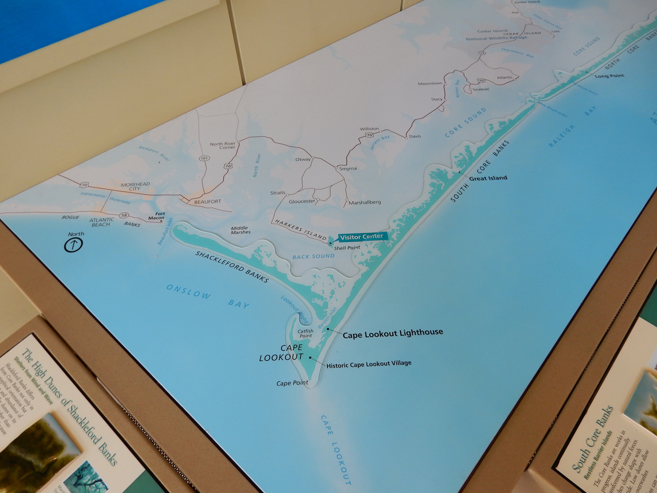
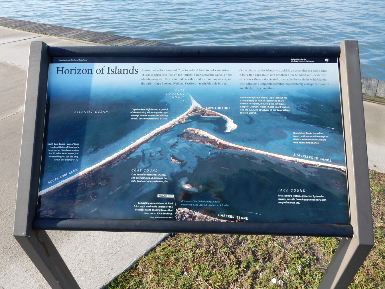
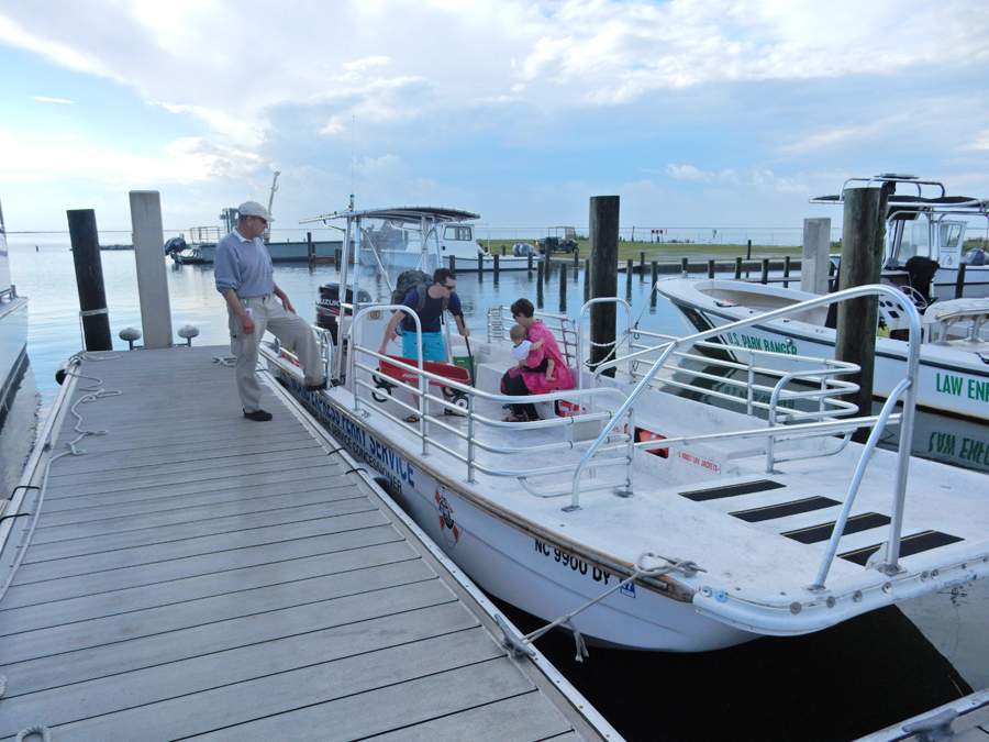
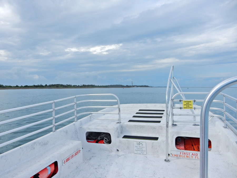
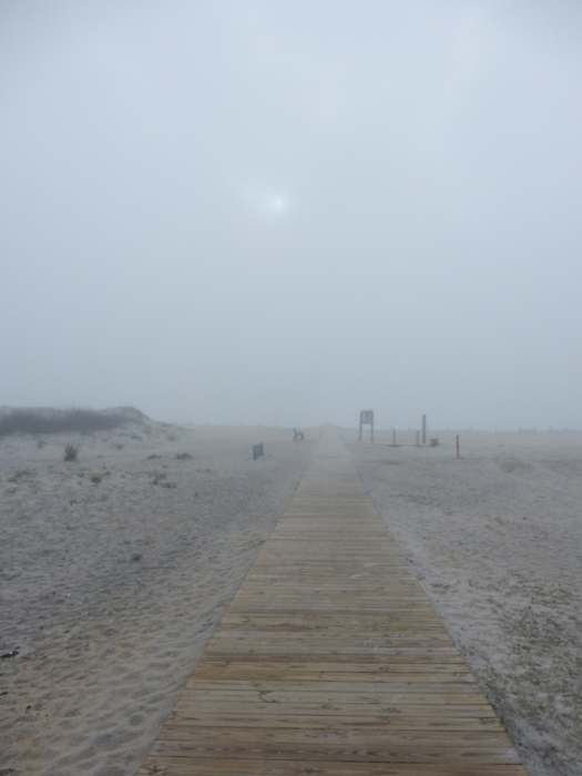
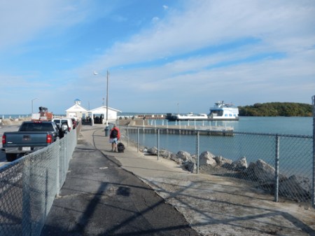
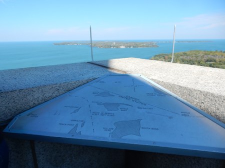
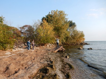
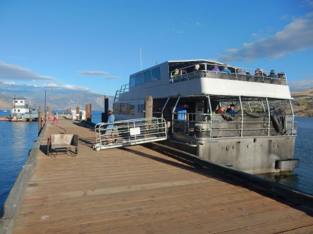
April 25 – I was up at six and at the Harkers Island Visitor Center for Cape Lookout National Seashore by 7:30am. It is located on Shell Point.


I wanted to catch the first ferry to Cape Lookout at 8:15, however, had to wait until at least four people were ready to board. A couple with two small children arrived and we were off at 8:45.


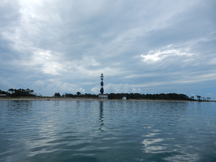
Temp was in the 50s on a nice morning as we arrived at the landing near the Cape Lookout Lighthouse

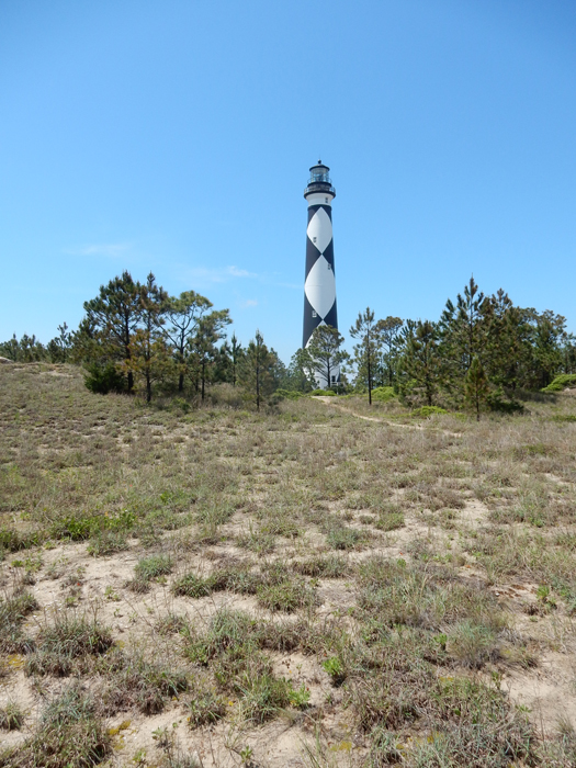
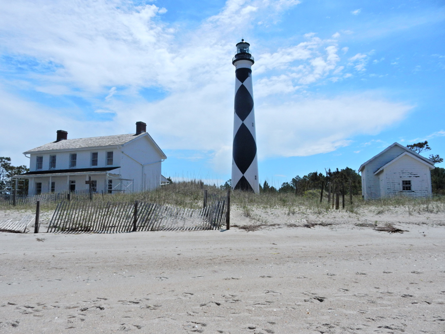
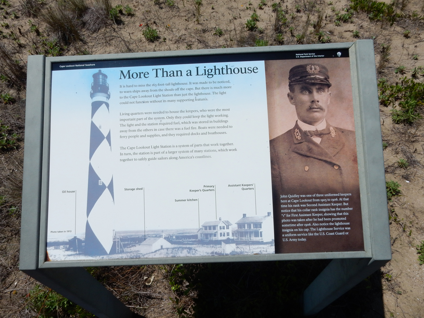
The first lighthouse was built in 1812, the second and current lighthouse was finished in 1859. The distinctive diamond pattern was added in 1873. The black diamonds are aligned North/South.

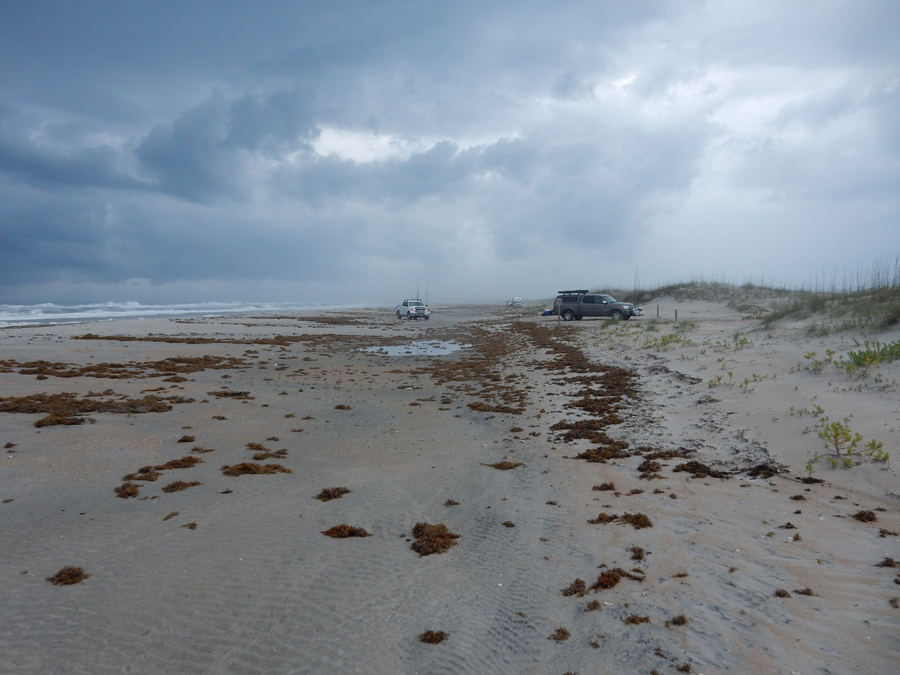
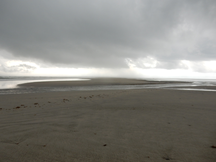
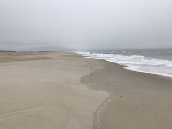
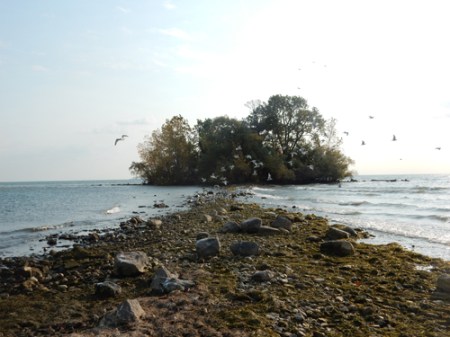
My objective was to hike to the very tip of the sand spit that sticks out toward the Cape Lookout Shoals, about three miles. This is the view as I started my hike. Note the storm out in the Atlantic Ocean to the left.

Surf fishermen leaving the beach as the storm approaches

It was now raining and I had to ford this waterway (tidal stream) between the ocean and Onslow Bay to reach the end of the sand spit

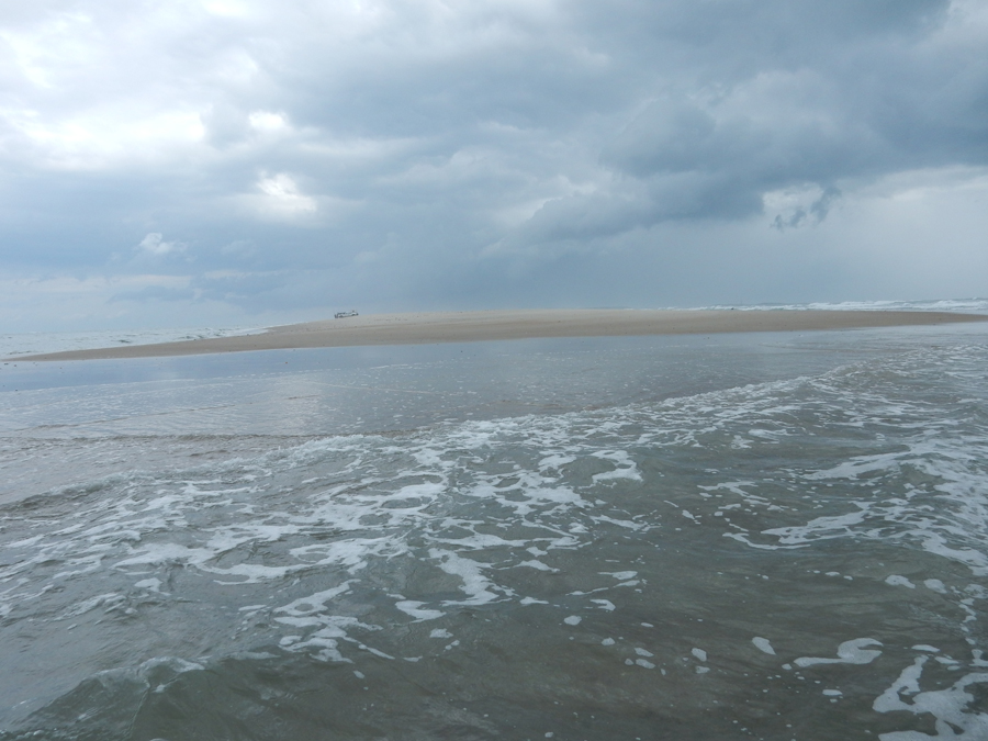
My objective was the end of the sand spit at Cape Point. Though they cannot be seen well in this photo, the waves from the ocean are crashing against the waves from the bay as the tide was going out.

I waded into the water and found two very colorful shells (for Helen). This is the view from the water looking back down the spit

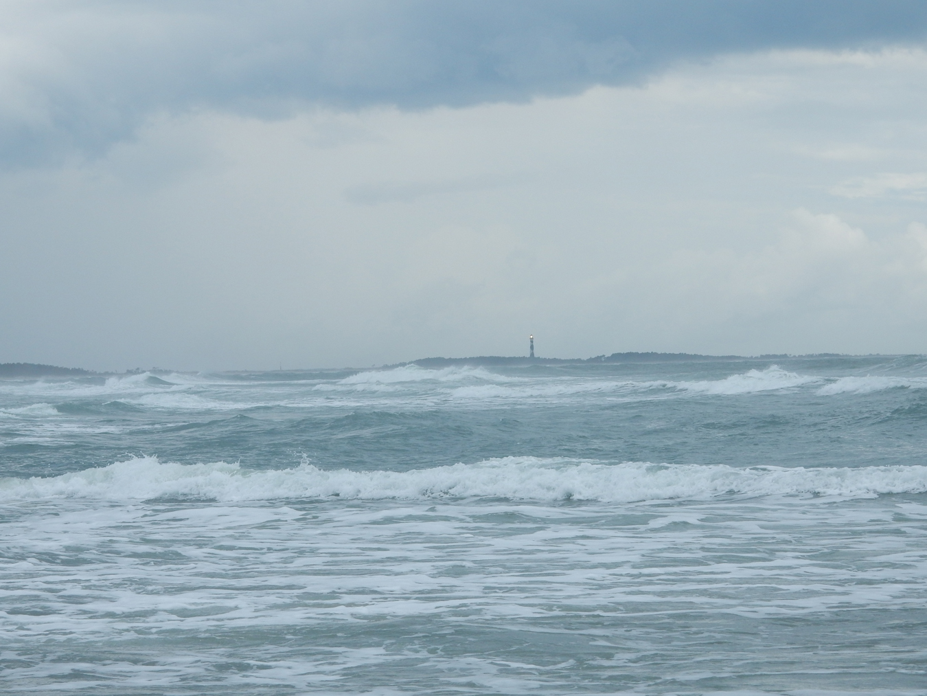
As I started back, Helen called from Spain! I dug out the phone from under my Gore-Tex and we had a good conversation. I then did a 360o video for my records. As I continued, the storm hit with some force. This is a view back across the ocean toward the lighthouse. Had I not had my Gore-Tex suit, I would have surely been hypothermic.

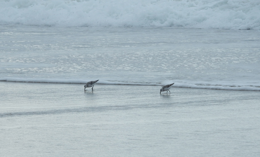
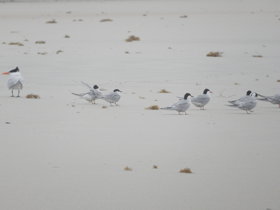
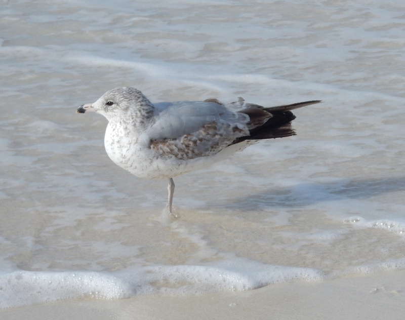
As the storm subsided, I took these pics of my feathered friends


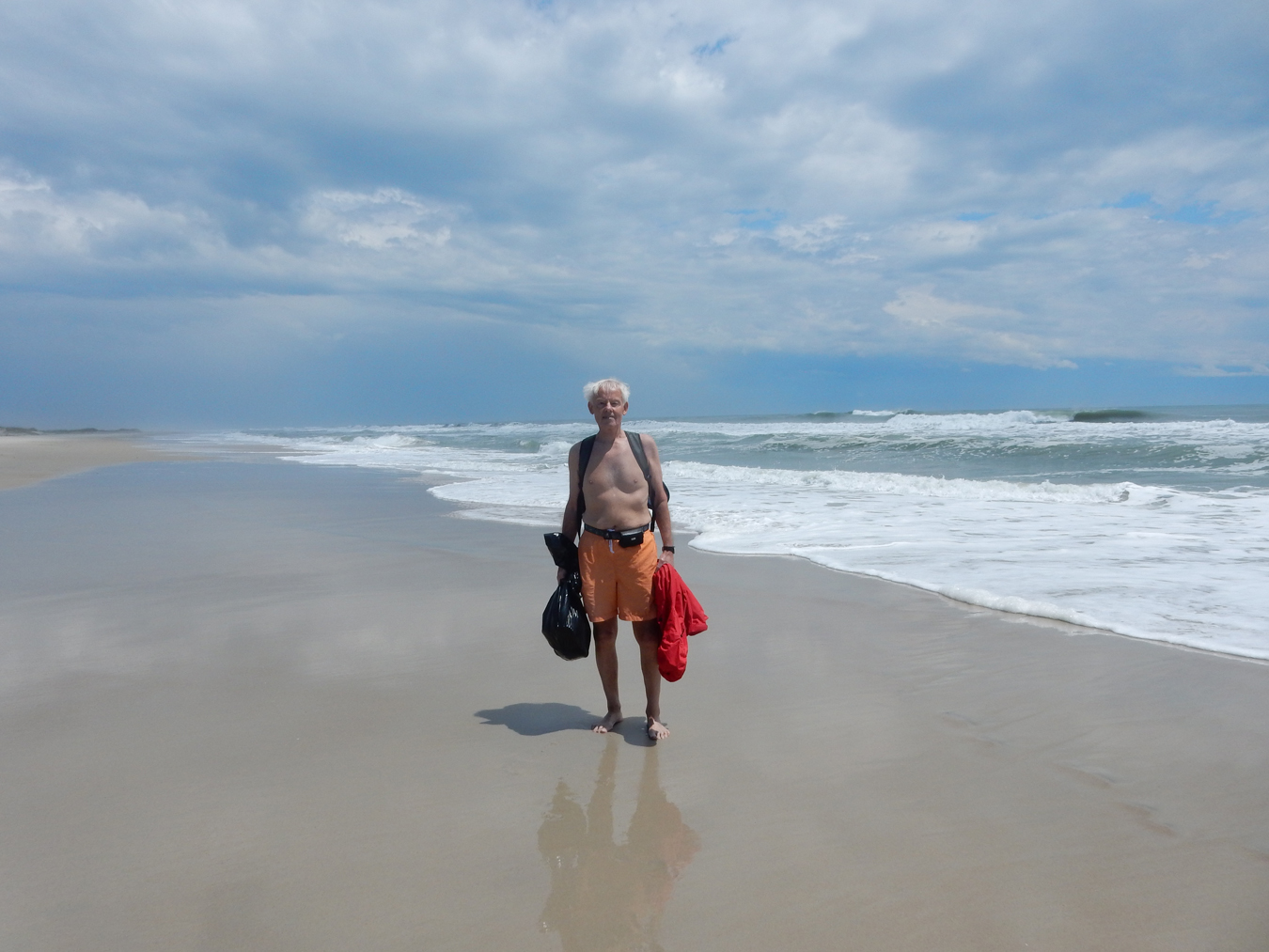
And then – the SUN arrived! Throughout the six-mile hike I was looking for and collecting shells. My favorite was a complete horseshoe crab about a foot long, which stunk up the SUV all the way home! I found the family I had arrived with near the lighthouse and asked the father to take my picture. My shells are in the black plastic bag.

Recall that the black diamonds on the lighthouse are aligned North/South. The white diamonds are aligned East/West.

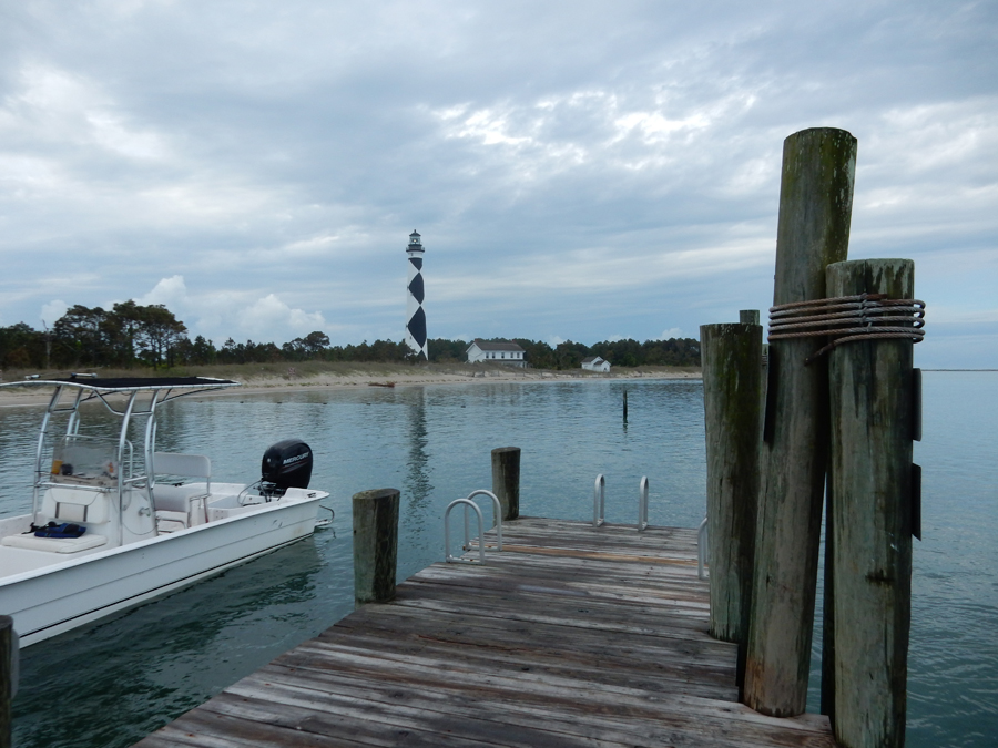
View from Barden Inlet. I would have liked to climb the lighthouse stairs to the top, however, it had not yet opened for the season.


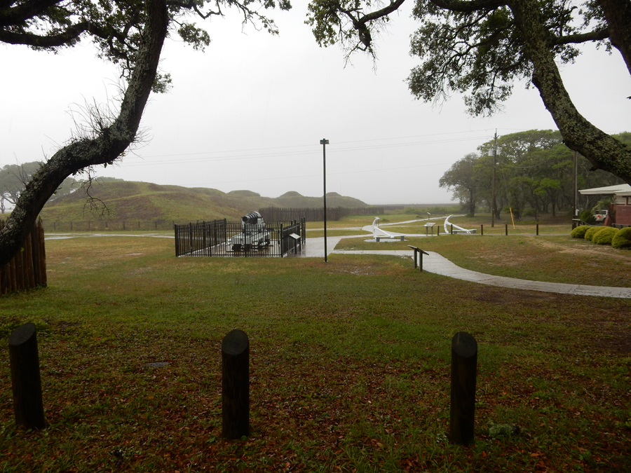
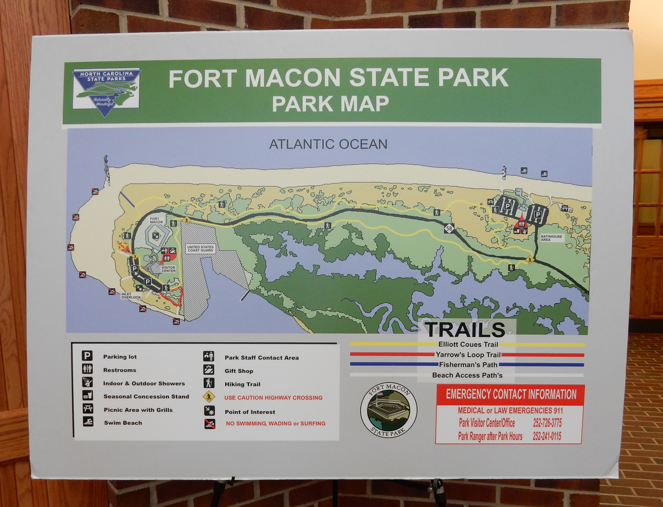
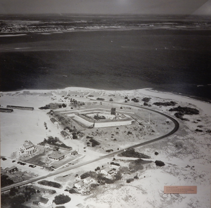
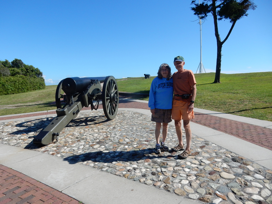
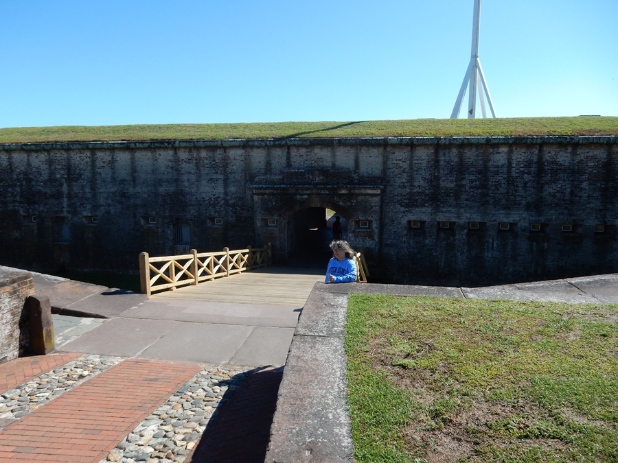
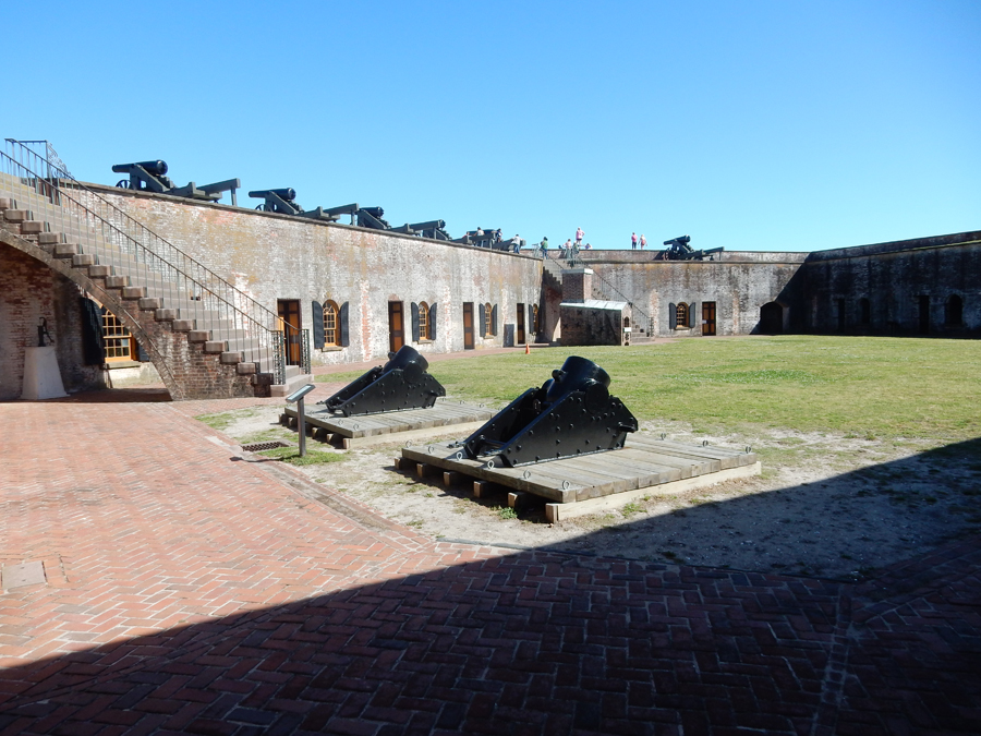
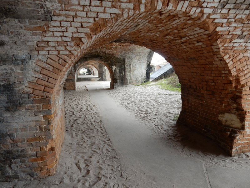
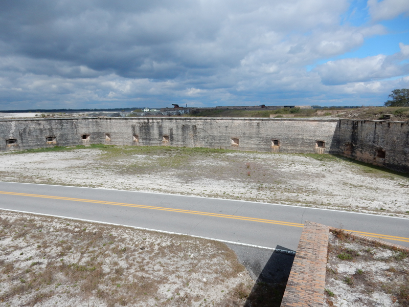
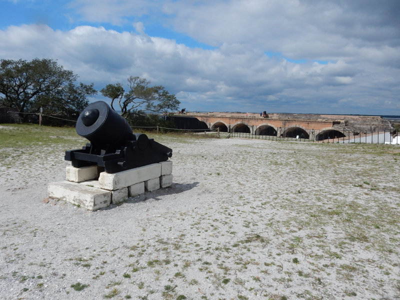
I got back to Linda’s house at four and we headed for Fort Macon State Park. It is the most visited State Park in NC. The fort was constructed between 1826 and 1834. The fort was occupied in 1861 by Confederates and then taken by Union forces on April 26, 1862. We started with a quick run through the Visitor Center.


We had to complete our tour before the fort closed at five!


There are several nice displays in rooms surrounding the parade ground


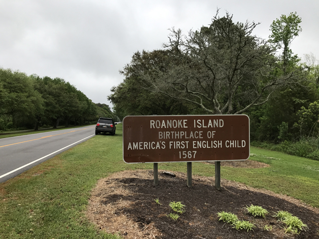
April 26 – I was again up and out by 6am followed by a four-hour drive to Roanoke Island NC. On February 7, 1862 Union forces overwhelmed the Confederates and took the island as part of the campaign to blockade southern ports. Afterward, a Freedmen’s Colony was established here by the army and by 1865 almost 3,500 runaway slaves were living on the island.

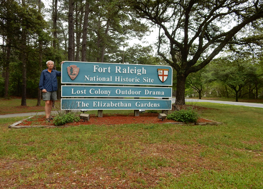
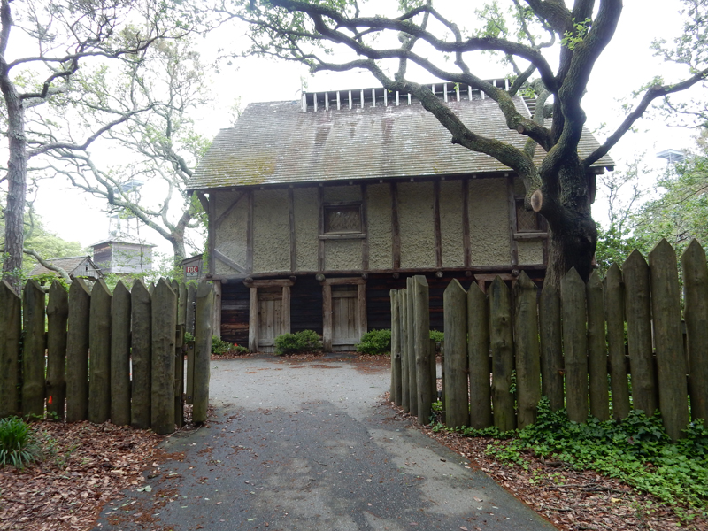
My objective in coming to Roanoke Island was to visit Fort Raleigh National Historic Site. Helen and I had been here in 1969, however, I did not take any photos at that time. This sign welcomes you as you arrive on the northern end of the island.


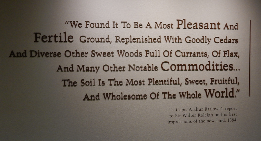
Sir Walter Raleigh never set foot on the island. However, he did raise money and use his own funds to first explore and then settle a colony on the island. A further objective was to counter Spanish domination in the “New World.” In 1584, under a charter from Queen Elizabeth, he sent two ships to explore the region. According to documents, the English established good relations with the Algonquian Indians and returned to England with Manteo and Wanchese two natives. Now names of two villages on the island. The North Carolina coast was named Virginia in honor of Elizabeth the Virgin Queen.


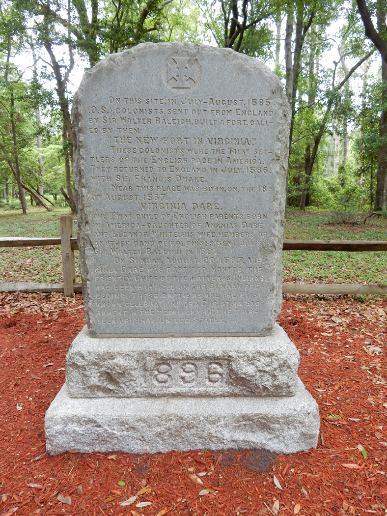
A military outpost was established here in 1585 but when a ship with 117 colonists arrived in July 1587 the 15 men left here could not be found. The “Cittie of Ralegh” was begun with John White, an artist from the first expedition, serving as Governor and, at Raleigh’s orders, the Indian Chief Manteo was baptized and created the Lord of Roanoke. On August 18, 1857, White’s daughter Eleanor, who was married to his Assistant Ananias Dare, gave birth to a daughter who was baptized Virginia Dare – the first English child born in the New World. After much discussion, Governor White returned to England for supplies. I walked the Thomas Hariot Trail to Albemarle Sound.


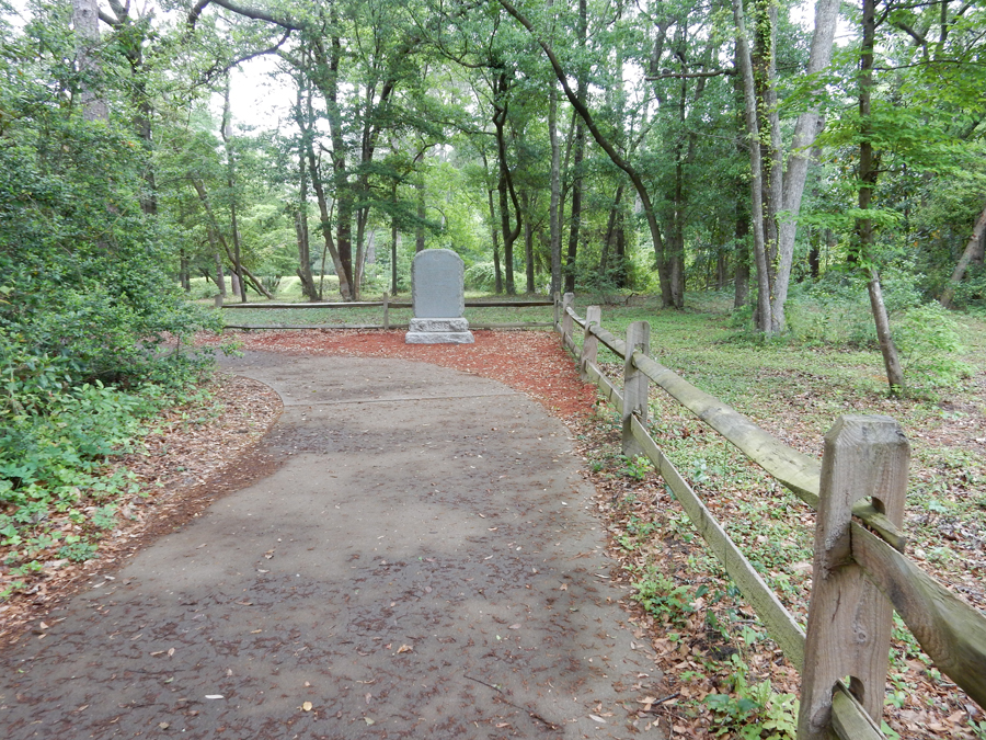
White was to return the following year, however, due to the War between England and Spain, he was unable to return until 1590. When he arrived, he found the colony had disappeared. A search could find no trace of the colonists. The mystery of what became of the colonists has never been solved and has become known as “The Lost Colony.” Monument to colonists –


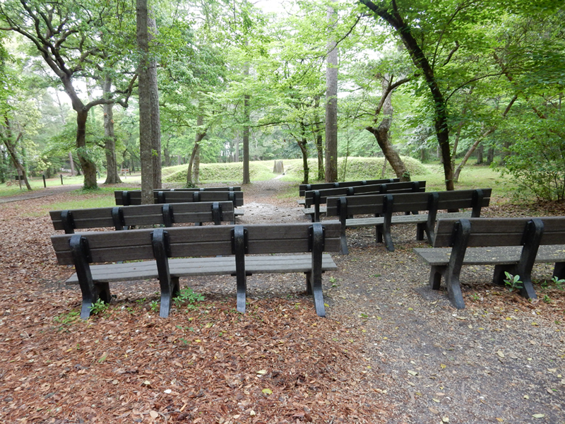
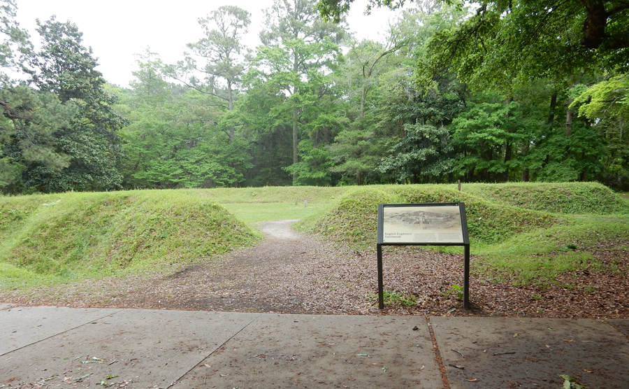
Recreation of Earthen Fort (1585)


Each year the Waterside Theatre presents the Lost Colony drama


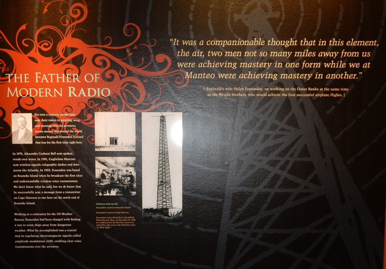
Do you use a smartphone? Roanoke Island is also noted for the first clear wireless voice transmission. Inventor Reginald Fessenden sent a message from a transmitter on the southern end of Cape Hatteras to a receiving tower here in July 1902.

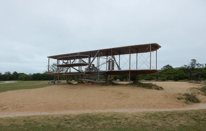
It was a short ride east over the bridge to Cape Hatteras and then a little north toward Kitty Hawk and the Wright Brothers National Memorial.

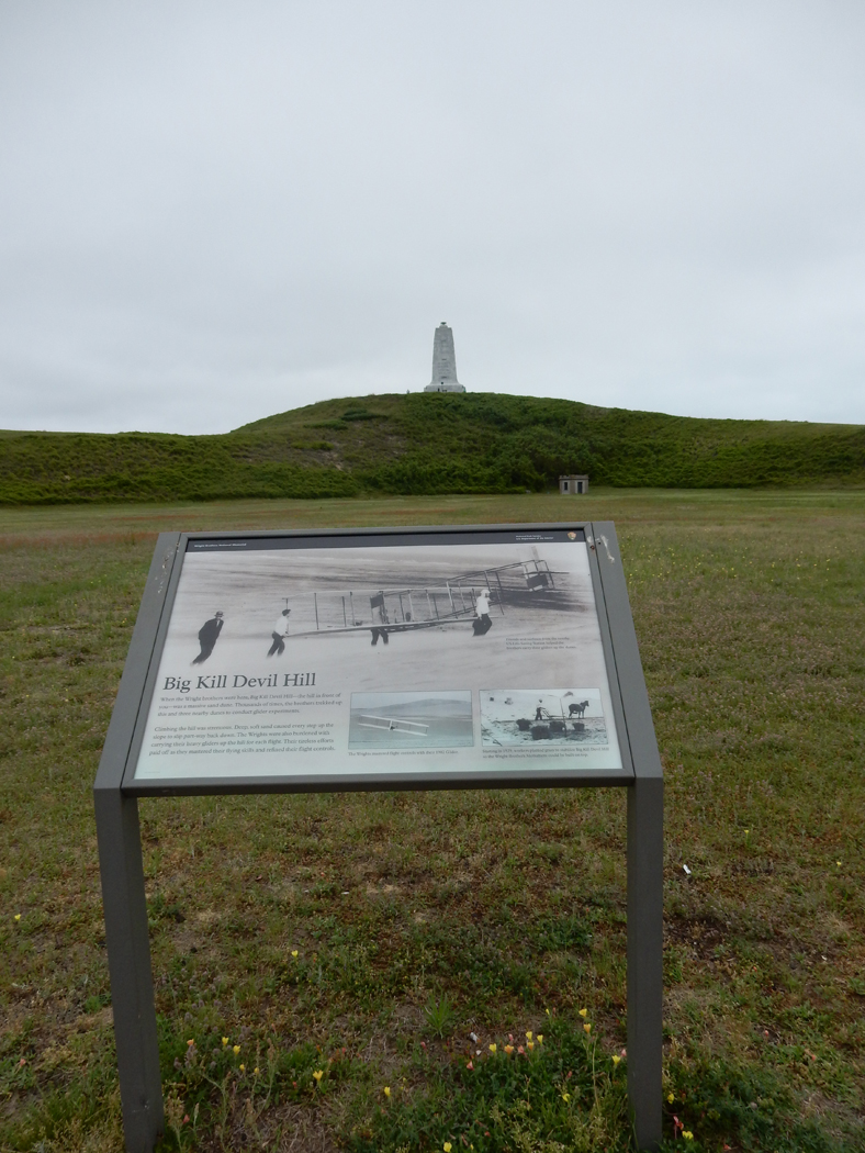
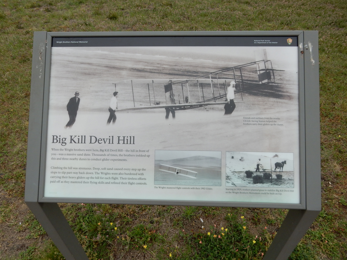
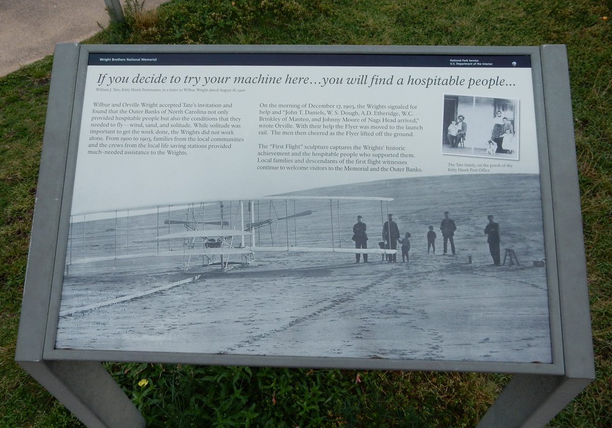
The Wright Brothers opened their bicycle shop in Dayton OH in 1892. In the late 1890s they became interested in aeronautics and started to build and test gliders. In 1900, they came to the Outer Banks of Cape Hatteras and Kitty Hawk to test and learn to fly their gliders. The site was selected for its regular wind and sand dunes. The Kill Devil Hill (90-foot sand dune) was selected for starting elevation and the sand field for a soft landing.


But what the Wright Brothers are really known for is the first controlled, sustained flight of a powered, heavier-than-air aircraft. That feat occurred on December 17, 1903 with four successful flights, the longest of which was 852 feet and lasted 59 seconds.

Sculpture depicting the first flight


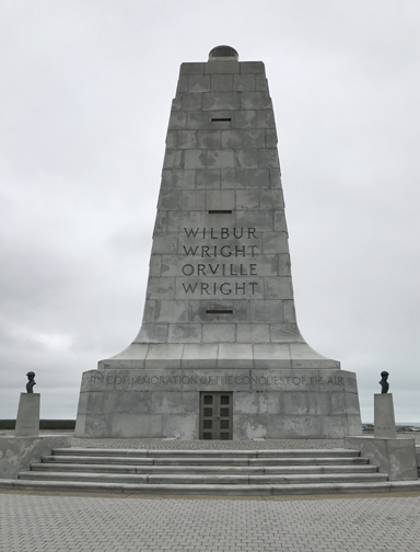
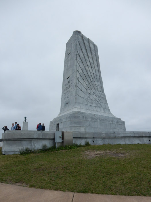
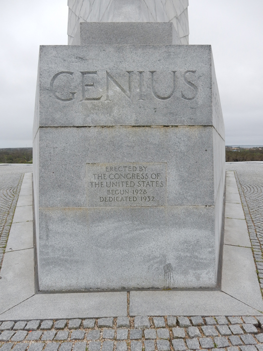
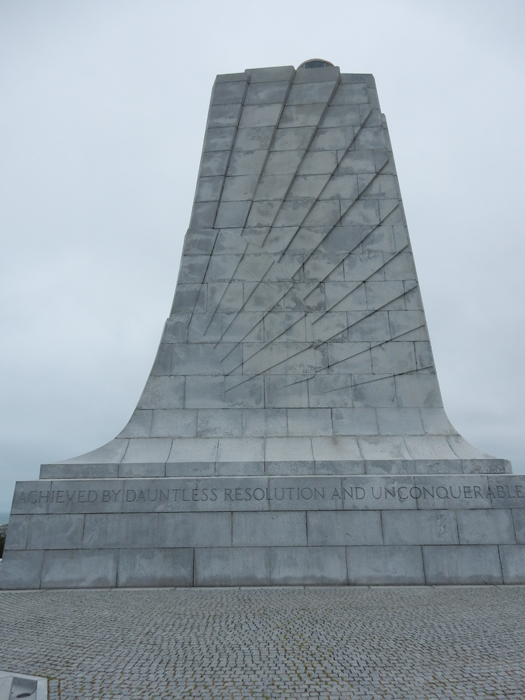
Wright Brothers Monument – engraved with the following, “In Commemoration of the Conquest of the Air by the Brothers Wilbur and Orville Wright Conceived by Genius Achieved by Dauntless Resolution and Unconquerable Faith.”


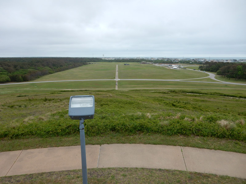
View from Monument

1969 – Helen reading inscription on stone

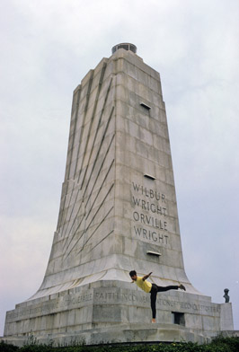
Tom “flying”

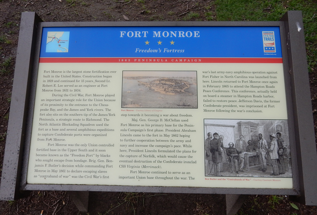
Next, drove two more hours up through Norfolk to Hampton VA and Fort Monroe National Monument

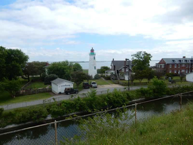
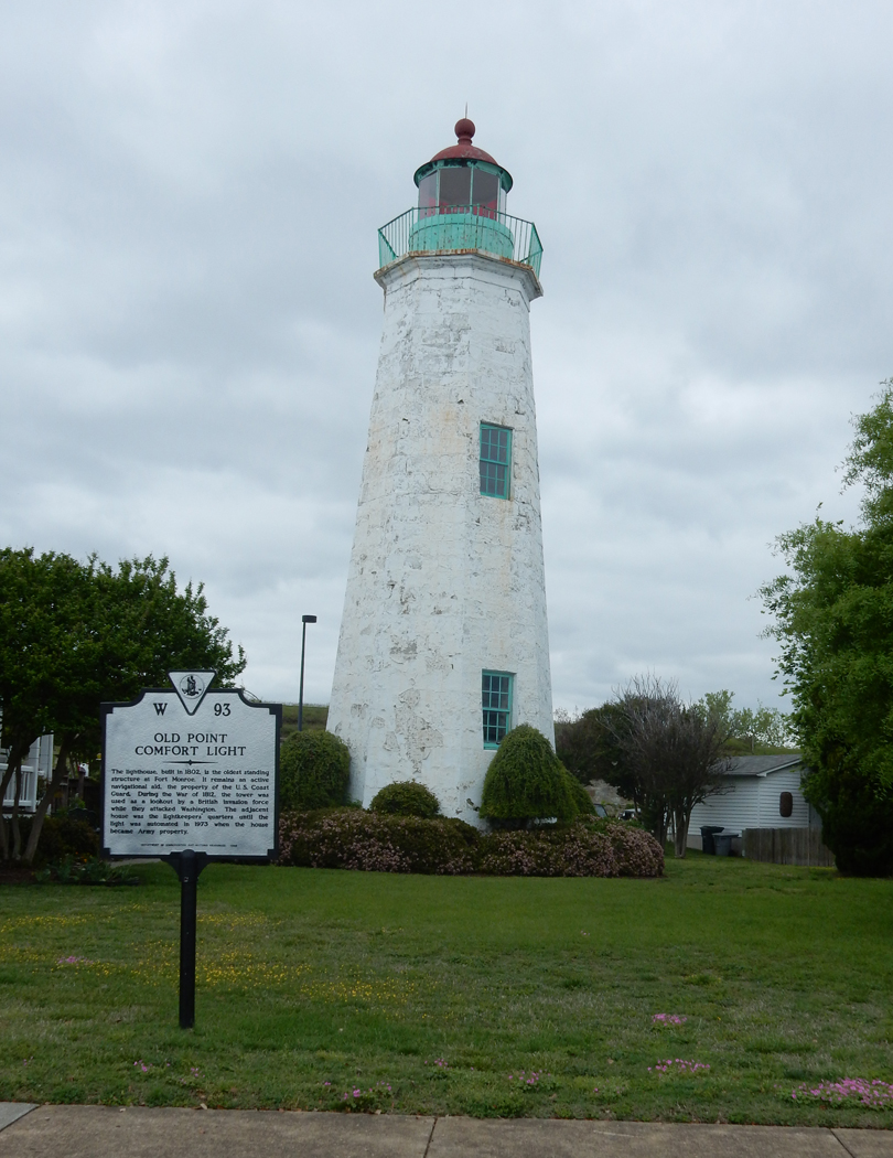
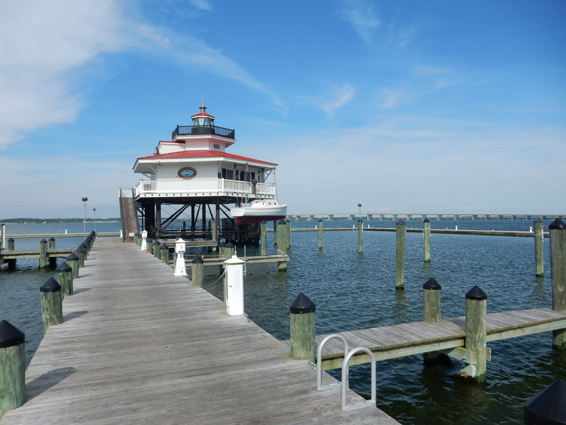
English explorer Capt. John Smith recognized the strategic importance of this position, which is where the James and Elizabeth Rivers empty into the entrance to Chesapeake Bay through Hampton Roads. As a result, the Virginia Company built Fort Algernourne here in 1609. At that time, the point where the fort was located was called Point Comfort. The U.S. built Point Comfort Lighthouse here in 1802. The British used the lighthouse as an observation post during the War of 1812 when they sacked Washington DC and burnt the White House. The lighthouse is still active and is maintained by the Coast Guard. Views of the lighthouse, first from the fort side and then the bay side.


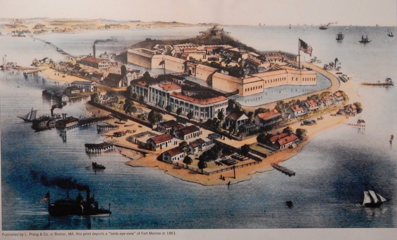
1861 print depicting Fort Monroe

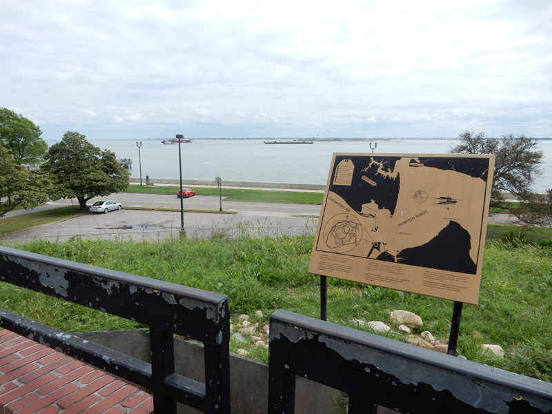
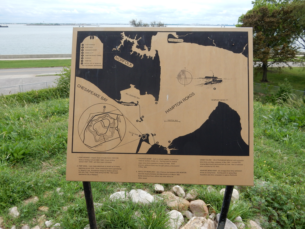
Unlike most maps, the top of this sign is toward the South. Hampton Roads is one of the largest natural harbors in the world.


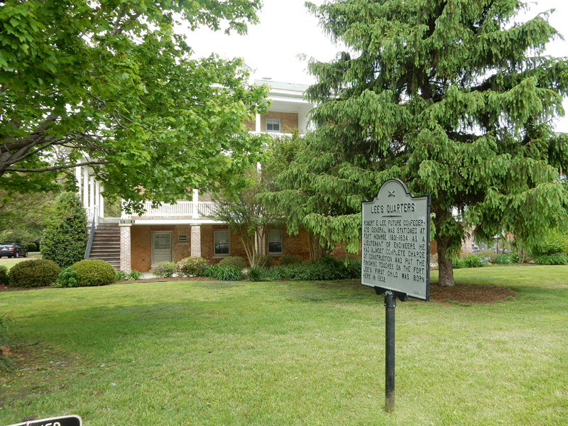
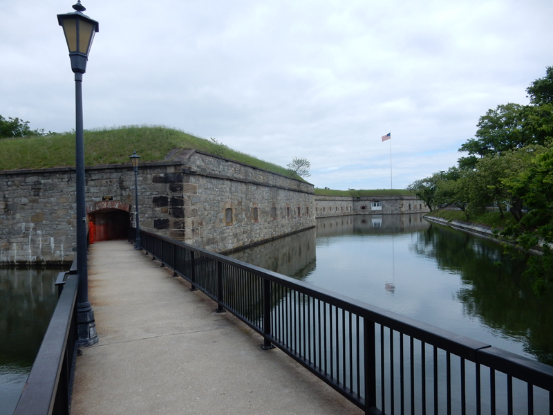
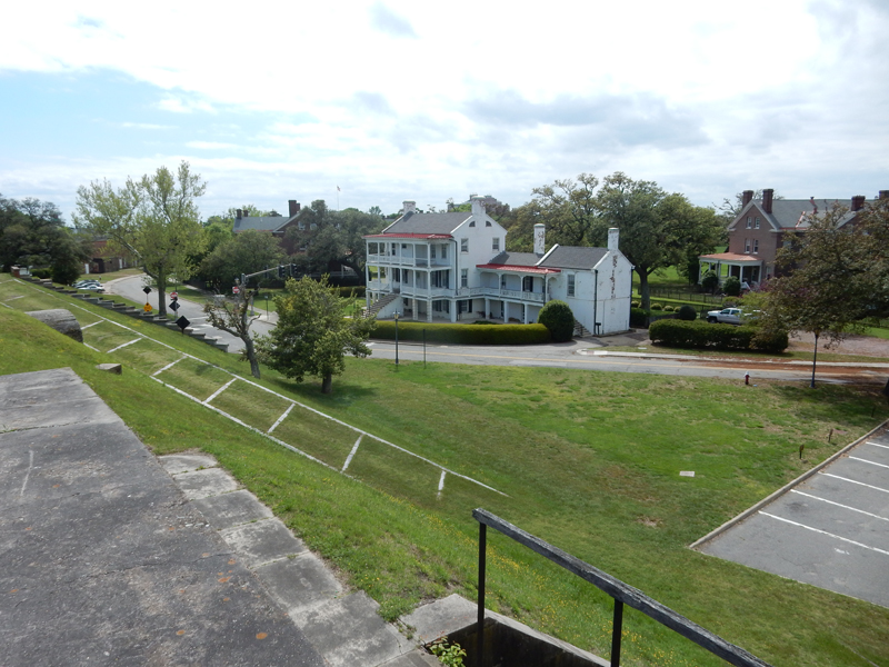
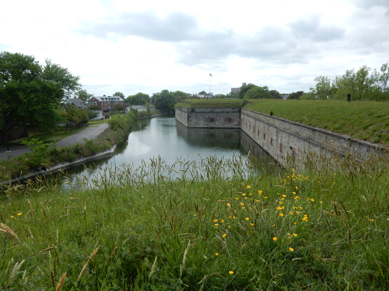
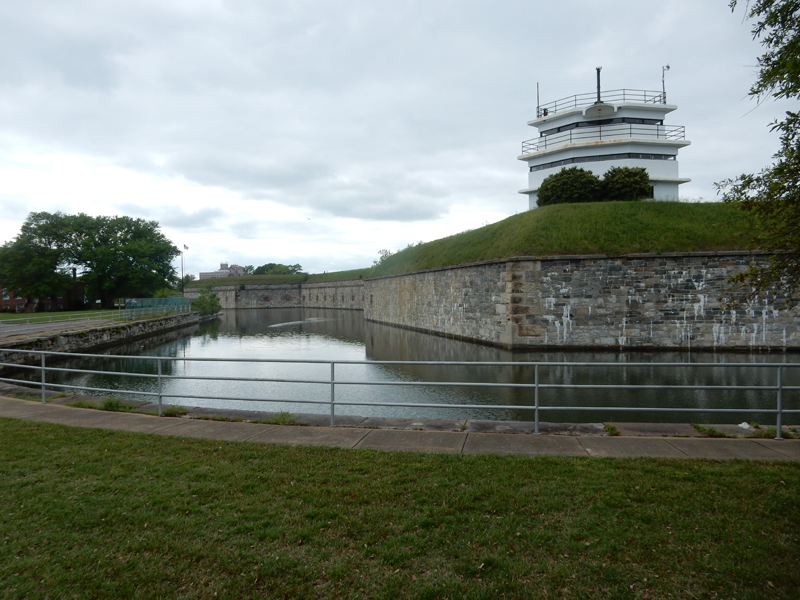
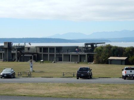
This sign presents a good summary of the history of Fort Monroe. It was built between 1819 and 1834. In 1823, Lt. Robert E. Lee, fresh out of West Point, began serving here as an engineer. It is the largest stone fort ever built in the U.S. It became known as the Gibraltar of the Chesapeake.

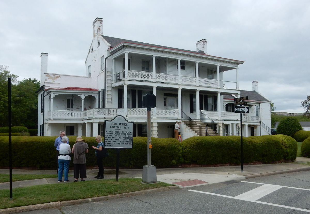
Newlyweds Lee and Mary Custis Lee, great-granddaughter of Martha Washington, lived here from 1831-34. Their first son, George Washington “Custis” Lee was born here in 1832. The Lees had seven children.

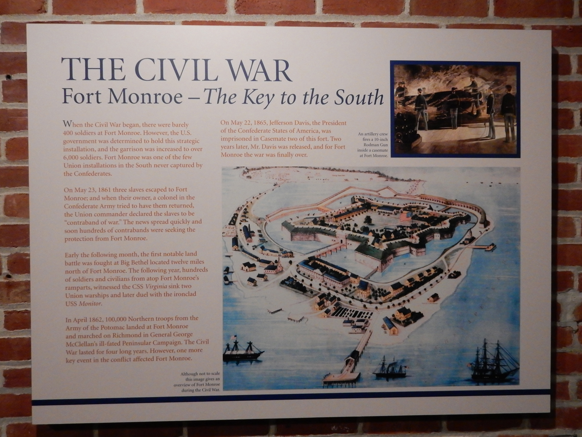
Fort Monroe and the Civil War

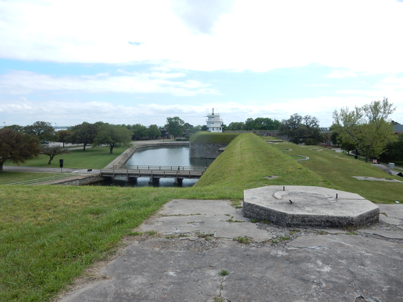
Walkway into the fort by way of the Postern Gate


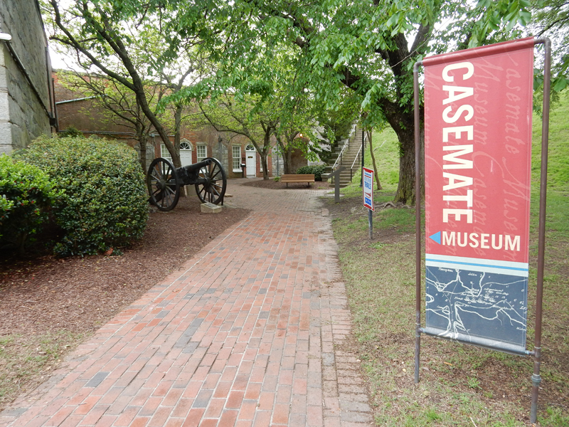
Entrance to Casemate Museum

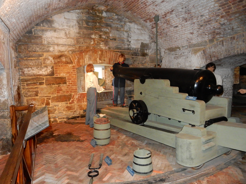
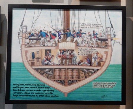
Nicely done displays in the Casemates. Casemates are vaulted chambers within the fort’s walls.

32-Pounder 19th century artillery gun

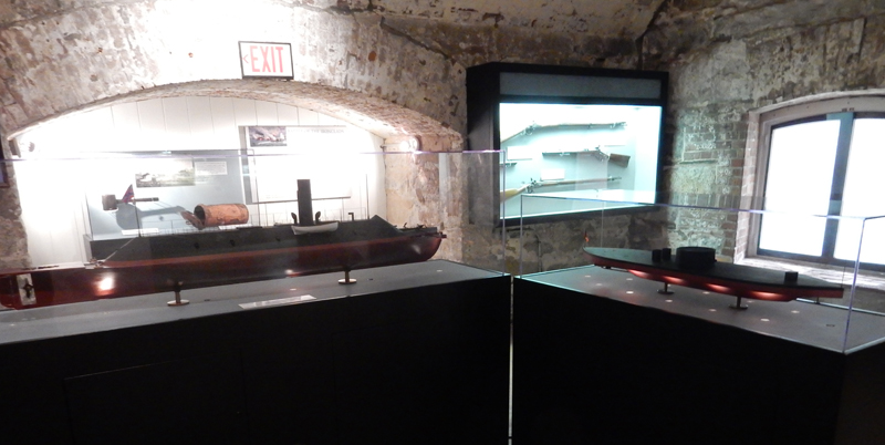
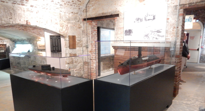
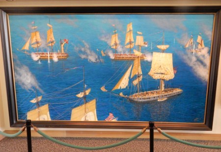
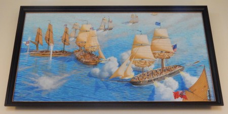
The Battle of Hampton Roads between the CSS Virginia (the former USS Merrimack that had been captured by the Confederates and ironclad) and the USS Monitor – the battle was a stalemate.


Contraband – a little more than a month after the start of the Civil War, three enslaved men escaped from Norfolk and sought asylum in Fort Monroe. The 1850 Fugitive Slave Act mandated these men be returned to bondage. Commander Maj. Gen. Benjamin Butler ruled that Virginia had seceded from the Union and was no longer part of the U.S. and further that the Confederacy considered slaves property and therefore these men would be retained as “contraband of war.” Within a month 900 more men, women and children arrived and were given sanctuary. Former slaves continued to arrive and Fort Monroe became known as “Freedom’s Fortress.”

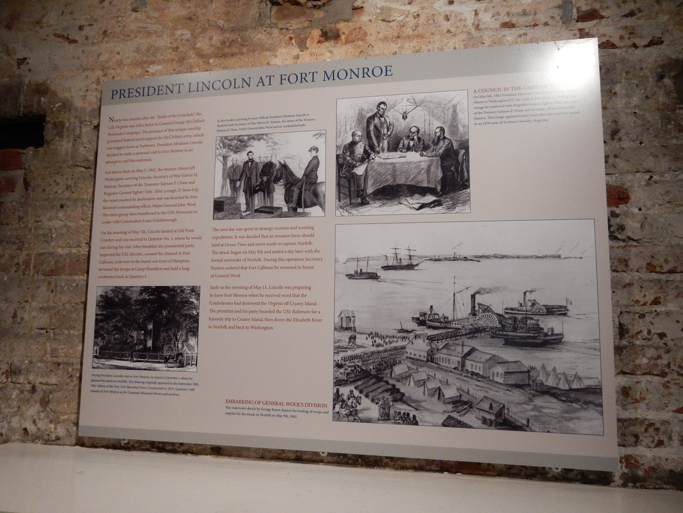
Lincoln at Fort Monroe


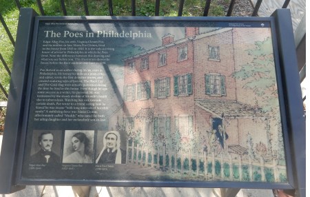
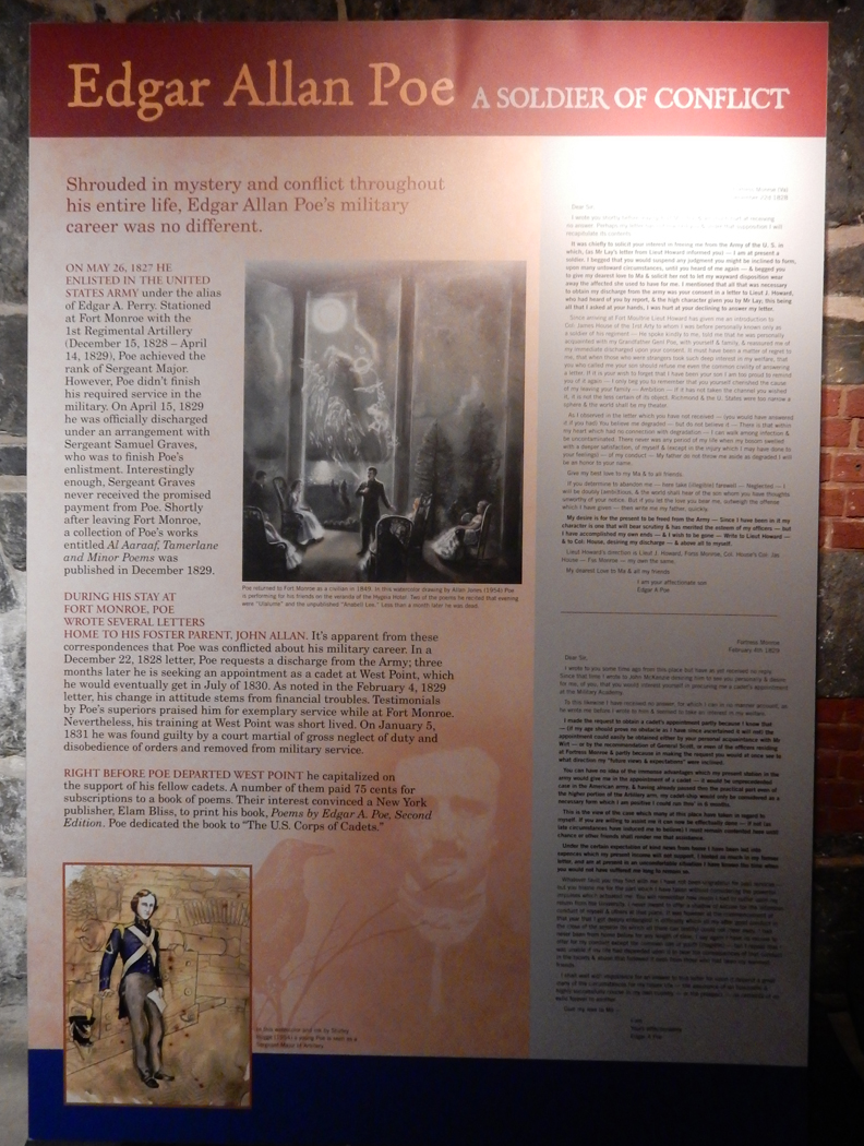
Edgar Alan Poe at Fort Monroe (1828-1829)

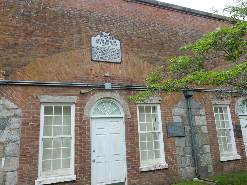
Jefferson Davis, President of the Confederacy, was imprisoned here for two years

I like this wall with the stone, brick and brick replacement sections

Flagstaff Bastion


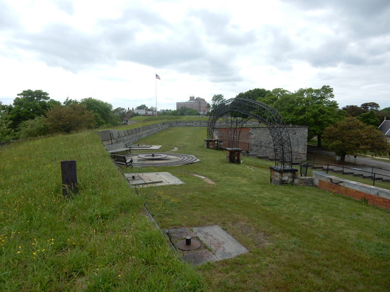
I walked around the top of the fort walls, my estimate – 1.5 miles


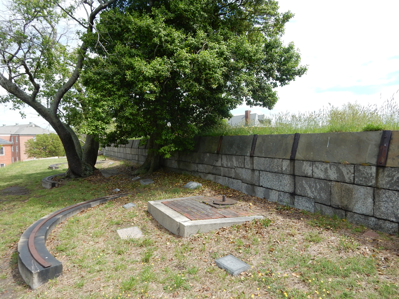
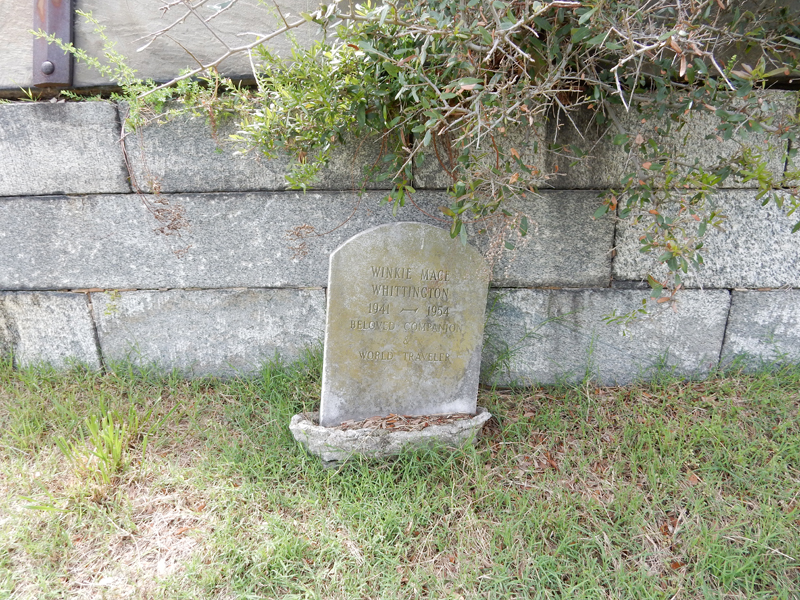
At first I thought the stones atop the earthen walls indicated graves of soldiers. Upon closer inspection, I discovered they were for pets! I didn’t count but there were a lot of them.


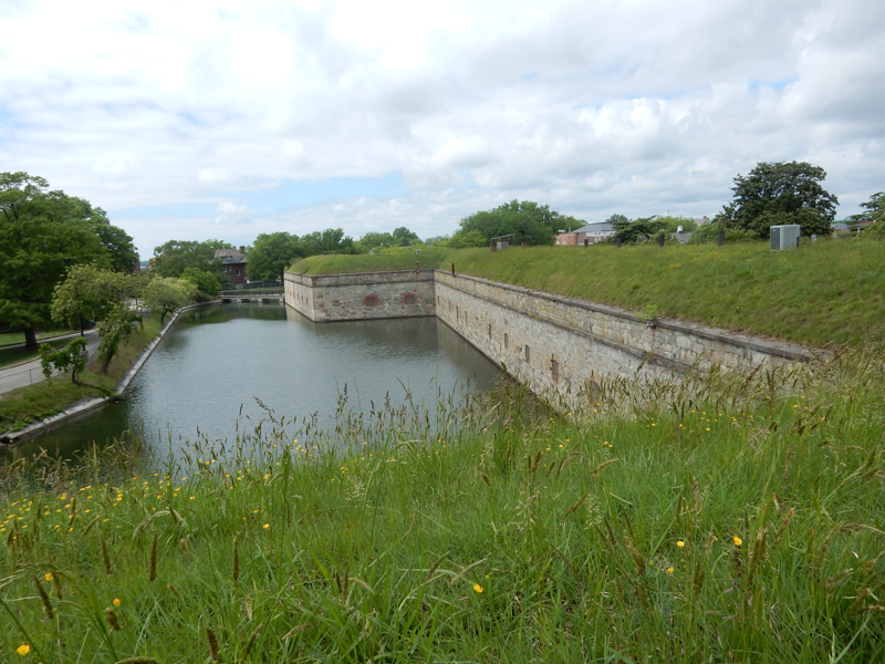
Fort Monroe was the last U.S. Army fort surrounded by a moat when it was retired in 2011 and President Obama declared it a National Monument


Check-out the size of this Big Fish Sandwich – Deadrise restaurant at the marina
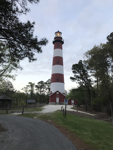
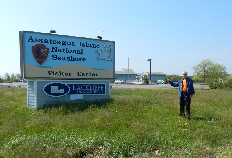
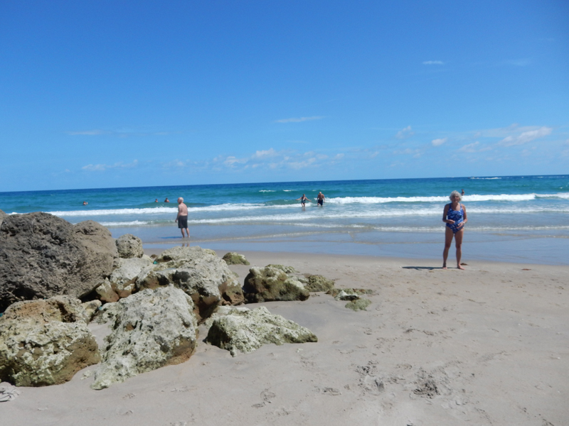
I entered Assateague Island National Seashore Visitor Center MD into Google Maps on my iPhone and followed the instructions. Unfortunately, or fortunately, it directed me to Chincoteague National Wildlife Refuge on Assateague Island BUT in VA! I passed the Wallops NASA tracking facility going to and returning from the island. I’d like to come back sometime and go to their visitor center.

I arrived at the USCG lighthouse at about 7:30
It was a relaxing and scenic drive to the beach at the end of the road at Tom’s Cove but as a result I had to drive an additional hour to get to the Oceanside Campground in the Assateague Island National Seashore in MD. I arrived at 9pm and slept in the SUV.
April 27 – awoke at 7am and started walking the seashore and dunes while eating my healthy breakfast of Graham Crackers and an orange. Graham Crackers have been my go to snack when I am driving.

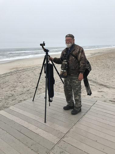
I met this nature photographer who was looking (unsuccessfully) to photograph dolphins. When I saw him later in the campground, he gave me some beautiful 5×7 photographs of ponies and eagles (his specialty).
I attempted to drive my SUV down the seashore but found that there was a substantial fee to do so. They also have a 145-vehicle limit, see sign, in relation to the number of vehicles that will be permitted through the gate. There were only 12 there at this time.

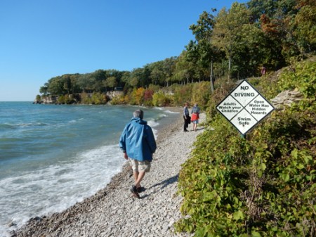
It was a cool misty morning as I again walked the beach looking for “treasures from the sea”


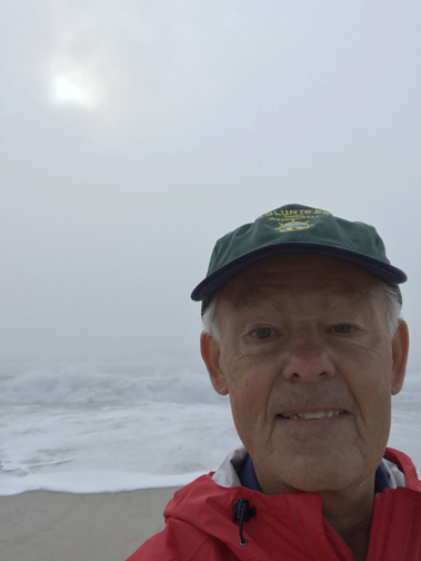
Selfie
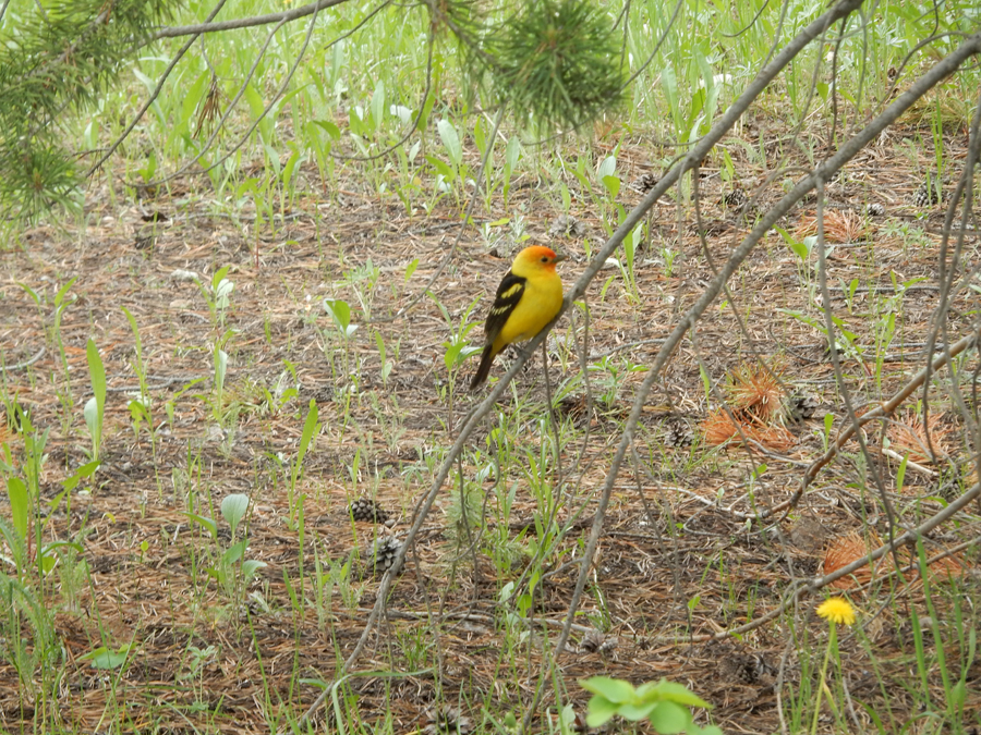
Red-winged blackbird

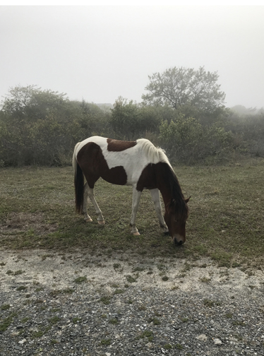
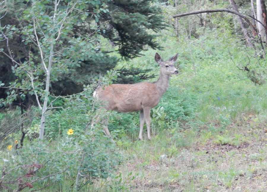
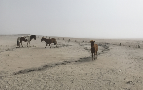
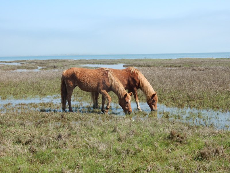
The mist cleared as I was driving out of the park. I came across some of the wild horses that make the seashore their home.


Horse on right coming to attack Gummy!

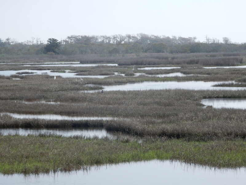
Salt marsh


Visitor Center


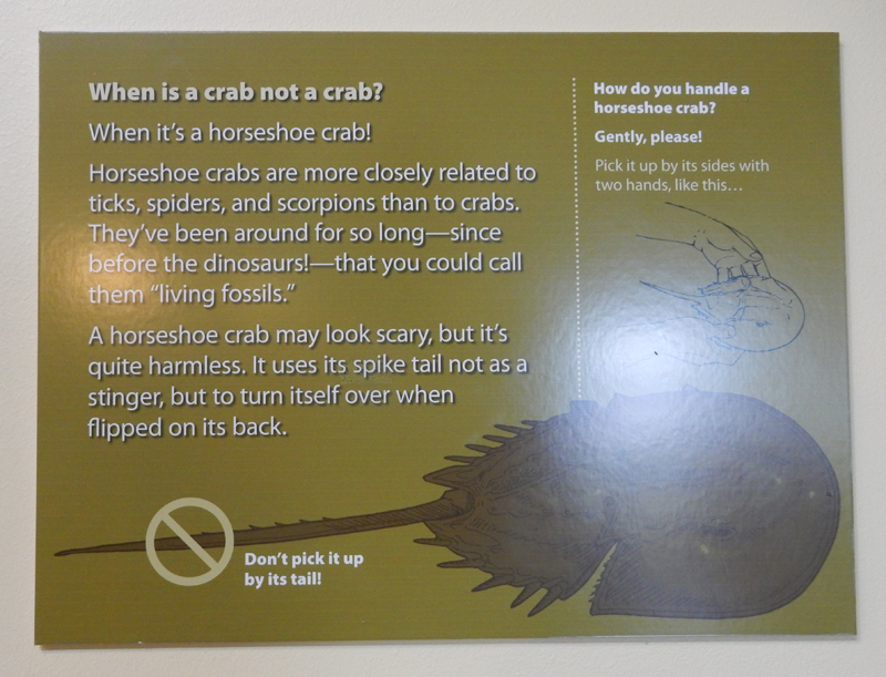
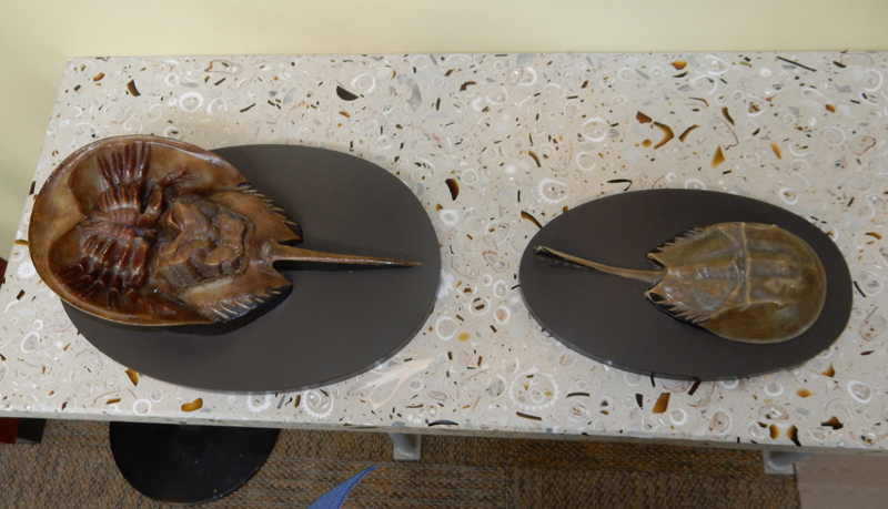
Horseshoe crabs


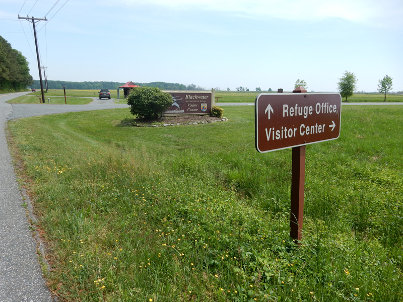
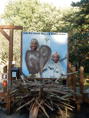
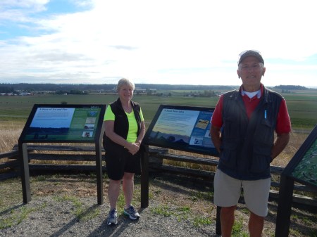
My next stop was the Blackwater National Wildlife Refuge in Dorchester County, Eastern Shore Maryland

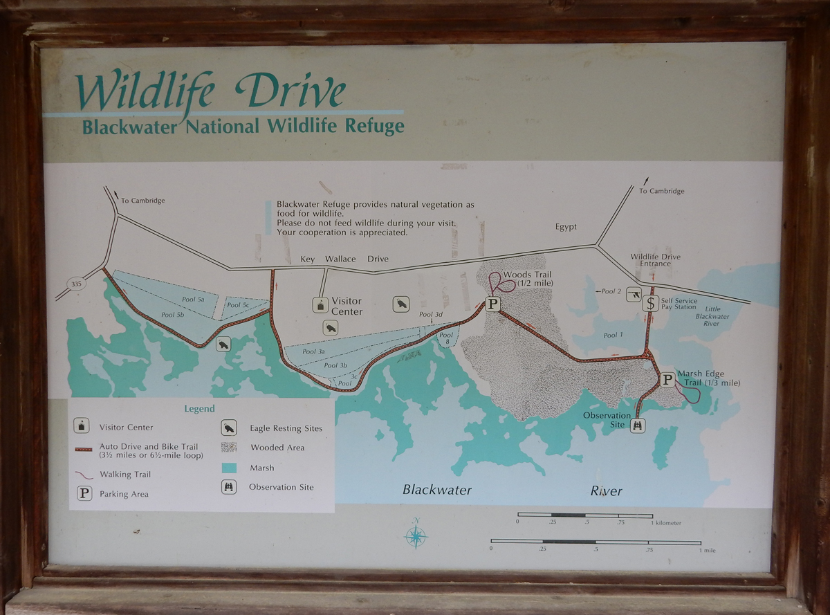
I toured the Visitor Center and then did the 4.5-mile Auto Drive/Bike Trail

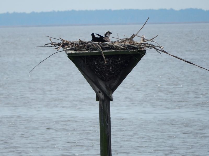
I was surprised to see so much wildlife in the middle of the day – eagle nests


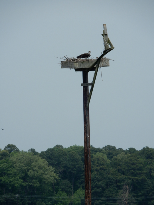
Osprey nest

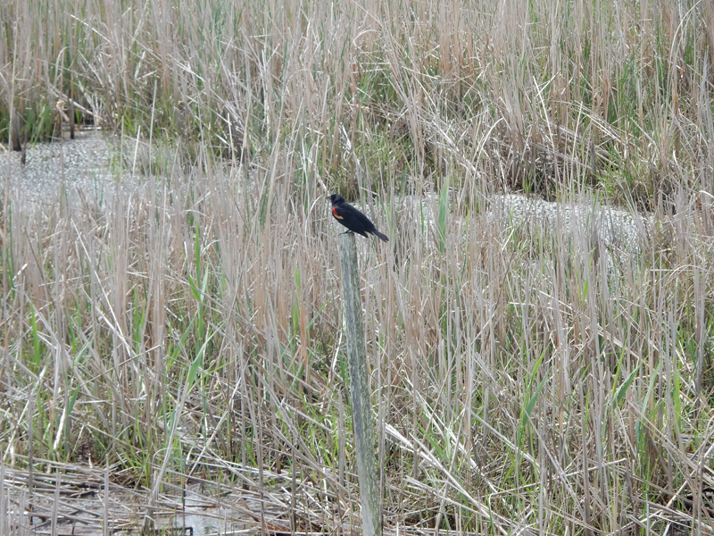
Red-winged blackbird

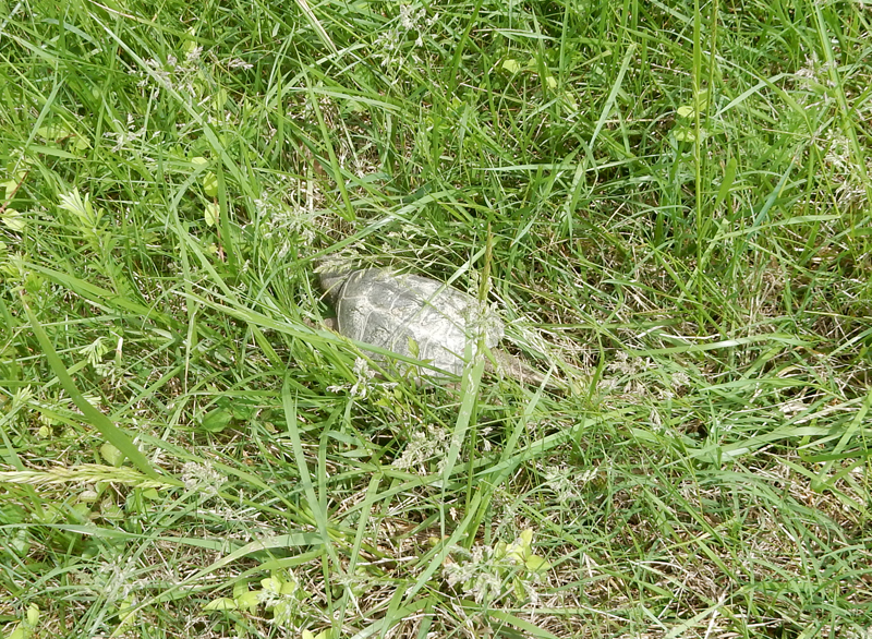
Two different kind of turtles


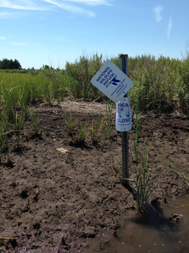
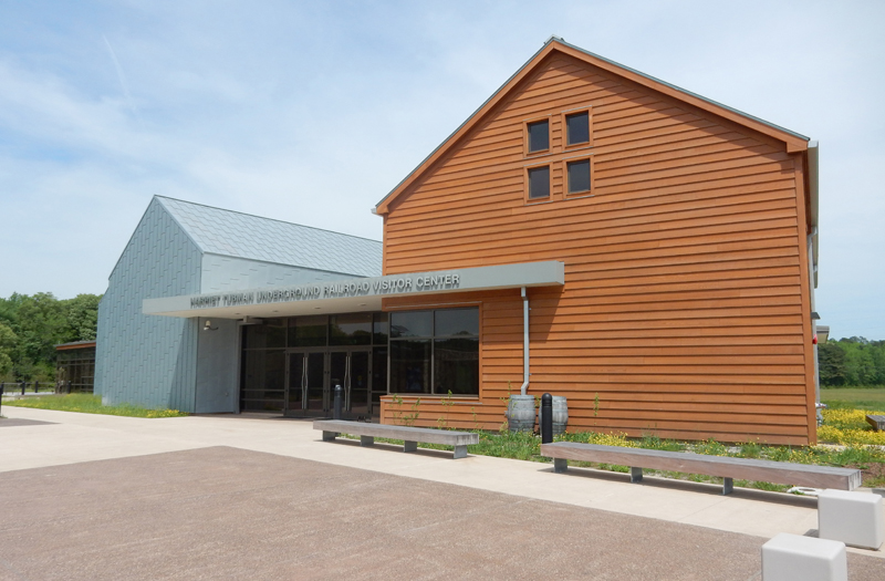
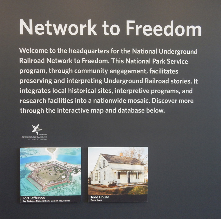
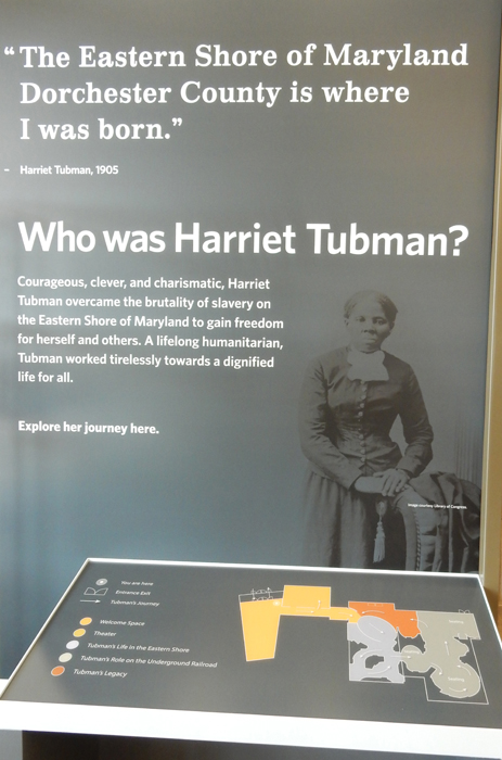
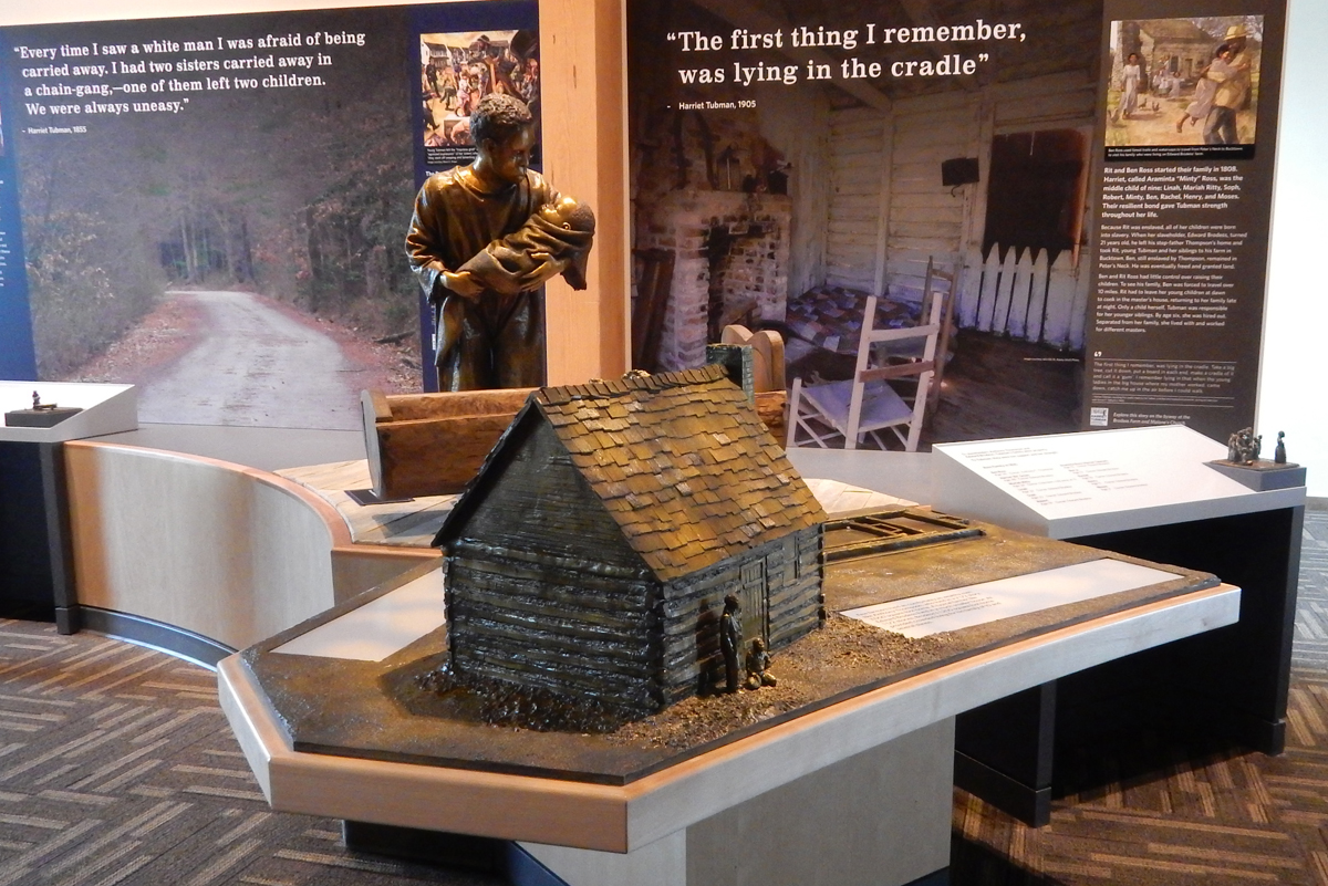
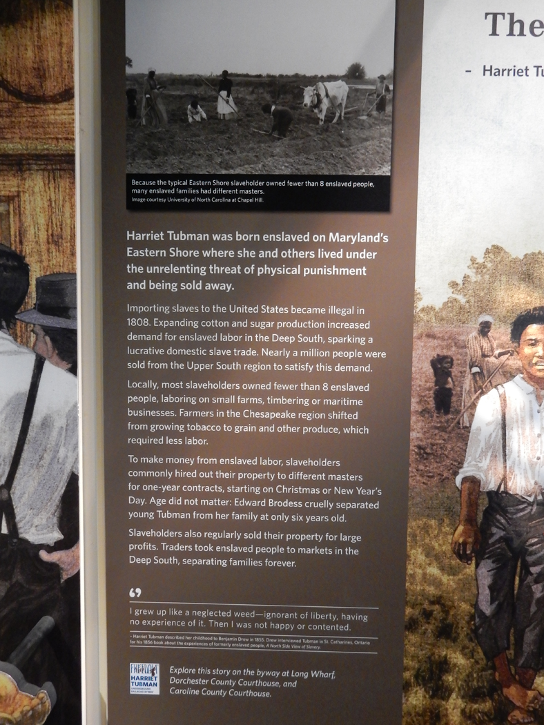
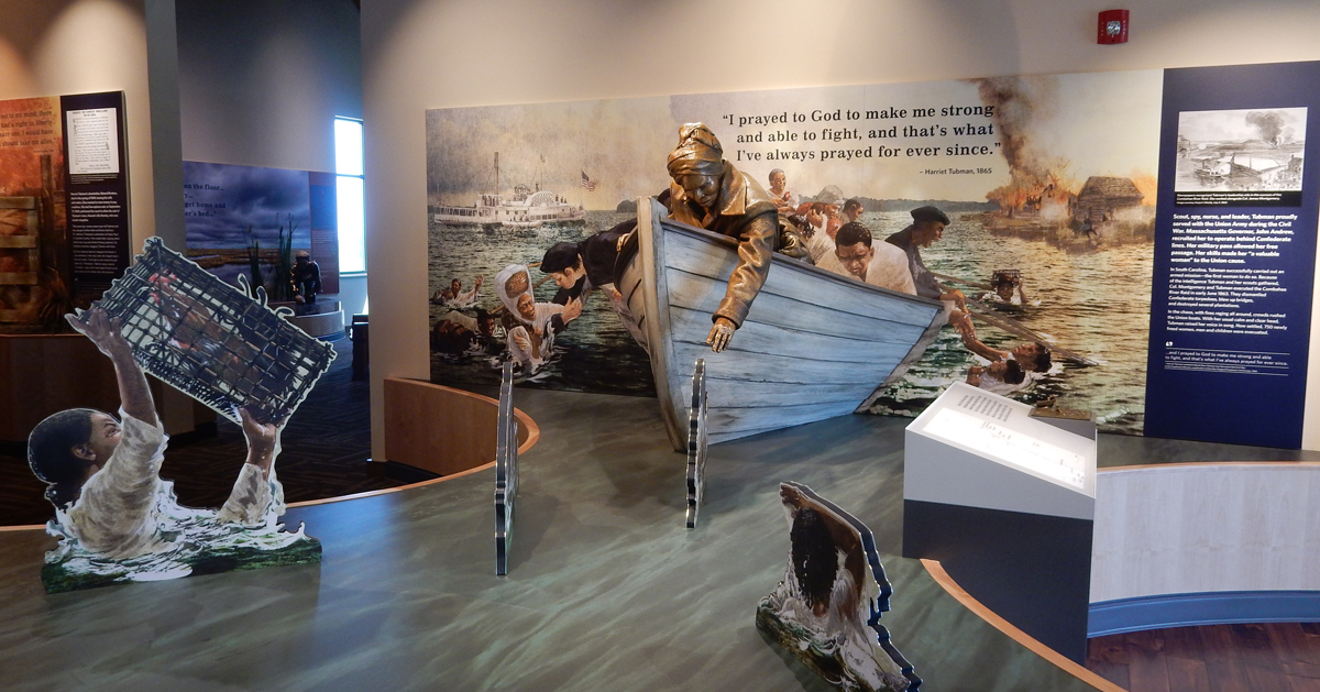
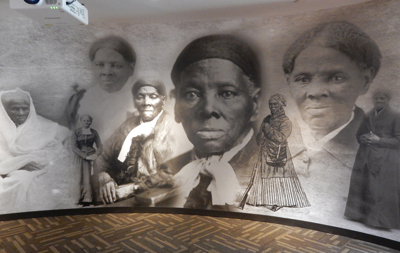
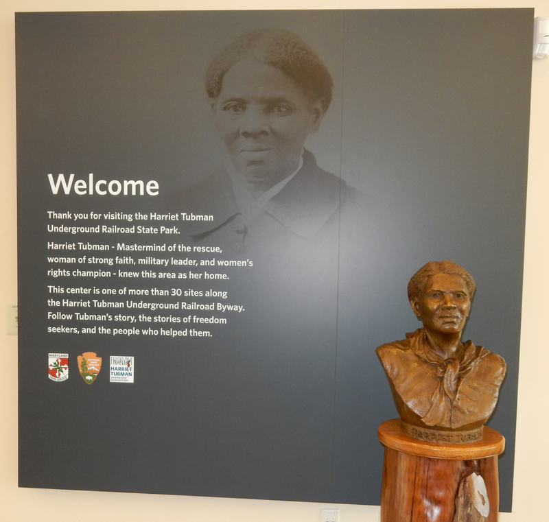
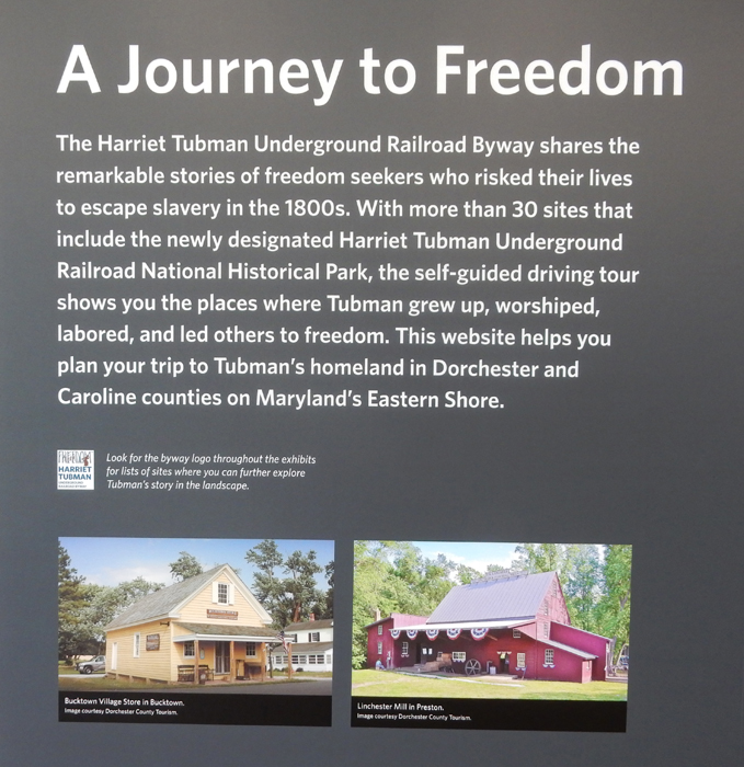
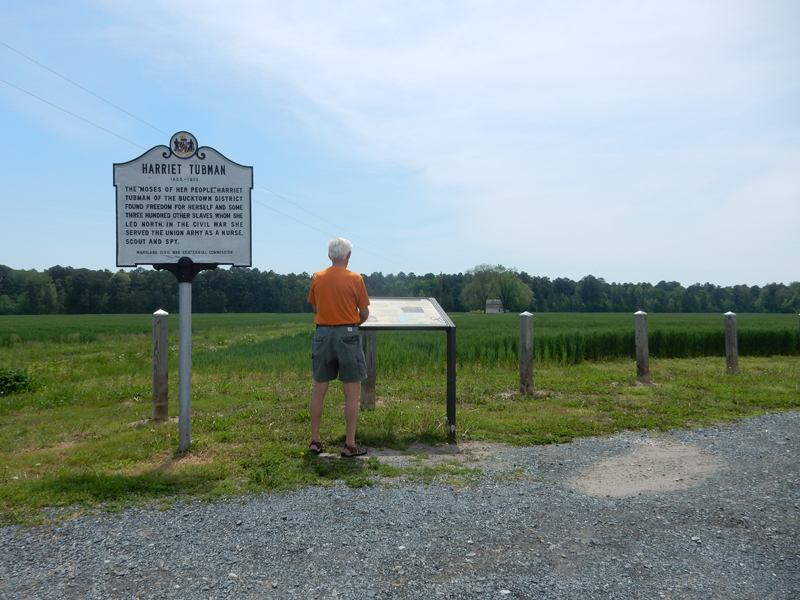
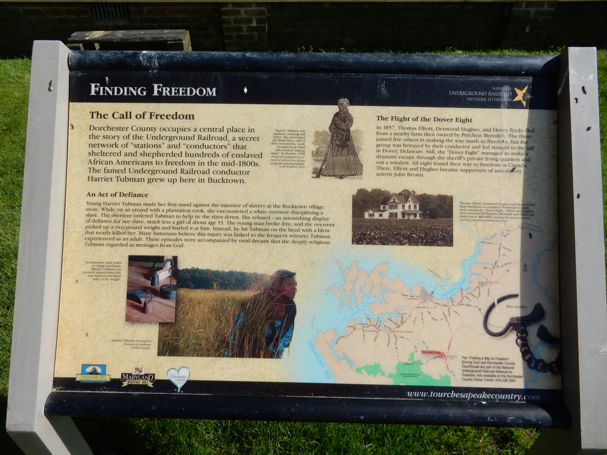
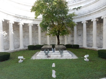
My main objective for the afternoon was the Harriet Tubman Underground Railroad National Monument which is adjacent to the Wildlife Refuge.


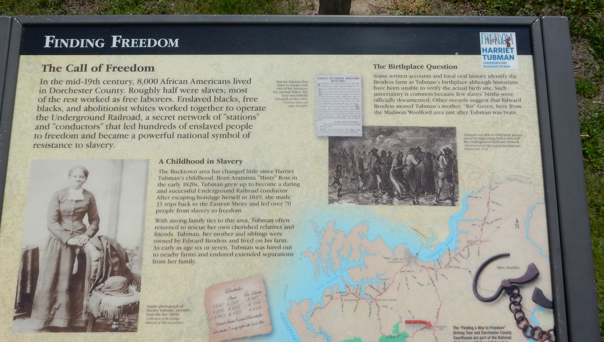
The following displays and signs will tell you about this amazing woman. She emancipated herself in 1849 at the age of 27 by escaping to PA (100 miles away), a non-slave state. She earned the nickname “Moses” for risking her life in guiding more than 70 of her family and friends to freedom. She also served as a nurse and spy for Union forces during the Civil War. Her knowledge of tidal stream areas helped her lead a raid in SC, the first woman to lead a U.S. army military assault. She eventually settled her family in Auburn NY, was active in the women’s suffrage movement, practiced her faith and founded a home for the elderly and disadvantaged.


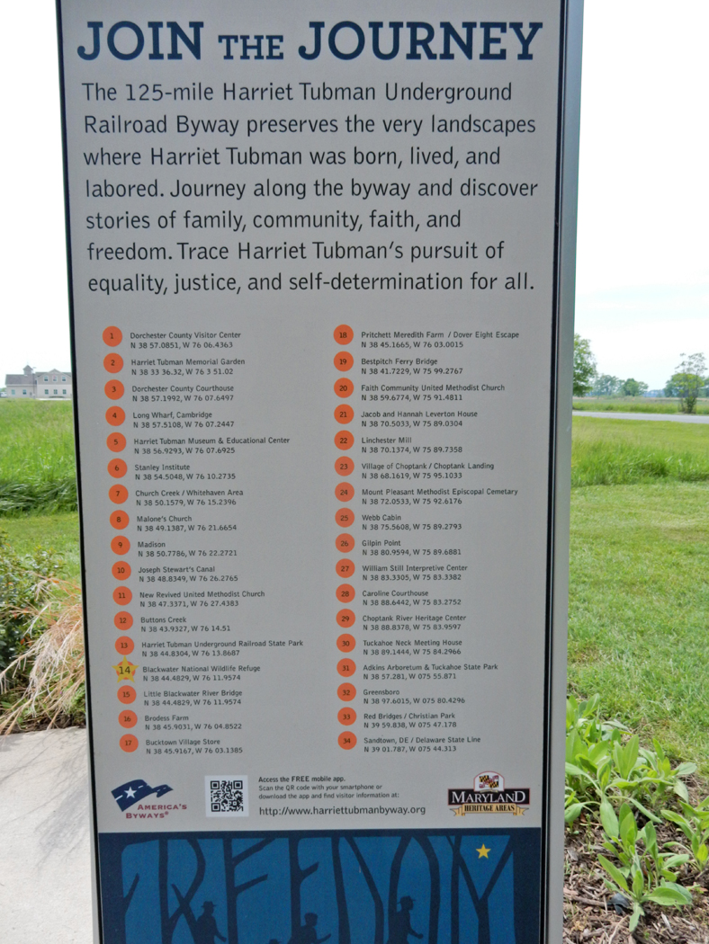
The Harriet Tubman Underground Railroad Byway is a 125-mile route through Dorchester and Caroline Counties on the Eastern Shore of MD that . . . Read Sign


Brodess Farm, possible birthplace of Harriet Tubman


New Revived Church, I met an elderly black man who lives across the street and he gave me a little history on the all-black congregation


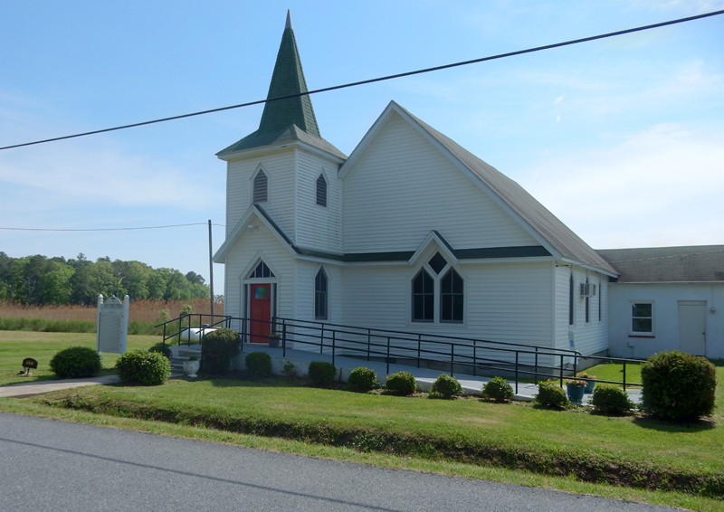
Scott’s Chapel

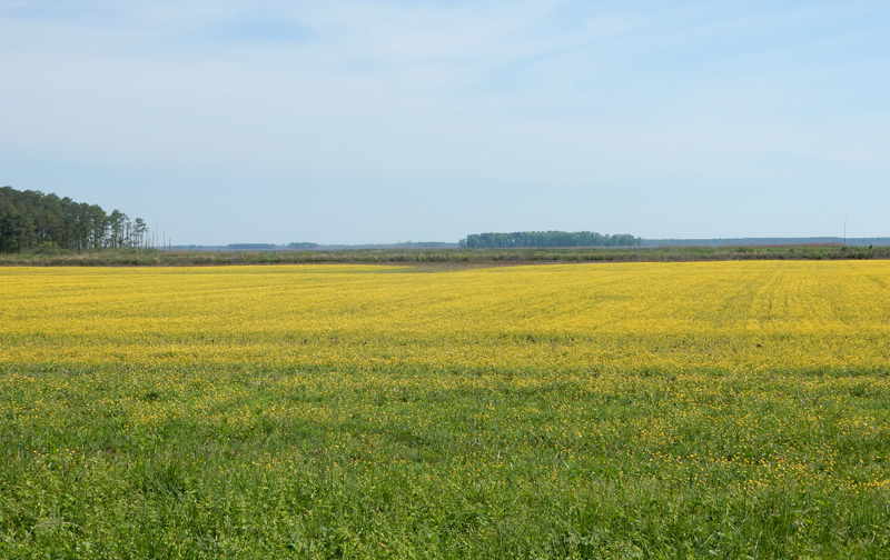
Pretty field

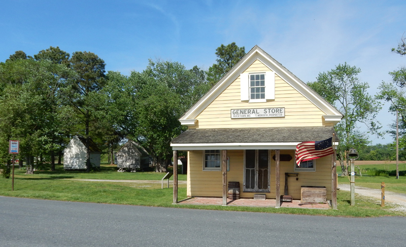
Bucktown Village Store


FYI – the Harriet Tubman National Historic Park, in Auburn NY, commemorates her work during her later years. It was established on January 10, 2017.
Chesapeake Bay Lighthouse in Cambridge MD and Bay Bridge, had dinner in town before driving to Towson MD for the night

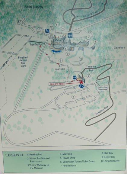
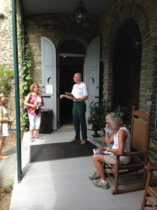
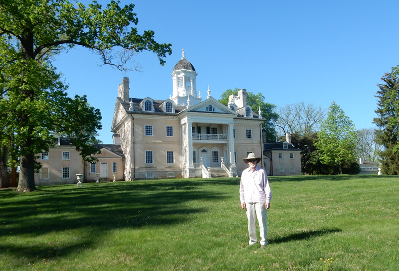
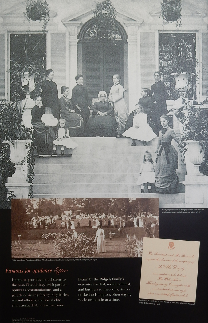
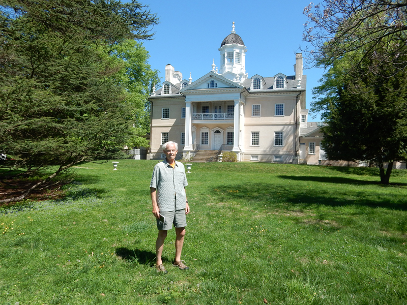
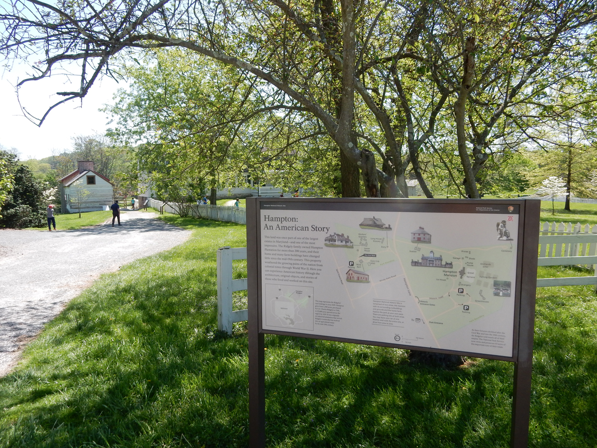
April 28 – I arrived at the Hampton National Historic Site in Towson MD (northern suburb of Baltimore) at 8am. I walked the grounds until the Visitor Center opened at 9am.


When the mansion was completed in 1790 it was considered “A palace in the wilderness.” In England, some referred to it as “The most elegant home in America.”

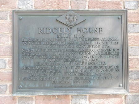
Col. Charles Ridgely purchased 1,500 acres from a cousin of Lord Baltimore in 1745 and expanded it to 11,000 acres. Capt. Charles Ridgely Jr, the eldest son, inherited the estate in 1760. Charles Jr, his father and brother John established an ironworks on the Gunpowder River. During the Revolutionary War, indentured servants casted molten iron into cannons and ammunition for the U.S. army. The war further increased the Ridgely’s wealth.

They were also colonial merchants and shippers. Slaves loaded barrels of grain, iron and timber on ships docked on Chesapeake Bay bound for Europe. The ships would return with fine wines and luxurious furnishings. This self-sustaining estate included half of present day Baltimore. My brother Joe arrived about 9:15 and we signed up for a 10am tour of the Hampton Mansion.

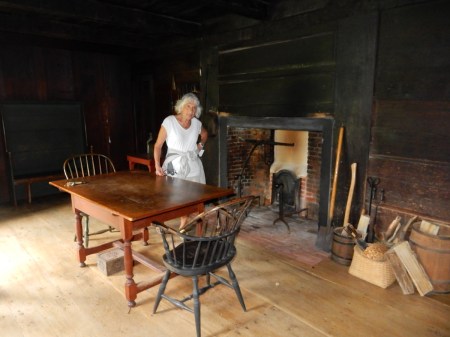
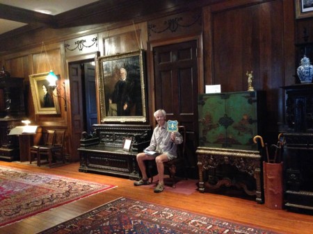
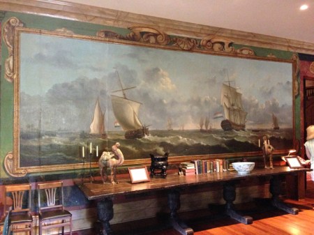
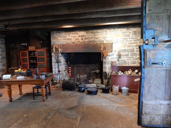
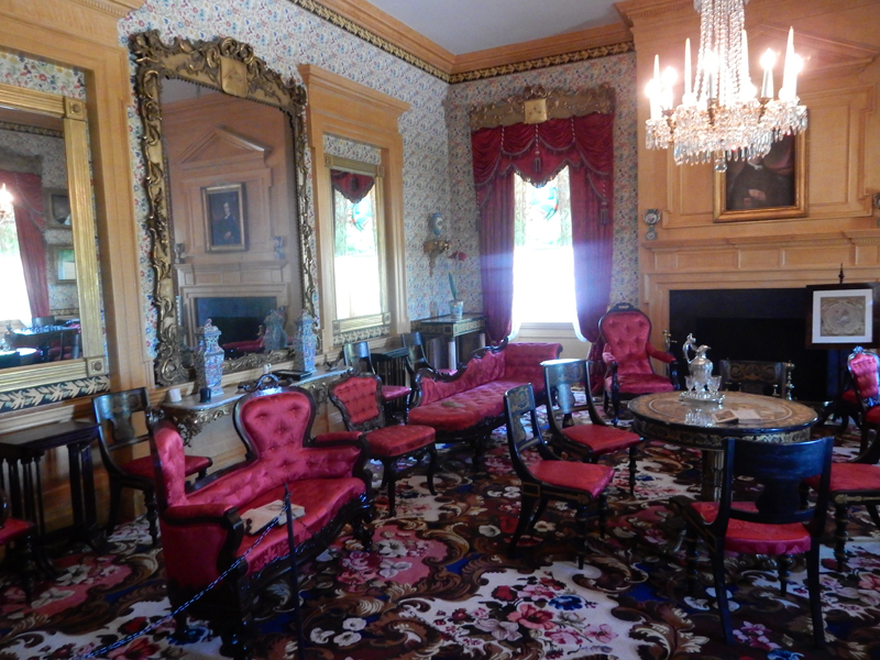
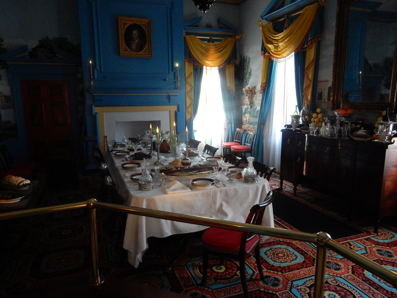
Hampton Mansion was built between 1783-1790 in the Georgian style popular at the time. It was elegantly furnished with imported and locally made furniture and decorations. I have many photos of the rooms. I will only include a few here. First, the music room


The drawing room


The dining room
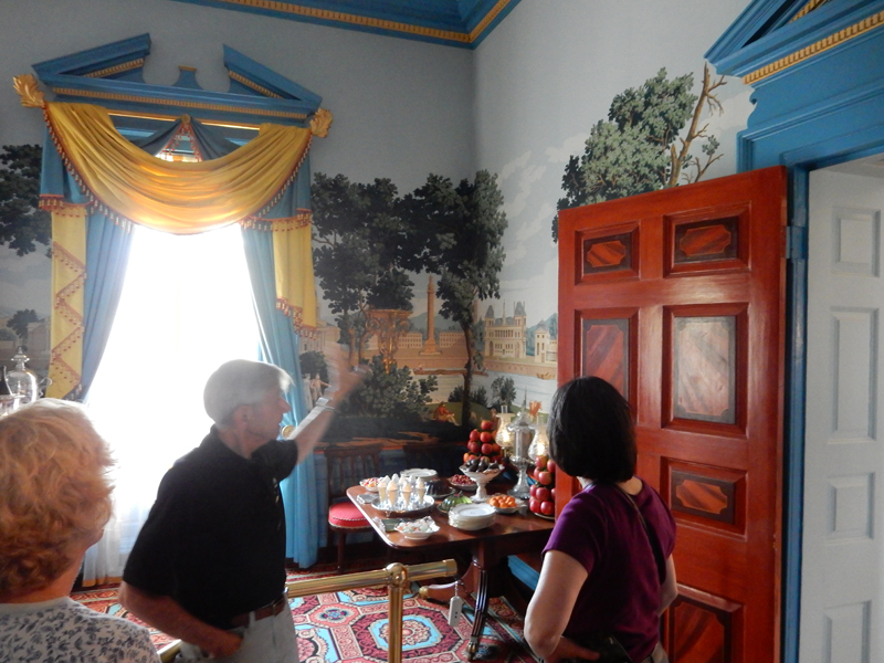
 Tom, our excellent tour guide

The kitchen

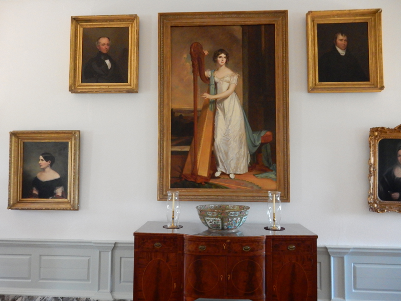
Center hall family portraits

Upstairs hallway

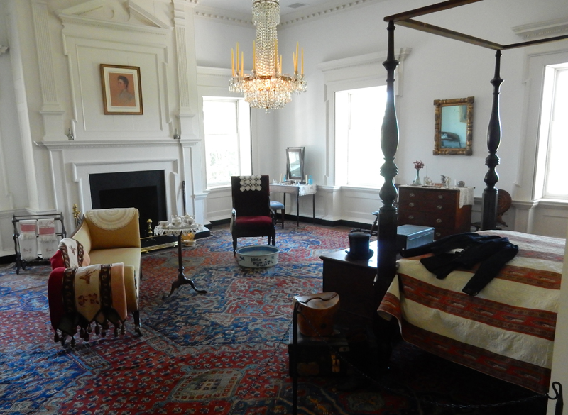
North bedroom

Master bedroom

The third floor has 10 small rooms and is not open to the public. Since the Ridgely family always owned the estate, and the extended family supported the preservation of the mansion, 95% of the furnishings are original to the house.

Back of mansion

View from back stairs – Lebanon Cedar

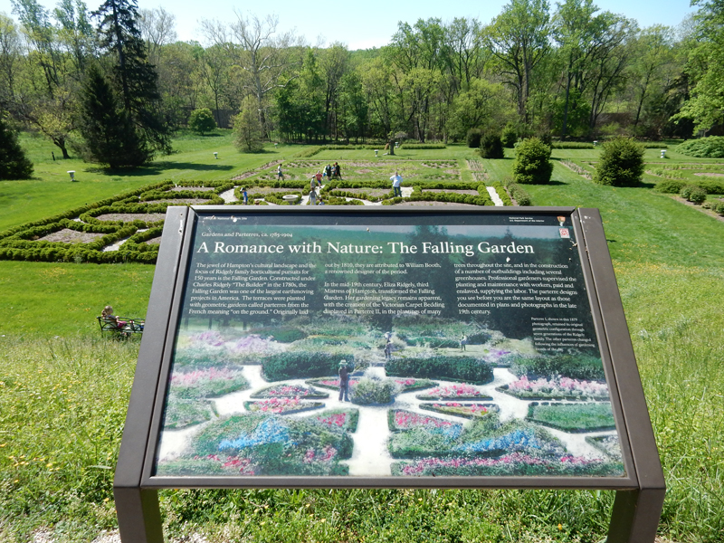
“Parterres” – Patterned Gardens

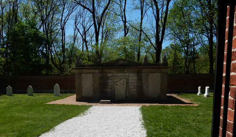
Family cemetery


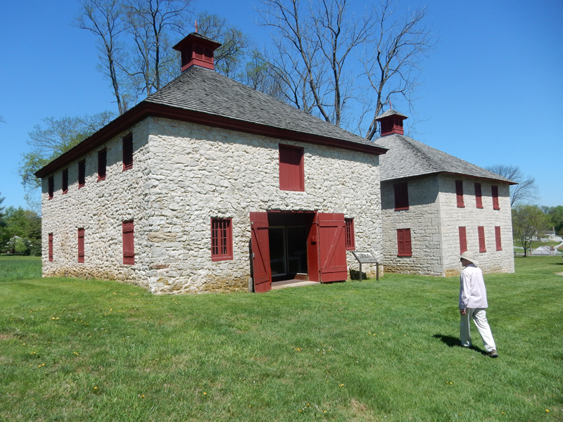
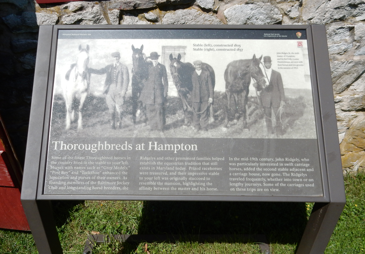
Stables, the Ridgelys were noted for their thoroughbred race horses and trotters


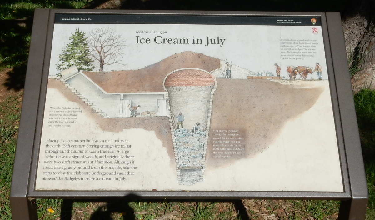
Ice Cream in July?


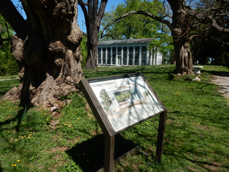
Orangery – greenhouse for citrus trees

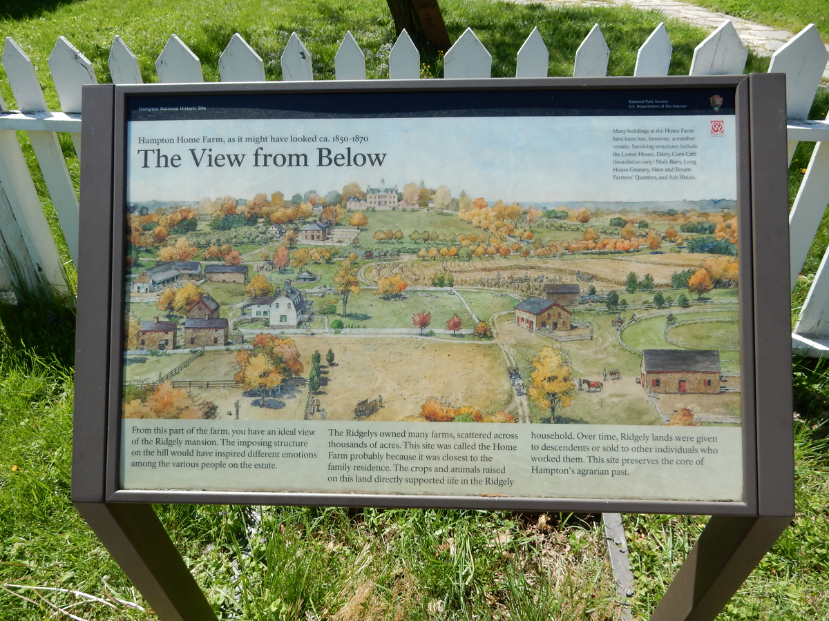
By 1825, the estate had grown to over 25,000 acres. In 1829 John Carnan Ridgely inherited the house and 4,500 acres. The remaining property was split among the other heirs. He also freed most of his 300-plus slaves.


The Civil War started Hampton’s decline. By the time the estate reached John Ridgely, the 6th Master of Hampton, it was in financial trouble. Fortunately, he received support from the Avalon Foundation to keep the mansion and immediate grounds. When Hampton became a National Historic Site in 1948, he moved into the farm house on the property with his wife and started charging an entrance fee to see the mansion. The Mellon family trust then acquired the property and in 1979 it was donated to the federal government.


The estate and its operation reminded me of Downton Abbey
Joe and I went to the Orchard Market & Café in Towson for lunch – a great Persian restaurant

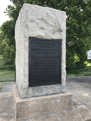
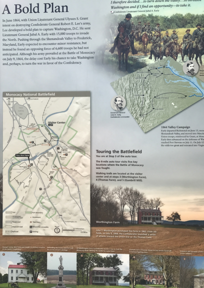
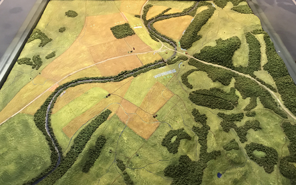
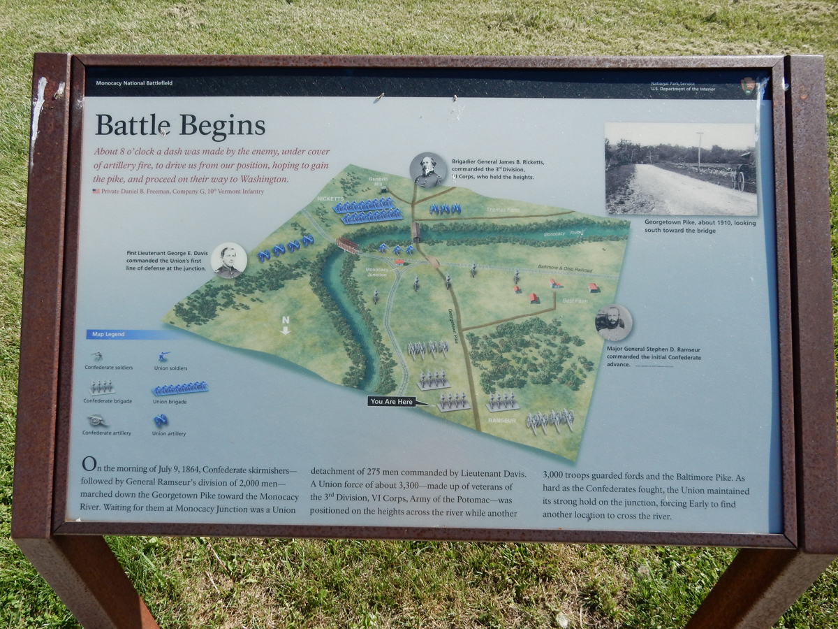
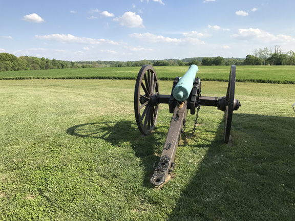
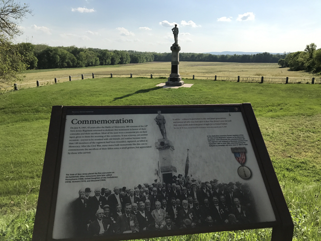
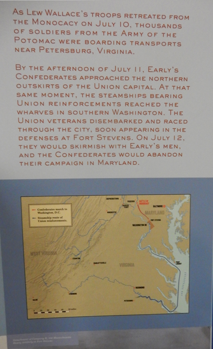
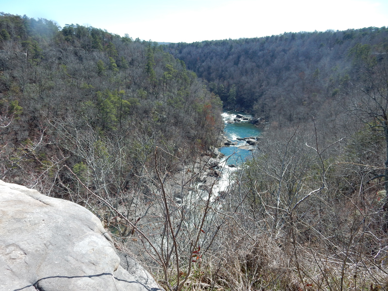
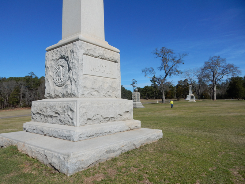
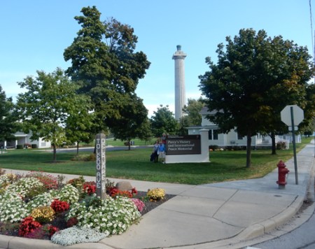
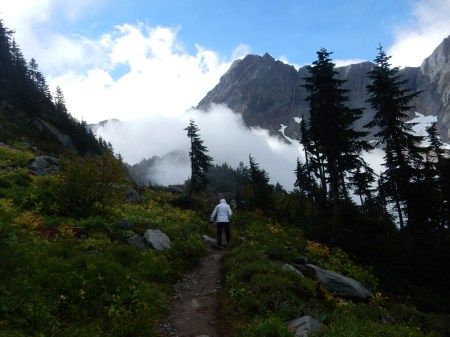
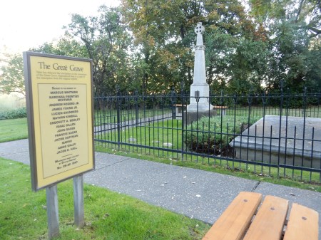
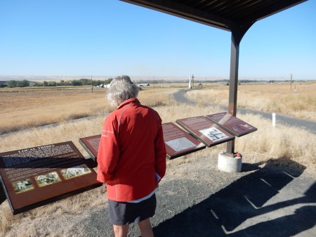
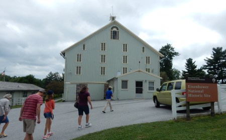
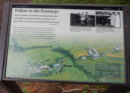
It took about an hour to get to Monocacy National Battlefield outside of Frederick MD, another Civil War site. The battle that occurred here on July 9, 1864 is touted as “The Battle that Saved Washington DC.” It marked the third and last time that the Confederacy invaded the North.

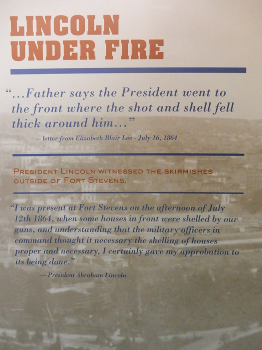
Lt. Gen Jubal Early’s goal was to take Washington DC. It was weakly defended because the bulk of Union troops were in northern Virginia. Monocacy was a Confederate victory but Maj. Gen Lew Wallace was able to delay the Confederates long enough for additional troops to be brought to DC. Few people realize that some of Early’s troops got as far as Fort Stevens the remains of which are in Rock Creek Park in DC.
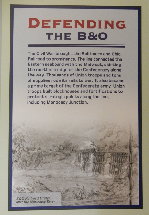
Importance of Baltimore & Ohio (B & O) Railroad


Troop positions at start of battle, Union – Blue, Confederates – Red

Battle begins

Looking toward Monocacy Junction (a road and railway junction) from the north

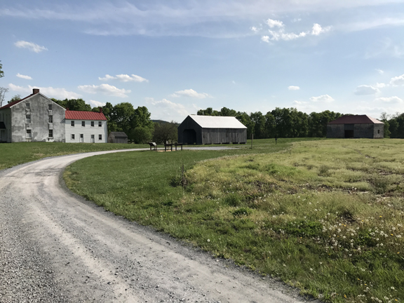
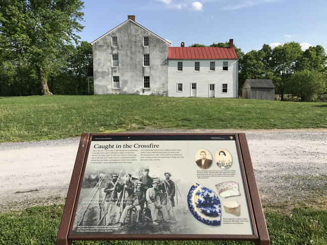
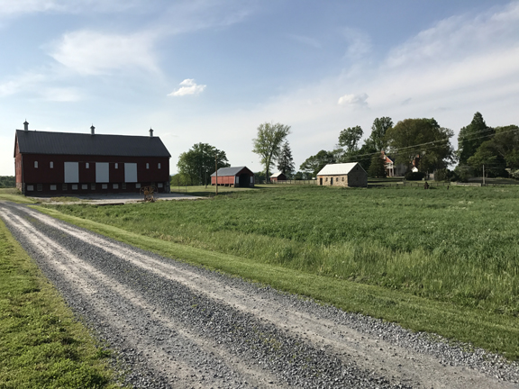
The Best Farm was caught in the crossfire


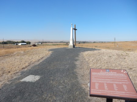
Confederate Monument
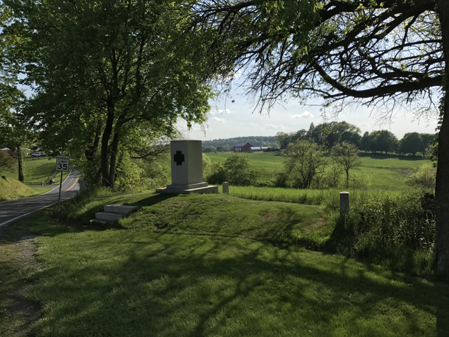
Monument to NJ troops guarding the junction

The road bridge across the Monocacy River was burned by the Union to slow the Confederate advance


Gen. Early decided to redirect his attack down river at the Worthington farm


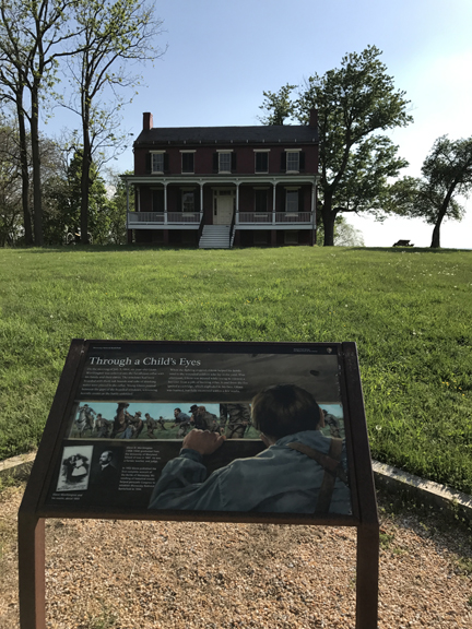
The Confederates then attacked the Thomas farm, VT monument with Thomas farm in background

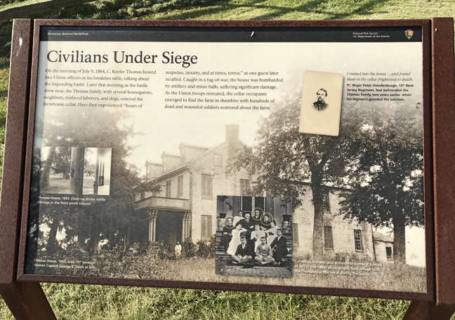
Thomas farm and civilians under siege


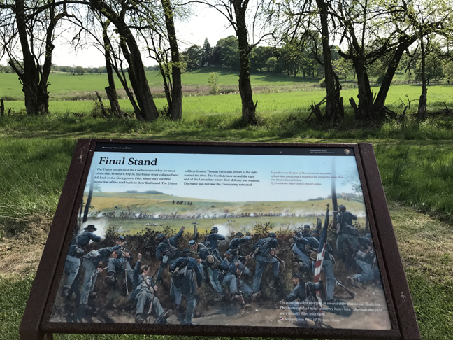
Final stand

Monument to PA troops that defended the Thomas farm

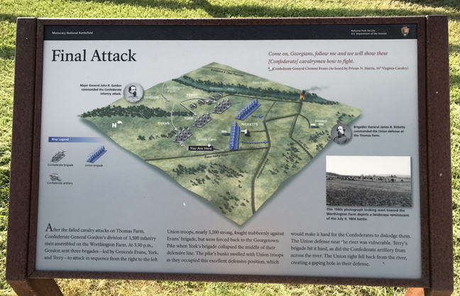
Final attack

Retreat from Thomas farm

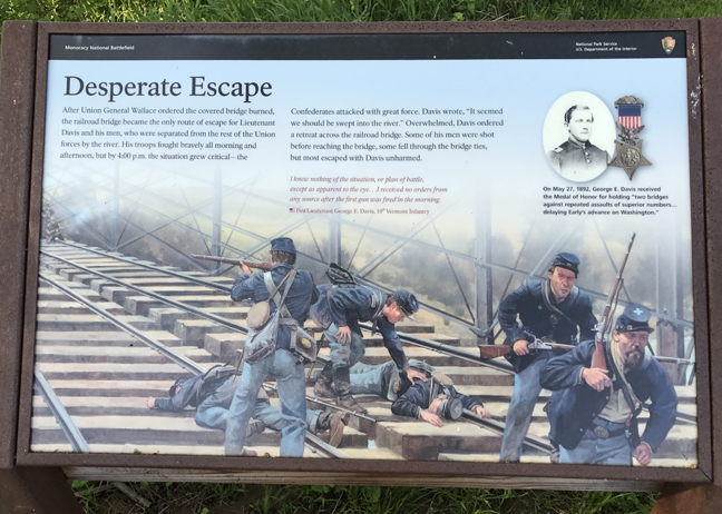
Final retreat from Monocacy Junction


A Confederate victory but the Union forces saved at least two days for the Union to reinforce Washington DC


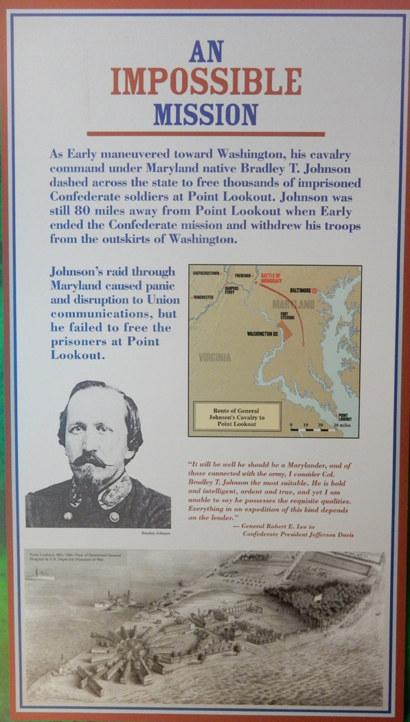
There was a second attack planned for Early’s forces. An attack on Point Lookout (Fort Monroe) to free Confederate prisoners. Had Early been successful in his efforts, it would have turned the tide of the war.

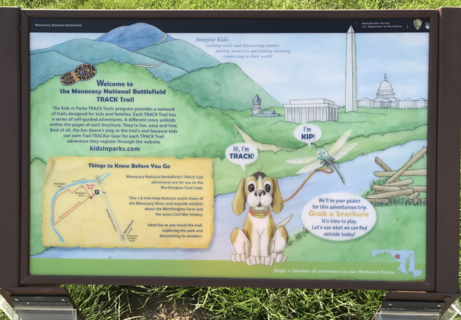
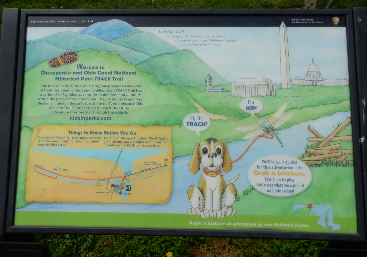
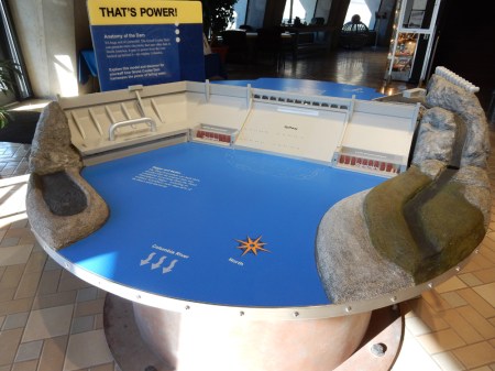
Kids in Parks We all need to introduce children to our National Park System – fun, learning and physical activity!

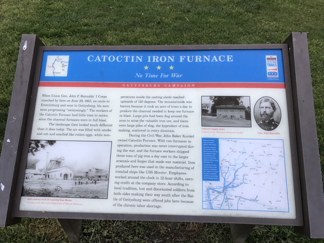
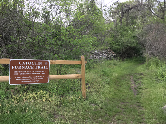
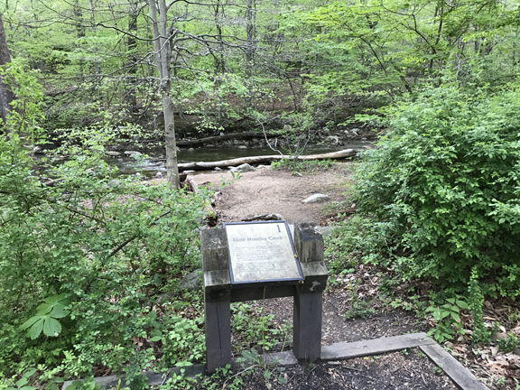
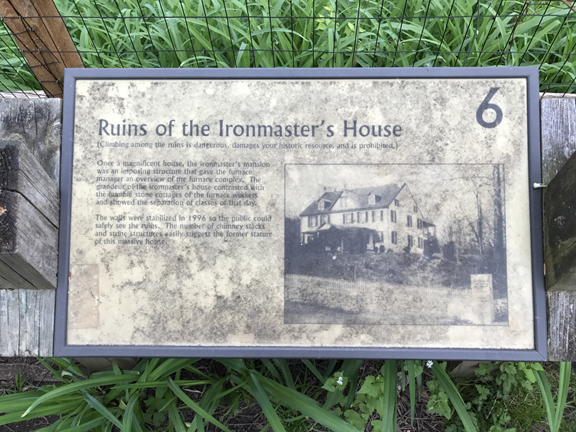
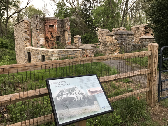
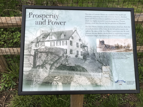
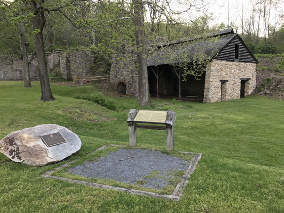
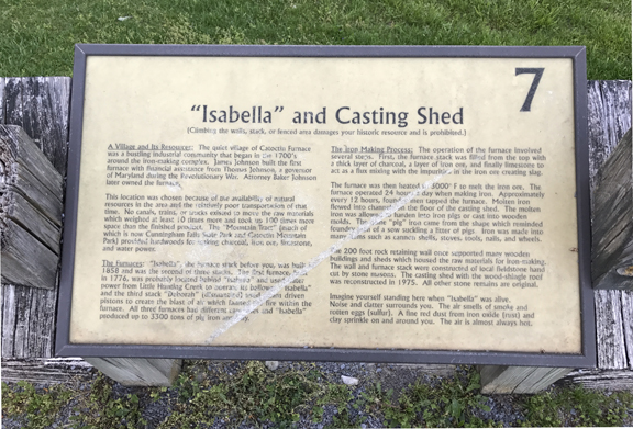
From Frederick, I drove north on Rt 15 and stopped at Catoctin Furnace, an 18th Century Iron Furnace


Probably walked about a mile at the site; there were seven signs explaining how iron was made


It was getting dark as I drove through Cunningham Falls State Park to Catoctin Mountain Park.

I drove the Central Park Road to the Owens Creek Campground only to find it closed. The campground would be open for the season in two days on May 1st! So, I drove back to the Cunningham Falls SP and checked in to their campsite.
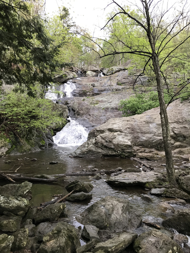
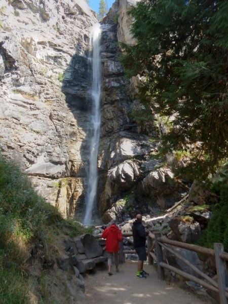
April 29 – I was up at day break and hiked from the campground on the Falls Cliff Trail to the Lower Falls Trail and then on to the Falls, about 2-miles roundtrip. The easy trail from Hunting Creek Lake did not open until 8am. Campsite

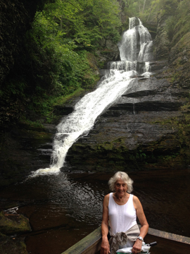
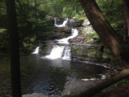
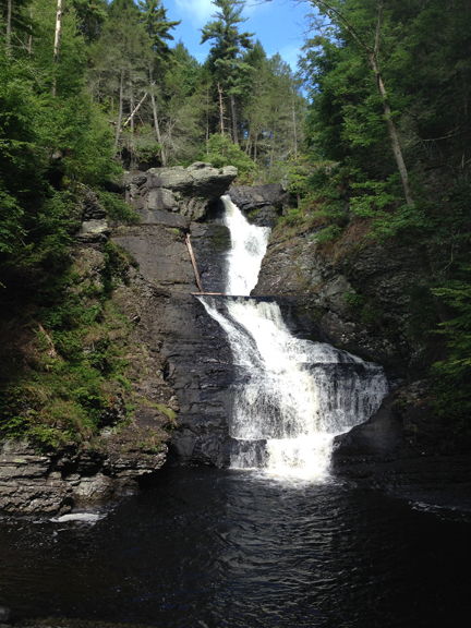
Cunningham Falls is billed as the largest cascading waterfall in MD – 78 feet
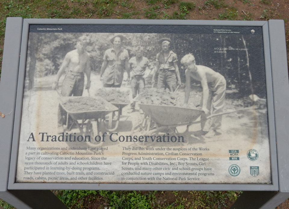
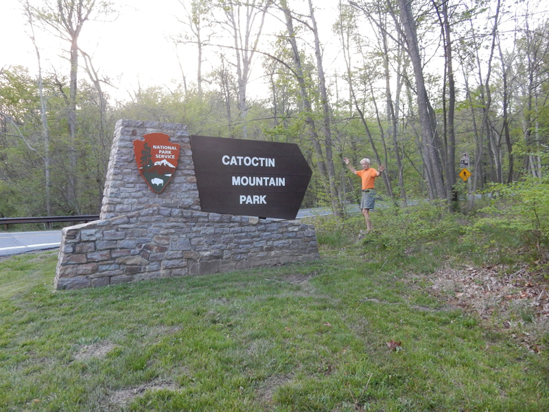
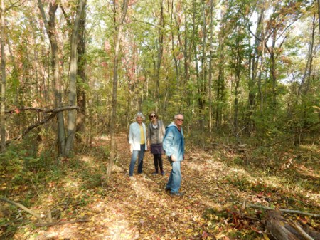
My next task was to do some hiking in Catoctin Mountain Park. Like Prince William Forest Park in VA, this park got its start during the depression. In 1935, the federal government bought 10,000 acres and developed it as the Catoctin Recreational Demonstration Area. The Civilian Conservation Corp (CCC) was put to work developing the park and its facilities.

President Franklin D. Roosevelt choose Camp Hi-Catoctin as a retreat he called Shangri-La. President Dwight D. Eisenhower renamed it Camp David after his grandfather and grandson. Camp David is located within Catoctin Mountain Park and is not open to the public. In fact, the Park Central Road is not open when the President or dignitaries are at Camp David. In 1954, the park was divided by MD Rt 77. The north part remains part of the National Park System but the south part is now Cunningham Falls State Park. I put on my Gore-Tex and started on the Chimney Rock Trail near Park Headquarters in a light rain.


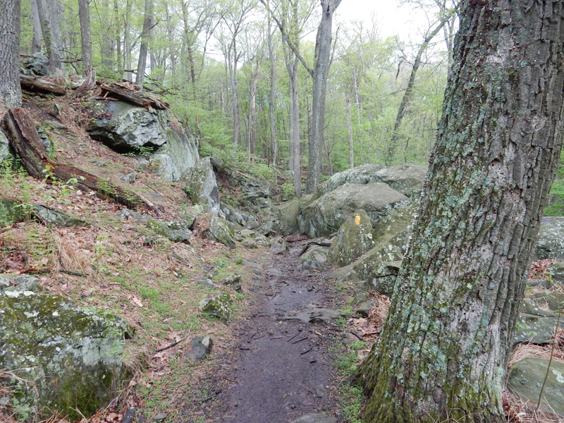
It was a little over a mile and a gain of about 600 feet to get there


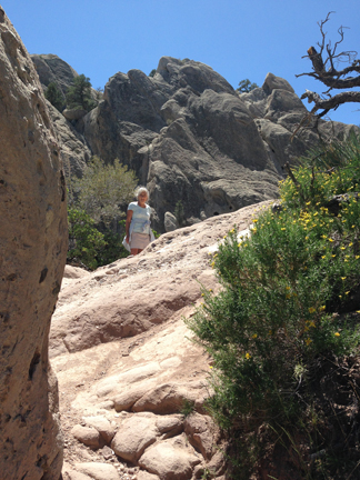
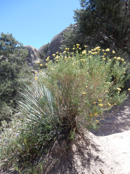
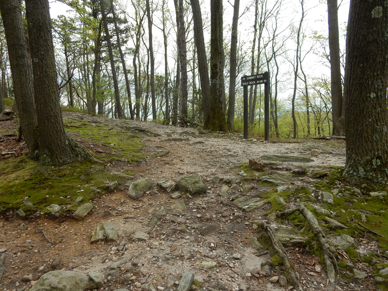
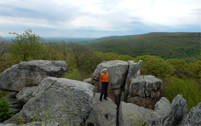
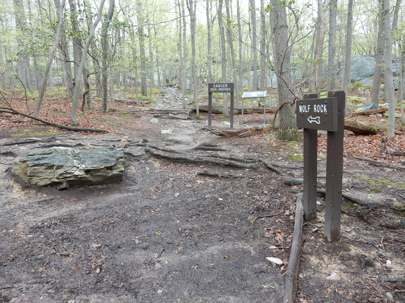
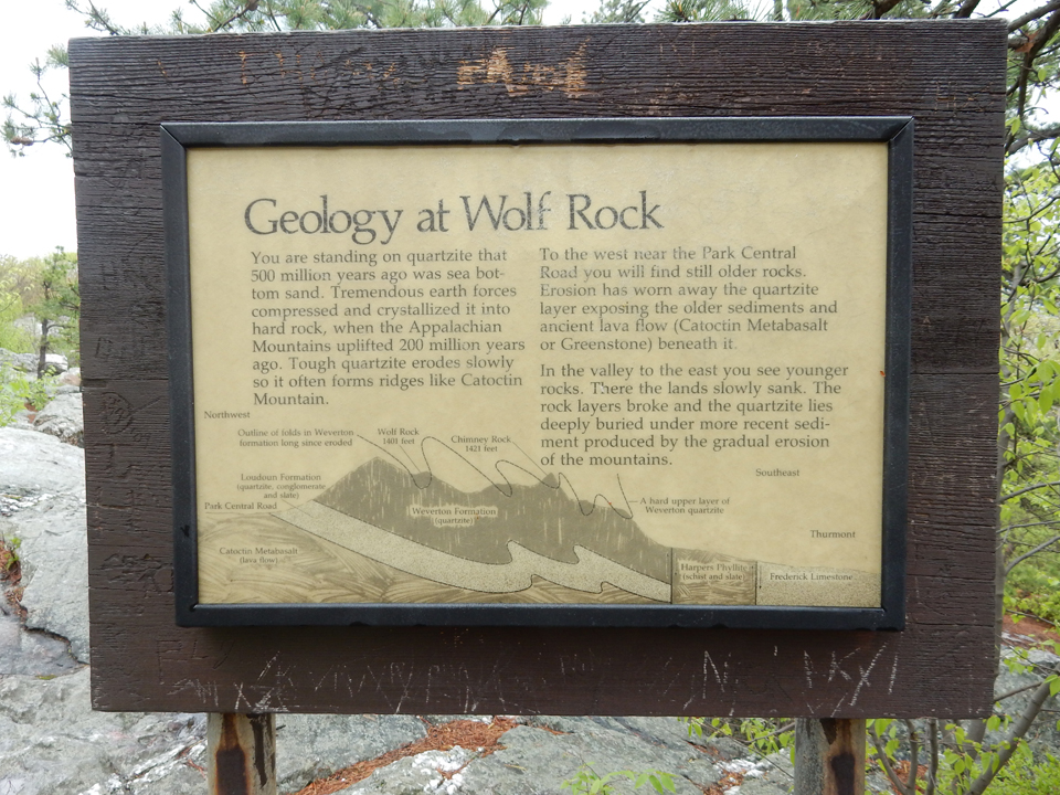
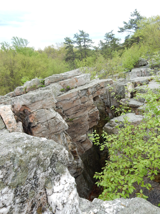
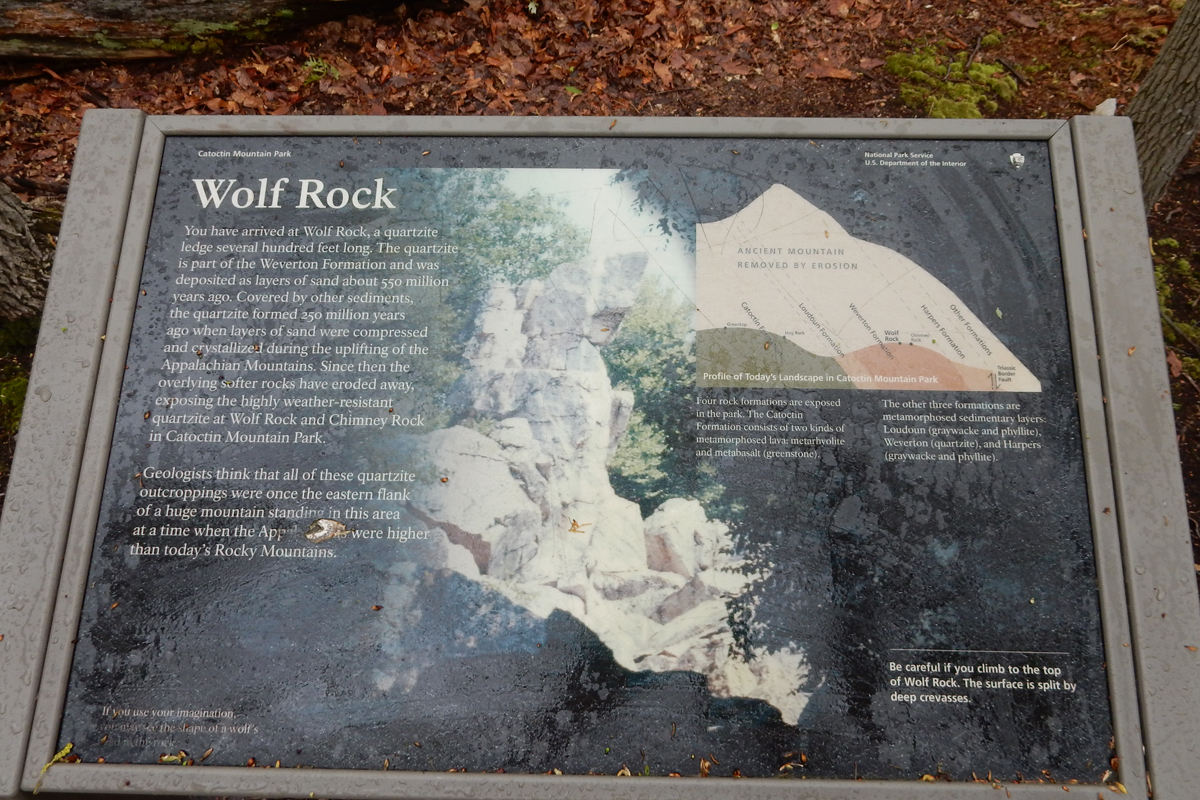
I then continued about a half mile to reach the rock outcrops/crevices and Wolf Rock


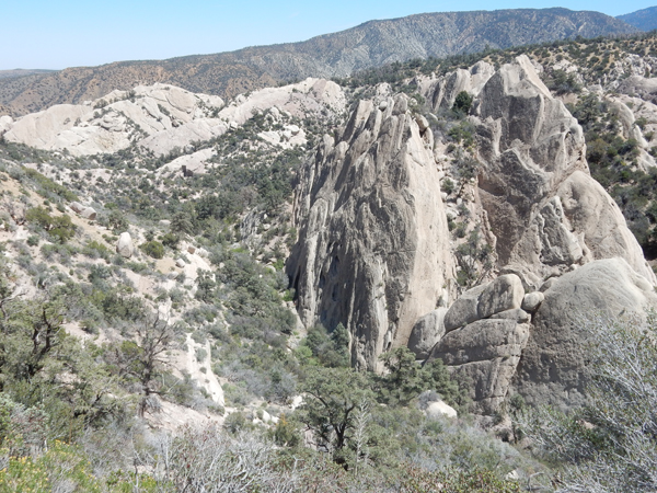
Rocks and crevices


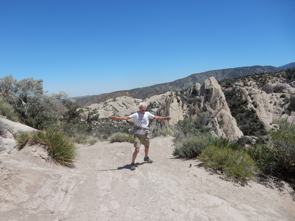
Wolf Rock


I stopped by the Visitor Center before leaving the park and starting my drive home. During World War II the park was used to train U.S. spies.

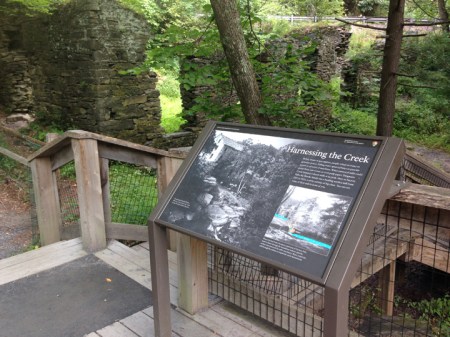
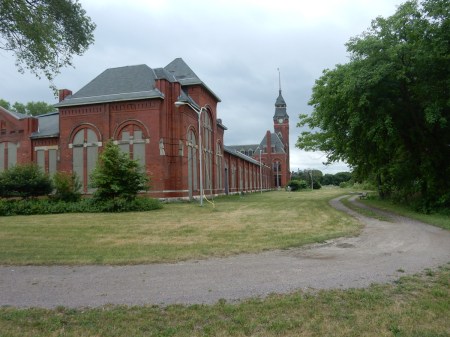
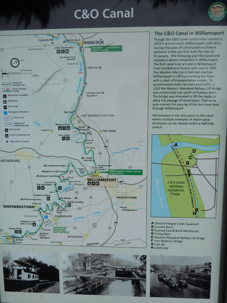
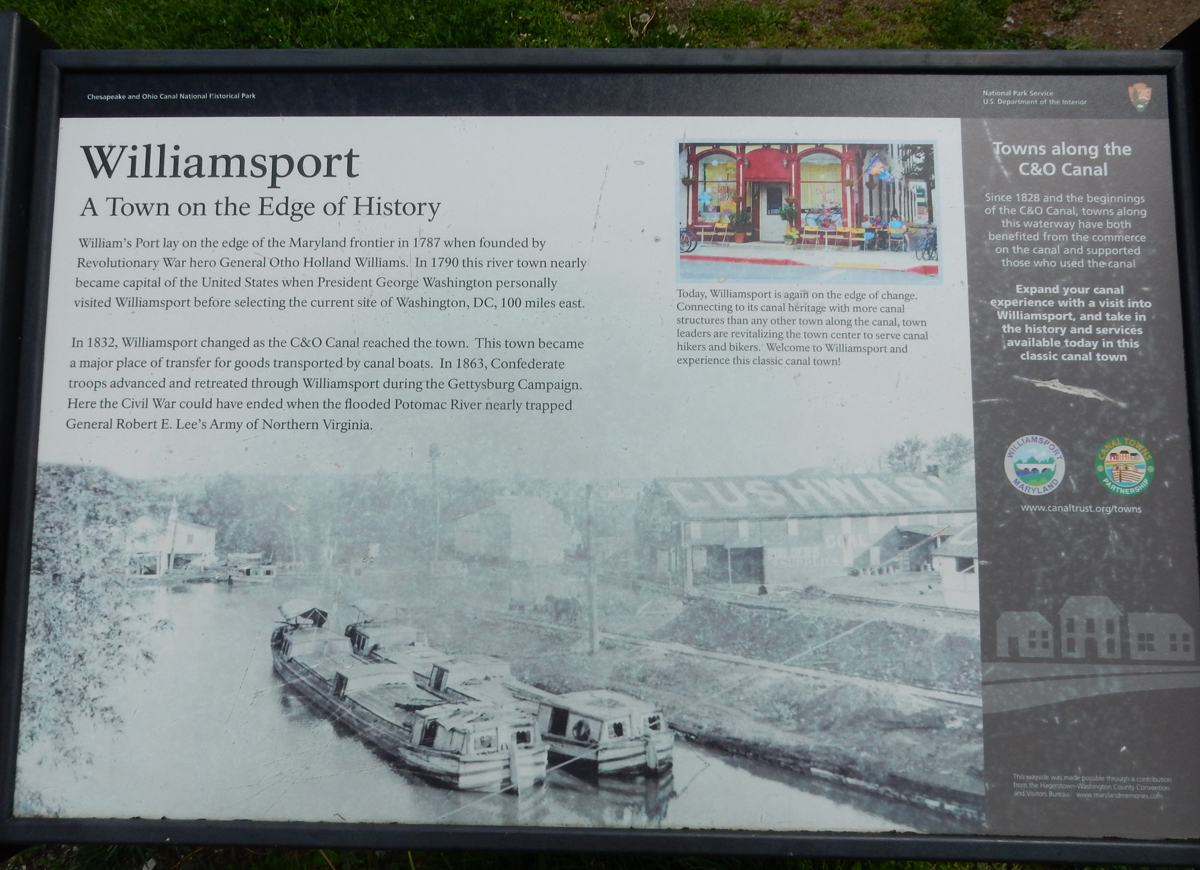
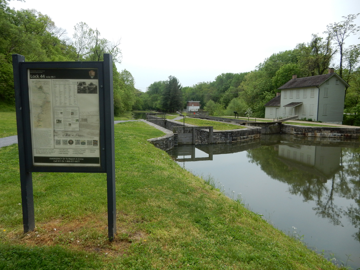
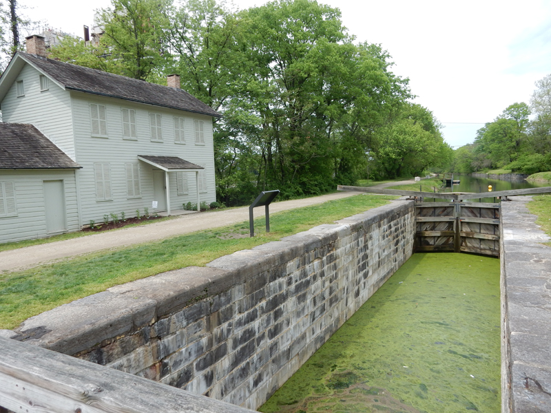
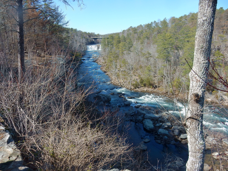
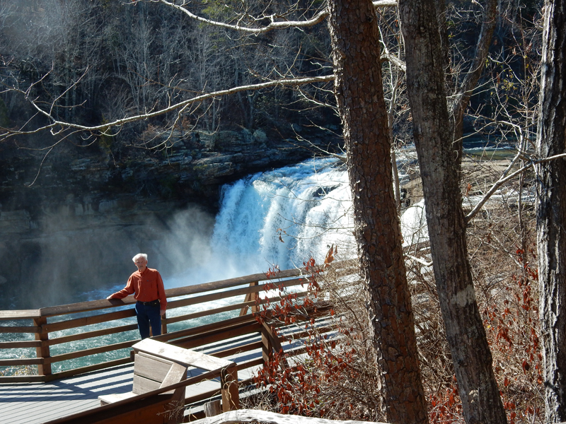
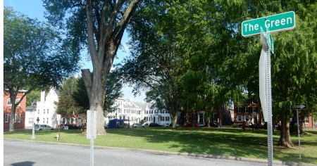
As I drove north on I70, I saw the signs for the Williamsport Visitor Center on the C & O Canal just west of Hagerstown MD and I couldn’t resist, I had to stop.

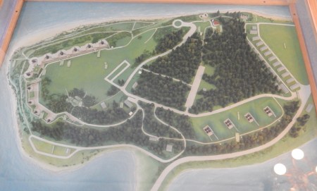
The site had it all: canal, towpath, Potomac River, Visitor Center, lock, lockhouse, railroad lift bridge, aqueduct, etc. Here is a map and a nice diagram presenting the basic of the canal water system.


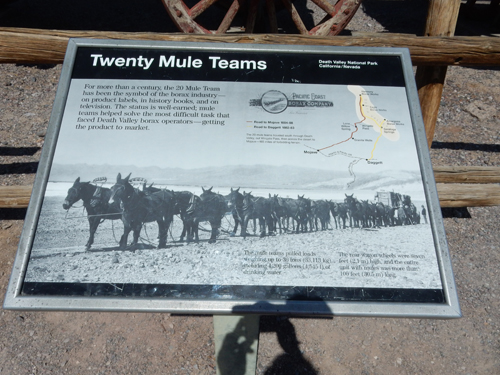
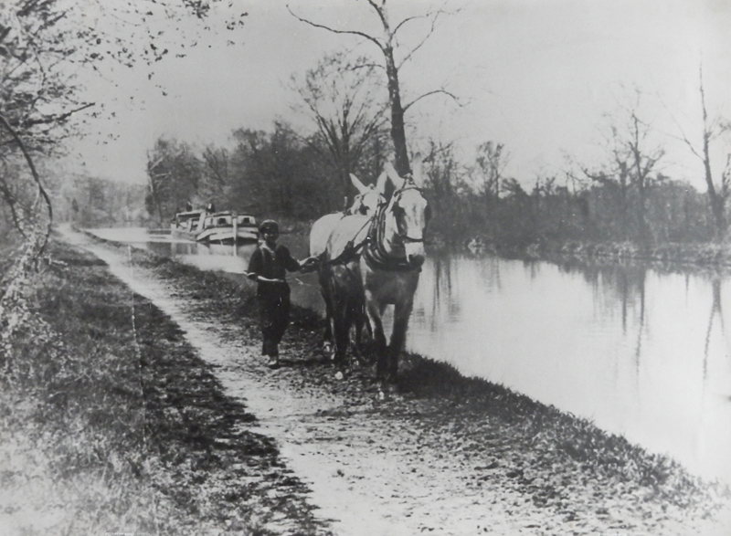
Mules pulling canal boat

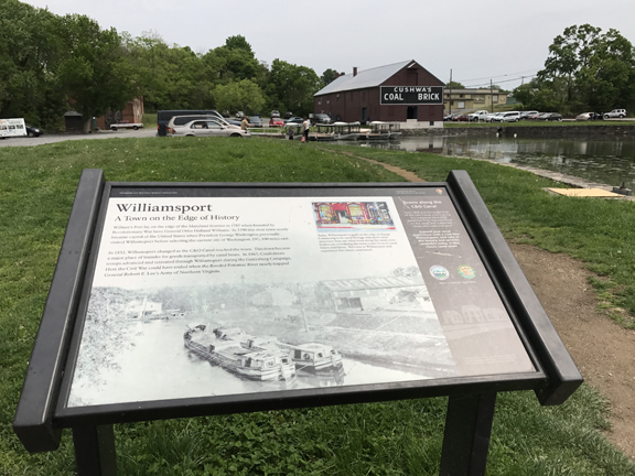
The Cushwa Warehouse was built in 1790, before the canal. When the canal arrived, Cushwa’s was used for flour, feed, brick and coal. It now serves as the Visitor Center.


The old Trolley Barn Power Station is also part of the Visitor Center

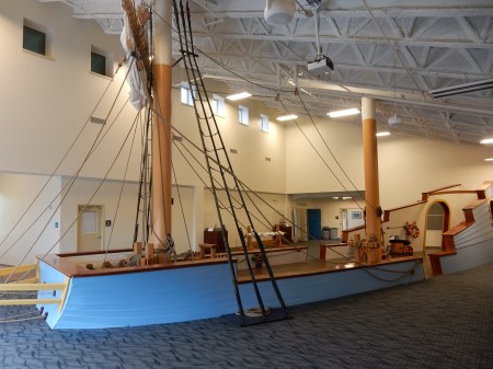
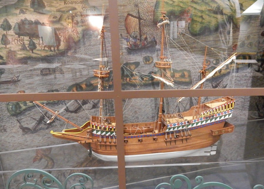
This canal boat model was in the Trolley Barn

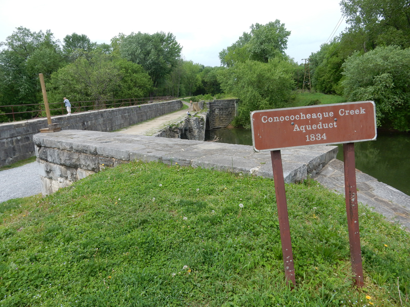
Aqueduct – the canal went over the creek

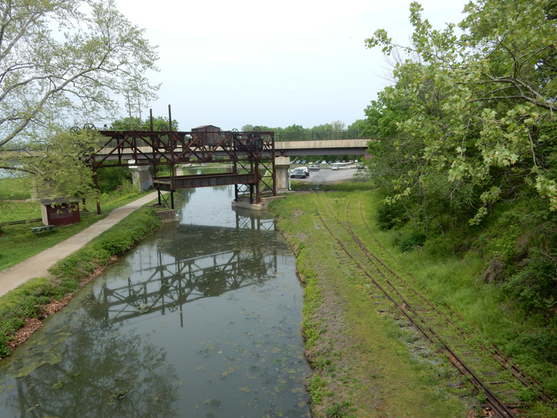
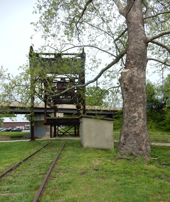
Lift bridge for canal boats so they could go under the Western Maryland Railway


Lock #44 – Mile 99.1 of 184.5


Canal Lockhouse


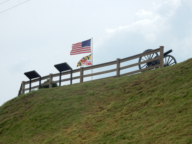
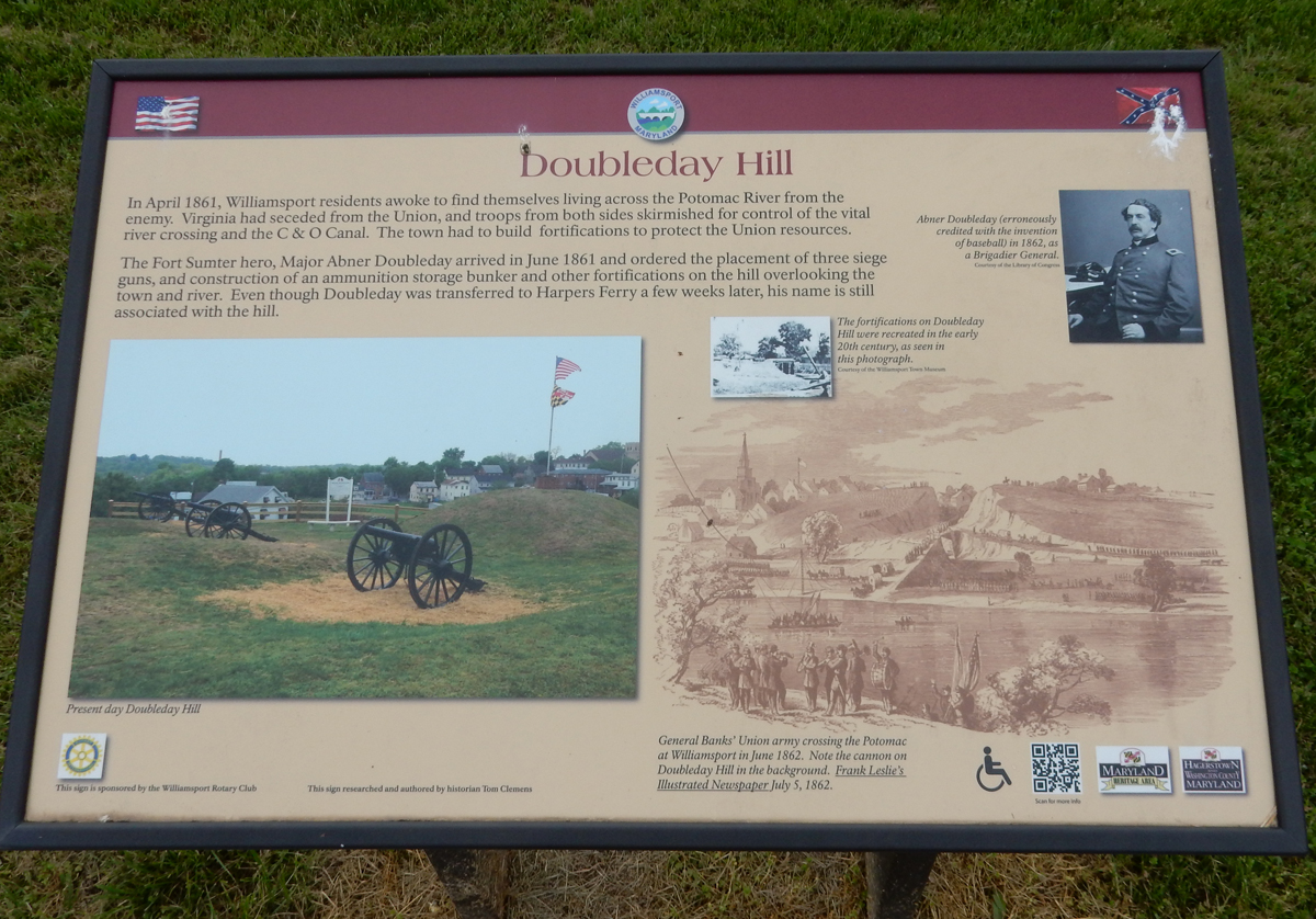
Doubleday Hill


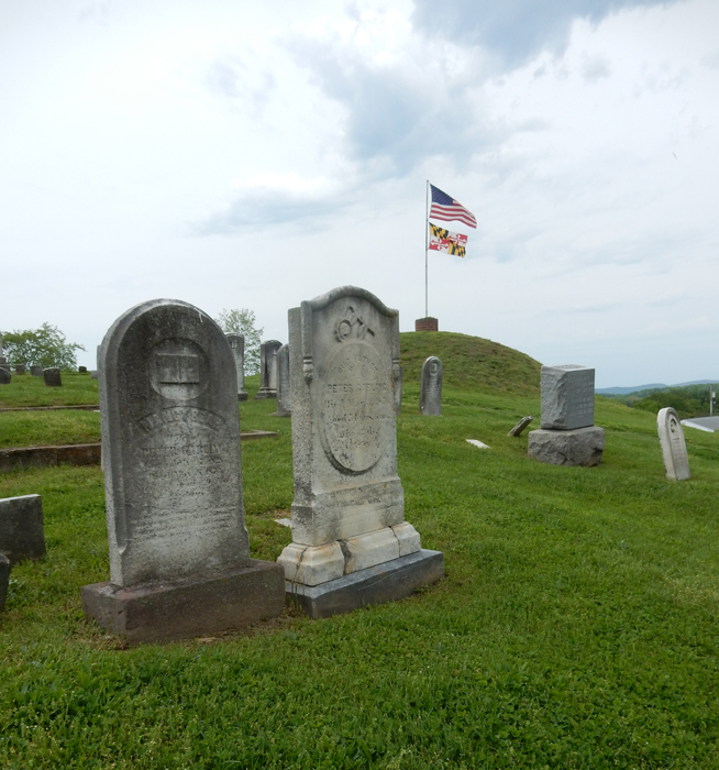
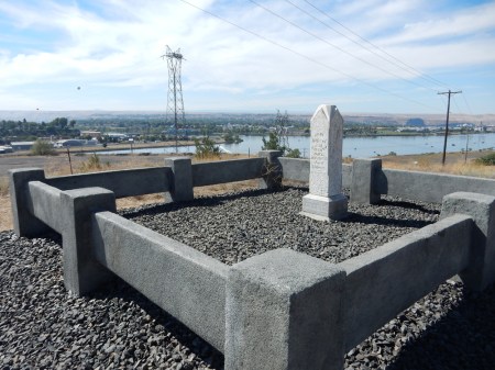
Cemetery

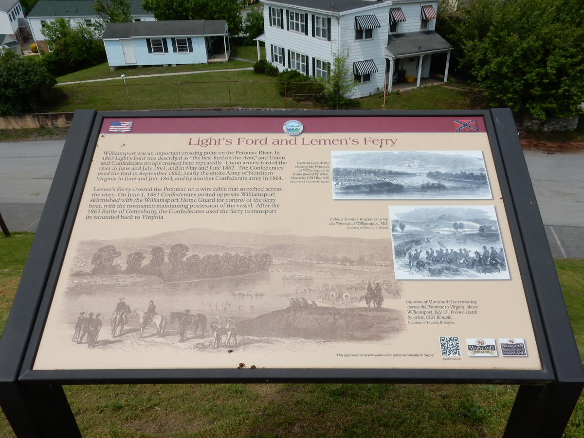
Williamsport and Civil War

For Kids

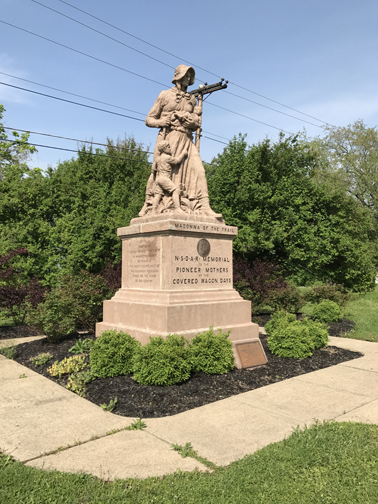
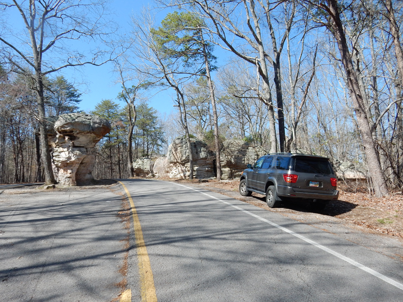
My last “Tourist” stop was the “Madonna of the Trail” statue on U.S. Route 40 in Beallsville PA.

The Daughters of the American Revolution (DAR) are responsible for the erection (1928-1929) of 12 of these statues in 12 states from Maryland to California. According to Wikipedia, they are still all in good condition. The Ohio statue is in Springfield!


 A
A