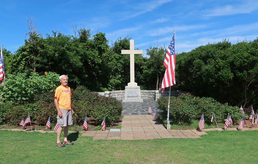
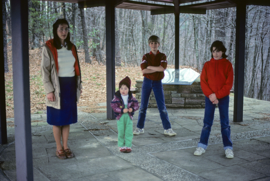
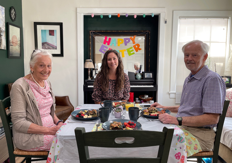
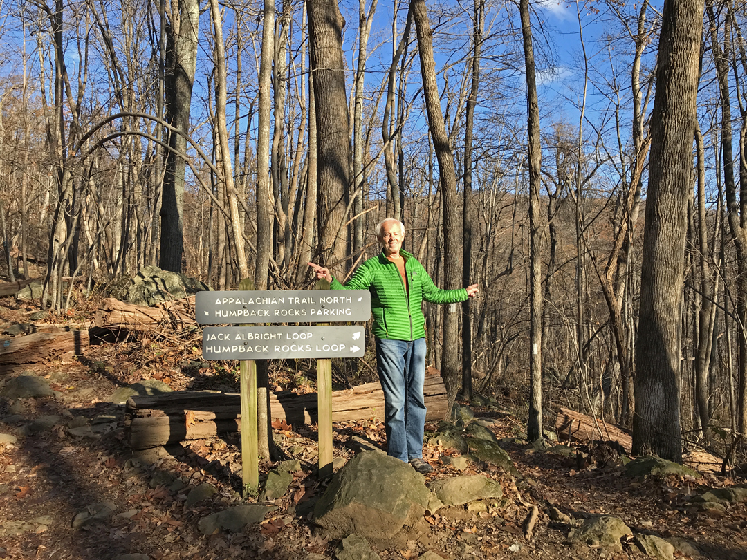
9/3 F – drove to Indianapolis to spend the weekend with Peter and Heather as their guests (Christmas present), We walked the dogs, had pizza, and played cards.
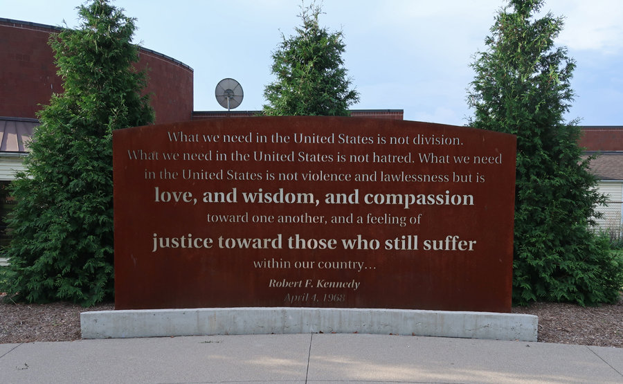
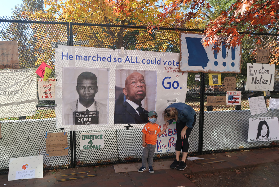
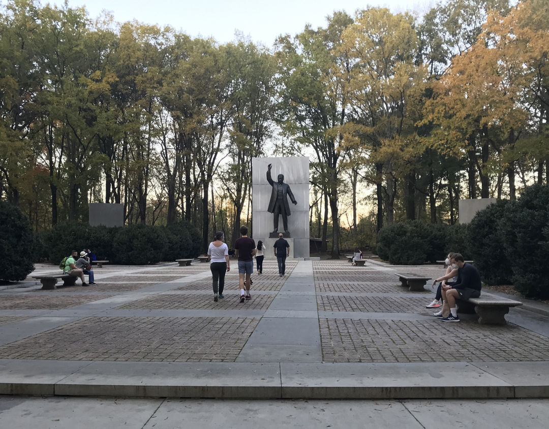
9/4 Sa – stopped at the Kennedy-King National Commemorative Site in Indianapolis. Rev. Martin Luther King Jr. was assassinated on April 4, 1968, in Memphis TN. Robert Kennedy, who was in Indy and running for President, gave an impromptu speech speaking to a mostly African American crowd. Authorities advised Kennedy not to speak fearing a riot. Riots were breaking out all over the U.S.
Kennedy announced the assassination and spoke of how MLK devoted his life to love, peace, and justice. He stated that his brother, President John F. Kennedy, was also killed (1963) by a white man and that Americans must work at understanding why these things happen and rise above these tragedies.
His improvised speech is credited with preventing a riot in the city. The Black community felt genuine empathy in his words. They heard a powerful speech emphasizing the need for healing in this country.
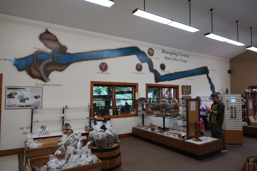
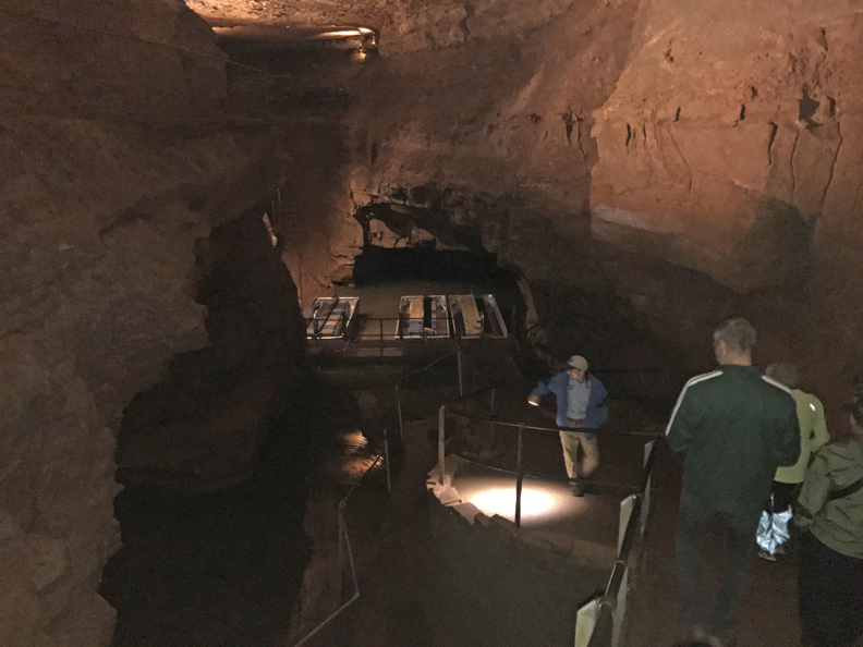
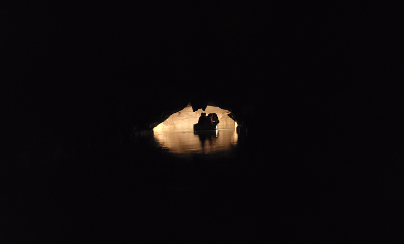
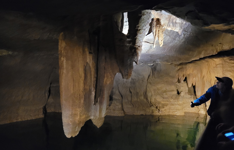
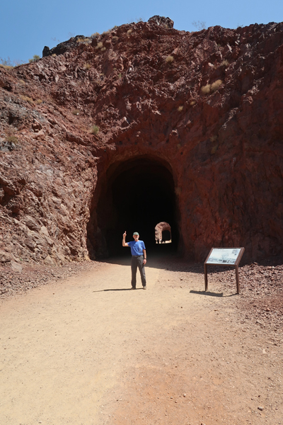
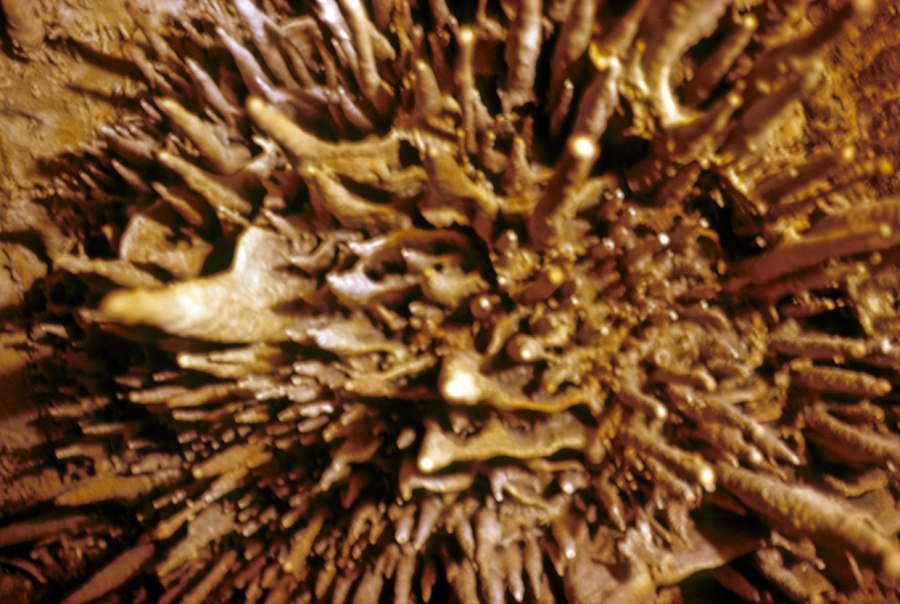
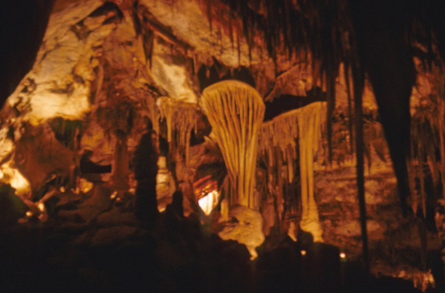
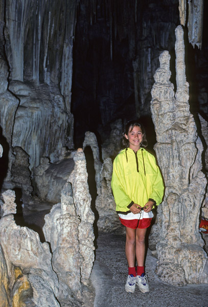
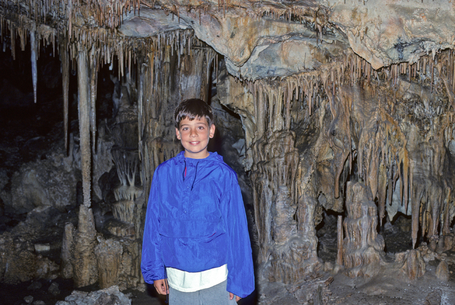
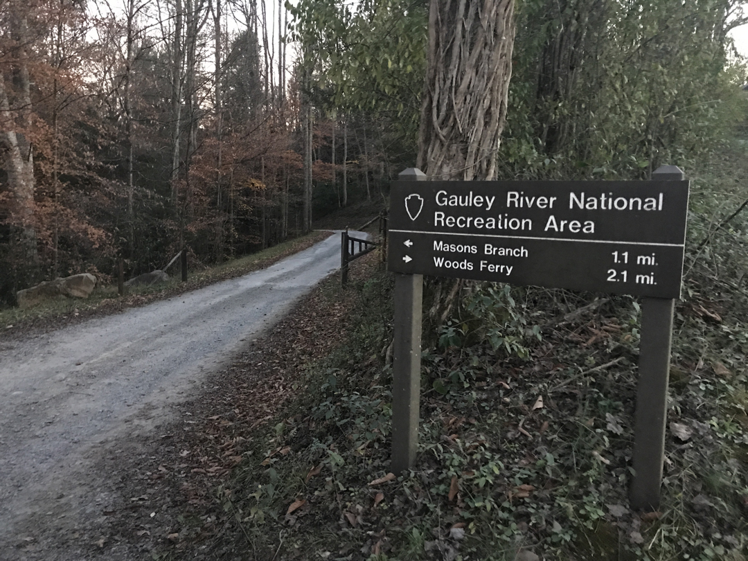
Next on our agenda was a one-hour boat tour through Bluespring Caverns in southern IN.
It is the longest known subterranean river cave in the U.S. It is a karst (limestone) cave with about 21-miles of surveyed passages.
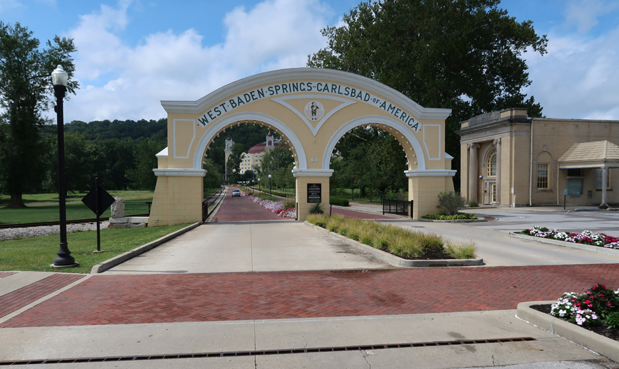
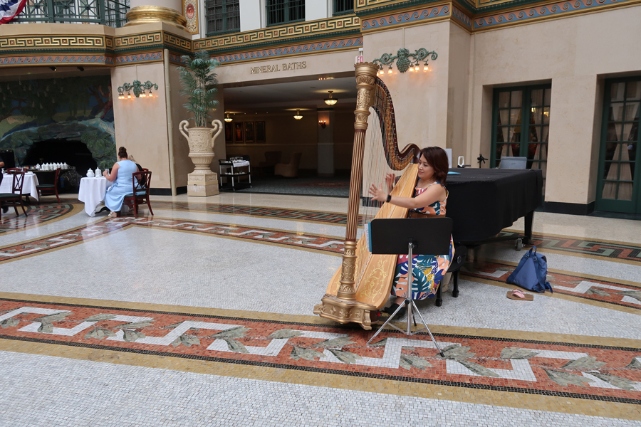
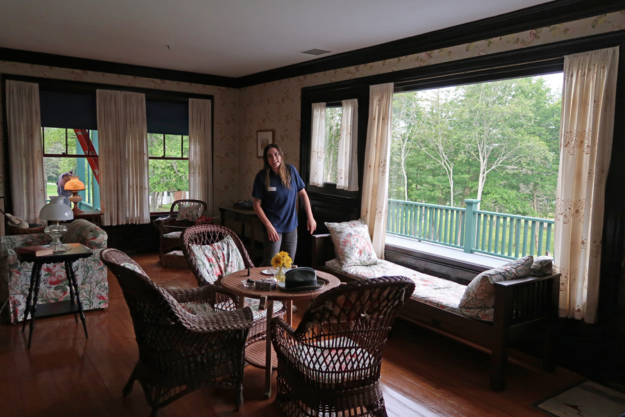
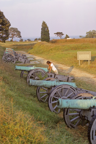
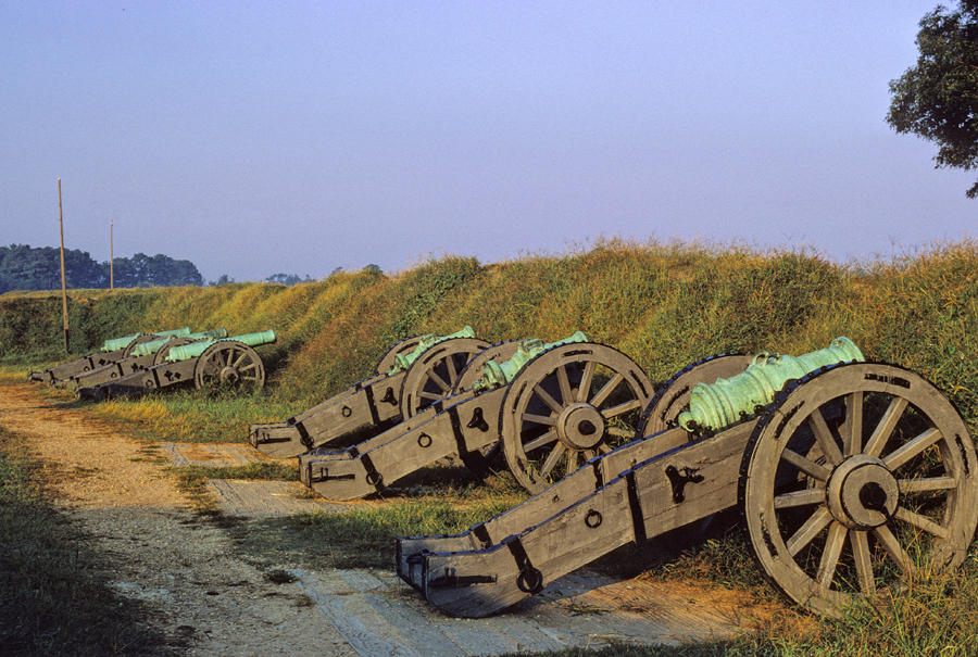
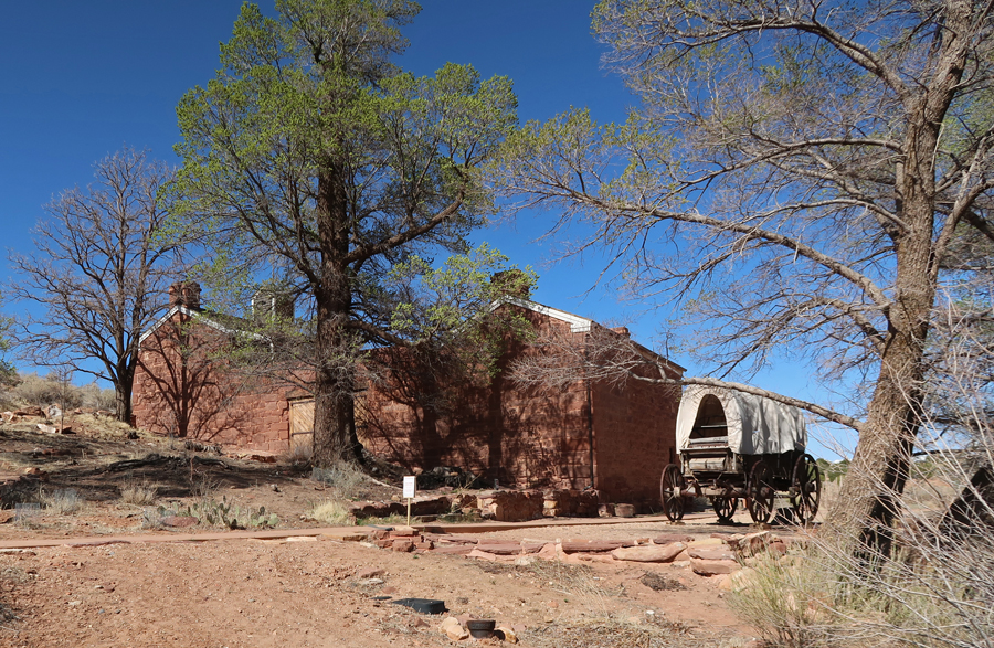
Continued to the West Baden SpringsResort Hotel outside of French Lick IN.
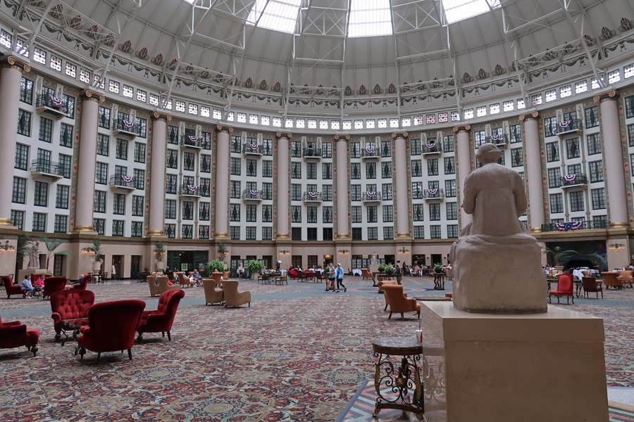
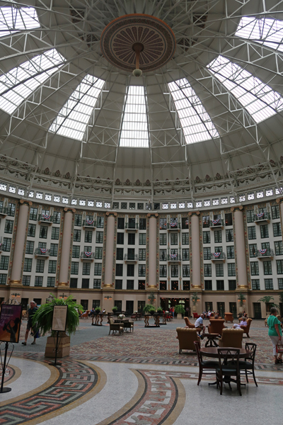
Built in 1902, with a 200-foot free-span atrium dome (largest in the world at the time) and extensive grounds, it was known as the “Eighth Wonder of the World.”
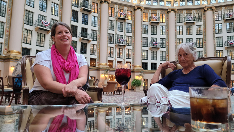
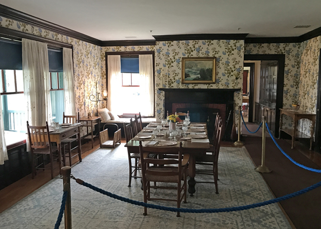
Had dinner and breakfast the next morning in the impressive atrium
Helen turned $1 into $41.84 at the slot machines in the French Lick Casino!
Dinner in the Atrium
Ceiling Reflection off Glass Table
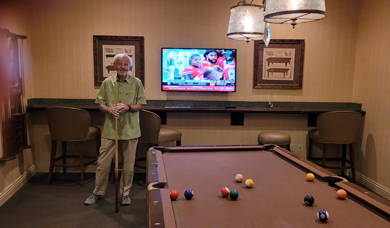
Evening of Pool, OSU Game (beat Notre Dame), and Euchre
9/4 Su – late breakfast at the resort with Peter and Heather and then a casual 3hr drive to the Cincinnati Airport. My Alaska Air flight to Seattle left at 6pm, the next flight at 9pm, and I arrived in Anchorage at midnight.
I had already planned a trip through ME for August. However, in early July, Stacy invited us to join her family in a vacation house at Higgins Beach ME for a few days. This was an opportunity to spend some relaxing time with Stacy, Brad, Leva, Geert and Hattie, so we jumped at the chance and changed our reservations, schedule, etc. We were told to take Queen sheets, blankets, pillows, towels/wash cloth, beach towels, beach toys, etc. for our accommodation in a small house attached to the house Stacy’s family was in. We also took our passports, vaccination cards, and Covid Tests because we would be crossing the border into Canada three times after our visit. We had to complete the ArriveCan App and enter our passports and Covid vaccination records. In addition, for each crossing, I had to enter the information on our port of entry and time of entry within 72hrs of crossing the border. $1 US = $1.30 Canadian
7/15 F – 7hrs to Kate’s (Nancy’s daughter) home in Victor NY where we spent the night
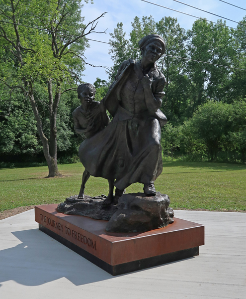
7/16 Sa – made a stop at Harriet Tubman NHP in Auburn NY (see Blog for October 2017) to get photos of her home, which I missed on our last visit.
There was also a “traveling statue” there titled The Journey to Freedom – Harriet was a “Conductor” on the Underground Railroad
Met Stacy and family at their rental house in Higgins Beach ME at 6pm
7/17 Su – we were up for sunrise at 5:15am!
7/18 M – Hattie took me for a walk to the river to see the “quicksand.” The beach is a half mile long spit bound by bed rock on the southwestern end and the Spurwink River on the northeastern end. On the way we passed the remains of the three masted schooner “Middleton,” which ran aground on a fog filled night in 1897. It was loaded with coal. Much of the coal was recovered, but many locals found enough afterwards to heat their homes for a couple of years.
For lunch we did the annual pilgrimage to the Lobster Shack near Twin Lights SP for lobster rolls
That was followed by a walk to the scenic South Portland Head Lighthouse in Fort Williams Park on Cape Elizabeth. The Portland Head Light was first lit in 1791.
7/19 Tu – spent the day playing and relaxing at the beach
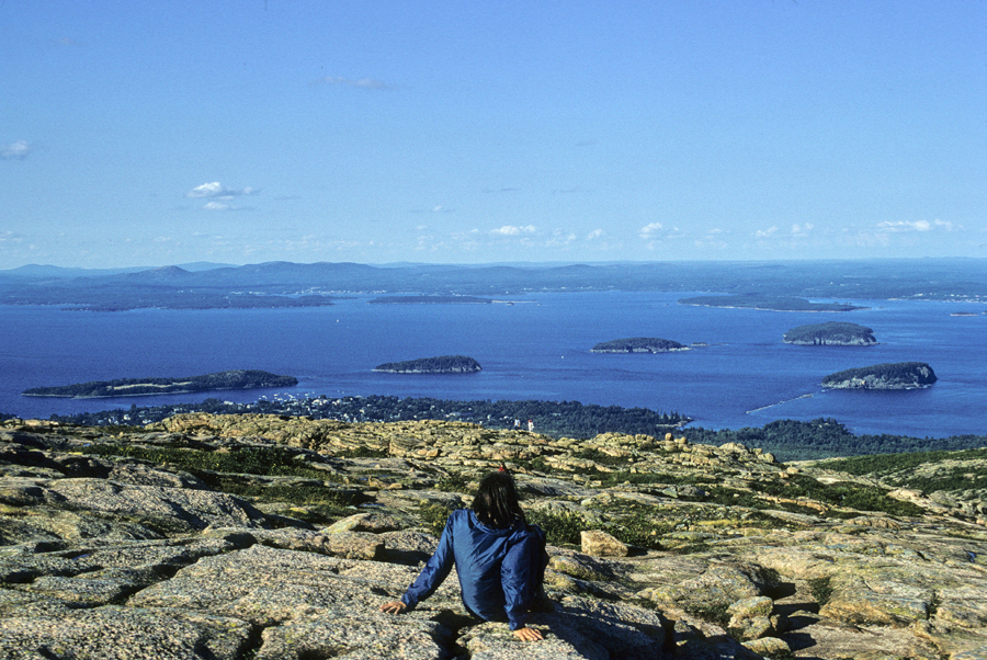
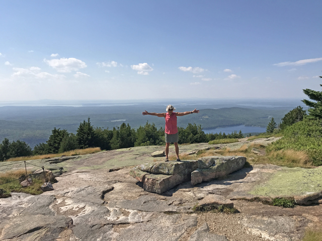
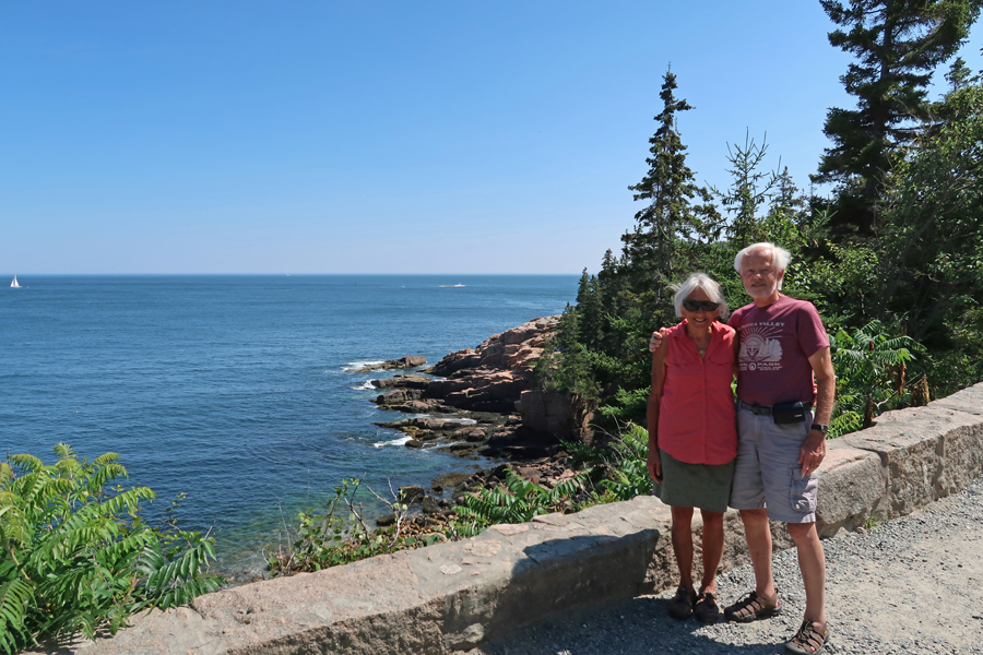
7/20 W – Kate’s Birthday! – said goodbye and did the 3-hour drive to Acadia NP. Helen and I were here in 1970 when we were on a road trip to the Eastern Canadian Provinces with our mothers in our VW camper. Helen taking in the view from atop Cadillac Mountain (1530ft) on Mount Desert Island, where the first rays of sunshine strike the continental USA. You can see Bar Harbor below, as well as islands in Frenchman Bay.
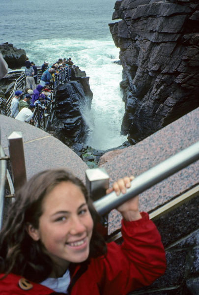
Kate and I visited in 1996 after we climbed Mount Katahdin by way of the Knife’s Edge. Here she is at Thunder Hole.
Kate and I had a cloudy/rainy day and could not see a thing from the top of Cadillac Mountain
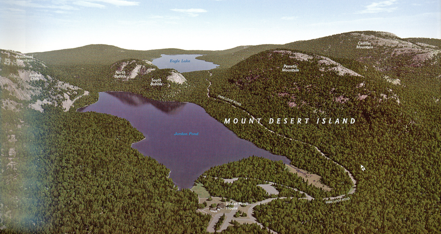
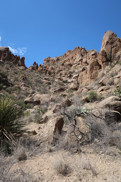
Some of Acadia NP land –
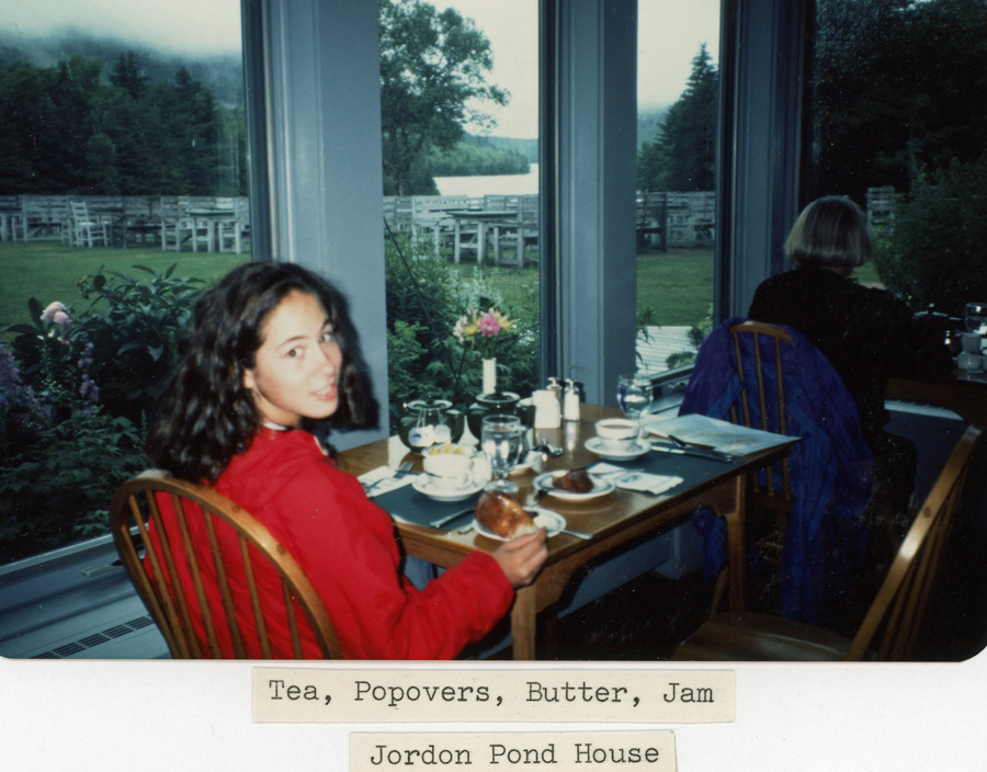
However, she was able to experience a form of high tea at the Jordan Pond House.
We did a long drive around Mount Desert Island, picture at low tide –
We camped at the Seawall Campground in our 1983 GMC van. Here I am making a healthy Lipton dinner at the beach.
It was clear the next morning when I took this photo of the Bass Harbor Head Lighthouse
2012 America The Beautiful Quarters Coin Acadia Maine Uncirculated Reverse
HAD TO bring back some lobster trap buoys for Helen!
This year we had to have an advanced reservation to drive the auto road to the top of Cadillac Mountain. It cost $6 online and I had a 3:30 to 4pm window to check in at the entrance gate. The reservations are in demand, especially for the earliest times, so as to catch sunrise on the top of the mountain (sold out months in advance). View from the West Parking Lot
View from the East Parking Lot
Same spot as the first photo of Helen above – top of Cadillac Mtn with Bar Harbor in center 2022
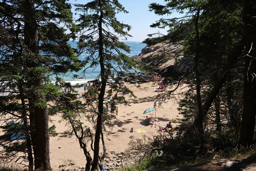
Sand Beach – A “Pocket Beach”
Beautiful day for a walk along the coast
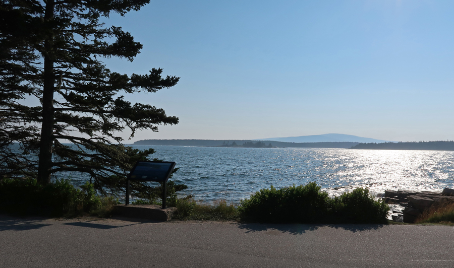
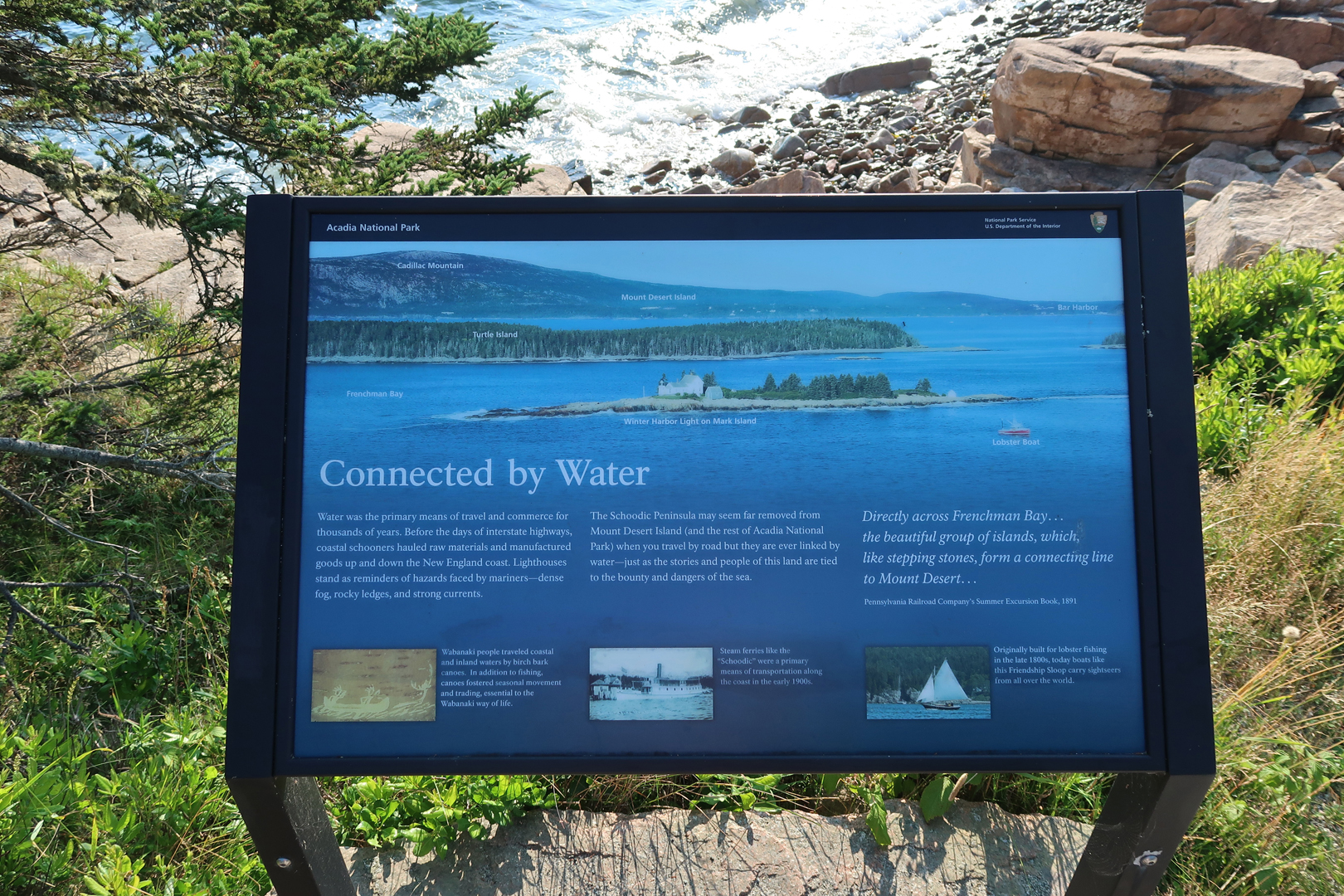
We next drove around Frenchman Bay to the Schoodic Penninsula, which is a unit of Acadia NP
Schoodic Point provides a wonderful view across the Bay back toward Cadillac Mountain
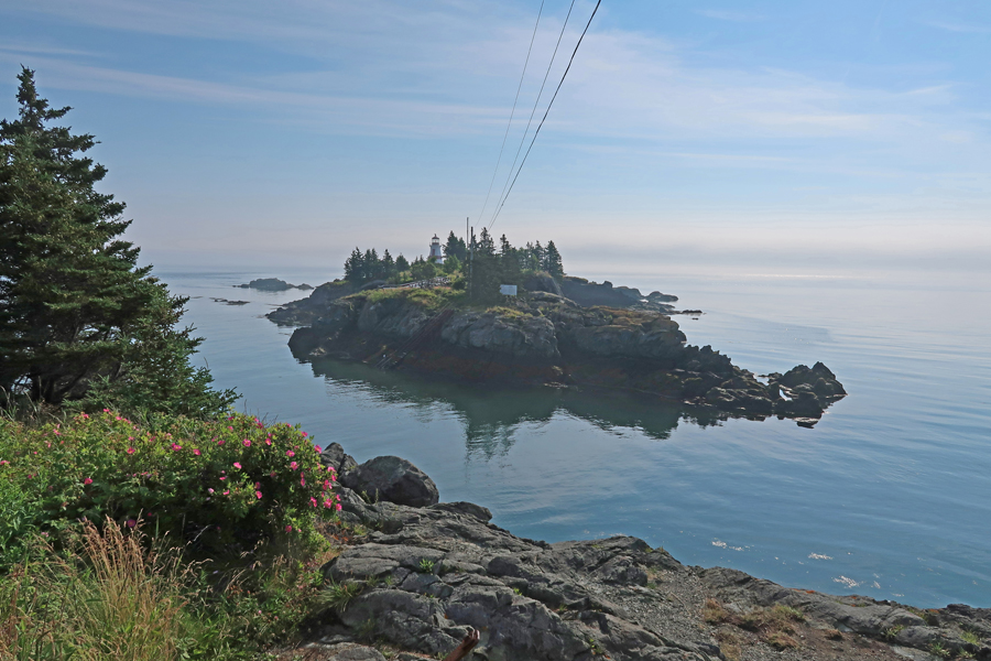
This granite point provides excellent ocean views –
Lobsterman and son, checking the traps
Stayed the night in Lubec ME
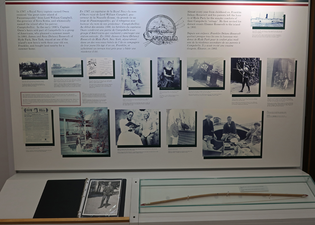
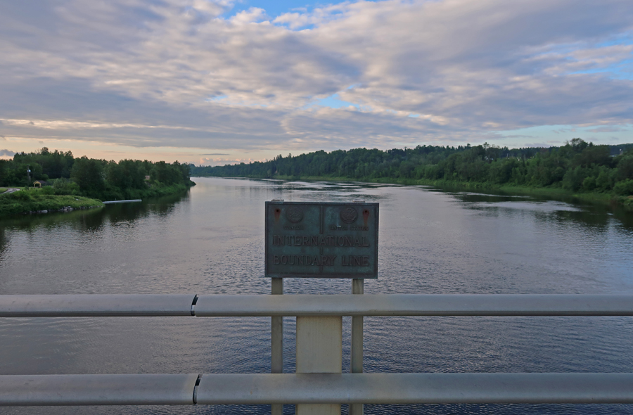
7/21 Th – crossed the border into Canada on the FDR International Bridge completed in 1962. Before that, island access was by boat from Eastport ME. We drove to the northeastern tip of Campobello Island to see the Head Harbour Lightstation (also known as the East Quoddy Light). The island is in New Brunswick and the wooden lighthouse (1829) has a distinctive St. George red cross daymark. Unfortunately, it was hightide and we were unable to hike to the lightstation.
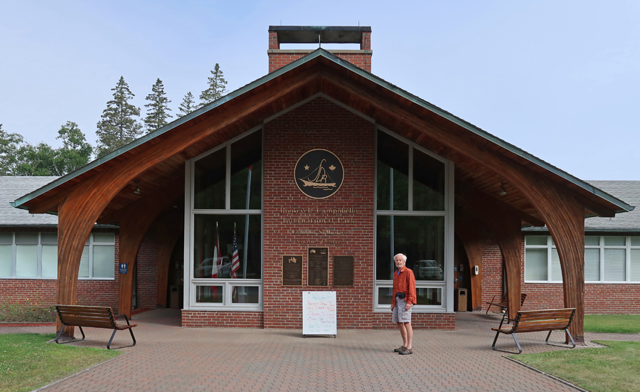
Campobello Island is on Atlantic Daylight Time (ADT), one hour ahead of EDT. So, I planned our arrival at the Roosevelt Campobello International Park Visitor Center (an Affiliated NP Unit) for 10am (9am EDT) when it opened. This was our brochure in 1970 when we visited with our mothers and then me in 2022.
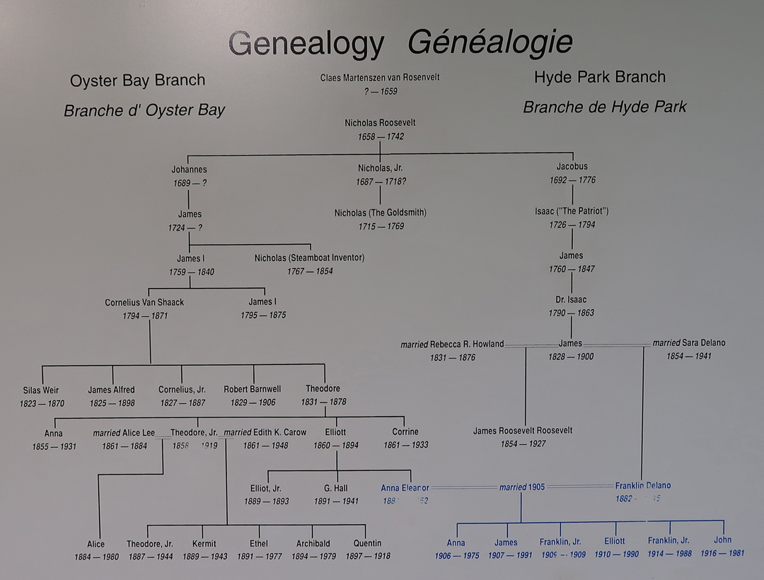
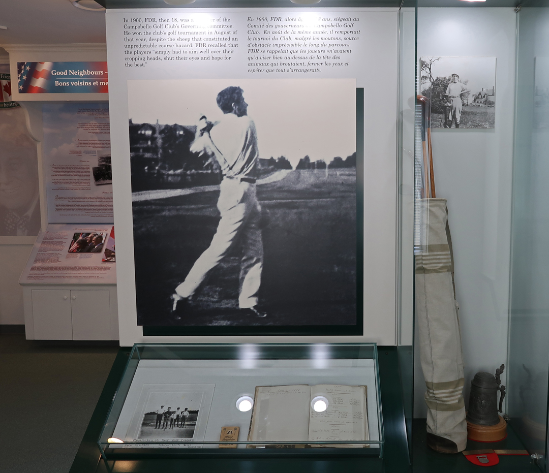
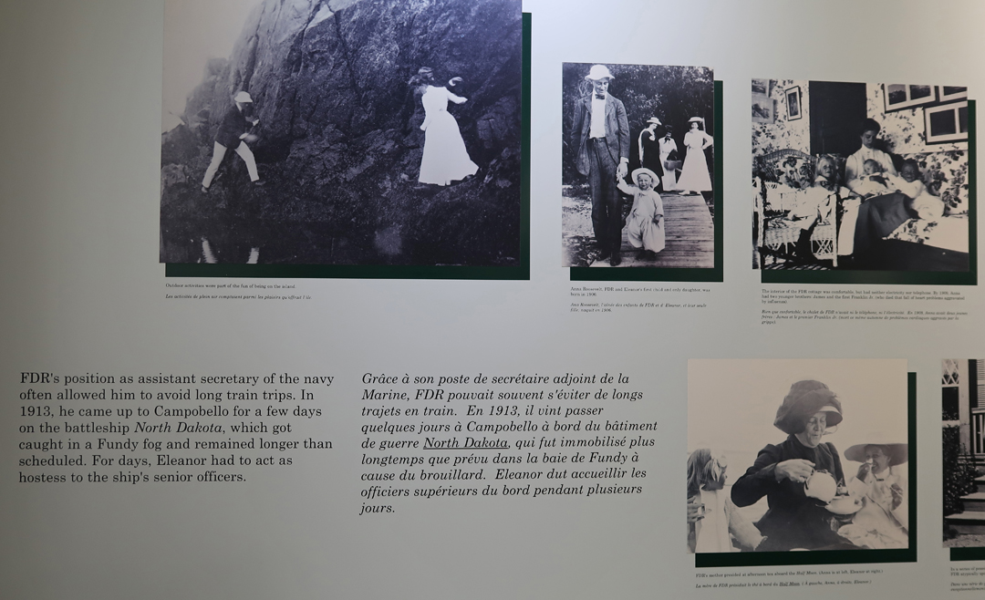
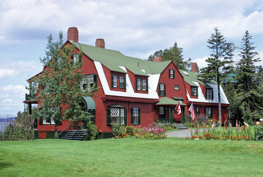
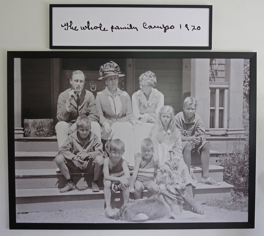
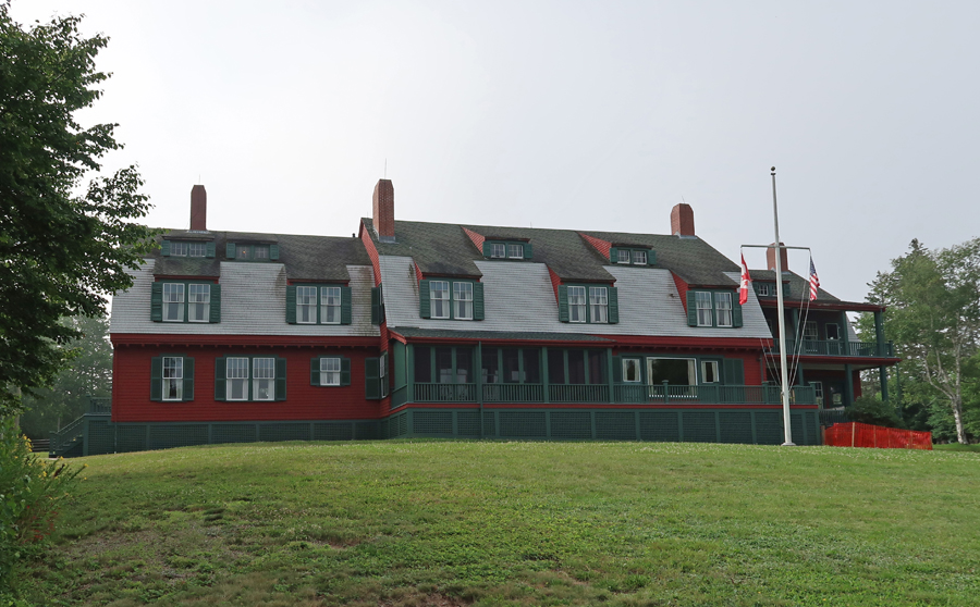
The Visitor Center (VC) tells the Franklin Delano Roosevelt’s family story. His father James bought the island with other investors and built a “cottage” here in 1883. FDR (1882-1945) spent his summers at that cottage until 1908. In 1909, their next-door neighbor Mrs. Hartman Kuhn died. In her will she offered her 34-room cottage to FDR’s mother Sara for the bargain price of $5,000 including all furnishings. Sara presented the cottage to her son Franklin as a belated wedding gift in 1909. FDR had married his fifth-cousin Eleanor Roosevelt in 1905. Her father had passed, so her uncle President Theodore Roosevelt gave the bride away. They enjoyed the first cottage and then the second each summer. All five of their healthy children experienced life at Campobello. A sixth child, the first Franklin Jr, died in infancy. Franklin contracted polio in 1921 (at age 39) and fell ill at the cottage. He was elected President four times starting in 1932. He died in 1945 shortly after starting his fourth term.
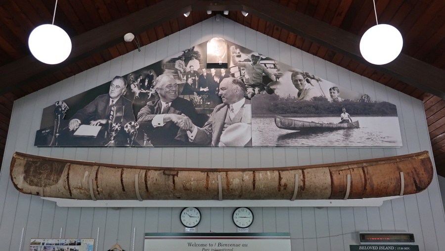
There is a birch bark canoe above the counter of the VC which was made for FDR by Tomah Joseph a Passamaquoddy elder and life-long friend of the President. Franklin had good relationships with the local Native Americans.
The museum had many interesting photos –
My Campobello cottage photo from 1970
Photo in entrance room of cottage
Cottage tours are free and take about a half hour. Select room photos follow – Playroom
Tour Guide in Study
Living Room
Dining Room
Butlers Pantry
Kitchen
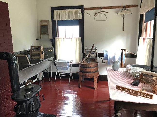
Laundry
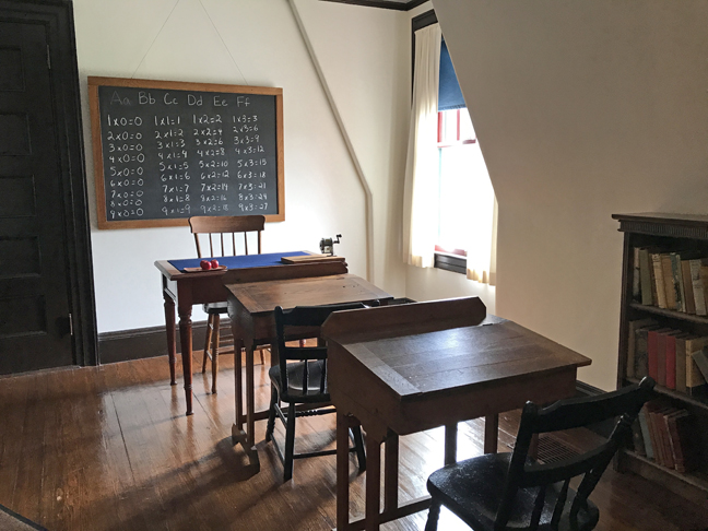
Schoolroom – children were home schooled in Hyde Park and here at their summer home as well
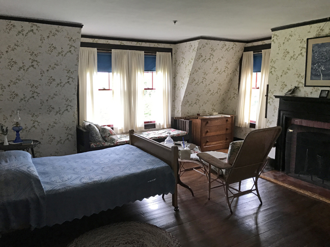
Master Bedroom
Bath
Boys Room
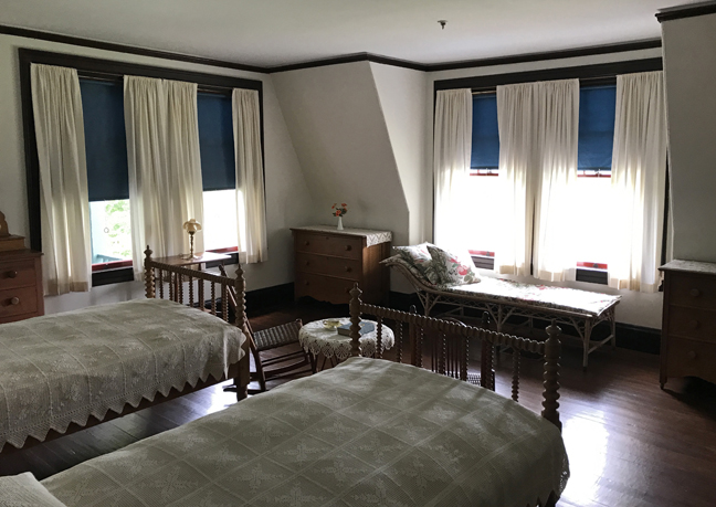
Guest Room
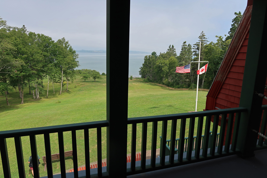
View from Covered Porch – Eastport ME in distance
Bay side of Cottage
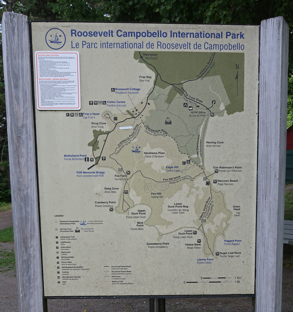
Map – we toured the grounds and then drove to the Mulholland Point Light
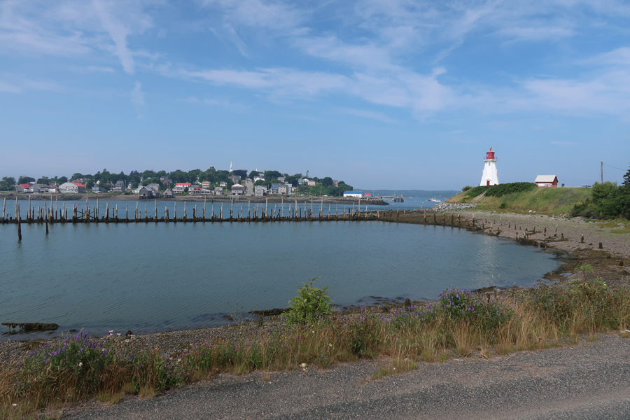
Lubec ME from Campobello Island New Brunswick Canada 2022
Mulholland Point Light – 1970
We re-entered the USA and in 10 minutes were at the West Quoddy Head Light, which is the eastern most point of the 50 states
This is a photo of the West Quoddy Head Light that I took in 1970 with Campobello Island in the background
1.5hrs to Rt 1 N and Saint Croix Island International Historic Site. See Blog to read about our first visit to this IHS – October 2017. This time it was low tide, and we could walk down to the shore of the St. Croix River to view the island, which is in the middle of the river with New Brunswick Canada on the opposite side.
The island was the beginning of a permanent European presence in Northern North America. The winter of 1604-1605 on Saint Croix Island was a cruel one for Pierre Dugua’s French expedition. Iced in by freezing temperatures and cut off from fresh water and game, 35 of 79 men died. As spring arrived and native people traded game for bread, the health of those remaining improved. Although the expedition moved on by summer, the beginning of a French presence in North America had begun.
Helen with one of the locals
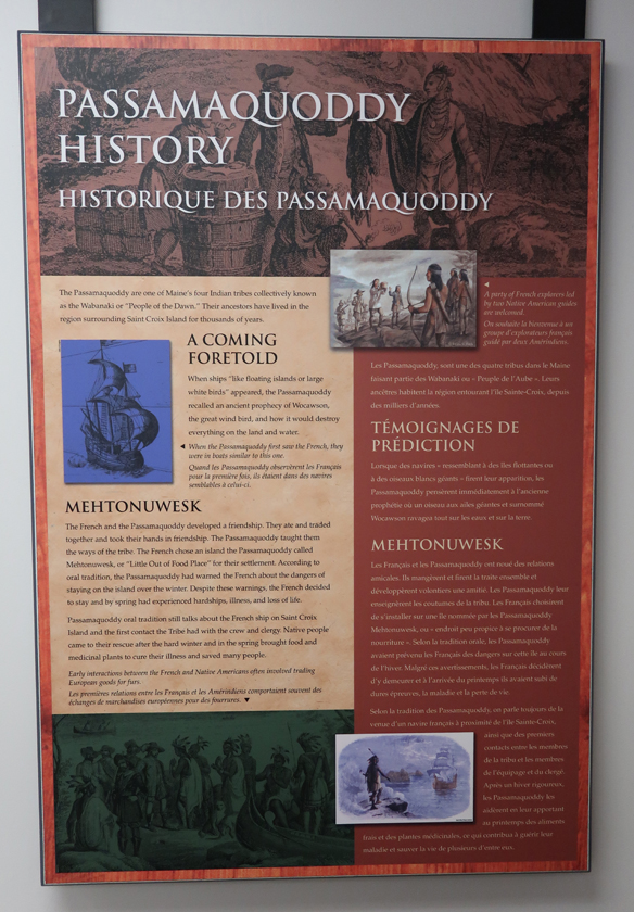
On this visit, we were able to enter the visitor center and learn more about the site and history. The Passamaquoddy Native Americans, who lived here, had a prophesy of how a great white bird (sailing ship?) would destroy everything on land and water. However, the historical information here states that the French and Passamaquoddy had a friendly and supportive relationship.
We then drove north on US Rt 1 stopping at a house sale in Calais ME (Helen bought an anchor plus misc. items) and then a sale along the road somewhere north of Presque Isle ME. She is still talking about the old handmade potato basket she should have bought there. In the 17th and 18th centuries Irish and Scotch-Irish immigrated into the area and introduced potato farming.
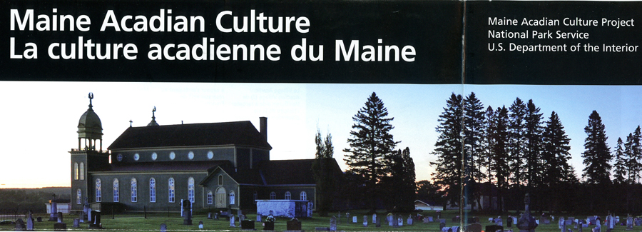
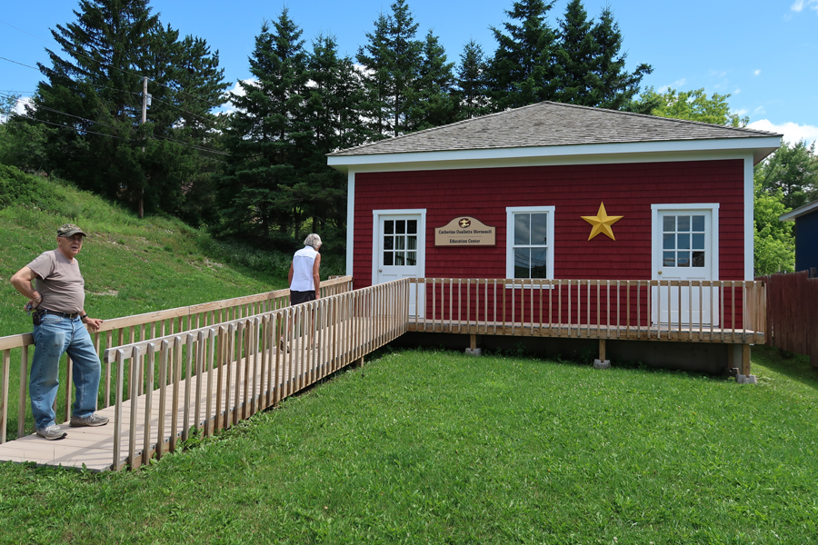
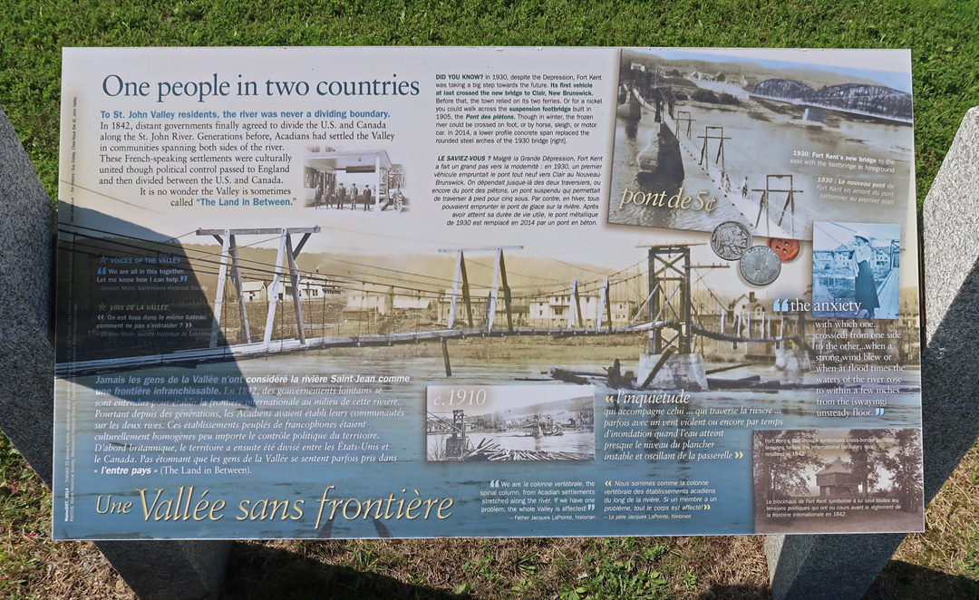
On the way to Van Buren ME, we made a quick stop in Cyr Plantation ME to see the Governor Brann School. It is one of twelve locations that are part of the Maine Acadian Culture Project, an Affiliated National Park Unit. The Project ties together a collection of twelve sites on the U.S. side of the Saint John River Valley border with Canada. The focus is on the unique ethnicity and culture of the region. In the 1600s French Acadians settled Nova Scotia. British took over in 1755 and proceeded with a forced relocation of the French. Some of these Acadians were relocated to New Orleans (“Cajuns”) and some to Fredericton New Brunswick.
The Governor Brann School tells the story of how a Maine 1919 law required the language of instruction in public and private schools to be English. The school was named for Louis Brann, who was Governor of ME at the time of its construction in 1934. It is the best-preserved of the community’s former district school buildings; it was listed on the National Register of Historic Places in 1993. The 1959’s Handbook for Teachers, stated that “Any teacher violates (our) trust, both legally and morally, who allows herself or any pupil to revert to French in the classroom . . . at recess, around the playground . . . or even away from school.” It is now used by the plantation as a polling station and meeting place.
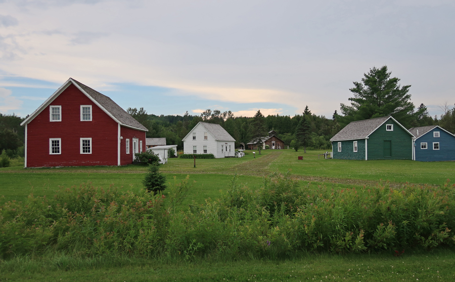
We were able to get to our next site, the Acadian Village ($7 open noon to 5) east of Van Buren ME before dark but after they closed. There are seventeen “Acadian” structures that have been reconstructed or brought here from around the St John River Valley. In 1785, Acadians who had settled in St. Anne Des Pays Bas, Fredericton (New Brunswick), after the English forced them out of Nova Scotia ~1755, were again forced to move by English Loyalists. Twelve thousand British Loyalists immigrated north to the Fredericton area after the American Revolutionary War. The Acadians, displaced again, made their way up the St. John River to what is now the northern border of Maine.
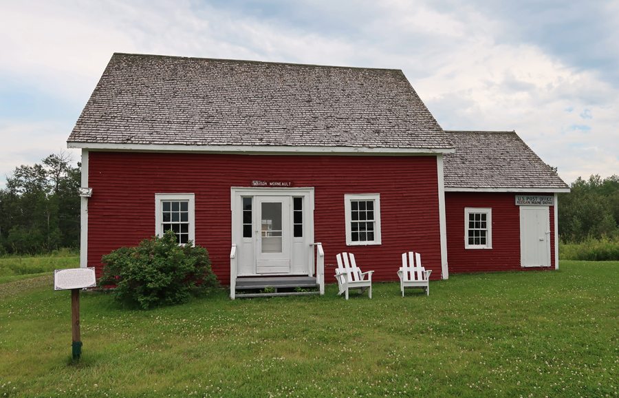
The settlement reflects and incorporates those traits inherent to the Acadians. These skills include fishing, lumbering, and ship building. A number of these dwellings are significant in terms of their distinct Maine Acadian construction such as nautical features of “ship knees,” used for supports in construction, which can be seen in the Morneault house and the Acadian barn.
These “Acadians” still speak French and comprise the largest French-speaking population in North America, except for the Canadian Province of Quebec. The site is owned and operated by Notre Héritage Vivant/Our Living Heritage. It was listed on the National Register of Historic Places in 1977.
Roy House
Center of Acadian Village
Morneault House – The settlement reflects and incorporates those traits inherent to the Acadians. These skills include fishing, lumbering, and ship building. A number of these dwellings are significant in terms of their distinct Maine Acadian construction such as nautical features of “ship knees,” used for supports in construction, which can be seen in the Morneault house and the Acadian barn.
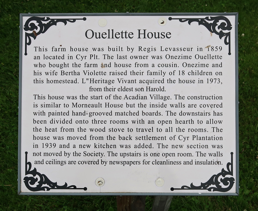
Ouellette House
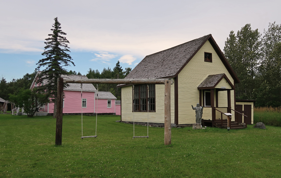
Notre Dame De L’ Assumption Catholic Church
St. Amand-Ayote School House (1900)
Doctor-Optician House
Boardwalk and Businesses
Bangor & Aroostock RR Station
Ate in Van Buren and then crossed the St John River into Canada and stayed at the Daigle’s Motel in Saint Leonard.
7/22 F – crossed back into the US of A – St John River boundary looking East. Canada on left US on right
Acadian Flag, which you will see many times in today’s photos – the French Flag with a gold star in the upper left corner.
Starting in Van Buren ME, this map shows our morning stops on US Rt 1 through Grand Isle ME
Our first stop was the Abel J.Morneault Public Library in Van Buren, which is a unit in the Maine Acadian Culture Project. Local libraries are important because they hold records related to the Acadian experience. Yesterday, we saw the Morneault House and barn at the Acadian Village outside of town.
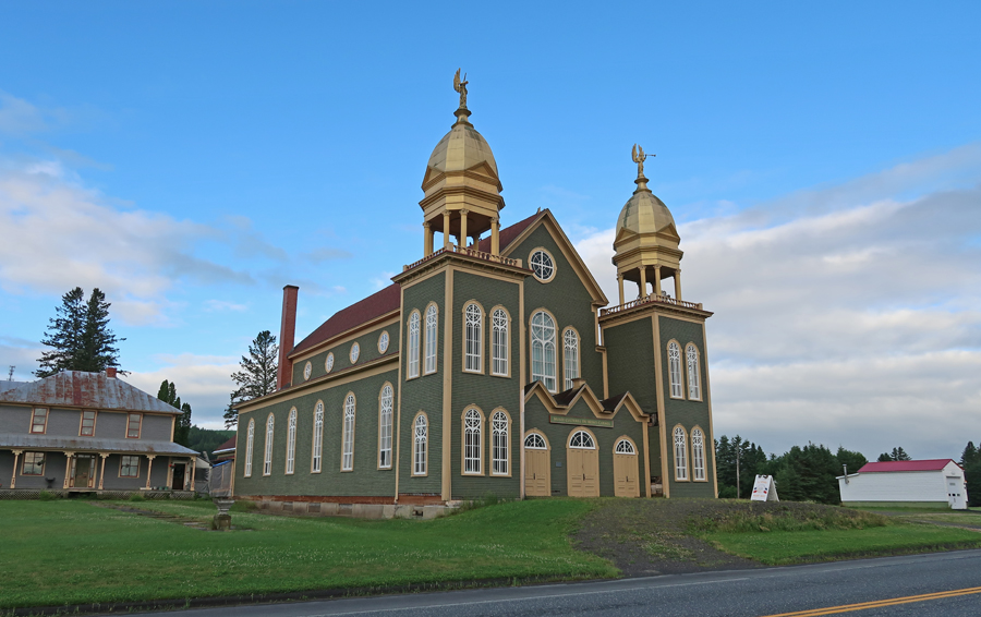
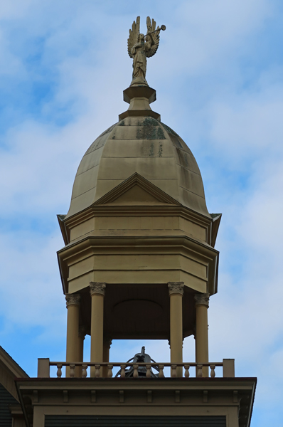
A half-hour ride took us to Lille ME and the Musée Culturel du Mont-Carmel. It is located in the former Our Lady of Mount Carmel Catholic Church and tells the story of the importance of religion in the Valley. It is one of the only surviving 19th-century Acadian churches in northern Maine. This architecturally distinctive building was placed on the National Register of Historic Places in 1973. As you can see, it is highlighted on this NPS brochure.
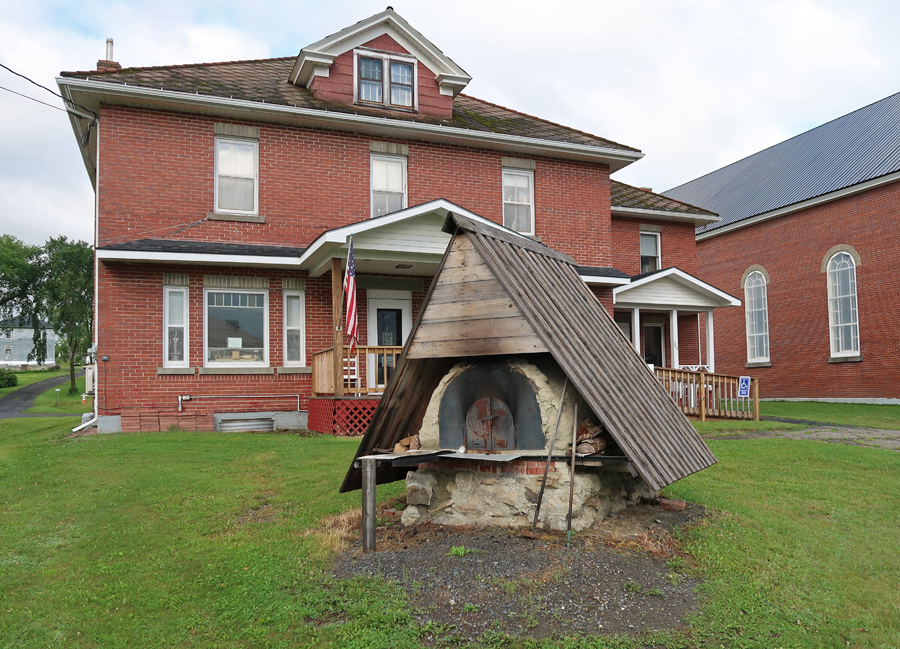
Greater Grand Isle Historical Museum with bread oven out front
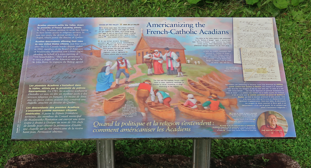
Roadside Shrine with marker explaining the Americanizing of French-Catholic Acadians
This map shows the location of each of our remaining stops through the Saint John River Valley
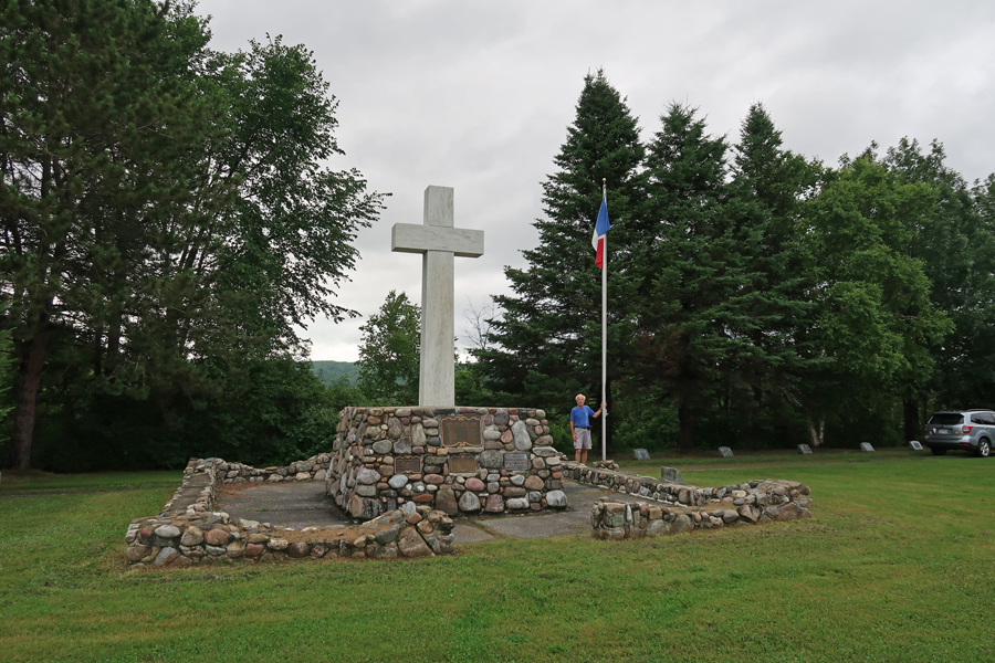
Acadian Landing Site –the Acadians landed at this site on the St John River in 1785. It is marked by a large marble cross. It is also known as the Acadian Cross Historic Shrine. It was listed in the National Register of Historic Places in 1973.
As mentioned, Acadians were living around Fredericton New Brunswick in 1784 at the end of the American Revolution. At that time, the British encouraged their Loyalists in the U.S. to move to that area, and 12,000 arrived interfering with the Acadian way of life. That was the main motivation for the Acadians to move up the St John River to this location. The land here was good for farming and they were a lot closer to the Catholic center in Quebec.
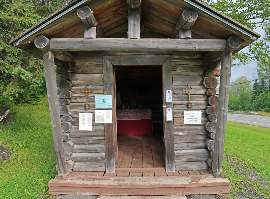
The Tante Blanche Museum is nearby, note St. David Catholic Church in background. Some masses are still held in French. This museum tells the story of Tante Blanche, a heroine during the Colonists black famine.
In 1797, after two years of flooding, an eight-day winter storm descended on the area. Tante Blanch gathered food and clothes from her relatives and friends and then snow-shoed to assist her sick, hungry, and cold neighbors.
We continued west along the St. John River for ten minutes to Madawaska, which was a French Acadian center. The Madawaska Library
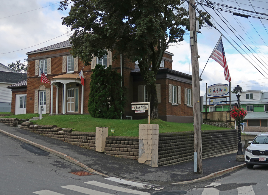
Le Club Francais in Madawaska
From Madawaska, it was a 20 min drive south to the Pelletier-Marquis House. It is now the St. Agatha Historical Society Museum. It represents an older working-class home and is thought of as “everyman’s home.” Humble in appearance, its original site, rock foundation, low ceilings, buckwheat hull insulation, wide floorboards, and square-headed nails make this a unique historical structure. It dates from 1853 and has two surnames because at one time two families lived there.
A donated Acadian Cabin was relocated here from Staratha ME
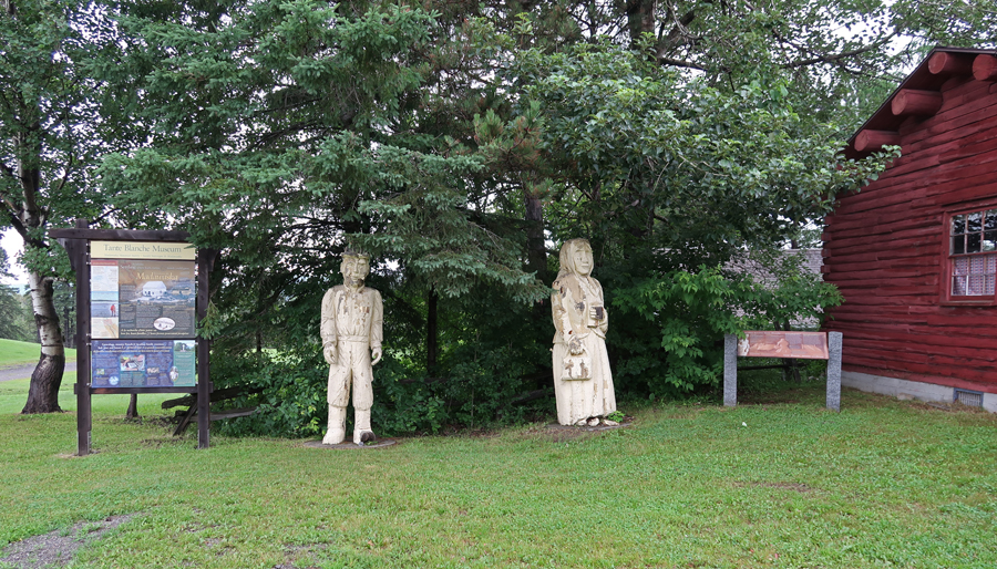
There are Colored Wood Carvings at several of the Acadian sites
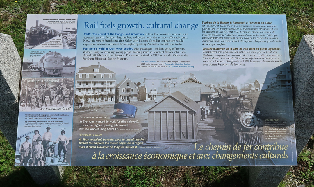
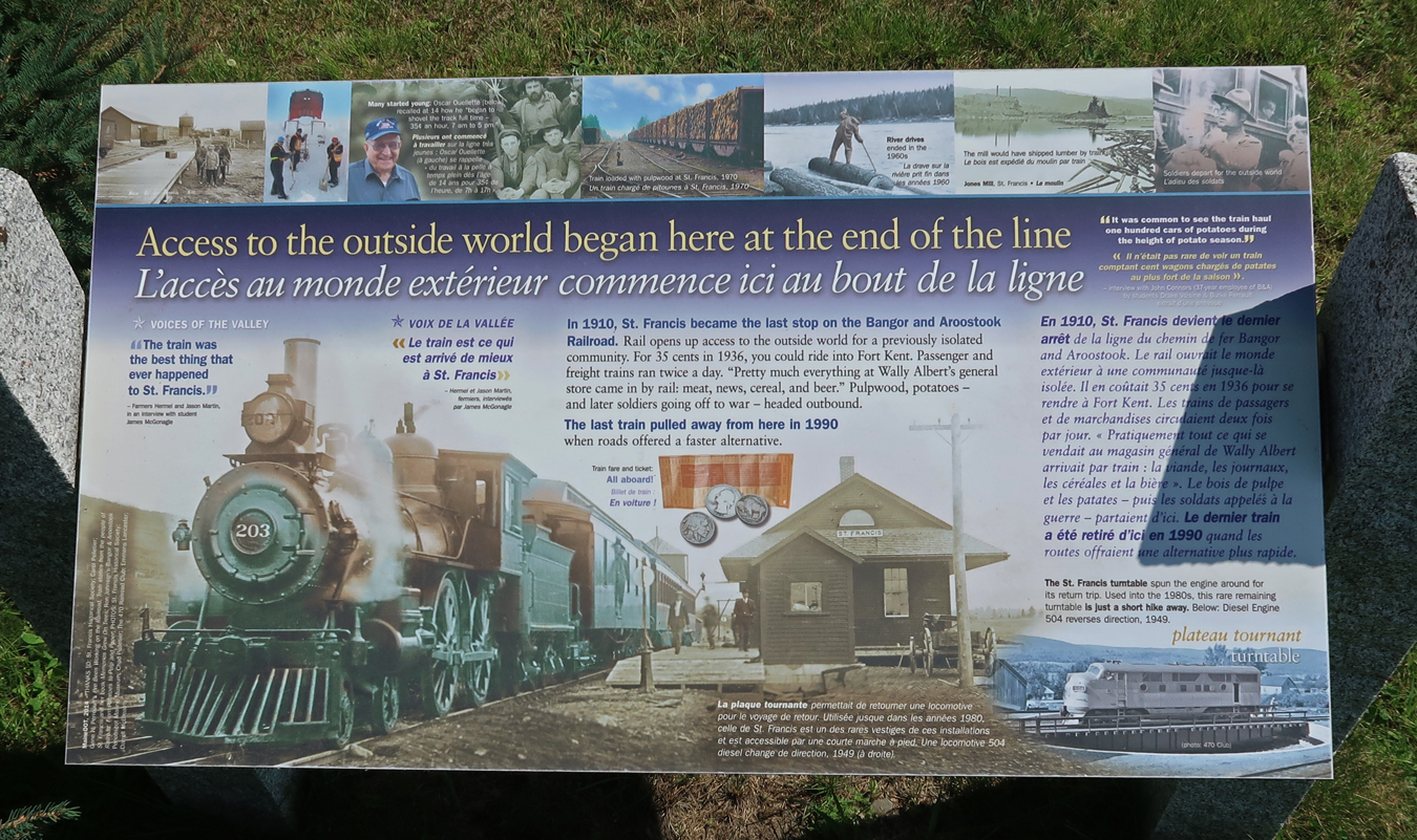
Our next stop was the Frenchville Railroad Station and Water Tank, built in 1910 by the Bangor & Aroostook Railroad (B&A). This site was added to the National Register of Historic Places in 1995. The station was retired in 1971. Tracks here ran along the St John River.
The Town of Frenchville purchased the water tank from Bangor & Aroostook Railroad and used it as a water reservoir for the fire department until 1981. The Frenchville Historical Society took over maintenance of the site in 1985. There is a long caboose that was built by the Pullman Co. as a troop transport car in 1943. It was acquired by the B&A in 1949 and refitted as a caboose. It remained in service until 1981 and was donated to the Frenchville Historical Society in 1988.
The water tower became obsolete in 1958 when the diesel locomotive replaced the steam locomotive. Almost every telephone/electric pole had an American Flag. Local communities, along US Rt 1 and ME Rt 161, put them up at the beginning of summer and take them down in the fall.
This building across US Rt 1 was owned by Hector Martin!
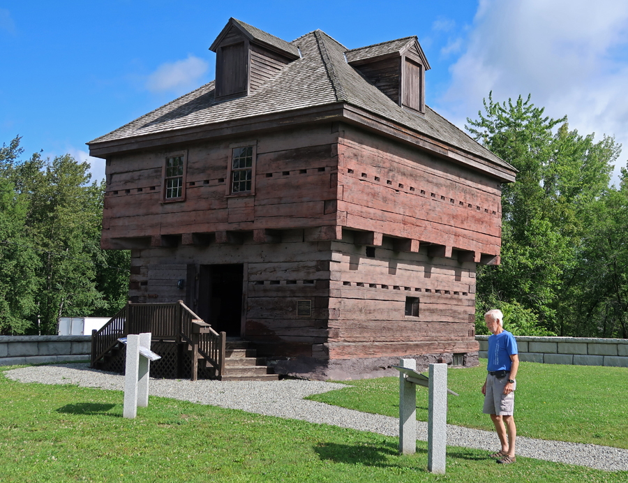
It took 30 min to get to the Fort Kent Blockhouse (1839), located in Fort Kent State Park. It is the only surviving fortification built during border tensions with neighboring New Brunswick, known as the “Aroostook War.” The fort was added to the National Register of Historic Places in 1969 and declared a National Historic Landmark in 1973.
The “Aroostock War” of 1839 was an undeclared and bloodless War with Great Britain over the boundary between New Brunswick (British) and Maine (USA). In 1842 a treaty was reached which distributed land to both sides.
1839
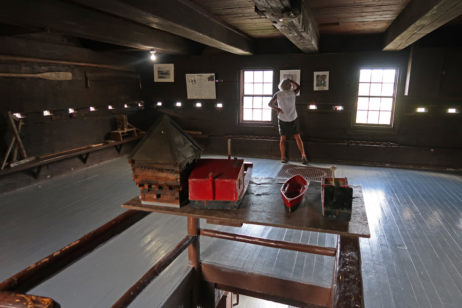
Second floor of Block House
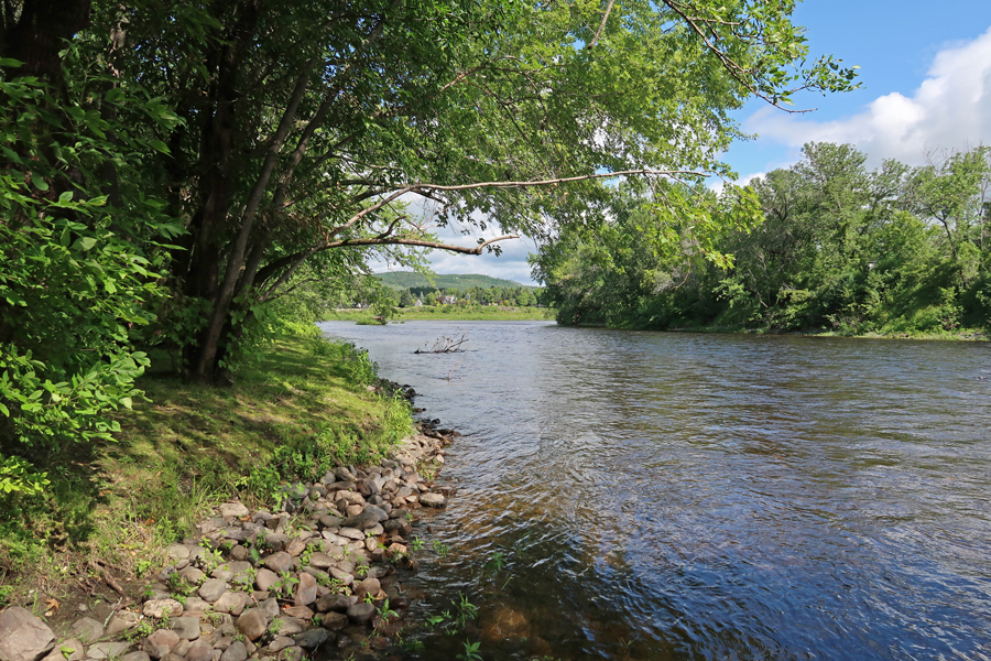
Fish River as seen through a rifle port.
After a short distance it empties into the St John River.
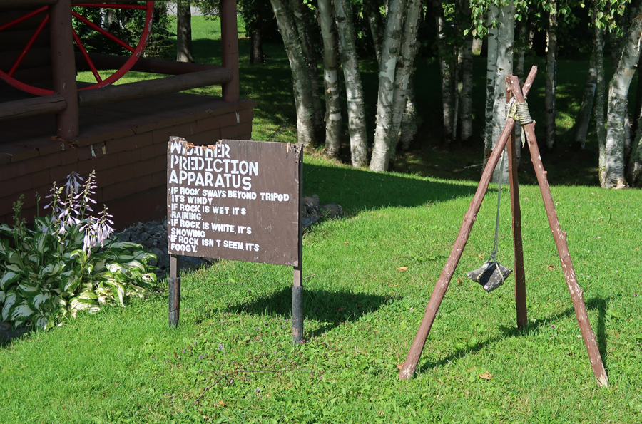
Famous Weather Prediction Apparatus, with one caveat; If the rock is damaged, the bears are hungry
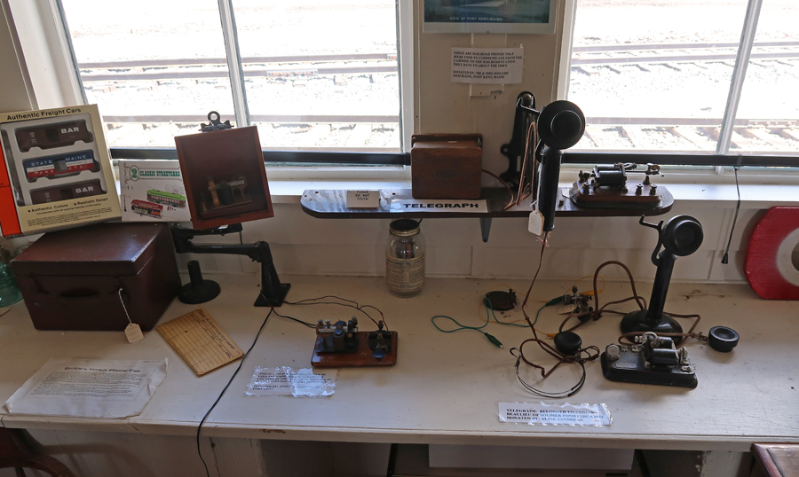
We then went downtown to the Fort Kent RR Station.
The buildings were not open, but I met Ron, a staff member, who gave us a personalized tour.
Telegraph and old phones
Ron, pointed to his father and uncle
The Paul D. Thibodeau Visitors’ Center of the Fort Kent Historical Society is next door.
The terminus of US Rt 1 is at the border crossing at the St John River in Fort Kent – 2,209 miles from Key West FL to Fort Kent
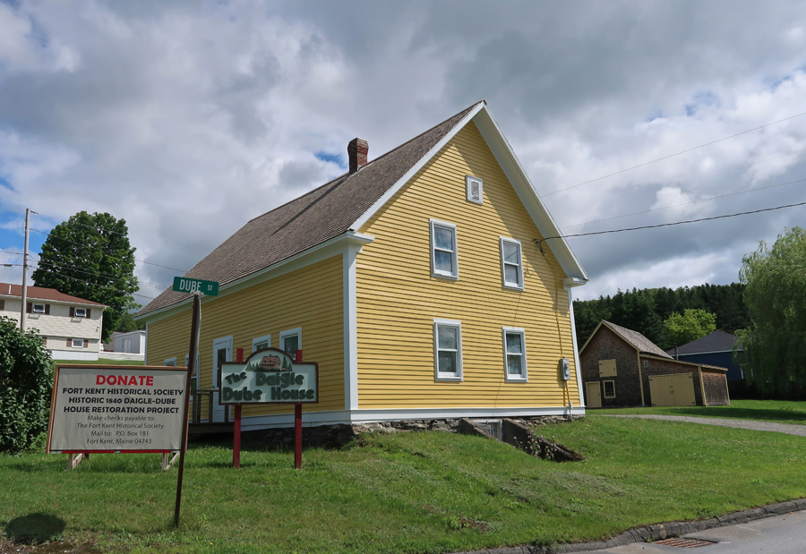
Ron then took us across the tracks to the Daigle-Dube House, so named because both families lived here.
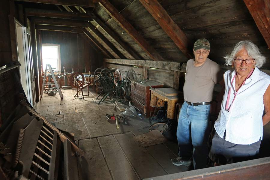
The house was being restored, but Ron opened it to give us a brief tour.
You can see the RR Station from an upstairs window.
There is a barn behind the building as well as a small schoolhouse that is being restored by two former teachers.
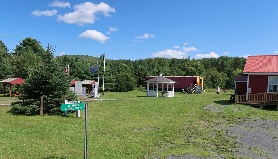
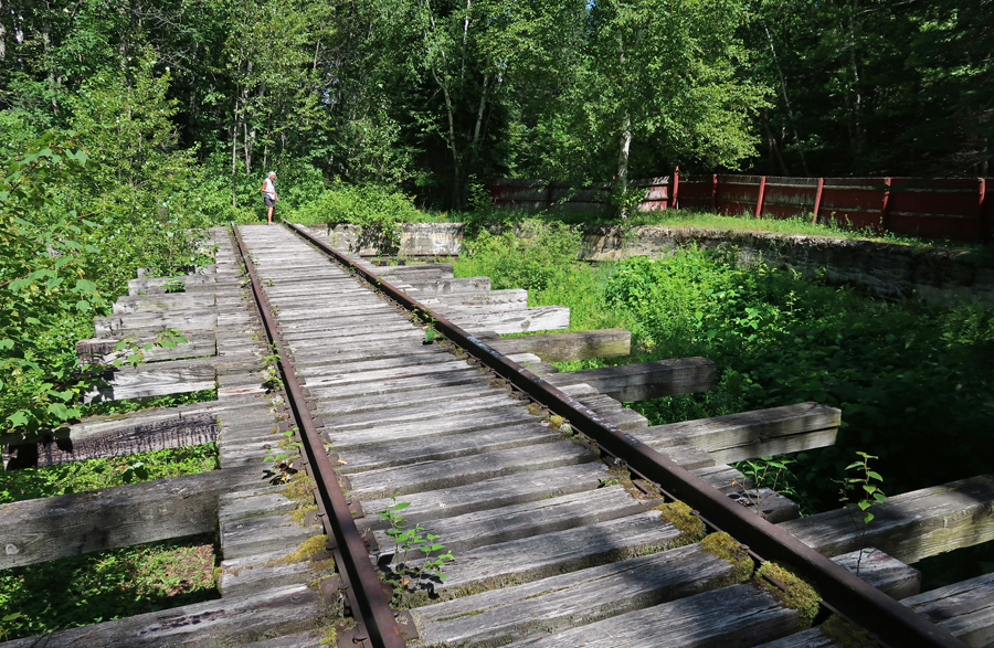
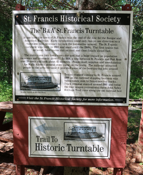
Turned onto Rt 161 West and drove about 25 min to the St. Francis Historical Society Museum
This was the end of the line for the Bangor – Aroostock RR
Wish that was my gas price for this trip!
Hiking to the Turntable – as a young boy I would walk to the turntable near 50th and Kedzie in Chicago to watch them move Engines inside for servicing, repair, and just to turn them around, because early locomotives could only run in one direction! The Saint John Valley Heritage Trail runs along the old railroad bed of the Bangor – Aroostock RR.
The Allagash Historical Museum was another 15 minutes west of St. Francis. This was our final Acadian Culture destination for the day.
This is where the Allagash River empties into the St John River. In August 1975, three friends and I canoed the Allagash Wilderness Waterway – from Telos Lake to the Saint John River, 95 miles.
“40 minutes back to Fort Kent on ME Rt 161; turn left on US Rt 1 (still Rt 161) and take photo of America’s First Mile on US 1 before crossing Canadian border.”
“Continue on Rt 161 in Canada to Caron Brook and then turn left (N) onto New Brunswick Rt 120, which becomes Rt 289 when you cross into Quebec. Continue to end of Rt 289 and take ramp onto A20, Trans Canada Hwy, to Quebec. Continue on Trans Canadian Hwy to Drummondville and then turn left on I55 to Sherbrooke.”
Estimated 6hrs to Comfort Inn in Sherbrooke, Quebec, turned into 7hrs when I discovered I did not have cell phone service in Canada and therefore did not have access to Google Maps! I did well with the above directions to Sherbrooke but then had to stop twice to ask directions. I took photos of my French “helper’s” phone each time and used those to navigate to our destination.
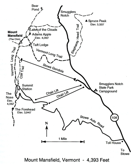
7/23 Sa – It took 3hrs to get to Stowe VT because of a half-hour hold up crossing the border. Also, stopped to buy a half gallon of “real” VT Maple Syrup along the way! View of Mt Mansfield as we approached from the east. The ridge of the mountain looks like a face, facing the sky, with the chin being the highest point.
We arrived at the Stowe Mountain Resort at about 10:30am. I had anticipated doing the Gondola ride and then the Cliff Trail-Long Trail combination to get to the summit, because when I checked the Resort information online two weeks earlier, it stated the Stowe Auto Road (toll) was closed due to winter damage.
However, when we arrived, we discovered they had opened the toll road. So, I paid $29 for car/driver, plus $11 for one passenger, plus tax $2.40 – adding to a total of $42.40 to drive 4.5 miles to a parking lot and Visitor Station at an elevation of 3,843 feet. That is where we accessed the Vermont Long Trail and started our 1.4-mile trek to the summit.
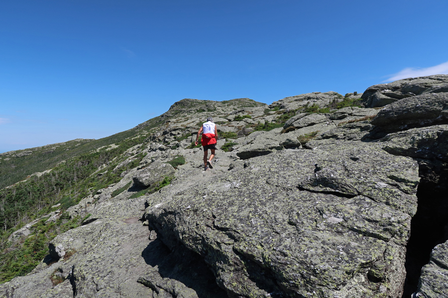
The trail was fairly level as we started hiking through pine trees. I found myself, what I thought was, a sturdy hiking stick and started using it to help with balance (I had forgotten to pack my hiking pole!).
We followed the ridge, slowly gaining elevation, until the final push to the top
The total gain in elevation from parking lot to top is 550 feet.
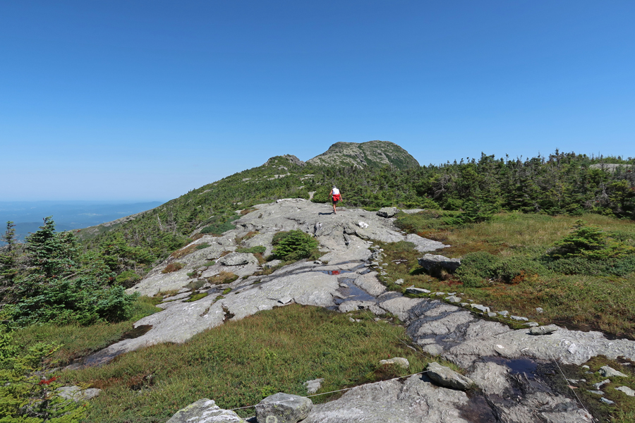
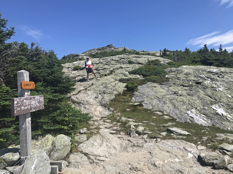
Though hot for VT, it was a beautiful day. We arrived at the summit (4,393ft) at 12:15pm. Photos were taken around the USGS marker, emphasizing that this was Helen’s 33rd state highpoint!
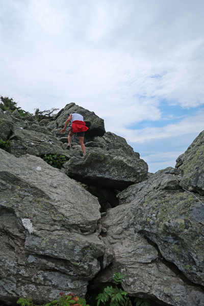
Wonder Woman
We then started down the trail. On one of the bigger step-downs my walking stick broke causing me to fall and partially roll on the rocks. I was lucky to avoid major injury ending with scratches/abrasions on both knees, arms, and back. A reminder – not to forget my hiking pole!
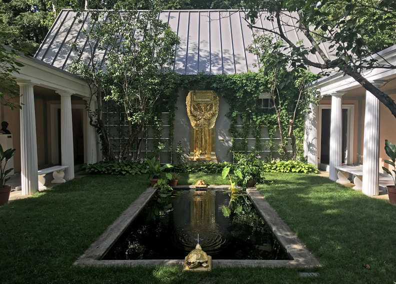
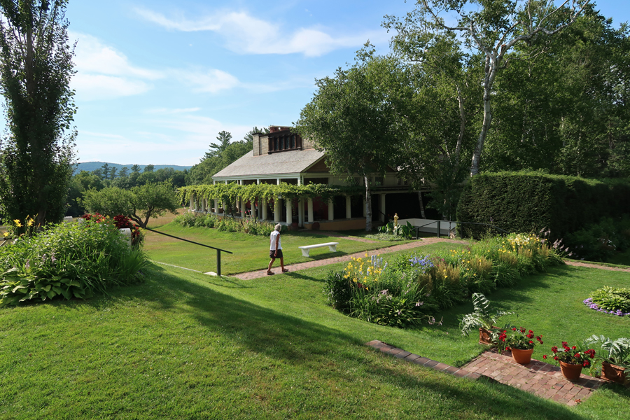
Had lunch is Stowe and called Seamus to sing him his Happy Birthday Song while we were driving to Saint-Gaudens NHS in Cornish NH. Saint-Gaudens was one of America’s greatest sculptors. This was my second visit (see August 2014 for first visit) and Helen’s first to this NHS. Following are some additional photos, starting with Aspet, Saint-Gaudens home that he named for his father’s birthplace in France. It was built in 1817 as an inn; Saint-Gaudens added dormers, the west porch, and columns. The tree is a thornless honey locust, planted in 1886.
“Artistic” photo of me looking in the window. The house is only open as staffing permits.
Flower Garden
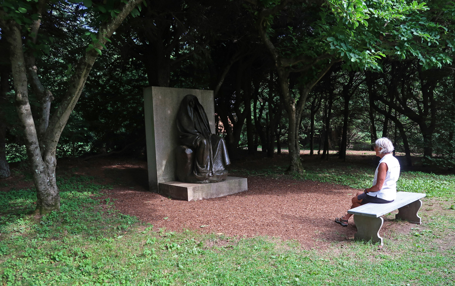
Adams Memorial, the original is in Rock Creek Cemetery in Washington D.C.
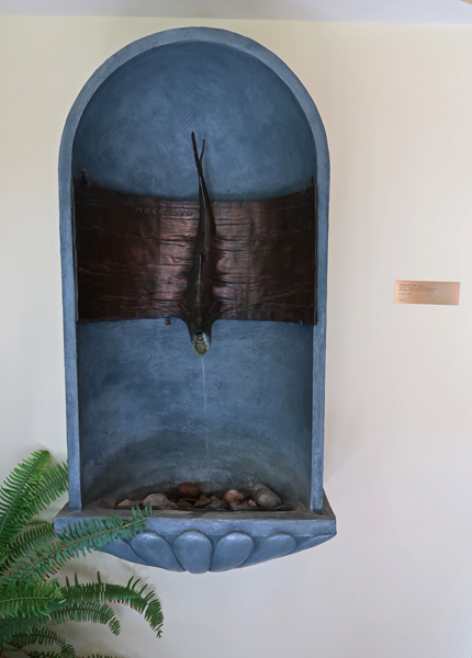
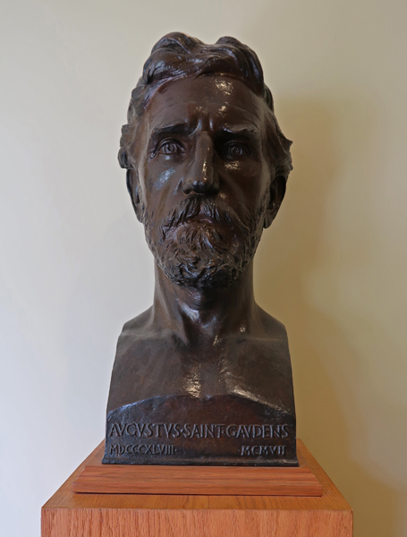
Villard Fish Font and Saint-Gaudens bust in Visitor Center
Atrium and pool with Amor Caritas and entrance to New Gallery
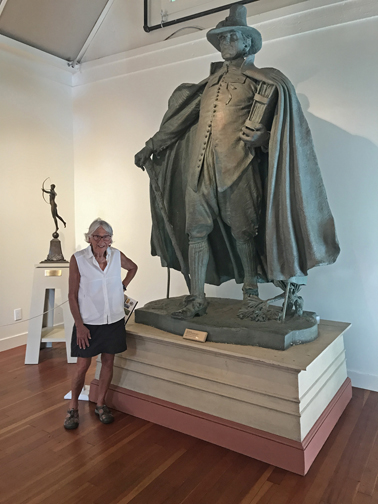
The Puritan
The Little Studio
Blow-Me-Down Mill (1891)
We stopped at Saugus Iron Works NHS on our way into Boston for a couple more photos. See October 2017 Blog for our first visit
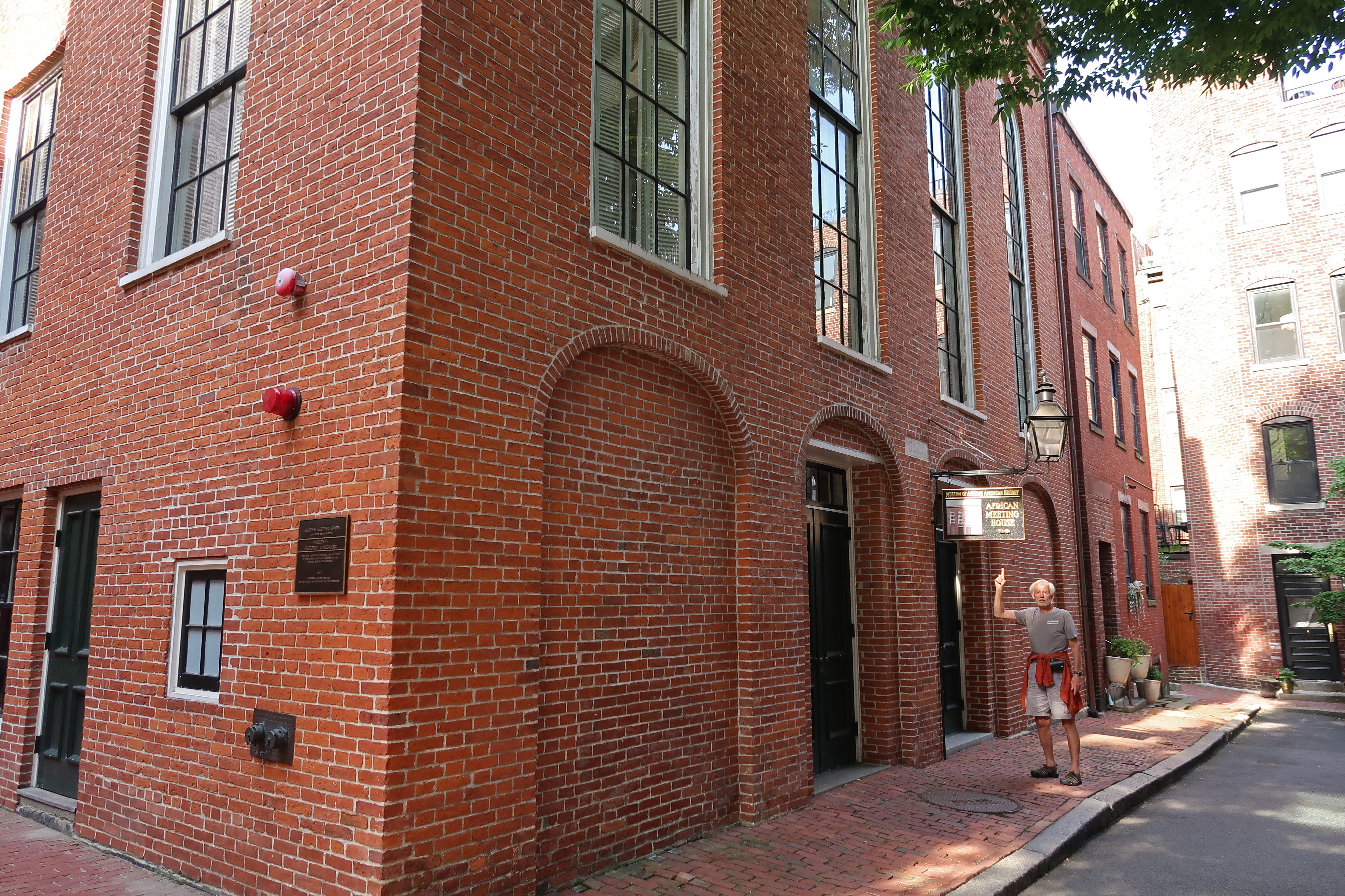
7/24 Su – After breakfast at the hotel, we drove to Beacon Hill and the Boston African American NHS for some additional photos to add to that folder (see Blog for October 2017).
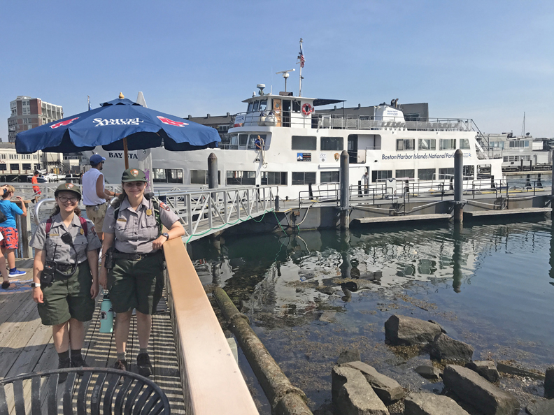
We then proceeded to the Long Wharf North to catch our ferry to Georges Island, which is one of 34 islands and peninsulas that comprise Boston Harbor Islands National Recreation Area. We did the Worlds End Peninsula in October 2017 (see Blog) but thought we should experience one of the Harbor Islands as well.
When we got to the wharf, I checked at the ferry ticket booth to determine the departure dock for our ferry scheduled to leave at 10am to Georges Island. I was told Long Wharf North #2A. So, we walked there, got in line, had our QR code scanned at the gate and boarded the ferry. At 9:30am the ferry started to move out into the harbor and the captain announced we were on our way to Salem MA! I jumped up and told the staff person on that deck that we were on the wrong ferry, and it should stop and let us off! He stated the ferry was moving and they could not do that. So, I ran (that’s relative) to the tower and opened the door to explain the situation to the captain. They threw me out (security breach), but I kept the door open enough to explain what had happened and that they never should have checked us on to the boat! Well, I was able to convince the captain to turn the boat around and re-dock. Here is Captain John’s photo with Helen –
As I stated, our ferry was to leave from dock 2A. After we were dropped off and that Salem ferry left for the second time, our ferry arrived. Here is a photo of two young park rangers who rode the ferry with us to Georges Island
Leaving Boston –
Passing Fort Independence. The English built a fort there in 1634 and that fort evolved through many changes into Fort Independence, which was built between 1833-1851.
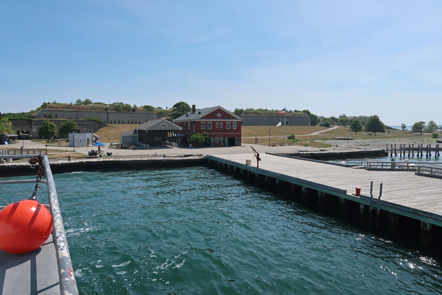
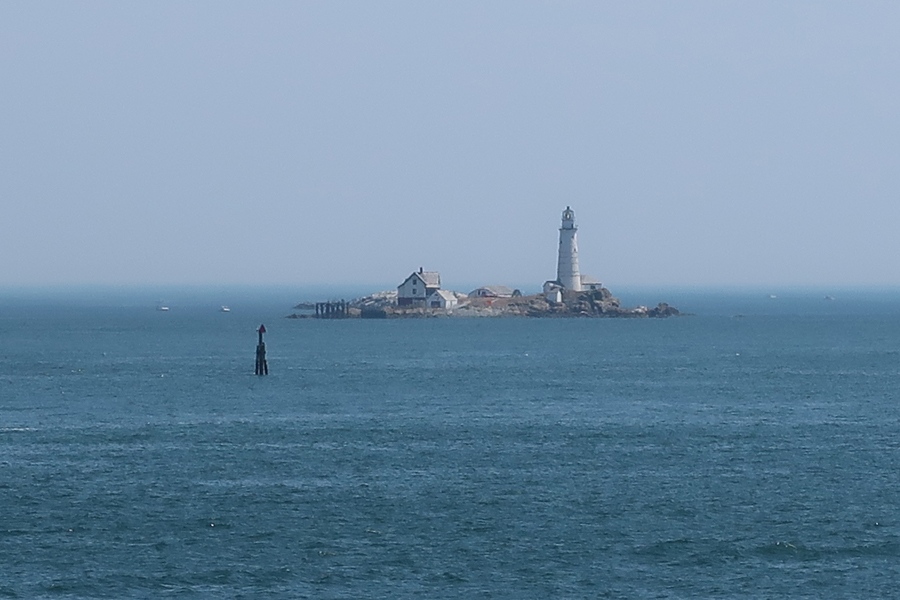
Arriving Georges Island, brick building is Visitor Center –
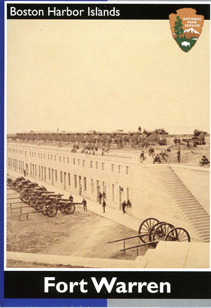
There is only one channel that is deep enough for ocean going vessels to get into Boston Harbor and it passes through the narrow channel between Georges Island and Lovells Island to the north. That is why Fort Warren was built here in 1850.
Sallyport, or entrance into fort
Fort Warren, named for Dr. Joseph Warren, who was killed during the Battle of Bunker Hill (1775). It served as a prison for 2,300 Confederate officers and government officials during the Civil War. Ranger tells the Ghost Story of “The Lady in Black.”
View east
Little Brewster Island and Light to the east
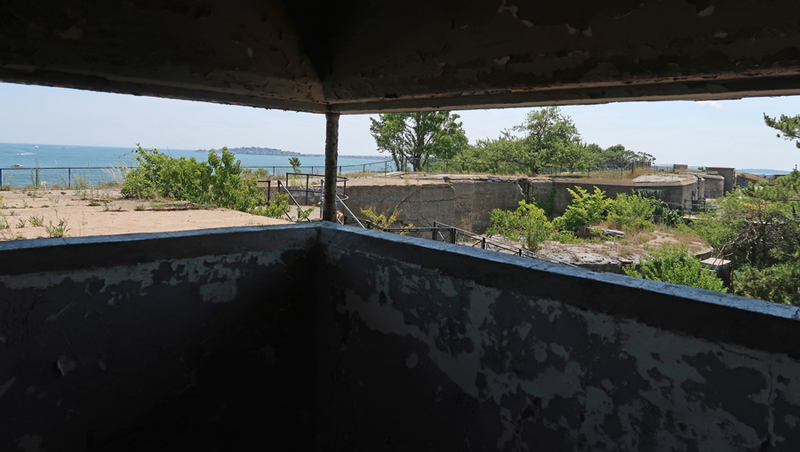
Tower used to oversee the Narrows’ mine field that was set to protect the passage
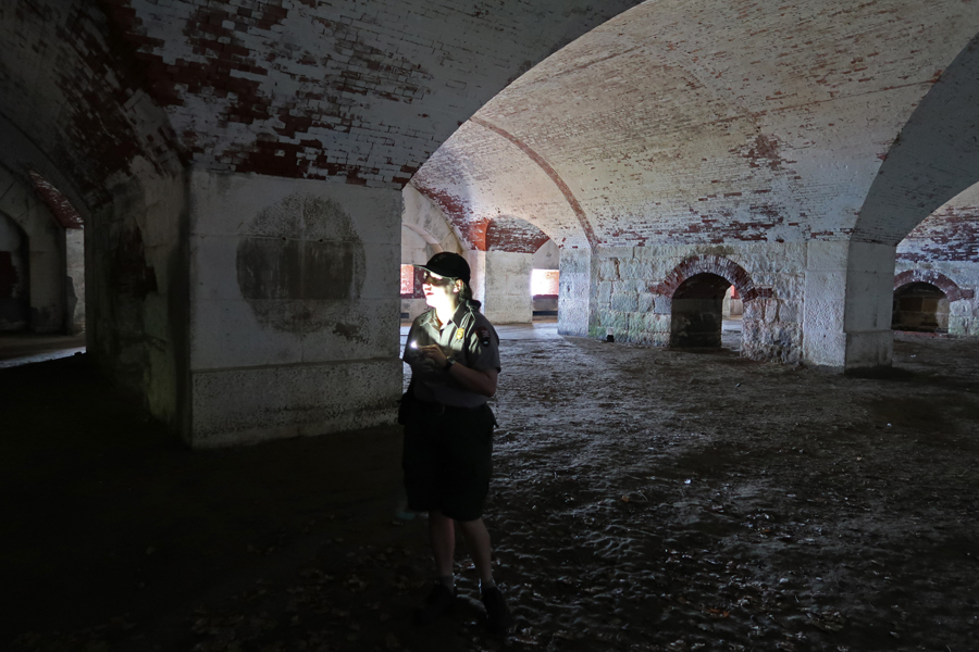
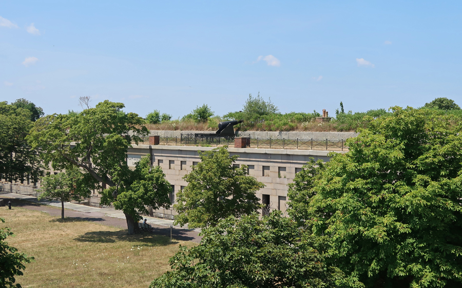
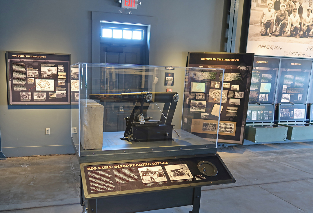
Inner fort with one Endicott Gun seen on the wall
What is left of the Bakery ovens
The Trent Affair – “In the fall of 1861, Confederate President Jefferson Davis dispatched diplomats James Mason and John Slidell to secure European recognition of the Confederacy. Captured by the Union Navy aboard the English ship Trent en route to England, they were imprisoned at Fort Warren. As war with England loomed over their imprisonment, President Lincoln release Mason and Slidell on January 1, 1862.”
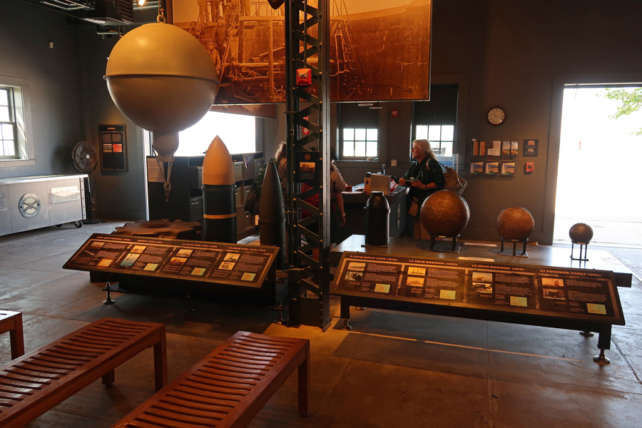
Visitor Center model of Endicott Gun and other displays
Progression of ordinance used at Fort Warren
“Where have all the flowers gone?”
45min ride back to Boston
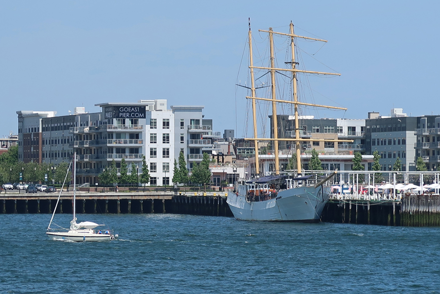
Three masted 245’ Tall Ship Caledonia made into a floating oyster bar at Pier One in trendy East Boston
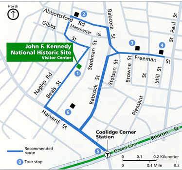
Stopped by the John Fitzgerald Kennedy NHS in Brookline, a south Boston suburb. We toured the house in October 2017 – see Blog. The house was closed for renovation and is due to re-open in 2023. Today, I wanted to get a photo of St Aidan’s Catholic Church (#3 on the map). JFK was baptized At St Adian’s, he, his brother and sisters (1914-1927) would walk to church and school. It is now community housing.
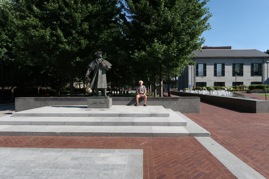
Less than an hour south brought us to Adams National Historical Park in Quincy MA. See Blog for October 2017 for our first visit. The Hancock Adams Common, which connects the Old City Hall (1844) and the United First Parish Church (1828) was completed in 2018. It honors two of the City’s most famous inhabitants, John Adams and John Hancock. Bronze statues are located at each end of the pedestrian mall.
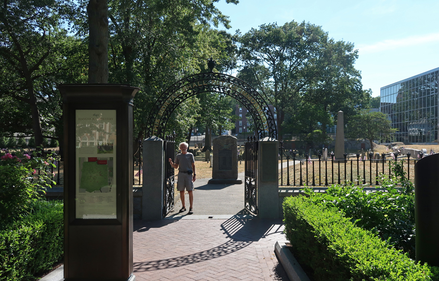
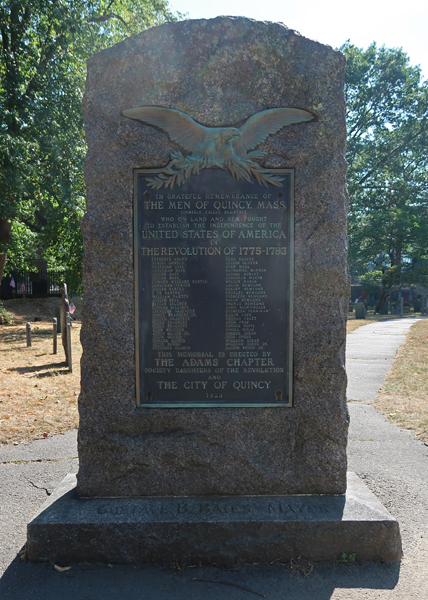
The Hancock Cemetery (1640) is on the west side of the Common and contains many historical markers and graves.
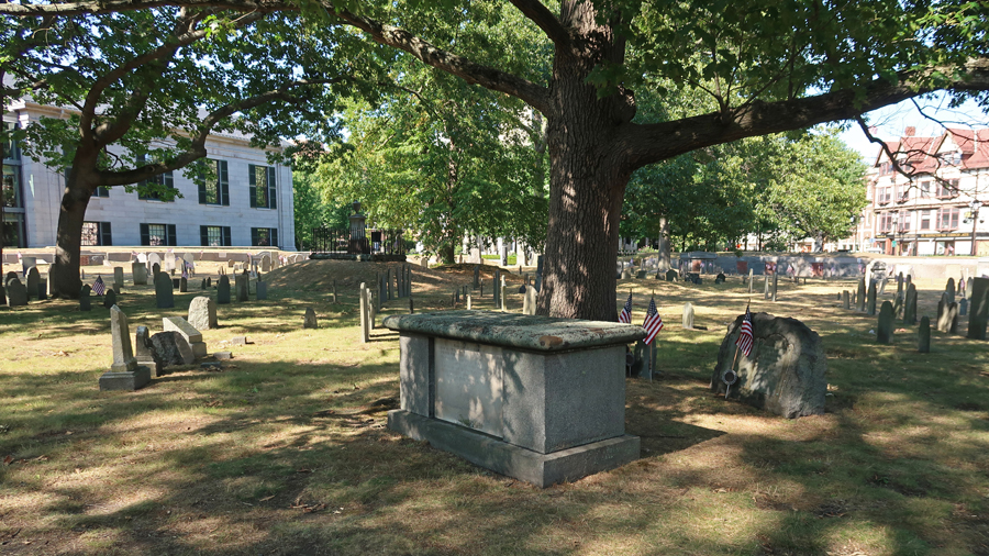
The first monument upon entrance is to “The Men of Quincy, Mass. Who on Land and Sea Fought to Establish the United States of America 1775-1783.”
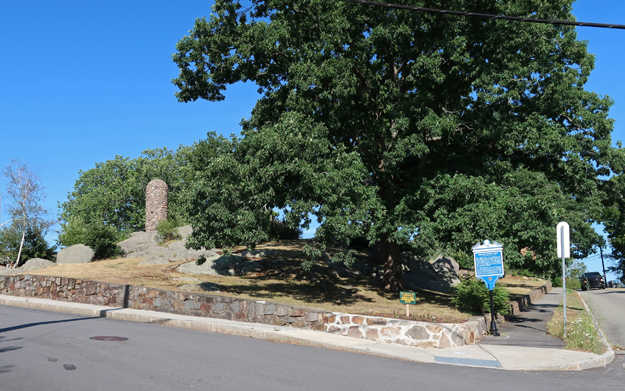
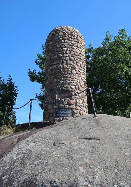
Our last historical stop for the day was the Abigail Adams Cairn
Stayed the night in Middeborough MA
7/25 M – It was a half hour to “The City That Lit the World” (whale oil), New Bedford MA for breakfast.
Also, took a few photos related to New Bedford Whaling NHP. See Blog for October 2017 for a description of our first visit. The sign describes New Bedford actions of abolitionists before the Civil War. Frederick Douglas lived here in 1839 after escaping slavery.
The 54th Massachusetts Volunteer Memorial Plaza.
After the Emancipation Proclamation (1/1/1863), Governor Andrew of MA recruited blacks to form the 54th Regiment. It is memorialized in the sculpture by Saint-Gaudens that is located across the street from the MA Statehouse in Boston. It depicts the regiment, led by Colonel Robert Gould Shaw, marching off to war.
The courage of that black regiment leading the failed Union assault on Battery Wagner, located on Morris Island SC on July 18, 1863, encouraged politicians and Army officers to further enlist black soldiers. The 1989 movie “Glory,” tells their story. This mural is on a building in New Bedford.
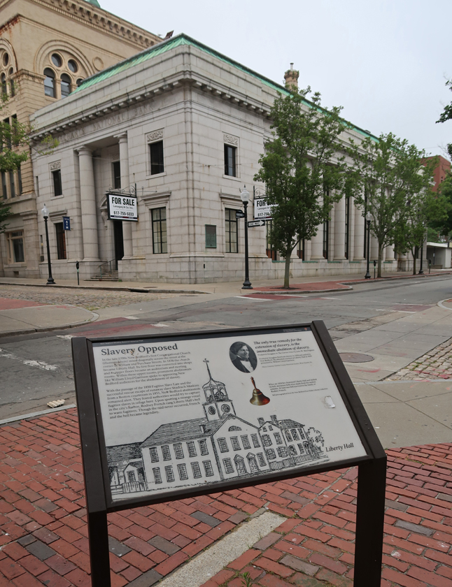
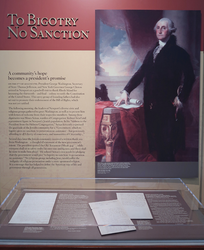
We arrived at the Touro Synagogue National Historic Site in Newport RI in time to take the 10am tour (seniors $14). We had visited in October 2017 but missed the tour – see Blog. This is the oldest (1759) surviving synagogue in the United States. Rhode Island (1663) was the first political entity in world history to declare officially, as a founding principle, the separation of church and state. See Roger Williams National Memorial on Blog October 2017. Touro Synagogue on left –
After a meeting with Newport leaders in 1790, President George Washington sent a written thank you to the Jewish community. He stated that the government would give “to bigotry no sanction, to persecution no assistance.”
The docent gave us an excellent tour of the synagogue.
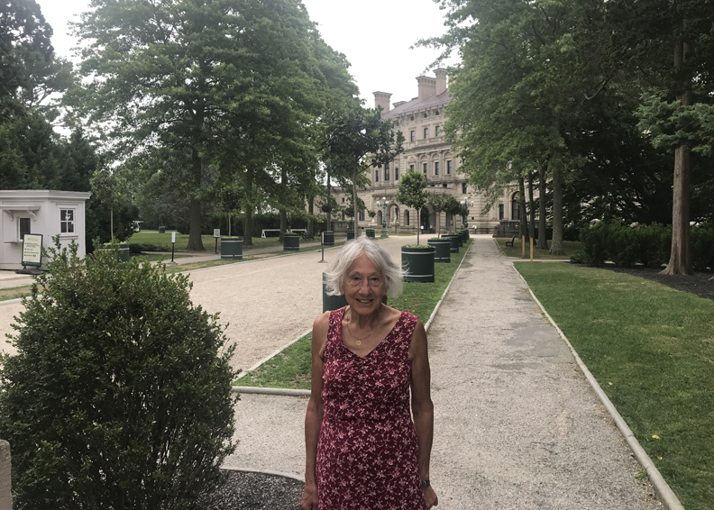
Afterward, we drove past the Newport mansions and stopped briefly at “The Breakers” built by Cornelius Vanderbilt II between 1893 and 1895 as his summer residence.
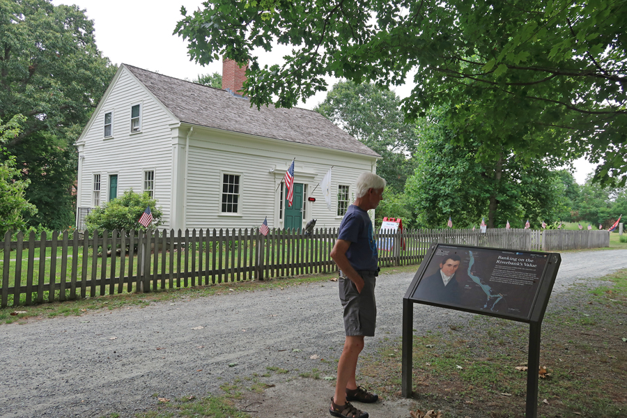
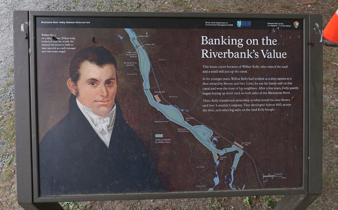
Our last National Park Unit of this trip was Blackstone River State Park, which is a unit of Blackstone River Valley National Historical Park. In October 2017 we visited the other four units of this NHP – see Blog. There are two major sites here, first the Kelly House Museum. Helen walking on the Blackstone River Canal Towpath – which is now the Blackstone River Bikeway.
Blackstone Canal on left, Canal Towpath, and Wilbur Kelly House in distance
Kelly built a small mill then purchased a larger mill in 1825.
At the same time, he continued buying up land along the river and canal. He then sold to a major company that built several large mills along the river. One of which was the Ashton Mill, which is across the river and was our second site for this unit of the NHP. It started producing cotton cloth in 1867 and later made fiberglass from the 1940s through the 1980s.
The mills supported communities all along the Blackstone River
Two hours to Jean and Jerry’s in Northfield MA, where we had a fun visit with old friends.
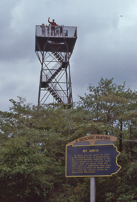
This was our second visit to Mount Davis – Highpoint of PA (3,213ft). Our first visit was in 1989 with Kate and Chad and their friends David and Jessica. Here we are on the tower – Helen took the photo.
1989
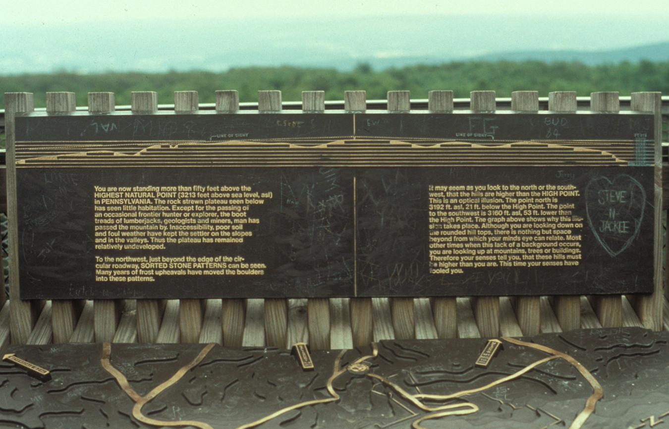
This is the marker on top of the tower
1989
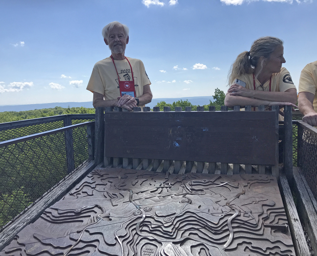
Helen and I visited again on 6/25/2022 when we were attending the Highpointers Konvention at Seven Springs Mountain Resort in PA. We arrived at the highpoint at 11am, took photos, climbed the tower, and spoke to other highpointers who were there for the Konvention Watermelon Feast.
2022
Note the weathered marker on top of the tower. There is a project in process to upgrade the signage at Mt Davis.
4/14 Th – I arrived in LA last night after a 4500-mile road trip from OH – see previous post for May 2022. Today, our friends Ron & Pat from Mercer Island WA visited. They are Kate’s godparents and Ron was my best friend growing up in Chicago.
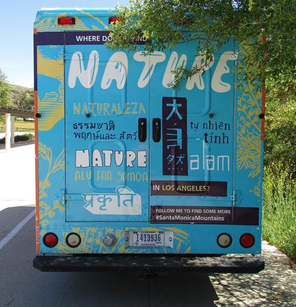
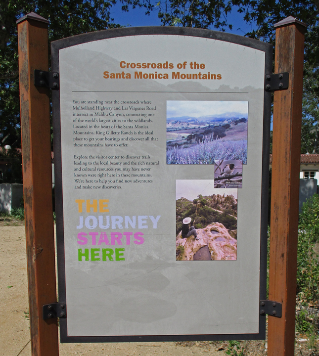
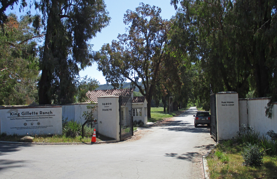
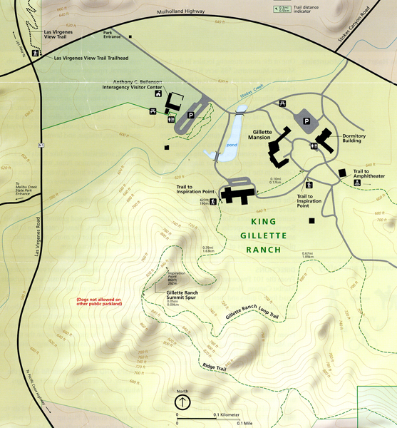
4/15 F – outing to Santa Monica Mountains NRA. Our last visit was October 2015 – see Blog.
“Nature in Los Angeles?”
We started at the Visitor Center, which was formerly the horse stable for the King Gillette Ranch.
The Urban Wild
Thriving in the Suburbs
The 588-acre King Gillette Ranch is managed by the Mountains, Recreation, and Conservation Authority (MRCA).
We hiked to Inspiration Point for an overview of the property and Santa Monica Mountains
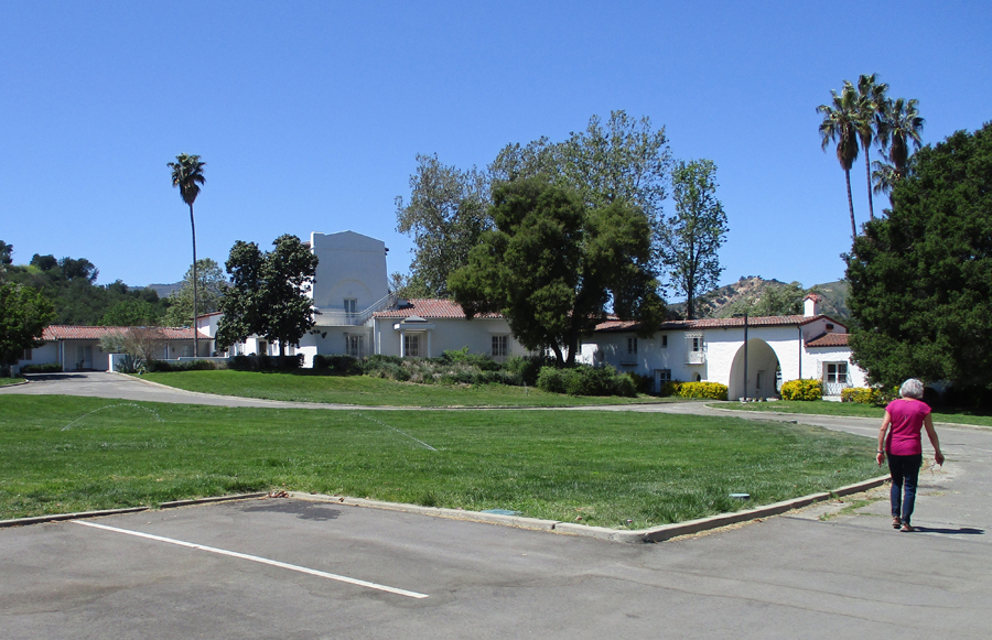
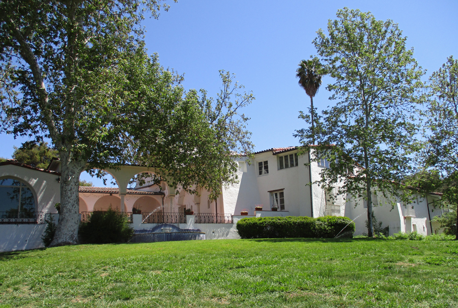
And then walked around the Gillette Mansion grounds. The Spanish Colonial Revival style mansion and other structures were built in the 1920’s for razor magnate King C. Gillette. They were all part of a landscape plan including tree lined entry, pond, formal courtyard, terraces, bridges, and lawns.
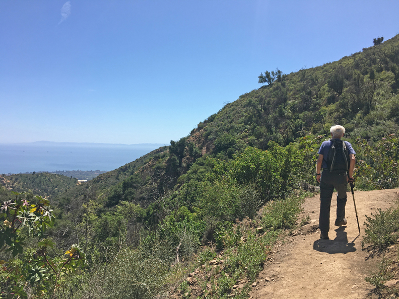
4/15 F – Photo of Channel Islands from Hot Springs Canyon Trail in Los Padres National Forest (north of Santa Barbara)
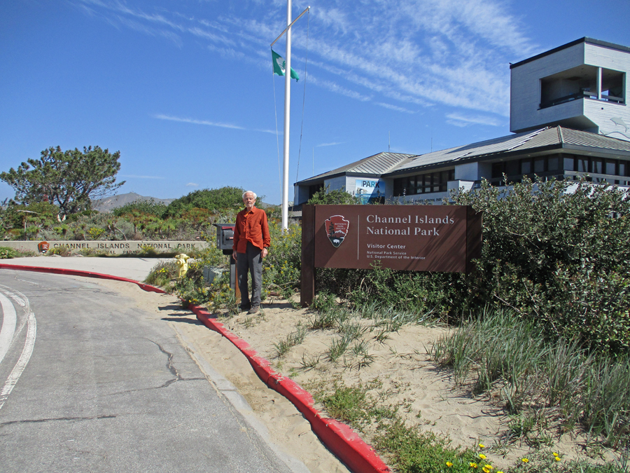
Took us about 1.5 hours to get from Silver Lake to the Robert J. Lagomarsino Channel Islands NationalPark Visitor Center at Ventura Harbor. Helen and I had visited here in August 2008 before we did a three-day kayak trip to four of the eight Channel Islands – see Blog. Note the viewing area on top of the Visitor Center. They have scheduled Ranger Dives from the islands that can be viewed live at the Visitor Center. Like an underwater campfire program!
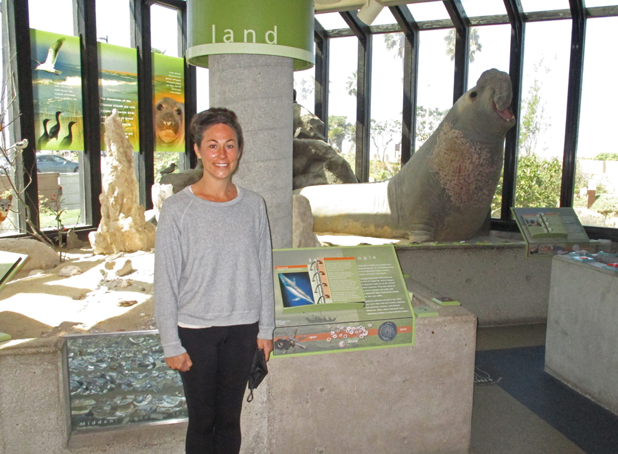
Nice model showing the eight Channel Islands. The islands were never part of the mainland – they are the easternmost islands in the Pacific Island group. “Today, five of the islands (San Miguel, Santa Rosa, Santa Cruz, Anacapa, and Santa Barbara), their submerged lands, and the waters within one nautical mile of each island are protected as Channel Islands National Park.” The Channel Islands National Marine Sanctuary extends six miles from the shore of each island. This land/water area is “. . . home to over 2,000 species of animals and plants – 145 are found nowhere else on Earth.”
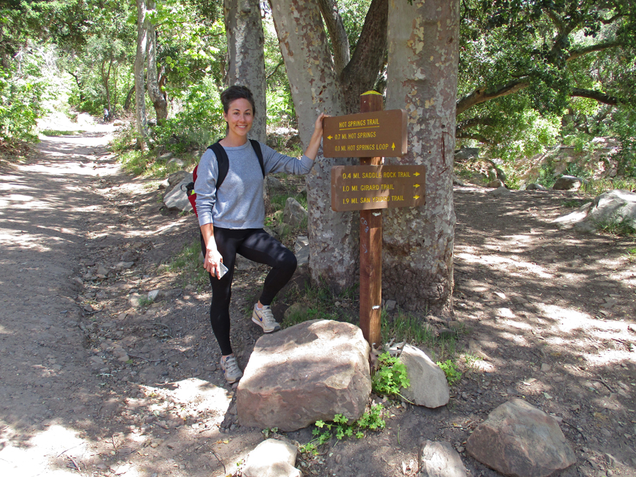
After IN-N-OUT Burgers, Kate directed us to the trailhead for the Hot Springs Canyon Trail in the Ynez Mountains near Montecito CA.
It was a 3.7-mile rt hike (1,177ft gain) to a series of small pools fed by a hot mineral spring
2022
2022
2022
The water temperature went from very hot in the top pools to moderately hot in the lower pools
Dinner at Bacari in Silver Lake
4/16 Sa – shopping, games, preparing for Easter. Also, oil change – discovered I had a leaking axle seal that had damaged the brakes, arranged to have repairs done at garage around the corner from Kate on Monday. Kate now has a second dog – Greta
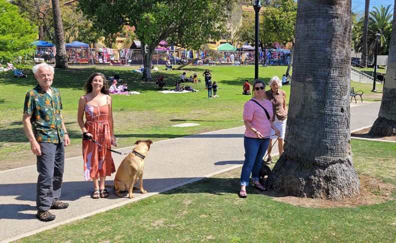
4/17/ Su Easter – returning from Easter Mass at St Francis of Assisi RCC, note Hollywood sign and Griffith Observatory in background
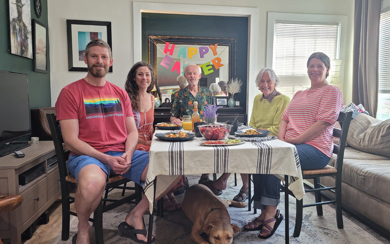
Heather had treated Peter to a So-Cal Holiday for his birthday and they joined us for a wonderful lamb Easter dinner at Kate’s
Followed by the traditional Cracking of Eggs
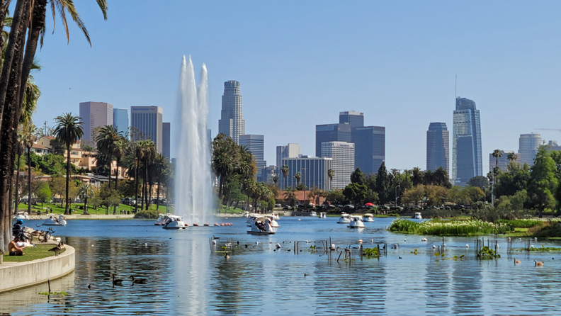
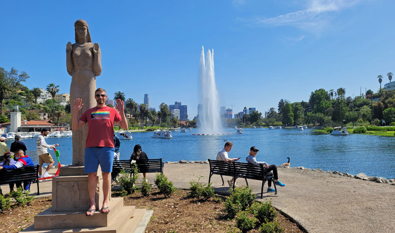
After meal walk in Echo Park
“Lady of the Lake”
Celebrated Peter’s 49th birthday – Kate gave him 49 scratch-off lottery tickets!
4/18/ M – with Kate. $2,300 for brake and axel seal repairs on Sequoia, got it back at sundown. This was great because it allowed me to continue my trip on schedule.
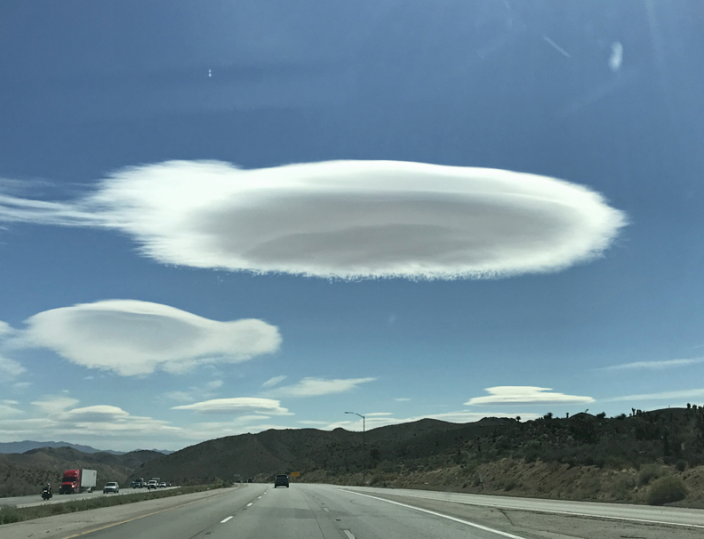
4/19 Tu – Dropped Helen off at the Burbank airport for her flight home and started my drive to UT. Found this flying saucer cloud outside of Las Vegas. Don’t text and drive – note, I am in the middle lane with no one around me!
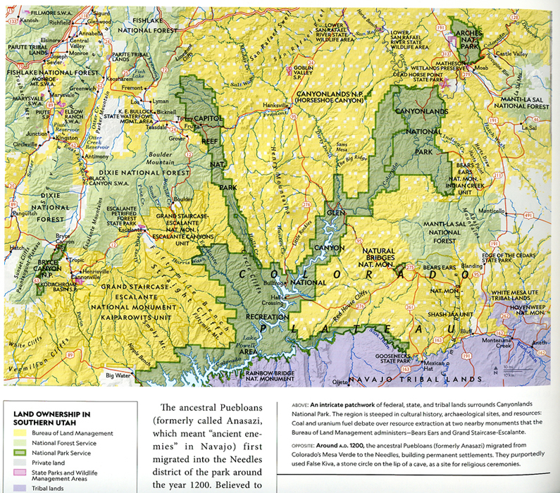
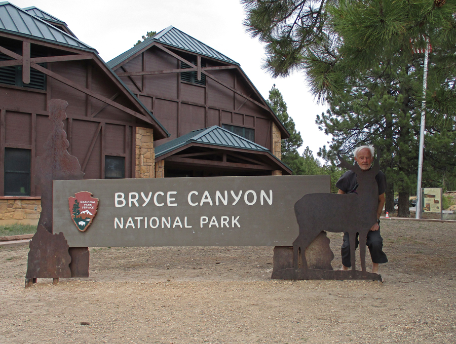
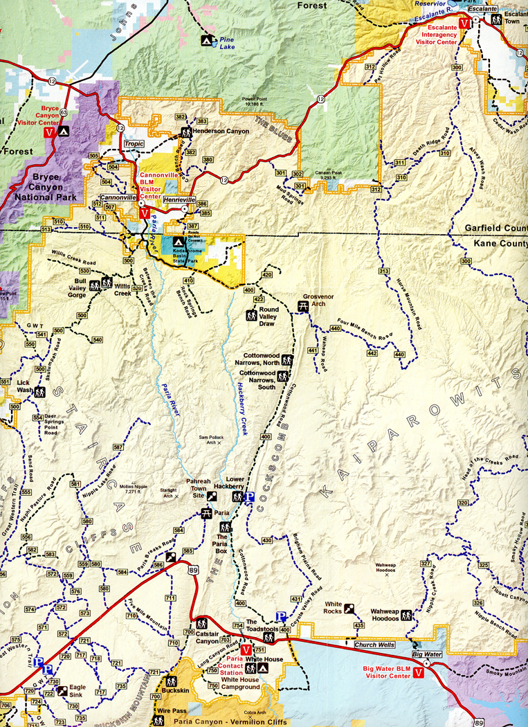
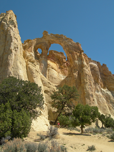
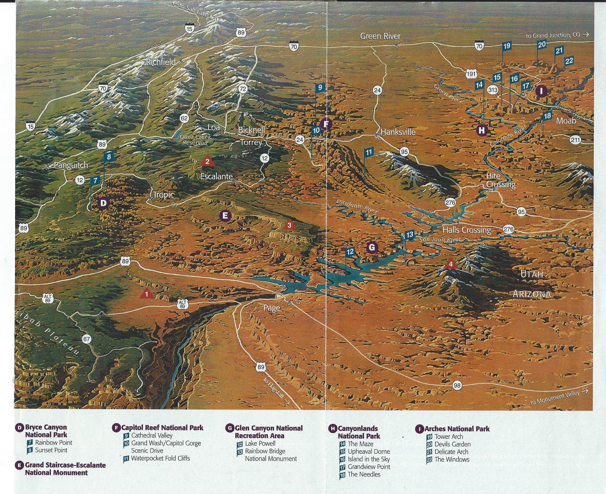
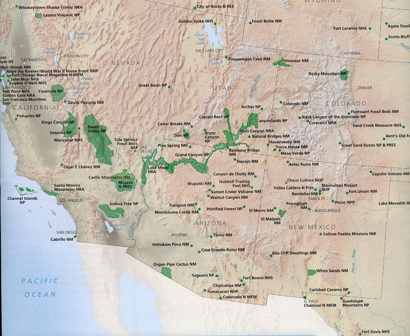
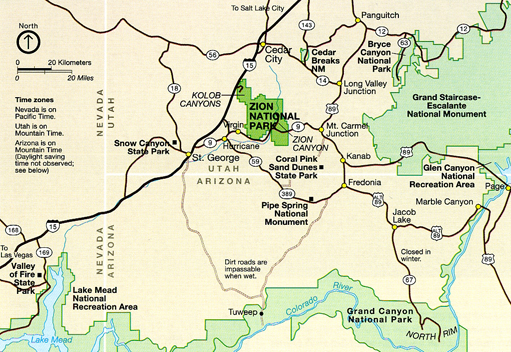
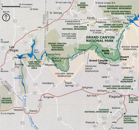
It was a 535-mile drive to Bryce Canyon NP. Note the location of Bryce Canyon on the lower left of this map, and its relation to other protected areas in Southern Utah.
I arrived late afternoon. My first stop was the Visitor Center –
Getting oriented
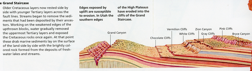
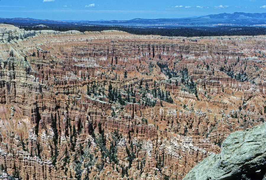
The Grand Canyon is at the bottom and Bryce Canyon is at the top of the “Grand Staircase.” This region is my favorite part of the contiguous 48-states.
Fairyland Point Overlook
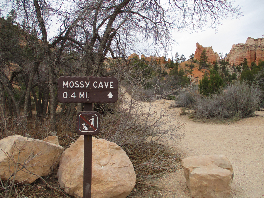
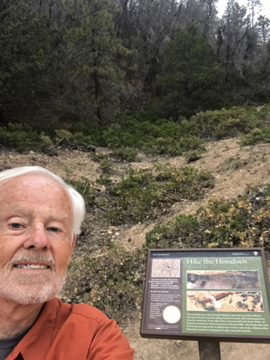
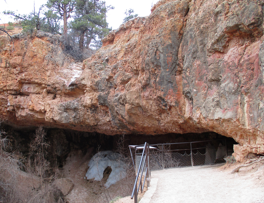
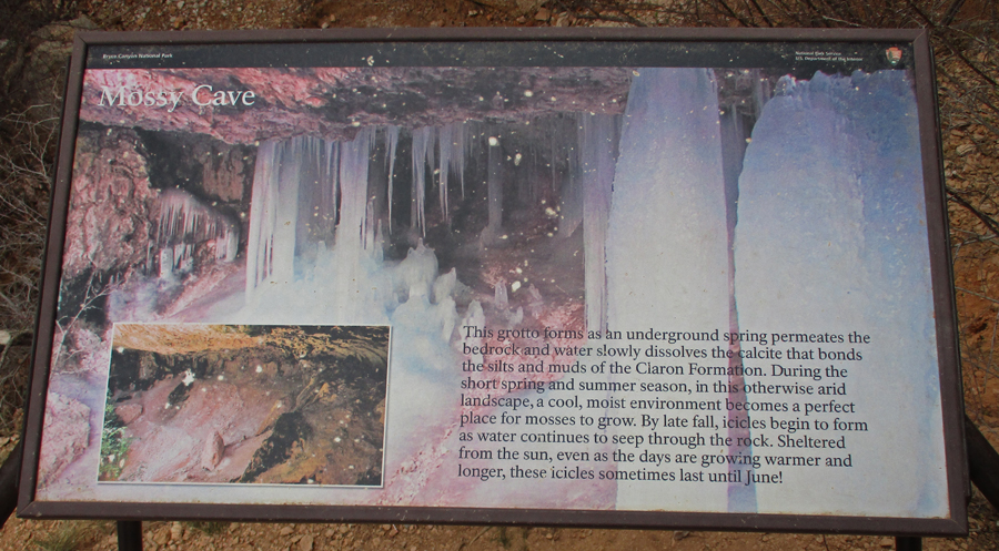
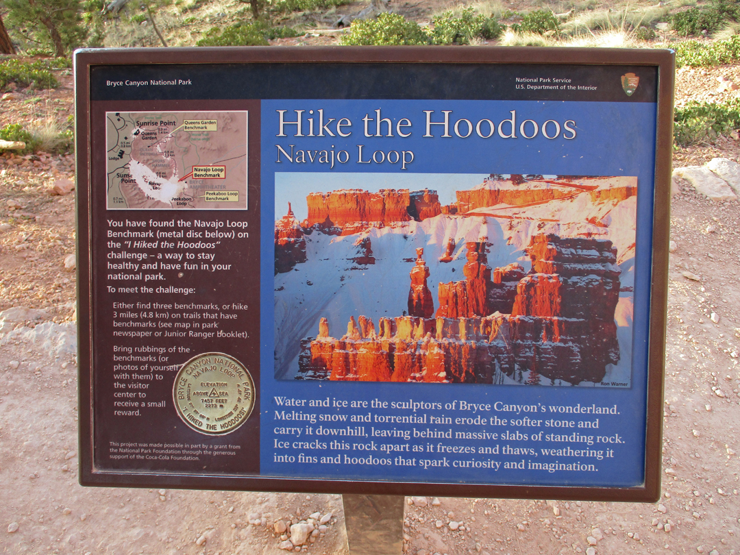
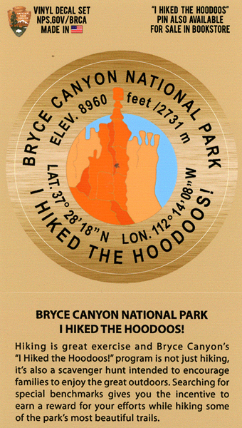
I decided to do the “Hike the Hoodoos” challenge. There are nine benchmarks located along eight different hiking trails in the park. A minimum of three miles of hiking is needed to get an “award.” In order to “prove” you completed this task, you need to take photos or rubbings of three of the nine medallion benchmarks. I started with a hike to Mossy Cave, which is off Rt 12 in the northern part of the park.
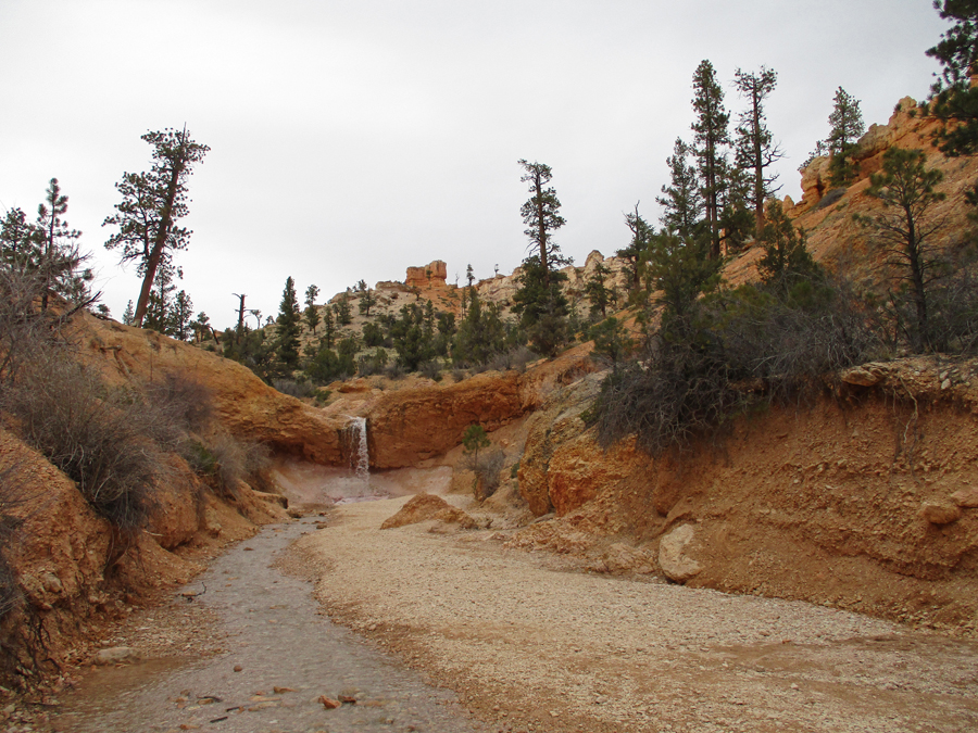
Along the way I took a side trail to a waterfall on the “Tropic Ditch,” a 1892 Mormon irrigation canal that brought water to the town of Tropic
I then backtracked and did the trail to Mossy Cave, where some ice remained in the “cave”
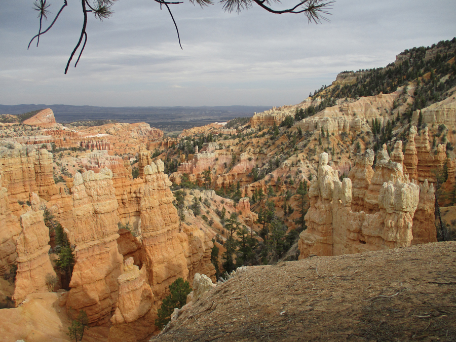
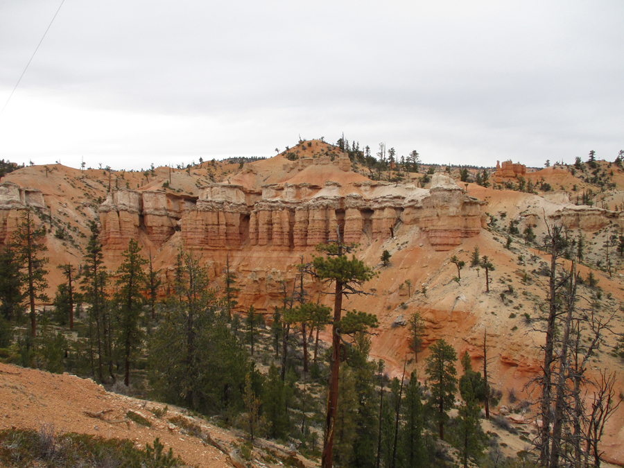
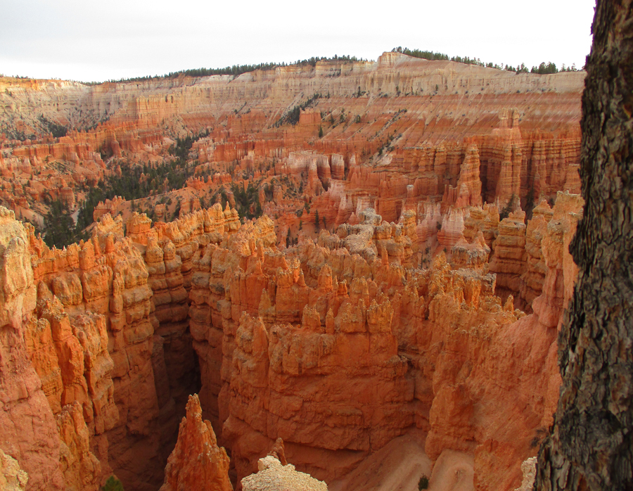
Returned on Rt 12, again entered the park on Rt 63, and drove to Sunset Point – 7:30pm
View from the Rim Trail
Hikers ascending on the Navajo Loop Trail
Slept in the Bryce Canyon Lodge parking lot
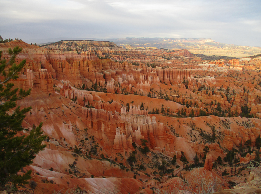
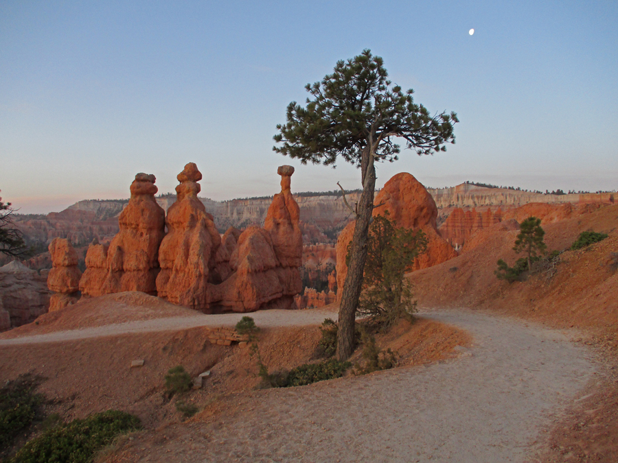
4/20 W – arrived at Sunset Point before sunrise (6am), twenty-nine degrees, – note the moon
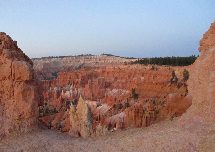
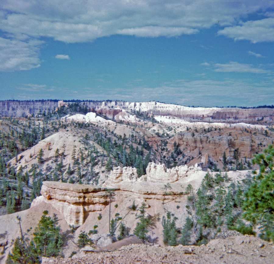
View of Bryce Canyon from the Rim Trail before sunrise
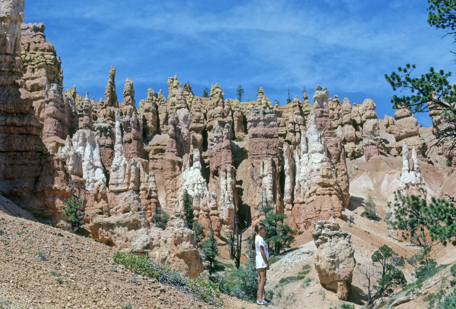
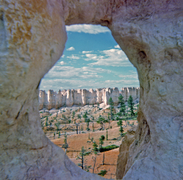
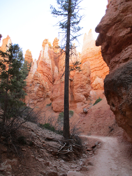
Walked to Sunrise Point and started on the combined Queen’s/Navajo Loop Trails in order to earn my “Hike the Hoodoos” reward. This was my fourth visit to Bryce, and my third time doing this loop. I will be adding photos from previous trips.
Sunrise
1982 hike with Helen, Stacy, Peter, and Kate – photos from the Queen’s Loop
Helen, Kate, and Queen Elizabeth
1967 hike with Jay – PH era (Pre-Helen)
I found the Navajo Loop Medallion Benchmark 2022
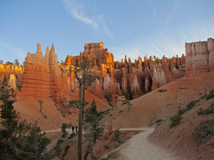
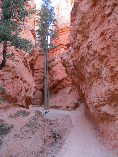
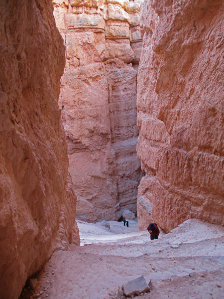
Start of the 600ft climb out of Bryce Canyon on the Wall Street segment of the Navajo Loop Trail
Wall Street section of trail
Almost there
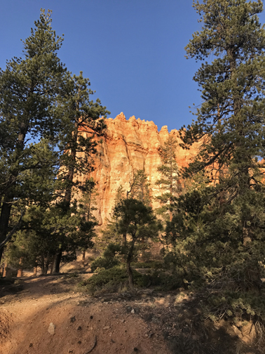
Top – back at Sunset Point
I successfully “Hiked the Hoodoos” covering about five miles over three trails – I took my photos to the ranger at the Visitor Center and received my award – a decal – made in the USA!
Photo from Inspiration Point in 1967
Photo from Bryce Point in 1982
Peter (11) and Stacy (12) – 1982
Drove Rt 12 from Bryce Canyon NP to Torrey UT before turning east to Capitol Reef NP. Rt 12 is said to be one of the most scenic roads in the US. A good part of this road passes through Grand Staircase Escalante National Monument, administered by the BLM. The monument was drastically reduced by the Trump administration in 2017 but reinstated by the Biden administration in 2021.
In March 2009, Helen and I hiked the “Toadstools” Trail, in the Paria Rocks area off US 89 in the southeastern or Kaiparowits Plateau Unit of the monument – see Blog.
On February 8, 2018, we stopped briefly at the Grand Staircase Escalante National Monument Visitor Center on US 89 – see Blog.
In April 2006, we did some wonderful hikes in the northern part of the Kaiparowits Plateau Unit. That was before the start of this Blog, so I am including some information and photos here. That year we drove Rt 12 from Torrey to Bryce Canyon NP (opposite of this trip).
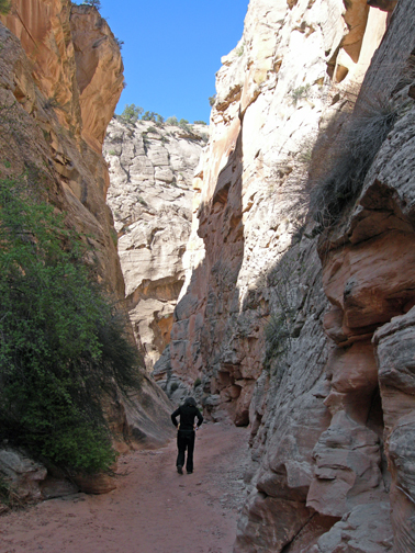
When we reached Cannonville, we turned south on the unpaved Cottonwood Canyon Road to a point where we had access to Cottonwood Canyon.
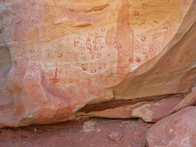
We hiked into, down about a mile, and then back up through this beautiful slot canyon
I have no idea who put these handprints here –
Do not do this hike if there is rain anywhere in the vicinity! Debris in the water is responsible for carving out these alcoves.
Rock – Face
Scree traverse to get into and out of the canyon
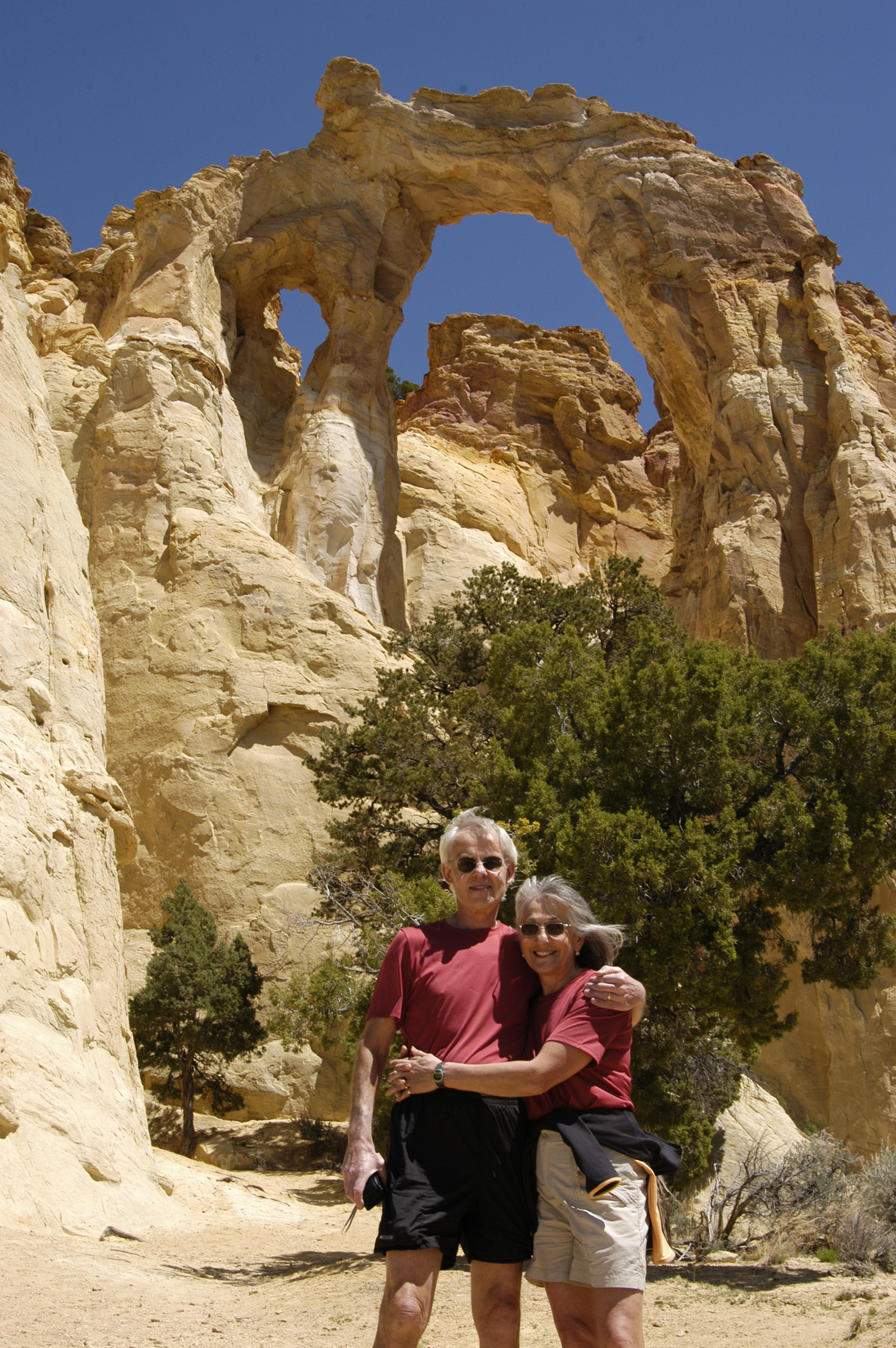
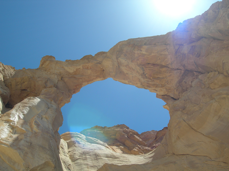
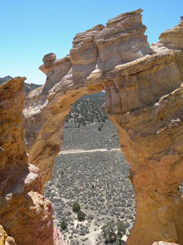
Our next stop was Grosvenor Arch, named for Gilbert H. Grosvenor, who was President of the National Geographic Society.
It is a double sandstone arch
View from the bottom
After deliberating for a while, we decided to climb it – back side of arch
View from top
After we descended, we met a couple who had taken photos of us on top. They later mailed them to us.
View north from bottom of arch
Our next stop was Kodachrome Basin State Park, which is in Grand Staircase Escalante NM. Rock formations on the Nature Trail
We hiked the Angels Palace Trail to a point called the “End of the World”
Photo of park cabins from Angels Palace Trail
Ranch scene along Rt 12
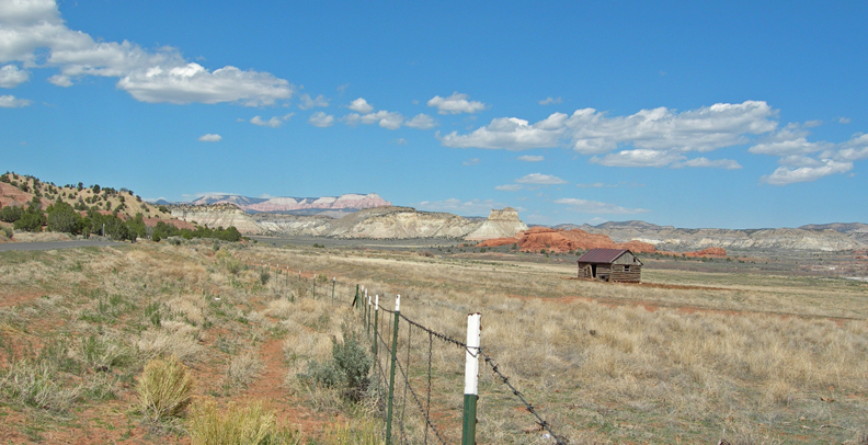
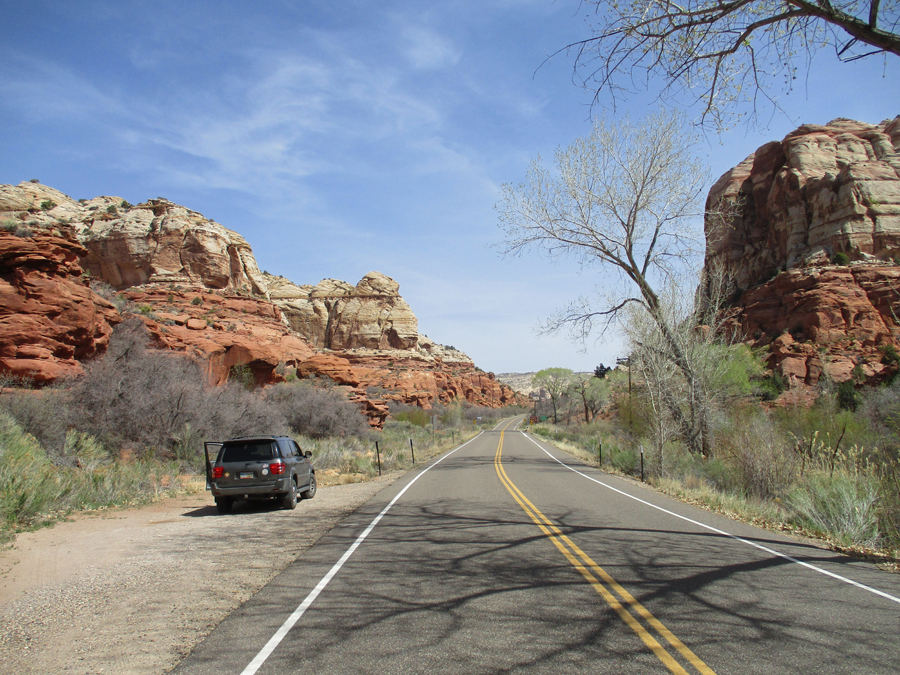
OK, now I am back to 2022, after leaving Bryce NP – entering Grand Staircase Escalante NM on Rt 12
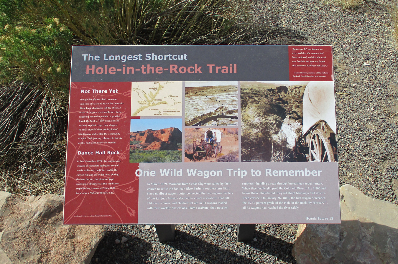
Mormon – Hole in the Rock Trail
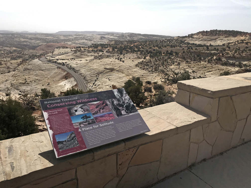
Rt 12 Overlook – here is one of three informative markers
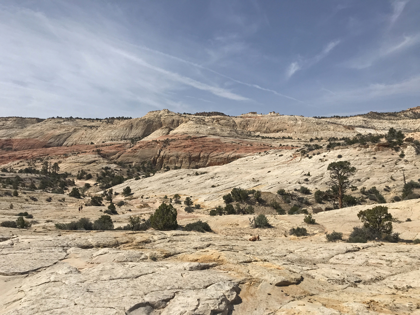
I really enjoy hiking on slickrock
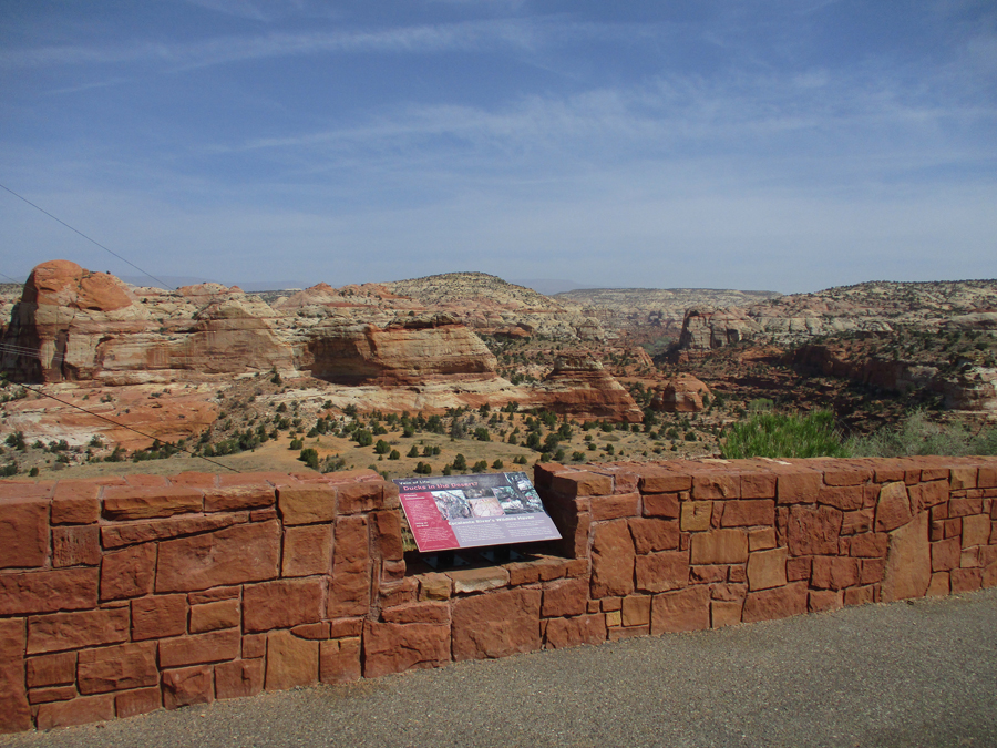
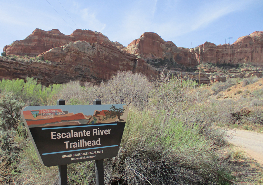
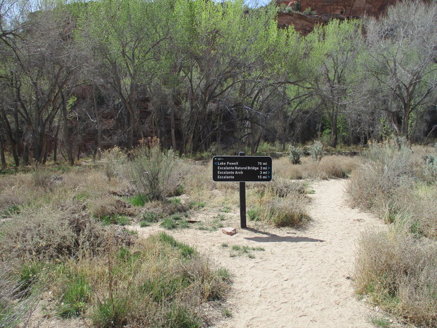
Escalante Canyons Unit of Grand Staircase Escalante NM, these are the canyons related to the Escalante River
Did a hike to the Escalante River
Colorful formations
View of Escalante River Canyon
I arrived at Capitol Reef NP today (April 20, 2022) at about 1pm.
On April 27, 2006, our first visit to the park, Helen and I arrived at sunset
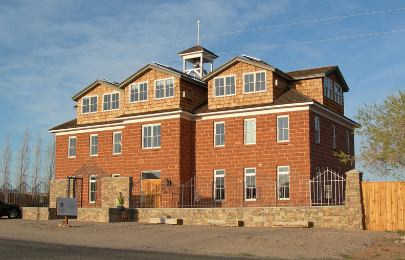
That night we stayed at the Torrey Schoolhouse Bed and Breakfast. It was built in 1914 (same year as our house) and was the center for community activities. The Butch Cassidy gang frequented its weekend dances.
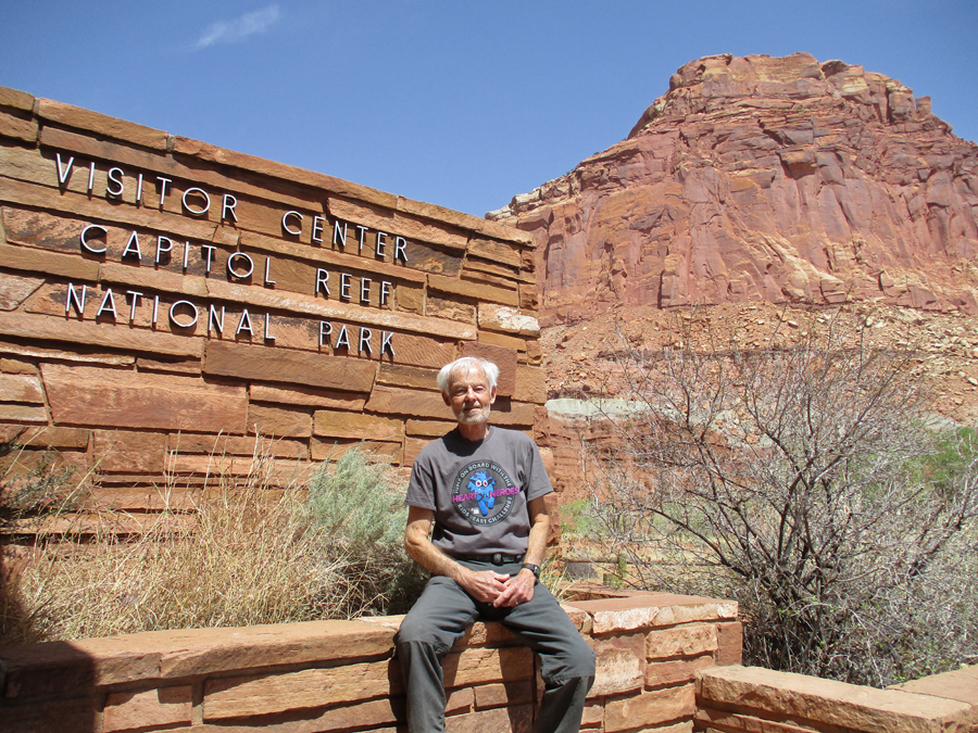
We drove back into the park the next morning – Visitor Center
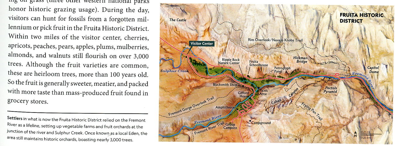
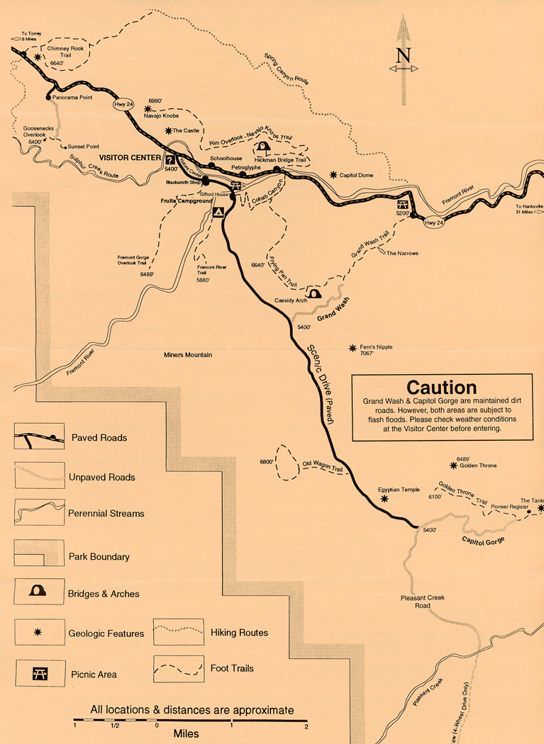
Map showing Fruita locations as well as the Rim Overlook and Hickman Bridge Trails
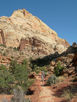
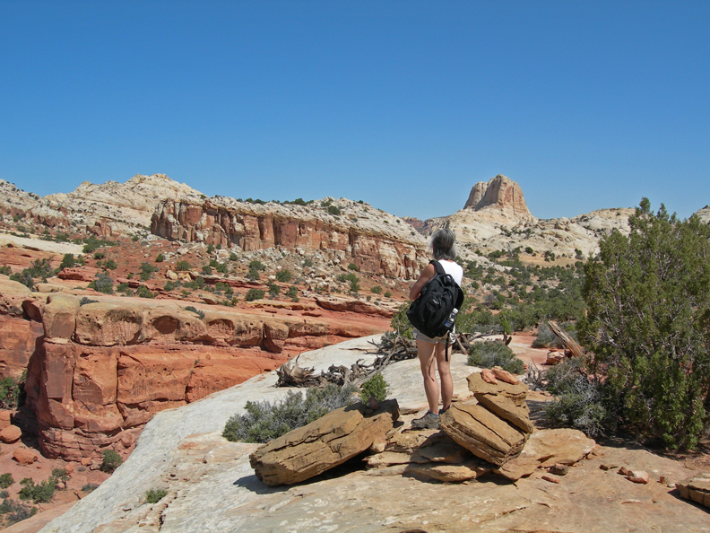
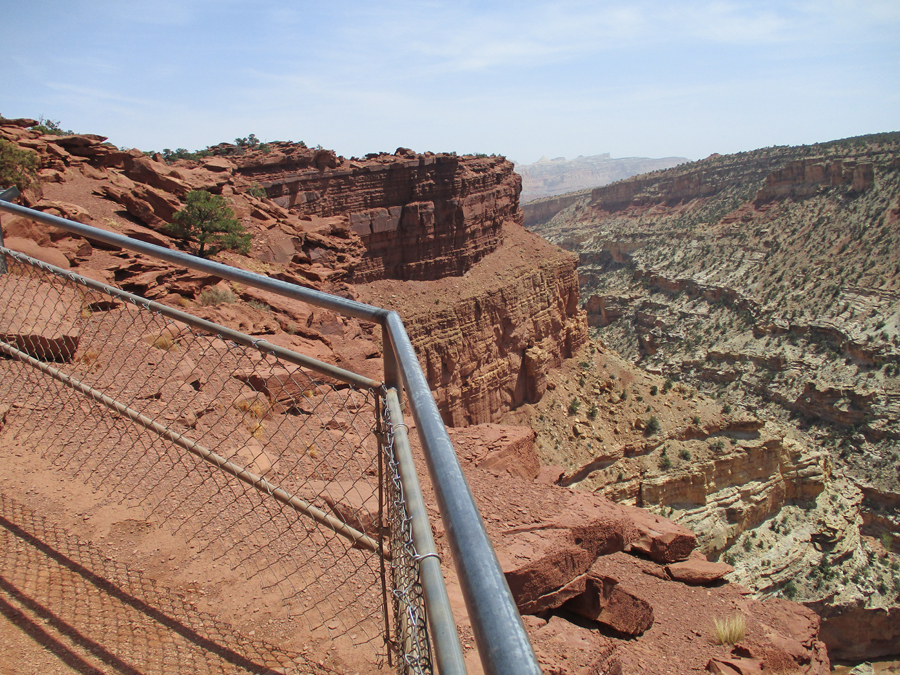
Our first hike that day was the 4-mile Rim Overlook Trail. It was a wonderful hike, gaining about a thousand feet in elevation, through beautiful multicolor rock formations.
Visitor Center from Rim Trail
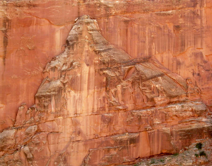
On the way up we passed an outlook for Hickman Natural Bridge but couldn’t see it. On the way back we met some other hikers who said we had to look harder – it was there. Well, I tried and still couldn’t see it – then Helen said, “There it is.” We were standing on a cliff right across from it but because it had a rock background from our high vantage point, we at first were unable to pick it out! The following photos are from our 2-mile hike to the Hickman Bridge. You can “see” the Bridge in these two photos.
The Hickman Bridge is 133 feet wide and 125 feet high – when you can see it from below, with the sky above, it is obvious! A “Bridge” is formed by water running underneath it. An “Arch” is formed by other erosion forces.
I call this the “Rock Wall Mountain”
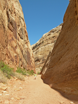
Afterward, we drove the 10-mile scenic drive to Capitol Gorge
We did the 2-mile trail into the gorge walking along a narrow wash bottom with sheer canyon walls.
I found it fascinating how rocks and pebbles created coves in the sandstone walls of the gorge
There was a “Pioneer Register” in Capitol Gorge where people signed their names on the rock wall over a hundred years ago and water pockets that are called “tanks.”
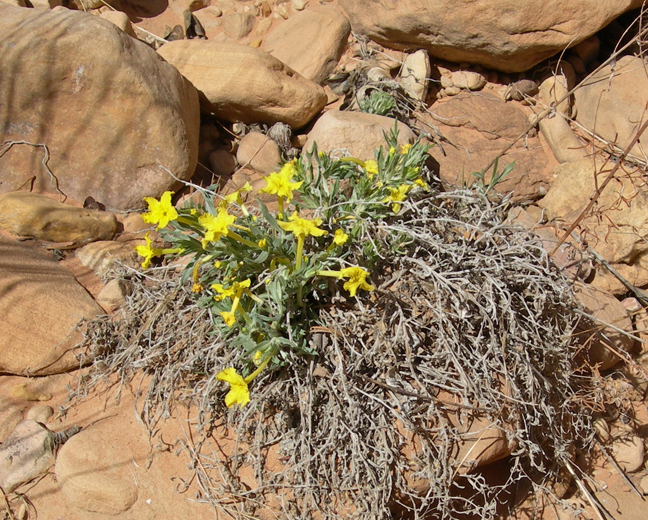
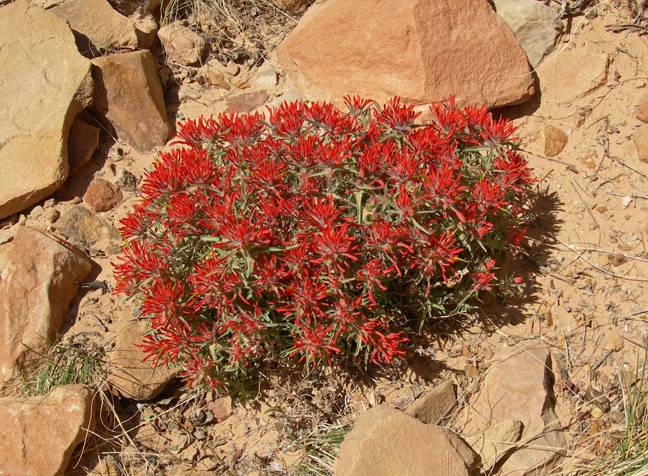
Spring flowers added to the beauty of this April visit to the park. Are you ready? Name these flowers –
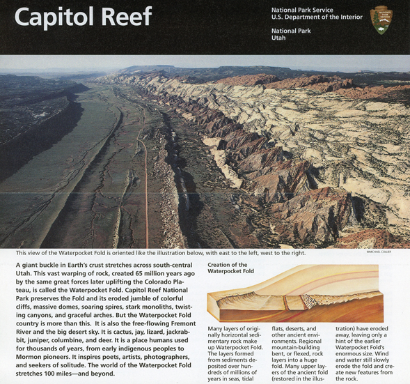
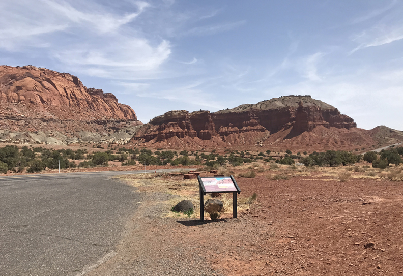
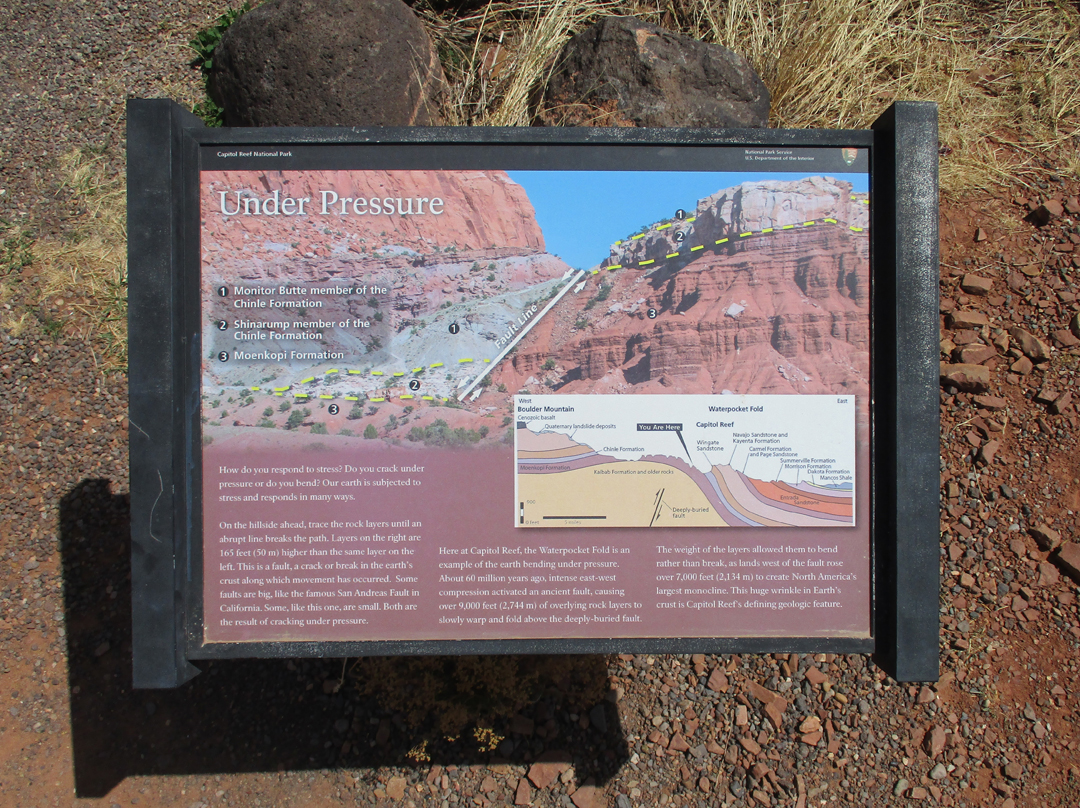
Today, 4/20/2022, I entered Capitol Reef NP from the west. The park protects the Waterpocket Fold (about 90 miles long), which is the longest exposed monocline in North America.
Chimney Rock
I then did a short hike to the Goosenecks Overlook
Sulfur Creek flows through the Goosenecks – this photo from 2006
Afterward, I did the same 1-mile rt hike from the parking lot to Sunset Point that Helen and I did in 2006
Castle Rock
Visitor Center
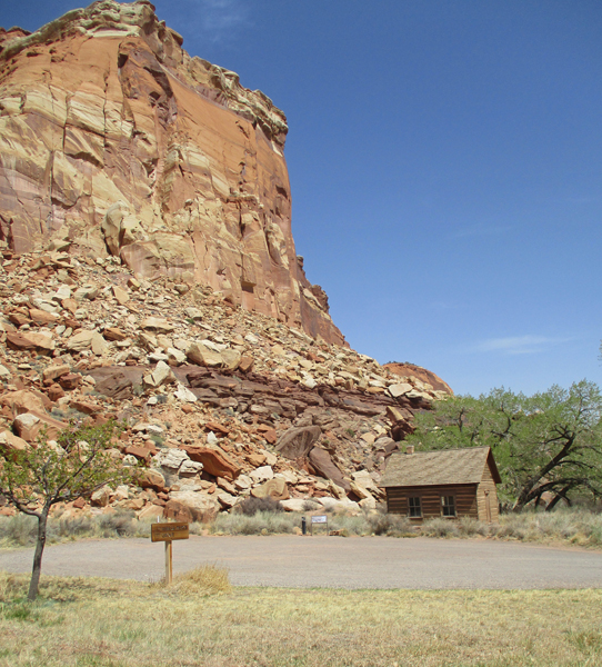
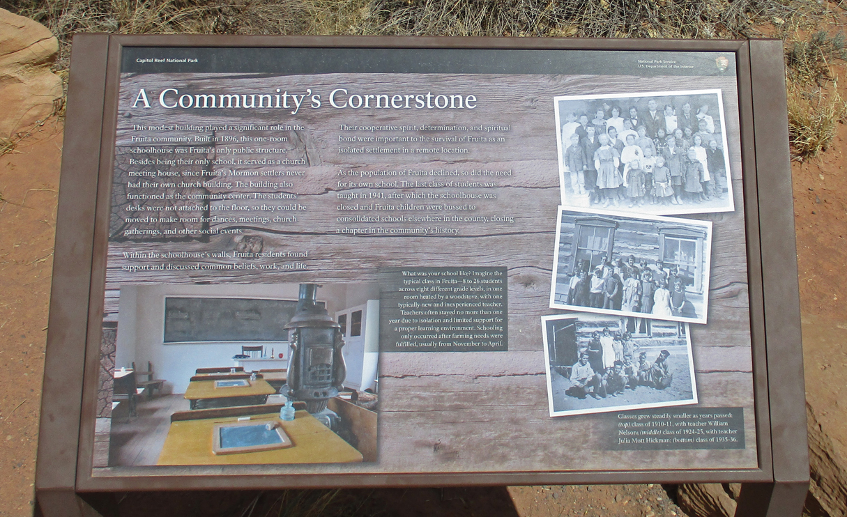
Fruita Schoolhouse
I was hoping that, if I arrived at Arches NP before the close of the Visitor Center at 5pm, a ranger would allow me into the park. This is the first year you must have a timed entry reservation to enter the park. I had a paid ($2) reservation for the following morning for the first entrance time slot of 6-7am. After 2.5-hours, I arrived at 4:30pm – made it! – and convinced the ranger that I would leave the park by sunset if she permitted me to enter.
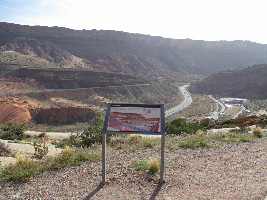
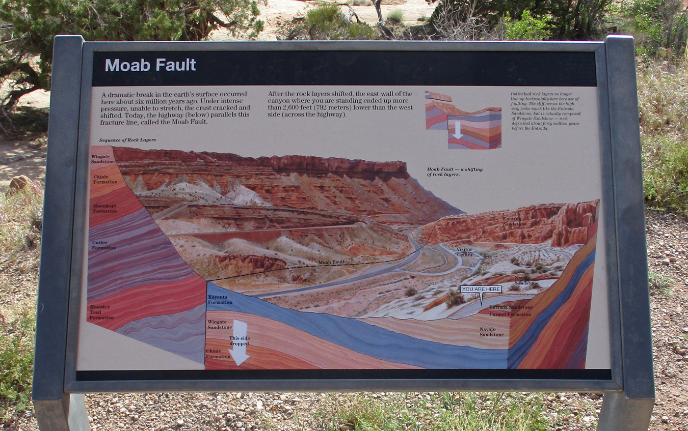
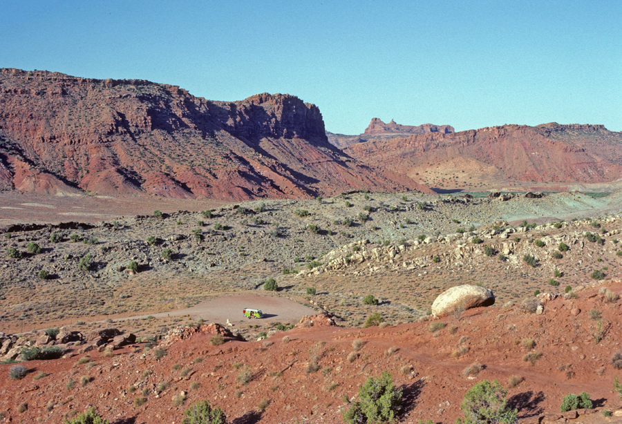
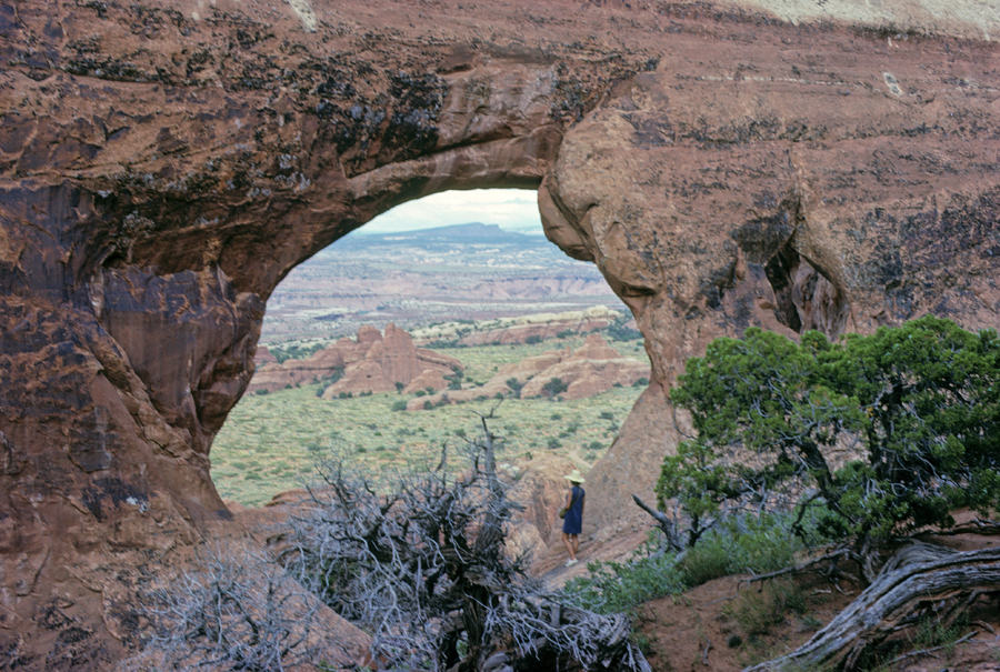
This was my fourth visit to Arches NP and my main objective was to get a photo of Landscape Arch, which has the longest span in the park, 290 feet. It is the fifth longest natural arch in the world. There are four in China that are longer. There are over 2,000 cataloged arches in the park. The minimum opening to be cataloged as an arch is three feet. This is my first Blog entry for Arches NP. So, I will present photos in the order you would see the formations driving the road into the park. I will also state the year each photo was taken – the Moab Fault, Visitor Center in the background 2022.
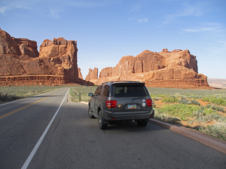
Approaching Courthouse Towers – on left 2022
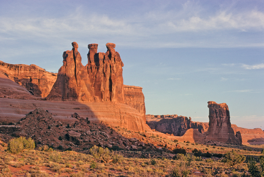
The Three Gossips and Sheep Rock (center) 2022
The Three Gossips and Sheep Rock 1968
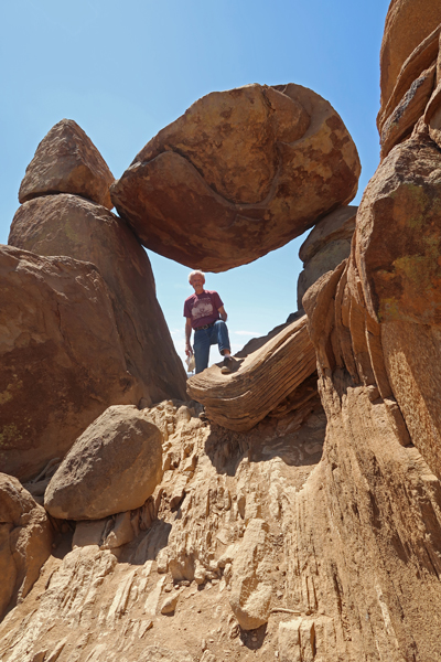
One mile trail – Park Ave Balanced Rock 1968
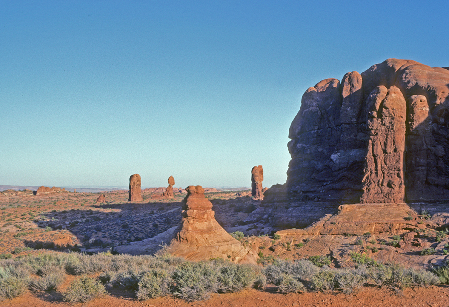
Rock Pinnacles 2022
Pinnacles and Balanced Rock 2022, 1982, 1968
198220221968
Half mile hike to Double Arch 112 feet High 1998
Turret Arch Thru North Window – One mile Loop Trail 1968
Chad and Turret Arch 1998 (15-year-old bonding trip with Dad)
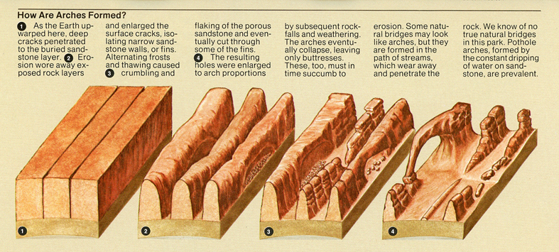
How Arches Form
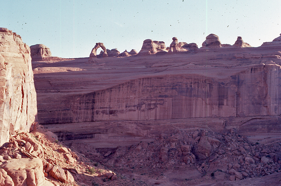
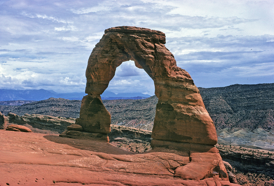
Half mile hike to Upper Viewpoint of Delicate Arch 1982, note VW Camper. We drove to LA and then flew to Hawaii on this family trip.
Stacy at Upper Delicate Arch Viewpoint 1982
Delicate Arch across Valley Wash
Map of North part of park
Helen at Wolfe Ranch for start of 3-mile rt summer hike to Delicate Arch 1968. We were married in June and were doing a NP road trip on our way to Seattle.
Tom at Delicate Arch 1998
Delicate Arch 1968
2014 Utah National Parks Quarter
2014 America The Beautiful Quarters Coin Arches Utah Uncirculated Reverse
Approaching Devils Garden 2022
Skyline Arch, 71 x 33 feet 2022
Sign describes how Skyline Arch increased in size in 1941
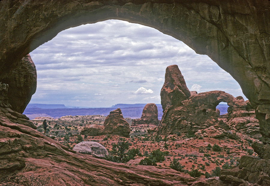
One mile hike to my objective – Landscape Arch 2022
Looking Northwest through Devils Garden 2022
2022, I continued on the Primitive Loop northwest through the fins of Devils Garden in search of two arches Helen and I had climbed to in 1968
Southeast view from top of small fin 2022
Southeast view from top of large fin – note small fin (previous pic) to the left – this photo 1968
The route through the fins was now in the shade and difficult to follow. These deer advised me to turn around before I injured myself 2022
1968 – Helen at Partition Arch
1968 – Navajo Arch
Sunset from our Devils Garden Campground tent site in 1968. The first time Helen washed her hair and then dried it over a campfire. How could she not like the campfire scent in the car for the next two days? Something a newly wed male was about to learn.
Slept in a hotel parking lot in Moab UT
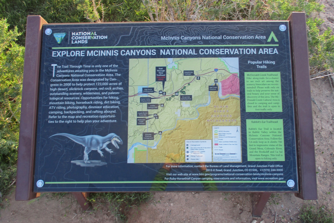
4/21 Th – 1.5hrs to McInnis Canyons National Conservation Area (MCNCA – BLM) in West Central CO on the UT border. It was previously called Colorado Canyons NCA and has the second highest concentration of naturally occurring arches in the world – behind Arches NP. Its 193 square miles includes a 24-mile section of the Colorado River. “View the fossils of 140-million-year-old dinosaurs at a working fossil quarry.” It has been proposed that this NCA become a National Monument.
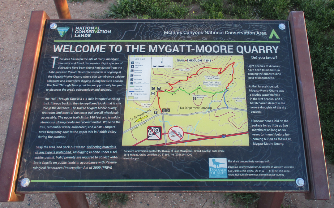
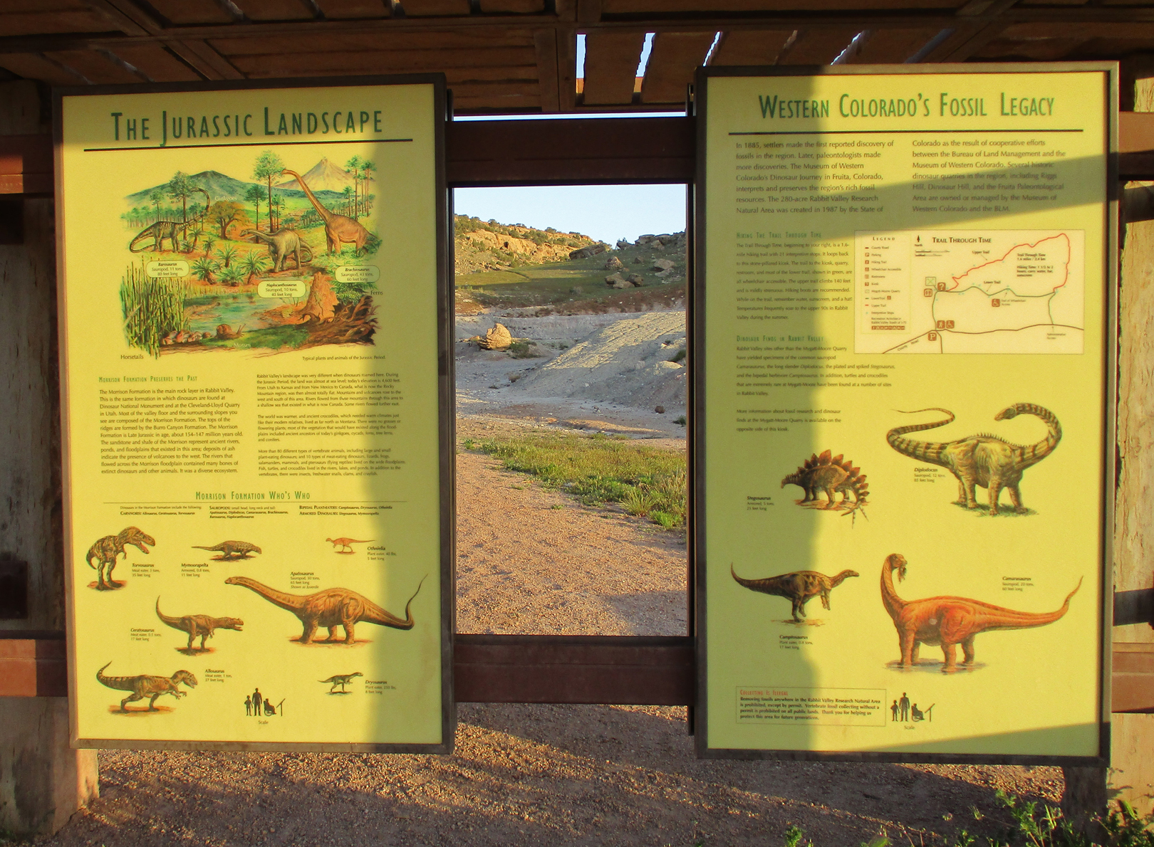
The 1.6-mile Rabbit Valley Trail Through Time is just off Interstate 70
Paleontologists have found eight species of dinosaurs in the Mygatt-Moore Quarry and continue to do field work here.
Kiosk at the start of the trail
Camarasaurus Skeleton – Note disk marker on rock
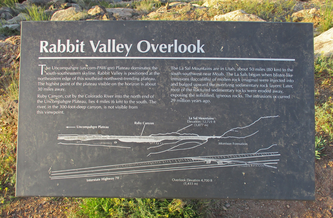
Rabbit Valley Overlook
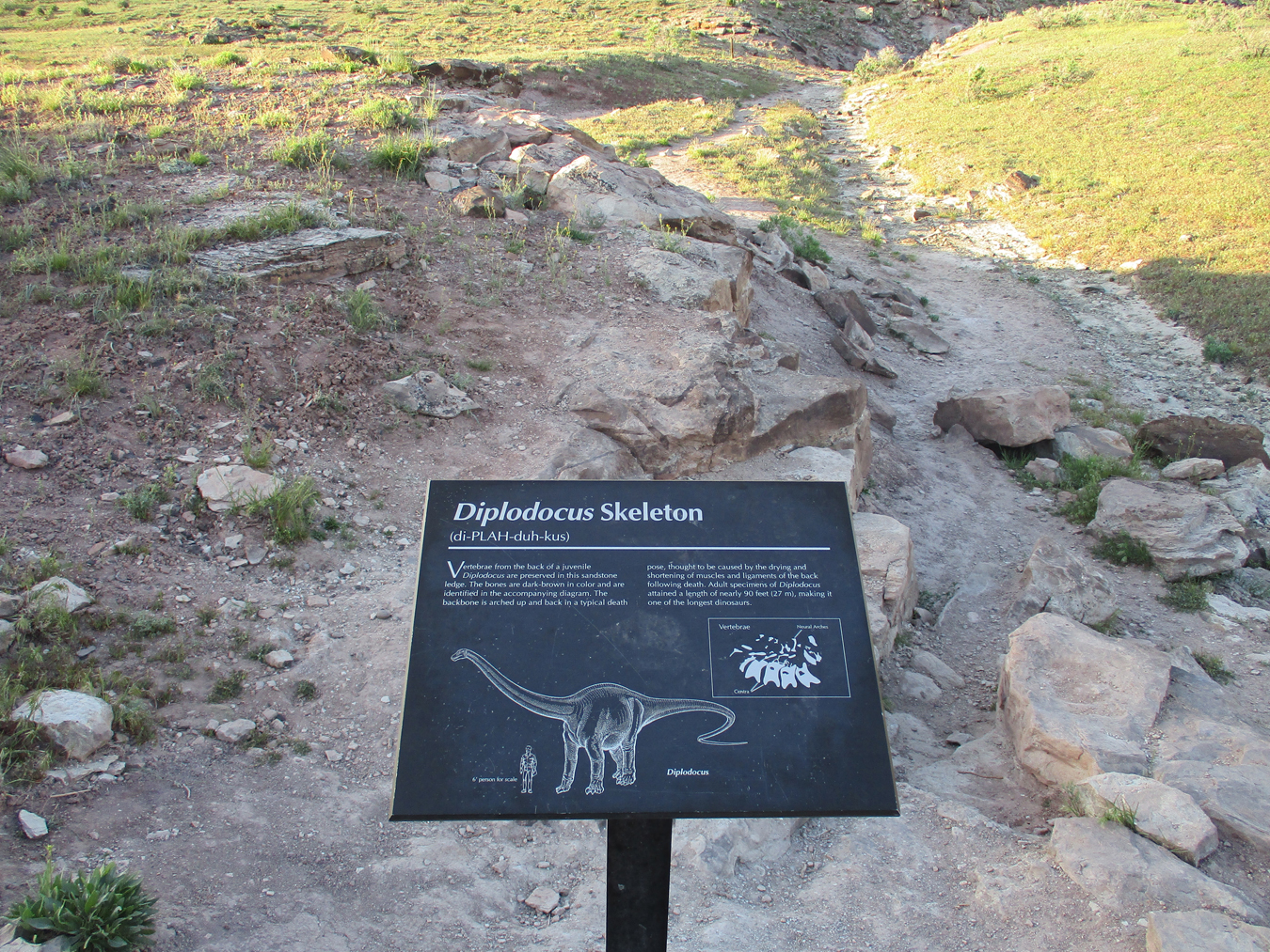
Diplodocus Skeleton
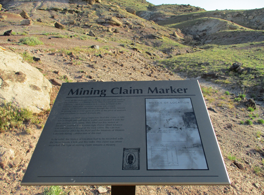
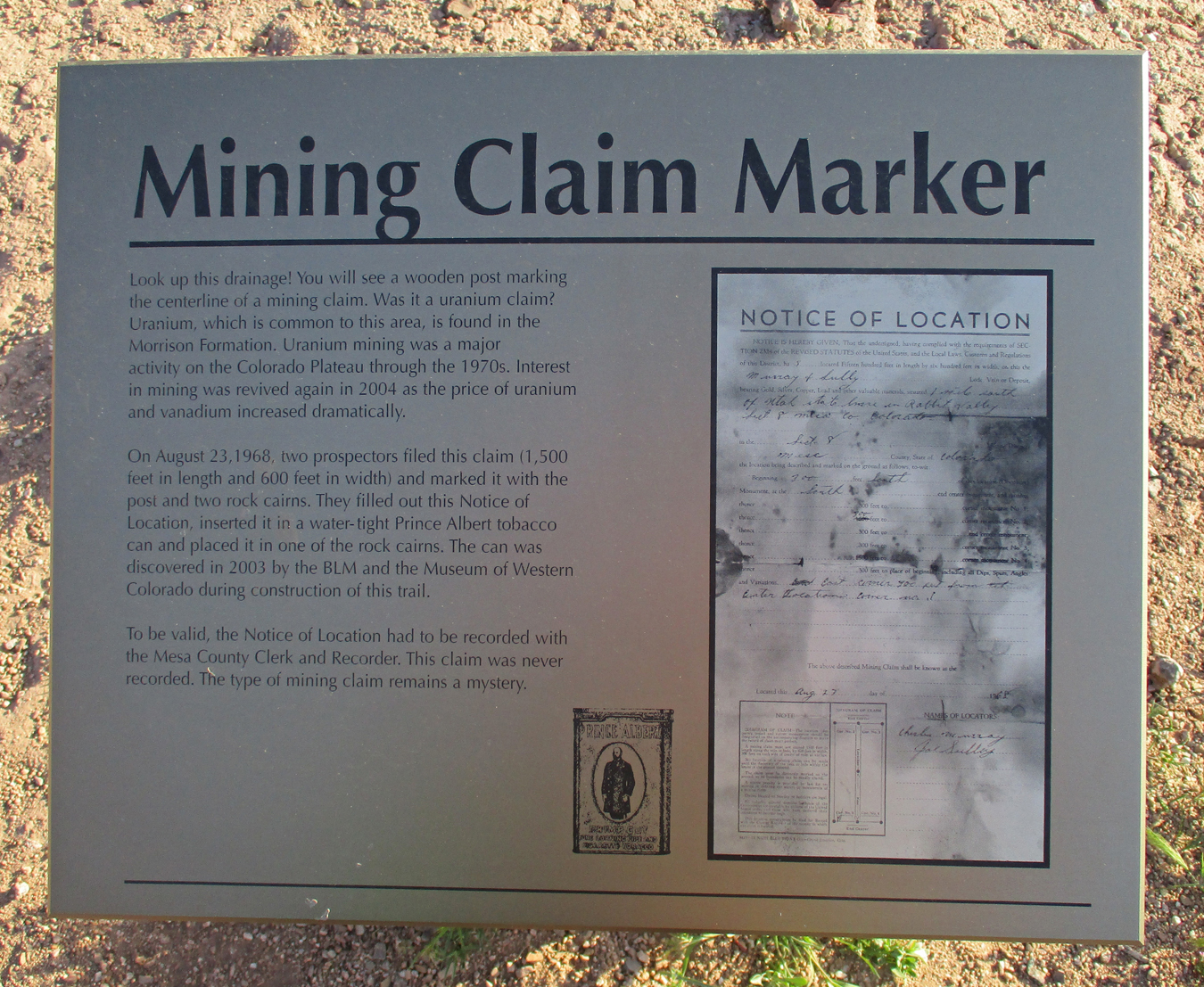
Mining Claim Marker
Balanced Rock
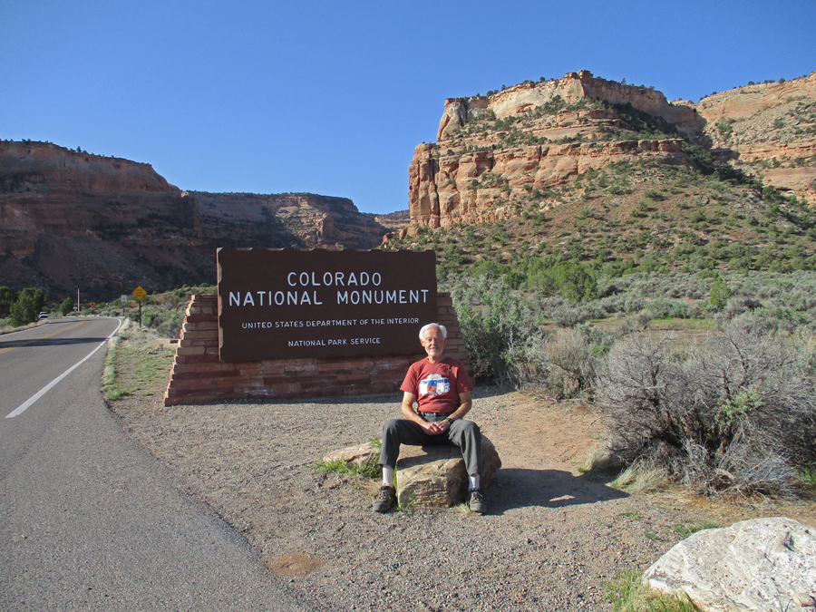
It only took a half hour to get to the west entrance to Colorado National Monument near Fruita CO.
Lots of great views as you drive up switchbacks to the top of the Colorado Plateau, 2,000ft above the Colorado River Valley
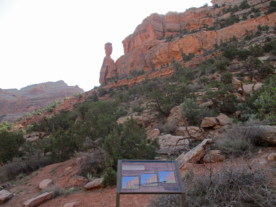
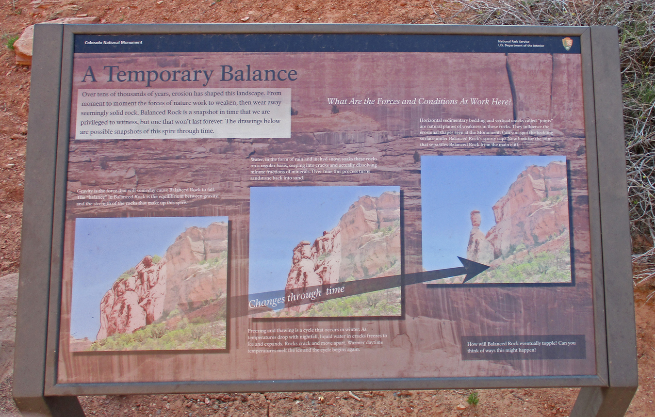
The formation of a Balanced Rock
Sign describing construction of the road by the CCC from 1931 to 1950.
Note Balanced Rock in the upper right part of the photo at the Fruita Canyon View
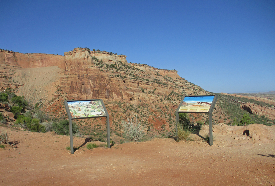
John Otto arrived in this area in 1906 and worked tirelessly for it to become a national park. When President Taft declared it a National Monument in 1911, Otto became the park caretaker at a salary of $1 a month!
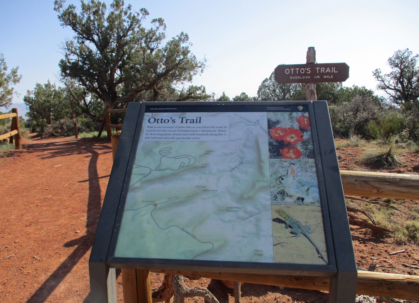
Otto’s Trail, I did lots of short trails to overlooks
Overlooking Wedding Canyon to Independence Monument
Independence Monument – 450 feet tall 2022
2022
Climbing Independence Monument to Raise Flag on July 4th – the Tradition Continues
2022
This was my third visit to this park – Independence Monument – took this photo in 1968 with Helen
1968
Independence Monument 1998 with Chad
Grand View 2022
Grand View – 1998
1998
Grand View – 1968
1968
Grand View – 2022
2022
Grand View Flowers 2022
Juniper – 1968
1968
Sandstone Detail – 1968
Coke Ovens – 2022
Highland View – 1968
1968
Upper Ute Canyon Overlook – 2022
2022
Bats –
Fallen Rock Overlook – 2022
Ute Canyon View – 1968 with Helen
1968
Red Canyon Overlook – 2022
Cold Shivers Point – 2022
Stayed with cousin Nick and wife Linda in Arvada outside of Denver, dinner at German restaurant with Nick, Linda, cousin Cathy, and Lisa (Nick & Linda’s daughter)
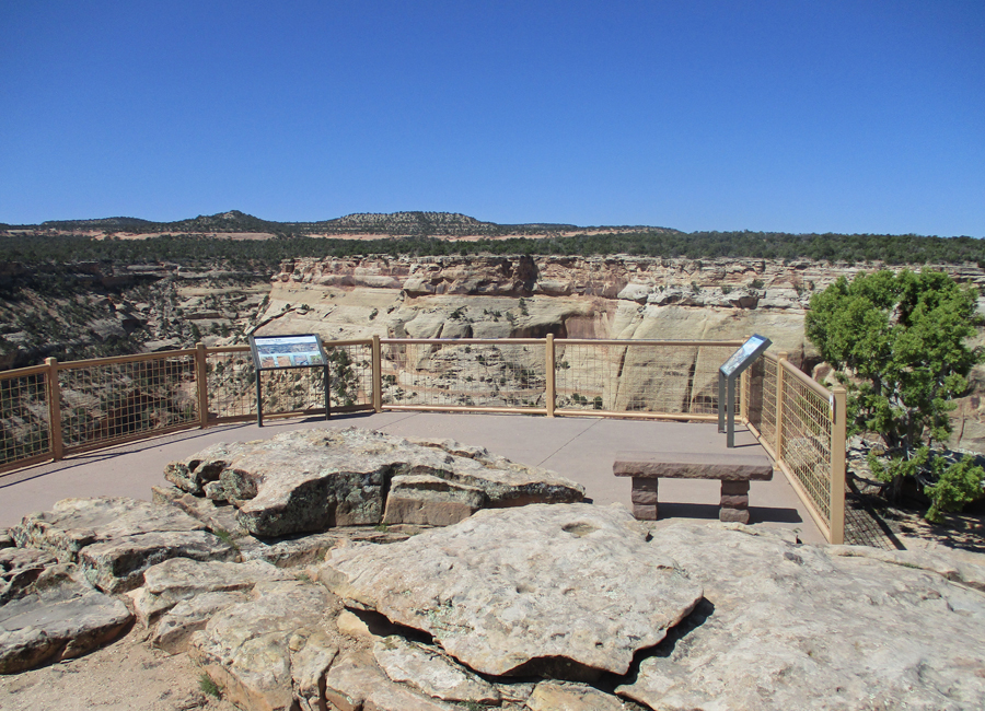
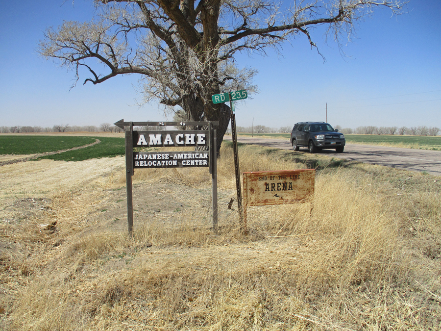
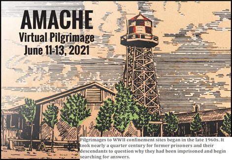
4/22 F – 4hrs to Camp Amache NHS near Granada in southeast CO. This is the newest National Park Unit (#424) – bill signed by President Biden in 2022.
Old Museum in Granada foreground, new Museum and Amache NHS Visitor Center background with green awning
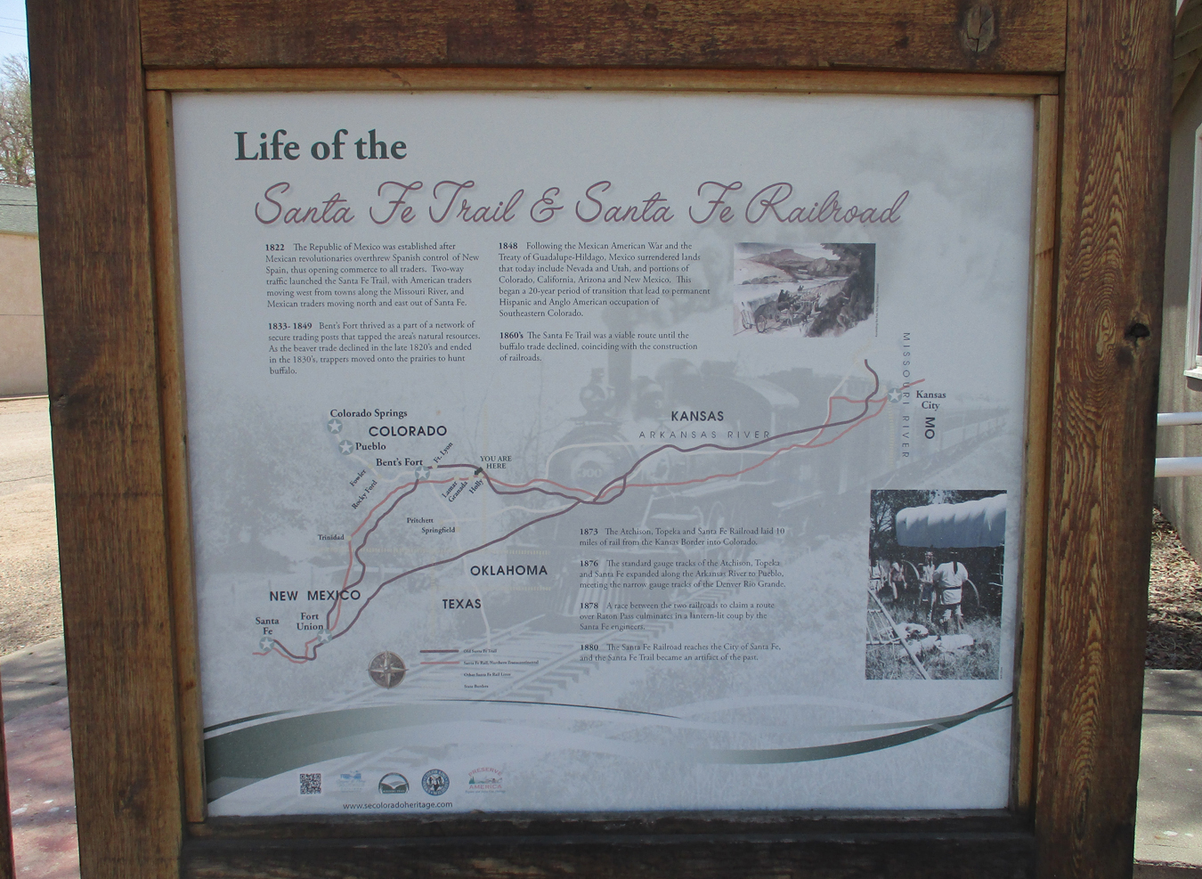
Santa Fe Trail and Santa Fe Railroad
The Visitor Center was to be closed today but John Hopper (APS) had opened it for me for a noon visit. A gentleman from Great Britain happened by as well.
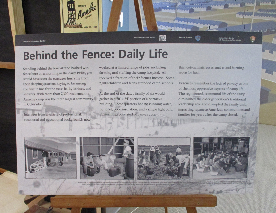
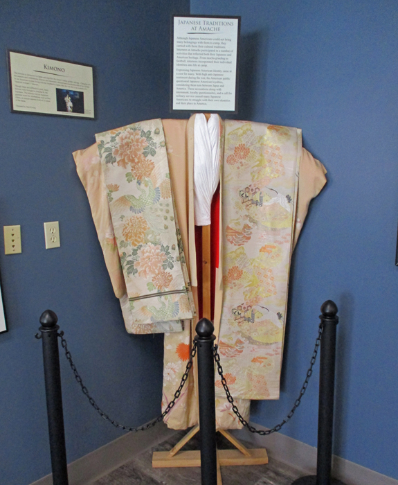
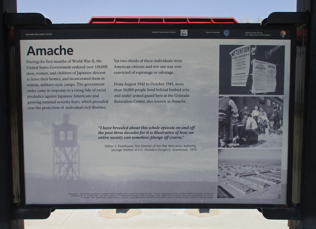
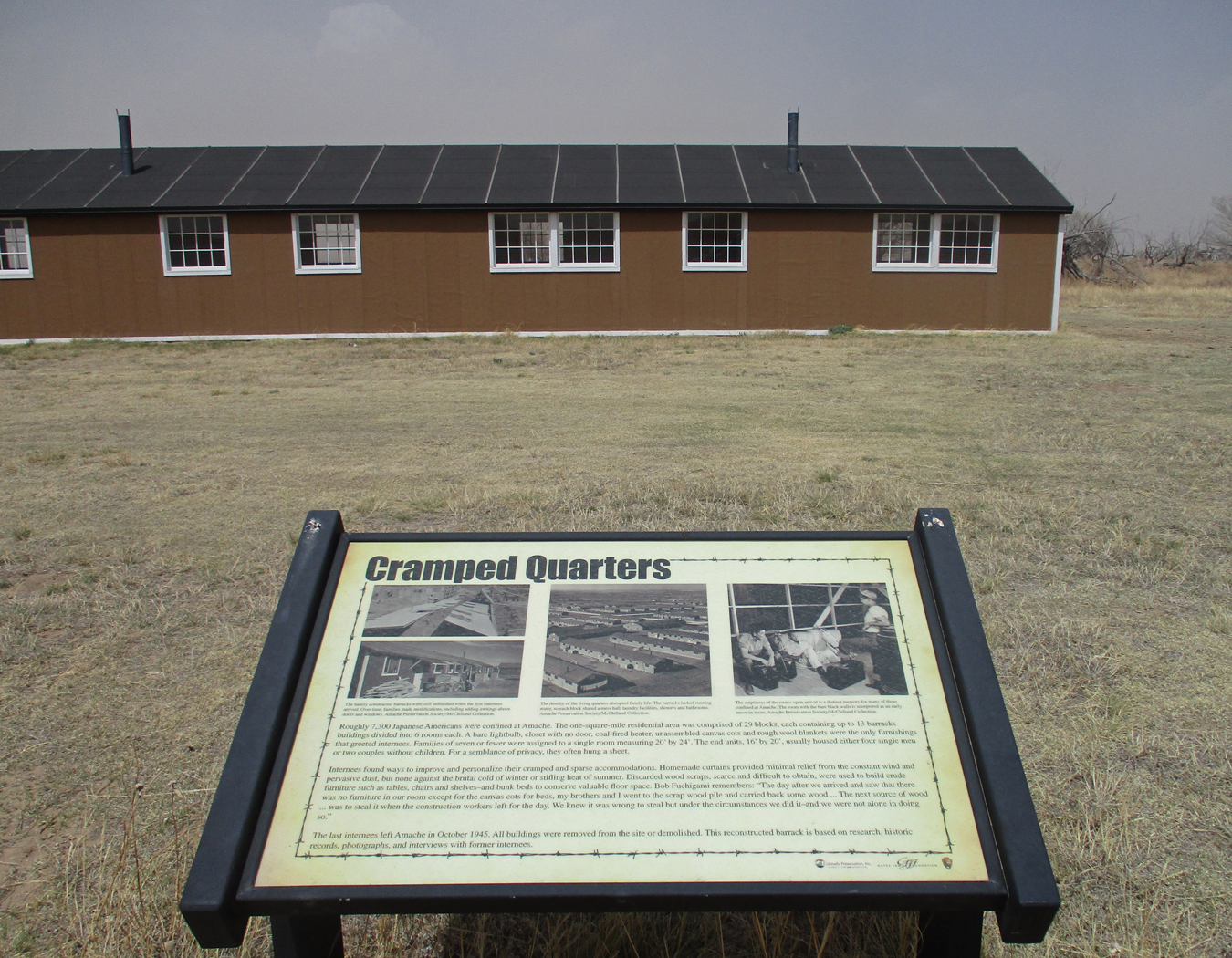
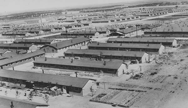
Granada Relocation Center, also known as Amache, was one of ten Japanese internment camps operated by the U.S. government during World War II (1943-1945). At its peak, it housed 7,500 persons of Japanese descent, most American citizens. In retrospect, this was a black mark on the Roosevelt administration. Japanese arriving by rail car – does that remind you of anything?
Relocation Center, Internment Camp, Concentration Camp?
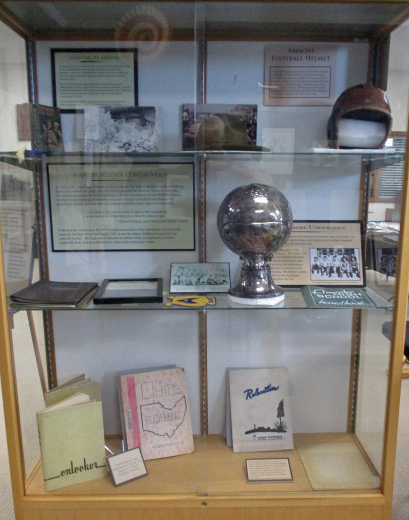
Despite the difficult conditions, the residents worked to maintain their community.
That included Japanese as well as American traditions
Amache was located on the Arkansas River so that residents could produce agricultural products for the war effort.
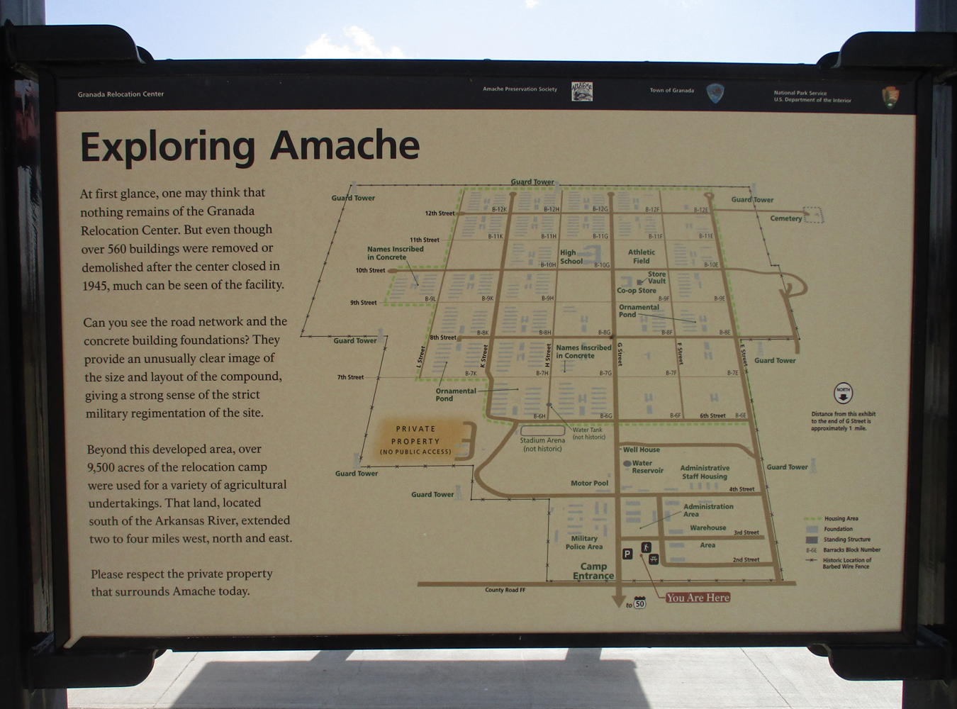
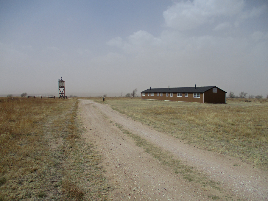
The Relocation Center Central Area is located off U.S. 50 just west of town
This was another “Red Flag Day.” High winds with blowing sand/dust made it unpleasant to be outside. The following are representative of many informative markers.
Poor visibility due to blowing sand/dust
Water Tank and Annual Pilgrimage
Guard Tower and rebuilt barracks
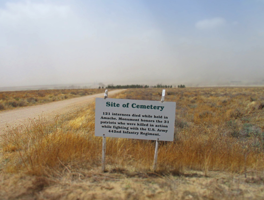
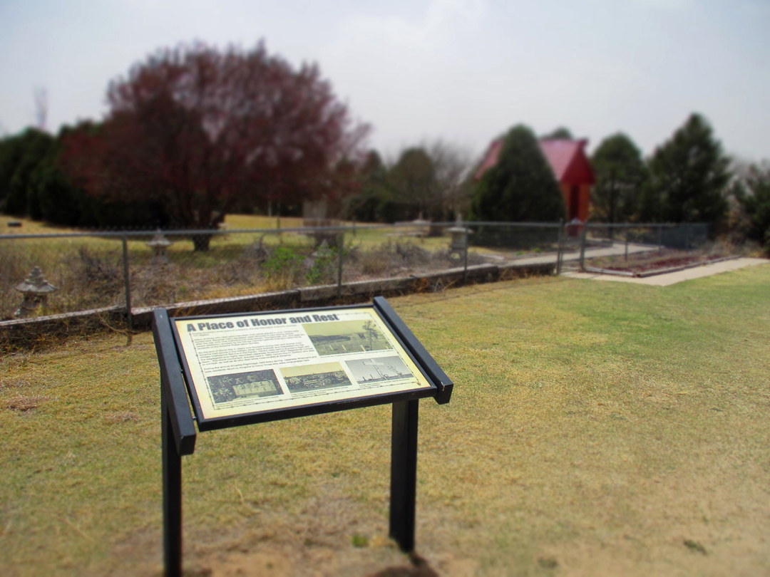
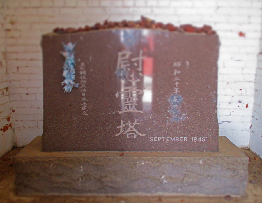
Cemetery
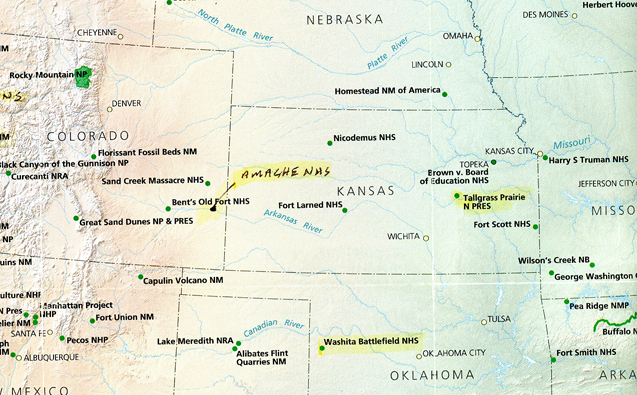
5.5hrs on U.S. 50 to get to Tallgrass Prairie N PRES in KS. Slept in parking lot.
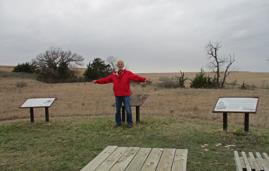
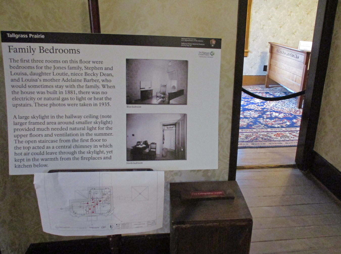
4/23 Sa – Tallgrass Prairie N PRES
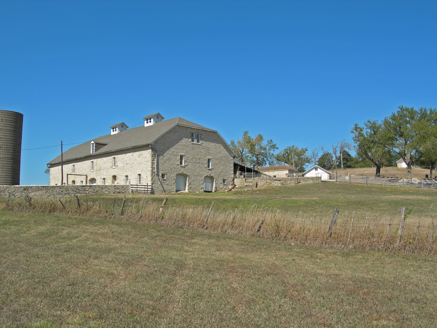
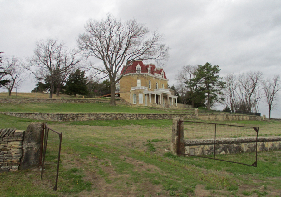
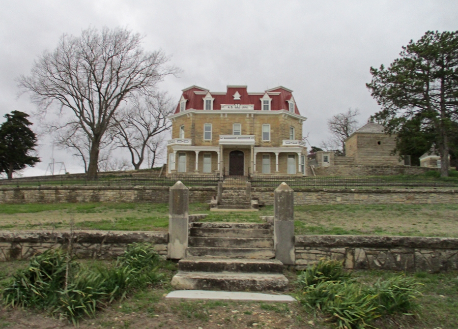
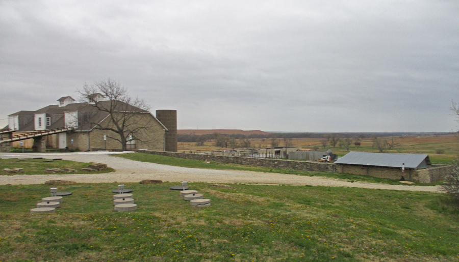
Spring Hill Farm and Z Bar Stock Ranch (11,000 acres) represents a ranching legacy from 1878 to 1986. The Nature Conservancy owns most of the land and manages the Preserve with the NPS.
Entrance
This photo of the 110ft x 60ft Limestone Barn is from my 2007 visit
The Ranch House Mansion was built in 1881
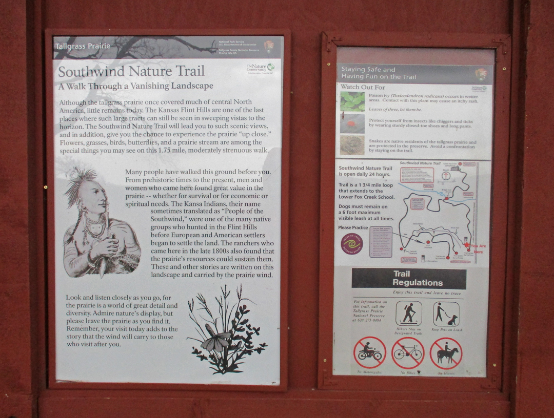
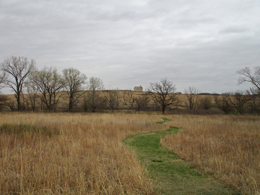
I did the 1.75-mile Southwind Nature Trail
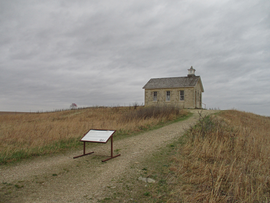
The scenic one-room Lower Fox Creek Schoolhouse was built in 1882 and closed in 1930
Tallgrass Prairie – 2022, Bison herds once roamed this land. Today you can see some bison in the Windmill and/or West Traps Pastures. However, I did not see any today when hiking through the West Traps Pasture.
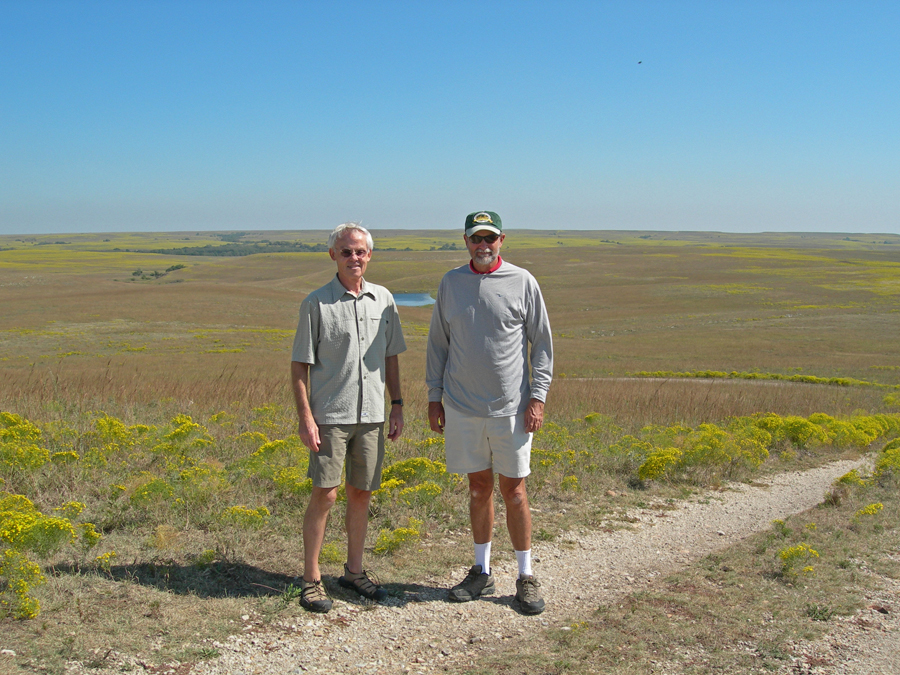
Tallgrass Prairie National Preserve with Larry – 2007
View from Overlook – 2022
Limestone Barn with Flint Hills in background
This old gas pump is by the 1882 limestone Chicken House
The Ranch House Mansion currently serves as the Visitor Center – Ice House on hill to left
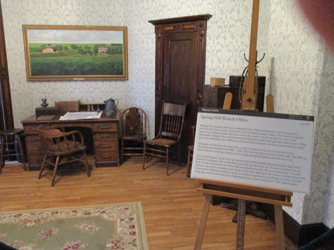
Spring Hill Ranch House Office
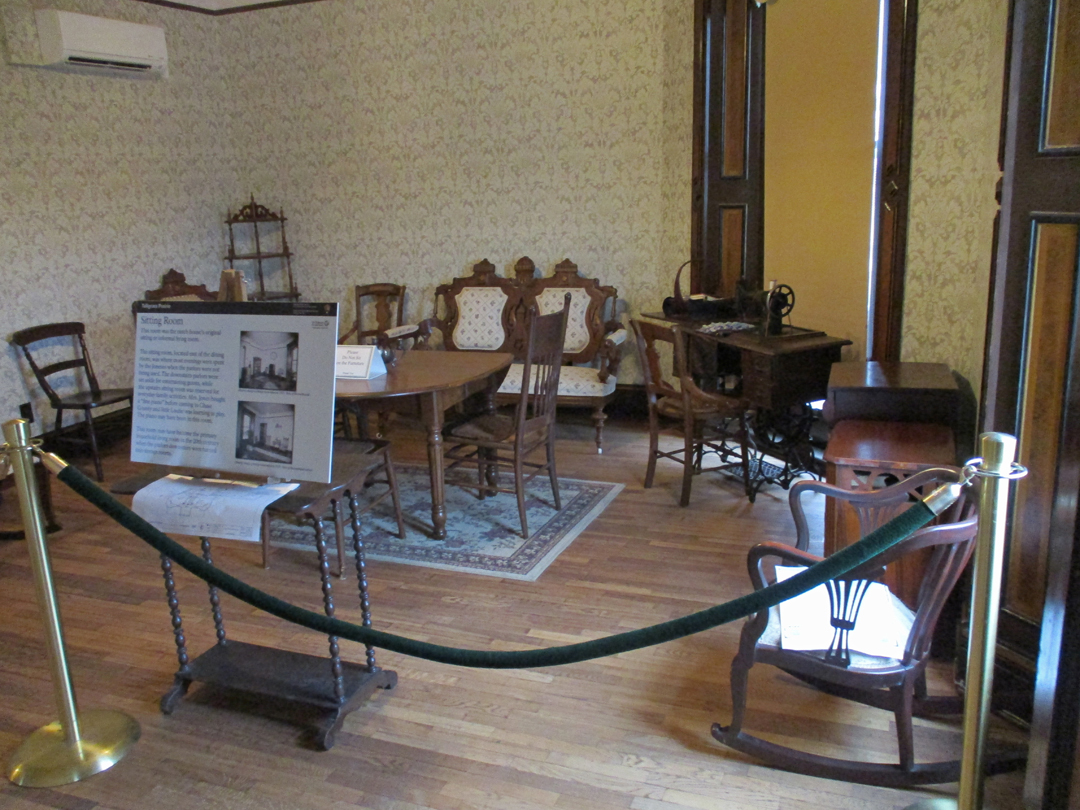
Sitting Room
Bedrooms
Ice House from second floor window
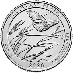
2020 Kansas Quarter – part of National Park series, one NP site from each state – Tallgrass Prairie
11hr (745mi) drive to Springfield – slept in my own bed!
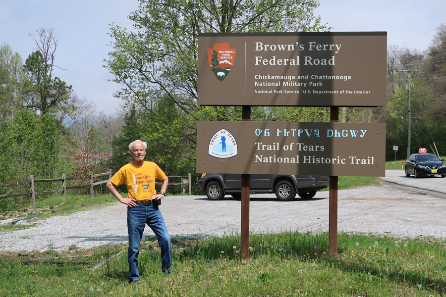
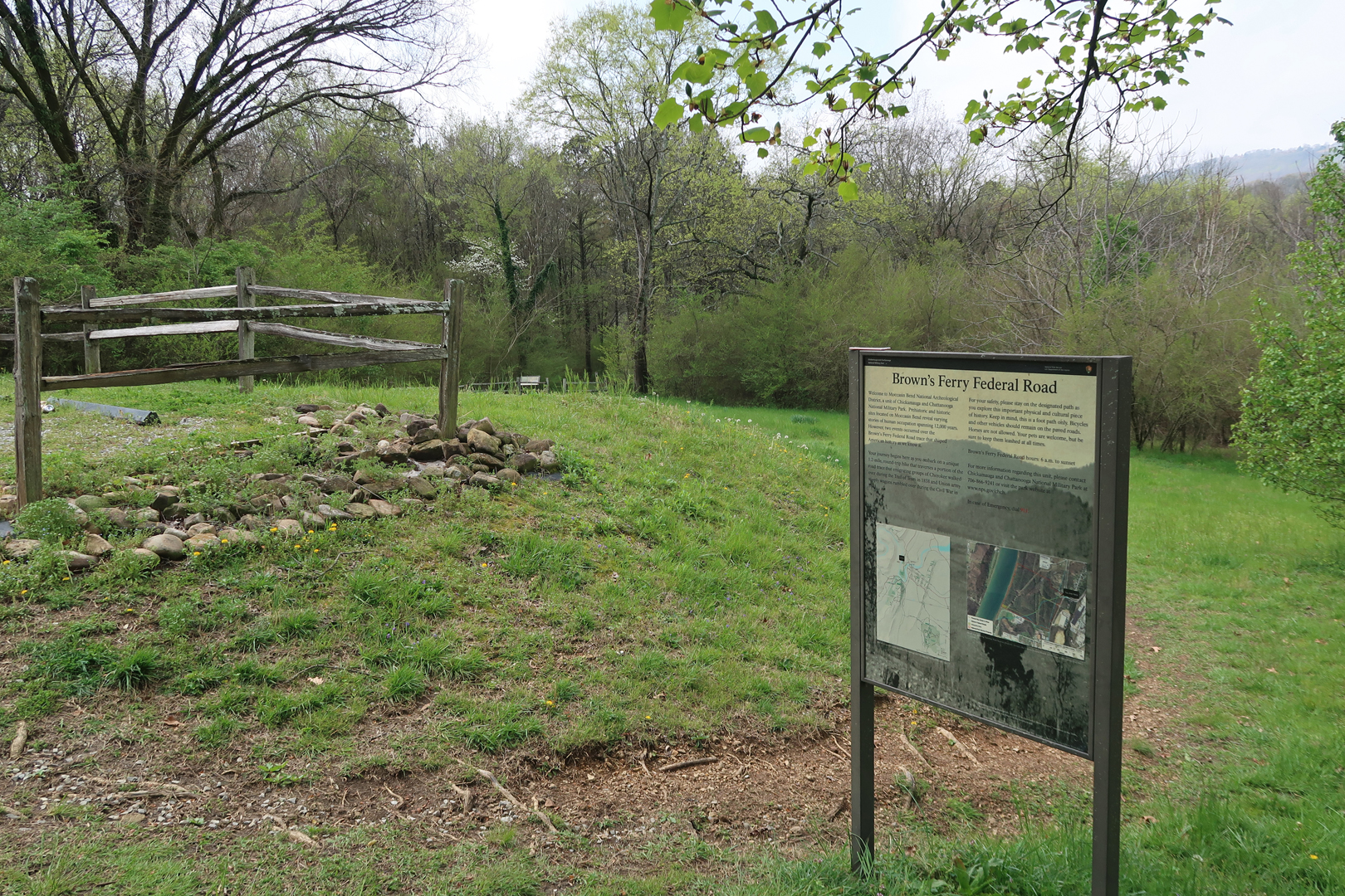
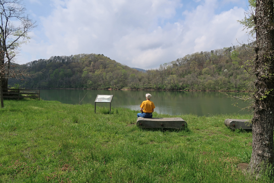
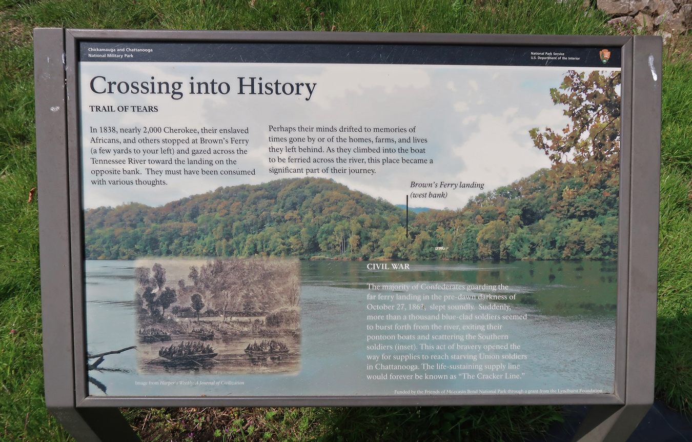
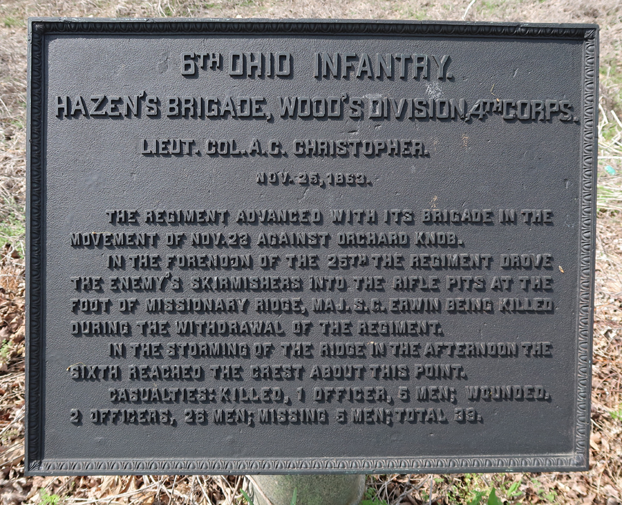
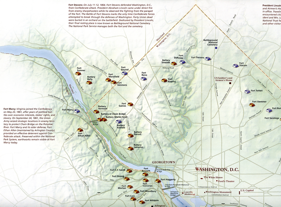
4/6/2022 –Trail of Tears National Historic Trail in Moccasin Bend National Archeological District of Chickamauga and Chattanooga National Military Park in Chattanooga TN. This is one small segment of a route used to forcefully remove Cherokee and other Native Americans from their homelands to “Indian Territory” (now Oklahoma) from 1830 to 1850.
Brown’s Ferry, a part of the Federal Road connecting Chattanooga to points west, was on a route used to force Cherokee from their homes in GA after gold was discovered there in 1838.
The Trail of Tears was a series of forced displacements of about 60,000 Native Americans as part of the Indian Removal Act of 1830. The relocated peoples suffered from exposure, disease, and starvation – thousands died while on the trail. Some have labeled this “American Genocide or Ethnic Cleansing.” How different is this from the forced relocation of Ukrainians from Ukraine? This question could result in some interesting moral discourse. Does it relate to Critical Race Theory?
As mentioned, this unit is part of Chickamauga and Chattanooga NMP – the marker describes how Federal troops crossed the Tennessee River on pontoon boats (October 27,1863) here and attacked the sleeping Confederates thereby opening a much-needed supply line to Union forces. See this Blog for our January 2020 visit to this Civil War Military Park.
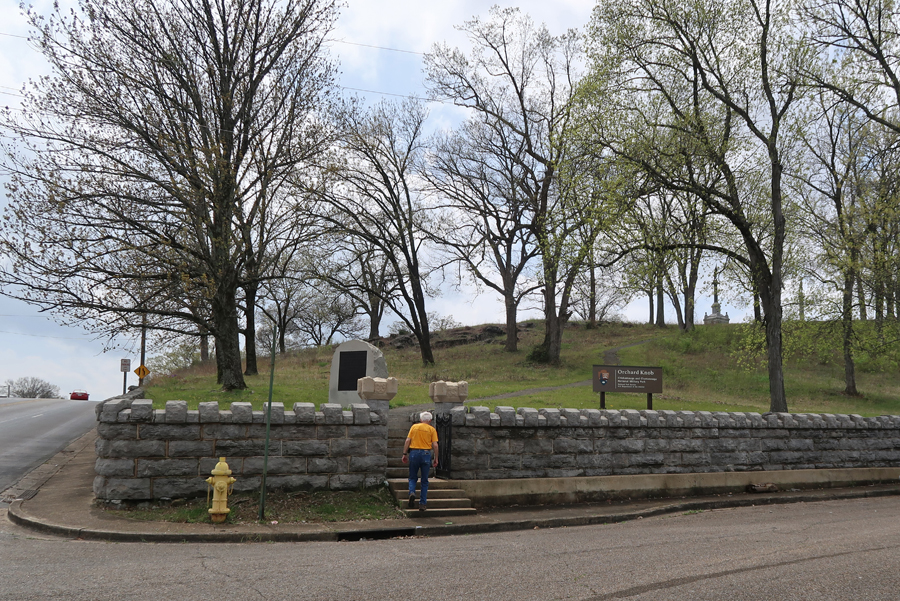
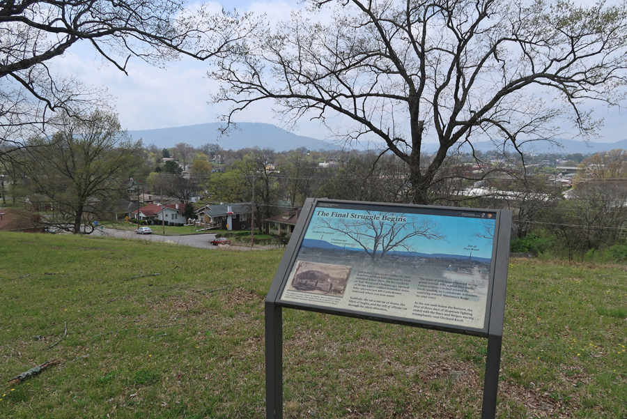
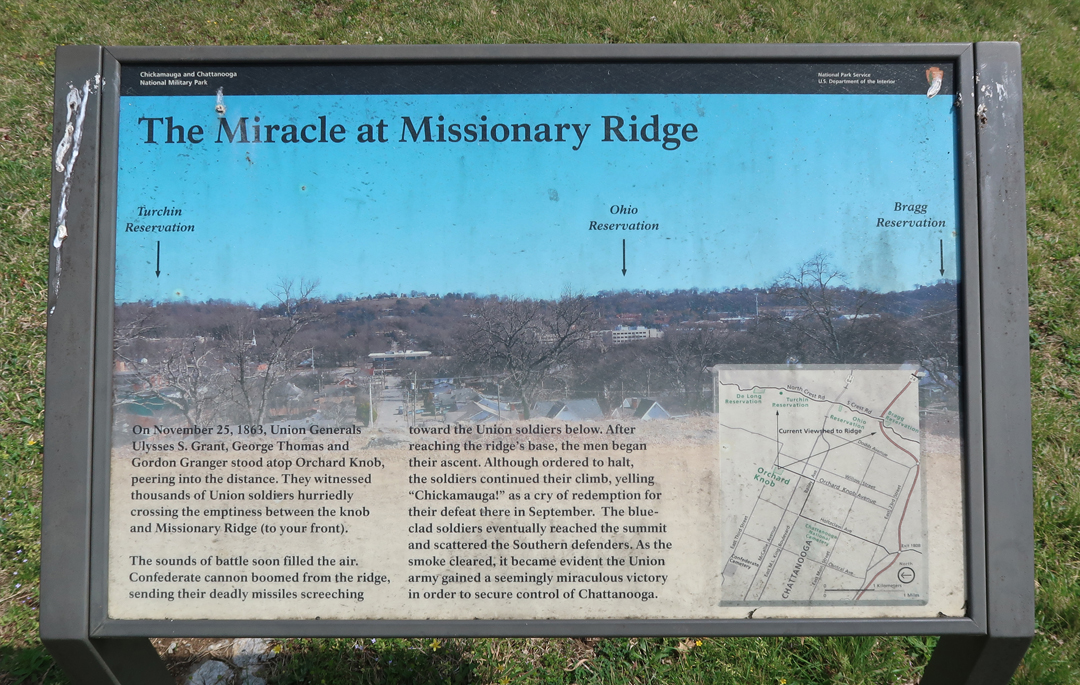
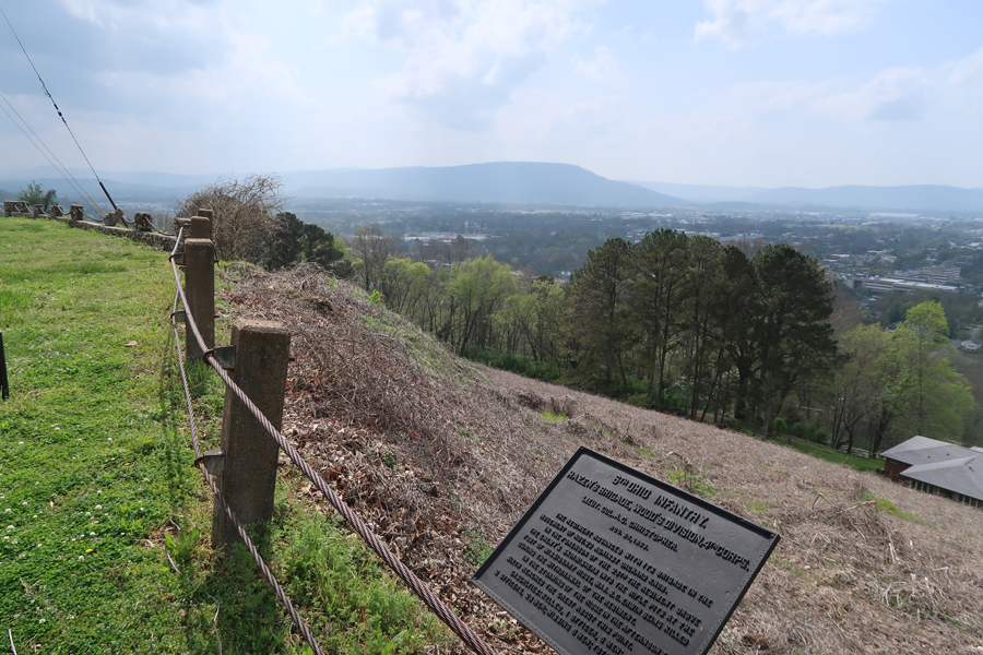
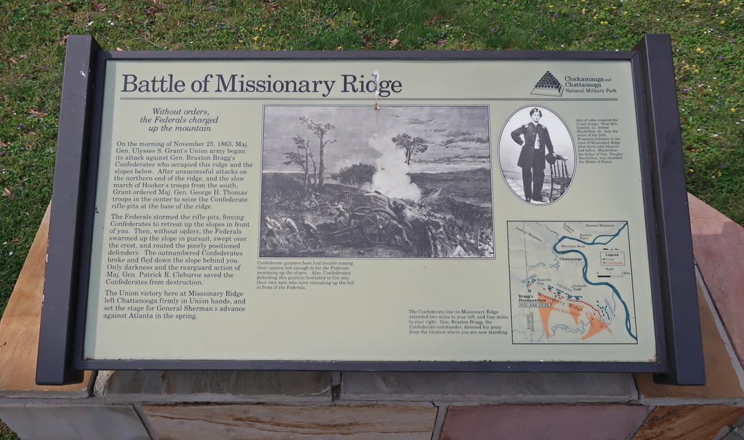
On this trip, I started at Orchard Knob in Chattanooga where General Grant had his headquarters and a 360-degree view of the battlefield – including Lookout Mountain and Missionary Ridge.
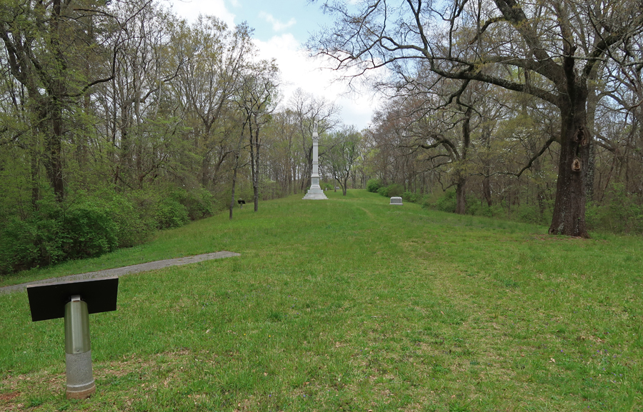
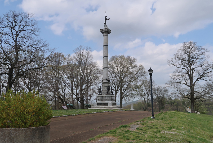
The Illinois Monument
The view of Missionary Ridge
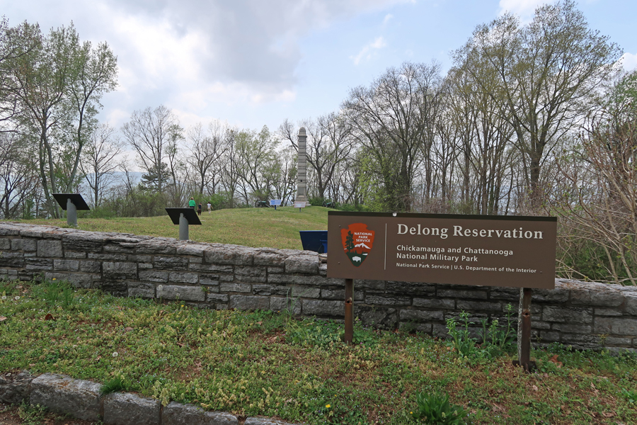
I then drove to the Sherman Reservation on Missionary Ridge and followed the ridge (some beautiful houses on this route) to the Chickamauga Battlefield in GA
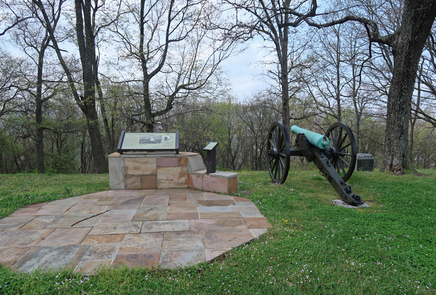
Delong Reservation
Ohio Reservation – Lookout Mountain in distance
Bragg Reservation
There were many Medals of Honor awarded to individuals during this battle. One was Arthur MacArthur; his grandson General Douglas MacArthur, Army Commander in the Far East during World War II, was also awarded the Medal of Honor. He officially accepted the surrender of Japan aboard the USS Missouri in Tokyo Bay on September 2, 1945.
I stopped briefly at the Chickamauga Visitor Center and then drove to Washington GA. It was now dark, and the Washington Historical Museum was closed. The town square proved to be a good place to spend the night.
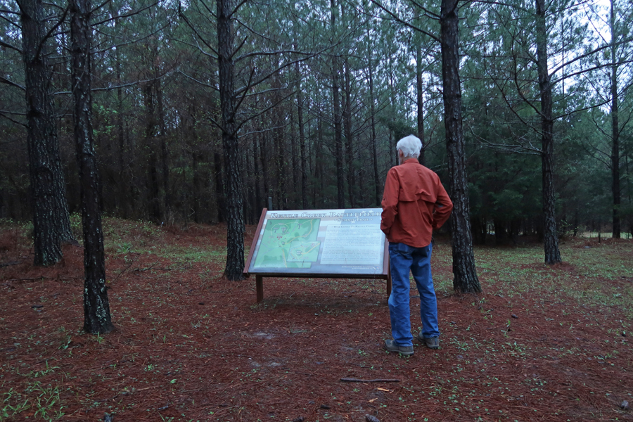
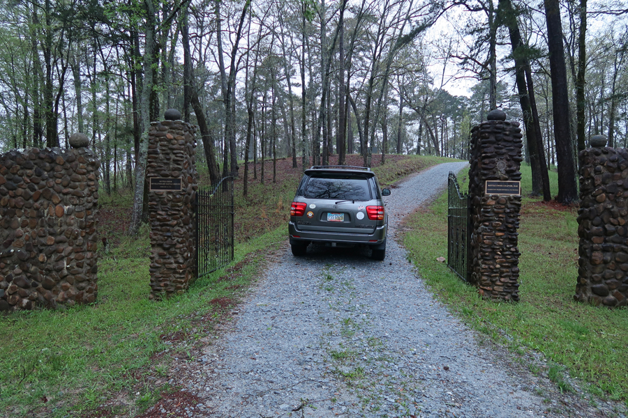
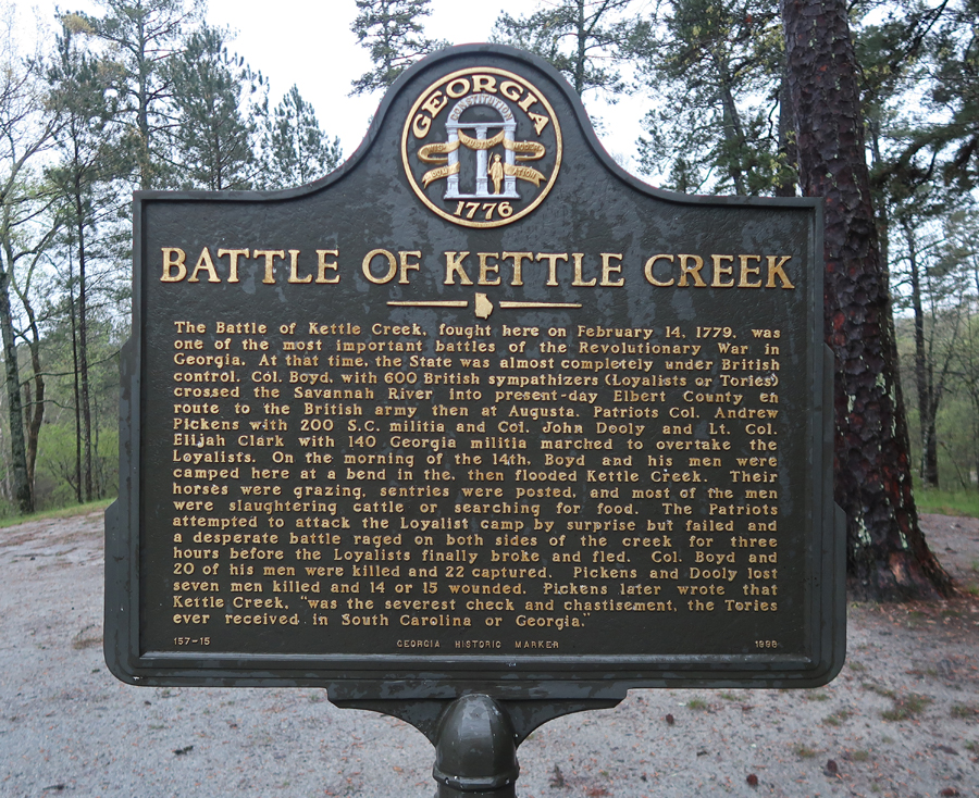
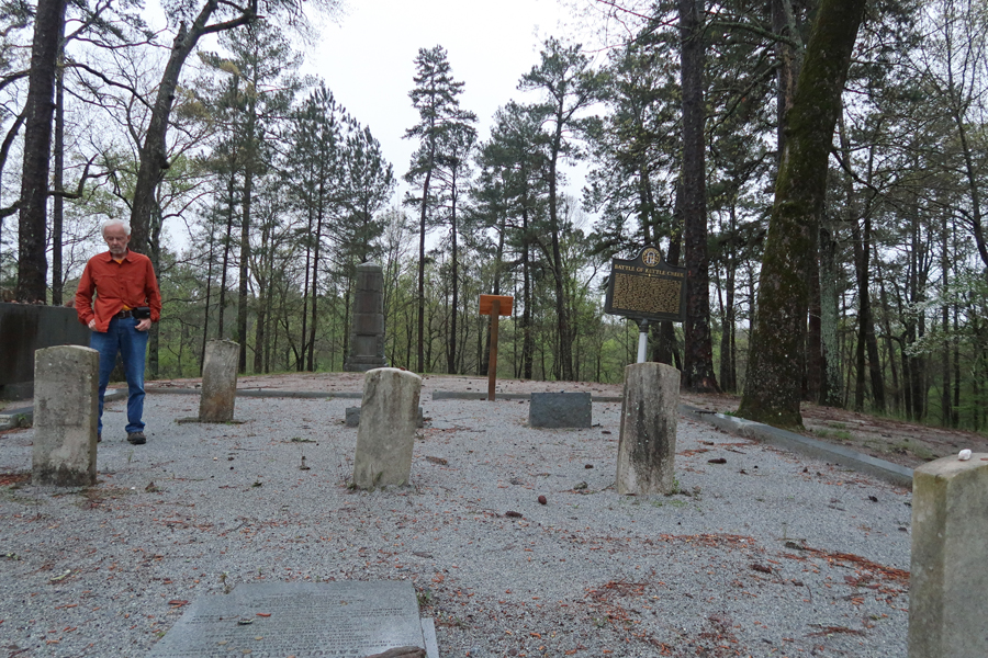
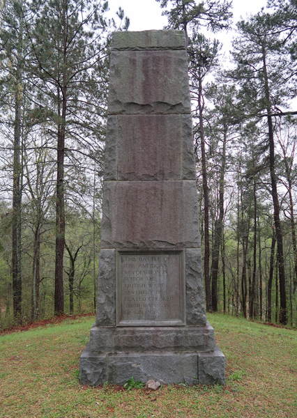
4/7/2022 – I was up early and drove about 7 miles to the Battle of Kettle CreekNMP, which is an Affiliated National Park Unit. I left my tripod in Chattanooga, so now I was using the end of my hiking stick, which has a screw to support my camera, for self-photos. Of course, I had to search for a good spot to stick it in the ground so it would not fall over!
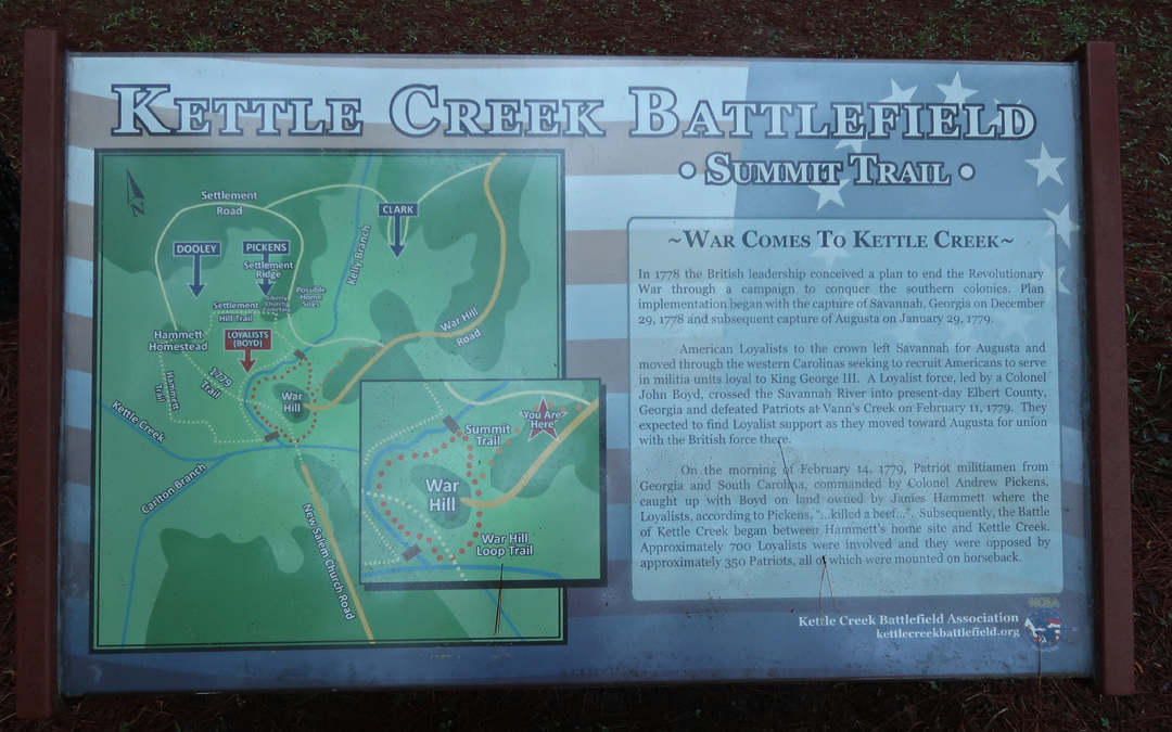
In early 1779, Patriot Colonels Andrew Pickens, John Dooly and Elijah Clarke joined forces (~380 militia) to overtake Colonel Boyd and his British Loyalists (~650 militia). On February 14, 1779, Boyd halted his troops for breakfast in a flat area between a steep hill and Kettle Creek. Pickens attacked. Boyd led a counterattack and was mortally wounded.
The Battle of Kettle Creek was the first major victory for the Patriots in the back country of GA during the American Revolutionary War.
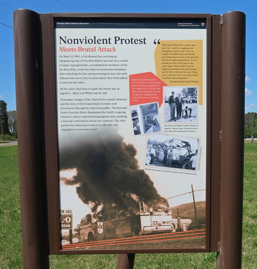
My next stop was Freedom Riders NM in Anniston AL – Helen and I were here in March 2017 – see Blog. Today I visited the NM Visitor Center, which is in the Calhoun County Area Chamber & Visitors Center.
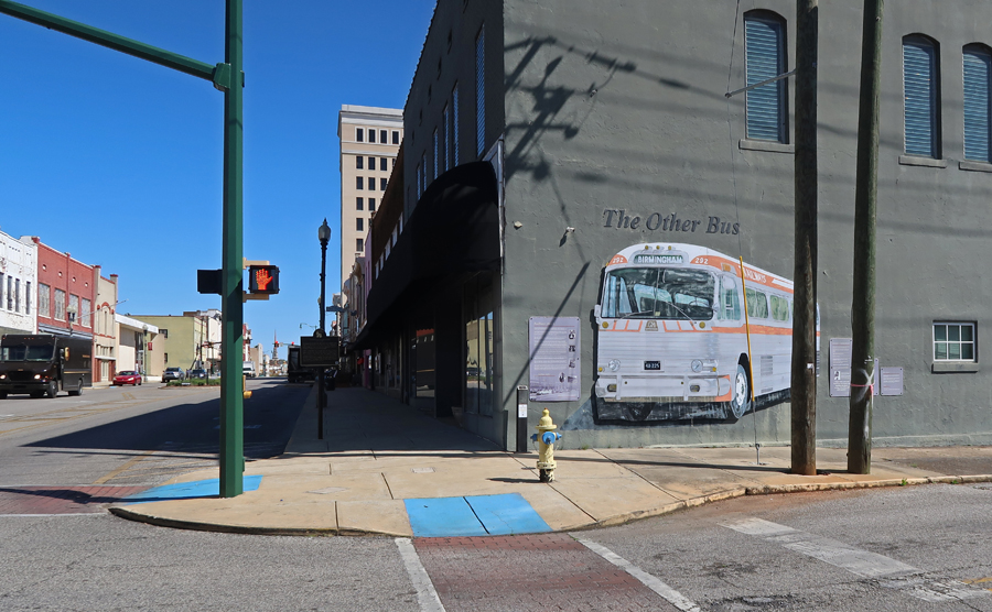
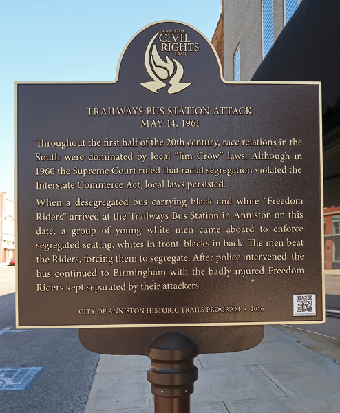
“The Other Bus” – there was also another bus that was attacked the same day, May 14, 1961, in Anniston – a Trailways bus.
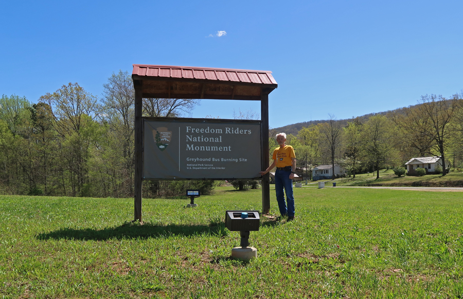
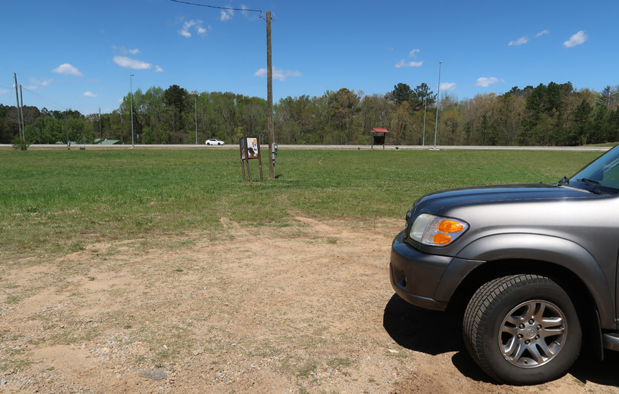
I then re-visited the Greyhound bus site in Anniston and drove to the location where it was burned.
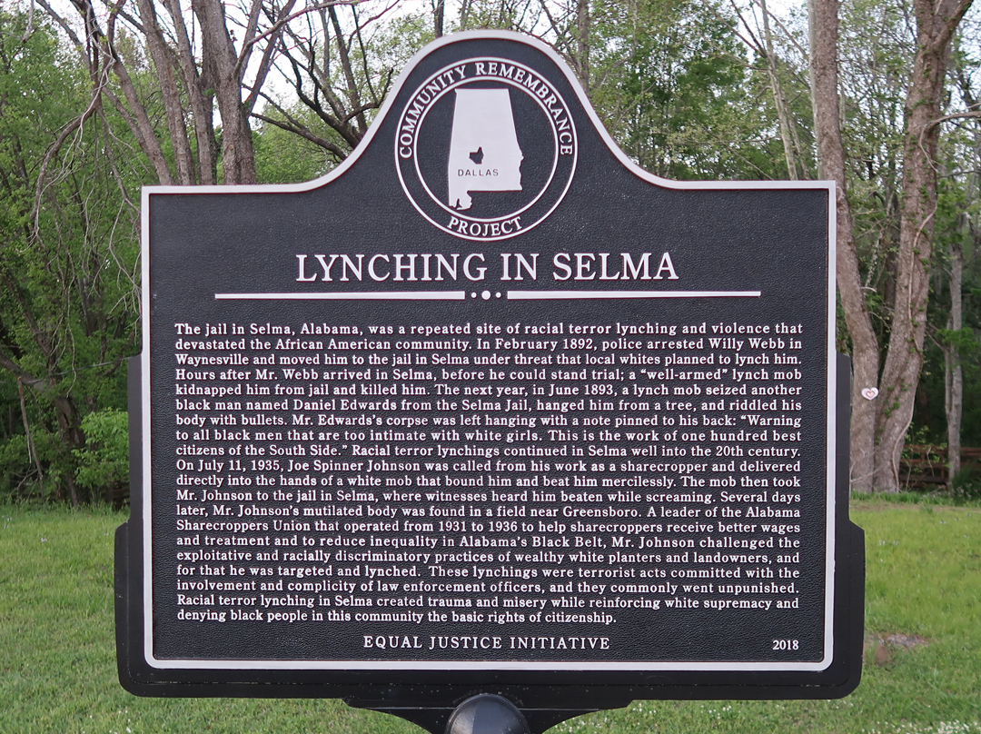
Note how the sign describing the incident has been damaged. I have found this to be a common occurrence in relation to Civil Rights historical signs in the South.
Also note the Confederate flag flying across the street!
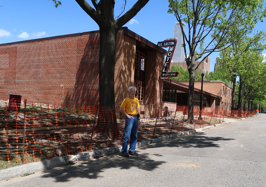
I continued west to the Birmingham Civil Rights NM, just as we did in 2017. The following are pics of related places that I did not cover in our March 2017 Blog post. The first is the A.G. Gaston Motel, which served as the headquarters for the civil rights campaign in 1963. It is being refurbished as the NMs Visitor Center.
St Paul United Methodist Church was established in 1869 to allow newly freed African American slaves an opportunity to gather and worship. It hosted mass meetings and was involved in nonviolent civil rights training including the 1965 Selma to Montgomery March.
Birmingham Civil Rights Institute, established in 1992, provides a history of Civil Rights in Birmingham as well as cultural, educational, and research services related to the international struggle for universal human rights.
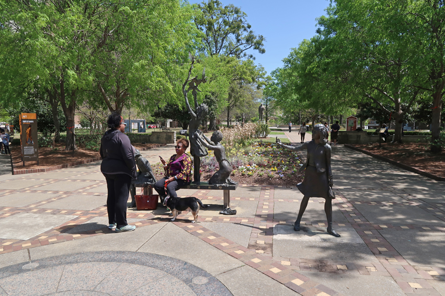
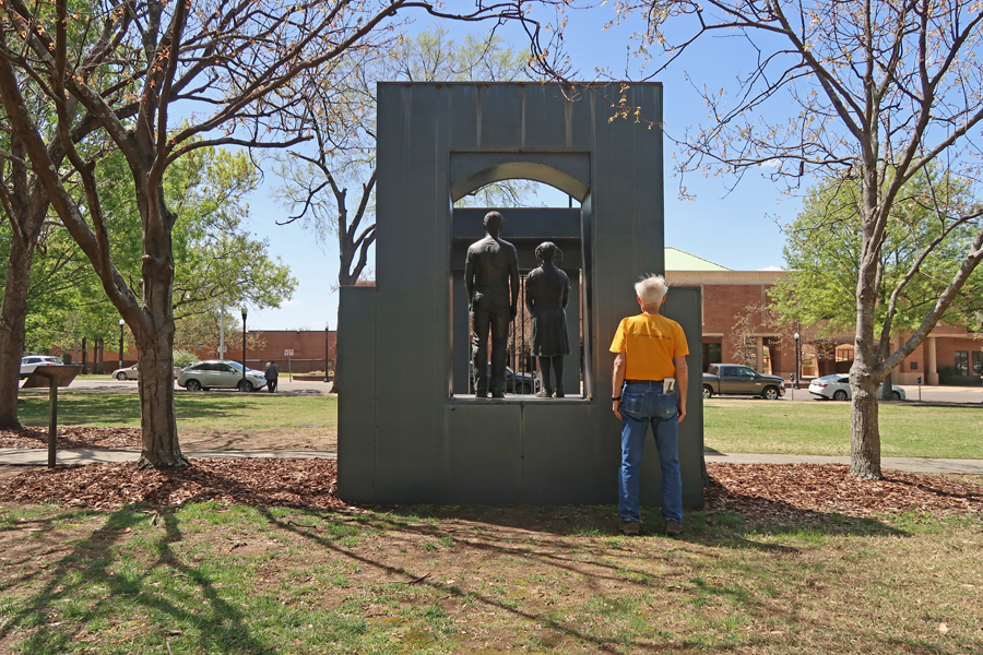
Additional photos from Kelly Ingram Park where, on May 3, 1963, police, canine units, and fireman attacked hundreds of peaceful student demonstrators. Images of the use of brutal police force shocked the nation and world.
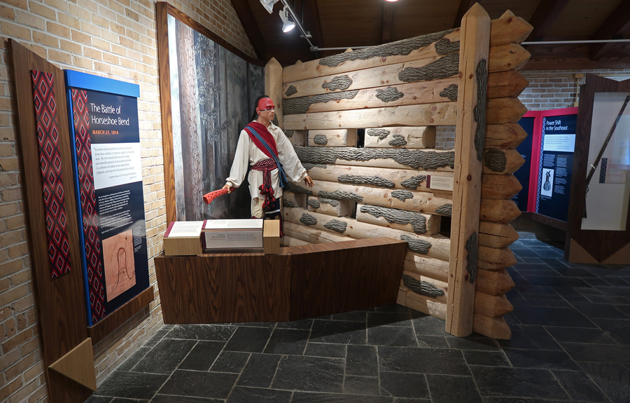
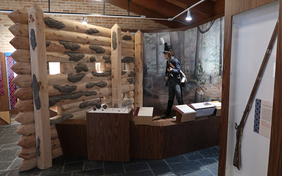
Drove SE and re-visited Horseshoe Bend NMP – see Blog for March 2017. This is where, in 1814, Gen. Andrew Jackson’s forces killed more Native Americans than in any other battle in the history of the U.S. I took additional photos in the Visitor Center. Replica of the Upper Creek Indian Village –
This band of Creek Indians were called the “Red Sticks.” They built an 8-foot barricade to protect their village.
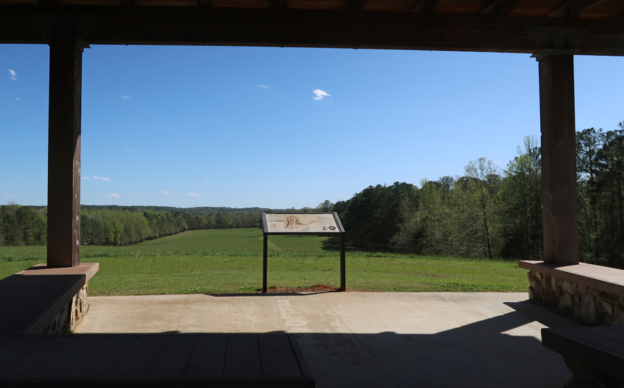
I also did a video from this battlefield Overlook
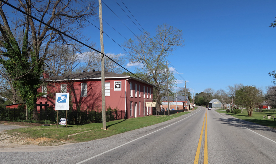
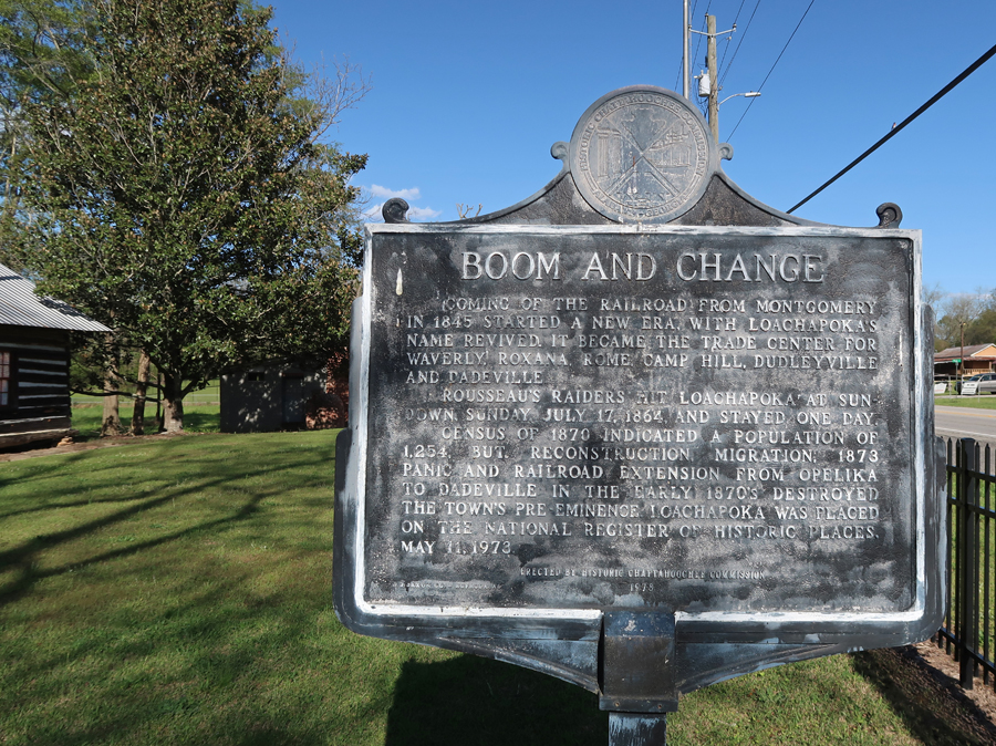
I then drove to the Loachapoka AL Museum, which was closed. Loachapoka was one of the larger settlements of the Upper Creeks before and after the Battle of Horseshoe Bend. The Creeks that remained in this area were removed 1835-1837 (Trail of Tears) to Oklahoma (Indian Territory).
There were also other historical markers outside the museum – Dr. Alexander Nunn
Loachapoka “Boom and Change”
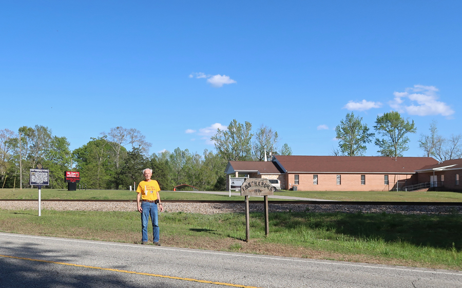
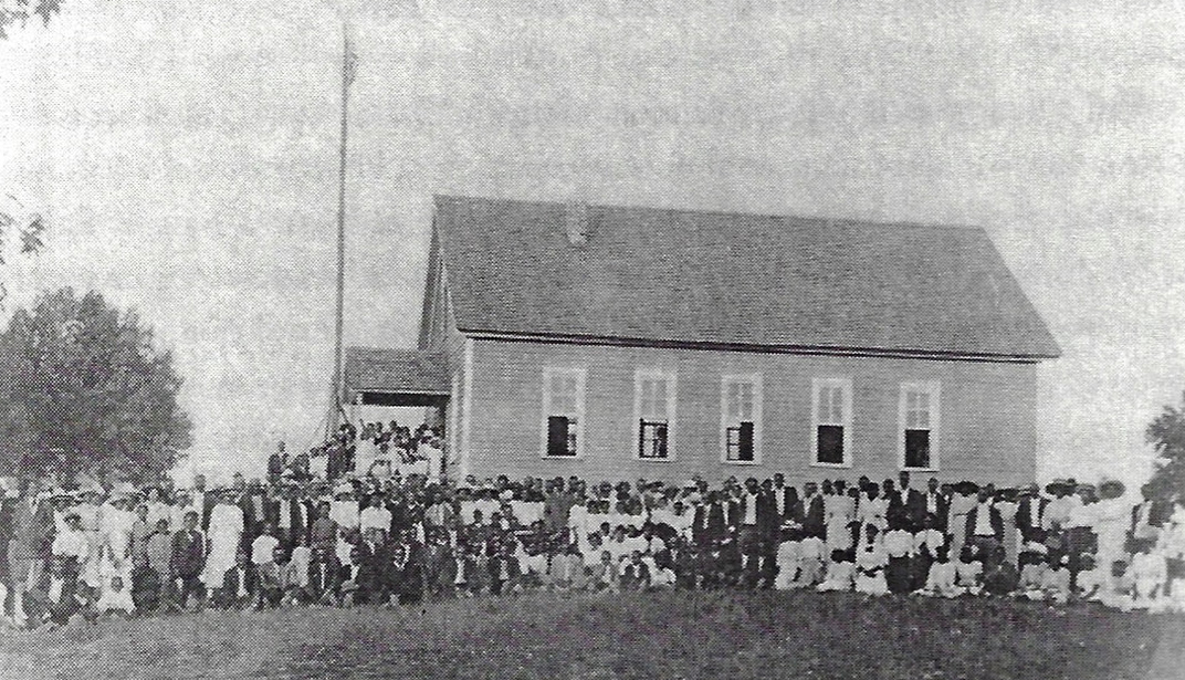
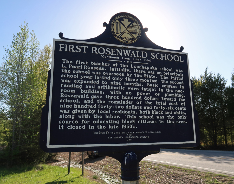
Across the highway from the museum was the site of the First Rosenwald School. There is currently an effort to establish a Rosenwald Schools National Historical Park.
Julius Rosenwald, the son of German-Jewish immigrants, was a prominent philanthropist and businessman from Chicago. Driven by the Jewish concept of “tzedakah” — righteousness and charity — Rosenwald partnered with African American communities across the South to partially fund and build thousands of schoolhouses.
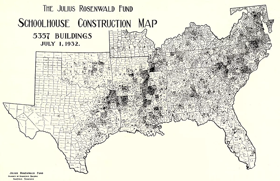
Constructed between 1912 and 1932, these “Rosenwald Schools” were some of the first permanent educational facilities for Black people in rural areas. Check out this map of the schools that the fund supported –
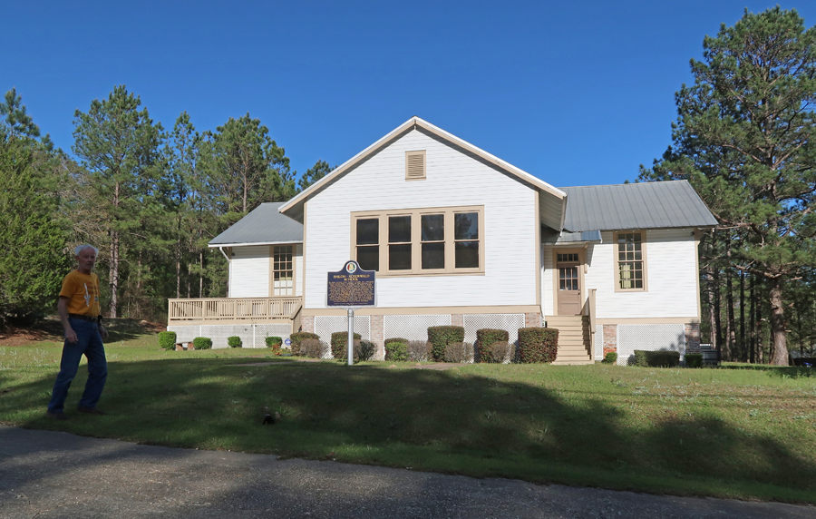
I then drove a short distance to Notasulga AL and visited the Shiloh-Rosenwald School, which still stands. It was renovated in 2010.
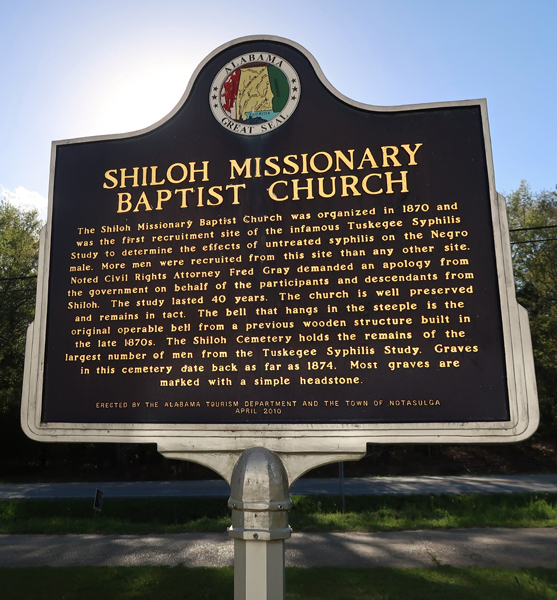
The Shiloh Missionary Baptist Church was one of the recruitment sites for the infamous Tuskegee Syphilis Study. Blacks were purposely infected with Syphilis – many are buried in the nearby cemetery!
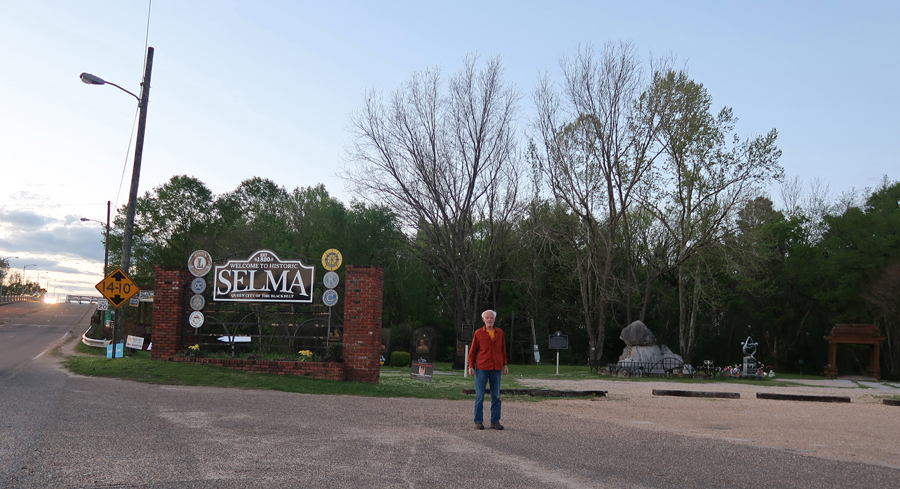
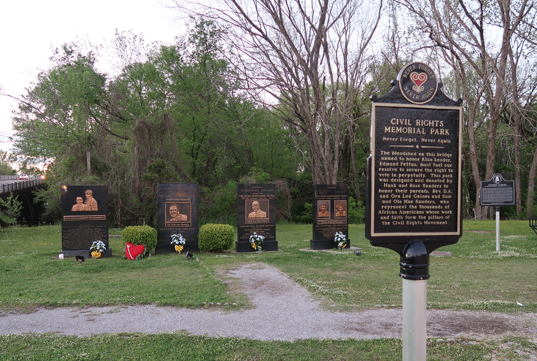
I then drove to Selma AL, entering the city –
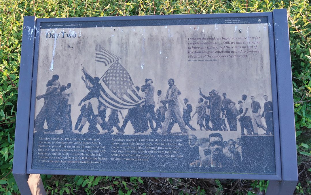
There were a series of events that took place in March 1965 that brought Selma to the International stage. An old cotton port, Selma Blacks had half the voting-age-population in 1950. However, due to literacy tests, poll taxes, and intimidation only 156 of about 15,000 African Americans were registered to vote. In the early 1960s, a push for voter registration gained steam. In January 1965, Dr. Martin Luther King (MLK) joined forces with local leaders to organize “marches” for voter registration. On March 7, 1965, John Lewis and Hosea Williams led a group of about 600 marchers over the Edmund Pettus (who was an AL Senator and a Grand Master of the KKK) Bridge. The marchers were attacked by state troopers and local law enforcement, some on horseback, first with nightsticks, whips, and rubber tubes. The attackers then donned facemasks and fired tear gas while continuing their assault. John Lewis was badly beaten and almost killed in this attack. This day became known as “Bloody Sunday.” Another larger march was then planned for March 21st to March 25th culminating in Montgomery AL, the state capitol.
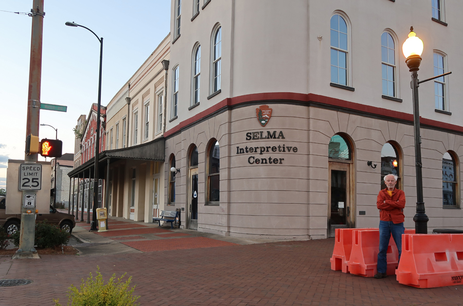
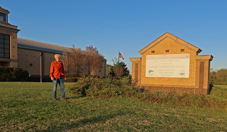
The Selma to Montgomery National Historic Trail, commemorating that march, begins in downtown Selma at the Interpretive Center
It then crosses the infamous Edmund Pettus Bridge
The major purpose of the March was to demand the right of Blacks to vote. It was a 54-mile march along US 80, the Jefferson Davis (President of the Confederacy) Highway!
In 2019, Helen and I drove the March route, but it was too dark for photos. Though I did get this one when I illuminated this sign for Campsite 1 with my headlights.
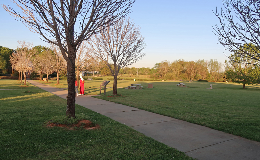
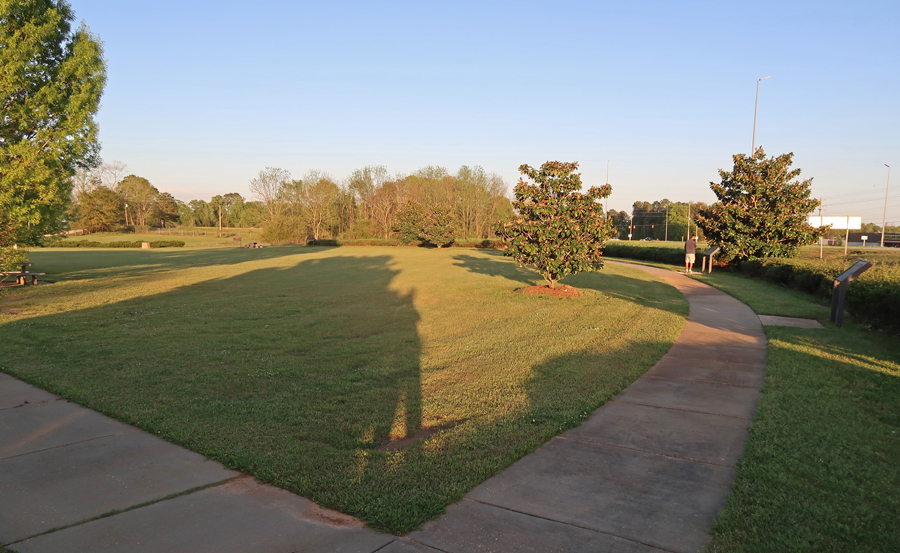
The Lowndes Interpretive Center for the NHT is near the Rosie Steele Farm, which was the location of the second of four march campsites.
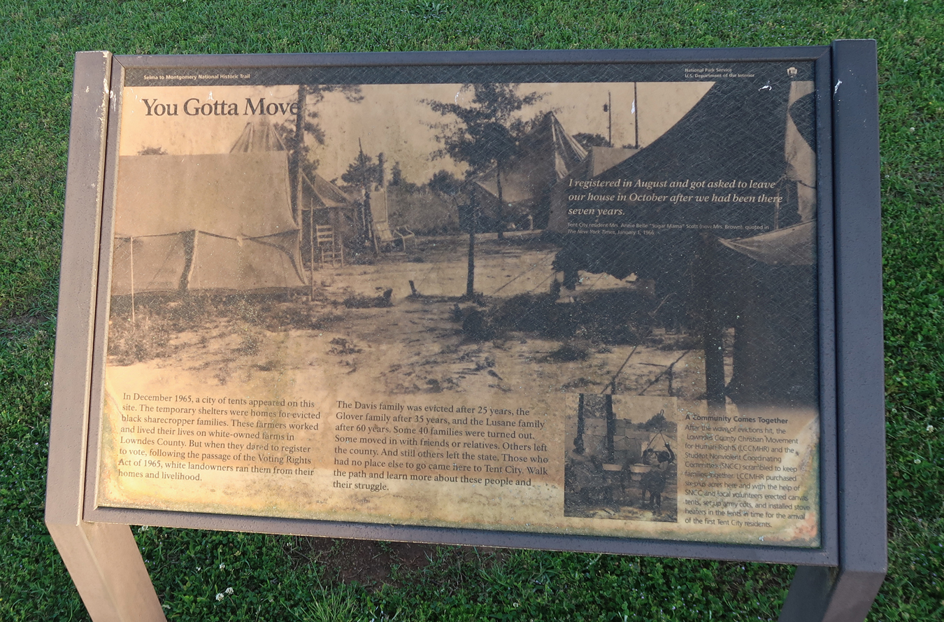
After the S-M March, whites retaliated by forcing Black people off their land. With no place to go, they set up a “Tent City” at this location.
On August 6, 1965, President Johnson signed the “Voting Rights Act,” which suspended literacy tests, called for the appointment of federal election monitors, and directed the US Attorney General to challenge the use of poll taxes by states.
Slept in Meridian MS
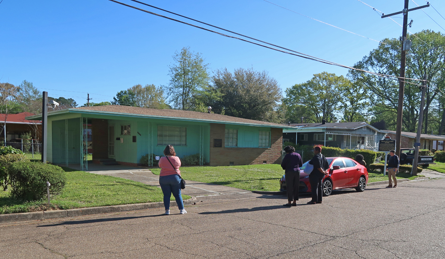
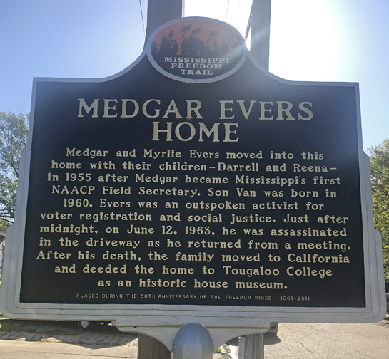
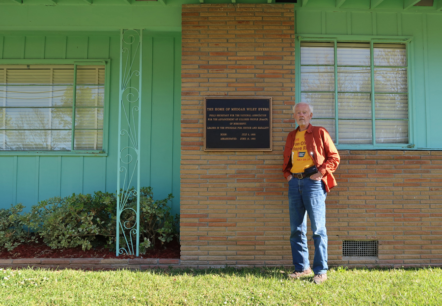
4/8 F – arrived at the Medgar and Myrlie Evers Home NM in Jackson MS at 7:30am. Minnie Watson of Tougaloo College had given us a personal tour here in January 2019 – see Blog. Today, I stopped for some additional photos. Medgar Evers was assassinated in the driveway of his home on June 12, 1963.
Visited John in Beaumont TX
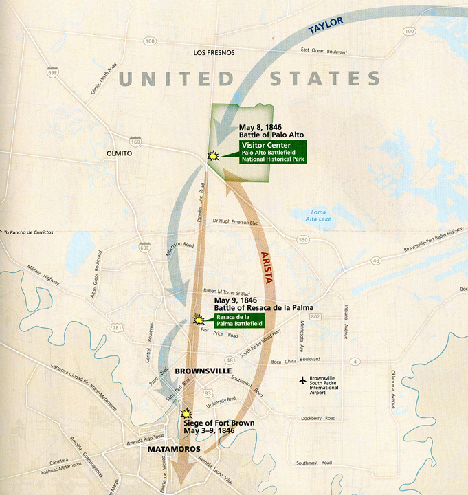
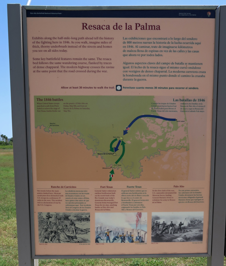
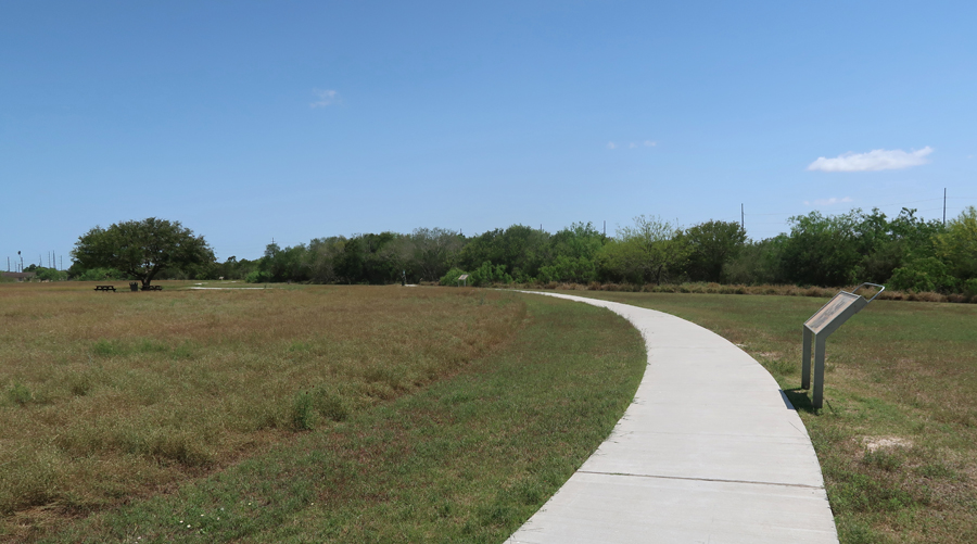
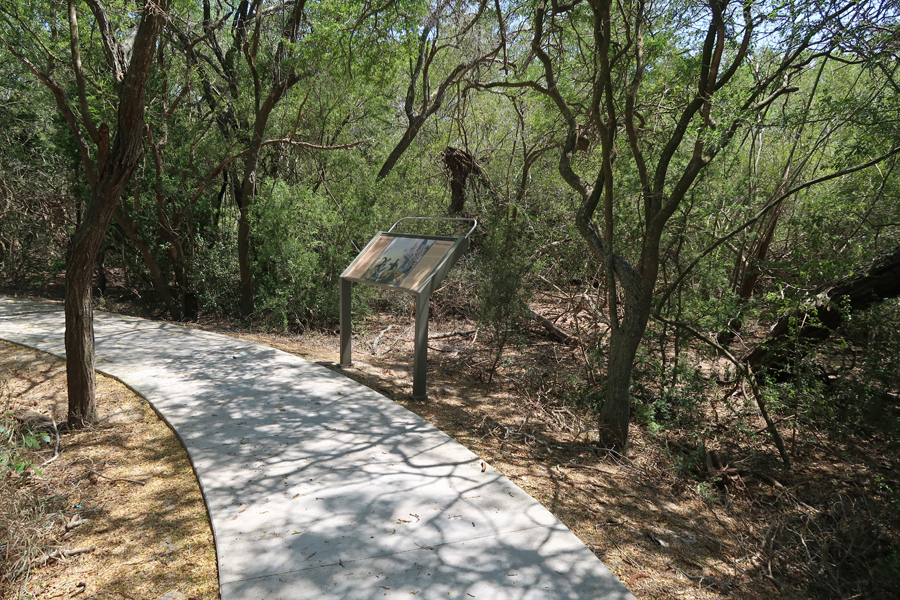
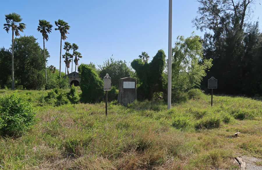
4/9 Sa – 7hr drive to Palo Alto Battlefield in Brownsville TX. Visited here in May 2014 – see Blog. The 2014 blog entry describes this first battle of the Mexican American War (1846-48). The Mexican Army laid siege to Fort Texas on the Rio Grande River in May 1846. Mexican General Mariano Arista then set 4,000 of his troops on the plain at Palo Alto. General Zachary Taylor, who had just re-supplied at Port Isabel, attacked on May 8, 1846.
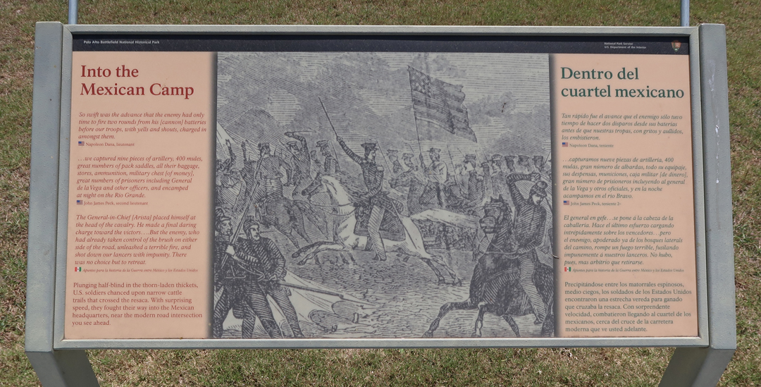
The Mexicans suffered heavy losses and moved south during the night. They set up a defensive position at Resaca de la Palma. Taylor attacked the next day.
The Mexicans were routed and withdrew across the Rio Grande River to Matamoros Mexico.
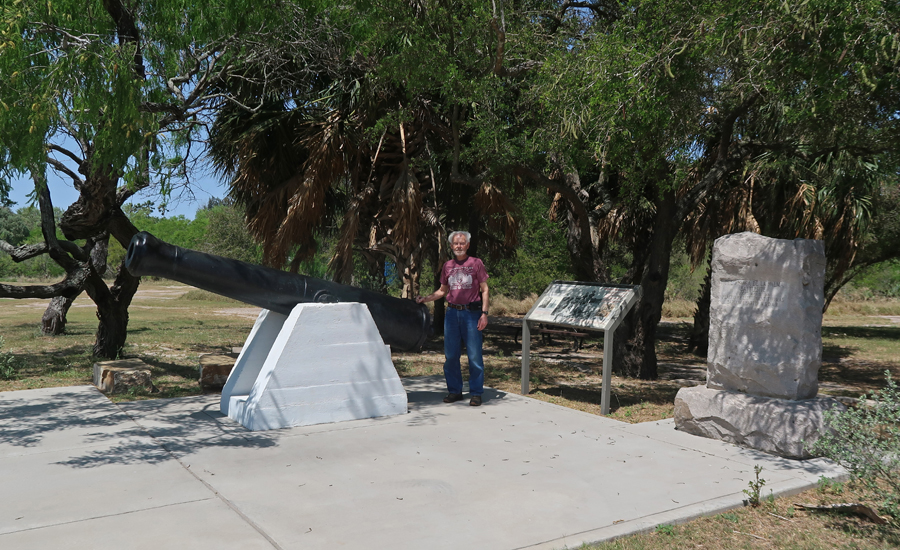
Cannon Memorial
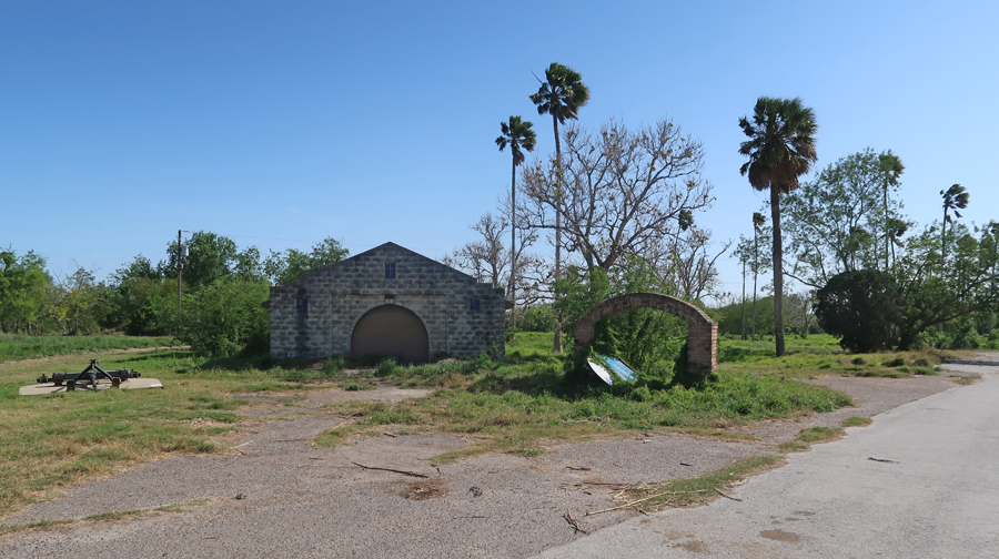
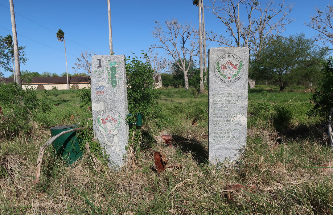
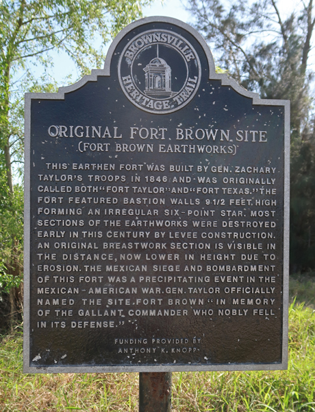
The siege of Fort Texas on a bend in the Rio Grande River, was lifted. Gen. Taylor had left 550 men here when he went to Point Isabel for supplies. Arista then retreated further to Monterrey. US losses were about 54 killed and 114 wounded. Mexican losses were 260 killed, 353 wounded, and 159 missing. Zachary Taylor would go on to become the 12th President of the U.S. in 1849. Fort Texas was renamed Fort Brown for Maj. Brown who was killed during the siege. The fort was controlled by the Confederates during the Civil War. The site eventually became the Fort Brown Memorial Golf Course and Texas Southwest College.
The area near the river is now protected by the U.S. Army to prevent illegal immigration. I spoke with some of the guards and was permitted to tour the Fort Brown site.
Cannon on former Golf Course
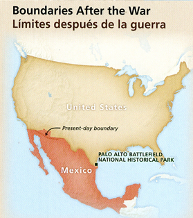
“After negotiations, Mexico accepted the Rio Grande as the Texas boundary and ceded the land between Texas and the Pacific to the US for $15 million.”
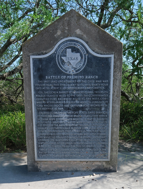
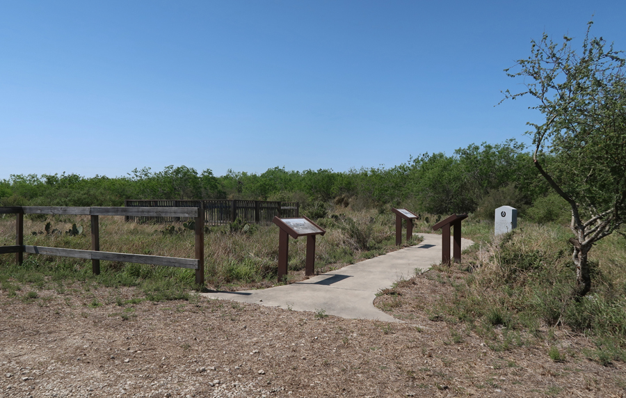
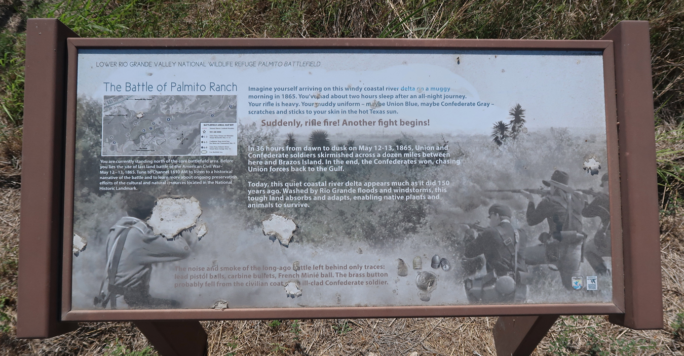
The Civil War Palmito RanchBattlefieldNHL is just east of Brownsville TX on Rt 4
The Palmito Ranch Battlefield NHS is nearby in the Lower Rio Grande Valley National Wildlife Refuge administered by the US Fish and Wildlife Service (USFS). This was the last battle of the Civil War (5/13-14/1865) and took place a month after Lee surrendered at Appomattox (4/9/1865). It was a Confederate victory!
Private John J. Williams of the Indiana Infantry, one of 118 U.S. soldiers killed, wounded, or missing at Palmito Ranch, was the last soldier killed in a Civil War battle.
Slept on the road –
4/10 Su – Gassed up in Marathon TX – note the old rolling digit pumps
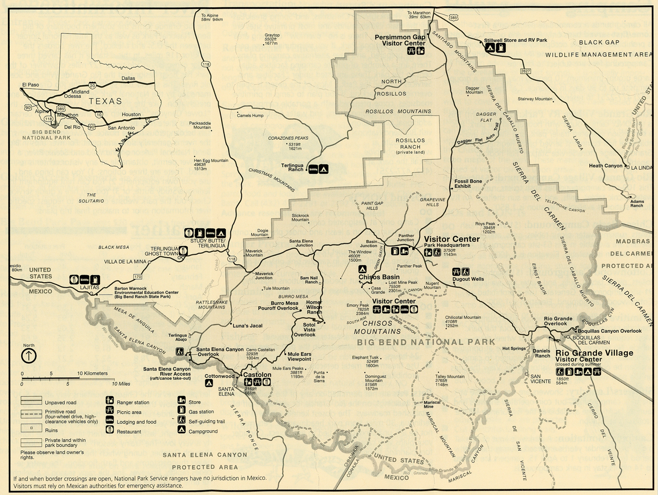
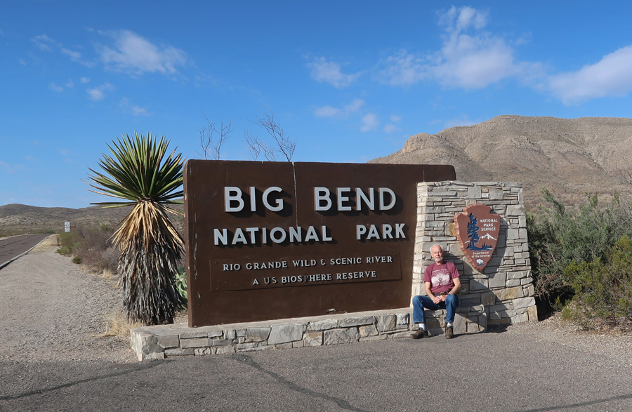
Map – I entered Big Bend NP at Persimmon Gap
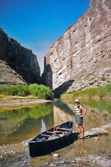
Helen and I were here for three days in 2006. On March 5th, we drove to the East end of the park and took a short hike to the Boquillas Canyon overlook. Mexicans had walked across the river and placed handicrafts for sale on the US side. You could yell across the river and bargain, but we did not buy anything. We then did a nature trail at the campground and went to the mineral Hot Springs (where they empty into the Rio Grande River) for a dip in the 105-degree water.
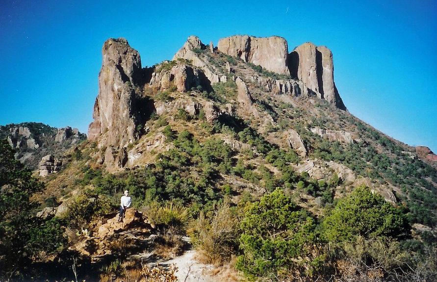
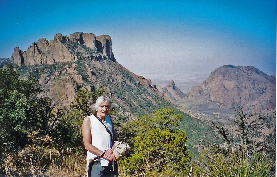
We then drove into the central mountain area where we set up camp in the Chisos Valley and then went to the Lodge for soup and salad.
March 6, 2006 – we packed up camp, had some dry cereal and cranberry juice for breakfast and then drove to the Lost Mine trailhead. We took a beautiful early morning 4-mile hike up along a mountain ridge with some great views.
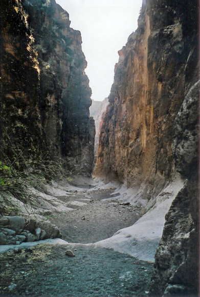
We then drove out of the park to Study Butte for lunch and continued on route 170 along the Rio Grande to the border town of Presidio. There wasn’t much there (not even a pawn shop!) and we headed back on the same road. We stopped at a sign that said Closed Canyon where Helen read in the car while I hiked about a half mile down a slot canyon toward the river. There were places where I could reach out and touch both walls (50-60 feet high) of the canyon.
We then drove about 20 miles north of Study Butte to the outfitter (Deadriver Canoe Rental) where we were renting a canoe the next day. No one was there but we found the owners in a nearby restaurant and were able to go back and set up our tent next to their business in the middle of the desert (outhouse but no water). Thank goodness for the double air mattress because there was nothing but rocks. We then drove back to Terlingua where we went to another authentic Mexican restaurant – Los Paisanos. The women could not speak English, but her husband could, and he recommended one green and one red enchilada dinner. We were the only ones there, sitting at one of their six small tables – the food was delicious!
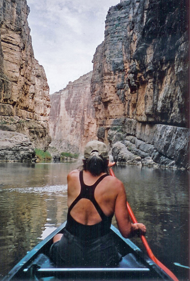
March 7, 2006 – we again had our dry cereal and cranberry juice breakfast and then loaded the canoe on to the car. It was about 25 miles back to Big Bend National Park and then another 40 miles through the park, stopping at viewpoints and taking short hikes, before getting to the Rio Grande Wild and Scenic River. Hiked the Santa Elena Canyon Overlook Trail (1.6-miles) to scout the river.
We then packed tuna fish sandwiches, snacks, light gear, and water in our dry bag and unloaded the canoe. One of the outfitters there allowed us to use his dolly to roll the canoe about a quarter mile to the river.
The water was low, and I had to drag the canoe to a point where we could start paddling.
But, because it was low, we were able to paddle about 2.5-miles upstream into Santa Elena Canyon. This used to be a whitewater rafting river but dams in Mexico and New Mexico have limited the river flow. We had to pull our canoe around some chutes and through some low water areas as we worked our way up through shear rock wall canyon.
We stopped at a side canyon (Fern Canyon) in Mexico to eat lunch and relax before heading back.
I dropped Helen off at the put-in spot so she could drive the car about a half mile downstream where she could pull up right next to the river. I paddled that stretch alone but it made it easy putting the canoe back up on the car. We drove back to the outfitter, dropped off the canoe, packed up our tent, and drove to Alpine TX where we got a room (with meager continental breakfast) in the old Bien Venido motel ($40). We again went to a Mexican restaurant and again had green enchiladas (the authentic ones are round) for dinner – before we left on this trip, we decided to maximize our Tex-Mex meals!
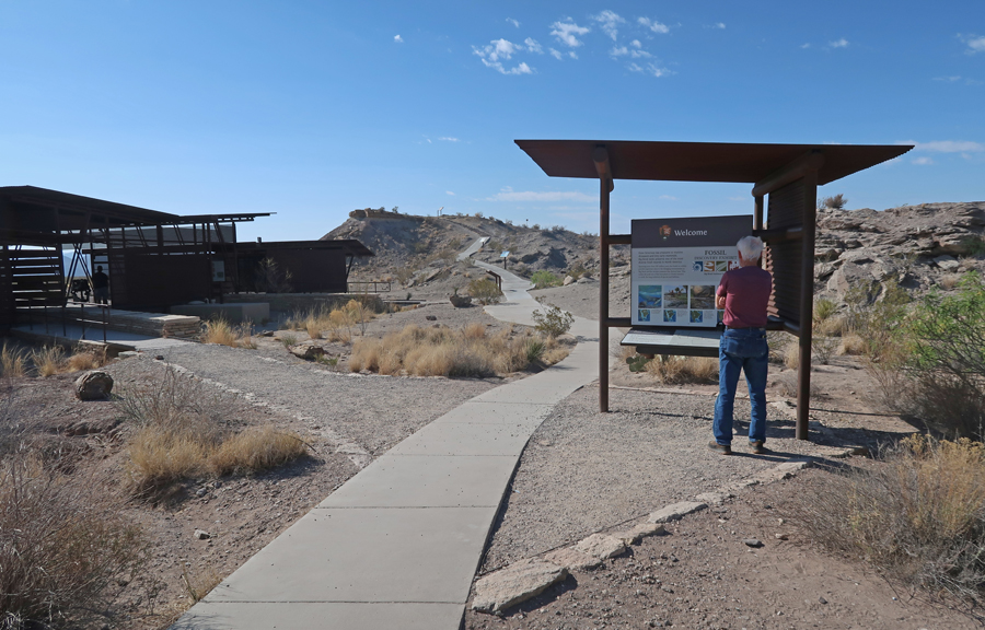
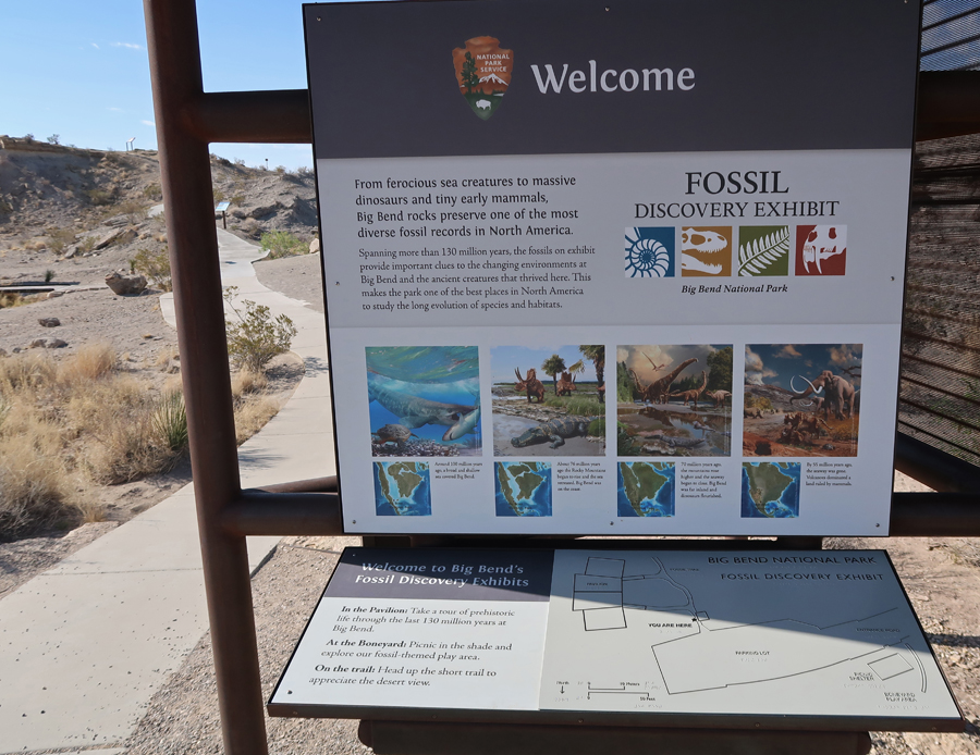
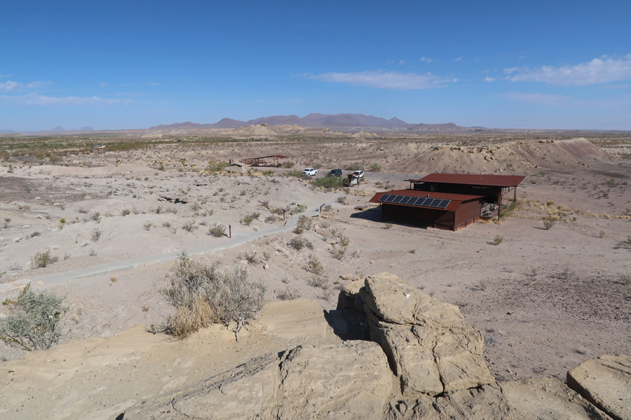
Now fast forward to April 10, 2022 – my first stop in Big Bend NP on this trip was at the Fossil Discovery Exhibit.
Did the short hike for a view of the Chisos Mountains
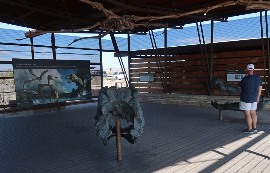
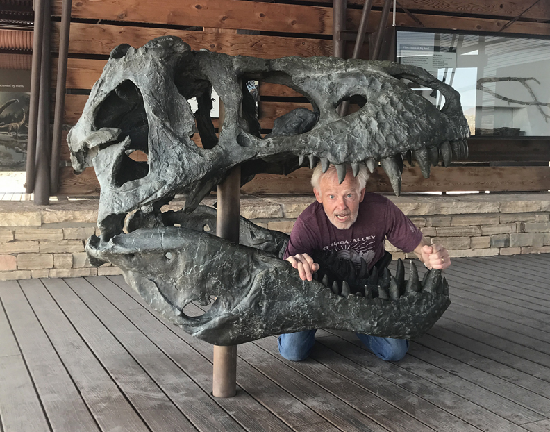
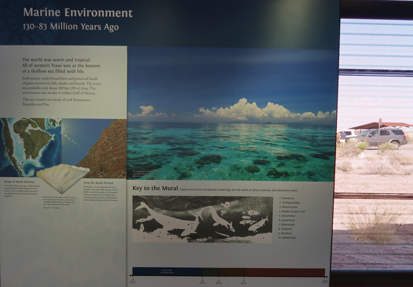
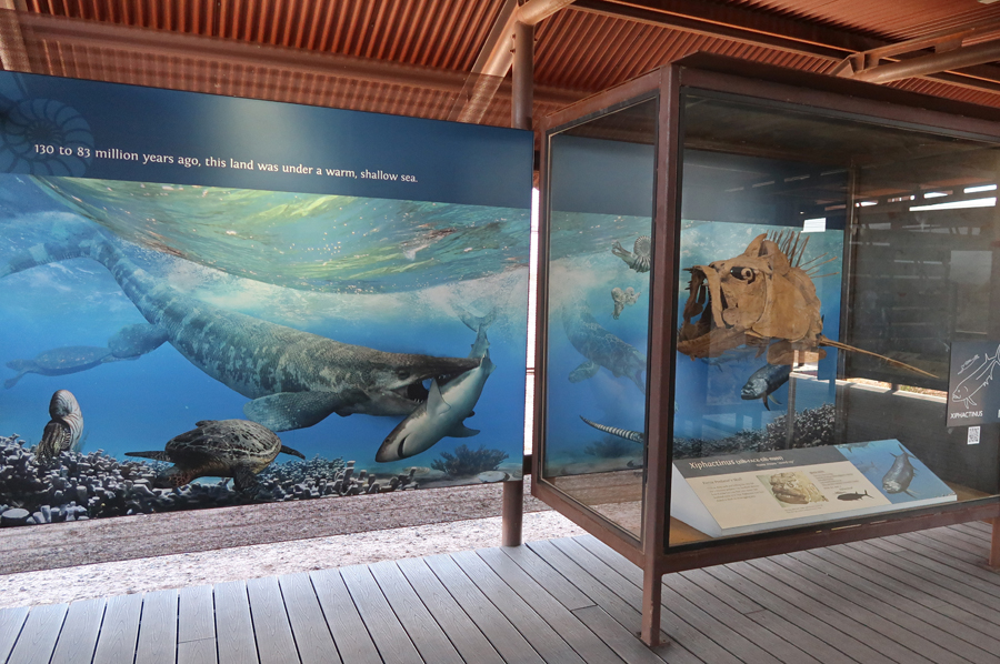
Then toured the Fossil Discovery Exhibit
A Pterosaur hangs above the main hall. It is thought to be the world’s largest flying creature of all time!
Bravoceratops
Dinner
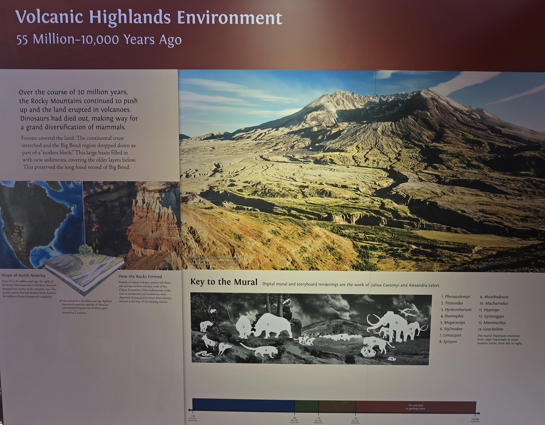
Volcanic Highland Environment
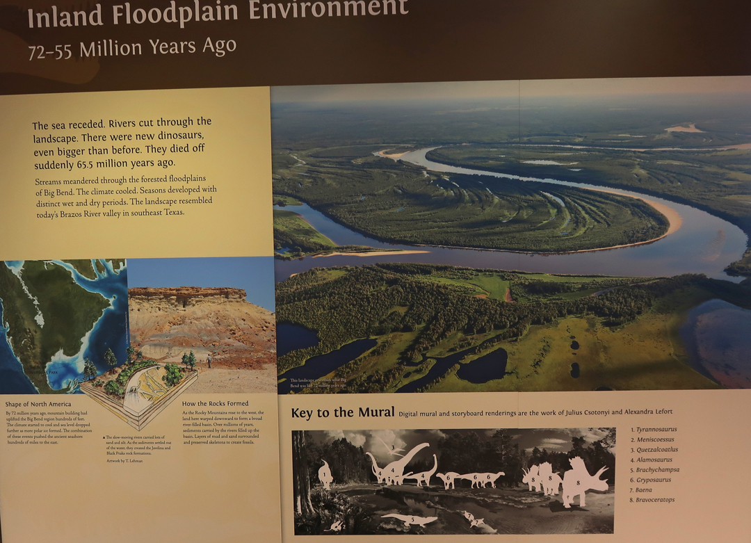
Floodplain Environment – note mural at bottom
Marine Environment
Big Bend NP Topo model at Panther Junction Visitor Center
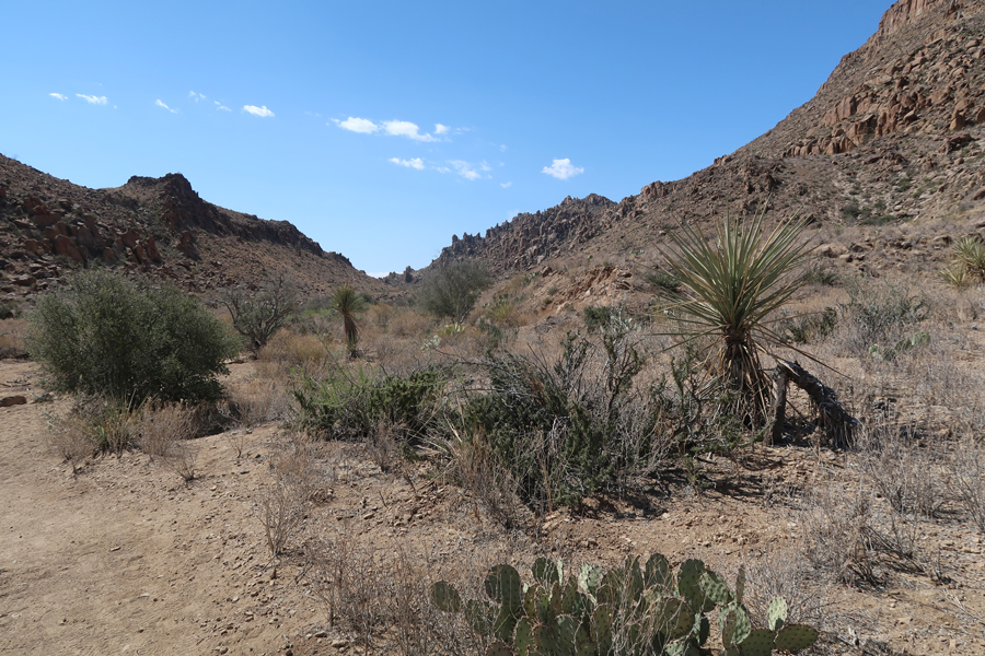
Drove 7-miles down a rough gravel road to get to the trailhead for the Grapevine Hills (Balanced Rock) Trail.
It is a 2.2-mile out and back trail. You start in a sandy wash and then move up through a boulder field.
You gain about 200ft in the last quarter mile. Watch out for snakes –
The Reward – A Big Balanced Rock
Steep descent
After returning to Rt 118, I took a short hike into the desert to get this shot of Croton Peak with a flowering Ocotillo cactus in the foreground
Hike to Maverick Badlands Hoodoo
Presidio – Oldest Town in America
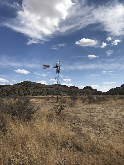
West TX windmill – an Aeromotor, made in Chicago
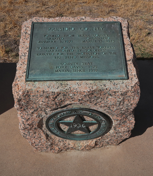
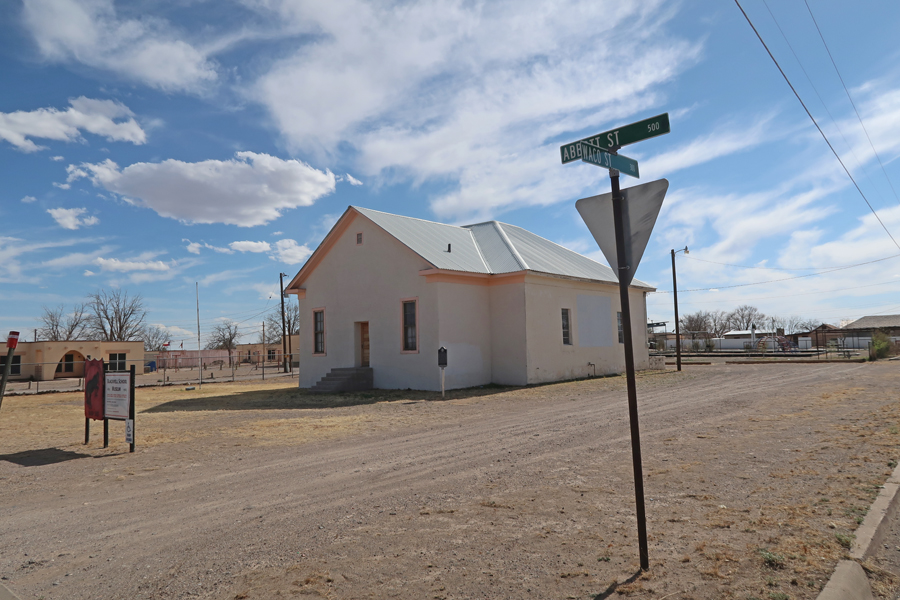
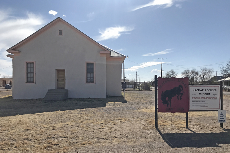
Stopped in Marfa TX for lunch (Tacos) and to visit the Blackwell “Mexican School” NHS, which has been proposed as a NP Unit
In 1889, the Methodist Church was converted to a school in the Mexican community. The children were required to speak and write only English. The school closed in 1965.
The Blackwell School Museum tells the story of de-facto segregation in TX – 1910 photo
It was a “Red Flag” day, meaning very high winds. Winds were 25-35mph with gusts up to 60mph. When I placed my camera on a tripod and set the timer to get in a picture, the wind blew it over breaking the camera! I took this photo with my phone.
Purchased a camera at Walmart in El Paso TX, then drove into New Mexico where I slept in the SUV off I25, somewhere around Truth or Consequences NM.
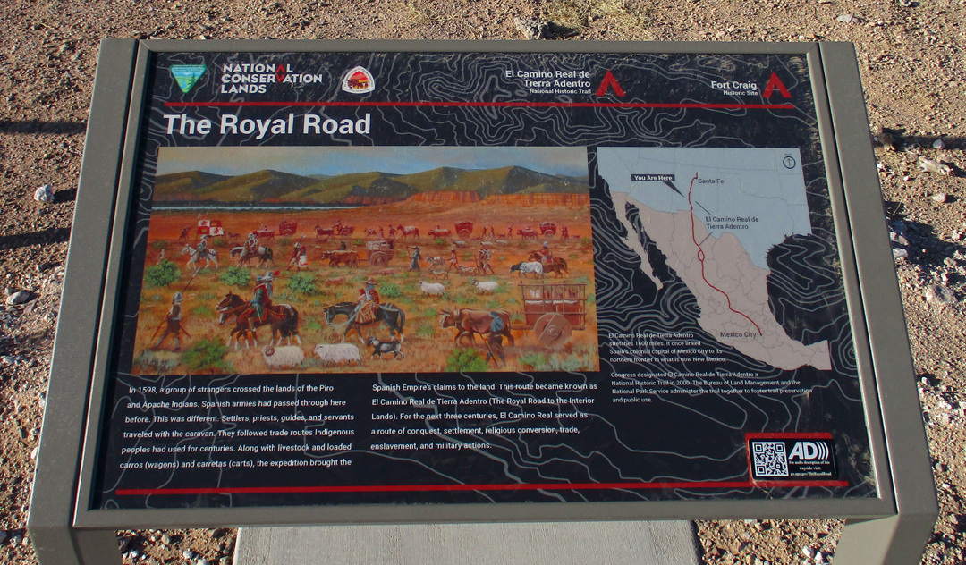
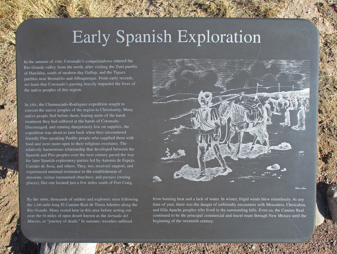
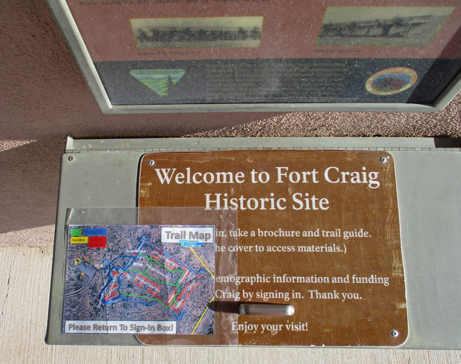
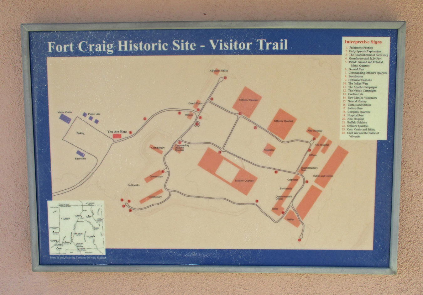
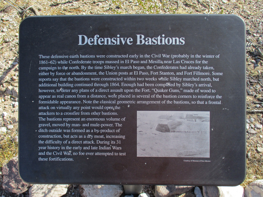
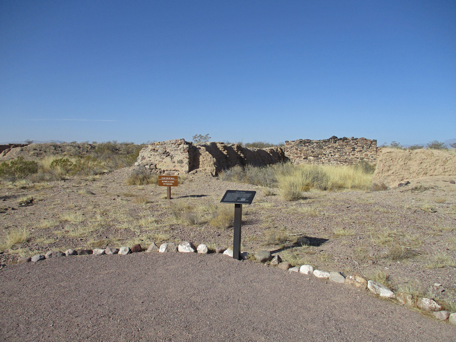
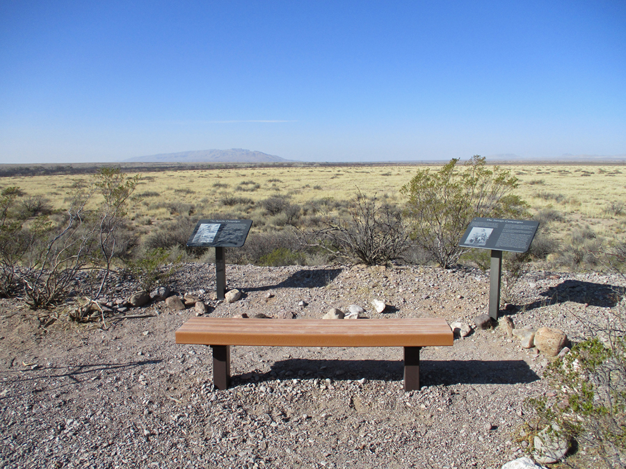
4/11 M – drove North along I25 to Fort CraigNHS (BLM). I25 follows the Rio Grande Valley, which was the route of the El Camino Real de Tierra Adentro (Royal Road of the Interior Lands)– the Spanish Road/Trail from Mexico City to Santa Fe (1,600-miles long). It is a NPS National Historic Trail.
This is a New Mexico State Monument titled “Road of Dreams” by the sculptor – commemorating the El Camino Real.
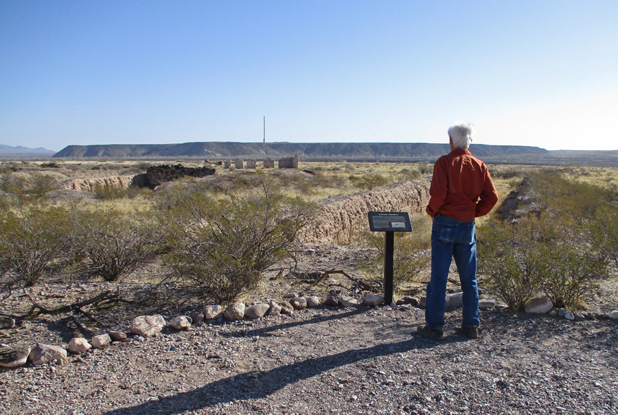
This sign is at Fort Craig
After the Mexican American War (1848), the U.S. acquired the lands north of El Paso and established forts to protect trade in the new Territory of New Mexico and the Rio Grande Valley. The Socorro Garrison was established in Socorro in 1849. It was replaced by Fort Conrad in 1851, and then by Fort Craig in 1854.
This is a BLM National Historic Site
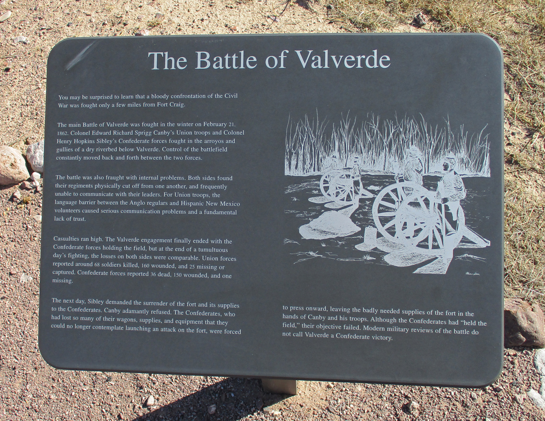
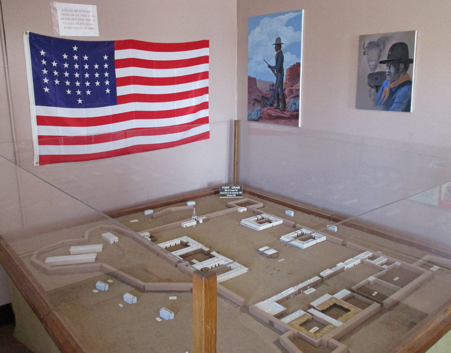
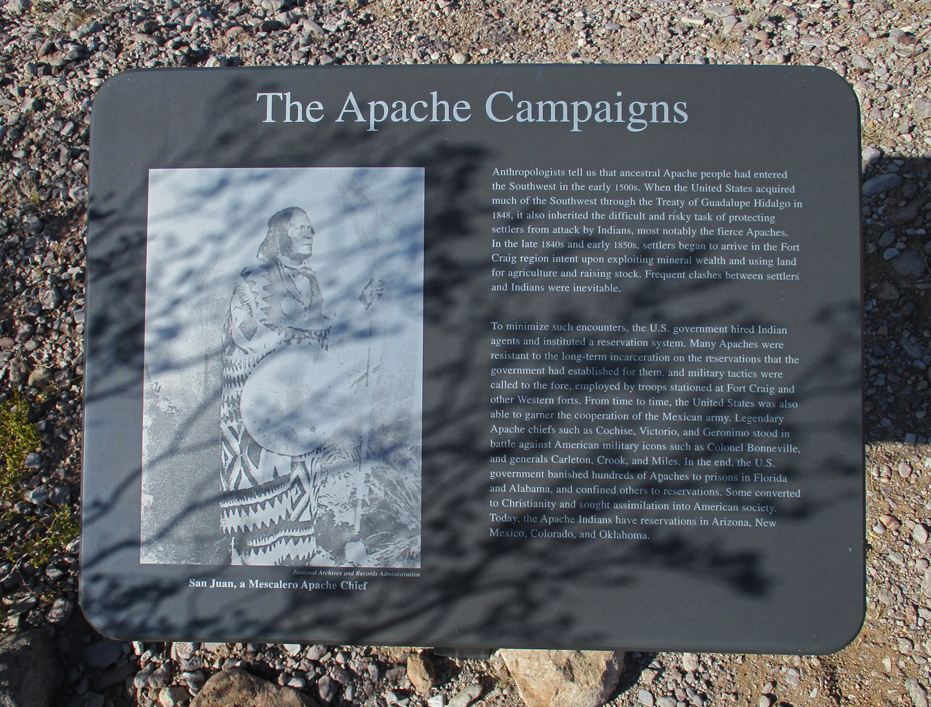
Fort Craig was at the center of the largest U.S. Civil War battle in the Southwest – the Battle of Valverde. Texas Confederate General H.H. Sibley captured military installations in El Paso and started moving up the Rio Grande Valley. The goal was to capture Fort Union in northeastern NM, the Colorado gold fields, and then the ports of CA. Sibley moved past Fort Craig because he did no want to risk a frontal attack on the well protected fort. On February 21, 1862, Colonel E.R.S. Canby led Union troops, and a contingent of New Mexico volunteers commanded by Kit Carson, out of the fort and attacked the Confederates at the Valverde crossing of the Rio Grande River. The Confederates prevailed and the Union troops retreated to the fort. However, half of the Confederate supply wagons were destroyed. Sibley continued north and Fort Craig was never taken. The loss of the remaining Confederate supplies at the Battle of Glorieta Pass, east of Santa Fe near Fort Union, on March 28, 1862, forced the Confederates to retreat to Texas and ended Southern aspirations for military conquest in the West.
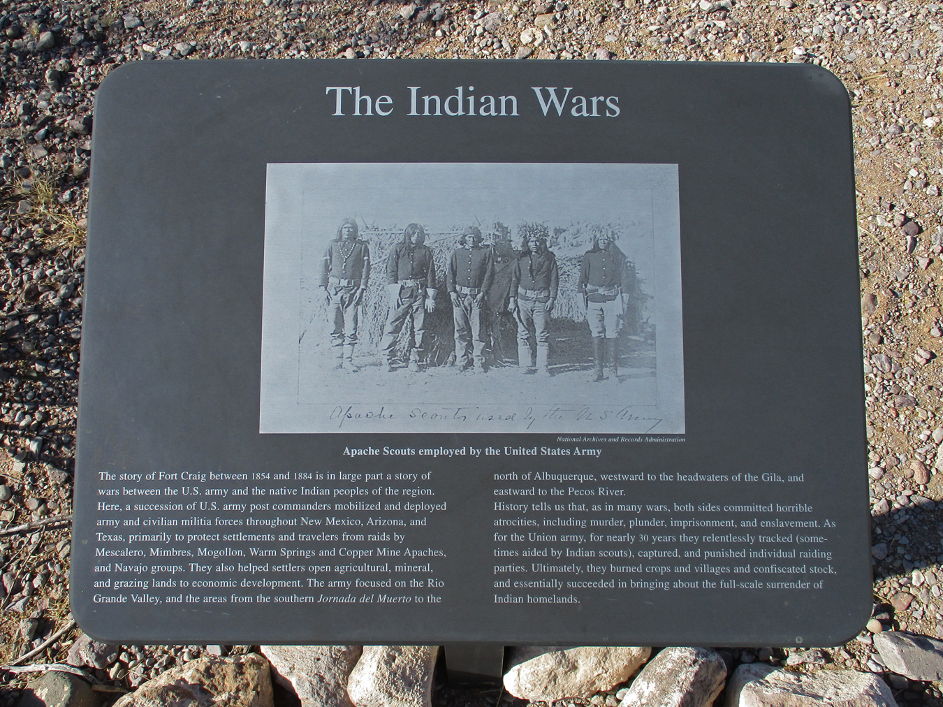
After the Civil War, troops stationed at the fort resumed their attempts to control Indian raiding.
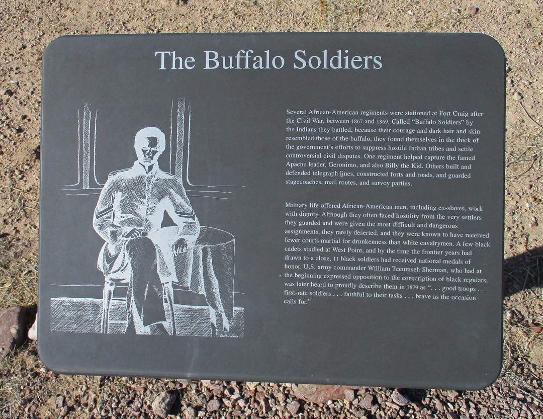
Troops from Fort Craig included Buffalo Soldiers of the 9th Cavalry and 38th and 125th Infantry, pursued Geronimo, Victorio, and other hostile Native Americans.
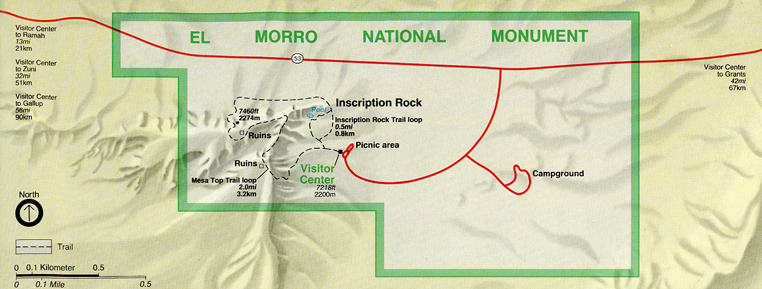
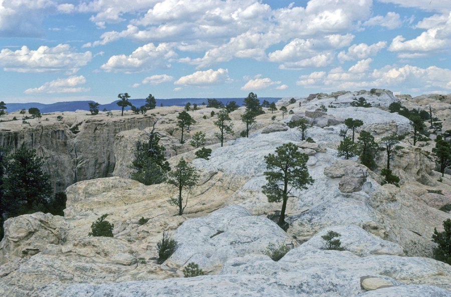
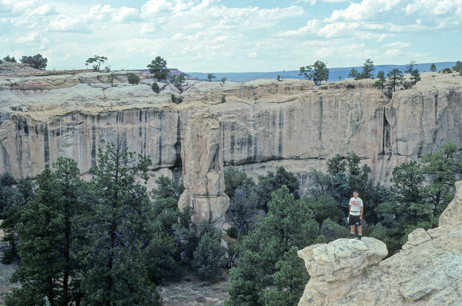
I continued north to re-visit El Morro NM. This sandstone promontory, with a pool of water at its base, has been a stopping place for thousands of years. It is on a main east-west trail used by Native Americans, Spanish explorers, and Anglo-Americans.
The Zuni call this rock formation Atsinna, which means “place of writings on rock.” The Spaniards called it El Morro, which means “The Headland.” Those that followed called it “Inscription Rock.”
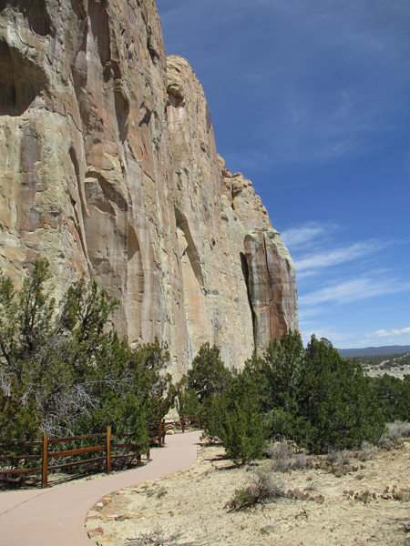
Today I did the Inscription Rock Loop Trail.
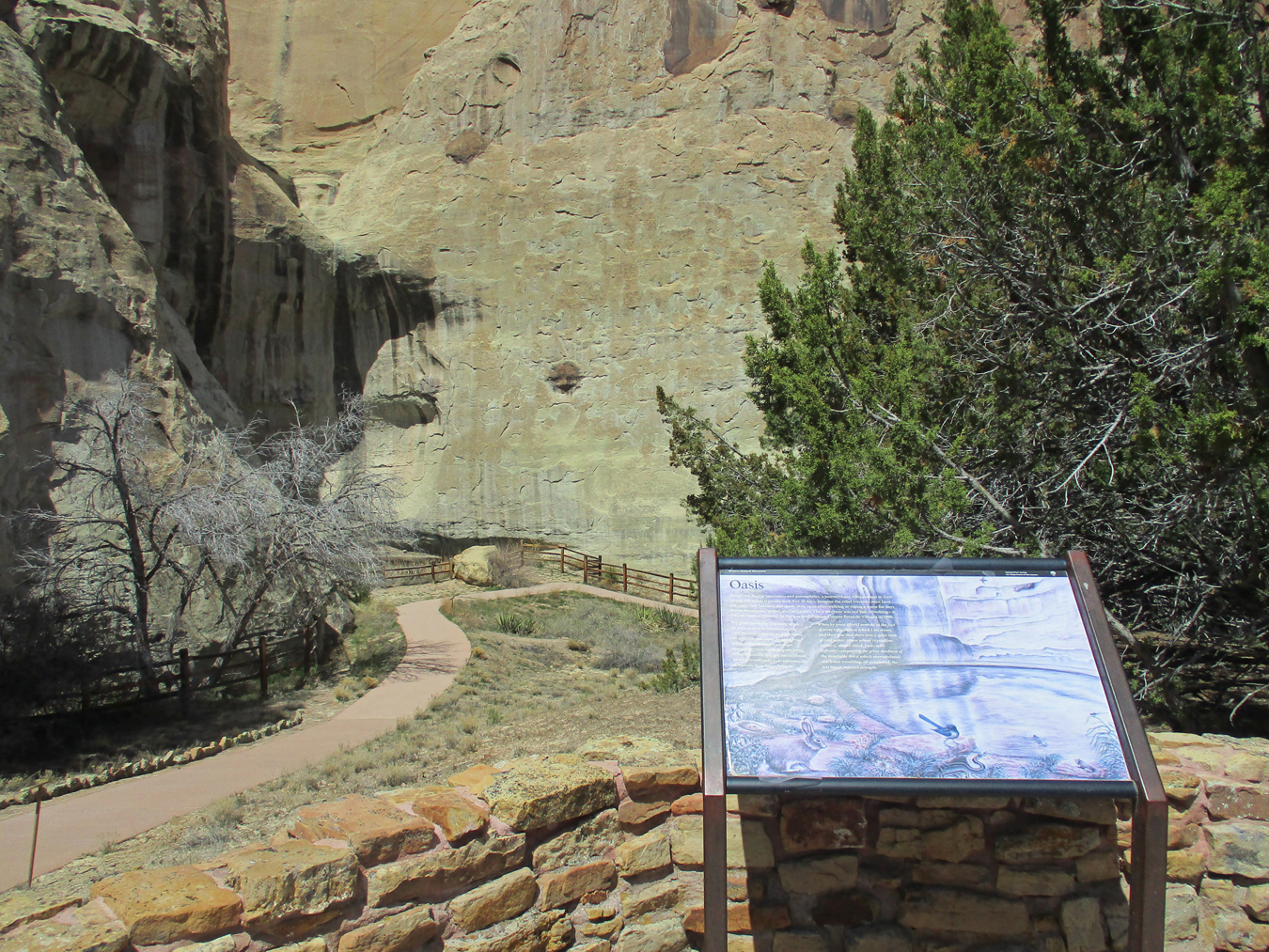
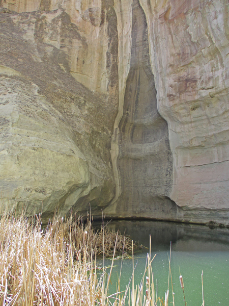
My first stop was the pool at the base of the rock wall –
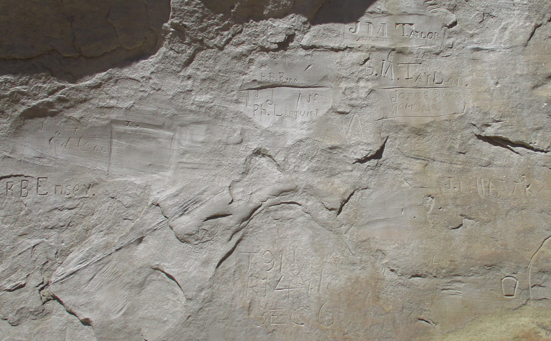
The sandstone provided a ready surface for petroglyphs, names, dates, and short descriptions left by those who passed this way.
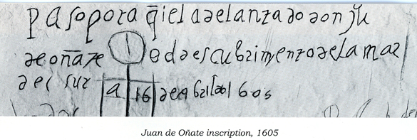
Most of the inscriptions are now hard to read. This is the oldest Spanish inscription, made in 1605.
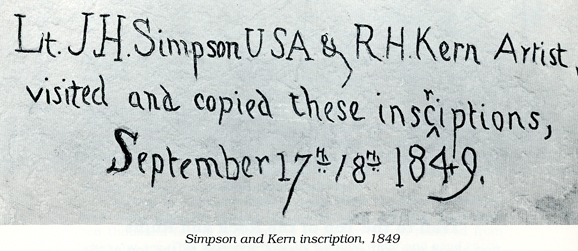
Another example of what inscriptions look like today and a clear one from 1849.
In 1998, Chad and I did the 2-mile Headland Loop Trail to the top of the mesa
I took his photo of Chad from the Astinna Village Site atop El Morro.
This display in the Visitor Center shows the location of the Zuni Pueblo (green) west of El Morro.
In 1982, after visiting El Morro, Helen, Stacy (10), Peter (9), Kate (1), and I where able to climb a ladder to a balcony overlooking the internal courtyard of the Zuni Pueblo at dusk and watch a REAL “Rain Dance.” This was not for tourists; we were the only Anglos there – no speaking and no photos. It was incredible to watch and listen as the dancers, mostly male elders, emerged from the kiva and danced about the courtyard. They were dressed in their Zuni regalia (think Kachina Dolls), chanted, and danced to the sound of drums. One of my favorites were the “Mudhead Clowns,” who act as disciplinarians and jokers. They had red clay painted bodies and their masks were formed by mud balls with human-like features.
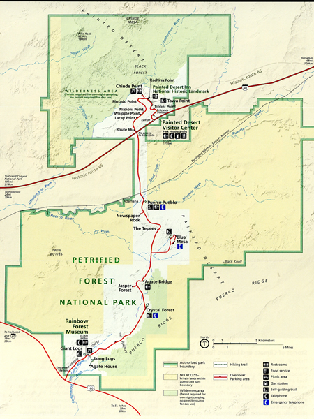
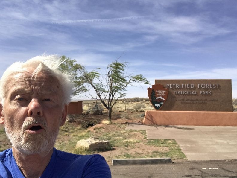
The rock wall had protected me from the wind at El Morro, but as soon as I started driving west my gas mileage dropped! When I arrived at Petrified Forest NP in AZ, I again had to deal with high winds. I was afraid to set up my new tripod and camera, so I took a selfie. Because of vandalism and poaching (petrified wood/rocks), you must enter the park before 5pm. If you are in the park, you must be headed for an exit at 5pm.
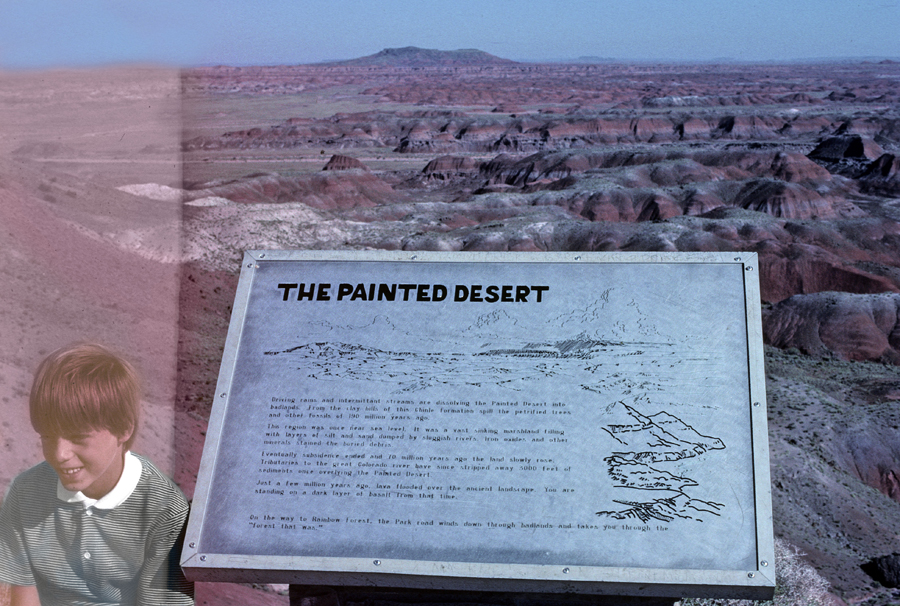
This was my third visit to this NP. We had visited as a family in 1982 (Stacy 10, Peter 9, Kate 1, no Chad yet). In 1992, the visitors were Tom, Helen, Kate, Chad, and Manuel our student from the Canary Islands. Photos taken on the Painted Desert Rim Trail in the northern part of the park (off Interstate 40) – Peter (1982)
Manuel (1992)
Tom (2022)
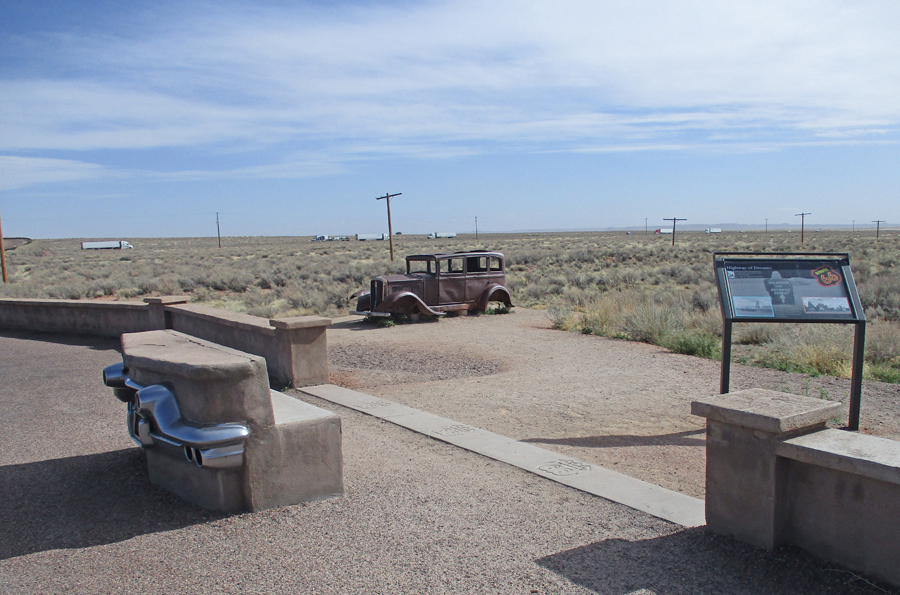
Old Route 66, now Interstate 40 passes through the park – that is a 1932 Studebaker
Puerco Pueblo occupied 1250-1380 CE
Newspaper Rock
The Tepees
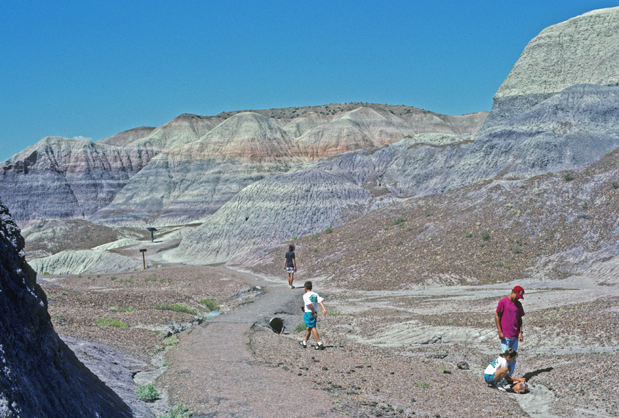
Hiked the 3.5-mile Blue Mesa Trail in 1982 and 1992
Stacy 1982
Kate, Manuel, and Chad 1992
Kate 1992
Giant Logs 0.4-mile Trail
In 1992, we combined the Long Logs Trail and the Agate House Trail for a 2.6-mile hike
Kate in the Rainbow Forest Museum, 1982 and 1992
1982
1992
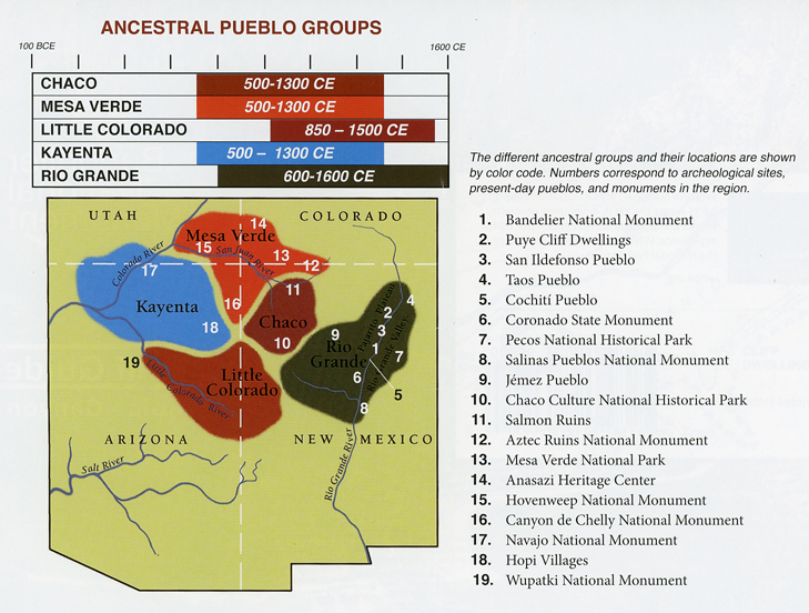
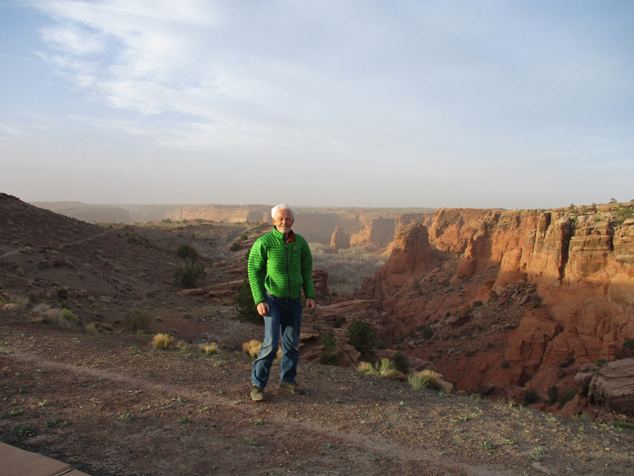
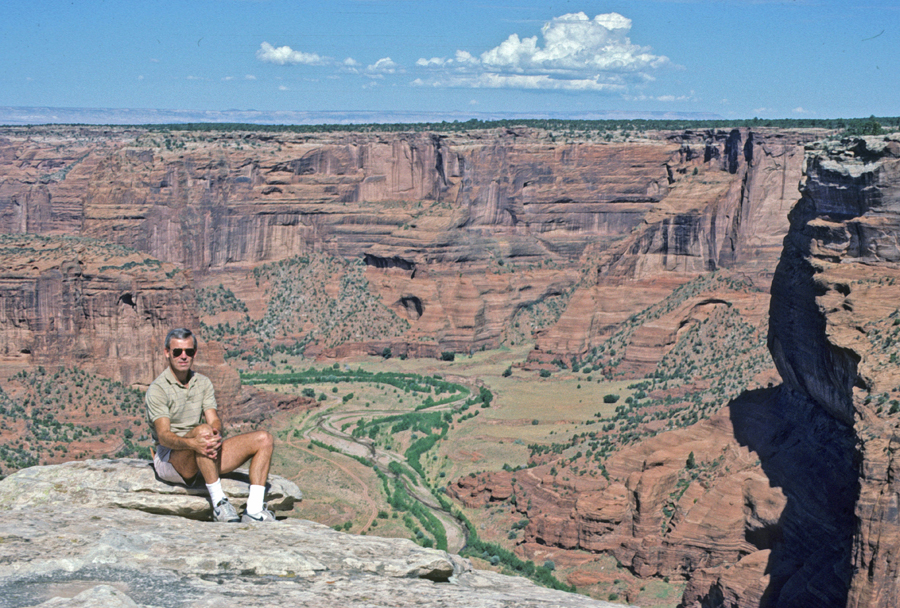
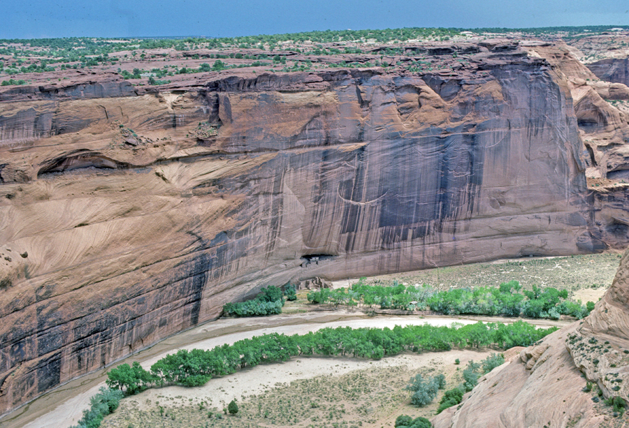
I had to rush to get to Canyon de Chelly NM before dark. Ancestral Pueblo Groups in the Four-Corners Region – #16 is Canyon de Chelly.
I did three stops on the South Rim Drive. First the Tunnel Overlook
Second, Tsegi Overlook
Third, Junction Overlook where I met Samuel Thomas, a Navajo selling carvings from cottonwood trees in the canyon and one of his wife’s paintings.
Canyon de Chelly NM was one of our first stops when Stacy (15) and I did our 1987 road trip together.
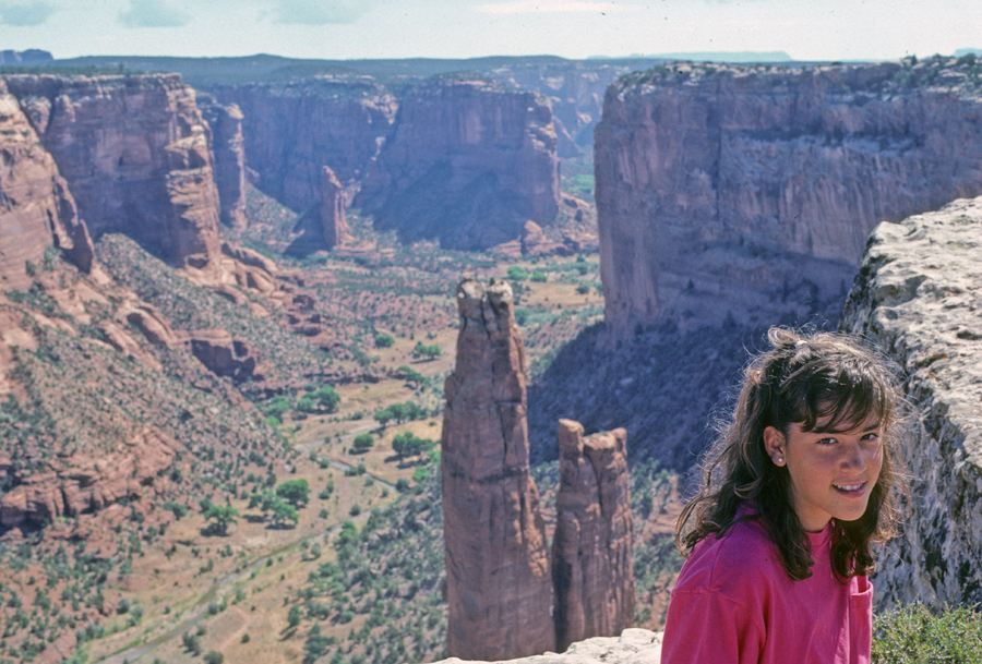
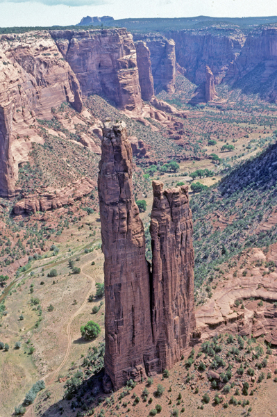
We started our day by doing the short (0.4-mile) Spider Rock Trail
Spider Rock is 800ft tall. According to legend, Spider Woman lives at Spider Rock, and taught the Navajo how to weave.
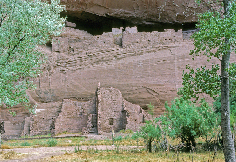
We then did the White House Ruin Trail (2.7-mile), which descends 600ft into the canyon.
It is named for the long white plaster wall in the upper dwelling
Hogan – the Navajo are still farming the canyon floor
Slept in Winslow AZ
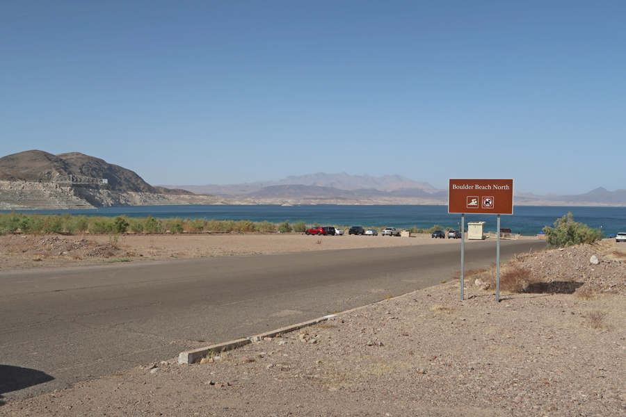
4/12 Tu – I texted family, “I was just standing on a corner in Winslow Arizona,” from the song titled Take it Easy by the Eagles 1972. On my way to Lake Mead NRA – See Blog April 2021 for other visits.
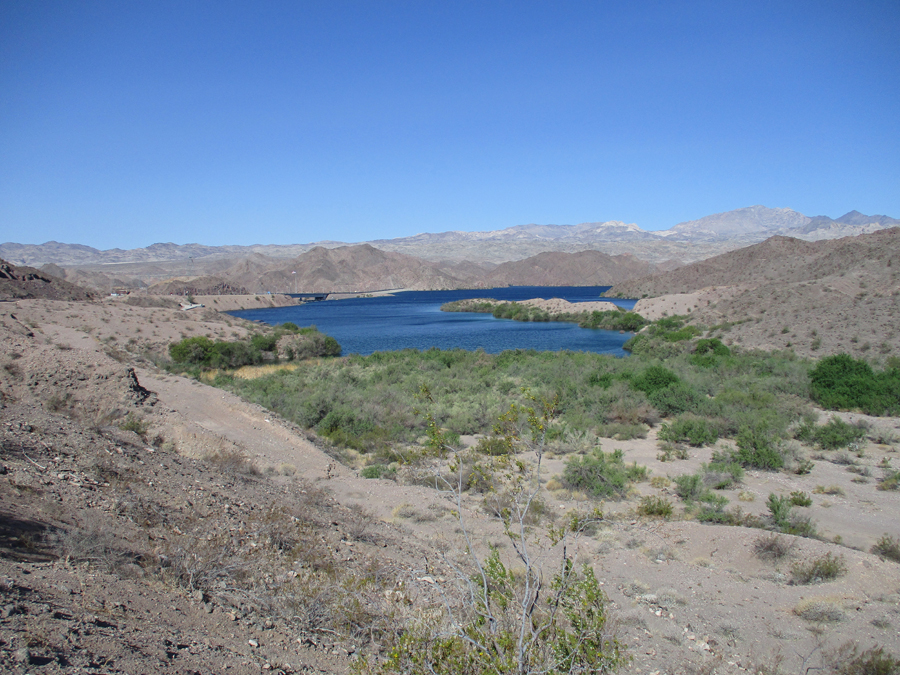
I stopped at Katherine Landing on South Lake Mojave just upstream from the Davis Dam on the Colorado River
Colorado River Dams
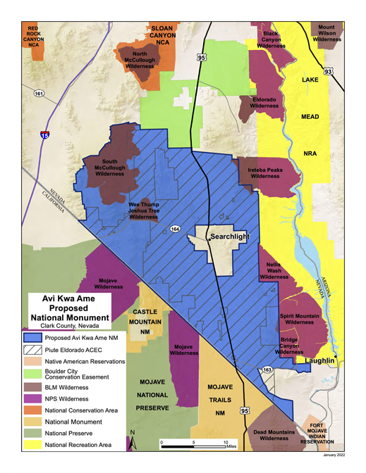
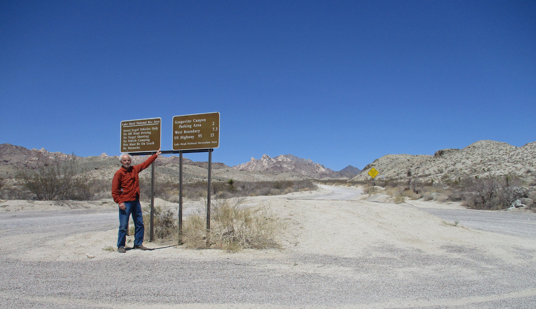
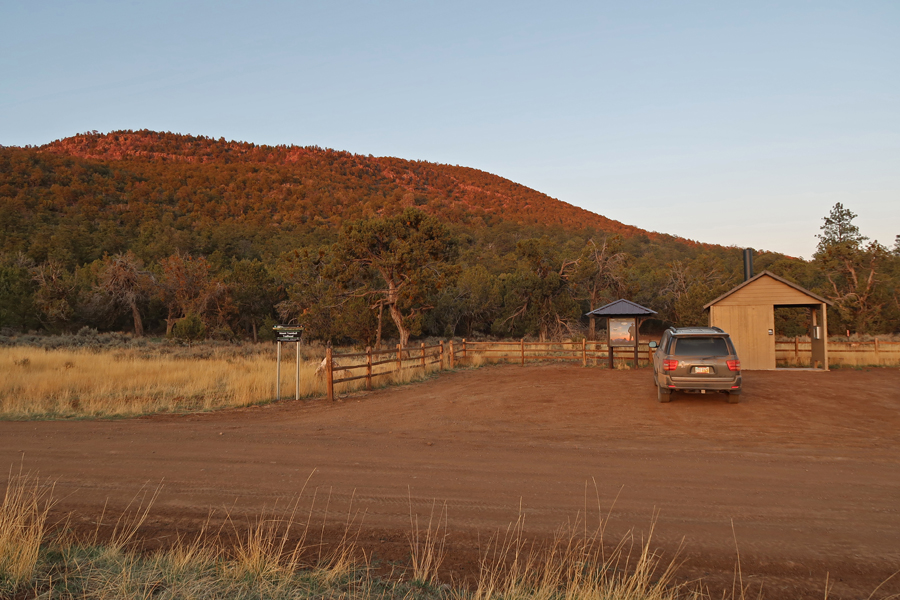
My objective today was to see and experience the proposed Avi Kwa Ame National Monument that is located in the southern tip of Nevada. Avi Kwa Ame is the Mojave Tribe name for Spirit Mountain.
I drove the 15-mile Christmas Tree Pass gravel road from Rt 163 just west of Laughlin NV to U.S. 95
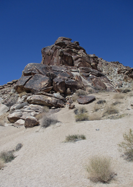
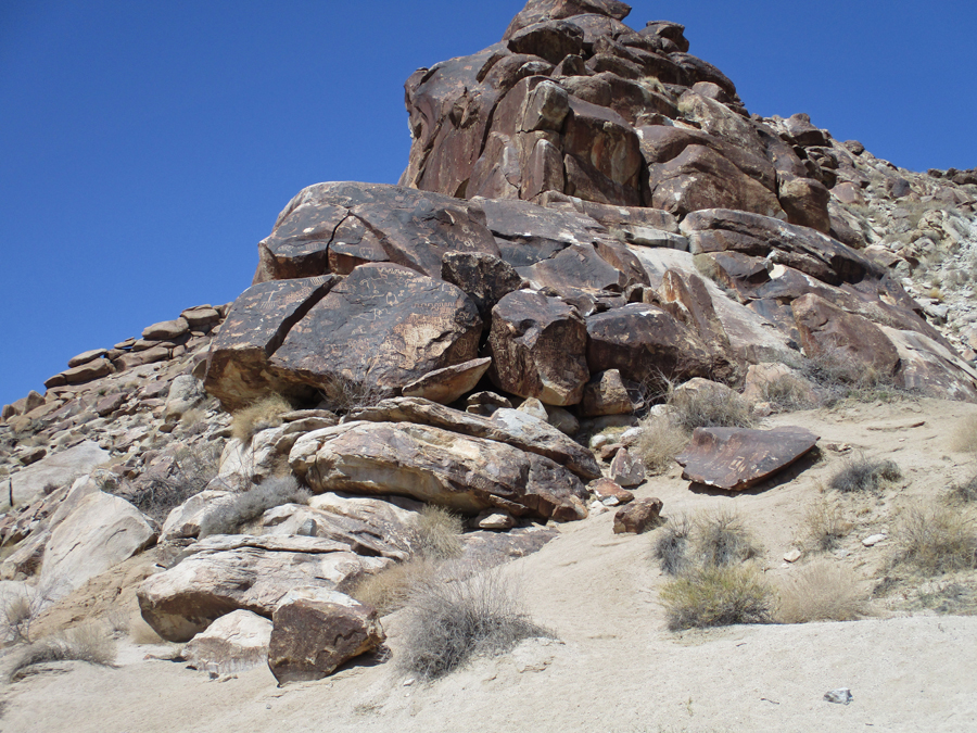
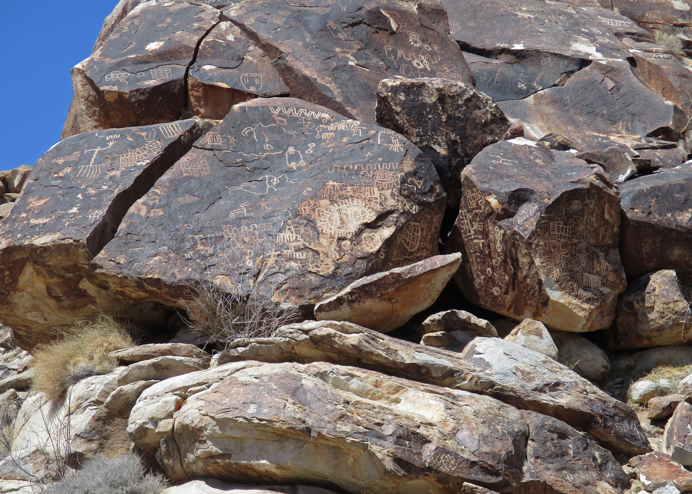
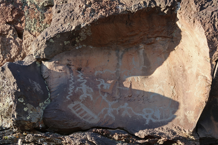
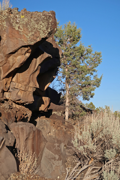
My first stop was at Grapevine Canyon where there is a trail to some petroglyphs and beyond
Photo progression to some of the petroglyphs
The trail, and then scramble, continued up Grapevine Canyon following an almost dry spring bed
I was able to climb up to a view of a balanced rock and a bit further. But I got to a point where I felt the granite rock was too slick for me to climb higher – wish I were younger!
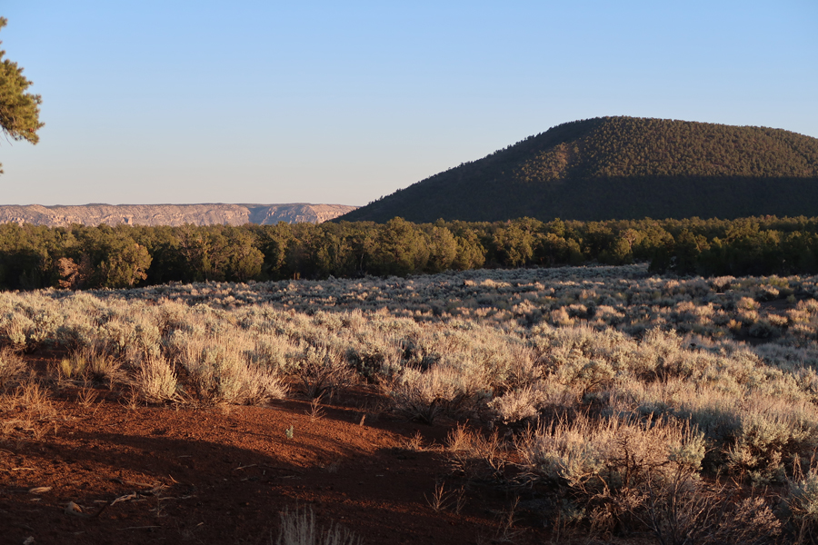
It was a gorgeous day with a temperature of about eighty degrees. Because I was on the leeward side of the Newberry Mountains, there was little wind at this location on this “Red Flag” day. On one side of the road was the Bridge Canyon Wilderness and on the other the Spirit Mountain Wilderness.
I bush wacked up a slope for some photos of the desert vegetation and rock formations
Bottom line, Avi Kwa Ame is worthy of National Monument status.
Next stop LA (Silver Lake) and dinner with Kate and Helen –
11/9/2021 Tu – arrived at the Mound City Group Unit of Hopewell Culture National Historical Park (NHP) outside of Chillicothe OH at about 8:30am on a beautiful fall day. This was my third visit to this site, which is the only fully restored Hopewell earthwork unit of the historical park. See Blog for June 2012.
These mounds were built from A.D. 1 to 400.
Mound 7
Elliptical Mound
The Hopeton Earthwork Unit is on the east side of the Scioto River
After going through the Visitor Center, I drove to the undeveloped Hopeton Earthwork Unit and walked for two miles on the paths that were mowed through the field to simulate the location of the earthworks there.
After consuming a Philly Cheesesteak from Charley’s in Chillicothe, I visited the Hopewell Mound Group Unit.
I hiked an additional two miles here, both through the mounds area
Mound 25 – the largest Hopewell mound ever discovered, 500 feet long and 30 feet high
and along the Tri-County Triangle Bike Trail
It took about 15 minutes to drive to the Seip Earthworks Unit of the NHP on U.S. 50
This is the third largest burial mound that the Hopewell are known to have built
Stopped briefly at Fort Hill Earthworks, which is part of the Arc of Appalachia Preserve System and the Ohio History Connection
My last stop was Serpent Mound, which is also a part of the Ohio History Connection. I have wanted to visit here for a few decades and finally made it! There is an $8 parking fee.
There are several burial mounds here as well as a Village Site
But the highlight is Serpent Mound
The next photo is from the viewing tower and shows the tail of the serpent
The following photo show the serpentine body with the mouth in the distance
Looking back toward the viewing tower, right center of photo
6/12 Sat – Left home at 6am for a 2,000-mile road trip to the Atlantic Ocean. Arrived at Friendship Hill NHS in SW Pennsylvania at 10am. I had visited here in 2011 when I was on my way to Pittsburgh for Drago’s birth. See Blog for October 2011.
This time, the house/visitor center was open for self-tours. This was the “Wilderness Home” of Albert Gallatin (1761-1849). He was an entrepreneur, politician, diplomat, financier, and scholar. He was the Secretary of the Treasury for Presidents Jefferson and Madison. He arranged financing for the Louisiana Purchase and the Lewis and Clark Expedition. He also worked to end the War of 1812 with Great Britain.
Friendship Hill is on the Monongahela River.
Though it was not on my agenda, my next stop was the terminus of the C & O Canal in Cumberland MD, which is part of the Chesapeake & Ohio Canal NHP. In my post of April 2017 on this Blog, I described stops at Spring Gap, Oldtown, Paw Paw Tunnel, Williamsport Visitor Center, and Lock 44.
The Chesapeake (Bay) and OHIO Canal never made it to the Ohio River. Construction stopped here in Cumberland MD in 1850 when railroads made the continuing digging of the canal a financially losing proposition. 184.5 miles of the C & O Canal were completed from Georgetown (Washington DC) to Cumberland MD. The canal remained open until 1924.
The Cumberland C & O NHP Visitor Center is located in the Western Maryland Railway Station. Goods were transferred from canal boats to wagons for travel on The National Road and on to railroad cars for points west and north. Likewise, goods, especially agricultural, were shipped back east.
Fort Cumberland (built 1754) was an 18th-century frontier fort that was an important military and economic center during the French and Indian War (1754-63). It was constructed at the confluence of Wills Creek and the Potomac River.
This fort once marked the westernmost outpost of the British Empire in America and was the jumping-off point for General Braddock’s disastrous expedition against the French at Fort Duquesne in present day Pittsburgh. When Braddock was killed, a young officer of the Virginia militia, George Washington, led the troops back to Fort Cumberland.
As mentioned, The National Road started here and linked the east to the western part of America at the time.
I then had a 3.5hrs drive to the Dickey Ridge Visitor Center in Shenandoah NP. Skyline Drive, the parks scenic roadway, follows the crest of the Blue Ridge Mountains for 105 miles. At its southern end, it joins the Blue Ridge Parkway, which continues 469 more mile to Great Smoky Mountains NP.
2014 America The Beautiful Quarters Coin Shenandoah Virginia Uncirculated Reverse
My first visit here was in the Fall of 1966 when I went with a group of graduate students from the U of MD. We drove part of Skyline Drive stopping at overlooks and doing short hikes.
The next year, I was invited to go along with my friend Jay and his date to climb Old Rag Mtn. Jay and I had just completed a 10,000-mile road trip out west that summer. This hike/climb is classified as the toughest but most rewarding hike in the NP – some say in the entire Middle Atlantic Region. We chose a route starting from Skyline Drive at an elevation of about 3,500 feet (Limberlost Parking Area) and then dropping about 1500 feet into Weakley Hollow via the Old Rag Fire Road and on to the Old Rag Shelter. From there, the route went up the Saddle Trail to the Byrds Nest 1 Shelter, and then on to the summit at 3,291ft. It was about 10 miles roundtrip with a total gain of about 2800 feet.
Jay and I carried small packs. Jay’s date, Helen Alexis, was given the task of carrying a bottle of wine for our summit celebration. To make it easy for her, he cut off one of his pant legs and made a sling she could put around her neck to protect the bottle and keep her arms free. Well, when we reached the top of the mountain, she was wearing the sling BUT the wine was gone! The bottle was lost somewhere on the trail. How could she not know that she dropped a full bottle of wine that was hanging around her neck? Did she drink it and discard the bottle?
We scrambled around the summit rocks and ate most or our snacks before heading back to Skyline Drive. It was a long day. I was impressed with the stamina and good spirit of this Serbian beauty during our challenging outing.
It was dark when we arrived back at Jay’s little red convertible, a TR3 sports car. We were hungry, all that remained was a can or sardines and crackers that Jay had brought to impress his date. Against my better judgement, I helped finish the remains and we started descending the narrow windy road dropping down from Skyline Drive. I was sitting sideways on the tiny bench seat behind Jay and Helen. I swayed to-and-fro, and lurched forward and back, as Jay tried to go as fast as he could down the steep mountain road (VA Rt 211). By the time we got to the bottom, I was sick. I jumped out of the car and ridded myself of those sardines and crackers. I was not going to go back to that bench seat. Helen, being a good sport, said she would sit in my lap on the passenger side. I found this arrangement very agreeable for the remainder of our ride back to the U of MD.
That was the beginning – in less than a year Helen (Baba) would be my wife!
We climbed Old Rag with Jay and other graduate assistants from the east side of the mountain in the Spring of 1968. We took the Ridge Trail for about 1.5 miles and then set up camp along the trail. The next morning, we summited and then returned to U of MD. This hike/climb is about 5 miles roundtrip with a gain of 2400 feet and involves a lot of fun rock scrambling on the top third of the route.
Baba and I returned in 1970 and did the same route again. It snowed on our campsite that evening.
Christmas break 1969-70, we drove the entire length of Skyline Drive and the Blue Ridge Parkway on our way to Mexico City in our new (used) VW camper.
In the Fall of 1970, Baba was coaching the U of MD women’s swim team. Most of the team joined us for another trek up the mountain by way of the Ridge Trail route.
After 50 years, I returned to Shenandoah NP ten day ago. I wanted to do a couple of new trails in the park. My first stop was the Dickey Hill Visitor Center with good views of the Shenandoah Valley and Shenandoah River.
The Many Moods of an Overlook
Marys Rock Tunnel (1932) at Mile Marker 32.4 of Skyline Drive, 700ft long, 12’ 8” clearance
Skyline Drive reaches its highest point (3,680ft) at Skyland. The Historic Massanutten Lodge (1911) is located here.
Mile Marker 45.5 – did the Lower Hawksbill Trail, 1.7 miles roundtrip, gain of 690ft, to the summit viewing platform (4,051ft). Hawksbill Mtn is the highest peak in the park. Park literature states that “The viewing platform on top of Hawksbill offers a magnificent 360-degree panoramic view of the Shenandoah Valley, the Blue Ridge Mountains, and the Virginia Piedmont.” Not so, when you are in the clouds!
It was getting dark as I did the 1.4-mile roundtrip Dark Hollow Falls Trail. It has a 440ft gain on the return.
Deer at Sunset
6/13 Sun – arrived at the Richmond NBP Cold Harbor Unit at about 6am. I visited the Richmond Unit at the Tredegar Iron Works in April 2017 (see Blog). On this trip I wanted to see the other four Units. All of these Units are related to the Battle for Richmond during the Civil War. However, I am starting this description of my visit with the Glendale Malvern Hill Unit in order to present the information chronologically.
The first Union attempt to take Richmond (Confederate Capital) and defeat the Southern rebellion took place at Bull Run in VA at the First Battle of Manassas in July 1861 (see Blog for June 2019). The Federal forces were defeated. The second attempt to take Richmond started in March 1862 under General George McClellan and was referred to as the Peninsula Campaign. His forces reached the east side of Richmond, but they were beaten back by General Robert E. Lee in the Seven Days Battles.
Glendale/Malvern Hill Unit – represents one battle during the 1862 Confederate defense of Richmond. Glendale National Cemetery
The Methodist Parsonage overlooked Malvern Hill.
Malvern Hill – Union successful defense of their position against General Lee’s attacks. General McClellan decided to withdraw after this battle and lost his advantage related to the goal of taking Richmond. Historians believe that this encouraged the Confederates and greatly extended the Civil War.
General Ulysses S. Grant’s 1864 Overland Campaign (see Blog for April 2017) began with the Battle of the Wilderness May 5-6, followed by the Battle of Spotsylvania May 8-21, and reached the outskirts of Richmond at the end of May. At Cold Harbor, 6,000 Federals were killed or wounded during massive, ill-conceived, assaults on Confederate entrenchments. Most of the casualties took place in one hour! The Civil War in the East was changed from a war of maneuver to one of siege.
Battle of Cold Harbor Unit
Garthright House – Union Field Hospital
Chimborazo Unit Medical Museum – Confederate Hospital, now Park Headquarters.
Powhatan Stone in Chimborazo Park, which overlooks the James River and Richmond
Fort Harrison Unit – including Fort Gilmore, Fort Johnson, and Fort Hoke were part of Confederate Defenses on the East side of the James River protecting Richmond. First Fort Gilmore
Fort Johnson
Fort Harrison
Fort Hoke
My next three stops were part of Colonial National Historical Park in southeast VA. I will start with the Cape Henry Memorial, which is located on the Fort Story Military Base, where the Chesapeake Bay opens to the Atlantic Ocean. You must provide photo ID and go through security in order board a shuttle that takes you to the memorial area and lighthouses. You are restricted to this area.
The first permanent English settlers landed here on April 26, 1607. A memorial cross has been placed here by the National Society Daughters of the American Colonists.
After taking measure of the Cape, they established the first permanent English settlement in North America on May 13, 1607, on an island in the James River. They called the settlement Jamestown, in honor of the then king of England, King James I of England and Ireland. Cape Henry and Cape Charles were named after his sons.
There is also a monument here to French Admiral Comte de Grasse, who defeated the English fleet on September 5, 1781, in the “Battle of the Capes.” This prevented reinforcements from reaching Lord Cornwallis in Yorktown, leading to his surrender on October 19th. Britain recognized American Independence in January 1783.
In 1791, President George Washington reviewed, and Alexander Hamilton signed the contract for the first public works project of the U.S. Government – the construction of the Cape Henry Lighthouse (107ft). I paid $9 for a senior ticket to climb to the top.
The “New” (current) Lighthouse was lit in 1883.
View of the Cape Henry Memorial Area from the Old Lighthouse (middle of photo)
1883 and 1792 Lighthouses
But wait – we were not through with the British yet! During the War of 1812 they blockaded the Chesapeake Bay and attacked Washington DC, burning the White House.
Historic Jamestown is one hour by car from Cape Henry. The site is administered by Preservation Virginia in conjunction with the NPS and a fee is charged for entrance. My reduced rate was $10 because I have a NP lifetime Senior Pass.
Helen and I visited in the Fall of 1969; some photos are from that trip. All tours start at the Tercentennial Monument, which was built in 1907 to mark the 300th anniversary of the founding of Jamestown.
63, 65, 68, 71
The Memorial Church was built in 1907 as well.
This sign gives and introduction to the “Old Towne.” Note the statue in the bottom center – John Smith.
Replicas of the three wooden ships that carried the 104 Englishmen were floating at the dock in 1969, the Susan Constant, Godspeed, and Discovery. They were not there in 2021.
2000 50 State Quarters Coin Virginia Uncirculated Reverse
The James River has eroded some of the bank where the fort was located –
The real story of Pocahontas, plus two interesting characters – Me 2021 and Helen 1969. She has said that I like Pocahontas better, because she did not talk balk!
Remembering Our Slave Heritage
Re-creation of the Virginia Company Military Outpost, 1610-14 – when Helen and I visited in 1969.
The Colonial Parkway is a leisurely (40min) and scenic way of traveling between the Jamestown Settlement and the Yorktown Battlefield of the Revolutionary War.
This sign, a short distance from the NP Visitor Center is close to Yorktown and is the first stop on a 7-mile loop road that takes you through the British inner Defense Line and the Allied (American and French) siege lines.
Photos from 1969, the first photo shows the van I bought for us to move from Seattle back to the U of MD.
Grand French Battery on the first siege line – 2021
A second 9-mile loop road takes you through the American and French Encampment areas. First the American Artillery Park and Washington’s Headquarters.
Then the French Cemetery and Artillery Park
On October 19, 1781, Cornwallis’s army surrendered. In this John Trumbull painting, Maj. Gen Benjamin Lincoln accepts the surrender of the British arm from Brig. Gen Charles O’Hara, Cornwallis’s second in command.
Following my Battlefield tour, I toured Yorktown.
It was fun walking through and visiting the period buildings. This is the Dudley Diggs House (1760), now the Mobjack Petite Café, where I had a great turkey sandwich. The Customhouse (1721) is located across the Main Street.
General Thomas Nelson Jr house
Grace Episcopal Church (1697) is still in service.
General Thomas Nelson, commander of the Virginia militia, governor of Virginia, and signer of the Declaration of Independence is buried in the church graveyard.
Helen at the Yorktown Victory Monument in 1969
Yorktown was under siege again during the Civil War
After a 3.5hr drive, I arrived at Cape Hatteras National Seashore at dusk. This NP Unit is one of ten NPS National Seashores.
It was almost dark as I took a video of the rotating beacon of the Bodie Island Lighthouse
Atlantic Ocean, next stop Europe? Slept in the Oregon Inlet campground.
6/14 M – I was up early and drove on to Pea Island as it became light.
My first stop, and walk, was at the Pea Island National Wildlife Refuge Visitor Center.
It was about 7am as I drove onto Hatteras Island.
The first photo of the Cape Hatteras Lighthouse was taken from the beach in 1969 when Helen and I visited the Seashore. The second was taken today (6/14/2021).
It was not open, so I was unable to climb to the top.
You need a permit for your vehicle (only 4WDs) to drive on the beach.
There is a tiny cemetery on the island honoring British seaman lost off this cost during WW II when their ship was sunk by a Nazi U-boat (submarine).
I then stopped at Frisco Beach, which is one of the few that have lifeguards.
6hr drive to Guilford Courthouse National Military Park in NC – during my school history lessons, I learned a good deal about the northern battles of the Revolutionary War but relatively little about the southern battles. For example, there are three National Park Units in South Carolina devoted to the Revolutionary War – Ninety Six NHS, Cowpens NB, and Kings Mountain NMP. There are two in North Caroling – Moores Creek NB and Guilford Courthouse NMP.
Our first visit to this Unit was in 2011, (Blog March 2011). As stated in that blog post – Guilford Courthouse National Military Park is located just north of Greensboro NC. On March 15, 1781, Maj. Gen. Nathanael Greene and about 4,400 men contested the invasion of NC by 1,900 redcoats commanded by Cornwallis. Fierce fighting resulted in about 250 rebels and 500 redcoats dying before Greene withdrew resulting in a British victory. However, the battle left Cornwallis’s troops weak and unable to fulfill their role as an occupying force. Seven months later he would surrender at Yorktown. Guilford Courthouse –
The Continentals, under General Nathaniel Greene, set up three defensive lines in this area (see map). The British, under General Charles Cornwallis, progressively attacked all three. The First Line Defense –
Second Line Defense
Cavalry Monument
Third Line Defense
British Perspective
General Nathaniel Greene Monument – largest in the park
Helen 2011
It took about 2hrs to get to Rt 80, a VERY windy/steep road up to Buck Creek Gap of the Blue Ridge Mountains. From there, I turned south on the Blue Ridge Parkway. After a few miles, I passed through Twin Tunnels at Marker 344.5 of the Parkway.
2015 America The Beautiful Quarters Coin Blue Ridge Parkway North Carolina Uncirculated Reverse
The very first United States Forest Service (USFS) tract of land established in 1911 by President Taft is to the east.
At 8pm, I arrived at Mount Mitchell State Park and the 5-mile road that takes you to a parking lot near the top.
Helen and I had been to the top in 1969 on our trip to Mexico from MD. I again took the short trail to the top in 1988, and this is a photo of Peter ready for the 285yd trek to the summit in 1992.
In this 1988 photo, I am standing on the observation platform surrounding the old 25-foot stone tower that was built on the summit in 1959.
Here I am again in 2021 at the new 10-foot-high viewing platform that was erected on the summit in 2009.
The current circular observation platform is the fifth structure to crown the summit of Mount Mitchell. The first was an obelisk erected next to the grave of geographer Professor Elisha Mitchell (1793-1857) in 1888. He died in a fall on the mountain while attempting to prove that the Black Mountains were the highest peaks in the region and the eastern U.S. He proved, with measurement taken in 1838 and 1844, that Black Dome, the highest peak in the Black Mountains, was higher than Mount Washington (6,288ft) in NH. Black Dome was re-named Mount Mitchell (6,684ft), by the U.S. Geological Survey, in his honor in 1881-82.
In 1915, high winds destroyed the obelisk and a 15-foot ladder, supported by three poles was placed on the summit. When Mount Mitchell State Park was created in 1916, a 15-foot covered wooden platform was constructed. In 1926, NC replaced the platform with a medieval looking stone tower. In 1928, a funeral cairn and plaque was placed on Mitchell’s grave. The word “University” is misspelled on the plaque! In 1959, a viewing platform was constructed on the 25-foot stone tower.
In 2009, a 10-foot-high, 36.5-foot diameter circular viewing platform replaced the stone tower. It provides a 360- degree view of the Black Mountains. Mount Mitchell is sometimes referred to as “The Island in the Sky” because it acts like an island above a sea of warmer land. Most plants and animals on top of Mount Mitchell cannot live farther down the mountain.
Glassmine Falls – center of photo
Craggy Gardens
Looking East from around Mile Marker 370 on the Blue Ridge Parkway.
Sunset
6/15 Tu – arrived at the Cumberland Gap National Historical Park Visitor Center about 6:30am and immediately took the road to the Pinnacle Overlook. This was my fourth visit to the park. On this trip, my objective was the Pinnacle Overlook, where there is a great view of the Gap and information related to the strategic importance of this location during the Civil War.
This was a popular tourist spot long before the establishment of the NHP in 1955.
This is the 2016 KY state quarter – three states come together in the Gap – KY, TN, and VA. It was not until 1803 that the tri-state point was made official.
2016 America The Beautiful Quarters Coin Cumberland Gap Kentucky Uncirculated Reverse
Kate is standing on the tri-state point in this photo from 1984, which was a short hike from Rt 25E when it ran directly through the Gap. In 1996 a tunnel was completed to bypass the Gap and the Gap was returned to a walking path – the original Wilderness Road.
As you can imagine, the Gap was a very strategic location during the Civil War. The first photo is from 1984.
The site of Fort Lyon is on the loop trail near the Pinnacle Overlook.
On my last visit, I hiked through the Gap on a rainy day in April 2016 – see Blog. This is where I finished my hike that day.
4/2 F – did a 2-mile hike from the Switzer Picnic Area in San Gabriel Mountains NM (USFS)
4/4 Sun – Easter Sunday
4/5 M – dropped Helen off at the Burbank Airport at 7:15am and drove about five hours to Lake Mead NRA. See Blog for March 2009. This was America’s first NRA.
Visitor Center
You can start the Historic Railroad Trail from the Visitor Center or from the Hoover Dam Lodge and Casino, which is on the upper right in this photo. Many people do the trail from here (flat) on bikes.
I started from a 0.3-mile connector trail that descends from the Lodge. It is 0.6-mile shorter, but you have to gain about 250 feet on the return. I hiked about 4 miles total.
This sign shows the connection of the two trails.
There are 5 tunnels that were built for the transport of workers and supplies to the Hoover Dam construction site on the Colorado River. Tunnel 1 –
Tunnel 2 –
Lake Mead
Tunnel 3 –
Inside Tunnel 4 –
Tunnel 5 –
After the hike I drove north on Lakeshore drive. This is Boulder Beach. There are many access points for beach and water recreation on Lake Mead.
Looking SE over Lake Mead from a point near the Fish Hatchery
I had a 5-hour drive to Great Basin NP – sunset in NV. Slept in Baker NV just outside the park.
4/6 Tu – Great Basin NP is located in East-Central Nevada near the Utah border.
Helen and I toured Lehman Caves NM in 1968. It was incorporated into the new Great Basin NP in 1986.
We visited again in 1992 with Kate, Chad, and Manuel, our exchange student from the Canary Islands.
Kate and Chad doing their Junior Ranger activities.
Great Basin NP entrance 6:45am – 24 degrees!
I did a short hike from the Upper Lehman Creek Campground
I then did the Nature Trail behind the Lehman Caves Visitor Center – view looking east.
“Discovery or Natural Entrance” – with bat-compatible gate. A new entrance tunnel was blasted into the cave in 1939.
Clarence and Bea Rhodes cabin (1928), they were custodians of the cave.
Ab Lehman discovered the caves in 1885
On the way out of town I visited the Baker Archeological Site administered by the BLM.
Pronghorns are the only animals in the world that have forked horns that shed each year.
This is open range country – watch out!
I had not planned on stopping in Zion NP on this trip. However, I was passing the Kolob Canyons section of the park, which I had not been to before, and could not resist seeing another part of the park. Helen and I tried to visit here in 2009 but the road was closed because of snow. So, we went to the main entrance and, among other things, climbed to Angels Landing – see Blog for March 2009.
I stopped at the Visitor Center and then drove to the end of the Kolob Canyons Road.
Photos from the parking lot at the end of the road – Kolob Canyons Viewpoint
I then hiked the Timber Creek Overlook Trail for a view from a higher perspective.
It took only an hour to get to Pipe Springs NM in the northern Arizona strip. Helen and I visited in 2009 and did the ranger tour – see Blog for March 2009. I had only one photo from that visit, so I stopped here again today.
This has been a notable “watering place” for hundreds, perhaps thousands of years. The Kaibab Tribe of the Paiute Nation is an active partner with the monument.
When the Church of Jesus Christ of Latter-day Saints (Mormons) came here in the mid-1800s, conflict over water and land use began. In 1868, a small stone cabin was built here to defend against Navajo raids. Two sandstone-block buildings, with a central courtyard and strong wooden gates, were constructed in 1870.
Winsor Castle
Some Winsor Castle rooms –
First occupants
Next experience – Grand Canyon-Parashant NM (BLM). In March 2009 Helen and I drove through a small eastern section of this monument on our way to the Toroweap Overlook of the Grand Canyon and Colorado River– see Blog. On this trip, I drove the same gravel road (Rt 109) to Rt 5 and then turned west to go further into the monument. I wanted to drive a loop from the west but the rangers in St. George told me it was too early for the 4WD road to be passable.
I had to hustle to complete the Nampaweap Petroglph Trail (about 1.5mi roundtrip) before it was dark.
I then continued west into the Mount Trumbull Wilderness and the trailhead for Mt Trumbull (8,028ft).
I used my headlights to take this photo of a marker for the Historic Sawmill Site (1870s-1940s) that was used to provide the lumber for the Mormon Temple in St. George. Teams of oxen hauled the wood 80 miles over what became known as the Mormon Temple Road.
It was now dark, so I drove a bit off the road into the forest for the night. The night sky was amazing. I opened the sunroof and enjoyed the dazzling display of stars as I lay in the SUV. It was a cold night at 6,500 feet with the temperature dropping into the teens. So cold in fact, that because I had not brought my cold weather sleeping bag, I got up at 3am and started driving to my next location! I only saw one other vehicle while I was in the monument.
4/7 W – started driving at 3am from Grand Canyon-Parashant NM. It was a long drive (12hrs) on back roads to Capulin Volcano NM in NE New Mexico. I was here in 1990 and did the Crater Rim Trail as well as the Crater Vent Trail.
On this trip, I only had a half hour to drive to the rim parking lot and do part of the rim trail before they closed the road for the night.
Looking West from rim parking lot
After closing I hiked the Lava Flow Trail and Boca Trail
4/8 Th – arrived at Chickasaw NRA around 11am. The springs area was purchased from the Chickasaw and Choctaw nations in 1906 and designated Platt National Park after a CT senator who had sponsored the legislation. In 1976 it was combined with Arbuckle Recreation Area to become Chickasaw NRA. This was one of the few times that a National Park was subsumed under another park designation.
My first stop was Little Niagara Falls of Travertine Creek
Helen gave Kate a bath in the Creek in 1982 –
I stopped by the Travertine Nature Center and then hiked to Antelope Springs
Then Buffalo Springs
There are many natural springs in the park, the CCC built several pavilions for the springs in the 1930s. This is Pavilion Spring
Hillside Springs
Black Sulfur Springs
Rock Creek
Famous Lincoln Bridge over Travertine Creek
Bromide Pavilion
Vendome Well
The Buckhorn area of Arbuckle Recreation Area and Lake of the Arbuckles.
I arrived at Fort Smith NHS in AR in the early evening. The first Fort Smith was constructed at Belle Point where the Poteau River empties into the Arkansas River in 1817.
The U.S. government attempted to keep peace among settlers, Osage Indians, and Cherokee Indians in this area.
The first photo is 2021, the second was taken in 1998 when I visited this site with Chad.
The second Fort Smith was built in 1838, primarily to defend against possible Indian attack from Indian Territory on the opposite side of the Arkansas River (today Oklahoma). It was a major installation.
The Commissary
Barracks-Courthouse-Jail-Visitor Center
The Federal Court for the Western District of Arkansas was established here in 1872 and operated until 1896. In addition to Arkansas, it had jurisdiction over Indian Territory as well. Judge Isaac Parker came to be known as the “hanging judge.” Of 160 he sentenced to be hanged, 79 met their fate at the Gallows.
Drove into the night and slept in Missouri.
4/9 F – I arrived at the Harry S. Truman NHS Farm Unit just S of Kansas City MO at 8am. Helen and I had visited the Harry S. Truman NHS home and Presidential Library in Independence MO in 2018 – See Blog for February.
The NPS now owns 10 acres of the 600-acre farm. Workers were repairing the front porch roof of the farmhouse when I was there.
Harry worked on his grandmothers farm from 1906-17, between the ages of 22 and 33. He stated that, “. . .riding one of these plows all day, day after day, gives one time to think. I’ve settled all the ills of mankind in one way and another while riding along seeing that each animal pulled his part of the load.”
Back of house
It was a half hour drive into Kansas City MO and the National World War I Museum andMemorial. I parked at Union Station across Pershing Road from the Memorial.
It is the largest and most notable World War I Museum and Memorial in the country. The Allied Commanders dedicated the site in 1921 and President Calvin Coolidge dedicated the completed Liberty Memorial in 1926. It was paid for by the citizens of Kansas City. It was designated a National Historic Landmark in 2006, the same year the National World War I Museum was opened. [The National Park World War I National Memorial is in Pershing Park in Washington DC, close to the White House. It has recently been renovated – see Blog for October 2018 and December 2020.]
The museum and memorial are run by a non-profit organization. “The National WWI Museum and Memorial is America’s leading institution dedicated to remembering, interpreting and understanding the Great War and its enduring impact on the global community.”
It has been supported by the U.S. government and I believe it should become an Affiliated National Park Unit. View of Union Station and downtown Kansas City from the Liberty Memorial.
I arrived at Gateway Arch NP, formerly known as the Jefferson National Expansion Memorial in St. Louis at 2pm.
We have visited the “Arch” many times. As you drive west on I70 and cross the Mississippi River from IL, Gateway Arch is the first thing you see as you enter St. Louis. The next photo is from 1982, the following photos are from 1992 when we rode the elevator to the top. Tram cars can carry up to five.
Today, I revisited the museum.
Elevator Entrance
One Day, Three Nations
Gateway Arch is the tallest in the world at 630 feet high and is based on an equilateral triangle – base is 630 feet wide.
Old Courthouse
Old Cathedral
In 2018, the Trump administration renamed and upgraded Jefferson National Expansion Memorial to Gateway Arch National Park. I disagree with the new designation. There is no way that this small man-made park is on par with any of the other major National Parks. Every other NP, among other notable characteristics, preserves a part of the natural environment. Think Yellowstone, Grand Canyon, Great Smoky Mountains, Yosemite, Acadia, etc., etc., etc. There is no comparison! In my opinion, the Arch should be designated a National Monument or a National Historic Site.
2003 50 State Quarters Coin Missouri Uncirculated Reverse
Six more hours of driving and I was home at 10:30pm – after having covered 8,400 miles.
Dick and Jan invited us to share their rented house in Port Charlotte for a week in March. We had a 2.25hr direct flight from Dayton to Punta Gorda, checked out the house, and were on Englewood Beach on Manasota Key that afternoon.
The next day we attended the All Florida Rodeo Championships in Arcadia and then set our sights on the J.N. “Ding” Darling National Wildlife Refuge on Sanibel Island. The 80 degree weather, EVERDAY, was wonderful!
We did a 4-mile loop starting on Wildlife Drive and then returning on the Cross Dike and Indigo Trails. Jan and I hiked, while Helen and Dick biked.
Continuation of National Park Road TripPart 1 – posted November 2020
11/8 Sun – I was up early and drove from the NJ Rest Area to Greenbelt Park outside of Washington DC – a busy day. I had been to most of these sites before but wanted pictures of myself at those locations for my records. Sorry about all the pics of ME!
I then went to three NPS sites in DC I had not been to before. The first was Battlefield National Cemetery
This is the burial site for 40 Union soldiers that were killed when Confederates, Under Gen. Jubal Early, attacked nearby Fort Stevens on July 11-12, 1864. The only attack on Washington DC during the Civil War.
A short distance S is Fort Stevens
President Lincoln rode over, from his summer cottage at the US Soldier’s and Airmen’s Home, to observe the battle. He is the only sitting President to come under direct enemy fire during a time of war.
My next stop was Meridian Hill Park, center right side of this map
The W Street NW entrance has a beautiful cascading waterfall – when the water is flowing!
Not many people are aware of this 12-acre park. Thomas Jefferson wanted to establish an American Meridian (Longitude 0” 0’), through both poles and the White House, from which all U.S. land would be surveyed – to reenforce Americas independence from Britain. He reasoned it would also aid American map making and navigation. Today, there are many meridians running through different continents, but the Prime Meridian is still located in Greenwich England.
Nearby is a monument to the 15th President of the US (1857-61) – James Buchanan who preceded Lincoln. He was our only bachelor president.
This inscription lets you know that he was James Buchanan of Pennsylvania
At the top of the double staircase is a statue of JEANNE D’ARC, LIBERATRICE, 1412-1431 (19 years old!)
Just east of Joan, is a statue of Dante Alighieri, author of The Divine Comedy, dedicated on his 600th birthday – December 1, 1921.
16th Street entrance to Meridian Hill Park
It was a ten-minute drive to Carter G. Woodson Home NHS on 9th St NW
There is a small triangular park with statue of Woodson around the corner. I am pretending to take a book off the shelf
Woodson is known as the “Father of Black History”
Ten more minutes and I was at Ford’s Theater NHS. It was Sunday morning, and the country was in the middle of a pandemic. So, it was easy to drive around DC and park.
House across the street, where Lincoln died
I then walked to the World War I Memorial, which is east of the White House and was under construction. We were here in October 2018 as well – see that month on Blog for additional pics. The location is also known as Pershing Park – for General John J. Pershing.
This Sherman statue is located across 15th St NW, from the World War I Memorial
As I continued, I walked past the Department of the Treasury
and a statue of Col. Thaddeus Kosciuszko, a Polish military engineer, who constructed outstanding military fortification for the Patriot cause during the Revolutionary War
I then continued walking around the White House. A new security fence had expanded the area around the White House and was covered with Anti President Trump, Black Lives Matter, Count Every Vote, Equality, Justice for George Floyd, Not My President, etc. posters. President Trump was refusing to concede former Vice President Joe Biden’s election victory.
Pics of the Eisenhower Executive Office Building and White House from the south
One of my main objectives today was to tour the new Dwight D. Eisenhower N MEM – the newest National Park Unit. The first view is of the NE corner. The Memorial is on Independence Ave in front of the Department of Education, this was my 421st National Park Unit.
This view is from the NW corner – Eisenhower “The Boy”
Homecoming speech in Abilene KS, 1945
There is a “Normandy Coastline Curtain Façade” on the Education Building – it is best seen at night
Eisenhower was the Supreme Commander of the Allied Forces in Europe during World War II (1941-1945)
34th President of the U.S. (1953-1961), quote from Ike’s second inaugural address
The Ike Memorial visit was followed by three quick stops, see Blog for October 2018 for additional photos – World War II Memorial
Franklin Delano Roosevelt Memorial, FDR, our 32nd President, contracted polio in 1921 and used a wheelchair for the rest of his life.
Bread Line during 1930s depression
Vietnam Veterans Memorial – notice everyone wearing masks because of the pandemic
I then drove across the Potomac River to the U.S. Air Force Memorial in VA, which is between the Pentagon and Arlington National Cemetery
It was dedicated in 2006 – “The three memorial spires range from 201 feet (61 m) to 270 feet (82 m) high and appear to be soaring; its array of stainless steel arcs against the sky evoke the image of ‘contrails’ of the Air Force Thunderbirds as they peel back in a precision ‘bomb burst’ maneuver.’ Only three of the four contrails are depicted, at 120 degrees from each other, as the absent fourth suggests the missing man formation traditionally used at Air Force funeral fly-overs.”
Next stop, the U.S. Marine Corps War Memorial (Iwo Jima Memorial). The first photo is from June 7, 1968. Helen and I were married on June 8th. My brother Mike is on the left and brother Pat is on the right.
Flag at half-mast for the death of Robert F. Kennedy, who was assassinated on June 6, 1968 in LA. Martin Luther King had been assassinated on April 4, 1968 in Memphis TN!
The memorial depicts the raising of the American Flag on Mount Suribachi on February 23, 1945 during World War II. Almost 7,000 Marines, sailors, and soldiers were killed or missing during this one battle and almost 20,000 were wounded.
The Netherlands Carillon, a gift from the people of the Netherlands (1954), is in the process of renovation. It originally had 49 bells but then in 1995 a 50th bell was added on May 5th to mark the anniversary of the liberation of the Netherlands from the Nazis.
It took me awhile to get to Arlington National Cemetery, because Google Maps kept giving me directions that did not work! Many roads and access points had been closed and I had to figure out how to get there from my maps. This photo was taken from cemetery looking across the Arlington Bridge to the Lincoln Memorial. The Washington Monument is in the center.
“Our Nations Most Sacred Shrine”
There were tight COVID-19 restrictions and I had to wait in line (six feet apart with mask) for about a half hour before they took my temperature and allowed me entrance
Arlington House, The Robert E. Lee Memorial
Eternal flame at grave of John F. Kennedy, 35th President, assassinated in Dallas TX on November 22, 1963
Grave of Robert F. Kennedy, assassinated on June 6, 1968 in Los Angeles, when he was running for President
View of DC from Arlington House
Most Americans are familiar with the Tomb of the Unknown Soldier at Arlington Cemetery, but few know about this monument near the Arlington House where 2,111 Unknown Civil War soldiers are buried
The second “main” objective of the day was to visit Arlington House (Robert E. Lee Memorial) in Arlington Cemetery – my 422nd National Park Unit, of 423
Newly renovated but not yet opened because of the pandemic
Construction started in 1802; built by slaves, free blacks, and indentured servants
Lithograph shows Arlington Plantation in 1838
Parked along the George Washington Memorial Parkway and took the footbridge to Theodore Roosevelt Island.
This island nature preserve, in the middle of the Potomac River, is a fitting memorial to the 26th President (1901-1909). Theodore Roosevelt established national parks, monuments, forests, bird reserves, and game preserves.
There are more National Park Units devoted to Theodore Roosevelt than any other person – his Birthplace in NYC, his summer home on Long Island (Sagamore Hill), Elkhorn Ranch in ND (part of Theodore Roosevelt NP), and his inaugural site in Buffalo NY.
I made a brief stop at Wolf Trap National Park for the Performing Arts as I began my drive west to the Shenandoah Valley. I slept in the parking lot of a Nursing Memory Care facility in Staunton VA, which seemed appropriate.
11/9 M – took Rt-250 E to the Northern End of the Blue Ridge Parkway at Rockfish Gap and started driving S
The Northern End of the Blue Ridge Parkway is the Southern End of Skyline Drive in Shenandoah NP
Rockfish Valley
Appalachian Scenic Trail markers at Humpback Rocks; it crossed the Blue Ridge Parkway there
I hiked the Humpback Rocks Loop, which includes about four miles of the AT
Blue Ridge Fall Color
Twenty Minute Cliff, I drove 30 miles of the parkway, exiting at Whetstone Ridge
I then drove west, taking I-64 to the Sandstone Visitor Center for the New River Gorge National River in WV
Sandstone Falls of the New River
New River Gorge National River
One lane Bluestone River Road to former village of Lilly on the Bluestone National Scenic River
“Ye Ole Swimin Hole” – with rope swing
Bluestone National Scenic River
Foot in river – see, I’ve been there
Little Bluestone River (left) flowing into Bluestone River
I hiked a short distance on the Bluestone Turnpike Trail
Another beautiful day
Next stop, the Canyon Rim Visitor Center for New River Gorge National River WV
We did a fun family rafting trip on the New River in June 2000
Last stop, Gauley River National Recreation Area WV
Summersville Dam on this trip
Dam in October 2000, when they were doing a release for world class white water rafting, note the snow on the trees
Gauley River Overlook, rafters starting their adventure
Carnifex Ferry Civil War Battlefield is located nearby
How West Virginia became a state – On September 10, 1861, the Federals prevailed, and the Confederates retreated from western Virginia. In 1863, West Virginia became a Union state, Virginia remained in the Confederacy
In 2000, we did the trail to Pillow Rock Rapids, you can see how it got its name